level-UP!
A riverfront development along the Bow River


I acknowledge Treaty 7 territory—the traditional and ancestral Siksika as well as the Tsuu T’ina Nation and Stoney Nakoda First Métis Nation of Alberta, Region 3 within the historical Northwest Métis and Inuit who have lived in and cared for these lands Keepers and Elders who are still with us today and those who of reconciliation and gratitude to those whose
ancestral territory of the Blackfoot Confederacy: Kainai, Piikani and First Nation. I acknowledge that this territory is home to the Northwest Métis Homeland. I acknowledge the many First Nations, for generations. I am grateful for the traditional Knowledge have gone before us. I make this acknowledgement as an act whose territory I reside on or I am visiting.
Location: Calgary, Alberta
Masters of Landscape Architecture, Winter 2021
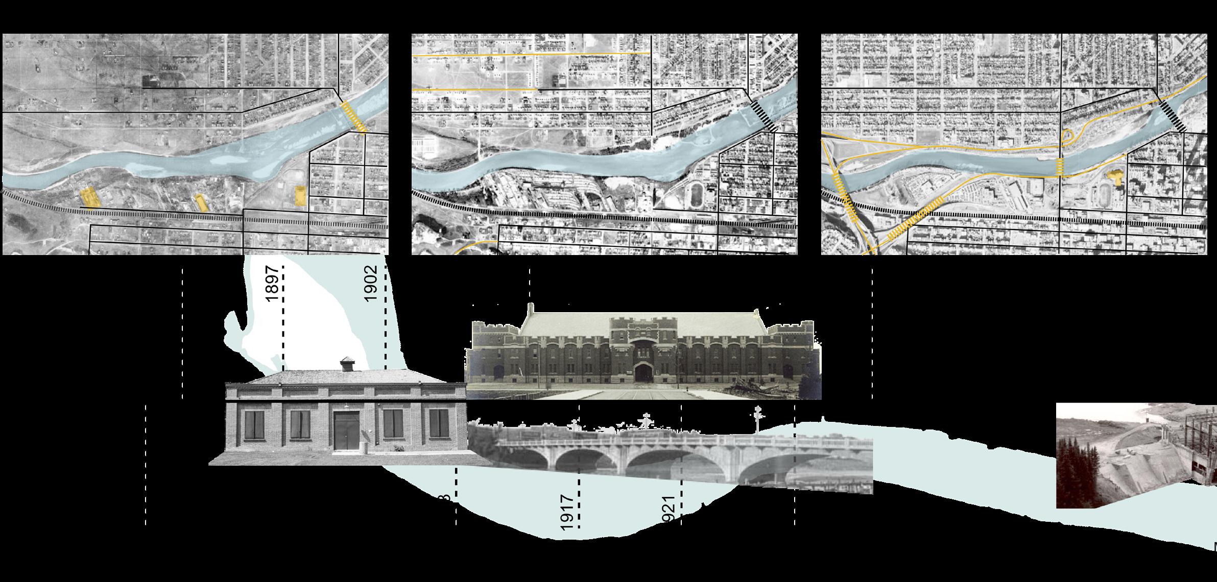
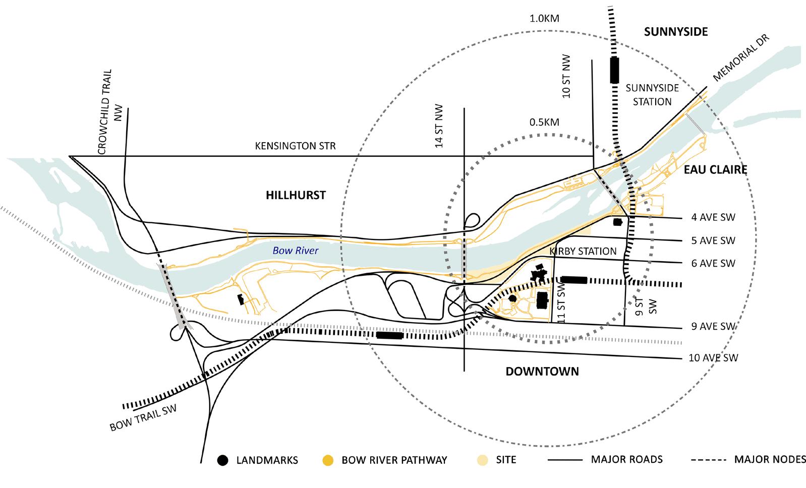
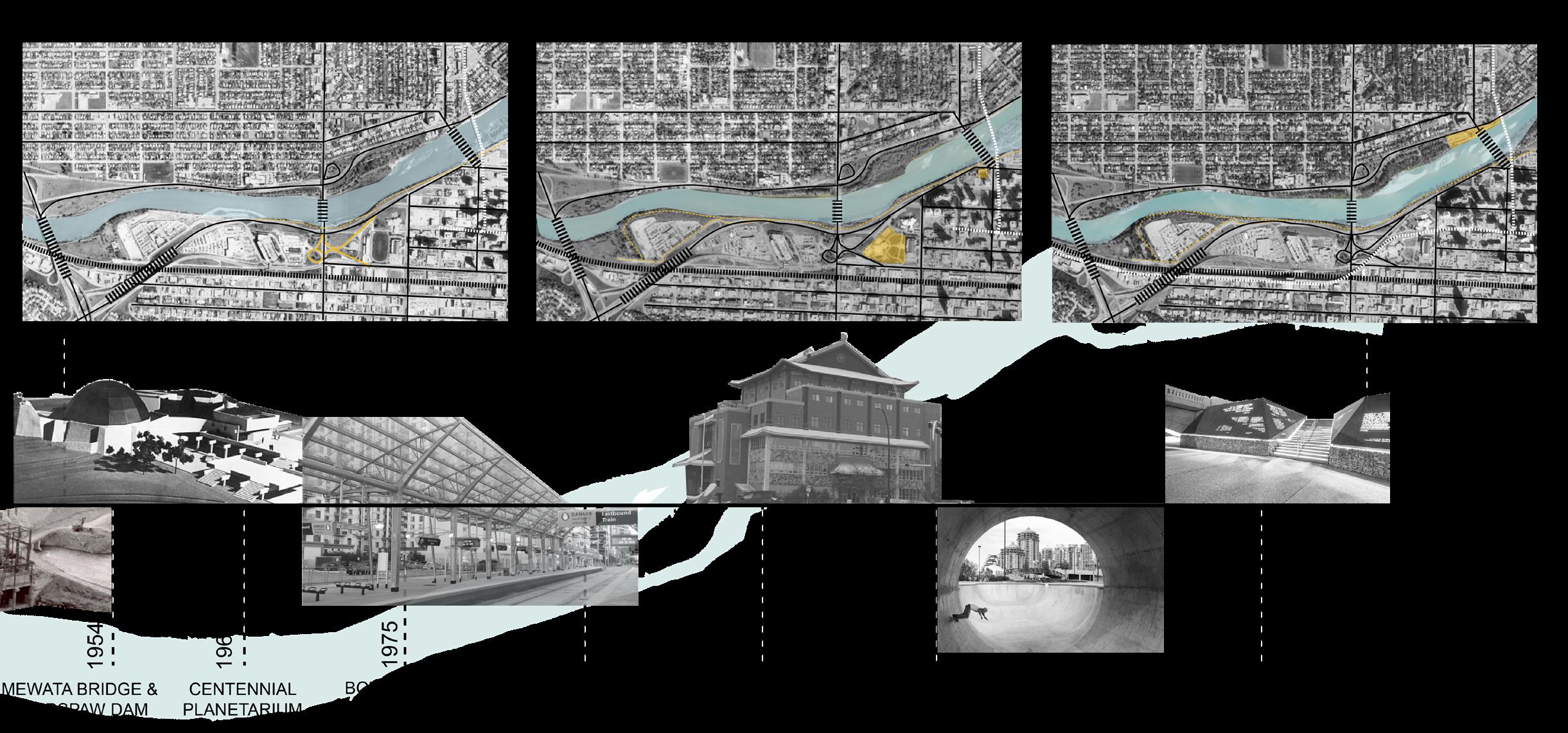
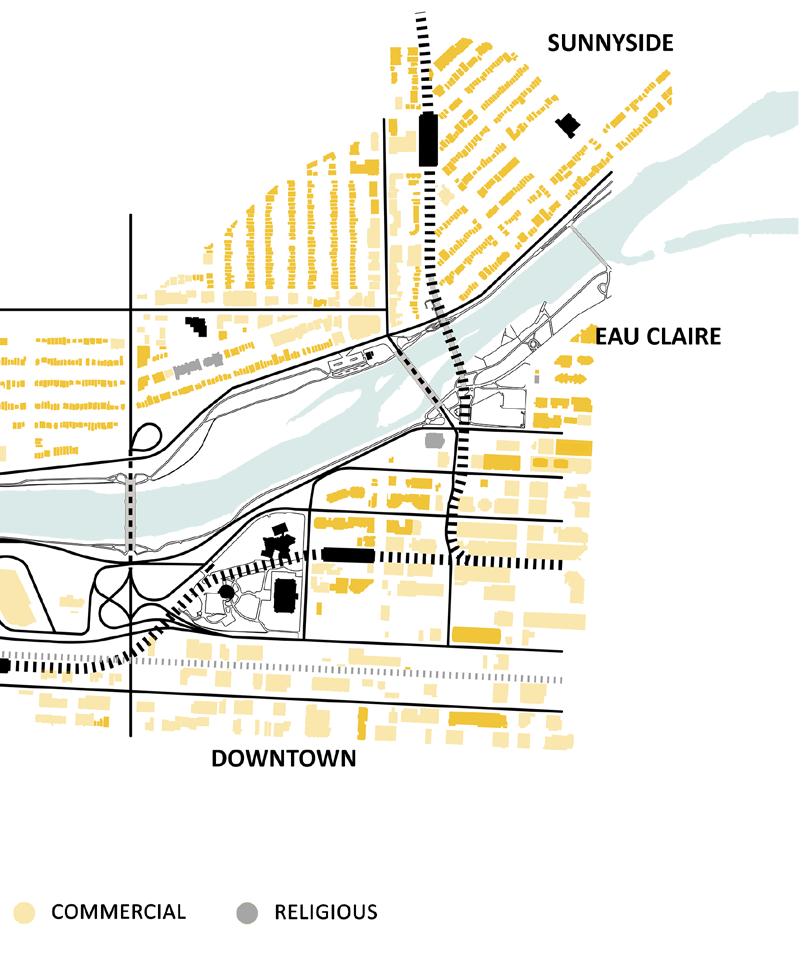
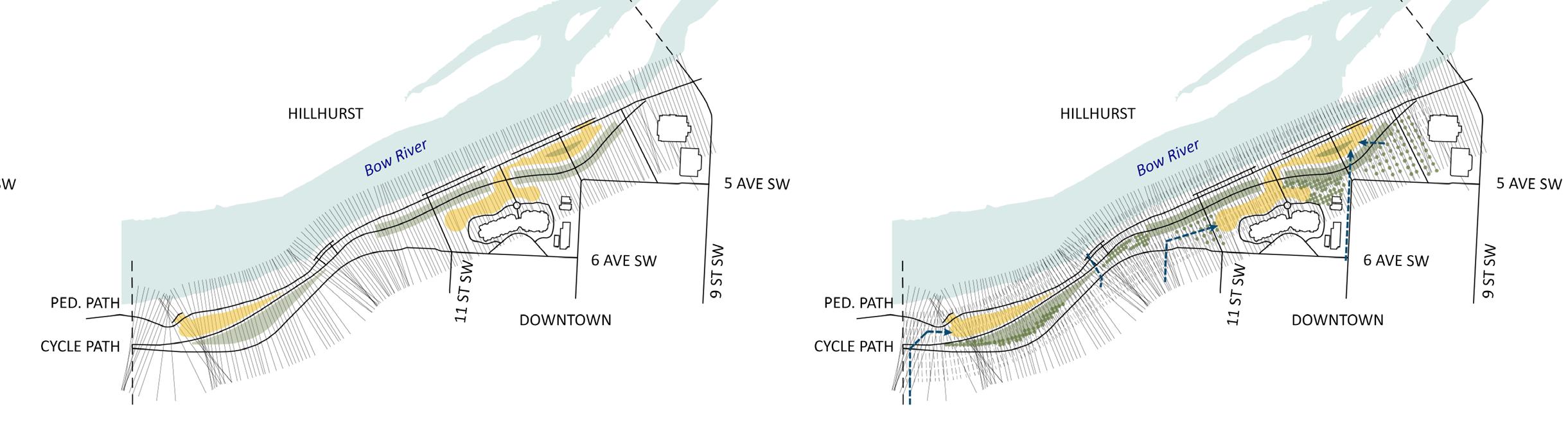
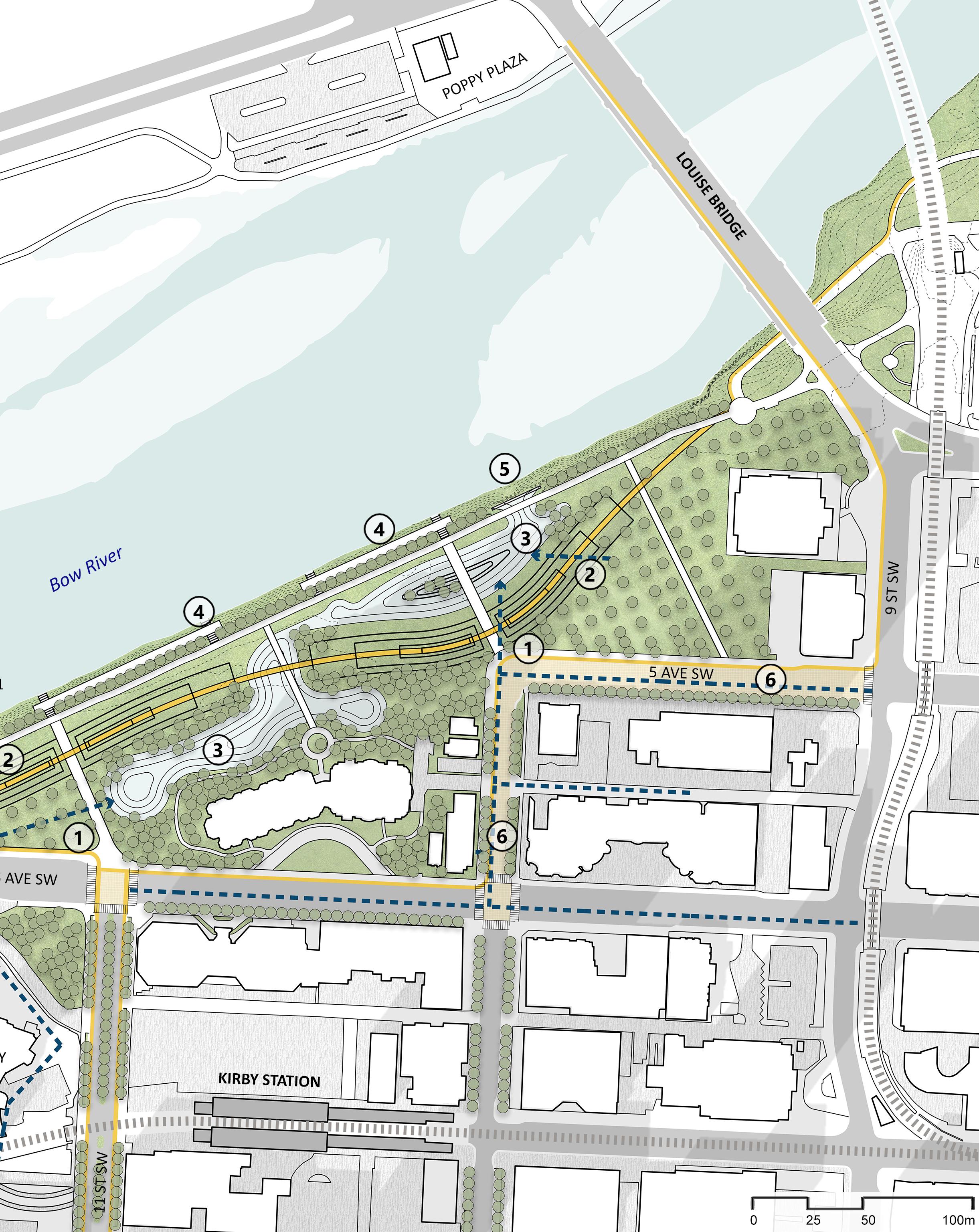
Located between historically important Mewata Bridge and Louise Bridge in the City of Calgary, Alberta, the site is a confusing mesh of high speed auto centric road catering to the commercial centre of Downtown Calgary. This web of asphalt has fragmented Calgary’s Downtown West from the Bow River, and devoid citizens a chance to experience the beautiful, and scenic Bow River Pathway- one of the great asset to the City of Calgary.
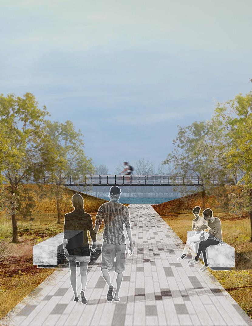
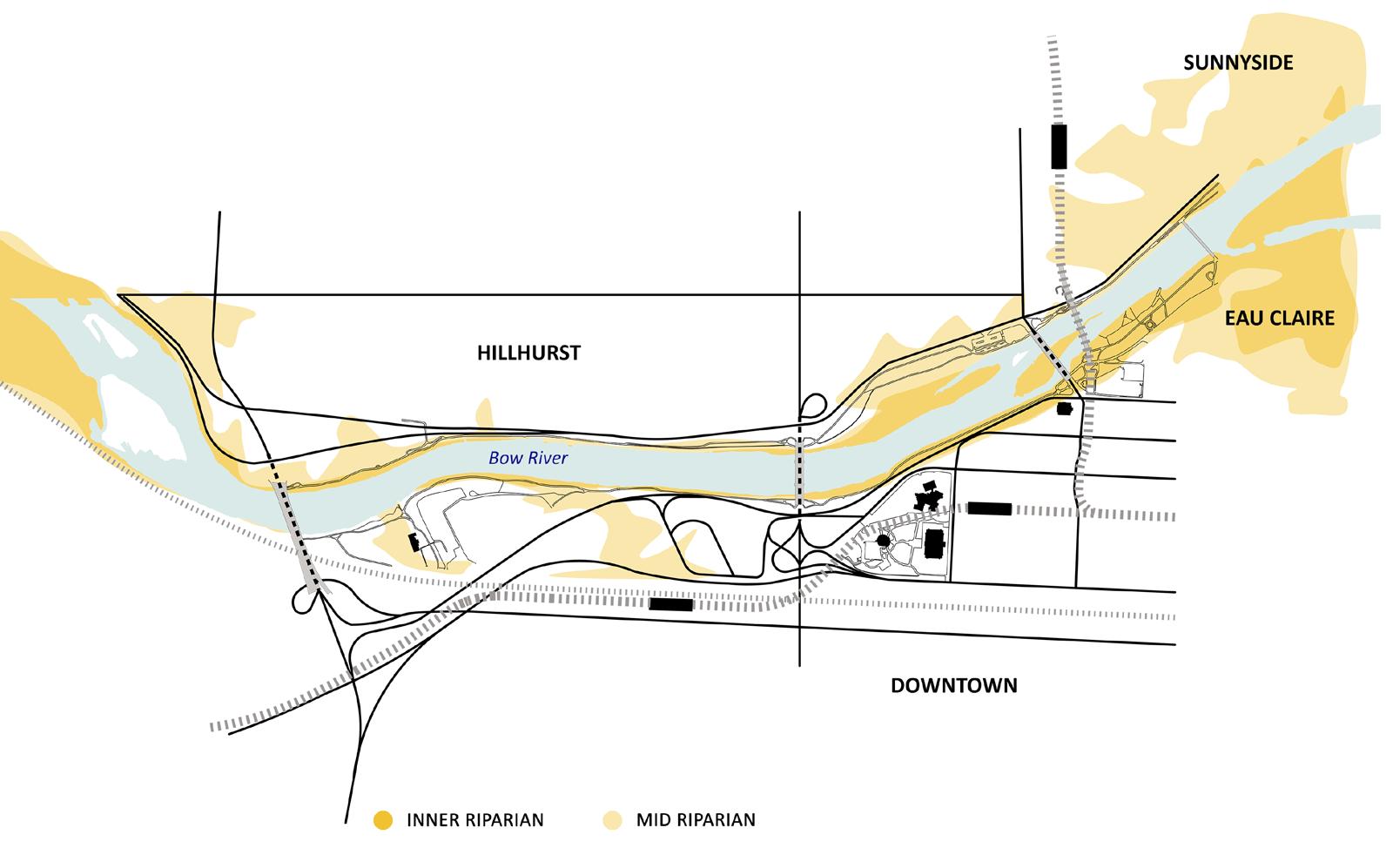
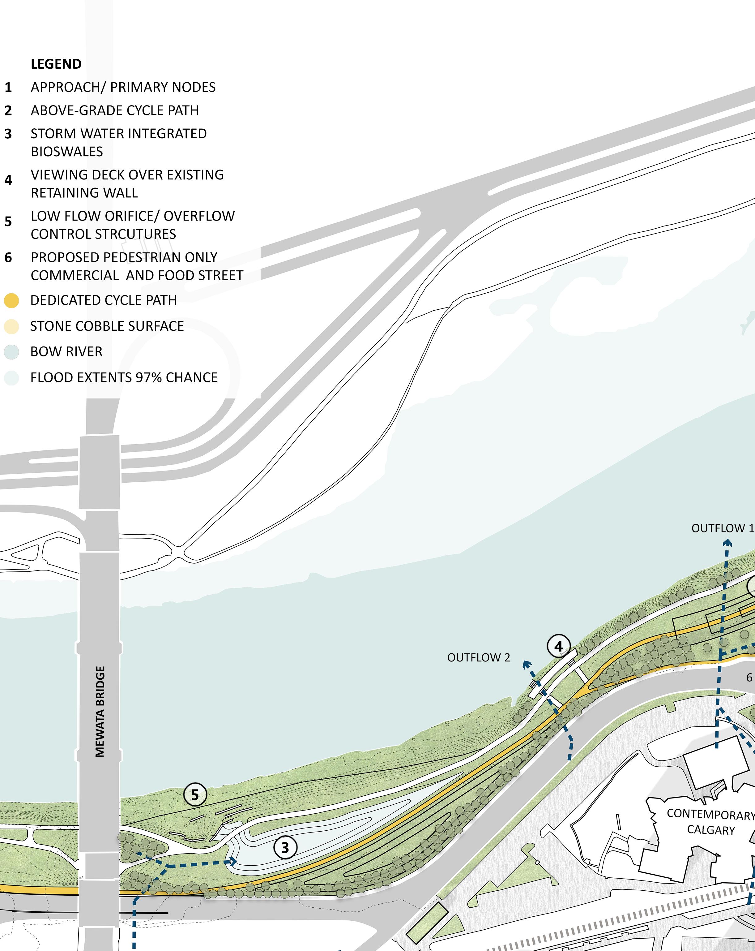
The design proposal intends to develop the area between the Mewata and Louise Bridge by integrating the urban infrastructure system into the landscape. Various layers like stormwater management integrated with bioswales, topography change for conflictfree transportation, ecological restoration, and areas of repose around the Bow River have been provided.
The design proposal aims to work on a ‘missing puzzle’ in an already developed river network, like the Eau Claire, and aims to act as a catalyst to take development further west, towards the contaminated land by the Creosote plant, and make our city a place where people would come, rest, and enjoy.
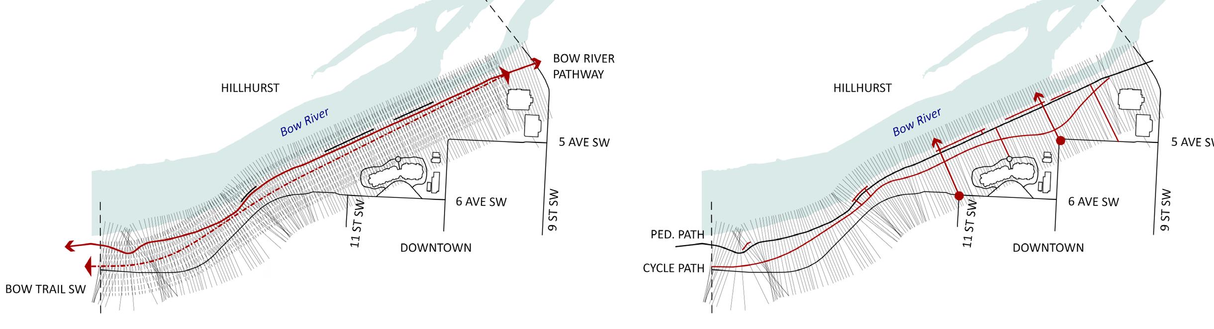
how are people moving?
roads
LRT - Kirby Station bike pathway on 11th ST
Bow River pathway
issues
• high speed, confusing mesh of asphalt contributing to fragmented lost spaces, noise pollution, and increased urban heat island effect.
• broken access with site.
• conflict with high speed motorized roads in Downtown, no connection with the site.
• conflict between pedestrians and cyclists.
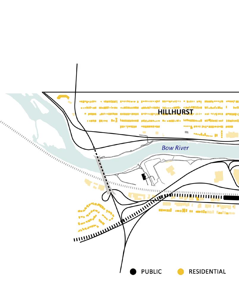
what is nearby?
residential tower commercial recreational areas like Contemporary Calgary, Mewata Armory
opportunities
• fragmented from site due to high speed motorized roads in Downtown. Scope of connecting residential areas with site for a healthy living standard.
• scope for pedestrian streets to help activate small businesses while promoting healthy, and safe street culture.
• need for better connection with site and LRT route via cycle and pedestrian pathway. Scope of reducing vehicle speed through boulevard design.
governing parameters
connections 01 02 form two grids through existing Bow River Pathway and Bow River Trail.
identify bisecting grid lines with existing intersections to form approach. The existing pathway and road system is refurbished to accommodate bike and pedestrians.
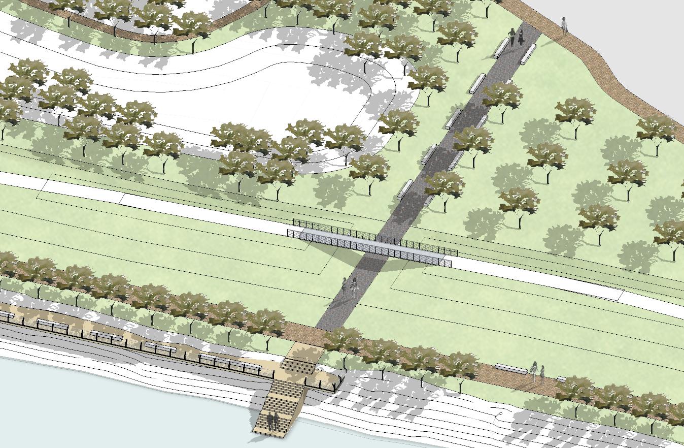
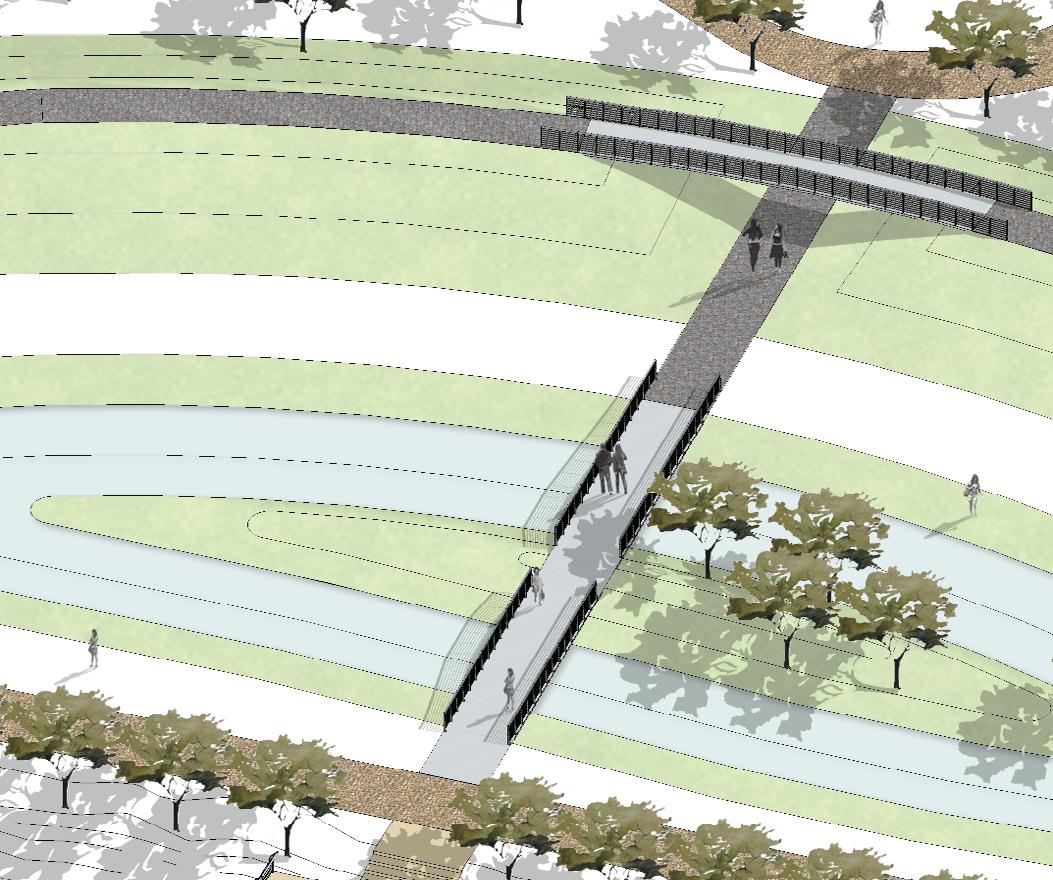
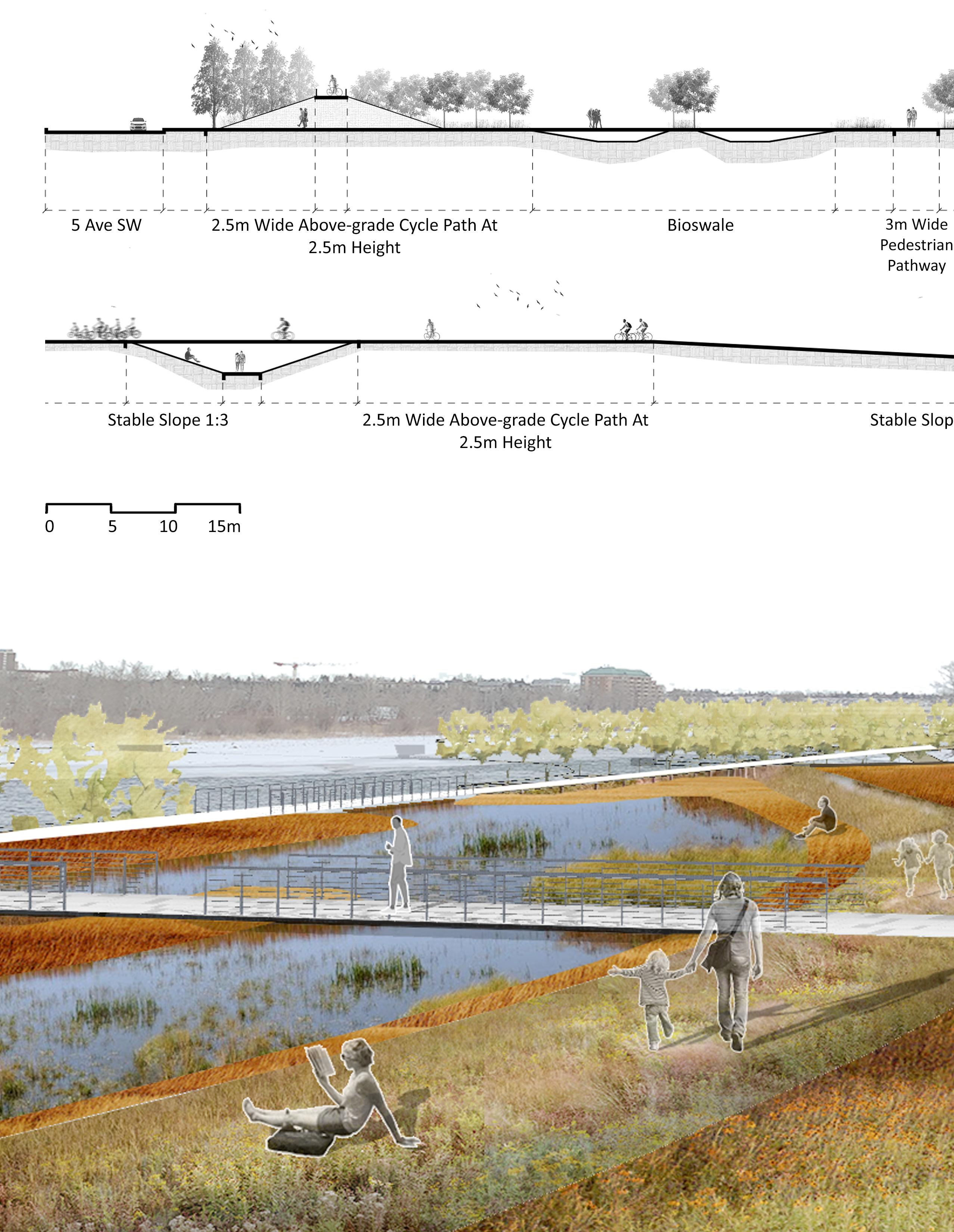
add and subtract de(link) 03 04 topography change through bioswales and mounds to separate levels for pedestrian & cycling path.
(de)link old storm water lines with bioswales & link spaces with tree cluster in random (for privacy) or grid (for avenue) form.
responding to the needs of the future
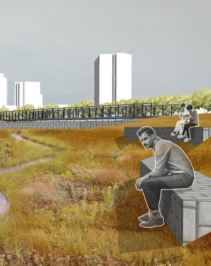
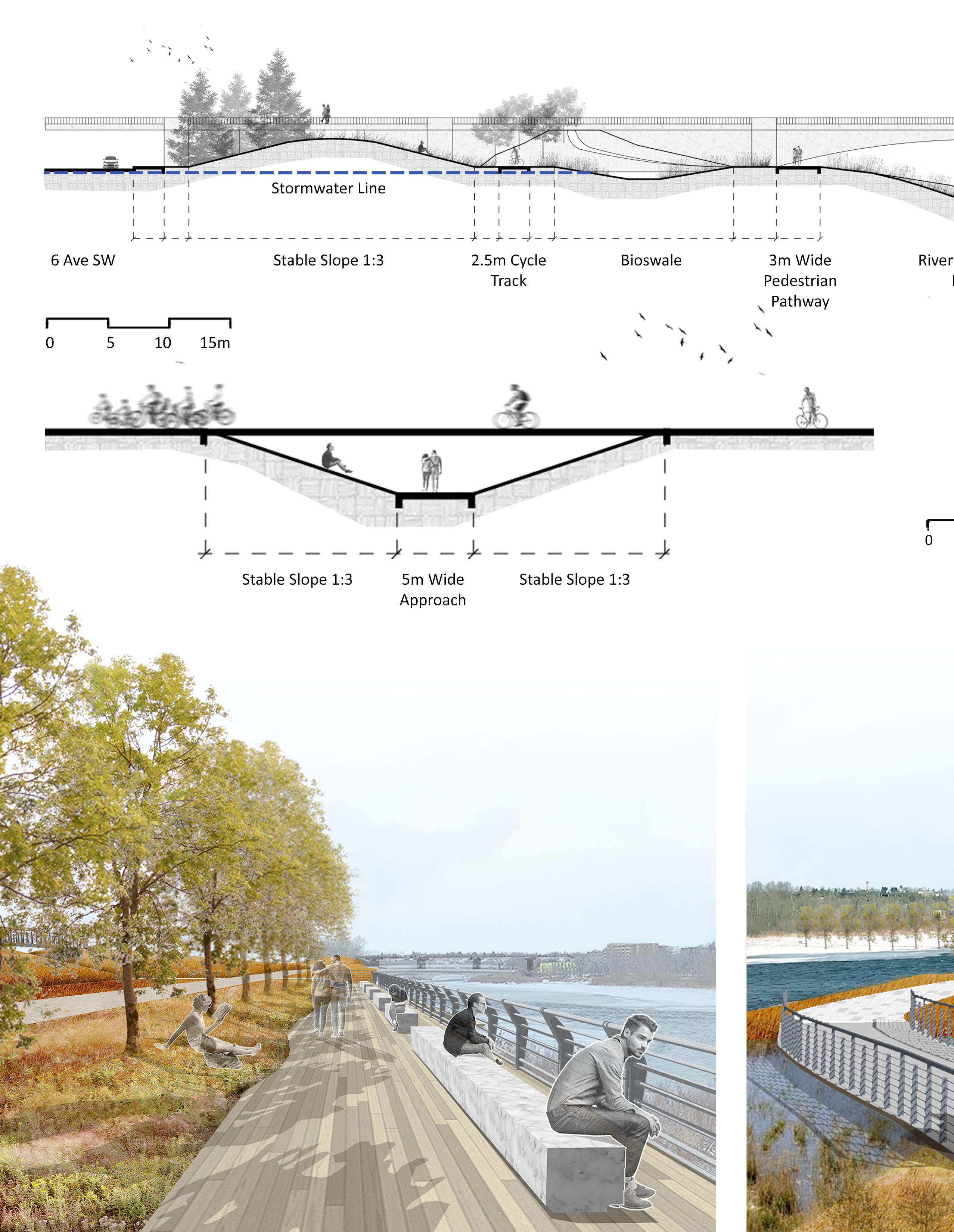 section A
section B section
view D
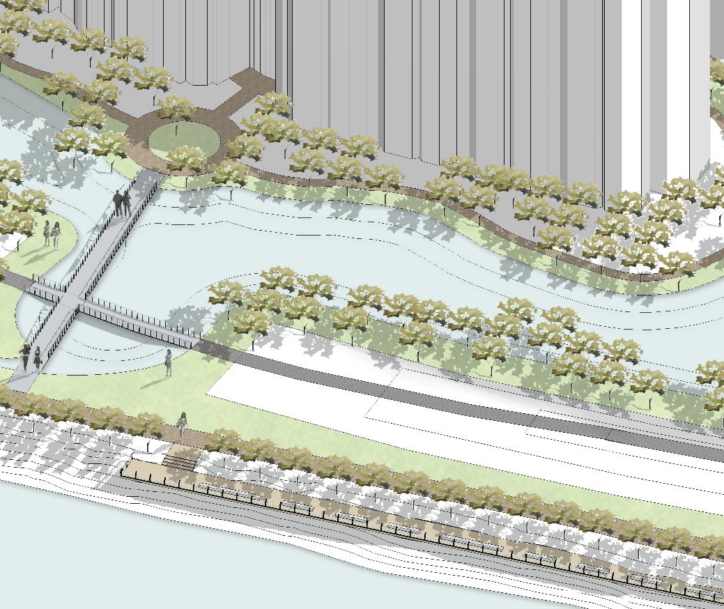
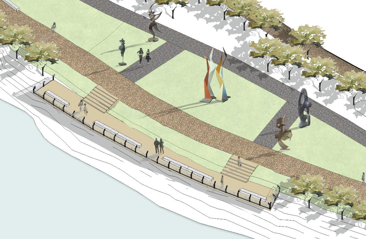
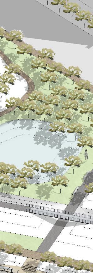
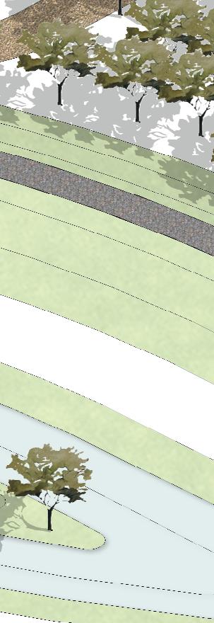
The viewing deck constructed over existing retaining walls provide areas for rest and repose.
section A
section B section
view D
The viewing deck constructed over existing retaining walls provide areas for rest and repose.
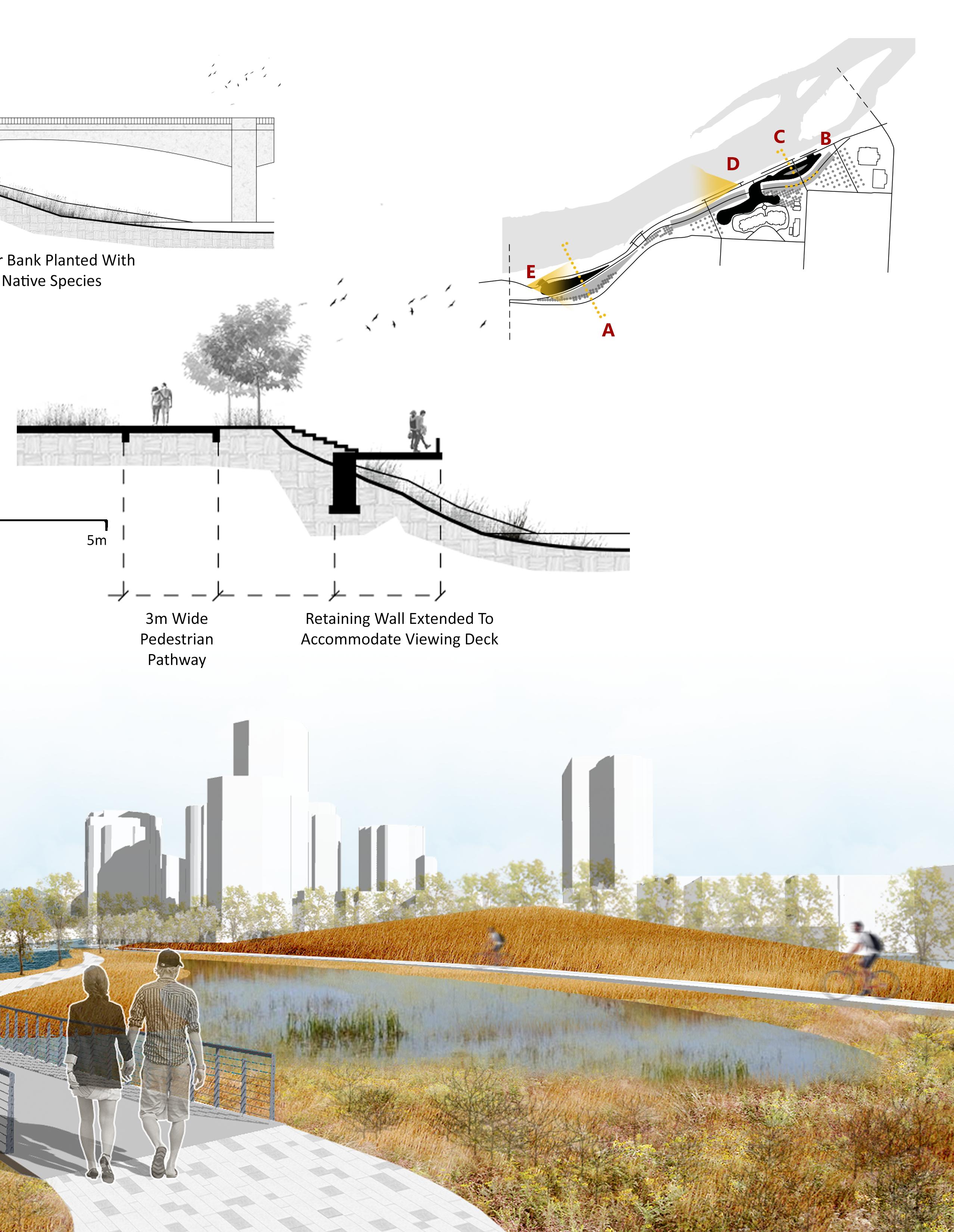
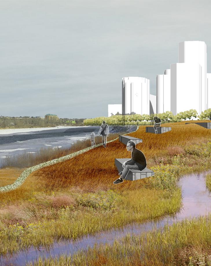
section F
section G
view H
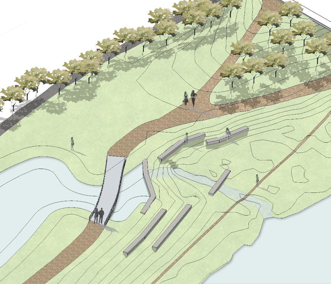
View from the constructed mounds overlooking the bioswales, with Louise Bridge in the background.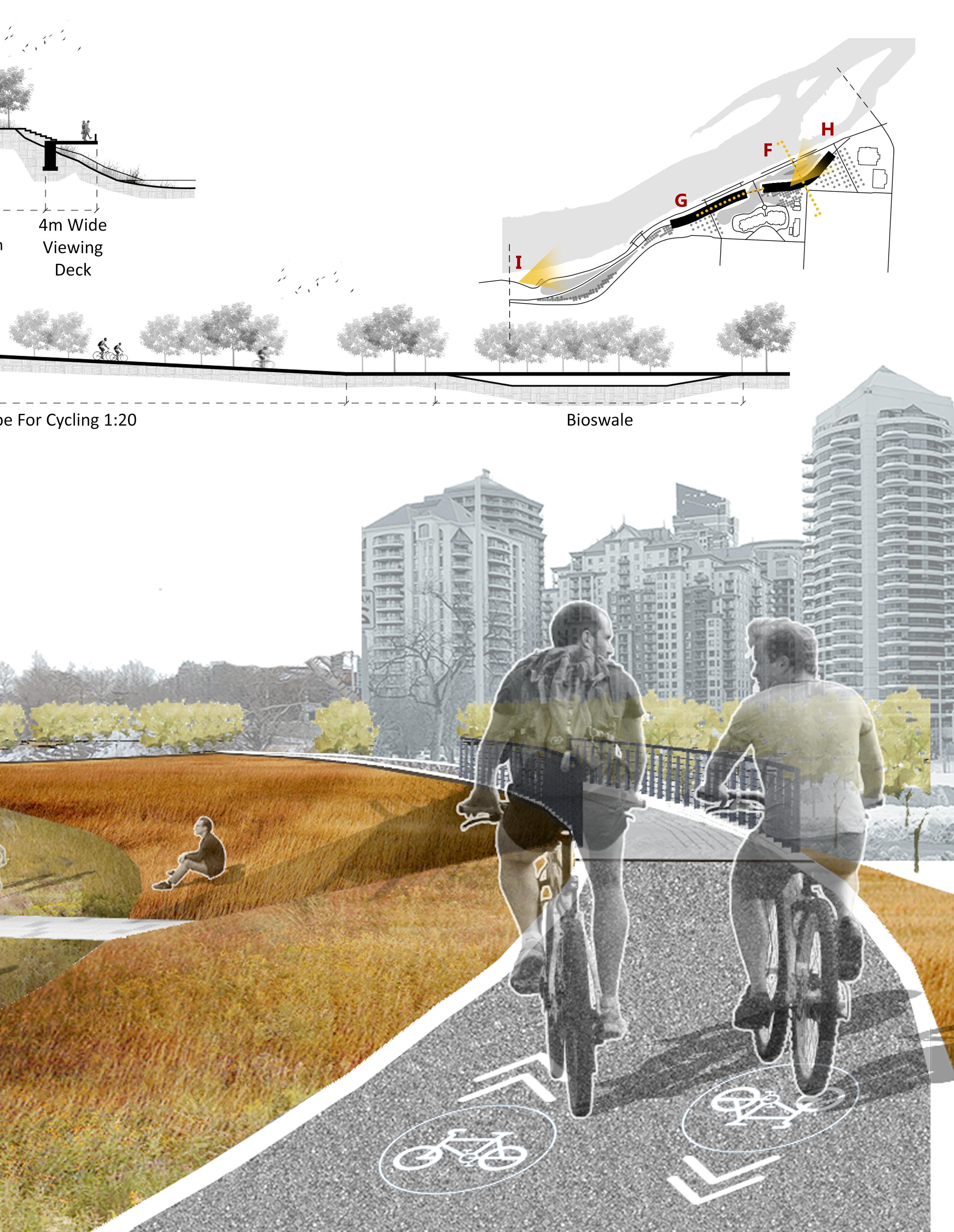
The scenario aims to imagine the river side where slopes have been left as is so that nature can take its best course creating organic forms with the flow of water. Low flow orifice or check dam will help to regulate the level of water from bioswale thus preventing the potential flooding of site. The earth stabilizing stone walls at lower levels are meant to provide a place to sit, view meandering swale and contemplate.