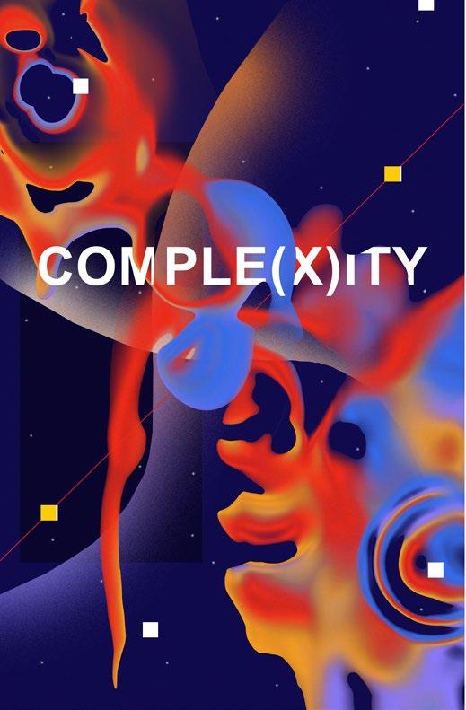
PORTFOLIO
Landscape Architecture + Design Pranshul Dangwal
I acknowledge Treaty 7 territory—the traditional and ancestral territory of the Blackfoot Confederacy: Kainai, Piikani and Siksika as well as the Tsuu T’ina Nation and Stoney Nakoda First Nation. I acknowledge that this territory is home to the Métis Nation of Alberta, Region 3 within the historical Northwest Métis Homeland. I acknowledge the many First Nations, Métis and Inuit who have lived in and cared for these lands for generations. I am grateful for the traditional Knowledge Keepers and Elders who are still with us today and those who have gone before us. I make this acknowledgement as an act of reconciliation and gratitude to those whose territory I reside on or I am visiting.
contents
01 02 03 04 05
waste to place
Reclaiming Spyhill Landfill
Location: Calgary, Alberta, Canada
Masters of Landscape Architecture, Fall 2022
urban acupuncture
Exploring the Concept Of ‘Baukultur’
Location: Calgary, Alberta, Canada
Masters of Landscape Architecture, Spring 2022
reclaiming public realm
Optimism | Thinking Critically About Canadian Landscapes
Location: Calgary, Alberta, Canada
Masters of Landscape Architecture, Winter 2022
IIT Gandhinagar
Campus Development: Research Park & Sports Area
Location: Gandhinagar, Gujarat, India
Professional Work, March 2017- November 2019
interests
Work Sample: Graphic Design and Photography
Pg 3
waste to place
Reclaiming Spyhill Landfill
Location: Calgary, Alberta
Masters of Landscape Architecture, Fall 2022
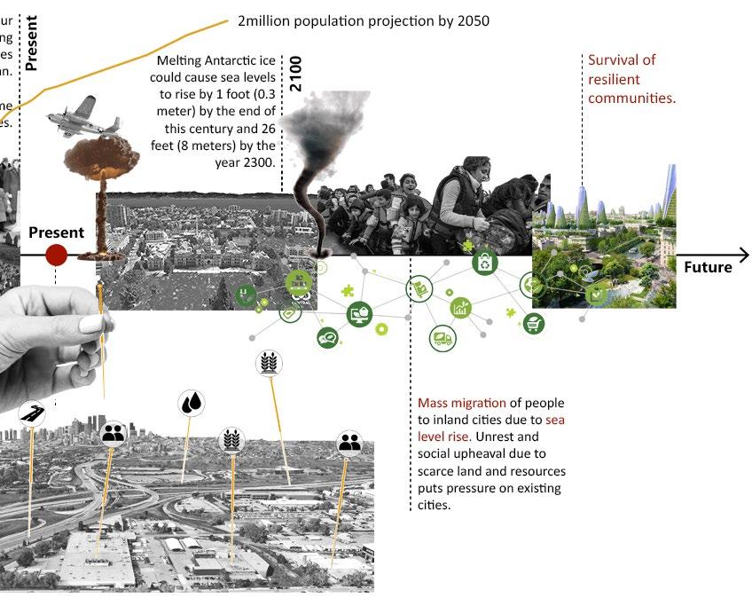
The Government of Canada has committed to planting 2 billion trees to address climate change and biodiversity loss over the next ten years (Government of Canada, 2022). Traditionally devoid of any trees and home to prairies, is planting trees in Calgary, Alberta the most sustainable option, and if yes, then where can those numbers can be put and what kind?
To reach net zero, the City of Calgary has to sequester 15.95 megatons of carbon which is equivalent to the amount of carbon emitted in 2021. Through environment scan, it was determined that naturalization as a solution to carbon sequestration requires vast amounts of land that may not be possible. However, naturalization has other benefits including but not limited to increasing biodiversity, making the city more resilient to flooding, reducing the urban heat island effect, and making the city a more pleasurable place to live.
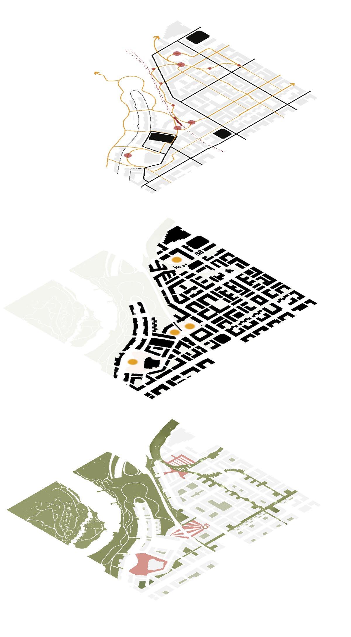
The project investigates the concept of drosscapes – the wasted spaces within the city as an answer to bring in change through nature-based solution. To help Calgary reach net zero, naturalization of drosscapes in conjunction with cleaner energy grid and stricter policies will have to be implemented.
The projects intends to explore a landfill (a wasted land of obsolescence) as a case study to guide how development and nature can sustainably coexist while designing the future these wasted spaces.
01
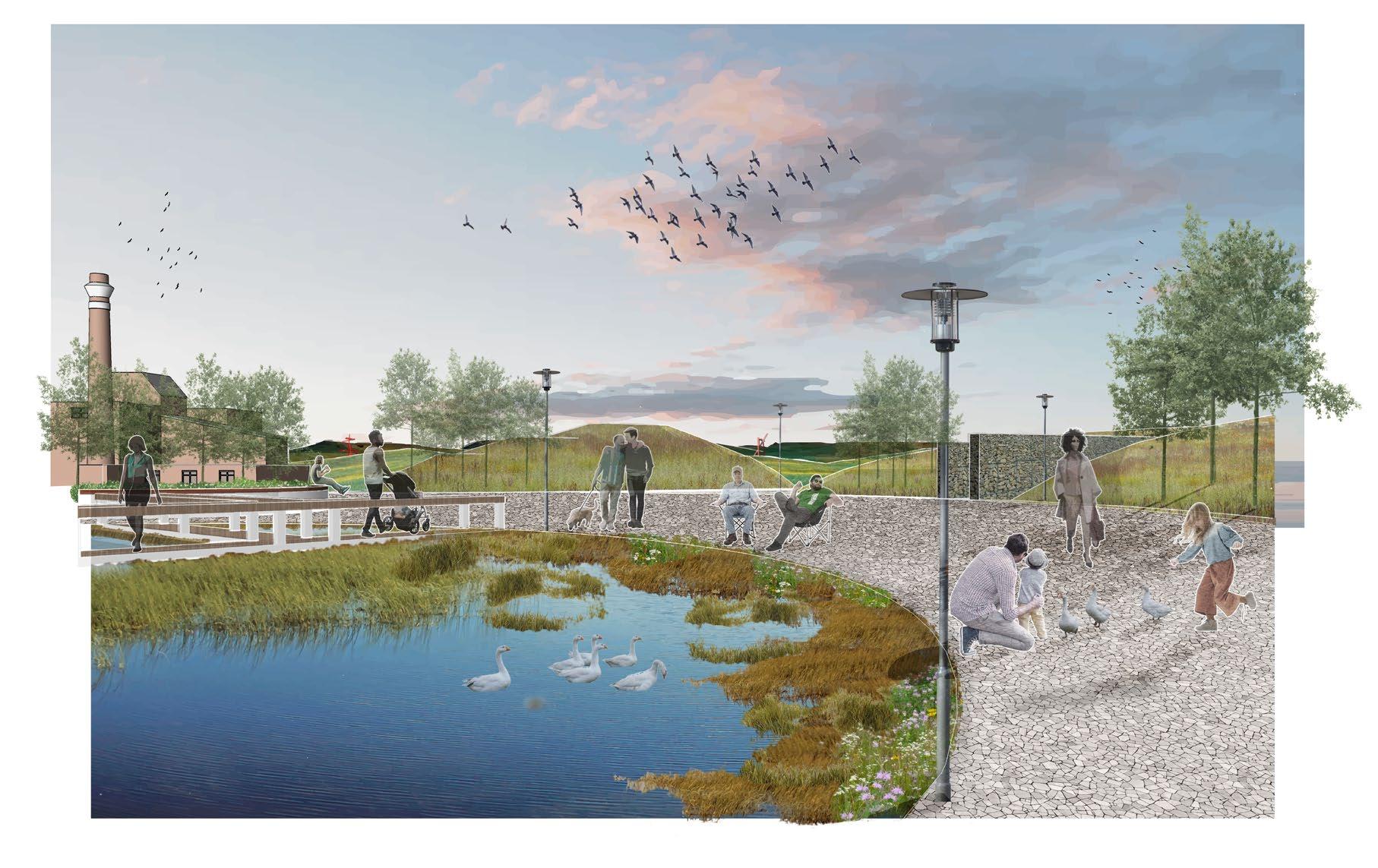
view a
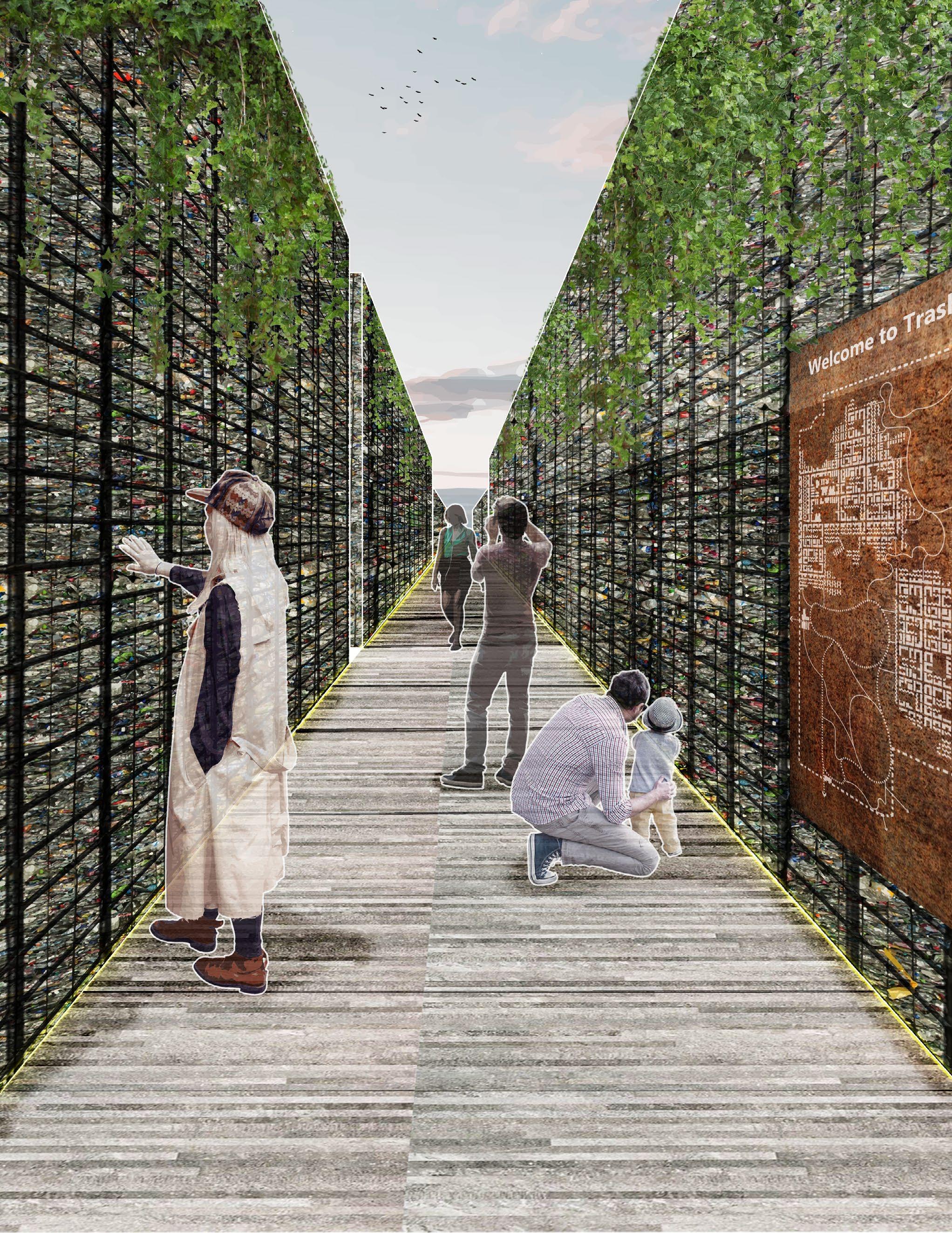
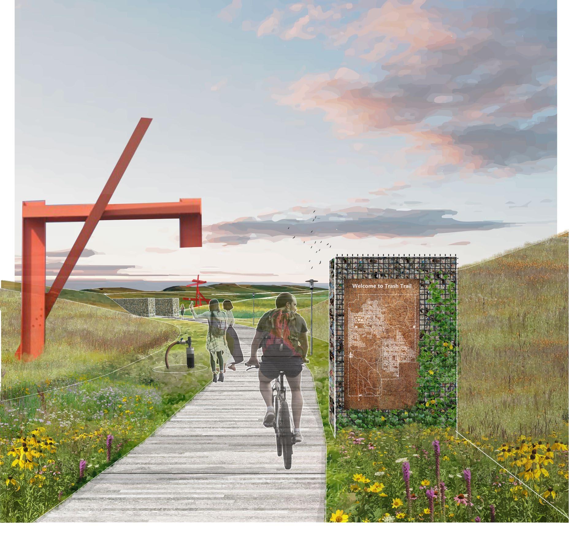
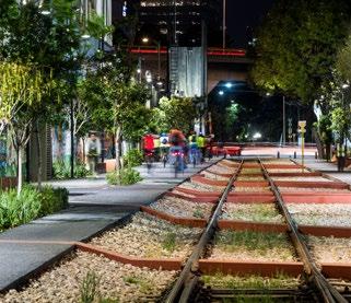
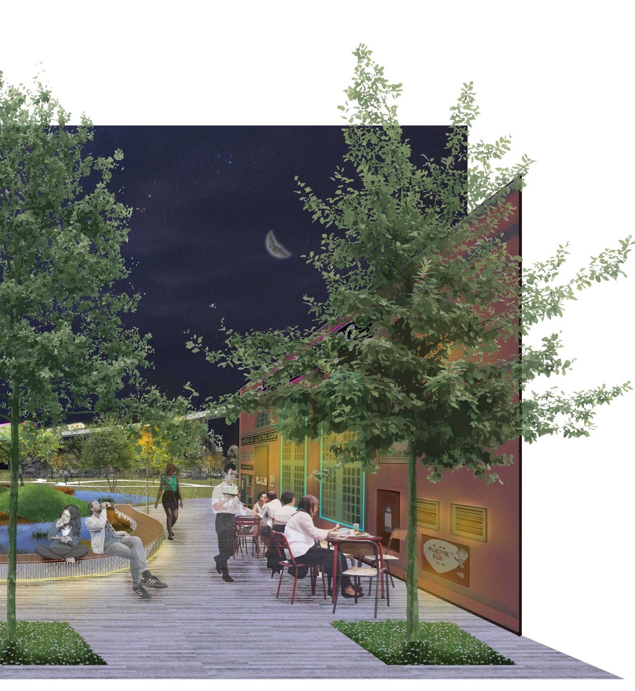
Meant to provide a glimpse into our unsustainable consumption practice and waste generation, the Trash Trail uses plastic bale and recycled metal as the facade of the high retaining walls. The limited sky, reduced sound and wind, and high walls are meant to limit one’s senses, and provide an explicit truth as to what this site still holds within.
5 Pg
 Province of Alberta, Canada
City of Calgary, Alberta, Canada
Province of Alberta, Canada
City of Calgary, Alberta, Canada
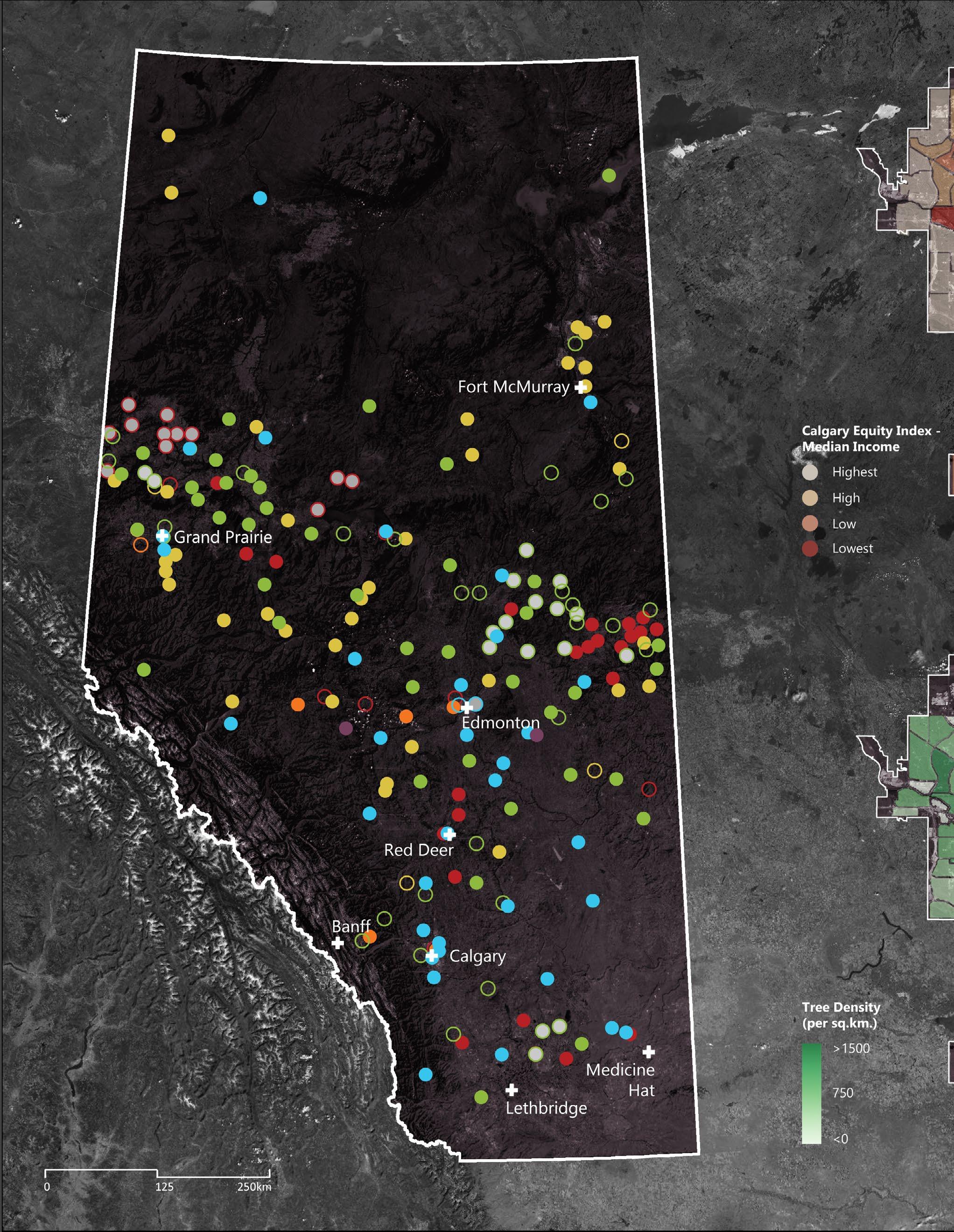
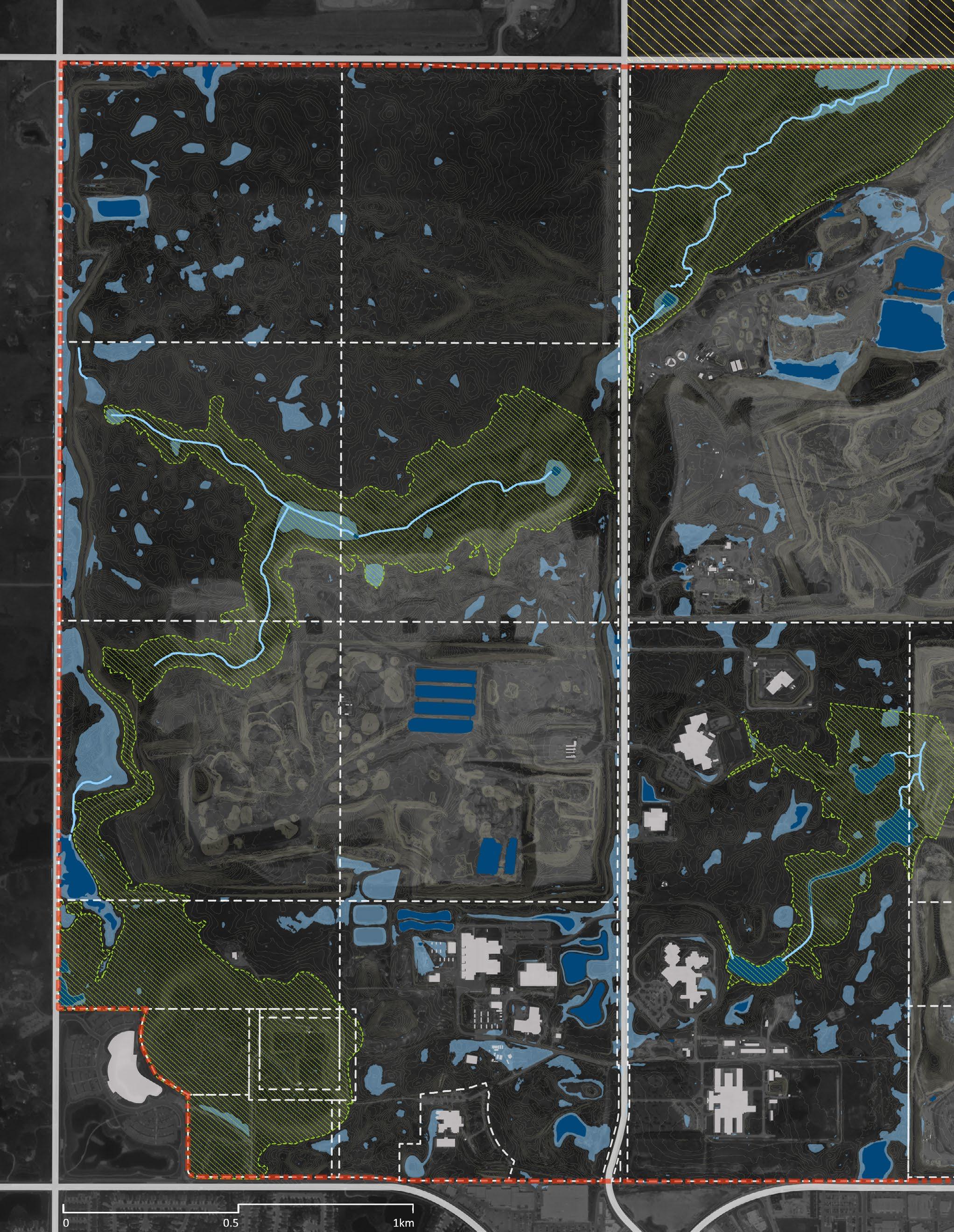
SPYHILL LANDFILL
The Waste Control Regulation and the Activities Designation Regulation classifies three different types of landfills in the Province of Alberta, Canada, depending upon the types of waste accepted.
Class I Landfill can accept solid hazardous waste. Class II Landfill can accept non-hazardous solid waste. Class III Landfill can only accept inert waste.
216
Total Landfills In Alberta
Expiry: June 20, 2027
40 30 146 Expiry: Nov 9, 2026
Total Landfills In Calgary
Two landfills (Spyhill Landfill and Chaparral Landfill) have already expired and should be moving towards post-operational phase.
But
Calgary,
7 Pg
Canada
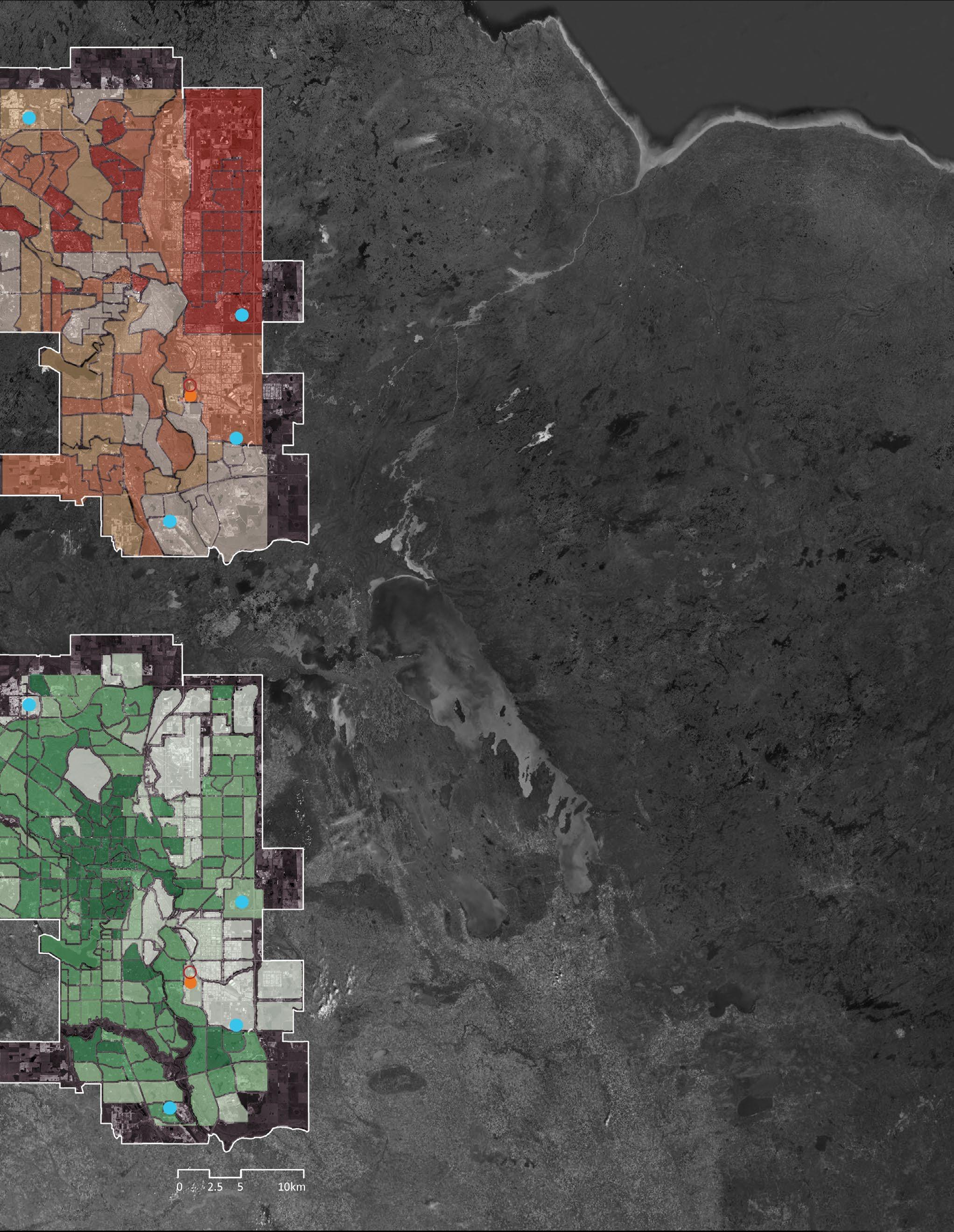
SPYHILL LANDFILL Chaparral Landfill Chaparral Landfill
Waste Landfill
Waste Landfill Ecco Dry Waste Landfill Ecco Dry Waste Landfill Shepard
Shepard
Does Not Expire Expiry: June 1, 2024
East Calgary Landfill East Calgary Landfill Ogden Dry
Ogden Dry
Landfill
Landfill
Active Acceptable Waste Landfill Classification Class I: Approved Double Liner & Leak Detection Inert Waste Solid Hazardous Waste Municipal Solid Waste Non-hazardous Industrial Waste Engineered Liner Leachate Collection Natural Barrier Alternative Liner System Waste Containment Barrier
III:
III:
Elements
they HAVEN’T! Not Operating
Class II: Approved Class II: Registered Class II: Industrial Approved Class
Approved Class
Registered Landfill Design
Operating as Transfer Station
6 Expired on June 15, 2022 Expired on April 30, 2021
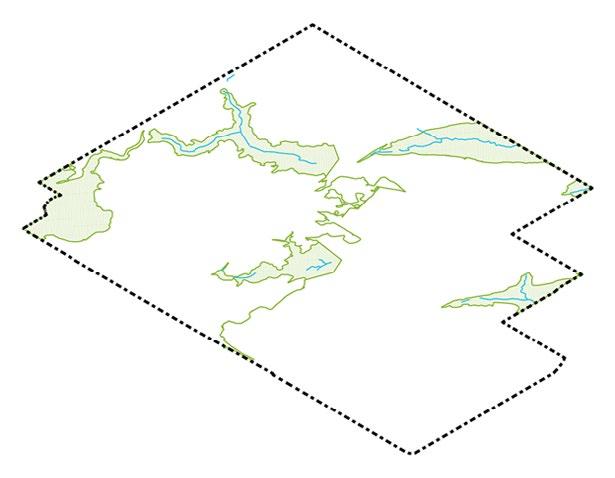
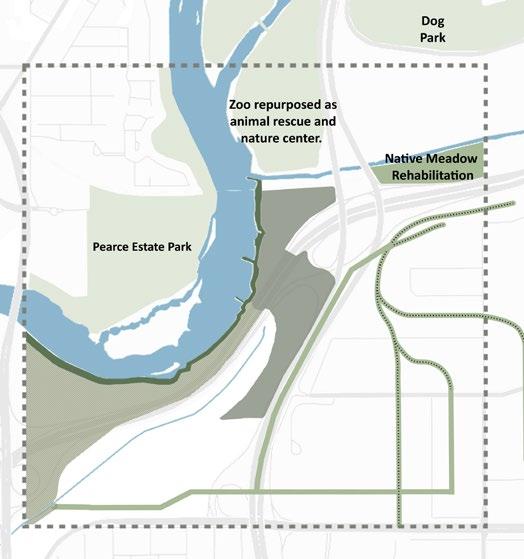
Historically, a beautiful mosaic of grasslands and prairie potholes, the site was taken over by agricultural needs, and the subsequent development of a landfill back in the 1970s.
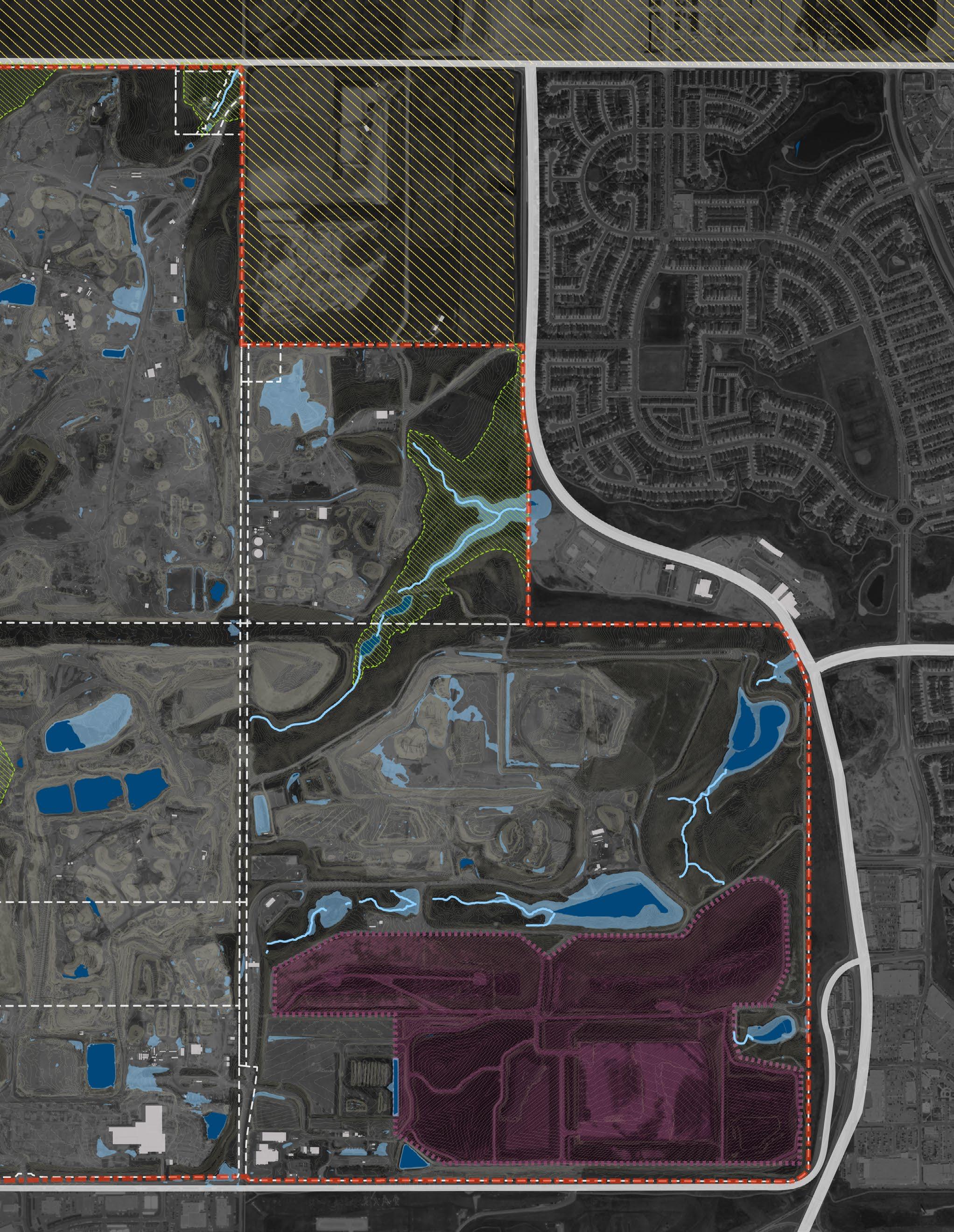
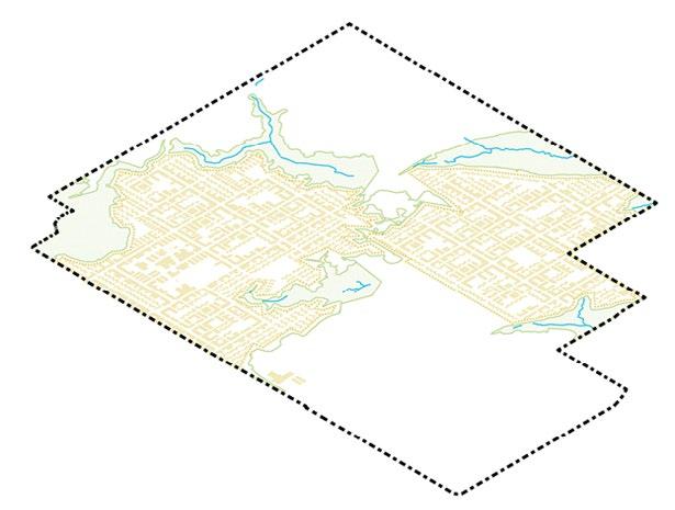
As the City of Calgary moves ahead with its plan to develop the Glacier Ridge ASP, it has been ambiguous with its future plan to develop or reclaim this 13.46 sq. km. of wasted space.
ROCKY RIDGE YMCA
STONE TRAIL AGGREGATE RESOURCE
UNIVERSITY OF CALGARY SPYHILL CAMPUS
CALGARY CORRECTIONAL CENTER
Coulee 1
Coulee 2
Coulee 3 Hill
Degraded Grassland With Prairie Potholes
LAFARGE SPYHILL (Gravel Pit)
144 Ave NW Rocky Ridge Rd NW 85 St NW
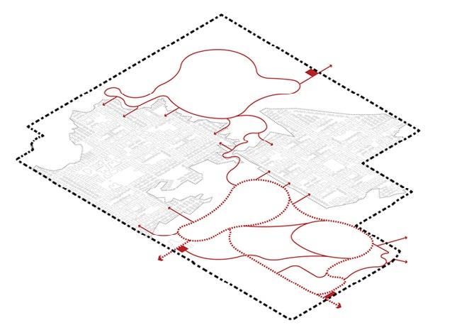
investigating Spyhill Landfill
Protect, remediate, and enhance the natural assets.
Bring development in a sustainable manner.
Connect within and outside the site precincts.
Integrate social aspects for the community.
Educate and bring awareness through art and technology.
9 Pg
Coulee 4
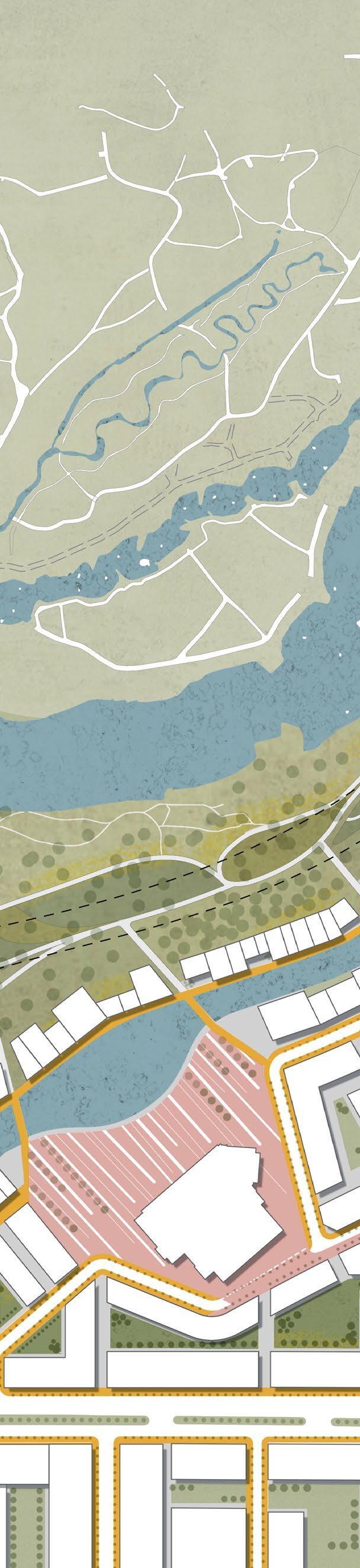
Constructed Topography of Landfill
SPYHILL LANDFILL INLAND GRAVEL PIT
Proposed Glacier Ridge Area Structure Plan (ASP) (Expected Population: 59,000) 112 Ave NW Site Extents Lot Line Valley Lines
Sarcee Trail NW
Symons Valley Pkwy NW
Existing Ponds Observed Depressions
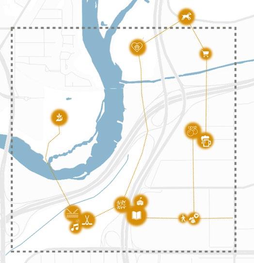
design goals
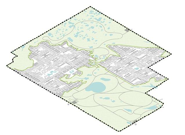
Entry U.F. Primary Pathway U.F. Urban Forest (U.F.) Trail Trail Wetland Ecosystem LID Feature identify natural features like coulees, ravines, hills, etc. 01 offset 30m from identified natural features to form development parcels. 02 connect within and outside of site with a seamless network. 03 P.R.E. Protect, remediate, and enhance infill area with novel ecosystems. 04
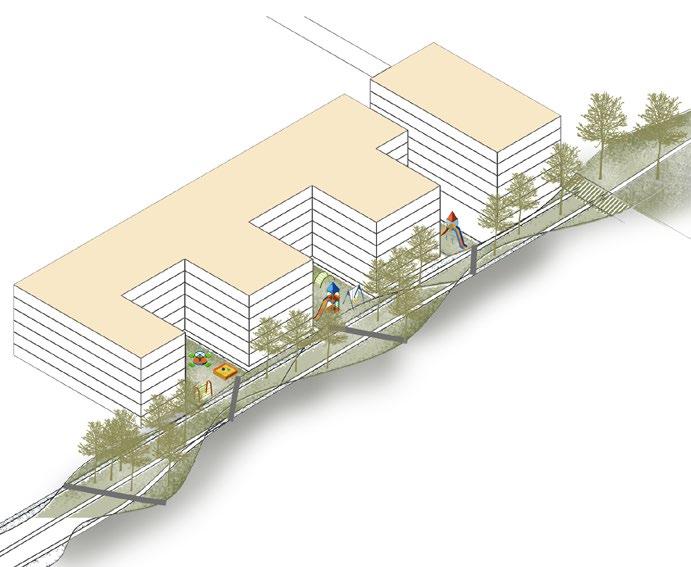
Restoring Prairie Potholes ecosystem. Protecting & enhancing natural assets on site.
Pocket parks within communities. LID feature to catch run-off from the proposed communities.
Increased tree cover.
Urban Food Forest as buffer. Grassland ecosystem over landfill.
High-density neighbourhoods. University of Calgary Spyhill Campus. Walkable block size of 400m.
Mixed-use development.
Primary pathway connecting site with surrounding neighbourhoods.
Secondary pathway connecting site within. Trails
Parking at three major entry nodes.
Plaza for events.
Ice skating during winter.
Tobogganing during winter.
Biking Trails
Off-leash dog park.
View Points
Art sculptures/ follies in collaboration with the Indigenous artists.
Trash Trail - recycled waste walls. Composting Center
Waste to electricity & heat conversion plant. Gas extraction well integrated with art installations and information panels/ signages. Education around remediation through nature-based soultions.
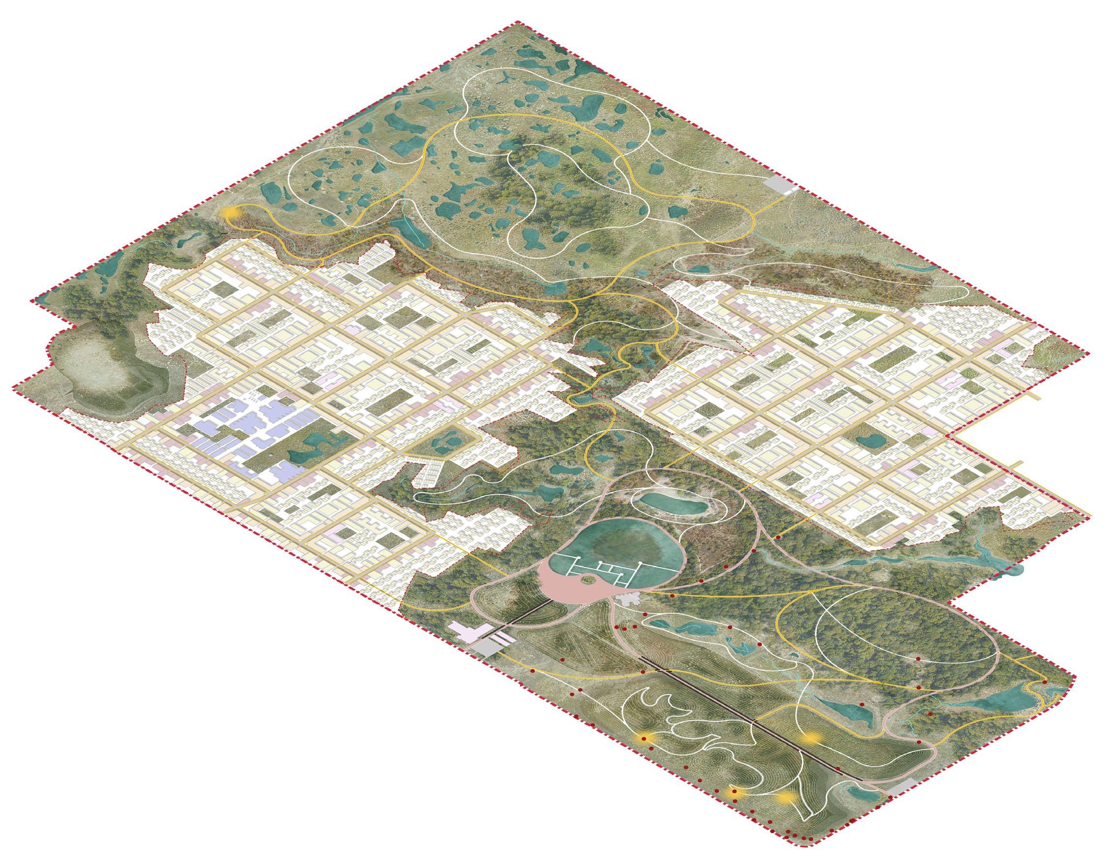
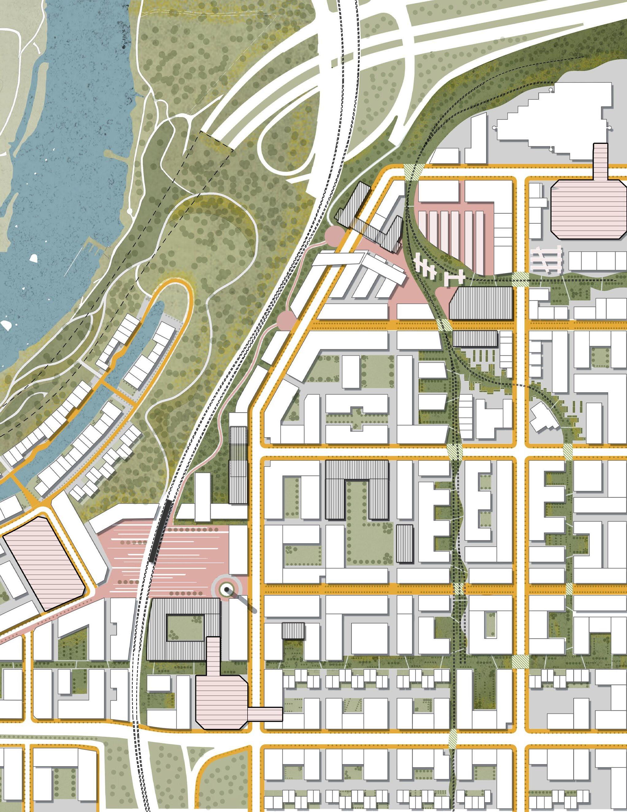
developing the Spyhill masterplan a sustainable co-existence of the built and the nature section
Entry Entry
0 50m
Boardwalk over LID Feature Plaza Entry through Trash Trail Entry/ Parking
11 Pg
Energy Buidling Compos�ng + Recycling Facility
1
1251.00 1258.00 1258.00 1255.00 1258.00 1264.00 1262.50 1264.00 1262.00 1263.00 1262.50 1267.00 1265.00 1262.00 Energy Building Composting Unit Urban Forest Urban Forest view b section 1 section 2 view d view c view a ExistingCoulee Open Grassland Leachate Pond Remodelled Mounds (Landfill) Mounds Mounds Tobogganing Hill View Point View Point View Point View Point LID Feature Boardwalk Plaza Trash Trail Trash Trail Trash Trail Spyhill Community (South) Spyhill Community (North) Entry & Parking Entry & Parking Wet Meadow Wet Meadow Art Installation/ Follies around gas extraction wells Primary Pathway (3m) Secondary Pathway (2m) Trails Water Flow
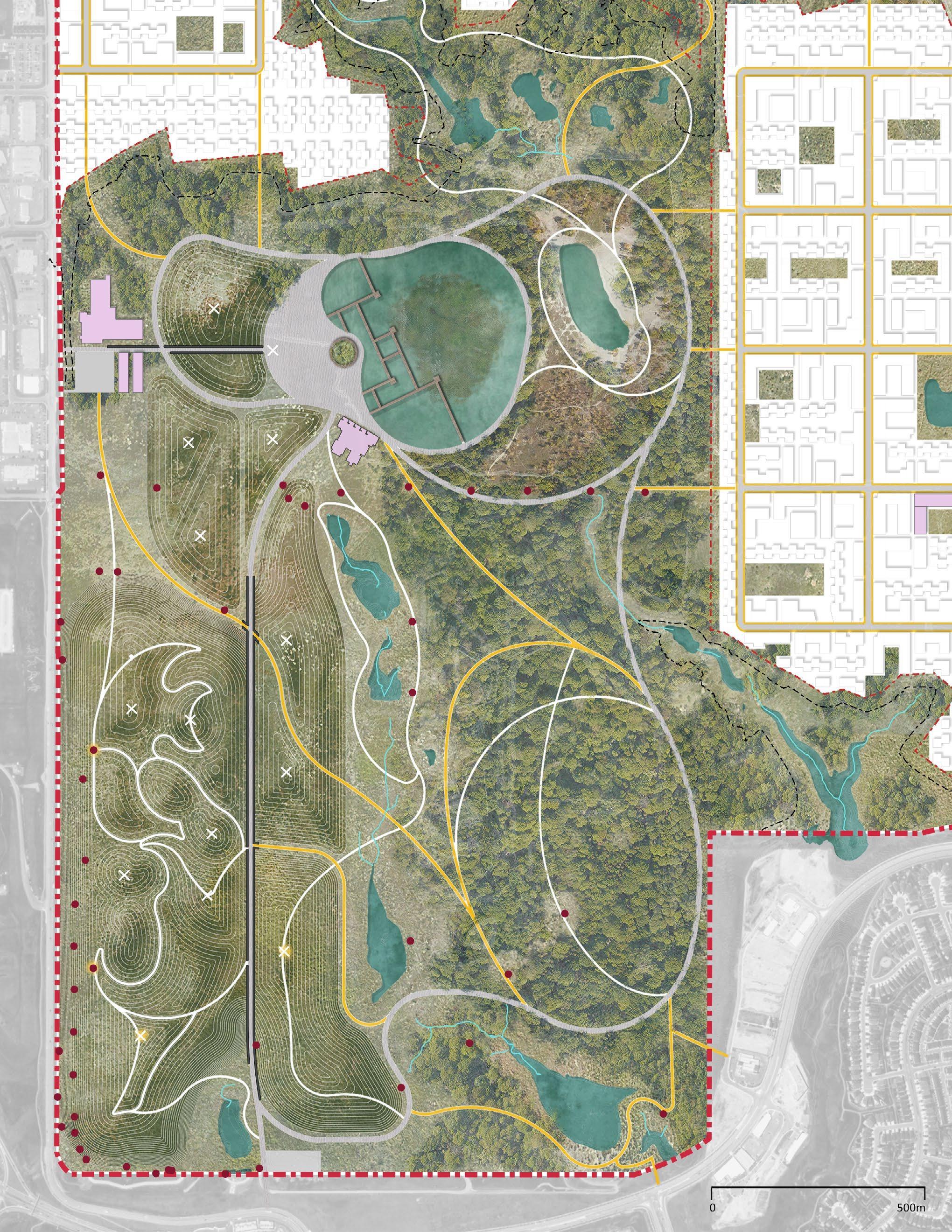
Situated amidst an urban forest, the scenario captures an art installation and/or a folly (in collaboration with the Indigenous artists) integrated with a landfill’s monitoring probe.
13 Pg
b
c
view
view
The scenario of the plaza next to the LID feature capturing run-off from proposed communities. The plaza is intended as an all-season gathering and/or events space.
 Wet Meadow (W.M.)
Boardwalk over LID Feature
Urban Forest
Urban Forest (U.F.)
Trail Trail W.M.
Wetland Ecosystem Remodelled Mounds (Grassland)
view d
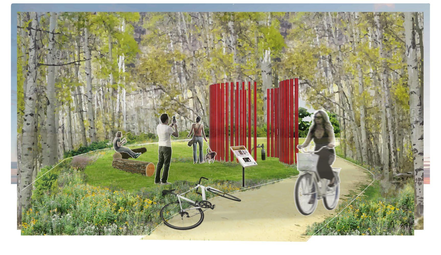
Scenario of the ‘Trash Trail’ surrounded by the open grassland ecosystem over the re-modelled topography of the landfill.
Wet Meadow (W.M.)
Boardwalk over LID Feature
Urban Forest
Urban Forest (U.F.)
Trail Trail W.M.
Wetland Ecosystem Remodelled Mounds (Grassland)
view d
Scenario of the ‘Trash Trail’ surrounded by the open grassland ecosystem over the re-modelled topography of the landfill.
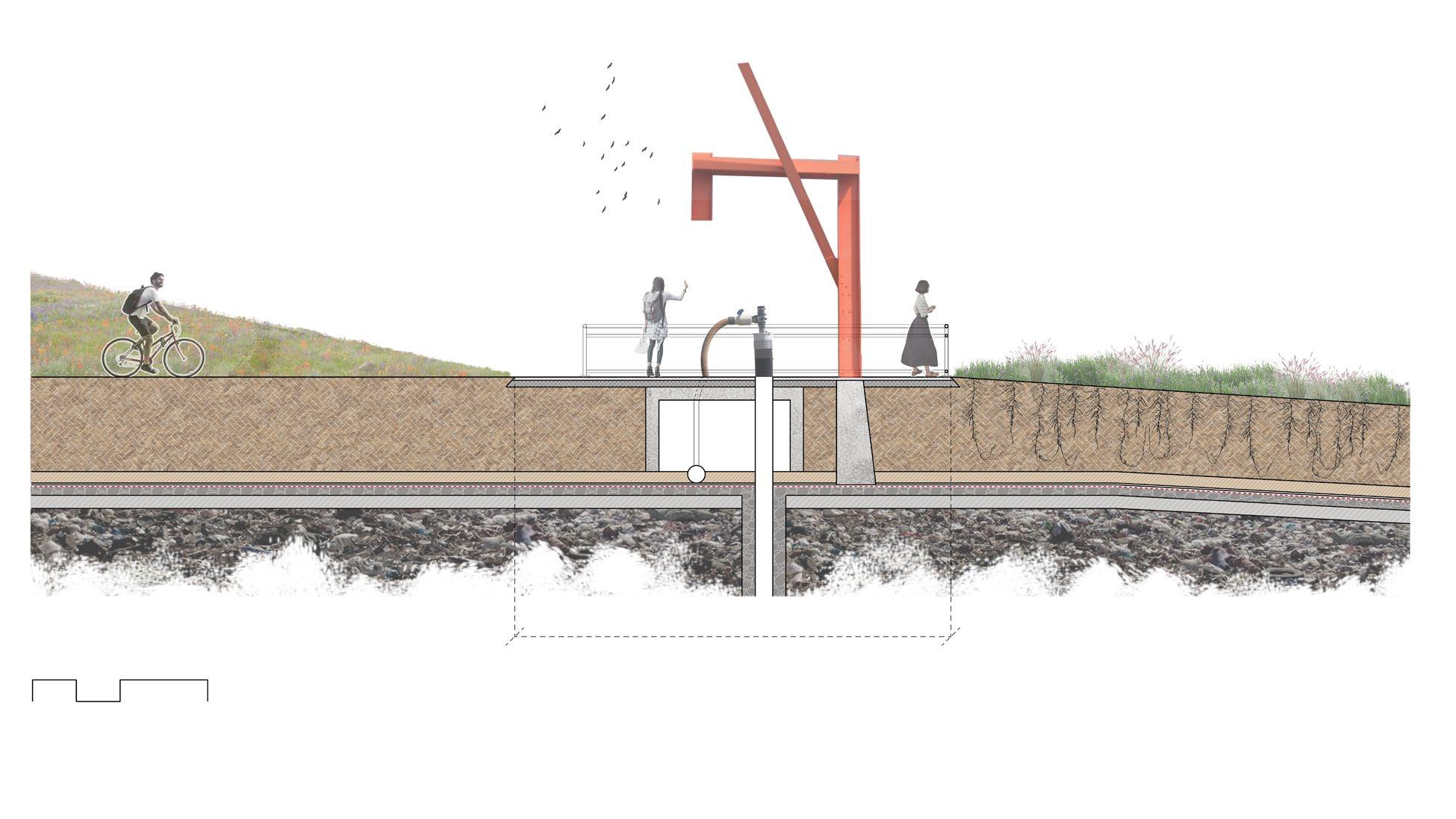
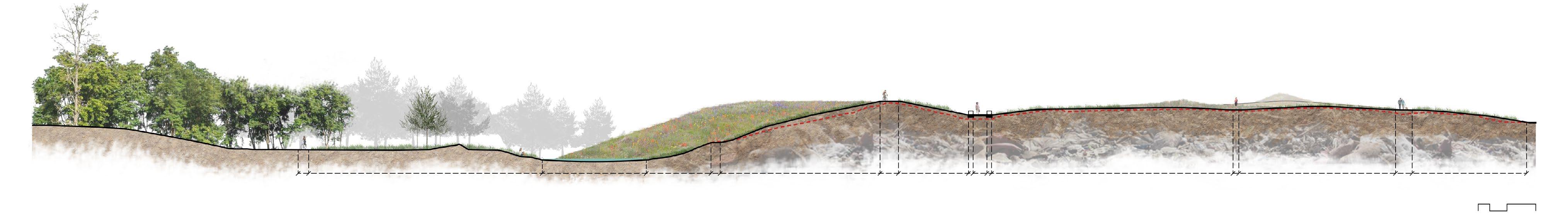
LID Viewing Deck Point of landfill (Grassland) Mounds of landfill (Grassland) Mounds of landfill (Grassland) Trash Trail/ Primary Pathway 0 50m Viewing Deck Stabilised slope 1:10 Waste Min. 2.5m fill over exis�ng grade to re-model topography Drainage Layer Separa�on Fabric/ Synthe�c Liner Exis�ng Grade Gas Vent Layer Soil Barrier Layer Trail leading towards Viewing Deck 0 1 2 4m Perforated Pipe to collect gas Flow control valve Pipe towards Energy Building to convert gas into heat & electricity 300mm Sand Fill Concrete Foo�ng to hold art installa�on LID Trail Viewing Deck Trail & View Point Remodelled Mounds of landfill (Grassland) Remodelled Mounds of landfill (Grassland) Remodelled Mounds of landfill (Grassland) Plaza Entry through Trash Trail Trash Trail/ Primary Pathway Entry/ Parking 0 50m 0 50m Energy Buidling Compos�ng + Recycling Facility 15 Pg detail e detail e showing base layers of the re-modelled topography over existing landfill. Estimated Carbon Sequestration Through Proposed Masterplan 13.46 sq.km- Total Site Area 21% Forest Carbon Sequestration Capacity of Forest Carbon Sequestration Capacity of Wetland Carbon Sequestration Capacity of Grassland 5% Wetland 35% Grassland 9331 tons 2.84 sq.km. 2556 tons 4.71 sq.km. 3297 tons 0.74 sq.km. 3478 tons section 2
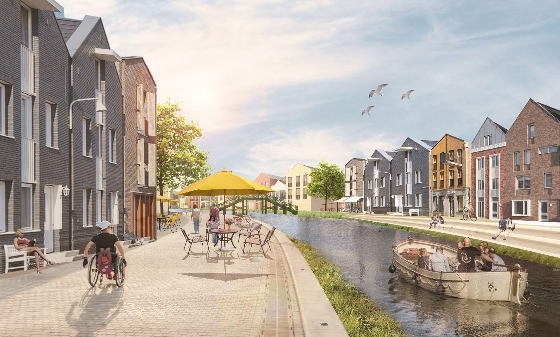
urban acupuncture
Exploring the Concept Of ‘Baukultur’
Location: Calgary, Alberta
Masters of Landscape Architecture, Spring 2022
Team of 8 (Members: Alima Pal, Deepali Dang, Garima Chaudhary, Joshua Bateman, Madiha Mehdi, Mona Meschi, Pranshul Dangwal, Shabnam Seifhamedan)
The indigenous way of life greatly emphasizes protecting and valuing their asset for the next seven generations. Land being an important asset in the 21st century, how do we bring the same philosophy while designing our cities? Notorious for its urban sprawl, automobile-centered city design, and unsustainable practices it is high time for many North American cities to look inward and reimagine the future of our neighborhoods.
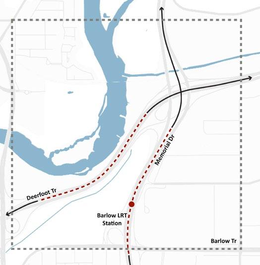
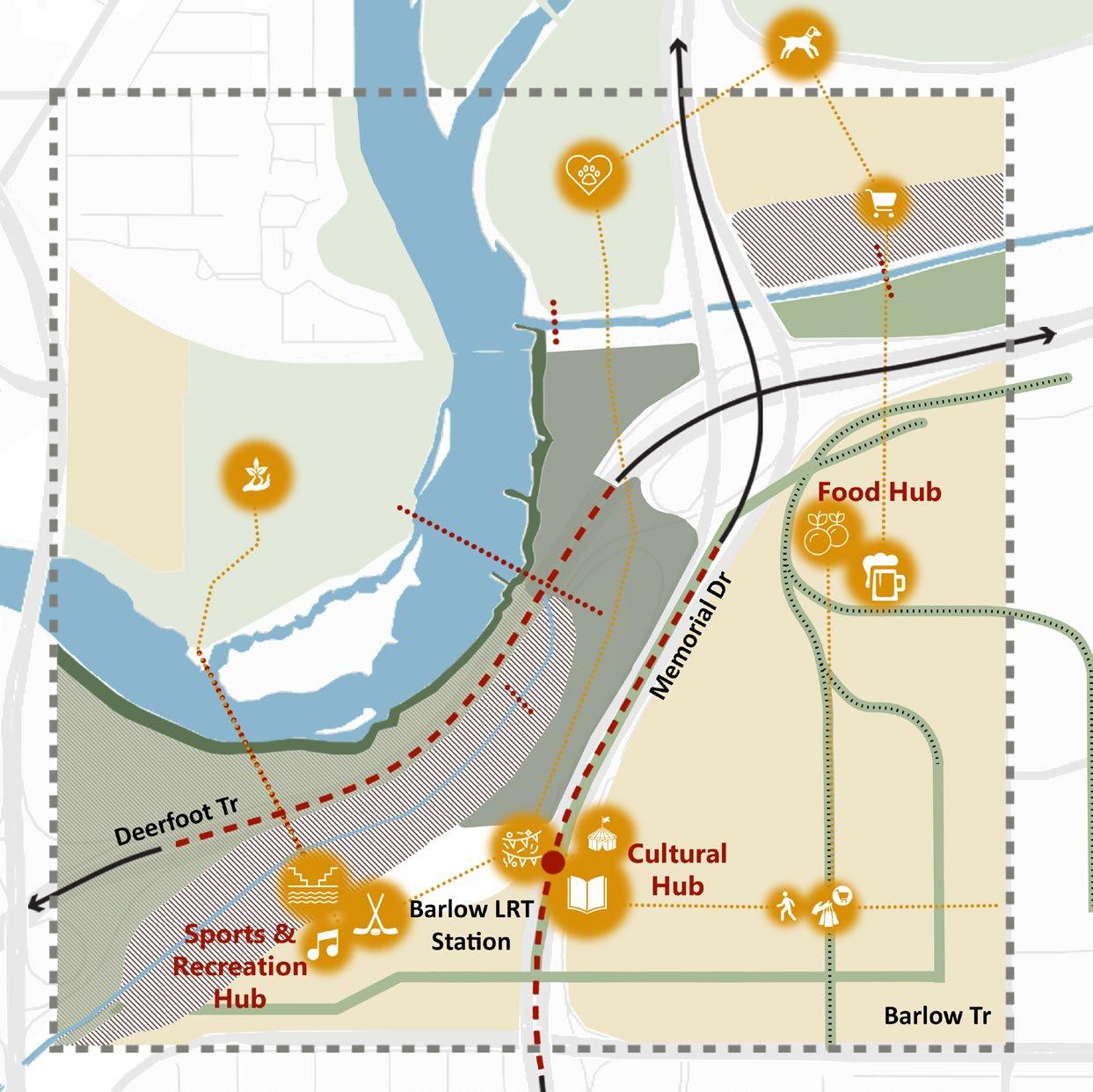
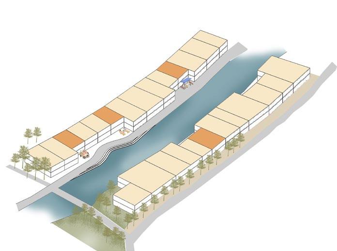
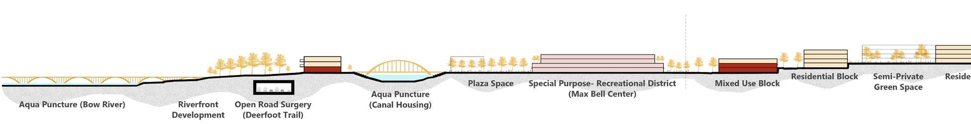
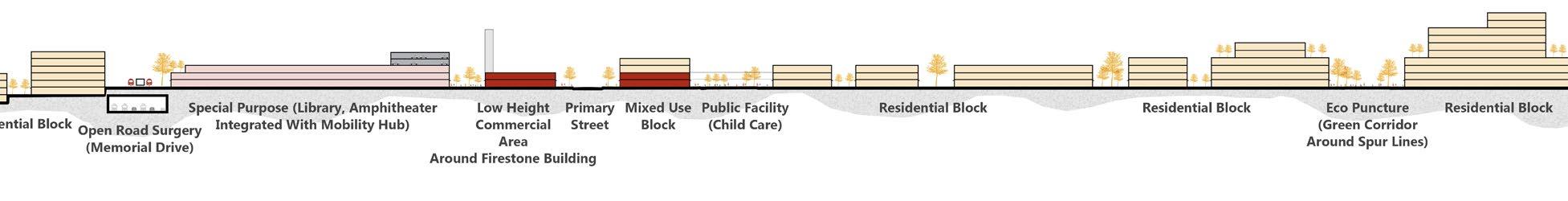
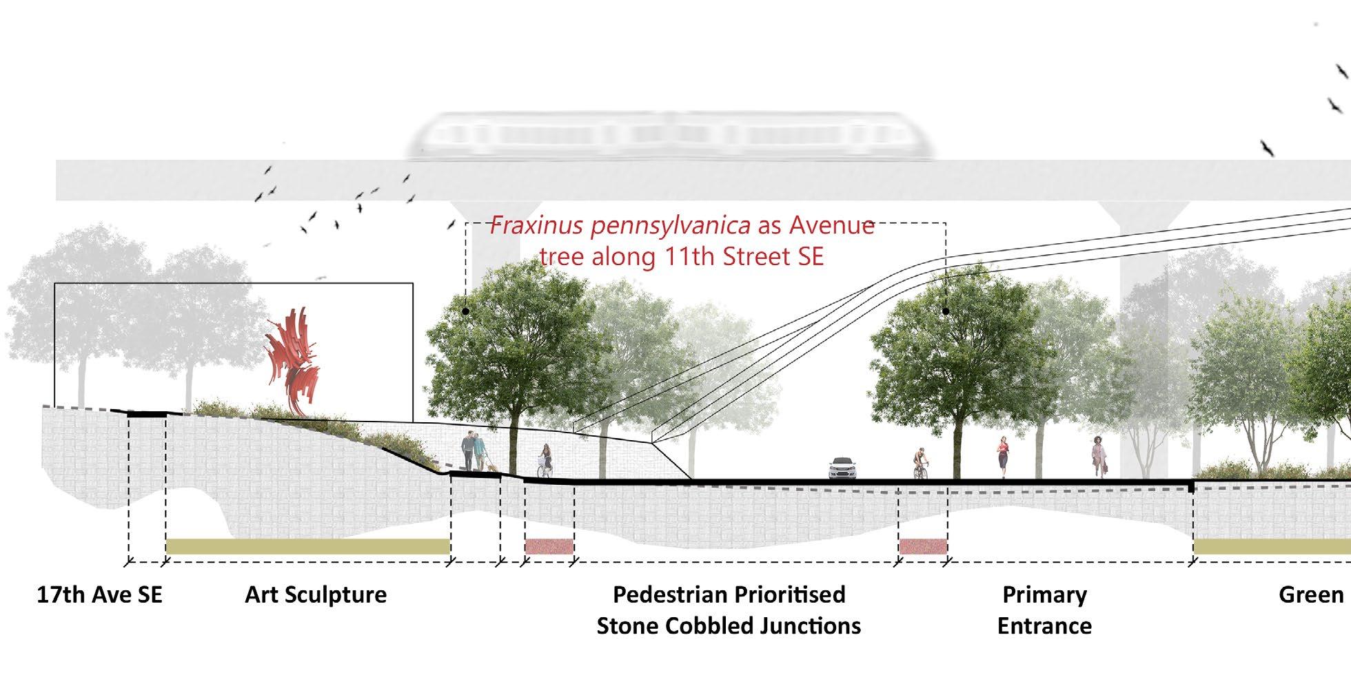
The proposal investigates the area around Max Bell/ Barlow LRT station, Calgary, Alberta. Two major roads- Memorial Drive and Deerfoot Trail run right through the center of the site as a result of which the area is characterized by high-intensity traffic, fragmentation, and remnants of urban sprawl.
The project takes a bold move to bury a segment of Memorial Drive and Deerfoot Trail to redefine a traditionally car-centric area in Calgary into a high-density, unique, pedestrian-focused neighborhood that connects Calgarians to the past, celebrates the present, and builds the foundations for a socially, ecologically, and economically flourishing future.
My Role: I took the responsibility to research the regional history and translate it into a graphical timeline. I collaborated in the concept development and design of the masterplan for the site. Individually, I was also responsible for the site and detailed sections to explain our design rationale.
Winner: Student Category
02
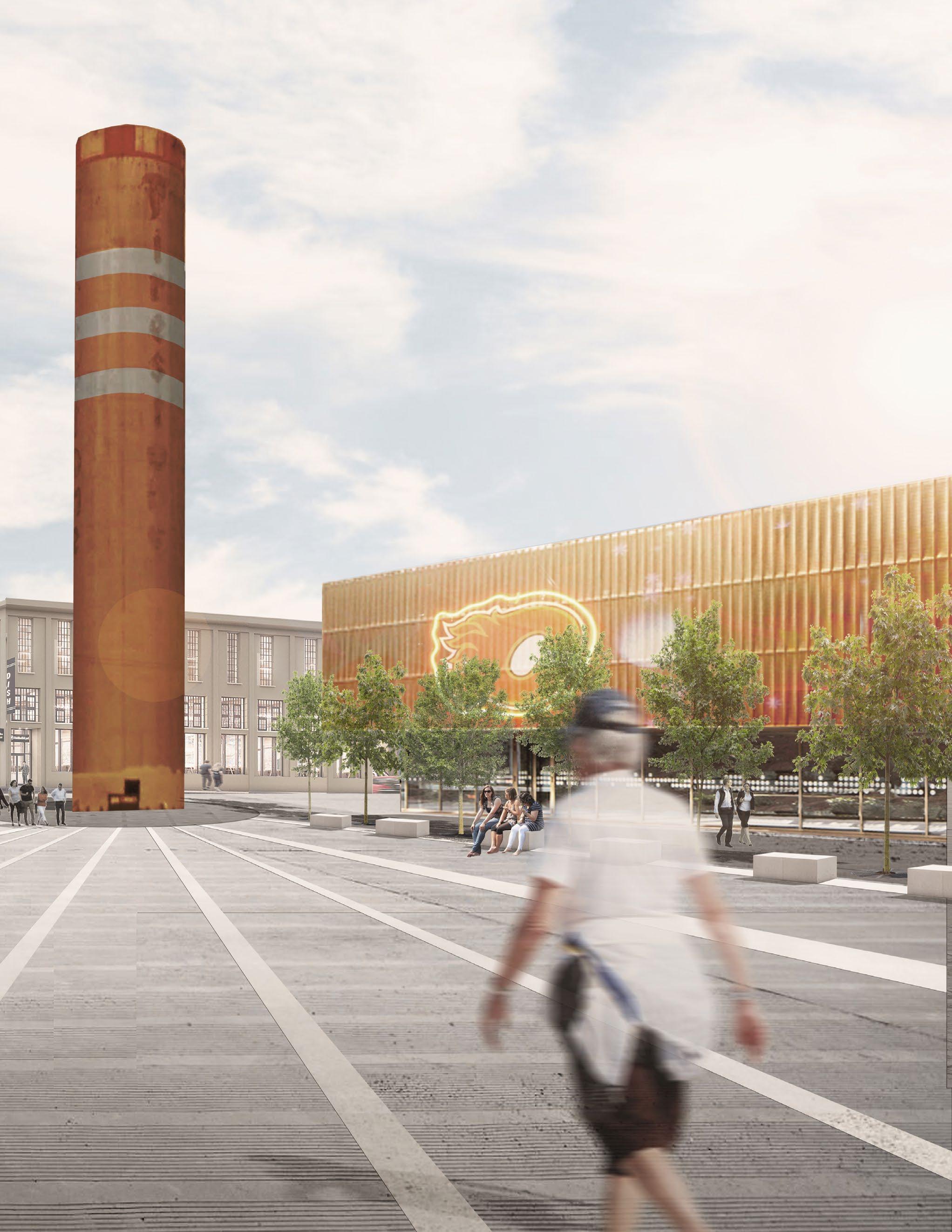
cultural hub around Firestone building (socio-historic puncture)
17 Pg
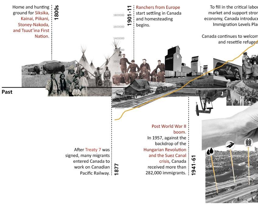
19 Pg timeline of change understanding our past, present, and future


open road surgery socio-historic puncture Madrid Rio AllezUp, Montreal Birmingham
UK Spur
Corridor Michigan Urban Farm agri/ eco puncture design strategy plan aqua puncture 01 03 02 01 03 02 04 04 Proposed New Development
Canal,
Line Green
Prince’s Island Park
21 Pg context plan
Eau Claire Chinatown
Crescent Heights
Renfrew
Bridgeland
Beltline
Downtown Commercial East Village Inglewood
Ramsay
Alyth
Historic
Agri/Eco
Aqua
Open
LRT
Site
0 1km
Mayland Heights Franklin Dover Southview Radisson Heights Meridian Social Puncture
Puncture
Puncture
Puncture
Road Surgery
Station
Extents
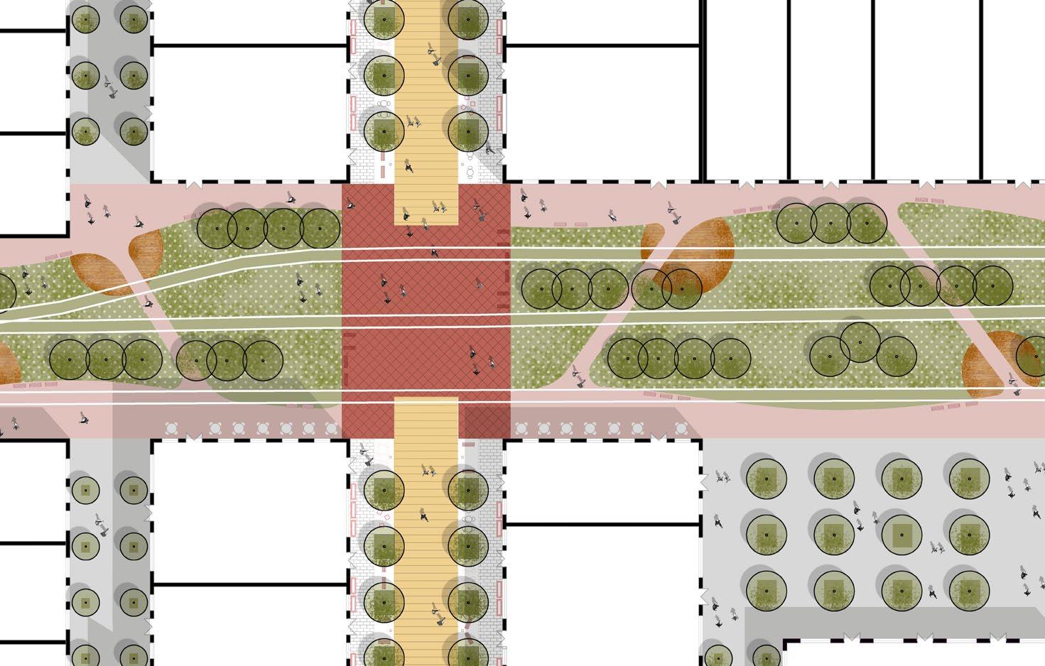
masterplan
responding the issues sustainably
mobility
LRT Line

Bike & Pedestrian
Main Streets
Secondary Streets
Public Plazas
LRT Station
Parking
urban morphology
Social Hubs
Built Environment
open space
Public Green Space
Semi-private Green Space
Public Plazas
SPORTS & RECREATION HUB
HarviePassage Barlow Trail Pedestrian Pathway Public Plaza Landmarks 0 100m
Riverfront
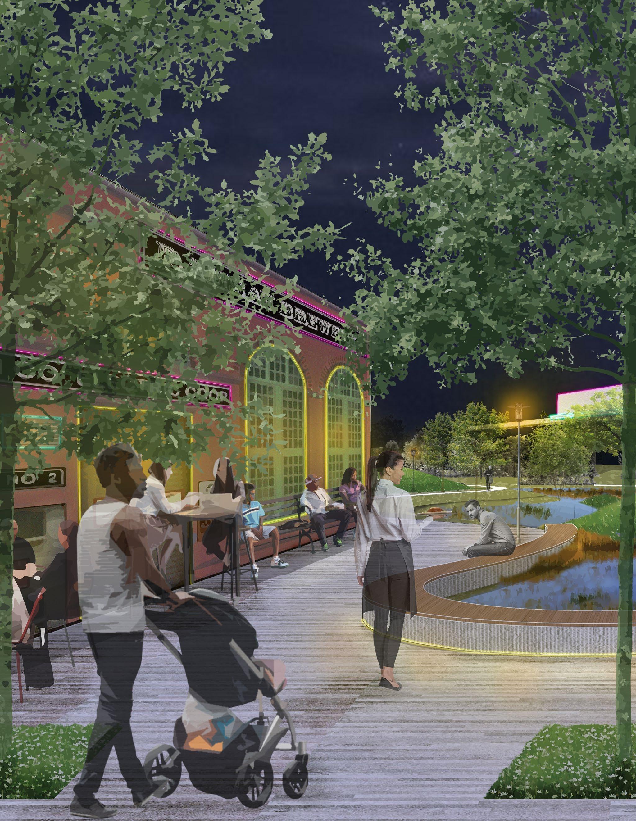
23 Pg FOOD HUB CULTURAL HUB section 05 detail 01 Mobility Hub Gelato School Library Firestone Tower
Barlow/ Maxbell LRT Station Senior Living Day Care Community Center Spolombos Brewery Indoor Farming/ Vertical Gradens Food Forest Bow River IrrigationCanal Food Processing Unit Farmer’s Market Mobility Hub Mobility Hub
RiverfrontDevelopment
mobility hub
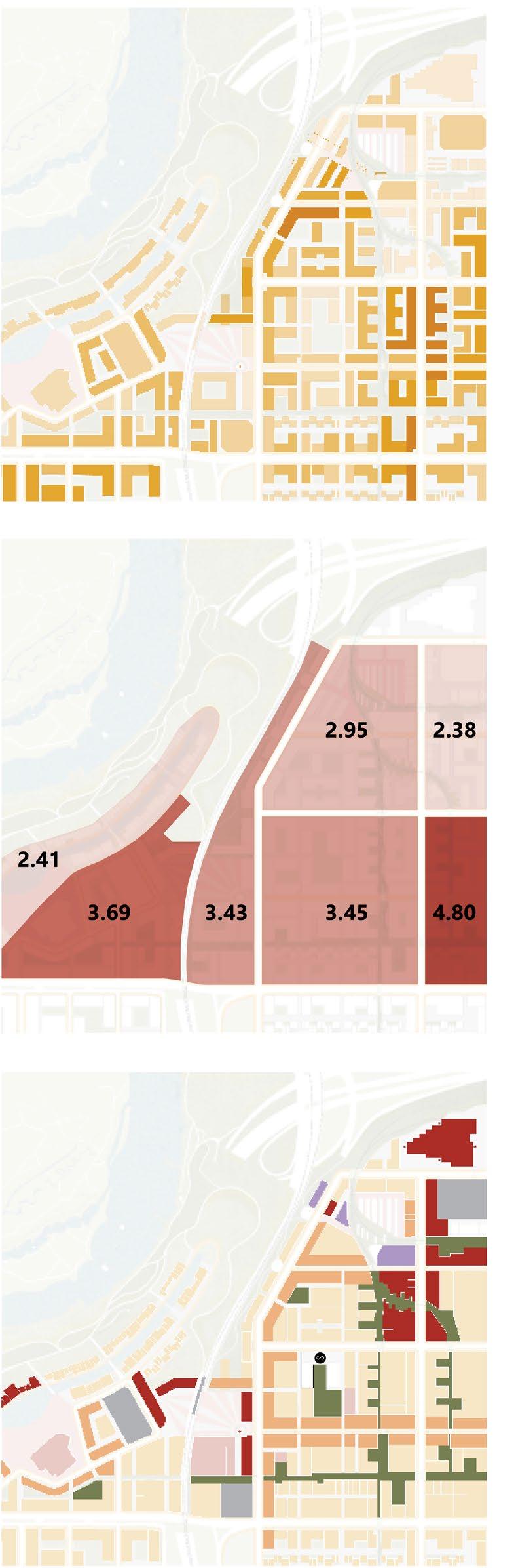
building typologies average FAR 3.3
residential type 2
canal housing
residential type 1 (along green corridor) (riverfront development)
building
landuse FAR
S School Residential Commercial Mixed-Use Activity Center Industrial Transport 1-2
3-4
5-6
7-8
9-10
height
calculation
Floors
Floors
Floors
Floors
Floors
25 Pg
food hub (socio & eco puncture)
riverfront development (aqua puncture)
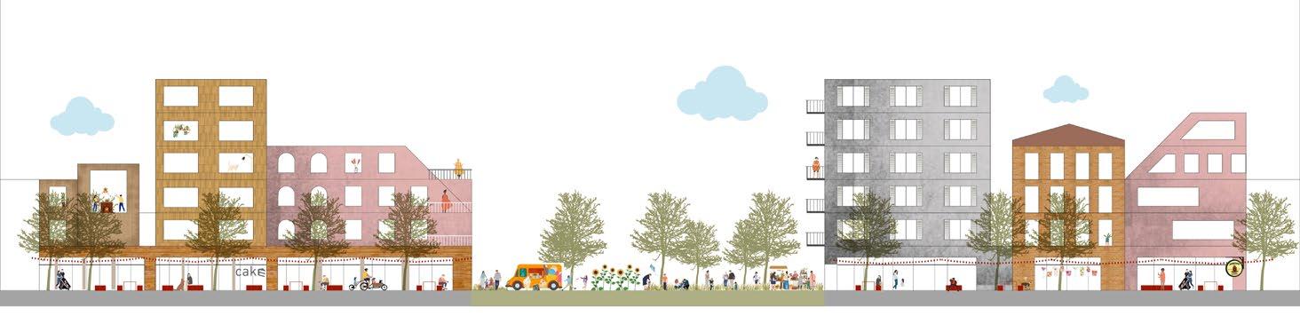
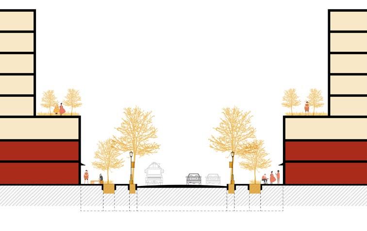

detailed street plan 01 street elevation 02 street section 03 street section 04 02 Mixed-use Block Mixed-use Block Mixed-use Block Mixed-use Block Mixed-use Block Walk 3m Walk 3m Walk 3m Walk 3m Green 2.5m Cycle 2m Green 2.5m Cycle 2m Street 8m Carriageway 12m 27m wide Primary Street Section 19m wide Secondary Street Section Green Corridor (31m) Mixed-use Block 04
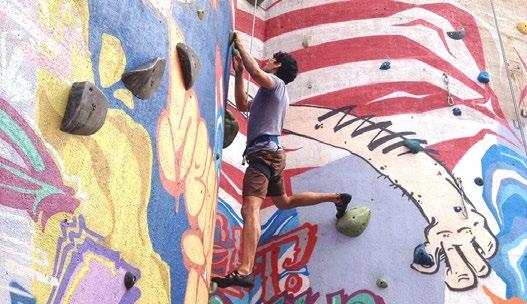
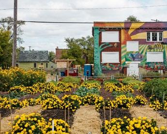
Aimed to convert underutilized parking lots into temporary installations to engage people of all ages. The placemaking exercise was proof that spaces can be activated in sustainable and cost-effective ways with materials sourced from the site.
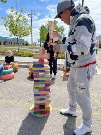
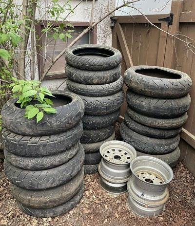
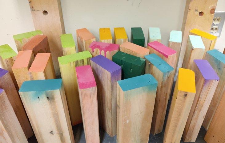
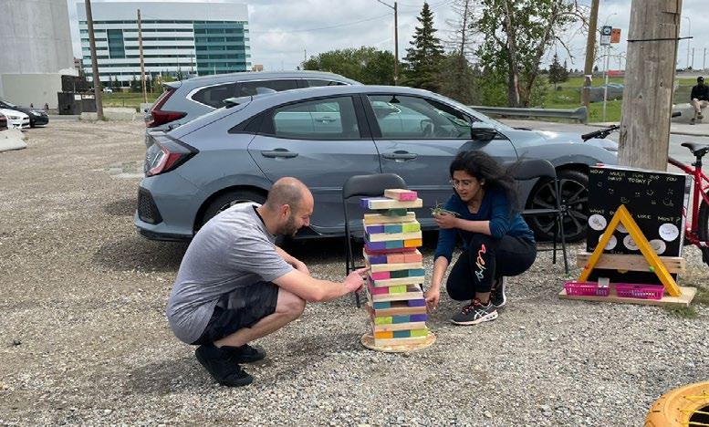
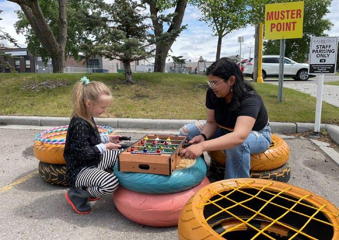

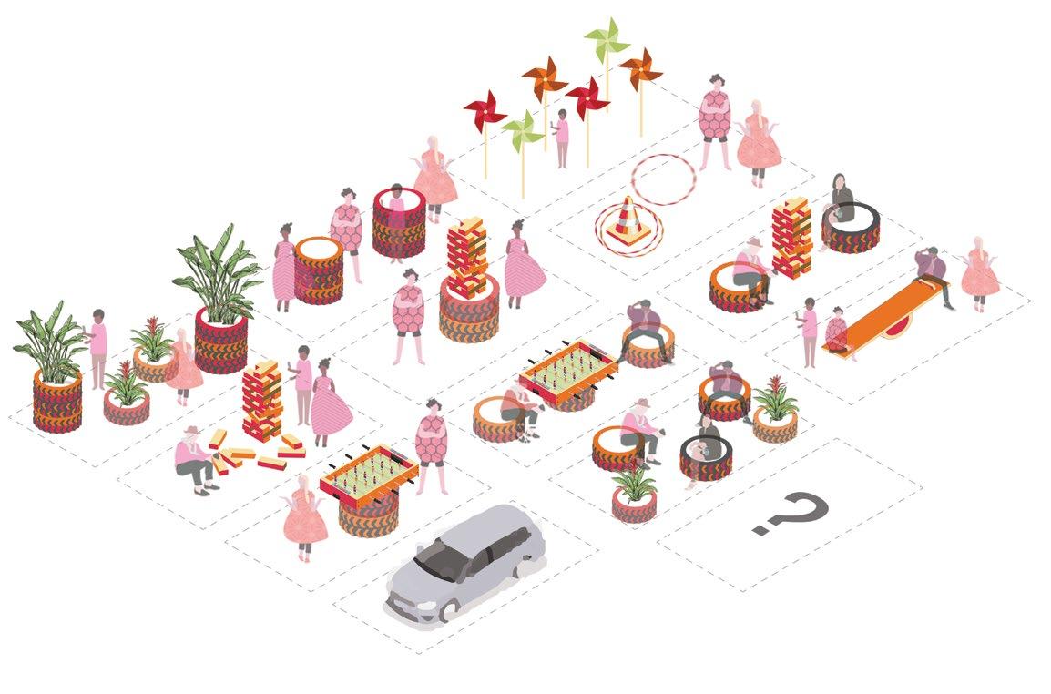
The design of the lots is modular and can be arranged in different ways using the same elements. The intervention took place over a period of two days and covered two parking lots, one next to Righteous Gelato, Calgary, and the other outside Barlow/ Maxbell LRT station. The elements include a giant Jenga, tire seating, tire planters, pinwheels, a mini Foosball table, and a ring toss.
27 Pg tactical urbanism placemaking on site
letspark_yyc
05
section
recycling materials from site
placemaking
section 03
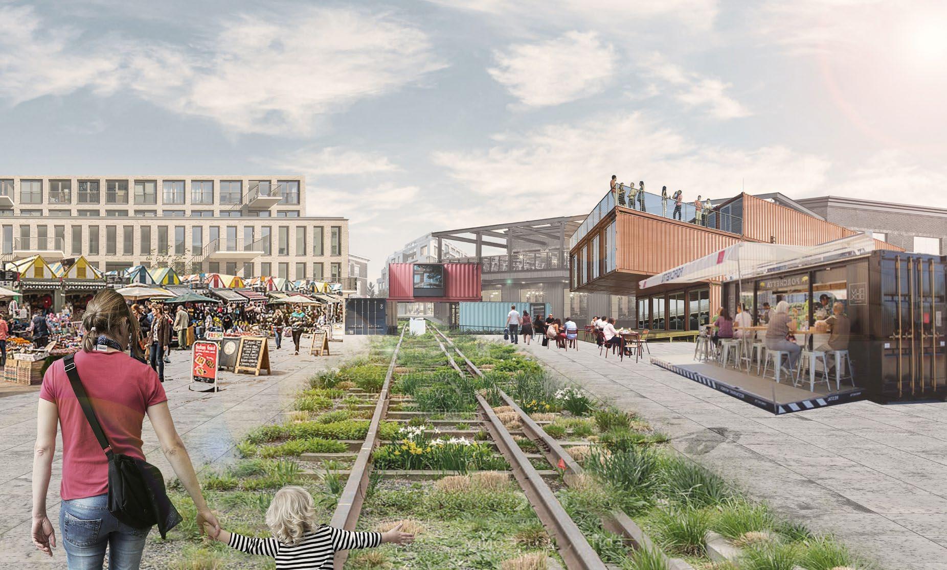
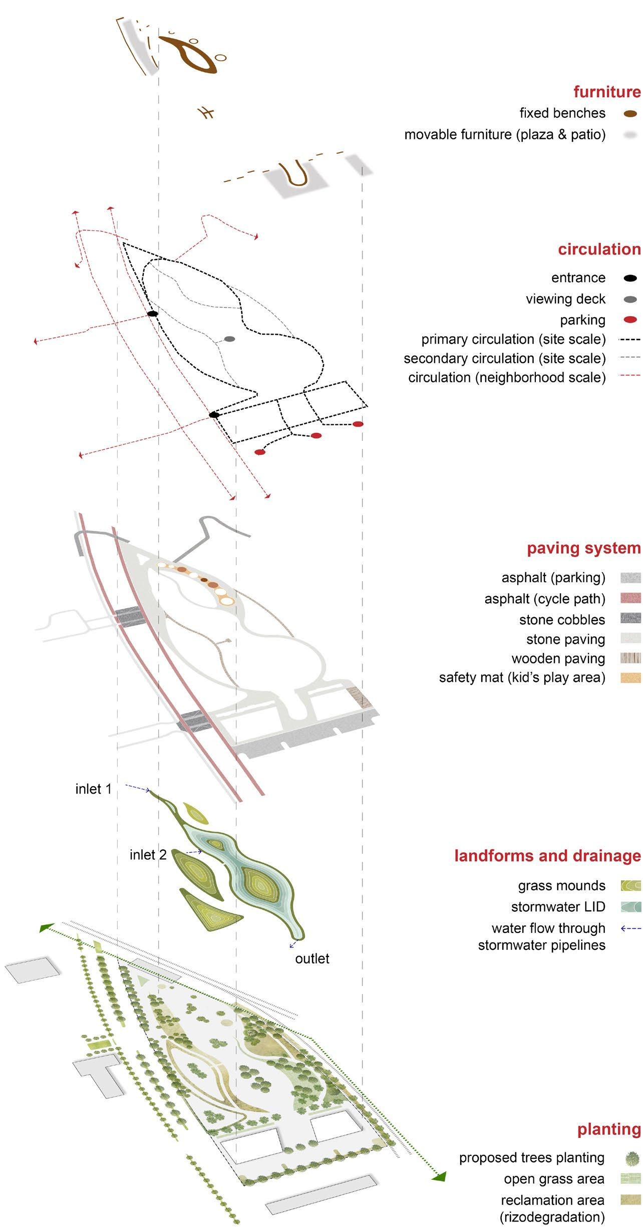
reclaiming public realm
Optimism | Thinking Critically About Canadian Landscapes
Location: Calgary, Alberta Masters of Landscape Architecture, Winter 2022
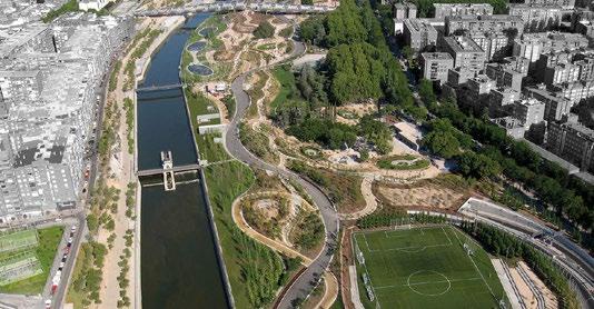
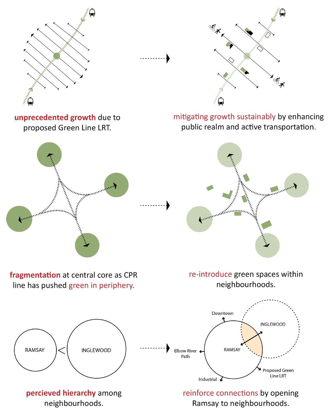
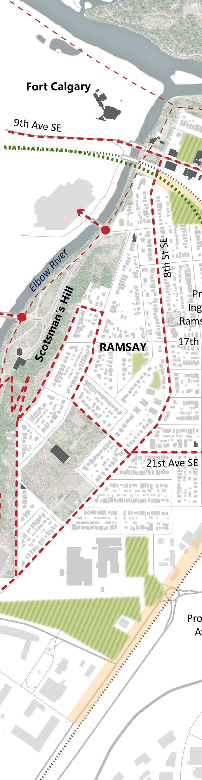
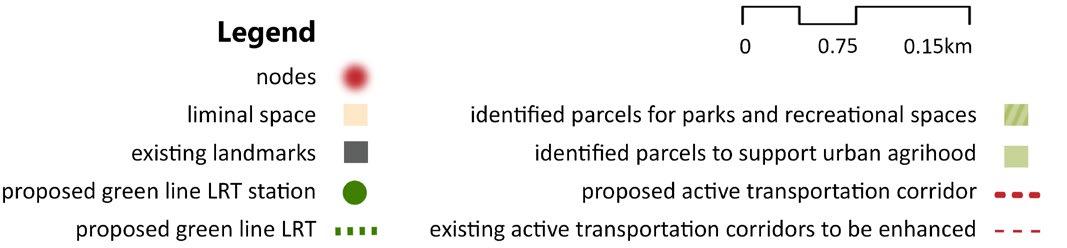
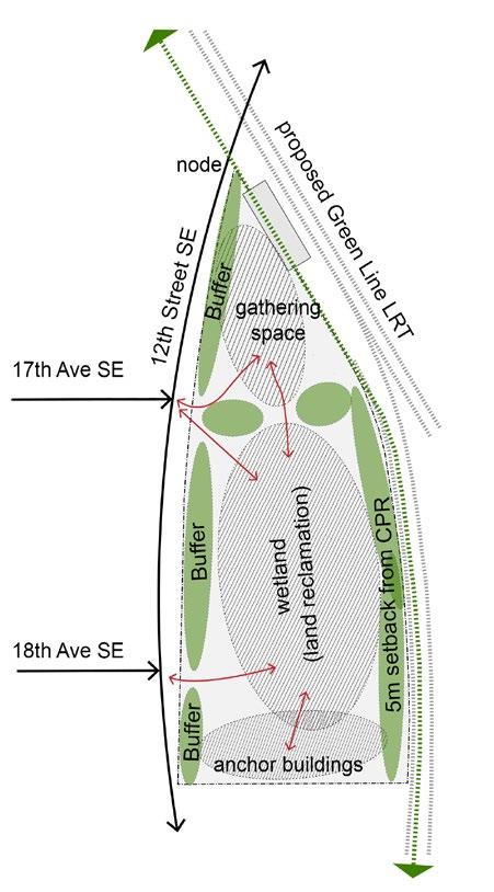
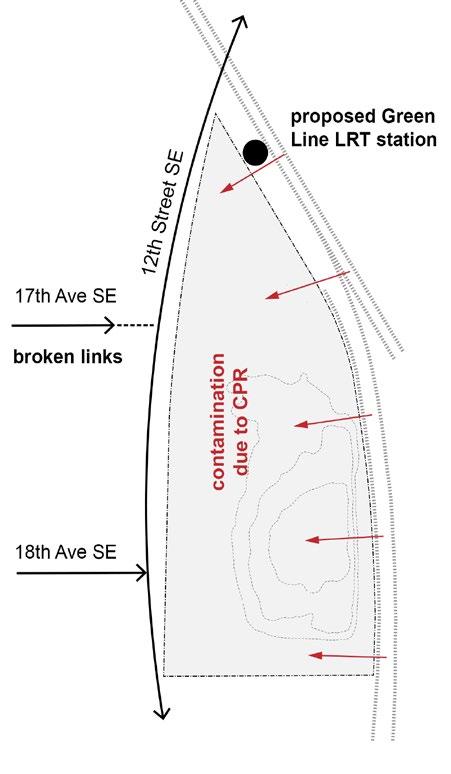
Ramsay and Inglewood are an eclectic neighbourhoods situated in the south-eastern part of the Canadian city of Calgary, Alberta. On one hand, they boast rich architectural history, a strong artisan community, and house some of the best breweries in Calgary. On the other hand, the neighbourhoods are heavily fragmented by the Central Pacific Railway Line (CPR), at the centre, which has pushed all the significant green spaces to the periphery, along the Bow and the Elbow River. With the upcoming Green Line Light Rail Transit (LRT), the neighbourhood will experience an unprecedented growth and development, which could impact the ecological footprint, if not addressed well in advance.
‘Reclaiming public realm’ aims to introduce green spaces back into the communities. The masterplan identifies the lost spaces which have the potential to be developed into public parks, plazas, or urban farming centres. They are visioned to be connected regionally with existing transportation hubs, and the future Green Line LRT with a seamless bike and pedestrian corridor, something that is currently missing.
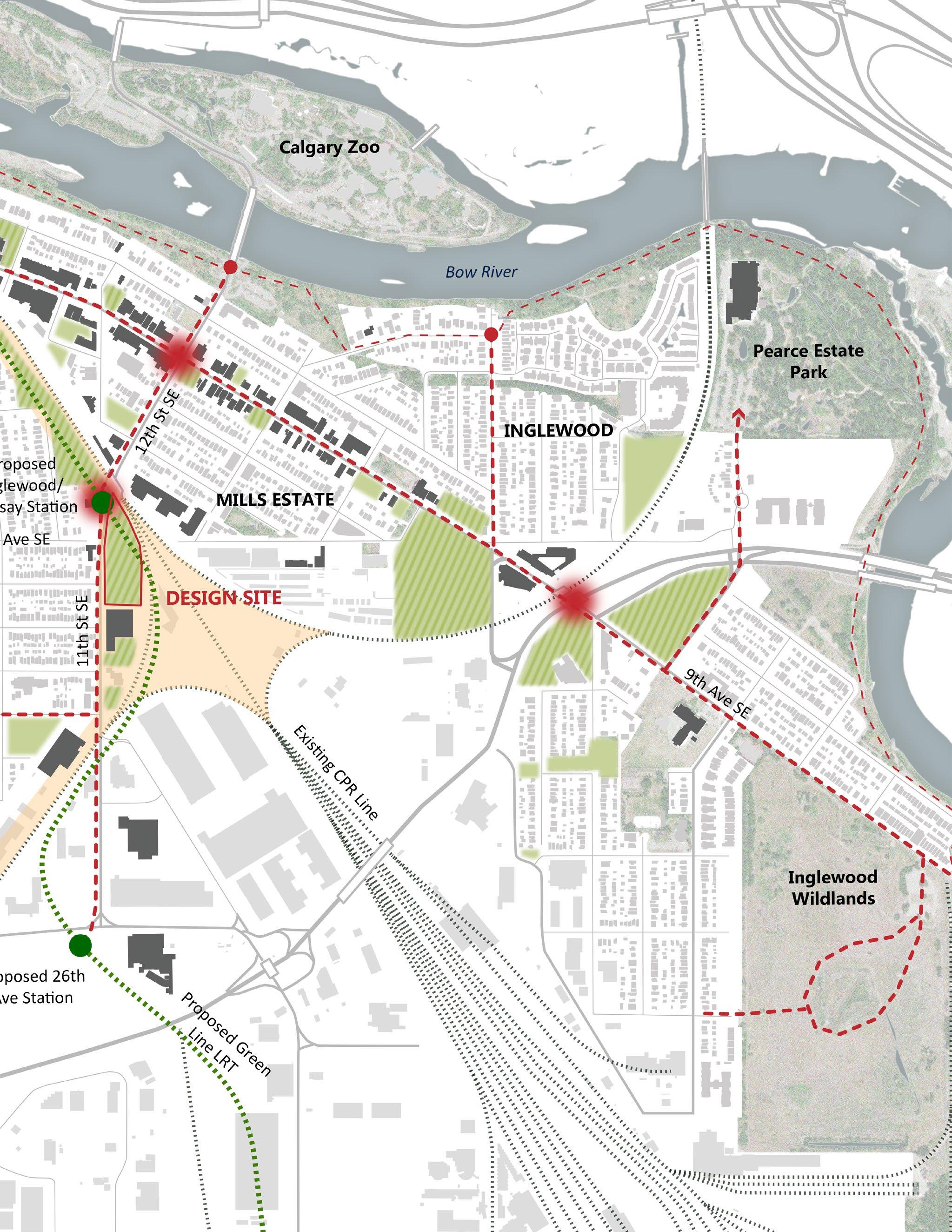
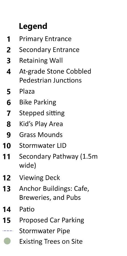
The project specifically investigates a disused parcel of land next to the proposed Green Line LRT station. The project aims to explore optimism through the lens of landscape architecture by activating the area based on future needs, educating people about the complex process of land reclamation and restoration of a degraded landscape through nature-based solutions, and creating a place for the community to enjoy.
03
29 Pg
masterplan
investigating the obstacles and responding it sustainably
analysis findings objectives
0 0.75 0.15 0.15km
31 Pg
site study
design justification
33 Pg
site
to
needs of the future
design
responding
the
view A
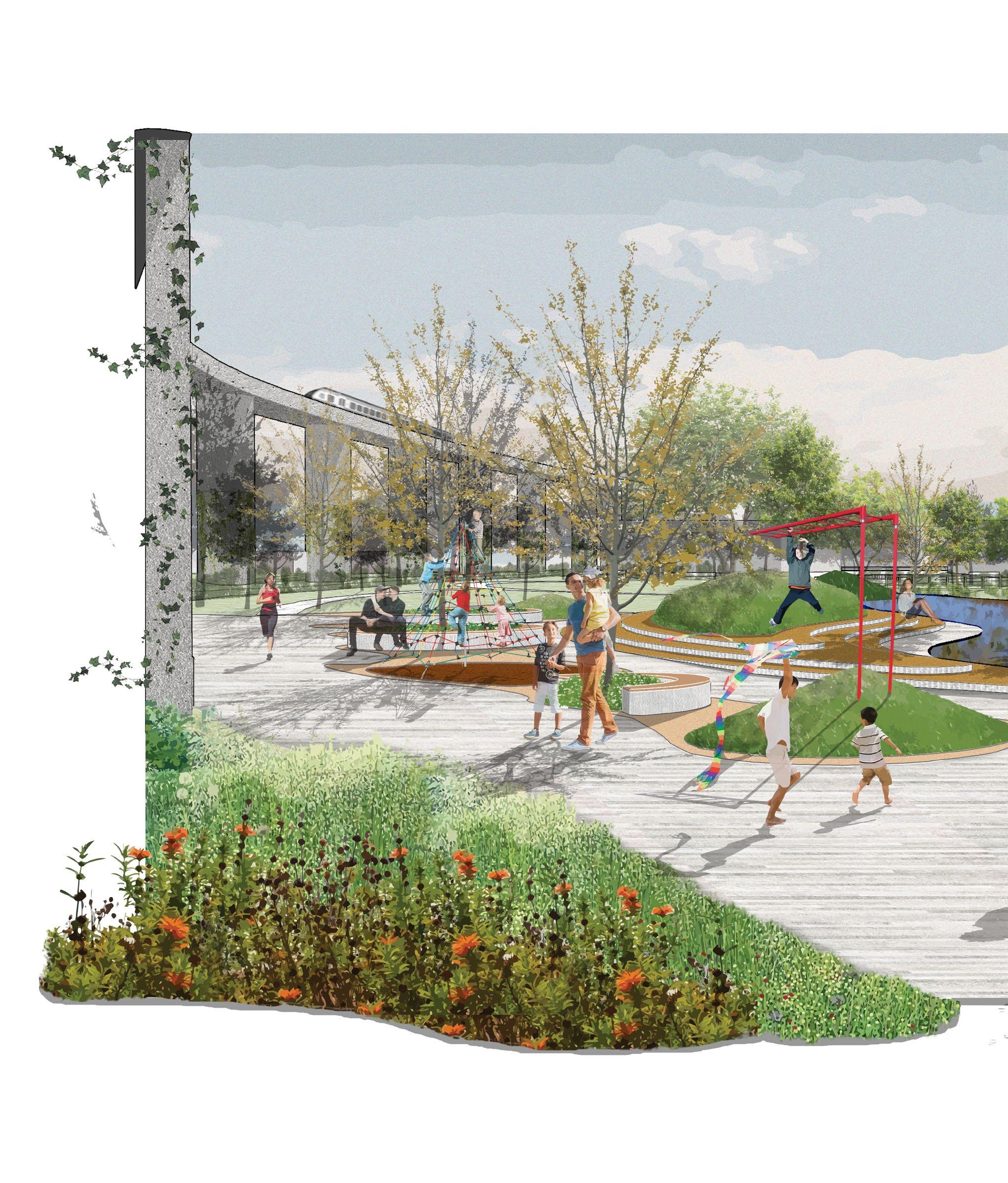
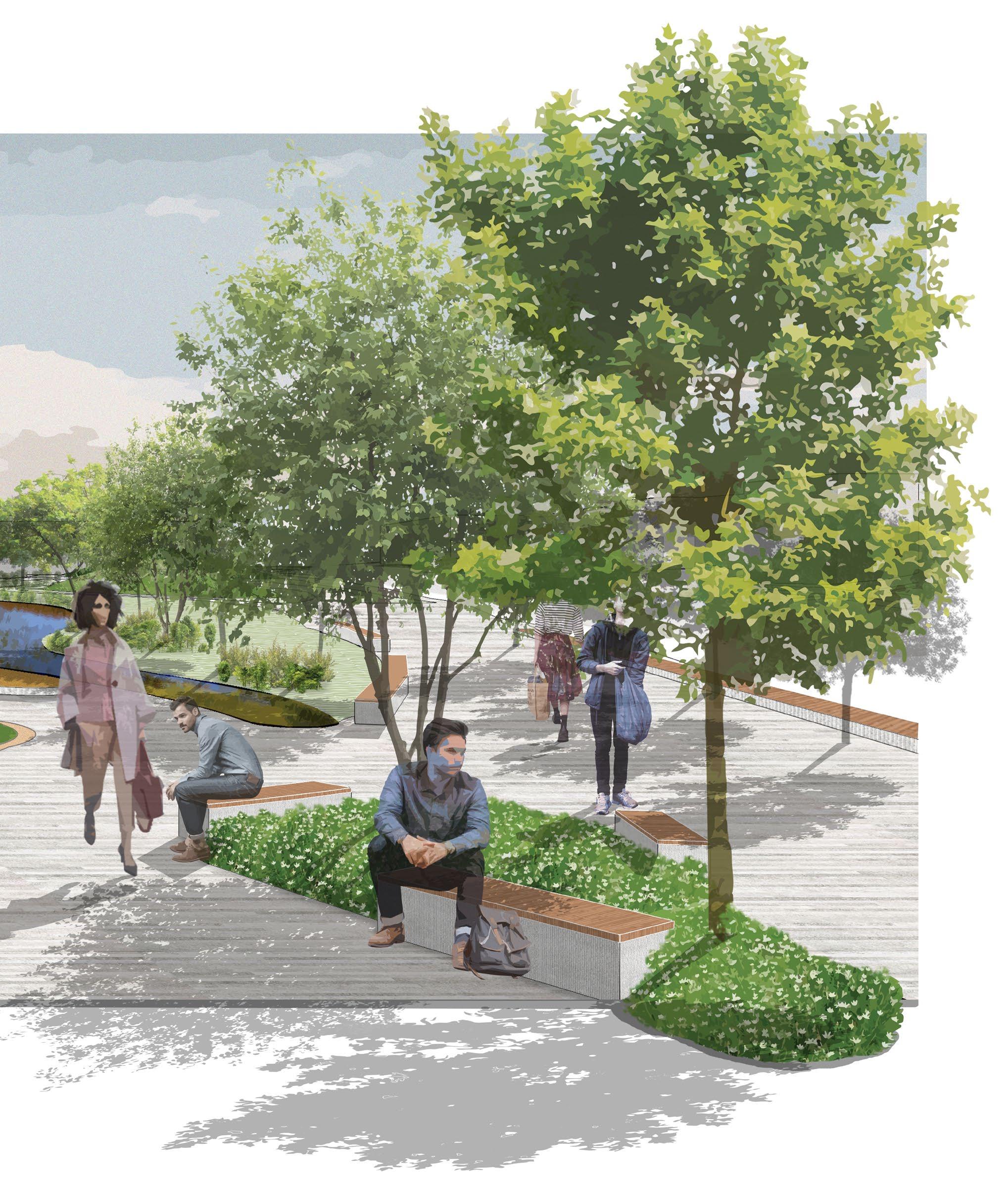
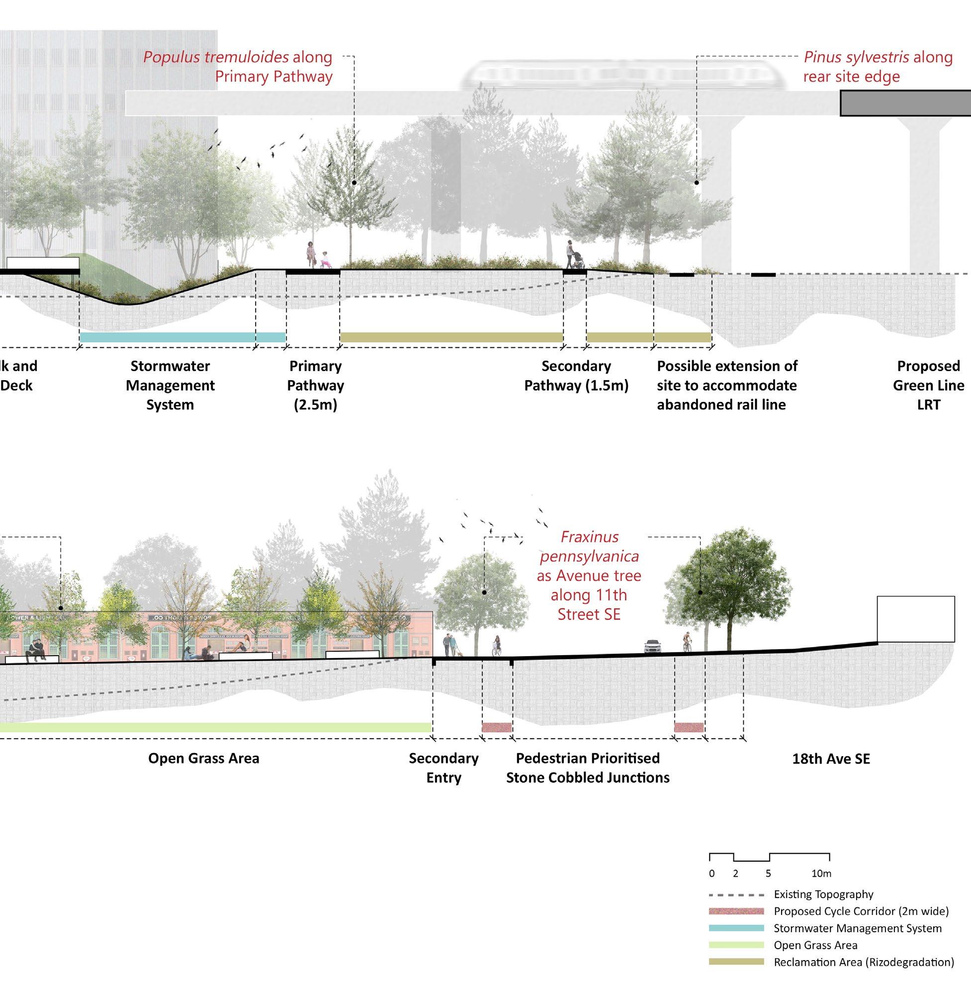
The scenario shows a strong juxtaposition between the ‘leisurely’ and the ‘hurried’ in the proposed plaza space. The left portion with its meandering pathways, play areas, and sitting spaces around stormwater management feature aims to provide a social and recreational space to its users. The setting on the right which includes a lot of hardscaping and tree-lined space, acts as a busy corridor bringing in and taking out people from the proposed Green Line LRT station to their destination.
35 Pg
design details
responding to the needs of the future
planting abacus
section B
planting
Prairies, palette. The has been
Stormwater
The system will remain
Open Grass are places Reclamation to help break height to
planting strategy
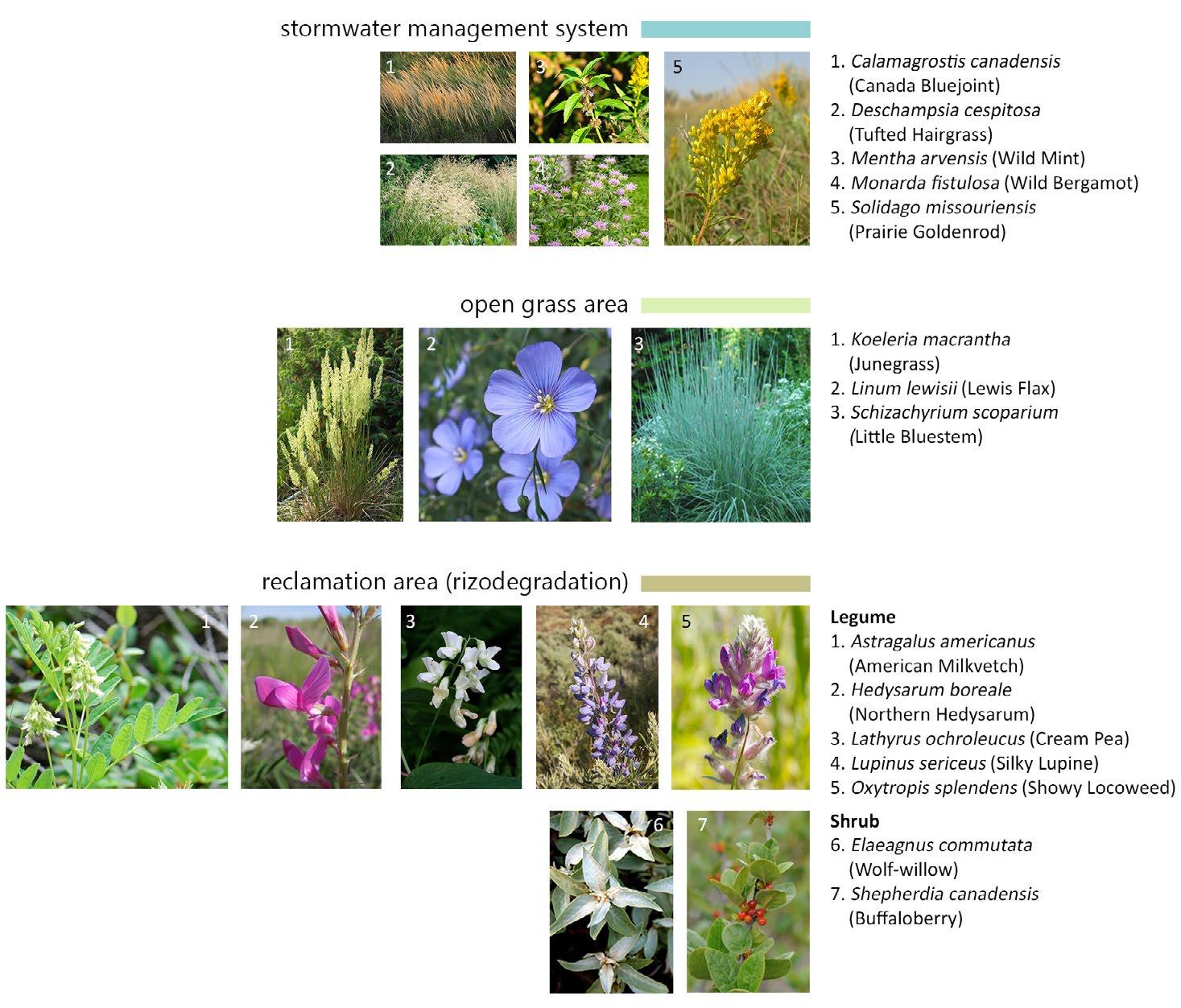
home to the beautiful Foothill Fescue Grassland ecosystem has been an inspiration behind the planting The species selected are native and help support numerous birds, bees, and insects. The planting strategy been divided into three parts based on the zones where they will be planted.
Stormwater Management System: Species that are tolerant to both wet and dry climate have been proposed. system will see the maximum water during the month of June which is the wettest period in Calgary. While it remain fairly dry during October.
Grass Area: The open grass area which combines the native grass and wildflowers species of the prairies places that are intended as informal gathering or social spaces.
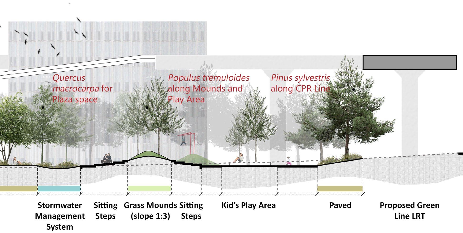
Reclamation Area (Rizodegradation): The reclamation area which is the largest of the three areas uses legumes break down hydrocarbons. A few shrubs have been added with an intent to provide structure and vertical to this zone.
37 Pg
design details

responding to the needs of the future
section C
section D
39 Pg
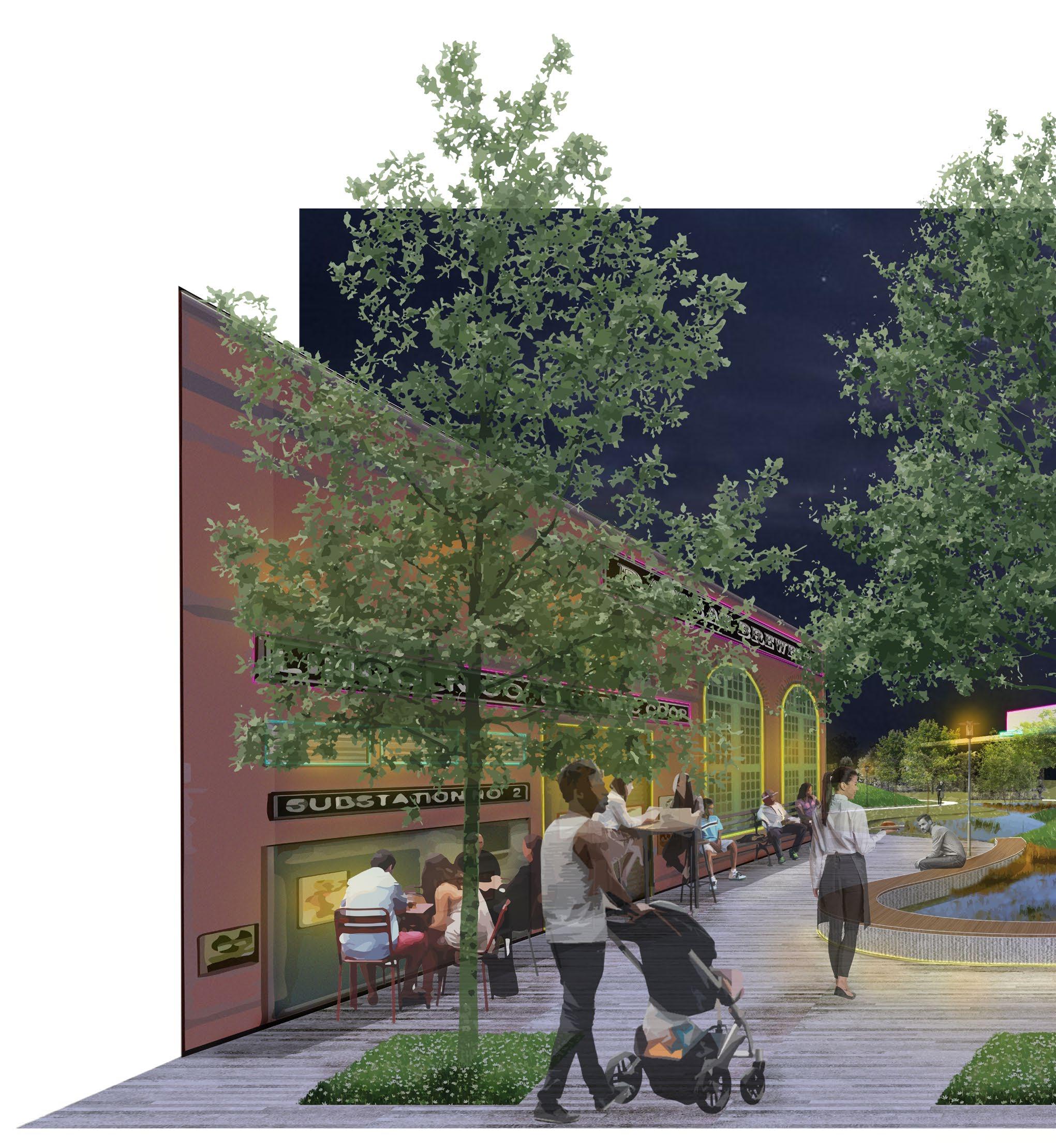
view E
The scenario aims to imagine the southern end of the site with commercial space for small businesses like pubs, restaurants, cafes, or a brewery. The plaza-like space in the center acts as an extension to allow activities to spill out while providing ample space for the movement of the people. The space allows room for movable street furniture to give people a sense of ownership of their public realm.
41 Pg
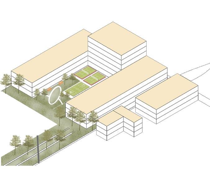
IIT Gandhinagar
Campus Development: Research Park & Sports Area
Location: Gandhinagar, Gujarat, India
Professional Work at SJA Consultants, New Delhi March 2017- November 2019
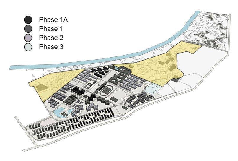
I have singlehandedly worked on this project since the time I joined SJA Consultants, New Delhi, having constant reviews and discussions with Mr. Yogesh Kapoor (Principal Architect- MSYK Design, New Delhi) and Mr. Saket Jain (Partner- SJA Consultants). I have been involved in masterplan design, coordination with MEP consultants, creating working and presentation drawings, 3D models, design visualizations, and project estimate. Of the total 400 acre project, I have specifically handled Research Park (93.74 acres) and Sports Area (33.15 acres).
The project showcases the landscape design for the open spaces (non parcel building areas) at IIT Gandhinagar campus. The landscape design was an integral part of the campus masterplan, integrating the buildings and features of the campus together and establishing a planned system of open spaces and vegetation that responds to the existing landscape qualities of the site. Landscape is often a neglected element in large institutional projects, but at IIT Gandhinagar a conscious decision was made to use the landscape as a central unifying element.
research park sports area
04
© All the copyrights of this project is owned by MSYK Design, New Delhi and SJA Consultants, New Delhi.
43 Pg
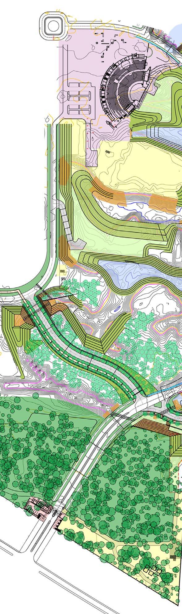
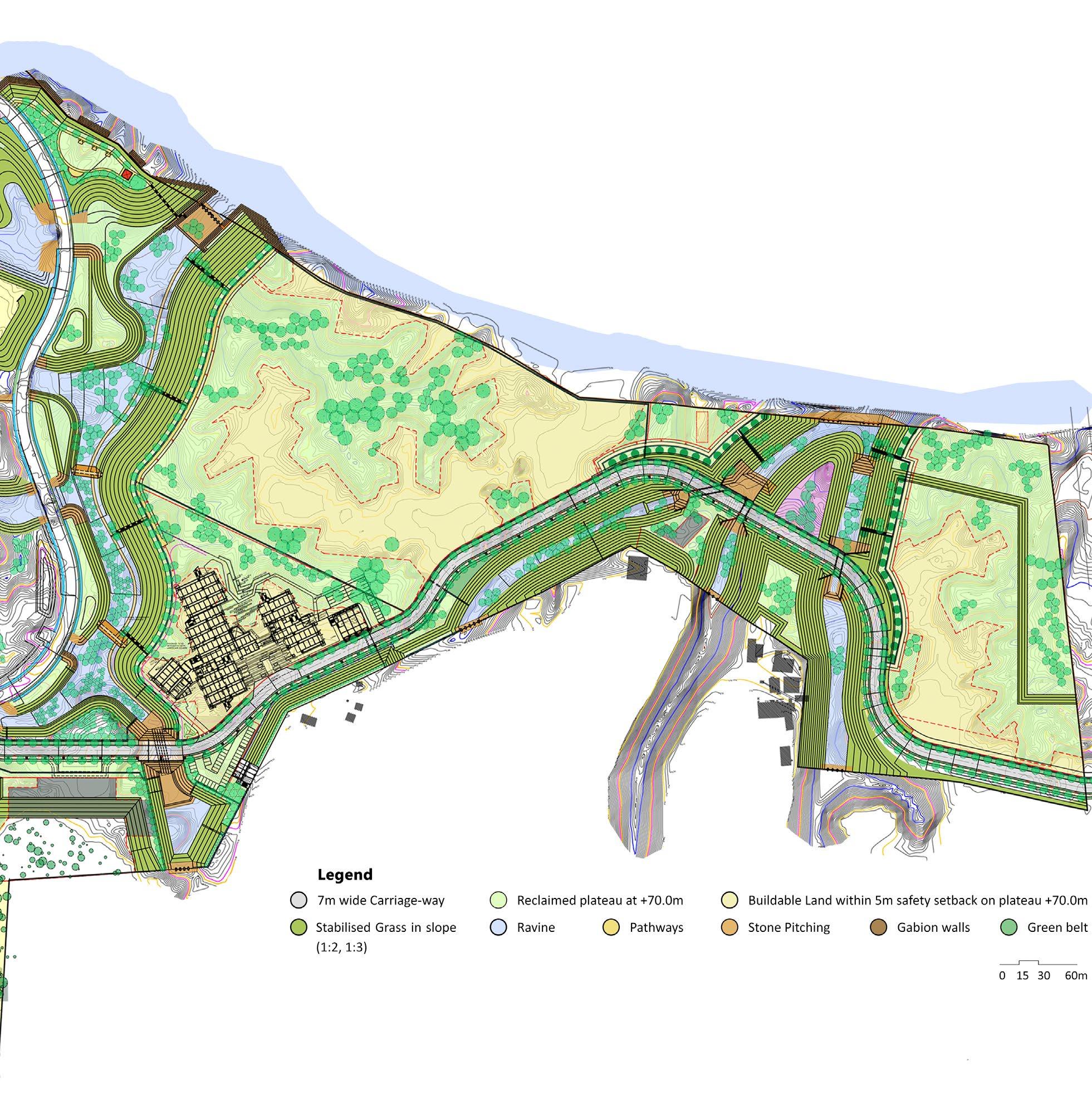
identifying the natural drainage through the site and developing the ravines for an interrupted water flow throughout the year. High Flood Level (HFL) +65.0m.
identified at 5m above HFL, at level +70.0m. An additional 5m setback is taken to prevent any sinking and provide a safety margin for the stability of buildings.
ravines are stabilized through slopes of 1:2, and 1:3, providing check dams at every 1m drop in gradient. Planting in the ravine bed impedes the flow of water and allows siltation.
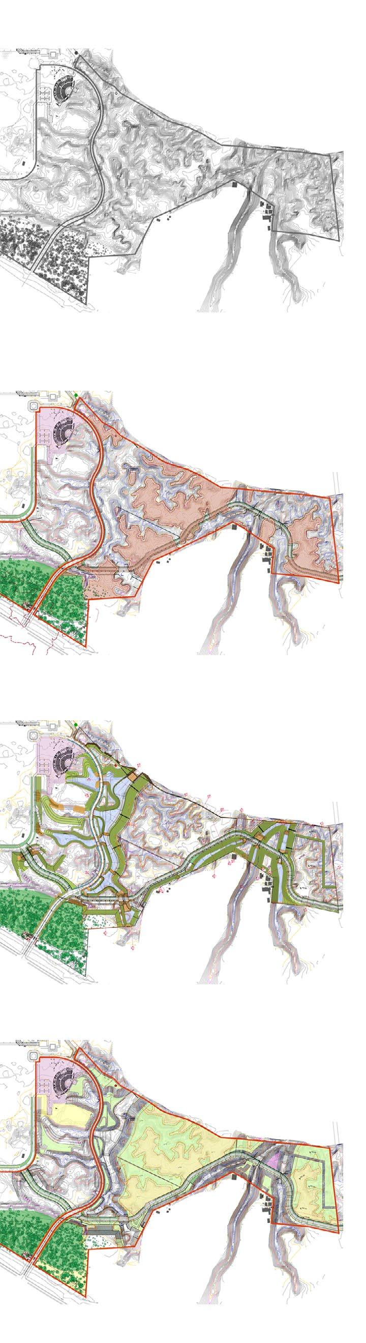
Entry Point
plots are a combination of green areas and buildable land. They are laid with due access from the road having the right of way as 16m.
hydrology buildable land ravine engineering plot formation
B
01 A A inflow outflow outflow inflow
02 03 04
SabarmatiRiver
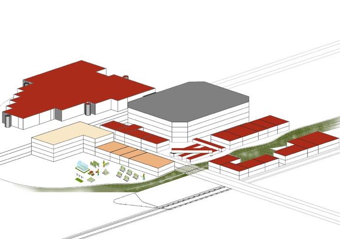
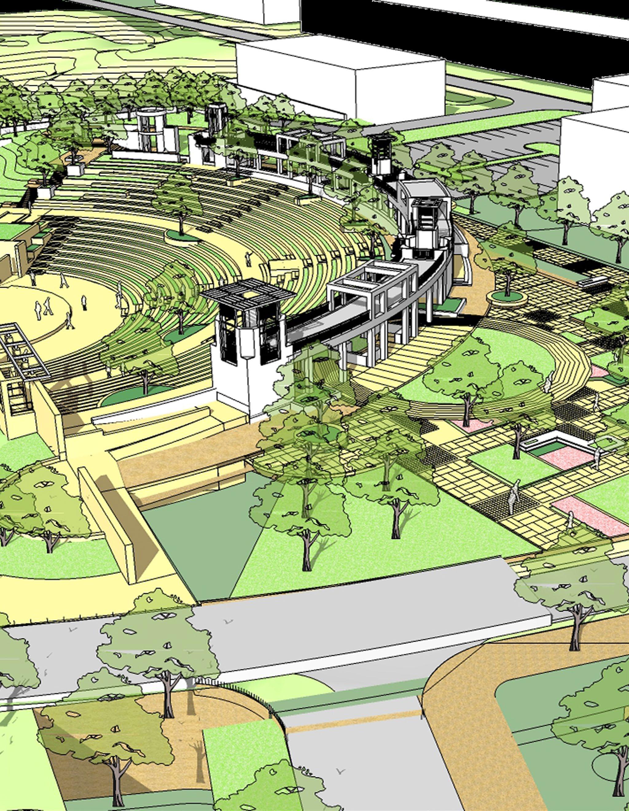
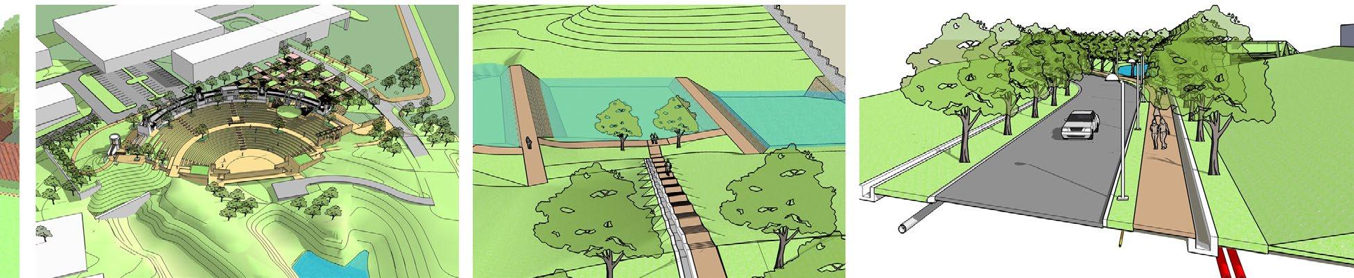
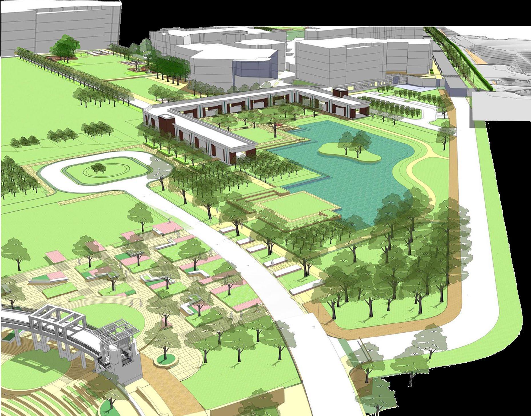
Masterplan utilizes site engineering to protect and stabilize the ravines that support the flow of water from the neighboring land parcels to the Sabarmati River. The check dams in the ravines would facilitate the recreational zones, create artificial lakes, and rejuvenate the groundwater table by capturing the rainwater overflow. The proposal also identifies plots of land ideal for construction. A scenic road along the ravine welcomes the users and lets them inside the campus. The masterplan also supports an amphitheater (with a 2000 seating capacity), designed as a garden with trees.
Sabarmati River
C D
45 Pg B
C D
Amphitheater Check Dams
masterplan
Scenic Road
research park
elevation C
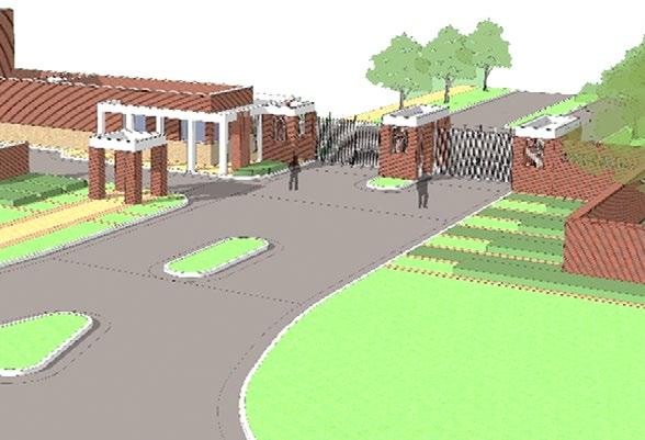
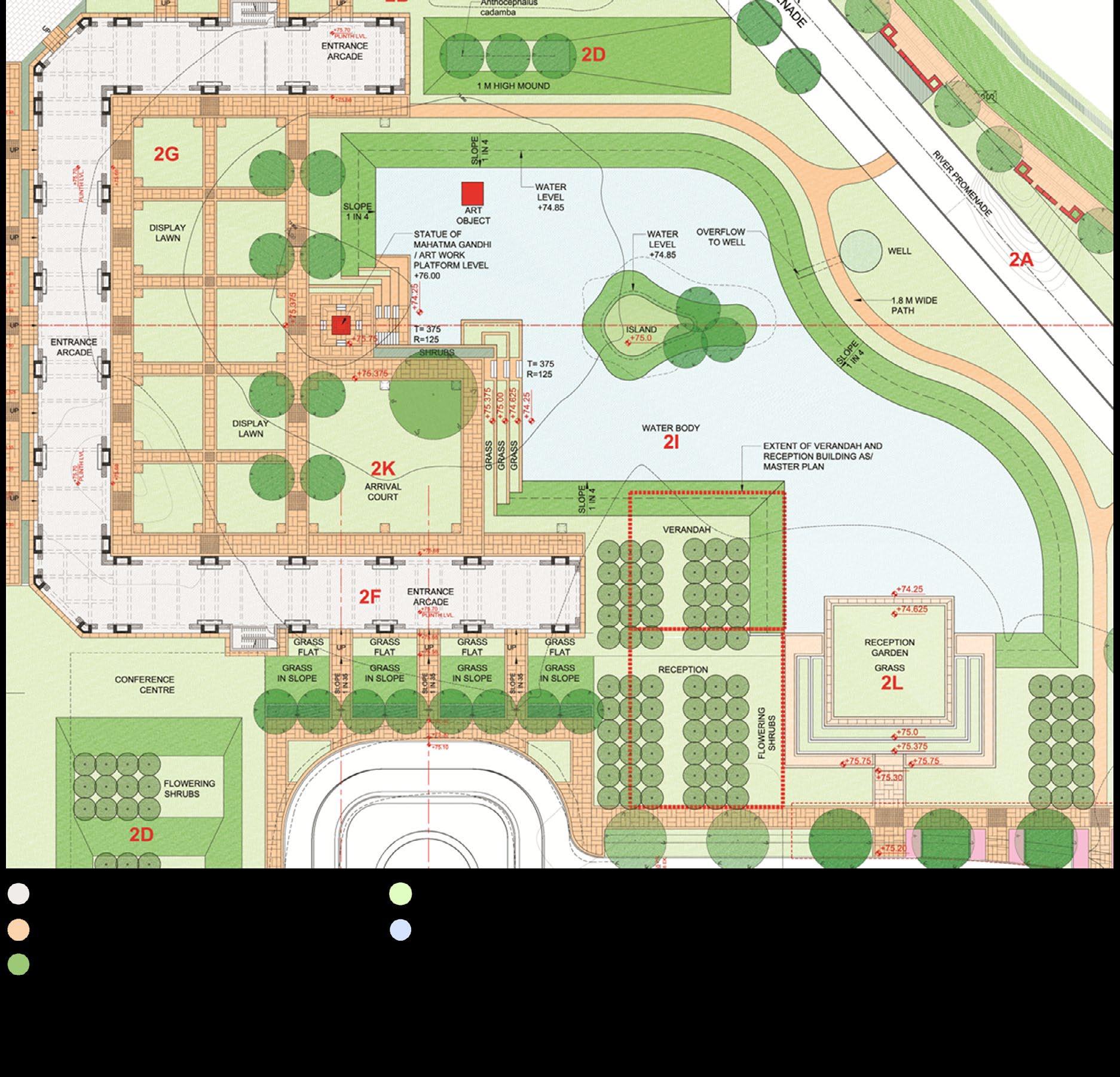
entrance court
plan-
view b elevation C
view a
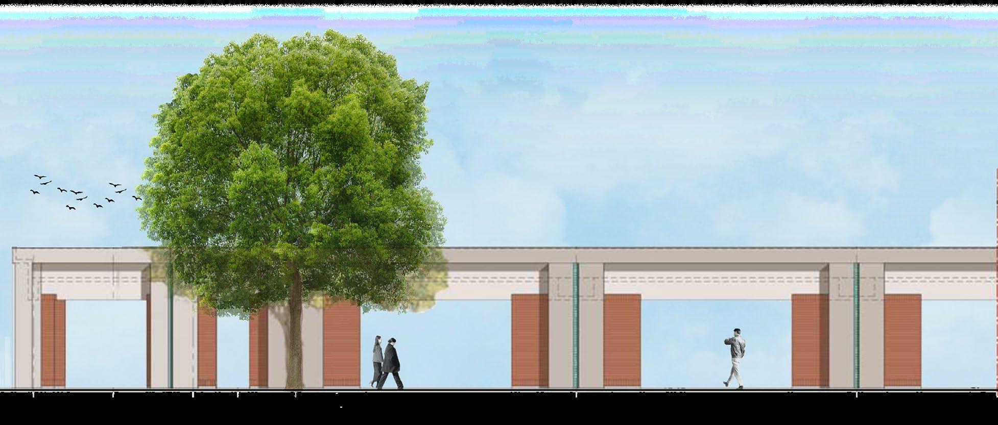
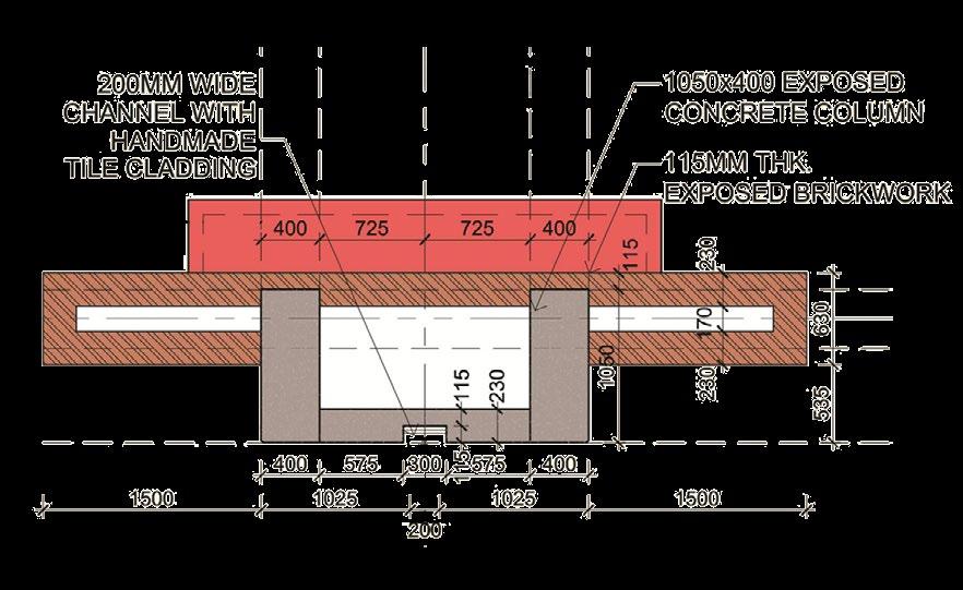
A conscious effort has been taken to maintain the axis for arcade and landscape feature for a visual effect.
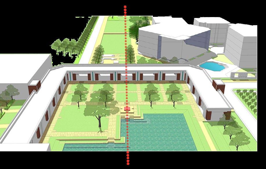
47 Pg detailed design plan entrance court
view A
view B
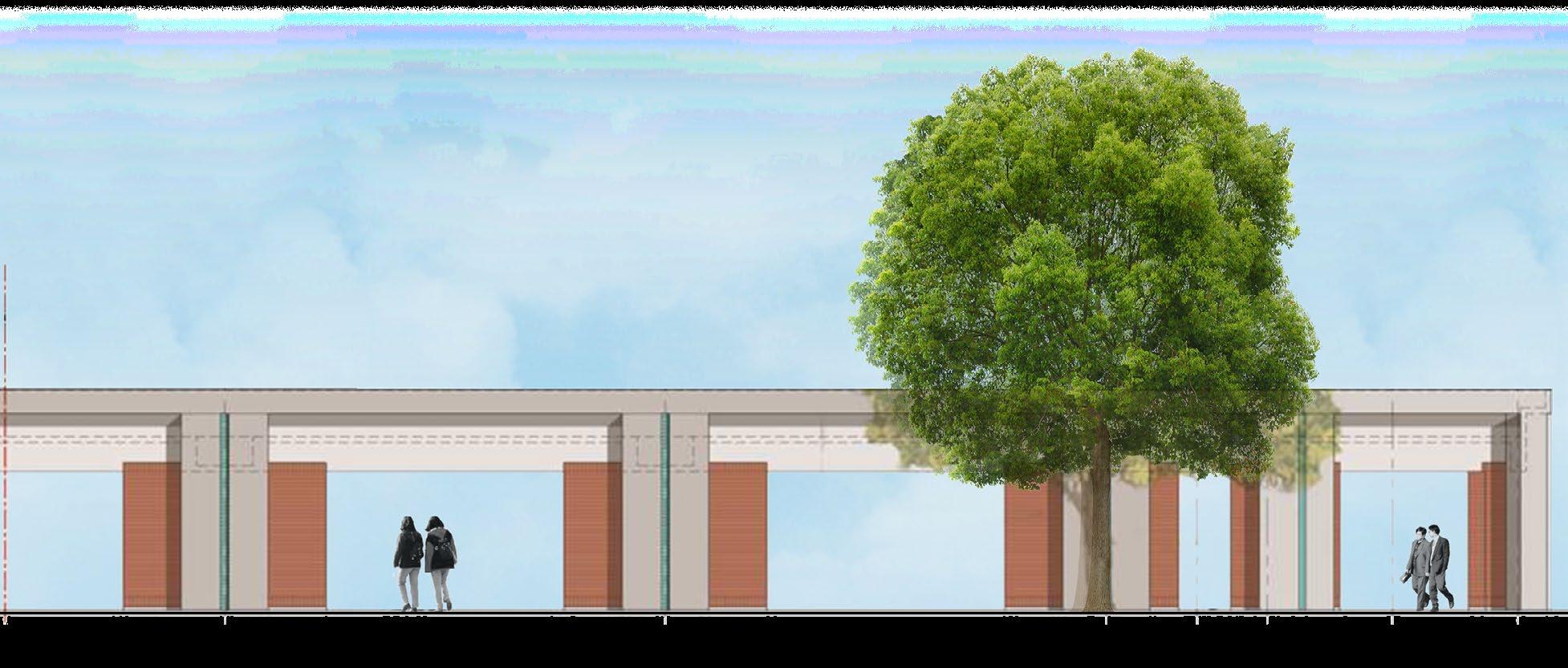
overall view of the entrance arcade from approach road.
Graphic Design

05
interests
49 Pg
Photography
pranshul dangwal Email LinkedIn CV
