PORTFOLIO
LANDSCAPE ARCHITECTURE & URBAN DESIGN
DELANEY HOPEN, B.S., M.L.A.


00 02 01 EVOLUTIONARY LANDSCAPES ACROSS THE BRIDGE FALL 2021 WINTER - SPRING 2022
TABLE OF CONTENTS


04 03 BARCELONA SUPERILLES REGENERATIVE SPORT URBANISM
2022
SUMMER
FALL - SPRING 2022-2023
EVOLUTIONARY LANDSCAPES

FALL 2021 MEDIA + TECH
A media course directed at using Rhino Grasshopper to analyze a landscape. A 2 mile by 2 mile plan area with a rather steep site profile was chosen for analysis. The process began first with environmental analysis such as slope, topography, and peak water flow locations, to later be used in site understanding. Later, this process helped inform more creative ways of communicating these environmental processes and inspire design with the existing landscape.
01
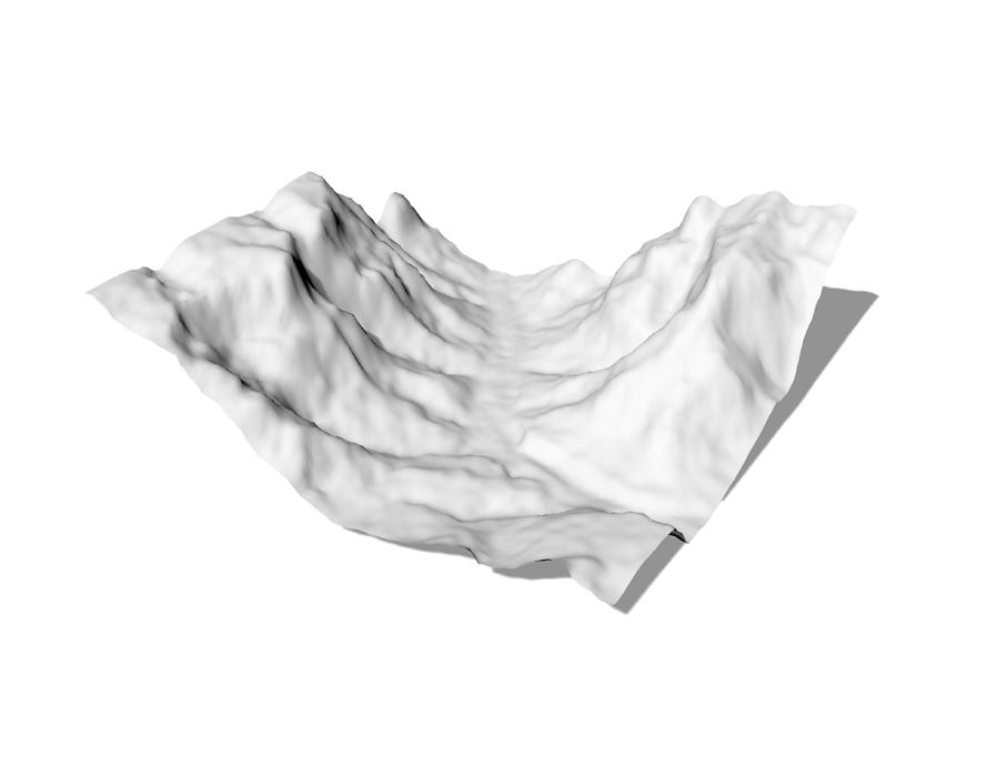
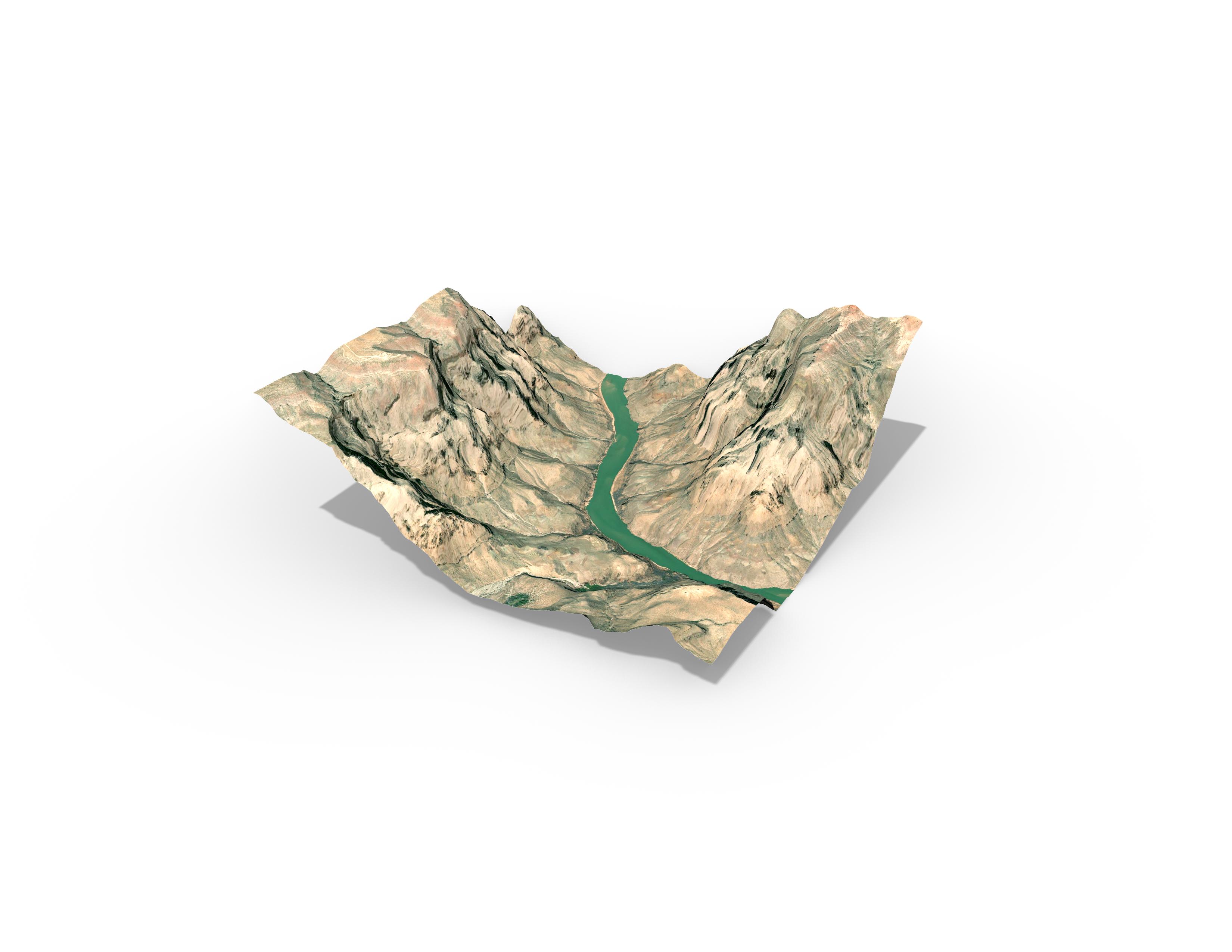
SITE PROFILE
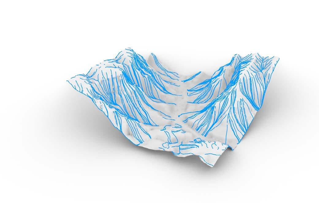
The site is made of up a 2 mile by 2 mile square of topography from the Grand Canyon in Arizona. With it’s dramatic topography, this site is historically significant for the native Havasupai tribe. Additionally, its horizontal deposits have been significant for Geologic study due to the lack of stratigraphic movement, and fossil record deposited within chronological layers of Earth history.
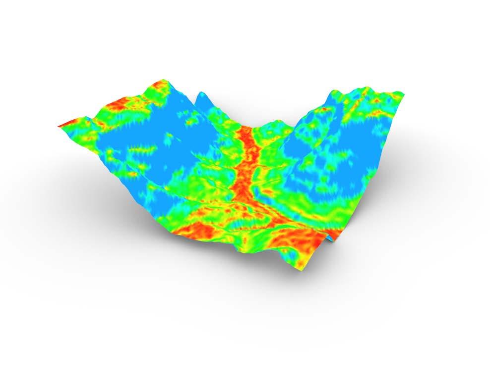
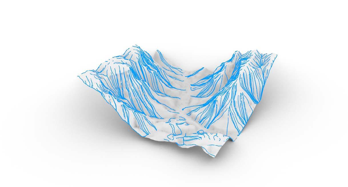
It was analyzed for aspect over the course of sun exposure during the year, flow paths to track drainage paths into the Colorado River, elevation, and slope visibility comparing steep hillsides to the flat river basin.
Aspect Flow Paths
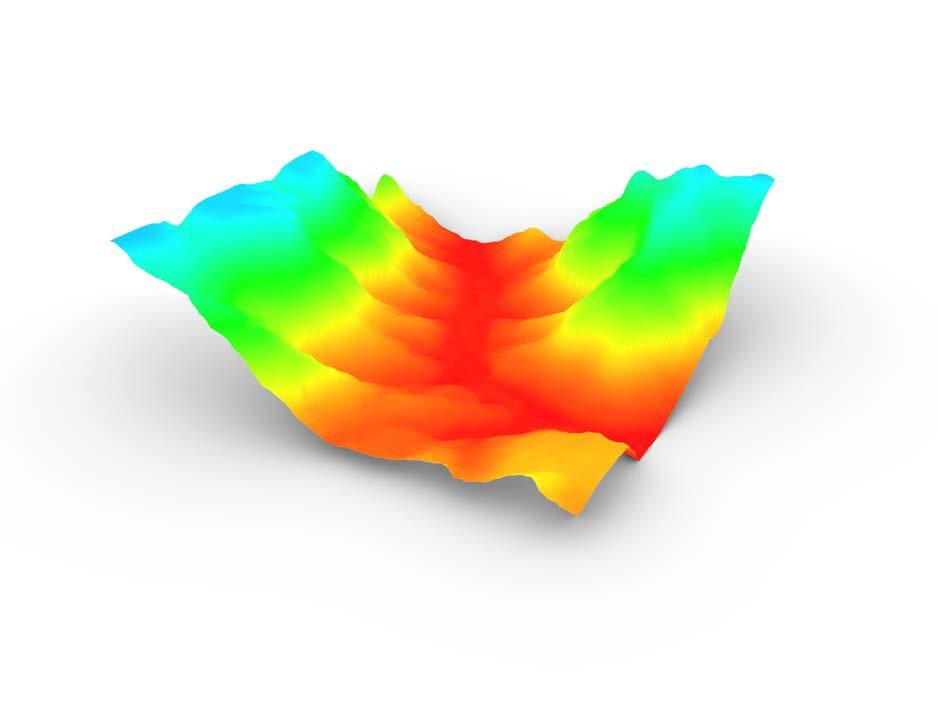
Elevation Slope 2 miles 4,000 ft
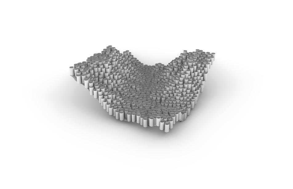
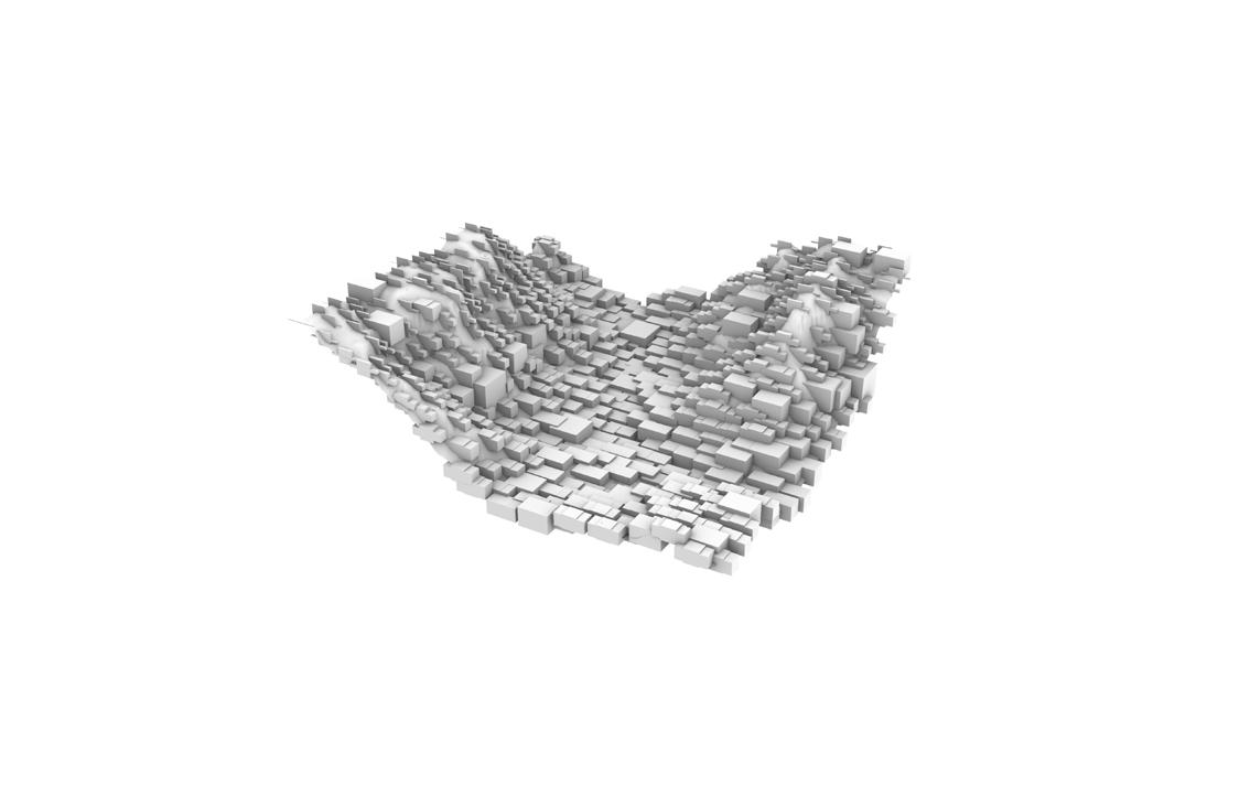
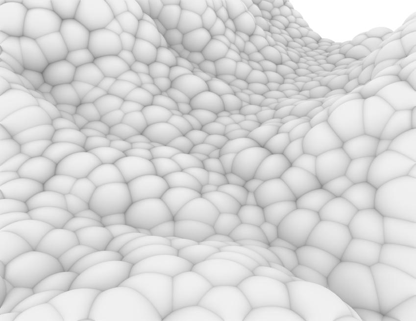
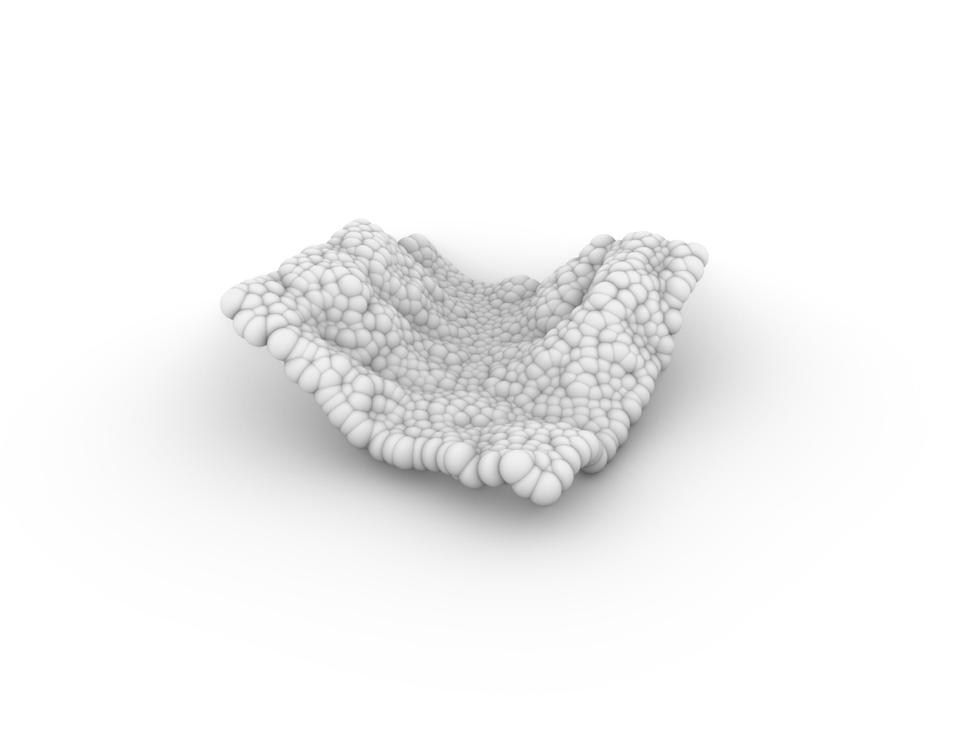
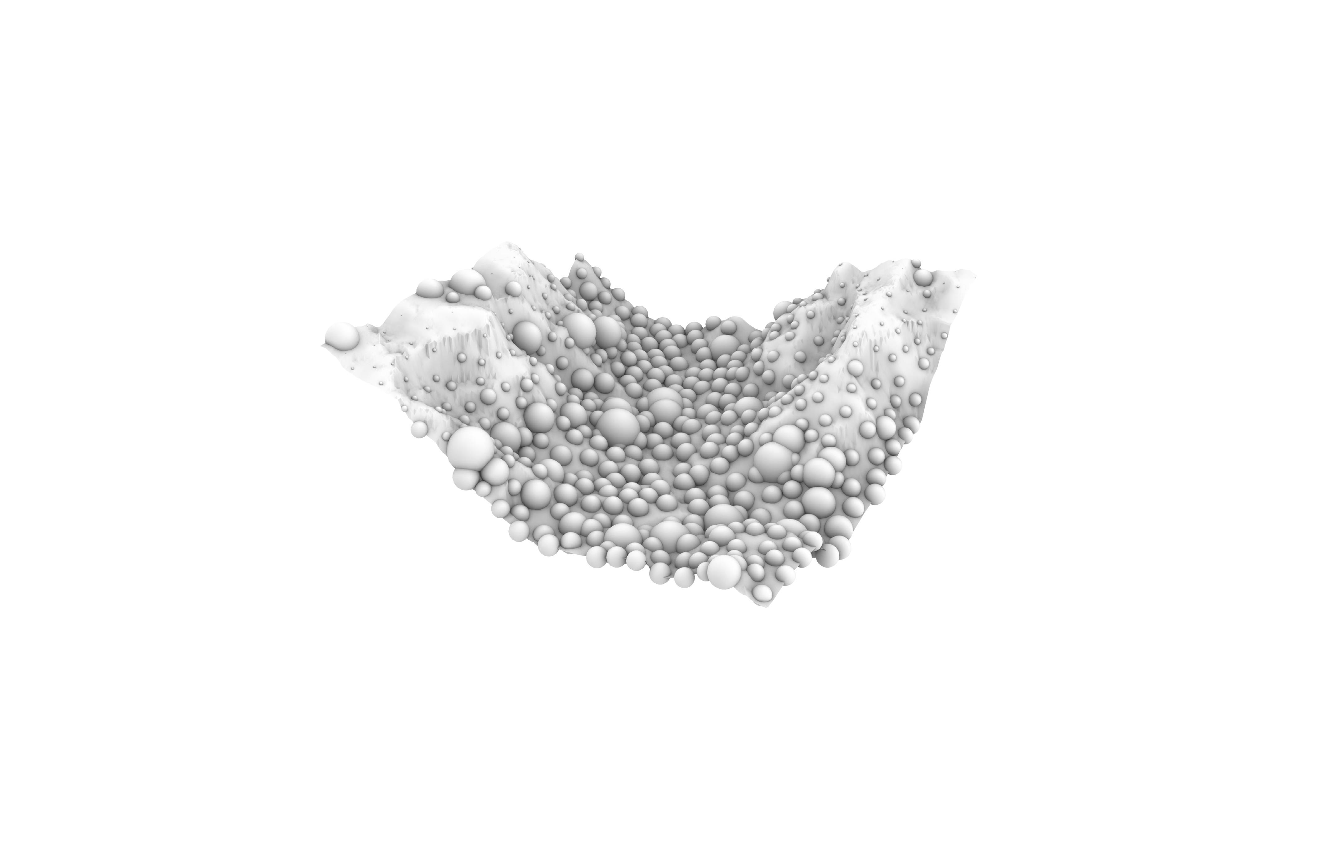
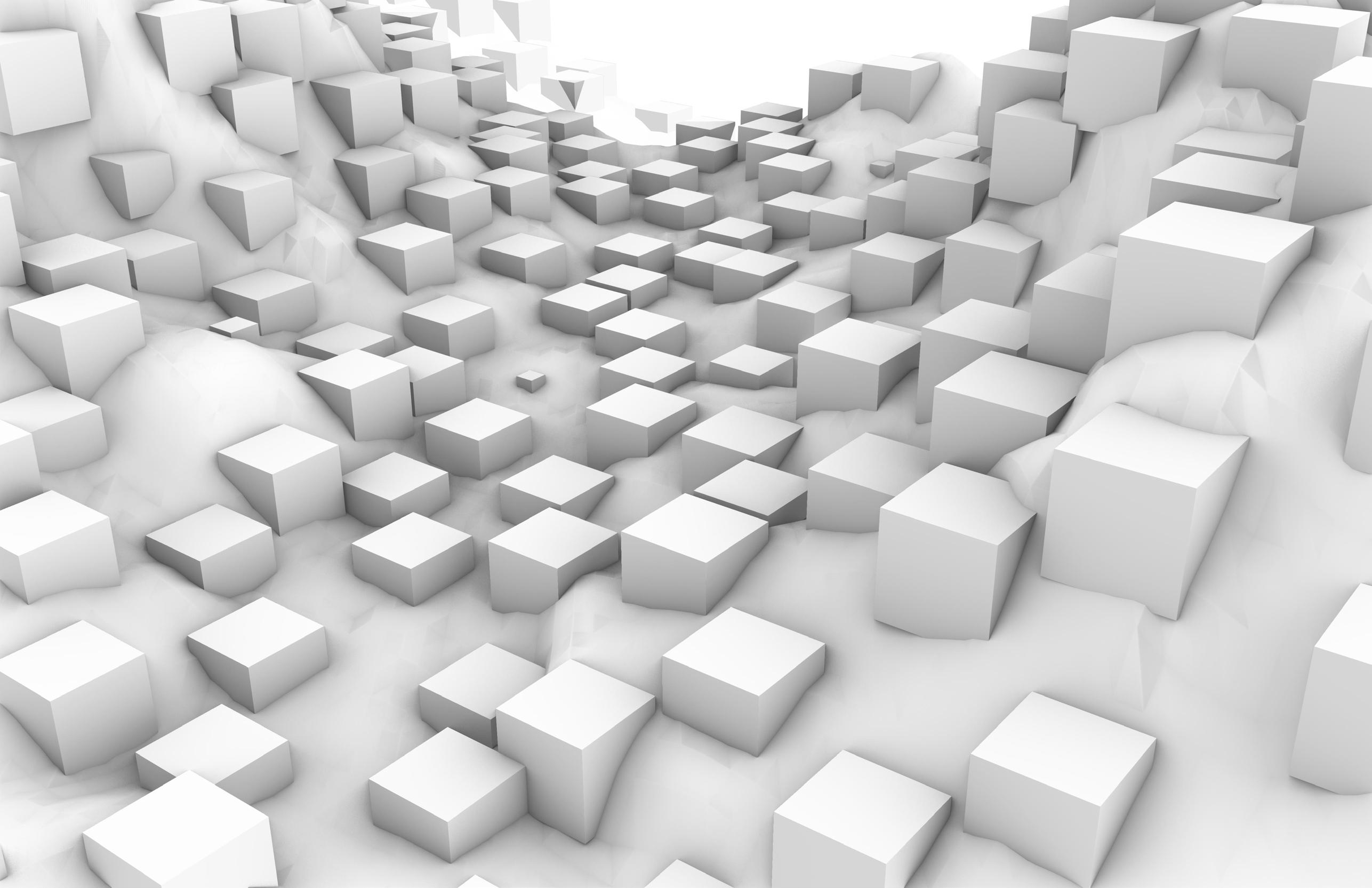
Cylinders
EXPLORATORY MODELS

Using populate geometries through Rhino Grasshopper modeling, exploration into various site manipulation occurred. Cylinders, Vornoi Triangulation, Center Box, and Mesh Spheres were all organized ways in which the existing topography was communicated through a new material shape.
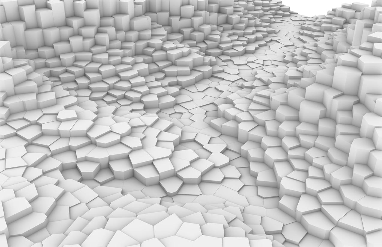
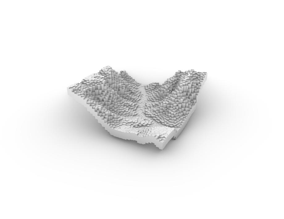
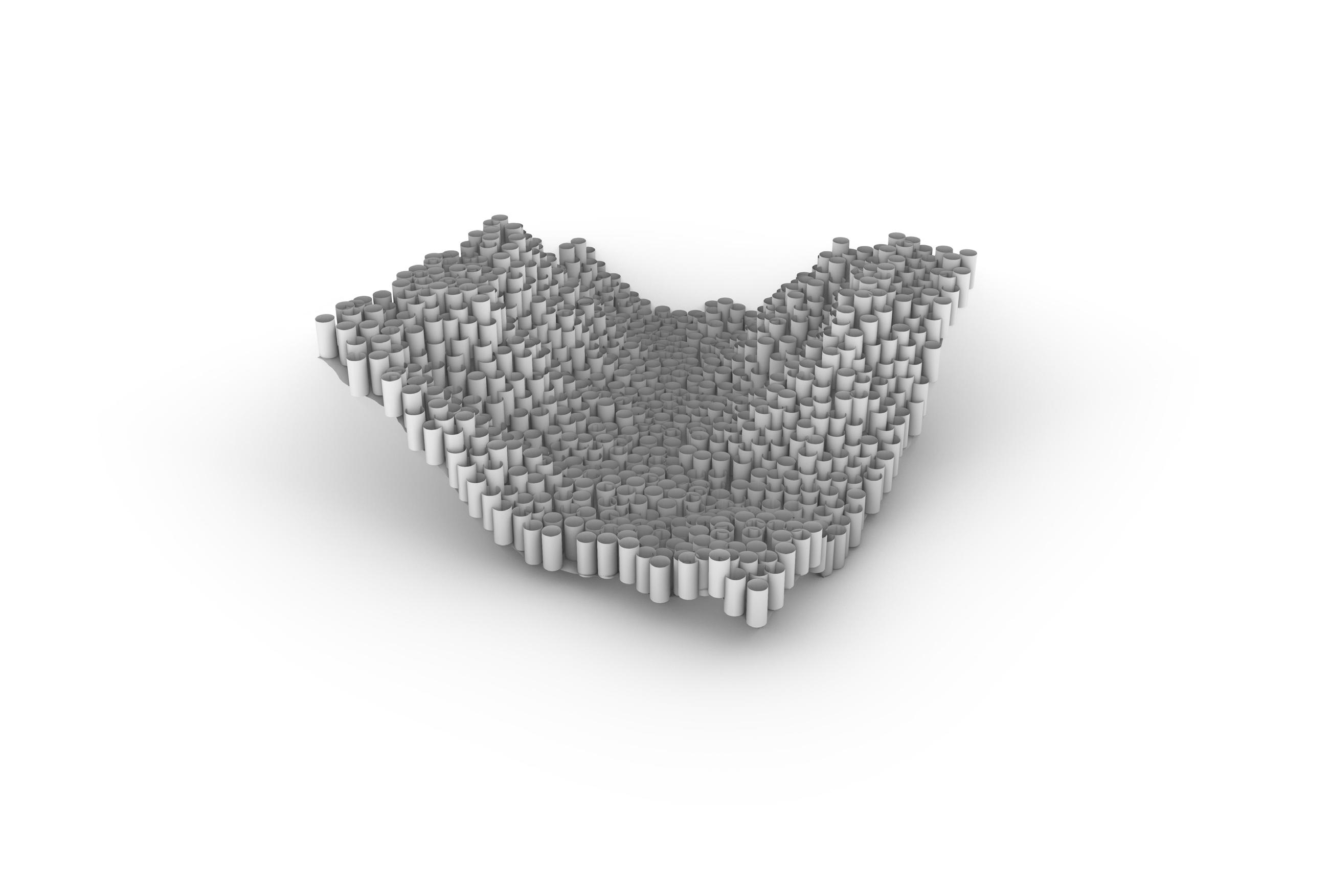
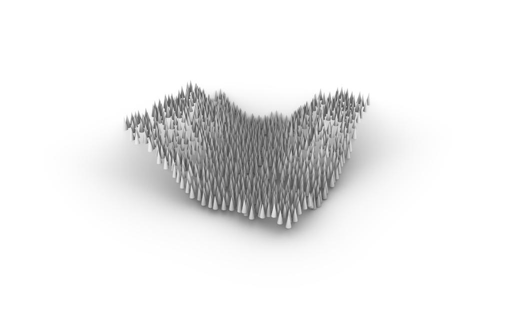
These geometries are produced through the use of a center point on the mesh, which is then created through either the repetition of the shape characteristics, or manipulates the area for a more varied outcome.
01 EVOLUTIONARY LANDSCAPES
Triangulation

Planes Cubes Adjusted Spheres
Cones Rectangles Spheres
APPLICATION
For environmental analysis application, I combined Slope with flow analysis on site. Warm colors represent slopes exceeding 20%, making them at risk of extreme landslide conditions during flash flooding events common to the Arizona landscape.
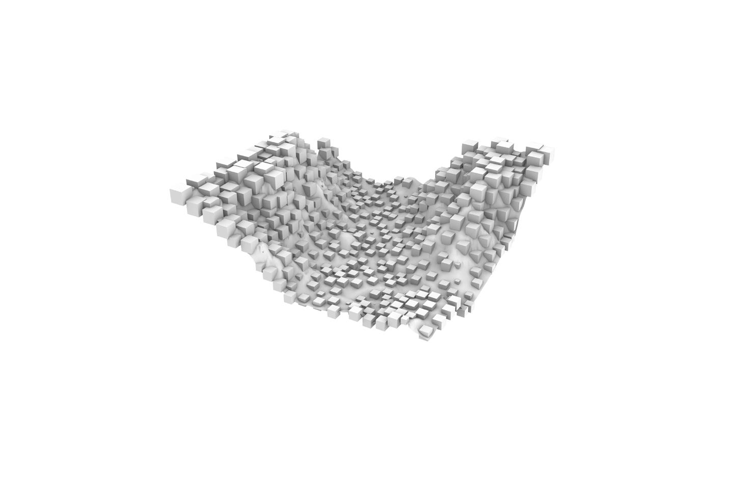
Flow locations identify just where this water will be collecting and traveling on site. Combing two areas of both Environmental Analysis and Geometry Population, creative design manipulation is able to be visually represented. This produced a new landscape visualization of 1,355 points which then took on the color visualization of the surrounding slopes, calculated on the existing mesh.
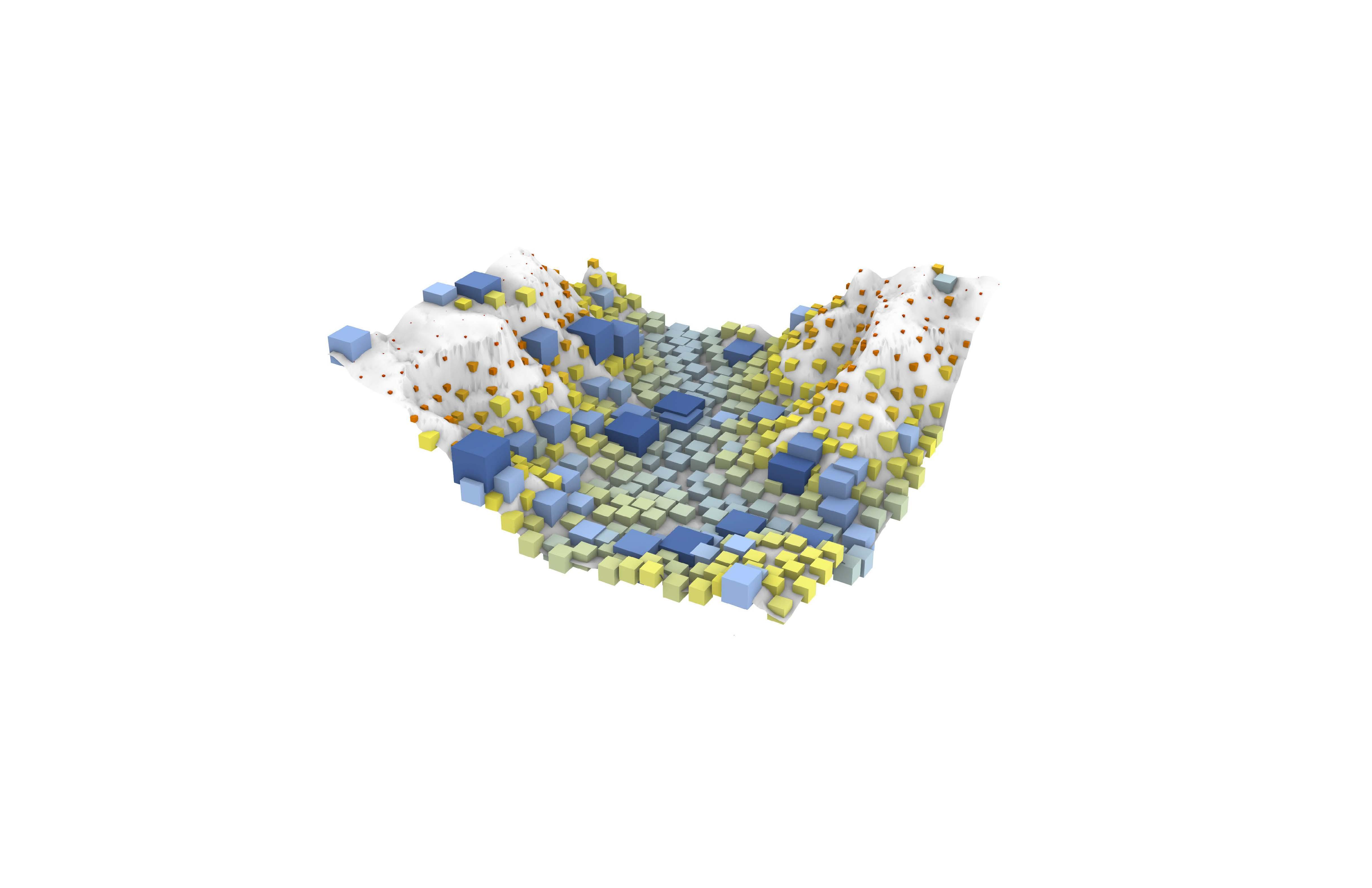
The color of the cube is controlled by the slope percentage calculated during analysis.
The size of the cube is based on common water collection locations, analyzed through flow analysis during the environmental analysis phase.
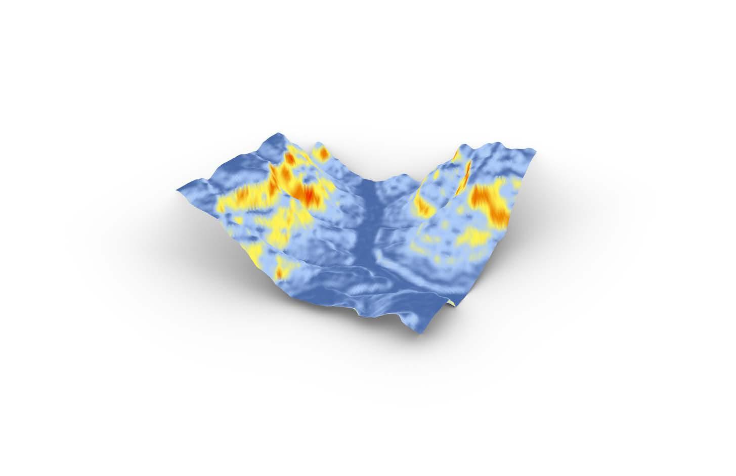
Flow Paths Slope
Populated geometries combined
Exploration
combined with slope analysis on the site.
ACROSS THE BRIDGE
WINTER - SPRING 2022 STUDIO
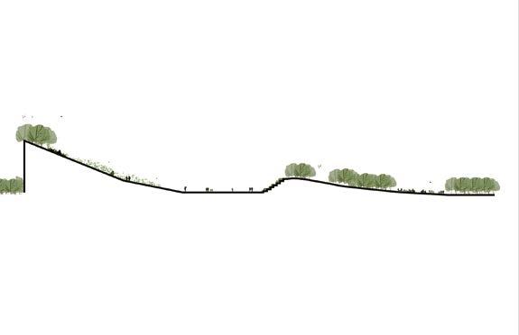
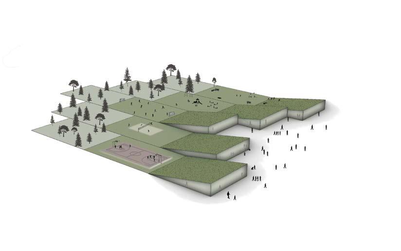
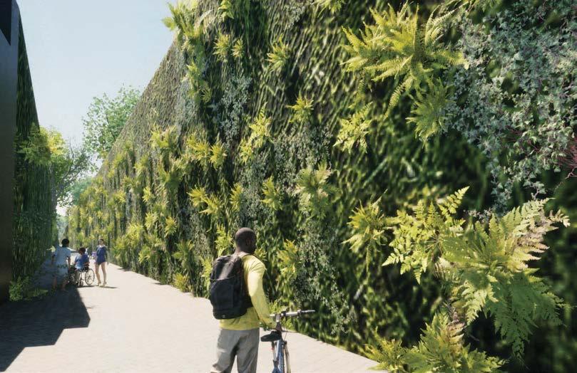
The Ferry Street Bridge erection in the 1950’s was the governmental cause of displacing an existing community of the first African American residents in Eugene Oregon. This studio’s design objective was to create a memorial site of the historically erased community.
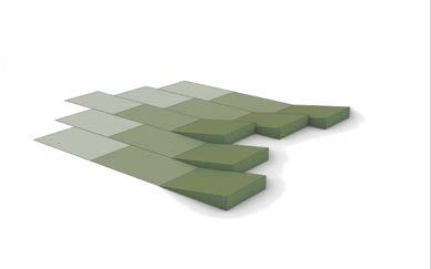
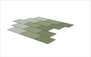
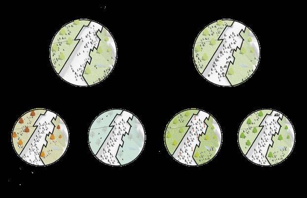
The concept design from my project originates from the Geologic structural concept of an unconformity. Unconformities are essentially gaps in the geologic time record due to erasure of displacement, so the site programming and outline reflects that gap symbolic of ferry street bridge. In order to memorialize the community, this site was designed to celebrate the strength and lives of this community rather than a memorialization of passing.
02
MASTERPLAN
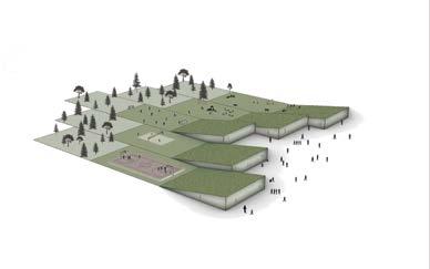
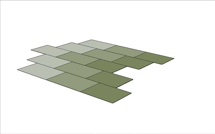
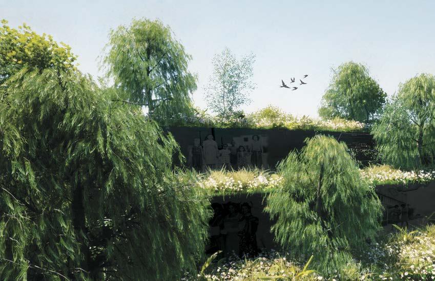
The major site changes occurred at the first intersection after the bridge crossing, focusing on moving vehicular traffic to the exterior. This road adjustment now opens this central alley into a pedestrian and bike driven space where green roofs connect the landscape and what looks like sub-surficial architecture.
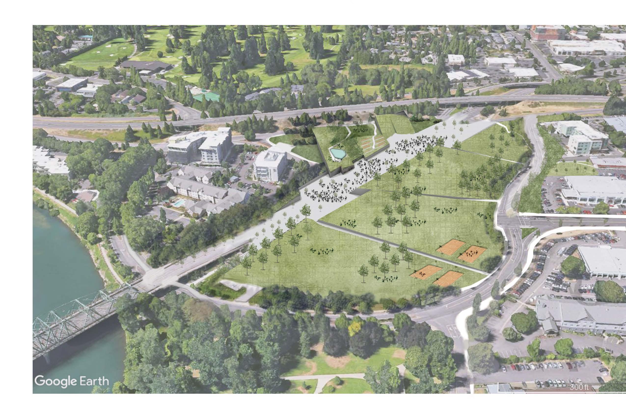
Concept model showing how the site is divided by units, like in a geologic profile, which is then faulted and shifted over time to create a unique user experience while organizing site program. These central units are then extruded to house architectural space for commercial and community uses in the form art, galleries, an extension of the existing Saturday Market, and business opportunities to help celebrate the ancestors of this community who still reside in Eugene.
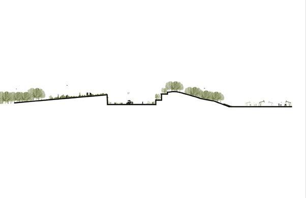
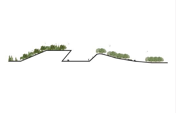
Deposition and Establishment
02 ACROSS THE BRIDGE

15
Faulting and Disturbance
Program Extrusion
Reclaiming the Site
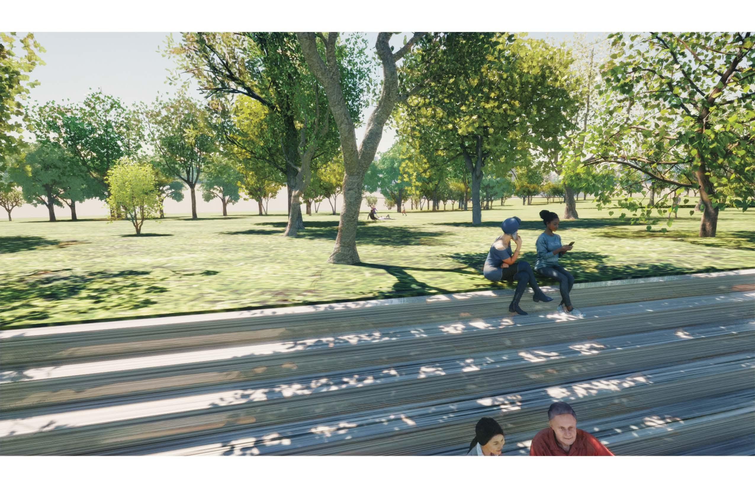
SITE DESIGN
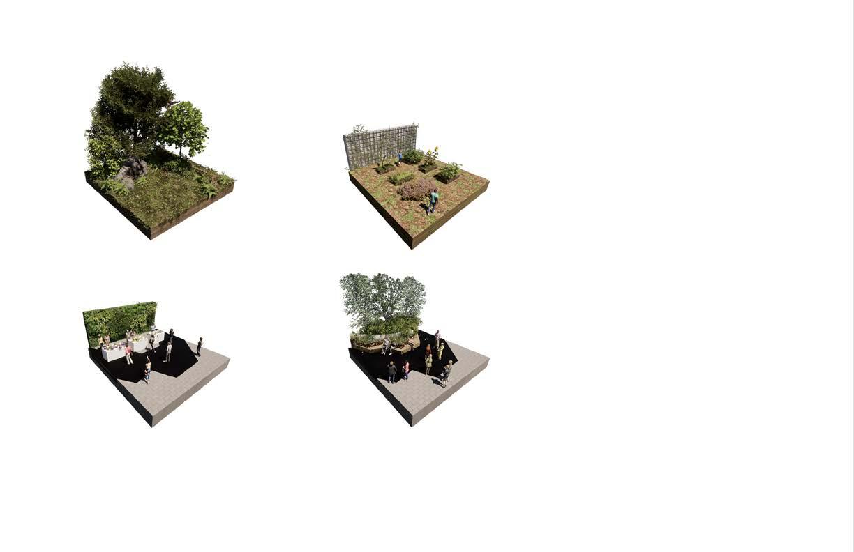
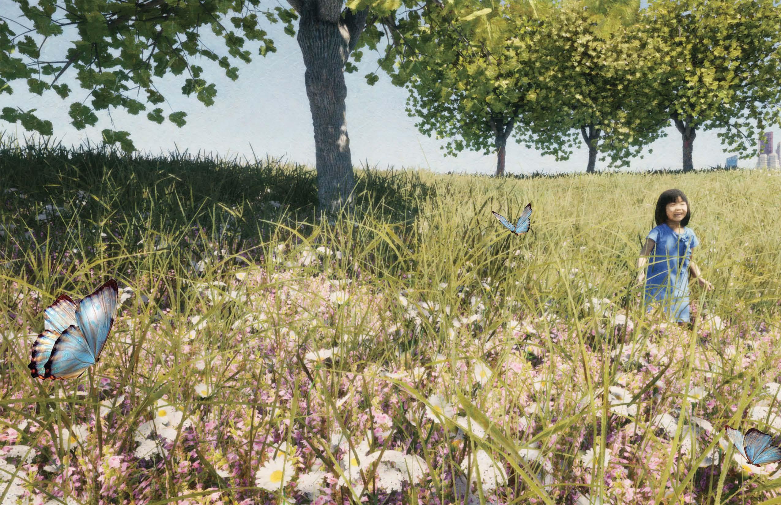
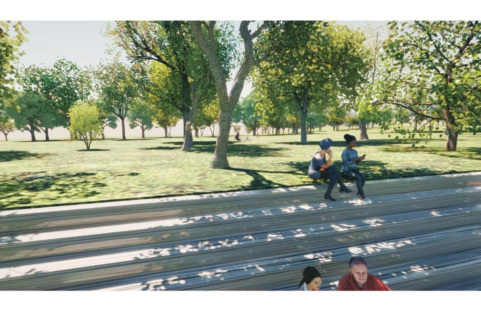
Providing native plants and outdoor space that can be used to benefit every community is important to this design. Ecological justice tied into community benefit, and economic growth was the driving force in this design.
Planning for open space, de-hardscaping the space, increasing urban interaction with native species, allowing for social cohesion through exercise, improving resting areas, continuing bike accessibility, and supplying opportunities for local-artist installations are the key program drivers.
02 ACROSS THE BRIDGE
DELANEY HOPEN MLA 17
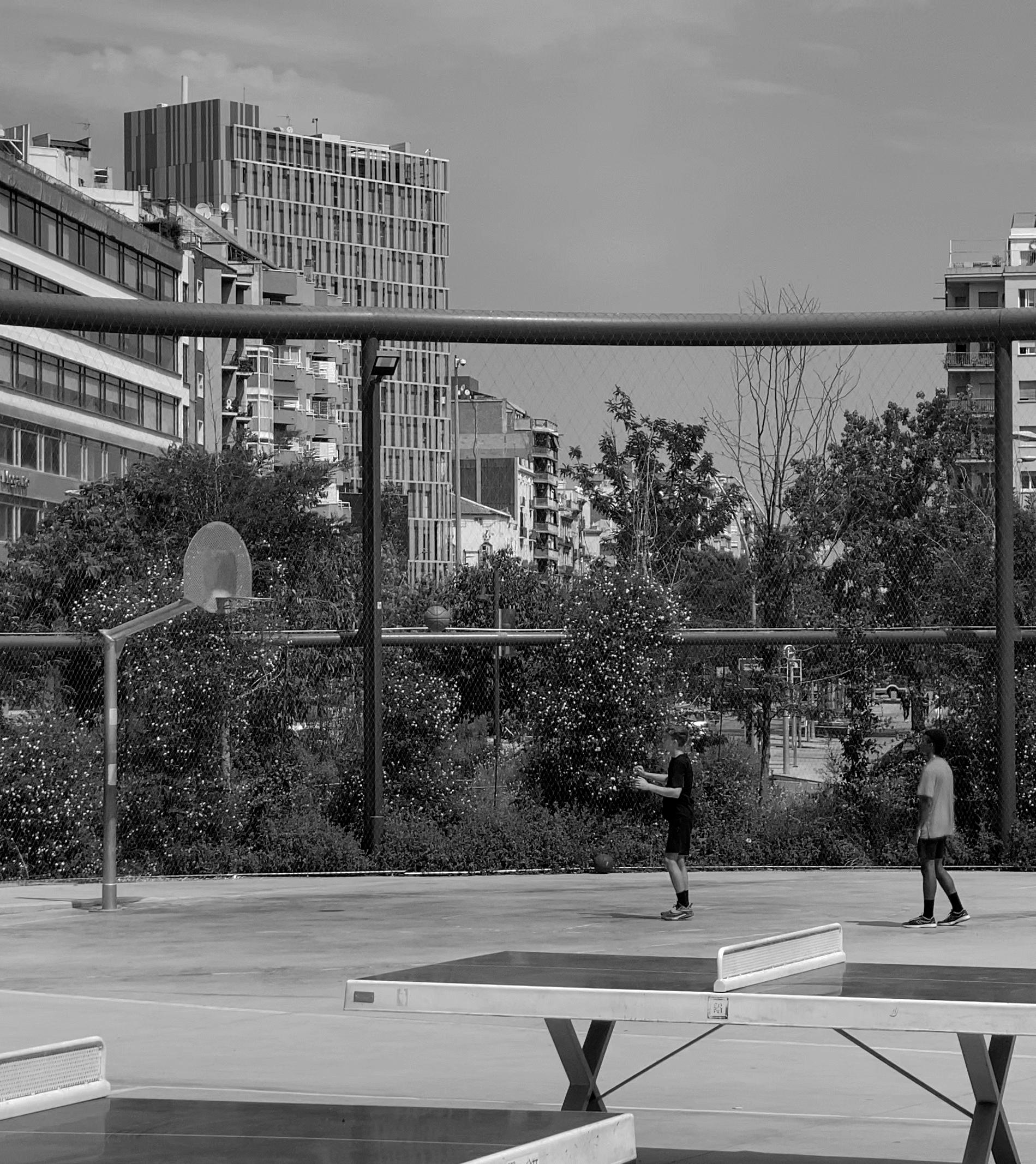
DETAIL MODELING
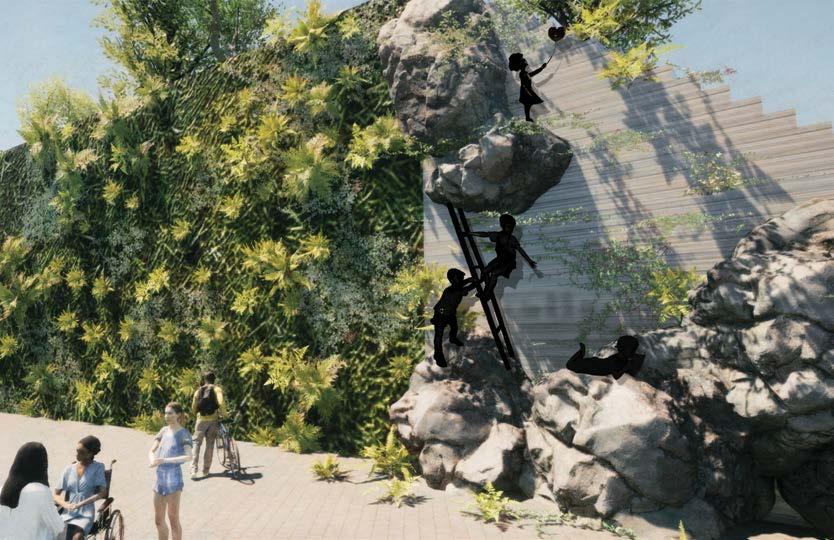
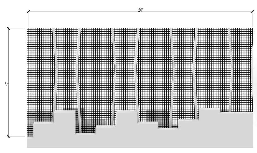
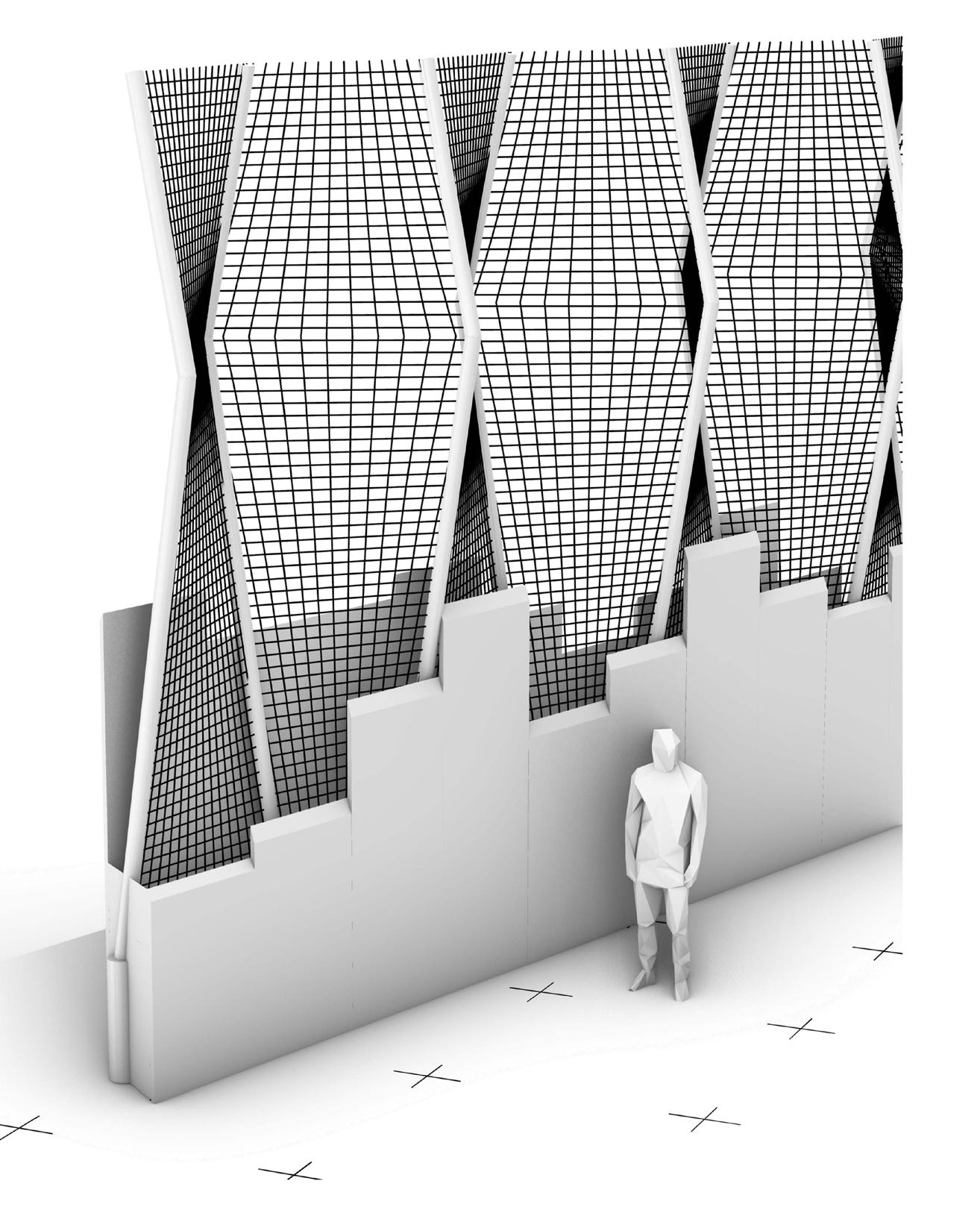
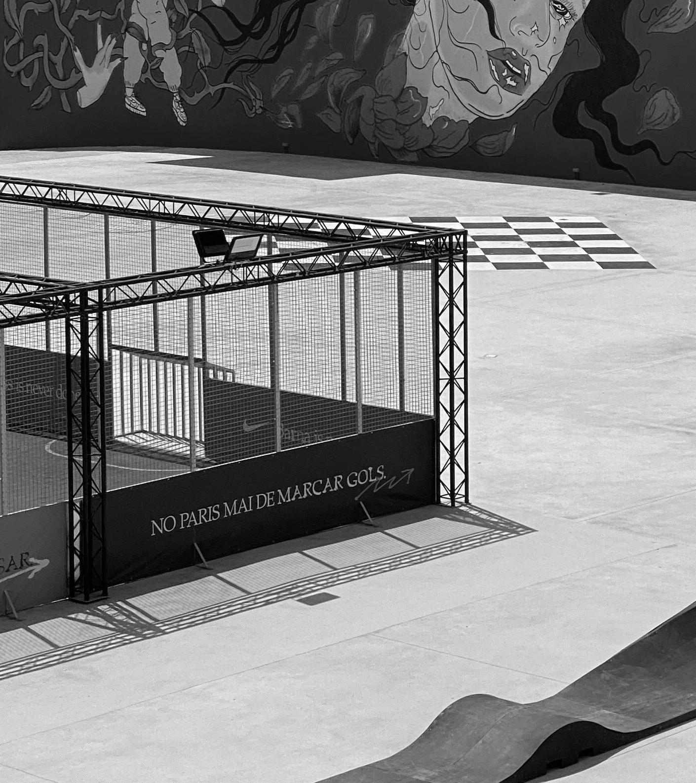
Continuing the studio allowed for CAD and Rhino modeling work. The detailing work continued through the program portion of designing for urban social interaction via sports.
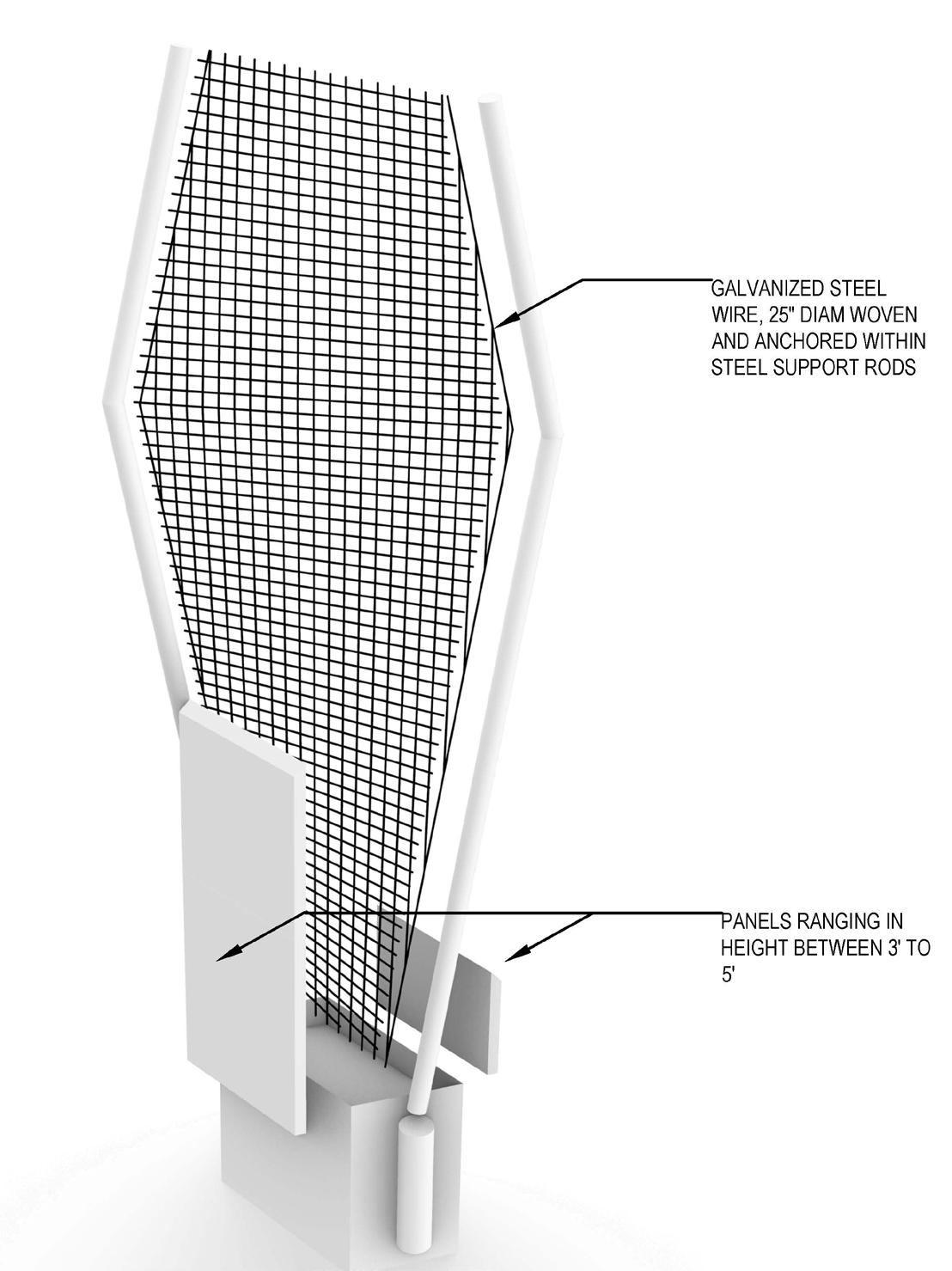
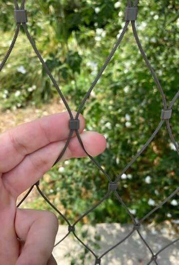
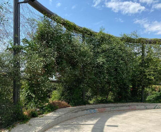
This design detail includes a netting system designed to not only control ball play and create rooms, but is dually used as a climbing apparatus to helps assist in heat mitigation via seasonal climbing roses, star jasmine, ivy.
This idea is designed to connect people to nature further, even when using incredibly human organized space.
02 ACROSS THE BRIDGE
Singular netting unit details
Precedent Study, Parque Glories Barcelona
DELANEY HOPEN MLA 19
Netting elevation profile with slab-wall detail
Human perspective of wall detail
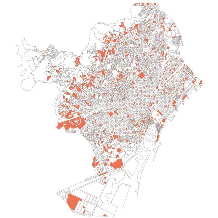
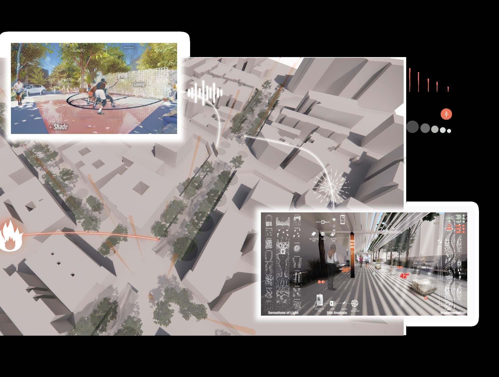
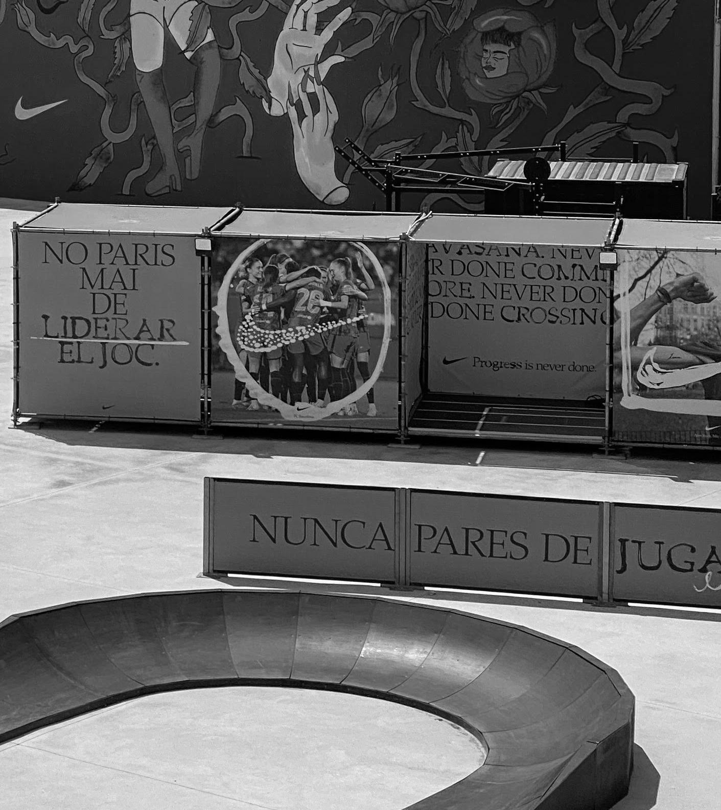
BARCELONA SUPERILLES
SUMMER 2022 URBAN DESIGN
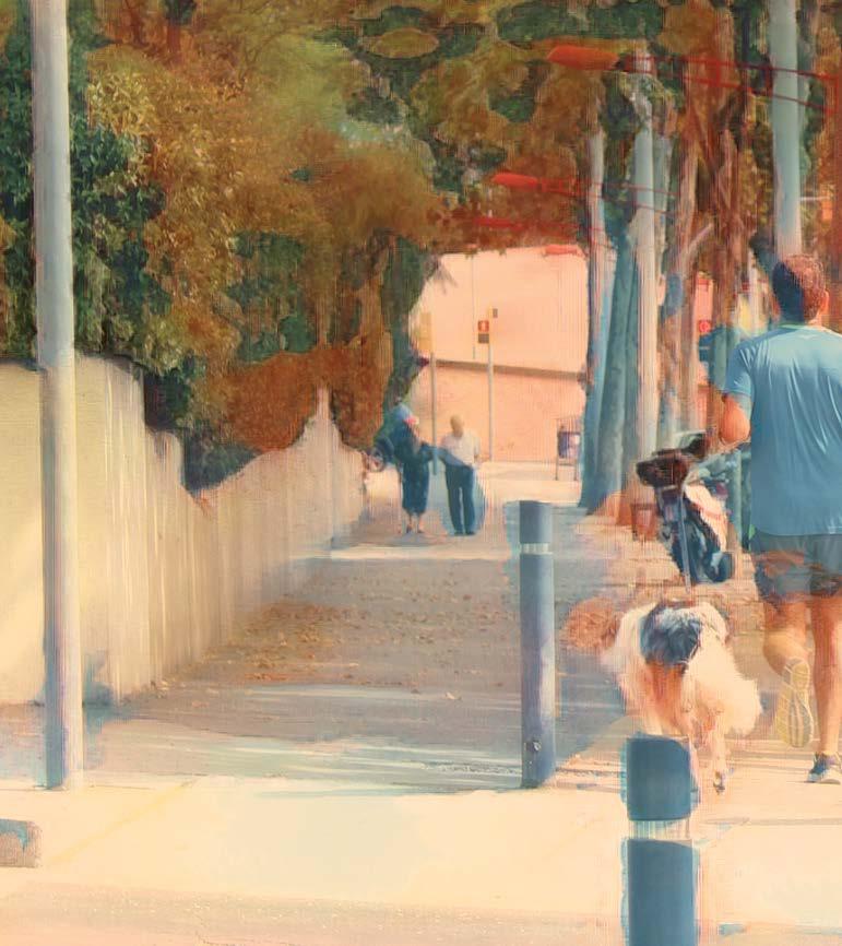
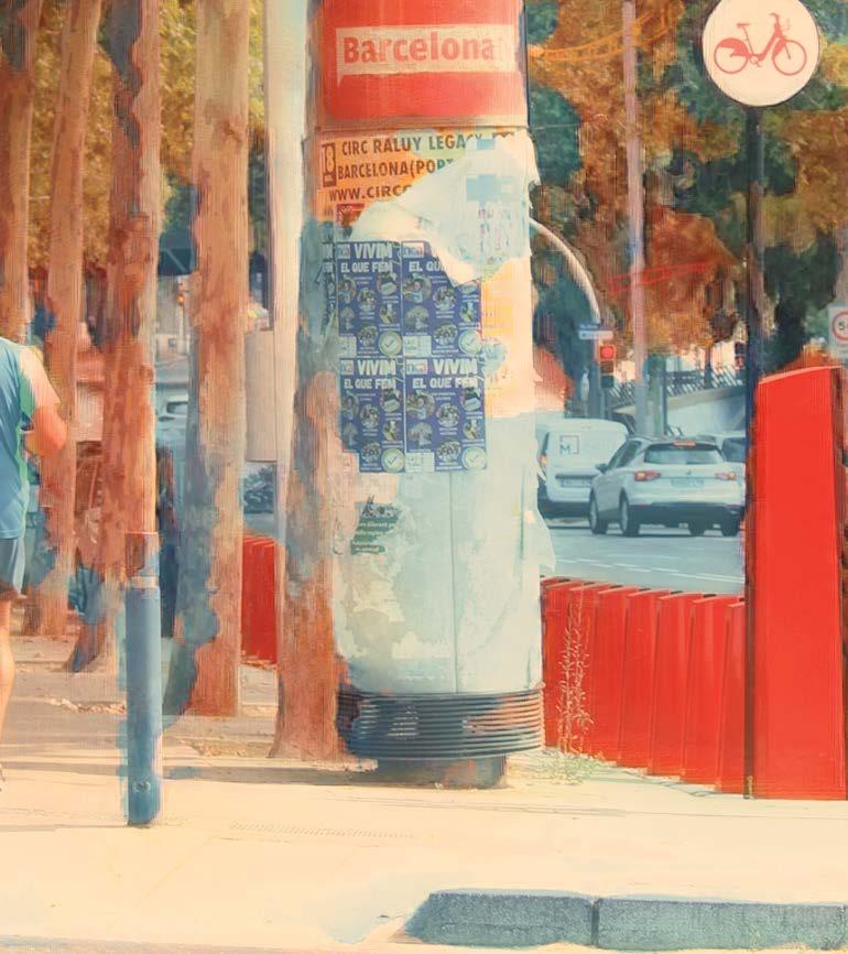
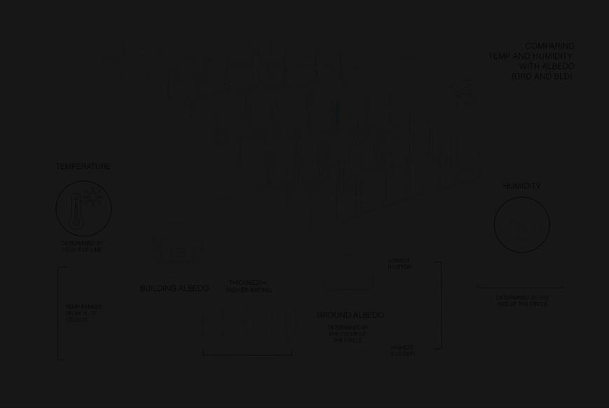
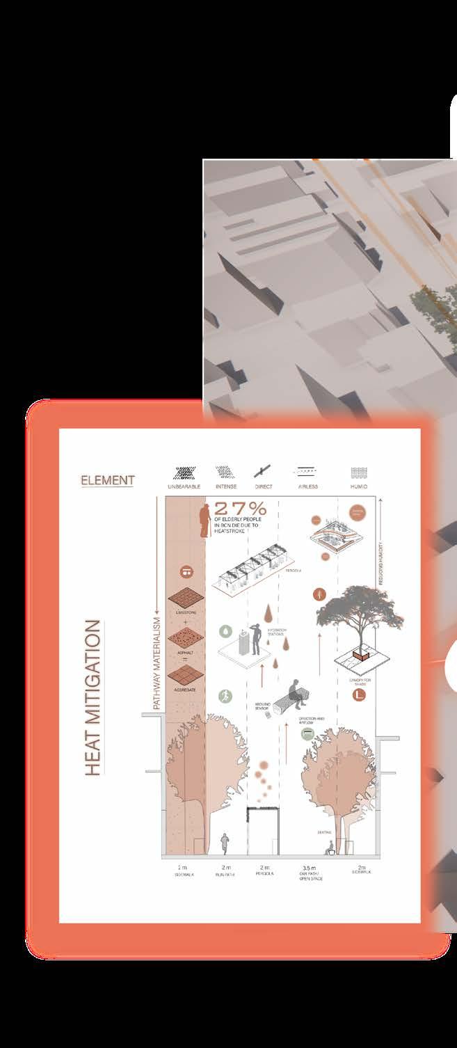
Through this study abroad program in Barcelona, the design challenge focused on the current work of the city to improve pedestrian access and limit vehicular travel. This dense urban environment with incredible historical significance also faces the challenge of increasing global temperatures, so mitigating heat is vital to prepare for climate change.
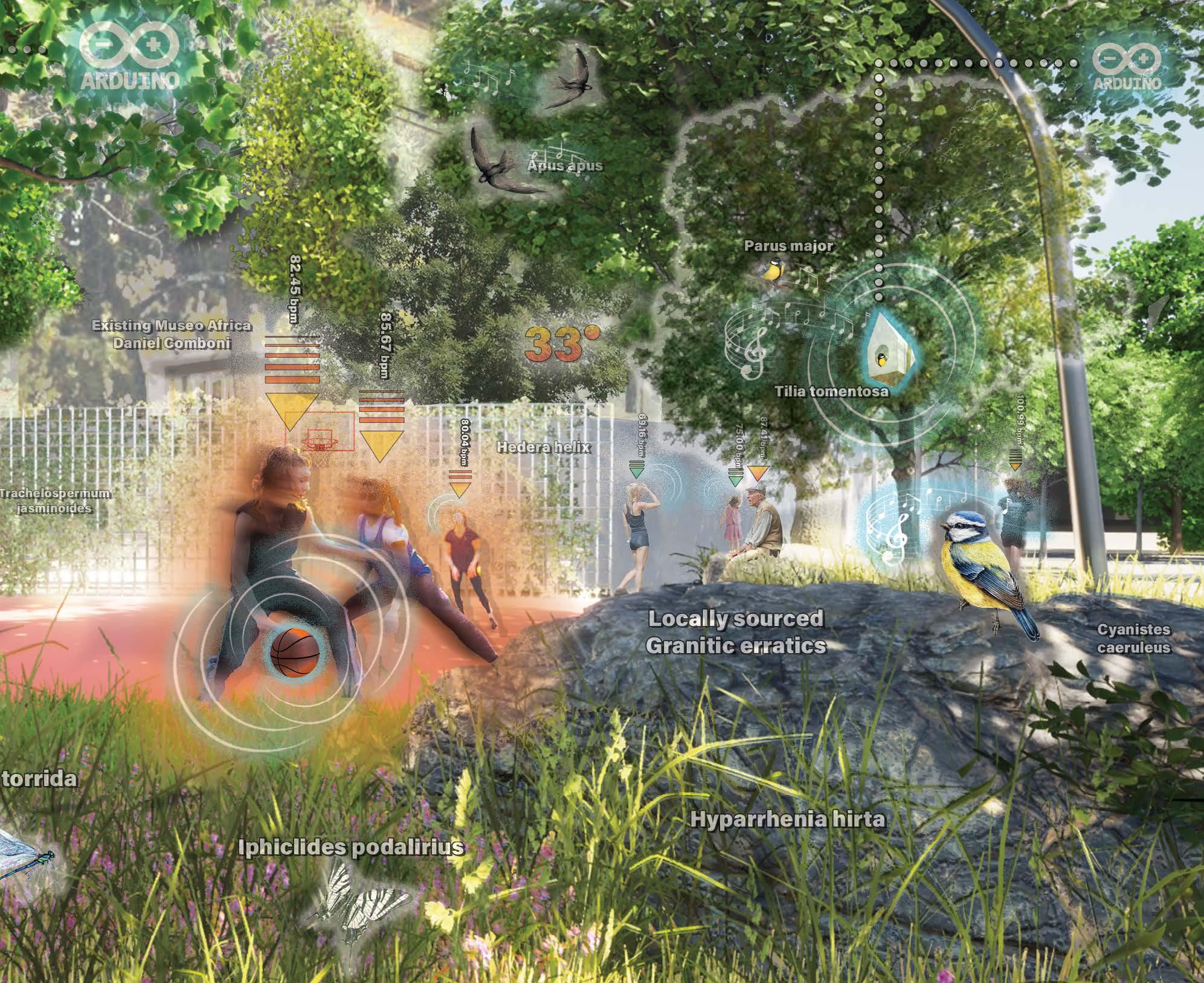
Our team consisting of Delaney Hopen, Braden Lawrie, and Mau Rovira Alvarez, decided to theme a design for a Superille around urban exercise, to not only help limit the Urban Heat Island Effect on Horta Barcelona, but allow for seasonally-considered group exercise space through the streets.
03
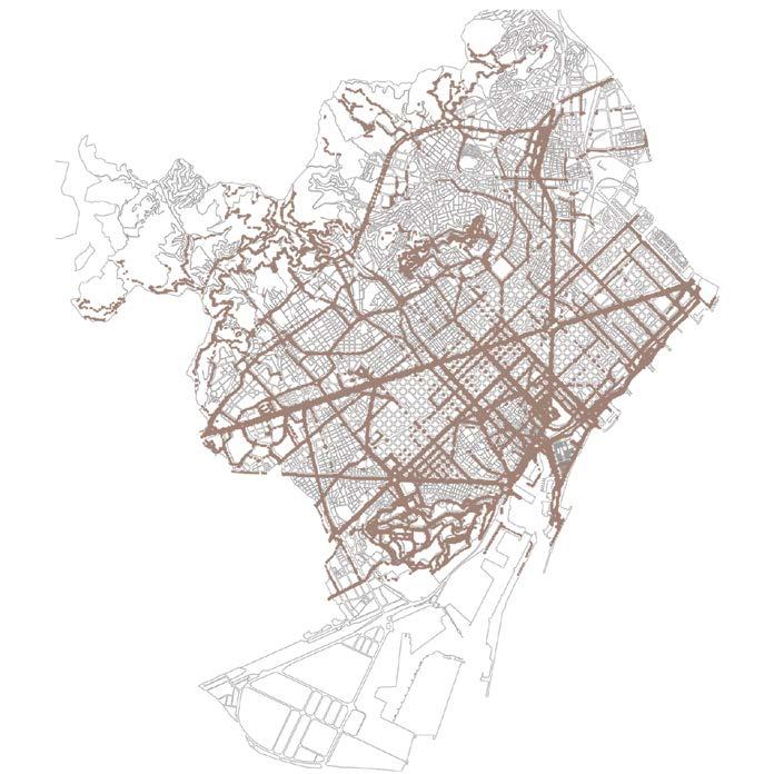
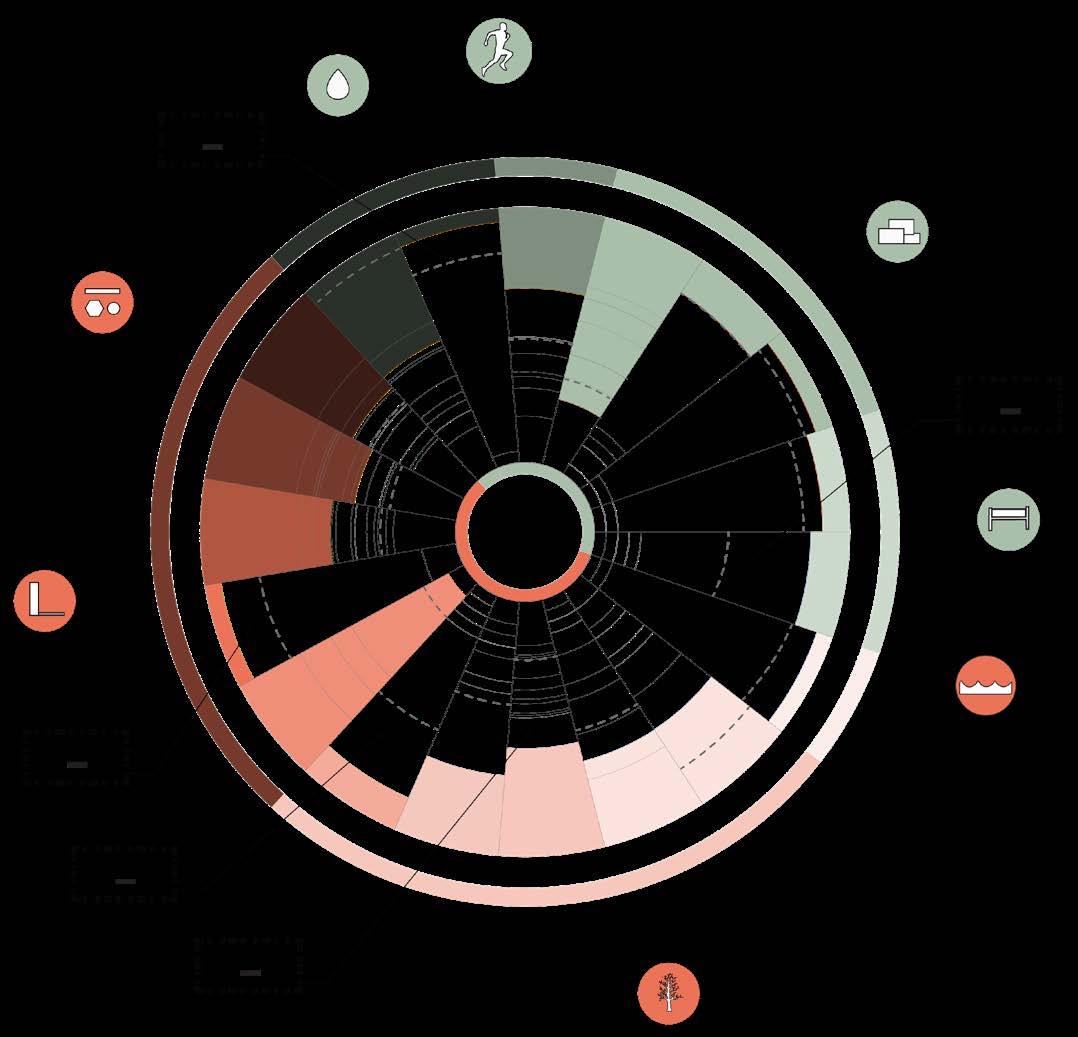
DATA COLLECTION AND ANALYSIS
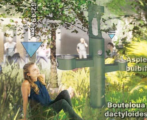
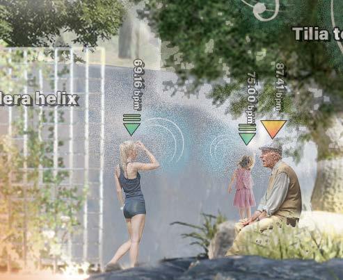
Arduino and data ranking graphs geo-located to show how various indicators are interacting with the space including Humidity, Vegetation Presence, Hardscape Material, Resting Space, and Area for Movement
Vegetation and Infrastructure Material
Temperature and Infrastructure Material
03 BARCELONA SUPERILLES
Resting and Commercial Space
For site design, we used Arduino sensing with physical data ranking analysis on site, and paired it with off site GIS analysis of the city context.
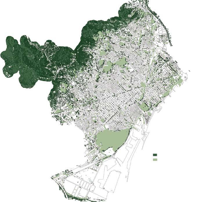
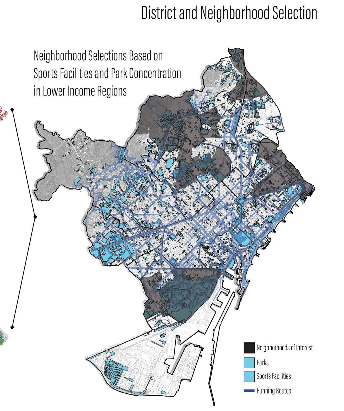
Through GIS analysis, we were able to compose multiple means of exercise within the city, as well as how the city is working to combat the urban heat island effect. From this process we used step-bystep filtering to identify patterns between various levels of information at the city level.
In order to understand the greater network of our associated layers that play into sport’s access, as well as resiliency to heat stress we overlayed data sets to find areas of interest. These layers include Disposable Income, Sports Facilities, Vegetation Index, Parks, and Running Paths.
DELANEY HOPEN MLA 23
Parks and NDVI Green Cover
Sports and Exercise Facilities
Strava Running Path Data
GIS Data Overlay
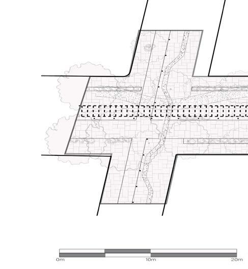
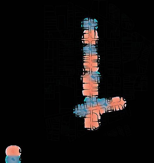
SUPERILLE DESIGN
We used our data to then help design our Superilles, to not only help mitigate urban heat and provide recreation space for residents, but also consider the current impacts of humidity on the space.
We learned throughout of data collection process just how important the balance between planting, heat, and humidity have on one another.
03 BARCELONA SUPERILLES
Superille Plan
Site Render and Dissection
Data Organization on Site
Data Synthesis
DELANEY HOPEN MLA 25
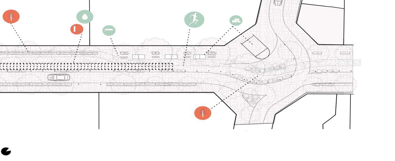
SUPERILLE DESIGN
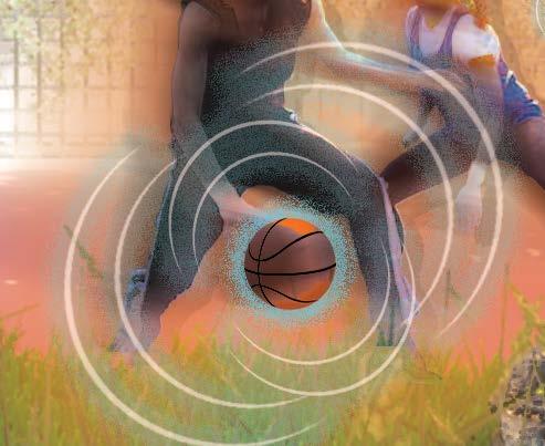
Using Arduino sensors, our group-sports design of an outdoor basketball court uses buffers to not only create interior rooms within the space, but strategically prevent basketballs from flying down the street. Buffers serve environmentally as well, by selecting grass species like hyparrhennia hirta and fescue rubra to add dimension and sound for masking the human-sport to roadway boundary.
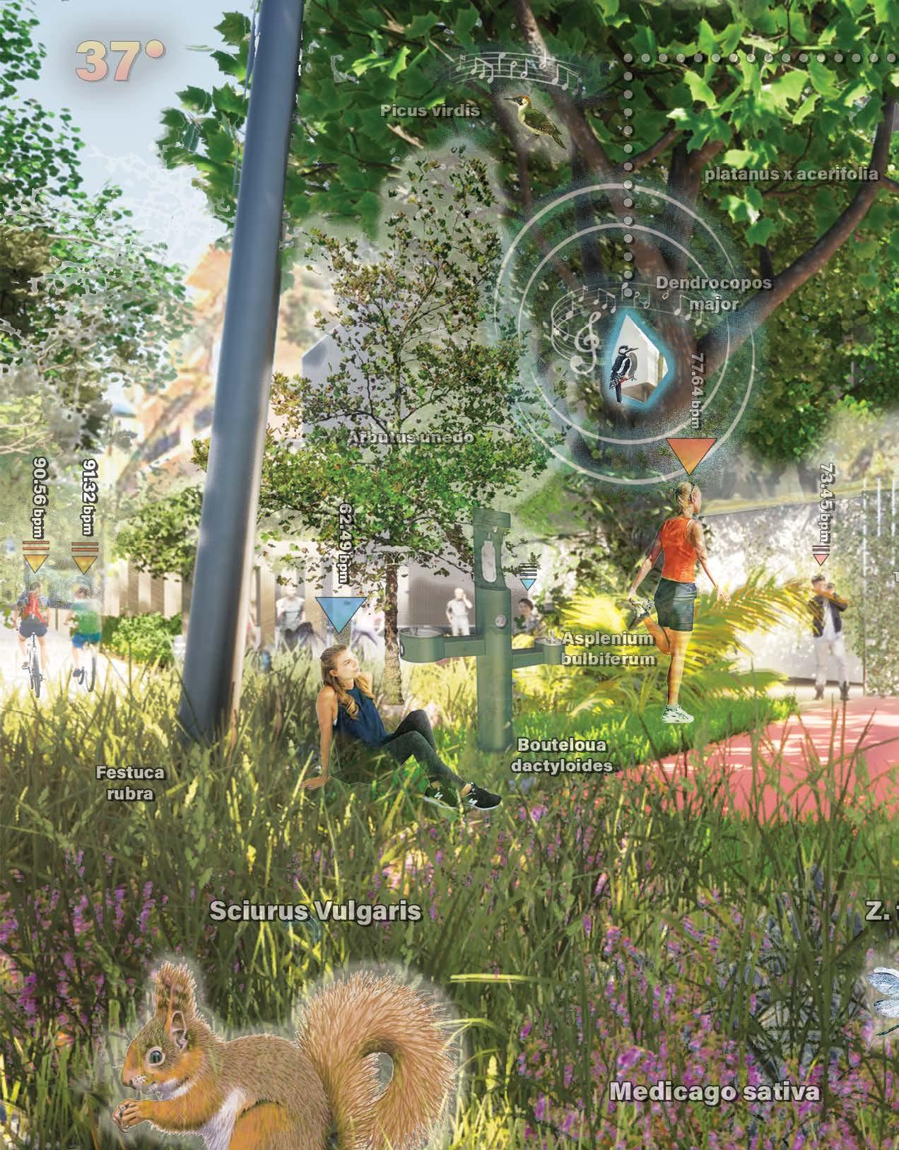
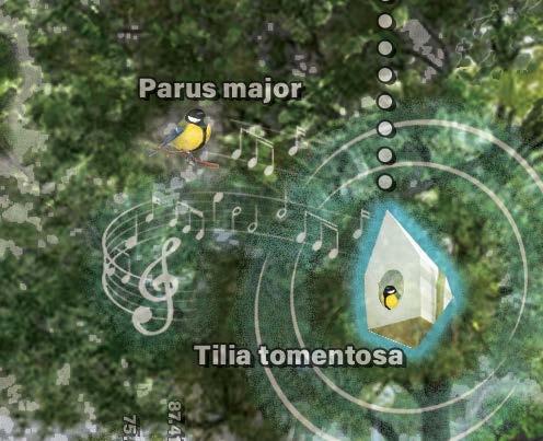
Our Arduino bird boxes not only assist in important data collection relating to volume of bird activity over various times of day, month, and year but also encourage nesting. Nesting during the primary Summer months is essential to species including the Picus virdis and Parus major. These native species are at risk of migratory changes brought on by the Climate Crisis.
03 BARCELONA SUPERILLES
Apus apus Parus major
Dendrocopus major
Cyanistes caeruleus Picus virdis Scirius vulgaris
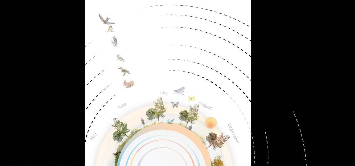
Annual Landscape Catalog
DELANEY HOPEN MLA 27
REGENERATIVE SPORT URBANISM
2022-2023 MASTERS DESIGN
Landscape architecture has played dense urban environments for thousands space for social cohesion, and public of the urban fabric that is threatened social changes provoked by a modern a traditional investment by government to promote community connectivity, population. Regenerative Sport Urbanism design initiatives to help create an modern American city. Now more than and doing more with necessary city forefront of urban design, to ensure Climate Crisis.
04
URBANISM
PROJECT: COMING JUNE 2023
played a role in how we design for thousands of years. Creating public public expression is a vital component threatened due to environmental and modern lifestyle. Sports have been government leadership for their ability connectivity, and better the health of the Urbanism models after European applicable framework to the than ever, protecting open space city infrastructure must be at the ensure quality of life while fighting the
THANK YOU FOR VIEWING