
Kaunas University of Technology
Architectural Peculiarities of Palanga Resort and Potential for Further Development
Master’s Final Degree Project
Divyaraj Singh Bisen
Project author
Assoc. Prof. Vidmantas Minkevičius Supervisor
Kaunas, 2023
Kaunas University of Technology Faculty of Civil engineering and Architecture
Architectural Peculiarities of Palanga Resort and Potential for Further Development
Master’s Final Degree Project Architecture (6211PX026)
Divyaraj Singh Bisen
Project author
Assoc. Prof. Vidmantas Minkevičius Supervisor
Assoc. Prof. Vytautas Baltus Reviewer
Kaunas, 2023
Kaunas University of Technology
Faculty of Civil engineering and Architecture
Divyaraj Singh Bisen
Architectural Peciliarities of Palanga resort and Potential for Further Development
Declaration of Academic Integrity
I confirm the following:
1. I have prepared the final degree project independently and honestly without any violations of the copyrights or other rights of others, following the provisions of the Law on Copyrights and Related Rights of the Republic of Lithuania, the Regulations on the Management and Transfer of Intellectual Property of Kaunas University of Technology (hereinafter – University) and the ethical requirements stipulated by the Code of Academic Ethics of the University.
2. All the data and research results provided in the final degree project are correct and obtained legally; none of the parts of this project are plagiarised from any printed or electronic sources; all the quotations and references provided in the text of the final degree project are indicated in the list of references.
3. I have not paid anyone any monetary funds for the final degree project or the parts thereof unless required by the law.
4. I understand that in the case of any discovery of the fact of dishonesty or violation of any rights of others, the academic penalties will be imposed on me under the procedure applied at the University; I will be expelled from the University and my final degree project can be submitted to the Office of the Ombudsperson for Academic Ethics and Procedures in the examination of a possible violation of academic ethics.
Divyaraj Singh Bisen
Confirmed electronically
KAUNAS UNIVERSITY OF TECHNOLOGY Faculty of Civil Engineering and Architecture
Topic (thematic) of the Master’s Final Degree Project Architectural Peculiarities of Palanga Resort and development feasibility study
The topic of the Master’s Final Degree Project is approved by the Dean’s Order Architectural Peculiarities of Palanga Resort and Potential for Further Development
Master’s Final Degree Project (study module M000M168)
T A S K
Objective of the work:
To prepare the Master’s final degree project based on the previous stages of the research work.
Tasks of the work:
To connect and summarise the data from the literature sources, analytical paper, research in situ report and experimental project, and prepare the Master’s thesis – to present the reasoned solutions to theoretical and practical problems.
Structure of the work:
Text. Title page, heading page, declaration of academic integrity, the task of the final degree project (FDP) (if needed), summary, content, list of figures (if needed), list of tables (if needed), list of abbreviations and terms (if needed). Main part: introduction (relevance and novelty of the work, research problem and the level of its examination, object, objective, tasks, and methodology of the FDP); augmented and summarised data of theoretical research, empirical research and experimental design; conclusions of individual chapters and the entire work. List of references, list of information sources (if needed), appendices, copies of the graphical part (reduced in size).
The volume of the text (main part) is 2 – 3 quires (1 quire is 40 000 characters with spaces), i.e. around 60 – 80 pages of printed text (recommended font is Times New Roman, size 12, line spacing multiple 1.15 (Methodological Guidelines for the Preparation of Written Works)).
Graphical part.
The graphical part of the work is presentedin posters(70x100 cm). It shouldreflect themost important results of the analysis of theoretical material, empirical research and experimental design, as well as general conclusions and proposals. The graphical part of the work should be arranged and exhibited in a way to form a visually unified whole and reflect the content of the work. It should be attractive aesthetically. When preparing the graphical part of the work, it is necessary to exclude the non-essential information, highlight the most important research results and ideas, and unify the notes, graphical expression, and colours.
The most expressive part of the project should be the experimental project, illustrating the conceptual proposals of solutions to problems. The experimental project should make from 3/5to 4/5 of the graphical part.
The volume of the graphical part is 10 – 16 posters, of 70 x 100 cm size – B1 (vertically oriented).
Inscriptions of the graphical part should not be smaller than 5 mm in size.
Model or virtual tour within the planned area/ designed object.
Digital copy of the text and graphical part of the final work.
Timetable of the performance of the tasks:
1. Discussion of the task 01 02 2023
2. Constitution of the writing programme of the final work and the work’s structure 08 02 2023
3. Supplementation, structuring, analysis and generalisation of the present data until 15 03 2023
4. Review and evaluation of the supplemented and generalised data 15 03 2023
5. Writing of the FDP text and finishing of the graphical part until 03 05 2023
6. Review of the first edition of the FDP text 03 05 2023
7. Defence of the FDP at the commission of supervisors 10 05 2023
8. Public defence of the FDP 31 05 2023
Weekday
Monday
Tuesday
Wednesday
Thursday
Friday * - 2 hours per week
Faculty of Civil Engineering and Architecture, Room 311, Zoom or other distance learning platform
Time and duration *
16:00-18:00, 2 hours
Workplace
Time and duration *
16:00-18:00, 2 hours
Supervisor of the final degree project Assoc. Prof. Vidmantas Minkevicius (name, surname, signature)

Student Divyaraj Singh Bisen (name, surname, signature)
February 2023
5
Divyaraj Singh Bisen Architectural Peculiarities of Palanga Resort and Potential for Further Development Master's Final Degree Project / Assoc. Prof, Vidmantas Minkevičius; Faculty of Civil engineering and Architecture, Kaunas University of Technology.
Study field and area (study field group): Architecture / SAMA-1
Keywords: Peculiarities, heritage preservation, sustainability, identity, urban systems, potential, architectural elements.
Kaunas, 2023 97
Summary
The following paper, in the first part, discusses the preservation of the local spirit of Palanga and tackling the various economic, social, and urban problems such as seasonal imbalance of tourist flow, visual pollution, and low level of awareness towards heritage objects. This is accomplished by analyzing the urban skeleton of Palanga and proposing various energy conserving systems on an urban level, with the goal of increasing the sustainability of the resort town and forming a hypothesis. In the second part, the paper discusses the preservation of the local In the second half of the presentation, a sustainable architectural solution for a specific location is offered. This solution takes into account the particularities of the Palanga architecture and strives to create harmony between the built environment and its natural surroundings. Effects of globalization, such as the degradation of the environment, are taken on by advancing and building upon the study of V. Stauskas and Aurelija Jankauskait and using their research points as the foundation for the investigation.
Divyaraj Singh Bisen. Palangos kurorto architektūriniai ypatumai ir tolesnės plėtros potencialas Magistro baigiamasis projektas /Assoc. Prof. Vidmantas Minkevičius; Kauno technologijos universiteto Civilinės inžinerijos ir architektūros fakultetas
Studijų kryptis ir sritis (studijų krypčių grupė): Architektūra / SAMA-1
Reikšminiai žodžiai: ypatumai, išsaugojimas, tvarumas, identitetas, miesto sistemos, potencialas, architektūriniai elementai
Kaunas, 2023 97 p Santrauka
Šio straipsnio pirmoje dalyje aptariamas Palangos vietos dvasios išsaugojimas ir įvairių ekonominių, socialinių bei urbanistinių problemų, tokių kaip sezoninis turistų srautų disbalansas, vizualinė tarša ir menkas paveldo objektų žinomumas, sprendimas. Tai atliekama analizuojant Palangos urbanistinį karkasą ir siūlant įvairias energiją tausojančias sistemas urbanistiniu lygmeniu, siekiant padidinti kurortinio miesto tvarumą ir formuojant hipotezę. Antroje dalyje aptariamas vietovės išsaugojimas Antroje pristatymo dalyje siūlomas tvarus architektūrinis sprendimas konkrečiai vietovei. Šiame sprendinyje atsižvelgiama į Palangos architektūros ypatumus ir siekiama sukurti užstatytos aplinkos ir gamtinės aplinkos darną. Globalizacijos padarinių, tokių kaip aplinkos degradacija, imamasi plėtojant ir remiantis V. Stausko ir Aurelijos Jankauskaitės studija bei remiantis jų tyrimo taškais.
7
1.3.1.
2.1.3.
3.1.3.
8 Table of contents List of figures ..................................................................................................................................... 9 List of tables..................................................................................................................................... 11 List of abbreviations and erms.........................................................................................................13 1. Analytical Part........................................................................................................................... 15 1.1. Historical Context and Developments (Theoretical Background) 15 1.2. Creating balance between resort development and landscape 22 1.3. Case Studies 26
Jurmala resort, Riga, Latvia................................................................................................... 26
Binz resort town, Germany.................................................................................................... 28 1.3.3. Sopot, Poland......................................................................................................................... 30 1.4. Hypothetical Model....................................................................................................................33 2. Empirical Part ........................................................................................................................... 33 2.1. Hypothesis 33 2.1.1. Activating Palanga in Winter Season.................................................................................... 33 2.1.2. Reducing Visual pollution on J.B. increasing Heritage Protection Awareness by visual learning through Holograms.............................................................................................................. 35
1.3.2.
Increasing Walkability........................................................................................................... 36
Utilizing Wind energy 36
Space Syntax Analysis of Palanga 37 2.1.6. Study of Genius Loci 41 2.1.7. Results................................................................................................................................... 43 2.2. Concept of Inclusive Heritage.................................................................................................. 43 2.2.1. Achieving Sustainability ....................................................................................................... 44 3. Experimental Design................................................................................................................. 45 3.1. Sustainable Urban Proposals 45 3.1.1. Proposal of wind kites’ systems Installation 45 3.1.2. Visual Impact......................................................................................................................... 46
2.1.4.
2.1.5.
Educating people by Installing Holograms ........................................................................... 47
Visual learning through holograms....................................................................................... 48
Proposal of Ice winds systems............................................................................................... 50
Study of Heritage Objects and their Peculiarities 54
Analysis of Heritage objects 54 3.3. Architectural Peculiarities 55 3.4. Design and Interpretations........................................................................................................ 55 3.4.1. Use of AI to re-interpret Architectural styles and elements and for further developments in Palanga .............................................................................................................................................. 55
Analysis with Mid journey.................................................................................................... 56 3.5. Design Solutions 58 Conclusions ...................................................................................................................................... 79 List of references.............................................................................................................................. 81 List of information sources............................................................................................................. 86 Appendices ....................................................................................................................................... 87
3.1.4.
3.1.5.
3.2.
3.2.1.
3.4.2.
List of figures
Fig. 1. Plan of recreation area in Palanga resort Scheme...................................................................16
Fig. 2. The scheme of Palanga in 1779-1781......................................................................................18
Fig. 3. The scheme of Palanga in 1877...............................................................................................20
Fig. 4. The scheme of Palanga in the beginning of the twentieth century..........................................21
Fig. 5. The scheme of Palanga 1937
Fig.6.Vanagupesarchitecturalconceptisbasedonthedominationofnatureseenfromtheseaside
Fig. 7. Evolution of architectural elements in Lithuania
Fig. 8. Diagram explaining hidden features of recreational landscape...............................................25
Fig. 9. Bathing places in 1917(from1920, City of Rigas Jurmala): Bullen (now Lielupe); Bilderlingshof (now Bulduri); Edinburg (now Dzintari); Majorenhof (now Majori); Alt-Dubbeln (now Dubulti); Neu-Dubbeln (now Jaundubulti); Karlsbad (now Melluzi) and Assern (now Asari) 26
Fig.10.OldMapofJurmala
Fig.11.PresentdayUrbanset-up........................................................................................................28
Fig. 12. Zoomed view of the town (present day)................................................................................28
Fig. 13. Old Plan of 1926....................................................................................................................29
Fig.
Fig.
Fig.
Fig.
Fig.
Fig.
Fig.
Fig.
Fig.
9
21
22
23
27
day)................................................................................30
14. Zoomed view of the town (present
Map showing division of city into four zones for focused development 31
15.
forheritageprotection 32
16.Hypothetical model
inPalanga 33
17.ConceptualsProposalsforfuturedevelopment
18. Seasonal Imbalance in Palanga..............................................................................................34 Fig.19. Mostactivepartsoftheresort................................................................................................34 Fig. 20. Total depth.............................................................................................................................37 Fig. 21. Connectivity graph ................................................................................................................38 Fig. 22 Mean depth graph 38 Fig. 23 Relative asymmetry 39 Fig. 24. Real relativeasymmetry ........................................................................................................39 Fig. 25. Choice graph..........................................................................................................................40 Fig. 26. Integration graph....................................................................................................................40 Fig. 27. Segments of Genius Loci in Palanga.....................................................................................42 Fig. 28. Affectingfactors and Protection plan 43 Fig. 29. Draught resistant plants for green roof 44 Fig. 30. USPs of the proposal................................................................................ 44 Fig. 31. Wind Kite system (offshore)..................................................................................................46
32. Heights in comparision with the windmills and low cost sea mechanism..............................46
33. Electricity cost graph and Visual impact comparision...........................................................46 Fig. 34. Highlightingtheheritageobjects with holograms..................................................................47 Fig. 35. Eyemovement ofObserver 48 Fig. 36. Turning town into a museum of architecture 49 Fig. 37. Icewind systems.....................................................................................................................50
38. TrafficandPedestrianflowwith majornodes........................................................................51
Fig.
39.
and
as potential highways points for installation of Ice wind systems...............................................................................................................................................52
Krentingos
Vytauto gatve
40. Ice winds systems after installation on the Kretinga highway 53
Fig. 41. Lost Heritage Objects............................................................................................................54
Fig.42.Conceptual
Fig. 43. Interpretations througs AI......................................................................................................57
Fig. 44. Old site...................................................................................................................................58
Fig. 45. Plot 44 (New Site)..................................................................................................................58
Fig.46.Plot44Area...........................................................................................................................58
Fig.47.HistoricalboundaryofPalangawithmarked
Fig. 48. Common Plants
Fig.49.Concepttorevivethesouloflostheritageintotheproposal...................................................61
Fig. 50. Interpretation of design elements from the heritage objects...................................................61
Fig. 51. Principles followed whileplanning........................................................................................62
Fig. 52. Design evolution through sketches........................................................................................63
Fig.53.SitePlanwithcontext.............................................................................................................64
Fig. 54. Areas......................................................................................................................................65
Fig
Fig.
Fig. 57. Residential Ground
Fig. 58. Residential First
Fig. 59. Perspective section throughout
Fig 60. Section through workshop
Fig. 61. Interpretation of design elements and exploded
Fig. 62. East
Fig. 63. West Elevation.......................................................................................................................73
Fig. 64. North Elevation......................................................................................................................73
Fig. 65. South Elevation......................................................................................................................73
Fig.66.BirdsEyeviewoftheproposal...............................................................................................74
Fig. 67. View from the entrance looking at theway towards underground parking, on-ground parking and eastern facade of the object.................................................................................................
Fig. 68. A biker passing by looking at the western facade of the object with arches supporting the green roofandthemonolithicdomeandpond.....................................................................................75
Fig. 69. View from the node covering the bycycle paths on both sides..............................................75
Fig. 70. Sunset view............................................................................................................................76
Fig. 71. Birds eye view of the object in winter season........................................................................76
Fig. 72. View from under the green roof in different sun positions....................................................77
Fig. 73. Isometricviewof theproposal with context...........................................................................78
10
sketches...............................................................................................................56
heritageobjects 59
around site 60
Plan 66
.55. Workshop Ground Floor
Plan.....................................................................................................67
56. Workshop First Floor
Plan...............................................................................................68
Floor
Plan....................................................................................................69
Floor
site........................................................................................70
70
spaces
diagram......................................................71
72
Elevation
74
List of tables
Table 1. The main styles of the final degree project and their descriptions........................................16
Table 2. Development of Palanga town from 19th century to present day.......................................17
11
List of Abbreviations
Abbreviations:
Space Syntax Analysis (SSP) – Space syntax analysis comprises a range of methodologies aimed at examining the spatial configurations and human behavioural patterns in both urban and architectural contexts. It constitutes a collection of theoretical frameworks that establish a connection between spatial dimensions and societal structures. The field of space syntax pertains to the spatial configuration of human environments, encompassing the study of human presence, movement, adaptation, development, and discourse.
Total Depth – Sum of the topological depth from any node to all the other.
Mean Depth – Sum of the shortest angular paths over the sum of all angular intersections in the system
Relative Asymmetry – compares how deep the system is from a particular point with how deep or shallow it theoretically could be.
Real Relative Asymmetry – compares the RA value of a particular space with the RA value for the root.
Genius Loci – Refers to as the local spirit of the place
AI – Artificial Intelligence
Seedum Roofs - The sedum roof is a variant of a living green roof. A layer of living plants, also known as vegetation, is installed on the surface of the green roof. It confers a multitude of advantages to both the edifice and the surroundings.
Recreational Landscape – A landscape designed for recreational purposes can be characterized as a terrainthatenablesphysicalactivitiesandrestoration,aligningwiththeattributesoutlined.Theauthor employs urban forests, coastal areas, and parks as instances in their individual case study, thereby reinforcing the characteristics of recreational landscape.
Node – A point where two or more lines cross each other.
Cast in situ – Put in place.
Facade – is the front part or exterior of the building.
Openwork – The term "openwork" or "open-work" is utilized in the fields of art history, architecture, and related disciplines to refer to a method of ornamentation that involves the creation of apertures, perforations, orvoids thatpenetratethroughasolidmedium, including but not limitedto metal, wood, stone, pottery, cloth, leather, or ivory.
Pediment – the triangular upper part of the front of a classical building.
Urban fabric – Physical characterstics of the urban area i.e. cities and towns.
Eco-Tourism – all nature-based tourism where travellers observe and appreciate nature and local cultures.
12
Introduction
Aim - The Aim of the research is to study the architectural peculiarities which forms the identity of Palanga region and to find the potential development zones by performing different types of analysis and propose solutions to make Palanga more sustainable, walkable and more inclined and aware towards heritage protection.
Object of research- Palanga town Planning and it‘s heritage objects
Globalization has had negative effects on various cities, including Palanga. These effects include the reduction of vernacular architecture, the depletion of green spaces, and a shift in the overall character of the region. Each municipality possesses a unique identity that is comprised of its distinct culture, populace, topography, and urban planning. The forthcoming section of the paper will delve into the subject matters of resort cities and their functional evolution. The importance of the genius loci of a place, its impact on an individual's mental perception, and its potential to modify the urban landscape of a city are all significant factors to consider. This topic encompasses an analysis of the local urban heritage items and the recreational environment of the city, as well as potential preservation strategies for characteristics such as the protective sand dunes and pine woods. Additionally, the relevance of the local urban heritage objects will be examined.
The objective is to discern these unique characteristics and establish a structure that can attain equilibrium among the principles of economics, conservation of landscapes, and cultural legacy, with the aim of rendering Palanga more pragmatic. Palanga exhibits distinct characteristics that set it apart from other resort towns, and these attributes are currently the subject of discourse. The research paper examines the potential need for policy development aimed at educating both locals and tourists on preserving the recreational features of cities. Additionally, the paper explores the potential economic benefits of incorporating certain activities that may aid in the discovery of previously unknown attractions within the town. In addition to the establishment of a route for historical strolls that enables a comprehensive experience of the palanga, this discourse underscores the utilization of advanced holographic technology and its associated advantages.
At present, a detailed examination is being conducted on the local concerns of the resort city to gain a comprehensive understanding of the mentality and challenges that prevail during the winter and summer seasons. Efforts are currently underway to enhance the resilience and autonomy of the economy through the development of strategies aimed at facilitating year-round operation of the resort.
Upon analyzing comparable data, it is evident that the resort of Jurmala in Poland has exhibited the most promising outcomes. A hypothetical model is currently under development, drawing on successful policy changes implemented in the aforementioned location and the untapped potential for growth in Palanga.
Theproposed design solutions aim to showcasethe strategies andprinciples employedin theplanning of a traditional arts center. This center provides local residents with the opportunity to engage in and explore their rich ancestral art forms. The site boasts a high percentage of green spaces, with over 90% of its area dedicated to lush forests. This makes it a highly sustainable and viable location, as it utilizes local materials to minimize its carbon footprint. Additionally, the site offers stunning views of the coast and a variety of recreational landscapes.
13
The work tasks of the research are as follows:
• To identify the problems which affected the urban skeleton of the resort town, along with identifying the anomaly of the place both landscape and cultural.
• To activate the resort in the winter season.
• To identify and preserve the peculiarities of Palanga resort.
• To accurately study the true genius loci of the place for proposal of plans
• Identifying the areas to strategically place the additional activities for the economic growth of the town.
• To identify the effects of globalization in parts of the town and preserve the urban skeleton of the resort city.
Methods – What function to choose for the following land with special provisions based on the local understanding of the city, space, landscape, people, ancestors and what sort of sustainable solutions could be proposed regarding the current climate scenariorelevant and beneficial to Palanga.
Research, surveys and reading the research papers and websites, interviewing the locals gave an idea of wide range of data as towhat works and what not. And with the methods like SWAT analysis the proposals of multifunctional/multipurpose spaces is made and research based urban solutions to benifit the resort town are being proposed.
By studying the history of city and components of Genius Loci and redirecting and making the youth aware of their ancestral skills and heritage (both tangible and intangible)
14
1. Analytical Part
1.1.
Historical Context and Developments (Theoretical Background)
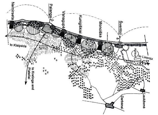
History of Palanga is very different from the todays town. Infact in the resort the recreation has inflated in past century. It has a moderate geographical importance. The resort has a intricate social essence for the country and is also a strong representative town for countries cultural heritage and therefore this holds a high value. It offers recreational activities in nature, spa tourism, medical tourism and cognitive tourism. The 24 km long stretch of Palanga along the coast as shown in (fig-1) includes well established areas of old palanga and Sventoji, along with the developed centres like Nimerseta, Monciskes, Kunigiskiai, Medvalakis/virbalishe, Butinge and Vilmiske. The resorts function was changed from being a port to a summer resort town for the rich people of that time, along with the efforts to keep the town active throughout the year.
15
Fig. 1. Plan of recreation area in Palanga resort Scheme (Source: by V. Stauskas-14)
(Source: compiled by author, based on a detailed analysis of historians)
16 Timeline
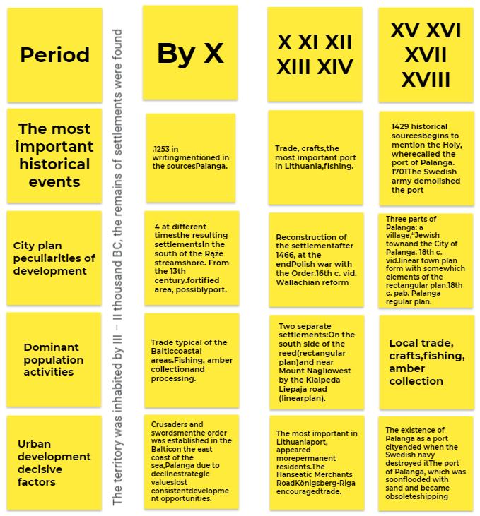
Table 1. Development of Palanga until the 18th century
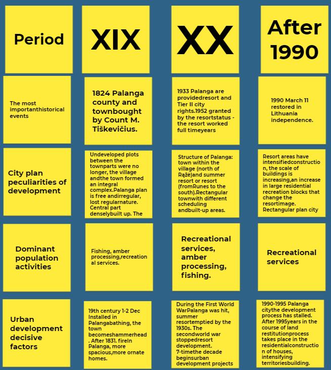
Table 2. Development of Palanga town from the19th century to the present day (Source: compiled by author, based on a detailed analysis of historians)
17
Seaside architecture (both overall design and specific seaside structures) is now a significant impact in either favoring or deterring tourists, as in 2006). In contrast, the resort's reason for existing is the illogical use of the natural framework, which leaves no harmonious nature, and architectural symbiosis, in addition to the aforementioned urban regions. The project's goal is to examine various urban and architectural developments in the Palanga resort.
1. To investigate the historical socio-cultural development circumstances of Palanga City, including the city's historical development and unique features in terms of plan, building, and silhouette.
2. To examine the unusual aspects of Palanga's resort-city planning.
3.To determine the issues with the development of Palanga resort.
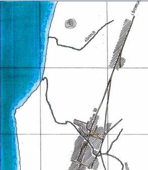
Fig. 2. The scheme of Palanga in 1779-1781 (Source: Ptasek 1995)
Analyzing Palanga's evolution, based on a careful examination of historians created by the group lead by V. Žulkus monograph (1999), which covers history from early areas to the newest metropolis. Palanga's development, plan, volume, spatial composition, cartographic iconographic material, current condition plans, and projects up to 1945. analyze a. "Cities and Towns of Western Lithuania" (Miškinis 2007) forest monograph. Based on the regeneration of Palanga's core section project and special plan for monument protection (1995), the city's planned structure was analyzed. "Baltic Zakopane: Palanga Tyszkewicziu laiis" (Omilanowska 2014) and D. Sobeckis and Z. Genienė's book on the depiction of Great Palanga cultural heritage artifacts (Sobeckis, Genienė 2008) provided information for the study.
Palanga Public Library lore study The fund contains Palanga-related municipal magazines from 1990 and interwar resort periodicals. Analyze E. Adiklienė (1981), a local historian from Palangiškės photosandworksdescribingthehistoryofPalangafrom ancienttimes,writtensources aboutPalanga, history of the city in the 16th–17th centuries, by Counts Tiškevičius influence on the formation of Palanga, the city in 1918–1940, postwar period.
18
Palanga Resort Health Park Layout Scheme (1988), Greater Palanga Undeveloped Spaces Landscape Formation and Recreation Organization Scheme (1989).
Investigations of the LSSR's most essential urban and architectural circumstances to prepare for their architectural development.
Preliminary Program (1986), General Plan of Palanga Resort (1991), and General Plan of Palanga City (2008) referenced in spatial planning papers and them Palanga resort planning and condition are contrasted. V. Stauskas' 2012 publications explain resort urban planning.
R. Povilansko (2010), P. Grecevičius (2014), J. Bučas, and L. Dringelis (1995) describe Palanga's development issues. Palanga's historical socio-cultural growth circumstances Palanga, one of the earliest Neolithic villages along the Rąžė stream estuary, became an important metropolis. Between Dwarf and the Order of the Crusaders and Swordsmen near the Baltic Sea on the east shore, Birutė Hill had four communities. Žulkus says Palanga recovered following the Polish-Order War (1999). Palanga as a marine town (village) flourished mainly in the 16th century. near the end of the town, with town privileges and port expansion rights. According to V. Žulkus' "History of Palanga" (1999), the 17th-century seaport, equivalent to Liepaja and Riga, was at Šventoji at the mouth of the river, not in Palanga near Ostriches.
Palangasilhouetteformantsareprizedfromtheseasincetheflatlandscapeandcity skylinevegetation obscurethesilhouettefrom themainland.Thesettlement's profilewas establishedbyequal vegetation and a strip of wooden dwellings with Birutė hill dominating. “The southern settlement in the southern on the shore, another settlement (Old Palanga) near Naglio hill near the Liepaja-Klaipeda road” were established in the 16th century, according to Miškinis (2007). Sand-infested plots separated the communities. Wallachian reform urban planning Palanga's method creates an urban system: Old ones are more functional. A planned community of fishermen and farmers in Palanga stretched from the road, where the cottages were, to the sea, where the fishing gear was. The southern Rąžė bank is enlarged and Palanga's northern coast is planned. This paragraph plans a merchant-artisan town. J. Lakovskis and his helpers designed a small region with a rectangular plaza, two streets, and two streets adjacent to the Klaipėda-Liepaja road in 1556–1569. After 1550, a tiny chapel was erected, followed by a bigger church in 1597, forming Palanga's silhouette.
19
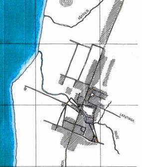
Fig. 3. The scheme of Palanga in 1877 (Source: Ptasek 1995)
Palanga had a linear plan in the 18th century, with a village-township road on the south bank of "Palanga city" and the R stream. In the 19th century, it began its resort history with the acquisition of Count M. Tikeviius, who built an embankment from the sea, planted forecourts, and built homes. The town's center was Mmelis, Birut, and Tikeviius' boulevard construction. The main artery of the resort J. Basanaviiaus Street has retained its status until now.
In 1877, Old Palanga remained unaltered, but homesteads near the Klaipda-Liepoja road were scattered and no longer had an ordered rhythm. In 1890, 150-170 visitors from Moscow and Warsaw visited Palanga, a prominent summer resort. J. Buas' 1990 architectural research identified three prominent resorts: Swiss villas, local symbiosis of coastal and modern architectural forms, and halftimbered resort architecture. The villas' low population and lush surroundings had a big influence on the summer resort's image and made Palanga part of the town's background.
1.1.1. Urban Form and Function
M. Ptaek (2012) claims that Palanga had no true resort life until J. Tikeviius erected the Kurhaus (1877–1880). The Kurhaus provided plenty of resort life entertainment, and Tikeviiai created naturefriendly architecture. Palanga developed in three periods in the 20th century: before the First World War (1914), interwar (1918–1939), and postwar (1945). In the 20th century, Palanga's brick church dominated the plaza as the northern section of the R River spread west.
The summer region (southern section of the river) spread westward, partially constructing a roadway network. E. Andre. Red-brick synagogue (1902) dominated town center. Neo-romanticism and historicism influenced early 20th-century high-value buildings.
20
4. The scheme of
in the beginning of the twentieth century (Source: Ptasek 1995)
21
Fig.
Palanga
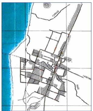
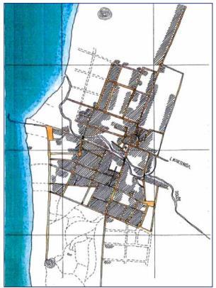
Fig. 5. The scheme of Palanga 1937 (Source: Ptasek 1995)
In 1932, F. Tikeviius was parceled out during the land reform and construction of a mansion, a summer house with a park left to the owner was sluggish due to the reduced demand and the number of summer workers. Major resort management effort began after the Lithuanian Law on Resorts and the 1933 Palanga conferred resort and city powers. Holidaymakers climbed from 2,000 in 1933 to 9,899 in 1939. After the 1938 fire damaged the north part of the city, Maiulskis Palanga urban repair and rehabilitation project brick building quarters were built.
Romanticism persisted in architecture without constructivism and functionalism. In 2006, the resort's limits were set up, assigning the whole resort area of Palanga south of R stream and a major chunk on the northern bank, from west of the church to Jrats Street. World War II damaged the city and halted resort restoration. Section 2 discusses resort formation and Tables 1 and 2 show Palanga's evolution. The historicist-style resort architecture that Palanga shares with other European beach resorts
1.2. Creating balance between resort development and landscape
In this age of globalization, resort towns struggle to flourish. The Lithuanian seaside town has been affected for a long time. Count Feliksas Tiskevicius developed the resort by respecting the natural scenery and erecting distinctive architecture across the town, which is now rare. Landscape and architecture matched.
The process of creating a balance and the effects of land privatization, which led to the destruction of the town's "Bonga" restaurant, show the importance of local vernacular architecture. Today, intensive construction has stabilized the landscape, but the Palanga municipality has revealed their future construction plans in the south-east section of the town between the Klaipeds highway and A13 road, which becomes one after Nemirseta district.
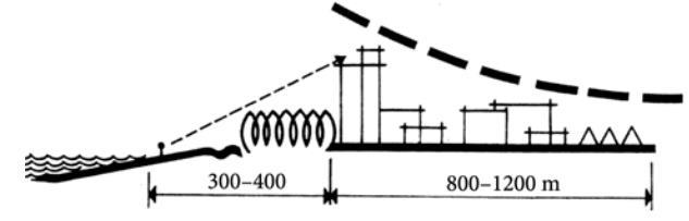
Fig. 6. Vanagupes architectural concept is based on the domination of nature seen from the seaside (Source: Stauskas 1968/2012)
The skyline in Palanga now is very much the same, but in the Vangupe area, building dominates the landscape, breaking the harmony. To remedy this, the deep-nesting method was established, but it failed due to the 1933 land reforms.
22
1.2.1. Importance of Vernacular Architecture
This research discusses the values of rural architecture, criteria for distinguishing ethnic elements and aesthetic expression, and essential regulations for new building in protected regions and landscape preservation. Multicultural suggestions founded on cultural understanding might inspire meaningful dialogue and artistic expression. The rural landscape was mostly local, a visual phenomena of culture that provided meaning to nature and the balance of human creation. Today, rural architecture must reflect the environment and authentic global cultural values counteract globalization. Construction heritage and planners recommend retraining to develop high-quality, genuine architecture to local and national form.
Village rehabilitation is considered as a chance to maintain distinctive cultural history that gives people purpose. The European landscape treaty requires the conservation of natural and cultural heritage landscapes for human well-being and self-assertion. The Lithuanian state wants to preserve national identity, including spiritual and material cultural elements like the land's image, areas that define it, building volumes, and colors. The state department for protected areas published numerous parts about Dzkija village construction, which examines traditional Dzkija building. Architectural traits, specified in the second paragraph, determine regional local identity and building heritage.
The third part's project suggestions and the strong part's execution conditions are based on these characteristics. The regional peculiarity is clearly exposed and little signs, decor, so projects come with instances of local decorating that are not essential but substantially enrich the image and quality of the interaction with the surroundings. Searches and recommendations, not models, should be posted to maintain the tradition. Dzkija, a stunning, natural, historical, and ethnically diverse edge, covers southeast Lithuania, spanning from the lake and hill west of that Dzkian Unemun through the woods fleeing and sandy woodland towards Vilnius. The borders are conditional since ethnographic traits do not finish at the map lines and are not the same inside the area.
23
Fig. 7. Evolution of architectural elements in Lithuania (Source: Rural Architecture of Dzukia by Simona Benetyte, Rasa Bertasiuite)
TheDzuks laborin poverty thelandwith theplentifulgifts ofnature,knowinghowto livein harmony with the environment. Old laments or calendar tunes may recall comparable eras and architectural structures.
1.2.2.
Heritage of Traditional Wooden architecture
Palanga case
Modern heritage preservation promotes participatory culture and grassroots heritage production. It involves identifying, analyzing, and conserving material heritage. The collection of 2nd half of the 20th century buildings in Palanga could be divided into two main groups: in-situ and ex-situ. The Heritage List depicts Palanga building trends before WW2. Rest-house "ilvinas" (1968) and library pavilion (1965) are the only buildings from the second half of the 20th century.
Inclusive heritage theory involves community participation in learning, recognizing, analyzing, and maintaining narratives, connections, emotional values, and mostly intangible assets. Seminars, trips, exhibitions, printed media, and oral history and ethnography can promote multiple narratives. Creative workshops may activate communities and raise awareness of built environment and architectural history.
1.2.3.
Evolution of recreational landscape in Palanga
To have a grasp on what is meant by the phrase "recreational landscape," it is necessary to first comprehend the meanings of the individual terms that comprise it, as well as how people interpret and perceive those terms in a variety of natural and man-made environments, and then investigate the many characteristics and components that go into its formation. A landscape is any natural or urbanized, planned or unplanned greenery that is interpreted by humans as a recreational object, and heritage landscape is one step forward where one landscape is associated with the values of humans' past activities and they try to link the feeling with the environment. Firstly, recreation is explained as a term of humans to enjoy and spend their leisure time basically an activity or stress relieving activity by the Cambridge University.
Heritage landscape is one step forward where one landscape is associated with the values of humans' past activities and they try to There are many diverse meanings and values buried under the surface of the landscape.
There are several possible meanings that may be derived from the same environment, and they all rely on the history of the town. The investigation of the connotations that are associated to features of a landscape is of the utmost importance for enhancing the significance, use, and value of any given setting. It is helpful to research the history of the town and suggest a leisure activity that will further make the physical environment more delightful. This is because the physical setting is the product of human history, memories, emotional connections, and symbols.
24
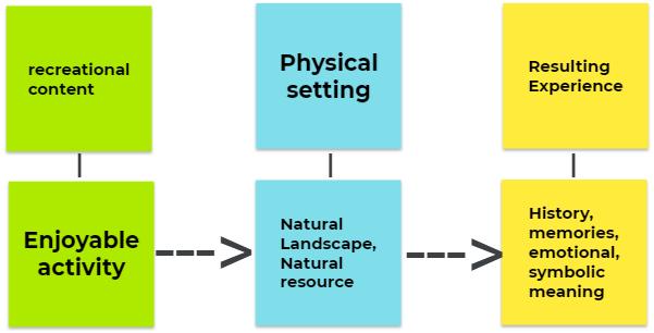
Fig. 8. Diagram explaining hidden features of recreational landscape (Source: compiled by author)
In actuality, Palanga was founded for an entirely other reason (goods transportation) and has no connection to the resort. In the 18th century, the bricks were shipped all over the world. In the second half of the nineteenth century, Palanga began to gain recognition as a potential resort town due to the fact that many prominent Soviet era figures visited there to relax. Additionally, the bridge that linked the major Baltic ports at the time was crudely constructed out of wooden logs, making it ideal for strolling, picnicking, and socializing. The town's cultural diversity and local vernacular architecture combined with its various aesthetic characteristics provided for a pleasant stroll across the town's landscape. Which ultimately led to the current day street named after Jonas Basanvicius
25
1.3. Case Studies
1.3.1. Jurmala resort, Riga, Latvia
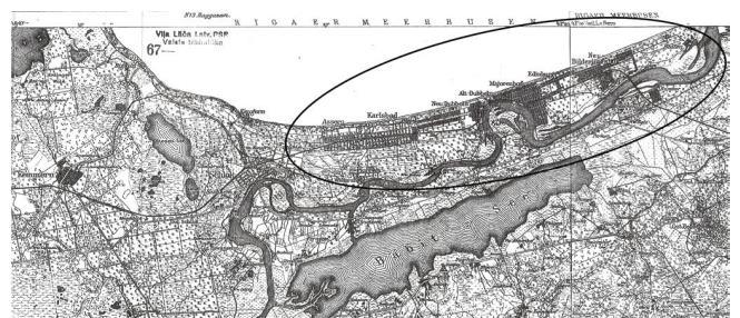
Fig. 9. Bathing places in 1917(from1920, City of Rigas Jurmala): Bullen (now Lielupe); Bilderlingshof (now Bulduri); Edinburg (now Dzintari); Majorenhof (now Majori); Alt-Dubbeln (now Dubulti); Neu-Dubbeln (now Jaundubulti); Karlsbad (now Melluzi) and Assern (now Asari) (Source: Wikipedia)
The evolution of Jurmala as a Latvian destination city and its forthcoming strategies are not solely a concern for Jurmala, but rather a matter of widespread significance for the entirety of Latvia. The city of Jurmala is currently experiencing a period of post-Soviet transformation that has persisted from the 1990s to the present day. This era is characterized by a multitude of interests and perspectives that are reflected in the city's physical environment. The urban environment is characterized by the emergence of novel residential landscapes, the persistence of transitional landscapes, and a reduction in the distinctiveness of the urban fabric. The integration of contemporary elements into the urban landscape of Jurmala is not consistently seamless. Although low-rise buildings are known to offer better protection to the Jurmala landscape, the traditional low wooden buildings that have been in existence since the 1970s and 1980s are being replaced by multi-storey apartment buildings that do not conform to the city's traditional landscape. The destruction of the cultural and historical infrastructure of the city, which has been conserved across previous eras, is taking place. The process of constructing edifices is occurring within the coastal dune ecosystem, resulting in a reduction of the indigenous pine forest terrain. The ongoing process of converting the pine forest into urban infrastructure is resulting in the gradual disappearance of the once publicly accessible outdoor areas, thereby limiting the availability of water bodies such as the sea and river. The perception of Jurmala as a "pine forest park" with buildings harmoniously integrated into the natural surroundings is being challenged by the magnitude of recent developments and the divergent landscape preferences of its new residents and property owners. The proposed planning documents overlook certain processes and propose solutions that could potentially alter the current cultural environment of the city. These solutions include constructing multi-storied buildings in the dune belt and "city gate" areas, developing new residential private house and multi-storied areas, and building hydro-technical constructions along the sea and river. These changes have the potential to significantly impact the city's main values, such as the beach, pre-dune, and Lielupe River landscape.
26
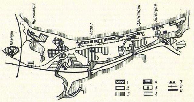
Fig. 10. Old Map of Jurmala (Source: Old maps of Jūrmala (oldmapsonline.org))
The development and future aspirations of the resort city of Jurmala have a significant impact on the entirety of Latvia. During the 1980s and 1990s, the Jurmala landscape was safeguarded by wooden edifices, however, presently, they are being replaced by multi-level residential buildings. The construction of buildings is resulting in the displacement of pine woods in the coastal dune belt, thereby diminishing the availability of public open space and impeding access to the sea and river. The revised planning documents propose various solutions, including the construction of multi-story buildings in the dune belt, new residential private houses and multi-story areas, and hydro-technical constructions along the sea and river. These proposed changes have the potential to significantly alter the cultural landscape of the city. The Gulf of Riga coast's Spatial Plan for the Riga Region has established certain regulations that prohibit the development of buildings in the dune belt, deforestation, and the privatization of forest areas that are accessible to the public.
Since 2007, the European Landscape Convention has been implemented in Latvia. However, the design of the new development plan primarily considered the visual aspect of the city landscape. In order to enhance the reputation of Jurmala as a resort destination, it is imperative for the local government to conduct a thorough reassessment of the key components that are integral to the city's aquatic and botanical ecosystems. Additionally, a comprehensive plan for the development of public outdoor areas must be devised and implemented. The scenery of Jurmala prompts a number of inquiries.
• What should be the envisioned future appearance of Jurmala?
• In what ways can Jurmala leverage its landscape to achieve economic prosperity?
• What modifications to the landscape should be permitted by the urbanization of Jurmala?
• What is the extent of human involvement in the interface between natural systems and human activities?
• Would it be preferable to have a city that towers over the surrounding pine trees like a metropolis, or a city that is integrated into the natural landscape like a "forest park"?
• Would the multi-level landscape attract international visitors?
• What are the unique geographical features of Jurmala?
• In what ways can the landscape of Jurmala achieve equilibrium amidst social, economic, and environmental transformations?
27
1.3.2. Binz resort town, Germany
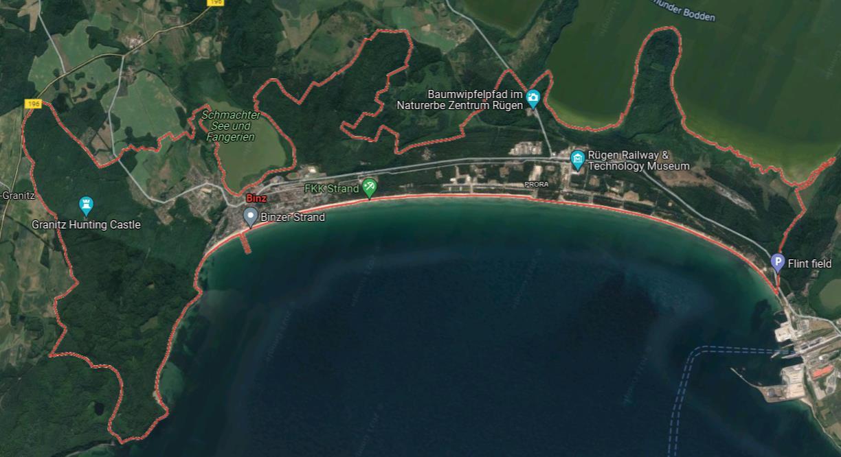
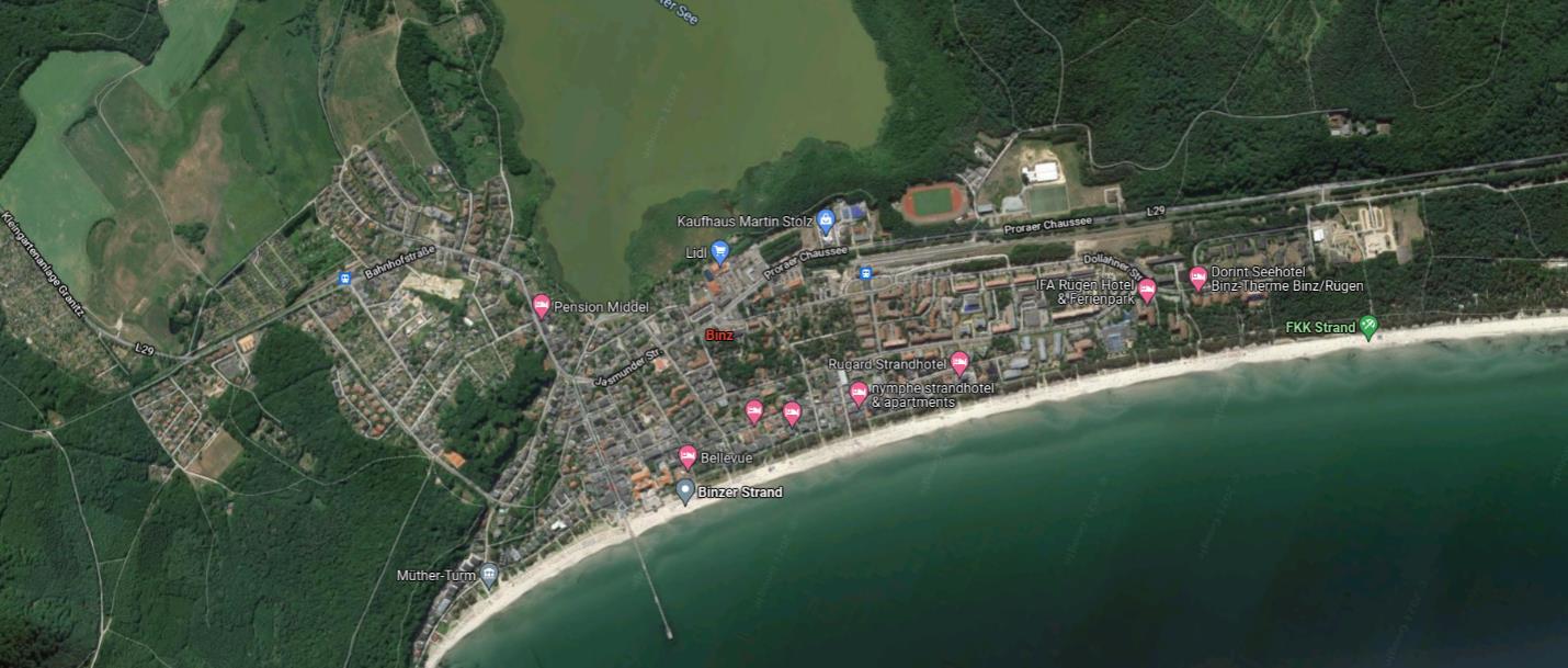
The old town of Binz Binz is on Rugen's eastern shore between Prorer Weik Bay and Schmachter See. The Schmale Hiede, north of Binz, connects Rügen's central Muttland to Jasmund. In the southeast, the Granitz rises to slightly over 100 m above sea level (NN). Binz owns Prora.
28
Fig. 11. Present day Urban set-up(Source: google maps)
Fig. 12. Zoomed view of the town (present day) (Source: google maps)

Fig. 13. Old Plan of 1926 (Source: oldmapsonline.org)
Binz, a resort located on the Baltic Sea (fig-11 and 12), boasts a collection of white villas and guest homes that date back to the late 19th and early 20th centuries. During the first week of May, the Week der Bäderarchitektur, also known as the "Week of resort architecture," offers a variety of activities such as themed tours, exhibitions, and lectures that focus on the subject of villas. The inception of summer vacations on Rügen dates back to the latter half of the 19th century, and numerous edifices from that era have undergone renovation and been transformed into lodging establishments such as hotels or guesthouses. The term "resort architecture" does not pertain to a specific architectural style or construction technique, but rather denotes a particular era and purpose of construction that was primarily associated with coastal regions. Contemporary white structures exhibit a consistent appearance, however, upon closer examination, they reveal elements of historic temple entrances and pillars, Gothic-style windows, Jugendstil embellishments, as well as Baroque and Renaissance characteristics.
Seaside resort villas exhibit several common characteristics, including multi-level structures ranging from two to four stories, as well as balconies and verandas. During winter, boatbuilders augmented their income by embellishing balcony facades with intricate carvings that showcased their artistic skills. Frequently observed in architectural design are windows with arched or rectangular shapes, featuring half-columns or pilasters. Additionally, the woodwork utilized in such designs may evoke elements of Alpine, Nordic, or Russian styles. The color white imbues Binz with a vibrant ambiance reminiscent of the Mediterranean region.
29
1.3.3. Sopot, Poland
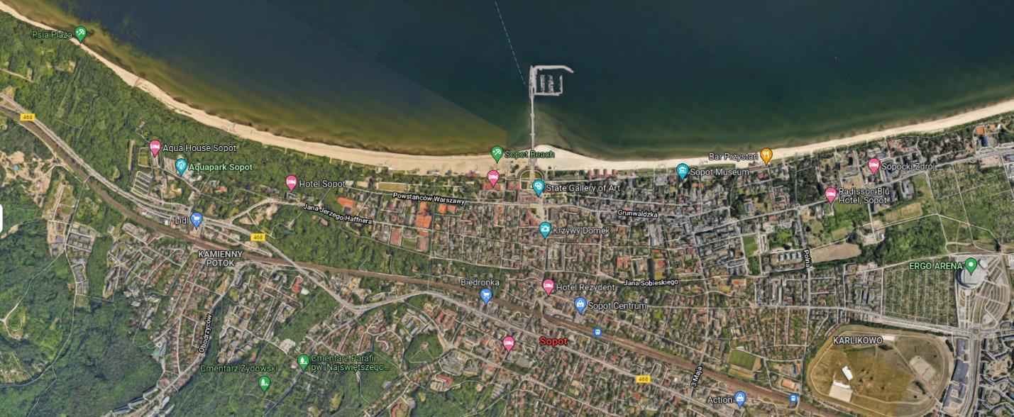
Fig. 14. Zoomed view of the town (present day) (Source: google maps)
Sopot (fig-14) is renowned for its architectural landmarks, including the Balneological Institution dating back to 1903, the recently reconstructed Spa House, and the Kuracyjny Square and Haffner Centre. The town has conserved a range of housing and service developments that date back to the latter half of the 19th century and the early 20th century. Additionally, the town has preserved a classical manor built around 1800, a Spanish Mansion, and a medieval stronghold that dates back to the 9th or 10th century. The inception of a coastal resort in Sopot dates back to 1819, when Carl Christoph Wegner made initial endeavors towards its establishment. The Bath Institute was constructed by the esteemed physician Jan Jerzy Haffner in 1923, and the Spa House was inaugurated the following year.
In 1870, Sopot was included in the railway line, facilitating a rapid growth of the resort. Subsequent to that period, there was a surge in the influx of vacationers to Sopot. Presently, Sopot remains a spa town, albeit the therapeutic value of its curative properties has diminished.
Sopot Revitalization
The revitalization of Sopot is a deliberate effort to enhance the quality of life of a local community by implementing measures that promote development and novel forms of socio-economic activity in selected regions. The revitalization program in Sopot encompasses four distinct zones, as outlined in the Local Revitalization Programme of 2005. The first zone, designated as the "spa resort" and encompassing the "A1" spa protection area, is situated in close proximity to the sea and serves as a hub for spa treatment and recreational activities.
30
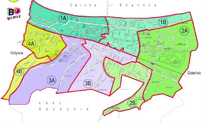
Fig. 15. Map showing division of city into four zones for focused development (Source: sopot municipalty)
The zone depicted in (fig-15) pertains to the Lower Sopot area, which comprises residential constructions that date back to the period of transition between the 19th and 20th centuries. The third area comprises the Hippodrome, which includes tracks for horse racing, two grandstands, a sweepstake building dating back to 1926, a room for saddles, and a paddock. Zone four is associated with the upper terrace of Sopot, which includes the Forest Opera (constructed in 1909) and its surrounding areas. The program's initiatives are consistently supported by the Sopot Town Council, which advocates for the active participation of housing communities. The aforementioned actions have led to a noteworthy alteration.
31
1.4. Hypothetical Model for Heritage Protection
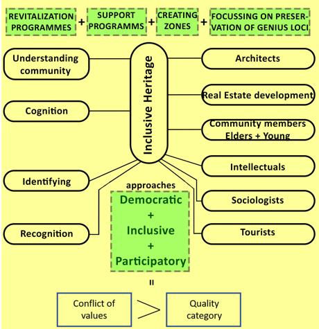
Fig. 16. Hypothetical model for heritage protection (Source: compiled by author)
The stability of the ecosystem is dependent on the contributions made by each person and species. In a similar spirit, the people who live in Palanga (also known as the locals) as well as the tourists from outside the town who come to visit throughout the course of the year should show respect for the unique characteristics of this extraordinary location, which is progressively losing its individuality as mankind advances. Inadequate spatial planning and conservation rules are likely to blame for the deterioration of local historical artifacts. As a result, it is necessary to take corrective and reformative actions in order to address the problem. In order to solve this problem, it is essential to improve the awareness of historical items among both the native population and tourists from other countries by putting into practice a variety of inclusive strategies, such as democratic, inclusive, and participatory approaches (Nekrošius, L., & Riaubienė, E. 2018) (fig-16). This category includes those who work in the fields of architecture and real estate development, sociologists, philosophers, and tourism professionals, as well as members of the community spanning a wide age range. It is critical that heritage assets be preserved not just because of the historical importance of such things, but also for the sake of the conservation of the urban landscape. In today's modern times, it is very necessary to preserve the Genius Loci (Nekrošius, L., & Riaubienė, E. 2018) of a particular location; in other words, this is an urgent need.
32
2. Empirical Part
2.1. Hypothesis
Fig. 17. Conceptual proposals for future development in Palanga (Source: compiled by author)
Landscape
Upon entering Palanga via the expansive highway and onto Vytautas.g street and its intersecting roads, one can readily discern the narrow thoroughfares that signal the transition into the historical milieu of the resort town. Palanga's urban landscape is characterized by low-rise structures that are concealed from the observer at the seaside. Notably, the resort's distinctive features, such as the sand dunes and the protective pine trees lining the coast, serve to mitigate the impact of strong winds originating from the sea. The preservation of the recreational landscape heritage in Palanga is imperative as it is a distinctive feature of the locality and contributes significantly to its character.
Ethnography and Folklore
The study of cultural groups and their customs, known as ethnography, is closely related to the examination of traditional stories, beliefs, and practices, known as folklore. The ethnic culture of Palanga and the Baltic coast is characterized by a multitude of cultural diversities, including the remnants of the Baltic tribes such as the Samogitians in the eastern region, as well as the Curonians and Old Prussians in the southern region (PG, JG, MP, CK, M., 2016). It is imperative to prioritize the preservation of the local identity of the town, including its folklore and traditions. Additionally, educating outsiders on the significance of these elements is crucial in facilitating sustainable and relatable knowledge exchange. It is imperative that the small fishing villages located in the suburbs of Palanga, where the indigenous tribes have resided, are not subjected to any form of disruption or inconvenience during the city's planning process.
2.1.1. Activating Palanga in Winter Season
The activation of Palanga in the winter season will help in the boost in economy and town development and will eventually help the locals to grow.
The resort town experiences prolonged cold winters that commence in September and persist until May, spanning a duration of nine months. This phase is commonly referred to as the passive phase of Palanga, characterizedby acessation ofoutdooractivitiesandadeclinein business forholidaymakers and shop owners. This situation results in an economic imbalance, as depicted in (fig 18)
Subsequently, during the summer season, the resort town experiences a surge in tourism, with approximately 300,000 visitors arriving from various regions of the country. This influx of tourists poses a challenge in terms of lodging, given the limited capacity of the small town, necessitating expansion efforts during the winter season. The phenomenon of overcrowding gives rise to situations of conflict and detracts from the overall experience for all parties involved. Additionally, the high volume of patrons can lead to overcrowding at beachside restaurants. The aforementioned situations
33
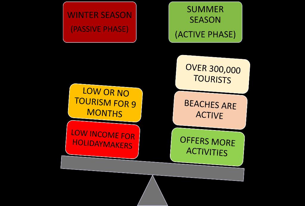
Fig. 18. Seasonal Imbalance in Palanga (Source: composed by author)
could be prevented by implementing the following remedies. (fig-19) displays the descending order of activity levels in various regions of Palanga at present.
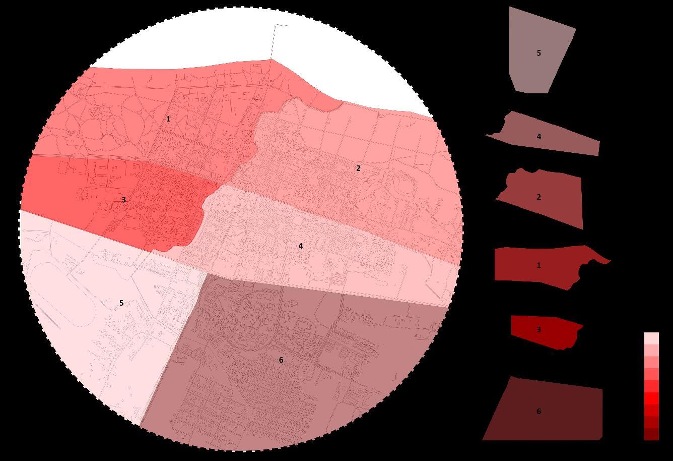
Fig. 19. Most active parts of the resort (Source: Composed by author)
There is potential to increase the level of activity in Palanga town during the winter season by implementing measures such as hosting diverse exhibitions, facilitating workshops and concerts, and promoting inward resort activation. Research has demonstrated that open environments facilitate the emergence and cultivation of creative thinking. Establishing a versatile space for various forms of artistic expression could potentially foster the development of creative hobbies among the residents of Palanga. This intervention has the potential to stimulate cognitive processes and facilitate the
34
process of recovery. The proposed solution appears to be well-suited for the site, as it offers healing environments andrecreationalspaces thatcould potentially activatePalangaduringthewinterseason.
2.1.2. Reducing Visual pollution on J.B. increasing Heritage Protection Awareness by visual learning through Holograms
J.Bsanavicius.g
The genesis of this street dates back to the 19th century, prior to the onset of World War I. It served as a popular destination for individuals seeking to partake in various recreational activities, including dining and deck lounging. Consequently, it holds significant importance in shaping the ethos of the locality. The aforementioned industry serves as a crucial pillar of the Palanga economy. However, as aresult ofheightened globalizationandtechnological progress, it has undergoneatransformation that has caused it to deviate from its historical roots. This has resulted in the local heritage objects being overlooked and underappreciated, even by the indigenous population.
Twoprimaryconcernsareevidentinthiscontext.Firstly,theprevalenceofbannersandcontemporary structures results in significant visual pollution, which often dominates, obscures, or obstructs the visibility of local heritage objects. Consequently, these objects remain unrecognized and unnoticed (Abromas, J., & Kamicaityte J., 2016). The high volume of pedestrian traffic on the streets often results in the neglect of certain cultural and historical areas within a town. To address this issue, the implementation of informative heritage walks or excursions is recommended. These activities should cover significant sites of cultural value and educate participants on the local heritage's importance, thereby increasing public awareness.
Ayurvedic therapy
The present discourse aims to introduce the Ayurvedic therapy, a traditional system of medicine that originated in India and has been practiced for thousands of years. If the city possesses distinctive features that offer diverse therapeutic options, it is imperative to consider the inclusion of Ayurvedic treatment to provide a more comprehensive perspective of Palanga as a healing resort city. The implementation of ayurvedic techniques can potentially stimulate economic growth, as there is a growing demand for this form of treatment among individuals. Additionally, the organization can provide yoga classes to the Lithuanian community, enabling them to fully reap the benefits of such instruction. During the winter season, when the town appears to be devoid of activity and stagnant, engaging in this particular activity can become a popular pastime.
Innovative application of holographic technologies.
The advancement of this technology presents a novel opportunity for raisingawareness and imparting knowledge about historical events in a more engaging and interactive manner, catering to both adults and children. Furthermore, it has the potential to enhance the cognitive map of Palanga. One potential solution involves the digital recreation of historic events in their original locations or on heritage objects, without disrupting their physical integrity. This could also be achieved through presentations featuring images and depictions of the event, held in forest parks or on decks. Such efforts would serve to increase awareness and understanding of the genius loci, allowing individuals to gain a more informative understanding of their roots and the historical events that have shaped them. The light displays of the installations will be achieved through the utilization of small circular points, resulting in a highly realistic immersive effect.
35
2.1.3. Increasing Walkability
Forest parks
Forest parksarenatural areas thataredesignatedforrecreational activitiesandconservationpurposes. These parks are typically characterized by their dense vegetation, diverse wildlife, and scenic landscapes. They serve as important habitats for various plant and animal species, and also provide numerous benefits to human communities, such as clean air and water, carbon sequestration, and opportunities for outdoor recreation and education. Forest parks are therefore important resources that requirecarefulmanagement andprotection to ensuretheirlong-termsustainability andecological integrity.
Furthermore, it possesses the capability to preserve the dwindling forested region in Palanga, which has currently ceased. Historic landscapes not only offer protection from sea winds but also contribute to the recreational value of urban areas. In order to enhance the preservation of this feature, it may be advisable to construct treehouses for safeguarding the specific area in question. The strategic positioningofthesestructuresshouldalsobecarefullyconsidered.Theproposedinitiativeisexpected to serve a dual purpose of introducing a novel recreational pursuit while simultaneously safeguarding the forests and their associated ecological systems. Furthermore, it is anticipated that this undertaking will enhance the pedestrian-friendly nature of the town.
2.1.4. Utilizing Wind energy
The preservation of the historical landscape entails safeguarding the receding coastline, dunes, and Pine trees from the adverse effects of storms and high-velocity winds. Additionally, exploring alternative methods for wind energy conservation, beyond windmills, is crucial.
The conservation of energy in contemporary society is a crucial determinant of urban sustainability. The coastal town of Palanga in Lithuania exhibits promising potential for the implementation of wind energy conservation systems. The proposal in question is highly practical given that Lithuania currently relies on external sources for 70% of its total electricity imports. During the winter season, wind storms have been observed to impact several residences in the area. This can be attributed to the town's low-rise and low-density urban structure, which allows for unobstructed flow of wind gusts. The regions that are shielded by the pine trees and sand dunes experience lower wind velocity in contrast to the localities situated at the J. Bascanavicious street, Kretings and Vytauto intersection, as well as the fretingos and klaipedos intersection. The wind direction shifts from a southerly to northerly direction at ground level to a westerly to easterly direction at an altitude of 800 meters. This change in wind direction is accompanied by an increase in wind intensity, which can be classified as hurricane-level wind speeds. The proposition of implementing wind kites and Icewinds systems within a region approximately 1-2 km off the coast of Palanga has been put forth as a potential solution to mitigate visual pollution.
36
2.1.5. Space Syntax Analysis of Palanga
Palanga experiences a significant disparity in its seasonal tourism patterns, with minimal to no tourist activity during the winter months and an inundation of visitors during the summer season, including both domestic and international tourists. The escalation in the volume of flow has resulted in the mismanagement of finite resources, leading to a multitude of economic, logistical, energy consumption, and accommodation-related challenges for the town. In order to comprehensively comprehend the issues and their underlying causes, as well as to identify points of conflict analysis, a space syntax analysis was conducted. The study was conducted to identify the most integrated and connected points and streets in the town, with the aim of installing energy-saving systems for the purpose of enhancing sustainability and benefiting the community.
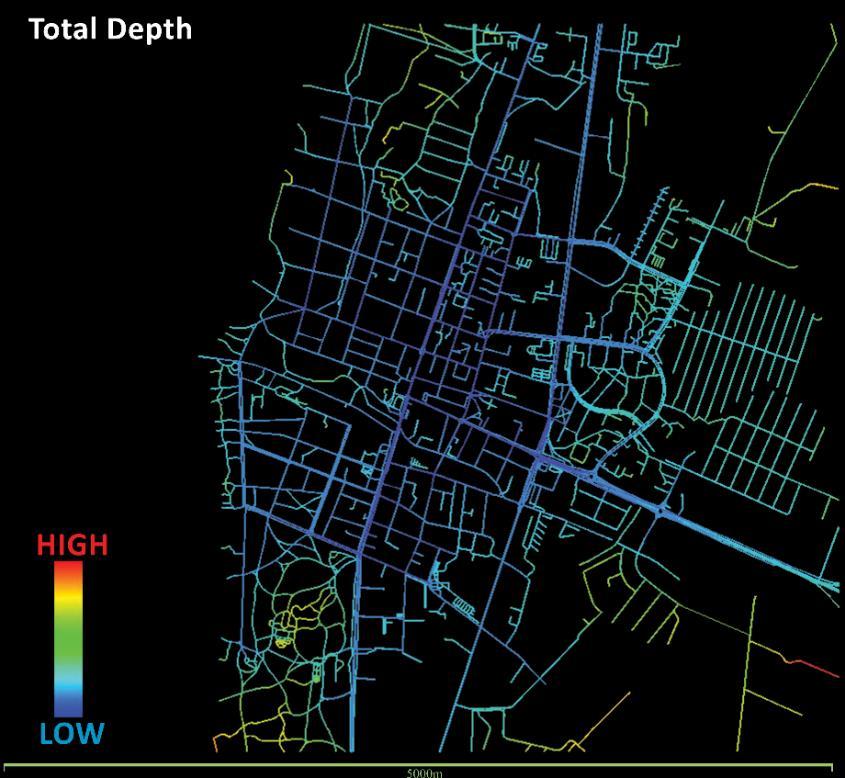
The subsequent examination presents an assessment of the evaluation conducted on the metropolitan framework of the historic district of Palanga, in conjunction with its environs.The findings indicate that the level of connectivity is greater on Vytauto G., which is the most frequently utilized thoroughfare in Palanga. This road provides access to numerous historical landmarks, as well as hotels and restaurants. Additionally, it exhibits the highest concentration of government edifices situated along this particular route. The road in question serves as a link between the old and new areas, andis flankedbytheKretingaandKlaipedoshighways,distinguishedbytheirgreen andyellow hues. This region is known for its high connectivity, ranking second in the area. During the summer months, the road experiences a surge in traffic, particularly in the vicinity of the Palanga old town. The figure depicted as (fig-20) illustrates that the overall total depth of the urban network is notably limited.
37
Fig. 20. Total depth (Source: composed by author)
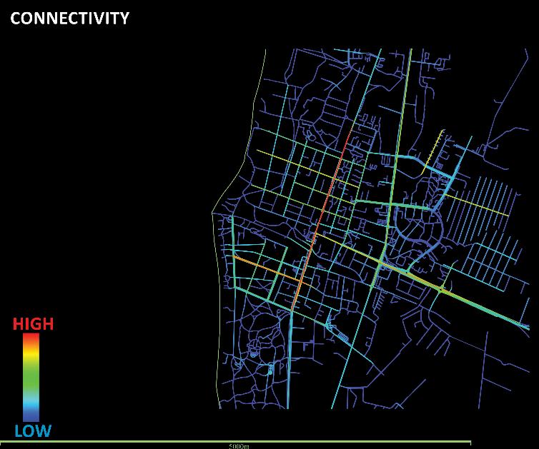
In the (fig-21) it shows the least and highly connected areas which is the end of the vytauto gatve and thestarting oftheJ.Bascanavicious street followed bythe Kretings highwayroadon theouterperifery of palanga and the kestucio gatve inside the historical boundary. Other than that the urban structure is moderatly and lowly connected amongst each other.
38
Fig. 21. Connectivity graph (Source: composed by author)
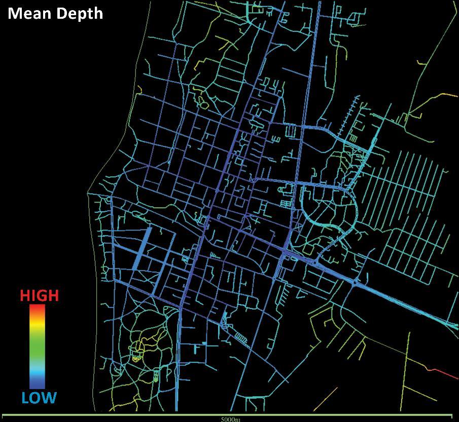
Fig. 22. Mean depth graph (Source : composed by author)
Mean Depth as expected is low because of the total depth of the system is low and the Integration is highestontheVytautog. andsomeofitssubstreetsinthecentrreoftheoldtownandnewsettlements. More or less the integration is equal and close in the whole of the town.
39
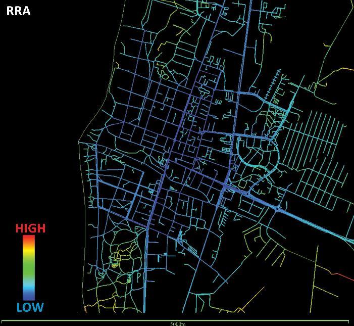
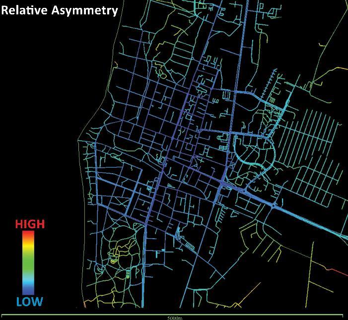
Fig. 23. Real relative asymmetry (Source: composed by author)
Fig. 24. Relative Asymmetry (Source : composed by the author)
Value of RRA (fig-23) depends on the RA which means that in (fig24) the parts of the structure does not have deep connections with its different parts which means that the green areas of the town like the castle area and the Vangupe are loosely connected to the middle part of the town.
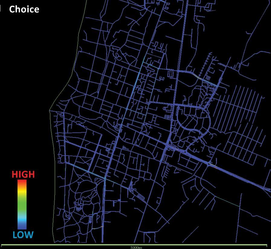
The concept of "choice" pertains to the probability of an axial line or a street segment being traversed on the shortest possible routes from all spaces to all other spaces within a given system or within a specified distance (i.e., radius) from each segment.
40
Fig. 25. Choice graph (Source : composed by the author)
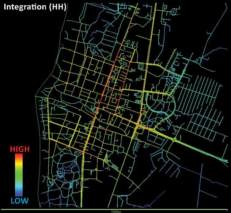
Fig. 26 Integration graph (Source : composed by author)
Integration is a metric that quantifies the number of street-to-street transitions required to access all other street segments within a network, utilizing the shortest possible paths. In (fig-26) it shows that there is high integration in the middle parts of the town and as we move outwards that shortest path connecting the streets becomes greater and greater.
2.1.6. Study of Genius Loci
A deeper understanding of Genius loci will help in identifying the cultural peculiarities of Palanga and can help find a practical function for the given site (which is unknown).
In order to obtain this knowledge, an investigation into the indigenous ethos of the area was conducted. Acquiring a more profound comprehension of a geographical area and cultivating a perception of its essence are two highly consequential objectives that can be attained through the acquisition of knowledge pertaining to the region's cultural, religious, culinary, architectural, and artistic facets. “The value of urban and historical monuments and old town districts are understood not only in terms of now entrenched commercial tourism, but also as enormous value of the environment for the local residents, often the location spirit, “genius loci” of the native environment”(Stauskas, V. (2013, June 11). (fig- 27) was generated based on the results of surveys conducted to gather diverse information on local practices and to conduct polls on suggested resolutions for the challenges presented in the (Appendices). The surveys were conducted to obtain diverse forms of data pertaining to the indigenous customs. Selecting the optimal land use and ensuring its viability were crucial factors in ensuring that the development had a positive impact on the community.
Palanga is a favored destination for a diverse range of leisure activities due to its relaxed ambiance. Individuals with diverse viewpoints frequently congregate during the summer season to commemorate, as the surroundings are highly hospitable. The present study examines the essence of Palanga and identifies the key factors that propel its growth, while also highlighting its increasing assimilation with American and British cultures. By means of dialogues and interviews conducted with the inhabitants of the area, It was acquired a more comprehensive comprehension of the erstwhile renowned leisure activities of the forefathers of this coastal settlement. Furthermore, it has been observed that particular proficiencies, artistic expressions, and diverse building techniques are in a precarious state of existence, in contradistinction to the collections showcased in the museums of Palanga, which exhibit artworks and cultural artifacts that remain perpetually youthful.
41
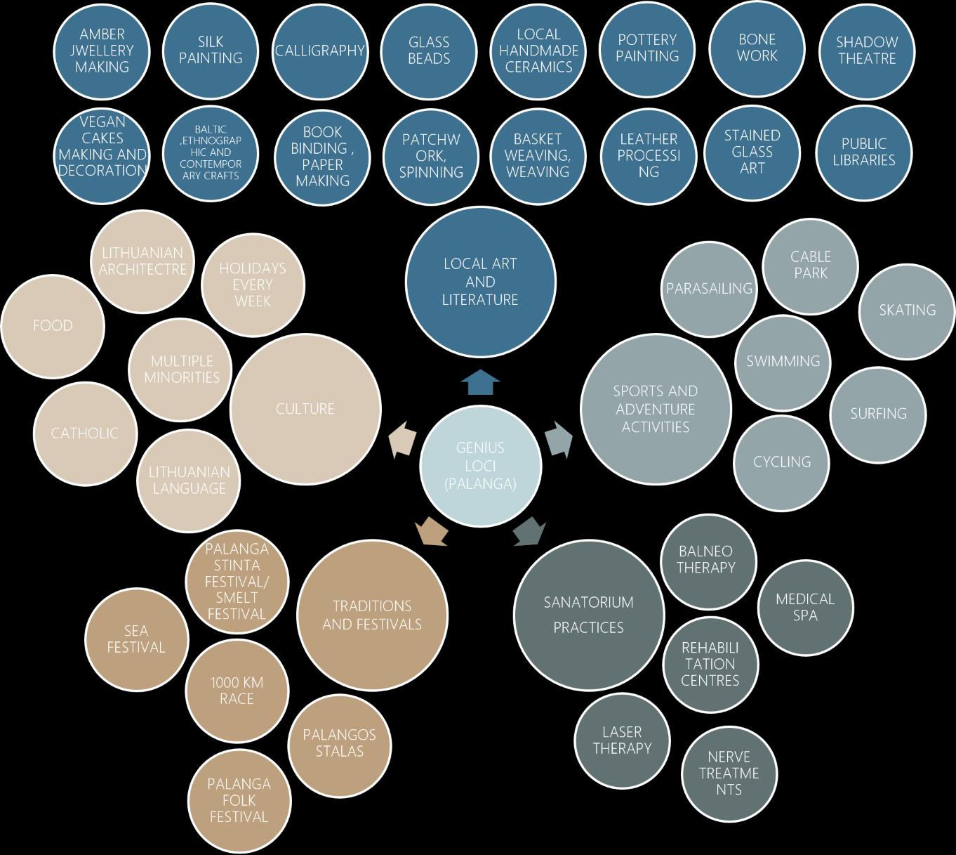
Fig. 27. Segments of Genius Loci in Palanga (Source: composed by author)
Fig.-27 shows the different activities which contribute to form the celebrating and relaxing spirit of Palanga, where it shows sports and leisure activities ancient teraputic methods practiced in sanatoriums, festivals play a major role in developing this spirit and obviously the culture has its own forms but the absolute starting point of this spirit is created through art which is the dominant factor in the below represented diagram. Many forms of local arts, literature, and different skills were perfected by local artists a century ago.By analyzing the data and observations it could be concluded that there is a decline in the art culture in palanga among the locals although Vila Ramybe is the only place where exhibitions are held and artists meet but there is no atmosphere for the local artists of different forms to practice their art forms.
42
2.2. Concept of Inclusive Heritage
Formation of a sustainable developmental strategy
Palangaisaffectedbyseveralsignificantfactors,includingtheseasonalimbalance intheresortduring both activeand passivephases, laws regardinglandprivatization,insufficient funding,andalow level of awareness regarding the protection of heritage.
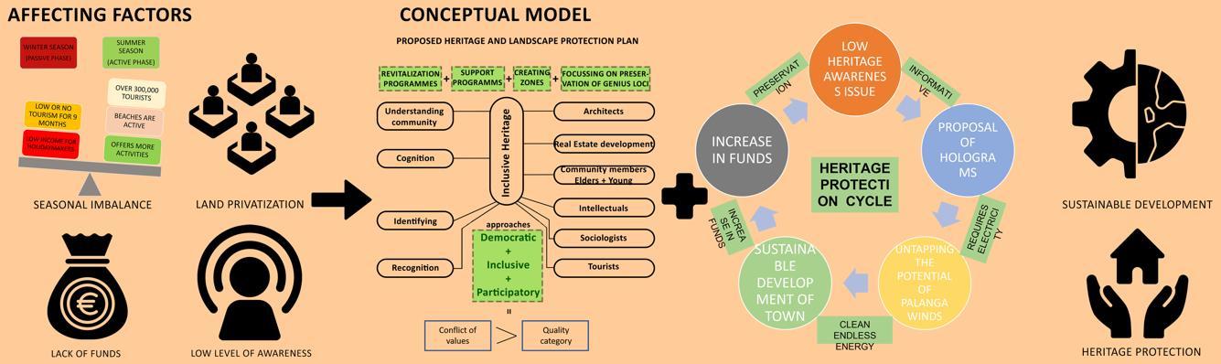
28. Affecting factors and Protection plan (Source: composed by author)
The preservation of Palanga's unique architectural villas, such as the Kurhouse and the Palanga music school, which are exemplary of modernist design, is challenged by various factors. These structures are experiencing material decline and a loss of authenticity over time.
In order to address this concern, it is recommended that an inclusive heritage approach be implemented. This approach would involve engaging experts from various fields to identify the underlying issues from their respective perspectives and propose revitalization and support programs, as well as establish creative zones. The primary objective of this approach would be to preserve the authenticity of Palanga's modernist legacy.
The author proposes the implementation of a new cycle for heritage protection, which involves the installation of holograms to highlight and emphasize heritage objects. These holograms can be utilized to create informative animations about the structure, thereby facilitating a more visual approach to educating observers and making the learning process more enjoyable. Due to the town's frequent exposure to strong winds and storms, a wind kite system could be implemented to sustain the functionality of holograms and generate the necessary energy. This approach could unlock Palanga's potential for clean energy production and contribute to sustainable development, aligning with the United Nations' 2030 goals. If the endeavor proves successful, the system could generate profits and expand its operations, potentially by commercializing the clean energy it produces.
The implementation of this initiative has the potential to facilitate sustainable development in the neighboring towns of Sventoji, Birute, Klaipeda, Nemersita, and Kretinga. The allocation of these funds enables the municipality to effectively administer the heritage site and safeguard its unique character and purpose.
43
2.1.7. Results
Fig.
2.2.1. Achieving Sustainability
To achieve the sustainability criteria proposal of the draught resistant plants like seedums, ice plants, thymes, Prarie dropseed, stonecrop, blue fescue and alpine-aster are being proposed on the sedum roof which not only increases the ecology and greenery in the region but also is very easy to maintain. It reduces the carbon footprint of the structure and along with the use of local materials like wood and CLT and using straw bales for the insulation it could also be made economically viable.
Maximum use of sustainable materials are incorporated into design like the use of straw bale with ICFs will be used for insulation and local abundant material like CLT would be used in the facade designs. Sedum roofs will help in creating microclimates for animals and decrease the carbon footprint. Recycled steel and aluminium could be used to make handrails and site components like doors and windows.
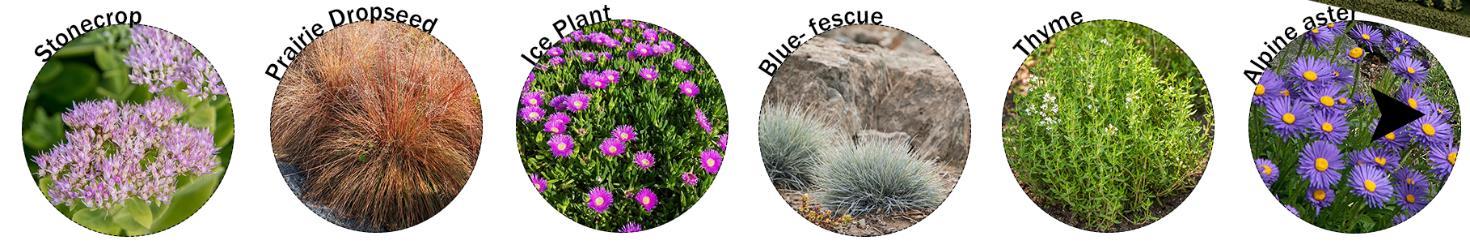
Focused attention on reducing the carbon footprint, saving the cultural identity, maintaining the ecology by the proposal of green roof systems, promoting walkability for good health, protection of the recreational landscape gives it an edge and creates a sustainable structure for the community of Palanga.
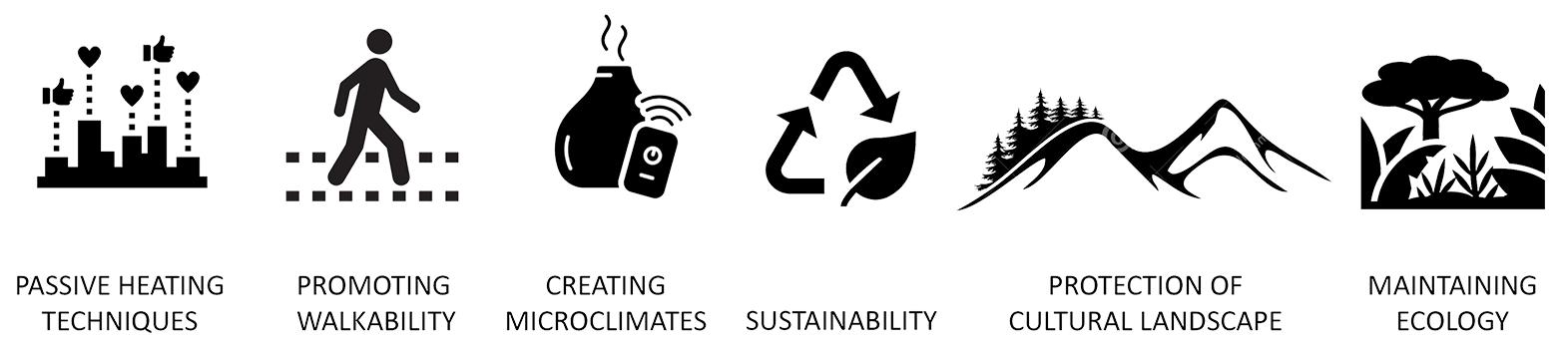
44
Fig. 29. Draught resistant plants for green roof (Source: composed by author)
Fig. 30. USPs of the Proposal (Source: composed by author)
3. Experimental Design
3.1.
3.1.1.
Proposal of wind kites’ systems Installation
The 12th goal established by the United Nations aims to ensure sustainable consumption and productionpatterns.Inlinewiththisobjective,effortsarebeingmadetoestablishsustainabletourism, which promotes local culture and eco-tourism while prioritizing highly sustainable energy consumption and production. This initiative seeks to transform Palanga into a hub for sustainable tourism, offering opportunities for skilled IT jobs and clean energy. Ultimately, this endeavor is expected to contribute to the growth of Lithuania's GDP and pave the way for a better future.
The preservation of energy in contemporary society is a crucial determinant of urban sustainability. The town of Palanga, situated on the Lithuanian coast, exhibits promising prospects for the implementation of wind energy preservation mechanisms. Given that Lithuania imports 70% of its total electricity from external sources, the proposed solution appears to be highly feasible. During the winter season, wind storms have been observed to impact several residences in the region. This can be attributed to the town's low-rise and low-density urban structure, which allows for unobstructed flow of wind gusts. The regions that are shielded by pine trees and sand dunes experience relatively lower wind velocity in comparison to the localities situated at the junction of J. Bascanavicious street with Kretings and Vytauto streets, and the intersection of Fretingos and Klaipedos streets. The wind direction shifts from a southerly to northerly direction at ground level, but changes to a westerly to easterly direction at an altitude of 800 meters. This transition is accompanied by a significant increase in wind intensity and flow, which can be classified as hurricane-level wind speeds. The implementation of wind kites and Icewinds systems has been suggested as a potential solution to mitigate visual pollution in the vicinity of Palanga's coastal region, at a distance of approximately 12 kilometers from the shore.
The proposition to implement wind kites and icewinds systems (This Vertical Axis Wind Turbine Works In Any Direction. (2022, March 28)) and (SkySails Power: Technology of Airborne Wind Energy Systems. (2020, November 24) has emerged as an optimal solution to harness the unexplored potential of Palanga's wind gusts and storms, thereby capitalizing on the formidable forces of nature. The windkites are available in both on-ground and off-ground configurations. Given that Palanga is a coastal region that attracts a significant number of tourists annually, it is advisable to install the windkite systems along the coast to minimize visual pollution and preserve the local ecology. The system comprises a solitary wire that governs the parachute responsible for gathering wind energy, as depicted in Figures 1 and 2. The entire system is tethered to the ocean floor, as illustrated in Figure 29. „A span of 50 meters has the potential to produce 3.5 megawatts of electrical power, which is sufficient to supply energy to 2800 households“ ((1101) The Future of Wind Power? - Kite Power Systems - YouTube)
45
Sustainable
Urban Proposals
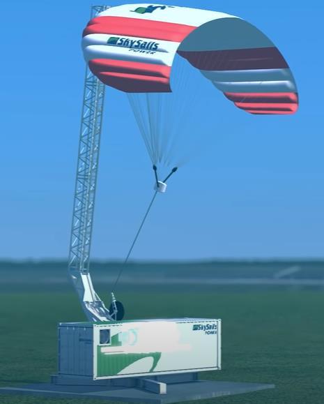
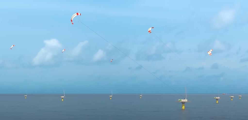
Fig. 31. Wind Kite systems (offshore) (Source: SkySails_Power_Imagebrochure_28-02-2021-1.pdf (skysails-group.com)
3.1.2. Visual Impact
The landscape of palanga and the whole of lithuania is very flat and any structure which is big and highrise will be visible from a long distanceof about 20 km and will affect the landscape as a whole. The following concept of wind kites is selected because of mainly two reasons:
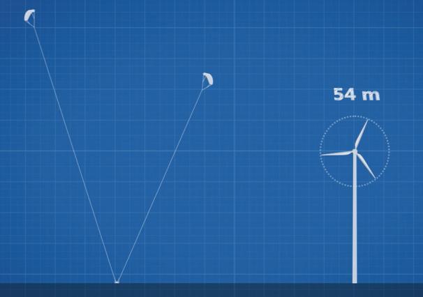
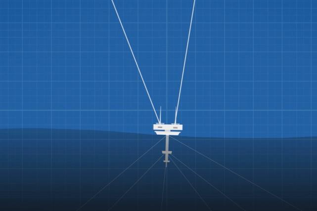
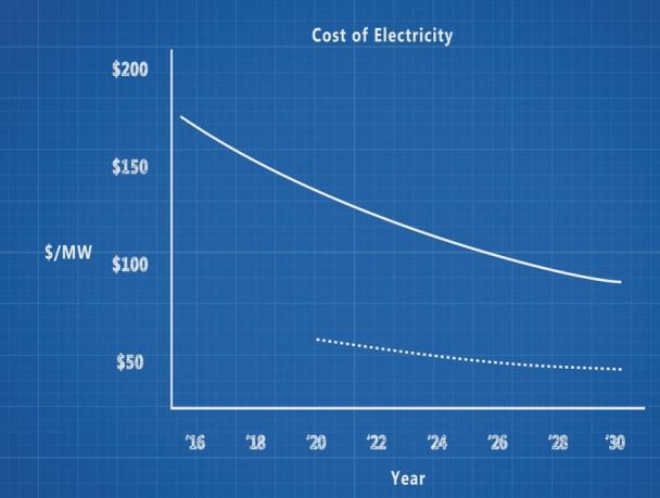

46
Fig. 32. Heights in comparision with the windmills and low cost sea mechanism (Source: (1101) The Future of Wind Power? - Kite Power Systems - YouTube)
Fig. 33- Electricity cost graph and Visual impact comparision (Source: (1101) The Future of Wind Power?Kite Power Systems - YouTube)
Firstly, becauseofits design as theunit has justonewireattachedto thekiteandtheelectricitystorage and mechanism unit which takes the kite to a height of about 800 m where the wind is high and because the wire when observed from a distance becomes invisible to the naked eye as illustrated in (fig-30) and also theparachutebecomessmall adding verylittleto thevisual field ofview and it could be observed like someone doing an adventure sport activity unlike windmills and does not seem to be mechanical and preserving the celebrating spirit of Palanga resort city.
Secondly, the system could be placed on and off the coast with very little installation costs unlike windmills. Of the coast systems have the potential generate 3.5MW of energy (fig-31) which can provide the Palanga town with clean dependable energy and also off shore system could be placed 5km from the coast to lower the already less visual impact and preserve the historic coastal views.
3.1.3. Educating people by Installing Holograms
The central axis of Palanga. J. Bascanavicious street is considered to be one of the primary points of interest within the town. Furthermore, it establishes a connection to the primary nodes and edges of Palanga. The location in question is marked by the presence of Vytautas the Great's statue at one end and a sea bridge at the opposite end, which holds notable historical significance. During the Soviet era, it served as a significant commodity for commercial transactions. Individuals tend to allocate their leisure time to engage in activities such as beach-going, walking, and unwinding on the streets. V. Stauskas noted that the presence of multiple activities on this specific stretch of street has resulted in a significant increase in visual pollution, thereby negatively impacting the visibility of heritage objects and rendering the area aesthetically unappealing. Amidst the vibrant array of hues, vocalists, emblems, and written language, the distinct auditory characteristics of these culturally significant artifacts are often overlooked. The current situation is antithetical to the requisite conditions for progress as we strive towards greater societal sophistication. The exploration of non-destructive alternatives is recommended in cases where visual pollution can be controlled and mitigated through digital means. For instance, holographic signboards and functional symbols could be strategically placed atop cultural objects to highlight their historical significance, as depicted in (fig- 34). The manifestation of the object's essence will imbue Palanga with the character of an architectural museum in its entirety.
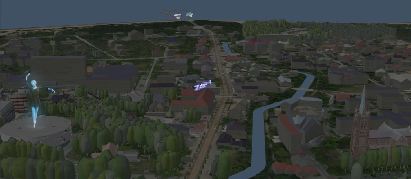
47
Fig. 34. Highlighting the heritage objects with holograms (Source: composed by author)
An additional rationale for the aforementioned proposition was to appeal to the younger demographic and stimulate an architectural renaissance, while concurrently captivating tourists. As the gaze of individuals tends to move in a top-down fashion, they will have the opportunity to consciously or subconsciously perceive the objects in their entirety. Additionally, it is likely that the implementation of this approach will result in an augmentation of the fractal dimensions of the street, thereby contributing to its value in a more understated fashion. The technology can also be utilized to showcase intricate and genuine sculptures in conjunction with historical events presented in video format. This immersive experience allows individuals to gain a more vivid understanding of events, resulting in a more memorable impact. These interventions are expected to generate employment opportunities for individuals with backgrounds in computational, IT, and architectural fields, including local residents and younger generations.
3.1.4. Visual learning through holograms.
In the contemporary age of social media, where the majority of human activities occur online, individuals have become increasingly reliant on technology and consume information at a rapid pace through the use of infographics and videos. This trend has facilitated an accelerated learning process. A similar approach could be applied to the Palanga heritage sites, whereby the resort town could be transformed into anopen museum ofmodernist architecture.This could be achievedby implementing a holographic display, as depicted in (fig-35), atop the heritage sites. The implementation of holograms would provide three significant benefits. Firstly, holograms would serve to underscore the modernist heritage objects, thereby enhancing their recognition and appreciation among the general public. By presenting the history and construction methods of these objects in a visually engaging manner, such as through the use of drop-down animations, architectural learning would become more enjoyable and accessible to local audiences, ultimately leading to a greater awareness of their cultural
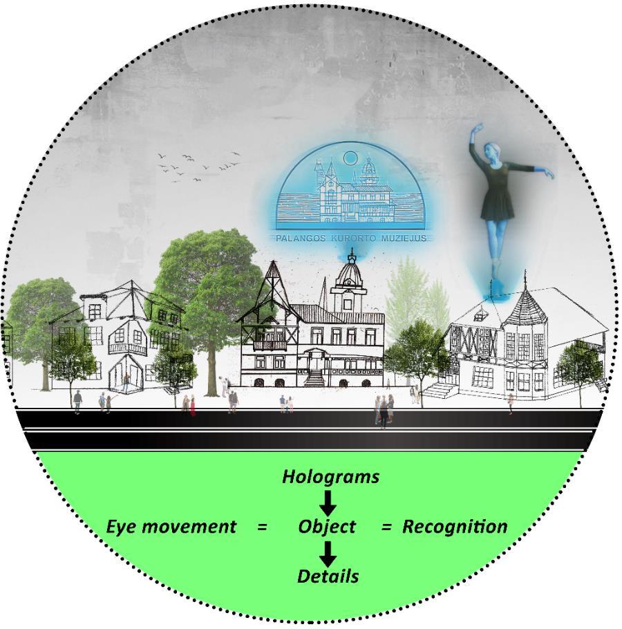
48
Fig. 35. Eye movement of Observer (Source: composed by author)
value. Secondly, the introduction of holograms could potentially create employment opportunities for Lithuanian animators or for Ukrainian refugees currently residing in the region, thereby contributing to the local economy and promoting social integration. Thirdly, the placement of holograms at the apex of the heritage site would prompt the observer's gaze to move in a top-down direction, thereby compelling them to pause and concentrate on the intricacies of the structures, as depicted in Figure 6. Fourthly, given that the heritage objects are dispersed throughout the resort, the observers would instinctively and unconsciously endeavor to investigate the locales and acquire knowledge about Palanga, consequently mitigating foot traffic on J. Bascanavicious street and fostering a sense of harmony. This would prevent the experience from being marred by large crowds congregating in a single location and also giving a highlight to the town and converting it to a museum of heritage objects (fig-36).
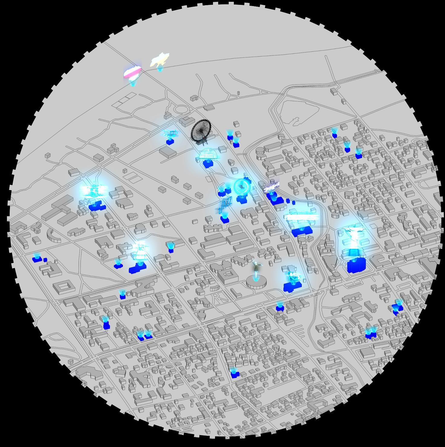
49
Fig. 36. Turning town into a museum of architecture (Source: composed by author)
Affordability of the holographic systems
The dimention of the affordability of holograms is much higher around 50,000 dollars and also consumes a lot of electricity which is not sustainable but technology is changing very fast and I see this solution practicle in less than five years of time also another solution is proposed in the above part of research that if Palanga could build a wind kite system offshore and onshore it could not only be able to support the holograms and the whole of the town but could also make profits by selling the clean energy to different parts of Lithuania and proceed further towards to the goal of self sustaining resort by 2030.
3.1.5. Proposal of Ice winds systems
There is a great deal of potential on the intersection of Kretinga and Klaipedos (fig-37), as the streets receive a good amount of continuous traffic flow both in the winters and extremely high in the summers. This potential could be taken advantage of by placing Ice winds systems on the calculated points where the vehicles pass by, so that the gust of wind created by it helps to move the system to produce clean energy around the clock, which could then be further treated by solar panels placed on top of it (fig 37). After then, these devices are able to discharge the stored electrical power to the parked electric vehicles (EVs) or bolt scooters, in addition to the streetlights. The use of these technologies will lead to a scenario in which all parties involved will emerge victorious. The incorporation of these technological advancements will make the city of Palanga more dependable, and they may also contribute to the ongoing expansion of the resort community.
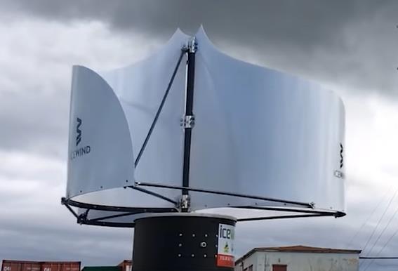
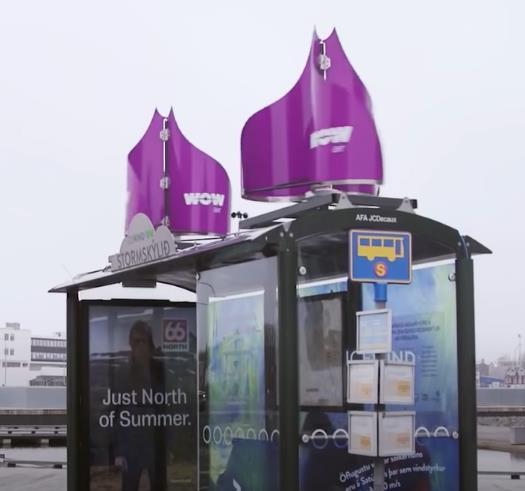
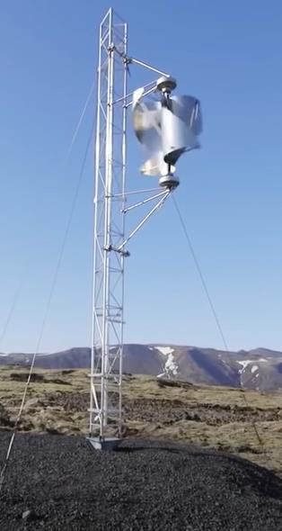
50
Fig. 37. Icewind systems (Source: Youtube)
Sunsetting and sunrise radius and points
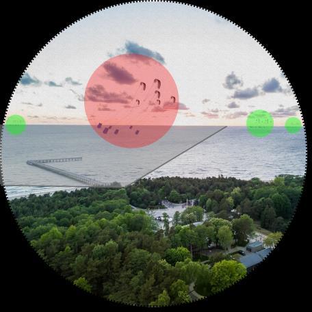
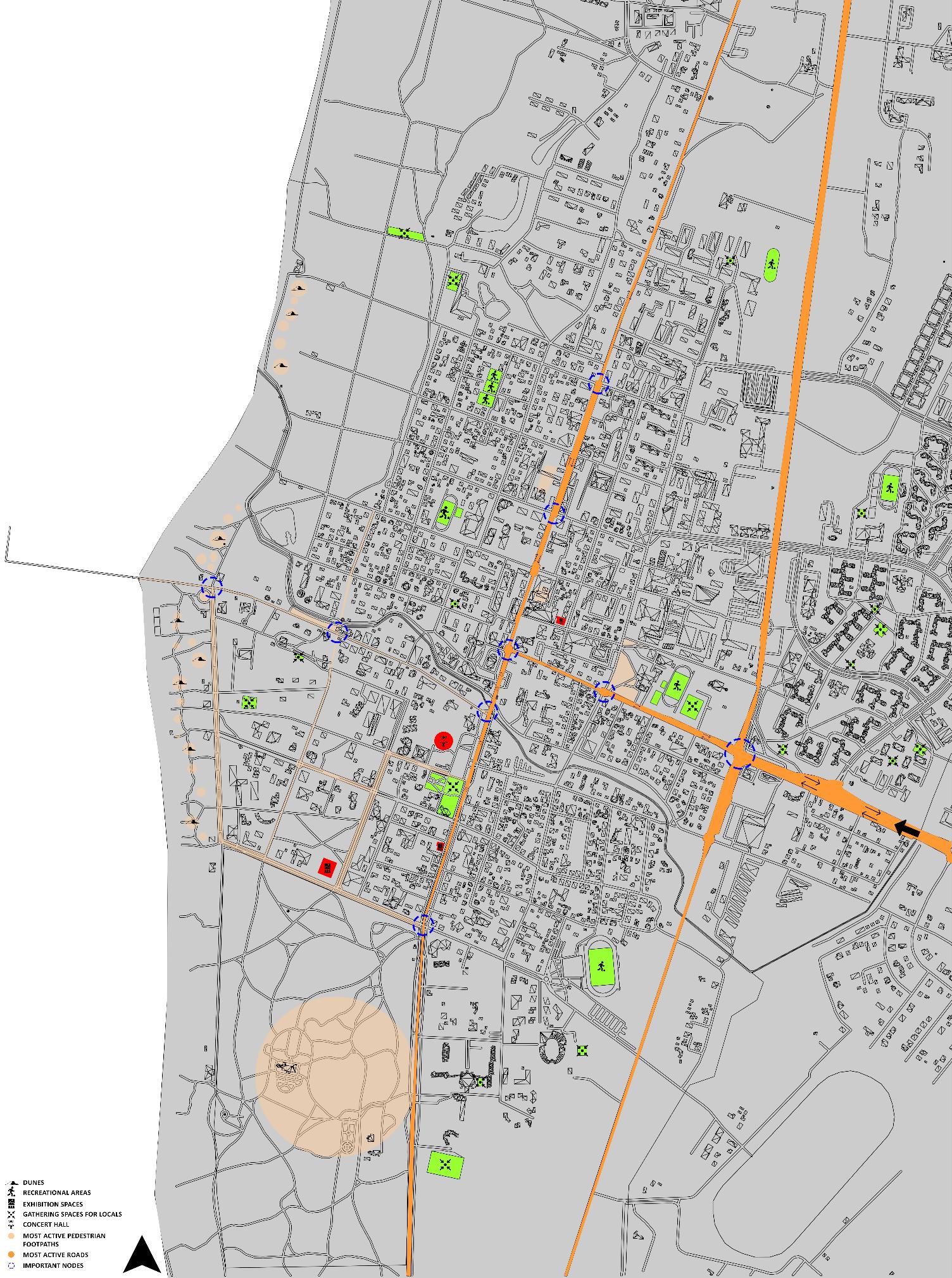
38. Traffic and Pedestrian flow with major nodes (Source: composed by author)
51
Fig.
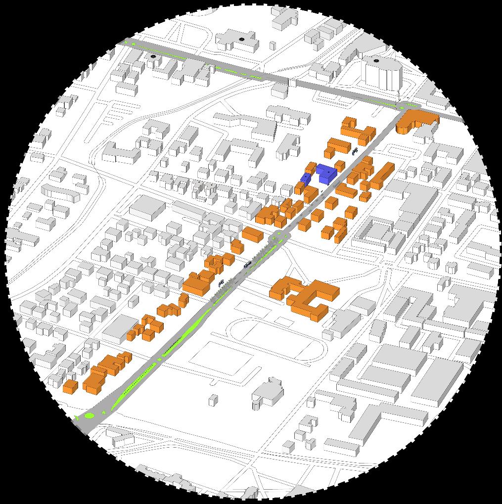
39.
and Vytauto gatve as potential highways points for installation of Ice wind systems
(Source: composed by author)
52
Fig.
Klaipedos
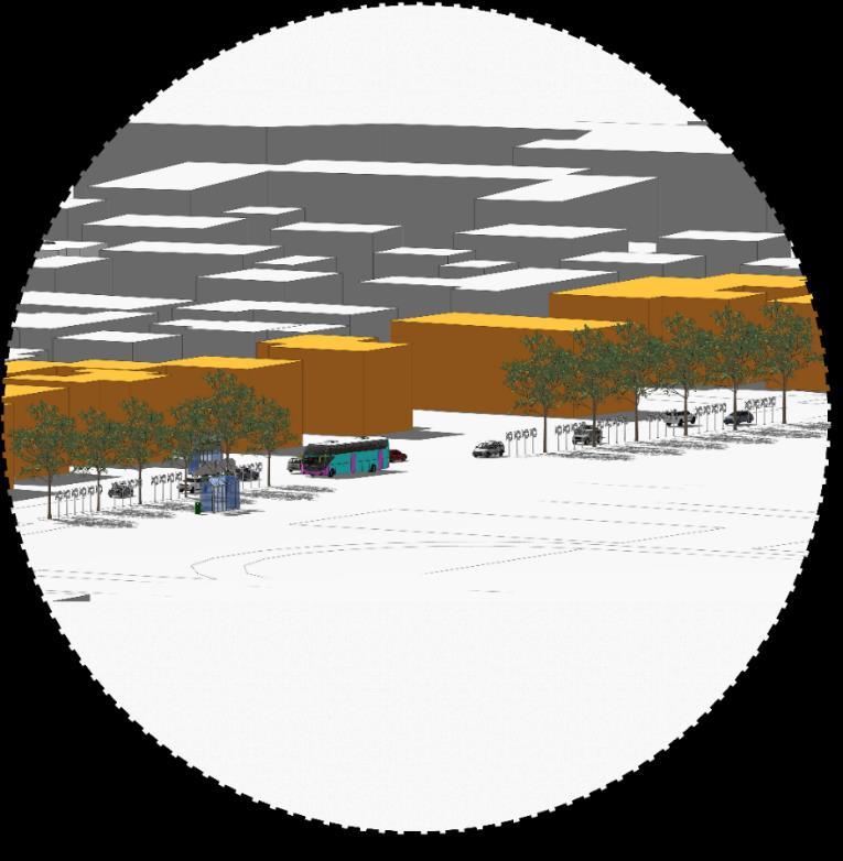
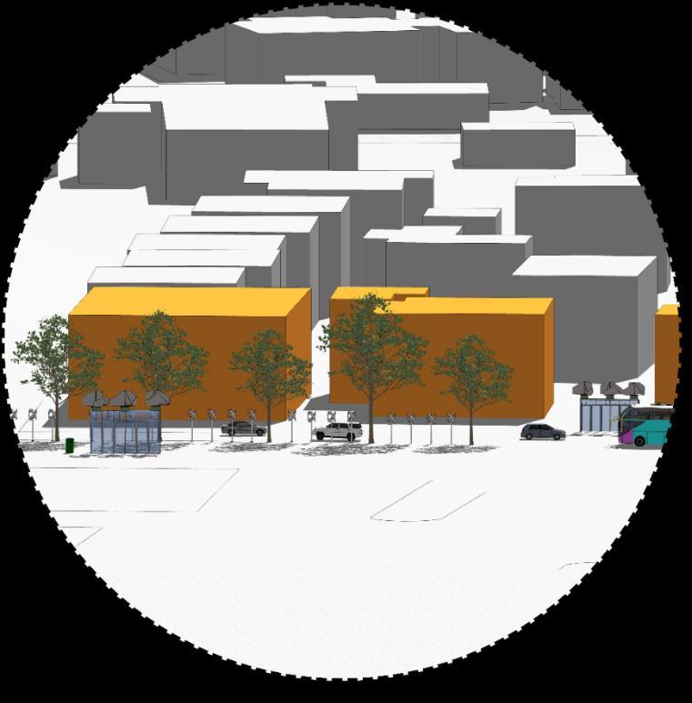
Fig. 40. Ice winds systems after installation on the Kretinga highway (Source: composed by author) Energy is being wasted everywhere around us, from tidal energy to solar energy to wind energy, and if we can take advantage of the wind gusts caused by the moving automobiles, it would bring the town one step closer to fulfilling the sustainability targets established by the United Nations until the year 2050 to become zero carbon cities. These systems might be positioned in the center of the street amid the trees, on the pathways, and at the top of the bus stops as indicated in the bottom left photo of (fig 38), and they will move in response to the wind gusts that are caused by automobiles and buses elaborated in the street views of (fig-39) and (fig-40)
53
(1)
(2)
3.2. Study of Heritage Objects and their Peculiarities
In order to move forward with the design process, some major issues needed to be tackled through research, such as the function of the site, what could be appropriate to propose taking into consideration the current heritage protection awareness in Palanga, and its form because of its close proximity with the bridge and major streets. These issues needed to be resolved before the design process could move forward. Analysis of the historical pieces, some of which were destroyed while others were preserved, was carried out, and the results showed the rich creative design element that was utilized to experiment with blending different sorts of styles into one another. Both the destroyed and the preserved heritage objects were examined. It was determined that the artifacts should be analyzed according to their shape, volume, facade design, plans, materials, interiors, and architectural styles. The results of these analyses may be seen in the (Appendices: Table-1) table.
3.2.1. Analysis of Heritage objects
Extinct Objects
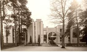
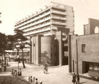
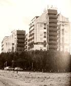
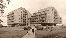
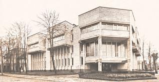
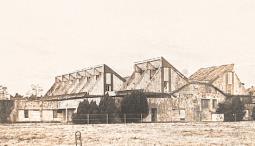


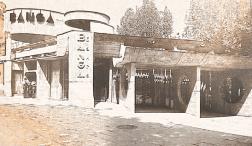
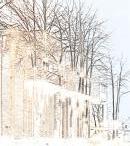
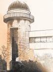
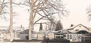
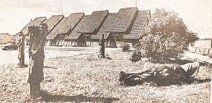
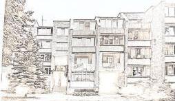
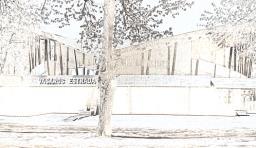
41. Lost Heritage Objects (Source: Palanga architectural guide (Petruliene et al., 2021))
1. Filharmonijos vasaros estrada (neislikusi) at Vytauto g. 43
2. Cafe Banga
3. Poilsine Silas at Maironio g. 12/ Gintaro g. 25
4. Siauliu Tauro Poilsio namai (dabar, veisbutis, Tauras) Vyatuto g. 116
5. Valgykla ir restoranas „Vasara“ at S. Neries g. 39
6. Zemes ukio akademijos poilsio namai
7. SSRS ministry Tarybos seveciu namai
8. Vila (dabar palangos civilines melrakaajos skyrius) at Kestucio g. 19 Palanga
9. Bursteino Vila at Birutis al. 37
54
Fig.
3.3. Architectural Peculiarities
Identified Architectural, Urban and Natural Peculiarities
1. Large and spacious sizes of any style and function of the object is a type of peculiar feature of the resort's buildings.
2. Recreational functions are highly dominant in the Palanaga region because of its history associated with many rich and famous people/artists or different fields.
3. Play of geometrical elements both in planning and designing facades.
4. Wood is an important material in Palangas history, many characteristic objects and elements are defined by it to make it more expressive.
5. The low urban fabric of Palanga allows the town to protect itself from strong winds and at the same time allow sunlight to enter deeply into the resort.
6. Porches decorated with graceful openwork ornamentation along with decorated pediments.
3.4. Design and Interpretations
3.4.1. Use of AI to re-interpret Architectural styles and elements and for further developments in Palanga
Artificial intelligence can be used in many ways to help in the development of Palanga. Some examples include:
1. Urban planning and design: AI can be used to analyse data on population density, traffic patterns, and landuse to help and design more efficient and liveble cities. This can help in the development of new buildings, public spaces, and transportation infrastructure in Palanga.
2. Smart tourism: AI can be used to analyse data on tourism patterns and preferences to help palanga as a destination, and to provide personalized recommendations to visitors.
3. Environment monetoring: AI can be used to monitor the environment and natural resources in palanga, such as air and water quality, and to predict and prevent potential ecological problem.
4. Predictivemaintenance: AIcanbeusedto predict whenequipments orinfrastructurewill need maintanence, which can save money and reduce downtime.
5. Energy Management: AI can be used to optimize energy consumption in buildings and infrastructure, which can help to reduce energy costs and improve energy effeciency.
6. Traffic control and management: AI can be used to analyze traffic patterns and predict congestion, which can help to optimize traffic, flow, improve safety, and reduce travel time.
Overall, AI can be used to make better decisions, improve efficiency, and create new oppertunities for Palanga. Its important to keep in mind that AI is a tool, and its success will depend on how it is implemented, and how it alligns with the overall goals and visions for the city.
55
3.4.2. Analysis with Mid journey
Interpretation of the old style elements was analysed through AI which gave some interesting results so as to predict the future development scenario in palanga, the influence of AI on the design was on the conceptual sketches was prevented by sketching the proposals first and then later the analysis in midjourneys was performed. While typing the key words it was also experimentd with the painting styles of two famous Lithianian artists Mstalavas Dobuzinskis and Janina Monkute the results are attached below.
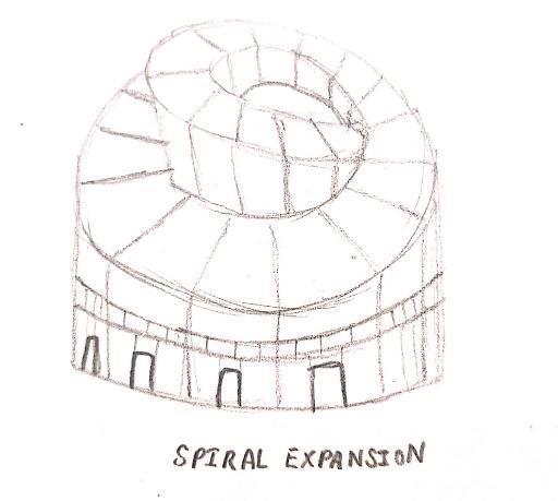
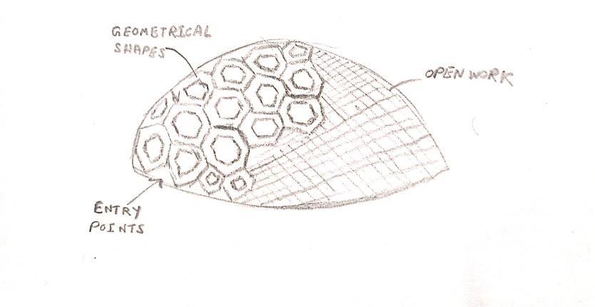
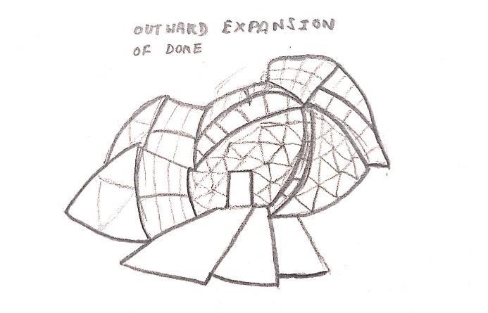
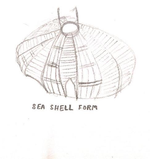
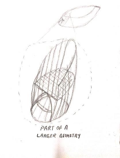
56
Fig. 42. Conceptual sketches (Source: composed by author)
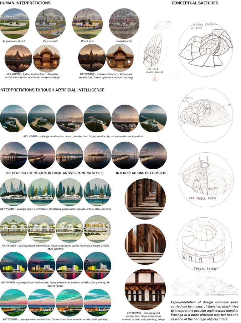
Fig. 43. Interpretations througs AI (Source: composed by author)
57
3.5.1. Site Upgradation
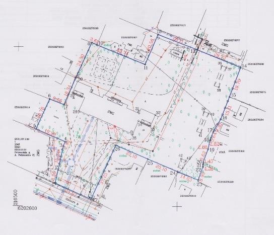
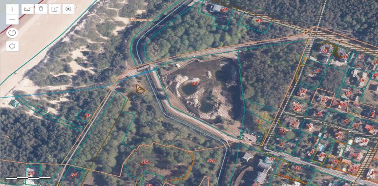

Previously in the starting of the research the site allocated was in the middle of the residential homestead but due to the size, scale and disturbance created by the design solution of a multifunctional space it was reallocated to a new location on plot 44 neat the river Raze which was suitable for the projectof such scale and size. Attached above are the sattelite images of both the sites with the context and size and scale difference
58
3.5. Design Solutions
Fig. 44. Old site (Source: composed by author)
Fig. 45. Plot 44 (New Site) (Source: www.regia.lt)
Fig. 46. Plot 44 Area (Source: www.regia.lt)
3.5.2. Site Analysis

47. Historical boundary of Palanga (Source: composed by author)
Existing new site has a good connectivity both with the coast, J. Bascanavicious gatve, Palanga pier, and is surrounded by trees and offers a view of beautiful sunset. The main USP is its connectivity and peaceful location at the historical edge of town with river Raze flowing which offers major recreational activities like taking a walk, cycling, skating etc. It is almost perfect with just one weakness, its entrypoint whichis very narrowand offersverylow width road.Previously it was some kind of a waterbody with absolutly no trees or plantation to protect unlike other sites. It has been alloted a land use of commercial but historical maps also show that it is being vacant for a long period of time due to a waterbody present on the site. Photofixation of the site is done to get a better understanding of the contours and what sort of landscape and vegetation is found in the
59
Fig.
syrroundings, along with measuring the average height of the trees to find out the perfect views offering sunset views.

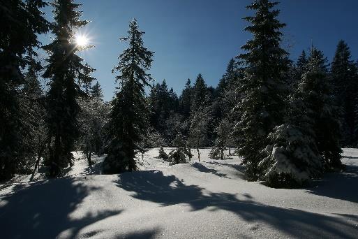
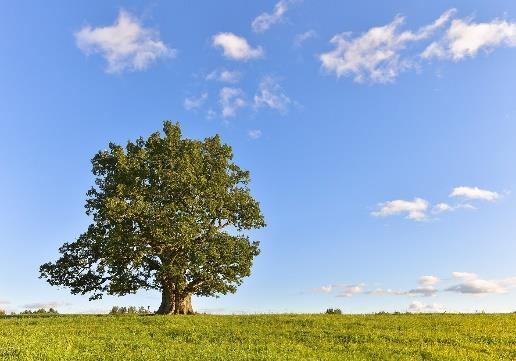

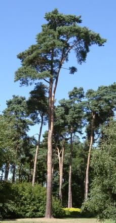
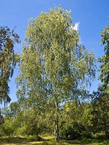
1 2 3 4 5 6
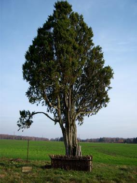

Fig. 48. Common Plants around site (Source: composed by author)
Pinus sylvestris, more commonly known as Scots Pine, accounts for around 40% of the total number of coniferous species, while Picea abies, more commonly known as Norway Spruce, accounts for approximately 20% of the total number of coniferous species. These two species are the main coniferous species. The presence of broadleaf trees is one of the most distinctive features of the landscape in the country's central regions. Birch trees make up roughly 18% of the total tree population, followed by Black Alder trees and European Aspen trees, which each make up approximately 8% of the total tree population. Elm, ash, and oak make up the remainder of the tree population respectively. Oaks are also present (fig-46).
3.5.3. Design concepts
The impact of art forms both in culture and architecture goes overlooked, therefore taking into consideration the artistic heritage of Palanga and taking inspirations from the lost and standing architectural objects an attempt to capture their soul in the design solution. The singular vehicular movement gave the freedom to try and connect other enterances which as a result increased the walkability on the site.
60

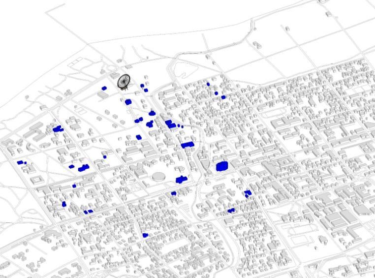
Fig. 49. Concept to revive the soul of lost heritage objects (Source: composed by author)
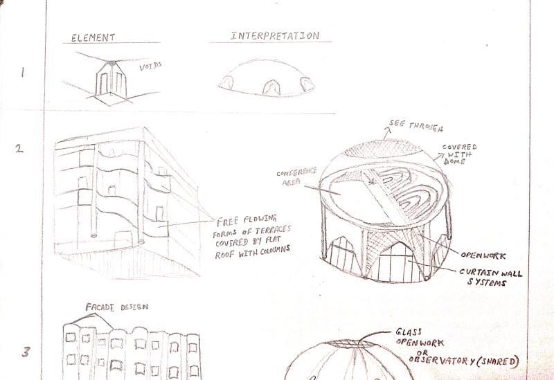
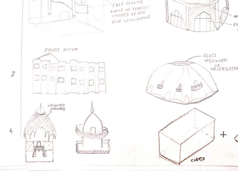


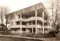
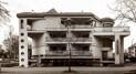
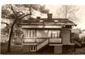
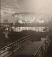
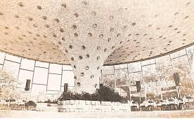
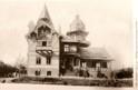
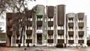
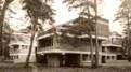
Fig. 50. Interpretation of design elements from the heritage objects (Source: composed by author)
Bascially the form of the structure was derived from the elements of lost and existing heritage objects like:
1. Filharmonijos vasaros estrada (neislikusi) at Vytauto g. 43
2. Cafe Banga
61
3. Poilsine Silas at Maironio g. 12/ Gintaro g. 25
4. Siauliu Tauro Poilsio namai (dabar, veisbutis, Tauras) Vyatuto g. 116
5. Valgykla ir restoranas „Vasara“ at S. Neries g. 39
6. Zemes ukio akademijos poilsio namai
7. SSRS ministry Tarybos seveciu namai
8. Vila (dabar palangos civilines melrakaajos skyrius) at Kestucio g. 19 Palanga
9. Bursteino Vila at Birutis al. 37
10. Medziokles namelis at J.Simpsono g. 19
11. Grafu Tiskeviciu davaro parkas su Lurdo grota
Which resulted into the and it follows all the peculiarities of a typical Palanga resort architecture like theuseofwoodin construction,largespaces, andlargefootprint, lowriseurbanform oftown, artistic practices. Its function is proposed to be a multifunctional/multipurpose artistic recreational as well as productive spaces where different minds of different region can practice different forms of traditional art forms as mentioned in the (fig 39) and can collaborate and work on design solution in various fields like, product design, Jwellery design, wooden carving art, and digitized arts. Goal is to counter the high consumption of social media by the young and give them spaces where they can explore their creative skills passed on by their ancestors.


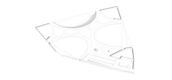


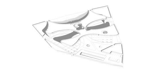
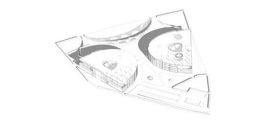


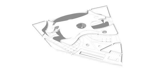
51. Principles followed while planning (Source: composed by author)
Also incorporation of Urban planning concepts from (Gorden Cullen -Townscape and Serial Visions) (Bruce, 2020) (Bertoli, 2017) are being followed as the site reveals its surroundings in different sets of pieces as we move from any entry point the view of the pond along with its background is revealed in a dramatic manner to the observer and the background creates a sense of arrival to the place. The flow of movement evokes a feeling of mystery. There is also great focus on planning the structure according to the sun and wind movement and strategic punctures in the outer dome and the green roof (fig-49) are given to make the space breathable and offers more natural lighting along with forming interesting spaces for people to explore and enjoy the surroundings of the site.
62
Fig.
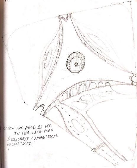
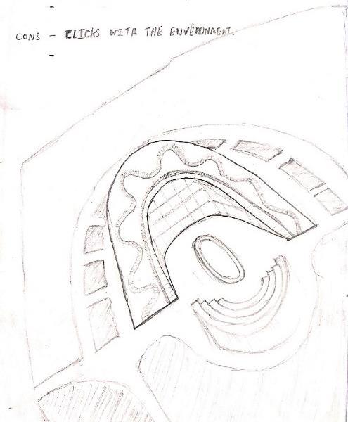
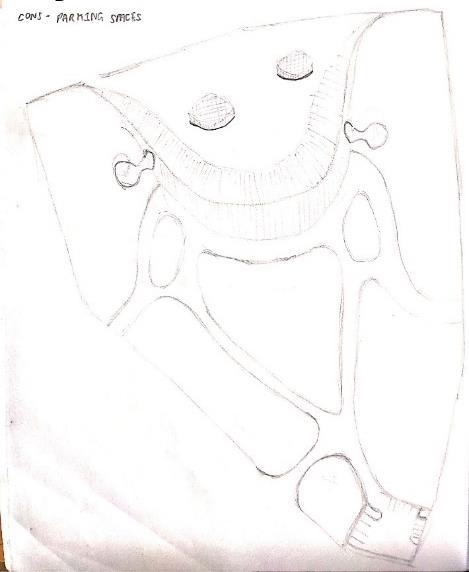
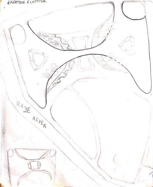
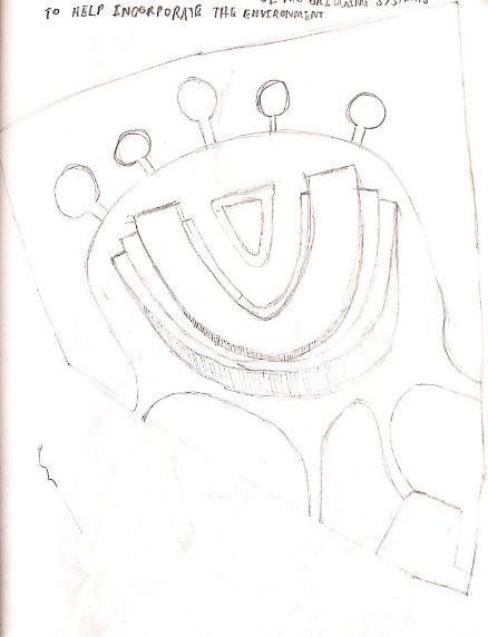
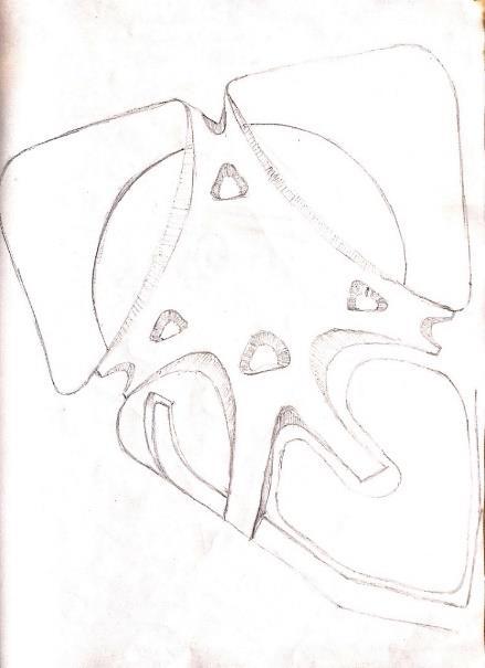
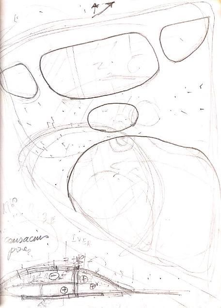
52. Design evoolution through sketches (Source: composed by author)
63
Architectural
3.5.4.
Solutions
(1)
(2) (3)
(4)
(5)
(6)
(7)
Fig.
Design Sketches
Following sketches show theevolution ofthedesignfrom forming asingular structure whichis trying to connect with the surrounding spaces to a well connected recreational space equally divided into two symmetrical parts to showcase the use of symmetry and an experimentation with the forms of green roof which connects the proposed bicycle pathway with the site to give a recreational feature and new view point to observe the setting sun. Further exploring the geometry formed and analysing the spaces formed by the intersection of the roof and the building it was proposed to give roof gardens with could be accessed by the regular public and gives it a symbolic meaning to the dunes and recreational function of the town.
Site Plan


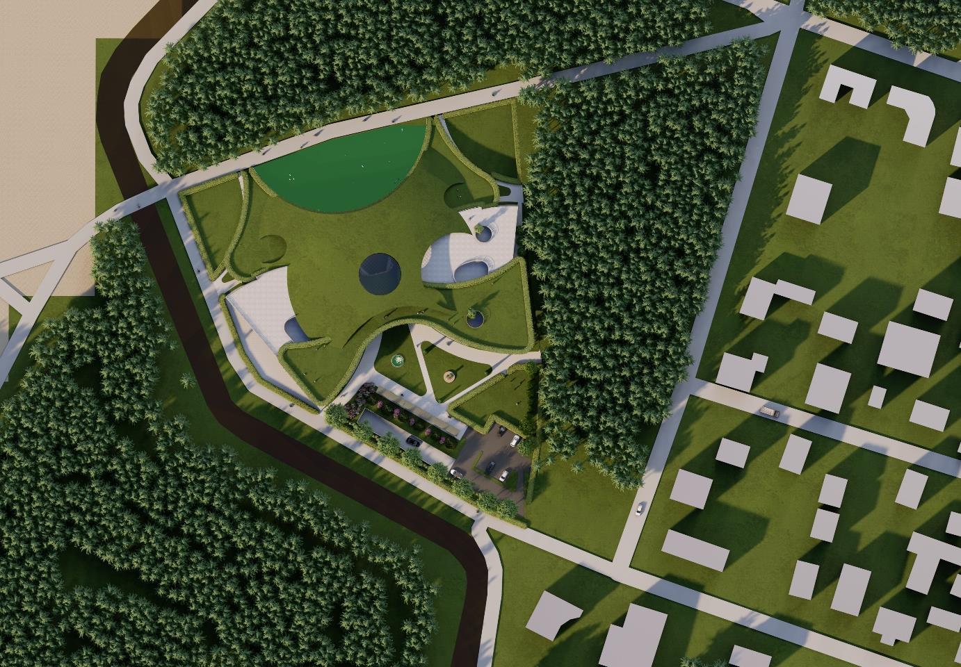


The site in question spans a total area of 1.16 hectares and exhibits a range of elevations, with the highest contour measuring 2.7 meters and the lowest contour measuring 2 meters above ground level. Previously, the site contained a pond which has since dried up, leaving behind a barren landscape with some vegetation growth. The site planning approach prioritized pedestrian movement while limiting vehicular movement and establishing a distinct separation between the two. The location of thesiteissituatedwithinthehistoricboundaryofPalangaandin closeproximitytonotablelandmarks such as the iconic street, pier, coast, and protected pine forest trees. This advantageous positioning affords a diverse range of panoramic views in all directions, rendering it a highly valuable asset. The impact of globalization on Palanga has resulted in significant deforestation, prompting a concerted effort to incorporate green design and planning strategies aimed at restoring the forested areas. In order to accommodate the requirements of artists and establish a thriving and leisurely atmosphere,
64
Fig. 53. Site Plan with Context (Source: composed by author)
WORKSHOP BUILDING RESIDENTIAL BUILDING
Vehicular Entry
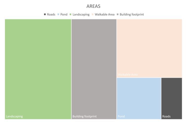
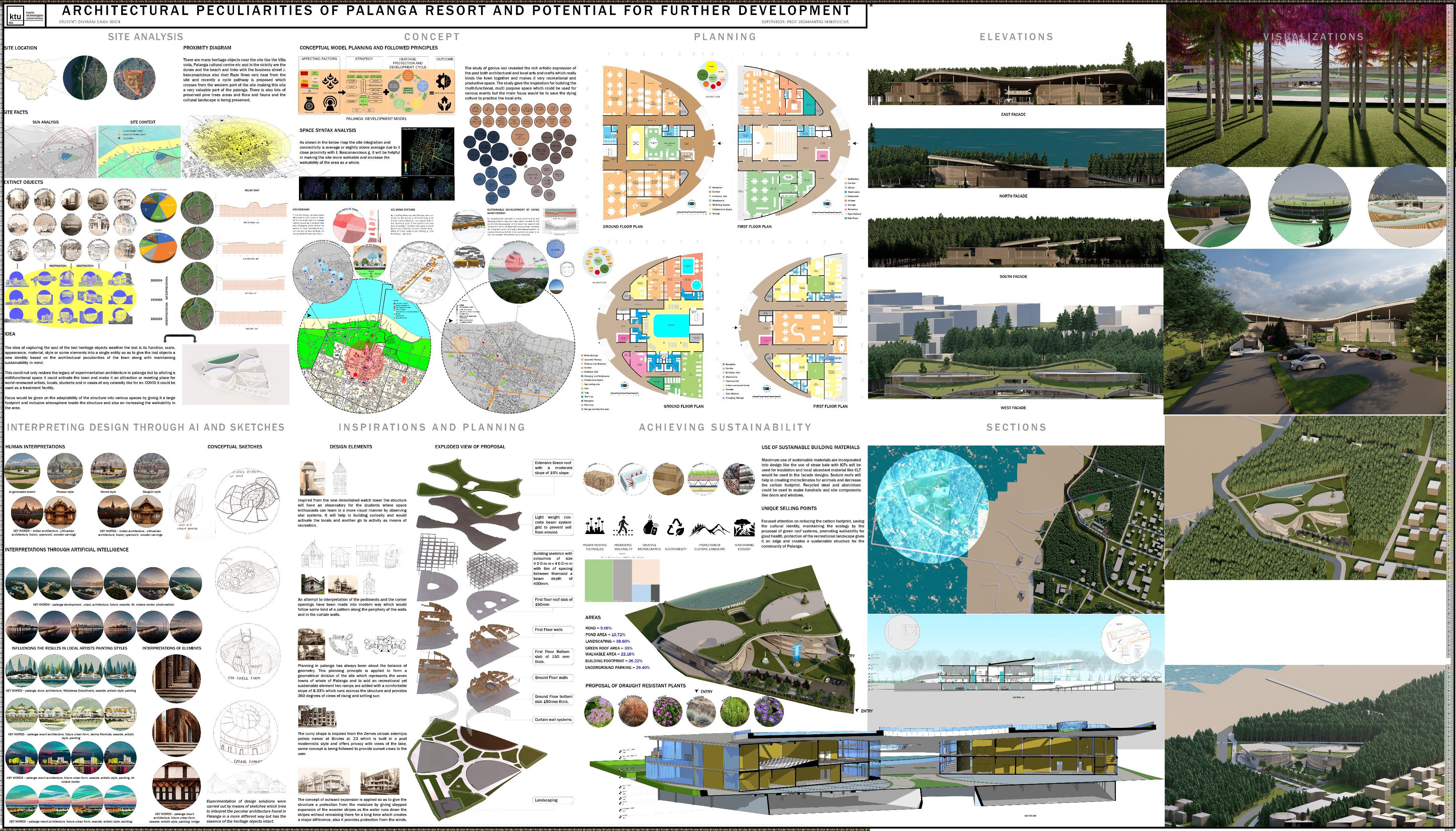
Ground Floor (workshop building)
The initial edifice situated opposite the raze river has a frontal entrance, as indicated in Figure 48. It features a majestic hall that is connected to the upper level corridors by means of two staircases. The structure features a column grid measuring 6 meters by 6 meters, which provides ample space for workshop areas dedicated to traditional Lithuanian arts. These areas are situated on either side of a central core space that includes a reception area and lift lobby. The lobby also features a waiting area that could potentially be repurposed as an exhibition space in the future. Adjacent to this core space are collaborative areas designed to facilitate the sharing of knowledge and the integration of diverse art forms. In the event of emergency situations, fire exits are provided to facilitate egress (as depictedin Figure 55).
65
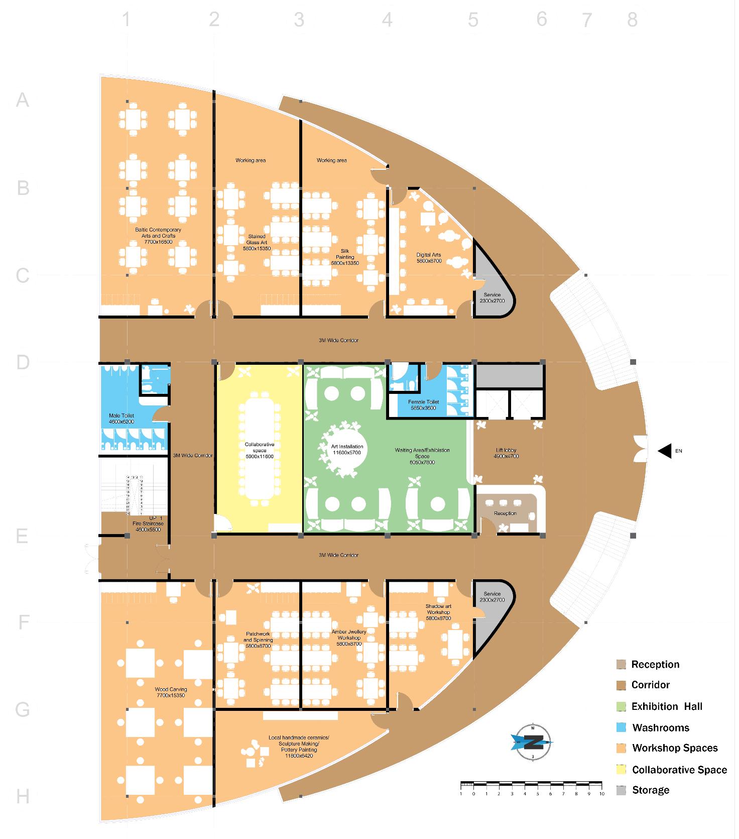
author)
First Floor (workshop building)
Located at an elevation of 3.6 meters, there exists a restaurant that offers a specialized kitchen and an adjoining children's room. The central region comprises an auditorium that can accommodate up to one hundred individuals, and restrooms are situated on either side of the hallway. The public library is situated on the opposing side of the edifice and boasts a capacity of fifty individuals, along with balconies and an emergency egress location (refer to fig 56).
66
Fig. 55. Workshop Ground Floor Plan (Source: composed by
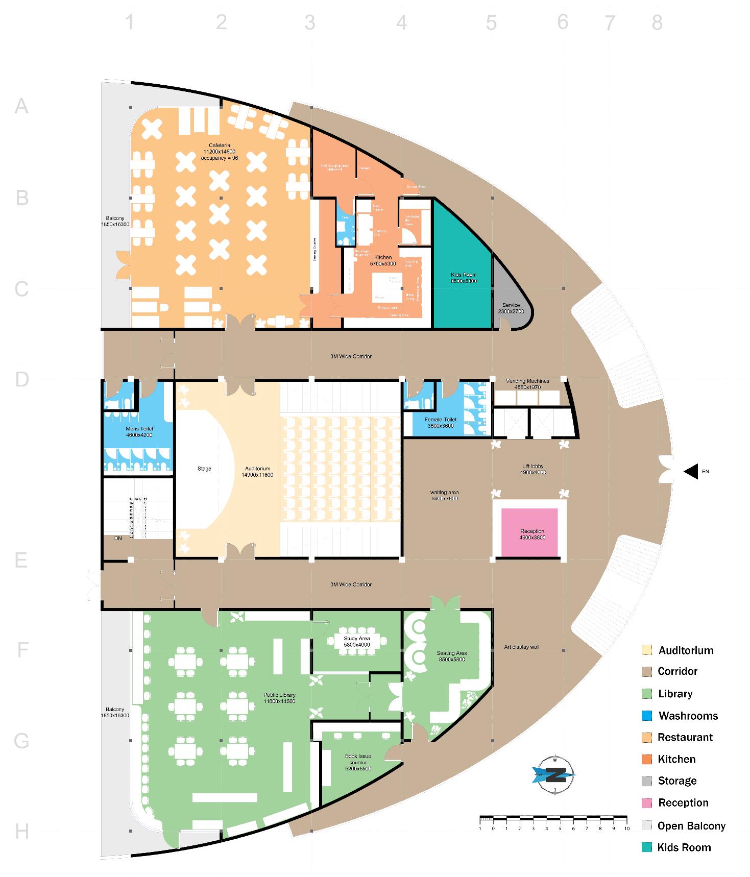
67
Fig. 56. Workshop First Floor Plan (Source: composed by author)
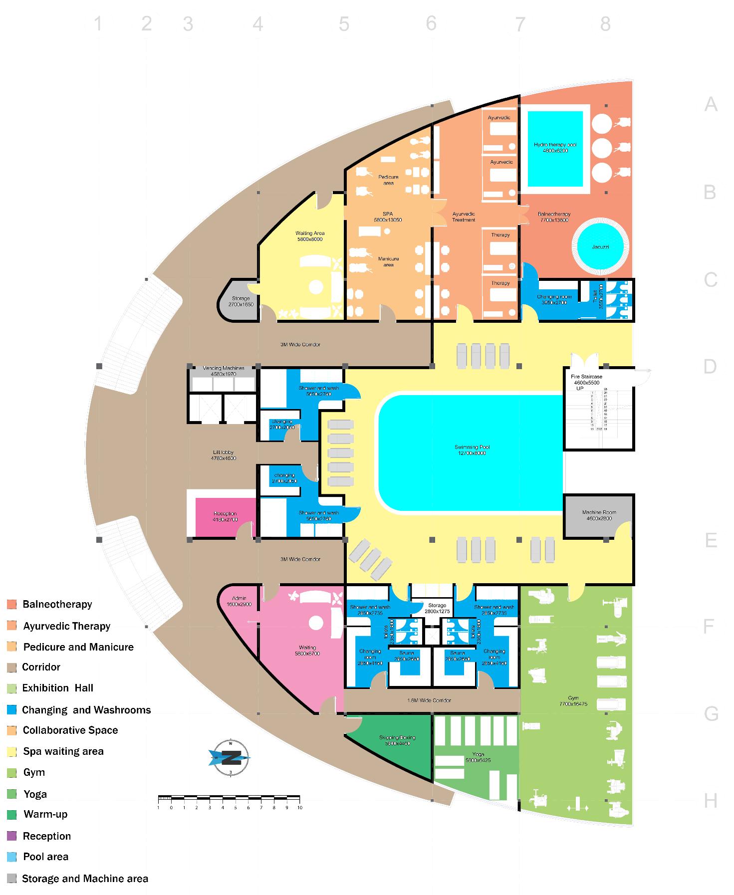
Fig. 57. Residential Ground Floor Plan (Source: composed by author)
Ground Floor (recreational building)
It consists of swimming pool area in the core with lift lobby and changing rooms to the north of the site and the fire staircase and machine room at the south with a gymnasium and dedicated sauna and changing rooms attached to it on the left side and spa facility on the right with 3m corridors running parallel to them (fig 50).
68
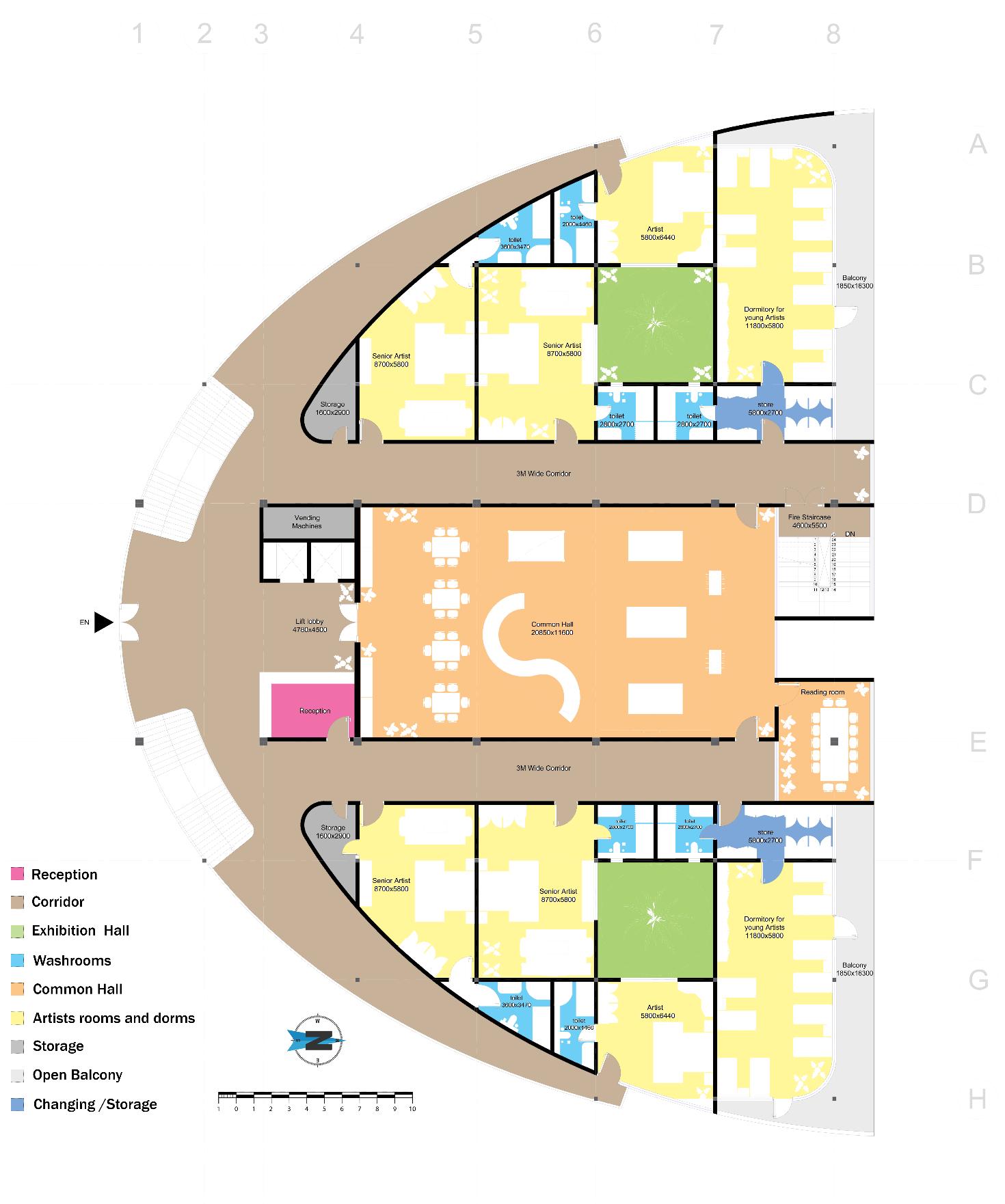
composed by author)
First Floor (recreational building)
On the first floor level at 3600mmof slab height there is a large common hall 20mx11m with reading and playing spaces for the students with luxerious rooms with attached toilets for accomodating 3-3 artists on each side and two dormitory spaces for a capacity of 20 students with attached balcony spaces on each ends. There is a open to sky area in between them for the incorporation of sunlight (fig-51).
69
Fig. 58. Residential First Floor Plan (Source:
Sectional Elevations
In (fig-52) the section is being cut from the centre core of both the buildings and some part of the eastern facade of the sedum roof where the first floor slab is at the 3.6 m and second floor slab is at 8.75 m and the total height till the green roof is 13.8m from where the sea is visible and it also has an underground parking of 50 cars. It also shows the fire staircases on bothe the ends of the building opening in an open space and the visible dome which covers the building from the top and gives a recreational landscape feature to the whole object which have strategic openings on the top of the recreational building to enjoy the sunset views.

59. Perspective section throughout site (Source: composed by author)
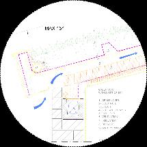

60. Section through workshop spaces (Source: composed by author)

In (fig-53) it can be seen the section cut of a workshop building along with the parking and the ramp of 1:12 slope, whis also cuts the fire staircase and the green roof system and in the enlarged the layers and the slant angle of 15 degrees of the roof and behing it is the symbolic monolithic dome made of light weight concrete. Visible spaces from the left are the baltic traditional arts workshop space above it is the restaurant and as we move towards the right there are the traditional wood carving workshop area on the ground level and public library at the first level.
70
Fig.
B B A A
Fig.
Exploded Diagram and Inspirations
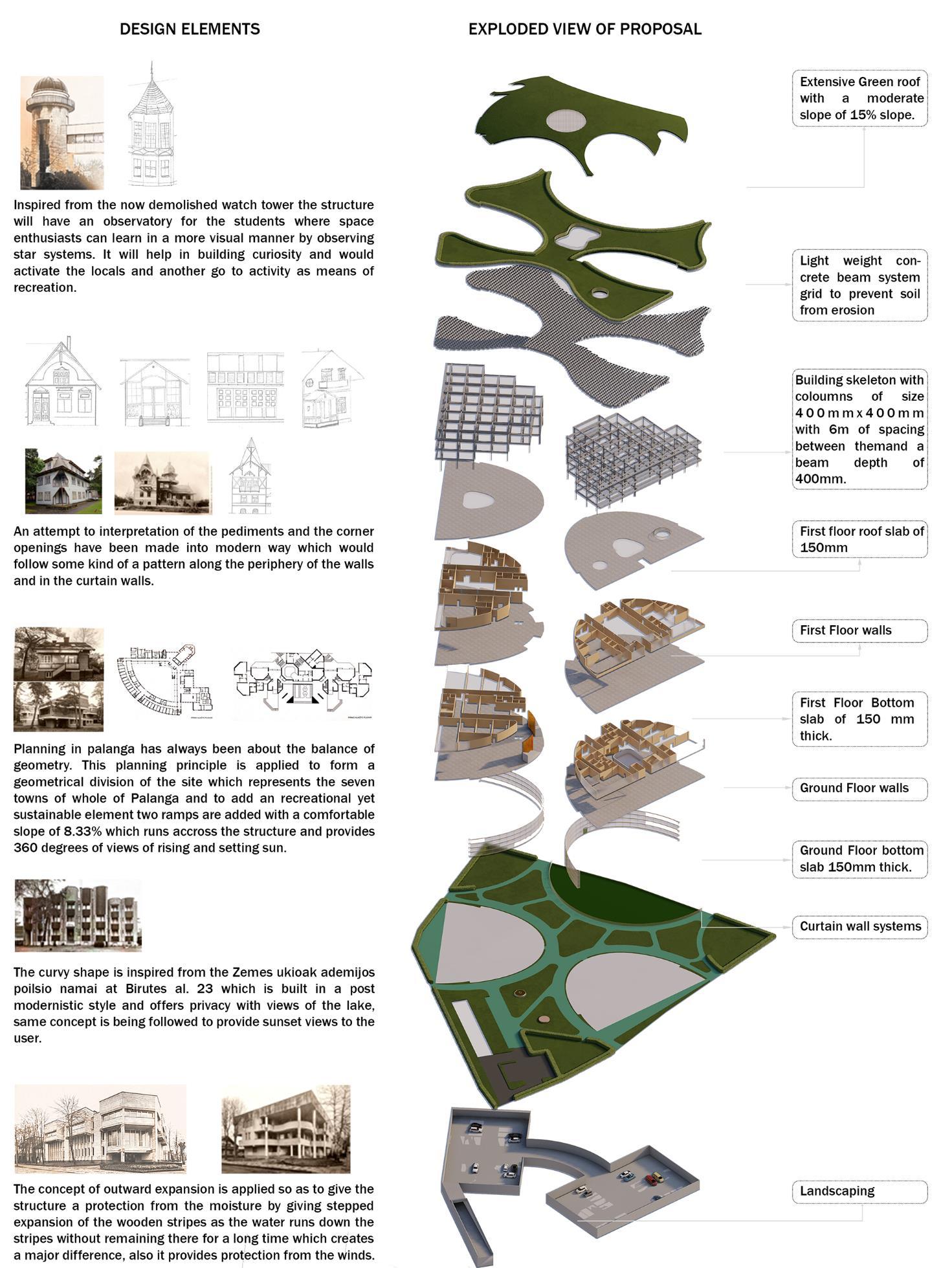
Fig. 61. Interpretation of design elements and exploded diagram (Source: composed by author)
71
The planned building will have an observatory that will be intended to improve students' learning experiences in the area of space research. The construction will be patterned after the old watch tower that was located on the property. Space nerds will have a once-in-a-lifetime chance to participate in the novel activity of visual study of star systems thanks to this facility. This program has the ability to promote inquisitiveness as well as encourage community interaction, and as a result, it has the potential to serve as a sustainable leisure endeavor.
An effort has been made to interpret the pediments and corner openings in a modern fashion, which would conform to a certain architectural scheme along the borders of the walls and inside the curtain walls. This attempt has been conducted in order to make the building seem more modern.
The planning process in Palanga has always placed a significant emphasis on the geometrical principle of balance. The planning method that was applied was the building of a site that was geometrically split into seven sections, each of which represented one of Palanga's municipalities. In addition, in order to improve the recreational value of the building while also assuring its long-term viability, two ramps have been built into it. These ramps have a manageable incline of 8.33% and circumnavigate the site, providing breathtaking vistas of the sun both rising and evening.
The design of the building was influenced by the Zemes ukioak ademijos poilsio namai at Birutes al. 23, which is located in the same neighborhood and was built in a postmodernist style. This particular building offers privacy while also allowing for views of the lake. The user will also be able to enjoy sights of the sunset thanks to the use of the same approach.
The purpose of implementing the idea of outward expansion is to give the wooden structure with protection against moisture by means of stepwise expansion of the wooden stripes. This will be accomplished via the application of the concept of outward expansion. Because to this architectural element, water is able to flow down the stripes without being there for lengthy periods of time, which results in a considerable improvement in the structure's resistance to moisture. In addition to this, the shape of the outer extension offers protection against damage caused by wind.
Elevations
In contrast to the presence of any form of covering compartments on the eastern facade of the edifice, as depicted in Figure 58, the construction permits unobstructed ingress of sunlight. Curtain walls are a prominent architectural element that can be observed throughout the entirety of a building's frontal facade. The frontal view of the Poilsine Silas edifice (Fig-39) reveals the presence of columns that provide support for the green roofing system. The columns are discernible in the frontal depiction.
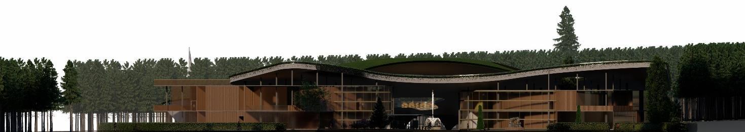
72
Fig. 62. East Elevation (Source: composed by author)
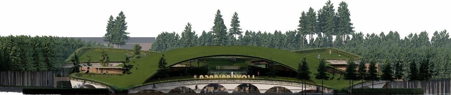
The western façade (fig-59) contains a series of arches on the ground level that serve as support for the roofing system. These arches also create visually appealing views of the green roof system and the pond that are located on the western side of the building. This is followed by a monolithic dome with an arch that provides areas for people to explore and interact with their surroundings in a way that is both dynamic and healthy.
The northern elevation exhibits the authentic outline of the dome along with the locations of the aperturesthatgeneratethesecaptivatingzones.Moreover,theexteriorsurfaceofthestructureexposes the two entryways for pedestrians, which direct the viewer towards the focal point of the location. The utilization of transparent glass in curtain wall systems in combination with cross-laminated timber of a lighter woodhue is evidenced in (fig- 60) and (fig-61). The aforementioned amalgamation is observable in both depicted illustrations.
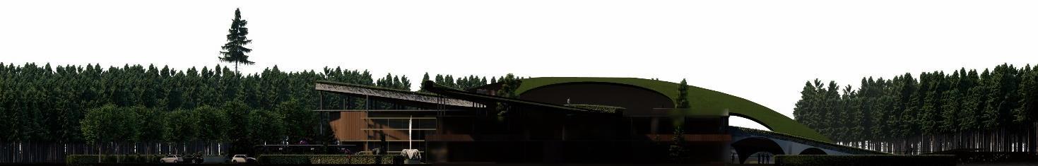
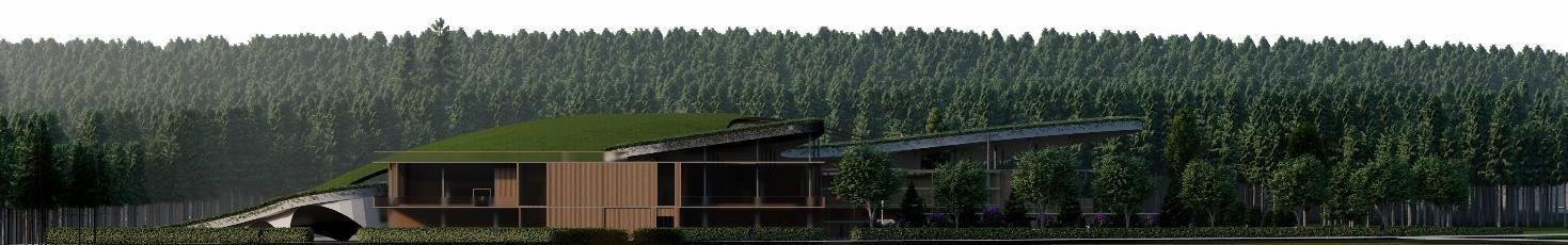
In the (Fig-57) western elevation we can see that the sedum roof accessible for the tourists with two entrances at the bycycle path proposed by the municipalty to form a connection with a moderate slope of 15% attaining a height of 13m having punctures at the middle for the incorporation of sunlight and for sunlight to entre inside the building the corridors are not covered with the roofing system instead the structures peep out of the roof so as to take the required sunlight from the setting sun.
73
Fig. 63. West Elevation (Source: composed by author)
Fig. 64. North Elevation (Source: composed by author)
Fig. 65. South Elevation (Source: composed by author)
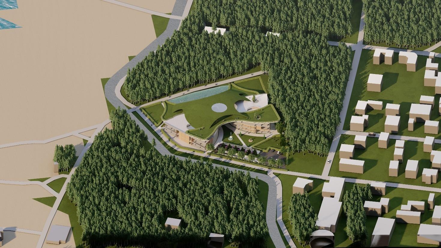
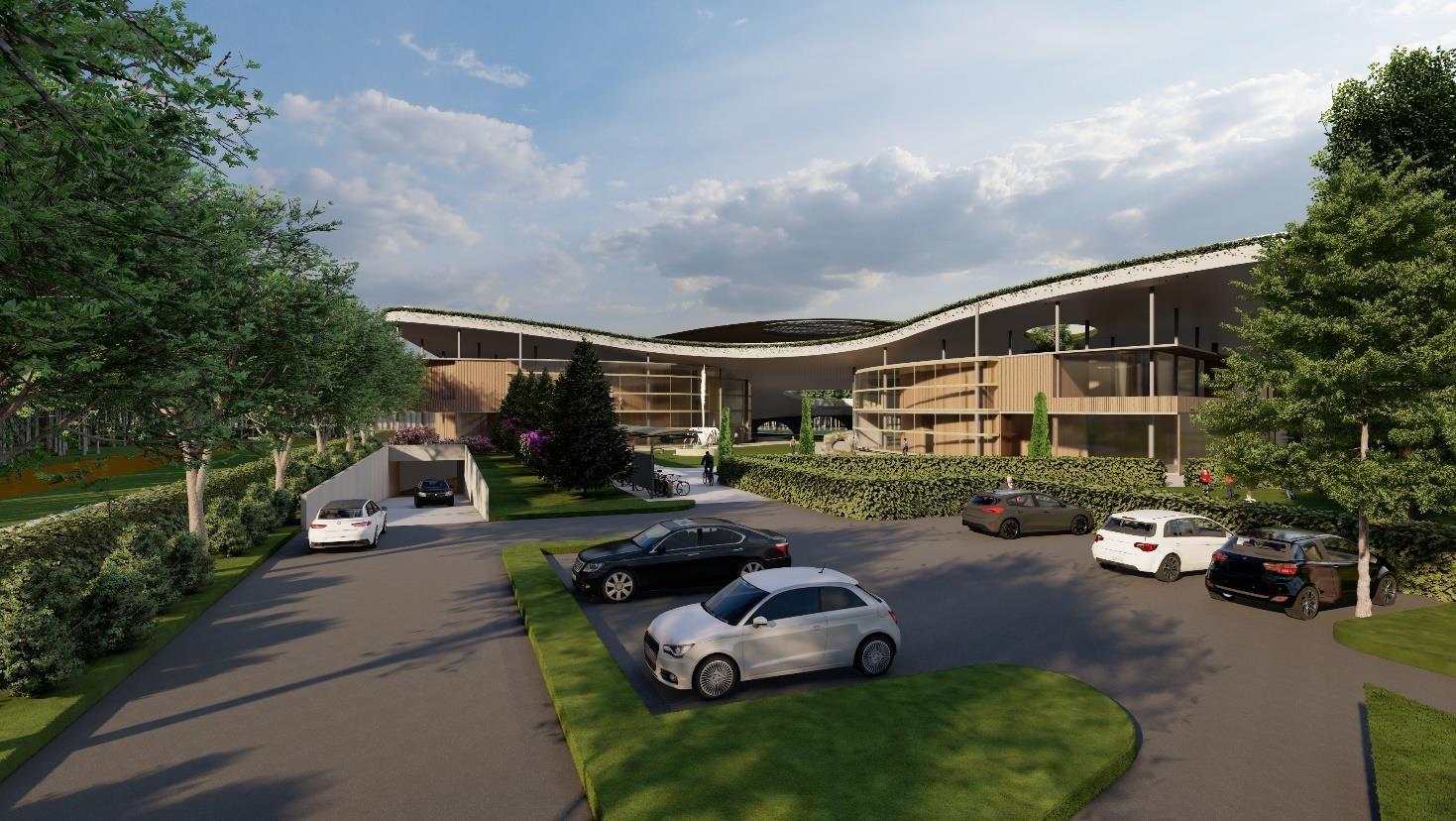
from the entrance looking at theway towards underground parking, on-ground parking and eastern facade of the object (Source: composed by author)
74 Visualizations
Fig. 66. Birds Eye view of the proposal (Source: composed by author)
Fig. 67. View
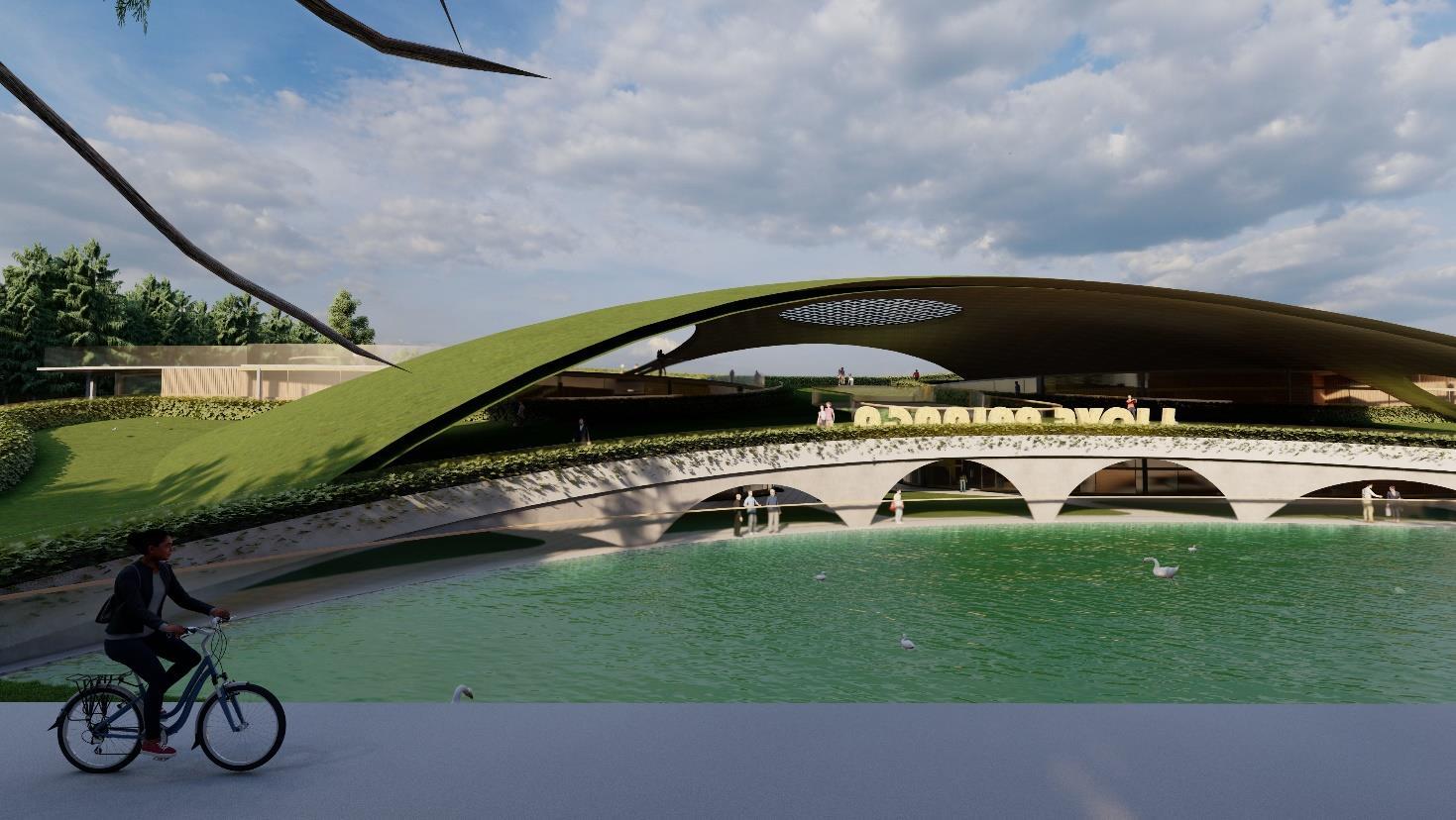
Fig. 68. A biker passing by looking at the western facade of the object with arches supporting the green roof and the monolithic dome and pond. (Source: composed by author)
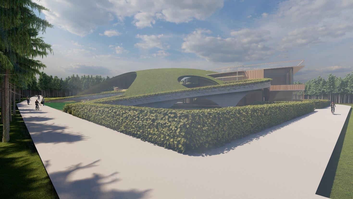
Fig. 69. View from the node covering the bycycle paths on both sides (Source: composed by author)
75
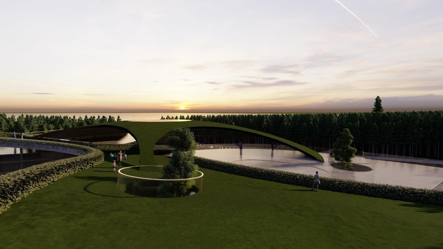
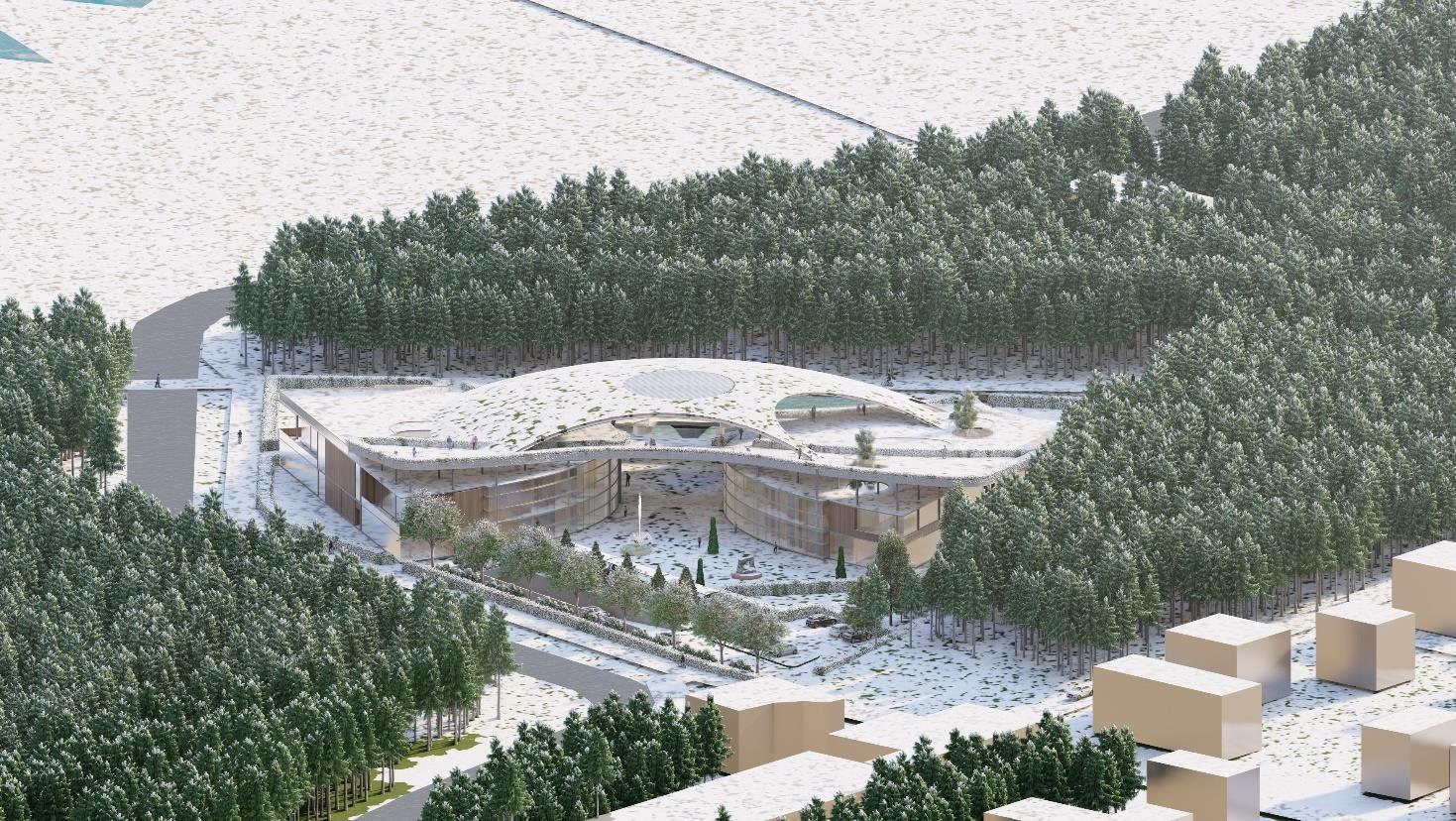
76
Fig. 70. Sunset view (Source: composed by author)
Fig. 71. Birds eye view of the object in winter season (Source: composed by author)
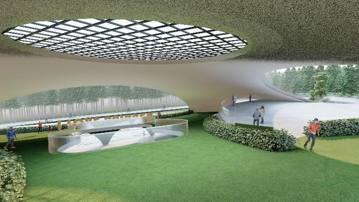
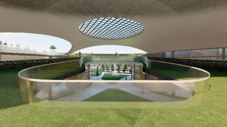
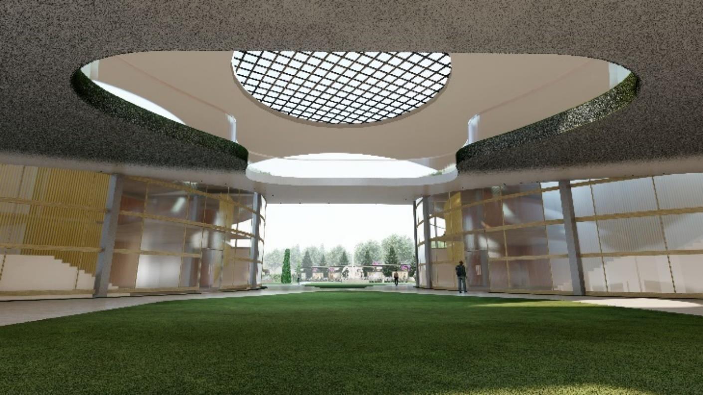
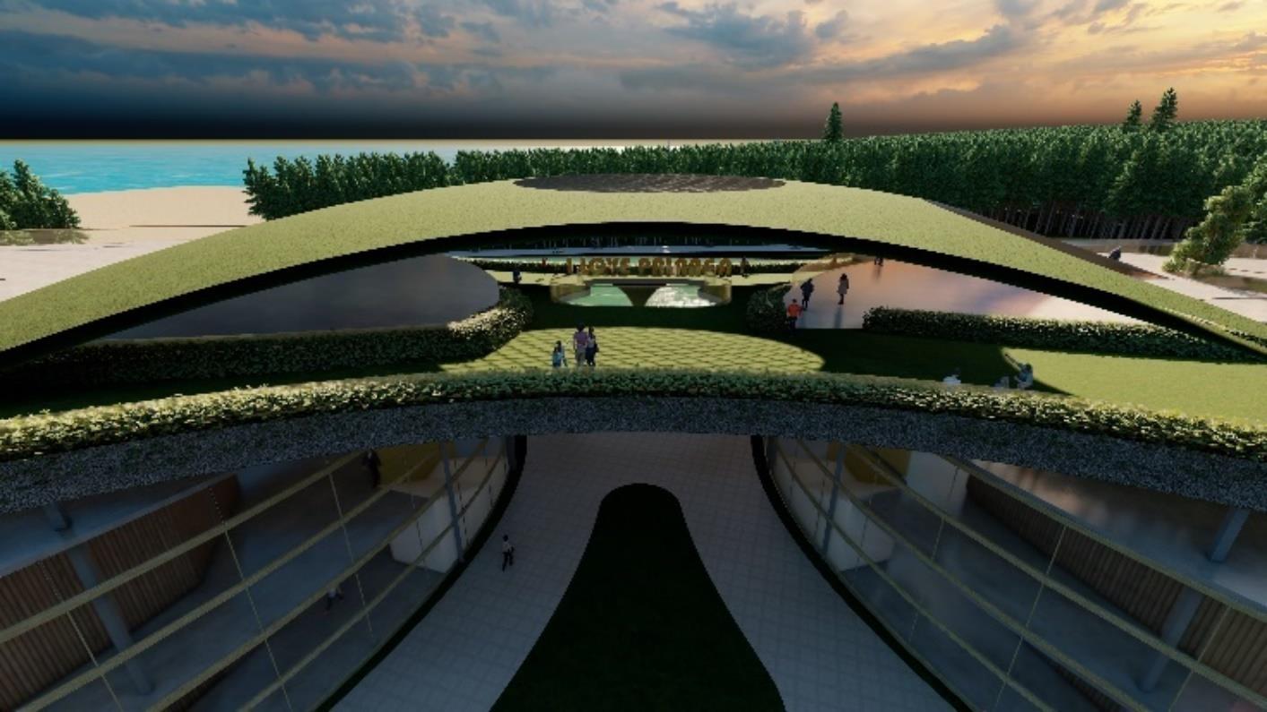
77
(4)
Fig. 72. Views from under the roof in different sun positions (Source: composed by author)
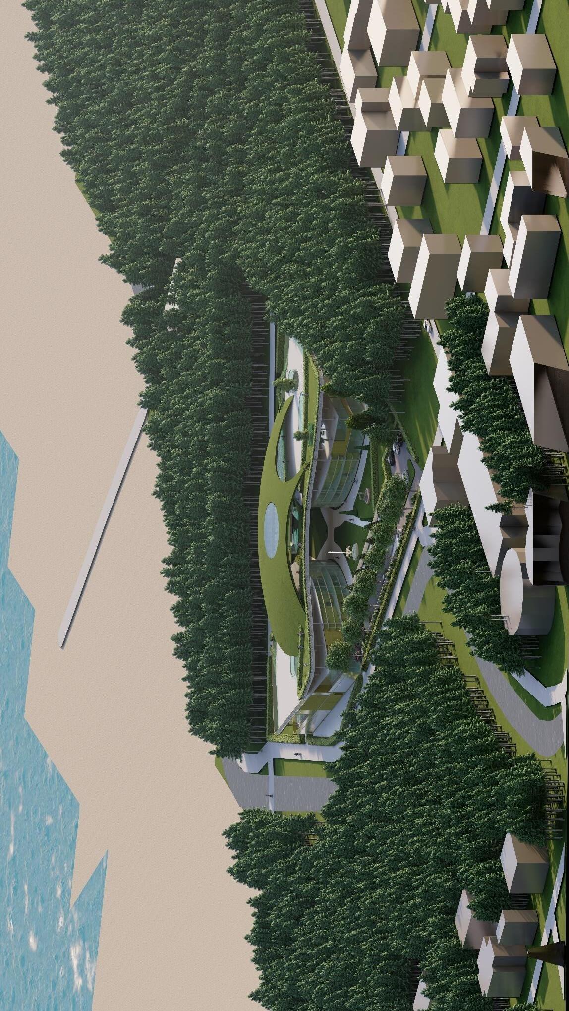
Fig. 73. Isometric view of the proposal with context (Source: composed by author)
78
Conclusions
The following research points out the areas of interventions at the sea and at the Kertinga and Klaipedos highways where connectivity is good, and the flow of traffic is high all year round except the cold months of October, November, and December.
1. The strategic installation of holograms over the heritage sites could give three valuable advantages such as firstly, the holograms will give an underlining to the heritage objects and givethemrecognitionas peoplewillgettingtoknowaboutitshistoryandbuildingconstructon methods in a more visual mannerlike thedropdownanimations used to displaya project from the start which looks very indulging and satisfying at the same time and it will make the architectural learning to a local audience fun to learn and most importantly become aware of its value.
2. Secondly it will also create jobs for the lithuanian animators or give jobs to the affected Ukranian refugees who are living there at this point of time or in the future.
3. Thirdly, because the holograms would be placed at the top of the heritage site the eye movement would be from top to down which will make the observer to stand still and focus on the details of the structures and fourthly because the heritage objects are spread all over the resort, the observers will automatically and subconciously try to explore the places and learnaboutpalangaandbecomeawareofthesites whichwillthenreducethepedestriantraffic on J. Bascanavicious street and create a harmony and the experience will not be ruined due to large crowds in a single place.
4. Also, the surveys and collected data and the study of genius loci helped in determining the function to be a multipurpose space for younger generation where they could attempt and learn new skills along with collaborating with fellow creators and take the artistic legacy of Palanga to a next level which has always been about local activities, art and different festivals. Therefore, it would be very practical to propose a multi-purpose space for locals, where they can refine their skills in various activities passed down by their ancestors and pay them respect in a more cultural way.
5. Taking in consideration the problematic current 2023 scenario of Lithuania facing problem for gas and energy, there is abundant supply of wind energy on the coast which could solve this problem and with the help of affordable wind systems installed at a distance from the coast the town can grow exponentially and could become self-sustainable in terms of producing electricity and even supplying it to other countries and using it for heating houses in the winter season.
6. The concept of inclusive heritage along with the heritage protection cycle has the potential to not only protect the heritage sites but it can also increase the awareness to document the heritage object and further helping Palanga achieve sustainability and become self-dependent.
79
7. The Design Proposal could provide an alternative to the palanga pier to provide the sunset views and would increase the greenery of the town, also invoking interest of local youths towards the nature and traditional Baltic art forms and provide a growing atmosphere.
8. The skyline of Planga resort town will gain a new identity as the structure is symbolic to the dunes and compliments its surroundings with elements of recreational landscape.
9. Although on a small level only, it will help the locals of the town to be active in the winter season and provide with ample activities to explore and give their creative self a push.
80
List of references
Deveikiene, Dr. (2015). The role of historical gardens in city development- from private garden to public park E.F. Andre Heritage case study. Scientific Journal of Latvia University of Agriculture, 5, 8–12.


PG, JG, MP, CK, M. (2016). Traditional Samogitians architecture (1st ed., Vols. 36–53). Lututÿ Publishing House, V. Putvinskio str. 34-1, LT-3000 Kaunas. http://zemaitijosnp.lt/
Qissi, S., & Banerjee, P. P. (2023, March 1). Multiplexed digital volume reflection holograms generated from digital transmission holograms. Applied Optics, 62(10), D171. https://doi.org/10.1364/ao.479063
Palanga Muncipalty. (2008). PALANGOS MIESTO BENDRASIS PLANAS. Vilnius Planas, 8 and 53. https://www.palanga.lt/
DIY Green Roof - 3SimpleStepsto Install aGreen Roof| CORESystems. (n.d.). DIY Green Roof
- 3 Simple Steps to Install a Green Roof | CORE Systems. https://www.coregravel.ca/blog/diygreen-roof/
Green Roof Construction – How to Guide. (n.d.). https://www.permagard.co.uk/. https://www.permagard.co.uk/advice/green-roof-construction
Sustainable tourism | Department of Economic and Social Affairs. (2018, July 31). Sustainable Tourism | Department of Economic and Social Affairs. https://sdgs.un.org/topics/sustainabletourism
Nektarios, P., & Ntoulas, N. (2017, December). Designing green roofs for arid and semi-arid climates. the route towards the adaptive approach. Acta Horticulturae, 1189, 197–202. https://doi.org/10.17660/actahortic.2017.1189.39
Petrulienė, V., Nekrošius, L., Petrulis, V., Mankus, M., & Drėmaitė, M. (2021, May). Palanga. Architecture Guide (Vols. 36–217) [Hard copy]. Aistė Galaunytė, Ūla Ambrasaitė, Monika Gimbutaitė. https://www.leidyklalapas.lt/products/palanga-architekturos-gidas

Teshima Art Museum / Ryue Nishizawa. (2011, July 19). ArchDaily. https://www.archdaily.com/151535/teshima-art-museum
Raphy, R. (2020, February 26). 5 Examples of Serial Vision- How Architecture Guides Your Eyes - Rethinking The Future. RTF | Rethinking the Future. https://www.rethinkingthefuture.com/2020/02/26/a614-5-examples-of-serial-vision-how-architecture-guidesyour-eyes/
Palanga Muncipalty. (2018). Palanga City Master Plan. palanga.lt. https://www.palanga.lt/doclib/oxuxoluyqbgasyh8xsptr7zwaxnvpwaf
Jankauskaitė, A., & Grecevičius, P. (2018, December 1). Tendencies of Recreational Landscape Formation in Southeastern Baltic Seaside Resorts after 1990. Case of the Palanga Resort. Architecture and Urban Planning, 14(1), 63–69. https://doi.org/10.2478/aup-2018-0008 (n.d.). Palanga 1888 [Video]. Youtube. Retrieved May 16, 2023, from https://youtu.be/dEw0u8KaW9g
Palanga Muncipalty. (2018). Norite didesnio 1-2 butu n_amo - teks jrengti kelias vietas automobiliams . Palanga.Lt. Retrieved November 13, 2021, from https://palanga.lt/data/wfiles/file11358.pdf?lang=en
Stauskas, V. (1994, March). The planning of recreational regions in Lithuania. Athens Center of Ekistics. Retrieved May 16, 2023, from
81
https://www.jstor.org/stable/pdf/43622313.pdf?refreqid=excelsior%3Ae91eb6f839cdcec507c2b 7c4e79578ae&ab_segments=&origin=&acceptTC=1
Jankauskaitė, A., & Grecevičius, P. (2018, December 1). Tendencies of Recreational Landscape Formation in Southeastern Baltic Seaside Resorts after 1990. Case of the Palanga Resort. Architecture and Urban Planning, 14(1), 63–69. https://doi.org/10.2478/aup-2018-0008
Stauskas, V. (2013, June 11). The Quality and Responsibility of Architecture in the Context of Emerging Ecological Challenges (Lithuanian experience). Journal of Sustainable Architecture and Civil Engineering, 2(3), 20–24. https://doi.org/10.5755/j01.sace.2.3.4329

Bertoli, O. (2017, November 17). Gordon Cullen’s Townscape Concepts Project [Video]. Youtube. Retrieved September 29, 2022, from https://www.youtube.com/watch?v=dMfR4oEZHgA&t=2s (2019). Gordon Cullen - Townscape [Video]. Youtube. Retrieved September 27, 2022, from https://www.youtube.com/watch?v=KE5HHmVI_44
Nekrošius, L. (2012, October 9). ARCHITECTURE AS AN ART COLLECTION: PALANGA CASE / ARCHITEKTŪRAKAIP MENOKOLEKCIJA. PALANGOS ATVEJIS. JOURNAL OF ARCHITECTURE AND URBANISM, 36(3), 222–238. https://doi.org/10.3846/20297955.2012.732799
Ivavičiūtė, G. (2020, June 4). THE CHANGE OF NATURAL LANDSCAPE IN PALANGA CITY (LITHUANIA). RURAL DEVELOPMENT 2019, 2019(1), 139–144. https://doi.org/10.15544/rd.2019.026
Czechowski, D., Hauck, T., & Hausladen, G. (Eds.). (2018, October 8). Revising Green Infrastructure: Concepts Between Nature and Design. CRC Press. de Oliveira, F. L., & Mell, I. (Eds.). (2019, February 27). Planning Cities with Nature: Theories, Strategies and Methods. Springer. https://doi.org/10.1007/978-3-030-01866-5
Nekrošius, L., & Riaubienė, E. (2018, December 1). Palanga’s Modern Architecture on the Way to Heritage. Architecture and Urban Planning, 14(1), 111–118. https://doi.org/10.2478/aup2018-0015
This Vertical Axis Wind Turbine Works In Any Direction. (2022, March 28). YouTube. https://www.youtube.com/watch?v=7uEKLUHXCL8
SkySails Power: Technology of Airborne Wind Energy Systems. (2020, November 24). YouTube. https://www.youtube.com/watch?v=DwiXTye681M
Abromas, J., & Kamicaityte, J. (2016). Problems of determining size and character of wind turbines Visual Impact zones on Lithuanian landscape. Problems of Determining Size and Character of Wind Turbines Visual Impact Zones on Lithuanian Landscape.
“Advantages/ Examples/ Classification/ Components/ Types of Ecotourism,” n.d. (n.d.). Retrieved January 25, 2022.
“Analysis of Palanga Greenry,” n.d. (n.d.). Retrieved January 25, 2022.
ARCHITEKTŪRA KAIP MENO KOLEKCIJA. PALANGOS ATVEJIS. (n.d.). Retrieved January 25, 2022, from https://www.researchgate.net/publication/271874216_Architektura_kaip_meno_kolekcija_Palan gos_atvejis.
“Binz, Germany Seaside Resort Is Born,” n.d. https://villen.binz.de/en/spa-style/. Christopher Alexander. A Pattern Language, n.d. (n.d.). Retrieved January 25, 2022, from . https://villen.binz.de/en/spa-style/
82
Christopher Alexander. A Pattern Language, n.d. (n.d.). Retrieved January 25, 2022.
“Coronavirus Questions That Will Not Go Away: Interrogating Urban and Socio-Spatial Implications of COVID-19 Measures,” n.d. (n.d.). Retrieved January 25, 2022.
Daniel Czechowski Thomas Hauck Georg Hausladen, ed. REVISING GREEN INFRASTRUCTURE Concepts Between Nature and Design. CRC Press, n.d. (n.d.). Retrieved January 25, 2022.
“Eco Tourism,” n.d. (n.d.). Retrieved January 25, 2022.
Fabiano Lemes de Oliveira Ian Mell, ed. Planning Cities with Nature Theories, Strategies and Methods, n.d. (n.d.). Retrieved January 25, 2022.
“Factors of Influence on Successful Development of Lithuanian Resort Wellness SPA Services,” n.d. (n.d.). Retrieved January 25, 2022.
“Five Ways Architects and Designers Are Helping the Fight against Coronavirus,” n.d. (n.d.). Retrieved January 25, 2022.

HEALTH&WELLNESSTOURISMAFOCUSONTHEGLOBALSPAEXPERIENCE,n.d. (n.d.). Retrieved January 25, 2022.
“Health, Wellness, and Place Attachment During and Post Health Pandemics,” n.d. (n.d.). Retrieved January 25, 2022.
“History of Mineral and Thermal Waters,” n.d. (n.d.). Retrieved January 25, 2022.
‘Hospitals in Drastic, Drastic Need of Innovation’ Says Reinier de Graaf,” n.d. (n.d.). Retrieved January 25, 2022.
“KAI
KURIE PALANGOS KURORTO ARCHITEKTŪRINĖS
-URBANISTINĖS RAIDOS BRUOŽAI,” n.d. . (n.d.). Retrieved January 25, 2022, from https://www.researchgate.net/publication/291100056_Kai_kurie_Lietuvos_sakralines_architekt uros_raidos_bruozai_XX-XXI_a.
“Kaimo Stat Yba: Dzūkij,” n.d. . (n.d.). Retrieved January 25, 2022, from http://gamta.cepkeliaidzukija.lt/files/796/Kaimo_statyba_Dzukija0.pdf.
“Landscape of the Resort City of Jurmala: From Fishing Villages to Planned Urbanization,” n.d. . (n.d.). Retrieved January 25, 2022, from https://www.researchgate.net/publication/324956200_Overcoming_the_depressiveness_of_the_ resort_city_of_Jurmala_by_creating_a_tourist_and_recreational_zone_in_the_region.
Lina Balsevičienė, trans. PROTECTED AREAS IN LITHUANIA, n.d. (n.d.). Retrieved January 25, 2022.
“Neurodiversity and Biophilia: The Future of the Workspace in the Post-PandemicEraSaveThis Picture!,” n.d. (n.d.). Retrieved January 25, 2022.
“NEW DATA ON PALANGA STONE AGE SETTLEMENT,” n.d. (n.d.). Retrieved January 25, 2022.
“Palanga’s Modern Architecture on the Way to Heritage,” n.d. . (n.d.). Retrieved January 25, 2022, from https://www.researchgate.net/publication/330876299_Palanga%27s_Modern_Architecture_on_t he_Way_to_Heritage.
“Palangos Kurorto Želdynų Analizė,” n.d. (n.d.). Retrieved January 25, 2022, from http://www.krastotvarka.vhost.lt/documents/2016_17.pdf.
83
“Palangos Raidos Ypatumai XIX a. Antroje Pusėje - XX a. Pirmoje Pusėje,” n.d. . (n.d.). Retrieved January 25, 2022, from https://www.lituanistika.lt/content/28184.
“Post-Pandemic Lifestyle Changes and Their Interaction with Resident Behavior in Housing and Neighborhoods: Bursa, Turkey,” n.d. (n.d.). Retrieved January 25, 2022.
RESIDENTIAL ARCHITECTURE IN A POST-PANDEMIC WORLD: IMPLICATIONS OF COVID-19 FOR NEW CONSTRUCTION AND FOR ADAPTING HERITAGE BUILDINGS, n.d. (n.d.). Retrieved January 25, 2022
Santa Treija Signe Skujeniece, trans. “RESEARCH FOR RURAL DEVELOPMENT 2019,” n.d.
Smart Dwellings. Architectural Perspectives Opened by COVID-19 Pandemic, n.d.
“Some Features of Architectural-Urbanistic Evolution in Palanga Resort,”n.d. .(n.d.). Retrieved January 25, 2022, from https://www.thefreelibrary.com/Some+features+of+architecturalurbanistic+evolution+in+Palanga...-a0458260813.
“Some Features of Architectural-UrbanisticEvolutioninPalangaResort/SomeoftheArchitectsUrban Development of Palanga Resort.,” n.d. (n.d.). Retrieved January 25, 2022.
“Tendencies of Recreational Landscape Formation in Southeastern Baltic Seaside Resorts after 1990. Case of the Palanga Resort,” n.d. . (n.d.). Retrieved January 25, 2022, from https://www.researchgate.net/publication/330928298_Tendencies_of_Recreational_Landscape_ Formation_in_Southeastern_Baltic_Seaside_Resorts_after_1990_Case_of_the_Palanga_Resort
“The Impact of the Design of Hospitals on Hospital Hoteling, Healing Process and Medical Tourism,” n.d. (n.d.). Retrieved January 25, 2022.
34. “The Influence of Resort Status on SustainableDevelopment: The Case of Lithuanian Resorts. Comparative Analysis,” n.d. (n.d.). Retrieved January 25, 2022.
Bertoli, O. (2017, November 17). Gordon Cullen’s Townscape Concepts Project [Video]. Youtube. Retrieved May 18, 2023, from https://www.youtube.com/watch?v=dMfR4oEZHgA&t=2s
Bruce, B. (2020, November 2). Sequential Perspective Drawing in the Field (Serial Vision) [Video]. Youtube. Retrieved January 24, 2022, from https://www.youtube.com/watch?v=nooVRcv_XNI
“The Physical Innovation of Hotels in Medical Tourism,” n.d. (n.d.). Retrieved January 25, 2022.
“The Quality and Responsibility of Architecture in the Context of Emerging Ecological Challenges (Lithuanian Experience),” n.d. . (n.d.). Retrieved January 25, 2022, from https://www.researchgate.net/publication/314542547_The_Quality_and_Responsibility_of_Arc hitecture_in_the_Context_of_Emerging_Ecological_Challenges_Lithuanian_experience.
“The Rebirth of the Hospital: Heterotopia and Medical Tourism in Asia,” n.d. (n.d.). Retrieved January 25, 2022.
“The Specificity of the Changes in the Lithuanian Health Tourism Services Industry,” n.d. (n.d.). Retrieved January 25, 2022.
“Traces of French Culture in Palanga: The Historical Context of Palanga Botanical Park, Personalities, and Memory,” n.d. (n.d.). Retrieved January 25, 2022.
“Traces of French Culture in the Narratives of the Residents of Palanga,” n.d. (n.d.). Retrieved January 25, 2022.
84
“Trends of Lithuanian Cultural Landscapes in the Recreational Territorial System of the Southeast Baltic Sea Region,” n.d. . (n.d.). Retrieved January 25, 2022, from https://www.researchgate.net/publication/327038442_Trends_of_Lithuanian_Cultural_Landsca pes_in_the_Recreational_Territorial_System_of_the_Southeast_Baltic_Sea_Region.
“Understanding Recreational Landscapes -a Review and Discussion Understanding Recreational Landscapes -a Review and Discussion,” n.d. . (n.d.). Retrieved January 25, 2022, from
https://www.researchgate.net/publication/345157151_Understanding_recreational_landscapes_a_review_and_discussion_Understanding_recreational_landscapes_-a_review_and_discussion.
URBAN ECOLOGY Strategies for Green Infrastructure and Land Use, n.d. (n.d.). Retrieved January 25, 2022, from http://www.appleacademicpress.com/.
85
List of information sources
1. The Lithuanian Amber Louvre – the Palanga Amber Museum – Journey starts at home (gintarokelione.lt)
2. Hologram Wall - Axiom Holographics
3. https://www.google.co.in/url?sa=t&rct=j&q=&esrc=s&source=web&cd=&cad=rja&uact=8&ve d=2ahUKEwjp8aeegeP3AhX7i_0HHf0JACYQFnoECC8QAQ&url=https%3A%2F%2Fwww.p alangatic.lt%2Fen%2Fsightseeing-places%2Fpalangakurhaus%2F&usg=AOvVaw1pC_0tIqhF536l_GyM9PBM
4. Wooden architecture (lithuania.travel)
5. ARCHITECTURE AS AN ART COLLECTION. THE CASE OF PALANGA
6. Architecture – Lithuanian Culture Institute
7. J.04~2014~1475244864429.pdf (lituanistikadb.lt)
8. J.04~2018~1575303795601.pdf (lituanistikadb.lt)
86
Appendices
Appendix 1. Survey questions and its results
Genius Loci
Q1 What are the common myths, religious beliefs and cultural practices of Lithuania, are there any specific to Palanga region?
Q2 What are the common festivals celebrated here and what are its significance?
Q3 What are some of the mythological stories associated with Palanga? (finding embedded meaning)
Q4 What is the most important feature of Palanga Resort other than historical sites and beaches?
Q5 Draw a mental image of Palanga resort?
J. Bascanavicious st.
Q1 - What are the common issues on J. Bascanavicious street and what should municipality do to tackle them?
Q2 What could be done to save the deteriorating coastline?
Q3 What could be the alternatives for wind energy conservation other than windmills?
Q4 How can the resort be activated in the winter season for locals?
Q5 Is Holographic sign boards a good alternative to reduce visual pollution on the J. Bascanavicius street.
General Questions on future development
Q1 Which parts of the town have the potential for further development?
Q2 What are the areas of interventions in Palanga?
Q3 How do you want to see Palanga in the near future?
Q4 What are the hidden gems of Palanga resort ?
Q5 Which activities do you think should be introduced in Palanga?
Q6 How can forest parks be made more interesting
Survey (Yes and No questions)
Results
1. Is there any need for the wind kite systems in Palanga?
87
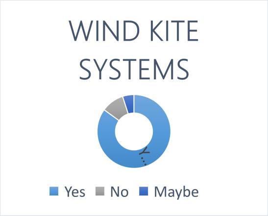
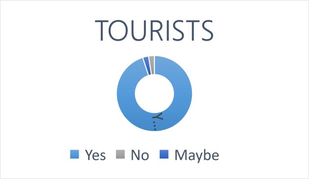
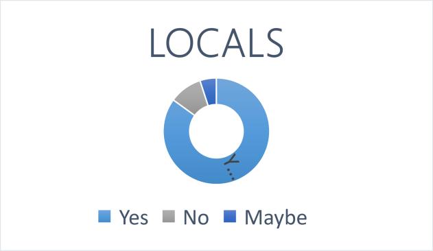
5. Should there be organized routes and workshops for the cultural heritage objects?
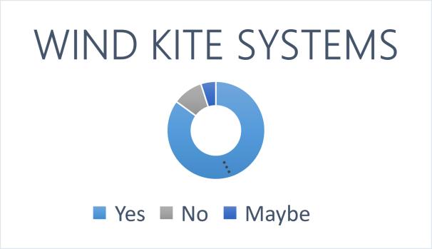
3. Are Holographic sign boards a good solution to the current scenario?
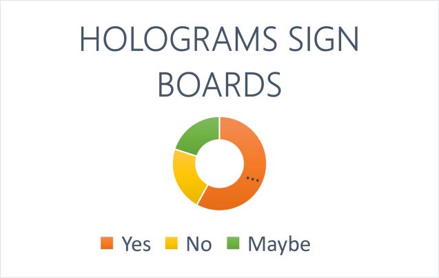
88
4. Is the concept of tree houses appropriate for the Palanga resort?
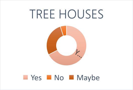
5. Should Ayurvedic treatments be introduced in the resort?
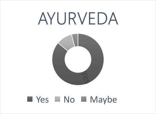
6. What is the period of your visit ?
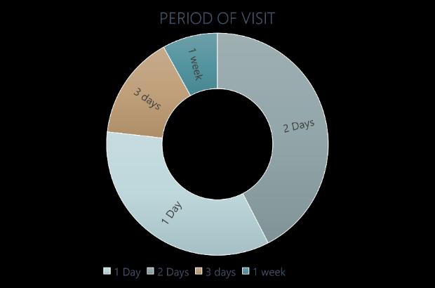
7. Where do you like to spend your time in Palanga?

89
Appendix 2. Architectural analysis of heritage objects
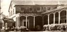
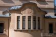

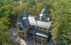

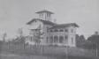
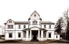
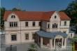
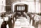
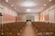

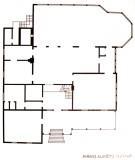


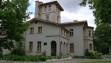
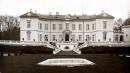

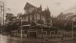


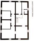
90
14 2 14 2 2
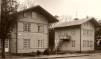


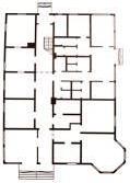


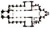
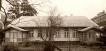
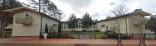
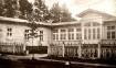
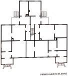
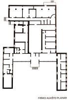
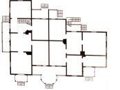
91 3 24

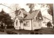
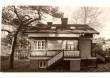
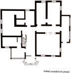
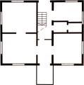
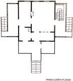

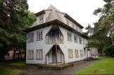
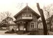


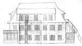
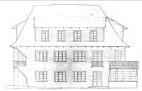
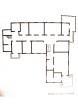
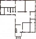
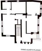

92 2 2 3 3


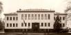

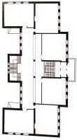

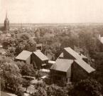
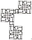

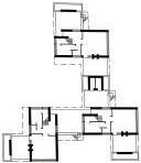
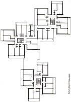
93 1 2 2 2 2 3 2 3 6 24 5 13 4
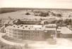
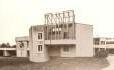
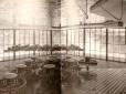
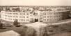
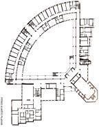

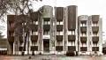
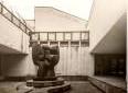
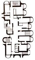
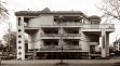


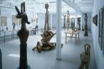
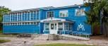

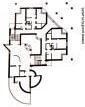
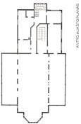


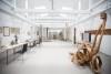
94 1 14 2 1 36 2 4 3 5 6 1
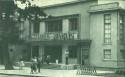
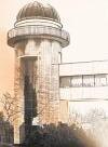

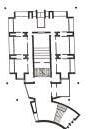

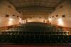
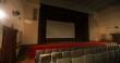
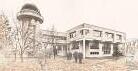
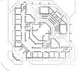
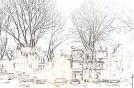
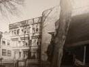
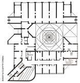

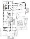
95 1 12 2 3 1 2 12 43 3 44 1


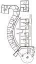
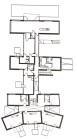
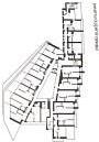


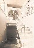

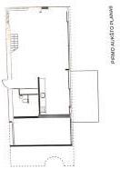


96 4 2

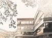
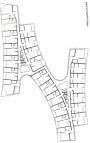
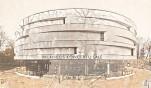

Appendix 3. Graphical Part
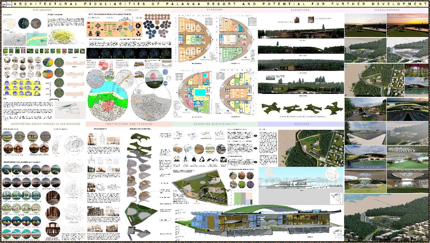
97
1
