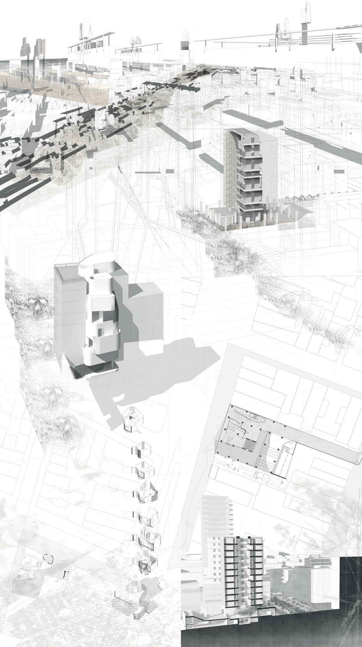
2018-20 Island Territories VI: Manhattan, Vol.1 of 2
ESALA 2019
Master of Architecture
Master in Landscape Architecture
MSc Landscape Architecture
ISLAND TERRITORIES VI:
MANHATTAN SCAPELAND
ESTRANGEMENT / DISPLACEMENT
Adrian Hawker
Victoria Clare Bernie
Tiago Torres Campos
This catalogue is part of a collection published by the Edinburgh School of Architecture and Landscape Architecture (ESALA), Edinburgh College of Art, University of Edinburgh. It documents student design work produced in the Master of Architecture (MArch) programme in 2018-19. Each catalogue describes one of the following fve design studios in the MArch programme. The full collection is available to view online at issuu.com/eca.march.
Catalogues 2018-19:
City Fragments: Palermo Institutions.
island territories vi: MANHATTAN scapeland eSTRANGEment / disPLACEment.
Parasituation [Calcutta/Kolkata].
The Other Paris.
The Streamlines, Vortices, and Plumes of the Blue Lagoon/Bath.
First published in 2019, eBook published in 2024. Published by The University of Edinburgh, under the Creative Commons Attribution Non-Commercial Non-Derivative 4.0 International License (CC BY-NC-ND 4.0). .
Hawker, Adrian, Victoria Clare Bernie and Tiago Torres-Campos. islandterritoriesvi:MANHATTANscapelandeSTRANGEment/ disPLACEment. Edinburgh: University of Edinburgh, 2019.
island territories vi: MANHATTAN scapeland eSTRANGEment / disPLACEment
ISBN (eBook): 978-1-83645-093-1
ESALA 2019
Master of Architecture
Master in Landscape Architecture
MSc Landscape Architecture
ISLAND TERRITORIES VI: MANHATTAN scapeland
E STRANGE MENT / DIS PLACE MENT
Adrian Hawker
Victoria Clare Bernie
Tiago Torres Campos
MANHATTAN
SMUGGLERS
EIREANN
LAUREN
PHILIP
YUN
CLOUD
CLARK
LANDSCAPE
HANYUE
ABANDONED
CEN ZHONG
HARRISON’S
RISHABH SHAH
ISLAND
NORMAN
ARCHIMERA
ANTONIO
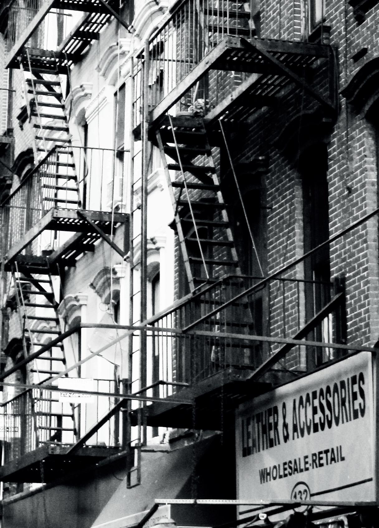
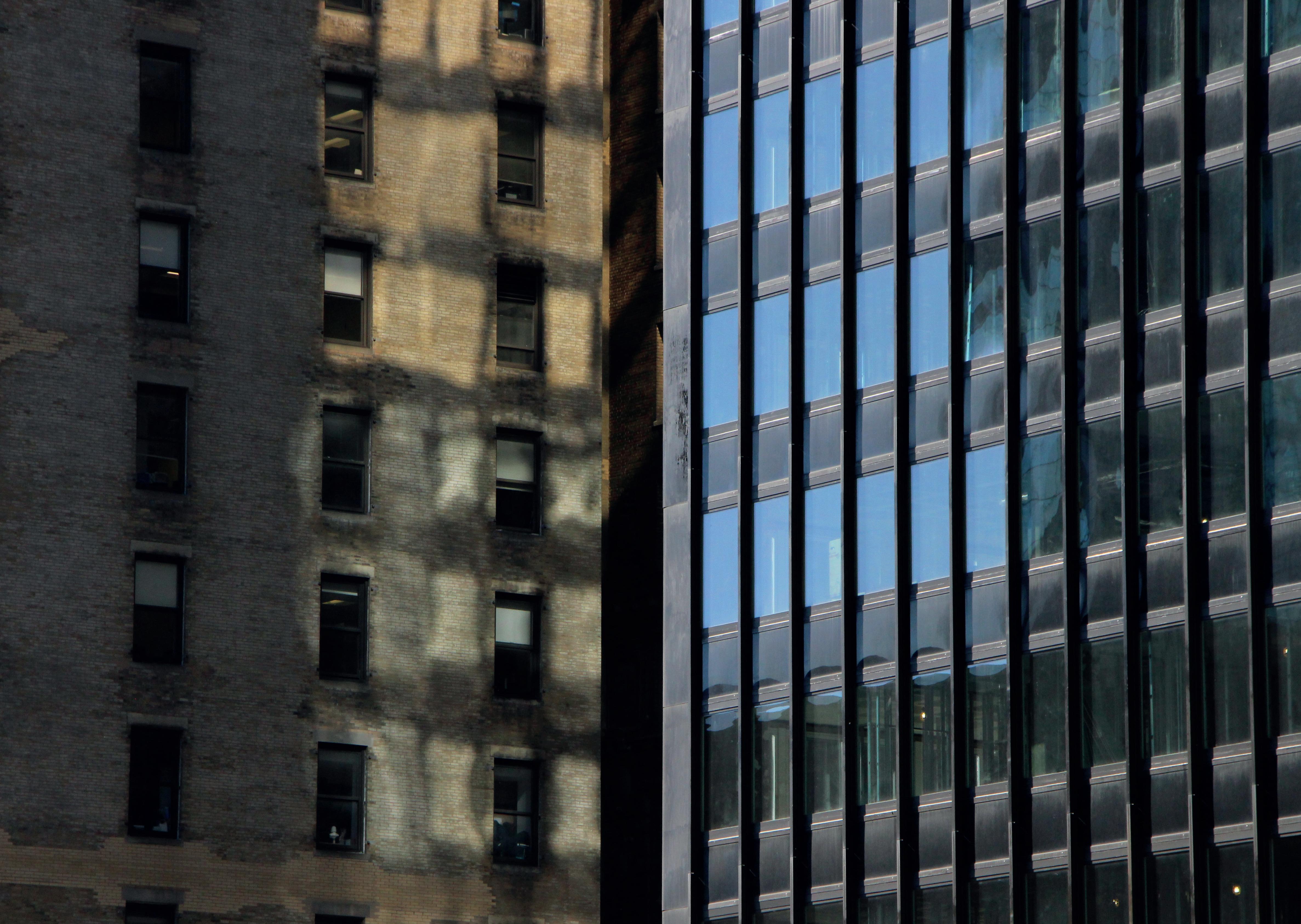
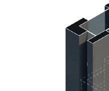
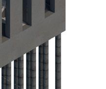
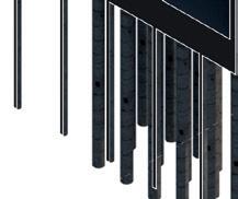
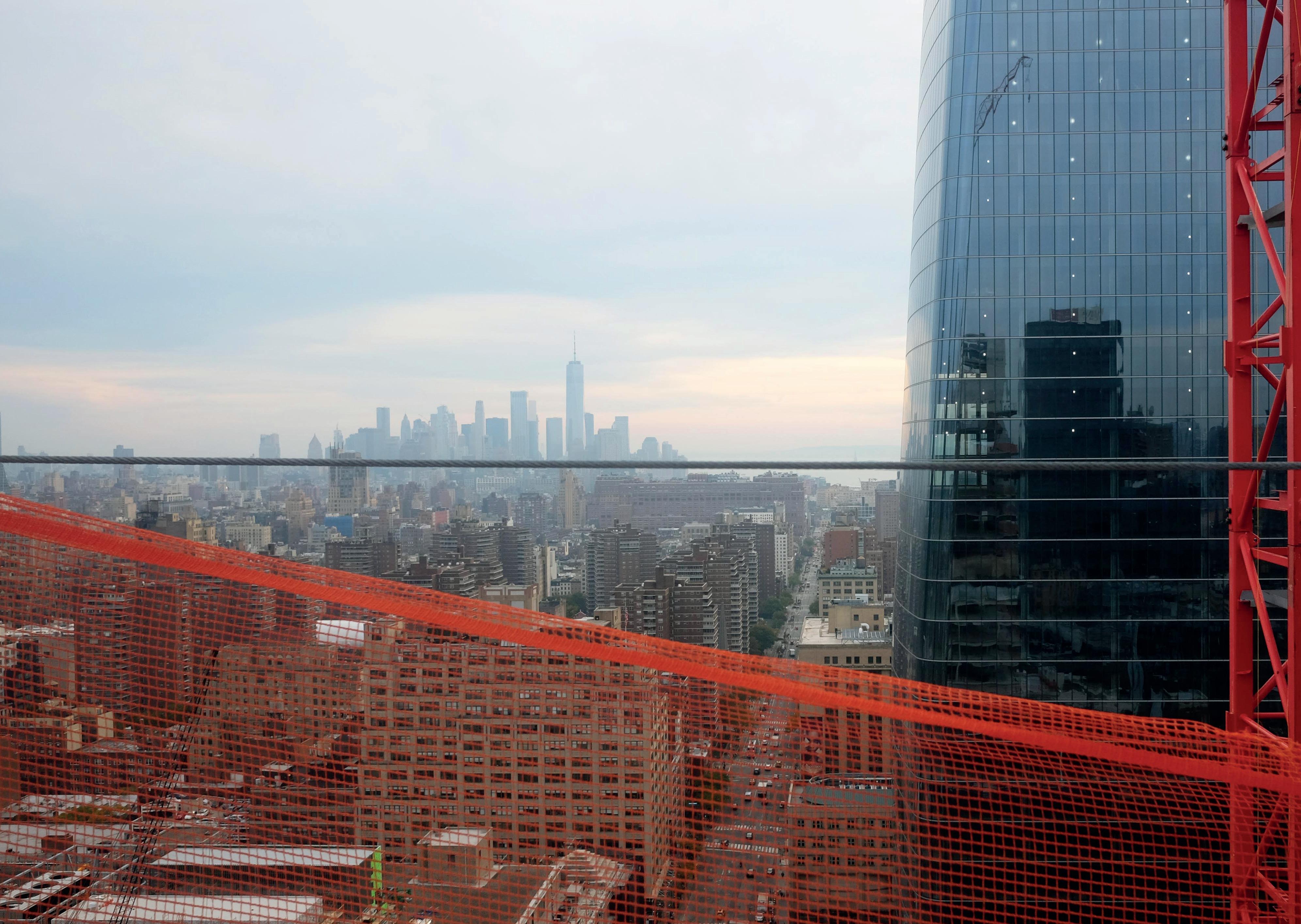
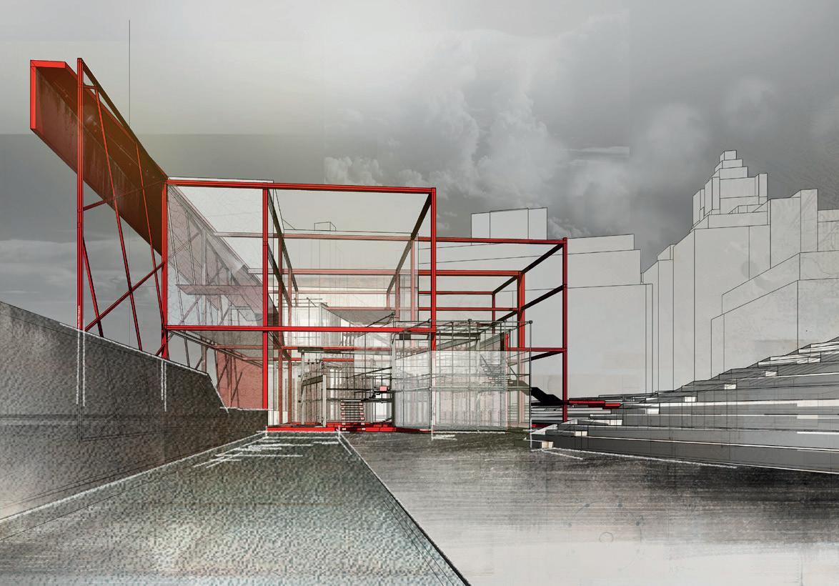
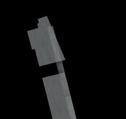
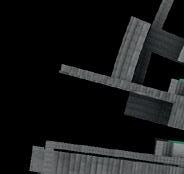
Wall St
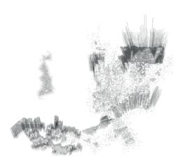
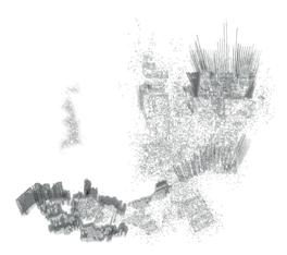
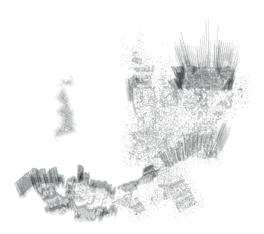
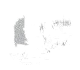
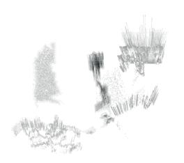
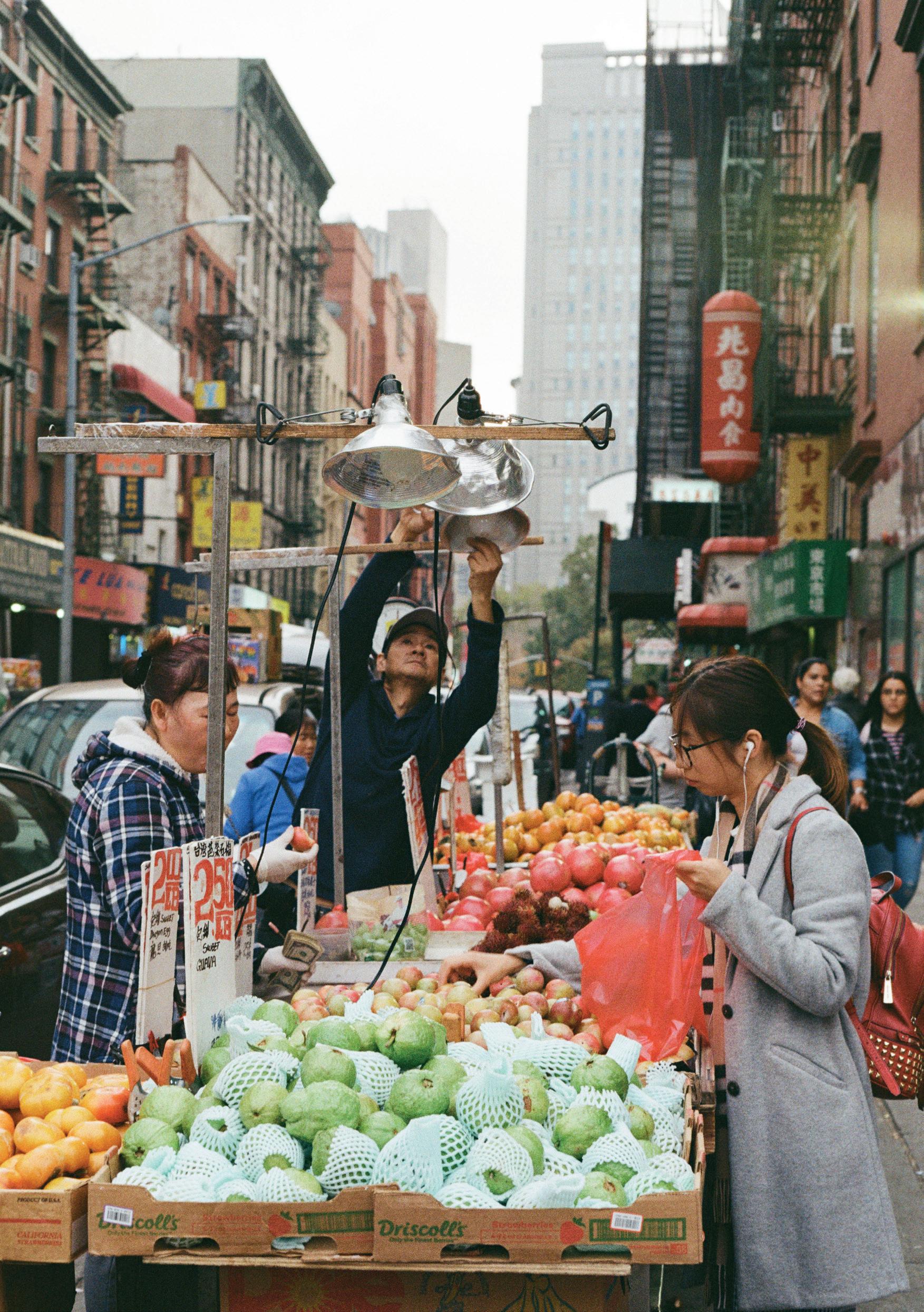
October 2018 | Katie Hackett
island territories vi: M ANHATTAN scapeland
E STRANGE MENT / DIS PLACE MENT
‘There would appear to be a landscape whenever the mind is transported from one sensorial matter to another, but retains the sensorial organisation appropriate to the frst, or at least a memory of it. The earth seen from the moon for a terrestrial. The countryside for the townsman; the city for the farmer. ESTRANGEMENT (dépaysment) would appear to be a precondition for landscape.’
Jean-François Lyotard, “Scapeland” In The Lyotard Reader edited by Andrew Benjamin (Oxford: Blackwell, 1989), 212.
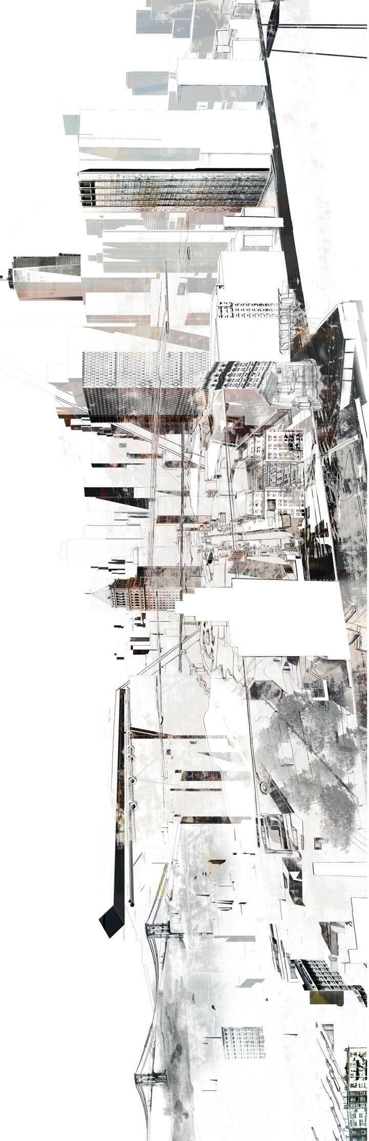
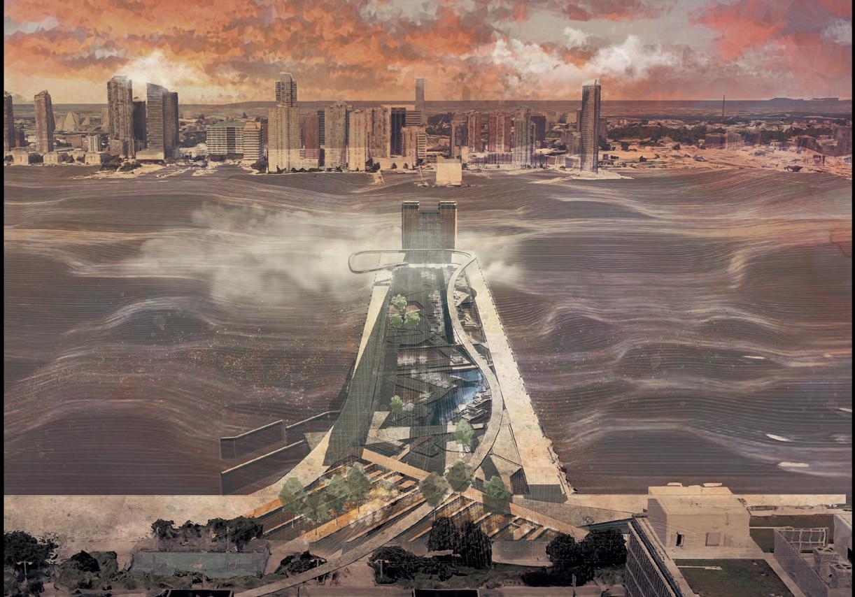
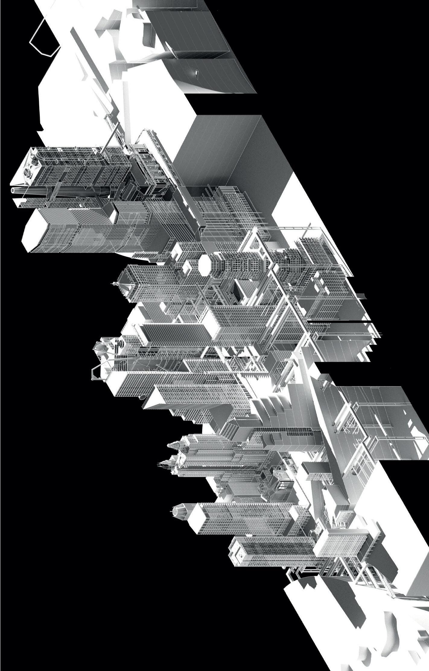
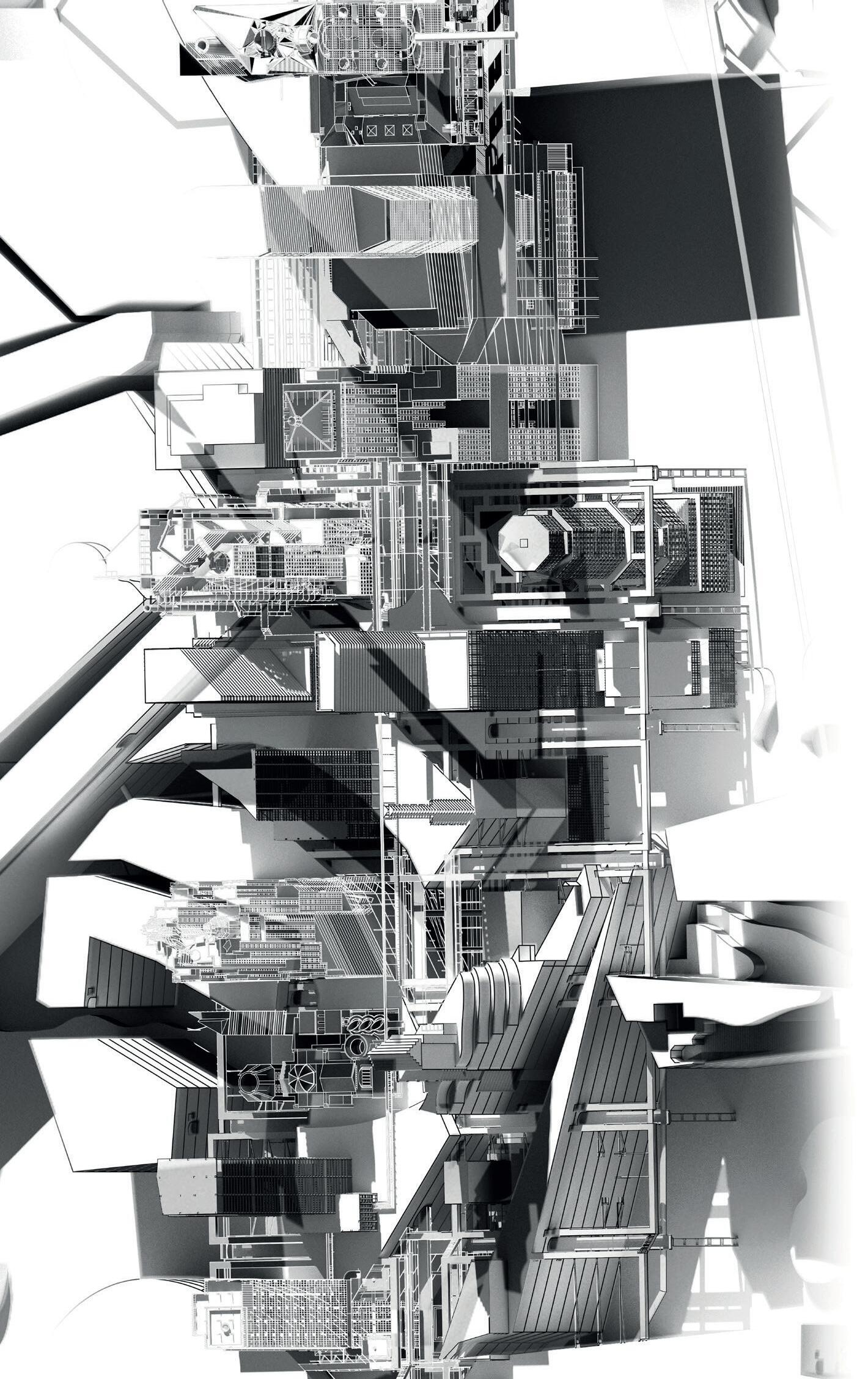
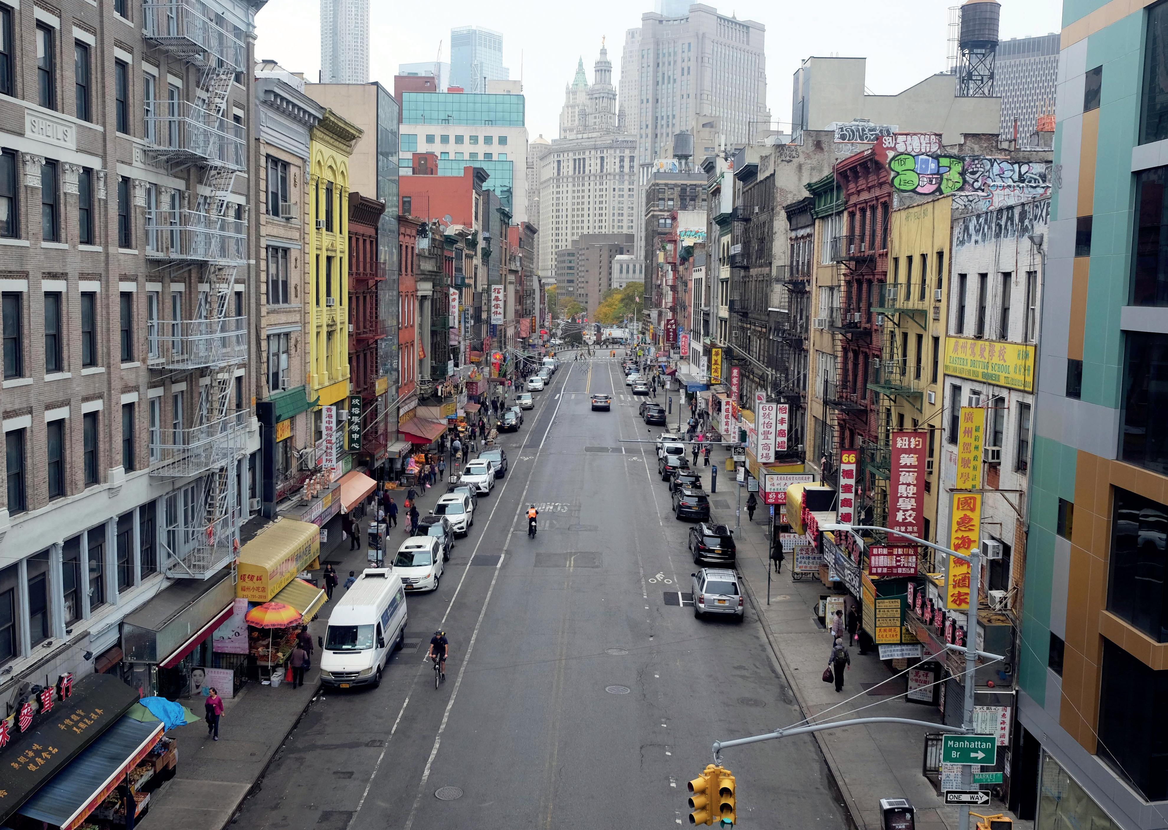
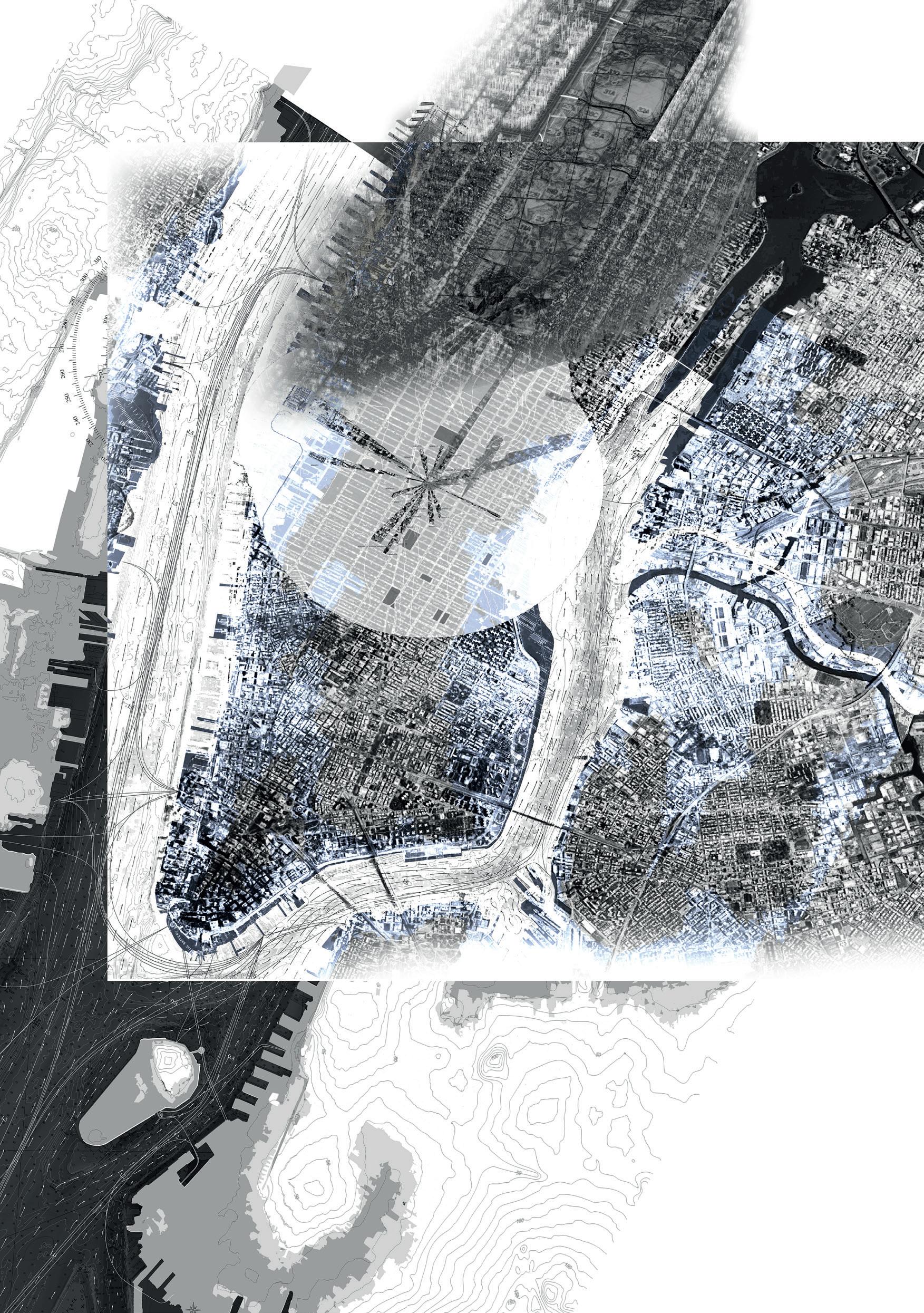
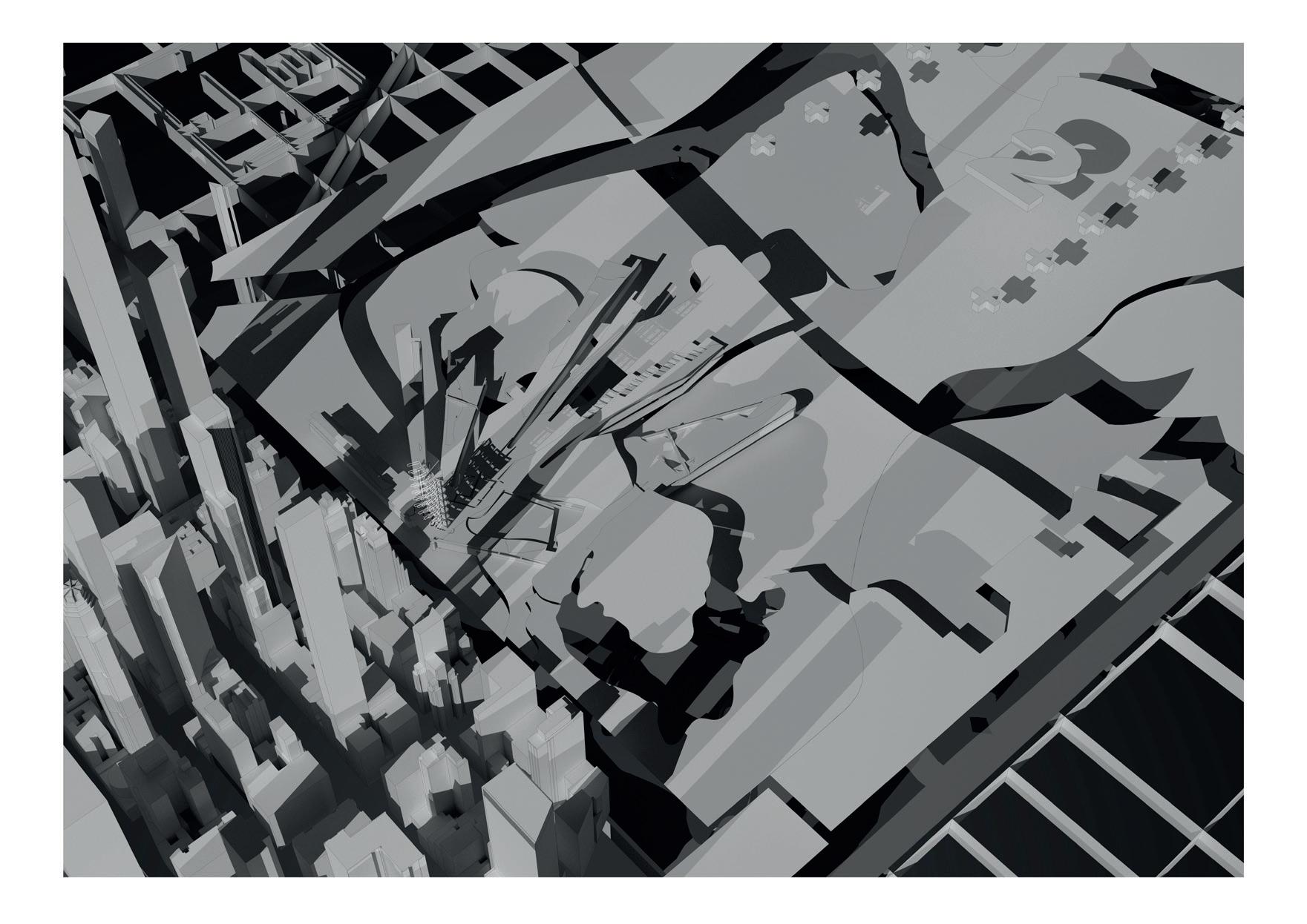
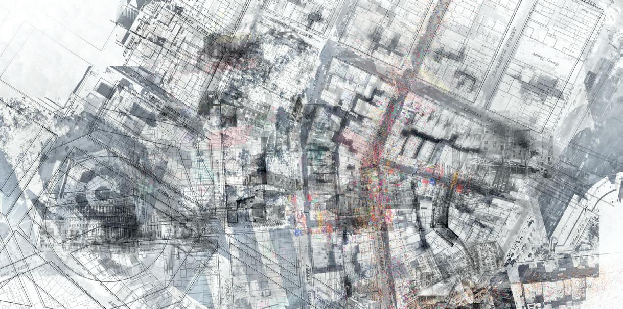
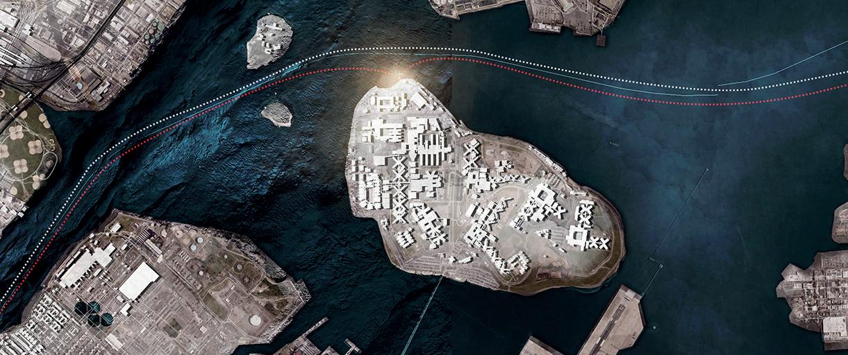
The island of Manhattan is strangely familiar to the new arrival, its image as an extraordinary artefact, a vertiginous topography afoat between the Hudson and the East Rivers, a somewhat misleading precursor to its material reality. For to walk through Manhattan is in fact to experience not height but depth. Its streets are canyons, skyframes, whose grated foors exhale the breath of a cavernous underworld of subways, culverts and slurry walls; its vistas only really visible from the summit of the towers that far exceed the hills from which the island takes its name. It is a landscape, a scapeland, a terrain to be navigated through the lens of culture and memory. Depictions of the island and its metropolis are everywhere, repeatedly represented through the medium of flm, television, art, literature and music. We feel that we know the city in as much as anyone can really know this place. It is strangely ubiquitous and it is this apparent omnipresence that lends the island its aura of estrangement. Once we feel we have grasped it, encountered it in one form or another, yet one more Manhattan
ADRIAN HAWKER
VICTORIA CLARE BERNIE TIAGO TORRES CAMPOS
materialises. As a city of strangers, of emigrants, it is overwritten with the sensorial organisation of Africa, Asia, and Europe. As a city of origins, it retains in its geology, hydrology and climate the place of its original inhabitants, the Lenape people of the Northeastern Woodland.
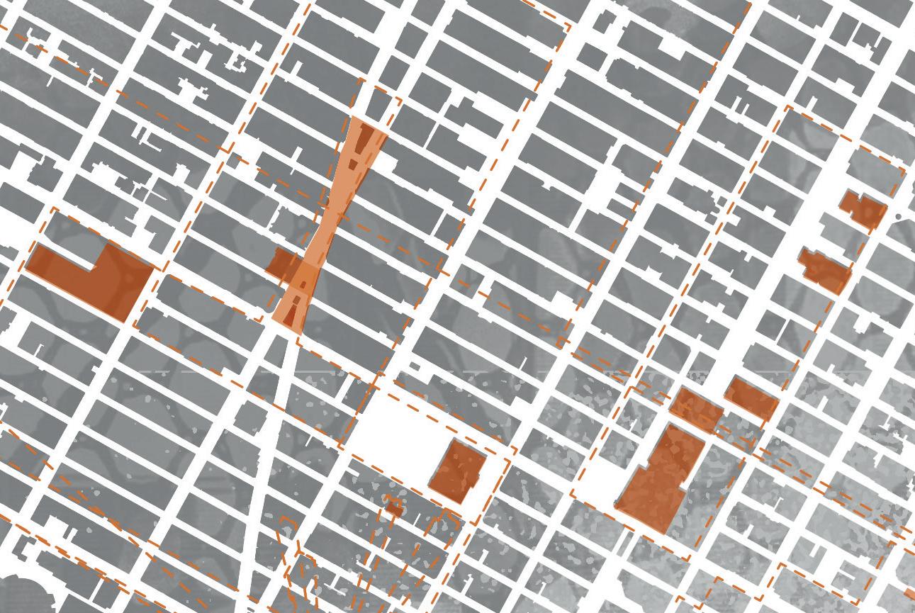
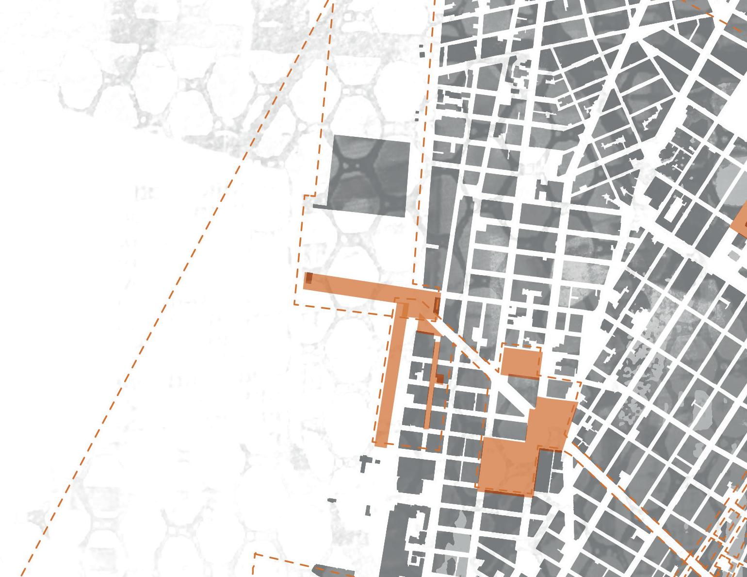
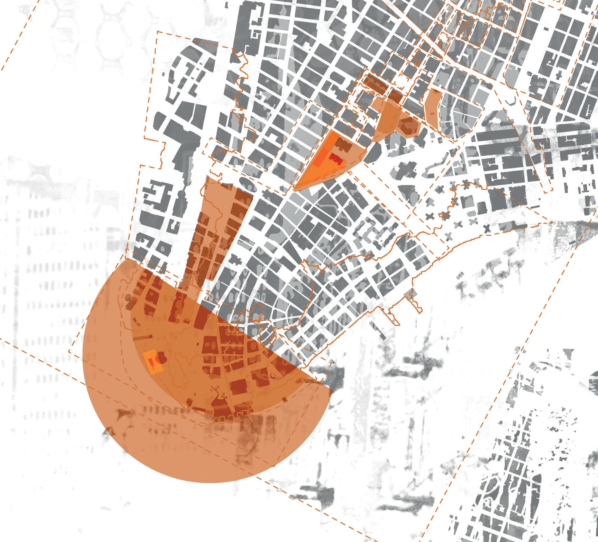
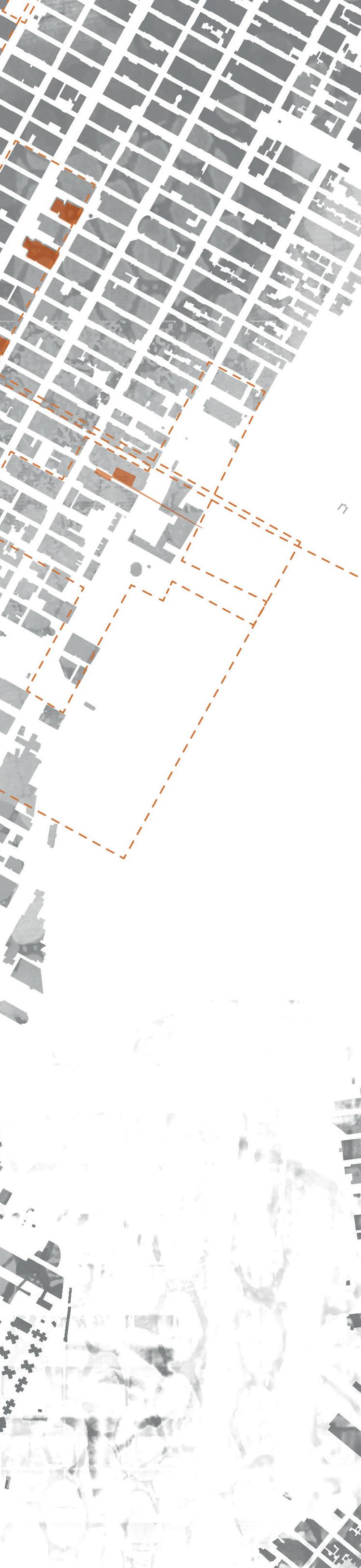
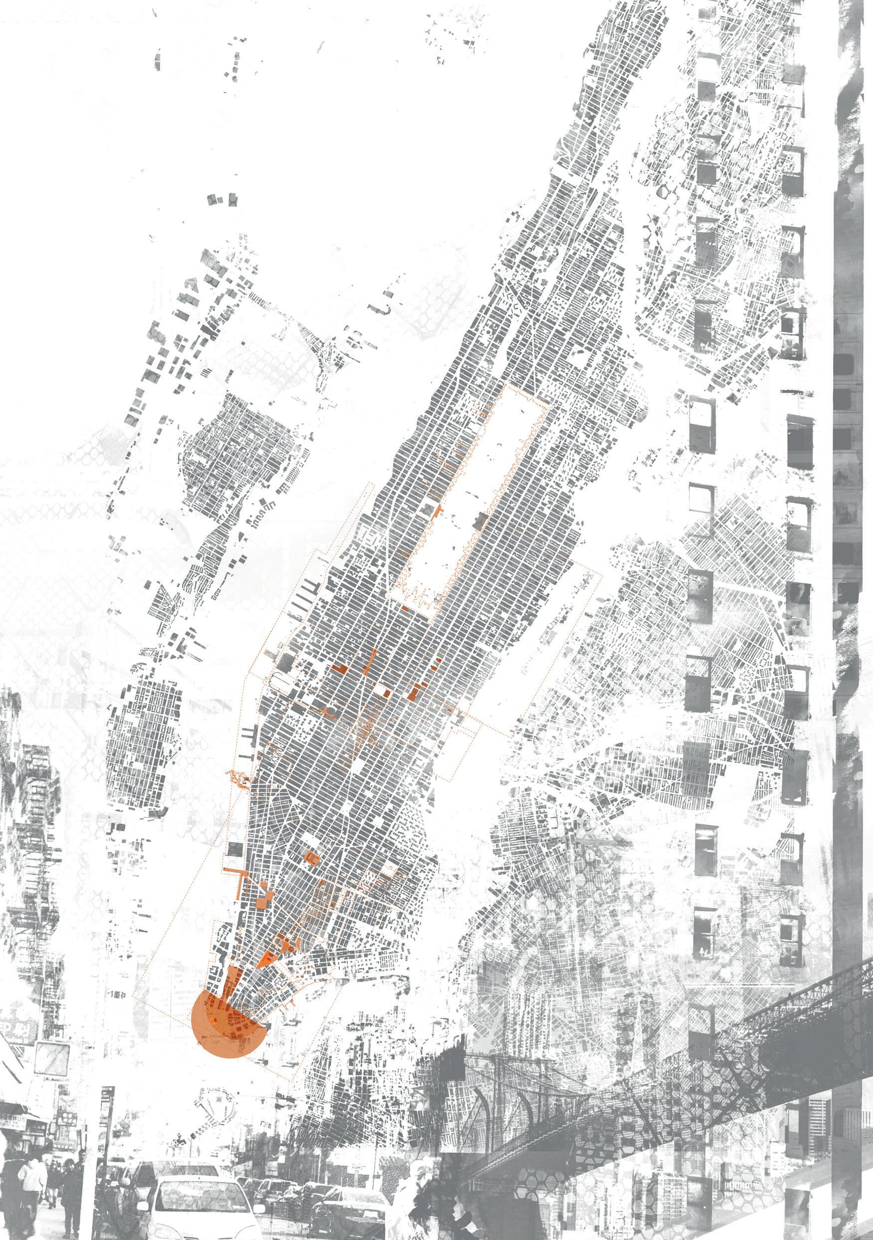
The terms of landscape have underpinned our reading of Manhattan, arguably the most urban of contexts. Our studio is peopled by students of architecture and landscape architecture working in dialogue and collaboration. Together we have sought to engage with the telluric pulse of the island, with the earth beneath our feet and the overt and latent power therein. In this city, the ground emanates both through the net of real estate boundaries and the sensorial map of past lives, the vestiges of places left behind by migrant ancestors persisting through the mythology, literature, culture and social organisation of the city. A population founded on estrangement generates multiple voices, numerous visions, fctions and realities that are compressed into the dense fabric of the island. This is a place where the land itself is prime currency and the notion of ‘public’ or ‘open’ space is a recurrent bargaining chip.
The Surveyor, his Devices and a landscape of resistance
“Getting better at using tools comes to us, in part, when the tools challenge us, and this challenge often occurs just because the tools are not ft-for-purpose. They may not be good enough, or it’s hard to fgure out how to use them. The challenge becomes greater when we are obliged to use these tools to repair or undo mistakes. In both creation and repair, the challenge can be met by adapting the form of a tool, or improvising with it as it is, using it in ways it was not meant for. However we come to use it, the very incompleteness of the tool has taught us something.”
Richard Sennett, “Arousing Tools” in The Craftsman (New Haven: Yale University Press, 2008) 194.
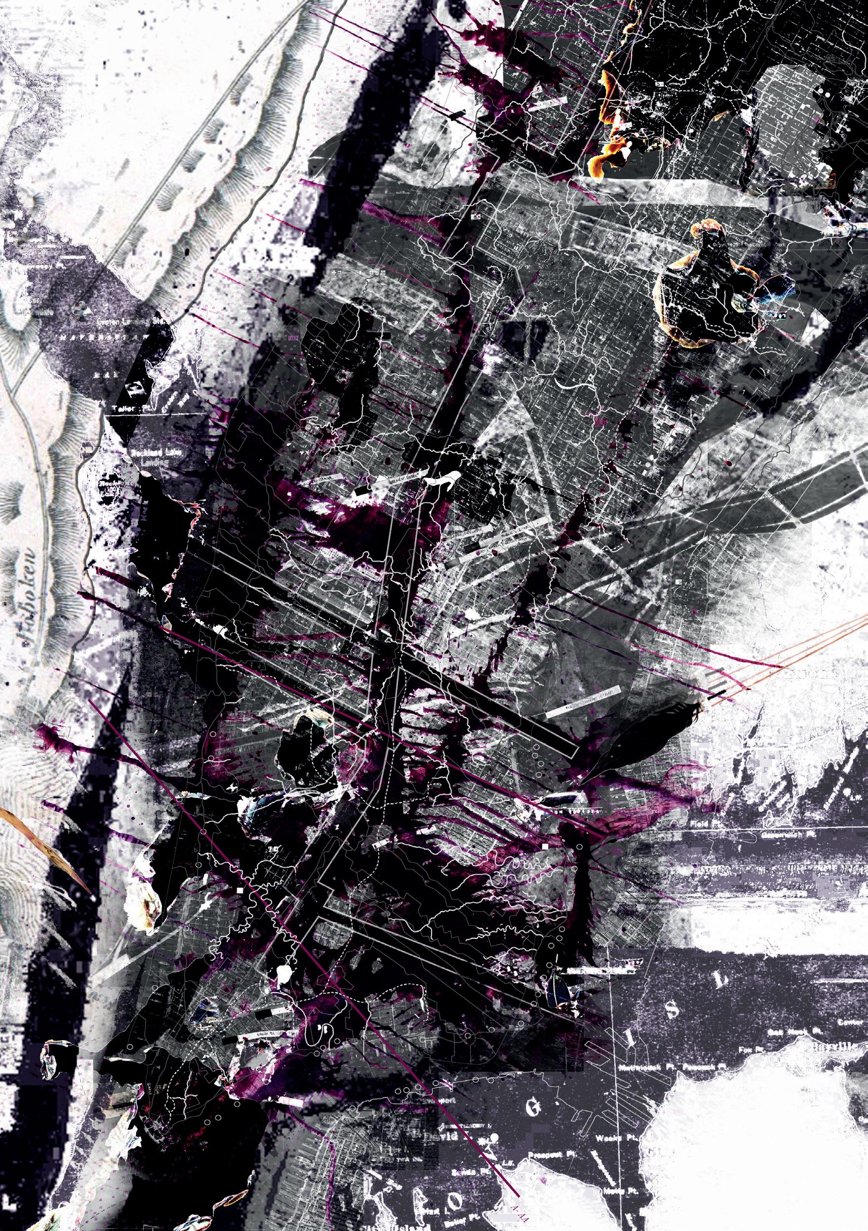
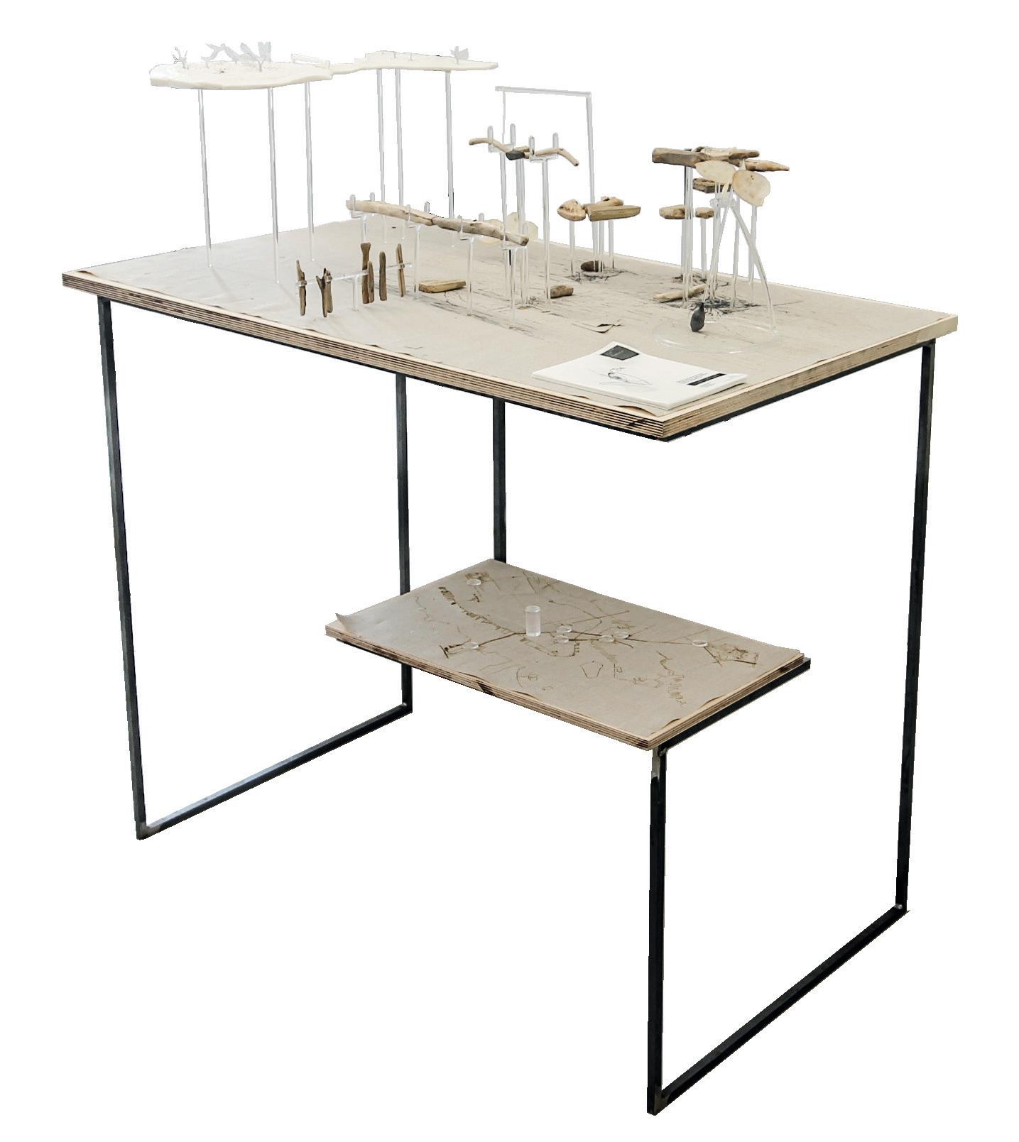
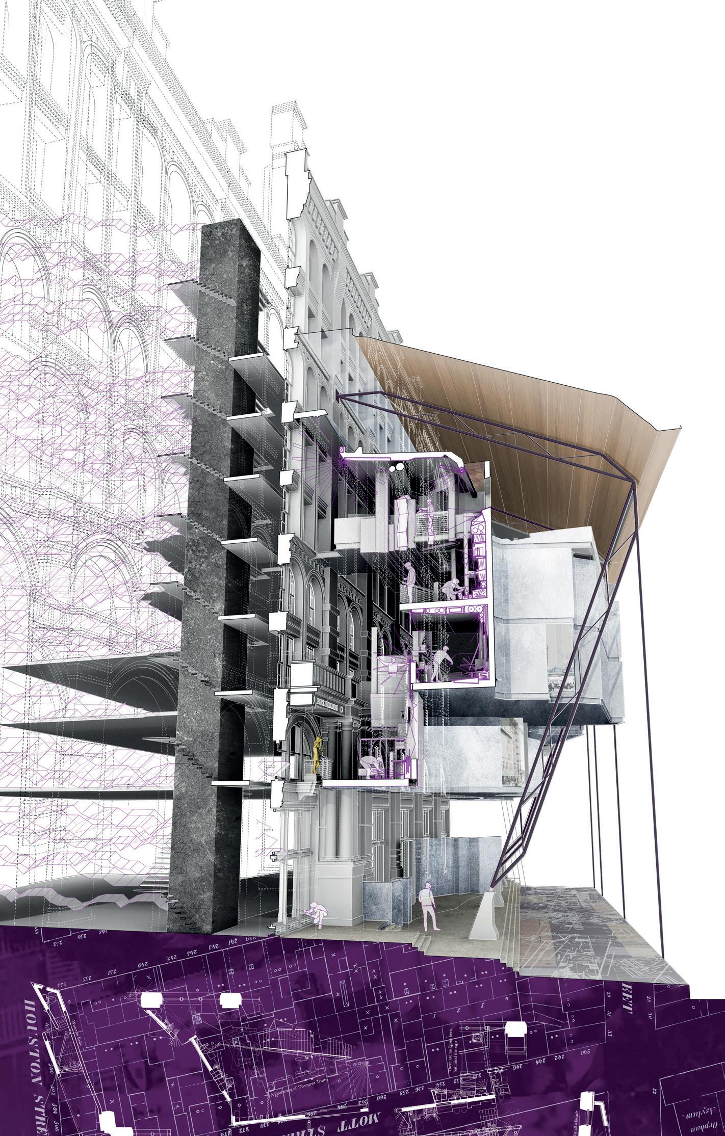
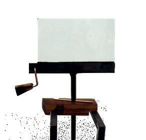
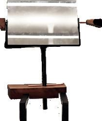
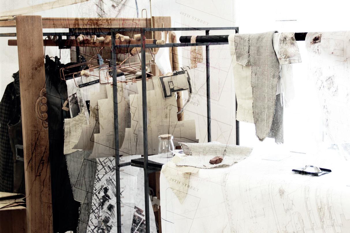
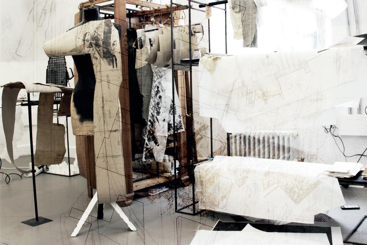
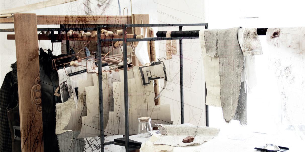
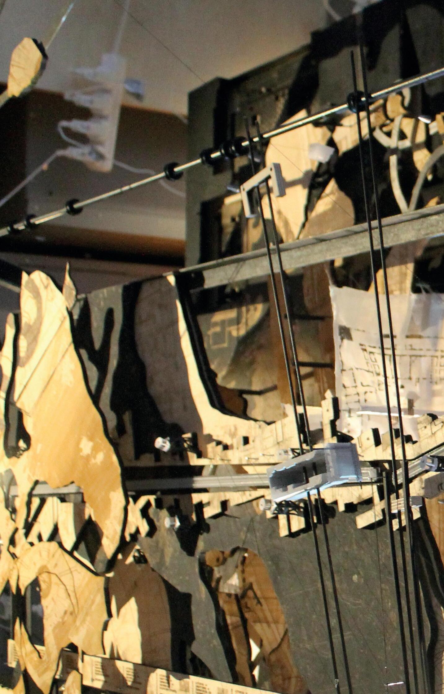
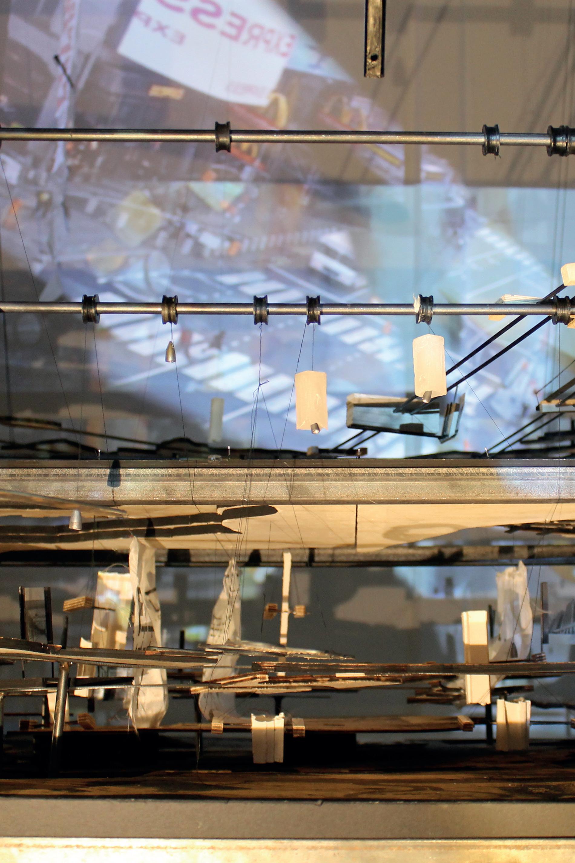
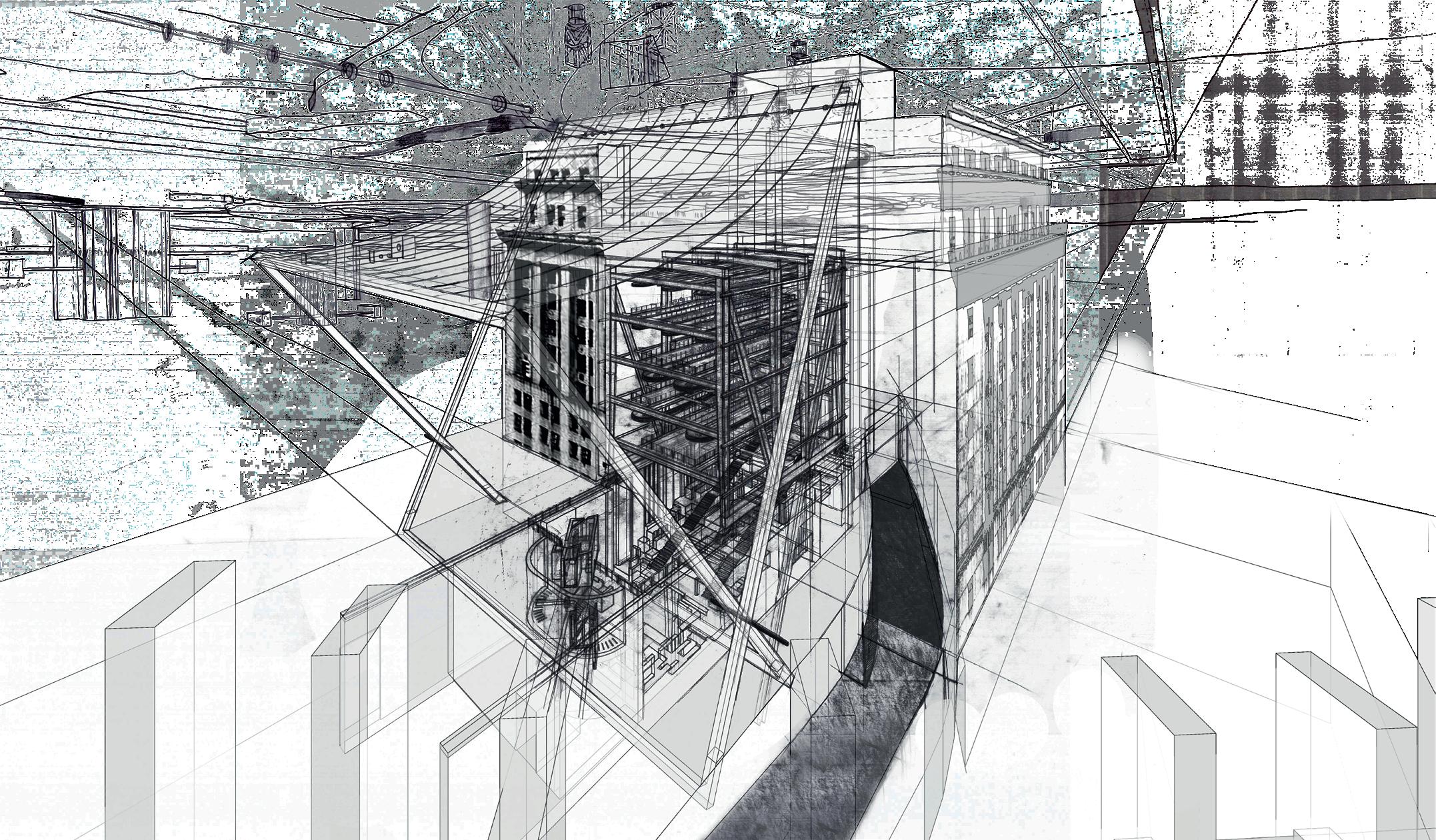
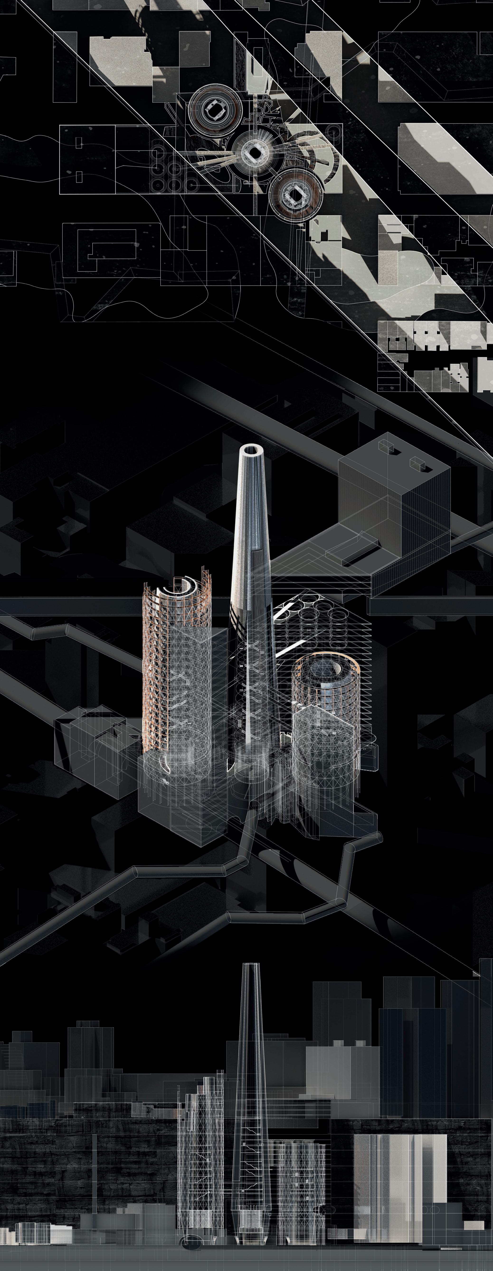
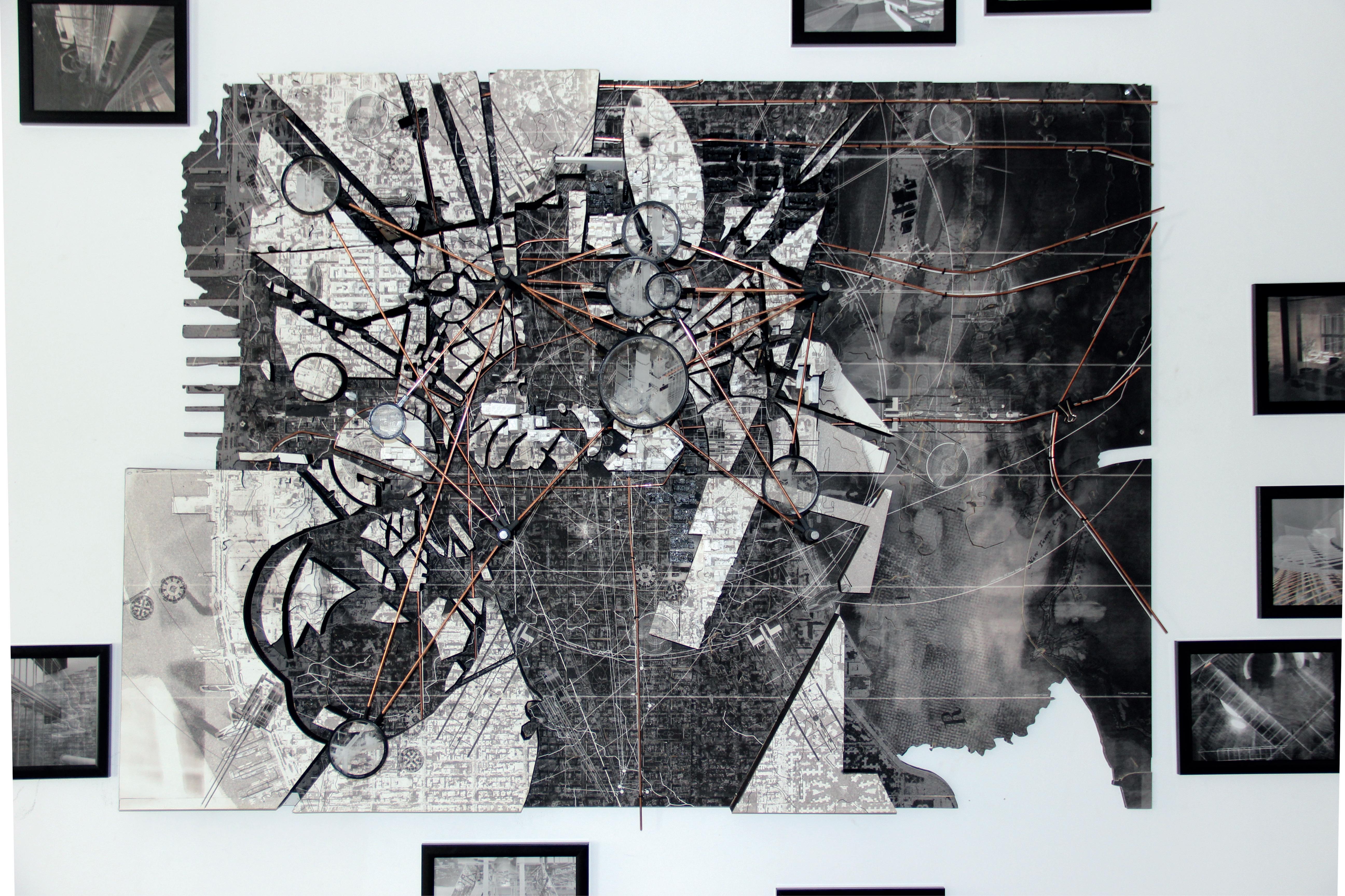
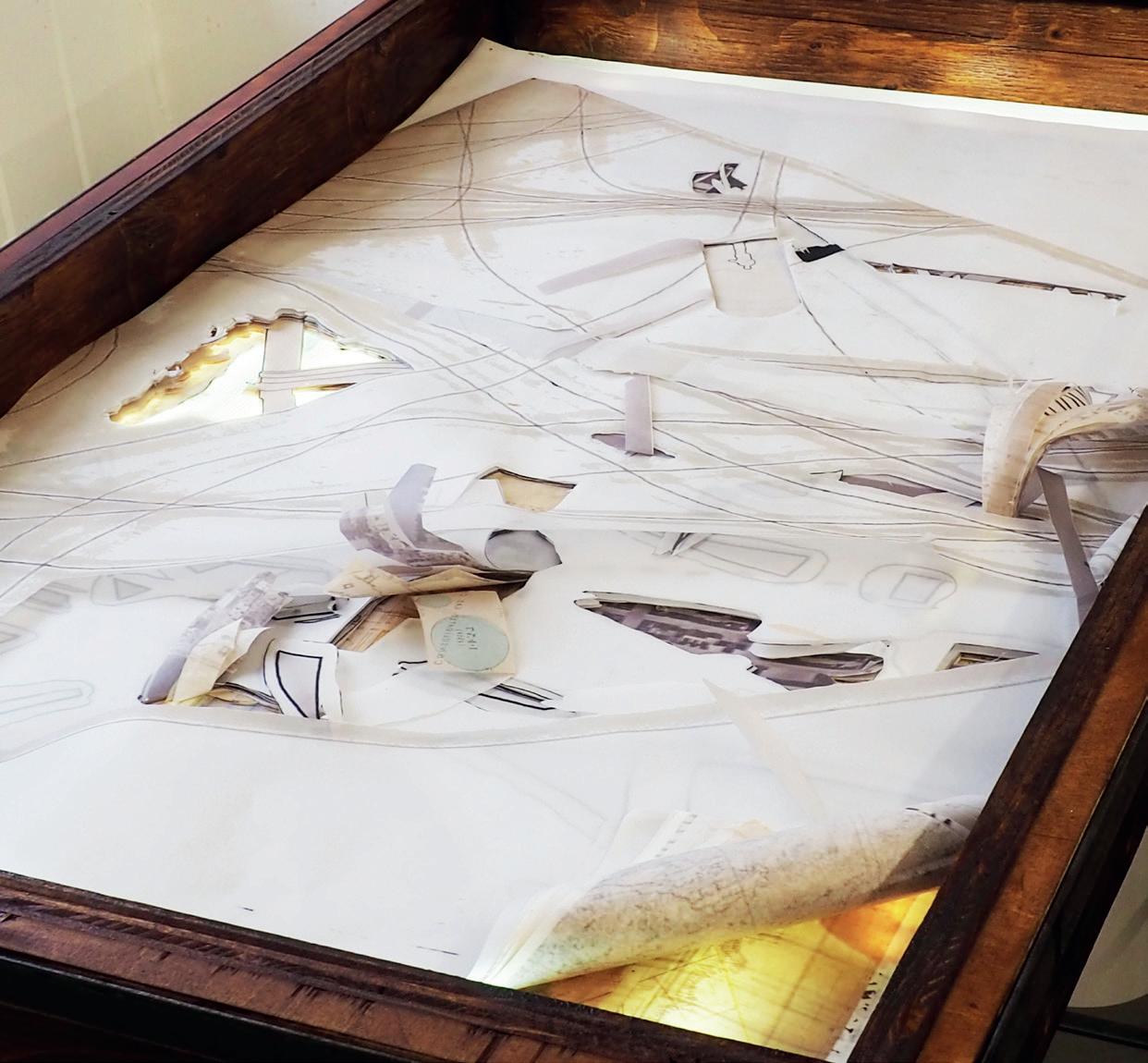
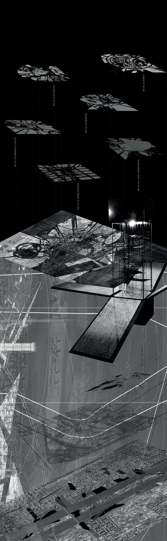
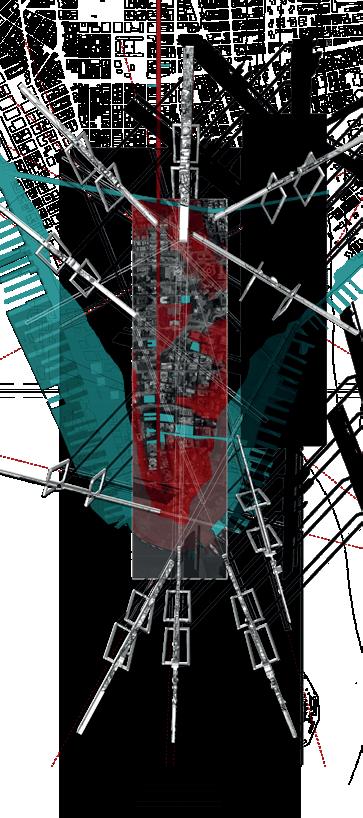
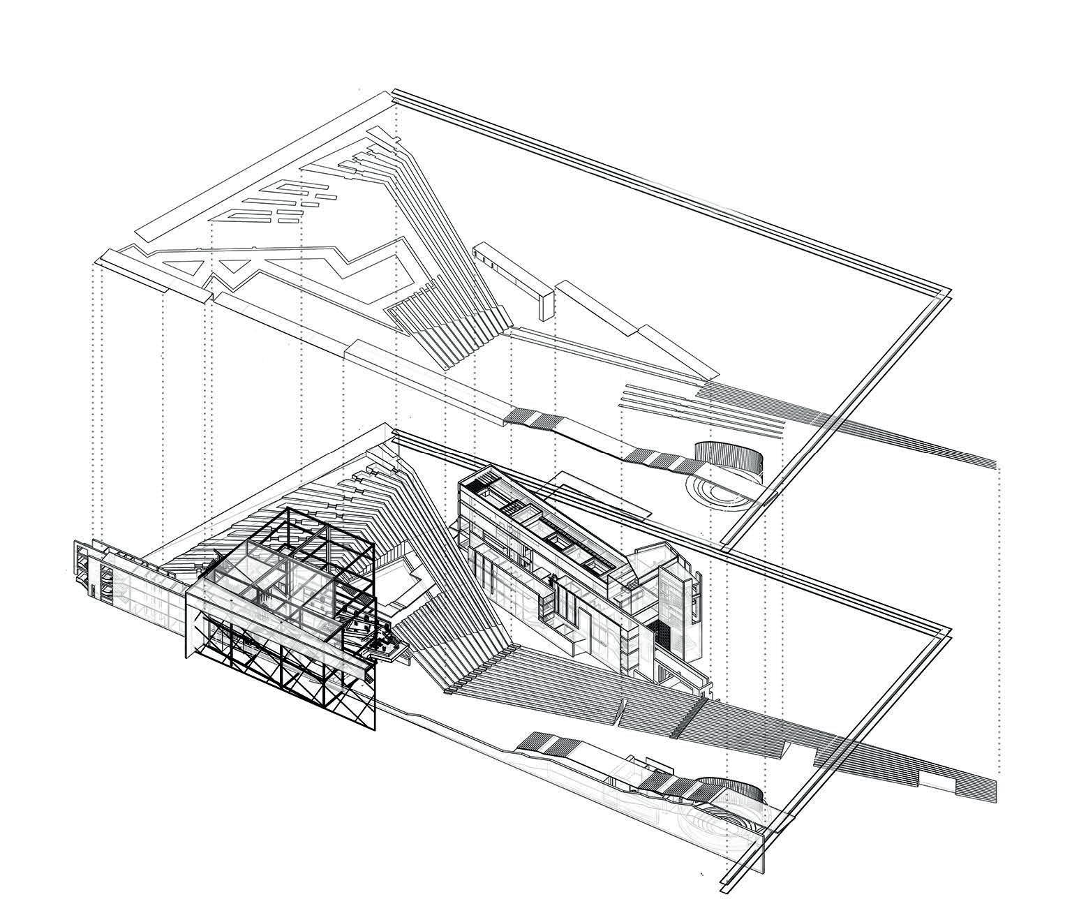
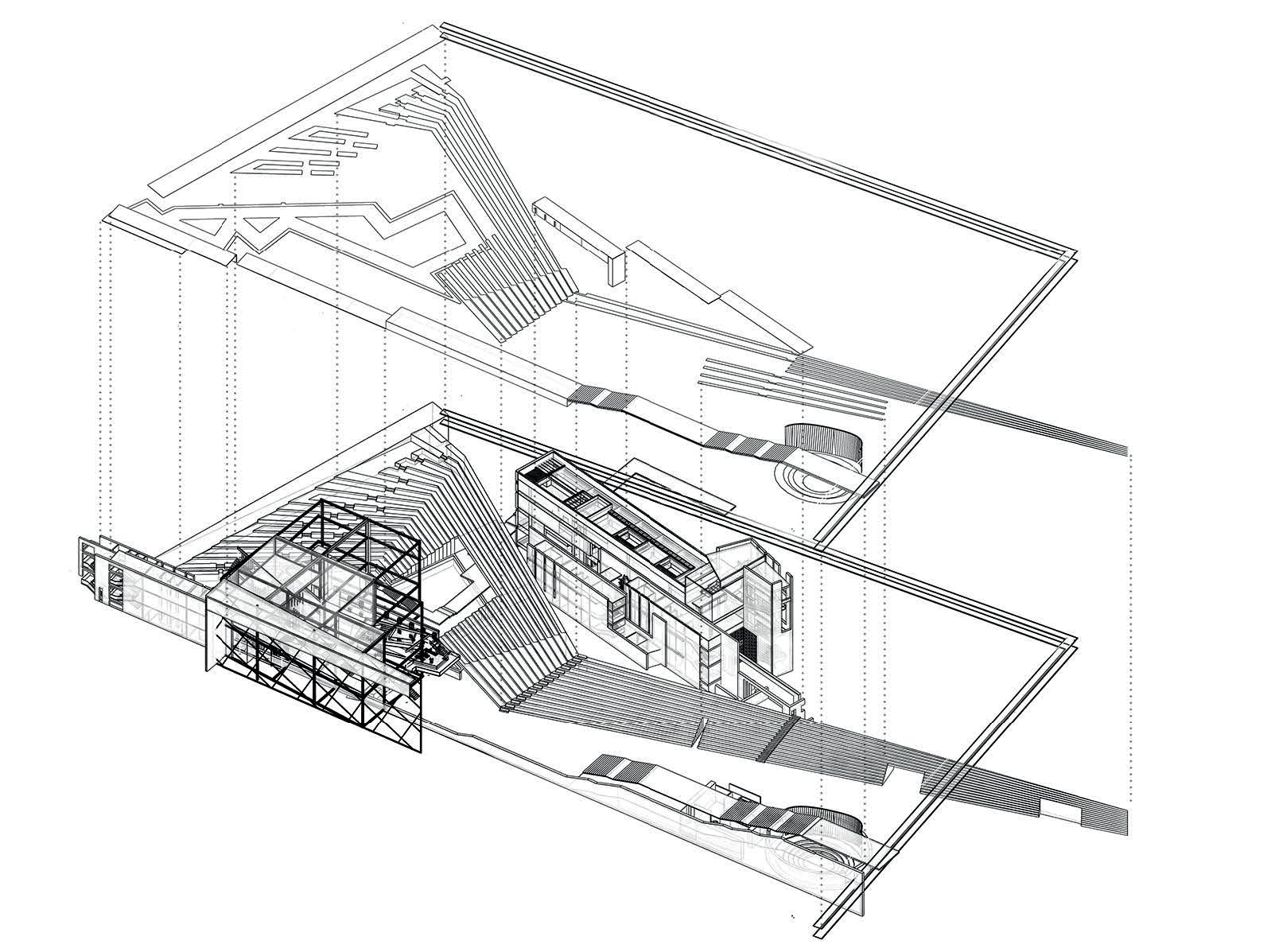
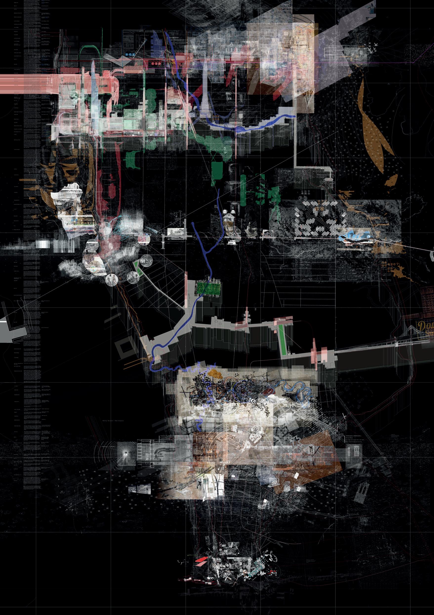
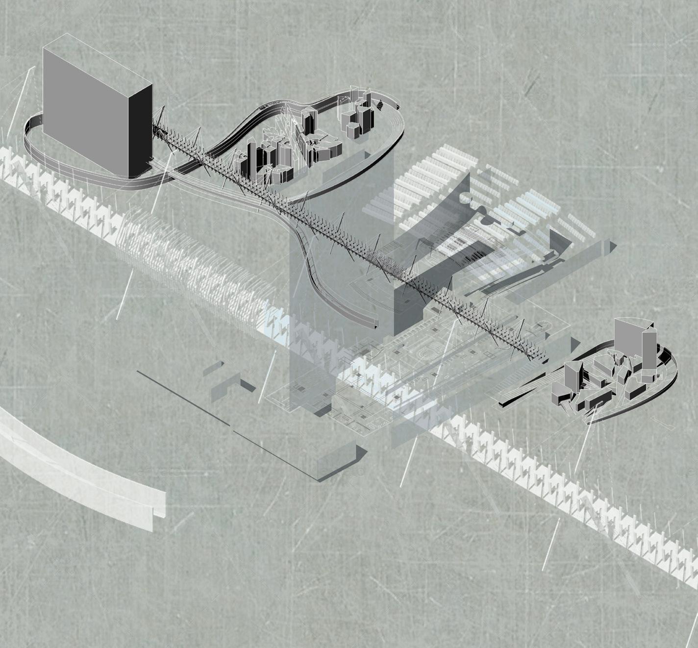
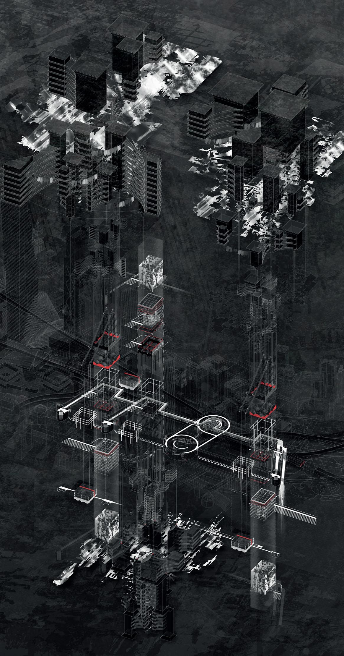
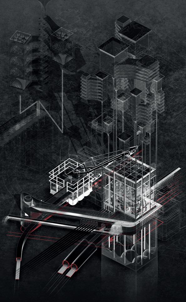
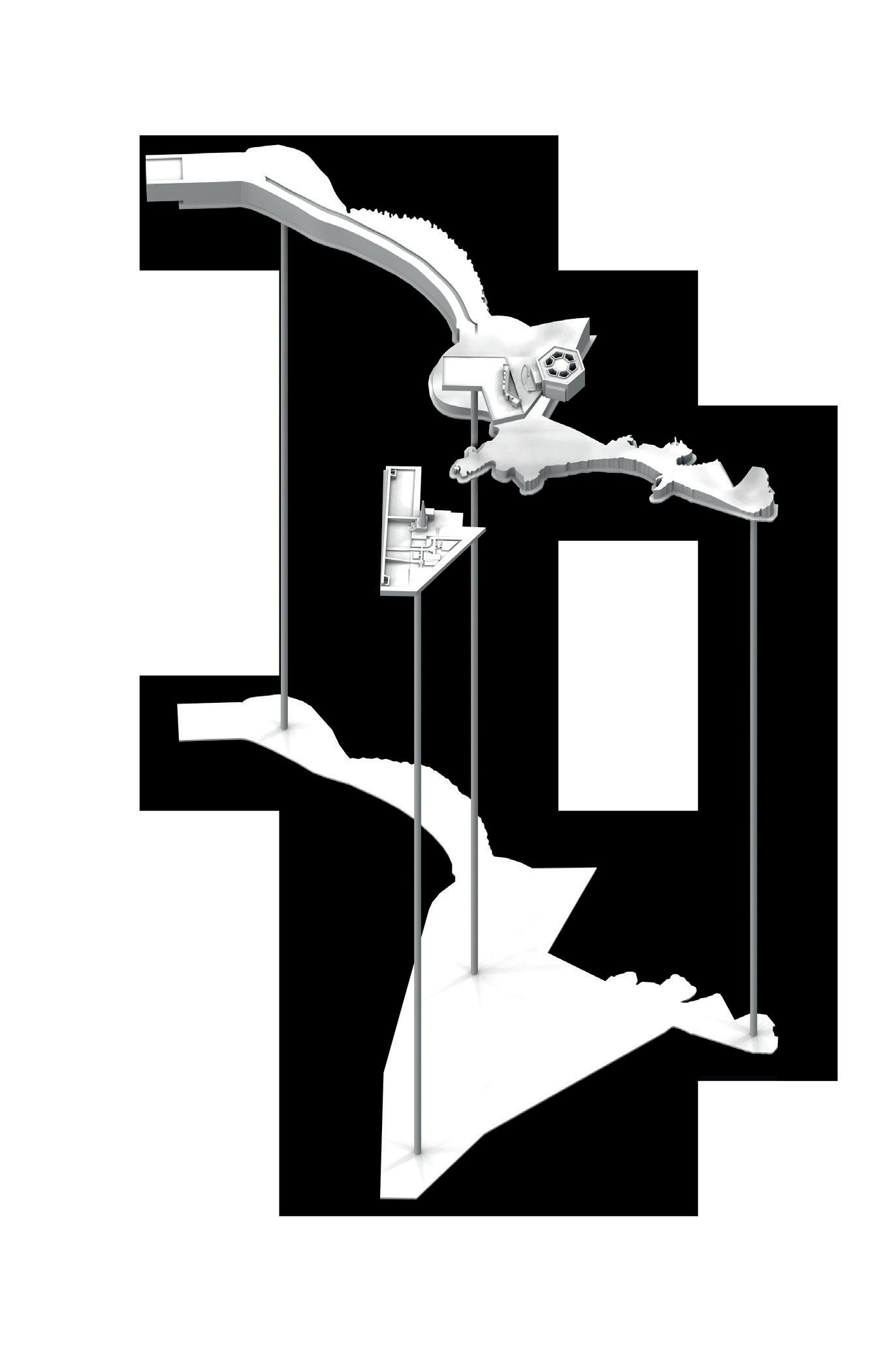
Island territories vi: Manhattan scapeland estrangement / displacement is predicated on the notion that architecture exists at every scale and through myriad forms of representation. It is drawn and built, written and spoken. The tools of architecture, its instruments, are both literal – devices, models, drawings, animations and installations –and conceptual – felds and gardens, locks and gates. As prompts and clues, points of departure, these tools are curious fctions, found flms, documentaries and narratives, and questionable facts, maps. They are instruments for measure and qualifcation, survey and projection, devices and plane tables. And they are conceptual logics, the familiar but malleable terminology of land and its ordering, felds and gardens, locks
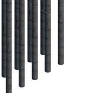
Bleecker & Lafayette
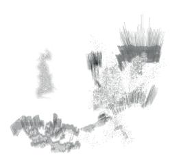
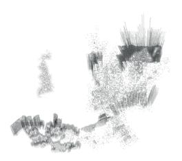
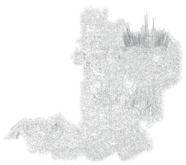
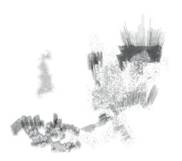
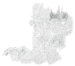
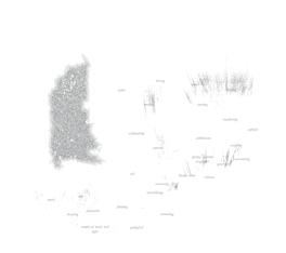
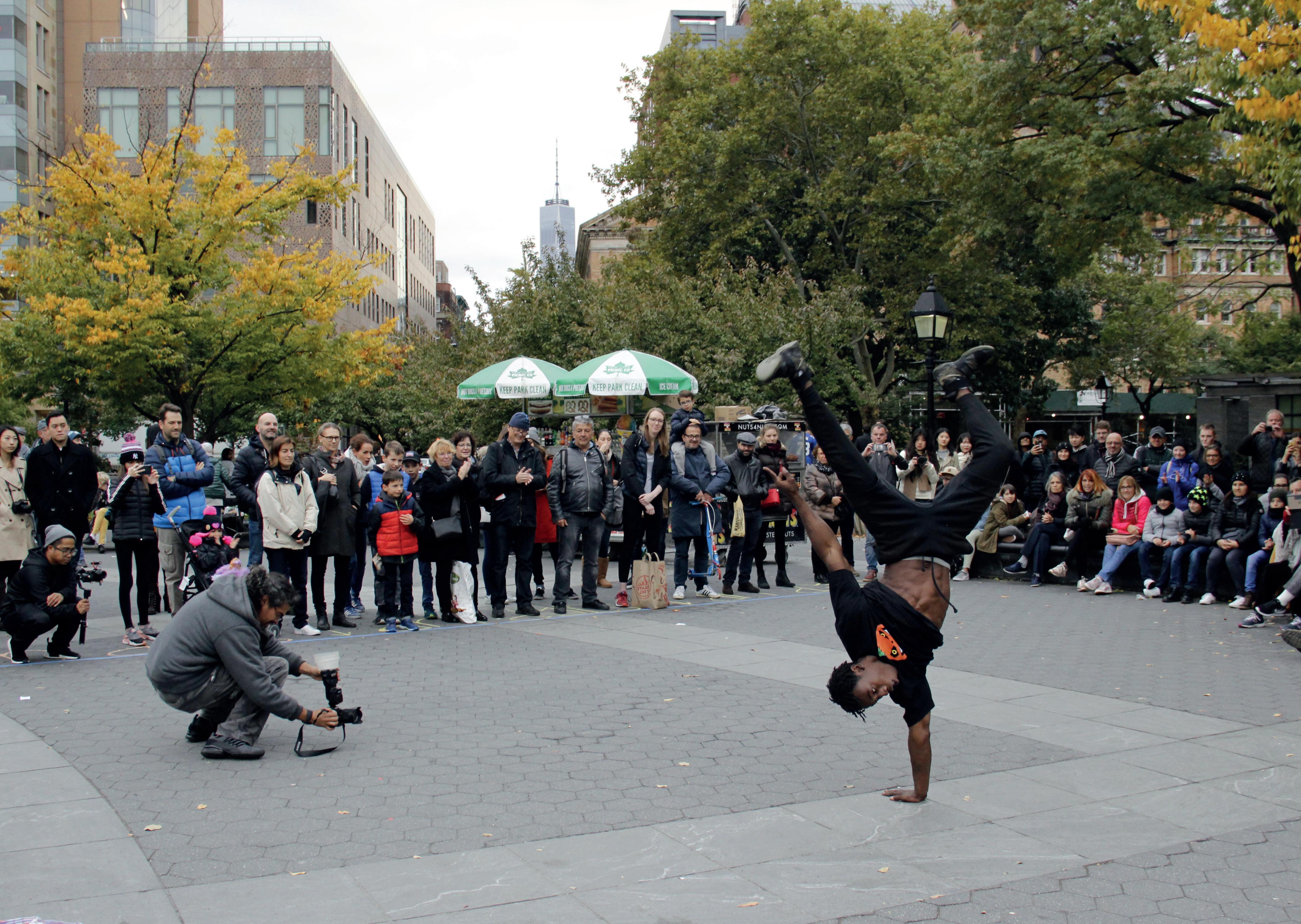
October 2018 | Norman Villeroux
and gates. They are notably open to interpretation through a drawing out, a crafting of their signifcance.
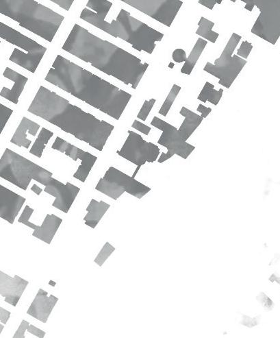
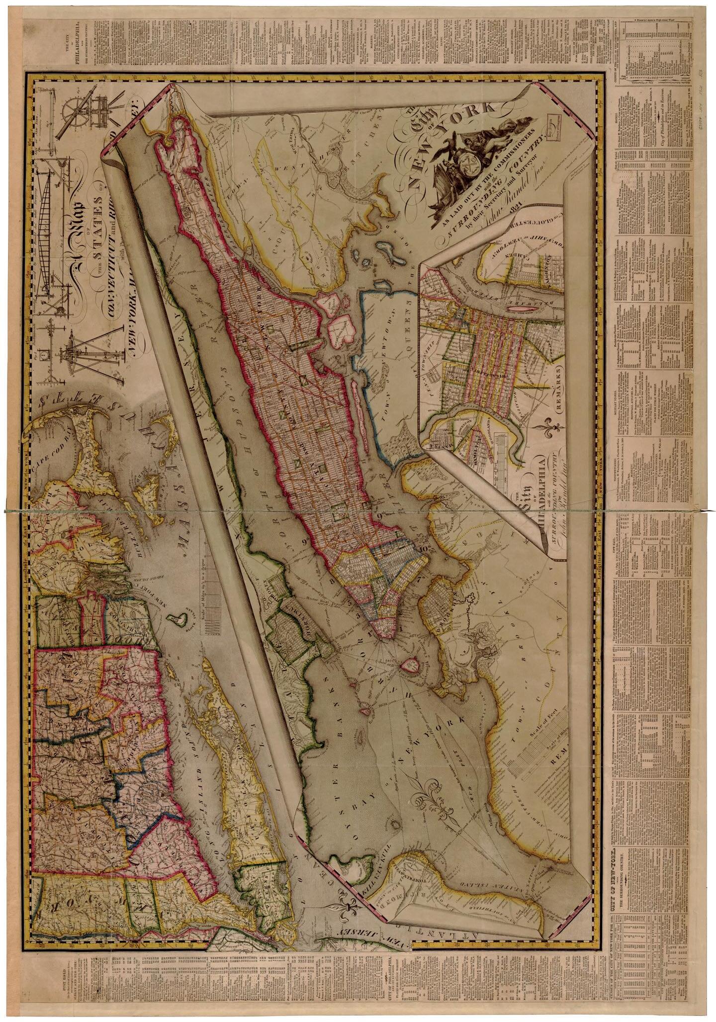
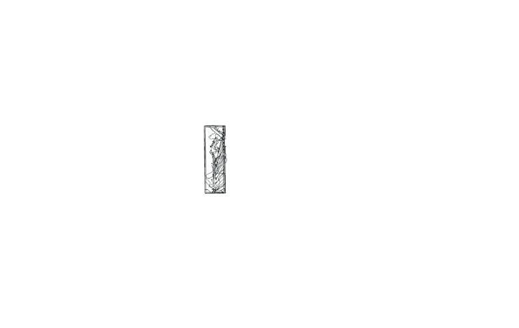
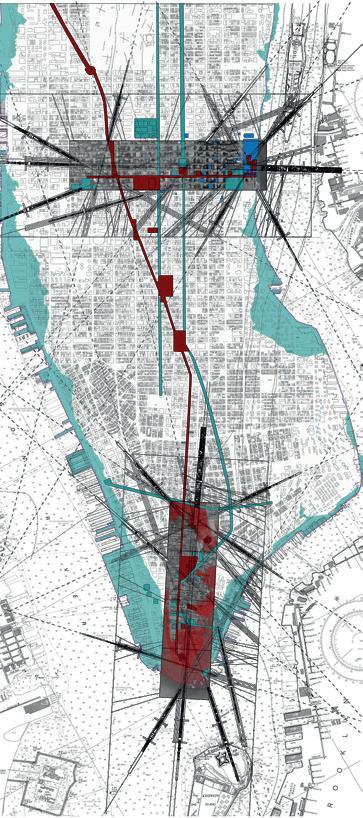
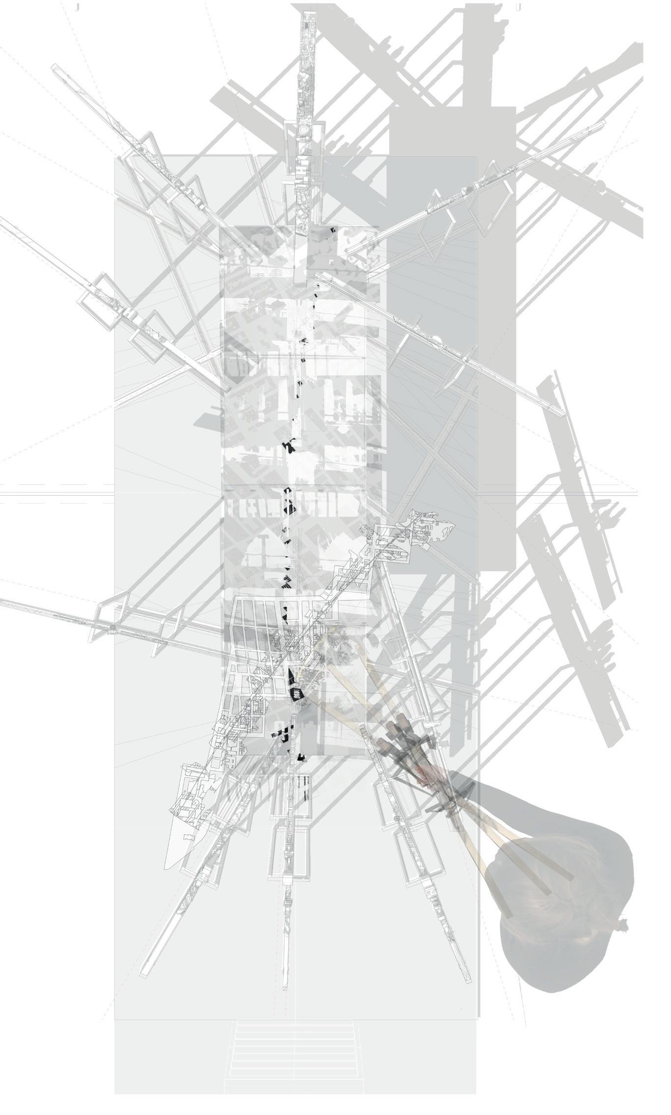
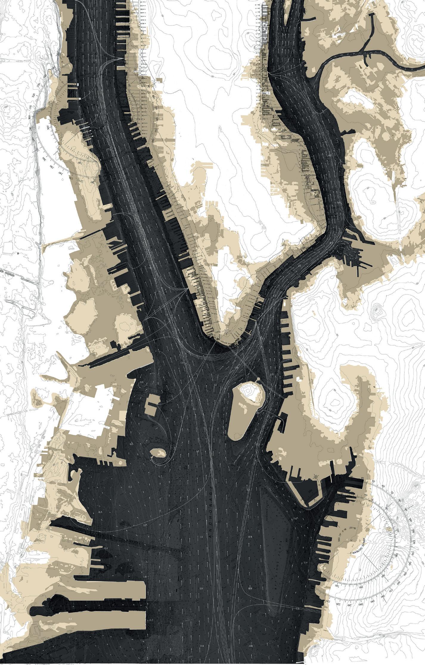
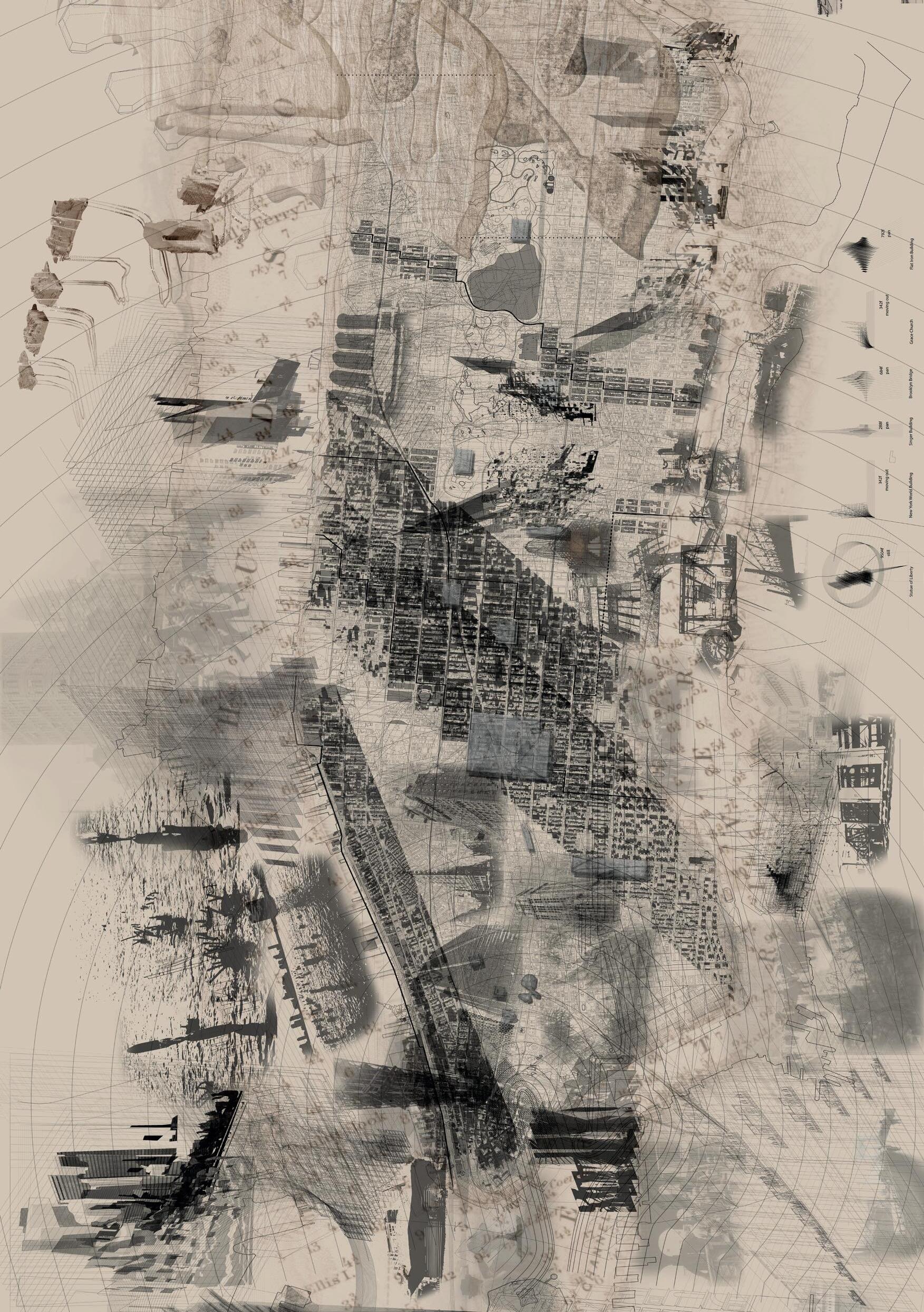
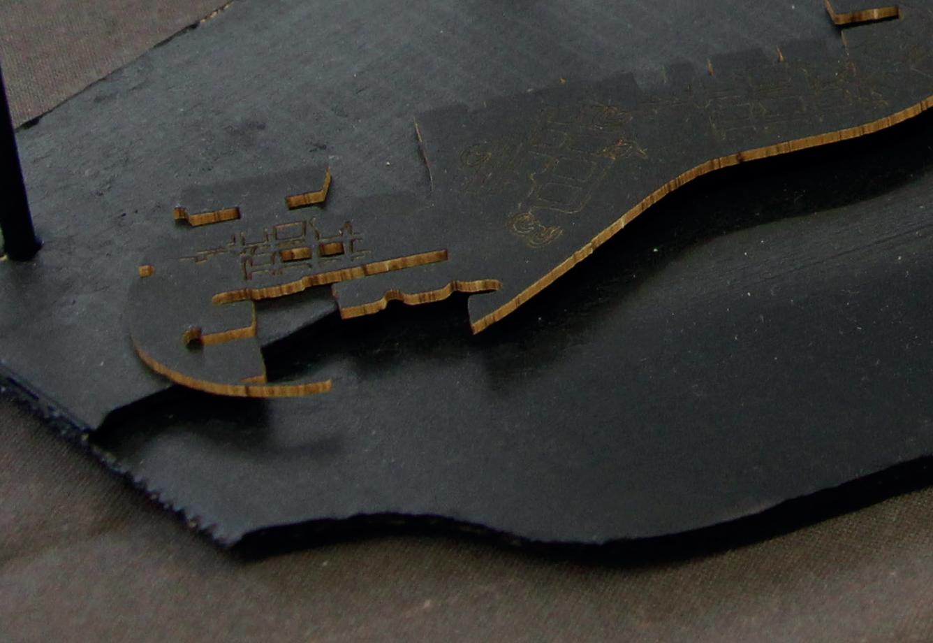
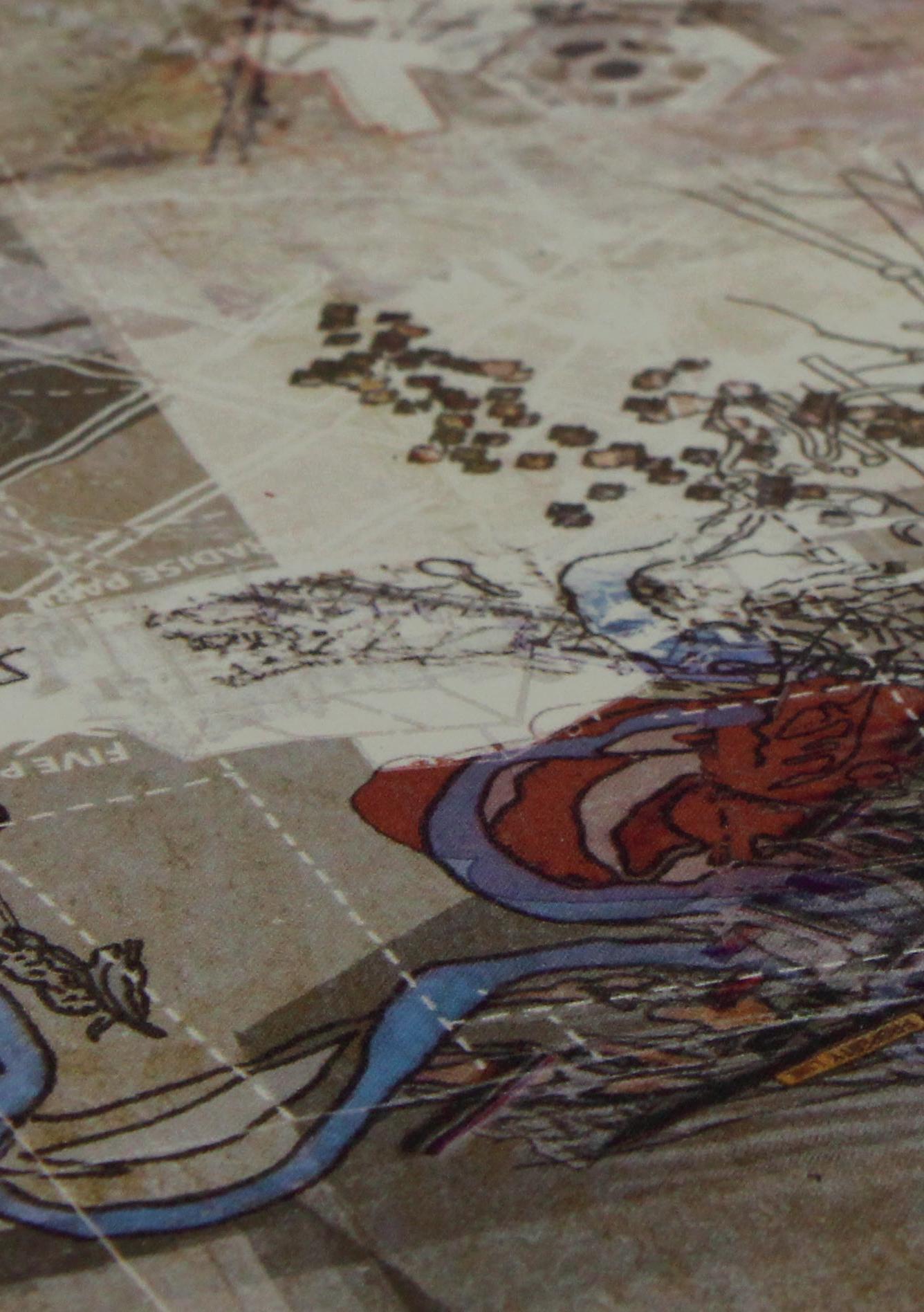
One key prompt, a map entitled ‘The Final Commissioner’s Plan of 1821’, Fig. 1, describes the island city at the moment when the conceptual becomes the real, the point at which the grid, now so familiar to us, ceases to hover over the irregular ground to the north of Manhattan Island, a terrain of hills, farm-scape and river systems, and fnally comes to ground. The map is the cartographic work of John Randel Jr (1787-1865), the young surveyor entrusted by the three Commissioner’s, Morris, Rutherford and De Witt, with the task of laying out the grid plan for the City of New York onto the island of Manhattan – a task that he fulflled twice. The frst iteration involved the careful survey of the sparsely populated island and its topography beyond the area now known as Lower Manhattan. This work provided the drawings upon which the geometry of the grid was defned and established. The second survey physically inscribed this geometry into the land itself in the form of white marble ‘monuments’ each measuring 3 feet by 9 inches. Roughly honed and set into the ground, these markers left only their polished upper surface, etched with the coordinates of avenue and street, exposed to the air. Where the ground was too hard to receive the stones, iron pegs were hammered into rocks and fxed with molten lead.
In this work, rather than merely depicting the gridded island, Randel forms a complex graphic layering of three maps drawn as though each successive image has been unfurled one upon the other. The lower map locates Manhattan within the greater territories of Connecticut and Rhode Island emphasising the strategic importance of the island in forming a gateway between the newly independent nation, the sea and its vital Atlantic trading routes. The presence of this lower map also served to highlight the internal ambitions of Manhattan and the infuence the planned metropolis would come to exert on the extended landscape through the Post Road north to the state capital of Albany.
The gridded plan of Manhattan forms the principle, central layer of the print. It is drawn in meticulous detail, surpassing normal expectations of a plan of this scale. Randel had a resource in the form of a set of earlier ‘Farm Maps’ to draw upon and distil down into this centrepiece. The Farm Maps were a beautifully rendered byproduct of his years surveying and pegging out the Commissioner’s grid. This series, which he produced between 1819 and 1829, consists of 92 individual maps each
1 | The City of New York as laid out by the Commissioners with the surrounding country, 1821. John Randel Jr.
Fig.
HAWKER, BERNIE,
measuring 32 by 20 inches corresponding to the dimensions of his domestic table in Albany upon which they were drawn. If assembled, they would form a colossal miniature of Manhattan island, 11 feet in width by 50 feet in length. They relate the proposed grid of streets and avenues, to topographic readings and the forms of existing occupation and agriculture that would have to give way to the planned city blocks. In the lower left-hand corner of each of the drawn blocks is a mark and a set of co-ordinates that correspond to the marble monument or peg that Randel had carefully placed into the ground of the nascent city.
The fnal, upper map depicts the plan of Philadelphia, the one element of the composition that Randel had not surveyed himself. Founded in 1682, the Philadelphia of the early 19th century was the cultural and political epicentre of a newly independent United States of America. It had played a key role in the American Revolution. It was the meeting place of the Founding Fathers where the Declaration of Independence was signed in 1776 and the Constitution in 1787. By the early 1800s, New York was a thriving but unruly port and a frantic place of business. Philadelphia, on the other hand, was a place of order and civilisation – a place of ideas and vision. By placing a plan of this city over the empty grid of Manhattan, Randel seems to invite citizens to project a semblance of cultural value onto the geometric weave of their future city. Indeed, much of the information contained in the type-dense margins of the map relates to Philadelphia rather than New York. It is a civic inventory of sorts, an extended list of colleges, academies, theatres, hospitals, churches, court houses and penitentiaries that might be added to those already listed in the densely occupied south westerly tip of Manhattan and then liberally sprinkled north throughout the waiting grid.
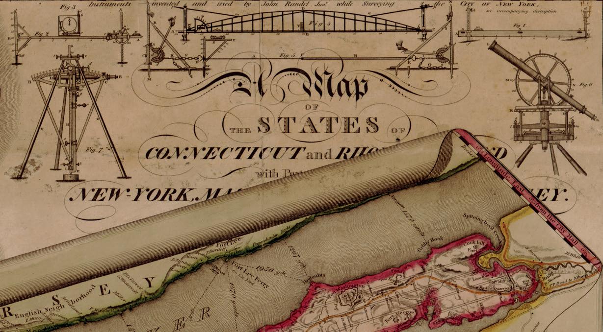
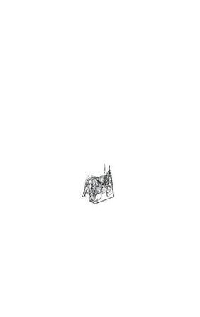
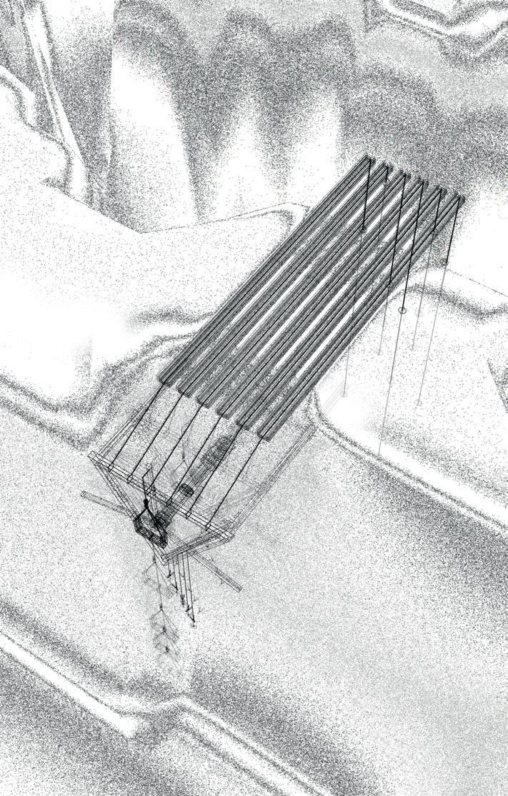
Completing the composition of the print, in the top right-hand corner, are seven detailed illustrations of ‘Instruments invented and used by John Randel Jr while surveying the city of New York’. Randel knew that if he was to survey the island of Manhattan to the level of accuracy and detail necessary to prepare the laying out of such an ambitious proposition, the establishment of a gridded city 2.3 miles wide and 13.4 miles wide, he needed a set of devices that were not only capable of providing exact readings but also able to withstand the pressures of such strenuous feld work. They would have to overcome the resistance the land would offer up to the prospect of becoming ensnared by the grid – rough topography, woodlands, swamps, water courses, unmetalled tracks, substantial fuctuations in heat and humidity, rain, ice and snow. The instruments needed to be scientifc and yet able to be transported and operated by unskilled hands. Randel’s numerous feld books detail not only
the measuring process but also the diffculties and interference encountered when surveying an island of this nature and size.
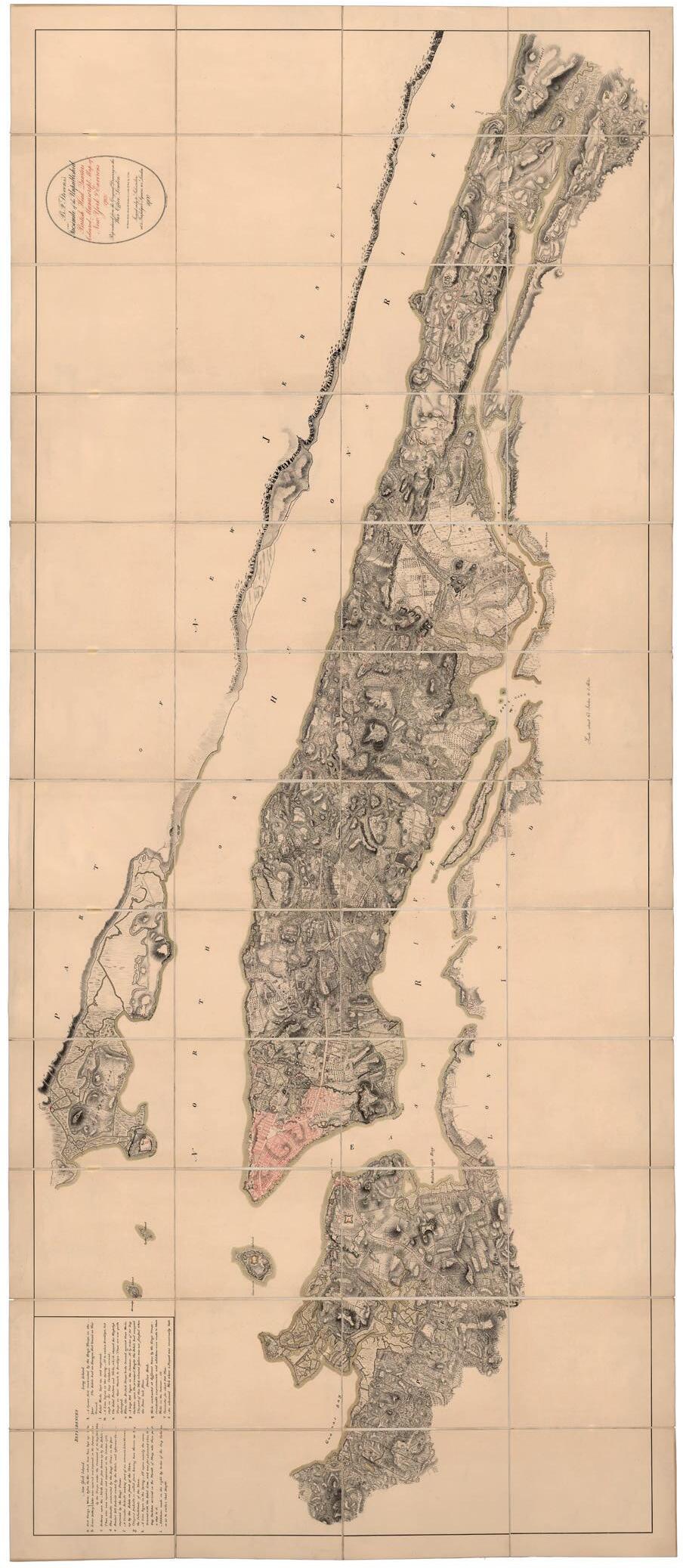
The name Manhattan derives from Manna-hatta a name frst recorded in the logbook of Robert Juet in 1609. It appears again twice on a map from 1610 on the shores of the Mauritius (later Hudson) river. In folk history it has been translated from the language of the indigenous Lenape people as ‘place for gathering wood to make bows’, ‘the island of many hills’, ‘the island where we all became intoxicated’ and, simply, ‘island’. The beautifully crafted ‘British Headquarters Map’ from around 1782, which depicts the island barely populated except for the township of New York under British occupation, seems to side with the reading of the island as a place of numerous hills. The grid the Commissioners offered to this land was not concerned with topography, it considered the island as a horizontal tableau, a tabula rasa onto which it could be easily inscribed. Randel had to negotiate this ideal with a more telluric reality. The diffculties encountered in the surveying of the grid, the resistance of the ground, the errors, the misreadings and the distractions – whether they occur naturally or culturally – are part of the ongoing layered narrative of the extraordinary island territory of Manhattan.
Fig. 2 | “The Devices of John Randel Jr”. The City of New York as laid out by the Commissioners with the surrounding country, 1821.
Randel’s devices are machines for transforming Manna-hatta into Manhattan – an island of hills into a plateau of order, a landscape of difference into a pattern of self-similarity. Whether the Commissioner’s motivations were a vision of postrevolutionary democracy where each citizen shares a similar ground (where ‘all
HAWKER, BERNIE, TORRES
men are created equal’) or the capitalist commodifcation of the land – the simple parcelling of ground as real estate for sale and development is an ongoing debate. The depiction of the seven devices on Randel’s map of 1821 talk as much about an attitude to the land as the cartographic rendering itself.
Devices, Tables and Fields / Locks, Gardens and Gates
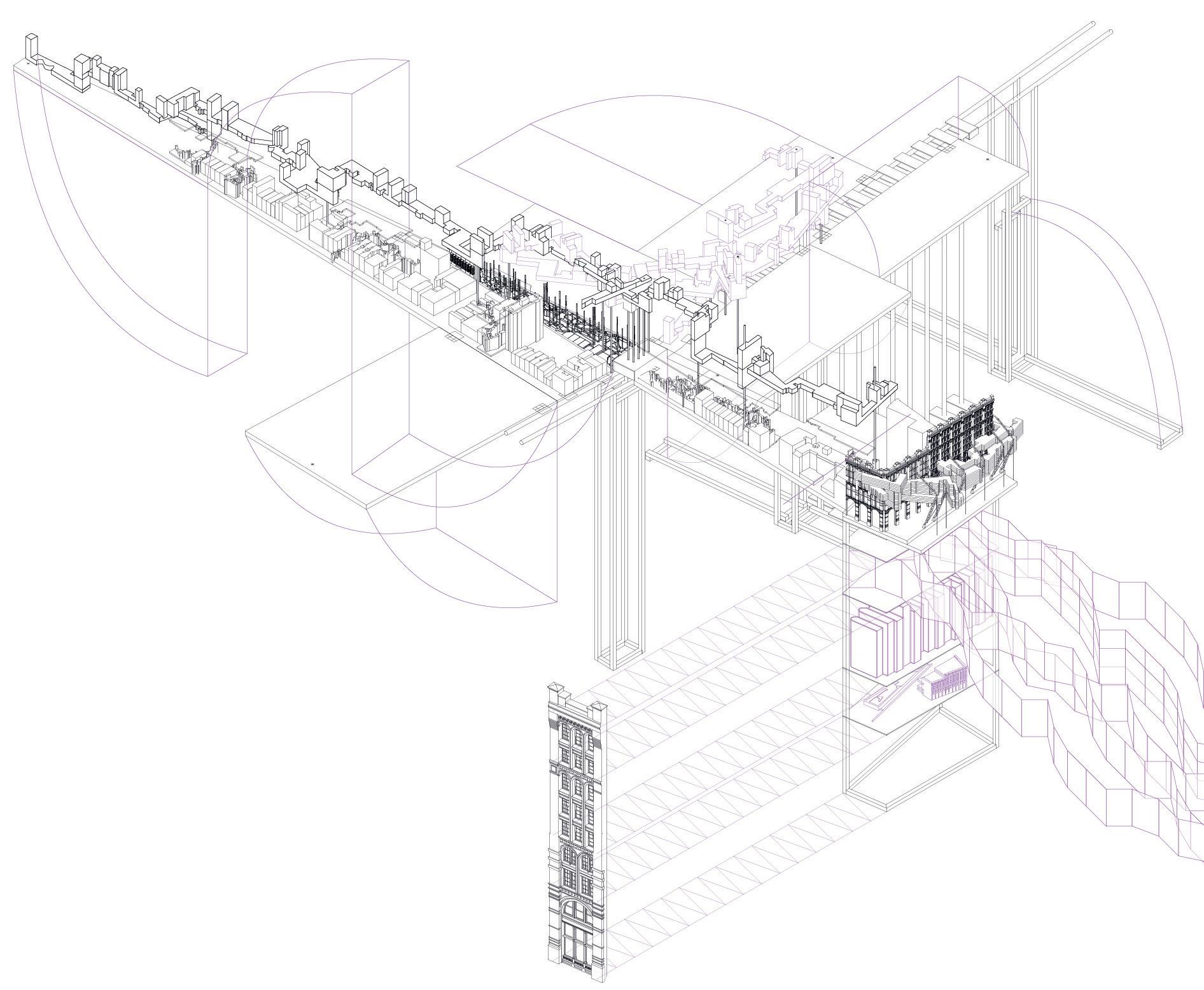
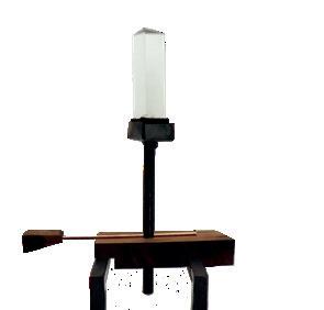
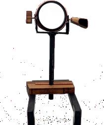
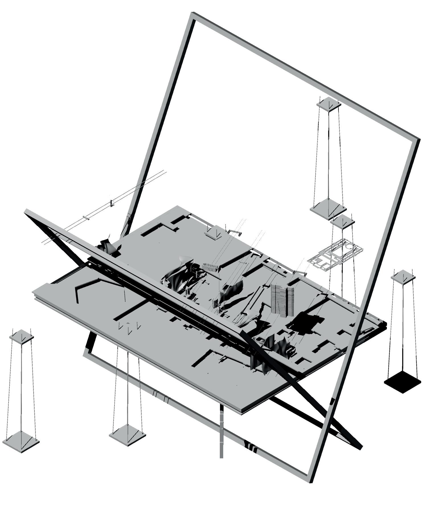
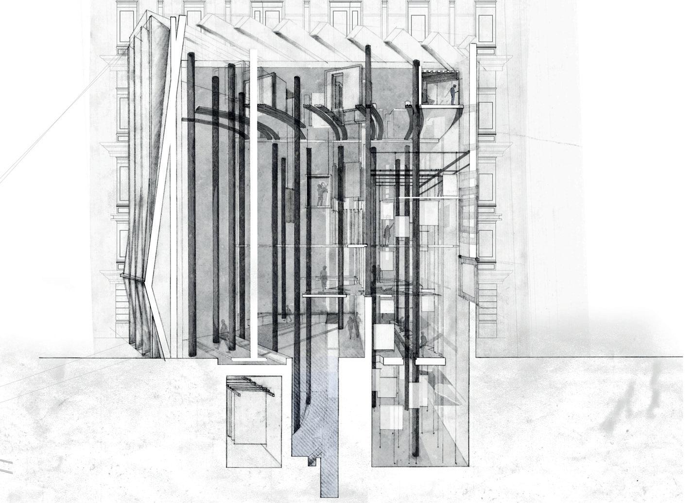
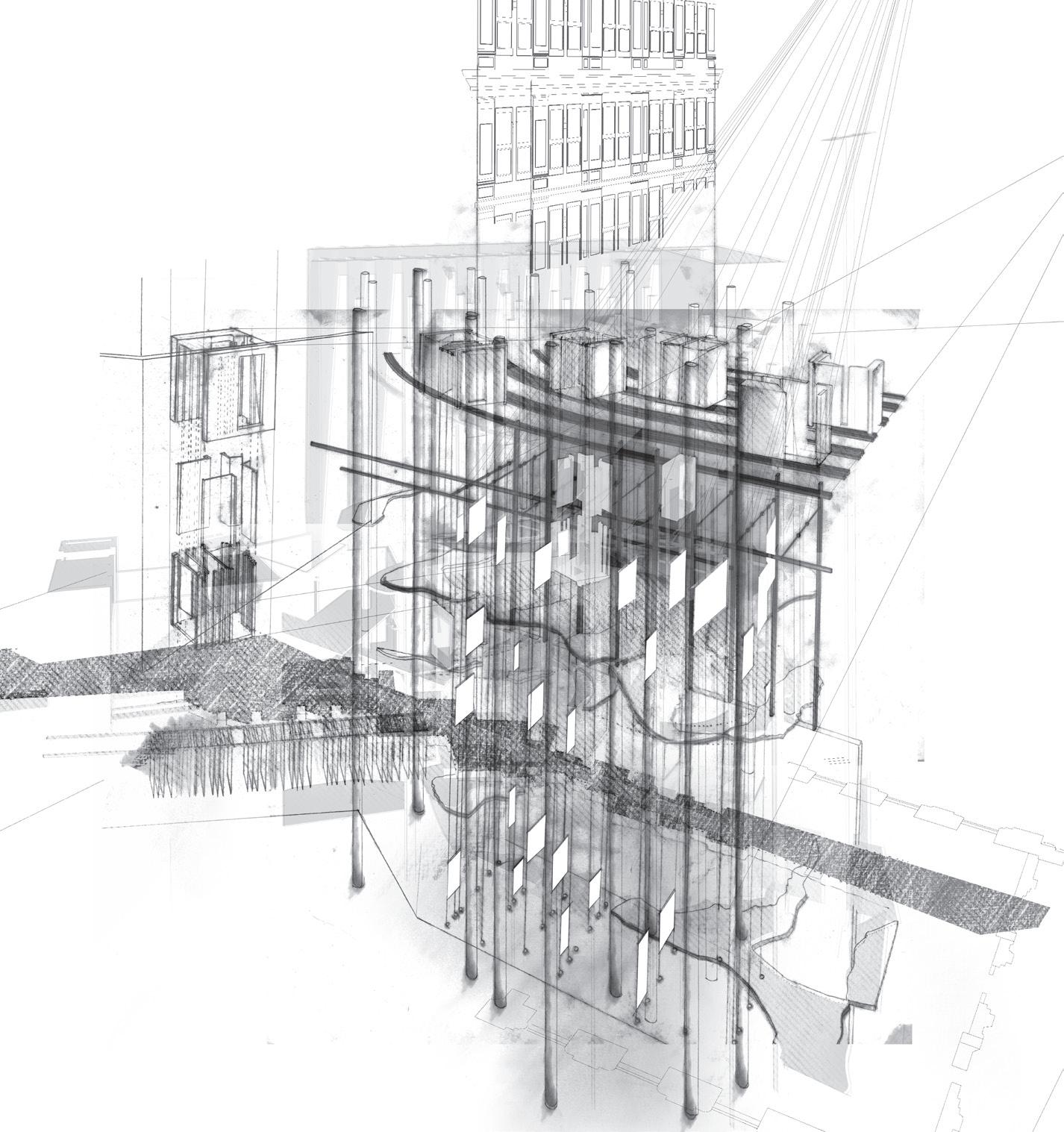
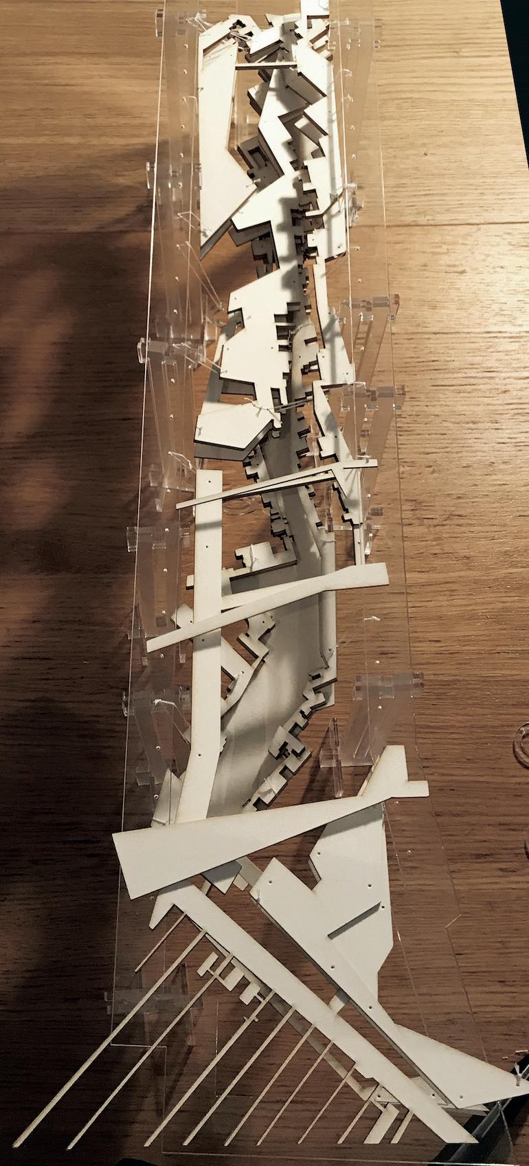
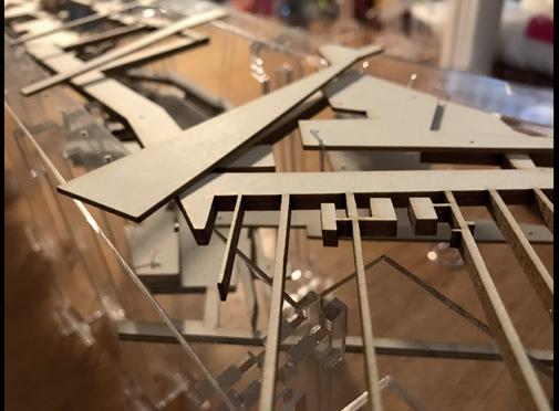
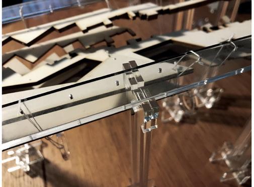
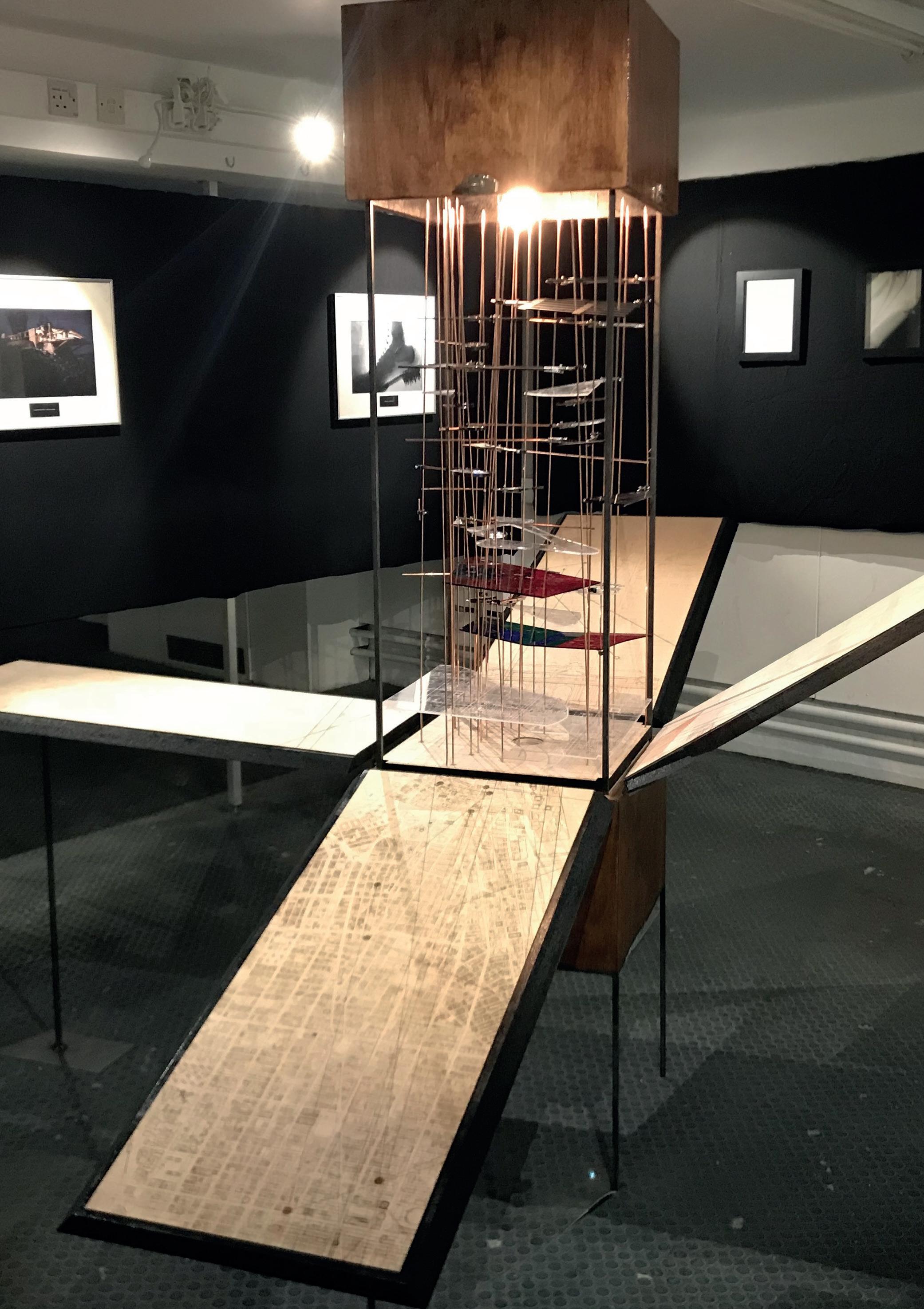
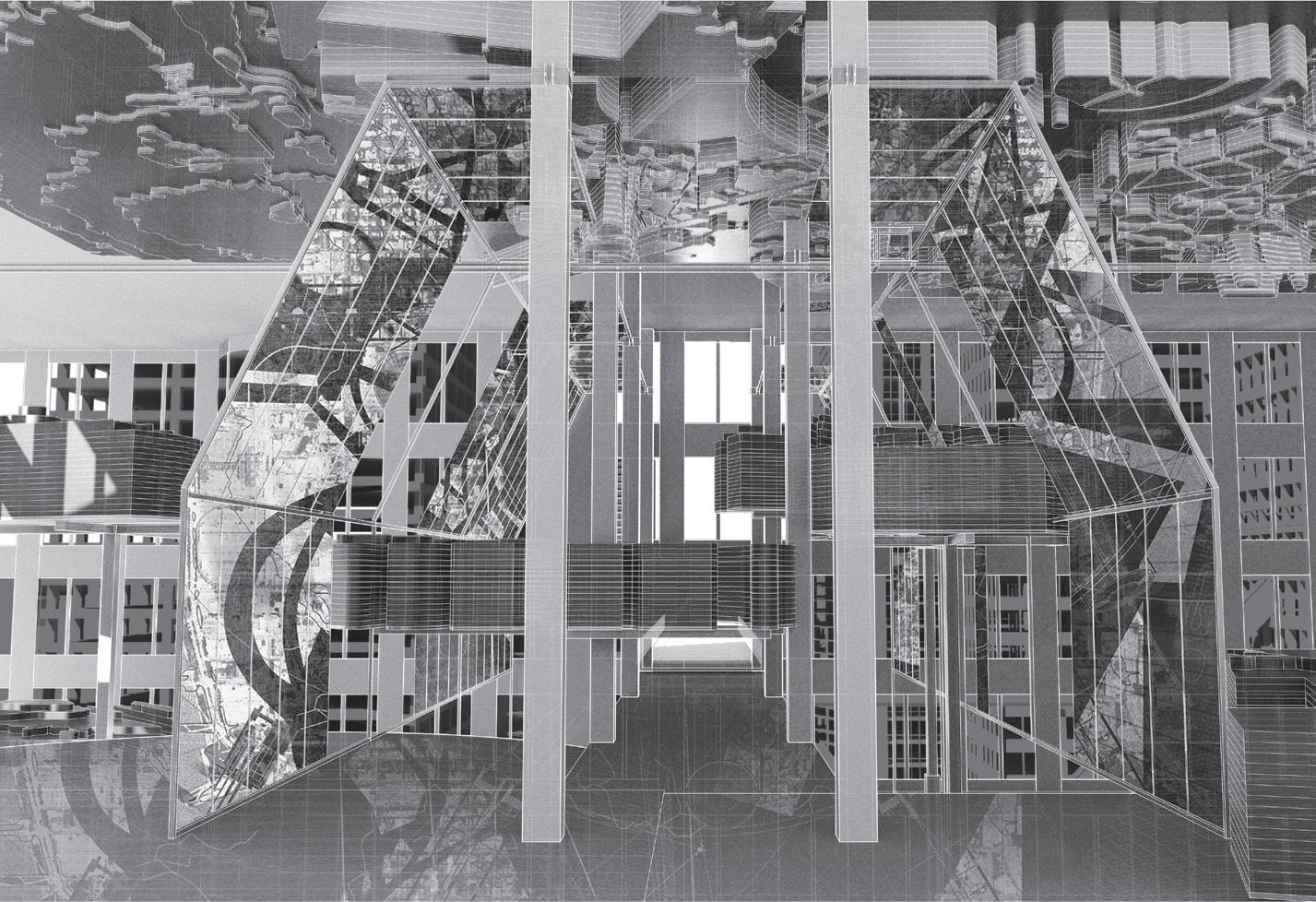
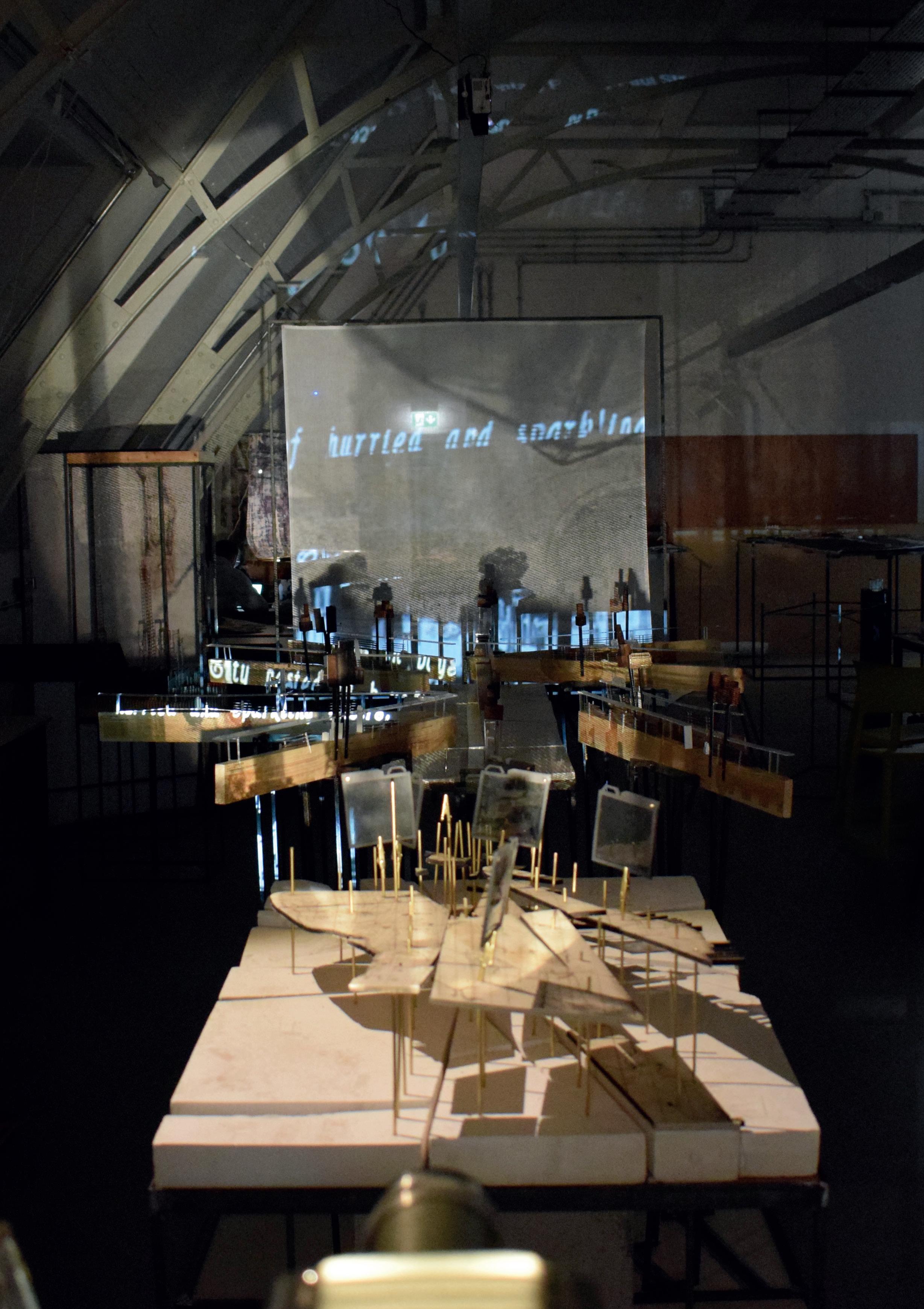
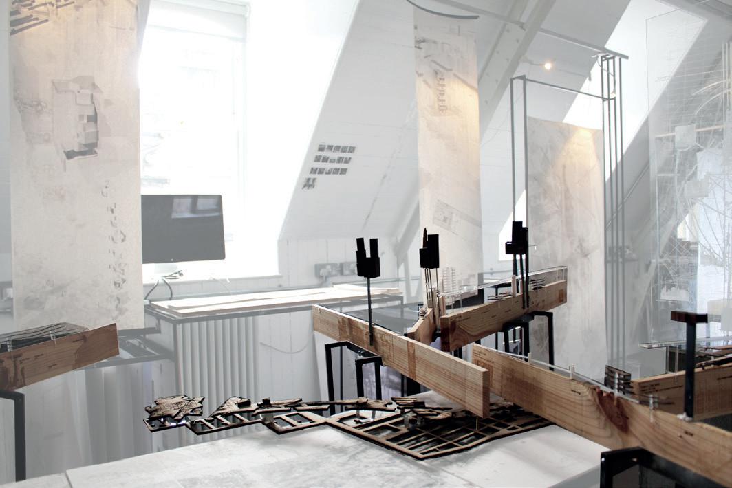
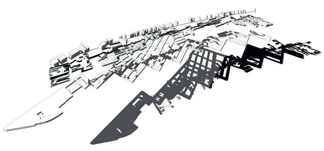
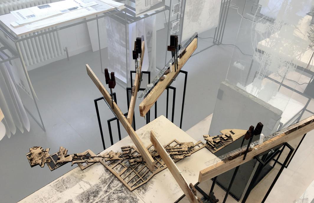
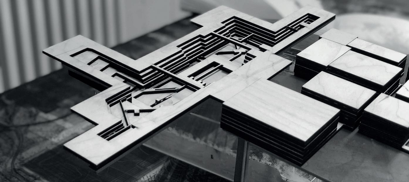
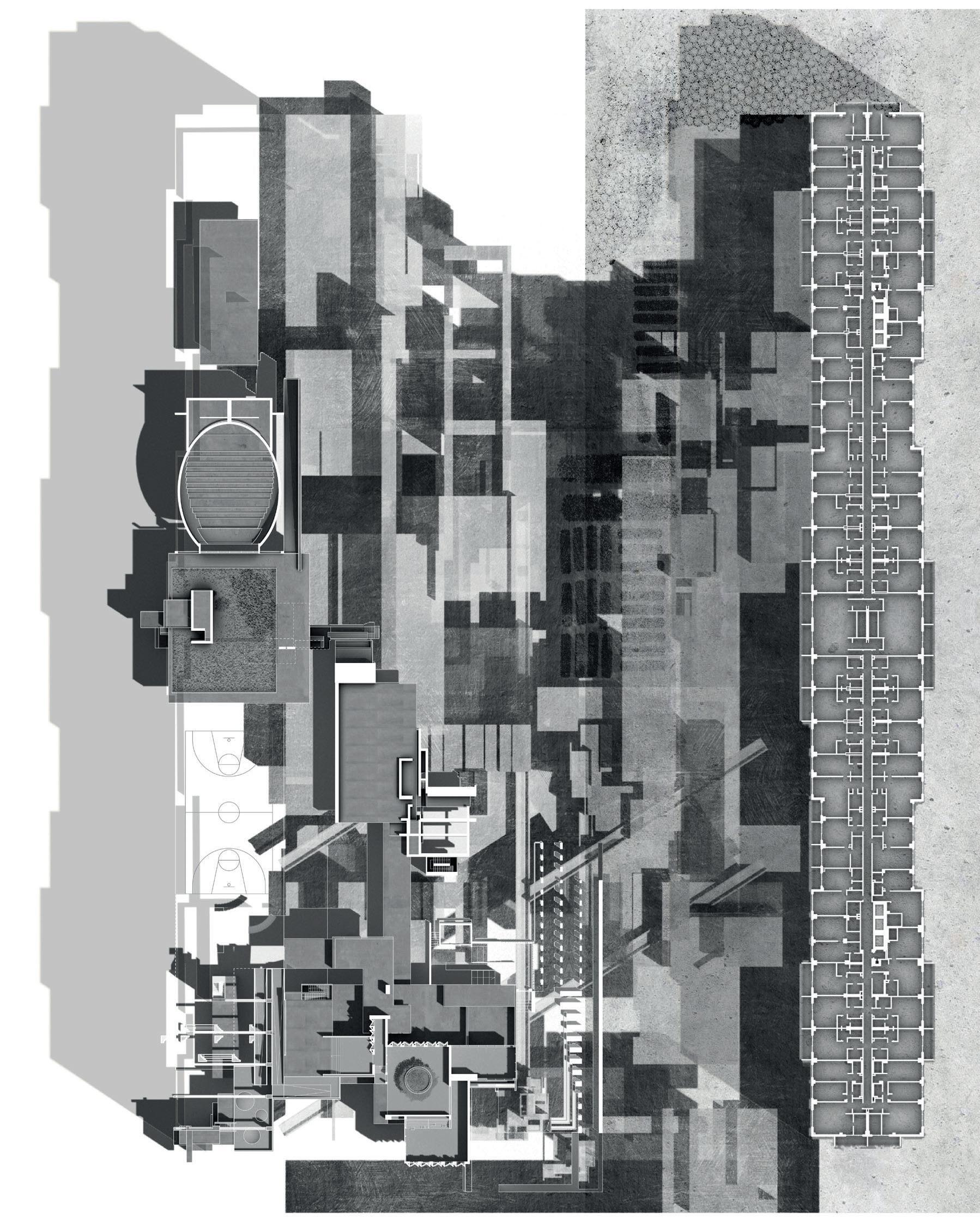
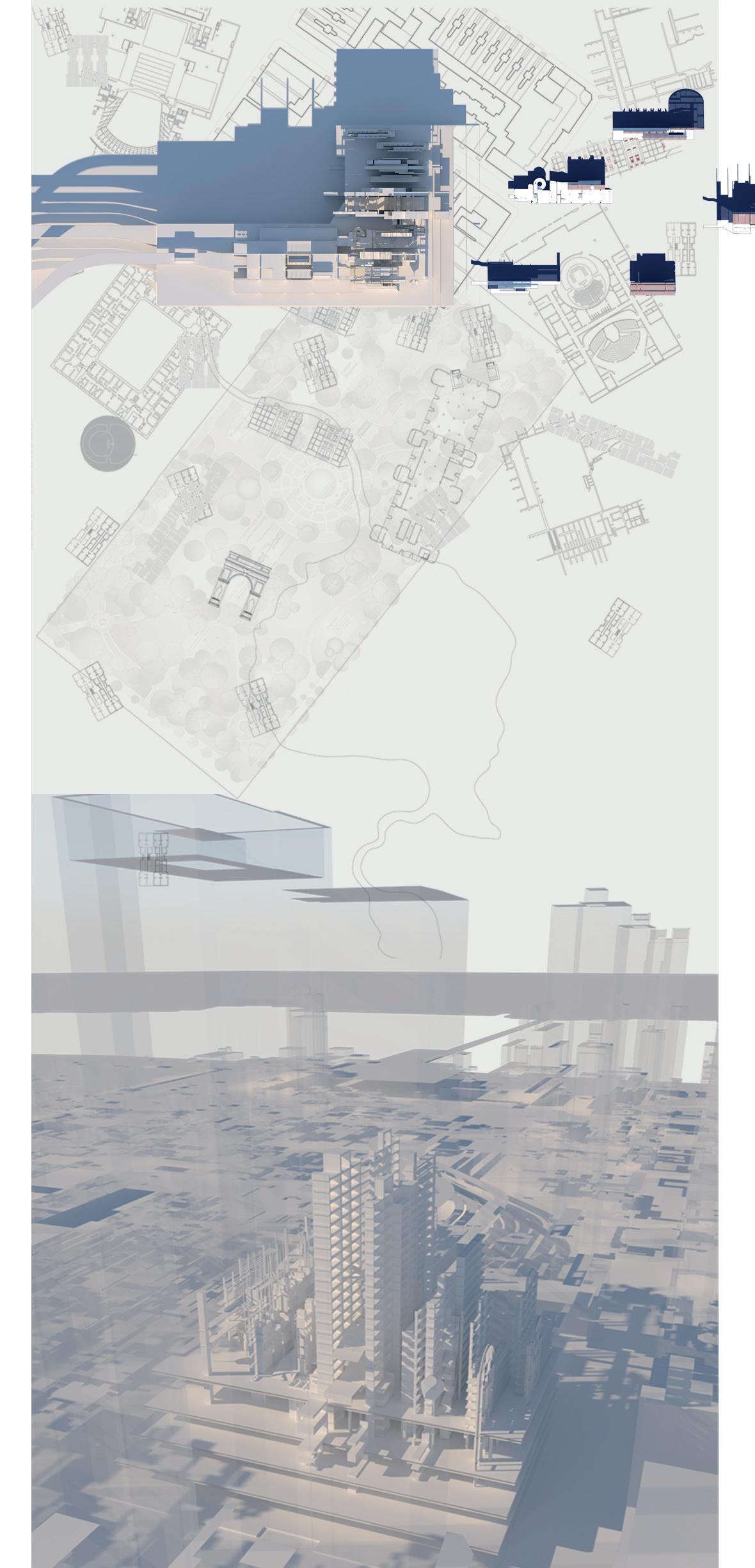
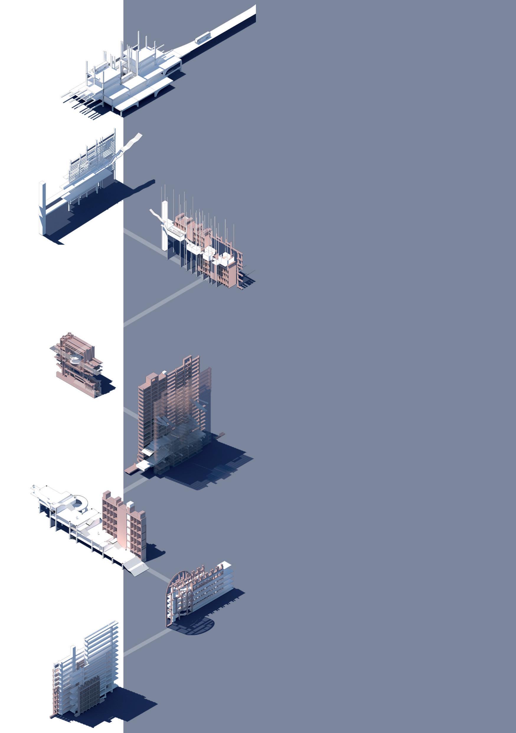
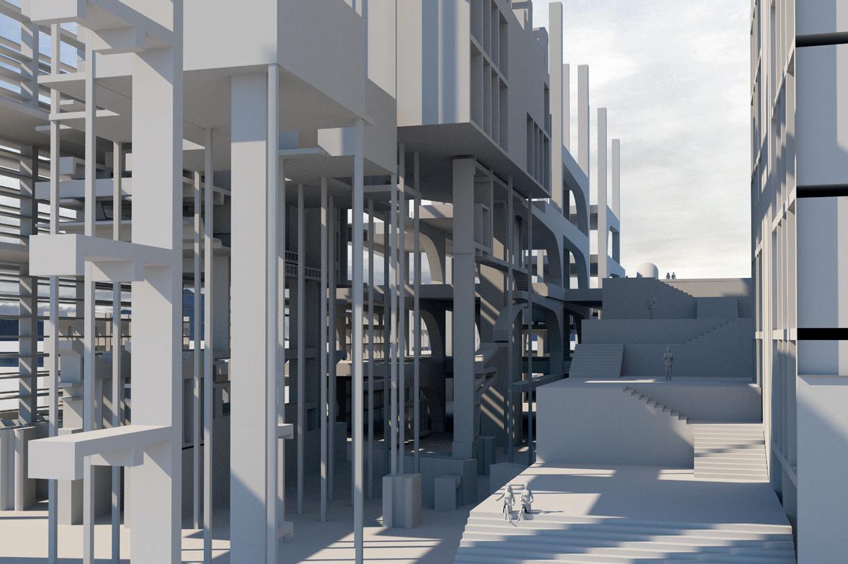
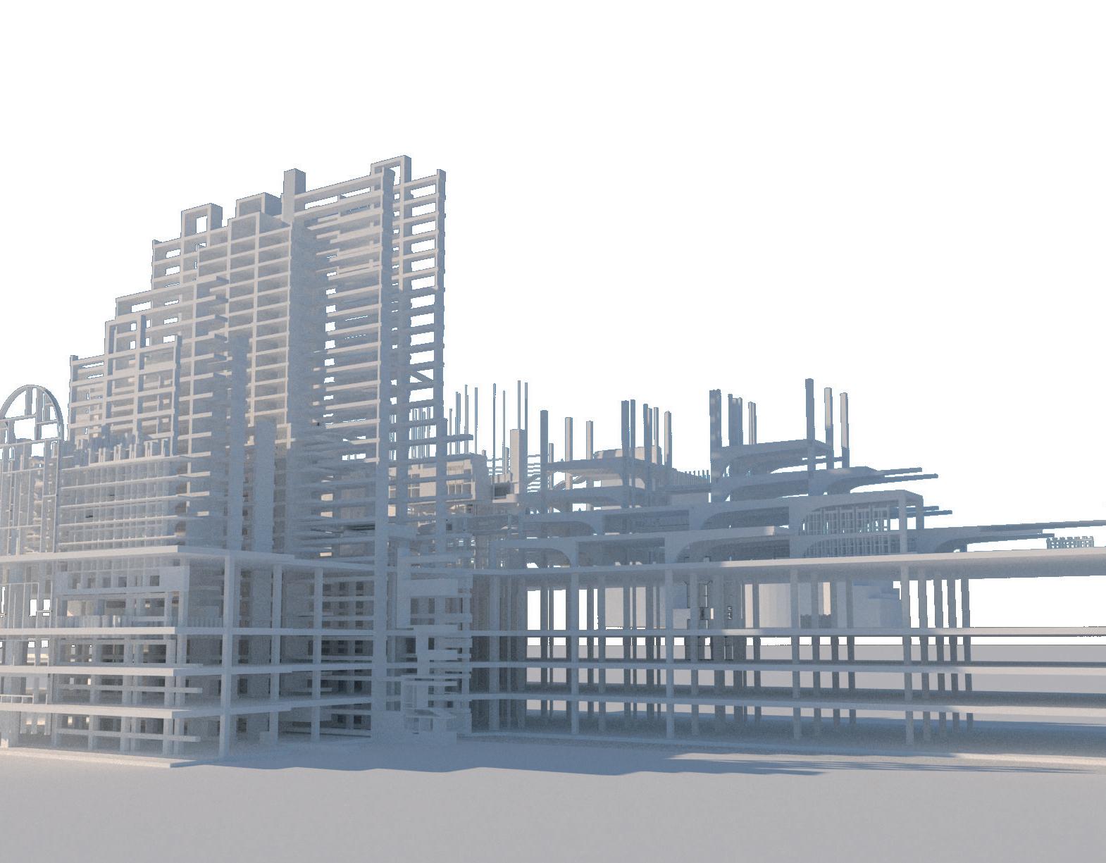
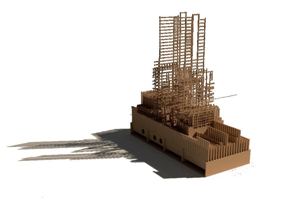
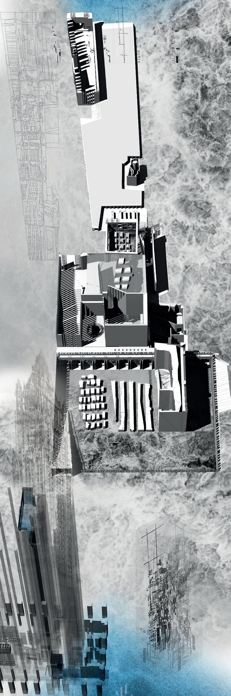
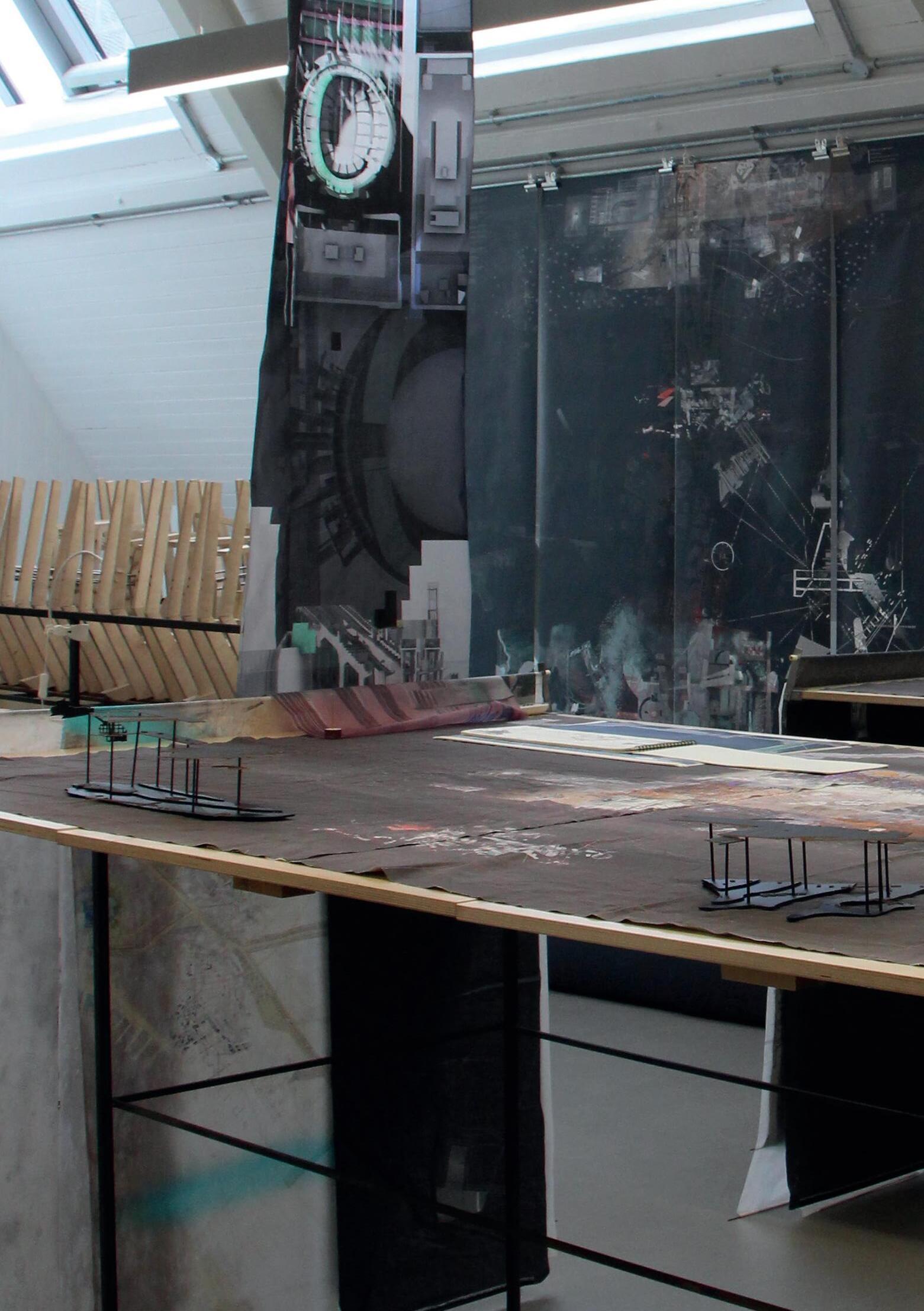
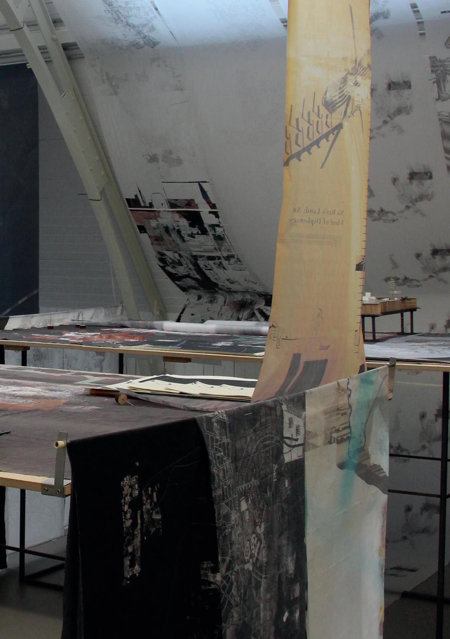
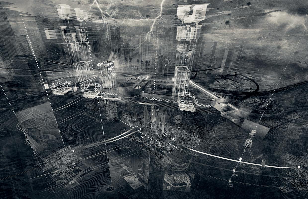
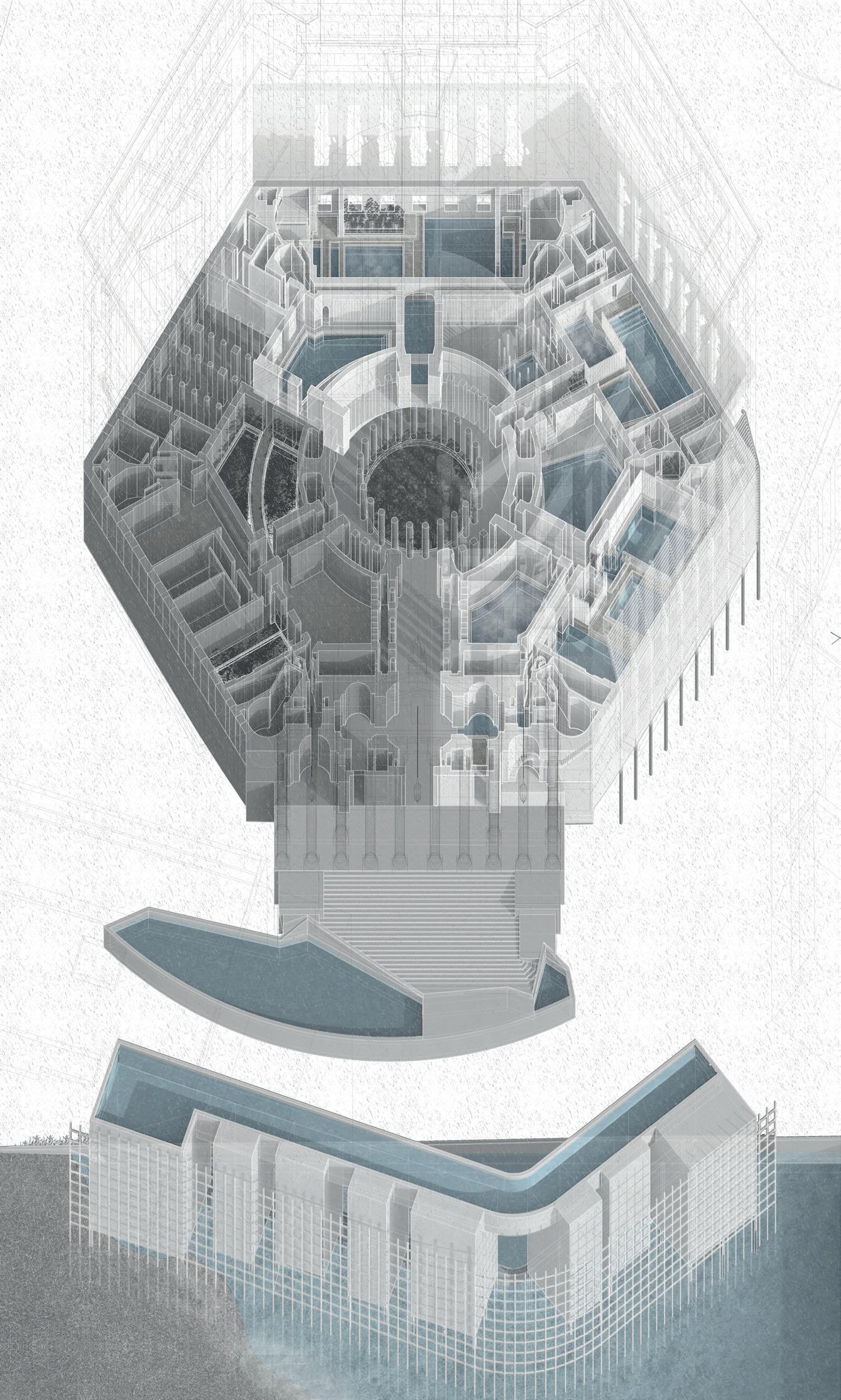
The work of island territories vi: Manhattan scapeland estrangement / displacement has evolved out of a close collaboration between students of architecture and of landscape architecture in which the terminology and concerns of the disciplines have become interchangeable. The evolution of thesis propositions has been structured through a creative re-imaging of the preoccupations of John Randel Jr as he inscribed the metropolis on to the surface of an island. The fabrication of surveying devices determined an attitude to the land, a statement of intent and focus. The derivation of plane tables, articulated drawing surfaces upon which a survey evolves through a direct engagement with a process of drawing, choreographed performative acts of research and analysis to form a series of studiolo, spatialisations of a graphic form of engagement with the conceptual topography of the city.
From these tools, complex drawings emerged that held in play critically identifed themes and concerns as felds of infuence, a cartographic process that allowed for an agile dialogue with the city, a negotiation of its physical, cultural, social and economic layers with the avoidance of the singular determinism of the ‘masterplan’. Instead, they formed dense cartographic realities, loaded representational contexts, a remarkable urban grain into which small design propositions, highly articulate locks, were engaged and tested. Closer readings of the island metropolis emerged as a series of gardens, spatial topographies that sought to address the social, political, cultural and ecological ‘realities’ of particular neighbourhoods. Their defnition allowed for more ambitious, programmatic and environmentally loaded propositions to be conceived as gates, thresholds between the pragmatic realism of contemporary Manhattan and the fabulous, fantastic narratives of its evolution.
For the landscape students, these felds, locks, gates and gardens are ambitious graduate proposals, a culmination of their professional studies. For the students of architecture, they are a form of proto-thesis to be elaborated through a further year of investigation. In both cases, within this rich body of work we discover forms of Scapeland. As one sensorial order gives way to another, extraordinary moments of
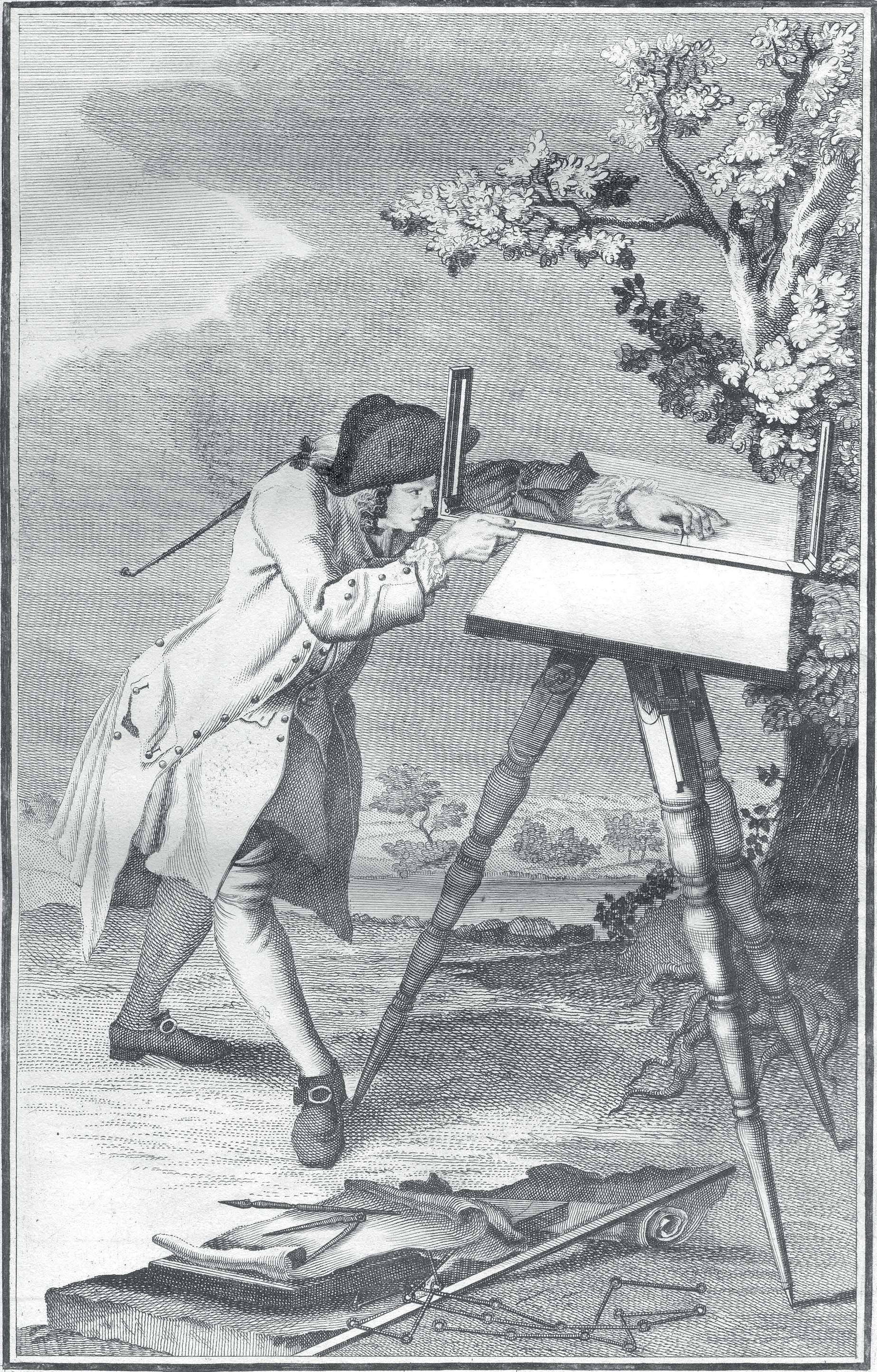
Fig. 3 | The Plane Table in use. Marinoni Icconographia
HAWKER, BERNIE, TORRES
estrangement and displacement emerge from the density of the island metropolis.
John Randel Jr cultivated the island of Manhattan. As his labours prepared the way for a tilling of the island on a gargantuan scale, his thoughts were often occupied with small parcels of land in which he had a personal investment. In the margins of his feld books, letters, inventories, diary entries and accounts lie references to the curation of felds and gardens. The British Headquarters map of 1782 reminds us that the island of Manhattan that Randel set out to survey was not a raw wilderness. Alongside the forests, streams, hills and swamps he would have found manicured estates, patchworks of cultivated felds, orchards and salt meadows. This land was cultivated, it was cared for. As he completed his fnal map of the emerging city from the immediate confnes of his own house, he must surely have immersed himself in memories of the landscape that he had travelled, measured and recorded for so many years, perhaps drawing from this experience as he tended his own garden in Albany.
Fig. 4 | British Headquarters Map, 1782. Stevens, Benjamin Franklin.
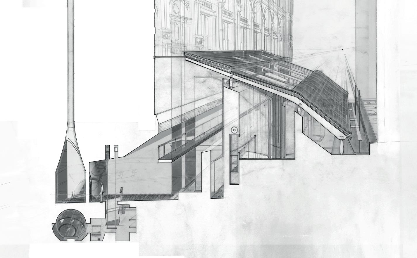
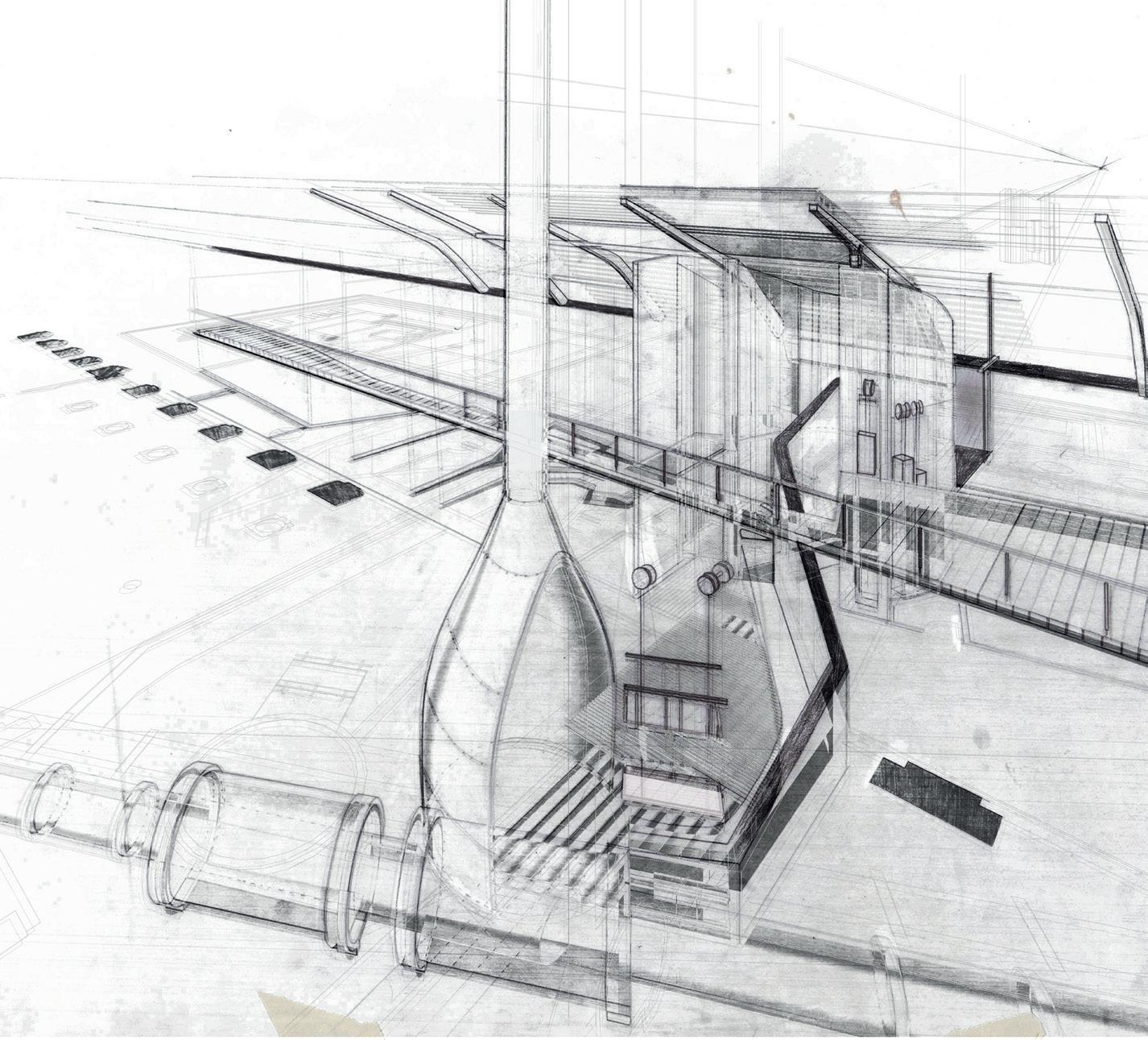
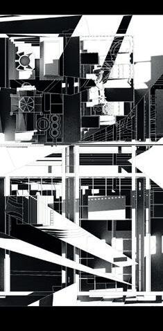
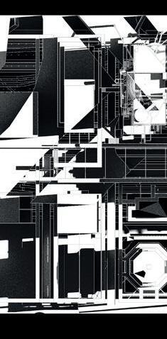
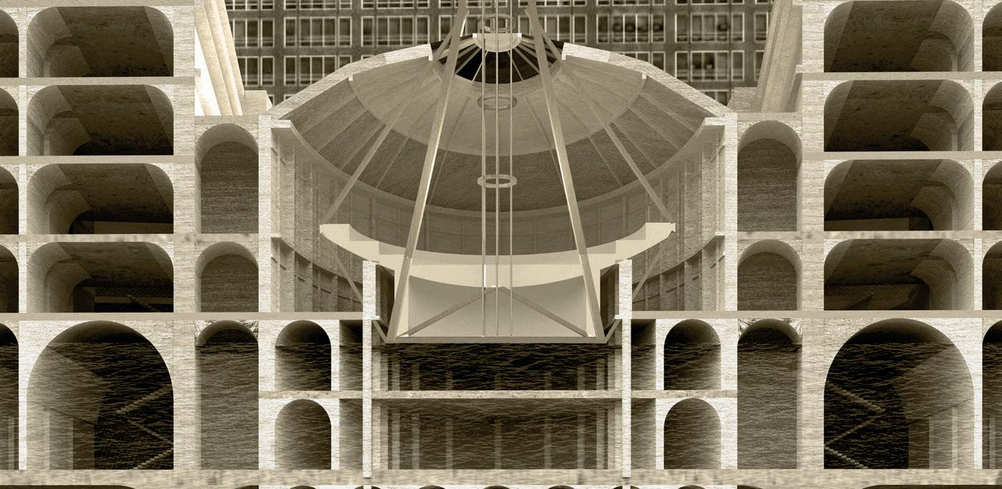
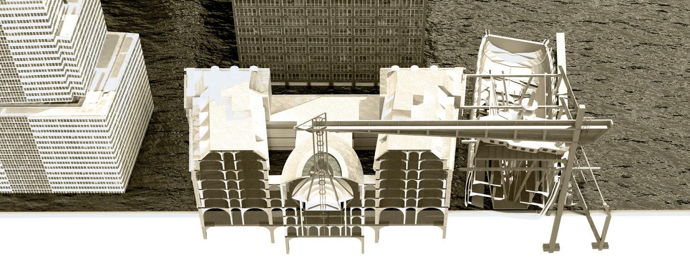
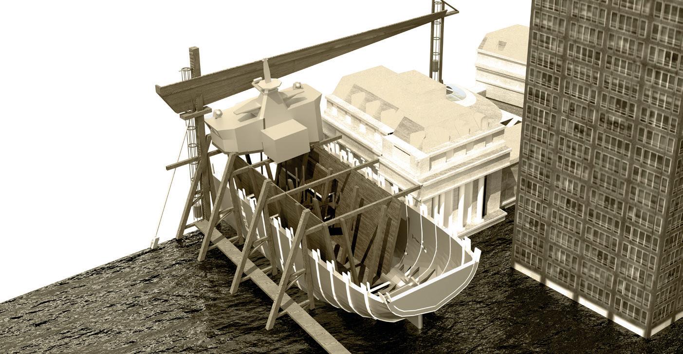
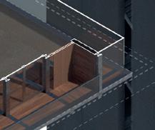
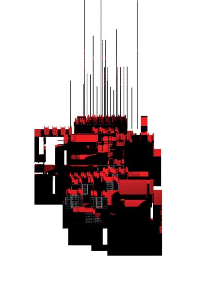
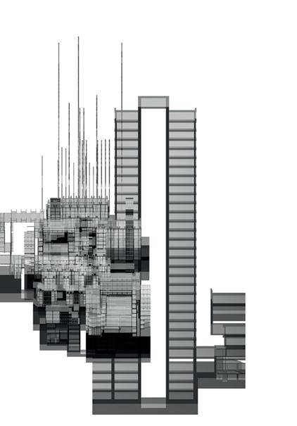
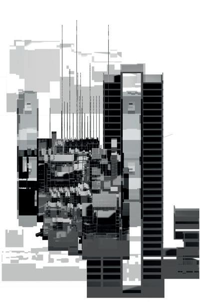
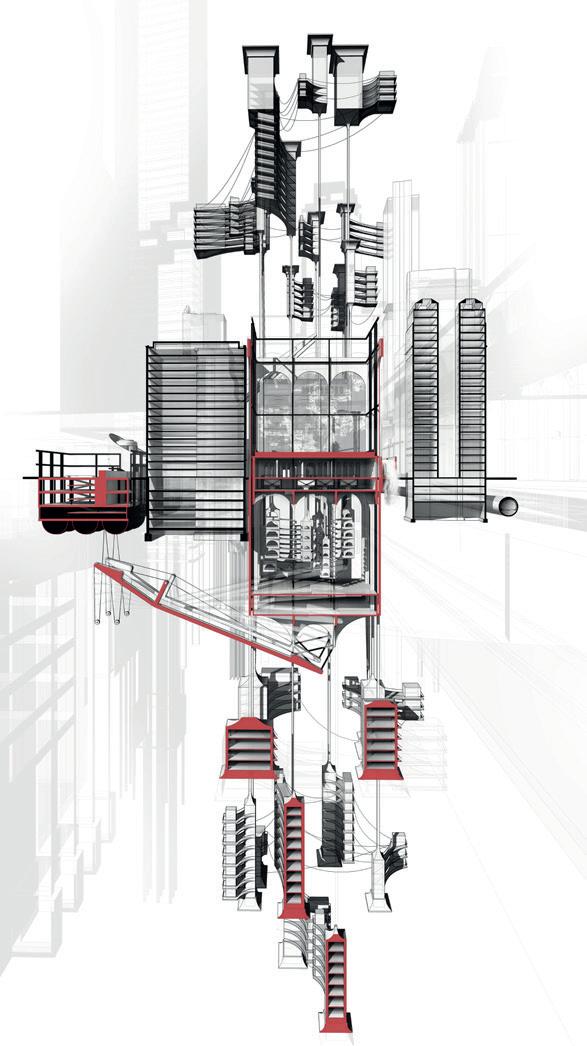
Setting notions of folding in the narrative wanderings of Edgar Allan Poe against the framed switchboard-style narrative of Jules Dasin’s 1947 flm Naked City, Manhattan is conceived as a tangle of tales. These tales are uncovered in fve scales, operating from within the plane table as fve mantles: milieu, monster, maison, man and mollusc.1 The unfolding of these mantles across the city, and their folding-back-up into the plane table as a heavy case sets up a frst move, a traverse of Manhattan, a mantling and a dismantling. This move becomes a means of catching Manhattan through a series of reels and walks — frames and folds — where the heavy case is an index housing clues, cues and tools.
Following ten days of wandering, wondering, playing detective and unpacking the heavy case, a series of elemental concerns were drawn out, weaving hydrological, geological and pyrological concerns into a complex feld, grounding fction in fact. This feld becomes the site of four locks: folding and unfolding; packing and unpacking; ravelling and unravelling; imbedding and disembedding.
The heavy case, feld drawing and the four locks inhabit a realm somewhere between expansion and contraction, constantly re-read and rewritten in the spirit of Mark Helliger’s closing narration: “there are 8 million stories in the naked city. This has been one of them.”2
1. The word Mantle has several etymologies all linked to the basic concept of covering and hiddenness. The etymologies cross scales from the ‘mantle’ of a mollusc as the inner shell covering, to the mantle of the earth operating at a geological scale — here called the scale of the wider milieu. See https://www. etymonline.com/wordmantle#etymonline_v_42819.
2. Mark Hellinger, The Naked City, Directed by Jules Dassin, New York: Universal Pictures, 1948.
A MANHATTAN DÉRIVE
OF VAGABOND SPECIES AND THEIR HUMAN
COUNTERPARTS
PATRICIA FARRELLY
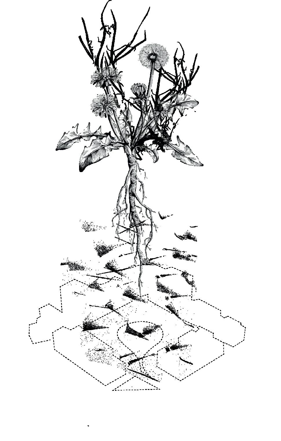
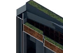
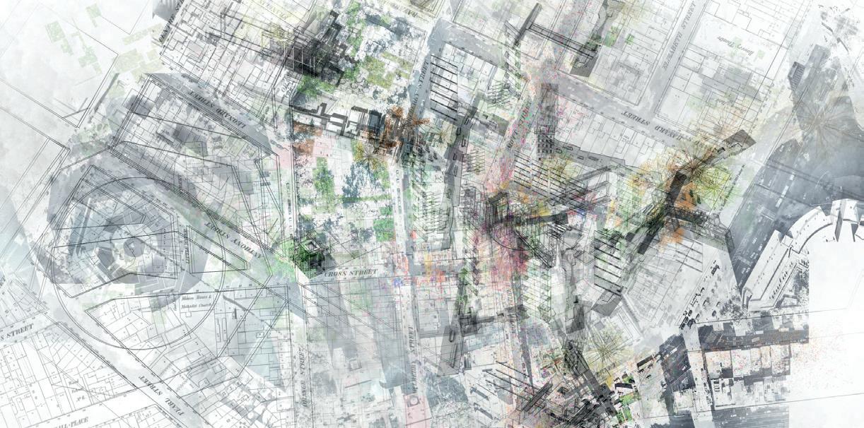
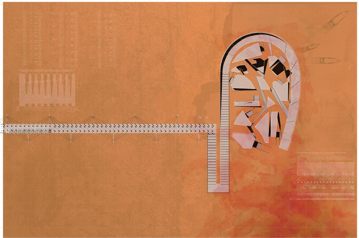
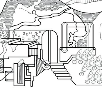
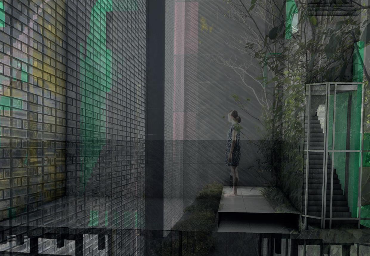
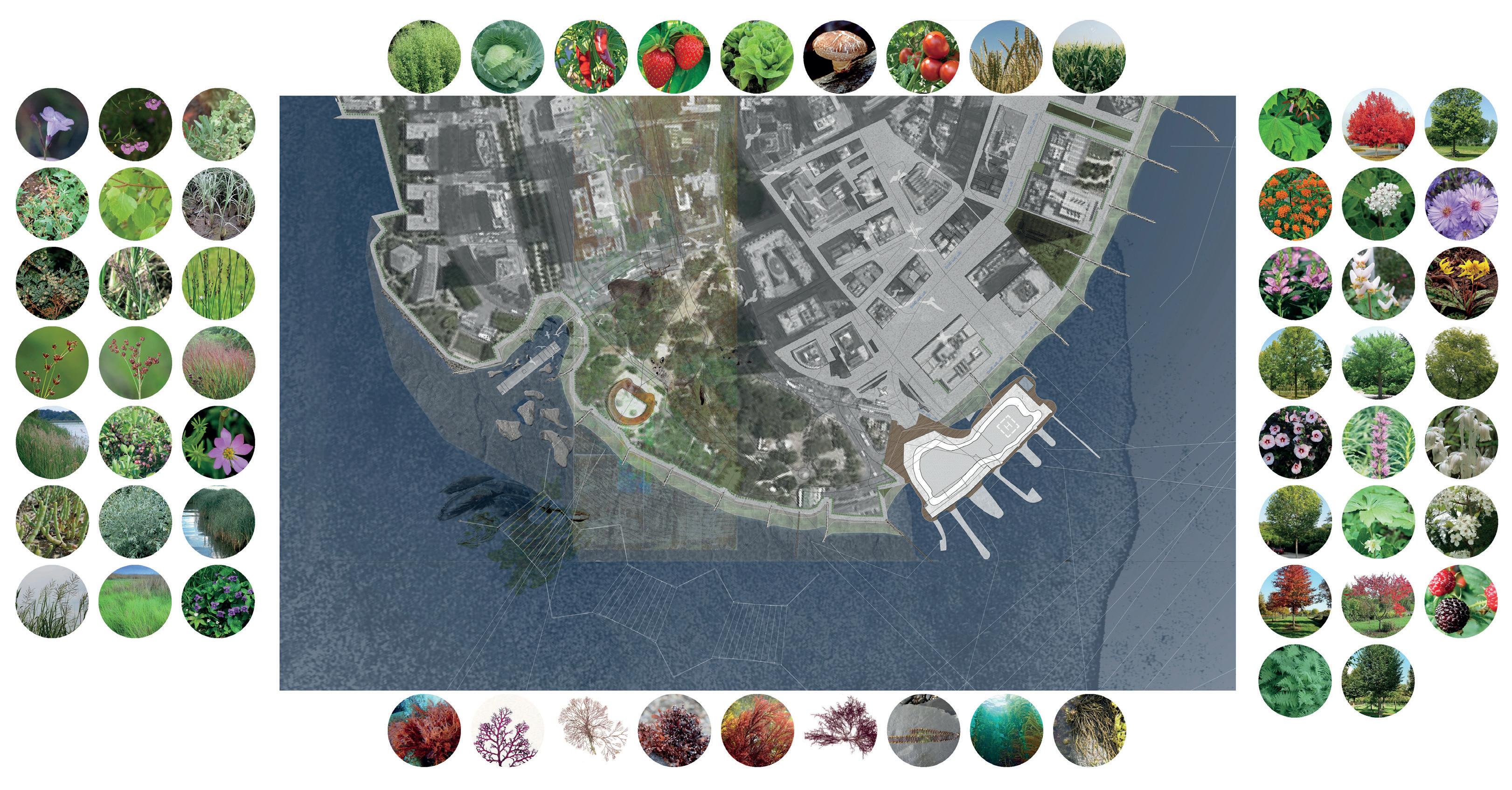
Within Manhattan exists an archipelago of accidental spaces created by the intersections of transport infrastructure and development vacancy; the ideal niche for spontaneous urban plants. These pioneer species colonise urban slag heaps as readily as mountain exposures. Hardy species of the wind, exploring dispersion and distribution, and allowing chance to organise their fate; operating in a constant dérive-like state. For Manhattanites, a dérive led by such species offers an opportunity to engage curiously with an organic Manhattan, forged by the interaction of these vagabond plants and the metropolis. A locus of natural succession acts in tandem with human activity, expectancy and abandonment. Off grid, unplanned spaces emerge for despondent urbanites to actively engage with their surroundings. Alternative aesthetic values may then develop, founded in ecological processes and the independent agency of nature.
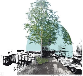
An assemblage of fxed moments, currants and vortexes in fux occupy this dérivelike scapeland in Downtown Manhattan. An ecological island sits at its vital centre – an inaccessible traffc island of the Holland Tunnel allows to evolve naturally into a spontaneous urban forest. The prototypical landscape serves as an ecological petri dish to study Manhattan’s spontaneous species and a seed source for surrounding sites. An archetype of integrating the dérive-scape into the built environment.
Scapeland model - Isolated Islands
Scapeland model
4 | Island Hortus
Hortus II
PUCK’S FURROW
FOLDING AND UNFOLDING DIVERGENT TRUTHS
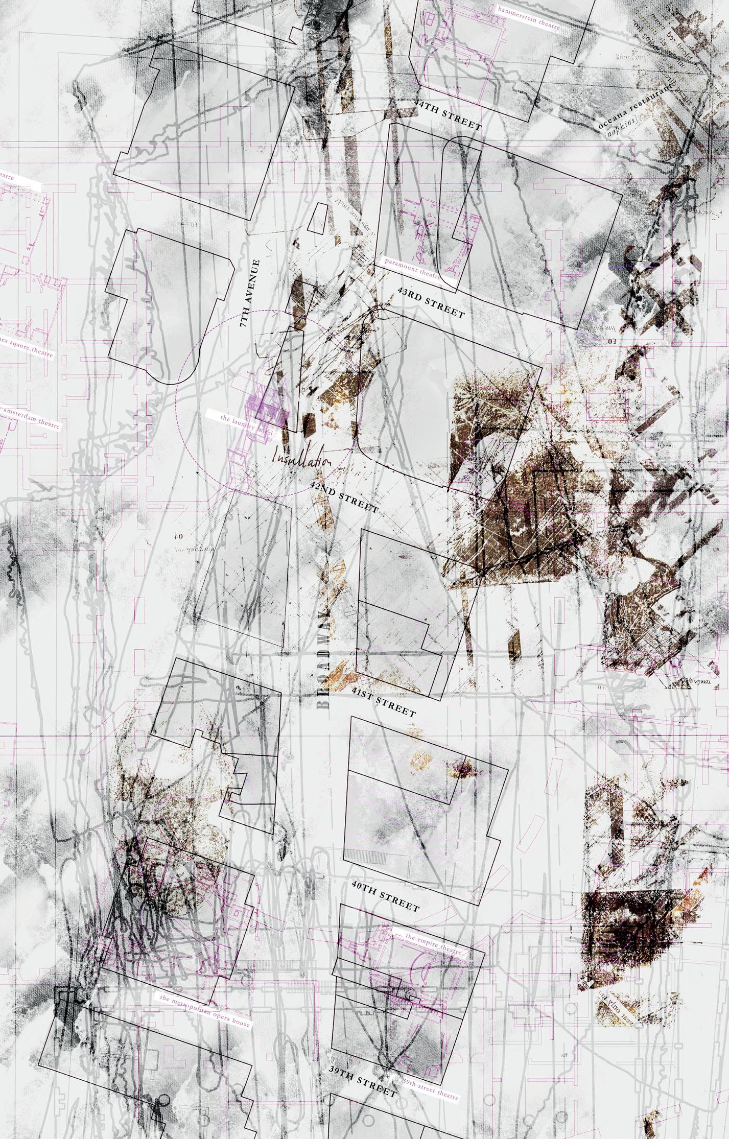
The House of Puck on the Lower East Side is appended by a new knot; a scapeland collapsed into a crease in the city, an architecture housing the chaos of divergent truths, a model of Puck’s mischievous Manhattan in miniature.
The Scapeland in play runs along Houston Street, caught between the original city of Manhattan to the South and the crumbling datum of Randal’s grid. Along this ecotone, the tensions of the island leave scars, the residue of various urban reimaginings. Within these scars, the project explores Manhattan, the metropolitan visage, now that the surface has been removed.
The house of Puck, a building that is testament to the relentless mutability of the city, belies its history of expansion and contraction with a façade of classical rigour. This façade is turned outside-in by a building that negotiates its surface and forms a labyrinth where journalists seek integrity, honesty and truth measuring the facts upon which the city is built.
Puck, the protagonist of our tale, revels in mischief, turning platitudes into play things. The building, the scapeland and the city are at the mercy of his trickery whilst he is bound by their realities, however precarious they may be. The model becomes the city and the city becomes the model, and somewhere within that inversion there is fun to be had.
BENJAMIN HAIR
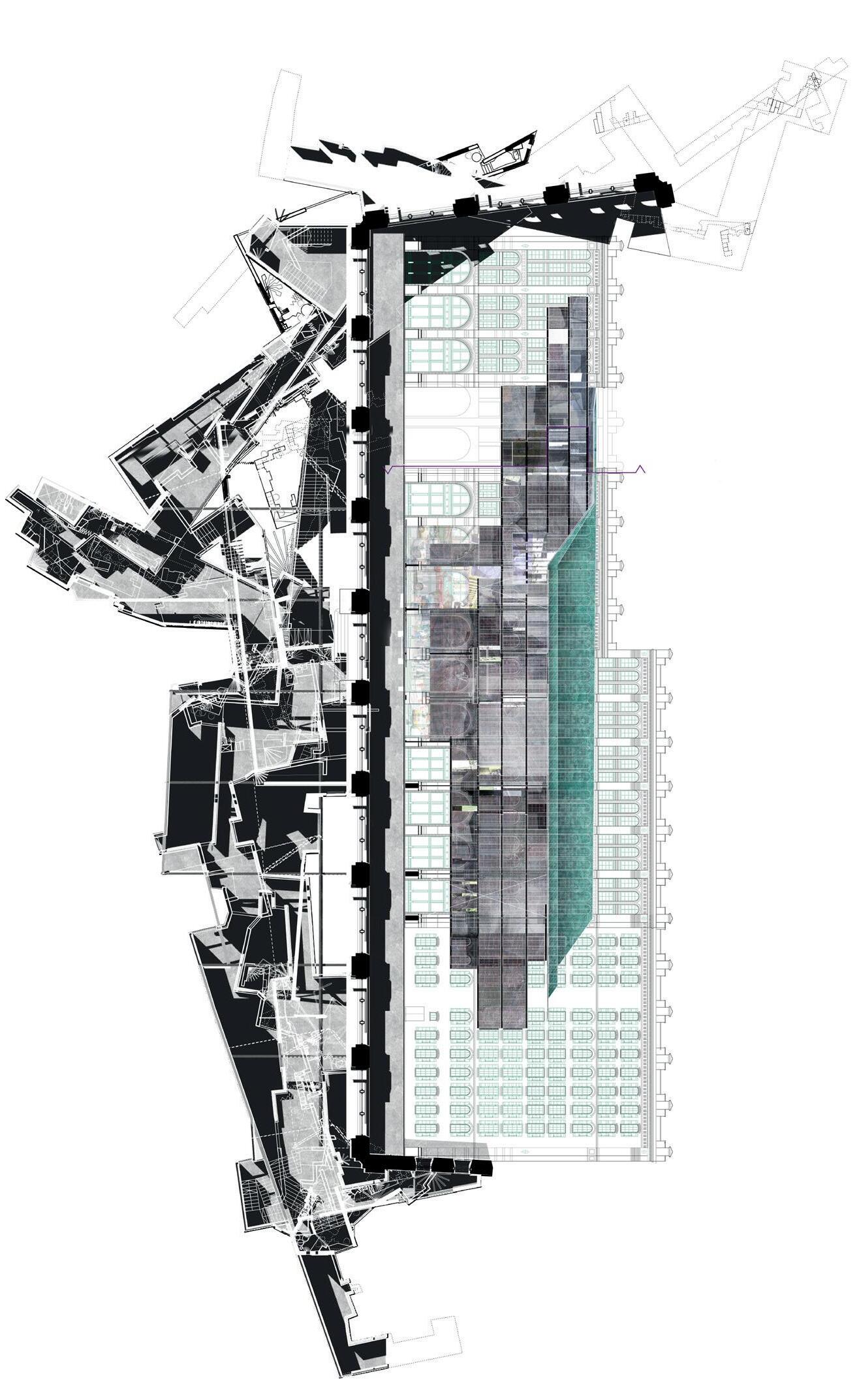
SMUGGLERS & SKINS
QUARRYING TIMES SQ’S THEATRICS: INHABITING SURFACES
EIREANN IANNETTA - MACKAY
“The centre is an illusion . America’s “great time” is merely an advertisement. Modern America is only a sign.”1
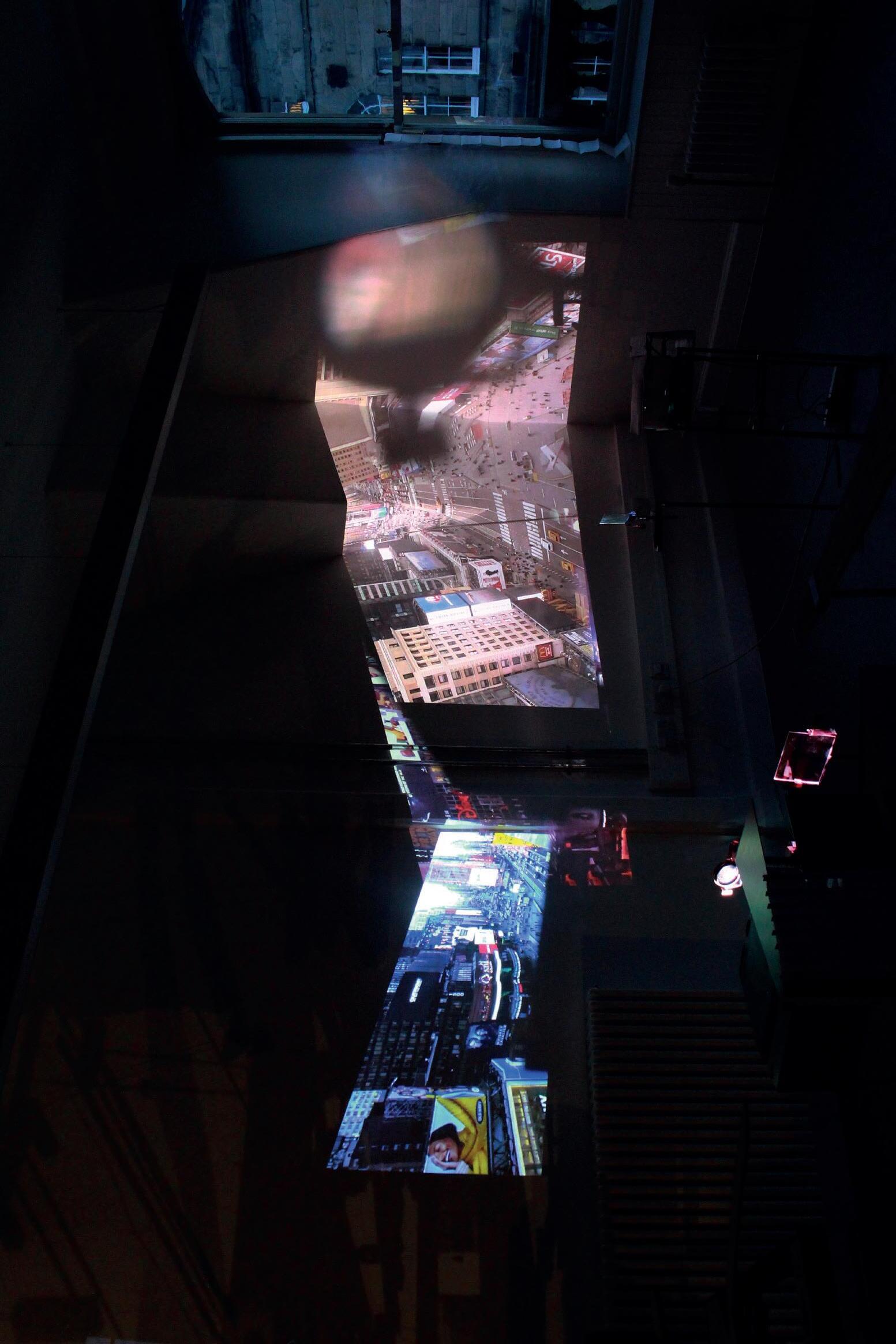
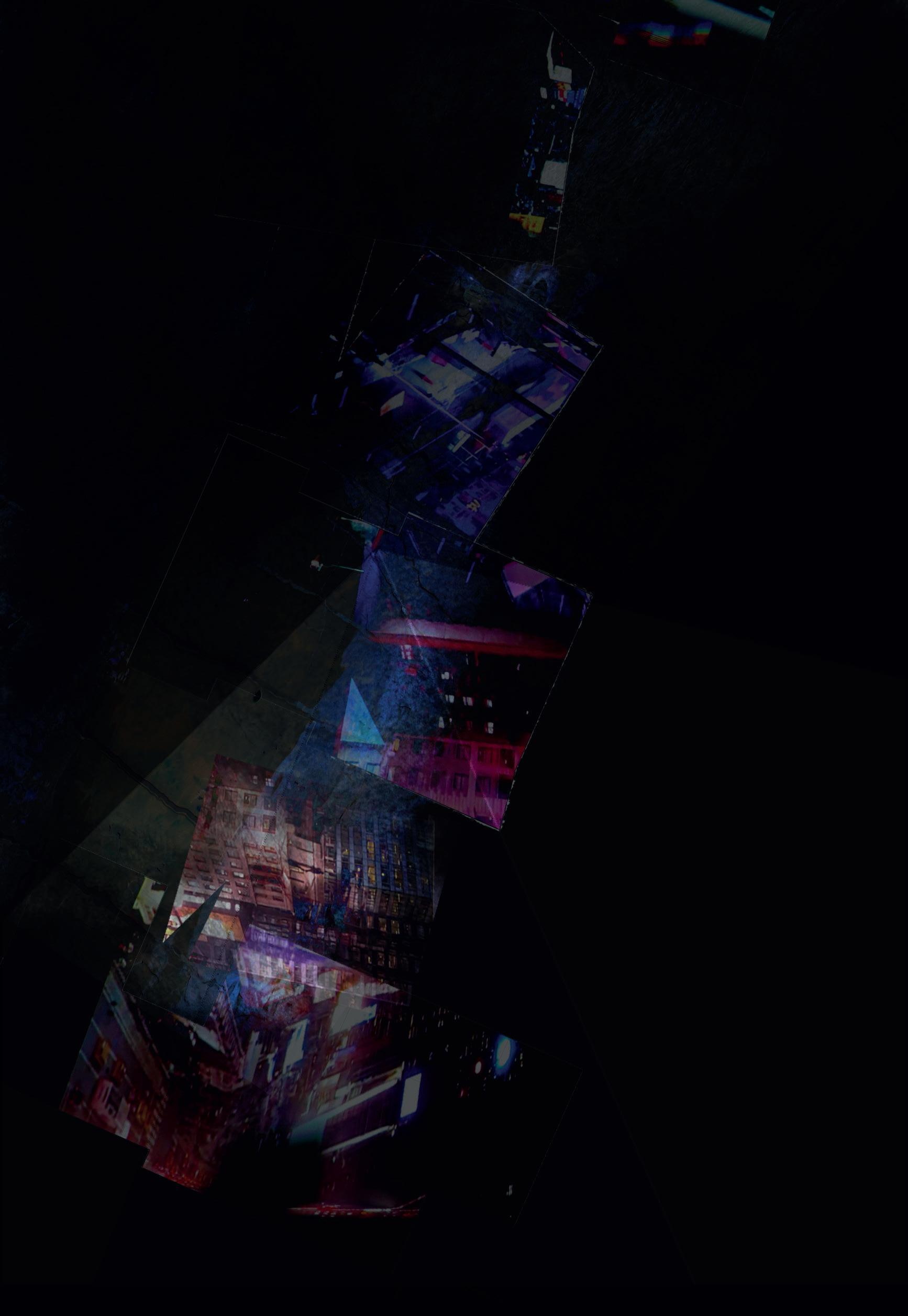
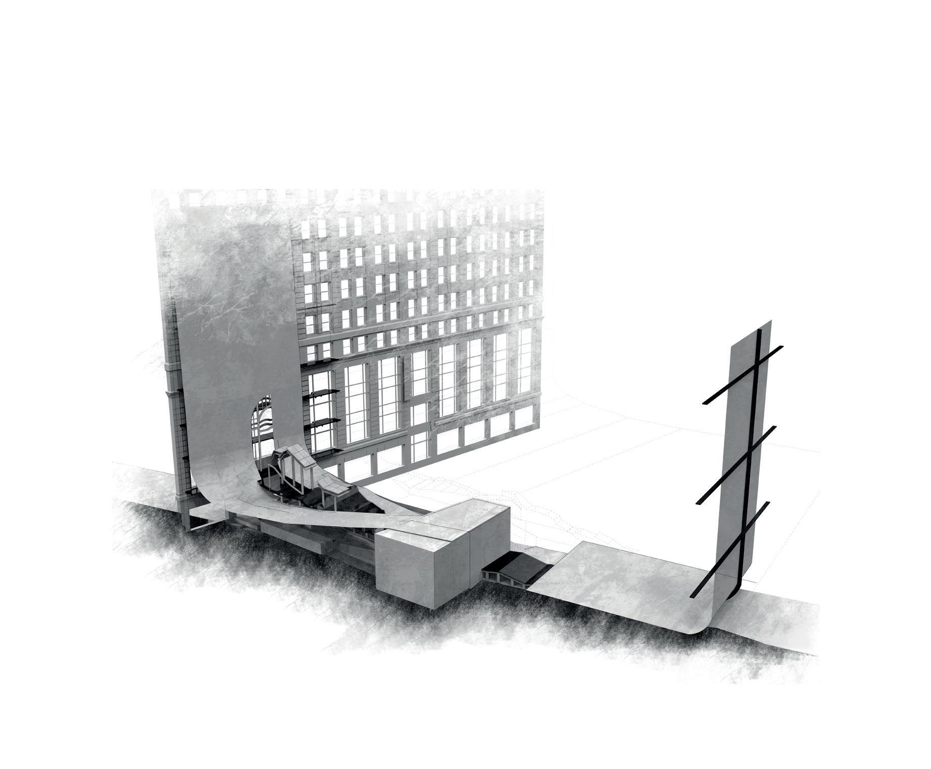
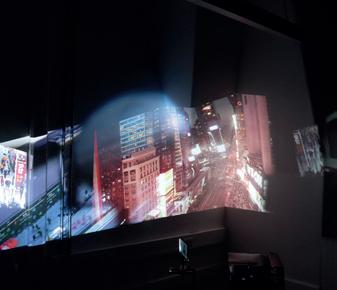
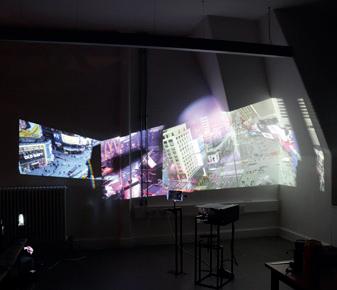
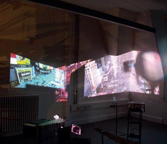
Smugglers and Skins [S&S] is situated in the heart of Manhattan’s Midtown - Times Square – where 24 hour live video recordings track the constant interplay of human and non-human movement across the surfaces of the city. Projected across the studio walls, the metropolitan spectacle inscribes a new site to inhabit and a space of inquiry. In the rescaled metropolis, how do light and colour exist as volume and surface? S&S utilises the processes of displacement, fracture and bleed that play out across the projections to produce an architectural vessel of image and colour. Here, the square is reimagined as a set of carpet-like skins that fold and unfold onto and between the existing building skins overwriting a fnely calibrated digital surface that smuggles within its folds a series of micro-architectures, pavilions and walls.
From delicate fractures in the surface world of the island’s Theater District, the scapeland creates a space of performance on, within and between the skins of existing architectures and newly grafted carpet-like skins. From these initial projections and manipulations, a new set of skins come into play, a surface to be mined, a material of thickness and thinness given form through the draw and pull of digital colour. Edge conditions emerge, manifesting as a set of gate-like architectures transitioning the landscape in a theatrical unfolding performance of an inhabited skin, hinged from the Paramount Theater on West 43rd Street and spilling onto 7th Avenue and Broadway beyond.
1. William Brevda, “How do I get to Broadway? Reading Dos Passos’s Manhattan Transfer Sign,” Texas Studies in Literature and Language, Vol 38, No1. Representative Paradoxes (SPRING 1996) 79-114.
| A Wandering Theatre District: Times Square’s Cameras Shift / the Stage Spills
| Isometric - Transect of a Skin
| Tools - a set of tools to quarry colour and light.
| A Live Times Sq Inhabits a new Site - enacting TS’s colour and light through the use of a set of tools.
REFRACT BLEED SPILL DISPLACE
HOW TO CLOTHE A NAKED CITY
RAVELLING & UNRAVELLING NINE STORIES OF THE PABST HOTEL, TIMES SQUARE
ROSEMARY MILNE
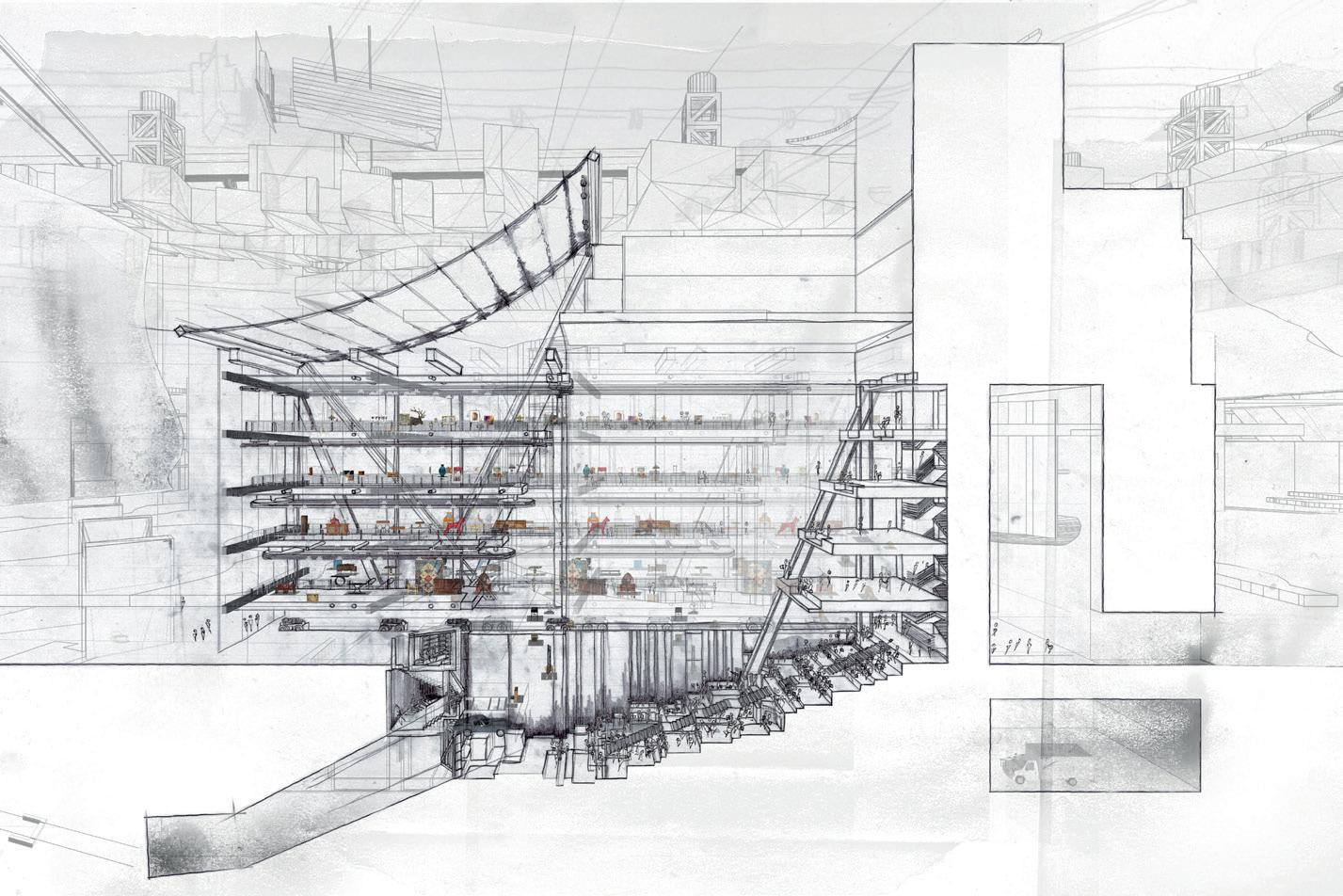
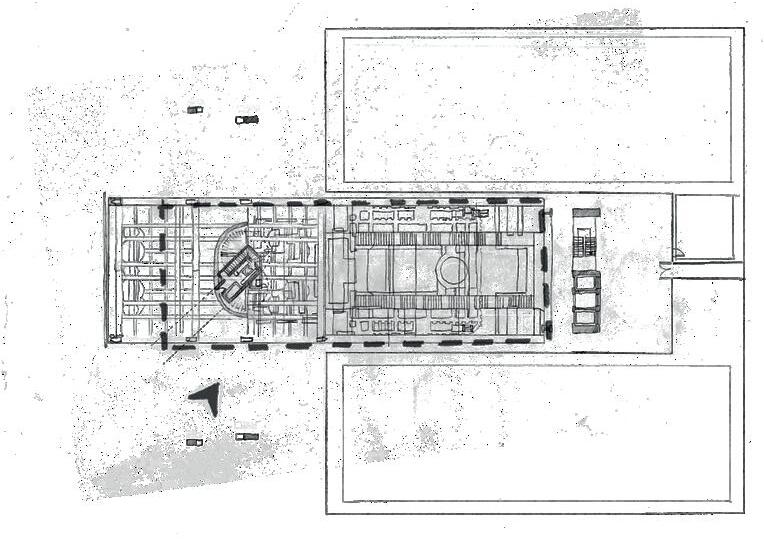
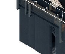
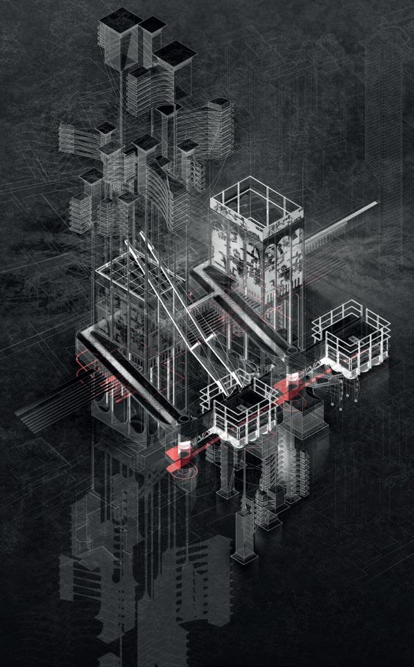
The verb ‘to unravel’ is curious, for it is both the synonym and antonym of its counterpart, ‘to ravel’ — when unweaving a piece of fabric, the result is further entanglement. This work exploits the etymological conundrum to a point of exaggeration, ravelling and unravelling the fabric of Manhattan via historical and cultural investigations into the Garment District, the Theatre District and Times Square as the point of transformation between these districts. Times Square is characterised by an architecture of sign, skin, saturation and surface; a naked architecture at the centre1 of a “Naked City.”2 The question then becomes how to clothe a naked city? In answer, a Wardrobe — itself a place of daily transformation — emerges, metonymically scaling itself across two sites of investigation: a bespoke piece of furniture is mantled/dismantled in the studio as a place of investigation and a strangely proportioned nine-storey hotel is found in Times Square. Within the Wardrobe’s woven world, a performance is devised across these two sites, and from this performance a series of moves are drawn out as nine tangled stories. These stories/storeys are then folded back into the Wardrobe, like linen onto shelves, and the wardrobe is then itself packed back into the Pabst Hotel. The architecture becomes characterised by notions of laundry, a programme which brings with it a series of environmental concerns to create a Laundry Hotel balancing the sartorial with the sensorial, the pragmatic with the theatrical and the operatic with the operative.
1. In Dos Passos’ Manhattan Transfer, his characters are always searching for Broadway, for Times Square — for “the centre of things.” See Jon dos Passos, Manhattan Transfer (London: Penguin 20th Century Classics, 2000
2. The Naked City, Directed by Jules Dassin, 1948. The closing line is a “there are 8 million stories in this naked city and this has been one of them.” I would close with this — “there are 8 million stories in this city, and this has been several of them, all tangled together, for to tell one is always to tug on the strings of many.”
2 | One of Nine Operatic/Operative Moves - drawing out a method of transfer.
3 | Final Installation - a table emerges, a stage is set.
4 | Final Installation - into the wardrobe.
5 | Section of a Laundry Hotel
| Plan of a Laundry Hotel
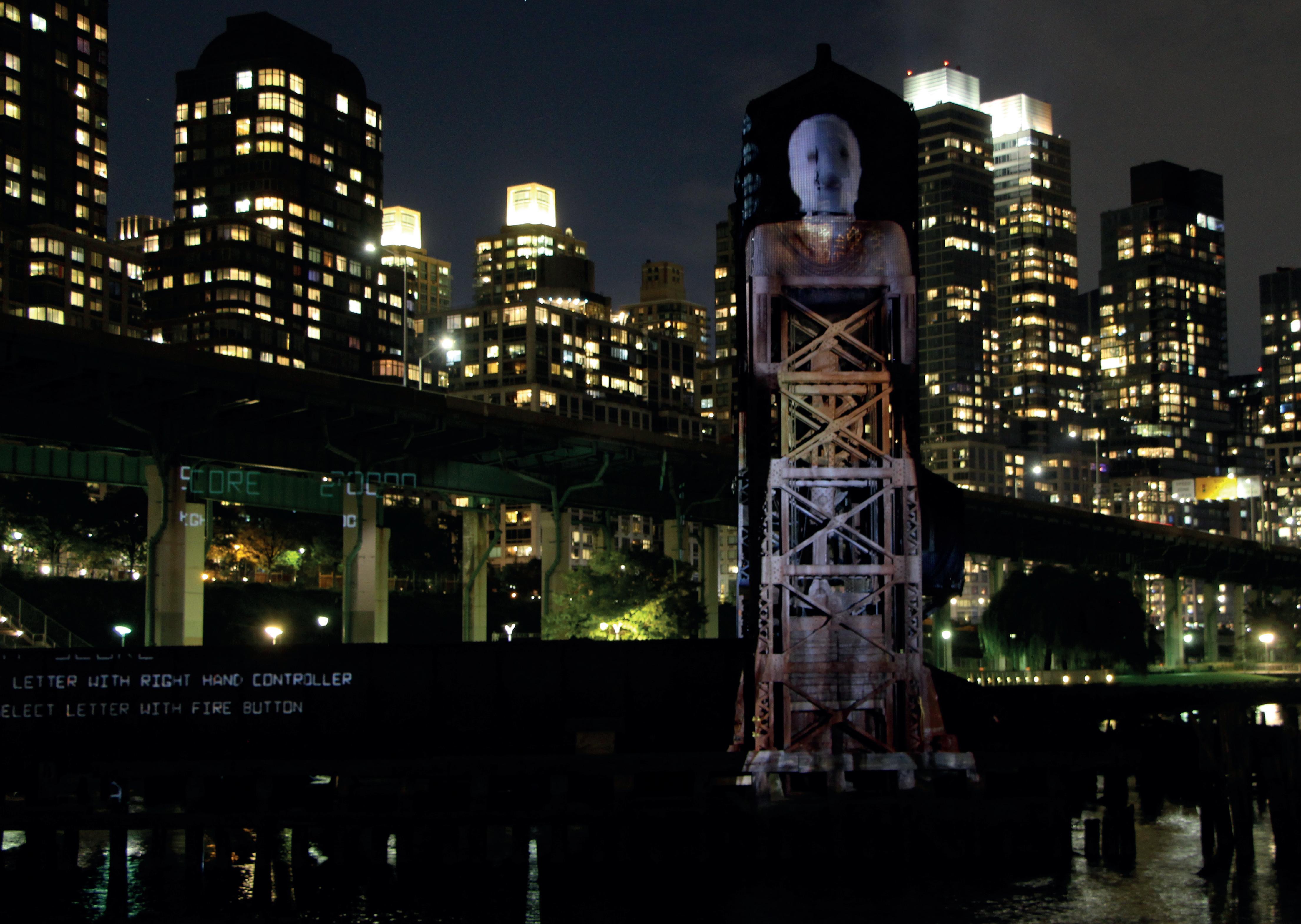
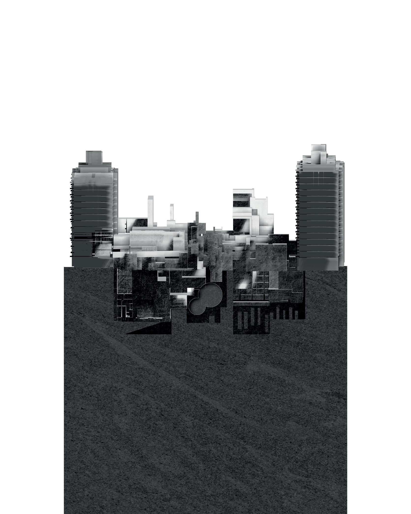
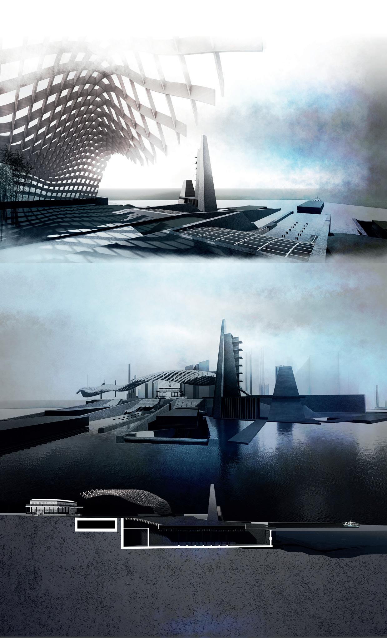
Tony Oursler Tear of the Cloud | Riverside Park South
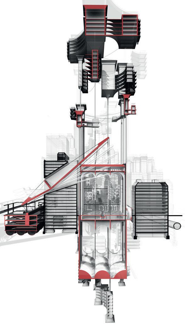
On 7th August 1974 Philippe Petit the renowned tightrope walker created his greatest masterpiece and walked across the void between the World Trade Centre Twin Towers. The spectacle went down in history for its criminal and artistic daring and demonstrated an almost religious gesture of devotion. In order to enact his dream, a carefully choreo-graphed scheme was proposed and undertaken culminating in the illegal ascent of the towers. The spectacle itself was an incredible display of balance that relied on a specifc set of atmospheric conditions at the top of the World Trade Center.
Taking precedent from Petit’s practice stage named ‘The Smallest Stage in the World’ the Plane Table gives form to an architectonic language of reciprocity, of vessel and mass that balances and spans across the landscape of Manhat-tan. These notions of balance also relate to an awareness of the environmental sensibilities of the atmosphere where-by atmospheric data, history and myth, exposed through feld studies, defne the territorial expanse that can exist in equilibrium. By overlaying the enactment of the plane table a new topographical understanding of the street is estab-lished. A topography that receives spillage of specifc atmospheric climates.
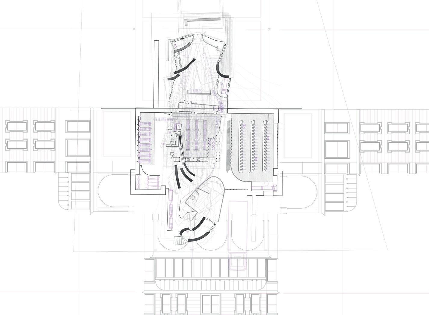
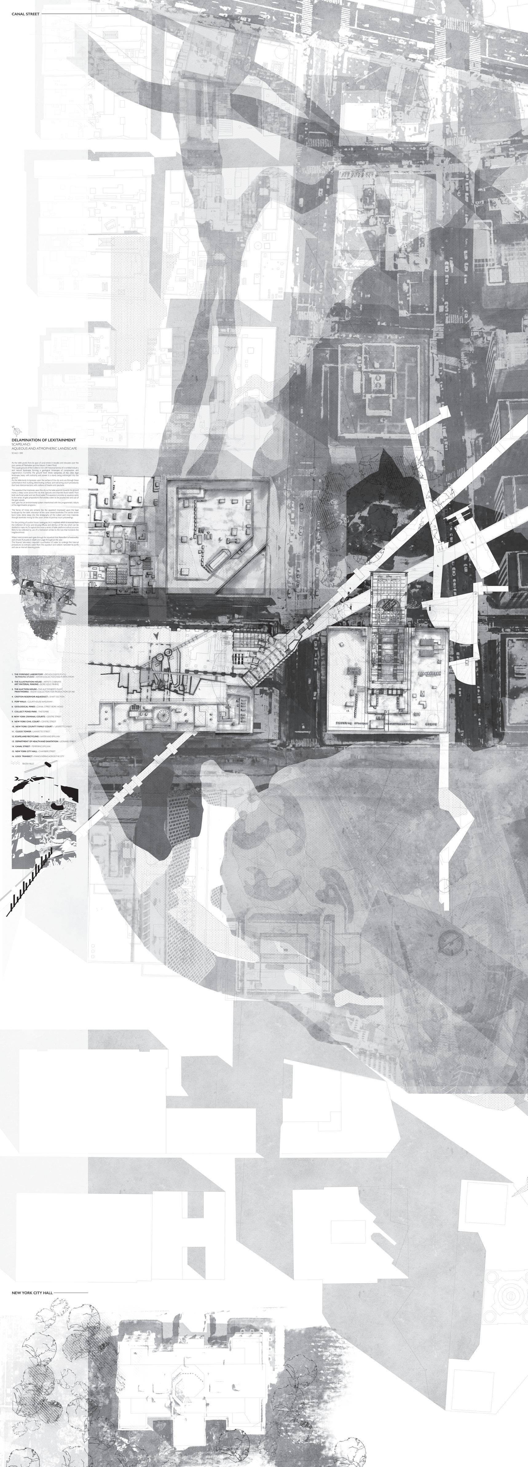
A DELAMINATION OF LEXITAINMENT
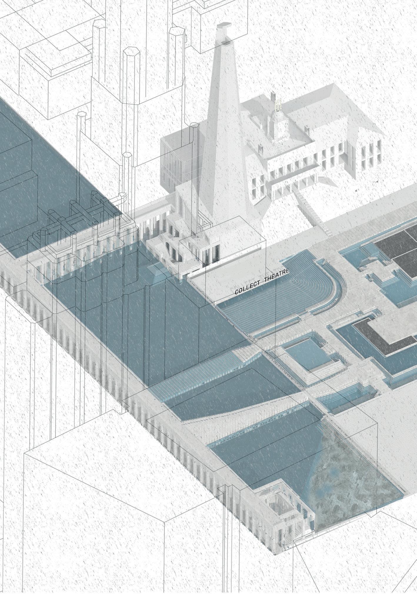
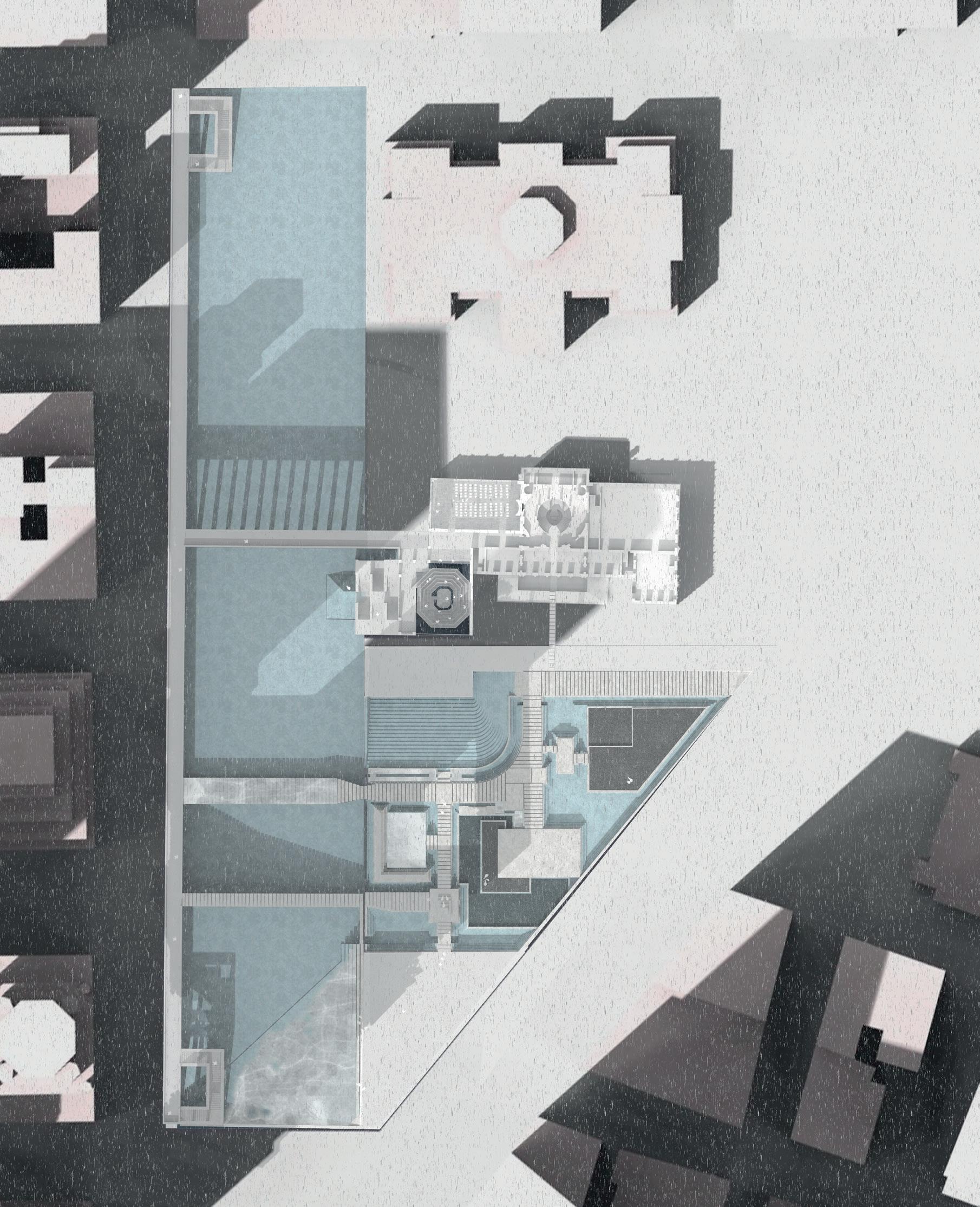
TEMPERING THE AQUEOUS LANDSCAPE OF THE COLLECT
LAUREN COPPING, GRACE LOSASSO, JESSICA THOMSON
Taking precedent from Philippe Petit - the famous tightrope walker and his ‘Smallest Theatre in the World’ – ‘A Delamination of Lexitainment’ imagines the city as a sequence of carefully balanced programmatic and environmental theatres. Operating between a series of datum levels, which span surface, sub-surface and atmospheric landscapes, the contextual Scapeland navigates the arrival of the imagined ‘cloud’ of research upon the existent landscape of Lower Manhattan, and its tumultuous contact with the real.
This Scapeland encompasses the historic Collect Pond, as well as the civic heart of Manhattan and its courts, and operates as an infrastructural instrument on this new neighbourhood.
Through an interrogation of ‘the spectacle’ as an essential condition to the validity of a judicial decision, the thesis offers a delamination of the peripheral functions of the justice system; extracting the shared characteristics of the courtroom and the theatre. These performative moments isolate and express key functions within court proceedings that deal with investigation, representation and redistribution. A series of three proposals [the Drawing Room, the Auction House and the Anatomy Theatre] interact with these programmatic functions of the court/theatre/spectacle whilst simultaneously engaging with the wider environmental scapeland of snow and dust, blood and ink, oil and water; carefully tempering the delicate atmospheric lamina of the collect.
A DELAMINATION OF LEXITAINMENT
TEMPERING THE AQUEOUS LANDSCAPE OF THE COLLECT
LAUREN COPPING
THE AUCTION HOUSE
COLLECTION AND REDISTRIBUTION
The Auctioneer’s Pulpit
A DELAMINATION OF LEXITAINMENT
TEMPERING THE AQUEOUS LANDSCAPE OF THE COLLECT
GRACE LOSASSO
THE ILLUSTRATION HOUSE
GEOLOGICAL EXCAVATION
A
DELAMINATION OF LEXITAINMENT
TEMPERING THE AQUEOUS LANDSCAPE OF THE COLLECT
JESSICA THOMSON THE FORENSIC LABORATORY
A CHOREOGRAPHY OF DECONTAMINATION
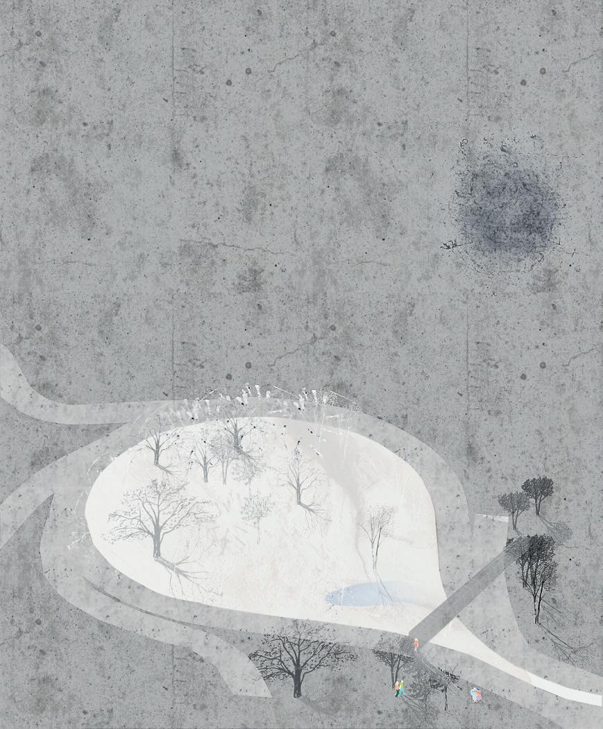
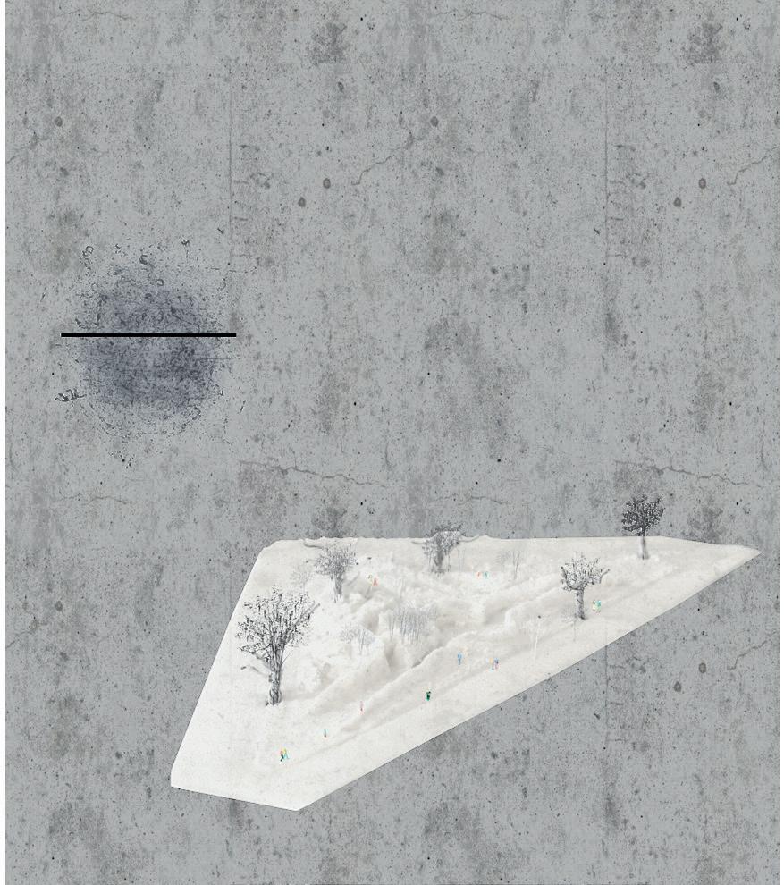
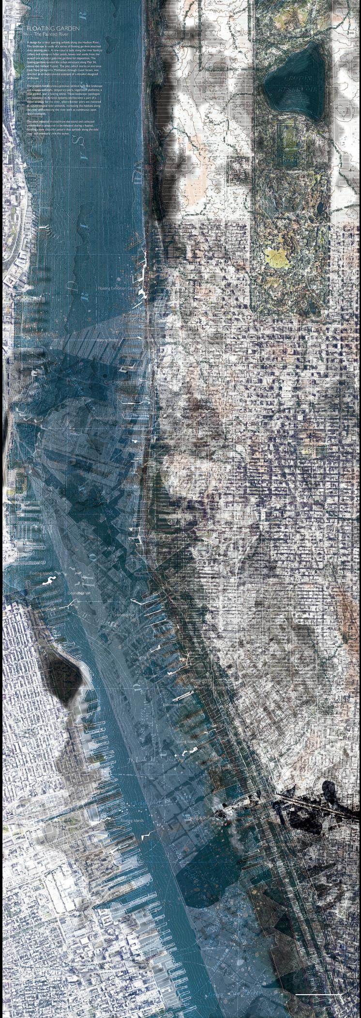
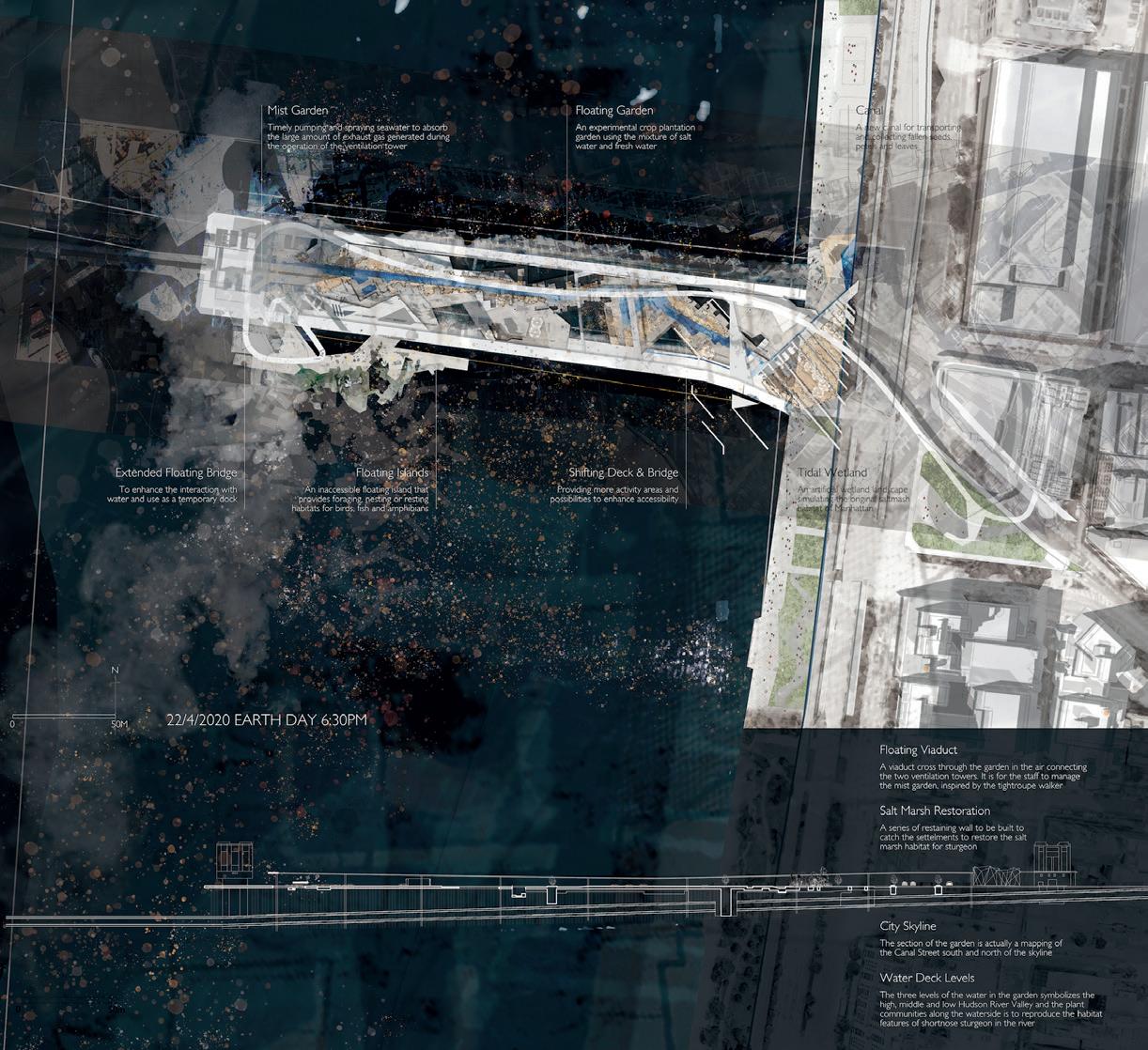
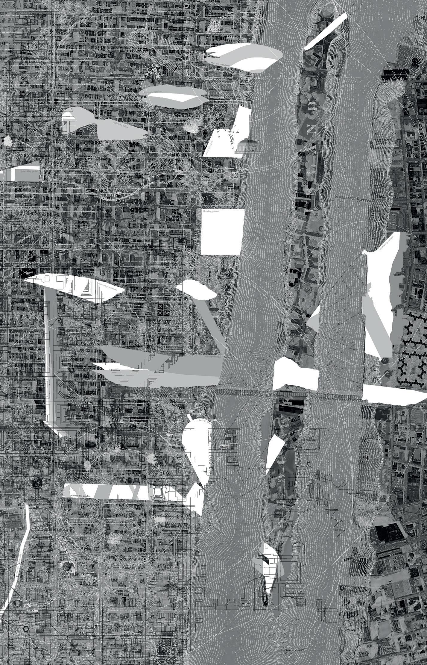
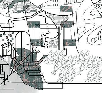
FLOATING GARDENS
THE PAINTED RIVER
A design for a river painting unfolds along the Hudson River. The landscape is made of a series of foating gardens attached onto existing piers. A new canal is built along the river bank to collect and transport fallen petals, leaves and seeds from the waterfront parks to gate-like gardens for deposition. The foating gardens extend the urban structure along Pier 34, above the Holland Tunnel. The pier, which marks an entrance from New Jersey into Manhattan through Canal Street, was selected as an experimental example of a detailed designed landscape.
The project reinterprets a previous vertical lock-like landscape and creates wetlands, temporary piers, vegetation platforms, a mist garden, and a foating island. These landscape typologies are combined as dynamic systems and become a part of a wider strategy for the river, where former piers are restored as natural coastal tidal wetlands, increasing the habitats along the river and activating the river bank as continuous open space ecologies.
The plant material drained from the island and collected underwater is prepared to be released during a festival, forming a new colourful pattern that spreads along the tidal river and eventually into the ocean.
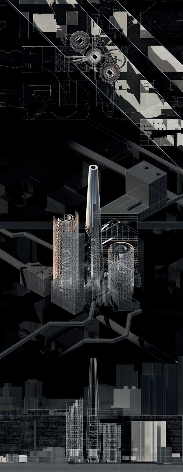
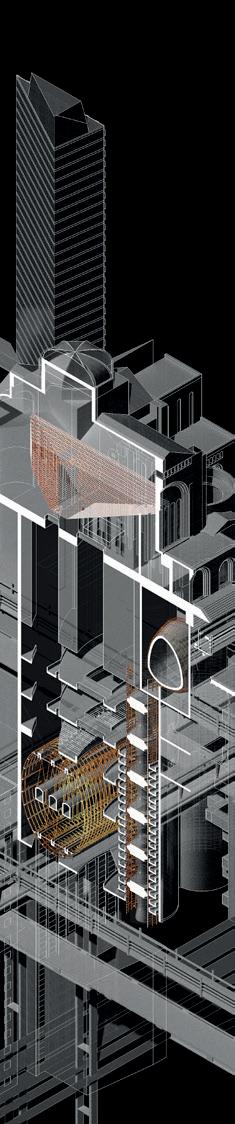
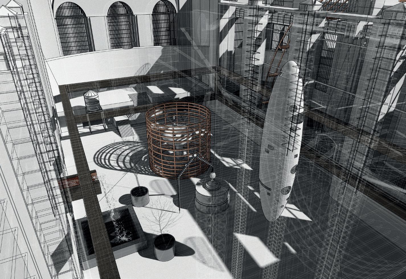
THE INVENTOR
HIDDEN REALITIES
WILLIAM BAYRAM, CHRIS MCCALLUM, DECLAN WAGSTAFF & ALEXANDRA BOHM
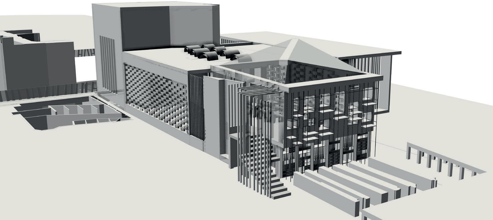
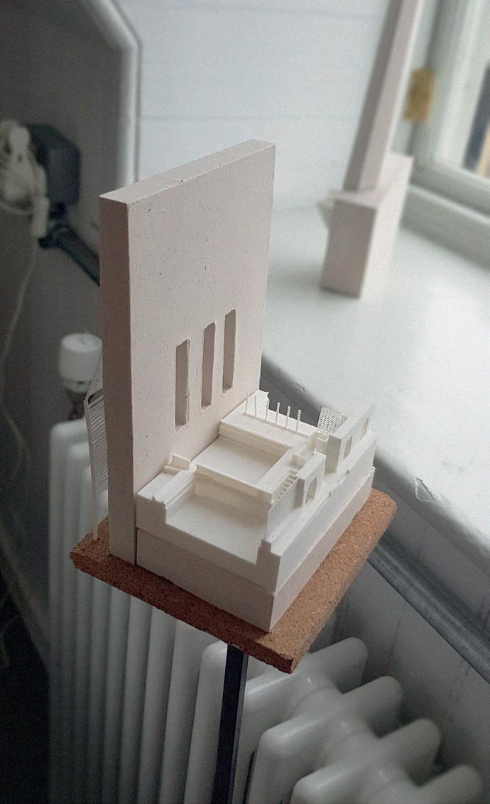
An understanding of Manhattan as an island territory is explored through the fabrication of a plane table upon whose timber surface is inscribed the life of one of the city’s more fascinating immigrants, the inventor and father of AC current, Nikola Tesla. His actions within the city, paralleled with the fctional events of Hitchcock’s North by Northwest, draws a focus around the constant reference point of Grand Central Terminal. In a nation and city built wholly on immigration, the station represents the central node through which we enter and exit the island. The mapped surface is then enfolded around this point, mirroring its chamber-like interior in the form of a camera, a producer of shadowgraphs. Electrical light flters through narrative micro-architectures set within its interior to form a continuously developing material dialogue between the histories, fabric and personal perceptions of Manhattan.
Manhattan’s resultant reconditioning is conveyed through the construction of a Field; a three-dimensional dialogue of the perceptions developed throughout the thesis, refecting a terrain that combines an understanding before and after visiting the city. To further this understanding, a landscape of hidden realities is articulated through disruptions at a human scale; light, tremors, electro-magnetism and depth, each element becomes a defning component within the overarching feld of investigation.
Plane Table - Shadowgraph Camera
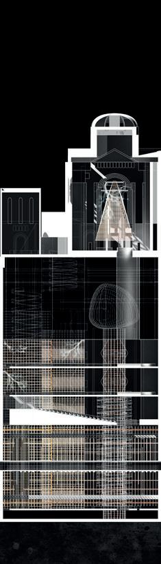
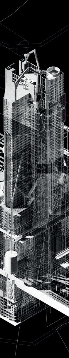
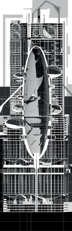
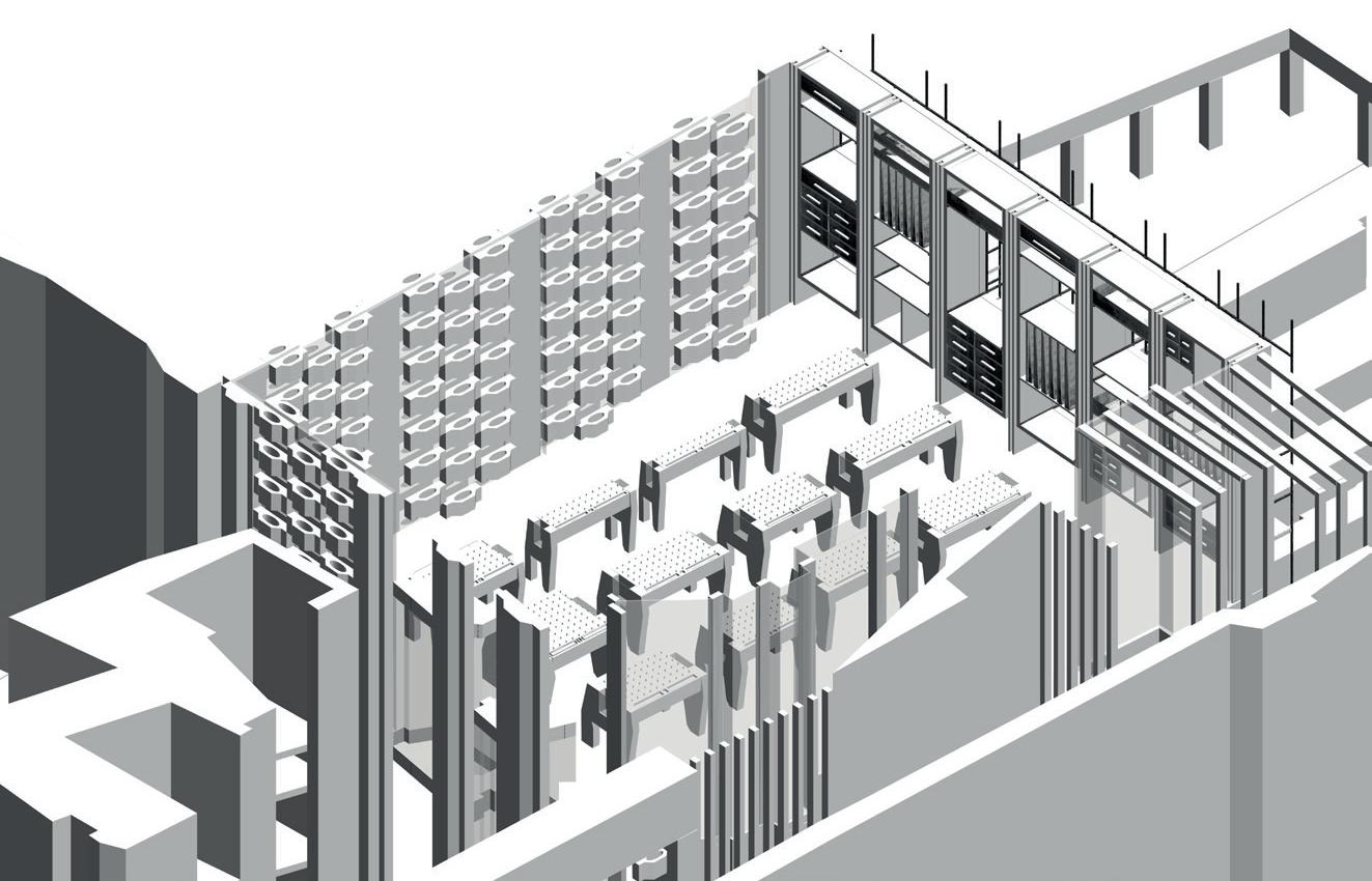
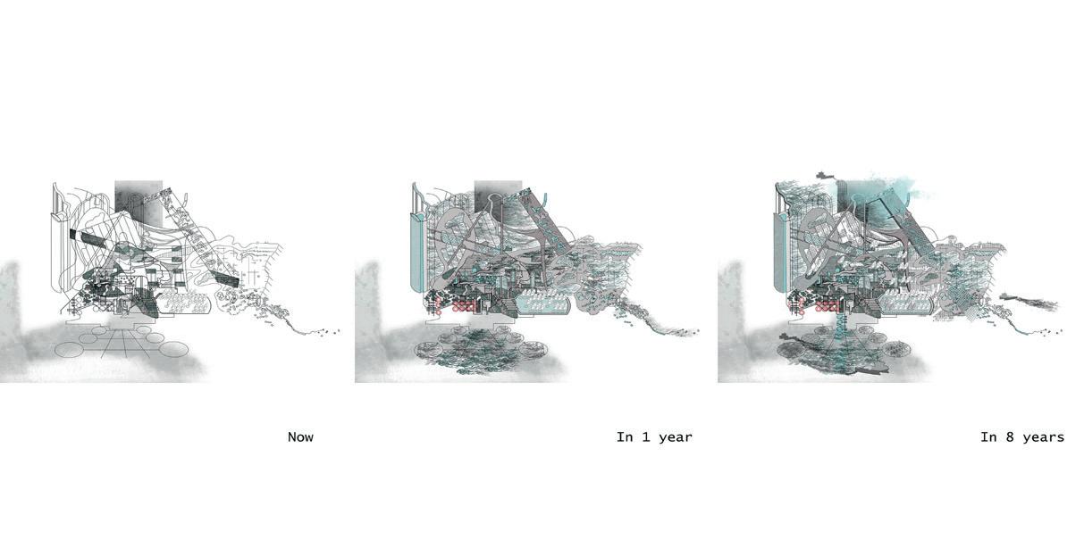
MONSTERS OF NOTHING
PEAK CONDITIONS // AN ‘OTHER’ WORLD FAIR
WILLIAM BAYRAM, CHRIS MCCALLUM & DECLAN WAGSTAFF
The thesis investigates the city as an urban construct, serviced by a complex network of infrastructures; it considers the conditions of infrastructure in the city through three concepts: the measuring of hidden disturbances, the conditions of peak ecological conditions, and the architecture of nothing.
We propose modern monsters of Manhattan as new Peak Architecture’s that operate at edge conditions, functioning within both the extreme and ordinary as thresholds. These ‘peakers’ act as dissected gates that accumulate around the central node of Grand Central Terminus, leaking across Park Avenue creating a referential system for the city.
World fairs are architectural accumulations which attempt to predict the future in radical propositions that either propel the city into growth, or dissipate into the reclamation of nature. In our proposition, we integrate An-Other World’s Fair as a representation for the overall scheme, a Fair which situates itself within the existing urban dynamic of Manhattan, exhibiting the city’s greatest export, its culture, and what the systems thrives for: nothing-ness. In this fair we propose transforming Park Avenue into a center of observation, offering its people and the new embedded infrastructure as moments of exhibition with the shared purpose of the production of nothing.
4 | Peaker Conditions // An ‘Other’ World Fair Layout
5 | Render of Grand Central Terminus - Reference Scale 6 | Render of Helmsley Building - Colossal Miniature Scale
WILLIAM BAYRAM MONSTERS
OF NOTHING
PEAK CONDITIONS // AN ‘OTHER’ WORLD FAIR
ELECTROMAGNETIC DISARRAY / ETHEREAL CONDITIONS
PEAK CONDITIONS
The conditions of peak usage architecture are investigated through the expanding programmatic needs of a geo-thermal plant, utilising the by-product of arsenic in the treating of wood - a material of electromagnetic resistance. This is paired with the qualities of operating within an edge condition of the island city, a transitional dictating. Within peak electrical usage, blackouts occur and disarray proceeds as the life of modern society is disrupted. The peaker offers the ability to restrict entry in and out of the city through the fear of electromagnetism, proposing the ethical system of using electricity to restore order in feeding the system or closing the edge of the city to restrict the disarray.
AN - OTHER WORLD FAIR
The proposal engages the theme of monstrous architectures of nothing, focusing on the realm and manifestation of oxygen - a substance necessary to human living but often craved within urban areas. Through the production of oxygen, there is a multiplicity of chemical and architectural by-products which have their own demands and experiential qualities. This consumption of pure oxygen is contained within a large receptacle, equal to the volume of the Grand Central Terminus, which offers a central focus for the project - a symbol of the fantastical within the functional.
PEAK CONDITIONS // AN ‘OTHER’ WORLD FAIR
CHRIS MCCALLUM MONSTERS OF NOTHING
CUPRUM ESTUARY // FOUNTAIN OF ABSENCE
PEAK CONDITIONS
Acting on the threshold of the island, this architectural estuary engages with the encroaching threat of rising sea levels to propose a containment strategy as the tidal estuary of the Hudson rises to its peak twice a day. Due to the environmental qualities of the location, the estuary consists of copper piping which oxidises and therefore strengthens at an increased rate. Symbiotically, it acts as a liquid battery as the potential energy of the water can be transmitted into tidal power when the island demands it. As the system lies dormant, a micro-ecosystem inhabits its copper innards, utilising the prime estuarial advantages of the water.
AN - OTHER WORLD FAIR
The functionalist architecture of the Seagram Building hosts the production of pure H20, a substance so empty of pollutants it becomes lethal. Exhibited alongside the health benefts of copper-infused water, the fnal pavilion of the fair will demonstrate the excessive nature of which the modern citizen will manufacture a basic human necessity. The dominant feature is the liquid curtain wall which obscures the building from the passer by, the volume of water scaled to the daily aquatic intake of the commuters of Grand Central Terminal. Exhibition-goers experience the process of purifcation alongside the tasting and bathing in the pure H20, with the bi-products of purifying the water being utilised to create unique dishes at the Seagram’s renowned Four Seasons restaurant.
MONSTERS OF NOTHING
PEAK CONDITIONS // AN ‘OTHER’ WORLD FAIR
DECLAN WAGSTAFF
THE CONDENSER / ELECTRIC VOID
PEAK CONDITIONS
An infrastructural threshold has been designed to create a new modern monster of Manhattan. Acting in the edge condition of the Over and Under-world, this icon creates an architecture that acts during both ordinary and extreme periods. Within the ordinary, this space acts as a pensive transitional place. However, during the extreme, it responds to the peak energy use that occurs due to the excessive use of both electrical air conditioning and heating units. It does this by acting as a condensing node, where its structure behaves as a refrigerant or heater for the world it inhabits. The fuel used is created within the Grand Central reference point from the city’s soot deposits gathered through vibration.
AN - OTHER WORLD FAIR
Inhabiting St. Bartholomew’s Church on Park Avenue the exhibition presents an electrical void, a space of nothing. Continuing with the notion of vibrations, this space acknowledges a predicted future where there is the need for an absence of electrical waves for the protection of information. The void is created through the use of a Faraday Cage where an electrical current is passed through its shell to produce a shield to external electrical signals. This void is lit by the patterned seismic oscillations of the subways the space interacts with. This propagates a void absent of electrical vibrations that exhibits a potential Manhattan future connected to function of ‘normal’ life.
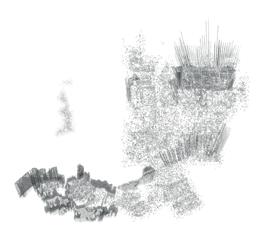
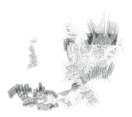
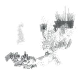
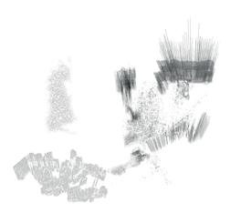
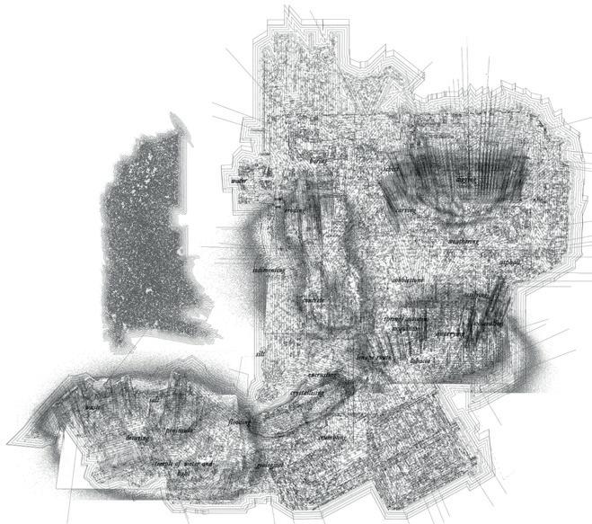
Scapeland
CRACKLING SURFACE
OPENING THE CITIES LAYERS FOR ECOLOGY
Driven by the folded landscape revealed in the group stages, the project evolves around the process of cutting into cartographical layers of the territory portrayed in different maps, the development of a new understanding of Manhattan and the revealing of the city history.
The resulting excavated landscape activates urban, ecological and social possibilities in the city. The dominant human constructions and the lack of ecological stepping stones pushed fauna and fora away from the island. Through this process the project breaks with the strict landscape and cracks open the clusters of the repetitive built form to let in diverse fauna and fora. These new conditions are further amplifed by the design of new relations between residents and the waters of the East River. The linear barrier between the polluted river and the residents is broken to create a new amenity through water treatment.
The new landscape is designed with surrounding materials, reorganised and reconfgured, which will increase an attachment with the existing city conditions. The landscape opens up an area where people may slow down and step back from the hectic, rushed pace of the city, but also play and socialise.
ALEXANDRA BOEHM
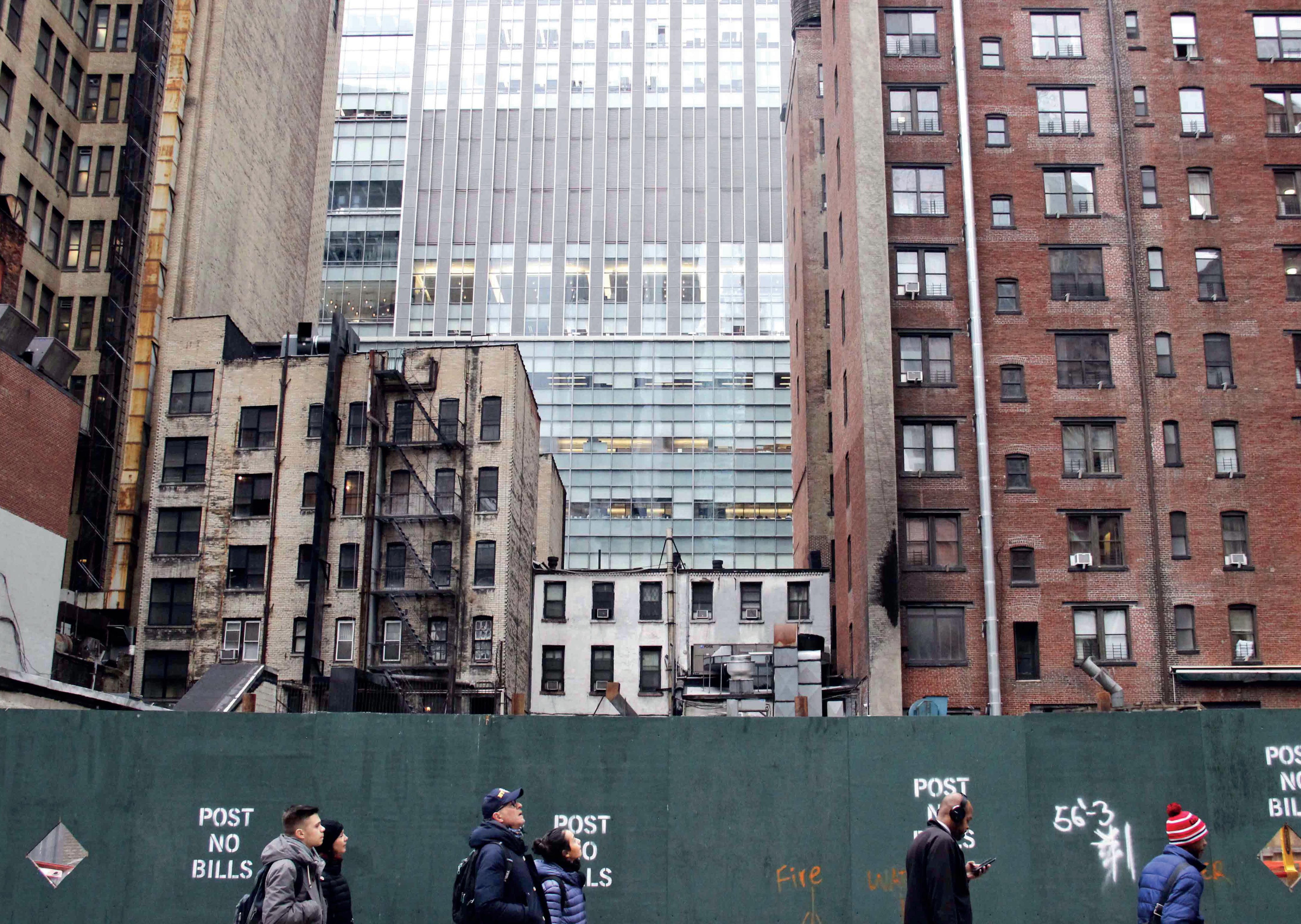
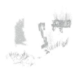
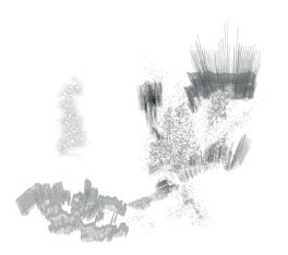
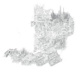
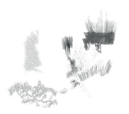
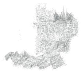
China Town October 2018 | Jessica Thomson
THE PHOTOGRAPHER
THE CREATIVE DECONSTRUCTION OF MANHATTAN
KATIE HACKETT, ADAM LEGGE & AGATA WOLOSZYN
Such an oxymoron suggests a knowing overwriting of the past to fulfl the immediate needs of the present - a process with its own rationale in the tight clutches of economic power. A formal, cultural and programmatic fracturing of Lower Manhattan established a methodology - a close dissection of the city’s fabric, enacted according to the flm angles from the 1921 avant-garde flm Manhatta and their interaction with the socially observant cones of vision of the 1950s photographer Vivian Maier. Cuts, fractures and folds reveal hidden narratives embedded within the body of the island.
An animate table provides a calibrated discipline to the choreography of dissection. It is at once a form of micro-architecture and a speculative garden within which interactions draw out possible futures. An orthogonal reimagining of the flm strips across the metropolis inform ten drawing arms that register the food projections of the island, the early development of the skyscraper and the subsequent 1916 zoning law that determines the passage of light. The drawing arms move according to time, season and tide to cause a burring of the table’s fssile plaster surface, forming a disturbance within the morphology of the grid tattooed upon its skin.
MANHATTAN STUDIOLO FOR UNCONSTRUCTED VISIONS
ADAM LEGGE
In his ‘retroactive manifesto’ Delirious New York, Rem Koolhaas explores how Manhattan became a mythical laboratory for invention as a result of the simultaneous growth of urban density and new technologies. Arguing that each block contains multiple layers of realised buildings that exist in parallel with the past occupancies and other potentials, the area of Midtown can be understood as an intense archipelago, with the Commissioner’s Grid of 1811 providing the bounding body to a series of individual islands.
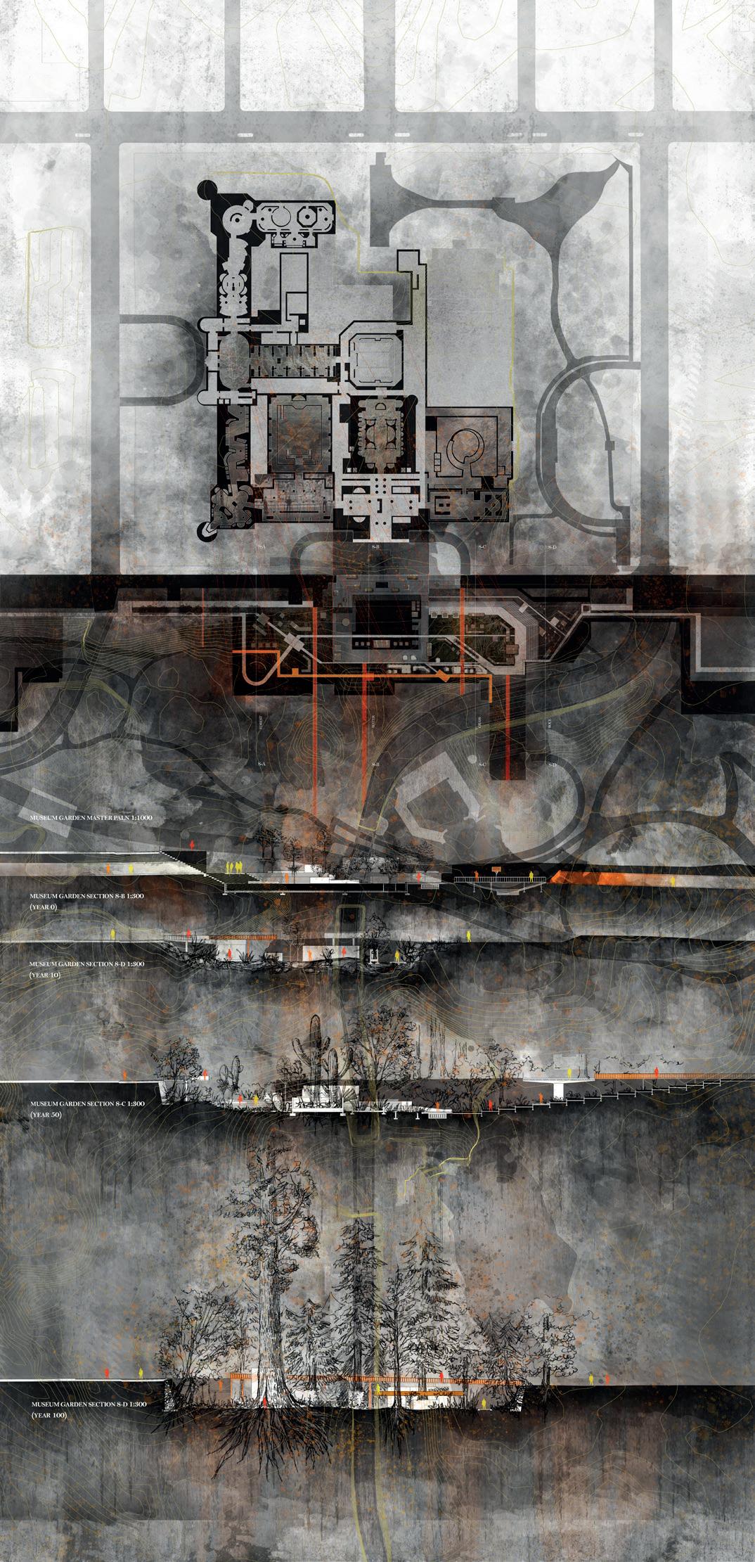
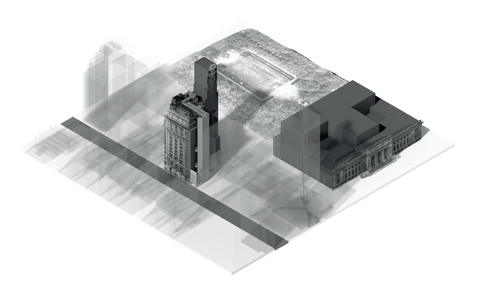
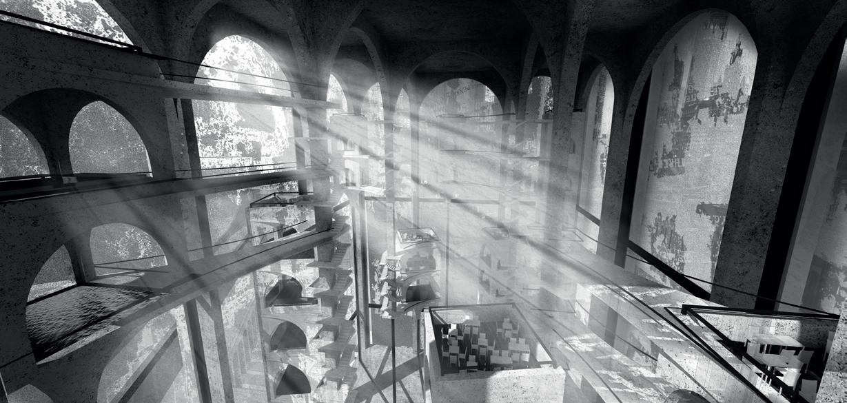
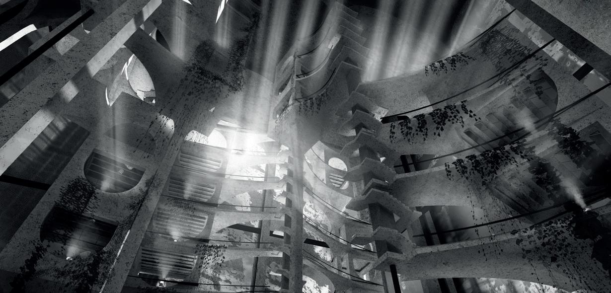
This proposition situates itself within the block that now holds the New York Public Library and Bryant Park, but previously hosted the Crystal Palace and Latting Observatory, where Koolhaas asserts “Manhattanism” was born. As the Crystal Palace, built for the 1853 ‘Exhibition of the Industry of All Nations’, coalesced imaginings for future under one roof and the observatory revealed the extent of the here and now, the Manhattan Studiolo of Unconstructed Visions will house all the models, drawings and imagined futures of unbuilt Manhattan and operate as a forum for the island city’s future. It will act as an ecotone, mediating the concerns of archiving, preservation and research with the creative cultivation of future visions for the city through a constant process of re-curation.
2 | Field (ii): Enacting the Capriccio [Midtown]
3 | Gate (ii): The Act of Drawing
4 | Gate (ii): The Act of Drawing
BASTIONS OF BOHEMIA
GOING AGAINST THE GRAIN
KATIE HACKETT & AGATA WOLOSZYN
The Creative Destruction of Manhattan revealed the city as a palimpsest of cartographies that evidence the role of neoliberal politics through de-industrialisation, redlining and urban renewal. Through the enactment of its drawing processes, a new fssure is inscribed into the surface of the urban archipelago that brings into question current processes of hyper-gentrifcation. Bastions of Bohemia welcomes the fringes of society to bask in the gloriousness of their “undesirability”, in an island metropolis founded on estrangement.
Going Against the Grain rechoreographs the historic San Genaro Festival in Little Italy, a neighbourhood increasingly compressed by the consumerism. The new lines of movement open out that which is currently denied and question the morality of the prevalence of unoccupied real estate investments. The proposal asserts a position where creation supersedes demolition, identifying vacant condominiums as opportunistic moments of programmatic interventions. Looking to bridge the gap between modernisation and preservation, the desire line acts as a disturbance within the physical and economic grid of Manhattan. The new route operates against the grain of the city, providing ephemeral spaces where programmatic intent is prompted by the fantasy of the festival, offering a set of architectures that offer everyday, pragmatic amenities to the inhabitants of Lower Manhattan.
1 | Scapeland: Bastions of Bohemia
3
2 | Table Scale: Neighbourhood / Going Against the Grain
| Exhibition View of the Desire Line
| Neighbourhood: Going Against the Grain
| The Desire Line: The Claiming of the Silhouettes enacted upon the Plane Table
BASTIONS OF BOHEMIA
GOING AGAINST THE GRAIN
KATIE HACKETT
IL PADRONE DI CASA
Il padrone di casa, or “the host”, is a character who has opportunistically walked into the circulation tower of 152 Elizabeth Street with a great amount of heft, sitting himself down comfortably into the newly constructed, gridded condominium building. This character has brought with him a new programme, prompted from the organisation of the Feast of San Gennaro Festival, in order to permeate himself within what has become tax-haven vacant luxury apartments.
His responsibilities as il padrone di casa act at three different scales: the vessel provides a guild for the Society of San Gennaro who meet consistently throughout the year to organise the festival, he also activates a new programme within the condominiums that is to offer hospitality to those displaced within Little Italy due to gentrifcation, fnally his positioning within the condominium acts at the scale of the desire line, opening up the ground foor to encourage the public to Go Against the Grain.
BASTIONS OF BOHEMIA
GOING AGAINST THE GRAIN
AGATA WOLOSZYN
IL TESORIERE
Il tesoriere, or “the treasurer” is a character who accommodates the money pinned to the statue of Saint Jaunarius during the festival processions of the Feast of San Gennaro whilst treasuring the talent of the authentic Italian street performers. ’il tesoriere’ opportunistically inhabits the core of the Nolita Place Condominiums, replacing the vertical circulation with a light-well which overlooks the treasury. Light penetrating the ground during the day and glow from within the condominiums at night, transforms this into a place of giving and exchange. Set between Little Italy and Lower East side, she acts as a bridge of passage for the Feast of San Gennaro.
Her responsibilities as il tesoriere act at three different scales: the vessel activates a new programme within the condominium acting as a treasury for the money collected and distributed to the adjacent Common Ground Andrew Transitional Housing. She also provides an unconventional theatre which echoes the previous occupation of the site by the People’s Theatre which hosted Jewish and Italian theatre companies. Finally, her positioning within the grounds of the condominium acts at the scale of the desire line which is opened up and manipulated through the reading of shadows and etchings recorded by the Plane Table, offering a new route and acting as a theatre to the festival and the city beyond.
THE ENTERTAINER
OLMSTED’S OPTICAL FIELD
JACK HUANG, PHILIP HUMPHREY, YUN LUI & CLARK ZHOU
Manhattan is examined through the optical treatment of the opening sequence of Woody Allen’s 1979 homage to the metropolis. What appears as the outer edge of the city is revealed to be its interior as seen from the great chamber of Central Park. The optical feld becomes its own island, intensifying the everyday so that, like the protagonists and curiosities of P.T.Barnum’s theatre, they take on fantastic proportions within the distorted and fractured grid of the city. These optical operations recognise Olmsted’s landscape itself as an illusion, a fabrication and distortion, and begin to question the boundaries of the park and reveal a reading of the landscape and the city as a continuum.
Through this analysis, the familiar has become distorted into a stratifed amalgam of relationships amongst parts. Things have become elongated, compressed and caught. That which was once vertiginous has now become the demarcation of the surface of the city – a negotiated edge between its density and the openness of the park, an excavation that reveals the park to be a set of artifcial processes, a scattered array of aerial gardens and a questioning the surety of the aquatic edge of the island itself.
Drawing
THE CONSERVATORY
LABORATORY OF CENTRAL PARK
JACK HUANG
Read as an island within an island, Central Park has served the city and its people for over a hundred years. Conceived by Frederick Law Olmsted as an open space accessible to all citizens and as a social space within the metropolis, it is considered one of the most successful urban parks. Despite its natural appearance it is an artifce, a construct that requires constant maintenance, a reality exacerbated by the effects of time, climate and modern use. The processes of preservation, renewal and conservation operate day and night.
The Conservancy Laboratory of Central Park engages with these processes to form a new landscape condition, a topography of conservation where the act of maintenance is acted out in the public realm, engaging the citizens of Manhattan. The processes required to keep the park operational are choreographed through a series of cuts into which a set of vertical gatehouses are inserted, forming a connection to the park above and distributing the programmatic agenda of planting, waste removal and resurfacing. The seams are derived from an optical mapping of the city beyond and provide a new way of viewing the park either visually or, like the Machine de Marly’s relationship to the gardens of Versailles, through a reading of its artifcial processes.
2
| A scapeland that fights the shadows being cast into the park by the boundary buildings.
3 | Carving into the landscape of the Central Park. 4 | The Lock/Loom - refracting the concealed splendour memories of city into the park.
JACK HUANG
AN ARCHIPELAGO OF VESSELS AND GATES
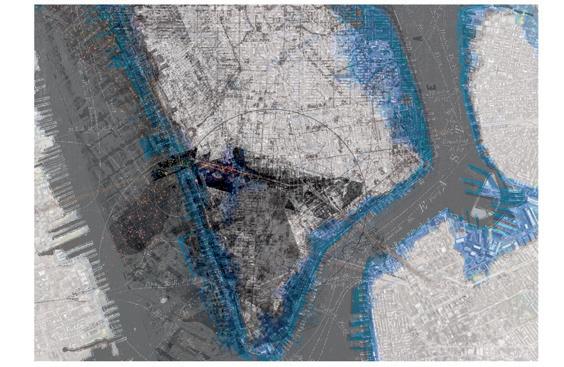
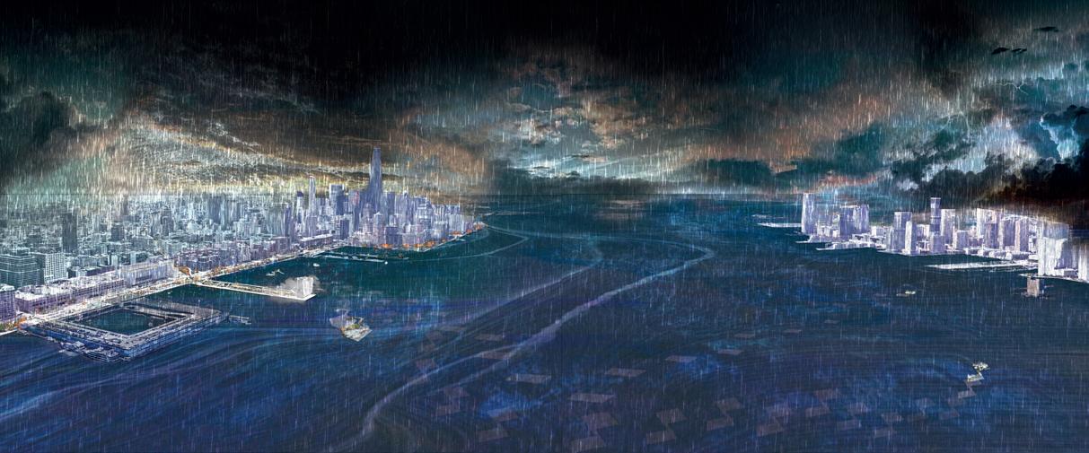
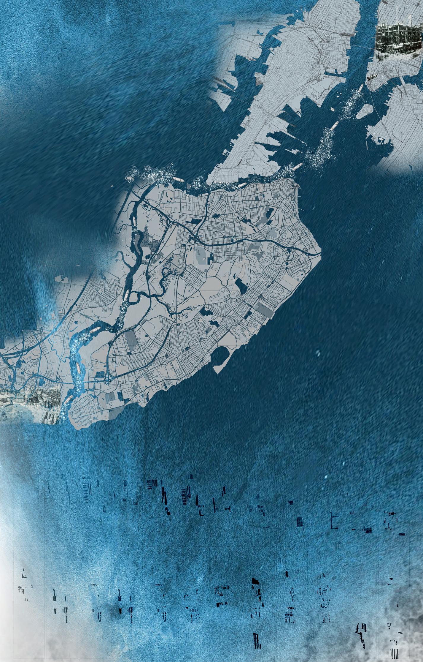
As an island, Manhattan’s limits have been constantly challenged over time. Through reclamation, the island has extended itself into the sea to become 30% larger than the landmass the indigenous Lenape knew. Now, with climate change exacerbating rising sea levels and storm surges, much of this land is set to be lost back into the sea. By 2050 sea levels are expected to rise by 750mm with foods that once occurred every one hundred years occurring as frequently as ten. The form of devastation witnessed during 2012’s Hurricane Sandy is predicted to become commonplace.
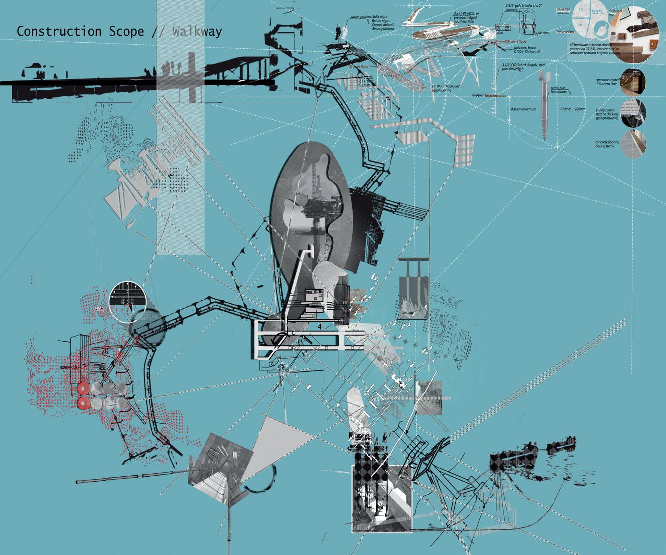
‘An Archipelago of Vessels and Gates’ offers a [re]generative strategy for the city to recover, reconstruct, reform and reinvent itself. An opportunistic architecture is conceived and developed to lithify the remnants of the food - reimagining what the fragile boundary between land and sea could become. Resilient buildings will become new anchor points to the architectures. Ships, like those that once serviced the island in their thousands, are reintroduced to these liminal landscapes, tethered and grounded to become new forms of programmatic vessels. Armature like gatehouses negotiate and connect new datums and levels of occupancy as hinges between the grounded and the buoyant.
PHILIP HUMPHREY
THE MOSS METHOD
COLLECTING, DISINTEGRATING AND REBUILDING
In Manhattan, there are obvious and rigid boundaries between the grid and Central Park. This project aims to explore a way of designing that disintegrates these boundaries to prompt new readings and relationships between the two urban systems.
The design process is divided into two parts. The frst explores a general way to establish the transition between the grid and the park. The lock-like landscape develops along a small tunnel under the Central Park’s southern boundary to collect sounds from the city grid and natural materials – seeds, spores, dusts, or water vapor – from the park.
The second part explores alternative boundary formulations in special moments along the park’s western boundary. A special focus is given to the area in front of the American Museum of Natural History due to its nature as a collection space of cultural artefacts. The new gate-like garden unpacks the collection rooms inside the museum into a series of reinterpreted open spaces. Following a cartographical analysis of historic maps, the landscape is reinvented as a sunken garden – a contemporary reinterpretation of the ha-ha – which results from shadow projections of the surrounding buildings onto the fabric of the park. The sunken garden collects water both from the city and the park and, in a wider application, the water strategy begins to create a necklace-like park boundary.
YUN LUI
CLOUD ISLAND
THE SITE OF SILENT RELICS
From a gaze enjoyed upon the observation deck of the Empire State Building, the island of Manhattan is scrutinized. Within this gaze, twenty-one moments are identifed and indexed as conditions of landscape; moments of estrangement where the order of the city is brought into question. These moments, conceived to be an archipelago of aerial landmasses, are each connected by a common optical feld. They are beacons that receive and acknowledge at least two other gazes, and optical tools that observe and measure the metropolis below. They are colonised from below through the introduction of slender armatures, and vertical seams, each island being structurally independent from the tower that it embraces. The process of colonisation introduces a set of concerns derived from the social and cultural history of the respective neighbourhood source.
Each cloud island receives a dining room from which the city is observed and considered over the particularities of a meal. The nature of the meal, its preparation and the ritualised form of dining enacted, is informed by the observations taken of the city below – a solitary act whilst reading, a casual conversation, a formal debate, the negotiation of a deal, a celebration or a satirical cabaret.
CLARK ZHOU
CLARK
Air Cultivation Chamber 2 (Lower Level)
Air Cultivation Chamber 3 (Higher Level)
First Floor (Cultivation Fields)
Storage, Rainwater Recycle and Machinery Area
Mushroom Cultivation Area (Shade Chamber)
Restored Original Architecture Facade (The original architectural fabric)
Transparent Open Kitchen
The Dining Chamber
Balcony (Openable to connect to main dining chamber)
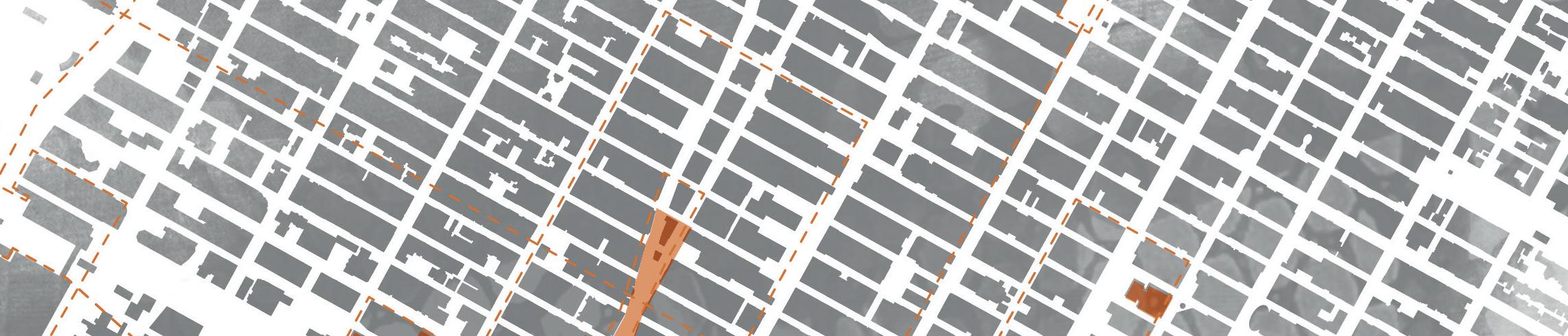
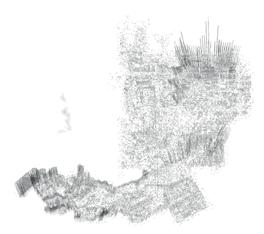
KPF Tower | Hudson Yards
November 2018 | Jessica Thomson
THE VILLAGE
HAO JIANG, JANICE LAU, LUQIAN LIN & LAURA MURESANO
Through the stimulus of a Character (Seneca Village) and a Film (Rear Window), a thesis has evolved in relation to the nature of dwelling in the city: community, power, authority and otherness. In Manhattan those who live on the margins have been defned and delimited by perceived origin, economy, history and culture and the city has responded to them through processes of erasure. Seneca Village, the frst settled community of African American landowners and consequently voters, was erased for Central Park, the tenement slums of 19th century Lower Manhattan were decanted north to the monolithic Projects as real estate values changed. The foundational villages of San Juan Hill, Little Africa and Five Points Slum, which are today parts of Lincoln Centre, Greenwich Village and Chinatown, keep almost nothing of their memory.
Operating in dialogue if not geographic proximity, we are approaching the city as a multiplicity of islands, where each island (village) has its fundamental characteristics, each attributed a specifc weight or value and offered in counterbalance to the other islands of the series. In this nonlinear process of give and take, the deep time of the city, the strata of villages, offer anchoring points and bridges between these erased communities and the metropolis of today.
LANDSCAPE FOLLIES
HAO JIANG
In the context of urban development and transnational human fows, Manhattan has become an island city with multiple cultural backgrounds coexisting and thriving together. The diversifcation and sometimes even collision of different cultural enclaves has led to the constitution of different neighbourhoods, which operate as an archipelago of islands within Manhattan. Some neighbourhoods mutually reinforce each other, while others are eventually demolished by the estrangement of the island’s urban development. During major city events – 9/11, Hurricane Sandy, and festivals – the different enclaves weaken their eventual segregation, and the identity of Manhattan as a whole is more strongly revealed.
The design of landscape-follies attempts to question the isolation between and within different enclaves and to strengthen Manhattan’s own identity by embedding into the structure of the island’s city grid a series of follies following a strategy of interlocking, interweave, and unfolding. These constructed landscapes exist in different forms and are inserted in urban spaces of different cultural backgrounds. In the neighbourhoods’ daily life, the follies not only serve as meaningful cultural stages, but also provide platforms for the diverse planting cultures. This planting strategy closely integrates family life in different communities through nurseries, cultivation plots, display, and trade. During festivals, the follies unfold out on to the streets and take part in the events by offering urban landscapes in different states and as distinct stages.
2 | Field Drawing
3 | Scapeland 1
4 | Scapeland 2
5 | Section
KNOTSVILLE
WASHINGTON SQUARE VILLAGE
JANICE LAU
“Cities have the capability of providing something for everybody, only because and only when, they are created by everybody.”1
Being a fâneur walking in Greenwich Village, I realised the signifcance of Washington Square Park to its neighbourhood. When Robert Moses tried to destroy it by proposing an expressway going across the park, Jane Jacobs took the lead, opposing the idea of developing the city solely concerned with mobility and effciency. She proposed a different way of appreciating the intrinsic randomness of the street. To what extent should our sense of community, history and identity give way to the grand narrative of development and effciency? How do we preserve our communal identity within this forest of skyscrapers?
One block south of Washington Square Park stand the two 15-storey residential buildings of Washington Square Village, a Robert Moses development from the late 1950s, a vestige of Moses’ greater project for the modernist overwriting of New York city through the lens of the car. For me, the Village and its histories and adjacencies are a scapeland, an ideal experimental ground in which to enact Jane Jacob’s ideology. By reconsidering the sequence, arrangement, confguration and expression of spaces and places across the neighbourhood I hope to refect upon the architecture of dwelling in the island city. This scapeland is not a proposal to replace modernist architectural approaches with a utopian-like condition, but rather to explore how the bulky brutalist block of concrete can coexist with the organic occurrence of social events to enhance living quality in the 21st century neighbourhood.
1. Jane Jacobs, The Death and Life of Great American Cities, (New York: Random House, 1961).
Knots intersecting | Creating the space of the ideal Jane Jacob’s Village.
Section showing the chaotic nature of village in Jane Jacobs eyes.
A MANHATTAN FOYER
For many people, the point of arrival via the interstate bus network to Manhattan is through the grim chaos of the Port Authority Bus Terminal, a major transit hub for the commuters of New Jersey. Unlike its more affuent counterpoint, Grand Central Station, there is no generous, dignifed space of welcome, sustenance and orientation. The arrival is abrupt, disorientating, threatening. A Manhattan Foyer, seeks to address this through the introduction of an intense feld of programmatic conditions whose linear, screen like forms flter light and movement across a range of datum levels. Slowly, these screens introduce the intensity and scale of the urban landscape towards Broadway and Times Square.
The screens are derived from the morphological analysis of the villages that underpin the social structure of this island of immigrants. These light architectural forms carry programmes that respond to the needs and economic realities of the interstate bus passenger and the low paid city worker – hostel accommodation, creche facilities, advice centres, language schools and storage for personal belongings. A Manhattan Foyer is an public space that negotiates the condition of estrangement and acts as a gateway to a city of possibilities.
LUQIAN LIN
Buselevator Busroadconnectwithlincontunnel
Storageforpersonalbelongings
Crechefacilities
Languageschoolsandgardens
Cafeandadvicecentres
Libraryandcollectstoriescentre
Artandculturecentre
THE
UNCLAIMED A JOURNEY TO HART ISLAND
LAURA MURESANO
There is a nameless quality about death, dying and remembrance, and perhaps it is nowhere more evident than in New York City.
Hart Island, an 846m2 island in the Bronx, holds more than 1 million dead people. Currently it is New York’s operational mass grave, administered by the Department of Corrections in conjunction with the Rikers Island prison, receiving in its hundredmetre-long trenches, strict visiting prohibition and desolated conditions, the $5 pine coffns of the poor, prematurely dead, unknown in life and unclaimed in death. People who may have lived their entire lives in New York, or just happened to die there as strangers.
The project seeks to address the overall situation of the poor, their memory, and the notion of a dignifed death in the metropolis. Through a series of design gestures and interventions at an infrastructural level, the work aims to claim these people, their connection and belonging to the city, recovering erased stories. The focus, an architectural landscape of integration whereby the ritual of death, burial, mourning and remembrance as it is understood and practiced in all major religions and beliefs, is rehoused within the dense urban environment of the city. New York is a crowded city with an elderly population; in such a context, what is the status or ritual and memory, individual lives and small histories?
1 | Field Cuts - Gate Conditions: The Death Registry, The Dry Docks, The Prison, The Potter’s Field
2 | Hart Island: The Human Forest - Plan Drawing
| The Hart Drift - Conceptual Drawing
| The Dry Docks - Architectural Proposal
5 | The Dry Docks - Architectural Proposal | Section and Visuals
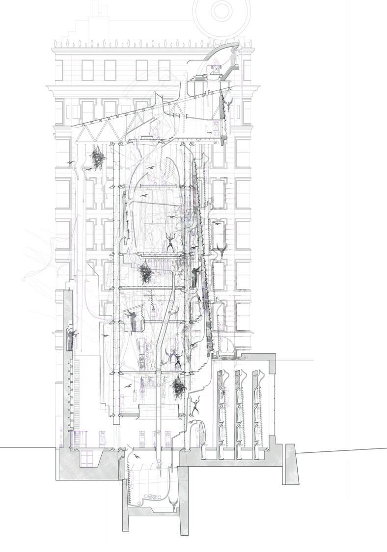
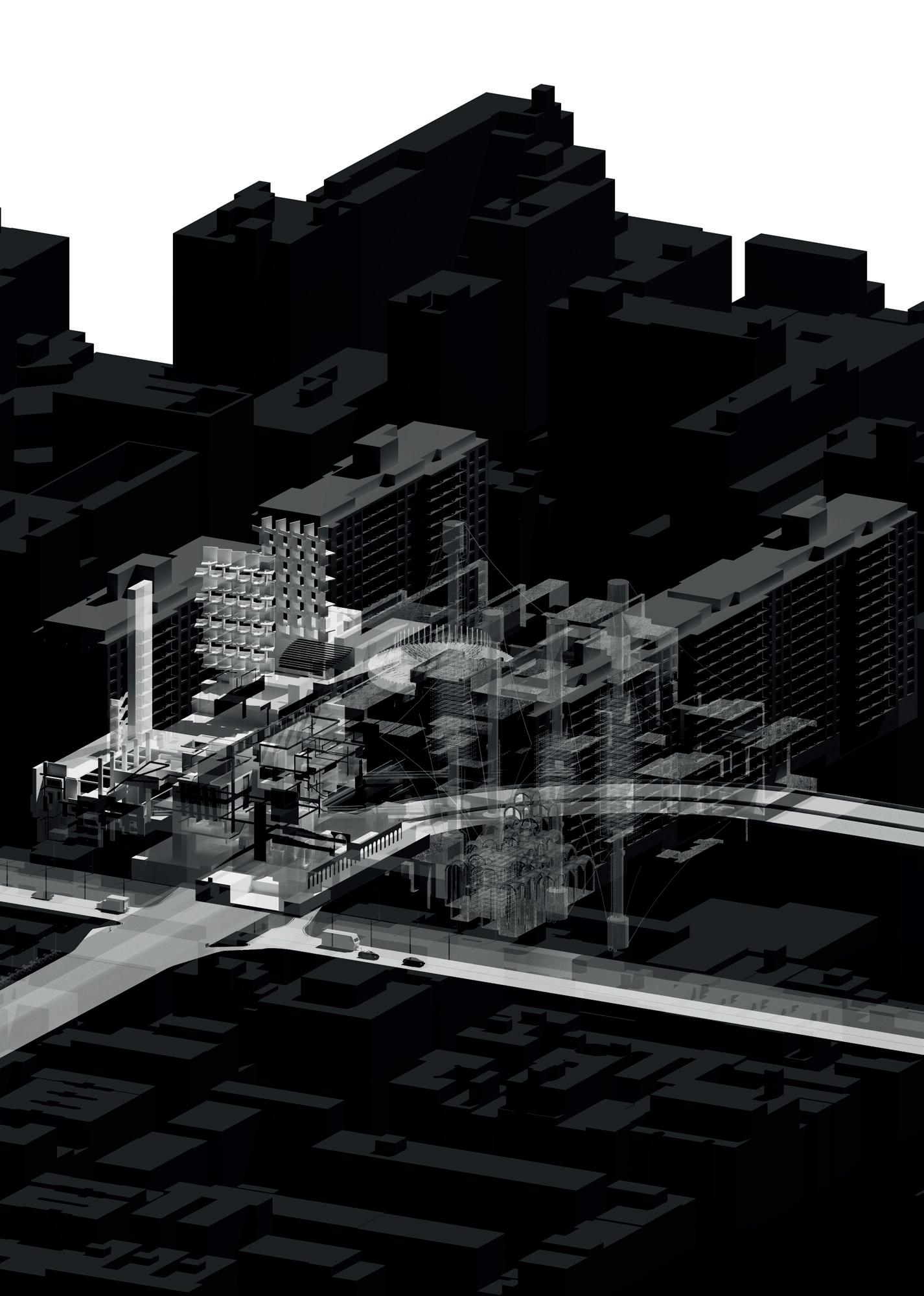
The Whale is represented as a fgure, a vast, monumental structure or entity caught on the shoreline or held, as the Trinity Church is held, between the towers of the adjacent and omnipresent institutional architectures and skyscrapers. The Plane Table made manifest the following prompts as a sequential survey of urban artefacts - the Manhattan 1911 flm and the pre-gridded geological and watery seams of Manhattan. The flm drew out extant architectures, ‘ghosts’, now lost to the city but recalled to memory and analysis through photographic investigations. The study of the protocols of the whaling hunt and the processing of whale meat and oil triggered ways of cutting monumental things, a sensibility with regards to mass and volume and the potential for cutting, occupying and recalibrating building skins.
Manhattan Island is sliced into six key fault lines from the Battery to Central Park and a suite of ‘meta’ fault lines in the northern reaches of the island. The feldwork in Manhattan comprised ‘walking the fault lines’ and collecting whales and, in an allied investigation, collecting building refections. Fieldwork investigations, resulted in a set of delaminated drawings of the whales and ghosts and, a series of ‘forensic’ slides of layers of refections of buildings on buildings. In this way the monstrous architectures of Manhattan were undone: cut, recalibrated and ‘bled’ in advance of a remaking through future architectures and landscapes of disassembly, geomorphology, hydrological reimagining and restoration.
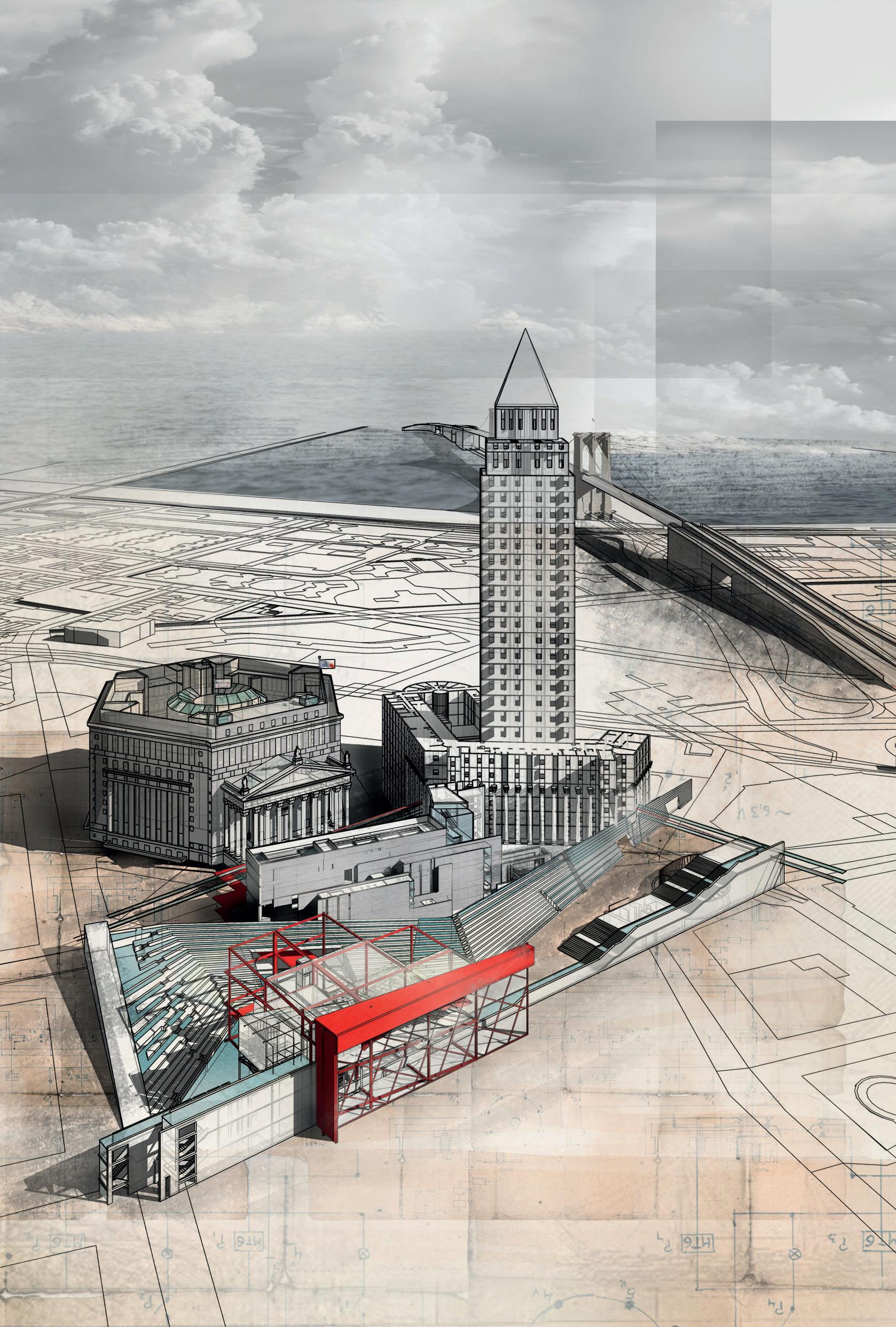
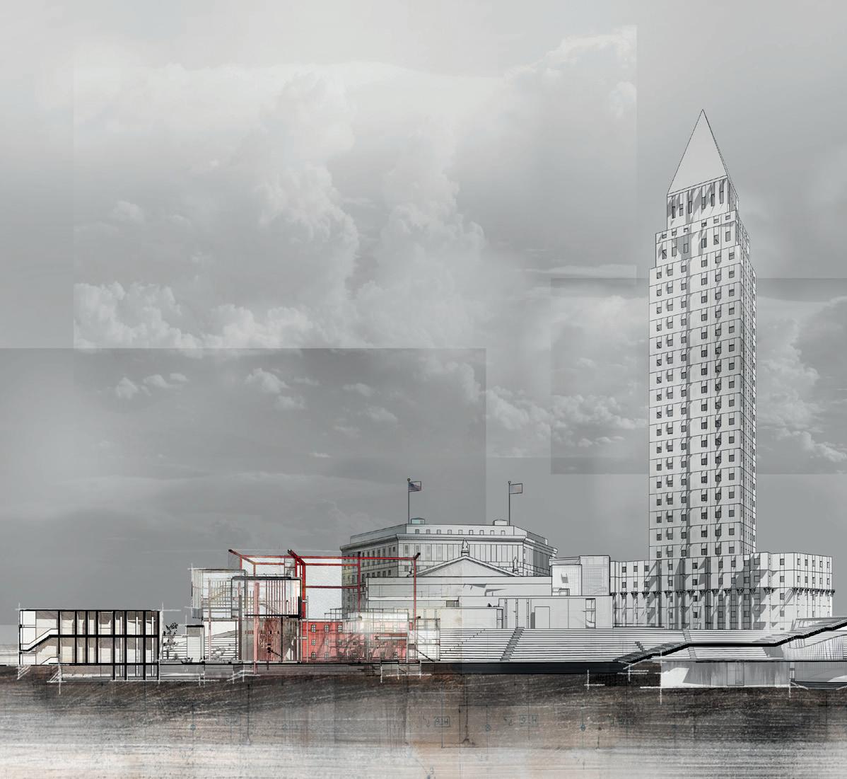
THE COLLECT POND FIELD
UNPACKING THE MEDIATION
HANYUE LU
The Collect Pond is a constant in the landscape of Lower Manhattan, a vestige of the other histories of the island and its occupants that rises intermittently in the lower basements of the court houses and government offces that dominate the Civic Centre of the city. Here, the Lanape, the indigenous people of the Northeastern Woodlands, the Dutch Settlers and the subsequent waves of emigrants found water to drink and wash. As a scapeland, the Collect Pond is a ghost, a barely visible but infuential fgure in the life of the city.
The Collect Pond Field is the neighbourhood of the original pond identifed through early maps and reinstated as a locus of unsure ground beneath the architectures of law and government that punctuate the landscape. These buildings, raised high on stone plinths, quietly drain away the rising waters of the pond through a system of pumps in lower basements across the site.
The Lock, a frst architectural offering, is a fnely crafted intervention in a court house. A move that cuts and recalibrates the fabric of the building to create a reservoir and irrigation arm for the nearby City Hall Park. The Gate, an architecture of mediation, disassembles the feld of present day buildings and earlier land forms: court houses, administrative buildings, Canal Street and Bayard Hill, through a process of cut, unpack, dismount, dislodge, unhinge and remove leaving a topography of beams and skins as the armature for a more permeable, less authoritarian programme of legal mediation and family law.
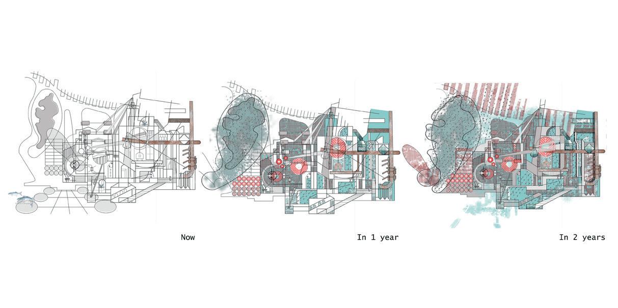
FRAGMENTS
RESTORATION CITY
YEDIJA MARKUS
The persistent presence of scaffolding affxing itself to the historic skyscrapers of present-day Manhattan serves as a reminder of the inevitable material deterioration these buildings face, weathering due to a lack of proper maintenance. The magnifcent Beaux-Art Woolworth Building (which recently celebrated its centennial) is no exception to this gradual, incipient decline. Requiring, as it did, the recent commission of specialised craftsman for the replacement of its damaged terracotta façade.
Fragments: Restoration City proposes a series of architectures inhabiting and cutting into City Hall Park along Broadway Street as a landscape of the materials and paraphernalia of repair and maintenance, The Woolworth Building, its frst client. The project, governed by a conceptual framework of the unpacking, dissection and deconstruction of Woolworth building into layers of fragments, is set in place as a means of articulating spaces laid down on the park. The scapeland of fragments incrementally occupied by a rich seam of different activities of material production and repository interwoven with the ritualised processes of blueprint production to mould making, tracing foor to stone carving, clay sculpting to kiln fring. In reviving the seemingly banal but culturally and politically charged City Hall Park, the architecture incorporates three different modes of access each strategically created to usher people towards the City Hall while pausing to witness the workings of sculptors and artisans in the re-making and re-constructing of the city’s frst skyscrapers.
2 | Unpacking: Fragments of Woolworth’s reflection on One World Trade Centre.
| Axonometric layers & perspective of material production spaces.
| Terracotta Glazing Station
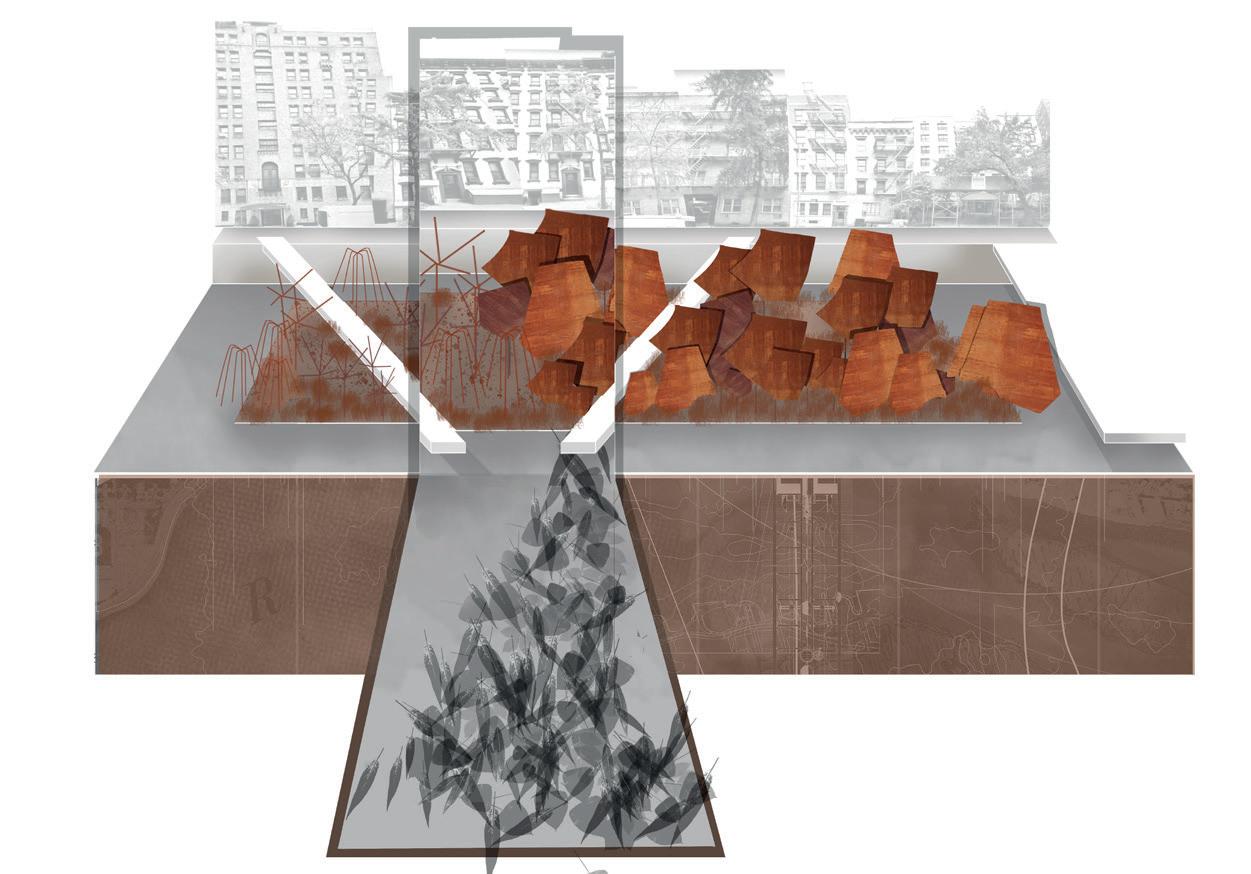
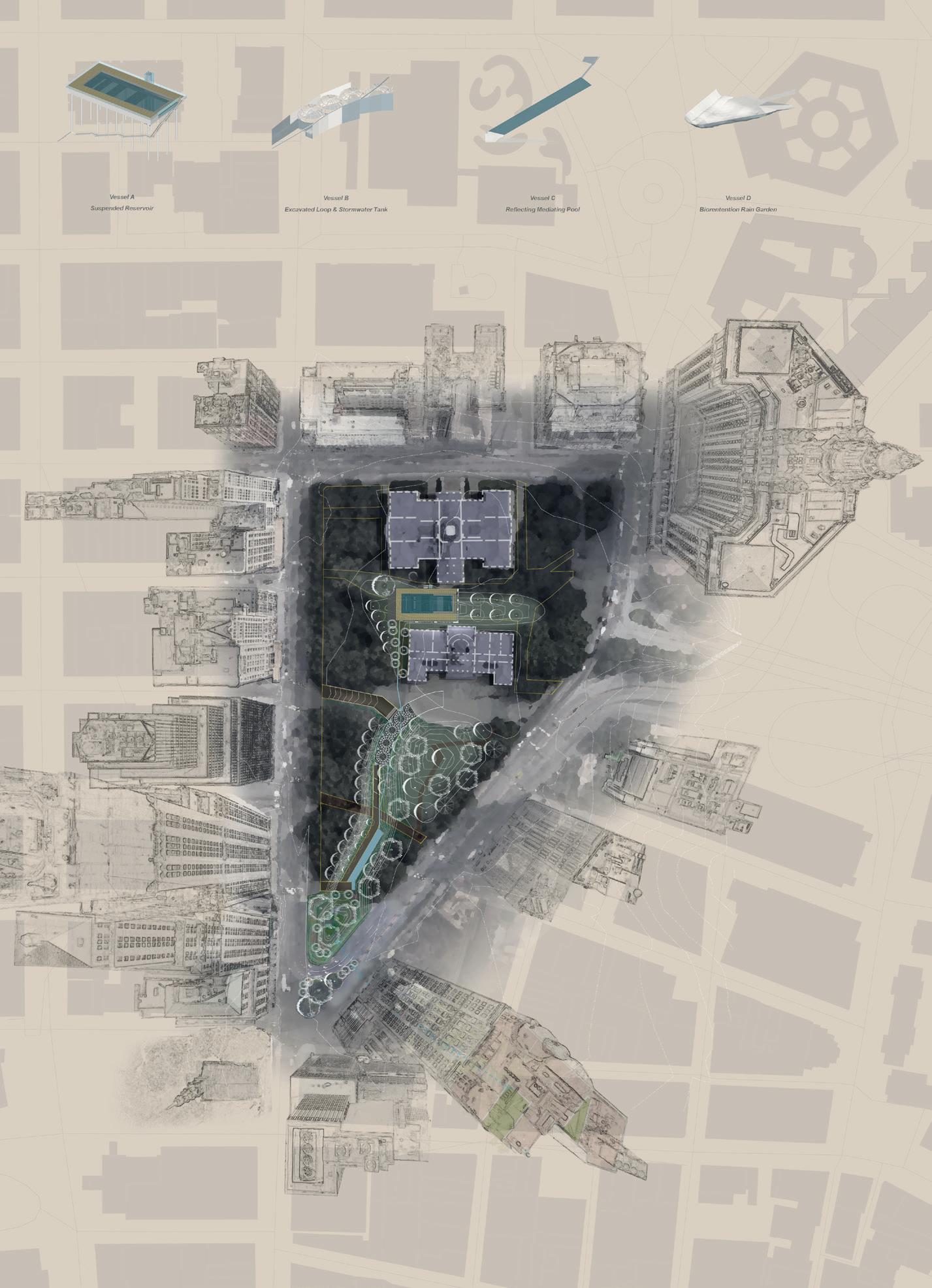
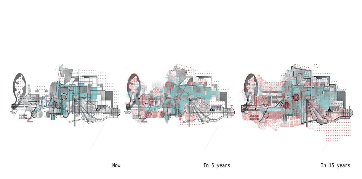
ABANDONED GARDENS
RESCALING AND REINVENTING THE REMNANTS OF MANHATTANS INFRASTRUCTURE
CEN ZHONG
To satisfy the growth and increasing demands of Manhattan, the infrastructure needed to support human development was continuously upgraded to create systems capable of handling the cities imports and exports – raw and processed materials, human and non-human populations, among others – in and out of this island territory. Abandoned gardens aims to explore alternatives to the derelict infrastructure, and to create closed sustainable cycles assembling some of the island’s assets.
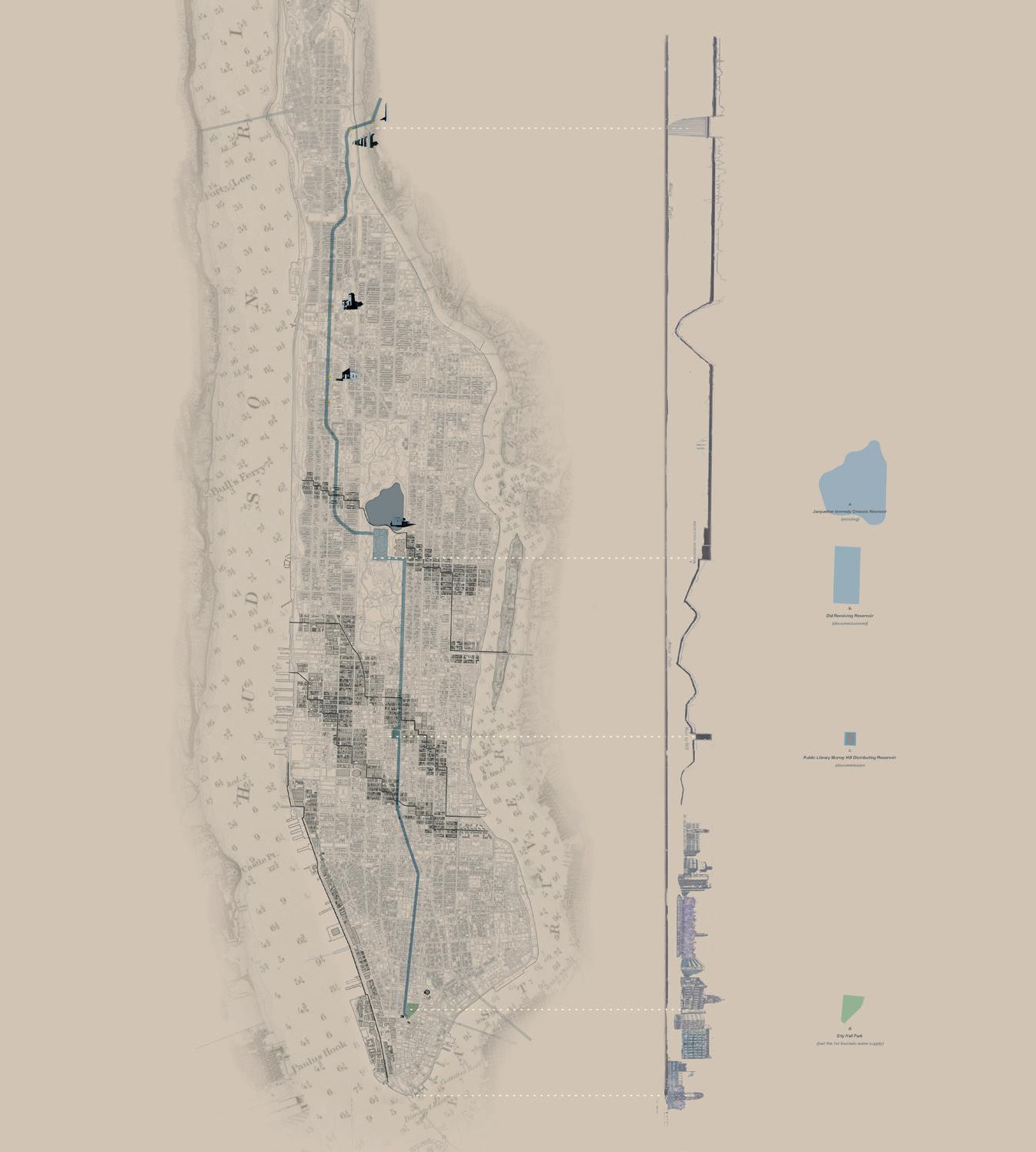
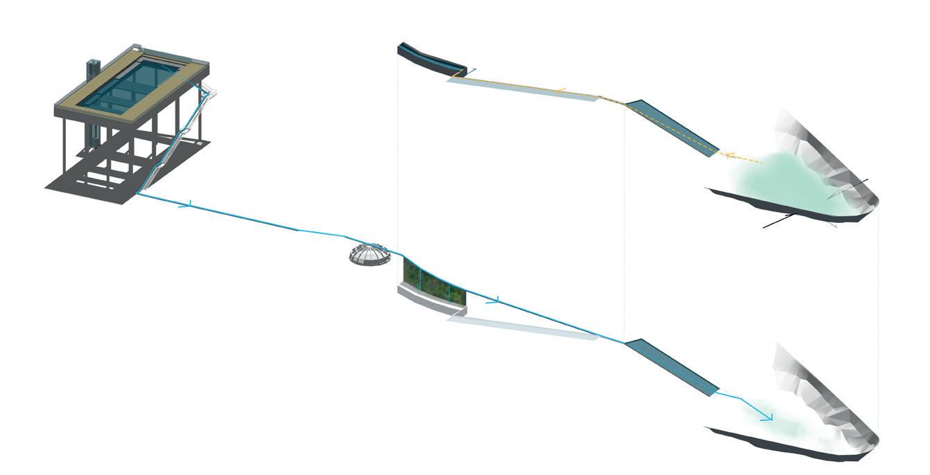
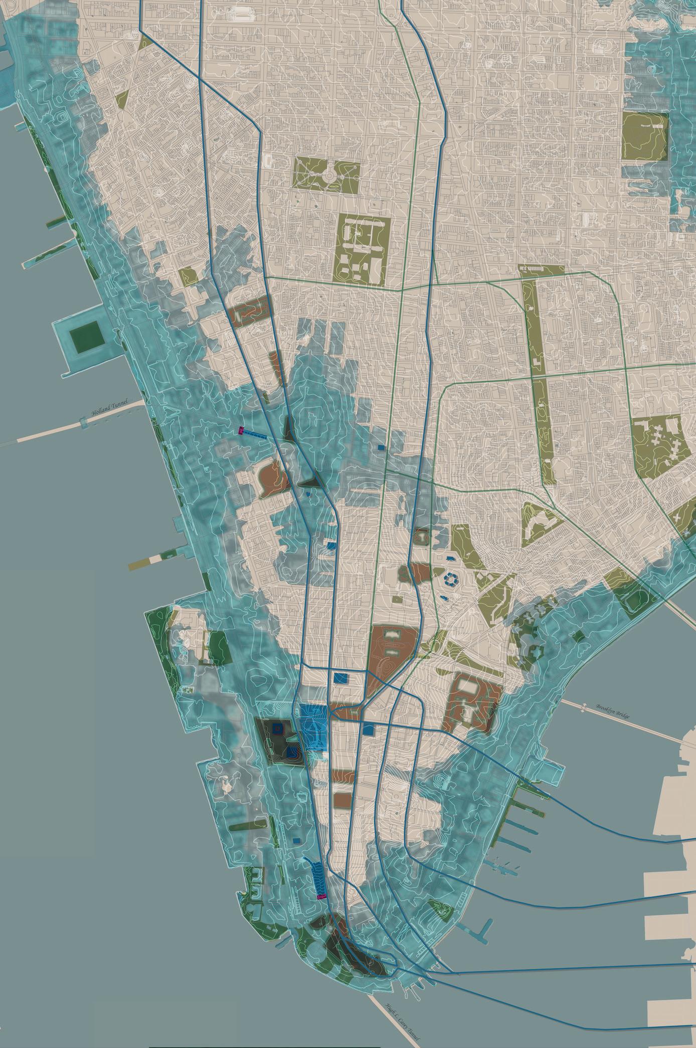
Abandoned gardens occupy City Hall Park in Downtown Manhattan, a meaningful public landscape which keeps hidden histories and remnants of both the Old Croton Aqueduct (OCA) and a subway station. The project proposes the rescaling of the OCA with its undulating section and retired reservoirs to the scale of the park. By doing so, it reworks the topography and hydrology of the park, creates a dynamic fux in the excavated station loop, foments dynamic aqueous moments, and stages the development of a rich seasonal landscape. The project explores the reinvention of the park as civic center in relation to city infrastructure. It also links with surrounding architectures, such as Park Row Building, through an early project of a lock-like vertical landscape entitled Watery vertical grounds. This linked landscape also experimented with a rescaling of Manhattan’s underground water network onto vertical building facades to flter water from roof down into the micro landscape on the facades and fnally draining it to the City Hall Park beneath.
Abandoned gardens becomes a prototypical landscape which celebrates the OCA as the infrastructural spine of the island. It hopefully inspires other landscape reinventions of abandoned cultural and industrial artefacts on the island.
2
3 |
of the dynamic hydrology system through the four vessels by gravity in active/inactive conditions.
4 |
- Lower Manhattan active mitigation plan in hurricane condition.
| Field - Rescaling from the Old Croton Aqueduct through focal points of reservoirs to the City Hall park.
Diagram
Scapeland
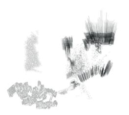
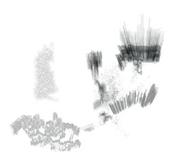
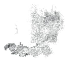
October 2018 | Benjamin Hair
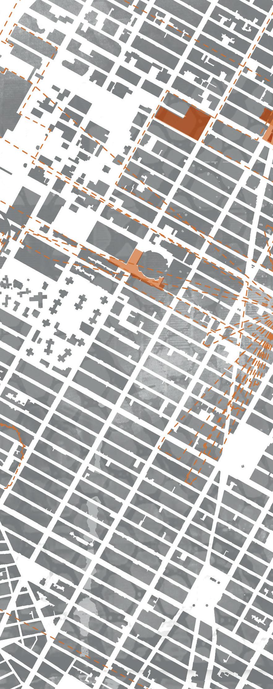
Williamsburg Bridge
THE SHIP
A r CHIMERA
RISHABH SHAH, MARINA SOLODOVA, NORMAN VILLEROUX & ANTONYO WONG
ArChimera is a magical realist-cartographic-con guration of Manhattan; a radical- ctional-alteration of the island.
Manhattan’s spatial morphology has constantly been bent into new realities, depicted by distinct stories entangled in various temporalities and scales. Indeed, the swampy Mannahatta exists in the protruding rocks north of the island, whilst the specter of New Amsterdam is revealed in the excavated 17th century remains of a Dutch ship. Today, New York City exists in the extravaganza of tabula rasa and technology, as the paradigm of the urban metropolis. A few out of many, these stories and moments evoke the ever-evolving tendency of Manhattan to reinvent itself. As such, ArChimera attempts to pursue this constant spatial morphosis, by bringing together distinct stories evoking quintessential architectural and landscape transmutations and injecting them with speculative scenarios deriving from the contemporary realities of the city.
ArChimera takes the form of a singular architectural entity inhabited by various fantastic realities – an archipelago of islands. e archipelago evokes the totality of this speculative urban landscape, a ctional scapeland existing at various temporalities emitted by the islands which inhabit it. ese multiple singular architectural formations can be understood as gardens, or in the words of Gilles Clement as mental territories of hope. As such, the islands represent the individual voices of the meta-thesis, autonomous spaces for programmes or speculative realities.
HARRISON’S WORKSHOP
AN ISLAND OF DIPLOMACY
RISHABH SHAH
In post-war 1951, the birth of the world’s strongest union of countries manifested as the United Nations headquarters in New-York, named A Workshop of Peace by Wallace Harrisson. However, the current turbulent political state of a airs in the United States of America echoed across her partner members of states in the United Nations, indicates a regression from this utopian ideal. Nonetheless, the United Nations still stands as a lasting testament to humanity’s hope for this utopian future. No Man’s Land: An Island of Diplomacy proposes an architectural realisation of the United Nations’ seemingly fantastical utopian ideals and a reawakening of Harrisson’s vision of a Workshop for Peace. .
e proposition operates on the border condition between the extraterritorial site of the United Nations Headquarters and grid of Manhattan. It aims to fray the impermeable boundary between international and national through the development of an architectural language of bridge buildings. e architecture catalyses a dialogue between these two worlds. On one hand, the creation of a more permeable ‘wall’ that enriches the otherwise impenetrable outlook of the United Nations, o ering serious topics of conversation that politicians are not having. On the other hand, sovereign functions that are otherwise closed o , spill out beyond the extraterritorial site, acting as more accessible architectural proxies.
Delegate’s Concourse
Cross Obligatory Services
Stramp Down
Cluster of International Houses Public Footbridge
Mess Hall/ Immigration Building
Observation Deck
Tidal Island of Diplomacy
House of Britain
House of Nigeria
House of Portugal
House of Iran
House of Greece
House of India
House of Canada
House of Mali
House of Egypt
House of Ecuador
House of Finland
House of Botswana
2 | Cluster: A myriad of national buildings responsible for cultural representation.
House of Kenya
House of Zambia
3 | Acoustic Pocket: Rib like panels arch over to collect sound and prevent noise entering the UN General Assembly.
4 | Tidal islands: Independent buildings function as archipelagos of education and diplomacy during low-tide
RISHABH
ARCHIMERA
ISLAND OF IMMINENT CHANGES
MARINA SOLODOVA
e urgency of contemporary urban transformation coupled with environmental shifts has resulted in a collective con ict that a ects the ways in which our cities change.
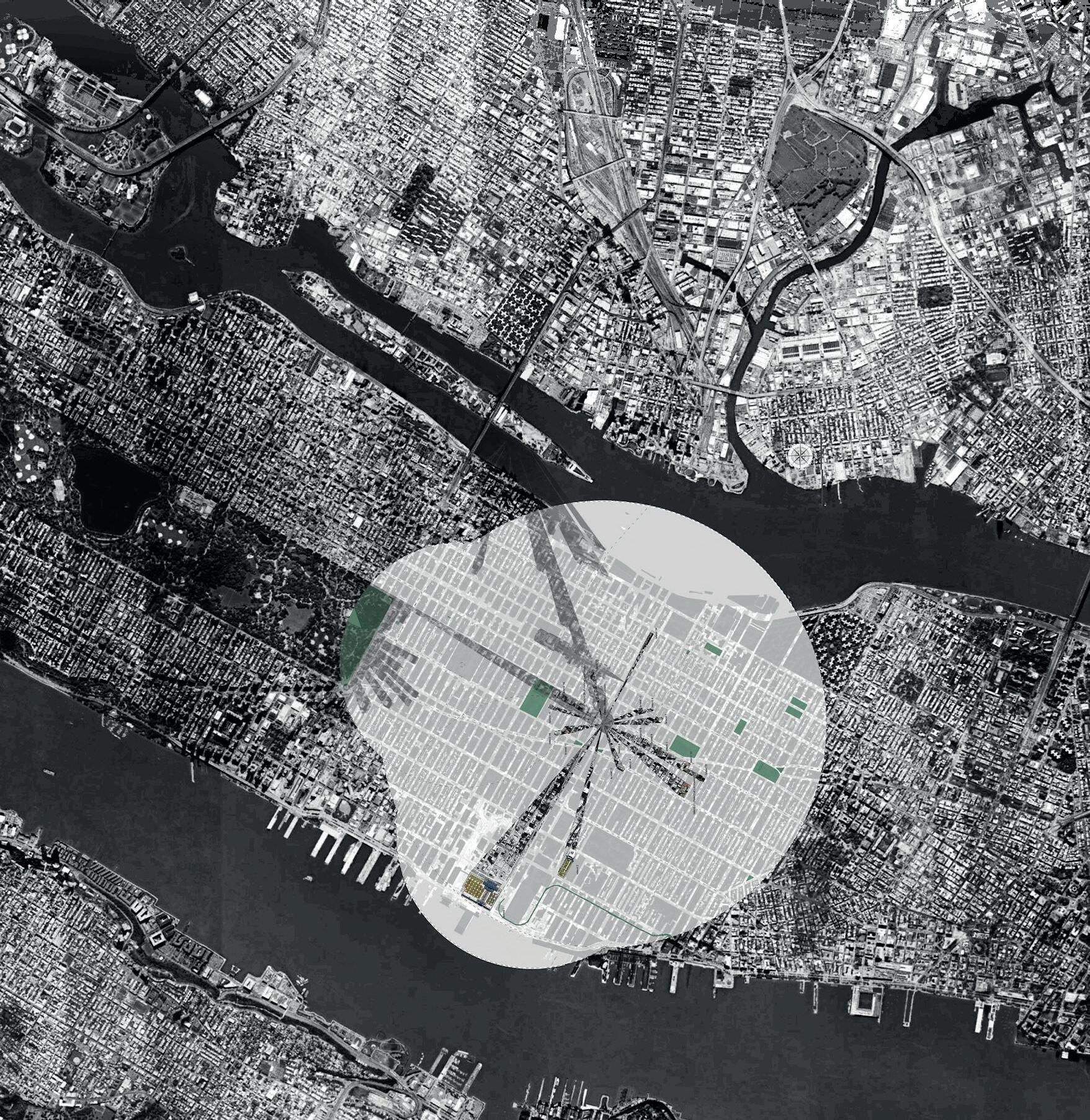
is investigation focuses on Manhattan’s southern tip, where Battery Park lies peculiarly isolated from the bustling inner city. e park’s edge becomes a laboratory to test di erent strategies and employ new tactics aiming to create a ood resilient and exible o -shore city landscape. e project also speculates on the future of this edge as a dynamic space during a period of ten years. e landscape’s temporalities eventually help de ne what is to be treasured and what is to be rejected.
e project aims to explore these matters of concern through a new aqueous scapeland, which o ers a glimpse into how a series of islands informed by speci c programs – reed and kelp production and oyster farming – could contribute to and shape the future of the waterfront edge. ese multidimensional landscapes combine functional, productive and social elements. e proposal is also framed by environmental research focusing on ooding issues and an increasing dialogue between humans and water.
e project aims to demonstrate that Landscape Architecture is not simply the process of designing surface treatments, spatial forms and objects, but increasingly, a process of creating a diverse and resilient mosaic of complex landscapes that may represent more accurately some of Manhattan’s regional ecological context. ese landscapes may hold design clues to better handle eventual environmental disturbances.
2 | Gate (ii) Scapeland Field: Aqueous Battery 3 | Dyvnamic Landscapes / Island of Kelp 4 | Dynamic Landscapes / Island of Oysters
| Dynamic Landscapes / Island of Reeds
ARCHIMERA
ISLAND OF ENTROPIC FLUSH
NORMAN VILLEROUX
e Island of Entropic Flux is the spectral manifestation of Manhattan’s Meatpacking District, acting as a shadowy doppelganger embedded in a process of degradation, decomposition, and erosion, eventually evaporating into a lump of nothingness.
Speculation: A wall is built around Manhattan to prevent rising sea levels from overtaking the totality of the built territory. e sea-wall passes through the island and triggers a set of interconnected spatial narratives which eventually sculpt the adjacent areas into speculative urban landscapes. Part of the island is almost entirely ooded. Here, oysters, algae, and excluded human communities live in symbiosis in a ooded urban landscape. Other parts of the island become worlds of eroding cultural icons and bastions of popular culture – the Whitney museum, the Google Headquarters, and the High Line. A second set of inner walls protects the appearance of these icons. e saturated use of these walls for protection eventually become also urban instruments of segregation.
e Island of Entropic Flux can therefore be understood as a landscape clock that reveals speci c moments of entropy – a tree that grows and dies, walls that break and fall, or water that freezes and evaporates – promoted or di used by microarchitectures which act as thresholds of dissolution.
ARCHIMERA
ISLAND OF NOMADIC BUILDINGS
ANTONIO WONG
Madison Square Garden exempli es the dynamism and exibility of architectural spaces and functions in Manhattan. e indoor arena has shed its architectural skin three times since its conception, reincarnating each time in a new site with a new form. Form literally follows function as the phantasmagorical arena travels across Manhattan.
e Island of Nomadic Buildings situates itself near the current Madison Square Garden which rests atop an equally active and tumultuous Pennsylvania Station. e already pending relocation of the Gardens and the predatory expansion of Pennsylvania Station into the adjacent James A. Farley Post O ce, facilitates the imagining of Manhattan’s urban strata as continually shifting tectonic plates.
Consequently, the thesis considers the urban constructive and destructive plate boundaries as potential moments for architectural propositions. In one such moment, a transit hotel in and around the Gardens is proposed. e hotel aims to accommodate the post-expansion in ux of people whilst positioning itself for a gradual takeover of the architectural skin that the Gardens will eventually shed. As the proposal embeds itself primarily in the tectonic boundaries between buildings, it latches itself onto a series of public and private niches. e resulting bridging architecture punctures, encapsulates and extends spaces creating new public transitory spaces punctuated by moments of private ephemeral inhabitation.
1 | Site plan showing architectural components binding Madison Square Gardens and West 31st Street.
2
Arcade Offices view onto the public Ante-arena space.
Interior view of Skybridge walkway showing atmospheric quality of glass bricks.
World Trade Center
October 2018 | Jessica Thomson
THE FIELD A MEAL FOR CHUCK
AUDREY CHAN, ALAN COX, HAILEY OLIVER & MARK WATERS
The cultivation and harvesting of grain from Agnes Denes’ Wheatfeld showcases a primitive, and largely absent use of land in contemporary Manhattan, it’s central location exhibiting the fundamental nature of food to the heart of the city. An exploration of lost cuisines, inspired from a menu once served at Delmonico’s, will be concentrated at various signifcant moments across Manhattan. The curation and provision of food sculpts the requirements and form for the necessary constructions in the city, locked in where now ‘ghosted’ buildings, or agricultural centric edge conditions once existed. The rekindling of bygone food craftsmanship is an art that can be enjoyed by Chuck, a character whose adventure through the subway system was documented in Jason Rosette’s short flm, Chuck. This introduces a narrative whereby meals from Delmonico’s set course menu will be recreated and fed to Chuck as he journeys across the city, receiving a different course at each location. The placement of these key moments is inspired from the drawings produced from the plane table, whose adjustable historic objects and time scales can manipulate and distort projections of Manhattan, allowing calibration and rescaling of multiple locations and moments of interest.
GEM IN THE MUDDIED WATERS
AUDREY CHAN
Beneath common depictions of New York’s city scape lies a lesser known yet fascinating past of Manhattan. e island’s edges used to be surrounded by marsh ats rich in ecological complexity, that were later overlaid with extensive new land ll areas, built on top of garbage and other materials excavated across the island to insert the foundations of the new buildings. Discovering the former ‘Abattoir Row’ during the early stages of group investigation, this lock-like prototypical landscape is a conceptual reactivation of Agnes Dene’s ‘Wheat eld - A Confrontation’, an art piece from the 1980s. e project experiments with the re-excavation of the dirt, compost, and lthy matters from Manhattan’s surface to expose the now contaminated marshy ground underneath. e new excavated landscape oscillates between the daily remediation of pollutants and the annual breeding of one lamb. Eventually, it provides a locally sourced and harvested roasted lamb rack with salt and local herbs, which contributes to a luxuriant private dinner across Manhattan, inspired by a famous meal served at Del Monaco, this time reinterpreted for Chuck. is new fertile landscape is only possible through the introduction of bone meal and bloodmeal inspired by the gruesome history of the former site of slaughterhouses, where thousands of cattle and sheep were slaughtered to feed the increasing human population of New York.
ELEMENTAL THE LOWER MANHATTAN WEATHERSCAPE
ALAN COX
e weather in Manhattan is extreme. Seasonal highs and lows are punctuated by meteorological events, storm and ood. Entropy, the constant hum of change, surrounds the towers and tenements of Gotham, an unconquerable force at odds with the con dence of real estate and vertical ascendency.
Elemental: the Lower Manhattan Weatherscape inhabits this contradiction. Drawing out speculative scenarios, weatherscapes of human and non-human atmospheres: ood and re, storm and snow, the thesis enacts a form of meteorological mapping, compartmentalizing the elements in a graphic enquiry at once fantastical and rigorous. e result, a cloud of fragments, possible future weathers that hover, latent with potential above the Battery, the neighbourhood most vulnerable to the weather.
rough an architectural enquiry founded on the interplay of engineered lines and cast vessels, a language rst sampled in the tenement Lock, a micro-distillery cast down into the subway and tethered to the metallic net of the re escape and hydrant, the Weatherscape proposes a new gate to the city. Emerging from the Hugh L Carey Tunnel from Brooklyn the Weatherscape, a scapeland of engineered ood management, market, car park and tethered dwelling clouds suggests a resilient, animate architectural landscape at odds with the brittle, monumental and ultimately vulnerable terrain of the modern Battery.
2 | Sections through the fire and fish markets respectively, showing moving modules, arms and tenements.
3 | Isometrics of all market modules, food, fire and fish, highlighting underground, water and land connections.
4 | The scapeland and neighbourhood that encompass the markets at the tip of lower Manhattan.
5 | Inside the fish market, a cluster suspended fish tanks, stalls and dining quarters.
| Inside the food market, baskets of steam-fed wheat fields spilling with produce.
HEDONISTIC WETSCAPE
A SACRIFICIAL LANDSCAPE GIVEN OVER TO WATER
HAILEY OLIVER & MARK WATERS
Hedonistic Wetscape is a sacrifcial landscape given over to water, an urban proposal for the Civic Centre neighbourhood of Lower Manhattan and the myriad scenarios of future fooding that will inevitably disrupt and displace the civilian life of the city.
The Plane Table, a device for survey and record, acts out a sequence of alternative fooding scenarios in the area of Collect Pond, the original watering-hole of the city. Hedonistic Wetscape hoards and re-appropriates these imagined food waters in the Civic Centre through a series of architectures that embrace and house the deluge in a response at odds with the conventions of dam, repel and redistribute that defne the logic of the present day city. In the Wetscape, the existing civic programmes of the neighbourhood are partially decanted into new, monumental and water resilient architectures, evoking and extrapolating upon the strangeness of a civic landscape that is both monumental and frequently empty. Meanwhile, the newly liberated spaces of City Hall and the New York Supreme Court are given over to programmes of leisure, reverie and a recalibrated watery democracy.
The Hedonistic Wetscape allows the city to continue functioning through a fooding disaster and in doing so it exposes a tension between the civilian and the ‘power’ of the Civic Centre neighbourhood. Here, unseen activities become visible - a necessary reminder to the powers that be of the nature of responsibility to the city and its civilians.
| Hedonistic Wetscape: Portion of Scapeland Drawing 2 | (overleaf) Field Investigations
HEDONISTIC WETSCAPE
HAILEY OLIVER
SCAPELAND THE BATHS
The Baths are located within the New York Supreme Court, one of a sequence of monumental institutional architectures that govern the city from the precincts of the old Collect Pond in Lower Manhattan. Given over to wetness, the Baths – as part of the greater landscape of the Wetscape - comprise a reservoir that collects excess water from the site of Foley Square, a water fltration system that channels the accumulated water for treatment prior to its use in the sequence of programmes that comprise the Baths and, a micro-hydro installation for blackout energy provision during extreme weather events.
The immediate landscape of the Baths is traversed by elevated marble walkways that offer views down to the granite plinth of the old Court House and the carved pools of the bathing chambers beneath. Each pool is lined with an inner skin of concrete, its thickness fnely calibrated to the demands of temperature change in the carefully choreographed sequence of bathing. On the southern façade a shading architecture, a brise soleil of sorts, houses the water administration of Lower Manhattan, the Scapeland of reservoirs and pools.
The programmes of the Supreme Court are recalibrated and resituated within the adjacent reservoir as part of the wall of the micro-hydro that derives its power from the vertical drop of the reservoir wall building. Here, the spaces of the Supreme Court have water both above and below, the accumulation basin above and the receiving reservoir below. As a component of the Wetscape the Baths reservoir acts as a new shore line, in the cooler months the water will frieze whilst in the summer, it will evaporate, revealing a new surface, a new ground for the city.
The visual presence of water and its changing levels across the Scapeland acts as a constant reminder to everyone that the climate is changing.
2
3
4
5
| The Baths: Water Administration Brise Soleil Model
| The Baths: Water Administration Brise Soleil Section
| Exhibition Photo of Plane Table and Models
| Exhibition Photo of Model: The Baths: Water Administration
HEDONISTIC WETSCAPE
SCAPELAND
THE PROTEST
City Hall is a microcosm of the American political landscape. It portrays itself as an open inclusive environment when in fact, the building is fenced off and offers no interaction with the street at a human scale. Decanting and reinterpreting the primary functions of City Hall allowed the architecture to begin to offer an alternative platform for political debate within the city through the provision of space to dwell, act, crowd and, as appropriate, protest. The landscape of the city and the immediate neighbourhood of Collect Pond and City Hall is a constant reminder of the dangers of climate change. As waters rise and storms increase the Wetscape manifests as both a mechanism of water management and a tool for political expression.
The marble base of the carved and calibrated landscape rises to meet the pre-existing topography of the site, acting as a constant gauge to register the implications of the weather in Manhattan. Above this, concrete rises to act as a series of walkways connecting the buildings, enclosures and terraces of the proposal. As the water level rises, different routes are cut off to the public as the overfow reservoirs are brought into play. Three architectural fgures foreground the urgency of climate change in their registration of the presence of water and its changing levels: the Debating Chamber that hovers above water, its Tower, calibrated to the height of the old Latting Observatory, the original lookout for the city, and the Nileometer that registers the lapping water at its base. Whilst the roof offers a view to the civic landscape below, creating tangible connections between the decisions made in offce and their consequences for the city.
MARK WATERS
Exhibition photo of model: The Protest: Debating Chamber and Tower
A Line
2018 | Katie Hackett
China Town October 2018 | Hailey Oliver
ACKNOWLEDGEMENTS
Tutors | Adrian Hawker
Victoria Clare Bernie
Tiago Torres Campos
Visitors | Stan Allen
Mark Dorrian
Technicians | Malcolm Cruickshank
Catriona Gilbert
Giulia Gentili
Rachel Collie
Julia Barbour
Michael Kay Terence
Special thanks | Ella Chmielewska
Catalogue designed and edited by | Kate Le Masurier, Eireann Iannetta-Mackay
Sub-edited by | Katie Hackett, Benjamin Hair, Rosemary Milne
The format of the catalogue has been developed and extended from the catalogue series for the ESALA MArch studios 2017-18, designed by Emma Bennett and Rachel Braude
Printed by | J Thomson Colour Printers Ltd., Glasgow
Cover Image | Photographs by Eireann Iannetta-Mackay & Hailey Oliver
Edited by Eireann Iannetta-Mackay & Rosemary Milne
BIBLIOGRAPHY
Brevda, William. “How do I get to Broadway? Reading Dos Passos’s Manhattan Transfer Sign.” Texas Studies in LiteratureandLanguage, Vol 38, No1. Representative Paradoxes (Spring 1996) 79-114.
Cadwell, Michael. StrangeDetails. Cambridge Mass.: MIT Press, 2007. Chuck. 16mm. Directed by Jason Rosette. 1987
Cohen, Paul E. Manhattan in Maps: 1527-1995. New York: Rizzoli, 1997.
Corner, James. “The Agency of Mappings.” In Mappings. Edited by Denis E. Cosgrove. London: Reaktion Books, 1999. 231-252.
Dorrian, Mark & Adrian Hawker. “The tortoise, the scorpion and the horse - partial notes on architectural research/teaching/practise.” The Journal of Architecture, Vol.08(2). 181-190.
Dos Passos, John. Manhattan Transfer. London: Penguin 20th Century Classics, 2000.
Dripps, Robin. “Groundwork.” In Site Matters: Design Concepts, Histories, and Strategies. Edited by Carol Burns & Andrea Kahn. London: Routledge, 2005. 59-91.
Empire. Slow Motion Footage. Directed by Andy Warhol. Warhol Films. 1964.
Frampton, Kenneth. “Maison du Verre.” Perspecta Vol 12 (1969). 77-128. Hellinger, Mark. TheNakedCity. Directed by Jules Dassin. New York: Universal Pictures, 1948. Holloway, Marguerite. TheMeasureofManhattan:theTumultuousCareerandSurprisingLegacyofJohn Randel,Jr.,Cartographer,Surveyor,Inventor. New York: W. W. Norton Company, 2013.
Jacobs, Jane. The Death and Life of Great American Cities. New York: Random House, 1961. Koolhaas, Rem. Delirious New York. New York: Monacelli Press, 1994. Lyotard, Jean-François. “Scapeland.” In TheLyotardReader. Edited by Andrew Benjamin. Oxford: Blackwell, 1989. 212-219.
Manhatta. 35mm Film. Directed by Paul Strand and Charles Sheeler. 1921. Manhattan. Directed by Woody Allen. United Artists. 1979. Mistaken Memories of Mediaeval Manhattan. Vertical Format. Directed by Brian Eno. Opal Records. 1981. NewYorkCity1911. Directed by Svenska Biografteatern. 1911. NewYorkSubway. Directed by G.W. Bitzer. 1905. NorthbyNorthWest. Directed by Alfred Hitchcock. Metro-Goldwyn-Mayer. 1959. Rear Window. Directed by Alfred Hitchcock. Paramount Pictures. 1954.
Sanderson, Eric W. Mannahatta,anaturalhistoryofNewYorkCity. New York: Henry N. Abrams, 2013.
Sennett, Richard. “Arousing Tools.” In The Craftsman. New Haven: Yale University Press, 2008. 194-213. Treib, Marc. “Inflected Landscapes.” Places 1 (2), 66-77.
IMAGE CREDITS
Inside Front Cover | Midtown, October 2018, Eireann Iannetta-Mackay
P 3 | Wall St, October 2018, Katie Hackett
P 6 | Bleecker & Lafayette, October 2018, Norman Villeroux
Fig. 1 | TheCityofNewYorkaslaidoutbytheCommissionerswiththesurroundingcountry,1821 John Randel Jr. Library of Congress. Last accessed May 12, 2019. https://www.loc.gov/ item/2006629796/
Fig. 2 | The Devices of John Randel Jr, Ibid.
Fig. 3 | Jacopo de Marinoni, Giovanni. “The Plane Table in use.” DeriIchnographica. Viennae Austriae: Prostat apud Leopoldum Kaliwoda, 1751.
Fig. 4 | BritishHeadquartersMap, 1782. Stevens, Benjamin Franklin. Hidden Hydrology. Last accessed May 12, 2019. http://www.hiddenhydrology.org/nyc-post-postscript-maps/