ESALA 2022
Master of Architecture
island territories vii:
ISLAND TEMPORALITIES
 Adrian Hawker
Victoria Clare Bernie
MONT-SAINT-MICHEL

This catalogue is part of a collection published by the Edinburgh School of Architecture and Landscape Architecture (ESALA), Edinburgh College of Art, University of Edinburgh. It documents student design work produced in the Master of Architecture (MArch) programme in 2021-22. Each catalogue describes one of the following five design studios in the MArch programme. The full collection is available to view online at issuu.com/eca.march.
Catalogues 2021-22:
Conversations Through Making [PLZEŇ]. Countryside [Inside] Architecture. Crossing Panamá.
island territories vii: Mont-St-Michel Island Temporalities. Soundings: Spaces/Architectures of [Re]assurance.
COVID-19
In September 2021, we welcomed a full return to campus following two years of remote and hybrid teaching imposed on us by the COVID-19 pandemic. The benefits of a return to faceto-face teaching were immediately apparent. The subtleties of communication, an ease of humour and gesture often lost through the digital interface, were restored to us. The process of remembering how to work together and embrace the social and academic benefits of a shared studio space and workshop, perhaps understandably, was rather more gradual. By the second semester however, we found ourselves once again able to witness the natural exchange of ideas, the discussion of thesis projects, the conviviality of practice at work well beyond the formal timetable. Studios in Minto House and 7-8 Chambers Street were busy. We reclaimed the culture of material research and creativity for which the ESALA studios are famous. The work presented through these catalogues serve to register a particular creative transition from the isolated meditations of digital space to the visceral world of the physical, the precision of the former learning perhaps for the first time to fully embrace the distractions of the latter.
First published in 2022, eBook published in 2024. Published by The University of Edinburgh, under the Creative Commons Attribution Non-Commercial Non-Derivative 4.0 International License (CC BY-NC-ND 4.0).
Hawker, Adrian and Victoria Clare Bernie. island territories vii: Mont-St-MichelIslandTemporalities. Edinburgh: University of Edinburgh, 2022.
Text © Authors, 2022.
Images © Authors and Contributors, 2022.
island territories vii: Mont-St-Michel Island Temporalities. ISBN (eBook): 978-1-912669-92-9
ESALA 2022
Master of Architecture
island territories vii:
ISLAND TEMPORALITIES
Adrian Hawker
Victoria Clare Bernie
MONT-SAINT-MICHEL
- ISLAND TEMPORALITIES MONT-SAINT-MICHEL ADRIAN HAWKER + VICTORIA CLARE BERNIE 1 CONTENTS 01 DRAFTING & RE-DRAFTING AMY DRABBLE JONATHAN PILOSOF 03 04 05 06 07 08 09 10 THE ISLE OF SOUNDS AND SWEET AIRS TOM SLATER THE APPLE BRANDY LANDSCAPE CECILIA SUN YUWEI WANG 02 11 THE FLOODING OF YS, IN DANCE THEO GLENCROSS ATTRAPER AU TERRE–CATCHING AGROUND LEWIS EVANS THEODORE SHACK DETRITUS TOBY ECCLESTON HIDING-SONGS AUGUSTUS WRAY GARDENS OF THE BAY GILES DAVIS GEORGIA WHITEHEAD A GARDEN FOR AN ANCHORITE STUART GOMES TOM CARNEY THE PILGRIM’S INN NATHALIE HARRIS ORATORY OF THE SALT MARSH ÁINE LYNCH JOEL PACINI 20 32 38 42 50 58 62 68 76 86 92 ACKNOWLEDGEMENTS 188191 BIBLIOGRAPHY & IMAGE REFERENCES
CHARLIE DONALDSON
DANIEL CUTLER
UNIVERSITY
ALASTAIR SINCLAIR
JAGODA BORKOWSKA
LUCREZIA HU
FORBIDDEN STORIES
MARTY SCHRODER
THE WING & THE FURROW
SHAUN THOMAS
THE BOATHOUSE OF THE POLDERS MORRIS CHAN
THE PERFUME GARDEN TIANSHI WANG
THE
QIANRU
ZEYU LIU
FRAYING
THE WATER CEMETERY OLUWASEYI SALAKO 12 15 16 17 18 19 14 a b c 13
OF DEPOLDERISATION
AGRI/AQUA-CULTURAL GUILD
SANATORIUM LA MANCHE
LI
YUNNING ZHANG
THE SEA DYKE JIAMIN ZHONG XINGYU LU
POTAGER OF THE KOIMETERION HANNAH DAVIS
THE
THE GARDEN AND THE GATE
OF
THE LITTORAL
100 110 126 128 134 142 146 150 156 172 182


Bay of Mont-Saint-Michel. marine chart, 1836
ISLAND TEMPORALITIES mont-saint-michel
PILGRIMAGE
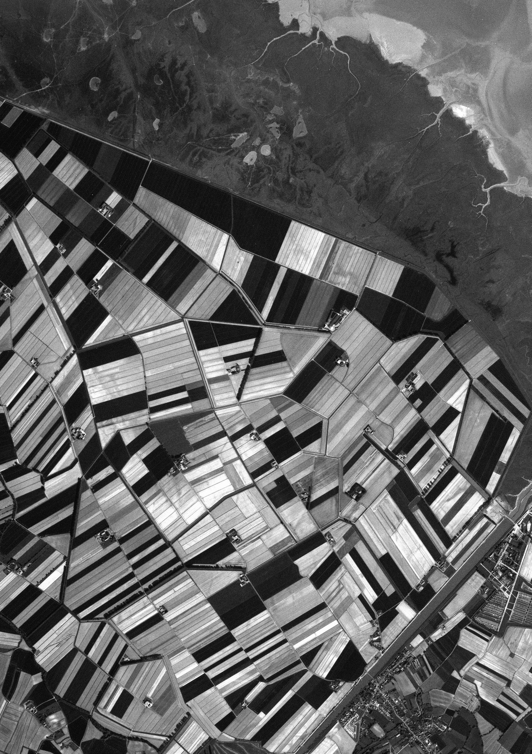
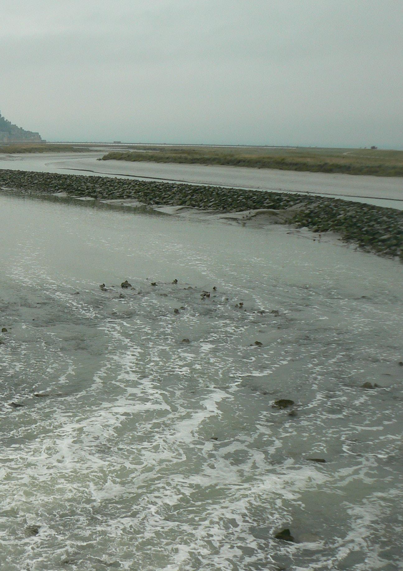
It seemed somehow appropriate to be standing late afternoon on the 20th of October 2021 knee-deep in cold water, bare feet tugged by clay and soft sand, with the flow of the rivers La Sée and Sélune washing against our legs as they rushed out towards the incoming tide. A storm was forecast and the sky was darkening beyond the almost hallucinatory silhouette of the island abbey of Mont-Saint-Michel. Our local guide, Amélie, read the eddies and swirls of water, the tone and texture of the sand with knowledge acquired through a life lived in the bay, directing us around currents too strong to enter and away from the clawing reach of quicksand. We were two kilometres out, midpoint between the island abbey and its smaller sister, the granite outcrop of Tombelaine, a stepping stone along the original pilgrimage route across the bay from Normandy. Our path that day was once the most efficient line across the sands for pilgrims and travellers. With the expansion of the polder landscape in the 19th century, the original coastline, a granite cliff topped with chestnut forests, moved inland and the route to Mont-Saint-Michel from the south became a matter of 1km on the sure, dry ground of causeway then bridge.
Originating in the 8th century, the polders had taken the same fertile silt we were now feeling beneath our feet, desalinating it with rainfall to form some of the richest agricultural land in northern France. From our vantage point we could see, on the horizon, a line of poplar trees planted to reinforce the outer dyke which held the seawaters back from this artificial land and island territories vii:
1
ADRIAN HAWKER + VICTORIA CLARE BERNIE
 Plan of the island abbey. Emile Sagot, 1850.
along which a littoral landscape, a fringe of salt marsh meadows, had long since taken hold. Against the mass of Mont-Saint-Michel, this horizon appeared both thin and fragile, barely tethered in place as if to emphasise the threat this marginal land now faces from the rising sea.
Appropriate, because many of us had been imagining this place for over a year from the confines of a pandemic enforced isolation. With images of the Mont-Saint-Michel always in our peripheral vision, we had been developing architectures formed from the representational archives of other strange islands – gifts to be offered to the island abbey.1 Other students who had joined us more recently, shared our hope that we just might be able to travel, engaging once again in unfamiliar worlds. There was something of the pilgrimage in our journeying. Some students could not join us, held back by the bureaucracy of travel. Back in the studio, they continued to imagine this place through a digital archive of maps, plans and photographs harvested from the French national collections. Most importantly, the exquisite 19th century survey drawings of Edouard Corroyer. Corroyer’s remarkable suite of plans and sections, elevations and details foreshadowed our visit, providing the underlay for the work of the coming year. His north elevation, the 12th century Merville filled our vision as we waded south and it was clear why earlier pilgrims had dubbed this wall of finely carved granite, quarried from the archipelago of the outlying Illes Chaussey, the ‘Marvel.’
Sheltered from the secular activities of the walled town that had gathered beneath the southern face and threshold to the abbey, the Merville formed the monastery of St Michael, a buttressed northern wall which braced and enabled the vertiginous height of the abbey itself. Severe limitations of space had required the organisational hierarchy of the monastery to break with the horizontal norm of a plan clustered around a central cloister. Instead, it was arranged in section with a stacking of the Chaplaincy, the Host’s room and the Refectory to the east and the Wine Cellar, the Knights room and Scriptorium to the west. The Scriptorium was capped by a cloister so that at the highest point of occupation, sheltered by the syncopated quincunx rhythm of thin English limestone columns, we find a well-tended garden. Three arches break the enclosure of the cloister arcade. Originally intended
1 See 2020-21 islandterritoriesvii:IslandTemporalitiesVol.1of2 https://issuu.com/eca.march/docs/2020-21_island_territories
3 ADRIAN HAWKER + VICTORIA CLARE BERNIE | MONT-SAINT-MICHEL
to form access to a further unbuilt wing, the Chapter House, they now frame the great expanse of the tidal mudflats, the fluid fringe of the salt marsh and the contrasting angular geometry of polders beyond. From this elevated garden, the wealth of the landscape is surveyed, bearing witness to the harvest of mussels and tidal oysters, a bounty that once served Versailles; the coveted agneau de pré-salé, the rare breed lamb that graze the salt marsh; and the rich agricultural bounty of the fertile polder fields.
The relationship between this aerial, architectural garden and the greater environment and ecology of the Bay of Mont-Saint-Michel mirrored a strategy with which we began to explore and engage with this particular island territory. Through the identification of similarly compressed and strategically positioned moments within the abbey island – from the outer defences, up the tight network of steeply raking streets and terraced gardens, through the barbican and into the labyrinthine network of the abbey itself – we developed discrete, embedded interventions that considered the wider conditions and implications of the temporal landscape beyond. Enjoying the limitations imposed by the fine grain of this miniature island city, we conceived architectures which were modest in size but highly detailed, bespoke to their immediate context and the needs of an inhabitant who, like us, was cast onto the island from elsewhere. To this, we brought sensitivities carried forward from our earlier island studies or through a selected tectonic artefact from home. In this way, a form of metonymic vessel was offered to the island. We referred to the resultant building as a House of Estrangement, an architecture of the familiar recalibrated to the unfamiliar.
SHIPWRECKING
Shipwreck and its narrative associations of the unfamiliar made familiar choreographed our journey into the fabric and landscape of Mont-SaintMichel. Shipwreck is a transitional process, an act of arrival, orientation and inhabitation. We choose it because it brought with it a visceral, spatial way of thinking about a new place. Through a process of dismantling, recalibrating, housing and securing, it offered an appropriately architectural, material and tectonic inroad into an unfamiliar context at once strange and rich.
Fictional island narratives play with the idea of the shipwreck, the trope
of a safe and familiar order dashed upon an unfamiliar landscape. The familiar is disassembled, reimagined and repurposed into either a memory of a lost order left behind or retooled to form a new device with which to navigate the unknown present, making a new place in a new world. In William Shakespeare’s The Tempest (1610-11), for Prospero the scholar, it is his books, cunningly secreted by his loyal manservant Gonzalo, that restore a kind of order to his world. They enable him to master the sorcery with which he enslaves Caliban, his monstrous opposite and greatest adversary, and establish his authority within his new domain.
In Robinson Crusoe (1719), Daniel Dafoe’s hero is marooned on an island with the wreck of his ship caught on a reef in one of its bays. The ship is not safe, it is unstable and will eventually be washed away. For the first two weeks on the island, Crusoe rows back and forth between wreck and shore. The ship has become a quarry from which he must gather all the tools, materials, seeds and munitions he needs for the fabrication of a shelter, the cultivation of land, and for hunting and defending his new territory. It is not until he has repurposed one of the ship’s doors as a table that he feels he has established order. The table seems to act like a metonymic device, an object that stands for something much greater than itself – the ‘civilisation’ from which he has become estranged. Upon its surface, the god-fearing Crusoe can re-enact past etiquette, eat in a ‘civilised’ manner and lay out his plans to remake the island in the image of the world he has left behind.
In a brilliant retelling of this story by Michel Tournier entitled ‘Friday, or, The Other Island’ (1967), we can read how Crusoe, alone and against all the odds, nearly succeeds in establishing the hoped-for facsimile. His project falters only when he meets Friday, another castaway from a closer land, who teaches him that there are, after all, better alternatives to his much lauded civilisation. In a further reworking of the story, Concrete Island (1974), J.G. Ballard’s Crusoe equivalent, Robert Maitland, a 20th-century architect, crashes from a raised motorway complex onto a traffic island below. The island is fecund, overgrown with waste and debris from the world above. His whole but fractured car is the marooned vessel from which he seeks to establish order, eventually coming to think of the island as his true home.
In contrast to Crusoe’s almost bureaucratic obsession with the practicalities and discipline of survival, Jean Giraudoux’s young, female protagonist in
5 ADRIAN HAWKER + VICTORIA CLARE BERNIE | MONT-SAINT-MICHEL
 La Merveille. north elevation, Édouard Corroyer, 1875

7
Suzanne and the Pacific (1923) narrates her five years of isolation in the South Pacific through an inner monologue comprising the wonders she observes, her contemplative reflections and curious dreams. Rather than imposing a rehearsed physical order on to the landscape of the island, she discovers a strange and marvellous mirroring of things past and familiar in her lone imaginings.
For Roberto della Griva, the 17th century Italian nobleman in Umberto Eco’s novel, The Island of the Day Before (1994), the physical colonisation of the island is a seeming impossibility, separated as he is, by strong tidal currents, sharp coral reefs and a confusion over the consequence of crossing the international dateline. He is shipwrecked not onto the island itself but rather, onto another ship caught intact but seemingly abandoned on the reefs that encircle the island beyond. For him, the new ‘empty’ ship is the true landscape and site of his estrangement. It is both familiar and unfamiliar. Spaces to which, in his own vessel, he would not normally be granted access are now laid open to him. Marvellous rooms of manuscripts, maps, strange botanical specimens and extraordinary and bizarre scientific instruments. Already set in play is the now familiar narrative device in which the marooned character is constantly measuring, and thereby trying to make sense of, the new world, comparing what is with the recollections of what was in his previous life back across the vast expanse of sea.
Satire is also a form of measurement and dismantlement and it proliferates throughout the tradition of island novels. Lucian of Samosata’s outlandish ‘A True Story’ (2nd century) elevates a ship to the moon from which it eventually descends, via a flying island, to the sea, straight into the belly of a continent-sized whale replete with interior forests and the cultivated colonies of past shipwrecked sailors. In the fourth book of François Rabelais’ ‘The Life of Gargantua and Pantagruel’ (1552), a storm becomes a forensic dissection of a ship and its named components. In this, it is as much a reading of a state of mind as it is the analysis of a physical entity.
Jonathan Swift’s Gulliver (1726) is caught within an unfolding sequence of shipwrecks. The act of being shipwrecked, of being cast upon an island by a storm, forms a moment of transposition where, in each iteration, the natural order of things are themselves dismantled. He is either a miniature of his former self or a giant. All that is ground, familiar and weighty is found to be manipulated by the cerebral occupants of a smaller, airborne land. Finally,

Agri/Aqua-cultural Guild of Depolderisation Charlie Donaldson & Daniel Cutler 9
in his most mysterious, poetic and moving tale, mankind reveals itself to be subservient to the grace of horses.
SEEDING ISLANDS
In Act 1 Scene 2 of The Tempest, upon finding himself shipwrecked on the shores of a seemingly deserted island, Alonso, the King of Naples, is counselled by his surviving companions. His honest and trusted adviser, Gonzalo seeks to lift his spirits by celebrating the miracle of their survival and the beauty and bountiful nature of the island. The king’s brother Sebastian and Antonio the Duke of Milan tease the child-like optimism of the old man and suggest that he must have been the miracle worker that saved them. In so doing, they lay out a beautiful image:
ANTONIO
What impossible matter will he make easy next?
SEBASTIAN
I think he will carry this island home in his pocket and give it to his son for an apple.
ANTONIO
And sowing the kernels of it in the sea, bring forth more islands.
At a vital moment in the thesis enquiry, the allusion to Seeding Islands allowed us to cast off from the abbey island and into the surrounding environment through a process born out of the highly detailed and embedded kernels of the House of Estrangement. The landscape of the Bay of Mont-Saint-Michel - from the dense inner grain of the abbey through the waters, mudflats and salt marsh to the tapestry of polder fields beyond - was the particular territory into which these seeds were cast. Like the occupant of the house, this extended, fluid terrain had been in our thoughts from the start. Initiated in the Edinburgh studio and given form in that October walk as we returned from the estuary and entered the island city with clay still clinging to our legs. The landscape had already permeated the work in the character of a house as a strange, enceinte architectural seed.
This catalogue represents the consequence of this seeding process – a set of ambitious architectural projects that engage directly with issues pertaining to the temporality of the island landscape. They offer considered ecological strategies for measuring, sustaining or enabling the transformation of a penumbra of fragile environments around and within the island of MontSaint-Michel.
Some projects form architectures devoted to the survey and registration of change. They acknowledge that the shifting ecology of this bay - the silting of watercourses, the fraying of salt marshes and the breaching of sea dykes - is a consequence of climatic change operating at a global scale. Others seek to give contemporary relevance to monastic traditions and rituals of hospitality, retreat, contemplation, the recital of voice and the craft of the written word. Some engage with the ambition of land engineers to reimagine methods of agriculture and aquaculture through a process of managed depolderisation. In so doing, they choreograph an ingress of rising sea waters whilst assuring the maintenance of associated natural habitats and an active local economy based on cultivation. Others still, propose a direct engagement with the liminal zone of the vast tidal sands and mudflats themselves – literal and littoral islands of analytical gardens formed in the shadow of the abbey.
Each proposal carries with it the language of the Island Temporalities studio - vessels broken and remade, chimeric architectures and a drive to survey the field of influences that determine the present and possible future of a given landscape. Each attest to a group or individual agenda, a sensibility with regard to the concerns of climate, craft, materiality and the myriad histories that inhabit the landscapes of Mont-Saint-Michel.
11 ADRIAN HAWKER + VICTORIA CLARE BERNIE | MONT-SAINT-MICHEL
 Dismantling the abbey
Giles Davis


 Architectural seeds
Clockwise from upper left. Stuart Gomes, Charlie Donaldson, Marty Schroder, Tom Carney
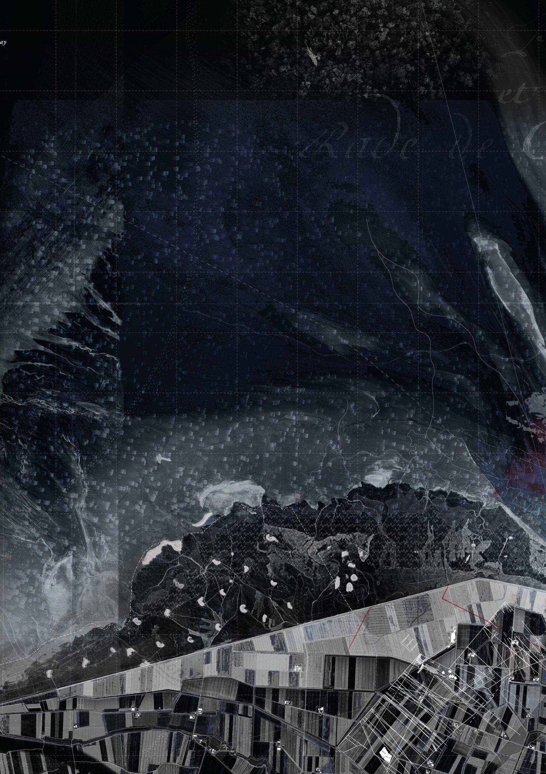
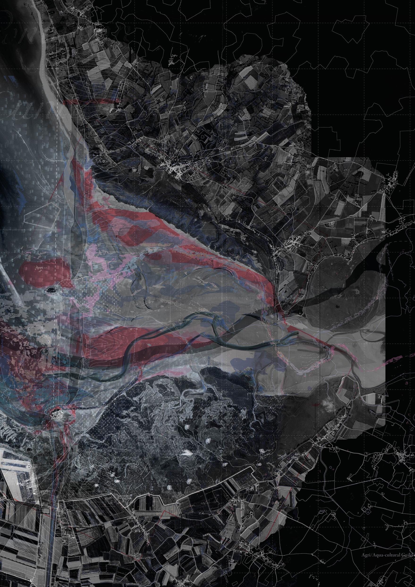 Field Drawing
17
Charlie Donaldson & Daniel Cutler

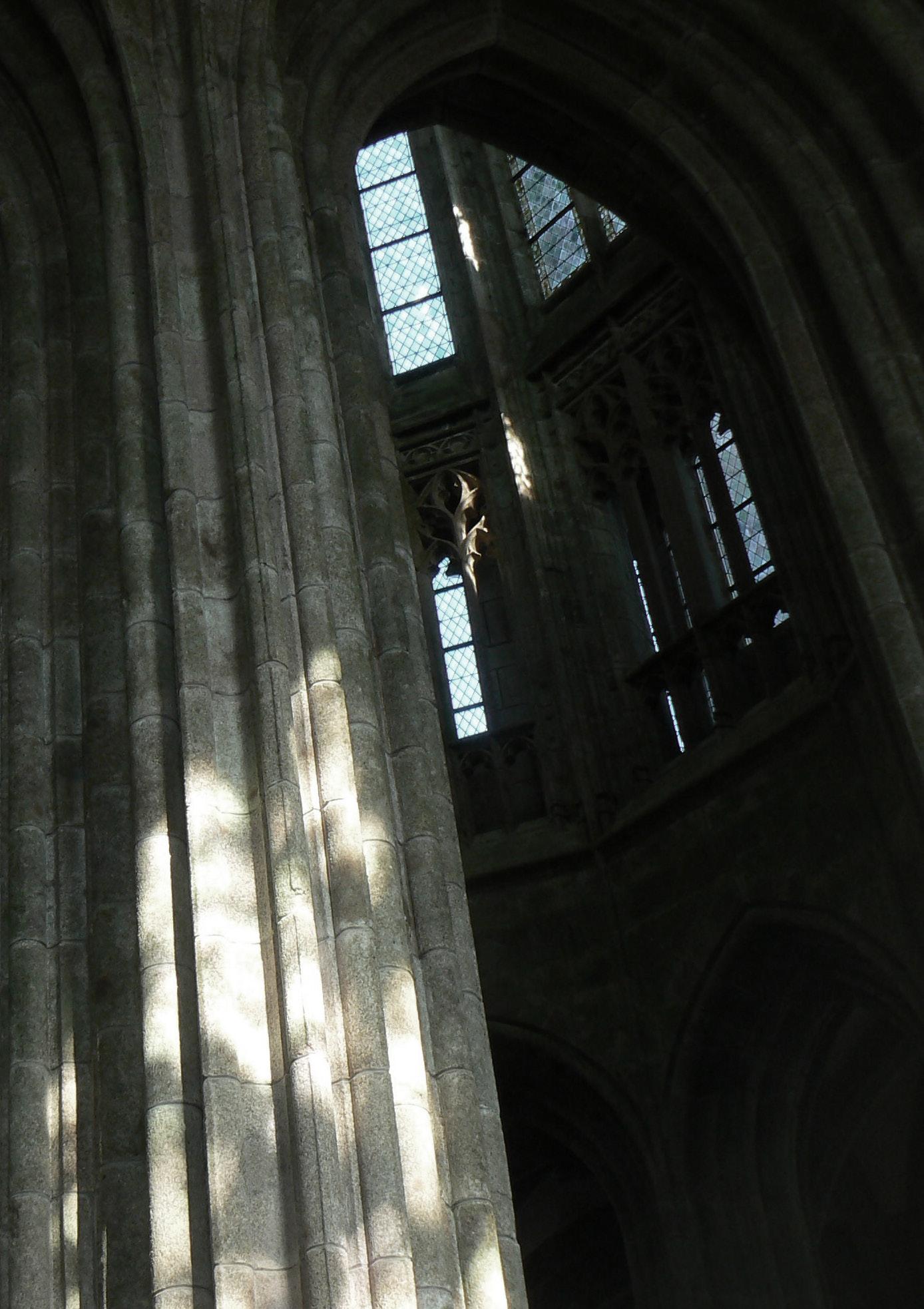
Site: Island Abbey of Mont-Saint-Michel.
Programme: Land Registry & Management, Archive, Cartographic Studio, Storehouse, Printhouse, Cistern.
01
DRAFTING & RE-DRAFTING
AMY DRABBLE JONATHAN PILOSOF
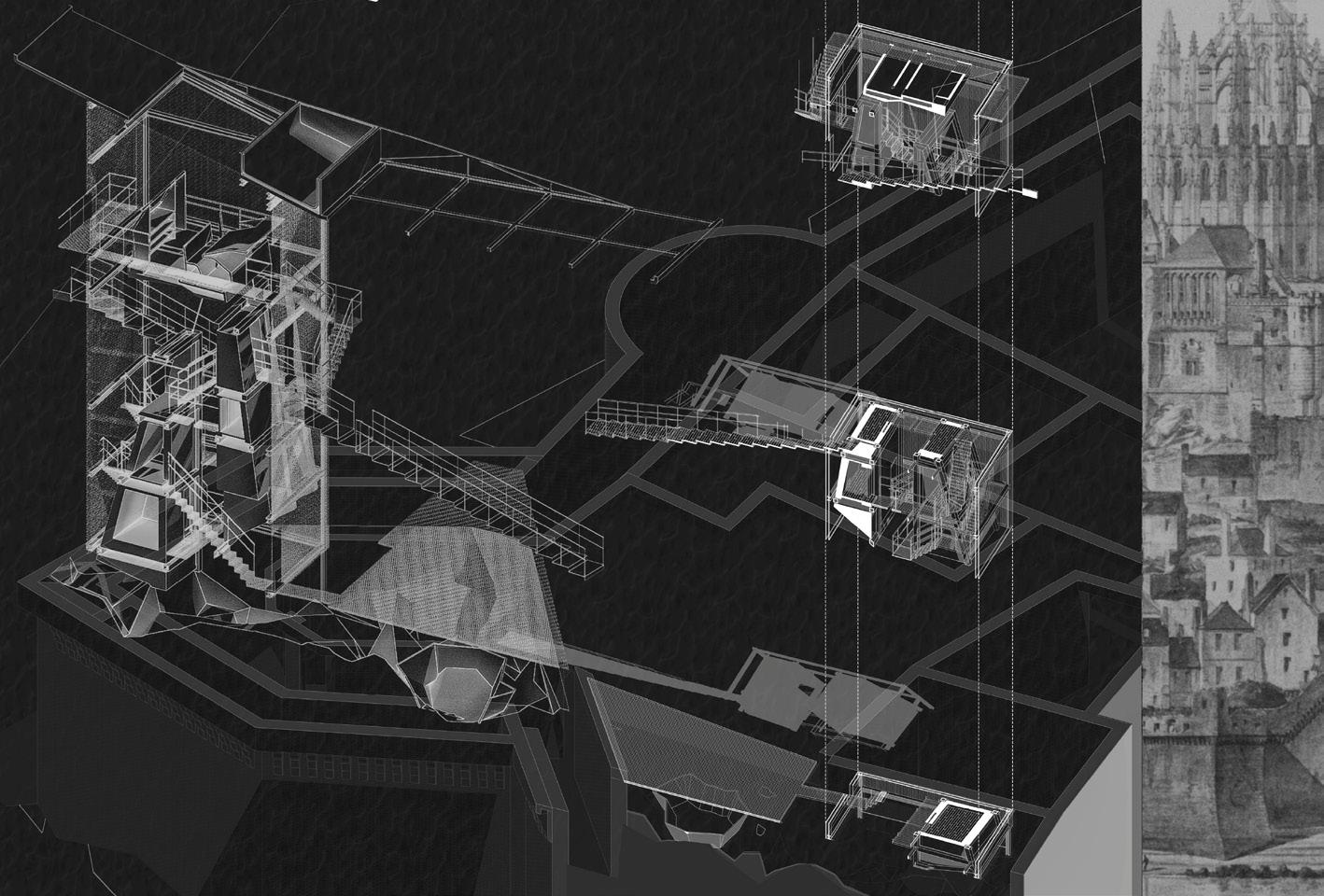
Encrusted beneath an architectural palimpsest, the Mount of Saint-Michel - on the coast of Normandy - offers a tablature on which to map. If cartography is to appraise, measure, and symbolise the landscape condition in order to navigate, The Institute poses architecture as a device for surveying and recording; folding the lines between the act of mapping and the map itself.
A community of architectures – the Opening Bell, the Stockist, the Broker, the Accountant, the Scribe, the Parchment-Maker, the Print-Maker, the Binder, the Archive and the Dam – chart a performance of landscape-measuring; recalibrating the Mount to form an architectonic institute to the practice of document-creation to the aim of managing the agronomy of nearby farmland.
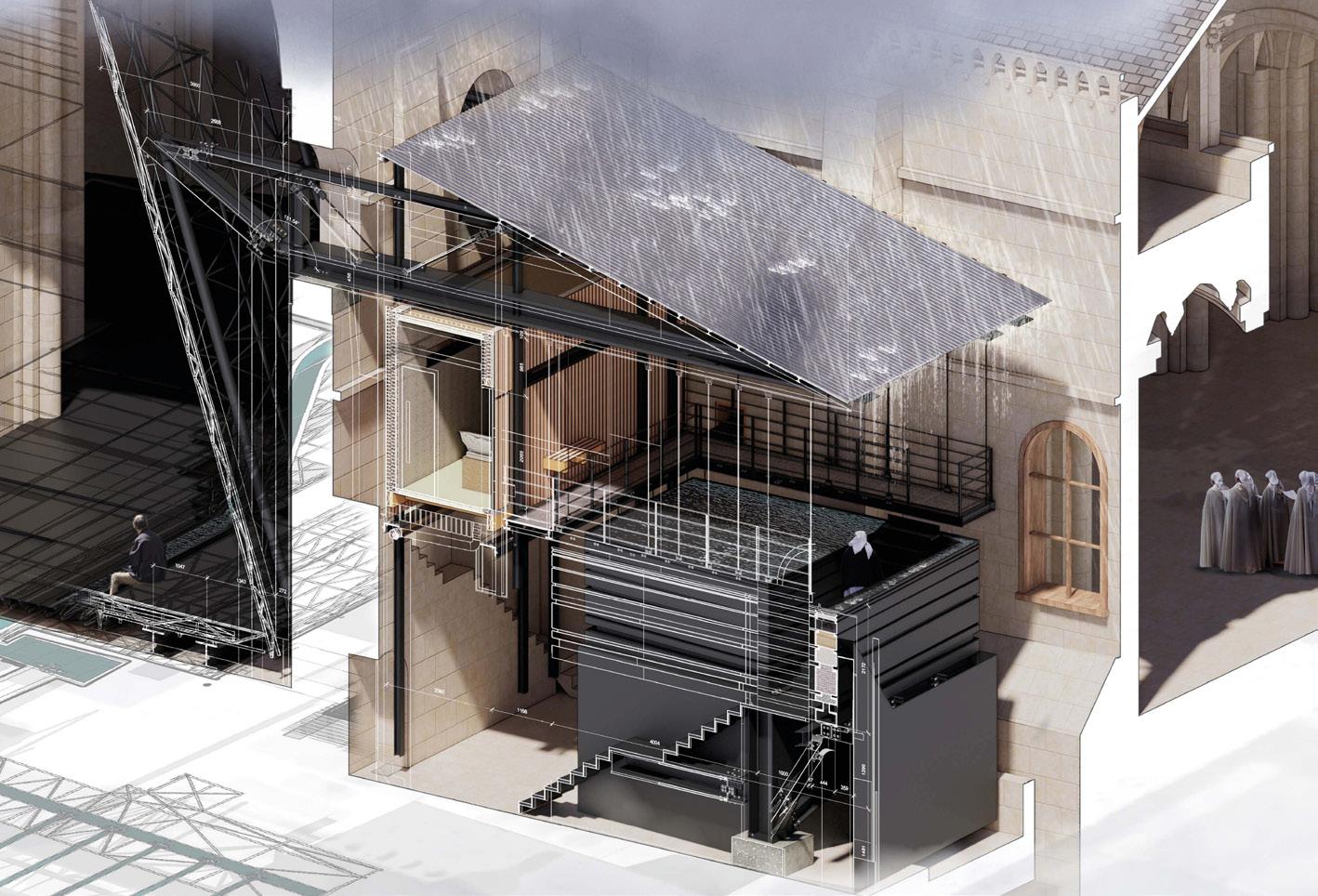
In the same way as the extant commune clings onto the granite island-outcrop, the Institute is composed of architectures - hanging, towering, floating and anchoring – that seek moorings within the thick walls of the Abbey. Anthracite steel keys into footholds - carved over centuries of built and destroyed sitesto suspend walls of finely milled oak that weather against the salt-air of the English Channel.
As the pilgrims illustrated the Mont in manuscripts and Edouard Corroyer painstakingly charted every stone in his drawings, The Institute recognises the Mont-Saint-Michel as an architectural Proteus: ebbing and flowing in density and reach, creating ever more footholds as it reaches to the heavens.

21


23


AMY DRABBLE & JONATHAN PILOSOF | DRAFTING & RE-DRAFTING
Preceding page. Field Table Amy Drabble & Jonathan Pilosof
Left. House of Estrangement Hélène Provost Archive Amy Drabble
25
Right. House of Estrangement Dam and Dais Jonathan Pilosof

 Upper left. The Insitute axonometric view
Lower left. The Institute section north-south
Right. Sectional Studies


AMY DRABBLE & JONATHAN PILOSOF | DRAFTING & RE-DRAFTING 27


29

Preceding page. Field Drawing
Above. Institute Cloister Stair perspectival view

AMY DRABBLE & JONATHAN PILOSOF | DRAFTING & RE-DRAFTING 31
Site: Island Abbey of Mont-Saint-Michel. Programme: Chapterhouse, Manuscript Archive & Restoration, Library.
THE FLOODING OF YS, IN DANCE
THEO GLENCROSS
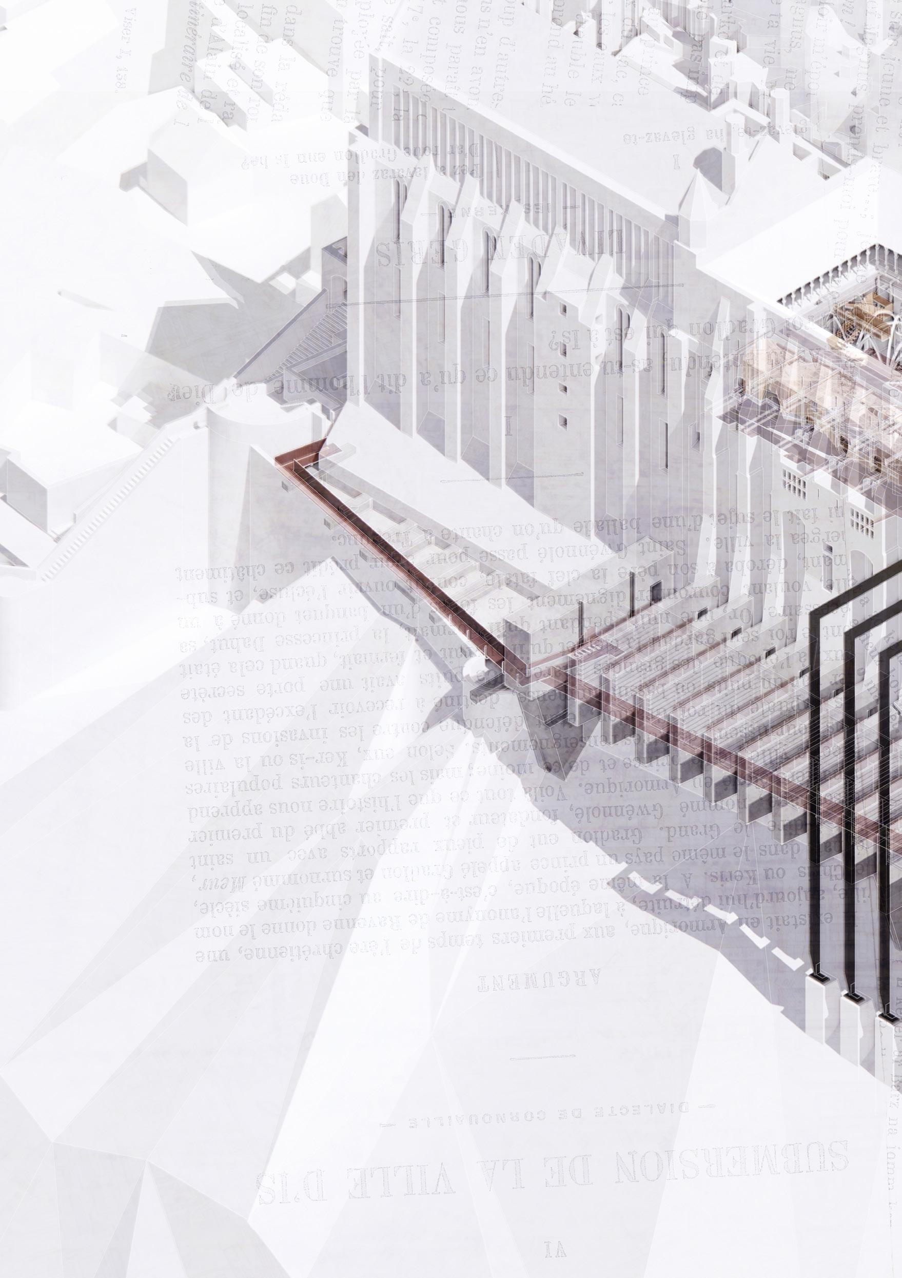
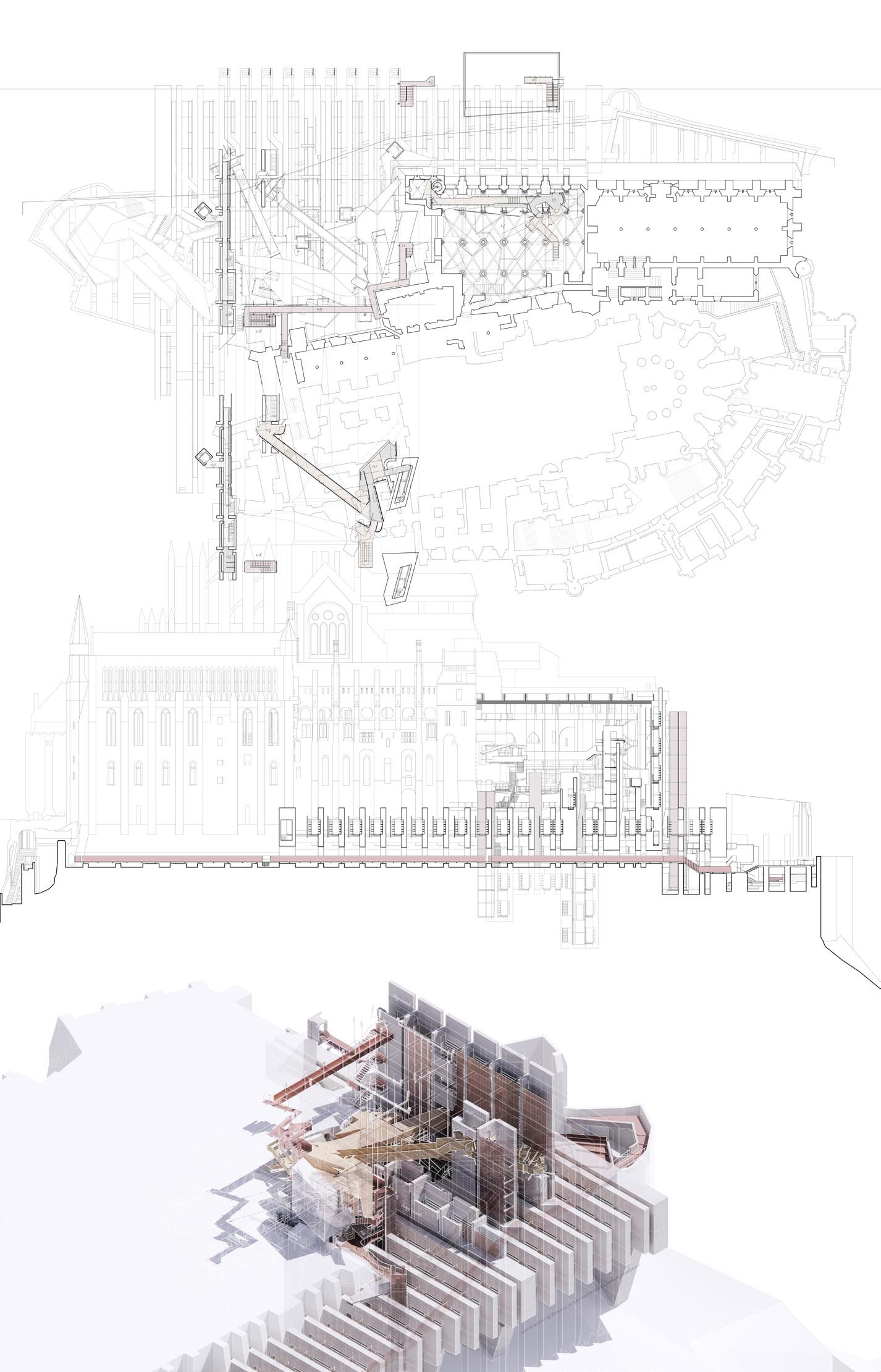
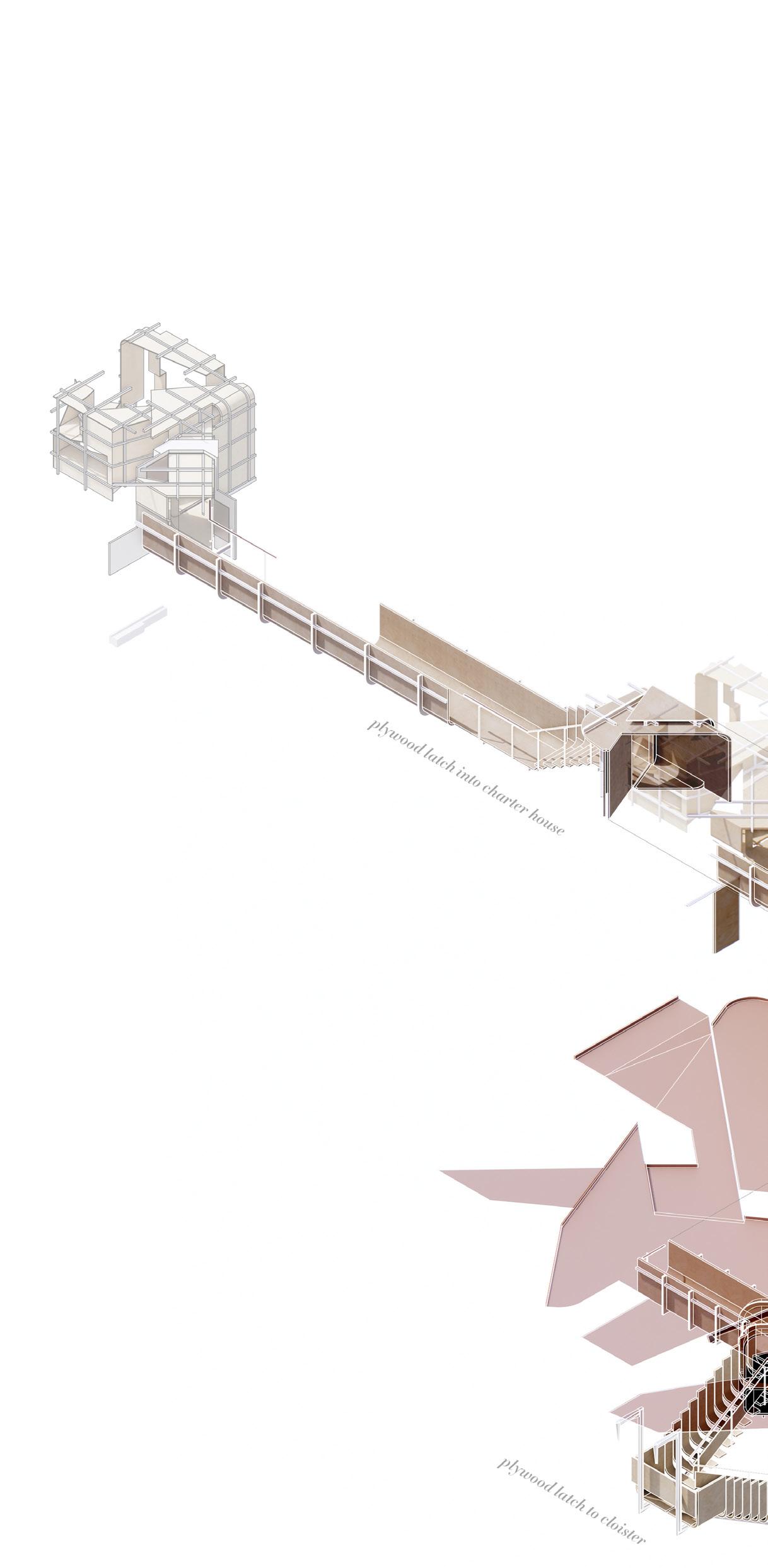
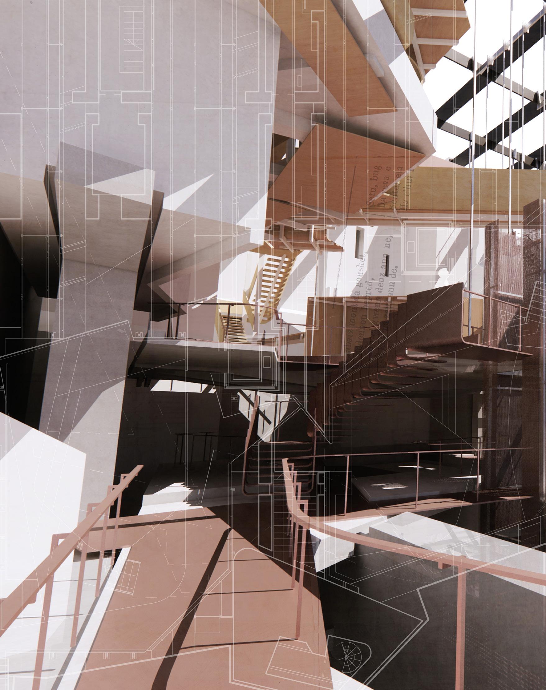
From her nest within the skin of the Charter House of Mont-Saint-Michel, Princess Dahut re-stages the mythical flooding of her city in dance - a winding tale of upended exploitation played out across seas, a travelling performance that mutates and reforms in frozen motion from stage to stage.
In the Palm Court of Edinburgh’s North British Hotel, we meet our architectural dancers performing displacement; ten skins assembled into a folded stage. Infiltrating the husk of the General Post Office, these ten dancers play out the ghost of Kinloch Castle, fusing in motion as four inhabited canopies suspended above a cascading ground carved into geological fog. In Mont-Saint-Michel, these four canopies themselves become dancers, negotiating the alien grain of the Abbey into which they are transposed. In accommodating their movements, the Merveille itself is at once disfigured and completed, surgical incisions and violent carvings made into the granite fabric to accommodate an unwieldy play of suspension and counterweighting.
In each performance, the dance carves and claims a strange new landscape as traced by the recording of its motion, becoming a colossal archive for the housing of displaced information – forgotten histories, exploited resources, dispossessed land – inhabited by spaces for the perusal, oration and performance of that which is archived within. Where the flooding of Ys was brought on by her stealing of a book, the flood-as-dance over which Princess Dahut presides facilitates an ironic, inversed theft, a counter-exploitation, in the reclamation and staging of the lost and dispossessed.
02

33

THEO GLENCROSS | THE FLOODING OF YS, IN DANCE
35
Left. Chapter House Archive and Library plan, section west-east and axonometric view Upper to lower right. Copper Walkway, Concourse and Chapter House Following page. Chapter House Copper Cloister

GLENCROSS | THE FLOODING OF YS, IN DANCE 37
THEO
Site: Island Abbey of Mont-Saint-Michel. Programme: Artists’ Residency, Performance Space, Dormitory, Washrooms.

THE ISLE OF SOUNDS AND SWEET AIRS
AN ARTISTS’ RESIDENCY FOR SELF-ENLIGHTENMENT
TOM SLATER
The Isle of Sounds and Sweet Airs is an architectural inhabitation of spaces within the abbey of Mont-Saint-Michel that history has rendered vacant, creating a residence for artists and an artists’ residency. Inspired by William Shakespeare’s The Tempest – a play of metamorphosis and self-enlightenment – this series of dwellings, pavilions and bridges facilitate and celebrate the voyage of discovery and pursuit of knowledge. Just as destiny brought the Milanese to Prospero’s Island, inquisition brings artists to the Isle of Sounds and Sweet Airs.
Nestled within existing ‘husks’, the proposal hyperbolises the architectural language of voids and bridges found within Mont-Saint-Michel, reconstructing found space and composing new walkways, canopies and pavilions to address and engage with the rich context of the island directly. The performativity of the architecture reverts the island once more to a place of ritual and myth, as well as referencing the theatricality of the source material from which it was derived. As the artists navigate their day-to-day tasks, visitors to the island catch glimpses of movement and flashes of architecture; an audience to the performance of discovery, isolated from the inner workings much as the island is isolated by the tides.
The Isle of Sounds and Sweet Airs imbeds itself within this historic island, reiterating its importance as a hub of artistic, architectural and divine inspiration. “Be not afeard. The isle is full of noises, sounds, and sweet airs, that give delight, and hurt not.”
03

39


TOM SLATER | THE ISLE OF SOUNDS AND SWEET AIRS
Left. Residency plan view
41
Right. House of Estrangement Oratory plan, axonometric and section views
Site: Island Abbey of Mont-Saint-Michel. Programme: Bathhouse, Water Purification, Cistern, Brandy Distillery, Public Walkway.

THE APPLE BRANDY LANDSCAPE
A JOURNEY ABOUT WATER
CECILIA SUN
YUWEI WANG
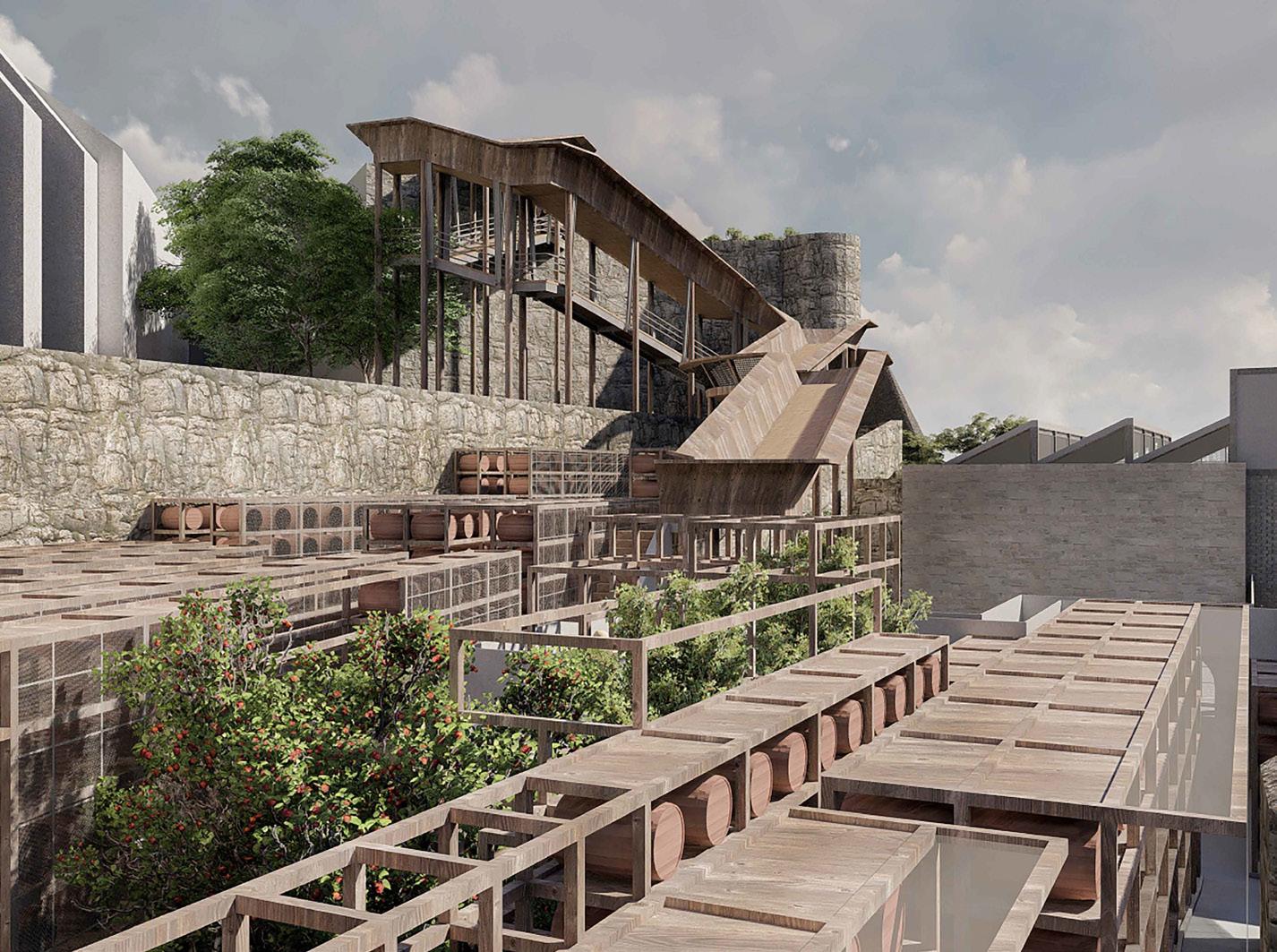
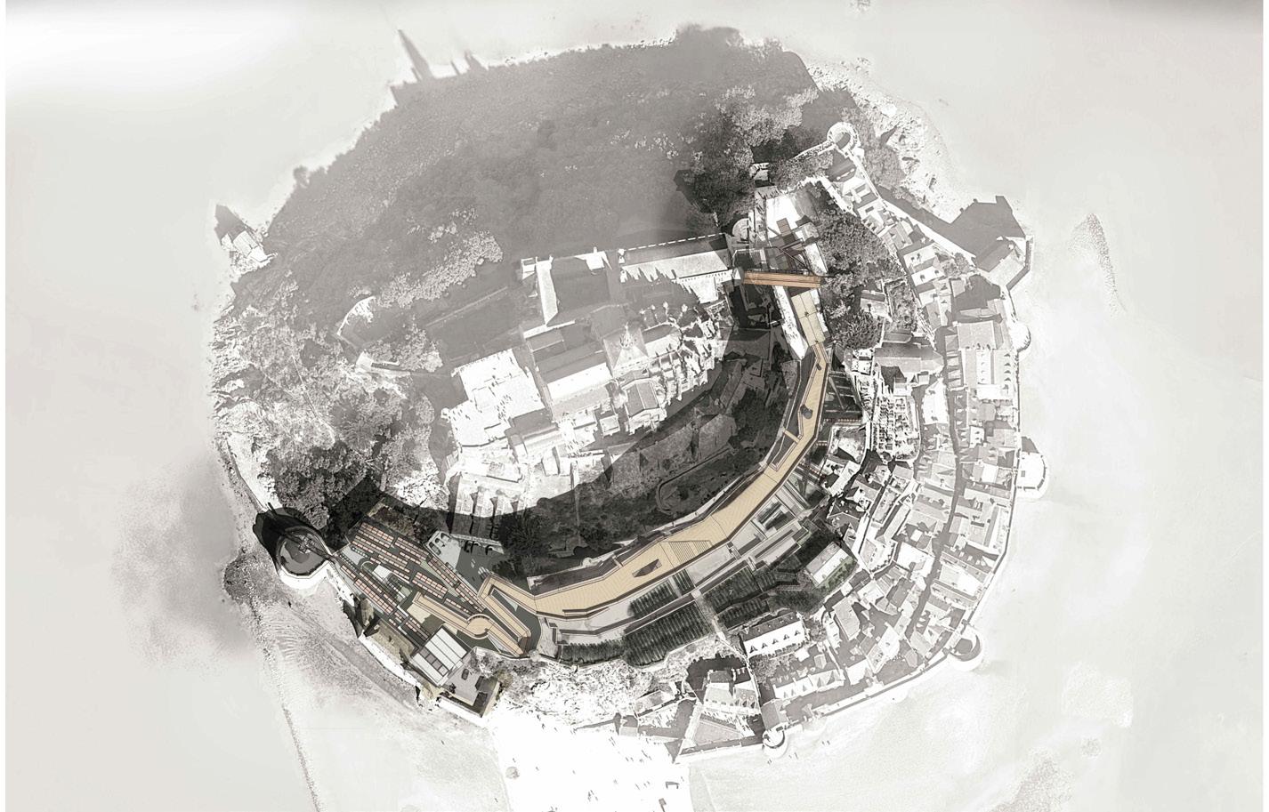
The Apple Brandy Landscape stands on the southern slopes of Mont-SaintMichel beneath medieval Abbey walls and amongst ancient terraced gardens. It comprises three programmes connected by water: an apple brandy distillery, a bathhouse refuge for pilgrimage and a rainwater collection system all tethered to a singular route from the Bay to the Abbey. From the entrance Gatehouse Bottling Plant the journey of production and pilgrimage moves past the Water Treatment Watchtower up through the Barrel Wall Forest to the elevated deck with inhabited wall and apple brandy distillery beneath. Apple orchards fill the ancient terraces to the south whilst water purification walls form an enclosed garden to the east meeting the Old School Reservoir and water collection roof before arriving at the Pilgrim Bathhouse and the Abbey beyond.
In the 21st century Mont-Saint-Michel is connected to the mainland for water and electricity. Natural springs and ancient water cisterns served the needs of earlier generations. Rainwater remains a key resource and the project foregrounds roofscape water collection, purification in charcoal walls, distribution through the brandy production process – washing, mashing, fermenting and distillingcleansing in the treatment tower and redistribution to the Bay.
An inhabited wall and elevated deck house programme and channel water, existing buildings – a watchtower and schoolhouse - are renovated and repurposed for production and hydrology. Rainwater water collected on roofs is transported into a water purification garden. Purified water is used in brandy production and orchard irrigation. Potable water is channeled for public consumption.
04

43


CECILIA SUN & YUWEI WANG | THE APPLE BRANDY LANDSCAPE
Upper to lower left. Distillery Mont-Saint-Michel south elevation, gatehouse bottling plant, distillery and deck, pligrim bathhouse and cistern
Upper right. Barrel forest view west to distillery deck
45
Lower right. Distillery aerial view
 Pilgrim Bathouse and Cistern aerial view

CECILIA SUN & YUWEI WANG | THE APPLE BRANDY LANDSCAPE 47


Site: Edge of Island Abbey of Mont-Saint-Michel. Programme: Botanical Garden, Research Laboratory, Bird Hide, Weather Station, Archive & Public Landscape.
ATTRAPER AU TERRE–CATCHING AGROUND
A BOTANICAL GARDEN AT THE ENTRANCE TO MONT-SAINT-MICHEL
LEWIS EVANS THEODORE SHACK
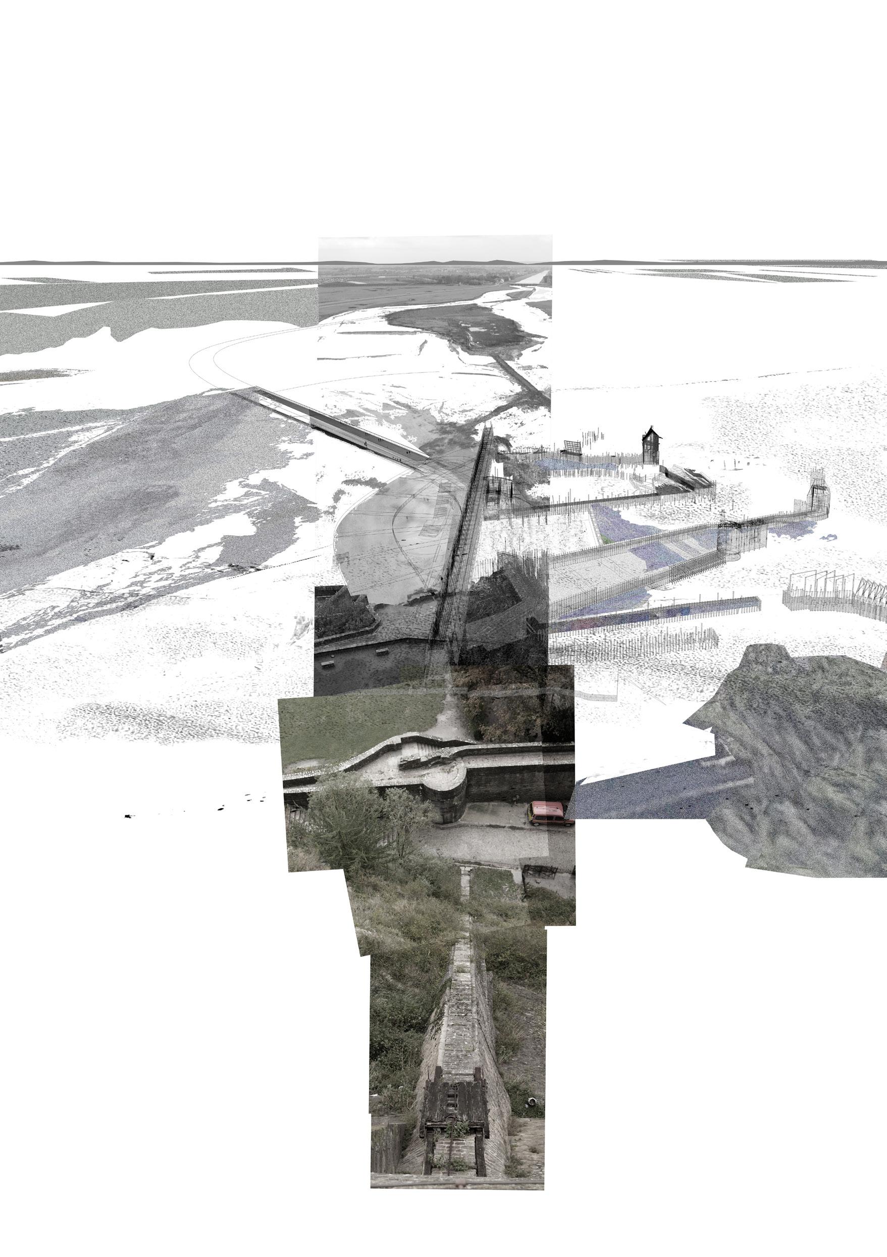
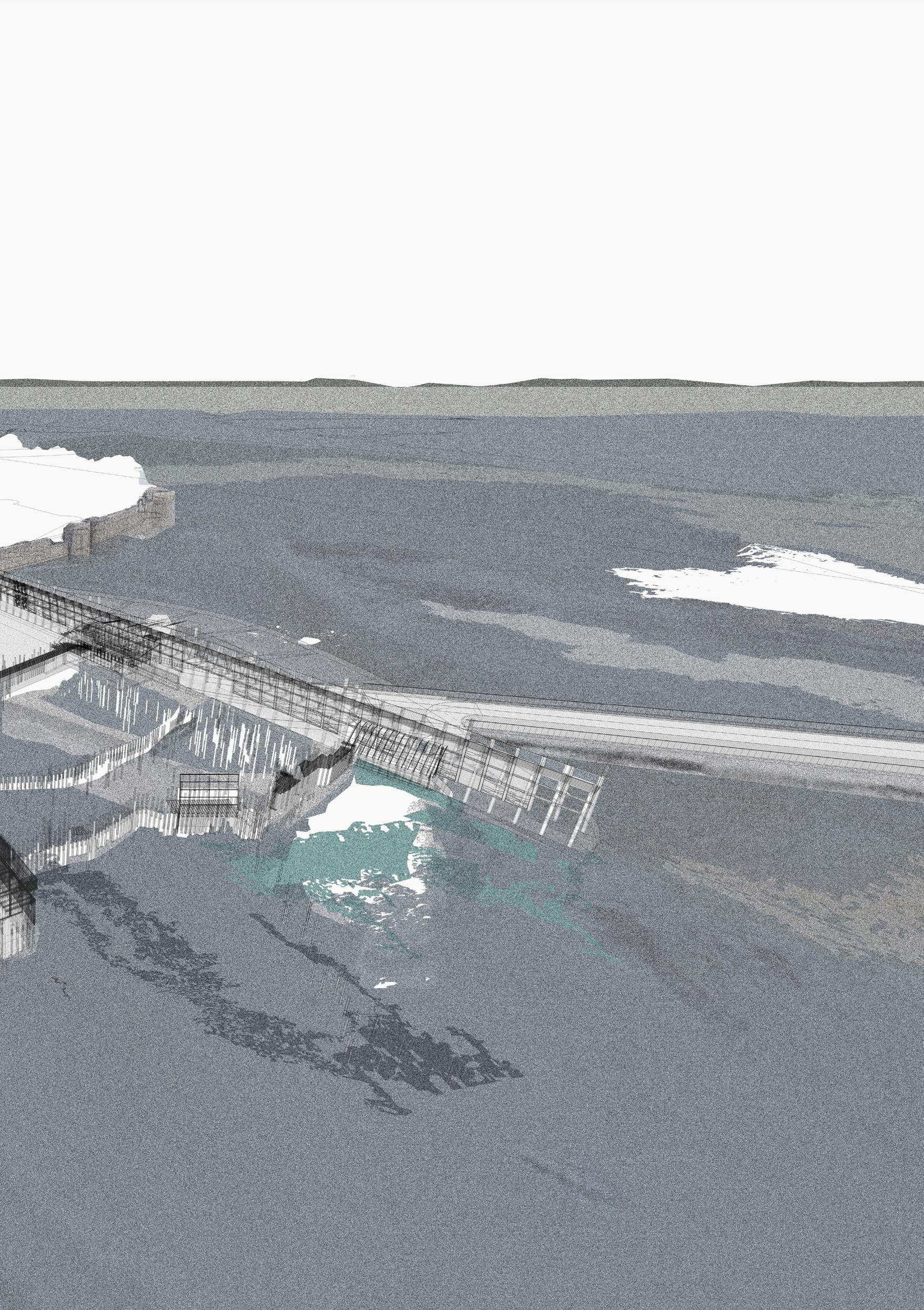
The Bay of Mont-Saint-Michel is a shifting ecotone sitting between land and sea; a far-reaching pan of sand and marshland that sinks and rises with a tidal variance of 14m.
The island-commune’s entrance is a concrete surface – an apron whose organic deposits, caught aground from the shifting tides, are brushed away at the start of each day. We propose that the apron be broken up, that these remnants be allowed to dwell, accumulate, and grow, changing the gateway to Mont-SaintMichel from a static to a dynamic landscape.
Our project suggests a Janus-like de-construction of the apron, one side is untouched other than pools cut in the concrete to wash muddy feet, on the other, the concrete rubble is quarried and fenced between trunks of felled poplar trees to form gabion groynes. Anchored to a timber walkway, these armatures sift organic deposits and silt from the bay and open the door to a landscape of collection – a microcosmic botanical garden of the non-human characters harbored in the bay. Placement of the armatures will shift over time in response to natural weathering and the changing requirements of the field stations that provide scientists’ residences. Parts constructed from granite will endure these sustained forces and may become ruins as the stations are disassembled and remounted elsewhere.
Following their studies, the scientists will leave behind an archive of their work, carrying the seeds of this extraordinary bay back to their lives elsewhere.
05
51


LEWIS EVANS & THEODORE SHACK | ATTRAPER AU TERRE–CATCHING AGROUND
Left. Botanical Garden plan view
Upper right. Meteoroligist Field Station
53
Lower right. Botanical Garden perspectival view to ornithologist and storytelling armatures
 Above. Botanical Garden perspectival view looking east Following page. Botanical Garden perspectival view looking northeast

55

LEWIS EVANS & THEODORE SHACK | ATTRAPER AU TERRE–CATCHING AGROUND 57
Site: Edge of Island Abbey of Mont-Saint-Michel. Programme: Marine Research Laboratory.
DETRITUS
ARCHITECTURE AS ENVIRONMENTAL INDICATOR
TOBY ECCLESTON
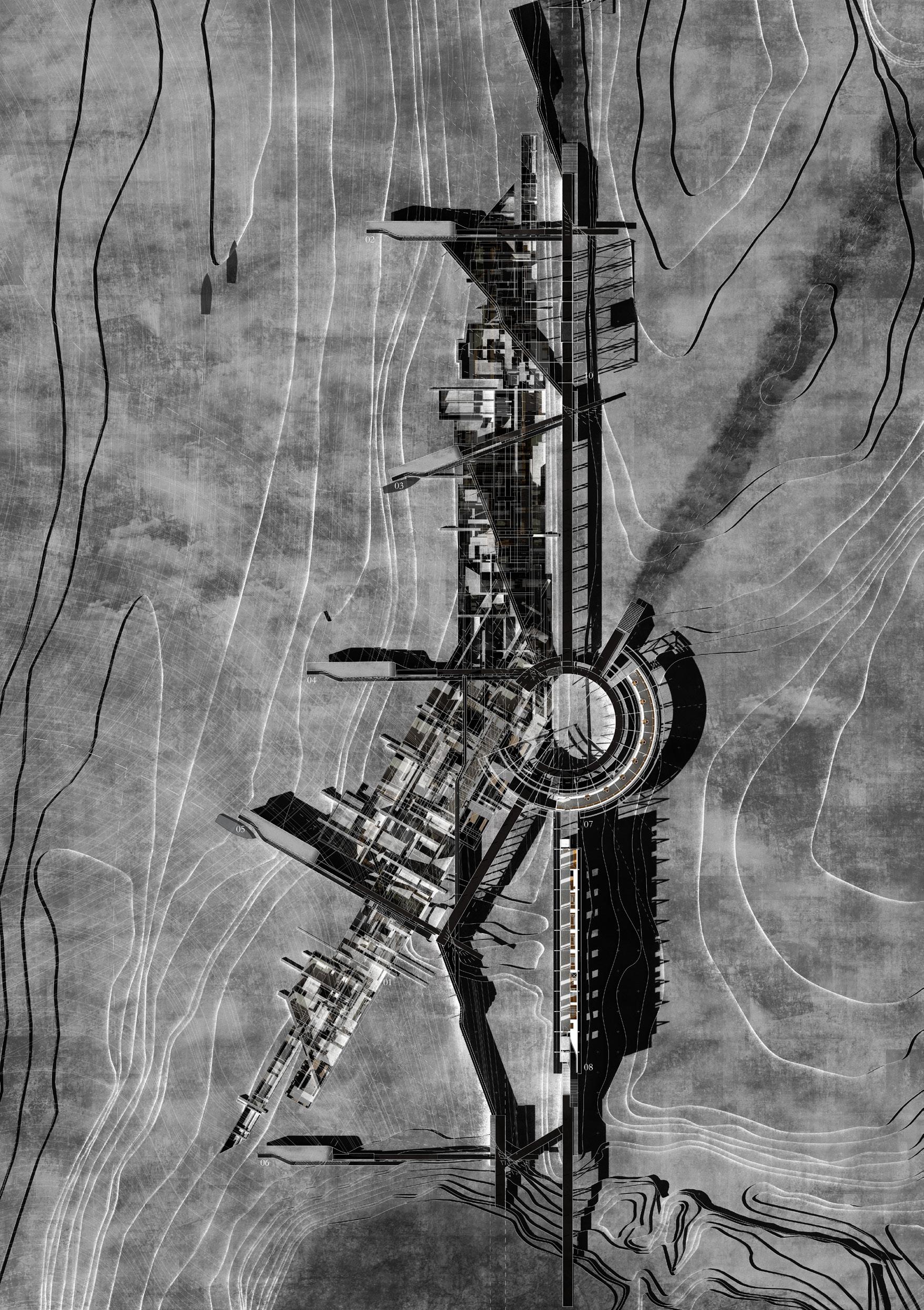
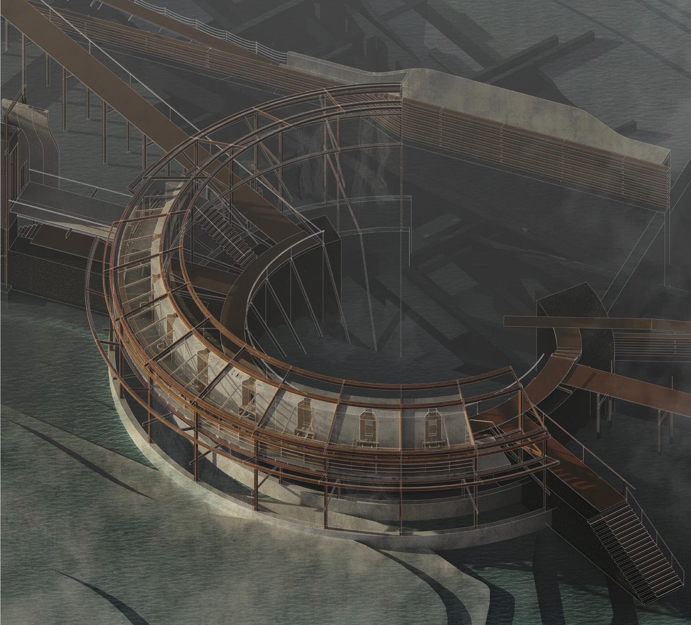
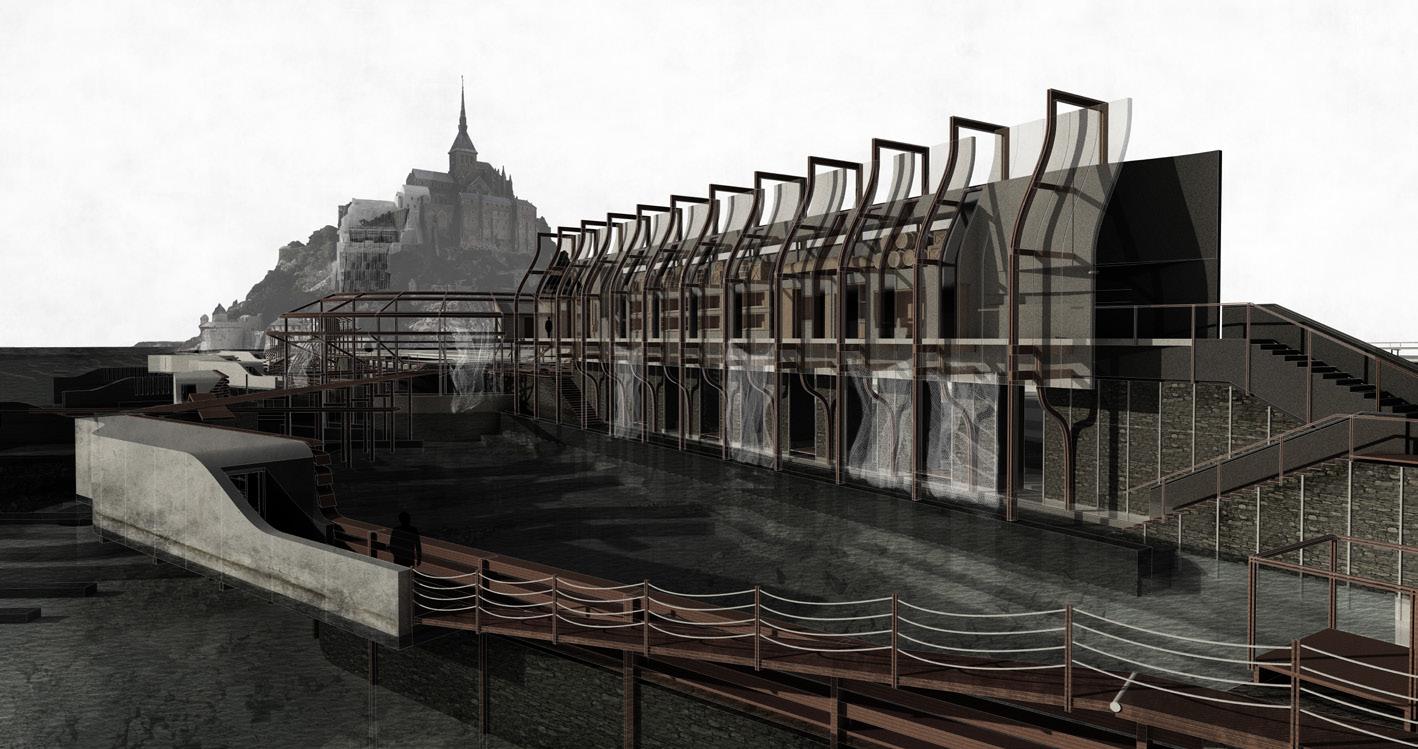
Detritus is an architecture of laboratories, study spaces, equipment stores, docks, bunkhouses and refuges. Animated by tide and current, it sits at the foot of the southern face of Mont-Saint-Michel. Periodically submerged in brackish water and silt, it is designed in response to the vibrant ecology of the bay of MontSaint-Michel, a biodiverse aquatic landscape in a condition of constant change. Detritus is designed for the study of silt, micro plastics, carcinology, reefs and agricultural run-off. Acknowledging the imminent threat of climate change the architecture strives to create an asset and an ally to the surrounding landscape, to explore a deeper understanding of the bay and address the challenges that face it.
With a tidal range of 15m, the waters around Mont-Saint-Michel present a unique littoral condition within which to invent a new architectural language. Five articulate ribs house laboratories, hinged armatures that sweep above a trench, a network of planes, filters and nets in which the detritus of the bay collects. Moving in relation to changing tides and the daily release of the Couesnon dam, the ribs collect, collate and examine the micro-landscape of the bay. Elevated above, a bunkhouse, library and a series of refuges offer the occupants retreat and rest at high tide. Taking inspiration from the material palette of the Abbey, a crafted interplay of granite walls lined with oak for comfort and clad with chestnut for protection from the rain and sea, Detritus creates optimum thermal conditions for dwelling and working in an extreme environment.
06

59
TOBY ECCLESTON | DETRITUS
Left. Marine Research Laboratory plan
Upper right. Library perspectival view
61
Lower right. Bunkhouse perspectival view north
Site: Edge of Island Abbey of Mont-Saint-Michel. Programme: Retreat, Hostel, Public Walkway.
AUGUSTUS WRAY HIDING-SONGS
LES NICHES PERDU
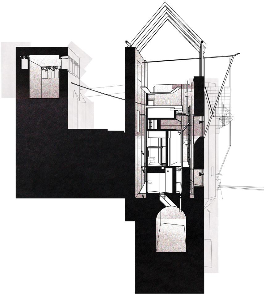
The Hiding-songs exist in the form of a series of refuges, interred along a new outer-wall on the north face of Mont-Saint-Michel – the hitherto uninhabited side of the island. The form of each refuge is cast from the grain of the island abbey and its surrounding settlement to form a mirrored perimeter set into the wooded slopes. Cast adrift from their anchor spaces and realigned with one another, each refuge carries a memory of their source and, in so doing, describe typologies of chapel, turret and wall.
Prior to the fabrication of the vast swathes of the southern polders, the crossing from the north coast via the sister island of Tombelaine was the preferred and most direct route to the abbey for the pilgrim. The refuges of the Hidingsongs anticipate a return to journeying from the northern sands of the tidal bay. Such a traveller would therefore encounter the refuges as a chain across the face of Mont-Saint-Michel, each bead speaking in a different spatial and material voice. Beams and posts stretch across from refuge to refuge. Although seemingly adrift, they are held together by the same requirements: a place to sleep, a place to eat, a place to wash, a place to contemplate and a place to warm by a central hearth. Each refuge enacts these requirements in its own way, with its own memory from its birthplace.
07

63

 Upper left. Refuge and Walkway plan
Lower left. House of Estrangement Camera Obsucra perspectival section
Upper and lower right. Tower Retreat axonometric
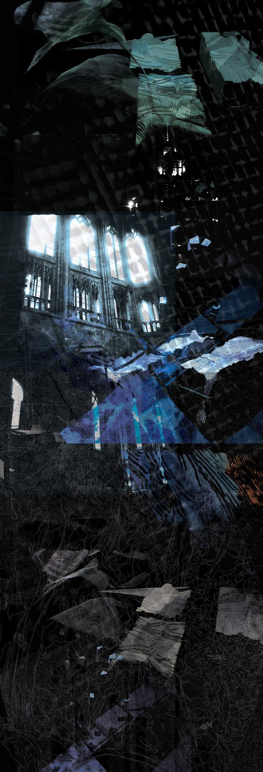
Far right. Field Drawing Augutus Wray, Toby Eccleston, Nathalie Harris


AUGUSTUS WRAY | HIDING-SONGS 65


Site: Tidal Mudflats.
Programme: Botanical Garden, Research Laboratory, Granite Quarry, Workshop.
08 GARDENS OF THE BAY
THE DISSOLUTION OF THE SEA
GILES DAVIS GEORGIA WHITEHEAD
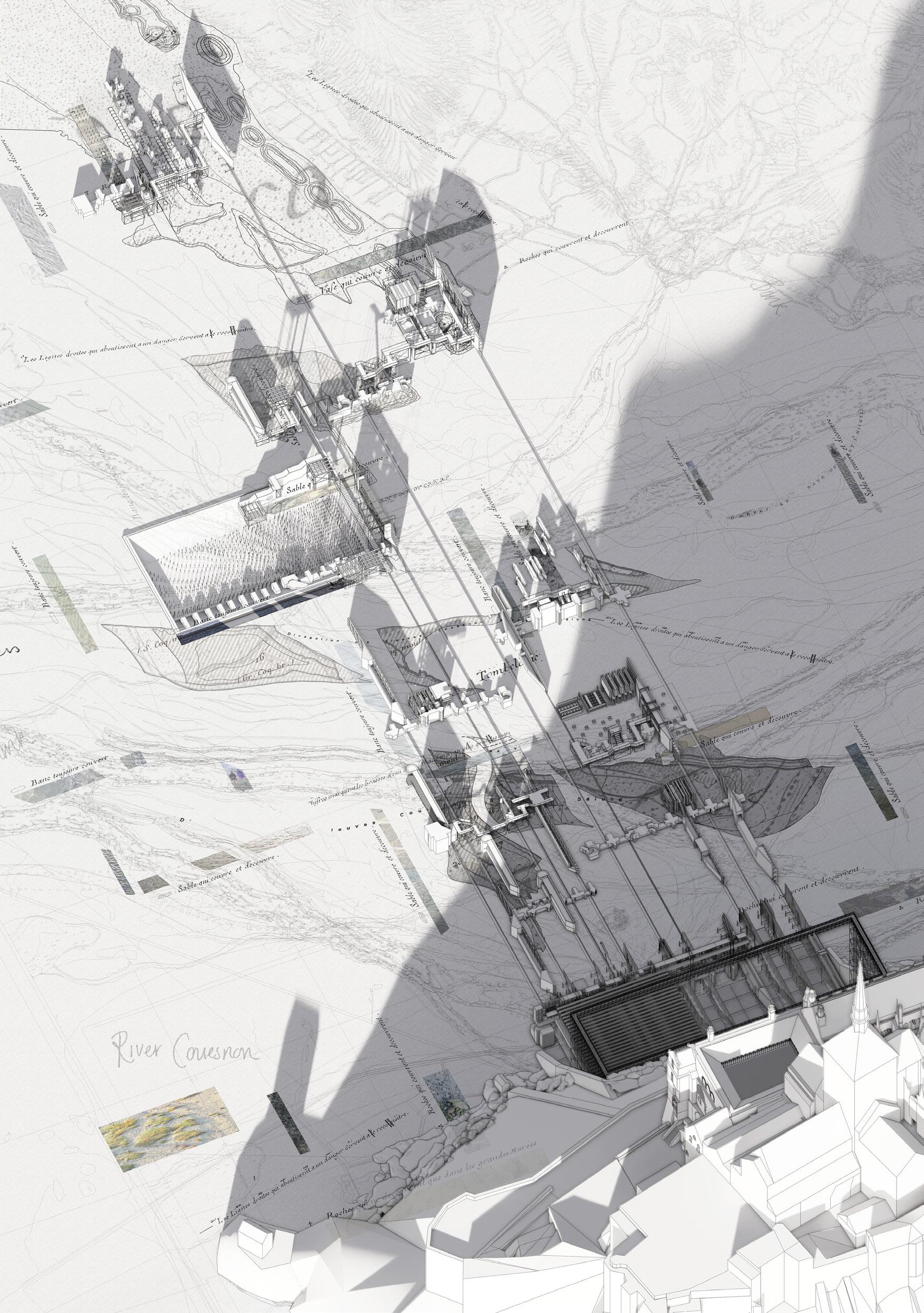
Gardens of the Bay: The Dissolution of the Sea explores the relationship between a constructed and ecological landscape to explicate environmental conditions of the Bay of Mont-Saint-Michel. A doubling of the Merveille, the great 13th century façade which dominates the northern elevation of the abbey island, elicits a dyadic response to its context. It unfolds and embeds into the granite of Mont-Saint-Michel to provide a newfound geomorphological landscape whilst providing the framework for a choreography of architectures that are cast out to inhabit the Bay.
Embedded within the littoral zone of the Bay, this thesis studies the ecological landscape whilst responding to the prevailing tidal force. A collection of research-centric architectures formed from a studied shadowscape of the Merveille creates an archipelago for scientific discovery and documentation. The remnants of the fragmented ecologies are collated within an archival wall that looks back out across the Bay, holding the memory of past investigations whilst delineating the previous threshold between Island and Bay.
The carving of the landscape defines the quarry inhabiting the base of the Island. From this, a monolithic architecture is drawn out of the granite rockface, where the projected architectures are conceived. The [re]fabrication and [re] distribution of these vessels to the wider environment reflects the littoral essence of the Bay through the constant ebb and flow of production, encapsulating the symbiotic relationship between the ecological and constructed landscape.
69

 Left. Botanical Garden, Workshop and Quarry aerial view, section north-south, plan
Right. perspectival view south
WHITEHEAD | GARDENS OF THE BAY 71
GILES DAVIS & GEORGIA


Following page. Gardens of the Bay field table
Left. Garden for Rocks that Cover and Uncover
Right. Quarry Workshop
73
WHITEHEAD | GARDENS OF THE BAY
GILES DAVIS & GEORGIA


75
Site: Tidal Mudflats.
Programme: Kitchen Garden, Retreat, Landscape Survey Facility.
A GARDEN FOR AN ANCHORITE 09
TOM CARNEY
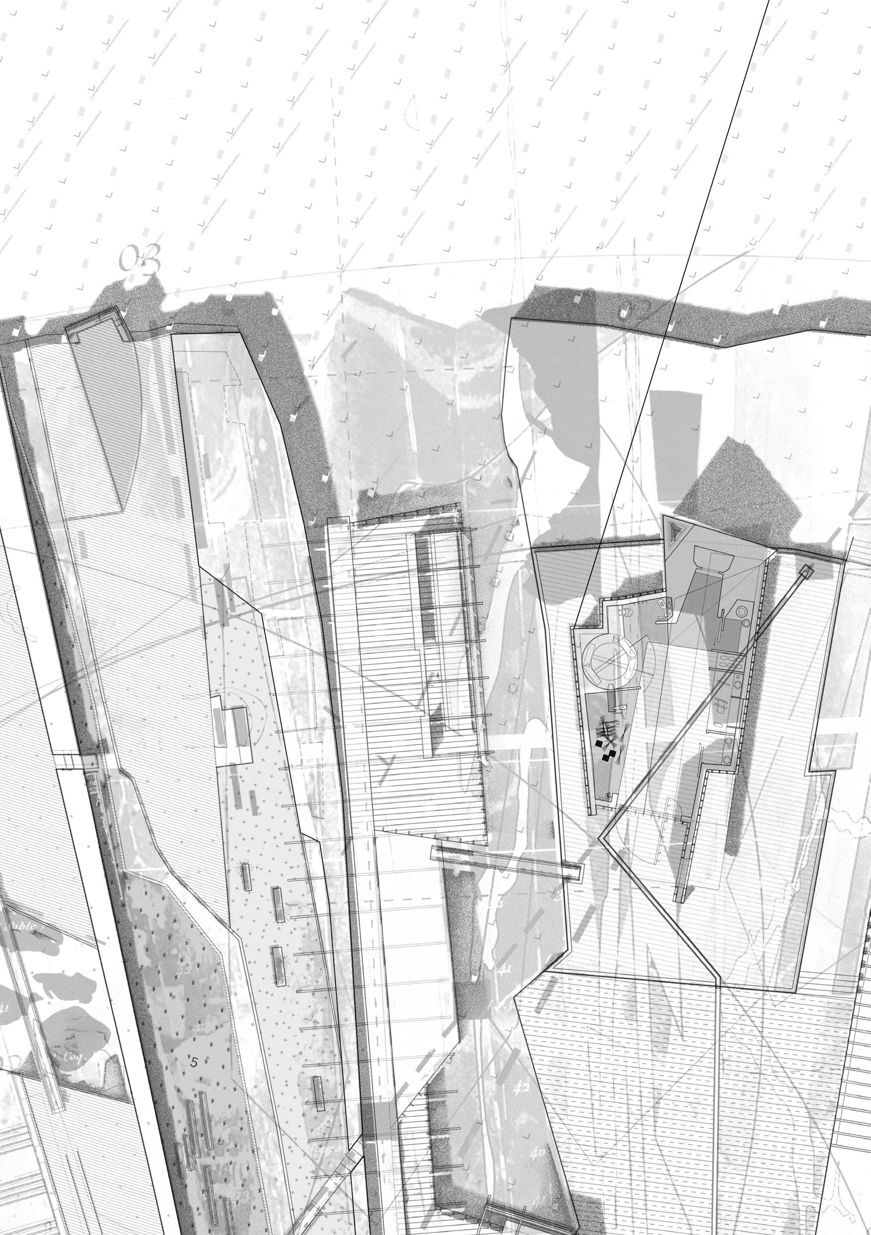
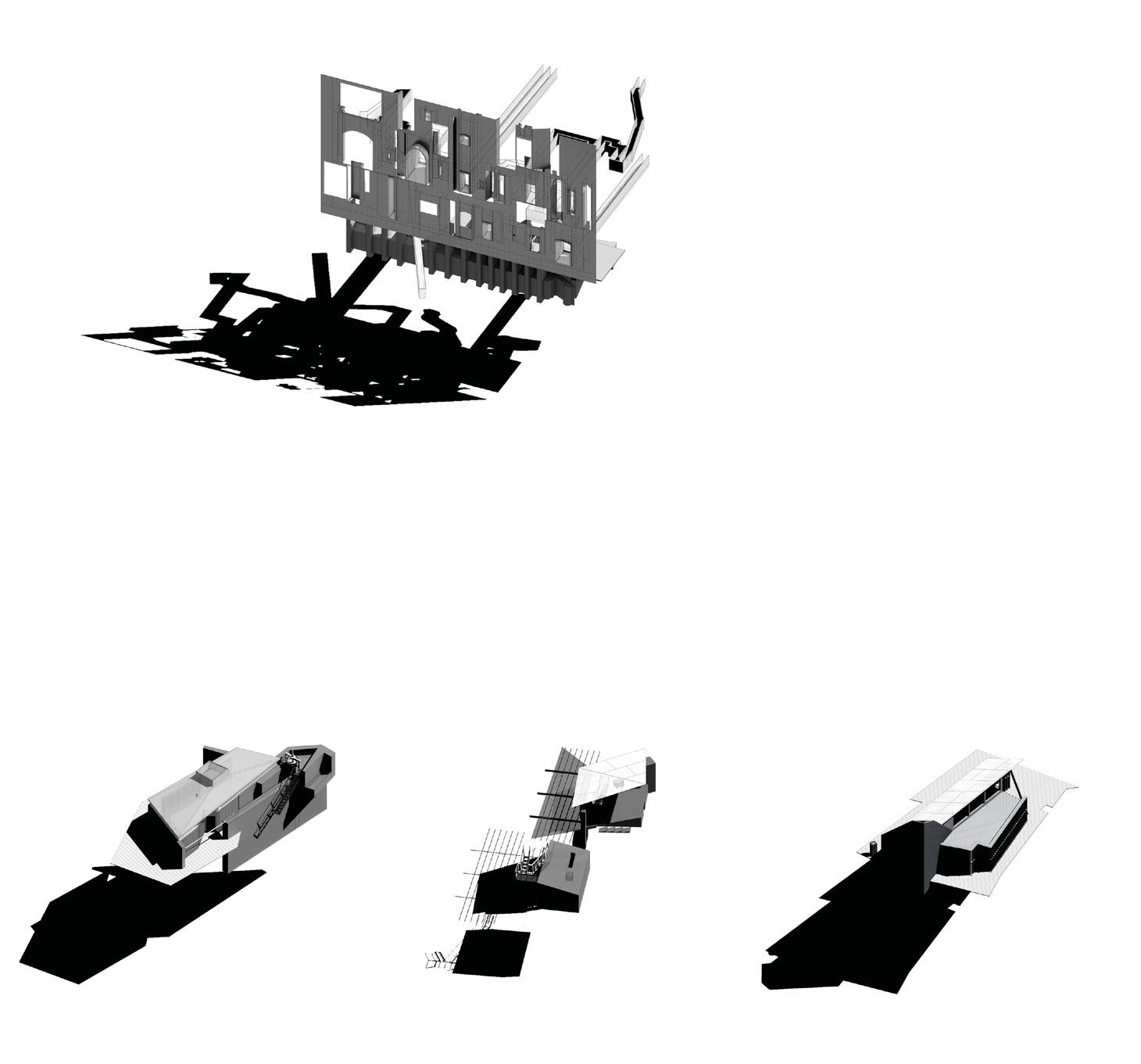
A Garden for an Anchorite is a considered curation of landscape conditions from the bay of Mont-Saint-Michel re-scaled to the northern shore of the Abbey island. A series of granite and copper polders, sourced from adjacent quarry islands and copper mines, anchor a garden to a dynamic tidal landscape of silt flats. These polders, reclaimed field conditions in miniature, allow for the cultivation of local produce to provide for the daily needs and seasonal feasts of the Abbey refectory above.
With the setting of a new horizon cast to the ancient pilgrimage crossing of Genest to the northwest, apertures found within the island walls provide a series of cones of vision which capture specific landscape conditions from the bay, marsh land, polders, rivers, agricultural provisions and silt flats. In the Anchorite’s Garden these conditions are re-calibrated, re-stitched, folded, unfolded, cut, scaled and re-scaled as walls and walks, harbours, fields, masks and stairs, a new parterre for the Abbey mount as a rich experiential field, a distilled environmental, geographical, cultural, religious and social terrain.
Existing landscape tectonics of the bay offer models of resistance and resilience for the architectural garden. The garden harbours both a vulnerable tethering and a protected anchoring of space as places for: cultivating, dwelling, crafting, sheltering from the wind, rain and tides. The project echoes life within the bay, its historical, religious, environmental and social practices, all in a manner that welcomes the inevitable reclamation of the bay.
STUART GOMES

77


79

Preceding page.
Left. Garden for an Anchorite aerial view
Right. Garden for an Anchorite plan
Garden for an Anchorite installation view

STUART GOMES & TOM CARNEY | A GARDEN FOR AN ANCHORITE 81

STUART GOMES & TOM CARNEY | A GARDEN FOR AN ANCHORITE 83

 Preceding page. Garden for an Anchorite plan detail
Upper left. House of Estrangement Stuart Gomes
Upper right. House of Estrangement Tom Carney
Lower. Garden for an Anchorite section and characters

STUART GOMES & TOM CARNEY | A GARDEN FOR AN ANCHORITE 85
Site: Tidal Mudflats and the Island of Tombelaine . Programme: Pilgrim’s Hostel.
THE PILGRIM’S INN
NEW JERUSALEM: A CHIMERIC PILGRIMAGE
NATHALIE HARRIS
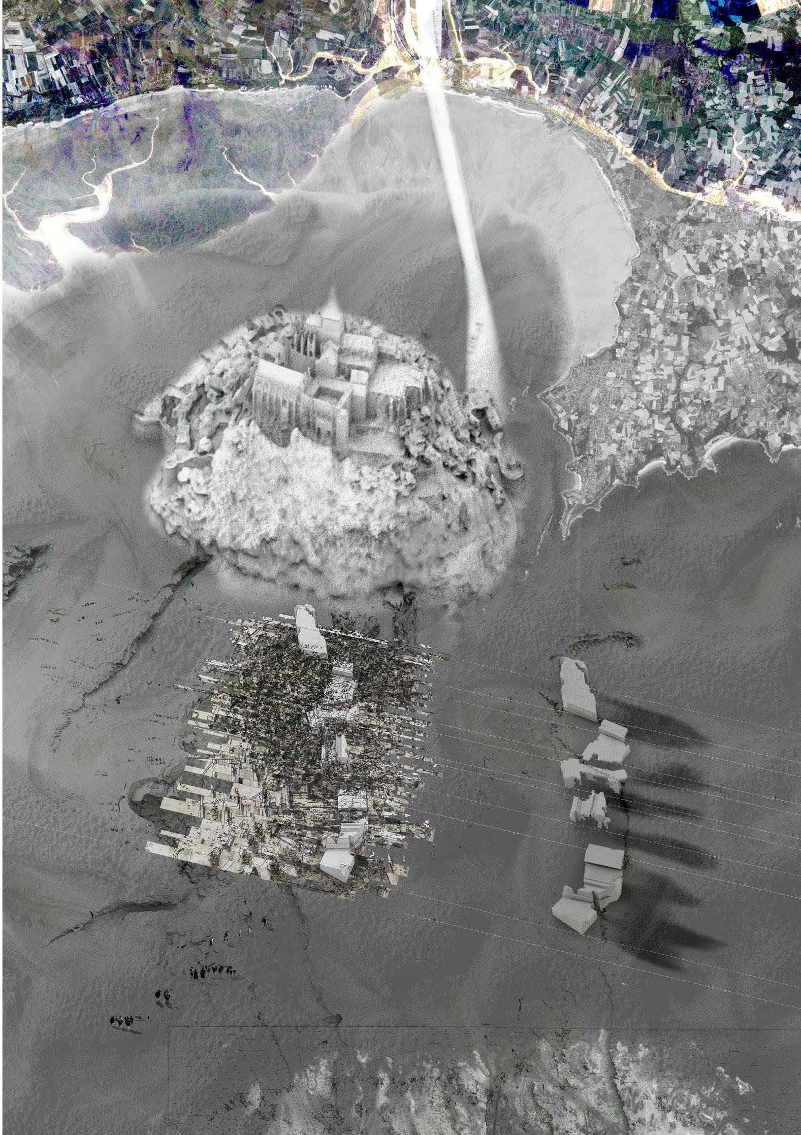
Reaching out from the island of Tombelaine towards the spires of Mont-SaintMichel lies the Pilgrim’s Inn, a refuge for the weary traveller arriving from one of the myriad pilgrim routes that thread between the holy sites of Europe, enroute to the island abbey. Situated some three kilometres into the bay through silt, cross currents, and varying tides, the diminutive island of Tombelaine, acts as an anchorage, resting place and space for reflection before the final traverse to the Abbey.
The Pilgrim’s Inn began with a chimeric reading of Mont-Saint-Michel and Jerusalem, where a new palimpsest was borne, crosshatching elements of Jerusalem and Mont-Saint-Michel until both were unrecognisable in the landscape of a New Jerusalem. Using the plan of the new city and the micro architectures suggested by its extraordinary porous topography, a language of granite footing walls - quarried from the Chaussey Islands to the northhabitable fins in oak and chestnut, corten walkways, steel staircases and mesh lanterns emerged. A permeable shelter, oriented south, fed by the island spring, a thickened palimpsest, anchored in a granite rock face and elevated above a rising tide.
Twelve pilgrims take refuge, bathe, cook, eat, and read. The pilgrim requires clear conditions to ease the crossing and must await the alignment of the skies, the tide, and the silt in order to traverse onwards to the holy mount of Saint-Michel.
10
87


 Above left. Field Drawing
Below left. reading room and undercroft
Above right. Tombelaine aerial view
Below right. hightide


NATHALIE HARRIS | THE PILGRIM’S INN 89


Site: Salt marsh and Sea Dyke.
Programme: Performance Space, Instrument Store, Roof Terrace.
ORATORY OF THE SALT MARSH
AN ECHO OF THE ABBEY
ÁINE LYNCH JOEL PACINI
The Oratory acts as a distant echo of the abbey of Mont-Saint-Michel, offering a raised fragment of secure land above the uncertainty of the peripheral salt marsh. Upon a deeply inscribed deck, informed by the stone terrace of the abbey itself, secure views back to the island source are held. Like that of the abbey, this new terrace folds down to engage with a thick interior of spaces attuned to congregation and recital. While the deck witnesses the uncertain, temporal nature of the great tidal bay, the chamber below resounds with the precise performance of choral music long since expelled from the abbey itself. Recitals of chant and song, drawn from a rehoused archive of mediaeval musical manuscripts, play out against the figure of their past home.
The deck is held by a gathering of tower-like masses, their forms cast from the voids within the grain of the abbey beyond. They are further stations for observation, artefacts and framed views caught in their vertical circulation. They cluster around the sea dyke separating salt marsh and polder, their supported deck becoming a momentary shelter for present day pilgrims who choose to either linger in the foyer, rise to the deck surface or continue their perambulation along the temporal land edge.
The generosity of this shelter encourages another form of gathering, the Agneau de pré-salé, the prized lamb of the salt marsh meadows who perform their daily marches to and from the evening pends of the neighbouring settlement that stretches inland to Ardevon.
11

93

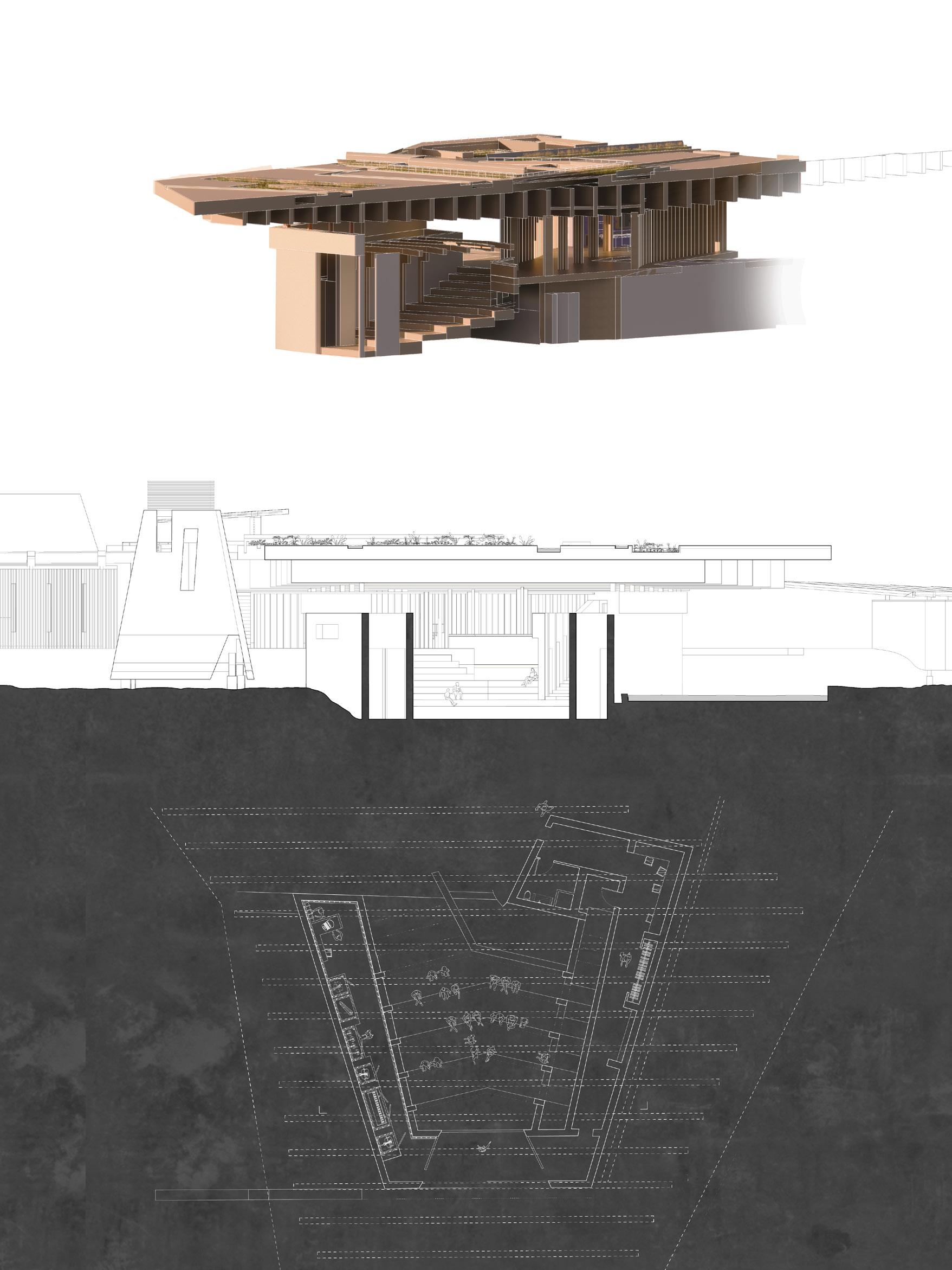 Left. Oratory
Right. Musical Manuscript Archive

ÁINE LYNCH & JOEL PACINI | ORATORY OF THE SALT MARSH 95


Following page. Oratory from the salt marsh
Upper left. Oratory plan and section
Lower left. Oratory sectional perspective
Right. Oratory model aerial view

ÁINE LYNCH & JOEL PACINI | ORATORY OF THE SALT MARSH 97


ÁINE LYNCH & JOEL PACINI | ORATORY OF THE SALT MARSH 99
Site: Sea Dyke and Polders.
Programme: Agricultural Guild, Tree Nursery, Hatchery, Flood Gate.
AGRI/AQUA-CULTURAL GUILD OF DEPOLDERISATION
CHARLIE DONALDSON
DANIEL CUTLER
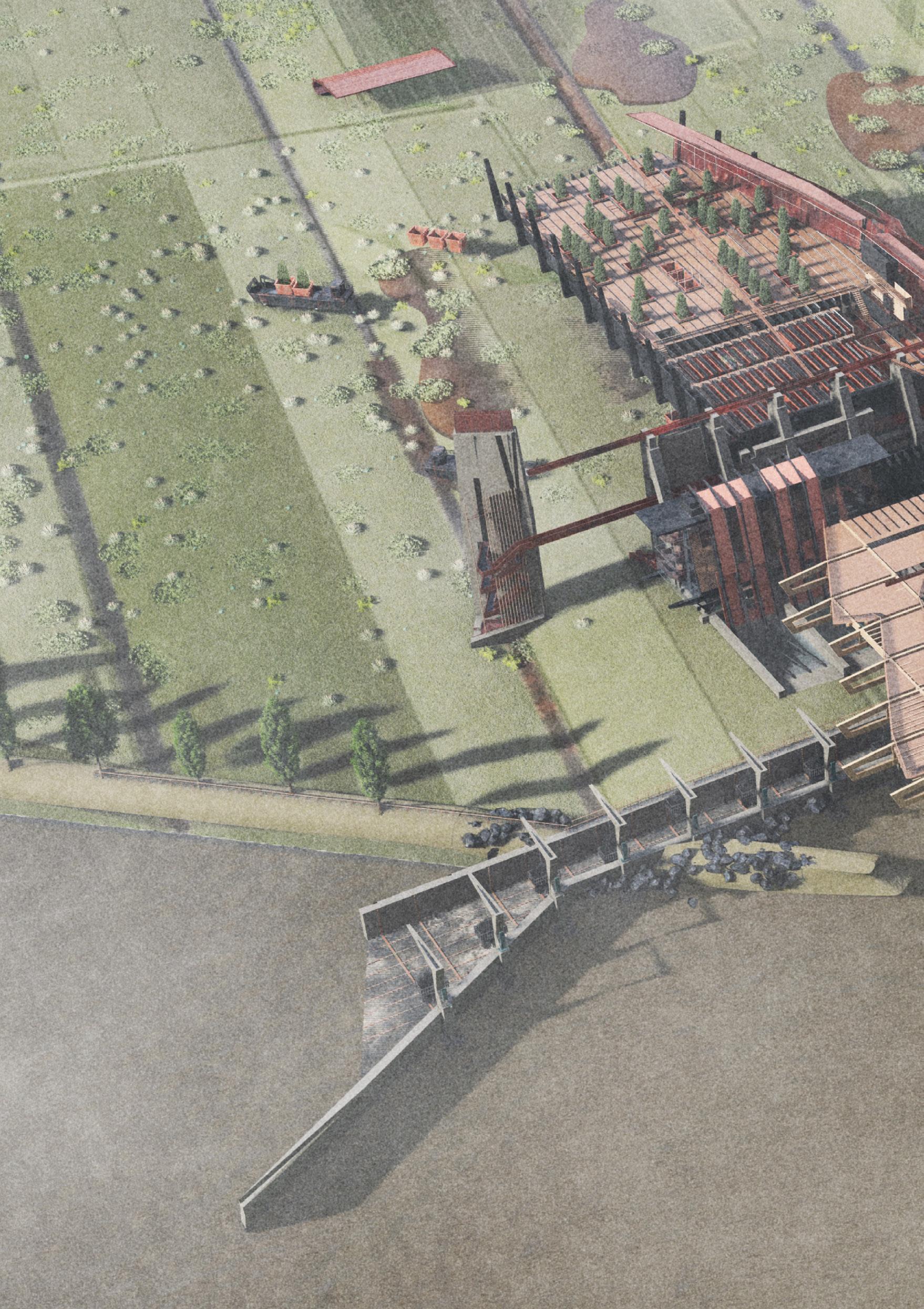
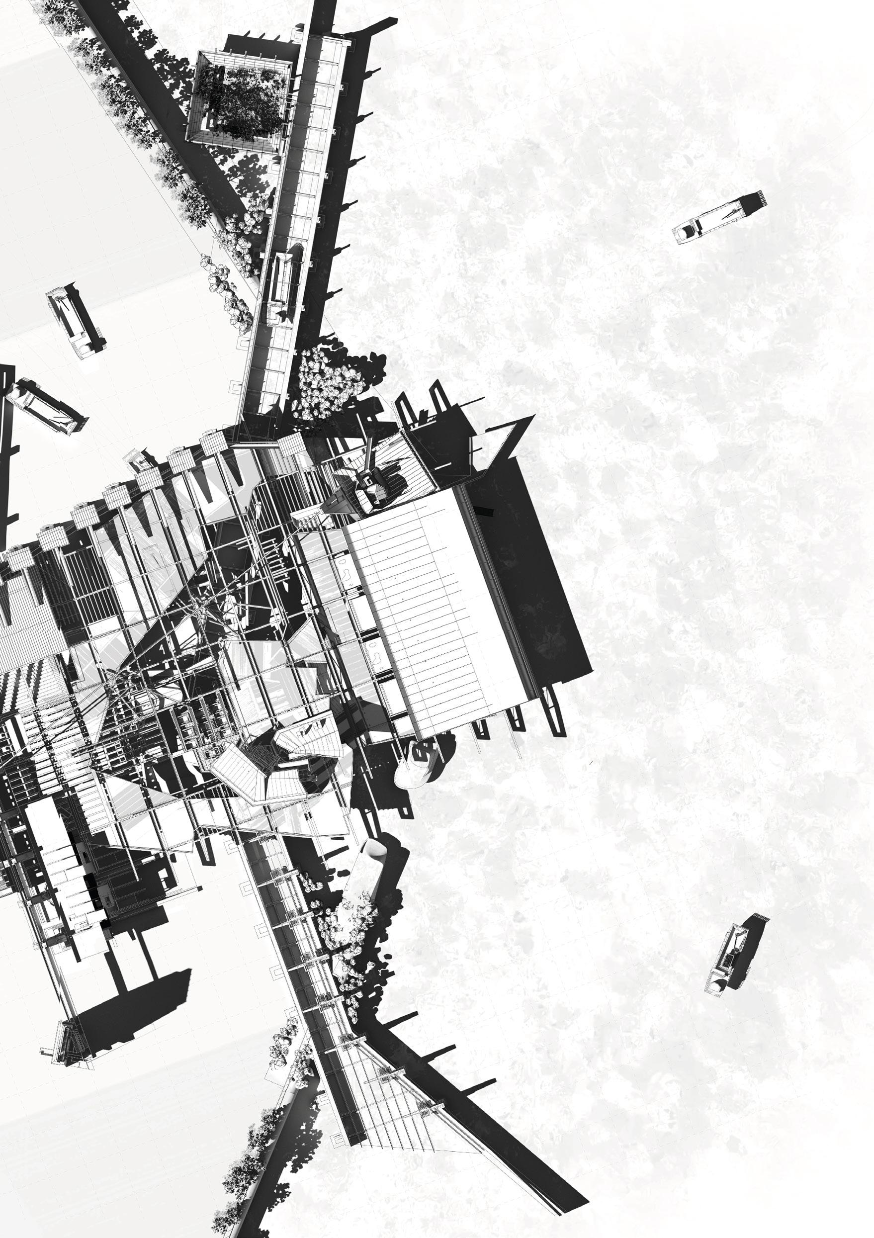
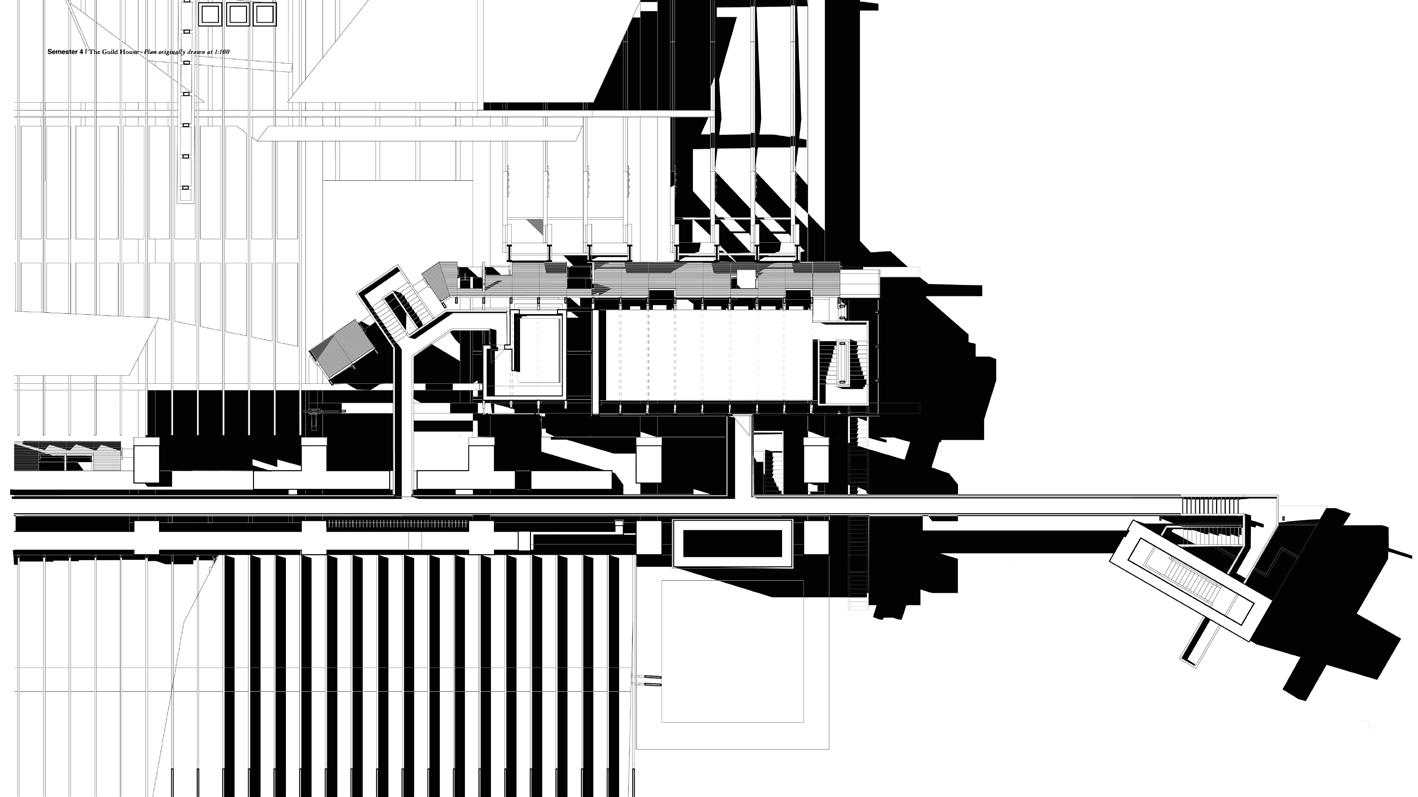
The Guild anticipates a future depolderisation of the constructed agricultural land surrounding the island abbey of Mont-Saint-Michel. It seeks to reconcile the continued economic and social benefits of these highly productive fields with the environmental pressures they, and the vulnerable fringe of salt marsh, now face due to climate change and an acute exposure to rising sea levels.
Funded by the French farming guilds, it registers changes within the bay and develops strategies for the gradual transition from agriculture to aquaculture. As a precedent farm, it becomes a focal point of gathering and knowledge transfer with the agenda of investigating new techniques for the cultivation of both soil and sea. It facilitates either the strengthening of sea dykes to further protect land or their dismantlement so as to receive the threatened habitats of the salt marsh - measures rooted in a negotiation of economy, ensuring the protection of the robust industries operating at the local and global scales.
The elevated deck structure houses gardens of production and research, embracing and enriching ecological systems. Fabricated from materials and craftsmanship local to the bay, the engineered timber and granite structure beds into the certainty of underlying bedrock then ambitiously cantilevers over less assured territories. The Guild converses with the adjacent abbey through scripted views and a strategic elevated positioning which witnesses the transition of the landscape. It enacts an initial breaching of the dyke wall, the threshold between sea and land is recalibrated in an act of controlled flooding.
12

101

Guild plan
CHARLIE DONALDSON & DANIEL CUTLER | AGRI/AQUA-CULTURAL GUILD OF DEPOLDERISATION 103


Guild section
and characters

CHARLIE DONALDSON & DANIEL CUTLER | AGRI/AQUA-CULTURAL GUILD OF DEPOLDERISATION 105


 Upper left. Oyster Beds
Lower left. Guild House
CHARLIE DONALDSON & DANIEL CUTLER | AGRI/AQUA-CULTURAL GUILD OF DEPOLDERISATION 107
Right. Guild House

Guild from the polders

CHARLIE DONALDSON & DANIEL CUTLER | AGRI/AQUA-CULTURAL GUILD OF DEPOLDERISATION 109
Site: Sea Dyke and Polders.
Programme: University, Laboratories, Scientific Gardens.

UNIVERSITY OF THE LITTORAL
ALASTAIR SINCLAIR
JAGODA BORKOWSKA
LUCREZIA HU
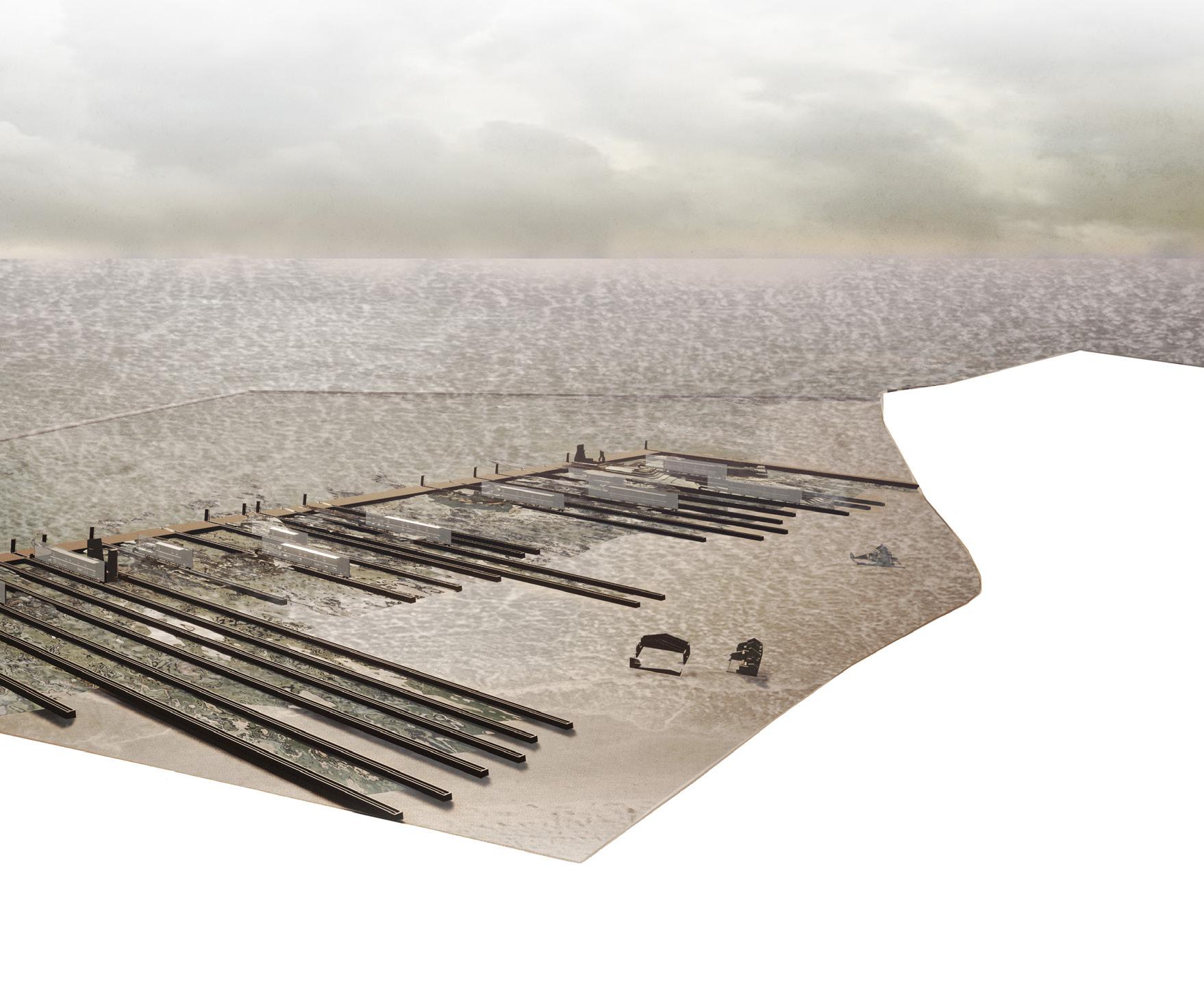
The project explores the liminal space between water and earth, the tension between natural systems and man-made structures. Mont-Saint-Michel and its bay have been in the constant entanglement between land and sea. Due to the opposing processes of sedimentation and erosion, the terrain of those areas has changed over time. Constantly re-shaping of the material space by constructing, reclaiming, destroying and restoring. The bay of Mont-Saint-Michel can be seen as a palimpsest, each narrative erasing the previous, but still preserving the traces of the old. Once again, the landscape of the area is about to change. To protect the salt marshes and to avoid the process of costal squeeze caused by sea level rise, a historic sea wall is reconstructed deeper inland, leaving behind the ghosted lines of the former polders and dyke.
By weaving the natural and artificial, the managed and the unmanaged, and the micro and the macro, we create strange and active architectures. Many nonhuman actors contribute to ecosystem function. To tackle the threat of biodiversity loss in the bay, the project introduces a network of walled gardens that act as a nursery habitat for different species within the salt marshes. Granite canals separate the gardens and regulate their access to the water of the bay. Upon these canals, thin screens of university buildings enable the study and maintenance of the gardens.
Entwined with the transitional zone of the ecotone, proposed walled gardens become landscape interventions that nurture an active form of environment.
13

111


University of the Littoral perspectival view and plan

ALASTAIR SINCLAIR & JAGODA BORKOWSKA & LUCREZIA HU | UNIVERSITY OF LITTORAL 113
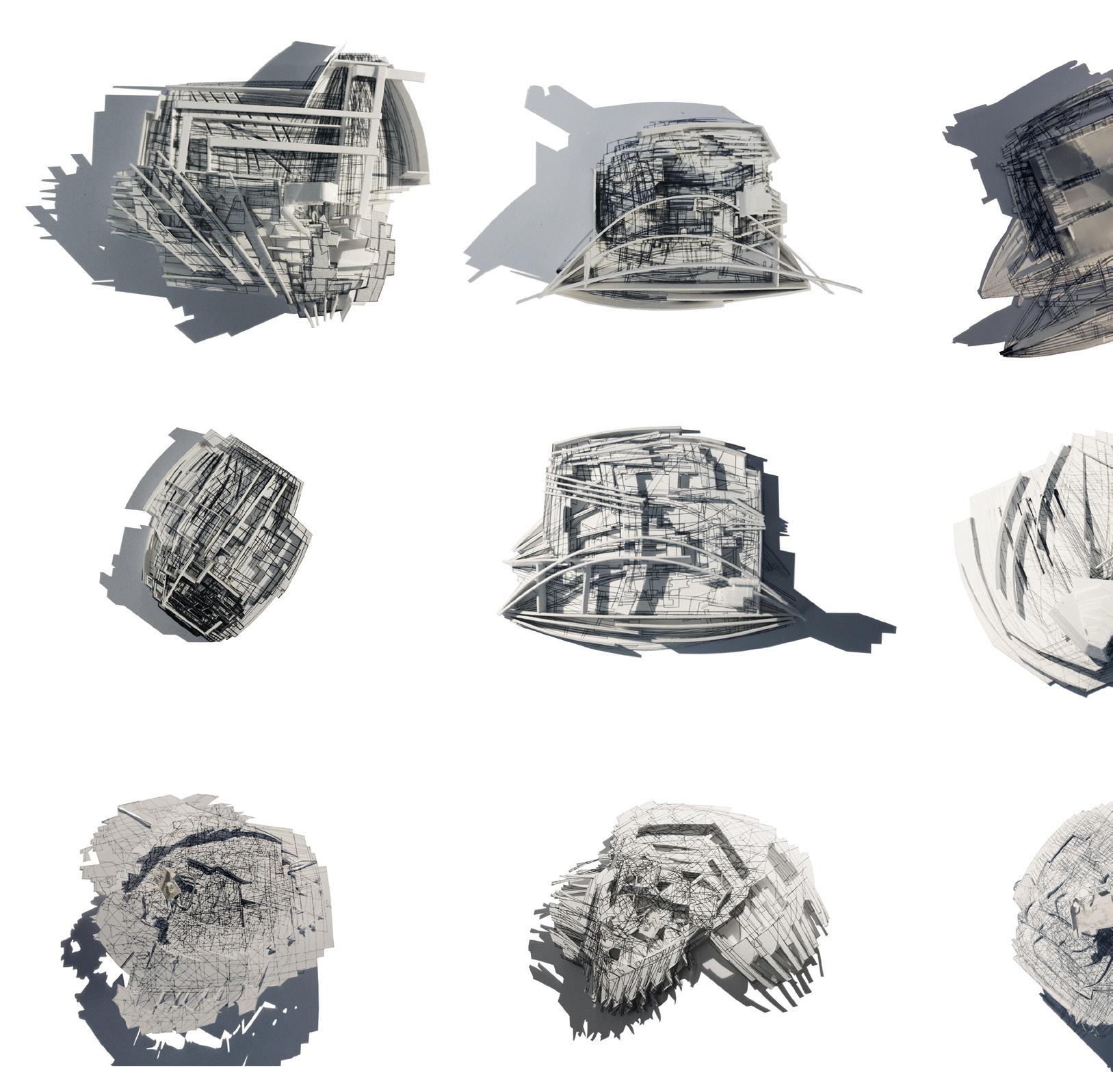 Wind Rose Seeds
Following page. Cockle Tide Pool

ALASTAIR SINCLAIR & JAGODA BORKOWSKA & LUCREZIA HU | UNIVERSITY OF LITTORAL 115

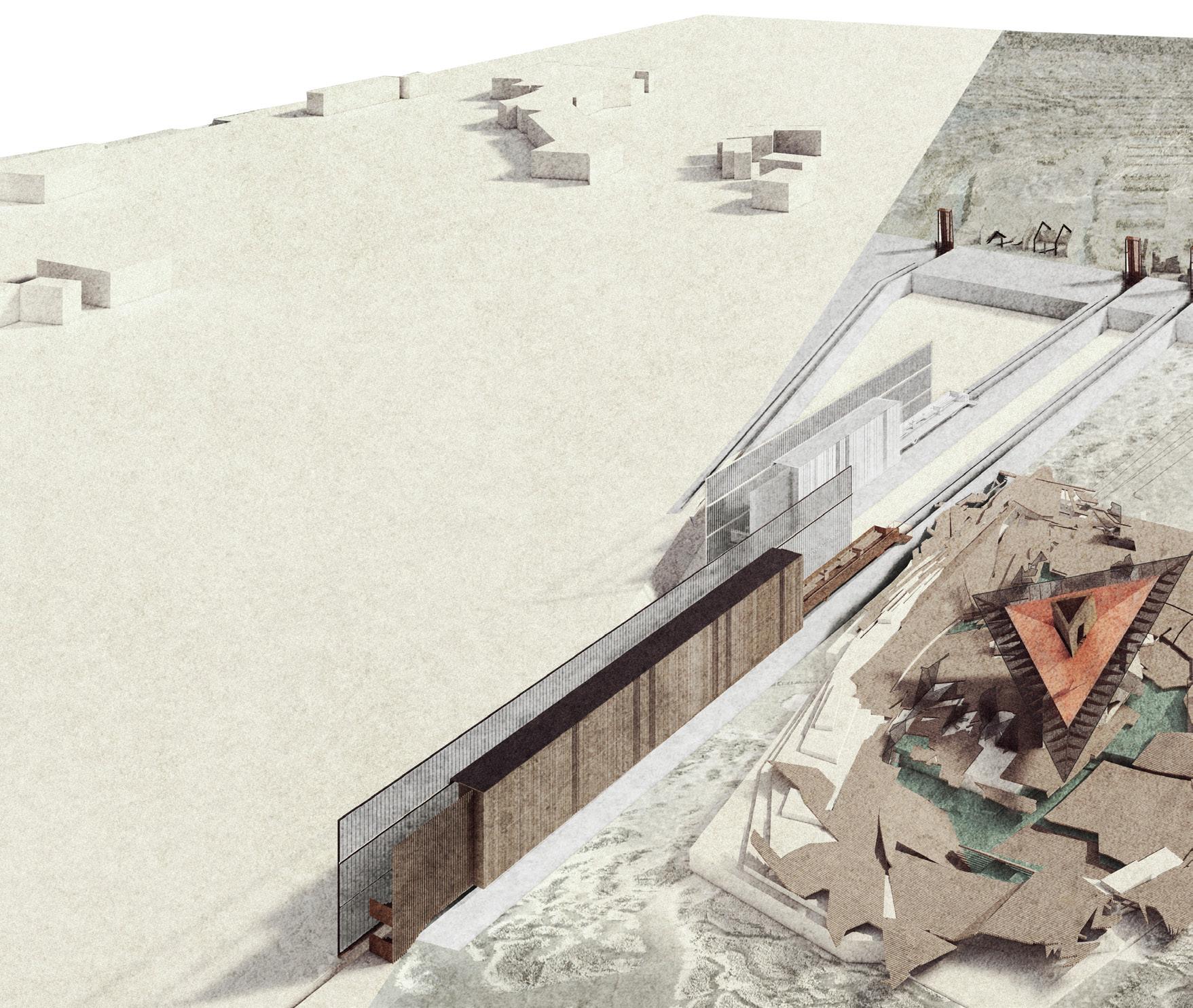


SINCLAIR & JAGODA BORKOWSKA & LUCREZIA HU | UNIVERSITY OF LITTORAL 117
ALASTAIR
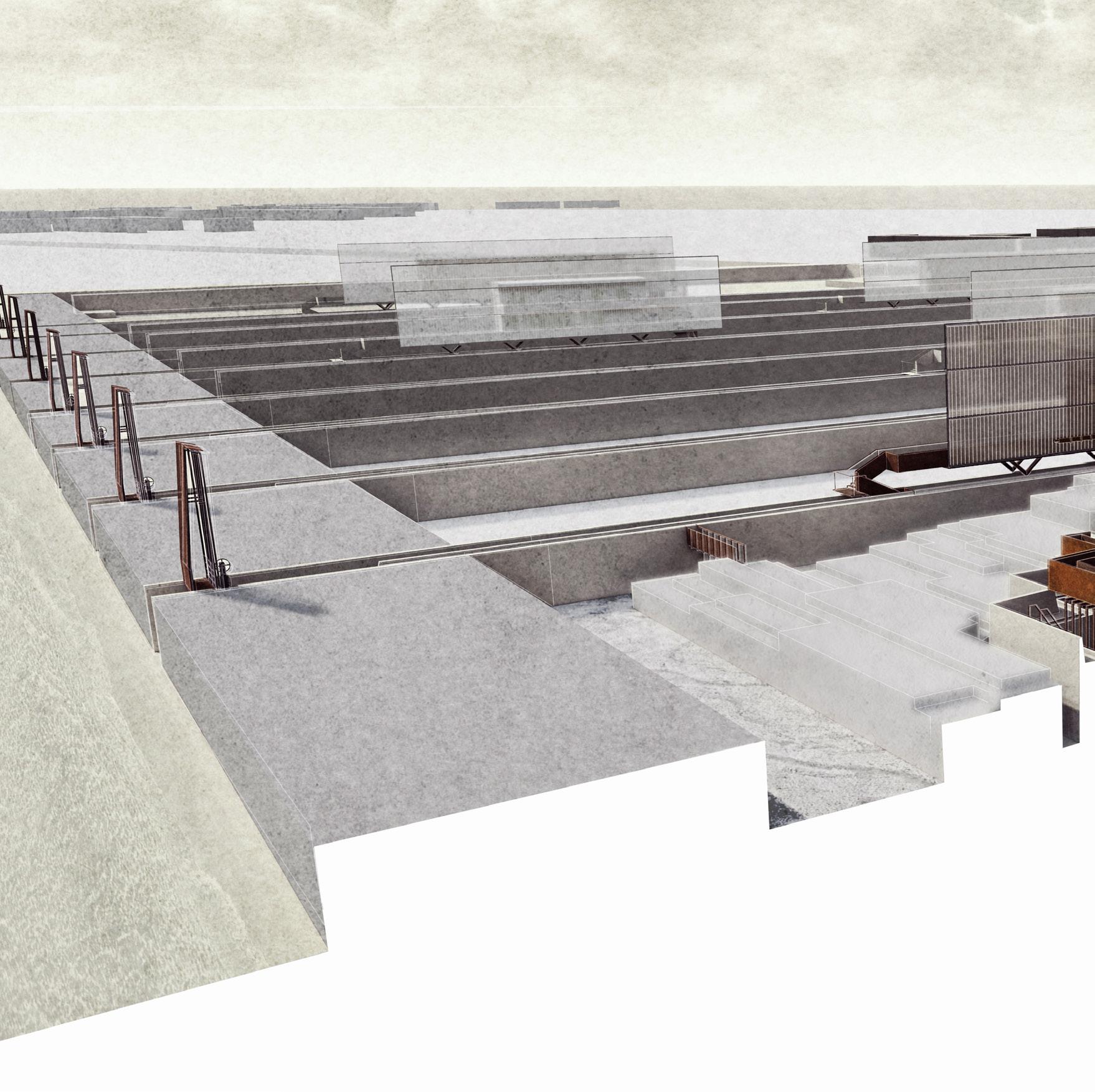
 Lavender and Tamarisk Garden

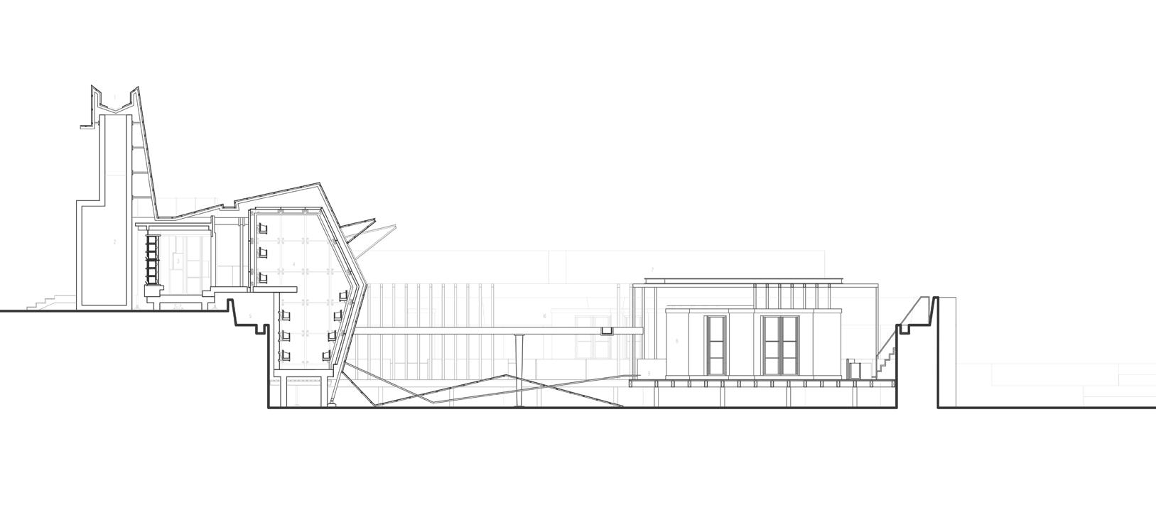
ALASTAIR SINCLAIR & JAGODA BORKOWSKA & LUCREZIA HU | UNIVERSITY OF LITTORAL 119
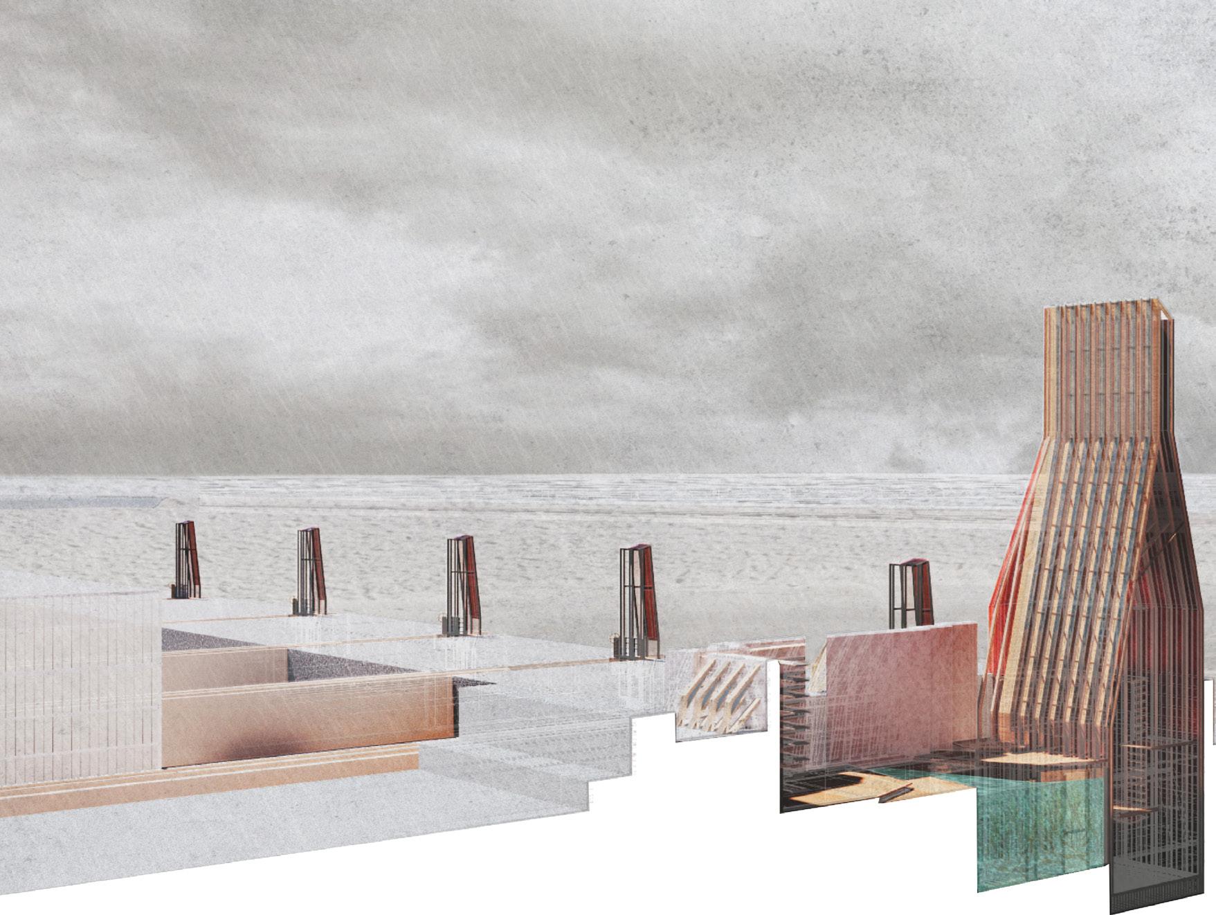

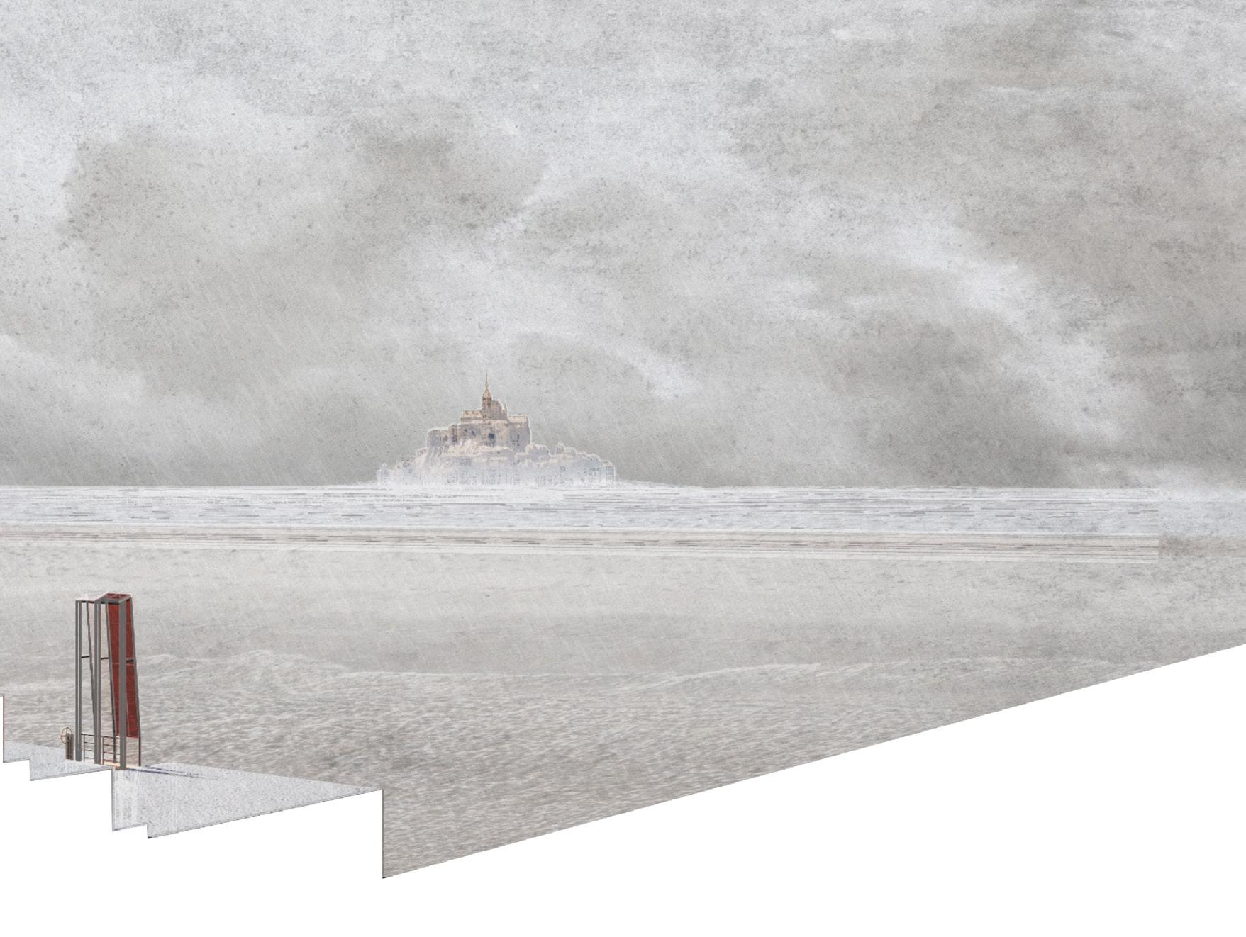
Following page. University of the Littoral installation view
Kelp Forest

ALASTAIR SINCLAIR & JAGODA BORKOWSKA & LUCREZIA HU | UNIVERSITY OF LITTORAL 121


123

Site: Sea Dyke and Polders.
Programme: Manuscript Archive and Restoration, Kitchen Gardens, Dormitory, Refectory, Aquatorium, Chapel and Memorial Garden.
THE GARDEN AND THE GATE
THE MIRROR OF MONT-SAINT-MICHEL
MARTY SCHRODER SHAUN THOMAS OLUWASEYI SALAKO
Three gardens held within a cloister wall carve a new landscape into the wasteland of a former polder field beside the Couesnon dam. Oriented to the Abbey of Mont-Saint-Michel, the complex of walls and pavilions, vessels and yards, fields and lade offers a double to its ancient neighbour, a monastic programme in miniature comprising a Scriptorium, Columbarium and Enclosed Garden. A secular reflection on the architecture of enclosure and retreat reimagined on the open plain of the bay of Mont-Saint-Michel between polder fields, salt marsh and river.
The creation of a dam and a bridge to keep an island was at once inventive and destructive, the canalised river, the excised salt marsh and the scarified polder field each attest to a bargain between culture and landscape in the maintenance of the island of Mont-Saint-Michel.
Three constructed gardens, discrete programmes operating in dialogue, unite in their desire to heal this wound, to create a commune, a mirror of the Abbey beyond. To the north, a gateway sits between water and marshland, a columbarium, a cemetery extracted from the common cloister wall. To the south, an architectural hinge between enclosed garden and extended cultivated polder fields. An architecture for a singular harvest, a feast of Tripes à La Mode de Caen. Lying in between, a new cloister gallery, a scriptorium for the restoration of lost manuscripts, offers manipulated glimpses, views across and between the three gardens of the commune in microcosm.
14

127
14 a
FORBIDDEN STORIES
INK IN THE SHADOWS
MARTY SCHRODER
A Scriptorium frames a wildflower garden cultivated for the production of pigments for the restoration of the 203 manuscripts exiled from Mont-SaintMichel. Returned to their landscape of origin, the manuscripts are housed amidst workshops, studios and growing spaces, accommodation for the gardener/scribes and a contemplative oratory.
The proposal compresses programme into a new ‘cloister’ gallery overseeing a shared water garden. The programme of restoration fronts onto the Cousenon river and engages with an existing dam. A new walkway within the cloister provides a sequence of views to the garden and the landscape beyond. Strips of pigment drop down to the water garden and extend into the distance, while the Gardener may carry out the daily routing of opening and closing taps, feeding water from the river, through the new lade, and into the water garden.
The lamination of the cloister gallery sees a thick limestone wall hold bespoke programme, service space and an elevated walkway. The wall is contrasted with a chestnut screen which sits lower and tapers in and out to define movement into the building, providing privacy or shade. The assemblage is completed with porcelain screens which fold into spaces to sit and observe the production line or contemplate the surroundings within earshot of those reading scripture.

129

Scriptorium plan

131

Scriptorium exploded axonometric

MARTY SCHRODER | FORBIDDEN STORIES 133
b
THE WING & THE FURROW
THE KITCHEN GARDEN
SHAUN THOMAS
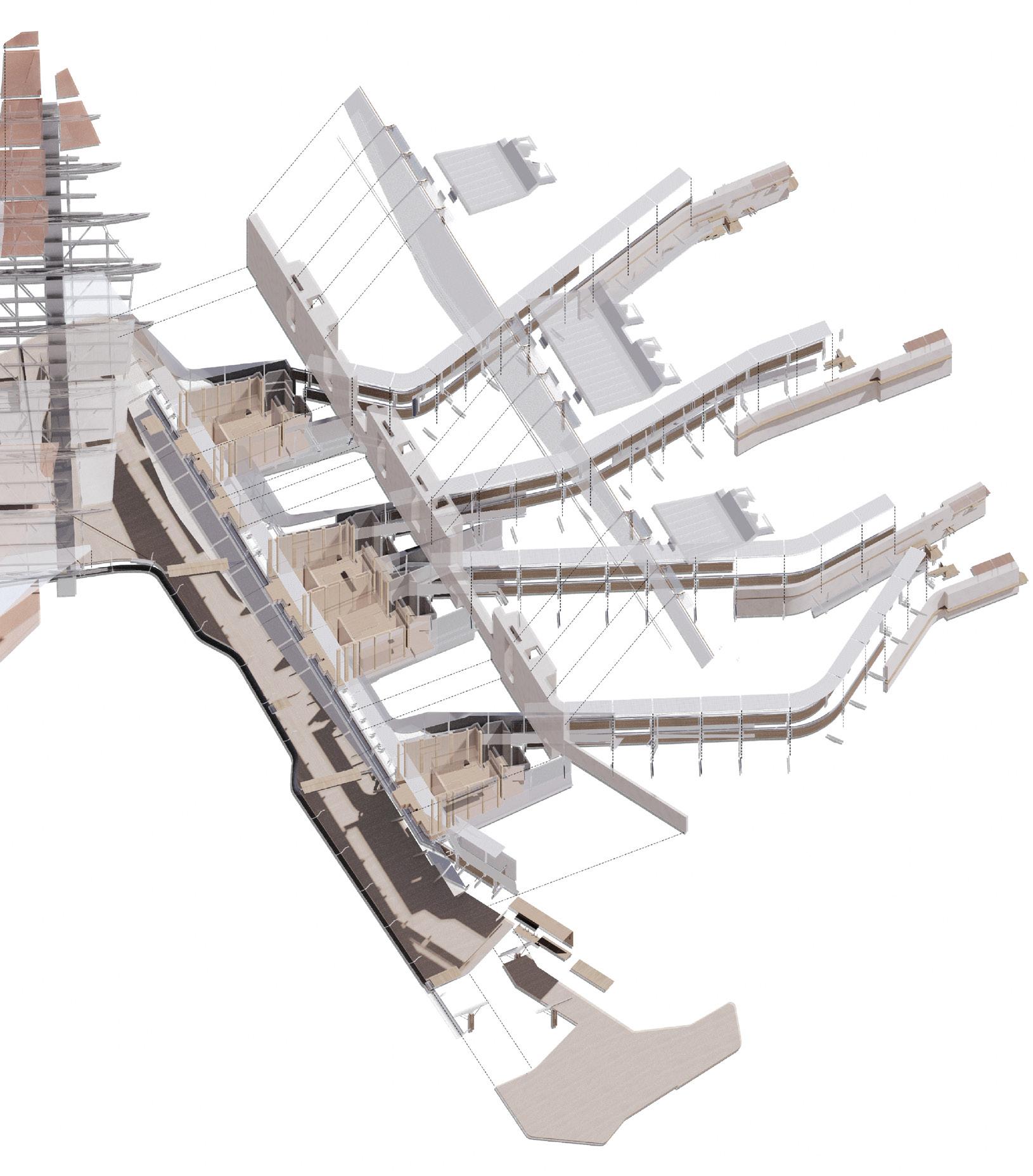
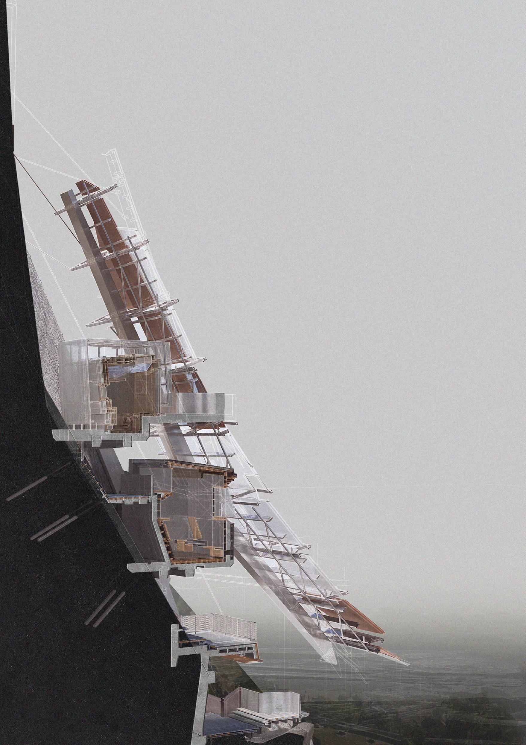
The architecture of the Kitchen Garden is comprised of linear furrows and enveloping wings. An inhabitable spine wall and lade and an articulate surface, at once an enclosing skin, yard and beach to an internal water garden. Situated in a repurposed overflow field and former construction site for the damming of the adjacent Cousenon River, the architectural elements describe a set of boundaries and water channels in granite and wood: boundaries to the riverbank, polder field and a strait of reinforcing poplars and channels between river and garden, garden and polder field.
The Wing & The Furrow originates from the southern granite outcrop of Mont St. Michel and a singular sample micro-architecture, a faceted skin, Wing, anchored by a linear spine, Furrow. As our collective workings redefine and create facsimile of Mont St. Michel so, the Wing becomes a retreat, part canopy, part ground plane or yard, available to work and flooding. The Furrow expands on the yard and holds four inhabitants who work the land and prepare the food. Extending through the poplar trees it bridges between the architectures of dwelling and working. The layered skins of the Furrow filter light and views.
Oriented toward Mont-Saint-Michel and the open landscape, tethered to the shared cloister wall, the proposal houses a programme of cultivation and consumption. The produce from the polder garden, once harvested and prepared is offered to a common meal for the inhabitants of the new abbey. A ritualised dinner beneath the shelter of the elevated Wing
14

135
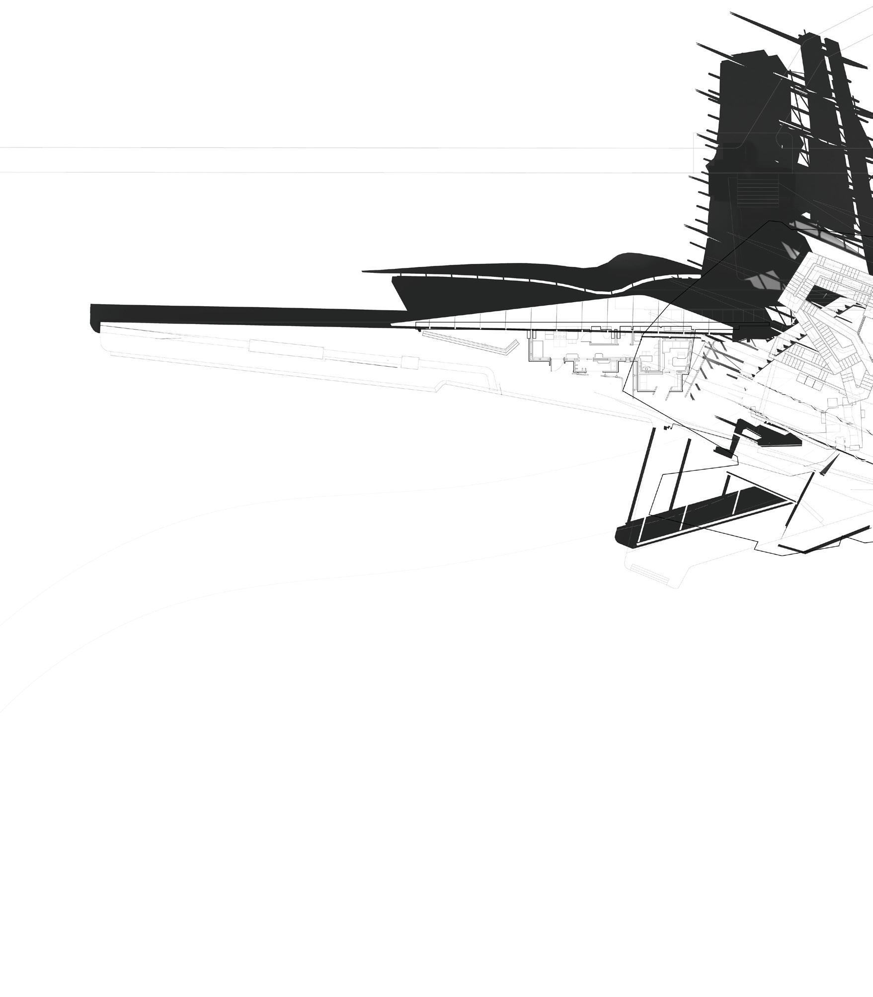
 Left. Polder garden armatures
Right. Kitchen Garden plan

SHAUN THOMAS | THE WING & THE FURROW 137

Kitchen Garden axonometric
Following page. House of Estrangement
SHAUN THOMAS | THE WING & THE FURROW 139

SHAUN THOMAS | THE WING & THE FURROW 141
THE WATER CEMETERY
CIMETIÈRE D’EAU
OLUWASEYI SALAKO
The architecture of the Water Cemetery derives from the designed rupture of a 16th century well in the Abbey of Mont-Saint-Michel. It is a broken vessel cut, cast and channelled to contain and distribute water for the purposes of ritual and memory adjacent to the Couesnon Dam. Water from the river is harnessed, creating a series of streams that are seen to flood the internal landscape of the cemetery. Light is used as a tool to carve spaces amongst the rubble and illuminate the choreographed assemblage of architectures required for the preservation and commemoration of a body through aquamation.
An architecture of wall and pavilion, walkway and void comprises granite walls enclosing two reflecting pools, copper basins, a carved limestone columbarium, a series of interconnecting walkways for the sequence of mourning and remembrance and a carefully articulated enclosure for private reflection. A gilded chapel aligned to Mont-Saint-Michel anchors the Cemetery to the site.
Reflecting on the material and structural language of Abbey, Dam and Dyke, masonry connects to fine mesh walkways, timber lines stone and steel, steel spans and braces stone and water.
14 c

143


Lower
Upper left. Water Cemetery chapel section
Lower left. memorial garden
Upper right. water gardens
OLUWASEYI SALAKO | THE WATER CEMETERY 145
right. aquatorium axonometric
Site: Sea Dyke and Polders.
Programme: Boatmaking Workshop, Rowing Club, Kayak Hostel.
15
THE BOATHOUSE OF THE POLDERS
MORRIS CHAN
This project draws from the tradition of costal rowing that emanates out from the nearby port city of San Malo. It proposes a rowing club, a seam of residential boathouses and a workshop for the fabrication of timber open water sculls. The Boathouse engages with the canaled waters that now reach inland from the barrage du Mont-Saint-Michel, a recent piece of infrastructure that collects and then strategically releases tidal water in an attempt to flush out the silt that threatens the island status of the abbey island. The Boathouse forms a developed water edge that runs parallel to the tourist settlement of La Caserne on the processional route to the abbey. In so doing, it activates temporally trapped waters of the river Couesnon from the barrage to the newly formed inland wetlands of Les Mares.
Connecting fresh water and sea, a new lade forms a controlled flow that is able to bypass the dam. It links the sequence of fabrication workshop to boathouse to club and, working in relation to the closing of the dam, allows for navigation from each into the tidal waters of Mont-Saint-Michel once again populating the bay with small vessels.
The canopy of the rowing club forms a new public space under which both families and small boats can gather – a respite from the seasonal crowds on the other side.

147


MORRIS CHAN | THE BOATHOUSE OF THE POLDERS
Left. Boathouse of the Polders
149
Right. boat-building workshop
Site: Sea Dyke and Polders.
Programme: Perfume Laboratory, Walled Garden, Public Walkway.
THE PERFUME GARDEN
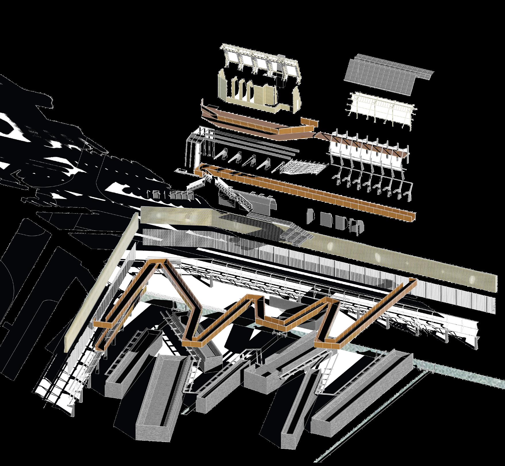
Situated in the bay on a sea dyke between salt marsh and polder field, the Perfume Garden looks north to the ancient gardens of Mont-Saint-Michel and a singular dwelling, an inhabited screen designed for monitoring the southern landscape, a 19th century project of land reclamation, arable and pastoral, fertile, prosperous and subject to change.
The Perfume Garden comprises screens and walls that enclose a flower garden and house a laboratory, garden store, work and changing spaces, a public gate and reception and perfume shop. Entering through the reception gate, a visitor to the perfume garden ascends a ramp above the flower gardens following an elevated pathway through the scents of seasonal flowers to the sea dyke wall where they can enter the screen, move past the laboratory arriving at the junction of salt marsh and polder before returning to the bay and the journey north to the island.
Elevated on concrete footings, the timber steel and mesh screen wall nestles behind the northern sea dyke, a small irrigation channel runs beneath. Garden walls of granite and wood shelter discrete flower gardens. A lightweight ramp leads to the garden walk atop granite walls.
 TIANSHI WANG
16
151


TIANSHI WANG | THE PERFUME GARDEN
Left upper to lower. Perfume Garden screen wall, plan, section through laboratory and walled gardens
153
Right upper to lower. screen walkway, Perfume Garden section, dyke walkway section

Site: Polders.
Programme: Sanatorium, Refectory, Hydrotherapy, Water Filtration, Library.
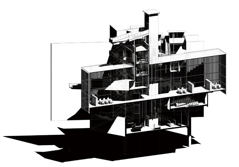
THE SANATORIUM LA MANCHE
QIANRU LI YUNNING ZHANG
ZEYU LIU
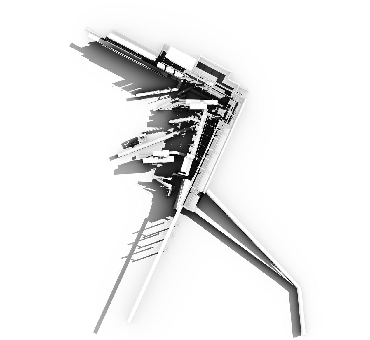
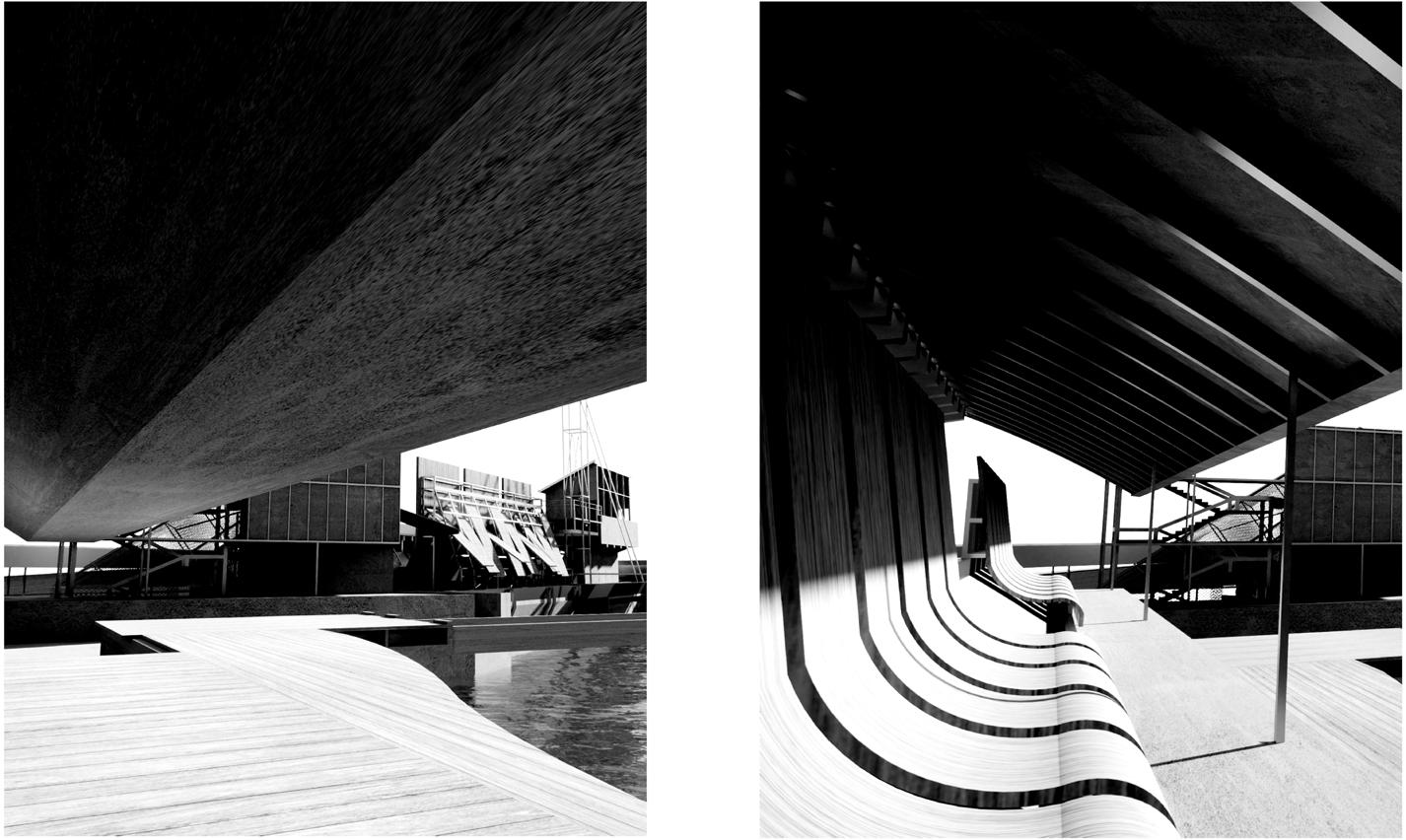
The Sanatorium La Manche is situated in the polder landscape south of the Bay of Mont-Saint-Michel and west of the Couesnon Canal. Aligned to the Abbey mount the Sanatorium is a mirror island offering retreat and therapeutic treatments for a range of pulmonary conditions.
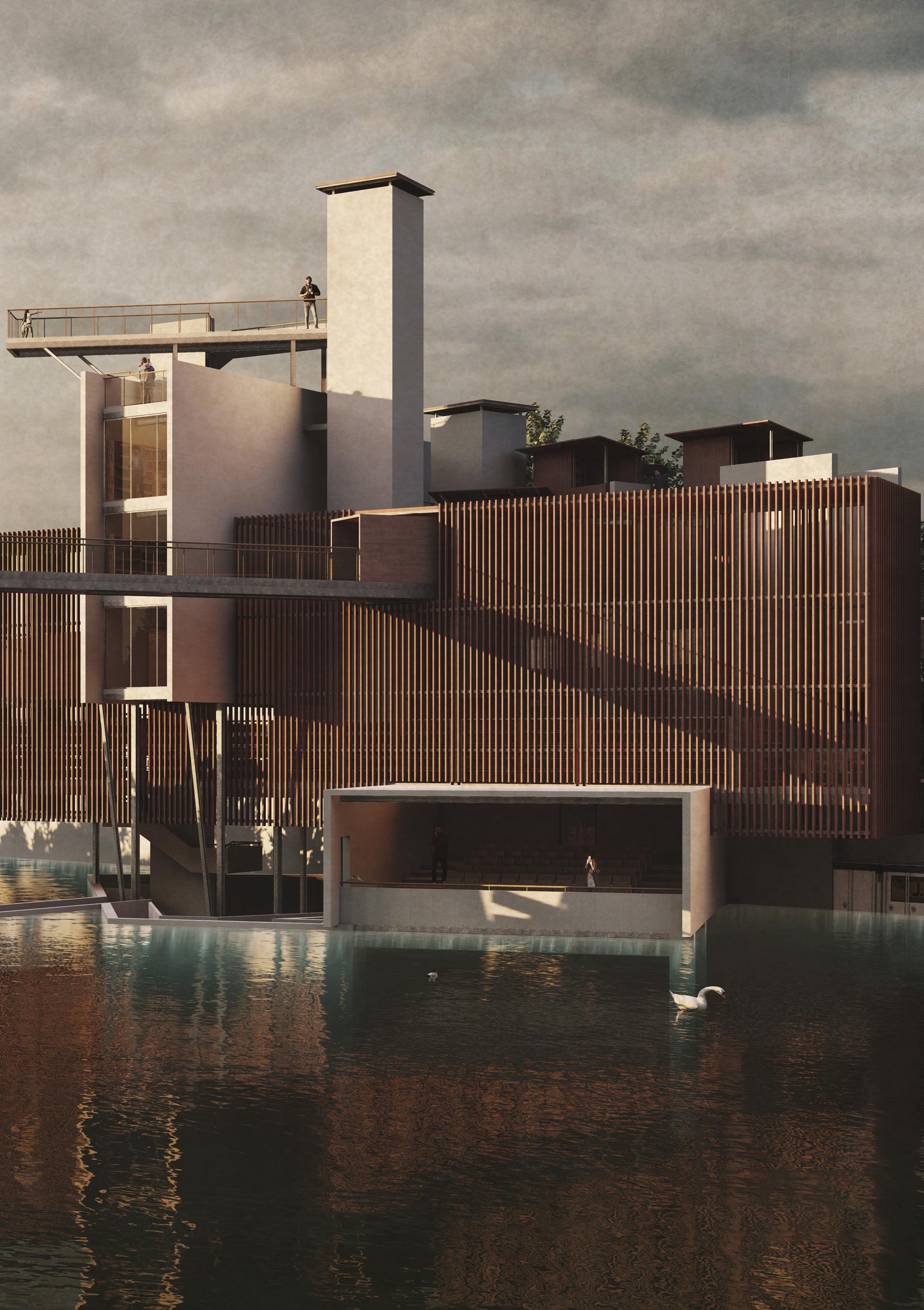
As an architectural island in an agricultural landscape, the Sanatorium seeks to engage with the greater ecology of the Bay and its fragile ecosystem by connections with water, the water of the adjacent designed wetland and the canal beyond. In this way, the architecture operates as an eddy between the Couesnon Canal and the sea, channelling water through its walls, beneath its bridges and below its stair towers, flooding its internal lake, discharging back into the Canal and the Bay beyond. The Sanatorium is a form of de-polderisation in miniature whereby land reclaimed for farming is offered back to the sea through designed rupture.
The architecture treats the human body and the ecosystem. By introducing water from the wetland into the Sanatorium it establishes an intimate relationship between body and water through therapeutic treatments: steam rooms, resistance hydrotherapies, aerobic exercises and aromatherapies and a designed landscape of internal views across, adjacent to and above water. An enclosing wall houses residential and therapeutic programmes, a rainwater treatment system and a singular elevated view to Mont-Saint-Michel. Bridges and reading towers animate the internal landscape, connecting and activating programme whilst creating viewpoints both internal and external. A laboratory and flower garden, library and acoustic performance space complete the programme.

17

157


159

 Preceding image. Sanatorum la Manche
Left. Sanatorium acoustic therapy wall
Right. Sanatorium library



QIANRU LI & YUNNING ZHANG & ZEYU LIU | THE SANATORIUM LA MANCHE 161

 Left. Sanatorium hydrotherapy wall and aromatherapy laboratory
Upper right. hydrotherapy plan
Lower right. Sanatorium wall views
QIANRU LI & YUNNING ZHANG & ZEYU LIU | THE SANATORIUM LA MANCHE 163
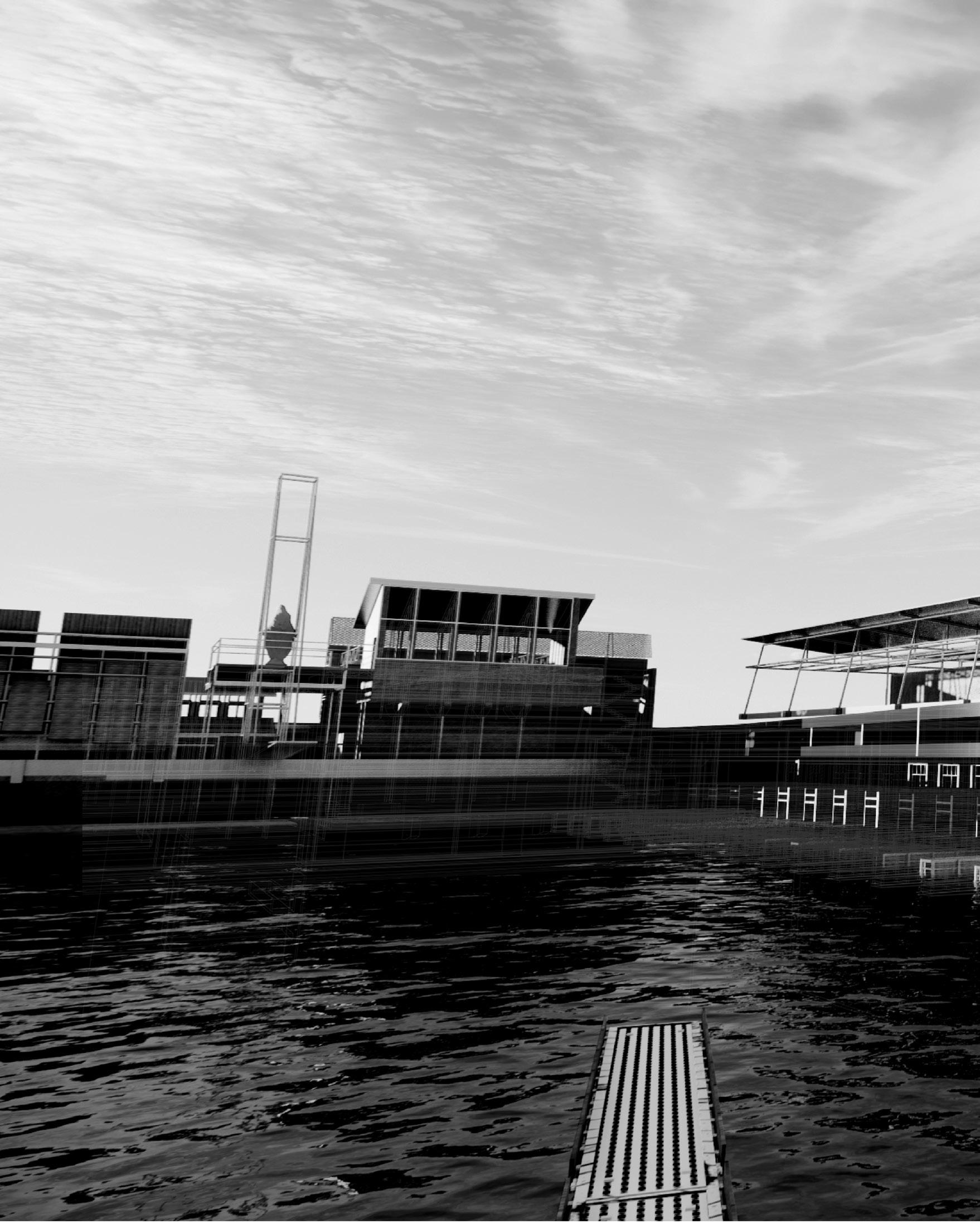 Sanatorium la Manche accoustic therapy and patient accommodation walls

QIANRU LI & YUNNING ZHANG & ZEYU LIU | THE SANATORIUM LA MANCHE 165

Following
Sanatorium la Manche hydrotherapy wall
page. Sanatorium la Manche library

QIANRU LI & YUNNING ZHANG & ZEYU LIU | THE SANATORIUM LA MANCHE 167

QIANRU LI & YUNNING ZHANG & ZEYU LIU | THE SANATORIUM LA MANCHE 169
171
Site: Sea Dyke and Polders.
Programme: Oyster Farm, Sea Gate, Lido, Public Walkway.
FRAYING THE SEA DYKE
DEPOLDERISATION THROUGH AQUACULTURE
JIAMIN ZHONG XINGYU LU
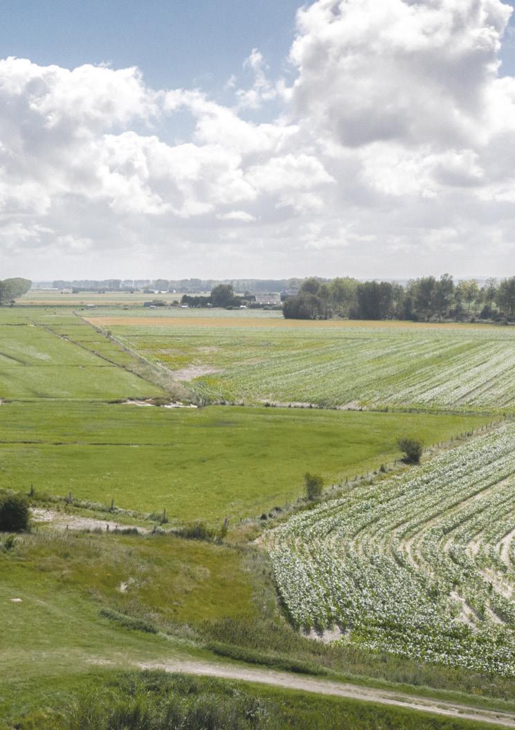
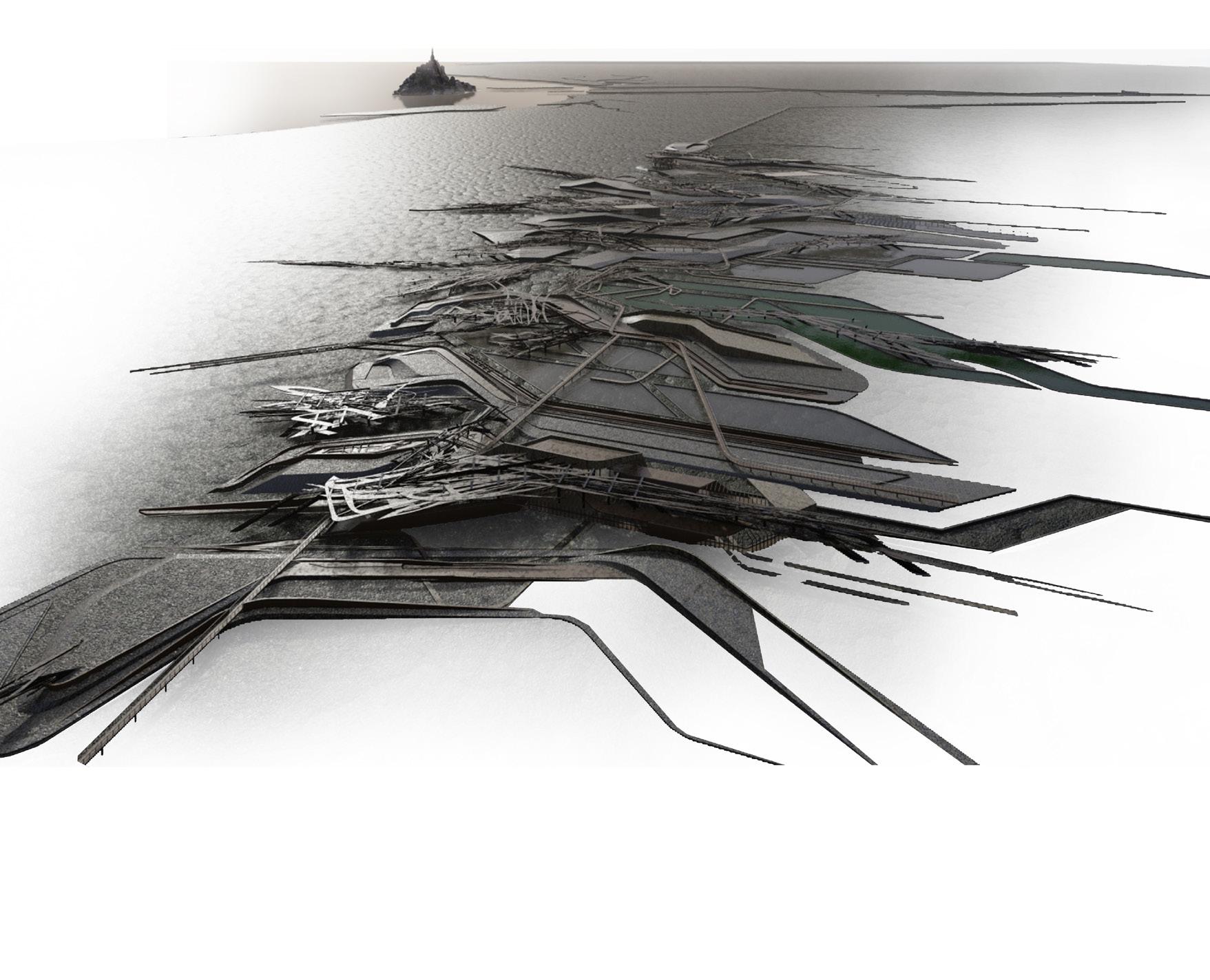
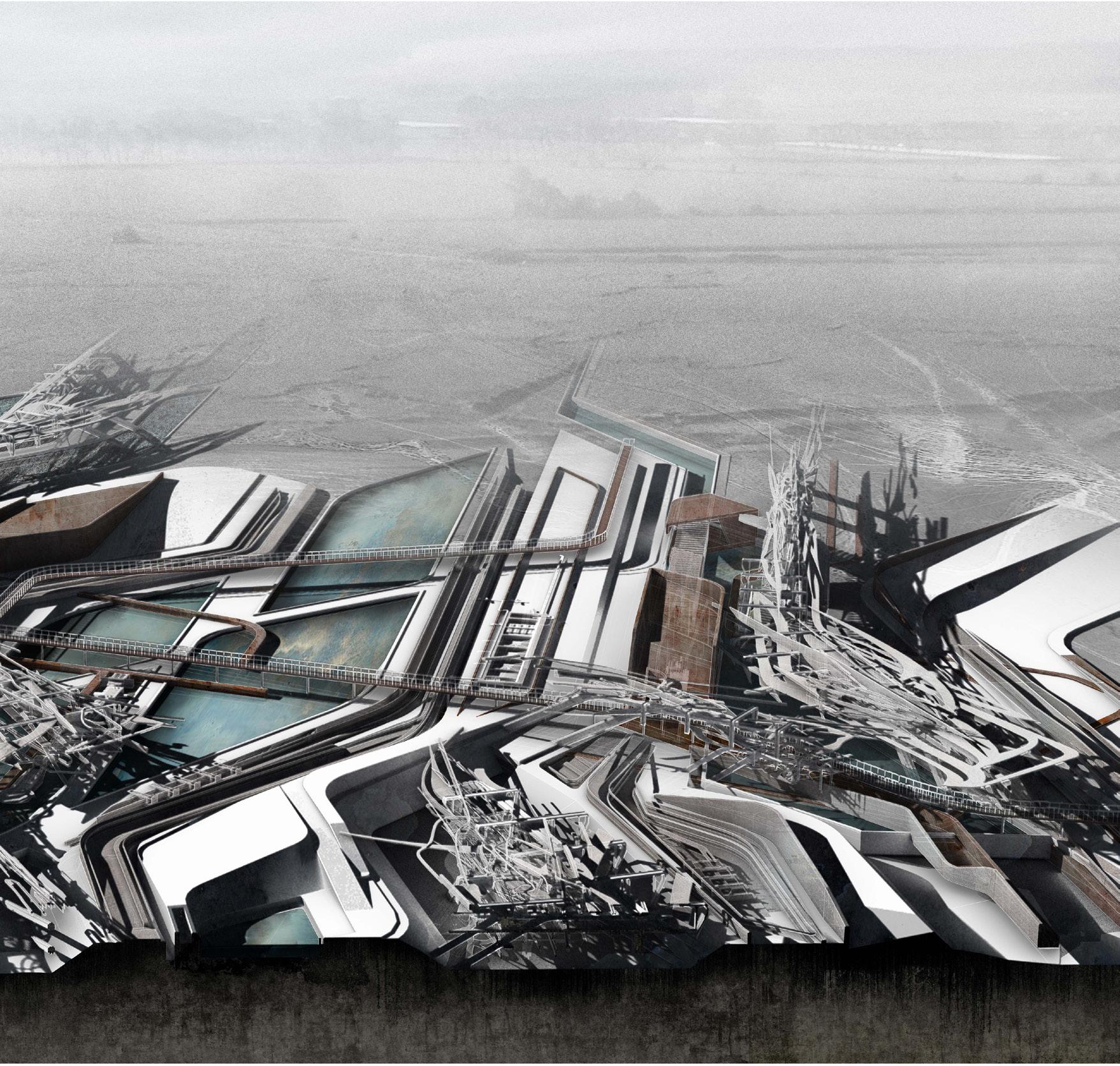
Fraying the Sea Dyke develops in relation to current thinking towards the depolderisation of certain areas of the north French coastline as a possible response to rising sea levels. The proposal explores a new form of aquaculture that intervenes into the expansive fabric of the nineteenth century polder landscape of the Bay of Mont-Saint-Michel in the form of a series of constructed landscape seams. Each of these seams act as transitional gates and breach the outer sea dyke to choreograph the ingress of the tides. In so doing, they flood certain areas to form an extension to the salt marsh habitats held by a secondary inner dyke and feed a series of pools that expand the local rich economy of aquaculture – specifically the cultivation of oysters for which the region is renowned. The pools and their associated laboratories and storehouses, the architectural forms of which reinforce the seam, provide the sequence of nursery beds and desalination pools required prior to and following the four year exposure of the oysters to the deeper tidal zones through elevated baskets arrayed out beyond the marsh.
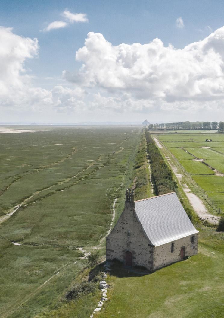
This frayed landscape forms a disturbance in the sea dyke’s path – a slowing of the pilgrimage route from the Chapelle Saint-Anne-de-la-Grève in the west to Mont-Saint-Michel along the ridge of the dyke. At this level, the new landscape provides an elevated public realm of repose, refreshment and bathing pools at once witnessing the extraordinary cultivation of the sea and exposing views towards the abbey island beyond.

18
173


JIAMIN ZHONG & XINGYU LU | FRAYING THE SEA DYKE 175


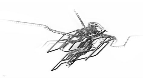


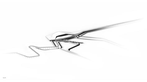 Preceding page. Fraying the Dyke landscape seams and oyster farm
Upper left. Fraying the Dyke plan
Lower left. oyster nursery section
ZHONG & XINGYU LU | FRAYING THE SEA DYKE 177
Right. landscape seams JIAMIN
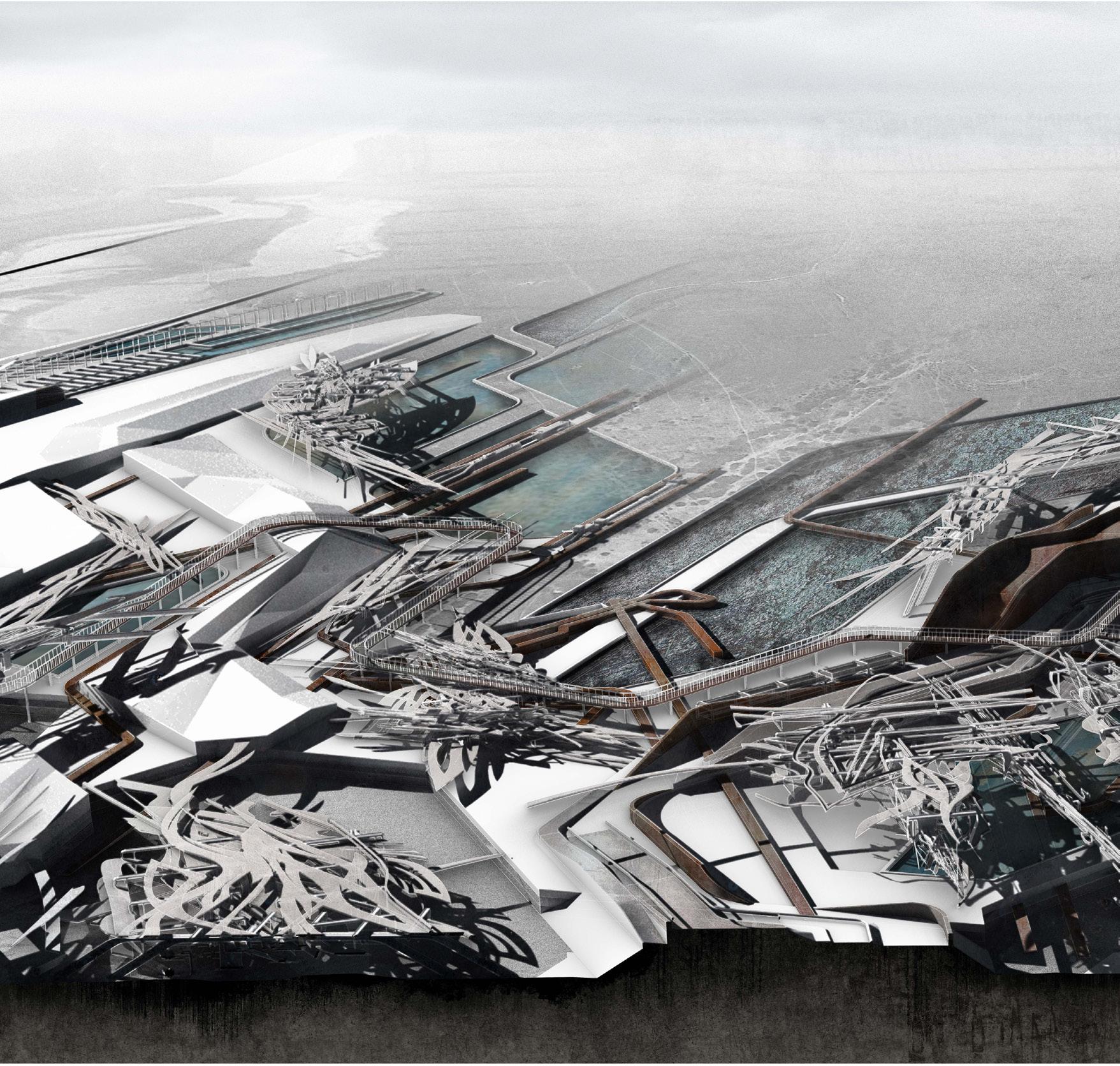 Fraying the Dyke landscape view to bay and oyster beds
179

 Left. oyster culitvation laboratory and hatchery ponds
Right. gabion wall landscape detail
& XINGYU LU | FRAYING THE SEA DYKE 181
JIAMIN ZHONG
Site: Western Sea Dyke, Chappelle Sainte-Anne-de-la Grève. Programme: Hostel, Refectory, Kitchen Garden, Scientific Gardens.
THE POTAGER OF THE KOIMETERION
AN ARCHIPELAGO OF AQUACULTURES
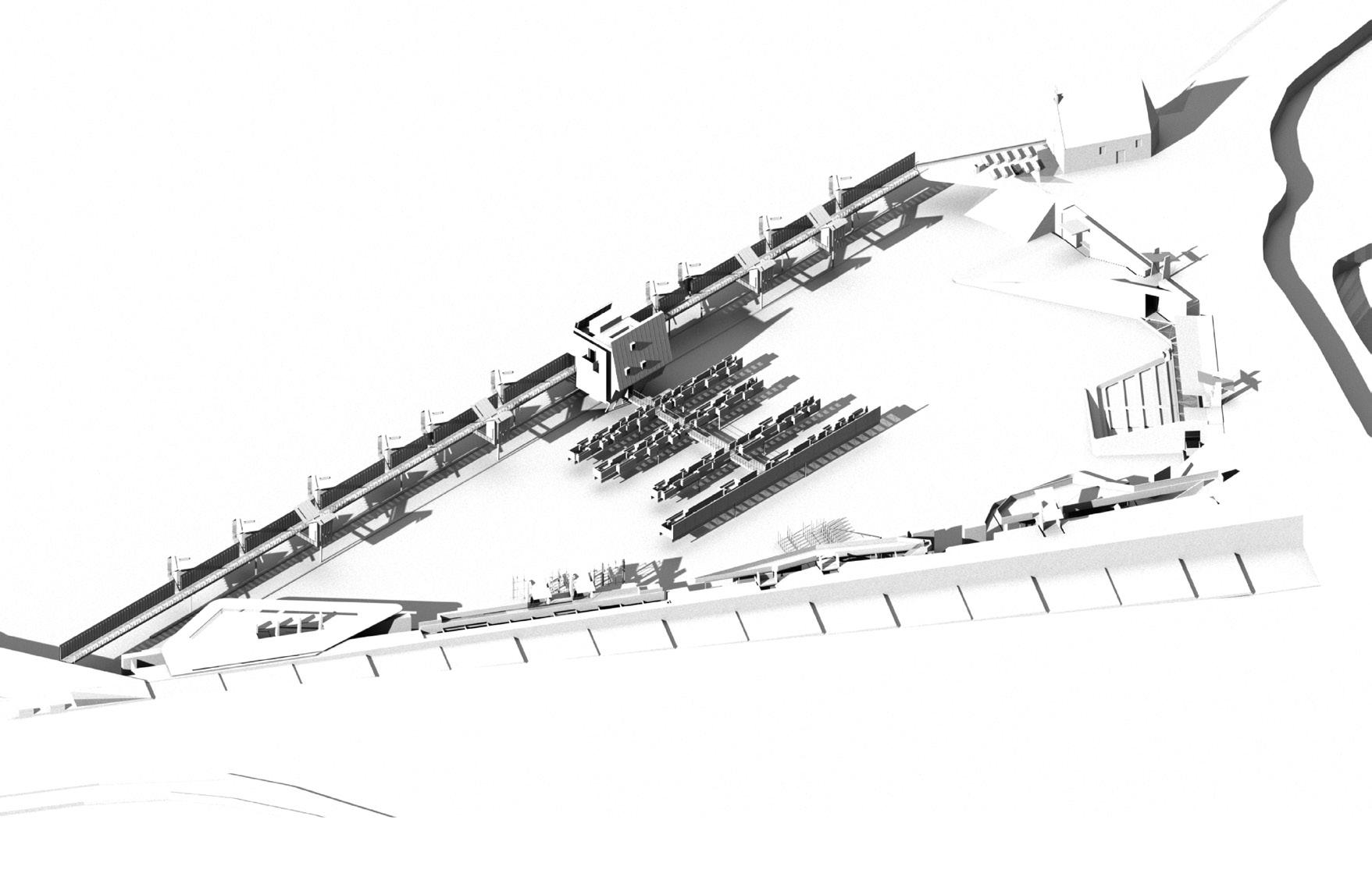
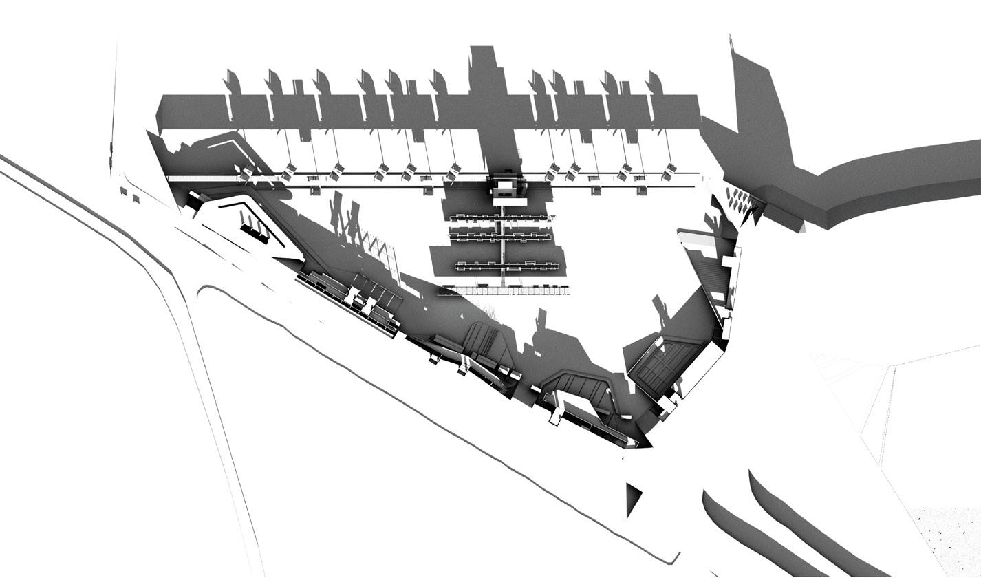
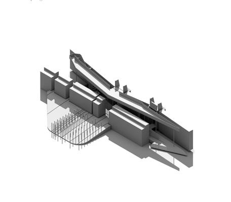
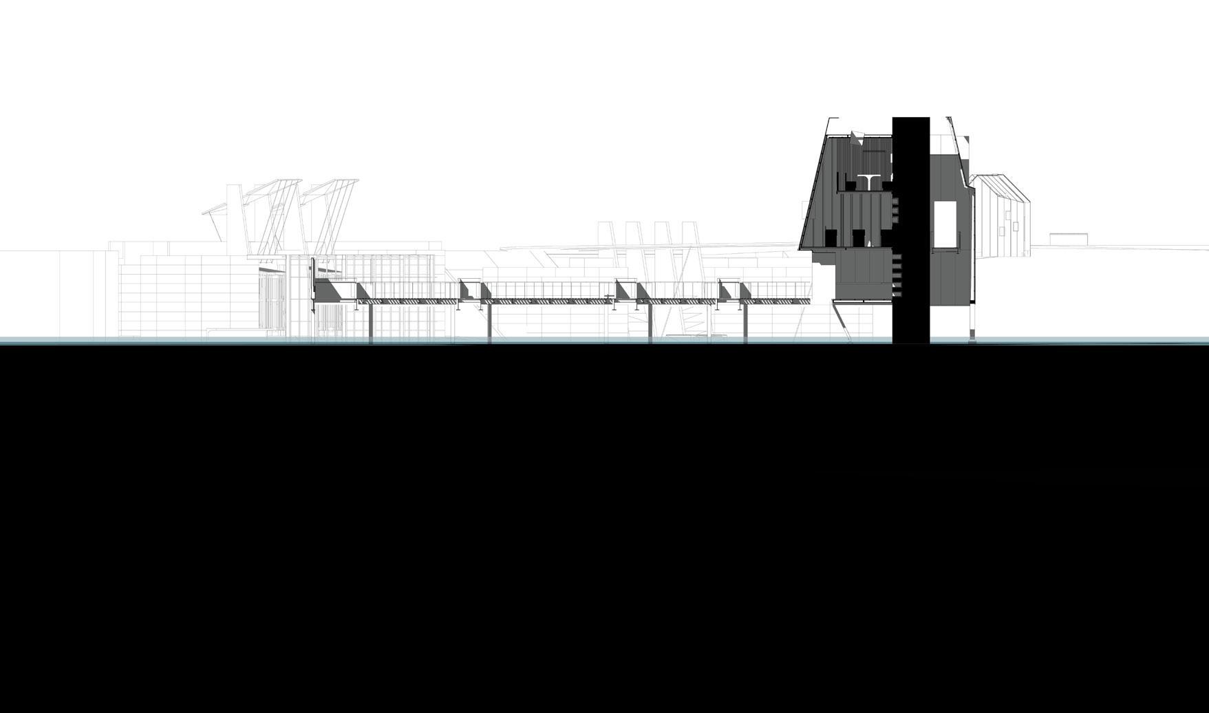
The Potager of the Koimeterion, like a surveyor, sits nestled into the salt marsh at the chapel of St Anne, a hinged threshold within the sea dyke that leads pilgrims to Mont-Saint-Michel. Locking into both the real and imagined narratives of the bay of the abbey island, the garden archipelago offers a programme of cultivation, registration and recouperation through typologies of skin, husk, walkway, garden, vessel and cast. Each piece is layered upon the salt marsh in response to the programmes of hospitality and cultivation.
Weaving between the urbanity of the island territory of Mont-Saint-Michel and the productive farmland of the polders The Potager of the Koimeterion draws upon the uncertain nature of the tidal bay through a gathering of architectural characters which witness and register local flooding as an indication of a global condition.
Six garden chambers are caught in a reinforced dyke. Like drawers pulled from a cabinet, they gradually receive and collect the detritus of the salt marsh –catching, filtering and processing; cultivating the temporal narratives of the tide and the gradual erosion of the land. The pilgrimage route is then registered above through architectures of sustenance - The Potager (kitchen garden), The Culinarium (refectory), The Cubiculum (bathhouse) and The Requiem (dormitory). Together, they employ an economy of materials where finely crafted timber acts as an internal tide marker of inhabitation amongst an industrial assemblage of beams and posts. Limestone raised beds form fragments of polder land strategically dispersed as an elevated cloister garden.
 HANNAH DAVIS
19
183




HANNAH DAVIS | THE POTAGER OF THE KOIMETERION
Left. plan and section
185
Right. protagonists and section through Culinarium and kitchen garden


BIBLIOGRAPHY
Adams, Henry, ‘Mont-Saint-MichelandChartres’ , American Institute of Architeects, 1904
Balard, J.G., ‘ConcreteIsland’ , Jonathan Cape, 1974
Cadwell, Michael, ‘StrangeDetails’ , MIT Press, 2007
Corner, James, ‘TheAgencyofMapping’,in Mappings edited by Denis Cosgrove, Reaction Books, 1999
Defoe, Daniel, ‘RobinsonCrusoe’,William Taylor, London, 1719
Eco, Umberto, ‘IslandoftheDayBefore’ , Secker & Warburg, 1995
Giraudoux, Jean, ‘SuzanneandthePacific’ , G.P. Putnam, 1923
Germain, P. M. Brin & E. Corroyer, ‘SaintMicheletleMont-Saint-Michel’ , Houghton Mifflin, 1913
Hawker, Adrian and Victoria Clare Bernie, MArch Island Territories Catalogues, University of Edinburgh: 2016-18 islandterritoriesv:Havana
2018-19 islandterritoriesvi:ManhattanVol.1of2 2019-20 islandterritoriesvi:ManhattanVol.2of2 2020-21 islandterritoriesvii:IslandTemporalitiesVol.1of2
Homer, ‘TheOdyssey’ , Greece, 8th Century BCE
Lucian of Samosata, ‘ATrueStory’ , independently published, 2nd Century
Lyotard, Jean François, ‘Scapeland’ , in The Lyotard Reader edited by Andrew Benjamin, Wiley-Blackwell, 1989
Rabelais, François, ‘TheLifeofGargantuaandofPantagruel’ , The Fourth Book of Pantagruel, France 1552
Sennett, Richard, ‘ArousingTools’ , in The Craftsman, Yale University Press, 2008
Shakespeare, William. ‘TheTempest’ , London, 1610
Swift, Jonathan, ‘TravelsintoSeveralRemoteNationsoftheWorld’ , Benjamin Motte, 1726
Tournier, Michel, ‘Friday,or,TheOtherIsland’ , Penguin London 1974
IMAGE REFERENCES
Cover
- Field Drawing, Amy Drabble & Jonathan Pilosof. edited Georgia Whitehead.
Inside Front Spread
- Aerial view of the Bay of Mont-Saint-Michel.
Inside Back Spread
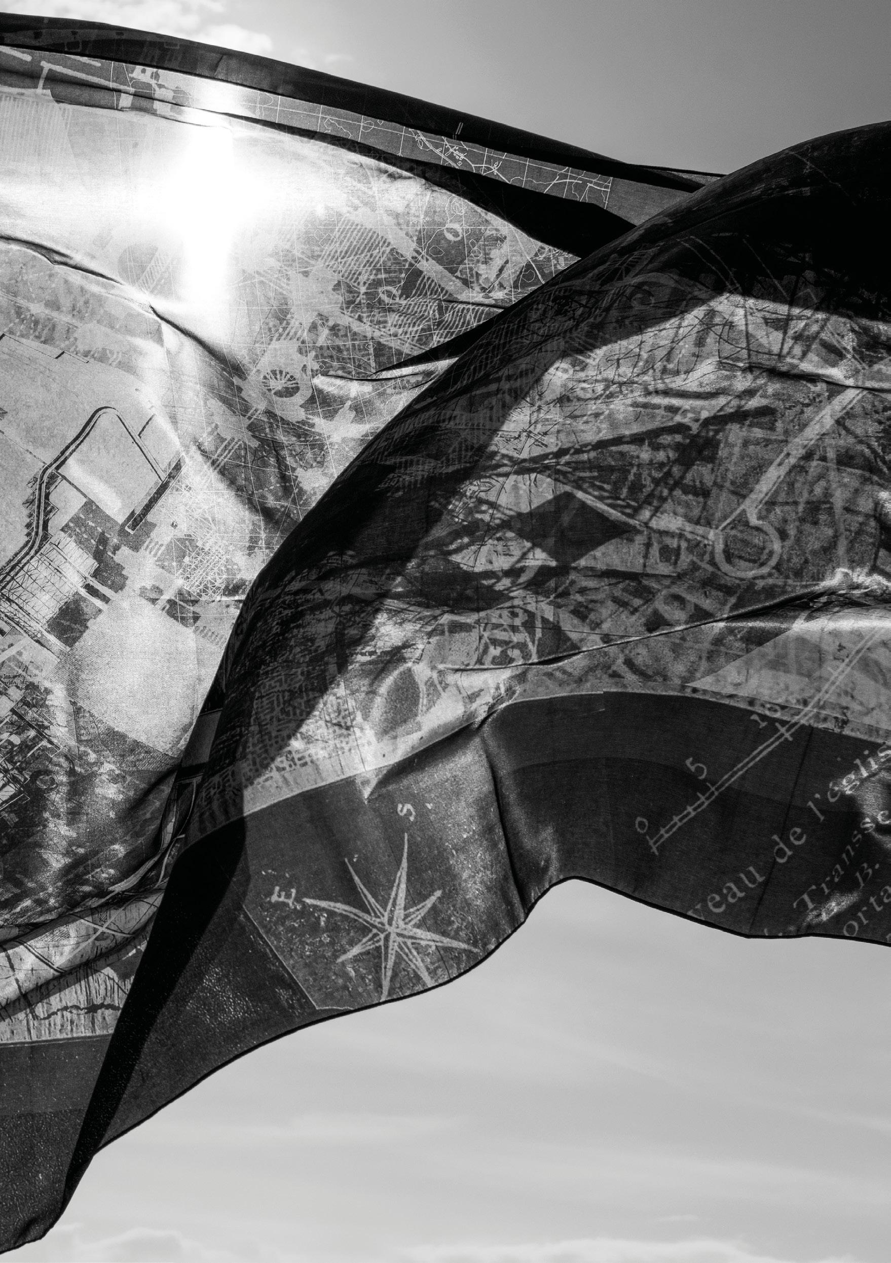
- Silk print of Drafting & Re-Drafting, Amy Drabble & Jonathan Pilosof.
Prologue
- Pilgrimage through the Bay of Mont-Saint-Michel, Tom Carney.
Photo Credits
18-19 Abbey Mont-Saint-Michel, Victoria Clare Bernie
48-49 The Bridge, Tom Carney
66-67 Shadow of Abbey on Sand, Tom Carney
90-91 Salt marsh, Tom Carney
124-125 Cousenon Dam, Victoria Clare Bernie
154-155 Polder Field, Victoria Clare Bernie
170-171 Chapelle Sainte-Anne de la Grève with sea dyke to Mont-Saint-Michel, Thibault Poriel
186-187 A Garden for an Anchorite Stuart Gomes & Tom Carney
Image Credits
1 Pilote Français. Quatrième partie, comprenant les côtes septentrionales de France, depuis l’île Bréhat jusqu’à Barfleur, levées e, 1829, 1830, 1831, 1832 et 1833 Bay Mont Saint Michel. Bibliothèque nationale de France.
2 Le Mont St Michel, ville et château d’après les plans d’Emile Sagot, arche 1850. The Bibliothèque nationale de France.
6-7 Mont Saint-Michel, face nord_par Édouard Corroyer. Bibliothèque nationale de France.
190 Plan du Mont St-Michel gravé par E. Lebel; d’après les plans levés par Emile Sagot, arche Lebel, Edmond (1834-1908). Bibliothèque nationale de France.
189

ACKNOWLEDGEMENTS
Tutors
Adrian Hawker
Victoria Clare Bernie
Visitors
Kevin Adams, Paddi Alice Benson, Anaïs Chanon, Chris French, Ben Hair, Lisa MacKenzie, Charlie Sutherland, Tiago Torres-Campos, Norman Villeroux, Leo Xian
Professional Consultants
Jonathan Narro [David Narro Associates]
Amélie St James [Guide] Claire Collin [Guide]
Technicians
Paul Charlton, Rachel Collie, Richard Collins, Malcolm Cruickshank, Paul Diamond, Catriona Gilbert, Marc Jeffries
Administration
Remi Jankeviciute, Laura Varga
island territories vii: Island Temporalities Mont-Saint-Michel edited by Giles Davis & Georgia Whitehead
The format of this catalogue has developed annually, evolving from the inaugural catalogue series produced for the ESALA MArch studios 2017-18, designed by Emma Bennett and Rachel Braude. Printed by J Thomson Colour Printers Ltd., Glasgow
191



 Adrian Hawker
Victoria Clare Bernie


 Plan of the island abbey. Emile Sagot, 1850.
 La Merveille. north elevation, Édouard Corroyer, 1875


 Dismantling the abbey
Giles Davis


 Architectural seeds
Clockwise from upper left. Stuart Gomes, Charlie Donaldson, Marty Schroder, Tom Carney

 Field Drawing


 Upper left. The Insitute axonometric view
Lower left. The Institute section north-south
Right. Sectional Studies


 Pilgrim Bathouse and Cistern aerial view


 Above. Botanical Garden perspectival view looking east Following page. Botanical Garden perspectival view looking northeast


 Upper left. Refuge and Walkway plan
Lower left. House of Estrangement Camera Obsucra perspectival section
Upper and lower right. Tower Retreat axonometric
Far right. Field Drawing Augutus Wray, Toby Eccleston, Nathalie Harris


 Left. Botanical Garden, Workshop and Quarry aerial view, section north-south, plan
Right. perspectival view south


 Preceding page. Garden for an Anchorite plan detail
Upper left. House of Estrangement Stuart Gomes
Upper right. House of Estrangement Tom Carney
Lower. Garden for an Anchorite section and characters


 Above left. Field Drawing
Below left. reading room and undercroft
Above right. Tombelaine aerial view
Below right. hightide


 Left. Oratory
Right. Musical Manuscript Archive


 Upper left. Oyster Beds
Lower left. Guild House


 Wind Rose Seeds
Following page. Cockle Tide Pool


 Lavender and Tamarisk Garden


 Left. Polder garden armatures
Right. Kitchen Garden plan


 TIANSHI WANG


 Preceding image. Sanatorum la Manche
Left. Sanatorium acoustic therapy wall
Right. Sanatorium library


 Left. Sanatorium hydrotherapy wall and aromatherapy laboratory
Upper right. hydrotherapy plan
Lower right. Sanatorium wall views


 Sanatorium la Manche accoustic therapy and patient accommodation walls


 Preceding page. Fraying the Dyke landscape seams and oyster farm
Upper left. Fraying the Dyke plan
Lower left. oyster nursery section
 Fraying the Dyke landscape view to bay and oyster beds


 Left. oyster culitvation laboratory and hatchery ponds
Right. gabion wall landscape detail
 HANNAH DAVIS


