ELLA LISAC
PLANNING & DESIGN PORTFOLIO
ABOUT ME
PASSIONATE, CREATIVE, FOCUSED
My name is Ella Lisac and I am currently a fourth year in Urban Planning. Born and raised in Cleveland, OH, I grew up experiencing a diverse and evolving city. My passion for city design ignited during high school, where my friends and I took frequent visits to downtown. Through these short explorations, I became enchanted by the intricate network of the urban realm. More importantly, I realized how the design of spaces made me feel, how places can kindle certain memories. Designing for people and the planet is my goal as a future Urban Planner. I hope to create spaces that harness new memories for communities, giving back what thoughtful city planning has given me.
INTERESTS


SKILLS
Photoshop
Illustrator
InDesign Mapping
ArcGIS
ArcMap
Google Earth Pro Drafting • AutoCAD • SketchUP Analog
• Technical Writing
• Data Analysis
• Brainstorming Additional
• Microsoft Office Suite
• Bluebeam
• Foxit
RESUME
EDUCATION
University of Cincinnati | Cincinnati, OH
College of Design, Architecture, Art and Planning
Bachelor of Urban Planning
Class of 2026
GPA: 3.9
Participating in Professional Practice Program, alternating semesters of classroom study and work in the field of planning.
KU Leuven | Brussels, Belgium
Faculty of Architecture
Urban Design and Spatial Planning Fall 2024
Beaumont School | Cleveland Heights, OH
Class of 2021
GPA: 4.2
ACHIEVEMENTS
DAAP School of Planning Scholarship Recipient | Fall ‘24
Segoe Scholarship Recipient | Fall ‘24
Cincinnatus Scholarship Recipient | Fall ‘21-Fall ‘24
University of Cincinnati Dean’s List | Fall ’21- Fall ‘24
Colorado Trail Thru-hiker | Summer 2022
EXTRACURRICULARS
Clay Club
UC Mountaineering Club
EXPERIENCE
WSP
Engineering Consulting Firm
Environmental Planning Intern | Full-Time | May-August 2024
Portland, OR
• Worked with the Environmental team for the Interstate Bridge Replacement Program (IBR).
• Helped prepare the Draft Supplemental Environmental Impact Statement (Draft SEIS) to follow NEPA standards.
• Wrote Alternative Text for figures and images to comply with Section 508 of the Rehabilitation Act.
• Responded to document comments and made technical edits to the Draft SEIS.
• Prepared training materials for the SEIS Public Comment Period using the platform, CommentSense.
• Researched public opinions regarding the bridge project and created mock-up comment responses for topic coders.
• Supported the Cultural Resources team with Tribal communication efforts, including drafting letters to Tribal leadership.
planning NEXT Columbus, OH
Community Planning Firm
Urban Planning Co-op | Full-Time | August-December 2023
• Maintained and analyzed engagement database of over 1,000 survey responses for Plan Chattanooga effort.
• Update Future Land Use Map for Mobile, AL. Went parcel-by-parcel and decided new land use based off of previous data.
• Drafted GIS exhibits detailing parcel ownership, walk sheds, and landmarks for Manchester Together initiative in North Manchester, IN.
RICONDO & ASSOCIATES, INC.
Aviation Consulting Firm
Aviation Planning Co-op | Full-Time | January-April 2023
Cincinnati, OH
• Built an online GIS database for over 5000 rooms at Hartsfield-Jackson Atlanta International Airport (ATL). Resulted in an interactive terminal database via Google Earth file to be referenced by clients. Drafted Environmental Documentation for air quality standards for ATL Airport Master Plan. Assisted in AutoCAD layouts for ATL interior plans.
• Utilized AutoCAD to assemble four Environmental exhibits for Minneapolis-St. Paul (MSP) 2040 Long-Term Plan to include future land use, noise contours, and runway protection zones. Designed page layouts using AutoCAD for MSP Near-Term, Mid-Term, and LongTerm exhibits.
• Designed two new terminal layouts from scratch for Southern Nevada Supplemental Airport.


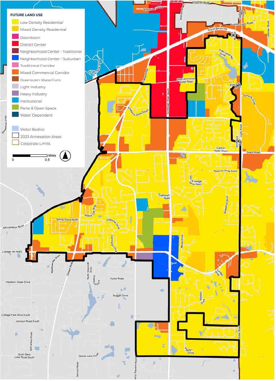
MAP FOR MOBILE
MOBILE, AL | planning NEXT
The Future Land Use Map (FLUM) is a guide for the future physical development of the City of Mobile. This map is part of the larger, Map for Mobile initiative, a framework designed to offer guidance and direction for the City’s infrastructure and readiness for growth. My role in this effort was updating Mobile’s future land use parcel-by-parcel, deciding the use based on prior data. As a part of this effort I built GIS exhibits for Map for Mobile, including Annexed Areas, Undeveloped Parks, and Major Street Plan maps.

Completed Future Land Use Map
Land Use updates include increasing Parks & Open Space, adding Residential areas, and creating a “Downtown” land use category to increase mixed-use development.
ANNEXED AREAS MAPPING
In July 2023, the City of Mobile annexed three new areas: Kings Branch, Orchard Estates, and Cottage Hill. With this new addition came the need for an updated land use and development plan. My role in this effort was creating GIS maps detailing the new land use for each of the annexed areas. Additionally, I created Major Street Plan maps to detail future traffic patterns. Decisions were made through collaboration with City of Mobile officials.
Hill Future Land Use
Cottage Hill future land use focused on adding Residential development.
view all maps

Cottage Hill Major Streets Plan All Annexed Areas Future Land Use

Major street maps were updated in the individual Annexed Areas maps, as well as at the Citywide scale.

Annexed Areas were all individually updated with parcel-by-parcel land use.
Cottage
MANCHESTER TOGETHER
NORTH MANCHESTER, IN planning NEXT
Manchester Together is an initiative created under the Lilly Endowment Inc.’s College Community Collaboration (CCC). This Collaboration encourages Universities and their communities to work together on projects that will transform their quality of place. My role in this initiative was to collaborate with the City of North Manchester and Manchester University to create a plan that would create a compelling town-gown development project. My main project was performing site analysis and GIS mapping, where I created all base map and analysis elements from scratch in ArcGIS Pro.
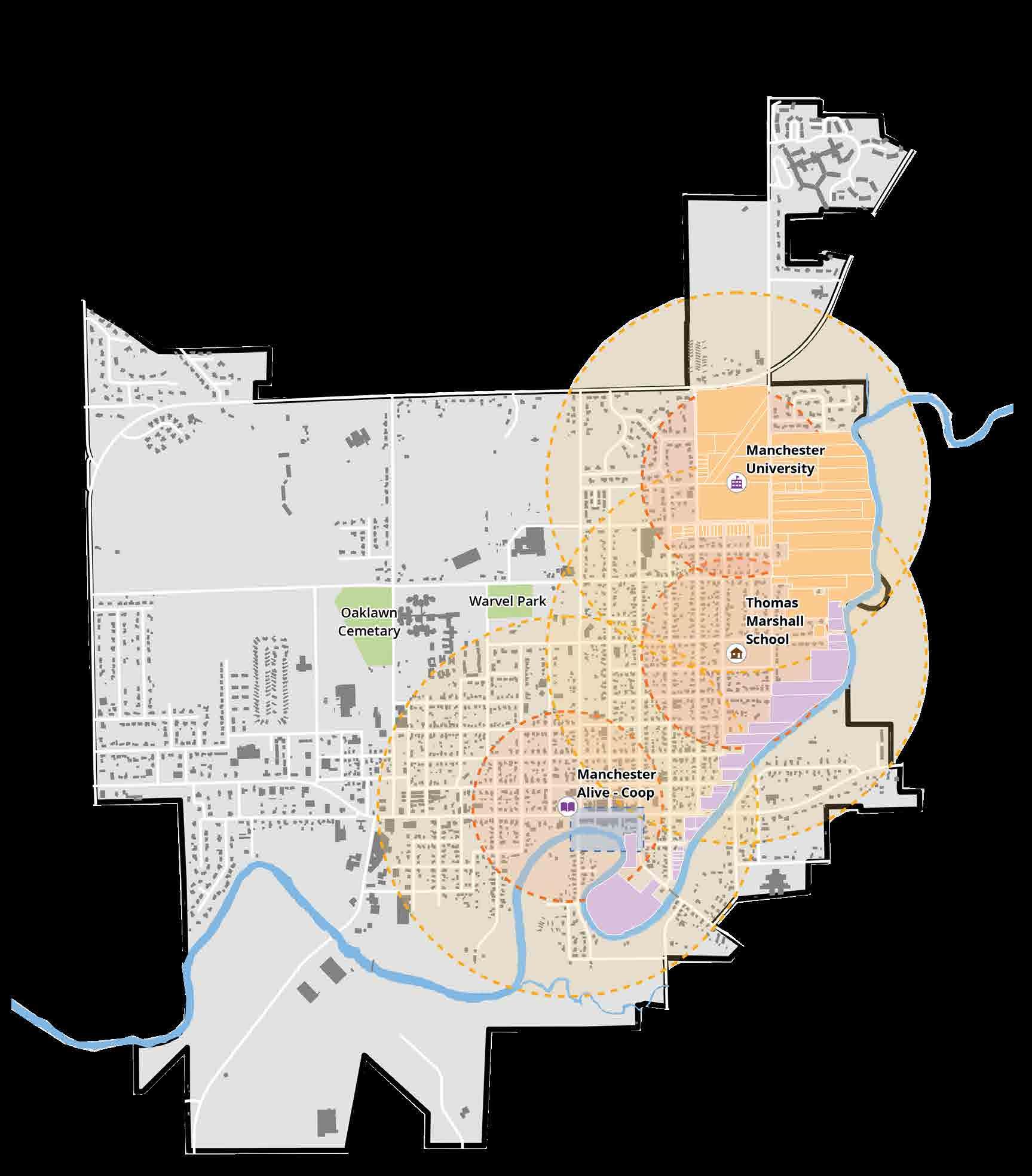
Landmarks and Walksheds Map
The City of North Manchester requested that new development be located within a 5-10 minute walkshed of their dedicated landmarks. This map conveys these walkshed distances overlayed on parcels of interest for the project.
HOUSING ANALYSIS
Increasing housing options was identified as a key strategy for Manchester Together. Three sites situated between North Manchester’s downtown and Manchester University were found to have the greatest potential for development.


Housing Sites Map

Manchester University Town Home Site
Thomas Marshall School Site
Downtown 2nd Story Housing Site
TERMINAL INVENTORY
HARTSFIELD-JACKSON ATLANTA INTERNATIONAL AIRPORT
Ricondo & Associates, Inc.
Hartsfield-Jackson Atlanta International Airport (ATL) is adopting a 20year Master Plan. This plan aims to promote economic development and improve facility conditions. Terminal Inventory is a critical component of airport master plans, detailing the physical and numerical characteristics of each room. I collaborated in building an online GIS database for over 5000 rooms across ATL Airport. Data recorded included space use, space function, area, shape length, etc. I converted this database into an interactive KMZ file that can be opened in Google Earth. This allows the user to spatially see a room and view quantitative data. This database will be used by developers as a reference for existing terminal conditions at ATL Airport.
Complete database at it appears in Google Earth
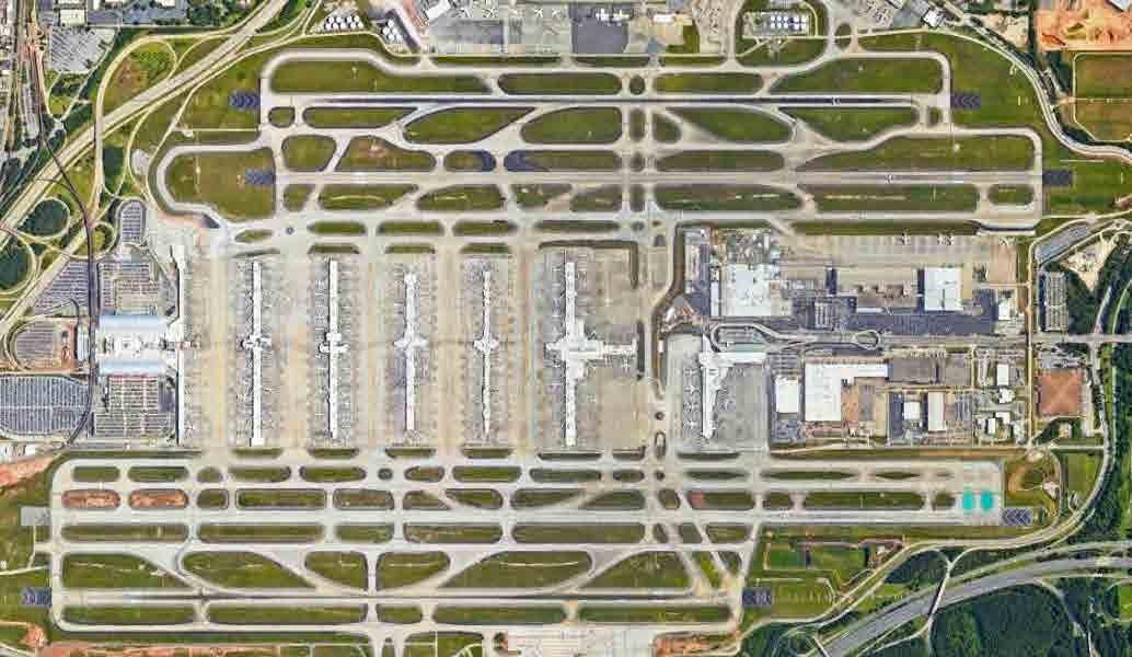
Project Site

A CLOSER LOOK
{DECONSTRUCTED
MODEL}
Similar to a land use map, this terminal database is separated by color based on space usage. This was created by making the footprint in AutoCAD and inputting spatial and qualitative information through GIS.

TERMINAL AERIAL
GIS TERMINAL DATABASE
ENVIRONMENTAL EXHIBITS
MINNESOTA ST. PAUL
INTERNATIONAL AIRPORT
Ricondo & Associates, Inc.
OVERVIEW
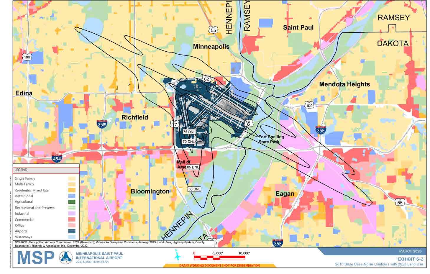
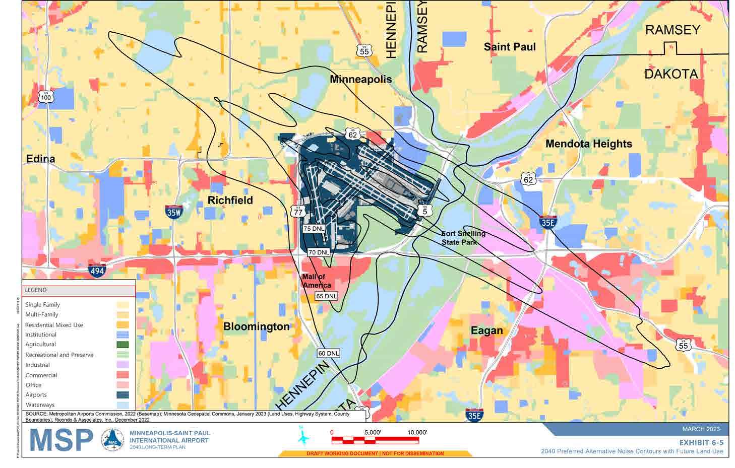
Minnesota St. Paul International Airport (MSP) is undergoing a new Long Term Plan for 2040. This requires updated environmental exhibits as well as projected environmental impact analyses. For this project, I assembled a series of exhibits in AutoCAD including future land use, airport noise contours, and runway protection zones. These exhibits will be used as a guide for developers when planning for long-term sustainable development in 2040.
IMPORTANCE
Noise Contour Maps visualize the intensity of aircraft volumes. Flight patterns are designed to fly over industrial or transportation zones so residential areas are not disturbed. Therefore, land use planning and airport development go hand-in-hand.
Runway Protection Zones (RPZs) are safety areas around a runway’s end that protect people on the ground and the aircraft in case of a faulty takeoff or landing. Large residential or commercial developments should not be placed within an RPZ. Therefore the land use the surrounding area must be considered.
Existing Noise Contours
2040 Noise Contours
Runway Protection Zones with 2040 Land Use

REIMAGINING FAIRMOUNT
URBAN DESIGN PROPOSAL
OVERVIEW
Located west of Cincinnati’s downtown, North and South Fairmount have suffered decades of neglect and disinvestment. However, with the recent construction of the $103 million “Lick Run Greenway” project, the development paradigm of Fairmount is beginning to shift. This studio project aims to create the foundation for a physically, environmentally, and socially resilient community through urban design strategies. All work displayed are my personal contributions and analysis for this project.
PROJECT VISION
Fairmount is a vibrant community where every individual is empowered to thrive. Through pedestrian-friendly infrastructure, climate resilient design, and inclusive housing, Fairmount paves the way for a sustainable community. Here, regardless of background or income-level, all people have the potential to flourish.
STRATEGIES FOR RESILIENCY
To build a resilient Fairmount, strategies are identified in both the physical and social realms. The string weaving this vision together is pedestrian-oriented infrastructure. Creating a complete trail and road network with pedestrian-first design sets the precedent that Fairmount is a neighborhood built for people. Additionally, diverse housing options and climate oriented design are identified as main strategies for a resilient Fairmount. Strategies are broken down into different tiers in order to offer a diverse range of solutions.


Pedestrian and bicycle only pathways, Low Traffic Intensity
Mixed-Use, Medium Traffic Intensity

PEDESTRIAN-ORIENTED INFRASTRUCTURE
Mixed Use, High Traffic Intensity


DIVERSE HOUSING
Lower Density, Mix of Private and Shared Outdoor Space


Higher Density, Shared Outdoor Space

CLIMATE-ORIENTED DESIGN
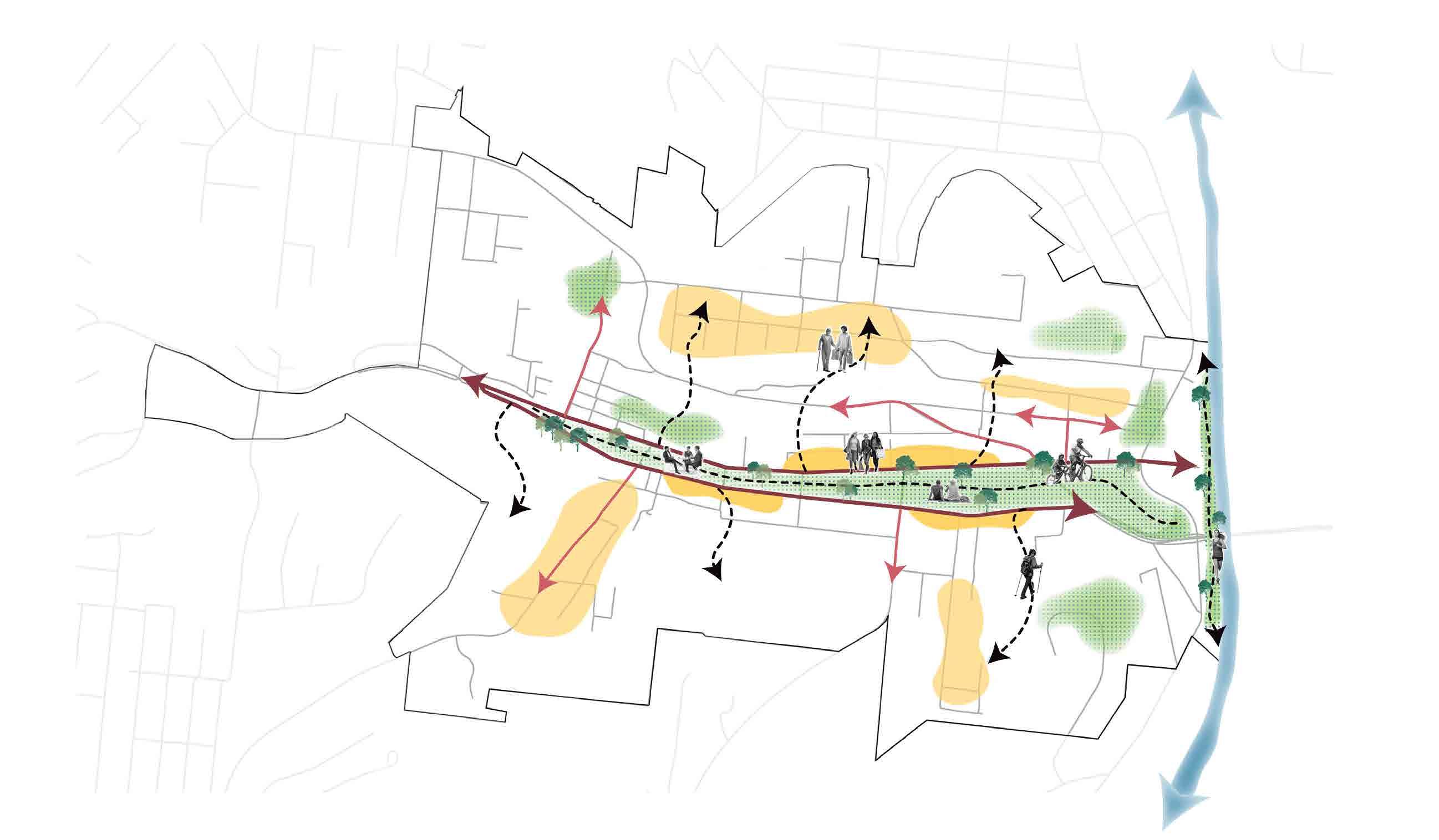
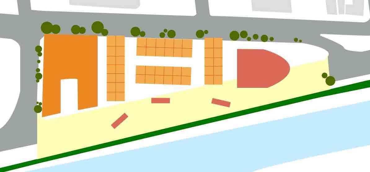
SITE-SPECIFIC INTERVENTION: CONNECTING TO THE MILL CREEK
Site Master Plan
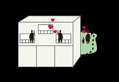
Fairmount borders the Mill Creek, a stream flowing into the Ohio River. Currently, Fairmount lacks any access to its waterfront, with surface parking and vacant industrial buildings lining the stream. This project prioritizes access to the Mill Creek through complete pathways and intentional green space. The master plan extends Fairmount’s main street, Queen City Avenue, to the waterfront. This extended main street plans for mixed-use residential and commercial development, using the waterfront as a catalyst for economic growth. Moving north, new residential housing will be added, prioritizing courtyards and riverfront access to promote social resiliency.
Residential Courtyards with Hidden Parking
Publicly Accessible Waterfront
Multi-level Residential Housing
Existing Footprint


Restaurant Seating and Riverfront Deck
Adaptive Reuse Employment District
Business District Extension
IMAGINING PATHWAY CONNECTIONS
Access to the Mill Creek is a guiding principle of this project’s development. New and enhanced pathways are designed to improve the pedestrian experience while also emphasizing connection to the waterfront. Existing pathways are extended to the Mill creek and new recreational trails are proposed near the waterfront’s edge.

Pathways and Mill Creek Connection Map Existing

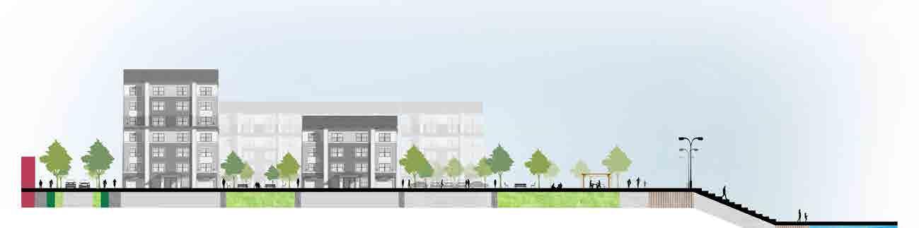
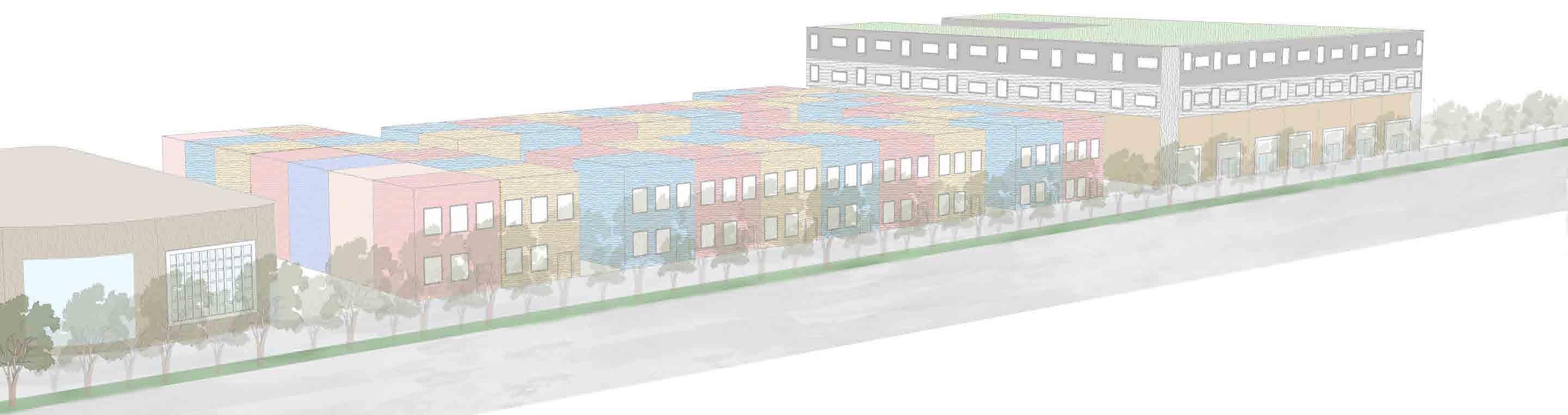
PEOPLE-FOCUSED DESIGN: PROMOTING WATERFRONT ACCESS
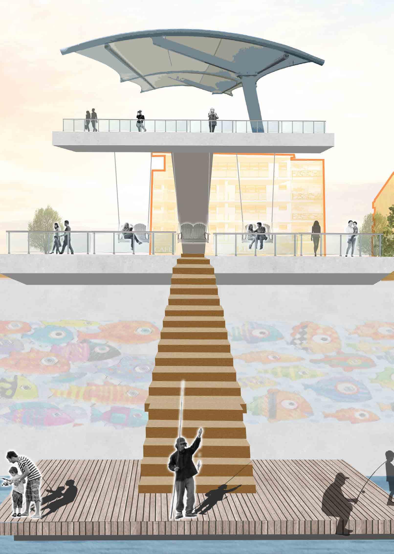
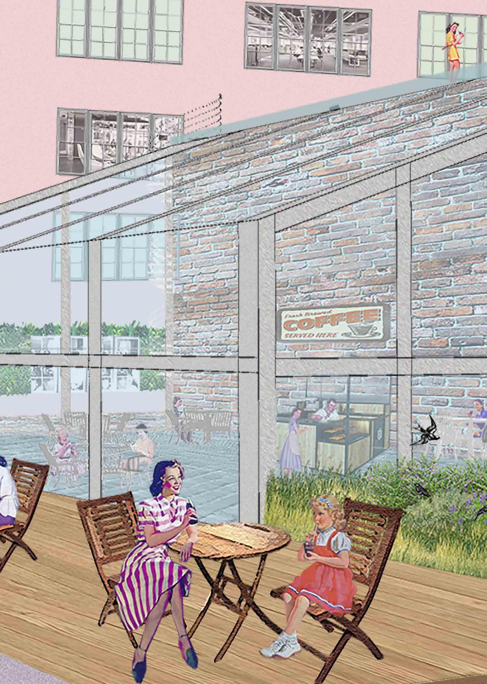
To promote waterfront use, the main design strategy is a public deck extending from the new business district. This deck design uses principles from Italian Baroque architecture, which uses monuments and large landmarks to draw the observer closer to the structure. If a pedestrian sees a piece of the deck from down the street, they are likely to continue down the path. This not only promotes walking along the business district, but acts as a welcoming to the waterfront.
Existing
Section
Site Location


Proposed Section


Warehouse
Surface Lot
Shade Structures and Restaurant Seating
Boardwalk Multi-Use Trail Open Lawn
Tiered Deck
River
Mural

Fishing Deck
Running Trail
Swinging Benches
Deck Overlook
BUS RAPID TRANSIT CORRIDOR
PLANNING FOR EQUITABLE COMMUNITIES
OVERVIEW
Cinicnnati, OH is implementing a Bus Rapid Transit (BRT) system in order to accomodate the projected population increase of 100,000 people for 2050. My team comprising of Lanie Tarowsky and Aaralyn Gross, have concentrated on strategies to promote equitable development along the corridor. Specifically, our focus is centered on increasing livability and affordability within the Neighborhood of Northside.
VISION
Northside, Cincinnati is a vibrant, affordable neighborhood that values green infrastructure, equity, and walkability. Through these strategies, Northside becomes a livable community that can sustain long-term prosperity.

HOW EQUITY STACKS UP
These maps explore traits of inequity along the BRT Corridor, identifying the area’s most vulnerable neighborhoods. Stacked maps help pinpoint correlation between these different metrics.

SOCIAL VULNERABILITY INDEX
MINORITY POPULATION
POVERTY RATE


EQUITABLE GROWTH: NORTHSIDE AFFORDABILITY PLAN
Northside is renowned for its diverse and vibrant community culture. Its collection of small businesses contribute to a strong sense of local pride. However, the neighborhood experiences gentrification and high housing costs. The primary goal of this master plan is to address the issue of gentrification by increasing the availability of affordable housing units along the corridor. Additionally, the plan aims to enhance livability through the adoption of density and green development tactics. Vacant lots and surface parking are primary targets for new development.
BRT Corridor
OBJECTIVES

New Affordable Housing + Pedestrian Street Double Roundabout at 5 Point Intersection

with Affordable Units Mixed-Use with Affordable Units
Bumpouts
REVITALIZATION THROUGH RECREATION
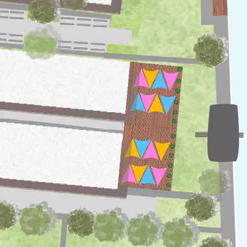
Currently, Northside’s waterfront is blocked by a four-lane road and large surface lots. This plan is fueled by recreationallydriven design. The proposed design converts an existing road into a pedestrian-only area, diverting traffic to the adjacent roadways. The existing Mill Creek Trail drives the focus of this site plan. Proposed development is centered around promoting outdoor recreation in Northside and increasing foot traffic on the Mill Creek Trail. New amenities include bike and canoe rental facilities, waterfront restaurants, and stairways to the creek. Mixed-income, Townhouse-style housing is also proposed to promote local usage of the recreational facilities.


Pedestrian-only Street
“Crossing Rocks”
Trail Facade Improvements
Stairs for Mill Creek Access
Mill Creek Collage
Current Site Conditions Proposed Site Plan

The site plan proposes 110 new individual units, accommodating about 270 families. Residential development includes town homes and mixed-use, apartment style housing.
Corner Brewery Townhomes with Courtyards
Green Roofs
Activate Street with Ground Level Commercial
Increased Tree Cover
3D Street View
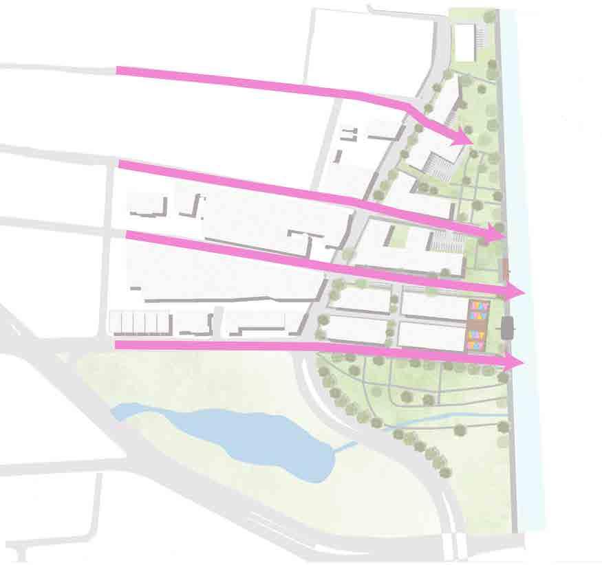
A GREENER CITY
RE-IMAGINING CINCINNATI’S DOWNTOWN
“A Greener City” showcases the impact of Cincinnati’s streetcar and what it can mean for the future of downtown. Through this project I was tasked with creating a Comprehensive Plan that both utilized the streetcar and promoted a unique pedestrian experience. In this effort, I collaborated with my peer, Reese Stangelo. All group efforts are labeled accordingly.
Site Master Plan: Group Effort

This plan aims to connect downtown Cincinnati through a series of bike paths, parks, and an updated streetcar route. By maximizing access to alternative forms of transportation, this plan encourages fewer trips by car. Green infrastructure and walkability are at the heart of the plan, as seen through proposed parks, tree cover, and infill buildings. By reducing the number of surface parking lots and transforming them into pedestrian-friendly zones, downtown Cincinnati will experience a thriving urban center.
Create access to public open spaces; Promote sustainability through green infrastructure and flood mitigation techniques
Develop surface parking lots and vacant buildings into mixed-use development to promote walkability
Create a network of parks, bike paths, and mixed-use development that promotes a lively pedestrian experience
Site Aerial Existing
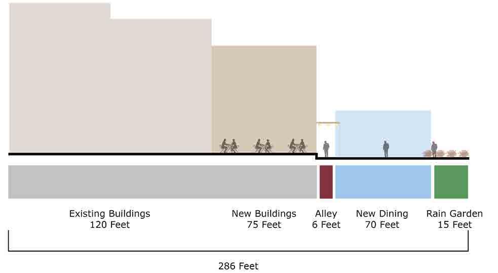
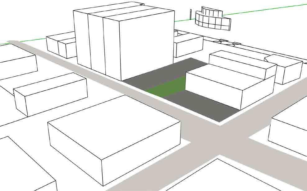
FROM VACANT TO VIBRANT: PARKING LOTS TO THRIVING SUSTAINABLE DESIGN
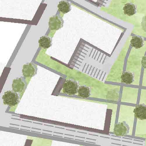
This site includes under-utilized buildings and empty land. Currently this site’s primary purpose is to accommodate parking. At a busy intersection in downtown Cincinnati, this site is wasting both its economic and social potential. Proposed are two new mixed-use buildings, a open-concept eatery, and a rain garden. On top of the existing building will be seating for rooftop access. This will densify the corner and act as a Third Place for residents.
PROJECT TYPOLOGY

At the intersection of Race St. and W. Court Street, this site has a combined 13,500 SQFT of parking lots and vacant space.
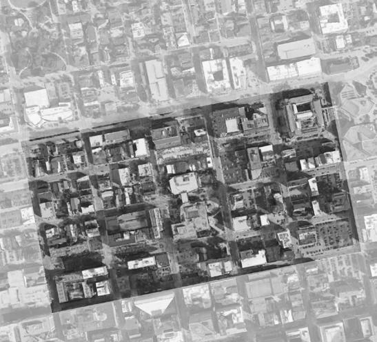
PROJECT SITE
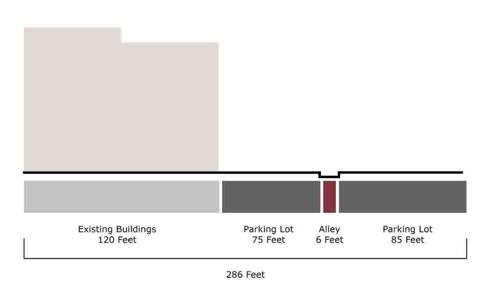
EXISTING CROSS SECTION
EXISTING CONDITIONS
PROPOSED CROSS SECTION
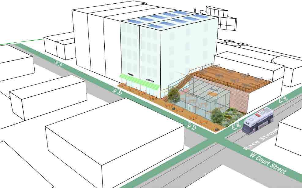
PROPOSED PROGRAMS

Mixed-Use Commercial with Affordable Housing
ILLUSTRATIVE COLLAGE

Open Concept
Coffee Shop for social gathering
DOWNTOWN OASIS: TURNING PARKING LOTS INTO URBAN PONDS
This site includes two large surface parking lots, posing health risks such as an increased heat island effect. Proposed is an Urban Pond which will serve as a retention basin for storm water as well as a recreational space for pedestrians. Around the site will be a multi-purpose boardwalk path to encourage recreation. Why a pond? Studies show that being around water can decrease stress and improve mental and physical health. This Urban Pond will provided access to a large water feature in the downtown neighborhood while also providing environmental benefits.


PROJECT SITE
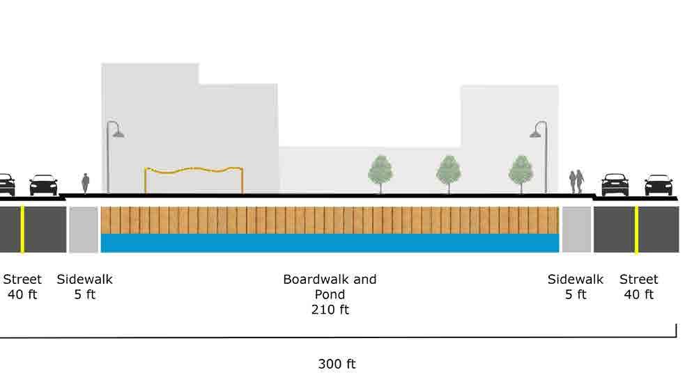
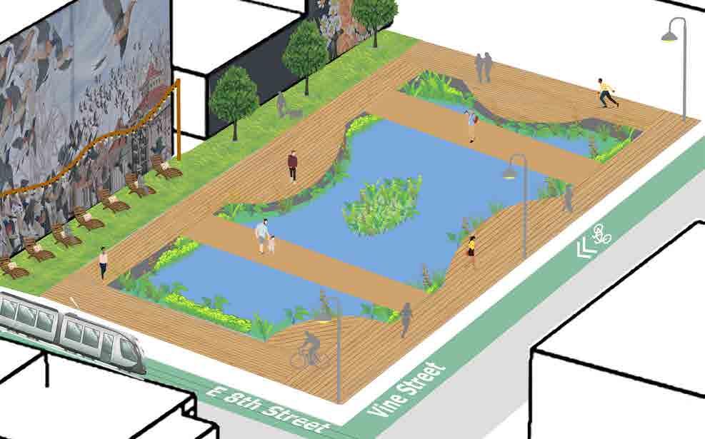
Located at E 8th St. and Vine St, this site contains a combined 25,000 SQFT of surface parking.

Access to Streetcar Stop
Plants to aid with pond filtration
Urban Pond
Multi-use Boardwalk
Lawn Seating
EARLY WORK
PEDESTRIAN CONNECTIVITY
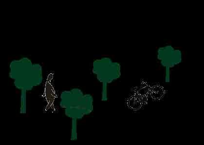
In the beginning of my journey as a planning student, I was fascinated by the concept of pedestrian-oriented design. This is a principle that still drives the spirit of my development plans to this day. The following work showcases some of my first work from my Freshman year studio. This project focuses on the neighborhoods of North and South Fairmount. Specifically, my goal was to improve the pedestrian experience and walking conditions in this car-oriented neighborhood.


Along Fairmount’s main roads, there is a lack of shade on the sidewalks. This temporary shade arch would have native plants and vines which bloom in the warmer months, beautifying the neighborhood. The geometric openings connect the user to their environment and encourage a feeling of safety.

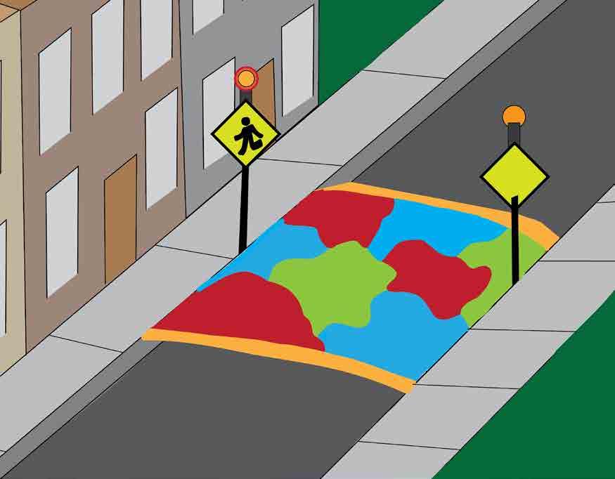
3D Painted Crosswalk
Raised Crosswalk
Proposed Crosswalk Locations
Shade Arch: Winter vs. Summer
HISTORY WALK
North and South Fairmount lack a direct path to each other. To connect these two areas, I designed a staircase that celebrated Fairmount’s history through a series of signs. In addition to providing direct access, the Fairmount History Walk builds a sense of pride and identity.


LOCATION