8 minute read
GREAT BRITISH


HIKE LIGHT
SIX GREAT BRITISH




People often lament that there’s not much genuine wilderness left in 21st Century Britain. But if you look hard enough - and you’re prepared to hike for it - you can still fi nd wild places throughout these islands. From the West Coast of Scotland, to the Peaks East of Manchester, here are six of the best wilderness walks in the UK.





BUACHAILLE ETIVE MÒR GLEN ETIVE, SCOTLAND 14KM 8-10 HOURS
The peak of Buachaille Etive Mòr rises to a nearperfect triangular point at the head of Glen Etive. Much photographed by tourists driving through Glencoe, it’s also one of Western Scotland’s classic day hikes, but not without its dangers. Famously (or infamously), the Coire na Tulaich, the steep-sided, 700m long access gulley, has been the site of numerous avalanche deaths down the years.
Despite being ‘the UK’s deadliest walk’, the Buachaille Etive Mor is well worth tackling when the weather’s right. Reach the top of the Coire na Tulaich, and you’ll have a fairly straight run at four signifi cant peaks - Stob Dearg, Stob na Doire, Stob Coire Altruim and Stob na Broige - as well as incredible views over the Glen, which served as the setting for the fi nal showdown of the Bond fi lm Skyfall.
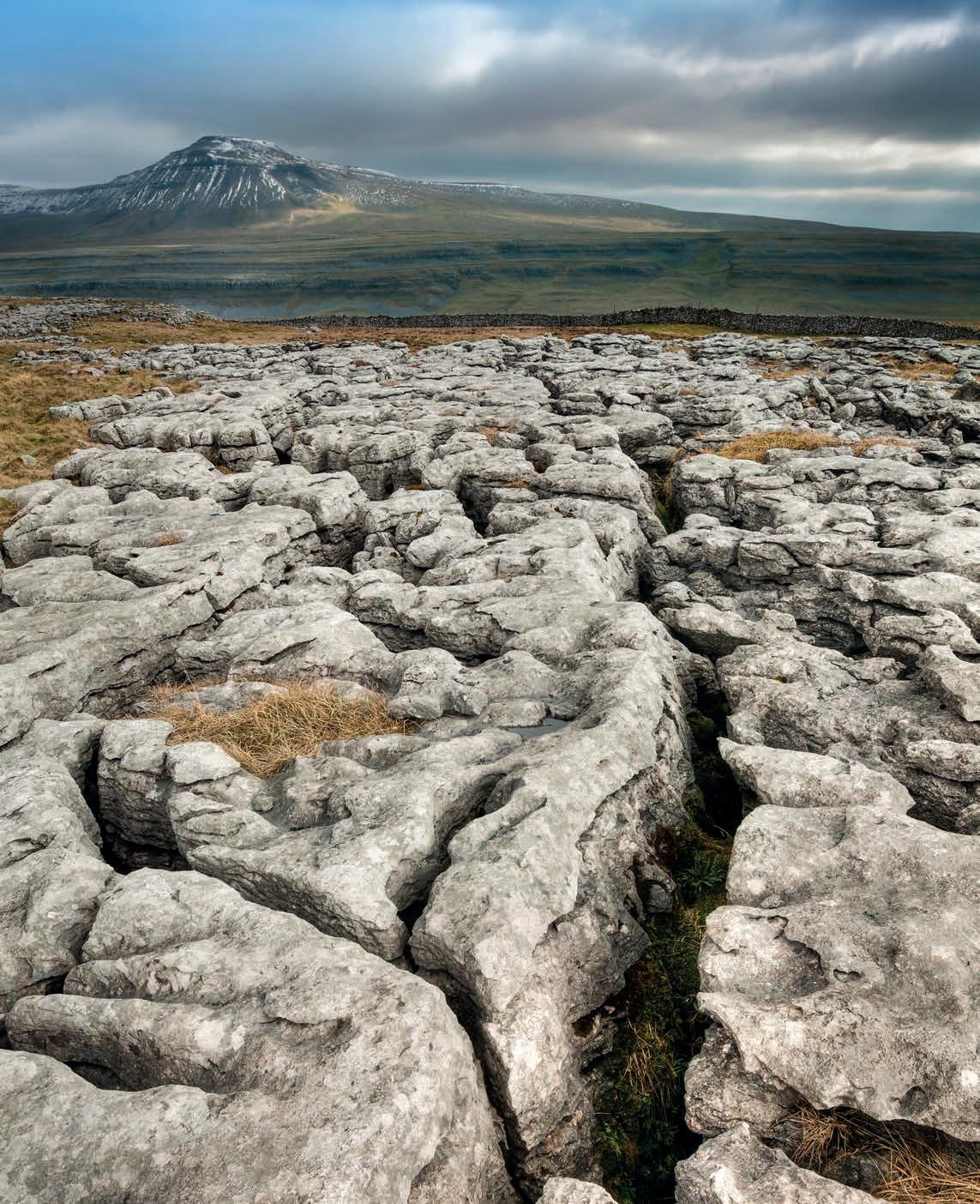
YORKSHIRE THREE PEAKS CHALLENGE, YORKSHIRE DALES N. PARK, ENGLAND 38.6KM 12 HOURS
The Yorkshire Three Peaks might be a well-trodden path, but it’s earned a place on this list as one of the toughest popular routes in England - and one that every British hiker should aim to tick off at some point. With more than 1500m of ascent in total, the route takes in Pen-y-Ghent (694m), Whernside (736m), and Ingleborough (723m).
There’s an organised race every May, but outside of that - and especially in winter - you’ll often find yourself alone on the path. Starting from Chapel le Dale, Horton-in-Ribbledale, or Ribblehead, the idea is to complete the loop in 12 hours. But depending on how fast and light you can travel across the terrain you can complete the Three Peaks Challenge significantly faster. The winners of the race regularly finish in under three hours, while the record, set in 1974, is just 2h29m.
SUILVEN, SUTHERLAND, SCOTLAND 22KM 7-8 HOURS

This steep, craggy outcrop is Scotland’s answer to Sugarloaf mountain - but while its Brazilian cousin has a major metropolis at its feet, this is one of the most remote peaks in the country. You can climb this in a few hours if you start from the west, but for the true wilderness experience, we’d recommend hiking in the two hours from the Eastern side of the mountain, across some of the wildest landscapes anywhere in the UK.
Formerly part of the privately-held Glencanisp estate, the land around Suilven was bought in 2005 by the local community with help from the John Muir Trust, as part of the ongoing effort to keep Scotland’s most beautiful landscapes open to the public. The climb is a stiff one - while the summit itself is broad and grassy, it’s almost entirely surrounded by rocky cliffs, so some scrambling is required.
ARENIG FAWR AND MOEL LLYFNANT, SNOWDONIA NATIONAL PARK, WALES 17KM 6-7 HOURS
Despite being almost slap bang in the middle of Snowdonia, the standalone peaks of Arenig Fawr and Moel Llyfnant are actually some of the least visited in the park. It might be the lack of easily-Instagramable ridgelines; it might be the remoteness; or it might be the simple fact that other routes are better-publicised, but we’re not complaining - it means this circular walking route, which takes in both mountains, is often empty.
The route starts just outside the hamlet of Arenig, winds its way past a tiny bothy, over a “bridge” that’s normally just a ladder, and up to the peak of Arenig Fawr, 836m above sea level. Here, a memorial commemorates the lives of eight US airmen, whose B-17 Flying Fortress crashed in 1943. The spectacular views across the surrounding moorland add a majesty to the simple plaque. The climb down, and then back up the steep sides of Moel Llyfnant, is challenging. But the scenery you can take in from the 751m peak makes it more than worthwhile.


TRAILINSPIRED AGILITY
Drawing on our trail-running expertise, this shoe is lighter and more agile, so you stay nimble on uneven terrain.
ENHANCED STABILITY
The new ADV-C Chassis targets articulations on the outer foot to optimize stability without limiting your mobility.
X ULTRA 4 4 GTX GTX


ALLTERRAIN GRIP
The Contagrip® MA outsole grabs the terrain, even when it’s wet or slippery, giving you more control especially on descents.
MARSDEN TO EDALE, PEAK DISTRICT NATIONAL PARK, ENGLAND 35.8KM 14 HOURS


Like the Yorkshire Three Peaks, the Marsden to Edale trail is popular enough to be run as an annual trail race. But for walkers, this represents one of the most challenging routes England has to offer. Taking in the wild, bleak moorland of Black Hill, Bleaklow, and Kinder Scout, with only three road crossings, it’s also one of the wildest walks you can do East of the Severn
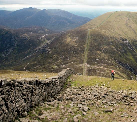
MOURNE WALL WALK, MOURNE MOUNTAINS, NORTHERN IRELAND 35.4KM 12 HOURS
On a good day, the views from the peaks of the Mourne Mountains in County Down are spectacular. Look west and you can see across the province into County Armagh. Look east across the Irish sea, and you can often make out the Isle of Man, and to the south, you can sometimes see as far as Dublin, and the Wicklow Mountains beyond.
Catch them on a bad day however, these mountains can present some of the most challenging conditions anywhere in the UK. As with all coastal ranges, you may well find you experience both the best and the worst of the weather within the roughly 12 hours it will take you to complete this classic walk. Carrying the right kit for every eventuality is essential.
The hike follows the Mourne Wall, a 31.4km dry stone construction built in the early 20th Century, and takes in seven of the 10 highest mountains in the range, including the 850m Slieve Donard, Northern Ireland’s highest peak. None of the terrain is particularly tough, but with more than 3,000m of ascent in total, this is no walk in the park. River, or South of the Scottish border.
Head south from Marsden train station and the next settlement of any significant size you’ll come across is your destination, more than 35km away. In between, you’ve got more than 1,600m of ascent, including most of the National Park’s highest peaks, and about 14 hours of tough walking.
