Emily Sanders
selected works
Washington University in St. Louis Master of Architecture, Dec. 2023 Master of Public Health, Dec. 2023
Clemson University Bachelor of Architecture, May 2017
Contact : emsanders502@gmail.com
A Blue Zone for St. Louis Degree Project, Fall 2023
ADDITION TO THE UNBUILT
International Center for Literature Option Studio, Spring 2023
THE LIVING COMMUNITY
Multi-family Residence Centered on Outdoor Living Core Studio, Fall 2020
EXOSKELETON 30
Multi-modal Bridge Core Studio, Fall 2014
Sustainable Bicycle Infrastructure Urban Design Option Studio,
CREATING CONNECTIONS 42
Neighborhood Sustainability Core Studio, Fall 2020
COMMUNITY
LONGEVITY 04
RESTORATION +
ARCHITECTURE
LIFE
CYCLE 34 URBAN DESIGN
22 18
Infrastructure for Daily + Crisis Conditions
Analysis + Proposal
RESEARCH + PRACTICE
SEGREGATION BY DESIGN
Causes, Consequences, and Mitigation Research Assistant, Fall 2022 - Present
GENDER-EQUITABLE TRANSPORTATION
Foundations of Geographic Information Systems Project Public Health Elective, Research Poster, Spring 2022
DENTAL CLINIC RENOVATION + ADDITION
Beale Air Force Base, CA Davis Stokes Collaborative Architects, P.C.
Spring 2021
48 52 54
COMMUNITY RESTORATION + LONGEVITY
Degree Project Studio (Fall 2023)
Professor: Allison Mendez
Location: Wellston Neighborhood, St. Louis, MO
Primary Health Goals:
Increase life expectancy using Blue Zone principles
• Improve mental health outcomes and decrease loneliness
• Decrease transportation stress for women and aging adults
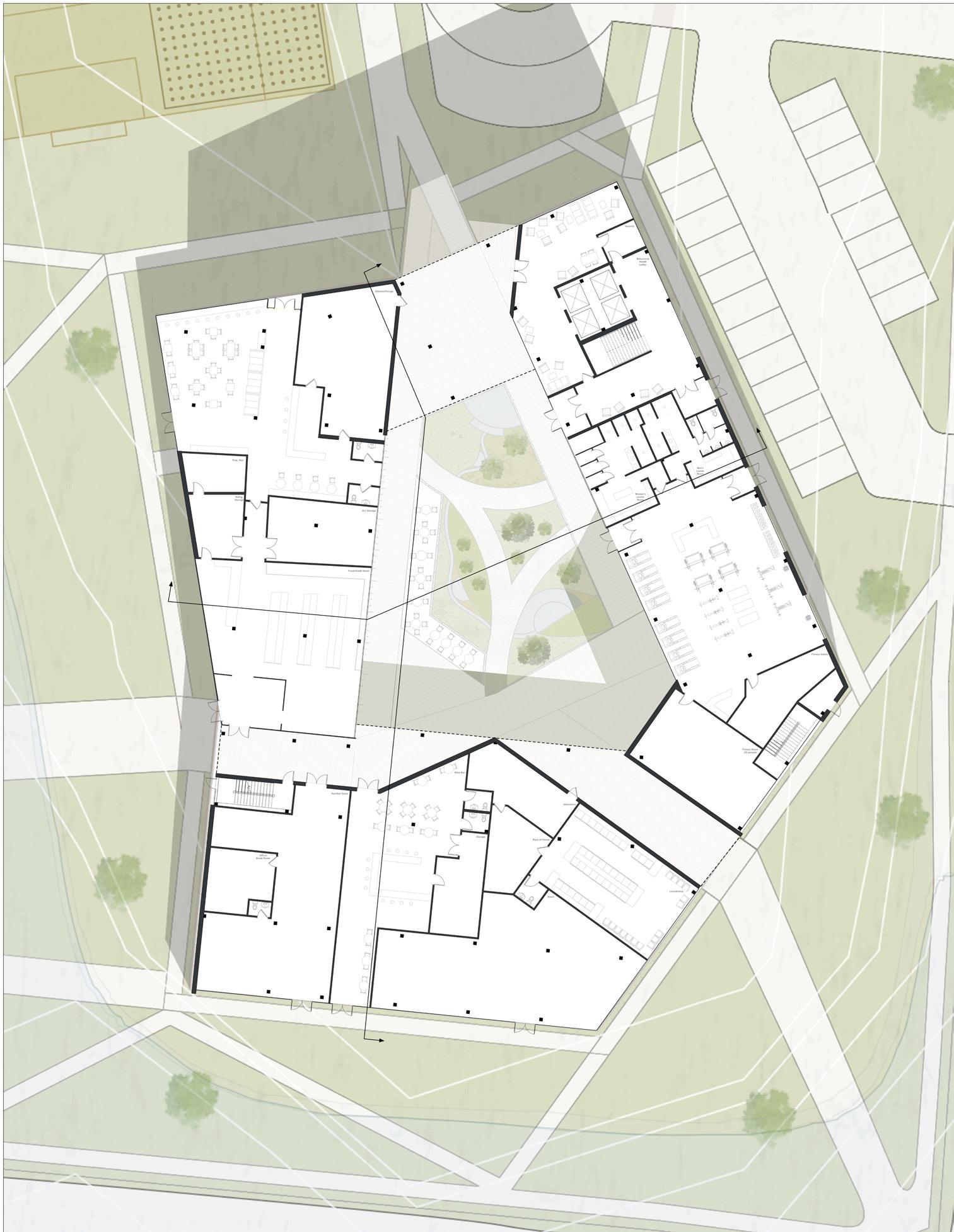
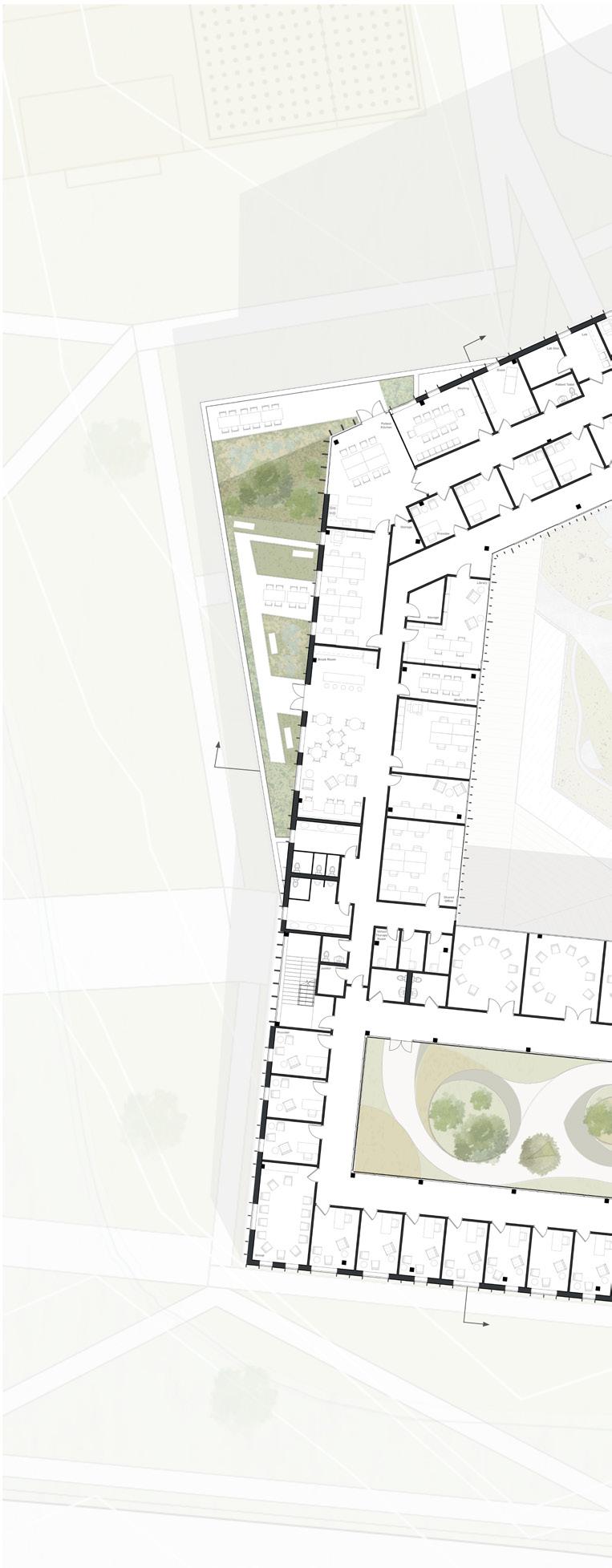
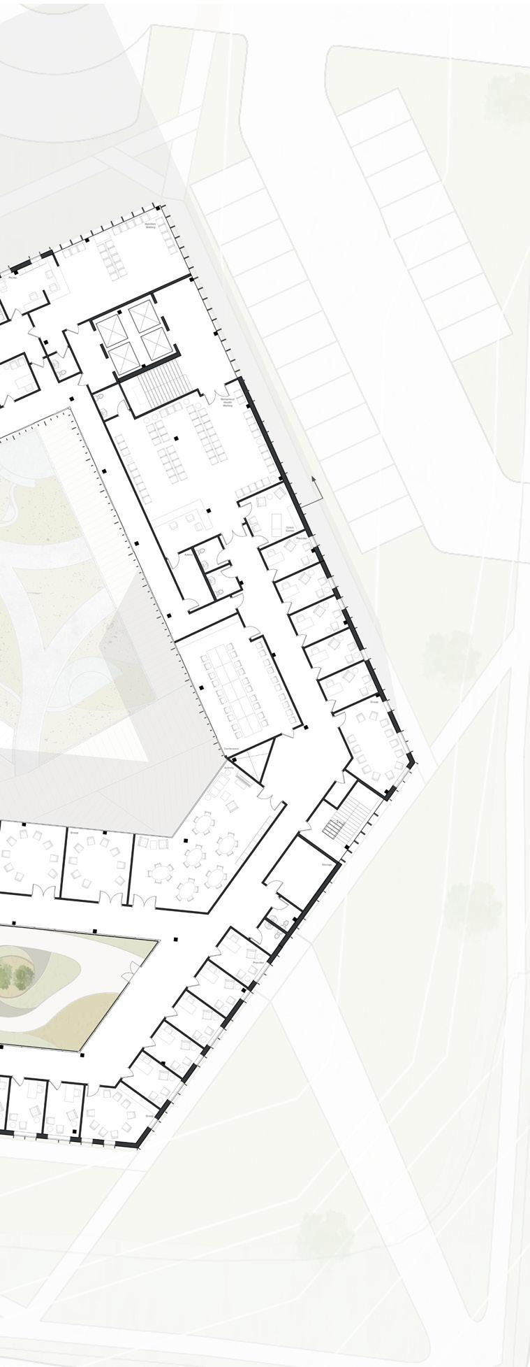
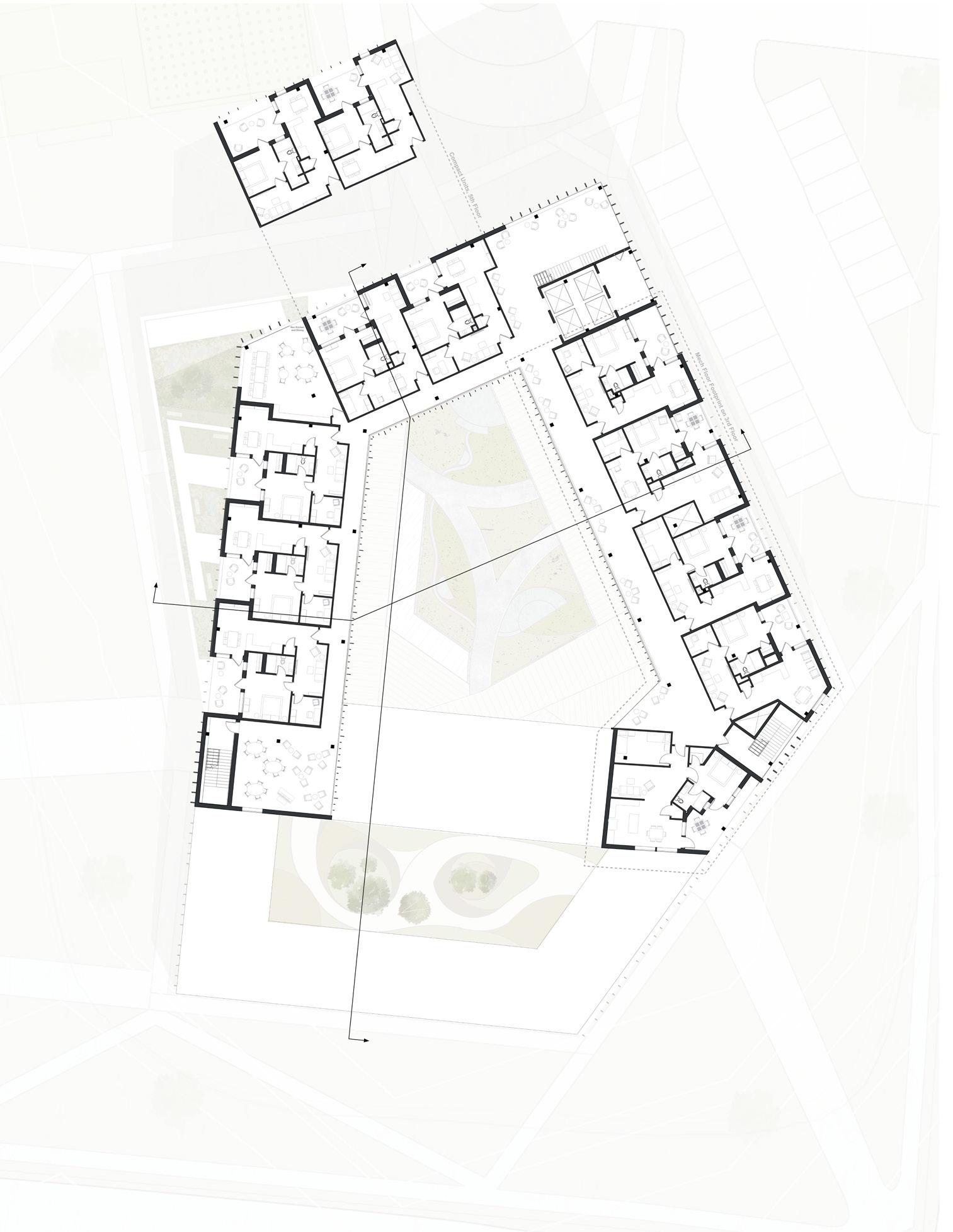
This mixed-use building and multi-purpose site is designed for human comfort and health by increasing community life expectancy, especially for women and aging adults. By combining systems thinking approaches and public health frameworks with sustainable strategies, the spaces are designed to conveniently connect people with one another and to necessary resources. The building consists of public programming (first floor), outpatient behavioral health and nutrition clinics (second floor), and independent senior living (third, fourth, and fifth floors). The remainder of the site includes public programs such as athletic fields, bioswales, urban agriculture and a farmer’s market.
Architecturally, the building utilizes natural materials, open courtyards, and nodes of interaction to further decrease stress. Vertical facades with undulating balconies nod to the neighborhood context, while the pentagonal massing and carved central courtyard allows for proper daylighting, improved views, minimal site disruption, and simple ground floor circulation. The public spaces and vertical circulation are highlighted with glass facades, to emphasize social health and physical movement.
A Blue Zone for St. Louis
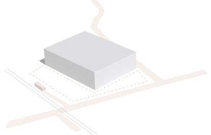
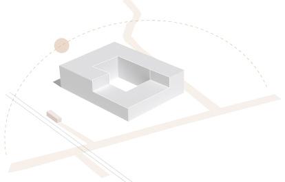

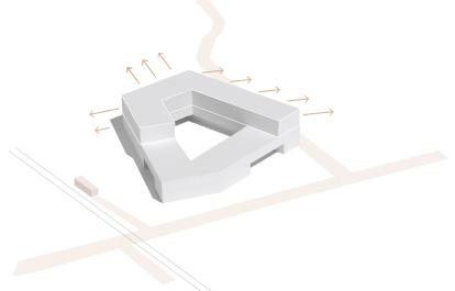
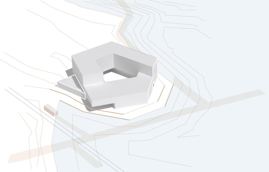

figure 1-6: massing sequence diagrams
5
1. ORIENTATION 2. DAYLIGHTING
3. ACCESS
4. VIEWS + PRIVACY
5. TOPOGRAPHY
Cafe Grocery Store Salon Wine Bar Retail
Laundromat Alterations Fitness Center Nutritionist Mental Health Independent Senior Living

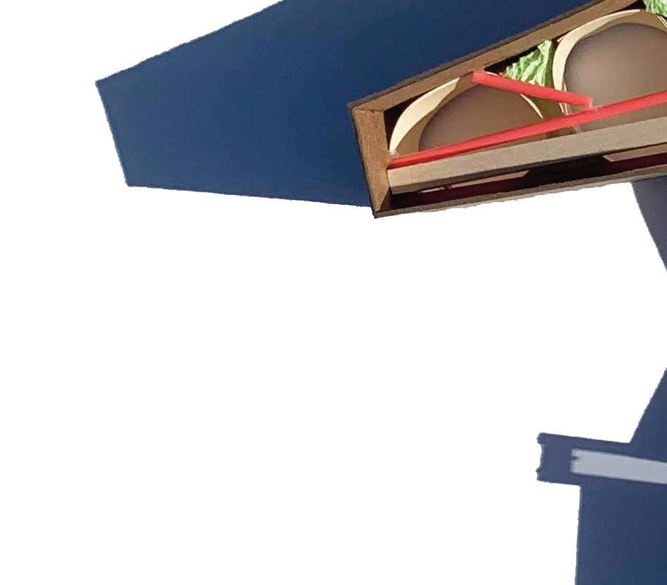

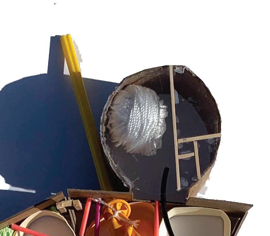
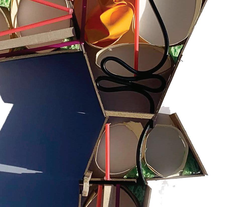
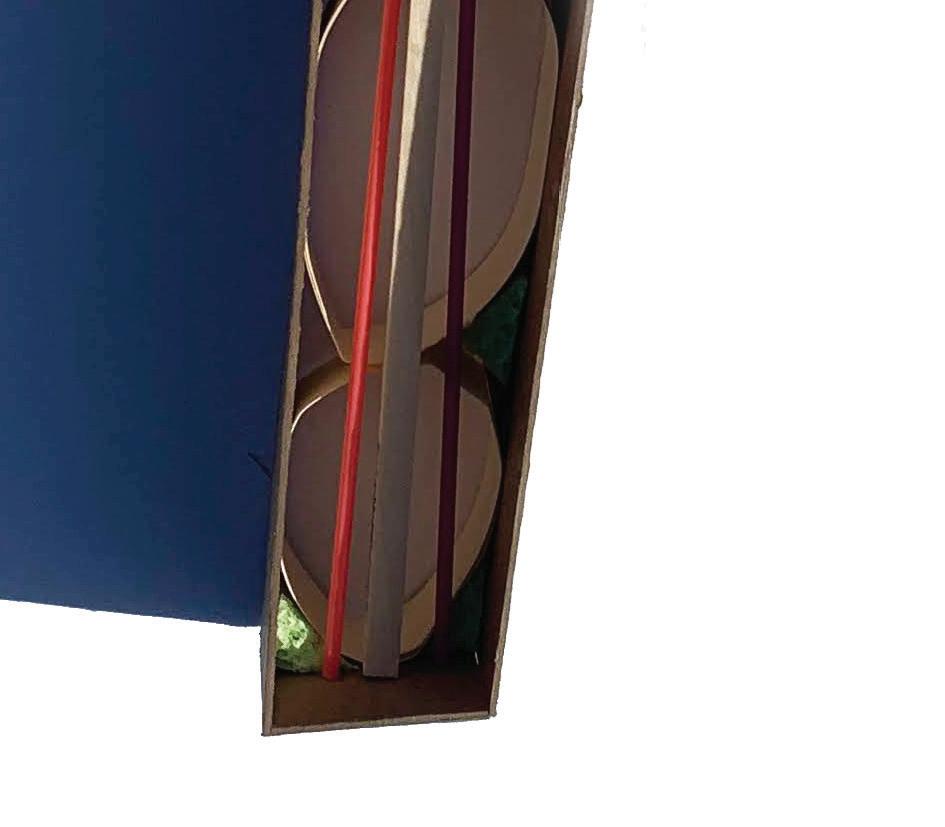





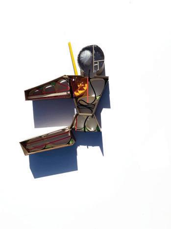










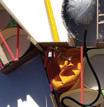
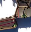


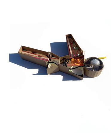


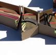


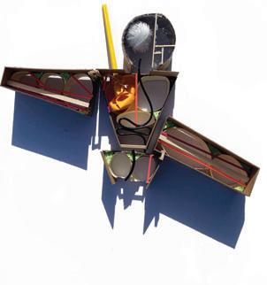






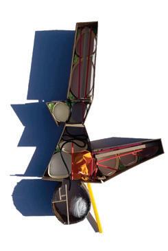










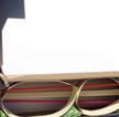


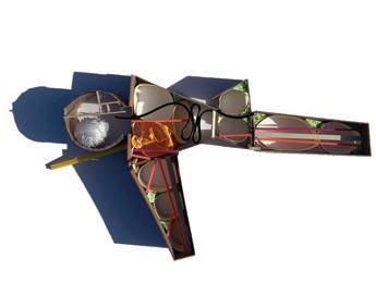


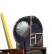


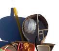

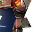


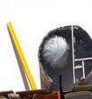
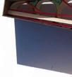

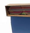






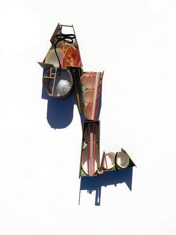
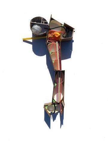


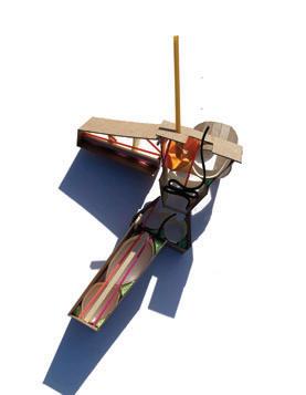


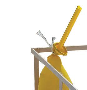


figure 7: study model of human + building systems
description: From the structural skeleton to the circulation of elements, parallels can be drawn between architecture and the human body. Each system is crucial to the body it serves. This study model simultaneously explores the anatomy of bodies and buildings along with their kinetic abilities.


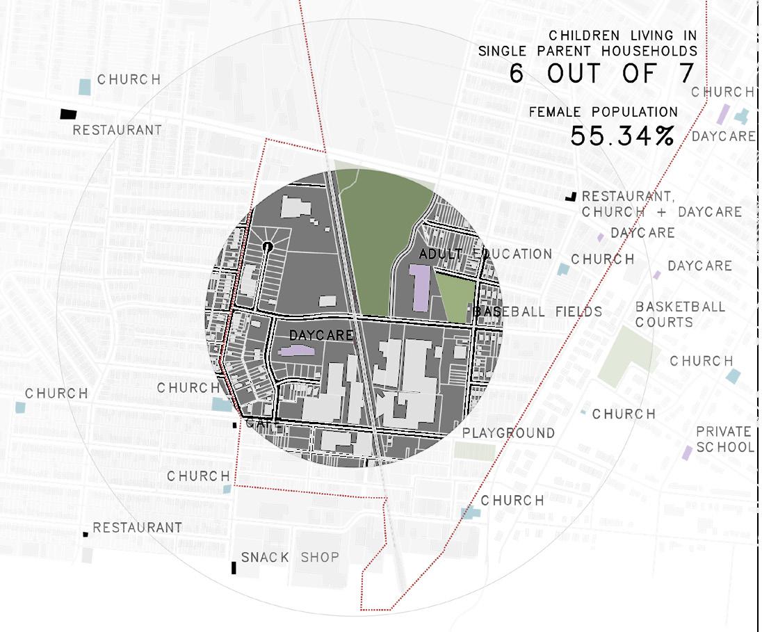


figure 8: vehicle ownership + walkability regional map
figure 9: Wellston health diagram
figure 10: metrolink key diagram
figures 11-14: systems diagram of neighborhood
9

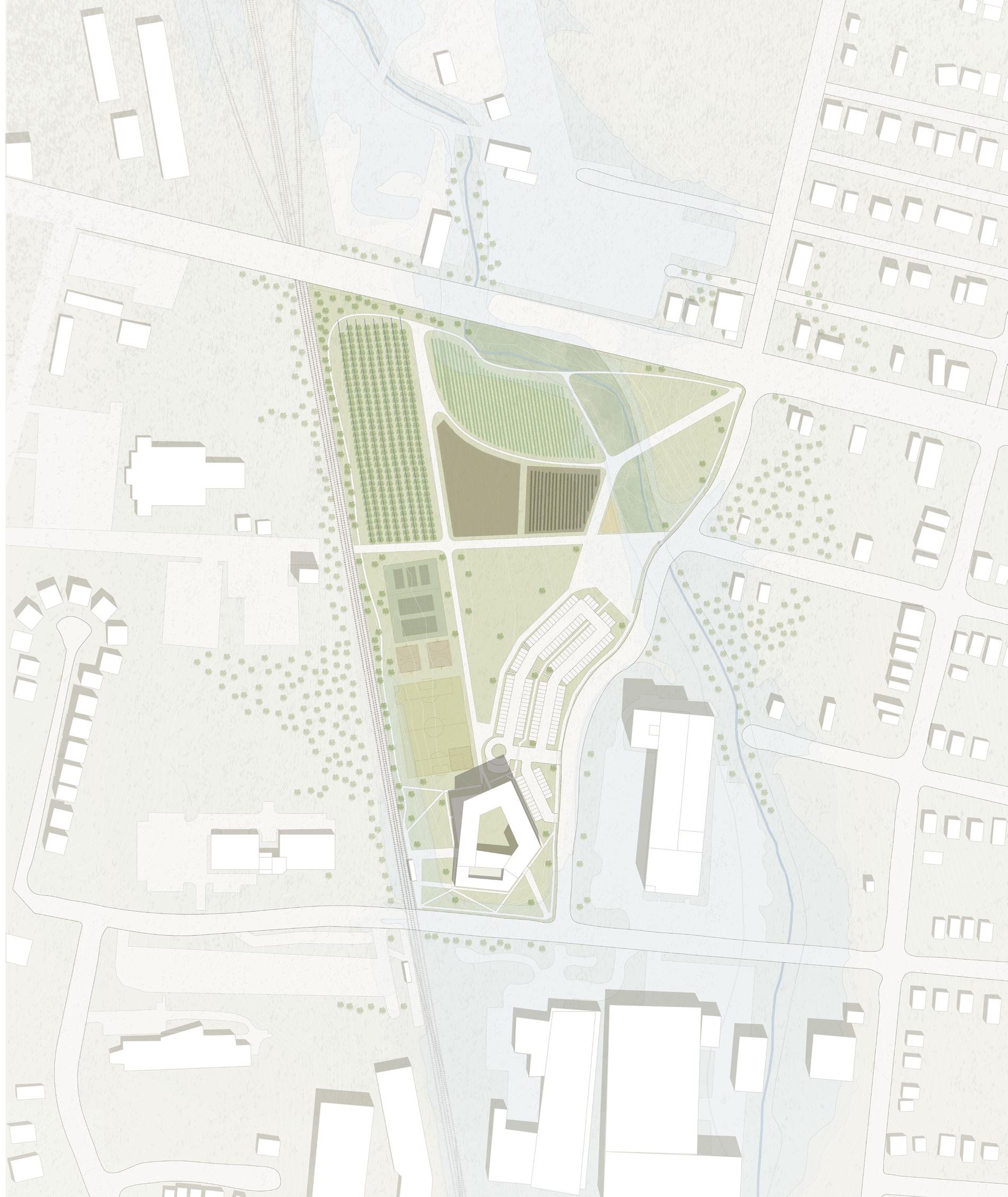
figure 15: schematic site model with test massing model figure 16: site plan
11
13
figure 17: ground floor plan figure 18: second floor plan figure 19: fourth floor plan
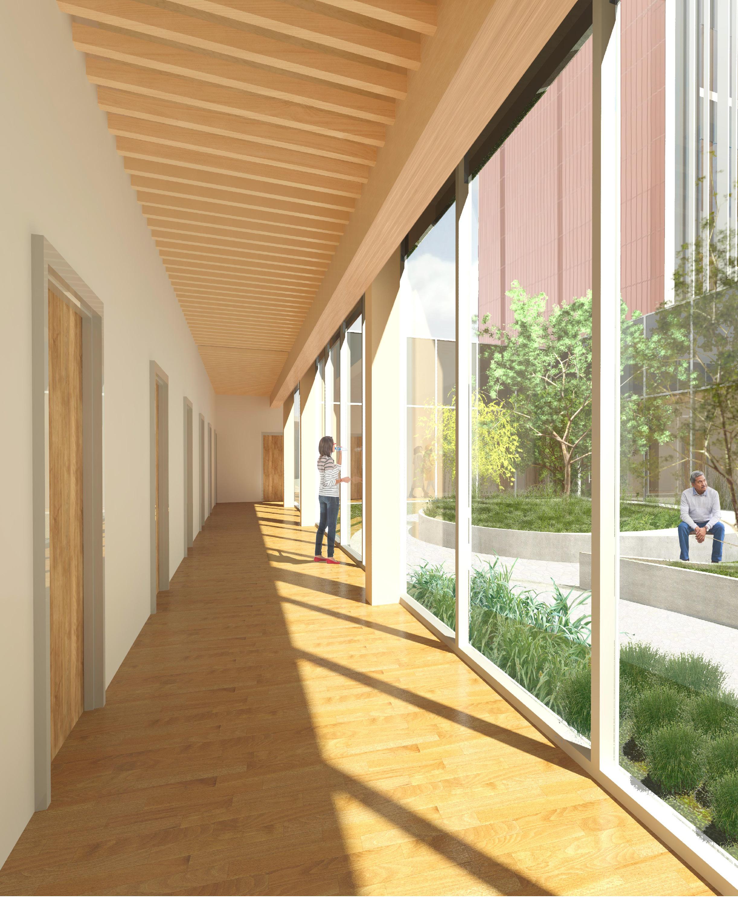

20: behavioral health courtyard collage render
15
figure


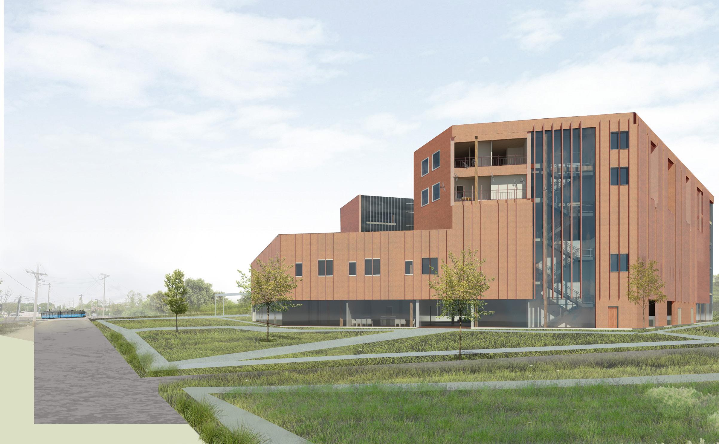


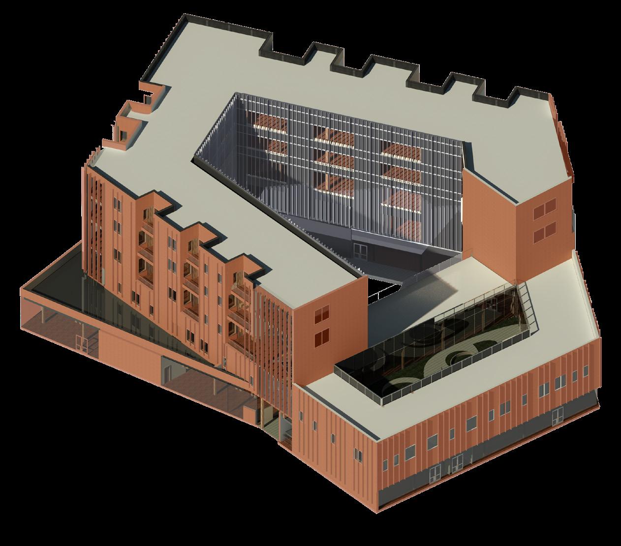
figure 21: north elevation figure 22: exterior render figure 23-28: diagrams of elevation schemes figure 29: axonometric elevation
17
ADDITION TO THE UNBUILT
Option Studio (Spring 2023)
Professor: Robert McCarter
Location: Rome, Italy
Primary Health Goals:
Design for occupant focus and healthy working conditions
• Utilize sustainable materials and improve air quality
• Provide each occupant with green space while still ensuring privacy
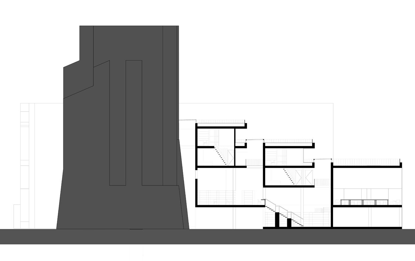
This project is situated in the Roman Forum, sited in an alternative reality where Terragni’s Danteum was built true to his vision. A series of projects evolved from studies on ascending residences above the realm, similar to the journey users experience ascending to Paradise in the Danteum. The building features climbing internal circulation from the ground floor library and external circulation along connected patios, with internal and external entries into each unit and gathering spaces with urban views of the Roman Forum.
Social and mental health are critical to the wellbeing of the building’s residents (literary scholars). The residents can seek inspiration in the meandering organization of bookshelves in the suspended library levels, where they may bump into other scholars or find remnants of another’s research. Semi-public spaces, such as courtyards and dining rooms, also become catalysts for discourse and camaraderie. Furthermore, the mass timber structure provides natural respite for scholars’ long working hours, boosts focus, improves mental wellness, and contributes to sustainable building construction.
International Center for Literature

1: axonometric wall section
19
figure

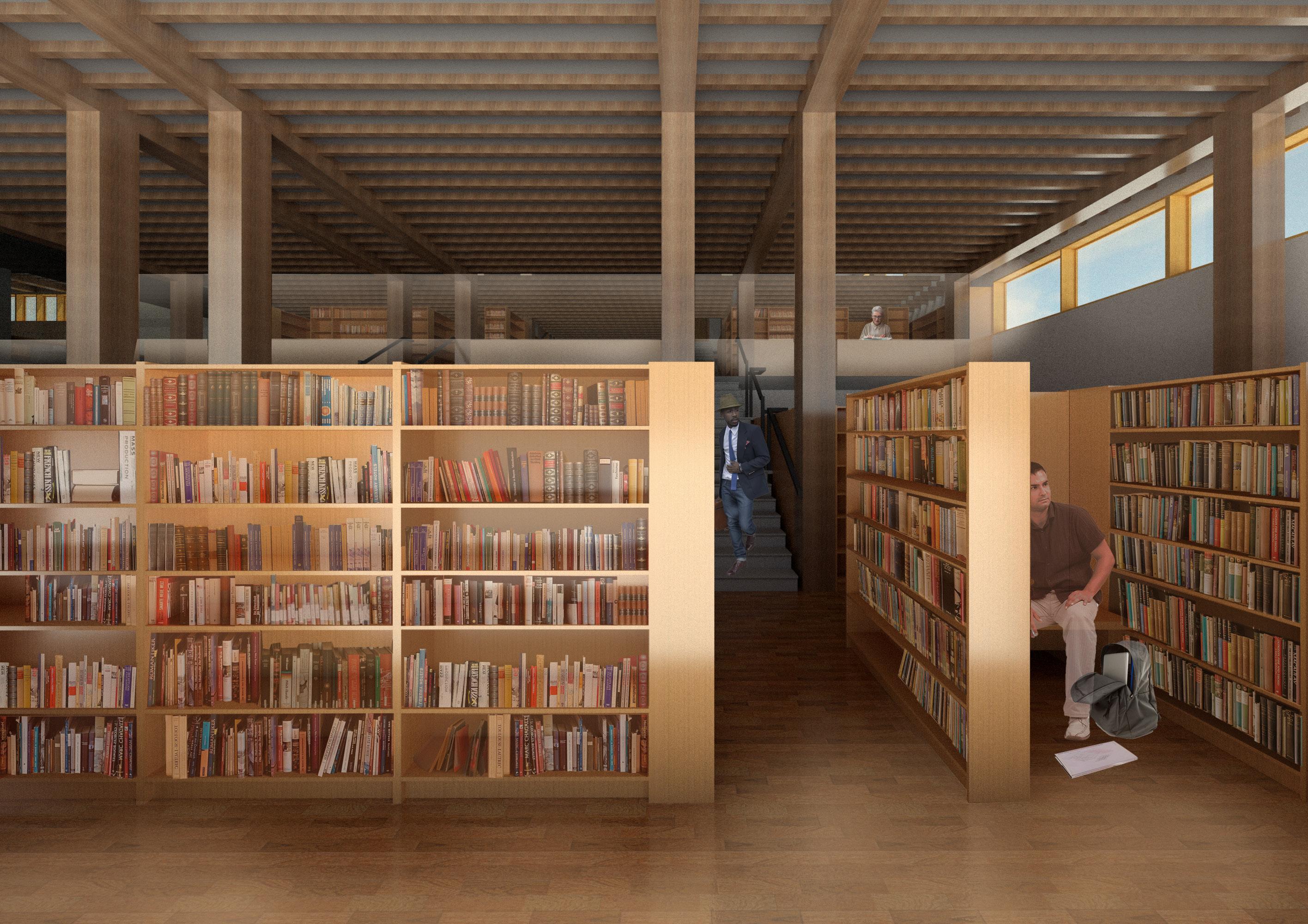
figure 2: second floor plan with site context figure 3: library rendering


21
building sections
figure 4-6:
THE LIVING COMMUNITY
Multi-family Residence Centered on Outdoor Living
Core Studio (Fall 2020)
Professor: Monica Rivera
Location: San Juan, Puerto Rico
Primary Health Goals:
Encourage communal, outdoor dining, therefore improving social connection and digestion
• Utilize passive strategies such as daylighting and natural ventilation Provide access to fresh produce and means for preparation
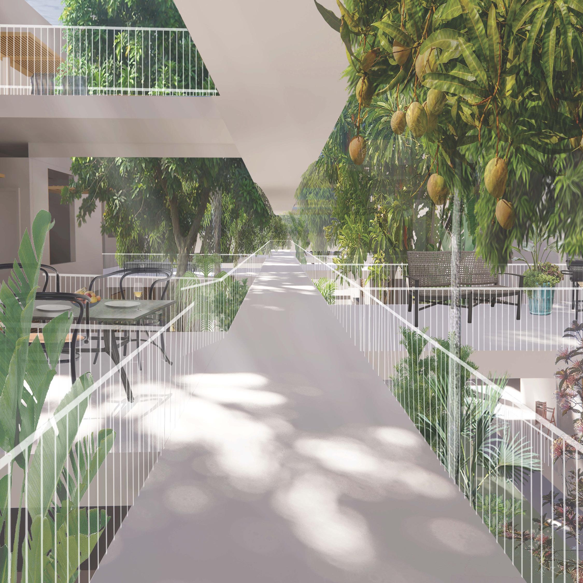
The challenge in designing Puerto Rican housing is maintaining cultural traditions of large gatherings while protecting the inhabitants from the natural elements. This residence re-imagines the traditional sequencing of tropical housing by placing the kitchen and dining rooms at the initial threshold of the unit. The forward public spaces allow residents to entertain without guests encroaching upon their more intimate spaces. Large fruit trees fill the gaps between outdoor dining porches, providing natural shade for resident comfort and accessibility to native produce. A series of private spaces, including a back patio for outdoor showering and drying laundry, allow for passive strategies such as cross ventilation.
This housing project promotes physical, mental, and social well-being through formal strategies and programmatic elements. Communal dining is associated with lower rates of obesity and chronic diseases, better moods, and greater social support, while outdoor dining slows digestion and improves one’s relationship with food. A public kitchen and nutritionist offices provide amenities to support nutritious choices. Social interaction nodes are woven throughout the building to create a more robust sense of community.
23
figure 1: rendering of exterior circulation
 Lawful Good Neutral Good Chaotic Good
Lawful Neutral
True Neutral Chaotic Neutral
Lawful Evil Neutral Evil Chaotic Evil
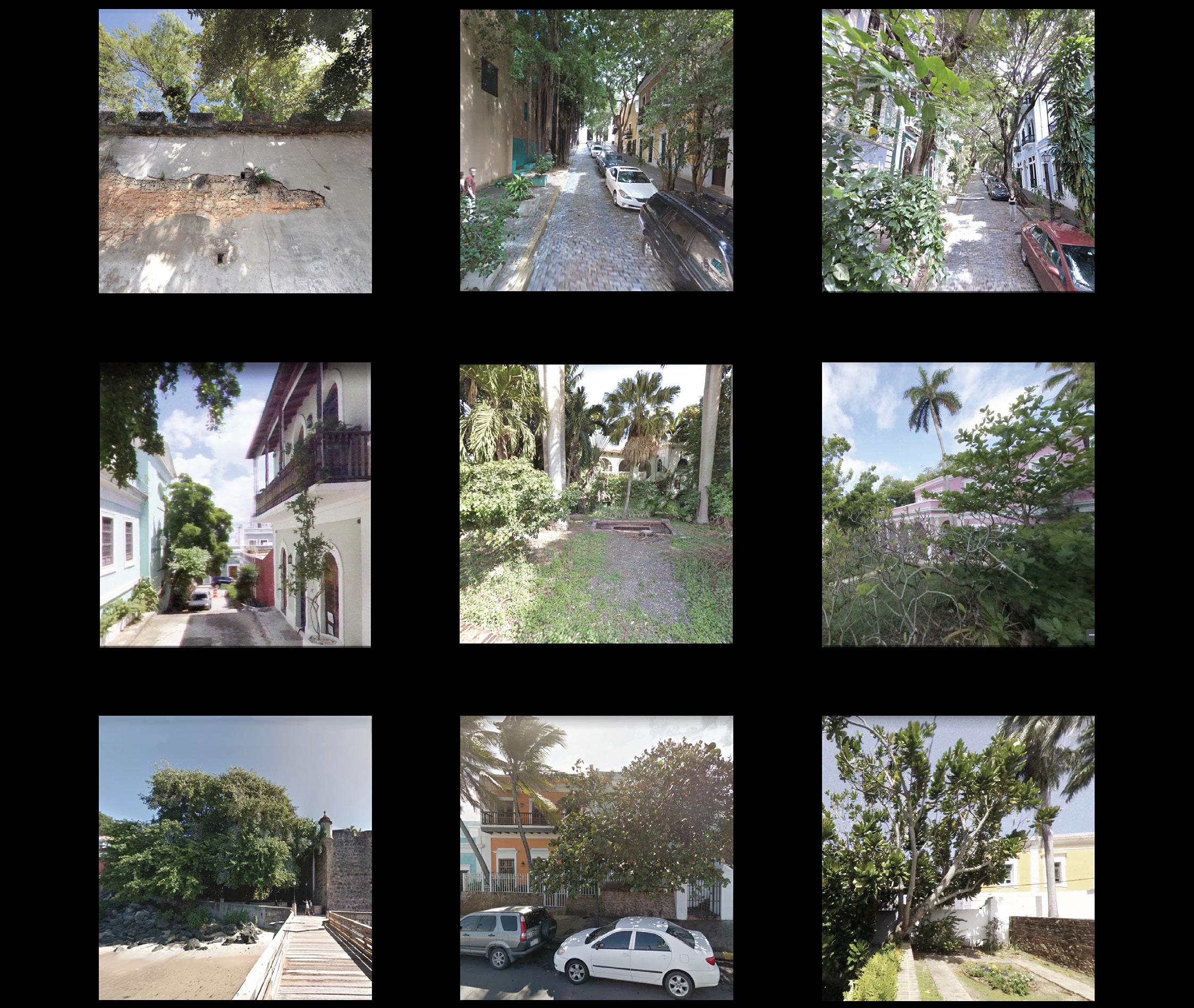
figure 2: context vegetation analysis, images from Google Earth


25
16 32 S cale 1/4 1’-0” 0 16 32 8 S cale 1/4 = 1’-0” 2
3
figure 3: ventilation diagrams
Bedroom
Bedroom
1
Bedroom


27 figure 4: typical residential floor plan 0 8 16 32


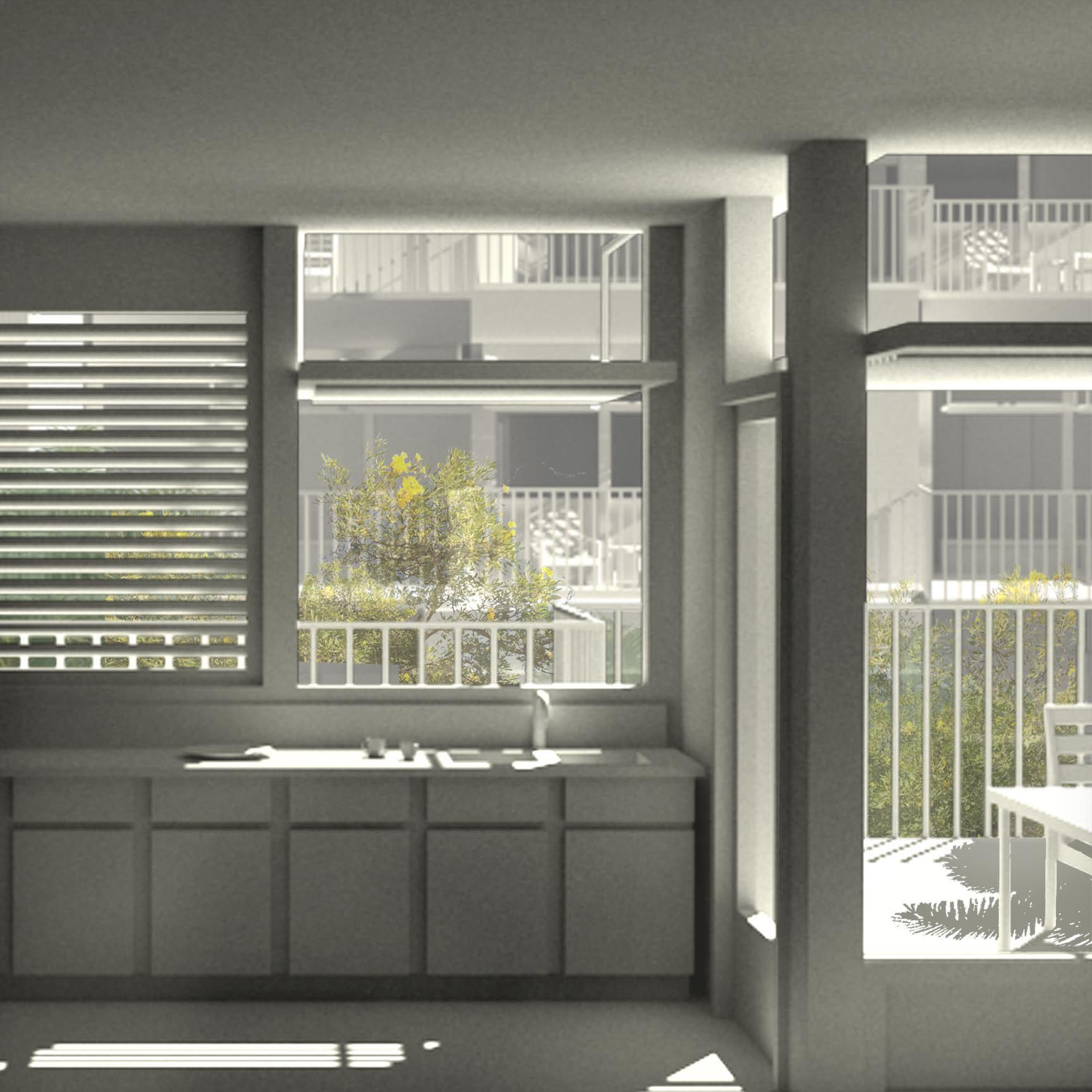

figures 5-9: evolution of kitchen-porch threshold
29
EXOSKELETON
Core Studio (Fall 2014)
Professor: Clarissa Mendez
Location: Canyon
Primary Health Goals:
Provide flexible routes for cyclists and pedestrians • Minimally disrupt the environment
Three distinct layers of structure create an exoskeleton in an otherwise desolate canyon. The underlying frame composes a fragmented, curved form that evokes physical and visual movement in multiple dimensions. An immediate structure breaks the organic shape into modular, triangular fragments. The final skin is a chaotic repetition of severe, wooden members at varying angles, forming a physical barrier from the environment.
The geometric and material properties of the bridge extend the natural landscape through two distinct paths. The first is an elevated route above the canyon, allowing the pedestrian a quick path with brief glimpses of the surroundings through the structure. The second caters to travelers wishing for a slower journey with an extensive pedestrian outlook.
Multi-modal Bridge
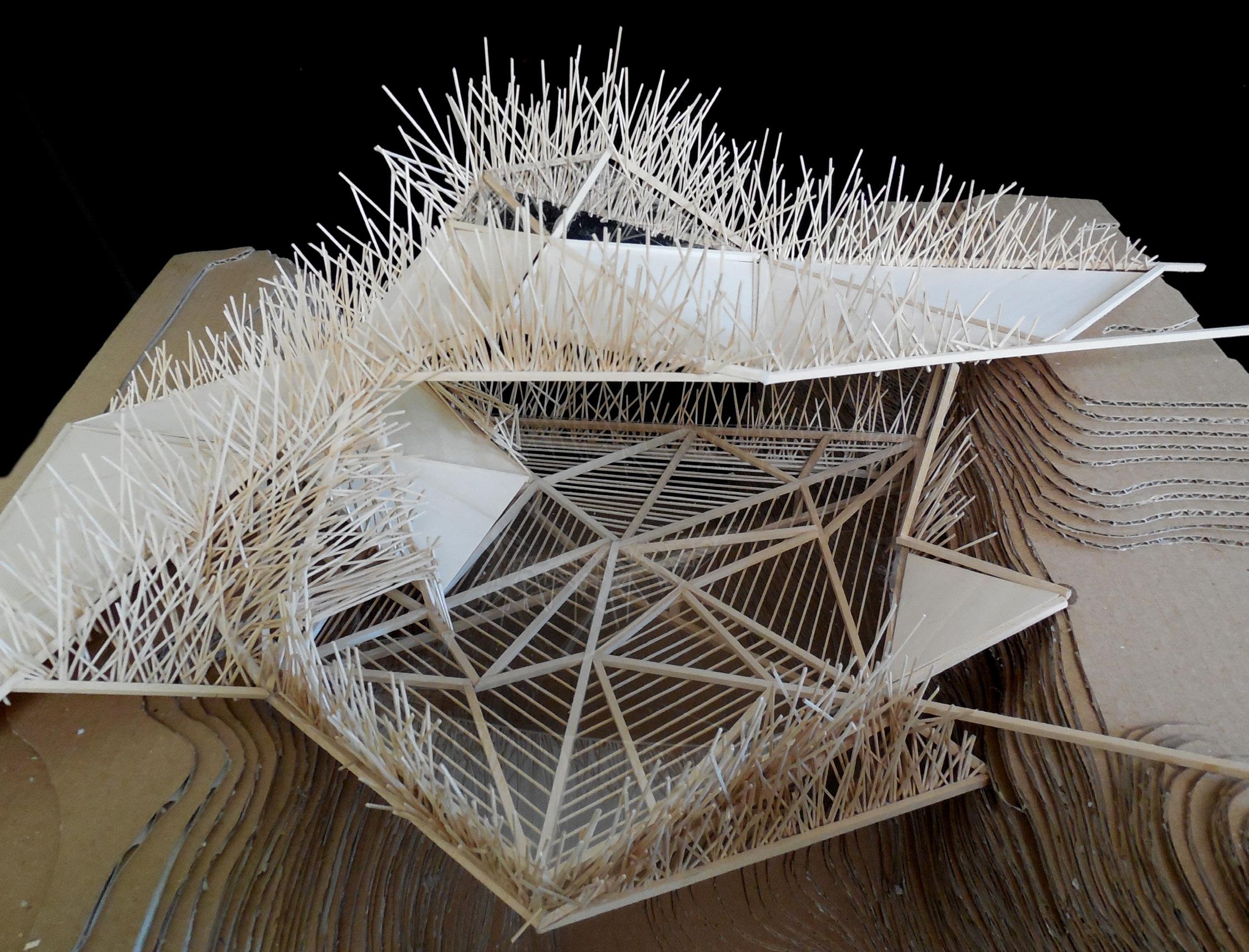
1: final model photograph
31
figure


 figure 2: biking path
figure 3: biking and walking path
figure 4: walking path

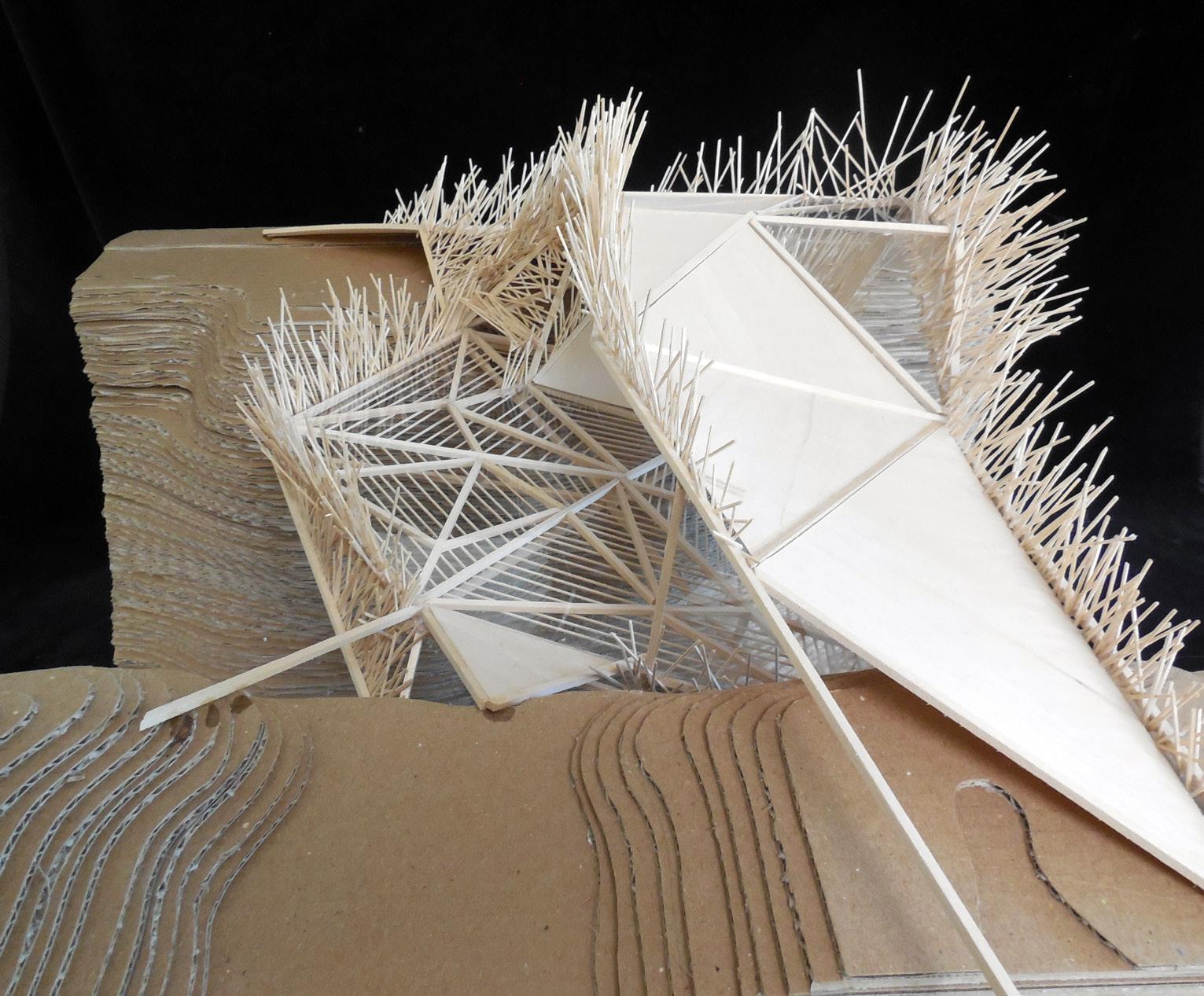
5-6: final model photographs
33
figure
LIFE CYCLE
Sustainable Bicycle Infrastructure for Daily + Crisis Conditions
Urban Design Option Studio (Spring 2021)
Professor: Linda Samuels
Location: Houston, TX
Primary Health Goals: Reduce resident mortality and displacement during natural disasters, specifically flooding events
• Promote active transportation (specifically e-bikes) as a daily and crisis transportation strategy
• Provide spaces for protest when resident wellbeing is threatened
Houston’s I-45 serves as a dividing line between resources and populations. Residents on the East side of the highway travel by public transit and carpooling at higher rates and face greater environmental stress due to their proximity to the floodplain. To answer the call of the Green New Deal, this project aims to utilize the changing landscapes of energy, transportation, technology, ecology, and democracy to reach under-served communities.
To mitigate the systematic discrimination while providing sustainable transportation, an elevated network of bicycle routes is proposed. These routes are re-purposed from existing highway and roadway infrastructure and provide evacuation routes for residents during increasingly frequent flooding catastrophes. By connecting tangible and intangible community resources through multi-modal transportation, citizens and non-citizens can contribute daily towards a healthier community and adapt these spaces where crisis arises, which are increasing in frequency. A vertical hierarchy of community spaces to increase visibility and provide safety also supports oppressed minority neighborhoods and highlights their fight to survive. An interconnected system of community assets fosters knowledge transfer, community feedback, and social engagement through resilient, equitable infrastructure.
Site Specific Goals + Objectives
35 figure 1: diagram of interconnectivity of site goals Achieve net zero greenhouse gas emissions Secure for all people … for generations to come… Clean air + water Promote justice and equity by stopping current, preventing future, and repairing historic oppression of indigenous peoples, communities of color, migrant communities... Climate + community resiliency Decrease vehicle traffic through bike + public transportation infrastructure 2030 2050 3% of Houston commuters bike to work 10% of Houston commuters bike to work Metro system is 75% supported by renewable energy Replace 15% of parking lots with green space and native vegetation Metro system is 100% supported by renewable energy Replace 50% of parking lots with green space and native vegetation Provide equity to the Hispanic community through representation, access + participation Build polling stations along major transportation lines for multimodal access Provide bike paths + “bike-thru” spaces to new + existing community assets east of I-45 corridor Create nodes of social engagement + expression Improve physical + mental health metrics through increased health education + access Provide support during times of natural disaster or other crisis Creation of crisis checkpoints in every census tract to engage localized resources Addition of permeable pavement, reduction of hard surfaces, and site terracing for water mitigation Provide bike evacuation route to provide safe, affordable escape options Gathering space Knowledge transfer space Tactical space Spaces of Action Resource space Participation Space Representation Space
Green New Deal
Spaces of Protest Spaces of Democracy
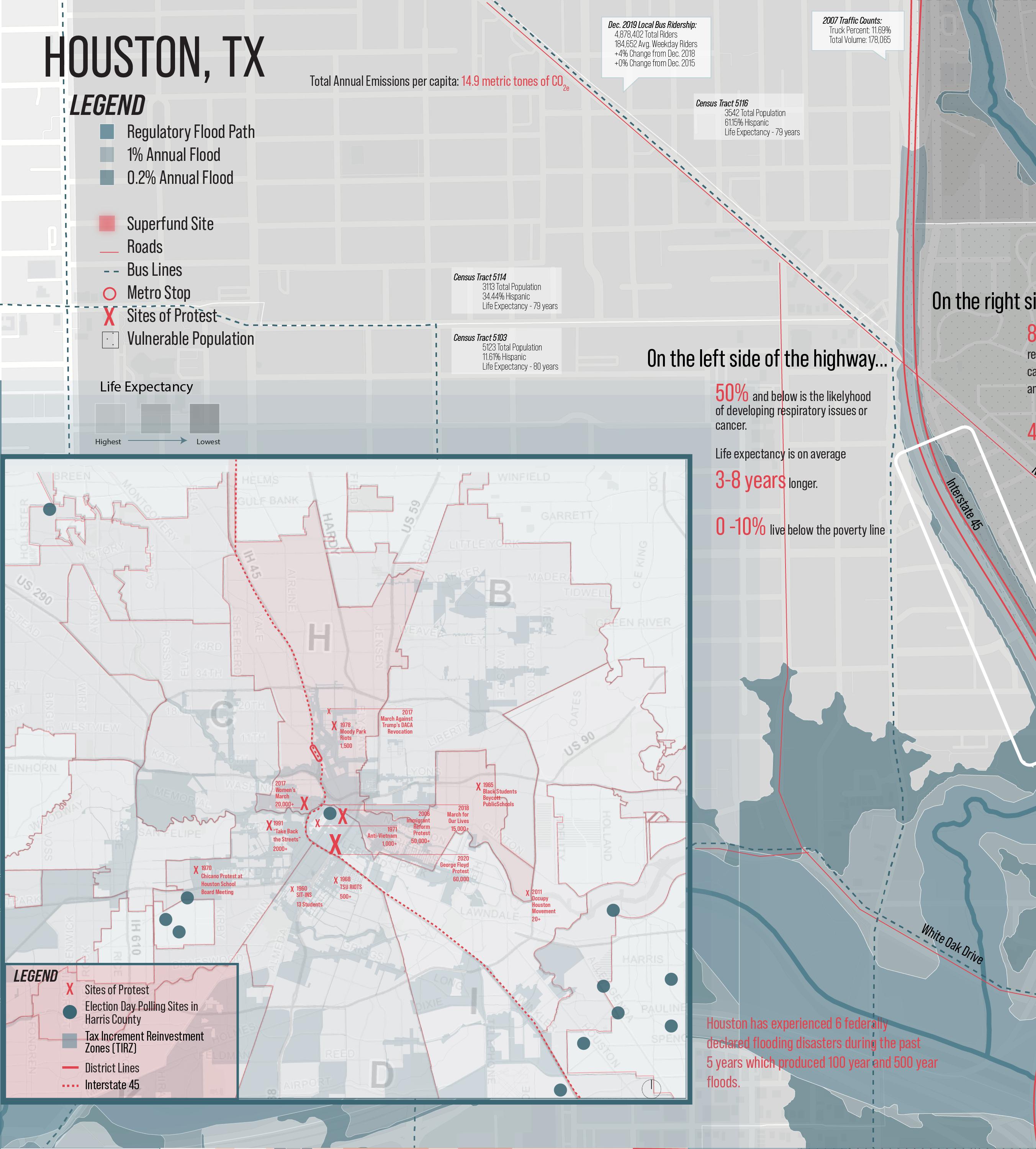
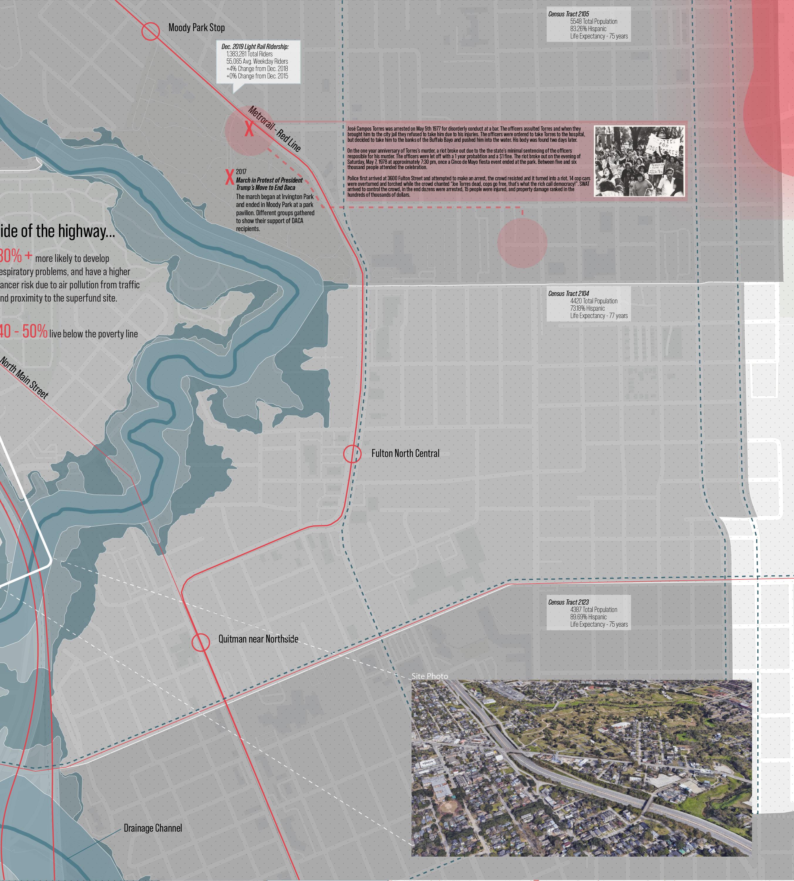

37 Site of José Campos Torres arrest, who was assaulted and later killed by police. His body was found in the Buffalo Bayou two days later. On the one year anniversary of Torres’ murder, a riot broke out due to the state’s minimal sentencing of the officers responsible. May 5th 1977
figure 2: parti of spatialized goals + networks figure 3: existing conditions map
note:
figure
3
created with graduate students Bette Dunn + Nakesha Newsome


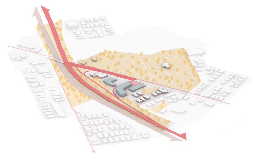

figure 4: infrastructural optimism components figures 5-7: protest, health, and education networks
39
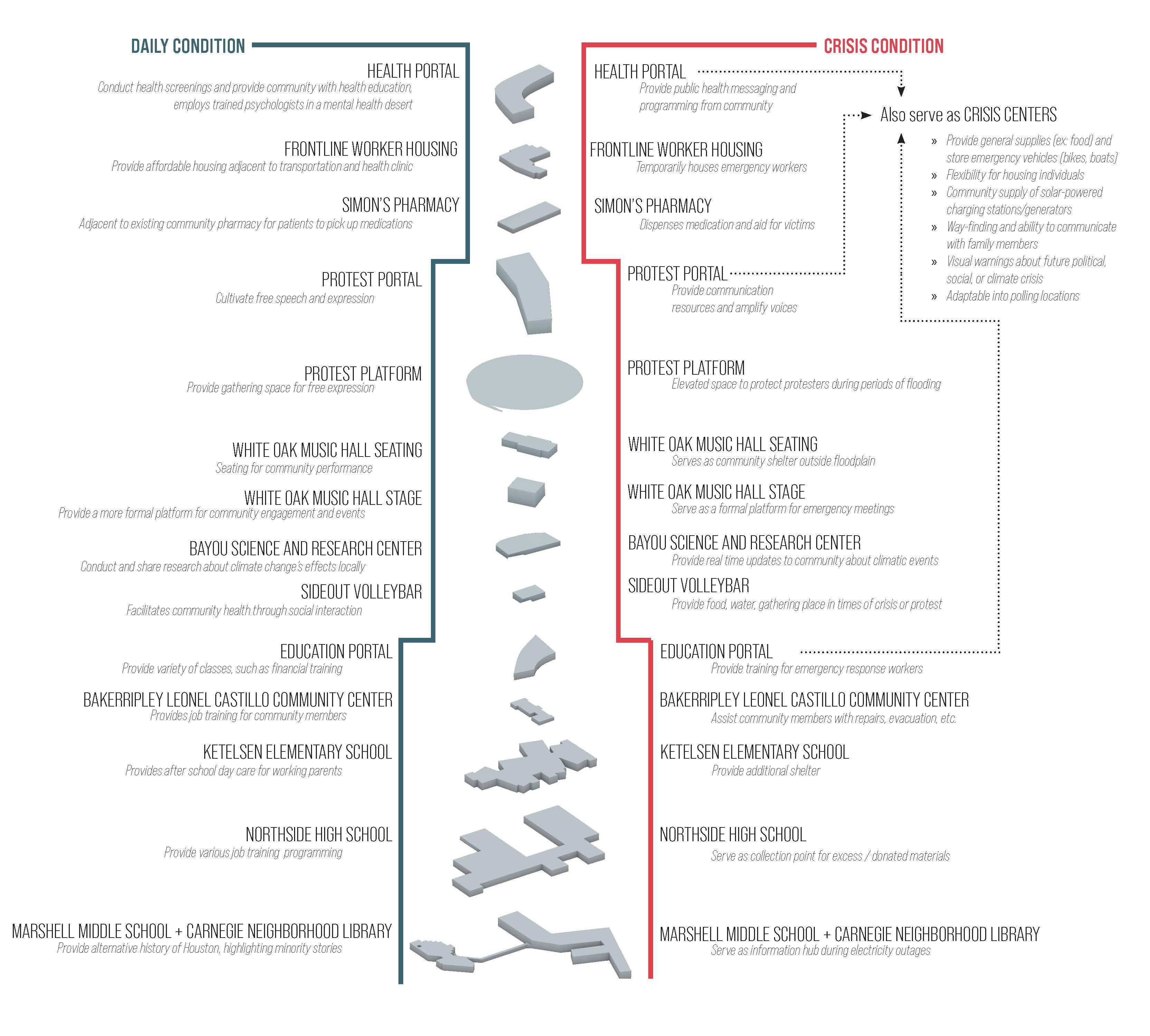
figure 8: dual purpose infrastructure diagram

9: collage render of daily condition
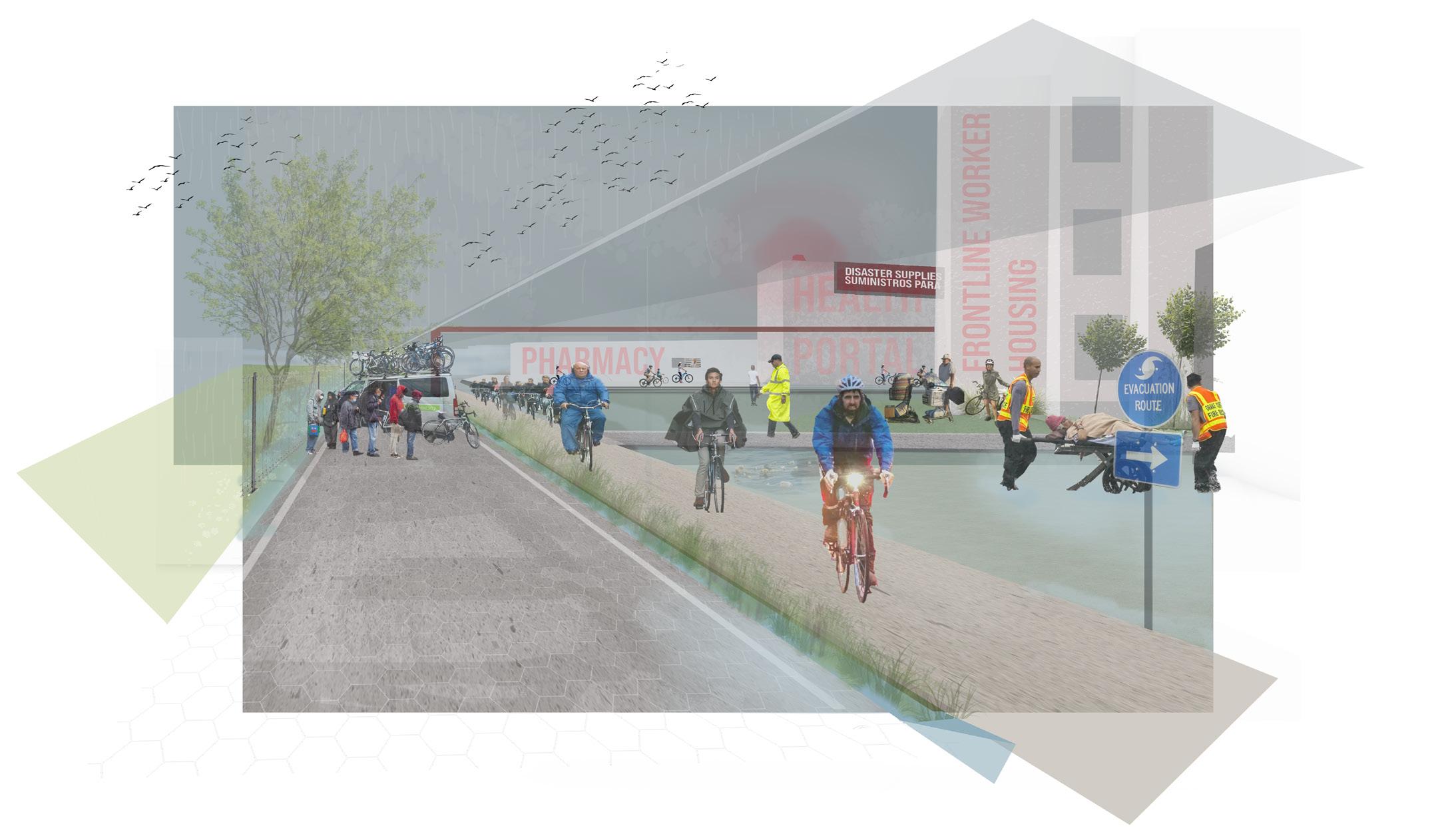
10: collage render of crisis condition
41
figure
figure
CREATING CONNECTIONS
Neighborhood Sustainability Analysis + Proposal
Urban Design Elective (Spring 2023)
Professor: Matthew Bernstine
Location: Mark Twain Neighborhood, St. Louis, MO
Primary Health Goals: Increase walkability and bikeability
• Increase the number and variety of local healthy food options
• Improve air quality by increasing green space and providing a highway buffer
Mark Twain is a low-income, minority neighborhood, bounded by two large cemeteries to the north, an industrial park to the east, and a wide highway to the south. These urban conditions have led to widespread vacancy, low resource access, and neighborhood isolation. The student team identified five neighborhood goals: mobility, food, vacancy as opportunity, health, and identity. The proposal’s strategies include the creation of more neighborhood entrances and connections to the cemeteries, revitalization of the Mark Twain School as a neighborhood anchor and community center, and introduction of a highway cap park and pollinator pathway.
Neighborhood Vision Statement: By 2040, we envision Mark Twain as a safe, opportunity-rich community with a diversity of people, public places, green areas, housing, and transportation and food options. This vision embraces existing assets and infrastructure to create an economically vibrant and resilient neighborhood. Mark Twain will be better connected to other St. Louis neighborhoods and opportunities and will become an integral part of the surrounding urban and social fabric. We are committed to honoring local heritage while celebrating and honestly engaging the neighborhood’s history.
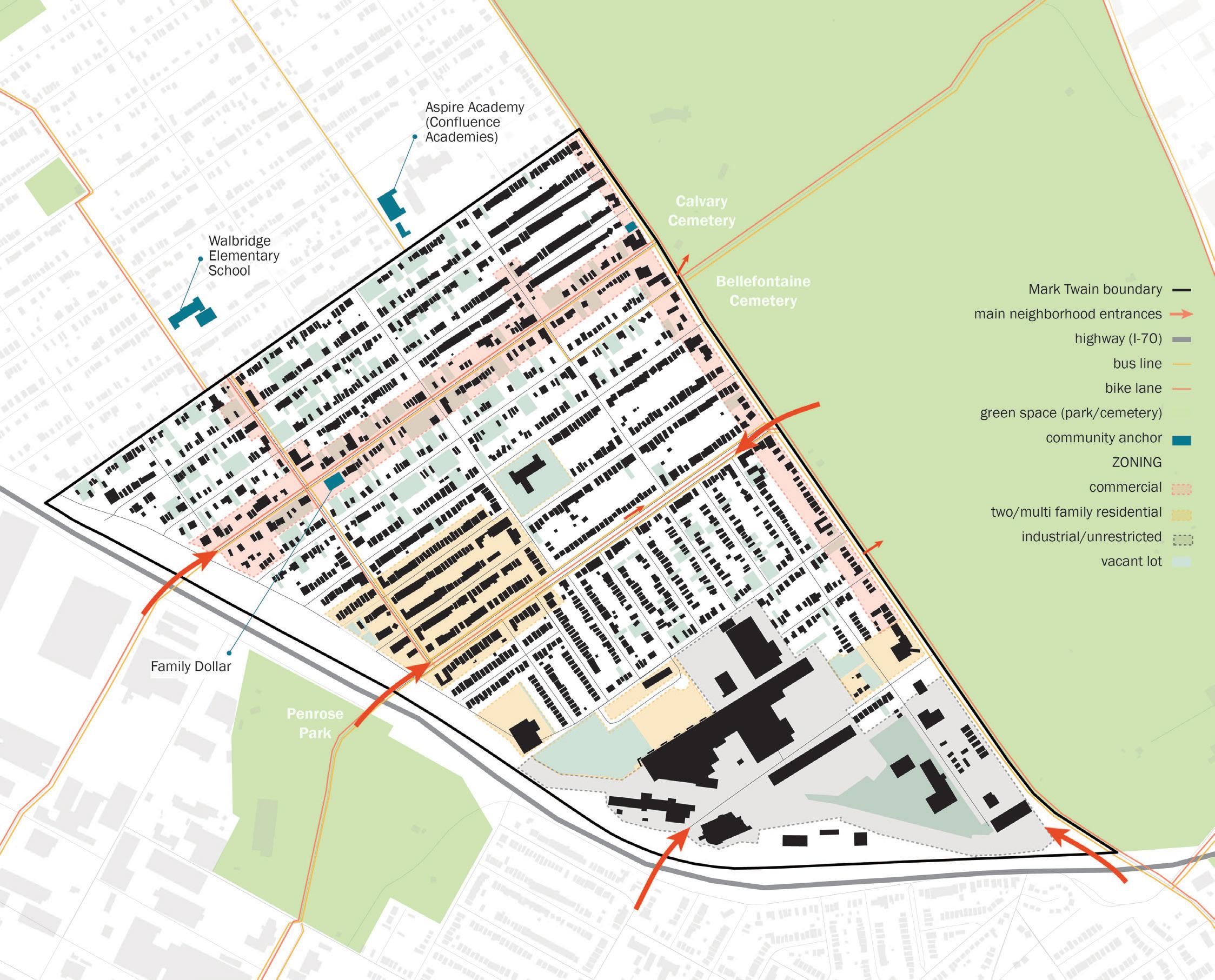
figure 1: existing conditions
43
map
BUILDING FIGURE GROUND
Building Figure Ground
BLOCK FIGURE GROUND
Block Figure Ground
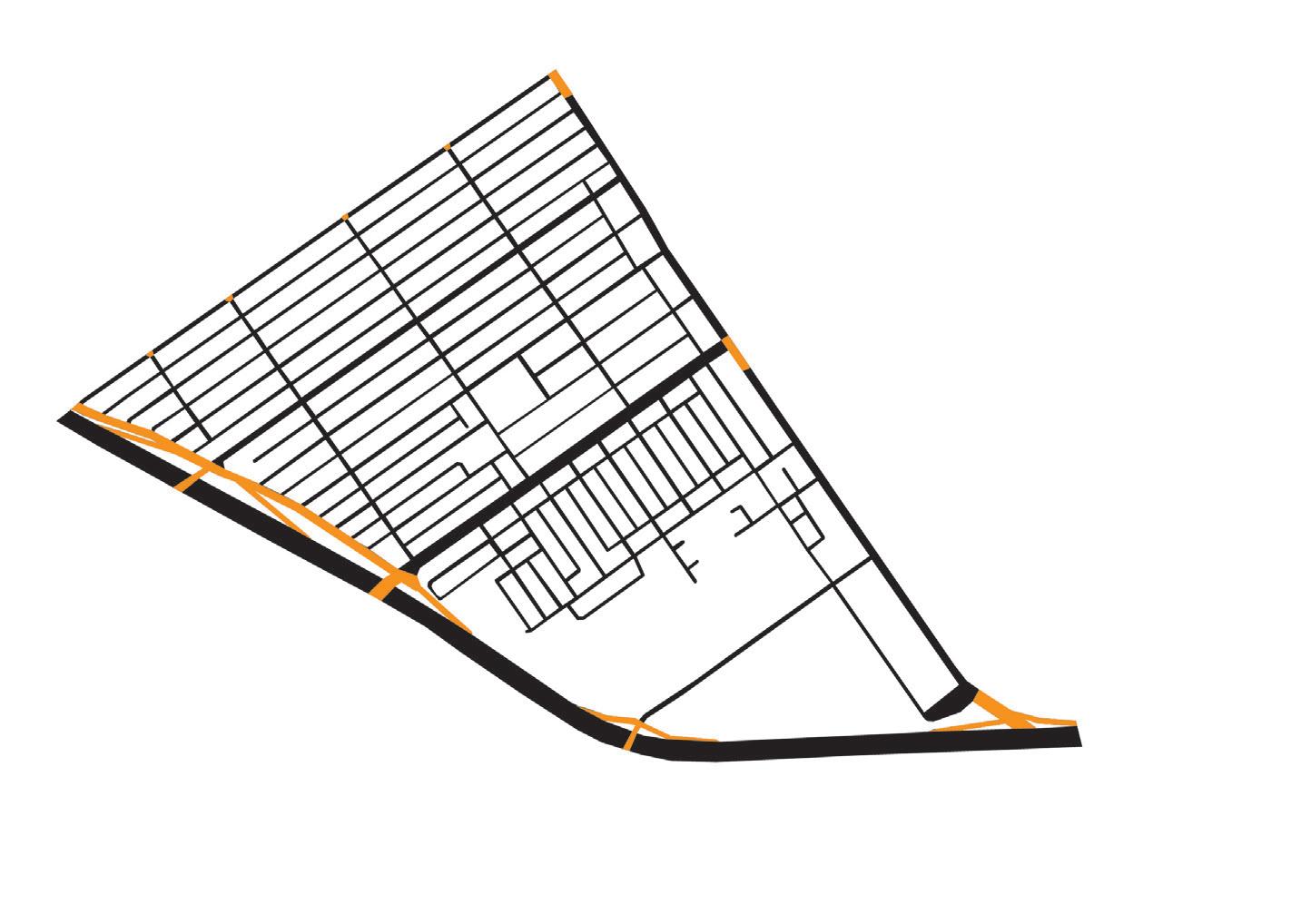
VEHICULAR NEIGHBORHOOD ENTRANCES

ONE WAY STREETS + DEAD ENDS
28’ average setback 5’ sidewalk width 18’ average alley 1-2 story single family residential larger industrial buildings
most tree cover concentrated in
135 intersections
1 parkway (Kingshighway Blvd)
0 fully tree-lined streets (Ashby, Queens, Leahy, Thekla come closest)
60’ average commercial street width
30’ average residential street width
100% of interior residential streets have parallel parking
20 in-use surface parking lots
STREET FIGURE GROUND
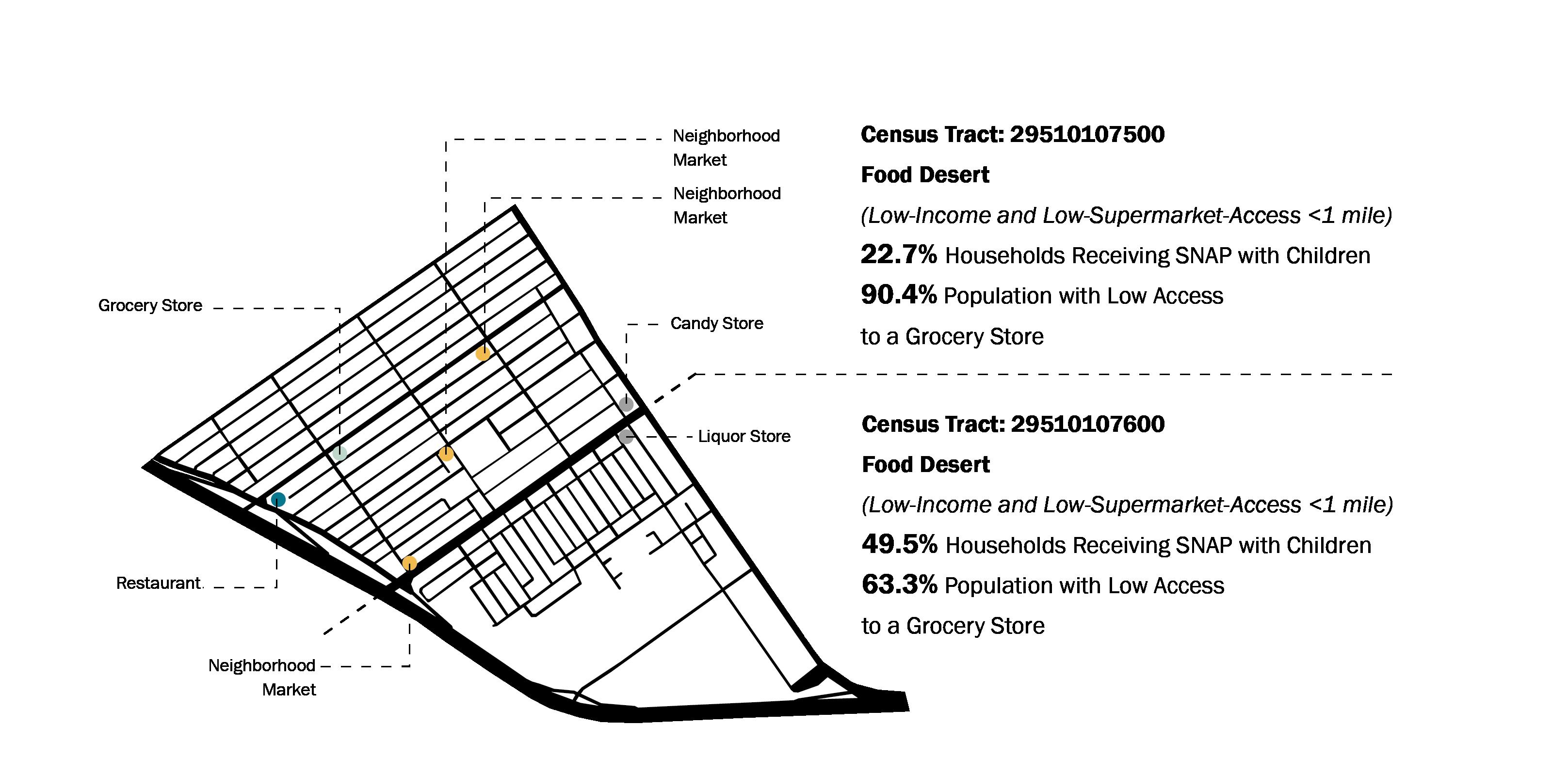
figures 2-7: selected neighborhood diagrams of urban conditions note: diagrams produced in collaboration with Madeleine Starr + Angie Hoffman
45
alleyways
Union:
42’ wide
wide I-70: 174’ wide
wide Queens: 25’ wide setback width alley width
Kingshighway: 73’
W Florissant: 75’
FOOD ACCESS
FOOD ACCESS
Goal: Increase the number and variety of healthy food options in the neighborhood
Design Strategies:
1. Convert vacant buildings and lots into restaurants + retail + gardens along commercial corridors
2. Green buffer produces food for animals and pollinators
3. Partnership with Senior Living Center to provide food and gardening activities for residents
Possible Metrics:
Number of grocery stores
Number of gardens
Average distance to grocery store
Percentage of diabetes
Percentage of obesity
Percentage of poor overall health Participants at neighborhood garden
MOBILITY
Goal: Increase walkability and bikeability both within the neighborhood and between Mark Twain and surrounding areas
Design Strategies:
1. Increase pedestrian access points into the neighborhood
2. Increase pedestrian and cyclist access points into the cemetery to encourage physical activity
3. Create walkability corridors near commercial zones and green spaces
Possible Metrics:
Miles of sidewalk
Miles of bike path
Miles of bus routes
Number of users on built paths
Percentage of car use
Walkability score
Walkable intersection density
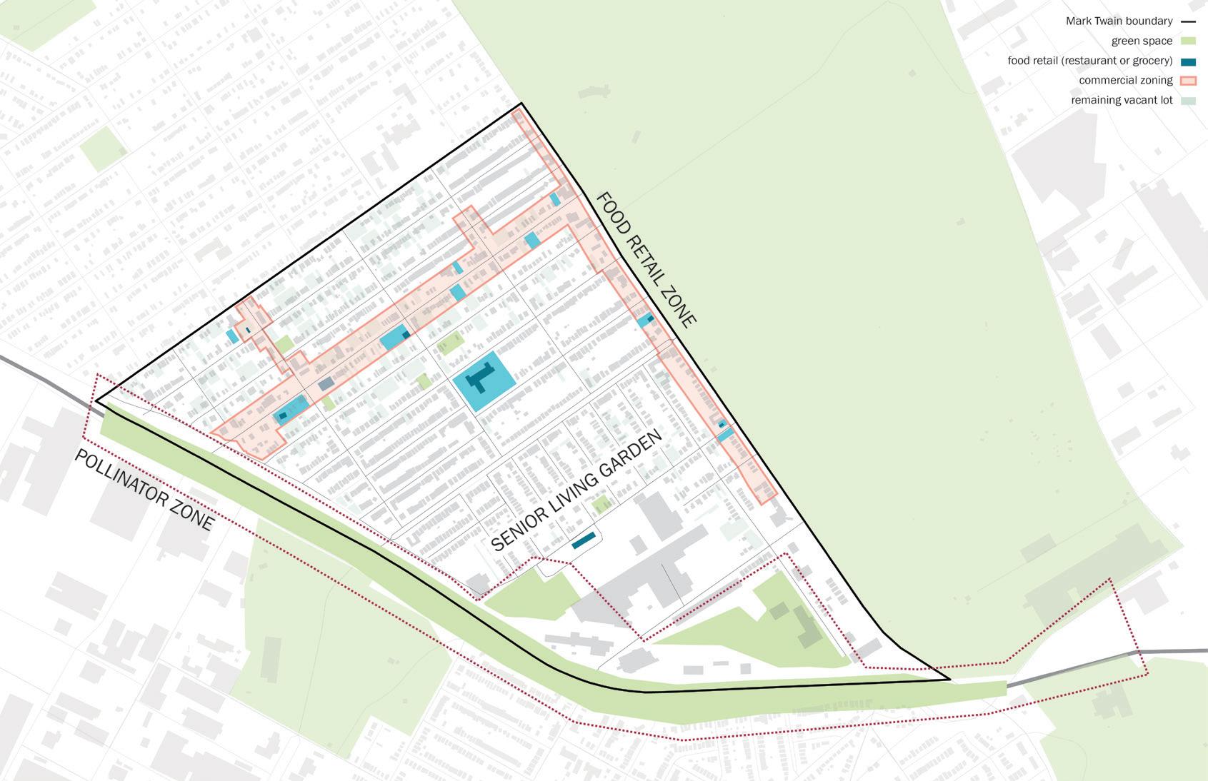
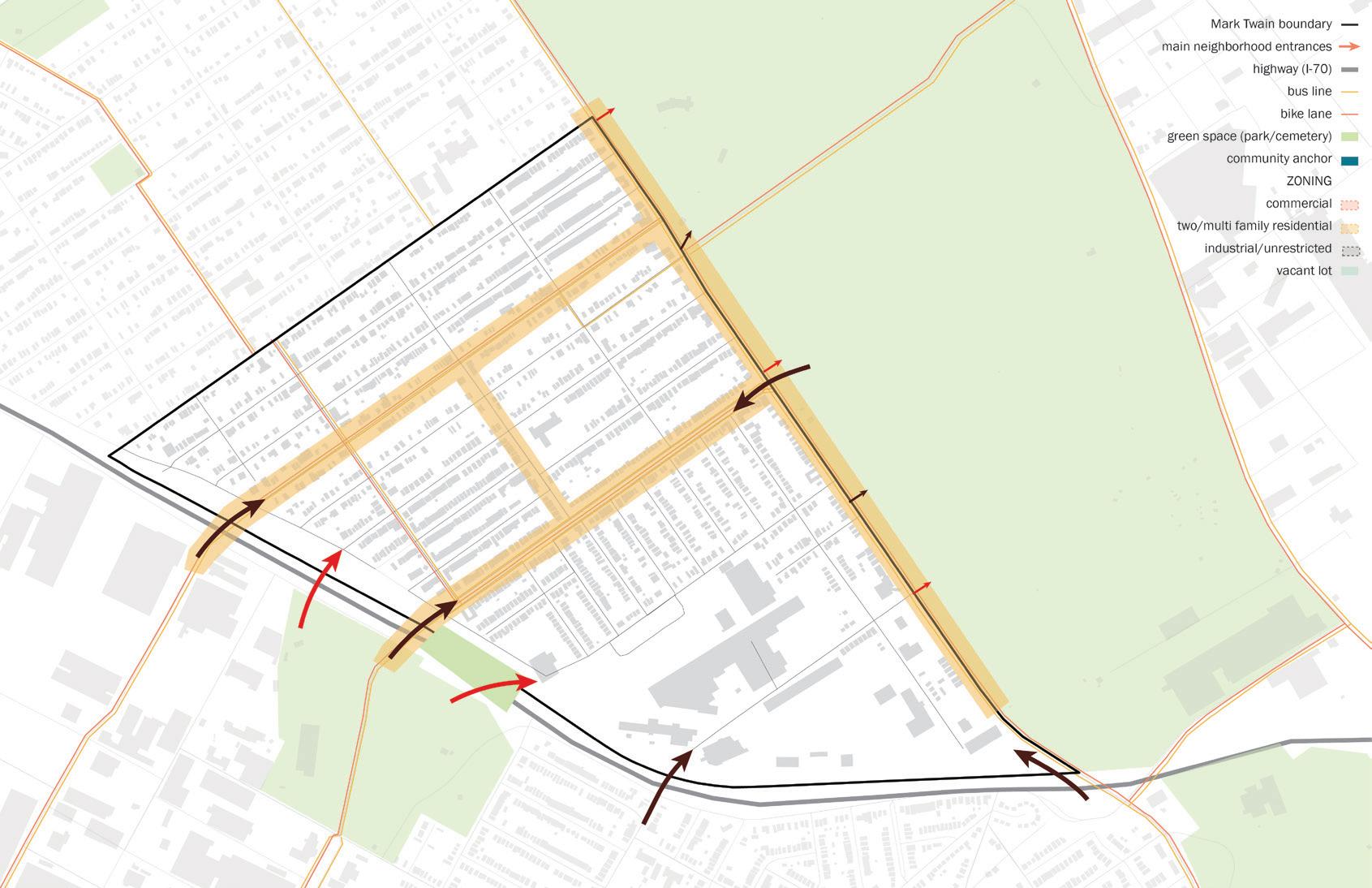
figures 8-9: selected framework plans note: maps produced in collaboration with Madeleine Starr + Angie Hoffman
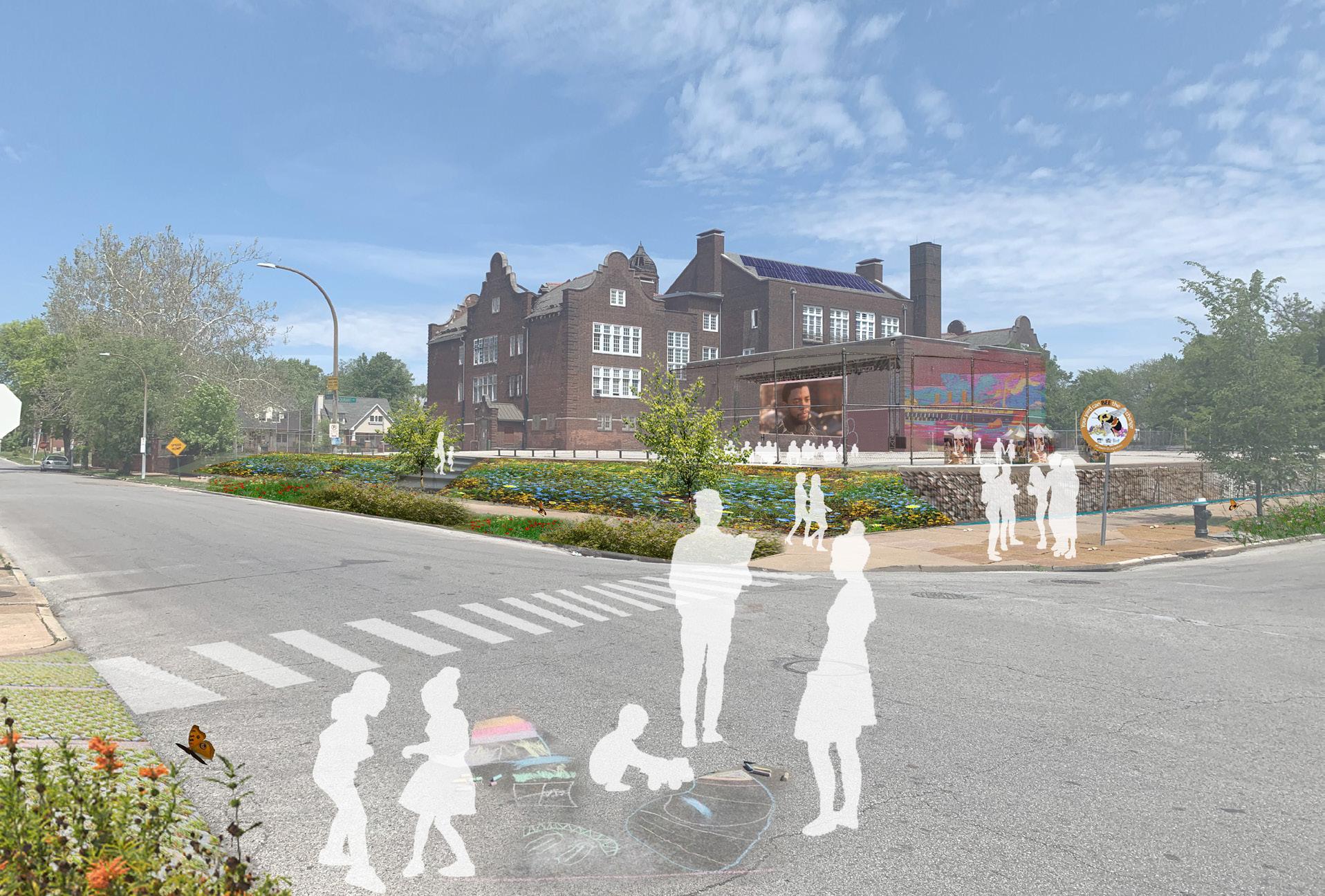

figures 10-11: prospective futures collages
47
SEGREGATION BY DESIGN
Causes, Consequences, and Mitigation
Research Assistant
Supervisor: Catalina Freixas
Location: KingsVille Neighborhood, St. Louis, MO
Primary Health Goals:
Decrease neighborhood crime and improve safety
• Improve economic opportunities and means for low-SES, minority residents
Implement vertical farming infrastructure to provide local produce
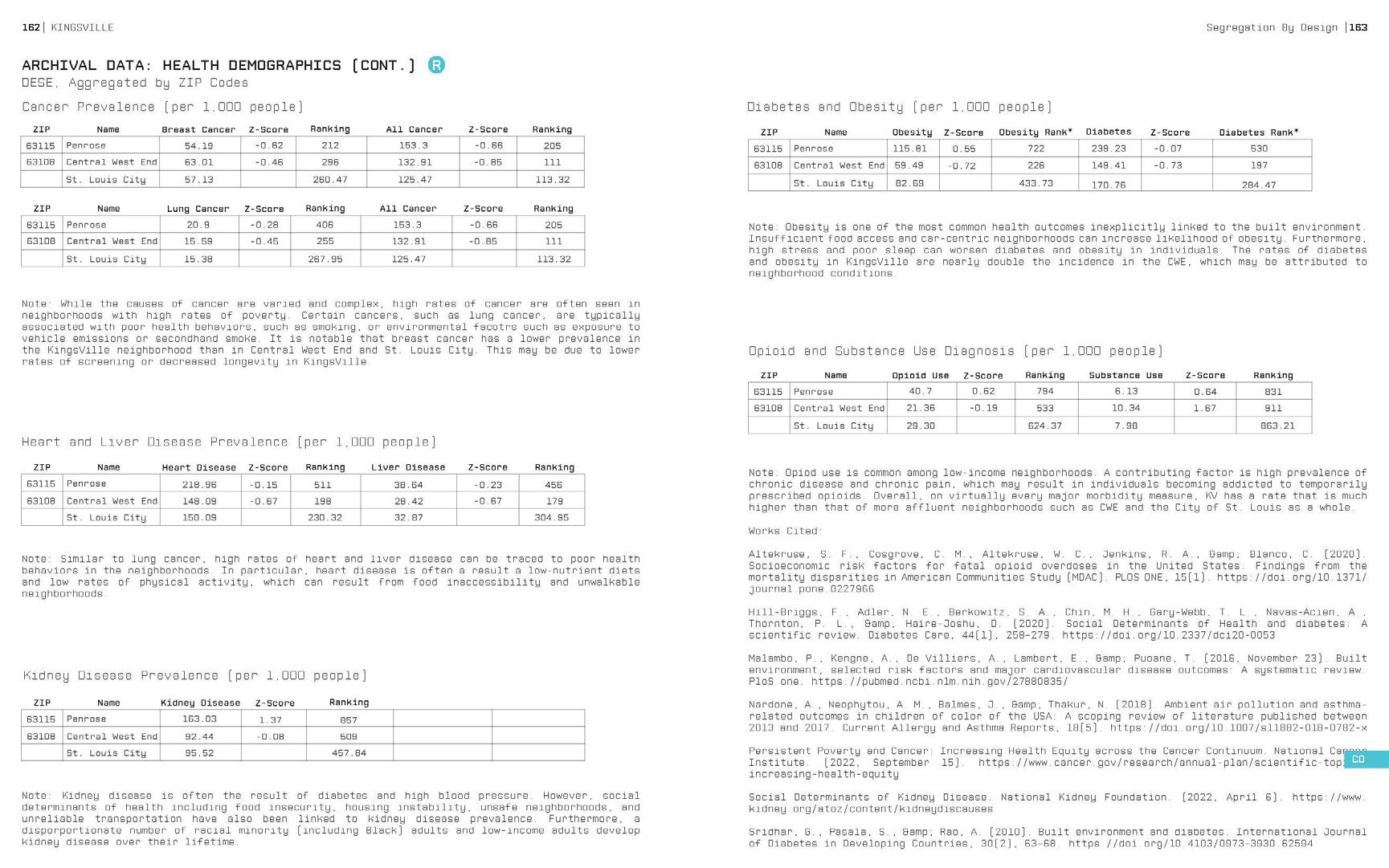
The Segregation by Design (SBD) project is an ongoing analysis of St. Louis neighborhoods utilizing the B.E.S.T. Framework (Beautification, Education, Services + Safety, and Technical Assistance + Training). This project supports local neighborhood groups in KingsVille, a community which straddles the Kingsway East and The Ville neighborhoods, and has identified Hickey Elementary School as a key partner and community anchor. The project culminates in a thorough publication of research and proposed mitigation strategies. A select number of pages are shown to demonstrate the breadth of research and quality of work produced.
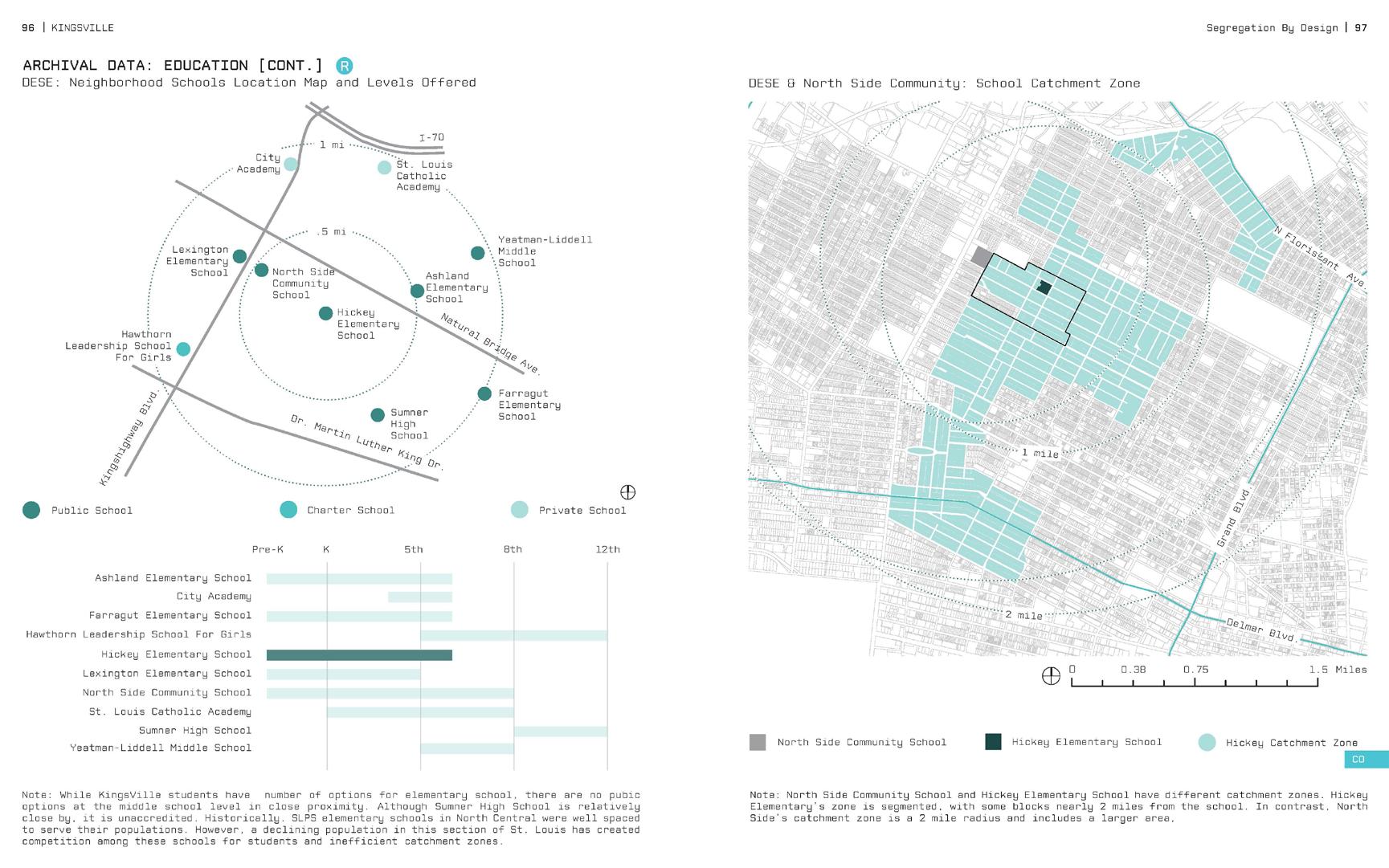
figures 1-2: pages from
49
SBD book


figures 3-4: pages from SBD book

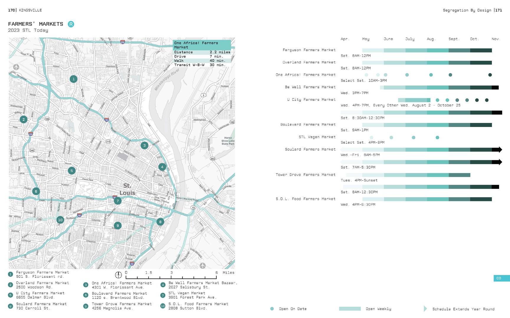
figures 5-6: pages from
51
SBD book
GENDER-EQUITABLE TRANSPORTATION
Foundations of Geographic Information Systems Project
Public Health Elective, Research Poster (Spring 2022)
Professor: John Cruz, MUP
Location: St. Louis, MO
Primary Health Goals: Understand women transportation needs and identify genderequitable improvements
• Promote women’s safety while utilizing public transportation
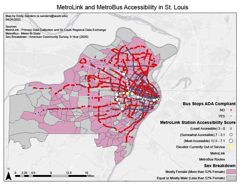
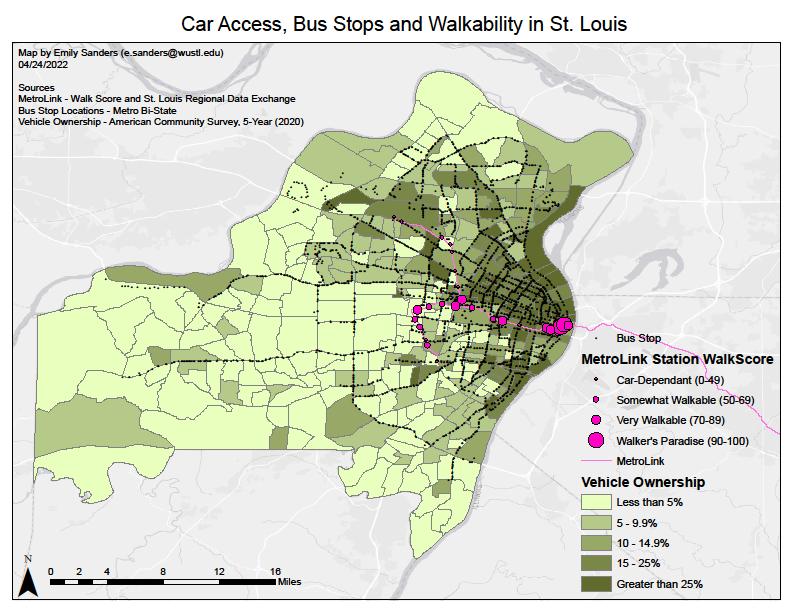
Women have specific transportation needs unaccounted for in malecentric, multi-modal transportation plans. Existing transportation systems favor drivers and bi-lateral travel instead of “trip-chaining”, traveling with children or relatives, and transit riders. A MetroLink audit was compiled with existing transportation and demographic data to measure safety and accessibility. Accessibility was lower in Northern MetroLink stations but higher in Northern MetroBus Stops. Vehicle Ownership was low in St. Louis City, and public transit gaps exist in low vehicle ownership and high female populations. Existing transportation systems should be upgraded and expanded to meet localized female needs.

Methods


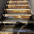
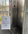

53 Is St Louis Transportation Gender-Equitable? Emily Sanders, MPH ‘23, Brown School Women have different travel needs than men, including greater accessibility and safety needs. The purpose of this project is to assess if St. Louis is currently meeting the needs of female travelers and identify potential gender-equitable improvements. • Gaps exist in North, West, and South St. Louis where women without vehicles have limited access to public transit • The North-South MetroLink could improve access • Bus Stops should become universally ADA compliance and lighting should be improved where needed • Northern MetroLink Stations should be priority for improvements, such as adding crosswalks and benches
• MetroBus Stops are not accessible, especially to disabled or older women, and have safety concerns • 50.3% are not ADA compliant (often located farther from city center) • 78.7% do not have a bench • 90.3% are not covered • 13.9% of bus stops are not lit • North MetroLink Stations are less accessible and have worse lighting than the South Stations • Less accessible Stations are generally surrounded by non-ADA compliant Bus Stops • All North St Louis Stations are CarDependent, where vehicle ownership is less likely • 3 elevators are out of service with no alternative for disabled riders • Downtown Stations are poorly lit and often underground, which is a safety concern at night • The population skews more male along the central MetroLink line, where Safety Scores are lower • Vehicle Ownership is much higher in St. Louis County • This is supported by more Bus Stop and MetroLink Stations in the City
Women have specific travel needs that are unaccounted for in male-centric, multi-modal transportation plans
Existing transportation systems favor drivers and bi-lateral travel
Women often “trip-chain” (link multiple stops together), travel with children or bags of items such as groceries, and use public transit or walk more frequently than men
Women live longer than men,
Women without cars face safety threats and financial barriers and require greater transit access
Primary data was gathered at each Missouri MetroLink Station, with a focus on specific safety and accessibility features.
Safety Scores incorporated the presence of lighting, crosswalks, and overhead cover, and visibility from the street or parking lot. • Accessibility Scores included the presence of ramps, elevators, bathrooms, indoor facilities, and adjacent parking, the quality of sidewalk, and the number of station exits and bus stop connections.
Secondary data was obtained through online GIS sources and local institutions. The data was compared to analyze multi-modal transportation and demographic information.
Discussion
•
•
•
•
•
Background •
•
•
Contact Information Emily Sanders: e.sanders@wustl.edu • Note: The work presented here was done for the purposes of a course and is not my thesis or dissertation. Research Question Is St. Louis transportation well designed for female travelers? Results 0% 10% 20% 30% 40% 50% 60% 70% 80% 90% 100% ADA Compliant Bench Present Shelter Present Lighting Present Bench, Shelter or Lighting Present MetroBus Stop Accessibility No Yes figure 1: research poster
DENTAL CLINIC RENOVATION + ADDITION
Beale Air Force Base, CA
Role: Project Coordinator + BIM Manager
Firm: Davis Stokes Collaborative Architects, P.C.
Location: Yuba County, CA
Primary Health Goals:
Decrease patient stress during dental visits
• Improve staff circulation to treat patients quickly and perform work tasks efficiently
The U.S. Air Force requested a renovation and addition to their existing one-story dental clinic on Beale Air Force Base. The floor plan was reworked into an H-form with concentrated staff services in the rear for efficient staff and patient circulation. This project also required medical planning for the clean and dirty storage spaces, laboratories, and radiology spaces and matching existing exterior materials and interior finishes, which was extensively coordinated with the Air Force end users. Natural light and views in patient rooms were of critical importance to the design team, increasing patient mindfulness during potentially stressful visits.
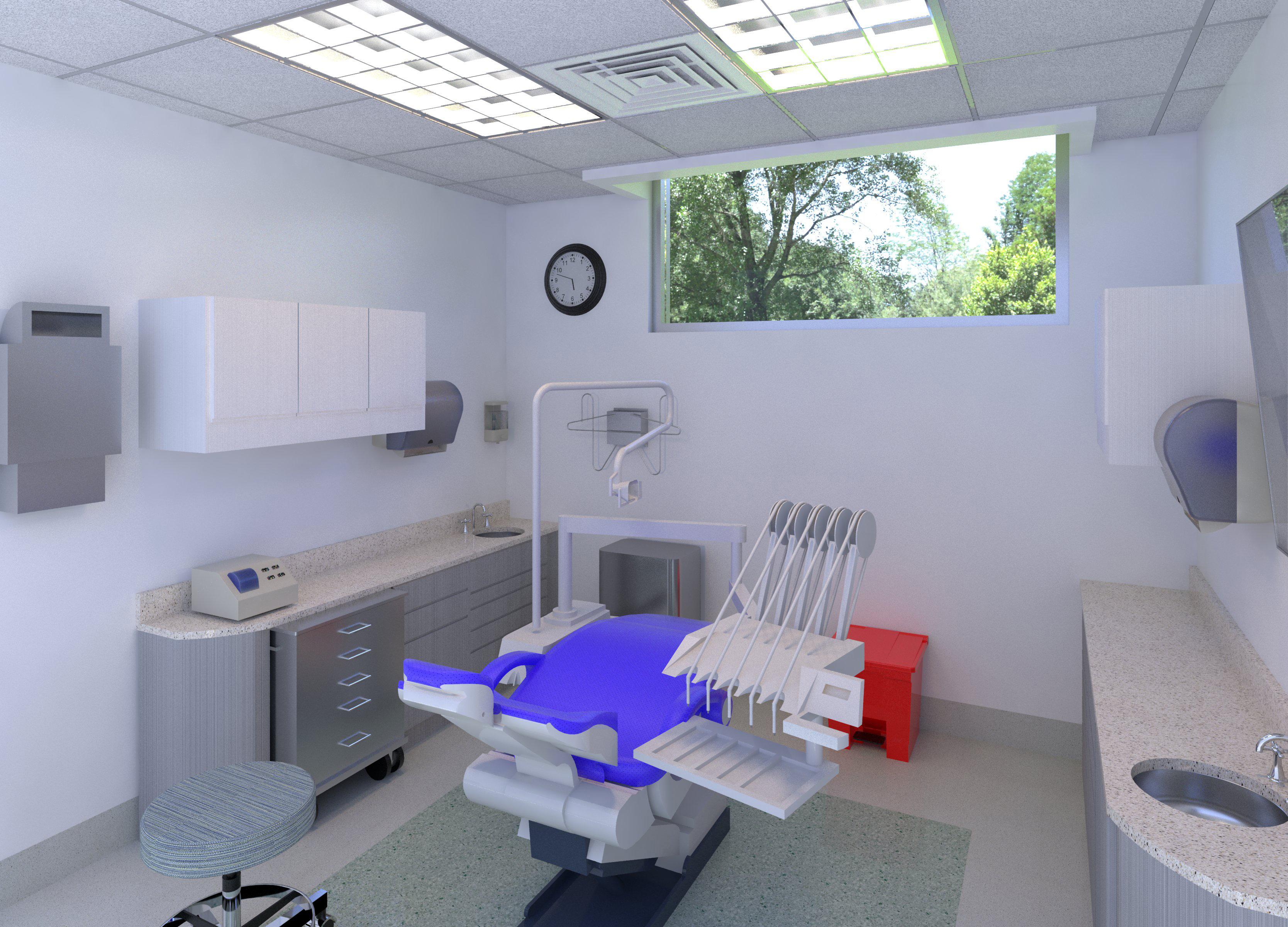
figure 1: dental treatment room rendering
55


figures 2-3: selected project construction documents

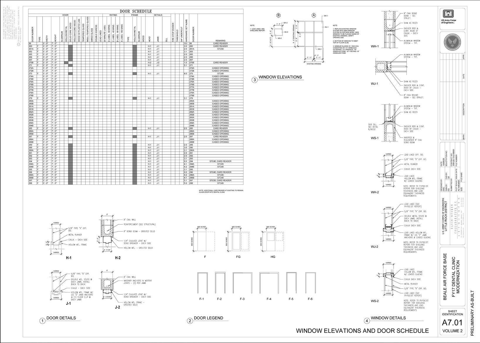
figures 4-5: selected project construction
57
documents


 Lawful Good Neutral Good Chaotic Good
Lawful Neutral
True Neutral Chaotic Neutral
Lawful Evil Neutral Evil Chaotic Evil
figure 2: context vegetation analysis, images from Google Earth


 figure 2: biking path
figure 3: biking and walking path
figure 4: walking path


