Esther Karanja

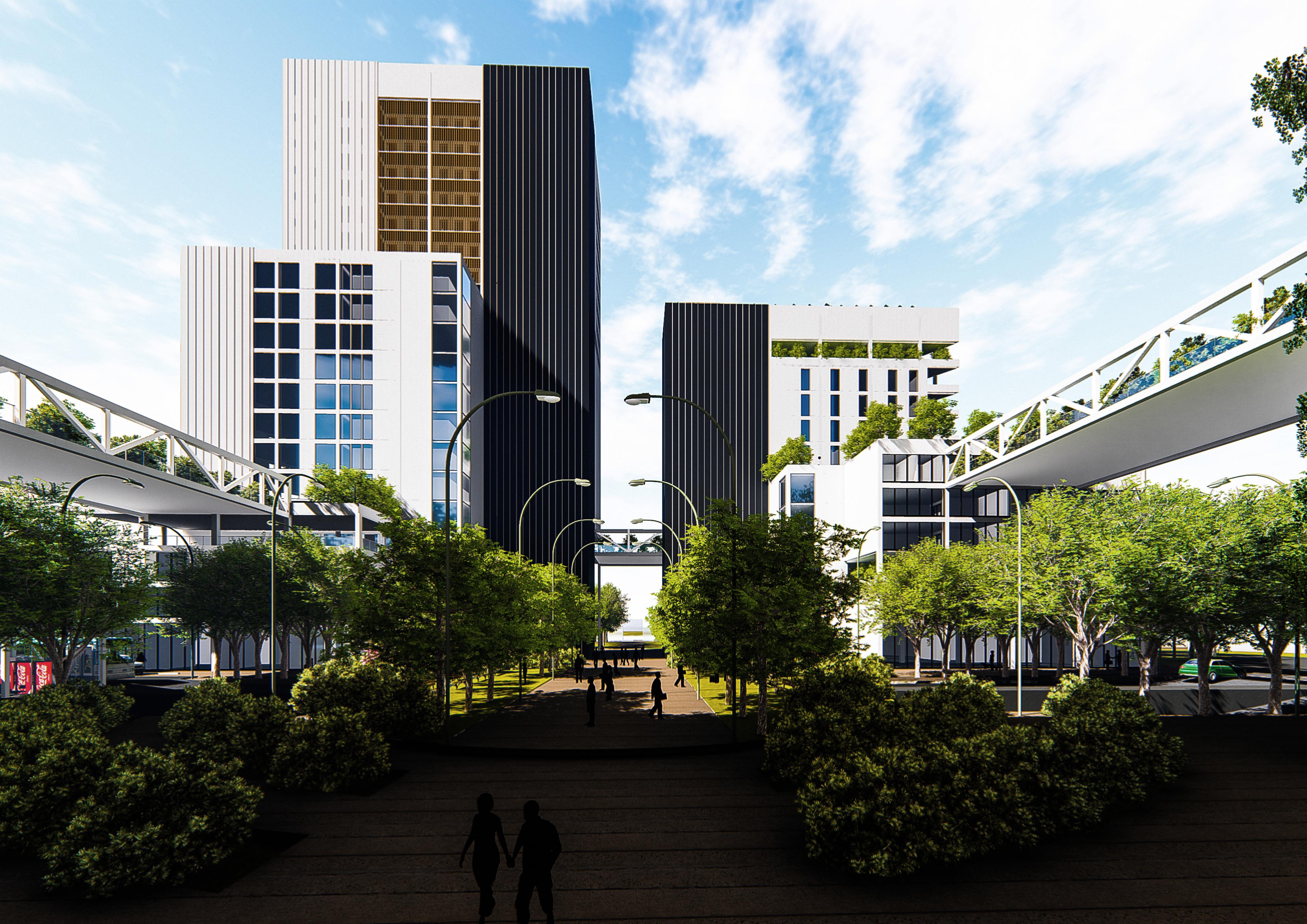
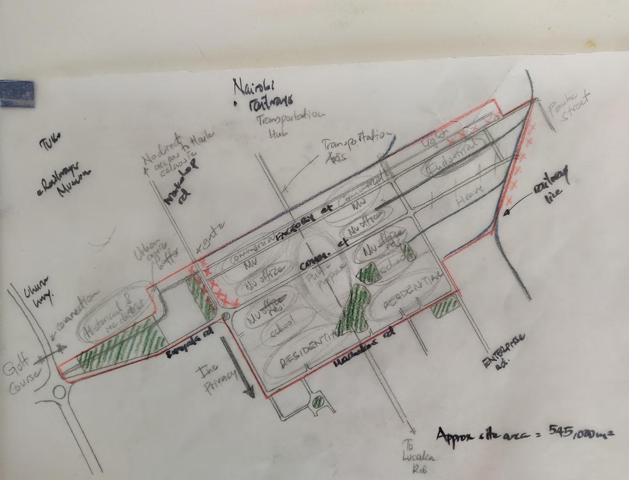
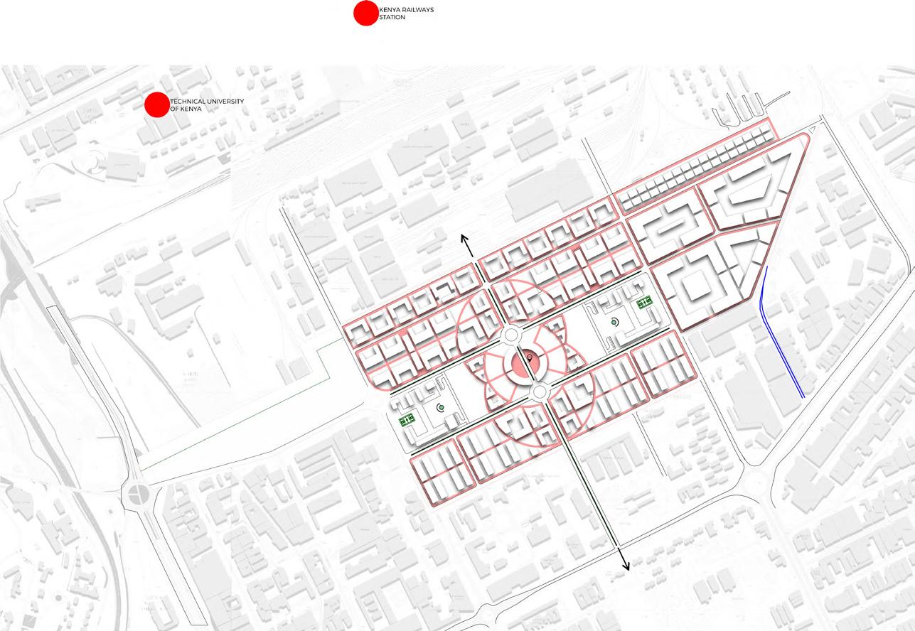
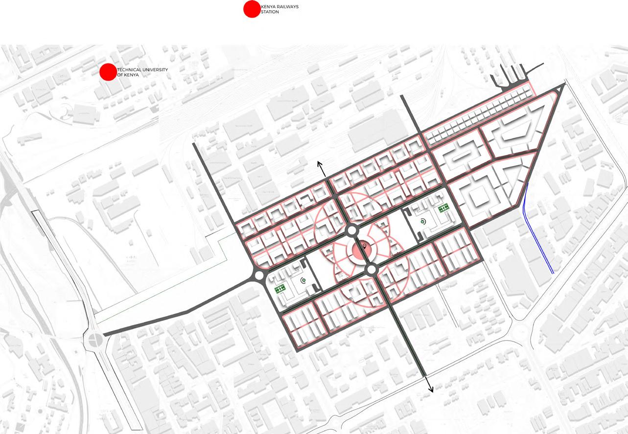
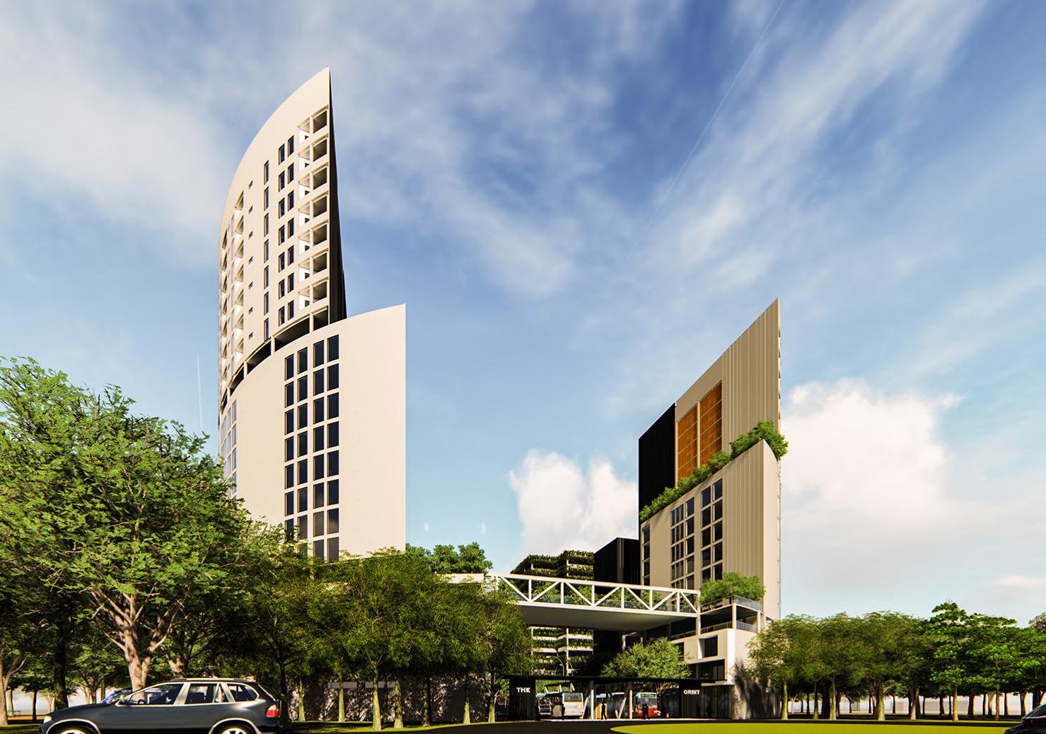
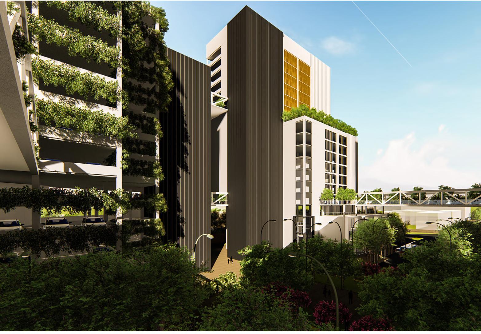
Kenya Railways City Redevelopment
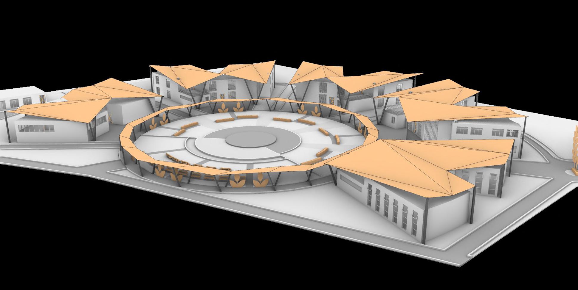
Mwea Agriculture & Technology Campus
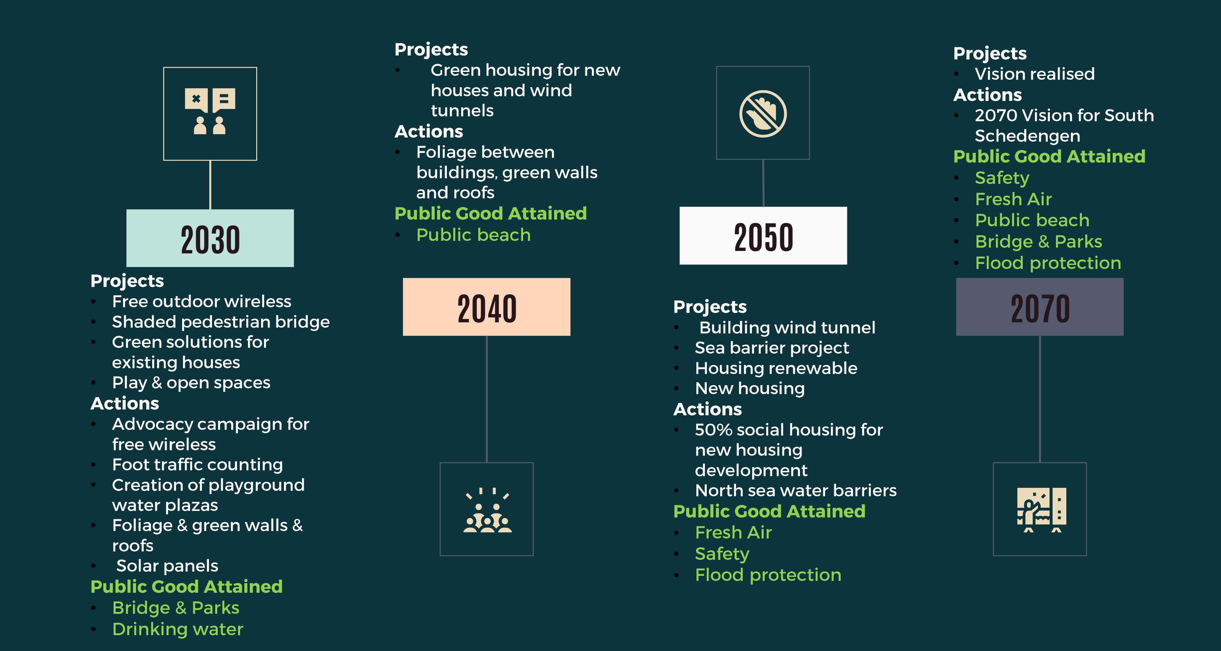
Operation RIC: 2070 South Scheveningen The Hague, Netherlands
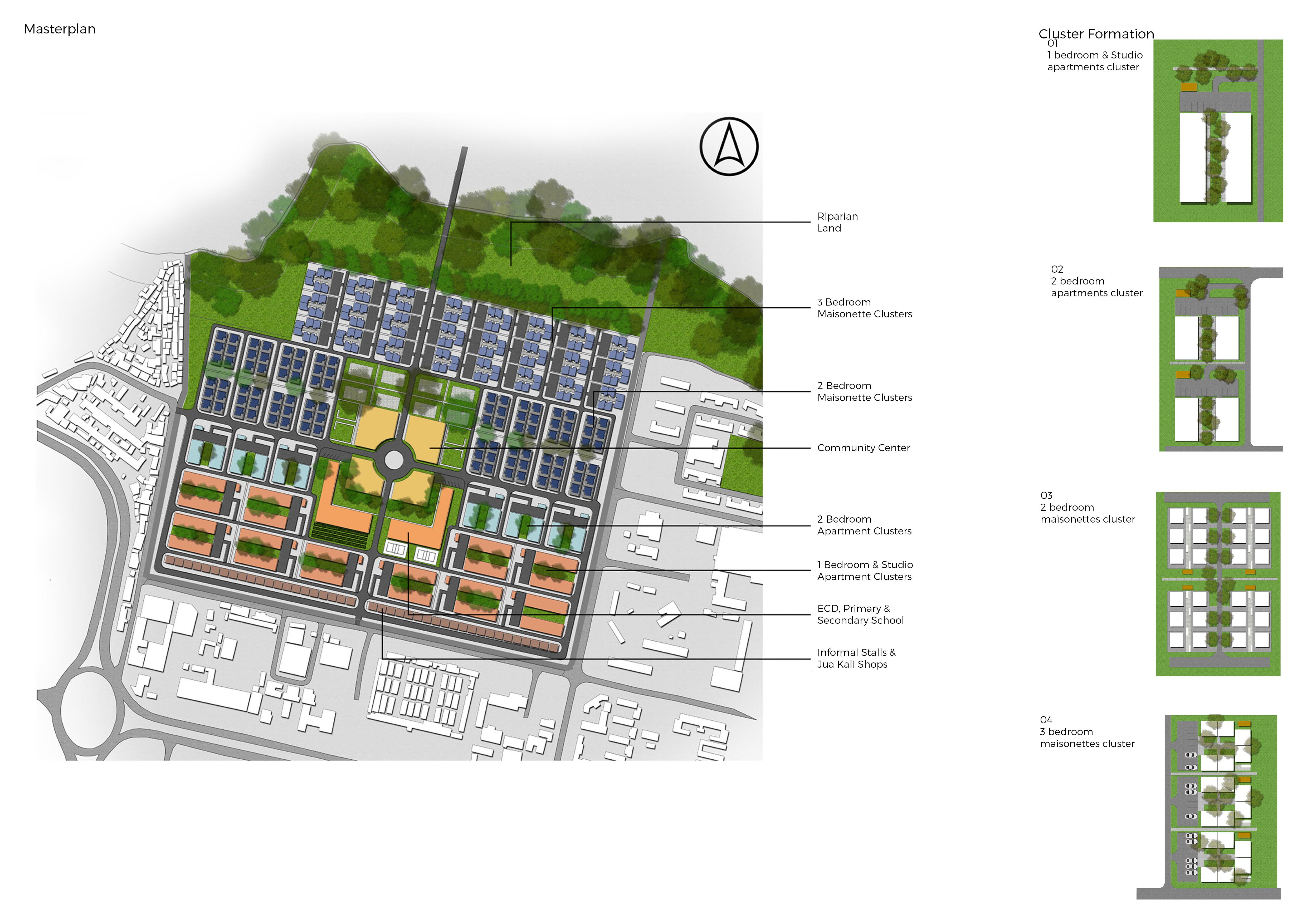
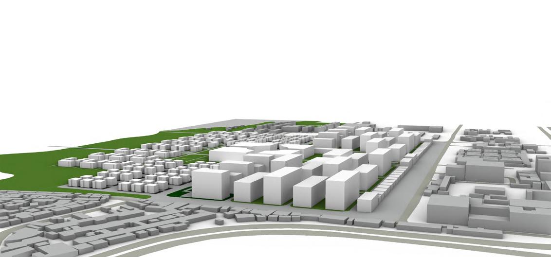
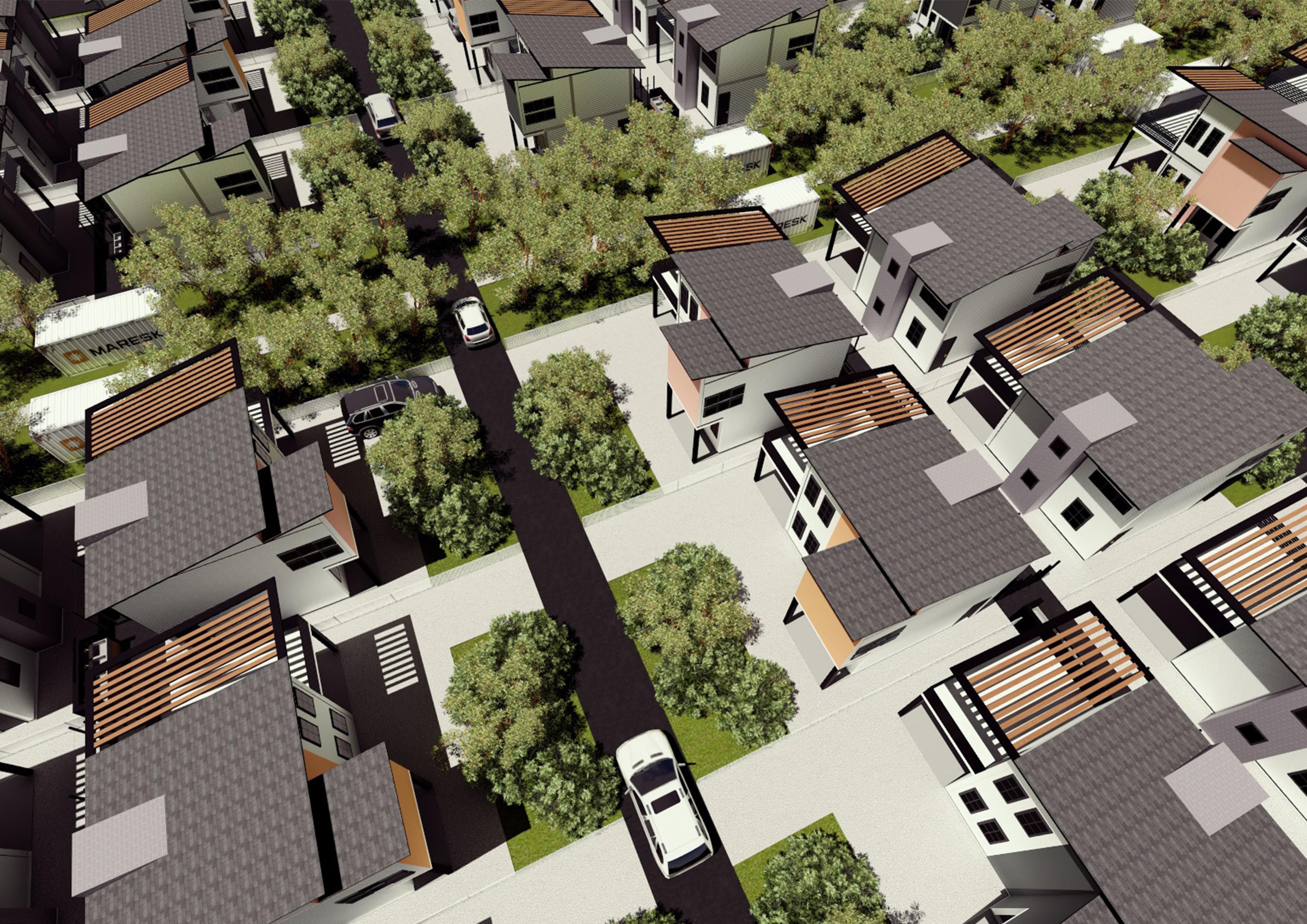
Shauri Moyo Affordable Housing Nairobi, Kenya


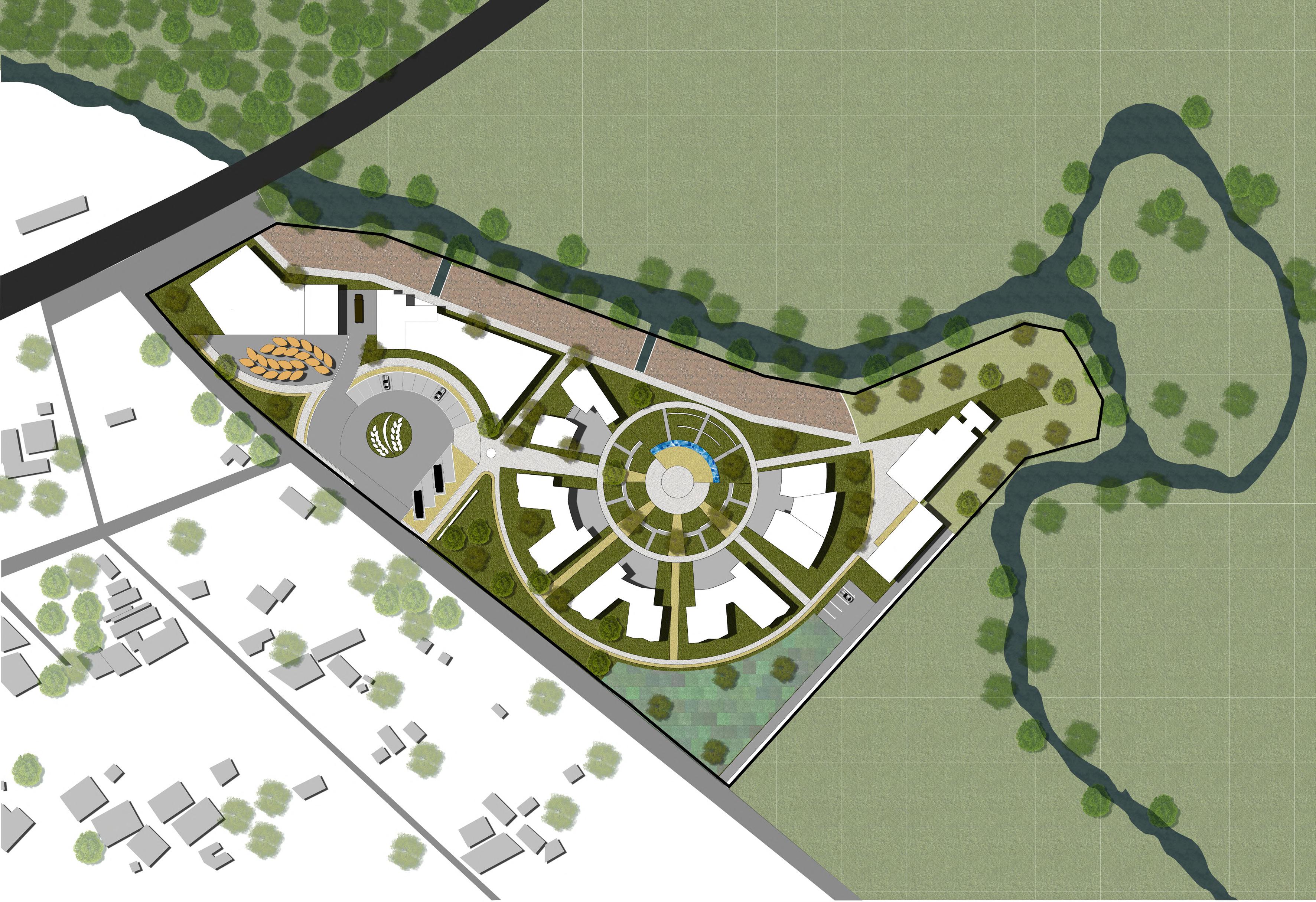


Rainwater harvesting to supplement site supply
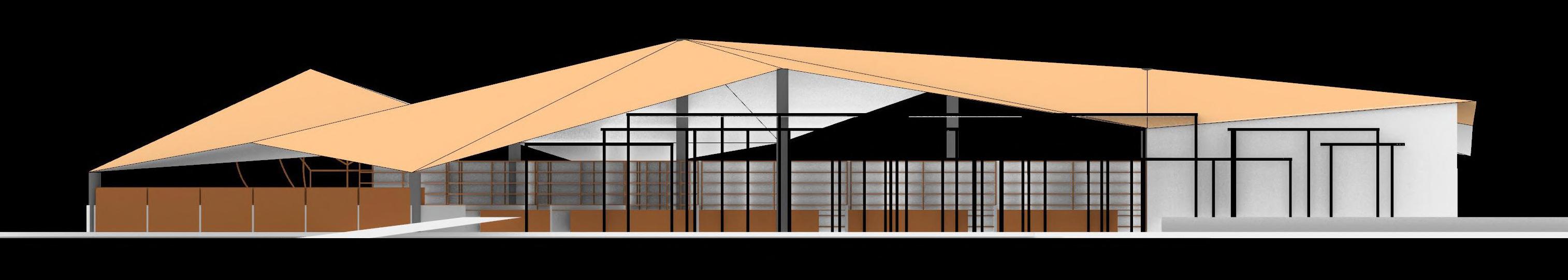
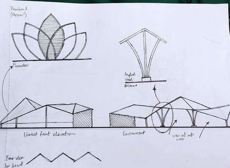
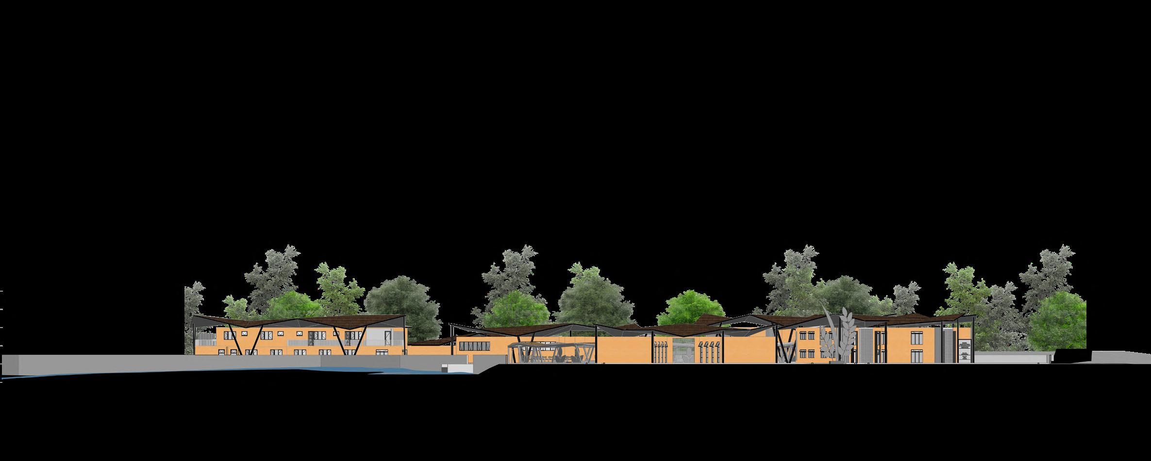
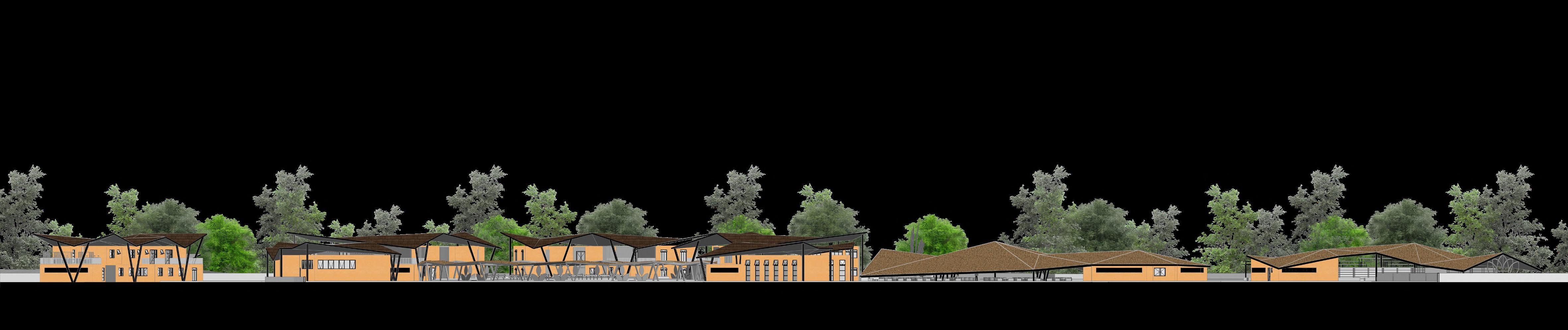
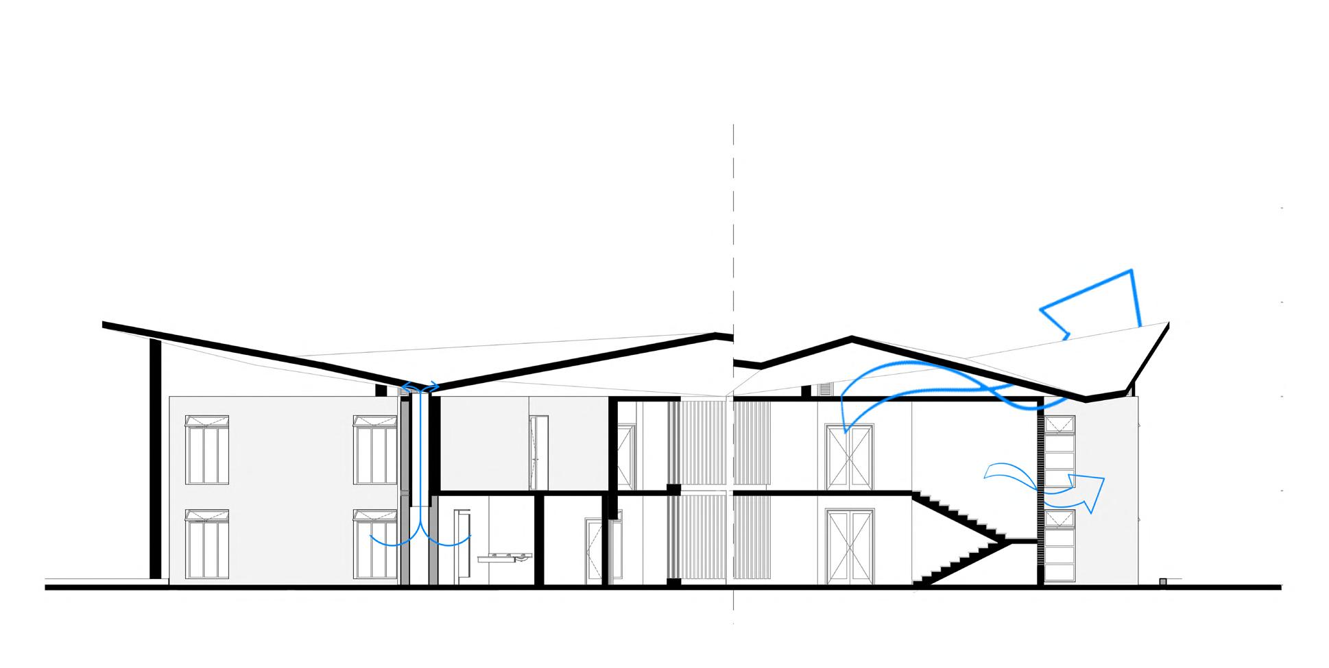
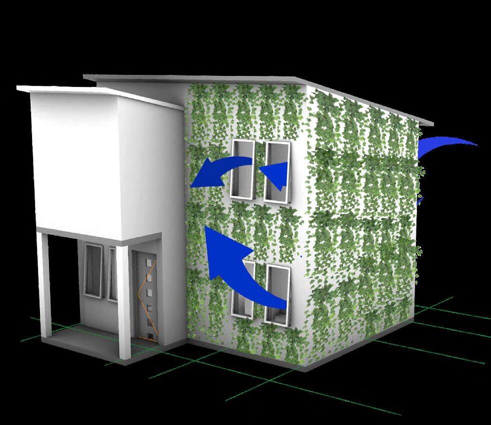
Raised roofs, screen walls & stack ventilation for passive cooling since the climate in Mwea is hot and humid
Rice straw clay brick walling to promote circularity & sustainability
Highly circular steel structure which is easily recoverable and is sourced from recycled material


Locally available rice straw clay bricks which are easy to fabricate on site and require low technical skill

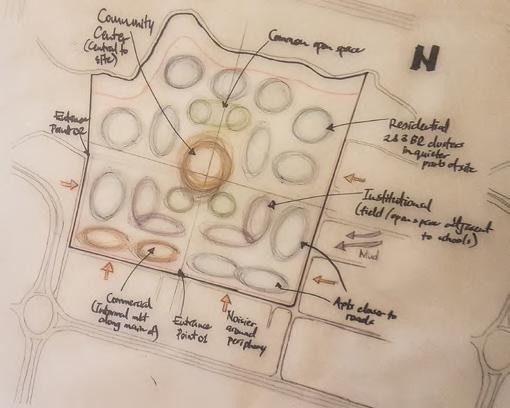
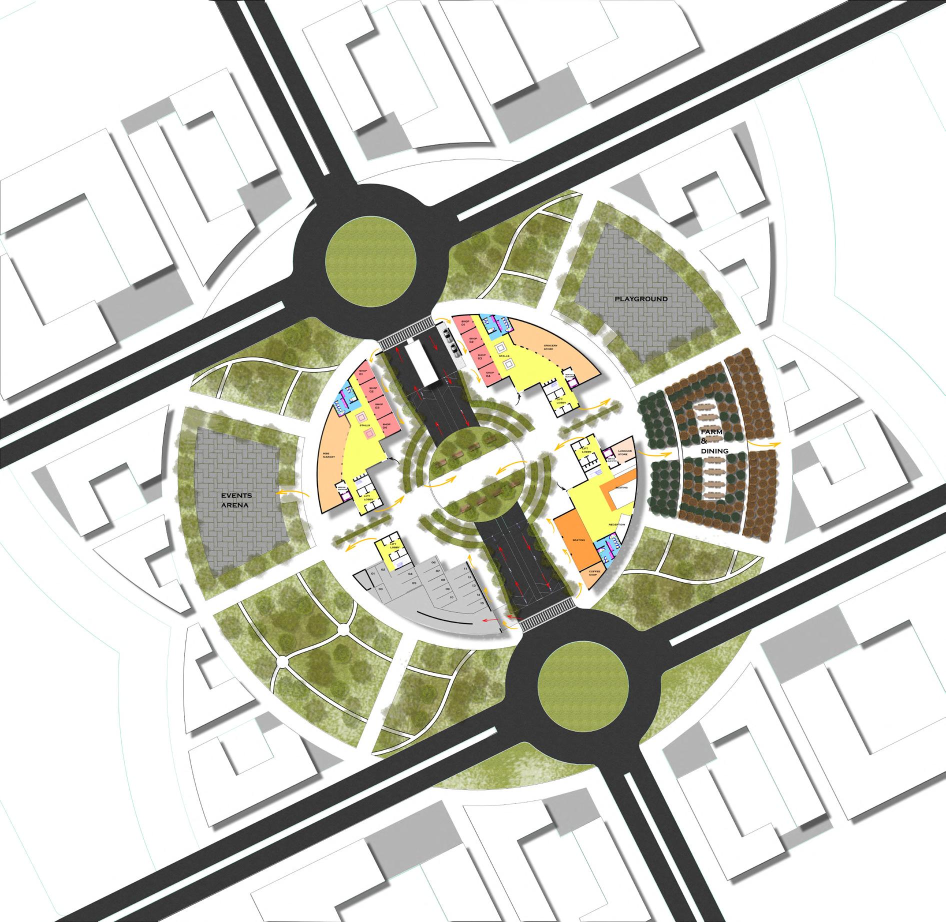
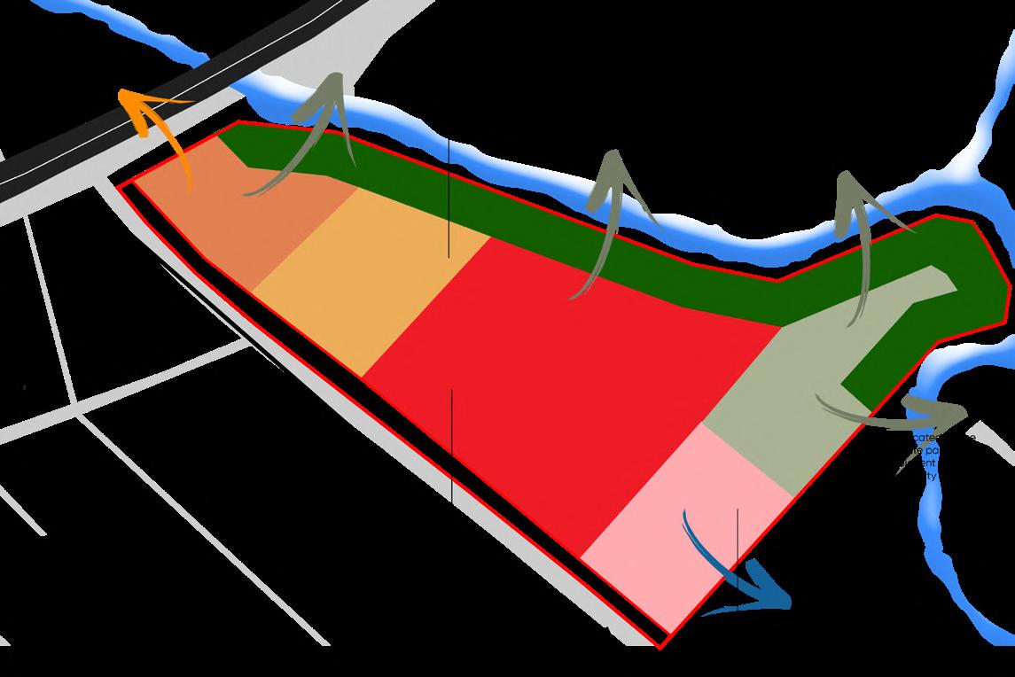
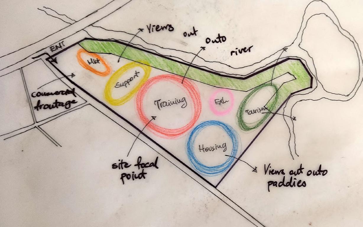
Public facilities to create nodes of pedestrian traffic & attract users to site

The market also provides retail space for local rice farmers to sell their produce
The plaza acts as the main training center node providing both circulation and recreational space

Introduction


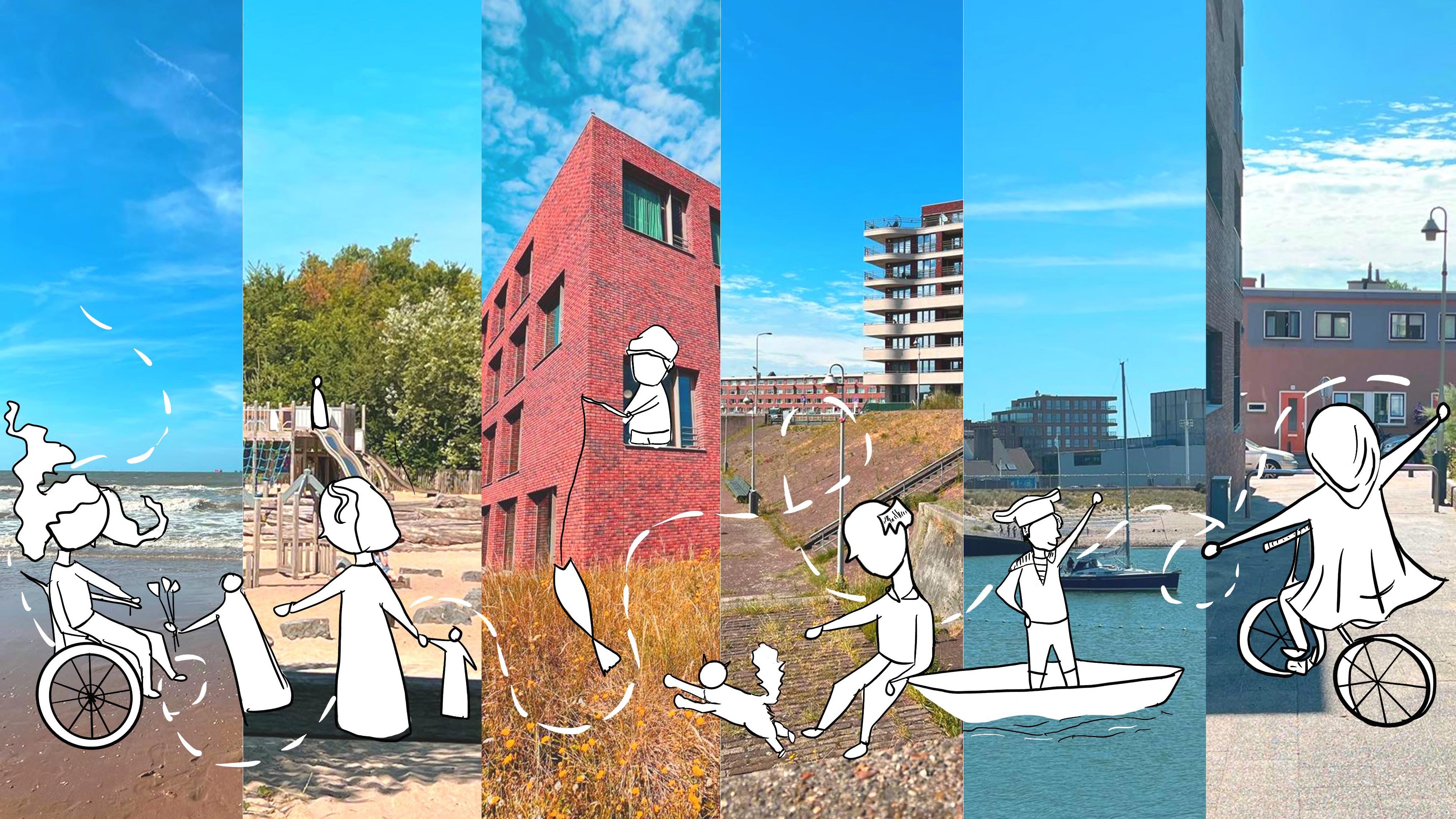
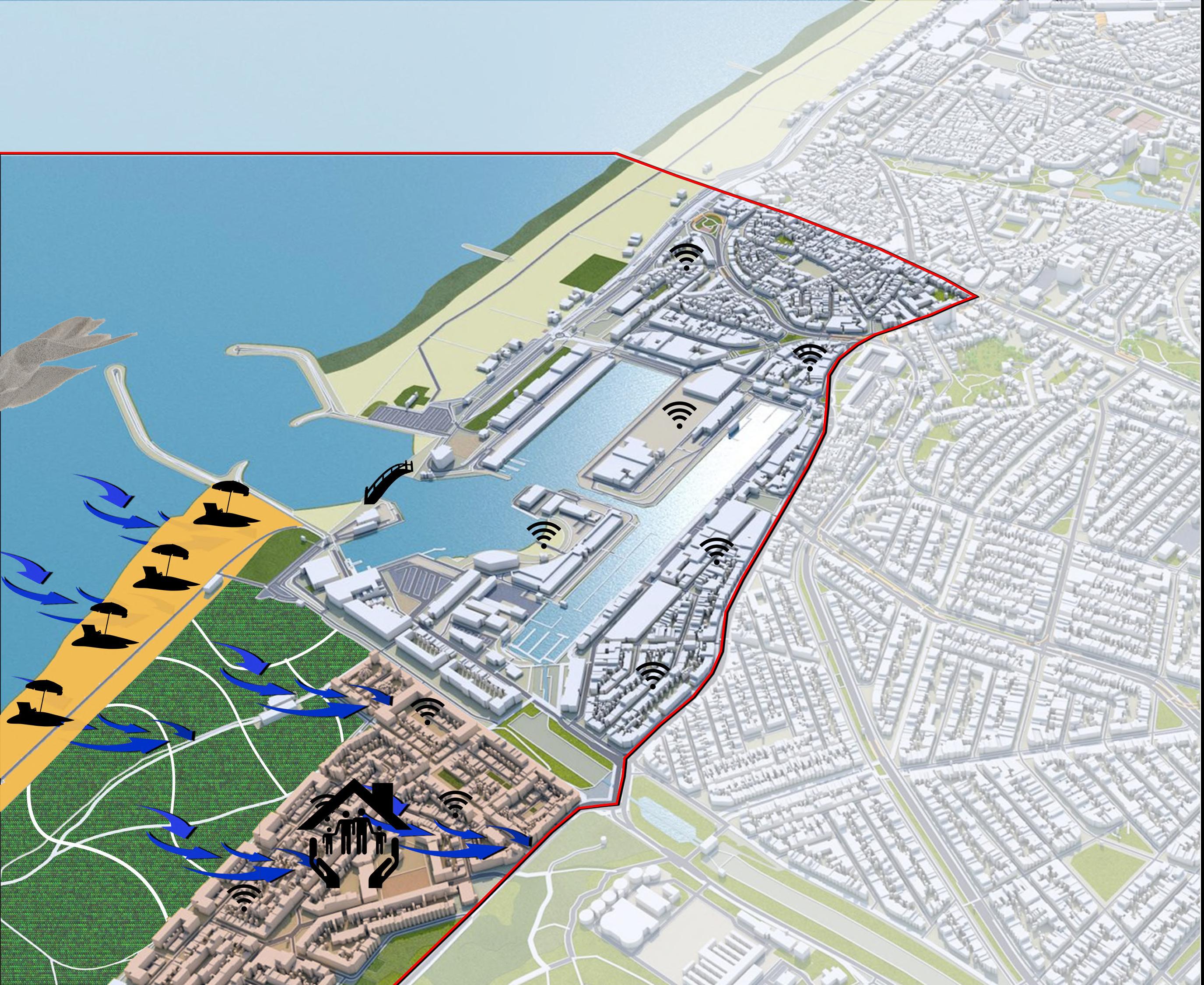
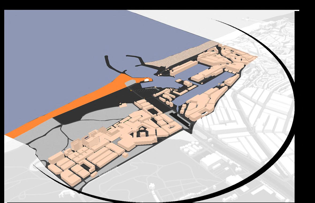
Our vision for South Scheveningen was that by 2070, the area should be Resilient, Inclusive and Connected (RIC) We focused on Duindorp, the port and the Marina, because these were the areas hosting the most underprivileged residents of the harbour and thus had more opportunity for interventions.

We also employed the use of a tulip-themed mascot named RIC to make the vision easier to communicate to a larger audience.

Situational Analysis
Following site visits, literature reviews and interviews with the residents, we established a number of urgent threats and developed a hierarchy of necessary interventions based on pertinence and need.

We then focused on developing an understanding of current and projected users of the area and their individual physical, social and economic configurations that would consequently inform their ability to interact with the space.

We specifically focused on underprivileged users who often don’t have a voice in urban planning.

Users of South Scheveningen


Vision Map & Strategy Formulation
This understanding allowed us to develop a strategy for the area in form of progressive trigger and support projects and policy development across a 50 year timeline.

resilience

Passive cooling strategies for existing & new houses
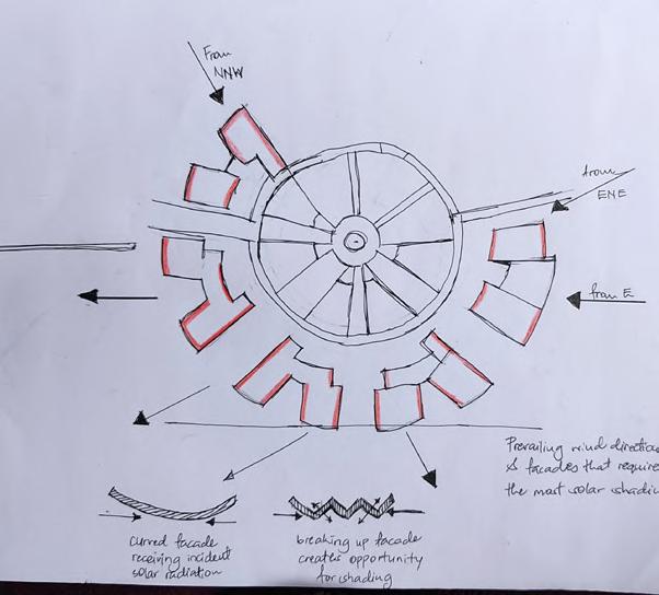
Incorporation of wind tunnel in any new or developmentsregenerative
Incorporating barrier project into vision for the South Beach

South Scheveningen 2070 Strategy
inclusivity
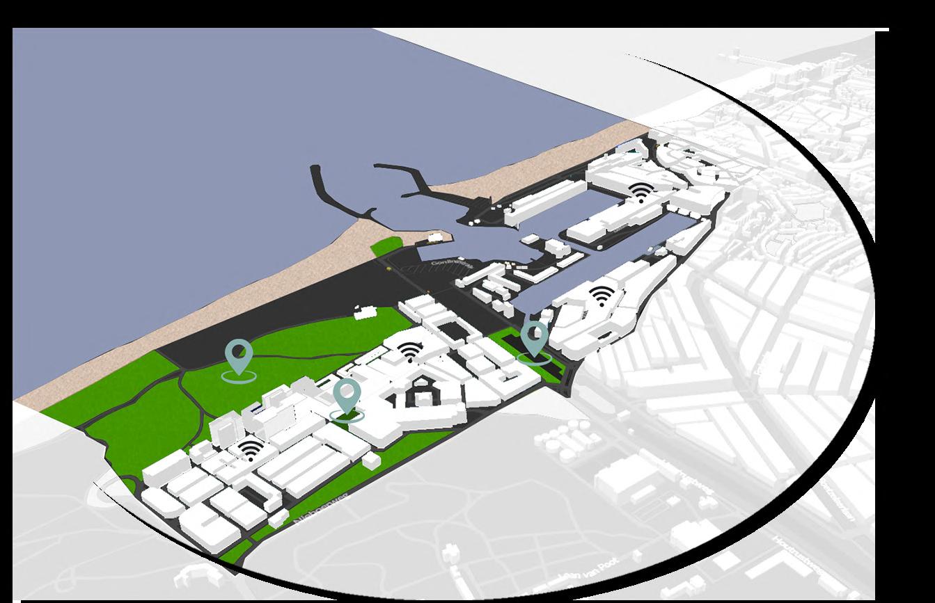
Free public Wifi all over South Scheveningen
Introduction and addition of play spaces and green open spaces

South Scheveningen 2070 Strategy
South Scheveningen 2070 Strategy
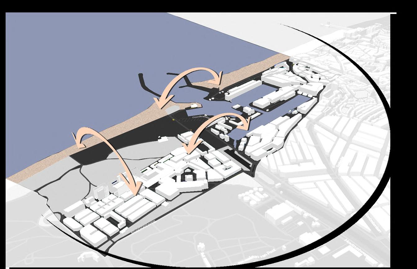

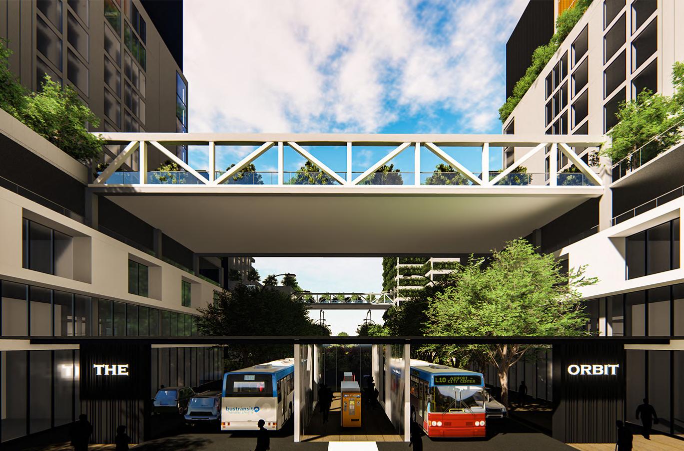
Shaded pedestrian & cycling bridge between the North & South beach
Shared open space between Duindorp & the Marina