3 minute read
The Ocean Prediction Center
A mariner’s best friend
By Craig Collins
At any given moment there are thousands of American ships and recreational vessels in offshore waters or on the high seas: In a normal year, 11 million Americans travel on cruise ships, and maritime shipping accounts for $1.6 trillion in economic activity. Given the number of severe storms in the past several years, it might seem surprising that weather-related accidents at sea are increasingly rare.
The National Weather Service’s Ocean Prediction Center (OPC) sometimes uses the map at the top of the next page to demonstrate the effect of its work: as Florence, a Category 4 hurricane, began to bear down on the Carolina coast in September of 2018, its path toward landfall – an area of 165,000 square nautical miles, shaded in red – was completely devoid of vessel traffic. The ability of mariners to clear the area and travel to safer waters was due in part to the OPC’s ability to communicate up-to-date and trending weather and sea-state information to users at sea.

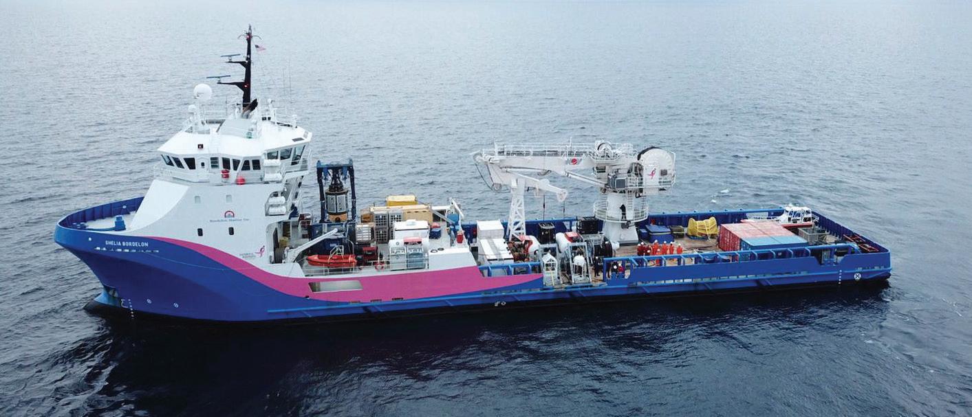
Coast Guard, New York State Department of Environmental Conservation, and Resolve Marine Group personnel work to assess the condition of the Coimbra wreck on April 30, 2019, supported by NOAA-generated automated decision support services.
One of the National Centers for Environmental Prediction, the OPC was established in 1995 – but its origins can be traced to the 1912 sinking of the cruise liner RMS Titanic in the North Atlantic Ocean, after which an international commission was formed to determine how to ensure safer ocean voyages. The NWS’s predecessor, the Weather Bureau, assumed the U.S. obligation to issue warnings and forecasts for parts of the North Pacific and Atlantic oceans. By the mid-20th century, the bureau was publishing bimonthly weather logs to help mariners make their own predictions based on past conditions in Northern Hemisphere oceans, and within a couple of decades, the NWS was faxing North Atlantic forecasts to users.

As Hurricane Florence was set to make landfall, OPC ensured the safety of ships at sea well in advance. Here, with hurricane warnings in effect offshore and along much of the Carolina coast on Sept. 12, 2018, the figure shows where ships have moved out to avoid hazardous conditions (red shading) and areas where vessels are anchored or at very slow speed (yellow shading). U.S. Navy ships are farther south along the Florida coast (red box).
Today’s OPC has greatly improved on both the methods used to forecast ocean weather and the technologies used to deliver these forecasts to users. Every day, OPC’s expert weather forecasters deliver more than 150 different products – current and forecast conditions related to wind, sea state, temperature, and navigational hazards such as sea ice, freezing spray, fog, thunderstorms, large waves, and high winds – to mariners across the Atlantic and Pacific ocean basins, including Alaskan waters.

A graphical forecast image of wind speeds generated by Hurricane Marco as it headed into the Gulf of Mexico.
In 2006, the center took its first step toward a digital marine weather service when it produced experimental significant wave-height forecasts in the form of gridded maps that include wind analyses – colorized areas displaying where an area will have winds of 15, 25, or over 30 knots – and wave forecasts that, with some of the stronger storms, can be higher than a three-story building. These and other products are issued by the OPC’s Ocean Forecast Branch.
The OPC’s other branch, the Ocean Applications Branch, helps to enhance the effectiveness of services by developing and implementing new technologies, software, and techniques. When NASA launched its QuikScat satellite in 1999, for example, experts at the Ocean Applications Branch adapted the satellite’s radar images to help develop a tool for forecasting hurricane-force wind conditions associated with strong winter storms. More recently, in 2019, branch experts quickly created automated decision support services multiple times daily for NOAA’s Office of Response and Restoration (OR&R), supporting efforts to salvage oil from the British oil tanker Coimbra, sunk by a German U-boat in 1942 off of Shinnecock Inlet, New York.
The OPC currently offers surface analyses and graphical forecasts of upper air, wind, and wave conditions looking ahead 24, 48, 72 and 96 hours; the surface analyses and forecasts with hazards can be offered out to 120 hours in advance. The center is working to expand this five-day lead time to a forecast horizon of up to 14 days, giving mariners a wider window in which to track the trending intensity of conditions and make routing decisions, avoiding maritime hazards well in advance – and perhaps finally realizing the OPC’s vision of eliminating all weather-related losses of life and property at sea.


