PORTFOLIO MAGGIE FANGYING LIU DESIGNWorks2015 – 2023 EMAIL:liufangying0622@gmail.com PhoneNumber: 778-960-0622
•URBAN DESIGN
•Dianchi International Eco Town,
•South China
•ECOLOGICAL DESIGN
•Design of Jueju River
•Eco-park
•South China.
•Park Design


•Navy MEMORIAL PARK
•Los Angeles, California, USA.
• MISSING MIDDLE
• HOUSING & COURTYARD DESIGN
• FROM PRIVATE TO PUBLIC
• AFFORDABLE HOUSING_SOCIAL NETWORK_ECOLOGY_PUBLIC AMENITIES
• In North Vancouver, Canada
•A FUNCTIONAL
•PUBLIC GREEN ORGANIZATION
•EVALUTING SYSTEM
•IN OLD CITY. Beijing, China
•PUBLIC PARTICIPATION Design Project
•In Arno River, Florence, Italy
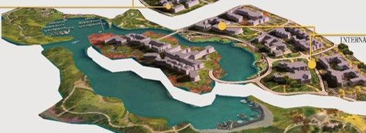
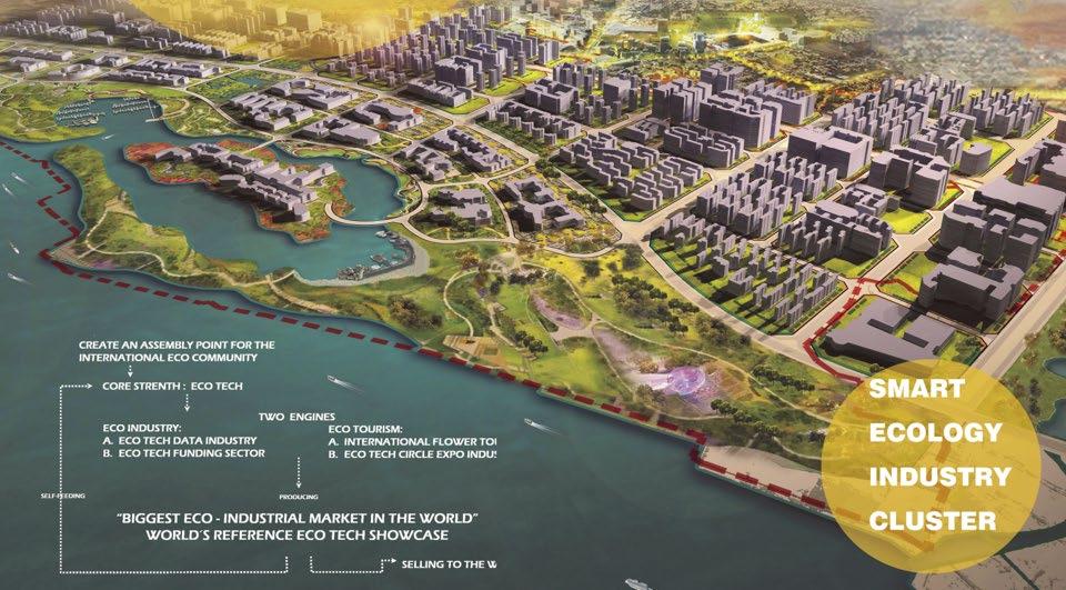
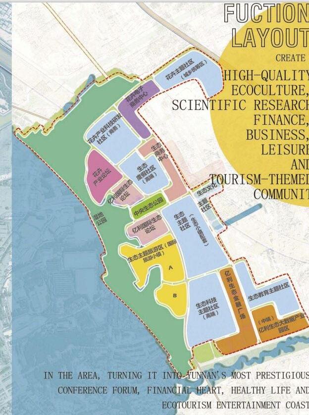
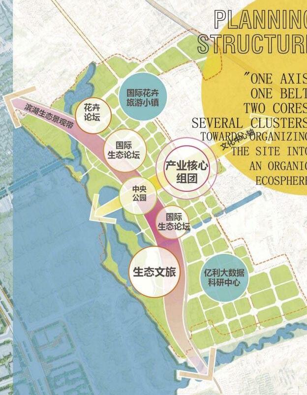
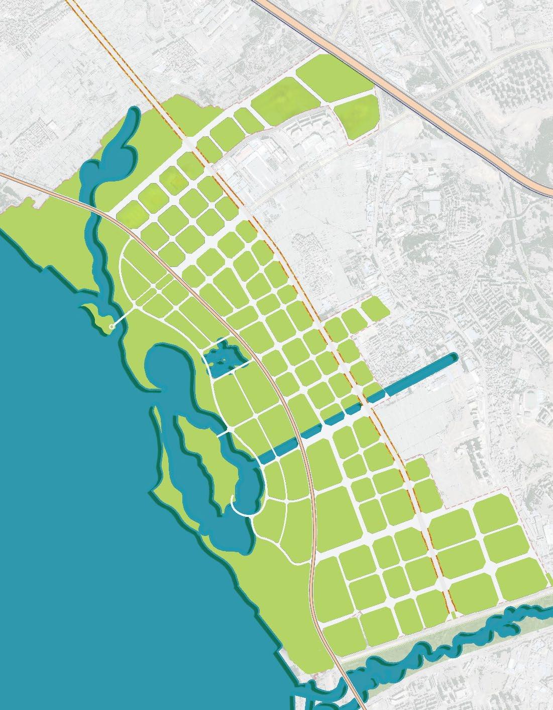
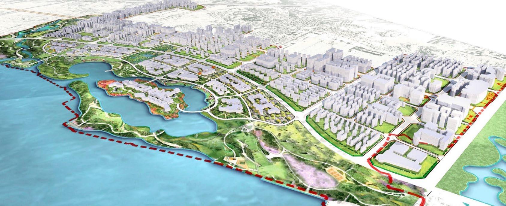
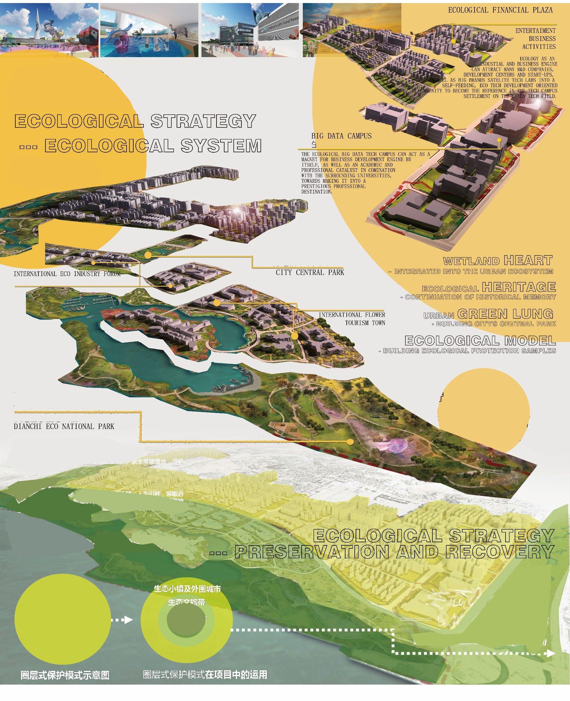
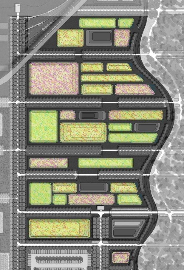
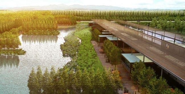
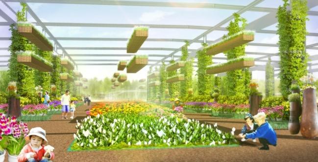
Dianchi International Eco Town
Market focus:
Kunming main city customers
Construction focus: urban construction spread
Ecological center of gravity: The shore of Dianchi Lake
Commercial center of gravity: regional axis through
1
Located in Kunming, Yunan Province, China.
With the development of an ecological infrastructure, city life is enhanced into the “Eco lifestyle"Ecological town. These resources are integrated with ecotourism, scientific research, commerce, culture, art, communities and schools, thus improving overall economic stability, promoting social fair competition and regional cultural identity.
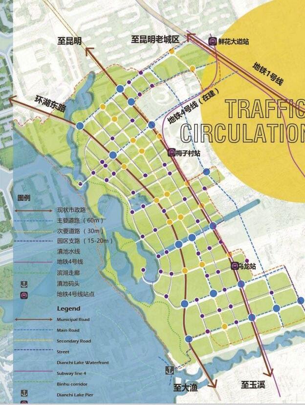
Waterfront corridor
Bicycle green corridor
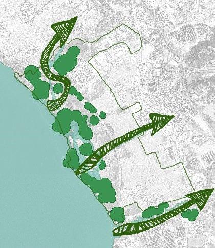
Festival activity line
Education practice line


Ecological animal observation line
ECOLOGICAL RESTORATION SOCIAL EQUITY FLOURISHING ECONOMY GENUINE CULTURAL IDENTITY


Dianchi International Eco Town
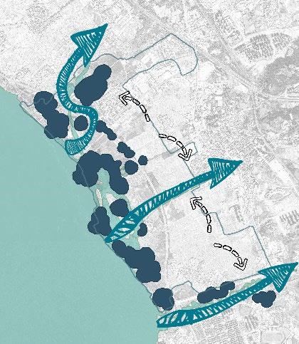
Challenges:

• Ecological Restoration Challenge
• Socially conscious Development Challenge

• Economical Activation Challenge


• Cultural Identity Challenge
Located in Kunming, Yunan Province, China.
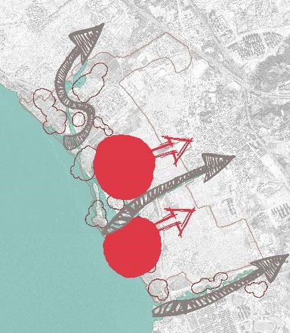
Dianchi International Eco Town
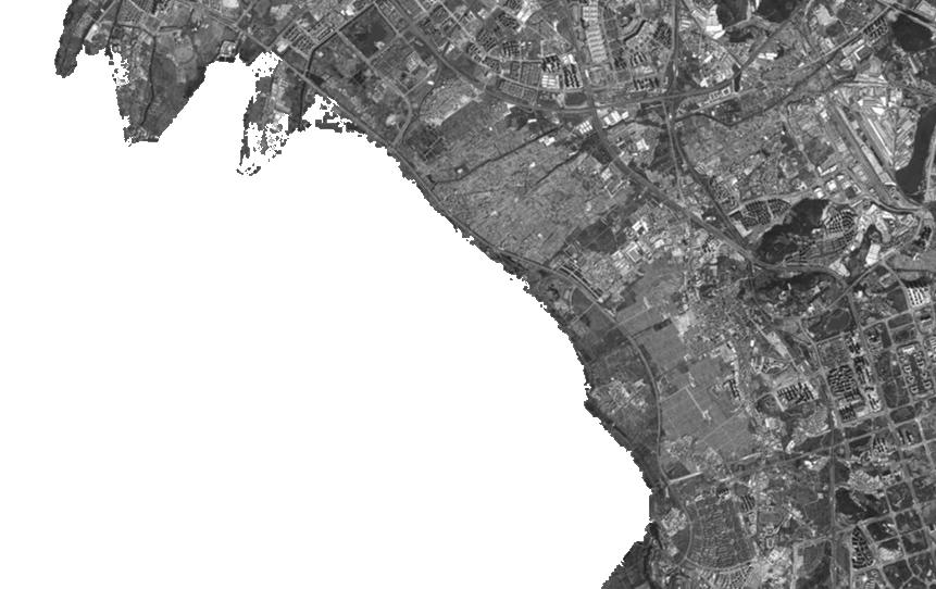
Located in Kunming, Yunan Province, China.
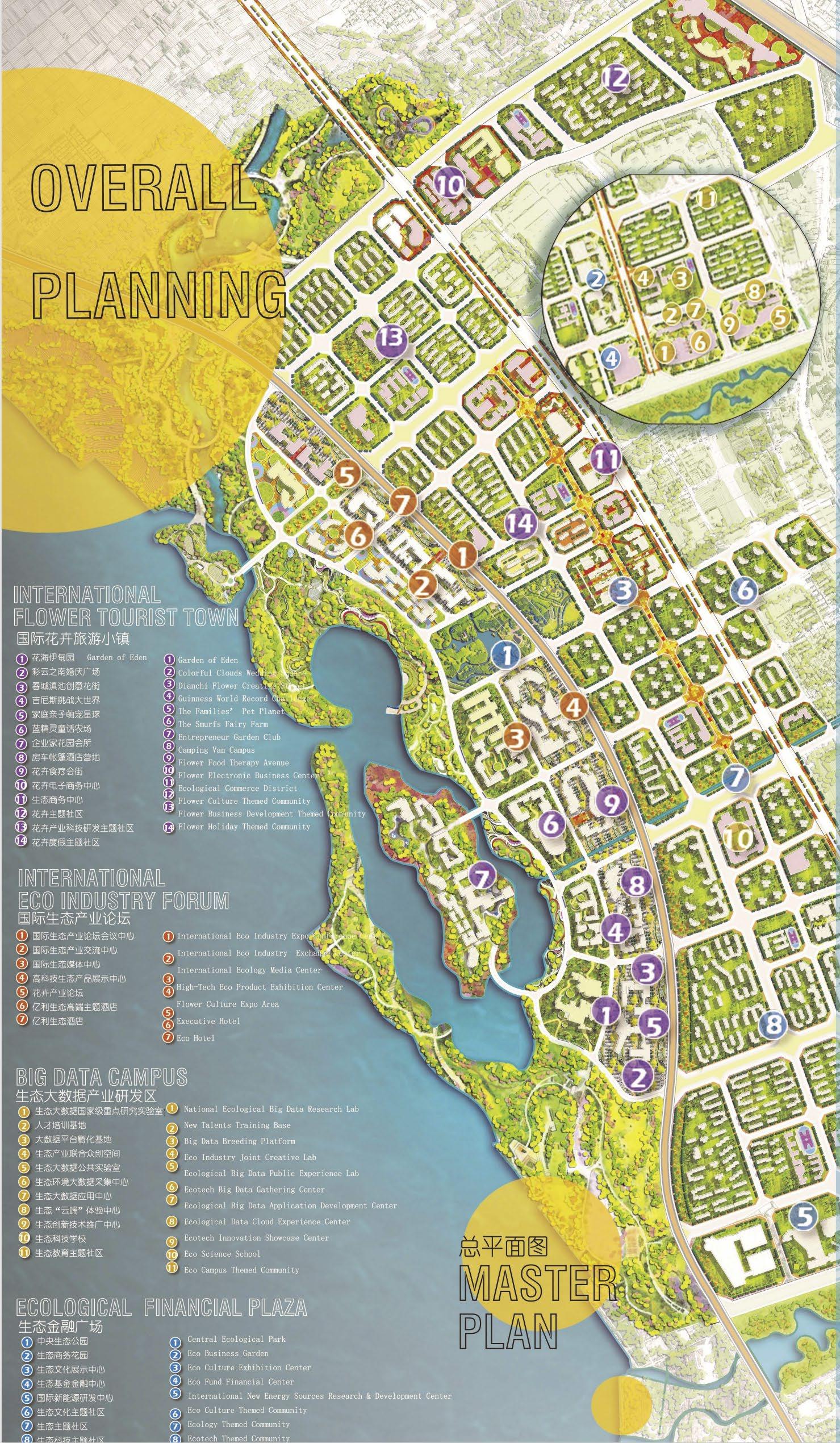
Master Planning Analysis
The surrounding land property analysis
Site need to suit for the city's image, satisfied for people’s education services such as comprehensive functional requirements.
Industry
Inhabitancy
Location Analysis
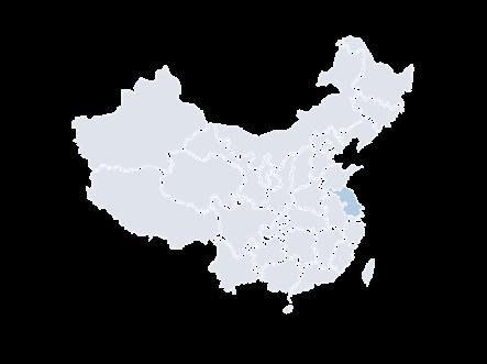
Site Location:
Changjiang river, Nantong city, Jiangsu province.
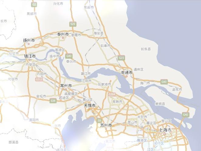
Total area: 1872.31 square kilometers
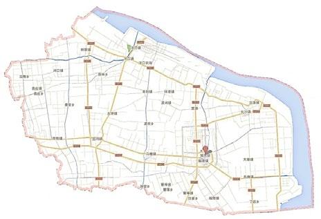
Total population : 1.0567 million.
Education
Trade
Administration

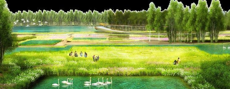
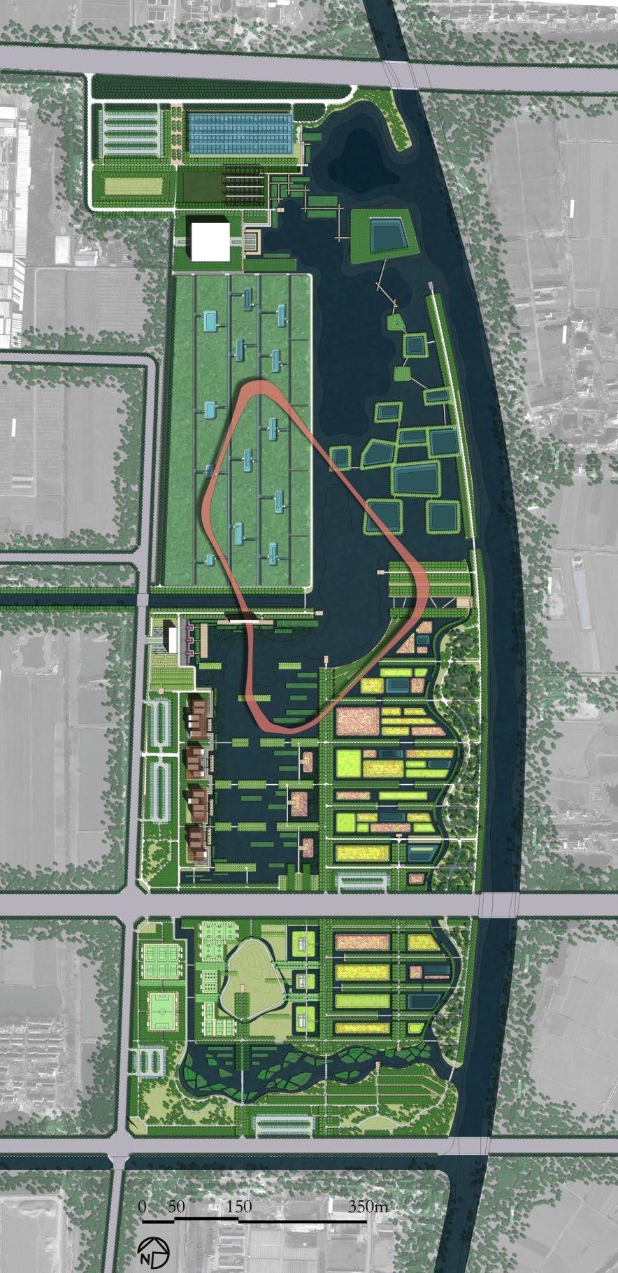
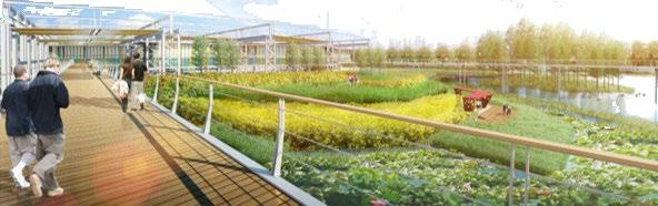
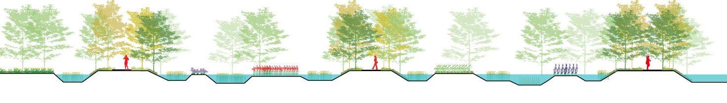
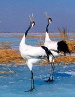
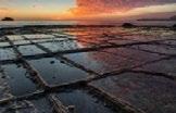
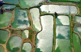
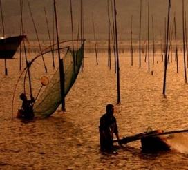
Ecological Design of Jueju River Eco-park
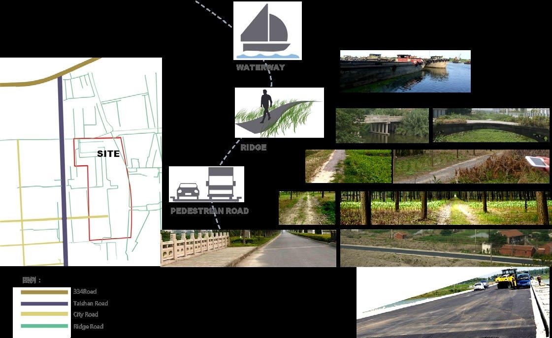
Site
Site Analysis
长江 Suzhou 208km Shanghai 173km Beijing 1100km Nantong City 如东县 Chongming Taizhou Qidong Yangzhou Changjiang River Jiangsu Province
Rudong County
design of the red line area:
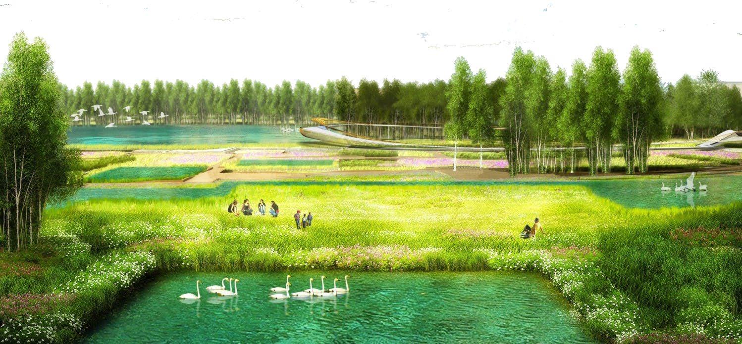
The
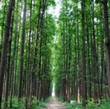
Local wild vegetables grew in river, road in the four seasons with species complex. Select the local native potherb and wild Chinese herbal medicine in the design, furthermore, this is a blessing which good natural conditions give to the people.
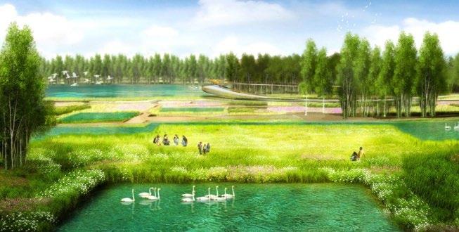
- Biological Diversity Strategy
- Diversity of Native Plants
Build a sustainable living education base. Encourage people to know, to protect, and to develop local natural and cultural resources.
An Eco-Museum Under Cape Circle
5 1 4 3 1 1 0 5 4 5 8 1 2 6 7 A A
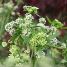
1. Herbal Pogostemonis
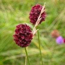
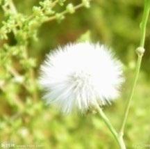
2. Garden Burnet 3. Dandelion
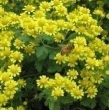
4. Wild Chrysanthemum
5. Medicine Celery
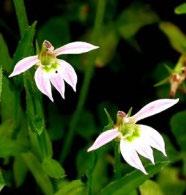
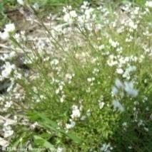
6. Malan Cap 7. Shepherd's Purse 8. Purslane 9. Metasequoia 10. Chinese Lobelia
1 8 7 5 5 2 3 4 9 10 6 A—A Sectional Elevation 5 6 6 6
Wild Nature
Back to the ground, respect the local, restore the diversity of native plant
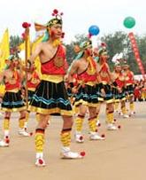
Thefolkculture
Rudong folk painting
Sacrificial dance
Longevity of the township keeping in good health.
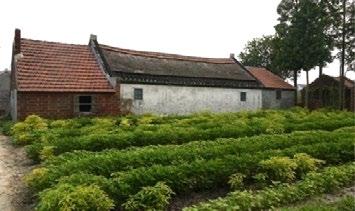
Traditional building reconstructionand newbuilding design
:
Integrate the local symbol into building types
Building function teahouse, bar, greenhouse, and service center, etc.
Newenergyresource artisticinstallation exhibition
Straw application making fertilizer, generate electricity, handmade article.
Solar energy application lighting, generate electricity
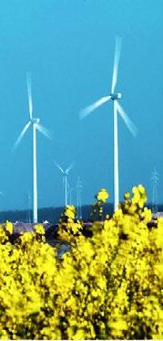
Wind power application generate electricity
Naturalandcultural elements:
Bound FanGongdam
Island Reed island
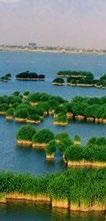
Pound The ditch pond
Reeds Float grass
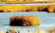
Cultural Nature
Promote the regional culture, And show the city's image
Sampling Nature
Retain the status quo resources of field, make nature as an outside laboratory

WaterGreenLandField
Industrial Nature
Displace the field function and realize the sustainable development
Rudong
:
Ecological, Culture, and Sustainable Development
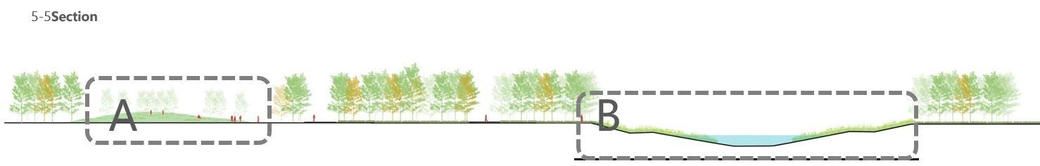
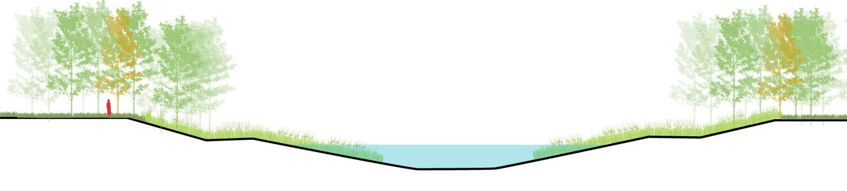
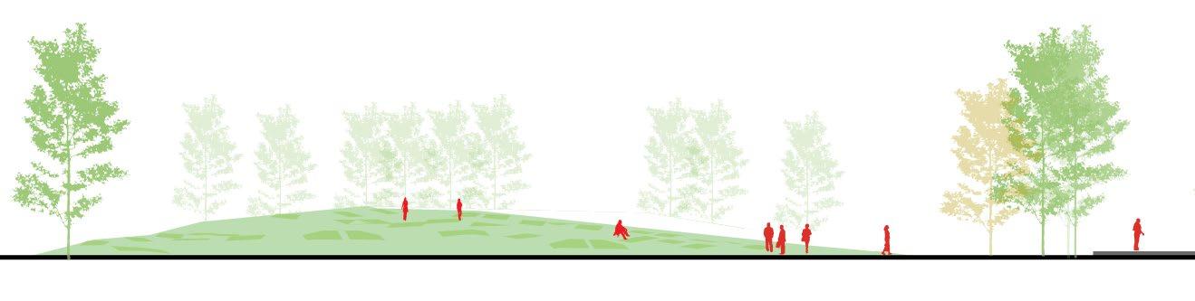
ASunshine grass slope
Walkway Metasequoia
wetland
Water grow plant Purify
BWater grow plant Metasequoia Metasequoia
Eco-Museum
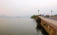
How to satisfy people’s need of getting close to water?
Since centuries ago, people construct space or streets along the waterfront in various forms including sandy beaches, stone steps, platforms, porches and lawns. More ways to get close to water can give people a fresh and over-all taste and make them to obtain a delightful feeling.
In modern cities, people live in bustle and dust, surrounded by high-rises. As a result, urban residents are even more in need of stress relieving.
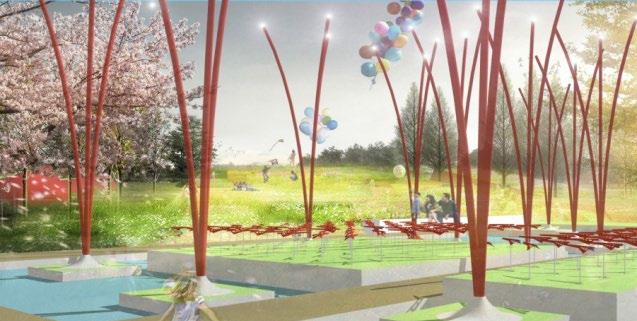
Design of Navy Memorial Park
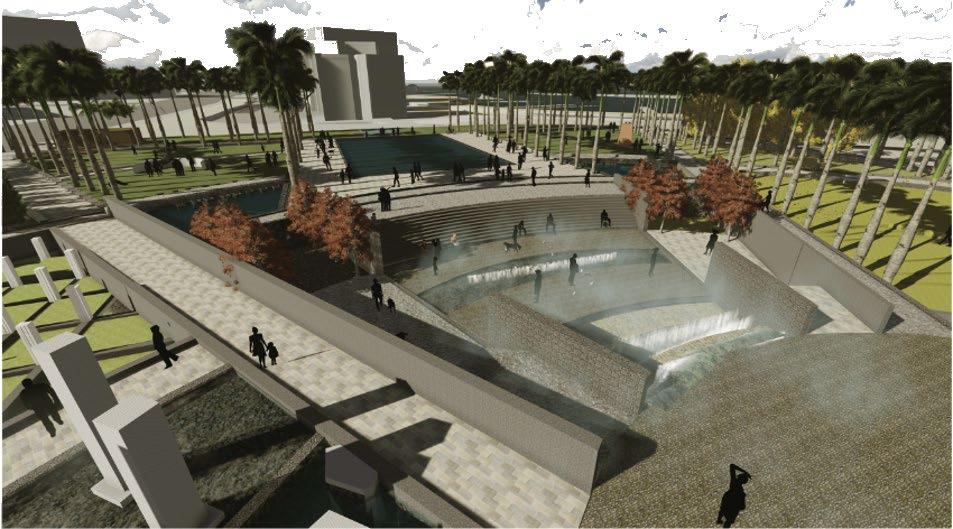
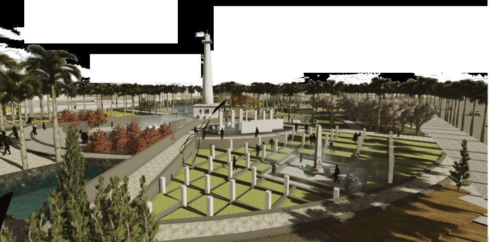
Here, we deeply mourn those who sacrifice her life for the sake of peace navy soldiers, at the same time, to long beach, Los Angeles navy memorial park into the humanities ecological urban oasis.Listen to the waterfall water, feel the warmth of the sun lawn, the depth of popular science exhibition history and culture, to wander between water stone, we will release people from noisy city life, here are awaken people to the bottom of my heart for peaceful life dream...
SPACE
CULTURE SPACE HUMANISTIC SPACE ECOLOGICAL
ART SPACE
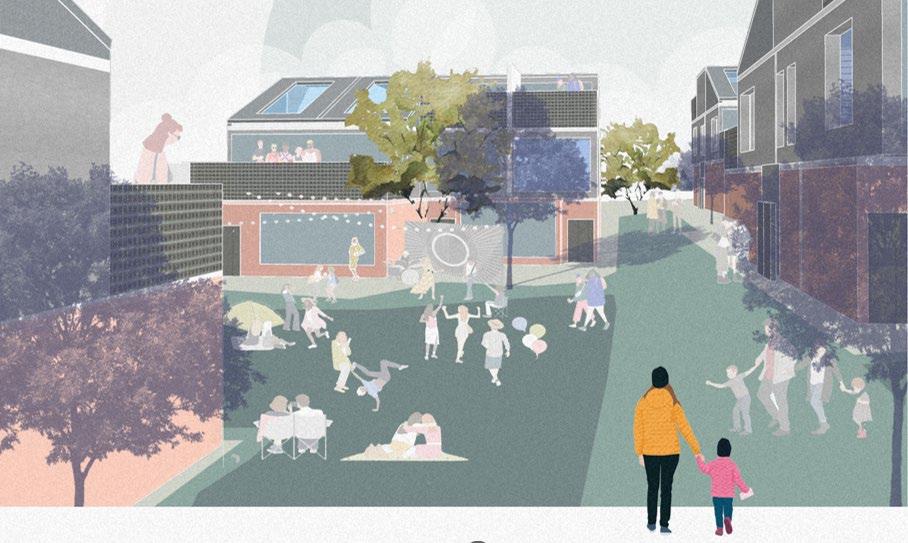
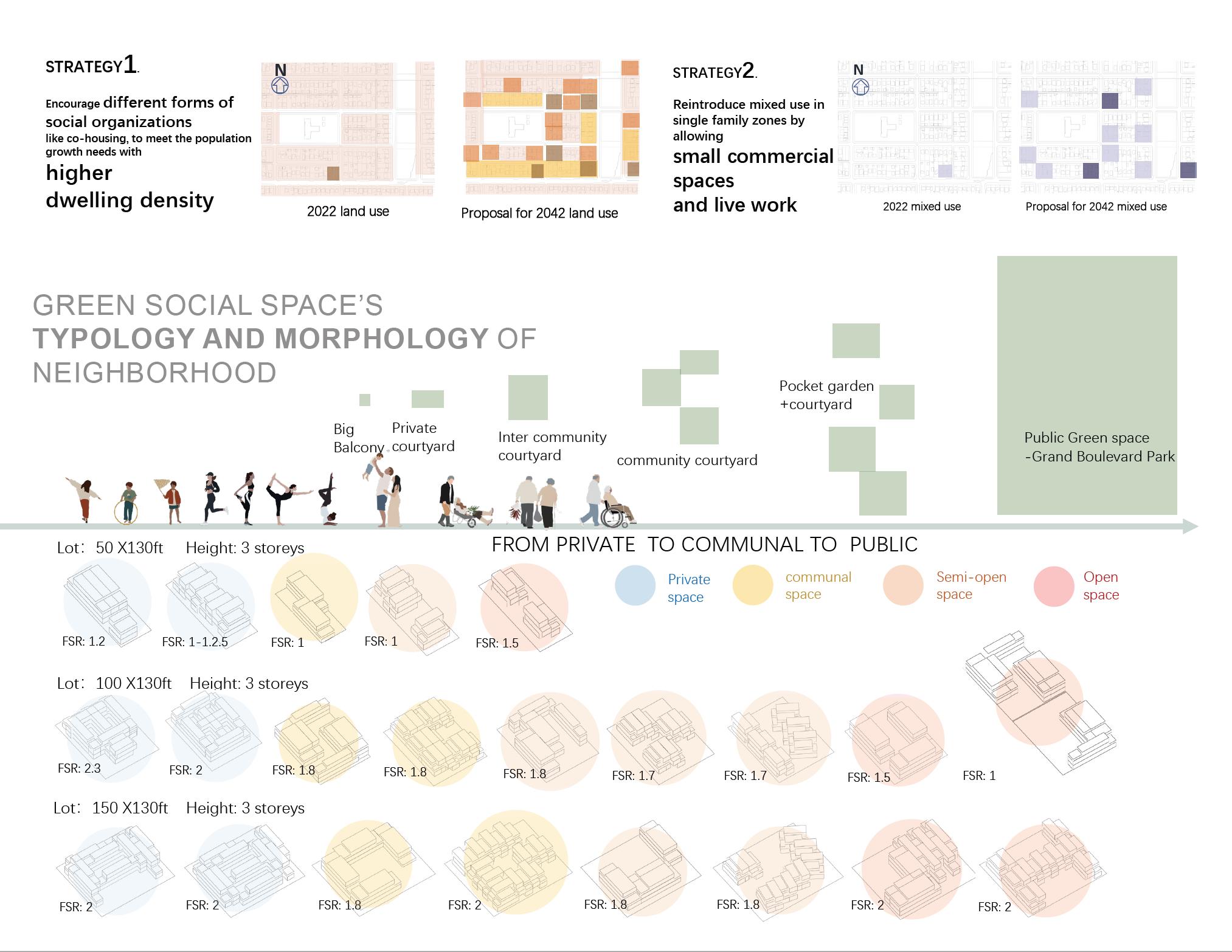
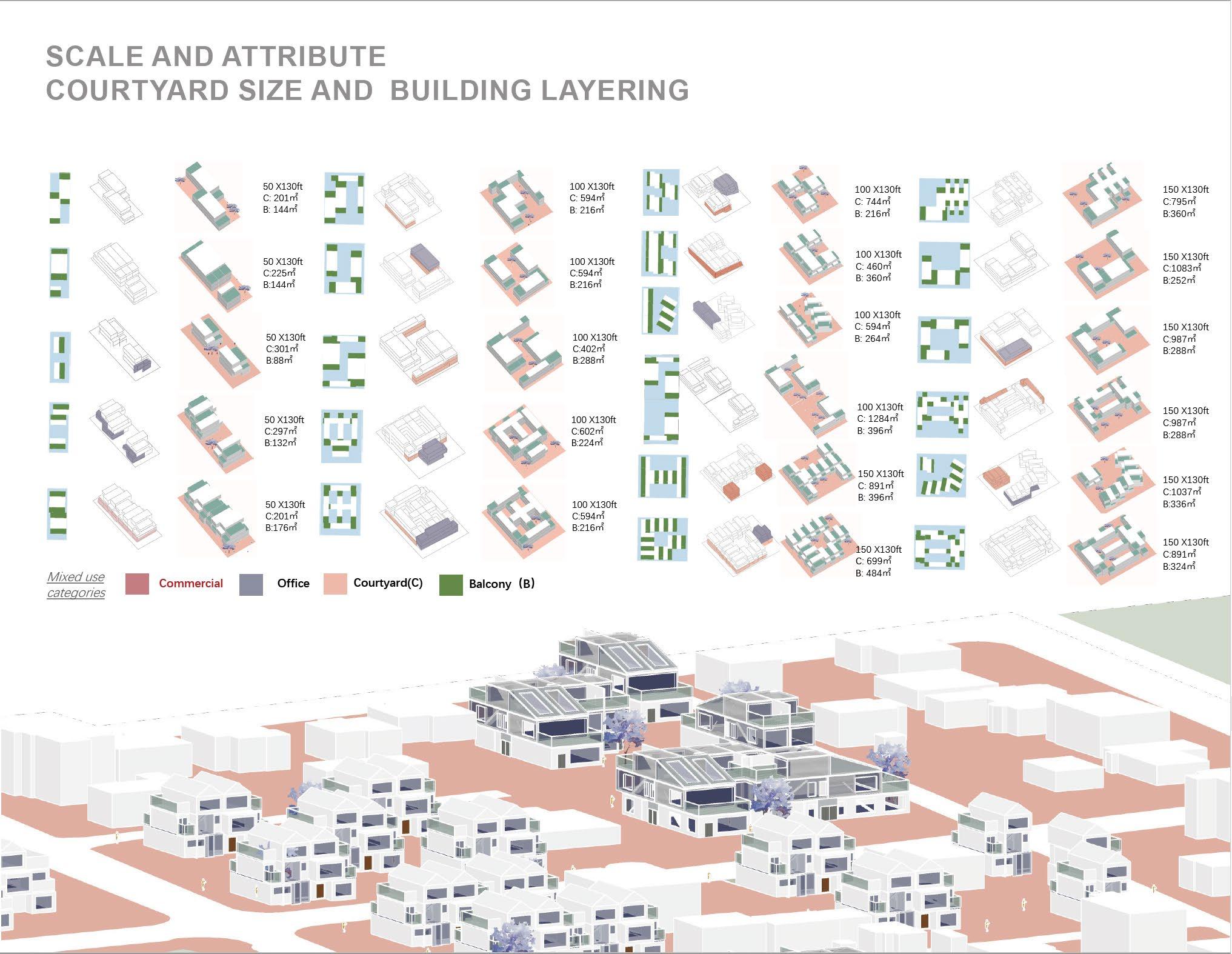
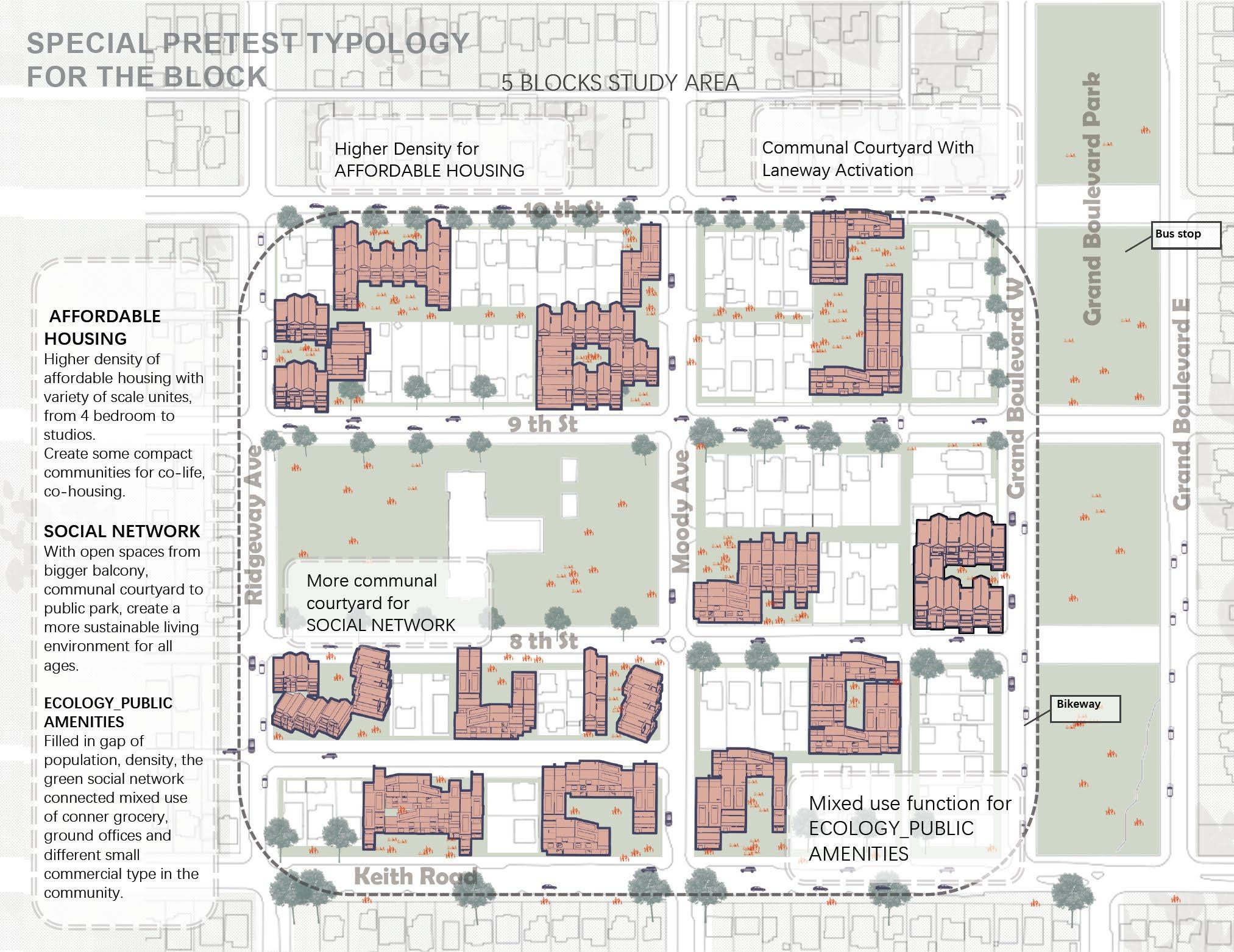
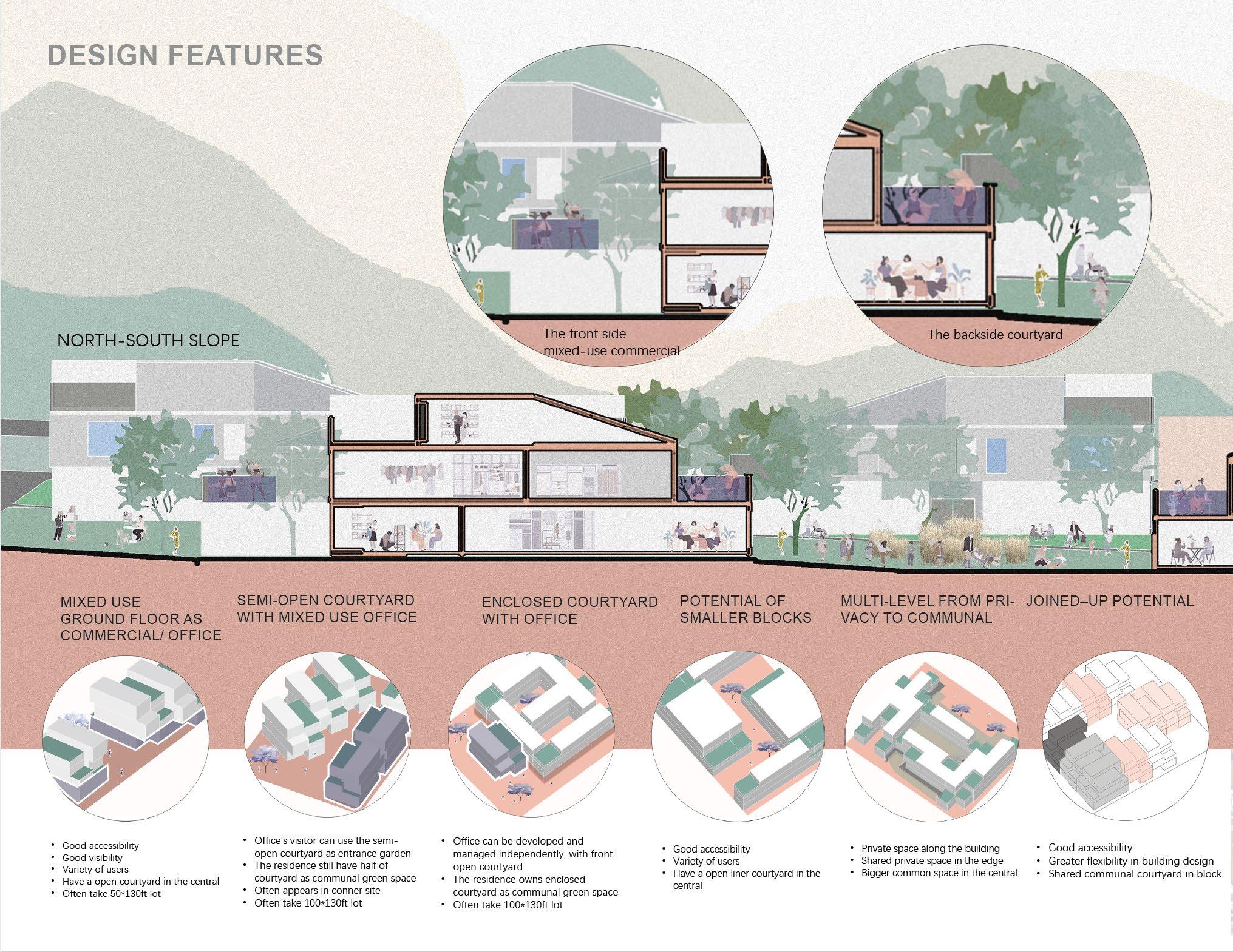
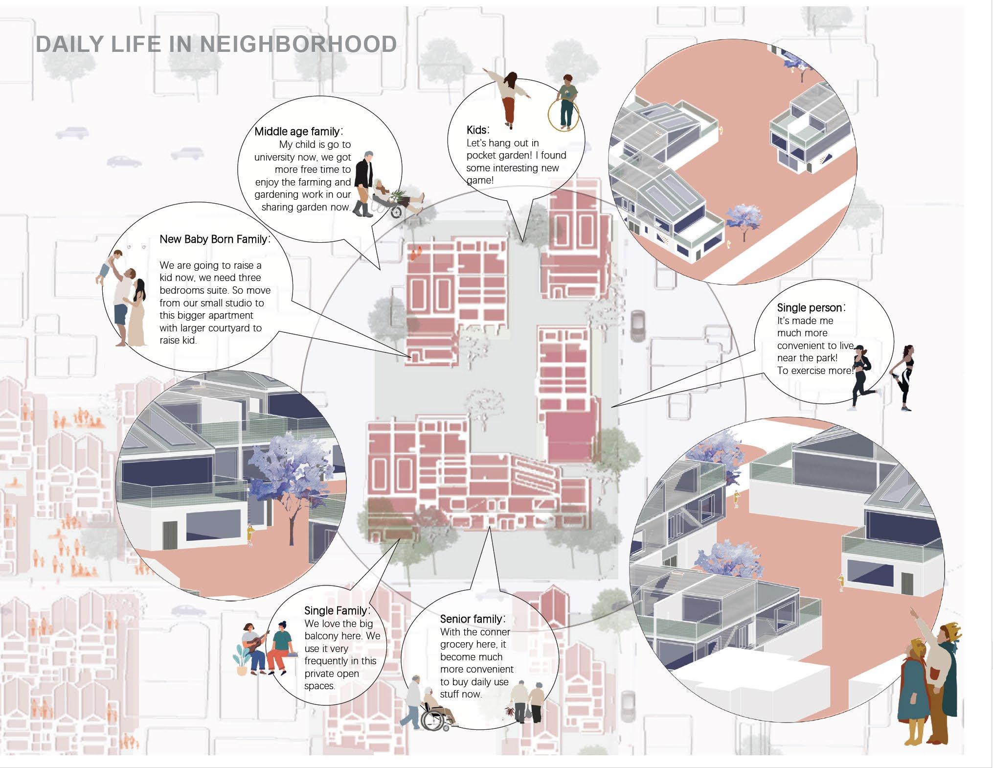
AFFORDABLE HOUSING_SOCIAL NETWORK_ECOLOGY_PUBLIC AMENITIES
A new model design for co-life, co-housing with open spaces from bigger balcony, communal courtyard to public park in north Vancouver area.
Filled in gap of population, density, and green network in Grand Boulevard Neighborhood. The proposal give varying possibilities of typology and morphology of courtyard housing to provide affordability while addressing suburban challenges of mobility and social connection. This proposal reconfigures 5 blocks with 22 types of courtyard which from private to semi-open to communal to open spaces, to support increasing population of multi-generational dwellings in a suburban mixed-use area.
With more communal courtyard design of greenspaces for social exchange, chance encounter, residents quality of life improved

FROM PRIVATE TO PUBLIC
A FUNCTIONAL PUBLIC GREEN ORGANIZATION EVALUTING SYSTEM IN
OLD CITY
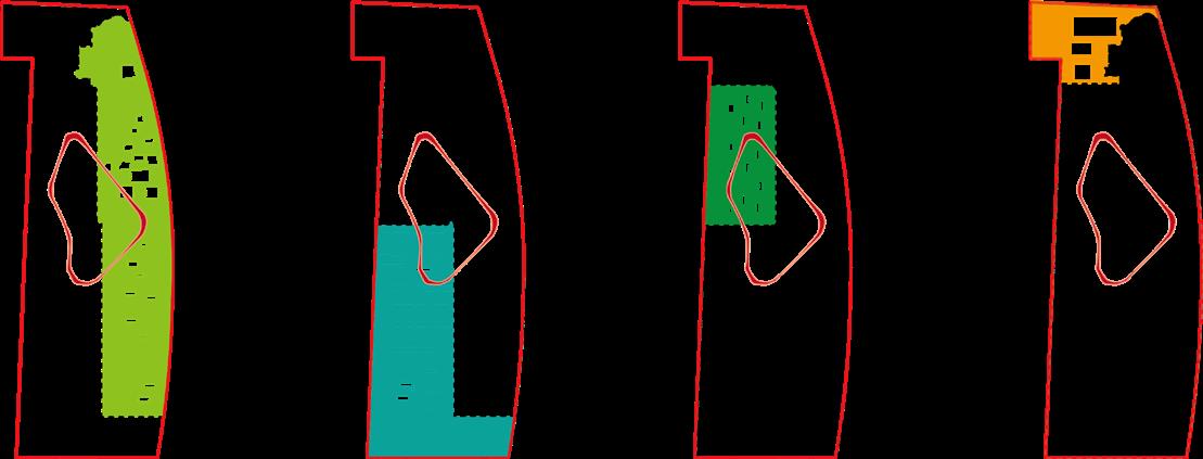
DEFINITION
PUBLIC GREEN LAND
Green space and square land (G): refers to the protection of green space in parks, green space square and other public open space land is divided into three middle categories Standard of urban land classification and construction Land planning (GB 50137-2011) According to the actual situation of hutong, the construction of open space for public service should be planned in the form of adjacent green space, attached green space, residential green space, public facilities green space, etc. Besides the adjacent green space, there is no requirement on the greening area proportion.

SITE ISSUES DESIGN-ORIENTED
The use of vacant lots and demolish partial places with less historical value to build a new public green space.
The daily life of residents is not rich and convenience enough due to the traffic congestion, road waterlogged, and so on. Additionally, those problems have affected local tourism value.
TARGETING
Establish an evaluation system to find out the optimal location for public green space according to different function construction
VALUE OF BUILDING
-- An Example at White - tower Temple Hutong
Analysis –
Hydrops issues
Severity of water accumulation
ANALYSIS –


ACTIVITY STRENGTH ACTIVITY ANALYSIS INFLUENCED BY POPULATION
PUBLIC GREEN SPACES EVALUTION ANALYSIS


VISUAL ANALYSIS


ANALYSIS PLANTS
ANALYSIS WEIGHTED
WORKSHOP
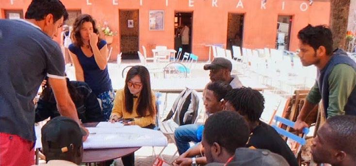
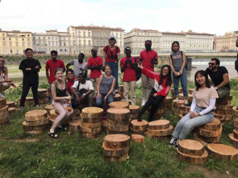
River’s Culture Reservation and Public Engagement Design Project

Background:
Along with the development of European countries after 1900s, the engagement of residents plays a critical role on local planning and redesign. The inclusiveness, especially in some sensitive regions, are being widely discussed over the past decade. We’re interested in figuring out if contemporary art and design could be integrated into the complicated municipal management and administration of local rivers and streams.
Fortunately, I had an opportunity to participate in Arno River Culture Reservation Project and in charge of design and reconstruction. We would find a sustainable development way to reconstruct the community with local Italian institutions and residents.


Approaches:
We would try to find an effective communication way for public activities in sensitive places of the local communities and discuss on the aspect of the possibilities about facilities redesign for the future. This workshop project would be following the principles of openness and preciseness, participants included residents, international students, international consultant and designer teams.
Each participant of the workshop would be able to use their own way to make temporary facilities, such as public furniture and shelters. All materials must be natural and collected nearby the riverside.
The Gates

Problems and connections:
Before we began, we were troubled with the potential sensitive territory conflicts and how to make an effective connections between the present market nearby the river and historical heritage from Renaissance.
Based on discussion with local institutions with in-depth understanding of the natural circumstances and historical landscape, Florence in Renaissance period was identified as our main topic and background of our workshop. Our target was to reconstruct local historical landscapes and find an effective approach to redesign their urban life in the future.
About the Arno River:
Design based on sharing and communication:

We focused on built a public workshop and rezone a more sustainable living space by collaborating with residents. We also know more information about Arno River by searching historical data from local library and taking field investigations.


Arno River suffered the most terrible flooding in 1966. Although local ecological environment had been revived, both residents and wild animals’ living habits had been totally changed after this tragedy.

Our workshop finally brought a series of decorations and shows to local people and became an essential facility for local community. Participants including local residents and refugees are able to show their creativity and skills in a natural way. Temporary practices at workshop also provided the possibility of cultural integration, which leads another vision for local residents to see the whole region.
The Memory of Flooding Arno River Project focused on rethinking about our future and reconstruction of a new urban life. As a beautiful city, Florence suffered blooding in 50 years ago and the heritage of Renaissance was almost terminated at that moment. Many people organized spontaneously to save those valuable heritage in our history


In the natural areas of the city’s riverside, we would try to be inspired from the history of Renaissance. As the birthplace of Renaissance, the prosperity of Florence came from a famous story: The emperor expected to confirm the design of the gate of the central church by a public bidding, and this event attracted plenty of well-known artists, craftsmen, and architects all over the Europe. The consequence of the event was not important in comparison with their influences, an epic cultural revolution had been made due to the substantial reward.

Public discussion can be an instruction of positive policies, urban life would be gradually changed along with the implementation of those policies. An outstanding temporary landscape would provide an unique way to analyse and understand the public memory of a certain region.
River stands for the flow of human history and life. All participants from Nigeria, Mali, Italy, Syria, Mexico, and Armenia made our workshop to be a boarder platform by constant sharing and engagement. We must say thankyou for all designers and consultant team for their support. MCM international has accumulated significant practical experience on community redesign and cultural landscape reconstruction.
The rage
Therefore, we decided to use the gate as a metaphor to think about the connection between our current urban life and history. We simplified gates to various frames, visitors could know more about urban design development and transition.
Arno River Safeguard
Thanks Email - liufy@student.ubc.ca Phone Number: 778-960-0622
