During my study in landscape architecture, I often imagined a time when urbanization has covered almost half of China, how much the designed space can play under the established framework and people’s thoughts. I found that in addition to creating a beautiful environment, urban design can affect people and society on a more complex level, so I focused on exploring different interventions in public space, to redefine proximity to space in the cities for everyone, thus create environmental equality.
Belle Isle Vision
Warren,RI, Waterfront Design Fall 2023 Richmond, VA, Park Planning Summer 2023
Behind Retreat
The Hills
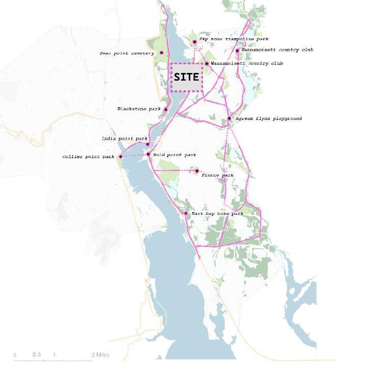
East Providence, Wasteland Design Spring 2022
Playground For All
Huangpu River Waterfront, Urban Green Space Design Summer 2020
Candy Kingdom
Playground and installation Design Fall 2023
Nostalgia In-Between
Haibingercun Neighborhood, Community Design Spring 2019
Little Island Commons
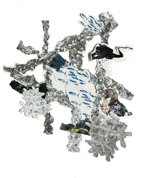
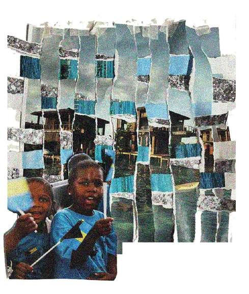
Nassau, Bahamas, Thesis Research Spring 2024
Works
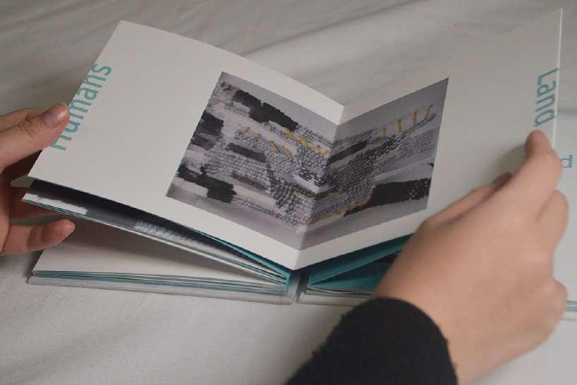
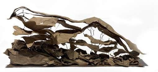
Little Is Land, Personal Artist Book, 2023 Winter
Bell Isle Vision Plan | Internship in Marvel
ASLA-NY 2024 Merit Award
Date: Summer 2023
Location: Richmond,VA
Project Clients: Friends of the James River Park, James River Parks System, The City of Richmond Team work with Tyler Silvestro, Chieh Huang, MItch Crowder, Tonghuan Wu, Bay Penny
Introduction:
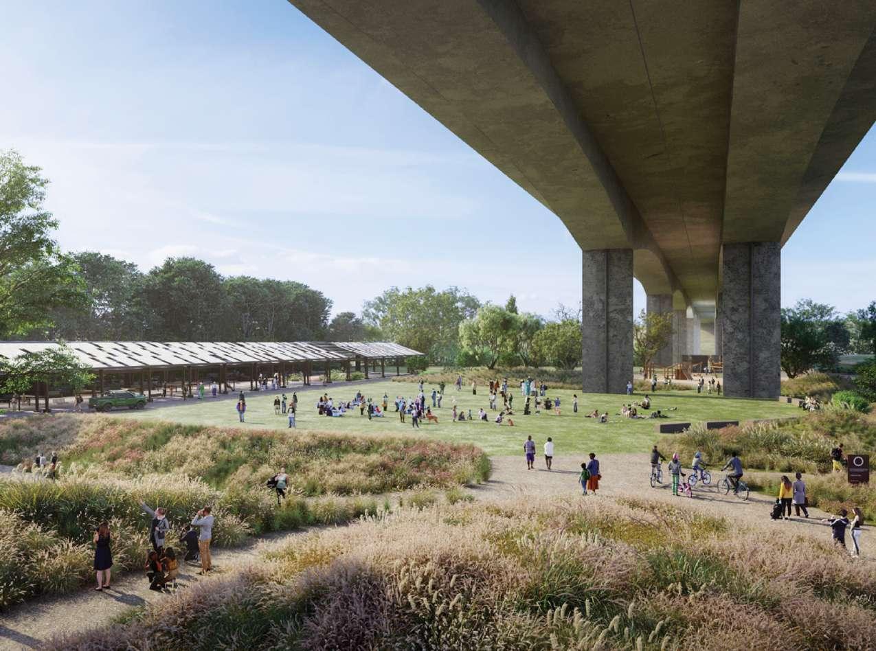
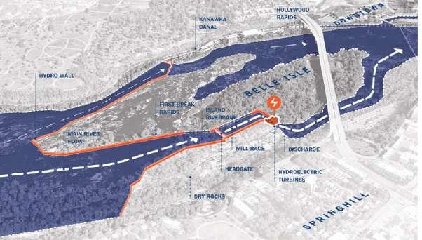
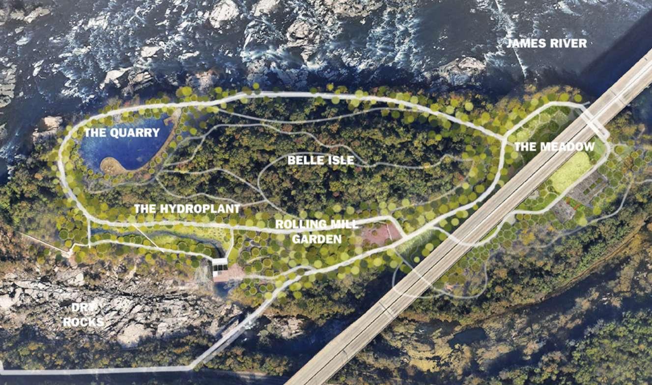
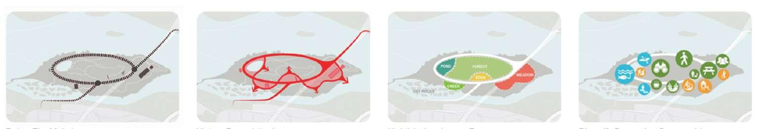
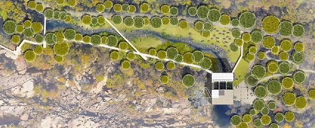
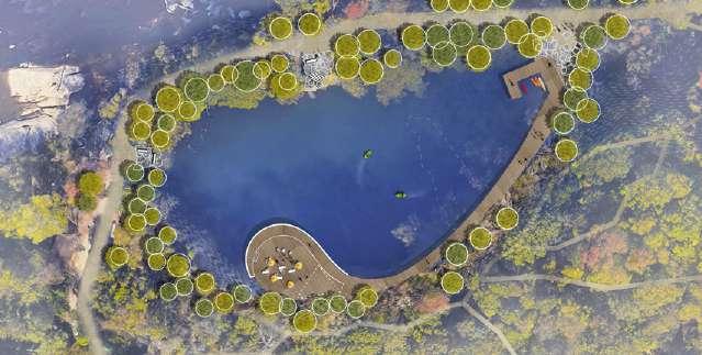
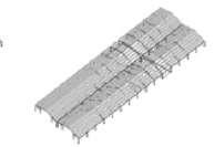
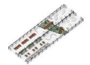
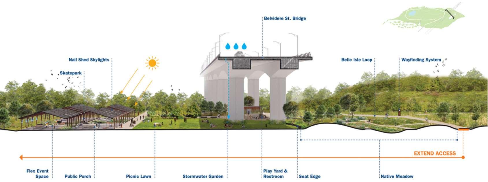
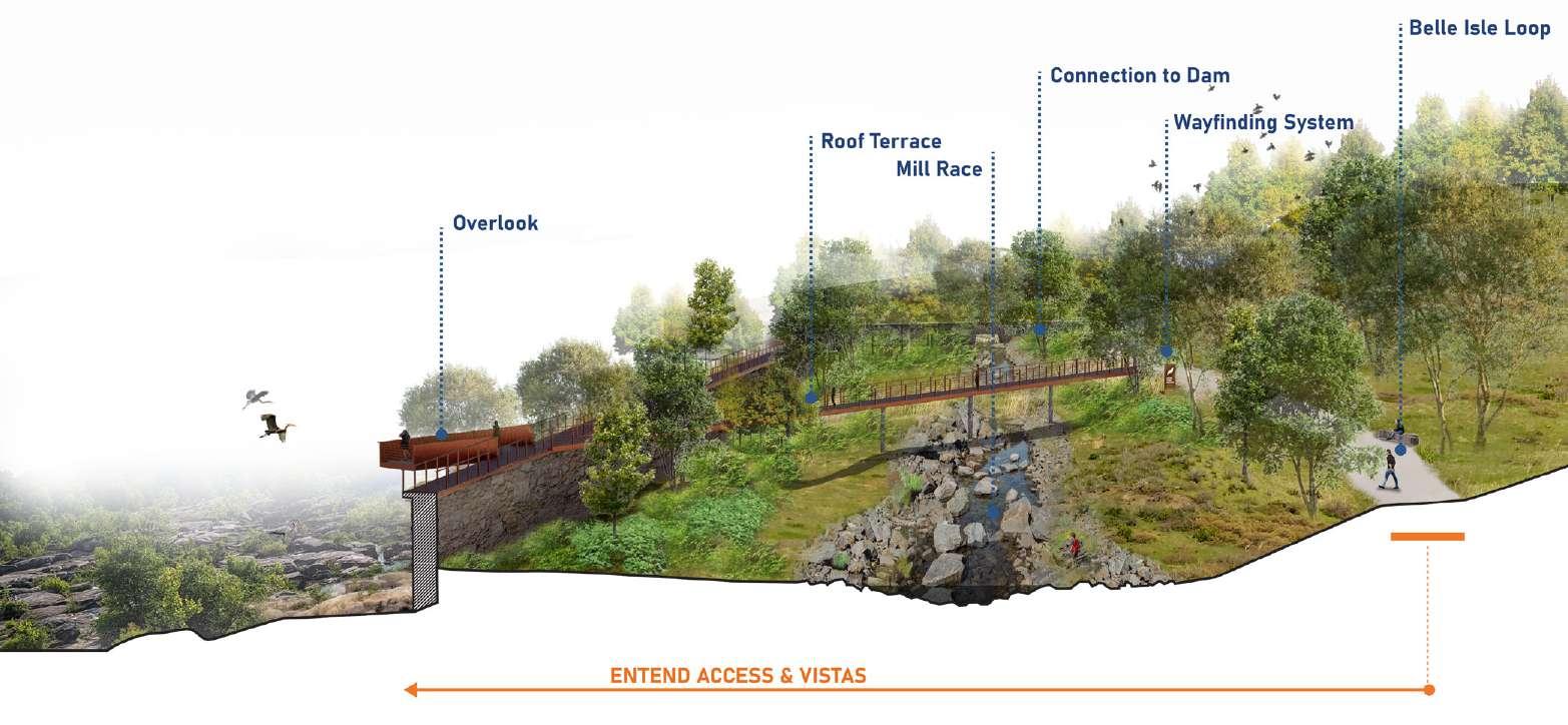
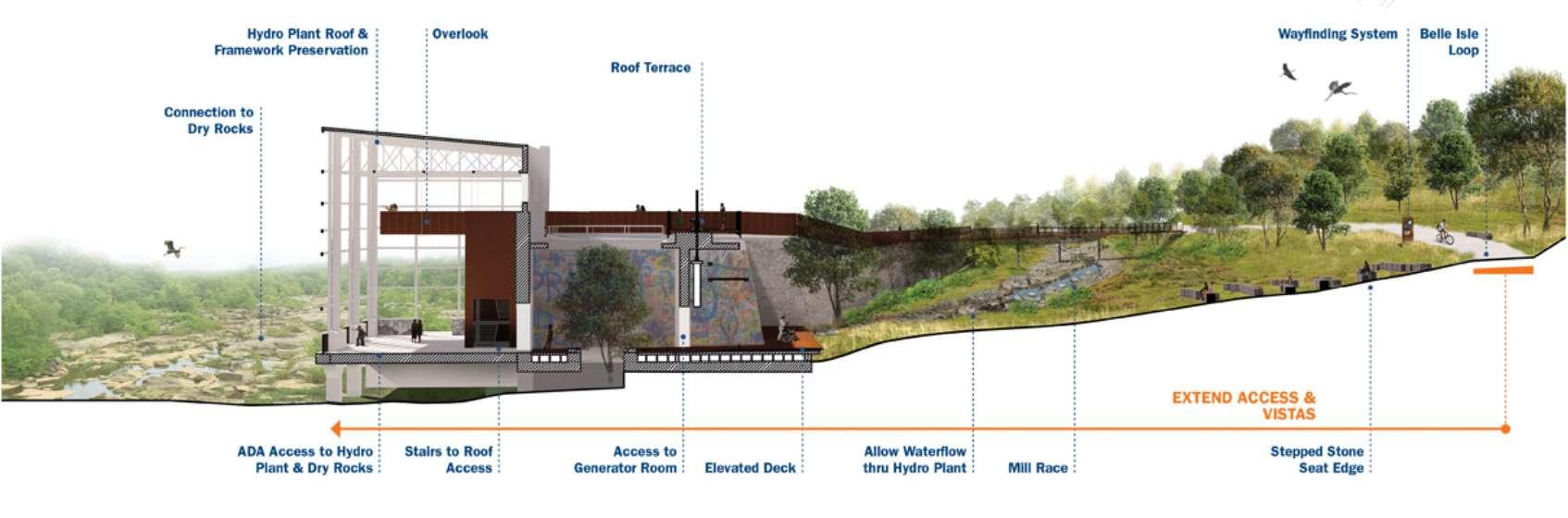
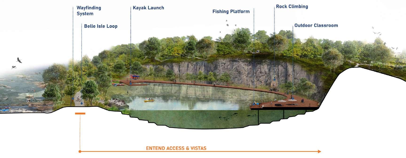
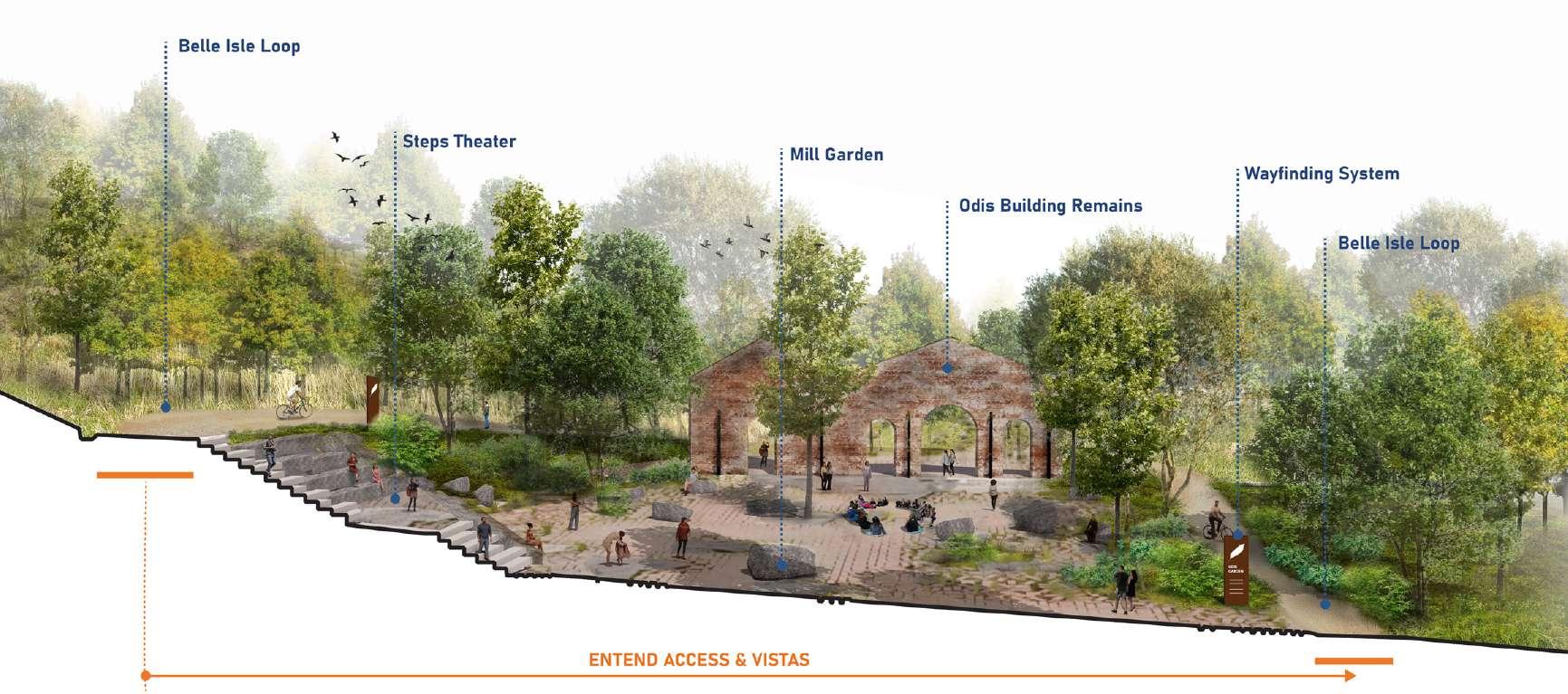
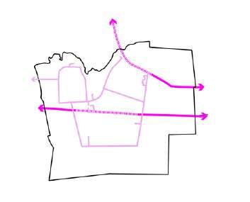
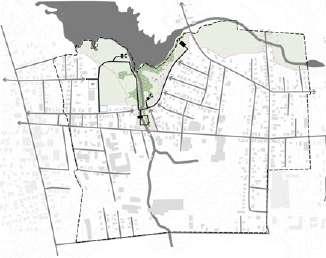
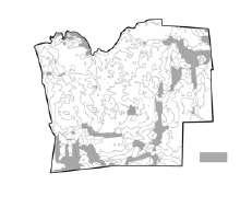
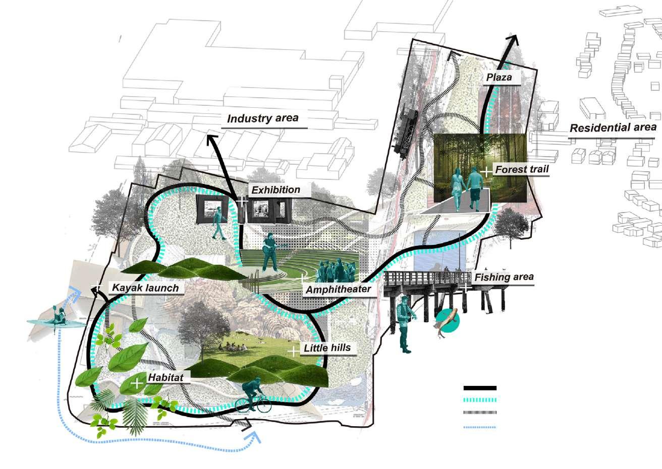
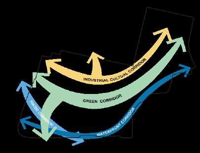
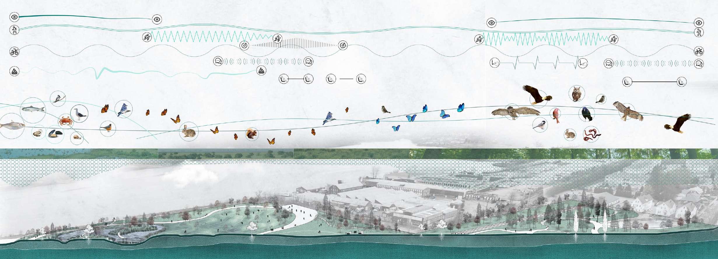
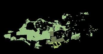
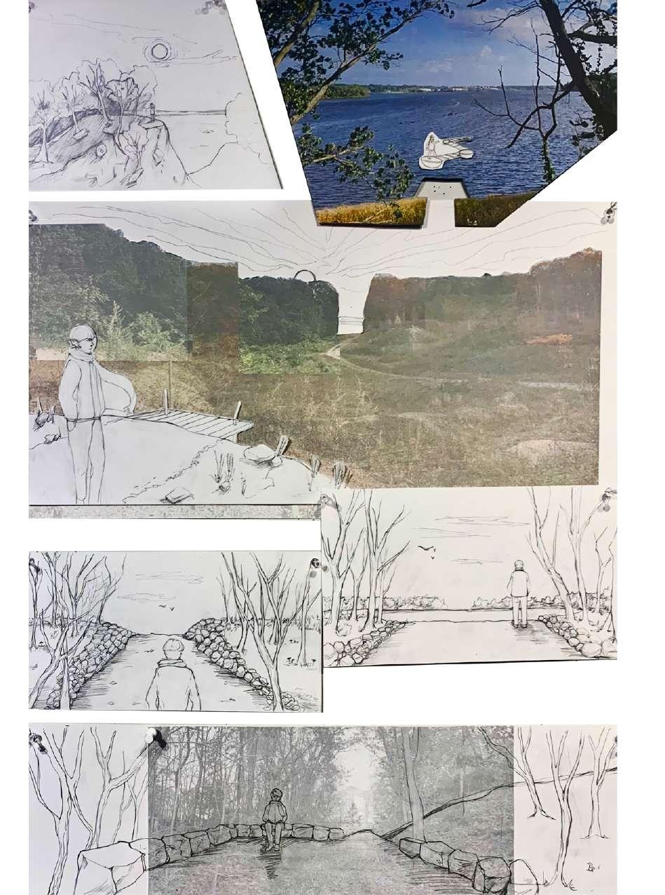
This project focuses on revealing and connecting four anchor locations on Belle Isle — a staple of outdoor recreation in Richmond, Virginia. Located along the Fall Line in the James River, Belle Isle’s story is inextricably linked to its hydrology. From fish farming to power sourcing, the island has always found a way to utilize its strategic setting. However, its industrial structures remain, and today it is a place for people. The goal is to improve island-wide accessibility and visitor amenities, conserve native species and habitats, and refurbish old structures to be safer and more inviting.
Future Plan for Belle Isle
The goal is to improve island-wide accessibility and visitor amenities, conserve native species and habitats, and refurbish old structures to be safer and more inviting. The Hydroplant, the Rolling Mill Garden, the Quarry, and the Meadows are the spaces of focus for this project and the Vision Plan highlights their potential to enhance the island.
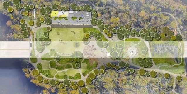
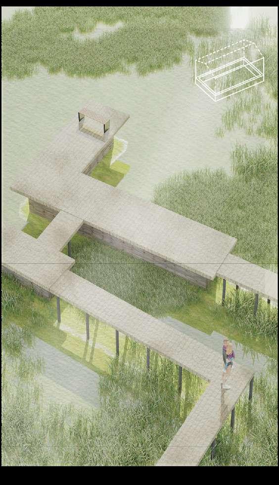
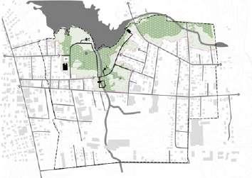
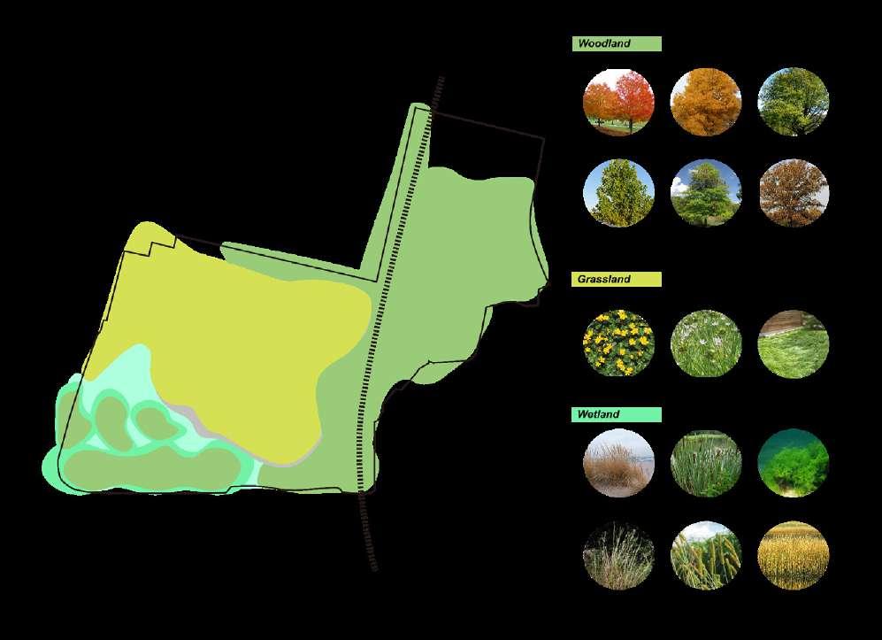
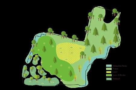
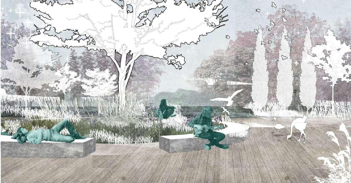
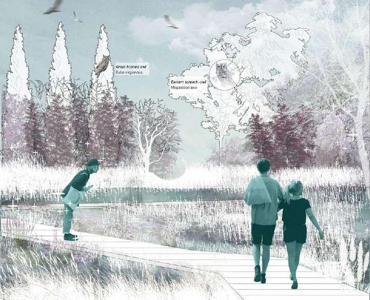
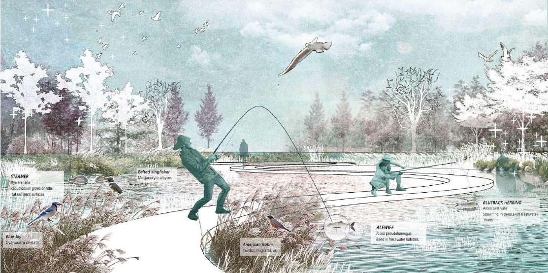
The Meadow
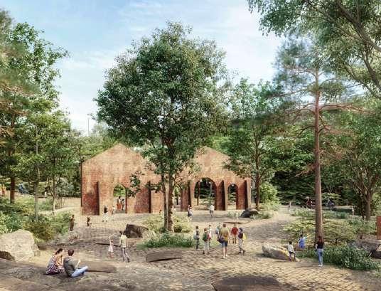
Rolling Mill Garden
The Hydroplant
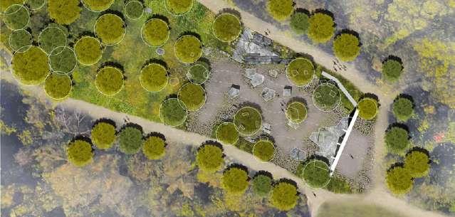
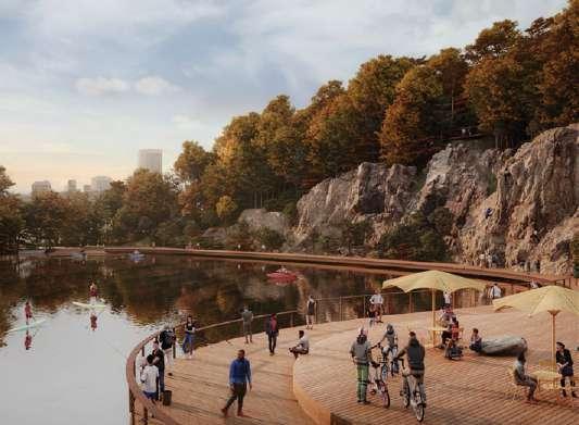
The Quarry
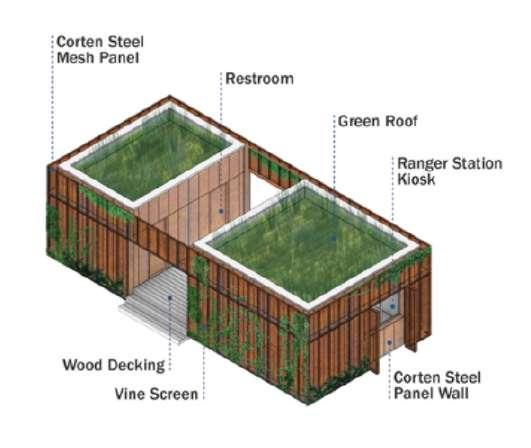
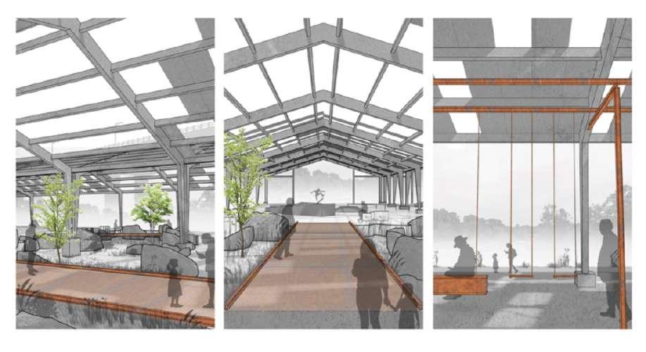
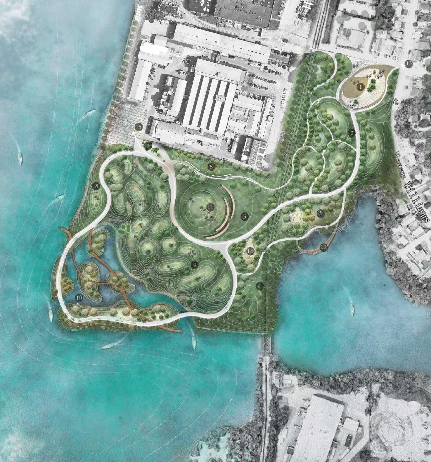
This area will serve as the first open space visitors encounter upon entering Belle Isle and will become the primary event space in the future. We envision developing comprehensive bike lanes and creating a variety of spaces, expanding upon the existing bike park on the site. The viaduct that crosses the upper level provides a natural division, adding a unique element to the space. Our plans also include transforming the disused factory into a skateboarding park and an open barbecue area, enhancing the site’s recreational appeal.
Existing: Abandoned Structure
Subdividing the Large Space
The Shed Ranger Station and Public Restroom
Creating a Public Porch
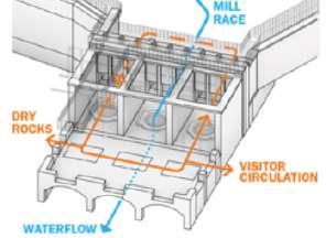
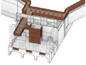
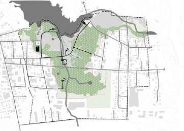
The Hydroplant
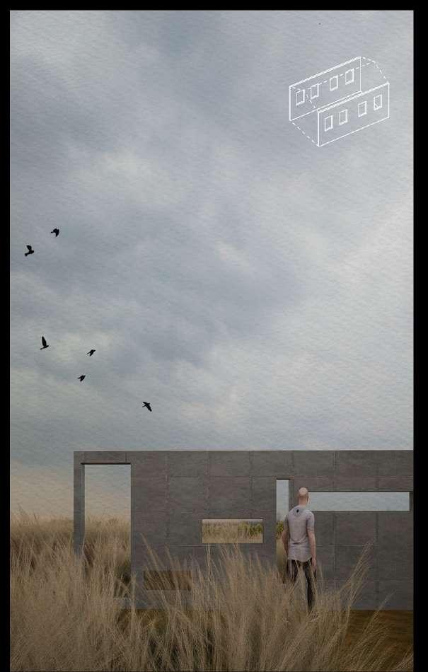
There is an abandoned hydroelectric plant from the early 1900s on the south side of the island, with a beautiful view of the river rapids below. Now it is often occupied by teenagers with nothing better to do, we hope to transform it into a multi-purpose resting and viewing spot. We also connect it with the neighboring abandoned wall to transform it into a friendly place for activities.
Restoring Access & Flow Creating a Unique Experience A Welcoming & Iconic Landmark
The Quarry
We translated all that was expressed and made the bold suggestion to adaptively reuse many of the defunct structures that were originally recommended for removal.
We translated all that was expressed and made the bold suggestion to adaptively reuse many of the defunct structures that were originally recommended for removal.
Rolling Mill Garden
02 Behind Retreat
Type: Waterfront design
Date: fall 2023
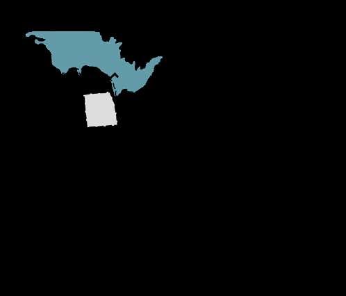
Location: Warren ,Rhode Island
Individual work
Instructor: Emily Vogler
Project Narrative:
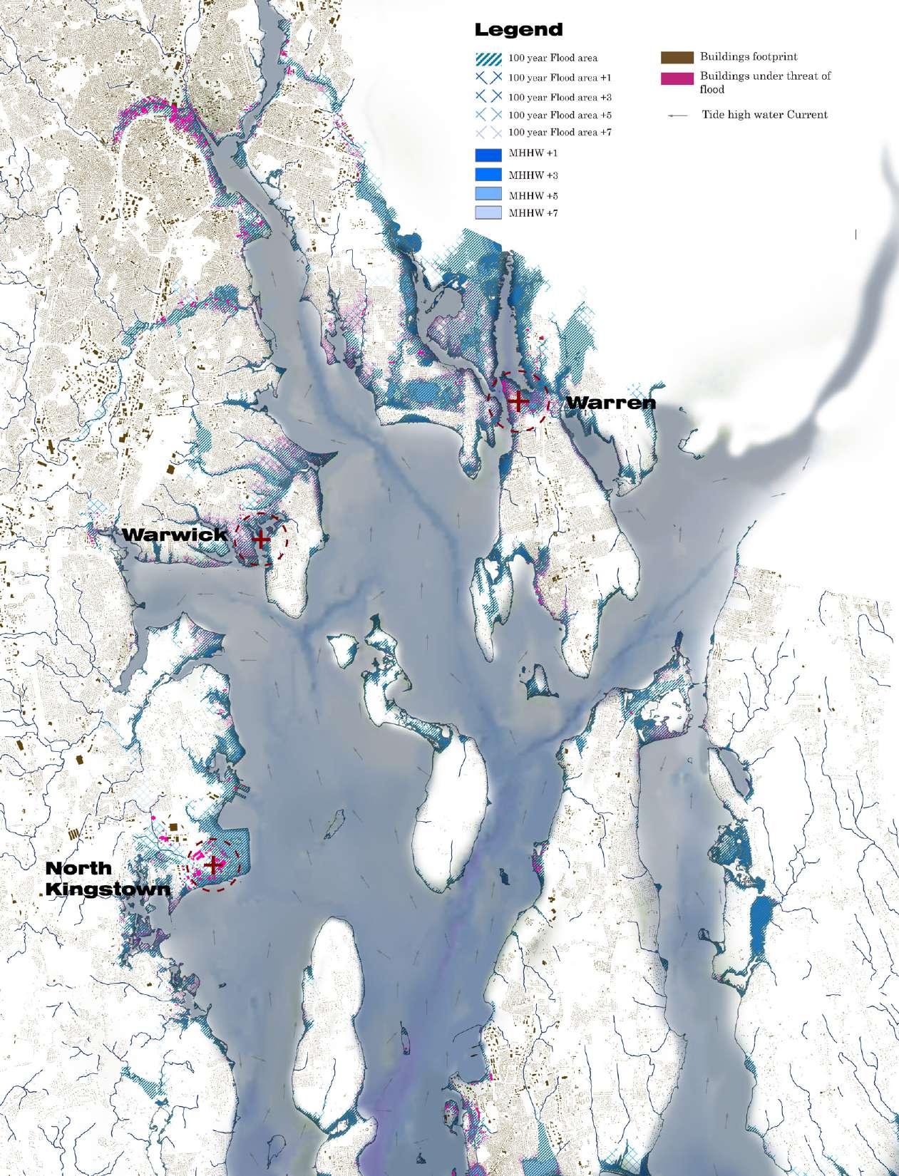
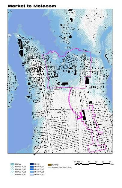
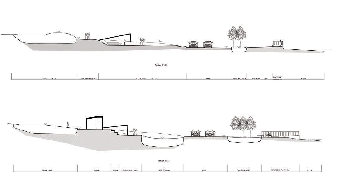
One town in the Bay that is predicted to be impacted by climate change is the Town of Warren, RI. It is bound by water on three sides and has more than 18 miles of coastline. Warren has already been planning for retreat and in 2021 developed the “Market to Metacom ” plan that proposes the removal of a 253-acre area containing approximately 400 buildings with over 500 housing units and 30 businesses to make way for rising seas. However these landscapes will hold memories of people's homes, of lost communities, and people’s lives that are being upended due to climate change. Rather than assuming no traces remain, how can we explore what emerges in these coastal spaces following retreat. How are memories held? How is a community able to still return to “home”?
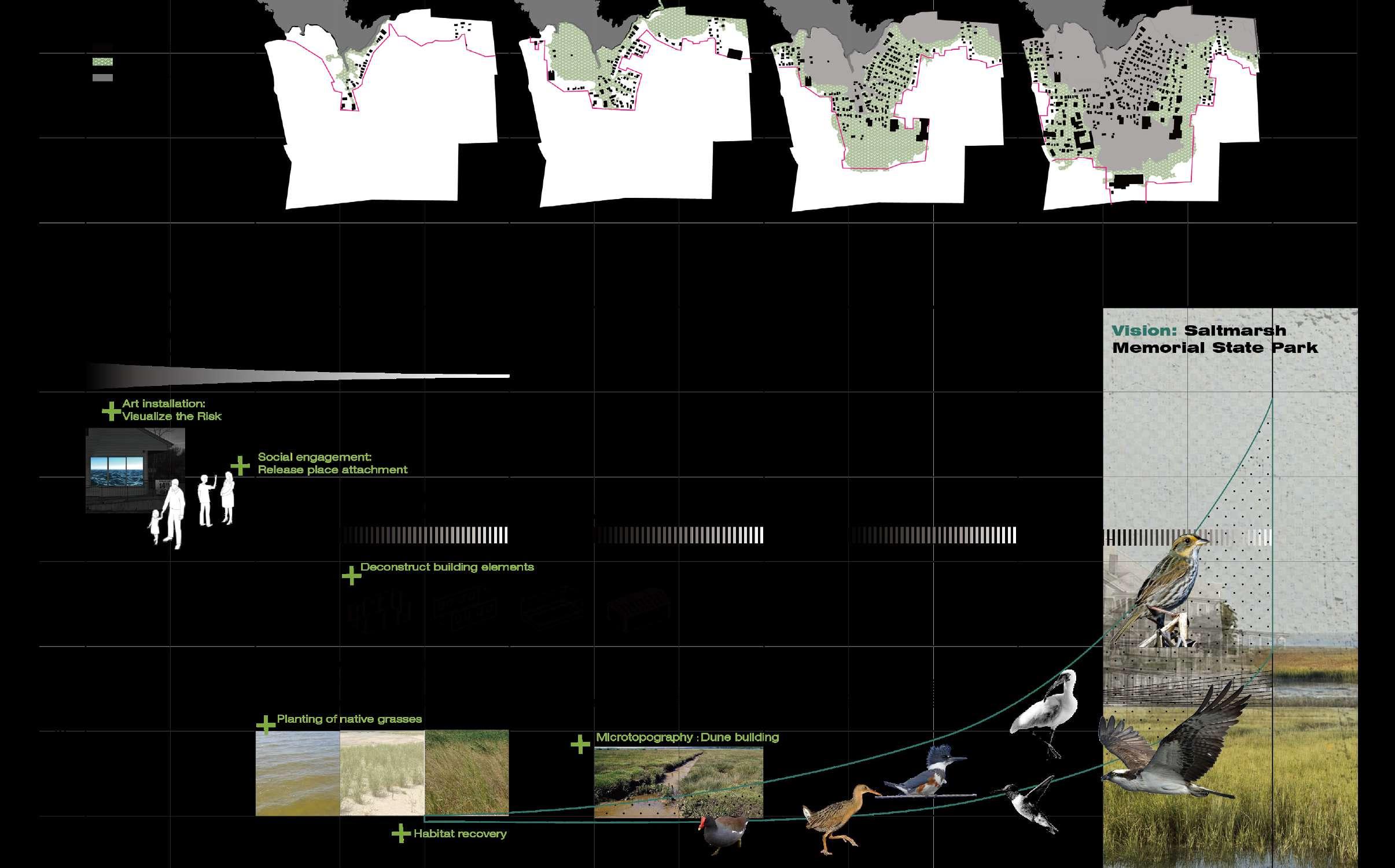
Taking Warren as an example I would reimagine the spaces left when communities are retreated because of flooding and sea level rise. I hope to honor the history and keep the collective memory alive while building resiliency to support humans and non humans species.
For Narragansett bay Models of different greenhouse gas emissions scenarios indicate 9 to 11feet by 2100. This map shows the 100 year storm flooding zone and areas will be influenced by sea level rise in the future.
Strategy 1: Buy In relocation
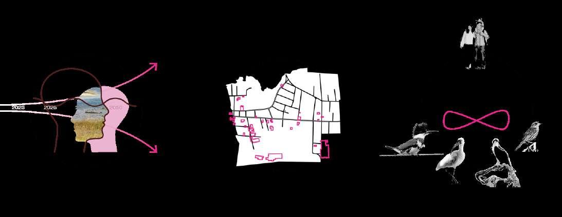
If the retreat plan will erase all the things, I start to think about what hold memories of people's homes and communities. How can we explore what emerges in these coastal spaces following retreat. How are memories held? How is a community able to still return to “home”?
There are still two years before the start of Metacom to Market project. But this project doesn't have to wait two years to start, I think it is a good time to increase people’s willingness to relocate making the process more gentle without regret.
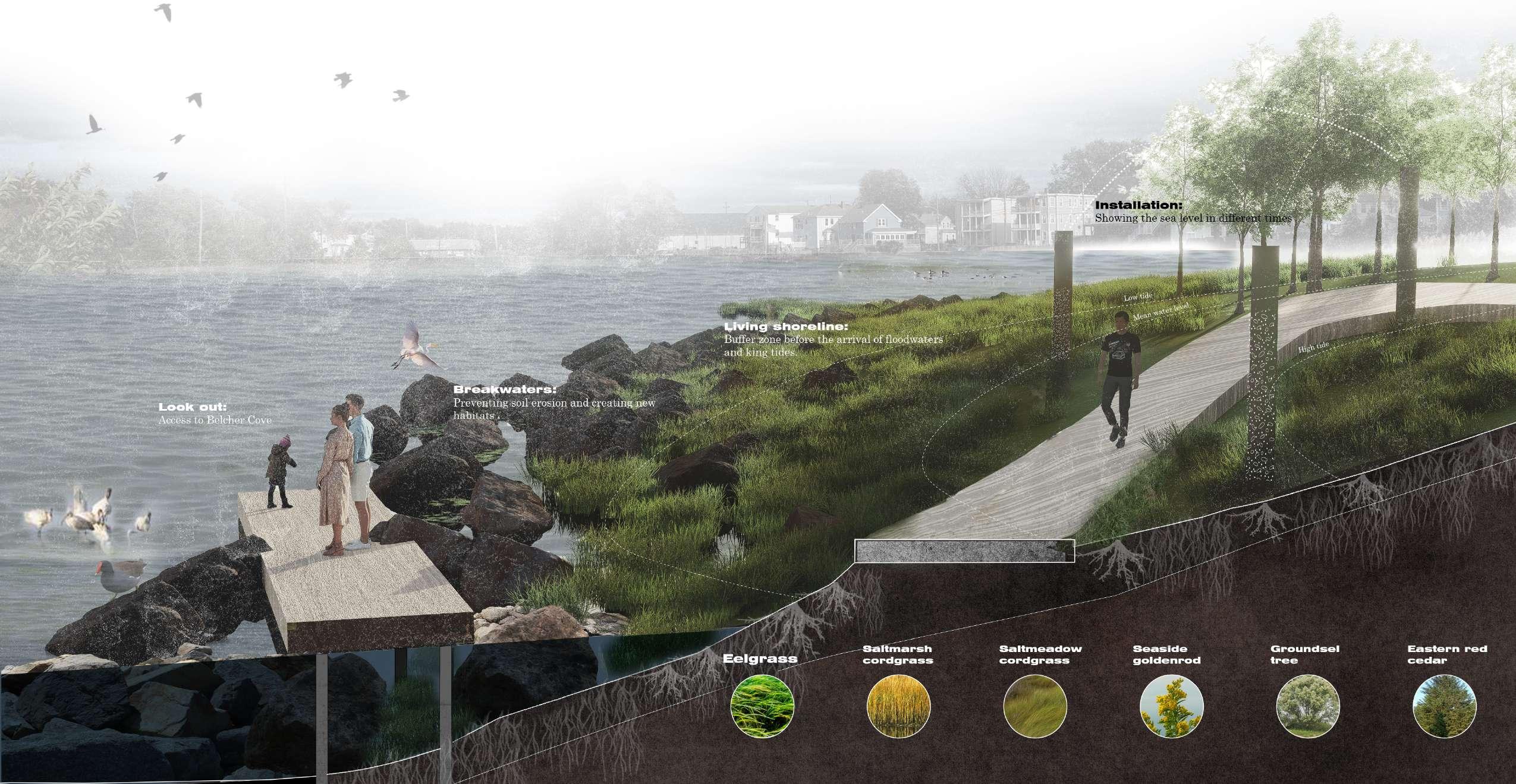
Jamie’s park is an important public waterfront space around Warren, so it also could be a pioneer. In this park, I am considering using the art installations to visualize the risk of sea level rise and also using the living shoreline and breakwaters to protect the edge of the park.
Empathy With The Community Honor The Past And Keep The Traces Home For All
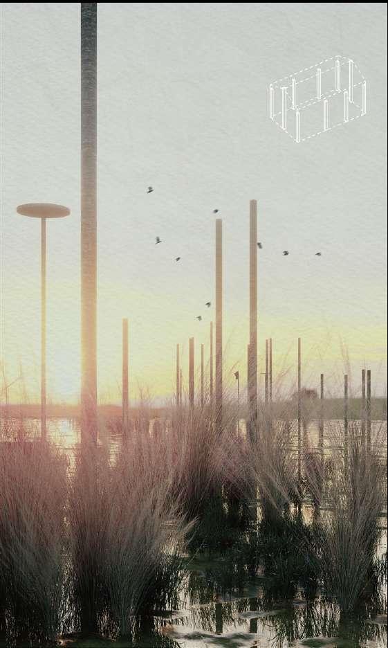
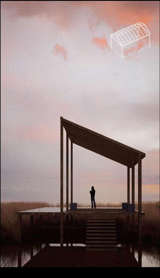
Strategy 2: Refurbish Ghost House : Living Mounment
Memories need to be placed in entities so that they don't disappear so easily. And I deconstruct the house using different elements including foundations,columns, wall and window,and the structure. The concrete foundation could be the base of a boardwalk. The
poles could be bird houses and also the monument of houses. The walls reminds the past of people living here and watching out. The structure could be a place for people to gather, to exhibit and see the sunset and to contemplation.
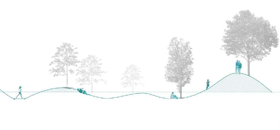
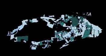
The hills
Type: Wasteland design
Date: Spring 2022
Location:
Teamwork with Yimeng An
Instructor: Sonny Xv
Project Narrative:
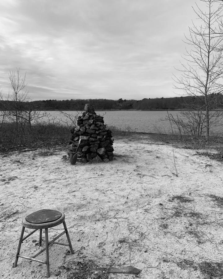
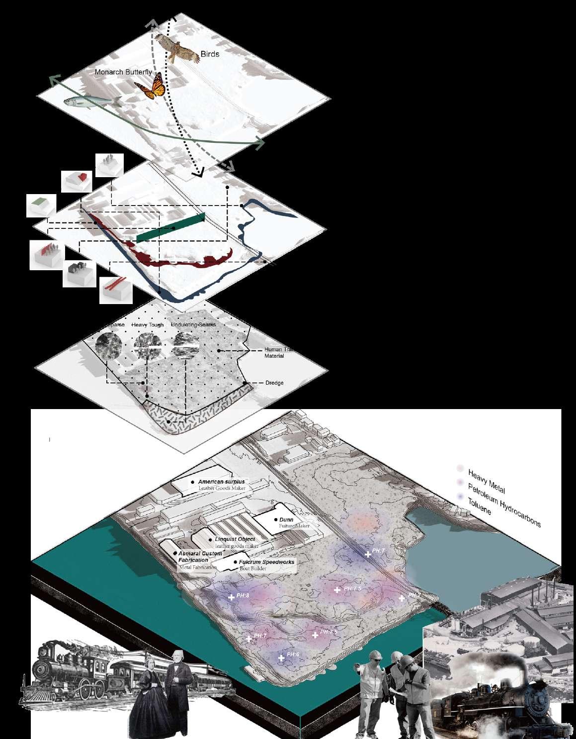
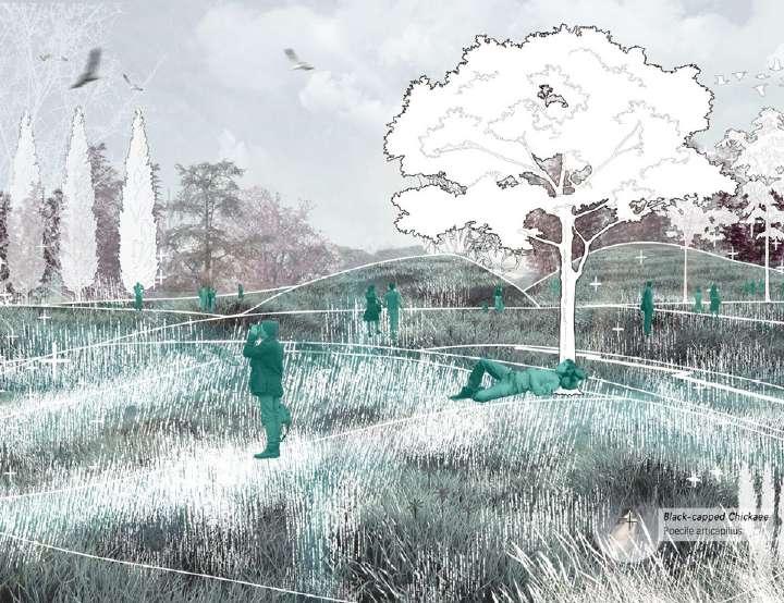
Without any preliminary research, we went to the greenwood point, a wasteland near Seekonk river, hoping can find some interesting things. After picking up a lot of waste, I found a sculpture made of stone. It is a guess that it is a monument for the workers who had dedicated their lives here. That is the starting point of this project. In my view, rather than "workers", they were living individuals, and I wanted to create a happy outdoor place for the workers in this abandoned land.
Encouraging the surrounding factory workers and communities to participate in this urban edge space where adults find their childhood memories, the joy to play in the nature. Thick folds made up the hills, between the space you may run, climb, or lie down. By revitalizing the site, reintegrating the site's topography, storm water management, ecosystem, pedestrian system and activity space, to create a new ecological and social node for the landscape system along the Seekonk river and reconnect the green corridor. It will enable people to escape from the busy work life for a while, and to relax in the green space during their leisure time.
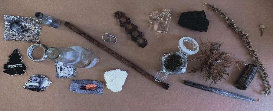
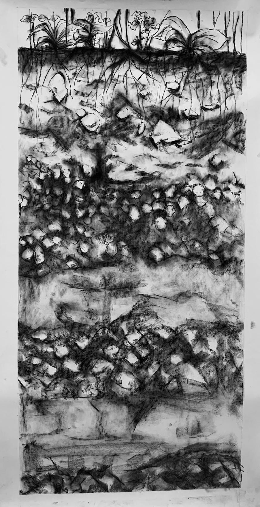
“Nonsite” is a concept may be useful to characterize the simulacrum of documentary evidence—samples, maps, photos, etc.—present in the studio at the moment of conceptualization of the project.
The items collected through fieldwork were quite random, but as I explored the connections behind these items, the story emerged. I collected a lot of industrial products, and from these items I saw many unnamed workers.
INDUSTRIAL ITEMS
SURROUNDING ITEMS
Potential of Making Ecological Corridor
Loss of Habitat
Animalcorridor
The site is in a very important position on the ecological corridor of providence. And it has the potential to connect the
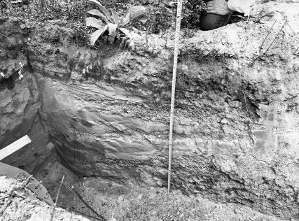
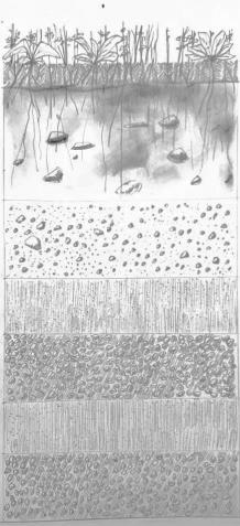
Soilprofile
As a point on the migratory pathway of many species of animals, this site can be a migratory waypoint for many species of animals, developing biological corridors and habitats.
Loss of Access
The site retained some traces of the industrial trace of the past, but the remaining workers’ buildings were not distinctive. Accessibility in the site is poor and there are many boundaries that prevent people from walking in the site.
Accumulation of Waste and Contamination
According to the soil samples test, there are also some metal contaminants in the soil. Also according to the records, the petroleum hydrocarbons, PCB, Asbestos, Cu, Polynuclear aromatic compounds, and Toluene has been tested positive in groundwater.
Seekonk River
Omega Pond
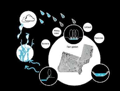
STORM WATER: Be Beneficial To Water Circulation System
By adding some soft green engineering, the site could serve as green infrastructure to purify the storm water and improve local water circulation system.
EXPERIENTIAL ACCESS: Bringing the Entrance to the Ecology
Breaking the original flow pattern, bringing in rivers, adding new waterways,combining them with the emergence of eco-zones where people can simultaneously paddle canoes
SPACE: Increase Site Utilization And Playability
Increase the landscape level and sequence of the site to develop the potential of the site and reduce negative land use. And increase the length of stay and playability of the visitors.
VEGETATION: Rescue Wasteland With Biodiviersity
By introducing local vegetations and creating habitant for different animals robust ecosystem will be established. Meanwhile barren land can also be improved.
BOUNDARIES: Displacement Space And Eliminate Boundaries
The industrial area expands onto the site from the boundary,overlapping the original site space producing a new space and removing the feeling of barrier.
Vegetation
Main loop
Bike loop
Trails
Kayak route
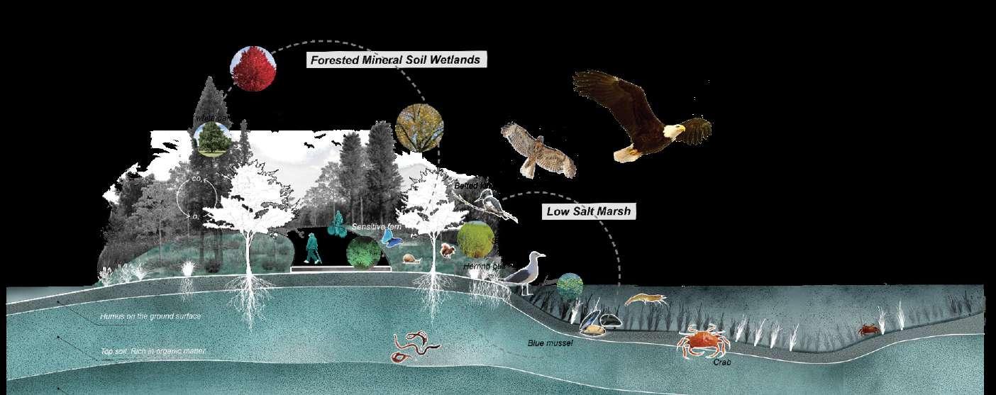
Forest
Wetland Lawn
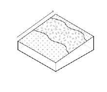
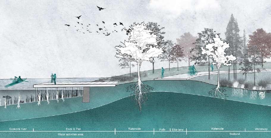
Transect: Riverfront Dock
Transect: Ripple Ridge
Transect: Seating Platform
9. Ripple Ridge 10. Isle Cove
Sunken Amphitheater
Ecological Transection: Isle Cove
Whole Transection
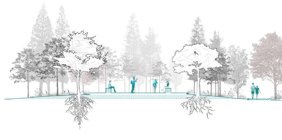
Activity Transect
The long transect is showing the main relationship of different area and the transformation of humans activities, animal activities and height of planting.
Whole Transect
Wetland Grassland with Shrub Prairie Forest
Experiential Views
Platform
Seating
Isle Cove
Ripple Ridge Fisherman’s Pier
Copyright Neenad Joseph Arul
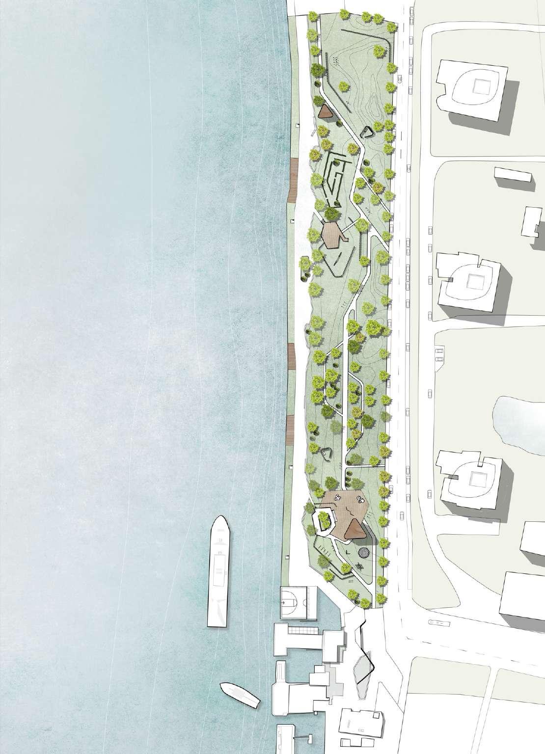
Playground for All
Type: Urban Green Space design
Date: Summer 2020
Location: Huangpu River Waterfront
Pudongxin district, Shanghai,China
Individual Work Instructor: Jun Wang
Project Narrative:
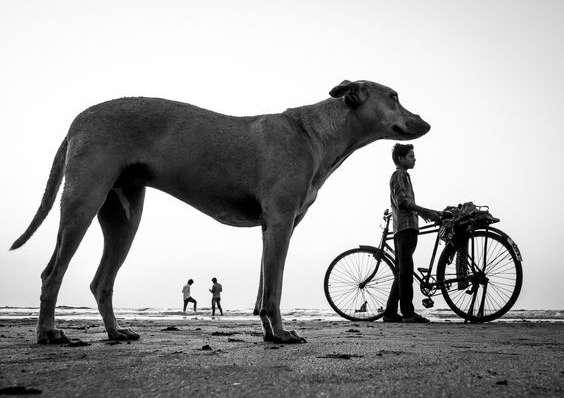
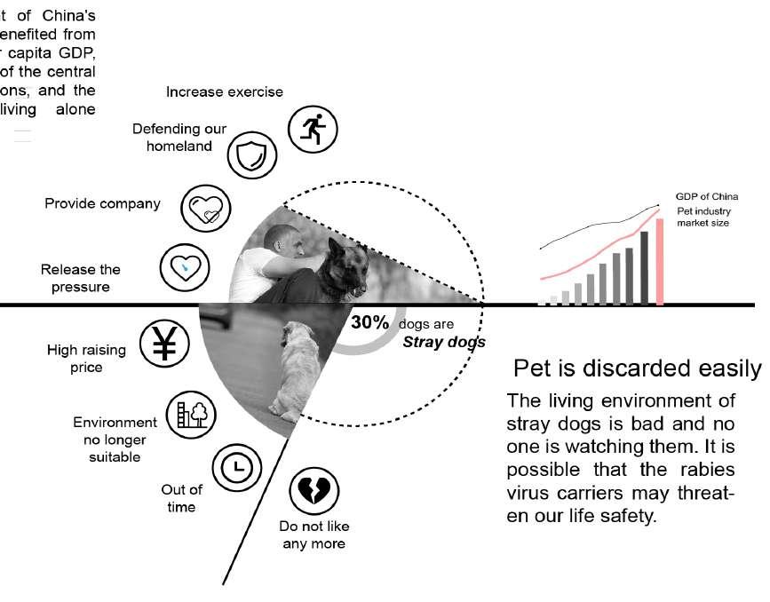
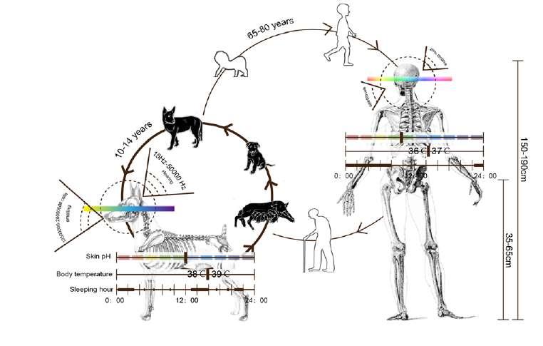
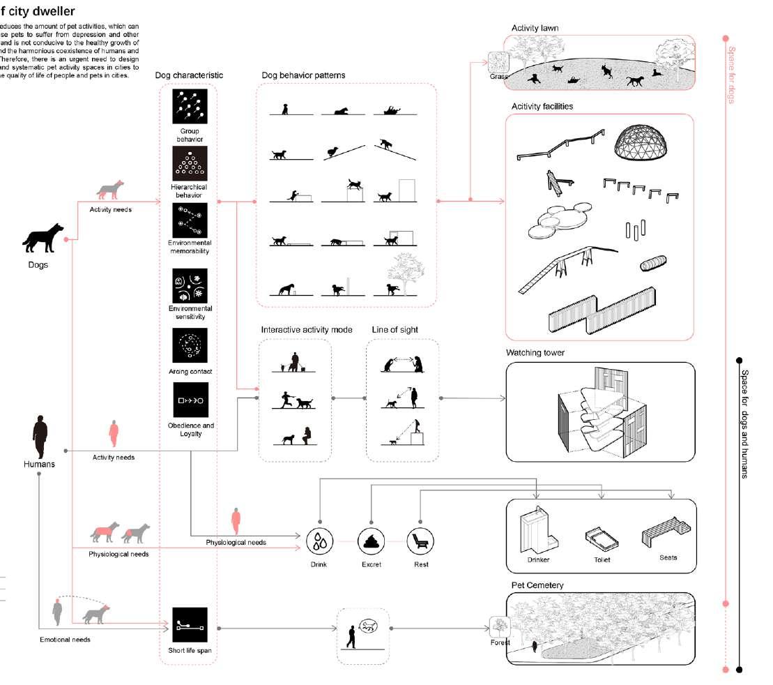
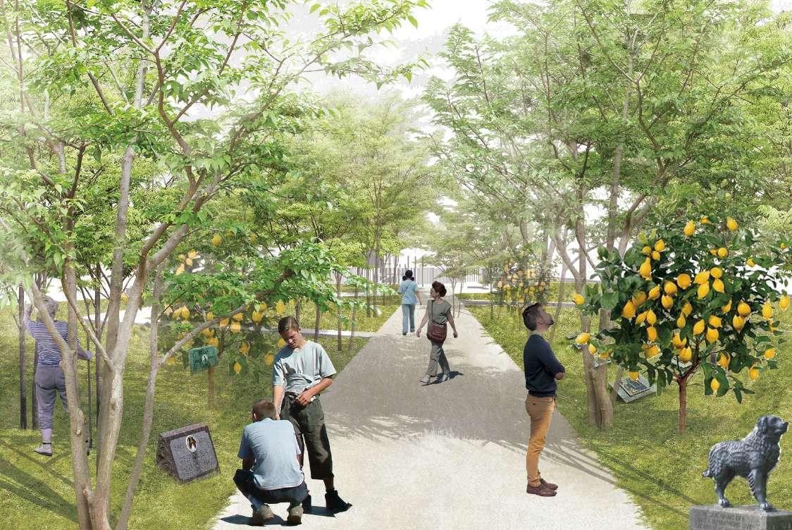
Having children is becoming more and more expensive, so more and more people will choose to place their affection on their pets, but these special city dwellers are almost invisible in the city, so I want to express the real care for pets from the human perspective and respect the right of pet dogs to live in the city.
Design Approach, Humans And Dog As Equal
Pet dogs are another kind of urban residents, and from the perspective of pet owners, there is a direct demand for urban pet activity space.
From the perspective of non-pet owners, pet activities will occupy part of the limited activity space, and the joint activities of humans and pets will increase the pressure of health, but also easy to cause security fears to some people, affecting social harmony.
From the perspective of pets, the lack of space for pet activities reduces the amount of pet activities, which can easily cause pets to suffer from depression and other diseases, and is not conducive to the healthy growth of animals and the harmonious coexistence of humans and animals.
Reorganize Space For Another Kind Of City Dweller
Paws & Play Zone
For physical interaction between humans and pet dogs
Through the interlacing of human resting space and pet activity space,the common activity space of people and pets can be increased, helping people to increase their knowledge of pets and pay attention to their real needs.
Pet Cemetery Forest
For psychosocial interaction between humans and pet dogs
Plants can draw nutrients from buried pets, and as people walk through these woods, their fond memories with their pets will be evoked, and it will give everyone a chance to revisit the human-animal relationship.
Pet Gravestones
Fruit Trees
Community Garden
Seating Platform
Activity Lawn
Through these fruits and trees, a pet’s life continues in another form
Pet owners and neighborhood residents will be responsible for maintaining the plants
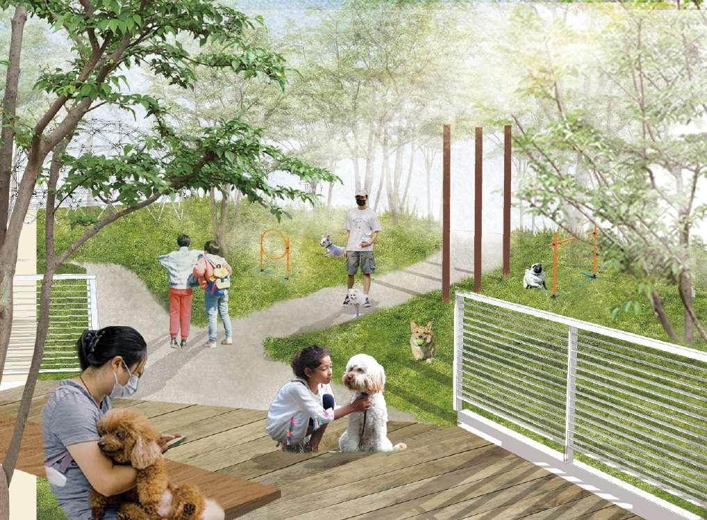
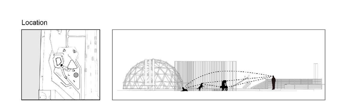
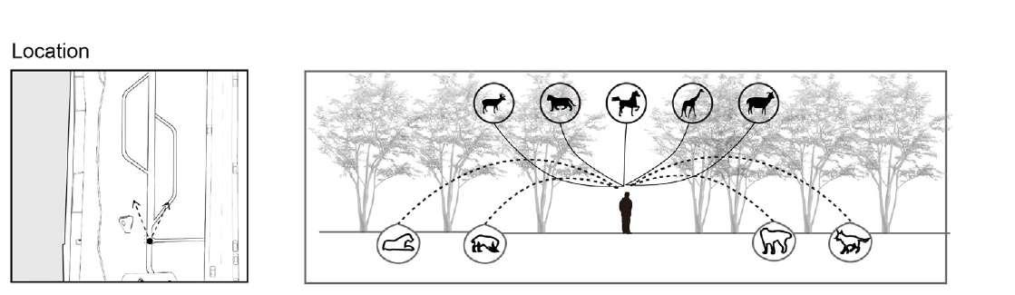
Watching Tower Dog Playing Zone
From human’s perspective
From pet dog's perspective
Looking down from the watchtower, you can see the activities of your pet dog, and you can let the dog move freely while monitoring their behavior.
The design to adapt to the size of the pet allows the dog to movefreely and fully in the area, and the variety of facilities can increasethe fun of the activity and adapt to their nature
Sports Ball
Continuous Pole Vaulting Pipeline See-saw
Dog Hedge Maze
Seating Platform
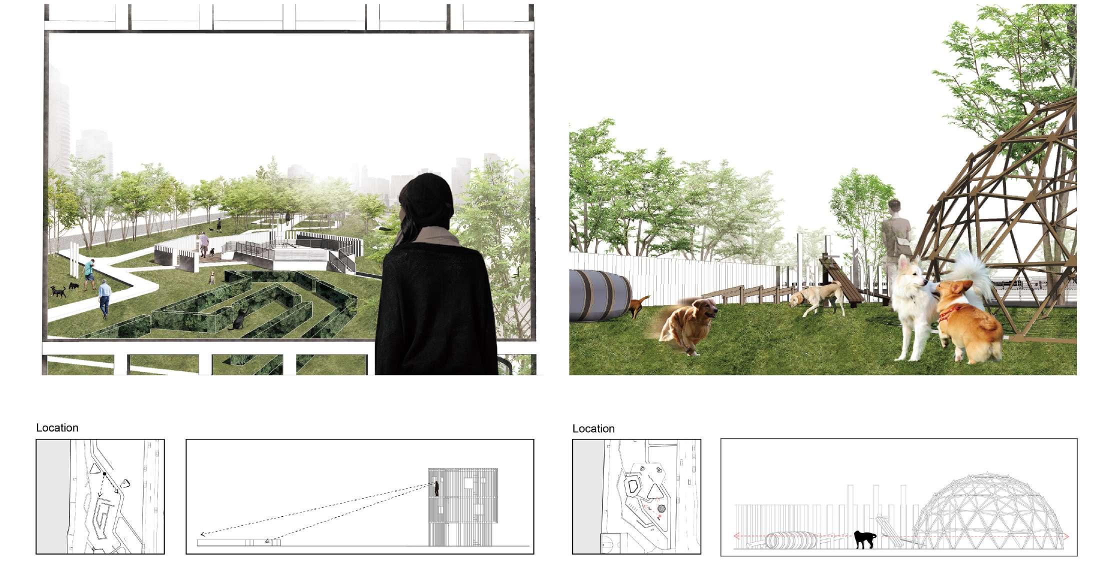
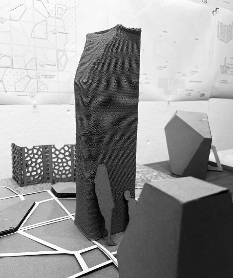
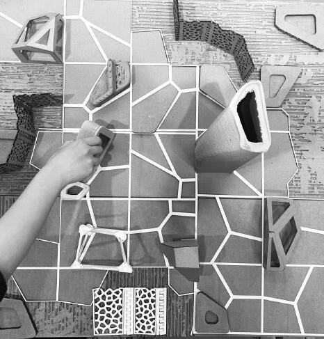
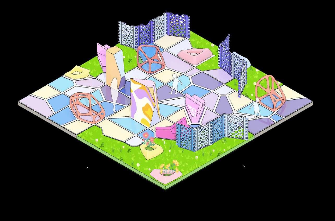
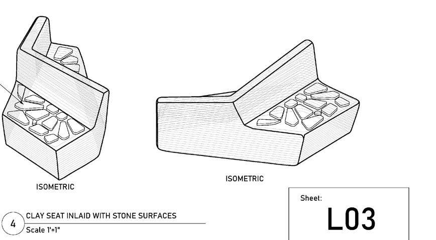
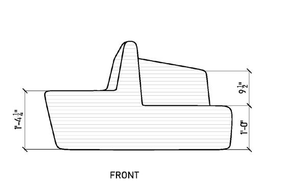
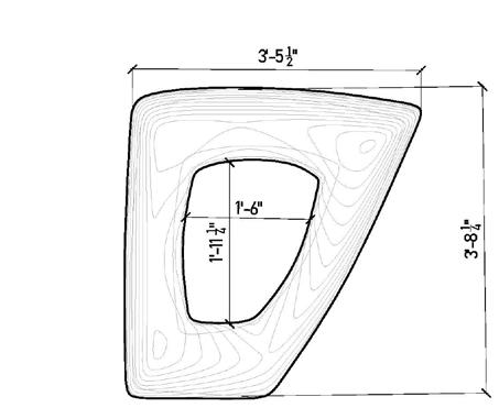
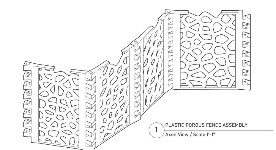
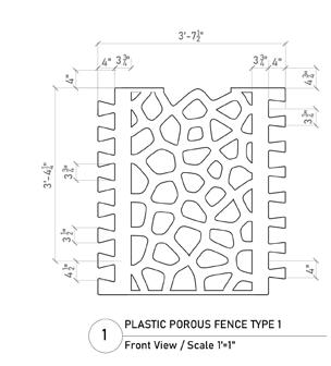
Candy Kingdom
Type: Playground Design
Date: Fall 2023
Size: 30’*30’
Team work with Silin Wang& Yuemeng Dai
Instructor: John O’ Keefe
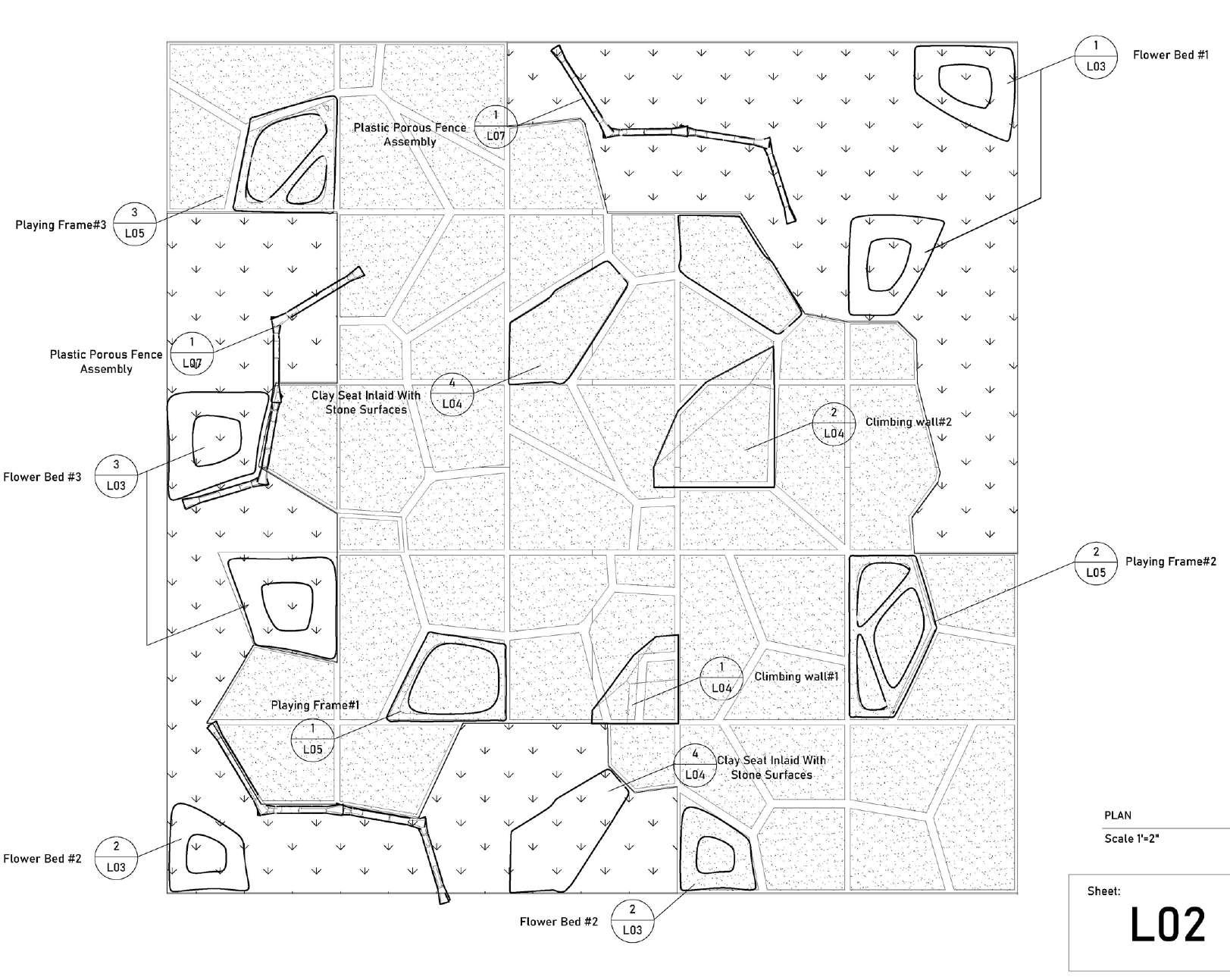
Introduction:
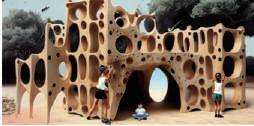
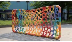
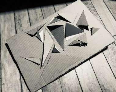
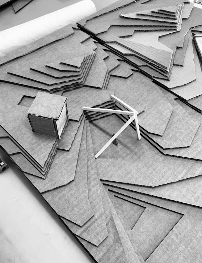
Candy Kingdom is a whimsical playground inspired by the vibrant and fragmented patterns of Voronoi geometry and the delightful imagery of hard smashed candy.The playground features various play structures designed to resemble pieces of shattered candy, offering a unique and interactive experience.
We also experimented with the use of 3d plot clay as a material in the construction and design of the application.
Firefly Genarated Visioning
Model
Ground
Prompt: A Circular Field, Grass, Shrubs, Open In The Middle, Children Playing, Irregular Buildings, Organic, Climbing, Curved, Centered Distribution
Play
Prompt: Wood playing structure, Different size holes, Cave, Cube, Space can go through
Concept Development
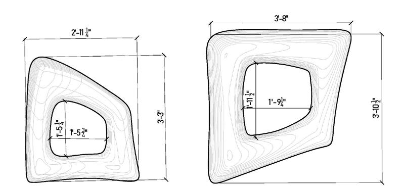
Voronoi Diagram
Interesting spatial prototypes were created by randomly dividing the square into seven pieces using Voronoi.
This space combines playful shapes and vivid colors to create an immersive environment that stimulates both visual and physical engagement for children.
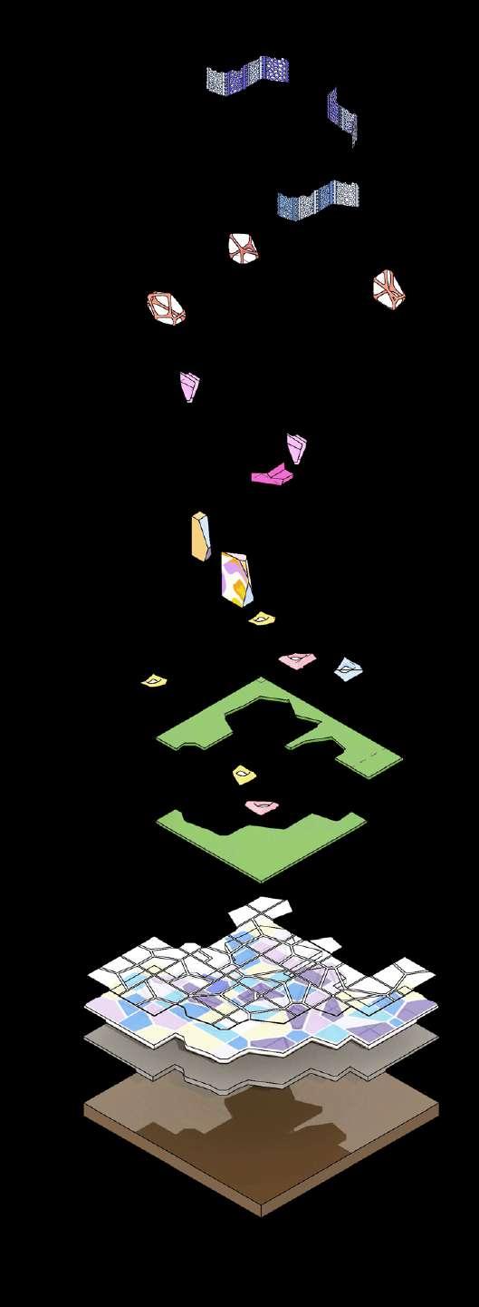
Isometric
Exploded
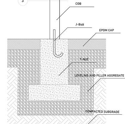
1'' Poured-In-Place Epdm
2'' Poured-In-Place Epdm
6'' Crushed Stone
Compacted Subgrade
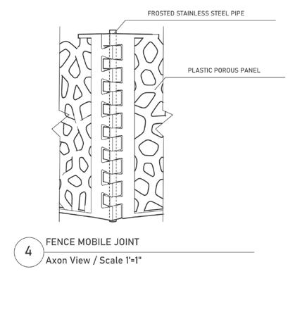
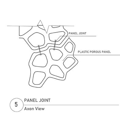
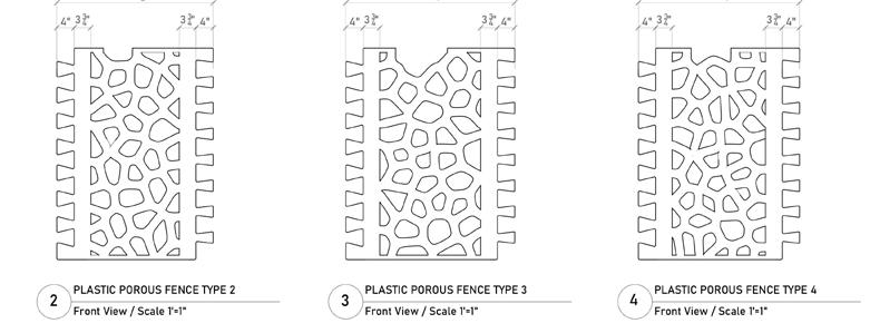
Fence
Playing Structure
Clay Bench
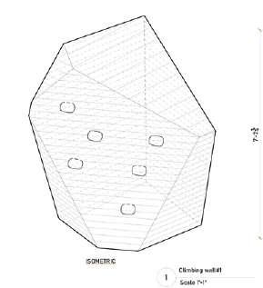
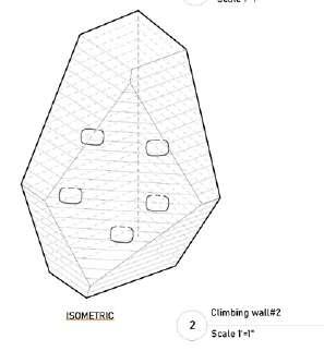
Climbing Wall
Clay flower Bed
Lawn
Kit-of-Parts
Playing Structure
Ground Clay
Recycled Plastics
Bamboo + Plastic Joint Wood
Clay + Stone Play
Enclosure Play
Ground
Outdoor Seating
Climbing Tower
Fence
Nostalgia In-between
Type: Community design
Date: Spring 2019
Location: Fengxian district, Shanghai,China
Individual work
Instructor: Yinan Lin
Project Narrative:
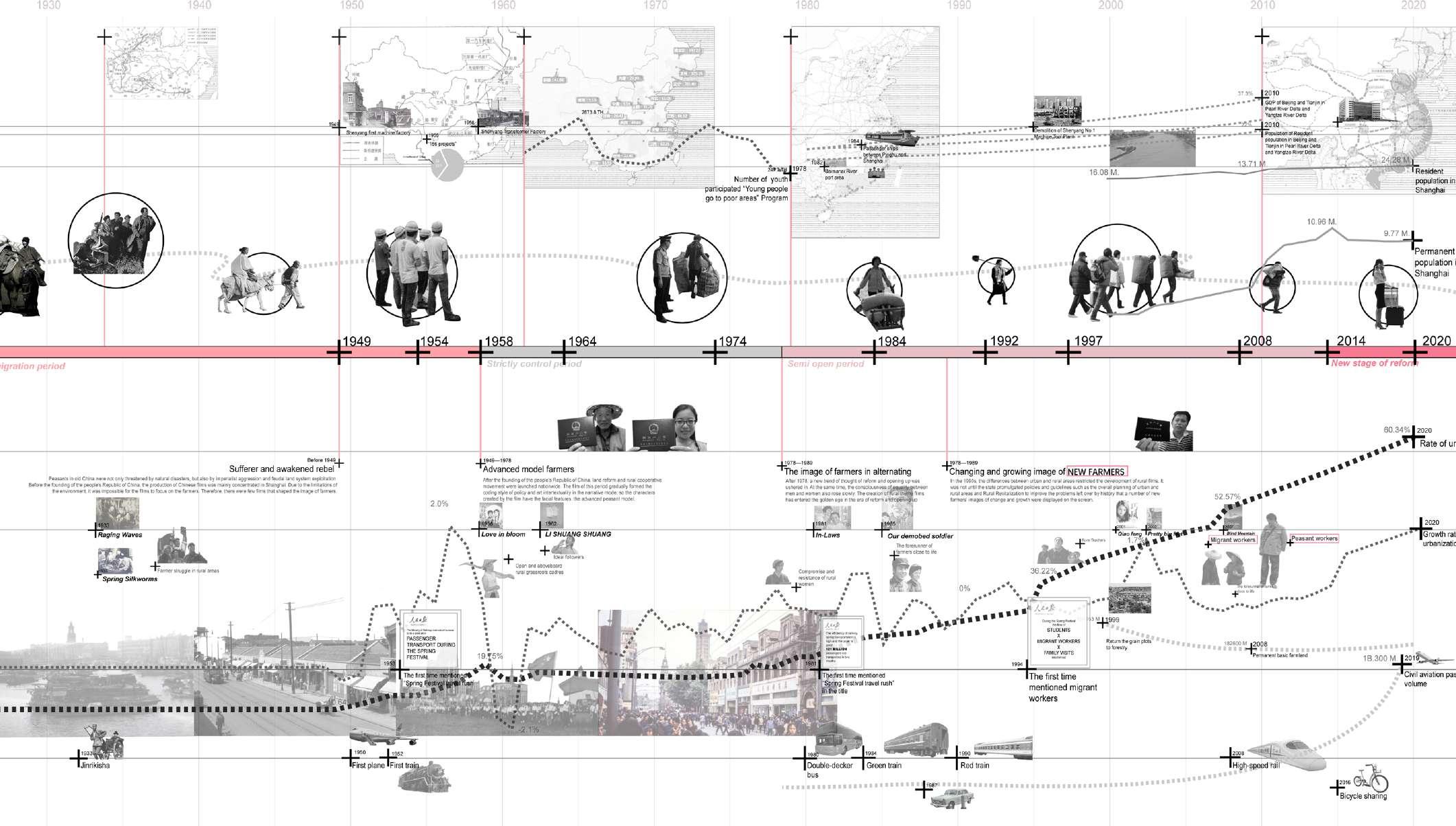
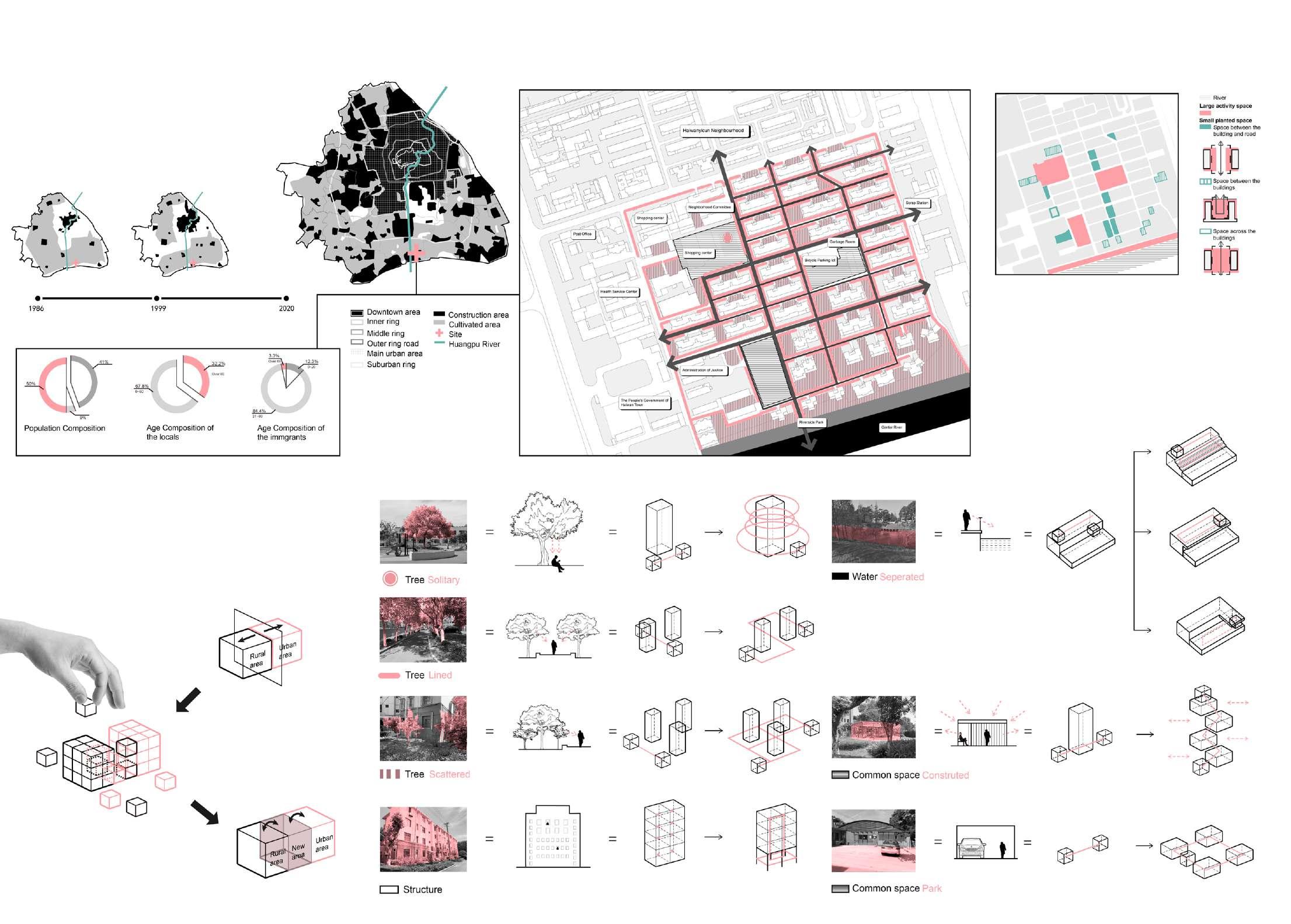
Driven by urbanization, many rural people are moving to big cities to make a living, but urban spaces and urban people seem to be rejecting them by virtue of stereotypes. Therefore, I hope that by integrating different ways of interacting with natural elements in people's memories, we can help foreigners get better acquainted with the city and generate various activity spaces to increase the communication between urbanites and foreigners, thus increasing understanding.
Household Registration, Another Idendity of Chinese People
Urban rural dual structure has existed since the Song Dynasty, more than 1000 years ago. But in the past, although there were urban-rural dual structure, there was no urban-rural dual system. For example,Shandong farmers could work in the towns of Northeast China as shop assistants,businessmen, apprentices. They could also open shops, run workshops, buy houses and build houses. This continued until the early 1950s.
Since the late 1950s, due to the establishment of the planned economic system, household registration is divided into urban household registration and rural household registration. The urban-rural dual system has been formed, and the urban and rural areas have been separated. From then on, both urban and rural areas became closed units, and the flow of production factors was
strictly restricted. Under the dual system of urban and rural areas, the vast number of farmers are bound to the land and confined in the countryside. The rights and opportunities of urban residents and farmers are unequal. In a sense, farmers are in the position of "second-class citizens".
On the one hand, urban-rural dual system has seriously violated the freedom of migration of urban and rural residents; on the other hand, it has seriously violated the social and economic rights of farmers. The urban-rural dualism has caused serious social injustice. It can be said that its existence is one of the reasons why the human rights situation in China has not been improved for a long time.
Live between City and Farm
Site analysis
Strategy Development
To strengthen the connection between rural area and urban area , i deconstructs the patterns and activities related with elements in this neighborhood, then combined them with some features in the rural areas. As a result, spaces will be rebuild as a new urban-rural form.
By analyzing and scrutinizing the spaces in the site, we can classify the spaces to large activity spaces and small planted spaces which can be used to redesign.
And also we analyzed the pattern of landscape structure and tried to abstract the elements.
Typologies and Activation Strategy Development
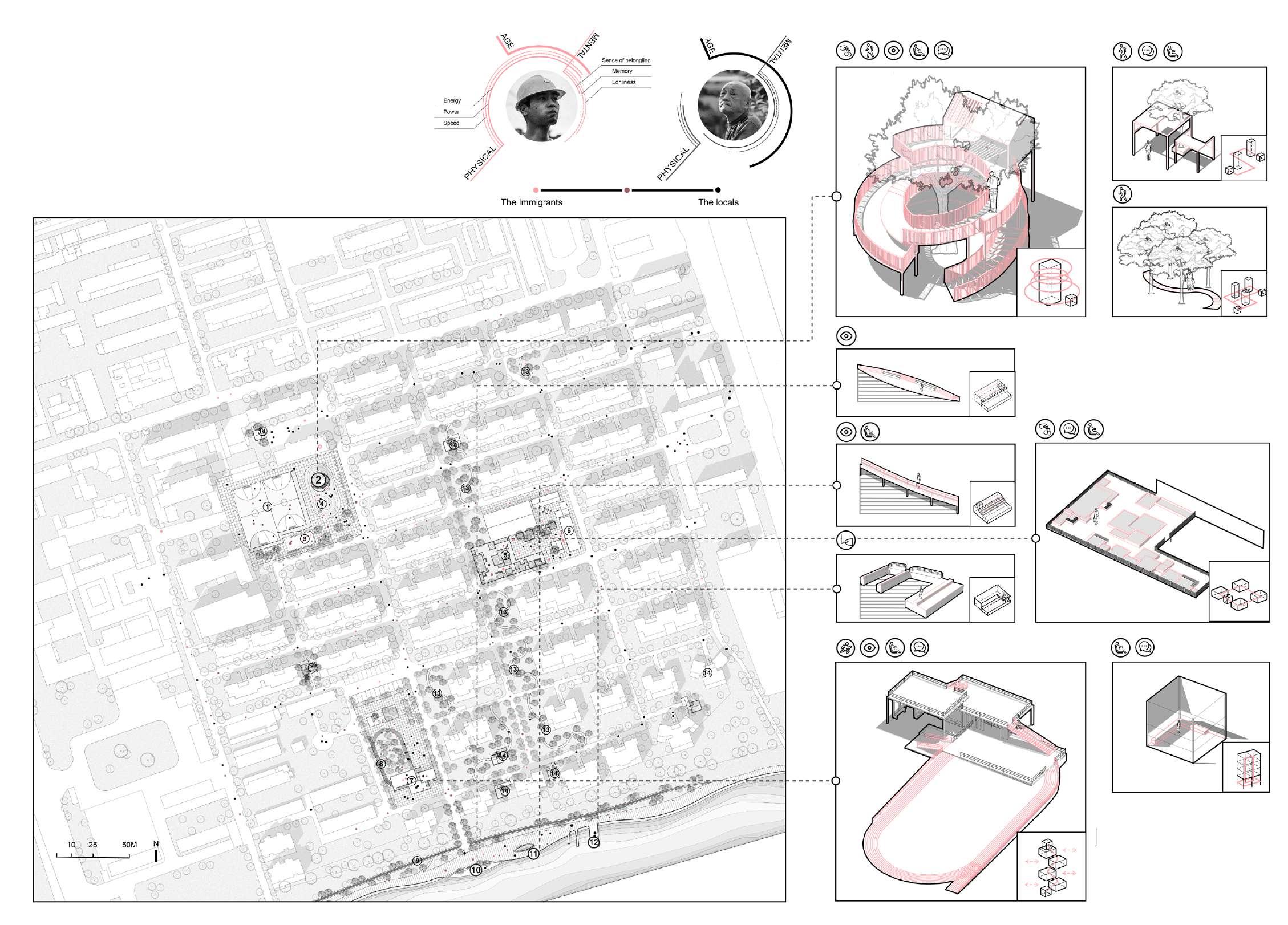
Based on the design strategy, I transformed the new abstract elements into specific activity space according to the activity form, crowd characteristics and community space, and put them into the site. In the future, immigrants and local residents will have more communication opportunities and new forms of space experience.
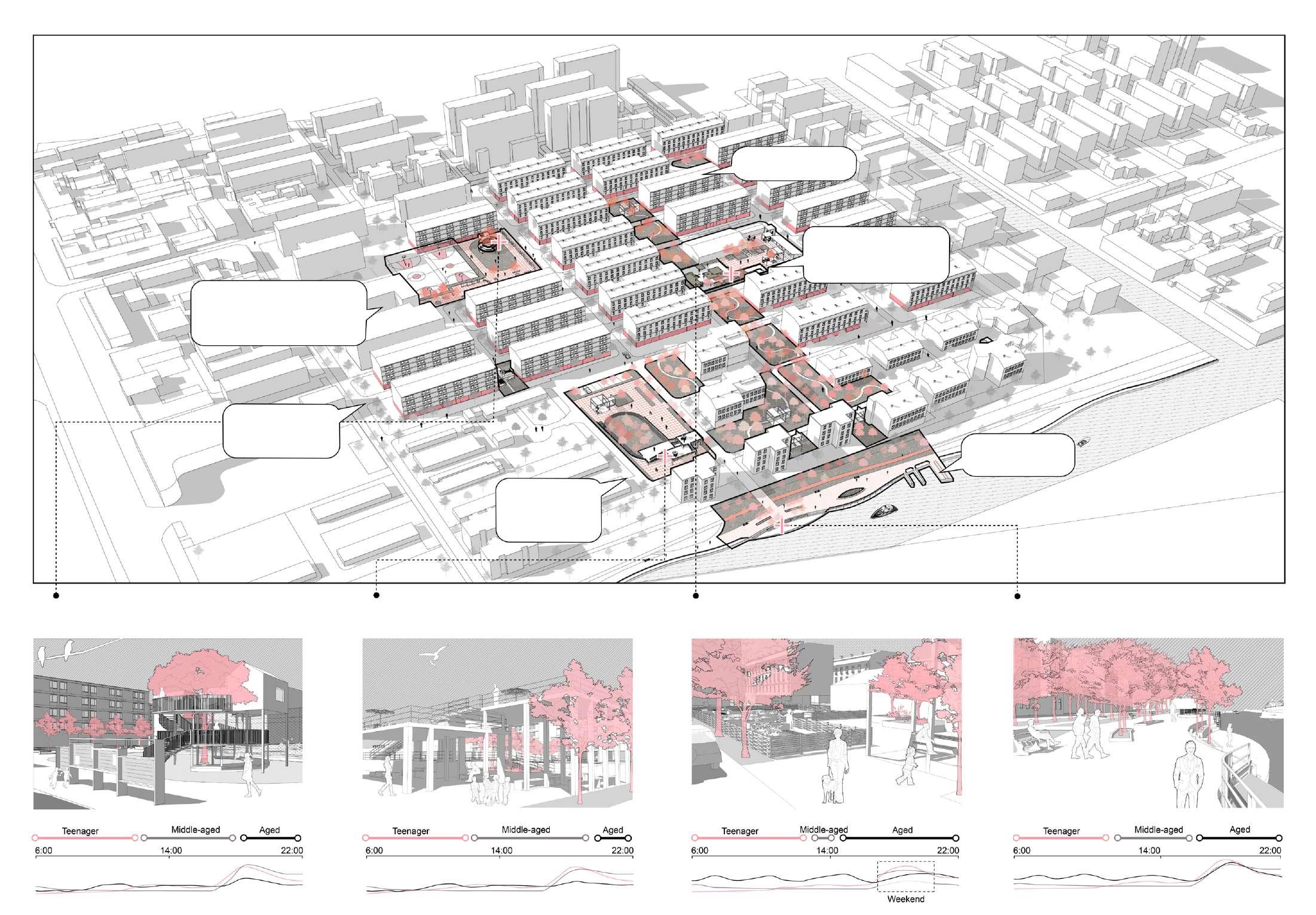
Master plan
Integrated Life: Neighbourhood of Haibingercun
Walking on the path is like being in the forest
The fruits and vegetables grown by myself are more delicious, and communication with people in the community has also increased.
Instead of just sitting in the shadow, we can have a new way to interact with a tree. In the journey of spinning upward, the connection between humans and trees will be strengthened.
The activity space on the ground floor allows me not to travel far to find a place for activities
Walking along the river, we can go fishing and do exercise.
We can not only enjoy outwards views in this platform but also enjoy ourselves in the inwards spaces.
Tree house
Viewing Platform
Shared community farm
Riverside platform
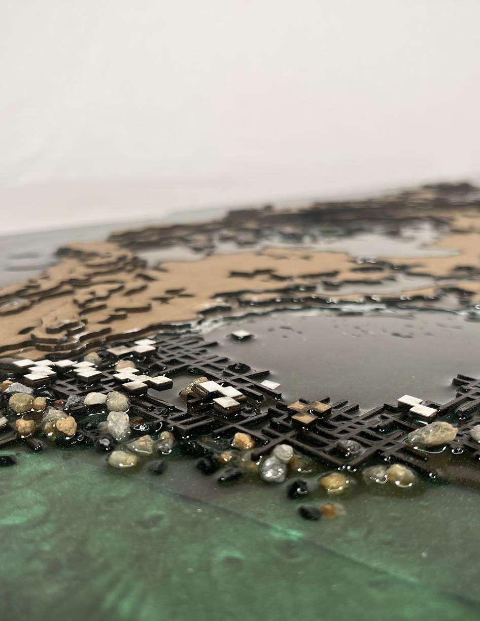
Little Island Commons
Type: Thesis Research
Date: Spring 2024
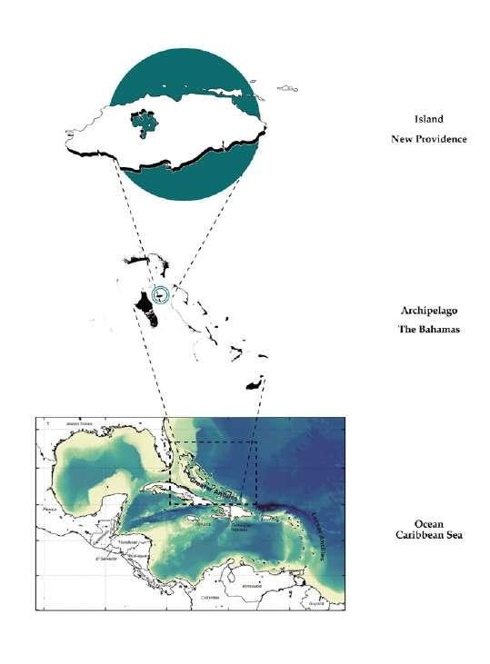
Location: Nassau, Bahamas
Individual work
Instructor: Elizabeth Hermann
Project Narrative:
The difference between a continent and a small island lies in the proportion of land and sea, so if the Earth is viewed as one entity, all people live on islands. And by realizing this fact, we will also be aware of the interconnectedness, fragility, and shared responsibility we have towards our planet and each other.
This research seeks to explore new socio-cultural contracts with territories to achieve bio-socio-spatial justice. It aims to maintain sustainable and equitable relationships between governments and local communities, focusing on addressing historical inequalities. By examining landscape-based strategies for climate resilience, the study proposes innovative ways to manage and protect territories, emphasizing the social, economic, and cultural needs of local populations over tourism industry demands, strengthening the connection between Bahamians and their territory, and ultimately fostering a sustainable and equitable future.
Land-Water Balance Continents: Land Dominance Island: Water Dominance
Archipelago State
An archipelago looks like the excess of land to sea.
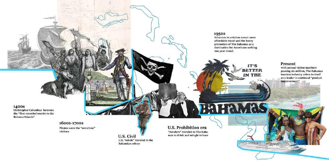
The word “Caribbean” comes from the Caribs, one of the major Native American populations at the time of the European arrival in the region at the end of the 15th century, When Christopher Columbus discovered the West Indies in 1492, the Spanish name “Antilles” was used to refer to the islands, and “Antillean Sea” became an alternative name for the Caribbean Sea in some European languages. For the next century, Spain held absolute hegemony.
Today, the Caribbean Sea region consists of 22 island nations or territories and is bordered by 12 continental nations. Thanks to its sunny, year-round warmth, tempered by trade winds, and its many scenic attractions, the Caribbean became a popular tourist destination in the second half of the 20th century and into the 21st century.
Bahamas, located just 50 miles off Florida’s shore, consists of about 700 islands and 2,400 cays in the Caribbean sea, which is definitely a country of islands.
New Providence is the most populous island in the Bahamas, containing more than 70% of the total population. Nassau is the capital and largest city of The Bahamas. It is located on the island of New Providence, which had a population of 246,329 in 2010, or just over 70% of the entire population of The Bahamas.2 Nassau is commonly defined as a primate city, dwarfing all other towns in the country. It is the center of commerce, education, law, administration, and media of the country.
Tourism and Export: America's Backyard
Historically, this country has a long history of colonization and in the marketing of destinations and in the production of touristified landscapes, tourism is creating neo-colonial relations in the modern world. Nowadays, data on tourism-related issues,
showing the Bahamas’ heavy reliance on tourism and reflections on tourism in general and ecotourism in particular.
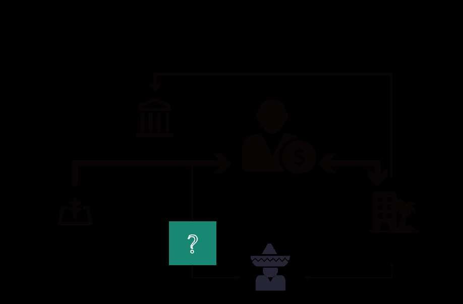
Confilct of Land between the Locals and Foreigners
In The Bahamas, the concerns surrounding Crown Land can be divided into two main aspects: ownership and management. When it comes to ownership issues related to Crown Land, it is evident that Bahamians have consistently been given less priority compared to foreign counterparts in acquiring these territorial areas.
Attorney Alfred Sears highlighted this disparity by pointing out that significant grants, leases, conveyances, and government leases were predominantly awarded to various entities such as Baha Mar, Baker's Bay in Abaco, MSC in Ocean Cay port and resort, Resorts World/Bimini Bay, Royal Caribbean seabed lease in Berry Island, Sandals Royal Bahamian in Nassau, Sandals Emerald Bay in Exuma and Breezes in Cable Beach along with numerous islands and cays within the Exumas and Abacos. In 2018, Oban
Energies, a company who proposed to build a $5.5 billion oil refinery and storage facility in East End, Grand Bahama, was expected to lease 690 acres of Crown Land. Yet, there are thousands of applications from Bahamians that have yet to be processed. This is when it becomes obvious that Bahamians are not a priority.
Actually, due to developer concessions and foreign direct investment policy, planning becomes very site specific and limited to the boundaries of development projects, rather than to a regional or national context. The conflict between local people and foreign investors continues.
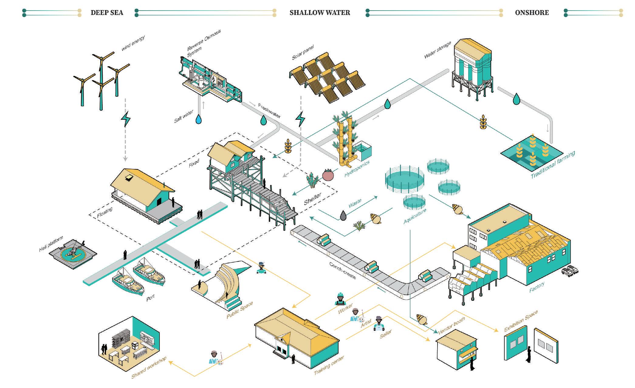
Self-Sufficient System
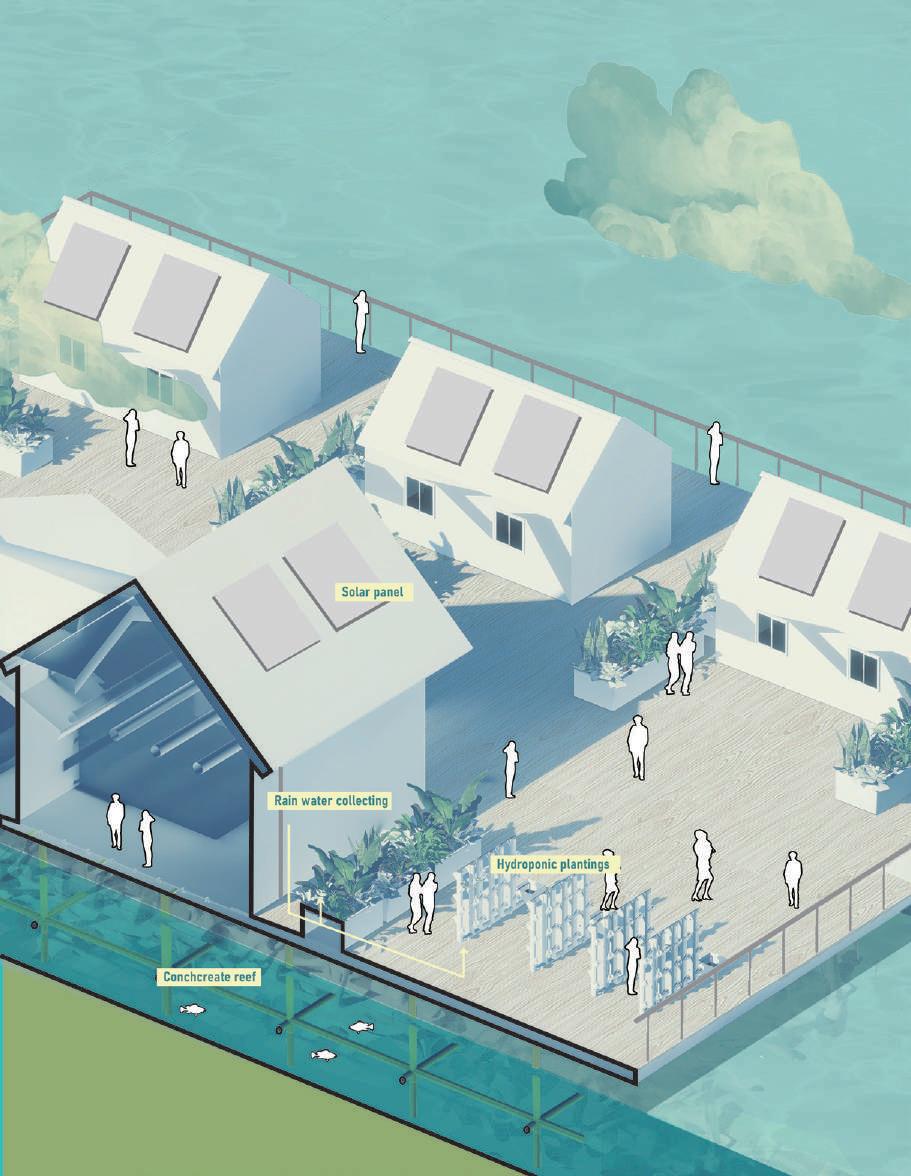
What is needed is a new self-sufficient system. I considered energy, producing, employment and social. Utilizing solar energy and smallscale wind power generation, we will make every effort not to rely on external transmission of energy in order to cope with future disasters. rooftop water harvesting and reverse osmosis can help this community get enough fresh water. Hydroponics and aquaculture
farming will provide food. And they will also use this conch to provide building materials. And then, by providing schools and training centers, they will have more people who have the ability to work there. This will be the basic prototype for a future island.
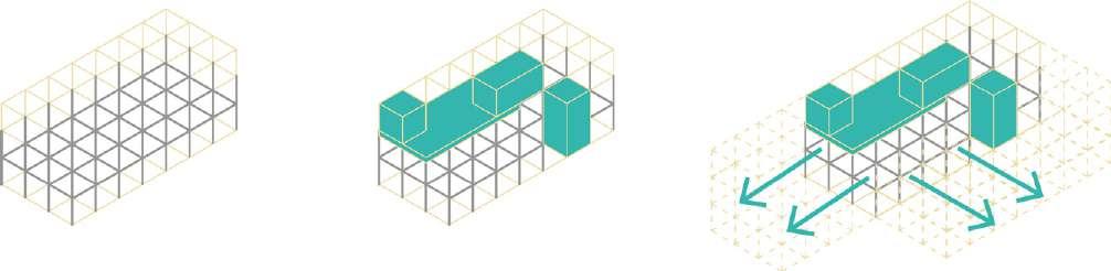
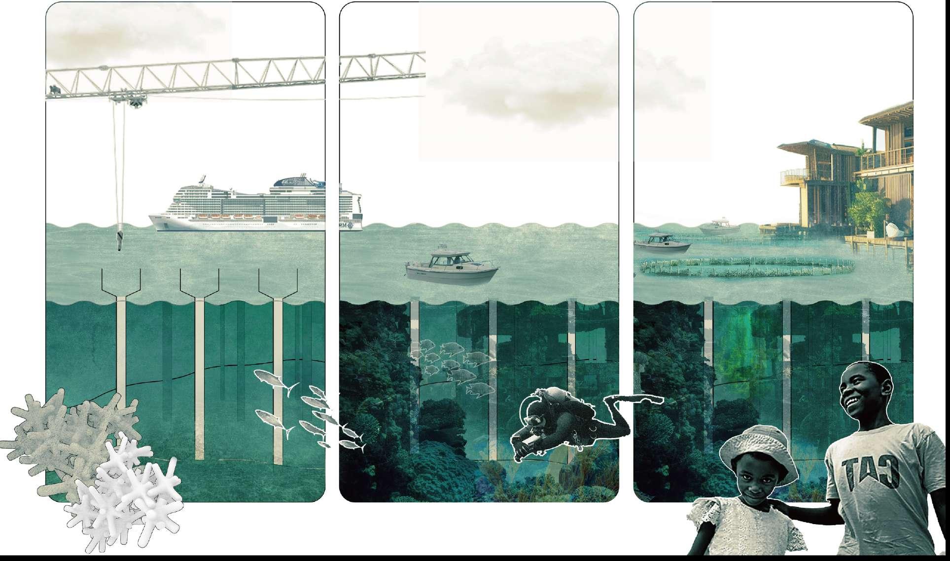
Short-Term Strategy : Rebirth of “Land”
In the short term, the strategy for community building will be to "frame","grow", "add-on" and "expand". The concrete structure will also serve as the artificial coral reef and attract the people for diving. Served as the basic structure, platforms and houses will be built in the future, more and more functions will be added on.
Underwater Frame
Weaved Together Platform
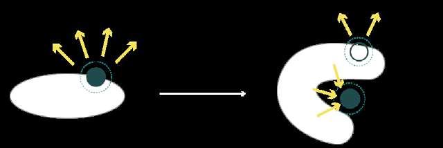
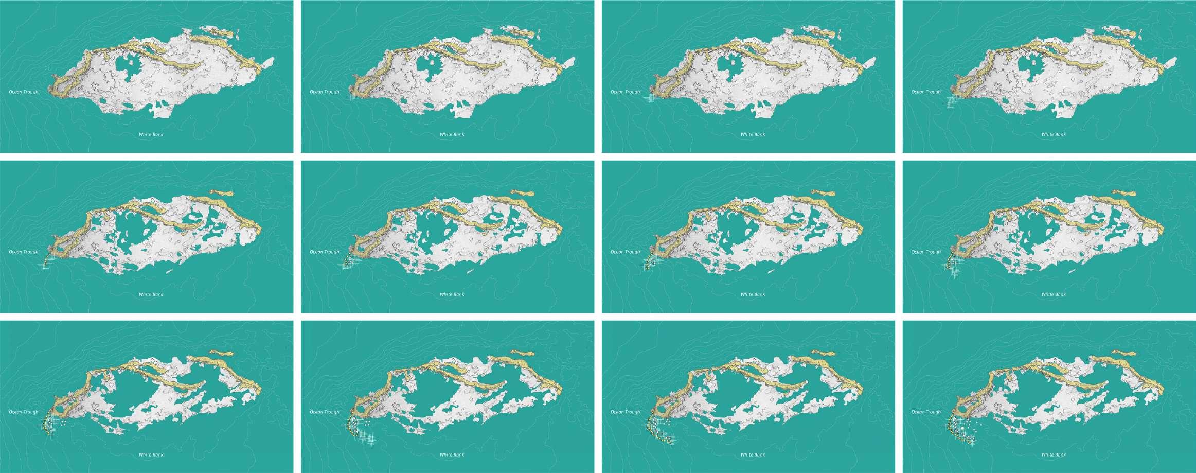
Long-Term Strategy: Shifting the Center
It's going to be a long struggle and building process. Starting with the construction of the framework, the island is first based on the construction of a defensive dyke through the input of eco-bricks, and then continuously expanding eastward in response to the topography and tidal direction to establish a community, where a more flexible mobile suspended island can be put into operation in the protected inner bay. Through constant construction, the shape of the island will change, and the center of the economy will shift from the north coast to the protected, more locally involved south side.
Self-sufficient Neighbourhood
Communities on the sea offer certain solutions for future territorial and climatic crises. Self-sufficiency through solar and wind energy utilization as well as hydroponics and shellfish farming, balancing production and consumption even when external resources are not available.
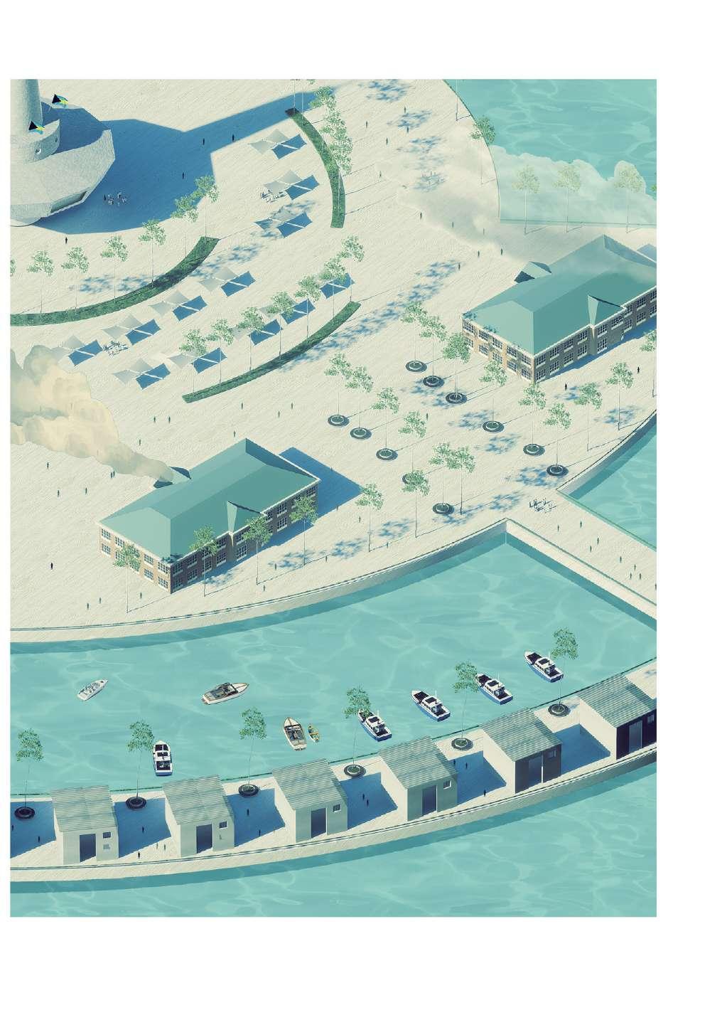
New Regional Center
The new regional center will be a place for people to gather, trade, and carry out cultural activities, and unlike the commercial center on the north beach, which is mainly for tourists, it will be a regional center focused on local life, and the future government could be relocated to this area.
Local Owned Small Business
Schools
Center Plaza
City Hall
Other Works | Installation and construction
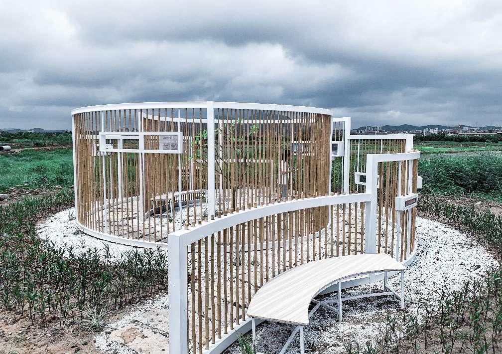
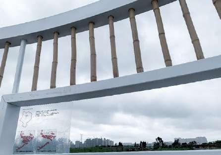
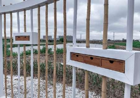
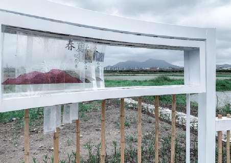
Landscape Storage Box
Type: Bamboo Viewing Pavilion Design
Date: Summer 2019
Location: Ninety-nine Streams Field Tourism Area, Fujian,China Team work with Xiaoting Mao, Qin Yu, Shuyin Yuan
Introduction:
We used bamboo and steel to make structures and use acrylic to make some slides superimposing on real space to strengthen understanding of the surrounding landscape. People can look outside from this structure informing the history and biologic characteristic of a indigenous tree standing by the pond, the history and existing scenery of a mountain in their walking journey.