Fayetteville High Priority Trail Study


Connecting People to Parks
March 2023


March 2023


MAYOR
Edward J. Johnson, Jr.
CITY COUNCIL

Niyah Glover, Mayor Pro-Tem
Richard H. Hoffman
Darryl Langford
Scott Stacy
T. Joe Clark
CITY MANAGER
Ray Gibson, AICP
DIRECTOR OF DOWNTOWN DEVELOPMENT (FORMER)
Brian Wismer, EDFP
DIRECTOR OF COMMUNITY AND ECONOMIC DEVELOPMENT
David Rast, ASLA
FAYETTE COUNTY PUBLIC WORKS
Phil Mallon, PE, Director of Public Works
FAYETTE COUNTY BOARD OF EDUCATION

Steve Cole, Assistant Superintendent, Operations
SOUTHERN LAND CONSERVATION TRUST
Katie Pace Quattlebaum
The City of Fayetteville’s High Priority Trail Study provided a review of existing conditions, alternative alignments and substantial public outreach efforts resulting in a locally preferred multi-use trail alignment.


The need and purpose of the High Priority Trail planning study is to examine the feasibility of constructing a greenway through the central core of Fayetteville, connecting people to parks and places, or destinations, without the use of an automobile.
Our project methodology was to engage the public to identify a trail alignment supported by both stakeholders and the citizens which provided connectivity to destinations within the City and minimized or avoided impacts to the environmental resources and private property.
Our technical analysis included a combination of research and site visits to identify and or evaluate potential hurdles and or opportunities associated with the recommended alignment. Several trail segments and or alternatives were evaluated throughout this process with the final recommendation being led and supported by the community and key stakeholders such as Fayette County, Fayette County Board of Education and the Southern Conservation Trust.
The community outreach process included facilitating public information open house sessions as well as attending City sponsored events such as Earth Day, the Jazz Festival and the Fall Carnival event. These City sponsored events provided an opportunity to engage the public in a more personalized setting, address specific questions and to get to know the great people of Fayetteville. The citizens responses to the proposed alignments in conjunction with our research and site visits, served as guideposts throughout the process resulting in a recommended trail alignment which will serve as the “backbone” for the City’s ongoing trail network.
When constructed, the High Priority Trail will be ten to twelve-foot-wide, approximately three miles in length comprised of concrete and boardwalks providing the users with a variety of experiences from urban context to the natural environment promoting health and wellness for the citizens of Fayetteville and visitors alike.


A brief introduction of the project background and goals and objectives of this study is included in this chapter. In addition, the total benefits that a multi-use trail can provide to communities are explained in details, including public health, economic, and environment benefits. Multi-use trails provide healthy recreation and transportation opportunities by creating of all type of users to walk, jog, and cycle, also, the trails help all users to incorporate exercise into their daily routines.
1.1 PROJECT BACKGROUND
1.2 GOALS & OBJECTIVES
1.3 DESIGN USERS
1.4 BENEFITS OF MULTI-USE TRAILS
1.5 THE PROCESS

The City of Fayetteville is located about 20 miles south of downtown Atlanta. “The population grew from about 5,600 in 1990 to 16,000 people in 2010. Good schools, low crime, and high quality of life continue to be Fayetteville hallmarks, and according to the 2020 U.S. Census Report, more than 19,000 people now call Fayetteville home.”
Data Source: “About Us.” About Us | Fayetteville, GA. Accessed December 21, 2022. https://www.fayetteville-ga.gov/351/About-Us.

The study area is in the City of Fayetteville, GA and portions located in unincorporated Fayette County and includes connections from the Fayette County High School and City Center Park to Spring Hill Elementary School and The Ridge Nature Area. The proposed trail is approximately 3 mile in length.

LEGEND PROJECT BEGIN/END
CITY OF FAYETTEVILLE CITY LIMIT
RECOMMENDED TRAIL ALIGNMENT
The purpose of this study is to establish a vision and path forward for a well-connected active transportation system for all users, accommodating useful and enjoyable trips, and allowing for healthy lifestyle choices. The Fayetteville High Priority Trail has multiple goals as listed below.
Expand
Provide
Help
Educate users on the proper way to use MultiModal Facilities.

PROMOTE HEALTHY LIFESTYLE
PROMOTE ECONOMIC DEVELOPMENT
Promotes community social interaction
Enhance the ability to attract and retain business

PROTECT AND ENGAGE THE ENVIRONMENT
Improve air quality
Promote active commuting
Promote tourism
Immerse people in nature
Encourage exercise which promotes mental and physical health benefits
Provide more equitable options for transportation within the City
Encourage environmental education


School Office
Parks
Pedestrian Types
Over 64 Elderly Adults Library


Bus Stop
Fitness Center


Community Center
Shopping center
Restaurant / Cafe


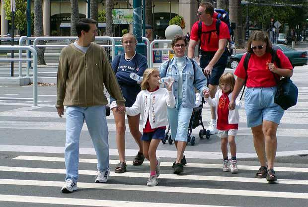
Designing facilities with these two user groups in mind will allow children to cultivate independence and the elderly to maintain it.

18 - 64 Adults

Under 18 Children
17% Elderly Adults
Adults
61%

Children
22%

Image source: pedbikeimages.org
Source: United States Census Bureau (2020). https://www.census.gov/library/stories/2021/08/united-states-adult-population-grew-faster-than-nations-total-population-from-2010-to-2020.html


“Pedestrian Safety.” Centers for Disease Control and Prevention. Centers for Disease Control and Prevention, May 13, 2022. https://www.cdc.gov/transportationsafety/pedestrian_safety/index.html.





Designing for the 51% of potential cyclists that are interested but concerned will help us build bicycle facilities for all ages and abilities.

City of Fayetteville, GA

I would describe myself as...

The U.S. Department of Health and Human Services states that people need exercise to be happy and healthy. Physical activity is a key to maintaining good health throughout the journey of life.


Even just a single session of physical activity improves a person’s sleep quality and cognition and reduces depressive symptoms and blood pressure. Consistent physical activity has added benefits such as improved overall functionality, reduction in many diseases and conditions, and maintaining a healthy weight. Incorporating walking and biking into commuting habits is a great way to consistently engage in physical activity.

Regular physical activity reduces

Data Source: Loh, T. H., Leinberger, C. B., & Chafetz, J. (2019). Foot Traffic Ahead: Ranking Walkable Urbanism in America’s Largest Metros 2019. Physical activity guidelines for Americans. https://health.gov/our-work/nutrition-physical-activity/physical-activity-guidelines.

Adults should aim for at least...
150 minutes of
Moderate Intensity Activity
1 in 4
1 in 5
1 1
1 mile
mile of walking each day


Proportion of U.S. adults ages 18 years or older who met the guidelines.

OR
1 mile mile of biking each day

Adults should aim for at least...
75 minutes of

Vigorous Intensity Activity
across the week across the week
1 in 10
=

2/3 1/2
HIGH SCHOOL STUDENTS
1 in 3
Proportion of U.S. high school students who met the guidelines.

of the weekly recom mended 150 minutes of moderate intensity activity
of the weekly recom mended 75 minutes of vigorous intensity activity

Data Source: Physical activity guidelines for Americans, 2nd Edition.

LESS SITTING TIME
GA
1.4


According to AAA, in 2022, the average of annual cost of owning and operating a motor vehicle is $10,728 (assuming 15,000 miles that the car is driven per year). That is $10,728 fewer dollars per driver pumped into the local economy.


The Victoria Transport Policy Institute estimates that shifting from driving to walking saves society at large $0.25 per vehicle mile reduced. FHWA states that the average driver travels 13,000 miles per year.


For illustration, take the City of Fayetteville with its ~ 15,000 drivers. That’s a total of 195,000,000 annual miles traveled. If just 20% of those trips were taken by foot, the city would see a savings of $9.75 million per year in intangible benefits as expressed in the infographic below.
Data Source: Transit for Livable Communities


If 20% trips were taken by foot or bike...

15,000 x 13,000 x $0.25 x 20% ≈ $ 9.75 M

Drivers in Fayetteville Miles driven per year
Societal cost per mile of driving
Proportion of short trips 1 mile or less
Savings per year that could be achieved
Data Source: Gössling, Stefan, et al. “The social cost of automobility, cycling and walking in the European Union.” Ecological economics 158 (2019): 65-74. AND 2009 National Household Travel Survey. Vandiver, Whitney, and Shannon Bradley . “What Is the Total Cost of Owning a Car?” What Is the Total Cost of Owning a Car? https://www.nerdwallet.com/article/loans/auto-loans/total-cost-owning-car.

Car dependency comes with a host of economic costs, while walkability and bikeability come with a host of economic benefits.
A study of 78 businesses in metropolitan Portland, OR, found that pedestrians and cyclists are actually “competitive consumers”, meaning that they spend just as much, and oftentimes more, than their vehicular counterpart. Cyclists tend to spend less per trip, but take trips more frequently, often patronizing smaller businesses, such as restaurants, bars, and convenience stores.


Car parking generates 19¢ of retail revenue per hour per square foot. Bike parking generates 69¢ of retail revenue per hour per square foot.
When bicycle accommodations were installed on Valencia Street in San Francisco, 65% of merchants reported that increased levels of biking and walking improved business. Only 4% reported that the installation hurt sales.

The purpose of this study is to develop project concepts that improve safety, mobility and access, while also preparing for advancement to full engineering and construction phases.
The project team reviewed the following documents to become familiar with prior studies to continue to advance approved ideas and concepts and be up-to-date on the most current requirements and guidelines related to shared use paths and greenways.
• Fayetteville and Fayette County Master Path Plans
• National best practices associated with trail design
• AASHTO Guide for the Development of Bicycle Facilities

• FHWA Small Town and Rural Multi-modal Networks Guide
• GDOT’s Pedestrian and Streetscape Guide

PAGES 3-16
In the Introduction, we take stock of the beautiful City of Fayetteville and its many attributes. We begin with the goals and objectives of this study - we aim to make recommendations that create a robust active transportation network as well as provide a data-based rationale for benefits of trails.
2
PAGES 17-30
The first step is to inventory the existing pedestrian and bicycle infrastructure. This gives us a clear picture of what has already been done and what needs to be upgraded. Next we determine the places that people want to get to and where they are coming from. This information helps to inform the community and the planning team on potential alignments.
The technical analysis phase is a critical step in the process of evaluating recommended and alternative trail alignments for the project. Using a combination of GIS, research and site visits, the project team evaluated the project area’s topography. The planning team evaluated the context and screened environmental conditions such as topography, drainage, history, ecology and archaeology. The purpose of the technical analysis is to identify early on any potential hurdles or constraints for the future recommended trail alignment.
4
PAGES 73-84
PAGES 31-72
Public involvement is a key component of any planning effort and is critical for truly understanding the vision, goals, and needs in the Fayetteville High Priority Trail study area. Establishing many ways for people to engage in the planning process helps to ensure that local knowledge is accessed and used in developing study recommendations. It also maximizes the opportunities for the public to become involved in the overall process and embrace ownership in the recommendations.
Finally, we present our recommendations in this chapter. A recommended trail alignment was developed base on community input and technical analysis.
5 RECOMMENDATIONS
PAGES 85-150
Phase 4: Draft Recommendations
Phase 5: Final Documentation

Understanding the existing conditions is a critical step in the process of evaluating alternatives and the recommended alignment for the project. This chapter is to inventory the existing and future pedestrian and bicycle infrastructure. It gives us a clear picture of what has already been completed and planned for the future.
2.1 HISTORY OF FAYETTEVILLE

2.2 EXISTING AND FUTURE BIKE & PEDESTRIAN INFRASTRUCTURE
2.3 WHERE DO PEOPLE NEED TO GO?

Established on March 28, 1823, Fayetteville is the seat of Fayette County, which was created in 1821 from land ceded to the state by the Creek Indians. Both town and county are named for the Marquis de Lafayette, the Frenchman who joined forces with George Washington during the American Revolution, helped bring France into the war on the side of the Americans.1
Fayetteville was incorporated as a town in 1823 and later as a city in 1902. The entry sign pictured below commemorates the year Fayetteville was first established

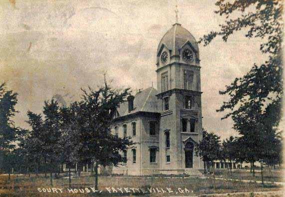
Constructed in 1825, pictured in the late 1880s, is listed on the National Register of Historic Places as the oldest surviving courthouse in Georgia. The clock tower was added to the structure in 1888 1823

Circa 1820’s Cemetery contains plots of original families to the county. Margaret Mitchell has relatives buried here
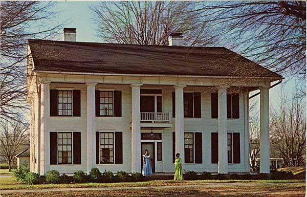
Was originally built in 1855 by an uncle of “Doc” Holiday of western fame and has become Fayette County’s first historical museum
1 Luckett, Robert. “Fayetteville.” New Georgia Encyclopedia, last modified Jun 30, 2022. https://www.georgiaencyclopedia.org/articles/counties-cities-neighborhoods/fayetteville/


The purpose of the Fayetteville High Priority Trail is to serve as both a transportation and recreation link connecting key destinations near downtown Fayetteville. There are many destinations within the project area, including educational facilities, residential, civic spaces, both historic and new entertainment, cultural events, businesses, natural environment, and regional connectivity.

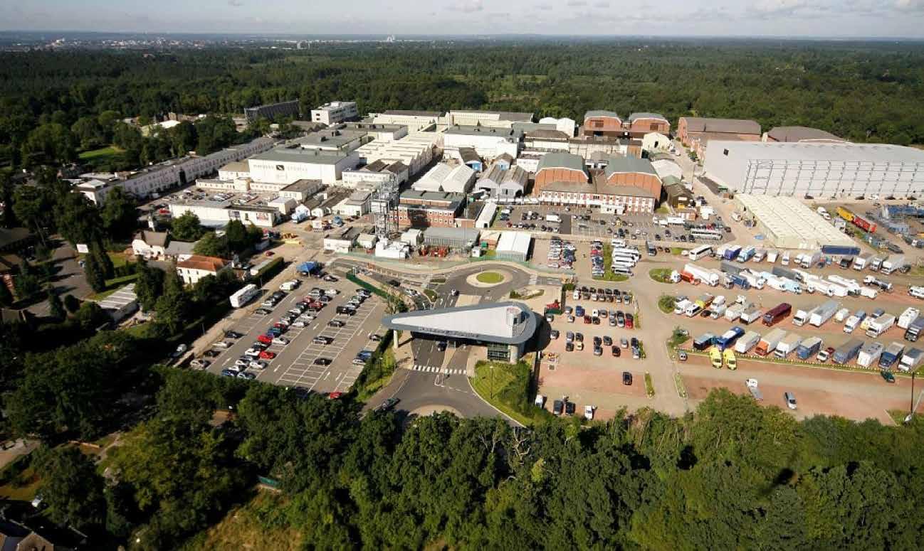
Trilith Studios encompasses a 700-acre site, with a 400-acre backlot and 24 soundstages. The Trilith community is a 235-acre European-inspired town.
One of downtown Fayetteville’s most popular attractions with its walking paths, playground, splash pad, dog park, and large activity lawn.

The present building was built in 1902. Besides being a big shipper of cotton, the depot also was the scene of Fayetteville’s social life
Is infusing new life into downtown Fayetteville. Opened in June 2021 and located at 210 Stonewall Avenue West between Fayetteville City Cemetery and the Fayette County Government Complex

This map illustrated a rough estimate of the city of Fayetteville sidewalks network in 2019.

Overall, the city boasts good sidewalk coverage. Notable missing links in sidewalk coverage include:
This map illustrates existing sidewalks in the City of Fayetteville.
• Veterans Parkway
• Sandy Creek Road
• Burch Road (access to the Ridge)
Overall, the city boasts good sidewalk coverage. Notable missing links in sidewalk coverage include:
• Hood Road/Ave (unincorporated)
• New Hope Road
• Veterans Parkway
• Banks Road (unincorporated)
• Sandy Creek Road
• Ginger Cake Road
• Burch Road (access to the Ridge)
• Portions of SR 85
• Hood Road/Ave (unincorporated)
• Portions of SR 314
• New Hope Road
• Banks Road (unicorporated)
The pedestrian experience when traveling varies greatly and is dependent on factors such as:
• GingercakeRoad
• Portions of SR 85
• Portions of SR 314
• Traffic volume
• Sidewalk width and physical condition
• Quality of the sidewalk surface
• Obstructions
• The presence of landscaping and street furniture
• Public art
• Building frontages
• Neighboring use

In 2019 a walking propensity analysis was completed for the city of Fayetteville. This quantitative analysis reviewed four factors to predict the most likely locations where people would walk.

These four factors included:
• Existing Land Use
• School and Park Zones
• Intersection Density
A walking propensity analysis was completed for the City of Fayetteville. This quantitative analysis looks at four factors to predict the most likely locations where people would walk if there were sidewalks. The four factors are:
• Pedestrian Crashes
• Existing Land Use
• School and Park Zones
• Intersection Density
• Pedestrian Crashes
The analysis showed a strong walking demand in downtown Fayetteville which was due to commercial land uses, a grid street network with small blocks, and proximity to schools. Other high demand nodes include the intersection of SR 54 and Grady Avenue due to commercial and office land uses, proximity to Fayette LIFE Academy and Spring Hill Elementary School, and the Meridian apartment development.
The analysis shows a strong walking demand in downtown Fayetteville. Demand here is due to commercial land uses, a grid street network with small blocks, and proximity to schools.
The analysis did not include Trilith Studios and community in western Fayetteville as this area falls outside of the High Priority Trail Study Area but is a key destination for future multi-modal connectivity within the City’s network.
Other high demand nodes include the intersection of SR 54 and Grandy Ave. due to commercial and office land uses, proximity to Fayette County Alternative School and Spring Hill Elementary School, and the Meridian luxury apartment development.
Notable in its absence in the analysis is the Pinewood development in western Fayetteville. At the time of this analysis the land use and street network were not available as inputs. However, this development will drive higher walking demand than is shown in this analysis.

Streets in and around Fayetteville were evaluated for how comfortable they were for biking. Among other factors, the Bicycle Comfort Index analyzed the speed and volume of automobile traffic. The index assumes that as travel speed and the volume of traffic increase, the road becomes less comfortable for cyclists.
Streets in and around Fayetteville were evaluated for how comfortable they are for biking. This Bicycle Comfort Index looks at the speed and volume of automobile traffic. The index assumes that as travel speed the volume of traffic increase the road becomes les comfortable for cyclists.

This map shows level of comfort by color. Roads in green are the most comfortable to ride on. Those yellow and orange are progressively more uncomfortable to ride on. Those in red area are the most uncomfortable to ride on.
This map shows level of comfort by color. Roads in green are the most comfortable to ride on. Those yellow and orange are progressively more uncomfortable to ride on. Those in red are the most uncomfortable to ride on.
The results show that almost all of the key roads and streets connecting the City’s destinations are uncomfortable to ride a bicycle on. This illustrates a need for either on-street or separated bicycle facilities to help facilitate bicycle mobility.
The results show that almost all of longer routes uncomfortable to ride a bicycle on. This illustrates a need for either on-rode or separated bicycle facilities to help facilitate bicycle mobility.
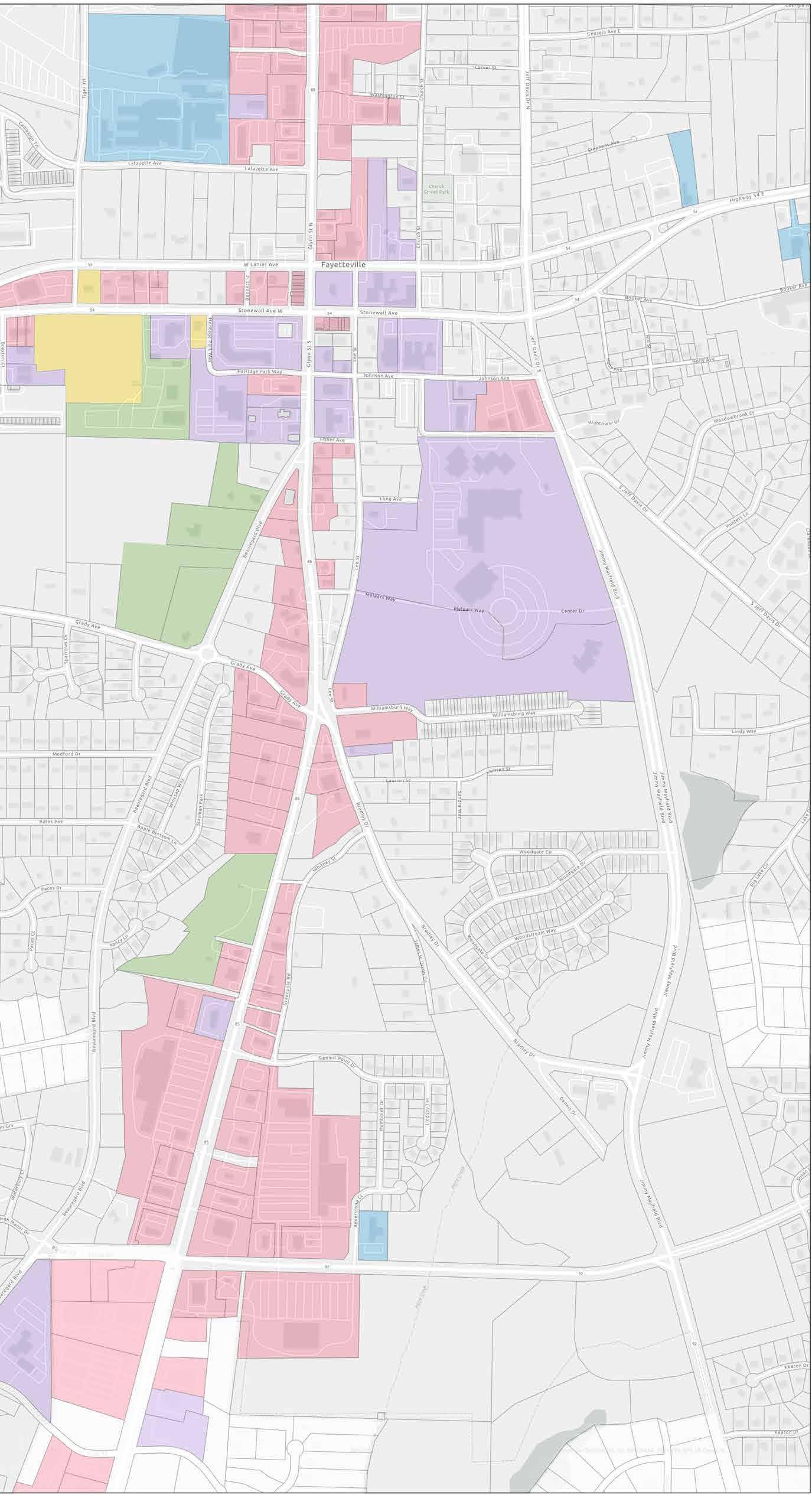
In order to study the connectivity of a city, one must begin with identifying what needs to be connected. In the context of Fayetteville, those places most fundamentally important to daily life in the City include: the home, the workplace, the school, and other common daily destinations.
Every trip starts from the home. As such, residences are critically important to the connectivity of a transportation network. One needs to be able to start at point A and get all the way to point B along comfortable transportation infrastructure.
The second most important place for a transportation network is the workplace and school. The typical worker will make two trips involving work per day, meaning 10 trips over the course of the week. For those workers to make trips to work by foot or by bike, there must be infrastructure that continuously and comfortably connects to school and the workplace.
The third most important places for successful transportation networks are scattered about town in the variety of places that people use on a daily basis. These are places like the post office, the bank, or parks.
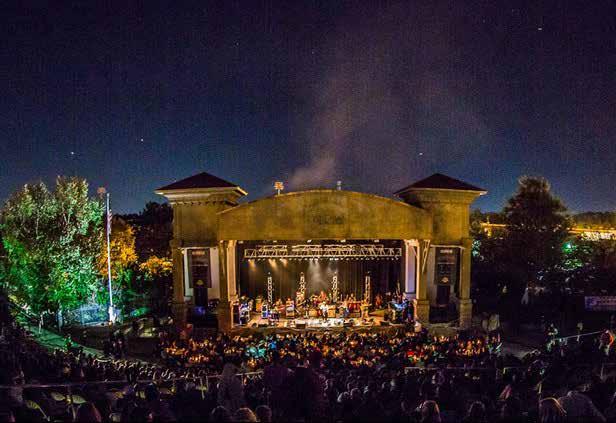


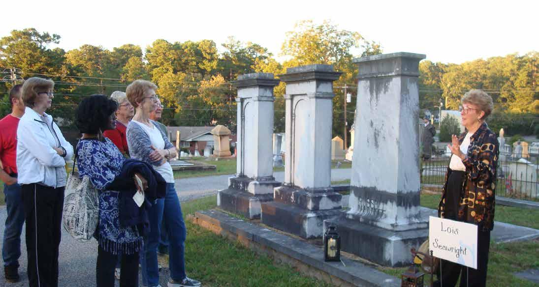


SCHOOLS
1. Fayette County Public Schools
2. Rising Star Montessori Academy
3. Adams Little Peoples Academy
4. Fayette LIFE Academy
5. Spring Hill Elementary School
6. South Fayetteville KinderCare
PUBLIC/INSTITUTIONAL
7. Fayetteville City Hall Government
8. Fayette County Library
9. Fayette County Courthouse
10. Kings Road Baptist Church
11. Fayette County Historical Society
12. City of Fayetteville Fire Department
13. City of Fayetteville Water Department
14. First United Methodist Church
15. Fayetteville First Baptist Church
16. Fayette County Probate Court
17. Fayetteville Church of Christ
PARKS/OPEN SPACE
18. City Center Park
19. Southern Conservation Trust
20. Turnipseed Nursery Farms
21. The Ridge Nature Area
COMMERCIAL
22. Retails and Restaurants
23. Kroger
24. Publix Super Market at Summit Point
25. Ingles Market
HISTORICAL/CULTURAL
26. Fayetteville Masonic Lodge
27. Fayetteville City Cemetery
28. The Hollingsworth House

As part of the Technical Analysis of Existing Conditions, AECOM conducted a assessment of environmental, right-of-way, utility locations, property impacts on both the alternative and recommended trail alignments. This technical analysis helps to identify future potential hurdles and opportunities the project may need to address as it advances forward in future phases.
Compile a complete right-of-way analysis, identifying all parcels, easements and acquisitions to be required along with associated costs.
Analysis of preferred routes to identify any challenges relating to topography, wetland crossings, existing developments, etc. Identify alternative alignments where necessary.
Document environmentally sensitive resources. Conduct survey to delineate potential impacts; determine mitigation and realignment options relating to affected resources, floodplains, wetlands, stream buffers, etc. in preparation of NEPA document.

Provide utility locations, where visible, to avoid or be aware of during the detailed design phase and construction of the project.
Provide recommendations to address pedestrian crossings over existing potential wetlands, streams and streets within the path alignment.
3.1 ELEVATION MAP
3.2 SLOPE ANALYSIS
3.3 OPPORTUNITIES & CONSTRAINTS
3.4 DECISION MATRIX
3.5 ENVIRONMENTAL SCREENING
By evaluating the existing topography and slopes, we can better determine accessibility and potential impacts to property owners and natural resources.
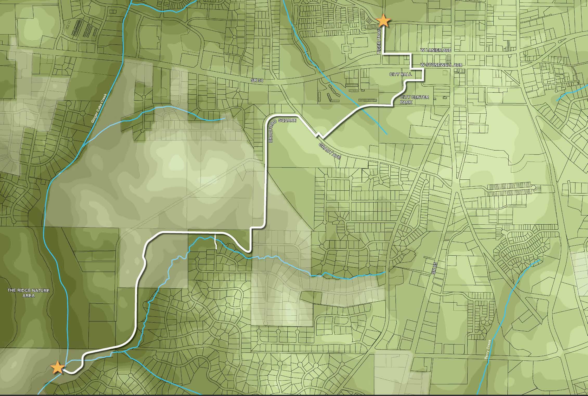
PROJECT BEGIN/END
RECOMMENDED TRAIL ALIGNMENT
PARCEL STREAM

Improves active connectivity between a variety of land uses such as; residential, educational facilities (4 schools), civic spaces both historic and new, entertainment, cultural events, businesses and parks.
The High Priority Trail can promote the arts by incorporating environmental art and sculptures within the trail environment.
The High Priority Trail will promote health and wellness by providing active connectivity to destinations which are currently accessed by automobiles.
The High Priority Trail can promote environmental education opportunities for all users, especially in and near.
Avoid impacts to the existing Fayetteville City Cemetery
Bridging over Ginger Cake Creek
Bradford Square topography and sight distance
Constraints associated with the existing floodplain around the existing Water Treatment Plant
Impacts to adjacent property owners
Impacts to environmental resources include the existing Fayetteville City Cemetery and Ginger Cake Creek
Mid-block crossing at Stonewall Ave near the City Hall
Right of Way Constraints, Tiger Road
Stream Buffer Variance, Tiger Road
Trail through City Park
Utilities, sight distance along Grady Ave
Wetland impacts, south of the existing Water Treatment Plant

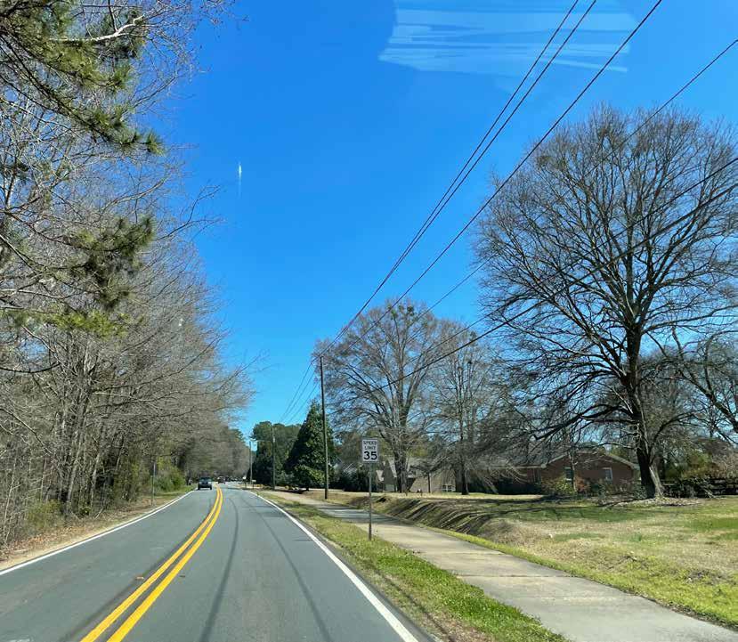
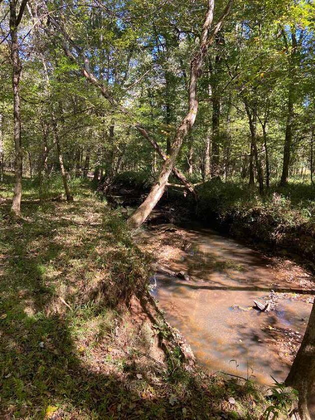


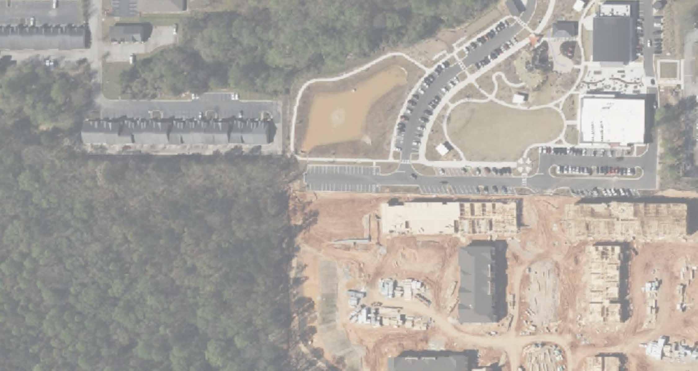
Based on public input, site visits, technical analysis, and the decision matrix, the recommended trail alignment was selected because it fulfills the project justification; avoids impacts to archaeological, environmental, and historical sites; minimizes grading impacts to the existing topography of the area; and addresses concerns from the public received through public comments regarding the east-west alignment between Oakleigh Manor and Lakemont communities that shows on the following page. PROJECT BEGIN

A utility assessment is one of the significant factors in the decision matrix that impacts which side of the road is better for the proposed multi-use trail. The following pages constitute the utility assessment for both recommended and alternative trail alignment where utilities can be observed.

WATER TREATMENT
BEGIN
*The white shaded area is unincorporated Fayette County.
After conducting a site visit, the design team further evaluated the east-west alignment between Oakleigh Manor and Lakemont and recommended this segment to a natural surface hiking trail through the woods. This segment is an important lane for pedestrian connection. It provides both local and regionally direct connectivity to the east Redwine Trail and to the west as it connects the Ridge Nature Area. The City should coordinate with the home owner associations for both Oakleigh and Lakemont prior to implementation.


The red spur trail alignment connecting the Ridge Nature Area and surrounding neighborhoods was also evaluated by the team. It provides a loop and crosses the Ginger Cake Creek in a drier area at the northern end of the Ridge Nature Area. However, the spur alignment is not recommended as the team observed a high volume and speed of trucks when visiting the site. The safety of pedestrian and bike crossing on First Manassas Mill would be a concern due to the volume of trucks on this portion of road and site visibility concerns. In addition, the proposed trail would increase the construction cost by extending the great amount of boardwalk.


*The utility assessment only picks up what was visible from our site visits. It does not cover underground utilities. All utility locations shown are approximate only.
PROPOSED SIGNALIZED PEDESTRIAN CROSSING


PROPOSED SIGNALIZED PEDESTRIAN CROSSING

MULTI-USE TRAIL CROSSING CITY HALL AND CITY CENTER PARK GRADYAVE
MULTI-USE TRAIL CROSSING THE UNDEVELOPED TRACT OF LAND ACROSS FROM LIFE ACADEMY




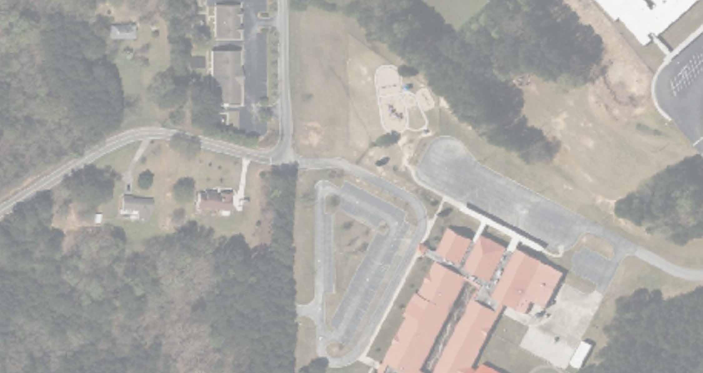

BRADFORD SQUARE
SPRING
SCHOOL


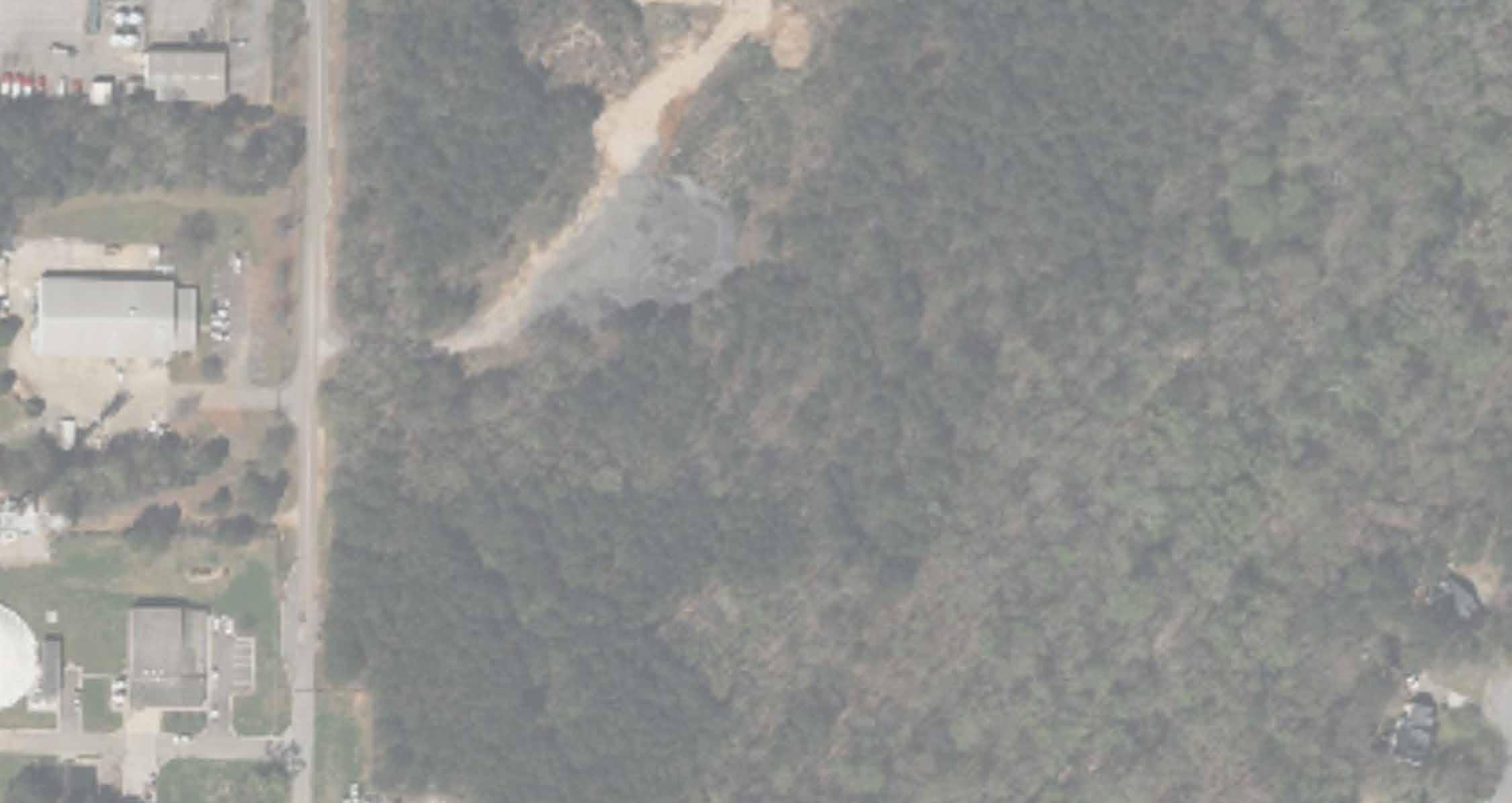

MULTI-USE TRAIL IN THE WOODLAND AREA
MULTI-USE TRAIL IN THE WOODLAND AREA
MULTI-USE TRAIL IN THE


MULTI-USE TRAIL CROSSING GINGER CAKE CREEK


TIGER TRAIL, W STONEWALL AVE, AND HERITAGE PKWY

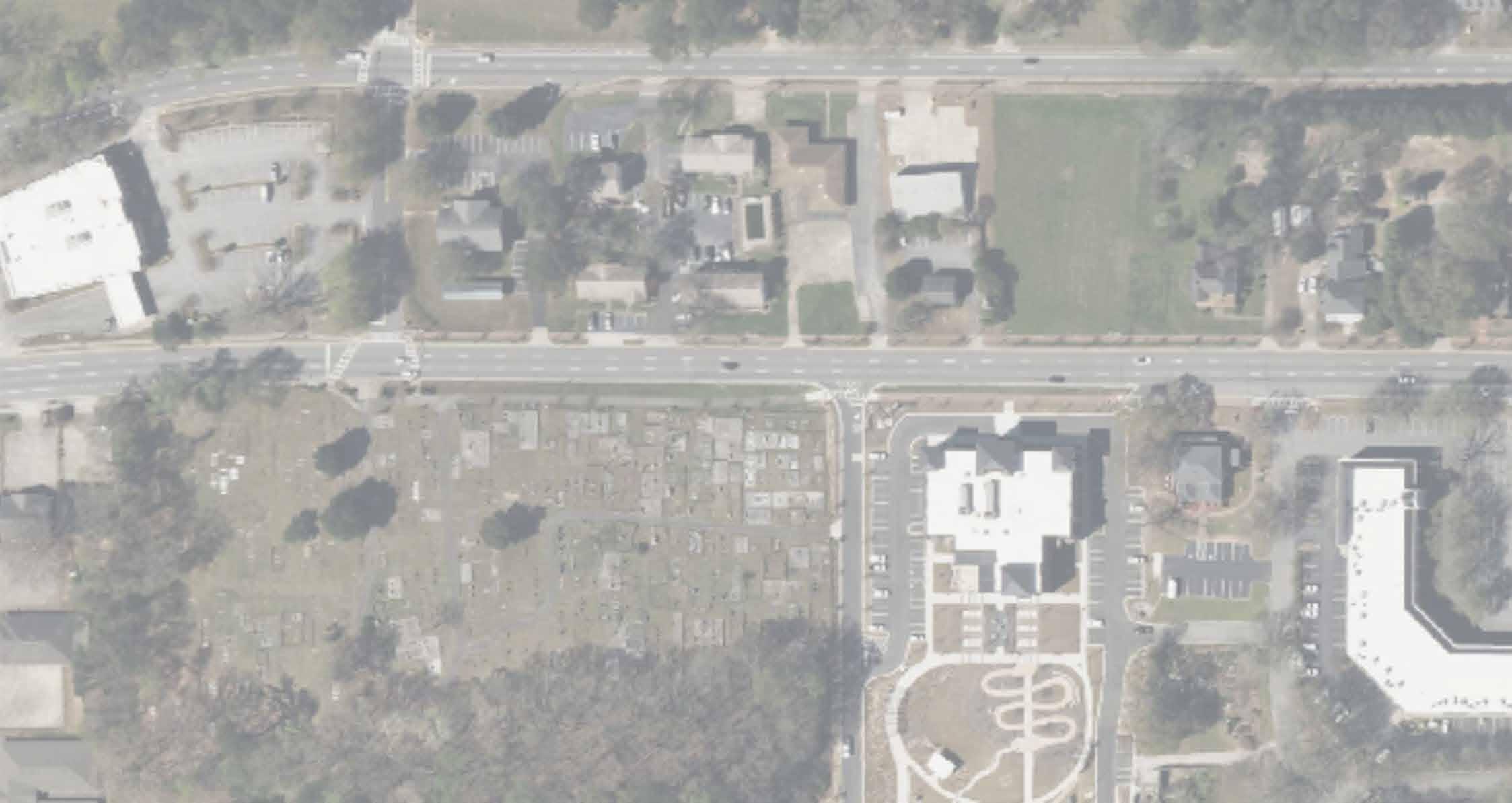

MULTI-USE TRAIL CROSSING CITY HALL AND CITY CENTER PARK


MULTI-USE TRAIL CROSSING NATURAL AREA


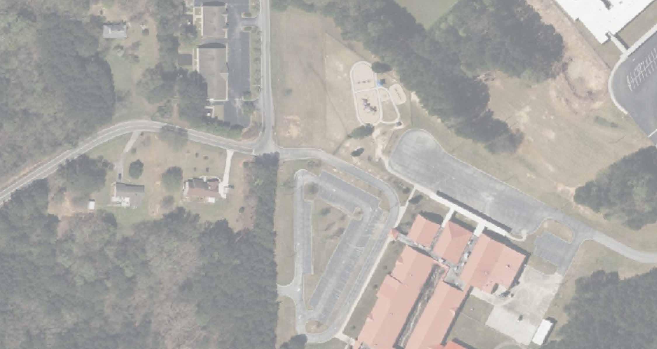

MULTI-USE TRAIL CROSSING BETWEEN OAKLEIGH AND LAKEMONT RESIDENTIAL COMMUNITIES


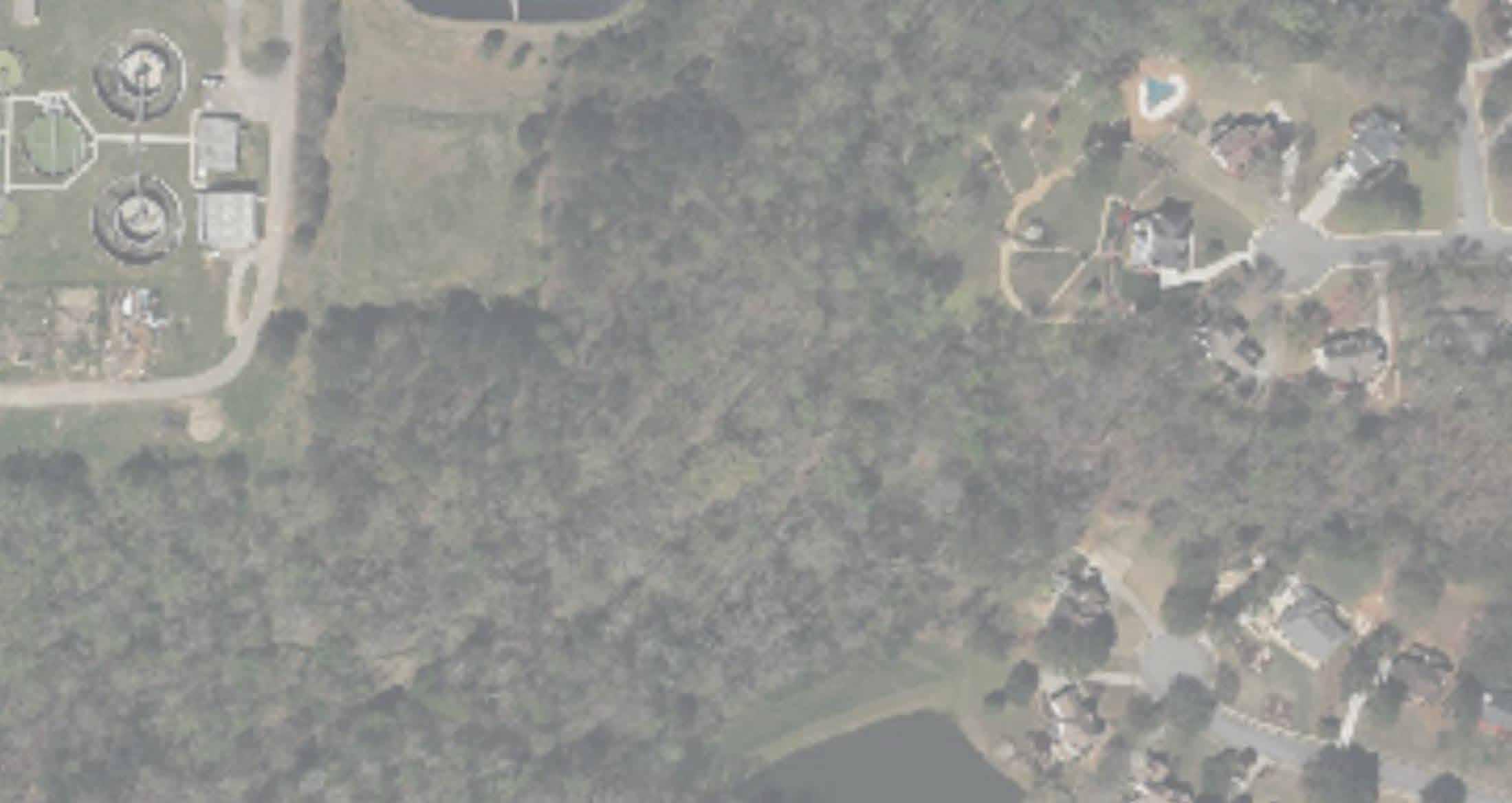


MULTI-USE TRAIL CROSSING GINGER CAKE CREEK


How do we make a final recommendation? It is based on community feedback, technical analysis, site visits and a decision matrix. The below decision matrix was used to organized evaluation criteria based on findings and what we heard from the community.
FAYETTEVILLE HIGH PRIORITY TRAIL ALIGNMENT - DECISION MATRIX
EVALUATION CRITERIA IMPACTING TRAIL ALIGNMENT
AASHTO STANDARD
PROPERTY IMPACT
RESIDENTIAL IMPACT
SAFETY CONCERN
CONNECTION WITH EXISTING TRAILS
CONNECTION WITH DESTINATIONS OF INTERESTS
RECOMMENDED TRAIL ALIGNMENT: Proposed trail alignment cross City Center Park may not be able to meet AASHTO preferred width of 12 ft wide Multi-Use trail in some locations
ALTERNATIVE TRAIL ALIGNMENT: Existing Redwine Trail and Stonewall Ave. sidewalks do not meet the AASHTO preferred width of 12 ft wide Multi-Use trail and 5 ft lateral offset from the roadway
RECOMMENDED TRAIL ALIGNMENT: N/A
ALTERNATIVE TRAIL ALIGNMENT: Citizens voiced concerns about safety, privacy, and property impacts.
RECOMMENDED TRAIL ALIGNMENT: N/A
ALTERNATIVE TRAIL ALIGNMENT: Citizens voiced concerns about safety, privacy, and property impacts due to the trail’s location in relationship to the homes
RECOMMENDED TRAIL ALIGNMENT: N/A
ALTERNATIVE TRAIL ALIGNMENT: Citizens voiced concerns about safety, privacy, and property impacts regarding their home in relationship to trail alignment
RECOMMENDED TRAIL ALIGNMENT: N/A
ALTERNATIVE TRAIL ALIGNMENT: Connects to Redwine road and Tiger Trail
RECOMMENDED TRAIL ALIGNMENT: Connects additional destinations of interest, including the Brightmoor Amphitheater, City Hall, City Center Park, Many Schools, and The Ridge Nature Area.
ALTERNATIVE TRAIL ALIGNMENT: Connects citizens and visitors to the City Hall, City Center Park, The Ridge Nature Area, etc.
This decision matrix was used to determine which side of the road/street which would be best to locate the recommended trail alignment.
FAYETTEVILLE HIGH PRIORITY TRAIL - DECISION MATRIX
EVALUATION CRITERIA IMPACTING LOCATION OF THE RECOMMENDED TRAIL
WEST SIDE OF TIGER TRAIL
EAST SIDE OF TIGER TRAIL
NORTH SIDE OF W LANIER AVE
SOUTH SIDE OF W LANIER AVE
NORTH SIDE OF STONEWALL AVE.
SOUTH SIDE OF STONEWALL AVE.
NORTH SIDE OF GRADY AVE.
SOUTH SIDE OF GRADY AVE.
NORTHWEST SIDE OF BRADFORD SQUARE
SOUTHEAST SIDE OF BRADFORD SQUARE
CRITERIA IMPACT BY PROPOSED MULTI-USE TRAIL RECOMMENDED SIDE FOR PROPOSED MULTI-USE TRAIL


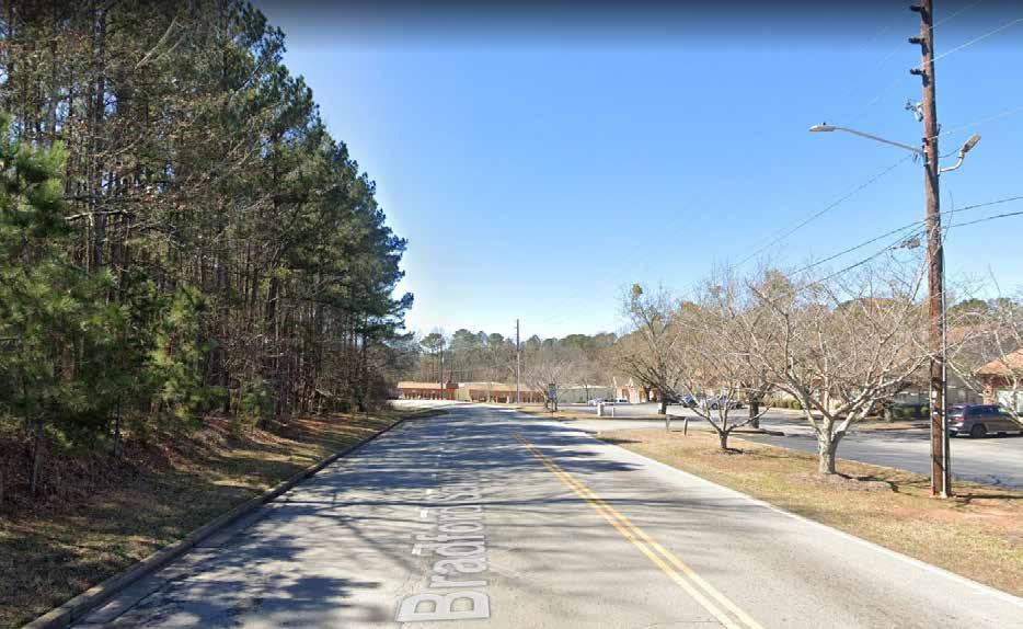
The purpose of the environmental screening section is to identify and evaluate potential environmentally sensitive areas (ESAs) along the proposed alignments of the Fayetteville High Priority (HP) Trail in the City of Fayetteville, Fayette County, GA. This section documents the existing conditions and potential impacts under a build scenario. A desktop screening for community resources, including parks, employment centers, hazardous materials, environmental justice populations, and public involvement; historic resources, archaeological resources; and ecology resources, including waters of the U.S. and protected species was conducted. Recommended next steps were developed if either future local or federal funding would be applied to the project.
The Fayetteville HP Trail proposes a 12-foot wide, shared-use concrete path. Two alignments were assessed (see Figure 1). Recommended Trail Alignment would start from The Ridge Nature Area on the south end to the intersection of Tiger Trail and LaFayette Avenue on the north end and extend for a distance of approximately three (3) miles. The existing land uses along the Recommended Trail Alignment near the northern terminus are institutional and commercial. South of Grady Avenue, existing land use is predominately institutional or undeveloped, and the southern terminus is parkland.
Alternative Trail Alignment would start at The Ridge Nature Area and running east to Redwine Trail near Beauregard Boulevard and extend for a distance of approximately one (1) mile. The existing land use along the alternative trail alignment is predominately single family residential, with parkland at the western terminus. The recommended trail would run south of the existing water treatment plant. This area is comprised of many tributaries, floodplain, and will require bridging and boardwalks to navigate this portion of the trail.
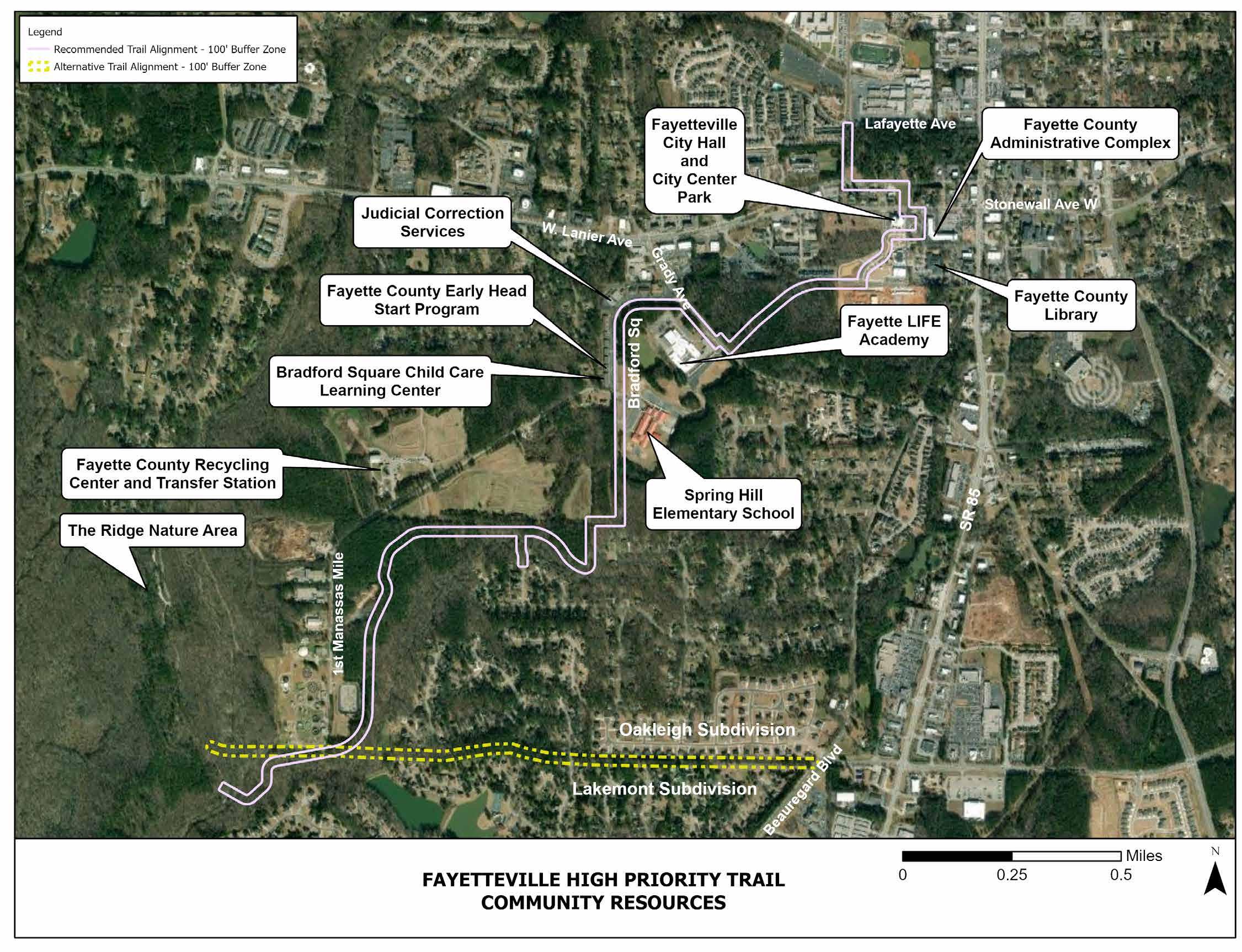
Community resources were identified within a 50-foot buffer of the proposed alignment using Google Earth Aerial Imagery (dated October 2021) and the City of Fayetteville and Fayette County Planning and Zoning maps. Community resources and the potential effects on uses of the resources are identified in Table 1 with resource locations shown in Figure 2
Community resources were identified within a 50-foot buffer of the proposed alignment using Google Earth Aerial Imagery (dated October 2021) and the City of Fayetteville and Fayette County Planning and Zoning maps. Community resources and the potential effects or uses of the resources are identified in Table
with resource locations shown in Figure 2

Fayetteville City Hall
Government Services
210 Stonewall Ave W Fayetteville, GA 30214
The use of sharrows would prevent impacts to the community garden.
Fayette County Administrative Complex 140 Stonewall Ave W Fayetteville, GA 30214
Fayette County Library
Fayette County Early Head Start Program
Judicial Correction Services
Fayette County Recycling Center and Transfer Station
1821 Heritage Pkwy
Fayetteville, GA 30214
155 Bradford Square Fayetteville, GA 30214
195 Bradford Square Fayetteville, GA 30215
211 First Manassas Mile Rd Fayetteville, GA 30214
Parks
No effects to this resource are anticipated (trail located on opposite side of road)
Provide non-motorized connectivity to the library.
No effects to this resource are anticipated (trail located on opposite side of road)
No effects to this resource are anticipated (trail located on opposite side of road).
The City would need to acquire ROW from Fayette County.
City Center Park
210 Stonewall Ave W, Fayetteville, GA 30214
390 Burch Rd
Anticipate utilizing the existing sidewalk; some widening of the sidewalk may be needed to meet minimum offset standards.
Ridge Nature Preserve
Fayetteville, GA 30215
ROW acquisition anticipated to connect the Fayetteville HP trail into the Ridge Nature Preserve trail system, and create an additional entrance into the preserve.
Screening Findings:
Both Recommended Trail Alignment and Alternative Trail Alignment may require ROW acquisition from The Ridge Nature Area and would create a new access point into the preserve. Within City Center Park, although Recommended Trail Alignment would follow the existing sidewalk, improvements to the sidewalk may be needed. The historic Fayetteville Cemetery is not being impacted by the recommended trail alignment.
Project Implications:
The proposed project has a high risk of requiring ROW acquisition from parks or resulting in temporary use of park property during construction. Early and ongoing coordination with park and school officials is recommended to maximize project benefits to adjacent parks and avoid delays during the ROW acquisition phase.
Under a federally-funded scenario, if funding from U.S. Department of Transportation (US DOT) is received, the identified resources are considered Section 4(f) resources, and a Section 4(f) evaluation would be required. Parks are a consideration in the environmental screening because Section 4(f) protects significant publicly owned parks, recreation areas, and wildlife refuges from use for DOT projects unless there is no feasible and prudent alternative, and the project includes all possible planning to minimize harm to the park1. Impacts to Section 4(f) resources require detailed alternatives analysis and coordination with the agency with jurisdiction.
Screening Findings:
Notable employment centers include the Fayette County Administrative Complex, Fayetteville City Hall, Spring Hill Elementary School, Fayette LIFE Academy, Fayette County High School, and Fayette County Board of Education. No displacements resulting in job losses are anticipated for either Recommended Trail Alignment or Alternative Trail Alignment.
Project Implications:
The proposed project has a low risk of adverse effects on employment centers. Outreach may be recommended to solicit input from major employers in the vicinity of the proposed trail to determine how employees may use the proposed facility.
Screening Findings:
A review of the Environmental Protection Agency’s Envirofacts2 database indicated a low likelihood of encountering hazardous materials or contaminated soils along either Recommended Trail Alignment or Alternative Trail Alignment.
Project Implications:
Based on these findings, there is low risk that a Phase II Environmental Site Assessment would be required as part of the project development with either state or federal funds.
2 Source: https://enviro.epa.gov/ accessed on August 25, 2022
The proposed Fayetteville High Priority Trail is at a low risk of resulting in adverse community impacts and is at low risk of resulting in disproportionately high and adverse effects to environmental justice (EJ) communities. The benefits of the proposed trail would include improved connectivity between neighborhoods, community resources, parks, and employment centers. If EJ communities are identified during the design phase or indicated by local officials, additional targeted outreach would be recommended, especially if federally funding is received.
If federal funding is received, a Section 4(f) evaluation may be required, the project team recommends initiating additional early coordination with officials for City Center Park, The Ridge Nature Area, and Fayette County School Board during the design phase. Early and ongoing coordination with these officials and the community at large would benefit the project, regardless of funding sources.


The proposed alignments for the Fayetteville HP Trail were screened to identify any historic properties (50 years of age or older) that have the potential to be affected by the project. This screening accounted for properties built in 1973 or earlier, but no properties were encountered with build dates between 1973 and 1980. Consideration was given to properties that intersect or border the proposed trail and any properties that would be visible from the trail. A historian that meets the Secretary of the Interior’s (SOI) Professional Qualification Standards reviewed online sources to identify historic properties within this area. These sources included:
• National Register of Historic Places (NRHP)
• Georgia’s Natural, Archaeological, and Historic Resources Geographic Information System
• The Fayette County tax assessor’s record
• U.S. Geological Survey (USGS) topographic maps
• Historic aerial photography
• Google Street View imagery
• Georgia’s Historical Marker program
A review of the GeoPI database for Georgia Department of Transportation (GDOT) project records was also conducted, as well as a screening for historic transportation corridors and historic cemeteries.

A review of the GeoPI database for Georgia Department of Transportation (GDOT) project records was also conducted, as well as a screening for historic transportation corridors and historic cemeteries.
This screening identified eleven (11) historic properties. These properties are presented in Table 2 and shown in Figure 3.
This screening identified eleven (11) historic properties These properties are presented in Table 2 and shown in Figure 3.
The trail would intersect the property and potentially require the removal of trees Impact should be minor and could be reduced by maintaining a tree buffer between the trail and the plant
The trail may impact the existing landscaping features, including paved walkways, trees, and a pergola. These features appear to be non-historic and are not associated with the building, since it was moved to this location in the 1990s.
The trail would intersect the side yard. Visual changes should be sensitive to the historic setting.
1 Significant (or adverse) impacts within the boundaries of historic properties determined to be eligible for the NRHP can also result in Section 4(f) impacts (discussed earlier in this document). For Section 4(f) to apply, there must be a use of land within the eligible boundary of a historic property and an Adverse Effect under Section 106 to that resource
Four properties have been found to have potential Section 4(f) impacts: Resources 1 and 6 (outlined in Table 2). Disturbance within Resources 1-2 are anticipated to be minimal and would likely result in de minimis impacts under Section 4(f), which applies when activities within an eligible resource boundary are determined to result in No Adverse or No Effect findings under Section 1063 . Coordination under de minimis is minimal compared to Individual Section 4(f). The Recommended Trail Alignment overlaps the existing landscape at Resource 5, which poses risk of Section 4(f). The building appears to have been relocated to the property in the late 1990s, so disturbance within the parcel or adjacent areas are unlikely to result in an Adverse Effect under Section 106 or a Section 4(f) impact. The Recommended Trail Alignment would intersect the side yard of Resource 6. Disturbance within the property poses risk of Section 4(f). Avoidance of this route merits consideration. If this route is most feasible, measures taken to minimize the project footprint within the parcel and reduce visibility of the trail in this area (e.g. avoid the placement of lighting and signage within the parcel) may reduce the impact from an Individual Section 4(f) impact to a de minimis impact.

If federal or state funding is received or a federal permit is required for construction (for example, if impacts to wetlands require a Section 404 permit under the Clean Water Act), a survey and evaluation of the properties in Table 2 would be required per 36 CFR Part 60.4 of the National Historic Preservation Act and OCGA 12-16-14. These regulations require projects to consider impacts to properties that are considered eligible for listing in the NRHP. This effort would entail the following steps:
1. A pedestrian survey of historic properties in the project area by a SOI Qualified Subject Matter Expert to further evaluate the resources during the design phase.
2. During the design phase, a formal report that outlines the project, survey methodology, and documents the evaluation of each historic property for NRHP eligibility should be conducted. This report would be submitted for review and concurrence by the federal agency (if applicable) and the State Historic Preservation Office (SHPO).
3. If no NRHP-eligible historic properties are identified, no further coordination is required. If any properties are determined to be NRHP eligible, the applicant would be required to consider and document appropriate measures to avoid and/or reduce adverse impacts to these properties in accordance with Section 106 and Section 4(f).
4. These measures and any proposed project activities in the vicinity of any NRHP-eligible properties would be documented in an Assessment of Effects report (AOE), which would also be submitted to the federal agency (if applicable) and the SHPO for review and concurrence.
5. Further coordination and measures, under Section 106 and Section 4(f), may be necessary if the project is determined to adversely impact an NRHP-eligible property.
A desktop review for archaeological resources was conducted within the proposed project area for the Fayette HP Trail. The list below is a summary of what was reviewed for this undertaking.
• NRHP listings
• Proposed NRHP nominations
4 http://ga.elaws.us/law/12-16
• National Historic Landmarks
• Georgia Archaeological Site Files (GASF)
• GNARHGIS
• Georgia Department of Natural Resources (DNR) lands
• Historic aerial photography
• USGS Topographic Maps
• Google Street View
• Google Earth KMZ files associated with Civil War battlefields, cemeteries, and historic trails
The desktop screening analysis identified potential for cultural resources within or adjacent to the proposed trail alignments.
No federal or state lands are intersected by the proposed Fayetteville HP Trail, and therefore neither an Archaeological Resources Protection Act (ARPA) permit nor a Georgia DNR permit is anticipated.
Under either a state or federal funding scenario, the project location will need an archaeological survey per 36 CFR Part 60.4 of the National Historic Preservation Act and OCGA 12-16-1. The following is a description of the next steps necessary:
1. Once the alignment is more refined during the design phase, a field survey by a Subject Matter Expert of the proposed alignments should be conducted.
2. Once the alignment is more refined during the design phase, the field survey must investigate any previously documented potential cultural resources within and adjacent to the proposed Fayetteville HP Trail alignment.
3. Once the alignment is more refined during the design phase, a report detailing the survey, methods, and findings will need to be documented with agency and SHPO concurrence.
4. If no NRHP eligible archaeological resources are identified, then no further action will be needed. If any archaeological resources are NRHP eligible, additional documentation and investigations will be required by archaeologists and any other applicable disciplines will be needed in order to avoid, minimize, any potential effects to archaeological resources, etc. and AOE.
A desktop assessment of jurisdictional waters of the U.S. that could be impacted by the proposed project was performed using USGS topographic maps, USGS National Hydrography Dataset (NHD) and United States Fish and Wildlife Service (USFWS) National Wetland Inventory (NWI) maps5. The study area was defined as the limits of the proposed trail alignments and an additional 50-foot buffer to account for potential construction access and stream buffers.
Background information regarding known occurrences and potential occurrences of federal protected species was obtained from the USFWS Information for Planning and Consultation (IPaC) and GNAHRGIS6.
The data in Table 3 and shown in Figure 4 below summarize water resources present within the study area based on a desktop assessment. The streams identified as crossing these alignments include Ginger Cake Creek and two of its tributaries, including riverine wetlands associated with these streams.
The Environmental team identified an intermittent stream along the east-side of the Tiger Trail which may require a 25’ state mandated vegetative buffer on both banks. AECOM recommends detailed analysis and coordination with the future developer on the impact of this stream.
The potential effects on perennial streams, wetlands, and open waters were measured by the number of crossings by each alignment. Further, data from the USFWS NWI was accessed to identify and determine the total acreages of wetlands and open waters falling within each study area.
The data in Table 3 and shown in Figure 4 below summarizes water resources present within the study area based on a desktop assessment. The streams identified as crossing these alignments include Ginger Cake Creek and two of its tributaries, including riverine wetlands associated with these streams.
All alignments are located within the potential range and have the potential to contain suitable habitat for the following six (6) federally protected species: Gulf moccasinshell (Medionidus penicilatus, endangered), oval pigtoe (Pleurobema pyriforme, endangered), shinyrayed pocketbook (Hamiota subangulata, endangered), alligator snapping turtle (Macrochelys temminckii, proposed threatened), Barbour’s map turtle (Graptemys barbouri, proposed threatened), and monarch butterfly (Danaus plexippus, candidate).
*All stream crossings also have a 25-foot state-mandated vegetated buffer and a 50-foot county-mandated vegetated buffer.
The potential effects on perennial streams, wetlands, and open waters were measured by the number of crossings by each alignment. Further, data from the USFWS NWI was accessed to identify and determine the total acreages of wetlands and open waters falling within each study area.
Information compiled here is based on a desktop assessment and field visits of potential ecological resources. The following steps are recommended to comply with Section 404 of the Clean Water Act and the Endangered Species Act:
1. Once the alignment is more refined during the design phase, additional site visits would be conducted by an ecology Subject Matter Expert to assess all potential ecological resources, determine boundaries of the potential wetlands and waters of the U.S. and associated buffers, evaluate habitat for protected species, including aquatic, and assess if any resources are located and have the potential to be impacted within the project area.

2. Preparation of a report detailing potential impacts to waters, state-mandated buffers, and federally protected species to facilitate coordination with appropriate agencies.
5 Jurisdictional water(s) of the United States (US) are defined by 33 CFR Part 328.3 (b)and are protected by Section 404 of the Clean Water Act (33 USC 1344). Source: https://www.epa.gov/cwa-404/overview-clean-water-act-section-404
6 In compliance with the Endangered Species Act (ESA), the lead federal agency must identify the presence of proposed (PT) or listed threatened (T) and endangered (E) species and proposed or designated Critical Habitat, as well as evaluate impacts to these resources. Species that are candidates (C) for listing under the ESA are also considered in the report. Source: https://www.fws.gov/law/endangered-species-act
3. If impacts to Waters of the U.S. are anticipated, a Section 404 permit application would be submitted to the U.S. Army Corps of Engineers (USACE). Compensatory mitigation credits7 may be required for impacts to waters of the U.S. Based on the mapping, there may be a need to bridge over streams that could impact waters of the U.S.
4. If encroachment within state-mandated 25-foot buffers is anticipated, a buffer variance application would be submitted to the Georgia Environmental Protection Division (EPD). Coordination with the Fayette County Stormwater Management Department is recommended if encroachment within the county mandated 50-foot setback buffers is anticipated. Based on the mapping, there may be a need to bridge over streams that could impact waters of the U.S.
5 Jurisdictional water(s) of the United States (US) are defined by 33 CFR Part 328.3 (b) and are protected by Section 404 of the Clean Water Act (33 USC 1344). Source: https://www.epa.gov/cwa-404/overview-clean-water-act-section-404
6 In compliance with the Endangered Species Act (ESA), the lead federal agency must identify the presence of proposed (PT) or listed threatened (T) and endangered (E) species and proposed or designated Critical Habitat, as well as evaluate impacts to these resources. Species that are candidates (C) for listing under the ESA are also considered in the report. Source: https://www.fws.gov/law/endangered-species-act
7 Avoidance and minimization of Waters of the U.S. will minimize the risk of requiring mitigation credits, thereby reducing anticipated project costs (see Appendix A).
Ecology
Six (6) streams
Six (6) federally protected species: Gulf moccasinshell, oval pigtoe, shinyrayed pocketbook, alligator snapping turtle, Barbour’s map turtle, and monarch butterfly with known ranges near the proposed project.
If these resources are identified as jurisdictional under Section 404 of the Clean Water Act, a 404 permit may be required. Note: As part of the permitting process, an evaluation of cultural resources is required.
Mitigation credits may be required pending anticipated impacts to Waters of the U.S.
If impacts are proposed to state-mandated buffers, then a buffer variance may be required.
If suitable habitat for protected species, including aquatic, is identified, additional seasonal surveys may be required to determine species presence/absence.
Ability to avoid suitable habitat will determine if Informal or Formal Section 7 may be required.
Once the alignment is more refined during the design phase, field surveys to identify, delineate, and confirm Waters of the U.S., state waters, and state buffers, as well as evaluate habitat suitability for protected species will be needed
History No NRHP-Listed
No historical markers
One (1) GNAHRGIS Site 11 buildings are 50 years or older
Archaeology No NRHP Listed
NRHP eligibility determination of the buildings that are 50 years or older
If a 404 permit is required, a history assessment would need to be included.
Once the alignment is more refined during the design phase, an archaeological survey is needed
If funding from the U.S. DOT is received, a Section 4(f) evaluation would be required.
An evaluation of alternatives would likely be required
Once the alignment is more refined during the design phase, field survey to identify, delineate, and confirm jurisdiction will be needed
Once the alignment is more refined during the design phase, field survey to identify, delineate, and confirm jurisdiction will be needed
Early coordination with officials for City Center Park, The Ridge Nature Area, Fayette County School Board, and general public is recommended regardless of funding.
Document avoidance and minimization efforts for use if an alternative analysis is needed.
Any fill or dredge of Waters of the U.S. would require a Section 404 permit8. If the project results in adverse impacts of more than 0.01 acre of stream and/or 0.1 acre of wetland, the purchase of mitigation credits would also be required.
Three permitting options are potentially available for use for this linear, recreational trail, depending on anticipated impacts resulting from project design: 1) Nationwide Permit (NWP) 14 – Linear Transportation Projects, 2) NWP 42- Recreational Facilities, or 3) an Individual Permit (IP).
Project impacts must be limited to less than 0.5 acre for eligibility under the NWP program and must follow the USACE’s 2021 General Conditions. If anticipated impacts cannot be kept beneath this threshold as the proposed project design advances, then the project would have to utilize an IP, which would have significant schedule and budget considerations.
Consideration of avoidance and minimization measures during project development, e.g., perpendicular crossings of streams, would be required for all permit types to help minimize impacts to Waters of the U.S. Minimization of impacts would directly reduce the amount of mitigation credits that would be required, thereby reducing mitigation costs. As the proposed project advances, it is recommended that the trail, including all necessary construction access, is designed in such a way to avoid and minimize impacts to streams and wetlands. Clear-spanning these features with an elevated boardwalk, or driving in piles with no other associated fill could also be implemented to further minimize anticipated impacts to Waters of the U.S.
SECTION 404 OF THE CLEAN WATER ACT BUFFER VARIANCE
Streams, and any other buffered state waters along the corridor, have a 25-foot state-mandated buffer and 50-foot county-mandated setback buffer. Any encroachment within the state-mandated 25-foot buffer would require a buffer variance with the Georgia Environmental Protection Division (GAEPD) during the permitting process. Further, any encroachment within the county-mandated 50-foot setback buffer would require approval from the Fayette County Stormwater Management Department. In addition to minimizing direct impacts to Waters of the U.S, the design team should also limit encroachment within this area, including clearing of vegetation and/or fill, to only what is necessary for project implementation.
In addition, standard Best Management Practices (BMPs) should be implemented during construction to help protect water quality, as required by the National Pollutant Discharge Elimination System (NPDES) program. ––––––––––––––––––––––––––––––––
8 Source: https://www.epa.gov/cwa-404/overview-clean-water-act-section-404
A site visit would be recommended to assess the proposed project corridor for federally protected species habitat suitability. If suitable habitat is identified onsite, the project team would avoid/minimize impacts to the greatest extent possible. Due to the aquatic nature of the anticipated species within this area, any avoidance of perennial streams would also result in the avoidance of potentially suitable species habitat. If the proposed trail would clear-span all perennial streams along the corridor, and no permanent or temporary in-channel work would occur within perennial streams, then there would be no Informal or Formal Section 7 risk as the project advances.

Public involvement is a key component of any planning effort and is critical for truly understanding the vision, goals, and needs in the Fayetteville High Priority Trail study area and to seek input and support for the project. As such, this study involved the public in a meaningful way and at key study milestones. Establishing many ways for people to engage in the planning process helps to ensure that local knowledge is accessed and used in developing study recommendations. It also maximizes the opportunities for the public to become involved in the overall process and embrace ownership in the recommendations.
THE PUBLIC PROCESS PUBLIC INVOLVEMENT SESSIONS MAP RESULTS

Two major public sessions were held to present project information, educate the public on benefits of tails, and collect input via questionnaires.

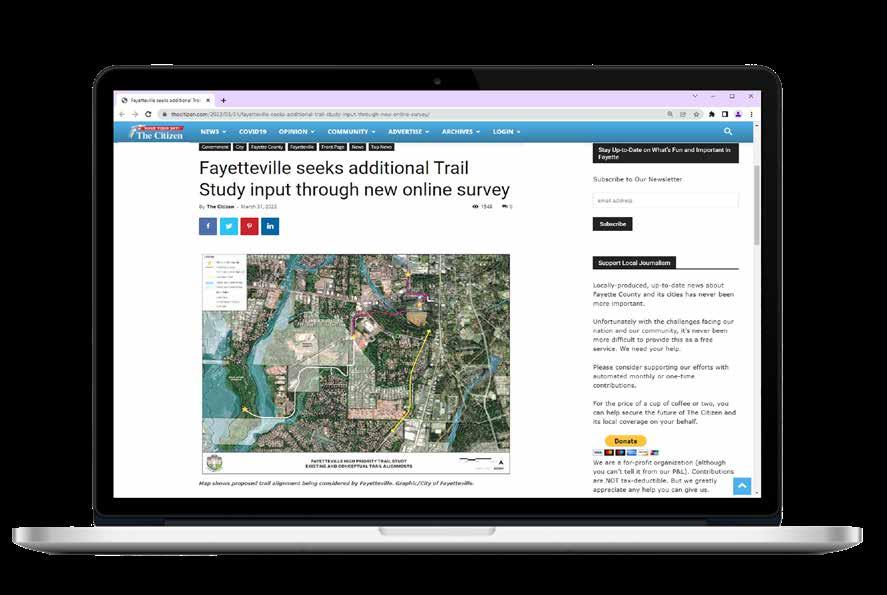
Online engagement provides a convenient way to engage with the public and to share information. Two online surveys were released to the public so those not in attendance had a opportunity to make their voice heard.


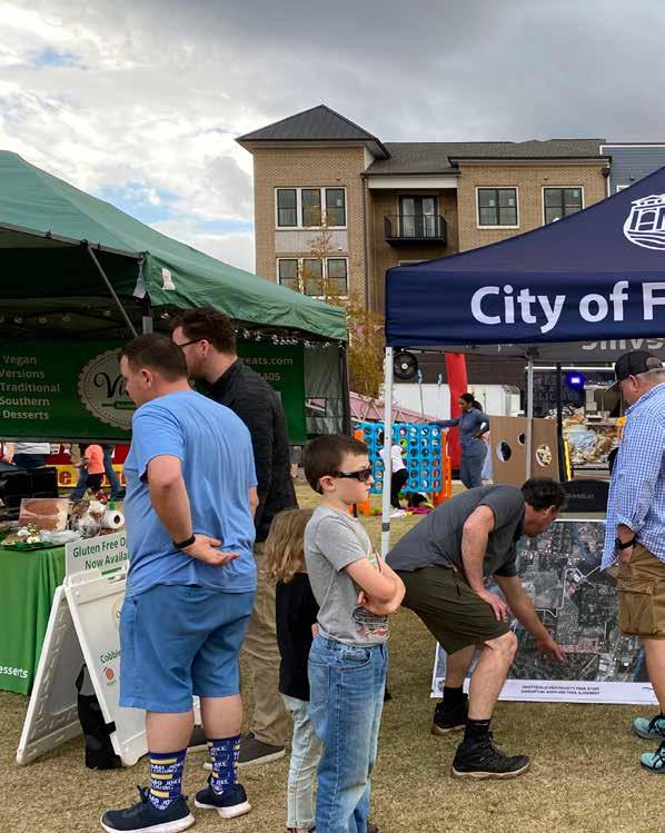
Pop-up events are an excellent way to connect with the community at places of high traffic. Three popups were held to provide study information, displays, posters, meeting flyers, and comment forms with the public to provide input.


Social media plays a significant role in communicating to the public about the study process. Project updates were posed on “Atlanta Journal-Constitution” and “The Citizen”.


The AECOM Team held two PIOH meetings and attended three pop up events during the course the project. The first PIOH meeting was held on March 1st, 2022 in which AECOM presented the alignment provided within the RFQ to the consultant team for public input. There was opposition to the trail segment that ran between Lakemont and Oakleigh Subdivisions. Concerns ranged from a lack of privacy, access, safety and impacts to the natural environment. Due to the voiced opposition at the PIOH meeting 1, AECOM developed another trail alignment which was presented through an online survey as well as at the second PIOH held on September 22nd, 2022 as well as it was presented at three Pop Up events during City held events. The revised alignment was supported by a vast majority of the public which was a turning point in the project’s success.

PIOH #1
The first PIOH was a kick off and community listening session. Upon arrival, participants were invited to take a look at the display boards that have the project information. The design team presented an alignment provided to AECOM which bisected Oakleigh Manor and Lakemont Subdivisions to obtain initial feedback and input. The community was vocally opposed to the alignment which bisected Oakleigh and Lakemont subdivisions. AECOM thanked the attendees for their input and noted all comments received. The design team further evaluated the east west alignment between Oakleigh Manor and Lakemont and determined this segment was better suited as a natural surface hiking trail through the woods. This segment provides both local and regionally direct connectivity to the existing Redwine Trail to the east and to the Ridge Nature Area to the west.

Two-third of the respondents said they would use the proposed trail shown in the map. About 63% of the respondents use the existing trails within the City of Fayetteville or Fayette County while the rest do not use the existing trails.
181 Responses
Suggestions for improvements to the existing trail facilities
309 Responses
About one third of the respondents who use the existing trails made comments suggesting have better connectivity in general or more trails, such as extending trail down Redwine toward Peachtree City and providing trail connections to the Brightmoor amphitheater. Approximate 30% people have concerns about safety at night and privacy for Lakemont and Oak Subdivisions.


Below are some other feedback received from all respondents included:
Maintenance: Common topics/suggestions include repaving/dealing with tree roots, improved signage and lighting, adding trash cans, widening the trail, improving crosswalks, and providing safe separation from cars.
Amenities: More trees or buffer between roadway and trail and add site furniture, such as benches and trash cans.
Reasons why you don’t use the trail facilities
Accessibility: Trails were too far or not accessible.
The majority responses were regarding concerns about the proposed trail alignment. The word cloud below represents the most common concerns which included privacy, safety, access to properties, and impacts on the natural environment (trees, wetlands, wildlife).


The second PIOH was a refinement of visions and goals. AECOM team showed the refined trail alignment to the public and sought feedback on the alternatives. To broaden the project’s exposure and make the process more accessible, an online survey was made available in addition to the comment form so those not in attendance had an opportunity to make their voices heard. The online survey was open from September 29th - October 26th .

There were a total of 41 responses submitted, including both online survey and comment forms. Their feedback is illustrated in the maps on the following pages. Most respondents commented positively toward the refined alignment and supported expansion of the trail network within the City of Fayetteville. Some respondents mentioned the existing trails access from their neighborhood were not safe and there is no safe crossing currently. Also, there is a desire for lighting to make sure the safety of night use of the trail.
Regarding the use of golf carts, 55% of the respondents were in favor of permitting golf carts use on the trail, citing this use as a good alternative to driving a car. The rest were in favor of prohibiting golf carts use, citing pedestrian safety and comfort.
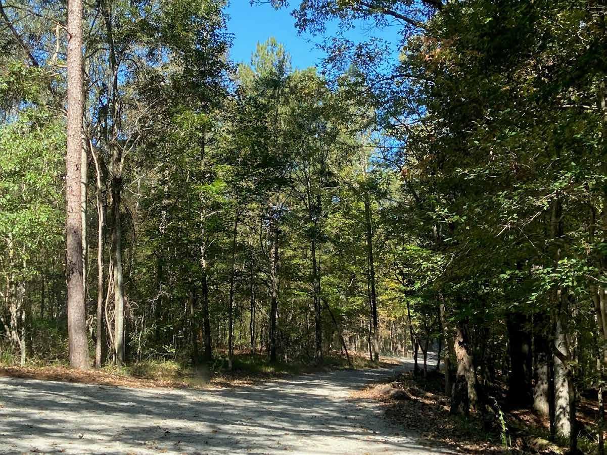


The map shows some of the comments received from the first PIOH. For more information about the survey results refer to Appendix 6.4.
of Fayetteville, GA
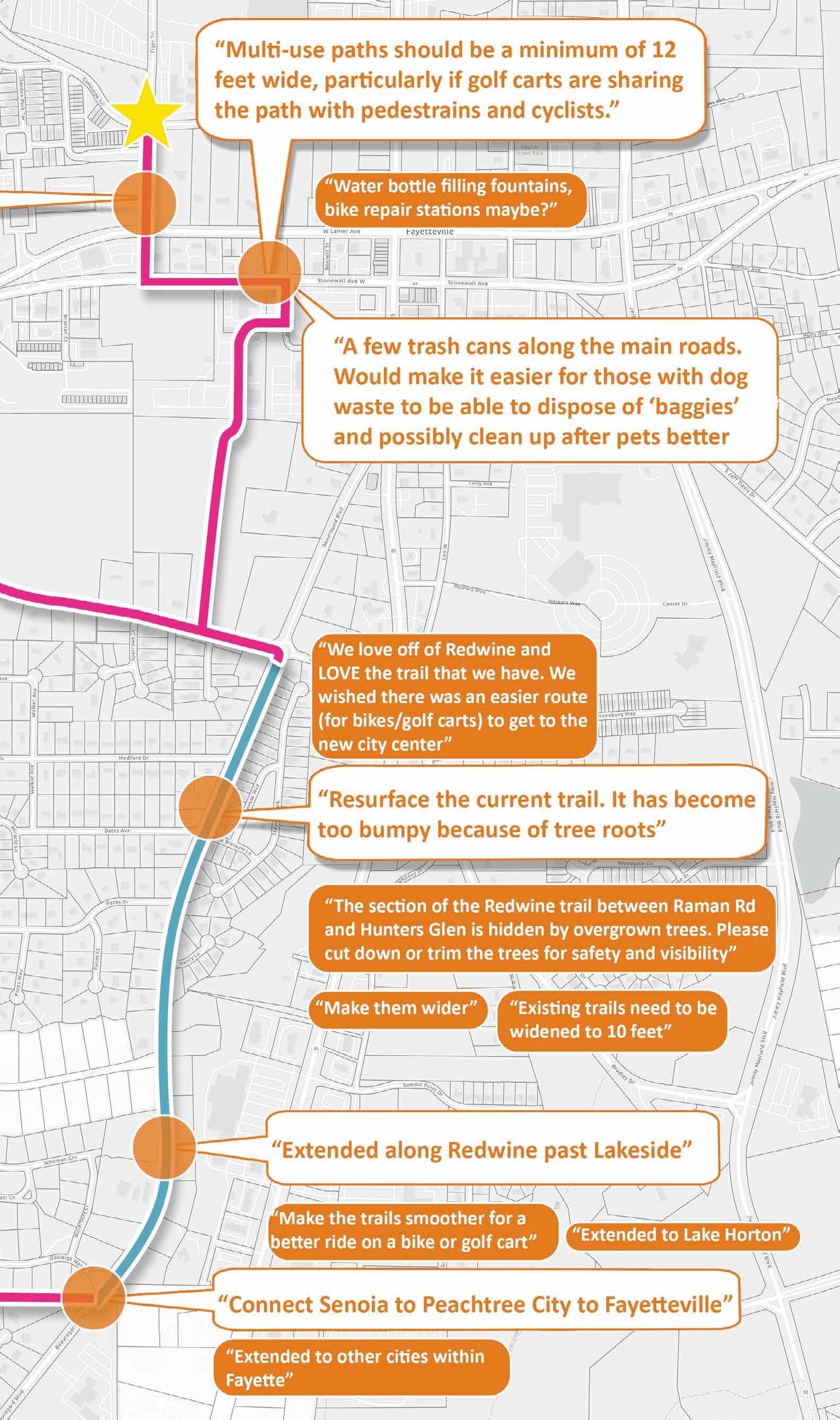

The map shows some of the comments received from the second PIOH. For more information about the survey results refer to Appendix 6.4.
Fayetteville, GA
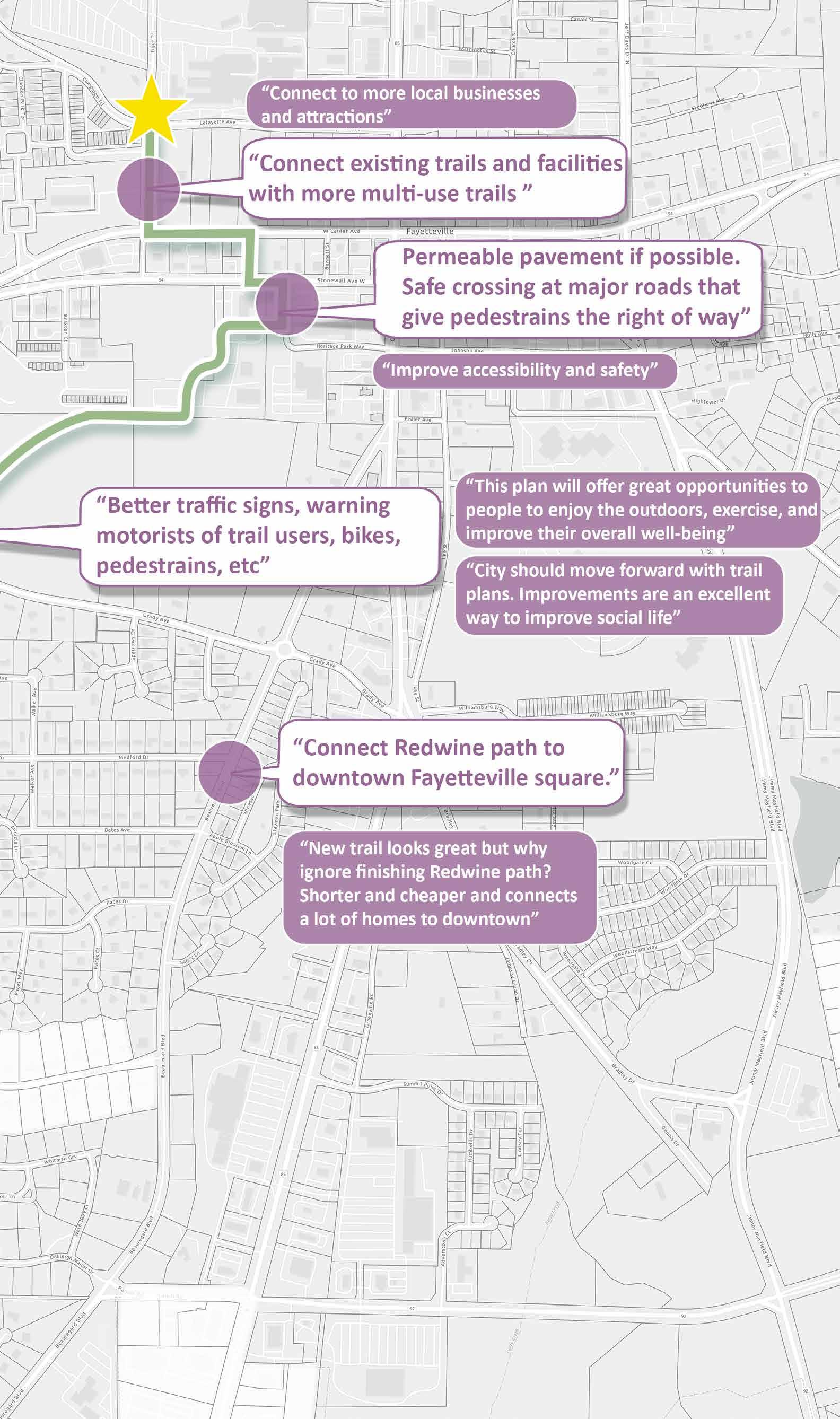
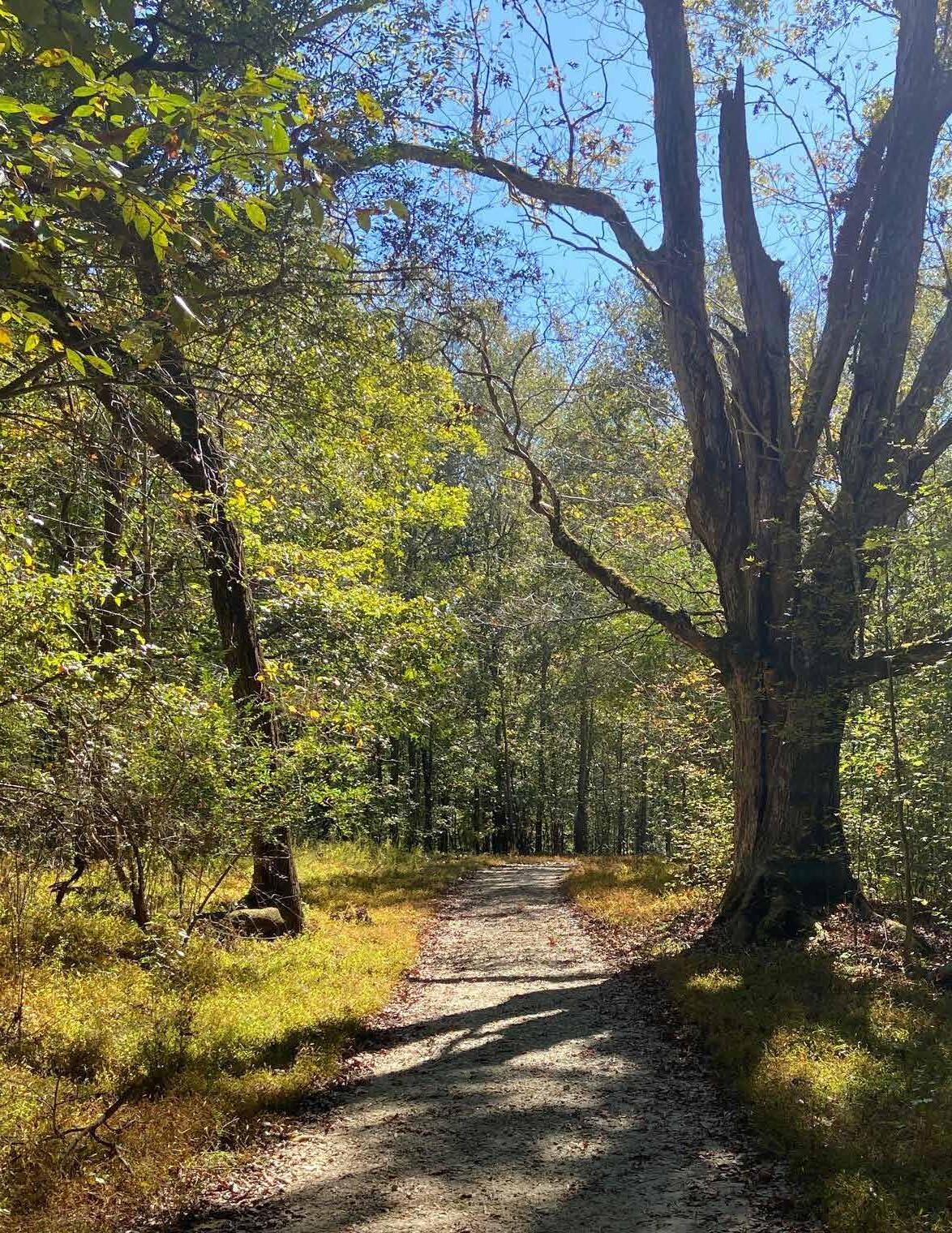
Finally, we present our recommendations in this chapter. A recommended trail alignment was developed base on community input, site visits and the technical analysis.
5.1 CONCEPT PLAN
5.2 MID-BLOCK CROSSING LOCATION MAP
5.3 BIKE RACK/BIKE STATION MAP
5.4 TYPICAL SECTIONS

5.5 WAYFINDING & SIGNAGE
5.6 CONCEPT RENDERINGS
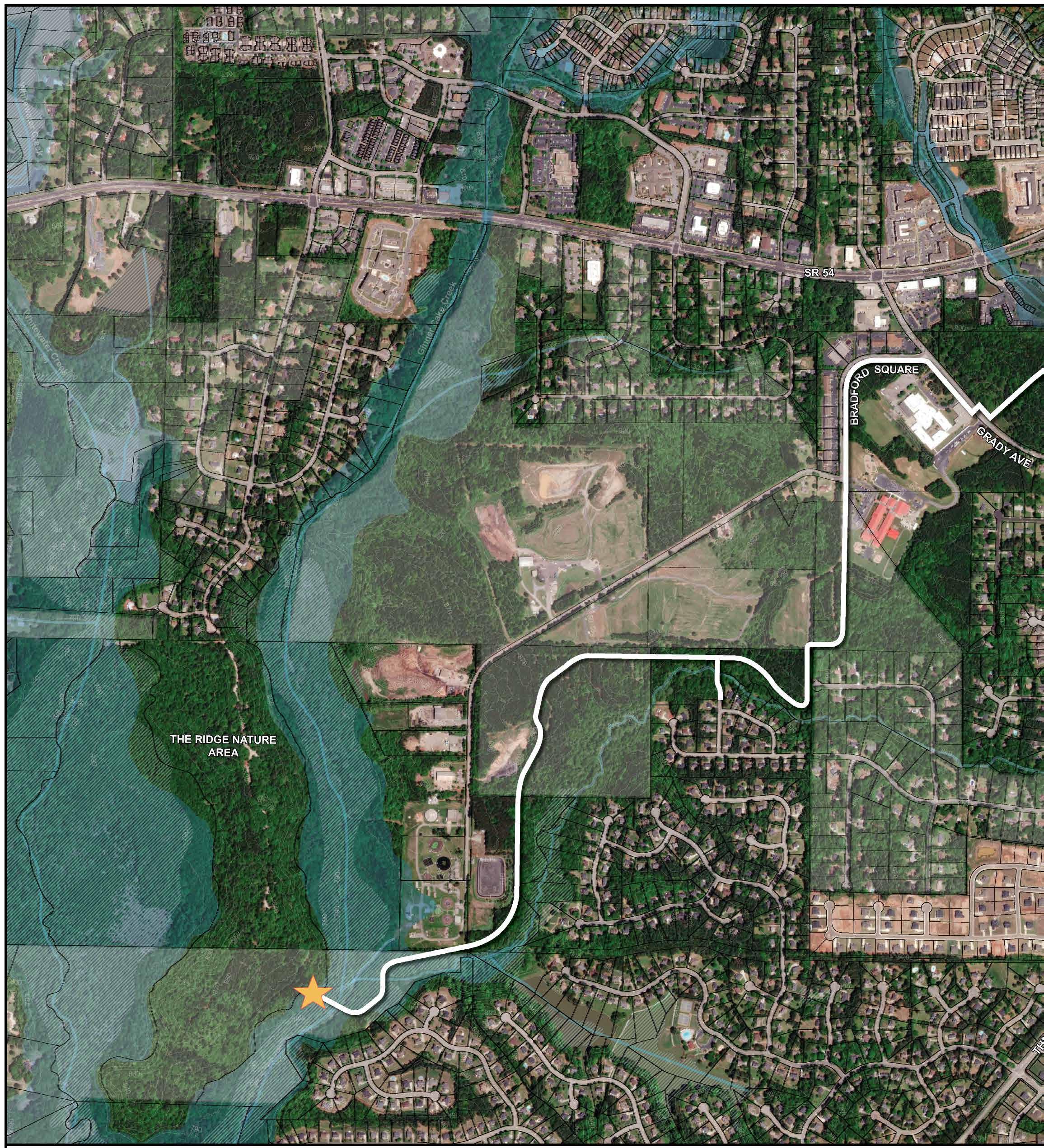
PROJECT BEGIN/END
RECOMMENDED TRAIL ALIGNMENT
100-YEAR FLOODPLAIN
500-YEAR FLOODPLAIN
WETLANDS
CONTOUR
PARCEL STREAM
PROPOSED BRIDGE OVER STREAM

PROPOSED BOARDWALK
Trail safety has been a common concern from the Public Information Open House. The trail South to the Spring Hill Elementary School will be open from Dawn to Dusk and under police monitoring. Emergency call boxes are provided for anyone who is needed. For more information about the trail safety refer to Appendix 6.1.
*The white shaded area is unincorporated Fayette County.
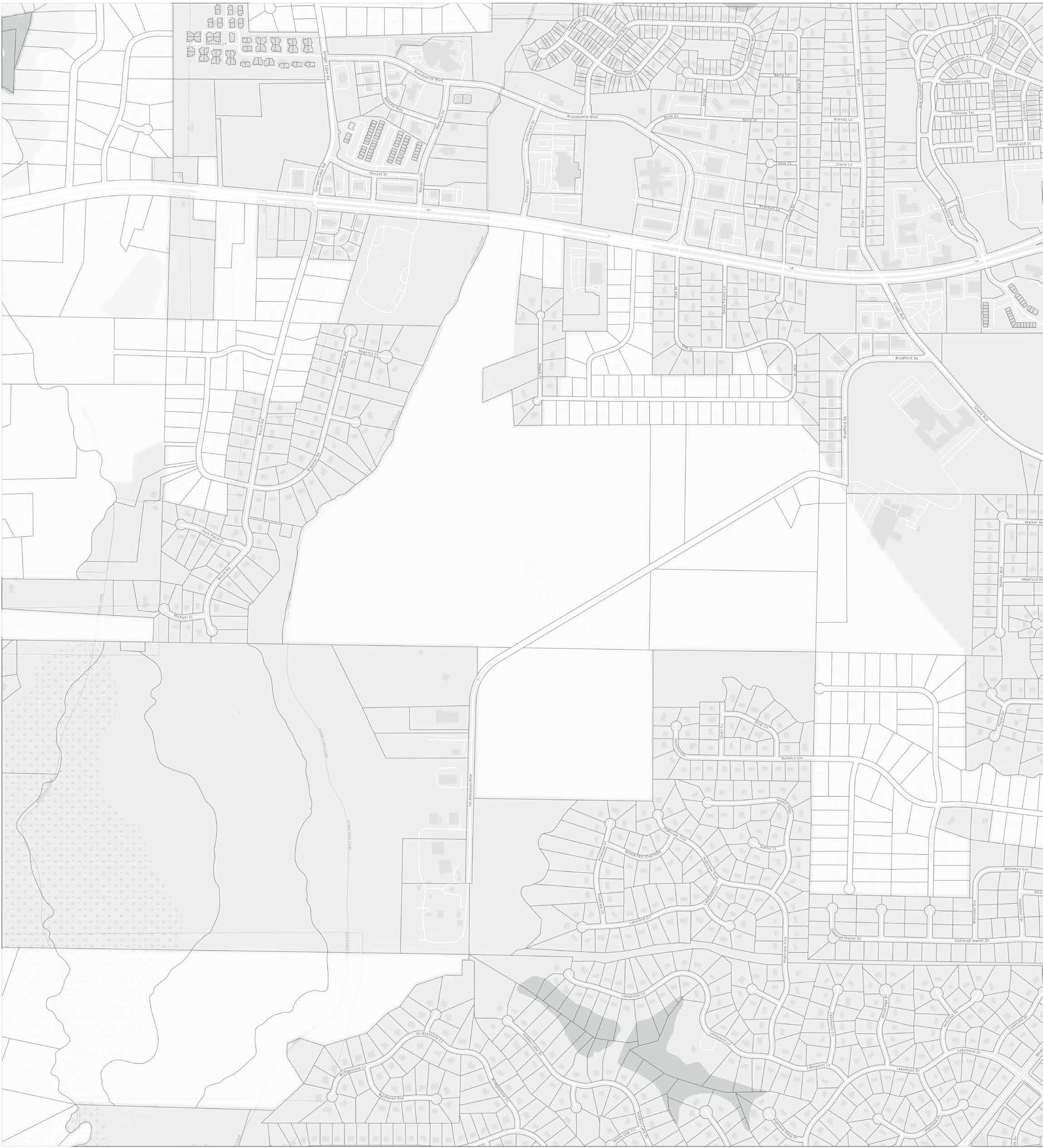
Total Trail Length: 3.4 mile +/0.4 mile
The Connector Link
This segment connects the Brightmoor Amphitheater, Fayette County High School, and Fayette County Board of Education.
The City Center Link
This segment of trail connects Spring Hill Elementary, Fayette LIFE Academy, and surrounding neighborhoods to the heart and soul of the City where festivals, civic events, retail and multi-family housing exist.

The Woodland Link
TRAIL HEAD
PROPOSED BRIDGE OVER STREAM
*The white shaded area is unincorporated Fayette County.
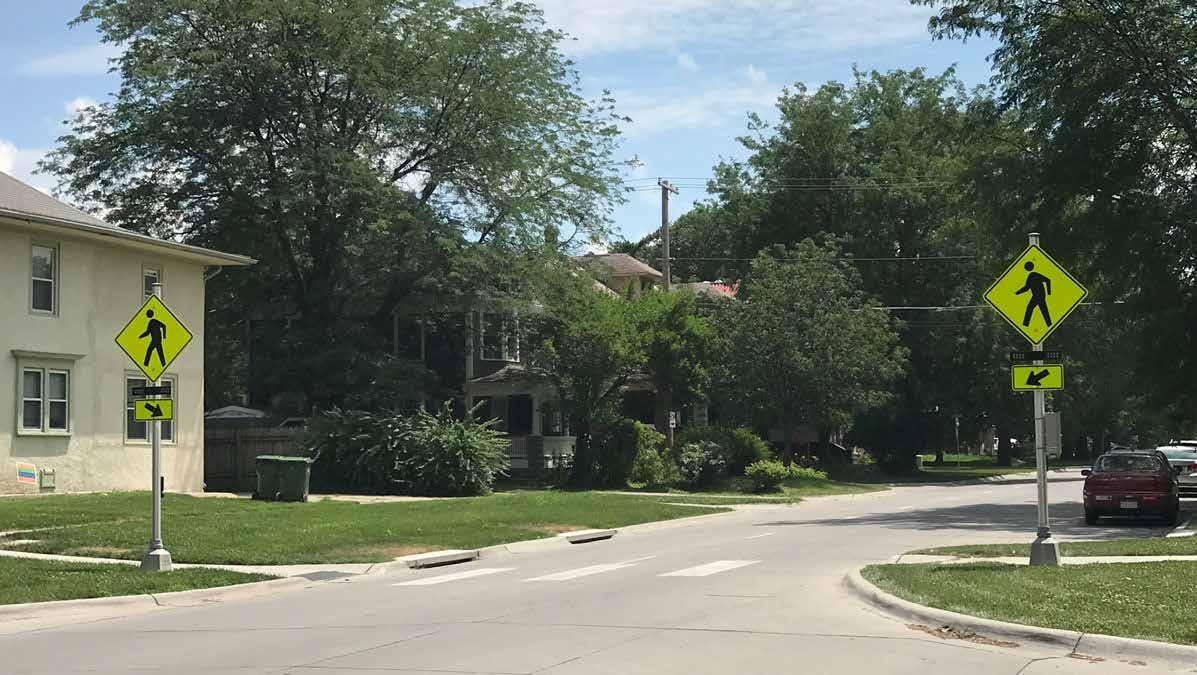
EXAMPLE OF SIGNALIZED PEDESTRIAN CROSSINGS
EXAMPLE OF SIGNALIZED PEDESTRIAN CROSSINGS


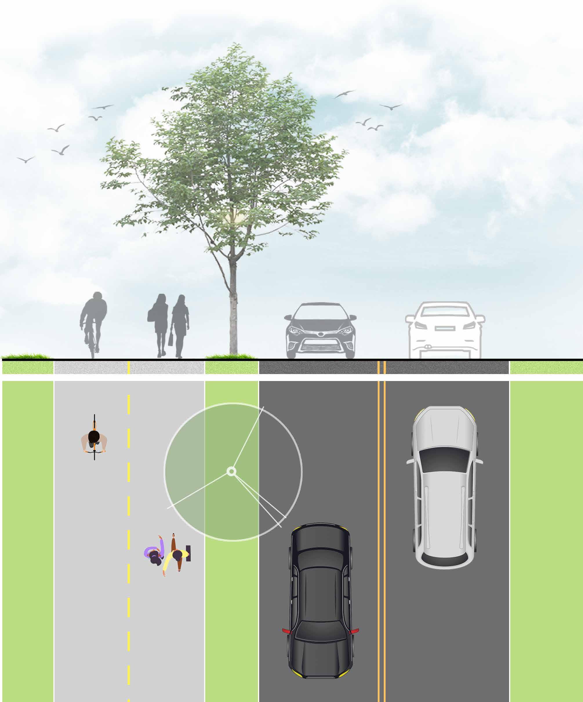
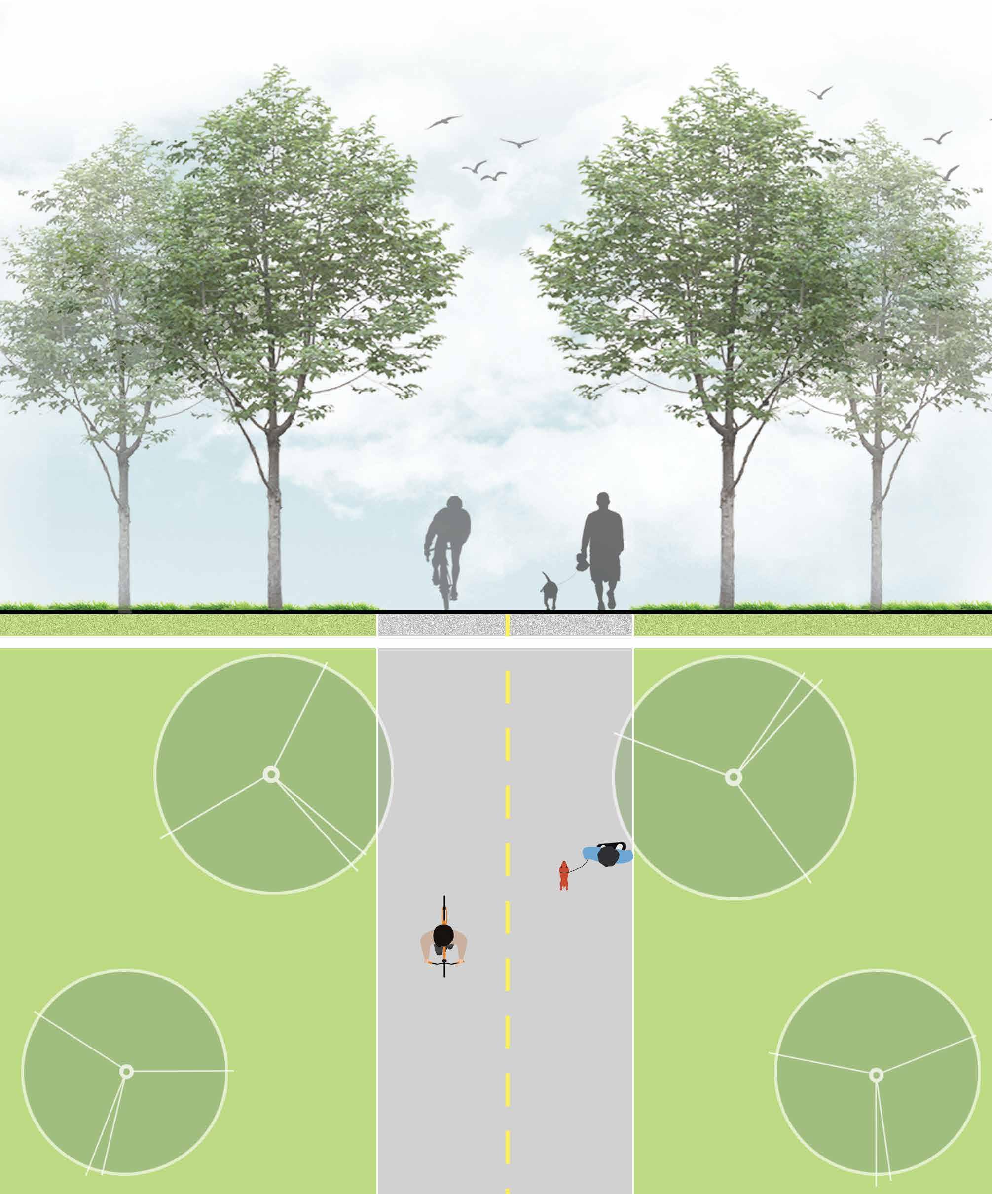

The trail system serves activities in all seasons for a variety of users. These users–walkers, runners, bikers, etc.–approach the trails with a multitude of different needs. The users bring with them many different levels of experience and physical ability, together with different wayfinding needs and expectations.
First Time Users:
Unique requirements for wayfinding, perceived safety and comfort to make a good impression and keep them coming back
Casual User:
Walkers, dog walkers (repeat users)
Athletes:
Runners, joggers, bikers, in-line skaters, and others may expect features such as distance markers that support their activities
Commuters:
Typically cover only certain sections of trail between home and work
Special Users: Older adults, children, students, educators, users of varied physical abilities
Design for First Time Users: Welcome, clearly-define, provide understandable information and a sense of safety
Positive Signing:
Fine line between establishing rules and setting a negative tone. Focus first on correct behaviors with positive tone.
Provide Digital Wayfinding Options: Include links on wayfinding signage live online maps via QR code
Structure Information: Develop information hierarchy to organize the messages
Category 1: Identification
Trailhead entrances, The Nature Ridge Area, schools, City Hall, landmarks, points of interest
Category 2: Orientation
“You Are Here”, maps, directional, mile markers, cardinal directions/GPS coordinates
Category 3: Safety and Regulatory
Rules and regulations, warnings, crosswalks, roadway signage, vehicular guides at parking areas
Category 4: Brand Identity
Unifying identity elements to serve as “brand”, consistent aesthetic to communicate brand
Category 5: Interpretive
Provide visitors with historic, scenic, or interesting information along the trail

A B D
MAIN IDENTIFICATION
ORIENTATION: YOU ARE HERE/MAP
C
MILE MARKER
INTERPRETIVE
TRAIL HEAD
RECOMMENDED TRAIL ALIGNMENT





Fabricated aluminum green wall frame with dimensional letters.


1” x 1” square tube grid within frame to accept plant material


Double-sided with painted aluminum partition panel.
Stacked stone base.


The Lattice features an inlaid leaf pattern, raised lettering and is designed to accommodate plant material

The Alpha features a dynamic letter “A” and is designed to accommodate


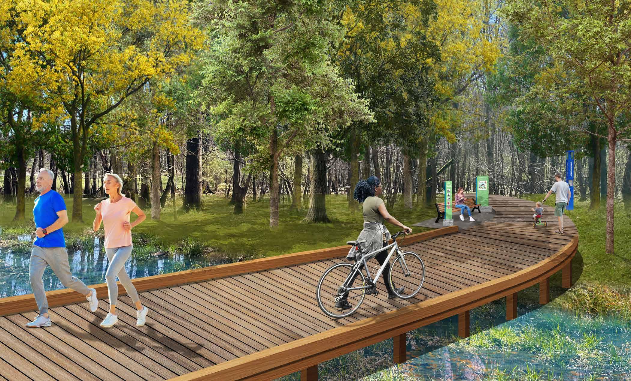
Before Condition
After Concept Rendering
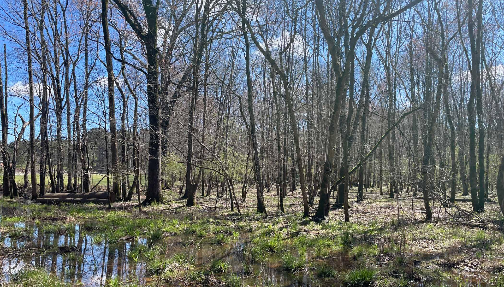
After Concept Rendering


Environmental Education Area


Down from Spring Hill Elementary School
Before Condition
After Concept Rendering


 Birds Eye View Rendering
Multi-Use Trail to follow the ridge
Spring Hill Elementary School
Fayette LIFE Academy
Bradford Square
 Multi-Use Trail
Multi-Use Trail
Multi-Use Trail

6.1 TRAIL SAFETY

6.2 PLANNING DOCUMENT REVIEW
6.3 COST ESTIMATION
6.4 DETAILED COMMUNITY INPUT SURVEY RESULTS
Trails are shared recreational spaces open to a wide variety of residents and visitors. To help improve the experience and safety when walking, biking or exploring surrounding areas, we strongly encourager all trail users to follow safety and courtesy guidelines.
01
Cyclist
Families
Runner
Senior with limited mobility
Pedestrian / With pet
02
Dress appropriately and pack essentials
Keep right, pass on the left
Safe hiking in the heat/cold
Stay aware of surroundings
Stay on the designed trail, paved and marked trail at all time
Wildlife interaction (Do not disturb)
03
Know your physical capabilities
Tell someone what your route is and when you expect return back
04
Use emergency call box as needed

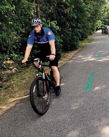
Police Monitoring
Trails open from Dusk to Dawn Police


• Don’t use more than half of the path, except for passing
• Ring your bell or call out when passing
• Slower traffic stay right




• Follow all posted rules and regulations


• Leash pet and keep close


• Keep children close
• Pay attention to other users
Documents Reviewed
DOCUMENTS REVIEWED
Documents Reviewed
AASHTO Guide for the Development of Bicycle Facilities
FHWA Small Town and Rural Multimodal Networks Guide
GDOT’s Pedestrian and Streetscape Guide


The County’s Transportation Plan is an important tool in identifying and prioritizing transportation needs, recommending possible solutions, and establishing a plan for project delivery and funding. It was approved by the Fayette County Board of Commissioners on December 12th, 2019.
The CPT has three main sections: Inventory of existing conditions, assessment of current and future needs, and recommendations.
The purpose of the Inventory of Existing Conditions Report is to provide detailed information on the present day make up and condition of the transportation network in Fayette County. It includes the review of previous studies and factors that influence transportation such as land use and development, demographic, employment, etc. This inventory is necessary to inform the planning process moving forward and help with needs assessment in the next phase of the plan.
The second phase of the plan outlines and assesses the overall needs for the community, including population and employment growth, future land use and development needs, access management needs, roadway needs, active and alternative transportation needs, and transit needs. One of the key takeaways from the assessment of the future land use and development is the need to have bicycle and pedestrian facilities in areas planned for dense mixed‐use development, community facilities, and parks. As these types of development have the potential for automobile trip reduction through the co‐location of a variety of land uses.
The active transportation has numerous benefits, including reduced roadway congestion, travel‐time savings, improved health outcomes, and increased recreational opportunities. An outcome of this planning process includes the identification of a Master Path Plan (MPP). The intent of the Master Path Plan is to identify ways to expand the path network throughout the county.
The purpose of the Recommendations Report is to detail recommended projects and policies developed through the planning process. It also includes background on the public involvement process that informed project and policy development. The Master Path Plan focused mainly on sidewalks, greenways, sidepaths, bike routes, and signed share the road projects. The recommendations provide key connections to schools, parks, population centers, shopping, jobs, and government facilities.
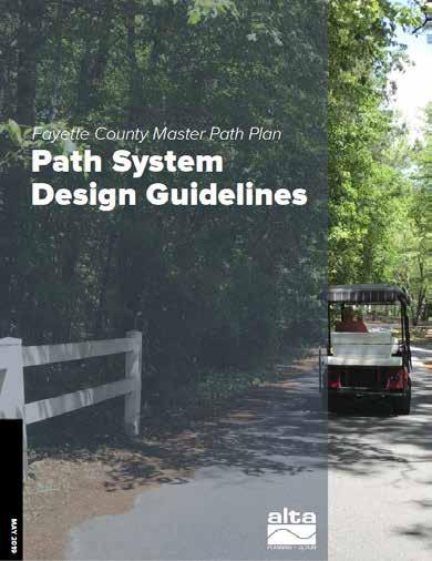
The path system design guidelines were developed as part of the Fayette County Master Path Plan. The design guidance was developed based on local and national best practices and is tailored to the needs of an unconventional path system that is used not only by people walking and bicycling, but also shared with people operating golf carts. These design guidelines are intended to clarify best practices for the design and construction of new paths and major path upgrades.
Typical application and design features outlined in the guidelines include:
Multi‐Use Path/Trail
• General Design Practices for Multi-Use Paths
• Multi-Use Path Along Streams and Rivers
• Multi-Use Path: Rail-To-Trail
• Multi-Use Path: Rail-With-Trail
• Multi-Use Path Utility Corridors
• Basic Sidepath/Shared use path
• Sidepath/Shared use path Along Major Roadway
• Sidepath/Shared Use Preferred Conditions
Crossings / Intersections
• Multi-Use Path Crossing Treatments at Unsignalized Location
• Minor Street Crossing
• Channelized Right Turn Lane Guidance
• Setback Crossings at 4-Way Stop-Controlled Intersection
• Setback Crossing at Signalized Intersection
• Mid-Block Crossing - Rectangular Rapid Flash Beacon
• Mid-Block Crossing - Pedestrian Hybrid Beacon
• Overcrossing
• Undercrossing
Additional Guidance
• ADA-Compliant Curb Ramp Wayfinding Signage
• Custom Signage
• Path Amenities
• Pedestrian-Friendly Curb Radii
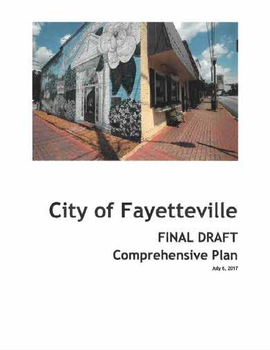
The Fayetteville 20-year Comprehensive Plan was adopted in 2017 and acts as a guide for the community in achieving their goals and objective. Based on the Community Survey, some of the main issues related to transportation the City are facing include the need for sidewalks/multi use paths/ cart paths improvements and pedestrian infrastructure that levels the playing field between cars and people. Special Purpose Local Option Sales Tax (SPLOST) approved by Fayette County citizens in March 2017 would allow the City to make infrastructure improvements.
The plan also identifies the transportation goals and strategies:
• Participate in the Fayette County Transportation Plan.
• More Multi Use Trails by participating Fayette County Trails Plan and developing a City Trails Plan
• Develop a more cooperative relationship with the GDOT to help meet local objectives for state controlled roads by improving wayfinding signage and pedestrian facilities.
• Continue progress of making Downtown more walkable.
This guide provides information on how to accommodate bicycle travel and operations in most riding environments. It is intended to present sound guidelines that result in facilities that meet the needs of bicyclists and other highway users. Sufficient flexibility is permitted to encourage designs that are sensitive to local context and incorporate the needs of bicyclists, pedestrians, and motorists. The intent of this document is to provide guidance to designers and planners by referencing a recommended range of design values and describing alternative design approaches.
The Small Town and Rural Multimodal Networks guide is a design resource and idea book to help small towns and rural communities support safe, accessible, comfortable, and active travel for people of all ages and abilities. It introduces different facility types, such as Mixed Traffic Facilities, Visually Separated Facilities, and physically Separated Facilities. For each facility type, the summary lists some key benefits and considerations. In addition to benefits related to transportation, the summary addresses other factors, such as compatibility with a rural aesthetic, and potential environmental impacts caused by road widening.
The path system design guidelines were developed as part of the Fayette County Master Path Plan. The design guidance was developed based on local and national best practices and is tailored to the needs of an unconventional path system that is used not only by people walking and bicycling, but also shared with people operating golf carts. These design guidelines are intended to clarify best practices for the design and construction of new paths and major path upgrades.
The guide has three main purposes:
• Provide a bridge between existing guidance on bicycle and pedestrian design and rural practice.
• Encourage innovation in the development of safe and appealing networks for bicycling and walking in small towns and rural areas.
• Provide examples of peer communities and project implementation that is appropriate for rural communities.
The Georgia Department of Transportation (GDOT) Pedestrian and Streetscape Guide contains guidelines and best practices for the design of streets and roadways that support safe multimodal travel. As defined by the Federal Highway Administration (FHWA), a pedestrian is “Any person not in or on a motor vehicle or other vehicle.” The overall intent is to encourage good design practices. Within the guide is data associated with pedestrian safety as related to crashes and the speeds of vehicles as well as other relevant data associated with pedestrian activity. The guide provides hyperlinks and references to other relevant resources associated with best practices for multi-modal design.
The Guide focuses on 4 primary areas:
• Design of pedestrian and streetscape facilities
• Conscientious planning
• Effective education programs
• Safety
The guide emphasizes designing streets, roads and transportation facilities based on the context of the project’s location, rather than a one size fits all approach.
NOTE:
Engineering , Inspection and Design Costs are not included in total costs.
Project Management Costs are not included in the total costs.
All Items Quantities and Estimations are based on concept plans and 2023 construction material cost, shipping fee, and labor cost, subject to change.
Lighting is not including in the estimate.
Maintenance Costs are not included.
Utility Relocation Costs are not included.
AECOM does not have control over the cost of labor, materials, equipment, or over the Contractor’s method of costing in the marketplace, the opinion of probable cost as herein stated is made on the basis of our experience and qualifications and represent our best judgment as a design professional familiar with the construction industry. However, we can not guarantee that bids or the construction cost will not vary from these probable cost opinions. If the Owner desires greater assurance of the cost of construction, it is recommended he employ an independent cost estimator.
Fayetteville Questionnaire #1
Do you currently use the Redwine Multi-Use Trail or any other trails within Fayetteville or Fayette County? Please check one.
Do you currently use the Redwine MultiUse Trail or any other trails within Fayetteville or Fayette County? Please check one.
Responses
Fayetteville Questionnaire #1
If you answered yes as a user of the trails, do you have any suggestions for improvements to the existing trail facilities?
14Apr
15Apr
16Apr
17Apr
trails smoother for a better ride on a bike or golf cart. EXTEND the trails to connect to Peachtree City and to the Pavillion for shopping & dinner
trash cans along the main roads. Would make it easier for those with dog waste to be able to dispose of ‘baggies’ and possibly clean up after pets better
of the Redwine trail between Raman Rd & Hunters Glen is hidden by overgrown bushes/trees. Please Cut down or trim the trees for safety and visibility.
There are also some cracks in the same section of the trail due to tree roots
continue to maintain them.
used Lake Horton trails for 2 decades. I'd like to see a trail connecting Fayetteville, City Center, to Lake Horton.
Connect to the Ptc golf cart paths
Connect the trail to peachtree city’s nature area and open it to golfcart’s, pedestrians, and bicycles.
Need to find a way to connect the paths and do a better job maintaining. Specifically the one on Lester road. Need to find way to connect to Trillith.
18Apr 06 2022 04:58 PM more connectivity
19Apr 06 2022 12:20 PM The trail that went through Lakemont subdivision would be nice. I am a resident in Lakemont and that would be a nice addition and attraction.
20Apr 06 2022 12:11 PM Yes! Connect the Cleveland Elementary trail to Trillith. Run it down Ebeneezer from Canoe Club to connect to the Braelin Center Peachtree City and create a path that connects those to downtown Fayetteville along the highway with stops that connect Franks at the Old Mill, and the Piedmont and Waterfall shopping/ dining center along the way.
21Apr 06 2022 11:46 AM Make sure tree roots are not buckling the trail.
22Apr 06 2022 11:45 AM Directional signage with distance markers.
23Apr 06 2022 11:11 AM Restrooms and connection to PTC paths
24Apr 06 2022 11:11 AM More accessibility
25Apr 06 2022 11:03 AM Connections to mountain bike trails.
26Apr 06 2022 10:54 AM Dogs must be on leashes signs
27Apr 06 2022 10:44 AM Don’t have a golf cart yet so I only use for walking. Would probably buy one and use trail(s) more if system is connected/expanded.
28Apr 06 2022
29Apr 06 2022
30Apr
AM Connect with trails on south Redwine.
AM A better crossing to get to the baseball fields
Interconnect them
31Apr 06 2022 09:10 AM The Lester Road trail is deteriorating quickly with heaving due to tree roots and potholes. A lighting evaluation is needed, and lights added especially between Stonebriar Pass and Old Norton Road and potentially between Bennett’s Mill Middle School and Sunderland Circle. The trail should not terminate into the main road at Lester Road near Old Norton Road. It would be much more useful if Lester Road and Old Norton Road trails went somewhere, if there was connection between West Fayetteville and East Fayetteville, or at least to the hospital. East Fayetteville, or at least to the hospital.
pavement for roller blades, bikes and a directional line like on a road so you don't run over by golf carts driven by children!
I would like to connect the trail on Redwine with Lester. Any additional trail would be great as long as they are connected.
access for walkability to shopping. Add to Hwy 92 side.
lit, safe and away from housing sub-divisions.
is tough. Maybe find a way to grade it down a bit.
been corrected since I have been there, but the trail near the park on Redwine floods badly when it rains.
golf cart speed rules and driver age limits.
the existing trail near
from Fayetteville connected past Lakeside down to Starrs Mill. Some tree roots are lifting the path on redwine. Someone
paths should be a minimum of 12 feet wide, particularly if golf carts are sharing the path with pedestrians and cyclists. Physical separation from the road is a must for comfortability and a physical barrier such as planters, trees, or curb is highly preferred if you really want to attract people to the path. Sidewalk should have continuous footways across intervening curb cuts so that a pedestrian/cyclist/wheelchair/stroller has an even walkway; cars should have to traverse the walkway, pedestrians should not have to traverse the driveway. Frequent crosswalks with illuminated signage and traffic calming on all streets should be a major component of multi-use pathway design. multi-use pathway design. The road should compliment the path in terms of appropriate travel speed, design speed, and traffic calming. Wide lanes with no traffic calming induce high speeds and discomfort for path users. This is particularly the case along Redwine Rd., Beauregard, North & South Jeff Davis Dr., and all state routes.
68Apr
I would love for it to be extended connecting to other various parts of Fayetteville.
69Apr 01 2022 05:04 PM Connect senoia to ptc to fayetteville
70Apr 01 2022 04:26 PM Existing trails need to be widened to 10 feet.
71Apr 01 2022 04:21 PM Can you please add golf cart paths from Harp Road to Redwine?
72Apr 01 2022 03:31 PM No, just need more of them
73Apr 01 2022 03:18 PM No, just more connections to things are sought. We love living off of the Redwine Trail.
74Apr 01 2022 12:00 PM No
75Apr 01 2022
76Apr 01 2022
78Apr 01
AM Make them wider
AM Make it go continuously to Bernhard so that it connects to the PTC paths.
AM clear and enforced rules on use. maintain cracks and flood prone areas
AM I really just want more places that I can walk.
79Apr 01 2022 03:56 AM repaving, extending it through Fayetteville
80Mar 31 2022
81Mar 31 2022
82Mar 31 2022
PM Make them connect in a loop to all shopping and recreational facilities
PM Make all trails 6 or 8 ft wide, 8 foot any new trails
PM no trail through Lakemont subdivision 83Mar
PM Extended along Redwine past Lakeside 84Mar
PM Yes needs to be trails and sidewalks on Ebenezer rd connecting to PTC
PM Expand as much as possible, such wonderful assets for all citizens
PM Repair bumps and damages on existing trail. Find agreeable homeowners to connect new trail from Lakemont thru Oakleigh or go thru wasteland area that comes out near Spring Hill School. 88Mar
connect from Harp Road Down Old Senoia Road to the Redwine Mix Use Trails and continue them to the New City Hall and Downtown
PM Just to extend it past Lakeside division
PM Keep the stop signs maintained that cross the path of vehicle movement. Establish rules for golf carts; this is a walking trail; not a golf cart trail. Golf carts yield to walkers.
Need more trails and smoothing/repaying of trails
a repave and extension of the trail. It has gotten very rooty over the years. If possible, consider an extension to the multi-use trail ending at High Grove.
PM Yes-- absolutely. I use it almost every day and it feels extremely unsafe to walk with my baby close to a busy road (with cars exceeding the speed limit) and there be no natural or artificial barrier between the trail and the road. It is terrifying to think a distracted driver could easily swerve off the road 2 feet and hit us. Not to fail to also mention, there is a loud noise factor with the cars.
There are some bumpy areas where tree roots have changed the paths. Also a path to the new city park to make it easier to access.
PM I like the idea of extending and connecting to other places - and I love the idea of a trail path through Lakemont - I live on Lakepoint Lane, so it would be super convenient for walks, bike rides, etc.
PM Some maintenance needs to be done, Tree roots are pushing up the asphalt across from the ball fieldsContinue south on Redwine.
golf cart friendly path
Add more lighting and make them wide enough for golf carts. Some parts are more narrow than others.
THEM TO REACH ALL OF FAYETTEVILLE/TRILITH… GOLF CART ACCESSIBLE LIKE PEACHTREE CITY. 115Mar
path down rewine to peachtree city....that was talked about years ago
trail needs a wider path once it reaches 85/City Cafe area to the county complex parking lot. Also to complete a full circle around complex, to city hall and down Grady Ave back to Redwine. 120Mar
More trails with expanded access will encourage more use, but must be balanced with security concerns of property owners that may border any new trails. Including security plans for those trails that affect property owners is crucial to gaining their approval.
Add more multi use (including golf cart) trails to skirt neighborhoods leading to new facilities near downtown Fayetteville.
Making it a bit wider as some parts of it are really narrow. Also to add trash cans along the way.
down Redwine into PTC
love a more extensive trail system with access to more of all the great things the city has to offer
plans
need sidewalk / trail from Helen Sams/ Jeff Davis to Publix shopping center.
let them connect better to the grocery stores and to the Ridge!
130Mar
133Mar 31
134Mar
135Mar
136Mar
137Mar
138Mar 31 2022
139Mar 31 2022
140Mar 31 2022
141Mar 31 2022
Get a wood chipper and grind up the falling branches piling up along the prettiest section of the trail, that on Redwine Road, which crosses in front of the Oddo property . . .
1) Extend/connect trails; 2) get better drainage - trail across the street from Patriot Park gets inundated when it rains heavy, and is unpassible
City should move forward with trail plans. Improvements are an excellent way to improve social life.
Make more trails
We use lake Horton. A dog park would be nice to let the pups play after a nice walk. For big and small dogs seperate.
AM Please consider an overpass or some kind of crossing that will permit residents who live within the city limits on the east side to safely access the trail/path. An example is residents from the Woodgate as well as Olde Dominion subdivisions. At the moment, residents on the east side of Fayetteville have to cross SR-85 south to get to the Redwine trail. This is unsafe as SR-85S is a busy road. Please consider your residents within the city limits on the East as well as on the West side of Fayetteville. Thank you.
AM Smooth several spots on Redwine that have roots making it very bumpy. Extend the path to make it more useful.
AM More consistent maintenance
AM More connectivity throughout Fayetteville
AM Use yield signs instead of stop signs at non major intersections. If a car has a stop sign, the pedestrian has a stop sign. That's okay. Redwine has stop signs for pedestrians at every street. A major pain in the ass for a cyclist.
142Mar 31 2022 07:48 AM Need new paving some places are rough…
143Mar 31 2022 07:11 AM Needs resurfacing/repairs in some areas especially in the roundabout area.
144Mar 31 2022 06:54 AM Need to make sure pine needles are cleared. They are a hazard for runners and cyclists
145Mar 31 2022 02:47 AM More gold cart paths
146Mar 31 2022 12:04 AM Connect the neighborhoods of S Jeff Davis with downtown Fayetteville, which would then connect through Redwine.
147Mar 30 2022 11:54 PM keep it clean
148Mar 30 2022 11:37 PM No, other than just extending them.
149Mar 30 2022 11:08 PM Resurface the current trail. It has become too bumpy because of tree roots.
150Mar 30 2022 10:43 PM No
151Mar 30 2022 10:28 PM Bring the golf cart path to downtown Fayetteville
152Mar 30 2022 10:24 PM Extend them! Make the connections with 85 at Grady and Ramah. Sidewalks needed all along both sides of the highway from Ramah to the Pavillion
PM Current trail should connect to new city hall 154Mar
really bumpy will all the roots, hard to ride my bike on the trails
one in front of Lakemont & Lakeside has many tree roots growing underneath it and has raised & cracked the pavement almost every 2 feet. 157Mar
Redwine and LOVE the trail that we have. We wished there was an easier route (for bikes/golf carts) to get to the new city center.
connect the trails down red wine and make a new trail that will connect to Bus Barn and downtown
need to have better access for golf carts eg. Redwine and Ramah.
bike on the Redwine trail 2-3 times a week. It is built too close to the road and feels unsafe/aggregating because of the speeding cars.
should slow in that corridor. Also NO drivers stop at the crosswalk over to the rec fields
bottle refill stations at entrance and emergency call button poles at various points.
the multi-use pathway on Lester Road to Pinewoods/Trilith Village and Togwotee Village
trail from the roundabout to downtown. It is only a sidewalk.
maintenance to keep them clean and clear of any tripping hazards.
174Mar
175Mar
PM Connectivity between parks, restaurants, shops, event spaces and residential areas. No golf carts.
PM I would like Edgewater subdivision on 85 south across from whitewater HS to get access to trails. 176Mar
178Mar
179Mar
PM Redwine trail is littered with huge tree roots in several spots which makes for a very bumpy ride and especially not good for the carts. We're thankful the city cleared many branches last year as the top of the cart was getting really banged up.
PM more of them, better lighting. what would be great is to link kingswood & changicleer subdivisions into the rest of the city
PM Just expand! Would love to see more like what peachtree city has 180Mar
181Mar
182Mar
PM There needs to be a barrier between paths and roadways.
PM Extend them create a similar system along 92
PM Better lighting. Benches. Covered areas (ie: pergolas) for areas that tend to be overly sunny.
PM Extend the trails and golf cart paths 184Mar
PM 1. Mark the trail in 1/2 to 1 mile increments2. Resurface with all-weather asphalt3.Periodically ensure trail is clear of rocks, roots, and other debris
PM Fix areas that are cracked or have the surface compromised by tree roots. Better drainage is certain areas. 186Mar
188Mar 30 2022
189Mar
192Mar
traffic signs, warning motorists of trail users, bikes, pedestrians, etc.
PM Would recommend a wider path on Beauregard and Highway 85.
PM better safety, maybe poles to separate lanes so you do not risk being hit by golf carts driving too fast or driven by underge kids
PM Cart path extension! Allow golf carts to connect to exciting new downtown area all the way to whitewater to connect to PTC paths. Pull some PTC residents into downtown fayetteville
PM Ability to travel on trail or sidewalk to the city square and city park. Existing trails are fine - but need more :)
PM Would like to use the Redwine trail to access New City Hall park & playground.
Fayetteville Questionnaire #1
If you answered no as a user of the existing trails is there a specific reason or reasons why you don’t use the trail facilities?
29Apr
I didn’t know about them
AM I ride a bicycle, perfer to have bicycle lanes put in.
Just don’t have a need to use them 31Apr
30Apr
I live in Sheffield Estates. The trail is of no use to me because there are no businesses in that area. The completion of the golf carts trails on the corner or Hwy 85 and 92, leading towards the summitt shopping center would be great. Especially for the Fayette Meadows residents and all those who live on Helen Sams. 32Apr
in an awful place for it to actually see any major use by the people who live by where it is proposed to live, it runs directly counter to the purpose of the neighborhood it would run through, and it would take public traffic through a private neighborhood. 37Apr
get to them from our home. The trails need to connect the whole city not just areas that you think people want. If your going to spend money do yhe whole city path system or do none of it.
use the new trail proposed for Ridge Nature center.
take my walks in kiwanis park. I enjoy the quiet and would rather not hear and see cars passing. 62Apr
in my area. I wish they had such a trail along New Hope Road to the Pavillion and
close enough to where I live. I prefer expanded gulf cart paths throughout Fayette County, tying in to the Peachtree City and Tyrone areas.
waiting for more trails to justify purchasing a golf cart
on the East side of Fayetteville where the trails aren’t at.
sidewalks in Lakemont Subdivision for our exercise or the cart path that runs parallel to Lakemont
network of sidewalks and the walkway around the two lakes here present
trails I have seen available outside of the Ridge, which I do visit, offer nothing other than a trail to walk. No waterways to enjoy, no real hiking required, overall not
own a golf cart do i dont find the need to use the trail
have legal access from my neighborhood to the trail system
need them at this point. No golf cart and I get my walks/runs in at Patriot Park or in my Lakemont neighborhood.
don't have easy access to it.
safe with children. Fayetteville needs dedicated bike/multiuse paths that do not road over roads, do not interact with vehicular roads. The attitude of residents toward walkers and bikers does lend itself to confidence in using sidewalks or roads for recreation.
would be nice to have a trail that connects to Kroger at Town Center.
break to make much use of it, and I don't have access to a bike or other vehicle. I like
Would you use any of the proposed trails as shown in this study? If yes, please comment on which trails will be most beneficial.
trail near city center is close to my house however, I would not use it.
How about a short cut from Stonebriar to The Ridge?
Both of them. The shorter one to get from the amphitheater to the bus barn. The other as a destination bike ride.
would ride my bicycle to city center
of the trails would be beneficial
17Apr
18Apr
The trails from Spring Hill Elem & Fayette High to City Center
I cannot really tell where the trails go from the map provided. The image is much too small and the main streets can not be identified.
PM No
PM I am a distant walker and enjoy walking outside as much as possible
19Apr 07 2022 09:40 AM hard for me to tell from this map
20Apr 07 2022 06:59 AM Yes but please put a pedestrian walkway across 85 from Beauregard
21Apr 07 2022 12:31 AM Yes
22Apr 07 2022 12:21 AM The ridge to city center
23Apr 06 2022 11:29 PM No
24Apr 06 2022 09:28 PM Yes
25Apr 06 2022 08:18 PM Yes. From the city center to the ridge.
26Apr
27Apr
28Apr
No
2022 07:44 PM Near tiger trail
29Apr 06 2022 06:31 PM If there would be somewhere to park and use them.
30Apr 06 2022 06:15 PM City county Park to Ridge
31Apr 06 2022 05:59 PM City hall to the ridge. Another trail connecting city center to the senior center would be nice, too.
32Apr 06 2022 05:17 PM Any trail would be great to use
33Apr
PM Fayco HS to The Ridge Nature area
PM Since this is in close proximity to where I live, ABSOLUTELY! In fact, I would take advantage of it on a daily basis. 35Apr
34Apr
PM Probably not, because I live by McCurry park and they have a nice walking trail. 36Apr
PM the one at the high school that goes to the Ridge. My whole family is excited about that
Most likely not, since I have to commute at least 5 miles to get there. The neighborhood does not appear well lit at this time, and at times seems unsafe. The Ridge is already not safe, with Pitbulls and other dogs running lose.
PM All the trails need to connect to offer growth. The trail along side Redwine needs to be able to access others and city center
PM No. Because we live by Cleveland Elementary and none of the paths extend that far.
Yes, Fayette HS to ridge nature preserve
Not near my house
The trail headed to the Ridge Nature area would be nice.
AM We live in the new homes on Harris rd and cannot connect to either the PTC or Fayetteville cart paths, it Would be awesome if the entire area could be connected one way or another on Redwine… 49Apr
not.
Yes, they would all be beneficial.
No, but It could be used if there was a trail to West Fayetteville included.
No. I live to far away to access
for walking, bike riding and golf cart riding
either of the trails leading into/out of the city center park
connections to The Ridge are welcomed.
of these trails would help in any way with my ability to travel to areas, because as previously mentioned, they're in an awful location.
to Antioch and the new traffic
if you going too spend taxes payers money either make a plan to do the complete city or do nothing. Your still only listening to a few and not everyone.
live in the Lakemont subdivision, and according to the map and legend, I will not have access to either of the proposed trails.
Center trail to schools for walking.Hopefully a bike trail from Vity Center to Ridge
and sidewalks that access old courthouse square new city center and cross 85 and 54 safely
the Lester road trail. I cannot access other trails.
for exercise.
love to walk out my front door and access a trail. As it is, I have to cross Glynn St/hwy 85. This is not ideal. An over pass would be great!
Hill trail would give great access to the park without having to drive over there.
to The Ridge would be great to reach the mountain biking/hiking trails.
trail going from the City Center will give lots of access to all citizens of Fayette County. Using existing public property is smart and the more scenic route would be my preferred trail
them! We love
idea of a new path to The Ridge!
trail to The Ridge. The Tiger Trail proposed path should extend to link up with the 8’ path at Hood Ave. The current proposed path along Tiger Tr. does a good job of connecting residents at the Villages @ Lafayette, but does not capture potential trail users off of Hood Rd and Forrest Ave where a preexisting paths exists. This is a roughly 415 households (approximately 1,200 residents) with only .5 miles of extra path. I believe Tiger Tr. is owned by the FCBOE, so either having a path or a Shared Street concept redesign of Tiger trail could be achieved with relative ease as it is only one property owner who already has a relationship with the City.
might use the Ridge Nature area trail to City Center Park. 112Apr
would most use the Nature area to city center 114Apr
PM A trail connection between the Ridge Nature Area and downtown 115Apr
116Apr
PM
map is very hard to read- too small and cluttered. But I'd use the one highlighted in white
PM I am located in about the center of the yellow path, so there are no good connectors to get me to the new paths. Connecting in Quail Hollow sounds difficult and dangerous since there are no sidewalks and many hills that make pedestrian travel unsafe. It would be possible to access the ridge via path, but the journey would be arduous compared to just using a car.
AM
preferred alternate would be good, although routing the trial north along the flood plain would make more logical sense
don't need to use because I go to Patriot Park
trail going to and back from The Ridge NP to City Hall
to city center would be convenient.
City Hall to Ridge Nature Preserve
from the ridge to New City Hall would be beneficial to enjoy as it actually connects different appealing parts of the city. I would not use the trail going up Tiger Trail as I have no reason to go that direction.
the existing trail on redwine rd
cart capability
live in Lakemont and I want the proposed path connecting Lakemont to the path
trail between the ridge and new city park. It’s a good start but there’s better trail placement that could connect more residents
from Redwine to the New City Park and Downtown
Fayette High school and around City Center park without major car traffic.
I would really love to walk from my house off Grady to the Ridge. I would do it often. I would also utilize the trail from Grady to city park to avoid the sidewalk on highway 54.
live in Lakemont and worry about the safety of a cut through. It is so easy to get there already- just 10 mins to the ridge. I don’t know anyone who goes to the ridge, they all do patriot park, neighborhoods or lake Horton.
would use the pink trail from the path on Grady to the city park. We currently use the path on Grady.
do not see the benefit to the community to add these trails especially if they are golf cart accessible and going to impact existing neighborhoods. Who will maintain them and at what cost to the tax payer? Who will ensure users are safe? Why does the City of Fayettevile think our neighborhoods want this added traffic (vehicle, golf cart, pedestrian), potential for crime to our citizens and properties and a disruption of quiet enjoyable natural spaces that host our wildlife and scar the natural beauty of our county? Just stop.
use
of the trails - it would be very convenient for the preferred alternative through Lakemont
preferred alternate trail
of Redwine in the Lakemont subdivision. I am in total support of the proposed trail in order to have access to city park. To answer the question, the Spring Hill connection would be more beneficial to me. 182Mar
I live in Lakemont. The trail would be behind a short length of my property. I go to the Ridge often. I would walk there and probably get a cart for travel downtown. 183Mar
would use the orange trail to ride from Lakemont to the Bus Barn area. 184Mar
COULD REACH THEM VIA GOLF CART. PATHS OFF TOWN HALL MOST IMPORTANTLY.
the Lakemont Trail. This would be very much opposed by this property owner. The proposed path would border our back deck. We love our peace and quiet in our neighborhood and very much wish to keep it as is.
187Mar 31 2022 01:08 PM Not sure.
188Mar 31 2022
The preferred alternative trail from behind Spring Hill would be great to get to The Ridge without going on Grady Ave. But you need to add a connection to back of Lakemont cul-de-sac just like Oakleigh Manor and Quail Hollow appear to get in the depiction, so residents can get on the path (but not the option that goes through heart of Lakemont). Since alt b path was viable, that means a connection to preferred alternative is also doable.
189Mar 31 2022 12:49 PM Red and Orange trails
190Mar 31 2022 12:41 PM Yes - I would use Alt B trail but it is adjacent to SEVERAL homes and security needs to be addressed.
191Mar 31 2022 12:39 PM White trail Alternative B
192Mar 31 2022 12:39 PM I will benefit from the connections to the City Center Park and to the Ridge Nature connections.
193Mar 31 2022 12:38 PM map is too small
194Mar 31 2022 12:28 PM I might use the Alt B proposed trail to get over to the nature preserve.
195Mar 31 2022 12:27 PM No
196Mar 31 2022 12:26 PM No
197Mar 31 2022 12:25 PM I would use the oaths except the one to the Ridge Natural area. I don’t think we need to be able to take golf carts to the area. I definitely don’t see the need to wind the path to the far south through the Lakemont subdivision. That isn’t a public area. Connecting up the downtown more directly via the preferred path route makes much more sense
198Mar 31 2022 12:22 PM I live in Lakemont and would use the alt-b proposed trail to more easily access commercial areas as well as accessing the Ridge Nature Preserve. As it stands now, it is a 15 minute drive in my car to reach the Ridge and the proposed white path would significantly make the ridge more accessible. I am also in favor of the trail connected to the new city central park.
199Mar 31 2022
200Mar 31 2022
201Mar 31 2022
202Mar 31 2022
203Mar 31 2022
204Mar 31 2022
PM Possibly. Would have to see if approved and completed
PM City center park
AM Yes
AM orange/ pink
AM Yes, connecting the Ridge to City Center Park.
AM Yes, all of them!
205Mar 31 2022 10:46 AM all of them if my dog is welcomed.
206Mar 31 2022
AM Yes; yellow and white, possibly purple and orange
207Mar 31 2022 10:39 AM Currently I use a section of the trail that fronts the Oddo Property and what is now Oakleigh Manor on Redwine Rd. My brother uses the north bound trail for a bike ride into Fayetteville maybe monthly. I would use the section of the trail that goes between what is now Oakleigh Manor and Lakemont, which is a section of approximately 1/2 mile, for purposes of walking. Probably I would consider buying a golf cart so that I could go all the way to the Ridge Nature Area.
AM Both trails are beneficial.
to Ridge Nature
No we live on the southside of Fayette co and I’m not sure we’d drive north to use them but it’s a possibility
school to Center Coty Park
I would have to cross SR-85S to even get to the trail.
Yes, we would use the preposed path extensions. It would be nice to take the path to different areas of Fayetteville and to the Trilith area.
There is no trail on the east side of the city to get there. A trail from mccurry park to the center of town would be useful too.
to the Ridge Nature area and the new city hall.
Either one of the alternatives; not the proposed trail.
I would use the trails going to The Ridge and to the City Hall area.
I enjoy the new park near the new city building. I would use one that attaches to it.
to trail on Grady to access both The Ridge Nature area and City Center Park
Yes. We live right off Tiger Trail. This trail would be very beneficial for us
the one that connects to the ridge
The Redwine trail extending to the downtown city center area would be really nice.
Alt-B would be great for me since I live off Beauregard. The preferred Alternative is second since there's a sidewalk up Grady to Bradford Square and I could cut through the parking lots to Spring Hill to catch the trail.
would definitely use the pink proposed trail. Tiger trail is closer to my subdivision and city hall. I could use the trail instead of driving my car to go to city hall.
to Fayette County High to Springhill would be perfect.
would use them all. We do so much walking around downtown Fayetteville
that would connect the new Center Park to other places, safely avoiding traffic
interested in the City Hall Ridge trail
trail and the pink trail
east fayetteville and would love trails by the mcdonough park going into town. As well as trails around countyline road tonthe grocery store there. Bike lanes in town would be nice around downtown and new park area.
pink trail would be huge! I would have certainly walked home from high school had these been an option
only if they would connect to the trail currently on red wine.
avoid 54 rush hour, Grady any time
use those trails. I think you should build both of them to make a nice loop. The Bradford square portion of the trail should be carefully planned because there is a tremendous amount of truck and school traffic on that road and at that intersection. No traffic light
it if there was an event at City Center and we needed to connect to Fayette County High.
264Mar 30
265Mar
266Mar
267Mar
268Mar
269Mar
270Mar
271Mar 30
272Mar
273Mar
274Mar
275Mar
276Mar
277Mar
278Mar 30 2022
279Mar
280Mar
PM No
PM Yes. I would use most of it on a weekly basis
PM Yes
PM If we could get over to the other trails from Redwine, we'd definitely use it.
PM the preferred alternate
PM if still have to drive so probably not
PM Yes City center and the ridge Also would be great to gave a trail link to trilith
PM I don’t have a reason to use any trails around the schools
PM The preferred alternative route
PM Potentially. I work in that area but live south of the city.
PM Yes all. I would propose that the ridge trails be a bridge over the dump though.
PM I would use the orange and the pink, particularly if you put in both. I live just west of the Ridge and connections that will get me directly to the City Hall area are priceless. Additionally, I have a high school student at FCHS. This would allow us other options than using a car to get to/from school.
PM Yes spring Hill
PM Yes. All would be used for recreational walking.
PM Probably not as they are not close to our home. Would love to see something connect from the south near Whitewater HS.
PM Fayette County High School to the Ridge Nature Area.
PM CCP to The Ridge 281Mar
yes the nature trail to city hall
Yes. A connection all the way from fchs to the ridge would be amazing. For me but also all the kids!
They would all be beneficial but am especially interested in the trail to the Ridge.
in my area
I live in Apple Orchard - I'd use whatever trail is available to travel to the Ridge - bonus if I can also get to City Park (I'd be walking, not using a golf cart or bike)
use proposed trail
the trail from Tiger Trail through City Center Park
Yes, the proposed and preferred alternative combined would be ideal.
City Hall, Ridge nature area, amphitheater.
would love to use all of them, but I would need more time or a quicker way to explore them. Also, I wouldn't want to be unpresentable upon returning to work.
Fayetteville Questionnaire #1
Please provide any other comments you may have regarding Fayetteville’s High Priority Trail Alignment.
as many areas as possible so that all citizens can benefit from trail usage.
important to allow space for outdoor activities.
trails we need more sidewalks connecting communities to city..ex: extend sidewalk on White Road, at least to heritage lake subs.
headed towards Fayette Meadows please
would make green spaces a higher priority in Fayetteville. This is one of the most sought after things for livability in a community, and we need to cherish the green spaces.
lake near 85 behind the tire place should also be preserved somehow as a public space, as I see waterfowl on it frequently, before it gets drained and paved over.
the schools gives additional travel, exercise & outdoor options for parents and students
get get an enlarged version of the map with the trails laid out?
developing county. Hard to do after developing. This type of thing increases property values significantly and gives county another notch to hang
I am not sure we should spend money on this, especially since it only benefits a limited number of residents in a selected area. I already live about 1 mile from a park I don't feel safe using. Now we want another project that I cannot use on a regular basis because of distance, yet I will most likely be forced to contribute to.
31Apr 06 2022 12:22 PM Trails are great for the community. Ptc is great and I wish we could expand fayetteville in that same way.
32Apr 06 2022 11:48 AM Would love to see trail all over county. It would be nice to be able to walk down Ginger Cake Rd
33Apr 06 2022 11:12 AM Is it mainly to service the students at those particular schools?
34Apr 06 2022 11:04 AM There can be so much more done than even what is being proposed
35Apr 06 2022 10:56 AM Just went to Newnan on Sat to check out their Linc trail. I like how they had places to sit along the way and were wide
36Apr 06 2022 10:42 AM Extend Redwine multi path trail up to Farms Road
37Apr 06 2022 10:37 AM It appears on the map that they do not connect the 3 trails together. That would be key.
38Apr 06 2022 10:34 AM I look forward to expanding the trails
39Apr 06 2022 09:22 AM If this proposal goes forward, consider using a model with lights, signage and durable trail materials like the trail at Norman Berry Drive in East Point, Georgia.
40Apr 06 2022 01:20 AM Bicycle lanes would benefit more people, better use of money and create a closer community atmosphere.
41Apr 05 2022 11:36 PM Why was this not proposed in a town meeting as the original ones? Will there be a town meeting in the future to discuss this scheme too? Will there be a citizen group working with the design firm? If so how are they selected? Why not do both paths running through the Lakemont subdivision? Something closer to a loop would enhance the travelers experience. This proposal is still running through a forest full of vegetation and wildlife more so because it runs along a creek. Is the design firm aware of the FSTAG issued by the US Access Board & US Forest Service? The FSTAG presents a much more natural trail type fitting to the area while remaining ADA accessible. What will be done to at least mitigate people trespassing on private property? Will there be, or is there already, an entrance to the Preserve at the end street that dead ends at the preserve? Maybe there should be with a number of parking spaces and possibly picnic tables among other amenities. Will we be informed of the survey’s finding and how will that happen? Finally, I am very interested in this proposal and need to be kept informed because given the new routing of the path being presented it is running along my backyard.
42Apr 05 2022 09:17 PM Try to give residents options to bike ride, run, walk, or ride a golf cart to shopping areas..
43Apr 05 2022 06:56 PM Not necessary 44Apr 05 2022 06:37 PM N/A
one should be dealing with the extra traffic
be scrapped as it isn't providing any benefit to the community since it is too far south to be used by any city residents. Furthermore, the path of the trail going through the Lakemont subdivision would be routing public foot traffic through a private neighborhood, which doesn't make sense for those residents.
any
going through the Lakemont subdivision
a small
of users doesn't seem fair.
should focus on current residents and their concerns regarding this project. It seems as though city leaders are disregarding their constituents and bulldozing ahead on a project that current taxpayers are not looking forward to. According to city docs, the plan was started years ago and in that time the city has transitioned and current concerns should be addressed.
cut through Lakemont subdivision-not designed for this. Green space purposely designed for subdivision. Peachtree City designed for trails through subdivision.
need something off hwy 92 besides a pretty traffic circle
do dilligent zoning while working on this. The city's zoning has taken a nosedive the last several years. Having appropriate greenspace along this trail would be a win for all parties.
go to keep explaining that the trails are a start however you need to have a complete plan for the whole city not just what you think people want. Connect 85, 314, and South Jeff Davis. Your still tailoring the paths to some and not all. Spend the money you have it but do it right the first time.
to more subdivision.
placing trails through housing sub-divisions such as Lakemont.
make Fayetteville more walkable and would add character to the downtown area.
be utilized more if it was publicized. It’s seems like the proposal for the trail will be nice. How about parking for access?
is great but trails there should be left natural. But paved trails on land on east side would be great 76Apr
to see connections for the Middle and High School.
good
if we can do it without disrupting a ot of private property owners. Perhaps these should be envisioned before new projects are approved in the future. 80Apr
Ridge would be fantastic! 81Apr
82Apr 01 2022 07:48 PM Not enough connections
to city attractions. Walkability equals less cars and congestion
83Apr 01 2022 06:17 PM I understand that the proposed route to the Ridge is the result of opposition to other more efficient path routes. I believe a key piece of the path will be adequate design along Bradford Sq. Heavy trucks make this a hostile environment for pedestrians. Adequate physical separation with a tree barrier along that portion of the trail along the roadside will be key in its success.
The loudness of traffic and lack of shade is a major deterrent to pedestrians feeling comfortable on a path. Even if it is wide and partially separated from a roadway. A well-designed pedestrian crossing at Grady is also very important. A minimum 12-14’ crosswalk speed table with traffic calming and a refuge island on Grady would be best. It is a high traffic count road with speeders. Pedestrians already feel significant discomfort even along the nice 8’ separated path along Grady.
I think the spur into Quail Cove is great for connectivity! Although they were in opposition, another spur/connection point into the back of Lakemont should also be researched as this would inevitably be heavily used by that subdivision and having to come all the way out to red wine road just to double back along Hunters Glen to get to the Ridge would deter many from wanting to utilize the path.
84Apr 01 2022 05:15 PM I would love to see some trails from North Fayette County that could run from Hwy 92 towards Trillith and the Hospital Complex to downtown Fayetteville.
85Apr 01 2022 05:07 PM I would also love to see the current trail extended to add pathway access to White Water HS, and the middle school. school.
86Apr 01 2022 04:30 PM The trail from Manassas Road crossing should travel northward and cross Gingercake Creek at the waterfall and connect to the Ridge at the entrance. The route proposed is subject to frequent flooding
87Apr
PM Which is the 'high priority trail alignment'? C'mon, better graphics!
PM I love that this is happening. As a city resident concerned with using less fossil fuels for local traveling, I love seeing pathways begin to open up and can’t wait to see where these projects go! 89Apr
PM I support further extension of the trails. 90Apr
will lead to even more urban storm water run-off into the Ginger Cake Creek and Whitewater Creek watersheds.
AM The Lakemont routing is still showing as an alternate, this should be removed from all and any consideration 92Apr
91Apr
AM I don't need it.
AM I am supportive of all trails that increases the opportunity to walk to a place over driving. 94Apr
AM should connect more subdivisions to schools, city center seems to mix with car and pedestrian children playing should be a new route and not follow sidewalk or road or encourage golfcarts on roads or side walks
hopeful the Fayette Co. path system ties into the PTC and Tyrone areas.
95Apr
AM
AM Can't wait until they open
AM I think it will be great to have more trails. Very exciting!
AM We'd like a trail from Helen Sams across Ga 92
AM Do not forget about the east side of Fayetteville!
hoping the city would stay with the original proposed trail as it would be more beneficial for my family
side walks in the down town area need 6 ft min.
pathway proposal vs the original pathway coming through a residential subdivision
provide great value to the community
the area of redwine near harp rd
heard Fayette talk about “building on existing infrastructure.” Why not connect trilith to downtown fayetteville via a trail along hood road and hood ave?
has been on plans I’ve seen before but not listed as priority on this survey. Trilith has plenty of existing infrastructure to feed off of and by installing the trail to downtown, you will get all of the residents of trilith into downtown easier and more frequently. Keeps people off the roads and out of the busy intersections around the square.
be ok as long as its not cutting through neighborhoods/subdivisions.
think it is definitely a must for our city, anything that connects to the square or new city hall area is a huge plus for our city
cut thru my Community (Subdivision).
need more trails as golf carts are being used more often
should consider a multi use path running west on Hood Avenue to the now disused bridge, establish a new pedestrian/bike/golf cart bridge, and extend this proposed multi-use path all the way to Trillith. This would be a way to connect all of the new and exciting areas of Fayetteville. Since the right of way exists, this would be the best way to connect these ares,
do not put a cut through in Lakemont or around it. We have a lovely safe neighborhood and a trial would be a huge risk for us. We have 15 kids under 10 in our cul de sac and want them to grow up in a safe environment with not much traffic or worry about cars/traffic. It is a kid friendly neighborhood and area and we want it to stay that way!
129Mar 31 2022 03:12 PM We enjoy using the current trails to get around Fayetteville. An additional trail between Grady and the City Park would be great. Not sure if it’s considered part of the City of Fayetteville or not but if there was a path to get to the restaurants/shops on 54 going towards Gingercake.
130Mar 31 2022 02:50 PM I think the trail in that area is ok.
131Mar 31 2022 02:42 PM DON'T WANT A PATH OR ANYTHING ELSE BUILT IN MY BACKYARD- TEARING DOWN TREES AND KILLING ANIMALS!!!!LEAVE LAKEMONT SUBDIVISION ALONE!!!!
132Mar 31 2022 02:23 PM I don’t want path going through Lakemont Subdivision
133Mar 31 2022 02:21 PM I use the Ridge for hiking and bike rides; I would love a connector to the new City Center Park; I would use for walking, running and bike rides - this would allow for safer, easier exercise to include social activity within our area
134Mar 31 2022 02:21 PM I live in an neighborhood where I get to see the natural beauty of this area. Unfortunately over the last ten years, we have already had to endure and now live with the constant noise from the transfer station and the disgusting smells from the water treatment facility on Manassas (which are never completely dissipated) and now the City wants to add more disruption with these trails. We do not need it and this proposal should not move forward. Stay out of the neighborhoods who are the major stakeholders for revenue in this city and stick to the main roads (HWY 54) for this type of traffic. Thank you for allowing me to voice my opinion.
135Mar 31 2022 02:13 PM No Alt B proposed trail thru Lakemont
136Mar 31 2022 01:59 PM i am resident of lakemont subdivision and i dont want the trail to cross from my neighborhood. Will cause too much traffic with in the subdivision and can destroy the peace of the living area
137Mar 31 2022 01:31 PM I live off of Redwine in the Lakemont subdivision. I am in tota support of the proposed trail in order to have access to city park.
138Mar 31 2022 01:28 PM Having the trail run through Lakemont would enhance the value of properties and serve other purposes. The alternatives would also be fine, but would be less likely to be used by me. I understand some residents have concerns, but I believe their issues could be addressed with path enhancements.
139Mar 31 2022 01:26 PM please expedite these trails as fast as possible.
140Mar 31 2022 01:21 PM Please keep adding more trails and figure out a way to connect them with the PTC trails.
141Mar 31 2022 01:21 PM PATH FROM TRILITH TO TOWN HALL/TOWN SQUARE
142Mar 31 2022 01:17 PM it would be nice if one could read the st.signs on your map
143Mar 31 2022 01:08 PM If trails are the direction that the county and residents agree on I believe more trails are needed so all residents of the county can take advantage of.
144Mar 31 2022 12:56 PM Consider more bike racks and golf cart parking as part of the trail proposal to accommodate the increased access.
145Mar 31 2022 12:49 PM White trail appears to cut through a subdivision which is NOT preferred.
146Mar 31 2022 12:41 PM Using Preferred route will also encourage more use of the new City Park. More business development in that area will also encourage higher traffic flow as well.
147Mar 31 2022
148Mar 31 2022
149Mar 31 2022
150Mar 31 2022
151Mar 31 2022
PM Very good initiative.
PM NA
PM would also use to go events at new city hall park
PM I think these trails would be good for the community.
PM The project needs to be abandoned. The positives presented at the hearing are vague representations of benefits the city would like to imagine citizens would take benefit from or take advantage of. The vast majority of those in attendance prefer not to have the project in or around their subdivision. The board members have not weighed any negatives in this proposal
152Mar 31 2022 12:25 PM Residents who live in the affected areas should have been surveyed prior to the path project initiation.
153Mar 31 2022 12:22 PM I look forward to our community being more walkable and rideable
154Mar 31 2022 11:32 AM It should be made Golf cart friendly
155Mar 31 2022 11:03 AM Connect City Center Park to McCurry
156Mar 31 2022 11:01 AM These are great for our families and our elderly pooulation
AM looks good.
157Mar 31 2022
158Mar 31 2022
AM Option B, what level of security will be provided?
159Mar 31 2022 09:54 AM Maybe this will get more people out walking and biking
the southside of the county to the trail system. 162Mar
be a great health benefit for city dwellers 163Mar
consider a trail that will allow ALL residents to enjoy our beautiful city.
what I can see, the trails all go from north to south. What would connect the trails to each other? Or from the east side of the city to the west side or reverse? 166Mar
adding trails, please remember you need to include a line item for maintaining the grass & pavement.
don't forget to include the east side of Fayetteville in your planning and spending. We may not live in the most expensive homes, but we care about our neighborhoods.
soliciting input. The new park area is great. Keep doing more things like this!
good start but it needs to be expanded to the Main Street area and south to the Summit Point development.
map is difficult to read. How will this help small businesses?
a very good plan.
definitely would like to see it happen.
use trails connecting to the schools because we are in the whitewater district.
think this is a great community addition. We have been in Fayetteville for 16 yrs and we would utilize P'Tree City trials but yearned for nice trails in our city. I would love for a trail to also connect to our community hospital, movie theaters, shopping, and restaurants.
the side walk to accommodate golf carts.
see new trail extensions in the plan
paths would be useful, especially from south Fayetteville; once the area is built up a little more. There are a lot of rundown old businesses and empty building that could be cleared out for new
think it is important that we keep the trails as much as possible out of residents backyards. The orange & Pink trails seem to do this, while providing a way to access these areas without a car.
a great asset in making Fayetteville a pedestrian friendly city
having a golf cart pathway system similar to PTC would be ideal and only allow electric carts it would help reduce roadway congestion and noise especially with current gas prices.
there were trails down hood rd and gingercake
see the current Beauregard/Redwine Rd path connected to Ramah Rd
is getting worse especially Hwy 54. As it become more city it will be gridlock from 2-7 new rush hour worse than ptc
good for students, but there are limited residential connections to that area
useless and literally leads to nowhere
would be a “dream come true” to see more multi use trails in the downtown area. Make them wider than the existing Redwine trail with center lines to define lanes.
Oak Street
a community committee to serve as keepers of the trail with voluntary group cleanup or periodic walkers to note areas of attention.
extend the study to West Fayetteville and other areas with existing trails to conduct a comprehensive assessment.
if possible. Safe crossings at major roads that give pedestrians the right of way.
extremely important as the city grows. Golf carts on the trails will cause additional issue like vandalism though. 202Mar
disappointed Lakemont subdivision is coming off the proposal you only listened to those who don’t want a golf cart in Lakemont we are a neighborhood of over 350 homes
related, but the consistent smell of raw sewage between the four way stops at the Apple Orchard and Oakleigh Manor subdivisions is horrible. It makes me want to avoid that area all together. Several calls have been placed to the public works dept...all to no avail. This has been ongoing for over two years. Totally unacceptable.
Get more people to the park? to the Ridge? less road traffic, more golf carts? utilize school parking lots? hard to say the best option is I don't what the goal is ...
Q 1 Do you current ly use t he Redwine Mult i-Use Trail or any ot her t rails wit hin F ayet t eville or F ayet t e Count y? Please check one
Fayettevi l l e H i gh Pri ori ty Trai l Study: Questi onnai re #2
Q 2 I f you answered yes as a user of t he t rails, do you want t o see addit ional t rail connect ions built wit hin t he Cit y of F ayet t eville? A
Connec t Redwine pat h t o downt own Fay et t ev ille s quare Not s uit able now f or golf c art ac c es s pas t t he Grady roundabout
19 Yes Would lov e a c onv enient area t o park a large t ruc k and be able t o walk t o c it y c ent er E s pec ially f rom t he nort h s ide/ P av illion
24 Yes y es y es ! I lov e pav ed t rails I t rav el ex t ens iv ely ac ros s t he c ount ry and bik e or walk at any opport unit y and s eek out c ommunit y t rails I t would be awes ome t o hav e s omet hing in Fay et t ev ille I liv e in t he Deep Fores t s ubdiv is ion on wes t 54 and f requent ly bik e t he s idewalk along t he highway (y uc k ) and Grady (s ort a y uc k ) t o reac h t he Redwine s idewalk I t would be nic e t o hav e pat hs t hat are not alongs ide t raf f ic
Fayettevi l l e H i gh Pri ori ty Trai l Study: Questi onnai re #2
Fayettevi l l e H i gh Pri ori ty Trai l Study: Questi onnai re #2
A ns wered: 29 S k ipped: 8
# RE S P ONS E S
1 A n ex c ellent addit ion Will enhanc e qualit y of lif e and mobilit y in t he c it y
2 I would lov e a golf c art pat h f rom t he Woodlands (of f S J ef f Dav is ) int o t he downt own s quare!
3 Walk abilit y, learning opport unit ies f or c hildren, great er healt h benef it s ; what els e is needed t o argue t he huge benef it t his would bring t o our c ommunit y ?
4 I t hink it ’s a great idea
5 Lov e t he idea of mix ed us e t rails & abilit y t o walk f rom plac e t o plac e as ide f rom s idewalk s
6 S af et y is a c onc ern
7 This plan will of f er great op port unit ies t o people t o enjoy t he out doors , ex erc is e, and improv e t heir ov erall well-being
8 P rov ides more people ac c es s t o c it y amenit ies . E as es park ing burden at c it y at t rac t ions .
9 Look s good, ex c ept f or c ros s ing major highway s , s eems dangerous We need t rails all ov er Fay et t e Count y, es pec ially t o major s hopping areas Might help c ut down on s ome of t he heav y t raf f ic
10 I mprov ed ac c es s ibilit y and s af et y
11 We need c hallenging hik es and walk s in t errain t hat is c los e t o us wit hout hav ing t o driv e t o A rabia mount ain or FDR P ark
12 I f av or t he leas t int rus iv e t rails and pres erv ing t he wildlif e areas in our c ommunit y
13 I enc ourage walk able dev elopment in Fay et t ev ille f or rec reat ion and addit ion al ac c es s f or pedes t rians t o v arious loc at ions
14 I enjoy us ing t he c urrent t rails t o ride my golf c art and f or ex erc is e I would lov e t o s ee an ex pans ion s imilar t o what ex is t s in P eac ht ree Cit y This will allow more golf c art ac c es s and an ex t ended s af e running/ walk ing t rail
15 I really lik e t he c onnec t ion wit h B eauregard/ Redwine t o Line Creek and Cit y Cent er P ark t hrough Quail Hollow
16 I look f orward t o being able walk ing more
17 A ddit ional mult i us e pat hs t hrough Fay et t ev ille will benef it public healt h, lif e s at is f ac t ion, ec onomic and res ident ial growt h A t NO point s hould t he us e of golf c art s be ent ert ained or c ons idered I f people want t o deal wit h golf c art s t hey c an go t o P TC
18 New t rail look s great but why ignore f inis hing Redwine pat h? S hort er and c heaper and c onnec t s a lot of homes t o downt own
19 I worry if t here are ev ent s going on, I s t ill c an’t f ind park ing near c it y c ent er E s pec ially wit h room t o maneuv er a large v ehic le
20 P leas e do not ov erdo it in t he way P eac ht ree Cit y has done We need t he t rail s y s t em t o be s t raight f orward and eas y t o us e
21 I ’m c urious about t he purpos e of t he educ at ional area Would it be open f or us e f or dif f erent groups (lik e priv at e s c hools or s c out s )? A re t here t hings in t hat area t hat c an t eac h f olk s about our area? I f plant ings or lands c aping will be done t here, pleas e pleas e pleas e us e nat iv e
Fayettevi l l e H i gh Pri ori ty Trai l Study: Questi onnai re #2
plant s ! I t would s pec t ac ular if part of it s purpos e is t o educ at e f olk s about Fay et t e Count y and Georgia Nat iv e plant ings would play int o t hat
22 I f a s idewalk were ins t alled along Tiger Trail, t he rout e c ould ut iliz e t he ex is t ing s t op light s at 54 and not hav e t o c ros s t he highway in 2 new plac es whic h I as s ume will be regulat ed by c ros s walk s ignals leading t o more t raf f ic c onges t ion The s ec t ion f r om t he park t o t he Ridge s eems nic e The area at t he end is v ery s wampy and c reepy Will t he t rail be a boardwalk ? I t k inda f eels lik e t he t rail leads t o nowhere and s t ops A c onnec t iv it y loop or lollipop t rail c ould f low bet t er May be t his is in t he work s ?
23 I t hink t he benef it s are enormous Fay et t ev ille has s uc h limit ed open t rails t hat are s af e f or y out h and adult s alik e t o ex plor e P lus , it giv es more v iews of nat ure and ex plorat ion opport unit ies Fay et t ev ille lac k s muc h where public us e is c onc erned
24 The c onnec t ion t o t he ridge s hould be at t he ent ranc e t o t he area, def init ely NOT down t rail. A f ew of many reas ons f ollow K eeping t he unimprov ed, hik ing t rail c harac t er of t he t rails is import ant and hav ing golf c art s in t he middle of t he area would great l y dis t urb t he point of unimprov ed t rails No one want s t o be on a peac ef ul woods hik e brok en up wit h more golf c art t rails B y all means let f olk s driv e c art s t o t he ent ranc e, but f rom t hat point on pleas e pres erv e t he unimprov ed c harac t er S ec ond how would s ec urit y be managed af t er dark ? Current ly t he ridge is s ec ured wit h a gat e How would t his work on a s ec ond ent ranc e? I f t he c art pat h c an’t be rer out ed t o t he nort h t o meet t he ent ranc e, t hen t he quiet t rail c harac t er of t he ridge c ould be maint ained by s t opping t he c art pat h at t he educ at ional c ent er wit h a c art park ing lot and c ont inuing t he t rail t o t he ridge wit h an unimprov ed or at mos t a s emi improv ed t rail ex c luding c art s
25 The env ironment al educ at ion area s eems s uperf luous
26 I t 's great out s ide ex erc is e
27 I am v ery ex c it ed k nowing we are implement ing a way f or c it iz ens t o be more ac t iv e
28 I really c an't s ee t he bef ore and af t er modif ic at ions , but my t hought s are t hat any addit ion of a mult ius e t rail would be benef ic ial t o t he c ommunit y
29 J us t mak e s ure all t rails are s af e and has s uf f ic ient light ing
Q 5 I f you support t he proposed t rail alignment , would you like t o see golf cart s as a permit t ed or prohibit ed use on t his t rail?
Per mit t ed u s e Pr o h ibit ed u s e
ANS WE R CHOI CE S
P ermit t ed us e
P rohibit ed us e
1 E it her P TC of c ours e allows t hem, Newnan does not
2 Helps wit h t raf f ic and more env ironment ally f riendly
3 Can’t walk s af ely wit h 14 y ear olds barreling down t he t rail t ex t ing and driv ing
4 S af et y is s ue when y ou’re walk ing or bik ing, es pec ially wit h k ids
5 I do approv e of t he us e o f bic y c les , s k at es , s k at eboards , and walk ers I believ e t hat golf c art s , due t o t heir s iz e, generally mean people mus t mov e of f t he pat h t o giv e room f or t he c art s
6 Might be a way t o s hop wit hout us ing c ars
7 pollut ion and s av ing on gas ; golf c art s bring f amilies t oget her f or c ommunit y ac t iv it ies , golf
c art s rides are night out on t he t own
8 Wit h t h e populat ion of Fay et t ev ille, golf c art s bec ome dangerous t o walk ers I liv ed in P TC 1978 - 2014 t hen mov ed t o Fay et t ev ille in 2014 The us e of golf c art s in t he early y ears of P TC was great , but got out of c ont rol as t he populat ion inc reas ed Unf ort unat ely, t oo many bad golf c art driv ers mak e it uns af e f or walk ers
9 They really impede bic y c le and pedes t rian t raf f ic
10 Nois e, pollut ion, and dis rupt ion t o wildlif e
11 I c urrent ly us e my golf c art on t he t rail on Redwine, my k ids lov e it as well B eing able t o ride t he golf c art up t o and t hrough t he new c it y hall area would be amaz ing
12 S o we c ould go t o dinner or des s ert at Cit y P ark I t would be a long walk s o golf c art pref erred Helps c ut down on park ing at Fay et t ev ille Fes t iv als Would t here be any addit ional golf c art park ing c reat ed t hat wouldn’t t ak e away f rom c ar park ing? A nd bik e rac k s t oo
Fayettevi l l e H i gh Pri ori ty Trai l Study: Questi onnai re #2
13 P leas e don’t t urn us int o P eac ht ree Cit y ! I ’m begging y ou t o k eep our t own t rails f riendly t o walk ers and bic y c lis t s Thank y ou!
14 They inc reas e ris k t o non mot oriz ed t rail us ers , pat h maint enanc e, v andalis m inc ident s , and ec ologic al dis t urbanc e Golf c art s det rac t f rom t he rec reat ion t rail ex perienc e
15 I won a golf c art and would lik e more pat hs t o ride on
16 Fun ac t iv it y c ommon t o our area
17 Only if t here’s an inc reas e in golf c art park ing at loc at ions A nd c onnec t ions f or ot her part s of t he c ount y I ’d lov e t o be able t o t ak e my golf c art t o ev ent s but we’re t wo miles f rom c it y c ent er We’d be more lik ely t o at t end t hings For lic ens ed driv ers only Or may be ev en older
18+
18 I t hink t he more f lex ible t he t rail is , t he more it would be us ed
19 The reas on f or t rails is ex erc is e and a s lower pac e t o lif e Golf c art s would be annoy ing and dangerous and lead t o s peed bumps
20 I n P TC t hey driv e lik e c raz y and it ’s unc omf ort able and dangerous
21 P eac ht ree Cit y is an ex pert c as e s t udy in why t eenagers s houldn't be allowed t o driv e a golf c art along it s pat hs They hav e no c ons c ious ef f ort t o be s af e, alway s on t heir phones and hav e almos t c aus ed s ev eral ac c ident s I hav e wit nes s ed f or lac k of pay ing at t ent ion Golf c art s s hould NOT be allowed - it 's dangerous and will c aus e hav oc ac ros s t he board Let t his be f or pedes t rians , ex erc is ing, dog walk s , f amily walk s , peac ef ul ex perienc es Golf c art s will ruin it ent irely
22 P rohibit ed pas t t he educ at ional c ent er at leas t as not ed abov e
23 What ’s wrong wit h allowing golf c art s ?
24 I t s hould be non " c art " ac c es s B ik es , s k at eboard roller s k at es , any s elf propelled
25 Yes ! Yes ! Yes ! Howev er what I really want t o s ee is a dedic at ed golf pat h s eparat e f rom a t rail wit h s af e c ros s -ac c es s t o s hopping and on t o c it y ev ent s !
26 A ny us e of v ehic les bes ides our c ars would be benef ic ial t o t he c ommunit y and f or t he env ironment ov er all
Fayettevi l l e H i gh Pri ori ty Trai l Study: Questi onnai re #2
A ns wered: 25 S k ipped: 12
2 Great idea! Hope it get s enough s upport
3 P leas e ex pand t his t o s out h of t he K roger and P ublix areas !
4 I want one t o c onnec t Chant ic leer wit h t he c ommunit y
8 The f ew people t hat s pok e out about not allowing a golf c art s t rail pat h in t he Lak emont s ubdiv is ion happen t o hav e propert y t hat abut s c ons erv at ion land
9 Let 's giv e people an opport unit y t o be healt hier by prov iding a great walk ing t rail!
10 E s pec ially in our beaut if ul weat her we need more plac es t o get out and be enc ouraged t o walk
11 I am look ing f orward t o all of t he new ex pans ions t hat mak e our c ommunit y a s af e and v iable plac e f or f amilies t o liv e
12 Thank y ou f or doing t his f or our c ommunit y ! I would als o lik e t o s ee golf c art educ at ion programs (rules of road) as P TC res ident s k now but Fay et t ev ille res ident s may not k now t he t raf f ic rules f or c ros s ing et c
13 I lik e t he alignment and hope it is des igned f or ex pans ion I t would be nic e t o hav e s af e, c omplet e s y s t ems t o c onnec t t hrough t own NO golf c art s I c an not s t res s enough my dis dain f or golf c art s
14 Complet e Redwine pat h f irs t
15 I ’d lov e t o s ee more c onnec t ing t rails bef ore golf c art s
16 P leas e prov ide t rail light ing and eas y -t o-read s igns , s o it 's eas y t o nav igat e
17 I lov e t hat we are t hink ing about t rans port at ion ot her t han c ars , c onnec t ing areas , and in t urn allowing f or c ommunit y building
18 The educ at ion area s eems lik e a was t e of money S ee what ev olv es as t o t he us age of t he area and add t hings as needed A nd don’t put any of t hos e ex erc is e s t at ions along t he way I mis s ed t he public c omment t im es s inc e I was out of t own all s ummer I f y ou would lik e t o c ont ac t me, pleas e do Mary Carol Hit c hell 770-461-2967
19 P leas e inc lude t he neighborhoods on s out h jef f dav is all t he way t o I nman road
20 The idea, in t heory, is great I f y ou permit golf c art s it will des t roy t he enjoy ment quic k ly P leas e als o ens ure it is well lit f or ev ening/ night hours and wit h an em ergenc y light ing s y s t em along t he pat hs Dog was t e bag/ garbage c an " k ios k s " in v arious plac es You s hould ens ure t o c ov er all t he bas es of enjoy ment and s af et y c oming t oget her t o bring an all enc ompas s ing and inc lus iv e ex perienc e f or res ident s and v is it ors alik e
21 I would lov e t o s ee t he c art / bic y c le pat hs ex t ended down Redwine at leas t t o E benez er Churc h Furt her ex t ending down E benez er would be awes ome
22 More pat hs t hat ac t ually c onnec t plac es is a good t hing
23
Fayettevi l l e H i gh Pri ori ty Trai l Study: Questi onnai re #2
13 P leas e don’t t urn us int o P eac ht ree Cit y ! I ’m begging y ou t o k eep our t own t rails f riendly t o walk ers and bic y c lis t s Thank y ou!
14 They inc reas e ris k t o non mot oriz ed t rail us ers , pat h maint enanc e, v andalis m inc ident s , and ec ologic al dis t urbanc e Golf c art s det rac t f rom t he rec reat ion t rail ex perienc e
15 I won a golf c art and would lik e more pat hs t o ride on
16 Fun ac t iv it y c ommon t o our area
17 Only if t here’s an inc reas e in golf c art park ing at loc at ions A nd c onnec t ions f or ot her part s of t he c ount y I ’d lov e t o be able t o t ak e my golf c art t o ev ent s but we’re t wo miles f rom c it y c ent er We’d be more lik ely t o at t end t hings For lic ens ed driv ers only Or may be ev en older
18+
18 I t hink t he more f lex ible t he t rail is , t he more it would be us ed
19 The reas on f or t rails is ex erc is e and a s lower pac e t o lif e Golf c art s would be annoy ing and dangerous and lead t o s peed bumps
20 I n P TC t hey driv e lik e c raz y and it ’s unc omf ort able and dangerous
21 P eac ht ree Cit y is an ex pert c as e s t udy in why t eenagers s houldn't be allowed t o driv e a golf c art along it s pat hs They hav e no c ons c ious ef f ort t o be s af e, alway s on t heir phones and hav e almos t c aus ed s ev eral ac c ident s I hav e wit nes s ed f or lac k of pay ing at t ent ion Golf c art s s hould NOT be allowed - it 's dangerous and will c aus e hav oc ac ros s t he board Let t his be f or pedes t rians , ex erc is ing, dog walk s , f amily walk s , peac ef ul ex perienc es Golf c art s will ruin it ent irely
22 P rohibit ed pas t t he educ at ional c ent er at leas t as not ed abov e
23 What ’s wrong wit h allowing golf c art s ?
24 I t s hould be non " c art " ac c es s B ik es , s k at eboard roller s k at es , any s elf propelled
25 Yes ! Yes ! Yes ! Howev er what I really want t o s ee is a dedic at ed golf pat h s eparat e f rom a t rail wit h s af e c ros s -ac c es s t o s hopping and on t o c it y ev ent s !
26 A ny us e of v ehic les bes ides our c ars would be benef ic ial t o t he c ommunit y and f or t he env ironment ov er all
AECOM is the world’s trusted infrastructure consulting firm, delivering professional services throughout the project lifecycle — from planning, design and engineering to program and construction management. On projects spanning transportation, buildings, water, new energy and the environment, our public- and private-sector clients trust us to solve their most complex challenges.
Our teams are driven by a common purpose to deliver a better world through our unrivaled technical expertise and innovation, a culture of equity, diversity and inclusion, and a commitment to environmental, social and governance priorities. AECOM is a Fortune 500 firm and its Professional Services business had revenue of $13.2 billion in fiscal year 2020. See how we are delivering sustainable legacies for generations to come at aecom. com and @AECOM.