
8 minute read
Blazing the Trail in Tosohatchee


by Doug Sphar, Tosohatchee Section Leader (Retired)
ranching operation at Tosohatchee that are no longer there. These include the Beehead Ranch House and associated bunkhouse, the cattle barn and corral, the various unique hunt cabins and camps, and the duck hunting pond with hundreds of ducks. The Beehead Ranch House was so named because it was located in a head of oak trees that contained bee nests.
Advertisement

Challenges in Trail Building

We were basically on our own with little guidance from FTA on how to approach building this new section of trail. In 1979 the FTA was more of a confederation of local chapters with a sparsely staffed office in Gainesville. There was no paid staff of professional advisors to offer guidance. Margaret Scruggs and a part time assistant ran the office and published the Footprint. Volunteer Cartographer Ernie Baldini manually produced the trail maps on a drafting table using pen and ink, glue, and scissors. A map was then photocopied for reproduction.
Contrasted to today, this was a far different era of trail planning. There was no GIS, GPS, personal computers, or smartphones. The planning involved gathering around U.S. Geodetic Survey maps spread on a dining room table. We scrutinized the maps and talked up notional routes. Tosohatchee is in the St. Johns River floodplain and is a mosaic of uplands interspersed with wetlands. The challenge was to weave a three season trail through this mosaic and provide some high and dry campsites. Routes were penciled in for later field check using map and compass. The team had a hint of technologies to come when a member with connections to the Air Force Eastern Test Range obtained a large format, high resolution, false color photograph of Tosohatchee taken by a high altitude reconnaissance aircraft. The false color technology enhanced topographic detail and we spotted a linear feature that turned out to be a long forgotten logging railroad grade. This high and dry grade was incorporated into the trail.

As the team passed through this planning phase, it was time to go out into the field and start flagging the trail with surveyor’s tape. The state had assigned the management responsibility for the Preserve to the Florida Division of Recreation and Parks (DRP). In 1979, the Preserve was closed to the public, but FTA got access to flag trail and start trail work. At the time, there was a cattle ranch operation at Tosohatchee that was given three years to wind down operations, so the team had to respect all fences and gates. The spring was spent flagging the trail and this was completed before the summer rains hit and work paused.

Trail construction was planned to start after Labor Day 1979, but this got disrupted by Hurricane David which flooded Tosohatchee. Once things dried up, trail construction got underway. In that era, trail users had a different expectation of the trail experience than hikers today. In those times, the trail was rustic and less groomed – more akin to an animal trail. Basically, this was a consequence of not having power equipment, such as mowers and brushcutters. As work started on the Tosohatchee trails, the tools were loppers, handsaw, and the Suwannee Sling. After slinging out a stretch of Gallberry to create a trail, you knew you had done a day’s work! To illustrate the tenor of that era, DRP staff did not have ATVs, but relied on horses to access the backcountry. These horses were stabled at a corral near the Beehead Ranch House.
Bill Arbuckle appointed three section leaders and assigned responsibility for a section of trail to each. Bill also scheduled some group work weekends where the work party camped at the old Hoot Owl Hilton hunt camp. The lodge was a unique Swiss chalet style cabin. Unfortunately, this cabin was contaminated with asbestos and was demolished. The cattle operator had a pair of tame hogs that tagged along like puppy dogs as we worked the trail. I took to carrying along some apples to share with them.
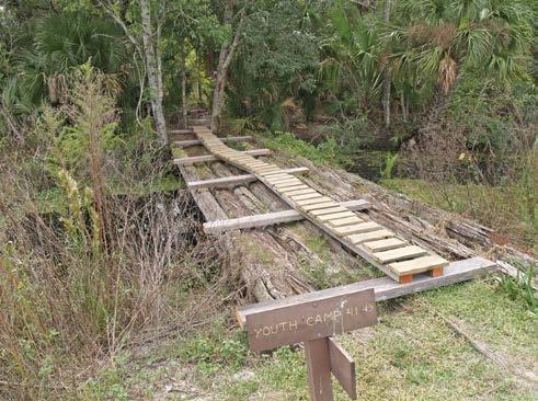
A number of footbridges needed to be constructed at various points along the trail. It is hard to believe today, but the FTA proposal to the state included the option of constructing bridges by felling and delimbing nearby trees and placing the logs across the stream or ditch. DRP rejected this option out of a concern that Florida’s voracious termites would make short work of the untreated logs! FTA got a donation of salvaged utility poles and these were muscled to the bridge sites by rope slings, rollers, and Come – Alongs (a type of hand winch.) These bridges would not pass muster by today’s standards as they were just two slippery logs, laid side by side across a ditch and with no decking or handrail.

DRP planned to open Tosohatchee to the public in January 1980. Our target was a completed trail system to greet the first visitors. We were close to the finish line when a glitch hit. Back then orange was the FTA standard blaze color. The blazes were barely dry when a DRP directive came down stating that all Tosohatchee blazes should be white. Bill Arbuckle requested a reconsideration, but to no avail and we repainted the blazes. The trail work got done and Tosohatchee opened to the public in January 1980. This event was featured in an article in the local newspaper.
Modifying the Trail Route: Ranches and Floodplains
The annotated map of Tosohatchee shown here reflects the trail system that existed in 1993. At that time, the FNST was envisioned to come up from the south through Deseret Ranch and enter Tosohatchee at the southwest corner, where there was a campsite with a well. The trail proceeded north, crossing Taylor Creek on a suspension bridge that no longer exists, and then north to a trailhead at SR520. After crossing SR 520 (then 2-lanes), the trail headed east on a berm that connected to the dike that paralleled the St. Johns River.
The trail headed north on the dike to SR 528. Airboaters had cut a bootleg channel through the dike to gain access to the Main Back Canal on the landward side of the dike. The late Wylie Dykes headed up the Central Florida Chapter’s work at Tosohatchee South and the dike. Wylie's team built a fixed bridge over the airboat cut. This bridge had a short life as it was an inconvenience to airboaters. Wylie repaired it, but life was again short. At that point the ingenious Wylie designed and built a bascule bridge, pictured here. The trail passed under SR 528 at the Mud Lake Canal bridge, and proceeded north west to intersect the main trail. Then, the trail headed north to Christmas.
Two things happened that spoiled this vision for the FNST. First, Deseret Ranch abrogated the trail agreement. Second, the state undertook a massive floodplain restoration project that removed the dike and filled in Mud Lake Canal and some other drainage ditches. Jim Creek was restored to its historic channel. This resulted in the loss of all the trail east of Jim Creek that is highlighted in orange. Also gone was the Whetrock Campsite, so named because there was some type of rock where feral hogs whetted their tusks. Note: all Tosohatchee place names are from a hand drawn map of the longtime caretaker.


The dike removal caused a firestorm within FTA, with both the main office and myself being contacted by individuals demanding "How can they do this? Doesn't the trail establish priority?" Based on Florida Statutes Chapter 259 Land Acquisitions for Conservation and Recreation, “such lands shall be primarily managed to benefit the resources for which the property was purchased to protect, and that all other uses, such as recreation or hunting are secondary and must be in consonance with the primary purpose.” Thus, the dike trail was trumped and the dike removed.
Unfortunately, between SR 520 and SR 528 all the dry upland is on the Deseret side of the boundary. This did not deter a number of adventurous individuals from undertaking a quest similar to the historic Search for the North Passage. For several years, park management and myself received requests for access to Tosohatchee north of SR 520 so they could scout a route to SR 528. As was known to both me and Parks, such a route would only be possible under drought conditions. A survivor of one of these search parties organized by the legendary Tony Florhes, who told me they turned back when the water level got up to a woman’s chin!
As evidenced by obstacles met along the way, a trail is never truly complete. These historical accounts of the Tosohatchee section reflect the collaboration, perseverance, and adaptability that is necessary to build and maintain the Florida Trail.
Photos
72 Turkey Camp
72 Beehead Ranch House
73 Bunkhouse near Beehead Ranch House
73 Bumby Camp Ruins
74 Horses used to access the backcountry in Tosohatchee
76 Remnants of the ranch at Tosohatchee
76 Bascule bridge designed and built by the late Wylie Dykes
76 Original powerline road canal bridge
77 Tosohatchee map dated July 1993 showing the trail system that existed at that time.
78 Wildflowers in Tosohatchee

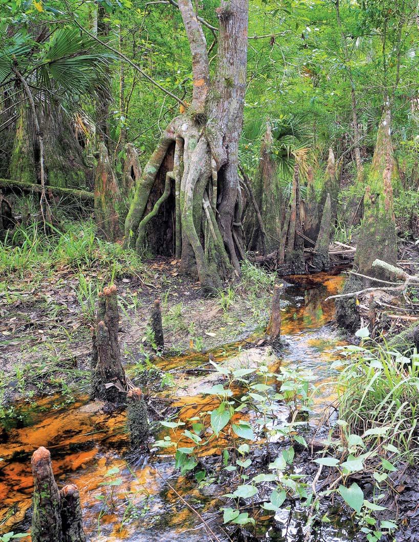
79 Tosohatchee creek at present day
80 Tosohatchee creek at present day

Connecting People and Places
by Tommie Gipson
How The Florida Trail Changed Our Lives


Idiscovered the Florida Trail from a YouTube channel a few months after my wife died unexpectedly. We were married 37 years and losing her left a huge hole in my life. I decided to get outside more and began section hiking the trail near my home in the panhandle. Hiking with my wife’s Yorkie became therapeutic for both me and her dog. Being in nature and soaking in the quiet stillness of life all around helped heal the deep wound in my heart.
One day while hiking to the highest point, I stumbled on something I could not believe. There is a bench at the highest point along with a sign. Two ladies had covered the bench with a tablecloth of the American flag. On top of that was wine, cheese, grapes, crackers, and chocolate. I knew we were at least five miles from the closest road and just had to stop and talk to them. They had been section hiking from the northern terminus over one hundred miles away and decided to celebrate. They loved my dog and asked me to join them. I took out a beer from my pack and sat down next to them.
We hit it off and I began weekly section hikes with them heading SOBO. Eventually one of the ladies (who was 71) decided she had gone far enough, but Deb and I continued hiking. Deb returned to the northern terminus and re-hiked the trail back to the highest point with me.
That was almost two years ago. Together Deb and I have section hiked over 300 miles from the northern terminus all of the way through Bradwell Bay in the Apalachicola National Forest (including the connector trail through Blackwater Forest to Alabama.)
Deb was not sure what direction to turn before she discovered hiking. She was stuck in an unhappy situation and was looking for a way out. She began hiking, hoping to find something to put her life back on track. She tells people that hiking literally saved her life. She rediscovered a side of her she had suppressed long ago. When she was hiking, all was well with the world and she began to return to a place where she could once again see the magical mysteries of life.
We both allowed the Florida Trail to change our lives. Together we have enjoyed the diverse beauty of the Florida Trail and the wonders of nature. After many miles on the trail, we have become more than just the best hiking and camping friends ever. We have bonded in ways that can only come from hiking miles and miles together. Hiking the Florida trail has changed our lives in beneficial ways neither of us could have imagined. We will forever be grateful for finding each other at the highest point on the Florida Trail.


