9 minute read
Sandhills and Steepheads


by Adam Fryska, Panhandle Trail Program Manager
Exploring the Highlands of the Florida Panhandle
Advertisement
From sub-tropical swamps and marshes to pine flatwoods, prairies, and even coastal sand dunes, the Florida Trail offers hikers a fascinating spectrum of ecosystems to explore. Much of this natural diversity is the result of surprisingly small changes in elevation. Often only a few feet of elevation change will completely change the character of the trail (and determine whether your feet will be getting wet or staying dry); a typical example is the matrix of high pine, mesic flatwoods, and swampy hardwoods that is found along many sections of trail throughout Florida. These elevation changes are subtle, and hikers rarely notice that they’re actively climbing or descending. Our hilliest areas are concentrated in the panhandle region, and even there the changes are gradual, more rolling hills than rugged climbs. Two habitats in particular are emblematic of the Panhandle's highest topography along the Florida Trail: sandhill uplands and steephead ravines. Traveling from the low pine flatwoods and swamps of the Apalachicola National Forest, the first major protected upland environments encountered by north-bound panhandle hikers are the 41,363 acres of the Econfina Creek Water Management Area. This area crosses a series of high sandhills that are split by the largely spring-fed Econfina Creek; the creek itself is the steepest gradient paddling trail in the state, featuring rocky limestone bluffs and even occasional whitewater rapids. The primary habitats here are xeric—meaning, “very dry”— sandhill uplands. These are fire-adapted forests of widely spaced pines and turkey oak in sandy soil. A fine example of this landscape can be found just off of the Highway 20 trailhead north of Panama City. Hiking here can be hot and dusty, especially in younger sections of the forest. The Northwest Florida Water Management District (NWFWMD) is in the process of restoring these hills from farmed slash pine to native longleaf pine. Many stretches have been clear cut and replanted in the last few years, and hikers can spot the distinctive grassy tufts of baby longleaf pines that have been thickly planted along the hillsides. These young trees spend many years without growing much in height, devoting their energy to the development of a deep root system that allows them to thrive in this extremely dry environment. From Econfina, the Florida Trail continues west and north through many more miles of rolling sandhill uplands in the Nokuse Plantation and Eglin Air Force Base. Like NWFWMD, these land managers have been doing tremendous work to restore and protect the longleaf pine forests of these dry highlands. The Eglin portions of the trail feel like the roof of the Florida Trail, our own little mountain range, with bigger hills and many significant hill climbs and descents to scenic stream crossings. The trail's highest point, 271 feet above sea level, is located in the north-eastern portion of the section. From the trailhead at Bob Sikes Road, hikers gradually “climb” about 100 feet over the course of 3 miles through sparse sandy forests and scrubland to attain this summit, making this probably the most easily attainable high point of all the National Scenic Trails. Despite its modest elevation, the sparse trees and scattered deer moss are somehow evocative of the high country in mountainous areas far to the north. Located about 15 miles due north, at Britton Hill near the Alabama border, is Florida’s state high point of 345 feet above sea level. Further to the west, the Weaver Creek area of Eglin also features some of the largest hill climbs along the trail, one of which offers sweeping views of the wetlands around the Yellow River. The last major stretch of upland habitats along the Florida Trail is found in Blackwater River State Forest. The largest state forest in Florida at 211,000 acres, this region of longleaf pine and mixed upland forests on sandy red clay soil stretches from the Alabama border to the Yellow River. Blackwater is the site of our trail’s alternative northern terminus, a remote kiosk at the state border line; from here, some long-distance hikers continue north along a series of Alabama road-
An example of longleaf pine restoration habitat in Econfina.
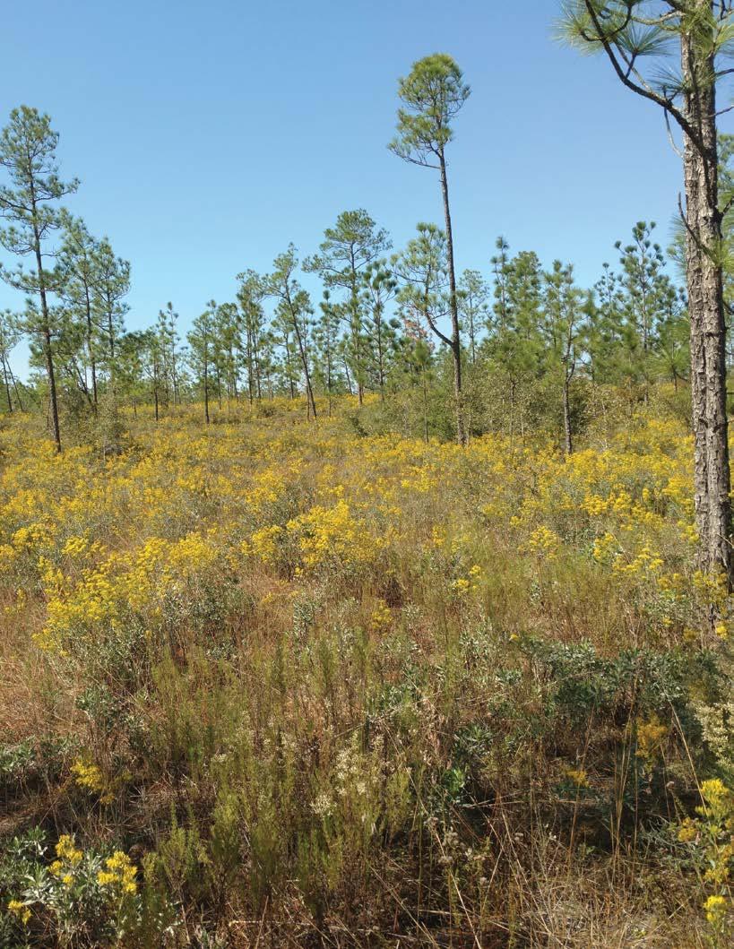

Photo courtesy of Wallis Mayo
FTA volunteers installed the Florida Trail High Point marker in 2011.
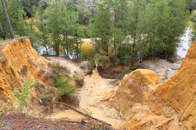
walks to the Pinhoti Trail and then onwards to the Appalachian Trail. Blackwater River State Forest is well known for its extensive stretches of mature longleaf pine forests and wiregrass savanna, part of an ecosystem that once covered over 60 million acres of the southeastern United States. Extensive logging decimated these forests, and only a tiny fraction still remain. Today, together with the Conecuh National Forest to the north and Eglin Air Force Base to the south, the Blackwater forest remains the largest contiguous stretch of longleaf pine and wiregrass savanna in the world. It is the best place along the Florida Trail to view established longleaf pines, providing a hint at what places like Econfina may one day look like when restoration work is complete. The sandy uplands in the panhandle are crossed by numerous spring-fed creeks and streams, and in many places erosion of the sandy soil has created dramatic bluffs and overlooks. One particularly impressive example is found along the red clay riverbanks of Juniper Creek in Blackwater River State Forest. From the Red Rock trailhead, a short hike south leads to a high viewpoint near a shelter and campsite. Steep eroded cliffs of red clay and sand drop down to the shoreline, creating a landscape reminiscent of the red cliff country of Utah. Another impressive shoreline view lies a few miles south of the Walsingham trailhead in Econfina. A sharp bend in the creek has created a deep sandy washout in the high bluffs, providing impressive views of the swiftly flowing creek and surrounding wetlands. Of all the erosion-formed features found along the Florida Trail, the most
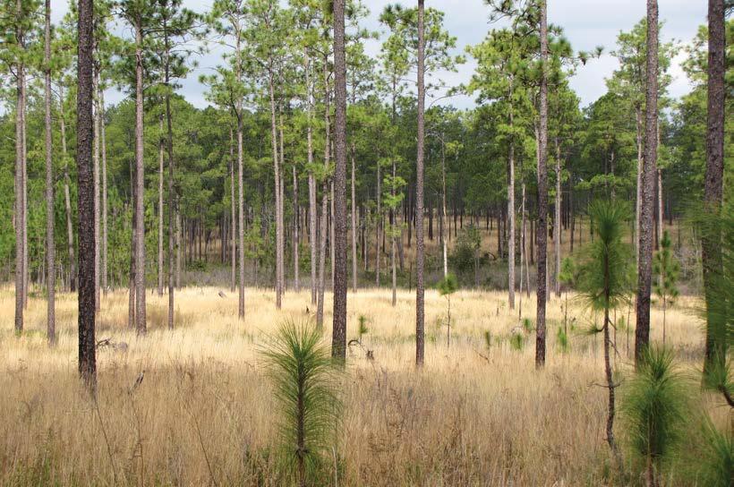
Blackwater River State Forest contains vast stretches of mature longleaf pine and wiregrass savanna ecosystems.
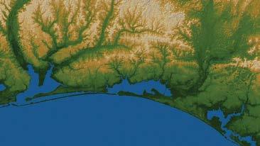
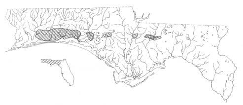
An elevation relief map of the Florida panhandle shows the network of uplands and eroded valleys typical of this region.
Photo courtesy of Van Tran
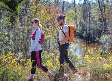
impressive are the steephead ravines. A steephead ravine is a deep, spring-fed gully found in upland sandhill ecosystems. They are unique topographical features of Florida's uplands, scattered along a relatively small section of the panhandle. Some steephead ravines can reach depths of 80 feet or more, a startling feature in an otherwise gentle landscape. Erosion of the sandy soil forms a deep amphitheater-like bowl around their spring seeps, gradually widening downstream into broad valleys that feed into the streams and major rivers of the panhandle. Considering Florida's relatively low elevation and topography, these ravines are the closest we get to canyons, presenting hikers with short but strenuous climbs and descents. They are extraordinarily cool Hikers high atop the sandy bluffs of Econfina Creek.
during the summer, with a canopy of thick hardwoods shading the lower elevations within the ravine. You can feel the air cool around you as you descend from the uplands into their shady depths, a welcome break from the dry heat of the pine sandhills. These cool and wet sheltered areas provide a unique habitat for many species of plants and animals; many of the species found within them are found nowhere else in Florida, and some aren’t seen again until several hundred miles to the north. Several distinctive species of salamanders have been discovered that are found only in
Extensive erosion is visible along the bluffs of Juniper Creek in Blackwater River State Forest
Graphic courtesy of D. Bruce Means
Steephead ravines have a fairly small distribution within Florida.
particular steephead ravines. Plants such as mountain laurel are remnants of the ice ages, remaining in the shelter of these ravines long after climate changes had pushed the rest of their species further north. Hikers can pass through lush corridors of wild azalea, magnolia and beech trees, sparkleberry, and Florida anise. Pitcher plants grow in the wetlands downstream of the steepheads. Extremely rare species such as the Florida Torreya tree and Florida Yew are also found exclusively in a small number of steephead ravines. One of the most impressive steephead ravines along the Florida Trail is found in the Weaver Creek section of Eglin Air Force Base. Just north of Range Road 213, the trail approaches a steep drop towards the headwater spring of Weaver Creek. The views from this point can be among the most sweeping of the Florida Trail, especially in the winter and early spring before the summer growth fills out. Hikers can peer down into a deep, thickly forested ravine and glimpse rolling ridgelines along the horizon; the scenery is reminiscent of the Appalachian Mountains located hundreds of miles to the north. A short loop trail allows hikers to descend almost 80 feet down into the ravine and back up to the overlook. Another noteworthy steephead ravine is found in Econfina. Heading east from the Strickland Road crossing off of Highway 20, hikers pass through a sparse forest of planted slash pine and longleaf pine restoration habitat before approaching the steep drop into another ravine. The faint sound of trickling water rises from a small creek almost 50 feet below. Soon a series of short switchbacks— one of the steepest sections along the entire Florida Trail—leads hikers to a picturesque sandy crossing at the base of the gully. Within the sand and clay of the stream bank are huge quantities of fossilized seashells, evidence of the ancient receding coastline of the Gulf of Mexico that now lies 30 miles away. With their steep grades and erosion-prone soil, steephead ravines present a unique challenge for our volunteer trail maintainers. They are one of the few terrain features along the FT that can require switchbacks, stairways, and other erosion control measures. In the past few years, several steephead sections of the Florida Trail in Econfina required significant work to rebuild following the catastrophic damage inflicted by Hurricane Michael, and more work will need to be done. We’re always looking for volunteers to help out! Keep an eye on the FTA’s Volunteer Opportunities page at: floridatrail. org/volunteer/volunteeropportunities/, as well as the Panhandle Chapter’s Meetup page at: meetup.com/hiking-central-panhandle/ for more information.
Looking out across the valley of the Weaver Creek steephead ravine.
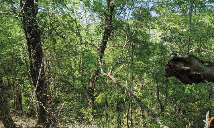
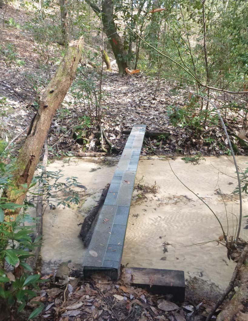
The clear, sandy-bottom stream found at the bottom of a steephead ravine in Nokuse.
Photo courtesy of Adam Fryska