


Frankston City Council acknowledges the Bunurong people of the Kulin Nation as the Traditional Custodians of the lands and waters in and around Frankston City, and value and recognise local Aboriginal and Torres Strait Islander cultures, heritage and connection to land as a proud part of a shared identity for Frankston City.
Council pays respect to Elders past and present and recognises their importance in maintaining knowledge, traditions and culture in our community.
Council also respectfully acknowledges the Bunurong Land Council as the Registered Aboriginal Party responsible for managing the Aboriginal cultural heritage of the land and waters where Frankston City Council is situated.
The ease of reaching destinations. In a highly accessible location, a person, regardless of age, ability or income, can reach many activities or destinations quickly, whereas people in places with low accessibility can reach fewer places in the same amount of time.
The features of an area, street or building, that provide facilities and services that contribute to physical or material comfort and benefit, and are valued by users. An amenity can be either tangible, such as open space, seating, a swimming pool or gym; or intangible, such as pleasant views, air quality, or proximity to a local school or supermarket.
Arterial road
The principal routes for the movement of people and goods within a road network. They connect major regions, centres of population, major transport terminals and provide principal links across and around cities. Arterial roads are divided into primary and secondary arterial roads. Declared arterial roads are managed by the Department of Transport. Also see 'Major roads'.
Blank Wall
A wall which has few or no windows or doors, and has no decoration or visual interest.
Habitable areas
Areas in which patrons and users of the building typically carry out day to day activities. Examples include office spaces, lunch rooms, meeting rooms, etc.
Facade (or 'building facade')
The principal wall of a building that is usually facing the street and visible from the public realm. It is the face of the building and helps inform passers-by about the building and the activities within.
Where different types of land use meet or are in close proximity to each other, and where there may be conflict due to air emissions and noise from a land use detrimentally affecting another.
Landscape buffer
An area in which landscaping is used to screen or protect the amenity adjacent land or property.
Major road
Major roads accommodate high volumes of motor vehicle traffic including public transport and freight, and have higher design speeds (60–100 km/h). Major roads can have two or more traffic lanes in each direction and may provide for on-street car parking, bus lanes or tram tracks, bicycle lanes, as well as verge space for pedestrian paths, infrastructure and landscaping. Also see 'Arterial roads'.
Open space
Land that provides recreation and leisure benefits and is accessible to the public.
The extent to which the urban structure permits, or restricts, movement of people or vehicles through an area, and the capacity of the area network to carry people or vehicles.
The street frontage which holds the main address to the lot and from which the site is most accessed. Typically, the primary building frontage is adjacent to the street, driveway, or parking lot that provides access to the building.
The size of a building in relation to its surroundings, or the size of parts or details of the building, particularly in relation to the scale of a person. Scale refers to the apparent size, not the actual size.
Land uses considered to be potentially sensitive to emissions from industry and infrastructure including; but not limited to; residential developments, hospitals, hotels, motels, hostels, caravan parks, schools, nursing homes, child care facilities, shopping centres, playgrounds, and some public buildings.
The distance of a building wall from any lot boundary. A building front setback can add to the perceived width of the street, provide additional public or private space, and allow space for landscaping. A building set on the front property boundary has zero street setback.
Lines of clear, uninterrupted sight from a viewer's location to other locations and distances.
The visual character of a street space that results from the combination of street width, curvature, paving, street furniture, plantings and the surrounding built form and detail. The people and activities present in the street also contribute to the streetscape.
The act of subdivision means the division of a land parcel into two or more parts which can be disposed of separately. It is also a term used for the resulting pattern of blocks and lots, and streets.
Observation, from the street or from adjacent buildings, provided by ordinary people as they go about their daily activities. This kind of observation can deter criminal activity or anti-social behaviour and make places feel safer.
Sometimes termed 'casual surveillance' and 'eyes-on-the-street'.
Urban context refers to the broader setting of an identified area. The context may include the physical surroundings of topography, movement patterns and infrastructure, built form and uses, and the cultural, social and economic environment.


The purpose of the Guidelines is to provide guidance for the design of developments and subdivisions in Frankston City's Industrial Precincts. It is intended to be used by applicants in the preparation of planning permit applications and by Council in the subsequent assessment of these permit applications.
The Guidelines support the recommendations of Frankston's Industrial Strategy and outline how existing and future industrial and commercial areas should look and function, and how they should respond to the local environment and surrounding context.
The Guidelines aim to ensure that relevant industrial and commercial areas within the City are functional, attractive, and sustainable environments for businesses, workers and visitors.
The objectives of these Guidelines are:
• To facilitate the development of functional, well serviced, amenable, and attractive industrial areas that have regard to local conditions and amenity.
• To establish a standard of development that assists in attracting desired economic development, facilitates business and employment opportunities and growth, and achieves state and local planning objectives.
The objectives for future development in the Frankston City Council (the City) are:
• To respond to the local characteristics of the site and its context.
• To make a positive impact on the amenity and environment in the City.
• To encourage environmentally sustainable design and integrated water management measures within all precincts.
• To recognise and build on the City’s existing industrial precincts and provide design guidance that supports future renewal and amenity improvements for workers and local residents.
The project is focused on industrial zoned land within Frankston City Council, as well as an area of commercial zoned land. Specifically, it includes the following six precincts:
• Precinct 1 - Seaford (including Kananook)
• Precinct 2 - Seaford North
• Precinct 3 - Carrum Downs
• Precinct 4 - Langwarrin
• Precinct 5 - Frankston East
• Precinct 6 - Frankston
These six precincts are mapped on Figure 1.


The Guidelines apply to all planning permit applications for the subdivision or development of land within the following land use zones:
• Industrial 1
• Industrial 2
• Industrial 3
In addition, the Guidelines apply specifically to Commercial 2 zoned land located between Overton Road, Dandenong Road, Mereweather Road and Kitson Street (i.e. Precinct 6).
Figure 1, broadly outlines these areas.
These Guidelines provide a set of easy to use illustrations and general design principles to assist in preparing and assessing a development proposal.
Subject to relevant approvals, agreements and consultation, these Guidelines are intended to supersede any existing industrial design guidelines. This will provide an up to date and consistent approach to the use, development and management of industrial land within the City.
Where there is a conflict between these Guidelines and a restrictive covenant or Section 173 Agreement, the restrictions will prevail; except where they are silent on an issue that these Guidelines address.
Subject to approvals and consultation, it is intended that these Guidelines will be implemented into the Frankston Planning Scheme through a Planning Scheme Amendment. This will help to give the Guidelines statutory weight and to help achieve improved design outcomes throughout the City’s industrial precincts.
Draft Amendment documents will be subject to public consultation as part of the formal Amendment process.
It is proposed that the application of the Design and Development Overlay will be the appropriate mechanism for implementing these Guidelines.
A number of existing guidelines are relevant to industrial and commercial development within the City. These include:
• Frankston City Council WSUD Guidelines;
• Frankston City Open Space Strategy 2016-2036;
• Frankston City Council Local Park Action Plan 2021;
• Lighting Frankston Plan 2021;
• Frankston City Council Landscape Plan Guidelines, September 2020;
• Frankston City Council Outdoor Signage Guidelines;
• Frankston City Council Nature strip planting guidelines, October 2022; and
• Frankston Indigenous Plant Guide. Applicants should refer to these documents for further information, as appropriate.
The Guidelines are structured into the following parts:
• Part A - INTRODUCTION - Provides the overall objectives for the Guidelines and instructions on how they apply.
• Part B - SUBDIVISION DESIGN GUIDELINES
- Provides guidelines for subdivision permit applications within the zones listed in Section 2.1.
• Part C - DEVELOPMENT DESIGN GUIDELINESProvides guidelines for buildings and works and signage permit applications within the zones listed in Section 2.1.
• Part D - PRECINCT SPECIFIC GUIDELINESProvides guidelines for specific precincts listed in Section 1.4.
The diagram below outlines the sections of the Guidelines that are to be considered for each type of permit application.
All parts relevant to the proposal should be considered.
APPLICATION TYPE / RELEVANT PARTS OF THE GUIDELINES SUBDIVISION APPLICATIONS DEVELOPMENT APPLICATIONS (BUILDINGS & WORKS & SIGNAGE) PART
The Guidelines include helpful tips and links to assist in providing further information for applicants. This includes links to relevant sections of the Frankston Planning Scheme and other reference documents, as appropriate.
These are identified with the following graphic:
It should be noted that while links are provided, the helpful tips and links do not provide a comprehensive list of all requirements or conditions to be considered as part of a permit application; nor does it consider restrictive covenants, Section 173 Agreement or other specific restrictions.
It is the responsibility of the applicant to ensure all relevant requirements and obligations are met.
Applications for subdivision and development within relevant zones and precincts (listed in Section 2.1) will be subject to the standard approvals process.
Applicants should use the Guidelines in preparing planning permit applications for subdivision, buildings and works or signage, to assist them in complying with the requirements of the Frankston Planning Scheme. Council will consider how the application has responded to the requirements of the Frankston Planning Scheme when assessing permit applications.
Before applying for a planning permit, applicants are encouraged to meet with Council officers, as part of their pre-application service, to:
• Discuss what information is required for the application,
• Discuss any relevant development constraints, and
• Confirm which Guidelines are relevant to their particular application.
Council will consider each development proposal on its merits, taking into consideration the individual context and site characteristics.
Council may impose permit conditions that will enable the development proposal to meet the requirements of the Frankston Planning Scheme and these Guidelines.
For all applications the following drawing and reports are to be prepared and submitted as part of the permit application.
Subdivision and Development Applications:
• Site Context Plan - Identifies surrounding land uses, built form siting, landscape elements and transport networks.
• Site Analysis and Design Response PlanIdentifies:
• Surrounding land uses and sensitive interfaces (existing and where relevant, proposed);
• Existing and future (where applicable) transport networks, including road, public transport, pedestrian and cycle routes;
• Surrounding built form character and heights;
• Significant vegetation and other natural and topographic features;
• Climatic conditions including solar access and prevailing winds,
• Any significant views to and from the site;
• Predominant landscape and cultural heritage character of the area;
• Drainage and potential flooding impact;
• Easements (e.g. high pressure gas pipelines, fuel pipelines or high voltage power lines); and
• Servicing (electricity, gas, water, sewer, and telecommunications).
• Site Layout Plan - Details the boundaries and dimensions of the site, adjoining roads, relevant ground and drainage levels, the layout of existing and proposed buildings and works, driveways and vehicle parking and loading areas, proposed landscape areas, and external storage and waste treatment areas.
• Landscape Plan - includes a description of vegetation to be planted, the surfaces to be constructed, a site works specification and the method of preparing, draining, watering and maintaining the landscape area. Refer to 2.4 Frankston City Council Landscape Plan Preparation Guidelines.
• Floor Plans - Building layout plans.
• Elevations and Cross Sections - Required as necessary to show the dimensions, colours and materials of all buildings and works.
• Guidelines Response Submission - A policy statement outlining the details on how the development responds to the objectives and, in the case that Guidelines are not met, providing justification on how the objectives are being satisfied.
In addition, other plans and reports that may be requested by the responsible authority or referral authorities as part of an application or as a condition could include:
• Aboriginal Cultural Heritage Management Plan
• Traffic Report and Management Plan
• Stormwater Management Plan
• Site Management Plan
• Arboricultural Report
• Tree Management Plan
• Vegetation Retention / Removal Plan
• Environmental / Soil Management Plan
• Acoustic Assessments
• Environmental Sustainable Design (SDA)/ Sustainability Management Plan (SMP)
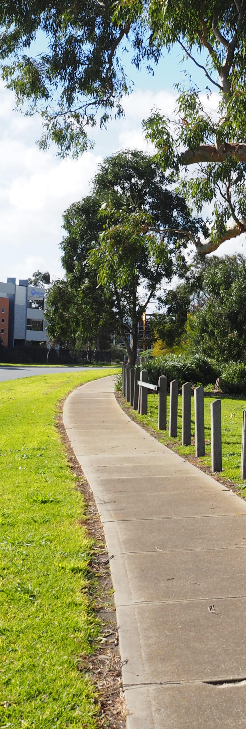


Subdivision design influences how industrial precincts develop, function and integrate with their surrounding context.
Part B identifies objectives for desirable subdivision design and guidelines to achieve these objectives.
O4.1.1 To provide a safe, functional, connected and attractive street network that responds to the local characteristics of the site and its context.
O4.1.2 To allow for the safe and efficient movement of people and goods, at all hours of the day.
O4.1.3 To maximise passive solar design through the orientation of the street network.
G4.1.1 Provide a logical road hierarchy that considers all road users including heavy vehicles, public transport, cars, cyclists and pedestrians and separates them where necessary. Road hierarchy and treatments should be clearly articulated as part of the subdivision application.
G4.1.2 Connect new streets with established arterial and major street networks to enhance permeability and ensure future connections to adjoining industrial areas are provided (refer to Figure 3 and 4). Avoid court bowls, where possible.
G4.1.3 Design the street network to avoid directing industrial traffic along local residential streets.
G4.1.4 Design the street network to facilitate buildings that address the public realm (such as streets, waterways and public open space) and avoid unsightly blank interfaces.
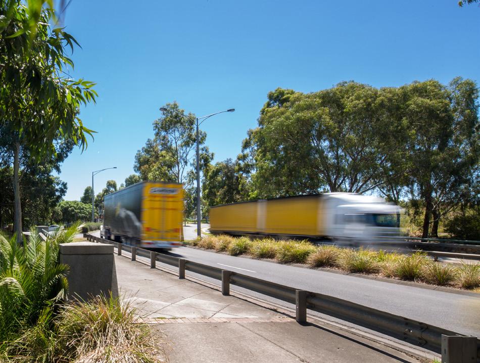
and goods.
G4.1.5 Design street networks to integrate existing site features such as drainage, topography, vegetation and heritage.
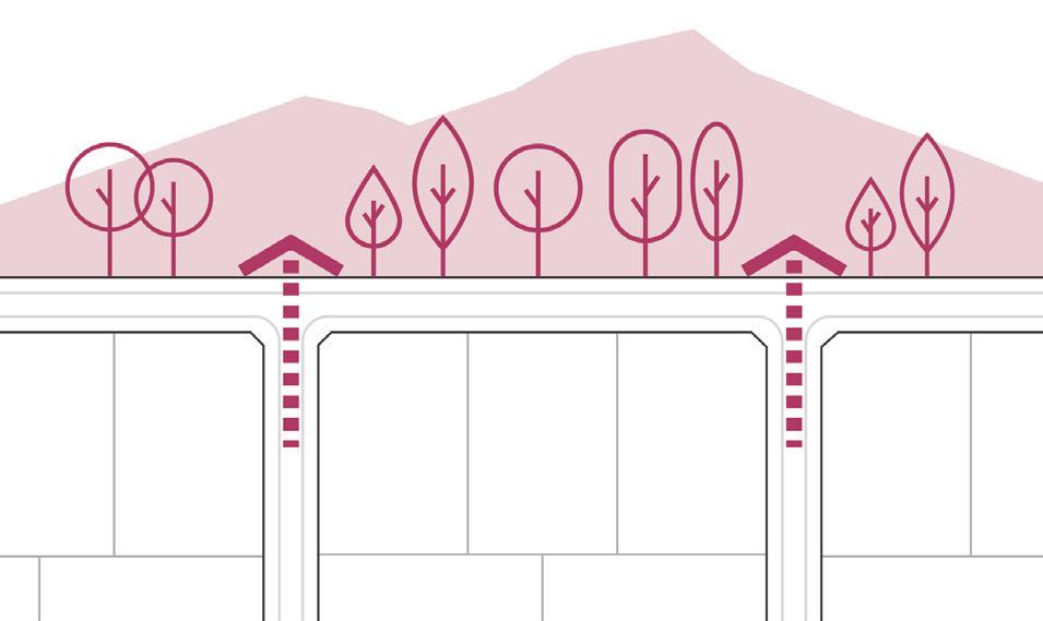
G4.1.6 Orientate streets to capture and maintain any key views to enhance the amenity of the precinct.
G4.1.7 Orientate streets north-south and east-west, wherever possible, to maximise passive solar access opportunities for lots.
G4.1.8 Ensure new subdivisions incorporate adequate street widths to provide for waste collection, emergency vehicles, street tree planting, walking and cycling infrastructure and public transport, where required.
Streets should be designed in accordance with Council’s Standard Drawings and the relevant Australian Standards.
FUTURE CONNECTION
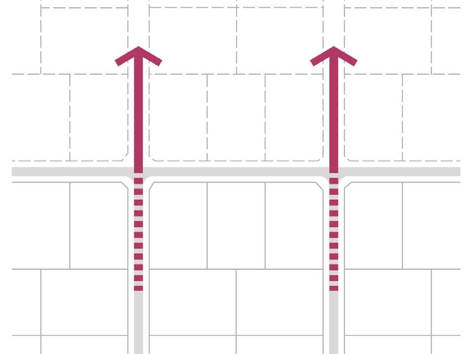
PROPOSED SUBDIVISION
Streets to continue between existing and proposed areas
EXISTING SUBDIVISION
Streets designed so lots front onto open space

Streets orientated to maximise solar access opportunities
O4.2.1 To ensure pedestrians and cycle access is integrated into the design of future subdivisions.
O4.2.2 To promote walking and cycling as suitable transport alternatives for workers and visitors.
O4.2.3 To provide safe, convenient, and comfortable access for pedestrians and cyclists.
G4.2.1 Develop a pedestrian and cycle network as part of the subdivision application that provides for continual and safe access between key destinations, open space and public transport within the area. The network should provide street tree planting for amenity and shade, connect into existing trails and residential areas, and provide signage to direct people to key destinations and connections.
Interconnected and permeable street network
G4.2.2 Provide shared pedestrian and cycle paths along key routes including major and arterial road and thoroughfares. Shared paths should have a sealed surface and a minimum width of 2.5m to provide a comfortable level of separation between pedestrians and cyclist.
G4.2.3 Provide sealed pedestrian paths on both sides of new streets (except where there is a shared pedestrian and cycle path), that are a minimum width of 1.5m.
Streets orientated to capture key views and maintain views from adjoining areas to surrounding landscape elements
Nature strip planting to be in accordance with the Frankston City Council Nature strip planting guidelines.
Objectives
O5.1.1 To provide streetscapes that respond appropriately to particular characteristics of the site and precinct, encourage the retention of high value trees and planting of new trees.
O5.1.2 To ensure streetscapes are durable and require minimal maintenance.
O5.1.3 To ensure tree planting is provided within all streets.
Guidelines
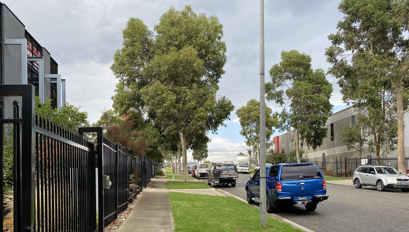
G5.1.1 Develop a landscape masterplan for new streetscape and open spaces as part of any subdivision application. The landscape masterplan should outline how the design will:
• Incorporate elements of the local area character, through the provision of verges, landscaping and incorporating existing significant vegetation. Verges should be wide enough to accommodate large street trees, particularly when located adjacent to a creek reserve;
• Incorporate gateway features at key entries into industrial areas, including signage.
• Utilise street tree planting species and siting to reinforce the movement hierarchy and desired character for an area. This could include formalised avenue planting for areas such as key entries and planting to reinforce movement connections;
• Utilise low level native or indigenous shrubs and grasses in conjunction with canopy trees; and
• Utilise low maintenance passive irrigation techniques to irrigate street trees with captured stormwater.
Street lighting should be designed and located in accordance with relevant Australian Standards.
G5.1.2 Incorporate street lighting that is sited and designed to provide for a safe journey along pedestrian paths.
G5.1.3 Provide public furniture including seating and bins at key open space nodes, key paths and streetscapes within new subdivisions to activate streets. Open space furniture, including lighting, to be designed and located in accordance with Frankston City Council open space standards.
G5.1.4 Provide tree planting along all new streets, existing roads and within open space areas. Tree planting should aim to achieve a minimum 20% canopy cover within streetscapes, where possible.
G5.1.5 Ensure new industrial development incorporates underground power and solar street lighting.
High value canopy trees and vegetation to be protected in accordance with Australian Standards AS 4970:2009 –Protection of trees on development sites.
Objectives
O5.2.1 To provide adequate provision of usable and amenable open space within industrial areas.
O5.2.2 To ensure new developments provide suitable activation and passive surveillance of existing and new open space areas.
O5.2.3 To integrate natural and valued landscape elements within new open space areas that reflect local character qualities.
Guidelines
G5.2.1 Distribute open space throughout the subdivision so that it is accessible to workers of the business or industrial area, and other surrounding land uses.
G5.2.2 Incorporate paths, seating, shade and landscape features into open space areas.
G5.2.3 Incorporate natural elements into the open space network such as creeks or water bodies and areas of established vegetation. Provide linear open space links along creeks with appropriate pedestrian and bicycle access.
G5.2.4 Site open space to optimise views and vistas to key landmarks and topographic features.
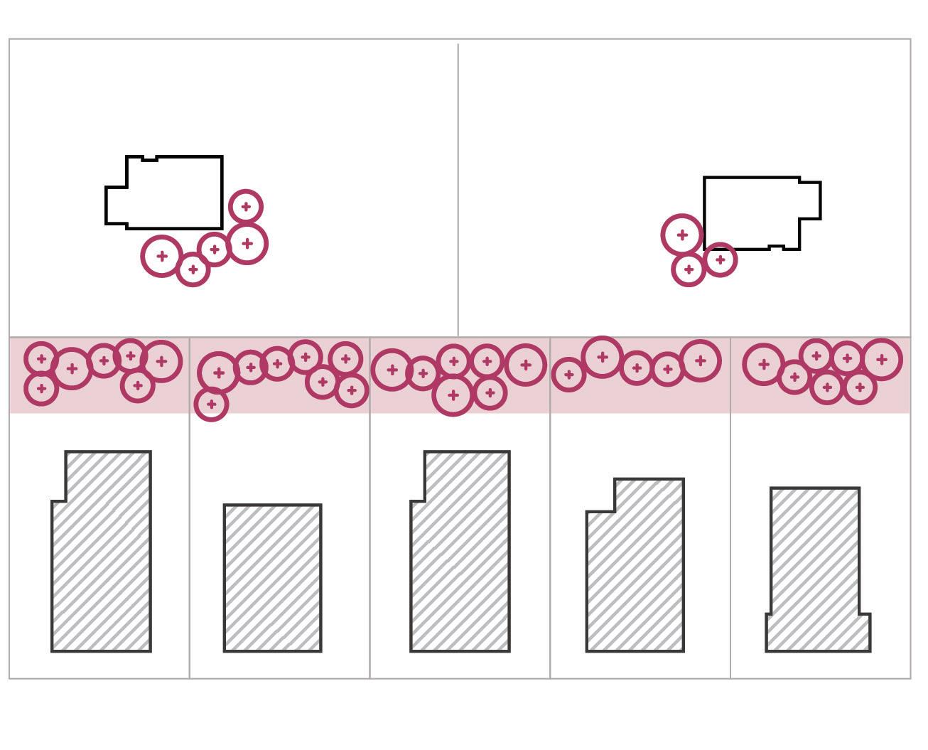
G5.2.5 Design street networks so that buildings will front onto the open space on each side and provide smaller lots at the open space frontage in order to achieve greater activation (refer to Figure 6).
G5.2.6 Open space should have a minimum of three street interfaces.
G5.2.7 Locate uses such as cafés and convenience shops adjacent to the open space to take advantage of the outlook and provide a location for staff and visitors to enjoy outdoor dining (refer to Figure 6).
Street design enables lots to front onto the adjacent open space. Ideally open space should have streets along a minimum of three sides.
Linear open space provides a buffer to the residential area
RESIDENTIAL AREA

INDUSTRIAL AREA
The Frankston Planning Scheme, requires a public open space contribution for land that is to be subdivided for industrial or commercial uses. Refer to the Frankston Planning Scheme and Frankston City Open Space Strategy 2016 - 2036.
O6.1.1 To create suitably sized lots that are functional, accessible and contribute positively to public streets and open spaces.
O6.1.2 To provide for a diversity of lot sizes and enable flexibility within lots to cater for a range of industrial and commercial uses.
O6.1.3 To appropriately respond to the site’s constraints and features whilst providing lots that are usable in terms of size and shape.

Create larger lots where natural features, including high value trees.
G6.1.1 Lot sizes are to be of an adequate size and dimension, to enable objectives and guidelines contained in Part CDevelopment Guidelines, to be satisfied for future development.
G6.1.2 New subdivision should create a variety of lot sizes. In determining the appropriate mix of lot sizes the applicant should have regard to the Industrial Land Strategy and Part D - Precinct Specific Guidelines as applicable, in accordance with metropolitan strategic planning policy for industrial and commercial land.
G6.1.3 Locate larger lots (i.e. at least 4000 sqm or with a frontage width of at least 30m), along major roads and higher order roads within the road hierarchy (refer to Figure 7) to allow loading, storage and employee parking to be located to the side or rear of the building, where possible.
G6.1.4 Ensure larger lots are provided where natural features, including high value trees and vegetation and topography, constrain the site.
G6.1.5 Create lots that are regular in shape and square to the street, wherever possible, for an efficient use of land and to provide a visually uniform streetscape.
Orientation
G6.1.6 Orientate lots north-south or east-west to maximise passive solar design, where possible (refer to Figure 7).
G6.1.7 Orientate lots so that the primary frontage is to the higher order roads within the road hierarchy (refer to Figure 7) and buildings have sufficient frontage to address the public realm including streets, creek reserves and public open space.

Lots are regular in shape
Lots are orientated so the primary frontage is to the higher order road
Provide adequate lot size to enable access, landscaping and built form objectives to be achieved
Lots orientated north south or east west to maximise solar design opportunities
Objectives
O7.1.1 To carefully manage the interface between industrial uses and adjoining residential areas, sensitive land uses, key thoroughfares, open space and environmental areas.
O7.1.2 To ensure adequate visual and sound buffers are provided to adjoining residential areas and sensitive land uses.
Guidelines
G7.1.1 Create separation between proposed industrial areas, and residential and sensitive uses, by providing a road with at least a 10m wide landscape buffer or a substantial open space area with a minimum width of 20m. The landscape buffer or open space should incorporate landscape screening and noise attenuation techniques such as planting and mounding. Alternatively, provide larger lots (greater than 4000sqm) along interfaces to residential or sensitive land uses so that a substantial landscaping screen (minimum 10m) can be accommodated within the proposed lot (refer to Figure 8 and Section 11 for further details).
G7.1.2 Design the road network so that development will front onto freeways and major roads. Utilise service roads or provide direct access to the adjacent road where appropriate.
G7.1.3 Provide a road between open space, creek or water body interfaces and proposed lots so that development can front onto this interface, provide passive surveillance and benefit from the outlook. Alternatively, a pedestrian path / driveway can be provided if a road is not required or feasible.
Proposed land uses should be appropriately designed and located in accordance with separation distances outlined in Clause 13.05, 13.06, 13.07 and land use buffers outlined in Clause 53.10 of the Frankston Planning Scheme.
Provide a minimum 10m wide landscape buffer between along the interface between residential / sensitive use uses.
Objectives
O8.1.1 To ensure that the street operates adequately during major storm events and provides for public safety.
O8.1.2 To minimise any increase in stormwater run-off and protect receiving waters from environmental degradation.
O8.1.3 To encourage stormwater management that maximises the retention and reuse of stormwater.
O8.1.4 To encourage stormwater management that contributes to cooling, local habitat improvements and provision of attractive and enjoyable spaces.
Guidelines
G8.1.1 The design for stormwater and drainage should:
• Respond to natural site drainage characteristics;
• Retain and enhance the function of natural drainage features in the area including drainage corridors and waterways;
• Utilise porous surfaces to maximise infiltration and incorporating other water sensitive urban design (WSUD) treatments to manage storm water run-off in streets; and
• Create attractive landscape features within sites or streetscapes, that are easily maintained.
All new development must meet relevant flood protection criteria. Refer to Melbourne Water Guidelines and Frankston City Council's requirements to build on flood prone land for further details.
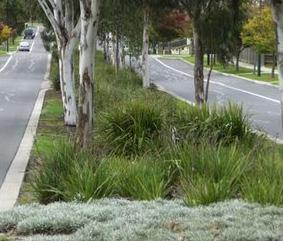
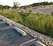
An integrated water management approach should be adopted for all subdivision applications to sustainably manage water supply and demand, water resources, wastewater, drainage and stormwater. Refer to Clause 53.18 of the Frankston Planning Scheme and Frankston City Council's WSUD Guidelines for further details.

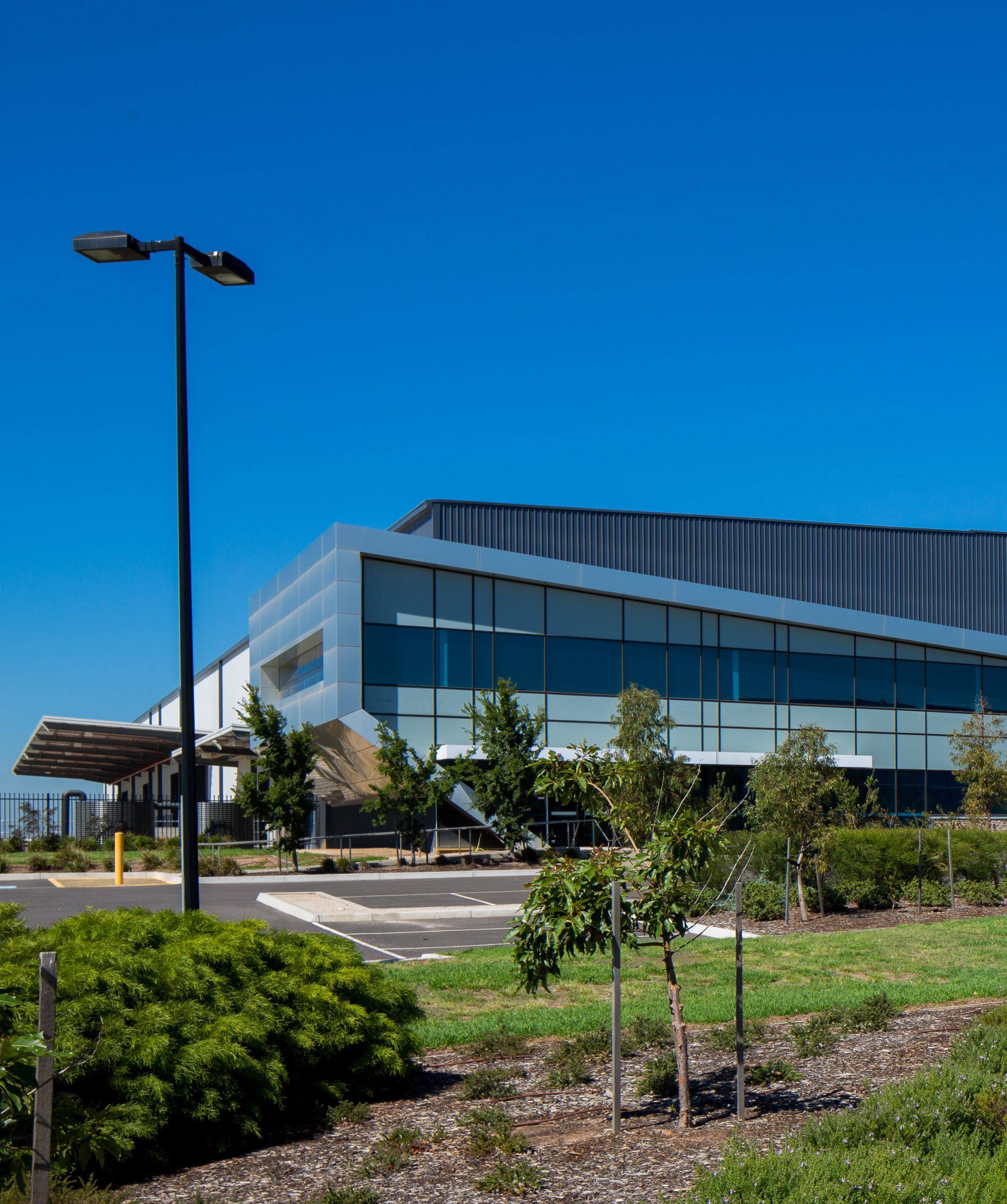

The placement and design of buildings and development on a lot can influence the appearance, functionality and sustainability of the broader industrial precinct.
Elements such as building design, siting and orientation, access and car parking, landscaping and waste and storage can influence the way in which people engage and use a space and the presentation and character of the precinct. Responding to existing features such as drainage, vegetation or heritage can ensure development is enduring, cohesive and positively contributes to the broader character of the industrial precinct. Setbacks also provide visual relief and separation between land uses.
Part C identifies objectives for desirable development and building design and guidelines to achieve these objectives.
Precinct specific guidelines are outlined in Part D.
Building design and siting outcomes aim to achieve best practice in environmentally sustainable development from the design stage through to construction and operation. Refer to 15.01-2L of the Frankston Planning Scheme and Amendment C157 – Elevating Environmentally Sustainable Development (ESD) Targets.
Crime Prevention Through Environmental Design (CEPTED) principles should be considered for all development. CEPTED principles aim to improve the safety of the built environment, minimise the opportunity for crime, and promote safe, accessible and liveable places. Refer to the Safer Design Guidelines for Victoria for further details.
Objectives
O9.1.1 To ensure new development is designed to appropriately respond to the local characteristics of the site and its context.
O9.1.2 To create cohesive streetscapes that are characterised by consistent building setbacks.
O9.1.3 To ensure the siting of buildings provides adequate space for landscaping and planting and strengthen the landscape character of the area.
Guidelines
NB: Specific setback guidelines apply to Precinct 3Carrum Downs.
All Precincts
G9.1.1 For infill development, front building setbacks should be consistent with the predominant front setback in the street, except where G9.1.6 and G9.1.7 apply.
G9.1.2 Where there is no predominant front setback in the street and G9.1.6 and G9.1.7 do not apply, front setbacks should be no less than 5 metres from the front property boundary and comprise landscaping (including tree planting) and building access.
G9.1.3 Front setbacks should be landscaped in accordance with Section 13 of these guidelines and must not be used to store goods, materials, waste or rainwater tanks.
G9.1.4 Buildings with a width of greater than 30 metres should be setback 3m from both side boundaries in order to minimise the impact of a continuous built wall to the street and provide space between properties.
G9.1.5 For corner sites, excluding those where G9.1.8 applies, the setback from the secondary street frontage should be a minimum of 3 metres to enable sufficient space for landscaping and building access. This setback may be reduced if the facade to the secondary street frontage is well articulated. A reduced side setback will not be considered where the side boundary is opposite a residential zone.

Precinct 3 - Carrum Downs only
G9.1.6 Front setbacks should be no less than 20 metres for lots abutting Colemans Road and Boundary Road.
G9.1.7 Front setbacks should be no less than 10 metres for lots abutting major roads other than Colemans Road and Boundary Road.
G9.1.8 For corner sites within Carrum Downs, the setback from the secondary street frontage should be a minimum of 5 metres to enable sufficient space for landscaping and building access. This setback may be reduced if the facade to the secondary street frontage is well articulated. A reduced side setback will not be considered where the side boundary is opposite a residential zone.
Match the predominant front setback in the street

STREET
Objectives
O9.2.1 To ensure buildings are appropriately sited to address the primary street frontage.
O9.2.2 To provide opportunities for access to daylight and natural ventilation in buildings.
O9.2.3 To maximise opportunities for passive heating and cooling of buildings.
Guidelines
G9.2.1 Site buildings so that the building frontage (i.e. entrance, reception, customer service area) is parallel to and opens onto the primary street frontage, or the entry is otherwise legible to visitors.
G9.2.2 Orientate the habitable areas of the building to take advantage of the northern aspect and maximise opportunities for passive heating and cooling.
G9.2.3 Orientate buildings so that loading and servicing areas, and large car parking areas (i.e. greater than 20 spaces), are located to the rear or the side of the site.
10.1 Building Address, Design and Detail
Objectives
O10.1.1 To provide built form that contributes to creating attractive, engaging and cohesive streetscapes and public spaces.
O10.1.2 To ensure development provides adequate activation and passive surveillance of the surrounding public realm.
O10.1.3 To provide attractive and visually appealing buildings that reinforce the local characteristics of the site and its context.
O10.1.4 To provide buildings that are fit for purpose and representative of their industrial or commercial use.
O10.1.5 To encourage flexible and innovative industrial building design that allow for a variety of uses and future adaptation as industry needs change over time.
O10.1.6 To ensure the appearance of buildings do not adversely impact on adjoining residential and sensitive uses.
Guidelines
G10.1.1 Locate pedestrian-generating uses including reception, customer service, retail, and office components along the street frontage to provide visual interest and opportunities for activation and passive surveillance of the street.
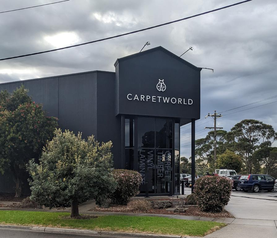
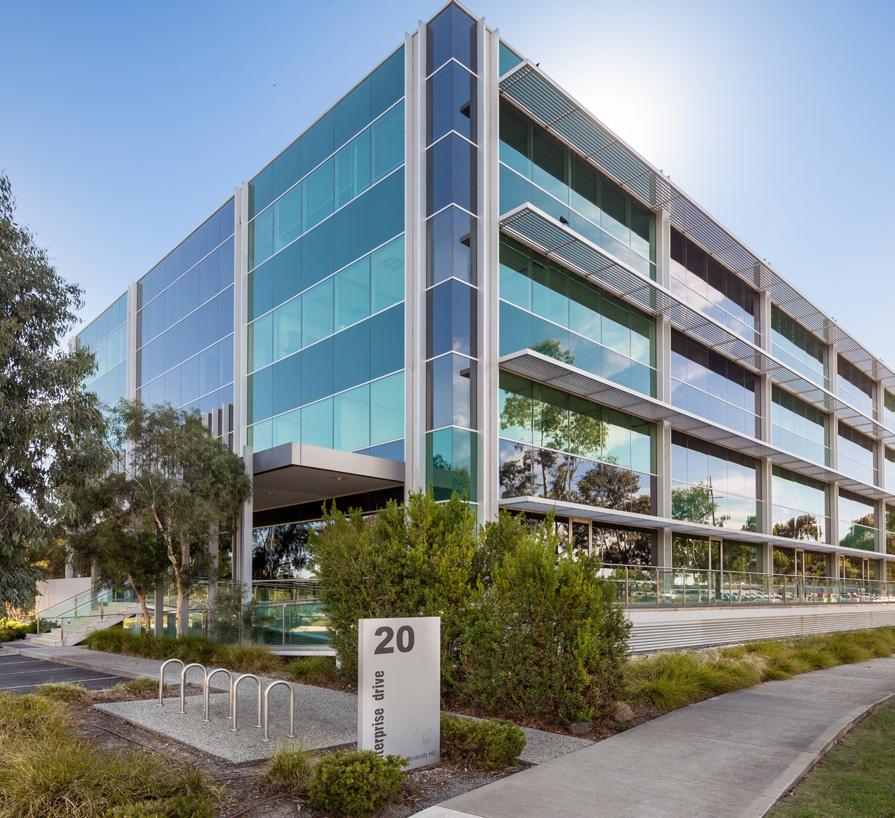
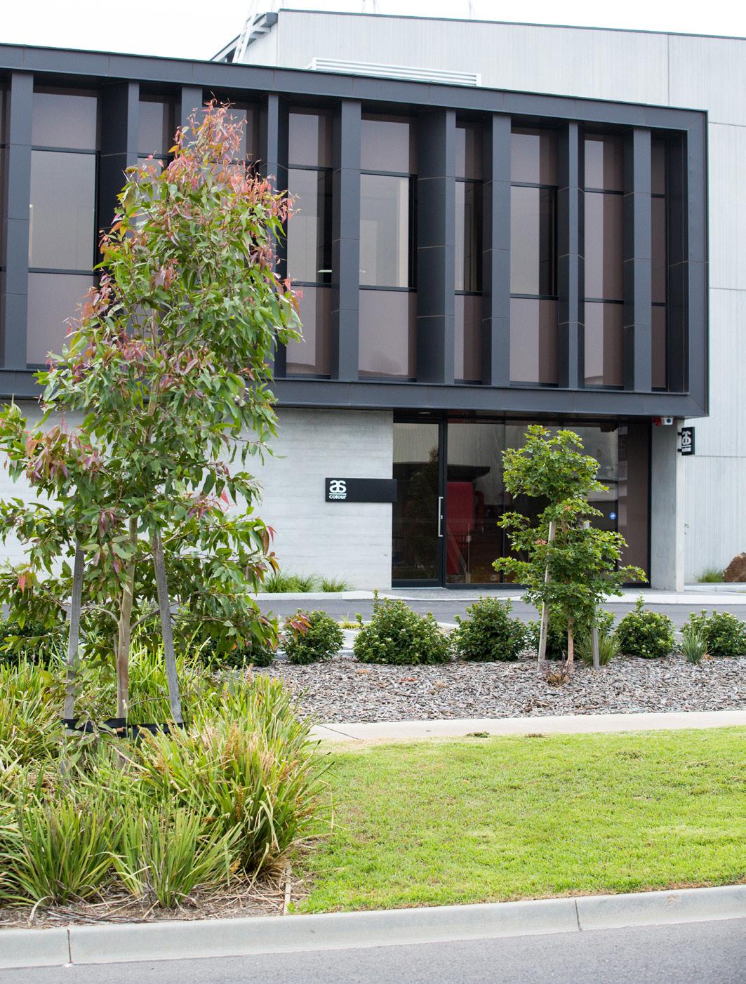
G10.1.2 Customer service, retail and office components of buildings should be well articulated by projecting and recessing building elements, utilising glazing, and varying building materials, finishes and colours. The industrial component of the building should be recessive.
G10.1.3 Building entries should be visible and easy to locate from the street in order to provide logical and convenient access for visitors. Provide feature architectural elements to emphasise building entries and provide weather protection.
G10.1.4 Buildings on corner lots should address both street frontages with articulated and activated facades.
G10.1.5 Where the site adjoins public open space, buildings should be designed to address the open space. Where this is impractical, the building should address the open space with articulated built form and windows from habitable rooms or spaces or outdoor staff amenity areas (refer Figure 10).
G10.1.6 All building walls that are visible from the street, public open space, residential area or key public viewing areas should be articulated to provide visual interest. Avoid large blank, unarticulated walls where they will be visible from the public realm.
G10.1.7 Design buildings to be contemporary and fit for their intended industrial or commercial purpose.
G10.1.8 Design of all buildings to be consistent with the overall design theme of the site.


Objectives
O10.2.1 To ensure industrial buildings have minimal impact on the amenity of the adjoining public realm and residential areas.
Guidelines
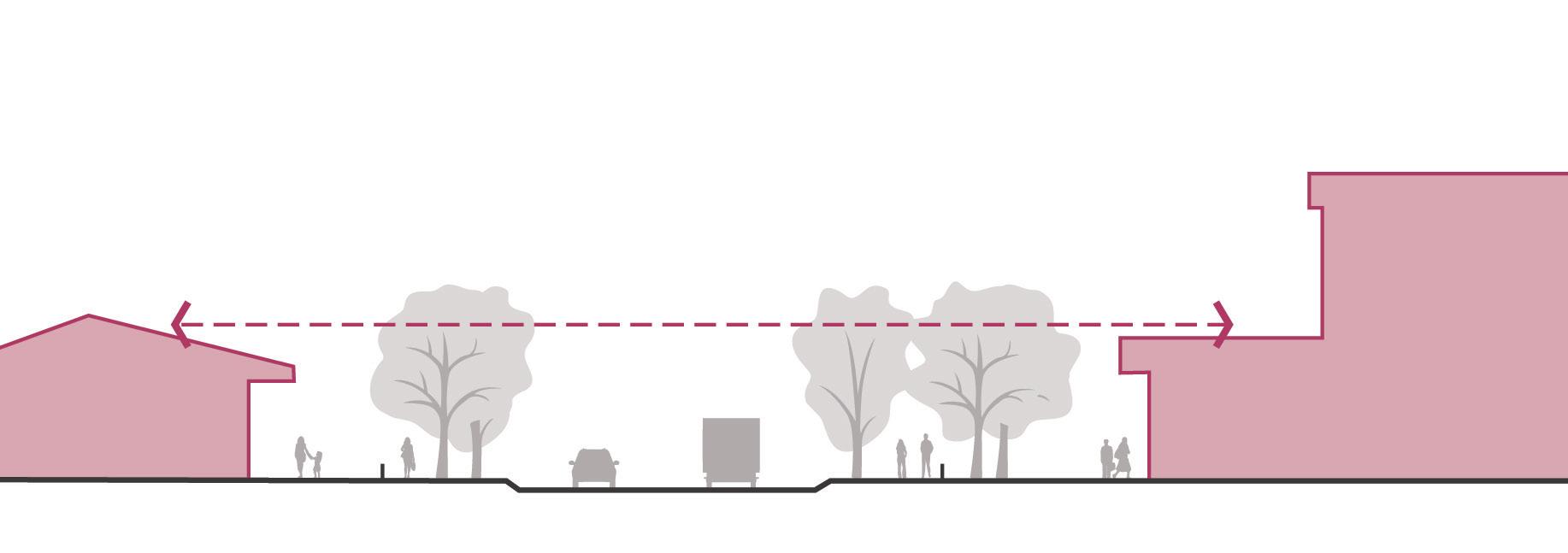
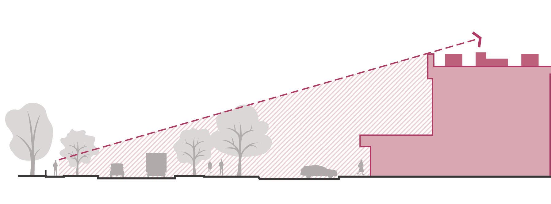
G10.2.1 Ensure new buildings step down to respect the height of neighbouring buildings and dwellings, incorporating lower elements towards the street and recessing taller elements. This is particularly important in the case where an industrial development is located opposite a residential area or public open space.
G10.2.2 Taller buildings should be located where visual impacts on surrounding sensitive uses, freeways and major roads can be mitigated.
G10.2.3 Buildings should not overshadow residential lots, or public open space between the hours of 10:00AM and 2:00PM at the Spring Equinox, 23 Sept.
Objectives
O10.3.1 To provide articulated roof forms that create visual interest and variation in the streetscape.
O10.3.2 To integrate the roof form into the overall design of the building.
O10.3.3 To minimise the visual impact of roofing and building infrastructure on adjoining areas.
Guidelines
G10.3.1 Roof forms should be of a low pitch unless necessitated by the particular industry function. Only use steeper pitched roof forms when reducing the apparent bulkiness of large roofing areas or responding to the prevailing streetscape character.
G10.3.2 Design the roof form to distinguish the office and entry areas from the industrial components of the building.
G10.3.3 Locate and discreetly screen building infrastructure situated on the roof to minimise its visibility from the from the public realm, residential areas or public open space.
G10.3.4 Incorporate natural lighting into the roof design for large span buildings.
Objectives
O10.4.1 To support the desired contemporary character of industrial development and encourage the use of high quality materials and appropriate architectural treatments.
O10.4.2 To encourage the use of materials that are robust, durable, sustainable and require low maintenance.
O10.4.3 To encourage the use of a coordinated palette of building colours, material and finishes that are appropriate to local characteristics of the site and its context.
Guidelines
G10.4.1 Design new buildings using contemporary materials and finishes.
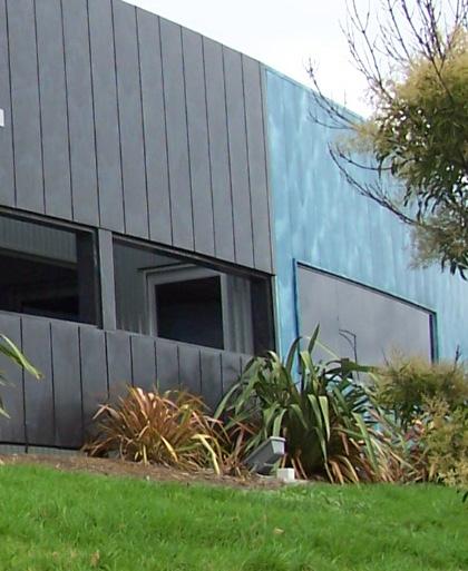
G10.4.2 Use materials, finishes and/or colours to provide articulation in the building facade. Avoid the excessive use of heavy looking materials, unfinished pre-cast concrete walls or exposed plain concrete block walls.
G10.4.3 Specify high performance facade treatments that are well sealed for improved environmental performance.
G10.4.4 Use recycled and sustainably sourced materials, where possible. Materials that may contain Volatile Organic Compounds (VOC’s) should be avoided.
G10.4.5 Materials should utilise muted, earthy tones or other colours approved by the responsible authority. Avoid the use of bright, bold colours that are not compatible with the tones of the natural landscape. Development applications must provide a colour and materials palette that clearly demonstrates the nature of the proposal.
G10.4.6 Where the rear or side of a building is visible from a publicly accessible area or residential area, provide articulation or utilise a textured surface treatment in order to provide visual interest.
G10.4.7 External finishes should be of low reflectivity to minimise glare and reflection to surrounding areas.

Use
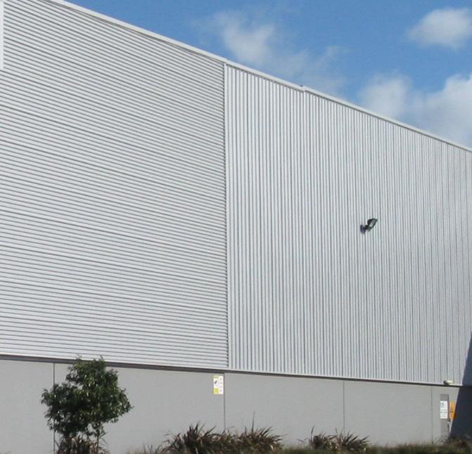
Providing textured panelling and changing the orientation of the panelling can provide for effective articulation

This
utilises a variety of colours, textures and projected elements to provide effective articulation
O10.5.1 To ensure signage and advertising is designed and located to be compatible with the surrounding streetscape character.
O10.5.2 To ensure signage is integrated into the design of the building, particularly in visually sensitive areas.
O10.5.3 To ensure signage is clear, informative and enables visitors to easily locate the front entrance and key site areas.
O10.5.4 To ensure that signs for a multi-tenanted buildings are of a consistent shape, size and presentation and are displayed in similar locations.
G10.5.1 Ensure signage is simple, clear and incorporated into the building design and shown in proposed plans for new buildings.
G10.5.2 Ensure the scale and proportion of signage is in proportion to the primary frontage including the scale of the building. Limit the amount of signage used on the building facade to avoid visual clutter.
G10.5.3 Freestanding and pylon signage within the front setback should be limited to directional signage.
G10.5.4 Internally illuminated and animated signage is discouraged at interfaces with reserves and open space or where illumination or glare will spill onto the road.
G10.5.5 Major promotion signs are discouraged along landscaped freeways, open space reserves or waterways and where they will form a visual dominant element along sensitive interfaces.
G10.5.6 Where there are multiple business occupancies within the one site, one consolidated sign should be provided. A small identification sign may be provided for each business that it is co-ordinated with the shared sign in terms of shape, size and presentation and are located in a similar location.
G10.5.7 Signage attached to front and side boundary fences is discouraged.
G10.5.8 Clear directional signage should be used to identify entries and exit points, visitor and staff car parking areas, office and receptions areas and loading bays.
G10.5.9 Signage should not be placed where it will require pruning/removal of existing vegetation for visibility.
Refer to Frankston City Councils, Outdoor Advertising Signage Design Guidelines and Clause 52.05 of the Frankston Planning Scheme for detailed guidance.


Refer to Section D - Precinct Specific Guidelines for key interfaces and where the below treatments will apply.
11.1 Residential
Objectives
O11.1.1 To protect the amenity of residential and other sensitive uses.
O11.1.2 To maintain and reinforce built form setbacks and landscape buffers established adjacent residential uses within Carrum Downs.
O11.1.3 Ensure industrial areas appropriately integrate with and present a high quality interface to surrounding residential uses.

This landscaping example is effective in screening and also providing an attractive element to the streetscape
Guidelines
All Industrial Precincts
G11.1.1 Site new development away from surrounding sensitive interfaces and provide sufficient visual and acoustic screening within the industrial property.
G11.1.2 Buildings visible from residential areas must be articulated, textured, or painted to address the residential interface.
G11.1.3 Ensure new buildings located adjacent to residential areas step down to respect the height of neighbouring buildings and dwellings.
G11.1.4 Avoids light spillage onto adjoining residential properties.
G11.1.5 Incorporate a minimum 10m landscape buffer on industrial land abutting residential land. The landscape buffer should be located within the property setback and accessible for maintenance. This landscape buffer must not be used for storage, loading or waste. Indigenous species are preferred. This landscape buffer may be reduced to 5m on lots less than 4000sqm. Where space is limited look to alternative methods such as green walls and green facades.
Objectives
O11.2.1 To ensure industrial areas present in an attractive and unobtrusive manner when viewed from key freeways into the Frankston City Council.
Guidelines
G11.2.1 Incorporate a minimum 5m landscape buffer where an industrial site shares a side or rear boundary with a freeway. The landscape buffer should include dense vegetated screening or mounding to soften the visual impact of the proposed development.
G11.2.2 Encourage the articulation of building façades and roof forms that face onto a freeway interface to provide an attractive visual interface for passersby.
G11.2.3 Ensure signage and advertising does not detract from a visually pleasing arrival experience.
G11.2.4 Avoid the placement of signage on at on and off ramps, where drivers require extra concentration; and to avoid illumination or glare spill onto the freeway.
Signage should meet the requirements of any guidelines specific to a road corridor of freeway (for example the EastLink Advertising Code, where applicable).
Objectives
O11.3.1 To protect the amenity and desired character of major roads, particularly those considered as gateways.
O11.3.2 To ensure industrial areas contribute to a high quality image of the City when viewed from major roads.
Guidelines
G11.3.1 Ensure built form located on major roads contributes to creating an active and continuous built form edge.
G11.3.2 Front setbacks should be no less than 10 metres for lots that share a front boundary with a major road. The front setback can comprise landscaping and building access and may be reduced to 5m on lots less than 4000sqm.
G11.3.3 Incorporate a minimum 5m landscape buffer where an industrial site shares a side or rear boundary with a major road.
G11.3.4 Ensure signage and advertising does not detract from a visually pleasing arrival experience. Avoid the placement of signage on front fences or footpaths; or free standing signage within front setbacks.
G11.3.5 Encourage the retention of existing vegetation. New vegetation and tree planting should respond to and reinforce existing planting themes within adjoining streets and public open spaces.
Objectives
O11.4.1 To protect the amenity and local character of open space areas.
O11.4.2 To ensure industrial areas contribute to a high quality image of the City when viewed from surrounding open space areas.
G11.4.1 Incorporate a minimum of 3m wide landscape buffer along all boundaries adjacent to public open spaces. Where space is limited look to alternative methods such as green walls and green facades.
G11.4.2 Landscaping within the development should respond to and provide a visual connection to adjacent public open spaces.
G11.4.3 Ensure built form addresses surrounding open space. Where development adjoins public open space, the building should address the open space by providing:
• Primary building entrance to be located on the primary street frontage, with a footpath connection to the public realm;
• Windows and openings at all levels; and
• Internal uses or habitable rooms located within the building to provide passive surveillance opportunities over the public open space.
• Outdoor amenity areas located to provide passive surveillance opportunities over the public open space.
G11.4.4 Where development sides or backs onto public open space, the building should address the open space by;
• Providing habitable rooms with windows overlooking the open space at all levels; and
• Ensuring built form visible from the surrounding open space is articulated in its form and detailing, avoiding the creation of large blank walls.
G11.4.5 In the case where fencing is required along adjacent to public open space (i.e. for security purposes), transparent fencing such as black PVC coated chain mesh or black vertical steel posts (not rounded tubular pool fence style) fencing with a maximum height of 2.0m, is preferred. Avoid the use of high, solid fencing, unless required for screening or amenity purposes.
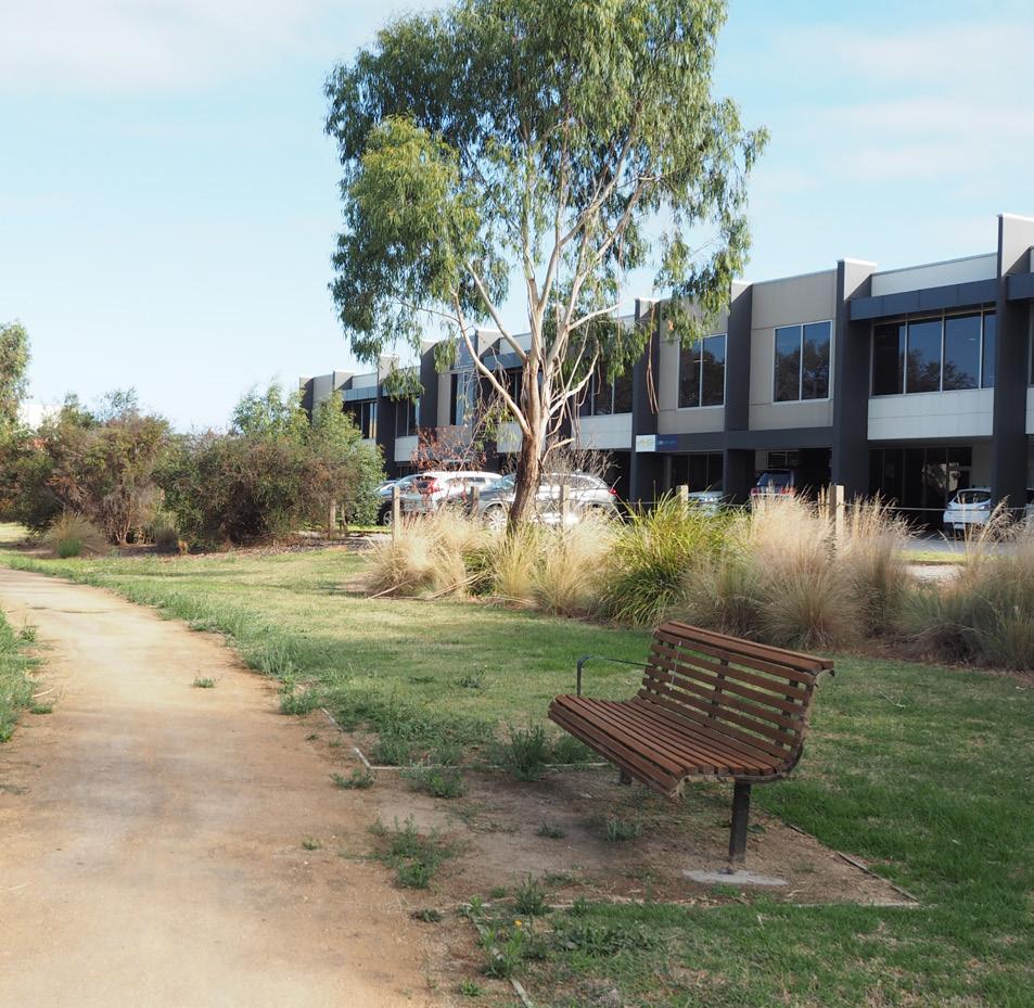
Ensure
Objectives
O12.1.1 To provide safe and convenient access for pedestrians and cyclists throughout new developments.
O12.1.2 To promote walking and cycling as suitable transport alternatives for workers and visitors.
O12.1.3 To minimise conflict between vehicles, bikes and pedestrians.

Guidelines
G12.1.1 Provide clearly defined pedestrian and cyclist entry points from the footpath or shared path to the main building entrance. This should include the provision of identification or directional signage.
G12.1.2 Design pedestrian access within the site and principal building entrances to achieve Disability Discrimination Act (DDA) compliance.
G12.1.3 Provide clear sight lines at vehicle crossover points to minimise potential conflict between vehicles, pedestrians and cyclists.
G12.1.4 Separate pedestrian and bicycle circulation from vehicle movements, particularly loading and servicing vehicles, where possible.
G12.1.5 Provision of infrastructure to support electronic bike charging is strongly encouraged.
Secure bicycle storage, lockers and showers for staff and employees should be provided in accordance with Clause 52.34 of the Frankston Planning Scheme.
Objectives
O12.2.1 To provide safe, convenient and efficient access for all vehicles within industrial sites.
O12.2.2 To minimise the impacts of vehicle crossovers on pedestrian and cyclist access and streetscape, where possible.
Guidelines
G12.2.1 Locate site entry and exit points to enable clear sight lines from the street.
G12.2.2 For sites less than 4000 sqm, limit driveway crossovers to one consolidated entry and exit point for each site in order to minimise disruption to the streetscape and footpaths.
Maintain clear sightlines between vehicles and pedestrians and cyclists
G12.2.3 For sites greater than 4000sqm, design vehicle movements though the site to allow all vehicles to enter and exit the site in a forward motion. Additional crossovers are permitted where there is a loop circulation network within the site but should be minimised. For sites where B-double access is required, a Traffic Engineer’s report should be provided to demonstrate that the vehicle can enter and exit and manoeuvre within the site safely and efficiently, and with minimal impact on the streetscape and surrounding uses.
Vehicles should be able to enter and exit the site in a forward motion
Limit driveway crossovers to one consolidated entry and exit point for lots under 4000sqm
Clearly defined pedestrian entry point with access separated from vehicles

Objectives
O12.3.1 To provide safe and efficient loading and servicing of industrial sites and operational premises.
O12.3.2 To minimise the visual impact of loading bays and service areas when viewed from the surrounding streets and other key viewing areas.

Guidelines
G12.3.1 Loading areas should be located to the rear or side of the property away from the primary street frontage (refer Figure 16), where practical.
G12.3.2 Locate loading and servicing areas so that all loading activities are completely contained within the site. No part of the vehicle should extend into the public road reserve when loading/unloading.
G12.3.3 Avoid locating loading areas along boundaries adjoining residential and sensitive uses.
G12.3.4 Integrate loading areas into the design of the building so that loading occurs internally, where practical. If loading areas are visible from adjoining land uses, utilise landscaping or articulated built form to screen loading areas.
G12.3.5 Separate loading areas from pedestrian and bicycle access routes, and where practical, from vehicle access routes.
G12.3.6 Ensure storage and loading areas are or sufficient size and dimensions to avoid the use of car parks for temporary storage of goods.
G12.3.7 Define loading areas with line marking to allow unobstructed vehicle access and provide appropriate turning areas.
Loading areas to be designed in accordance with Australian Standards AS 2890.2 - Parking facilities Part 2: Off-street commercial vehicle facilities.
Objectives
O12.4.1 To ensure the location, design and layout of vehicle parking areas are integrated into the site planning, and is logical and legible to employees and visitors.
O12.4.2 To provide safe and secure car parking that reduces conflict between vehicles, pedestrians and cyclists.
O12.4.3 To provide adequate parking spaces and facilities.

Avoid large areas of car parking to the front of the building
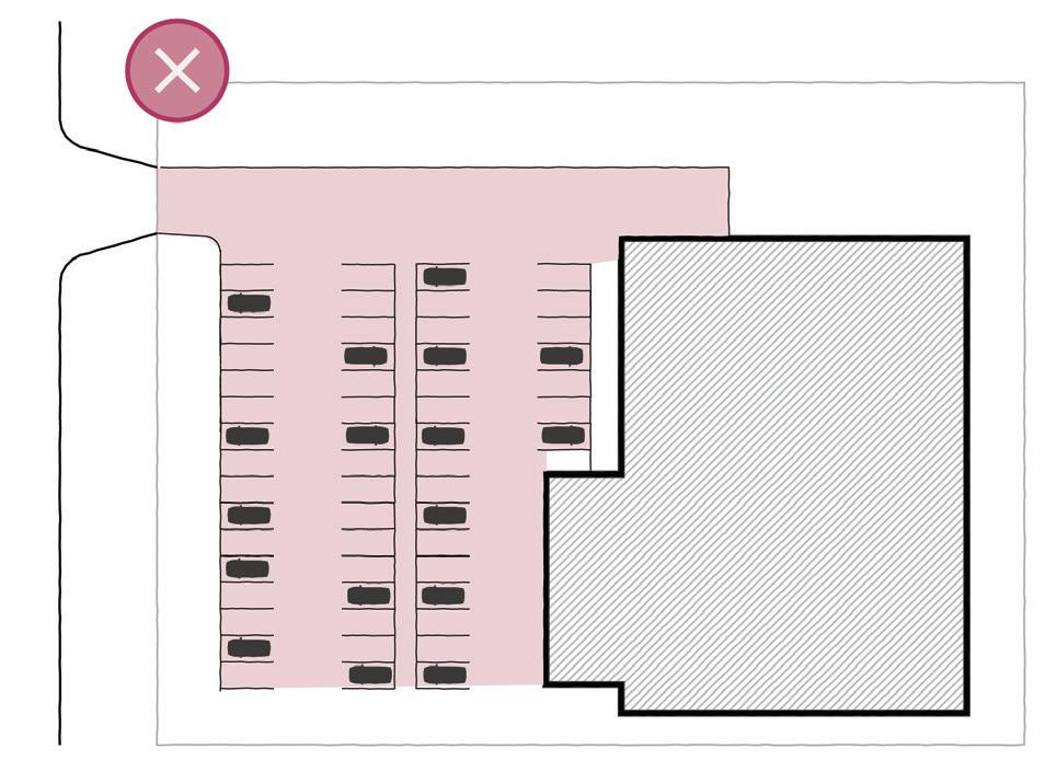
Guidelines
G12.4.1 Car parking within the front setback of the site should be restricted to visitor parking. Visitor spaces should be clearly distinguished with suitable signage or pavement markings and should be made permanently available for visitor use. Staff parking may be provided in the front setback if it can be demonstrated that sufficient car parks have been provided for visitors (refer to Figure 17).
G12.4.2 Large expanses of car parking of greater than 20 spaces should be located to the side or rear of the building.
G12.4.3 Car parking must be avoided within 4.5m of the front property boundary to allow sufficient space for landscaping.
G12.4.4 All trafficable areas must be sealed to the satisfaction of Council.
G12.4.5 Undercroft car parking may be provided if it does not form a dominant element of the building frontage and enables larger areas of landscaping to be provided within the front or side setback.
Guidelines (Continued)
G12.4.6 Provision of infrastructure to support electronic vehicle (EV) charging is strongly encouraged.
G12.4.7 Provide security lighting in car park areas.
Car parking (including DDA parking) should be provided in accordance with the provisions specified in Table 1 - Car Parking Requirements Clause 52.06 of the Frankston Planning Scheme and designed in accordance with the dimensions specified in the Frankston Planning Scheme and the Australian Standards.
Where electric vehicle (EV) charging bays are proposed, the location of the charge point(s) and/or infrastructure and cabling is to be clearly identified, dimensioned and labeled on development application plans.

Objectives
O12.5.1 To support the integration of drones and electric vertical take-off and landing (eVTOL) vehicles and other emerging aviation technologies within industrial areas.
Guidelines
G12.5.1 Provision of infrastructure to support drones and electric vertical take-off and landing (eVTOL) vehicles and other emerging aviation technologies is strongly encouraged except when adjoining any sensitive environment areas (e.g. Seaford Wetlands- RAMSAR listed).
The Australian Government is currently developing an Infrastructure Planning Framework to ensure a nationally consistent approach to infrastructure and planning decisions for emerging aviation technologies.
NB: The Australian Government is currently developing an Infrastructure Planning Framework to ensure a nationally consistent approach to infrastructure and planning decisions for emerging aviation technologies. These guidelines should be updated to reflect these guidelines, once complete and as appropriate.
O13.1.1 To provide high quality, attractive landscaping that positively contributes to the streetscape, sensitive interfaces and the surrounding context.
O13.1.2 To protect existing significant trees and vegetation.
O13.1.3 To encourage the use of local, drought tolerant, low ongoing maintenance species.
O13.1.4 To enhance local biodiversity values.
O13.1.5 To reduce the urban heat island effect of industrial development.
O13.1.6 To ensure industrial zoned land & selected commercial 2 zoned land contributes to Frankston's tree canopy cover target of 20% by 2040.
Deep soil zones are areas within a development of natural ground with no obstructions above or below. Deep soil zones help promote healthy growth of large trees and allow infiltration of rainwater. They exclude areas on structures (above basements), pools and nonpermeable paved areas. For success they should have a minimum dimensions of 4.5 metres x 4.5 metres.
Refer to Landscape Plan Preparation Guidelines, September 2020 for requirements for landscape design within industrial developments.
G13.1.1 Retain and protect existing mature trees, where possible and integrate the tree into the overall site planning.
G13.1.2 Incorporate existing vegetation into building setbacks, building recesses, car park areas, or within open space areas.
G13.1.3 New development, driveways, and vehicle crossovers must be setback from the protection zone of existing trees that have been identified to be retained.
G13.1.4 Avoid locating tree species where the root system might impact on services and assets within the road reserve and service easements.
G13.1.5 Provide for the effective impact of vegetation by planting at appropriate densities, and where possible, consolidating landscape areas. NB: Recommended densities are outlined in Council's Landscape Plan Preparation Guidelines, September 2020.
G13.1.6 Provide adequate space for the planting of new canopy trees. Where possible locate deep soil zones adjacent to deep soil zones on adjoining properties to form contiguous areas for large tree planting.
G13.1.7 Site large trees with consideration of their ability to shade windows (and minimise the need for internal mechanical cooling).
Primary Frontage Landscape Zone
G13.1.8 Provide clear stemmed canopy trees that mature to at least 12m within the front setback. One tree should be provided for every 8 lineal metre of road frontage. Indigenous and native trees are preferred.
G13.1.9 Low growing shrubs (less than 900mm high) should be used to maintain visibility and surveillance adjacent to paths, pedestrian crossings, and roads.
G13.1.10 Consider providing elements within the front landscape setback that will encourage use of the space by staff and visitors, including seating, shade treatment and bike parking.
G13.1.11 Corner sites should provide landscaped setbacks along both the street frontages.
Side and Rear Boundary Landscape Zone
G13.1.12 Landscaping should be incorporated into a 1.5m wide (minimum) side and rear setback with consideration of vehicle access.
G13.1.13 Provide a landscape buffer along the rear property setback if the site adjoins a public street or is visible from a freeway, railway corridor, major road, residential area, or other sensitive interfaces. Where the property abuts open space the landscape treatment should encourage passive surveillance opportunities. Refer Section 11 for further guidance.
G13.1.14 Use landscaping treatments to minimise the visual impact of blank walls and hard surface areas.
Clear stemmed canopy trees allow views between the footpath and the industrial building
Front setback is well utilised through the provision of seating

Car Parking Landscaping
G13.1.15 A minimum of one large canopy tree provided within the car parking area for every five car parking spaces, or one large canopy tree per ten double linear parking bays.
G13.1.16 Protect landscaped areas abutting car park and vehicle access ways through provision of appropriate barriers and tree outstands. Diamond shaped barriers should be avoided.
Utilise water sensitive urban design measures to treat stormwater run off from car parks to passive irrigate vegetation. Refer to Frankston City Council WSUD Guidelines for further guidance.
Landscaping Adjoining Open Space
G13.1.17 For sites adjoining creek corridors or areas of indigenous or native vegetation, utilise plant species that reflect the species within the area to provide a visual and ecological connection
Visual and Acoustic Screening
G13.1.18 Design landscape buffers to be a minimum of 5m wide and planted with species that provide an appropriate level of coverage for visual screening.
G13.1.19 Utilise landscaped mounding in combination with planting of shrubs and canopy trees for effective and aesthetically pleasing screening.
G13.1.20 Use landscape screening on large building façades (i.e. green walls) to improve the appearance of the building and minimise presentation of blank walls.

Establishment and Maintenance
G13.1.21 Provide for the ongoing maintenance of landscaped areas and utilise low maintenance, appropriate irrigation, and durable landscaping techniques.
G13.1.22 Plant selection to be hardy and robust species, low maintenance, with trees being relevant to scale of buildings being proposed. Group plants with similar water needs and irrigate accordingly.
G13.1.23 Indigenous or native species are preferred. These contribute to the local character and biodiversity values of the area. Environmental weeds must not be planted.

Plant
Objectives
O13.2.1 To provide areas of paving and hardscaping that are appropriate in an industrial environment.
Guidelines
G13.2.1 Specify paving materials for internal site pathways that are robust and durable and can withstand heavy loads.
G13.2.2 Provide shade over large, paved areas to minimise contributing to the heat island effect.
Select species to integrate with the surrounding landscape character. Refer to the Landscape Character Map included in the Landscape Plan Preparation Guidelines, September 2020, for species selection parameters.
Objectives
O13.3.1 To ensure the front boundary treatment contributes positively to the appearance of the streetscape and clearly distinguishes the public and private realms.
O13.3.2 To ensure fencing provides for adequate site security.
O13.3.3 To ensure fencing is co-ordinated with the design of the building and landscaping.
O13.3.4 To enable passive surveillance of car parks, streets and the surrounding public realm through the use of transparent fencing.
Guidelines
G13.3.1 Fencing along the front boundary should be avoided unless required for security or screening purposes.
G13.3.2 In the case where front fencing is required, transparent fencing such as black PVC coated chain mesh or black vertical steel posts (not rounded tubular pool fence style) fencing with a maximum height of 2.0m, is preferred. Avoid the use of high, solid fencing, where possible.
G13.3.3 Locate security fencing at or behind the building line where front security fencing is required.
G13.3.4 Avoid the use of razor or barbed wire fencing.

Objectives
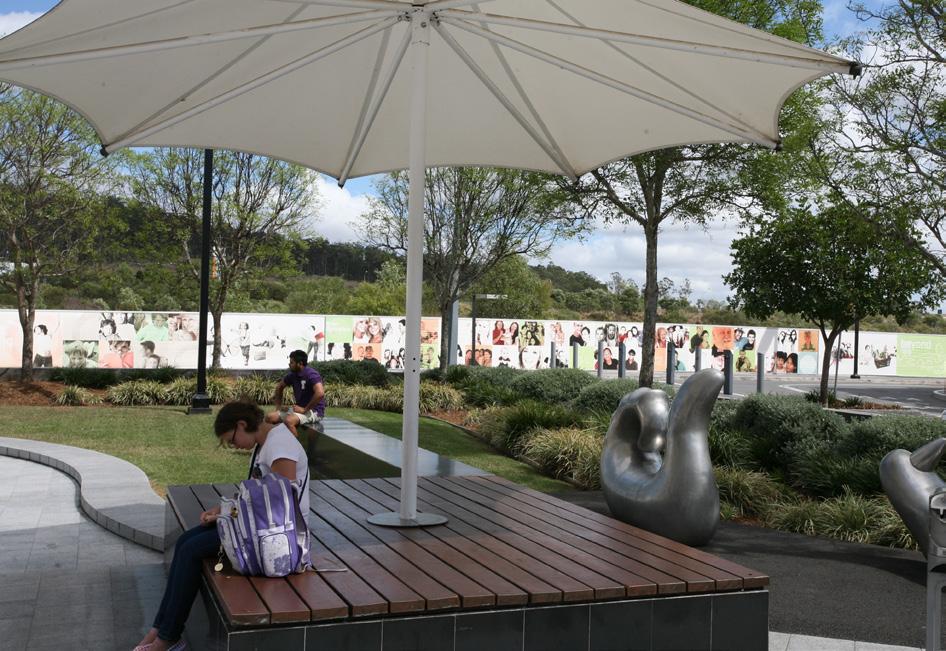
O13.4.1 To provide well located, integrated areas of attractive outdoor space with weather protection, lighting and seating for staff and visitors.
O13.4.2 To encourage the siting of outdoor amenity space in areas that contribute to an activated public realm.
Guidelines:
G13.4.1 Usable landscaped outdoor areas for staff and visitors to be provided on lots greater than 4000sqm. Where possible, outdoor areas should be located to take advantage of the northern aspect.
G13.4.2 Do not locate services, such as air conditioning units, rainwater tanks and hot water units in outdoor amenity areas.
Objectives
O14.1.1 To ensure public utilities (water, power, gas, waste and communications/ICT infrastructure) can be provided in a sustainable and cost effective manner, and can be easily accessed and maintained.
O14.1.2 To minimise the visual impact of site services.
To Guidelines
G14.1.1 Provide adequate space within developments to accommodate the installation and maintenance of services.
G14.1.2 Consider the most appropriate location for all site services such as sub-stations and fire fighting equipment when undertaking site planning, and provide screening where necessary.
G14.1.3 Services should be located away from front setback, integrated with the design of the building and not impact on landscaping opportunities.
Ensure site services comply with Australian standards and confirm the location of any infrastructure or utilities easement prior to submitting a development application.
Objectives
O14.2.1 To ensure adequate access to waste and recycling facilities is provided for each business or industry.
O14.2.2 To ensure waste and storage areas are appropriately sited and designed to minimise impacts on the public realm.
Guidelines
G14.2.1 All sites are to provide dedicated waste and recycling storage areas located internally, where possible.
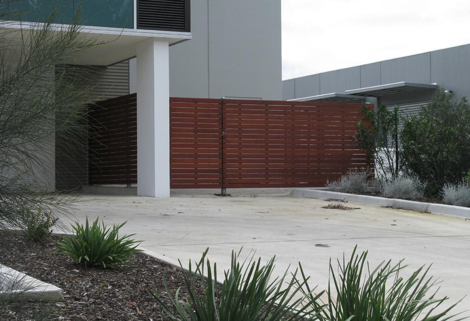
G14.2.2 If located outdoors, waste and storage areas must be located away from the street frontage, staff amenity areas and stormwater drains. They must not be in front of the building, within landscaped areas, driveways, car and truck parking spaces or vehicle turning areas.
G14.2.3 Waste and storage areas should be adequately screened from public view and waste bins covered. Waste areas should also be screened from staff amenity areas and adjoining residential properties.
Objectives
O14.3.1 To ensure lighting is adequate for the purposes of navigation for pedestrians and security.
O14.3.2 To minimise the spill of light onto adjoining and nearby residential and rural properties and sensitive environmental areas.
Guidelines
G14.3.1 Car park areas that are obscured from public view should be lit at night for safety.
G14.3.2 Lighting is to be directed towards the ground, baffled and of a height that prevents light spillage into adjoining sensitive areas such as residential development or open space where wildlife may reside. Lighting should not adversely impact on the safety of road users or be directed into the sky.
G14.3.3 Light poles must not be higher than buildings.
G14.3.4 Utilise solar powered sensor lighting where appropriate to reduce energy consumption and impacts on surrounding areas.
G14.3.5 Motion sensor lighting should be used reduce light impacts.
Objectives
O14.4.1 To ensure acoustic treatments are designed to achieve their purpose and integrate with the surrounding context.
O14.4.2 To ensure acoustic treatments match in with the site design.
Guidelines
G14.4.1 Where practical, utilise acoustic treatments internal to the building through the design of the building layout, and the use of acoustic insulation or suitable building materials.
G14.4.2 Where external acoustic treatments are required, utilise tree and shrub planting, mounding, acoustic walls or a combination of each as required. The acoustic treatment areas should be accessible and maintained.
G14.4.3 Design the acoustic treatment so that it contributes positively to the public realm and adjoining properties, and integrates with the design of the building and landscaping.


Part D provides guidance for precinct specific design issues. It identifies the various interface types and locations for which guidelines are provided in Section 7 and 11 of this document.
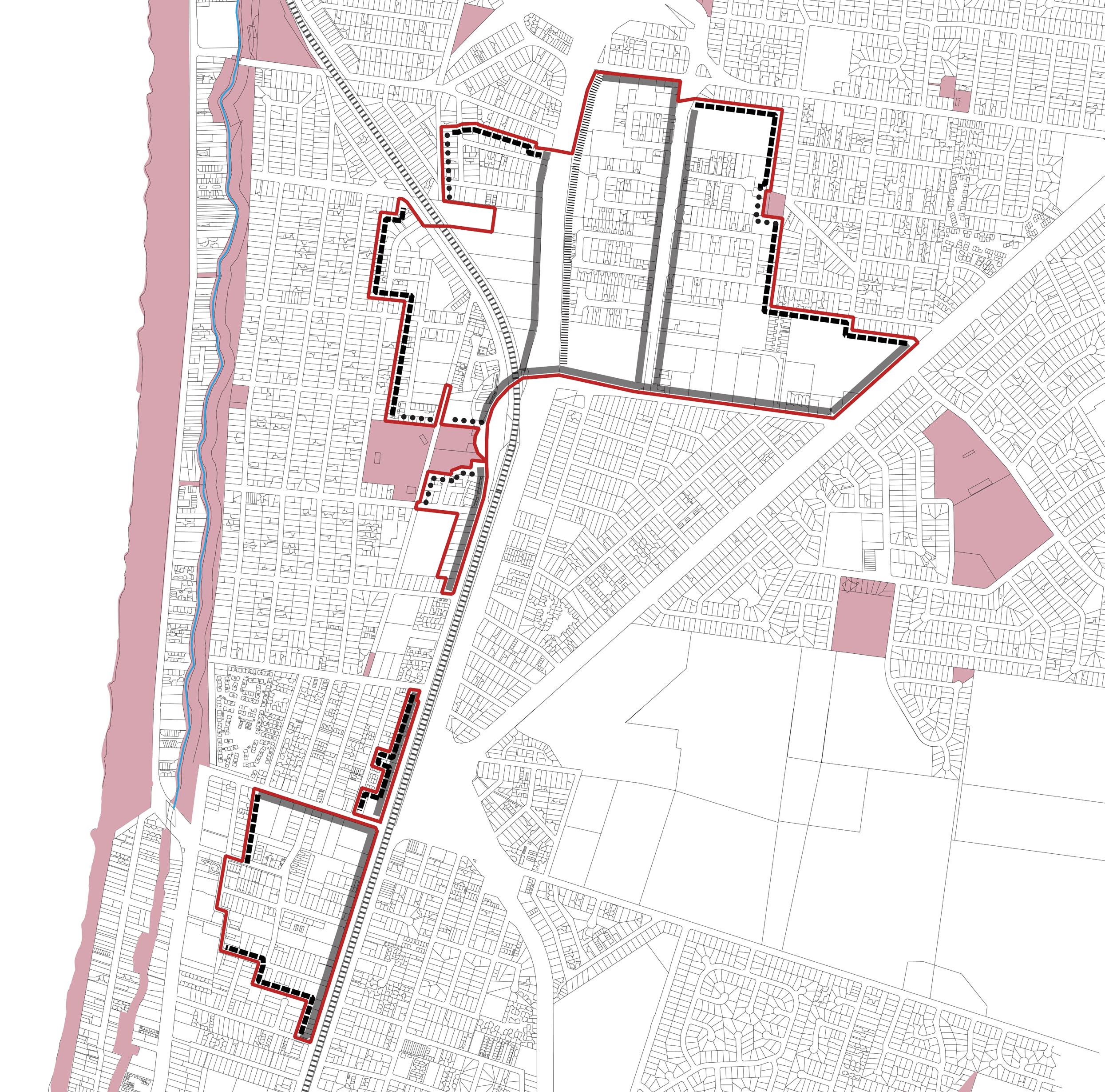

PRECINCT BOUNDARY WATERCOURSE
EXISTING OPEN SPACE / SERVICE AND UTILITY RESERVE / URBAN FLOOD WAY

INTERFACES - SECTION 7 & 11 FOR GUIDELINES
FREEWAY INTERFACE
OPEN SPACE INTERFACE LEGEND
MAJOR ROAD INTERFACE
RESIDENTIAL INTERFACE


PRECINCT BOUNDARY
WATERCOURSE
EXISTING OPEN SPACE / SERVICE AND UTILITY RESERVE / URBAN FLOOD WAY

INTERFACES - SECTION 7 & 11 FOR
GUIDELINES
FREEWAY INTERFACE
MAJOR ROAD INTERFACE

LEGEND

BOGGY CREE K
C OLEMANS R D
LATHAMS ROAD
PRECINCT BOUNDARY
WATERCOURSE
EXISTING OPEN SPACE / SERVICE AND UTILITY RESERVE / URBAN FLOOD WAY

INTERFACES - SECTION 7 & 11 FOR
GUIDELINES
FREEWAY INTERFACE
MAJOR ROAD INTERFACE
RESIDENTIAL INTERFACE
OPEN SPACE INTERFACE
BOUNDARY RD DA R


PRECINCT BOUNDARY
WATERCOURSE
EXISTING OPEN SPACE / SERVICE AND UTILITY RESERVE / URBAN FLOOD WAY
CENTENARY PARK
QUARRY
CARAVAN PARK
MCCLELLAND GALLARY
MCCLELLAND SCULPTURE PARK

INTERFACES - SECTION 7 & 11 FOR
GUIDELINES
FREEWAY INTERFACE
MAJOR ROAD INTERFACE
OPEN SPACE INTERFACE
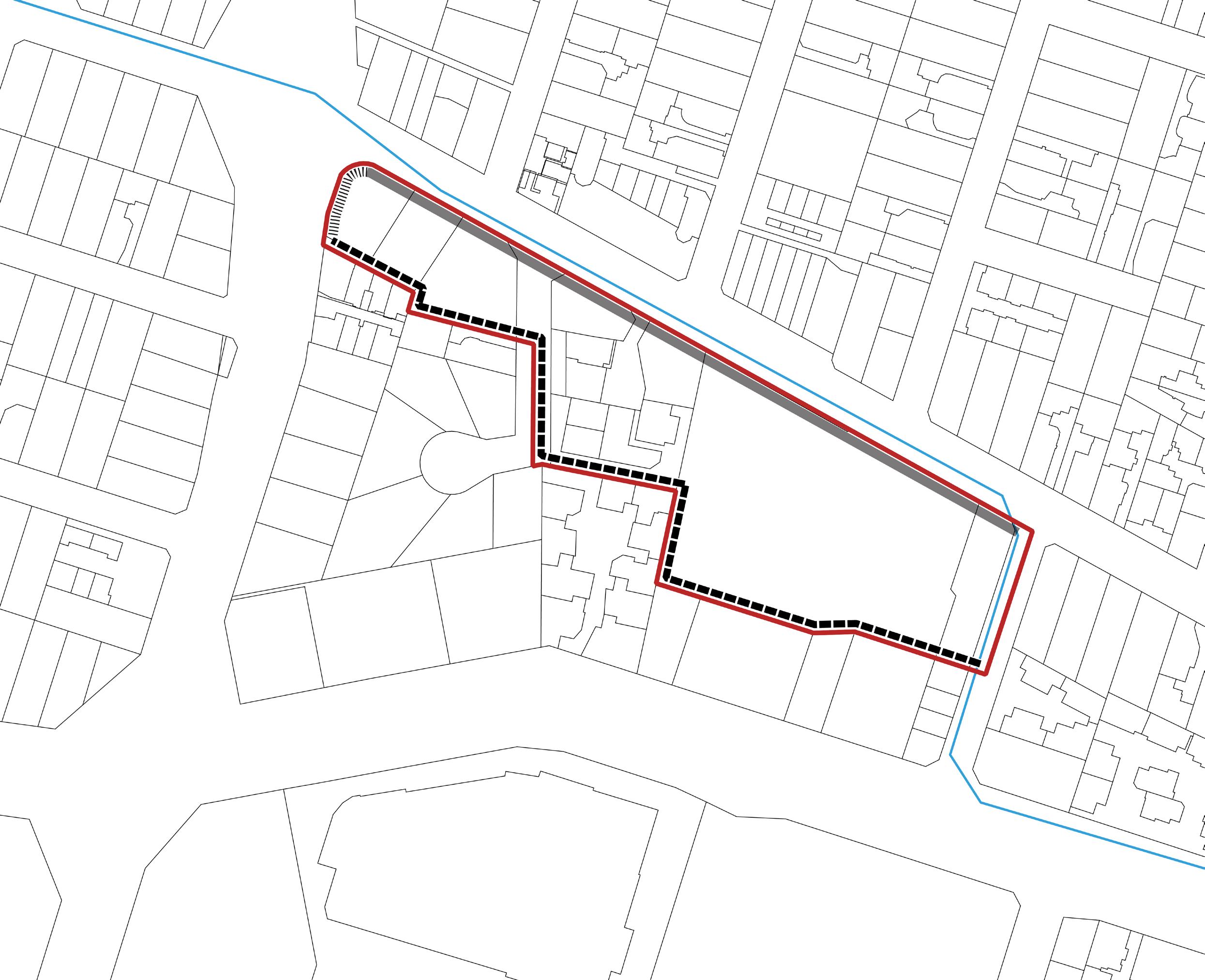
RE TAIL
RE TAIL
RE TAIL
LEGEND

PRECINCT BOUNDARY
WATERCOURSE

INTERFACES - SECTION 7 & 11 FOR
GUIDELINES
FREEWAY INTERFACE
MAJOR ROAD INTERFACE
RESIDENTIAL INTERFACE
