17 minute read
20 YEARS OF GW


Editor from 1995 to 2017, Stephen booth looks back on an era that has seen technology change the nature of surveying, moving from the field to the desktop.
This exercise involved trawling back through 20 years of GWs and some Surveying Worlds from before September/October 2001, when the title changed name. It’s been a lengthy task. I was constantly distracted by the many interesting articles and especially juicy items in Undercurrents which I had to read again.
MILLENNIUM’S EVE
The eve of the Millennium.
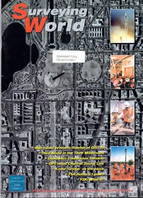
On the eve of the millennium, the edition of Surveying World for Nov/Dec 1999 set much of the scene for the coming decades. A striking cover image of Washington DC taken from the Ikonos-II satellite some 400 miles out in space heralded the coming growth of aerial imagery and remote sensing. The satellite was offering 1 metre resolution in B&W and 4 metres in colour. Today, there are micro satellites that capture full colour imagery, lidar, infrared, multispectral and SAR, all to within a metre or so resolution. So, we were entering an era of innovation driven by technology and sometimes by events. In the meantime, what would today’s GW readers think of the choice made by readers 20 years ago of ‘Surveyor of the 20th Century’: head of the Directorate of Overseas Surveys, Martin Hotine?
Meanwhile, many were anxious and on tenterhooks about the threat of the millennium bug. However, the new millennium came without any of the expected bugs, largely due to the diligent attention of many IT specialists.
Satellite positioning was moving ahead rapidly. In 1999, the EU decided to develop Europe’s own satellite navigation system, Galileo. GW reported on the plans following a major conference in Nice in November 2002. Meanwhile, the US and Russia had plans to upgrade their systems, the latter to complete their Glonass system. Of course, as Professor Paul Cross pointed out in an article for Showcase 2000 issue No 1, “the real drivers. . . do not come from surveyors and engineers. . . the real pressures. . . come largely from the transportation sector.”
Cross-listed potential applications like meteorology, geophysical hazards, climate change, machine control, flood risk, farming, oceanography and timing for cell phones with GPS chips were soon appearing alongside other handheld devices. Important in the adoption of GPS was President Clinton’s order to remove selective availability from the satellites’ signals. The move began decades of economic growth, marred only by the financial crash, the pandemic and the end of the trig pillar. It was the age of “Smart”: by 2017 (Jan/Feb), smartphones were being used for progress recording on construction sites.
Meanwhile, the ubiquitous total station, which first arrived in the 1970s, had added GPS and photogrammetry via image capture to its onboard totality by the end of the millennium’s first decade.
RICS: CONFERENCES AND A PROUD HISTORy
In 1999, the RICS Land Survey Division, later renamed Geomatics, held a successful biennial conference and was celebrating its 50th anniversary. Keynote speaker Professor David Rhind, former DG of OSGB, told surveyors that societal change, technological development and the need for a radical review of education and training was necessary if we were to keep pace in the field of geomatics. The impact of the Web, globalisation and deskilling would also play a part.
The conference also looked back at the history of the division through a brilliantly informative series of recollections put together by the then President, the late Professor Michael Cooper. Tales of hardship and derring-do in surveying and mapping around the world were recounted. But we were about to embark on an era when surveyors increasingly moved from behind the instrument to the detail pole and to the comfort of the office desk. As Iain Greenway observed, ‘there >
would be no more Land Rovers and sunsets’. A consequence has been that surveying has become more attractive as a career to women (still only 7% noted GW in Jan/Feb 2002). It was a time when land and hydrographic surveying became part of the RICS’s “property profession” (2004 Sept/Oct). We reported in detail (sometimes too much!) from around the world, fulfilling our contribution to members’ CPD quota, on conferences, lectures, seminars, exhibitions, workshops and congresses. We visited Cairo, Las Vegas, Washington, Munich, Ireland and a host of German cities as Intergeo continued its annual tour.
Hydrography is too often the overlooked branch of geomatics. However, GW was saved by having two hydrographers as Faculty chairs - Ruth Adams and Gordon Johnston. Ted Read was also a regular contributor on near shore and river applications.
EVENTS
The year 2001 was overshadowed by the terrible events of 11 September (9/11). It surely became a major driver in geospatial technologies for tracking, tracing, GIS and analytics. The “Boxing Day” tsunami of 2004 triggered the dispatch of MapAction teams to SE Asia, while HMS Scott captured side-scan sonar data from a ruptured seafloor off Aceh in Indonesia, reported in Mar/Apr 2005.
Our News columns regularly found stories in the national news media relevant to geomatics. We reported how geomatics aided the search for the lost Malaysian Airlines flight MH370 (2016 Jan/Feb. News, p.07). In 2013 May/Jun we reported an important lesson for someone about knowing exactly where you are when drilling holes: a piling drill pierced a tunnel on Network Rail’s Northern City Line (News p.07, see also GW Mar/Apr 2014 p.06).
xxx_GW mar-apr cover.qxd 16/2/05 5:56 pm Page 1
Issue No 3 ■ March/April 2005 ■ Volume 13
<< PINPOINT FARADAY – PERSONAL NAVIGATION – GEOMATICS AND THE TSUNAMI >> ■ Anywhere, anytime – the SPACE project ■ PCA’s 40 years ■ Digital mobile devices for navigation ■ The narrowly educated surveyor ■ Technology boost for East Midlands ■ Action, Land, Bathymetry and the Tsunami ■
Sponsored by the RICS
HMS Scott images the seabed disruption from the tsunami.
Our planet’s star - scintillations and geomagnetic storms.

The cover for Nov/Dec 2010 was a startling pic of the Sun, heralding an intriguing article on Ionospheric scintillations, geomagnetic storms on the star and how it could threaten global communications and GPS infrastructure.
EMERGING GEOMATICS
Writing in GW’s sister publication, Showcase 2000 issue No 1, Simon Barnes argued that the emergence of geomatics as a catch-all word to describe the application of technology to spatial data gathering, processing and presentation would provide exciting opportunities. His firm was one of the first in the UK to apply high-resolution 3D imaging techniques made possible by digital photography and laser scanners such as the Cyrax, to be joined by several competitors. By using photogrammetry, the firm expanded into the growing demand for digital solutions in the film industry. Later applications included crime scene mapping, 3D street scene modelling, heritage recording, artworks and accident investigation.
New words and phrases entered the language of geomatics; for example, the Blue Economy (not to be confused with Bluetooth), Internet of Things (IoT), Point Clouds, Big Data (once described by a researcher as the ‘exhaust’ from millions of credit card transactions) and the word ‘Smart’ got capitalised, while as early as 2001 Robert Fowler highlighted the threat to privacy posed by GIS and data miners. For GW, it was a time driven by phrases like ‘growing the business’ and ‘moving up the property ladder’.
DISRUPTIVE TECHNOLOGIES
It has been a time of disruptive technologies (and even more disruptive politics, none of which is likely to stop any time soon). BIM, robots, UAVs, Google Earth (and maps), RTK networks and point clouds arrived. As did terrestrial technologies such as Bluetooth, inertial units, 360 degree panoramic cameras and handheld laser scanners guided by SLAM. Airborne lidar was now able to see through the water column to a depth of over 30 metres (News Jul/Aug 2015). In 2011 (Mar/Apr), indoor mobile mapping arrived with Trimble’s TIMMS Cart.
Instrument manufacturers now offered reflectorless distance measurement on total stations,
along with robotic operation. This meant that the instrument could be left standing and the surveyor could move around, capturing points with a detail pole in contact with the instrument. Overlooked in this revolutionary move, first pioneered by Spectra Precision a decade earlier, was the risk of theft of an unattended instrument as well as lone working risks for surveyors. Nevertheless, most of today’s instruments are controlled from tablet or pad computers or from remote sites if installed as part of a monitoring system.
Software made great strides, helped along as always by faster processing and ever more storage capacity. This is continuing today with a growing move to cloud computing and pay-as-you go software. At last, clients were taking buried services seriously and at last we had the tools to do it - with ground penetrating radar and the processing power to reveal the world beneath. In 2014 (Jan/Feb), Esri’s Jack Dangermond predicted that web GIS was set to transform cartography. Andy Coote (Jan/Feb 2019) looked at the rise of GeoAI with a quote: “to create machines capable of being sentient, you would first have to program in the seven deadly sins: envy, gluttony, greed, lust, pride, sloth and wrath.”
LAND: bOUNDARIES, REGISTRATION AND MOVEMENT
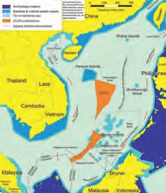
New technologies have helped land registration. We attracted high calibre authors for GW in this area of practice; for example, Stig Enemark, Robin McLaren (Crowd Sourcing for land administration), Peter Dale and Paul van der Molen. In 2016, we were part of the campaign to dissuade the Government from privatising the Land Registry, including a spirited and detailed repulse from former chief registrar, John Manthorpe (May/Jun). Land, of course, is at the heart of boundary disputes, a topic we regularly returned to, usually under the auspices of David Powell or Carl Calvert. There was keen interest in international boundaries too. The 2013 Mar/Apr issue featured Maritime Boundary Disputes in SE Asia by Robert Beckman. The article remains an important introduction to the key issues in one of the world’s flash points. Carl Calvert reported from Durham’s IBRU (International Boundary Research Unit) and Lord Curzon’s dictum: “Frontiers are indeed the razor’s edge on which hang suspended the modern issues of war or peace, of life or death to nations” (2010 Jan/Feb). We also covered India and Pakistan’s bizarre multi-enclave dispute of Cooch Behar (2012 Jul/Aug).

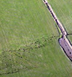
Land and its displacement, otherwise known as earthquakes, was reviewed in 2012 Mar/Apr by our New Zealand correspondent Roy Dale, followed in May/June with a startling cover pic of NZ’s 4-metre shifting Greendale fault. And a report on the Christchurch Earthquake by Malcolm Anderson, coincidently visiting the country (2011 May/June).
FC GW March-April 2013:FC GW Nov-Dec 2012.qxd 21/02/2013 18:32 Page 1
GeomaticsWorld
MARCH | APRIL 2013 Issue No 3 : Volume 21
BIM: repeat the message even if you lose the will to live Helping to unravel Easter Island’s mysterious statues DGI 2013: maritime security highlighted Too many points: LiDAR or photogrammetry?
Building Surveys: is it time for survey with Zebedee?
Don’t miss GEO-South @ Holiday Inn Elstree 1&2May @ WWW.PVPUBS.COM
Maritime disputes in SE Asia.
FC GW May-June 2012.qxd 30/04/2012 15:07 Page 1
GeomaticsWorld
MAY | JUNE 2012
Issue No 4 : Volume 20
Surveying for geographical and spatial information in the 21st century
Repairing New Zealand’s shaken cadastra Can 19th c. mapping help in retracing boundaries? GeoForum hears Map Addict author Marine technology and Oceanology
Marking the retirement of Leica’s 360° man
MAJOR PROJECTS FC GW Sept-Oct 2015:FC GW Nov-Dec 2012.qxd 24/08/2015 09:29 Page 1
GeomaticsWorld SEPTEMBER / OCTOBER 2015 Issue No 6 : Volume 23
Surveying for geographical and spatial information in the 21st century
Geomatics: it’s all about robust measurement
The future for surveyors is BIM consulting Measurement techniques for vessel sensor offsets The Sagrada Familia: geometry and a client in no hurry Plaques, geodetic pendulums and James Joyce HxGN LIVE! 2015: shaping smart change
FREE DIGITAL SUBSCRIPTION FOR PROFESSIONAL SURVEYORS see page 3
Construction continues at the Sagrada Familia, begun in 1882.
We have covered projects as diverse as Mapping for D-Day (2004 July/Aug and Mapping in the coastal zone for D-Day, 2014 July/ Aug), Lewis & Clark’s mapping of Jefferson’s Louisiana Purchase for $15 million from France, thereby doubling the size of the infant US (2004 July/Aug). But perhaps one of the most extraordinary projects was Barcelona’s Sagrada Familia cathedral, where work began in 1882 and has still to be completed. Current target is 2026, to coincide with the centenary of architect Gaudi’s death (2015 Sep/Oct). >
The British Museum’s Great Court project saw some extraordinary surveying challenges in a roof made up of hundreds of individual triangular glass panels (July/August 2000). At Heathrow’s T5, the job for contractors was not to lay a pipe or a cable but to lay it and record precisely where it was. Europe’s biggest infrastructure project for much of the early 2000s, the Channel Tunnel Rail Link, had only just started and was not expected to be completed before 2007. In the meantime, trains would continue to speed across northern France, through the tunnel and emerge into Britain’s ailing 19th century rail network before arriving at Waterloo; St Pancras was just a dream.
REGULATORy AND DATA UNDERPIN GEOMATICS
A new Land Registration Act came into force in 2003 and, in 2004, the Land Registry’s Index map was vectorised, while in 2014 (Sept/ Oct), the PAS 128 standard for utility surveying arrived. Major countrywide databases were growing; OSGB launched Mastermap, large scale seamless layered mapping of Britain, while Getmapping launched the imagery-based Millennium Map and others were building height datasets and land use. Even the UK Hydrographic Office was developing a marine spatial data information system, while INSPIRE, the Marine Bill and Location Strategy (2009 Mar/Apr) tried to bring order.
HERITAGE AND DIGITAL DOCUMENTATION
From the Antarctic Scott Huts, cathedrals, townscapes, Stonehenge (2011 Nov/Dec) to ancestral structures in Colorado of Native Americans (2019 May/Jun), the Heritage sector has benefited from scanning technology and high definition photography, now aided by SLAM technology. This allows intricate detail in hard-to-reach places to be captured. The 2002 March/April issue featured a striking cover showing CAD captured details of the intricate structure of the Iron Bridge in Shropshire, a UN World Heritage Site. The survey was carried out on the 225-year-old structure by English Heritage’s Metric Survey Team using photogrammetry, laser scanning and reflectorless EDM, while in 2014 (July/Aug), John Hallett-Jones showed how a digital camera imaged the Banqueting House in Whitehall.
For surveying’s own heritage, Struve’s Arc became a UNESCO world heritage monument. Undercurrents noted that Heinrich Wild’s T2 theodolite, which first saw the light of day in 1920, was still going strong more than 80 years later with the instrument working on Canary Wharf and the QEII Bridge at Dartford. For those who wanted detailed knowledge of techniques in the past there was a reprint of William Leybourn’s The Compleat Surveyor from 1653 (2002 Nov/ Dec). In Sept/Oct 2003, Prof Mike Cooper marked the 300th anniversary of the death of Robert Hooke. Mike also interviewed Michael Elfick, surveyor on Sydney Opera House, on the challenges of setting out those sweeping roof sails (2005 July/Aug and Sept/Oct). In Jan/Feb 2011, Mike again gave us a fascinating article, this time on Gertrude Bell: surveyor, mapper and kingmaker (to which one might add archaeologist, explorer, mountaineer and boundary maker).
MANUFACTURERS AND DEVELOPERS
Even before the millennium, there was an emerging trend for survey instrument manufacturers to watch out for pioneering measurement technology and, if it worked, to buy up the developers. Leica Geosystems was a typical example of this, acquiring laser scanner developers Cyra Technologies in 2001 and itself becoming part of Hexagon. Shortly afterwards, GPS pioneers Trimble acquired Spectra Precision, which added a range of total stations to their portfolio (following an abortive in-house attempt to develop a total station). They later added Zeiss Oberkochen and Nikon’s total stations, followed by laser scanner developers Mensi and Callidus. Topcon, a large Japanese conglomerate with interests spanning surveying and optometry, merged with Sokkia. In 2001, Showcase found over a dozen GPS survey receiver manufacturers in the survey market. That number was whittled down to less than half that two decades later. Trimble supplier Survey Supplies rebranded as Korec. My thanks to all these companies and many others too who supported GW through both editorial and advertising.

The historic Ironbridge captured and analysed.
RETIREMENTS, LOSSES AND THEy WHO SERVED
I was privileged to have been editor and to have known several stalwarts of surveying who alas are no longer with us. We remember Gary
Covington, author Andro Linklater, John Wright, Jack Weightman, Professor Mike Cooper, Mike Fort, Stan Longdin, Eric Radcliffe, John Grant, Bob Blow, Rear Admiral Steve Richie, Alan Wright, Ken Hall, Frank Shepherd, Richard Bullard, Ian Harley, Tim Leon, Graham Brown, Mike Curtis, Harry Glennie, Sir David Haslam, Jonathan Davy, Derek and Greg Simmons, Brian Hart, Doug Hodges, Keith Pope, Ordnance Survey DGs Brian Irwin, John Kelsey and Peter McMaster (“I left school with a kilt and rifle so how on earth have I landed up here!”). Apologies if I’ve missed someone.
For RICS, this has been a time of transition from Division to Professional Group, from presidents to chairs. It is perhaps invidious to highlight the RICS Geomatics presidents and chairs who were excellent contributors to GW, but I must record my thanks to Richard Bullard, Mike Curtis, David Powell, Rob Mahoney, Ruth Adams, Chris Preston and Gordon Johnston who were contributors, not just with regular columns but through significant and insightful articles too.
During this period, a number of significant academics in our field retired and their work was celebrated through special days, colloquiums and seminars. Professors Peter Dale, Vidal Ashkenazi, Paul Cross and Ian Dowman provided memorable events. Throughout this period, there were a number of regular contributors. Three stand out whose columns were always interesting to read. Those with regular columns like Nick Day, whose regular Overcurrents included several reference articles such as those for would-be immigrants to the US and how to get the fabled green card (2002 May/June).
Carl Calvert’s legal column unravelled many a thorny problem for readers, while the late Garry Covington provided a stream of fascinating articles about field survey in the past. John Brock, champion of FIG and especially its Art and History of Surveying Commission, provided constant copy about his world travels and his native Australia.
Along the way, GW found space to highlight the activities of charity Map Action, the AGI, FIG, the British Cartographical Association, ISPRS, the Defence Surveyors Association, and the Royal Geographical Society, the latter providing a regular source of reporting and comment for the Undercurrents column.
Richard Groom gave willing and unswerving support to GW. His 2008 Sept/Oct Flood risk insurance article was a benchmark; members and readers owe him a great debt for his technical insight into all aspects of geomatics. Other regular writers included Adam Spring, Gordon Adreassend, Mark Griffin, Ted Read and, throughout the years, Malcolm Draper’s Undercurrents. While Malcolm found the bullets, I tried to fire them, often tempered with moderation. James Kavanagh kept readers up to date with the latest regulatory and professional practice news. I salute and thank you all for over 20 years of enthusiastic support for GW.
Throughout most of this period, GW’s office was sustained by a small team consisting of the Editor, Barbara Molloy, Sharon Robson and Richard Groom. Others came and went including Jason Poole, Hayley Tear, John Fenn, Mark Wiseman and Nigel Harding.
EDITOR’S NOTE.
Ian Dowman took over from Stephen as editor in 2017 and the editorial policy has been unchanged, with many of the contributors continuing to report on important developments in geomatics. See the editorial (page 4) for further comment.

Insurance and flood risk was popular that year.
TECHNICAL B2B MARKETING


WWW.GEOMARES-MARKETING.COM