23 minute read
Enhanced Solutions for Seagrass Monitoring
Advanced Underwater Surveying Combined with Deep Learning
Enhanced Solutions for Seagrass Monitoring
A new, non-invasive method to measure and monitor seagrass biomass on the seabed around England’s southwest coast has been successfully demonstrated this year as part of a collaborative project supported by Innovate UK’s Smart Grants programme. The approach made use of an altimeter installed on a USV that was specifically developed for this purpose, and the hydrospatial data was processed and visualized through an advanced cloud-based solution.
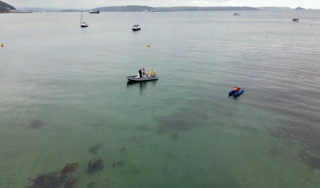
The innovative new technique builds on the concept of the acoustic reflectivity of seagrass providing valuable information to characterize submerged aquatic vegetation. It was trialled during two phases in May and September 2022 by the southwest England-based companies HydroSurv and Valeport, working with the University of Plymouth and Natural England.
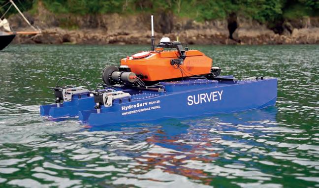
The full-stack solution comprised a Valeport VA500 altimeter installed on a HydroSurv REAV-28 uncrewed surface vessel (USV) specifically developed for the project. A large, validated signal library and deep learning algorithm, developed by the University of Plymouth, deciphered the survey data to predict seagrass distribution. The data was visualized and interpreted in a cloud application created by HydroSurv.
ACCURATE, COST-EFFECTIVE REPEATABLE SURVEYS
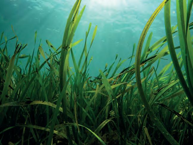
Seagrass meadows are a crucial part of the marine ecosystem and are increasingly recognized for their essential carbon capture abilities. As well as being as effective at storing carbon as woodland, seagrass also provides a vital habitat for young fish, seahorses and jellyfish. It additionally cleans surrounding seawater and helps to stabilize the seabed, thereby reducing coastal erosion.
A USV provides a non-invasive, cost-effective platform to facilitate accurate repeat surveys that can be compared to monitor temporal changes in seagrass coverage for the planning of protection and regeneration projects at biodiversity-rich worksites. The solution is set to change the way in which seagrass meadows are monitored in the future, complementing traditional diver surveys to cover much larger areas and enable rapid resurvey work as required.
The work carried out in the collaborative project directly translates into impact, addressing UN Sustainable Development Goal 14 ‘Life below water’. Rapid data acquisition, processing and visualization of seagrass meadow density is critical for coastal practitioners in developing their current understanding of seagrass meadows as vital ecosystems. New technologies, such as USVs equipped with innovative sensors and instrumentation, are enabling cost-effective and repeatable surveys that support effective conservation and restoration projects.
CUSTOMIZED TOOLS FOR DEEPER ANALYSIS
Valeport’s VA500 altimeter, which uses state-of-the-art signal processing, was customized specifically for this project. It is an underwater positioning instrument that is
Seagrass. (Courtesy: Fiona Crouch)
Valeport VA500 Altimeter. (Courtesy: Valeport)
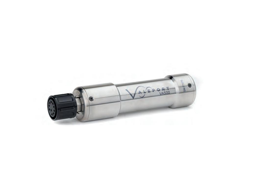
primarily fitted to autonomous, remotely operated or towed vehicles, both surface and underwater, to give an accurate measurement of height above the seabed. The VA500 uses advanced digital signal processing to hone-in and track the seabed, ignoring spurious echoes. It works by emitting an acoustic pulse (500kHz) and times how long it takes for echoes from distant surfaces to return; given the speed of sound in water, the sensor can then calculate a distance from the measured time. For this project, the sensor was simplified. A standard VA500 receives multiple signal echoes and must decide which one represents the seabed. The customized version of the altimeter used on HydroSurv’s USV didn’t have to make that decision. Instead, it output all measured echoes, together with an indication of how strong and how sharp each signal is, for the University of Plymouth to analyse with their software. The project partners worked together to develop custom firmware that delivers low noise, high-quality, correlated acoustic profiles at up to 10Hz, enabling deeper analysis, exploration, mapping and classification of the acoustic information gathered.
The customization presented one main challenge, namely ensuring that the sensor was able to output much larger quantities of data than usual while maintaining a sensible sampling rate. The absolute accuracy of data from any altimeter generally depends on knowledge of the sound speed in the local environment. However, more important for this application was the resolution of the data and its ability to distinguish multiple echoes from objects that were close to each other.
This was the first time that Valeport had customized the performance of the altimeter for a client, although other mechanical adaptations to fit specific vehicle requirements have been made in the past. The company hopes to realize more opportunities for this version and is also considering other applications that could be addressed with further changes and optimizations.
The application of deep learning algorithms for the acoustic detection and characterization of seagrass beds has introduced improved accuracy and efficiency over more traditional techniques. Combined with the advantages of lightweight autonomous survey platforms, it introduces a step change in accurate and repeatable seagrass mapping.
The algorithm developed for this project, named SeagrassNet, uses a machine learning algorithm (recurrent neural network, or RNN) to detect the presence or absence of seagrass in echosounder data. The developed algorithm ingests raw echosounder data from the Valeport VA500 and uses the RNN to classify whether seagrass is present or absent and where within each echosounder ping the most likely location
(elevation) of the seabed and seagrass canopy is, enabling the height and density of any seagrass present to be detected. When tested against a large database of labelled echosounder data, SeagrassNet successfully labelled 95% of the validation data points.
The benefits of using a machine learning algorithm for detecting and measuring seagrass, rather than a more traditional rules-based approach, is that the algorithm is trained to differentiate the seabed and seagrass from any other subaqueous features, therefore requiring less manual effort during quality control than traditional seagrass detection methods. With enough labelled echosounder data, the algorithm could also be trained to label other subaqueous features such as frond weed, kelp and bladderwrack.
UNCREWED VESSEL DEVELOPED TO PROJECT SPECIFICS
To develop the REAV-28 USV hull form for this project, HydroSurv subjected over 42 candidate hull designs to motion analysis using simulation in line with the sea conditions expected at the UK worksites. Mass and drag properties were optimized relative to overall hull length and the resulting design performed well in a range of sea conditions throughout trials.
The aluminium USV is propelled by two Torqeedo 1,100W outboard motors, powered from four 915Wh propulsion batteries located inside the hulls, while general service power is provided from a separate 1,280Wh battery inside the cross-deck compartment. The vessel can operate at service speeds up to 5 knots, with good line-keeping performance and cornering at all speeds. The USV also incorporates a cast winch system that is fully integrated into the vessel control systems. As a fully electric, non-invasive survey platform, it is readily portable to inland and coastal worksites and can be rapidly deployed, operated and recovered with a small survey team.
The UK has lost around half of its seagrass since the mid-1930s, due to factors ranging from seagrass wasting disease (SWD) and pollution to physical disturbance from the anchoring, launching and mooring of leisure boats. The £2.5 million LIFE Recreation ReMEDIES partnership ‘Save Our Seabed’ is a five-year marine conservation project that was launched in July 2019 to protect and restore these sensitive habitats. Valeport sponsors the initiative, which is funded by the EU LIFE programme and led by Natural England in partnership with Marine Conservation Society, Ocean Conservation Trust, Plymouth City Council/Tamar Estuaries Consultative Forum and The Royal Yachting Association.
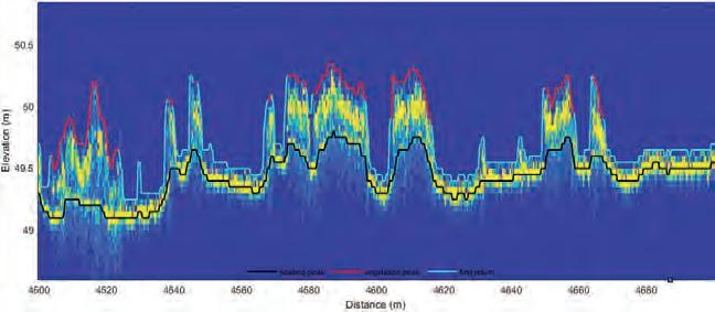

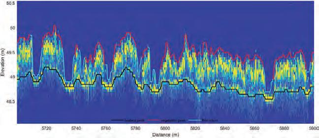
Example of seagrass data collected over the Great Ganinick seagrass meadow in the Isles of Scilly in 2020, showing the seagrass canopy (red), seabed (black) and first return (where seagrass is absent, cyan), as detected by the developed SeagrassNet algorithm. The intensity of the VA500 acoustic data across elevation (y-axis) and surveyed distance (x-axis) is shown in yellow (strong, coherent acoustic returns) to blue (absence of acoustically reflective objects) colours in the background.
Acknowledgements
Sonardyne International for loan of a Mini Ranger 2 acoustic positioning system with Nano beacons for the accurate positioning of diver observations during field trials (as part of their long-standing partnership with the University of Plymouth). GEOSIGHT Limited for loan of their REAV-28 USV, a 2.8m catamaran hulled vessel with fully electric propulsion built by HydroSurv, suitable for deployment and recovery from foreshores and beaches for a range of hydrographic and environmental survey applications.
David Hull, CEO, HydroSurv
Following his early career in the shipbuilding and repair and commercial marine sectors, David Hull went on to work in marine installation, operations and maintenance. In 2019, he founded HydroSurv, an impact-focused marine robotics company which has since developed a range of electric and hybrid USVs for hydrographic and environmental data acquisition for inland, nearshore and offshore applications.
Tim Scott, Associate Professor in Ocean Exploration, University of Plymouth
Tim Scott is an Associate Professor in Ocean Exploration at the University of Plymouth. Working within the Coastal Processes Research Group, he has more than 20 years of experience in the collection and analysis of coastal morphological, hydrodynamic and hydrographic data. Recent research has focused on the use of autonomous platforms for coastal/ marine environmental sensing.
Matt Quartley, Managing Director, Valeport Ltd
Matt Quartley has headed the environmental monitoring instrument company Valeport since 2005. With a background in defining and specifying new products for development, he leads the strategic and operational decision-making and processes at the Valeport group, which serves both marine and inland water sectors.
Positioning a Deep-sea Crawler for Polymetallic Nodule Mining
Landing on the Abyssal Plain
Electrification and the transition to a green economy are rapidly accelerating the demand for metals and rare earth minerals. As this demand cannot be met by recycling existing metals, a number of land-based mines are depleting their reserves with an ever increasing environmental and societal impact. Space mining is not a reality for the near future, and so governments and companies are looking into obtaining these crucial metals from the bottom of the world’s oceans. This is the story of Global Sea Mineral Resources’ (GSR’s) efforts to develop a new, responsible mining industry.
POLYMETALLIC NODULES
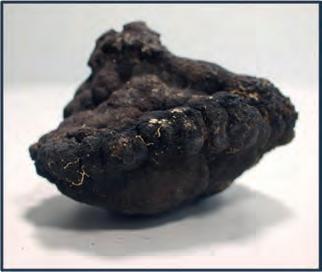
Polymetallic nodules are rock concretions that form on the abyssal plane and that contain a wide variety of metals and other rare earth minerals. These nodules can be found in all of the world’s oceans, but their metal content and appearance can differ, depending on their location. The size can vary from a few millimetres in diameter to over ten centimetres. The exact way in which they form is still under debate, but it is widely believed that they start out from a hard substrate around which metals in the water column or sediment gather to slowly form a polymetallic nodule. This hard substrate can be a piece of rock or it may be something more interesting, such as dolphin ear bones or even teeth from prehistoric megalodon sharks.
The nodules that garner the most interest are those with the highest content of the metals needed for the transition to a green economy. In one area, called the Clarion-Clipperton fracture zone (CCFZ), the nodules are particularly rich in manganese, copper, cobalt and nickel: metals that are crucial for the production of batteries, solar panels and wind turbines. The CCFZ is an area of about 4.5 million km² in the Pacific Ocean, situated roughly between Mexico and Hawaii. The International Seabed Authority, which has jurisdiction over this area, has so far only signed contracts for exploration, and GSR was awarded one licence area in 2014 with a total surface area of about 75,000km².
Figure 1: Polymetallic nodule.
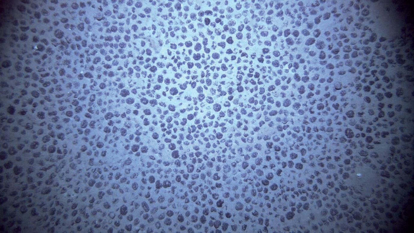
Figure 2: Nodule field.
RESOURCE DEFINITION
Quantifying the polymetallic nodules is the first crucial step in estimating the viability of deep-sea mining. Knowing where the nodules can be found and in what numbers has a significant effect on the procedure and operational schedule of the collection system. In 2014, GSR organized a first research campaign to the CCFZ with a hull-mounted Kongsberg EM120 multibeam echosounder (MBES), to get a full low-resolution overview of the licence area. During this campaign, 75,000km² of Pacific seabed was mapped and all of the data collected was shared publicly. As a result, this multibeam data is now part of the GEBCO Chart to contribute to Seabed 2030. Based on this data set, GSR drafted a preliminary resource model and defined several areas of interest. These were visited one year later, in 2015, using an autonomous underwater vehicle (AUV) that combined MBES measurements with sidescan sonar data and high-resolution pictures of the seabed. Other samples were also gathered, such as boxcores, multicores and water samples. With this data, advanced models were made to estimate the nodule abundance.
PATANIA I
Using the data gathered in this survey, GSR started to develop a tracked soil testing device. The focus was on testing the performance of a tracked vehicle on the seabed of the Pacific Ocean, while also gaining practical experience in the development of vehicles that can go 5,000m deep and drive around on the seabed. The device was named ‘Patania I’, after the world’s fastest caterpillar.
With the development of Patania I, a reliable positioning system was required. Many options were considered, but because of the limited requirements for these first trafficability tests, a simple setup was chosen with an ultra-short baseline (USBL) system on the vessel and an inertial navigation system (INS) with coupled Doppler velocity log (DVL) on the crawler. A Sonardyne Ranger 2 was used for the USBL system and Phins was selected from iXblue for the INS. It was clear that the raw position of the USBL would not be accurate enough at these depths, so it was suggested that the INS would filter out the jumps and give a smooth position in combination with the DVL. In the field, however, the inaccuracy of the USBL was found to be too great at depth for the INS to filter it properly. This resulted in small fluctuations in the position of the Patania. If it were an ROV, this would not have been a big issue, but as the vehicle was known to be standing still on the seabed, every movement that the navigation screen showed was one too many. It also made it very difficult for the operators and the automatic driving system to control it properly. To resolve this issue, it was decided to disable the USBL input in the INS and continue in pure INS/DVL mode. This gave a very stable, usable position, but with a long-term drift. As the Patania drove an average of five kilometres each dive, the
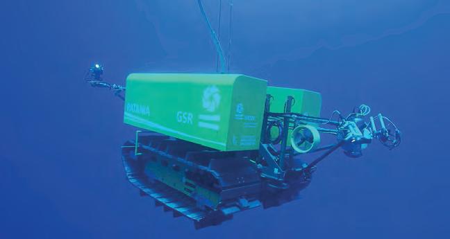
Figure 3: Deep-seabed mining robot Patania I.
positioning error of five metres at the end was however considered to be acceptable.
PATANIA II
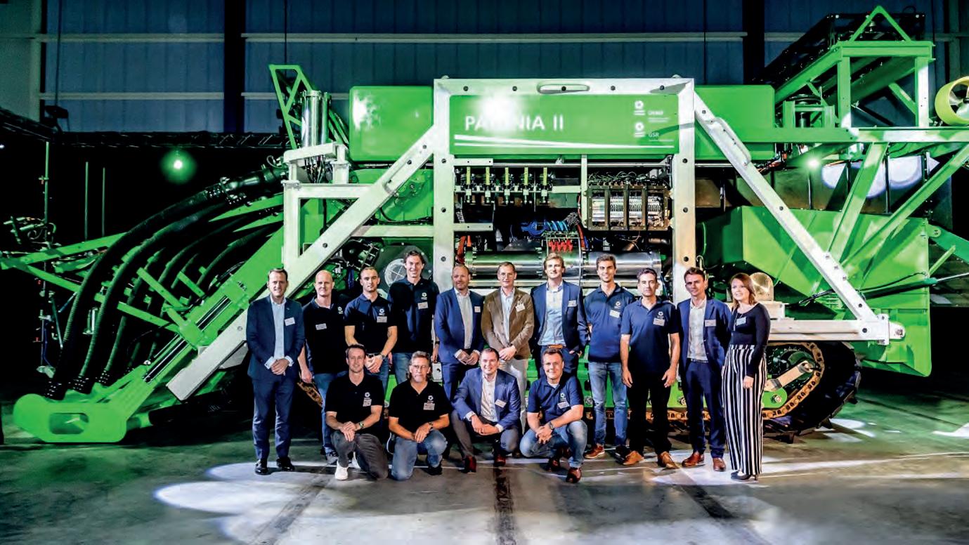
After the success of the Patania I, GSR developed a bigger vehicle that, while still a pre-prototype, not only drove around but also tested a harvesting system. Tests had already been performed in a lab, but the system had to
prove itself in situ. While Patania I was about the size of a small car, Patania II was more the size of a truck with a length of ten metres and a height and width of about four metres. It had four hydraulic collectors in front that used the Coanda effect to lift the nodules without touching the seabed.
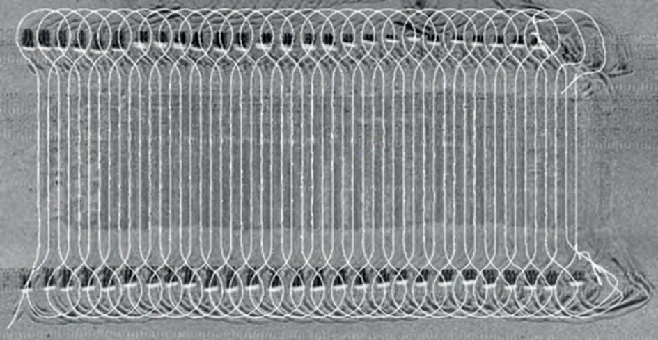
Beside technical trials, Patania II was also built with the purpose of carrying out pilot mining impact studies. In collaboration with universities and research institutes from all over the world, it was agreed to clear an area of about 20,000m² of nodules and to study the impact of this on the environment. For this, a more robust positioning system was clearly required with an accuracy that did not deteriorate over time, as the aim was to achieve a constant relative position accuracy of about 25cm. This ensured that an entire surface could be cleared efficiently by driving a lawnmower pattern. As the INS/DVL setup performed well with Patania I, the same equipment was used for this new positioning setup, although with an input to correct the long-term drift. The obvious way to do this would have been with a long baseline (LBL) array of half a dozen transponders on the seabed, but this solution was disregarded as it would take too long to deploy and calibrate such an array at such depths, so far offshore, for trials
that would last just a few days. The solution therefore was to use sparse LBL, which provides near-LBL accuracies using just one or two transponders by combining the ranges with the information that is already in the INS. This provided the required accuracies without the vessel time that the deployment of a full LBL array would need.
The Ramses from iXblue was selected for this task with two transponders on the seabed. A box-in was done on one of the transponders, and the second transponder was to receive an accurate position through SLAM calibration. This would fix the position of the transponder by driving alongside it. Unfortunately, this did not work out in practice as the angle between the vehicle and the transponders on the seabed did not vary enough for it to calibrate properly. A second issue arose just before the crawler arrived at the seabed when, due to the immense pressures at this depth, the subsea cable towards the Phins shorted for a second, resulting in a restart of the INS. This caused a bad initial position and a discrepancy between the USBL and sparse LBL data. There was only one opportunity to fully test the positioning system during the entire campaign, and unfortunately this did not work out as intended. However, the data that was collected showed in postprocessing how the system could have performed without these issues, and that looked very promising.
MINING IMPACT STUDIES
These positioning issues had a very limited effect on the mining impact studies, as the pure INS/DVL positioning was accurate enough to provide full coverage of the mining area. In Figure 5, the live position can be compared with a sidescan survey that was performed afterwards. The darker zone in the centre is the area that was cleared of nodules, and the heaps at the top and bottom are the nodules that were deposited by Patania II.
CONCLUSION
Both the team from GSR and the teams of scientists that joined the campaign were thrilled with the results. After all, this is the first time in history that thorough environmental data has been collected to study the impact of a new industry before the industry starts. All of the environmental data gathered is publicly available and has been shared with universities, research institutes, governments and international organizations all over the world. This data will be used to assess the impact of collecting these nodules and as a basis for international legislation for this new emerging industry.

References
Metal-rich nodules collected from seabed during important technology trial | DEME Group (deme-group.com)
Hendrik De Beuf has worked in DEME’s survey department since 2014 and became involved with GSR in 2017 for the development of the prototype deep-sea harvesting vehicles. Since then, he has been responsible for the development and commissioning of the monitoring and positioning systems used during the offshore campaigns.
Deploying Uncrewed Vessels in the Search for Lost Shipwrecks
In the summers of 2021 and 2022, an iXblue DriX USV was deployed to try and locate the missing wreck of the sunken French fishing trawler Ravenel. The vessel disappeared in January 1962 with 15 people on board and was never found, despite extensive research campaigns.
In April 2021, the French Minister for the Sea announced the launch of a major research campaign, requesting that the DriX uncrewed surface vessel (USV) be used to map the seafloor off the coast of the Saint-Pierre and Miquelon islands. A dedicated crew was first sent by iXblue to operate the DriX and perform the survey in the summer of 2021, and then again in 2022. A Kongsberg EM2040-04 multibeam echosounder (MBES) system was installed in the DriX gondola for seabed mapping.
Conducted in coordination with local authorities, the survey mission also included archaeologists from the DRASSM (Departement des Recherches Archéologiques Subaquatiques et Sous-Marines), whose aim was to analyse the data collected by the DriX USV and inspect potential targets using ROVs.
During the two campaigns, DriX was used in autonomous mode under the supervision of a remote operator. The USV was monitored either from iXblue’s remote control centre in La Ciotat (south France) using 4G or Satcom or from a support vessel for operations conducted close to the shore.
EXTENSIVE AREA COVERAGE DESPITE CHALLENGING SURVEY CONDITIONS
The uncertainty surrounding the exact time of the sinking led to the definition of a large research area: from outside the port of Saint Pierre to the Newfoundland coast for the 2021 campaign (450km2), and south of the islands of Saint-Pierre and Langlade for 2022 (400km2).
The environmental conditions in the area are known to be very challenging, even during the summer. Typically, sea conditions with a tidal current up to 2kn, wind gust up to 50kn, waves of 2.5m and an Atlantic swell up to 3.5m are to be expected. The presence of dense fog is another challenge in terms of situational awareness and obstacle management.
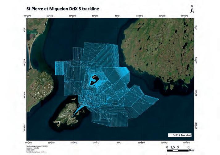
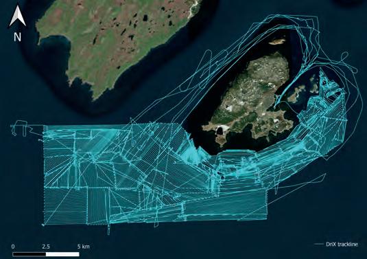
Statistics for wind (average wind speed in knots and gusts) per month for Saint-Pierre and Miquelon are presented in Figure 2. These difficult conditions did not prevent DriX from completing the full planned survey area within the allocated time frame. The maps in Figure 4 show the navigation lines performed by DriX during the 2021 (left) and 2022 (right) missions. This represents more than 11,000km.
The over-the-horizon operational mode and the complex environment required a high level of situational awareness. Navigation could be managed safely and efficiently owing to the DriX advanced obstacle detection and avoidance system that combines multispectral / multidistance perception means (camera, Lidar, radar,
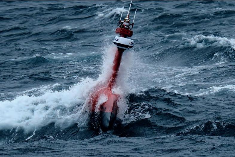
Figure 1: DriX performing a bathymetric survey off the coast of Saint-Pierre and Miquelon. (Credit: Raphaël Chantelot)
Average wind speed and gusts per month (kn)
Figure 2: Wind statistics for Saint-Pierre and Miquelon.


Figure 3: iXblue Phins C7 real-time heave recording.
AIS) to detect, locate and track obstacles and provide a single unifi ed georeferenced representation.
OPTIMIZED ACQUISITION AND DELIVERY
Despite the rough weather conditions, the unparalleled stability of the DriX and the data acquisition performance of the EM2040 resulted in high-quality multibeam data and a survey resolution up to fi ve times better than previous surveys in the same area. The optimized data gathering environment made it possible to record very clean data. Over the 11,000km of survey line acquired, the post-processing phase did not require the use of any bathymetric automatic data fi lter or manual despiking, which vastly increased the processing time and fast tracked the
data delivery to the DRASSM archaeology team.
Finally, the very low noise acoustic signature of the DriX gondola made it possible to maintain high-frequency recording and an optimized swath, even in deep waters. Therefore, the 400kHz MBES frequency was used from 5m to 250m depths, the deepest section of the survey area.
The survey was conducted between 7 and 8 knots, which provides the best compromise between sounding density versus area coverage effi ciency for a given time objective.
In 2022, DriX’s new ‘auto-line’ feature was used for the fi rst time. Auto-line is the ability of the DriX to decode the bathymetry provided by the Kongsberg multibeam system and to perform navigation autonomously based on the swath width. This new development allowed around a 50% gain in time for line planning and a 30% increase in operations, thanks to the swath optimization and overlap management.
This new software development allowed for tremendous gains to be achieved in the 2022 campaign, resulting in covering an area close in size to the one surveyed in
2021 but in much less time. The teams could therefore cover an additional survey area in the remaining time frame of the mission.
Another challenge was the operational coordination between the organizations
Figure 4: DriX track lines during the 2021 (left) and 2022 (right) missions.
involved. iXblue was conducting the survey in Saint-Pierre and Miquelon while the DRASSM was performing target identifi cation and the ROV inspections. The DRASSM operation was fully dependent on the bathymetry interpreted from the DriX measurement. As the ROV inspection started before the end of the survey project, the bathymetric results needed to be delivered for review within two days after acquisition.
The data was therefore downloaded directly from the DriX computer to the control centre, where it was checked, processed and delivered to the DRASSM so that analysis and target picking could be performed.
This highly detailed bathymetric mapping of the area allowed the DRASSM to identify two high-potential targets, both in French waters. The identifi cation confi rmed that the two targets were indeed shipwrecks, although visual inspection confi rmed that they were not the Ravenel. Both wrecks were lying on the seabed at around 110m depth. The fi rst one, around 40m long, the second one (see Figure 7), approximately 24m long. Both were made of wood.
CONCLUSION
With over 11,000km covered, completing the full scope of work, the operations showed that using a USV such as the DriX represents a very effi cient means of surveying, providing a highly reliable and high-quality survey in very challenging survey conditions.
Figure 5: DriX HMI view showing autonomous navigation based on the bathymetry, overlayed as coloured grid and multibeam swath edges (dotted lines).
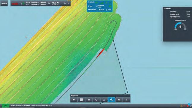
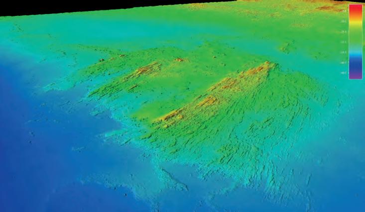
Figure 6: 3D data view of DriX MBES survey data using Kongsberg EM2040-04 MBES.
Unfortunately for the 2021 mission, the completion of the search area inspection did not provide any further information regarding the sinking of the Ravenel. For the 2022 search campaign, analyses are still ongoing, and so the mystery continues.
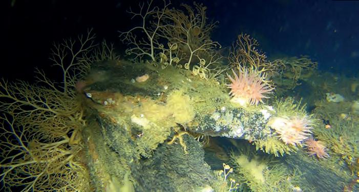
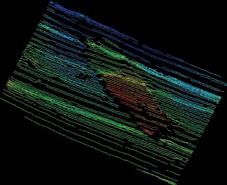
Figure 7: Identifi ed shipwreck located at 110m depth, seen from the EM2040 data and extracted from the visual inspection.


