Università IUAV di Venezia
Abstract
Introduction
Analysis of the location
1.1. Location through the history
1.2. The importance of the surroundings
1.3. The development of the park and the museum
1.4. The development of the quay
Research
2.1. The importance of the parks in the city
2.2. The importance of the waterfront (re)development
2.3. Weather conditions and flood in Belgrade
Case study of Park Usce
3.1. Location analysis
3.2. Accessibility and connection to the surroundings
3.3. The cultural/social manifestations on the location
The Project
4.1. Strategy of the project
4.2. Design proposal
Conclusion
References 01 02 03 04 05 06
Abstract
The focus of the master’s thesis is on the urban planning and development of a park in Belgrade called Ušće, which translates to confluence. That being said, Usce stands around the confluence of two international rivers – the Sava and the Danube – which was a strategic point for the city’s birth and development on account of its topographical and natural features. Once again in Belgrade’s history, the waterfront area is at the center of attention, this time as the main location of the ongoing process of Belgrade’s radical urban change and development. Through a comprehensive analysis of the site, including its historical context, existing urban fabric, and cultural significance, this researchaimstoproposeinnovativedesignstrategiesbyaddingnewactivitiesaroundthe parkinacontemporaryway.Thethesisinvestigatesthesymbioticrelationshipbetween the park and the confluence of two rivers, Museum of Contemporary Art and the park, the importance of the waterfront, and highlights the potential for seamless integration and mutual enhancement of social and cultural experiences.
The project focuses on the integration of a sustainable water circulation system designedtocollectwaterfromfloodsandrainfall,whichisthencleansedanddirectedtoa newpoolarea,supportingtheideaofbringingbackthewatertothepeopleofBelgrade.
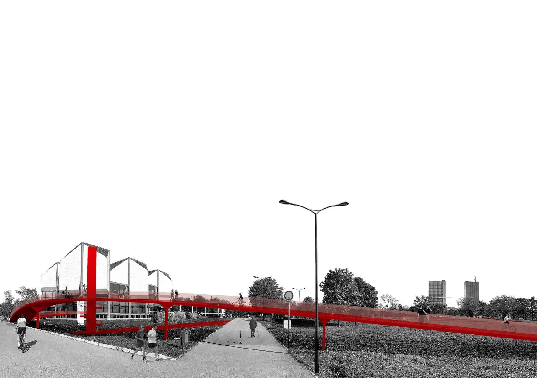
Central to this initiative is the creation of a new red ramp-pathway that traverses the park, directly linking it with the waterfront area, with many new activities along the way, creating the visual connection between them.
Drawingonprinciplesofsustainabledesignandurbanplanning,theresearchevaluates the potential benefits in terms of water management, ecological restoration, recreational amenities, and community engagement.
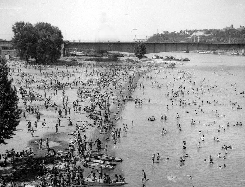
 Figure 2: Usce park with the Museum of Contemporary Art in 1970s
Introduction
Waterfrontredevelopmentinarchitecturerepresentsanimportantanddevelopingcomponent of urban planning and design, reflecting shifting perspectives on urban water bodiesandtheirsocialsignificance.Historically,waterfrontsarestrategicallyimportant for trade, transit, and military defense, they have been predominantly industrial and commercialhubs.However,inthesecondhalfofthe20thcentury,thewaycitiestreated waterfront areas underwent a radical change that resulted in a renewed emphasis on redevelopment for cultural, residential, and recreational purposes. This kind of urban initiative has emerged as the new worldwide “normality” for predicting the future of modern cities. Moreover, many mega-projects of new waterfronts that have emerged worldwide have been praised as role models for modern urban development. Redevelopment along the shoreline nowadays places a strong emphasis on inclusivity, resilience, and sustainability. Projects are progressively integrating green spaces, flooding solutions,andsustainableinfrastructuretocombatclimatechange.Additionally,maintaining public access, reestablishing community connections with their waterfronts, and protecting biological and historical aspects are also receiving more awareness.
That being said, the redevelopment of Park Usce in Belgrade represents a significant architectural and urban planning project aimed at revitalizing a prime waterfront location in the Serbian capital. Situated at the meeting point of the Sava and Danube rivers, Park Usce is a historically and naturally significant location. This region has historically servedasahubforthegrowthofthecityandisarepresentationofBelgrade’srelationshiptoitswaterwaysduetoitsexceptionallocationattheconfluenceoftwosignificant Europeanrivers.ThethesisprovidesathoroughcasestudyofParkUsceandisevidence of the modern concept of fusing urban regions with natural settings, improving public access to waterfront areas, and supporting environmentally friendly flood defenses.
1
1.1 Location through the history
Belgrade,thecapitalofRepublicofSerbia,cametobeasacityonthecollisionofalluvialplains,onthehillabovethepositionwheretheriverSavaflowsintotheDanube.Itis oneofmanycitiesalongtheDanuberiverandthespecificcitypatternsalongthecourse of it depend highly on historical occurrences, as well as on movements of populations over the European continent, and relationships realized between nations and countries. Classified as a waterway of international significance the Danube was the border zone inthetimesoftheRomanEmpire.ThecitiesthatarisealongtheDanuberepresentsome of the oldest European settlements and depending on their position and cross section through the riverbed they are being developed along its course.
ThefirstpeoplesthatwereattractedbythispeculiarlocationwereCeltsinthethirtcenturyBC,whentheysettledaroundtheSavaandtheDanubeconfluenceandthelocation ofthepresent-dayBelgradeFortress,andnamedtheirsettlementSingidun.Thiswasa strategic point, a well-defended spot, located on a hill, surrounded by rivers from three sides and with a perfect outlook, the same reason fortress and other infrastructure were built there later on. In the following centuries, numerous peoples passed through Belgrade, visiting, trading, laying siege or conquering it. These centuries of intense humanactivitystronglyinfluencedthetransformationofthisspacetothepresentday.The layers of heritage that these peoples left created the foundation for the development of a multi-cultural, post-socialist, metropolis on the crossroads.
The confluence, locally called ušće, in Belgrade is the place where the river Sava flows into the Danube. It is located in the center of Belgrade at a location between the Great War Island in the north, New Belgrade in the west, and the Belgrade Fortress in the east. The confluence of these two rivers - Sava and Danube represents the „gates of theBalkans“aswellasthe„gatesofCentralEurope“withwhichitisconnectedviathe most significant European waterway.
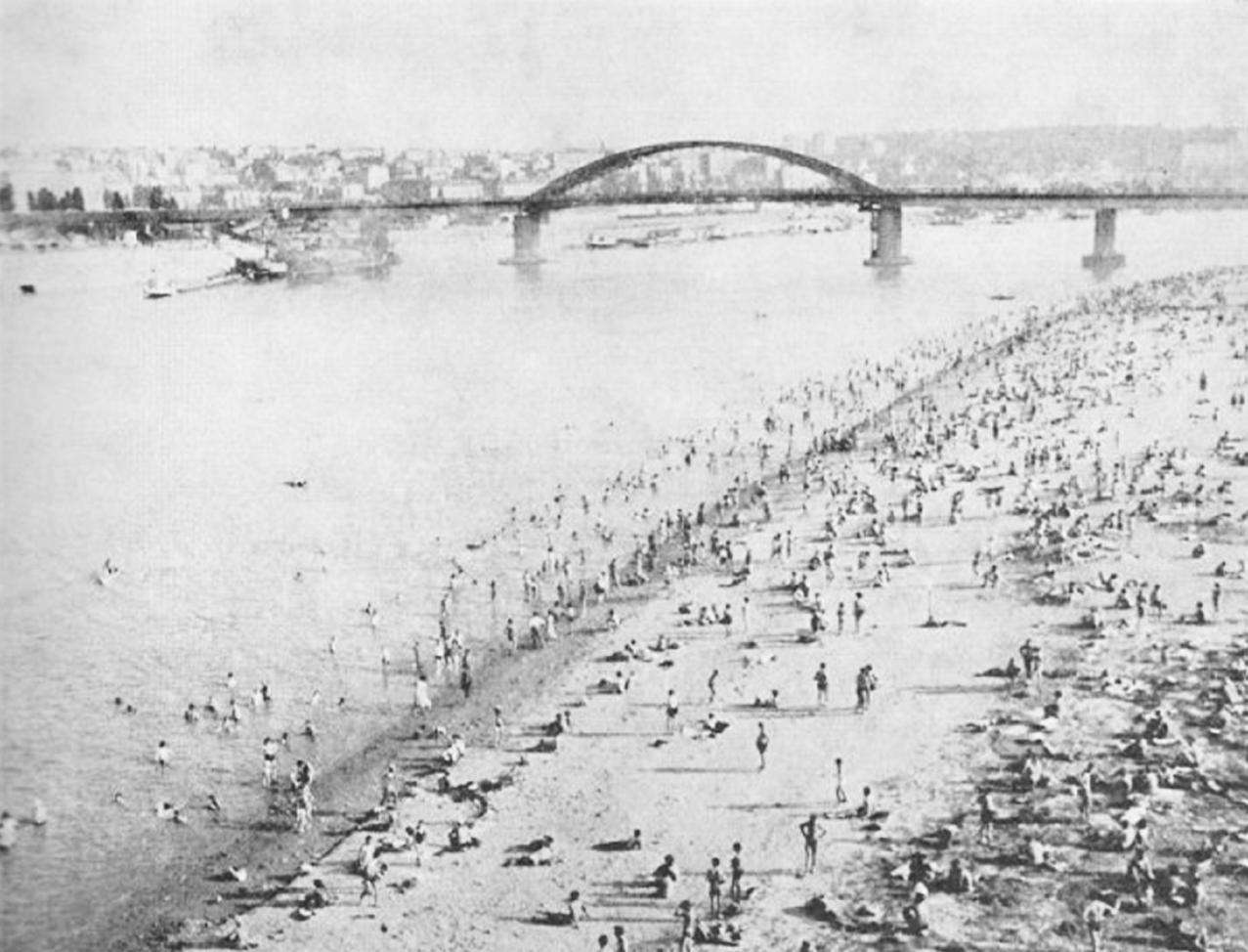
Usce park originates before the beginning of the World War II, when the quay was established at the left bank of the Sava, from the King Alexander’s Bridge1 to the Danube, with the intention of filling four meters of sand to create sixty hectares of space for a futuresettlementcalledNewBelgrade.TheembankmentonthebanksoftheSavawas paved until May 1939. Temporarily the location also served as a cargo dock, as well as a reception camp for Germans during the war. Until the 1960s, the area stayed intact, when the new building for Museum of Contemporary Art opened in 1965.
From that time on, the site went through many changes, until the final reconstruction of the park and museum finished in 2017. The current Serbian government is rapidly changingtheareaaroundthewaterfrontbyurbanmega-projects(BelgradeWaterfront) that might change its form and meaning forever. This confirms the notion that the representation of landscape is never detached from politics, but very much embedded in a sense of power. Landscapes are created or destroyed within a certain ideological context,inaparticularplaceandtime.Unfortunately,Serbianeitherrecognizesnorprotects theconceptoflandscapeinpractice,althoughthecountrysignedandratifiedtheEuropeanLandscapeConventioninFlorencein2011,andcommitteditselftotheprotection, management,andplanningoflandscape.Inmyopinion,theconfluenceoftheSavaand Danube should be treated as a landscape. Usce Park is a modernist, post-World War II urbanexpansionofBelgradeanditformsauniqueenvironmentalandaestheticensemble with the Belgrade Fortress, ofering the best viewpoints towards it.


1.2 The importance of the surroundings
The neighborhood of New Belgrade, to which the park Usce belongs, is surrounded by rivers on the north and east side. Its urbanistic project was established based on conceptualprojectsoftheNikolaDobrović2 from1946andseveralarchitecturalcompetitionsfollowedin1947.ThreeyearsaftertheendoftheWorldWarII,theconstructionof NewBelgradestartedbyyouthworkbrigades.Transformedintothelargestconstruction site in the country, this part of Belgrade unexpectedly quickly became a “city within a city”. In terms of population, New Belgrade was the largest municipality in Yugoslavia. Today it hosts some of the most important business and sport buildings in Belgrade. The city’s greenest municipality is New Belgrade, with its parks, well-kept lawns, and forested plateaus.
Across the river, at the very end of the Sava quay, is the notorious Belgrade fortress, called Kalemegdan. It represents the core of the city, originating from when the population was concentrated only within its walls. Its geographical position and the natural features are directly responsible for the birth and development of the city of Belgrade. Today it represents the biggest urban park of the city and one of the most important symbols of Belgrade. Throughout its lengthy existence, as a castrum, castel, medieval, and artillery fortress, it silently saw changes in leadership.
The Great War island is located across the river in the north. It was formed around the 16th century when the slowdown of the water flow at the confluence of the rivers caused the deposition of water-borne material that formed a water bank. It is uninhabited precisely because it has no solid ground. Most of the island is covered with forest, but there are not many species of mammals, due to its isolation and frequent flooding. With its good position, the island was a strategic point from which Belgrade was attacked and defended, which is why it was called the Great War Island. OnthesouthernpartofSavaquay,onthesamesideasUsceparkistheMemorial park for the Concentration camp Sajmiste.ItservedasaNaziGermanfacilityforinternment andexterminationduringtheWorldWarII.Originallyestablishedasanexhibitioncenter by the Belgrade municipality in 1937, its primary aim was to foster international trade relations and commerce within the city. The centerpiece of this architectural ensemble wasatoweringstructureutilizedbyPhilipsforthetransmissionofpioneeringtelevision broadcasts,markingasignificanttechnologicaladvancementinEuropeduringthatperiod. Almost 80 years later, the conversion of that space into a memorial center begin, and today the work is mainly focused on the reconstruction of the tower.


1.3 The development of the park and the museum
UsceParkbelongstothemunicipalityofNewBelgradeandrepresentsthelowestpoint of this neighborhood with an altitude of 68 meters. As the development of the neighborhood began in the middle of 20th century, during the times of Yugoslavia, so did the idea of organizing green areas along the riverside and building a cultural place that will unitethewholenationthroughart.Onthenorthernpartofthepark,thereisapartcalled Friendship Park, which holds historical significance as it was established in 1961 as a memorial park. Its construction was intended to symbolize the global movement for equalityandpeace.OnSeptember7,1961,formerYugoslavleaderJosipBrozTitoplanted plane trees to commemorate the park’s official opening. It has since evolved into a representationofpeaceandfriendship.ThecentralpartoftheparkfeaturestheAvenue of Peace, adorned with a memorial obelisk known as the Eternal Flame. The other area ofthepark,closertothequayofSava,continueddevelopmentuntillate1960s,withthe construction of the Museum of Contemporary Art.
TWith the establishment of the first modern art museum in New York in 1929, modernism came to be recognized as the acceptable style for representing the twentieth century. On the other hand, it may be argued that this is really a natural outgrowth of howmodernartcametobe—thatis,thatmodernartwasproducedwithintheconfines of art history and is reliant on the institution of the museum. Put another way, modern art and the museum are inseparable as a product of modernity.
Belgrade started developing faster after World War II, and in 1960 a competition was announcedforthedesignofanewmuseumbuildingintheparkUšće.Theprojectofthe architects Ivan Antić and Ivanka Raspopović was accepted and the new building was opened in 1965, on the 20th anniversary of the liberation of Belgrade from fascism in the World War II. .
The ground floor space, the center building, and a separate cube meant for the lecture hall comprised the three aspects of the composite construction that the two architects identifiedastheirdesign.Onecouldcharacterizethegroundfloor’spurposeasthatofa sculpturepark.Witha3:5aspectratio,ithasarectangleform.Acentralstaircaselinks the ground floor to a two-story building that is 45 degrees rotated from the lower level and is built from a square modular grid. The bases of the floors have a 2:3 aspect ratio and take the shape of rectangles. Since the numbers 2, 3, and 5 correspond to the elementsoftheFibonaccisequence:(0),(1),1,2,3,5,8,13,21,...36,thesescalesillustrate the inclination of the “golden section”.
The museum had a huge impact at that time, not only by being on such a popular and growinglocation,butalsobyconnectingtheYugoslavianartists,andthroughthem,the whole nation, despite their diferences.


Being the first museum to acquire and display modern art did not make the Museum of ContemporaryArtunique.ThiswasthefirstmodernartcollectionfromallofYugoslavia to be assembled methodically. It remains in the Museum’s permanent exhibition to this day.Yugoslavart-displays,projects,andactivitiescenteredaroundYugoslavart-persisteduntil1991,whenYugoslaviabegantodisintegrate.Nowadays,Serbianartistsare the main focus.
The museum was closed to the public in 2007 due to work on the adaptation, reconstruction and extension of the building. The project was created in such a way as to integratemodernapproachesinthedesignofcomplexsystemsofmuseumtechnology, primarily from the aspect of microclimatic optimization of the building. The first phase of works on reconstruction of the roof and basement, adaptation and extension was partiallycompletedin2010.Thenextphaseofthereconstructioninvolvescompleteinterior decoration, replacement of installations and restoration of the museum’s facade, which was finally completed in 2017, when the museum was reopened to the public.

 Figure 14 - Museum of Contemporary Art - interior
Figure 15 - Museum of Contemporary Art - exterior
Withthemuseum,thewholeparkwentthroughanurbanreconstructionprovidingnew basketball courts, skate park, children’s playgrounds, bike lanes, and new urban furniture for visitors to enjoy.
IncollaborationwiththeDanisharchitectJanGehl,in2017theprojectofreconstructing the coast area was proposed, both on the Danube and Sava riverside. This strategy consisted of opening the city towards the river, but was never fully realized due to lack of finances and importance of other, more attractive areas, like Belgrade Waterfront project on the opposite side of the river.


1.4 The development of the quay
Inrecentyears,thegreenquayofNewBelgradeisbecomingmoreandmoreattractive, both for locals as well as tourists. It hosts many rafts along the coast, many of them being clubs, restaurants or cafes for the popular nightlife of Belgrade. There are various types of rafts today, from the most ordinary boarded-up taverns on barrels to exclusive and hyper modern buildings on the water in which more money, architecturalvisionsandconstructionknow-howhavebeeninvestedthaninsomeresidentialbuildingsinthecapital.Theinvasionofraftsandthecompleteoccupationofthe banks of both Belgrade rivers began only at the end of 20th century, shy and modest compared to what everything turned into later.
Private houses-rafts on Sava, in which some people have even lived, became popular when people began to gather and make parties. This was the embryo from which the “party culture” that Belgrade is perhaps best known for today will be born among the manytouristswhocometoiteveryday.Duringthe90s,intheareaneartheconfluence of two rivers, but mostly on Danube, the rafts became clubs each one having a DJ and many visitors from the very beginning. That age was still the age of naivety for river objects,althoughitindicatedwhereeverythingwillgo.Thelegalstatusoftheseobjects was never raised as an issue because there is no legal regulation and the installation and construction of rafts is not subject to any inspections or controls. Full expansion beginsalreadyinthesummerof1996,whentheraftsexpandedfurthersouthalongthe Sava. The largest number of rafts that were placed here then in some form still exist today,althoughtheyaremostlynowlarger,moremodern,withgardensthatwentmuch further into the river, in order to accommodate as many guests as possible, etc.
In the last decade and a half, rafts have taken over the entire banks of Belgrade and there is no longer any part of the river accessible to non-guests. An exception is made in the case of the coast next to the Belgrade Waterfront area. Although foreigners love them, as well as many domestic audiences, all those bad stories and bringing, at least part of the rafts, into connection with the criminal context, have forever separated that termfromjustatouristandentertainmentofer.Rafts-hostels,thatis,rafts-apartments that are ofered for rent for a day or longer, are a new fashion that has been ruling the last few years.


2.1 The importance of parks in the city
Parks provide a multitude of advantages that contribute significantly to improving the standardoflivinginurbanareas.Firstly,theyperformasresidents’greenlungs,ofering vital areas for leisure, recreation, and reconnection with the natural world. Besides physical health, parks also improve mental health by providing a break from the bustle ofdailylife.Theyactassocialgatheringplacesthatpromoteinterpersonalrelationships andcommunalcohesion.Byfosteringbiodiversity,loweringtheurbanheatislandefect, and reducing air pollution, parks also support environmental sustainability. They also draw both locals and visitors by enhancing a city’s aesthetic attractiveness. A vibrant urban environment must have parks because they foster social connection, mental and physicalwell-being,andenvironmentalsustainability.ThedevelopmentofparksinBelgrade has a rich history that goes back centuries. Through diferent eras, these green spaceshavewitnessedtheurbandevelopmentofthecityandchangesinthewayoflife oftheinhabitants.Todaythereareeightbigparkswithinthecity,threeofthembeingin theverydensecitycenter.ThemostimportantparkisKalemegdan,theformerfortress, which dates back to the Roman period. Over the centuries, Kalemegdan went through various transformations, and its conversion from a fortress to a park began in 1867 on the orders of Prince Mihailo Obrenović.

Belgrade has implemented plenty of initiatives in recent years to improve and create green spaces. Major projects like Belgrade Waterfront are creating new parks surrounding the lavish buildings along the Sava River, providing residents with more possibilities for leisure and entertainment. Besides the recreational area, these spaces are also used as a space for cultural events.
Park revitalization is one of the initiatives that is beginning to gain support as a result of people’s growing awareness of the value of parks and green spaces in recent years. Belgrade’songoinggreenspacedevelopmentisacrucialcomponentofurbanplanning that enhances the lives of citizens.
Itisimportanttomonitornewprojectsandinitiativesinordertocreateafreshpictureof thecurrentstateandfutureplansforthedevelopmentofparksinBelgrade.Introducing anewcultureofspendingtimeinBelgrade’sparkscanbechallenging,butwithcareful planningandjointcommunityeforts,itispossibletograduallychangehabitsandrevive these public spaces. Some of the solutions might be organizing cultural events such as artexhibitions,performances,concertsandplays,organizingsportprogramsandactivities, workshops regarding gardening, recycling and ecology, family-friendly activities, or opening more outdoor spaces that will attract visitors with diferent interests and age. Changing the culture of spending time in a park usually takes time, consistency and community support. Working with local authorities, non-governmental organizations and residents can create a positive atmosphere and contribute to the long-term success of such initiatives.

2.2 The importance of the waterfront (re)development
Belgradeisthecapitalthatliesontwobigrivers,theDanubeandSava,andtheserivers have influenced the formation of the present-day city in an unusual way. The critical periodoftheBelgradegenesiswasearlymodernity,fromthelate17thtotheearly20th century. During this period, both rivers represented borders between two empires: the Habsburg Empire in the north and the Ottoman Empire in the south. The frontiers along the Sava and Danube Rivers were a true military boundary because these empires had completely diverse cultural, political, and religious spheres that were always at odds with one another. Belgrade’s inner center remained still on the top of the ridge above the confluence of the Sava into the Danube, only a relatively short Sava riverfront with port facilities in the Savamala quarter was formed during this period. Belgrade didn’t begin developing its riverfront until 1918, when all of Yugoslavia’s rivers were united; initially, these places served as green spaces for leisure during the socialist era. This trajectory has shifted dramatically since the end of the Soviet era to make way for the development of new urban hubs along the riverside. However,thelastandbiggestprojectonthewaterfront-theBelgradeWaterfrontProject, has been in progress since 2012. This ongoing project occupies the large area of the prior main railway station of Belgrade with supplementary technical facilities. Due to its size, very noticeable physical appearance, and general importance for the city, this mega-project has received a lot of public and professional attention with diverse opinions,thusbecomingthemostimportantandmostcontroversialprojectinBelgrade. Completely out of context for this part of the city, it has proved to be a challenge for the entire city development. Nevertheless, it certainly shows the new developmental trajectoryofBelgradeasawholeandkeepsbringingmoreandmorevisitorseveryday.
TherecentsurveyhasshownthatmanyBelgradiansusethewaterfrontonadailybasis, but the majority visits it several times per month(43.5%). It is mainly used for entertainment or recreation purposes, and more users choose to visit the riverside of Sava than Danube.
Considering that the old part of Belgrade is located along Sava river, it makes sense that the quay of Sava is far more popular than the Danube. Thus, future growth along the Sava must find a balance between buildings and other features that are necessary fortheeconomicdevelopmentofmoderntownsandopenpublicspaces,whichthepoll indicated are crucial for recreation and leisure.


2.3 Weather conditions and flood in Belgrade
Belgrade experiences a year-round variation in weather patterns due to both natural climatic cycles and trends in global climate change. The city receives between 700 and 800millimetersofrainonaverageperyear,thoughspecificyearsmayvaryfromthisaverage.Therearenoticeablevariationsintheweatherthroughouttheyear.Springandfall usually bring more wet days, whilst summers are usually dryer with less precipitation. ItisdifficulttopredictclimatechangesinBelgradeforthenextfiftyyearsorso,because climatic systems are complicated. However, general predictions indicate the increase in temperature, more intense rains or droughts, and frequent occurrence of extreme weather events including heatwaves, storms or heavy downpours. It is suggested that futureprojectsuseadaptationmechanismsinordertoappropriatelyaddressimpending weatherconditionsinlightoftheseforecasts.Infrastructurecanbemodifiedandpreparationsmadeforpotentialchangesinprecipitationpatternsandextremeweatherevents to lower risks and preserve resilience in the face of climate change consequences. Belgradehasexperiencedfloodingseveraltimes,withseveralnotableoccurrencesleaving theirmarkonthecityanditspeople.TheDanubeandSavariversoverflowedin1864,causing oneofthemostwell-knownfloodstooccurandsubmergingalargesectionofthecity.This terribleeventcausedextensivedamagetohouses,infrastructure,andagriculturalland, whichpromptedsignificantattemptstofortifyflooddefensesintheyearsthatfollowed. In 2014, Belgrade went through yet another major flood. The horrible natural disaster left thousands of people homeless and ricocheted extensive damage in its wake. In low-lying areas, significant flooding resulted from heavy rainfall with the Sava River overflowing, causing damage to homes, businesses, and vital infrastructure. To control the situation and help impacted populations, the city dispatched emergency response teams and foreign aid.
Todaythefloodingoccursnearlyalwaysaftertheintenserain,mostlyintheareaofNew Belgrade, as it is on the lower level than the rest of the city. These incidents highlight the necessity of strong flood preparedness measures, including as early warning systems, infrastructure upgrades, and community resilience programs, in order to lessen the efects of further flooding occurrences and protect the city’s citizens and property.


3.1 Location Analysis
Park Usce is located at a highly significant and strategic spot on the map of Belgrade. It stands for the capital’s respite within its extremely congested urban fabric. Numerous new structures supporting the recreational activities were added to the park as a resultofthepreviouslystatedrenovations.Therearenumerouschildrenplaygrounds,a skatepark,andafewbasketballandtenniscourts.Thus,theentireparkcanbedivided into three areas: the art zone, which is centered around the sculptures surrounding the museum and Museum of Contemporary Art; the sport-recreation zone, which is home to numerous such activities; and the waterfront area, which is naturally home to numerousraftsandapromenadealongtheSavariver,whichconstitutesthethirdarea. The museum is the sole structure within the park itself, however two sister towers and a large shopping center complex are located quite close by, across the boulevard, and draw a lot of people every day.

3.2 Accessibility and connection to the surroundings
Park Usce is a symbol of the city’s dedication to fusing natural spaces with urban mobility, serving as a beacon of accessibility and connectedness. Located at the meeting pointoftheSavaandDanuberivers,thisverdantoasisismorethanjustapark;because of its well-developed public transportation system and close proximity to important sites,itservesasahubfromwhichtoobservethepulseofthecity.Manybusandtram linesmaketheparkeasilyaccessible,allowingvisitorsfromallaroundthecitytoenjoy this natural haven.
Park Usce’s advantageous position also puts it close to some of Belgrade’s most important landmarks. For example, one of the most important streets, lively Knez Mihailova,andtheancientBelgradeFortressarebothonlyashortdriveoranicestrollaway across the bridge, at a distance of roughly two to three kilometers. Similarly, it is only approximately five kilometers from the park to the famous Saint Sava Temple, another important building in Belgrade’s architectural crown, which is easily accessible by automobile or public transportation. This system of accessibility is a proof of Belgrade’s ambition to create a dynamic and connected city. The park is more than simply a green haven thanks to its vast network of bus and tram lines and its advantageous location closetoimportantsitesbutagatewaytoexploringtherichtapestryofBelgrade’surban landscape.

4.1 Strategy of the project
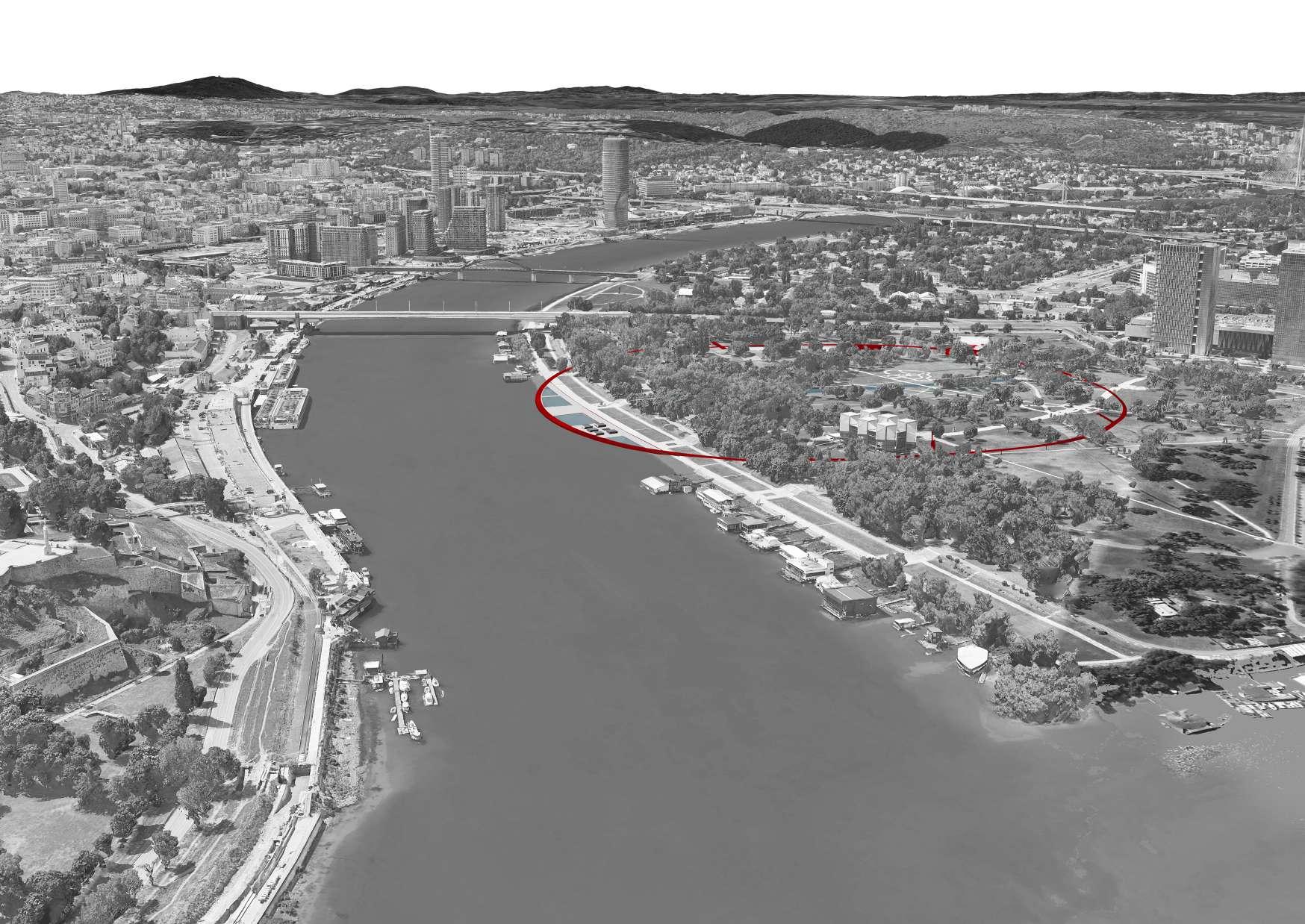
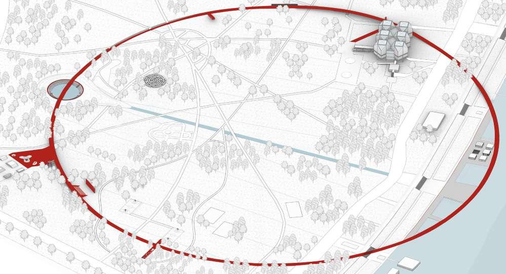
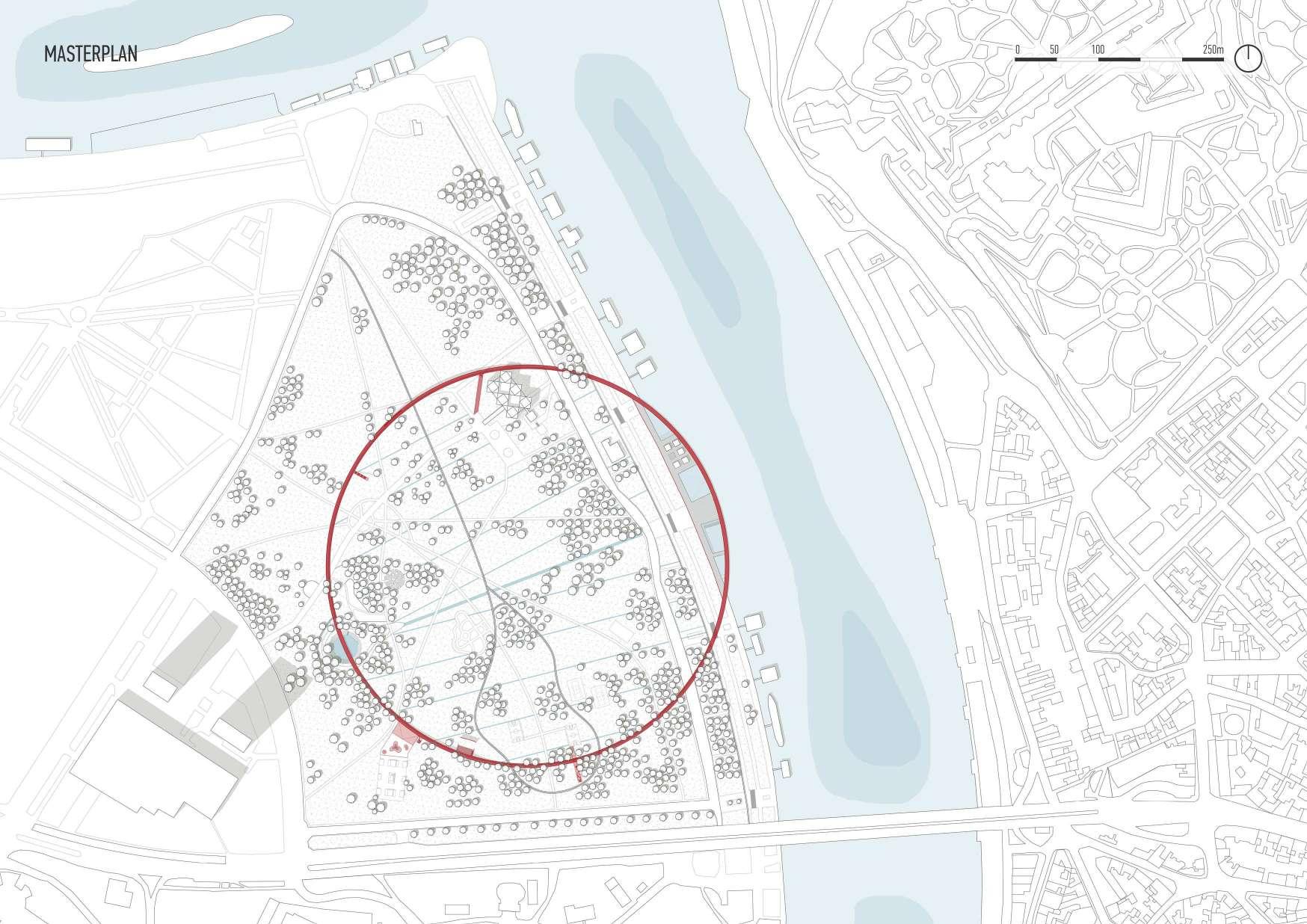
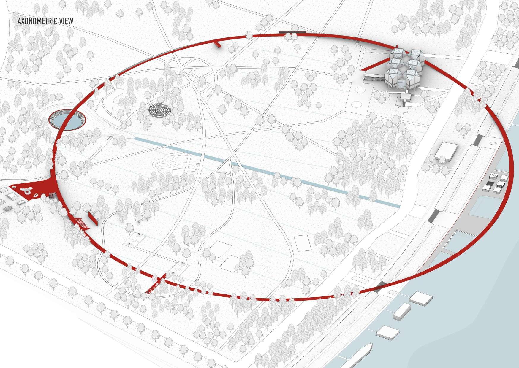
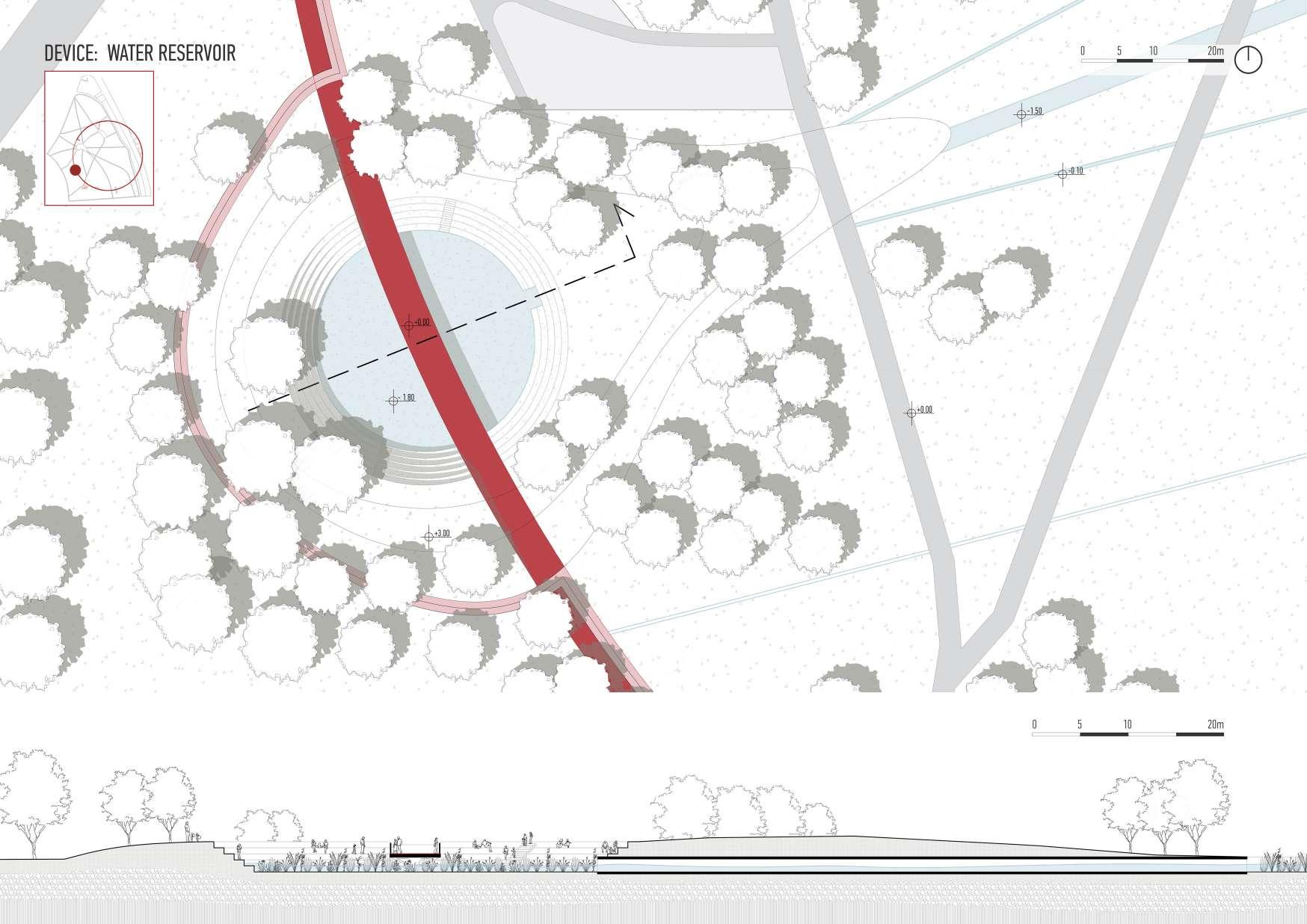
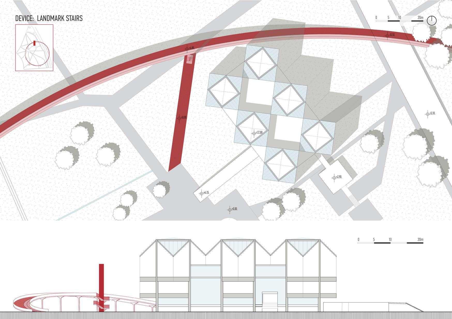
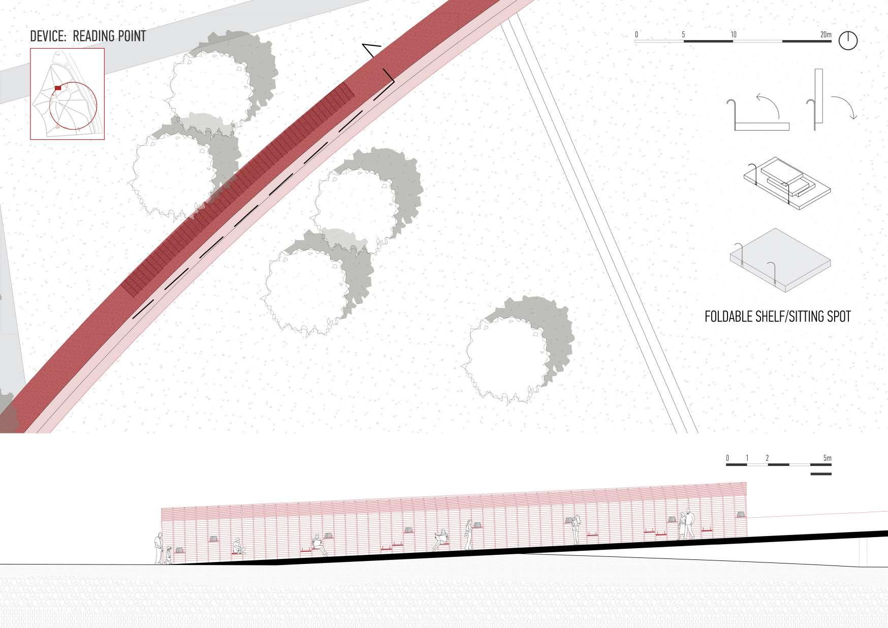
A sustainable water circulation system is the main component of this project’s idea; it gathers, filters, and transports water from floods and rain into a newly created pool area along the coast. This project addresses the issues brought on by urban flooding andclimatechangeinadditiontoenhancingthewaterfrontarea’saestheticappealand recreational value. The strategy consists of three parts: first step is to cover the current park area with a linear grid that is orthogonal to the coastline and will eventually symbolize the park’s water canals. The red ring structure, which will also function as a water collector and visually link the park’s three zones—the art, sports, and waterfront zones—is being added in the second stage. The last step is to place the devices of diferent shapes and sizes, in various locations along the pathway, respecting the existingactivities,butmakingtheparkmoreattractive,aswellasincludingMuseumof Contemporary Art in this contemporary urban design.

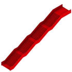
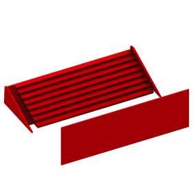
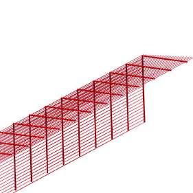
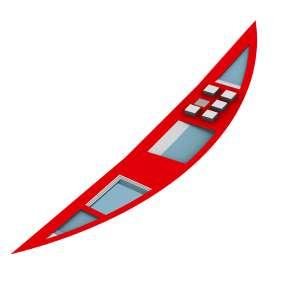
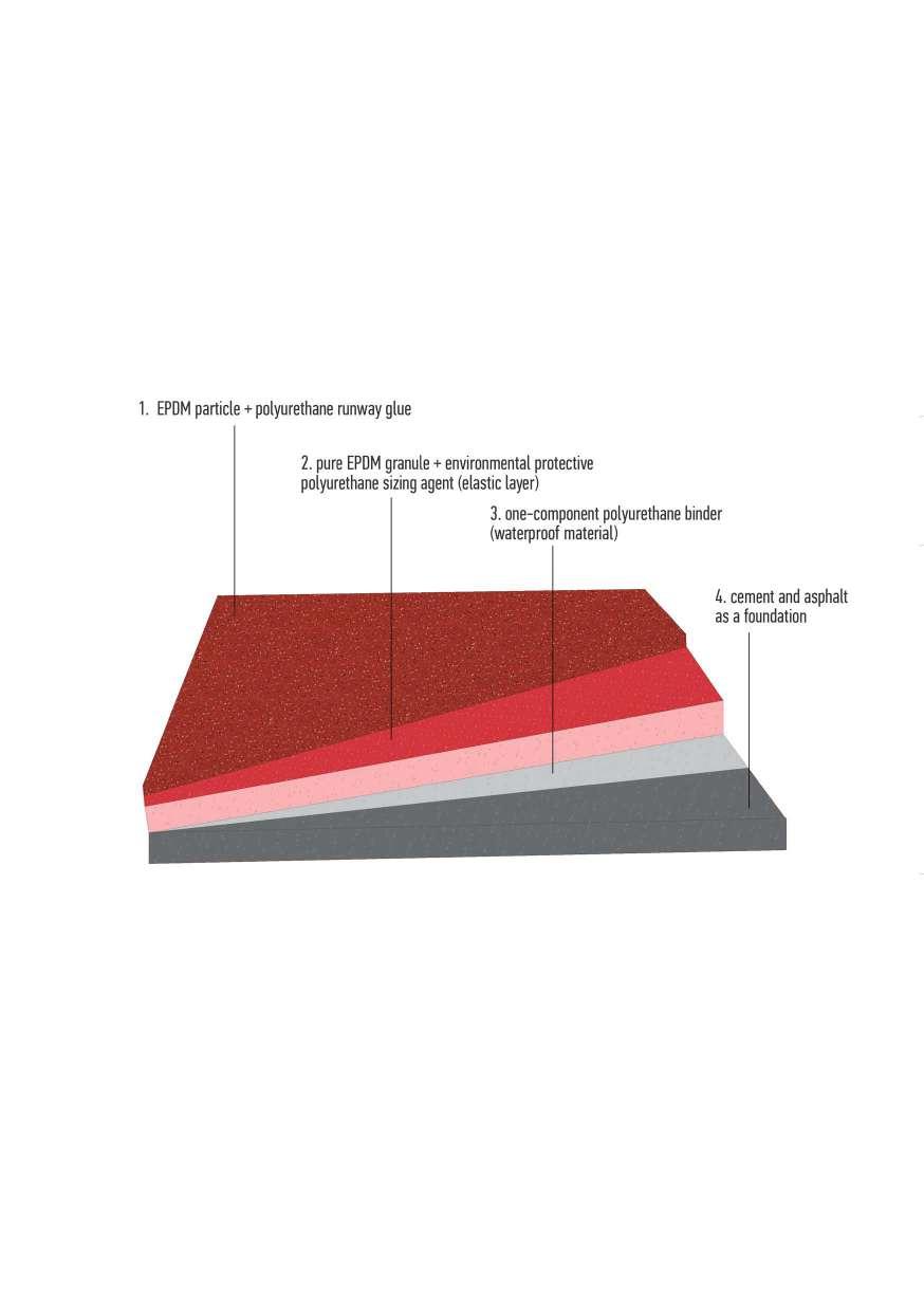
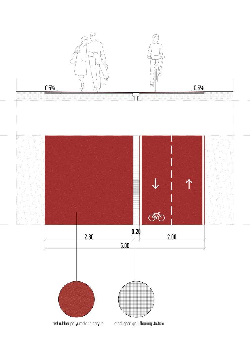
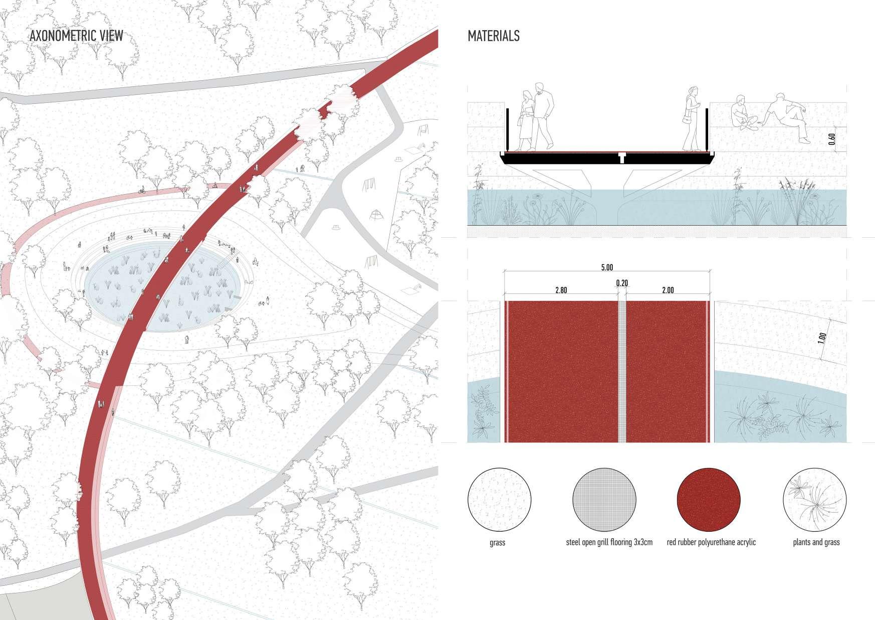
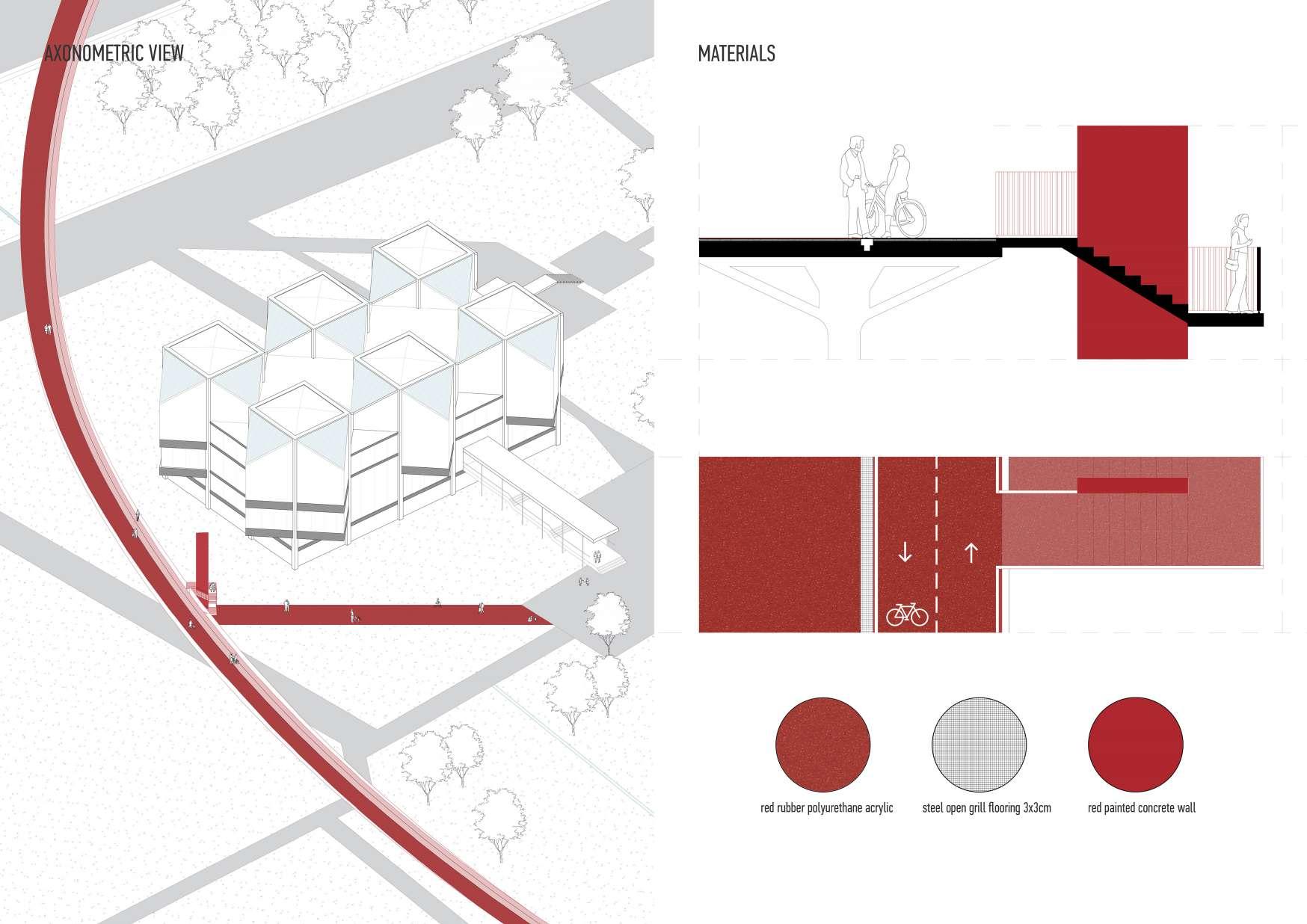
The red ramp-pathway represents a signficant architectural element that weaves through the park, serving as both a functional connector and a vibrant public space. It is a central feature of this redevelopment a symbol of accessibility, adaptability, and interactivity, and it was inspired by the inventive design ideas of Park de la Villette. In addition to creating a direct connection between the park and the coastline, which improves pedestrian traffic flow between these important urban locations, it also adds newfeaturesandactivitiesalongitspath.Thepathhasbeendesignedtoserveasmore than just a walking route; it is envisioned as a linear park filled with diferent features, entertainment areas, and interactive displays.

1. existing park area
2. proposed water ways following the grid ortogonal to the coastline

4.
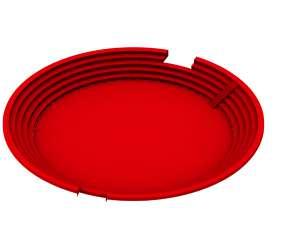
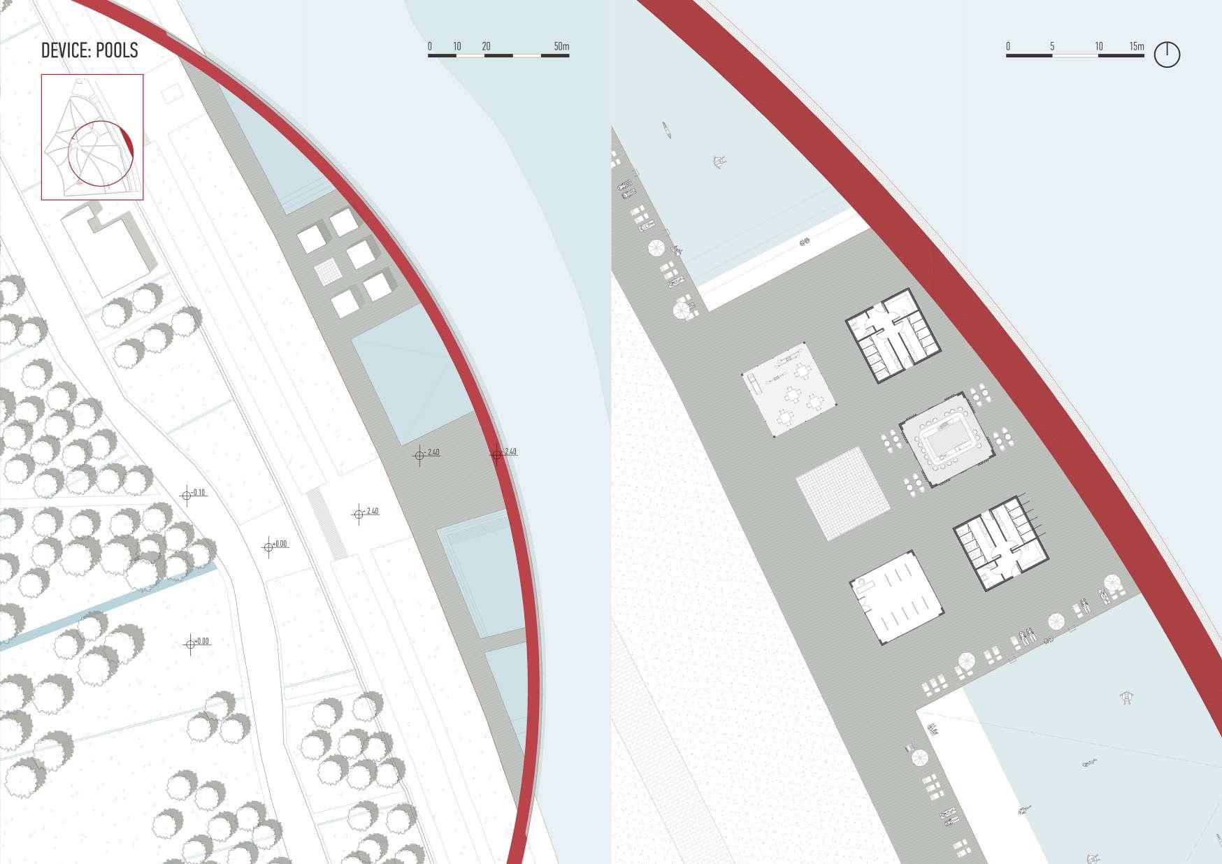
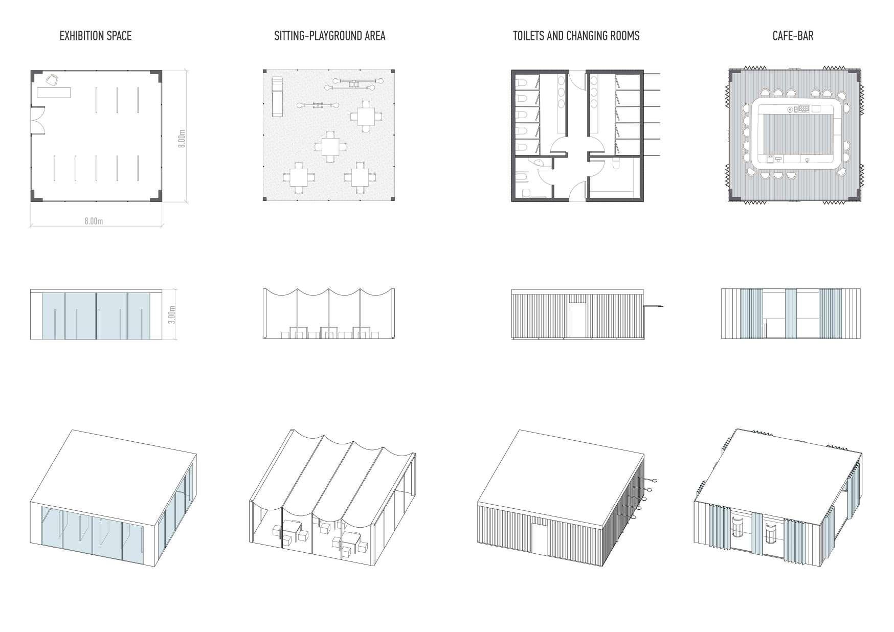
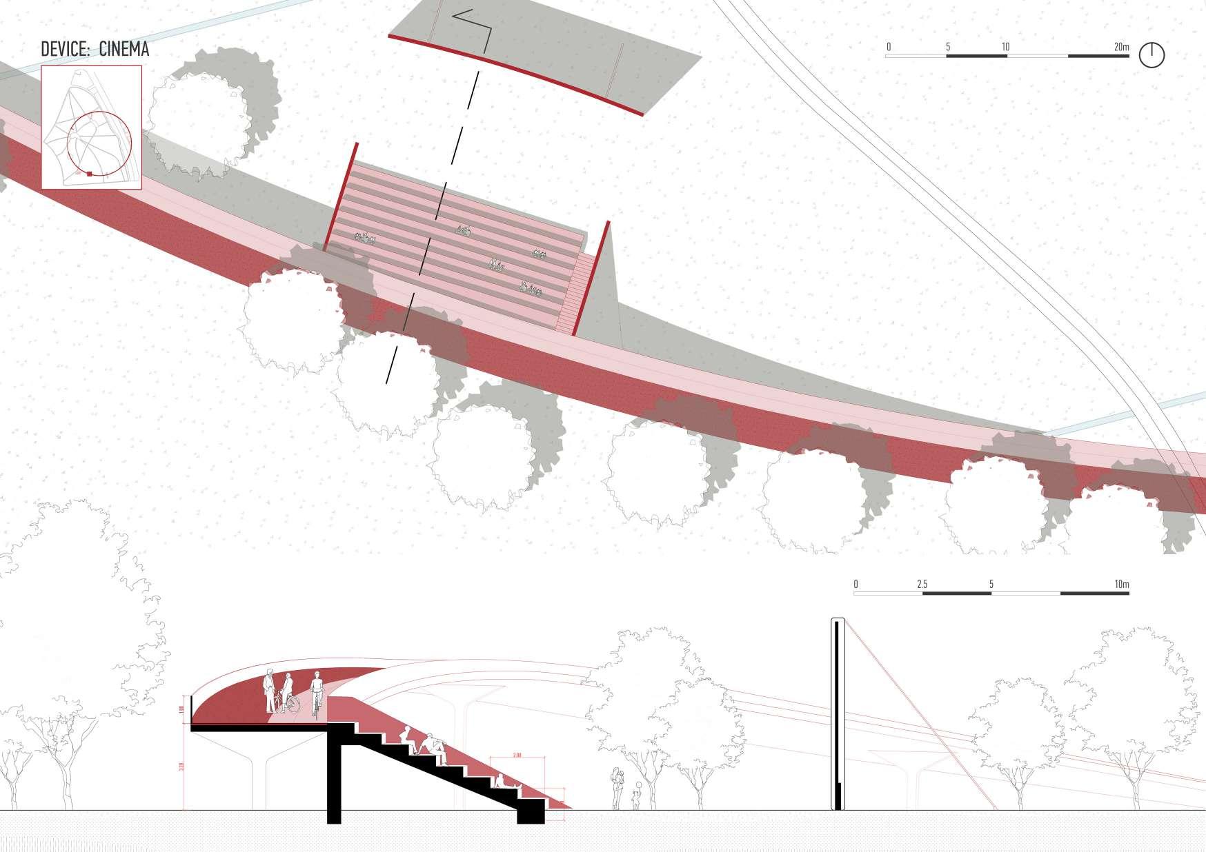
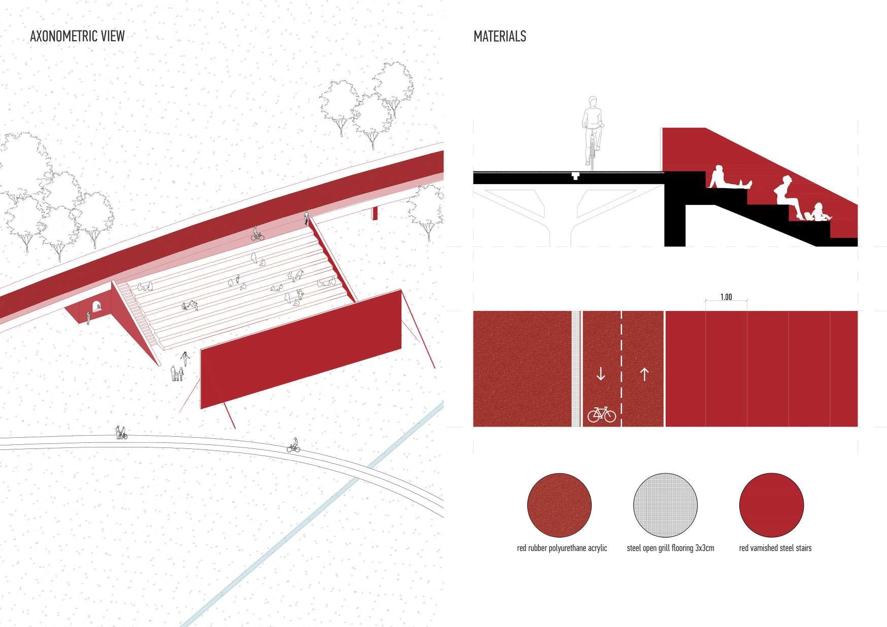
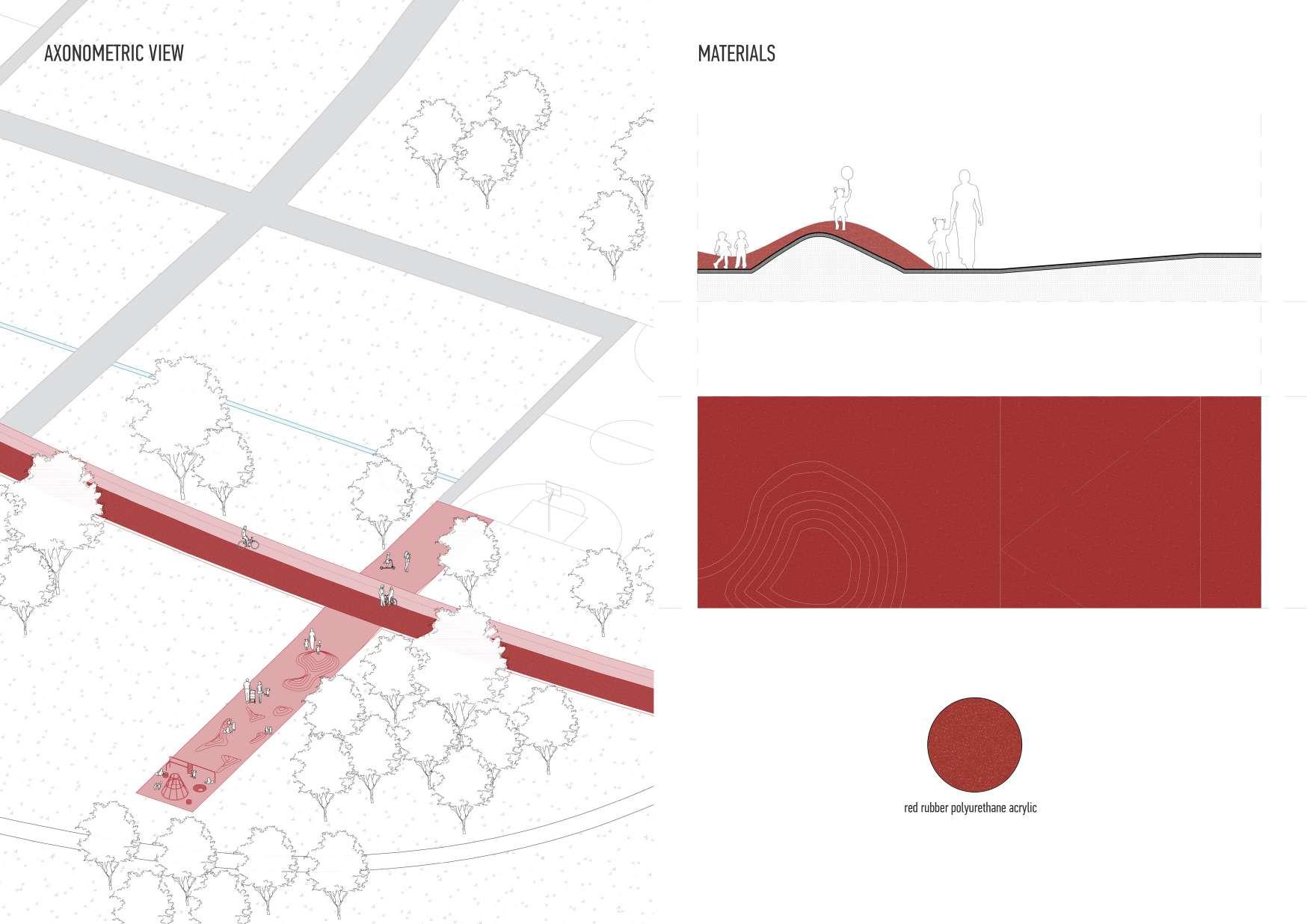
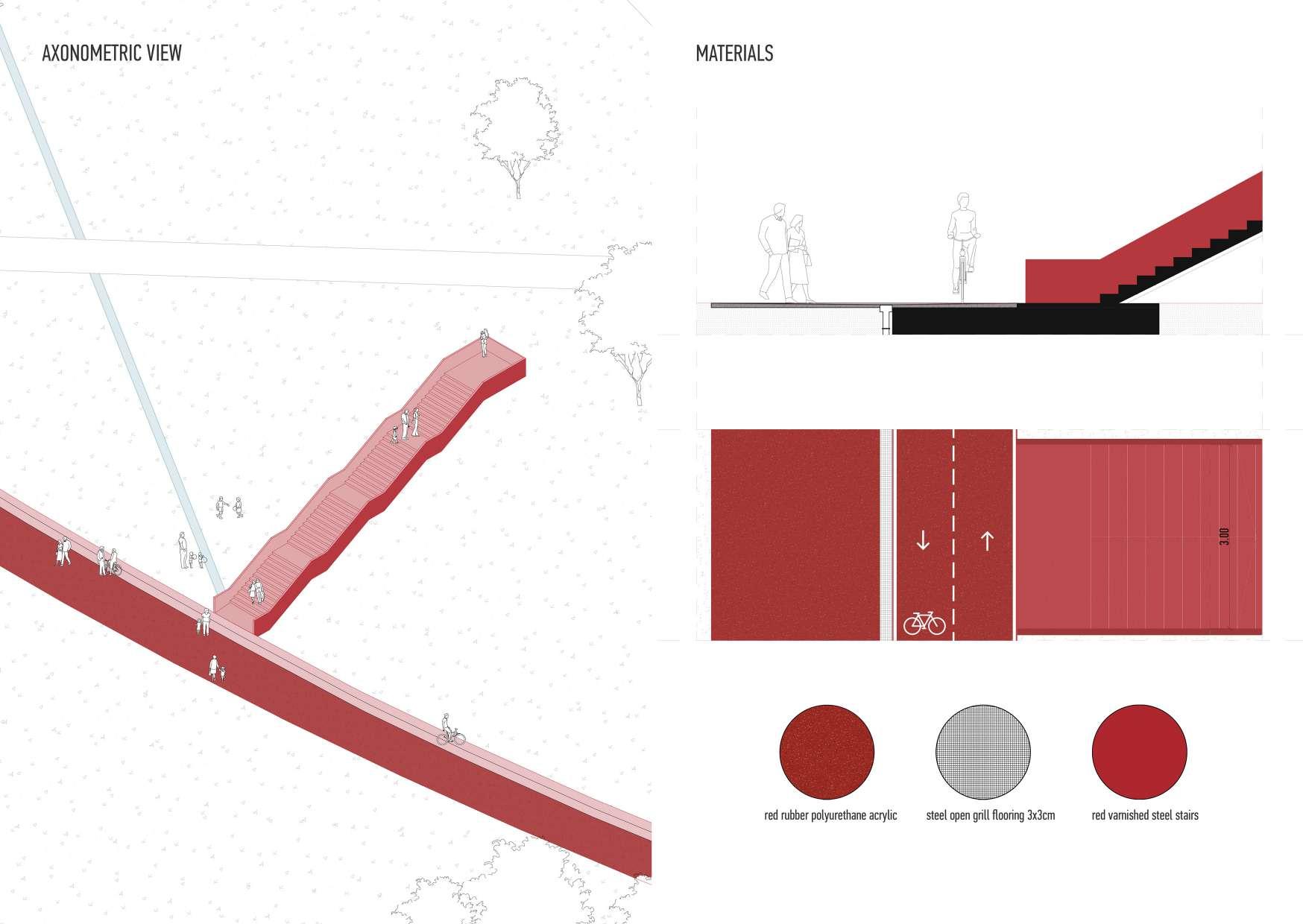
Addition of the eight new devices along the red walkway, the main two being on the opposite side of each other: natural amphitheatre-water collector and waterfront pool area.

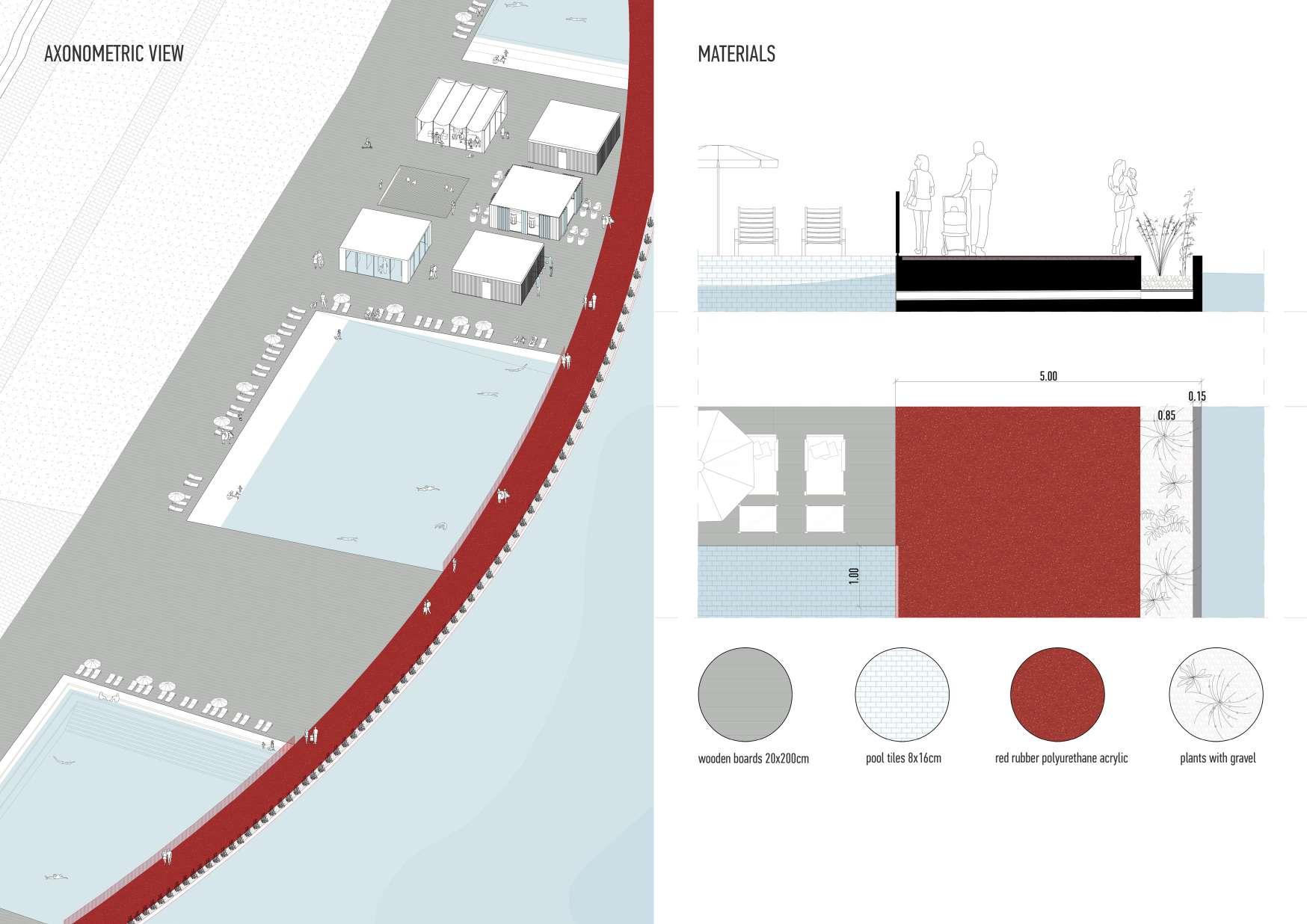
Aspartofthewatercirculationsystem,linearwaterpathsareemployedasatechnique to reshape the park and provide a link between the land and the river. The primary component that reduces flood and precipitation is the red ring walkway. Water is collectedallalongthepath,throughthecanalinthemiddle,aswellasthesides,andthen broughtdowntothegroundthroughthesteelstructurecolumns.Underthegroundlevel isthepipesystemthatcollectswaterundergroundfromthepathwayandlinearcanals around the park, and directs it to the main reservoir. The water reservoir, which is used to treat floodwater and rainwater, is shaped like a natural amphitheater. All around it are planted specific species of plants that, when combined with gravel, purify water in thenaturalway.Collectedandpurifiedwateristhenfurtherdispersedinthefournatural poolsthatlinethecoastafterpassingviathethreemeterwidemaincanalandthepool pump room.


For natural water purification, choosing plants that can survive in such conditions and efectivelyfilterwaterisessential,especiallyinacontinentalclimatethatBelgradehas, withveryhotsummersandcoldwinters.Thepresentedplantsarefrequentlyutilizedin artificial wetlands or biofiltration systems because they function by absorbing contaminants through their roots. Here are some plants that could grow well in Belgrade and are appropriate for such uses:

Cattails (Typha spp.) - for removing heavy metals and other pollutants

Reeds (Phragmites australis) - for removing pollutants from wastewater

Duckweed (Lemna spp.) - for nutrient removal in water treatment pro-

Water Hyacinth (Eichhornia crassipes) - for removing heavy metals and other pollutants

Bulrushes (Schoenoplectus spp.) - for absorbing nutrients and pollutants

Horsetail (Equisetum spp.) - for absorbing heavy metals (arsenic and lead)

Water Lilies (Nymphaea spp.) - for reducing algae growth

Rushes (Juncus spp.)for filtering out nutrients and sediments
It’s important to take into account a plant’s growing patterns, maintenance requirements,andpossibleefectsonnearbyecosystemswhileusingittopurifywater.Careful management of invasive species is necessary to prevent ecological imbalances. Combining these plants can result in a varied system that improves water quality and adds to the area’s visual appeal and biodiversity.
Although the majority of the water originates from the park’s large reservoir, during high tides and flooding it is also possible for water to enter directly from the river; for thisreason,plantsaresituatedalongthepool’sperimeter,purifyingtheriverwaterand keeping the pools clean.


