6 minute read
Ancient Beaches of Gila County


BY JOHN TRIMBLE
This week, our time travel trail will be taking us to a seashore beach. You say Gila County doesn’t have a sea? I say, now it doesn’t, but back in deep time, it did. But we don’t want just any beach: we want to find the oldest one in Gila County.
To achieve this objective, we need to know how to find the beach. What clues remain after a billion years or so that tell us we’re at the beach? If we were going to a current beach, we could check a map for a body of water and then head toward it until our feet got wet. This doesn’t work so well when we want to travel to the oldest beach, as it dried up before animals existed. So to time travel to the oldest beach in Gila County, we need to know where the oldest beach is.
Luckily, those strange humans known as geologists go around identifying rocks, age dating and mapping them. So if we get a map of Gila County’s geology, then we can hunt for that seashore using what we know and like about beaches. The Arizona Geological Society keeps a database of geologic maps on the web and has one for Gila County.
Checking for beaches, we should look on the map for the oldest rocks that were formed from sandy beach deposits. We all love to run our toes through the beach sand and to play tag with the waves, which is way more fun than thrashing around in deep water.
I’ve always liked geologic maps because of the multiple colors, one for each rock formation and for different ages of rock. First, to make sure we’re at the oldest beach, we need to know the time scale to read the map – the time scale of … drum roll ... deep time.
Deep Time: An Age of Earth Metaphor to Guide the Time Traveler
Our Earth is at least 4.6 billion years old. Such an expanse of time is hard to grasp, but understanding deep time helps us read geologic maps and grasp basic geologic processes, such as the buildup and erosion of the rock layers that are constantly shaping and reshaping Earth’s surface. This understanding is required for walking the time travel trails.
If you squeezed all of Earth’s history into one calendar year, the first 4 billion years (informally known as the Precambrian) would last from the first of January into late November. The oldest rocks discovered at Earth’s surface would date from mid-March. Geologists know very little about what happened during the Precambrian compared to later periods. They do know that very primitive life forms first appeared in the late Precambrian seas. On the calendar, that would have happened in late November. The vast majority of what we know about Earth’s history would fall into December. Dinosaurs became dominant in mid-December but disappeared the day after Christmas. At about the same time, the Rocky Mountains were uplifted. The first human ancestors appeared sometime during the evening of December 31 – the last x on the calendar. Everyone on Earth today would have been born in the last millisecond of New Year’s Eve – the microscopic dot at the end of December Finding the Oldest Beach
Looking at the Gila County geologic map (the best map for deep time travel trails), we can determine that the Apache Group of sediments, deposited in the late pre-Cambrian, includes a formation named the Dripping Springs Quartzite. Quartzite is a rock formed from sand after it has been squeezed and possibly heated up over geologic time, The Dripping Springs Quartzite is an amazing formation – it includes prehistoric turquoise mines located in Canyon Creek up in the White Mountain Apache area, and uranium deposits and workings in the Workman’s Creek area. Plus, the Salado Indians used its softer layers for cliff dwellings, such as the ones at the Tonto National Monument.
Best of all, the Dripping Springs Quartzite preserved shoreline features that will allow us to place our blanket on the shore and not underwater. I had the best time researching it – there are lots of articles on the web, partly thanks to funding that the Atomic Energy Commission provided for geologic research back in the late ’50s. The formation is widespread throughout Gila County and beyond. It was formed from sand washed into a sea located in central Arizona and has sedimentary features in its upper unit.
Dripping Springs Quartzite of Precambrian age is 50 to 700 feet thick. It’s divided into the following parts: Barnes Conglomerate (5 to 20 feet down), Middle Member (140 to 470 feet) and Upper Member (180 to 400 feet). Study of the deposition of the DS quartzite indicates that the Barnes Conglomerate was sorted and redistributed from talus outwash by an encroaching sea. Then the sea retreated, and then subsidence caused it to come back. So we can use the geologic map to find outcrops (on the surface) of
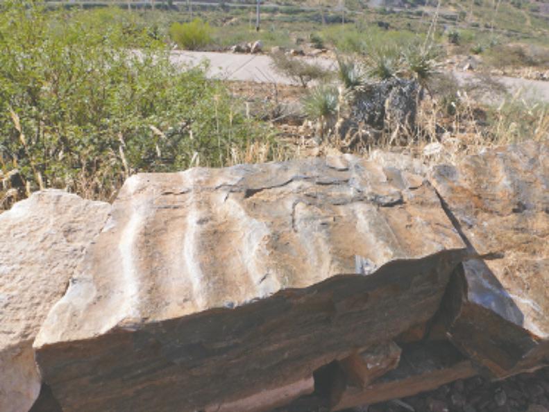
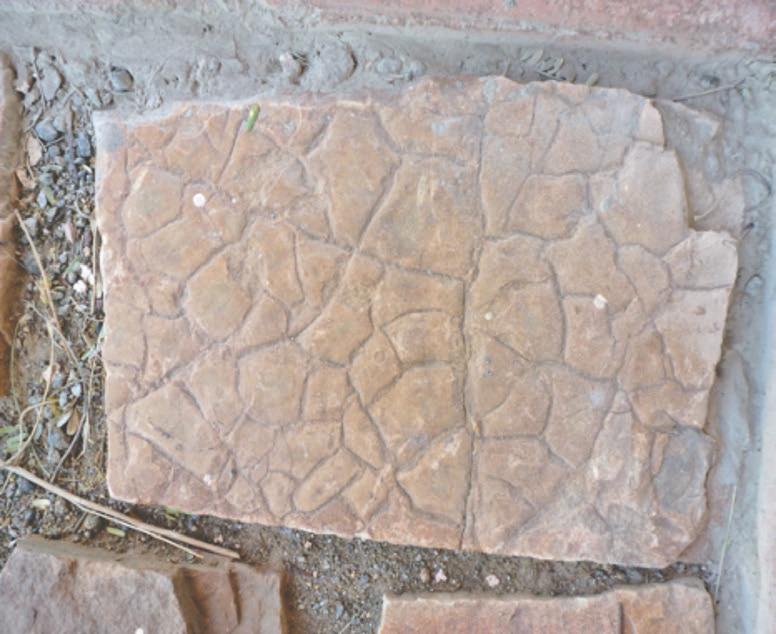
Dripping Springs Quartzite ripple marks – note that the ripples have equal slopes on both sides, so were formed by oscillating waves – meaning they occurred at the shore.
On ridge south of Quartzite Canyon, looking east at Quartzite Mountain. White patch is a water catchment liner.
the Dripping Springs Quartzite.
The Upper and Middle Members of the Dripping Springs Quartzite contain ripple marks and shrinkage cracks. This mix of features indicates that they were caused by waves cutting and depositing at the surface of water-saturated muds and sands. Which sounds like a beach to me! So how do we know where to put our blanket to be close to the shore, even if we are close to a billion years too late for the water? We need to look for ripple marks that indicate waves and for mud cracks that indicate being above the water. You can’t sunbathe if you’re underwater.
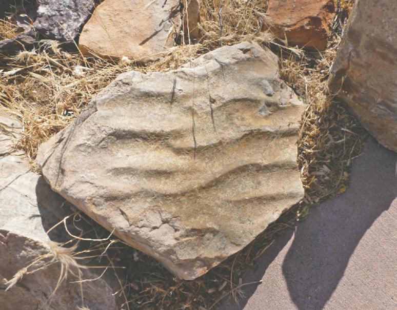
The Beach
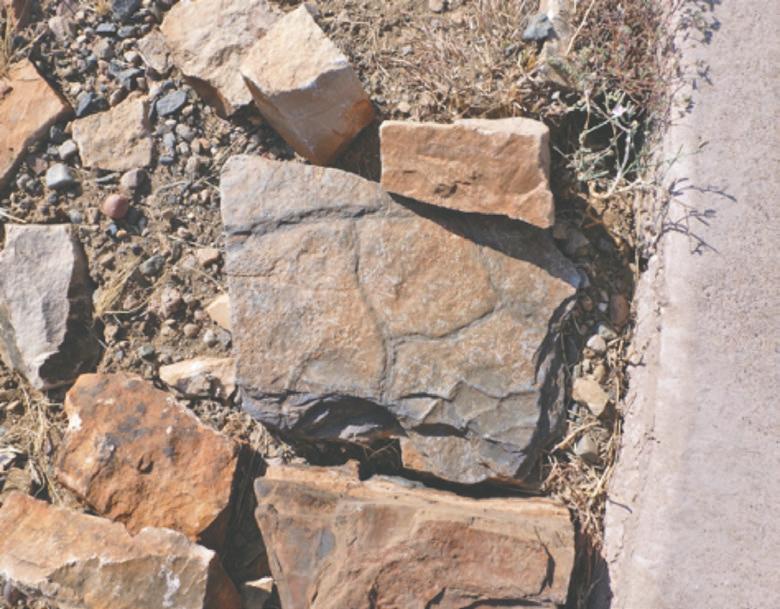
I found my beach! Note the ripples and mud cracks. The gray shading might be signs of the first life on earth: bluegreen algae.
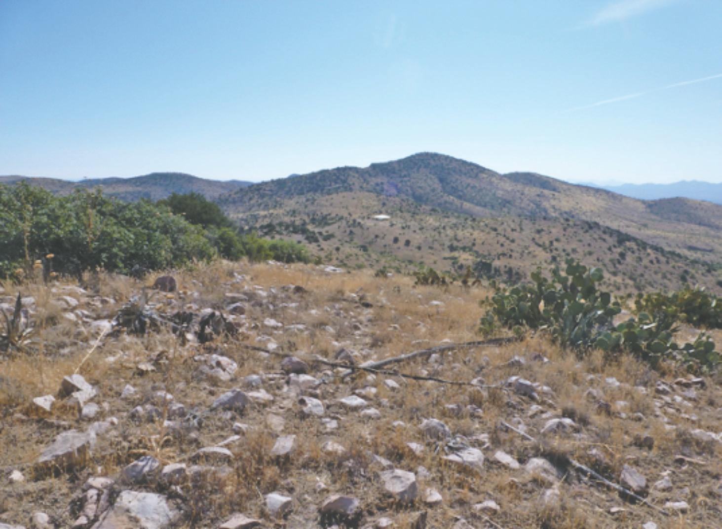
I found my beach, and here’s how you can find it. Take Forest Service Road 224 north from the end of Copper Canyon Road and travel 2.1 miles to, strangely enough, Quartzite Canyon. This is a rough rock outcrop road in places and best done in a 4X4 with high clearance. The Dripping Spring Quartzite outcrops appear along the south slope of the canyon from Quartzite Mountain to Nugget Mountain. Look for the mud cracks and ripples in the Upper unit, and enjoy a beautiful canyon hike and walk. Watch out for the rip tide. There are lots more beaches in the county, so read that geologic map and keep looking, u
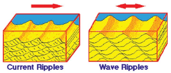
Two types of ripple marks: current or oscillation/wavetype ripple marks. We’re looking for wave ripples to be on the beach.
Diagram courtesy of dranablog.com.
Shrinkage cracks in Dripping Springs Quartzite Mud cracks when it dries and then gets filled with later deposition. It forms a rock surface that looks like this, so we’re sure the rock dried out on the surface.
GilaPROUDGilaPROUD
PREVENT & REPORT OUR UNLAWFUL DUMPING A campaign aimed at reducing illegal dumping through education, eradication and enforcement.