

INTRODUCTION


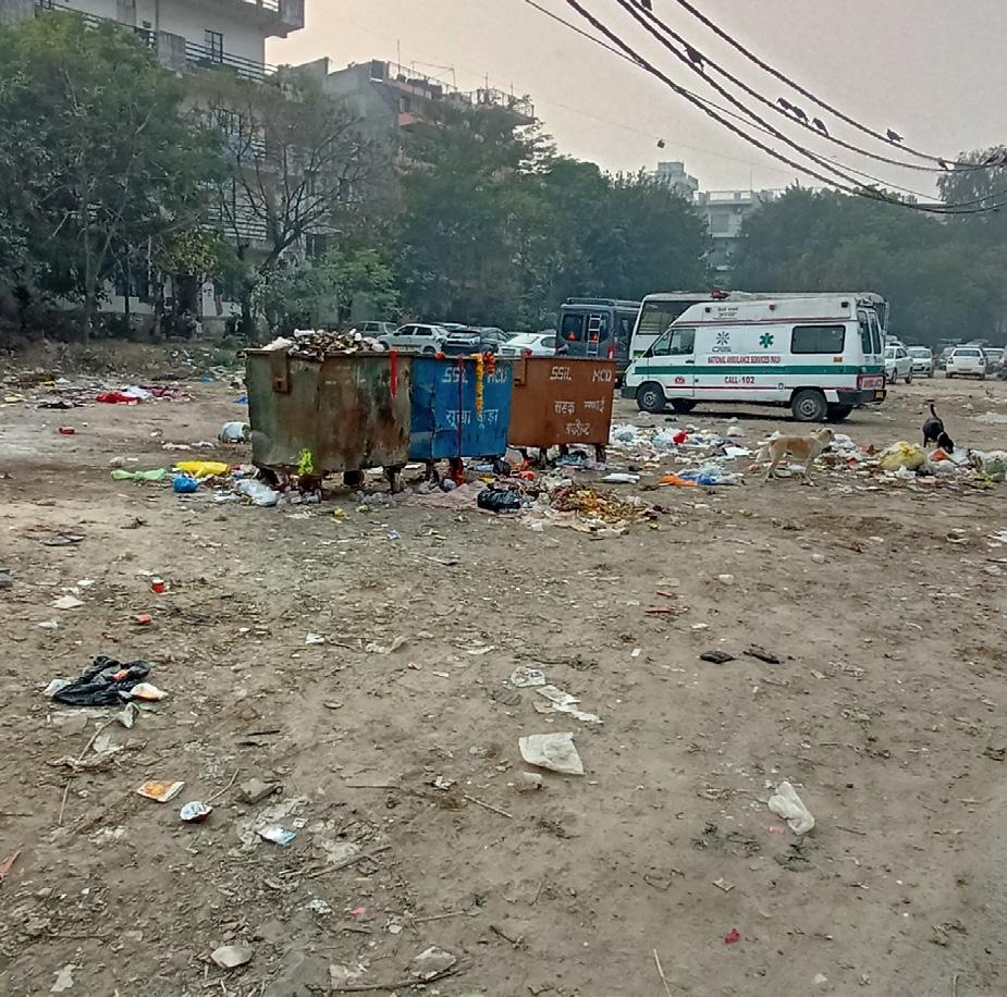
• Site is an underutilized edges of vacant DDA land located at lado sarai, New Delhi.
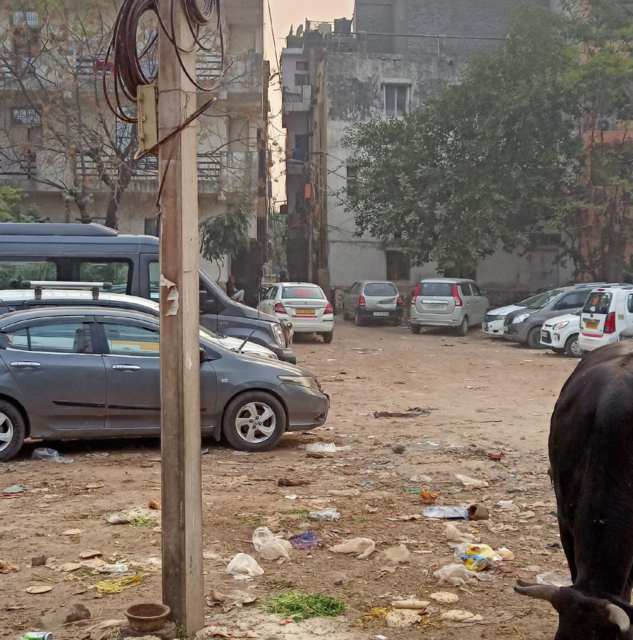
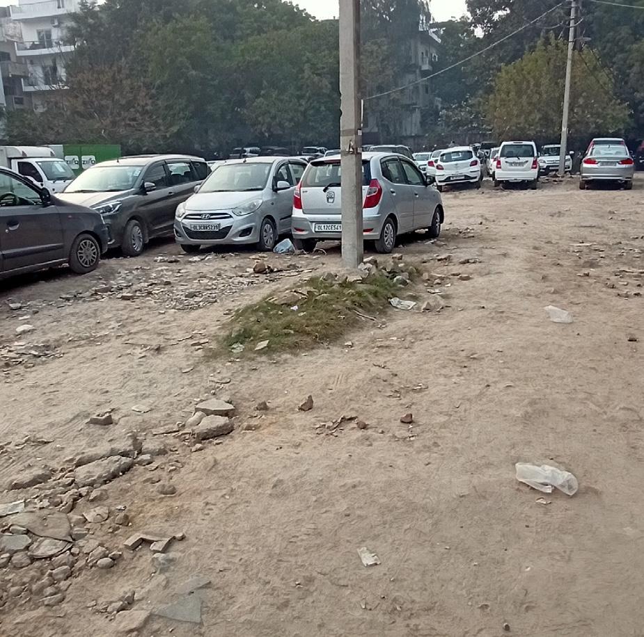
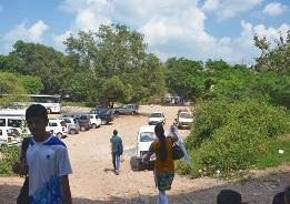
• Site consist of informal road, unofficial car parking, existing MCD school etc.
• Lado Sarai is located within a large green area containing many important historical monuments.
• The immediate surroundings include forested areas, an archaeological park, traces of historic cities, a golf course and neighbourhood parks maintained by the Delhi Development Authority.
• Important roads connect Lado Sarai and Mehrauli with New Delhi, Shahjahanabad, Badarpur, Gurgaon and the adjoining states of Up, Punjab and Rajasthan.


• The unregulated edges of the existing habitation are proposed for planned development which can form the urban interface and help in de-congesting the existing built environment.
CONNECTIVITY
• 2.1 KM away from Qutub Minar Metro Station
• 12 KM away from Indira Gandhi International Airport Terminal 3
• 14.9 KM away from New Delhi Railway Junction.
• 20.1 KM away from Kashmere Gate ISBT.
CLIMATE
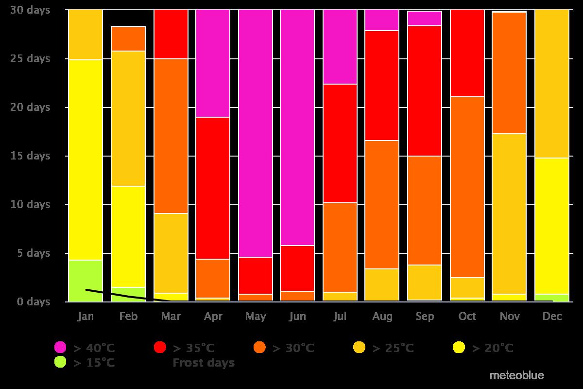
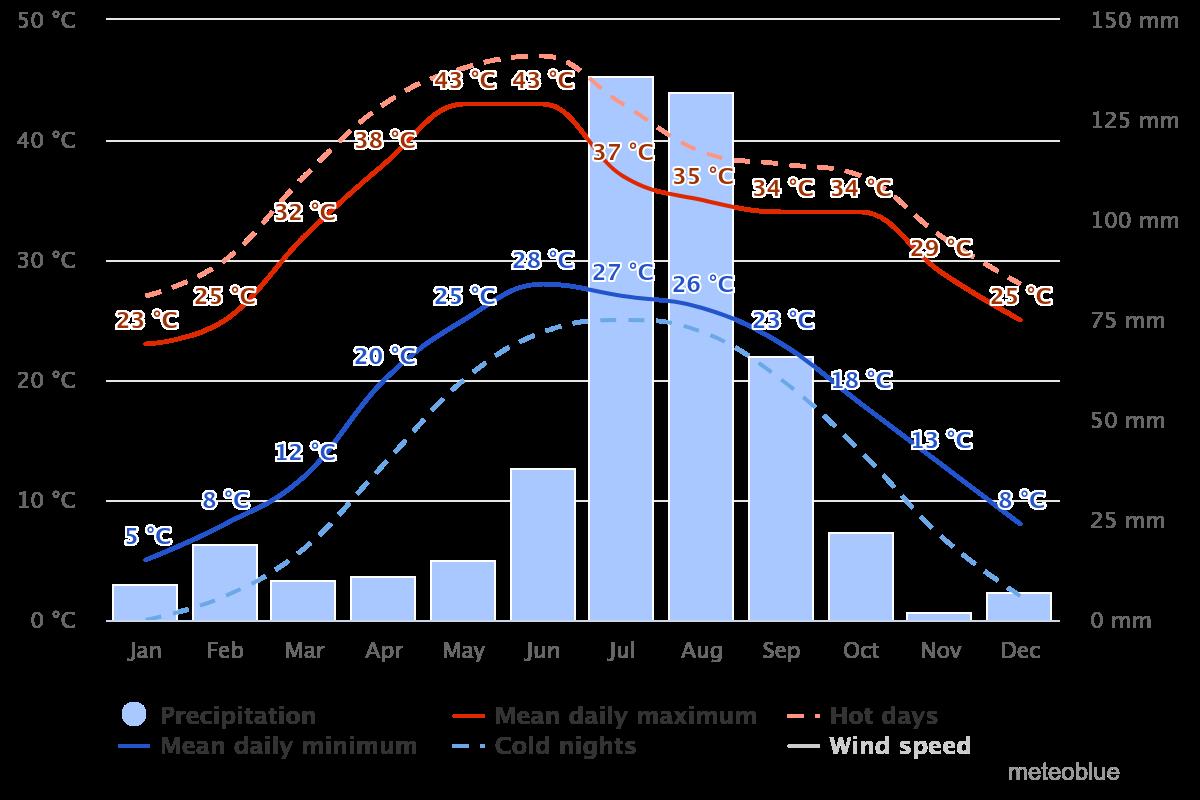
• Macro-Climate: Composite
• Average Temperature: 25.0 ° C
• Maximum Temperature: 47.0 ° C.
• Minimum Temperature: -2.2 ° C.
• Annual Precipitation: 886 mm.
• Prevailing Wind Direction: 18KM/H North-West
SOIL TYPOLOGY
• The proposed site has alluvial soil with undifferentiated soil. The alluvial soil is formed due to the yamuna river basin near to the site. The soil has also an abundant amount of silt contained in it.




Source- Self
Source- Self Source-



UNDERGRADUATE THESIS BATCH 2019-2024 SITE ANALYSIS URBAN DEVELOPMENT LADO SARAI SUBMITTED BY THESIS COORDINATOR THESIS GUIDE GORESH SAINI 1999005 AR. SUKHMANJIT SINGH AR. VIVEK SEHGAL REMARK & SIGN SITE
:
ANALYSIS
Self
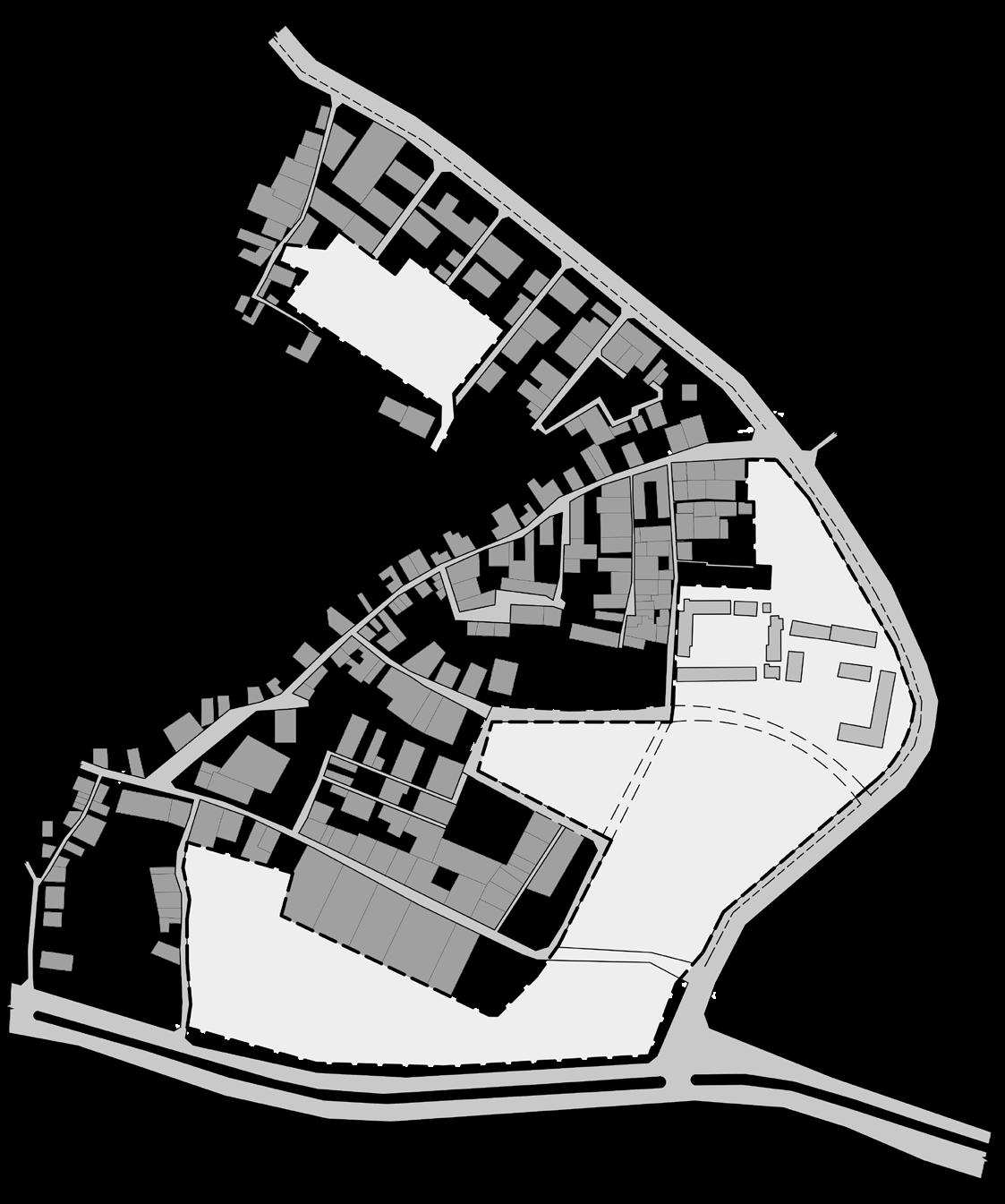
1. ROAD END WITH SITE LOCATION 3. VACANT LAND USED AS DUMP 2. INFORMAL ROAD AND PARKING SITE PROXIMITY LADO SARAI Butterfly Park DDA Park Saket Metro Station Jain Mandir Qutub Minar 1500M 1000M 500M Lal Kot Qila GB School GBS Cricket Ground Sheetla Mata Mandir National Institute of TB and Respiratory Diseases Tehsil Mehrauli Mehrauli Golf Course Shivaji Park Saket Park DDA Flats Source- Self SITE ACCESSIBILITY ACTIVITY MAPPING PUBLIC INFRASTRUCTURE CLIMATOLOGICAL DATA Yearly wind Speed Monthly Average Temperature Monthly Average Precipitation SITE PLAN 1:2000 PROPOSED SITE 15 ACRES Source- Self TO MEHRAULI 1 2 3 TO BADARPUR TOAUROBINDOMARG MB ROAD PHIRNI ROAD EXISTING MCD SCHOOL EXISTING FORMAL ROAD EXISTING INFORMAL ROAD EXISTING INFORMAL ROAD Wind Rose Diagram Sun-path Diagram
DELHI LADO SARAI VEHICULAR PARKING METRO LINE(Y) EXISTING MCD SCHOOL ELECTRICITY SUPPLY VENDORS SEWER LINE Source- Self Source- Self Source- Self Source- alamy.com/Self Source-andrewmash.com
POTENTIAL ENTRY/ EXIT POINT ON SITE
INDIA
Source- meteoblue Source- meteoblue Source- meteoblue Source- meteoblue
DEVELOPMENT PERIMETERS
• MUSEUM - NATIONAL MUSEUM OF ARCHITECTURE
Site Area-13,414.1 SQM


BUILDING USE PLAN
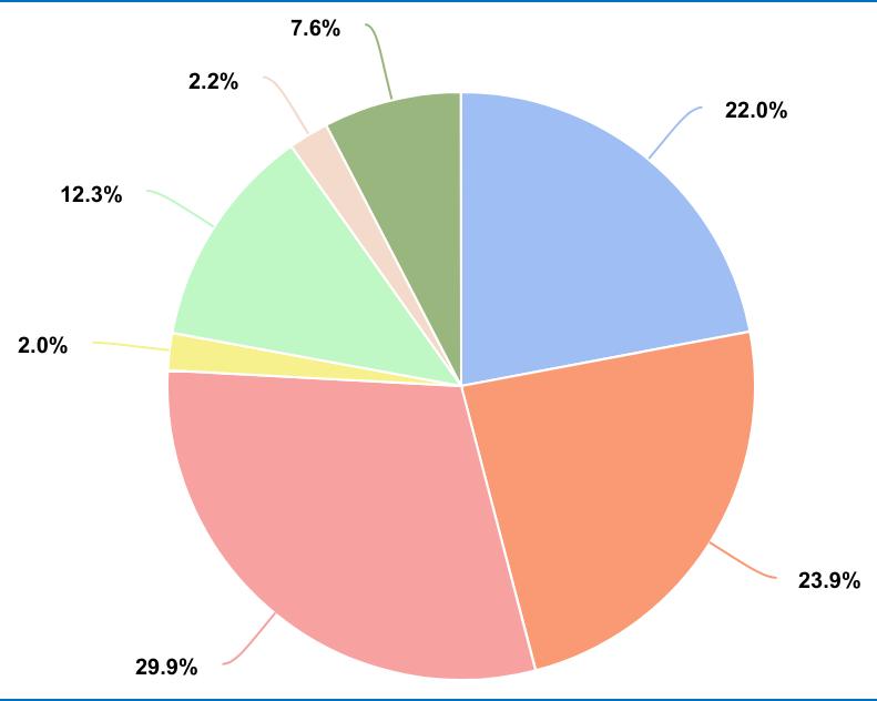
• The predominant use of the buildings is residential.



FAR- 1.2
Permissible Ground coverage- 30%
Permissible Built-up Area- 16,096.92 SQM
Parking- 312 ECS
• MIXED-USE DEVELOPMENT- RETAIL + OFFICES
Site Area-18,211.5 SQM
FAR- 1.875
Permissible Ground coverage- 40%
Permissible Built-up Area- 34,146.56 SQM
Parking- 3 ECS/ 100SQM
• COMMUNITY CENTRE
Site Area-7,476.4 SQM
FAR- 1.2
Permissible Ground coverage- 30%
Permissible Built-up Area- 8,971.7 SQM
• SCHOOL EXTENSION- MCD SCHOOL (SENIOR SECONDARY)
Site Area-14,536.4 SQM
FAR- 1.5
Permissible Ground coverage- 30% + 5% (Extension)
Permissible Built-up Area- 21,804.6 SQM

Parking- 204 ECS
• PUBLIC PARK
Site Area-4,624.1 SQM
• UNDERPASS WITH AMPHITHEATRE
Site Area-1,347.9 SQM
• BUS STOP
Site Area-1,245.3 SQM
INFERENCES
• Informal roads should converted to paved formal road to provide circulation in and around the site.
• The urban village have informal development pattern which leads to non-vechicular access in inner zones of settlement.
• To counter the Shortage and issue of Illegal parking formal Parking spaces are required.
• Mixed-use Development is helpful to micro economy, the location is ideal due to the presence of existing commercial zone at Old MB road.
• The location of Museum is also significant due the location of lado sarai near to historical Monuments like Qutub minar,etc
• Major roads have mixed-use development.
• Old MB Road has seen a major transformation in recent times, with the introduction of new art galleries, showrooms and designer studios.
• The few public buildings are schools, a mosque, temples and tombs.
OPEN SPACES
• Lado Sarai is surrounded by large city level green open spaces such as a golf course, Sanjay Van and Qila Rai Pithora Park.
• Most of the vacant lands around Lado Sarai are under the DDA and are of uncertain use.
• These open spaces are used as bus and car parking spaces by the community.
• The pedestrian network is part of the organic development of the village and is now subject to vehicular traffic causing distress among the pedestrians

Source- Self
• The sky line of Lado Sarai consist of Mid-Rise development block which restrict the new development to go beyond that i.e. G+6 around.
• MCD school have vacant land in the northern part of the site which can be used to develop Senior secondary school extension with a separate entrance.
• Underpass is proposed to develop on phirni-MB road junction which also help to provide accessibility between Mixed use development and DDA park.

Source- Self


• Lado Sarai may have a strategic or desirable location, providing easy access to residents and visitors.
• The site proximity helping the institutional dvelopment like museum, school etc.
• The Skyline of lado sarai consist of mid-rise and low rise buildings leads to constrain the new development building height.
• Lack of adequate infrastructure (roads, utilities, etc.) can decrease the development’s functionality
• Lado Sarai has a rich cultural history, incorporating it into the project help Architecture Design.
• The development help to create a urban precinct for the residents of lado sarai which help in social harmony
• Lack of vehicular accessibility in the internal areas of lado sarai.
• Presence of alluvial soil due to yamuna basin leads to various structure constrain and special consideration for structure like raft foundation etc.


UNDERGRADUATE THESIS BATCH 2019-2024 SITE ANALYSIS URBAN DEVELOPMENT LADO SARAI SUBMITTED BY THESIS COORDINATOR THESIS GUIDE GORESH SAINI 1999005 AR. SUKHMANJIT SINGH AR. VIVEK SEHGAL REMARK & SIGN SITE
:
ANALYSIS
SITE MASTER PLAN 1:2000
MIXED-USE DEVELOPMENT PUBLIC PARK MUSEUM EXISTING MCD SCHOOL BUS STOP POTENTIAL SITE FOR EXTENSION EXISTING COMMERICAL DEVELOPMENT OF OLD MB ROAD COMMUNITY CENTRE 123.2 56.3 123.8 66.56° 116.43° 82.87° 96.77° 113.55° 89.7° 122.2° 72.1 24.7 46.7 79.1 22.7 32.4 136.2 65.0 103.1 101.3 35.3 25.9 110.5 42.2 13.9 71.8 48.4 24.2 76.4 101.39° 106.44° 62.1° 90.07° 83.0 SITE MEASUREMENTS Source- Self 15M ROAD SECTION AA’ 15M 40M Wide Mehruli-Badarpur Road Source- Self 24M 24M Wide Phirni Road Side-way Row Parking ROAD SECTION BB’ SITE DISTRIBUTION Source- Self B B’ A A’ BUILDING USE PLAN OPEN SPACES Source- DUAC Source- DUAC PROPOSED LOCATION FOR UNDERPASS POTENTIAL ENTRY/ EXIT POINT ON SITE UNDERPASS
CONCEPT:


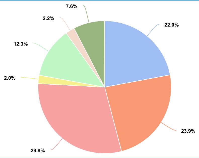
Source- Self SITE DISTRIBUTION


Source- GREHA
BACKGROUND STUDY
Lado Sarai is a vibrant urban village located in South Delhi, India. While primarily known for its cultural significance and commercial activities, it also offers a unique glimpse into the architectural heritage of the region.
• Historical Context: Lado Sarai’s architectural landscape is deeply rooted in history. The area was traditionally inhabited by farming communities and later developed into a bustling village.
• Vernacular Architecture: Like many urban villages in Delhi, Lado Sarai features vernacular architecture characterized by its simplicity and functionality.
• Contemporary Development: In recent years, Lado Sarai has witnessed significant urban development and gentrification. This has led to the construction of modern buildings, including commercial complexes, residential apartments, and upscale restaurants.
URBAN DESIGN
• The urban design of Lado Sarai, like many urban villages in Delhi, is characterized by a mix of traditional and contemporary elements. Here’s an overview of the urban design aspects of Lado Sarai:
• Street Layout: Lado Sarai features a maze-like network of narrow streets and alleyways, typical of traditional Indian urban settlements. The layout has evolved organically over time, reflecting the village’s historical development.
• Mixed Land Use: One of the defining characteristics of Lado Sarai’s urban design is its mixed land use.
• Public Spaces: These include open courtyards, chowks (squares), and neighbourhood parks where residents gather for social activities and cultural events.
• Gentrification and Redevelopment: In recent years, Lado Sarai has experienced gentrification and redevelopment, leading to changes in its urban fabric.


Source- Self MIXED-USE DEVELOPMENT MIXED-USE DEVELOPMENT
• Retail area(G+1 floors)
• Offices area( 5 floors)
• Basement parking
• Lift lobby
• Services UNDERPASS
• Sunken court
• Vendors market
• Art gallery
• Informal shops
• Amphitheatre

MIXED-USE DEVELOPMENT
• Site Area: 18,211.5 SQM
• Pro. Built up Area: 34,100 SQM
• Pro. Ground coverage: 30%
• FAR:1.875
• Parking: 1023ECS
MUSEUM
• Site Area: 13,414 SQM
• Pro. Built up Area: 15,990 SQM
• Pro. Ground coverage: 25%
• FAR: 1.2
• Parking: 320 ECS
SCHOOL EXTENSION
• Site Area: 14,536.4 SQM
• Pro. Built up Area: 3,030 SQM
• Pro. Ground coverage: 35%
• FAR:1.5
• Parking: 204 ECS
•


India Gate Red Fort Qutub Complex


Source- Younidarchitects
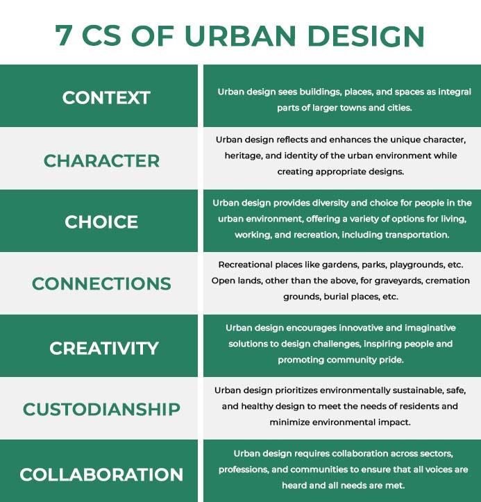
Source- UDL Labs
DERIVATION OF CONCEPT
• The Concept for the development deviated from the phase “Harmony Within Diversity” which is related to diversity in building typology but have a common relation between.
• This concept can also be related with the Urban village settlement of lado sarai consist of diversities within itself.
COMMUNITY CENTRE
• Site Area: 7,476.4 SQM
• Pro. built up Area: 3,250 SQM
• Pro. Ground coverage: 15%
• FAR: 1.2
• Parking: N/A


• The architectural and urban design elements are dervied from the existing context of the lado Sarai and Delhi.
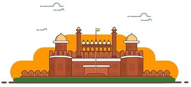
• Prominent element common in all spaces is Arch which work to link spaces dervied from Historical monuments like Qutub Complex, India Gate, Red fort, etc..
• Other traditional Indian planing concept like building orientation, courtyard planing etc.. are used along the development which help to develop concept functionality. SITE MASTER PLAN 1:2000
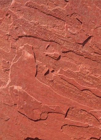
• The Red Stone is used as the external facade material in all the buildings which is already used in abundant in Delhi gives a urban context.
Source- Self

UNDERGRADUATE THESIS BATCH 2019-2024 URBAN DEVELOPMENT LADO SARAI SUBMITTED BY THESIS COORDINATOR THESIS GUIDE GORESH SAINI 1999005 AR. SUKHMANJIT SINGH AR. VIVEK SEHGAL REMARK & SIGN
CONCEPT SHEET
UNDERPASS ENTRY/ EXIT POINT ON SITE UNDERPASS PARKING PARKING PARKING PARKING PARKING PARKING GREENAREA GREEN AREA GREEN AREA GREEN AREA GREENAREA GREENAREA OAT OAT OAT VENDORS MARKET VENDORS MARKET SCHOOL EXTENSION Classrooms Labs Physics Laboratory Chemistry Laboratory Biology Laboratory Domestic Science Laboratory Social Science Room Art Room
Crafts Room
Activity Room • Science Theory Room
NCC
Admin
Wash-room
Student Club
Multi Purpose
Book
MUSEUM
MUSEUM EXISTING MCD SCHOOL BUS STOP SCHOOL EXTENSION COMMUNITY CENTRE
•
•
•
• Staff room •
Area •
•
•
Hall •
Shop
Entrance •
Exhibition gallery Workshop Laboratory Auditorium Library Amenities Services Art & craft centre Open spaces PUBLIC PARK Underground Parking is proposed to resolve the issue of shortage of defined parking space for residents. COMMUNITY CENTRE
Admin Area • Dispensary
Workshop • Banquet Hall
Senior Citizen Centre
Exhibition Area • Open Air Theatre • Public Washrooms • Public Park PUBLIC PARK
Administration
•
•
•
•
CONCEPT:
TECHNOLOGY
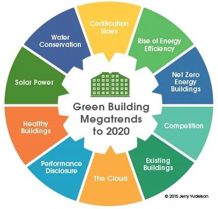
• NATIONAL MUSEUM OF ARCHITECTURE is part of proposal of Green Rating For Integrated Habitat Assessment (GRIHA).
• The Design proposal aim to design Museum building GRIHA rated as a Green building to attain sustainability and energy efficiency.
• Other buildings are also aim to achieve Sustainability and Energy Efficiency with use of different methodology while have building typology as a constrain.
USER
MATERIALS
• Use of Red Sandstone is proposed in design which is derived from the existing Historical structures like Qutub complex, Red Fort, etc.
• It help to create connectivity with existing of old Delhi.
• The extraction and processing of red sandstone have evolved to become more environmentally friendly.
• Using sandstone in construction projects promotes ethical sourcing and resource conservation, increases energy efficiency, and lowers carbon emissions.
COMMUNITY CENTRE BUILDING
SCHOOL BUILDING
MIXED-USE BUILDING MUSEUM BUILDING

SCHEMATIC DESIGN SECTIONS
MIXED-USE BUILDING
OFFICES
OFFICES
Source- Self
BUILDING SCHOOL BUILDING COMMUNITY CENTRE BUILDING
DESIGN STRATEGY
• The design strategy is based on the typology of building although some basic principle like orientations, etc. is used collectively.
• The Red sandstone and Arched Facade is the main concept of theme “Harmony within Diversity”. Hence used in all the buildings.
• Museum: Linear with loop Genetic planning is used. To order to maximize the Diffused light in interior courtyard planing is also integrated. Sky light are also used to inchance user experience of museum. National museum of architecture is proposal of GRIHA which means its a GRIHA rated Green building, hence the aim is to design building as per GRIHA specifications.
• Mixed use building: The G+1 floor consist of retail areas and from 2nd level offices are proposed. The main aim of articulation is increase the perimeter of the block in order to have larger facade which help to inchance natural lighting conditions in the office hours.
• School Extension: 3 blocks with classrooms with OTS is designed for a Healthy and User friendly Learning space
• Community centre: The community centre is planed with the Indian courtyard planing concept consist of courtyard working as OAT.


• The Settlement of Lado Sarai consist of mid-rise development which consist of building blocks up-to G+6 level.
• To attain Maximum Utilization of FAR in Mixed use development the building is proposed of G+6 with 3 Basement levels
• Due to the Presence of Alluvial soil due to Yamuna Basin Raft foundation is proposed for Structural stability.
SKYLINE
Source- Self


UNDERGRADUATE THESIS BATCH 2019-2024 URBAN DEVELOPMENT LADO SARAI SUBMITTED BY THESIS COORDINATOR THESIS GUIDE GORESH SAINI 1999005 AR. SUKHMANJIT SINGH AR. VIVEK SEHGAL REMARK & SIGN GALLERY EXHIBITION LIBRARY AUDITORIUM SERVICES WORKSHOPS ENTRANCE COURTYARD ADMIN AMENITIES SERVICES ENTRANCE VERTICAL CIRCULATION RETAIL OFFICES OPEN SPACES LOBBY CLASSROOMS O.T.S CLASSROOMS ENTRANCE ADMIN STAFF ROOM MULTI- PURPOSE HALL LABS OPEN SPACES AMENITIES ENTRANCE ADMIN SENIOR CITIZEN CENTRE BANQUET HALL EXHIBITION AREA OPEN SPACES OPEN AIR THEATRE AMENITIES ZONING
OFFICES OFFICES GALLERY CLASSROOMS
CLASSROOMS CLASSROOMS GALLERY GALLERY GALLERY GALLERY VERTICAL CIRCULATION OFFICES RETAIL RETAIL PARKING PARKING
PARKING PARKING
ADMIN
SERVICES
MUSEUM
Source- Self Source- DUAC
Source- GREHA
PRELIMINARY RESEARCH:
CHRONOLOGICAL DEVELOPMENT




8th-11th Century
• Delhi was under the Tomar dynasty who ruled as generals of the Pratihara kingdom of Kannauj.
• Before the formation of the fortified city of Lalkot as the new capital in the 11th century, the Tomars ruled from Suraj Kund.
12 th Century
• The Chauhan Rajputs under the leadership of Prithvi Raj Chauhan defeated the Tomars in 1160 CE and established the Qila Rai Pithora as a new city extension of Lalkot.
• Mohammad Gohri defeated the Chauhans in 1192 CE and captured Delhi.
13 th Century
• Delhi was under the rule of the Slave dynasty. The Qutub complex was built during this period.
• The village of Mehrauli grew around the shrine of Saint Qutubuddin Bakhtiyar Kaki, who was active and buried in Delhi in 1235 CE.
14 th-18th Century
• Lado Sarai was built as a night shelter/inn north of the city’s important thoroughfare (Mehrauli–Badarpur Road) to Tughlaqabad.
• It was the period during which Mehrauli grew in size and new monuments were built.
• The population around Lado Sarai and Mehrauli increased during the late Mughal period as a new thoroughfare from Shahjahanabad to Mehrauli (present Aurobindo Marg) was built.
20th Century- Till date
• The DDA formulated its Master Plan in 1962, and Mehrauli–Badarpur Road and Aurobindo Marg were established as major inter-city movement arteries.
• Planned areas of Saket and Vasant Kunj were colonized and built during the 1970s and 80s.
• During this period DDA also acquired the agricultural lands around Lado Sarai and Mehrauli and earmarked them as the Qutub Golf Course, Mehrauli Archaeological Park and Sanjay Van to conserve heritage monuments as well as the flora and fauna of the precinct.
• The Yellow Line of Delhi Metro came up in the area in the year 2010.



Source- SELF
CITY LEVEL INTERFACE
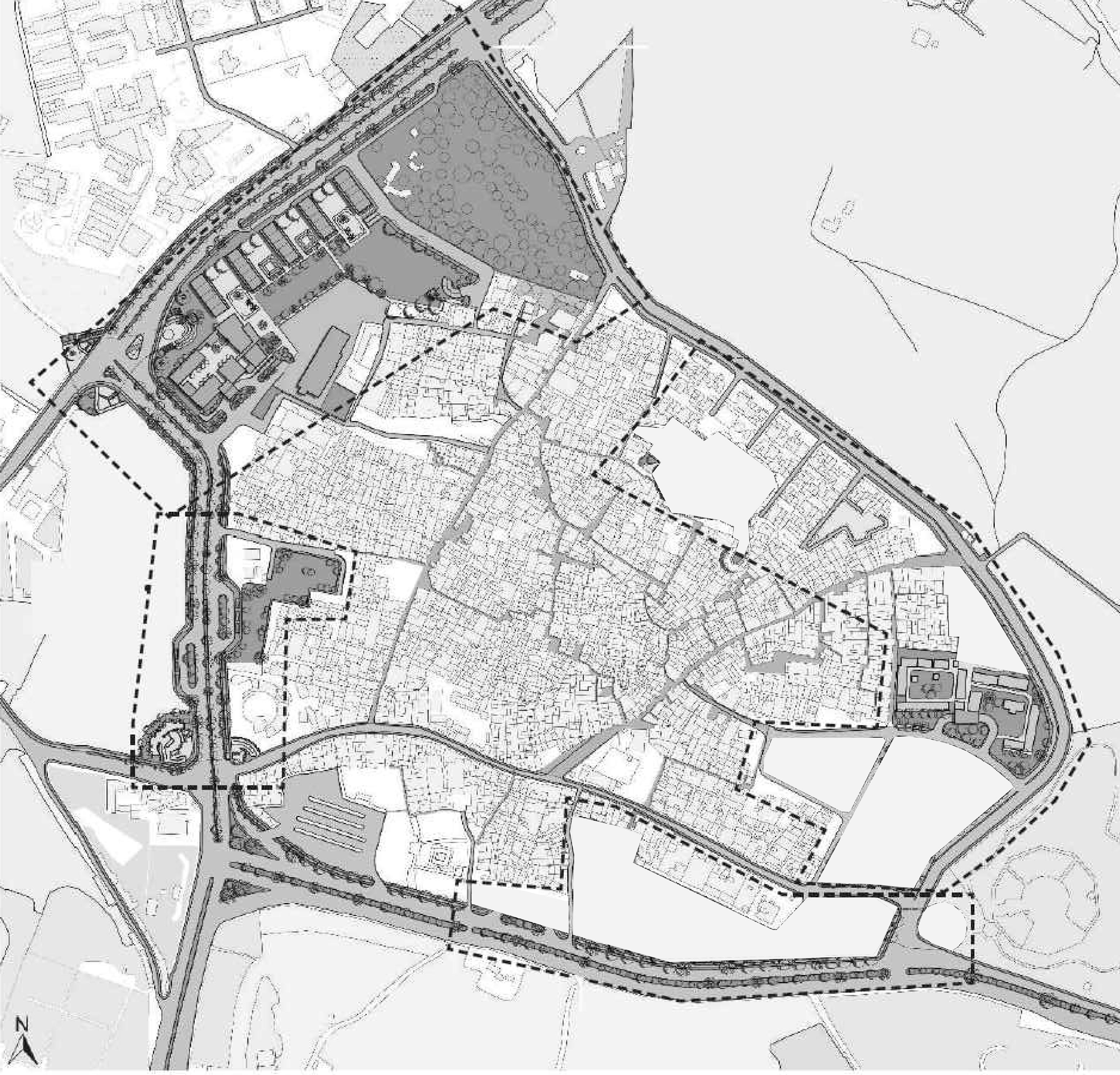
• The Delhi Master Plan proposed arterial roads which, while providing city level accessibility, enclosed the habitation to make it an urban island.
• These roads generated open spaces on the edge of the built fabric which have become areas of unregulated urban growth.
• The urban habitation interfaces with the city at only a few places through vehicular traffic junctions.

LADO SARAI URBAN VILLAGE
Source- SELF
URBAN CONTEXT
• Lado Sarai is located within a large green area containing many important historical monuments.
• The immediate surroundings include forested areas, an archaeological park, traces of historic cities, a golf course and neighbourhood parks maintained by the Delhi Development Authority.
Source- SELF


Source- SELF


OPEN SPACES
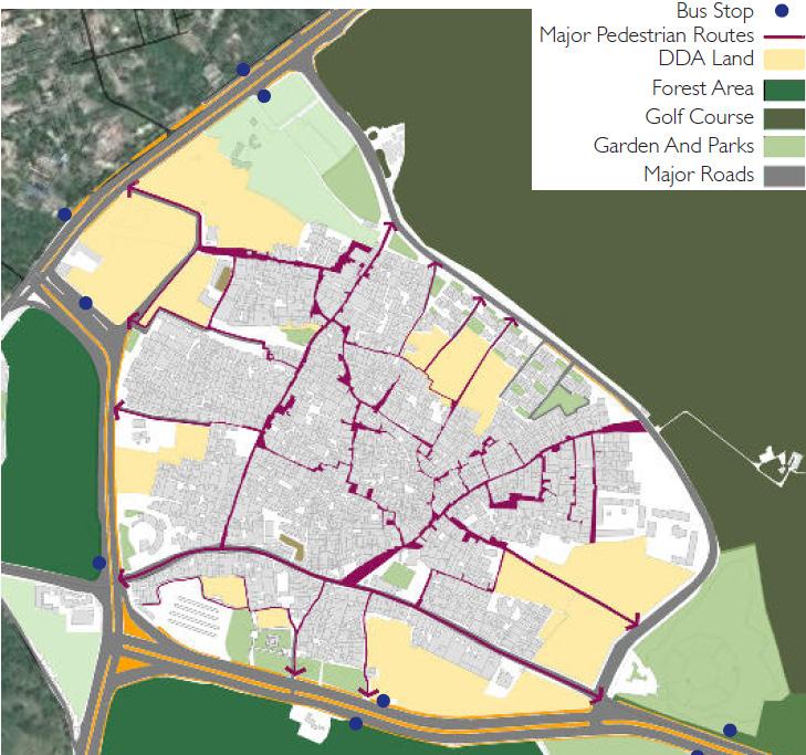
• Lado Sarai is surrounded by large city level green open spaces such as a golf course, Sanjay Van and Qila Rai Pithora Park.
• Most of the vacant lands around Lado Sarai are under the DDA and are of uncertain use.
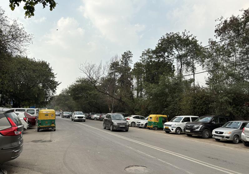
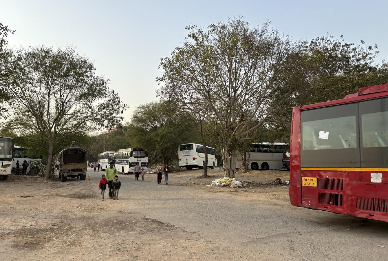
• These open spaces are used as bus and car parking spaces by the community.
• The pedestrian network is part of the organic development of the village and now vehicular traffic causing distress among the pedestrians.
Source- DUAC
BUILDING USE PLAN
• The predominant use of the buildings is residential.
• Three major roads, that is Old MB Road, Gali Numbers 1 and 2, have mixed-use development.
• Old MB Road has seen a major transformation in recent times, with the introduction of new art galleries, showrooms and designer studios.
• The few public buildings are schools, a mosque, temples and tombs.
Source- DUAC
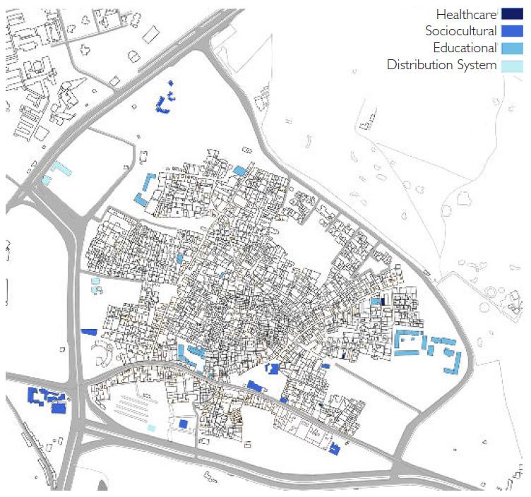
SOCIAL INFRASTRUCTURE
• There is a deicit of healthcare facilities in the area.
• There are temples, a mosque, a tomb and a community centre which constitute the sociocultural facilities.
• Education facilities include a MCD primary school, a senior girl’s school and a play school.
• Two CNG stations and a petrol pump are distribution facilities located on the road around Lado Sarai.
Source- DUAC
HISTORICAL MONUMENTS
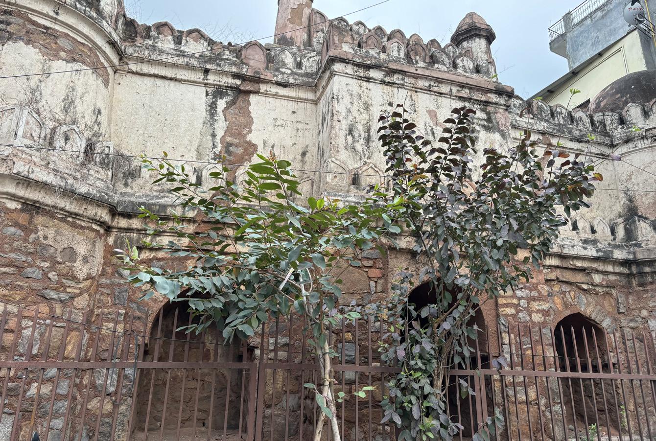
• Lado Sarai has one state protected monument along the MB Road and two unprotected monuments in a dilapidated state within the habitation.
• Wells have generally being co ered by steel nets but are still visible in the urban fabric.
• A number of old trees serve as community spaces and sacred places within the urban fabric.
Source- DUAC

UNDERGRADUATE THESIS BATCH 2019-2024 PRELIMINARY DESIGN RESEARCH URBAN DEVELOPMENT LADO SARAI SUBMITTED BY THESIS COORDINATOR THESIS GUIDE GORESH SAINI 1999005 AR. SUKHMANJIT SINGH AR. VIVEK SEHGAL REMARK & SIGN
Lalkot Ward Boundary Major Road Metro Station Metro line Lalkot To Shahjahanabad To Hauz Khas To Hauz Khas To Tughlaqabad Qutub Complex Qutub Complex Qutub Complex Sanjay Van To Gurgoan Aurobindo marg Aurobindo marg Lado Sarai Saket Lado Sarai 1962-1980 8-11th Century 12th Century 13th Century 14-18th Century 1980-2010 MB Road Qutub Golf Course Mehrauli Mehrauli Mehrauli Vasant Kunj Qila Rai Pithora TIMELINE Bus Stop Major Pedestrian Routes DDA Land Forest Area Golf Course Garden And Park Major Roads Commercial Institutional Mixed-Use Residential Warehouse/Godowns Healthcare Healthcare Sociocultural Educational Distribution System Monuments Wells Old Trees
1 1 2 2 5 5 3 4 4 7 7 3 6 6
Historical Places To Old Delhi To Vasant Kunj To Gurgoan To Badarpur Lado Sarai Green Zone Lado Sarai Habitation Green Zone Vehicular Interface Proposed City Level development To Gurgoan To Badarpur To Old Delhi Vacant Unregulated DDA Land
Source- Delhi: A Thousand Years of Building, Lucy Peck, Roli Books, 2005/SELF





3. THE NEST- QUTUB GOLF COMPLEX.
4. CRESCENT MALL.
5. LADO SARAI RTO TEST TRACK.
6. GUMBAD PARK.
7. FOUNDATION FOR INDIAN CONTEMPORARY ART.
8. MCD COMMUNITY CENTRE.
9. SHIV MANDIR.
10. DDA PARK
11. DDA CHILDREN PARK
12. MCD PRIMARY SCHOOL [BOYS].
13. HANUMAN MANDIR
14. MITHUN PARK
15. DDA JANTA FLATS
16. QUTUB NURSERY DDA
17. MEHRAULI COMPLEX PARK PHASE 2.
18. HARE KRISHNA CENTRE LADO SARAI
19. BUS STOP- LADO SARAI CROSSING
20. BUTTERFLY PARK LADO SARAI.
MAJOR ROADS
1. MEHRAULI-BADARPUR ROAD40M WIDE
2. PHIRNI ROAD-24M WIDE
3. CRESCENT ROAD- 26M WIDE
4. AUROBINDO MARG-26M WIDE
5. OLD MB ROAD
6. CAMPA COLA GALI
7. HIMMAT SINGH MARG
8. HANUMAN MANDIR WALI GALI.
MAJOR CHOWKS [JUNCTIONS]
1. KALI MANDIR CHOWK
2. KHALIYA CHOWK
3. BAANDE KI CHAUPAL
4. KUDI CHOWK
5. HARIJAN CHAUPAL CHOWK
6. SHIV MANDIR CHOWK
7. VALIMIKI GALI CHOWK
8. ANURAG SCHOOL CHOWK

UNDERGRADUATE THESIS BATCH 2019-2024 PRELIMINARY DESIGN RESEARCH URBAN DEVELOPMENT LADO SARAI SUBMITTED BY THESIS COORDINATOR THESIS GUIDE GORESH SAINI 1999005 AR. SUKHMANJIT SINGH AR. VIVEK SEHGAL REMARK & SIGN Public Washroom at Phirni Road MB Road TOBADARPUR lodhi Era Mosque Open Area for community Centre Phirni Road with Parking AUROBINDO MARG JUNCTION WEST LADO SARAI ZONE 4 CENTRAL LADO SARAI ZONE 2 HANUMAN MANDIR WALI GALI PHIRNI ROAD 24M WIDE OLD MB ROAD HIMMAT SINGH MARG CAMPA COLA GALI CRESCENT ROAD AUROBINDO MARG 26M WIDE TO HAUZ KHAS OLD MB ROAD ZONE 1 EASTERN LADO SARAI ZONE 3 SOUTHERN LADO SARAI ZONE 5 LANDMARKS
TB
RESPIRATORY DISEASES.
1. NATIONAL INSTITUTE OF
AND
2. BHARAT PETROLEUM, PETROL PUMP.
1 3 2 4 5 6 8 9 10 11 13 14 15 16 17 19 20 18 12 7 TO MEHRAULI COMPLEXTOQUTUB TOQUTUBCOMPLEX
ROAD 40M WIDE
Source-
Source- SELF Source- SELF SCALE 1 : 2000
MB
LADO SARAI WARD
DDA
AMENITIES
Kali Mandir Chowk
As a Entrance to the village, sports facilities, gathering spaces, temple plaza, heritage node and green coverage.
Anurag Industrial Training centre
A transit chowk with seating spaces.
Anurag School Chowk Children Play area.
Valimiki Gali Chowk Existing well, seating spaces and entrance to old core.
Shiv Mandir Chowk Park, Temple Plaza, Panchyat Ghar plaza, Playground, seating spaces.
Khaliya Chowk
As a Commercial chowk with provisions for eating outlets, hawkers and pedestrian facilities.
Baande ki Chaupal Community gathering space and vending zone
DDA open space
Open green space used for parking.
Chowk Extension of existing chaupal.
SETTLEMENT PATTERNS

MOBILITY
Kudi Chowk Highest point of Lado Sarai and oldest chowk.
• Lado sarai consist of 4 abandoned water well which were previously used for fresh water for daily need.
• According to the existing pattern of settlement the development of the village begin around the well as they are in the oldest part of it.
• Wells are centrally focused with a plaza which is used for community activity and serve as a public space till now.
Harijan Chaupal Chowk Existing well, chaupal and vending zone.
Source- SELF
One way
Regulated vehicular movement free way
Pedestrian Trails
Pedestrian Zones and regulated vehicular moment
Transport Hubs: Bus stop, Auto Stand, and car parking
Auto Stand
Pedestrian Crossing

Pedestrian trails Existing streets to be enhanced with pedestrian facilities to connect all community open spaces.
Old MB road Entrance from Phirni road and exit on Anuvart marg to control Unnecessary vehicular movement.
ROAD HIERARCHY
ENTRANCE
Collector road entrance junction are wide .
NARROW STREET Street become more narrower inside.
Source- SELF

BUILDING
Building consist of Mid-Rise blocks with narrow streets.
PLAZA AREA
Open area[chowk]
WELL
Used as source foe water earlier now dried and covered with iron mesh lid.
ROAD
Street network emerging from chowks
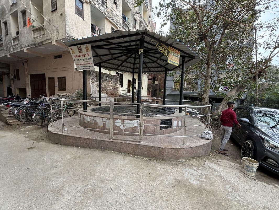
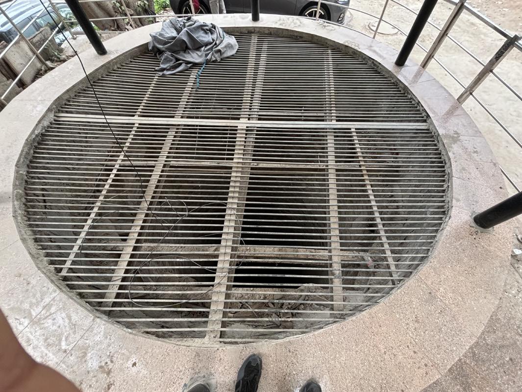
COVER STRUCTURE
Shed is constructed for covering.
PODIUM
Raised level from road level
WELL Radius of 2m-2.5m.
IRON MESH COVER
Used for safety concerns.
Shiv Mandir Chowk Hub of community activity and pedestrian zone, Hence need to be redesigned as public space.
Source- SELF
Main Road Inner Road
Source- SELF
MAPPING
Source- SELF
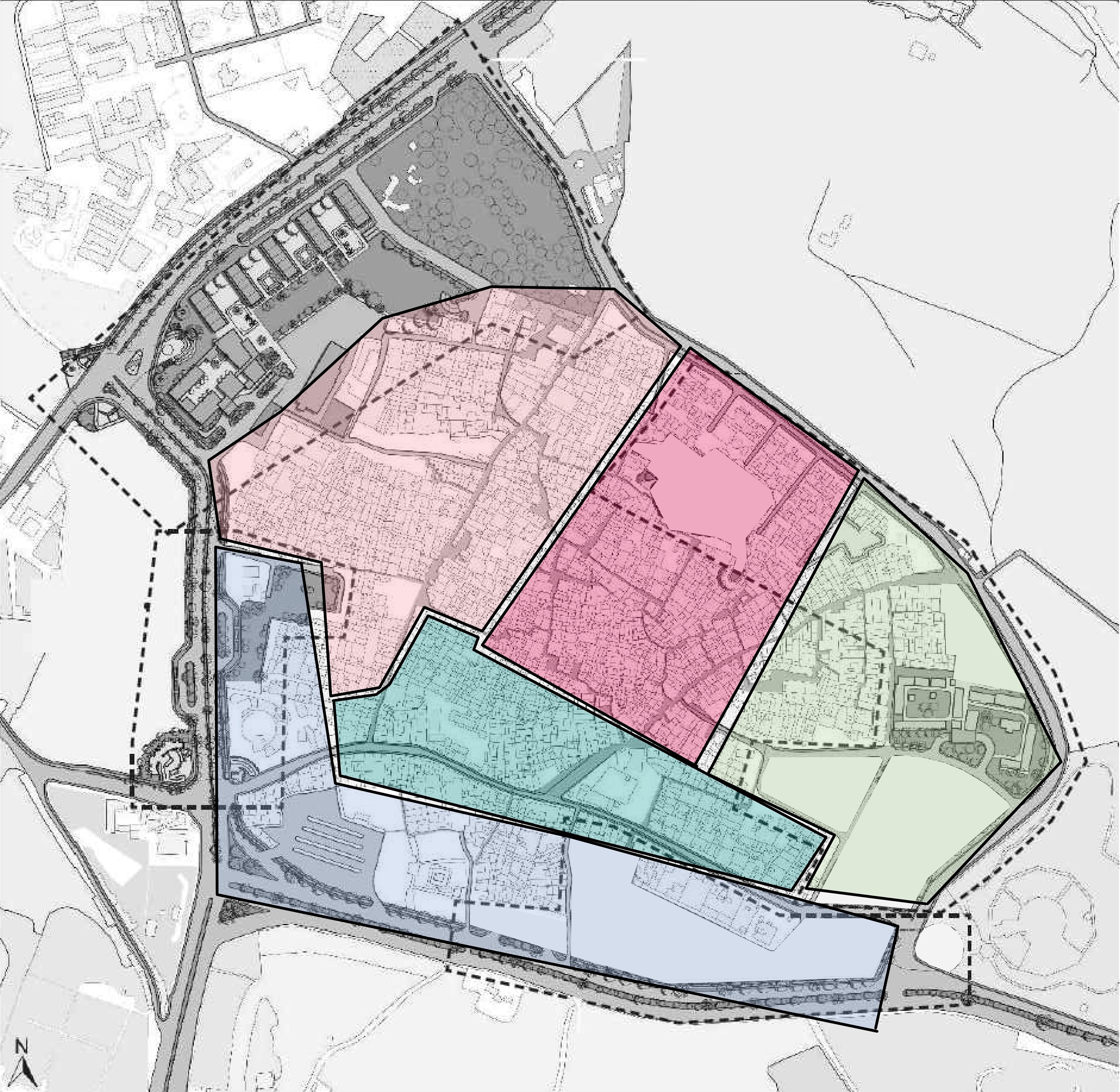
PUBLIC PARTICIPATION ZONE-WISE MOBILITY
• Survey and observations are conducted in the Urban village to Track and document the mobility, major travel routes and prime road at different zone.
• Four Destination are marked MCD School, nearest Bus Stop route, Way to nearest metro station and nearest auto stand location for transit.
• The Result of this mobility mapping shows and explain primary routes for transit according to zone of the user.
• For many route overlap each other either for a same function or for a different which make them more important to provide circulation inside the settlement Areas.

Way to MCD School


Way to Nearest Bus stop

Way to Nearest Metro station

Way to Nearest Auto Stand
Source- SELF
• A survey with public participation is performed to map need and requirement of different zones of lado sarai and what is their need for development parameters in the designing of the urban development planned on the nodes at the Phirni road consist of community centre, Mixed-use building, National museum of architecture and extension of MCD School.
• According to the survey need for Public green spaces is most and common among all the zones along for Physical infrastructure and Commercial spaces . While healthcare and Educational is avoided.
COMMERCIAL SPACES
HEALTH CARE
Source- SELF
EDUCATIONAL SPACE ZONE 1 ZONE 2 ZONE 4 ZONE 5 ZONE 3
PUBLIC SPACE AND GREEN AREAS X X X X X X X X X X INFRASTRUCTURE
Source- SELF

Source- SELF


UNDERGRADUATE THESIS BATCH 2019-2024 PRELIMINARY DESIGN RESEARCH URBAN DEVELOPMENT LADO SARAI SUBMITTED BY THESIS COORDINATOR THESIS GUIDE GORESH SAINI 1999005 AR. SUKHMANJIT SINGH AR. VIVEK SEHGAL REMARK & SIGN


INFERENCES AND FINDINGS
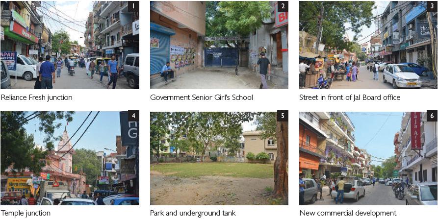
INFERENCES AND FINDINGS
• This is the heart of the community which connects and encourages interaction between inhabitants and the rest of the city.
• It is a major source of revenue for the local people and can be considered as the urban public face of Lado Sarai.
• This zone mostly consist of Mixed-use mid-rise blocks with have commercial spaces in the lower levels and office or residential spaces.
• The physical infrastructure of this zone is also not in good state the road is previous used as the major route to connect Mehrauli with badarpur hence have organic development along the road.
• The Mixed-Use building is planned in this zone which can be design to enhance and counter the challenges of the infrastructure.


• This edge of Lado Sarai has three distinct built environment conditions.
• The First one is the section containing a bus depot with a CNG station, which is not in use currently.
• The entrance of the depot is located very near a major traffic junction thereby creating conflict with traffic movement.
• The second condition is in the middle which has a public garden from where the local people access MB Road. It consists of the DDA Park, a tomb protected by the State Archaeological Department and parking space.
• The third condition has a boundary wall around vacant DDA land allotted to Aurobindo College which is used as a garbage dumping ground.
• Right of Way of MB Road is mentioned as 60 m in the DDA Zonal Plan, but only about 40 m is currently in use as a road. It acts as an arterial road and carries through traffic towards Faridabad.


UNDERGRADUATE THESIS BATCH 2019-2024 PRELIMINARY DESIGN RESEARCH URBAN DEVELOPMENT LADO SARAI SUBMITTED BY THESIS COORDINATOR THESIS GUIDE GORESH SAINI 1999005 AR. SUKHMANJIT SINGH AR. VIVEK SEHGAL REMARK & SIGN
KEY PLAN Social Infrastructure Public Functions [commercial] Private Functions [commercial] Vehicular Parking Street Vendors 1 2 3 4 5 6 Private Functions [commercial] Land allotted for functions Parks and Gardens Reserved Forest Bus Stop 7 6 8 Social Infrastructure 1 2 3 4 5 Public Functions [commercial] Reliance Fresh Junction Government Senior Girl’s School Street in front of jal board office DDA land boundary wall Approach road to MB road Tomb and DDA park Bus Depot Entrance Market CNG station DDA vacant land DDA land Temple Junction Park and underground tank COMMERCIAL USE RESIDENTIAL USE New commercial development OLD MB ROAD AT D1 MB ROAD AT D2 EXISTING STREETS AND PHYSICAL ENVIRONMENT Source- SELF/DUAC Source- SELF/DUAC Source- SELF Source- SELF SECTION AA’: Across the Old MB road and new Mehrauli- Badarpur roads Old MB Road Commercial building 70m vacant land 40m wide Mehrauli-Badarpur Road Qila Rai Pithora Source- DUAC
INFERENCE AND FINDINGS

• The Phirni Road edge of the village is most active as it opens up on to the village bypass. It has the maximum activities as Old MB Road connect the community with the city through this road.
• There are small streets like Chowdhary Prem Singh Marg and many other pedestrian connections opening on to Phirni Road.
• The street is active due to the vegetable market, MCD Primary School, vehicular parking spaces, entrance to the DDA children’s park and DDA housing.
• The Phirni road have being used in illegal parking which leads to traffic conflict point.
• On the other side Phirni road consists of major city level green spaces like Qutub Golf course and DDA park which invite hight no. Of visitors which face parking issues due to absence of designated parking spaces. This also provide a opportunity to generate revenue and have a scope of commercial spaces which help the Micro-economic.
• Alot of street vendors are also their which are having illegal encroachment of phirni road and create congestion points we can plan a designated market place for them to enhance the urban design of the zone.
• The infrastructure also need improvement the road have a opportunity for construction of designated cycle tracks and Pedestrian Trails due to the presence of neighbourhood green areas.
• The site for Museum, School extension and community centre is also located in this zone hence the Architecture design and site planning should help to reduce the Zonal issues.

• Site also have a informal market and illegal parking at the site of museum which should be relocated and planned.
• Public park is also the part of the development to be designed with UG parking space to counter parking issue of the zone have also help to generate revenue.







UNDERGRADUATE THESIS BATCH 2019-2024 PRELIMINARY DESIGN RESEARCH URBAN DEVELOPMENT LADO SARAI SUBMITTED BY THESIS COORDINATOR THESIS GUIDE GORESH SAINI 1999005 AR. SUKHMANJIT SINGH AR. VIVEK SEHGAL REMARK & SIGN
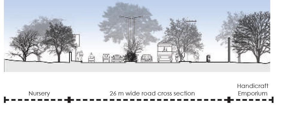
KEY PLAN Phirni Road Lodhi Era Mosque MCD Primary School for Boys Parking along Phirni Road Himmat Singh Marg DDA Housing Apartments VACANT DDA LAND INSTITUTIONAL MIXED-USE VEHICULAR PARKING VENDORS 1 5 2 6 4 3 1 2 3 4 5 6 PHIRNI ROAD AT D3 Section BB’- Across Vacant Land on Lado Sarai Edge and DDA Park Space Allocated to Aurobindo Collage Phirni Road 24M wide Section DD’- Aurobindo Marg in front of Handicraft Emporium Road DDA Nursery 26M wide road Cross Section Handicraft Emporium Section CC’- Across Vacant Land on Lado Sarai Village and DDA Housing DDA vacant Land for Community Centre along DDA housing DDA LIG housing Phirni Road 24M DDA Regional Park 56M wide Road including Bus Stop Parking in vacant DDA land Section EE’- Lado Sarai Crossing bus stop 1 2 2 1 Source- SELF Source- SELF Source- DUAC Source- DUAC Source- DUAC Source- DUAC Source- SELF Source- SELF

DDA HOUSING
Mid-rise DDA housing Block.
COMPOUND WALL
Wall between housing and DDA vacant land.
ROAD IN SETBACK
Setback area used as road.
DDA PARK
STREET PARKING
Road sideways used as illegal parking.
STREET VENDORS
Street Vendor on road sideways.
PEDESTRIAN TRAIL

Source- SELF
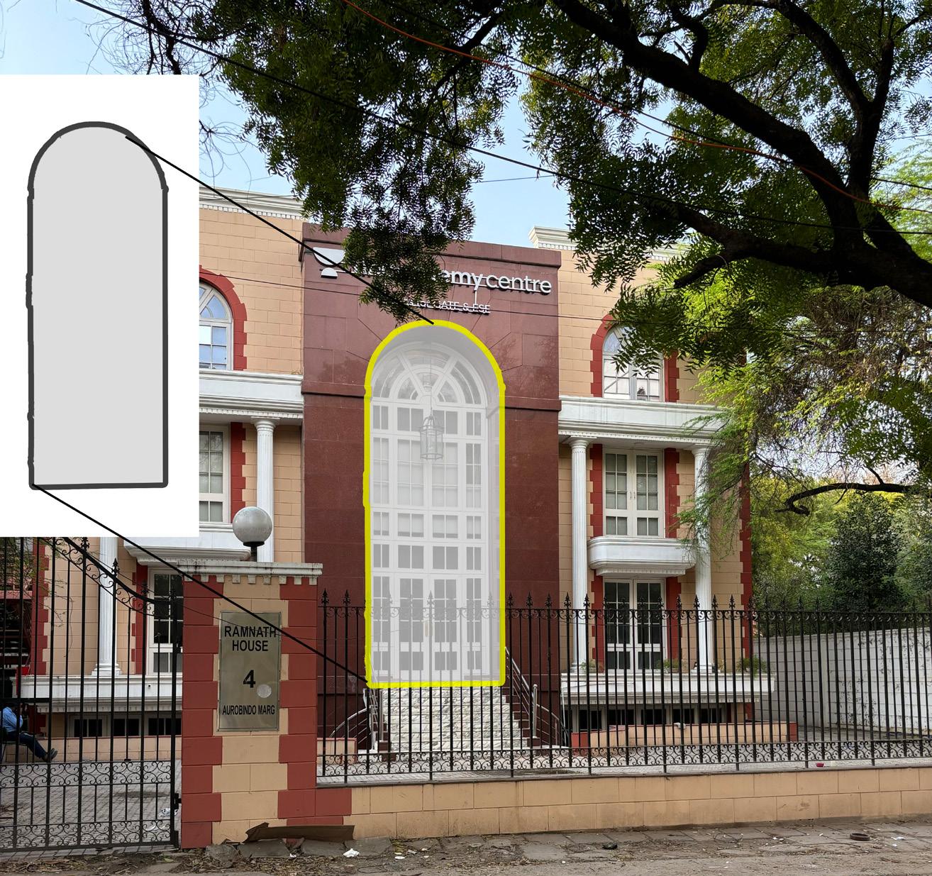
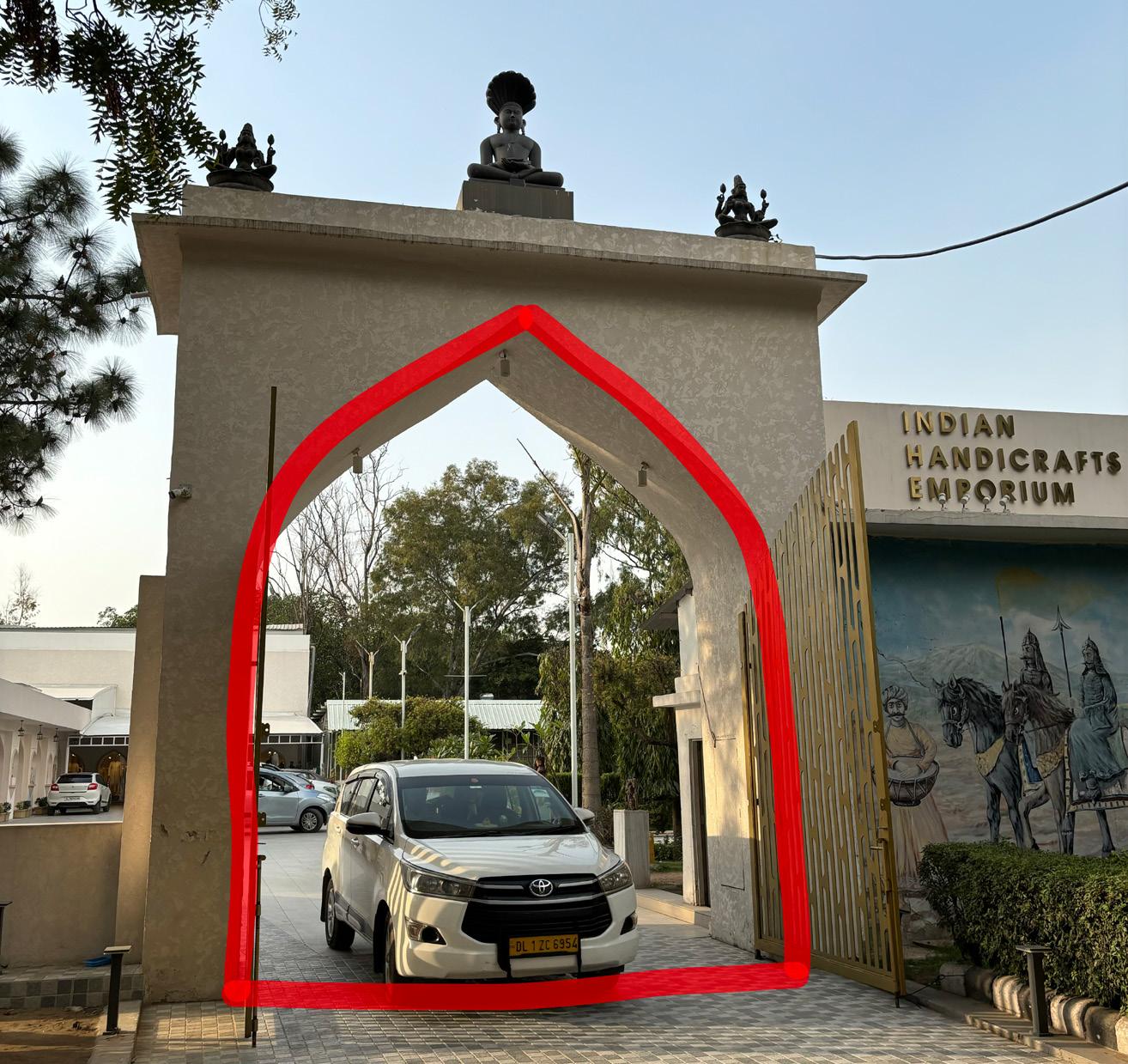
• Different type of arches are used in the village in different phase of time.
• Round Arch is prominently used in the village in various structures, work as a identity of the place.
• Not only in Lado sarai but this element is commonly noticed in qutub complex, Qila Rai Pithora, India Gate,etc used abundantly in whole Delhi region.

EDGE AT COMMUNITY CENTRE SITE
ZEBRA CROSSING
Pedestrian cross MB road.

MEHRAULI- BADARPUR ROAD
One of the busiest road in the zone connect Mehrauli with Badarpur and Delhi with faridabad.

CRESCENT ROAD
Lack of planning and execution of urban design strategies leads to poor infrastructure.
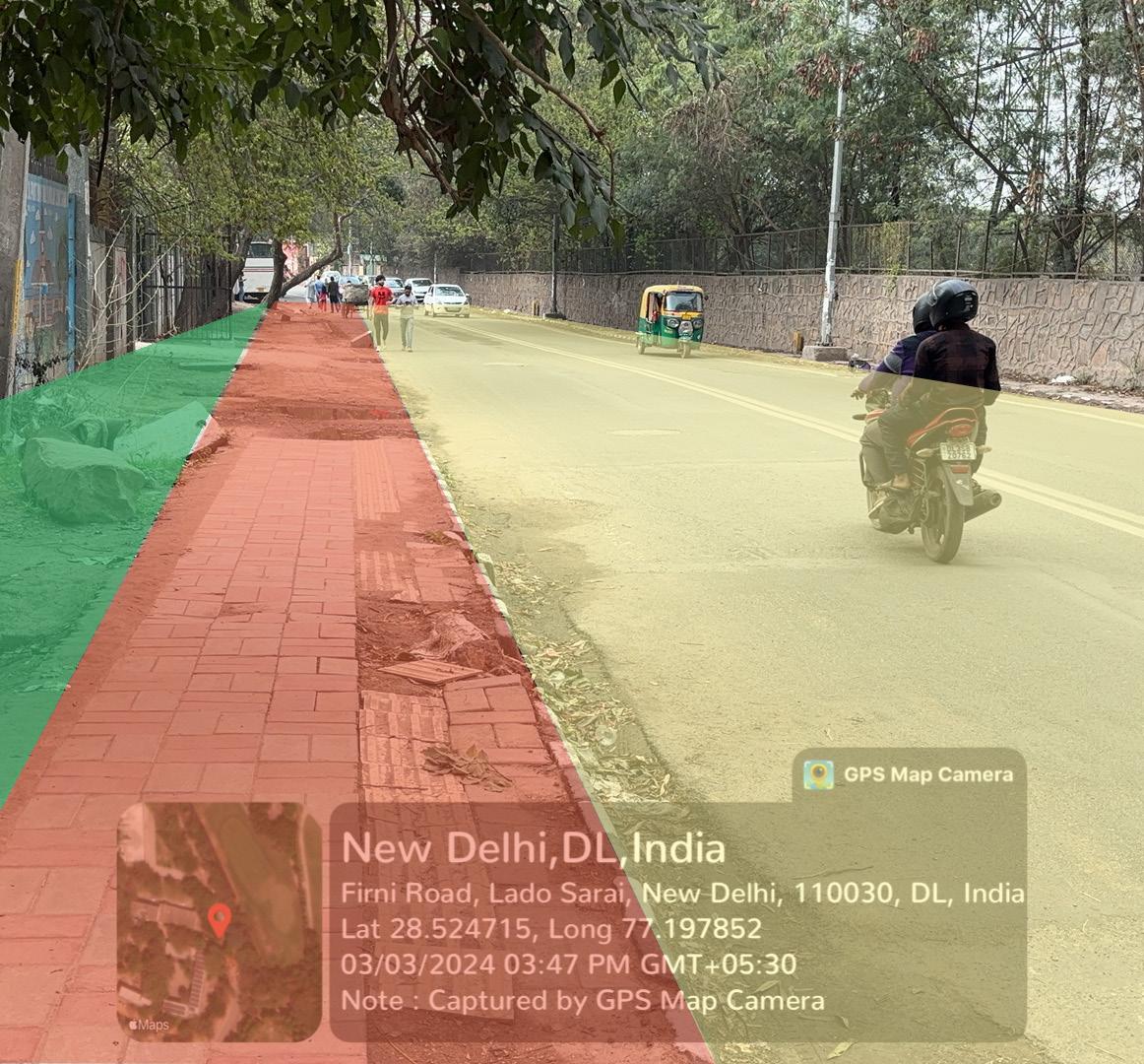
ROAD WAY
ROW for vehicular circulation
FOOTPATH Pedestrian Trail.
SCHEMATIC PLAN

SCHEMATIC SECTION
PHIRNI ROAD
ZEBRA CROSSING Pedestrian crossing. ARCHITECTURE
GREEN BELT
Green area left for road extension.
Road for Vehicular circulation
PEDESTRIAN TRIAL
Space left for pedestrian circulation. ROAD

SCHEMATIC PLAN
Space left for pedestrian circulation. ROAD Road for Vehicular circulation.
PHIRNI ROAD
GREEN BELT SITE FOR COMMUNITY CENTRE
SITE FOR COMMUNITY CENTRE FOOTPATH FOOTPATH
SCHEMATIC PLAN
WALL WALL ROAD ROAD PATHWAY PATHWAY PARKING DDA HOUSING
DDA HOUSING
Source- SELF
GREEN AREA
Source- SELF
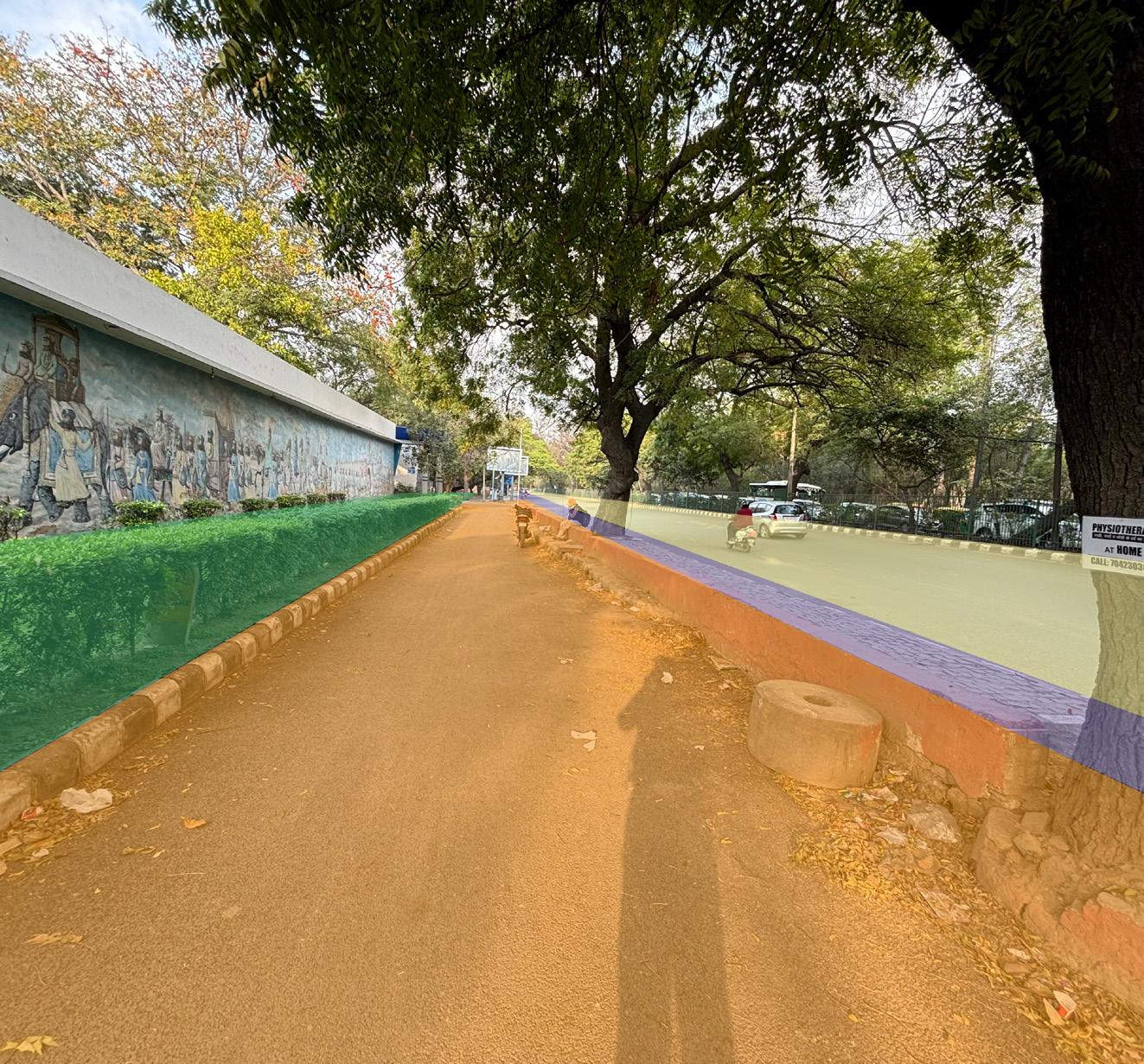
PEDESTRIAN CROSSING
Crossing provided for pedestrian
CROSSING
Absence of zebra crossing.

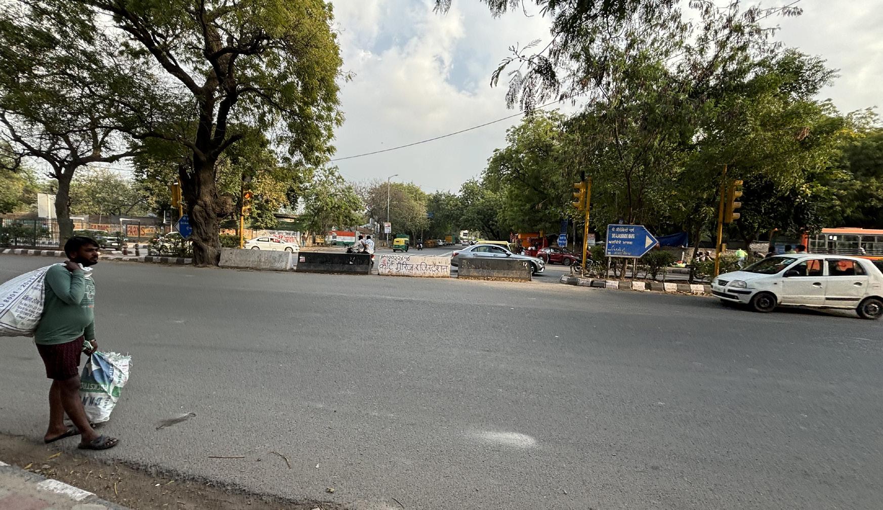
PEDESTRIAN CROSSING AT AUROBINDO MARG
Pedestrian crossing is provided in the divider and green belt but Zebra crossing is absent on the road same for the Traffic light.
PHIRNI ROAD
Phirni road originate from this point at MB road.
AUROBINDO MARG
Aurobindo marg connect MB road with Hauz khas and have Slip road for accessibility to joining secondary streets and roads.
FOOTPATH
Pedestrian Trail.
ROAD
ROW for vehicular circulation
GREEN BELT
SLIP ROAD
Service road at Aurobindo marg.
GREEN AREA
Source- SELF
CROSSING
Zebra crossing is absent for other side Pedestrians.

MB ROAD AND PHIRNI ROAD JUNCTION
This Junction is proposed with underpass to provide better Pedestrian circulation between the DDA park and residents of lado sarai. Due to heavy Traffic MB road is unsafe and difficult to cross with weak infrastructure.
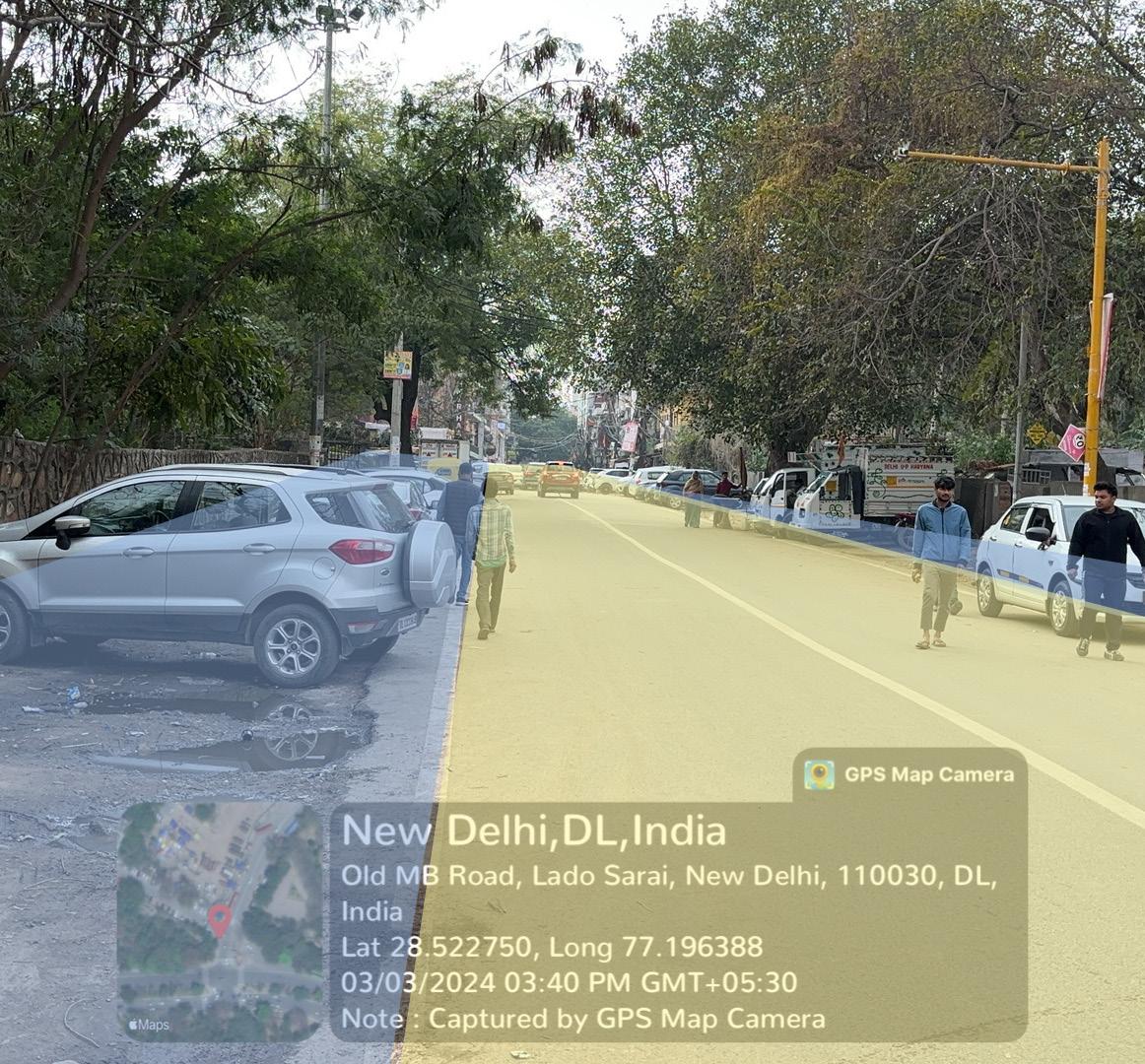
PHIRNI ROAD
Phirni road is congested with illegal parking on both side of the road. Footpath is encroached with vehicles leads to pedestrians way to road.
Street vendors are also their with temporary structures on road.
Source- SELF
FOOTPATH
Pedestrian Trail is provided for circulation with joining streets.
ROAD
SIDEWAYS PARKING
Vehicles are Illegally parked on Road sideways

UNDERGRADUATE THESIS BATCH 2019-2024 PRELIMINARY DESIGN RESEARCH URBAN DEVELOPMENT LADO SARAI SUBMITTED BY THESIS COORDINATOR THESIS GUIDE GORESH SAINI 1999005 AR. SUKHMANJIT SINGH AR. VIVEK SEHGAL REMARK & SIGN
ELEMENT AND HISTORICAL PRESENCE EXISTING CONDITIONS
VENDOR


