Future Afterlives of an Extractive Landscape: Sweetwater County
Future Afterlives of an Extractive Landscape: Sweetwater County by Gracie Meek
A Thesis Submitted to the Department of Architecture in Partial Fulfillment of the Requirements for the Degree of
Bachelor of Architecture at Cornell University May 2022
Advisors: Lily Chi and Tao DuFour
Dedication
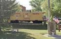
This thesis is dedicated to William and Francis Sines, my grandparents. Without your vivid stories of the good old days in Superior and Rock Springs, this thesis would not exist.
ACKNOWLEDGEMENTS
While I am indebted to countless classmates, friends, family members, and professors whose conversations, ideas, and advice led to the completion of this thesis, I offer my foremost appreciation to my parents, Robert and Marilyn Meek. In retrospect, it is evident that growing up under parents whose passions range from the physical sciences and geology to drone flight and the history of the Wild West undoubtedly influenced the direction of this thesis. Apart from your academic inspiration, your love and encouragement motivated me to persevere through five years of architecture school.
I express my deepest gratitude to my thesis advisors, Lily Chi, Ph.D., and Tao DuFour, Ph.D., for providing me with invaluable guidance throughout this research. Your continual passion, excitement, and honest criticism inspired me to think innovatively and have fun in the process of this thesis. It has been an honor and privilege to work with you both for more than one semester, and the direction of this thesis, combined with our past studios, has shaped my academic interests and life decisions. Lily, your dynamism, vision, and rigor, and Tao, your sincerity, brilliance, and great sense of humor made this by far my most enjoyable semester.
The Highland Homies (Zana Hossain, Abigail Calva, Ing Wongpaitoonpiya, Jaein Lee, Duncan Xu, Jacob Wong, and Polen Guzelocak) kept me well fed and my levels of serotonin high. Our spontaneous gatherings, serenity walks around Beebe Lake, and study-break laps around the Quad kept me at a decent level of sanity over the past ten semesters. For who?! For Him!!
My sincere thanks also go to The Lineage (Lauren Lam, Miriam Gitelman, Charlotte Zhang, and Tracy Qiu, and those above on the ladder) for your friendship, endless hype, and eleventh-hour assistance.
Last but not least, I would like to thank my Studio Deskmates (Theo Neil Blones, Joe McGranahan, and Joseph Appiah) for always lightening the mood—whenever I walked into studio and saw one of you already there, my happiness and inspiration were instantly amplified.
Final
Appendix:
PHASE
PHASE
P PHASE III ARCHIVE I II III IV V VI VII VIII IX X XI XII XIII XIV 11 13 19 29 45 65 91 107 123 195 209 227 341 363 CONTENTS
Introduction Proposal Energy Source Analyses An Electrified Landscape Superior and Rock Springs Historical Archive Cartographic Analysis of Past, Present, and Future Extractive Processes Byproducts and Choreography Labor and Capital Sites of Stewardship Pivot Swoop Wrinkle Superior Schematic Projections
Thesis Defense
Site Fieldwork Process Bibliography
I
II
Operating in the context of a once-booming landscape of extraction, Future Afterlives of an Extractive Landscape: Sweetwater County restrategizes utilitarian extractive processes to be productive, beneficial, and remediative for the grassland ecosystem and agrarian community whose land uses will be altered by a future lithium mine. Toggling between macroscale ecological, economic, and infrastructural processes and the micro-scale human experience of stewardship, the thesis envisions an anticipatory field of revelatory landscapes whose reverberations are as much about the qualitative, perceptive experience as they are about systematization. The afterlife of an exhausted coal town has a possibility for future resurrection.
10 I
INTRODUCTION
Modern economies and progress rely heavily on energy in various forms. The provision of energy involves processes of extraction and production that leave behind wide-ranging effects at multiple scales—from landscapes and environments, to towns and cities, and to lives and livelihoods. How might this be rethought and repaired as we go forward with the energy transition of today?
Typical extractive infrastructures are problematic in that they have a singular, utilitarian logic of efficiency and profit. Future Afterlives of an Extractive Landscape: Sweetwater County asks how processes of extraction can be reimagined to account for what is usually forgotten to render visible, cultural, and remediative what is typically hidden while also involving environmental actants.
The thesis uses the history of an exhausted coal mining town and a possible future lithium mine as vehicles to explore how architecture, in making connections between what has been kept discrete, might link remediation to extraction, stewardship to labor and capital, and the visible to the invisible.
In doing so, the thesis explores how architecture might anticipate in advance future afterlives in our changing energy landscape to ultimately make these extractive landscapes matter to more people.
11 I Introduction
The original thesis proposal from Fall 2021 centered around creating remediative, hybrid charging stations for electric vehicles. While the large-scale concept of today’s energy transition implications remained the focus of the thesis, charging infrastructure was set aside to prioritize possible future afterlives of electrification.
12 II
PROPOSAL
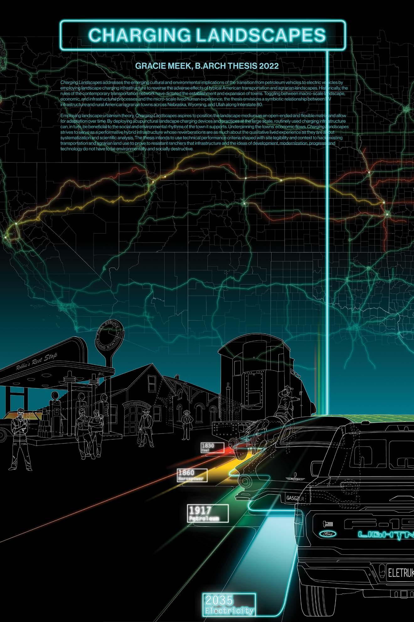
Charging Landscapes
Charging Landscapes addresses the emerging cultural and environmental implications of the transition from petroleum vehicles to electric vehicles by employing landscape charging infrastructure to reverse the adverse effects of typical American transportation and agrarian landscapes. Historically, the rules of the contemporary transportation network have dictated the establishment and expansion of towns. Cities and transportation systems concurrently evolved socially, economically, and environmentally through transit oriented development (TOD) schemes. With GM’s transitioning out of gas and diesel engines by 2035, the Biden administration’s infrastructure bill providing $7.5 billion in federal grants to build a national network of charging infrastructure, and, closer to home, TCAT’s addition of seven electric busses to their fleet, America begins its transition to a “manifest destiny-esque” electrified landscape. The role of public infrastructure in our cities and towns is changing.
Making EV ownership the standard can be achieved only when charging infrastructure is available throughout the country and strategically placing it to make electric transportation to and from any point within the continental US a reality. However, with already overburdened rural electrical grids intensified due to climate change, the lack of charging stations along remote longhaul routes in the Great Plains causing “range anxiety,” and the ineffective setup of rest stops to support the wait for a car to charge, rural towns are confronted with the task of catching up with larger cities to make EVs accessible to everyone. An allinclusive approach is the only way to establish a completely interconnected electric road map throughout the country.
13 II Proposal
Toggling between macro-scale landscape, economic, and infrastructural processes and the micro-scale lived human experience, the thesis envisions a symbiotic relationship between EV infrastructure and rural American agrarian towns across Nebraska, Wyoming, and Utah along Interstate 80. These towns historically emerged as pit stops along the Oregon Trail, Union Pacific Railroad, Pony Express, and US Highway System. Presently, the road network facilitates access to vast cattle and sheep ranch lands, national trucking of agricultural products grown nearby, and the export of coal. But, it is also where a freshly licensed teen driver aimlessly cruises to express her newfound freedom and where families embark on long distance trips to cross the Rocky Mountains. Landscape becomes the vehicle by which to articulate solutions for the integration of EV infrastructure with practical programming that can address not only the needs of the everyday agricultural community but also the grassland ecosystem.
Employing landscape urbanism theory, Charging Landscapes aspires to position the landscape medium as an open-ended and flexible matrix and allow for adaptation over time. By deploying acupunctural landscape charging devices and practices at the large scale, routinely used charging infrastructure can, in turn, be beneficial to the social and environmental rhythms of the town it supports. Underpinning the towns’ economic flows, Charging Landscapes strives to serve as a performative hybrid infrastructure whose reverberations are as much about the qualitative lived experience as they are about systematization and scientific analysis. The thesis intends to use technical performance criteria shaped with site legibility and context to hack existing transportation and agrarian land use to prove to resistant ranchers that infrastructure and the ideas of development, modernization, progress, and technology do not have to be environmentally and socially destructive.
Original Thesis Proposal, November 2021
14
15 II Proposal
16
PHASE I
17
After encouragement in the initial thesis meeting to “not be too optimistic” about electrification, research about the implications of the energy industry including resource extraction and battery production was conducted.
18 III
ENERGY SOURCE ANALYSES
The Afterlives of Extractive Infrastructures and Future Afterlives of “Green” Energy
Initial research on today’s transition from fossil fuel derived energy to electrification revealed that renewables are not as “green” as they may seem. Electrification is generally seen as a positive, as the consequences of the combustion of coal and other fossil fuels like oil and gas extracted for energy production have dire social and environmental outcomes. Wild boom and bust economic swings and airborne, surficial, and groundwater pollution only scratch the surface when it comes to consequences of nonrenewable extraction. Additionally, possible solutions for “cleaner” energy production, like nuclear fission, fail to deal with wast which will remain toxic for thousands of years.
Typical extractive infrastructure is problematic in that it isolates functions, processes, and byproducts in an entirely utilitarian approach that is only interested in “efficiency” and profit. These infrastructures are hidden from the public eye, for instance, oil pipelines buried underground, or oil wells painted tan to blend in with the landscape. The thesis restrategizes these threads to render visible, cultural, and remediative that which is normally hidden while also involving environmental actants.
The thesis does not propose the adoption of the electrification of cities as a neutral or as a solution. The thesis takes this adoption as a fact. It has implications. So, rather, how can architects anticipate problems that may arise with the energy transition in the future to identify, measure, expose, and repair the traces left by past energy systems while working in conjunction with the energy transitions and operations of the present?
19
III Energy Source Analyses
20 Data
from Lawrence Livermore National Laboratory, US Department of Energy, and US Energy Information Administration
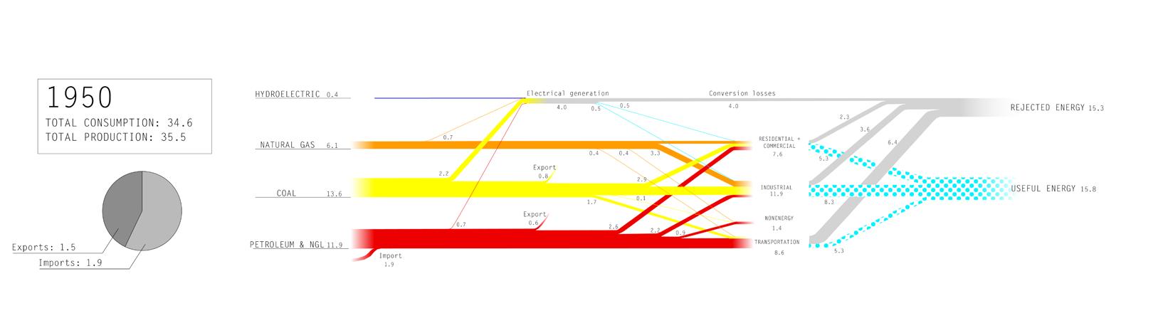
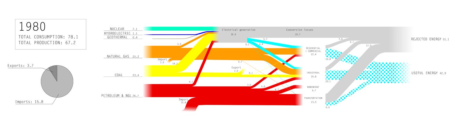
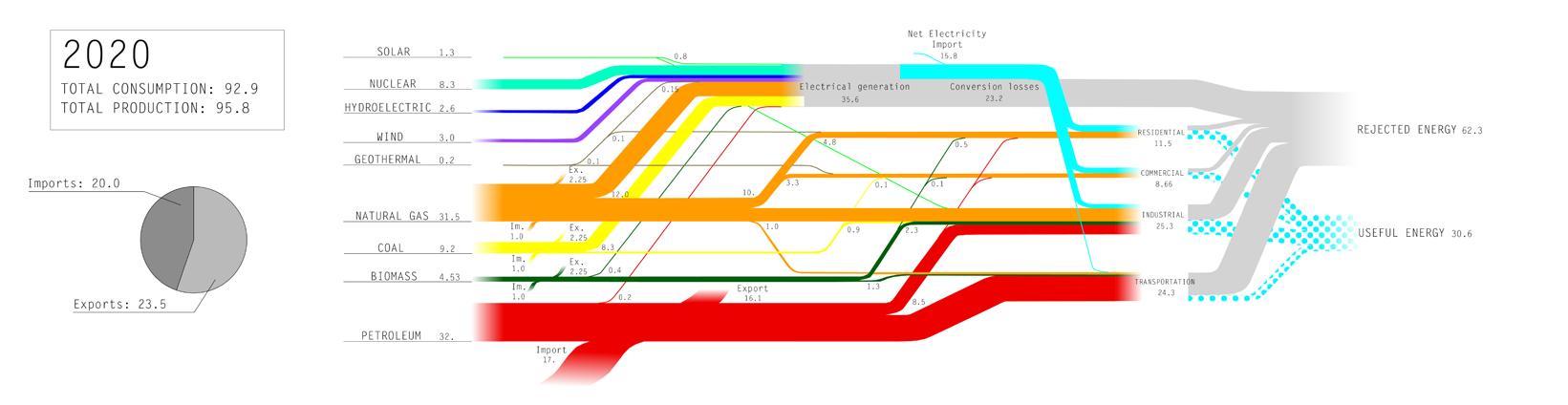
TYPES OF ENERGY, CONVERSION LOSSES, AND THEIR USABLE FLOWS IN THE US FROM 1950–PRESENT
The energy flow diagram on the left shows how the US creates energy, where the energy goes, and how much is wasted. The ineffective conversion of energy from raw materials throughout history resulted in a considerable loss of potential energy. As of 2020, the US is a net exporter of energy for the first time since 1952. The past ten years have seen a significant decline of coal extraction for energy production (yellow) with renewables slowly gaining traction.
Measurements in 1 quadrillion BTU (British Thermal Units: the amount of energy needed to heat 1 pound of water by 1 degree F), equal to 36,000,000 lbs of coal
21 III Energy Source Analyses
22 Geologic information from: (Hallman 2010)
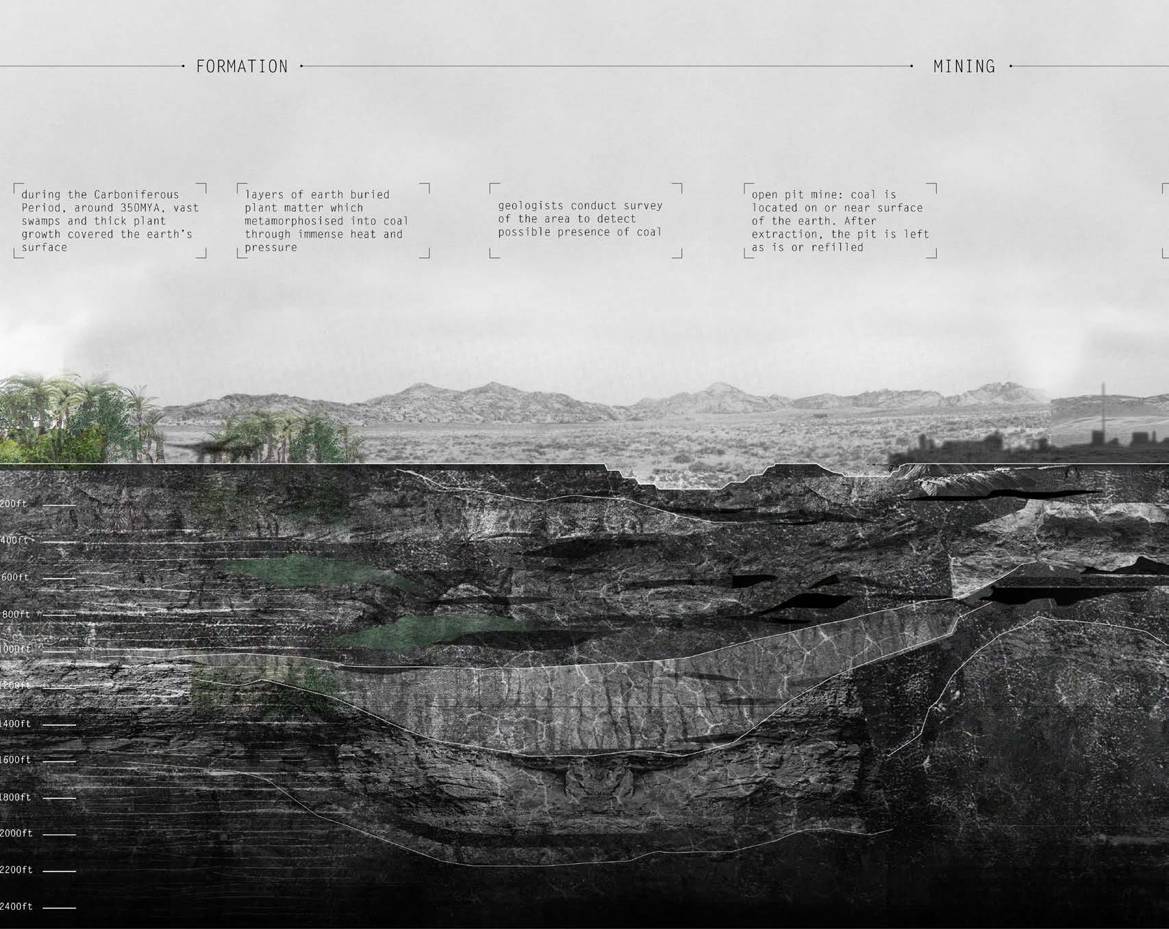
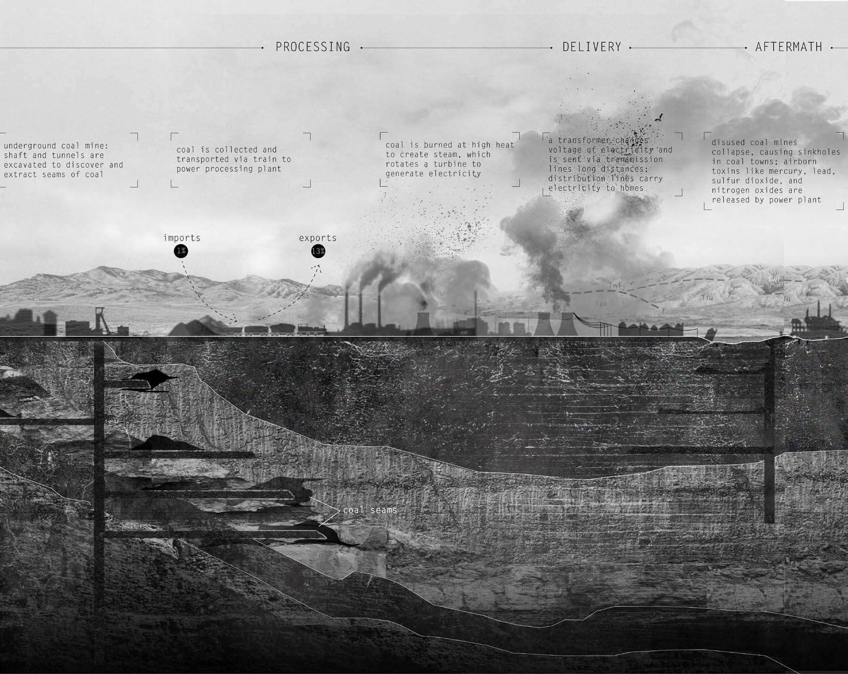
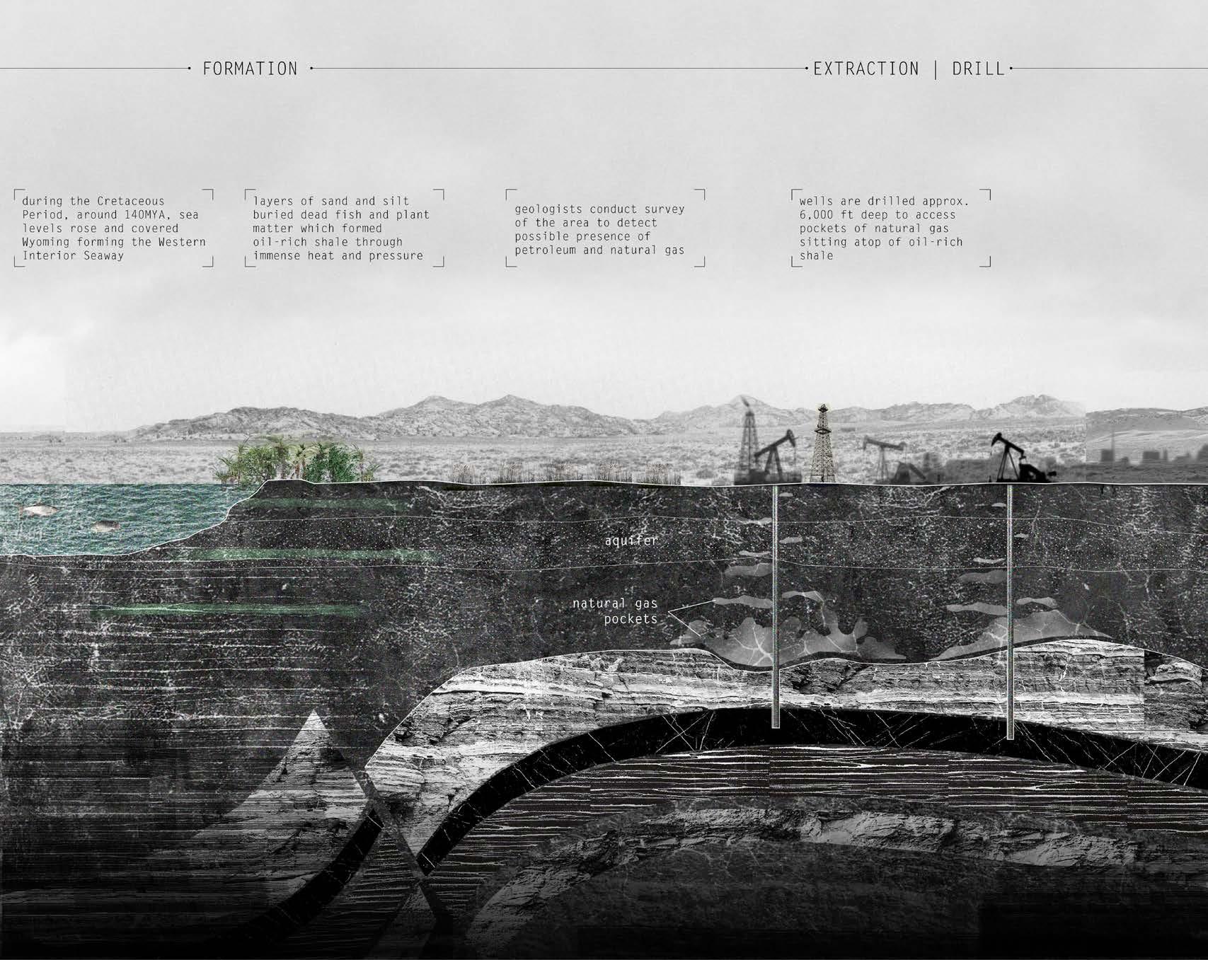
Coal in Wyoming was formed about 350 million years ago when vast swampy forests covered the territory. Over time, immense heat and pressure caused buried plant matter to metamorphosize into coal. In the early to mid-1800s, geologic surveyors discovered coal in the Rock Springs Uplift region of Wyoming. Currently, after being mined, coal is transported via train to a power processing plant. Coal is burned at high heat to create steam, which rotates a turbine to generate electricity.
23 III Energy Source Analyses
LIFETIME OF COAL FROM FORMATION TO EXTRACTION AND ENERGY PRODUCTION
24 Geologic information from: (Hallman 2010)
LIFETIME OF OIL AND NATURAL GAS FROM FORMATION TO EXTRACTION AND ENERGY PRODUCTION
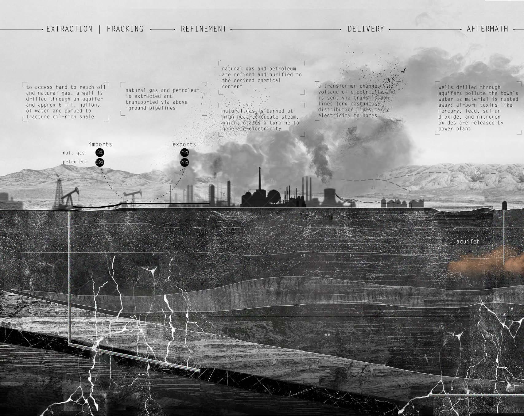
Oil and natural gas in Wyoming was formed about 140 million years ago when sea levels rose, covering Wyoming and forming the Western Interior Seaway. Silt and sand buried dead fish and plant matter, and oil-rich shale formed through immense heat and pressure. To extract oil and natural gas in hard-to-reach places, millions of gallons are water are pumped to fracture (i.e. fracking) the shale.
Oil and gas is then transported via pipelines to a processing plant where it is converted into energy after being purified to their desired chemical content.
25 III Energy Source Analyses
26 Nuclear energy information
of Energy 2021)
from: (Department
LIFETIME OF NUCLEAR ENERGY FROM RAW MATERIAL TO ENERGY PRODUCTION
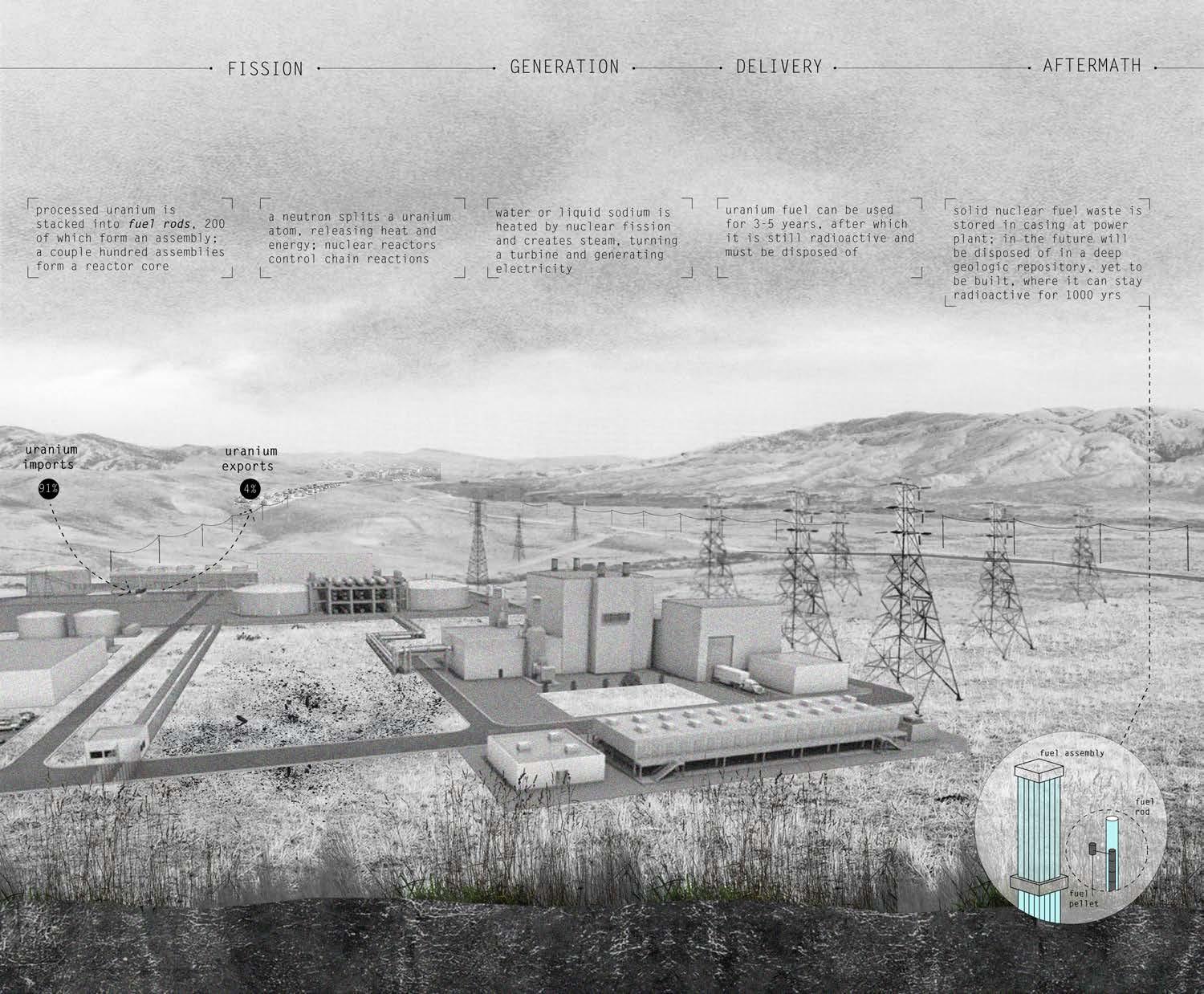
The production of nuclear energy relies on the extraction of uranium. A uranium atom is split by a neutron, releasing heat and energy. Water or liquid sodium is heated by nuclear fission and creates steam, which turns a turbine and generates electricity.
Uranium as fuel can be used for 3 to 5 years, after which it is still radioactive and must be disposed of. Solid nuclear fuel waste is stored in a casing at the power plant.
27 III Energy Source Analyses
Lithium mining is vital to electrification. Renewable resources require lithium for the production of batteries, which reveals a dark present day reality of new environmental exploitation.
28 IV
AN ELECTRIFIED LANDSCAPE
The Rise of Lithium Extraction
Today, many environmentalists, politicians, and architects have the goal of switching to total electrification and renewable energy as a mode of decarbonization. With General Motor’s transitioning out of gas and diesel by 2035, the Biden administration’s infrastructure bill providing $7.5 billion to build charging infrastructure, and, closer to home, TCAT’s addition of 7 electric busses to their fleet, America begins its transition to an electrified landscape.
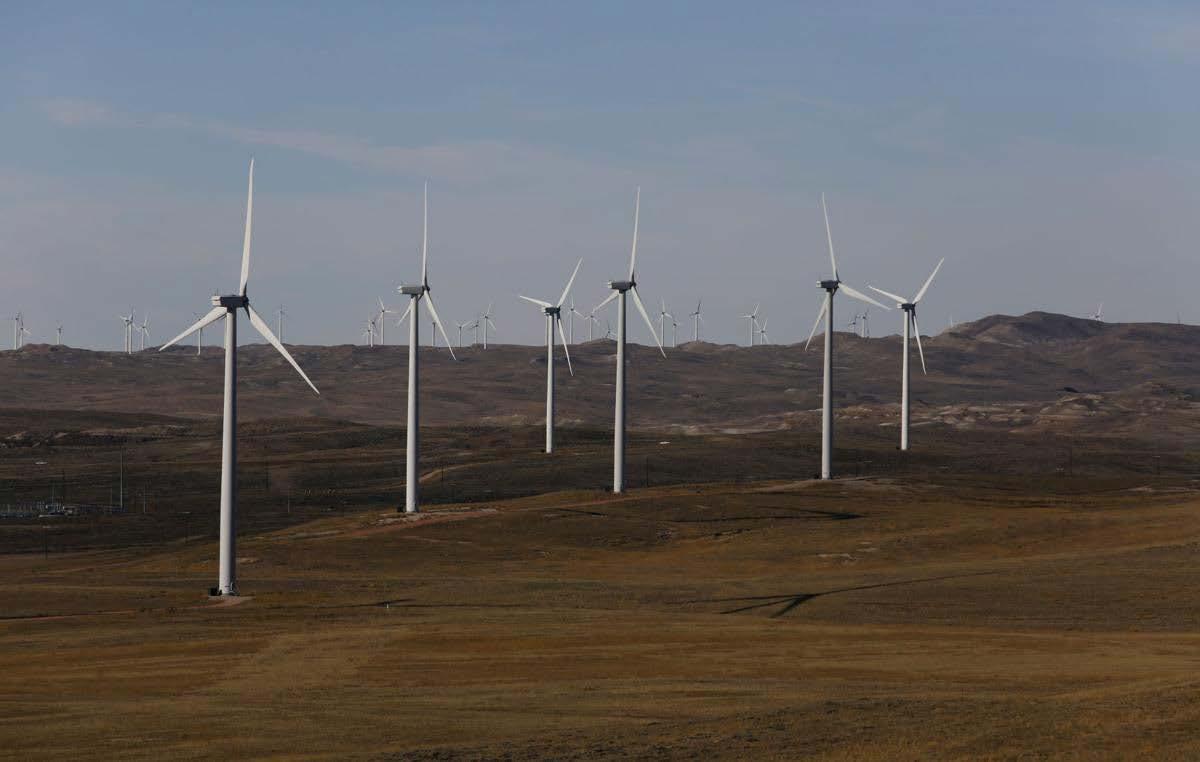
Wyoming is now slowing its reliance on nonrenewable energy and is beginning its transition to renewables. The state provides energy for the whole of America’s Pacific Northwest, so as more liberal-leaning states urge renewable-derived energy, Wyoming is building wind turbine fields to keep up with demand. This promises another social, environmental, and cultural upheaval as people look for new jobs in the renewables sector as coal and gas powered power plants in the region begin to close.
While this transition to “green” energy is usually viewed optimistically, it requires the extraction of lithium to produce batteries. Wind turbines, solar fields, and electric vehicles all rely on lithium-ion batteries for energy storage. These batteries require imported minerals from all over the globe for production. Lithium mining, namely, reveals a dark present-day situation of environmental exploitation.
29
IV An Electrified Landscape
30 Photos from: (NowThis News 2021)
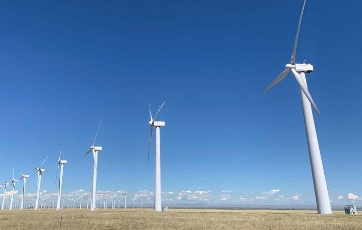
RISE OF RENEWABLE ENERGY DEMAND IN WYOMING
To keep up with demand from states requesting renewable-derived energy, Wyoming has built, and is currently building, fields of wind turbines on open range cattle land.
31
IV An Electrified Landscape
32 Information on
EV batteries and labor from: (GreenCarReports 2022) and (Granholm 2021)
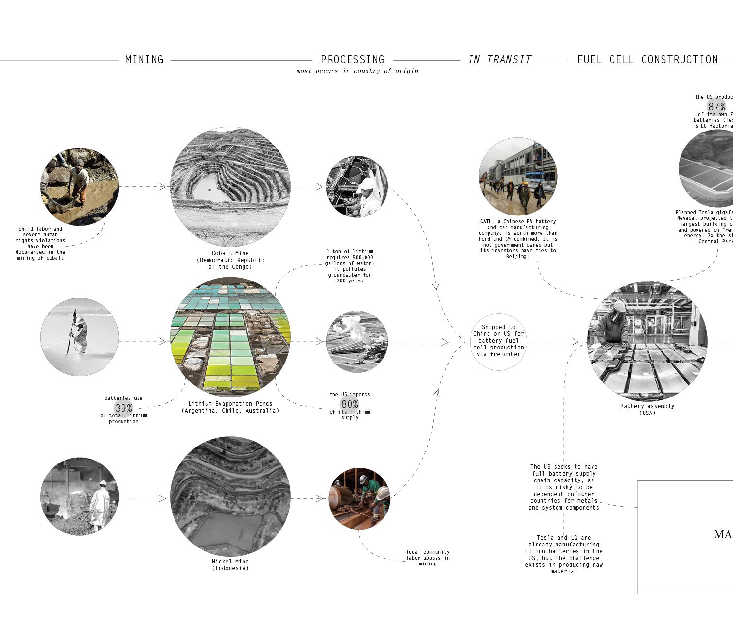
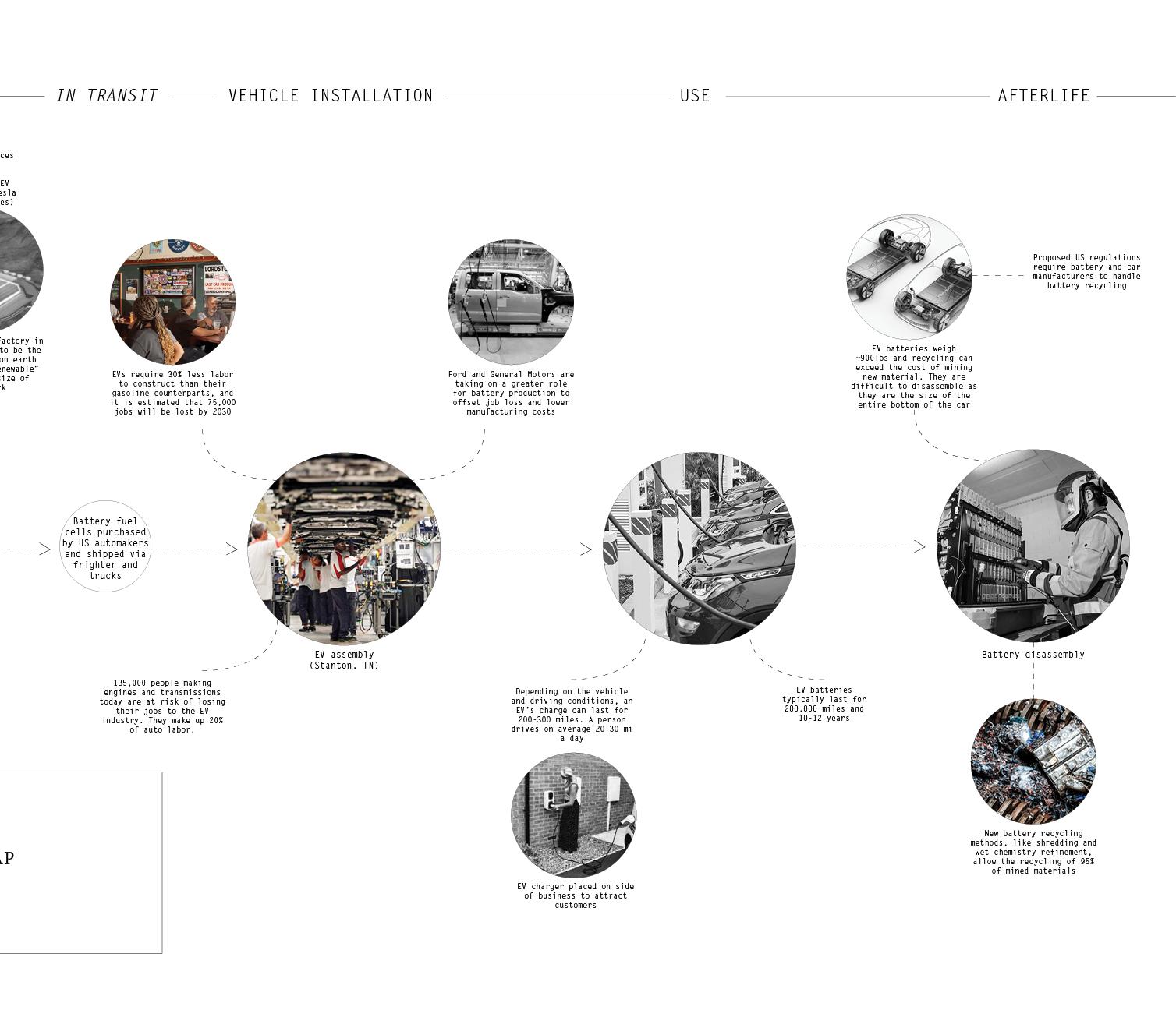
PROCESSES AND ACTORS INVOLVED IN LITHIUM-ION BATTERY PRODUCTION
Minerals in addition to lithium, like nickel and cobalt, are also required for the production of a lithium-ion battery. Child labor and severe human rights violations have been discovered in mines that produce batteries for electric vehicle companies, such as Tesla.
About 20% of the auto labor market is composed of people who make engines and transmissions. They are at risk of losing their jobs to the EV industry.
33
IV An Electrified Landscape
34
Lithium extraction information from: (Penn, Lipton, and Angotti-Jones 2021) Photos by: (The Guardian 2021)
LIFETIME OF LITHIUM FROM RAW MATERIAL TO EXTRACTION AND BATTERY STORAGE
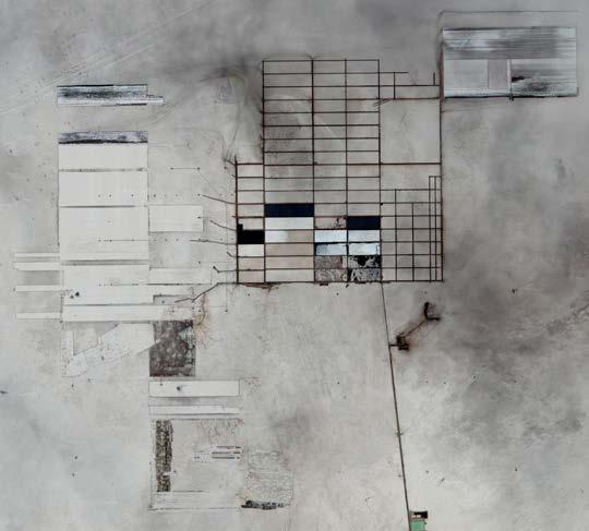
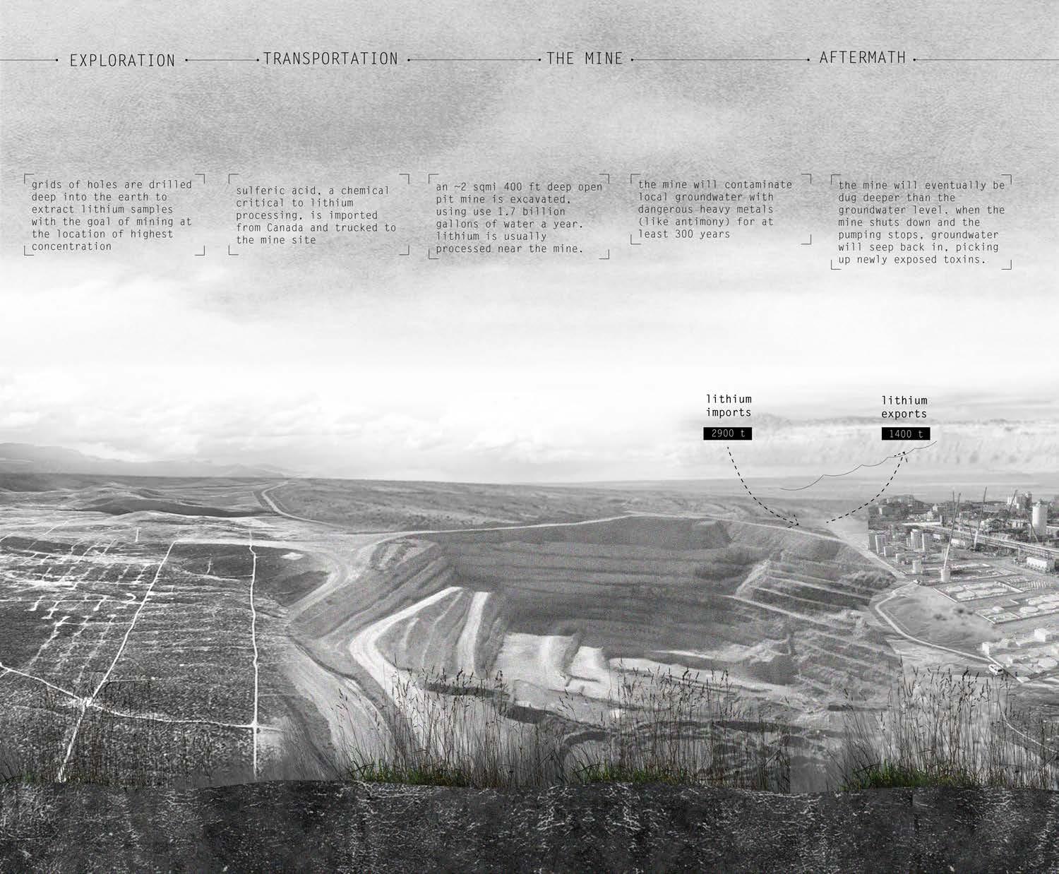
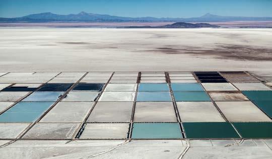
Lithium can be extracted either through open pit mining or by evaporation from brine found underground. Brine-derived lithium is usually located in parallel with oil and gas drilling, where excess water is tested for possible lithium concentration. This salty water is then pumped to the surface, through channels, and into large shallow pools. Ideally in hot and dry climates, water is evaporated from the brine with lithium leftover. Salt is a major byproduct of evaporation, as well as traces of magnesium. 500,000 gallons of water are needed to extract one ton of lithium, worrying cattle ranchers whose cattle depend on grasslands for survival.
35
IV An Electrified Landscape
36 Lithium
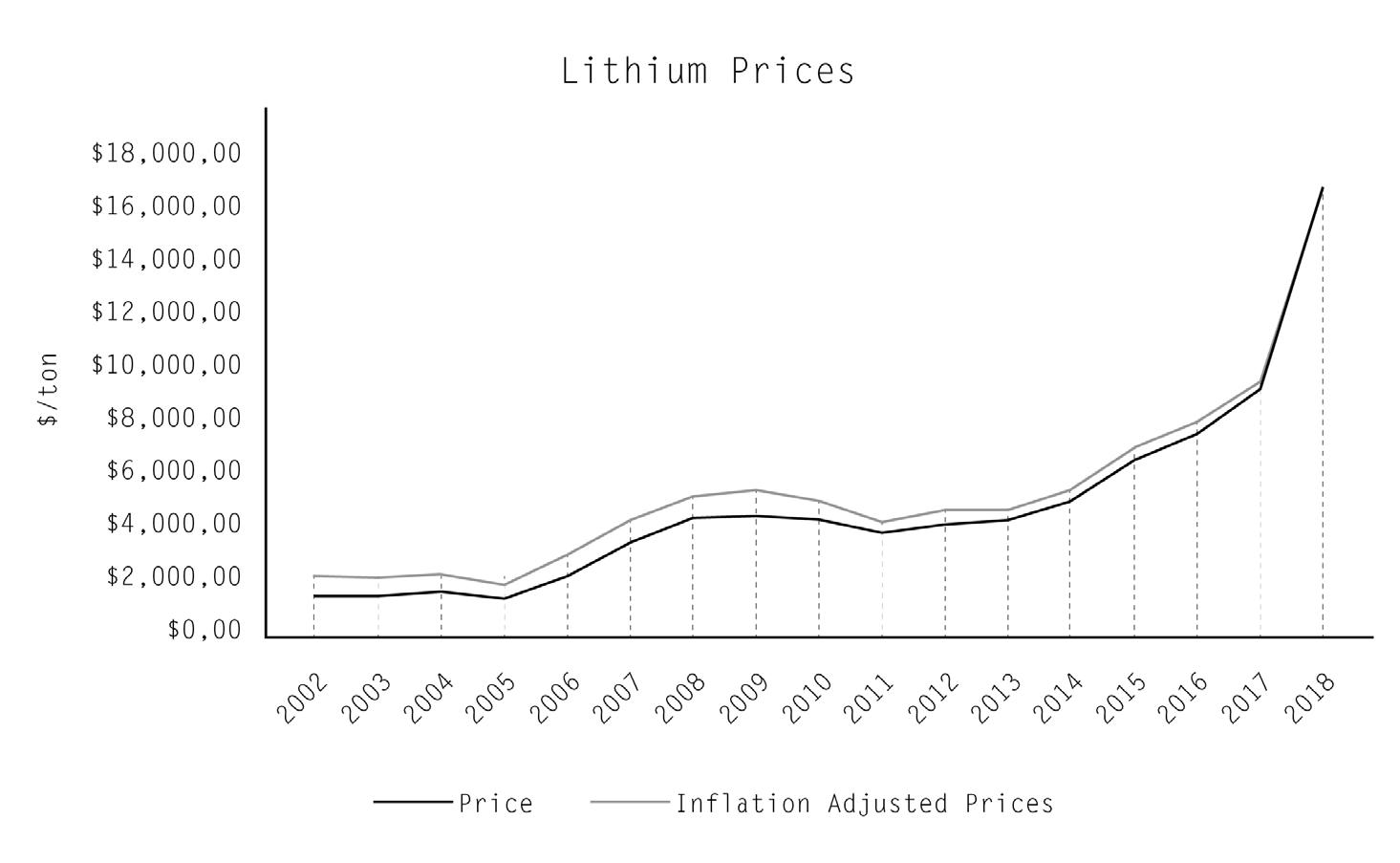
price data from: (Ewing and Boudette 2022)
MOTORS IS ON ITS WAY TO AN ALL-ELECTRIC FUTURE.”
-Mary
LITHIUM PRICES RISING EXPONENTIALLY SINCE RISE IN EV POPULARITY
Lithium prices are rising in conjunction with the growing renewable energy industry and electric vehicle industry. The US currently imports more than 80% of its lithium supply from Argentina, Bolivia, and Australia.
37
IV An Electrified Landscape
“GENERAL
Barra Chair and CEO of GM
treehugger.com
gillettenewsrecord.com
38
mining.com
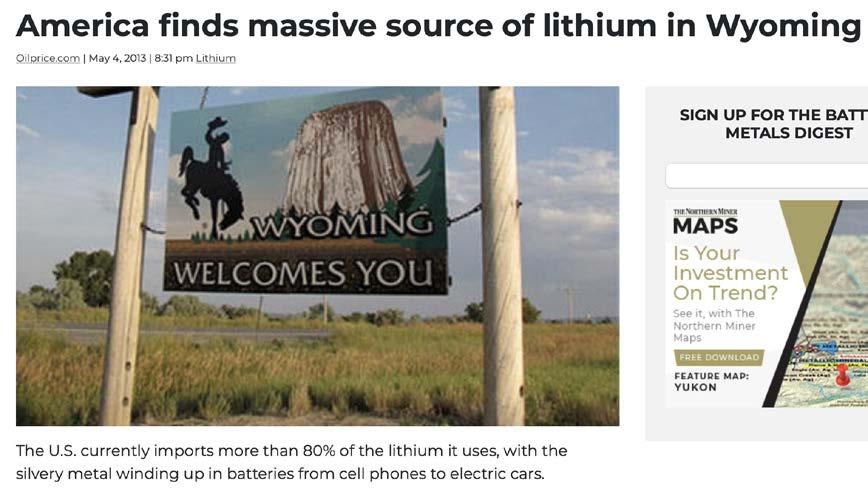
LITHIUM DEPOSITS DISCOVERED IN WYOMING VIA OIL AND GAS WELL WASTEWATER TESTING
Lithium deposits have been located about 25 miles north of Superior. While not economic now, with the cost of lithium increasing exponentially, construction might ensue within the next 15 years. Superior will see a large influx of migrant workers like it has in the past as a support city for new Rock Springs mine and power plant construction.
National Water Information System (NWIS) water samples with lithium concentration data (NWIS, 2015)
39
IV An Electrified Landscape
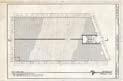
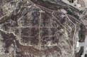
40 +0 ft .25 mi
Map by Gracie Meek. Data from the United States Geological Survey, the Wyoming Landscape Conservation Initiative, the Wyoming State Geological Survey, and OpenStreetMaps
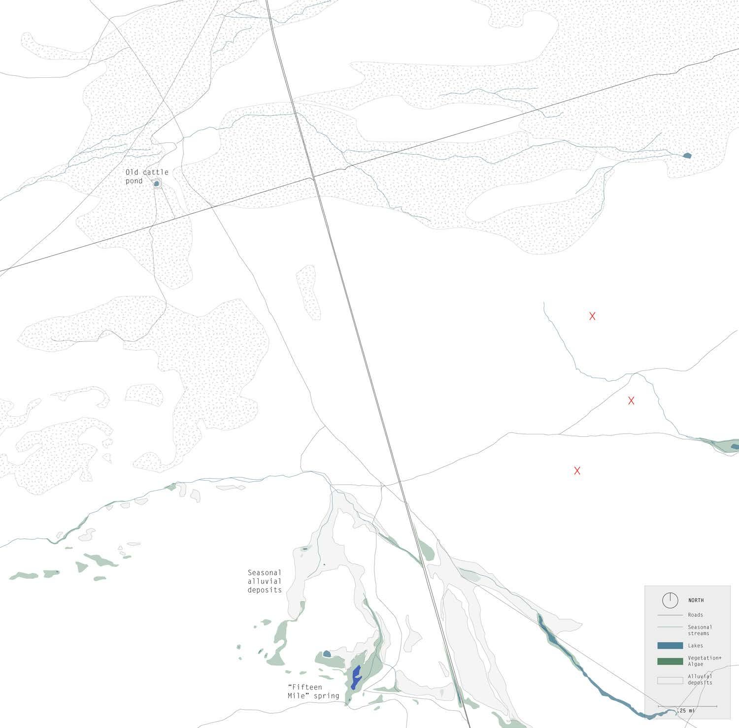
SITE OF FUTURE LITHIUM MINE BEFORE CONSTRUCTION
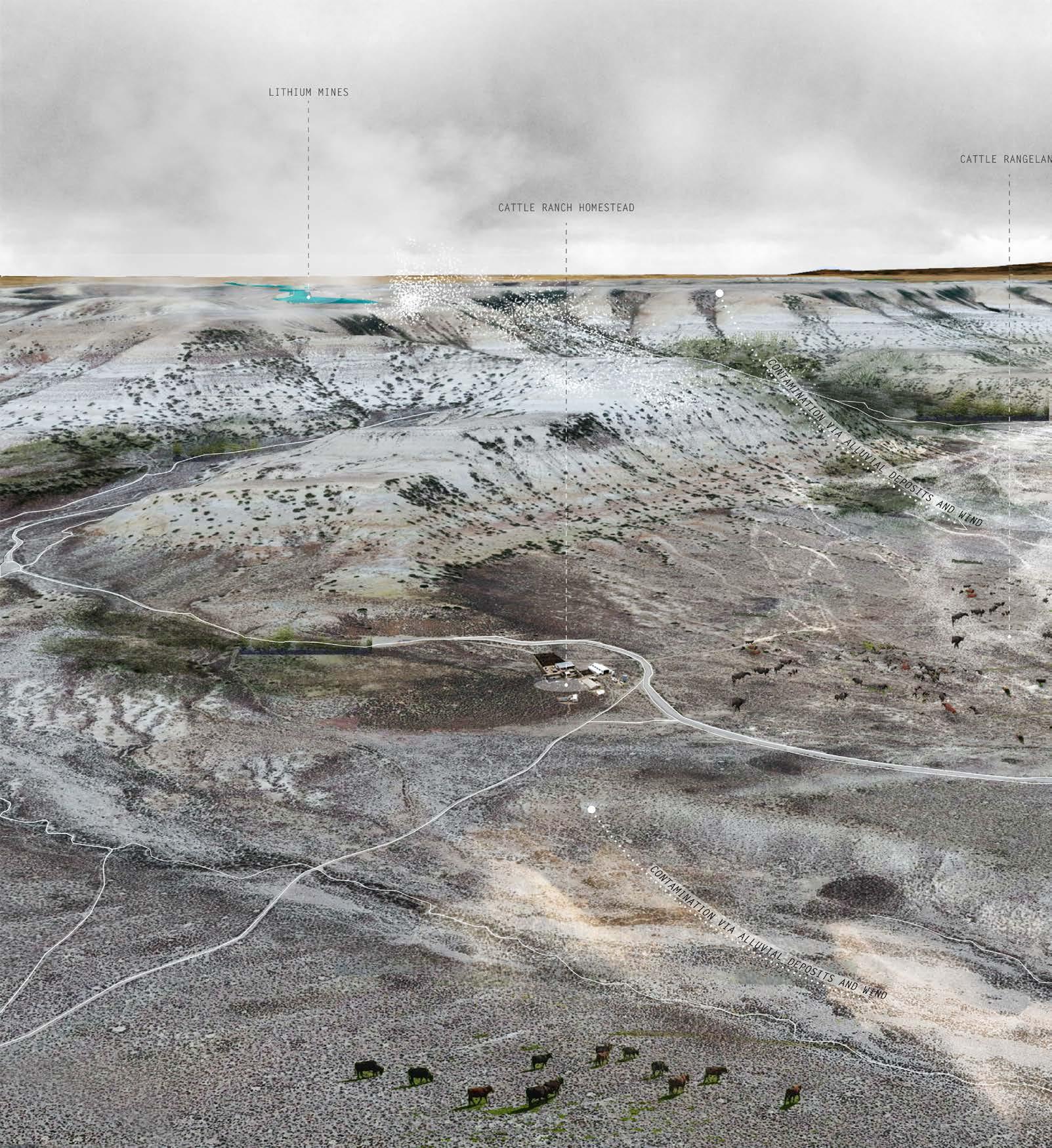
The mine will contaminate surrounding seasonal alluvial plains that flood during seasons of snowmelt. Wildlife like antelope, prairie dogs, and deer will be disturbed as their habitats dry due to the operation of the mine. The lithium deposits are located on BLM (Bureau of Land Management) Land, which was previously open range for cattle grazing.
41
IV An Electrified Landscape
42
PHASE II
43
-Leroy Winters, who manages Superior’s water supply
44 V
“You’re doing your thesis on Superior? That hasn’t gotta be easy.”
Historical information from: (Prevedel 2011)
SUPERIOR AND ROCK SPRINGS HISTORICAL ARCHIVE
A Living Ghost Town
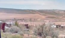
Superior and Rock Springs, located in southwestern Wyoming in an area rich with coal outcrops and natural gas deposits, offer a vivid example of how the livelihood of energy towns and the health of the environment rest on the extraction industry. These two towns have a personal story for me, as my grandparents, William and Francis Sines, grew up here working in the historic coal mines.
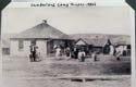
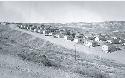
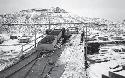
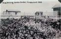
The town of Superior had its origins in the coal boom days around the turn of the century. The town grew to its largest population in the mid-1940s when, during World War II, hundreds of migrant workers came to the mines, living in homes fashioned from boxcars. Geography and geology intertwined to influence where people lived, worked, and the paths they traveled. Although none of these historic extractive towns were meant to endure, the coal beds proved difficult to exhaust. Superior and Rock Springs endured many more than the few years envisioned in 1866 when the Union Pacific Railroad began its coal operations.
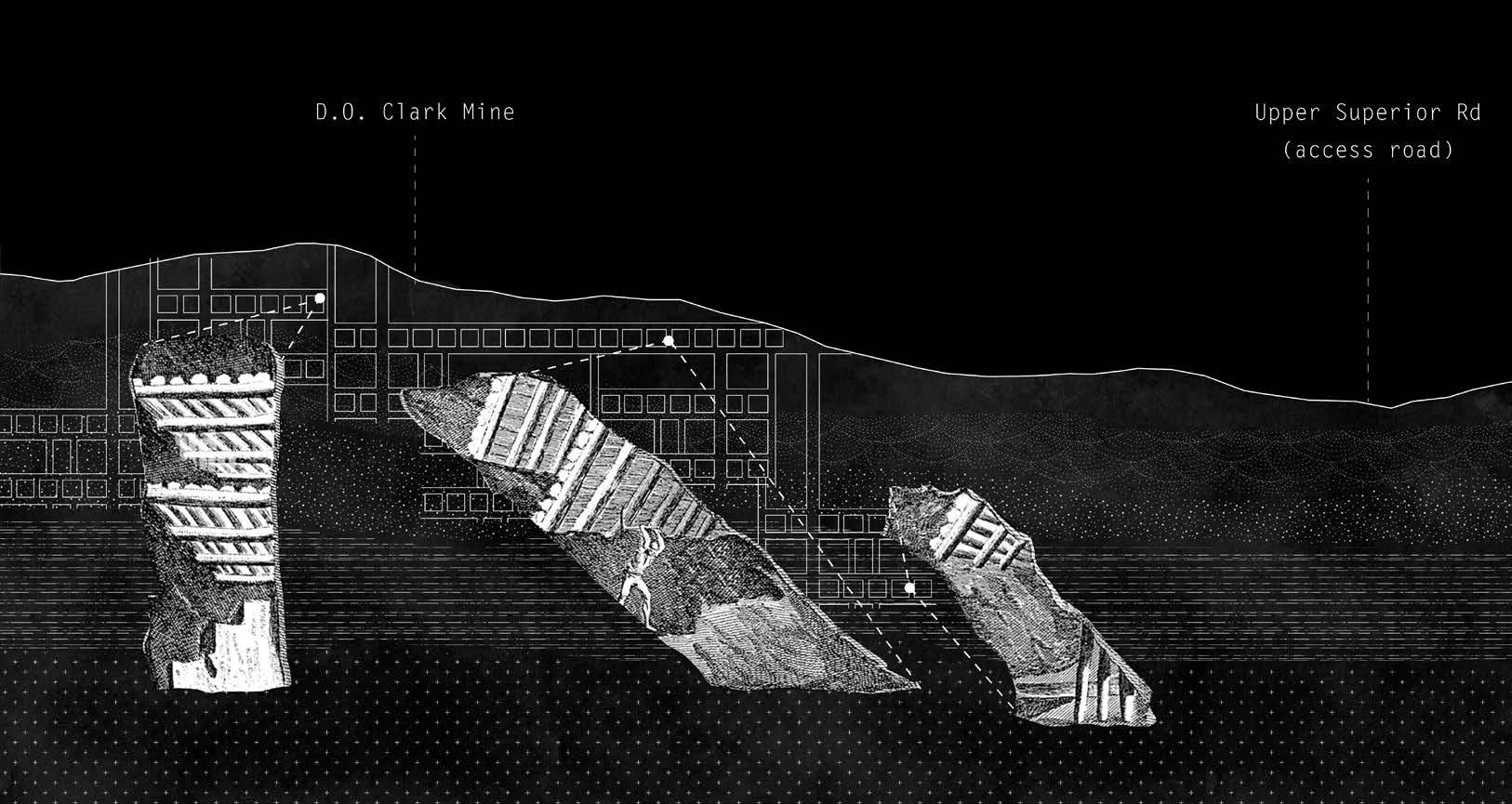
What remains today are mostly memories of a busy, bustling past. With the advent of diesel fuel, the UPRR began slowly converting from coal to oil to power its locomotives. The coal market declined and eventually ended. Mine closures began in the 1950s, with the D.O. Clark Mine the last to close in 1962. With the closure, Superior declined in population, and business establishments closed.
However, history was not finished with Superior yet. Pacific Power began building the Jim Bridger Power Plant in 1971 and Superior experienced a brief population spike. New people moved in, bringing new life to the “living ghost town.” Now, only time will tell if Superior will swing back to full prosperity for the town nestled in the hills and rocks of the high Wyoming desert. With a future lithium mine, the exhausted coal town has a possibility of resurrection.
45
V
Historical Archive
Superior and Rock Springs
46 Historical information
2011)
from: (Prevedel
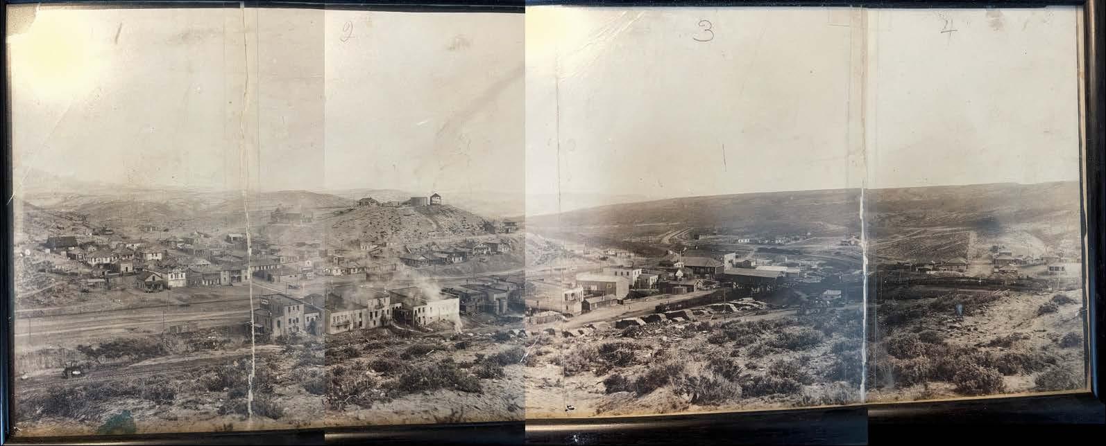
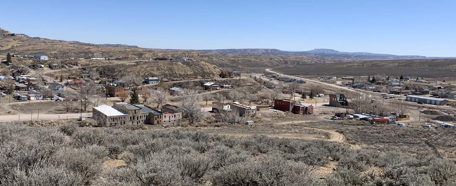
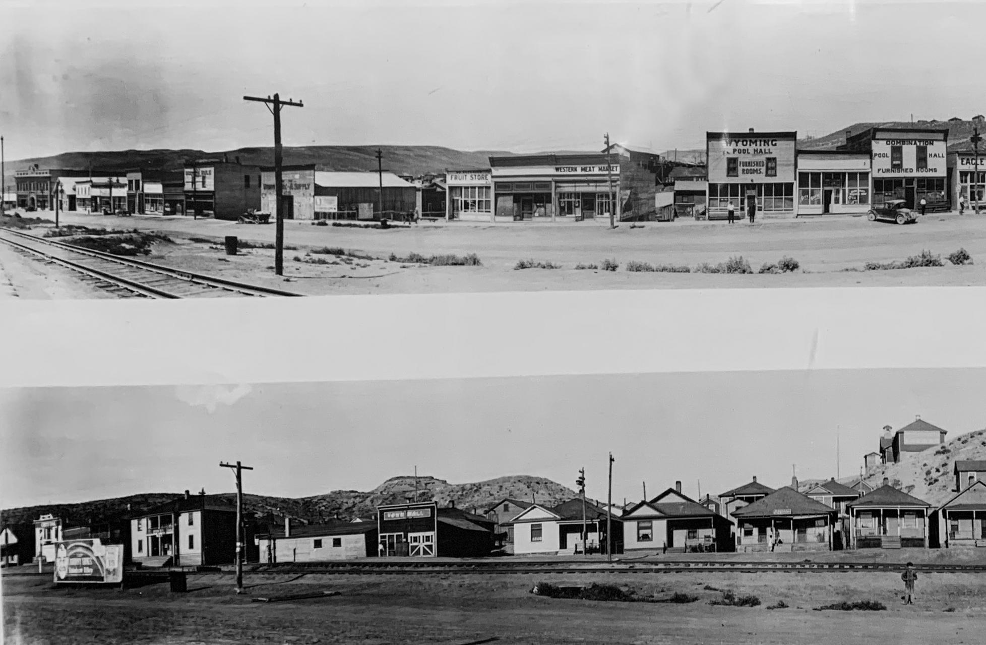
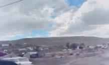
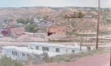
Superior in the 1930s-40s, photo from the Meek Family archives Superior in 2022, photo by author
View from “B” Hill towards downtown Superior 7 April 2022 2:24 p.m.
ORIGINS OF SUPERIOR
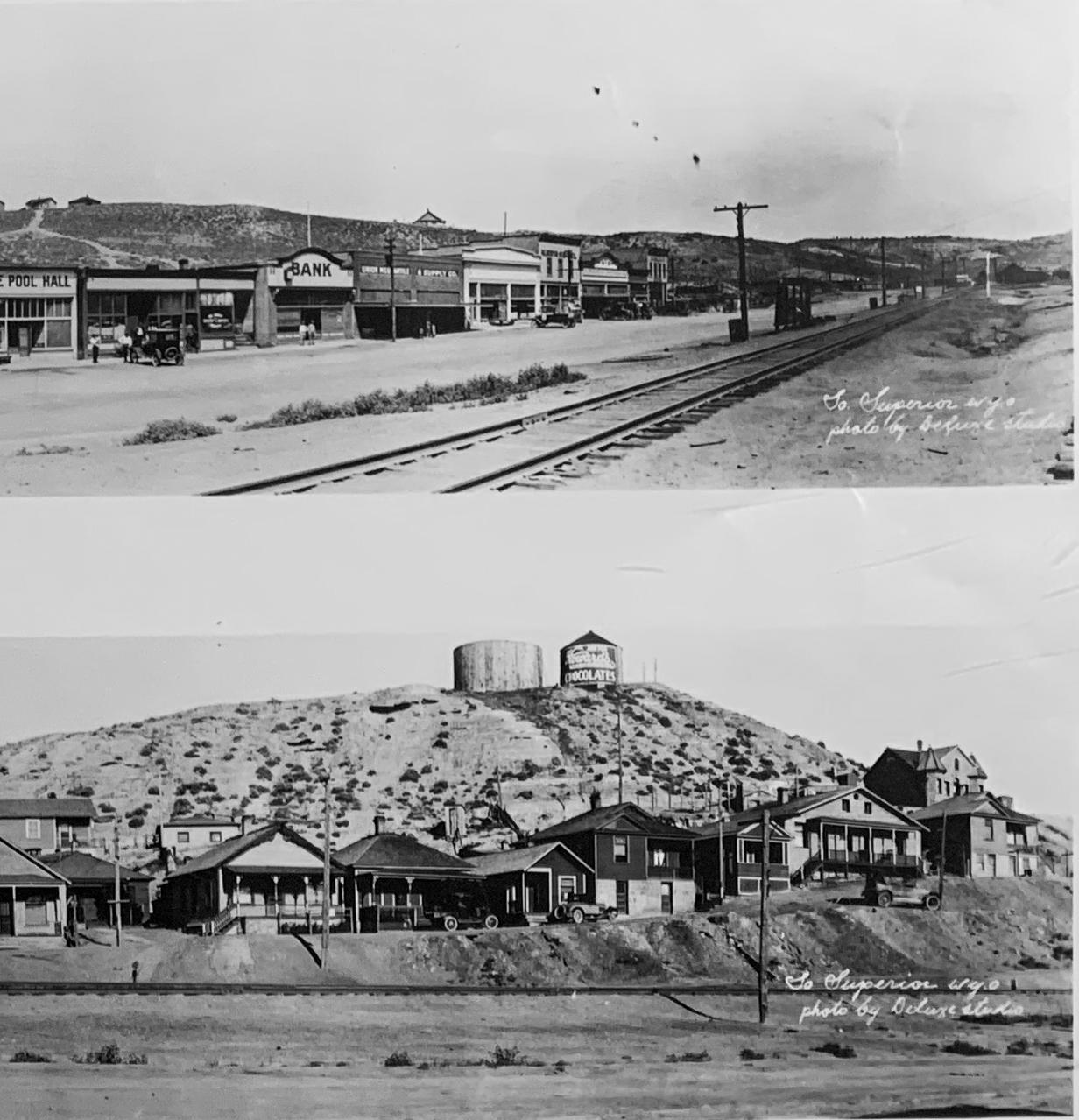
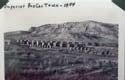
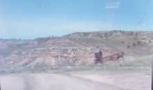
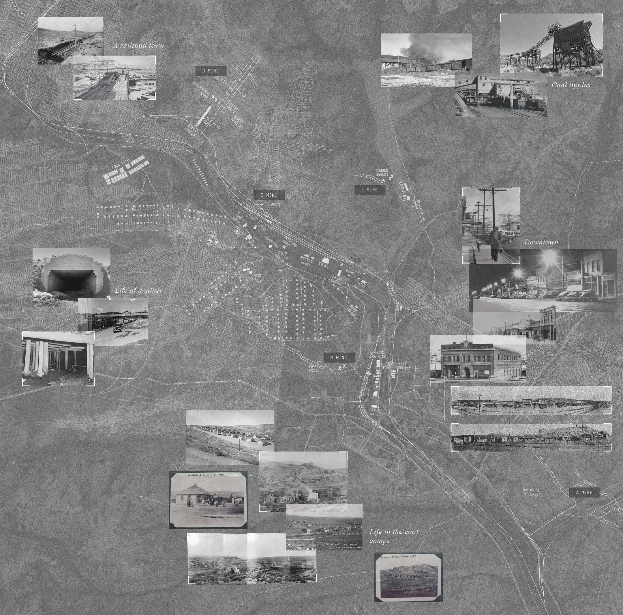
Located down the aptly named Horse Thief Canyon, an early day rendezvous point for stock-stealing outlaws, Superior proudly asserts its history as a coal boomtown. Coal was first located in Superior in 1900 when a prospecting team led by Morgan Griffiths entered the Canyon and established the site for the first of Superior’s many coal mines. The Superior mines produced nearly 24,000,000 tons of coal annually in their prime, second only to Rock Springs. There were eight mines in the area, all but two owned and operated by the Union Pacific Coal Company to supply their locomotives. The Premier and Copenhagen Mines were independent.
47 V Superior and Rock Springs Historical Archive
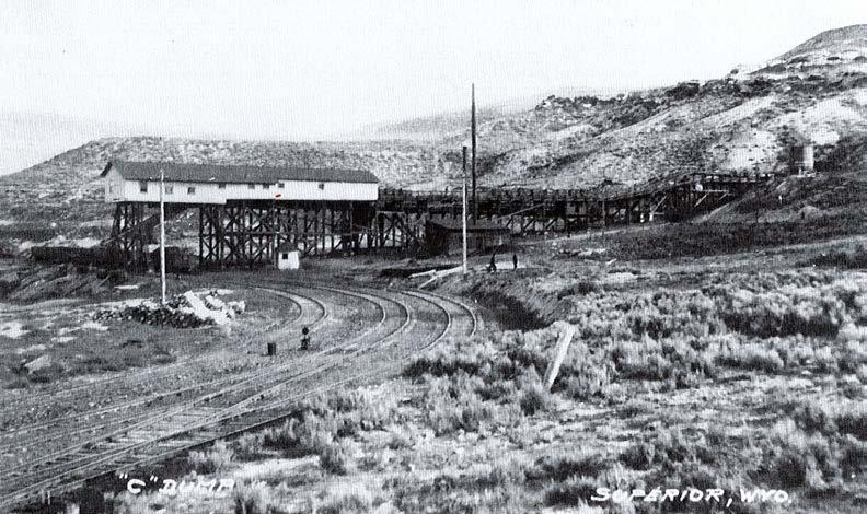
“C” Mine in the early 1900s, photo from Superior Historical Museum
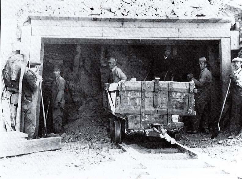
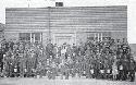
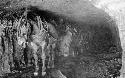
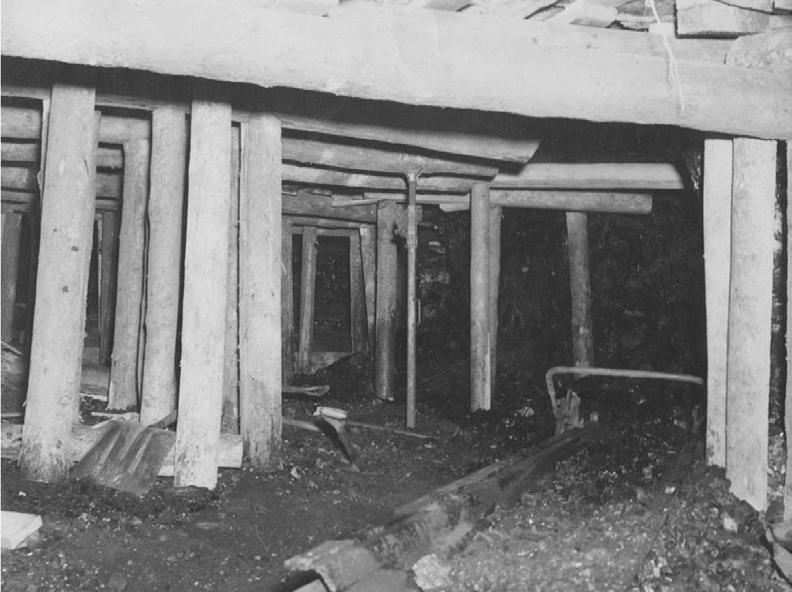
Miners in D.O. Clark Mine, where my Grandfather worked, photo from Frank Prevedel and the Sweetwater County Historical Museum
48
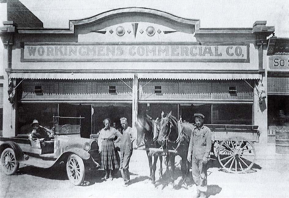
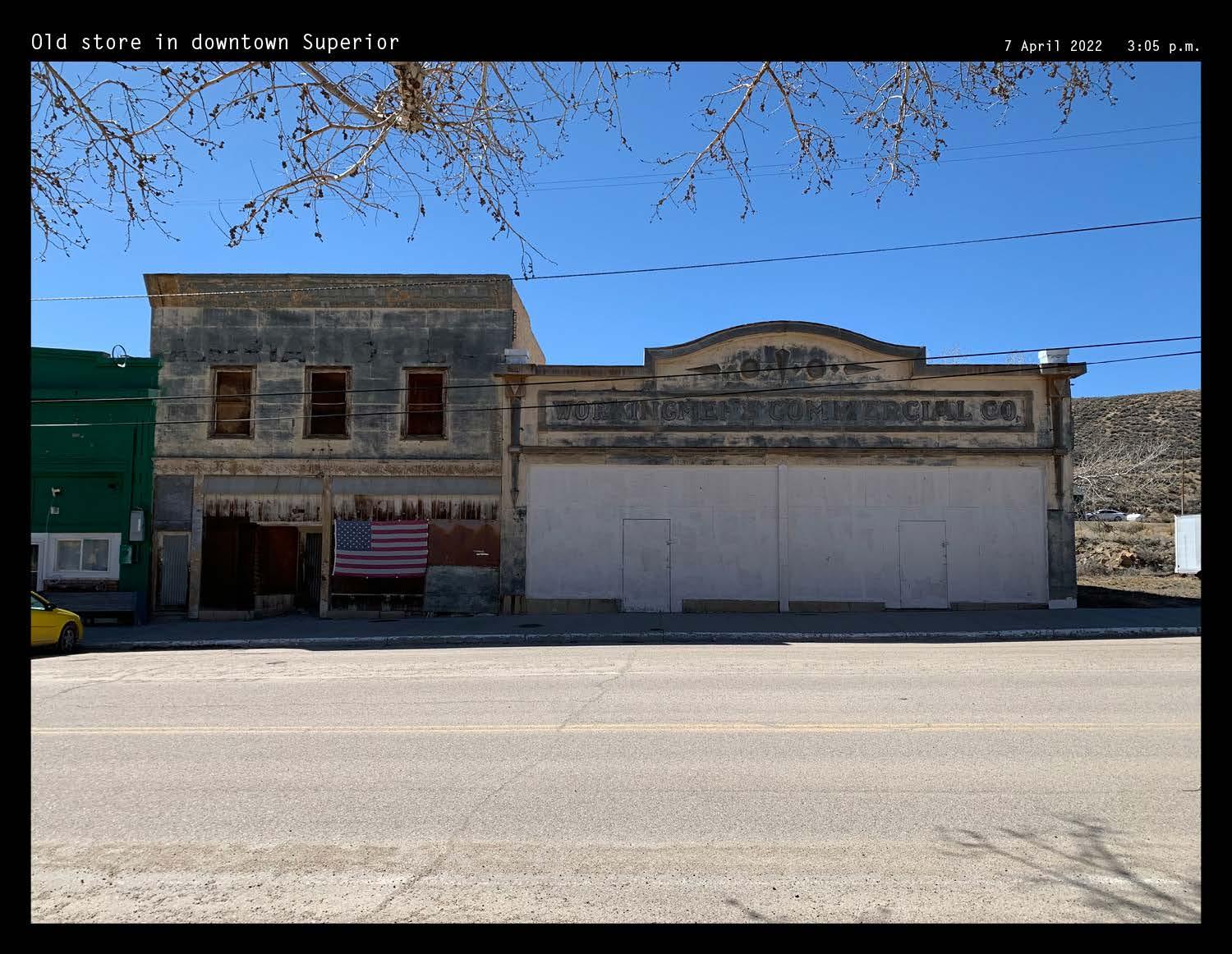
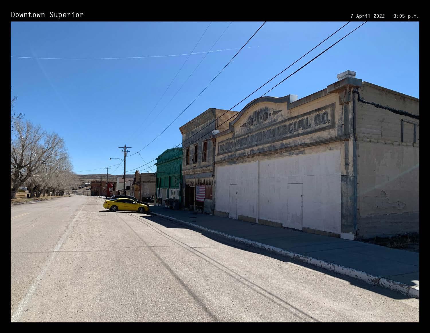
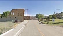
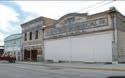
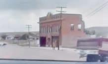
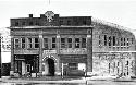
Workingmens Commercial Co. in 2022, photo by author
Historical information from: (Prevedel 2011)
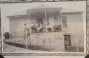
Workingmens Commercial Co. from the 1920s-30s, photo from Frank Prevedel and the Sweetwater County Historical Museum
SENSE OF COMMUNITY AND LIVELIHOOD CENTERED AROUND THE EXTRACTION INDUSTRY
Background research provoked the question: what is a town’s role in energy transitions, and what effects do these larger-scale actors have on the people whose livelihoods and sense of community depend on the extraction industry?
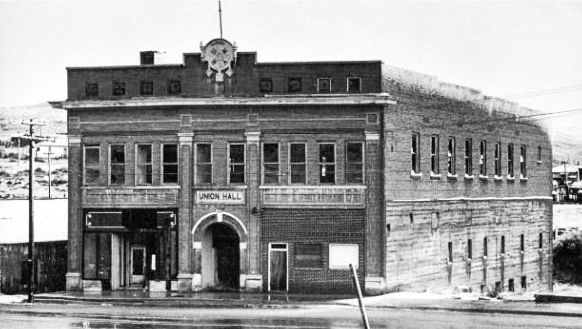
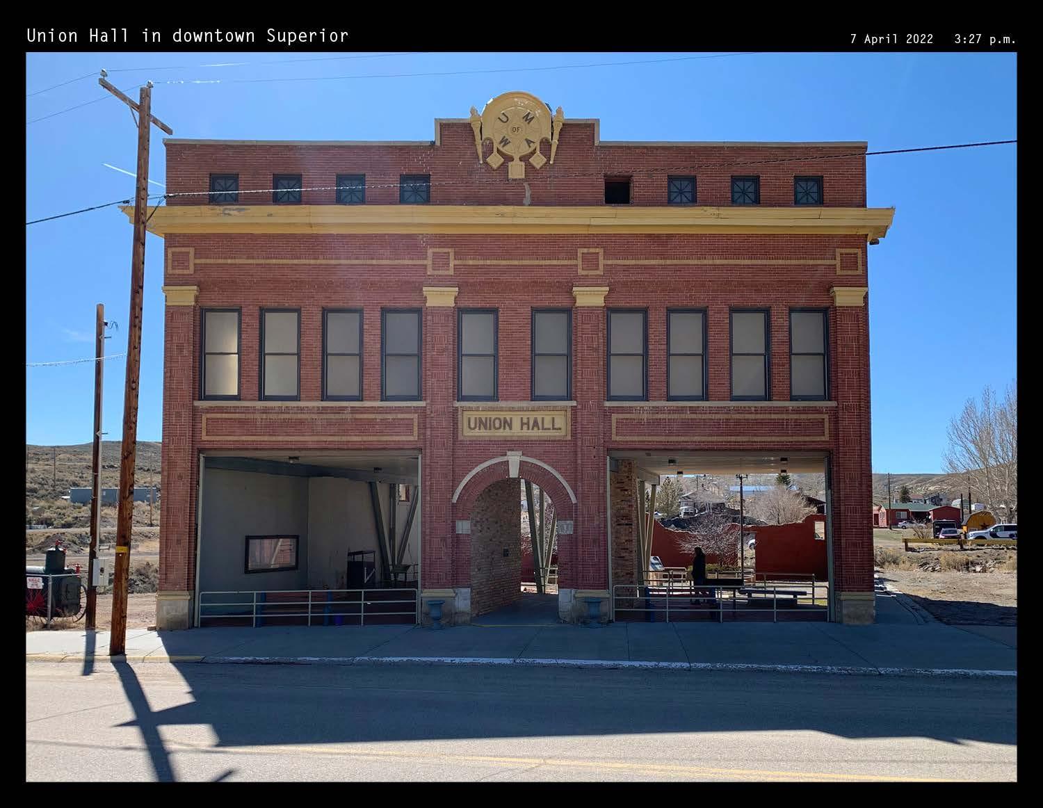
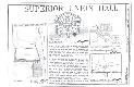
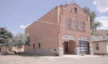
Union Hall in Superior, for example, was funded and operated by the United Mine Workers. Accommodating union and community activities, the hall at one time hosted a bowling alley, a grocery store, and doctor’s and dentist’s offices. My grandparents attended dances on the upper floor. Union Hall has since been restored and now stands as a park to inform visitors about the town’s history, and as a monument to workers in the Superior mines.
49 V Superior and Rock Springs Historical Archive
Union Hall in 2022, photo by author
Union Hall from the 1920s-30s, photo from Frank Prevedel and the Sweetwater County Historical Museum
50
Downtown Superior, photo from the Superior Historical Museum
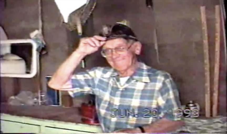
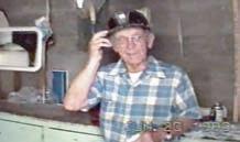
My great-grandpa, Frank Novak, wearing his coal miner’s hat. Taken from a family home video from June 20, 1993.
LIFE IN THE MINES: A FAMILY STORY
Coal mining was grueling labor. My grandmother, Francis Sines, recounted her father’s life in the mines:
“He [Frank Novak] worked for most of the time in D.O. Clark until it shut down, then they moved their house to Rock Springs and he went to work at the mine in Quealy which was a few miles from Rock Springs. The mine there wasn’t in good condition to work in. Some of the tunnels were barely high enough for the little coal cars to fit. When he had to move the cars, he had to sit in the car and duck his head down so it wouldn’t hit the top of the coal tunnel. His brother, my Uncle Tony, worked there too but he worked outside. But one day, he was by the big coal chutes that dumped to coal into train cars and an empty one broke loose and came crashing down right behind him and cut his leg off by the knee. One foot further and it would have hit him right on the head. And who knows what that would have done.”
“Your great-great Grandpa Leosco was hurt in the mine too. A coal tunnel collapsed on him and broke his back, his legs, and several ribs. The other miners thought he was dead, so they hauled his body up in one of the coal carts. A doctor on-site rescued him and he lived, but he was a few inches shorter after the accident.”
51 V Superior and Rock Springs Historical Archive
52
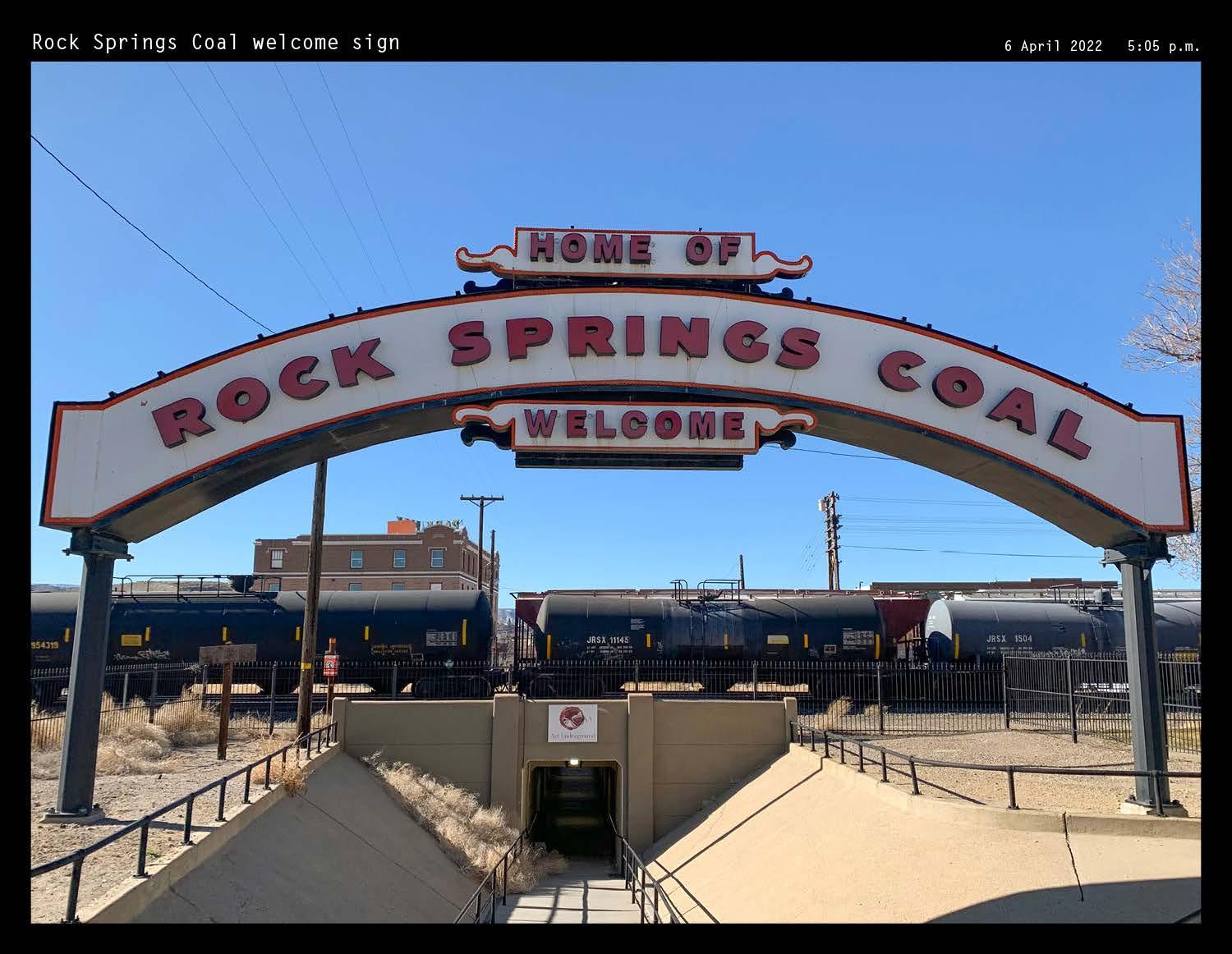
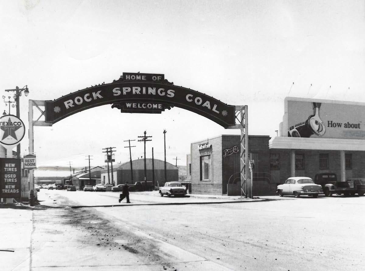
Rock Springs welcome sign in 2022, photo by author
Historical information from: (Prevedel 2011)
Rock Springs welcome sign in 1955, photo from The Sweetwater County Historical Museum
Both Rock Springs and Superior started out as fully reliant on the coal industry, and their economic dependency still strongly relies on extraction. A majority of workers in Rock Springs today work in fields related to the energy industry, whether it be at power plants, as oil field workers, or as trona and potash miners. The community already feels repercussions from the declining coal industry, and worries about what might happen when the Jim Bridger Power Plant closes in the future when energy becomes renewably generated.
The Rock Springs Coal sign is an emblem of the community connected by the coal industry.
53
SISTER TOWNS: SUPERIOR AND ROCK SPRINGS
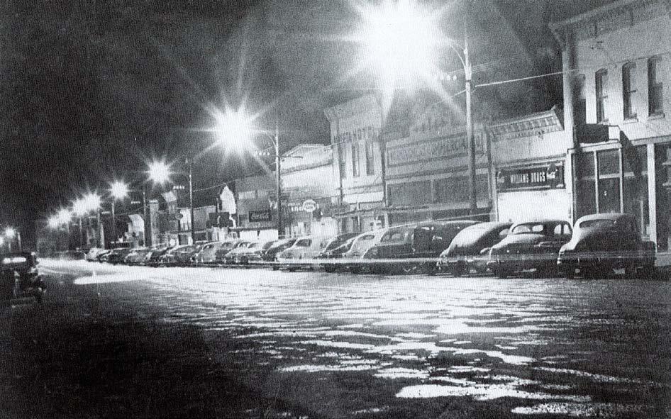
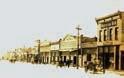
Downtown Superior in 2022, photo by author
Downtown Superior in the late 1940s, photo from the Superior Historical Museum
Historic and population data from: (Prevedel 2011) and (Shanks and Tanner 2008)
54
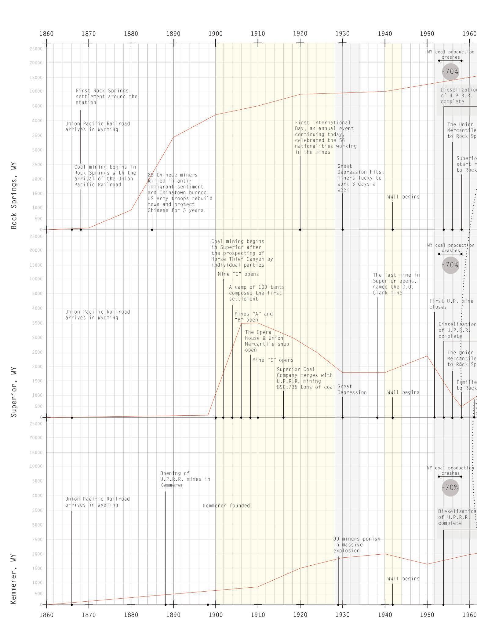
POPULATION FLUX IN SUPERIOR AND ROCK SPRINGS DUE TO ENERGY TRANSITIONS
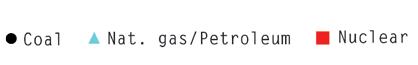
Rock Springs and Superior had different responses to external processes, boom and bust patterns, and fuel technological revolutions. After the dieselization of the railroad after WWII, Rock Springs embraced the new form of energy while Superior collapsed into a ghost town, relying solely on coal extraction. The red line shows the fluctuating population of Superior as it becomes a support city for Rock Springs’ new mining operations.
55 V Superior and Rock Springs Historical Archive
56 Demographic information from: (CityData.org 2020)
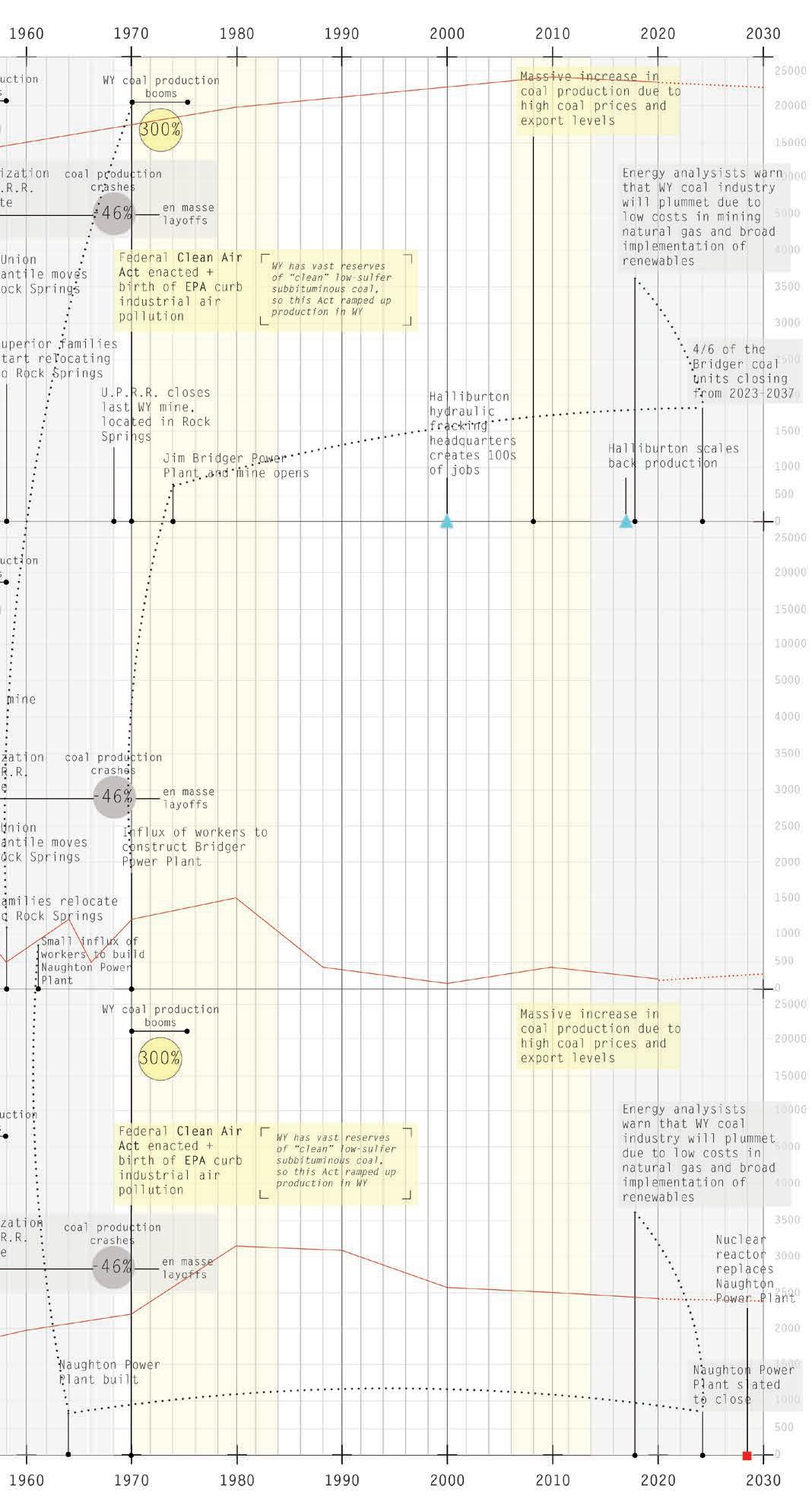
PRESENT DAY DEMOGRAPHIC INFORMATION FOR SUPERIOR
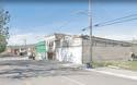
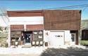
312 hearty souls live in Superior today, most commuting twenty minutes to Rock Springs for work. A majority of people work in the petroleum vehicle industry and in oil and natural gas extraction.
57 V Superior and Rock Springs Historical Archive
On
NATURE OF EXTRACTION INDUSTRY


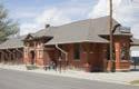
In early Superior, people traveled to and from Rock Springs with a horse and wagon, taking a full day. In 1903 a railroad from Superior to the main rail line was constructed to carry coal, frieght, and passengers. It took 2 days to get to Rock Springs.


58
Oregon
Pony Express,
I80 closely follows the route of the original Lincoln Highway, the first road across the US. It also traces the
Trail,
and the Transcontinental Railroad
sign bids
Interstate 80 a
one to visit a “living ghost town”. Should you follow its advice, after a 7 mile journey through Horse Thief Canyon you would come upon Superior Wyoming once a thriving community dependent upon its coal mines.
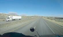
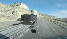
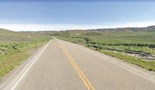
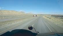
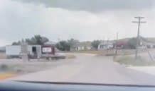
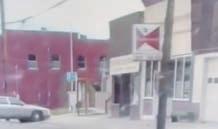
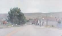
A very long train. Lots and lots of trucks. Very windy. The last sign I saw back there it said ‘Superior.’ 00:00; 0mi 1 Truck Driver Livestream I-80 Pre-bust 2022 06:52; 1mi 12:63; 3.5mi 14:41; 5mi Trains along the Union Pacific Railroad, which flanks I-10, usually carry coal down to Texas. The original Rock Springs train depot was built in 1868, right after the railroad itself. It was the entryway for thousands of immigrants as they sought work in the coal mines or a new life. Car on display in Superior behind a WWII monument Nowadays, I-80 is mostly used by transcontinental truckers carrying goods and by tourists crossing the Rocky Mountains. 00:00; 0mi 1 Tourists ENTRY TO SUPERIOR Pre-bust 2022 Displayed relics of the past greet a visitor upon entry 06:27; 2.6mi 08:03; 4.7mi 09:25; Transcontinental Railroad I-80 Frontage road Bitter Creek Road 371 I-80 Horse Thief Canyon THE GREAT DEPRESSION With the Depression came a reduction of both freight and passenger trains on the U.P.R.R.
RELIANCE ON COAL TO POWER TRAINS
Passenger and freight trains relied completely on coal-fired engines. This highly increased demand for coal especially during WWII.
prices
lithium,
BOOM/BUST
With the rapid rising and falling of
on coal, oil/gas, or
town populations skyrocket or plummet within a matter of months. Superior fell in and out of its “Ghost Town” status as the US economy shifted on a large scale.
I-80 TRUCKING
Although Superior is only 7 miles away from a major trucking route, truckers take pit stops at Rock Springs since it’s easier to access and there are more amenities. Occasional tourists, drawn in by signs, visit to see a “Ghost Town.”
FOOD INSECURITY
CINEMATIC FORENSICS: DISSECTING
FAMILY HOME VIDEOS
Dissected and transcribed family home videos piece together memories of a once-booming energy boom town. Tying together larger-scale political and economic events, like the Great Depression and World War II, with present day plans of Superior reveals how patterns of livelihood and reactions of the community relate to personal memories of an era long past.

59 “Alberta Hotel” Pre-bust “Here’s good ole’ downtown Superior” Currently the Horse Thief Saloon 00:00; 0ft 00:13; 341ft “Mom used to work at this store right here on the end when she was a girl” “And she worked for V over there, that butcher shop” Novak Family Video: 1993 “A good ole’ ghost town” “And then she went to Rock Springs and worked for the telephone company for a whole month, she didn’t like it, “Here’s a little store that used to be, it looks like someone’s working there” “Oh, there’s the bank” 1 2 3 4 “And there’s the Union Hall right there” “Grandma and Grandpa used to live “Oh yeah, 00:13; 341ft “The senior center” 00:31; 652ft 00:47; 1025ft 00:47; 1025ft 00:58; 1231ft 2022 “Working Mens Commercial Co.” Grandma would be sent down by her family to get a bucket of beer for parties. Superior maintains over five acres of parks, two modern public restroom facilities, baseball diamond, basketball court, children’s play grounds, lighted tennis court, picnic tables and shade trees. “Here, preserved, lie epoch tales of the town’s origin, rising through the heydays and the hard mining life awaiting numerous immigrants and pioneers.” DOWNTOWN Union Hall finished construction in 1922, paid by the Union Mine Workers of Superior. Miners of Superior paid $2 a month to cover the cost and maintenance of the building. Every Saturday the Union held meetings in the mornings and dances in the evenings. Over its lifetime it contained a grocery store, saloon, doctor’s and dentist’s offices, a bowling alley, dance hall, and offices. The Union Pacific Coal Company wanted the miners to enjoy life and have a community spirit while working for them. Numerous saloons and dance halls added to the recreational facilities of the town in the 20s and 30s. The Workingman’s Store was established in 1910. It was a department store and carried dry goods as well as meat and groceries. During the coal boom There was a garage and filling station, Golden Rule Novelty Store, Laundry, Western Meat Market, Shoe Repair Shop, Bakery Shop, Bank, Dentist office, Alberta Hotel, Drug Store, Duzik Grocery Store, Beauty Shop, Jackson Café and Rooming House, Gratton Café, Harshbarger Barber Shop, John Bettra Barber shop, Pruja Pool Hall and Saloon, Palace Bar, Eagle Pool Hall, White City Bar, Combination Bar and Pool Hall, Houses of Prostitution or “Cat Houses”, the Union Hall and the Finn Hall. The railroad tracks ran through the main part of the town and on the other side of the tracks was the Crystal Theater, Angeli’s Garage, Town Hall and Fire Station. The town built a 50’x90’ swimming pool, financed and built by the community. The water came from the mine and was chlorinated and changed weekly. A large lawn was sown with grass and clover and 50 trees planted for families to enjoy. New community park where the swimming pool was The same view today; many buildings were destroyed in a fire in 1913 A sign reads: “Coal: It keeps the lights on” 09:25; 7mi Superior, appox. 1913 The Episcopal, Mormon, and Catholic Churches held services in the building. Administrative Building (includes the Mayor’s office, Senior Center, Community Room, Fitness Center, and Library Union Hall Post Office Horse Thief Saloon Town Hall & Fire Station Proposed site Public Building (will be an emergency shelter for and outlying commercial kitchen, public showers, restrooms, weddings & funerals, $500,000 business council grant
Superior was deserted as people left to Rock Springs to find new work in Rock Springs. Many downtown Superior businesses went bankrupt, never to recover. POST-WWII
groceries
shops
food
V Superior and Rock Springs Historical Archive
Even in its heyday, Superior residents traveled to Rock Springs for
since the
in Superior were expensive. Now, there is no
availability in Superior.
WATER SCARCITY
THE GREAT DEPRESSION
Later, the railroad company hauled water from Point of Rocks in tank cars. People waited in long lines to fill their 5 gallon buckets from the pump.

BOOM/BUST NATURE OF EXTRACTION INDUSTRY

DURING WWII
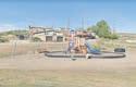
60 whole month, she didn’t like it, the buzzing in her ears” there” “Grandma and Grandpa used to live on the hill up there” “Oh yeah, this must be Dogtown” 00:58; 1231ft 01:04; 1413ft Superior maintains over five acres of parks, two modern public restroom facilities, baseball diamond, basketball court, children’s playgrounds, lighted tennis court, picnic tables and shade trees. Coal life community working facilities 20s The town built a 50’x90’ swimming pool, financed and built by the community. The water came from the mine and was chlorinated and changed weekly. A large lawn was sown with grass and clover and 50 trees planted for families to enjoy.
In the early days, dirty, inky water was hauled in from the mines and stored in tanks. Each family had several barrels of water storage. Barrels of water were 25 cents each from the department store. The water was then hauled throughout the community by wagon, which held twenty and fifty gallon containers.
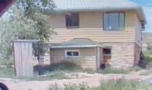
Before 1949, the only public telephone was at the DeGuio Shoe Repair Shop. Due to population influx during Company new residents railroad placed and two larger 01:55; 436ft The town hall and fire station was built in the 30s.The first fire truck Superior had was a cart driven by men and later by horses. The Town Hall now includes a history museum and community gym community park where swimming pool was Pre-bust “This is my parents’ house over here. The garage is gone.” 00:00; 0ft “Oh, that’s their house? It’s still standing. There’s the owner there.” “That white house back there?” Novak Family Video: 1993 1 2 3 4 2022 NEIGHBORHOODS 01:20; 0ft “No, that was just a bachelor pad.” “We lived in that basement for 16 years, it had a big 12’x16’ “In ‘50 we bought that house and moved 01:56; 0ft “This is where we lived right we got married, and where appendix attack. My sister lying on the bed reading and I couldn’t catch my breath. to run out of that door to breath and I hollered.” “That electric meter, there, in for us so we could get power.” “Ah, that’s right. argued about electricity. pay half the electricity whole family, and Grandpa way.’” “Your dad used to live up there on B-hill. “Francis went to school on that Camp houses, 1930s Camp houses, 1920s Superior BoxCar town, 1944 Camp house neighborhood gone, only roads remain Location of old highschool 02:21; 0ft Playgrounds and basketball hoops near town entrance Town Hall & Fire Station Proposed site of new Public Building (will be an emergency shelter for Superior and outlying areas, commercial kitchen, public showers, restrooms, hold weddings & funerals, $500,000 business council grant Grandmother’s
As a result Superior declined from a population of 1,580 in 1920 to a population of only 241 in 1930, leaving vacant properties.
In the coal booms of the 20s the U.P.R.R. Company built several hundred houses, constructing neighborhoods during the influx of new workers. All that are left of the neighborhoods are the roads, and the house foundations have been leveled. As coal miners in Superior joined the armed forces, there was high availability for new mining jobs. Families moved from all over the US to be housed in boxcar camps.
Superior obtains its water from 3 wells, and as of 2020 the water is safe to drink. Dirty, inky water has been sourced from the mines and water still travels through iron pipes. Wyoming has a very arid climate and water must be used thoughtfully.
DEPRESSION
OTHER STATES’ ENERGY DEMANDS
My Sweetheart’s The Mule in the Mine (Traditional)
My sweetheart’s the mule in the mine Down below, where the sun never shine And all day I just sit And I chew and I spit All over my sweetheart’s behin’.
My sweetheart’s the mule in the mine I drive her without an-y line On the bumper I sit, And I chew and I spit All over my sweetheart’s behin’.
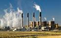
BRIDGER POWER PLANT CONSTRUCTION
RELIANCE ON COAL TO
ENVIRONMENTAL REGULATIONS
61
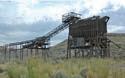
Miners from “D” Mine, 1943 Unidentified UPRR mine to an increase in population during the influx of new workers during WWII, the Company made homes for residents using railroad box cars, placed on foundations two combined for larger homes. 12’x16’ kitchen and a big bedroom. We added that porch, Francis’s little bedroom.” moved up there.” right after I had my sister and I were comic books breath. I had to catch my there, was put our own right. We always I had to bill for the said ‘no “Grandpa used to work in C-mine over there. He used to walk from A camp all the way across the hill up to go to work.” B-hill. There aren’t any houses up there anymore.” that hill, but it’s gone right now.” “This used to be all empty. What a mess it is.” Leosco family house Leosco prize-winning Victory Garden Houses and trailer homes on the hill 00:00; 0mi 1 THE MINES Pre-bust 2022 02:45; 0ft 04:05; 0ft 04:23; 0ft Marskey Park with baseball diamond and historic tipple in the background Nearby church 2 “It’s a miner’s cap.” “Wacha have on your head there?” “What’d ya wear it for?” “In the mine.” “Ya had to wear it everyday?” “Sure, it kept me from bustin’ my head.” 3 Novak Family Video: 1993 The aftermath of a coal mine With the dieselization of the U.P.R.R after WWII, all mines but one were closed. People left the town for Rock Springs and businesses were deserted. It soon began to resemble a “Ghost Town.” Jim Bridger Power Plant, now being shut down The town enjoyed a short revival in the ‘70s during the construction of the Bridger Power Plant and Mine. Several mobile home parks were built to house the workers, and many lived in tents next to the site. When construction finished in ‘75, Superior once again became a “Ghost Town.” The D.O. Clark Mine trams, the only mine in production after the WWII bust The old tipple in Superior still stands as a testament to the town’s coal mining history.
Workers still commute from Superior to Rock Springs for work at the power plant and other jobs. 00:28; .25mi 03:26; 3mi 03:50; 3mi Annual mud bog festival every June, tickets $7 Great Great Grandmother’s house was here THE GREAT
Many mines in Sweetwater County closed due to the lower coal demand and the mines in Superior began to exhaust their reserves. The dieselization of trains and machinery after WWII led to the closure of all but one mine and a rapid decrease in the town’s population.
Old Miner’s Working Song:
POWER TRAINS
Due to the high cost of coal in the late 70s and demand for electricity, the coal-powered Bridger Power Plant construction led to a rapid influx of workers to Superior. The Pacific Northwests depends on workers from Superior for their energy. Likewise, Superior jobs depend on other states’ energy demands.
The Pacific Northwest is ending its reliance on coal and encouraging renewables, prompting Wyoming to keep up with this new demand. Coal power plants, like the Bridger plant, are now being shut down. NEW
V Superior and Rock Springs Historical Archive
62
NOTATIONAL MAPS OF MEMORIES OF SUPERIOR DRAWN BY MARILYN MEEK
Information on Superior was difficult to come by in the early days of research. My mother, Marilyn Meek, helped provide orientation to the town she frequented as a child, and most recently ten years ago, by creating notational maps to pinpoint my family’s roots and what has since disappeared.
63 V Superior and Rock Springs Historical Archive
Recreational and extractive landscapes intertwine in Wyoming’s Red Desert.
64
VI
CARTOGRAPHIC ANALYSIS OF PAST, PRESENT, AND FUTURE EXTRACTIVE PROCESSES
A Landscape of Extraction and Recreation
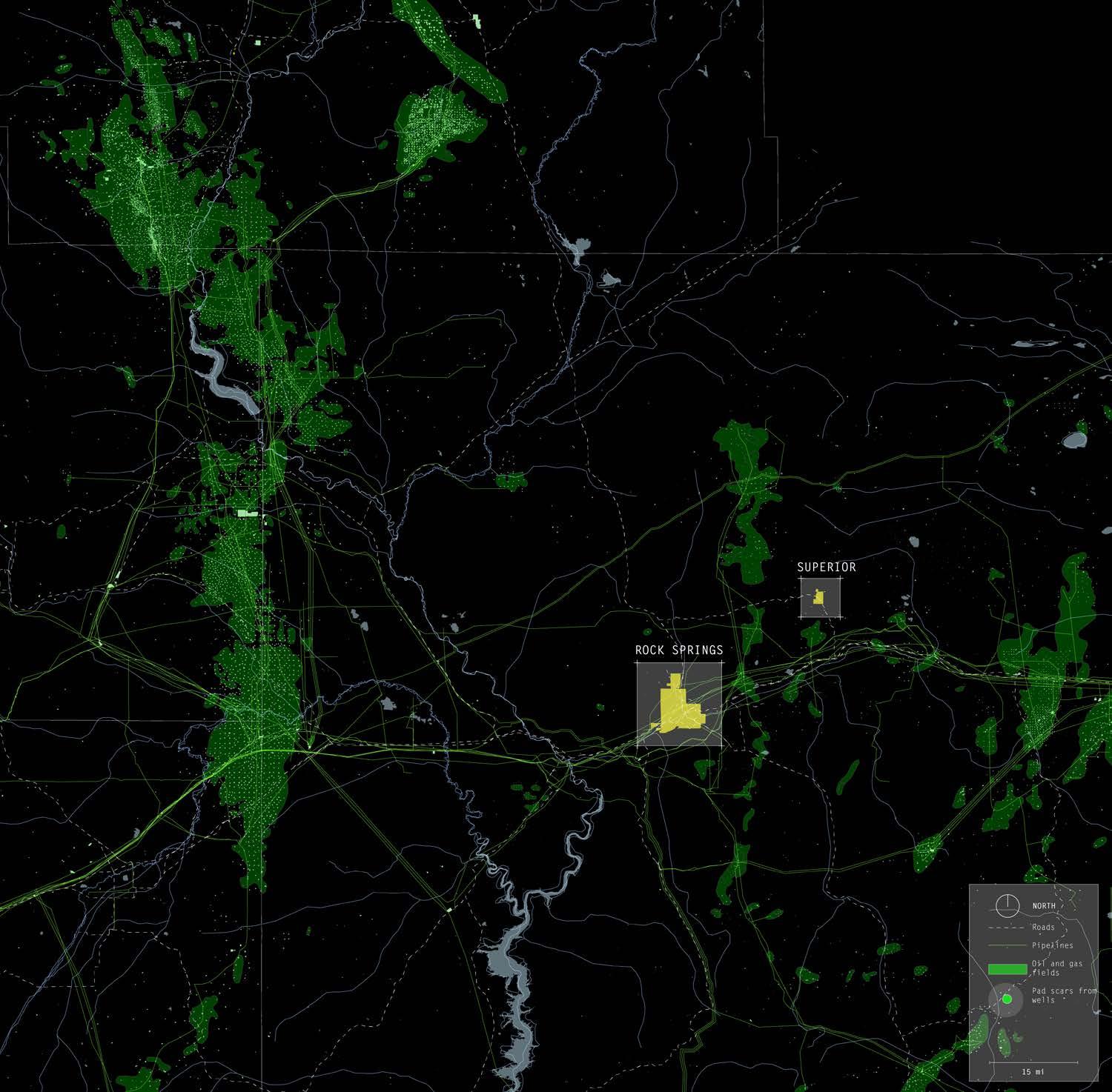
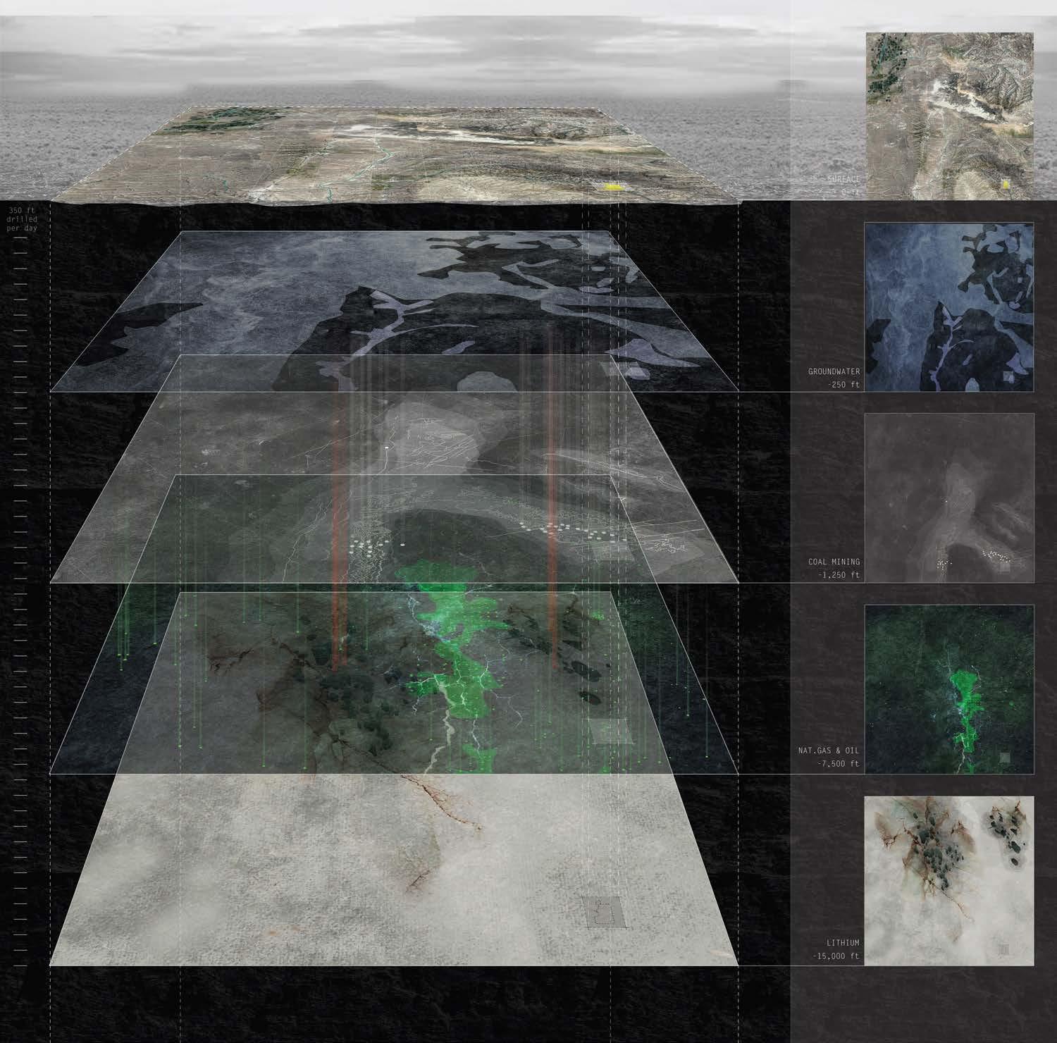
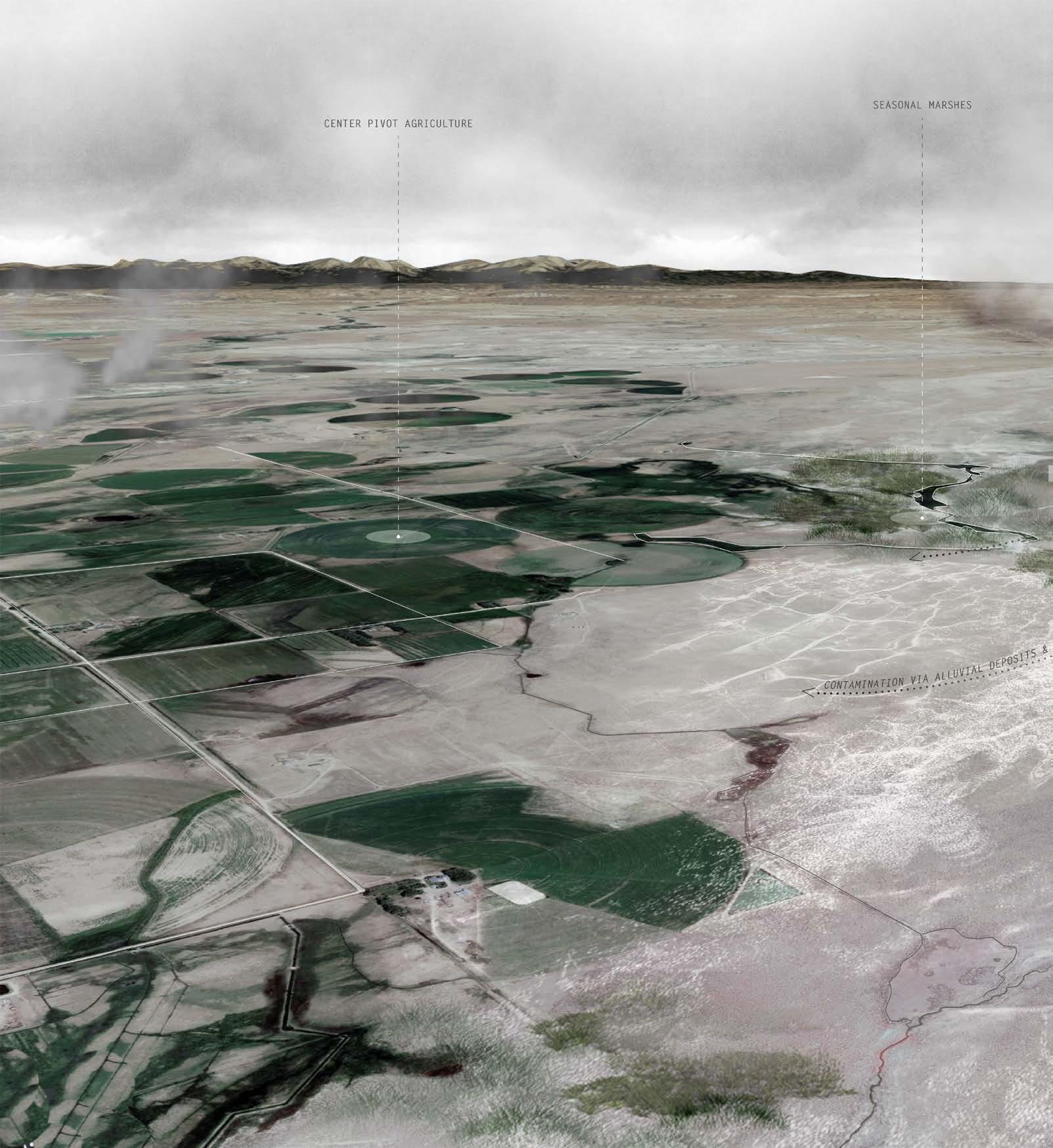
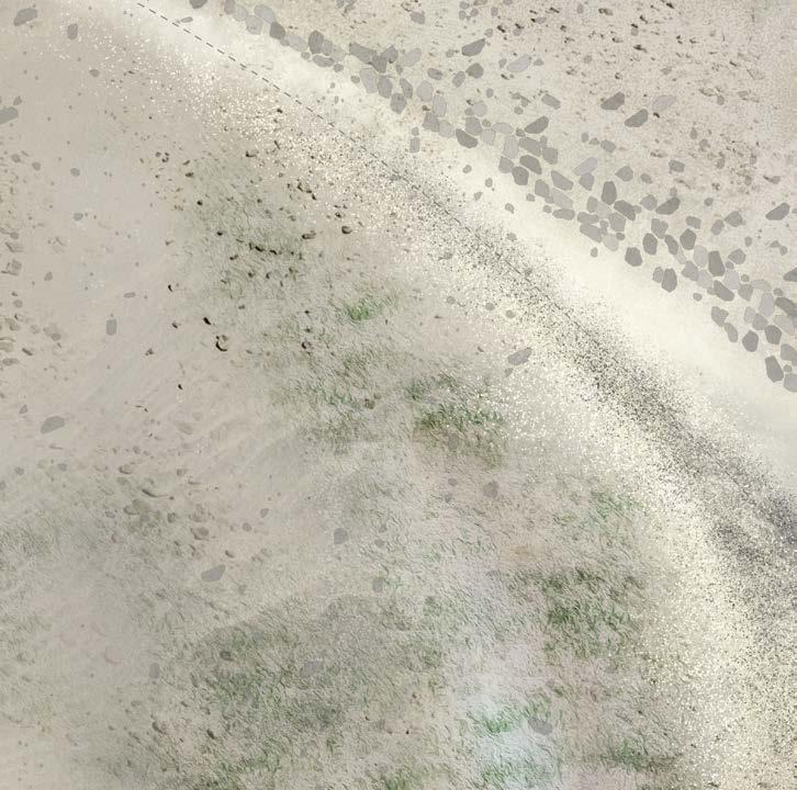
The act of mapping facilitated an understanding of Superior and Rock Springs’ territorial attributes at different scales and geological levels. Geology and geography intertwine to influence where people live, work, and the paths they travel. Only the oil field pad scars stippling the surface of the arid, barren Wyoming Red Desert give hint to the geologic richness and significance under the surface.
Human interest in this landscape ranges from the surface to -12,000 feet underground. Recreational locations, such as the White Mountain Petroglyphs, the vast field of the Killpecker Sand Dunes, and the dominant geologic monument of Boar’s Tusk attract both locals and out-of-staters to explore a landscape only typically used for extractive purposes.
Surficial exposed coal outcrops and coal deposits buried up to 8,000 feet underground first drew people to the Superior and Rock Springs territory. Because of the popularization of diesel fuel for locomotives, a geologic survey commenced and ended with the discovery of vast oil and natural gas reserves.
The discovery of lithium deposits about 25 miles north of Superior in 2013 continues Wyoming’s tradition as valuable land for extractive purposes. The thesis ties together both of this territory’s threads of intrigue by rendering visible operations of extraction while amplifying the recreational landscape.
65
VI Cartographic Analysis of Past, Present, and Future Extractive Processes
66
15 mi
-10,500 ft
Map by Gracie Meek. Data from the United States Geological Survey, the Wyoming Landscape Conservation Initiative, the Wyoming State Geological Survey, and OpenStreetMaps
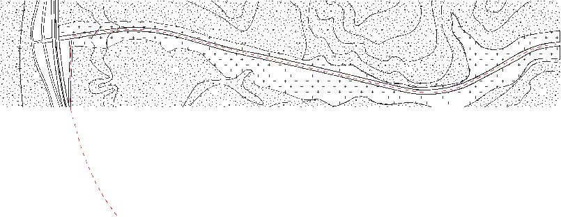
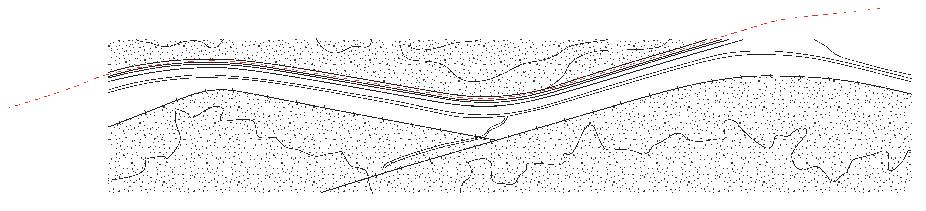
SUBSURFACE PLAN OF TERRITORY SURROUNDING TOWNS OF SUPERIOR AND ROCK SPRINGS SHOWING OIL AND NATURAL GAS FIELDS AND BOREHOLES
Oil field pad scars stipple the landscape above vast reserves of oil and natural gas buried -10,500 feet underground. Pipelines, both surficial and below ground, facilitate the transportation of these fossil fuels to refineries and power plants.
67
VI Cartographic Analysis of Past, Present, and Future Extractive Processes
68 -200 ft 10 mi
Map by Gracie Meek. Data from the United States Geological Survey, the Wyoming Landscape Conservation Initiative, the Wyoming State Geological Survey, and OpenStreetMaps
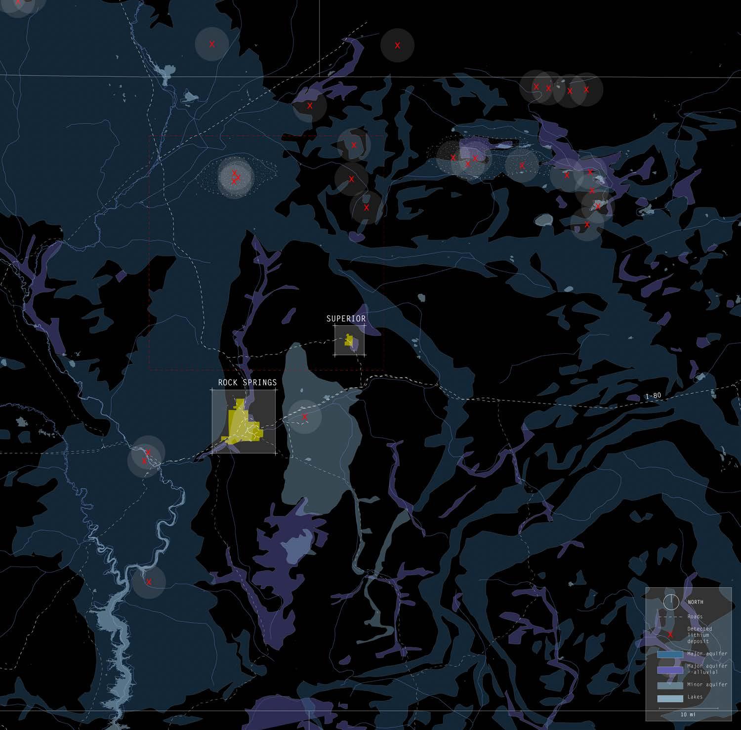
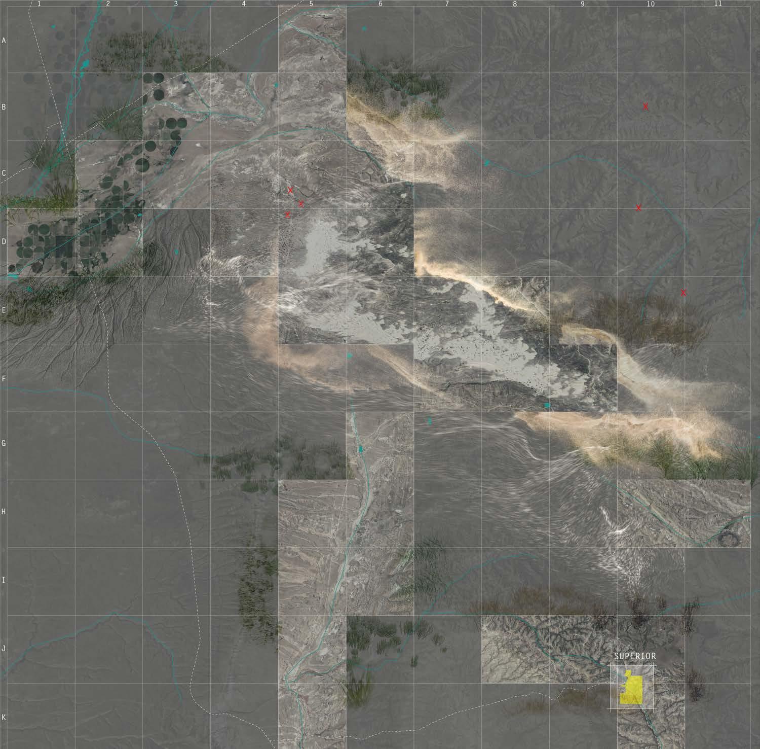
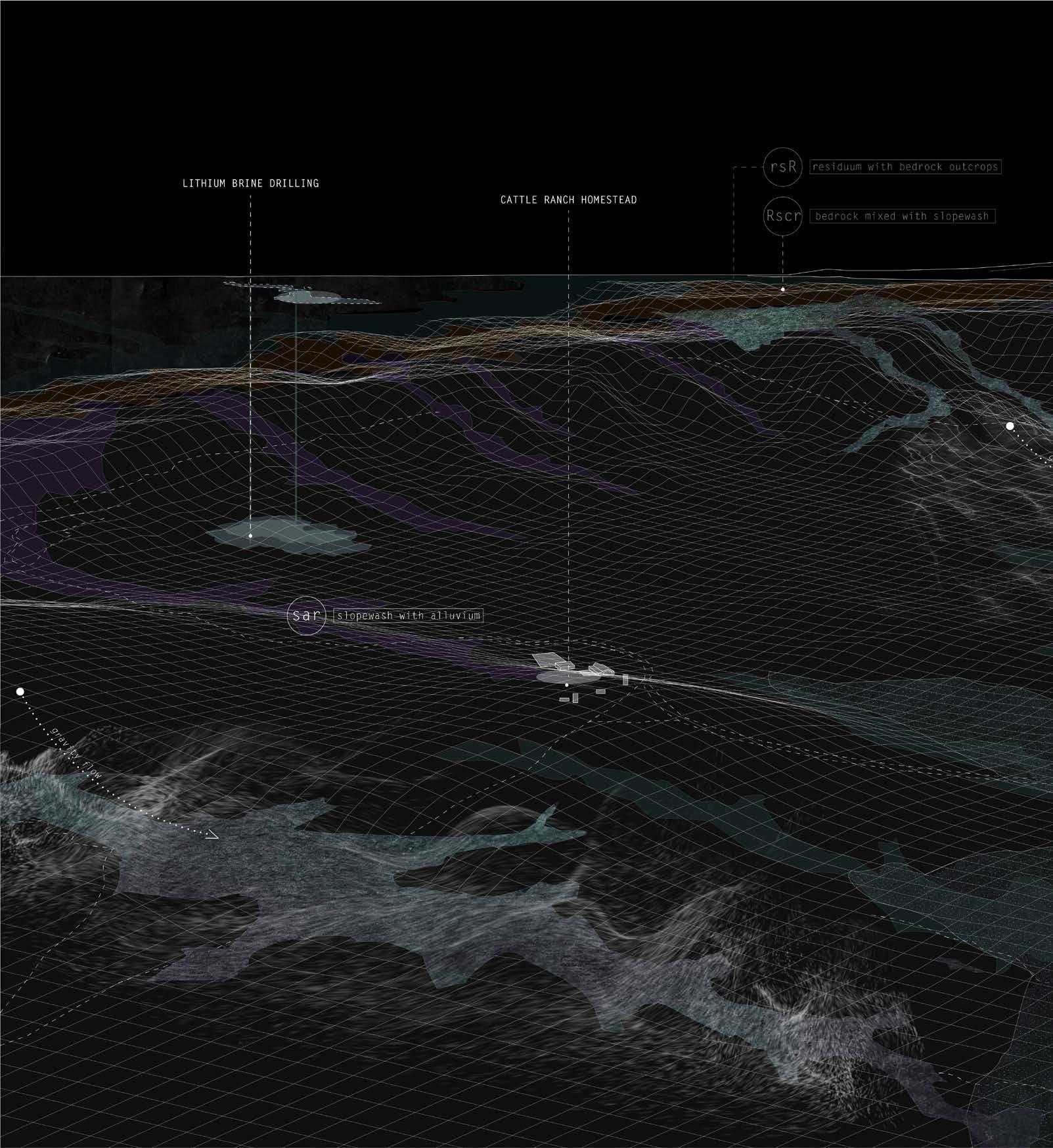
SUBSURFACE PLAN OF TERRITORY SURROUNDING TOWNS OF SUPERIOR AND ROCK SPRINGS SHOWING GROUNDWATER AND LITHIUM DEPOSITS
Lithium deposits have been located in an area about 25 miles north of Superior. With the cost of lithium increasing exponentially, construction might ensue within the next 15 years. Superior will see a large influx of migrant workers like it has in the past as a bedroom city for Rock Springs extraction.
This territory also supports alluvial aquifers and major/minor aquifers, which will be depleted if construction of the lithium mine proceeds.
69
VI Cartographic Analysis of Past, Present, and Future Extractive Processes
70 -50 ft 1 mi
Map by Gracie Meek. Data from the United States Geological Survey, the Wyoming Landscape Conservation Initiative, the Wyoming State Geological Survey, and OpenStreetMaps
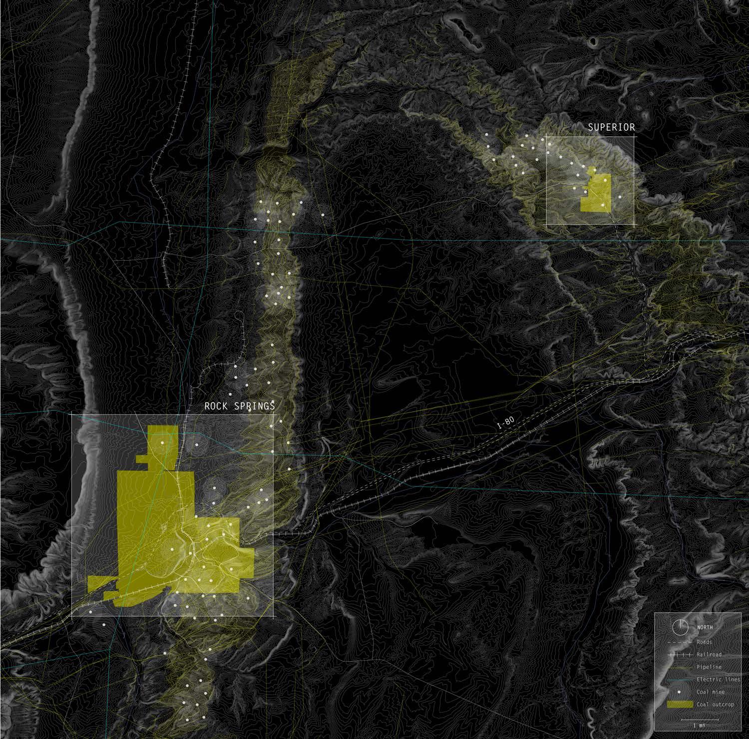
SUBSURFACE PLAN OF SUPERIOR AND ROCK SPRINGS COAL DEPOSITS, COAL MINE ENTRYWAYS, AND PIPELINE INFRASTRUCTURE
Superior and Rock Springs are historic coal, oil, and gas towns whose livelihood, culture, and economic dependency depend on the extraction industry. A band of surficial coal outcrops connects Superior and Rock Springs geologically, while pipelines, a rail road, and I-80 connect these energy towns to other urban centers.
71
VI Cartographic Analysis of Past, Present, and Future Extractive Processes
Historic maps from Sweetwater County Historical Museum and State of Wyoming Department of Natural Resources: Abandoned Mine Land Division
72 -100
.5 mi
ft
Map by Gracie Meek. Data from the United States Geological Survey, the Wyoming Landscape Conservation Initiative, the Wyoming State Geological Survey, and OpenStreetMaps
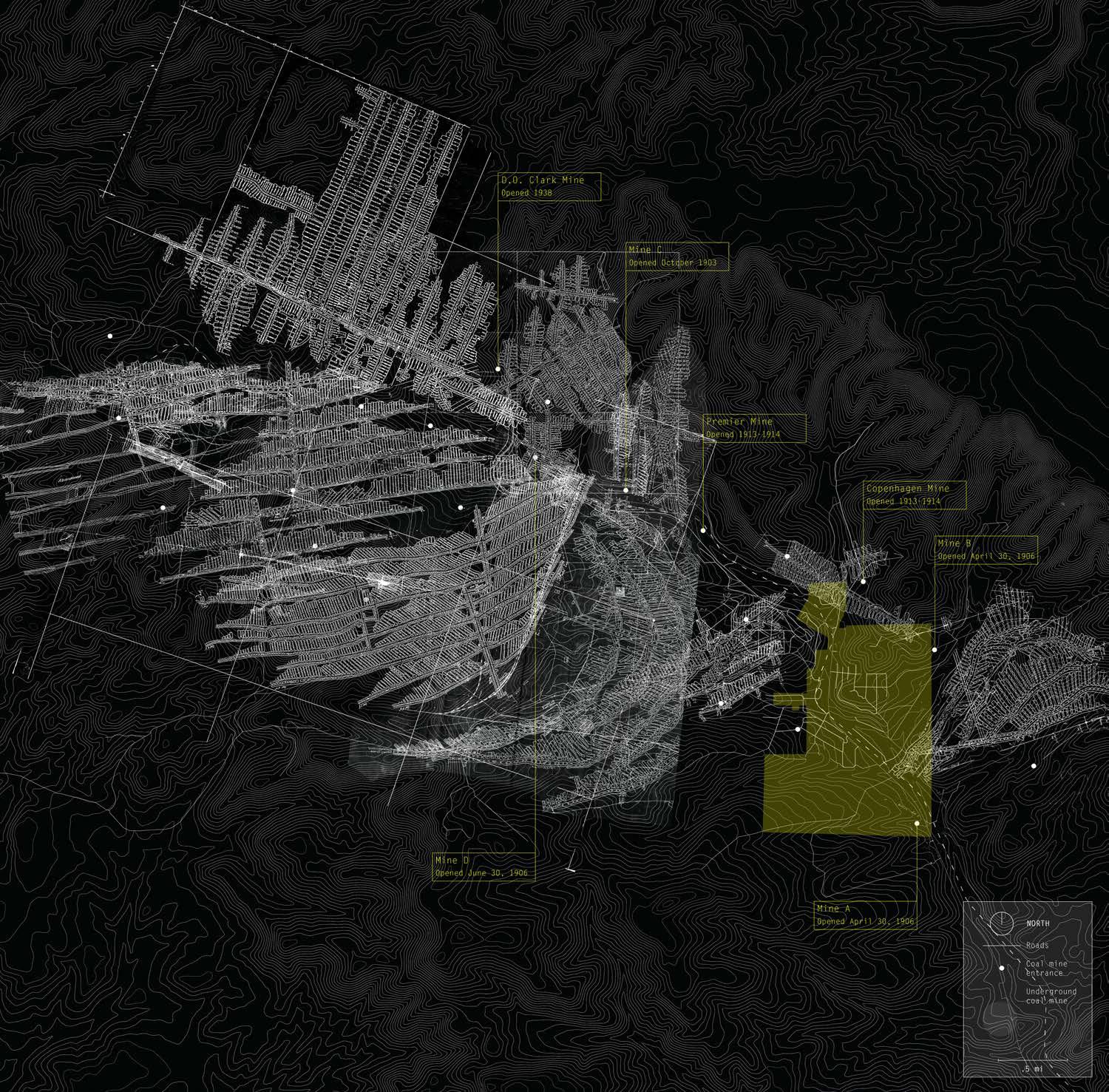
SUBSURFACE COMPOSITE OF AVAILABLE HISTORIC SUPERIOR MINE MAPS
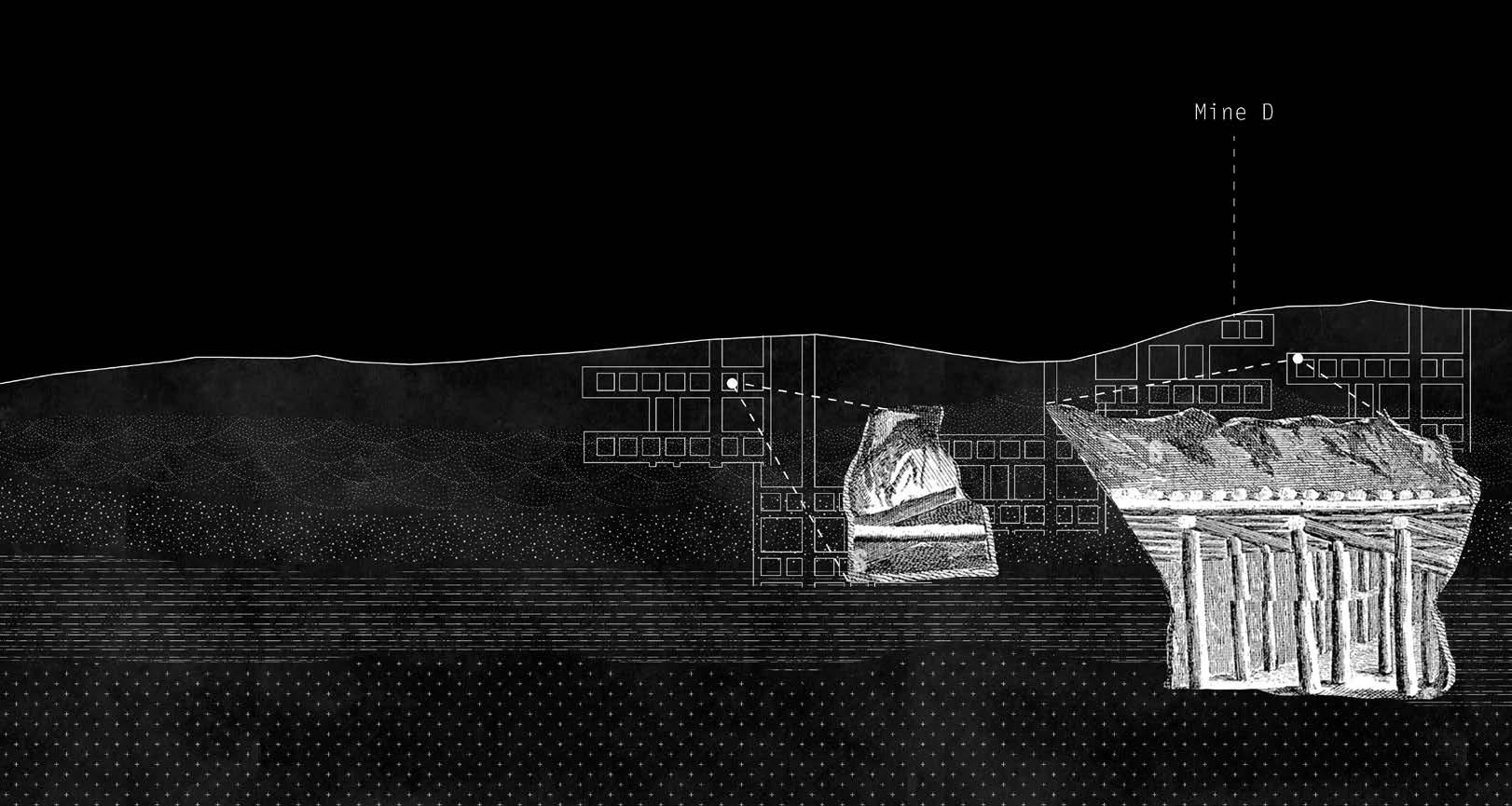
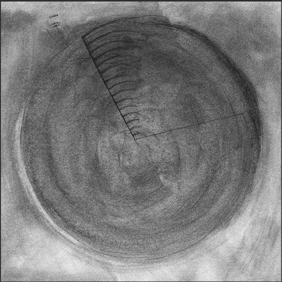
The mine network surrounding Superior is about seven times the size of the town itself. The first mines in Superior were “C” Mine in 1903, “A” and “B” Mines in 1906, and “D” Mine later that year. In 1934, when it became evident that the coal reserves of the present Superior mines were nearing exhaustion, active prospecting commenced in the vicinity of the mines. By mid-1936, evidence indicating reserves of 40,000,000 tons of coal justified the opening of a new mine of large capacity. The largest mine in Superior, D.O. Clark mine, opened in 1938.
73
VI Cartographic Analysis of Past, Present, and Future Extractive Processes
Map by Gracie Meek. Data from the United States Geological Survey, the Wyoming Landscape Conservation Initiative, the Wyoming State Geological Survey, and OpenStreetMaps
Historic maps from Sweetwater County Historical Museum and State of Wyoming Department of Natural Resources: Abandoned Mine Land Division
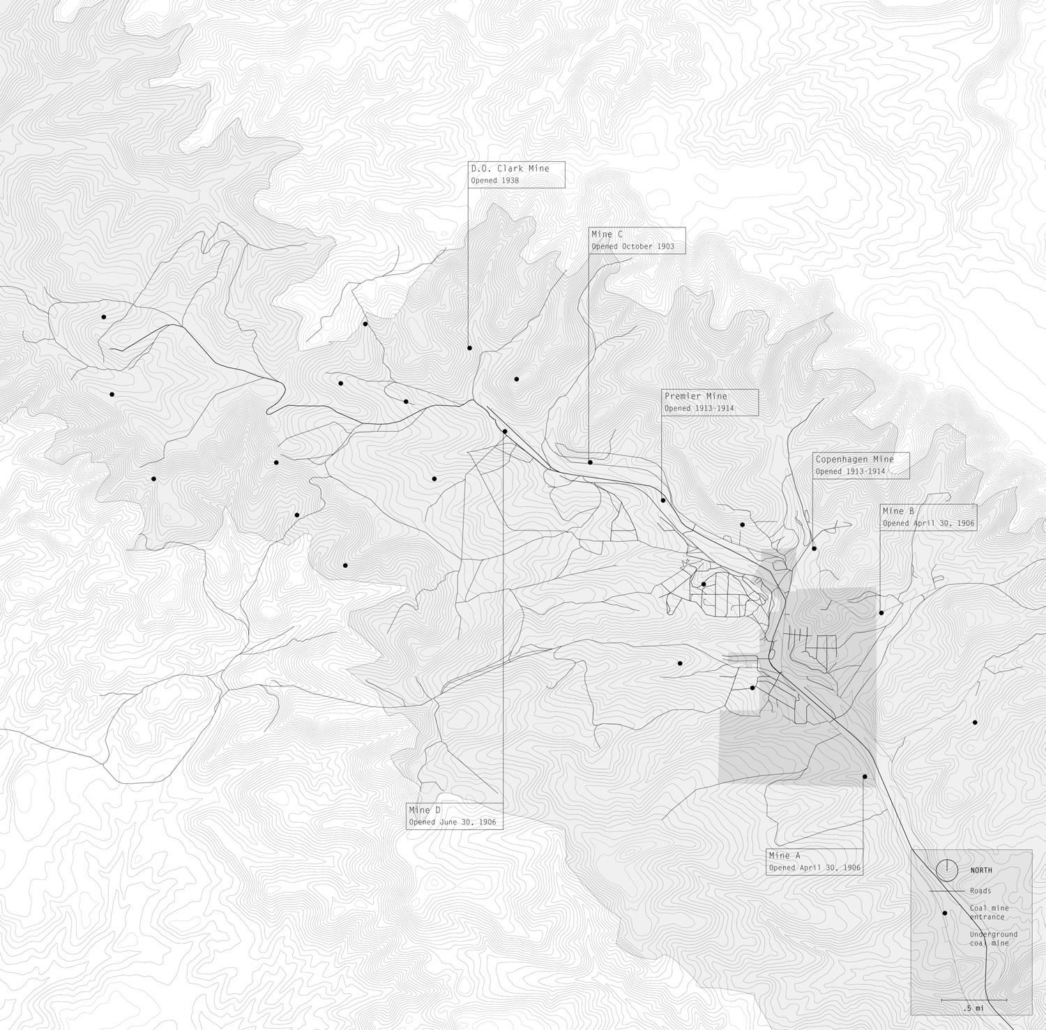
74 +0 ft
.5 mi
SURFICIAL PLAN OF SUPERIOR SHOWING PRESENT DAY RELATIONSHIP OF DOWNTOWN WITH ABANDONED COAL MINES
75
VI Cartographic Analysis of Past, Present, and Future Extractive Processes
Map by Gracie Meek. Data from the United States Geological Survey, the Wyoming Landscape Conservation Initiative, the Wyoming State Geological Survey, and OpenStreetMaps
Historic maps from Sweetwater County Historical Museum and State of Wyoming Department of Natural Resources: Abandoned Mine Land Division
76 +0 ft
.5 mi
ARCHIVAL MAP OF SUPERIOR AT PEAK POPULATION DURING COAL BOOM PERIOD DOCUMENTING HISTORIC LIVELIHOOD
This map georeferences the location of the Union Pacific coal mines and coal camps built in the years between 1906 and 1910 with the town as it was in its heyday in the late 1940s-1950s. The town was known as Reliance until, on July 14, 1906, the name was changed to Superior, after the Superior Coal Company which originally opened the mines.
In its early days, Superior was actually two towns: Superior and South Superior. While the companyowned homes were built adjacent to the mines, the town of south Superior was developed to house independentlyminded families and individuals. Aft first a tent town, called various names such as “White City” and “Dog Town”, it grew, and a relatively large commercial center developed. My grandmother, Francis Sines, grew up in Dog Town while my grandfather, William Sines, grew up in the company-owned coal homes.
77
VI Cartographic Analysis of Past, Present, and Future Extractive Processes
78 +0 ft
1 mi
Map by Gracie Meek. Data from the United States Geological Survey, the Wyoming Landscape Conservation Initiative, the Wyoming State Geological Survey, and OpenStreetMaps
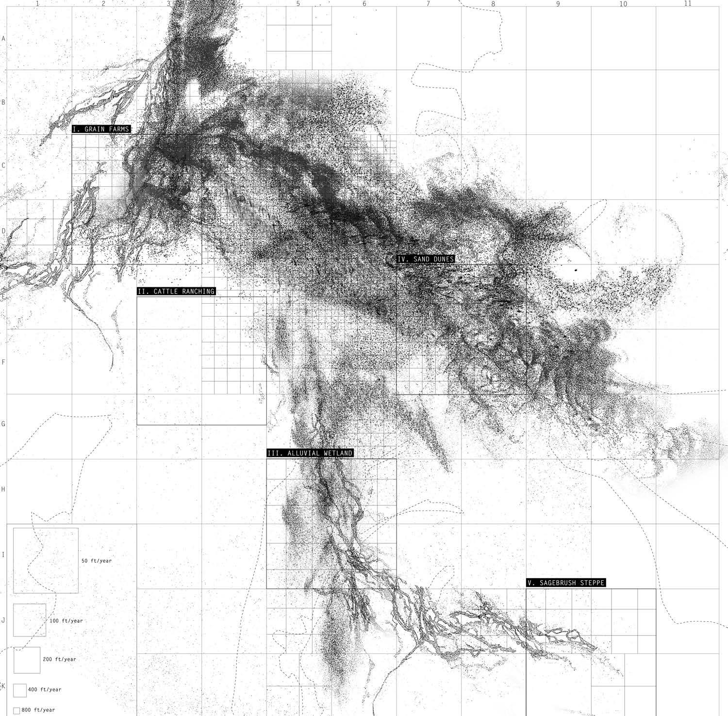
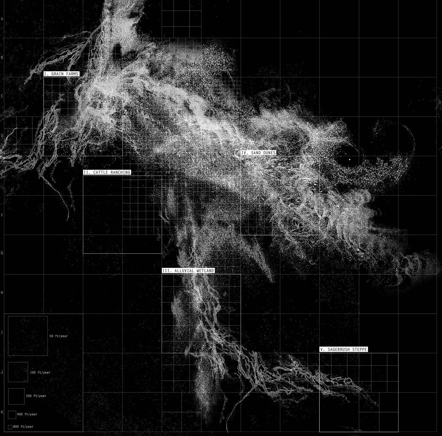
TYPICAL SURFICIAL CONDITIONS BETWEEN SUPERIOR AND LITHIUM DEPOSITS
Typical surficial conditions lying between Superior and the lithium deposit include grain farms, cattle ranching, alluvial wetlands, a vast field of sand dunes, and a sagebrush steppe ecosystem. Only the oil drilling sites stippling the surface of the arid, barren Wyoming Red Desert give hint of the geologic richness and significance under the surface.
79
VI Cartographic Analysis of Past, Present, and Future Extractive Processes
80 +0 ft
1 mi
Map by Gracie Meek. Data from the United States Geological Survey, the Wyoming Landscape Conservation Initiative, the Wyoming State Geological Survey, and OpenStreetMaps
SPREAD OF SALT THROUGH THE LANDSCAPE BETWEEN SUPERIOR AND LITHIUM MINE VARIABLE DUE TO ENVIRONMENTAL AND GEOLOGIC CONDITIONS
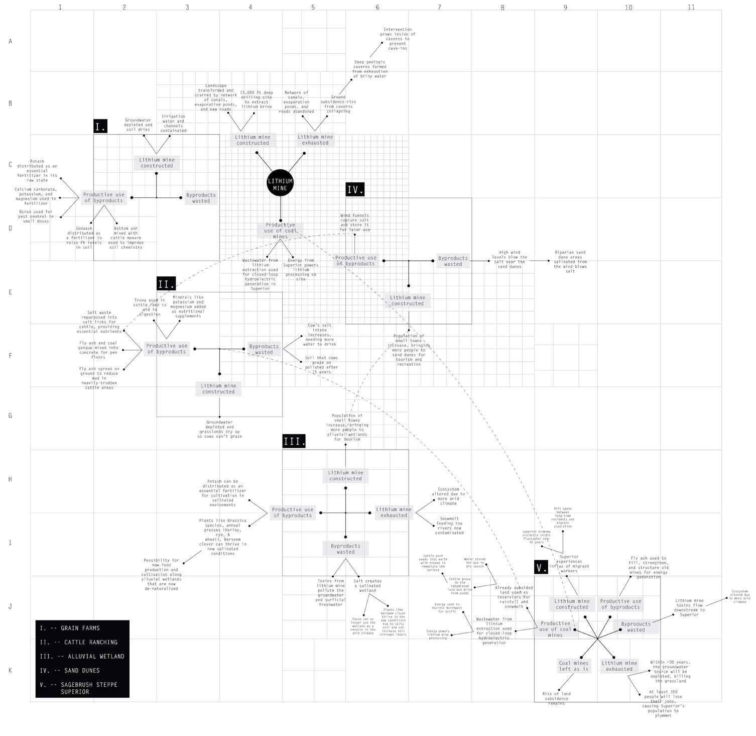
The rate of spread of lithium mine contaminants throughout the landscape varies based on the groundwater level, wind patterns, soil content, and water bodies. The landscape will be altered at different speeds.
81
VI Cartographic Analysis of Past, Present, and Future Extractive Processes
82 -100 ft
1 mi
Map by Gracie Meek. Data from the United States Geological Survey, the Wyoming Landscape Conservation Initiative, the Wyoming State Geological Survey, and OpenStreetMaps
SPREAD OF SALT THROUGH THE LANDSCAPE BETWEEN SUPERIOR AND LITHIUM MINE AFTER 20 YEARS OF OPERATION
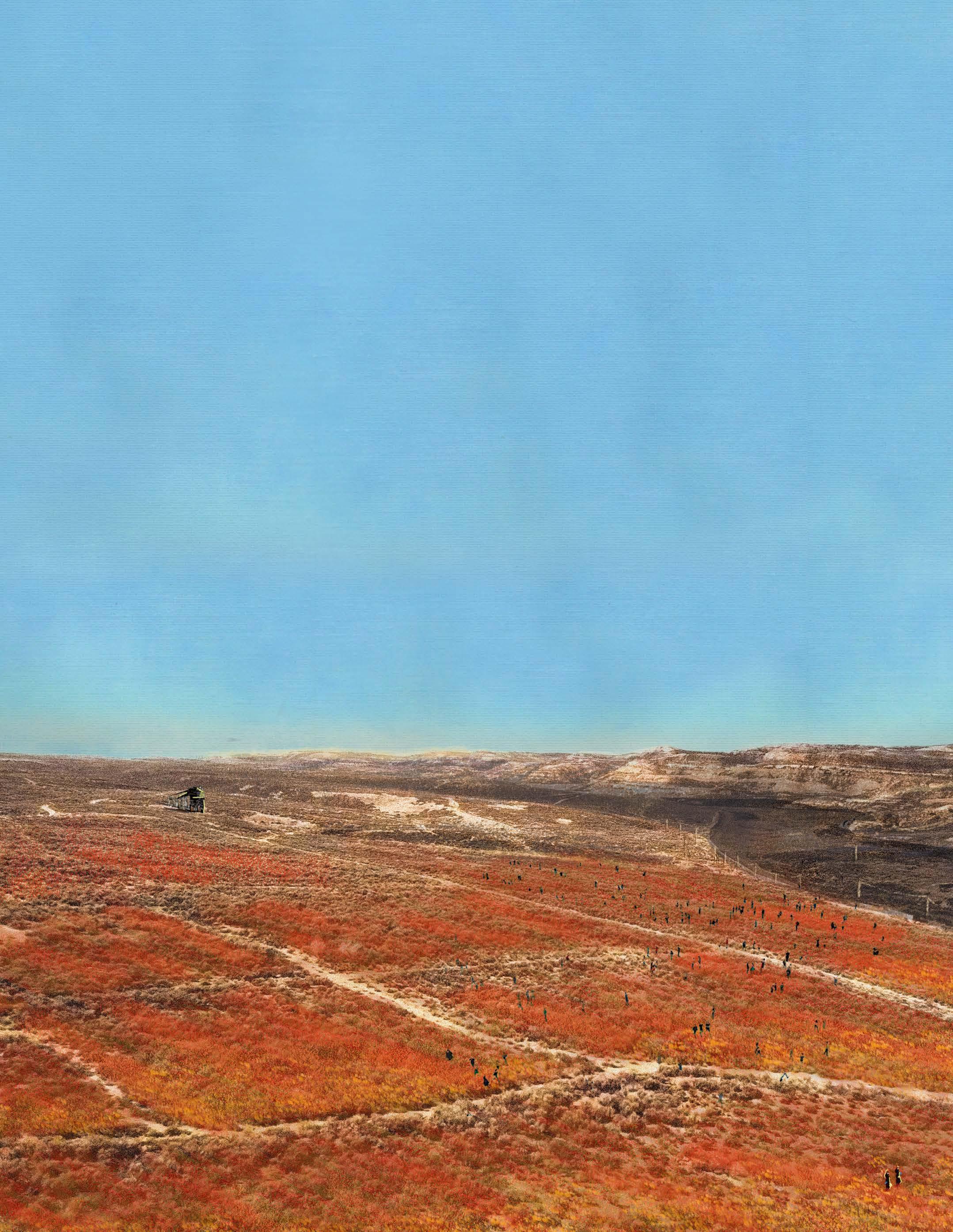
The spread of salt byproduct over the landscape from the evaporation of lithium from briny water in pools is of large concern. People will be differently affected based on their specific practices in that region, for instance, cattle ranchers will experience the change in the landscape differently than grain farmers. An anticipation for the lithium mine’s future afterlife is critical to break the boom and bust cycle.
83
VI Cartographic Analysis of Past, Present, and Future Extractive Processes
84 multiple
Map by Gracie Meek. Data from the United States Geological Survey, the Wyoming Landscape Conservation Initiative, the Wyoming State Geological Survey, and OpenStreetMaps
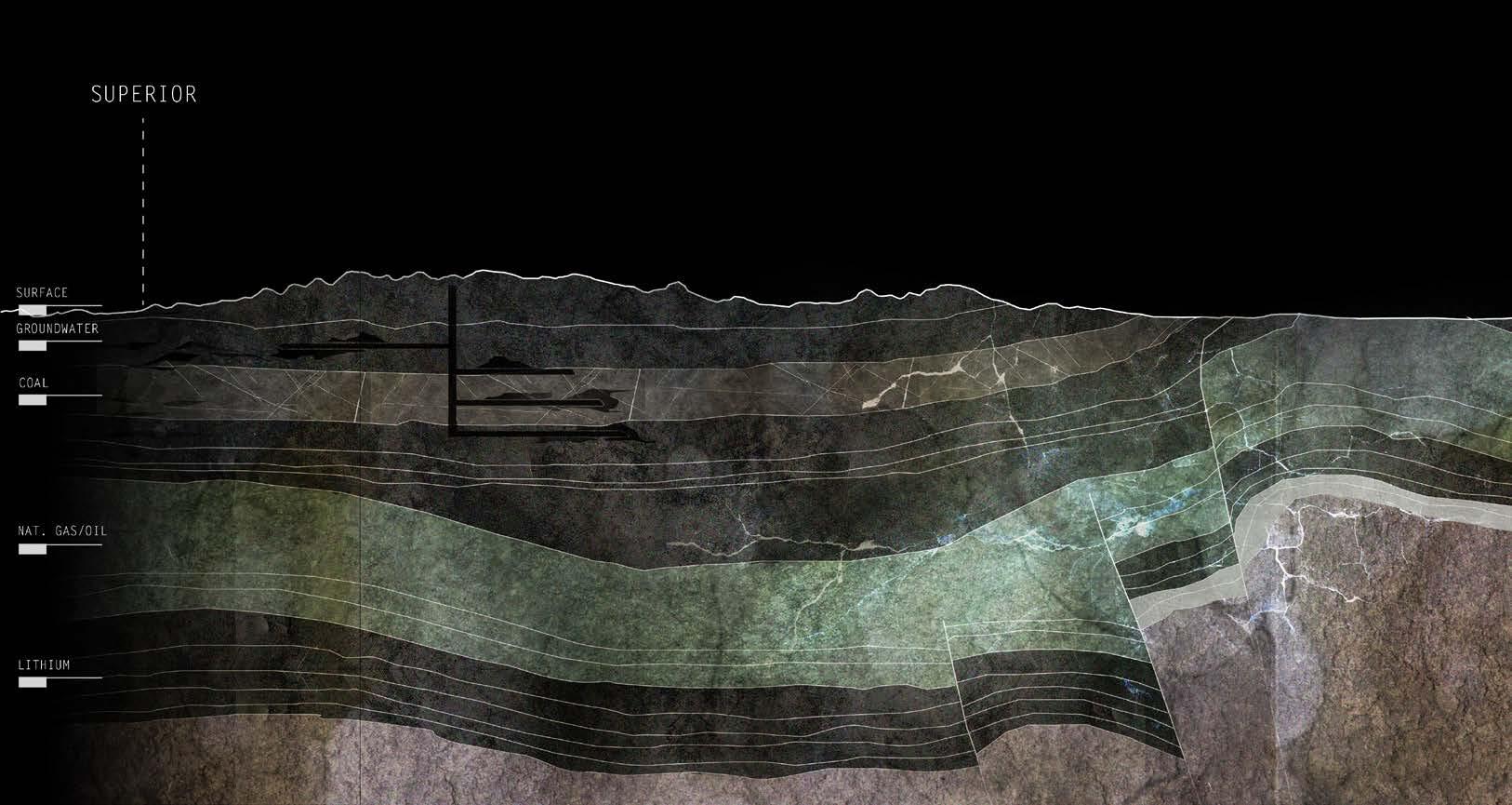
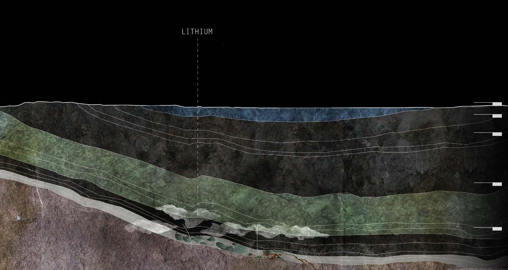
GEOLOGIC LAYERS SHOWING SUBSURFACE HUMAN INTERFERENCE THROUGH EXTRACTIVE PROCESSES
The geologic content of the land affects the spread of landscape contamination on the surface. Previous drilling operations exacerbate the spread of toxins since the groundwater layer was penetrated and exposed to leakages. Like coal, land subsidence is common with lithium mining since hollow caverns are left from the extraction of briny water pockets, leaving the ground subject to collapse.
85
VI Cartographic Analysis of Past, Present, and Future Extractive Processes
86 +0—-15,000
ft
1 mi
Section by Gracie Meek. Data from the United States Geological Survey, the Wyoming Landscape Conservation Initiative, the Wyoming State Geological Survey, and OpenStreetMaps
87 REGIONAL
HIGHLIGHTING
EXTRACTIVE INTERESTS VI Cartographic
of
and Future Extractive Processes
GEOLOGIC SECTION
LAYERS OF
Analysis
Past, Present,
88 +0—-15,000 ft
1 mi
Section by Gracie Meek. Data from the United States Geological Survey, the Wyoming Landscape Conservation Initiative, the Wyoming State Geological Survey, and OpenStreetMaps
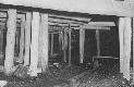
Interior conditions in D.O. Clark Mine, where my Grandfather worked, photo from Frank Prevedel and the Sweetwater County Historical Museum
89
VI Cartographic Analysis of Past, Present, and Future Extractive Processes
SECTIONS OF D.O. CLARK MINE AND MINE D EXPLORING INTERIOR CONDITIONS
The thesis makes circular excess materials and byproducts which are usually forgotten in the lithium extraction process.
90 VII
BYPRODUCTS AND CHOREOGRAPHY
Making Circular What is Usually Forgotten
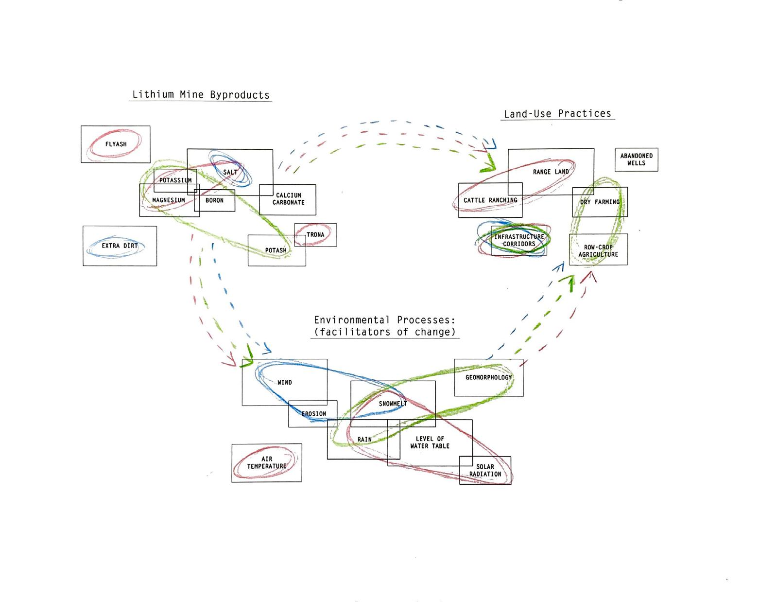
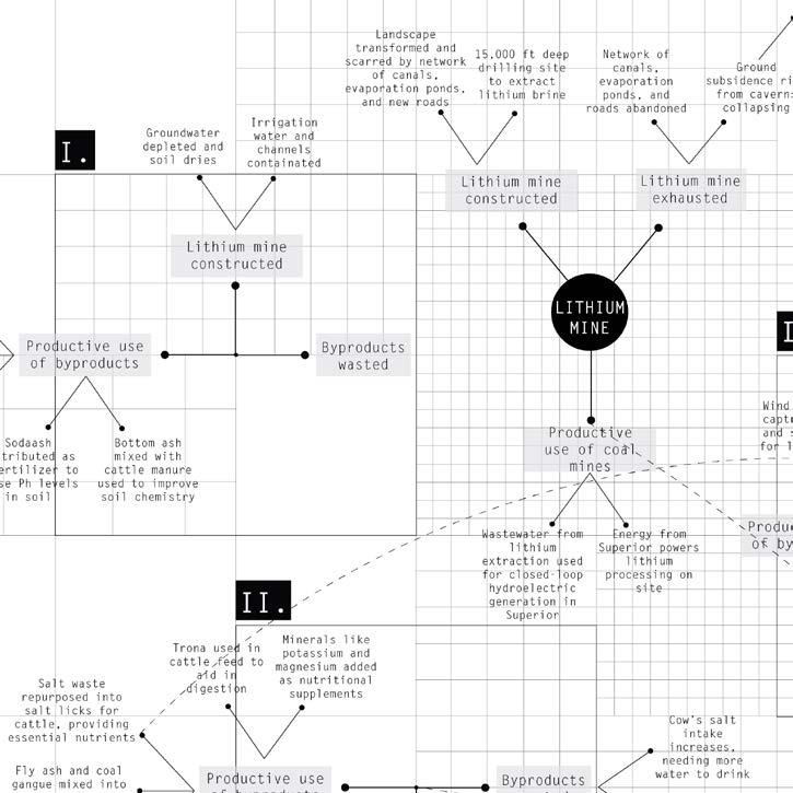
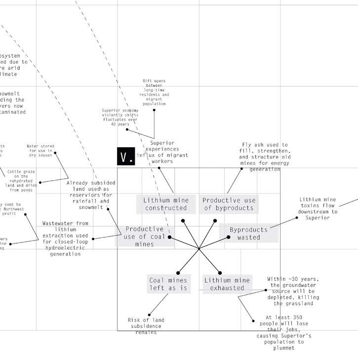
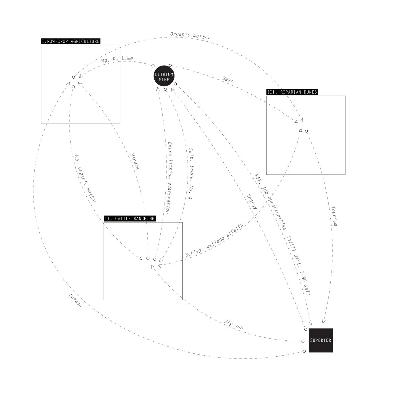
Choreographed, networked byproducts balance out excess materials from the lithium mine to make circular what is usually leftover and forgotten in extractive practices. The thesis parses byproducts, environmental processes, and land uses onto four sites where the output of one agent serves as the input for the other. Circularity is a guiding principle, but the thesis does not expect, or intend it to be, perfectly smooth.
Excess materials are choreographed as a field condition onto different typical landscapes and practices. The thesis design begins with these different environments—center pivot agriculture, a vast field of sand dunes scarred by boreholes, cattle ranching, and finally, Superior. This is to anticipate future conditions when land-use practices are forced to adapt to the conditions of the pre/present/post-lithium extraction landscape.
For example, the displacement of dirt excavated for the lithium mine ponds is utilized in the construction of designed landforms. Some plants thrive in saline soil conditions and excess salt is made into salt licks for cattle. Minerals like magnesium and potassium are essential ingredients in fertilizer. Ash byproduct from coal combustion is used as a soil additive and is also spread in areas heavily trodden by cattle to prevent muddy conditions.
The initial process built and played out different scenarios to see how the landforms can anticipate and interact with different possible futures and remain productive. As a result, possible lateral activities can now develop alongside better lithium practices. It becomes like a dance, where leftover pieces of extraction move to convalesce into a circular whole.
91
VII Byproducts and Choreography
EVAPORATION
SALTS
BORON
NaCl B
WHAT: sodium chloride (table salt)
HOW GENERATED: evaporated from brine
SIDE EFFECTS: oxygen depletion in water bodies, contamination of irrigation water, freshwater reservoirs and wells, [in excess] plants cannot take water into their roots
DURATION:
POTENTIAL USES: plants take up many salts in the form of nutrients; Brassica species, annual grasses (barley, rye, & wheat), Berseem clover (enriches soil with nitrigen) can thrive in these conditions when regularly irrigated; liquid salt is used in nuclear reactors; important dietary aid for cattle
MAGNESIUM
WHAT: boron (dark, brittle metalloid)
HOW GENERATED: evaporated from brine
SIDE EFFECTS: does not break down, contaminates the water table and water bodies
DURATION:
POTENTIAL USES: allowed for pest control in organic food production; in low concentration it is an essential nutrient in plants and aquatic life; borax (bleach); pyrex glass
POTASSIUM
Mg K
WHAT: magnesium (shiny, gray solid)
HOW GENERATED: evaporated from brine
SIDE EFFECTS: contributes to water hardness, but not harmful to biodiversity in low levels; naturally dissolves
DURATION:
POTENTIAL USES: an essential ingredient in fertilizer; in low concentration it is an essential nutrient in plants; important dietary supplement for grazing cattle; a reducing agent in the production of pure uranium
WHAT: potassium (silvery, white metal)
HOW GENERATED: evaporated from brine
SIDE EFFECTS: contributes to water softening; as a pollutant results in explosive algae growth
DURATION:
POTENTIAL USES: an essential ingredient in fertilizer to resist disease; in low concentration it is an essential nutrient in plants; dietary supplement for cattle
PROCESSING
CALCIUM CARBONATE (lime)
SODIUM CARBONATE (soda ash)
WHAT: calcium carbonate (aka lime, chalk, limestone)
HOW GENERATED: removed from brine using soda ash (sodium carbonate)
SIDE EFFECTS: naturally occurring in form of sea shells etc.; produces carbon dioxide upon contact with acid
DURATION:
POTENTIAL USES: pH control in soil; ingredient in fertilizers (adding calcium to the soil)
POTASSIUM CARBONATE (potash)
WHAT: sodium carbonate (a white salt)
HOW GENERATED: combination of salt and limestone to evaporate calcium carbonate (lime). Wyoming’s largest export.
SIDE EFFECTS: not harmful to environment since it is basic when it reacts with water
DURATION:
POTENTIAL USES: a natural fertilizer to raise pH but makes a saltier soil; produces baking soda and powder
TRONA
WHAT: potassium containing salt in water soluble form
HOW GENERATED: removed from earth by conventional shaft mining
SIDE EFFECTS: mining creates hazardous air pollution
DURATION:
POTENTIAL USES: an essential fertilizer in its raw state
WHAT: trona (a white, yellowish mineral)
HOW GENERATED: removed from earth by conventional shaft mining

SIDE EFFECTS: mining creates hazardous air pollution used to create sodium carbonate (soda ash); methane emissions
DURATION:
92
CaCO3
K2CO3 Na3H(CO3)2·2H2O Lithium byproduct information
POTENTIAL USES: used in animal feed products to aid in digestion; creates baking soda and Ayres 2013)
Na2CO3
from: (Kanji, Ong, Dahlgren, and Herbel, n.d.) and (Peiró, Méndez,
IDENTIFICATION OF LITHIUM EXTRACTION AND PROCESSING BYPRODUCTS AND THEIR POTENTIAL USES
Potential uses were narrowed down to how people living in the area might use them (i.e. agriculture, cattle ranching, and construction).
93
VII Byproducts and Choreography
COMBUSTION
REFUSE ROCK
COAL GANGUE
WHAT: refuse rock (rock leftover from mining operations)
HOW GENERATED: material left over from coal mining
SIDE EFFECTS: leaching of iron, manganese, and aluminum residues into waterways, creating both surface and groundwater contamination; vulnerable to fires
DURATION:
POTENTIAL USES: very expensive to reprocess, so it is placed in a landfill
MERCURY
Hg
WHAT: mercury (shiny, silver-white metal)
HOW GENERATED: coal combustion for energy production releases mercury from the rocks
SIDE EFFECTS: burning of coal releases airborne mercury toxins
DURATION:
POTENTIAL USES: in this airborne state, it is highly problemmatic and unusable
WHAT: coal gangue (solid black coal waste)
HOW GENERATED: generated during coal mining and washing
SIDE EFFECTS: disposed in landfills or discharged into nearby waterways
DURATION:
POTENTIAL USES: can be used to make cement to create a structural fill to plug old coal mines
FLY ASH
BOTTOM ASH
WHAT: fly ash (a fine particulate made of cinders, ash, dust, and soot)

HOW GENERATED: composed mostly of silica made from the burning of finely ground coal in a boiler
SIDE EFFECTS: disposed in landfills or discharged into nearby waterways DURATION:
POTENTIAL USES: used to make nutrientrich soil and compost; helps soil retain water; fertilizer; material to reduce mud in heavily-trodden cattle areas; make cement and grout used to create a structural fill to plug old coal mines
FLUE-GAS DESULFERIZATION SLUDGE
WHAT: flue gas desulfurization (wet sludge consisting of synthetic gypsum)
HOW GENERATED: a material leftover from the process of reducing sulfur dioxide emissions in coal burning
SIDE EFFECTS: disposed of in holding pond
DURATION:
POTENTIAL USES: synthetic gypsum can be used as fertilizer to improve soil chemistry; used to make synthetic gypsum for wallboards; also used in concrete and mine fills
WHAT: bottom ash (coarse, angular ash particle)

HOW GENERATED: when burned is too large to be carried up into the smoke stacks so it forms in the bottom of the coal furnace
SIDE EFFECTS: disposed in landfills or discharged into nearby waterways DURATION:
POTENTIAL USES: when mixed with cow manure can be used as fertilizer to improve soil chemistry; used in road construction, snow/ice control on roads, and cement
94
MINING
Coal byproduct information from: (Song, Gang, Ma, Yang, and Mu 2017)
IDENTIFICATION OF COAL EXTRACTION AND PROCESSING BYPRODUCTS AND THEIR POTENTIAL USES
Potential uses were narrowed down to how people living in the area might use them (i.e. agriculture, cattle ranching, and construction).
95
VII Byproducts and Choreography
96
Lithium mine waste data from: (Peiró, Méndez, and Ayres 2013)
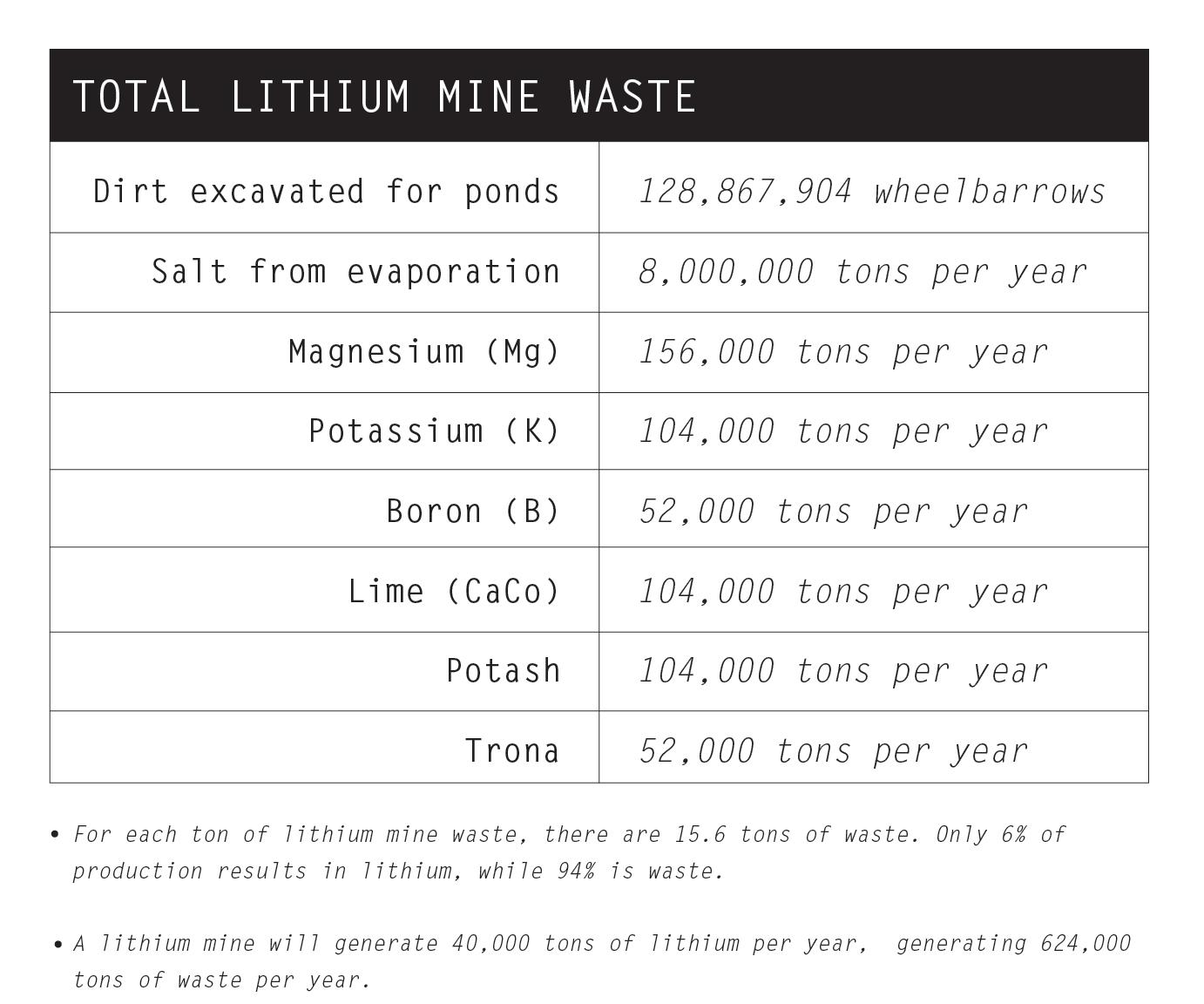
TOTAL LITHIUM MINE MATERIAL WASTE
Astonishingly, only 6% of total production results in usable lithium, while 94% is waste.
97
VII Byproducts and Choreography
98
PARSING OF ENVIRONMENTAL PROCESSES, LAND PRACTICES, AND LITHIUM MINE BYPRODUCTS ACROSS THREE SITES
99
VII Byproducts and Choreography
100
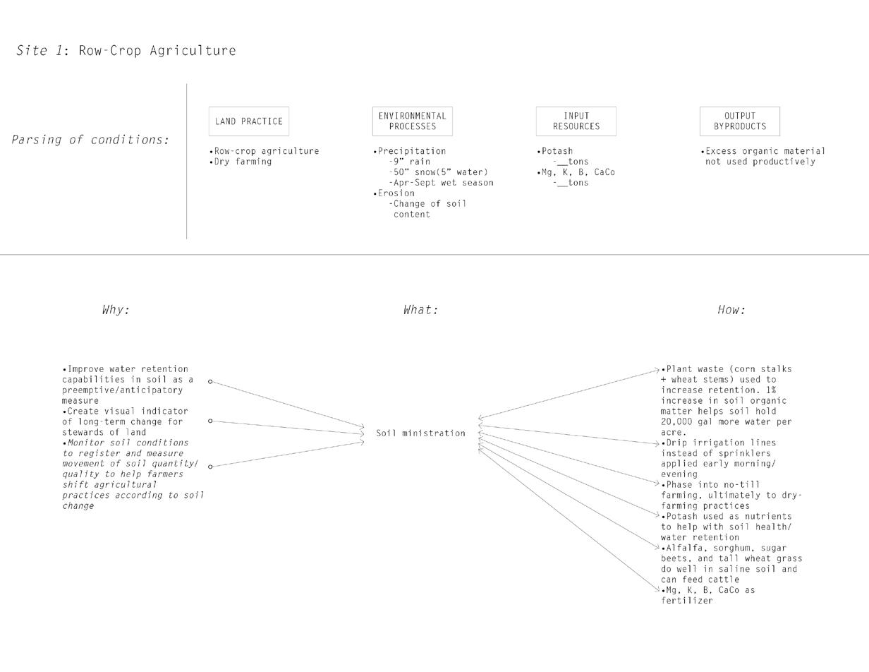
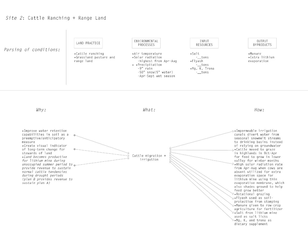
DESIGN AND RESOURCE STRATEGIES FOR AGRICULTURE AND CATTLE RANCHING
Design strategies for agriculture and cattle ranching consider land practices, environmental conditions, and input/output resources.
101
VII Byproducts and Choreography
102 1 mi
CHOREOGRAPHY OF POTENTIAL BYPRODUCT USES ACROSS SWEETWATER COUNTY AS A FIELD CONDITION
Excess materials are choreographed as a field condition onto different typical landscapes and practices. The initial process built and played out different scenarios to see how the landforms can anticipate and interact with different possible futures and remain productive. As a result, possible lateral activities can now develop alongside better lithium practices.
103
VII Byproducts and Choreography
104
MATERIAL AND OPPORTUNITY FLOWS BETWEEN SITES OF INTEREST
The thesis parses byproducts, environmental processes, and land uses onto the 4 sites. The output of one agent serves as the input for the other, making circular that which is usually forgotten.
105
VII Byproducts and Choreography
The thesis manipulates the capitalist structure to create a beneficial, poetic method of being entrepreneurial where excess is rendered visible.
106 VIII
LABOR AND CAPITAL
Stewardship Linked With Labor and Capital
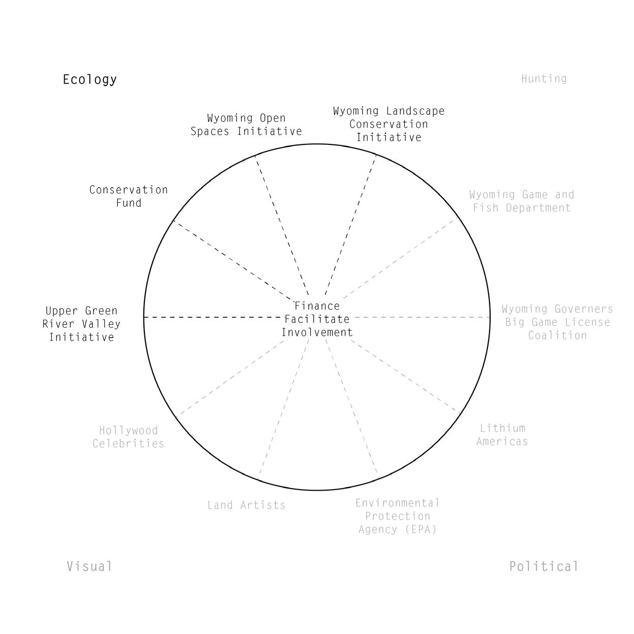
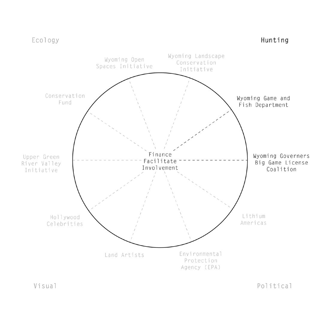
The thesis rearranges the excess from capitalism, both labor and byproducts, as an environmentally reparative gesture toward a landscape scarred by histories of resource extractive practices. In making connections between what has been kept discrete, the concept of stewardship is linked with labor and capital. Involving a diversity of stakeholders, both organizational and individual, is critical in making the landscape of extraction matter to more people and involves people who have the authority to make a difference. The capitalist structure is manipulated to create a beneficial, poetic method of being entrepreneurial where excess is rendered visible.
The laborers in this scenario are not just construction workers, they are stewards of the landscape developing a care for it over time. Surplus labor from the lithium extraction process is seen as one important stakeholder as well, who would live with and experience the various landforms, including their formation and transformation over time. They are a new community for whom Superior becomes a culturally significant landscape. A new relationship of concern for the landscape develops. An intergenerational relationship also develops, since the building of the landforms generates jobs over a 100 year time frame. The children of the 1940s-1950s coal miners have a different care and relationship with the landscape than the lithium stewards.
Apart from human labor, the earth, geologic forces, and the weather are conceptualized into labor of the atmosphere as the landforms change states. This is not a positive labor force, per se, as the atmosphere works against the humans in the maintenance of landforms. Hindering and interrupting the process, the weather pushes contaminants further into the landscape.
107
VIII Labor and Capital
108
INVOLVEMENT OF OUTSIDE GROUNDBASED CONSTITUENTS
To facilitate and finance the process of building these landforms the thesis proposes the involvement of outside constituents. The involvement of the Wyoming Conservation Initiative, and even the conservative Wyoming Governor’s Big Game Coalition helps to draw in as many people and diversities of organizations as possible to promote longevity.
109
VIII Labor and Capital
110
INVOLVEMENT OF OUTSIDE AERIAL CONSTITUENTS
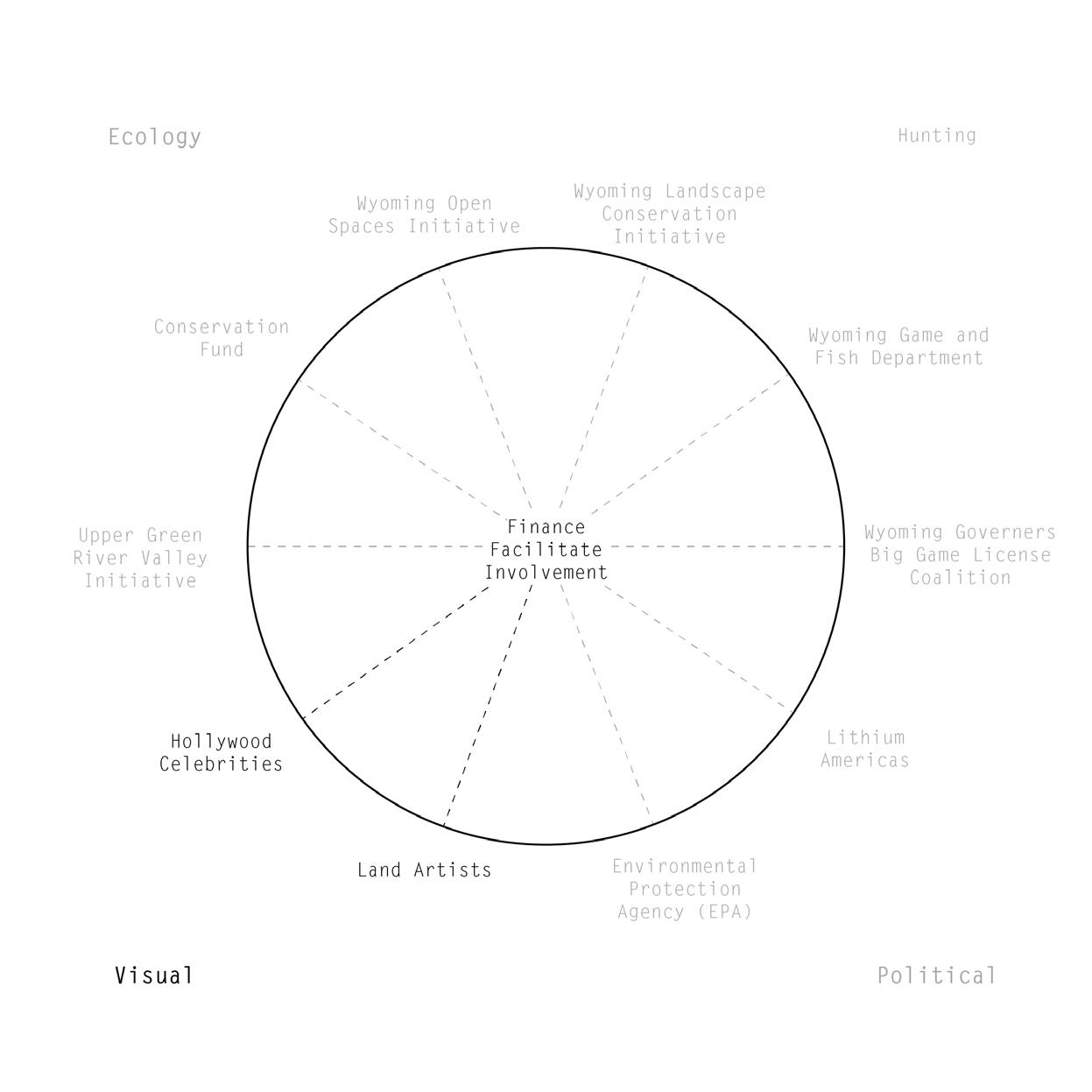
Apart from the constituents that are more interested in ecological factors, some stakeholders experience the landforms visually aerially. For instance, a Hollywood celebrity pays $10 to sponsor a crane bucket of dirt, and in return receives a satellite image as the landscape undergoes change. This has a dual purpose in that the landforms render visible and measure the spread of contamination through the landscape.
The coalescence of eye level and aerial stakeholders is required to see the whole picture.
111
VIII Labor and Capital
112 Mining Law of 1872 information
2022)
from: (Robbins
LITHIUM AMERICAS AS LOOPHOLE STAKEHOLDER: MINING LAW OF 1872
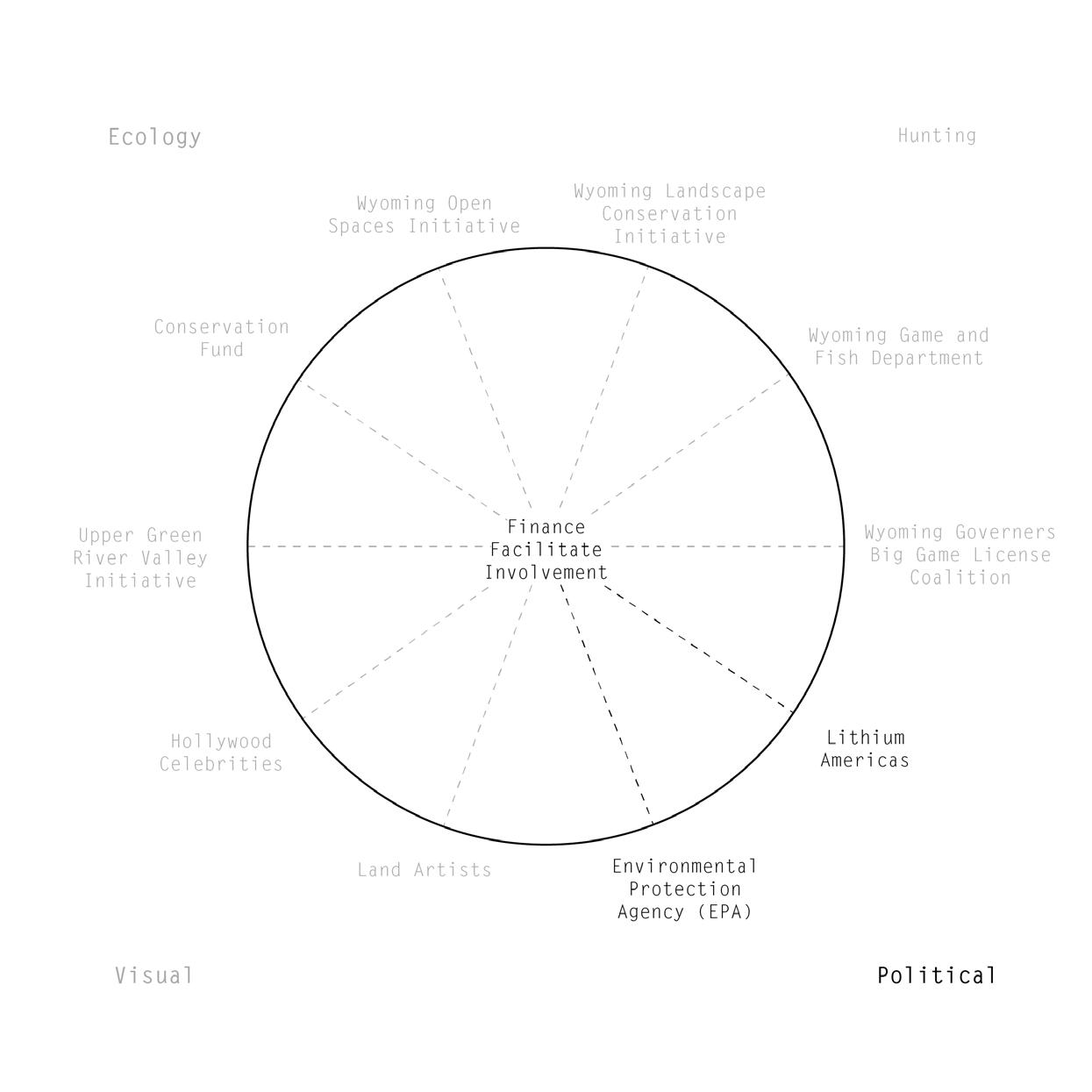
Even the company that owns and operates the mines, Lithium Americas, can be involved. as the still-in-place historic Mining Law of 1872, which allows miners to pay no royalties for minerals they dig from federal land, is currently being proposed to be reformed under the Biden administration. If the reform goes through, Lithium Americas in Wyoming could pay a royalty to the EPA since the minerals are publicly owned on Bureau of Land Management land. Part of the money could help recycle and purify the contaminants into their usable forms.
113
VIII Labor and Capital
“Land-use planning is primarily the responsibility of city and county governments that are empowered by state-level enabling legislation or land planning policy to preserve public health, safety, and welfare. Decisions about which land uses are permitted, their size, location, and compatibility, occur at the local government level, guided by citizen input and implemented by local elected officials.
In addition to guiding land-use decisions, planning also enables communities to promote economic development; protect private property rights, farmland, ranchland and historic areas; and make fiscally responsible decisions regarding community services and infrastructure needs.
There exists opportunity to both improve existing regulatory mechanisms and enhance current legislation with incentive-based strategies to better support economic growth, environmental resilience, and quality of life.”
114
Publicly owned land information from: (Hammerlinck, Lieske, Gribb, and
n.d.)
– Understanding Wyoming’s Land Resources: Land-Use Patterns and Development Trends by the Wyoming Open Spaces Initiative
Oakleaf
LAND OWNERSHIP AS DRIVER OF CHANGE
Land ownership is also a driver of change. The sites of intervention are publicly owned by the Bureau of Land Management. This enables the citizens to pressurize their political representatives for preferable land policies and protect private property from contamination.
115
VIII Labor and Capital
116
LABOR CYCLE FOR CONSTRUCTION AND MAINTENANCE OF LANDFORMS
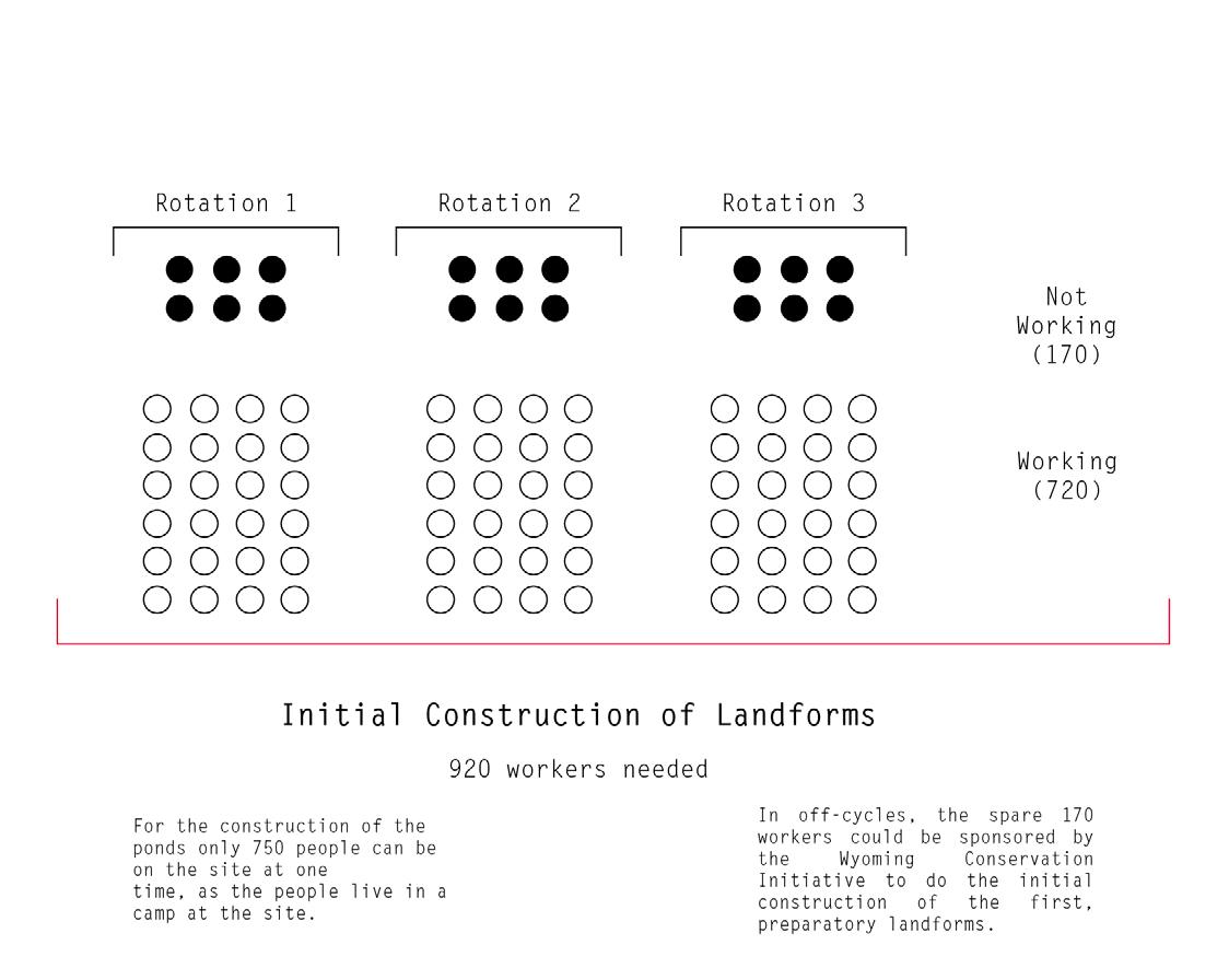
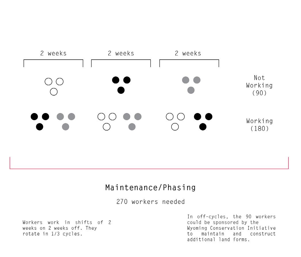
The labor to construct the landforms is composed of an excess of “in limbo” lithium mine workers due to their 2-week on 2-week off labor cycles. During their off cycles, the workers can be sponsored to construct and maintain the landforms. Lithium miners are now stewards, developing a sense of responsibility for the landscape.
The thesis rearranges the excess from capitalism, both labor and byproducts, as an environmentally reparative gesture toward a landscape scarred by histories of industrial resource extractive practices.
117
VIII Labor and Capital
118
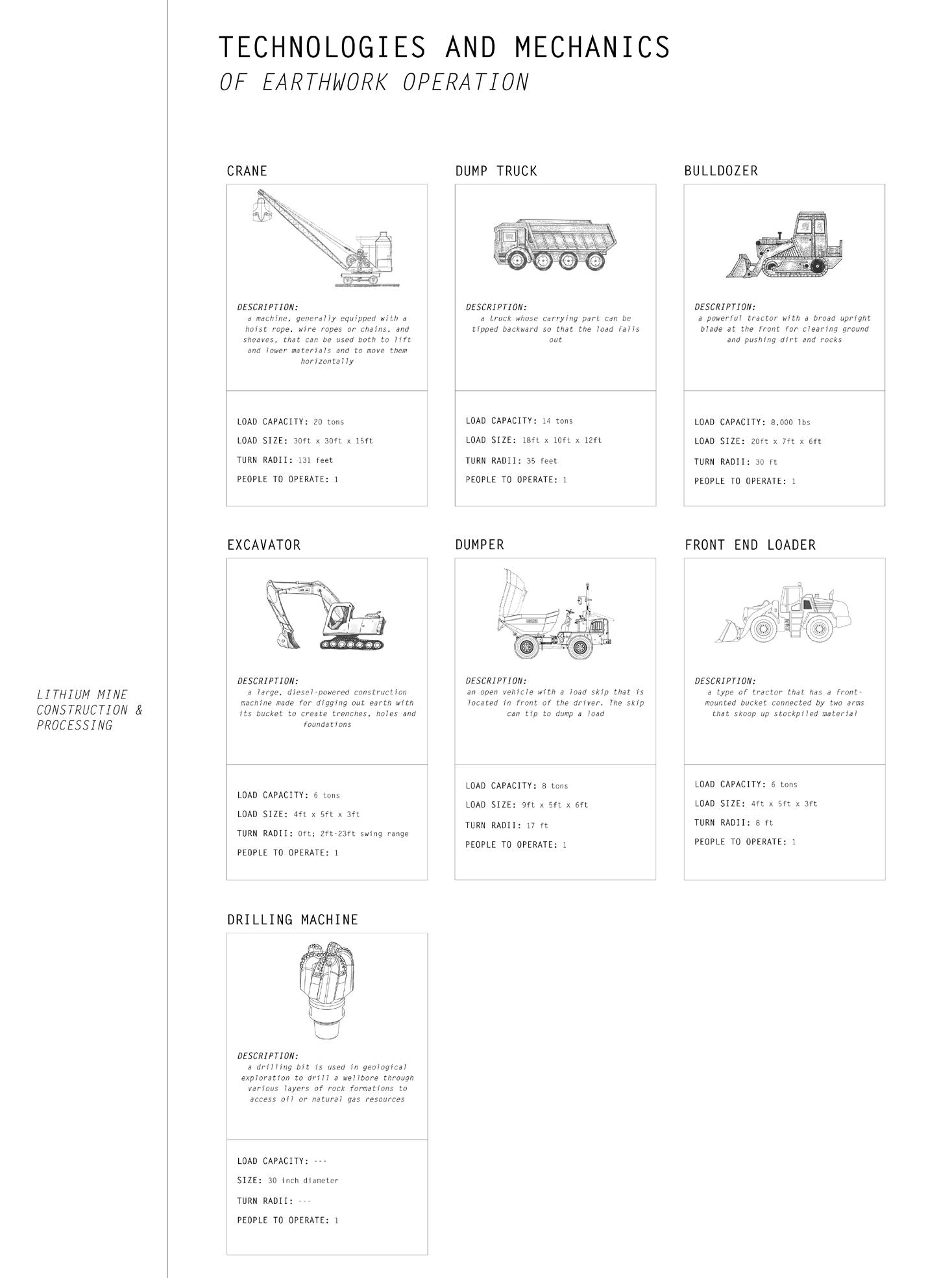
MECHANISMS OF LITHIUM MINE CONSTRUCTION USED TO BUILD LANDFORMS
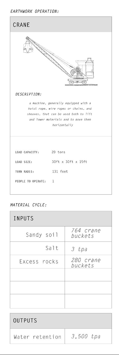
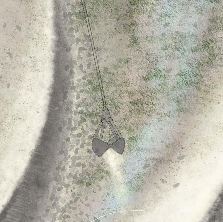
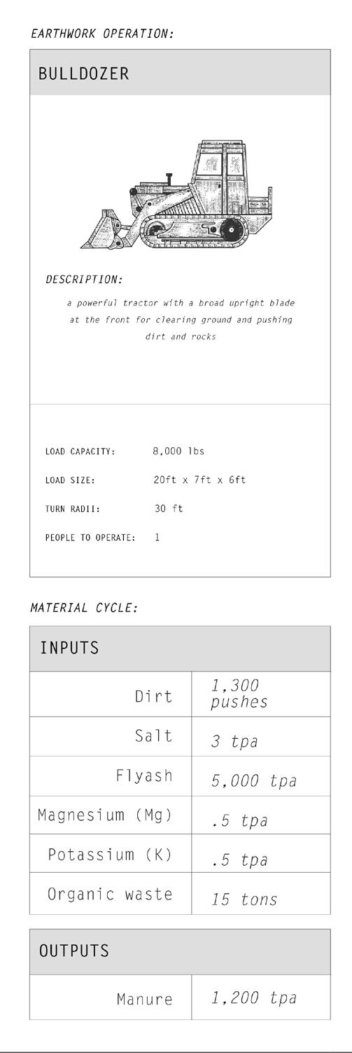
The construction and maintenance of the landforms reveal, expose, and undo lithium mine processes by utilizing the same mechanisms and machines that are used to build the ponds. Cranes and bulldozers are reused after their role is completed in mine construction.
119
VIII Labor and Capital
120
PHASE III
121
Designed landforms render visible landscape contamination, preemptively remediate future effects of the lithium mine, and reveal processes of lithium extraction.
122 IX
SITES OF STEWARDSHIP
Microclimates That Render Visible Change
Historically the ground was hollowed for coal mines, excavated for lithium mine ponds, and drilled for oil and gas. The geometry of the earth surficially and sectionally is an expression of how it has been molded by natural, economic, and cultural forces over time. The thesis redefines this into visibility and productivity as a new form of infrastructure. In contrast with typical extractive practices, the landforms follow a cut and fill strategy, where the balancing of the artificial displacement of soil provides a sustainable whole.
Existing in the voids left between architecture, infrastructure, and ecology, the thesis integrates the memory, physicality, material properties, and environmental processes of a particular site into a meaningful whole. Felix Guattari’s three ecologies: 1) mental ecology (aesthetics), 2) the environment, and 3) social relations, were a guiding principle in this pursuit. The landforms exist within the traditions of land art that began in the 1960s, but also the traditions and memory of the coal mining community that have been here since the late 1800s. The sites are superimpositions of natural, agricultural, and extractive networks changing over time.
The landforms are not a static solution to the problem of landscape contamination, they are microlandscapes and climates of memory. While in plan the landforms render visible change in the landscape for stakeholders and landscape stewards, the section is ecologically remediative and affects the microclimate. While remediating past landscape exploitation, either by overtilling or unsealed abandoned drilling sites, the landforms also preemptively remediate possible future lithium mine effects.A generative methodology of landform manipulation reveals correlations between histories, morphologies, assemblies, materials, and affordances of landscape practice.
123
IX Sites of Stewardship
124 +0 ft 3 mi
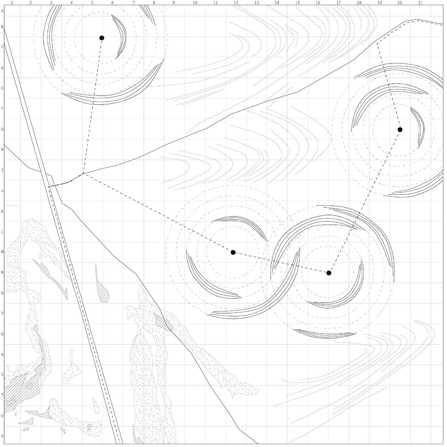
Map by Gracie Meek. Data from the United States Geological Survey, the Wyoming Landscape Conservation Initiative, the Wyoming State Geological Survey, and OpenStreetMaps
NOTATIONAL KEY MAP OF THE DESIGNED LANDFORM FIELD IN SWEETWATER COUNTY
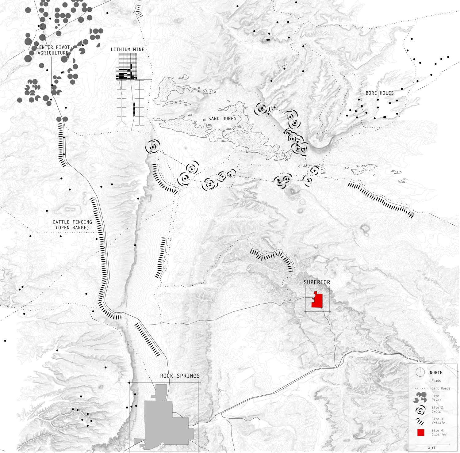
125 IX Sites of Stewardship
126 IX-a
Center Pivot Agriculture Turned Firefly Halos
127 IX-a Sites of Stewardship | PIVOT
SITE
PIVOT
1:
128 +0 ft .25 mi
Map by Gracie Meek. Data from the United States Geological Survey, the Wyoming Landscape Conservation Initiative, the Wyoming State Geological Survey, and OpenStreetMaps
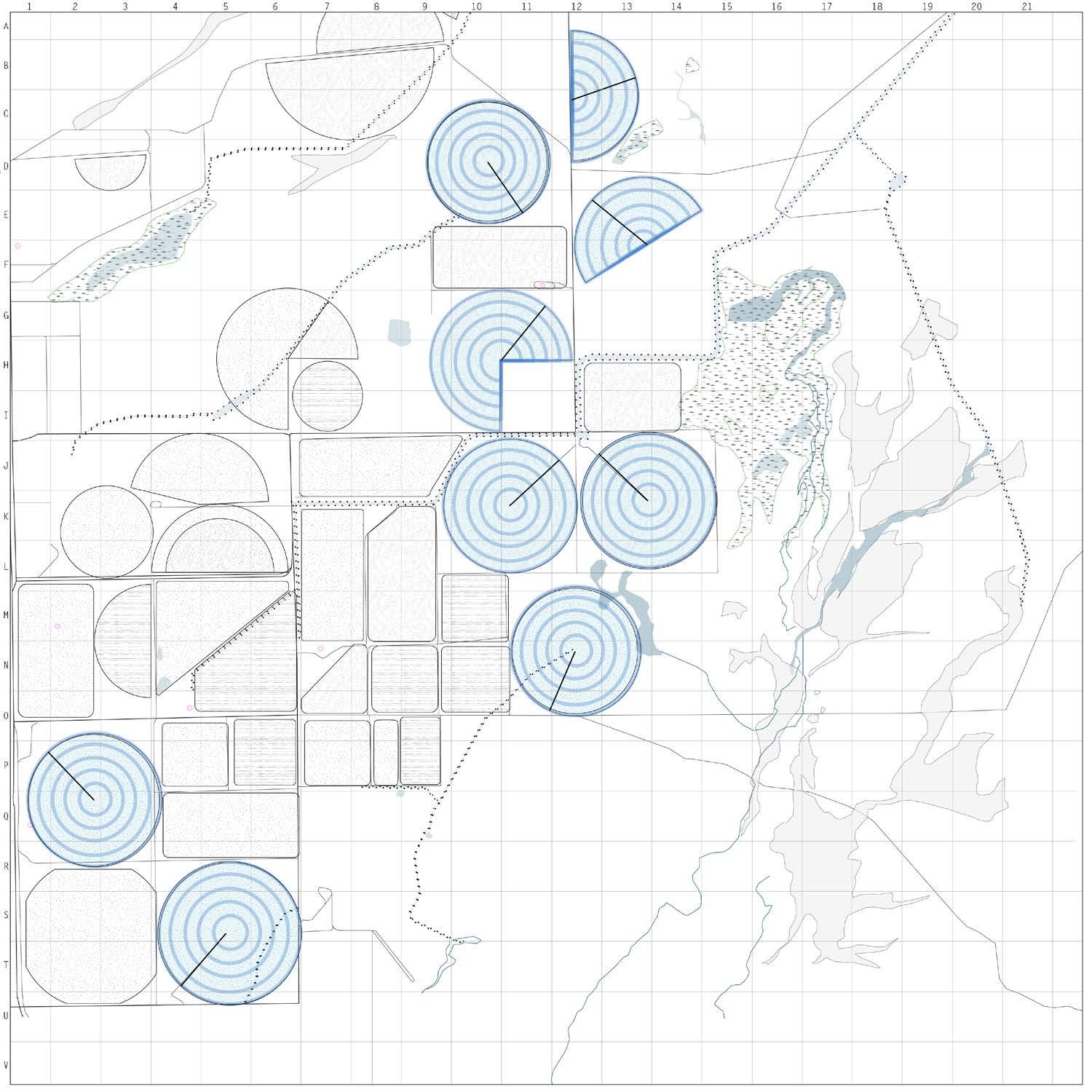
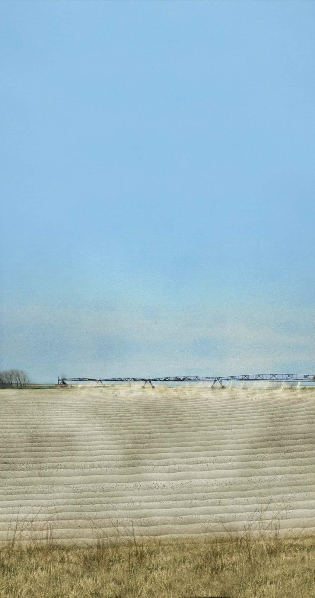
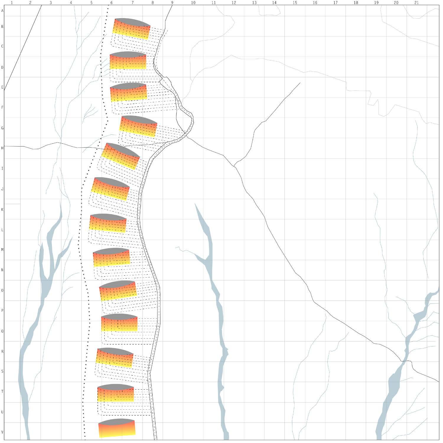
SITE 1: PIVOT | CENTER PIVOT AGRICULTURE
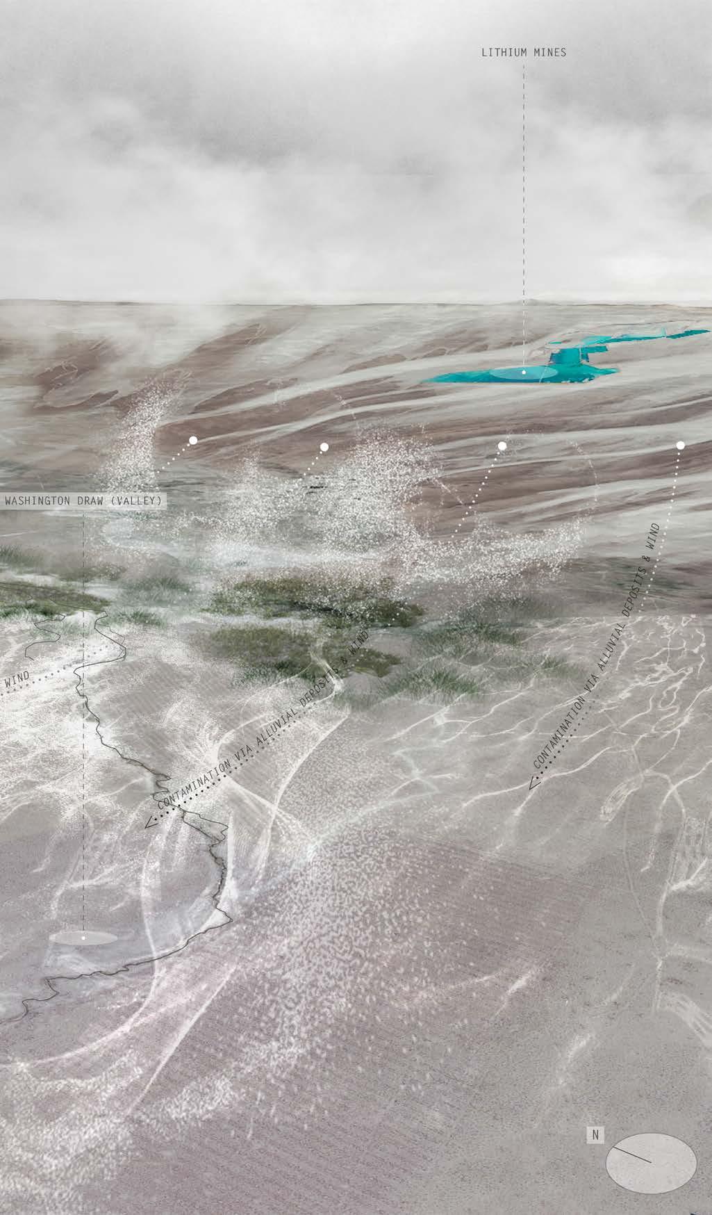
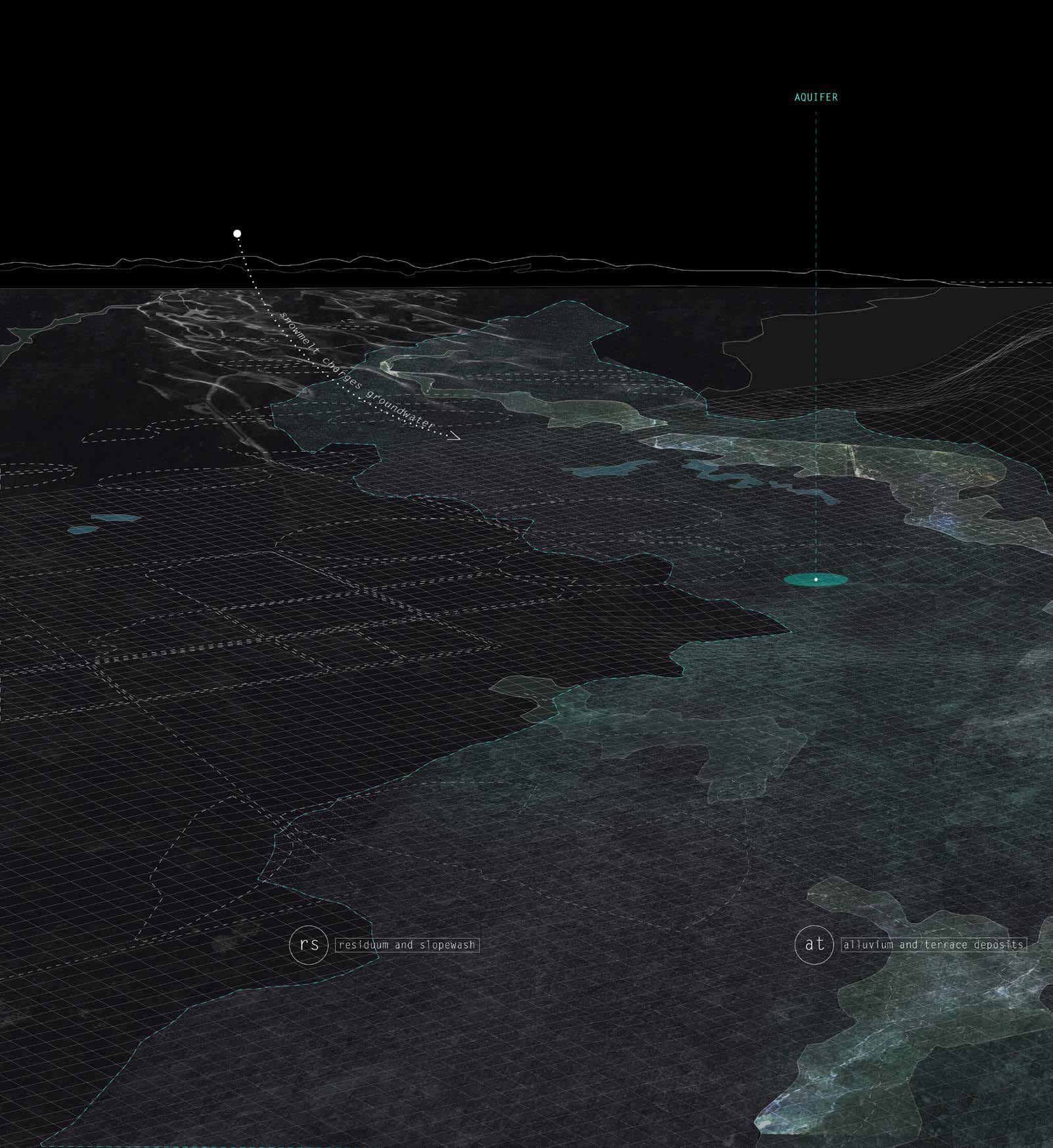
Land practices on Site 1 consist mainly of center pivot agriculture and row crops. A seasonal river in the “Eden Valley” feeds the farms through a series of canals. Since the parcels are downstream and at a lower topography than the lithium mine site to the west, the site is vulnerable to contamination via groundwater flow and toxic sediment that the river might collect.
Site 1 utilizes Magnesium, Potassium, and Boron as fertilizers for crops and Potash to improve water retention capabilities in soil as an anticipatory measure for future drought conditions exacerbated by the lithium mine.
129 IX-a Sites of Stewardship | PIVOT
130
SURFICIAL ANALYSIS OF SITE 1
Surficial analysis of site 1 expresses land practices and possible flows of contaminants through the Eden Valley via seasonal alluvial channels.
131 IX-a Sites of Stewardship | PIVOT
132 Surficial
soil
content information from: United States Geological Survey
SUB-SURFICIAL X-RAY ANALYSIS OF SITE 1
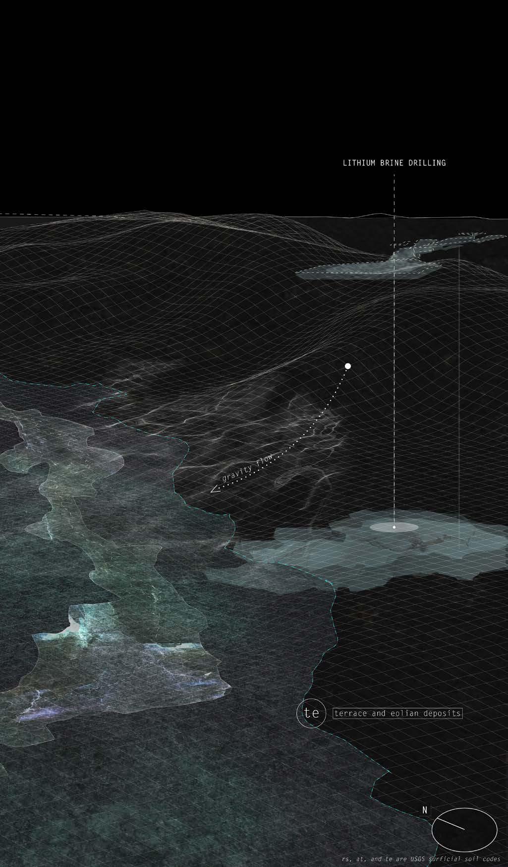
Sub-surficial x-ray analysis of site 1 uncovers groundwater levels, surficial soil types, topographical conditions, and how contaminants might spread below the surface.
133 IX-a Sites of Stewardship | PIVOT
134
SITE 1: PIVOT | CENTER PIVOT AGRICULTURE DESIGN STRATEGY
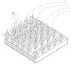
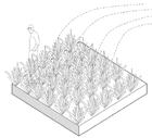
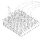
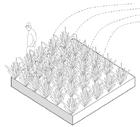
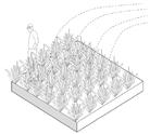
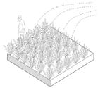
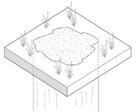
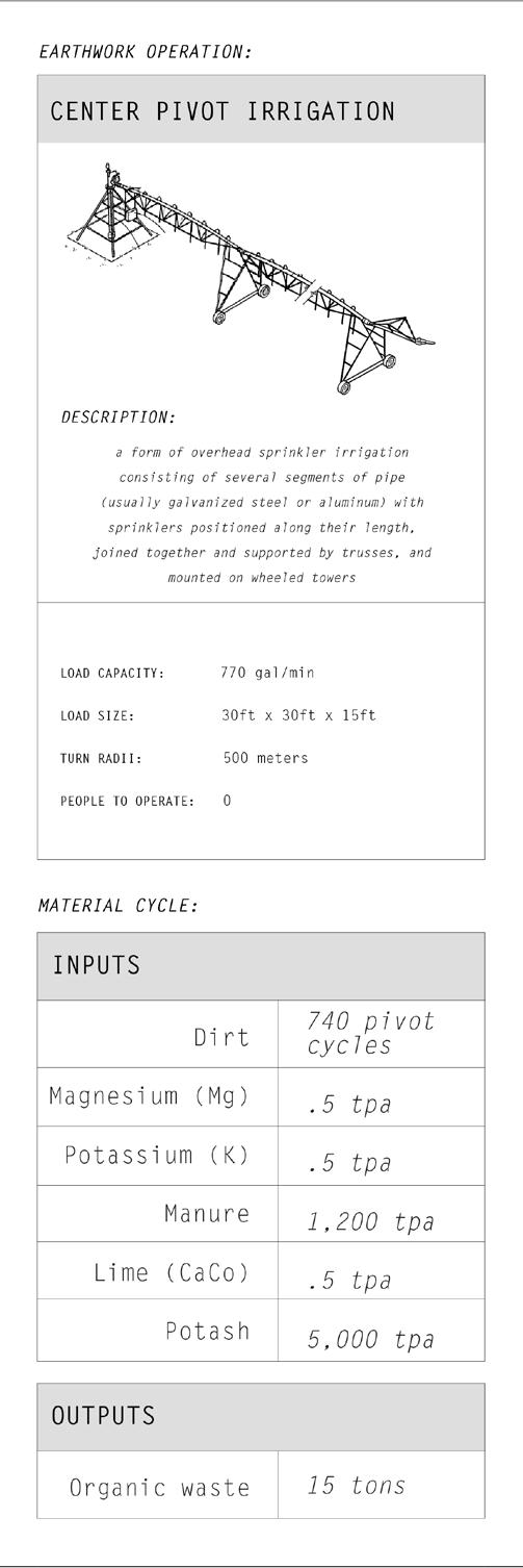
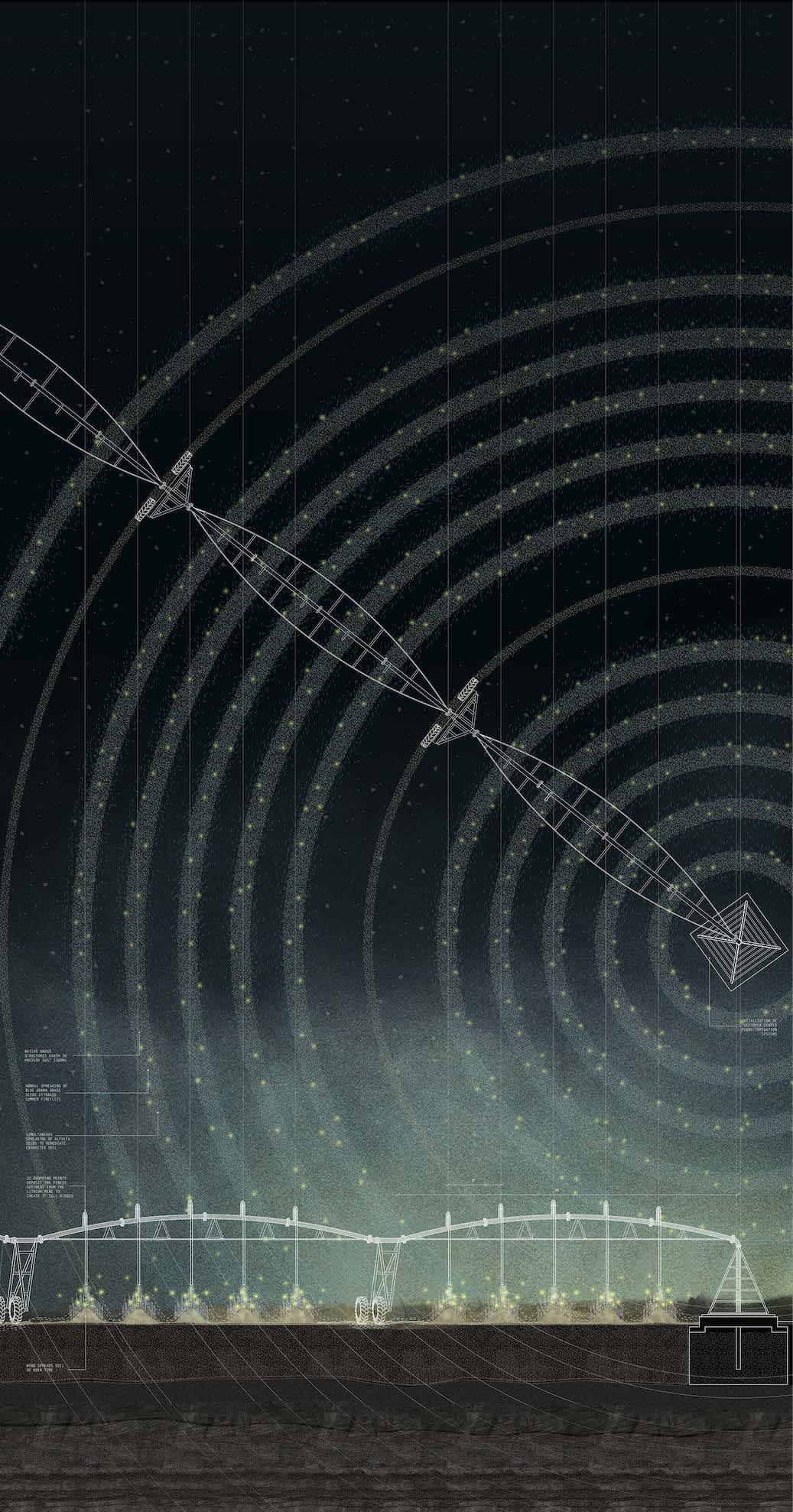
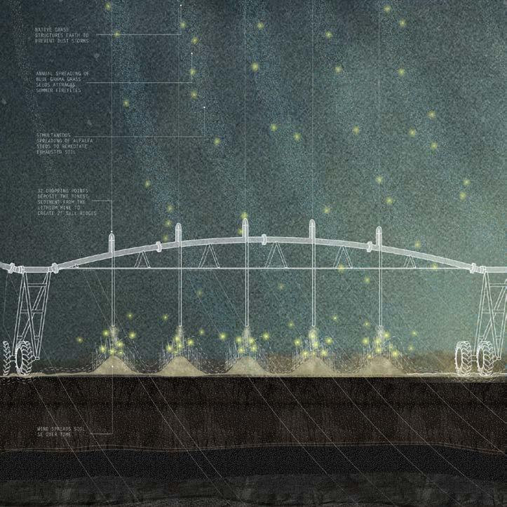
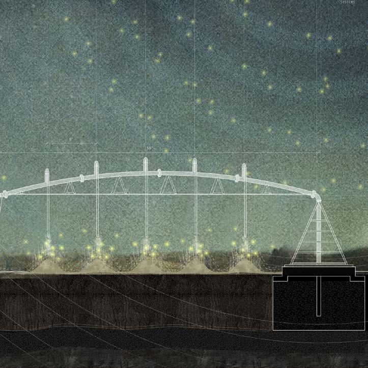
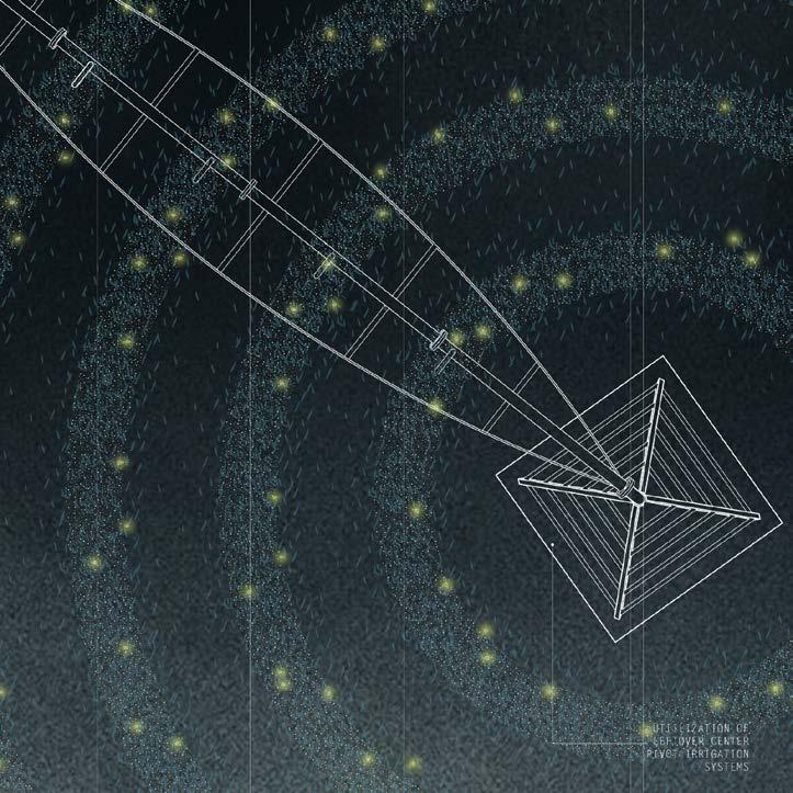
PIVOT utilizes leftover circle pivot irrigation infrastructure as sediment sprinklers after groundwater levels decrease to a point that nearby farmers transition to dry-farming. 32 dropping points along the irrigation system deposit the finest sediment from the lithium mine pond excavation. These create 3ft tall ridges which are simultaneously planted with Blue Gramma grass seeds, which require little water and attract fireflies during summer months. The center pivot deposition system completes a rotation every six months, depositing the seeds annually on the Spring Equinox. The grass structures the earth to prevent dust storms in the newly dry landscape.
135 IX-a Sites of Stewardship | PIVOT
Early charcoal sketch
136

137 IX-a Sites of Stewardship | PIVOT PIVOT
SITE 1: PIVOT | CENTER PIVOT AGRICULTURE AERIAL VIEW
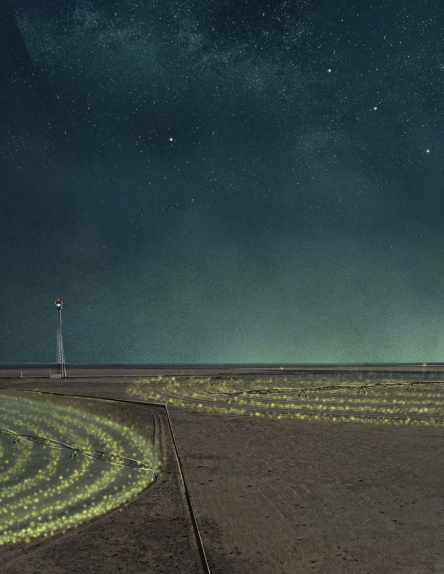
Halo-like rings of fireflies bear resemblance to the Milky Way overhead.

139 IX-a Sites of Stewardship | PIVOT

140
SITE 1: PIVOT | CENTER PIVOT AGRICULTURE EYE LEVEL EXPERIENCE
A mother and her child lay in the field of ridges, surrounded by fireflies, and gaze at early rising stars.
141 IX-a Sites of Stewardship | PIVOT
SITE 1: PIVOT | CENTER PIVOT AGRICULTURE EYE LEVEL EXPERIENCE
Retrofitted center pivot irrigation system deposits initial fine sediment and blue grama grass seeds.
143 IX-a Sites of Stewardship | PIVOT
144 IX-b
SITES OF STEWARDSHIP
SITE
2: SWOOP
Riparian Sand Dunes Remediate Boreholes
145 IX-b Sites of Stewardship | SWOOP
146 +0 ft .25 mi
Map by Gracie Meek. Data from the United States Geological Survey, the Wyoming Landscape Conservation Initiative, the Wyoming State Geological Survey, and OpenStreetMaps
The Killpecker Sand Dunes, a field of naturally occurring dunes shaped over 15,000 years of high winds blowing sand from the Big Sandy River, is currently used as a tourist destination for dune buggies and sand surfing.
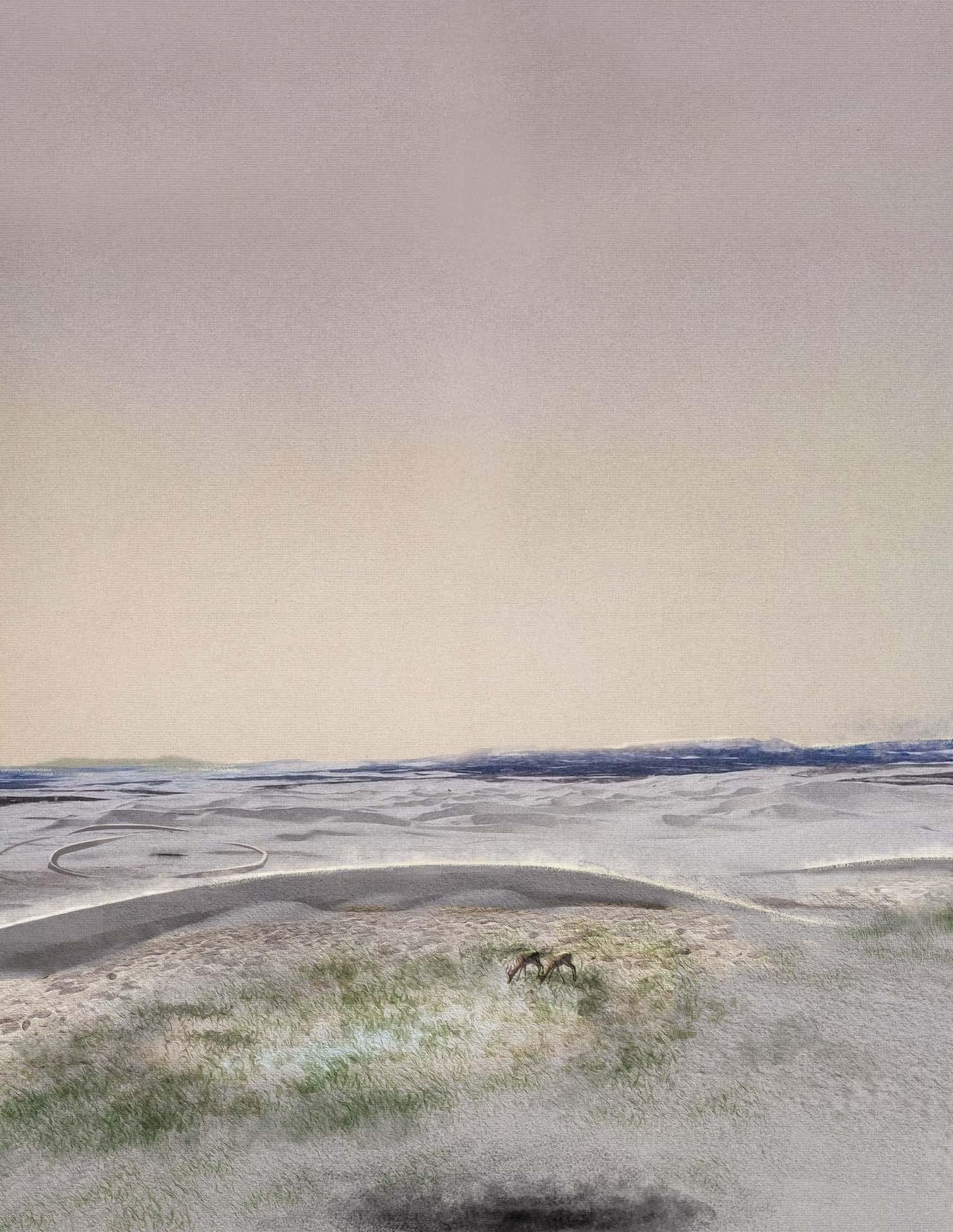
Along with recreational activities, the sand dune ecosystem also harbors a plethora of riparian life, to the great interest of conservationists in the area. Sand blows over drifted snow in the wintertime and compresses it into ice, delaying the rate of water retention. This creates seasonal wetland ponds where cattle and antelope drink and graze.
147 IX-b Sites of Stewardship | SWOOP
SITE 2: SWOOP | SAND DUNES
148
SITE 2: SWOOP | SAND DUNE DESIGN STRATEGY
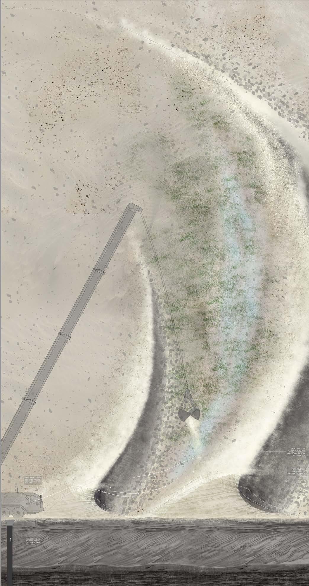
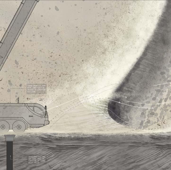
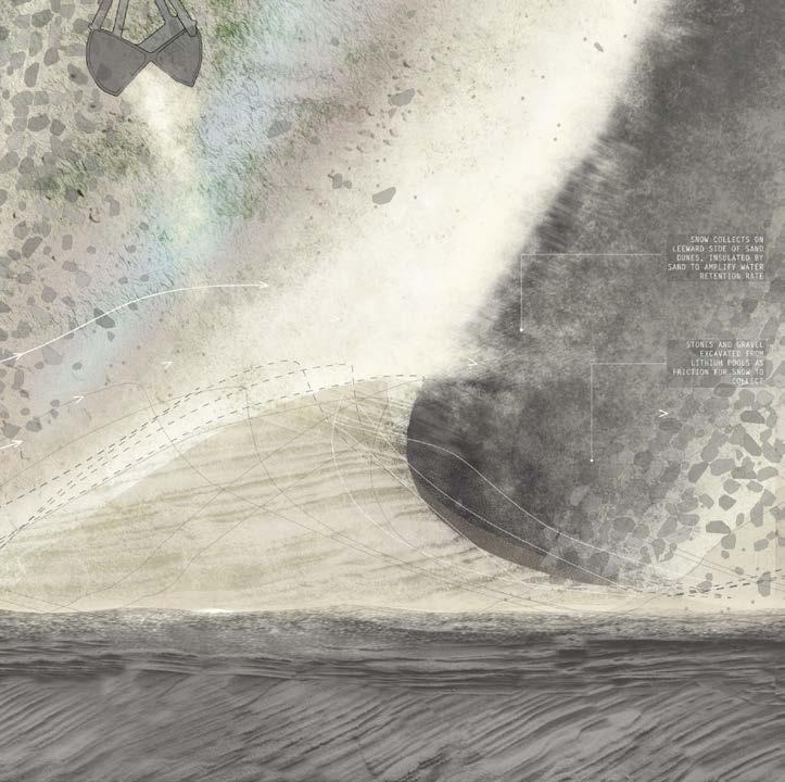
Engaging with the natural processes of sand dune formation by wind, SWOOP is constructed preemptively in anticipation of groundwater drying up due to the lithium mine. Swoop is deposited by the swinging of a crane’s arm as it traces the path of abandoned infrastructural scars on the ground. Each pivot point marks the borehole of a previous drilling operation. Aggregating sand on its leeward sides to intensify the natural process of water retention and pondmaking from snow compacted under layers of sand, it simultaneously remediates the land marred by past extractive systems while anticipating the reduction of the water table due to the mine. A constructed barometer in the landscape, it renders visible and measures possible salt deposition due to wind direction as it relates to seasonal change as sand ebbs and flows.
149
IX-b Sites of Stewardship | SWOOP
Early charcoal sketch
150
151 IX-b Sites of Stewardship | SWOOP SWOOP
SITE 2: SWOOP | SAND DUNE AERIAL VIEW
Antelope graze near a wetland pool made possible by the sand dune swoop remediating an abandoned borehole.

153
IX-b Sites of Stewardship | SWOOP
154
SITE 2: SWOOP | SAND DUNE EYE LEVEL EXPERIENCE
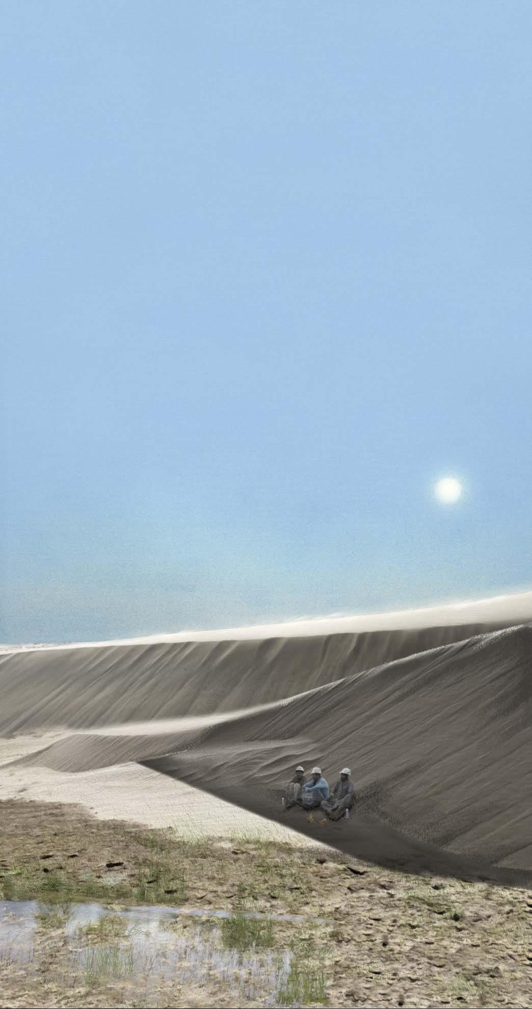
Oil field workers eat lunch sheltering from the harsh sun in the shade of a sand dune swoop.
155 IX-b Sites of Stewardship | SWOOP
156
SITE 2: SWOOP | SAND DUNE EYE LEVEL EXPERIENCE
A rancher and his son watch cattle drink at dawn while snowdrifts melt.
157 IX-b Sites of Stewardship | SWOOP
158 IX-c
SITES OF STEWARDSHIP
SITE 3: WRINKLE
Landscape as Litmus Test and Measuring Device
159 IX-c Sites of Stewardship | WRINKLE
160 +0 ft .25 mi
Map by Gracie Meek. Data from the United States Geological Survey, the Wyoming Landscape Conservation Initiative, the Wyoming State Geological Survey, and OpenStreetMaps
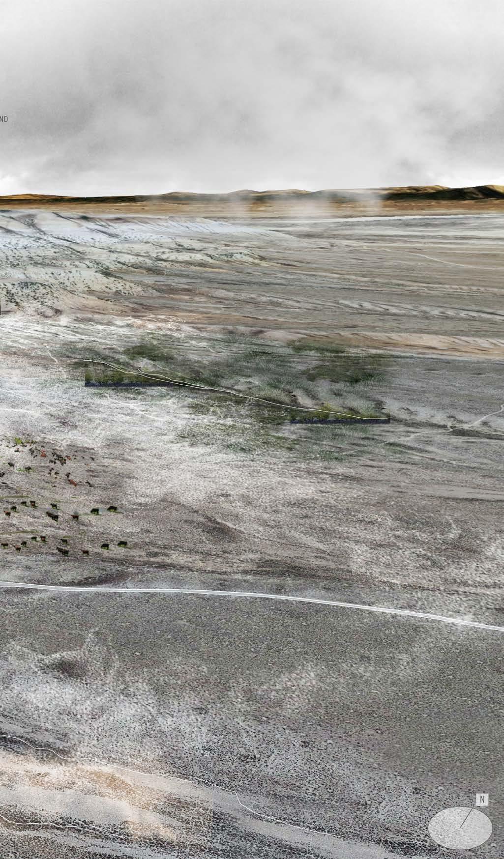
3: WRINKLE | CATTLE RANCHING
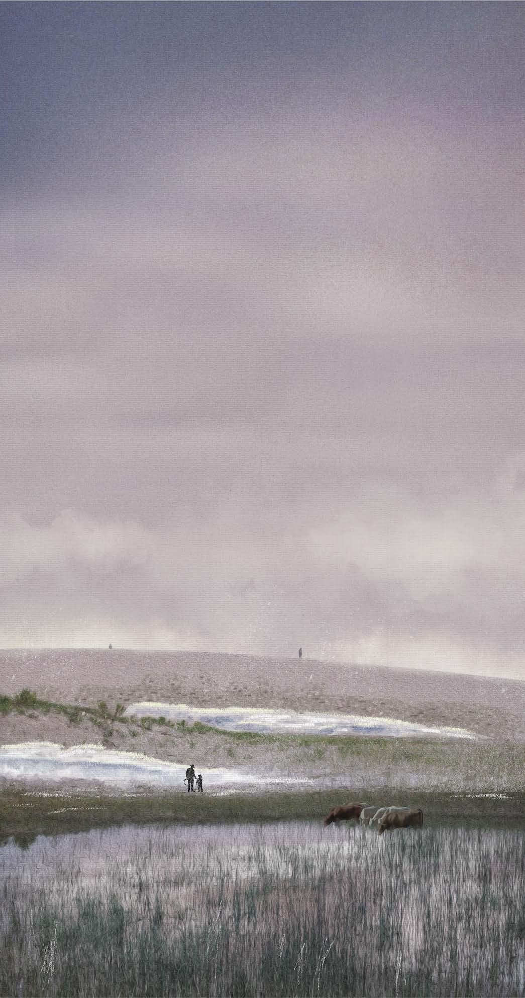
Land practices on Site 2 consist of cattle ranching, where typical herds reach 100 heads. Light-colored sandy cliffs with seasonal streams characterize the rangeland, where cattle ranchers fear that groundwater levels will drop due to the future mine. If this happens, the grassland ecosystem that the cows rely on for food will be parched.
Site 2 utilizes salt as salt licks for cattle, and Magnesium and Potassium for essential dietary nutrition.Like Site 1, ash can be used in the soil to improve water retention capabilities in soil as an anticipatory measure for future drought conditions exacerbated by the lithium mine.
161 IX-c Sites of Stewardship | WRINKLE
SITE
162
SURFICIAL ANALYSIS OF SITE 3
Surficial view onto Site 3 expressing cattle rangeland and possible flow of contaminants over sandy cliffs via seasonal alluvial channels.
163
IX-c Sites of Stewardship | WRINKLE
164
Surficial
soil content information from: United States Geological Survey
SUB-SURFICIAL X-RAY ANALYSIS OF SITE 3
Subsurface X-Ray view into Site 3 uncovering groundwater levels, surficial soil types, topographical conditions, and how contaminants might spread below the surface.
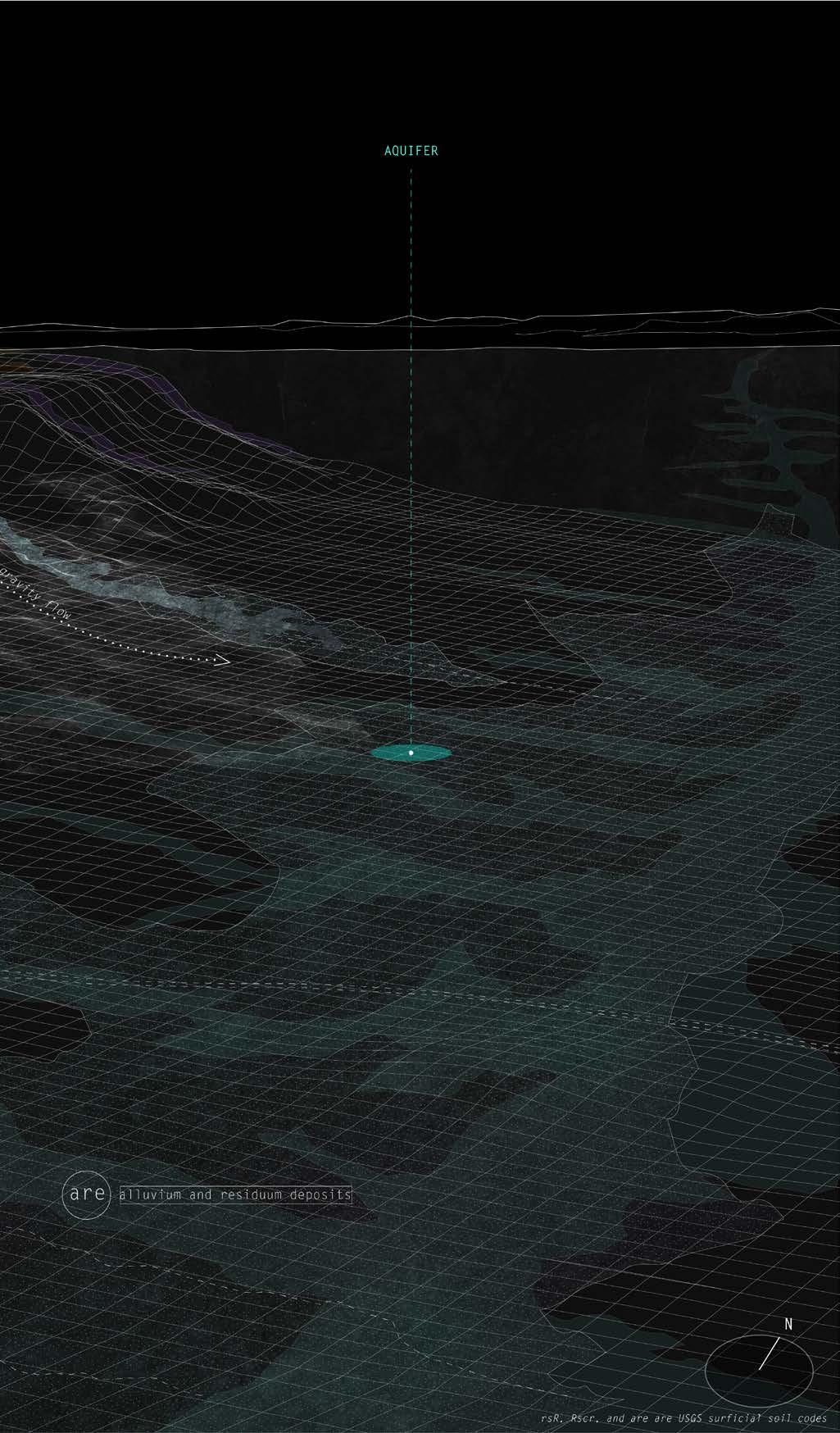
165
IX-c Sites of
| WRINKLE
Stewardship
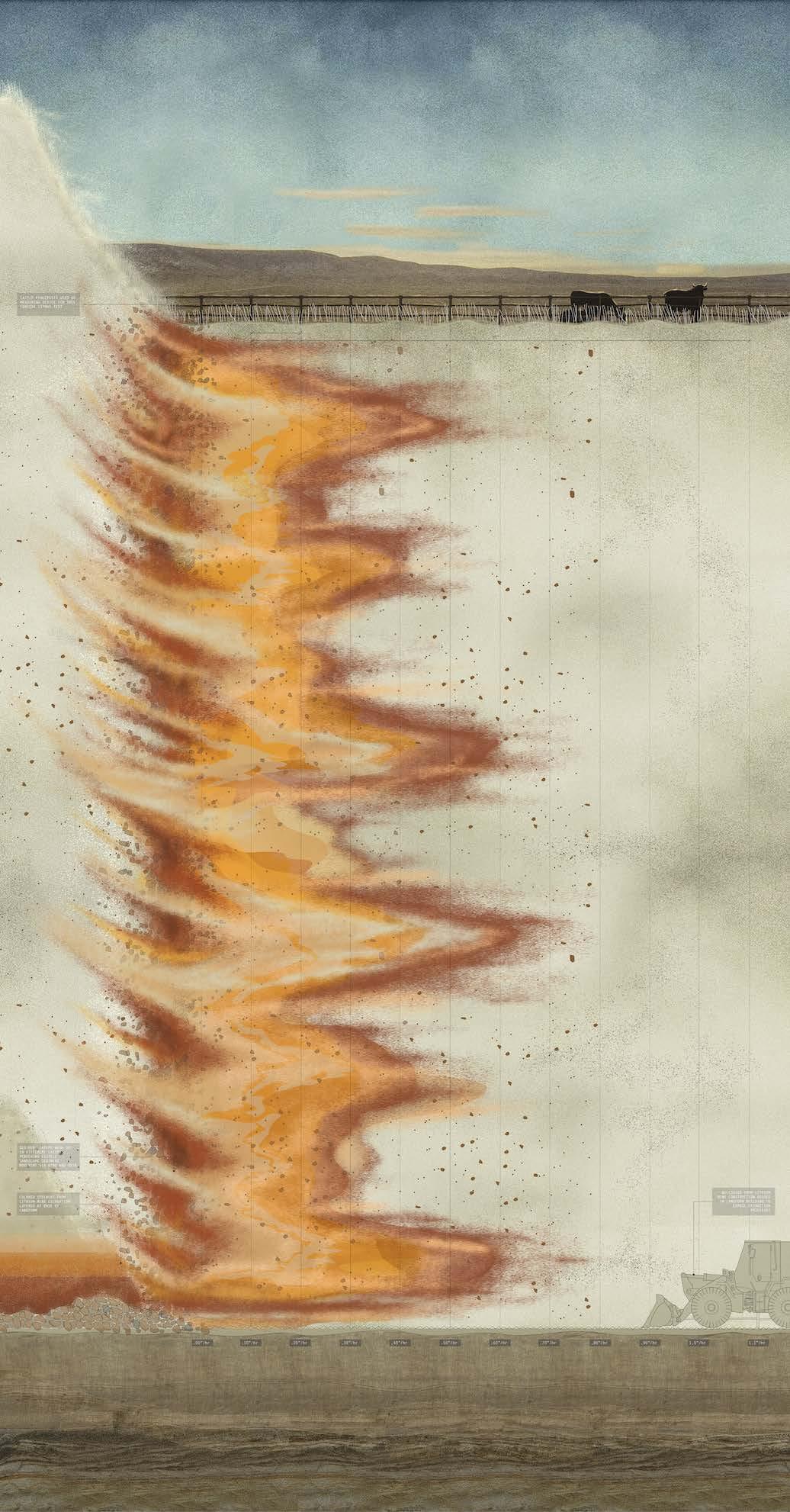
166
SITE 3: WRINKLE | CATTLE RANCHING DESIGN STRATEGY
Constructed at the same time as the lithium mine, WRINKLE is pushed into the landscape with excess bulldozers and dirt next to the roads. Red, orange, and yellow sediments excavated from the mine’s construction are layered at the base of the Wrinkles. A litmus test in the landscape to register the amount of erosion caused by summer rainfall and wind, it correspondingly catches excess salt from the mines to be used to salt winter roads and make licks for cattle. Adjacent cattle ranching fences are an increment of measure for the travel of color.
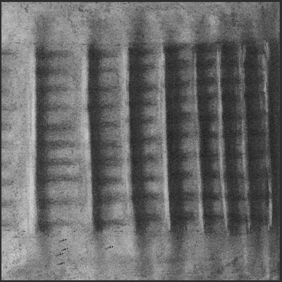
167
IX-c Sites of Stewardship | WRINKLE
Early charcoal sketch
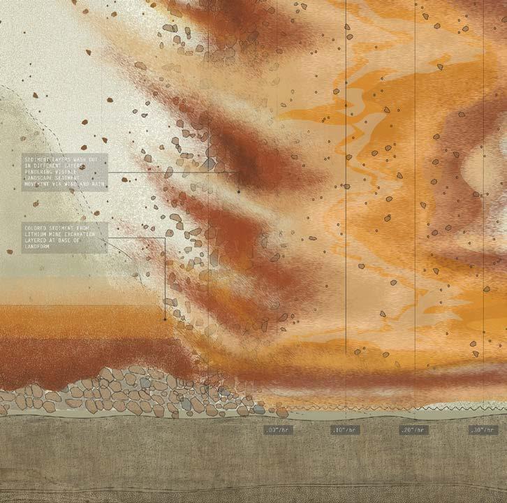
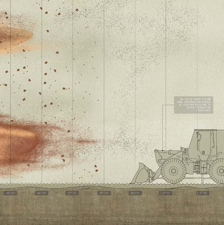
168
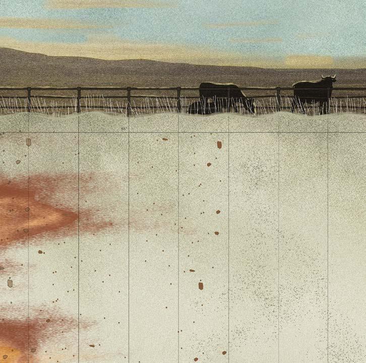
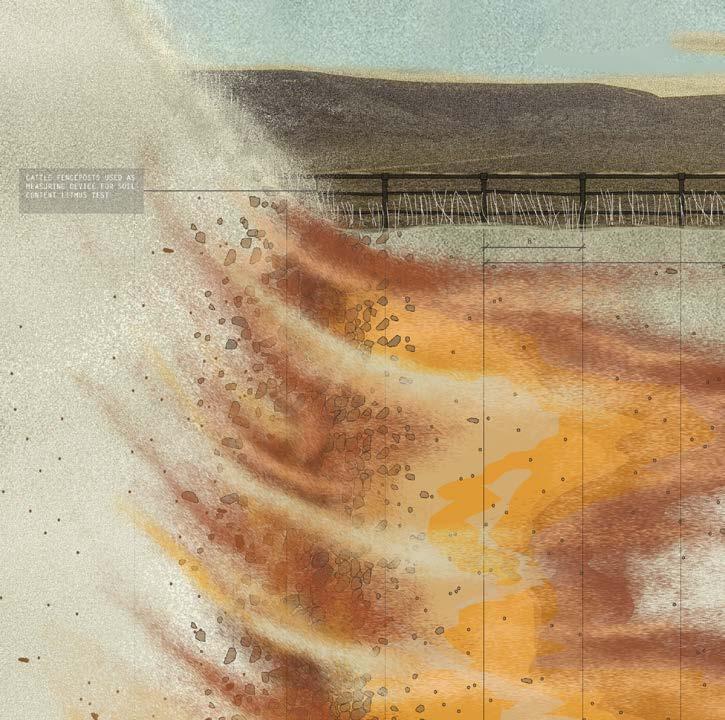
169 IX-c Sites of Stewardship | WRINKLE WRINKLE
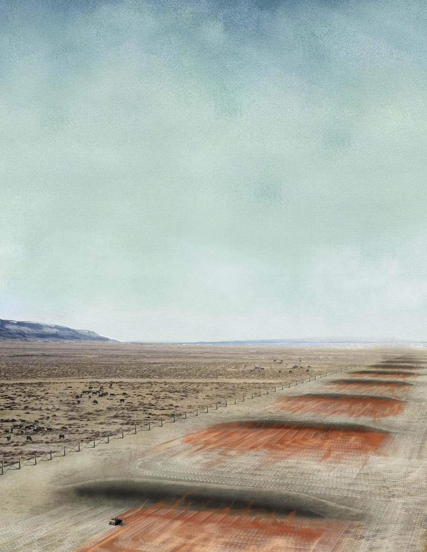
SITE 3: WRINKLE | CATTLE RANCHING AERIAL VIEW
A bulldozer scrapes colored sediment and excess salt to reset the measuring device.
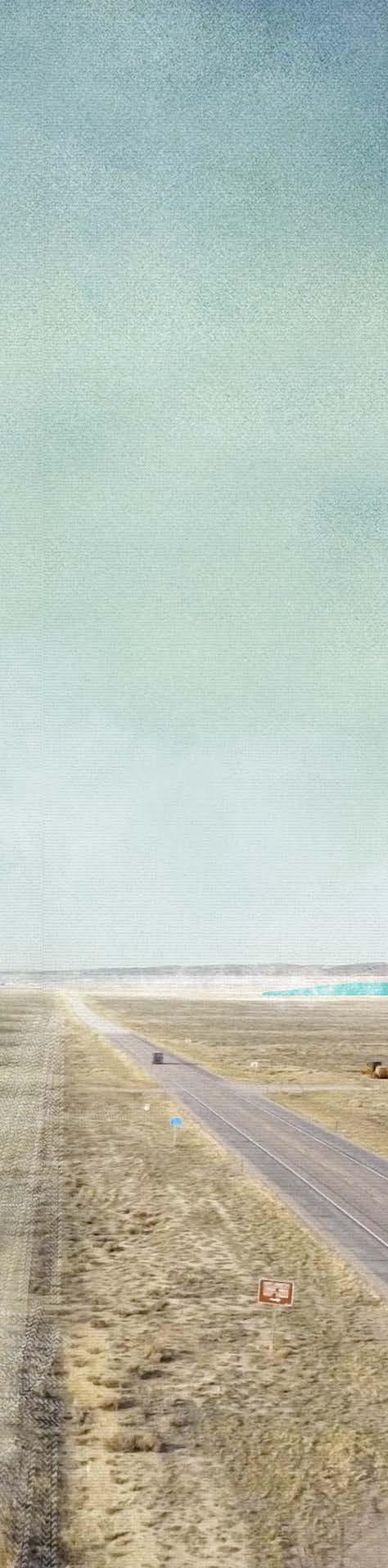
171
IX-c Sites of Stewardship | WRINKLE
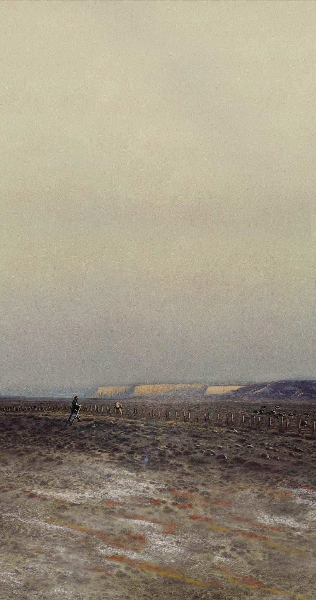
SITE 3: WRINKLE | CATTLE RANCHING EYE LEVEL EXPERIENCE
A cattle rancher repairs a measurement fencepost after a heavy thunderstorm.
173 IX-c Sites of Stewardship | WRINKLE
174 IX-d
SITES OF STEWARDSHIP
Commemorating Superior’s Coal Mining History as Warning to Future Extractive Practices
The area of “B” Hill, once a neighborhood of U.P.R.R. companyowned homes where my grandfather lived, and where nowadays only traces of the roads remain, was chosen as a site of intervention to both respect the history and the memory of the coal mines. “B” Hill is a lookout point over downtown Superior and valleys where coal miners used to commute daily. A shallow stream runs along its base and a small community park with a baseball diamond lies at the foot of the entry roads.
Superior is seen as an “in-between” site as a mediating ground between the more normatively urban Rock Springs and the designed landscapes. While more robust urban functions for the new labor stewardship force are associated with Rock Springs, Superior is a kind of “heritage” landscape—a landscape of ruin that is not dead. Superior survives through material traces of former industrial life and the ongoing process of ecological change and re-wilding.
Longtime locals share the memories and heritage of the historic coal town and develop renewed relations to Superior’s landscape, while the newcomers develop a new relationship with the extractive, yet simultaneously remediative, cultural, and visible landscape to create a new legacy. While the other landforms are more physically active, Superior’s intervention is one of heritage, memory, and commemoration.
The byproduct engaged with in Superior is historic lost labor and depletion instead of salt and minerals. It commemorates and brings value to the past as a premonition to lithium mine operators of what happens with the forgotten in utilitarian extractive practices.
175 IX-d Sites of Stewardship | SUPERIOR
SITE 4: SUPERIOR
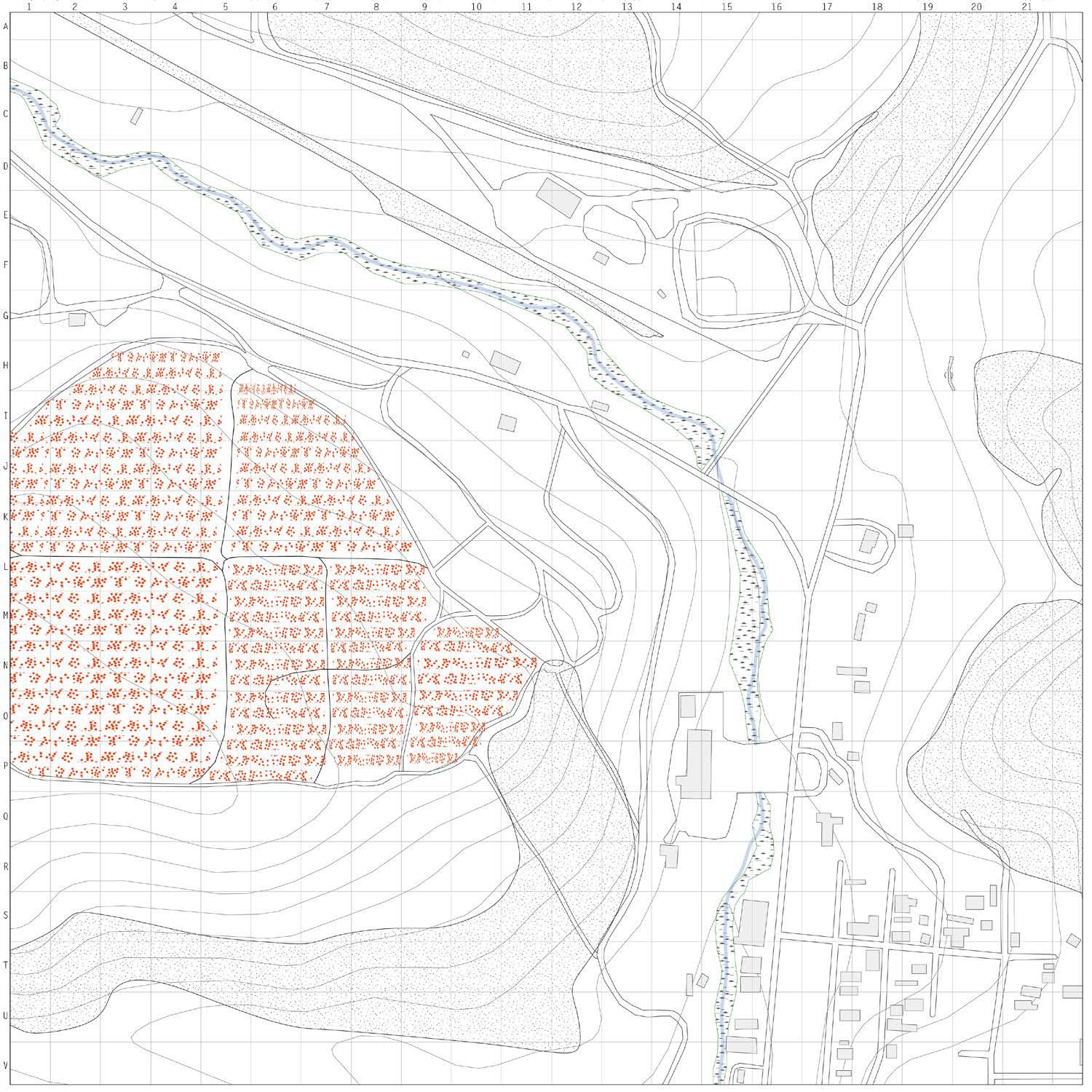
176 +0 ft .25 mi
Map by Gracie Meek. Data from the United States Geological Survey, the Wyoming Landscape Conservation Initiative, the Wyoming State Geological Survey, and OpenStreetMaps
SITE 4: SUPERIOR | COMMEMORATION
The labor to construct the landforms is composed of an excess of “in limbo” lithium mine workers due to their 2-week on 2-week off labor cycles. During their off cycles, the workers can be sponsored to construct and maintain the landforms. Lithium miners are now stewards, developing a sense of responsibility for the landscape.
The thesis rearranges the excess from capitalism, both labor and byproducts, as an environmentally reparative gesture toward a landscape scarred by histories of industrial resource extractive practices.
177
IX-d Sites of Stewardship | SUPERIOR
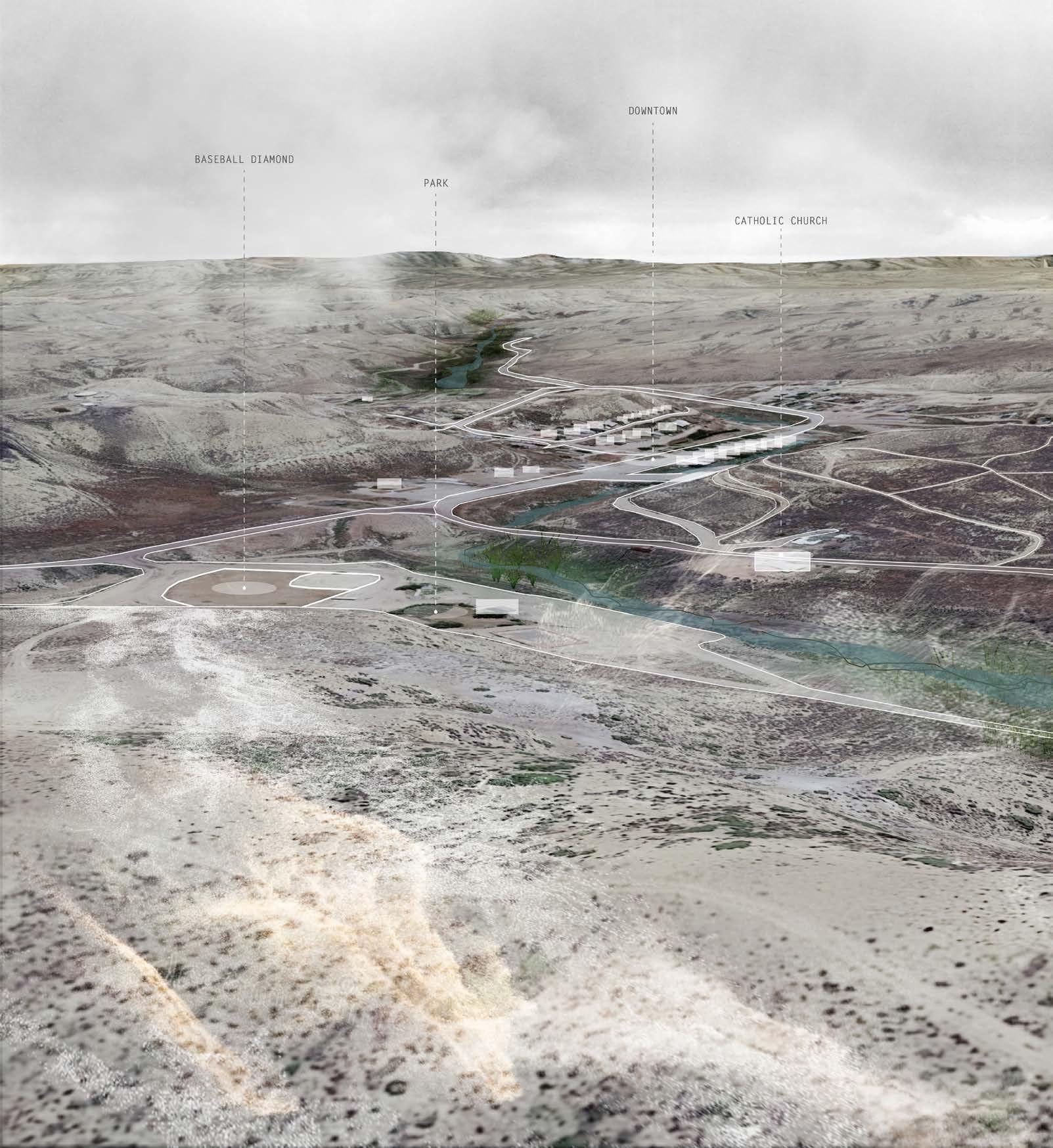
178
SURFICIAL ANALYSIS OF SITE 4
Surficial view onto “B” Hill in Superior showing relationship between the site of intervention, the community park, the historic tipple, and downtown.
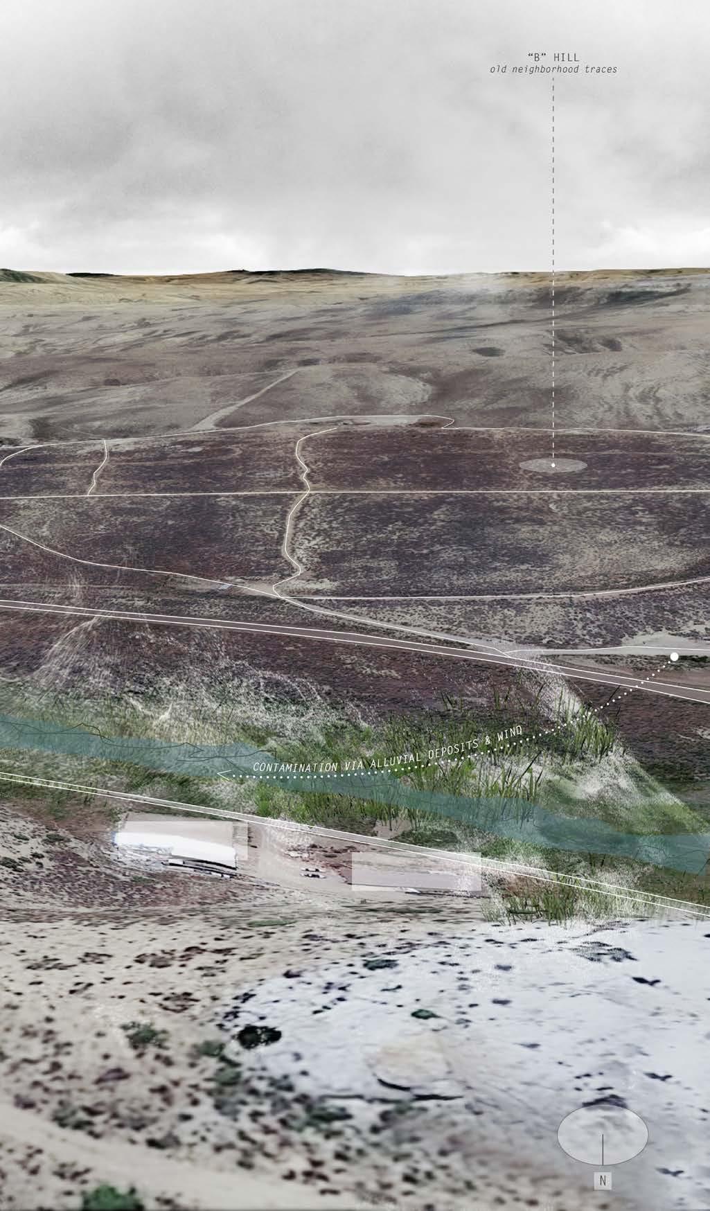
179
IX-d Sites of Stewardship | SUPERIOR
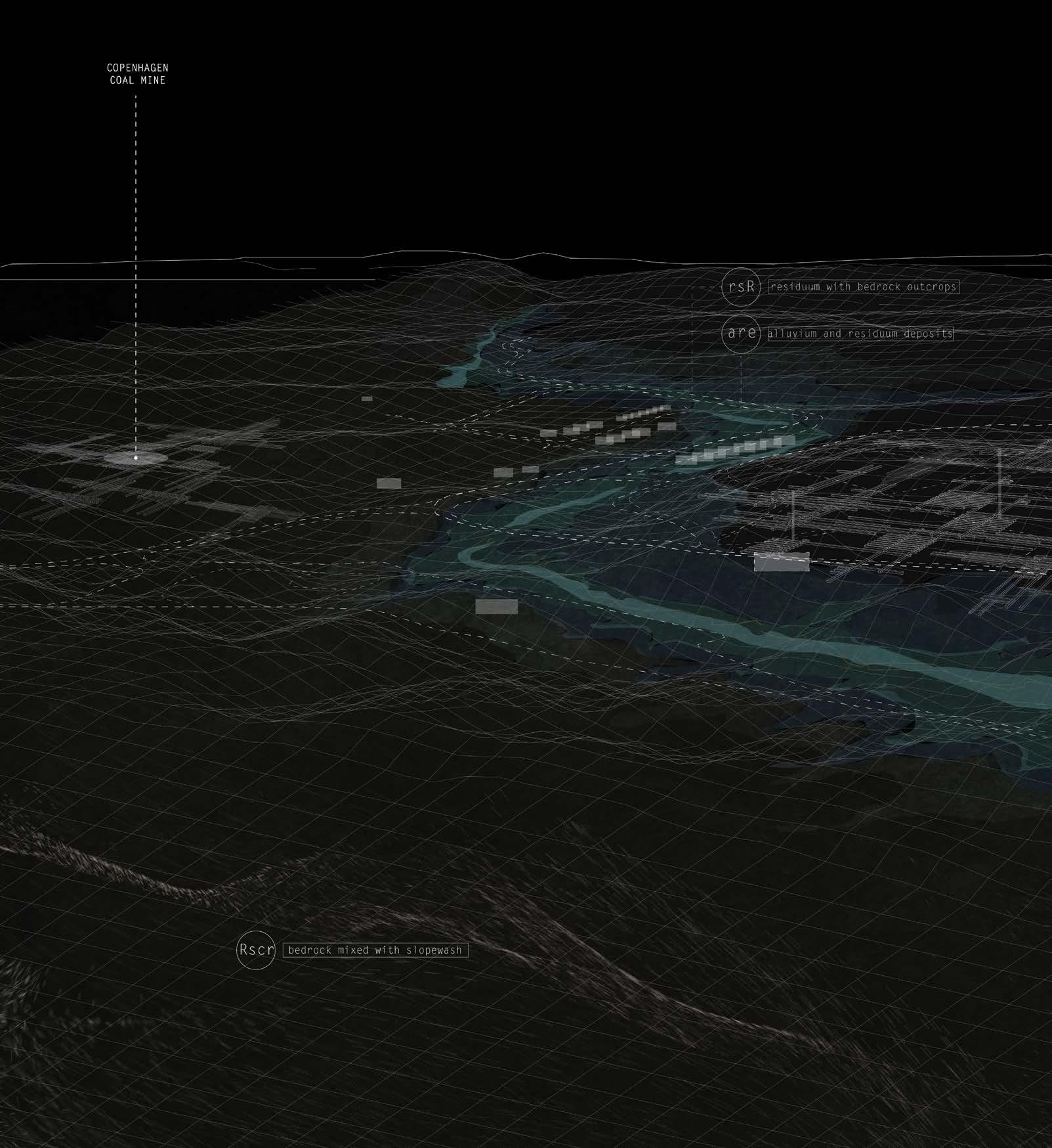
180
Surficial
soil content information from: United States Geological Survey
SUB-SURFICIAL X-RAY ANALYSIS OF SITE 4
Subsurface X-Ray view into “B” Hill in Superior revealing historic coal mine networks and uncovering groundwater levels, surficial soil types, and topographical conditions.
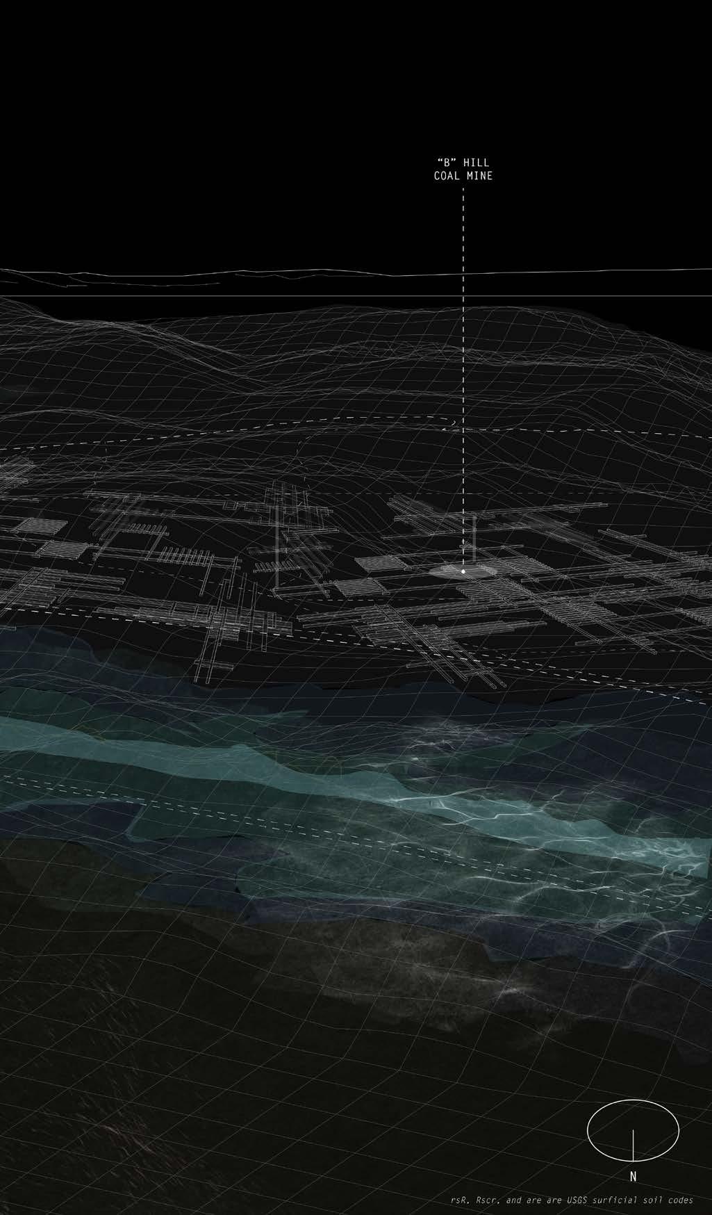
181
IX-d Sites of
| SUPERIOR
Stewardship
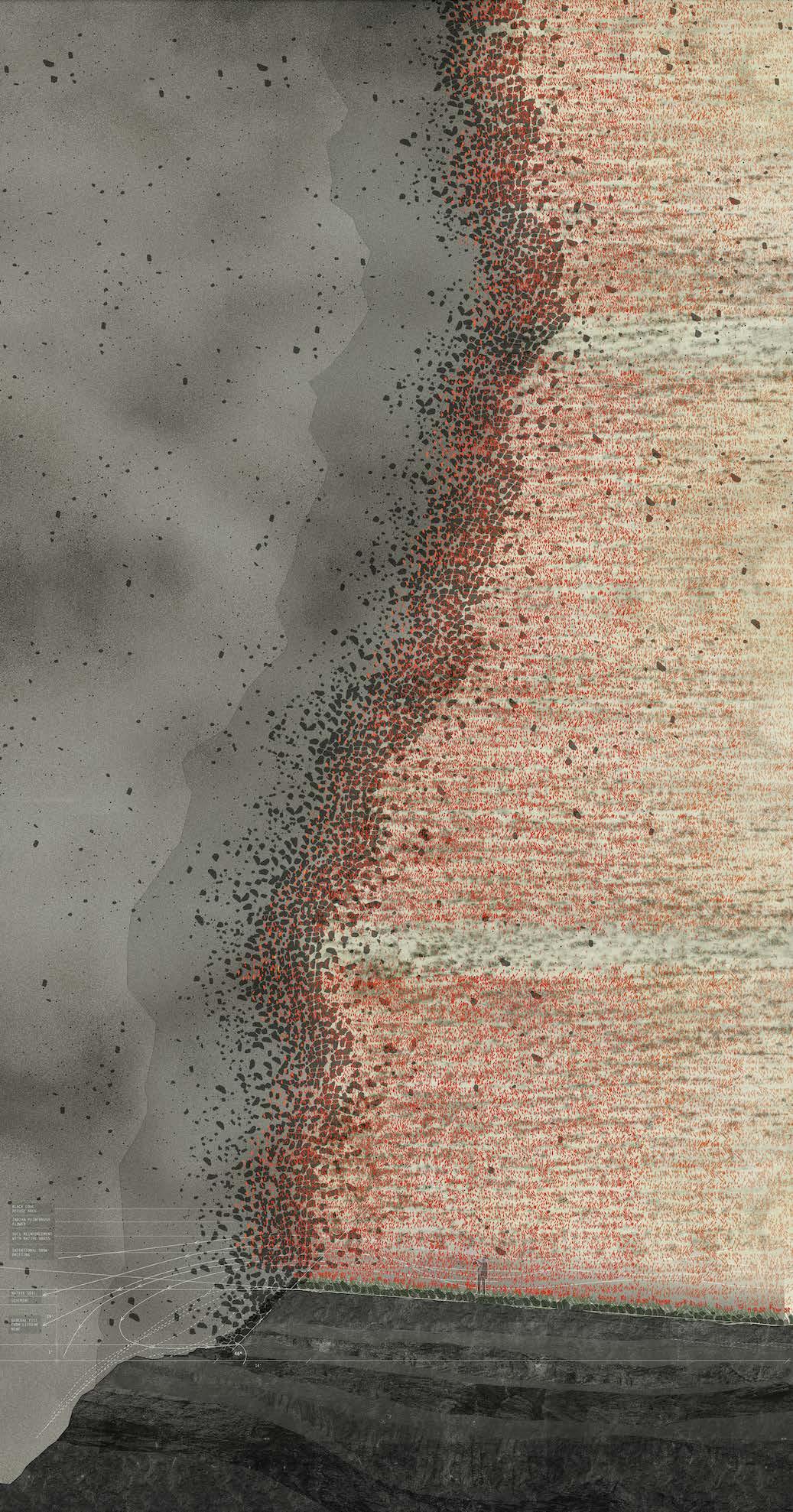
182
SITE 4: SUPERIOR | COMMEMORATION DESIGN STRATEGY
The planting of a field of red indian paintbrush flowers is a visible reminder of the lost labor in a decayed industrial landscape, where the byproduct is lost labor and meaninglessness instead of salt and minerals. It commemorates and brings value to the past as a warning/ premonition to lithium mine operators. The scars of the roads once supporting Union Pacific-owned company homes remain.
The field is on top of “B” Hill, a coal mining camp where my Grandfather used to live, where now only scars of the roads remain. The edge of the hill is lined with black coal refuse rocks, intentionally drifting snow during the winter to collect treasured water. When viewed from below in the historic downtown, one would see a thin band of black and red lining the hill as a remembrance.
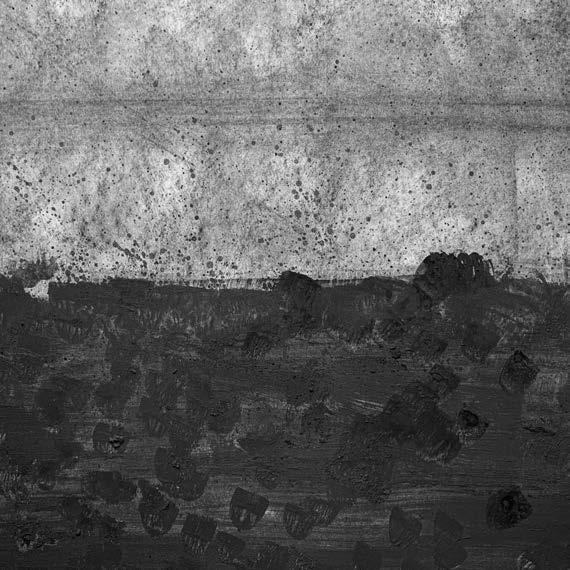
183
Early charcoal sketch
IX-d Sites of Stewardship | SUPERIOR
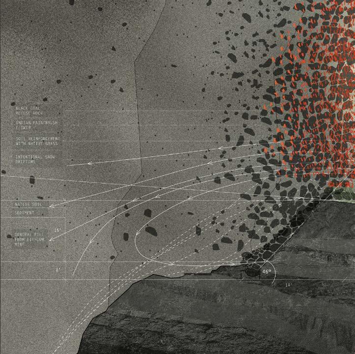
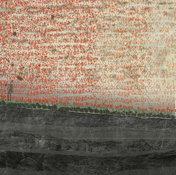
184

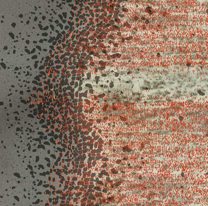
185 IX-d Sites of Stewardship | SUPERIOR SUPERIOR
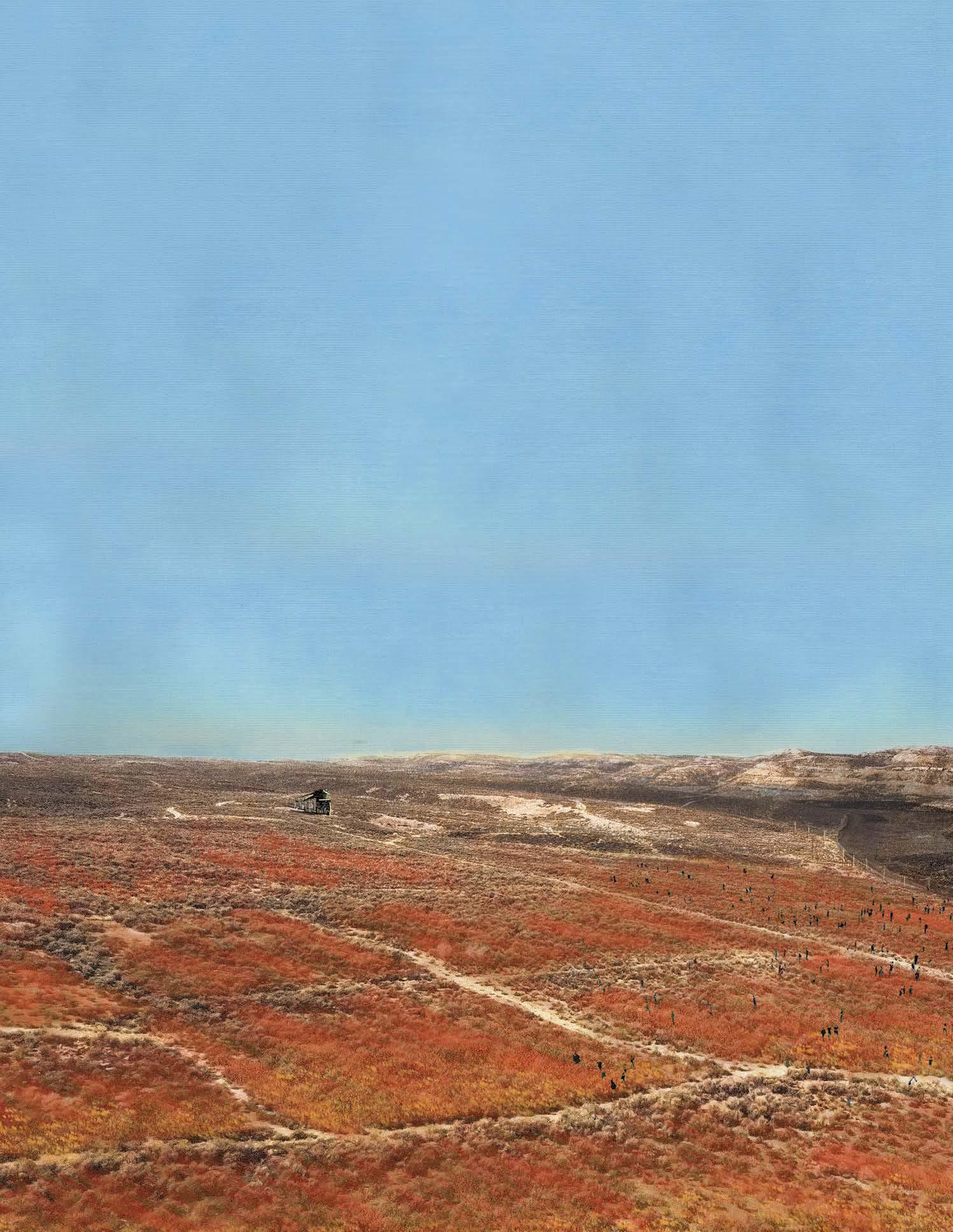
SITE 4: SUPERIOR | COMMEMORATION AERIAL VIEW
Children join the Wyoming Conservation Initiative to scatter red indian paintbrush flower seeds on top of “B” Hill.
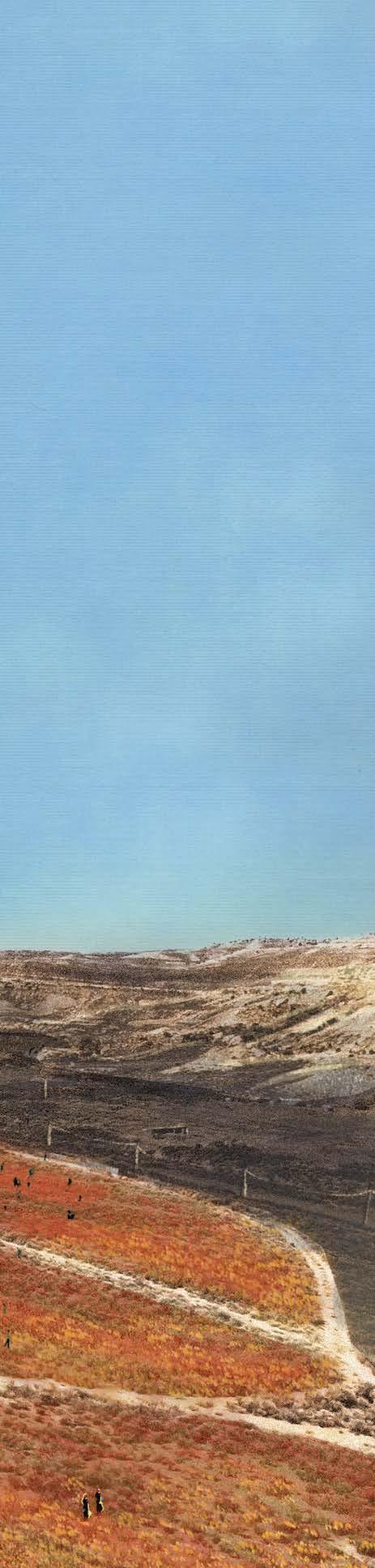
187
IX-d Sites of Stewardship | SUPERIOR
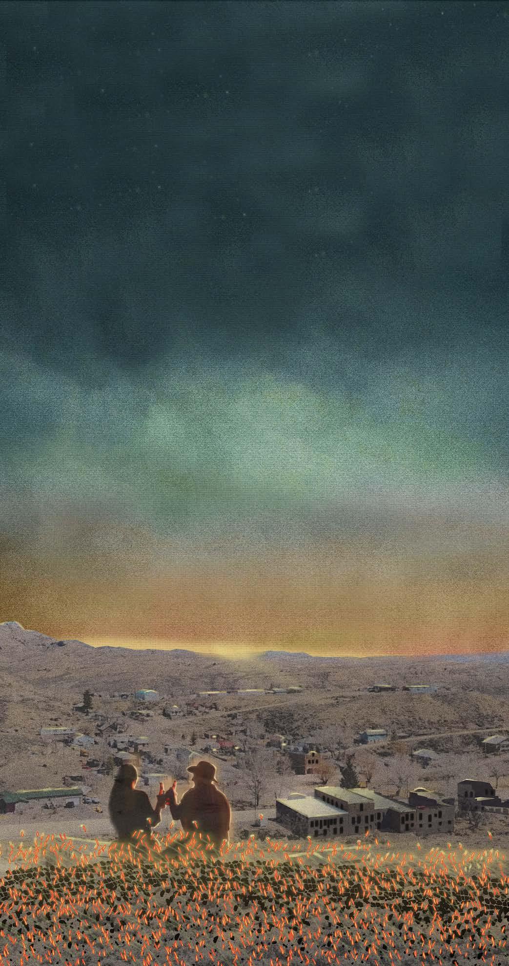
188
SITE 4: SUPERIOR | COMMEMORATION EYE LEVEL EXPERIENCE
“Roughneck” oil field workers toast a beer on top of “B” Hill looking over downtown while the dawn sun peeks over the horizon.
189
IX-d Sites of Stewardship | SUPERIOR

190
SITE 4: SUPERIOR | COMMEMORATION EYE LEVEL EXPERIENCE
A late spring snowstorm blows through Superior, and only the bright red line of flowers peeking above “B” Hill is visible.
191
IX-d Sites of Stewardship | SUPERIOR
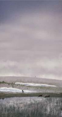
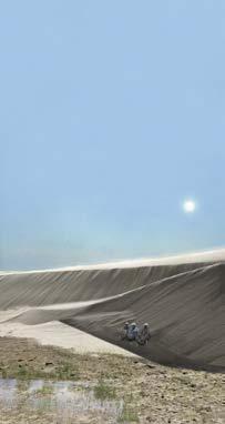
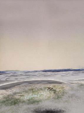
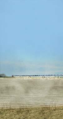
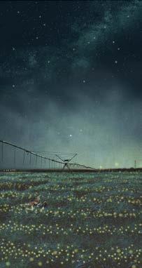
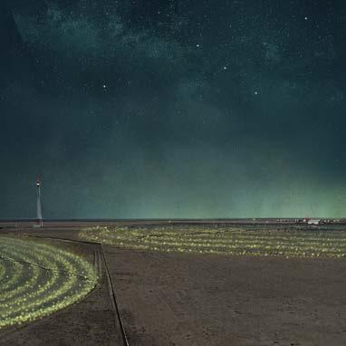
192
SLICES OF THE LANDSCAPE

Perspective drawings were positioned with the horizon line at the same level. When viewed all together as a continuous band, as intended, the visualizations appear as different temporal slices out of the same landscape field condition.
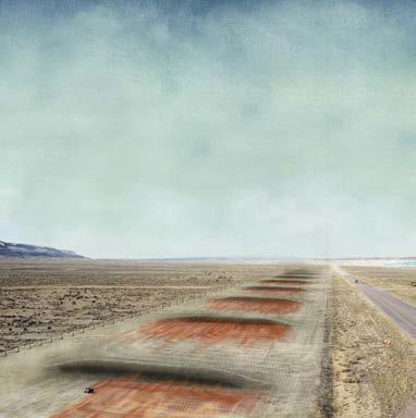
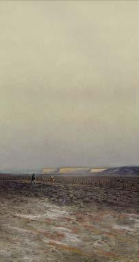
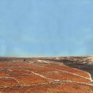

193
IX Sites of Stewardship
Choreographed in conjunction with lithium mine processes, the preceding maps anticipate and visualize landscape change over a 50 year time period.
194 X
SCHEMATIC PROJECTIONS
Change Over Time
The phasing of construction and maintenance of the four landform typologies are choreographed in conjunction with the expected lifetime and phasing of the lithium mine. Emphasizing certain milestones in lithium processes reveals and exposes its procedures and make warning of its future effects on the landscape. Milestones like the planning of the mine, the launching of construction, the initiation of the decommissioning process, and the final closure of the mines are all brought to light.
Over the 50 year lifetime of the lithium mine, the preceding maps illuminate areas of water retention in anticipation of groundwater depletion and resulting vegetation growth, the remediation of land scarred by boreholes and coal extraction, and the switch from center pivot agricultural practices to the remediative and lucrative blue grama grass. Because the landforms render visible the spread of contaminants throughout the landscape, the landscape sees dramatic color changes that help involve more people in the lithium mining process.
195
X Schematic Projections
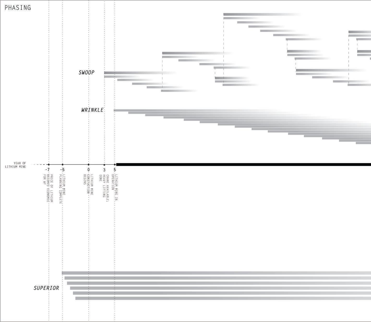
196
PHASING OF LANDFORM CONSTRUCTION, OPERATION, AND DECOMMISSION
Construction of the landforms are relationally phased with the planning, construction, operation, and decommissioning of the lithium mine to reveal and expose its processes.
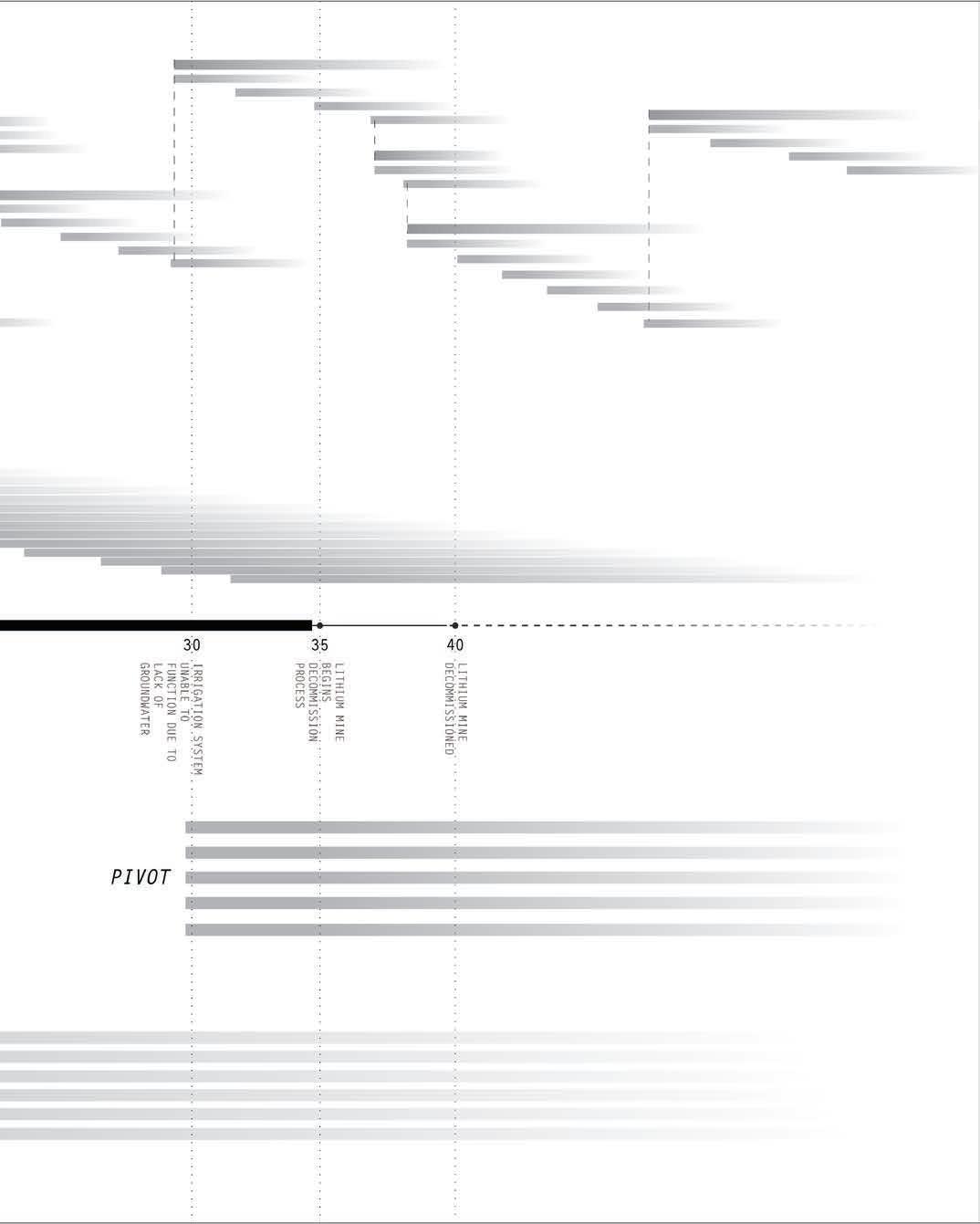
197
X Schematic Projections
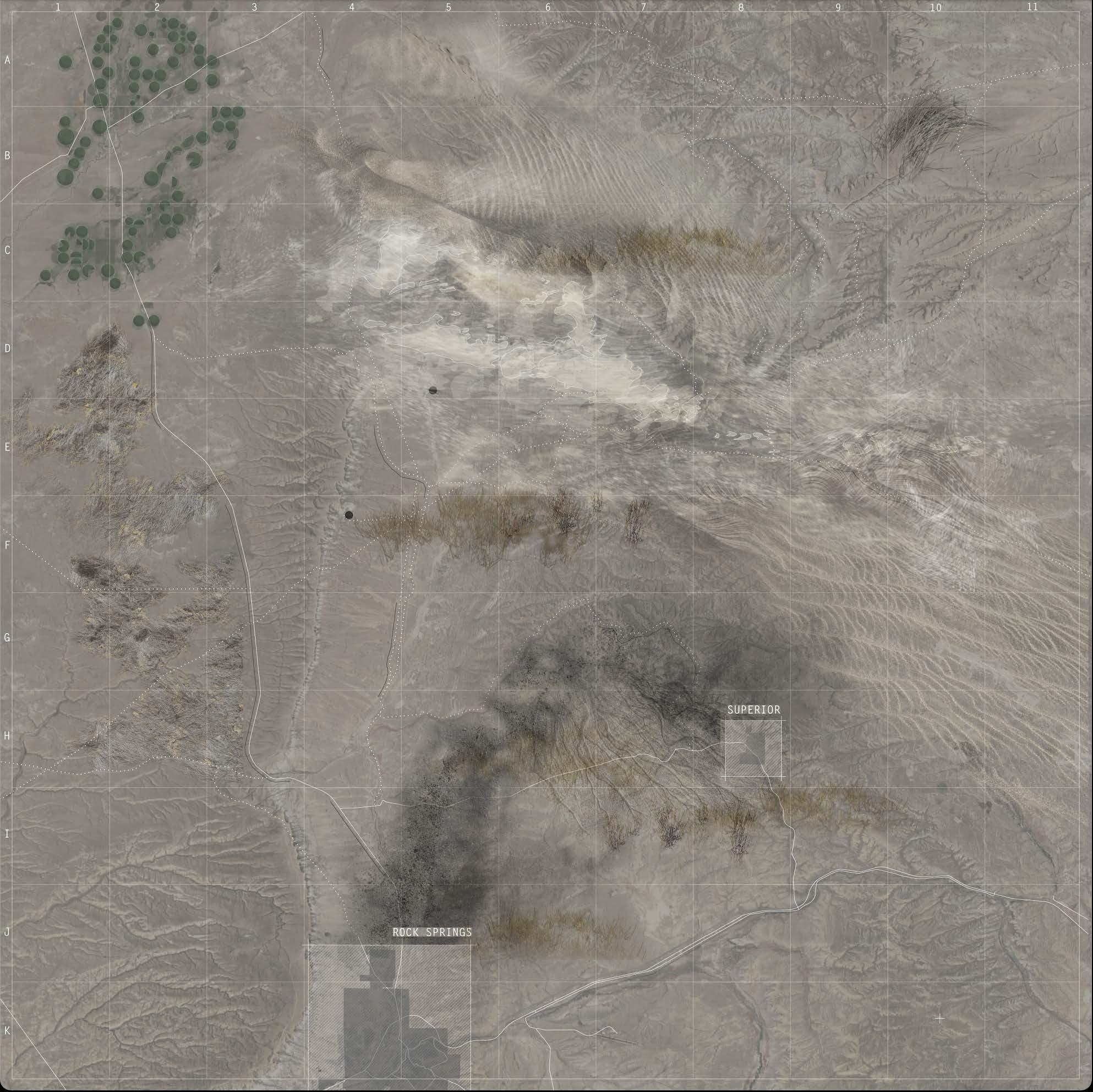
198 +0 ft
3 mi
Map by Gracie Meek. Data from the United States Geological Survey, the Wyoming Landscape Conservation Initiative, the Wyoming State Geological Survey, and OpenStreetMaps
PRESENT CONDITION BEFORE LITHIUM MINE CONSTRUCTION
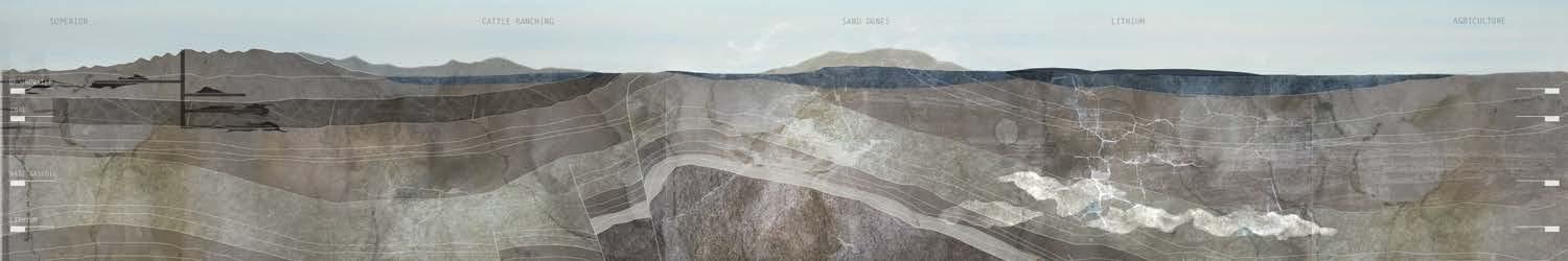
199 X Schematic Projections

200 +0 ft
3 mi
Map by Gracie Meek. Data from the United States Geological Survey, the Wyoming Landscape Conservation Initiative, the Wyoming State Geological Survey, and OpenStreetMaps
CONSTRUCTION OF LITHIUM MINE AND INITIAL PHASING OF LANDFORMS
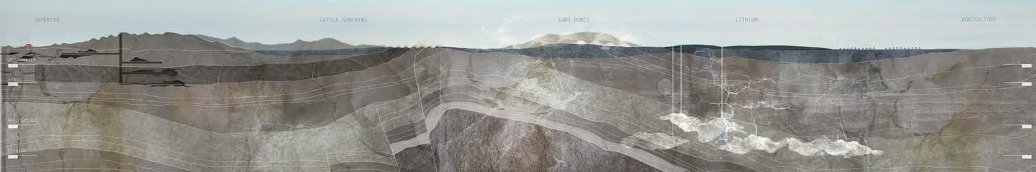
201 X Schematic Projections
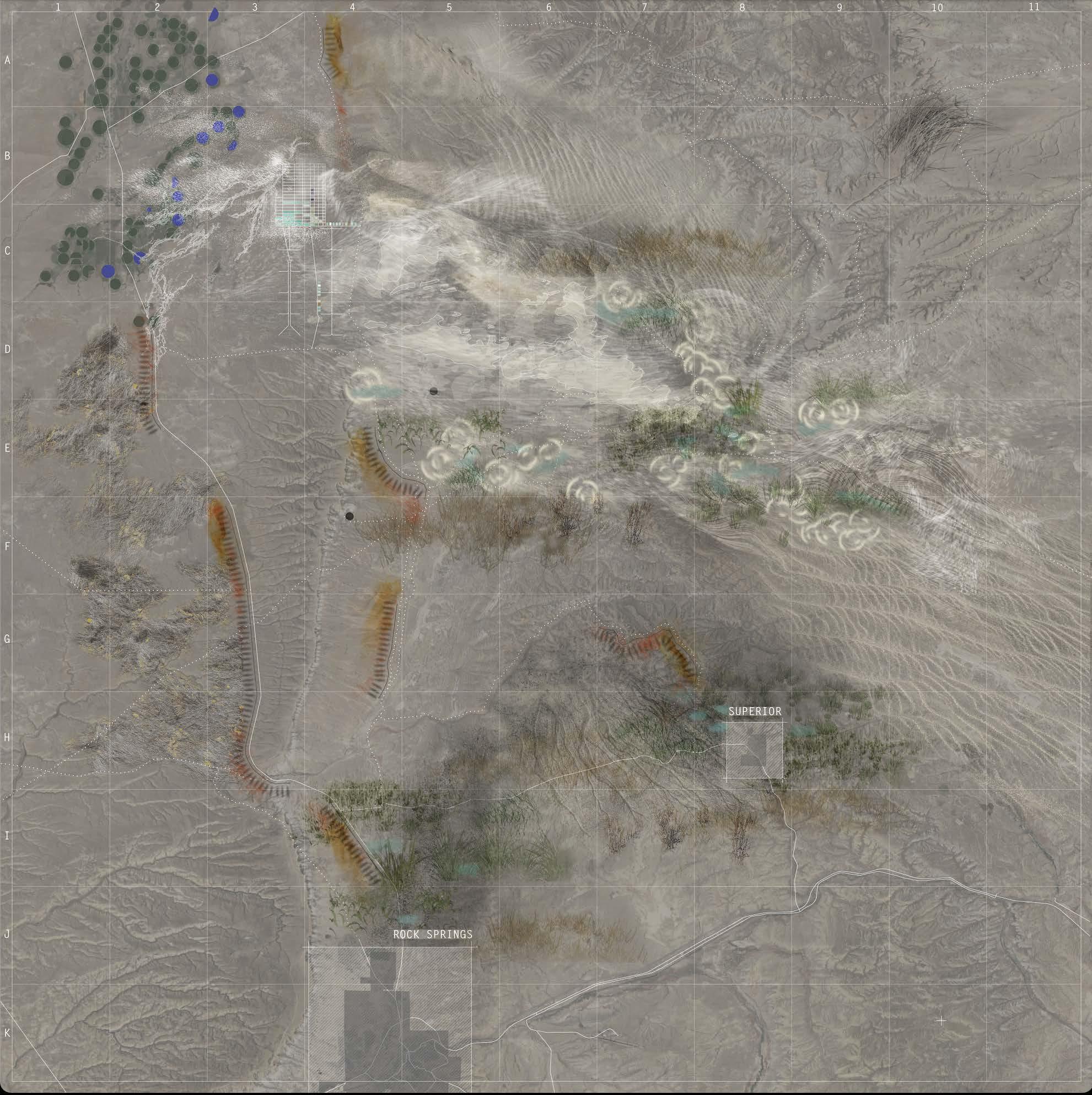
202 +0 ft
3 mi
Map by Gracie Meek. Data from the United States Geological Survey, the Wyoming Landscape Conservation Initiative, the Wyoming State Geological Survey, and OpenStreetMaps
LITHIUM MINE AND LANDFORMS AT FULL OPERATIVE CAPACITY
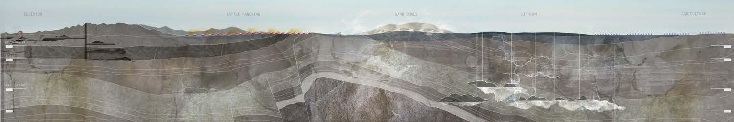
203 X Schematic Projections
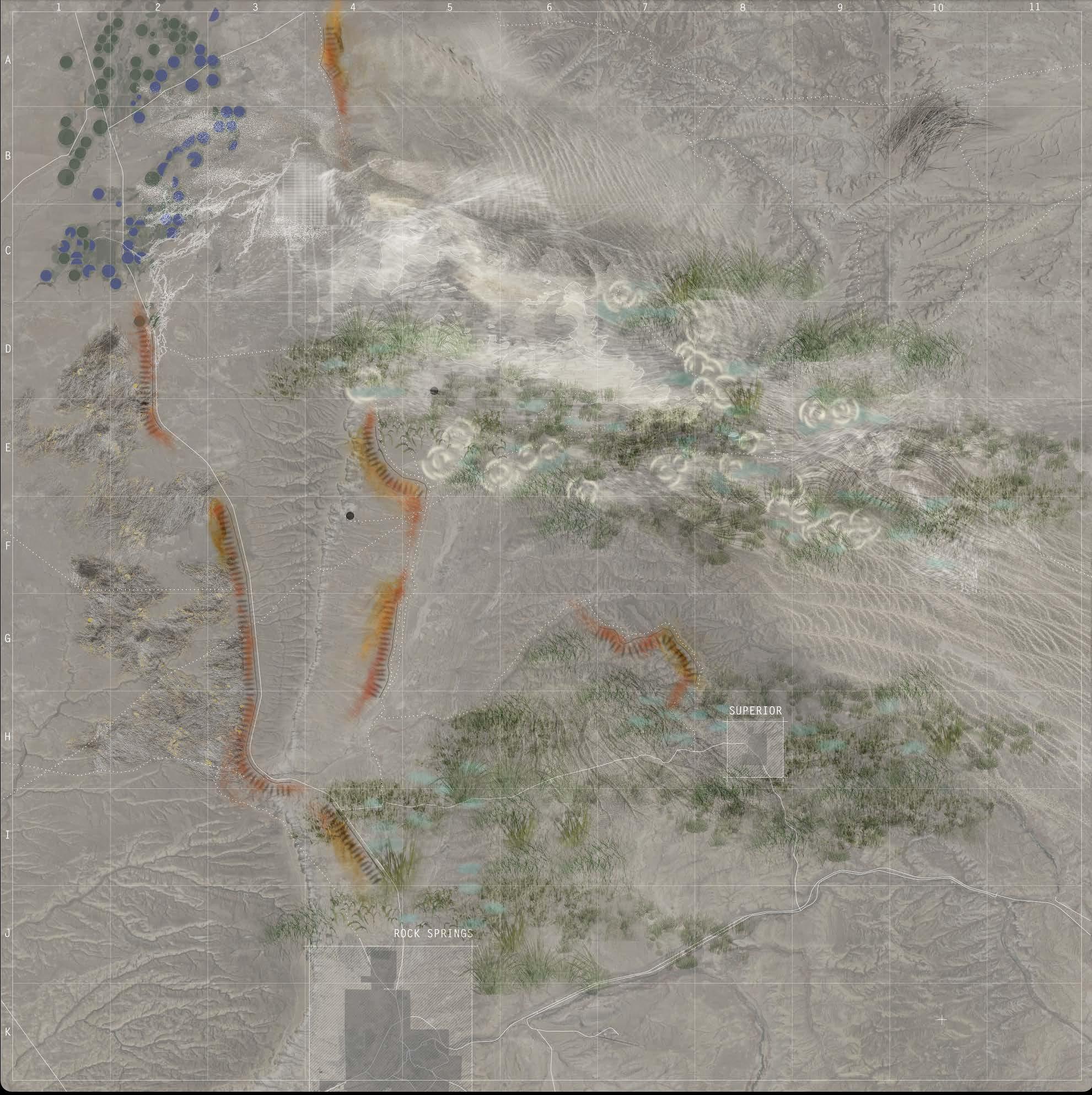
204 +0 ft
3 mi
Map by Gracie Meek. Data from the United States Geological Survey, the Wyoming Landscape Conservation Initiative, the Wyoming State Geological Survey, and OpenStreetMaps
DECOMMISSION OF LITHIUM MINE AND LIFE OF LANDFORMS
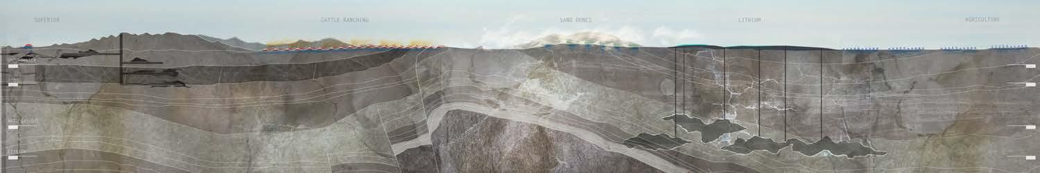
205 X Schematic Projections
206
ARCHIVE
207
208 XI
FINAL THESIS DEFENSE
The thesis was presented at 12:00 p.m. in John Hartell Gallery, Sibley Hall. In attendance were advisors Lily Chi and Tao DuFour, and external critics Jeremy Foster, Rebecca-Jane McConnell, and Piergianna Mazzocca. The Meek Family attended via Zoom and many friends and classmates comprised the peanut gallery. I offer my most heartful gratitude to Farzana Hossain, Abigail Calva, and Tracy Qiu for arriving at studio at 7:00 a.m. to help with setup and providing eleventh-hour hype.
209
XI FINAL THESIS DEFENSE
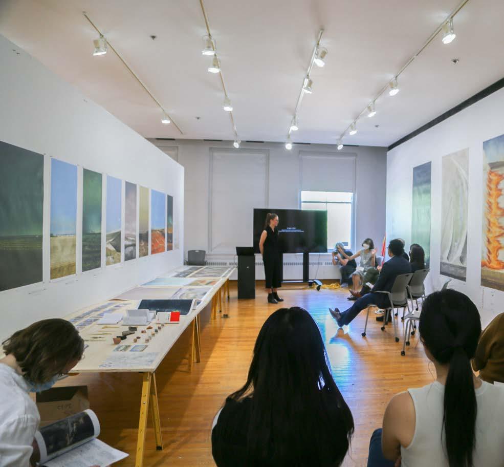
210
211 XI FINAL THESIS DEFENSE
THESIS DEFENSE
FINAL
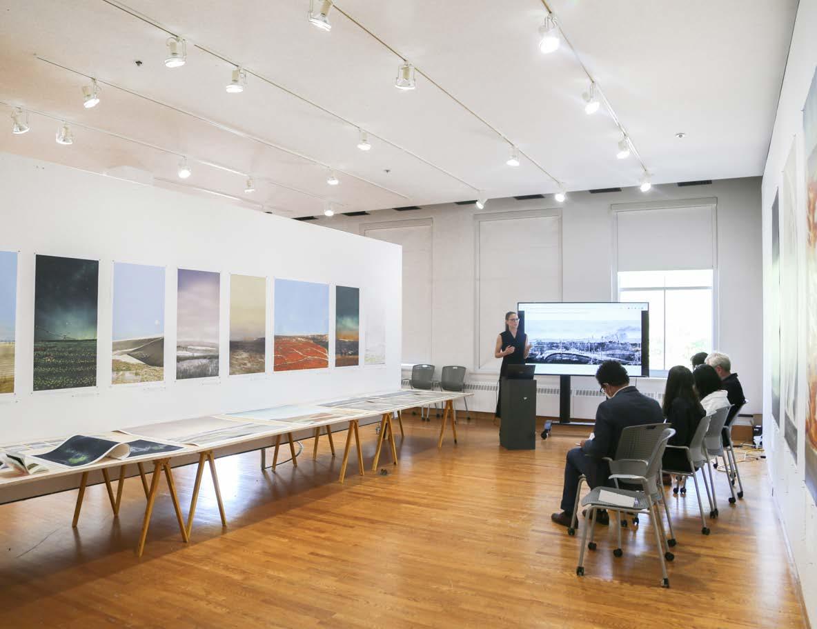
212
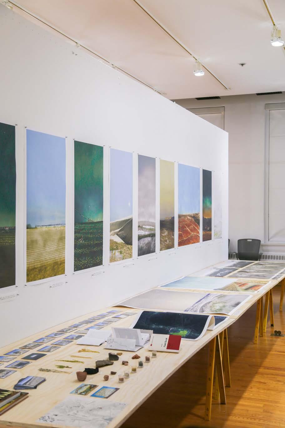
213 XI FINAL THESIS DEFENSE
THESIS DEFENSE
FINAL
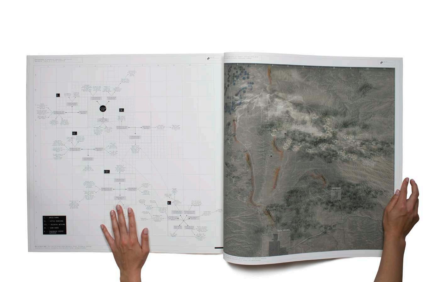
214
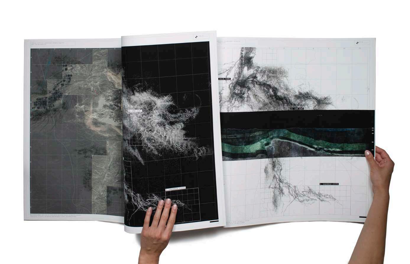
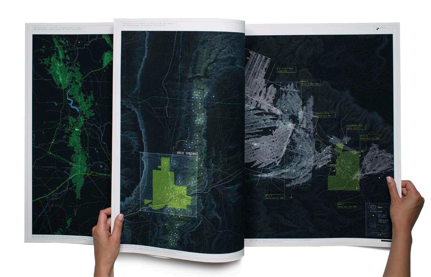
215 XI FINAL THESIS DEFENSE
CARTOGRAPHIC ANALYSIS ELEPHANT FOLIO


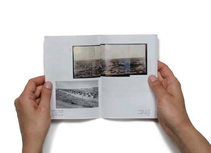
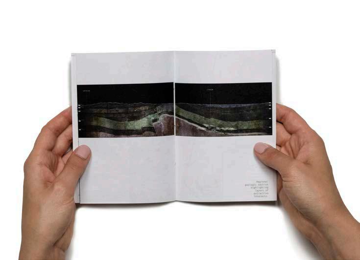
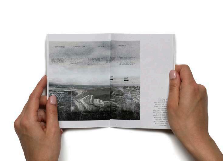
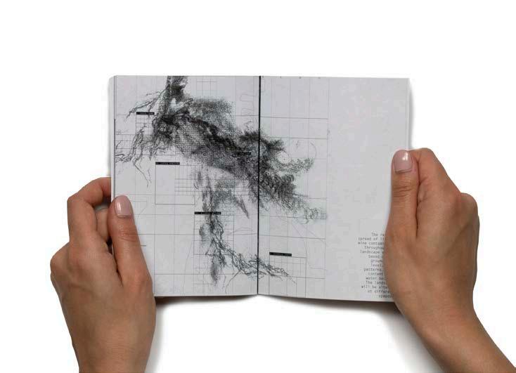
216 Interim I Booklet Interim II Booklet
PROGRESS BOOKLETS PRESENTED TO JURY DURING REVIEWS
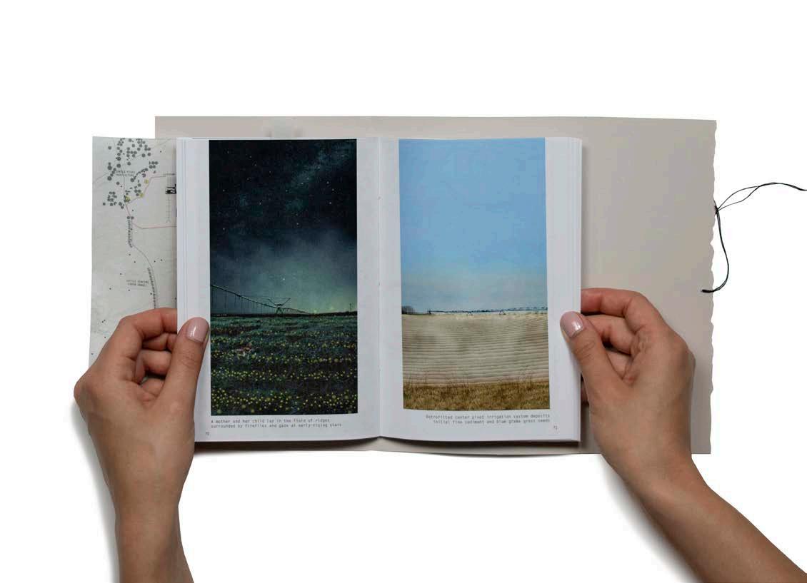
Final Defense Booklet
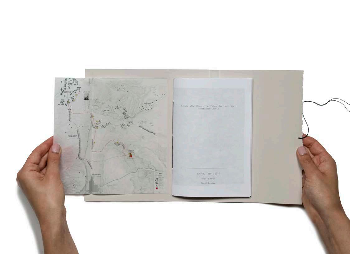
217 XI FINAL THESIS DEFENSE
Modern economies and progress rely heavily on energy in various forms. The provision of that energy involves processes of extraction and production that leave behind wide-ranging effects at multiple scales—from landscapes and environments -- to towns & cities, lives & livelihoods. How might this be rethought and repaired as we go forward with the energy transition of today?
Typical extractive infrastructures are problematic in that they have a singular, utilitarian logic of efficiency and profit. The thesis asks how processes of extraction can be reimagined to account for what is usually forgotten-- …to render visible, cultural, and remediative what is typically hidden while also involving environmental actants.
The thesis uses the history of a coal mining town and a possible future lithium mine as vehicles to explore how architecture, in making connections between what has been kept discrete, might link remediation to extraction, stewardship to labor and capital, and the visible to the invisible.
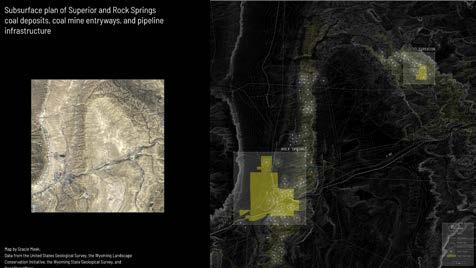
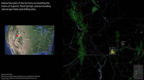
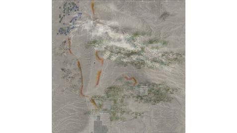
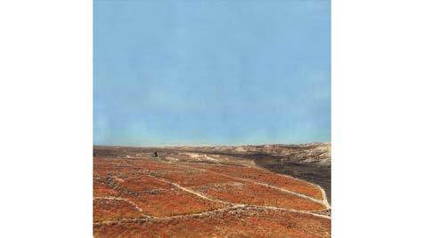
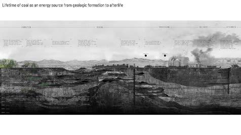
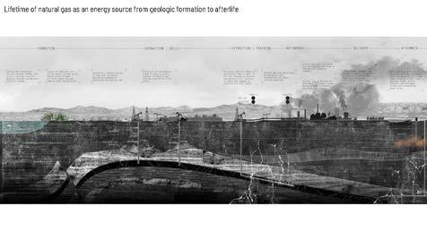
In doing so, the thesis explores how architecture might anticipate in advance future afterlives in our changing energy landscape to ultimately make these extractive landscapes matter to more people.
Superior and Rock Springs, located in southwestern Wyoming in an area rich with coal outcrops and natural gas deposits, offer vivid example of how the livelihood of energy towns and the health of the environment rest on the extraction industry.
These two towns have a personal story for me, as my grandparents grew up here working in the historic coal mines.
218
The peak of Superior was during the coal boom of the early 20th century, and after the dieselization of transportation and the depletion of the mines in the 50s, the town collapsed.
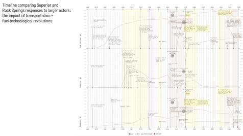
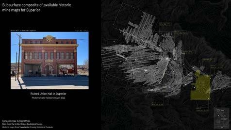
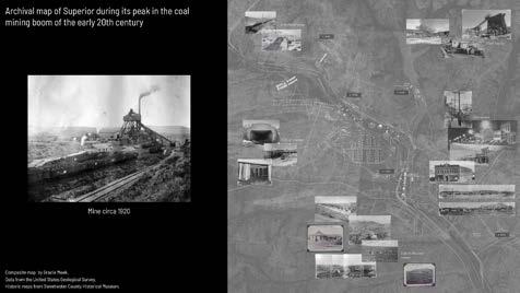
Superior is now a living ghost town with 300 residents who live with memories of loss in the afterlife of an exhausted extractive landscape.
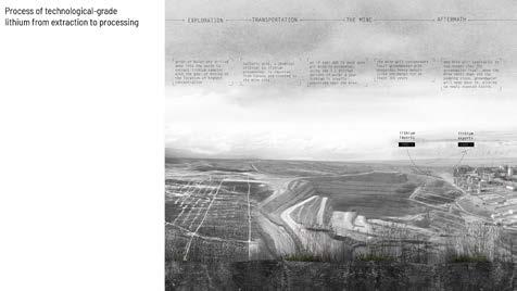
The town currently sees brief population spikes with incoming migrant workers in conjunction with energy boom patterns in the oil/gas industry of the territory.
Wyoming is now slowing its reliance on nonrenewable energy and is beginning its transition to renewables, promising another social, environmental, and cultural upheaval as people look for new jobs.
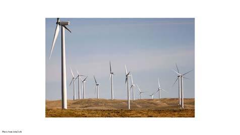
With General Motor’s transitioning out of gas and diesel by 2035, the Biden administration’s infrastructure bill providing $7.5 billion to build charging infrastructure, and, closer to home, TCAT’s addition of 7 electric busses to their fleet, America begins its transition to an electrified landscape.
While this transition to “green” energy is usually viewed optimistically, it requires the extraction of lithium to produce batteries.
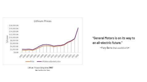
219
XI FINAL THESIS DEFENSE
FINAL THESIS DEFENSE PRESENTATION
Lithium deposits have been located about 25 miles north of Superior. With the cost of lithium increasing exponentially, construction might ensue within the next 15 years.
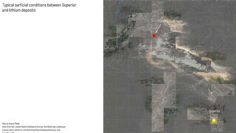
Cattle ranchers in the territory between Superior and the future lithium mine fear that the mine’s excessive use of groundwater will dry the grasslands their herds use to graze.
And, grain farmers’ soils will be altered by windblown salt, a major byproduct of lithium mining.
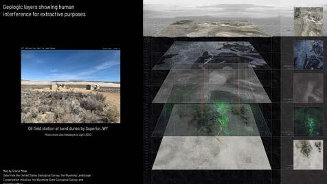
This exasperates a landscape already exploited and hollowed by historic coal mining operations, with land subsidence and the uncontrolled spread of contaminants from unsealed oil and gas fracking being a constant threat.
But, Rock Springs and Superior share a sense of community and pride through the heritage of extraction that historically and presently underpin their livelihoods.
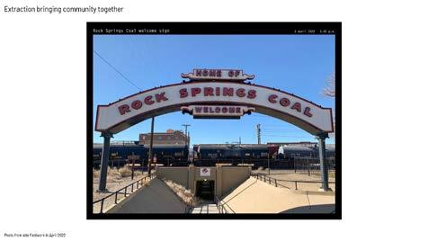
My project begins with these different environments – center pivot agriculture, a vast field of sand dunes scarred by boreholes, cattle ranching, and finally, Superior, in land above a historic coal mine.
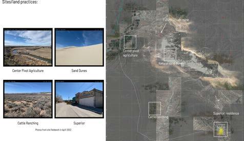
The project works with a taxonomy of calibrated landforms that balance out the displacement of dirt excavated for the lithium mine ponds.
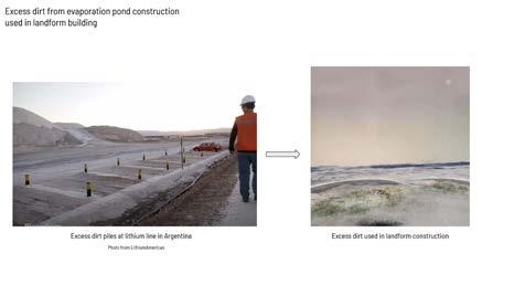
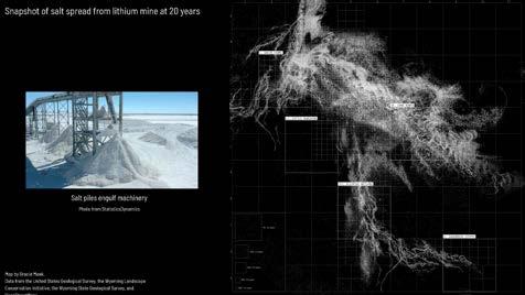
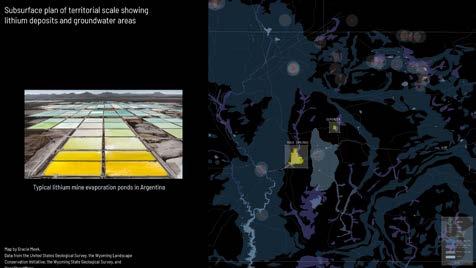
220
Other excess materials, like magnesium and potassium, are choreographed as a field condition onto different typical landscapes and practices. This is to anticipate future conditions when land-use practices are forced to adapt to the conditions of the pre/present/post-lithium extraction landscape.
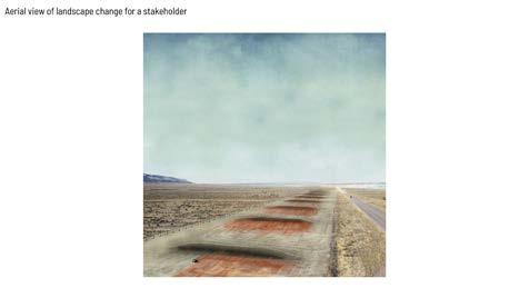
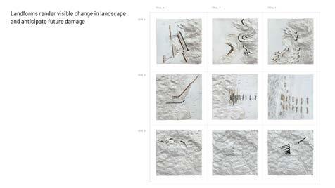
The project parses byproducts, environmental processes, and land uses onto the 4 sites. The output of one agent serves as the input for the other, making circular that which is usually forgotten.
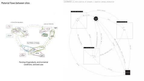
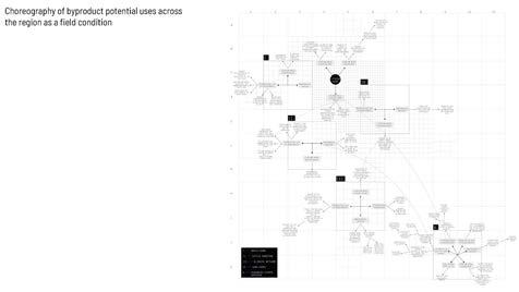
These landforms simultaneously remediate past landscape exploitation and anticipate future environmental damage caused by the lithium mine. They also render visible the change of the landscape due to lithium practices.
The construction techniques and maintenance of the landforms reveal, expose, and undo lithium mine processes by utilizing the same mechanisms that are used to build the ponds. Cranes and bulldozers are reused after their role is completed in mine construction.
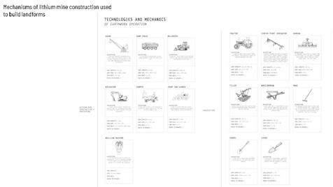
To facilitate and finance the process of building these landforms the thesis proposes the involvement of outside constituents. The involvement of the Wyoming Conservation Initiative, and even the conservative Wyoming Governor’s Big Game Coalition helps to draw in as many people and diversities of organizations as possible to promote longevity.
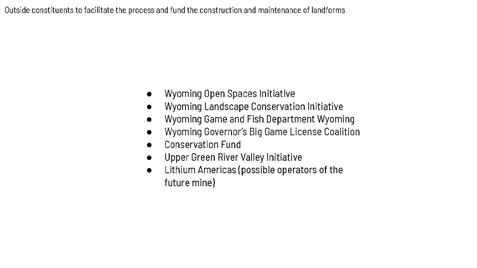
Apart from the constituents that are more interested in ecological factors, some stakeholders experience the landforms visually aerially. For instance, a Hollywood celebrity pays $10 to sponsor a crane bucket of dirt, and in return receives a satellite image as the landscape undergoes change. This has a dual purpose in that the landforms render visible and measure the spread of contamination through the landscape. The coalescence of eye level and aerial stakeholders is required to see the whole picture.
Land ownership is also a driver of change. The sites of intervention are publicly owned by the BLM. This enables the citizens to pressurize their political representatives for preferable land policies and protect private property from contamination.
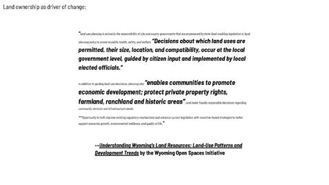
221
XI FINAL THESIS DEFENSE
The labor to construct the landforms is composed of an excess of “in limbo” lithium mine workers due to their 2-week on 2-week off labor cycles. During their off cycles, the workers can be sponsored to construct and maintain the landforms. Lithium miners are now stewards, developing a sense of responsibility for the landscape.
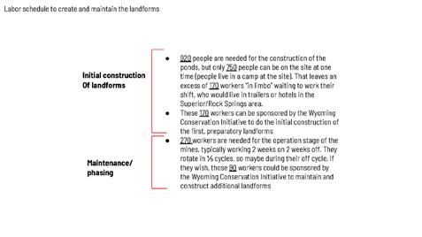
Again, the thesis rearranges the excess from capitalism, both labor and byproducts, as an environmentally reparative gesture toward a landscape scarred by histories of resource extractive practices.
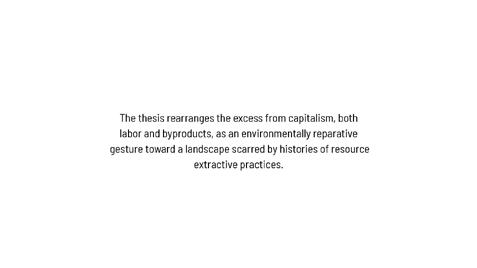
We will now follow the evening commute of a lithium mine worker/landscape steward from their 2-week post at the mine, traversing through the field of landform interventions via well-traveled oil field roads back to the historic coal mining town of Superior. You can follow along with the map insert in your books.
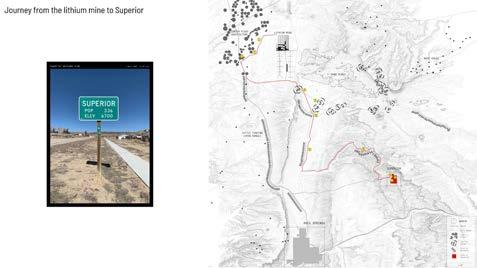
As he makes his way from the lithium mine, he first passes by what were previously center pivot irrigation grain farms.
Groundwater depletion by the lithium mine has now dried up the landscape. This lithium mine is at a higher elevation than the 4 sites to the south, so they’re vulnerable to contamination via groundwater flow.
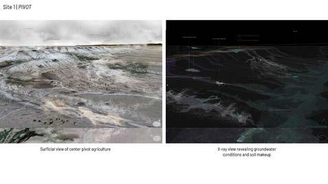
Pivot utilizes Center pivot infrastructure to instead spread the finest grained dirt from the lithium mine construction with native blue gama grass seeds to prevent future dust storms.
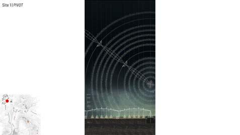
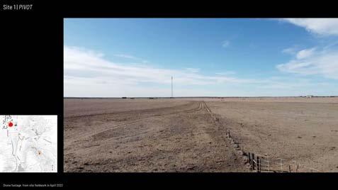
The grass remediates previously overtilled land and attracts fireflies in the summertime. On his journey down the road he spots a mother and her son laying in the field of ridges surrounded by fireflies gazing up at early-rising stars.
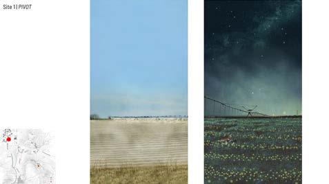
222
As the mine worker drives past fields of halo-like firefly rings, he hears a coyote howling and can smell the sagebrush in the wind.
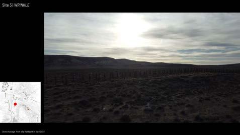
He now enters a new landscape, the windy Killpecker sand dunes.
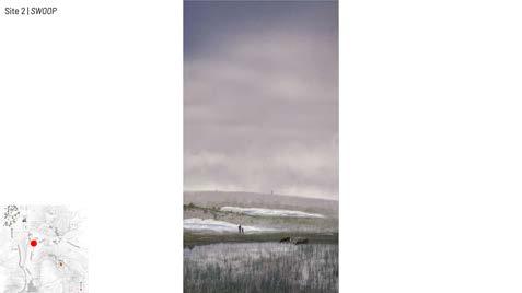
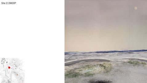
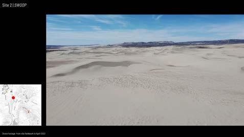
Swoop is constructed preemptively to anticipate the depletion of groundwater due to the lithium mine. It works with natural processes of sand dune formation by the wind. It is deposited by the swinging of a crane’s arm as it traces the path of abandoned infrastructural scars on the ground. Each pivot point marks the borehole of a previous drilling operation.
A constructed barometer in the landscape, it renders visible possible salt deposition due to wind direction as sand ebbs and flows. Swoop aggregates sand on its leeward sides to amplify the natural process of water retention and pondmaking from snow compacted under layers of sand.
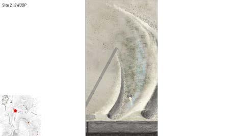
Our landscape steward remembers when he ate lunch with oil field workers in the shade of the constructed dune, sheltering from the harsh afternoon sun.
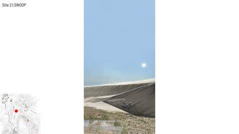
He sees antelope and cattle drinking from the retention ponds as a rancher watches with his son while the prairie moon rises.
Next, our landscape steward approaches Wrinkle, adjacent to cattle ranches. He maintained these landforms on his last off-labor cycle sponsored by the Wyoming Open Spaces Initiative.
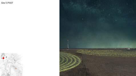
223
XI FINAL THESIS DEFENSE
Wrinkle is constructed with lithium mine bulldozers that push excess dirt into mounds along roads next to cattle ranches. Dimensioning is based on the turning radius of the machinery.
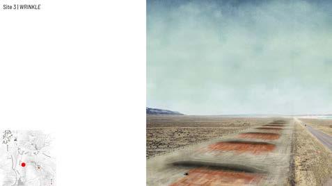
Red, orange, and yellow sediment layers at the base of the mounds act as a litmus test in the landscape. The colors register the amount of erosion caused by summer rainfall and wind, and thus the spread of salt. They catch excess salt from the mines to salt winter roads and make licks for cattle. When the color has reached 100 feet, a bulldozer returns to scrape off the surface. Wrinkle also acts as snowfences to protect the road from the drifting of snow and collects snowmelt to rehydrate adjacent grazing areas.
Cattle fences are an increment of measure for the travel of color. A heavy storm came through the night before, and our landscape steward sees a cattle rancher fixing a fencepost that blew over.
After a 30 minute drive, the landscape steward has almost arrived to Superior. He enters downtown from the road that runs through the historic coal mines to meet his family. Joined by other families who were also in search of work in the energy transition, Superior is now experienced by a new community.

Longtime locals share the memories and heritage of the historic coal town, while the newcomers develop a new relationship with the extractive, yet simultaneously remediative, cultural, and visible landscape to create a new legacy.
This is “B” Hill, the site of an old coal mining camp where my Grandfather used to live, where now only scars of the roads remain. While the other landforms are more physically active, Superior’s intervention is one of heritage, memory, and commemoration. The planting of a field of red indian paintbrush flowers is a visible reminder of the lost labor in a decayed industrial landscape.
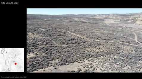
The edge of the hill is lined with black coal refuse rocks, intentionally drifting snow during the winter to collect treasured water. When viewed from below in the historic downtown, one would see a thin band of black and red lining the hill as a remembrance.
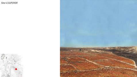
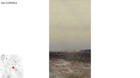
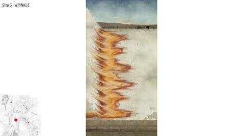
224
The byproduct engaged with here is historic lost labor and depletion instead of salt and minerals. It commemorates and brings value to the past as a premonition to lithium mine operators of what happens with the forgotten in utilitarian extractive practices.

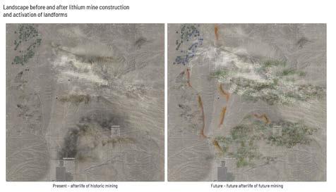
In today’s energy transition, Superior offers vivid example of how the livelihood of energy towns and the health of the environment rest on the extraction industry. The thesis argues that architecture has agency in engaging the disparate processes –and effects—of extraction to render visible, cultural, and remediative what is typically hidden. In making connections between what has been kept discrete, the thesis explores how architecture might anticipate in advance future afterlives in our changing energy landscape to ultimately make these extractive landscapes matter to more people.
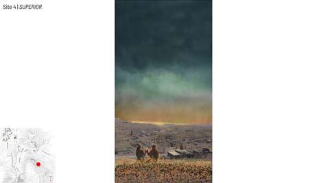
225
XI FINAL THESIS DEFENSE
The initial entrance into the “Living Ghost Town” of Superior was a surreal experience. It was fascinating to see it in person after deeply studying the town for over two months.
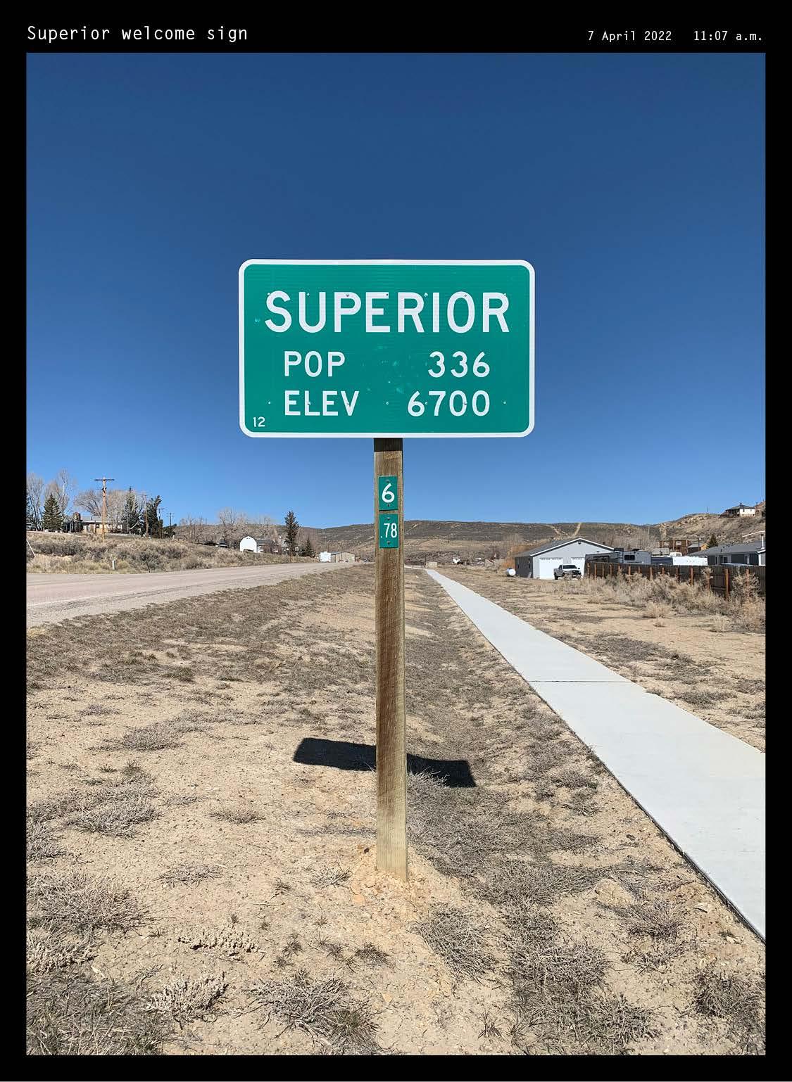
226
XII
APPENDIX: SITE FIELDWORK
Tracing the Multiple Voices of Each Site
Fieldwork executed over spring break from April 4 to April 11 constituted a critical turning point in the thesis. It is impossible to fathom the vast scale and emptiness of the Wyoming landscape without experiencing it firsthand. With a field book in one hand and a drone remote in the other, multiple voices and scales of each site were traced. Collections of different colors of rocks and sediments quickly accumulated. A makeshift press of books ensured plant specimens’ safe journey back to Ithaca, where their scents and tactile attributes could be experienced. The combination of the dry atmosphere and incredibly intense windy conditions was not anticipated. The trip to the sites proved useful in comparing initial mappings with the actual state of the sites—most of the drawn rivers and streams were parched.
In addition to experiencing the landscape’s physical traits personally, conversations with locals also proved invaluable. A chance encounter with the head of Superior’s drinking water elucidated residents’ feelings towards job opportunities in electrification, the decline of fossil fuels, and the rise of the future nuclear power plant a few towns over. When asked (in the politest manner possible) why would someone want to live in a town like this, locals stated that they simply like to be alone in the vast landscape without the noise and hassle of city life. Locals also emphasized the friendliness, hospitality, and generosity of strangers, which did not go unnoticed on my part.
The vivid colors of Wyoming’s big-sky sunsets, the wind picking up dust into the air, and the sheer emptiness of the desert landscape inspired later perspective visualizations of the landforms. I am forever grateful to my parents, Robert and Marilyn Meek, for accompanying me on this off-the-beaten-path journey and for being an endless source of inspiration, knowledge, and encouragement.
227
XI APPENDIX: SITE FIELDWORK


228
RECORD-KEEPING TOOLS
Keeping an analog field book was central in the pursuit of documenting site experience in-situ. A curated satchel of tools facilitated the process.

229
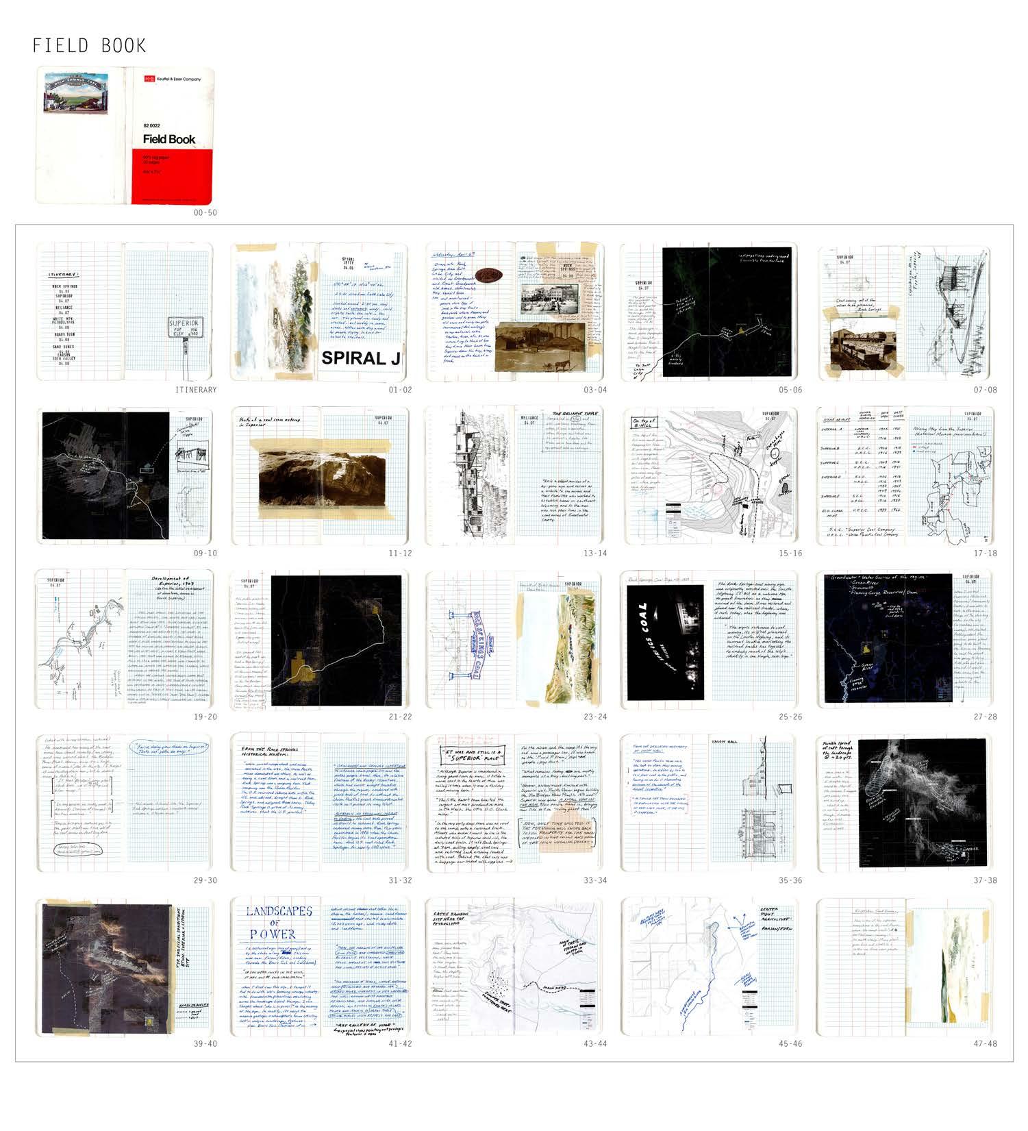
230
KEEPING OF AN EXTENSIVE FIELD BOOK AS RECORD OF IN-SITU ANALYSIS AND EXPERIENCE
231
XII APPENDIX: SITE FIELDWORK
FIELD BOOK
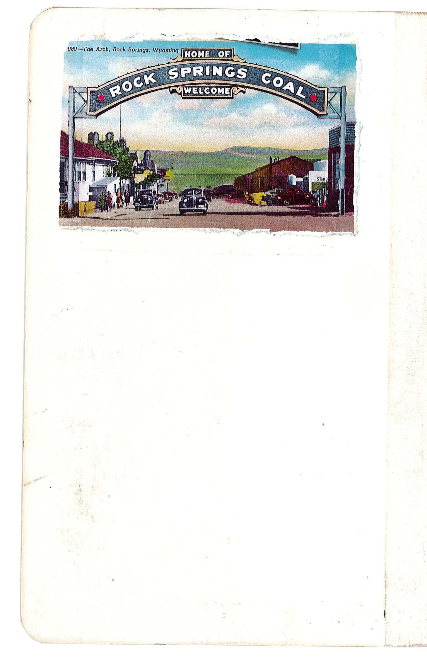
232 FIELD BOOK 00-50
233 XII APPENDIX: SITE FIELDWORK
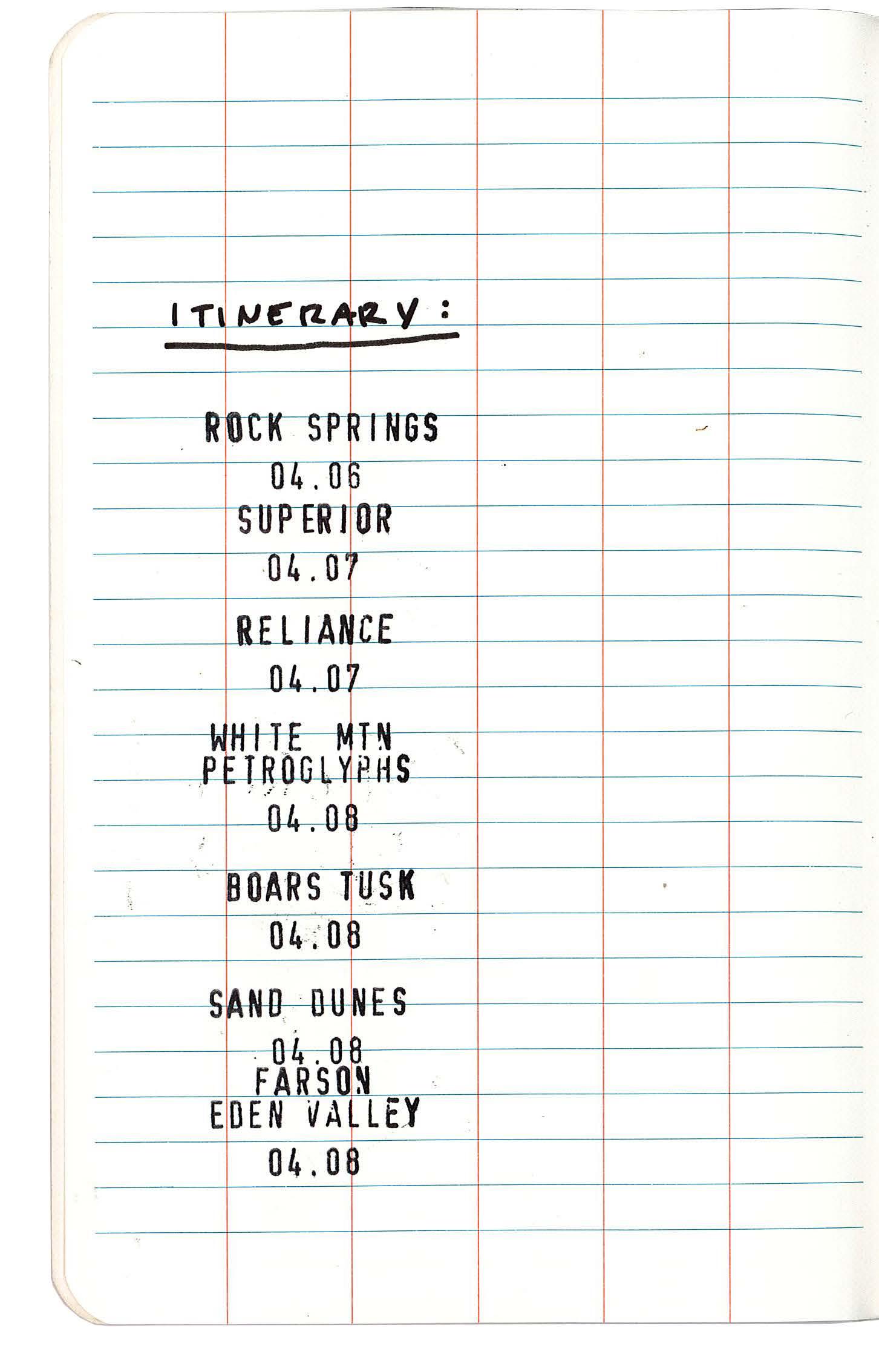
234 FIELD BOOK 00
ITINERARY
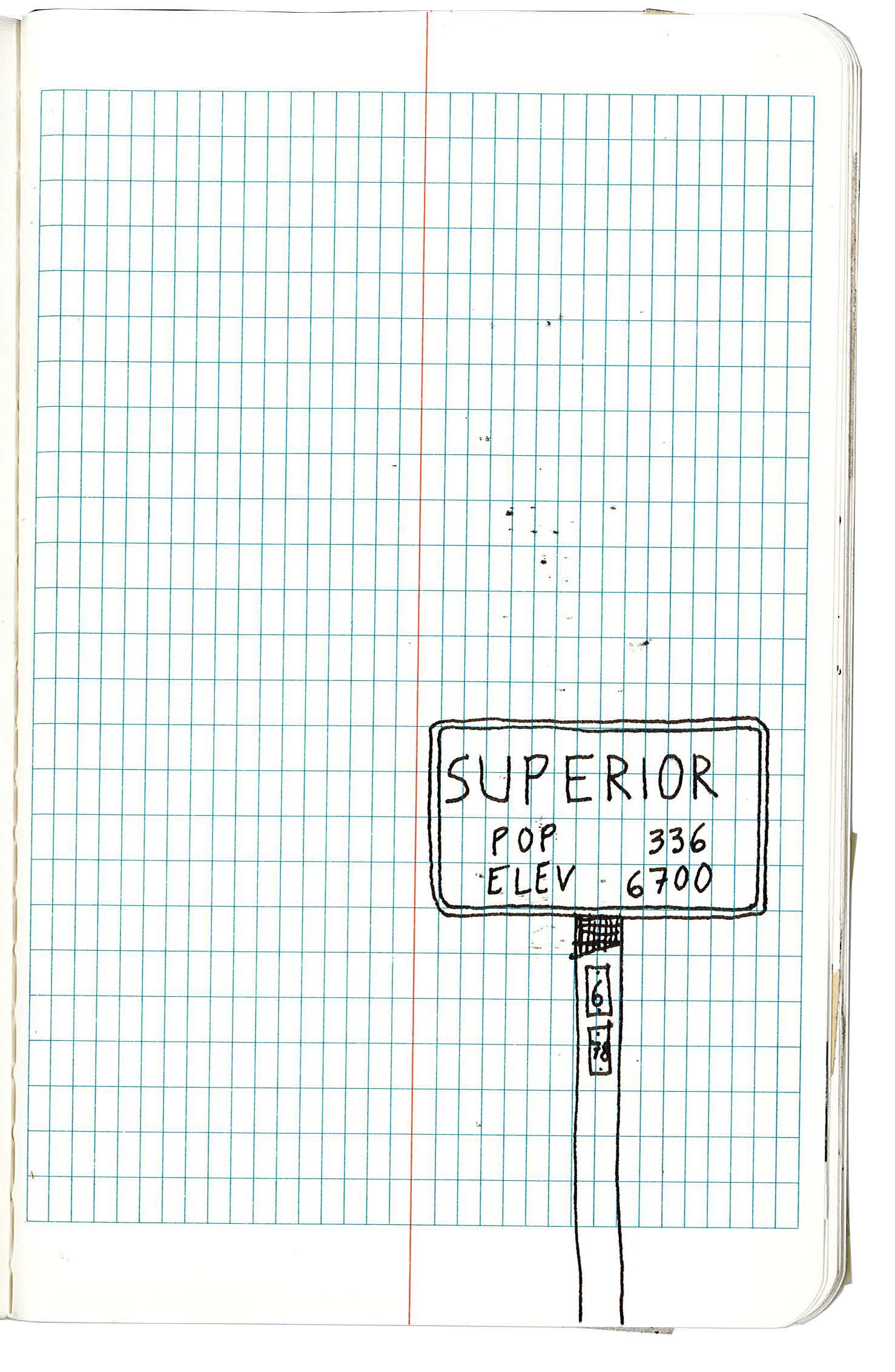
235 XII APPENDIX: SITE FIELDWORK
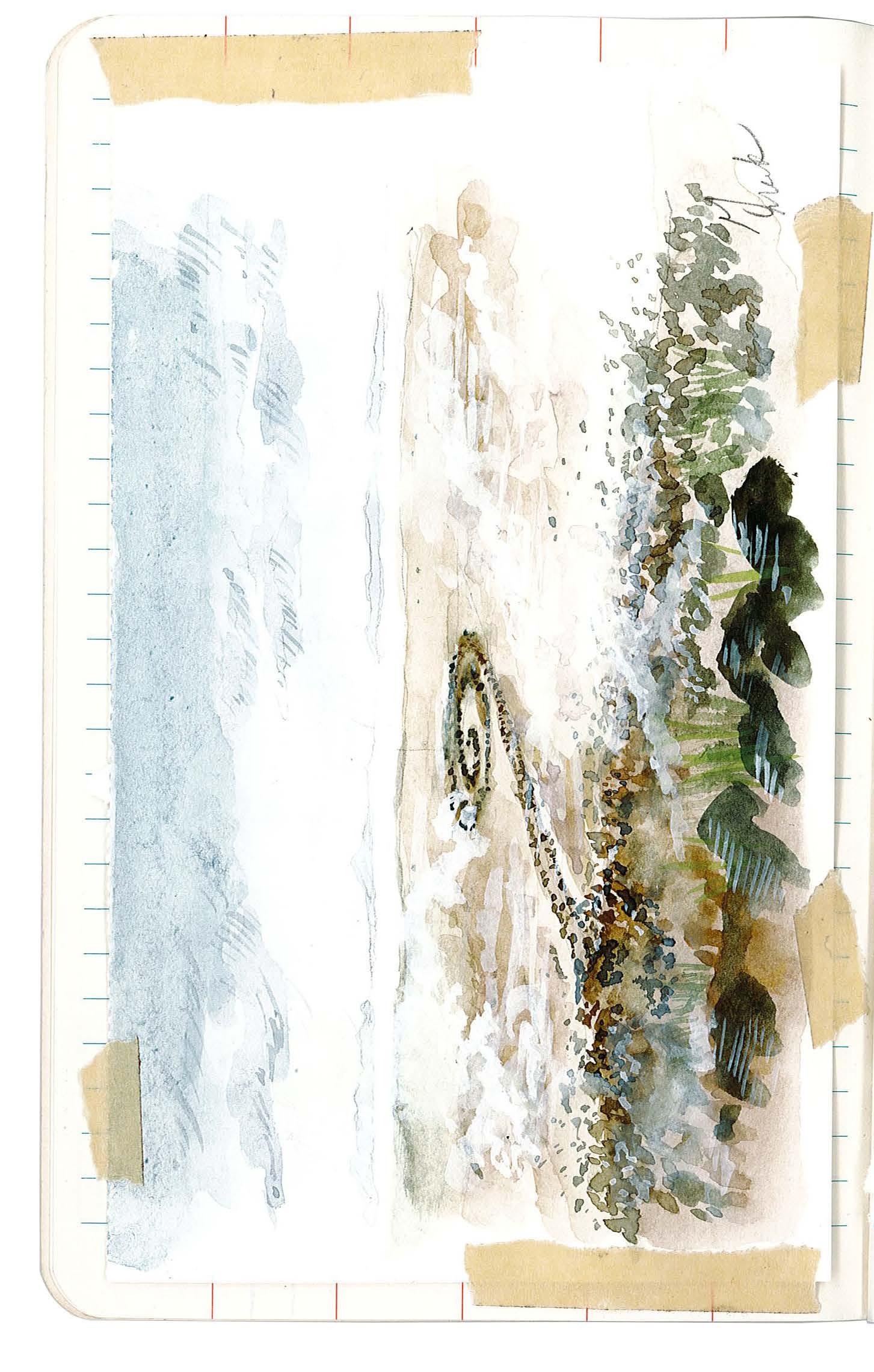
236 FIELD BOOK 01-02
SPIRAL JETTY 04.05
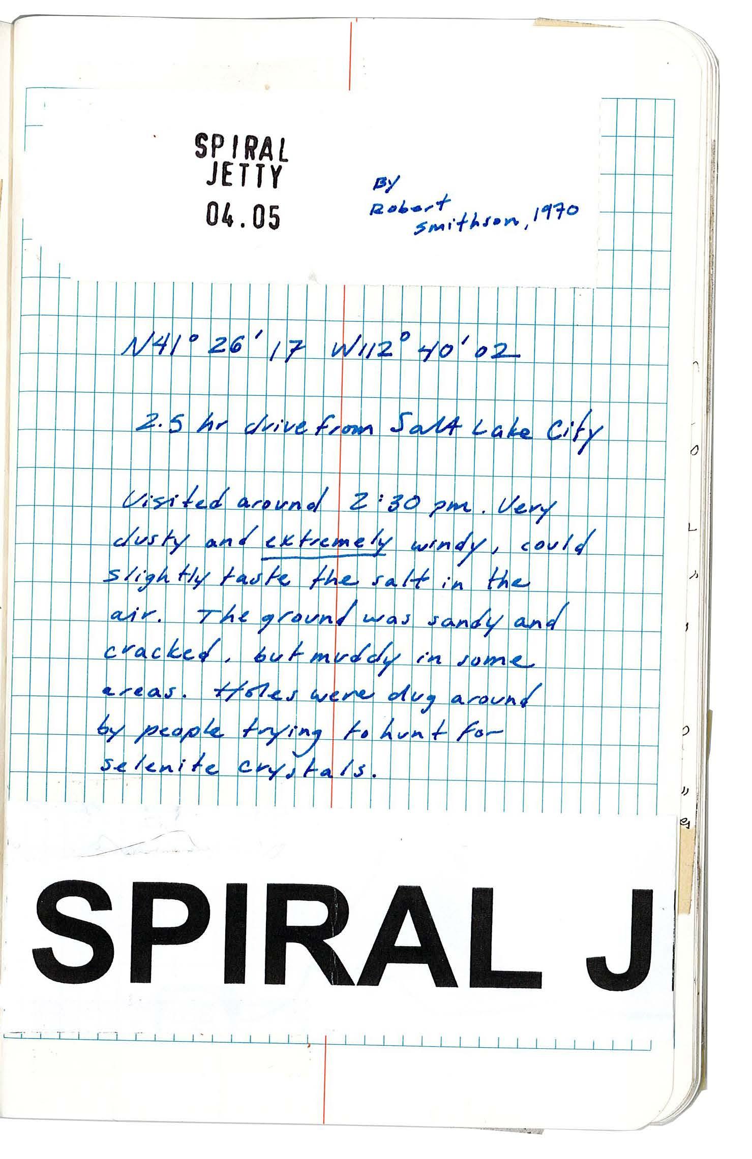
237 XII APPENDIX: SITE FIELDWORK
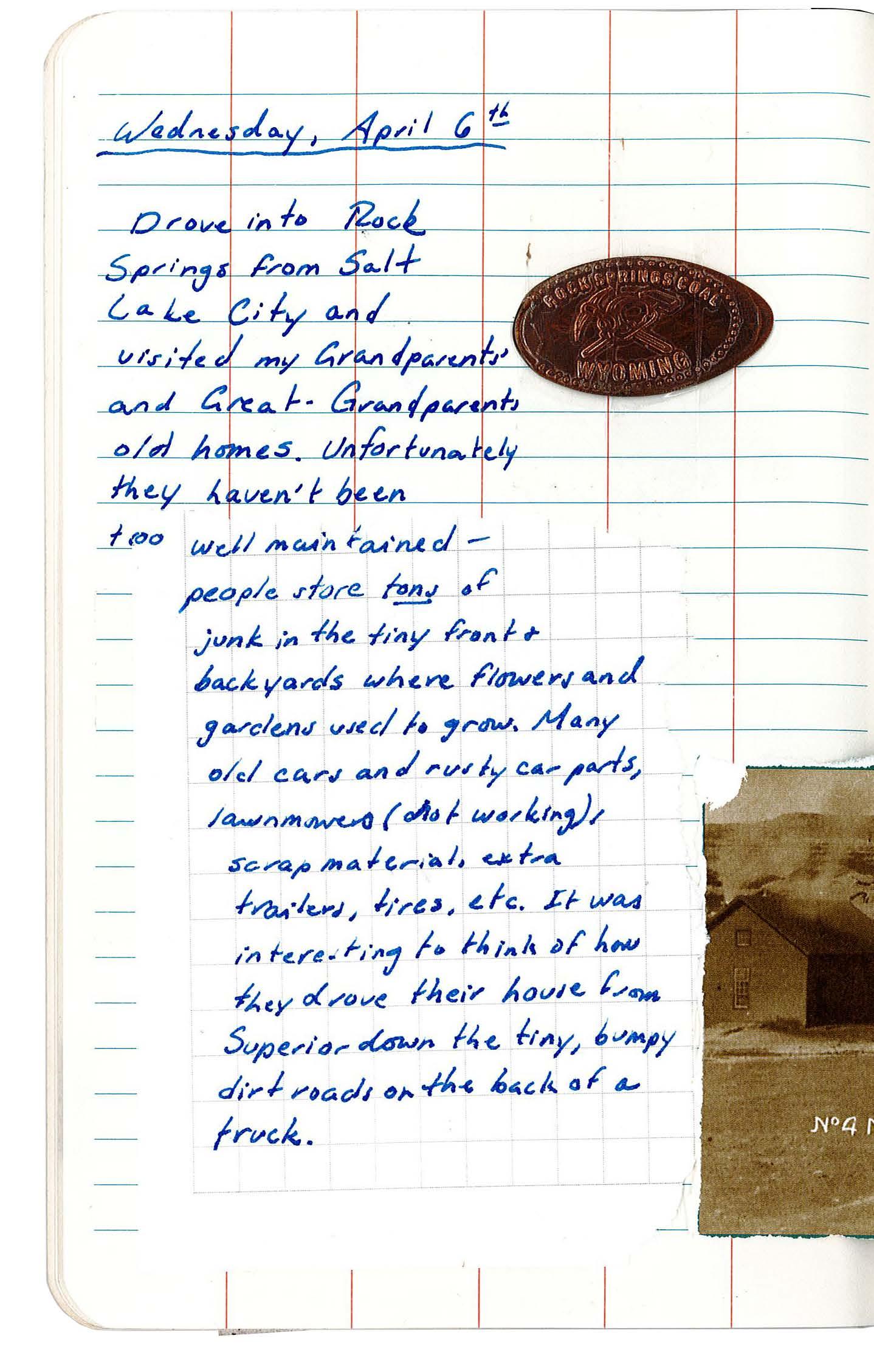
238 FIELD BOOK
03-04 ROCK SPRINGS 04.06
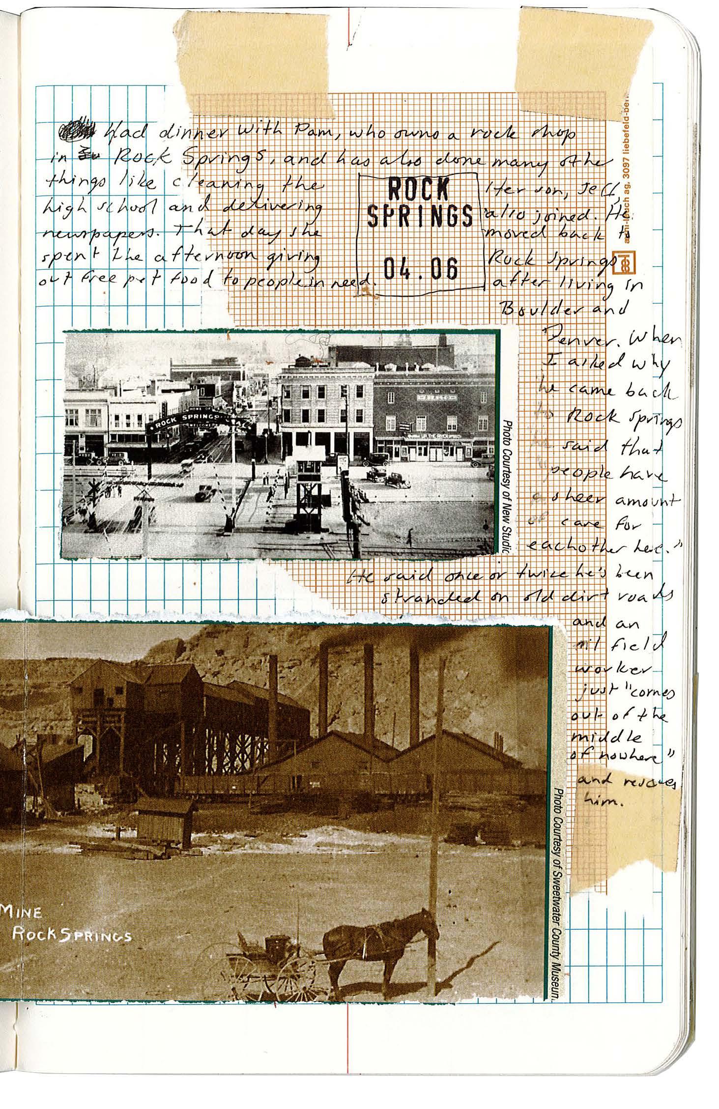
239 XII APPENDIX: SITE FIELDWORK
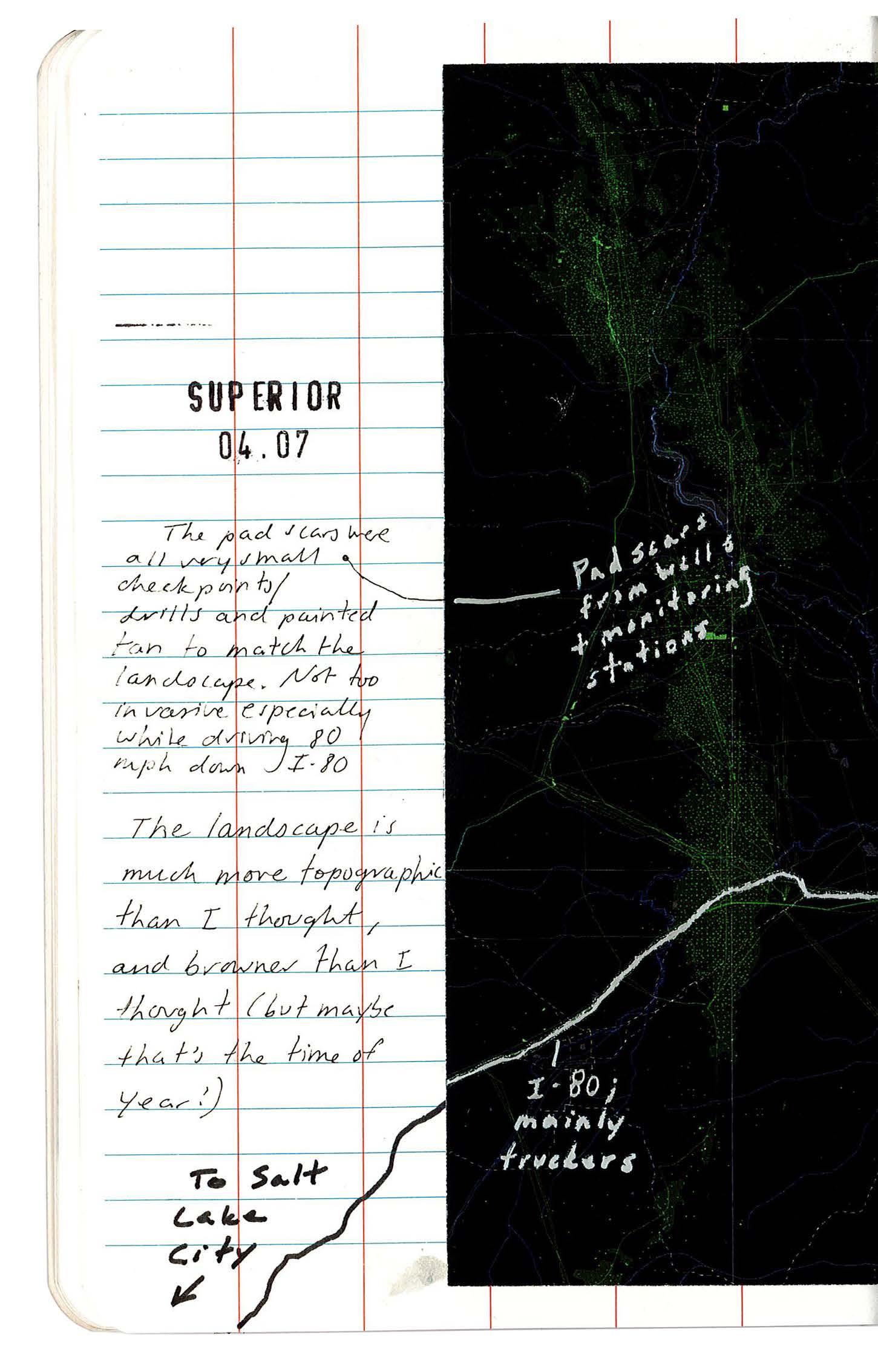
240 FIELD BOOK
05-06 SUPERIOR 04.07
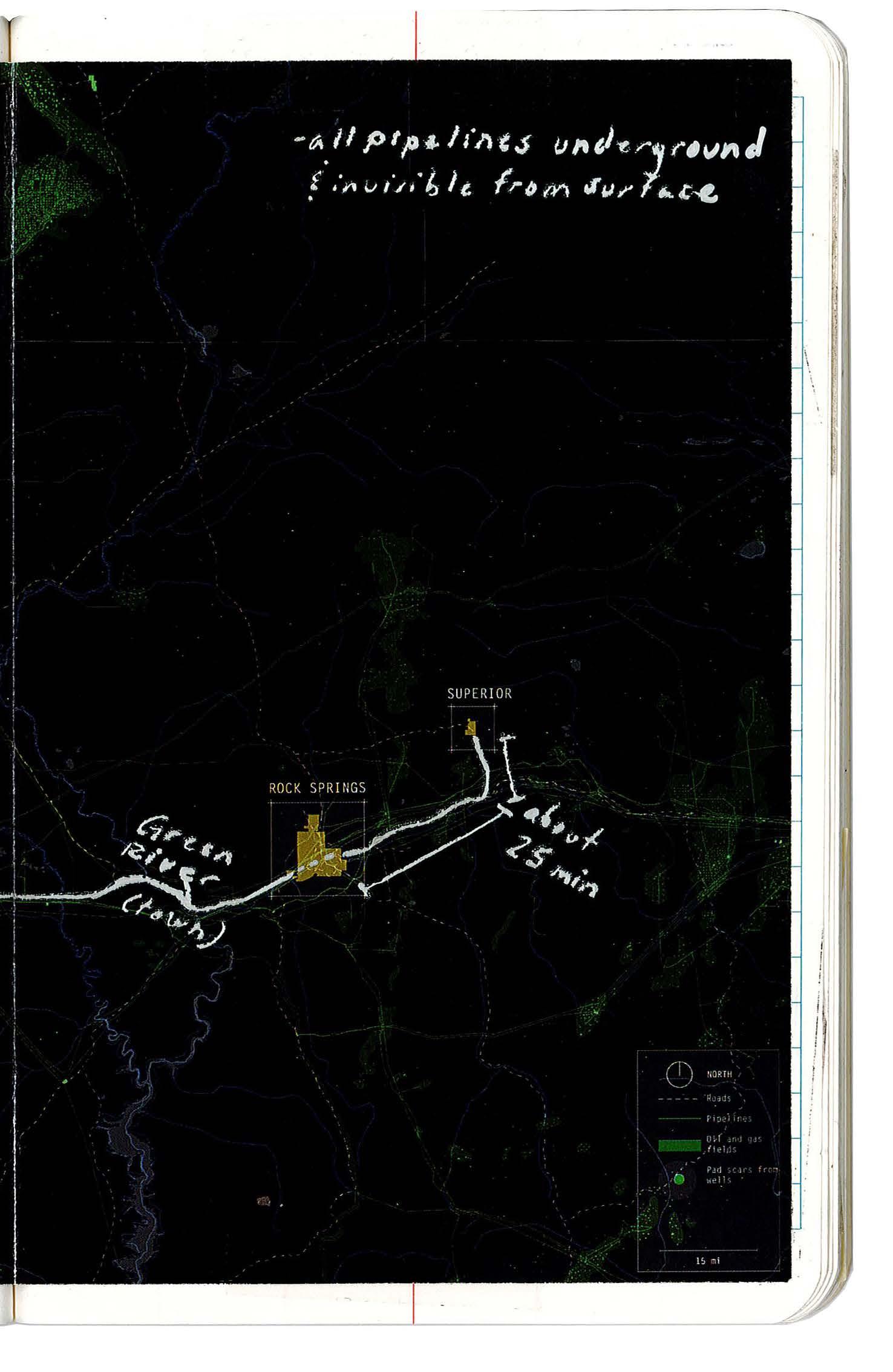
241 XII APPENDIX: SITE FIELDWORK
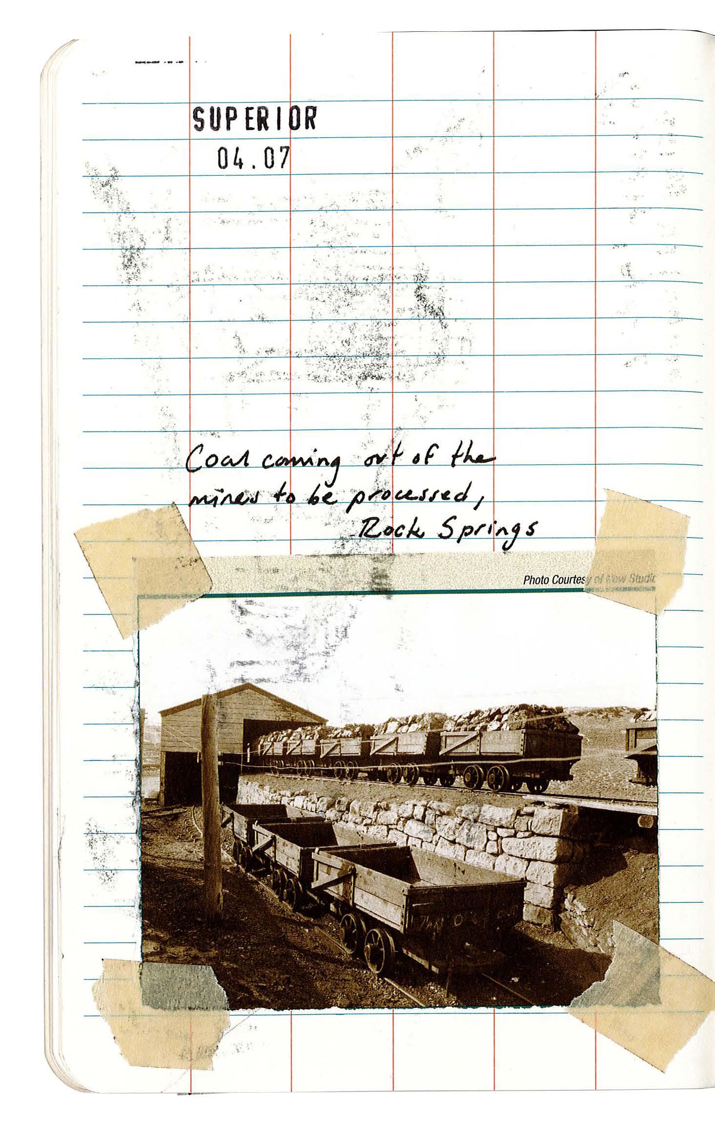
242 FIELD BOOK 07-08
SUPERIOR 04.07
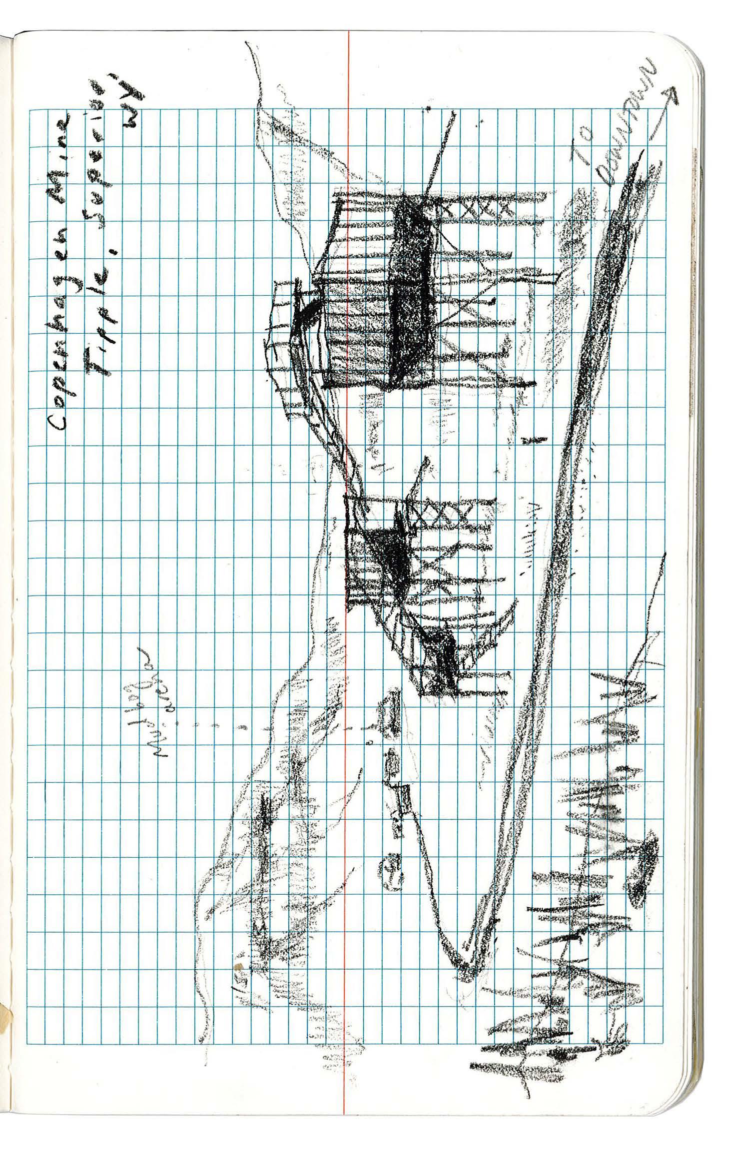
243 XII APPENDIX: SITE FIELDWORK

244 FIELD BOOK 09-10 SUPERIOR 04.07
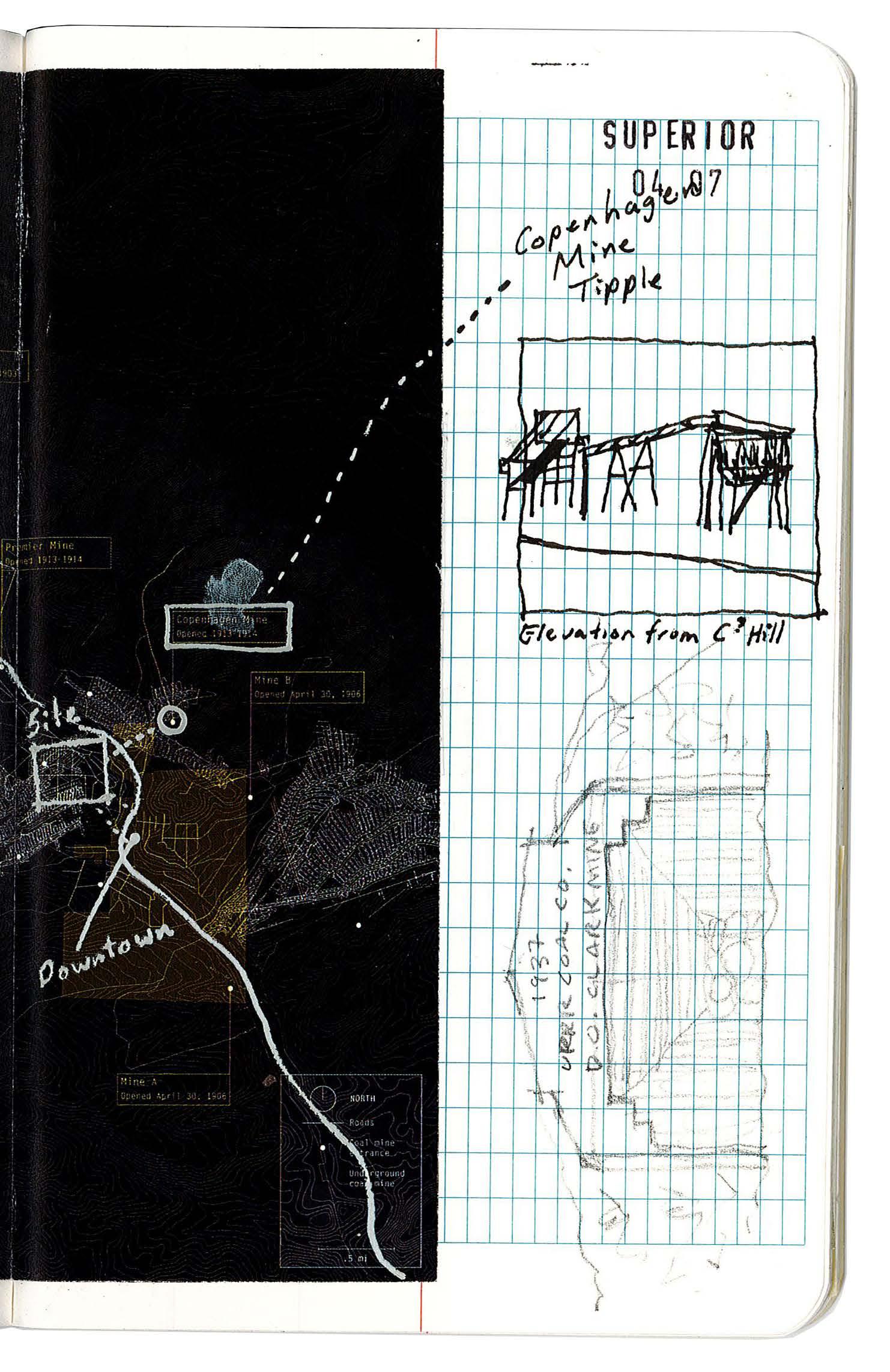
245 XII APPENDIX: SITE FIELDWORK
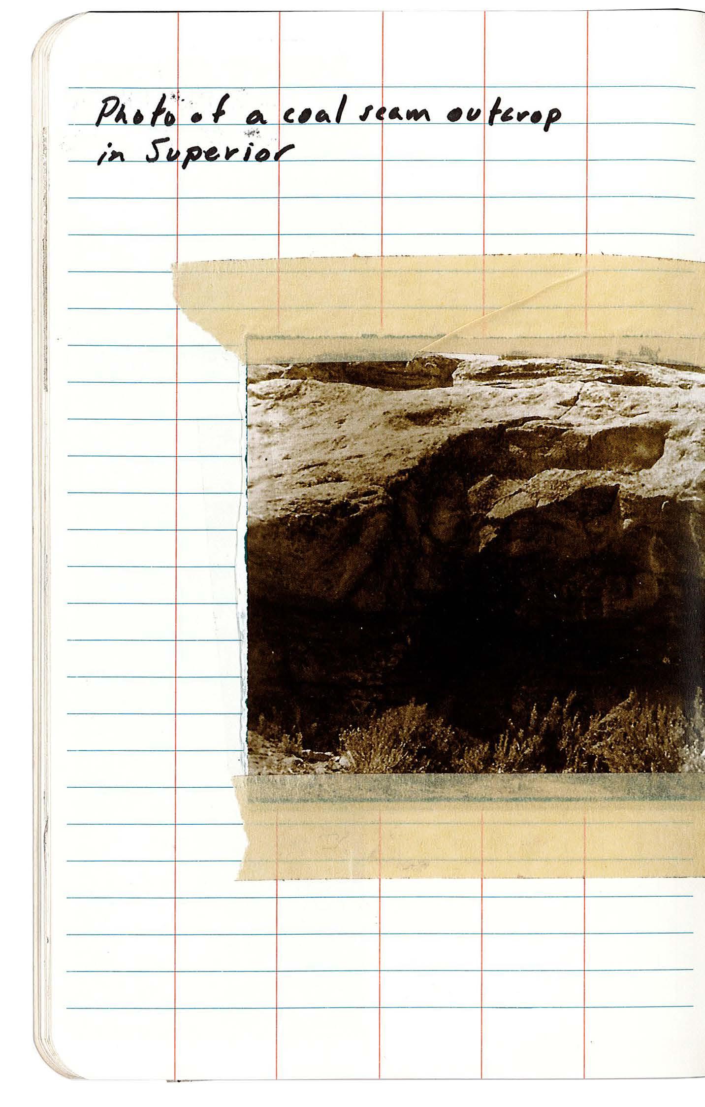
246
FIELD BOOK 11-12 SUPERIOR 04.07
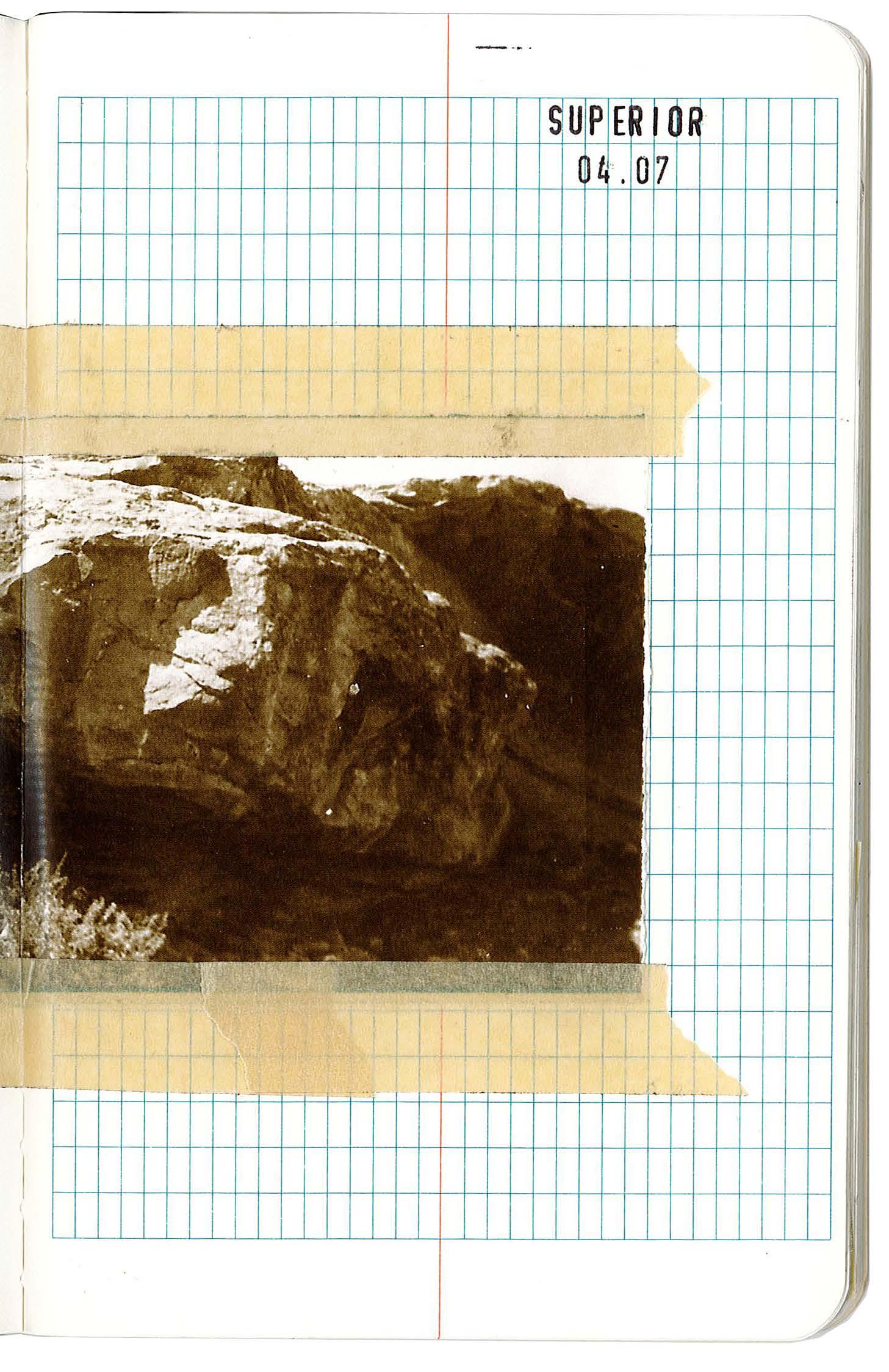
247 XII APPENDIX: SITE FIELDWORK
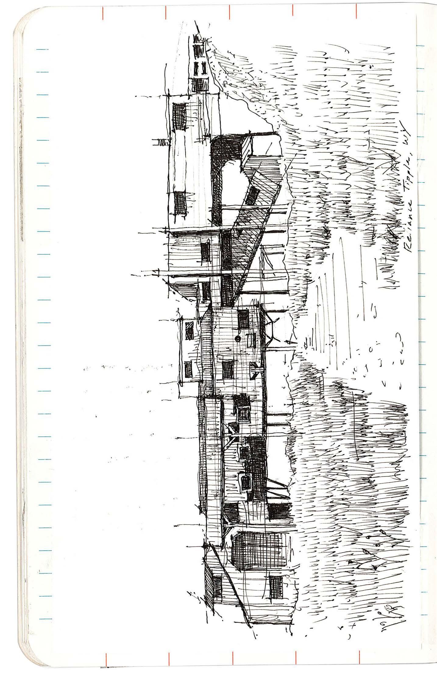
248 FIELD BOOK 13-14 RELIANCE 04.07
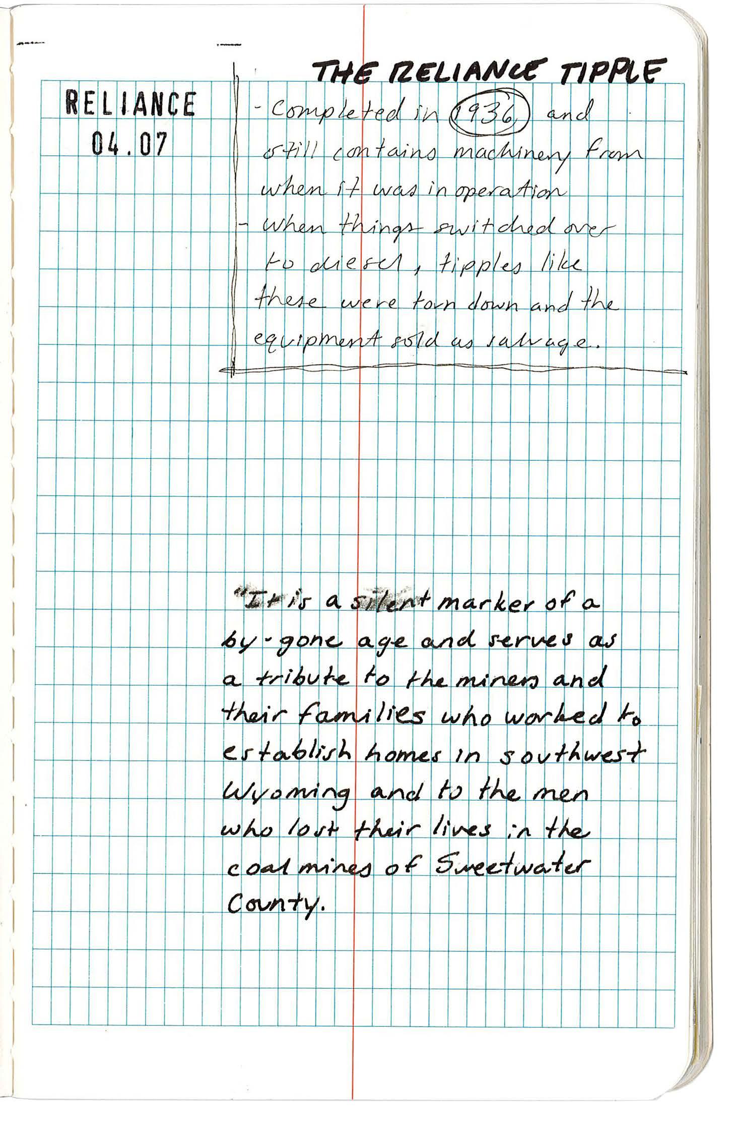
249 XII APPENDIX: SITE FIELDWORK
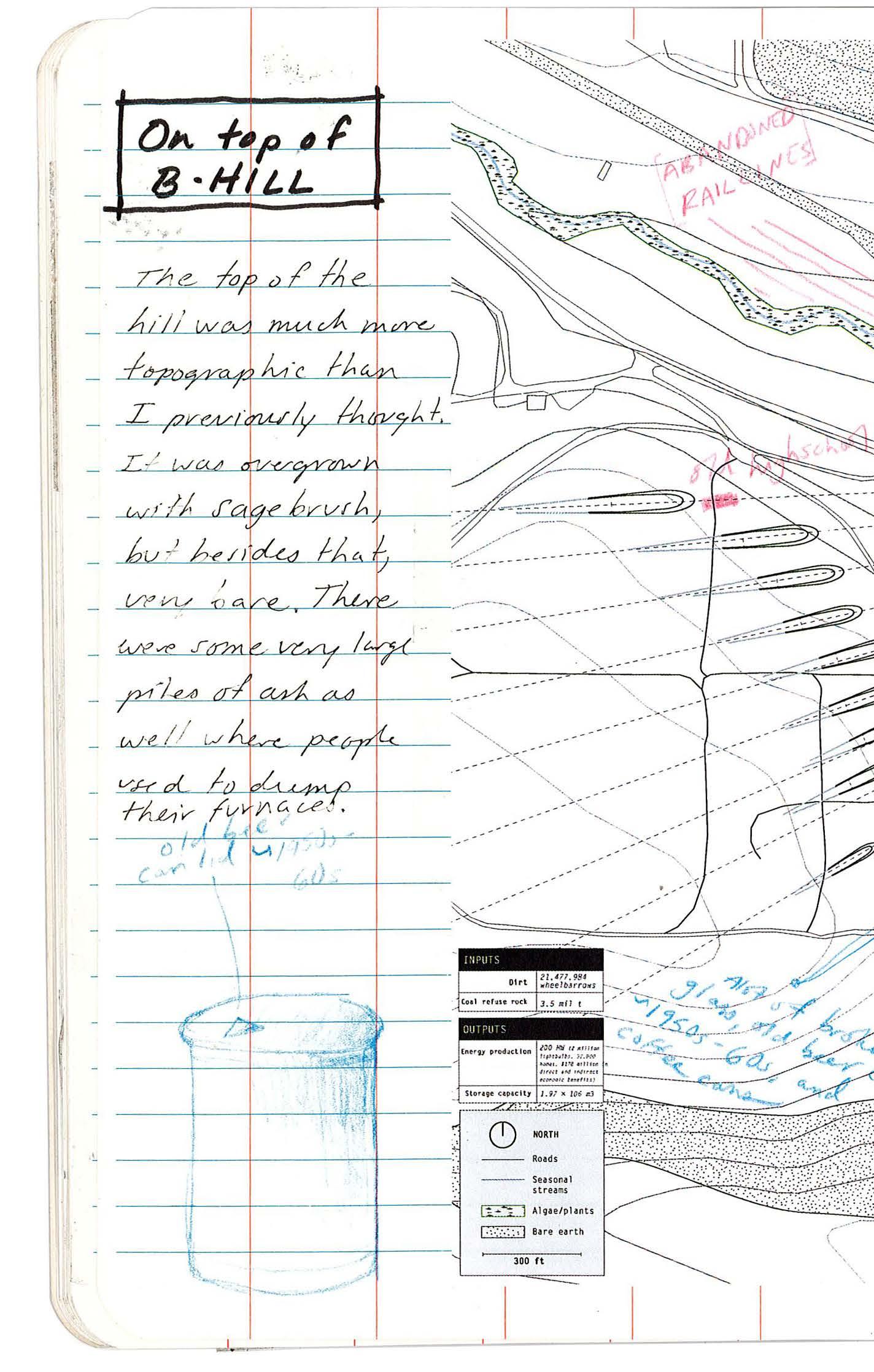
250
FIELD BOOK 15-16 SUPERIOR 04.07
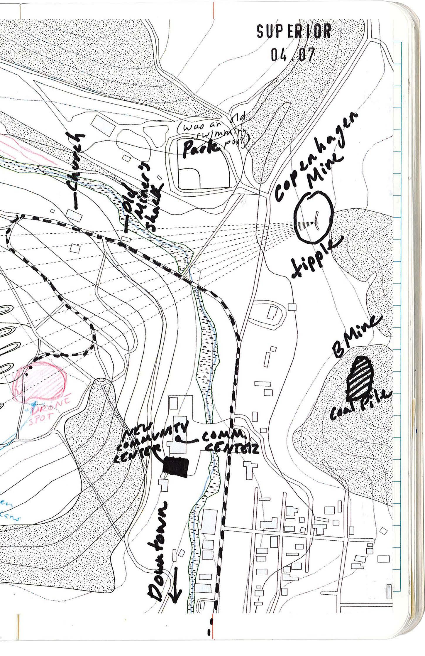
251 XII APPENDIX: SITE FIELDWORK
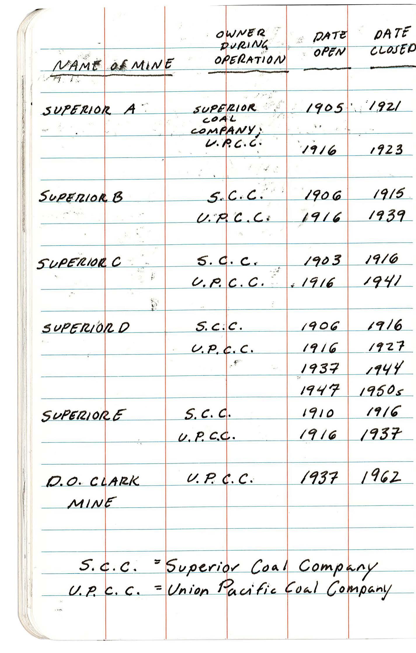
252
FIELD BOOK 17-18 SUPERIOR 04.07
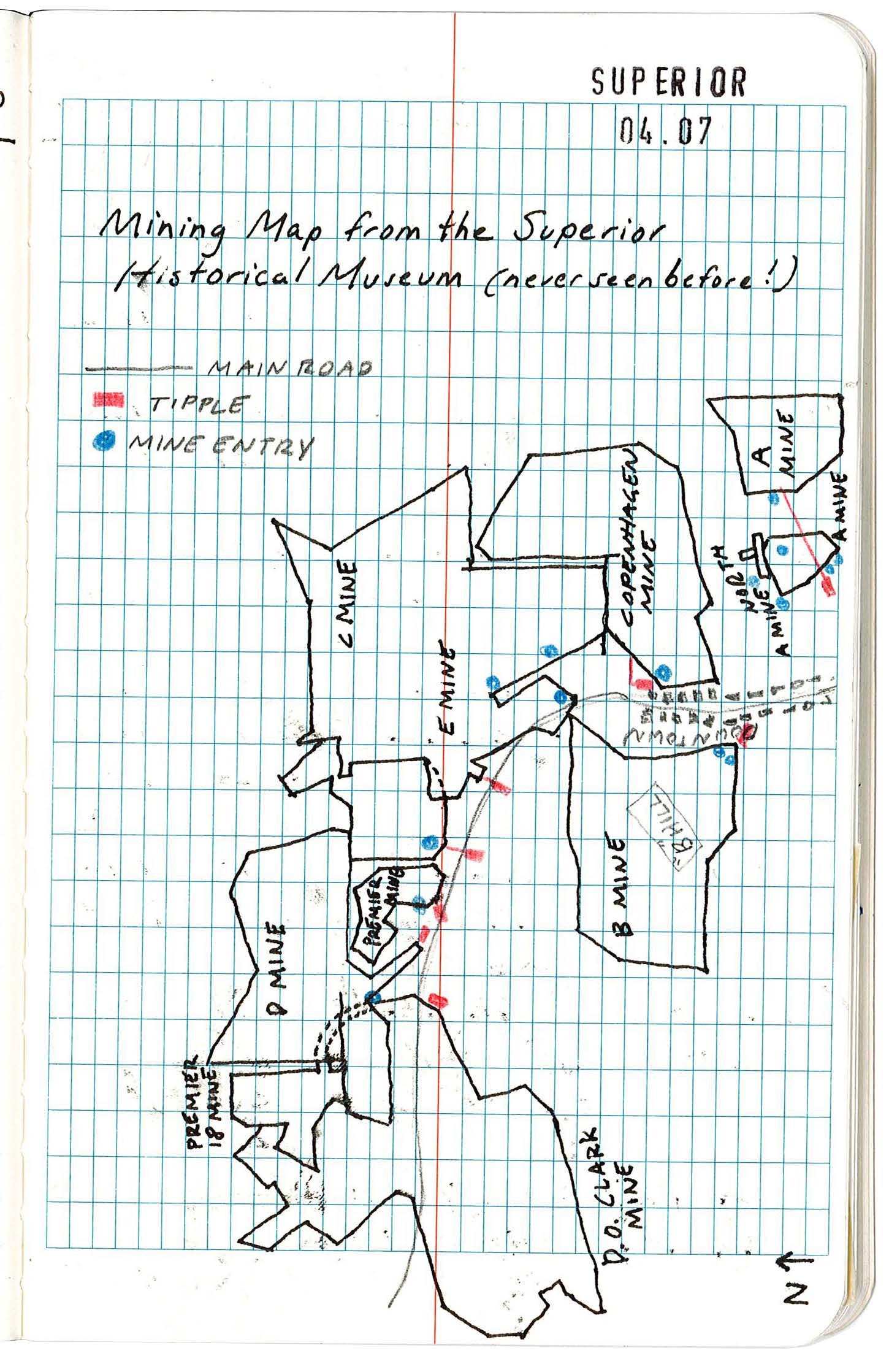
253 XII APPENDIX: SITE FIELDWORK
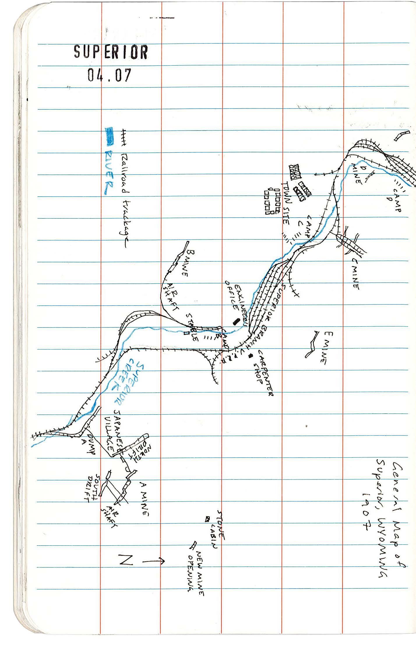
254
FIELD BOOK 19-20 SUPERIOR 04.07
255 XII APPENDIX: SITE FIELDWORK
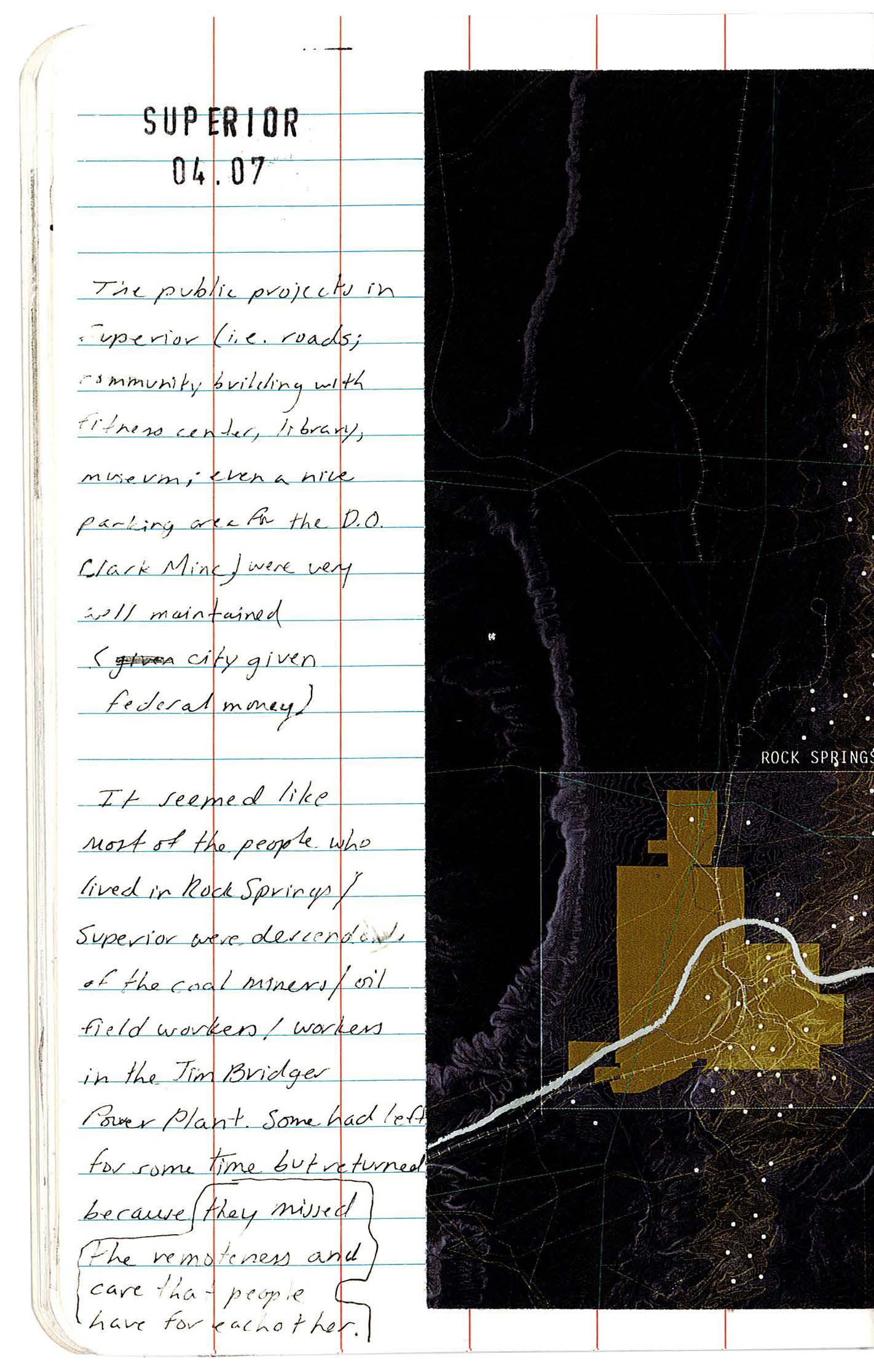
256 FIELD BOOK
21-22 SUPERIOR 04.07
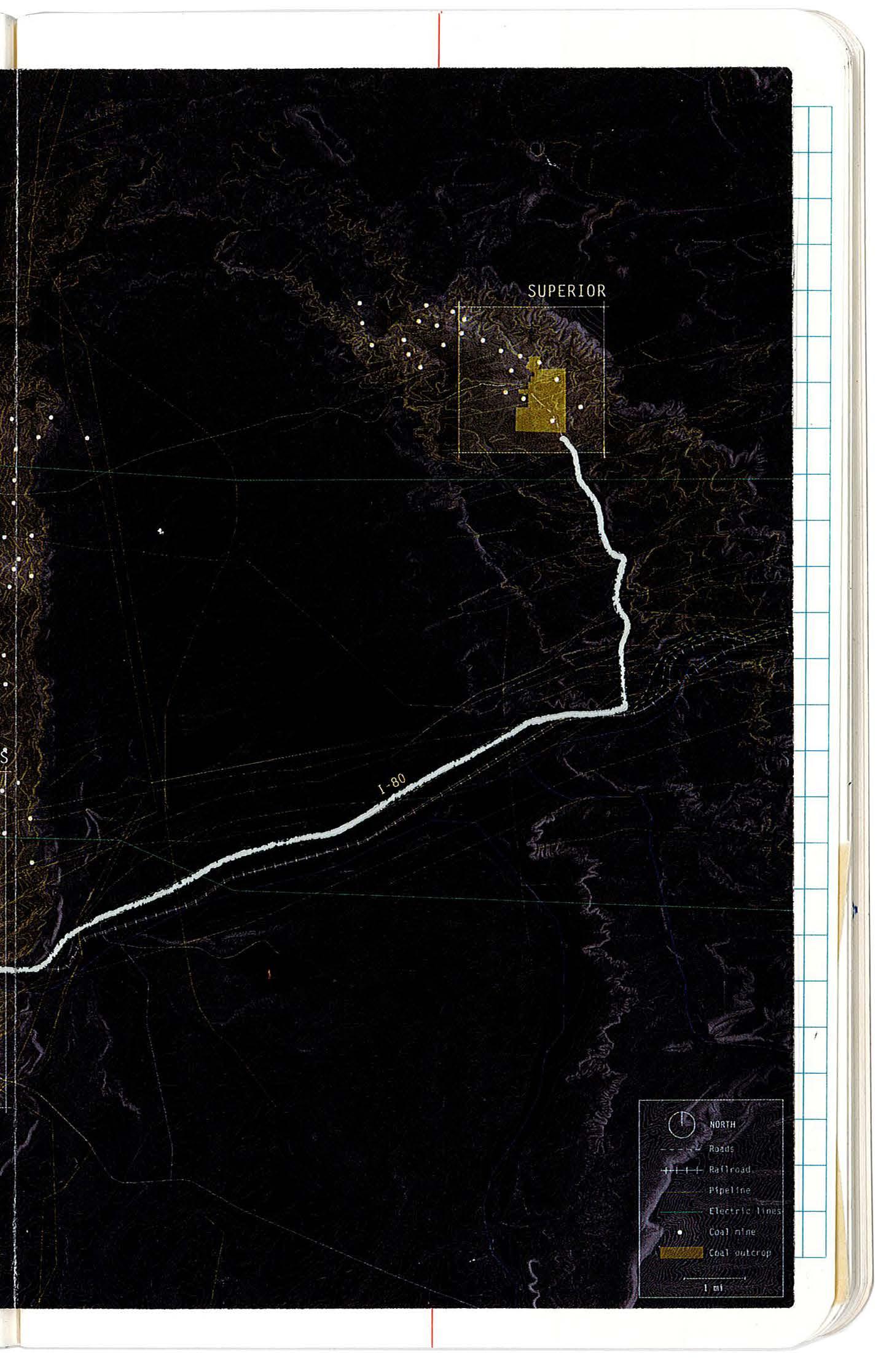
257 XII APPENDIX: SITE FIELDWORK
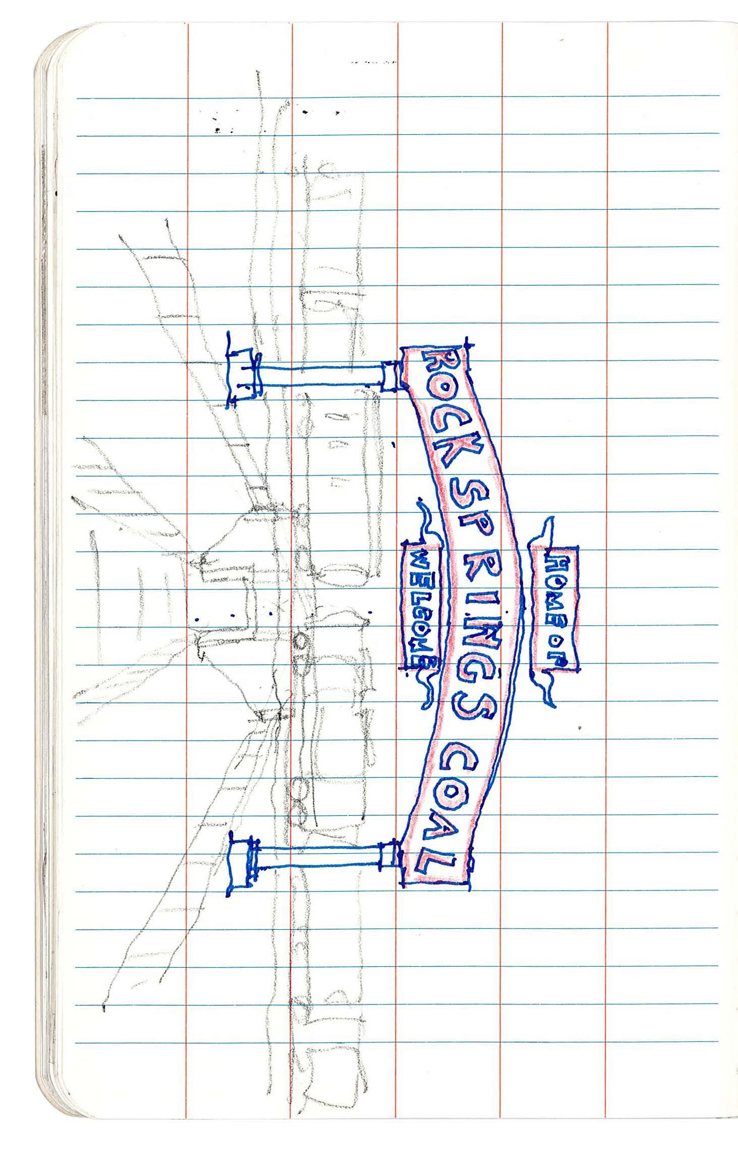
258
FIELD BOOK 23-24 SUPERIOR 04.07
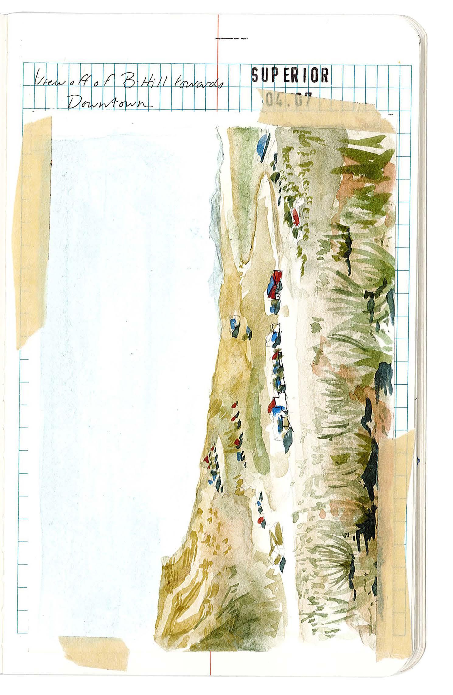
259 XII APPENDIX: SITE FIELDWORK
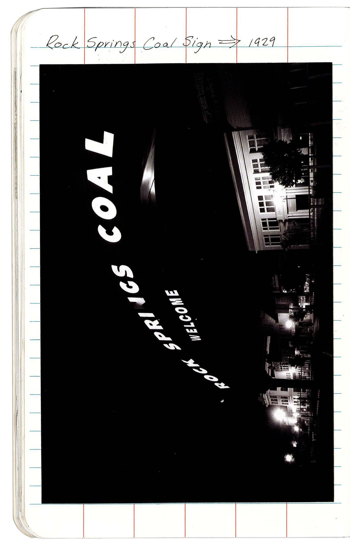
260 FIELD BOOK 25-26
ROCK SPRINGS 04.07
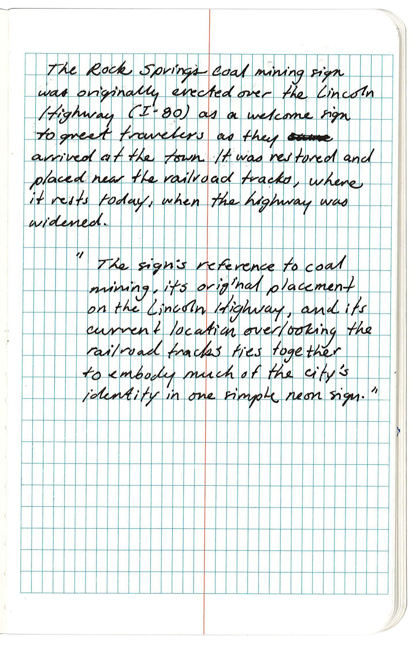
261 XII APPENDIX: SITE FIELDWORK
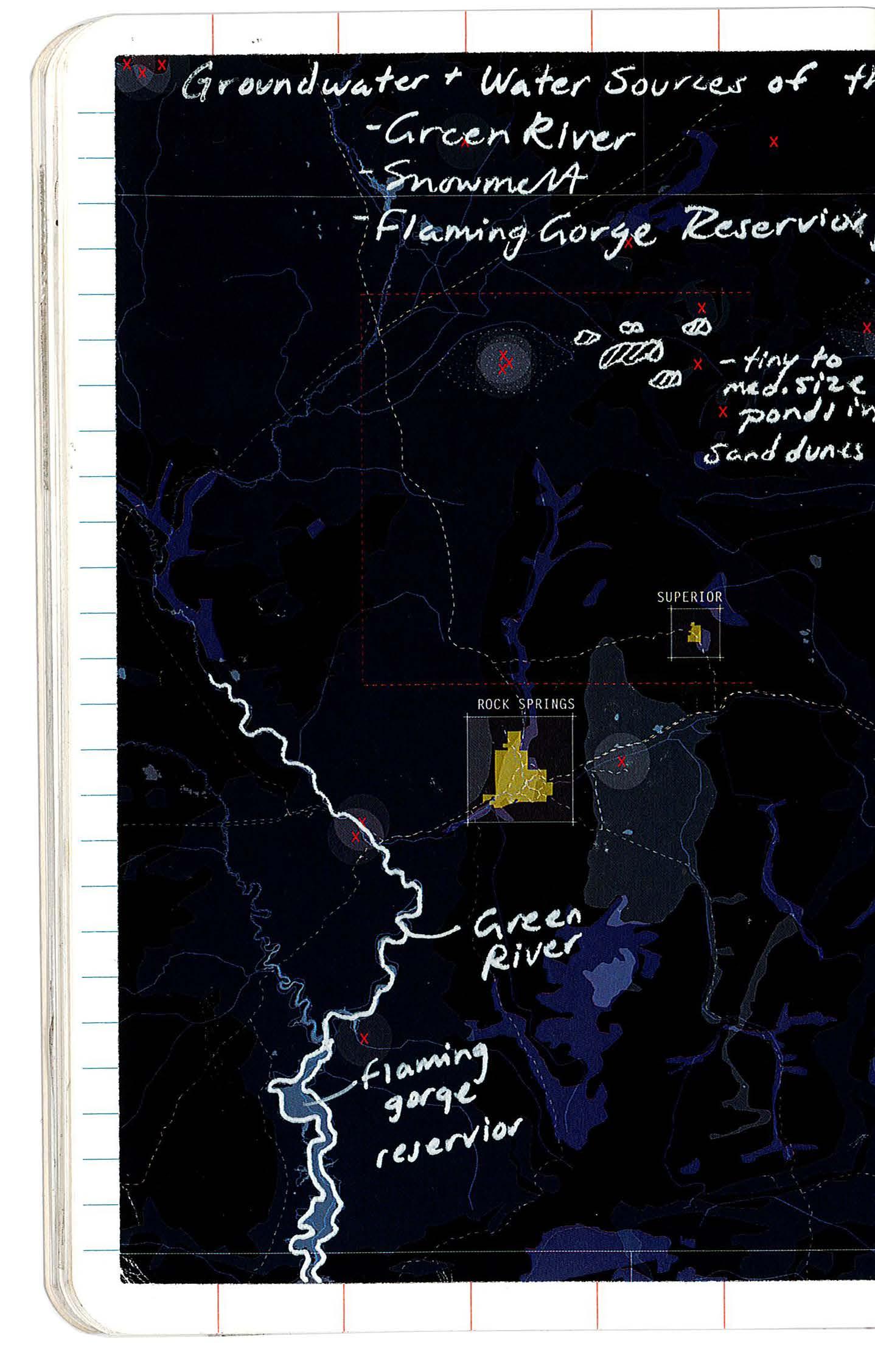
262 FIELD BOOK 27-28 SUPERIOR 04.07
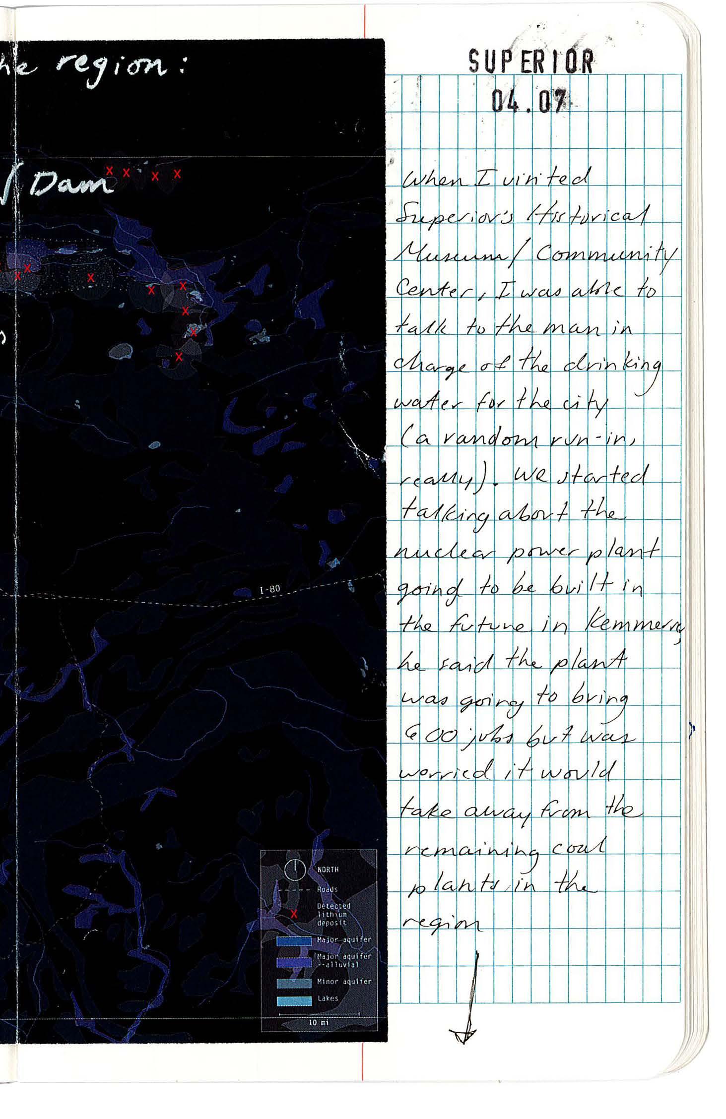
263 XII APPENDIX: SITE FIELDWORK
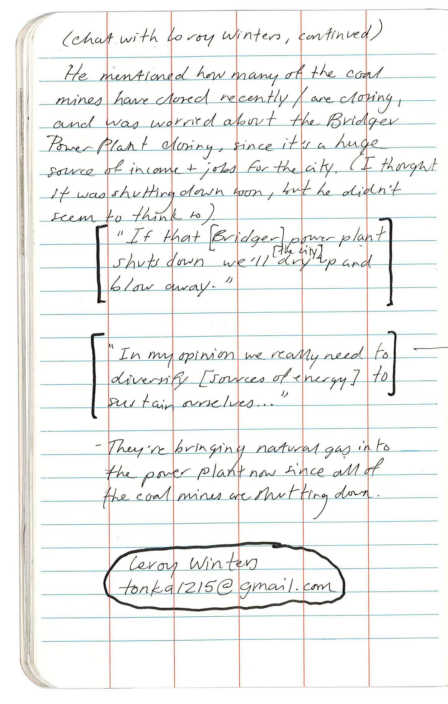
264
FIELD BOOK 29-30 SUPERIOR 04.07
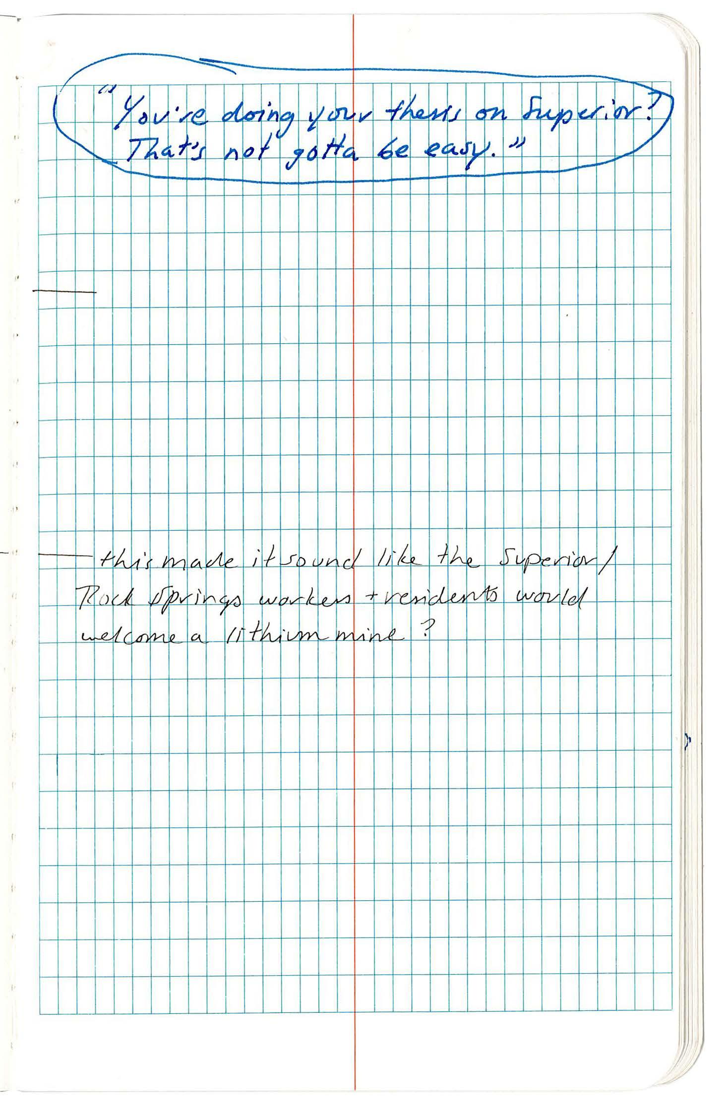
265 XII APPENDIX: SITE FIELDWORK
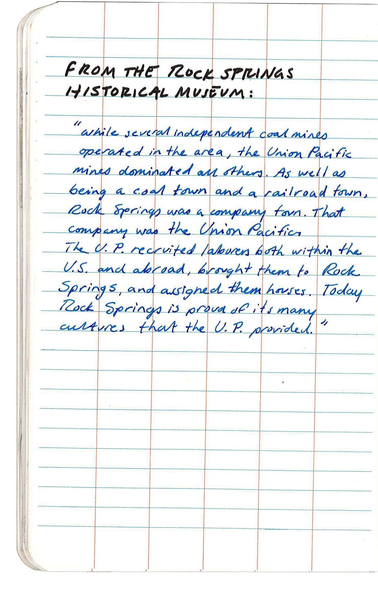
266
FIELD BOOK 31-32 ROCK SPRINGS 04.07
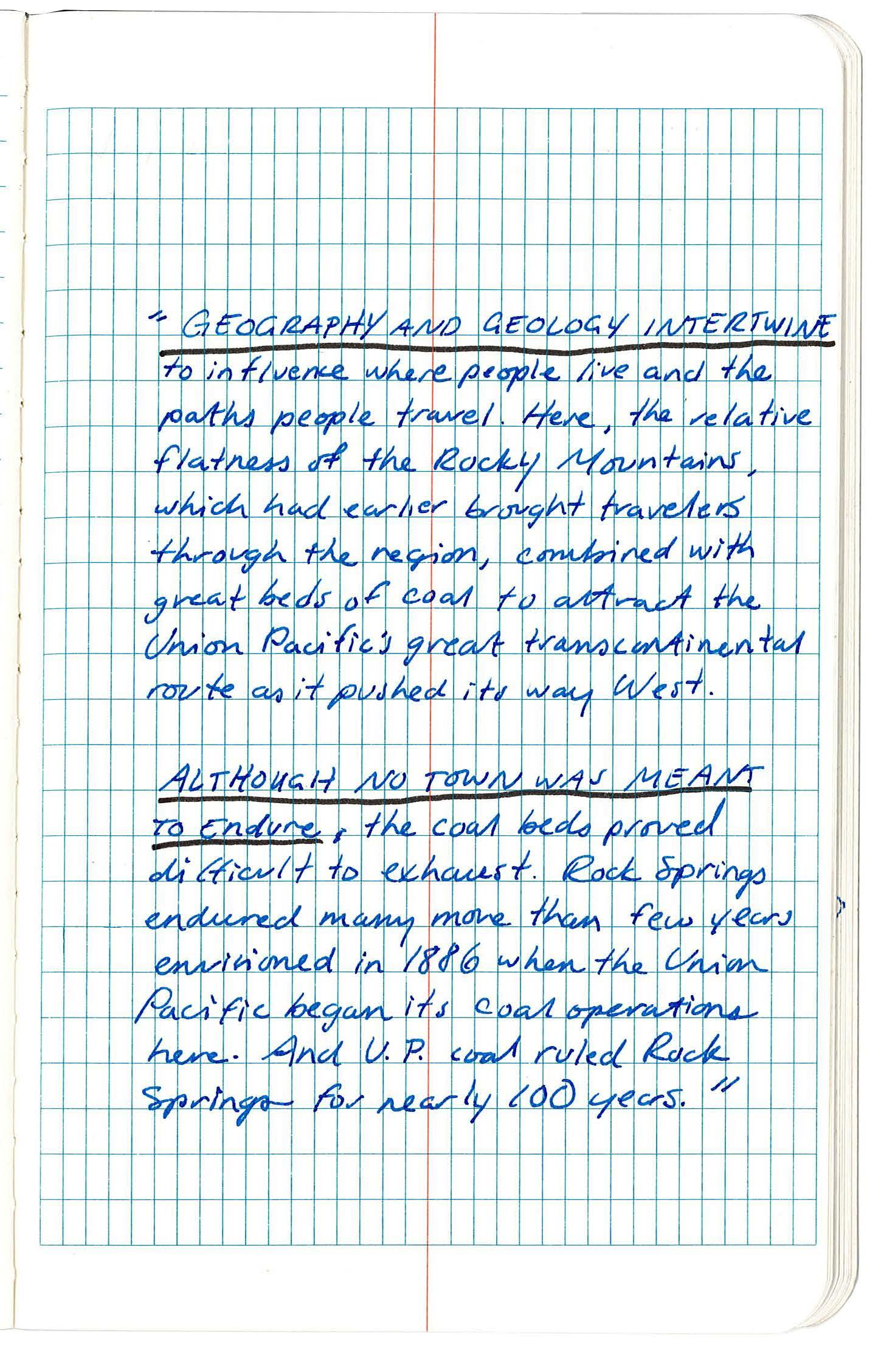
267 XII APPENDIX: SITE FIELDWORK
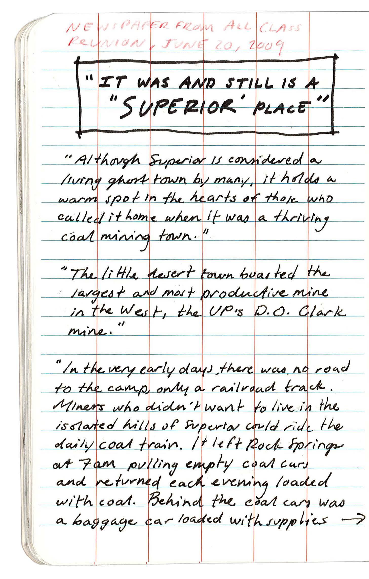
268
FIELD BOOK 33-34 SUPERIOR 04.07
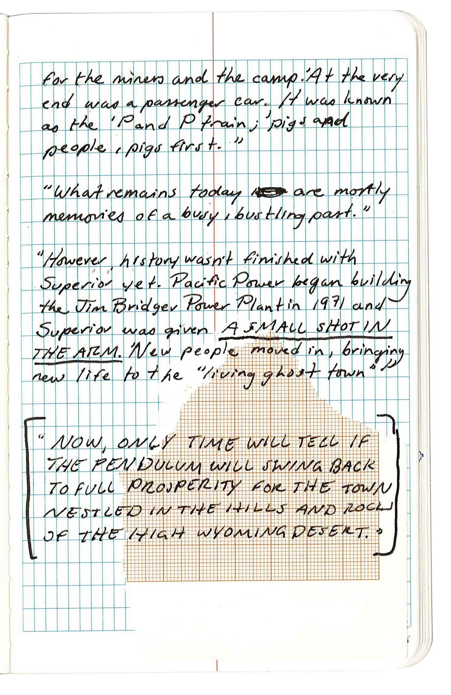
269 XII APPENDIX: SITE FIELDWORK
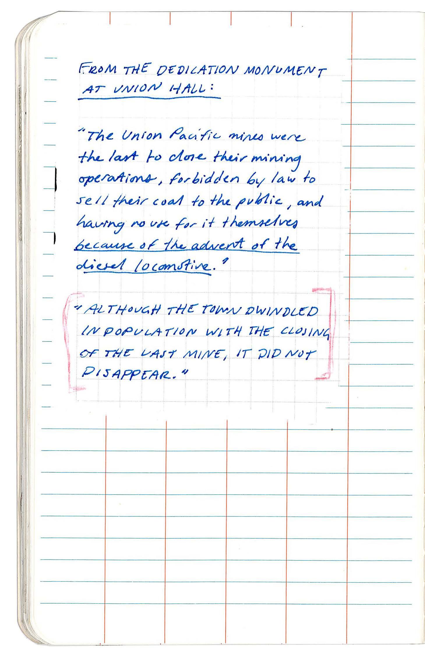
270
FIELD BOOK 35-36 SUPERIOR 04.07
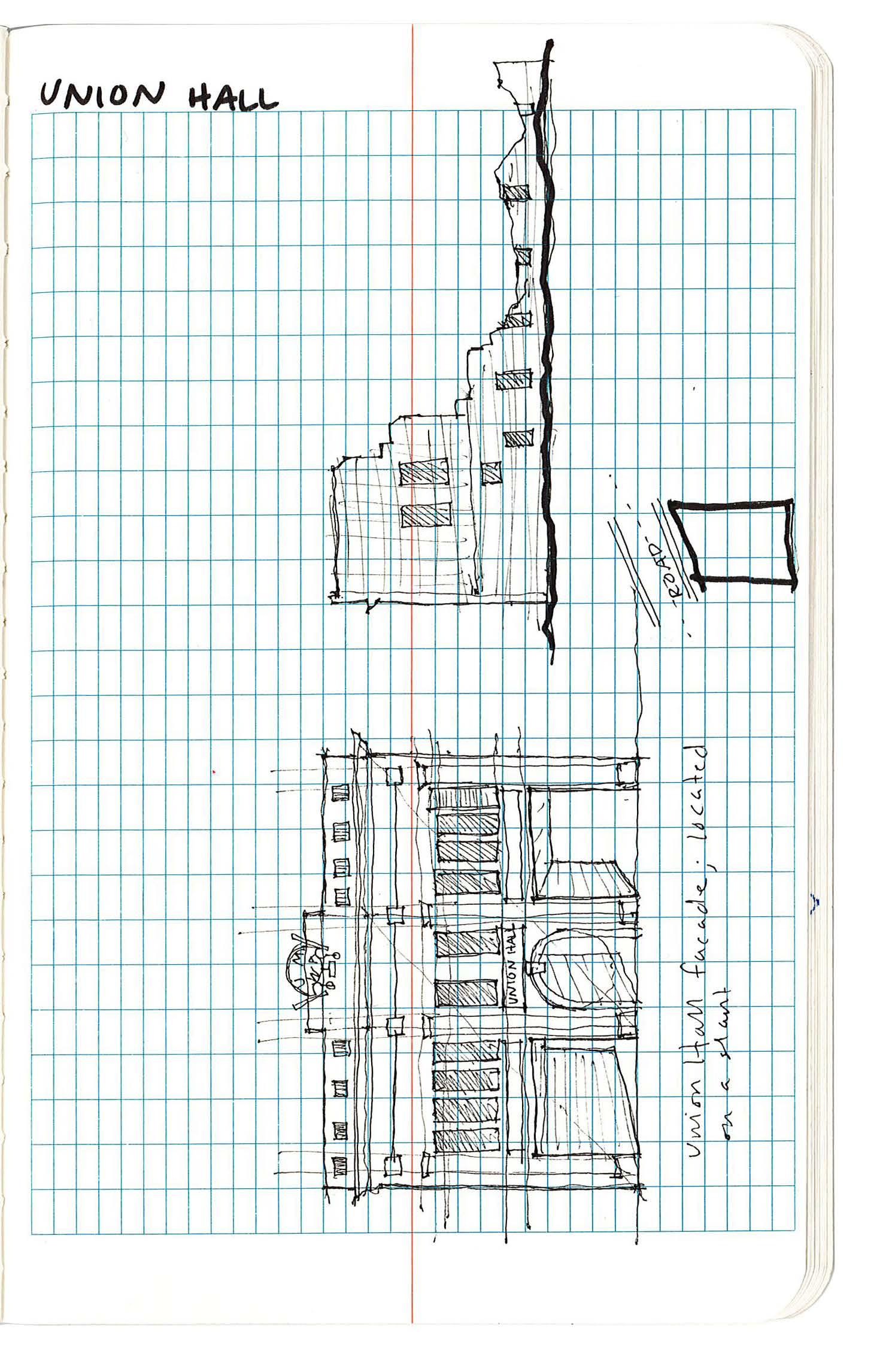
271 XII APPENDIX: SITE FIELDWORK
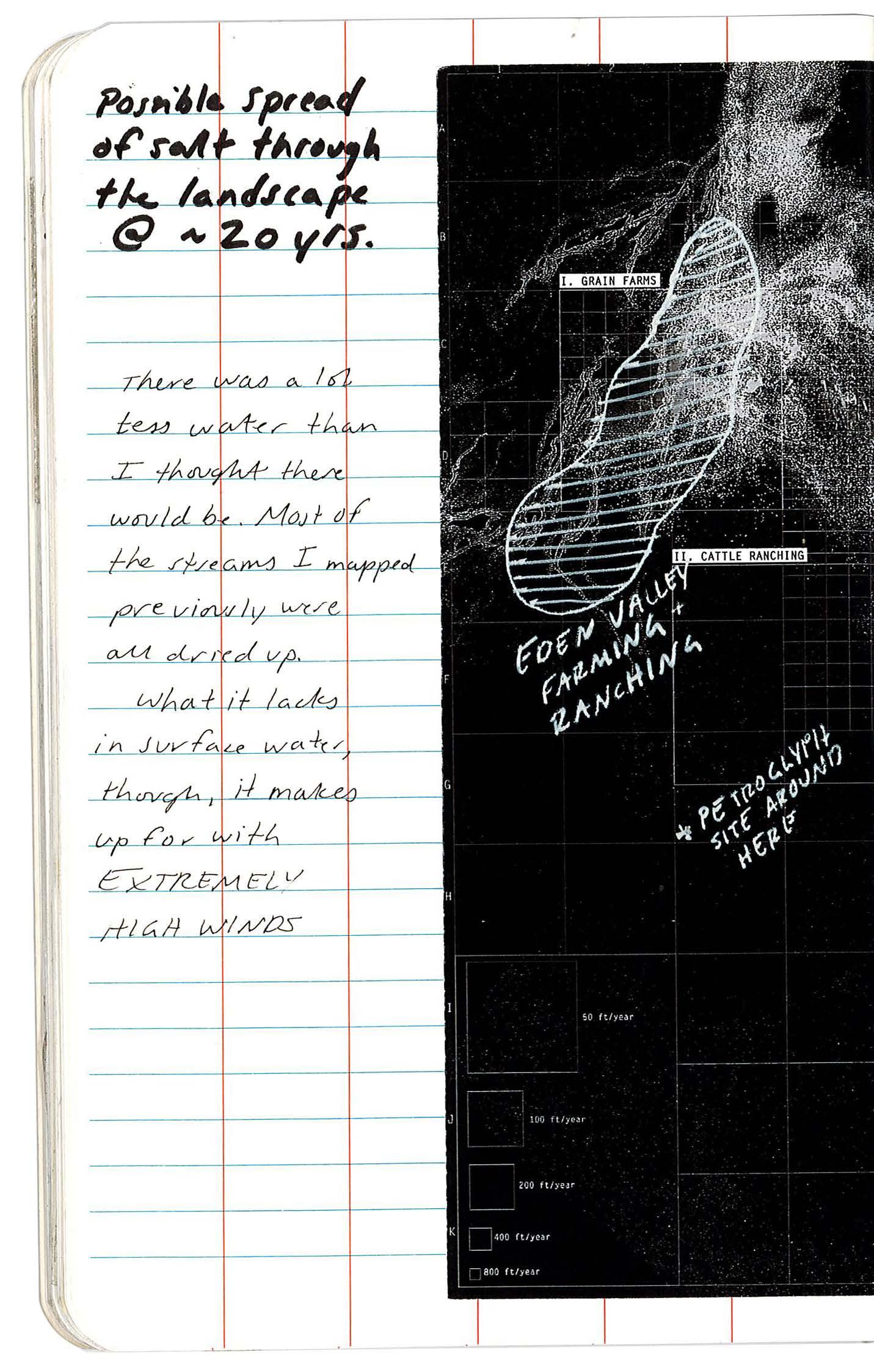
272 FIELD BOOK 37-38 SAND DUNES 04.08
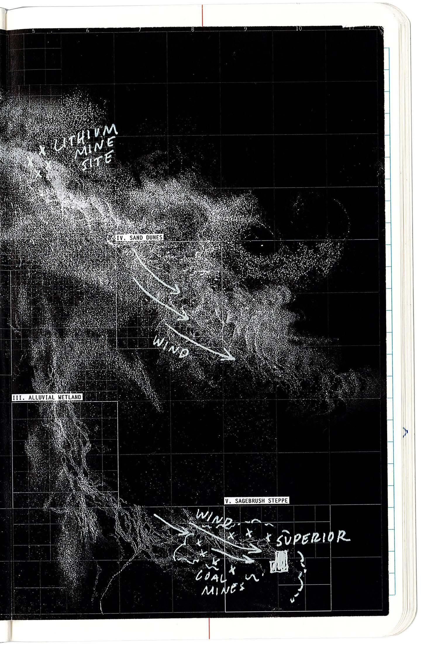
273 XII APPENDIX: SITE FIELDWORK
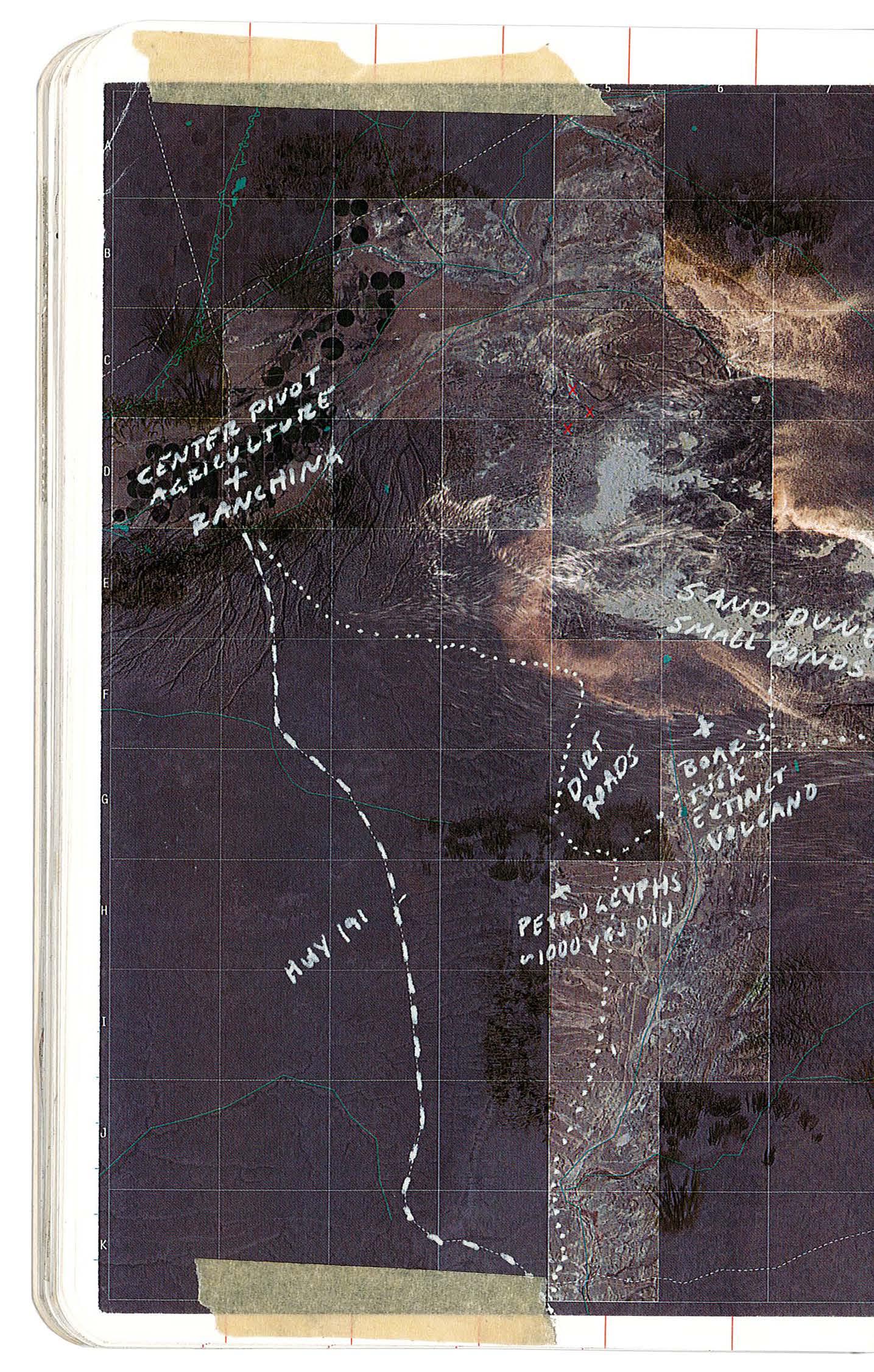
274 FIELD BOOK 39-40
SAND DUNES 04.08
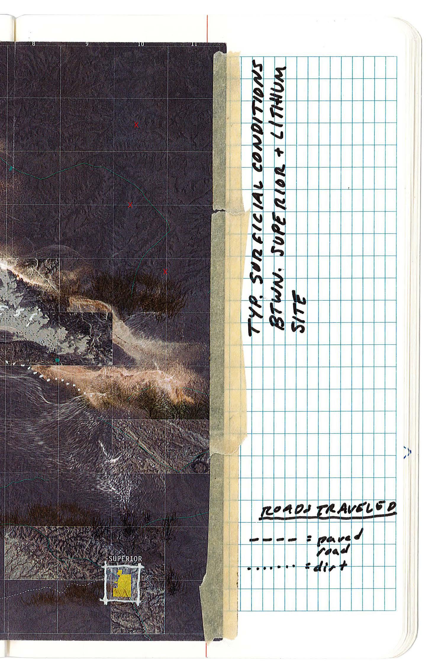
275 XII APPENDIX: SITE FIELDWORK
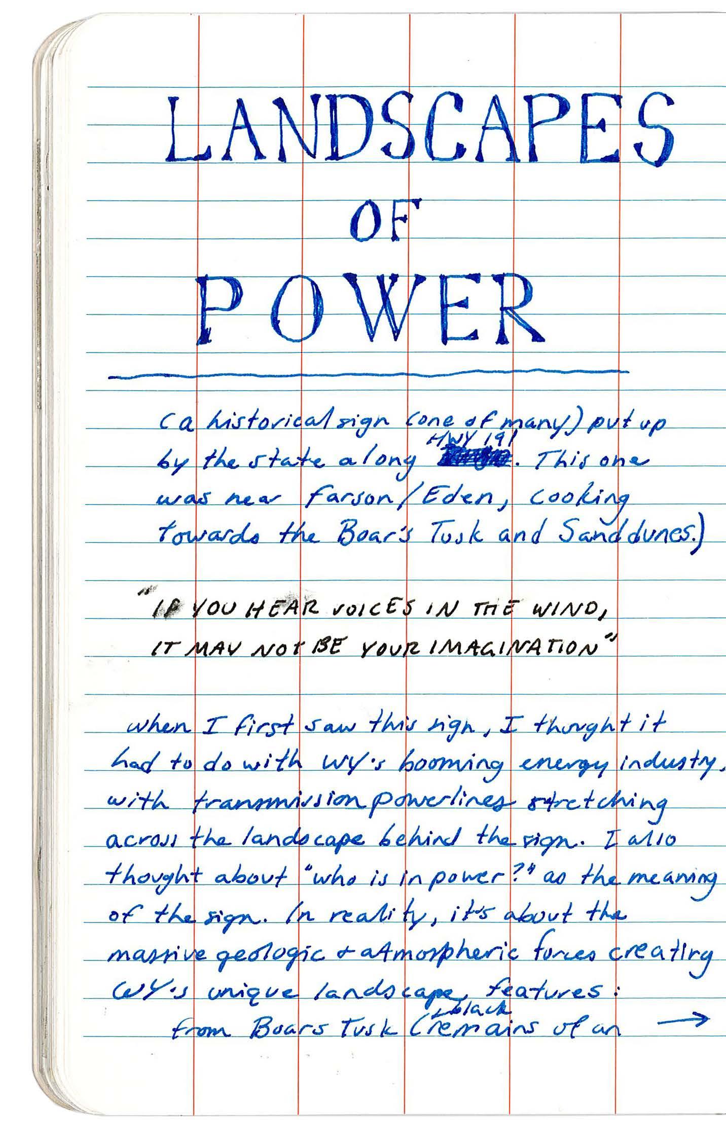
276
FIELD BOOK 41-42 BOARS TUSK 04.08
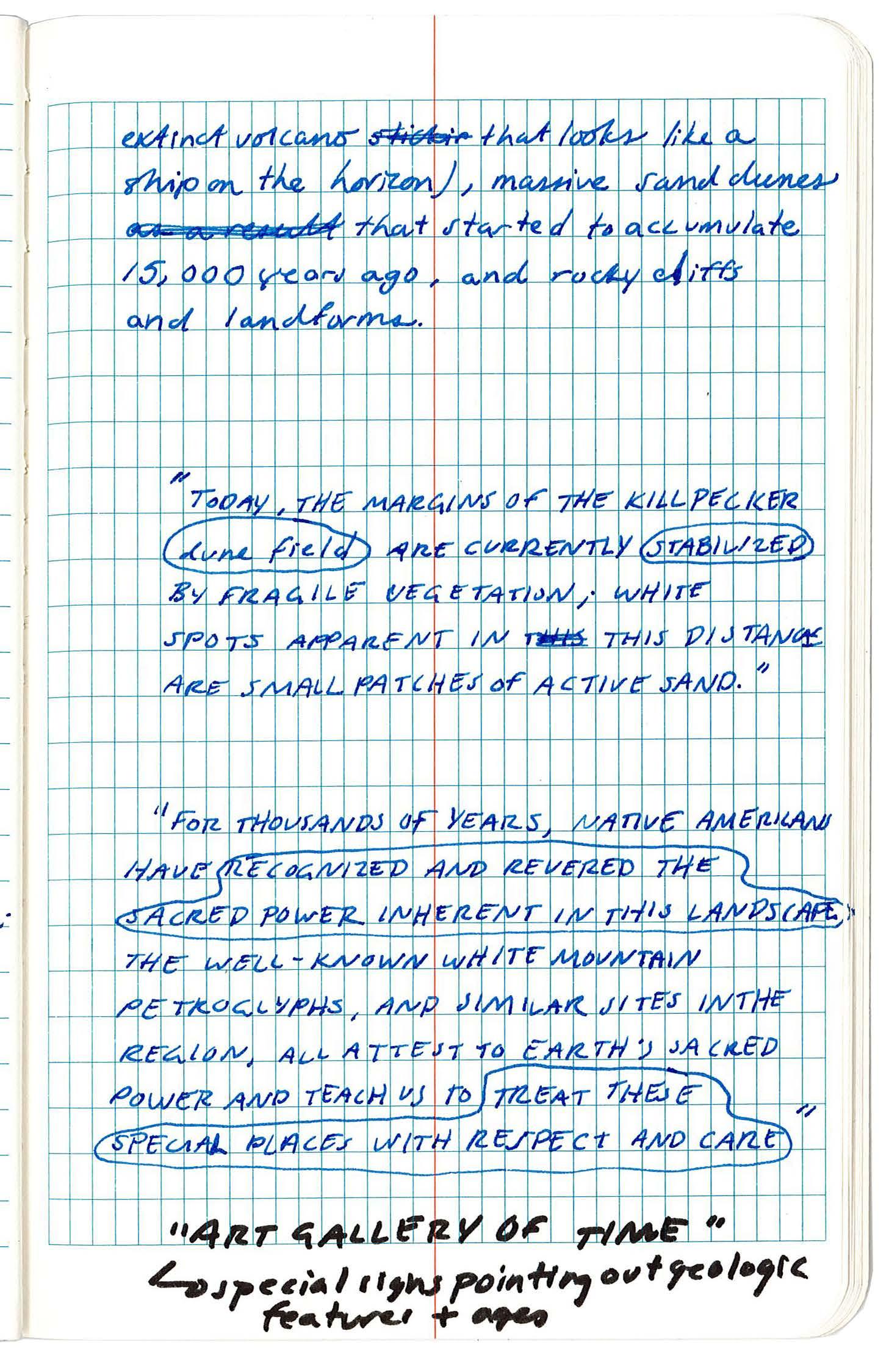
277 XII APPENDIX: SITE FIELDWORK
278
BOOK 43-44
FIELD
WHITE MTN PETROGLYPHS 04.08
279 XII APPENDIX: SITE FIELDWORK
FIELD BOOK 45-46
FARSON/EDEN VALLEY 04.08
280
281 XII APPENDIX: SITE FIELDWORK
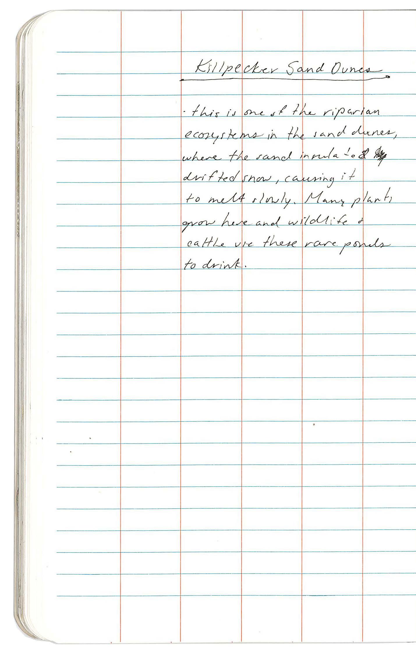
282 FIELD BOOK 47-48 SAND DUNES 04.08
283 XII APPENDIX: SITE FIELDWORK
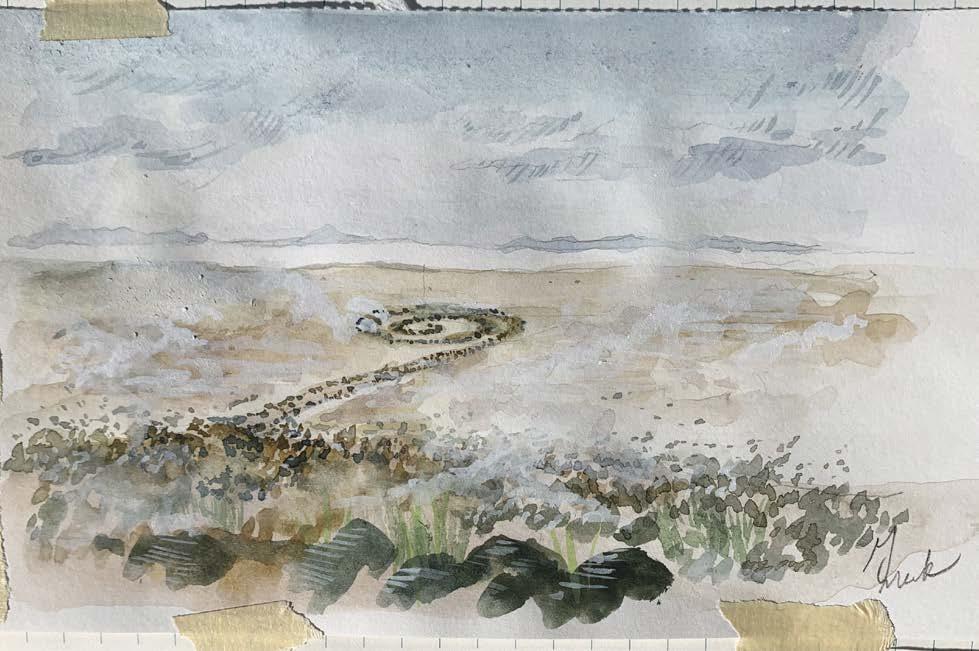
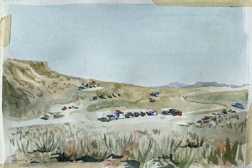
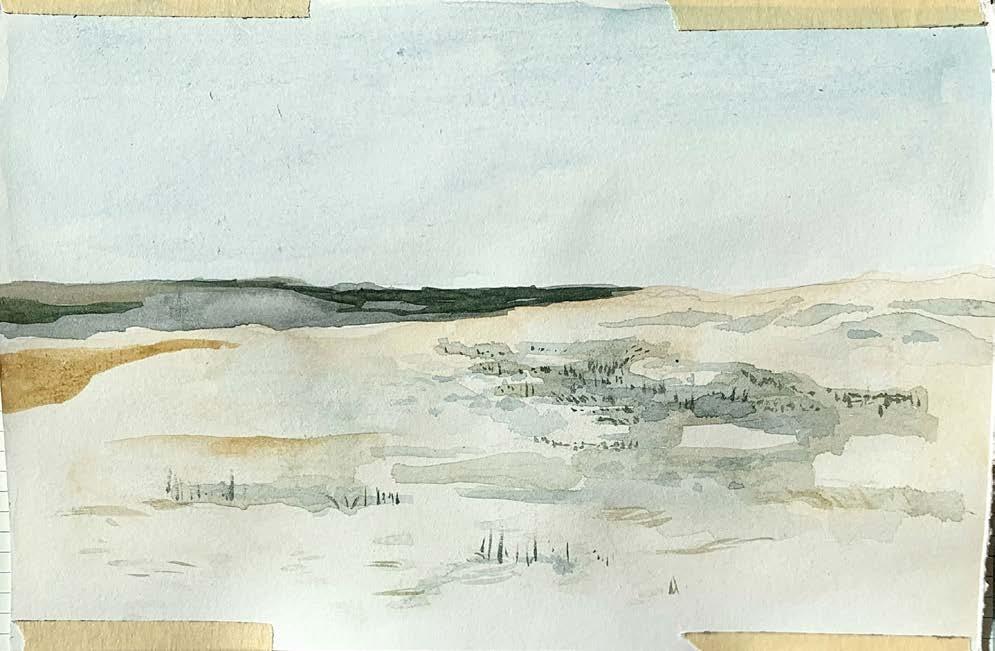
284

285
XII APPENDIX: SITE FIELDWORK
PLEIN AIR WATERCOLORS
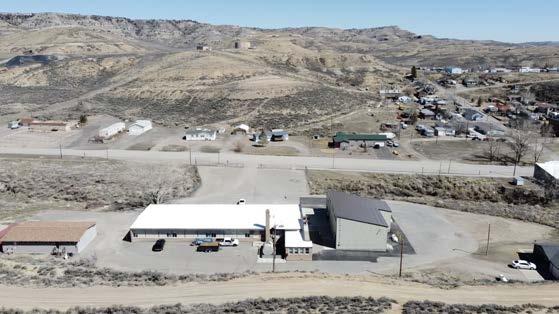
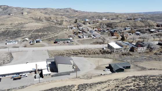
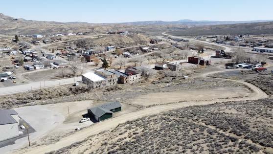
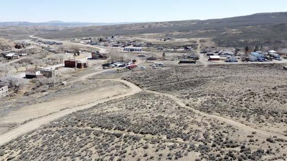
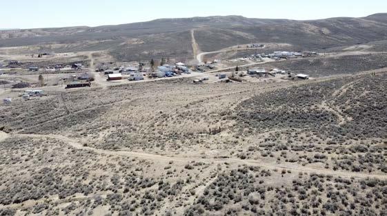
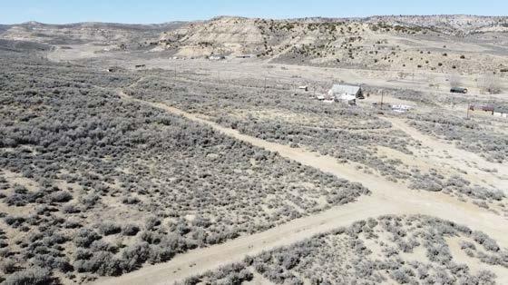
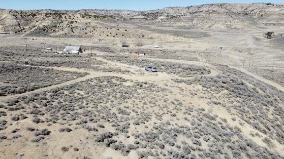
286 Photos by author
DRONE FOOTAGE: AN AERIAL JOURNEY THROUGH SWEETWATER COUNTY
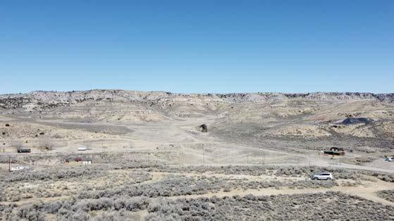
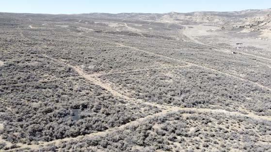
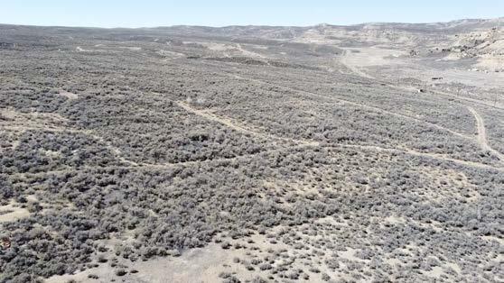
287 01_SUPERIOR XII APPENDIX: SITE FIELDWORK
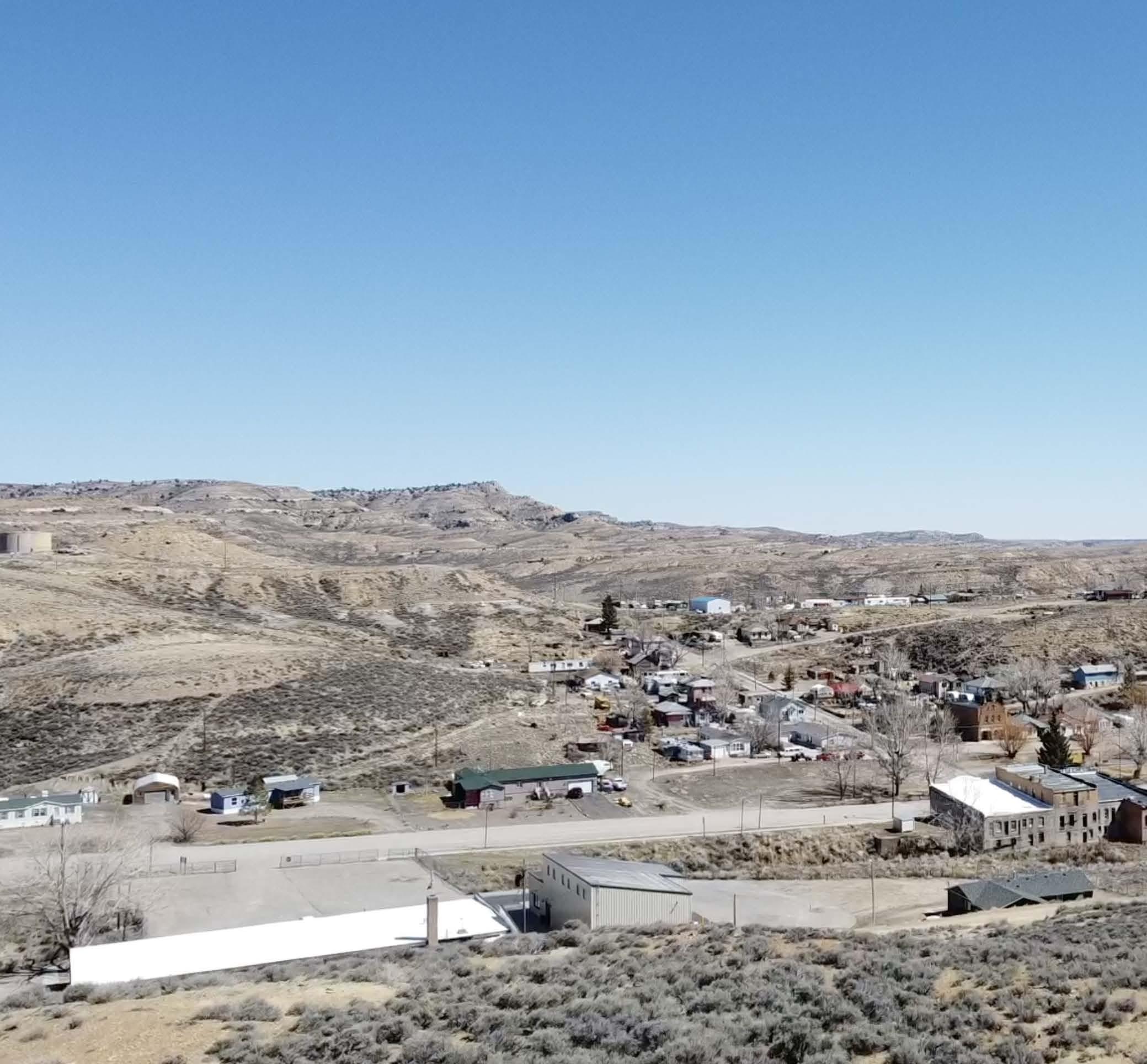
288 Photo by author
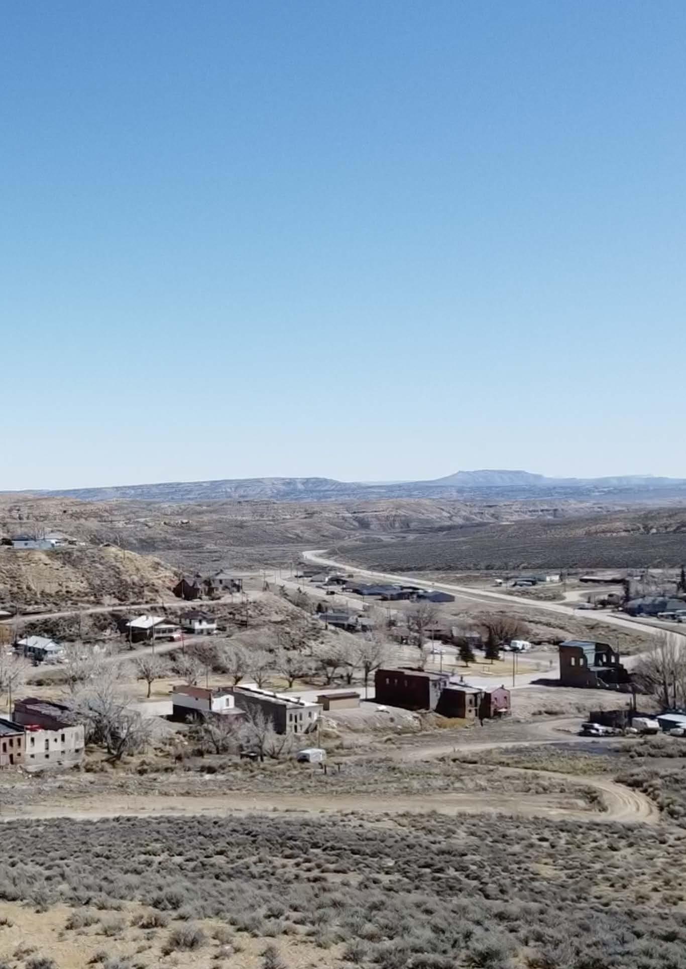
289 01_SUPERIOR XII APPENDIX: SITE FIELDWORK
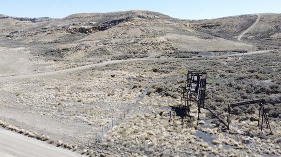
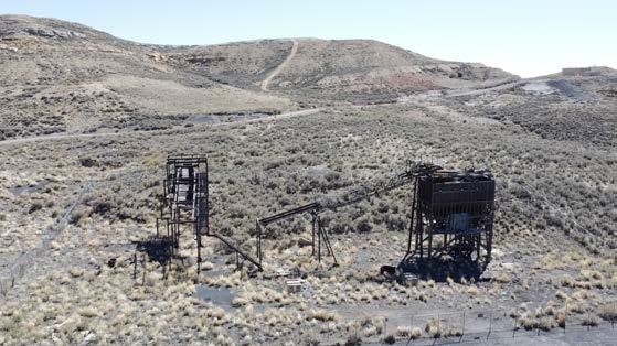
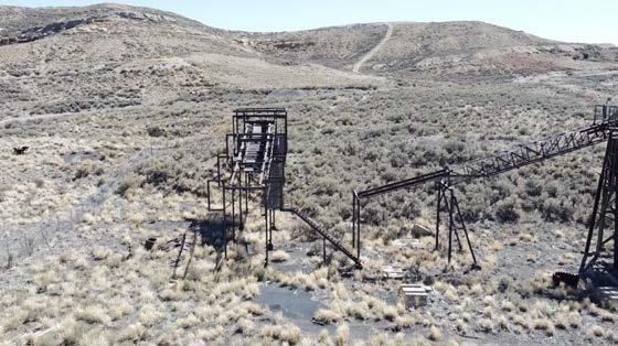
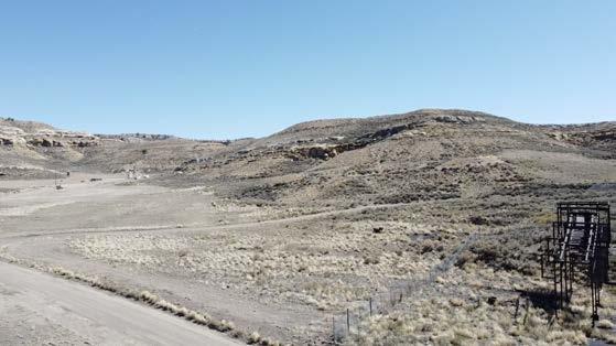
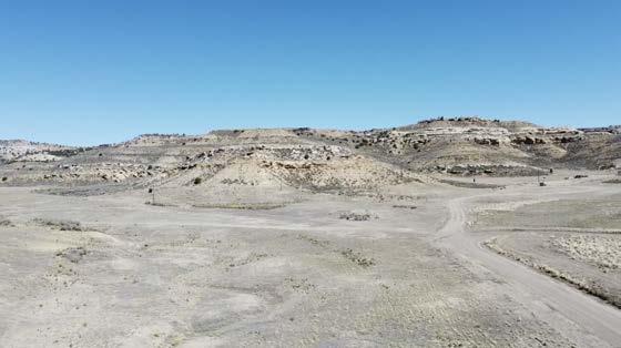
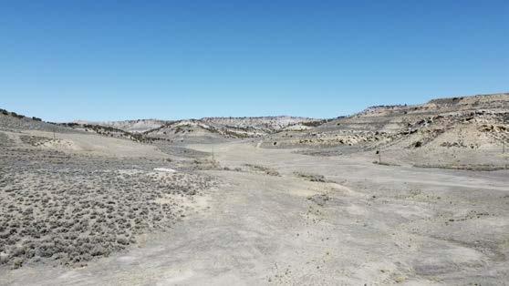
290 Photos by author
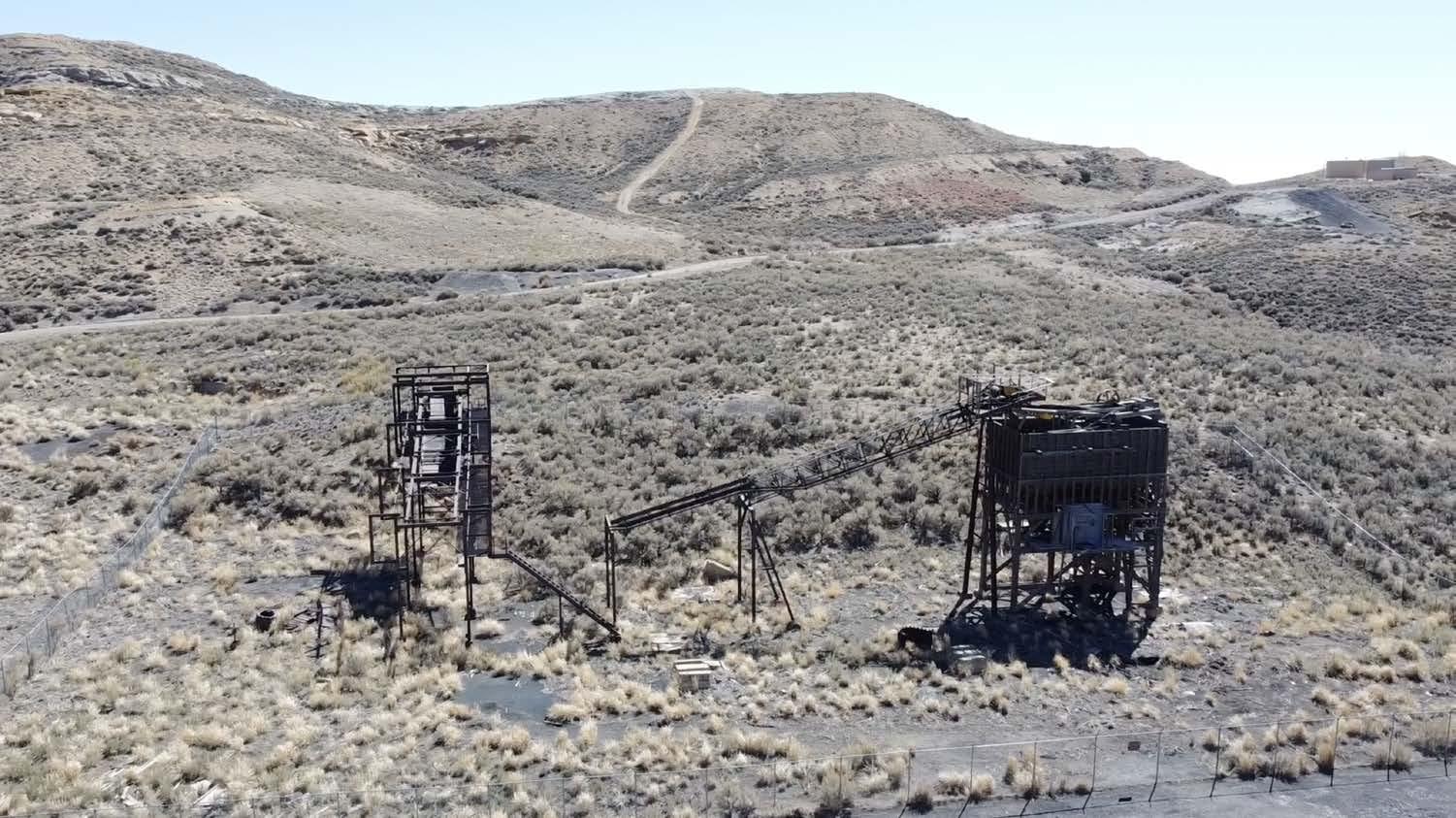
291 02_SUPERIOR TIPPLE XII APPENDIX: SITE FIELDWORK
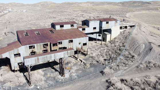
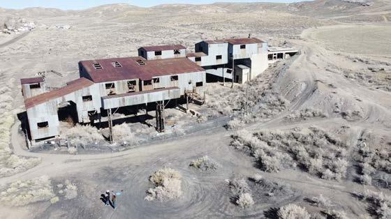
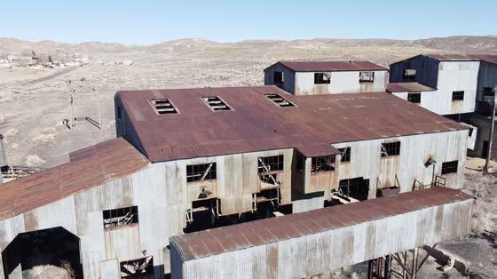
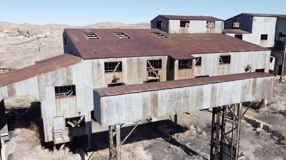
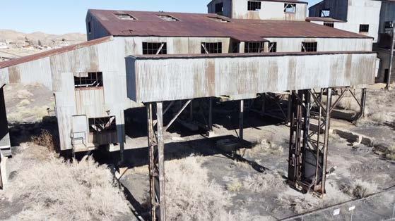
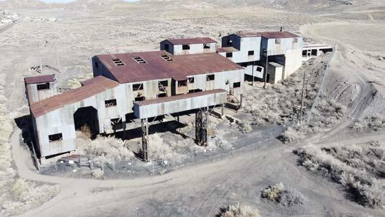
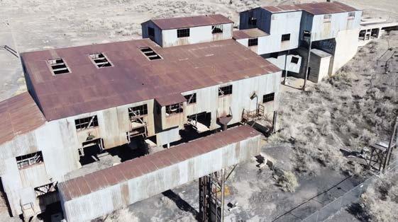
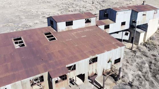
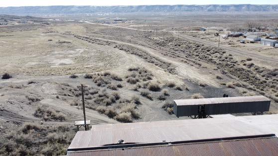
292 Photos by author

293 03_RELIANCE TIPPLE XII APPENDIX: SITE FIELDWORK

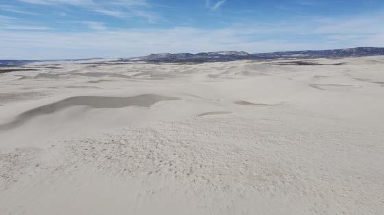
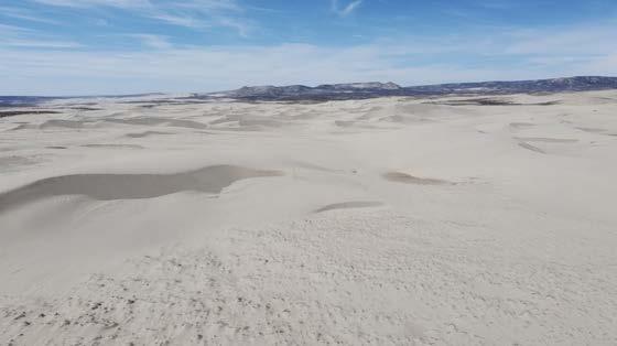
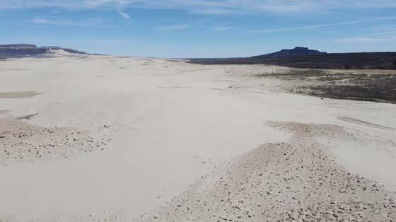
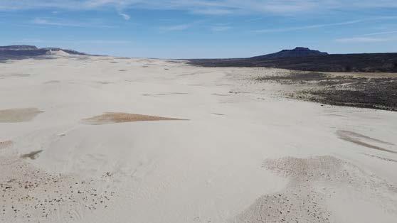
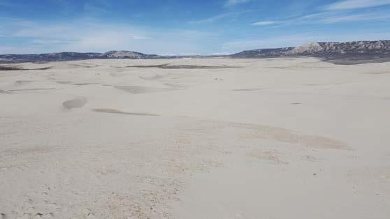
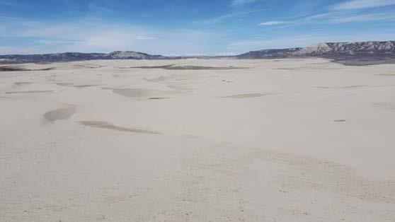
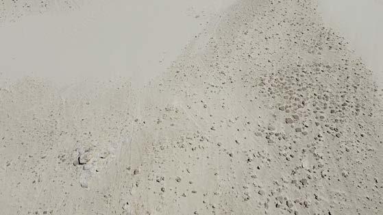
294 Photos by author

295 04_SAND DUNES XII APPENDIX: SITE FIELDWORK
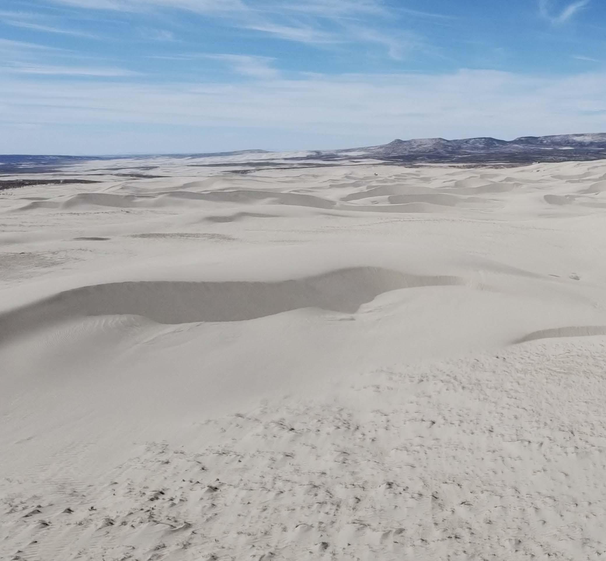
296 Photo by author
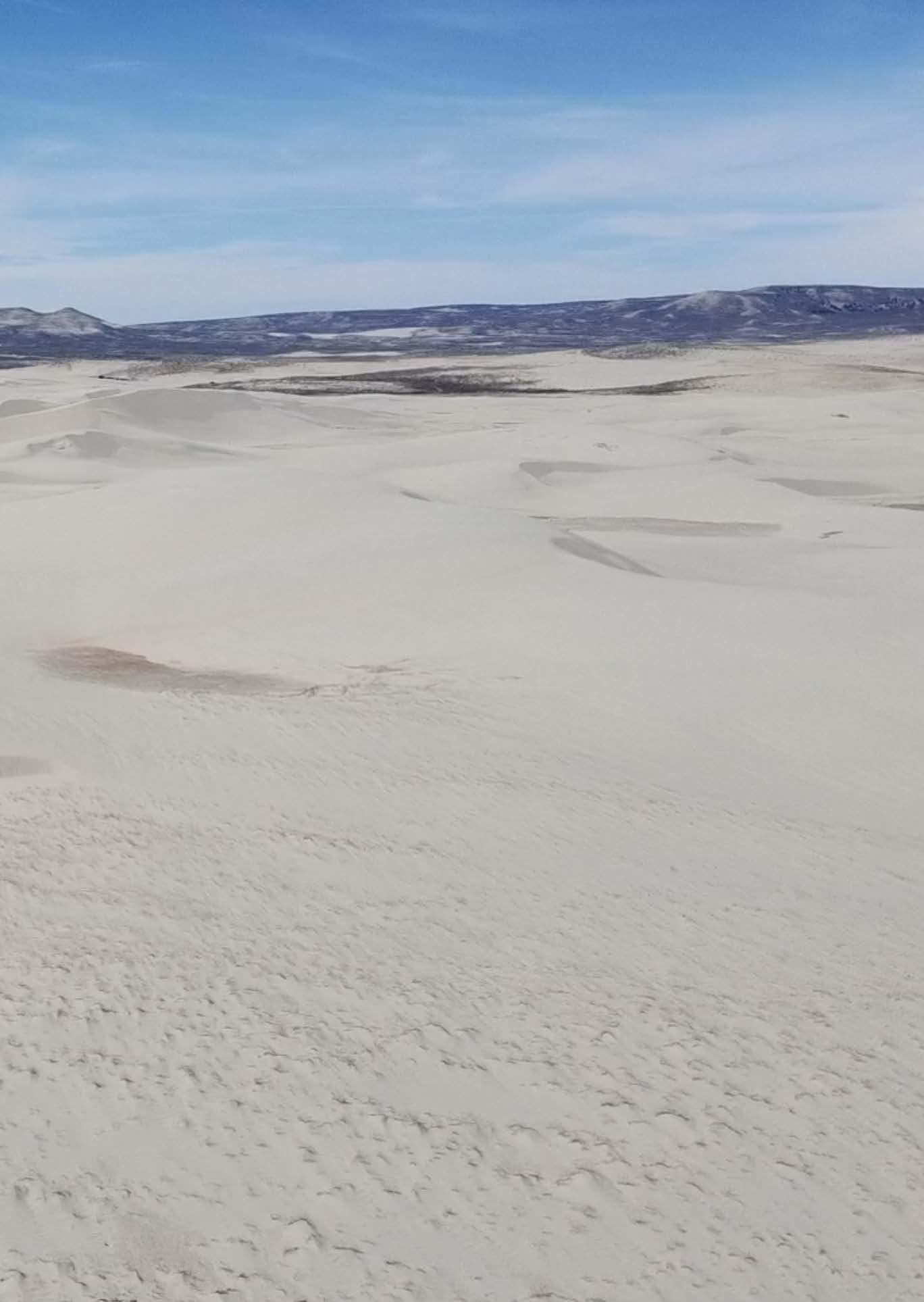
297 04_SAND DUNES XII APPENDIX: SITE FIELDWORK
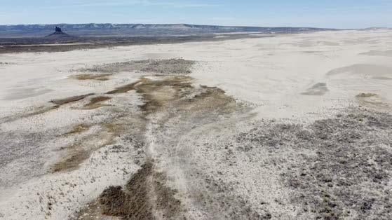
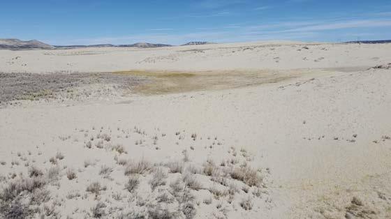
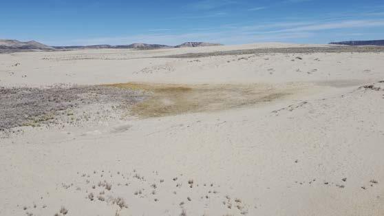
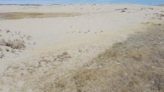
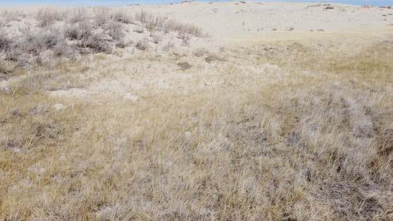

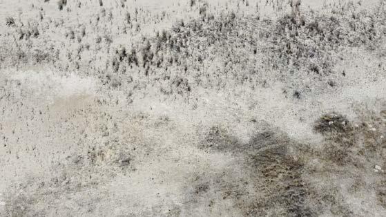

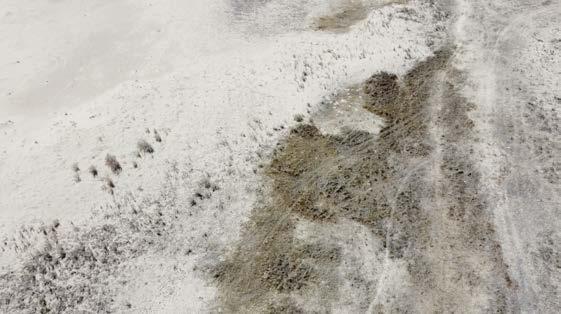
298 Photos by author
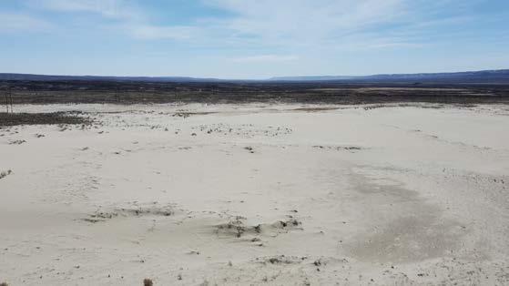
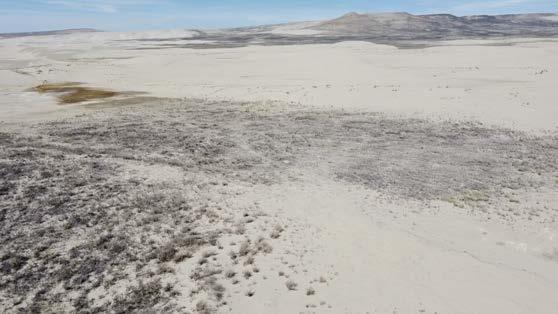
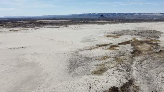
299 05_RIPARIAN SAND DUNES XII APPENDIX: SITE FIELDWORK
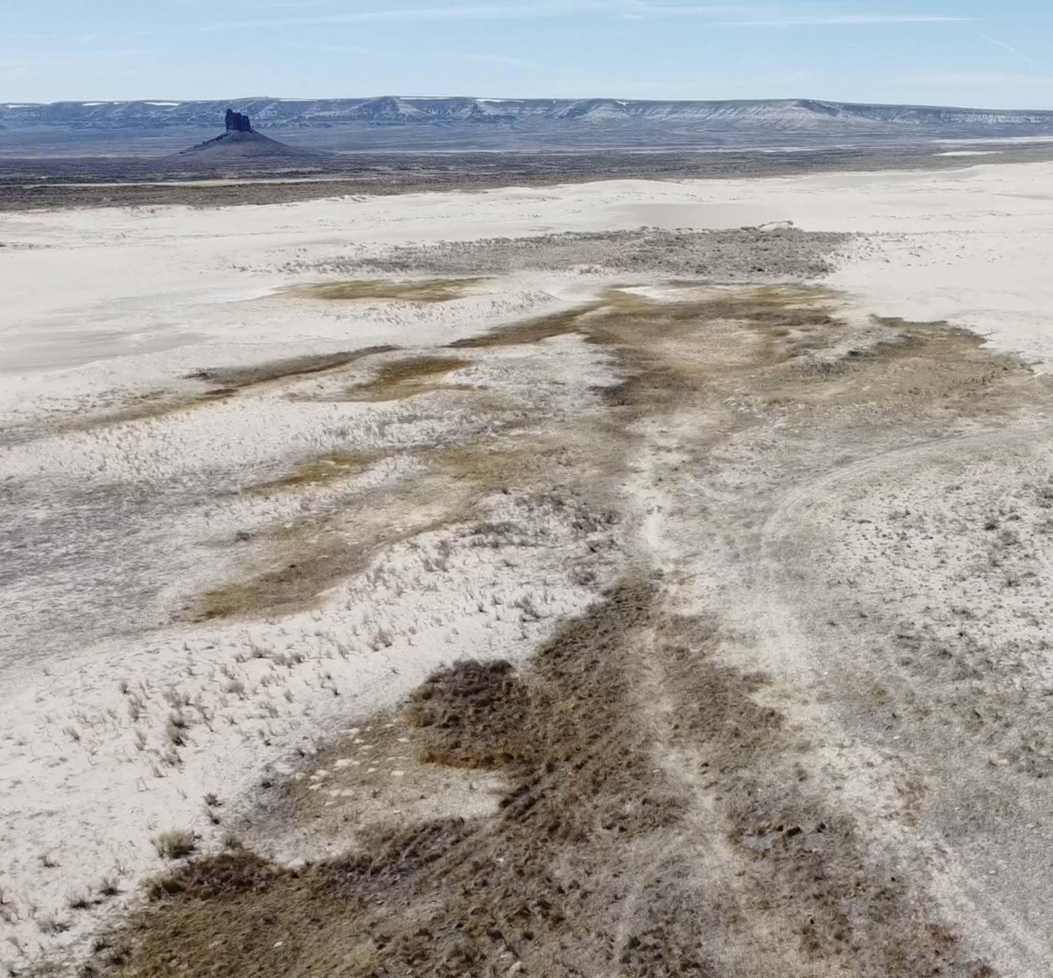
300 Photo by author
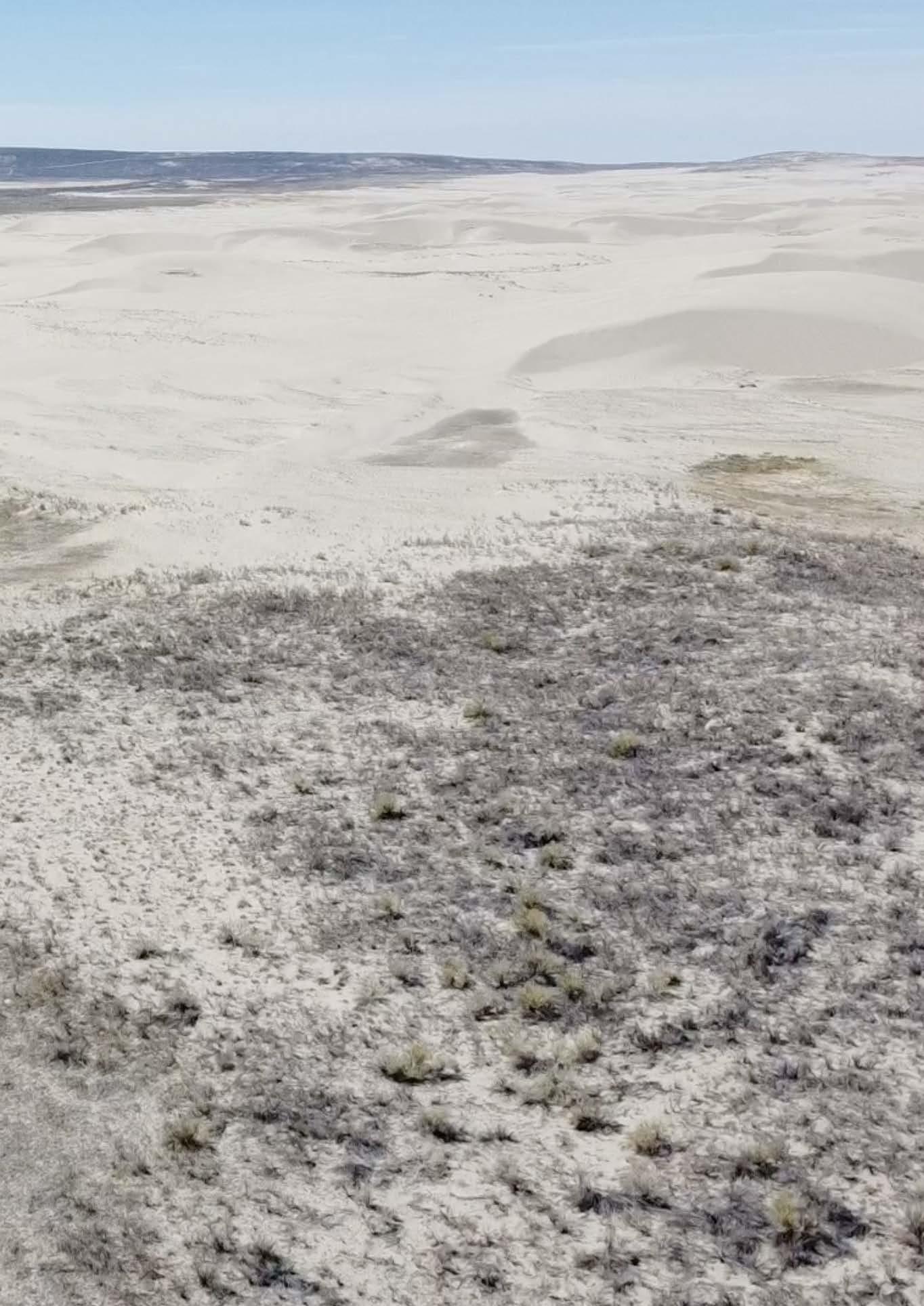
301 05_RIPARIAN SAND DUNES XII APPENDIX: SITE FIELDWORK
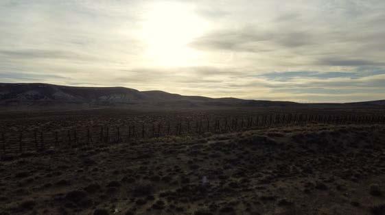
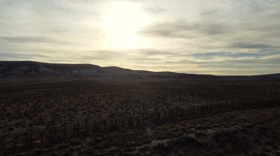
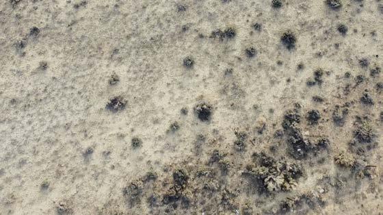
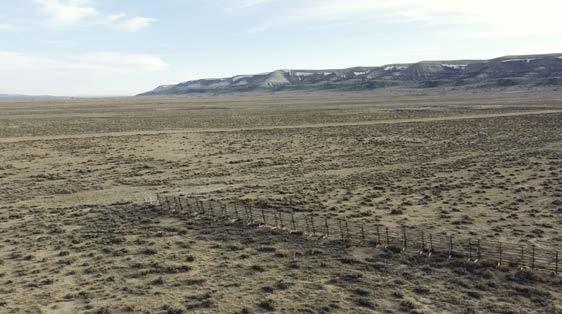

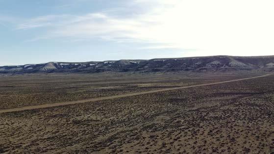
302 Photos by author
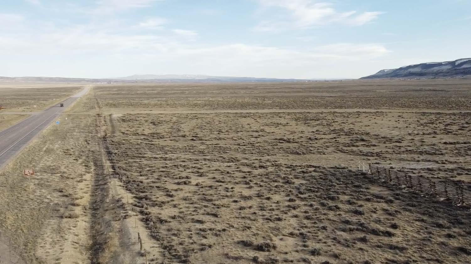
303 06_CATTLE RANCH XII APPENDIX: SITE FIELDWORK
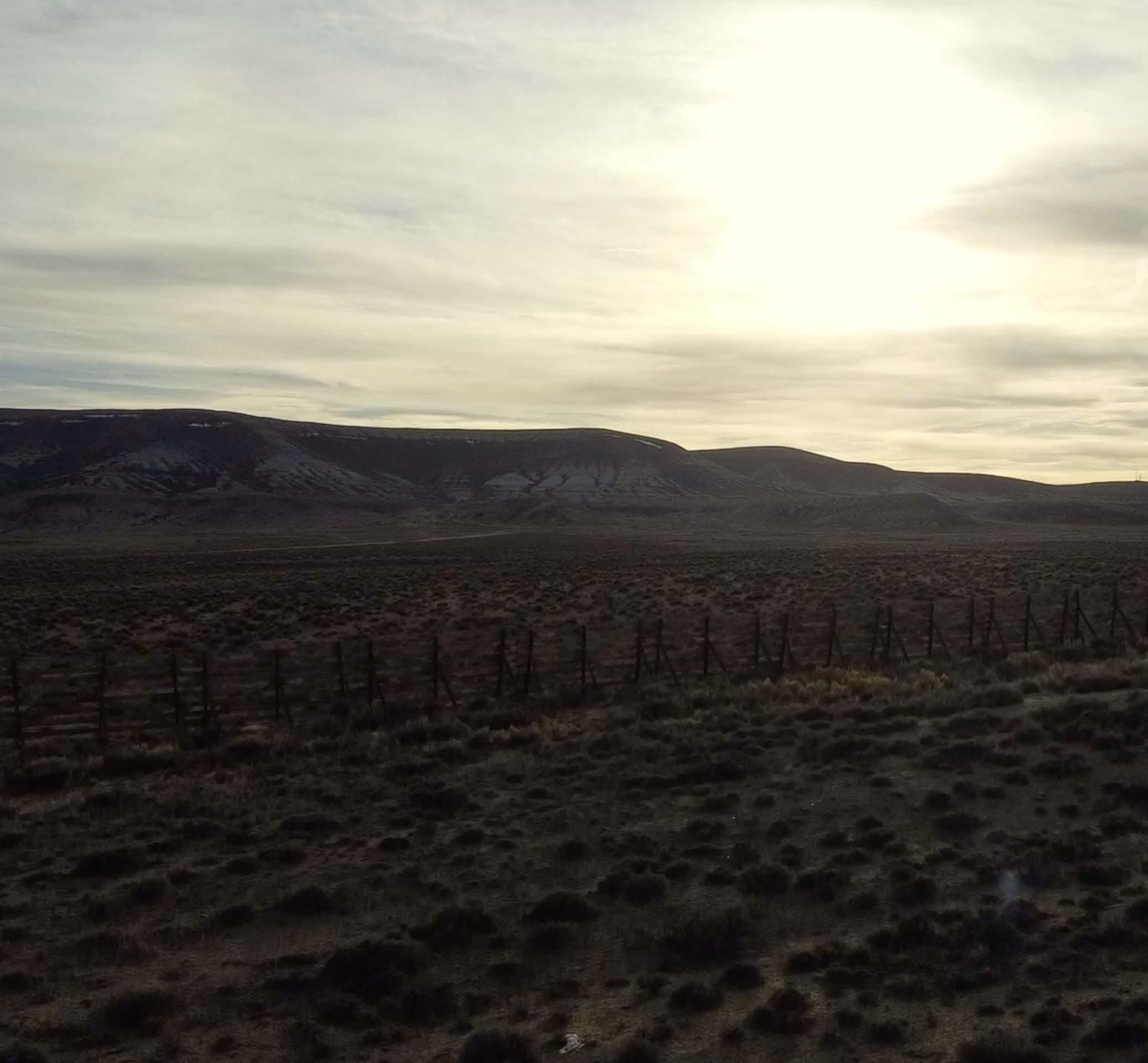
304 Photo by author
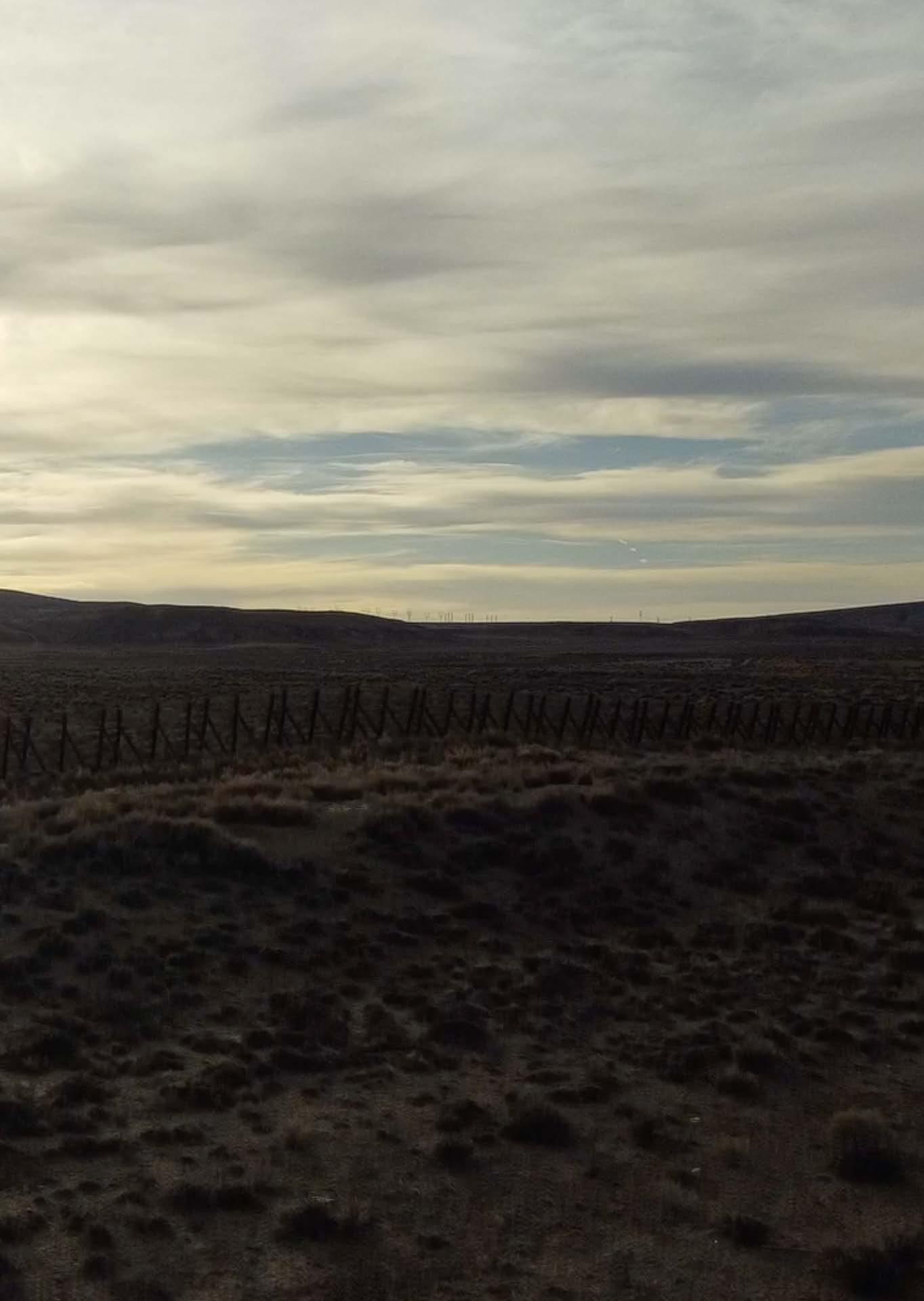
305 06_CATTLE RANCH XII APPENDIX: SITE FIELDWORK
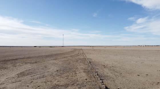
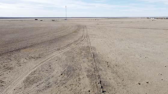
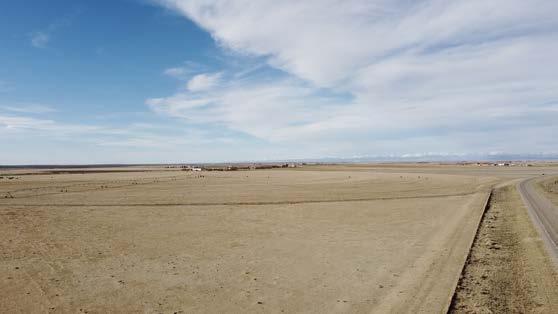
306 Photos by author

307 06_CATTLE RANCH XII APPENDIX: SITE FIELDWORK
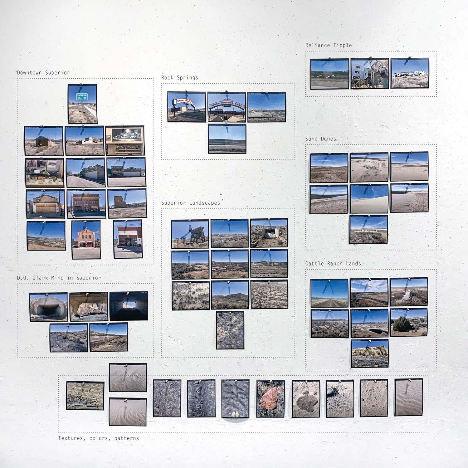
308
PHOTOGRAPHIC DOCUMENTATION
PHOTOGRAPHS DOCUMENTING MULTIPLE SCALES AND HISTORIES OF EACH SITE
309
XII APPENDIX: SITE FIELDWORK
310 Photos by author
311 XII APPENDIX: SITE FIELDWORK
DOCUMENTATION
DOWNTOWN SUPERIOR | PHOTOGRAPHIC
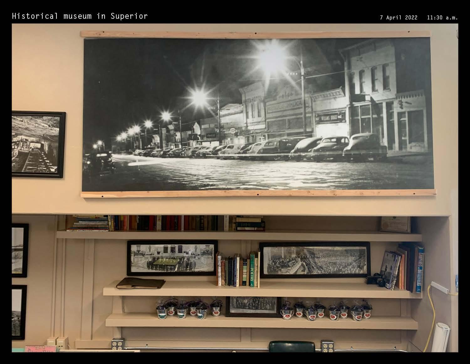
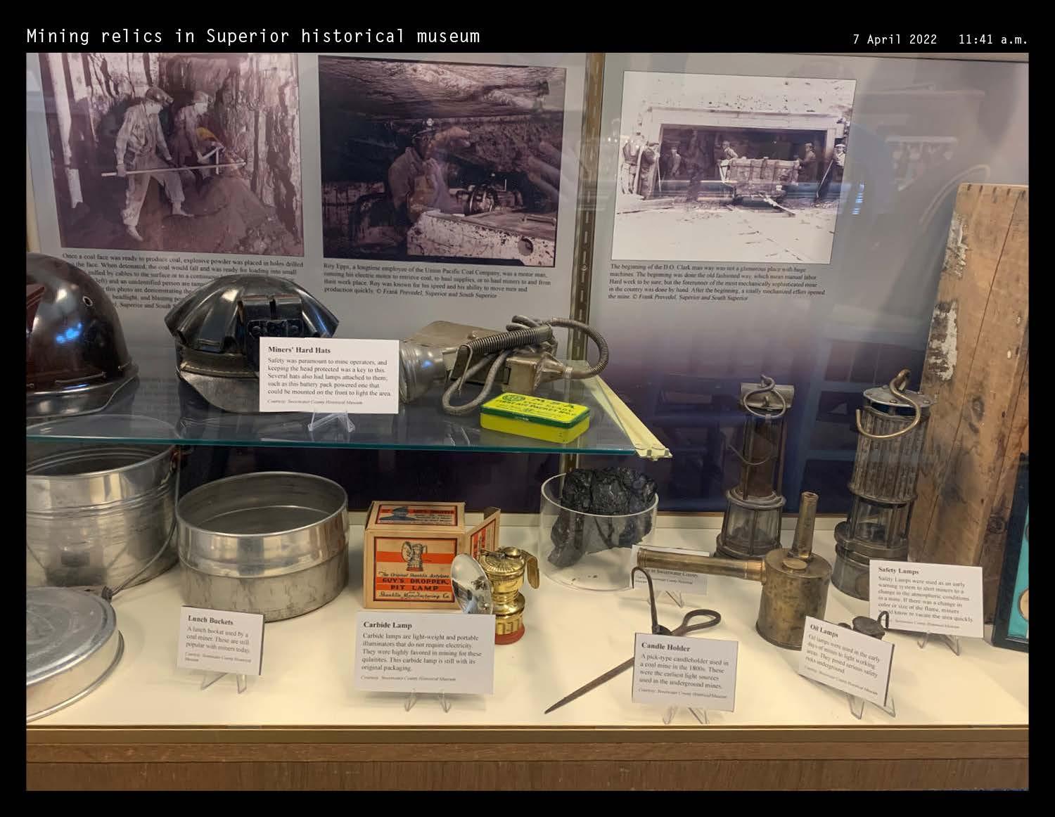
312 Photos by author
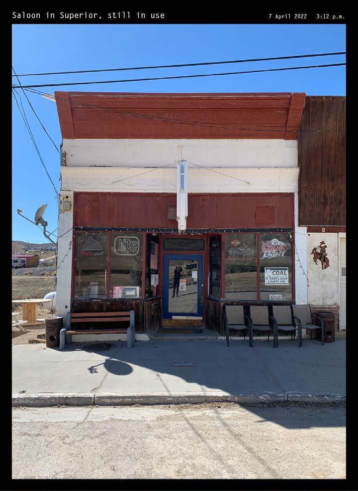
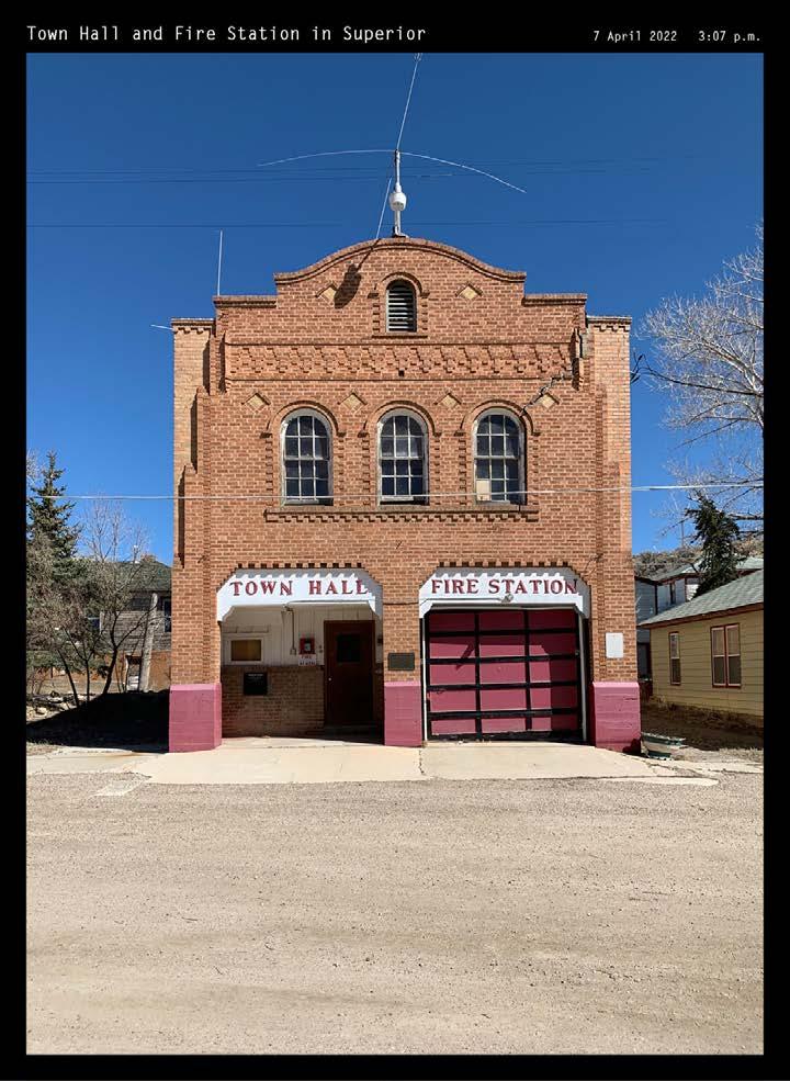
313
DOCUMENTATION XII APPENDIX: SITE FIELDWORK
DOWNTOWN SUPERIOR | PHOTOGRAPHIC
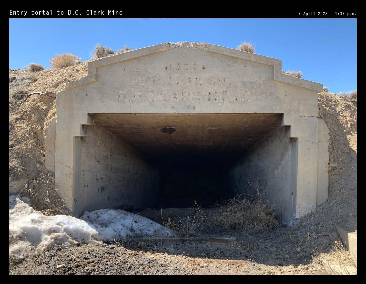
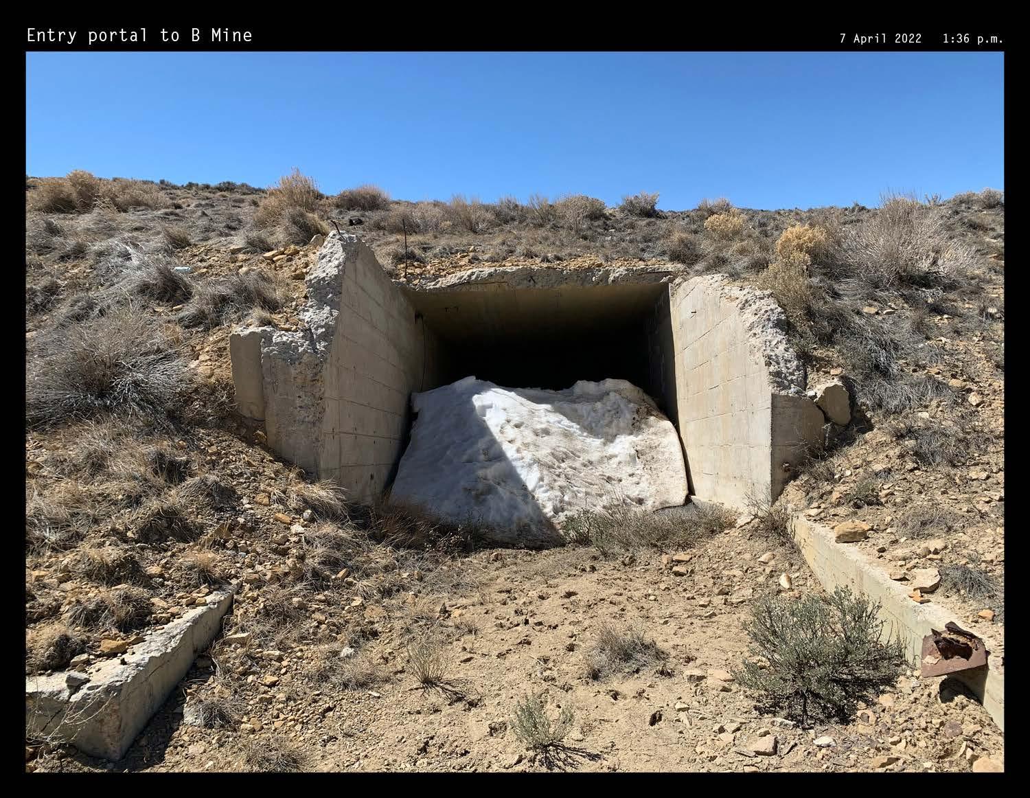
314 Photos by author
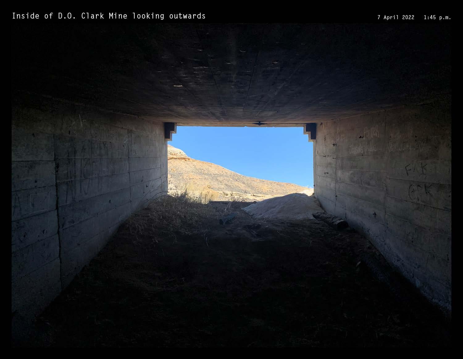
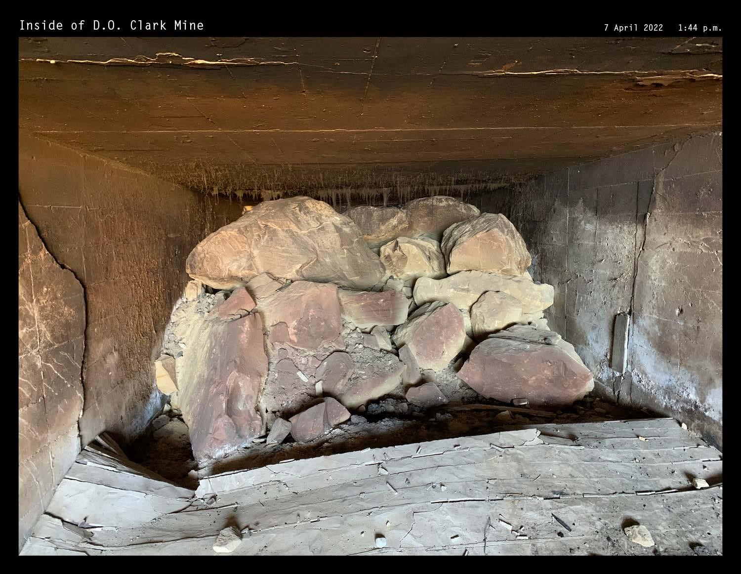
315 XII APPENDIX: SITE FIELDWORK
D.O. CLARK MINE | PHOTOGRAPHIC DOCUMENTATION
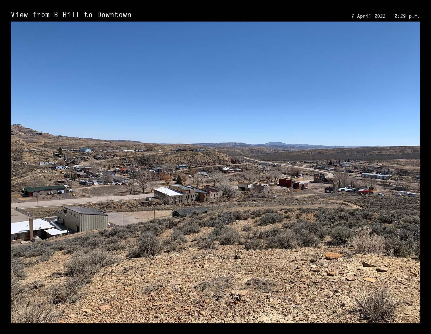
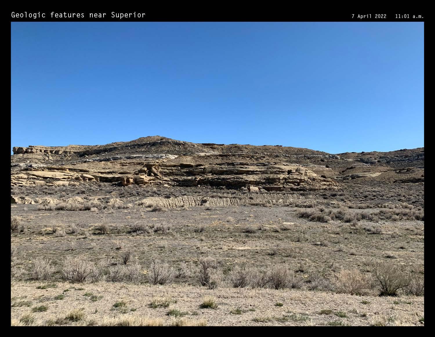
316 Photos by author
SUPERIOR LANDSCAPES | PHOTOGRAPHIC
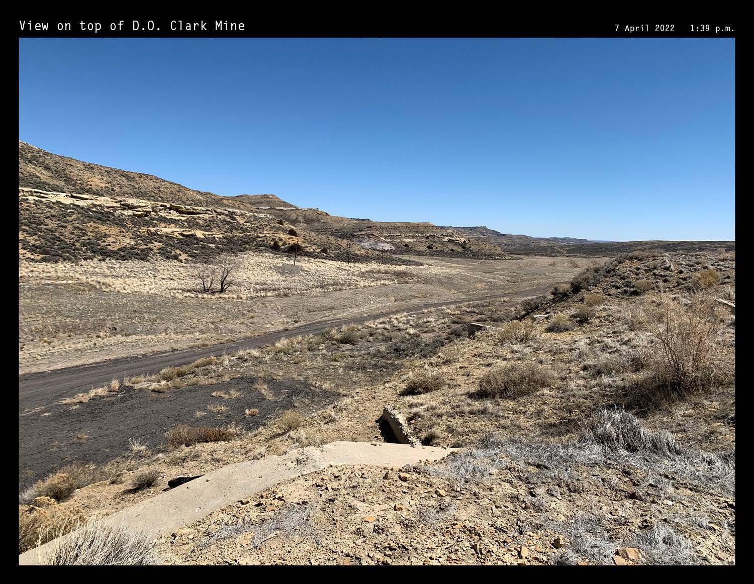
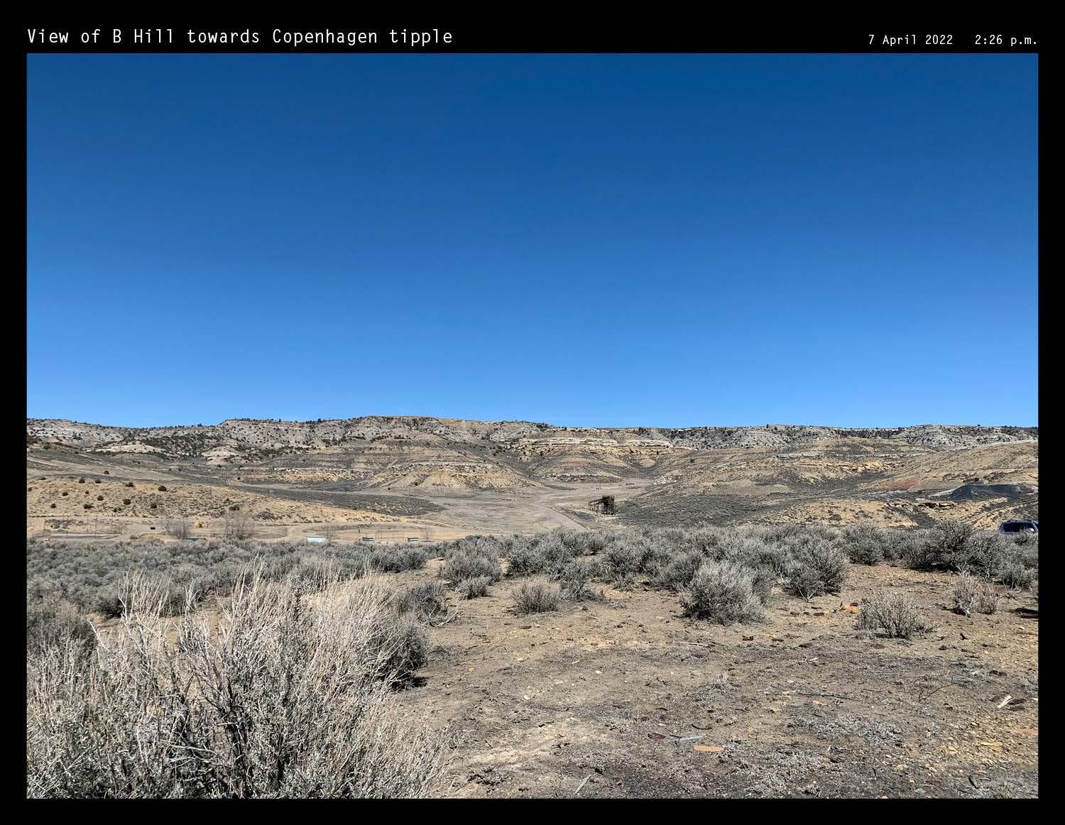
317 XII APPENDIX: SITE FIELDWORK
DOCUMENTATION
ROCK SPRINGS | PHOTOGRAPHIC DOCUMENTATION
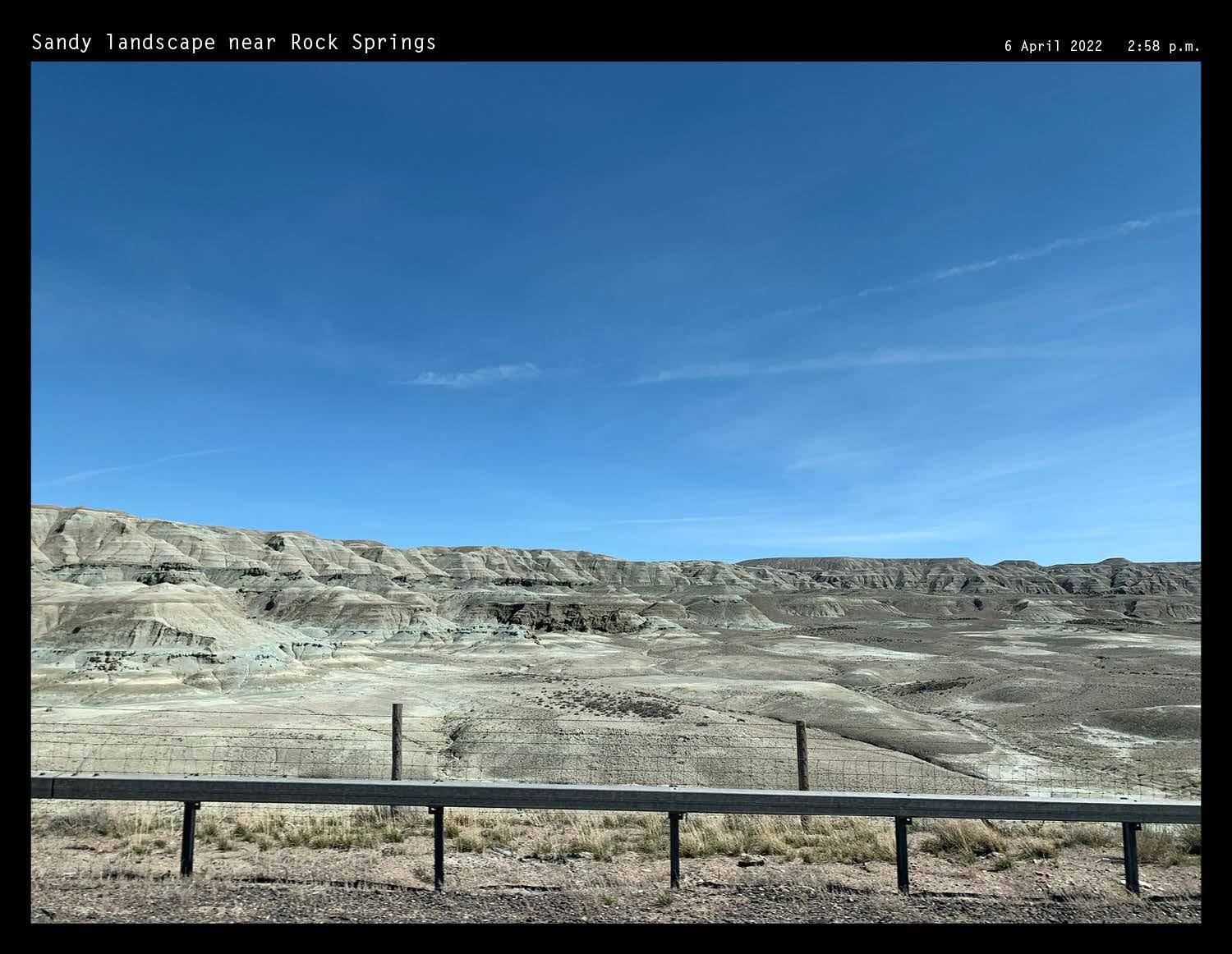
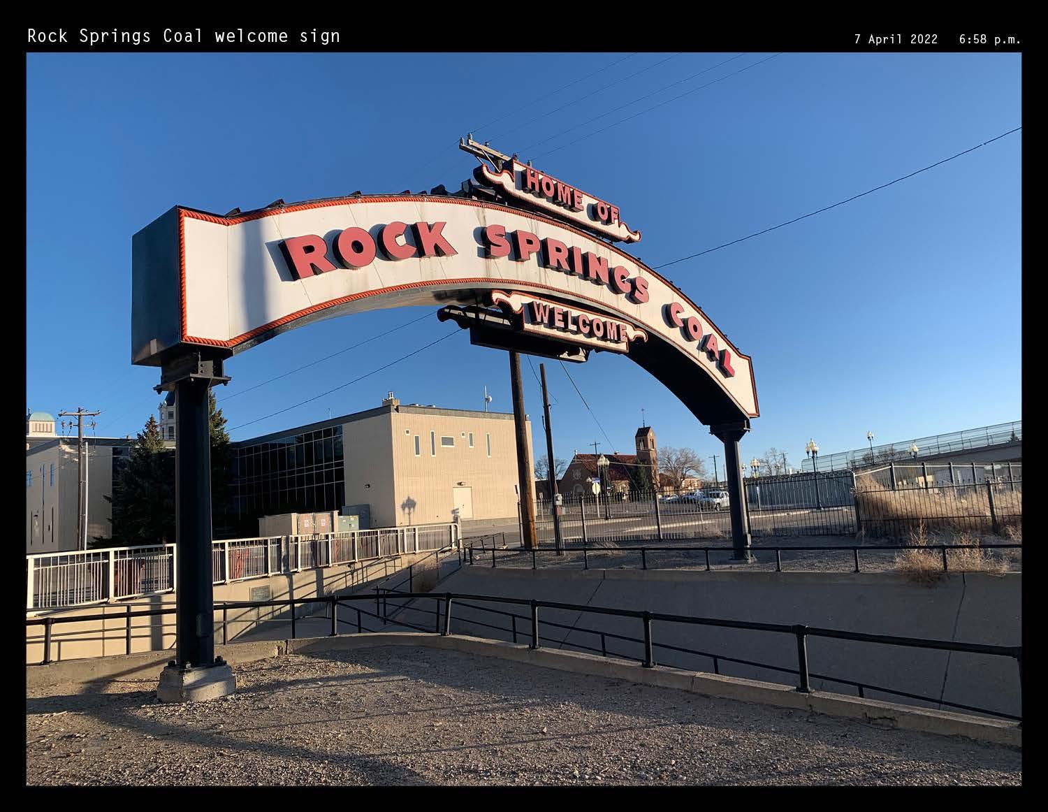
318
Photos by author
RELIANCE TIPPLE | PHOTOGRAPHIC
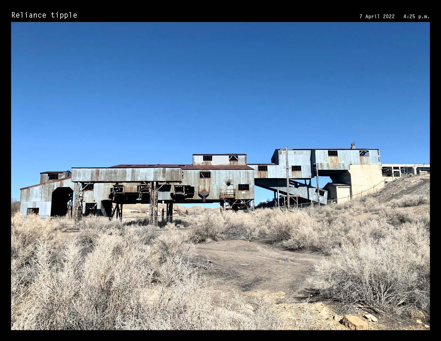
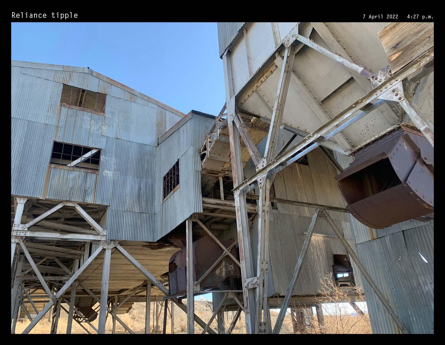
319 XII APPENDIX: SITE FIELDWORK
DOCUMENTATION
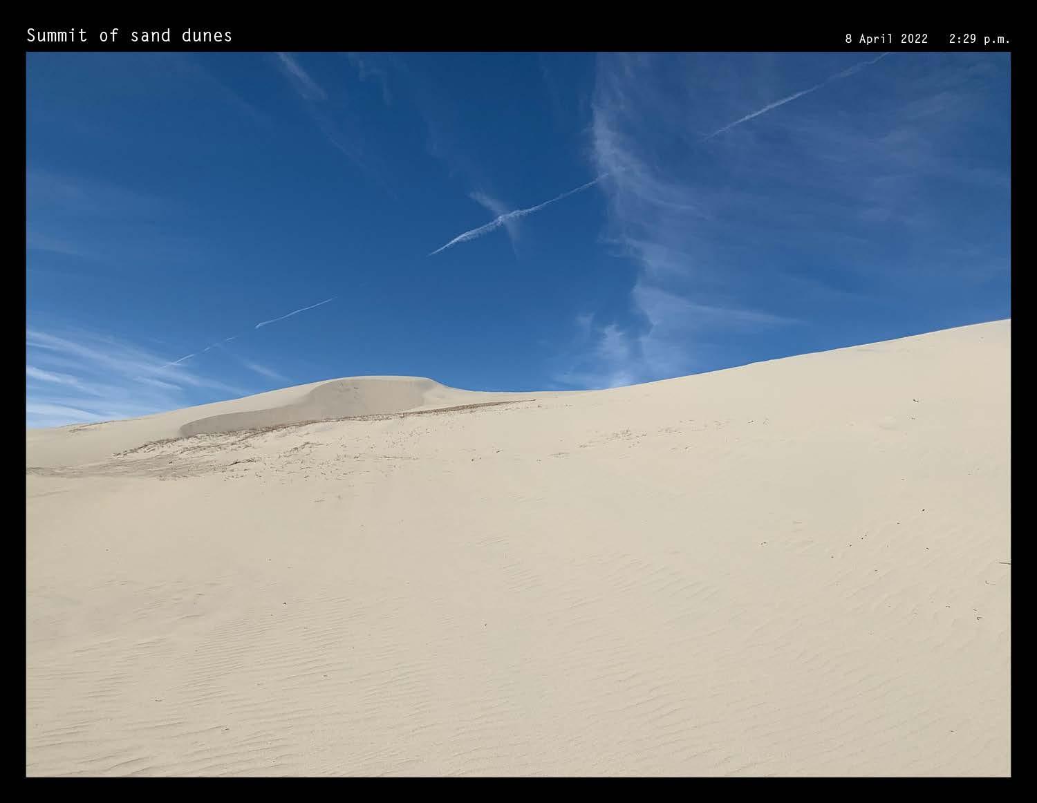
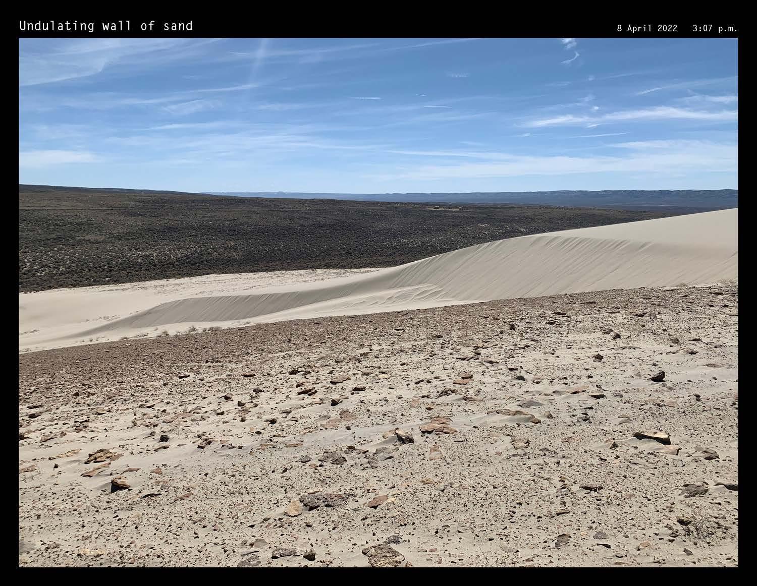
320 Photos by author
DUNES
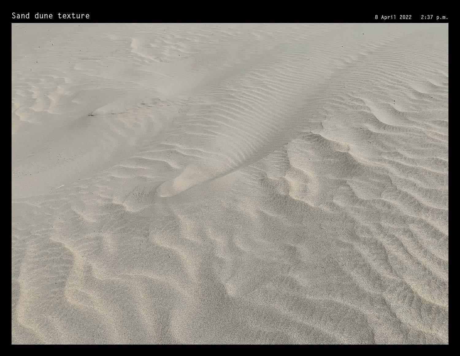
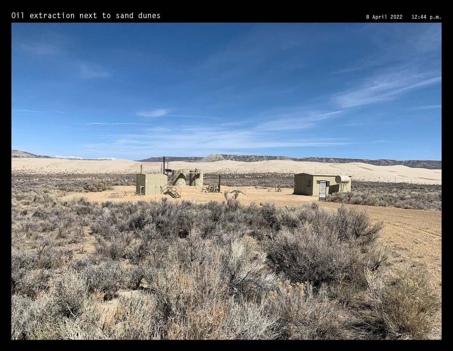
321 XII APPENDIX: SITE FIELDWORK
DOCUMENTATION
SAND
| PHOTOGRAPHIC
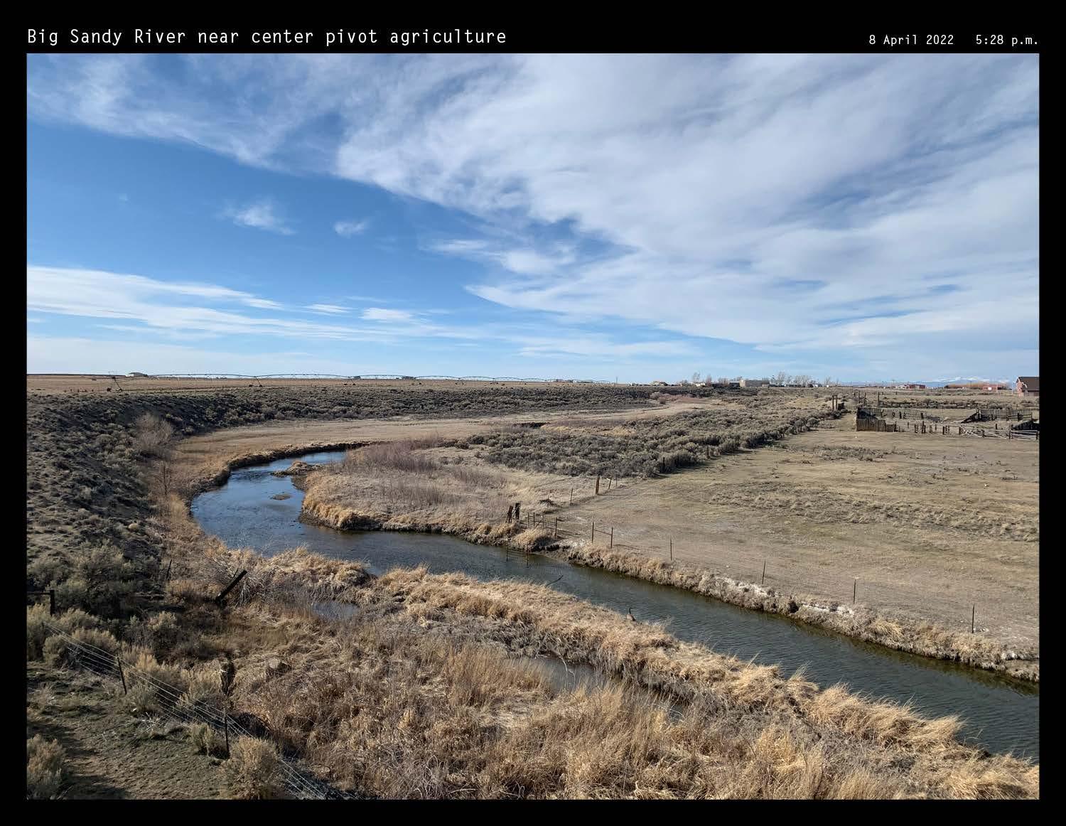
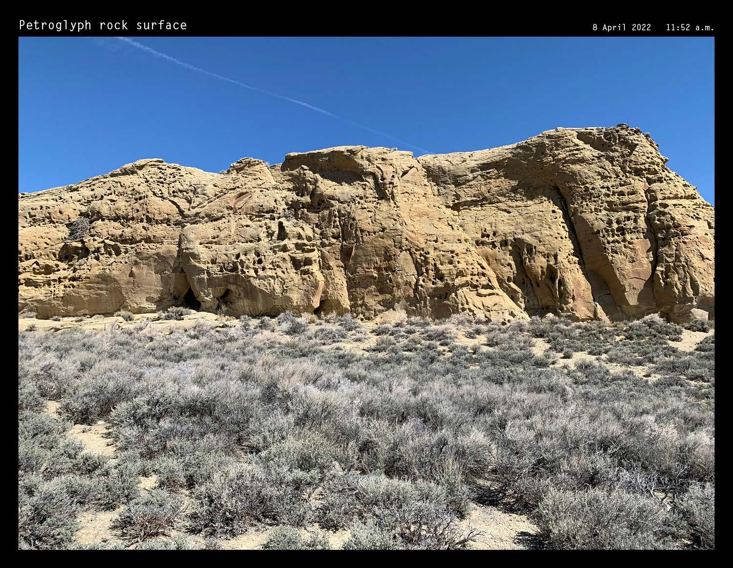
322 Photos by author
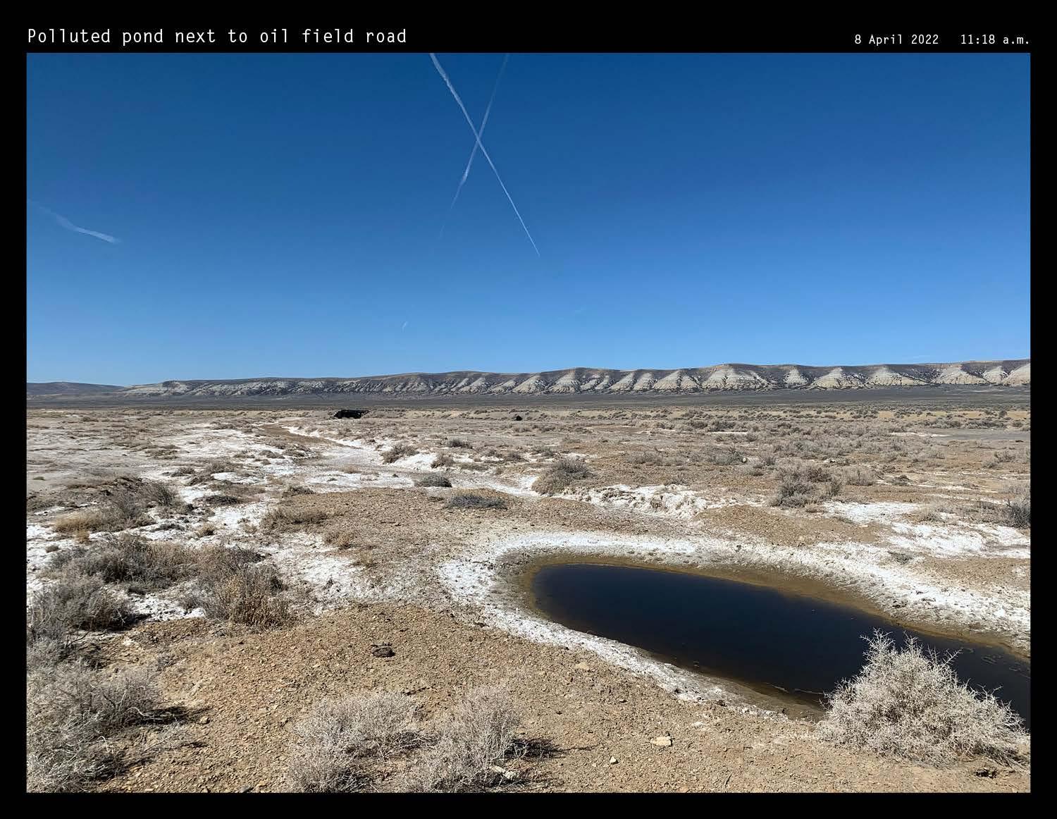
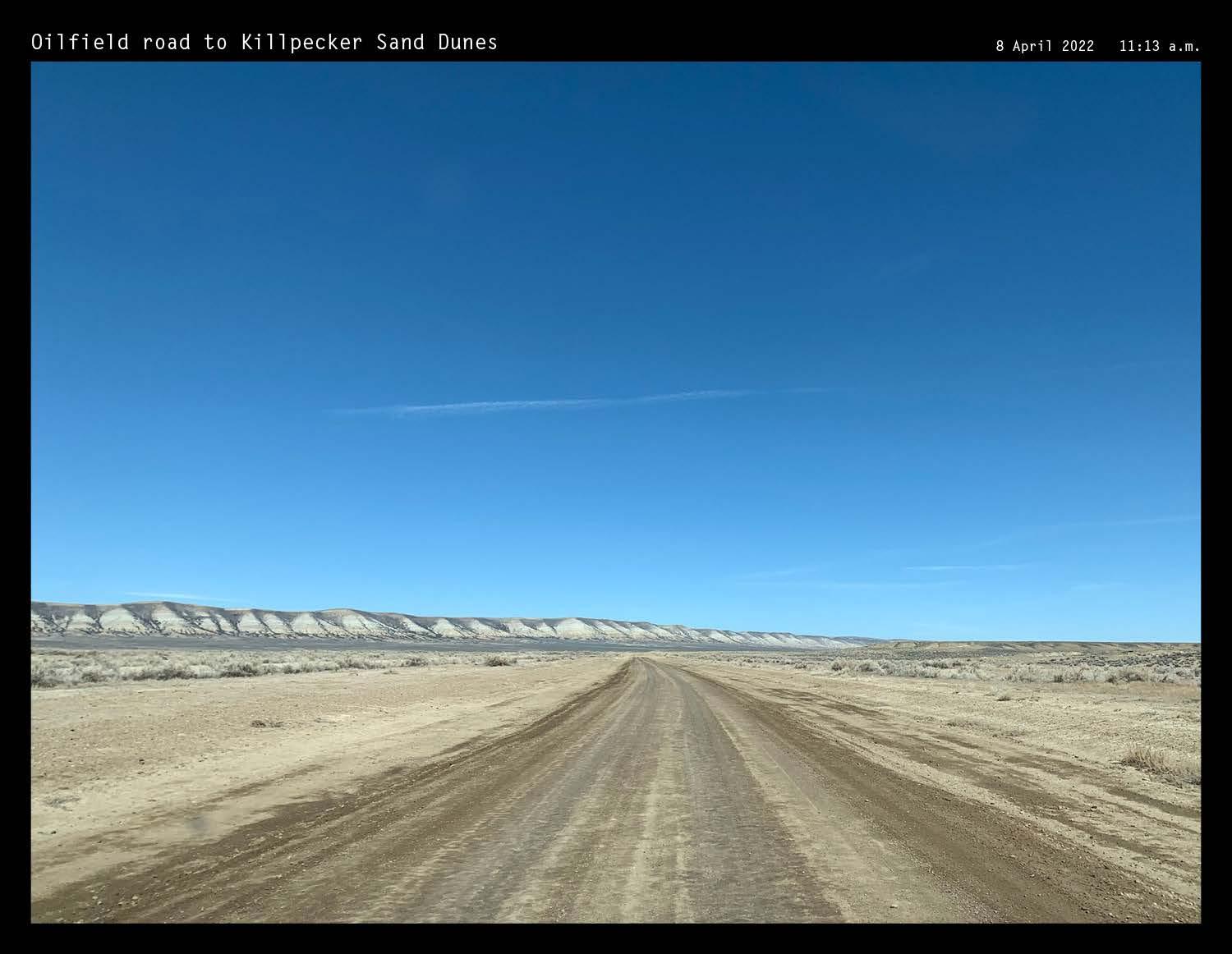
323 XII APPENDIX: SITE FIELDWORK
DOCUMENTATION
OPEN RANGE | PHOTOGRAPHIC
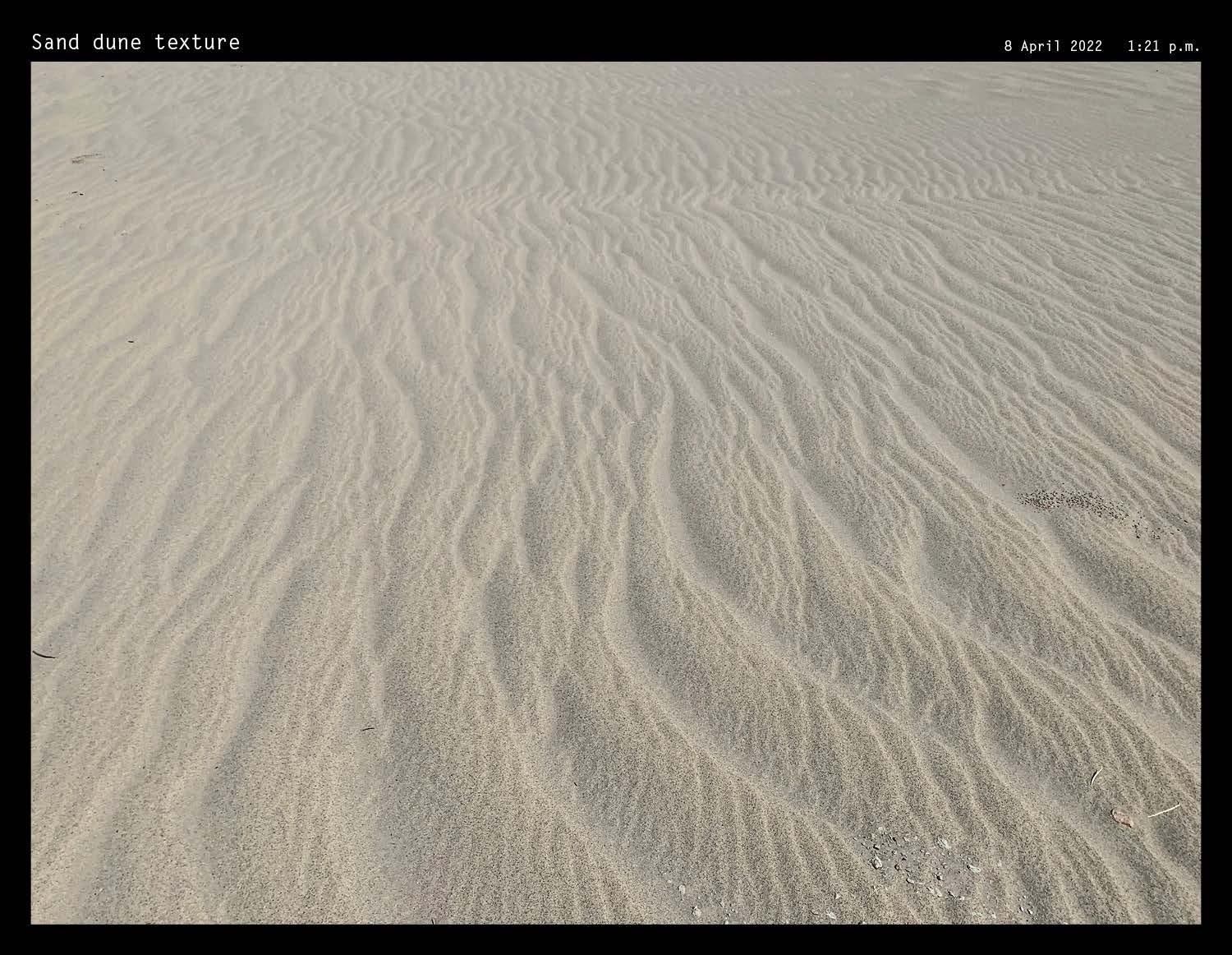
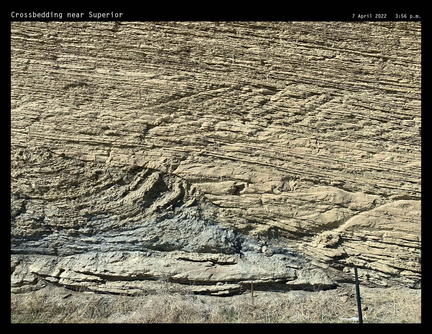
324 Photos by author
COLORS & TEXTURES | PHOTOGRAPHIC
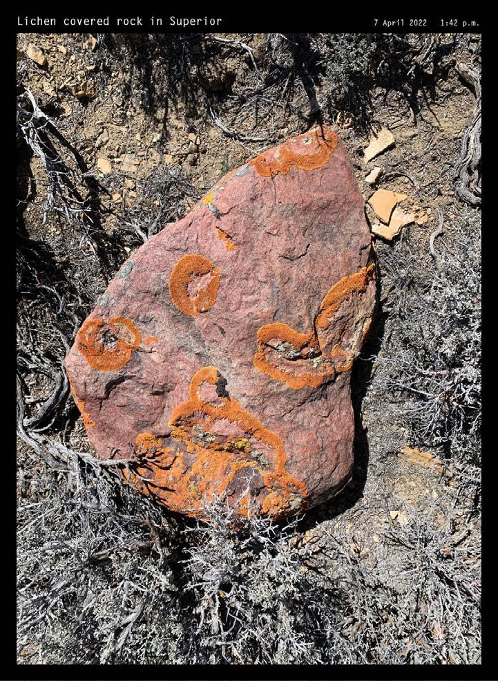
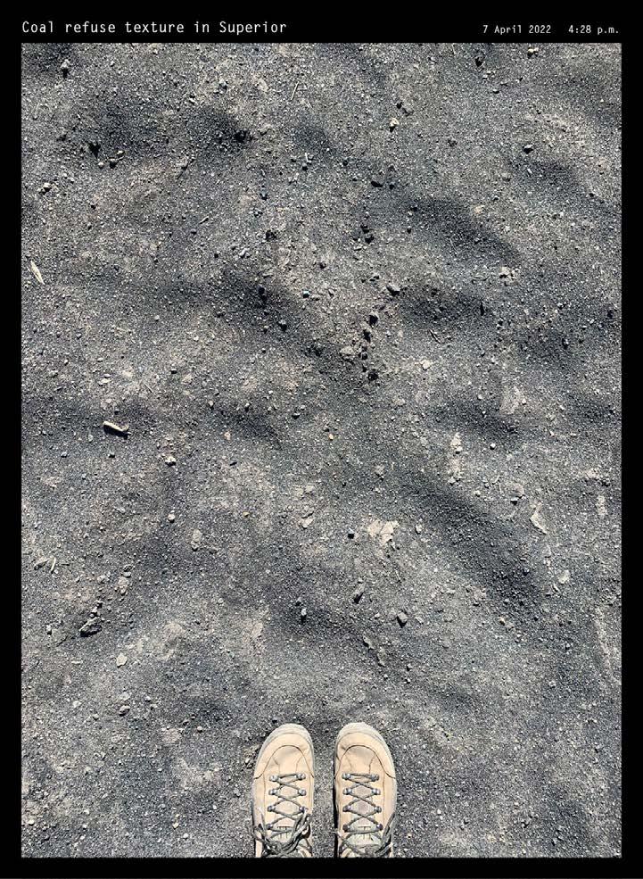
325 XII APPENDIX: SITE FIELDWORK
DOCUMENTATION
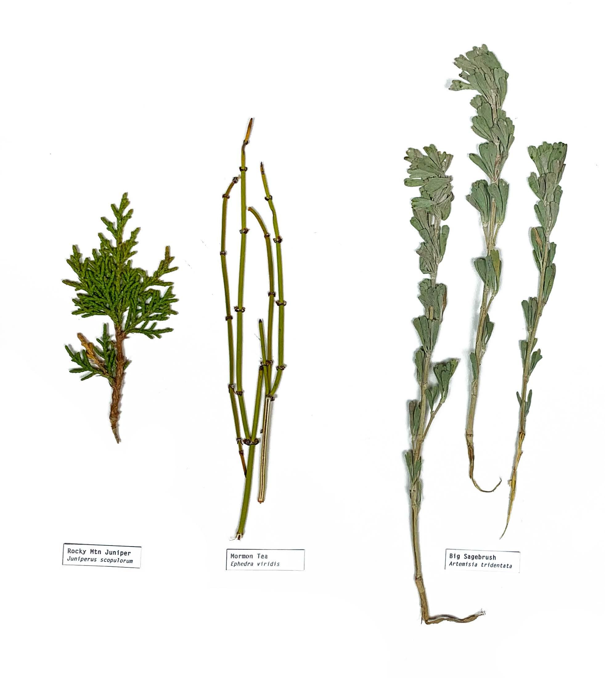
326
COLLECTING AND SAMPLING
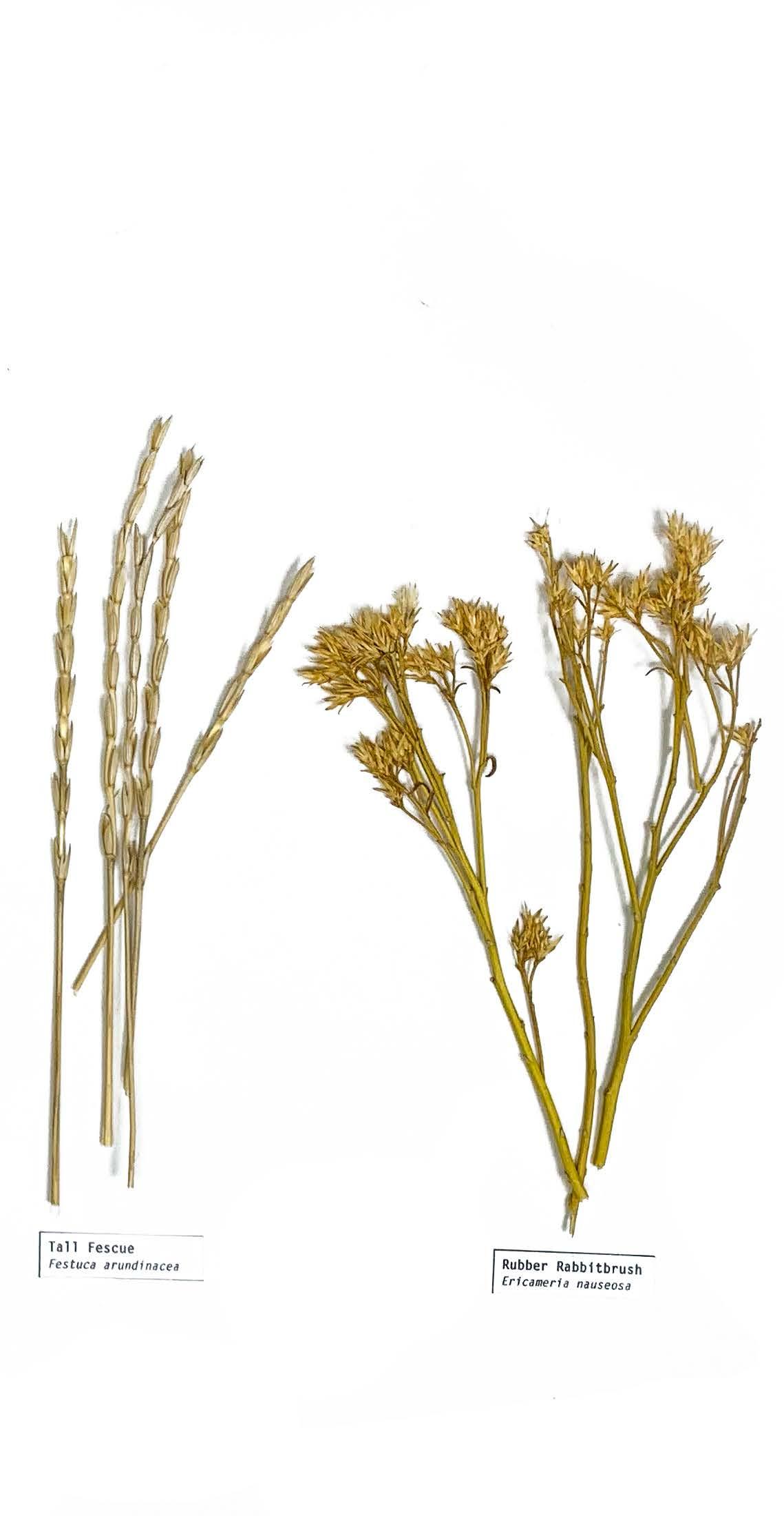
327 COLLECTING
XII APPENDIX: SITE FIELDWORK
OF PLANTS
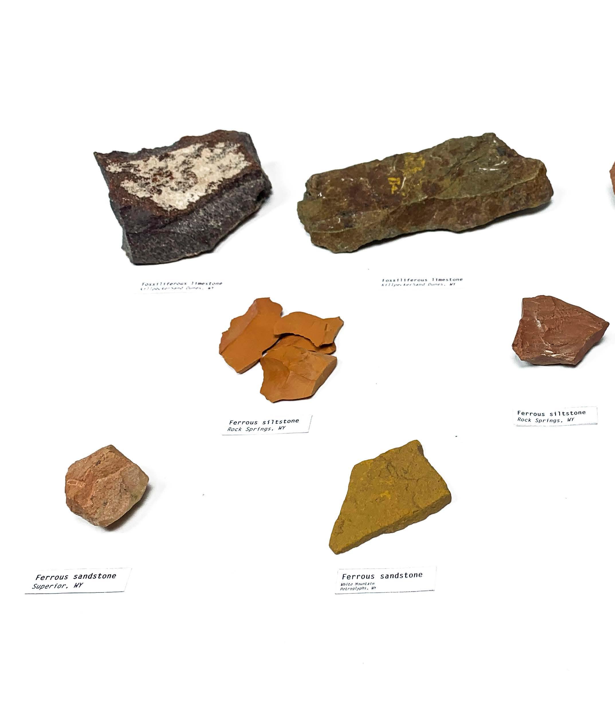
328
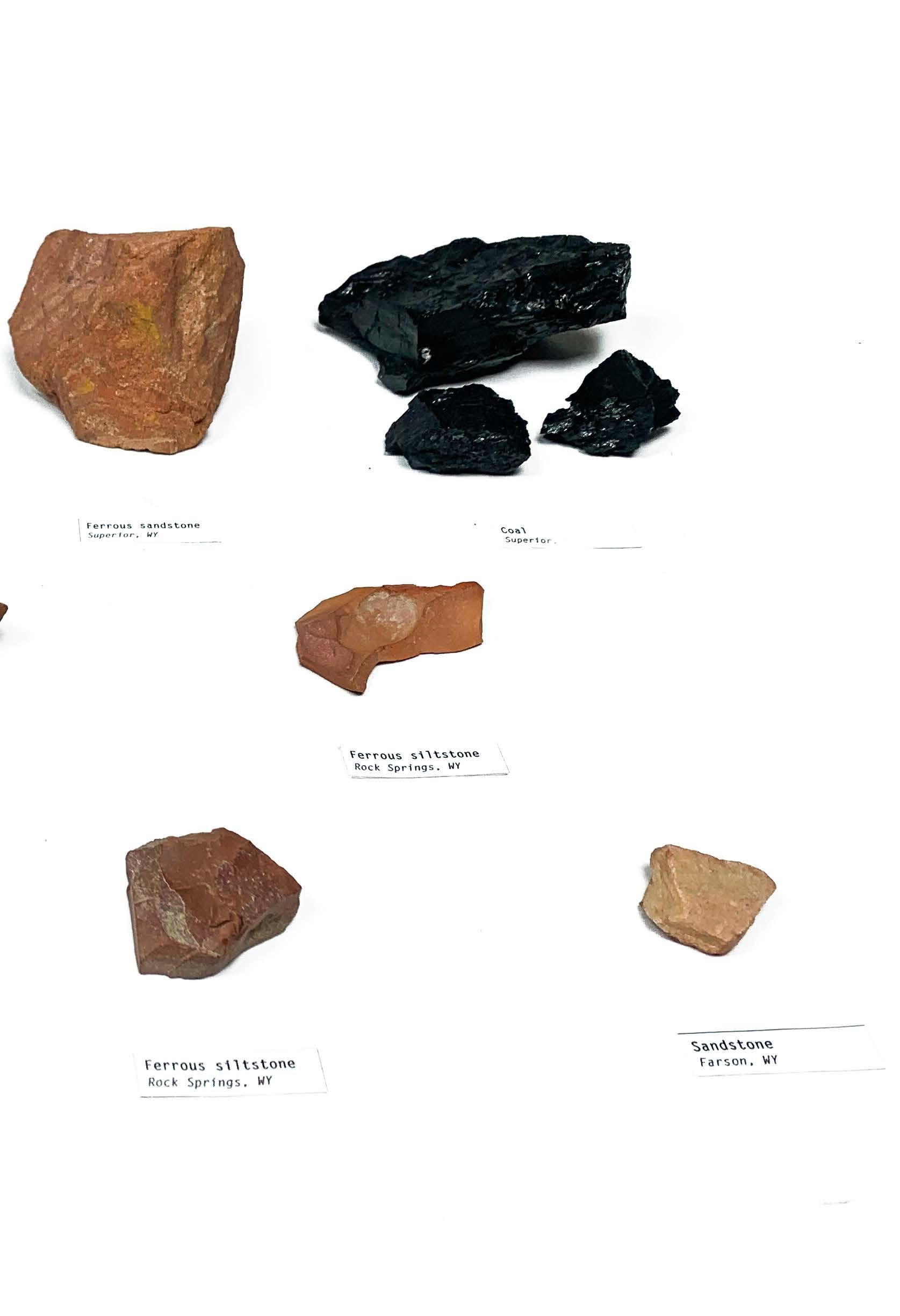
329
XII APPENDIX: SITE FIELDWORK
SAMPLING OF ROCKS
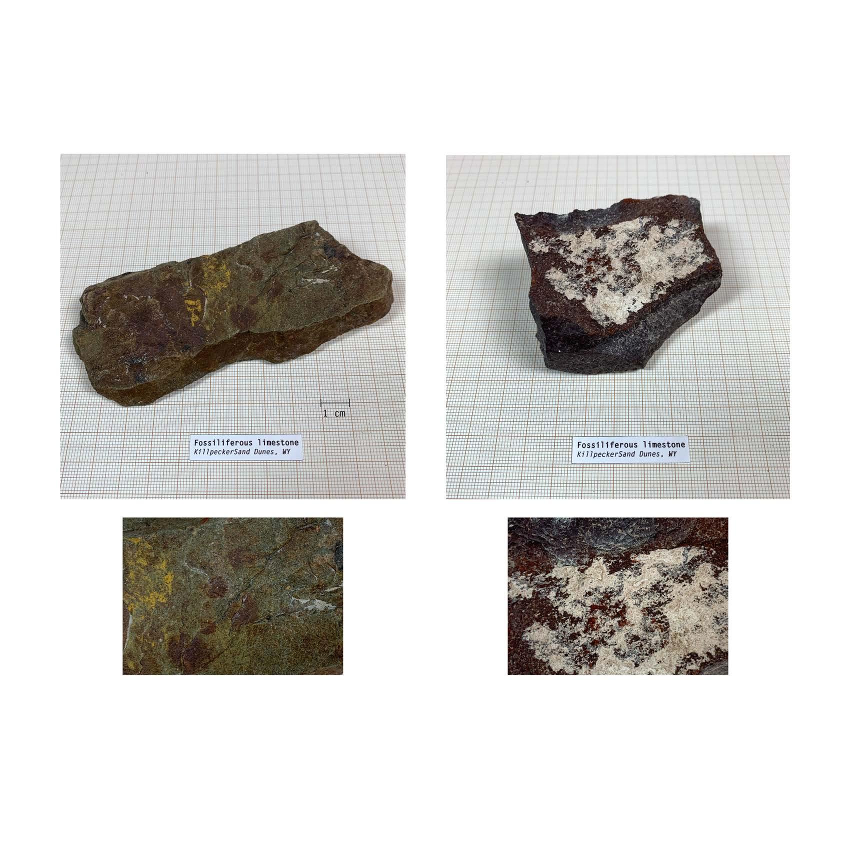
330
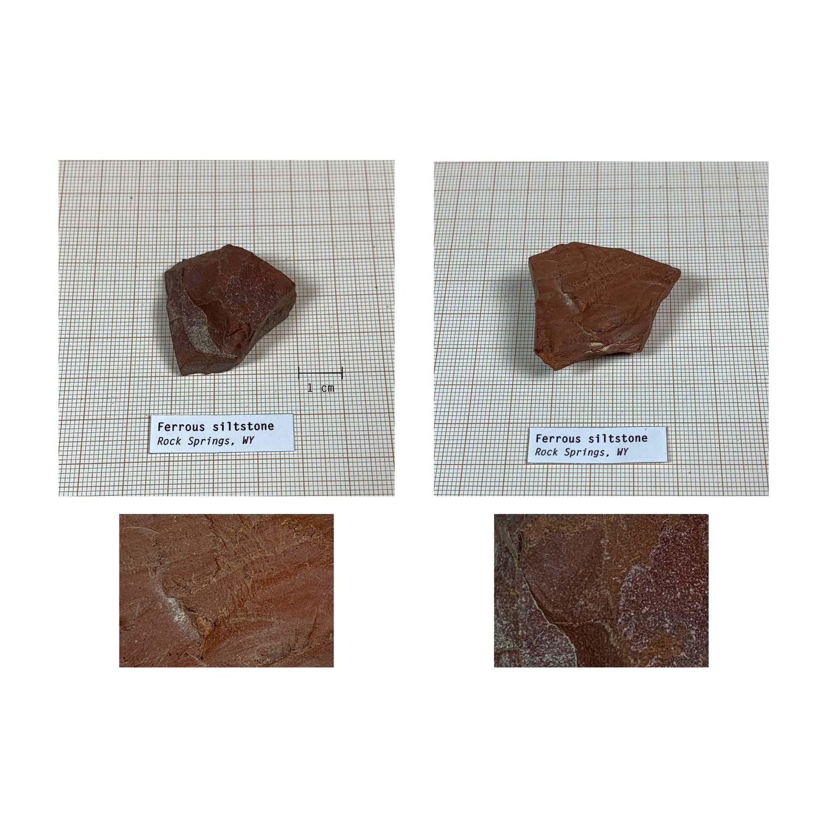
331 XII APPENDIX: SITE FIELDWORK
SAMPLING OF ROCKS
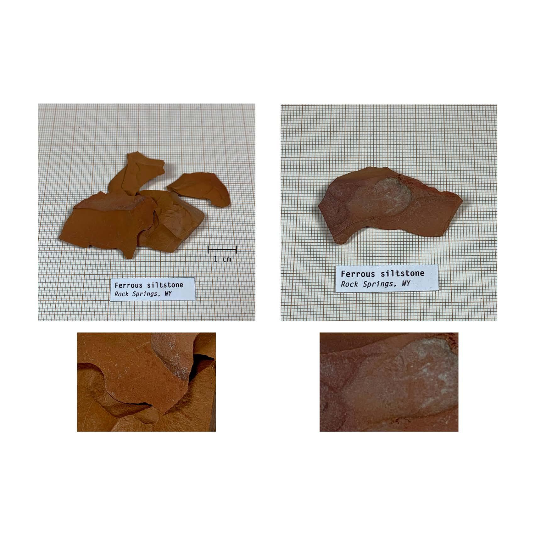
332
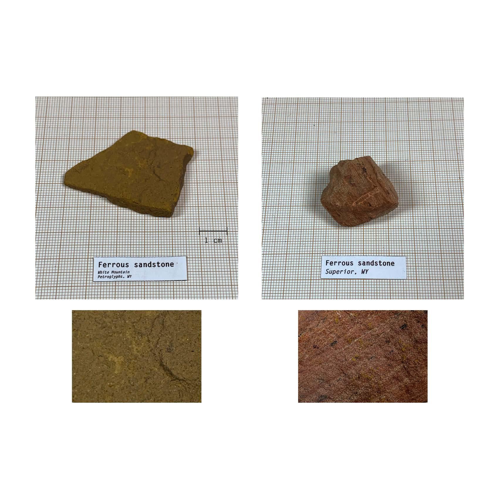
333 XII APPENDIX: SITE FIELDWORK
SAMPLING OF ROCKS
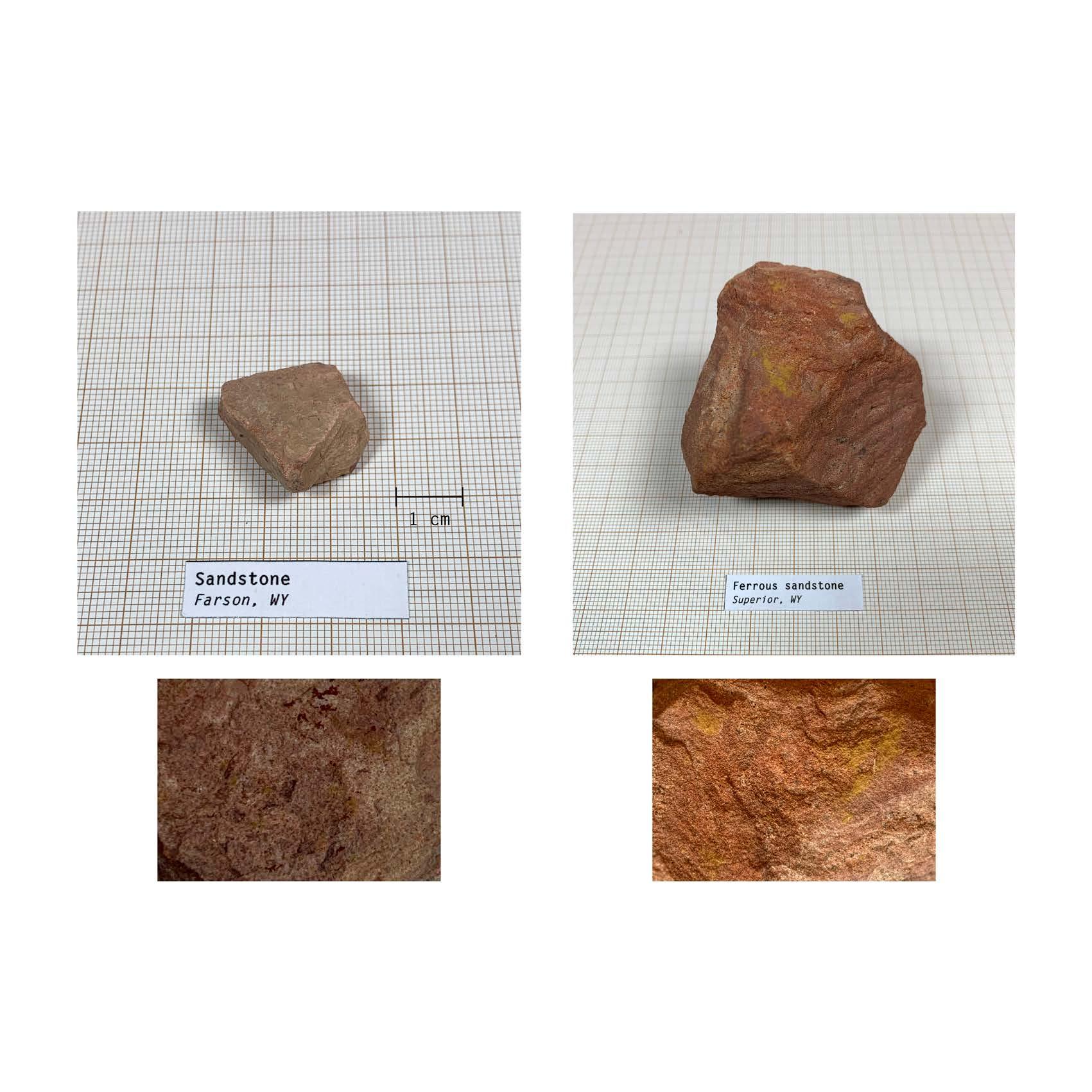
334
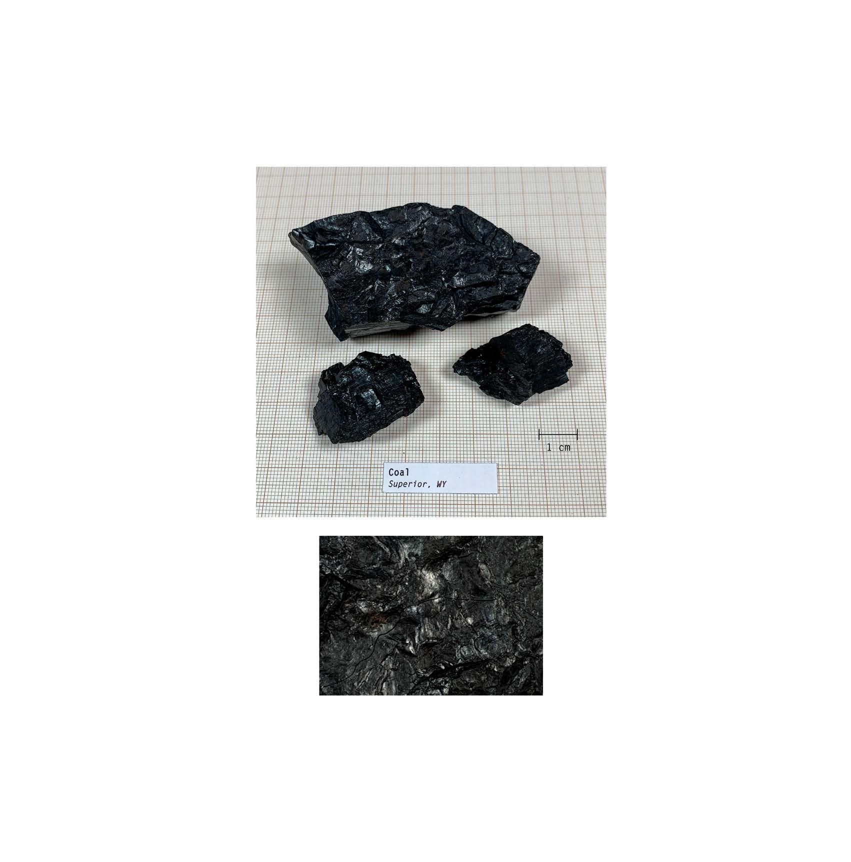
335 XII APPENDIX: SITE FIELDWORK
SAMPLING OF ROCKS
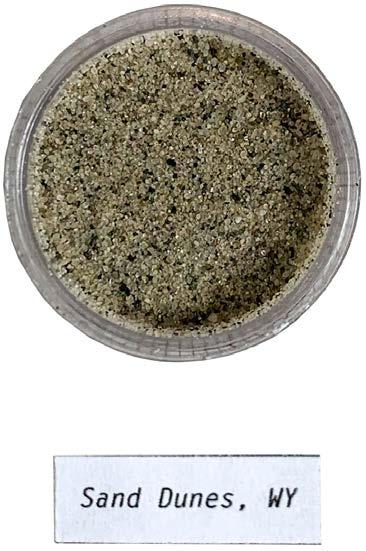
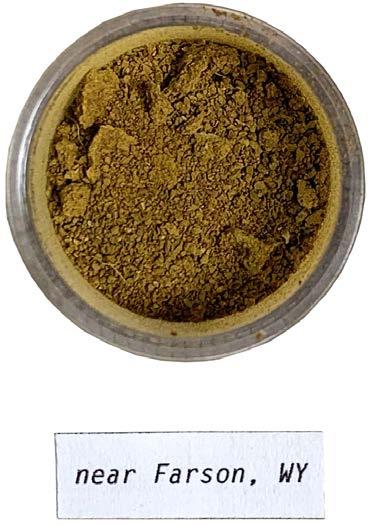
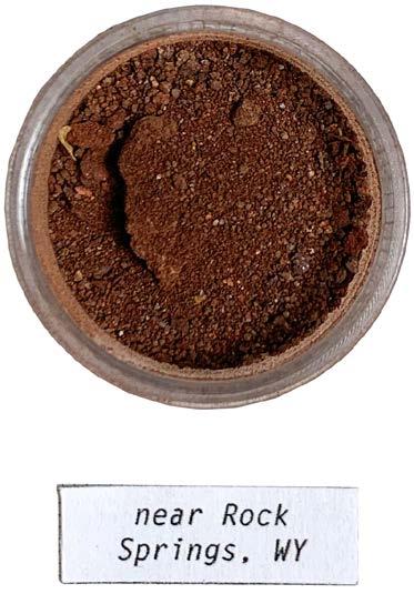
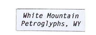
336
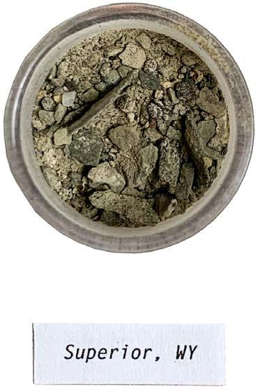
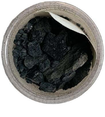
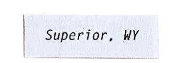
337
XII APPENDIX: SITE FIELDWORK
SAMPLING OF SEDIMENTS
Well, I’m weary and tired, I’ve done my day’s riding Nighttime is rolling my way
The sky’s all on fire and the light’s slowly fading Peaceful and still ends the day
Out on the trail night birds are calling Singing their wild melody Down in the canyon cottonwood whispers A Song of Wyoming for me
Well, I’ve wandered around the town and the city Tried to figure the how and the why Well, I’ve stopped all my scheming I’m just drifting and dreaming
Watching the river roll by Here comes that big old prairie moon rising Shining down bright as can be Up on the hill there’s a coyote singing A Song of Wyoming for me
Now it’s whiskey and tobacco and bitter black coffee A lonesome old dogie am I But waking up on the range Lord I feel like an angel
Free like I almost could fly Drift like a cloud out over the badlands Sing like a bird in the tree The wind in the sage sounds like heaven singing
A Song of Wyoming for me A Song of Wyoming for me
338
SONG
OF WYOMING by Kent Lewis (first released by John Denver)
MUSIC ON THE ROAD
The long, empty drives around Utah and Wyoming were serenaded by the music of John Denver, Johnny Cash, Waylon Jennings, and Lord Huron. This song, The Song of Wyoming, was played as we exited the state for the last time. The song’s immersive lyrics inspired the atmosphere of the perspective views of the designed landforms. Listening to the song now, while writing this thesis book, reminds me of the smell of the sagebrush, the big open sky with bright stars, and the sound of the howling wind.
339
XII APPENDIX: SITE FIELDWORK
340 XIII
341
XIII PROCESS
PROCESS
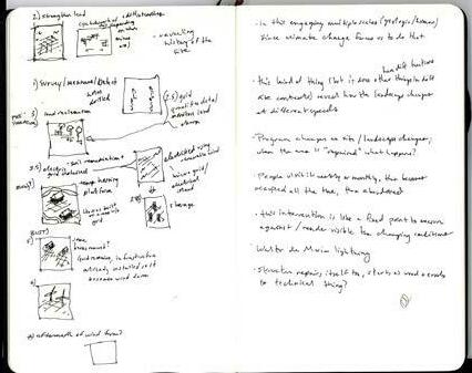
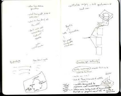
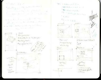
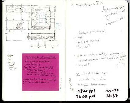
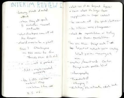
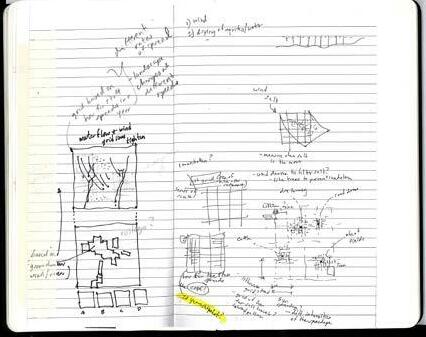
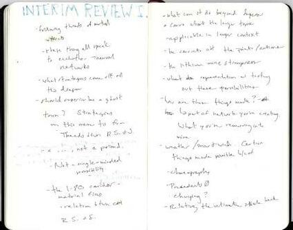
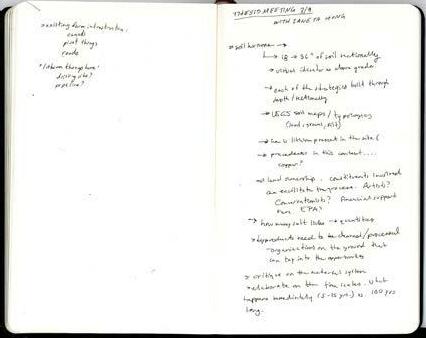
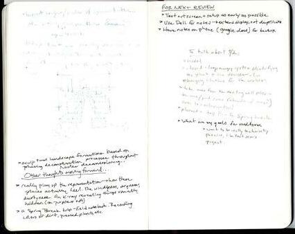
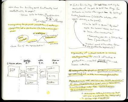
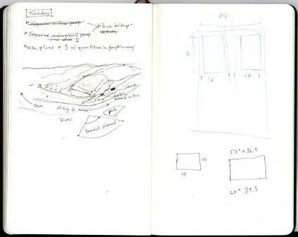
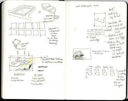
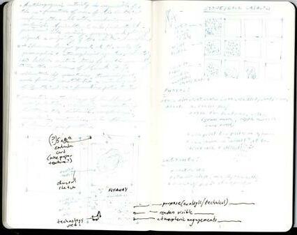
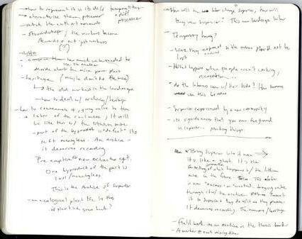
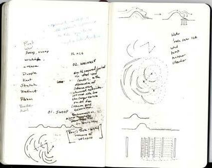


342
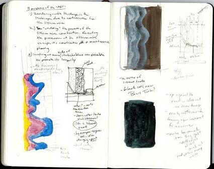
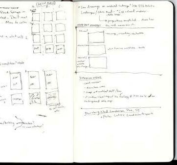
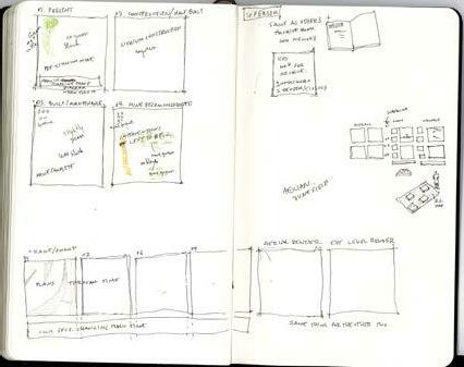
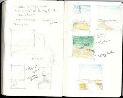
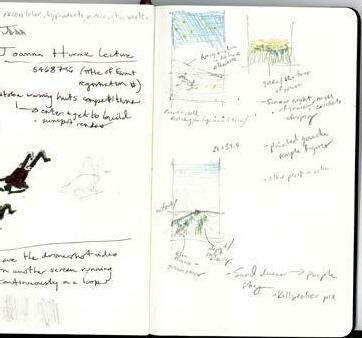
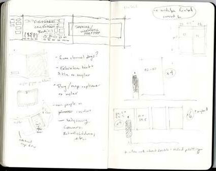
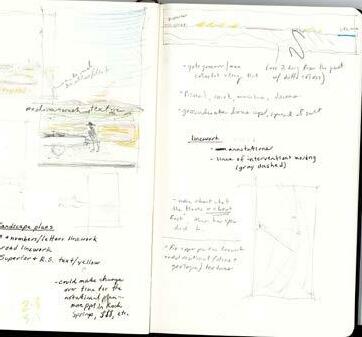
343 THESIS
XIII PROCESS
NOTEBOOK
Crit Notes:
* What ties these sites together? What is the problem in each case?
* an industry that is has died / is in the process of dying / will die in the future
* What gets left behind after a nouveau/boom of electricity in a town
* Choices of the sites + why did you choose them? The side effects or consequences of choosing these sites?
* Criteria for choosing the site —> the entry point into electrification
* How this stuff gets made and the implications of it
* Lithium mining — the extractive industry associated with electrification
* What does it mean to make these batteries? The complications speak directly to the American landscape
* Creating public realms that you wouldn’t normally have around gas stations
* What is the downside of Tesla/plopping down chargers everywhere?
* How does it change everyday practices?
* The streetlamp, the house, more broad electrification than just cars —> very spatial (the electric grid… is it decentralized?)
* The siteless battery as a diagram for a different form of electrification. What is implicated in the production of the batteries?
* Where are the batteries for the US made?
* Coal mining towns —> the uncertainty in the future
* The spaces leftover
* Process of coal mining and environmental problems (sites continue burning for a while)
* The life cycle of the energy source — before/during/after
* Non-urban sites affected by this transition. The electric car is a new agent that will affect the city
* What happens to those left behind in the energy transition?
* What are the problems with electrification? Not being so optimistic. What are the implications?
* Cities key to petroleum industry also being affected (Dakota?)
* What are other forms of energy that (some) people hope will be replaced? Why don’t others want to replace them?
* What is the source of this new electricity? Solar panels/wind farms bring their own challenges. Some crops might grow better under the solar panel because they’re getting shaded… they now need the shade because the earth is getting so hot.
* Are farms being converted for electricity?
* What happens after the electric car? What happens to the old batteries?
* Unpack the different forms of energy (where they came from, why used, who using/laboring, the percentages of what kinds of energy being used in the US and for what)
* What these different forms of energy mean — actors in them/intangible + materiality
* What happens to these cities after the energy leaves? In the case of petrol/natural gas + coal + electricity (battery making/energy generation)
* What are the physical things being left behind afterward
* Research Rock Springs / other energy towns some more. Ask for stories from relatives/historical relics.
* All of these things are happening geologically/geographically in the same area as well (sectionally and planimetrically) (could do a synthesis drawing of how all these things overlap)
Bottom line:
* Research what’s involved in the electric car (before [lithium mines, construction], during [how used everyday/how often need to be charged], after [the afterlife of the batteries/cars])
* Be extremely rigorous/precise in this research and then SHOW it… to a silly amount of detail
* Research before/during/after (how energy is created from this and distributed to ppl’s homes, who working/ owning, what, where, why, how for… actors in them/intangible + materiality
* Coal
* Petroleum/Natural gas
* Electricity (batteries, car)
* Renewables
* (Nuclear?)
* Research the towns where this happened — what happened to the city’s footprint and how the people’s lives changed after coal ran out [constantly burning landscape] /oil dried up
* The material that gets left behind in all of this
* Then… present and draw this out. Write a blurb/make an outline. Document these dying industries
* Stories about labor/life in the town
Action Items:
- [ ] Diagram of what percentages of energy currently being used in the US and for what (maybe can look at this through diff time periods?)
- [ ] Life cycle illustrated/data/technical diagram of… + the intangible implications. Unpack the different forms of energy (where they came from, why used, who using/laboring)
- [ ] Global network import/export map
- [ ] typical forms of renewable electricity
- [ ] Nuclear
- [ ] coal
- [ ] petrol/natural gas
- [ ] Diagram of life cycle of a battery (where from, what happens to place where it is mined, what happens after it’s used up, what/who is implicated)
- [ ] Gather firsthand stories about the labor and living in the towns (FILM?)
- [ ] Decide on site options, quick map of where the sites are
- [ ] Why each of these sites/histories of each?
- [ ] Gather pics/maps/representations of each city of before/during/after FILM
Crit Notes:
* Look at the micro/local and the macro systems
* Look at the life of the towns today —> identifying similar problems among each of the towns (?)
* What are the direct implications on these three towns with the possible new lithium mine?
* How might the lithium mine relate to these three towns?
* Where do these people get their food? Their water? How do they live so remotely?
* What are some of the qualities of the community? But still stay focused on energy.
* What kind of route is I-80? Who drives on it usually or unusually?
* Evs are not neutral or necessarily a solution. It is a fact, so what are its implications?
* EV as ambiguous project
* EV as a coat hanger (finite) and what are its other details, like the clothes you hang on it and their memories or the rust on the hanger..
* How close is Superior to Rock Springs? 27 miles.
* What can we do with the aftermath of the energy transition, and what have been the aftermaths in the comparable cities?
* What can architecture do with the aftermaths of energy transitions? Begin by identifying problems, like the sinkholes or the burning coal seams. Look for some more problems.
* ^^^What are the consequences of a form of energy (in the past) and what might be a problem from the energy transition in the future?
* Anticipating an aftermath of this new energy system
* Think about an infrastructure that restores & anticipates & measures problems or renders the problems visible?
* An infrastructural accommodation that has a past/present/future.
* This infrastructure will be simultaneously past/present/future, as it addresses the context+problems of the past energy system, interprets what the city needs in the present to support this transition, and what might it anticipate in the future.
* Where does Superior rely on for its stuff?
* Since Superior is only ~30 minutes away from Rock Springs, people could go to work there and shop for food there etc.
* What are the populations of Rock Springs and Superior?
* What is the LIFE in Superior? How dormant is it?
* Showing an intimacy to the energy industry (this big systems thing)
* ^^^ it suggests family relations.
* An intimate story of what happened when + the embeddedness of town in larger economic systems but people still experience them in an intimate way (how) and that gives a sense of a territorial structure/texture. The idea of community (like the coal sign) brings these two large scales together.
* So… in that town there’s those 3 “scales”
* Is there resistance to lithium mining? ((you could look at the townspeople’s attitude towards nuclear/wind energy.. but lithium has that “extractive” surface characteristic that might be attractive to them since they’re used to coal)
* Superior will benefit from the influx of people for lithium. !Push for llithium!
* What are the stores there now in Superior?
* Infrastructure as a foil. What counts for economic is. not what counts for the ecological/cultural (i.e. pipelines)
* Economic progress + energy can be reparative or beneficial for the environment + society
* Infrastructure as an agile/imaginative construct. A political and ecologic entity. A complex network of actors and actees.
* For instance, a pipeline does 1 thing in a very defined way — it transports oil and natural gas. Its efficacy depends on it being monological.
* But, there can be a more complex infrastructure that can work on different scales/different temporalities/ different actors and livelihoods
* How to weigh the influx of new resources against existing resources?
* 1) What are the Actors?
* 2) Scales/Actions/Dynamics?
* 3) The area/physicality that it takes, like jobs
* A patch dynamic instead of monological!!!. It understands INTENSITIES and different characteristics.
* How can the patches balance/thrive
* How to frame the project setup? But first research.
* People as an infrastructure. An infrastructure of feeling (Iulia) (my family’s stories)
* What are some other family narratives?
* You can record these stories more systematically.
* The smallness of Superior/dormancy, look out for this.
Shower thoughts:
* I’m not proposing the adoption of EVs and EV infrastructure to the city and territory as a neutral or as a solution.. it has implications. I’m taking it as a fact. It will happen (give proof). But rather, how can we anticipate problems that may arise with it and not to have this monological infrastructure (like a pipeline), but a “poly- or multi- infrastructure” that can do many things at once and operate at different scales and temporalities. I looked at other nearby towns and their successes and their boom/bust cycles when it comes to new energy adoption, and how can this happen in Superior with a new lithium mine being built?
* There’s been a shifting the blame of climate change from corporations to individuals (i.e. if you don’t buy this bamboo toothbrush you’re killing the environment). How can we create something that bridges this gap?
* Start to identify different patches in Superior and their latencies/habits/relation to broader highway/ lithium/energy/contexts/environment
Action items:
- [x] Write up more of a project brief/what you want to do ^^^ clarify your thoughts (basically a synthesis of these notes…)
- [x] What are some of the problems these cities are facing (on a micro-scale — like what are some of the problems actually with transition/the past (subsidence, fires, lack of housing)
- [x] Identify different patches in Superior and their latencies/habits/relation to broader highway/lithium/ energy/contexts/environment (sketches of possible intervention on B-Hill(?))
- [x] Lithium montage
- [x] More research in WY lithium
- [x] demographic info for Superior (kids? families?)
- [x] Look more into the lithium mine and what it might do to the town (look at other lithium towns for examples? What they might need i.e. Nevada)
- [x] A macro/systems and micro timeline comparing Superior with the other boom/bust towns (to wrap up/clarify the previous research done)
- [x] Take frames from the home videos to forensically analyze stories (from past and present) to show the texture/lived-ness of Superior. Forensically stitching together memories of different generations.
less important:
- [ ] Collage of stories/newspaper clippings/photos/film strips etc to clarify previous research (make it more systematic) that tell the intimate stories of the boom/bust cycles of cities - [ ] (for review — have a graph of how coal/gas/other energy sources changing)
- [ ] (for review-lithium demand, price of lithium over time)
344
January 26th
February 2nd
February 16th
Crit Notes:
* Put footers on all your maps/diagrams (Map by…) and source all of your material as well
* Plot out the more important images so the critics stay focused
* Put research material in a booklet that they can flip through
* Clearly present my question I’m investigating, how I got to my hypothesis/research, and my hypothesis/ speculation of what to do with that question
* Need to reformat the diagram — it’s more of a field condition than a closed system. It’s not a one-dimensional process, I introduce all of these new actors and relationships and keep it going in a healthy way.
* This ^^^ is how you diagram the sites as well.
* A shrinking city scenario? It’s a scenario building project, like a game board of possible changes in a dynamic way
* It’s not a cycle, because it eventually dies. The mines become exhausted. This is an afterlife of Superior that you’re working with. Investigating a social afterlife of the city but also spatial afterlife of the mines
* ^^ a field condition diagram…
* How do the two afterlives (the coal mines in Superior and the afterlife/byproducts of lithium mining relate?)
* A future boom that affects/impacts Superior (which is already in its aftermath).
* It’s simultaneously past tense and a future town
* Superior is a bedroom community for Rock Springs + the lithium mine
* The reason that you have all of these possible fictions in Superior is because of this future economic events up north
* What is the surface condition in typical squares around Superior and the lithium area/region? Are there different practices in each of these? (i.e. cattle ranching, sheep ranching, coal, nat gas, wheat farming?)
* What scale is the proposal and where? (operating in 2 scales?)
* Investigate the lateral activities that can develop alongside better lithium practices ^^^
* ***how does this afterlife of Superior relate to this
* other landscape possibilities other than cattle? It depends on the area/square
* This is an ecological/environmental field?
* Take plans at different geological increments (what is this increment? How much ___amount of people dig in a day? How deep can be drilled in a day? 100 feet?)
* The vulnerability of coal subsidence and lithium salt caverns subsidence
* What happens to these old mines?
* The afterlife of an afterlife…superior in past/future tense. Past futures? Future pasts? It’s a genre of thinking.
* Project acts in 2 scales — the large actors vs the individuals
* “A nostalgia about what cannot be” (ask tao about this again)
* These byproducts are all points of departure for different fields, etc.
* What is the rainfall?
* If things in the past went differently what would happen?
* Looking at both geologic and surficial conditions
* Speculate on what to do to get focused feedback
* Look to positive externalities.. and it does this.. and this… and and and
* Think big —> why not?
Bottom line:
- Have fun, think big, make a speculation of what you could do. Sketch on top of the maps and sections. Make a proposition of the role of arch in this - shoot for the stars, what do YOU want to do.
Action items:
- [ ] Program sketch
- [x] Different surface environment maps (Investigate the lateral activities that can develop alongside better lithium practices in relation to these)
- [x] Booklets for previous research
- [x] A new program diagram of the field condition of new actors I’m introducing. This can also be how you map those different surface conditions ^^
- [x] Sections across the Superior scale
- [x] Sections across the regional scale
- [x] Plans at different increments (x5 including surface)
- [x] Map typical surface conditions/squares in the lithium and Superior region
- [x] Mylar overlay for map “key”/salt spreadage
- [x] Are there different practices in each of these? (i.e. cattle ranching, sheep ranching, coal, nat gas, wheat farming?)
- [x] Oil/natural gas map (do quickly)
- [ ] (for review — have a graph of how coal/gas/other energy sources changing)
- [ ] (for review-lithium demand, price of lithium over time)
NOTES RE-WRITTEN AFTER EVERY THESIS MEETING
Analog notes taken during thesis meetings and interim reviews were retyped after every critique. This helped to retain information and allowed me to keep a record of my thoughts and observations about the thesis’s progression and aspects I sought to emphasize in the next meeting.
February 23rd: INTERIM REVIEW I
Crit Notes:
* Following the threads of mutual effects
* These things all speak to each other, like neural networks
* What strategies come off of this diagram?
* Should Superior be a ghost town? Same strategies used (on the landscape?) can form threads between Rock Springs and Superior
* When presenting don’t be so absolute — a … and not just a period (You don’t know the future — be more speculative)
* Not just a single-minded possibilities. Many other possibilities…
* Relationship between Rock Springs and Superior
* What can it do beyond Superior? A conversation about the larger topic (climate change.) The broader idea behind all this. Maybe this can relate with the highway.
* These things can be applicable in a larger context
* The strangeness of all these things.. the colorful lithium pools, etc.
* What can representation do for you when testing out all of the different possibilities? Revealing/exposing things usually left unseen through the drawings (like an x-ray view of the experience)
* How are your interventions made? The mode of construction can be part of the network that you’re creating
* Maybe they can be from what you’re removing in the mines?
* Weather/snow/wind… different things made possible because of the different atmospheric conditions
* Choreography. Charging (?)
* Need to relate the intimate scale back
* Be concrete about these different points/actions
Thoughts:
* invent ways/modes of representation. An x-ray eye-level perspective revealing things that are usually unseen (left unseen on purpose or not). Like driving through Texas oil derricks and not really knowing what’s going on
* ^^describing these 5 different conditions
* representation — how the landscape actually feels… the windiness, dryness, dustiness.
* Spring break field trip —> recording colors of dirt, pressed plants, interviews
* Phasing
* Site model? Wood? Sectional geologic model that could match this in some way?
Goals for Interim II Review:
* A concrete design/framing/direction for the interventions: design strategy/spatial projections * A base site model?
* Want to be very technically precise.. numbers. Like last semester’s studio.
Ideas for the intervention:
* A closed-loop hydraulic energy system in the abandoned Superior coal mines giving energy to the lithium processing mine and the devices.
* what is the lifespan of this * where to get the water (water collection devices as first phase?)
* take cues for siting from the existing well sites in the area/the pad scars (they’re pretty much all abandoned) for placement of these things?? This is where the earth is exposed to the contaminants the most because it’s been penetrated
* These devices have different uses depending on where they are — maybe the abandoned coal mines can electrify them. One of them could be a bus terminal/rest stop for the workers bussing up to go to work
345
XIII PROCESS
March 2nd (Tao)
Crit Notes:
* 3 possible approaches to go from here:
* Description of these different conditions (those 5 different boxes and what might happen to them)
* Problem solving (designing a thing that actually does something)
* Rendering visible/aesthetic (like a light blinks on when salt touches it or something)
* What is the process of how the lithium mine is built? (how many people does it take to build it, where will they come from, how much dirt, how long will it take, what’s in the land right now that will have to be razed, how do they make the pools)
* There’s earth movement from the very beginning. Could plants grow here?
* What is the actual process of manipulating this landscape —> then you can start to unravel and reverse these things
* this can help determine where these byproducts might fit and inform where/how to build these things
* From looking at this ^^^ you can see where in this condition there is room to change
* Want to anticipate that the landscape is not a ruin, because I would be changing from the beginning
* Imagining the pre-life of this mine before it emerges
* Talk to Grandpa and ask what he thinks about it, how might it compare to his experiences?
* Draw Superior and the Lithium mine SIMPLY. A ~during~ drawing. Not before/after. A changing/in progress landscape
* Making a productive civic intervention
* Bringing ecology into the extraction industry
* dealing with the inevitability of these conditions
* is the goal to have better lithium practices from the very BEGINNING, or taking how they usually build these things as a given and having a more productive afterlife? which scenario is it? (**dealing with the inevitability of these conditions**) — framing the thesis more tightly
Action Items: (do these before the Lily meeting)
- [ ] Make CLEAR plan for Superior
- [ ] Call grandpa and record what he thinks might happen with the lithium mine and what would happen to Superior with an influx of migrant workers.
- [x] Collect numbers for landscape manipulation operations
- [x] Make CLEAR plan for lithium site
plant things where lithium mine dirt goes.
Crit Notes:
* Look more closely at these sources of change (wind, seasonal rain, snowmelt, groundwater); how the contaminants are distributed
* Strategically place the landforms (or other things) within a smart proximity/layout so they can work together
* Choreograph all of these changes
* How do you take something produced in a utilitarian manner and choreograph it to be productive/beneficial
* These extraction companies sort out these things (individually defined/organized) on purpose. All processes are in different boxes. How can you reconnect all of this.
* This waste is because modern extractive technologies only have a singular, mono-logic. They are only interested in X, and all these byproducts are left.
* For the new program diagram… how much byproduct in each case? (quantities/numbers) and how you can distribute them across these 3 (or 5) typical conditions and landscape practices
* Flush out the program diagram. External processes (wind) vs byproducts vs how people use it.
* Bucket the different byproducts + processes together
* Zoom in and out of these squares. Have 3 zoomed in squares, each of those have their own layers (before/ during/after) so they’re also changing temporally
* Setting your parameters that you’re working within
* Make a gesture/hand drawing to simplify this
* Then, look at points of tangency between this and the townscape of Superior/Rock Springs
* Play out some different what if’s.. if water could be found then how would the map changes
* possible scenarios: (pre-construction of lithium mine) Population in Superior booms because of construction of the nuclear power plant in Kemmerer, after construction is done the people leftover can convert the coal mines into the closed hydraulic energy loop.
* enough snowfall —> energy production
* drought —> no energy production
Action Items:
- [x] Determine where in this post-condition there is room for change. Help to determine where these byproducts might fit in
- [x] updated programming diagram ^^^
Crit Notes:
* Think about soil horizons (ask more about this..); you’re only working with 18-36” of soil sectionally. Whereas your visual indicator is above-grade
* Each of the strategies is also built through depth/sectionally
* Look more at USGS soil maps/typologies (gravel vs sand vs silt) which might help inform where to intervene
* How is the lithium present on the site, how might the infrastructure physically intervene, etc
* Are there any precedents in this context for lithium cleanup/rehabilitation? There are projects for postextracted copper, oil/gas, coal landscapes.
* Also look into land ownership. How is it managed, who owns it, who travels for it, who has the authority to make a difference
* The constituents that might be involved that can facilitate the process (artists? Wyoming Conservation Initiative? Who will give the financial support to make this happen. The EPA?
* Get more specific on the quantities —> how many licks of salt will a cow take vs how much salt is produced. How far would the wind blow it.
* Byproducts would need to be cleaned or processed. You can use organizations on the ground that could tap into this process. Involving more hands so this could actually happen.
* ***The thesis as a critique on the material system/extractive cycle.. involving economics, social, aesthetic, environmental, etc
* could be nice to write this out as a more detailed/specific thing to present
* Elaborate on the time scales. What would happen immediately within 5-15 years, vs what would have extremely long-lasting consequences like 100 years
* The thesis as a plausible fiction, this could happen if this and this and this
* How much water goes to each intervention? The groundwater? Be more rigorous in each of these things in each of the sites..
* Land art as an ecological role. New forms of livelihood. Who are other agents you could introduce into this process. Usually it’s a frivolous thing but make it useful
* What’s the minimal processing amount for salt, other byproducts?
* Corralling dust and salt, like wrinkles in the landscape. Pulling/pushing the earthwork. Process/phasing of building?
* From the air is entirely a visual effect but on the ground it’s different
* Engaging other actors who might be interested (like artists), this ecology uses capital
* Project as a critique —> you can use your critique as a guiding principle (circularity) but it’s not perfectly circular or smooth.. other threads + rough edges
* What’s the role of the seasons —> seasonality
* How would you move the earth? Develop infrastructure/instrument to move the earth? How long would people need to be there for?
* Once you have a human population here you need other programmatic things
* There’s a labor migration — can be used to pull Superior back in
* ***Topographical transformations/land art —> representation of the site transformations become manner in which people engage with it
* My representation/documentation points to the goal (a meta-significance.. 2 layers)
* how this is documented; the intervention is a record
* Giving the landscape back to the land
* Sensitivity to the land, stewardship
* ***How snowmelt and rain fuels/recharges the irrigation systems
* What kind of equipment to build
* Need to start making figural representations
* 3-D maps, become more concrete
* Start with 3-D terrain maps and rhino model
* You can be inspired by the landscape as it is (sand dunes, dry, cliffs, streams, etc) to create typologies as a visual indicator
* Cut and fill —> expanding the idea of land stewardship.
* Site analysis of ground conditions. Will the intervention be isolated or a field condition? How to get to them?
* Imagining the transformation of a drawing as the transformation of the landscape (??)
* the process of drawing as a process of landscape change. Find an analogy to require landscape change (oil paint?)
* Landscape changes itself as well as humans change it to the north. Humans have diff uses for it as time goes on
* Depths become legible
* Zoom in for an exemplary condition
* The design is not just self-referential
* Where in this zone (one of 3) might I intervene
* What would happen if a tech company planted themselves here? How would that change the scenario?
* What if it becomes commercialized instead of an aesthetic thing
* Also think of the project autobiographically, what can I do with that
* Cultural and anthropological interests. Working with the communities. Talk to people on the ground.
* Superior is benefitting from its proximity to the mines. Superior as one of the 3
Bottom line:
- be more concrete about each of the sites and where you want to intervene. Topography, soil types, wind direction, represent it
- land ownership + how it’s managed
- outside on-the-ground constituents that could be involved to facilitate the process of building + fund it.
Also they could help with purifying the byproducts
- ***The thesis as a critique on the material system/extractive cycle.. involving economics, social, aesthetic, environmental, etc
- Where in the zones I’ve identified do I want to put them
- What geometries are they, why that shape.
346
March 6nd (Lily)
March 9th, with Zaneta Hong from Landscape Arch.
-
Saturday Thoughts: How to argue for/rationalize the topographical transformation
* How does the territory exist functionally and aesthetically for people?
* Thesis sits at the spaces left between 1) architecture, 2) infrastructure, and 3) ecology
* Integrating the physical, scientific, and material properties of a particular site into a meaningful whole (or land practices, lithium byproducts, environmental processes, economics)
* Felix Guattari’s 3 ecologies: Mental ecology/aesthetics, environment, and social relations
* Cut and fill strategy —> the earth dug for the construction of the pools will be used to build the intervention. The earthwork can involve other agents for building, funding, and maintenance (conservation initiative, other agents on the ground)
* Can it be built in phases? By whom? maybe excess laborers that have to leave after construction? Workers work 2 weeks on 2 weeks off at the mines.. maybe on the off weeks, if they choose, they can be sponsored by the conservation initiative to maintain/build them. Still housed at the lithium mine camp.
* The building of these things/maintenance generates jobs over a 100 year time frame (intergenerationality… coal mine worker’s kids vs lithium mine)
* An initial mound built and then others follow
* Maybe this same outside actor or another one can purify the byproducts
* Geometry of inclined surfaces in various configurations for sound reflection & protection, riverbed remediation, and leisure activities
* ****BALANCING THE ARTIFICIAL DISPLACEMENT OF SOIL/MATERIALS (salt, etc) PROVIDING A SUSTAINABLE WAY FOR TOPOGRAPHIC TRANSFORMATION
* imagine different scenarios that will use and modulate the topography in various ways and purposes
* When presenting tell the story of the different sites, what they’re like
* The sites are superimpositions of natural, agricultural, and extractive networks changing over time
* currently they’re only considered on a utilitarian and technical level… but the thesis makes it productive/aesthetic/etc
* A topography to provide the foundation for circulation, noise relief, leisure activities, and water runoff in 1 continuous typology instead of isolated objects (field condition but still related)
* Topography but the different sides have diff materials (gravel vs grass)
* Recent moments in landscape urbanism and landscape infrastructure make a plea towards a broadening of the discipline to include larger territorial systems
* The earth’s surface physical shape as an expression modeled by natural and cultural forces over time
* ***geometry of the ground as a result of its means of production; reveals, celebrates?
Historically the ground was hollowed for coal mines, excavated for lithium mine ponds, and drilled for oil and gas. The geometry of the earth surficially and sectionally is an expression of how it’s been molded by natural, economic, and cultural forces over time. The thesis redefines this into productive/aesthetic/social relations/ecology/infrastructure
* how did you arrive at these geometries?
* maybe the geologic depths and groundwater shapes can help guide geometry?
* How these act in winter vs summer (think of a snowy windy landscape… nobody’s gonna want to go there
Action Items:
[ ] Site 3 (Superior)
- [ ] more detailed map
- [x] x-ray perspective view
- [x] surficial perspective view (environmental processes/city life)
- [x] Site 2 (cattle ranching)
- [x] surficial perspective view (environmental processes)
- [x] x-ray perspective view
- [x] more detailed map
- [x] Site 1 (center-pivot agriculture)
- [x] x-ray perspective view (pipelines, drilling sites)
- [x] more detailed map (soil, vegetation)
- [x] surficial perspective view (environmental processes)
https://wsgs.maps.arcgis.com/apps/webappviewer/index. html?id=e6879af0fadf4f74852380a58f4fa1c9&fbclid=IwAR2sl3CBgU_5jOVk6mT_
HVcJBTRuPQpH3A5u2wdKJVVH3LLzTubNJxjhj-M terrain with labels, OSM blueprint, https://farmandranch.com/property/wyoming-cattle-ranch-1
https://www.conservationfund.org/where-we-work/wyoming
March 16th
Crit Notes:
* Taking the excess (materials + labor) and putting it to more productive and beneficial use
* Can the soil at the lithium mine make housing for the in limbo workers? Can it be mixed into the concrete used for the hydraulic energy
* Make a value chart with hydraulic energy goods and bads?
* Lithium mine corporation should be constituents in the narrative as well…
* Outline a more specific outline for the economy of the stakeholders/constituents
* where do they get their money, how do they pay the workers
* The laborers as not just construction workers, they’re stewards of the landscape, they care for it. They now have a new relation with the landscape, they have a concern for it
* What part of the country does the labor come from?
* The surplus labor that they’re using to generate my ***field condition***. They’re now also workers for the stakeholders
* The processes that are happening are very temporal…
* The earth/geologic forces/weather is another source of labor as the landforms change states
* they might not be a positive force of labor…working against the humans. The atmosphere/weather is the thing that pushes these contaminants further into the landscape… they might hinder or interrupt the process
* Coal mines as an artifact.. remember the history of this landscape
* Superior should be different than the other landforms, it has memory
* Cattle ranchers are also wealthy —> you have different kinds of social/cultural forms of $$stakeholders (celebrities looking at the art from above, hunters wanting to protect the deer, wealthy cattle ranchers, the environmentalists)
* Using the capitalist structure to create capital in a poetic/beautiful/beneficial way
* a more poetic/aesthetic way of being entrepreneurial
* The excess from capitalism can be beautiful (labor and wasted byproducts)
* It’s more than just a transaction of $$$, it can be beautiful
* In Spain (?) the sunflower patch where the group of van gogh fangirls in Japan would sponsor a patch of sunflowers, each year they would get some seeds and a bouquet in return… maybe celebrity sponsors can sponsor a wheelbarrow of dirt and get _____ in return?
* a population that looks at it only aerially (so what is the system that records it? film? photo every week?)
* What other things would go on these mounds — they need to be planted with something so they don’t blow away —gravel, rocks, etc.
* other things are caught up in this peculiar engagement between the humans and the geologic…
* Need to draw the landform in process, visceral.
* the landform is never final, don’t draw it like it is
* Where do the deposits end up or go, who picks them up, with what do they pick it up with, where do they put it
* being extremely specific about the design decisions that you make.. look at air pressure as it drops off the other side of a wall
* look at them in section specifically
* how high are they
* what can you plant them with/what materials. What animals might find toxic homes in these landforms
* the leeward vs windward side
* THE PLAN VS SECTION
* Section: the ecologically remediative… how it operates and affects the microclimate
* Plan: what else it can do… Hollywood aerial, sensorial
* What might it mean to different stakeholders? Different lenses for different companies
* Go in depth to one site in its multiple facets: labor, geologic forces
* human work vs. earth/atmospheric work. Earth is working against the humans
* make a taxonomy of plants that are deliberately planted here
* what to do with the toxic plants/contamination?
* It’s not a solution, it’s a microlandscape/climate/ecology
* a historical record of the mines
* deal with wind in making the figure — being specific with what you are doing to calibrate them
* draw the way you’re thinking of the process, drawing the windspeed, rain, change… don’t draw it in a frozen condition
* TEXTURE… waving vs static… a sea of texture
* indicating the movement —> drawing talks about the condition in a true way
347
Action Items: - [ ] byproducts material palette (colors, texture etc) - [ ] Presentation - [ ] Script - [ ] Test out zoom + presenting a couple days before - [x] Research booklet - [x] print+bind - [x] make indesign file - [x] material palette for superior design—> rock and soil types and plants - [x] site plan - [x] ecological/technical plan+section - [x] Taxonomy of landform sketch models - [x] photograph - [x] add clay
- [x] Spray
topo models - [x]
* how might snow drift? also act as snow fences.. living snow drifts for cattle site https://cleantechnica.com/2022/01/10/kentucky-coal-mine-will-become-giant-water-battery-energy-storageproject/
landforms
paint
Base chipboard topo models (spray glue together)
XIII PROCESS
NOTES RE-WRITTEN AFTER EVERY THESIS MEETING
Crit Notes:
* How to calibrate the quantitative vs. the qualitative
* Weigh the productive/numbers against the beauty to regulate the design
* The infrastructure is visible (although they take it for granted/don’t make it useful and beautiful); the thesis makes it beautiful and productive
* To make legible is what makes the thesis; to render visible the contamination is the purpose of the art (but also funding)
* How much $$$ can you make from the mining law reform? It might be able to fund the project on its own
* NO!! Trying to spread stewardship across all spectrums.. involving the most amount of actors with “skin in the game” instead of only one thing. Makes it more sustainable/maintained..
* Need to find the core of the thesis and abstract it into one bite size piece (your elevator pitch)
* Actually show pics of the lithium mine and its rubbish it generates, how is it built (video of construction)
* Tease out the key strands; synthesize
* Be more clear on what is your critique on “efficiency” (quotation marks)
* TO RENDER VISIBLE
* Think of the landform design at a massive scale.. like literally invert one of the ponds.
* The landforms as a reminder of what’s going on… (can the design form become indicative of the lithium process AND be inspired by the natural WY landscape AND be calibrated to atmospheric processes?)
* The thesis as a strategy to reveal the lithium processes.. ***Revealing the mining site instructions and undoing them***
* James Turrell’s Rodin Crater is a work of land art + is also a hotel where you can stay in (in limbo workers??)
* Calibrated programs and events to go along with the ecological/ephemeral processes
* Need a scale reference for how much byproducts are produced (idk how much 130mil wheelbarrows of salt is)
* Land art could have negative consequences? What is considered art? Could you consider the lithium mine a land art that does bad things?
* What makes your landforms different than a “beautiful” lithium mine?
* What constitutes art? How/Can you judge what is good art and what is harmful art? Are the landforms the opposite of the mines?
* The landforms don’t have to be exclusively pragmatic
* Create a set of instructions/diagram for how processes of extraction + how to make the landforms correlate…
* The making of the landforms is more consequential
* Make more scales of drawing.. how to represent sound, wind, temperature
* Thesis is talking to other traditions of land art + coal mining
* The dimensional things (like wheelbarrows, dump trucks, cranes, shovels) as designers. These decide how big the landforms are
* How far can a crane go? What about a circular pivot agriculture device? THE IMAGE OF THE MILLING
* Animated drawings? You need simpler diagrams
* Distill your thesis question more — what does it do simply
Saturday thoughts/clarification:
* it takes place within the traditions of land art that began in the 1960s, but also the traditions and memory of the coal mining community that have been here since the late 1800s
* The process of making these things as a reversal of the lithium mine
* using center pivot agriculture circle things to make circles on the landscape
* each design is a result of its means of production
* using charcoal to draw, paint, etc
* using the same technologies used to dig/dump/deposit excess lithium material as a “unit” for building and designing the landforms. Can also use infrastructure on the cattle ranches and agriculture farms
* the changing size and shape of the piles is like a constructed barometer in the landscape (light shining on it in a pattern renders visible the changes)… sticks that when it a chemical hits them, it turns red (powered by Superior plant)
* Ground is both site and material for design intervention
* through a systematic manipulation of the landscape, humans account for the fastest geologic transformation of the earth’s surface in its 4.54 billion year history
* anthropogenic activity is responsible for the re-formation of more of the earth’s surface than all other mechanisms combined. Agricultural and industrial practices like mining, grazing and plowing impact a majority of the earth’s surface
* human beings operate at the scale of geomorphic and atmospheric agents, relocating 120 billion metric tons of earth annually (twice the volume of Mount Fuji)
* collection of operations, technologies, and forms constitutes a catalog of earth’s re-formation potentials
* generative methodology of landform manipulation, revealing correlations between the histories, morphologies, assemblies, materials, and affordances of landscape practice
* traces from means of production remain.. becomes a unit of building.. each landform is a product of its means of productions to **reveal the technologies/methods of lithium extraction*
* Using the lithium mine instructions, processes, and technologies to undo itself
* (can the design form become indicative of the lithium process AND be inspired by the natural WY landscape AND be calibrated to atmospheric processes?)
* cycles of geologic and celestial time can be directly experienced
* links the physical and the ephemeral * make events and programs that go along with each landform
the thesis renders visible and measurable the contamination AND collects byproducts for useful distribution AND is a reminder of what’s going on at the lithium mine to reveal the lithium mine “instructions” AND generates $$$ AND socially creates a new relationship between the construction workers (now stewards of the land) and the land… the excess of Capitalism both labor and byproducts can be beautiful and productive
http://www.landing-studio.com/projections-salt https://www.gsd.harvard.edu/exhibition/land-formation-catalog/
Action
- [ ] forms - [x] technologies
Ideas for some landforms:
- center pivot agriculture device dirt (big circles)
- cattle ranch device (square/straight lines)
- a literal invert of a pond (dump truck)
- wheelbarrow
- crane - one that operates at night (bioluminescence, firefly attracting plants)
- light shining on a pile in a pattern renders visible the changes…a barometer)
- sticks that when it a chemical hits them, it turns red (powered by Superior plant)
MARCH 30th
Crit Notes:
* Different grains when going back and forth (like rubbing your hand on velvet)
* The placing of them needs to be calibrated in relation to each other + atmospheric/recreational/heritage/ ecologic/geologic
* Think about the parts vs. whole relationship
* Are they all isolated or together as one
* Diagram the relationships and effects that they engender together
* This should be spatial
* Only highlight the relationships you want on the map (a diagram).. notational map as key
* Stamp these mounds all over
* Flush out all of their performative/ecological/labor aspects
* The designs are blurred.. they’re always in movement.. seasonality
* Zoom into some of the moments as they’re experienced by a person
* Who are these being seen and experienced by?
* Experienced at a distance vs. up close; what you see from above is never seen from above; nobody has the whole or same picture
* Are they connected to a path or would people walk off road? Maybe their placing can be in relation with oil field roads/current oil fields
* What it would look like as seen through the eyes of a construction worker
* Two sides of things… the Ian McHarg/Rachel Carson technical vs the Smithson/DeMaria ephemeral… But in a way art is very technical — they’re using technical drawings and measurement to build them, etc. It’s a craft question —> need the quantities/specifics/technical
* What the drone sees
* The technical construction vs. the human experience
* Who is there — contextualize them in relation to Superior
* Sequence the construction as well -> prep vs during vs after
* Human byproduct (workers) as well as byproduct waste
* Colors, oil pastels, watercolors. Color can be notation not realistic
* Soil remediation in the center pivot agriculture.. they sprinkle alfalfa, etc.. phasing
* The technologies themselves of construction create marks
* Need a picture of the whole
348 MARCH 23rd: INTERIM REVIEW II
items: - [ ] diagram of instructions for how the lithium mines are built and how the construction of the landforms are a reversal of that… [the landforms as a strategy to reveal the lithium processes] - [ ] collection of: - [ ] operations (instructions)
NOTES RE-WRITTEN AFTER EVERY THESIS MEETING
*
APRIL 13th
Crit Notes:
* Visitors —> a potential occupancy for these
* Programming the landforms, engaging the excess labor/byproducts/memories
* This field note material for the human scale to the project (sand dune tourists and petroglyphs)
* Be more specific and concrete about the relationship to Superior
* Anticipating a new form of mining and accounting for… preemptive remediation.. Using the landforms to anticipate and fix the effects of the mine
* Distant “artifact” — landforms from far away. Giving visualization to the contamination and the mine and multiplying stewards to support landscape care
* Landscape representation —> ground movement through atmospheric conditions AND human labor. Different agencies creating the land
* How to represent it in its different temporalities and processes
* “Characterize” these processes
* Watch the Earth Art / Robert Smithson film
* Stewardship —> the workers become stewards and not just workers (what could this mean physically?
* WHO is visiting them? Why would they want to come through Superior?
* Landscape as Heritage — Landscape IS Heritage.. commemorating the past while remediating the present and anticipating for the future
* What are some of the old markers in the Superior landscape? How can you deal with an archival/heritage landscape
* How to commemorate this landscape? Giving value to the time and the labor of the coal mines — it will be like this in the future with the lithium mine (major crash afterwards with ruined landscape and excess labor/ byproduct).. what is a good alternative to this?
* Part of the byproduct of the coal mines / the future lithium mine is defeat. It’s left meaningless. An archive — it deserves recording.
* These landforms are preemptive for the new extractive act (while the other landforms are more physical/ anticipatorily remediative, Superior’s is more of a warning of what is left afterward… labor/loss/memory). One byproduct of the past is loss/meaninglessness
* This landscape is the archive of Superior’s more ~metaphysical~/memory traits.
* How will the new labor change Superior? How will the new labor view Superior? Will they pass through Superior? Why?
* The work the miners endured in the mines should not be lost
* What happens on the landforms when people aren’t there maintaining them?
* Do the laborers come with their kids? Visitors for recreation? How else would humans use these?
* Superior is now experienced by a new community? Clarify.
* The significance of Superior is what you can foreground (its history, memory, and livelihood)
Bottom line:
* Bring Superior into it more.. It’s like a ghost. It’s the foretelling/premonition/warning of what will happen with the lithium mine and its workers in the future. This labor is now “excess” or “wasted”.. bringing value to it with this archival/heritage landscape. It deserve recording, the memory/heritage
* Fieldbook as an appendix in the thesis book
* A marker or heritage landscape at each mining site? A journey down the road to the mines which opens up to the landscape between Superior and the lithium mine? Then… why would people want to go to Superior in the first place?
* 3 or 5 types of mounds???
APRIL 20th
Crit Notes:
Still relevant from last week/still need answers:
* These landforms are preemptive for the new extractive act (while the other landforms are more physical/ anticipatorily remediative, Superior’s is more of a warning of what is left afterward… labor/loss/memory). One byproduct of the past is loss/meaninglessness
* This landscape is the archive of Superior’s more ~metaphysical~/memory traits.
* How will the new labor change Superior? How will the new labor view Superior? Will they pass through Superior? Why?
* The work the miners endured in the mines should not be lost
* What happens on the landforms when people aren’t there maintaining them?
* Do the laborers come with their kids? Visitors for recreation? How else would humans use these?
* Superior is now experienced by a new community? Clarify.
* The significance of Superior is what you can foreground (its history, memory, and livelihood)
Bottom line:
* Bring Superior into it more.. It’s like a ghost. It’s the foretelling/premonition/warning of what will happen with the lithium mine and its workers in the future. This labor is now “excess” or “wasted”.. bringing value to it with this archival/heritage landscape. It deserve recording, the memory/heritage
* Fieldbook as an appendix in the thesis book
* A marker or heritage landscape at each mining site? A journey down the road to the mines which opens up to the landscape between Superior and the lithium mine? Then… why would people want to go to Superior in the first place?
Action Items:
- [x] Finish fieldwork documentation - [x] Technical drawings of the sites and their building methods… really design where the diff. types of plants/rocks/sediments go… how is it structured.. different surfaces; how they’re actually built. Put the quantities and specifics on these. Also include sequence diagrams (how they’re built and in what stage of the lithium process).. individual timelines for each - [x] Bulldozer mounds - [x] Crane/Swoop - [x] Superior
* Different grains when going back and forth (like rubbing your hand on velvet) - [x] Center pivot agriculture site
* Soil remediation in the center pivot agriculture - [ ] Clarify/start putting together Superior’s archive/commemoration - [ ] Answer the “who?” question + represent it - [ ] Who are these being seen and experienced by? - [x] Think about the parts vs. whole relationship - [x] More detailed map of Superior relating present/past conditions and ecology — show where the archive ties in as a recreation/heritage landscape - [x] What you want for the final + make a schedule - [x] Large-scale map drawing of sites’ interrelations; the whole picture —> blurred mounds, movement, ecology, seasonality - [ ] Long sections through the large scale as well // how they interrelate - [x] Maybe their placing can be in relation with oil field roads/current oil fields - [x] The placing of them needs to be calibrated in relation to each other + atmospheric/recreational/ heritage/ecologic/geologic - [x] Diagram the relationships and effects that they engender together; simple (notational) - [x] Large scale timeline of the sequencing (a composite of the ones above ^^^)
- [ ] Renders/plans/views (?) of the experience as seen through the lens of different constituents; the temporality, how they change
* You’re seeing the change of the landscape/rendering visible the lithium effects from above aerially but when you’re up close/laborers visiting you’re experiencing ____; nobody has a whole piece of the puzzle; ***how the different constituents view the landscape/different lenses for each***… looking at the mounds as if you’re a laborer/steward; or a Hollywood celeb; or recreationally… what you see from above is never seen from above
* Superior and Rock Springs relationship is more conceptualized
3
*
349
Just
A
Mats?
— you don’t have to do or design anything here.
write about it in the thesis book. *
field condition? Nodes?
Conduits? * An anticipatory ecological FIELD * They aren’t isolated. Surplus labor being used to generate my field condition * Through the construction of these things it is a visible reminder of the “wasted” labor in a “decayed” industrial landscape. A commemoration/bringing value to the past to serve as a warning to the mining operations as the lithium mine is being built and in operation
Purposes of the Art aspect:
* Rendering visible the change in the landscape due to contamination from the lithium mine, and also the lithium mine processes through the landforms’ very timing and methods of construction
Undoing the process of the lithium mine construction: Revealing the processes of the lithium mine through its construction and maintenance phasing
* Involving as many kinds of stakeholders
XIII PROCESS
INTERIM I
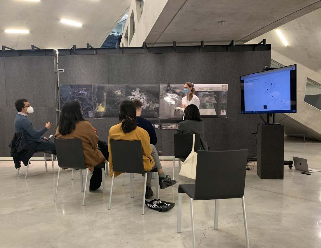
350
External Critics: Iris Ma Dillon Pranger
INTERIM II
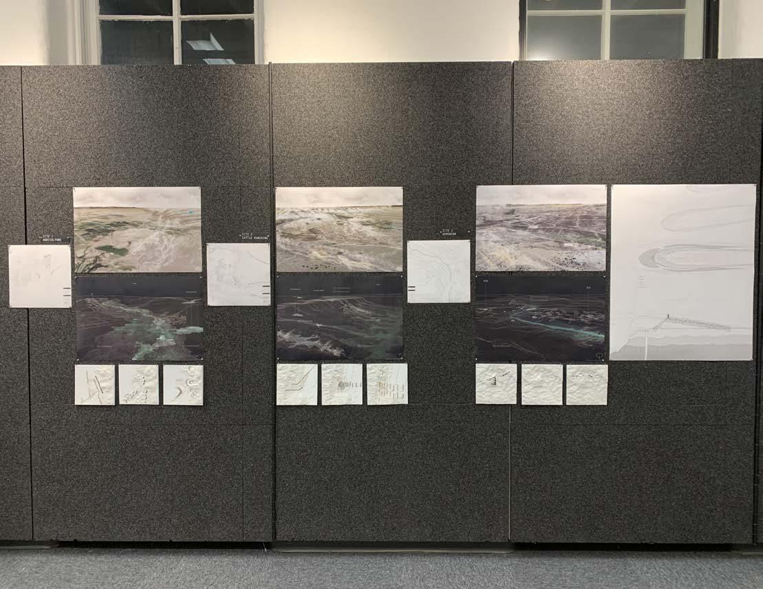
351
XIII PROCESS
External Critics: Greg Keeffe Caroline O’Donnell
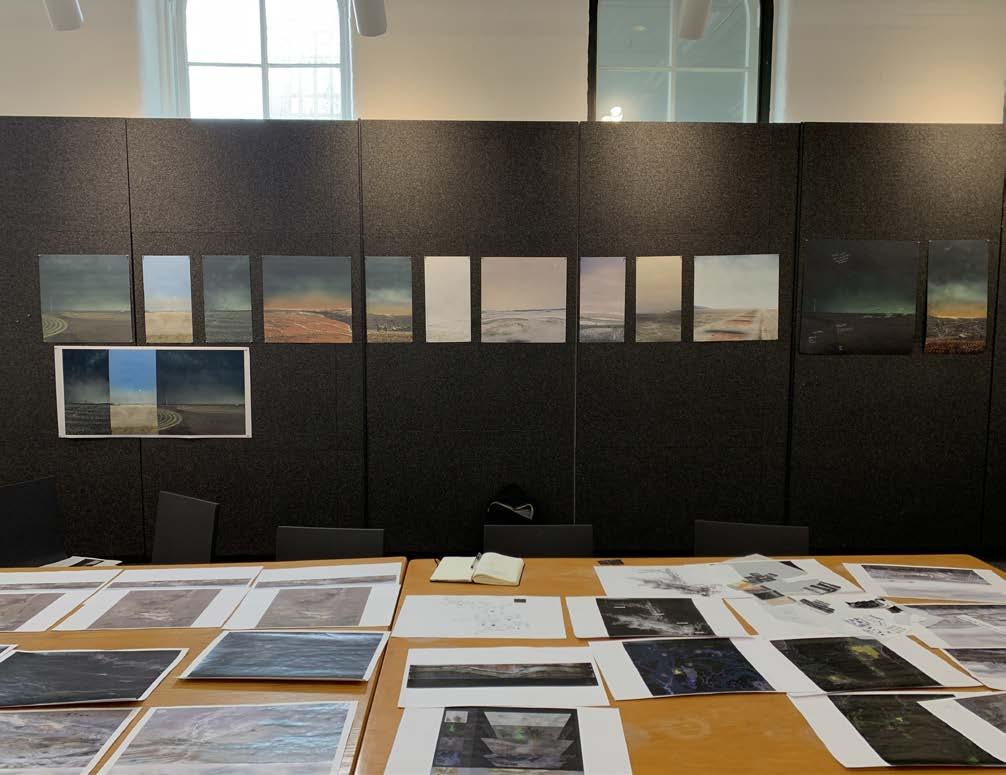
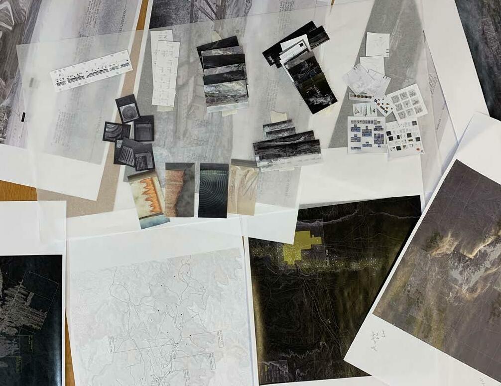
352
LAST MEETING BEFORE FINAL DEFENSE
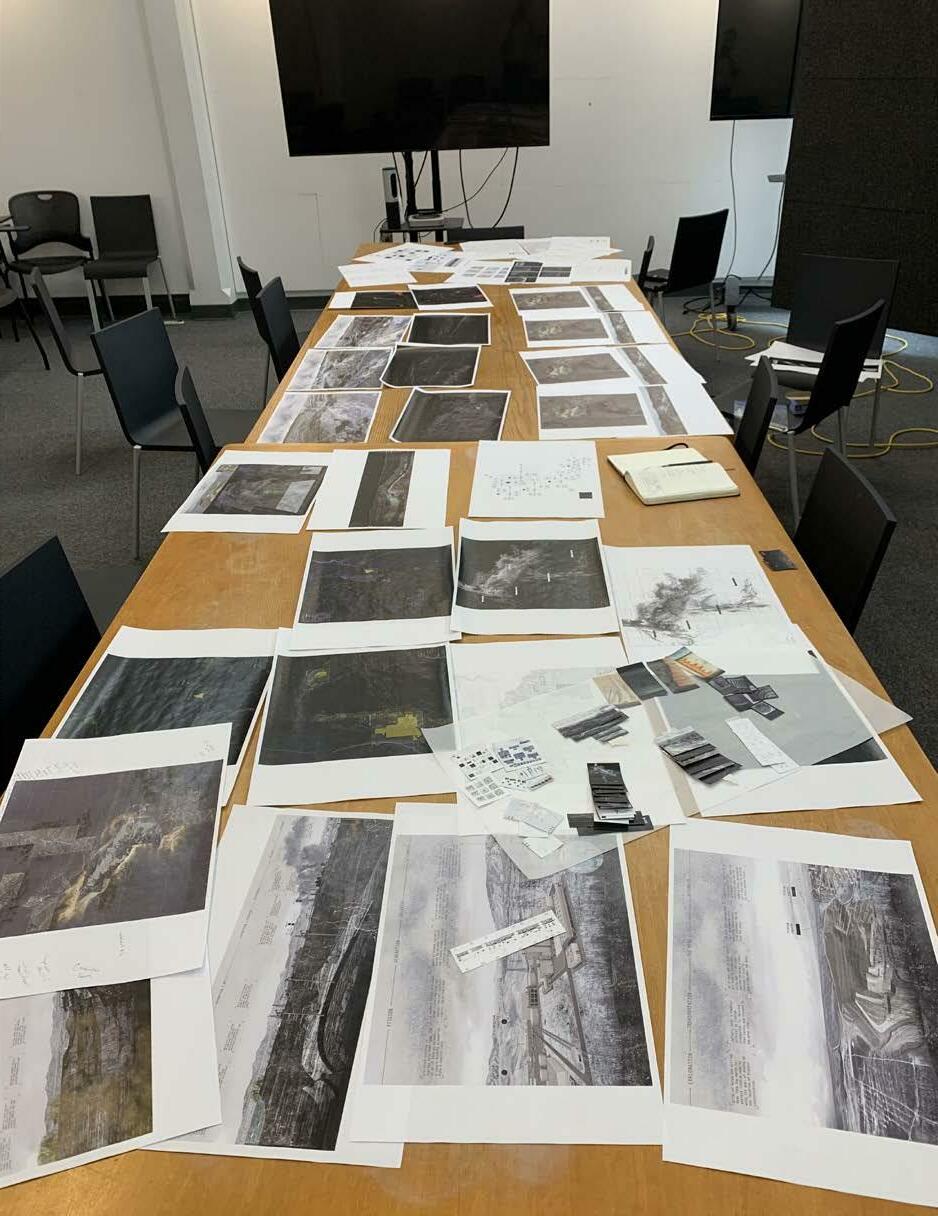
353
XIII PROCESS
354
MINIATURE DRAWING TESTS

Tiny-scale drawing tests proved useful when deciding which drawings to display at the final thesis defense, and how. The map drawings from Phase 1 appeared quite heavy relative to the final drawings, so it was decided that they would instead be made into a book. Text-heavy diagrams were presented in the booklets given to the critics, so as much real estate could be given to the final drawings as possible.
355
STATE OF STUDIO DESK AT BEGINNING OF SEMESTER
356
STATE OF STUDIO DESK AT END OF SEMESTER
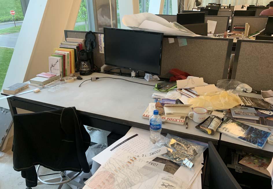
357 XIII PROCESS
358
The best advisors a thesis student could ever wish for!
POST FINAL REVIEW CELEBRATION AT CORNELL’S BOTANIC GARDENS
359 XIII PROCESS
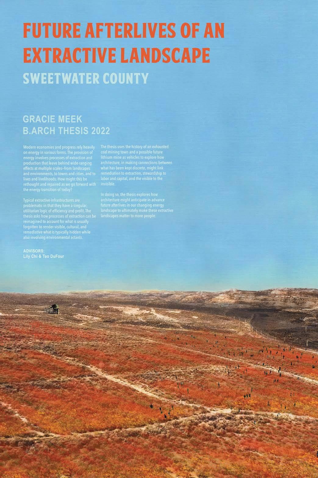
360
“There continued to be a regret for the loss of a life I might have lived but didn’t live, and the nostalgia for what cannot be.”
-Stuart Hall, The Stuart Hall Project
361
FINAL THESIS POSTER
MAPPING
OpenStreetMaps
Wyoming Landscape Conservation Initiative
Wyoming State Geological Survey
Biewick, L.R.H., and Jones, N.R., 2012, Energy map of southwestern Wyoming, Part A—Coal and Wind: U.S. Geological Survey Data Series 683, 18 p. pamphlet, Plate 2. https://pubs.usgs.gov ds/683/contents/Plates/Plate2_CoalMines.pdf.
Biewick, L.R.H., and Wilson, A.B. 2014. Energy map of southwestern Wyoming, Part B—Oil and gas, oil shale, uranium, and solar: U.S. Geological Survey Data Series 843, 20 p. pamphlet, Plate 4. http://dx.doi.org/10.3133/ds843.
Garman, S.L., and McBeth, J.L., 2014, Digital representation of oil and natural gas well pad scars in southwest Wyoming: U.S. Geological Survey Data Series 800, 7 p., http://dx.doi.org/10.3133 ds800.
Garman, S.L., and McBeth, J.L., 2015, Digital representation of oil and natural gas well pad scars in southwest Wyoming—2012 update [abs.]: U.S. Geological Survey Data Series 934, http://dx doi.org/10.3133/ds934.
Hallberg, Laura L., and James C. Case. 1999. Geologic Hazards section Digital Map 99-4 (HSDM 99-4) Preliminary Rock Springs Wyoming Surficial Geologic Map 1:100,000 Scale Series. N.p.: Wyoming State Geological Survey.
Wilson, A.B. 2015. Uranium in the Wyoming Landscape Conservation Initiative Study Area, southwestern Wyoming: U.S. Geological Survey Open-File Report 2014–1123, 33 p., 1 plate, http://dx.doi org/10.3133/ofr20141123.
Wittke, Seth J. 2011. Surficial Geological Map of the Farson 30’x60’, Quadrangle, Sweetwater, Sublette, and Fremont Counties, Wyoming. N.p.: U.S. Geological Survey.
Wyoming Geological Survey. 1973. “CRS-2 Sweetwater County, Wyoming.”
Wyoming Geospatial Hub. “GIS Information.” n.d. https://data.geospatialhub.org.
Wyoming Landscape Conservation Initiative. “Digital Representation of Oil and Natural Gas Pad Scars in Southwest Wyoming-2012 Update.” n.d. https://www.wlci.gov/wlciMapviewer/maps/pads?map=Pa Scars.
Wyoming Landscape Conservation Initiative. “Uranium,Oil and Gas Development in Southwestern Wyoming.” n.d.https://www.wlci.gov/wlciMapviewer/maps/timeMap?map=EnergyOverTime.
Wyoming Landscape Conservation Initiative. “Wind and Coal Energy Development in Southwestern Wyoming.” n.d. https://www.wlci.gov/wlciMapviewer/maps/map?map=EnergyDevelopment.
Wyoming State Geological Survey. “GIS Data: Wyoming State Geological Survey.” n.d. https://www.wsgs wyo.gov/pubs-maps/gis.
Wyoming State Geological Survey. “Wyoming State Geological Survey: Geologic and Topographic Index Map of Wyoming.” https://wsgs.maps.arcgis.com/apps/webappviewer/index.html?id=e6879af0fad 4f74852380a58f4fa1c9&fb
ENERGY
Anselmi, J. J. “The Rise and Fall of a Fracking Boom Town: An Oral History.” The New Republic, December 21, 2020. https://newrepublic.com/article/160689/rise-fall-fracking-boom-town-oral-history.
362
CNN, Opinion by John D. Sutter Video by McKenna Ewen. “Opinion: This Town Powered America for Decades. What Do We Owe Them?” CNN. Accessed February 9, 2022. https://www.cnn.com/2021/01/23/opinions/biden-climate-change-gillette-wyoming-coal-sutter index.html.
High Country News. 1974. “Energy Boom - Plans and Payments. High Country News: The Environmental Bi Weekly. Vol. 6 No. 12. Lander, WY.
“Next-Gen Nuclear Plant and Jobs Are Coming to Wyoming.” 2021. Department of Energy https://www.energy.gov/ne/articles/next-gen-nuclear-plant-and-jobs-are-coming-wyoming.
NowThis News, “Wyoming Works to Pivot From Coal to Clean, Renewable Energy,” Youtube Video, 7:32, April 25, 2021. https://youtu.be/XC9UeA7FkEU
COAL MINING
Campbell, Maurius R. 1910. Contributions to Economic Geology, 1908, Part 2: Mineral Fuels. Washington: Government Printing Office.
Fan, Gangwei, Dongsheng Zhang, and Xufeng Wang. 2014. “Reduction and Utilization of Coal Mine Waste Rock in China: A Case Study in Tiefa Coalfield.” Resources, Conservation and Recycling. Elsevier BV. doi:10.1016/j.resconrec.2013.12.001.
Hallman, Dave. 2010. History of Coal Mine Subsidence in Rock Springs Wyoming https://www.researchgate.net/publication/281286039_History_of_Coal_Mine_Subsidence_in_Rock_ Springs_Wyoming.
Robbins, Jim. 2022. “As the US Rushes After the Minerals for the Energy Transition, a 150-Year Old Law Allows Mining Companies Free Rein on Public Lands.” Inside Climate News. https:/insideclimatenews.org/news/13032022/as-the-us-rushes-after-the-minerals-for-the-energy transition-a-150-year-old-law-allows-mining-companies-free-reign-on-public-lands/.
Schmidt, William E., and Special To the New York Times. “WYOMING TOWN SINKING INTO HISTORY AS ABANDONED MINE SHAFTS COLLAPSE.” The New York Times, April 27, 1983, sec. U.S. https://www.nytimes.com/1983/04/27/us/wyoming-town-sinking-into-history-as-abandoned-mine shafts-collapse.html.
Schultz, A. R. 1910. The Southern Part of the Rock Springs Coal Field, Sweetwater County, Wyo.: U. S. Geol. Survey Bull. 381, pp. 214-281.
Swann, C.E. 1940. Outline of Discovery and Development of Coal Seams in Sweetwater and Carbon Counties, Wyoming. Union Pacific Coal Company.
U.S. Department of the Interior: Office of Surface Mining Reclamation and Enforcement: National Mine Map Repository.
https://www.osmre.gov/programs/national-mine-map-repository
LITHIUM MINING
Bartlett, John. “Mining of Lithium, Key to the Climate Fight, Faces New Scrutiny in Chile.” The New York Times, January 6, 2022, sec. Climate.
https://www.nytimes.com/2022/01/06/climate/lithium-chile.html.
Daly, John C. K. “Researchers Have Stumbled On A Massive Lithium Mine That Could Meet All US Demand.” Business Insider. Accessed January 30, 2022.
https://www.businessinsider.com/new-wyoming-lithium-deposit-could-meet-all-us-demand-2013-4.
363
XIV BIBLIOGRAPHY
BIBLIOGRAPHY
Ewing, Jack, and Neal E. Boudette. “Why This Could Be a Critical Year for Electric Cars.” The New York Times, February 8, 2022, sec. Business. https://www.nytimes.com/2022/02/08/business/energy-environment/electric-cars-vehicles.html.
Granholm, Jennifer M. “National Blueprint for Lithium Batteries 2021-2030,” n.d., 24.
Green Car Reports. “Most EVs for US Sale Have American-Made Batteries.” Accessed February 1, 2022. https://www.greencarreports.com/news/1132958_most-evs-for-us-sale-have-american-made batteries.
“How Brine Ponds Differ from Other Evaporation Ponds.” n.d. BTL Liners. https://www.btlliners.com/how-brine-ponds-differ-from-other-evaporation-ponds.
Kanji, Kenneth K., Colin G. Ong, Randy A. Dahlgren, and Mitchel J. Herbel. n.d. “Salt deposits in evaporation ponds: an environmental hazard?” California Agriculture 46 (6): 18-21.
“Lenntech Brine Evaporation Ponds Data Sheets.”n.d. https://www.lenntech.com/Data-sheets/Brine-Evaporation-Ponds.pdf
“Maricunga Lithium - Bearing Lithium.” n.d. Bearing Lithium Corp. https://www.bearinglithium.com/maricunga-lithium/.
Mrozik, Wojciech, Mohammad Ali Rajaeifar, Oliver Heidrich, and Paul Christensen. “Environmental Impacts, Pollution Sources and Pathways of Spent Lithium-Ion Batteries.” Energy & Environmental Science 14, no. 12 (2021): 6099–6121. https://doi.org/10.1039/D1EE00691F.
Nowak, Neil. 2014. “High Density Polyethylene (HDPE) Lined Evaporation Ponds.” 21st International Petroleum Environmental Conference. https://cese.utulsa.edu/wp-content/uploads/2017/06/IPEC-2014-HDPE-lined-evaporation.pdf
Penn, Ivan, Eric Lipton, and Gabriella Angotti-Jones. “The Lithium Gold Rush: Inside the Race to Power Electric Vehicles.” The New York Times, May 6, 2021, sec. Business. https://www.nytimes.com/2021/05/06/business/lithium-mining-race.html.
Song, Weijun, Gang, Hongze, Ma, Yuanqing, Yang, Shizhong, and Bozhong Mu. 2017. “Migration Behavior of Lithium during Brine Evaporation and KCl Production Plants in Qarhan Salt Lake.” Minerals 2017, 7, 57; doi:10.3390/min7040057
“Students dig into lithium potential outside Rock Springs.” 2017. Wyoming Tribune Eagle https://www.wyomingnews.com/rocketminer/news/students-dig-into-lithium-potential-outside rock-springs/article_256f40db-ffde-5f86-8f54-8d4a8b949f43.html.
Talens Peiró, Laura, Gara Villalba Méndez, and Robert U. Ayres. 2013. “Lithium: Sources, Production, Uses, and Recovery Outlook.” JOM. Springer Science and Business Media LLC. doi:10.1007 s11837-013-0666-4.
The Guardian, “Lithium mine pits electric cars against sacred Indigenous land,” Youtube Video, 10:20, December 2, 2021. https://www.youtube.com/watch?v=sv9iHH7g6xk
‘THE ROCK SPRINGS BRINERS’: Hollmann, Matthew, Moss, Alexander, Robeson, Josef, Samet, Mhamed, and Brandon Wilde. 2017. “Water and Lithium Recovery From Rock Springs Uplift Brines.”
US Lithium-Ion Battery Imports Jump as China Seizes Market Share.” Accessed February 1, 2022. https://www.spglobal.com/marketintelligence/en/news-insights/latest-news-headlines/us lithium-ion-battery-imports-jump-as-china-seizes-market-share-63271388.
Yale School of the Environment. “YSE Study Finds Electric Vehicles Provide Lower Carbon Emissions Through Additional Channels,” December 19, 2021. https://environment.yale.edu/news/article/yse-study-finds-electric-vehicles-provide-lower carbon-emissions-through-additional.
364
SUPERIOR & ROCK SPRINGS
Gardner, A. D., and Val Brinkerhoff. 1993. Historical Images of Sweetwater County. Edited by Jolane Culhane: Donning Company.
Prevedel, Frank. 2011. Images of America: Superior and South Superior. Charleston, South Carolina: Arcadia Pub.
Shanks, Margie F., and Russel L. Tanner. 2008. Images of America: Rock Springs. Charleston, South Carolina: Arcadia Pub.
“Superior, Wyoming (WY 82945) profile.” n.d. City-Data.com. http://www.city-data.com/city/Superior-Wyoming.html.
ECONOMICS AND LAND USE
Hammerlinck, Jeffrey D., Scott N. Lieske, William J. Gribb, and Jim Oakleaf. n.d. “Understanding Wyoming’s Land Resources: Land-Use Patterns and Development Trends.” University of Wyoming. http://www.uwyo.edu/haub/_files/_docs/ruckelshaus/open-spaces/2013-land-use-patterns.pdf
The Mineral Rights Podcast. “MRP 130: What Causes an Oil Price Bust and Will History Repeat Itself?” 2021. https://mineralrightspodcast.com/mrp-130-what-causes-an-oil-price-bust-and-will-history repeat-itself/.
CONSERVATION AND ECOLOGY
“15 Key Facts & Statistics About Power Plant Pollution.” Accessed January 30, 2022. https://blog.arcadia.com/15-key-facts-statistics-power-plant-pollution/.
“BLM Wyoming Native Plants Program.” n.d. Bureau of Land Management. https://www.blm.gov/programs/natural-resources/native-plant-communities/about-native-plants wyoming.
Tronstad, Lusha, J. Cody Bish, and Oliver Wilmot. n.d. “Aquatic invertebrates in dune ponds at Sand Dunes Wilderness Study Area.” University of Wyoming https://www.uwyo.edu/wyndd/_files/docs/reports/WYNDDReports/U17TRO01WYUS.pdf.
“Wyoming: Where We Work.” n.d. The Conservation Fund https://www.conservationfund.org/where-we-work/wyoming.
WWC Engineering, AECOM, and ERO Resources Corp. 2010. Green River Basin Plan: Prepared for Wyoming Water Development Commission. Basin Planning Program.
Society, National Geographic. “Movement of Pollutants.” National Geographic Society, December 17, 2015. http://www.nationalgeographic.org/activity/movement-pollutants/.
CATTLE RANCHING
“Drought Proofing Your Grazing System | Master Grazer.” n.d. Master Grazer. College of Agriculture, Food and Environment. University of Kentucky. https://grazer.ca.uky.edu/content/drought-proofing-your-grazing-system.
United States Department of Agriculture. 2017. “2017 Census of Agriculture County Profile, Sweetwater County.” www.nass.usda.gov/AgCensus.
“Wyoming Ranching.” 2014. Bitterroot Ranch. https://www.bitterrootranch.com/stories-from-the-ranch/wyoming-ranching/.
365 XIV BIBLIOGRAPHY
Abe, Masanao, Sadie Plant, and Helmut Völter. 2016. The Movement of Clouds Around Mt. Fuji. Edited by Helmut Völter: Spector Books.
Corner, James, Michel Desvigne, and Gilles A. Tiberghien. 2009. Intermediate Natures: The Landscapes of Michel Desvigne. Translated by Elizabeth Kugler. N.p.: Birkhauser Verlag AG.
Ferry, Robert, and Elizabeth Monoian, eds. 2022. Land Art of the 21st Century: Land Art Generator Initiative at Fly Ranch. Munich, Germany: Hirmer Verlag.
Steiner, Frederick R., Richard Weller, Karen M’Closkey, and Billy Fleming, eds. 2019. Design with Nature Now: Lincoln Institute of Land Policy.
Waldheim, Charles. 2006. The Landscape Urbanism Reader. 1st ed. Hudson, NY: Princeton Architectural Press.
Waldheim, Charles. 2016. Landscape as Urbanism: A General Theory. Princeton, NJ: Princeton University Press.
366
LANDSCAPE
367 XIV BIBLIOGRAPHY
