5 minute read
Gingerbread Survey Comparisons
In total, the team surveyed 356 Gingerbreads, a substantial variance from the 206 identified in the 2010 Earthquake Mission Report. Given that the 2010 survey took place soon after the earthquake while some roads remained closed—and that it focused on recording the largest, most definitive examples of the Gingerbread style—it is easy to understand how the current study recorded a greater total number of houses. Nevertheless, by comparing the distribution of Gingerbreads in 2015 with other studies conducted after the earthquake, it became clear that at least fifty-nine Gingerbreads are known to have been lost since 2010 [see Appendix 01].
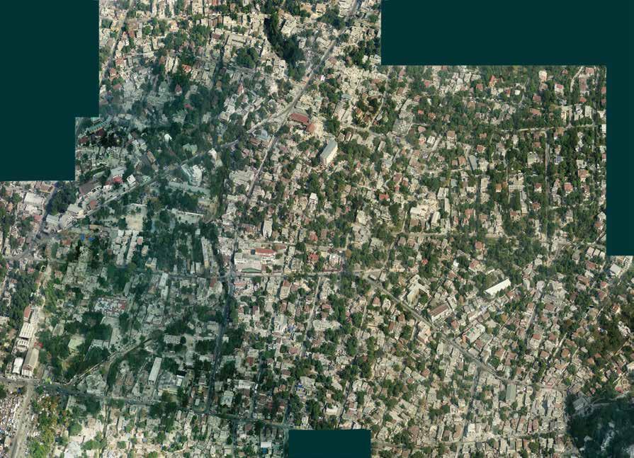
2010 Pictometry Image. Here streets were labeled to assist in identification. Extant Gingerbread houses are marked in green; known sites of demolished Gingerbreads are marked in red. Documentation from previous surveys included photographs, GPS locations, addresses, and brief conditions assessments that proved invaluable in assisting with this cross-referencing task. While confident matches were made between properties that had identical addresses, fairly consistent GPS data, and photographs, other matches were found by extrapolating from the available addresses in proximity to the property and using aerial imagery. In particular, copies of the 2010 oblique aerials taken by Pictometry International Corp. and assembled and rectified by conservationist and photographer Randolph Langenbach for the 2010 earthquake mission, were used to more easily identify where demolitions had occurred. [1]
Avenue Lamar t in ière
Rue Vilmenay
Avenue Charles Sumner
Avenue Christophe
Avenue Jean Pau l II Avenue N Rue O Rue José Marti 3ème Rue du Travail 1ère Rue du Trava i l 2ème Rue du Travail
Rue M
Rue 7 Rue 6
In few cases, high walls, dense vegetation, or private roads obscured Gingerbreads set back from the street. While these structures are likely still extant and appear to be present in recent aerial imagery, their presence and condition were not confirmed in the field. However, these represented only a few cases and were often the result of the adaptation of a Gingerbread to a use that necessitated higher security.
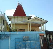
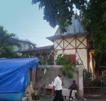
While it is difficult to provide a number for the total loss of Gingerbreads since the first inventory in 1980, the studio can confirm that fifty-nine have been lost since the completion of the 2010 assessment mission. The historic photographs taken during the 1980 survey, however, offer an important early snapshot of these structures. For a handful of structures, photographs can be compared between 1980, 2010, and 2015, offering an important glimpse at some of the adaptations and changes to the use and physical fabric of the Gingerbreads [see also Appendix 02].
The comparisons that emerged from this exercise illustrated a number of conditions faced by the Gingerbread houses that are commonly referenced, but not often visually illustrated. In some cases stability, resilience, and careful maintenance were visible in markedly unchanging
facades. In other cases, drastic change or complete loss was amplified by images of Gingerbreads that weathered the earthquake with no visible exterior damage, but had vanished without a trace by 2015.
Avenue John Brown Locations, in red, of all 59 identified Gingerbread houses lost since the 2010 survey.
Avenue Lamartinière
R ue C a poi s
Avenue Chr is top he Avenue Jean Paul II
500 Meters
Subdivision of Lots and Densification.
Due to the setback of these homes, owners are able to profit from the subdivision of their historically large lots. The densification of Port-au-Prince, the desirability of this area, and the financial hardships of maintenance have combined to make Gingerbreads very susceptible to the loss of their historic context. Many homes have been entirely obscured from public view by new construction.
26 Rue Cadet Jérémie
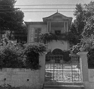

Persistent Earthquake Damage.
Many Gingerbreads exhibit lasting earthquake damage from 2010. This can range from masonry cracking (as visible below) to the weakening or loss of key structural elements. Without attention, even relatively innocuous damage can lead to the loss of an entire structure.
4 Rue M. Casséus, the Patrice Pamphile House

Rising Walls and Alterations.
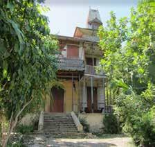
Increasing wall heights are a symptom of the fear for safety in Port-au-Prince. Many walls show a substantial increase in height, a decrease in use of permeable materials, and are often topped with barbed wire or broken glass.
Alterations to these structures can range from concrete additions to the replacement of original features. Continuing alterations that—while well-intentioned—detract from the building’s identity as a Gingerbread are a threat to the continuing presence of these structures.
208 Rue Alerte Here the alterations—wooden infill in place of original verge boards—are well-intentioned and attempt to mimic a Gingerbread style with choice of materials.
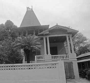

Deterioration.
While neglect can sometimes work in favor of preservation (preventing alterations and allowing the building to retain material authenticity), long-term neglect and deferred maintenance are pressing issues for the preservation of the Gingerbread houses. Despite the structures’ resilience, maintenance and restoration must be undertaken to save this historic housing stock.
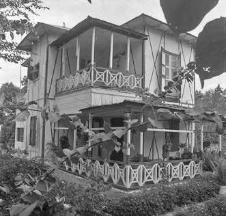

15 Rue Garoute, This structure, as well as another Gingerbread house nearby, was recently purchased by the Haitian Education and Leadership Program (HELP) as a location in which to base their growing campus.
Demolition.
Without constant monitoring, demolition is a serious concern. With the difficulties in acquiring raw materials for repair, the threat of natural disasters, the densification of the city, and only a limited discourse on the value of these structures, many Gingerbread houses are under substantial development pressure. Understanding why some areas, like Lavaud or Rue O, have experienced higher losses in their historic housing stock will help to inform how heritage protections can be best approached.
1980.
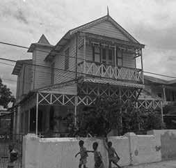
Post-Earthquake, 2010. October 2015. 5 Rue Lavaud 1er


