8 minute read
FOOTPRINTS ACROSS THE LANDSCAPE
WORDS: CAITLIN SYKES / IMAGERY: JESS BURGES
The French explorer Marc-Joseph Marion du Fresne is a lesser-known figure in New Zealand history, but the ripple effects of the time he spent in the Bay of Islands 250 years ago have arguably shaped the New Zealand we know today
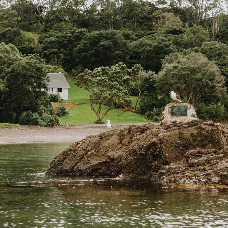
Ahush descends on our boat as we pause, reflecting on a headland that separates two small sets of boats moored either side. Then, as ripples created by our craft drift towards the headland, Ka Waiata ki a Maria carries across the quiet.
Kororāreka Marae Chair Deb Rewiri sings the waiata to acknowledge tūpuna who died in battle at this place, Paeroa Pā. It was here, 250 years ago, that French sailors, armed with muskets and seeking retribution for the killing of explorer Marc-Joseph Marion du Fresne, killed more than 250 tangata whenua at the pā on Moturua Island in Pēwhairangi/the Bay of Islands (also known as ‘the Bay’).
Our boat trip has been organised as part of activities in 2022 marking 250 years since the arrival of Marion du Fresne and the crews of his two vessels on our shores. Unlike James Cook, who three years earlier had spent six days in the Bay, the French spent more than two months in the area in 1772.
The massacre at Paeroa Pā was a culmination of events that formed one the earliest prolonged interactions between Māori and foreigners in Aotearoa – interactions, argues Bill Edwards, Area Manager Northland for Heritage New Zealand Pouhere Taonga, that have shaped the New Zealand we know today.
“It’s probably one of the most significant interaction events in New Zealand history, but it doesn’t really get talked about,” he says. “And we need to talk about it.”
A history of interaction
Marion du Fresne was already a highly experienced sailor and navigator, with naval skills honed in conflicts such as the Seven Years War before he embarked for the South Pacific in 1771 with his ships the Mascarin and the Marquis de Castries. His mission was twofold: to return the Tahitian Ahutoru to his homeland, and to find Terra Australis. On both counts, however, the mission was unsuccessful: the hypothetical ‘Southern Land’ remained just that, and Ahutoru, like Marion du Fresne, never made it home, succumbing to smallpox on the journey.
There were other misfortunes. While Marion du Fresne’s vessels were taking soundings near the Prince Edward Islands in the southern Indian Ocean, the wind changed and the boats collided. Requiring timber and suitable conditions to establish a forge to repair the damage, and a place for his sailors to recuperate from scurvy, Marion du Fresne sailed onwards to Australia then New Zealand, anchoring in Northland, first at Spirits Bay then at the Bay of Islands.
Specifically, the French spent most of their time based around Moturua – the very same island that, unbeknown to them, Cook had visited three years earlier.
Moturua, however, is a landscape filled with history and stories stretching back centuries before these European arrivals. The Mangahawea Bay Partnership Project, set up in 2016 by Ngāti Kuta and Patukeha alongside three Crown agencies, has established Mangahawea Bay on the island as a place of very early Polynesian settlement.
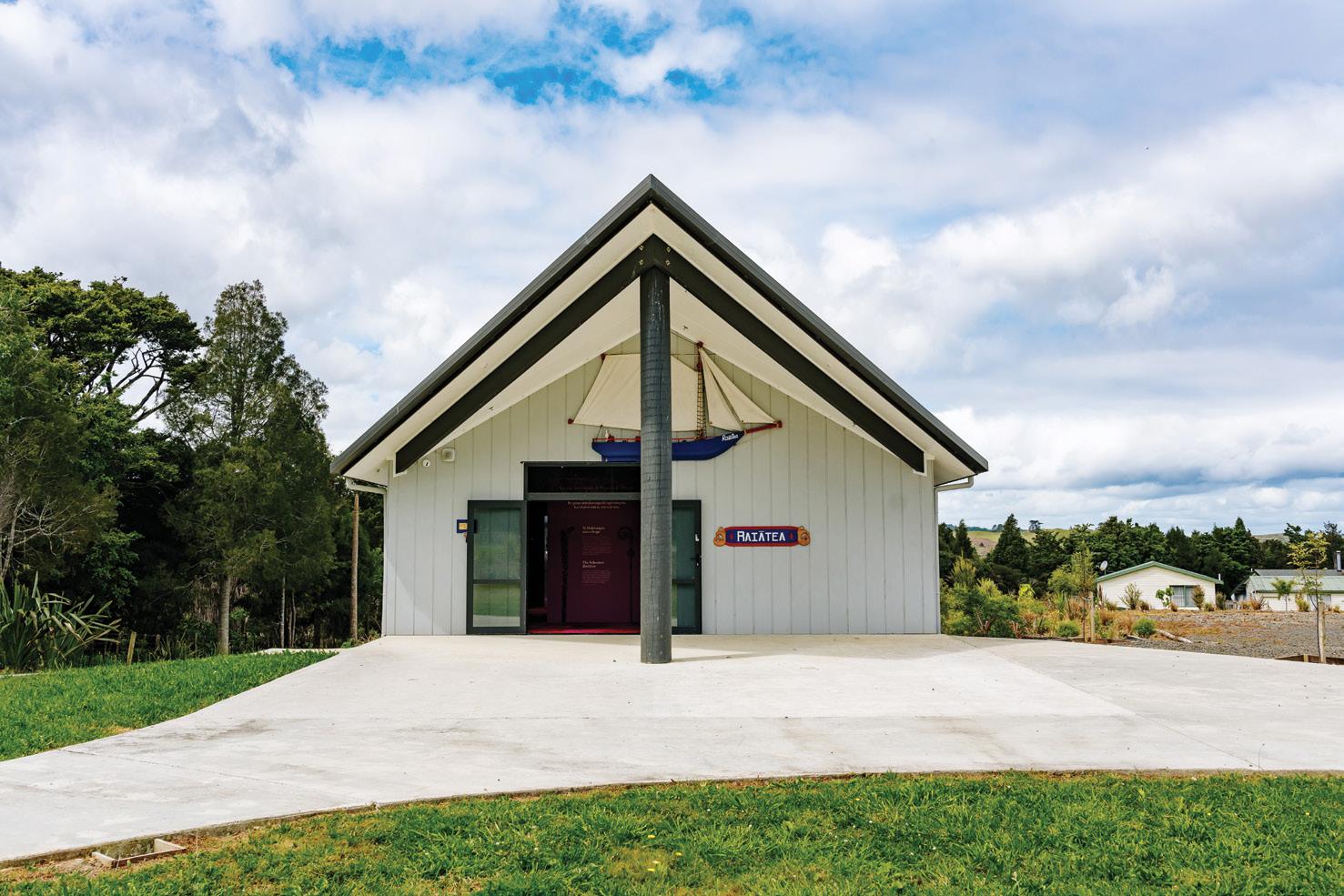
Left by ancestors like footprints across the landscape, place names, such as that of Motu Rangiātea off Mangahawea Bay, reference these deep Pacific connections.

It was a freshwater source that drew both Cook and Marion du Fresne to the adjacent bays of Waiiti and Waipau on Moturua. And it was here that the French set up a camp in early May 1772 that included a hospital, a watering place and a forge to undertake metalwork for ship repairs.
A timber camp was also established at Manawaora, a nearby bay on the mainland.
“The French were spread out across the landscape, and because they were here for quite a period of time, some of their relationships with tangata whenua broke down for numerous reasons: breaking tapu, taking resources, tying up the time of rangatira and multiple political reasons,” explains Bill. “And when they broke down, they broke down badly.”
On 12 June 1772, Marion du Fresne and 26 members of his crew were killed at Te Hue Bay.
A series of reprisals ensued, culminating in a massacre at Paeroa Pā where, for the first time, muskets were used to attack a traditional pā, resulting in a huge number of casualties.
A month after Marion du Fresne’s killing, on 12 July, the French left, burying a bottle in the sands of Waipau Bay containing a declaration of France’s possession of the entire country as they departed.
Ripple effects
As with the 250th anniversary in 2019 of Cook’s landing, the 250th anniversary of Marion du Fresne’s arrival in the Bay of Islands has served as a point for activity and reflection.
Although the French explorer is a lesserknown figure in New Zealand history, Bill says the ripple effects created by his interactions with tangata whenua – and other, subsequent early contact in the North with the French – have been substantial.

Bill outlined some of these in a paper he presented at the conference of the Australasian Society for Historical Archaeology (ASHA), hosted by Kororāreka Marae and held in Russell last September, in which he argued that their impacts are evident in some of our founding documents.
He points, for example, to the 1831 petition to King William IV for protection signed by 13 Northern rangatira, which noted: “We have heard that the tribe of Marian [the French] is at hand, coming to take away our land. Therefore we pray thee to become our friend and the guardian of these islands, lest the teasing of other tribes should come near us, and lest strangers should come and take away our land.”
The subsequent arrival of Charles de Thierry in Hokianga, says Bill, also provided impetus for both He Whakaputanga o te Rangatiratanga o Nu Tirene – the 1835 Declaration of Independence of the United
Tribes of New Zealand – and the Treaty of Waitangi.

“A generation after the arrival of Marion du Fresne,” he says, “there was a really important fear of the French in the minds of the people here – a fear that I think was utilised by the British for colonisation.”
As part of Tuia 250 – the series of events in 2019 that marked 250 years since Cook’s arrival – Bill and his team overlaid charts produced during the HMS Endeavour’s voyage with modern maps to identify significant sites of early interaction with Māori in the Bay. The chart then provided a route for a series of boat tours run in conjunction with mana whenua, where people could hear about both the written historical accounts and the oral histories associated with these places of early interaction.
The work provided a model for marking the anniversary of Marion du Fresne’s arrival, when historical and modern maps were again overlaid, this time to locate the French footprint.
In late September 2022, the findings from both projects were combined to help form the route of another boat tour of the Bay. Organised by Heritage Northland and run as a field trip as part of the ASHA conference programme, the trip was also open to the public and local school students. The tour spanned both the Bay of Islands and hundreds of years of history – from early
Polynesian settlement at Mangahawea Bay, to Waiiti and Waipau Bays, and to the first mission station at Oihi (Hohi).
Importantly, the voyage was also a chance for those on board to hear the history of these important places from a range of perspectives; oral histories from different hapū were shared on the voyage, along with insights from historians including Dame Anne Salmond and Bill, as well as archaeologists, an ecologist and Murphy Shortland, who has mapped the Bay’s traditional names.
“The idea was really to look at the seascape and the landscape through the eyes of the people as they first came here, from the Polynesian settlers to Cook and [Marion] du Fresne; to actually see first-hand these places of early contact because we’re now able to geographically locate them,” says Bill.
On the trail
A map produced of ‘J Marion’ (Moturua) Island by Crozet, a leader on Marion du Fresne’s voyage, is also helping to tease out archaeological evidence of the French footprint on the island, explains James Robinson, Senior Archaeologist for Heritage New Zealand Pouhere Taonga.
Crozet identified a range of features on the island – including two streams at Waiiti and Waipau Bays, and Paeroa Pā (which was also separately mapped by the French) – and the locations of the hospital and forge the crews set up during their weeks-long stay.

While the island as a whole isn’t perfectly mapped, explains James, its accuracy increases closer to the bays in which the French were based and has provided a foundation on which modern maps can be overlaid.
Crozet’s map shows the locations of the hospital and forge relative to the islands’ streams. Overlaying this information with modern maps, which also show the surrounding area of flat land required to set up such temporary infrastructure, has helped to pinpoint the areas where archaeological evidence might be found.
One focus of the search so far has been a large hole located in the area of the type required for what James calls a ‘go-ashore’ forge.
“It’s what sailors had to build in far-off places when they had metalwork to fix on their boats. It’s not a full blacksmith’s forge that we’d think of today with all its infrastructure; instead, on the boat they would have a small anvil, a pipe to get air into a hole in the ground in which they’d build heat, a hammer, tongs and bellows. So when they left and took those tools with them, all you’re really left with is a hole in the ground.”
Investigations of the hole have revealed a feeder near its top and a nearby drain leading to a stream – features identified in other archaeological sites confirmed as go-ashore forges.
In October 2022 James and Heritage New Zealand Pouhere Taonga volunteers carried out a grid search around the hole using a metal detector, which identified a concentration of metal fragments in one area near the hole. A further investigation to see if that metal was scale, a by-product of the metalworking process, was imminent.
“If we can find scale – tiny, microscopic pieces of iron – then without doing any damage to the hole itself we’ll be able to say this is consistent with this being a forge, and we’ll be happy to record it as such.” While this would be a significant finding, James points out, it would only add to the highly complex and significant archaeological landscape of Moturua.
“This European contact archaeology sits within a landscape of Māori archaeology that goes back to 1300, when the first Polynesians arrived. There’s a lot going on throughout the island – villages, gardens, pā – and some of it is very ancient, with continuous occupation.
“The eight-week period when [Marion] du Fresne was in the Bay 250 years ago is an interesting phase of New Zealand history to explore, but what it also does is again emphasise Moturua Island as a very important, central place.” hapū: sub-tribes mana whenua: those with tribal authority over land or territory rangatira: chief/s tangata whenua: people of the land tapu: sacred tūpuna: ancestors waiata: song
1. Searching for evidence of scale at the possible ‘go-ashore’ forge site.
2. A possible go-ashore forge site.


