YO UR VISION . YO UR FUTU RE . Heritage Interpretation Strategy and Ac tion Plan hornsby.nsw.gov.au
We acknowledge the Traditional Custodians of this land, the Darug and GuriNgai peoples, and pay respect to their Ancestors and Elders past and present and to their Heritage. We acknowledge and uphold their intrinsic connections and continuing relationships to Country.

Hornsby Shire Council
ABN 20 706 996 972
Contact details
PO Box 37, Hornsby NSW 1630
Phone: 9847 6666
Fax: (02) 9847 6999
Email: hsc@hornsby.nsw.gov.au
Customer service (telephone and online) hours: 8.30am–5pm Monday to Friday (excluding public holidays) hornsby.nsw.gov.au
Visit us
296 Peats Ferry Road, Hornsby NSW 2077
Please check the website for the latest opening hours for the Customer Service Centre and Duty Officer.
Disclaimer
Every effort has been made to provide accurate and complete information. However, the authors assume no responsibility for any direct, indirect, incidental, or consequential damages arising from the use of information in this document.
Copyright Notice
No part of this publication may be reproduced in any form, or stored in a database or retrieval system, or transmitted or distributed in any form by any means, electronic, mechanical photocopying, recording, or otherwise without written permission from Hornsby Shire Council. All rights reserved.
Copyright © 2021, Hornsby Shire Council

Report to Hornsby Shire Council 15 March 2023
Hornsby Shire Heritage Interpretation Strategy and Action Plan
We acknowledge the Gadigal, the traditional owners of the land on which we work. We pay our respects to Elders past and present, and extend that respect to any Aboriginal and Torres Strait Islander people who we work with on this project.
Document history and status
Last saved: 31 May 2023
File name: Hornsby Council HIS&AP_draft 14032023
Author: Darrienne Wyndham, Alexandra Gaffikin, Stephanie McCarthy-Reece, and Carolyn MacLulich
Project manager: Alexandra Gaffikin
Name of organisation: Artefact Heritage Services Pty Ltd


Name of project: Hornsby Shire Heritage Interpretation Strategy and Action Plan
Name of document: Hornsby Shire Heritage Interpretation Strategy and Action Plan
Document version: Draft 3
© Artefact Heritage Services, 2023
This document is and shall remain the property of Artefact Heritage Services. This document may only be used for the purposes for which it was commissioned and in accordance with the Terms of the Engagement for the commission. Unauthorised use of this document in any form whatsoever is prohibited.
Disclaimer: Artefact Heritage Services has completed this document in accordance with the relevant federal, state and local legislation and current industry best practice. The company accepts no liability for any damages or loss incurred as a result of reliance placed upon the document content or for any purpose other than that for which it was intended.
Hornsby Shire DRAFT Heritage Interpretation Strategy and Action Plan Page ii
Revision Date issued Reviewed by Approved by Date approved Review type Internal 11 July 2022 Carolyn MacLulich, Artefact Heritage Carolyn MacLulich, Artefact Heritage 11 July 2022 Internal Rev 1 12 July 2022 Alison Bangs, Hornsby Shire Council Alison Bangs, Hornsby Shire Council with comments 19 August 2022 Draft 1 Rev 2 25 October 2022 Hornsby Shire Council Alison Bangs, Hornsby Shire Council, and HATSIC with comments 24 February 2023 Draft 2
3
Hornsby
Council Alison Bangs, Hornsby Shire Council with comments 4 April 2023 Draft 3 Final
Rev
15 March 2023
Shire


Hornsby Shire DRAFT Heritage Interpretation Strategy and Action Plan Page iii CONTENTS Abbreviations ......................................................................................................................1 1.0 Introduction...............................................................................................................2 1.1 Background .......................................................................................................................... 2 1.2 Purpose of the report............................................................................................................ 2 1.3 Scope of the report............................................................................................................... 3 1.4 Limitations ............................................................................................................................ 4 1.5 Guiding documents .............................................................................................................. 4 1.6 Authorship and acknowledgements ..................................................................................... 5 2.0 The Study Area .........................................................................................................6 2.1 Location and setting ............................................................................................................. 6 3.0 Historical Context...................................................................................................10 3.1 Introduction......................................................................................................................... 10 3.2 Aboriginal history of Hornsby Shire.................................................................................... 10 3.3 Non-Aboriginal history of Hornsby Shire............................................................................ 12 4.0 Values and Significance.........................................................................................15 4.1 Introduction......................................................................................................................... 15 4.2 Aboriginal cultural heritage values ..................................................................................... 15 4.3 Non-Aboriginal (historic) heritage significance................................................................... 18 4.4 Landscape heritage values ................................................................................................ 20 5.0 Consultation Plan...................................................................................................22 5.1 Introduction......................................................................................................................... 22 5.2 Hornsby Shire Council Community Engagement Plan ...................................................... 22 5.3 Aboriginal stakeholder consultation.................................................................................... 22 5.4 Targeted community consultation ...................................................................................... 23 6.0 Interpretive Strategy...............................................................................................27 6.1 Introduction......................................................................................................................... 27 6.2 Interpretive principles ......................................................................................................... 27 7.0 Existing interpretation............................................................................................28 7.1 Sample of existing interpretive elements ........................................................................... 28 7.2 Guidelines for assessing current interpretive elements at a destination............................ 34 8.0 Audience identification ..........................................................................................35 8.1 Residents............................................................................................................................ 35 8.2 Visitors................................................................................................................................ 35 9.0 Historical themes....................................................................................................38 9.1 Introduction......................................................................................................................... 38 9.2 Key themes from the Hornsby Thematic History................................................................ 38


Hornsby Shire DRAFT Heritage Interpretation Strategy and Action Plan Page iv 10.0 Heritage Interpretation Examples..........................................................................39 10.1 Introduction......................................................................................................................... 39 10.2 Acknowledgement of/Welcome to Country ........................................................................ 39 10.3 Architectural integration and landscape geometry............................................................. 40 10.4 Adaptive reuse.................................................................................................................... 41 10.5 Re-use of salvaged materials............................................................................................. 42 10.6 Conservation ...................................................................................................................... 44 10.7 Functional elements ........................................................................................................... 45 10.8 Ground plane elements...................................................................................................... 46 10.9 Interpretive panels.............................................................................................................. 47 10.10 QR codes and Beacon Technology ................................................................................... 49 10.11 Landscaping and plantings................................................................................................. 50 10.12 Multilingual interpretation ................................................................................................... 51 10.13 Aboriginal languages.......................................................................................................... 52 10.14 Lighting............................................................................................................................... 53 10.15 Artefacts and movable heritage.......................................................................................... 54 10.16 Museums and libraries ....................................................................................................... 55 10.17 Play spaces........................................................................................................................ 57 10.18 Public artwork..................................................................................................................... 58 10.19 Public programming and events......................................................................................... 59 10.20 Heritage walks.................................................................................................................... 60 10.21 Site markers and Blue Plaques.......................................................................................... 62 10.22 Educational materials......................................................................................................... 64 10.23 Publications........................................................................................................................ 65 10.24 Digital displays.................................................................................................................... 66 10.25 Social media....................................................................................................................... 67 10.26 Podcasts............................................................................................................................. 68 10.27 Websites and apps............................................................................................................. 70 10.28 Oral histories ...................................................................................................................... 71 10.29 Community heritage prizes................................................................................................. 72 10.30 Temporary hoardings ......................................................................................................... 73 11.0 Interpretive Design Principles ...............................................................................75 11.1 Principles............................................................................................................................ 75 11.2 Interpretive Design guidelines............................................................................................ 77 12.0 Heritage Interpretation Opportunities ...................................................................78 12.1 Introduction......................................................................................................................... 78 12.2 Shire-wide opportunities..................................................................................................... 78 12.3 Destination opportunities.................................................................................................... 81


Hornsby Shire DRAFT Heritage Interpretation Strategy and Action Plan Page v 12.4 Lower Hawkesbury River Settlements ............................................................................... 81 12.5 Wisemans Ferry and surrounds......................................................................................... 88 12.6 The Great North Road........................................................................................................ 92 12.7 Berowra, Berowra Waters and Creek ................................................................................ 95 12.8 The Field of Mars: Beecroft and Cheltenham .................................................................. 100 12.9 The Orchard District: Dural, Arcadia, Galston, Glenorie and surrounds.......................... 105 12.10 Fagan Park and Netherby................................................................................................ 110 12.11 Cowan and Muogamarra.................................................................................................. 112 12.12 Maroota and Canoelands................................................................................................. 115 12.13 Hornsby Regional Park .................................................................................................... 118 12.14 Hornsby Town Centre ...................................................................................................... 121 12.15 Pennant Hills to Normanhurst .......................................................................................... 127 12.16 Wahroonga and Waitara .................................................................................................. 134 13.0 Destination Management Plan Input ...................................................................138 13.1 Introduction....................................................................................................................... 138 13.2 Place: Defining the destination......................................................................................... 138 13.3 People: Understanding your market (customers and visitors) ......................................... 140 13.4 Product: Community based vision.................................................................................... 140 13.5 Product: Understanding your offering (key products or experiences).............................. 140 14.0 Action Plan............................................................................................................141 15.0 Conclusion............................................................................................................150 15.1 Next steps......................................................................................................................... 150 16.0 References............................................................................................................151 17.0 Appendix A: Review of Documents.....................................................................153 17.1 The Burra Charter (Australia ICOMOS, 2013) ................................................................. 153 17.2 Connecting with Country Framework (Government Architect NSW, draft 2020)............. 153 17.3 Ask First: A Guide to Respecting Indigenous Heritage Places and Values (Heritage Commission, 2002)......................................................................................................................... 154 17.4 We’re a Dreaming Country (National Trust, 2012)........................................................... 154 17.5 Aboriginal Arts and Culture Protocols (Create NSW, 2011) ............................................ 154 17.6 Heritage Interpretation Policy (NSW Heritage Office, 2005)............................................ 155 17.7 Interpreting Heritage Places and Items: Guidelines (NSW Heritage Office, 2005).......... 155 17.8 Heritage Gap Analysis and Action Plan (GML Heritage, 2019)....................................... 156 17.9 Hornsby Thematic History (GML Heritage, 2021)............................................................ 156 17.10 Hornsby Shire Council Archaeological Heritage Study (Extent Heritage, unpublished draft 2022) …………………………………………………………………………………………………….156 17.11 Hornsby Shire Council Landscape Heritage Study (Extent Heritage, unpubished draft 2022) …………………………………………………………………………………………………….157


Hornsby Shire DRAFT Heritage Interpretation Strategy and Action Plan Page vi 17.12 Hornsby Shire Local Government Area Aboriginal Heritage Study (Coast Heritage, unpublished draft 2022).................................................................................................................. 157 17.13 Hornsby Public Domain Guidelines (Hornsby Shire Council, 2021) (with the exclusion of Part E covering key projects in Beecroft)........................................................................................ 158 17.14 Hornsby Shire Public Domain Signage Manual (Hornsby Shire Council, 2020).............. 158 17.15 Hornsby Shire Council Brand and Style Guidelines (Hornsby Shire Council, 2017)....... 158 17.16 Hornsby Shire Economic Development and Tourism Strategy 2021-2026 (2021).......... 159 17.17 The Guide to Best Practice Destination Management (Tourism Australia, 2020) ........... 159 17.18 Brooklyn Place Planning Discussion Paper, Hornsby Shire Council (DJN Consulting, 2021) …………………………………………………………………………………………………….160 17.19 Hornsby Park Masterplan (Clouston Associates, 2021) .................................................. 160 17.20 Hornsby Park Embellishment Draft Interpretation Strategy (Clouston Associates, 2022)161 17.21 Fagan Park – Plan of Management and Conservation Management Plan (Hornsby Shire Council, 2004)................................................................................................................................. 161 17.22 Draft Dual Naming Policy (Hornsby Shire Council, 2021)................................................ 161 17.23 Play Plan – Future Hornsby (Hornsby Shire Council, 2021)............................................ 161 18.0 Appendix B: NSW Historical Themes..................................................................162 19.0 Appendix C: HLEP 2013 Listed items..................................................................167 19.1 Heritage Items, Hornsby Shire LGA................................................................................. 167 19.2 Heritage Conservation Areas (HCAs) .............................................................................. 175 19.3 Archaeological Sites, Hornsby Shire LGA........................................................................ 176 20.0 Appendix D: Heritage-related Annual Program of Events .................................182 21.0 Appendix E: Schools materials ...........................................................................184 21.1 Introduction....................................................................................................................... 184 21.2 Existing resources............................................................................................................ 184 21.3 NSW school curriculum links............................................................................................ 185 21.4 Opportunities for education materials .............................................................................. 188 22.0 Appendix F: Design Guidelines...........................................................................196
Figure 1. Map of Hornsby LGA...............................................................................................................
Figure 2. Overview of the Hornsby LGA and distributions of Council-managed and NPWS land. Source: Coast History and Heritage, 2022.............................................................................................
Figure 3. Location of Hornsby Shire and heritage destinations
Figure 4. Distribution of LALC-managed Country throughout the Hornsby Shire. Source: Coast History and Heritage, 2022...............................................................................................................................

Figure 5. Left: A span of the Hawkesbury River railway bridge on the pontoon on Dangar Island, 1888 (Source: Hornsby Shire Recollects); right: Oysterman’s Shack, Brooklyn, date unknown (Source: Hornsby Shire Recollects)....................................................................................................................
Figure 6. Left: Solomon Wiseman’s house, approx. 1920s (Source: Hornsby Shire Recollects); right: Pymble Family crossing the Hawkesbury River at Wisemans Ferry via the cable ferry, c. 1920 (Source: Hornsby Shire Recollects)
Figure 7. Great North Road at Wisemans Ferry, 1890 (Source: Hornsby Shire Recollects); Convict built retaining wall and drainage channel along the old Great North Road (Source: Sydney Living Museums).............................................................................................................................................
Figure 8. Left: Boating at Berowra, c. 1900s (Source: Hornsby Shire Recollects); right: “A day out at Berowra Waters”, Max Dupain, 1957 (Source: Hornsby Shire Recollects)..........................................
Figure 9. Beecroft School of Arts (now Beecroft Community Centre) in 1904 and 1910 (Source: Hornsby Shire Recollects)..................................................................................................................
Figure 10. Government Orchard, Dural, 1909; Orcharding in Old Mans valley (Source: Hornsby Shire Recollects)..........................................................................................................................................
Figure 11. Netherby homestead, 2022...............................................................................................

Figure 12. Left: ‘Netherby’, Fagan Park, c. 1980s (Source: Hornsby Shire Recollects); right: Fruit sorting at the Fagan Packing Shed, c. 1920s (Source: Hornsby Shire Recollects)...........................
Figure 13. Aboriginal rock carvings depict wallaby in motion at Muogamarra Sanctuary (Source: National Archives of Australia). Cowan Creek, c1900 (Source: Hornsby Shire Recoleects).............
Figure 14. Left: Hornsby Quarry, Old Mans Valley, Hornsby (Source: Hornsby Shire Recollects); right: Scientists at the Hornsby CSIRO radio astronomy station, c. 1947-55 (Source: Hornsby Shire Recollects)..........................................................................................................................................
Figure 15. Left: Jack's Island/Hornsby Junction railway station, 1886 (Source: Hornsby Shire Recollects); right: Hornsby Butchering Co, Peats Ferry Road Hornsby, 1890s (Source: Hornsby Shire Recollects)..........................................................................................................................................
Figure 16. Left: The Goods Yard at Pennant Hills Railway Station with produce from orchards, 19111916 (Source: State Library of NSW); right: Thornleigh Railway Station, 1930 (Source: Hornsby Shire Recollects)..........................................................................................................................................
Figure 17. Left: Shop in Wahroonga, c. 1890s (Source: Hornsby Shire Recollects); right: Hornsby Hotel (now The Blue Gum), Waitara, 1885 (Source: Hornsby Shire Recollects)...............................
Figure 18. Location of the Hornsby Shire recommended heritage destinations
Hornsby Shire DRAFT Heritage Interpretation Strategy and Action Plan Page vii
FIGURES
7
8
............................................................. 9
16
82
..................................................................................................... 89
93
96
101
106
110
111
113
119
121
128
134
................................ 139


Hornsby Shire DRAFT Heritage Interpretation Strategy and Action Plan Page viii TABLES Table 1. Addressing the project objectives............................................................................................. 3 Table 2. State Heritage items, Hornsby Shire...................................................................................... 19 Table 3. Aboriginal organisations consulted during the HIS&AP development ................................... 23 Table 4. Community consultation log ................................................................................................... 24 Table 5. Existing interpretive elements ................................................................................................ 28 Table 6. Audience segmentation for the Hornsby Shire....................................................................... 36 Table 7. Recommendations for heritage interpretation across Hornsby Shire .................................... 78 Table 8. Key listed heritage items, Lower Hawkesbury River and settlements ................................... 83 Table 9. Non-listed items...................................................................................................................... 86 Table 10. Key listed heritage items, Wisemans Ferry.......................................................................... 90 Table 11. Non-listed items.................................................................................................................... 91 Table 12. Key heritage listed items, The Great North Road ................................................................ 94 Table 13. Non-listed items.................................................................................................................... 94 Table 14. Key heritage listed items, Berowra, Berowra Waters and Creek......................................... 97 Table 15. Non-listed items.................................................................................................................... 98 Table 16. Key heritage listed items, The Field of Mars: Beecroft and Cheltenham........................... 101 Table 17. Non-listed items.................................................................................................................. 104 Table 18. Key heritage items, The Orchard District: Dural, Arcadia, Galston and Glenorie.............. 107 Table 19. Non-listed items.................................................................................................................. 108 Table 20. Key heritage items, Fagan Park and Netherby.................................................................. 111 Table 21. Key heritage items, Cowan and Muogamarra.................................................................... 113 Table 22. Non-listed items.................................................................................................................. 114 Table 23. Key heritage listed items, Maroota and Canoelands.......................................................... 116 Table 24. Non-listed items.................................................................................................................. 117 Table 25. Key heritage listed items, Hornsby Regional Park............................................................. 119 Table 26. Non-listed items.................................................................................................................. 120 Table 27. Key heritage listed items, Hornsby Town Centre............................................................... 122 Table 28. Non-listed items.................................................................................................................. 126 Table 29. Key heritage listed items, Normanhurst, Thornleigh and Pennant Hills............................. 128 Table 30. Non-listed items.................................................................................................................. 132 Table 31. Key heritage listed items, Wahroonga and Waitara........................................................... 135 Table 32. Non-listed items.................................................................................................................. 136 Table 33. Action Plan: Heritage Interpretation Strategy Hornsby Shire............................................. 141 Table 34. Next steps........................................................................................................................... 150 Table 35. Best practice principles ...................................................................................................... 155


Hornsby Shire DRAFT Heritage Interpretation Strategy and Action Plan Page ix Table 36. Historical themes relevant to the Hornsby LGA................................................................. 162 Table 37. Heritage items listed on the HLEP 2013 ............................................................................ 167 Table 38. HCAs, Hornsby LGA........................................................................................................... 175 Table 39. Archaeological sites listed in HLEP 2013........................................................................... 176 Table 40. Annual program of events.................................................................................................. 182 Table 41. NSW curriculum links ......................................................................................................... 185
ABBREVIATIONS
AHIMS Aboriginal Heritage Information Management System

CHS Comprehensive Heritage Study
HATSIC Hornsby Aboriginal and Torres Strait Islander Advisory Committee

HCA Heritage Conservation Area
HDCP Hornsby Development Control Plan
HIP Heritage Interpretation Plan
HIS&AP Heritage Interpretation Strategy and Action Plan
HLEP Hornsby Local Environmental Plan
HSC Hornsby Shire Council
LALC Local Aboriginal Land Council
LGA Local Government Area
NPWS National Parks and Wildlife Service
Hornsby Shire
Page 1
DRAFT Heritage Interpretation Strategy and Action Plan
1.0 INTRODUCTION
1.1 Background
Artefact Heritage has been engaged by Hornsby Shire Council to prepare a Local Government Area (LGA) - wide Heritage Interpretation Strategy (HIS) for Hornsby Shire, exploring the Aboriginal and non-Aboriginal heritage values of the Hornsby Shire, identifying key stories and locations for heritage interpretation and providing a broad strategy to guide future interpretive planning for Hornsby.
In April 2018, Council resolved to consider undertaking a Comprehensive Heritage Study (CHS) to inform amendments to Hornsby Shire’s heritage related planning controls. To assist Council with the preparation of the CHS, GML Heritage was engaged to prepare a Heritage Gap Analysis and Action Plan (Action Plan), which was endorsed by Council on 8 April 2020.
The Action Plan recommended that the Hornsby Shire Council prepare an HIS and visitor strategy as a high priority. This HIS has been prepared to respond to the objectives and tasks of Action Plan.
The recommendations of the Action Plan also included undertaking a four-year Comprehensive Heritage Study program. The projects commenced in 2020, with one completed and several near completion and others underway. They include:
Hornsby Thematic History
Aboriginal Heritage Study


Landscape Heritage Study
Archaeological Heritage Study
Heritage Item Review of known potential items.
Heritage Conservation Area Review
Targeted Identification and Review of Heritage Items
Heritage Chapter of the Hornsby Development Control Plan (HDCP) Review
Heritage Interpretation Strategy (HIS)
Heritage Community Engagement Strategy
Hornsby Shire is known for its natural beauty, with expansive bushland and picturesque waterways spanning approximately 460 square kilometres in Sydney’s north. Home to a diverse and vibrant community, Hornsby is planning for the future while honouring its past, incorporating the many stories of the shire’s local history into future development.
1.2 Purpose of the report
A HIS is a tool that provides a broad strategic vision for ways of transmitting messages about the cultural heritage values of a site to visitors and other audiences through interpretation. It is intended to inform and guide planning for future heritage interpretation, connecting this strategic vision with practical place-making and design.
The HIS for Hornsby Shire has been prepared to provide a comprehensive interpretive strategy to address both Aboriginal and non-Aboriginal (historical) values of the Hornsby Shire, that aligns with industry best-practice and builds on the suite of heritage studies developed for the Comprehensive Heritage Study program.
This HIS identifies historical and cultural themes relevant to Hornsby Shire and explores opportunities for effective, meaningful heritage interpretation closely linked to place. The HIS also identifies heritage destinations within Hornsby Shire, creating a network of locations with heritage themes, and outlines strategies for presenting the historical and cultural themes of each destination through a variety of interpretive elements.
Hornsby Shire DRAFT Heritage Interpretation Strategy and Action Plan Page 2
1.3 Scope of the report
Hornsby Shire Council’s Heritage Gap Analysis and Action Plan (GML, 2019) recommended an LGAwide heritage interpretation strategy and visitor strategy as a high priority.
The HIS would fulfill the following planning framework requirements:
The Heritage Interpretation Strategy will assist Council to achieve the objects and aims of the Environmental Planning and Assessment Act, 1979 (the Act) and the Hornsby Local Environmental Plan (LEP) regarding heritage.
These include:
- the sustainable management of built and cultural heritage (including Aboriginal cultural heritage); and,


- the protection and enhancement of the heritage of Hornsby, including places of historic, aesthetic, architectural, natural, cultural and Aboriginal significance.1
Hornsby Shire Council requires the below project objectives to be addressed within this HIS. The project objective, and where it is addressed within this report, is included in Table 1
Where addressed
1
To identify opportunities and innovative examples of interpretative planning to celebrate Hornsby Shire’s local history and heritage, including tangible items and places and intangible values.
Section 12.0 Heritage Interpretation Opportunities
2
To review and analyse interpretative initiatives recommended under Council’s adopted documents, policies and strategies, including the Year 1 studies undertaken for the Comprehensive Heritage Study Program.
Section 1.5 Guiding documents and Section 12.0 Heritage Interpretation Opportunities
3
To identify key heritage sites, places and landscapes within the LGA that have potential for on-site or online interpretation, including appropriate products for specific audiences.
Section 12.0 Heritage Interpretation Opportunities
4
To develop a consistent typology for interpretative media across the LGA in line with the relevant Council policies and guidelines.
Section Appendix F: Design Guidelines
5
To identify a range of interpretative materials, histories or other information that would be suitable for use in local schools and relevant to school curricula.
Section Appendix E: Schools materials
6
To prepare the cultural heritage content for a Destination Management Plan for Hornsby LGA covering key rural, river and metropolitan places to be incorporated into Council’s future Destination Management Planning and aligned with Destination NSW policies and guidelines.
Section 13.0 Destination Management Plan Input
7
To identify opportunities to build on Council’s annual program of events to support cultural heritage with specific activities or celebrations.
1 Hornsby Shire Council Request for Tender for HIS&AP
Section Appendix D: Heritagerelated Annual Program of Events
Hornsby Shire DRAFT Heritage Interpretation Strategy and Action Plan Page 3
Table 1. Addressing the project objectives
Number Objective
To develop an Action Plan to guide implementation of the recommended interpretation outcomes, (tangible and intangible), including intended audiences, priority actions and estimated costs.
1.4 Limitations
Section 14.0 Action Plan
A number of limitations have been identified during the preparation of this HIS, due to the scale of the Hornsby Shire. These limitations and the mitigation measures adopted within this document are listed below:
This HIS does not include the extensive areas of NPWS Parks and Reserves within the Shire. Existing items that fall within areas of NPWS Parks and Reserves have not been reviewed, though possible interpretive elements that can be incorporated into NPWS properties have been included in cross- Shire opportunities.
There are a large number of listed heritage items located within the Hornsby Shire, including State and locally significant heritage sites, archaeological sites and Aboriginal sites (see Section 4.0 and Appendix D). Additionally, many unlisted/potential items of historical or Aboriginal cultural heritage significance have been identified in the Hornsby Shire Item Review. To simplify the process, the HIS has divided the Shire into heritage ‘destinations’ with key heritage items within each, providing possible interpretive elements that can deliver effective, meaningful interpretation of listed and potential heritage items for each destination.
It is not possible within the scope of this study to identify every location where heritage interpretation elements could be installed; rather, the HIS provides a list of possible heritage interpretation elements for identified heritage ‘destinations’ within the Shire and a list of crossShire opportunities.
As this document comprises an overarching strategy, the HIS does not include content (text, images, etc) for individual interpretive elements. It is recommended that detailed Heritage Interpretation Plans (HIPs), which include content and design of interpretive elements, be prepared for relevant new development projects undertaken or approved by Council. These HIPs should align with the principles and guidelines set out in this HIS.
1.5 Guiding documents
This HIS has been prepared with reference to the following documents. A summary of the principles outlined in each document has been included in 17.0 Appendix A: Review of Documents
Documents relevant to heritage interpretation planning
The Burra Charter (Australia International Council on Monuments and Sites [ICOMOS], 2013)


Connecting with Country Framework (Government Architect NSW, draft 2020)
Ask First: A Guide to Respecting Indigenous Heritage Places and Values (Australian Heritage Commission, 2002)
Interpreting Heritage Places and Items: Guidelines (NSW Heritage Office, 2005)
Heritage Interpretation Policy (NSW Heritage Office, 2005).
We’re a Dreaming Country (National Trust, 2012)
Hornsby Shire DRAFT Heritage Interpretation Strategy and Action Plan Page 4 8
Aboriginal Arts and & Culture Protocols (Create NSW, 2011)


Documents relevant to Hornsby Shire
Hornsby LGA Heritage Gap Analysis and Action Plan (GML Heritage, 2019)
Hornsby Thematic History (GML Heritage, 2021)
Hornsby Shire Council Archaeological Heritage Study (Extent Heritage, unpublished draft 2022)
Hornsby Shire Council Landscape Heritage Study (Extent Heritage, unpublished draft 2022)
Hornsby Shire Local Government Area Aboriginal Heritage Study (Coast Heritage, unpublished draft 2022).
Hornsby Shire Council strategies
Hornsby Public Domain Guidelines (Hornsby Shire Council, 2021)
Hornsby Shire Public Domain Signage Manual (Hornsby Shire Council, 2020)
Hornsby Shire Council Brand and Style Guide (Hornsby Shire Council, 2017).
Tourism strategies
Hornsby Shire Economic Development and Tourism Strategy 2021-2026 (SC Lennon & Associates Pty Ltd, 2021)
The Guide to Best Practice Destination Management (Tourism Australia, 2020).
Place based strategies
Brooklyn Place Planning Discussion Paper, Hornsby Shire Council (DJN Consulting, 2021)
Hornsby Park Masterplan (Clouston Associates, 2021)
Hornsby Park Embellishment Draft Interpretation Strategy (Clouston Associates, 2022)
Fagan Park – Plan of Management and Conservation Management Plan (Hornsby Shire Council, 2004)
Draft Dual Naming Policy, (Hornsby Shire Council August 2021)
Play Plan – Future Hornsby (Hornsby Shire Council, 2021).
1.6 Authorship and acknowledgements
This HIS&AP has been prepared by Stephanie McCarthy-Reece (Heritage Consultant, Artefact Heritage), Darrienne Wyndham (Senior Heritage Consultant, Artefact Heritage) and Alexandra Gaffikin (Senior Associate, Artefact Heritage), with management input and review by Carolyn MacLulich (Principal, Artefact Heritage).
Our thanks to Alison Bangs and Katherine Vickery (Hornsby Council) and Fenella Atkinson (Coast) for their input and advice.
Hornsby Shire
Page 5
DRAFT Heritage Interpretation Strategy and Action Plan
2.0 THE STUDY AREA
2.1 Location and setting

The study area, the Hornsby LGA, extends from the Hawkesbury River in the north, capturing multiple islands within the Hawkesbury including Milson Island, Long Island, Bar Island, and Dangar Island, to the M2 Hills Motorway in the south. The LGA is bounded by the Old Northern Road to the west and Cowan Creek to the east and the Hawkesbury River in the north. The LGA is composed of over twenty different suburbs and large areas of NPWS Parks and Reserves, including part of Ku-ring-gai Chase National Park.
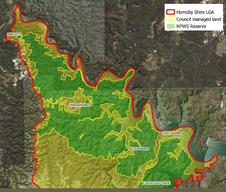
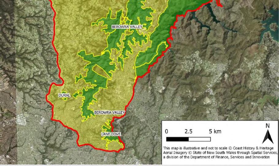
Note: In accordance with the scope of the Aboriginal Heritage Study and advice from Hornsby Council, this study does not include the extensive areas of NSW National Parks and nature reserves within the LGA. Existing items that fall within areas of NPWS Parks and Reserves have not been reviewed and areas of NPWS Parks and Reserves were not assessed for potential interpretation. The Hornsby LGA and NPWS areas are shown in Figure 1.
For the purposes of this report, a number of specific ‘heritage regions’ or destinations have been identified within the Hornsby LGA (details in Section 12) which have a similar or related heritage focus, see Figure 2. These regions will be used as a basis for identifying clusters of heritage interpretation opportunities within this report.

Hornsby Shire DRAFT Heritage Interpretation Strategy and Action Plan Page 6


Hornsby Shire DRAFT Heritage Interpretation Strategy and Action Plan Page 7
Figure 1. Map of Hornsby LGA


Hornsby Shire DRAFT Heritage Interpretation Strategy and Action Plan Page 8
Figure 2. Overview of the Hornsby LGA and distributions of Council-managed and NPWS land. Source: Coast History and Heritage, 2022


Hornsby Shire DRAFT Heritage Interpretation Strategy and Action Plan Page 9
Figure 3. Location of Hornsby Shire and heritage destinations
3.0 HISTORICAL CONTEXT
3.1 Introduction
These summary histories are not intended as text for potential interpretive elements, but as context to guide and ground interpretation of Hornsby Shire. Much of this information has been extracted from the Hornsby Thematic History,2 and the Draft Hornsby Shire LGA Aboriginal Heritage Study3 to ensure consistency of historical information.
3.2 Aboriginal history of Hornsby Shire

3.2.1 Country
The landscape of Hornsby Shire is connected to one of the world’s oldest continuous living cultures. Aboriginal people have lived close to Dyarubbin (alternative spelling Deerubbin, the Hawkesbury River) for at least 50,000 years, and their ancestors have inhabited Country before the last Ice Age.4 This landscape and the culture of its first peoples can be read not only through the archaeological evidence—including middens, stone tools, grinding grooves and rock art found on the prevalent Hawkesbury Sandstone5—but also the traditions of song, ceremony and language that knitted together a deep understanding of the land and how to care for it.6
The wildlife of the Hornsby Shire region provided a rich resource that Aboriginal people hunted and consumed. Animal skin, fur and teeth were repurposed in textiles and clothing (e.g., possum-skin and bark cloaks, animal-bone needles, bedding), and in decoration (teeth, bone, wood, feather and flowers were all used as body ornaments).7 The forests were important places to Aboriginal people for both cultural and practical reasons. Wood and bark were used in a variety of ways, for fishing and hunting (e.g., canoes, shields, nets, fishing lines, baskets, bowls, animal-teeth barbs, axe hafts, spear-throwers, hunting spears, clubs, twine, and paddles). Trees scarred where bark was removed for the production of canoes and shields are recorded throughout the Hawkesbury, and more have the potential to be recorded where there are old-growth trees, such as Sydney peppermint (Eucalyptus piperita), and ironbark (Eucalyptus paniculata). 8
3.2.2 Pre-contact

The harvest of land and water sustained lifeways, especially the yam culture along riverbeds. The Darug word for yam – dyirraban – is synonymous with the Hawkesbury River. This is a landscape of everyday and special places and practices, connected through pathways, camp sites, shelters, tool making, seasonal foods, ceremony and belief. Used by people for physical and spiritual nourishment according to traditions and responsibilities over millennia, the river, creeks, and waterways were artfully fished (Berowra and Cowan Creeks) and navigated aboard nawi (canoes). Later these were crucial places of refuge and survival during and following colonisation as Aboriginal people used their knowledge and sophistication to adapt and survive.9
2 GML Heritage. 2021. Hornsby Thematic History. Unpublished report prepared for Hornsby Shire Council.
3 Coast History and Heritage. 2022. Draft Hornsby Shire Local Government Area Aboriginal Heritage Study. Unpublished report prepared for Hornsby Shire Council.
4 GML. Hornsby Thematic History, 8.
5 GML. Hornsby Thematic History, 13, 24-25.
6 GML. Hornsby Thematic History, 8.
7 GML. Hornsby Thematic History. 25
8 GML. Hornsby Thematic History. 25
9 GML. Hornsby Thematic History. 8
Hornsby Shire DRAFT Heritage Interpretation Strategy and Action Plan Page 10
Aboriginal people travelled across Country via foot and water, likely establishing some of the routes later followed by Europeans.10 Aboriginal place names reflect these networks, such as Maroota, believed to originate from the Darug word muru, meaning ‘pathway’11
Aboriginal people managed the land and water for millennia. Rich yam beds lined the riverbanks and were harvested by women with digging sticks. Fish were caught from the rivers and streams using hooks made from spiral shells along the sandy riverbanks. The lines were made by women who wove the twisted fibres of the kurrajong tree12
3.2.3 Contact stories
Before there had been much physical contact between the local Aboriginal people and the colonists, Aboriginal artists were engraving motifs on rock of ships and boats observed from a distance. This rock art was mainly engraved onto rocks running along ridgelines or around the Hawkesbury River.13
Now known as the Hawkesbury and Nepean Wars, a series of bloody conflicts took place from 1794 triggered by the theft of Country along the river and the ever-increasing number of settlers arriving. Conflict escalated further in the Hawkesbury region in the following decades. In 1803, a petition signed by settlers at Portland Head was forwarded to Governor King, requesting that settlers be allowed to shoot Aboriginal people found on their farms. This document turned out to be a forgery, and the forger was gaoled for several days. Despite the fact that the letter was a forgery, disquiet in the area bothered Governor King, who in 1804 interviewed ‘three of the natives from that part of the river’ (Portland Head) about conflict with the settlers. They stated ‘that they did not like to be driven from the few places that were left on the banks of the river, where they alone could procure food.’14 As Aboriginal people were increasingly deprived of access to Country, they were allegedly found wearing stolen settlers’ clothes, and there was reported to be evidence that they had stolen corn.
Sporadic attacks and raids on settler farms continued throughout the next decade. In 1816, after several years of intensive development in the Hawkesbury area in conjunction with drought and renewed conflict (including major attacks at South Creek), Governor Macquarie ordered three punitive expeditions against Aboriginal people. He instructed that the bodies of those slain be hung up in the trees ‘in order to strike the greater terror into the survivors.’15 Women and children were not excluded—any who were killed were to be buried ‘where they fell’. In April 1817 Governor Macquarie advised the government in London that ‘all Hostility on both Sides has long since Ceased’.16
In 1883, a Board for the Protection of Aborigines was established by the State Premier and the Colonial Secretary to manage Aboriginal affairs. This signalled the beginning of successive waves of intervention into Aboriginal lives. Paternalism, control, segregation and assimilation increasingly characterised government policies towards Aboriginal people in the late nineteenth and early twentieth century. The NSW Aborigines Protection (later Welfare) Board created several reserves across the state in the following decade. In 1889, two Aboriginal reserves were proclaimed on the Hawkesbury River on Cumberland Reach (150 acres) and Kent Reach (50 acres).17
As settlement spread and land was cleared, fenced and ‘improved’, Aboriginal people used their intricate cultural knowledge of land to adapt and survive, moving around Country. Aboriginal people worked within the colonial economy as domestic staff, labourers, fishermen or gardeners, and were often employed in seasonal labour. Some of the Aboriginal people living and working in the Hornsby
10 Including segments of the Great North Road (see Coast, 2022. Aboriginal Heritage Study, 40).
11 GML Heritage. 2021. Hornsby Thematic History. Unpublished report prepared for Hornsby Shire Council. 31
12 GML. Hornsby Thematic History. 40

13 GML. Hornsby Thematic History. 36.
14 Bladen, F.M. 1979. Historical records of New South Wales, Volume 5. Sydney: Charles Potter, Government Printer, 513.
15 GML. Hornsby Thematic History, 9.
16 GML. Hornsby Thematic History, 9.
17 Coast. 2022. Aboriginal Heritage Study, 23.

Hornsby Shire DRAFT Heritage Interpretation Strategy and Action Plan Page 11
Shire did so under conditions of indentured labour, revealing the legacy of colonialism within local and suburban histories and the workings of racial discrimination in everyday domestic settings18
3.2.4 Contemporary communities
In the past few years Darug and GuriNgai knowledge holders, artists and educators have worked with historians, linguists, and archaeologists to map Aboriginal place names along the Hawkesbury. Place names are crucial to understanding Dreaming tracks reaching across Country.
As Leanne Watson, Grace Karskens and their co-authors noted: ‘Singular names can also embed the stories of important events and landmarks involving Ancestral Beings in places and memory.’19
Despite the government intervention into Aboriginal lives and their relocation to reserves, families today remain connected to the Hornsby Shire, their ancestors bound to this Country, and the language and traditions revitalised and renewed through today’s generations.
3.3 Non-Aboriginal history of Hornsby Shire
The following history is based on the Hornsby Thematic History (2021).20


3.3.1 Early settlement
One of the first land grants within the Shire was made in 1794 to emancipated convict David Kilpack, who received a 30-acre grant of land lying in the far southwestern corner of the Shire alongside Devlins Creek, bordering what became the Field of Mars (modern Beecroft and Cheltenham).
3.3.2 Early nineteenth century
Most early enterprises in the Hornsby Shire region were centred around convict works and timbergetting to supply lumber for the colonial building program. Government farming was undertaken as early as 1801, with the Government Farm Castle Hill extending into the southwest portion of the present Hornsby Shire. Following its abolition in 1811, the majority of the Government Farm was subdivided and split among pardoned convicts, becoming what is now known as Cherrybrook. Between 1810 and 1821, Governor Lachlan Macquarie’s campaign to rebuild Sydney led to convict works being undertaken in Hornsby Shire; one of the pillars of Macquarie’s civil construction program was the Pennant Hills Timbergetting Establishment, which was located in Pennant Hills from 1816. The timber industry was the backbone of Hornsby Shire in the early nineteenth century.
The Great Northern Road is undoubtedly the most iconic and enduring symbol of Hornsby Shire’s convict past, and is one of the most significant examples of major public infrastructure built by convict labour in New South Wales. Construction of the Great North Road, part of which extends the length of the Shire’s western boundary starting in the south at Beecroft, commenced in May 1826 and continued until its completion in 1836. The road was constructed primarily using convict labour and connected Sydney to Newcastle, crossing the Hawkesbury River. Wiseman’s Ferry, located on the Hawkesbury River, was established in 1827 by former convict Solomon Wiseman, who operated a ferry across the river to deliver provisions to the convict road gangs.
In 1830, constables Samuel Horne and John Thorne shot the bushranger John McNamara and captured his accomplice – the land they were granted in reward became known as Hornsby and
18 GML Heritage. 2021. Hornsby Thematic History. 10
19 Karskens, G., Watson, L., Wilkins, E., Seymour, J. and Wright, R. 2021. “A Deep Human History: Remapping Darug place names and culture Dyarubbin, the Hawkesbury River,” Reconciliation 45, pp. 11.
20 GML. Hornsby Thematic History.
Hornsby Shire DRAFT Heritage Interpretation Strategy and Action Plan Page 12
Thornleigh respectively.21 To avoid confusion, Samuel Horne’s Hornsby was later renamed Normanhurst following the construction of a train station in the north named Hornsby Junction.22 By the mid- nineteenth century, the Hornsby Shire region was synonymous with citrus and stone fruit. Orchards were concentrated in Dural, Arcadia, Galston, and Glenorie, but settlers along the banks of the Hawkesbury River also cultivated fruit orchards.
3.3.3 Late nineteenth century
During the 1870s, the Hawkesbury became a recreational destination after being popularised by English novelist and travel author Anthony Trollope, who toured the Hawkesbury in 1871 and wrote that the river was greater than the Rhine. The Hawkesbury region became an established destination for artists in the late nineteenth century. The shire’s waterways became popular places of leisure, and the influx of visitors meant that hotels and associated infrastructure was increasingly established in tourist locations such as Brooklyn and Berowra. The Peats Ferry crossing and opening of Peats Ferry Road in 1852 provided further transport options for nineteenth century travellers. Peats Ferry operated until the railway bridge across the Hawkesbury River was opened in 1889, extending the Main Northern Line (Strathfield - Hornsby) that had been in operation since 1886.
By the end of the nineteenth century, the Dural, Arcadia, Glenorie, and Galston areas continued to be home to some of the finest orchards in Australia. To increase transport from these important agricultural areas, a railway was proposed in 1893. The arrival of the railway transformed previously undeveloped regions of the shire into desirable residential areas and saw the subdivision of original land grants such as the Field of Mars. Although the railway was intended to extend from Baulkham Hills, Castle Hill and Dural areas to Carlingford, Castle Hill, and Dural, financial failures meant that it was only completed as far as Carlingford. Construction of the North Shore line was completed by 1895, when Waitara Station was opened. Construction of the Main Northern line was completed with opening of the Hawkesbury River Railway Bridge in 1889, traversing the Hornsby Shire from Beecroft in the south providing improved communication and means of travel between Sydney and Newcastle.
3.3.4 Twentieth century

Transport and public infrastructure increased rapidly throughout the Hornsby Shire in the twentieth century. Instead of completing the other sections of the railway to Dural, in 1902 the government constructed a steam tramway from Parramatta Railway Station to Baulkham Hills, and later extended it to Castle Hill in 1910. The Berowra Waters Road was constructed on both sides of Berowra Creek between 1900 and 1902. The North Shore Line was electrified in 1927, followed two years later by the Main Northern line between Central and Hornsby via Strathfield, resulting in quieter, quicker and more efficient train services to the Shire and an increase of settlement in the suburban areas. During the Great Depression, public works became a way for the unemployed to earn a living. Depression-era works in the Shire include the Bobbin Inn, stone walls, shelter sheds and the grading of the roads from Mount Colah to North Turramurra. Elsewhere in the district, sandstone steps were formed throughout the Shire’s valleys, many still enjoyed by bushwalkers today.
Industries in the Shire also transformed in the twentieth century. The Australian Town and Country Journal noted in 1907 there were 8000 fruit growers and primary producers based in the Central Cumberland District (encompassing Hornsby Shire) and over 40,000 people were ‘dependent or mainly dependent on the fruit growing industry for a livelihood’.23 By the 1930-40s, however, the fruit industry declined as a result of rapid population growth and expansion of suburban development.
21 Hornsby Shire Council. 2022. “History of Hornsby”: Accessed at: https://www.hornsby.nsw.gov.au/library/catalogues-and-resources/local-history/history-resources/suburbhistories/hornsby.
22 Hornsby Shire Council, “History of Hornsby”:
23 Hornsby Shire Council, “History of Hornsby”:

Hornsby Shire DRAFT Heritage Interpretation Strategy and Action Plan Page 13
During the 1940s, a growing number of orchards began constructing plant nurseries and growing flowers, industries that are still evident in the region today.
The Hawkesbury River Road Bridge opened in 1945 and electric trains extended from Hornsby as far north as Gosford by 1960, offering a growing number of transport options for locals.
3.3.5 Post-1960s


Commercialisation and urbanisation in the Hornsby Shire increased in the second half of the twentieth century. The Hornsby Westfield was constructed in 1960-61, creating a new commercial centre for the suburb. Transport infrastructure and connectivity also increased, with the construction of the Sydney to Newcastle Freeway (F3) section from Wahroonga to Berowra opening in 1989. However, the natural landscape of the Shire was also being actively preserved; in 1979, over 29,000-acres of bushland was dedicated to form Marramarra National Park, and Berowra Valley Bushland Park was established in 1984. The nursery industry thrived in the Orchard District of Dural and Glenorie in the 1960s and 1970s, an extension of the early orcharding that took place in the region in the 19th century.
The post-war migration boom and abolition of the White Australia Policy in 1975 saw an increase in multiculturalism in the Hornsby Shire, and families from all over the world began to call Hornsby home. The changing face of the Shire is perhaps best represented by the adaptive re-use of former public buildings and places of worship – the Assembly Gospel Hall and former Scouts Hall at Asquith, for example, is now home to the Australia Ling Liang Church, while the former Waitara Uniting Church now houses the Amitabha Foundation Tibetan Buddhist Centre.
Hornsby Shire DRAFT Heritage Interpretation Strategy and Action Plan Page 14
4.0 VALUES AND SIGNIFICANCE
4.1 Introduction
This section outlines the Aboriginal, non-Aboriginal (historic) heritage, and landscape heritage values within the Shire to inform the development of interpretive media around the precinct.
4.2 Aboriginal cultural heritage values


Aboriginal people have lived close to Dyarubbin or the Hawkesbury River for at least 50,000 years, and their ancestors have occupied Country before the last Ice Age. This landscape and the culture of its first peoples can be read not only through the archaeological evidence—including middens, stone tools, grinding grooves and rock art on the prevalent Hawkesbury Sandstone—but also the traditions of song, ceremony and language that knitted together a deep understanding of the land and how to care for it. 24
An understanding of the relevance and importance of the Aboriginal cultural landscape is key to sensitive future development. This understanding provides opportunities to explore Aboriginal peoples’ unity with the natural environment, their traditional knowledge of spirit, places, land uses and ecology, and the ongoing interrelationships between past and present. These understandings are best developed through authentic and sustained consultation with Aboriginal knowledge holders and professionals.
The Aboriginal cultural landscapes of the Hornsby Shire are highly valued by Aboriginal people because of their long and complex relationship with the land. The area, part of the traditional lands of the Darug and GuriNgai, has a wealth of intangible and tangible Aboriginal heritage values. Intangible heritage values are communicated through story and song and should only be shared though meaningful consultation with Elders. More tangible heritage values, communicated through Aboriginal sites, are recorded and cared for through the Aboriginal Heritage Information Management System (AHIMS) database, which is continually updated with new archaeological discoveries, and the Local Aboriginal Land Councils (LALCs) within the Hornsby Shire.
Hornsby Shire DRAFT Heritage Interpretation Strategy and Action Plan Page 15
24 GML Heritage. 2021. Hornsby Thematic History. Unpublished report prepared for Hornsby Shire Council.


Hornsby Shire DRAFT Heritage Interpretation Strategy and Action Plan Page 16
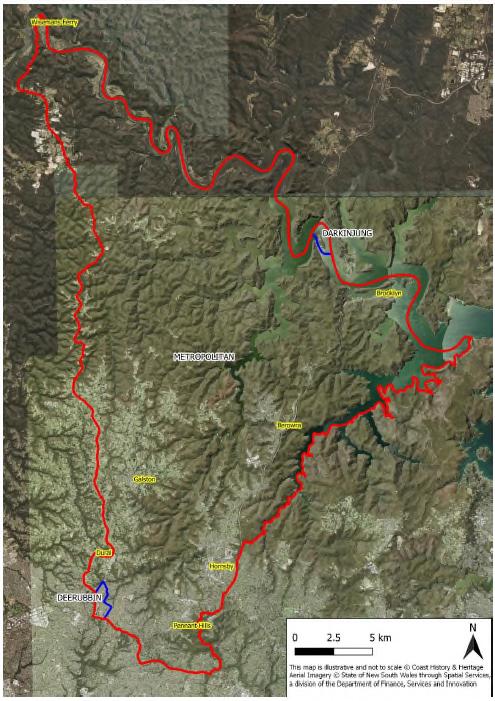
Figure 4. Distribution of LALC-managed Country throughout the Hornsby Shire. Source: Coast History and Heritage, 2022
The AHIMS is a comprehensive, secure database of Aboriginal Places and objects collated by the NSW Department of Planning and Environment. The approximate geographical location and type of object or place is recorded as an ‘Aboriginal site’ in the database.
A search carried out by Coast History and Heritage (2022) found 334 site features recoded for AHIMS within the Shire. These include:
Art sites


Middens
Rock shelters
Grinding grooves
Modified trees
Quarries
Full details about all the sites recorded in AHIMS are available in the Aboriginal Heritage Study (Coast 2022).
The Aboriginal cultural heritage values of the Hornsby Shire are complex and deeply connected to the diverse Country of the Shire – waterways, landscapes, and sky. The Hornsby Shire Local Government Area Aboriginal Heritage Study has been prepared by Coast History and Heritage, and has identified the following Aboriginal cultural heritage values relevant to the area.
There are a large number of places associate with the Aboriginal history of the Shire, especially Dyarubbin (Hawkesbury River) which has creation sites in the landscape, places of colonial conflict, enduring archaeological sites, and ongoing occupation into the present day.
There are 334 recorded Aboriginal archaeological sites in Hornsby Shire. These sites need to be sensitively managed.
The following historical themes have been identified in the Hornsby Heritage Study and augmented in the Aboriginal Heritage Study;
o Deep time occupation
o Traditional land management practices
o Important places and connections: Dyarubbin (Hawkesbury River), Dowlaba (part of Wianamatta), Werriling, Sackville
o Colonisation and resistance
o Continuing on Country: language, culture and contemporary identity
o Child removal
o Political activism, including the work of Bill Onus’s, and land claims under the Aboriginal Land Rights Act and the Native Title Act
o Art sites associated with outcropping sandstone
o Natural resources
o Involvement of Aboriginal Police Trackers in searches through bushland
o Travel along the Hawkesbury
o Land travel routes possibly followed by current road alignments
o Aboriginal guides, including Boio / Long Dick, working with non-Indigenous surveyors
o Aboriginal yam agriculture, aquaculture and fishing.
Hornsby Shire DRAFT Heritage Interpretation Strategy and Action Plan Page 17
o Oyster farming, oyster middens for lime, commercial fishing, and boatbuilding on the Hawkesbury River including at Brooklyn and Berowra Creek
o Possible Aboriginal labour in fruit and vine industries
o Manufacture of stone tools
o Aboriginal agricultural and pastoral labour
o Aboriginal creation stories – Gungatty
o Art sites


o Knowledge-based use of the landscape
o Cemeteries in rural and remote areas ie Bar Island, Brooklyn, Wisemans Ferry
o Adoption of western religions
o Aboriginal cultural tourism, including Bill Onus’s demonstrations at Koala Park
o Cricket at Wisemans Ferry, including Fred Barber
o Hornsby Hospital
o Our Lady of Mercy Home and Waitara Foundling Home
o Aboriginal health and medicinal knowledge
o Aboriginal domestic labour under the Aborigines Protection Board apprenticeship scheme
o Reconciliation movement, including the Hornsby Area Residents for Reconciliation
Note that when interpretive Aboriginal cultural heritage, it may not be appropriate to mark the exact location on the ground, for instance private residences and workplaces, but the associated stories could be incorporated into broader interpretation strategies
Aboriginal archaeological heritage of Hornsby Shire is under-represented due to concerns with the vulnerability of archaeological sites to harm resulting from increased public awareness and visitation. However, this is a particularly significant element of the heritage of the Shire.
4.3 Non-Aboriginal (historic) heritage significance
The non-Aboriginal (historic) heritage values of the Hornsby Shire are largely demonstrated by the State and locally significant heritage listed items within the Shire. These tangible items have strong histories and associations with the people of the Shire. Many heritage listed items within the Hornsby Shire will be strong focus points for heritage interpretation. Non-listed and intangible heritage items identified through existing reports and consultation have also been included, and will also be a focus for heritage interpretation.
4.3.1 UNESCO World Heritage List
The Old Great North Road was inscribed on the UNESCO World Heritage List in 2010 under the ‘Australian Convict Sites’ entry. This internationally significant site forms the western border of the Hornsby Shire, and segments of the road still exist within the LGA’s boundaries.25
Hornsby Shire DRAFT Heritage Interpretation Strategy and Action Plan Page 18
25
UNESCO World Heritage Convention. 2010. Australian Convict Sites, https://whc.unesco.org/en/list/1306/
4.3.2 National Heritage List
The National Heritage List (NHL) records sites of outstanding heritage significance to Australia. Sites within the NHL are subject to the Environment Protection and Biodiversity Conservation Act 1999 (EPBC Act).
The Old Great North Road was inscribed on the National Heritage List in 2007.26
4.3.3 State Heritage Register
The NSW Heritage Act 1977 (Heritage Act) is the primary piece of State legislation affording protection to heritage items (natural and cultural) in NSW. Under the Heritage Act, ‘items of environmental heritage’ include places, landscapes, buildings, works, relics, moveable objects, and precincts identified as significant. Significance is based on historical, scientific, cultural, social, archaeological, architectural, natural or aesthetic values. Items of significance under the Heritage Act are listed on the State Heritage Register (SHR).
The following items within the Hornsby Shire listed on the SHR.


Street Congregational Church (former) School Road, Galston
Hawkesbury River Railway Station Group
Bridge over Tunks (Pearces) Creek Main Road 161, Galston
Hawkesbury River Rail Bridge and Long Island Group
4.3.4 Hornsby Local Environmental Plan (HLEP)
Item No. 00382
Item No. 01166
Item No. 01478
The Environmental Planning and Assessment Act 1979 (EP&A Act) establishes the framework for cultural heritage values to be formally assessed in the land using planning and development consent process. The EP&A Act also requires that local governments prepare planning instruments (such as LEPs and DCPs) in accordance with the EP&A Act to provide guidance on the level of environmental assessment required.
26 Department of Climate Change, Energy, the Environment and Water. 2022. “National Heritage Places - Old Great North Road,” Accessed on 24 August 2022 via <https://www.dcceew.gov.au/parksheritage/heritage/places/national/north-road>.
Hornsby Shire DRAFT Heritage Interpretation Strategy and Action Plan Page 19
Item name Address Listing Old Man’s Valley Cemetery Old Man’s Valley, off Quarry Road, Hornsby SHR Item No. 01764 Gilligaloola 82-84 Pennant Hills Road Normanhurst SHR Item No. 00271 Mount Wilga House 2A Manor Road (Rosamond Street), Hornsby SHR Item No. 00535 Highlands 9 Highlands Avenue, Wahroonga SHR Item No. 00034 Pipe Organ from Bourke
SHR
Table 2. State Heritage items, Hornsby Shire
SHR
Main Northern Railway, Brooklyn
SHR
Main
SHR
SHR
Northern Railway, Brooklyn
Item No. 01040 Ahimsa 67 Cobran Road, Cheltenham
Item No. 01494
Hornsby Shire is subject to the heritage provisions of the HLEP 2013. Heritage items with local significance, Heritage Conservation Areas, and archaeological sites are identified on Schedule 5 of the HLEP.27 The HLEP lists a total of 665 locally significant items within the Hornsby Shire, as well as six Heritage Conservation Areas (HCAs) and 70 archaeological sites.
Locally Significant Heritage Items
Of the 665 local heritage items listed in the HLEP, 432 are private residences and have therefore not been included in this assessment. Items from Epping that are listed on the HLEP (v.30/6/2022) have also been excluded from consideration in the HIS on the advice of Council. The remaining 233 locally significant items are listed in Appendix C: HLEP 2013 Listed items 19.1. These items have been assessed as being associated with heritage destinations or specific key stories within the Shire.
Broadly, the heritage items assessed as being associated with heritage destinations or specific key stories in the Shire include:
Railway stations
Public parks, gardens, reserves, bushland, and open spaces
Community halls and centres
Schools
Shops and commercial buildings
Places of worship
War memorials
Cemeteries

Street trees and windbreaks
Retirement villages
Public buildings
Heritage Conservation Areas (HCAs)
The six HCAs contained within Hornsby Shire (see Appendix C: HLEP 2013 Listed items: Section 19.2) provide distinct opportunities as heritage destinations, often representing specific phases of the Shire’s development. The Hornsby West Side HCA (HLEP 2013 nos. C3, C4, C5), for example, is associated with the early development of the shire and the coming of the Great North Railway. This conservation area presents a unique opportunity to interpret the key themes of Transport, Settlement and Suburbanisation, and The Changing Face of the Shire (discussed in 9.2).
Archaeological Sites
Seventy archaeological sites are also listed on the HLEP 2013. Depending on accessibility and visibility, archaeological sites can be effectively interpreted for the public as physical remnants of Hornsby’s past. The HLEP-listed archaeological items are provided in Appendix C: HLEP 2013 Listed items.
4.4 Landscape heritage values

The Hornsby Shire Landscape Heritage Study: Comprehensive Heritage Study (Extent 2022) outlines the landscape heritage values for the Shire. Landscape heritage values include cultural heritage and natural heritage:
27 Hornsby Local Environmental Plan. 2013, sch. 5 <https://legislation.nsw.gov.au/view/html/inforce/current/epi2013-0569#sch.5>.
Hornsby Shire DRAFT Heritage Interpretation Strategy and Action Plan Page 20
The National Parkland and other environmentally protected lands in Hornsby Shire are recognised for their ‘natural, ecological and cultural values’28. The majority of the land in the Shire is made up of this type of landscape and forms a ‘green belt’ across the Shire.
Hornsby Shire adjoins the Cumberland State Forest, Australia’s only metropolitan state forest and an area of protection for flora and fauna.29

The Hawkesbury River runs along the north of the Shire and has been used for millennia.30
The convict-built Great North Road runs along the west of the Shire and allowed access to the Hornsby Plateau and Hunter region.
The railway line connects Sydney railway systems to Newcastle railway systems through Hornsby Shire. The final step involved the construction of the Hawkesbury River Railway Bridge – then an ‘engineering marvel’.31
The Field of Mars Common was set aside for colonists’ flocks and herds which freed up more land for farming and agriculture for the developing colony.32
Significant citrus orchards sprung up in Beecroft and Galston in the 19th century. Waddell’s Orchard has remained in continuous use since the 1880s.33
Timber getting and forestry in Hornsby Shire were a major industry for the expanding colony. Saw pits near Epping and Pennant Hills transported timber down the Parramatta River.34
Quarrying and mining in Hornsby included dolerite an Old Man’s Valley and sandstone at Thornleigh. The sandmining quarry at Roberts Road established in the 70s is still in operation.35
Early land grants would be ‘foundational to the development of the Shire’ and the Third Government Farm was established in 1801, a ‘significant moment’36
Samuel Wiseman established a ferry in 1827 at Wisemans Ferry; the first regular crossing of the Hawkesbury River.37
Early subdivisions and the growth of suburbs was heavily influenced by the arrival of the railway. High streets were created and a ‘commercial boom’. Beecroft and Cheltenham were characterised by good quality homes with retention of native trees and bushland.38
There are several notable federation gardens throughout the Shire and in Beecroft, Cheltenham and Wahroonga in particular.39
The Loreto Convent at Normanhurst was established following purchase of the land in 1896. This is a landmark Federation Gothic building with well-maintained grounds40
Hornsby Shire has many public parks including Lisgar Gardens a ‘significant site’ within the Shire, The Koala Park Sanctuary, Muogamarra Nature Reserve and Fagan Park and homestead41
There are a number of ‘significant’ monuments and commemorative memorials around the Shire including a memorial at Beecroft Village Green.42
Impressive ‘landmark’ churches are found throughout the Shire. These include St Jude’s Anglican Church in Dural and the ruined church on Bar Island.43
Hornsby Shire Cemeteries have become ‘important sites if historical and communal memory’ such as the cemeteries at Old Man’s Valley and Brooklyn.44
28 Extent. 2022. Hornsby Shire Landscape Heritage Study: Comprehensive Heritage Study. 25, Unpublished Draft

29 Extent. Landscape Heritage Study. 25
30 Extent. Landscape Heritage Study. 30
31 Extent. Landscape Heritage Study. 35
32 Extent. Landscape Heritage Study. 38
33 Extent. Landscape Heritage Study. 38
34 Extent. Landscape Heritage Study. 42
35 Extent. Landscape Heritage Study. 43
36 Extent. Landscape Heritage Study. 45
37 Extent. Landscape Heritage Study. 45
38 Extent. Landscape Heritage Study. 50
39 Extent. Landscape Heritage Study. 54
40 Extent. Landscape Heritage Study. 59
41 Extent. Landscape Heritage Study. 63
42 Extent. Landscape Heritage Study. 65
43 Extent. Landscape Heritage Study. 66-67
44 Extent. Landscape Heritage Study. 68
Hornsby Shire DRAFT Heritage Interpretation Strategy and Action Plan Page 21
5.0 CONSULTATION PLAN
5.1 Introduction
This section addresses the consultation with Aboriginal and non-Aboriginal stakeholders during the development of this HIS&AP, in line with the requirements of the Hornsby Shire Council Community Engagement Plan (2021) and best-practice Aboriginal consultation guidelines.
5.2 Hornsby Shire Council Community Engagement Plan
The Hornsby Shire Council’s Community Engagement Plan (2021) outlines how the community can participate in planning for the future of the Shire and provide feedback on items placed in exhibition under the Environmental Planning and Assessment Act 1979 and the Local Government Act 1993 45
Under the engagement plan, consultation is proactive, strategy-led, open and inclusive, with meaningful results delivered in a timely manner. The plan contains an engagement framework with the following stages:
Consult
5.3 Aboriginal stakeholder consultation
Consultation with Aboriginal knowledge holders is a fundamental aspect of the heritage interpretation process. As the Traditional Owners46 of the land, the local community and knowledge holders maintain a dynamic connection to Country which informs their identity, culture, language and ways of living. 47 The depth of this connection requires that appropriate, effective consultation with relevant community members and knowledge holders must take place for any heritage works occurring on their traditional land.
Under the Burra Charter:
Article 12. Conservation, interpretation and management of a place should provide for the participation of people for whom the place has significant associations and meanings, or who have social, spiritual or other cultural responsibilities for the place 48
‘Ask First: a guide to respecting Indigenous heritage places and values’ states that Aboriginal people:
45 Hornsby Shire Council, 2021. Community Engagement Plan: Your Say Matters. Accessed at: https://www.hornsby.nsw.gov.au/__data/assets/pdf_file/0020/162425/HSC_Community-Engagement-Plan.pdf (May 2022).
46 Australian Heritage Commission. 2002. Ask First. a guide to respecting Indigenous heritage places and values.4.
47 Australian Heritage Commission, Ask First.
48 Australia ICOMOS, 2013. Burra Charter – The Australian ICOMOS Charter for Places of Cultural Significance. 3.


Hornsby Shire DRAFT Heritage Interpretation Strategy and Action Plan Page 22
Inform
Involve
Collaborate
Empower.
Are the primary source of information on the value of their heritage and how this is best conserved;

Must have an active role in any Indigenous heritage planning process;
Must have input into primary decision-making in relation to Indigenous heritage so they can continue to fulfil their obligations towards this heritage; and
Must control intellectual property and other information relating specifically to their heritage, as this may be an integral aspect of its heritage value 49
Hornsby Council advised that discussions should take place with the Council Aboriginal and Torres Strait Islander Consultative Committee (as at June 2022, the new committee is not yet formed) and Aboriginal community groups to inform the HIS&AP, and that the LALCs should receive a copy of the draft HIS&AP for comment.
Consultation for the development of the HIS&AP has been undertaken with the following Aboriginal organisations as of February 2023:
Table 3. Aboriginal organisations consulted during the HIS&AP development
Hornsby Aboriginal and Torres Strait Islander Advisory Committee

5.4 Targeted community consultation
reviewed report and sent feedback including their ‘express wish’ that information about Aboriginal Cultural Heritage be included in the HIS&AP.
Consultation with a range of community and historical organisations has also taken place during the development of this HIS&AP. The following table summarises community consultation undertaken. 49 Australian Heritage Commission, 2002. Ask First: a guide to respecting Indigenous heritage places and values
Hornsby Shire DRAFT Heritage Interpretation Strategy and Action Plan Page 23
Organisation Contacted by Date Method Comment
Artefact Sep 2022 Email HATSIC
Artefact via Hornsby Shire Council 24 February 2023 Sent draft 2 Feedback has been incorporated into this report Darug Custodian Aboriginal Corporation Artefact 10 June 2022 Site visit to Canoelands Discussed interpretation of sensitive sites Guringai Tribal Link Artefact 10 June 2022 Site visit to Canoelands Discussed interpretation of sensitive sites Metropolitan Local Aboriginal Land Council Artefact Email Send copy of draft HIS for comment Darkinjung LALC Artefact Email Send copy of draft HIS for comment
LALC Artefact Email Send copy of draft HIS for comment
Deerubbin
Person/agency contacted Contacted by Date

Outgoing Heritage reference group
Artefact 17 May 2022

Method
Consultation meeting
Comments
Supportive of the HIS&AP interim update
Commented on audience segmentation Comments incorporated into the HIS&AP.
Supportive of the HIS&AP interim update
Council staff
Artefact 31 May 2022
Consultation meeting
Highlighted interpretation projects in development Comments incorporated into the HIS&AP
Arcadia Galston Residents’ Association Inc
HSC 27 April 2022
HSC 27 April 2022
Letter introducing project and asking for comments
Letter introducing project and asking for comments
Beecroft-Cheltenham Civic Trust Inc & Beecroft Cheltenham History Group
Artefact 22 April 2022
Email and phone conversation
Enthusiastic about emphasising the village feel, built heritage, and bush heritage of Beecroft and Cheltenham.
Highlighted past and existing interpretation Made recommendations for public programming Comments incorporated into the HIS&AP
Berowra Waters Progress Association
HSC 27 April 2022
HSC 27 April 2022
Letter introducing project and asking for comments
Letter introducing project and asking for comments
Berowra & District Community Association Inc
Artefact 3 June 2022
Brooklyn Community Association
HSC 27 April 2022
Letter introducing project and asking for comments
Discussed connection of location to Margaret Preston
Highlighted interpretation potential of area
Discussed heritage tourism of the area Comments incorporated into the HIS&AP
Hornsby Shire DRAFT Heritage Interpretation Strategy and Action Plan Page 24
Table 4. Community consultation log
Person/agency contacted Contacted by Date

Artefact 3 May 2022 and 4 May 2022
Method
Comments
Discussed heritage transport options
Discussed current and potential heritage interpretation
Highlighted potential usage of buildings for heritage interpretation
Comments incorporated into the HIS&AP
HSC 27 April 2022
Letter introducing project and asking for comments
Dangar Island Historical Society / Hawkesbury People and Places
Artefact 3 May 2022
Dharug and Lower Hawkesbury Historical Society
HSC 27 April 2022
HSC 27 April 2022
Letter introducing project and asking for comments
Letter introducing project and asking for comments
Highlighted current and potential interpretation options
Discussed current publications
Discussed concerns about potential vandalism to heritage
Comments incorporated into the HIS&AP
Dural and District Historical Society
Artefact 7 June 2022

Phone call
Discussed agricultural heritage of the area and interpretation possibilities
Recommended some relevant publications
Discussed oral histories
Comments incorporated into the HIS&AP
Hornsby Shire Historical Society (HSHS)
Milsons Passage Progress Association
HSC 27 April 2022
HSC 27 April 2022
HSC 27 April 2022
Letter introducing project and asking for comments
Letter introducing project and asking for comments
Letter introducing project and asking for comments
Pennant Hills District Civic Trust
Artefact 8 June 2022
Phone call
Discussed the heritage streetscapes and buildings of the area
Recommendations for publications and guides based on heritage compilation by the Trust
Comments incorporated into the HIS&AP
DRAFT Heritage Interpretation Strategy and Action Plan Page 25
Hornsby Shire
Person/agency contacted Contacted by Date Method
Ray Park Heritage Group HSC 27 April 2022
Westleigh Progress Association HSC 27 April 2022
Letter introducing project and asking for comments
Letter introducing project and asking for comments
Artefact 27 May 2022 Interview and email


Comments
Disability Worker, Options Disability Support, Central Coast
Discussed levels of engagement and successful interpretation for visitors with intellectual difficulties
Discussed engagement with disability workers Comments incorporated into the HIS&AP 17 June 2022 email
Discussed economics of excursions and accommodating families with members who have a disability Comments incorporated into the HIS&AP
Chinese Australian Services Society Ltd
HSC 20 May 2022
Letter introducing project and asking for comments
Artefact 7 July 2022 email
Cherrybrook Chinese Community association HSC 20 May 2022
Letter introducing project and asking for comments
Discussed language barrier issues for members of CASS Outlined key languages to translate into Comments incorporated into the HIS&AP
Australian Sikh Heritage Artefact 23 May and 30 May 2022
Australian Indian Historical Society Artefact 27 May 2022
Berowra Creative Society Artefact 4 November 2022 Attendance at committee meeting
Recommended additional groups to contact. Would like to be kept informed about the project Is happy to publicise
Discussed the Cherrybrook Jawan Memorial Comments incorporated into the HIS&AP
Discussed the proposal for improvements to the Berowra District Hall and potential display and interpretation in Berowra about Margaret Preston.
Comments incorporated into the HIS&AP
Public exhibition of draft HIS&AP – HSC organise HSC 2023 TBC Public exhibition
Hornsby Shire DRAFT Heritage Interpretation Strategy and Action Plan Page 26
6.0 INTERPRETIVE STRATEGY
6.1 Introduction
This section outlines the strategy that is recommended for interpretation in the Hornsby Shire, incorporating the historical themes and key stories of the sites and the Aboriginal cultural values of the landscapes.
6.2 Interpretive principles

The key principles for the development of heritage interpretation across the Hornsby Shire are as follows:
Present the Hornsby Shire as a distinct cultural landscape, the product of numerous phases of use and associations, and intrinsically connected to its heritage.
Provide a clear, consistent approach to heritage interpretation across the Shire by connecting interpretive elements to the key heritage themes.
Identify heritage ‘destinations’ across the shire and promote these heritage destinations to audiences through a range of interpretive strategies.
Connect key heritage stories with key heritage destinations and heritage items across the Hornsby Shire.

Prioritise the interpretation of diverse heritage stories and voices from the Hornsby community.
Be guided by Aboriginal stakeholders to ensure interpretation adheres to the cultural heritage significance of the area and is developed with sensitivity and respect.
Ensure that interpretation is engaging, creative, evokes curiosity and provokes conversations about the heritage values of the Hornsby Shire.
Ensure heritage interpretation media are developed with a consistent look and feel so that they are identifiable by audiences.
Create interpretation experiences which are accessible and appropriate to target audiences across the Hornsby Shire.
Ensure that interpretive media are developed in a way that complements the built and natural environment and landscape design of their specific location and the historical characteristics of the area.
Ensure heritage interpretation for future developments within the Hornsby Shire is developed to align with this HIS.
Hornsby Shire DRAFT Heritage Interpretation Strategy and Action Plan Page 27
7.0 EXISTING

INTERPRETATION
The Hornsby Shire has a large range of interpretive materials extant throughout the Shire, developed throughout the twentieth and twenty-first centuries by Council, local organisations and private developments. This section provides guidelines for the types of interpretive materials present within the Shire, and a methodology for assessment of the suitability of interpretive material.
7.1 Sample of existing interpretive elements
There are hundreds of interpretive elements already installed across the Shire. Below is a sample of the types of interpretative elements that are extant across the Hornsby Shire.
Description Examples Image
Self-guided heritage walks
A well designed and laid out self-guided historic walking tour brochure for of the business and retail precinct of Hornsby highlighting the social and cultural past within Hornsby Shire. There are also site-specific heritage trails.

Council’s Local Studies staff have confirmed they are currently preparing a self-guided heritage walk for the areas of Brooklyn and Pennant Hills. The type of information provided and printed format will be similar to the current Hornsby Heritage Walk as advertised on Council’s website: Hornsby Heritage Walk | Hornsby Shire Council (Hornsby.nsw.gov.au).
Guided bushwalks
The Council offer free guided bushwalks and events to Hornsby Shire residents only. https://www.hornsby.nsw.gov.au/environment/flora-and-fauna/bushlandmanagement/bushwalks
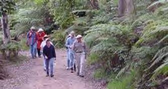
Natural Resources Branch runs a guided walks program, which includes visits to Aboriginal sites, but only where these are already on the public record, for instance with NPWS signage
The Natura Resources Brand hosts a series of guided bush tucker walks, led by NPWS Aboriginal Rangers.

Hornsby Shire DRAFT Heritage Interpretation Strategy and Action Plan Page 28
Table 5. Existing interpretive elements
Description Examples Image
Online interactive database

Council’s interactive database Hornsby Shire Recollects for the Hornsby Shire Library Local History Collection, as well as historical material belonging to community organisations and local history enthusiasts: https://hornsbyshire.recollect.net.au/

QR Codes

A QR code is located on an Aboriginal heritage interpretive panel located outside the Hornsby Council Chambers.
Plaques and panels for in situ heritage

Bar Island has a combination of panels about the ecology of the island as well as the ruins and graveyard on the site.
Trail website
Convict Trail Project web site which includes historical information and details for visiting https://www.convicttrail.com.au/

Museums
Hornsby Shire Historical Society Museum
Fagan Park Rural Museum

Dural & District Historical Society
Cobham Hall Museum, Wisemans Ferry
Hornsby Shire DRAFT Heritage Interpretation Strategy and Action Plan Page 29
Description Examples Image
The Village Green sign at Beecroft gives visitors the impression of the ‘heritage village’ aspect of the site.
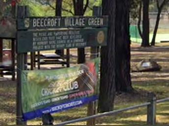
Location signs
There are other examples of heritage locations sigs at Wallarobba and the Beecroft Community Centre

Outdoor exhibition
McKell Park has multiple interpretive signage panels next to the children’s play area and adjacent to the footpath.

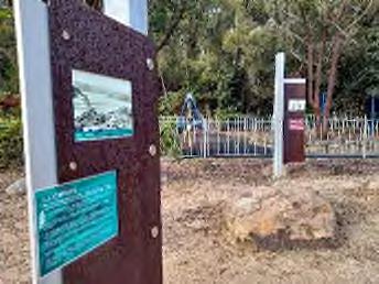
Murals
Dural Lane Murals by Hugues Sineux depicting what Hornsby would have looked like in the early 1900s
Decorative functional elements

Ping pong table at St James Park, Hornsby with heritage imagery and text emblazoned on the side panel Decorated electrical boxes.

Hornsby Shire DRAFT Heritage Interpretation Strategy and Action Plan Page 30
Description Examples Image
Discover Hornsby Council’s website

Website promoting activities and destinations across Hornsby Shire

https://discoverhornsby.com/

‘Farmgate Trail’ – historic farms and orchards ‘living history’
External website marketing farms, orchards and ‘living history experiences; https://www.harvesttrailsandmarkets.com.au/farm-gate-trails/

Bush track walk with tactile models Carrs Bush Track has accessible tactile models of animals

Festivals and fairs
The Festival of the Hawkesbury River - organised by the Natural Resources Team to a community campaign to receive feedback on the Hawkesbury-Nepean Coastal Management Program and the Swift Parrot Project being undertaken by Council staff in collaboration with Local Land Services and NPWS. The local Brooklyn Community Association then engaged with the staff to create more of a fete type event with additional activities and stores.
Live interpretation / Living history
Watkins Orchard promotes itself as a ‘living history’ experiencehttps://www.watkinsorchard.com.au/
Hornsby Shire DRAFT Heritage Interpretation Strategy and Action Plan Page 31
Description Examples Image
War Memorials

War memorials like Beecroft WWI, WWII, and Boer War Memorial, Carlingford K13 Submarine Memorial Park, Cherrybrook ANZAC Jawan Cenotaph

Public programs
The Natural Resources Team has had Native Plant giveaways. Previously they have also organised an Earth Hour Fun Day and Environmental Day.
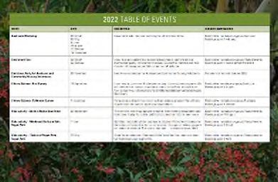
Heritage app


Students from Macquarie University as part of their studies developed two prototypes for a “Heritage Walks App” for Hornsby Council. One was presented as a video, the other as a PowerPoint as the end of project outcome. Council does not currently have a funded project to progress with the “Heritage App” but it is a desirable function.
Natural Environment signage
Interpretative signage existing along walking trails and natural heritage features for example brass plaques on the Hornsby Heritage steps (pictured), interpretive signs at Lakes of Cherrybrook Walk and Erlstoke Park Track. Additional interpretive signage is being installed in 2022 at various sites including Kenley Park Shared Path and New Farm Road Reserve Track.
Hornsby Shire DRAFT Heritage Interpretation Strategy and Action Plan Page 32
Description Examples Image
Hornsby Heritage Awards


Running from 2014-2018, the Hornsby Heritage Awards served to publicly acknowledge outstanding design work that HLEPed maintain places of historical significance, as well as efforts to promote heritage. The Owen Nannelli Memorial Award was awarded to a group or individual who has made an outstanding contribution to the education and promotion of the heritage of Hornsby Shire. Winners of the Heritage Award were presented with a commemorative plaque and a Certificate of Achievement acknowledging the Award. However, the installation of the plaques was not undertaken, monitored, publicised, or recorded by Council.

Hornsby Shire DRAFT Heritage Interpretation Strategy and Action Plan Page 33
7.2 Guidelines for assessing current interpretive elements at a destination
As shown in Section 7.1 the extensive range of interpretive elements present throughout the Hornsby Shire mean that a comprehensive assessment of each piece of interpretation is not possible. Instead, it is recommended that an assessment of any existing interpretive element is undertaken during future development of destinations within the Hornsby Shire, or any future major works taking place throughout the area. This assessment should utilise the following criteria:
Relevance – is the message of relevance in supporting the main interpretive themes for the precinct or site-specific stories?
Accuracy – has the interpretation been checked by subject experts and knowledge holders?
Condition/age – is it in excellent condition?

Style – does it integrate with the overall interpretation focus, use of materials and design style?
Add value – does the pre-existing element add value to the interpretive experience of users the site?

Representativeness – is the element representative of a story or style of interpretation that is unique in itself?
If the existing interpretive elements at a site or destination do not satisfy these criteria, a redesign or development of new interpretation will be required. New interpretation should be developed according to the principles and design guidelines outlined in this HIS, as well as aligning with the Hornsby Shire Council branding and style guides (see 22.0 Appendix F: Design Guidelines).
Hornsby Shire DRAFT Heritage Interpretation Strategy and Action Plan Page 34
8.0 AUDIENCE IDENTIFICATION

Heritage interpretation is most effective when potential audiences are identified and specifically targeted. It is important to define audience categories to ensure that the design, content and location of interpretive media provide engaging and informative experiences relevant to those audiences.
Two main audience groups of the Hornsby Shire are relevant to heritage interpretation development: residents and visitors.
8.1 Residents
In 2021, the Australian Bureau of Statistics estimated the permanent residential population of Hornsby Shire to be 152,225, making residents the largest audience by far. At 22,540, the suburb with the highest population is Hornsby, followed by Cherrybrook at 19,135, and Beecroft-Cheltenham at 9,817.50
The 2016 Hornsby Shire community profile population highlights51 give the average demographics for the population of Hornsby:
Median age is 40
45% are couples with children
11% are older couples without children
17% are lone person households
37% were born overseas
31% have a language at home other than English.
2021 ABS data gives more details of the demographics of Hornsby Shire:
0.6% of the population are Aboriginal and Torres Strait Islander people
Top languages spoken at home (other than English): Mandarin 9.2%, Cantonese 4.1%, Korean 2.3%, Hindi 2.2% and Persian 1.4%
66% are families with children
8.2 Visitors
The following tourism profile for the Hornsby Shire, extracted from the Hornsby Shire Council Economic Development and Tourism Strategy 2021-2026, outlines the expectations and plans for tourism: 52
The strategy summarises Hornsby Shire’s tourism profile which consists of:

59% of visitors are domestic overnight visitors – visiting friends or relatives
60% of international visitors are visiting friends and relatives
27% are visiting the Shire on holiday.
50 Hornsby Shire Council community profile. June 2022. Accessed at: https://profile.id.com.au/hornsby/highlights2016?WebID=13183100.
51 Hornsby Shire Council community profile.
52 Economic Development and Tourism Strategy. 2021-2026. (SC Lennon & Associates Pty Ltd)
Hornsby Shire DRAFT Heritage Interpretation Strategy and Action Plan Page 35
8.2.1 Tourism audience segmentation
The Destination NSW audience segmentation model is a useful tool for defining consumers of heritage interpretation in Hornsby Shire.53 Table 7 outlines the audiences most relevant to Hornsby Shire. These market segments can be successfully and specifically targeted for heritage interpretation experiences.
At 63% of all visitors to the Hornsby Shire, the “visiting friends and relatives” audience segment is the largest visiting demographic. Although school groups and students are not included in the Destination NSW audience segmentation model, Artefact has identified this demographic as significant to Hornsby Shire and has included it in the below table.54
Market Segment Detail
Road Trippers
NSW road trippers are defined as fully independent overnight Holiday visitors to NSW who have at least 2 stopovers on their trip. They travel by car or van. The majority are young or mid-life.
Types of experiences
Sightseeing
Visiting parks
Routes and itineraries
Domestic Caravan and Campers
Domestic caravan and camping visitors are Australian residents, aged 15 and over, who have taken a trip in NSW and stayed at least one night in a caravan park or commercial camping ground, at a place 40 kilometres or more from their home
Sightseeing
Visiting parks
Bushwalking / walks Trails
Sightseeing
Visiting parks
Markets
Zoo/Aquarium/wildlife park
(if have kids)
Visiting Friends and Relatives
The Visiting Friends and Relatives visitors are aged 15 and over, who visit NSW for the primary purpose of ‘visiting friends and relatives’. Australian hosts tend not to accompany their guests. VFRs can be international or domestic.
Day trips and short stays
Experiences aimed at Chinese /Indian visitors
Museums and art galleries
Heritage buildings, sites, and monuments
Concerts and performing arts


Festivals and fairs
Sightseeing
International Youth
International youth travellers are overseas visitors to Australia for a period of no longer than 12 months, who visit NSW and are aged 15 to 29 years. They come to NSW for the purpose of holiday/ leisure, visiting friends and relatives, education, employment, business or other reasons.
Group tours, guided trips and holidays
Heritage buildings, sites, and monuments
Museums and art galleries
Nature based activities
International Students
International students are any international visitors who come to NSW for the purpose of education. This market is typically characterised by a long length of stay, which in turn results in a high average spend per visitor. Predominantly Chinese students.
Sightseeing Markets
Heritage buildings, sites, and monuments
Museums and art galleries
Nature based activities
53 Destination NSW market segments. June 2022. Accessed at: https://www.destinationnsw.com.au/tourism/factsand-figures/market-segments
54Hornsby Shire Council economic profile. June 2022.Accessed at: https://economy.id.com.au/hornsby/tourismvisitors-reason
Hornsby Shire DRAFT Heritage Interpretation Strategy and Action Plan Page 36
Table 6. Audience segmentation for the Hornsby Shire
Market Segment Detail
Working Holiday Makers
Working holiday makers (WHMs) are visitors who intend to work while they are holidaying in Australia. While the number of WHM visitors is smaller than many other market segments, their long length of stay means that they account for a significant proportion of total visitor nights spent in NSW. Mainly from UK. Aged 18-30.
Types of experiences
Sightseeing
Heritage buildings, sites, and monuments
Museums and art galleries
Near public transport
Sightseeing
Visiting parks
International Backpackers
The backpacker market accounts for a significant proportion of visitors to NSW. Aged 20-29.
Heritage buildings, sites, and monuments
Museums and art galleries
Nature based activities
Art and crafts or cultural display
[Visitors interested in…] Aboriginal Tourism


Destination NSW’s ‘Aboriginal tourism’ visitor is defined as a visitor who undertook an Aboriginal related activity in New South Wales
Dance or theatre production
Visit an Aboriginal site or community
Over 55s Travel
As the over 55s market continues to expand in line with Australia’s aging population, it presents an opportunity for tourism in NSW. Travelling as couples – often visiting friends.
Mentally relaxing activities
Group activities
Escapism
General sightseeing
Relaxed and easy with beautiful surroundings
Local places
NSW Family Market
Couples without kids outnumber couples with kids (and its increasing). Mostly going on holidays and if they stay in NSW then they head to the coast.
Places to ‘re-connect’
Options that cater for all family members
Outdoor nature activities
Zoo/Aquarium/wildlife park
Accessible Tourism
Accessible tourism is about making it easy for all people to enjoy tourism experiences. This includes seniors, people with a disability, people from non-English speaking backgrounds and parents with children.
Historic pubs
Hornsby Shire DRAFT Heritage Interpretation Strategy and Action Plan Page 37
9.0 HISTORICAL THEMES
9.1 Introduction
To successfully interpret a site, the contextual background should be presented in a way that is concise, easily accessible, informative and engaging. Successful interpretation is best achieved by structuring the interpretive approach around key themes or stories directly associated with the site in order to provide a clear context for understanding the heritage values of the site.
9.2 Key themes from the Hornsby Thematic History
Key themes are a valuable vehicle for conveying specific messages about a site’s layered history and cultural values. The themes function as an organisational tool, grouping and ordering important information to present accessible, appropriate and effective heritage interpretation to an audience.
Hornsby Shire is a rich and diverse cultural area with complex, layered histories embedded in Country. In order to simplify the interpretive structure and provide some major anchor-points for heritage interpretation, GML identified key local themes for the Hornsby Shire.55
The Thematic History identifies locally distinctive themes to structure Hornsby’s historical narrative. These are key themes that capture the unique aspects of Hornsby Shire and its development through time:
Aboriginal Country
Convict Life
Bushland Shire
Transport
Agriculture and Horticulture


Industrial Enterprises
Belief and Faith
Leisure and Recreation
Health and Wellness
Settlement and Suburbanisation; and
The Changing Face of the Shire.
These key themes will inform the focus of interpretive elements in the Hornsby Shire; with each theme targeted to key locations. Specific site stories will also be developed to provide an engaging exploration of the historic and Aboriginal cultural values present within the site and the surrounding land and waterscape.
Hornsby Shire DRAFT Heritage Interpretation Strategy and Action Plan Page 38
55 GML Heritage, 2021. Hornsby Thematic History.
10.0 HERITAGE INTERPRETATION EXAMPLES

10.1 Introduction

This section outlines a range of interpretive media opportunities which could effectively express the Aboriginal and non-Aboriginal heritage values of the Hornsby Shire. These options have been developed to provide a considered, comprehensive suite of heritage interpretation possibilities.


It is not intended that all of these interpretive options are necessarily appropriate to be incorporated at all sites within the Shire, but that the most appropriate for each site’s design and function be considered when Council is undertaking or approving new developments.
Descriptions and a successful Australian or international case study featuring each type of interpretive media are provided below.
10.2 Acknowledgement of/Welcome to Country
A key method of communicating the importance of Country to audiences at the site is by providing a Welcome to Country or Acknowledgement of Country message. A Welcome to Country is given by the traditional custodians/knowledge holders of the area, welcoming people to their land, while an Acknowledgement of Country is a sign of respect to the traditional owners of the land stated by the asset holder.

Hornsby Shire DRAFT Heritage Interpretation Strategy and Action Plan Page 39
Left: Marrickville Library Acknowledgement of Country; right: University of Sydney Acknowledgement of Country
Left: Heart of Country by Damian Vick, Sculpture Down the Lachlan; right: Bendigo AoC sculpture
10.2.1 Case study: NRMA Insurance Acknowledgement of Country


As part of their Reconciliation Action Plan, NRMA Insurance prioritized acknowledging Country on major highways across New South Wales. NRMA Insurance partnered with three Local Aboriginal Land Councils, Boomalli Aboriginal Artists Collective and three Aboriginal artists with local connections to create bespoke artworks for Acknowledgements of Country on Wonnarua, Wiradjuri, Kamilaroi and Dharawal Country.


The artworks express each artist’s connection to Country, with text that acknowledges the multiple spellings created by a traditionally oral culture. These large signs create a strong, creative statement easily seen over a long distance, ensuring drivers understand whose Country they are travelling through.
10.3 Architectural integration and landscape geometry

Creative practices relating to place-making and the built form are powerful devices to incorporate and reflect the heritage values and stories of a site in a new development. Heritage values embedded within the heritage destinations of the Hornsby Shire can be expressed through innovative architectural design responses for new developments, providing a visual exploration of the history of each site. This can be realised through the form of new buildings, integrated applications within new developments and the shaping of the landscape’s geometry.
This interpretive media option is also an effective approach to integrating Aboriginal cultural values into the built form. Designs that echo traditional forms, spaces and narratives and their contemporary interpretations are increasingly being integrated within new developments worldwide, sending strong, respectful messages about the timeless links between Indigenous people and the landscape, and allowing for reflection of contemporary connections to the land.
Hornsby Shire DRAFT Heritage Interpretation Strategy and Action Plan Page 40
NRMA Insurance Signposting Country; by Debra Beale (left) and Jasmine Sarin (right)
Left: Puntukurnu Aboriginal Medical Services healthcare hub, by Kaunitz Yeung Architecture; right: UluruKata Tjuta Cultural Centre, National Parks
10.3.1 Case study: Yagan Square, Perth
Yagan Square is a major civic place within Perth’s Central Business District, located between the William Street Horseshoe Bridge and Roe and Wellington Streets. As part of the early design consultation, a cultural engagement process was undertaken by Metropolitan Redevelopment Authority and the local Aboriginal organisations, including the Whadjuk Working Party and the South West Aboriginal Land and Sea Council. This engagement shaped a new urban typology that meaningfully embedded Aboriginal cultural values into the architecture and landscape of the development.

The narratives gifted by the local Aboriginal peoples included themes of place, waterways, animals, birds, people and the landscape, and the local Aboriginal resistance fighter Yagan, a Noongar man killed in conflict in 1833, and Balbuk, a Noongar woman who protested against colonial occupation in the late nineteenth century.
Yagan Square, Perth
10.4 Adaptive reuse

Adaptive re-use refers to the adaptation of a heritage place for a new use by respecting and retaining its cultural significance. Adaptive re-use aims to retain and sympathetically re-use significant existing fabric, features and the inherent character of buildings, landscapes, or places, while creating spaces that people want to inhabit and use in a meaningful way.
The Burra Charter provides a best practice framework for considered, meaningful adaptive re-use, advising that a cautious approach to change is adopted, adapting as little of a structure as possible while caring for the original structure and making it useable and safe.56

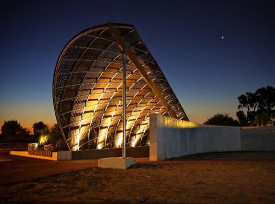


Hornsby Shire DRAFT Heritage Interpretation Strategy and Action Plan Page 41
Left: Wanarn Clinic by Kaunitz Yeung Architecture; right: Champion Lakes Aboriginal Interpretive Centre, by Gresley Abas
56 Office of Environment and Heritage, 2012. Adaptive Reuse of Heritage
Policy.
Places
10.4.1 Case study: Ngununggula Southern Highlands Regional Art Gallery, Retford Park

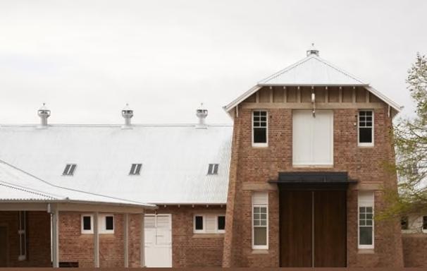




Opened in 2021, Ngununggula art gallery is housed in the Old Dairy complex at Retford Park, Bowral. The 1880s complex, owned by the National Trust NSW, was adapted into 700 square metres of gallery space by Tonkin Zulaikha Greer Architects in a heritage-sensitive design that prioritised visual arts, education, artistic practice, and cultural voice. While the exterior and facades of the complex were left largely intact, the interiors were transformed into modern, flexible gallery space.
Ngununggula Southern Highlands Regional Art Gallery, Retford Park
10.5 Re-use of salvaged materials

Architectural and archaeological materials salvaged from heritage buildings undergoing development, such as sandstone blocks, fireplaces and fittings, bricks and decorative tiles, can be re-used to interpret a site’s past in a new development. These items, often made from quality fabric, are both a physical reminder of a site’s past and a sustainable building material.
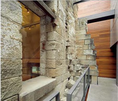
Hornsby Shire DRAFT Heritage Interpretation Strategy and Action Plan Page 42
Left: Geelong Arts Centre, Melbourne; right: The Mint, Sydney Living Museums
Left: No. 4 Police Station, by Welsh and Major; right: The Gantry, by Bates Smart
Salvaged materials can be incorporated into functional items, such as seating, shelters and walls, or into interpretive devices, such as interpretive panel mounts, public art pieces or play spaces. The condition of these materials should be assessed by a fabrics conservator to ensure that the material is safe to re-use.


10.5.1 Case study: Interloop, Wynyard Station
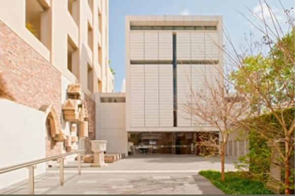


As part of the upgrading of Wynyard Station in 2017, the original 1930s hardwood escalators at the York Street entrance were salvaged and replaced by modern people-movers. Four combs and 244 hardwood treads were welded into an aluminium base and threaded into a twisted design by artist Chris Fox, a creative response to the heritage staircase regarded as iconic by the Sydney community. Interloop, installed above the modern escalators, evokes memories of thousands of train journeys taken by Sydneysiders over eighty years, celebrating the historic identity of Wynyard Station.

Interloop, Chris Fox, Wynyard Station

Hornsby Shire DRAFT Heritage Interpretation Strategy and Action Plan Page 43
Left: Example of a re-used heritage window in context at Milsons Point Station; centre/right: seating constructed of salvaged brick
Left and right: St Barnabas’ Church salvaged materials display, Sydney
10.6 Conservation


Conservation can be regarded as a process of managing change in ways that best retain and protect the heritage significance of a place, while recognising opportunities to reveal or enhance its values for present and future generations. There are a large number of listed and unlisted heritage items in private hands in the Shire57 so opportunities to promote the conservation of these buildings, and give insights into the process for the public, should be investigated.
10.6.1 Case study: Woolshed at Rouse Hill Estate

Constructed in 1858, the Rouse Hill Estate Woolshed is one of 17 outhouse structures on the estate, but after 160 years of use and wear, the timber woolshed was in poor condition. In 2020, Sydney Living Museums began conserving the building, employing heritage engineers and builders to best preserve the building’s historical integrity.
The conservation effort was undertaken in two stages: the first was the recording, cataloguing, and documentation of the site, and the second was intensive structural conservation. All modern fabric was date-stamped and photographed so as to differentiate it from the original material.58
As a result of Sydney Living Museums’ conservation effort, visitors can now safely enjoy and learn from the building, the lifespan of the structure has been substantially prolonged, and its historical value has been honoured.
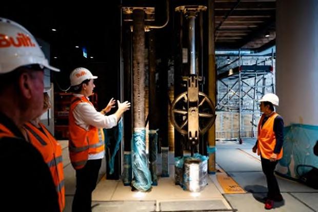

57 Artefact Heritage. 2022. Draft Hornsby Shire Heritage Review. Report prepared for Hornsby Shire Council, 58 Sydney Living Museums, “A Strong and Simple Structure: Conserving the Woolshed,” accessed on 6 May 2022, <https://sydneylivingmuseums.com.au/stories/strong-and-simple-structure-conserving-woolshed>.
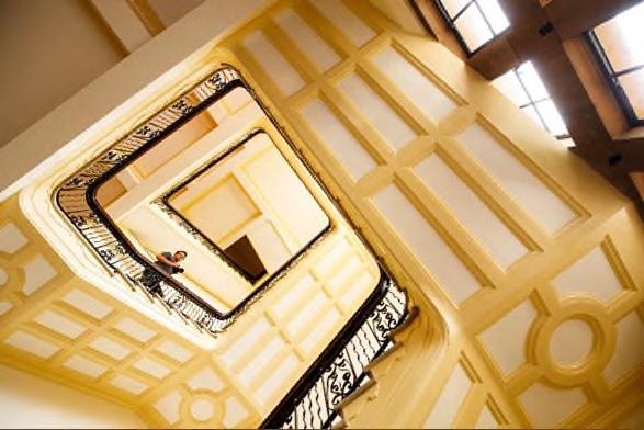
Hornsby Shire DRAFT Heritage Interpretation Strategy and Action Plan Page 44
Left: Registrar General’s Building, Sydney Open; right Tulkiyan House conservation, Gordon
Left: Substation No. 164, Clarence Street Sydney; right: Hinchcliff House conservation, Sydney
10.7 Functional elements


New developments provide an opportunity to integrate heritage interpretation into buildings and public spaces, with heritage details incorporated into functional elements such as stairways, seating, shelters, balustrades and screens. As well as being essential elements of public space, these items can be canvases for heritage content.


Embedding heritage interpretation elements within the seating, ground plane, and shade structures within gathering spaces provides a rich context and points of engagement and conversation. Patterning, text, or graphic image-based seating inserts are effective forms of interpretation, strategically positioned to engage people who have some time to pause, read and reflect absorbing messages and stories about the site. Similarly, utilising overhead elements such as canopies, roofs, shopfront awnings or shade structures for portraying images or Aboriginal designs are opportunities for unique expressions of a destination’s heritage.

Hornsby Shire DRAFT Heritage Interpretation Strategy and Action Plan Page 45
Left: Conserving the Rouse Hill Woolshed; right: Rouse Hill Woolshed, Sydney Living Museums
Left and right: Pirrama Park heritage interpretation; right: Burwood Brickworks, Balarinji and Mandy Nicholson
Left: Parramatta Dairy Precinct garden interpretation; right: Hourglass Lake balustrade insert
10.7.1 Case study: Sunset Heritage Precinct, Western Australia


Sunset Heritage Precinct, located at the Dalkeith Peninsula on the Swan River, was home to the Claremont Old Men’s Home, established in 1901. The site was redeveloped into an arts, recreation and cultural precinct in 2014, with interpretive signage developed by Turner Design. As well as interpretive panels, the interpretive strategy focused on incorporating seating inlays into the public domain, each telling a story about a particular year in the precinct’s history. Located in prominent rest areas, the inlays feature large historical photographs and succinct text bites for optimal audience engagement.

10.8 Ground plane elements
Ground plane elements embedded in public domain areas are a subtly effective heritage interpretation medium. Paving colours, metal inlays or sandblasted patterns may be installed into ground planes, forming artworks, tracing the footprints of former structures or containing small ‘bites’ of textual information, quotes or dates creating a narrative as paths are traversed.
Embedding Aboriginal design elements into the ground plane of a site can connect a new development directly to Country, providing a tangible aesthetic reference to significant physical, social, or spiritual features of the land. By installing such ground plane elements into outdoor spaces, a strong visual message about the Aboriginal heritage of the site can be created.

Hornsby Shire DRAFT Heritage Interpretation Strategy and Action Plan Page 46
Functional seating inlays at Sunset Heritage Precinct
Left: Bulletin Place inlay with the Sydney Language; right: The Glasshouse, Port Macquarie
10.8.1 Case study: Marrickville Metro, Sydney
As part of renovation works at the Marrickville Metro shopping centre, heritage interpretation of the former Vicar’s Wool Factory was required by AML Capital. Deuce Design and FJMT Studio produced ground plane inlays of corten steel and vitreous enamel panels with flora and fauna related to the site. The naturalistic colour palette for the inlays was offset by design of the inlays, which featured stylised interpretations of Marrickville’s industrial architecture. Each inlay presented a period of the evolution of the site, with site users able to create an effective timeline as they crossed the entry courtyard.

Ground plane inlays at Marrickville Metro, Marrickville

10.9 Interpretive panels
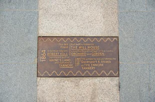


Well-designed and written interpretive panels are an excellent media for conveying key stories and rich narratives in an effective, accessible manner. If integrated into the design of a site, they can be strategically located to gain appropriate exposure. Interpretive panels, as text-based media, are ideally suited to tell more details of site-specific stories providing contextual information in a succinct and engaging manner.
Panel text can encourage visitors to look more closely at their surroundings or text can pose questions to stimulate conversations. They should be located in spaces which allow for a longer dwell time or in natural pause points such as public squares, parks or seating areas. Interpretive panels can also work as trail markers on walks or bush trails, highlighting different aspects of the site. When used across a site, panels should have a consistent ‘look and feel’ so audiences know they are encountering heritage information.
Hornsby Shire DRAFT Heritage Interpretation Strategy and Action Plan Page 47
Left: Riverbanks College, by Mantirri Design; right: Citizens Gateway to the Great Barrier Reef, by Brian Robertson
10.9.1 Case study: Window in time, Krusevac, Serbia


The ‘window to the past’ panel at the Kruševačka Tvrđava, Serbia, outlines the original shape of the tower of the Zonzon tower at the Krusevac Fortress for visitors who stand in a specific spot. Much of the original building as collapsed and the panel HLEPs to ‘revive’ the heritage.
Interpretive signage at Krusevac59


Hornsby Shire DRAFT Heritage Interpretation Strategy and Action Plan Page 48
Left: Castlereagh Street interpretive signage, Sydney; right: Burrawang Walk, Kamay
Left: The Gantry, Camperdown right: Fairfield Station crane panel
59 Krusevac Grad. 2019. “Prozor u prošlost” Donžon kule. https://krusevacgrad.rs/prozor-u-proslost-donzon-kule/
10.10 QR codes and Beacon Technology


Digital connections such as QR codes and Beacon Technology are increasingly implemented within interpretive panels to provide an extended experience. Curious site users can scan a QR code with their smartphone to access a larger field of historical information, stories and images via a webpage or Hornsby Recollects. Beacon Technology, in which small, wireless transmitters that use Bluetooth technology are installed in convenient high traffic locations, could also activate tailored audio/visual experiences for key heritage items or destinations.
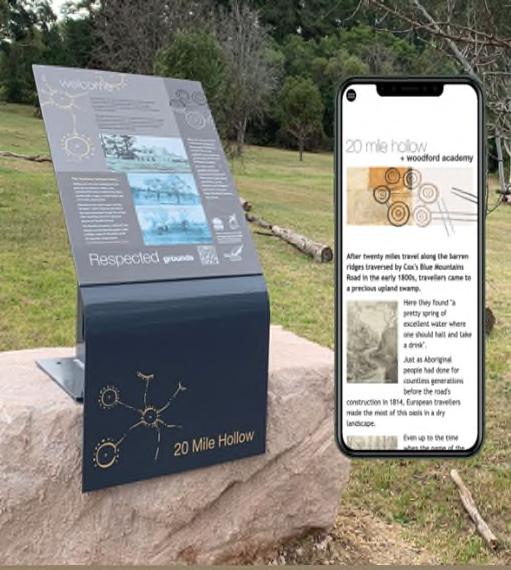
10.10.1 Case study: Metropolitan Museum of Art, New York
MediaLab at the Metropolitan Museum of Art in New York experimented with beacon technology and demonstrated that it provided valuable context to museum visitors by delivering audio and video content as well as descriptions of objects. As well as delivering interpretive content, the beacons could also be used as a navigation or wayfinding tool that informed visitors about the locations of related exhibits.

Hornsby Shire DRAFT Heritage Interpretation Strategy and Action Plan Page 49
Left: Panel and QR code, Woodford Reserve, Blue Mountains; right: QR code in pavement
Beacon Technology in use at the Metropolitan Museum of Art
10.11 Landscaping and plantings
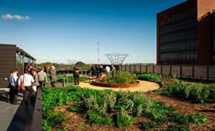


Interpretive landscaping is an effective approach to evoke past structures, gardens and landscapes within public and private developments. Landscaping devices, including use of turf and hardstand, geometry and shapes, use of water and planting certain species can create an immersive space for site users that gives a feeling of being surrounded by heritage. Depending on the site, footings or sections of previous heritage buildings can be marked out with landscaping to deepen the understanding of place within the public domain.
Plantings of species that were in the Sydney area prior to European arrival, and therefore part of the Indigenous landscape experienced by the local Aboriginal community, is another powerful interpretive approach for landscaping. Planting patterns, where trees and understory plants were clumped rather than planted in lines, are preferred to enhance the naturalistic feel and to echo Country.
10.11.1 Case study: Barangaroo Reserve

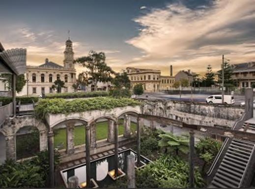

In 2010, works began on Barangaroo Reserve, an artificial headland within Sydney Harbour designed by PWP Landscape Architecture and Johnson Pilton Walker. The reserve design utilised sandstone blocks quarried onsite to recreate a significant hunting and fishing area for the local Gadigal people, that had been increasingly misshapen and industrialised by wharfage schemes from the 1830s onwards. The goal of the project was to use cultural knowledge to restore the endemic plant species of Sydney Harbour and to recreate the headland along the natural Sydney fault line.
Approximately 75,000 native trees and shrubs of 84 species that were native to the Sydney region at the time of colonisation were chosen in consultation with local knowledge holders and native botanists. These included mature trees transplanted from southern Queensland and specially grown plants from a Central Coast nursery. Native bee colonies were also reintroduced to the reserve. Cultural tours and interpretive signage complement and contextualise this project.
Hornsby Shire DRAFT Heritage Interpretation Strategy and Action Plan Page 50
Left: Bungarribee House footings in landscaping, Doonside; right: Paddington Reservoir Gardens
Left and right: Yerrabingin terrace garden, South Eveleigh
10.12 Multilingual interpretation


As diversity within Australia increases, there is a growing opportunity to include heritage interpretation that features multiple languages other than English. In the 2021 Australian Census, the ABS recorded that 39.5% of residents in Hornsby spoke a language other than English at home, a figure well above the national average. As of the 2021 Census, the languages spoken most commonly at home in Hornsby include English, Mandarin, Cantonese, Korean and Hindi.60
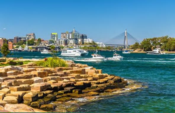

Heritage interpretation provides a medium for diverse communities within the Hornsby Shire to gain a deeper understanding of the heritage values of their home and express their own heritage and culture. The inclusion of multilingual interpretation in the Hornsby Shire could include the translation of key words, names or phrases into multiple languages on interpretive media, inclusion of additional cultural references or the inclusion of QR codes with accessible content in multiple languages.
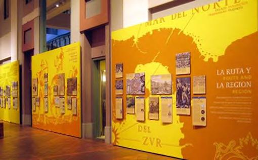
Hornsby Shire DRAFT Heritage Interpretation Strategy and Action Plan Page 51
Barangaroo Reserve landscaping, Barangaroo
Left: Multilingual interpretative tree grate; right: ‘Welcome’ translations integrated into steps, Lincoln Centre, New York City
Left: French-English Gateways exhibition; right: Bilingual Exhibit, Smithsonian Latino Centre
60 Australian Bureau of Statistics, 2021. Hornsby. Accessed at: https://abs.gov.au/census/find-censusdata/quickstats/2021/LGA14000 (February 2023).
10.12.1 Case study: Swedish Army Museum, Stockholm


The 2017 special exhibition Segerns Pris - Narva 1700 (The Prize of Victory - Narva 1700) at the Swedish Army Museum, Stockholm explored the theme of the great Battle of Narva in the year 1700. The exhibition exhibited a vast collection of flags taken by the Swedish army and pieces of propaganda surrounding the victory and, ultimately, the defeat. All labels and exhibition materials were printed in Swedish and English.
Segerns Pris,Narva 1700 (The Prize of Victory,Narva 1700),Swedish Army Museum
10.13 Aboriginal languages

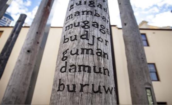

For Aboriginal people, connection with Country is intrinsically connected to identity through language, cultural practices and long held relationship between people and the land. Using Aboriginal words or phrases in audio recordings, as elements in the paving, to name key features in new developments or as dual naming for streets and public spaces is an interpretive option that recognises Aboriginal cultural heritage values.


Hornsby Shire DRAFT Heritage Interpretation Strategy and Action Plan Page 52
Left: Worth Place Park language sculpture, Newcastle; right: Edge of Trees, Museum of Sydney, Janet Laurence and Fiona Foley
Left: Darumbal language steps, Yeppoon; right: St Leonards Health Complex, ‘teaching the children to make fish slow’
10.13.1 Case study: Royal North Shore Hospital, St Leonards


As part of the St Leonards Health Organisation Relocation project, artist Nicole Monks was engaged to deliver three artworks that embedded Aboriginal language into the new centre. Monks, a Wajarri Yamatji woman from Western Australia, created three artworks centred around connecting with Cammeraygal Country, weaving cultural narratives and modern shapes together in the exterior landscaping.

Language phrases were applied to seating and the entryway of the new building, where natural pause points invited site users to reflect on the nature of the Country they were standing on, and how it had been used for generations of Aboriginal families.

10.14 Lighting
Lighting is a dynamic form of interpretation that can tell stories in a non-invasive manner, and support nighttime uses and activations of a site. Both Aboriginal and non-Aboriginal heritage interpretation themes can be expressed through lighting patterning, using a gobo or template over a lighting source, as this medium can creatively ‘reconstruct’ demolished built forms or architectural details, highlight building features, recreate historical images, project key design components or single words, and move/change to tell unfolding cultural stories. Lighting programs can change seasonally or in response to specific events within the Hornsby Shire or future developments.
Audiences can view and physically interact with lighting displays, enabling meaningful messages about the history of Hornsby’s heritage destinations to be experienced. Lighting can also be effectively paired with complementary interpretive devices, such as play spaces, adaptive re-use of buildings and public art, to create an immersive experience for evening site-users.

Hornsby Shire DRAFT Heritage Interpretation Strategy and Action Plan Page 53
St Leonards Health Organisation, Connection to Country by Nicole Monks
Left and right: Parrtjima Festival in Light, Alice Springs
10.14.1 Case study: Vivid Festival of Light, Sydney
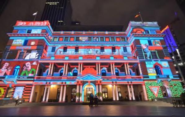


The annual Vivid Festival of Light is held in Circular Quay and The Rocks, some of Sydney’s most iconic heritage spaces. The light projections and installations, submitted by emerging and worldrenowned artists, utilise the facades of heritage buildings including Customs House, the Sydney Opera House and the Museum of Contemporary Art as canvases. The lighting both highlights and plays with the architectural features of each building, enabling thousands of tourists each year to encounter heritage in new, colourful ways.
10.15 Artefacts and movable heritage


There is a large, disparate collection of movable heritage items associated with listed heritage buildings and places throughout the Hornsby Shire. Historical artefacts from archaeological excavations and museum collections are also present throughout the Shire. These items are an opportunity to showcase innovative and engaging responses to heritage, and allow audiences to experience and interact with heritage in new, intimate and immersive ways.
Displays of movable heritage or artefacts, with contextualising information, would enable audiences to visualise the phases of previous use of a site. These displays may be onsite within a heritage item or a new development, or be located at local hubs such as museums and libraries. Quality, well-conserved pieces should be chosen for displays, with research undertaken into their provenance by heritage specialists, conservators, historians or archivists. Any movable heritage pieces or artefacts for future development should be selected by a qualified heritage consultant/archaeologist or curator and assessed by a qualified conservator to determine their suitability for inclusion in display.
Alternatively, movable heritage that is not associated with a listed heritage item can be integrated into a site in more creative ways. Depending on their size and material, movable heritage items could be integrated into sculpture, large-scale art pieces, room displays, or into floor or wall cavities.

Hornsby Shire DRAFT Heritage Interpretation Strategy and Action Plan Page 54
Left: Treasures Illuminated, Australian Museum; right: Melbourne Fringe Festival
Left: Vivid Festival of light at the Museum of Contemporary Art; right: Customs House
10.15.1 Case study: Hill End Heritage Centre, Hill End
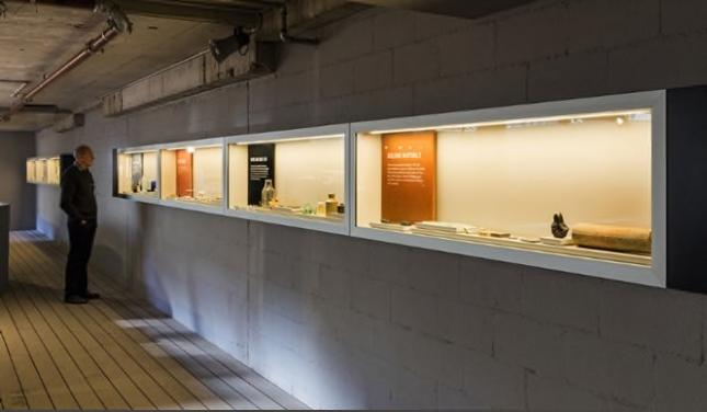
Hill End Historic Site, an 1850s gold mining village with a rich industrial heritage, was revitalised by the NSW National Parks and Wildlife Service in 2017. GML Heritage and Trigger Design collaborated to create ‘Alchemy: The Lustre of Hill End’, a permanent interpretation experience at the Hill End Heritage Centre. In line with the project’s HIS, the interpretation utilised movable heritage items and artefacts recovered from the site, and adaptively re-used the local heritage FRS Fire Shed to house the display.

Alchemy: The Lustre of Hill End
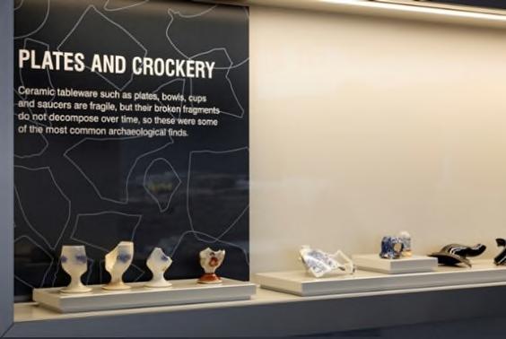


10.16 Museums and libraries


Local museums and libraries are invaluable repositories of the stories, objects and voices of the Hornsby Shire. Run by Council or local historical societies, museums and libraries are public venues which can host a large variety of heritage events, including exhibitions, displays of historical and archaeological artefacts, public talks, workshops and celebrations tying in with nationwide events like NAIDOC and History Weeks. Libraries are a particularly useful venue, as visitors would be primed to encounter new information and pause to read and engage with displays.

Hornsby Shire DRAFT Heritage Interpretation Strategy and Action Plan Page 55
Left: Meroogal, Nowra Sydney Living Museums; right: Elizabeth Farm kitchen, Rosehill Sydney Living Museums
Left and right: V by Crown, Parramatta artefact display
Holding a series of curated heritage events at community venues such as these allow heritage to be more accessible, engaging and community-focused, presenting opportunities for diverse voices to be heard. Heritage programs at museums and libraries should be promoted across the Hornsby Shire.

10.16.1 Case study: The Great Cobar Museum and Visitor Information Centre


The Great Cobar Museum was originally the 1912 administration offices of the Great Cobar Copper Mine. Converted by Cobar Shire Council and Dunn & Hillam Architects in 2020-21, the museum houses the local history collection and movable heritage associated with Cobar’s copper mining and transport history and promotes storytelling by locals for locals. The combined museum and visitor information centre focuses on heritage at Cobar, providing links to other notable sites in the area. The museum also offers guided tours and education packages.

Hornsby Shire
Page 56
DRAFT Heritage Interpretation Strategy and Action Plan
Left: Parliamentary Library, Western Australia; right: Silverton Gaol and Historical Museum
Left: Coming Out in the 70s display, State Library of NSW; right: National Museum of Industrial History
10.17 Play spaces

Play spaces act as community focus points, drawing young families to a space of recreation, safety and relaxation, a key element in placemaking for a new development. A well-designed play space providing a rich and diverse play opportunities allows children and adults alike to engage with heritage in new ways. By incorporating heritage interpretation in a play space in creative and subtle ways, both children and parents can encounter new ideas and integrate educational experiences into everyday play.
This type of interpretive media would be suitable for communicating Aboriginal heritage or nonAboriginal interpretive experiences, depending on the location of the play space and its proximity to surrounding key sites.


Play equipment and topography can be customised to the heritage experience, with local materials, natural shapes and reconstructed heritage elements creating a strong sense of connection to the land or railway motifs integrated into the design. Visual/tactile design features and simple text could be incorporated into the play space to support play-based learning.
The Hornsby Council’s Play Plan outlines possible developments of new play spaces. Integrating heritage interpretation within the space geometry, play structures and simple labeling within Regional, District and Local play spaces in areas of identified tangible or intangible significance, and within identified special purpose play spaces (e.g. bush trail play, ‘splashpad’ water play spaces, natural water play spaces), should be considered.
Hornsby Shire DRAFT Heritage Interpretation Strategy and Action Plan Page 57
The Great Cobar Museum and Visitor Information Centre
Left and right: Gosford Leagues Club playground
10.17.1 Case study: Koolangka Koolangka Waabiny, Western Australia

The Koolangka Koolangka Waabiny space was developed at Wellington Square in 2021. Set in a park with strong historical connections to children’s play and deep-time connections to the Whadjuk Nyoongar people, the park is a continuation of the use of the space as a meeting place for community. The play space was designed in consultation with the Whadjuk Working Party, a features a circular disc shadecloth representing the stars and sky of the Dreaming, landscaping echoing traditional forms, small banksia-shaped play spaces and a play tower resembling a Candle Banksia tree.

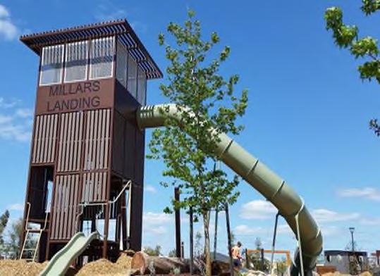
Koolangka Koolangka Waabiny, Wellington Square
10.18 Public artwork

Public artworks, such as sculptures, murals and installations, can be an evocative and successful tool in interpreting the heritage significance of a site while also enhancing its aesthetic and cultural character. This type of interpretive media creates a visual statement about the cultural heritage of an area and is important in place-making for the public domain. Public art may work in tandem with other interpretive elements, such as lighting, functional or ground plane elements.
Public art can be an engaging medium for carrying heritage interpretation messaging, if based on Aboriginal and non-Aboriginal heritage interpretation themes, thus creating a further connection through an exciting visual form to the heritage of a site.


Hornsby Shire DRAFT Heritage Interpretation Strategy and Action Plan Page 58
Left: Railway Square playspace, Perth; right: Millars Landing Steamrail Adventure Playground, Baldivis
10.18.1 Case study: Leichhardt Park Aquatic Centre


In 2011, a series of works by Aboriginal artist Bronwyn Bancroft was commissioned by former Leichhardt Council for the Leichardt Park Aquatic Centre. In collaboration with the Leichhardt Aboriginal and Torres Strait Islander Consultative committee, Bancroft created seven brightly coloured glass panels entitled Weavings of Light and Life. These artworks, nestled within the complex gardens, explore themes of water as a life source, fishing, gathering, songlines and Country.
Weavings of Light and Life, Bronwyn Bancroft, Leichhardt Aquatic Centre

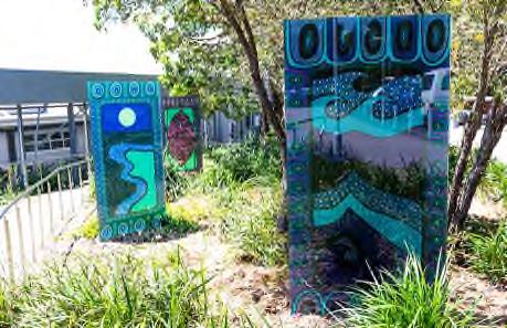
10.19 Public programming and events

The development of a Public Programming Strategy to provide guidelines for future programs involving both Aboriginal and non-Aboriginal knowledge holders should be undertaken. Additionally, opportunities to build on Council’s annual program of events to support and celebrate cultural heritage with specific events, activities or celebrations should be considered.


Hornsby Shire DRAFT Heritage Interpretation Strategy and Action Plan Page 59
Left: Jack Mundey portrait, The Rocks; right: Dual Nature by Nigel Helyer, Woolloomooloo
Left: Marrickville Library heritage wall feature; right: Adelaide mural, by Elizabeth Yanyi Close
Carrick

As well as hosting regular public programs such as events and markets, school holiday activities and tours, Carrick Hill also features a built-in Story Book Trail designed to enable children to explore the historic grounds. The Story Book Trail public program, focusing on classic British fairy tales, draws people across the extensive historic gardens.
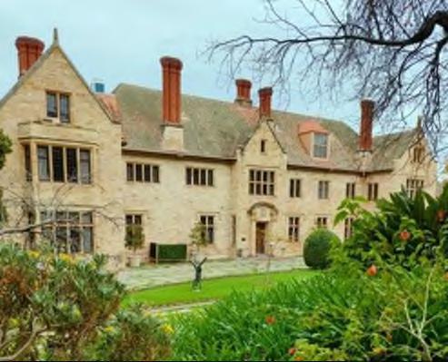
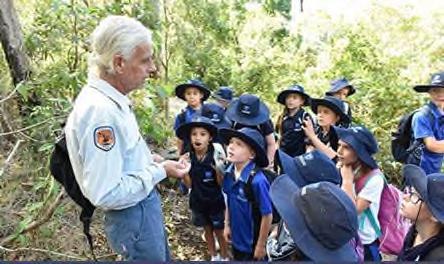
Carrick Hill Story Book Trail, Adelaide

10.20 Heritage walks

Heritage walks comprise of short, medium, or long trails that lead visitors to places of natural or built heritage that are linked by common themes, histories and people. The walk often includes public art, movable heritage displays or signage explaining points of interest along the way. Established heritage walks can be achieved in a number of ways, with brochures, maps, QR codes, a smartphone app system or websites as possible delivery methods, integrating the various histories of the area into a comprehensive, engaging narrative.
Currently, self-guided heritage walks are available for Hornsby (Hornsby Heritage Walk), Berowra/Galston (Heritage Bridges Walk), Dangar Island (Dangar Island Walk), Carrs Bush track and Bar Island (Bar Island Walk). Creating heritage walk maps for each suburb is a cost-effective and accessible method of interpretation.

Hornsby Shire DRAFT Heritage Interpretation Strategy and Action Plan Page 60
Left: Hyde Park Barracks, Sydney Living Museums; right: National Parks and Wildlife Aboriginal Studies lessons
10.19.1 Case study: Carrick Hill, Adelaide
Hill House and Gardens is a 1930s manor-style heritage home in Adelaide with an active suite of public programming, designed to foster a strong community and tourist interest in the historic home, grounds and art collection.
Thematic tours (as opposed to location/suburb-based tours) are also a good way to highlight the key stories of a region’s history. Tours and self-guided walks that focus on key themes such as places of leisure, places of worship, cemeteries, train stations, architecture, etc. can assist in targeting specific demographics and interest groups and expanding public engagement beyond discrete suburbs.


10.20.1 Case study: Burrawang Walk, Kamay Botany Bay National Park
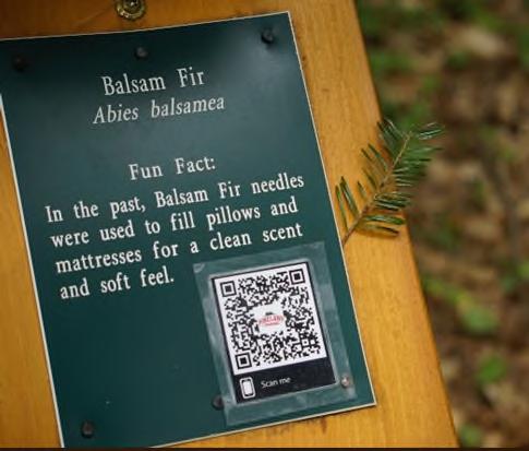

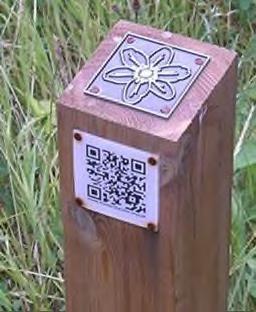
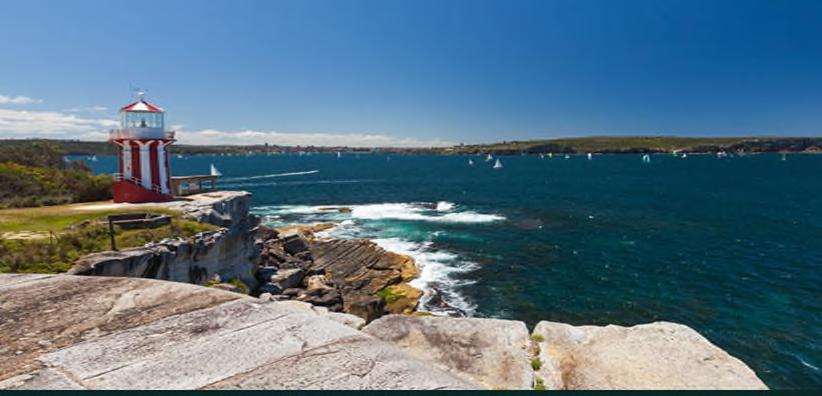

The Burrawang Walk, developed by Freeman Ryan Design and the NSW Government Architect’s Office in consultation with the La Perouse Local Aboriginal Land Council, celebrates the resilience of the local Aboriginal people and Aboriginal stories to be placed at the centre of the place where Lt James Cook landed in 1770.


Hornsby Shire DRAFT Heritage Interpretation Strategy and Action Plan Page 61
Left and right: South Head Heritage Trail
Left: Brutalist Sydney Map; right: Skirting Sydney Historical Walking Tour, City of Sydney
Examples of QR codes on heritage trail markers
The heritage walk includes interpretive panels about the eight days in Kamay, information boxes and gathering circles and soundscapes and culminates in the bronze sculptures created to mark the 250th anniversary of the landing. The striking natural beauty and cultural significance of the site at Kurnell are complemented by the sensitive curation of the heritage trail.


The heritage walk is supplemented by online interpretation, including a virtual tour captured with Google Street View Trekker, a downloadable PDF map, and an extensive webpage on the State Library of NSW website entitled “Eight Day in Kamay” that presents written and oral histories by Aboriginal knowledge holders and colonial sources, and a range of relevant materials from the library collection.
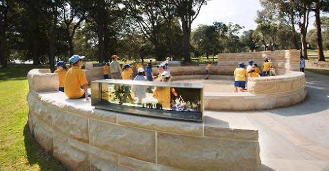

10.21 Site markers and Blue Plaques

Site markers are an effective way of embedding short bites of information about the history of a building or site into a nearby paving or wall. Though often regarded as a more ‘traditional’ method of heritage interpretation, creative site markers can be a dynamic and attention-grabbing approach, ensuring that significant public or private buildings are noticed by passers-by.
The Blue Plaques program, highly successful in the United Kingdom, was introduced into NSW in 2021. The NSW Blue Plaque program is a NSW Government initiative that is administered by Heritage NSW. The eye-catching bright blue, circular plaques aim to tell stories that are quirky, fun and interesting, alongside more sombre stories of NSW’s heritage. The NSW Blue Plaques program links places of residence or significance with notable people, with 2021 nominations including Ethel Turner, Nancy Bird Walton, Brett Whitely and Walter Liberty Vernon. Each blue plaque is linked with a digital story, enabling users to find out more and extend their heritage experience.
Hornsby Shire DRAFT Heritage Interpretation Strategy and Action Plan Page 62
Left: Eyes of the Land and the Sea by Alison Page and Nik Lachajczak, Burrawang Walk; right: Burrawang Walk; below: Eight Days in Kamay website, State Library NSW
It is noted that Hornby Shire Council submitted nominations in 2021 and additional nominations in future years would be recommended.

10.21.1 Case study: Blue Plaques, London
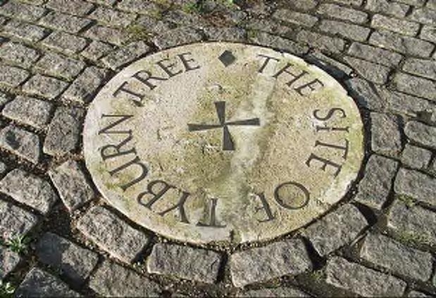


The London Blue Plaques program was established in 1866, intended to mark homes and buildings occupied by prominent politicians, philosophers, scientists, musicians and other historical figures around the capital city. The goal of the eye-catching plaques was to connect Londoners with their historical counterparts, functioning as reminders that houses are places of history where real people lived and historical events unfolded. As of 2022, 933 plaques have been installed in London.
The Blue Plaques also have an interactive mapping feature, so visitors can trail London or search for historical figures who lived close to their own houses.

Hornsby Shire DRAFT Heritage Interpretation Strategy and Action Plan Page 63
Left: Royal Australian Historical Society plaque; right: City of Adelaide plaque
Left: St Benet Sherehog Church plaque, London; right: Tyburn Tree, the king’s gallows site from 11961793, London
10.22 Educational materials


Links to primary and high school curricula are a largely untapped opportunities for heritage interpretation exploring both the Aboriginal cultural heritage and the historic stories of the Hornsby Shire. Educational materials targeted to specific curriculum areas and students learning stages focusing on local history can be available via website downloads – case study materials, activity sheets, trails and hunts, and excursion opportunities. The production of educational materials be a positive outcome for young audiences and HLEP to promote a lifelong understanding of the heritage significance of the Hornsby Shire. This type of material has been identified as one requiring development by Hornsby Shire Council. Existing materials, new opportunities, and links to the curriculum are elaborated on in Appendix E: Schools materials
Left: Nyanda Cultural Tours; right: Sydney Living Museums School House Lessons
10.22.1 Case study: NSW Schoolhouse Museum, North Ryde

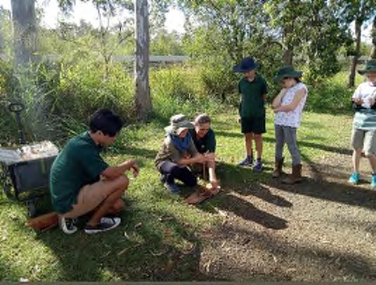
The NSW Schoolhouse Museum of Public Education is housed in the first building of North Ryde Public School, constructed in 1877-1893. The museum features restored early school rooms with movable heritage items related to the history of public education in NSW. Objects from its large collection are available to hire for classroom activities.
The museum offers a Hands-On History Program tailored to Stages 1, 2 and 3, providing learning experiences for students including dress-ups, imaginative activities, nineteenth century craft and games and copperplate writing. Students are also able to toast bread and golden syrup over a fire. Interactive, immersive and imaginative educational practices are of enormous value for younger students.
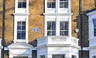

Hornsby Shire DRAFT Heritage Interpretation Strategy and Action Plan Page 64
Blue Plaques in place, London
10.23 Publications


Publications are a popular way for visitors to delve deeply into a subject, providing local authors and historians with opportunities and income. The value of publication is the diversity in subject matter, with publication topics as broad as Shire-wide histories, or as niche as building techniques, family histories or particular complexes like cemeteries. They can also include guides and trails connecting to major heritage themes within the Shire. Sold online or at heritage sites/destinations, publications are effective tools to extend the heritage experience at home.
A short series of targeted online publications, each telling a specific heritage story or tied to a destination, should be considered for inclusion on the Hornsby Council website.


Any publications commissioned by Hornsby Shire Council should be linked to the heritage themes, be developed for a target audience, and utilise high production values and consistent design and typography.

Left: Collingwood Historical Society Bitter Roots, Sweet Fruit; centre: Blacktown Historical Society Horses, Houses and Trees; right: City of Sydney Council History of City of Sydney Council

10.23.1 Case study: Sydney Cemeteries, A Field Guide
Lisa Murray’s field guide to Sydney’s public cemeteries captures the history of each location and why it is unique to the Sydney area. The field guide also notes famous or notorious burials, giving an insight into the diverse histories of colonial Sydney from the graves of its inhabitants. Murray also describes monument styles and offers guidelines on headstone meanings and grave symbology.
Hornsby Shire DRAFT Heritage Interpretation Strategy and Action Plan Page 65
NSW Schoolhouse Museum, North Ryde
10.24 Digital displays


Digital media screens can HLEP to achieve a variety of communication objectives more easily than ever before and can be aimed at all levels. Digital displays can gain the attention of users more readily than traditional signage, are easy to configure and update, can utilise high-definition picture quality and multiple display boards can be managed from one central location.
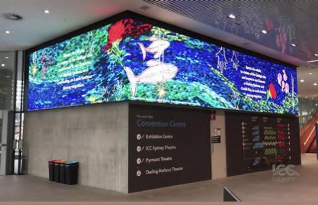
Digital displays could be placed in public squares, buildings or on the grounds of heritage properties, allowing visitors to interact with facts and stories in real time. Content can be static or interactive, depending on the budget, size and position of the digital display. Digital content should be relevant, meaningful, interesting, motivating and evoke emotion in order to consistently draw the attention of users.


Hornsby Shire DRAFT Heritage Interpretation Strategy and Action Plan Page 66
’’
Left: Sydney Cemeteries, A Field Guide by Lisa Murray; right: Lisa Murray at St John’s Anglican Cemetery, Ashfield
Left: Digital screen displays, ICC; right: digital screens, Hyde Park Barracks, Sydney Living Museums
10.24.1 Case study: ICONS, The Powerhouse Museum, Museum of Applied Arts and Sciences

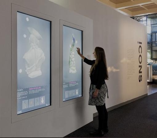
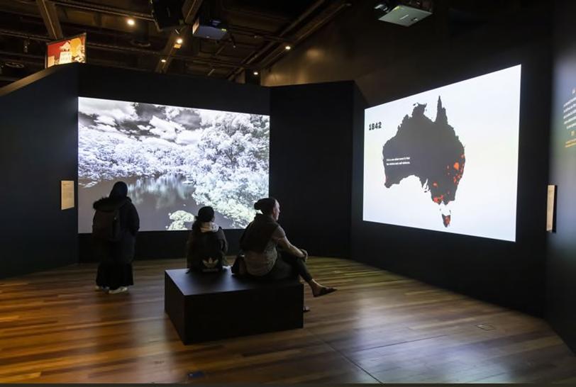
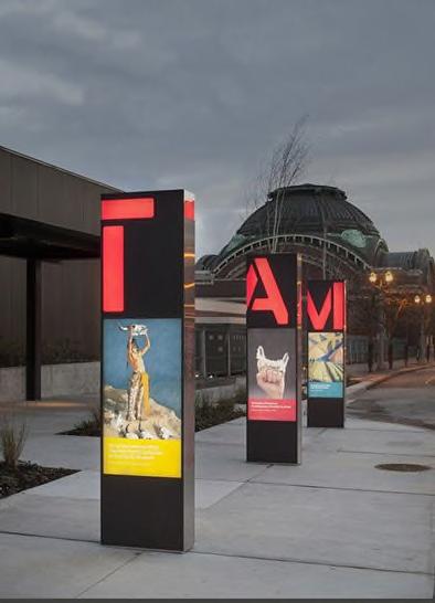


The ICONS exhibition at The Powerhouse (Museum of Applied Arts and Sciences) in Ultimo presented ‘iconic’ objects from the museum’s collection, considering the idea of the icon as a sacred image, a popular image and a luxury. To project the priceless objects on display and provide greater depth of experience, each object was 3D scanned into a program available on large digital screens within the exhibition. Visitors could zoom in on features of the object, turn it 360 degrees onscreen and access facts and stories about the object’s ‘iconic’ nature.
10.25 Social media
Social media is an increasingly popular form of interpretation being used by local Councils, Heritage NSW, museums, and other heritage bodies. Social media provides free and wide-ranging access to heritage, allowing people to explore a region’s heritage regardless of location. A well-run and consistently updated social media account can not only raise awareness of significant sites, but attract initial users and encourage physical visitation. Social media is an excellent way to engage with younger audiences, road trippers, and families looking for school holiday activities.
Hornsby Shire DRAFT Heritage Interpretation Strategy and Action Plan Page 67
Left: Outdoor digital display at Tacoma Art Museum, Washington; Right, ‘Unsettled’ exhibition, Australian Museum.
Left and right: Interactive digital kiosks at the Powerhouse Museum, Ultimo
10.25.1 Case study: NSW National Parks and Wildlife Service


An excellent example of interpretation via social media is the official NSW National Parks and Wildlife Service Instagram account (@nswnationalparks), which has over 171k followers and terrific engagement among young people. Each post is colourful, well framed, and has an informative but engaging caption. Posts on the NSW National Parks and Wildlife Service Instagram account generally garner between 2,000-5,000 likes and 30-50 comments, typically from people tagging their friends in the post as inspiration for a trip.

Instagram posts, National Parks and Wildlife Service (@nswnationalparks)
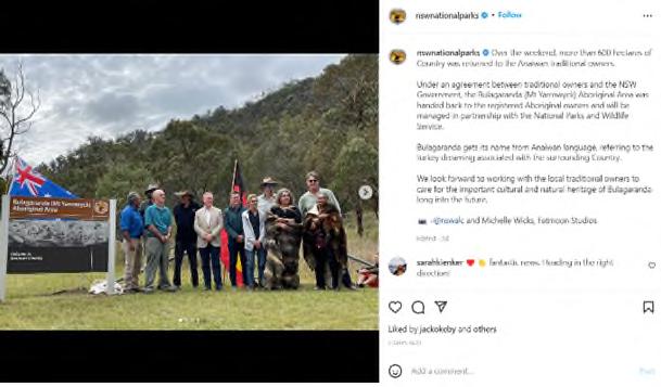

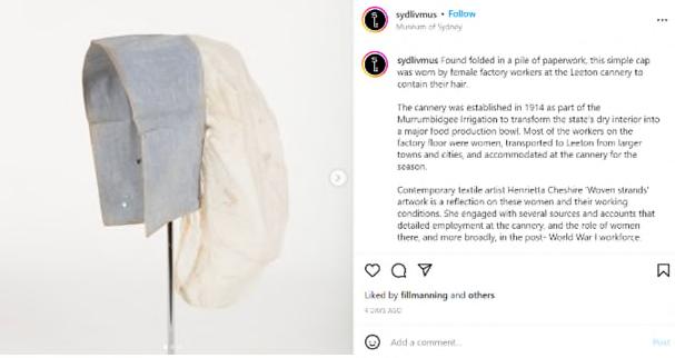
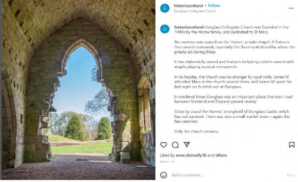
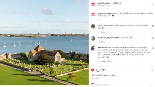
10.26 Podcasts
Audio podcasts, delivered via Apple Podcasts, Spotify, Listenr or other platforms, are a way to deliver a personal heritage experience to the broader public no matter their distance from the Hornsby Shire. Presented by a single speaker or team, podcasts can tell more involved stories rather than just impart facts, creating an intimate, engaging encounter with heritage.
Hornsby Shire DRAFT Heritage Interpretation Strategy and Action Plan Page 68
Left: English Heritage Instagram (@englishheritage) right: Historic Scotland Instagram (@historicscotland)
Left: Sydney Living Museums Instagram (@sydlivmus); right: ABC Indigenous Instagram (@abcindigenous).
Visitors can access podcasts when they wish, downloading and streaming stories at home, on a commute, while walking or when travelling through an area by car. They are an increasingly popular and effective way for visitors to engage with historical tales, objects and sites.


10.26.1 Case study: Collected, Stories from the Australian War Memorial


The Collected podcast series, produced by the Australian War Memorial in Canberra, delves into the strange, poignant, popular and wonderful artefacts held in the memorial’s vast collection. Interviews with the memorial’s curators and local military historians are combined with first-hand accounts from people connected to the artefacts to tell compelling stories about Australia’s contributions to military campaigns across the world and the effects they had on those at home. A link on the show notes allows listeners to view the collection items.

Hornsby Shire DRAFT Heritage Interpretation Strategy and Action Plan Page 69
Left: The History Listen, ABC; right: Australia’s Invisible History, Hope 103.2
Left: Always Was, Always Will Be Our Stories, Marlee Silva; right: Songlines of Australia Madonna Griffin.
Collected: Stories from the Australian War Memorial


10.27 Websites and apps

As a more traditional form of digital engagement, web pages have continued to be popular with a wide range of audience groups. Dedicated pages within a website can provide a vehicle for layering of information and easy access to a wide range of images, photographs and historical information. Websites can also host blogs, oral histories, presentations and news updates which can be frequently updated to present the most recent, relevant heritage stories and associated events across the Hornsby Shire. Web-based, native and hybrid apps can offer similar content but tailored to devices.

A link from onsite media via QR codes to a website can mean that a wealth of information is accessible to interested audiences with no additional investment.
Hornsby Shire Recollects is currently the Shire’s most extensive heritage website. At present, Hornsby Shire Recollects is a repository for images and does not necessarily interpret the heritage it is presenting. The website would benefit from discrete, storied webpages that explore specific themes that relate to the Shire, utilising the vast resources of Hornsby Shire Recollects. Hornsby Shire Recollects also does not currently explore the Shire’s rich Aboriginal heritage. The website should therefore invest in the interpretation of Aboriginal heritage of the Shire in consultation with relevant stakeholders.
Left and right: Eveleigh Stories webpage
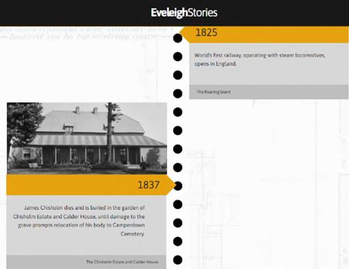

Hornsby Shire DRAFT Heritage Interpretation Strategy and Action Plan Page 70
10.27.1 Case study: City of Sydney Barani: Sydney’s Aboriginal History
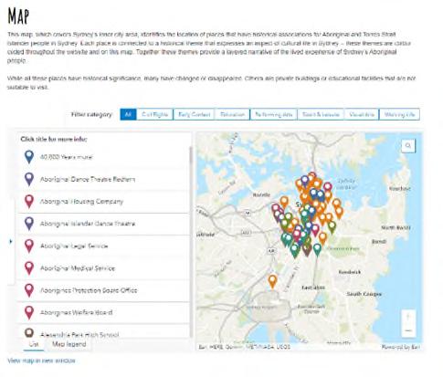
Established and administered by the City of Sydney Council, Barani is a comprehensive resource for Aboriginal history, cultural stories and significant places within the City of Sydney LGA. The webpage contains multiple well-researched historical pages, a location reference map, and a resource section for further reading by academics and community Elders. Barani also offers a contemporary news function, where community can be updated about important events, news and upcoming talks by First Nations people.


10.28 Oral histories


A positive way to engage the community and capture the rich layers of information about Hornsby’s history would be to develop an oral history project, where first-hand accounts of community members recount their stories and perspectives on local histories. Oral histories could be used to capture the experiences of certain groups within the Hornsby Shire, such as suburbs, religious groups, community organisations, Aboriginal communities, orchard workers, rail workers, etc. The resulting publication would be a positive outcome and an important resource for the Hornsby community.
The publication of an oral history project could either be in hard-copy or digitally on a website. Partnerships with community focused organisations such as the State Library of NSW should be explored. The City of Sydney Council also has extensive expertise on the collection and publishing of oral histories, with its own Oral History Collection recording perspectives by Sydney’s residents on the history of the city, art and culture, historic local businesses, and many other topics at https://www.sydneyoralhistories.com.au/
Hornsby Shire DRAFT Heritage Interpretation Strategy and Action Plan Page 71
Left and right: WW1: Stories from our museums website, Sydney Living Museums
City of Sydney Barani website
10.28.1 Case study: The Store oral history project, Newcastle
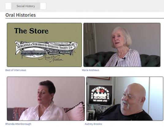



As part of the redevelopment of The Newcastle and Suburban Co-operative Society Ltd building, or ‘The Store’, a dual oral history project was commenced by Artefact Heritage, DOMA and the University of Newcastle’s GLAMx Living Histories Digitisation team. Twenty oral histories from past employees and community members and more than 300 archives were collected and digitised, ensuring the community recollections of The Store were easily accessible to future generations. The project also digitised a collection of oral histories from a 1989 project on The Store.
The Store Oral History Project, Newcastle: https://livinghistories.newcastle.edu.au/nodes/view/89913

10.29 Community heritage prizes

Competitions and prizes are regarded as effective methods of promoting local heritage, engaging with new audiences and involving the community in heritage interpretation. Local competitions, which encourage authors, artists, and historians (amateur or professional) to research and present an aspect of local history, shine a light on little-known local stories and contribute to the body of knowledge about the Hornsby Shire.

Hornsby Shire DRAFT Heritage Interpretation Strategy and Action Plan Page 72
Left: City of Sydney ‘Open All Hours’ oral histories; right: Harbour Trust oral history project
Redfern oral history project: http://redfernoralhistory.org/
The Hornsby Heritage Awards briefly ran until 2018 and served to promote the preservation of heritage within the Shire. Commemorative plaques were given to recipients of the award, however, the installation of the plaques was not undertaken, monitored, publicised, or recorded by Council. Any future community heritage prizes should publicise the work of the participants and recipients and ensure that any plaques or interpretive materials are installed and recorded.

A cash prize or opportunity for fellowship/further promotion may also assist in launching or maintaining the careers of key local historians. Such competitions are also opportunities for multicultural or minority voices to be heard and supported. The NSW Premier’s History Awards, for example, has a ‘NSW Community and Regional History Prize’ – a similar award could be implemented at a local level.
Left: Wollongong City Council’s Local History Prize award winner Andre Brett, 2020; right: Victoria’s Collaborative Community History Award 2021, Graham Willett, Angela Bailey, Timothy W. Jones and Sarah Rood

10.29.1 Case study: Addi Road Award for Multicultural History


Founded by the Addison Road Community Organisation and History Council of NSW in 2019, the Addi Road Award encourages new and emerging historians to discover, analyse and explore multicultural histories, HLEPing to increase academic and public engagement in a topic that has ongoing relevance to Australian history and society today. The $1000 prize and citation awarded to a local historian ensure that a large amount of entries are received each year.
Addi Road Award for Multicultural History 2021 winner Jane Curtis

10.30 Temporary hoardings
Hoardings are a highly visible temporary canvas for heritage interpretation and are necessary for developments constructed in high traffic areas for safety and to mitigate visual impacts. Though only temporary, the inclusion of Aboriginal artworks or historic images on hoardings during construction of the future developments would communicate a sense of the heritage of the site during the construction phase, engaging the local community in a positive manner. Developing a set of images/artworks for use on temporary hoardings around the Shire would be an efficient and consistent way of signally the importance of Hornsby local history.
Hornsby Shire DRAFT Heritage Interpretation Strategy and Action Plan Page 73
10.30.1 Case study: City of Sydney Council


The City of Sydney Council requires temporary hoardings to be covered in art by a living Australian artist or in relevant historical images with a connection to the construction site. The existing artworks offered by the City of Sydney include images designed by both Aboriginal and non-Aboriginal artists, covering a wide range of themes; an alternative option is for hoardings to be developed independently for each construction and approved by the City of Sydney.61 Heritage listed buildings must be covered in temporary hoardings with historic images only.62
City of Sydney approved hoardings by local artists
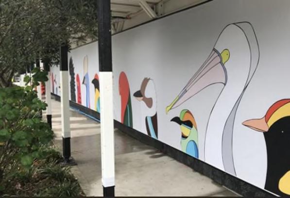
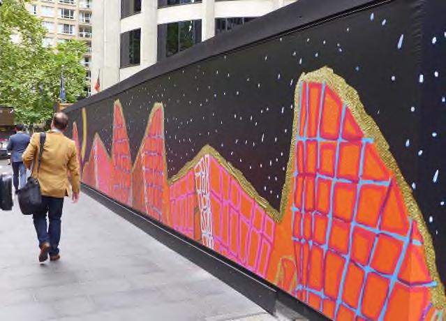
61 City of Sydney, 2021. ‘Creative Hoardings Program’. Accessed at: https://www.cityofsydney.nsw.gov.au/culturalsupport-funding/creative-hoardings-program (April 2021).
62 City of Sydney, 2021. ‘How to create or commission your own site-specific artwork for construction site hoardings’. Accessed at: https://www.cityofsydney.nsw.gov.au/hoardings-temporary-structure-approvals/createcommission-site-specific-artwork-hoardings (April 2021).


Hornsby Shire DRAFT Heritage Interpretation Strategy and Action Plan Page 74
Archival images at the former Department of Education building, Sydney
11.0 INTERPRETIVE DESIGN PRINCIPLES


11.1 Principles
To guide the development and design of the heritage interpretation elements within the Hornsby Shire the following interpretive design principles are recommended for future interpretive planning:
First Nations first
Celebrating and valuing Aboriginal heritage and connection to Country is a key responsibility of heritage interpretation and should be at the forefront of the planning process for any new developments. Building relationships and engaging in authentic consultation with Aboriginal knowledge holders and traditional custodians is an essential component of developing heritage interpretation messages, designs, and experiences for any current or future heritage interpretation planning. Approaching the planning process in partnership with Aboriginal designers, artists and landscapers is also an important element. Of key importance is acknowledging Country, providing tangible markers of Aboriginal associations with place, representing Aboriginal culture as a living and vibrant. Use of local language for naming places and spaces is of key importance as is dual naming of streets.
Integration
Heritage interpretation should be fully integrated in any new development, with consideration of the design principles, stories and overarching themes contained within this HIS. Interpretation planning should take place during early design stages of new developments to ensure this integration.
Connectedness
Heritage interpretation should support a connected public realm by providing experiences, both physical and in terms of cohesive messaging, which connect places within the Shire and connect people with place.
Adding value
Heritage interpretation should be planned to add value to peoples’ experiences, giving insights and new knowledge about the cultural and heritage values embedded within the Shire.
Accessibility
Heritage interpretation should be physically and conceptually accessible, designed to encourage engagement and conversation. Interpretation should be planned with an understanding that audiences will have a variety of intellectual and physical capabilities, come from different language and cultural backgrounds, interact in different sized social groups, and have a differing amount of available time. Translations of materials into community languages, whether available on-site or through digital pathways/QR codes to a web resource, is of key importance.
Significance
Heritage interpretation should respond to both the tangible and intangible significance of sites and items, the historical characteristics of the area, and the significance of connecting to Country.
Hornsby Shire DRAFT Heritage Interpretation Strategy and Action Plan Page 75
Storytelling
While linking with the key heritage themes to guide the development of interpretation within each destination area, heritage interpretation should seek to highlight key site stories while incorporating cohesive meanings and messages across the entirety of the Shire.
Cohesiveness
Each destination area may have different characteristics from the others, yet both cohesive messaging and design considerations should ensure that all interpretive media share similar elements to create the impression that they are part of the overall Shire approach. The graphic language of interpretive media should complement other signage and wayfaring devices.
Consultation
Consultation with key asset owners/managers is a key requirement of any heritage interpretation planning process. All Aboriginal heritage interpretation must be developed in consultation with Traditional custodians/knowledge holders. Meaningful and respectful consultation must be undertaken for all future developments and initiated early in the design process. Consultation should extend to the engagement of Aboriginal designers and artists to create any Aboriginal heritage elements in interpretive media.
Materiality
Materials used in interpretive elements play a key role in contributing to the overall aesthetic. The predominant textures and colours of the Shire - bushland, sandstone, orchards, river - should be echoed in the interpretive elements where possible, such as the use of sandstone and timber. Alternatively, the use of new or contrasting materials, such as glass and metal, can provide a stimulating contrast by focusing attention on specific elements and re-interpreting the heritage aspects of the area creating relationships between the old and the new.
Sustainability
Design of interpretive elements should adhere to best practice sustainable design guidelines, such as the Council’s ‘Sustainable Hornsby 2040 Strategy’, The construction and maintenance of all interpretive media should also be undertaken according to these best practice sustainability guidelines.
Consistent typography

In order to create a consistent ‘look and feel’ for the majority of interpretive elements, draft guidelines for the graphic design of interpretive elements has been developed, and are included in 22.0 Appendix F. They include:
o Choice of a suite of sizes/styles of panels/markers, depending on location and purpose
o Consistent use of graphic approach for interpretive media – panels, publications, digital, in ground, etc
o Consistent use of Universe font, as per Hornsby Council Brand and Style Guidelines

o Consistent use of specific colour palette, as per Hornsby Council Brand and Style Guidelines
o Guidance as to readability requirements, font size and heights
Hornsby Shire DRAFT Heritage Interpretation Strategy and Action Plan Page 76
11.2 Interpretive Design guidelines


The Interpretive Design Guidelines are shown in detail in 22.0 Appendix F: Design Guidelines. They are based on the existing signage styles and sizes as detailed in Public Domain Signage 2020. Variations on the public domain signage designs have been further developed to include motifs, size ranges and structural components which could distinguish them as heritage interpretation signage. A design by Aboriginal artist Tracey Howie has been included, with permission, to exemplify the use of Aboriginal design as a motif. The interpretation signage should feel part of the Council’s signage suite but be identifiable as interpretive content rather than wayfinding signage.
Not all interpretive elements would need to align with these guidelines – public art, lighting, play spaces and other creative forms of interpretation would benefit from being stand-alone designed elements, relevant to the location.
Hornsby Shire DRAFT Heritage Interpretation Strategy and Action Plan Page 77
12.0 HERITAGE INTERPRETATION OPPORTUNITIES
12.1 Introduction

This section outlines recommended interpretation opportunities for the whole of Hornsby Shire and for each heritage ‘destination’. Each heritage destination is summarised, with key heritage items, audience groups, and heritage themes contextualising the recommendations for interpretation.
Note: Each heritage destination within the Hornsby Shire has been identified for the cohesive heritage story it tells, with linked histories, heritage items and experiences available for audiences. Some of these destinations border the edges of Hornsby Shire, with connected heritage items located just outside the boundaries of the Shire, eg. Wisemans Ferry which is located across the Hornsby Shire, Hawkesbury and Hills LGAs. In these cases, the connected heritage items have also been included in the destination summary.
12.2 Shire-wide opportunities
This section explores opportunities for interpretive media and programming that can be implemented across the Hornsby Shire.
12.2.1 Recommendations for interpretation across the Hornsby Shire
The following table outlines recommendations for interpretative media that would span the whole of the Shire. Recommendations for priority and an indicative cost level are also supplied. It would be anticipated that the majority of these initiatives would be managed and supported by Hornsby Shire Council. The initiatives may also be accomplished by working collaboratively with local cultural organisations and community groups.
Hornsby Shire Recommendation
Detail
POLICY
Reference this HIS Ensure heritage interpretation elements across the Shire are developed and designed with reference to the interpretive strategies and design guidelines outlined in this HIS

Develop conservation management plans for Council-owned assets
The current best-practice heritage frameworks and statutory documents for Hornsby Shire recommend conservation of the physical, visual, sensory and cultural settings of heritage items and the protection of all elements that contribute to their significance. 63 Heritage items should be conserved according to their individual CMPs, and in the absence of a CMP the principles of The Burra Charter should be followed. Heritage interpretation can be a key consideration within the CMP.
Include heritage interpretation considerations in DA conditions
Encourage co-operation with cultural organisations and community groups
As development in Hornsby Shire increases, there are opportunities for heritage buildings and places to be creatively interpreted. Buildings within HCAs or in close proximity to public domain settings are especially suitable for heritage interpretation. Heritage interpretation plans, aligned with this HIS, should be required where appropriate for developments of heritage buildings or large developments within the Hornsby Shire.
Opportunities to promote co-operation between schools and local historical societies, museums and organisations should be promoted, as well as cultural organisations with education officers such as the National Parks and Wildlife and the Metropolitan, Deerubbin and Darkinjung LALCs.
Hornsby Shire DRAFT Heritage Interpretation Strategy and Action Plan Page 78
Table 7. Recommendations for heritage interpretation across
63 Australia ICOMOS, 2013. The Burra Charter, and Hornsby Local Environmental Plan 2013.
Recommendation Detail
Consult Aboriginal community knowledge holders
Reference the Design guidelines
Develop a Public Art Strategy
Develop heritage resources for people with disability and their carers
Implement the Dual naming policy
LANGUAGE
Use Aboriginal Language
Consider multilingual interpretation
WEBSITES AND APP
Develop a series of heritage trails as an app
Expand the Hornsby Shire Recollects website
Aboriginal heritage interpretation in future developments within the Hornsby Shire, should include the involvement and authority of Aboriginal community knowledge holders and Aboriginal architects/designers/artists is paramount.
Interpretive signage produced for future developments should align with Hornsby Shire Council’s signage style guide 2020 and be based on the principles and typology outlined the Heritage Interpretation Strategy Design Strategy expressing the cohesive heritage identity of the Shire (see Appendix F: Design Guidelines).
Hornsby could consider commissioning a Public Art Strategy which considers and includes heritage in its development. A variety of unique site-based public art installations could be considered during future development at Hornsby Shire, with installations comprising either representative or more impressionistic pieces.
Develop resources to assist people with disability and carers to access heritage sites and information around the Shire.
The Hornsby Shire Council dual naming policy should be considered when naming council facilities, particularly areas with significant Aboriginal Cultural Heritage Values.
Consider opportunities for naming of places and spaces, using Aboriginal language in interpretation materials, and for dual place naming. To be done in consultation with the Hornsby Aboriginal and Torres Strait Islander Consultative Committee/key knowledge holders.
Consider providing interpretive material in Mandarin, Cantonese, Korean, Hindi and Persian, the largest community languages in the Shire.64 This would include interpretation on-site, in brochures/publications or through digital pathways/QR codes.
Develop an app or downloadable trails with self-guided curated tours for key destinations.
Expand the Hornsby Shire Recollects website to include a mapping resource that pins locations throughout the Shire and links them by theme, could include both Aboriginal and on-Aboriginal locations/key sites as appropriate.
Expand the Discover Hornsby website with:
Interactive maps linking heritage elements
Expand the Discover Hornsby website
Heritage themed itineraries at destinations
Short histories, oral history quotes
Calendar of events
Transport options
Expand the Hornsby Shire Council website

Provide digital School materials
Produce a series of History pages on Council website - short, themed publications by historians/residents/extracts from the Thematic History published online to highlight the Shire’s history and broaden its audience reach. Include ‘history and heritage’ as a category in the events filter.
Provide heritage linked schools materials for download on the Hornsby Shire Council website

Hornsby Shire DRAFT Heritage Interpretation Strategy and Action Plan Page 79
64 ABS Government. ‘Hornsby 2021’. https://www.abs.gov.au/census/find-census-data/quickstats/2021/LGA14000
Recommendation Detail
Create a heritage specific Instagram account
Although Hornsby Shire Council runs an Instagram page (@hornsbycouncil), the account is aimed at a very general audience. A new Instagram account dedicated to the living heritage of the Hornsby Shire can increase traffic to these sites and introduce younger audiences to histories and stories of the region. Posts could comprise a combination of contemporary images of heritage sites that people can still visit today and historic photos of Hornsby Shire, so that the audience gains a broad insight into the living heritage of Hornsby. This could be an Instagram account which is a spinoff from Hornsby Shire Recollects.
Develop a set of Podcast
Develop a set of podcasts of curated stories of the history and heritage of Hornsby.
Develop virtual tours

OTHER INTERPRETIVE MEDIA
Develop guidelines for Blue Plaques nominations
Reinstate Community history prizes
Install Interpretive panels in Heritage Conservation Areas
Develop a series of virtual tours which could be hosted on a Council website. The tours would allow virtual access to areas which have difficult or limited access for example the Maroota Historic site, Bar Island or potentially even private properties.
Develop guidelines for nomination of heritage site markers within Heritage NSW Blue Plaques Program.
Reinstate the Councils’ previous Heritage Awards – both the Hornsby Heritage Award for conservation/architectural works, and the Owen Nannelli Memorial Award for promoting of the heritage of the Shire.
Install an interpretive panel for each Heritage Conservation Area located in a public location and highlighting the unique features of each specific HCA.
The Hornsby Shire Council currently has the following written Acknowledgement of Country statement for publications:
“Council recognises the Traditional Owners of the lands of Hornsby Shire, the Darug and GuriNgai peoples, and pays respect to their Ancestors and Elders past and present and to their Heritage. We acknowledge and uphold their intrinsic connections and continuing relationships to Country”
Develop a Shire-wide Acknowledgement of / Welcome to Country wording

However, a formal, standardised policy does not exist. It is recommended that the Council investigates the creation of a formal, Shire -wide Acknowledgement of Country and Welcome to Country policy. This policy should be developed in consultation with community and the recommendations of the Hornsby Shire Aboriginal Cultural Study (Coast Heritage, 2022).
The use of the Acknowledgement of Country as a public message should be encouraged for all new developments and public domain areas within the Shire that do not currently carry a Welcome or Acknowledgement. Acknowledgement wording would be defined by the asset holder and Hornsby Shire Council in line with the policy.
If Council would prefer to develop a Welcome to Country message, this should be undertaken in accordance with the key Aboriginal knowledge holders for the area and approved by the Local Aboriginal Land Council.
Develop an oral history project
Develop tours and trails on Conservation management
Develop an oral history project to expand the oral history section of the Hornsby Recollects website.
The process of conservation of the Hornsby Shire’s listed heritage buildings may be a suitable avenue for tours, talks and trails, integrated with local historical societies and organisations such as the National Trust and Sydney Living Museums. This would allow an insight into the ongoing importance of conserving heritage properties, while offering exciting educational experiences into Hornsby’s history.
Hornsby Shire DRAFT Heritage Interpretation Strategy and Action Plan Page 80
Recommendation Detail

Expand Heritage walks
Opportunities to expand, improve and promote existing bushland and heritage walks are being and should be considered for future development within Hornsby Shire. This could include interpretive markers on trails, brochures or apps, promoted through the website.
Develop schools excursions
There are many locations around the Shire which can be a focus for school excursions, with appropriate support material. Case studies of key people and events could also be prepared to support school research projects. A summary of an assessments of appropriate school curriculum links and sample materials that could be developed for use in local schools in shown in Appendix F.
Incorporate heritage into play spaces
Incorporate heritage into designs for temporary hoardings
Program heritage themed annual events
Suite of interpretation panels
New plans and refurbishment plans for play spaces should consider incorporating heritage interpretation elements when located in/near an area of tangible or intangible heritage. This could include space geometry, play structure design, trails, simple words and labels.
Develop a suite of designs for temporary hoardings that celebrate the heritage of Hornsby Shire.
A list of events which have a heritage focus could be programmed by the Council (see Appendix D: Heritage-related Annual Program of Events).
A suite of interpretation panels using the design guidelines should be developed for heritage buildings, items and locations. These interpretation panels could include QR codes for links to online content and maps linking nearby heritage sites. The panels could form a network that encourages visitors to move between sites to discover more.
12.3 Destination opportunities
This section explores opportunities for interpretation in specific areas of the Hornsby Shire, called heritage ‘destinations’. These destinations contain the most prominent heritage items in each area, and, when visited, can tell powerful, intriguing and engaging stories of the history and cultural values of the Hornsby Shire. It is noted that there are many local areas not covered by these ‘destinations’ but that also have heritage items. These could feature on Shire-wide initiatives like Hornsby Shire Recollects, Discover Hornsby or trans-Shire trails, but they do not fulfil all the criteria of a Destination NSW ‘destination’.

12.4 Lower Hawkesbury River Settlements
12.4.1 Summary
A world away from the hectic streets of Sydney lies Brooklyn and the river settlements of the Lower Hawkesbury. A more remote part of the Shire, the area has a strong river heritage with Aboriginal heritage along the Hawkesbury River, early colonial settlements, recreational and leisure history, old oyster farms and historic villages. It is an area best explored by train and boat – perfect for a weekend away. Brooklyn is marked by its fishing and farming industries and historic village centre; Bar Island is significant for the remains of its church and cemetery; and Dangar Island is dotted with remains from the early colonial landings of 1788, Depression era sandstone works, and World War Two military infrastructure.
Hornsby Shire DRAFT Heritage Interpretation Strategy and Action Plan Page 81
12.4.2 Destination history
The following history is based on historic information from the Hornsby Thematic History65


The Brooklyn area, originally called Peats Ferry until its subdivision in 1884, is best known for its fishing industry, around which communities and families have revolved for generations. Rock oysters collected from the Hawkesbury River were an important source of food for the local Aboriginal peoples. Shortly after European settlement, large-scale harvesting of Sydney rock oysters commenced along the Hawkesbury River, where stocks were plentiful. Oyster farming became more commercialised by the 1860s for both food and as a source for lime in cement production. Overexploitation of the wild oyster beds between 1850 and 1870 led to government intervention and restrictions on farming.
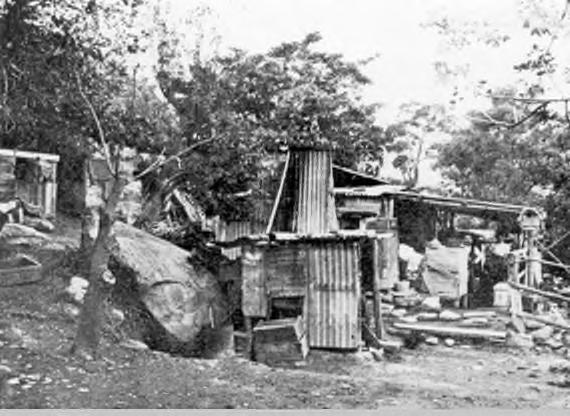
In 1889, the Hawkesbury River Railway Bridge was officially opened, connecting Brooklyn and the surrounding region to the rest of the Hornsby Shire. With the opening of the bridge, leisure tourism to Brooklyn increased. Many of the railway workers involved in construction of the railway line and bridge settled at Brooklyn and the residential islands on the river, becoming fishermen and oystermen. The Hawkesbury District Fishermen’s Cooperative was established at Brooklyn in 1950 and continues to the present day.

Brooklyn, which has retained its ‘village’ character, remains a popular tourist destination for its natural scenery and seafood industry. Evidence of the early days of colonisation and convict life can be found throughout Brooklyn, with the cemetery, dam, railway bridge, and houses and shopfronts of the nineteenth and twentieth century remaining. Life in Brooklyn continues to revolve around the Hawkesbury River, which has provided food, recreation facilities and a livelihood to the local population for millennia.
Milsons Island was established as a laboratory, quarantine station and hospital for WWI veterans. It expanded to be a hospital for people with intellectual disabilities. Since 1982 the facility has been run as a sports and recreation camp for schools and families by the NSW Department of Sport and Recreation. Some of the heritage buildings have been refurbished for use by visitors to the island.
Dangar Island has rock engravings and middens by the Aboriginal people of Dyarubbin. It is also the site of the earliest meeting of Aboriginal people and Europeans on the Hawkesbury, in 1788. Later it became a site of conflict when two salt boiler workers stationed at Dangar Island had their clothes and supplies taken by men armed with spears. In the 19th century it was leased to the Union Bridge Company as accommodation for American workers building the bridge. By the 20th century it had become a more touristy place for guests to come and stay for a taste of island life.
Hornsby Shire DRAFT Heritage Interpretation Strategy and Action Plan Page 82
Figure 5. Left: A span of the Hawkesbury River railway bridge on the pontoon on Dangar Island, 1888 (Source: Hornsby Shire Recollects); right: Oysterman’s Shack, Brooklyn, date unknown (Source: Hornsby Shire Recollects)
65 GML Heritage. 2021. Hornsby Thematic History. Unpublished report prepared for Hornsby Shire Council.
12.4.3 Key audiences
The key audiences for this destination are as follows:
Local residents
Road trippers
NSW Family Market
International backpackers
Over 55s Travel
12.4.4 Key heritage themes related to the area
The key heritage themes for this destination are as follows:
Aboriginal Country
Bushland Shire
Transport
Agriculture and Horticulture


Industrial Enterprises
Leisure and Recreation
12.4.5 Key listed heritage items
The key listed heritage items for this destination are included below. Note that items related to Bar Island have been included in section 12.7
A cluster of commercial and public buildings from 1884 (198), the Federation period (200), and Inter-War period (197) that tells a visual story of the development of Brooklyn’s village centre.
Perhaps the best-known grave in the cemetery is that of Robert Buie, a Brooklyn soldier credited by many with shooting down the Red Baron in World War I.
Hornsby Shire DRAFT Heritage Interpretation Strategy and Action Plan Page 83
Suburb Item name Address HLEP Listing Notes Brooklyn Shop 1–3 Bridge Street 197
Table 8. Key listed heritage items, Lower Hawkesbury River and settlements
Brooklyn Shop 5 Bridge Street 198 Brooklyn Shop 7 Bridge Street 199 Brooklyn Brooklyn Police Station 11 Bridge Street 200 Brooklyn Brooklyn Post Office and residence 13 Bridge Street 201 Brooklyn Brooklyn cemetery Brooklyn Road 204 and A13
Brooklyn Seymours Creek Mangrove wetland Brooklyn Road 205 Brooklyn Boatshed 53 Brooklyn Road 207 Brooklyn Brooklyn Park 87X Brooklyn Road 209
A private cemetery, in use from 1879 to 1931, and associated with the family of Thomas Edward Higgins, an early European settler.
The listing identifies Aboriginal heritage values associated with the locality, rather than the item specifically. The reference is to information about Old Man’s Valley provided to Peter Read by Dennis Foley.
heritage value recommendation from Draft Aboriginal

2022)

Hornsby Shire
Action
Page 84 Suburb Item name Address HLEP Listing Notes Brooklyn Brooklyn Public School (excluding grounds) 106 Brooklyn Road 213 Brooklyn War Memorial Hall 120 Brooklyn Road 215 Brooklyn Old St Mary’s Church 156A Brooklyn Road 219 Now a private residence Brooklyn Shopfronts 212–214 Brooklyn Road 224 Brooklyn McKell Park—lower, upper, cabbage palms and World War II gun and emplacements Dangar Road 225 and A14 Includes a small exhibition on history of area. Brooklyn Hawkesbury River Railway Station group (Brooklyn Railway Platform and Station) Main Northern Railway—Dangar Road to Brooklyn Harbour 227, A16 SHR No. 00116 Brooklyn Railway shelter shed 6 Dangar Road 228 Brooklyn House 10 Dangar Road 229 ‘The Cottage’, art and history space. Brooklyn Footpath Karoola Street 233 Brooklyn Nature Reserve— bushland Long Island 245
DRAFT Heritage Interpretation Strategy and
Plan
Brooklyn Kangaroo Point Pacific Highway 99 and A21
cultural
Heritage Study (Coast,
Brooklyn Rest Park Pacific Highway 248 Brooklyn Station Master cottage 1 William Street 249 Brooklyn Telephone exchange 8 William Street 250 Dangar Island Pedestrian street Baroona Street 323 Dangar Island Recreation Reserve 15–17 Baroona Street (corner Grantham Crescent) 325 Dangar Island Blackbutt trees Grantham Crescent 327 Dangar Island Sandstone tower 9 Neotsfield Avenue 331 and A35
Aboriginal
Dangar Island
Waterfront, seawall, wharf, trees and 1889 Railway Bridge construction site
Listing Notes


foreshore 332 and A36
Dangar Island Roadworks Riverview Avenue 333
Dangar Island
Dangar Island Bradleys Beach 43X Grantham Crescent A34
The beach that Governor Arthur Phillip landed at in 1788. On Bradleys Beach is a rusty iron ring that once anchored a net that stretched across the bay to Little Wobby, used to stop Japanese submarines from reaching the Hawkesbury River Railway Bridge.
The site of the earliest meeting of Aboriginal people and Europeans on the Hawkesbury, in 1788. The listing includes the remains of a midden
Dangar Island Historic water tower
Not listed
Dangar Island Tyneside House 8 Baroona Street A32
Dangar Island “The Pavilion” 9 Yallaroi Parade A37
Berowra Creek Cemetery, church ruins and memorial Bar Island A3
Brooklyn Governor Phillip Memorial Dangar Road A15
Brooklyn Brown’s boat shed 10–16 James Road A17
Brooklyn Old railway dams Ku-ring-gai Chase National Park A18
Built in 1880, this water tower was repurposed as a watchtower in WW2
Visitable by boat. There is a trail that leads visitors through the remains of the old Bar Island settlement. Interpretive panels throughout.
Brooklyn Hawkesbury River Rail Bridge and Long Island group
Main Northern Railway—Long Island
A19 SHR No. 01040
Brooklyn Road remains Old Peats Ferry Road (disused) A20
Brooklyn Peats Ferry Road bridge Pacific Highway A22
Brooklyn Dam (campsite and trails) – Constructed in late 1890s. Visitors can explore the dam, camp at the campsite, and walk the modern tracks that lead to Cowan and Muogamarra.
Viewable from the river and Dangar Island. Constructed in 1889 by the same company that built the Brooklyn Bridge in New York, this is one of NSW’s most iconic bridges.
Hornsby Shire
and Action Plan Page 85
Item
Address
DRAFT Heritage Interpretation Strategy
Suburb
name
HLEP
Northern
Kiparra
Park bushland 35–127 Riverview Avenue 334
12.4.6 Other non-listed items
Non-listed historical and Aboriginal cultural items of interest are listed below. These items have been suggested by stakeholders.
Table 9. Non-listed items
Suburb Item name

Dyarubbin Hawkesbury River
Dangar Island Public wharf and shop
Address Notes
Aboriginal Cultural Heritage
2 Neotsfield Ave
Brooklyn The Riverboat Postman Dangar Road, Brooklyn
A shop has occupied the site since 194866
The first Riverboat Postman started the run in 1910, and the tradition continues today with Hawkesbury Cruises.
Created in the 1980s and derived from the Great North Road, the walk passes many historic sites.
Aboriginal cultural heritage value recommendation from Draft Aboriginal Heritage Study (Coast, 2022)
Aboriginal cultural heritage value recommendation from Draft Aboriginal Heritage Study (Coast, 2022)
Milsons Passage Milson (Mud) Island Milsons Passage
12.4.7 Recommendations for interpretation
Prior to 1865. Possibly owned by ‘Granny Lewis’ / Sarah Lewis Ferdinand. Sarah Lewis in died 1880.
The following interpretive media and strategies, reflecting the key themes and heritage items of this destination, are recommended. These are broad recommendations only and should be refined in future development planning.
Acknowledgement of / Welcome to Country

An acknowledgement of or Welcome to Country installation should be considered at the boundaries of the destination.
Public programming and events
As a popular place for families to visit, more ways for children and young people to interact with the local heritage, especially at weekends and during school holidays could be considered. These events and activities should be easily found on the website and/or marketed to external websites. The Brooklyn Place Plan recommends ‘community-driven events and activations designed to celebrate the unique qualities of the area and stimulate the local economy’ and events like the 2022 Deerubbin Festival could become annual events to encourage repeat visitation as well as engage locals in their heritage.
Hornsby Shire DRAFT Heritage Interpretation Strategy and Action Plan Page 86
Brooklyn The Great North Walk
John Israel Rose’s camp
66 Dangar Island Historical Society. 2018. Guide to Historic Dangar Island
The Cottage at 10 Dangar Rd is already being used by the Brooklyn Community Association for arts and culture workshops, markets etc67 it could also be used as a space to engage visitors/tourists to the heritage of the area through displays and activities.
The proposed Parsley Bay Centre could consider heritage interpretation in its fit-out, by including heritage focused permanent displays or holding temporary exhibitions and events during key times like History Week.
Publications
Publications (leaflets, maps, and books) already exist for Brooklyn and surrounds, but access to these documents is difficult. The Guide to Historic Dangar Island (Dangar Island Historical Society 2018), for example, is only available on the ferry or at the Dangar Island shop. Hornsby Shire Council could create an online store which collates and allows visitors to download publications relevant to specific heritage sites.
Interpretive panels
Strategically positioned heritage interpretation panels that follow the design guidelines can provide contextual information about the heritage of a particular building, site or location in this area. Integrated QR codes can provide a link back to more detailed information on Councils website.
It is understood from consultation that Aboriginal cultural sites need to be sensitively interpreted. Whilst it may not be appropriate to advertise a site, visitors do reach these areas by word of mouth. For those that do find the sites it would be beneficial to have interpretive panels, developed in consultation with Traditional Owners, to interpret the Aboriginal Cultural Heritage.

Multilingual interpretation
While this recommendation is relevant across all destinations, according to the Brooklyn Community Association this area in particular has a significant number of Asian/Asian-Australian visitors and so consideration could be given to interpretation in other languages.
Website

Arriving by train into the heritage listed train station is a heritage experience itself and one which encourages visitors to use public transport. This also assists with problems with parking outlined in the Brooklyn Place Plan68. Information encouraging people to go by train, alongside heritage information about the station and bridge, could be included online or shared via marketing channels.
Virtual tours can be offered online for historic sites that are difficult to access like Bar Island.
Public artwork
The Brooklyn Place Plan69 recommends ‘Explore opportunities for public art on private and public land to further articulate and celebrate Brooklyn’s identity. This could also make use of ‘vacant property pop ups and activation opportunities.’
Heritage walks
The Brooklyn Place Plan70 has recommendations to improve the Great North Walk track head entry and access and though this is mainly on NPWS and private land, there could be heritage interpretation elements such as interpretive panels or trail markers included at the areas accessed from public land.
67 Hornsby Shire Council. 2021. Brooklyn Place Plan
68 Hornsby Shire Council. Brooklyn Place Plan
69 Hornsby Shire Council. 2021. Brooklyn Place Plan
70 Hornsby Shire Council. Brooklyn Place Plan
Hornsby Shire DRAFT Heritage Interpretation Strategy and Action Plan Page 87
Tours of Dangar Island, Bar Island and other river communities could be considered - though access is difficult.
Play spaces
With a strong family market, any play spaces developed in this area could be inspired by or incorporate elements that explore local heritage.
Functional elements
When functional elements such as seats, shelters, and footpaths are being upgraded, Council should consider embedding interpretive media.
Landscape and Planting
When landscapes and parks are being upgraded, consider embedding interpretive plantings and associated interpretive media.
12.5 Wisemans Ferry and surrounds
12.5.1 Summary
Wisemans Ferry and the Great North Road are some of the most significant convict sites in the state. The most northern location within Hornsby Shire, Wisemans Ferry offers a living history experience including the long-running ferry journey, the continuously operating orchards and town inn, walkable segments of the convict-era Great North Road and the nearby oldest working Thomas James Bridge. Ideal for a day or weekend trip, Wiseman’s Ferry is a handy base from which to explore the heritage sites in nearby LGAs including the areas of Wiseman’s Ferry in the Hills Shire, The Great North Road in Hawksbury LGA and Dharug National Park is in Central Coast LGA.
12.5.2 Destination history
The following history is based on historic information from the Hornsby Thematic History.71


Construction of the Great North Road commenced in May 1826 to connect Sydney to Newcastle, crossing the Hawkesbury River. Between 1826 and 1830 up to 700 convicts worked in iron gangs, road parties (also called road gangs) or bridge parties. During this period, the ‘New Road to Dural’ (now Beecroft Road and New Line Road) was formed as a branch of the Great North Road between Abbotsford and Dural. The length of the Great North Road was completed in 1832, including the descent into Wisemans Ferry, the Devine’s Hill ascent and the section near the Mount Manning Group north of the Hawkesbury River
One of the central figures of the Great North Road construction project – and of the early Hornsby Shire – was Solomon Wiseman. A former convict, he was transported for life to New South Wales and arrived in August 1806 on the Alexander with his wife and two children. He received his ticket of leave in 1810 and was pardoned two years later. From 1811 he transported goods along the New South Wales coast using two vessels he had constructed. Wiseman and his family settled in 1816 on a 200-acre lease on the Hawkesbury River at Lower Portland Head (later renamed Wisemans Ferry). Here he built an inn in 1821.
Wiseman operated a ferry across the Hawkesbury River from 1827, the oldest ferry crossing still in operation in New South Wales. By 1828 Wiseman had amassed 1100 acres (450 hectares). Wiseman was aware the government planned to build a road between Sydney and the Hunter Valley and convinced the authorities to route the road through his property. After construction commenced in 1826,
Hornsby Shire DRAFT Heritage Interpretation Strategy and Action Plan Page 88
71 GML Heritage. 2021. Hornsby Thematic History. Unpublished report prepared for Hornsby Shire Council
Wiseman secured a contract to supply all provisions to the convict road gangs and the soldiers guarding them. The following year he was awarded the licence to operate the ferry to transport people, goods and stock across the Hawkesbury River.

Wisemans Ferry is home to some of NSW’s earliest churches, with St Mary Magdalene Church (built by Solomon Wiseman) opening in 1841. Wisemans Inn (also built by Solomon Wiseman) dates to 1827 and is still in operation, as is the Watkins Farm family orchard, which dates to 1936. Emancipated convicts such as Solomon Wiseman figure largely in the history of Hornsby Shire, dating back to the earliest years of the emerging colony.
12.5.3 Key audiences
The key audiences for this destination are as follows:
Local residents
Road trippers
NSW Family Market
Food and Wine tourism
Over 55s Travel.
School groups

12.5.4 Key heritage themes related to the area
The key heritage themes for this destination are as follows:
Aboriginal Country
Convict Life
Bushland Shire
Transport
Settlement and Suburbanisation; and


The Changing Face of the Shire.
12.5.5 Key listed heritage items
The key listed heritage items for this destination are included below.
Hornsby Shire DRAFT Heritage Interpretation Strategy and Action Plan Page 89
Figure 6. Left: Solomon Wiseman’s house, approx. 1920s (Source: Hornsby Shire Recollects); right: Pymble Family crossing the Hawkesbury River at Wisemans Ferry via the cable ferry, c. 1920 (Source: Hornsby Shire Recollects)
Laughtondale “White Rock” house 422 Singleton Road
Laughtondale Fords Farm
Laughtondale Singleton’s Mill
Wisemans Ferry Road, stone wall, bridge, escarpment and drain Old Northern
Advertises on Harvest Trails and Markets for Pick Your Own


Site of an early nineteenth century flour mill.
Remnants of the World Heritage Listed Great North Road, including atone embankments and cutting. Scenic lookouts from roadside on ridgetop.72
Visitors can stop in at the historic pub established in 1827 by Solomon Wiseman, after whom Wisemans Ferry is named.
Wisemans Ferry
Wiseman’s Ferry Inn, including grounds –(and Cobham Hall Museum) River Road 795
Wisemans Ferry Cable ferry River Road
Cobham Hall Museum - Located at Wisemans Inn, Cobham Hall was commissioned by Wiseman for his second wife. It was built by convicts out of bricks made from crushed Wisemans Ferry Rock Oysters shells, and retains the interior furnishing of the 1820’s.
Visitors can travel on NSW’s (and possibly Australia’s) oldest ferry crossing still in operation (200th year of ferry crossings in 2027). Two cable ferries operate daily.
Wisemans Ferry Wiseman’s Ferry Cemetery Singleton Road A71
Wisemans Ferry Sandstone well/soak 80 Singleton Road A73
Wisemans Ferry Mill Creek Mill ruins 174 Singleton Road A70
Wisemans Ferry The Lodge 292 Singleton Road A72
Wisemans Ferry Indigenous place
12.5.6 Other non-listed items
Historic cemetery dating back to 1821 that contains the graves of many early colonists, including Solomon Wiseman and those who came across on the First Fleet.
Non-listed historical and Aboriginal cultural items of interest are listed below. These items have been suggested by stakeholders.
Hornsby Shire DRAFT Heritage Interpretation Strategy and Action Plan Page 90
Suburb Item Name Address HLEP Listing Detail
Table 10. Key listed heritage items, Wisemans Ferry
565
1275
566
Singleton Road
1457
Singleton Road A56 and A63
Road 794 and A69
796
72
hms.heritage.nsw.gov.au/App/Item/ViewItem?itemId=1780880
Table 11.
Suburb Item name


Dyarubbin Hawkesbury River
Wisemans Ferry St Mary Magdalene’s Anglican Church
Address Notes
Aboriginal Cultural Heritage
Wisemans Ferry Wisemans Ferry Oval
12.5.7 Recommendations for interpretation
3025 River Road
The original structure of this church was built in 1841 and replaced in 1881, after which it has remained unchanged.
Aboriginal cultural heritage value recommendation from Draft Aboriginal Heritage Study (Coast, 2022)
The following interpretive media and strategies, reflecting the key themes and heritage items of this destination, are recommended. These are broad recommendations only and should be refined in future development planning.
Visitor centre and museum
Wisemans Ferry would be well-suited to a staffed visitor/tourist information centre that would serve as a major destination hub and base for exploring Wisemans Ferry and the Hawkesbury River. This centre could include museum displays on the local heritage of the area, and activities and tours for families.
Public programming and events
2027 will be the bicentenary since the first crossing of the Wisemans Ferry in 1827, the longestcontinuously-running ferry journey in Australia. This presents an important opportunity for a major heritage festival at Wisemans Ferry, celebrating the heritage, industries, and shared identity of the community.
Tours and trails
Orchards and farms in and around the area could be encouraged to join the Harvest Trails and Markets website73 and develop a distinctive heritage orchard identity for the region. Orchards could be encouraged to include heritage information on their signage and websites.
Tours of the river could also reference historical literature like The Secret River by Kate Grenville.
Lighting
Dramatic lighting of the heritage buildings and ferry along the Old Northern Road through Wisemans Ferry could enhance the visibility and interest in the heritage items so they are seen in a new way.
Ground plane elements
Ground plane elements along the pedestrian pathways alongside the road could signify to pedestrians that they are walking along The Great North Road heritage route. Text based engravings could signify distances to destinations, years that sections were created and names of the people involved.
73 Harvests Trails Markets. 2023. https://www.harvesttrailsandmarkets.com.au/farm-gatetrails/map/?region_id=1&m_id=26
Hornsby Shire DRAFT Heritage Interpretation Strategy and Action Plan Page 91
Non-listed items
Interpretive panels
Strategically positioned heritage interpretation panels that follow the design guidelines can provide contextual information about the heritage of a particular building, site or location in this area. Integrated QR codes can provide a link back to more detailed information on Councils website. Sites such as lookouts, trails, public reserves, and commercial centres present a good opportunity for the incorporation of interpretive panels into future planning.
Functional elements
Seating along the Great North Road and the river, an important facility for visitors, could incorporate heritage interpretation elements. Lookouts and public reserves also present a good opportunity for the incorporation of interpretive functional elements.
12.6 The Great North Road
12.6.1 Summary
The Great North Road commences in the Hornsby Shire at the Devlins Creek Causeway, North Epping, and continues north via Observatory Park, Pennant Hills. The drive along the ‘Great North Road’ commences in the semi-rural suburb of Dural in Sydney’s north-west, and follows the convict built Old Northern Road to Wisemans Ferry. Along the way is Kenthurst with its shops and galleries; Glenorie (orchards, market gardens and roadside stalls); Marramarra National Park (bushwalks, abundant bird life, river and valley views); Tobruk Merino Sheep Station; a number of lookouts with sweeping views up and down the Hawkesbury River. The entire route is historically called the Great North Road and is named Old Northern Rd as it passes through Hornsby Shire.
12.6.2 Destination history
The following history is based on historic information from the Hornsby Thematic History.74


The Great North Road, which extends the length of the Shire’s western boundary, is one of the most significant examples of major public infrastructure built by convict labour in the world. Construction of the Great North Road commenced in May 1826 following its commission by Governor Ralph Darling. Over 700 convicts who had reoffended since arriving in the colony of NSW worked on the road daily, comprising smaller ‘road gangs’ that cleared timber, cut rock, and lay down road.
From 1827, Solomon Wiseman operated a ferry across the Hawkesbury River to deliver provisions to the convict gangs working on the road, forming what is now known as Wiseman’s Ferry. The Great North Road was completed in 1836 and spanned over 250km from Five Dock to Newcastle. The scale and extent of the road provided the colony of NSW with a sense of permanence and connectivity, and was the largest early-colonial public infrastructure project.
The Hornsby Shire has a strong association with the Great North Road. Relics of the Great North Road can be found on both private and public land throughout the Shire. For example, Thomas James Bridge (mainland Australia’s oldest operating vehicular bridge, built in 1830 as part of the Great North Road) is located on a public road in Wisemans Ferry, whereas locally heritage listed relics of the Great North Road in Maroota are located on private land. Bridges, culverts, stone retaining walls, and sections of visible road are found throughout the Western extent of the Hornsby Shire. The Road was added to the Australian National Heritage List in 2007 and the UNESCO World Heritage List in 2010.
Hornsby Shire DRAFT Heritage Interpretation Strategy and Action Plan Page 92
74 GML Heritage. 2021. Hornsby Thematic History. Unpublished report prepared for Hornsby Shire Council.
12.6.3 Key audiences
The key audiences for this destination are as follows:
Local residents
Road trippers
International backpackers
Over 55s Travel
Domestic youth.
12.6.4 Key heritage themes related to the area
The key heritage themes for this destination are as follows:
Aboriginal Country
Convict Life
Bushland Shire
Transport
Industrial Enterprises

Settlement and Suburbanisation; and


The Changing Face of the Shire.
12.6.5 Key heritage listed items
The key heritage listed items for this destination are included below.

Hornsby Shire DRAFT Heritage Interpretation Strategy and Action Plan Page 93
Figure 7. Great North Road at Wisemans Ferry, 1890 (Source: Hornsby Shire Recollects); Convict built retaining wall and drainage channel along the old Great North Road (Source: Sydney Living Museums)
Table
Maroota Great North Road relics
Road Reserve, Old Telegraph Road A58
Sites include a convict well, campsite, and road remnants.
North Epping/ Cheltenham Stone causeway over Devlins Creek
M2 and Beecroft Road, near Lynne Road Reserve A40
The road crossed Devlins Creek via a convict-built causeway now located under the M2 bus underbridge off Beecroft Rd.
Wisemans Ferry Road, stone wall, bridge, escarpment and drain
Old Northern Road 794 and A69
Remnants of the World Heritage Listed Great North Road, including atone embankments and cutting. Scenic lookouts from roadside on ridgetop.75 The listing comprises a section of the Great North Road, the route of which was said to follow a former Aboriginal track.
12.6.6 Other non-listed items
Non-listed historical and Aboriginal cultural items of interest are listed below. These items have been suggested by stakeholders.
Table 13. Non-listed items
Various The Great North Walk
12.6.7 Recommendations for interpretation
Online resource detailing the history of the Great North Road and sites of interest.


Created in the 1980s and derived from the Great North Road, the walk passes many historic sites.
The following interpretive media and strategies, reflecting the key themes and heritage items of this destination, are recommended. These are broad recommendations only and should be refined in future development planning.
Heritage podcast
A podcast series detailing the heritage of sections of the Great North Road could be commissioned and made available on the Convict Trail Project website media section and Discovery Hornsby. The podcasts could be downloaded by road trippers and caravaners as a guided tour to listen to as they drive the route. The podcast would encourage deeper engagement with the landscape as well as make recommendations of places to stop to experience some of the convict
75 State Heritage Inventory. 2023. ‘Road, stone wall, bridge, escarpment and drain’ hms.heritage.nsw.gov.au/App/Item/ViewItem?itemId=1780880
Hornsby Shire DRAFT Heritage Interpretation Strategy and Action Plan Page 94
Item Name Address HLEP
12. Key heritage listed items, The Great North Road
Suburb
Listing Notes
Suburb Item name Address Notes Various
Online
Convict Trail
Trail and site markers
The Great North Road could have heritage themed scenic drive signage that runs along the route: highlighting to users that they are on a heritage road. Ideally this signage would be consistent along the entire route which would involve negotiations with other LGAs. The signage would be a mixture of simple wayfinding and identification signage at various points, and more detailed route and heritage information at stop off points.
In addition, more signage identifying that parts of the Great North Road are within Hornsby Shire should be included. Currently stretches of the Great North Road, particularly around Dural are only identified as being in the Hills Shire. Some Convict Trail markers exist, but these are quite limited and discrete.
Interpretive panels
Strategically positioned heritage interpretation panels that follow the design guidelines can provide contextual information about the heritage of a particular building, site or location in this area. Integrated QR codes can provide a link back to more detailed information on Councils website. Interpretive panels in specific Great North Road sites, such as Wisemans Ferry and Dural, can elp relay key convict heritage stories.
Functional elements
Additional rest stops, car parking spaces, and viewpoints could be identified along the route and heritage incorporated into functional elements like seating or canopies.
Public artwork
Public artwork celebrating the heritage and history of the Great North Road, viewable by travelling vehicles, could be included along the route providing additional points of interest.
Ground plane elements
Ground plane elements along the pedestrian pathways alongside the road and at rest stops could signify to pedestrians that they are walking along a heritage route. Text based engravings could signify distances to destinations, years that sections were created, and names of the people involved.
12.7 Berowra, Berowra Waters and Creek
12.7.1 Summary
Berowra Waters is a largely natural area but is also home to sites of historic significance. An early holiday destination for Sydneysiders, visitors to Berowra Waters today can catch the ferry, which has been running for over 100 years, visit the historic Berowra Waters Inn, and take a walk through the National Park, which is full of Aboriginal and non-Aboriginal heritage sites. Berowra Waters was also once home to artist Margaret Preston, ‘one of Australia’s most significant artists’76
12.7.2 Destination history
The following history is based on historic information from the Hornsby Thematic History77

For millennia, Berowra Creek has been used by Aboriginal peoples for physical and spiritual nourishment according to traditions and responsibilities. The river, creeks, and waterways of Berowra were fished by the original custodians of the land, who navigated the waters aboard nawi (canoes).

Hornsby Shire DRAFT Heritage Interpretation Strategy and Action Plan Page 95
76 Berowra Visions, Margaret Preston & Beyond. 2005. Macquarie University Art Gallery. 77 GML Heritage. 2021. Hornsby Thematic History. Unpublished report prepared for Hornsby Shire Council.
Later these waters were crucial places of refuge and survival during and following colonisation as Aboriginal people used their knowledge and sophistication to adapt and survive. In the upper reaches of Berowra Creek, an array of resources from yabbies, tortoises, eels and perch could be sourced. Well into the twentieth century, fishing was an important part of Aboriginal life in the area, providing a subsistence living and supplementing insufficient government rations as policies began to control Aboriginal movement and income78 .
Berowra was settled by European colonists mostly by means of the waterways, which preceded landbased exploration. The Berowra Waters Road was constructed on both sides of Berowra Creek between 1900 and 1902 by unemployed labour. The new road provided access to the Berowra Waters Ferry, which commenced service in 1903 as a small punt. This ferry grew to become a well-patronised service; during 1921, almost 7,000 passengers caught this ferry. In the twentieth century, Berowra became a popular tourist destination, a means of escaping the bustle of the growing city. The Berowra Rural Fire Brigade was established in 1943, following the devastating Black Saturday fires of January 1939 that swept through the Hills District. Berowra remains well known for its natural beauty. Exposed rock shelves and platforms, Hawkesbury Sandstone, and pigment art can be found throughout Berowra Valley National Park.
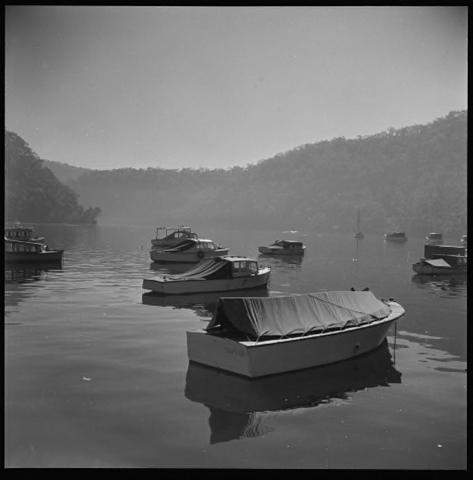
The following biography is based on information from Berowra Visions, Margaret Preston & Beyond
79 Artist Margaret Preston purchased a property in Berowra in August 1931 and lived in Berowra between 1932 and 1939. Her time there was an opportunity for her to convalesce and recuperate after an operation. While living there, Margaret was stimulated by the bush landscape and she used the opportunity to study and interpret native flowers. Many of her botanical and horticultural works date to this period and she also painted landscapes of Berowra. Her works from this time include: The Winding Road to Berowra Waters, c1939, and Native Hibiscus and Gum Flowers, c1936. In 1941 she painted I lived at Berowra currently held at the Art Gallery NSW80. Her property was known locally as ‘The Springs’ due to a natural spring located near the house and is in private hands today.
12.7.3 Key audiences
The key audiences for this destination are as follows:


Local residents
Domestic caravan and campers
78 GML. Hornsby Thematic History. 40
79 Berowra Visions, Margaret Preston & Beyond. 2005. Macquarie University Art Gallery.
80 Art Gallery of NSW, I lived at Berowra, 1941. https://www.artgallery.nsw.gov.au/collection/works/7177/

Hornsby Shire DRAFT
and Action Plan Page 96
Heritage Interpretation Strategy
Figure 8. Left: Boating at Berowra, c. 1900s (Source: Hornsby Shire Recollects); right: “A day out at Berowra Waters”, Max Dupain, 1957 (Source: Hornsby Shire Recollects)
12.7.4 Key heritage themes related to the area
The key heritage themes for this destination are as follows:
Aboriginal Country
Bushland Shire
Agriculture and Horticulture


Leisure and Recreation
Health and Wellness
The Changing Face of the Shire.
12.7.5 Key heritage listed items
The key heritage listed items for this destination are included below.
Historic inn which was originally a teahouse/ guest house, built in 1920, patrons can get lunch and drinks at this historic inn.
The listing includes a shell midden and the 1880 burial place of Granny Lewis (Sarah Ferdinand). Berowra
Hornsby Shire DRAFT Heritage Interpretation Strategy and Action Plan Page 97
Suburb Item Address HLEP Listing Notes Berowra Berowra Park 14X Berowra Waters Road 158 Berowra Community hall and grounds 41X Berowra Waters Road 161 Has potential to host temporary and permanent exhibitions Berowra House 5 Wanill Place 174 “The Springs” Berowra Former servant’s quarters 7 Wanill Place 175 “The Springs” Berowra Creek “Capo di Monte” Collingridge Point 182 Berowra Creek “Berowra Waters Inn” Dusthole Point 183
Table 14. Key heritage listed items, Berowra, Berowra Waters and Creek
Berowra Heights Scenic road through bushland Berowra Waters Road 187 Berowra Waters Rex Jones Memorial Berowra Waters Road 193 Berowra Depression era sites Sam’s Creek, Berowra Valley Regional Park A2
Creek Cemetery, church ruins and memorial Bar Island A3
Berowra
Creek Jetty Bennets Bay A4
Creek Ballast heap Berowra Creek and Murramurra Creek junction A5
Berowra
Suburb Item
Berowra Creek Fire trail
Berowra Creek Fretus Hotel ruins
Berowra Waters Vehicular cable ferry
Berowra Waters Boat shed
Address HLEP Listing Notes

McCallums Avenue A6
McCallums Avenue fire trail A7
Berowra Waters Road and Bay Road A8
Berowra Waters Road A9
Berowra Waters Kiosk—teahouse Berowra Waters Road A10
Berowra Waters Toilet block
Berowra Waters Road A11
Located on private fire trail
Visitors can access Berowra Waters by catching the ferry, which has been in operation since 1903.
Berowra Waters Tidal bath remains Franks Bight adjacent to Kirkpatrick Way A12
Built during the Great Depression, the Tidal Baths were constructed in Berowra Creek as a government-funded scheme. The baths closed by 1975. Tidal pools like this are a long-standing tradition in the Hornsby shire, that allowed swimming in safety from sharks
Hornsby Heights Crosslands Reserve
Berowra Berowra Valley Regional Park
12.7.6 Other non-listed items
441 Somerville Road 564
The place was formerly inhabited by the ‘Benowie Aboriginal tribe’, and contains a number of Aboriginal sites.
Non-listed historical and Aboriginal cultural items of interest are listed below. These items have been suggested by stakeholders.
Table 15. Non-listed items
Suburb Item name

Address Notes
Dyarubbin Hawkesbury River Aboriginal Cultural Heritage
Berowra Berowra Valley National Contains the Great North Walk
Berowra The Benowie Track Part of the Great North Walk
Berowra Moses Shattle’s selection and oyster lease at Porto Bay
Peat’s Bight, Porto Bay
40 acres at Peat’s Bight at the mouth of Marra Marra Creek. Home of Moses and Alice Shattles and their four children Shattles applied to Dept Fisheries for a 300-acres lease at Porto Bay. No record found of whether it was granted.
Page 98
Hornsby Shire DRAFT Heritage Interpretation Strategy and Action Plan
Fiddletown Doughboy beach
Jack’s rock, Sal’s cave, King Billy’s camp and Sam’s cave
12.7.7 Recommendations for interpretation
Aboriginal cultural heritage value recommendation from Draft Aboriginal Heritage Study (Coast, 2022)
Aboriginal cultural heritage value recommendation from Draft Aboriginal Heritage Study (Coast, 2022)

The following interpretive media and strategies, reflecting the key themes and heritage items of this destination, are recommended. These are broad recommendations only and should be refined in future development planning.
Tours and trails

Berowra waters and creek is a predominantly water-based area and would benefit from tours and trails that are water-based experiences. Trails could be developed by podcast or app which would encourage boats to visit areas along the creek and see heritage sites by water.
Adaptive reuse
Working with the National Parks and Wildlife Service, the heritage-listed kiosk/teahouse on Berowra Waters Road (HLEP no. A10, located on NPWS land) could be adapted to be a tourist information site or centre. The building could be a base for visitors to be introduced to local heritage activities. Some of the material from the ‘Museum of Berowra’81 (an online facility) could be repurposed for physical displays.
Site markers/Blue Plaques
A submission was made in 2021 for a Blue Plaque for Margaret Preston. Preston and her house are strong candidates for a Blue Plaque and it is recommended that a revised application be submitted to Heritage NSW, the managing body for the Blue Plaques program.
Interpretive panels
Strategically positioned heritage interpretation panels that follow the design guidelines can provide contextual information about the heritage of a particular building, site or location in this area. Integrated QR codes can provide a link back to more detailed information on Councils website.
It is understood from consultation that Aboriginal cultural sites need to be sensitively interpreted. Whilst it may not be appropriate to advertise a site, visitors do reach these areas by word of mouth. For those that do find the sites it would be beneficial to have interpretive panels, developed in consultation with Traditional Owners, to interpret the Aboriginal Cultural Heritage.
Oral histories
As a relatively remote community the heritage of the area would be suited to being interpreted virtually and digitally, to allow for broader engagement. The local histories of Berowra, Berowra Waters and Berowra Creek could be recorded as oral histories for Hornsby Shire Recollects.
Public programming and events
A heritage water festival could become an annual event at Berowra, celebrating the water-based heritage of the area, both Aboriginal and non-Aboriginal, while encouraging repeat visitation.
Hornsby Shire DRAFT Heritage Interpretation Strategy and Action Plan Page 99
81
Museum of Berowra. https://berowramuseum.wordpress.com/
A targeted book on the history of the Berowra Waters area could be commissioned to be part of a series of short publications on key sites within Hornsby Shire.
Museums and libraries
Berowra District Hall is a community space with potential to host displays about the local history of the area and artist Margaret Preston.
Aboriginal languages
The sites of Aboriginal engravings could be renamed with Aboriginal place names in consultation with Knowledge Holders.
Acknowledgement of Country
Where appropriate include an Acknowledgement of Country near to heritage sites or on nearby interpretative panels (see above).
Content for social media and websites

There is a balance needed between sharing the importance and richness of the Aboriginal heritage sites in this area with the risks of increased access and footfall by tourists. However, many of the sites in the area could be recorded and shared digitally through 3D imagery, oral histories, virtual tours etc. This would allow appropriate stories to be told but without revealing the locations of sensitive sites.
12.8 The Field of Mars: Beecroft and Cheltenham
12.8.1 Summary
In 1804, 6000 acres of land were put aside for public use and named the Field of Mars Common. The streetscapes of Beecroft and Cheltenham – which stand now on that land – retained their latenineteenth and twentieth century charm. These suburbs are perfect destinations for day trips, where visitors may picnic at parks with heritage sites or stroll through the historic streets and shopfronts. Beecroft and Cheltenham have retained both their village feel and bush heritage, which are important to the local community.
12.8.2 Destination history
The following history is based on historic information from the Hornsby Thematic History82 .

The traditional custodians of the Beecroft and Cheltenham area are the Wallumettagal/Wattamattagal people who speak the Darug language. The modern suburbs of Beecroft and Cheltenham are built upon an allotment of land known to early colonists as the “Field of Mars.” The name “Field of Mars” was decided upon by Governor Arthur Phillip, when in January 1792 he granted to two marines the first parcels of land. In 1804, 6000 acres of land was set aside for the use of the local community and named the Field of Mars Common.
The Common was intended as a place for small settlers to graze their livestock, collect firewood, and supplement their farming practices. However, within 60 years the Common had become home to smugglers and bushrangers, and in 1874 it was subdivided and most of it was privately sold. The only remaining public space from the days of the common is the Field of Mars Reserve, located between
Hornsby Shire DRAFT Heritage Interpretation Strategy and Action Plan Page 100
Publications
82
GML Heritage. 2021. Hornsby Thematic History. Unpublished report prepared for Hornsby Shire Council.
North Ryde and Gladesville. From the Field of Mars subdivision, the suburbs of Beecroft and Cheltenham were established in 1887.
The railway arrived at Beecroft in 1886 and serviced both Beecroft and Cheltenham, the latter of which did not get a railway station until 1898. The suburb of Cheltenham was named by wealthy tailor William Chorley, who petitioned the Department of Railways to construct the station and name it after his birthplace of Cheltenham in England. The temperance movement of the late-nineteenth century had a strong influence on the development of both Beecroft and Cheltenham – neither town has ever had a pub or bar, and commercial development has been extremely limited. As a result, Beecroft and Cheltenham have retained their late-nineteenth and early-twentieth century residential character, as well as much of their bushland
12.8.3 Key audiences
The key audiences for this destination are as follows:
Local residents
Visiting Friends and Relatives

NSW Family Market
Over 55s travel
12.8.4 Key heritage themes related to the area
The key heritage themes for this destination are as follows:
Aboriginal Country
Settlement and Suburbanisation; and


The Changing Face of the Shire.
12.8.5 Key heritage listed items
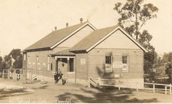
The key heritage listed items for this destination are included below.
Table 16. Key heritage listed items, The Field of Mars: Beecroft and Cheltenham
Hornsby Shire DRAFT Heritage Interpretation Strategy and Action Plan Page 101
Figure 9. Beecroft School of Arts (now Beecroft Community Centre) in 1904 and 1910 (Source: Hornsby Shire Recollects).
Suburb Item Address HLEP Listing Notes Beecroft Beecroft Public School (excluding grounds) 90–96 Beecroft Road 49
The timber building standing next to today's brick building was the original church (erected in 1891) at the corner of Beecroft Road and Hannah Street.


Shire
Page 102 Suburb Item Address HLEP Listing Notes Beecroft “Vintage Cellars” building 100 Beecroft Road 50 Beecroft Beecroft Community Centre 111 Beecroft Road 51
facility was
Thompson and
1904
the Beecroft School of Arts. Beecroft The Village Green, Boer War Memorial, World War I and II Memorials 111X Beecroft Road 54 Also has playground and other facilities. Beecroft Street trees Boronia Avenue 66 Beecroft Street trees Cardinal Avenue 68 Beecroft Street trees Castle Howard Road 69 Beecroft Bushland reserve—Beecroft and Cheltenham Parks 23X Castle Howard Road 70 Featured in ‘Self guided bushwalks Beecroft-Cheltenham Link Track’ Beecroft Street trees Chapman Avenue 71 Beecroft St. John’s Anglican Church 9 Chapman Avenue 72
Hornsby
DRAFT Heritage Interpretation Strategy and Action Plan
The
designed by Lindsay
built in
as
Beecroft Street trees Hannah Street 98 Beecroft Beecroft Post Office 5B Hannah Street 101 Beecroft Fearnley Park 86X Hannah Street 110 Forested playground with walking trails through the remnants of Blue Gum High Forest. Beecroft Street trees Hull Road 111 Beecroft Lyndon Way Reserve and street trees Lyndon Way 113 Beecroft Street trees and bushland Malton Road 114 Beecroft Presbyterian Church 1A Mary Street 127
Beecroft Chilworth Reserve 11X and 14X Mary Street 129 Featured in ‘Self guided bushwalks Beecroft-Cheltenham Link Track’ Beecroft Street trees Murray Road 130 Beecroft Devlins Creek Bushland Reserve Orchard Road 135 Beecroft Street trees Orchard Road 136
The building for the Beecroft Presbyterian Church was commenced on 19 September 1908 and was opened on 13 February 1909.
State heritage listed bushland sanctuary and meditation retreat located in Cheltenham and constructed in 1937, popular among visiting Buddhists, bushwalking groups, and conservationists. Designed and built by Marie Byles, NSW’s first female solicitor
Beecroft and Cheltenham represent the largest heritage conservation area in the Hornsby Shire, and their streets are lined with houses dating from the 1880’s.
12.8.6 Other non-listed items

Non-listed historical and Aboriginal cultural items of interest are listed below. These items have been suggested by stakeholders.

Hornsby Shire
Page 103 Suburb Item Address HLEP Listing Notes Beecroft Pennant Hills Golf Club—grounds 589 Pennant Hills Road 138 Conserves mature indigenous trees, clubhouse dates from the 1950s/60s Beecroft Bushland Railway land— Beecroft to Pennant Hills 139 Beecroft Bushland Reserve Sutherland Road and Park Avenue—Byles Creek Valley 140 Beecroft Booth Park 82X Sutherland Road 141 Beecroft Beecroft Railway Station and garden Wongala Crescent and Great Northern Railway 142 Cheltenham Former church and grounds 179 Beecroft Road 266 Cheltenham “Ahimsa” and grounds 67 Cobran Road 276 SHR No. 01494
Cheltenham Bushland Sutherland Road 416 Cheltenham Trees 1 The Boulevard 280 Cheltenham Grounds—Cheltenham Recreation Club 60–74 The Crescent 296 Cheltenham Street trees The Promenade 298 BeecroftCheltenham Heritage Conservation Area Beecroft and Cheltenham C2
DRAFT Heritage Interpretation Strategy and Action Plan
Table
Suburb Item name

Bill Onus’s residence
Address Notes
Aboriginal cultural heritage value recommendation from Draft Aboriginal Heritage Study (Coast, 2022)
Beecroft apprenticeships

Aboriginal cultural heritage value recommendation from Draft Aboriginal Heritage Study (Coast, 2022)
Cheltenham apprenticeships
12.8.7 Recommendations for interpretation
Aboriginal cultural heritage value recommendation from Draft Aboriginal Heritage Study (Coast, 2022)
The following interpretive media and strategies, reflecting the key themes and heritage items of this destination, are recommended. These are broad recommendations only and should be refined in future development planning.
Public programs
An annual heritage festival similar to ‘Open Sydney’ where locals and visitors are encouraged to visit heritage houses and streets in the area. The festival would be hosted by homeowners, local heritage organisations like the Civic Trust, Rotary Club, the Council, churches, retreat centres who occupy heritage houses or buildings. For one weekend doors (or gates) are unlocked to spaces normally closed to the public. Participation would need to be voluntary but preliminary discussions with community groups demonstrate that local residents have a pride in their heritage homes and areas that may like to celebrate.
Site markers and Blue Plaques
Beecroft and Cheltenham History Group have identified a number of significant historic people associated with the area. The list should be reviewed to identify potential applicants for the NSW blue plaque scheme. For example, Joyce Winifred Vickery – a pioneering botanist and the first woman to be appointed in a scientific role in the NSW Public Service – lived and died at her house on The Promenade in Cheltenham. Similar pioneering public figures identified by the Beecroft and Cheltenham History Group would be good candidates for submission to Heritage NSW’s Blue Plaque Program, or for a Council-managed site marker program within Beecroft and Cheltenham.
Ground plane elements
The residential nature of Beecroft and Cheltenham lends itself to subtle interpretation, such as pavings and ground plane elements that flag streetscapes and houses of interest.
Functional elements
During public space upgrades within the Beecroft town centre, interpretive functional elements should be considered in planning stages.
Interpretive panels
Strategically positioned heritage interpretation panels that follow the design guidelines can provide contextual information about the heritage of a particular building, site, or location in this area. Integrated
Hornsby Shire DRAFT Heritage Interpretation Strategy and Action Plan Page 104
17. Non-listed items
QR codes can provide a link back to more detailed information on Councils website. Interpretive panels should be placed at pause points throughout the suburbs, such as bus stops and public reserves.
Website

The Beecroft and Cheltenham History Group website is a useful resource which includes history, heritage houses, notable people, and other heritage information. The site is run by volunteers and could be supported to allow it to be expanded and developed further. Further information about the heritage of the ‘Field of Mars’ region could be included in a discrete page on the Hornsby Shire Council’s local history website.

Conservation
The heritage houses and streetscapes of Beecroft and Cheltenham are a good example of best practice of a local community conserving the heritage of their area. Encouraging the residents to share their experiences and knowledge in conservation of homes and areas could benefit other areas within the Shire. These experiences could be included in a package encouraging homeowners around the Shire to appreciate the benefits of listing their properties or installing blue plaques.
12.9 The Orchard District: Dural, Arcadia, Galston, Glenorie and surrounds
12.9.1 Summary
The Dural, Arcadia, Galston, Glenorie and surrounds district is dotted with historic orchard properties, nurseries, farms and markets many of which have been in operation since the 1800s, and which already welcome visitors to stay, pick fruit, shop and take part in what is an on-going agricultural living history experience.
12.9.2 Destination history
The following history is based on historic information from the Hornsby Thematic History83
Galston, Arcadia, Dural, Middle Dural and Glenorie have a rich history of fruit-growing and the region is one of the finest orchard districts in the country. William Fagan was a prominent free settler who arrived in Sydney in 1848 and later purchased property at Arcadia. A pioneer orange grower, Fagan was instrumental in establishing the citrus industry in the Arcadia, Dural and Galston area. This area soon became synonymous with stone and citrus fruit. By 1899, 603 acres of fruit-bearing trees and 279 acres of non-bearing fruit (newly planted orchards) could be found in the Dural district. New and improved roads in the later-nineteenth and early-twentieth centuries streamlined the delivery of fruit from farm to market, which had previously been conducted by horse and cart. Hornsby became a busy goods yard and transport centre in this period and the shopping centre on the western side of the station became a busy service centre for farmers and locals alike.
In 1907, there were approximately 8000 fruitgrowers and primary producers based in the Central Cumberland District (encompassing Hornsby Shire) and over 40,000 people were ‘dependent or mainly dependent on the fruitgrowing industry for a livelihood.’84 For this reason, in 1909 the Department of Agriculture purchased a former ‘old and neglected’ orchard on 40 acres in Galston Road, Dural. The Government Orchard was operated until 1917 as an experimental and demonstration orchard providing training for the ‘Dreadnought Boys’, British child migrants who voluntarily migrated to Australia between 1911 and 1939 and undertook farm training before working on rural properties across New South Wales. Several of the original nineteenth and twentieth century orchards of Galston, Arcadia, Dural and Glenorie remain in operation to this day, and allow public access to these historic sites.
Hornsby Shire DRAFT Heritage Interpretation Strategy and Action Plan Page 105
83 GML Heritage. 2021. Hornsby Thematic History. Unpublished report prepared for Hornsby Shire Council. 26, 4048 84 GML. Hornsby Thematic History. 44.
12.9.3 Key audiences
The key audiences for this destination are as follows:
Local residents
Road trippers
NSW Family Market
International backpackers
Food and Wine tourism
Over 55s Travel.
12.9.4 Key heritage themes related to the area
The key heritage themes for this destination are as follows:
Aboriginal Country
Bushland Shire

Agriculture and Horticulture


Leisure and Recreation
Health and Wellness
The Changing Face of the Shire.
12.9.5 Key heritage items
The key heritage items for this destination are included below.
Hornsby Shire DRAFT Heritage Interpretation Strategy and Action Plan Page 106
Figure 10. Government Orchard, Dural, 1909; Orcharding in Old Mans valley (Source: Hornsby Shire Recollects)


Hornsby Shire DRAFT Heritage Interpretation Strategy and Action Plan Page 107
Suburb Item Address HLEP Listing Notes Arcadia Waddell Ridge group Calabash Road and Calabash Creek A1 Dwelling remains, cistern, benchmark, rock inscription, field terracing, road terracing, fenceline and footings Arcadia Arcadia General Store 89–91 Arcadia Road 1 Arcadia Arcadia Community Hall 136 Arcadia Road 4 Arcadia St. Columb’s Anglican Church and grounds 138 Arcadia Road 5 Working church part of parish of Dural District. Arcadia Arcadia Public School 140 Arcadia Road 6 Original building (excluding other buildings and grounds) Arcadia Windbreak Halls Road 12 Arcadia Windbreak 8–12 Sunnyridge Road 17 Arcadia Windbreak 15–17 Sunnyridge Road 18 Dural Swanes Nursery 490–498 Galston Road 341 Dural Original alignment of New Line Road (Elouera estate) New Line Road 344 Dural Street trees and bushland New Line Road 343 Dural House, former Uniting Church and chapel 925–935 and 937 Old Northern Road 351 Dural St Jude’s Anglican Church and grounds 951–965 Old Northern Road 352 and A39 Working church part of parish of Dural District. Dural Cemetery 885–887 Old Northern Road A38 Plot informationhttp://www.ddac.org.au/ddac1/wpcontent/uploads/2022/09/CemeteryPlan-Plot-Map.pdf Galston Galston Community Centre 37 Arcadia Road 420 Galston Fagan Park group, including Netherby, farm buildings, packing shed, brick kiln site, clay pit and bushland 38–50X Arcadia Road 421 and A41 See separate section for Fagan Park. Galston Galston Public School 39–45 Arcadia Road 422 Original building, former teacher’s residence and grounds (excluding other buildings) Galston Windbreak Bayfield Road 428 Galston Windbreak 29 Crosslands Road 431 Galston Galston Branch Library (former church) 357 Galston Road 437 Old Emmanuel Church –deconsecrated.
Table 18. Key heritage items, The Orchard District: Dural, Arcadia, Galston and Glenorie
12.9.6 Other non-listed items


Non-listed historical and Aboriginal cultural items of interest are listed below. These items have been suggested by stakeholders.
Table 19. Non-listed
Hornsby Shire DRAFT Heritage Interpretation Strategy and Action Plan Page 108 Suburb Item Address HLEP Listing Notes Galston Galston High School 403 Galston Road 438 “Waddell Cottage” and water trough (excluding grounds) Galston Galston Park and memorial 412X Galston Road 439 Galston Pipe organ 11 School Road 447 At Galston Uniting Church Galston Roadworks Crosslands Road A42
Galston Gorge culvert Galston Road A44 Galston Galston Gorge sandstone buttressing Galston Road A43 Galston Galston Gorge timber bridge Galston Road A46 Galston Galston Gorge water troughs Galston Road A45 Galston Banksia cottage quarry 40 Mid-Dural Road A47 Galston Culvert Sallaway Road A48 GlenhavenRoadside trees Old Northern Road 448 Glenorie Glenorie Mission Hall 1409 Old Northern Road 451 Glenorie Mission Church is nondenominational working church Glenorie Glenorie Memorial Hall and war memorial precinct 1729 Old Northern Road 456 Middle Dural “Mountain View” 1229 Old Northern Road 570 Middle Dural “Spring Hill” and garden 1231 Old Northern Road 571 Middle Dural Bushland reserve 18—20 Sallaway Road 572
Galston
Suburb Item name Address HLEP Listing Notes Arcadia St Benedict’s monastery 121 Arcadia Rd, Arcadia, NSW, 2159 Un-listed
monastery
Arcadia
items
The
at
was founded in 1961, and the first wing of the present building constructed in the following year.
12.9.7 Recommendations for interpretation
The following interpretive media and strategies, reflecting the key themes and heritage items of this destination, are recommended. These are broad recommendations only and should be refined in future development planning.
Public programs
The owners and workers at the orchards, farms and markets are ‘live interpreters’ who could be conduits for imparting heritage information for visitors. Sharing of heritage information with owners and workers would give them confidence to talk more broadly about the heritage of the area.
An annual ‘Harvest Festival’ event in the area could be a celebration of the local produce and agricultural heritage of the area. An annual event would encourage repeat visitation.
Tours and trails
Orchards and farms in and around the area could be encouraged to join the Harvest trails and markets website85 and develop a distinctive heritage orchard identity for the region. Orchards could be encouraged to include heritage information on their signage and websites.
There are also a number of historic churches, cemeteries and monasteries in this area and nearby areas that could form part of a trail or app.
Interpretive panels
Strategically positioned heritage interpretation panels that follow the design guidelines can provide contextual information about the heritage of a particular building, site or location in this area. Integrated QR codes can provide a link back to more detailed information on Councils website.
Oral histories
As an area with families and businesses who have lived and worked in the area for generations, it would be beneficial to carry out an oral history project with the data being made available through websites like Hornsby Shire Recollects.
Publications

A targeted book on the history of the Orchard District could be commissioned to be part of a series of short publications on key sites within Hornsby Shire.
85 Harvests Trails and Markets. 2023. https://www.harvesttrailsandmarkets.com.au/farm-gatetrails/map/?region_id=1&m_id=26,

Hornsby Shire DRAFT Heritage Interpretation Strategy and Action Plan Page 109
Item name
HLEP
Suburb
Address
Listing Notes Dural, Middle Dural and Glenorie Great North Road Old Northern Road / New Line Road
Tracker Jack Redtank
Aboriginal cultural heritage value recommendation from Draft Aboriginal Heritage Study (Coast, 2022)
12.10 Fagan Park and Netherby
12.10.1 Summary
Originally a family orchard dating to 185386, the 55-hectare park features a “Garden of Many Nations” with flora from countries from all over the world, the original homestead ('Netherby'), the original milking complex, and a packing shed.
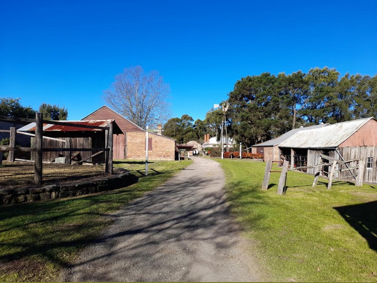
12.10.2 Destination history
The following history is based on historic information from the Hornsby Thematic History87 .


Fagan Park is named after Irish free-settler William Fagan and his descendants, who, after arriving in Australia in 1848, purchased 70 acres of land in Arcadia and established orchards. Fagan was instrumental in establishing the citrus industry in the Arcadia, Dural and Galston area, and by the late nineteenth century was known as a pioneer citrus grower. In the early 1900’s, William’s son Sam Fagan and his wife Emma built the family home ‘Netherby’ and a large packing shed in the early 1900s, planting orchards and running cattle on the land. The packing shed, which still stands today, was used to pack fruits from the orchard for delivery to markets in Sydney.
In the 1930’s, when the Depression struck Sydney, Sam Fagan shut down the orchards. Bruce Fagan, Sam’s youngest son, successfully ran a herd of Jersey dairy cattle on the property after the closure of the orchard. In 1980, Bruce and his sister Ida Fagan donated the property to the Department of Lands, who opened it to the public as ‘Fagan Park.’ Netherby, the milking shed, and the packing shed
Hornsby Shire DRAFT Heritage Interpretation Strategy and Action Plan Page 110
Figure 11. Netherby homestead, 2022
86 History of Fagan park prepared by Hornsby Library & Information Services.
87 GML Heritage. 2021. Hornsby Thematic History. Unpublished report prepared for Hornsby Shire Council.
underwent extensive restorations in 1988, and are now valuable examples of early twentieth century farming heritage. Netherby is occasionally open to visitors, and the milking and packing sheds are now museums.
12.10.3 Key audiences
The key audiences for this destination are as follows:
Local residents
NSW Family Market

12.10.4 Key heritage themes related to the area
The key heritage themes for this destination are as follows:
Aboriginal Country
Agriculture and Horticulture


The Changing Face of the Shire.
12.10.5 Key heritage items
The key heritage items for this destination are included below.
12.10.6 Recommendations for interpretation
The following interpretive media and strategies, reflecting the key themes and heritage items of this destination, are recommended. These are broad recommendations only and should be refined in future development planning.
Hornsby Shire DRAFT Heritage Interpretation Strategy and Action Plan Page 111
Figure 12. Left: ‘Netherby’, Fagan Park, c. 1980s (Source: Hornsby Shire Recollects); right: Fruit sorting at the Fagan Packing Shed, c. 1920s (Source: Hornsby Shire Recollects)
Table 20. Key heritage items, Fagan Park and Netherby
Suburb Item Address HLEP Listing
Galston
Fagan Park group, including Netherby, farm buildings, packing shed, brick kiln site, clay pit and bushland
38–50X Arcadia Road 421 and A41
Heritage Interpretation Plan
As a major destination, Fagan Park and Netherby could have its own Heritage Interpretation Plan based on this HIS&AP. A site as diverse and well-preserved as Fagan Park would be well-suited to a suite of interpretive elements, which could include:
adaptive re-use
play spaces
public art
trails
tours

interpretive panels
live interpretation
functional elements
oral histories
12.11 Cowan and Muogamarra
12.11.1 Summary
Cowan and Muogamarra are large areas of natural beauty within the Hornsby Shire bounded by Berowra Creek to the west and Hawkesbury River to the north. Rock carvings, pigment art, and grinding grooves created by generations of traditional Aboriginal custodians can be found throughout the Cowan and Muogamarra regions.
12.11.2 Destination history
The following history is based on historic information from the Hornsby Thematic History.88

Besides the botanist George Caley, who explored the area in 1805, the first Europeans to visit the area were timber-getters. The timber from Cowan was used for coach building, one of the first industries in the area.89 In 1836, George Peat was granted 50 acres (20 ha) on the Hawkesbury River at what is now Peats Bight, where he built a wharf, huts, and a dairy farm.
The Muogamarra Nature Reserve is home to Peats Crater, a volcanic diatreme formed by a gaseous explosion in the past. In 1878, a cricket match was played in the diatreme between the South Colah and Peats Ferry teams. Along the various trails in the Muogamarra Nature Reserve, visitors can find the remains of Peats Ferry Road and George Peat’s farmhouse. In the 1930s, J.D. Tipper was granted Crown Land at Cowan to establish the Muogamarra Sanctuary for the conservation of native bird, animal and plant life.
Cowan’s railway stop was constructed in 1901 and electrified in 1958, which led to an increase of tourism, largely from bushwalkers and outdoorsmen. During the construction of the Great Northern Highway (now Pacific Highway) from 1925 to 1930, Cowan was home to gangs of workmen and their families; in 1927, a tent school was established for the 14 children of these workmen. The area continues to be best known for its walks, which include the Jerusalem Bay track and Point Loop.
88 GML Heritage. 2021. Hornsby Thematic History. Unpublished report prepared for Hornsby Shire Council.
89 Dictionary of Sydney. Cowan. https://dictionaryofsydney.org/entry/cowan
Hornsby Shire DRAFT Heritage Interpretation Strategy and Action Plan Page 112
12.11.3 Key audiences
The key audiences for this destination are as follows:
Local residents
Road trippers
Domestic caravan and campers.
(Visitors interested in…) Aboriginal Tourism


12.11.4 Key heritage themes related to the area
The key heritage themes for this destination are as follows:
Aboriginal Country
Bushland Shire

Agriculture and Horticulture.

12.11.5 Key heritage items
The key heritage items for this destination are included below.
Table 21. Key heritage items, Cowan and Muogamarra
Suburb Item Address HLEP Listing Notes
Cowan Street trees Pacific Highway 314
Cowan House ruins near quarry 1245 and 1247 Pacific Highway A26
Cowan Original quarry Pacific Highway A27
Hornsby Shire DRAFT Heritage Interpretation Strategy and Action Plan Page 113
Figure 13. Aboriginal rock carvings depict wallaby in motion at Muogamarra Sanctuary (Source: National Archives of Australia). Cowan Creek, c1900 (Source: Hornsby Shire Recoleects)
Suburb Item Address HLEP Listing Notes
Cowan Railway Station
Pacific Highway A28 SHI #4801906
Cowan Peats Ferry Road remains Pacific Highway (Muogamarra Nature Reserve) A29
Cowan Remains of George Peat’s farmhouse Peats Bight A30
Cowan Old road
Peats Bight (Muogamarra Nature Reserve) A31
Sydney’s only remaining double-track railway. Electrified train station with the original platform buildings, ticket office, and residence.
Ticketed access only via NP Muogamarra Nature Reserve
Ticketed access only via NP Muogamarra Nature Reserve
Ticketed access only via NP Muogamarra Nature Reserve
Cowan Guringai Resting Place –Bujiwa Bay
Repatriation site containing the ancestral remains of Guringai Aboriginal people taken in the past and held in museums
Cowan Indigenous place
12.11.6 Other non-listed items
Non-listed historical and Aboriginal cultural items of interest are listed below. These items have been suggested by stakeholders.
Table 22. Non-listed items
Suburb Item name Address


Notes
Muogamarra Nature Reserve
Muogamarra Nature Reserve, 3km north of Cowan
This reserve, which is only open for 6 weekends during Spring, offers a rare opportunity to view some hidden heritage sites. Along the various trails, visitors can find the remains of Peats Ferry Road and George Peat’s farmhouse.
Muogamarra Muogamarra museum
Muogamarra Nature Reserve, 3km north of Cowan
Also within the reserve is a small museum: the Muogamarra Field Studies Centre Museum – formerly Tipper’s Office. Contains some interpretation about local natural history, site history and local Aboriginal heritage sites.
Cowan Great North Walk
The Berowra Waters to Cowan section of the Great North Walk.
Hornsby Shire
Page 114
DRAFT Heritage Interpretation Strategy and Action Plan
12.11.7 Recommendations for interpretation
The following interpretive media and strategies, reflecting the key themes and heritage items of this destination, are recommended. These are broad recommendations only and should be refined in future development planning. It is noted that some of the heritage items are in NSW National Parks.
Aboriginal languages
The sites of Aboriginal engravings could be renamed with Aboriginal place names in consultation with Knowledge Holders.
Interpretive panels
It is understood from consultation that Aboriginal cultural sites need to be sensitively interpreted. Whilst it may not be appropriate to advertise a site, visitors do reach these areas by word of mouth. For those that do find the sites, it would be beneficial to have interpretive panels, developed in consultation with Traditional Owners, to interpret the Aboriginal Cultural Heritage.
Acknowledgement of Country
Where appropriate include an Acknowledgement of Country near to heritage sites or on nearby interpretative panels (see above).
Content for social media and websites

There is a balance needed between sharing the importance and richness of the Aboriginal heritage sites in this area with the risks of increased access and footfall by tourists. However, many of the sites in the area could be recorded and shared digitally through 3D imagery, oral histories, virtual tours etc. This would allow appropriate stories to be told but without revealing the locations of sensitive sites.
12.12 Maroota and Canoelands
12.12.1 Summary
The bushland areas of Maroota and Canoelands are ideal for campers, hikers, and nature enthusiasts. The Maroota Historic Site is distinguished by Devil’s Rock, one of Sydney’s most significant Aboriginal heritage sites, containing over 67 well-preserved rock engravings. Canoelands has plenty of hiking trails and private properties containing significant heritage sites (such as the Fretus Hotel Ruins) – the Canoelands Orchard is the most significant site still available to the public.
12.12.2 Destination history
The following history is based on historic information from the Hornsby Thematic History.90

The traditional custodians of the land now known as Maroota and Canoelands are the people of the Darug language group – it is thought that the name ‘Maroota’ derives from the Darug word muru, meaning ‘path’ or ‘road.’ The plentiful remaining rock art and grinding grooves throughout the region attest to tens of thousands of years of Aboriginal inhabitation and connection to Country. During early contact at Maroota, the Dharug people devised a story to protect of their sacred sites (now known as Devil’s Rock), warning the Europeans to avoid the area because it was where the devil lived. This sandstone outcrop – one of the most extensive Aboriginal art sites in the Sydney basin – is home to 6080 rock engravings and continues to be of great spiritual significance to the Dharug people.
In 1832, land at Maroota was granted to soldiers who had served in the Napoleanic Wars. However, the new landowners soon discovered that the soil was not suited to European farming practices – an
90 GML Heritage. 2021. Hornsby Thematic History. Unpublished report prepared for Hornsby Shire Council.
Hornsby Shire DRAFT Heritage Interpretation Strategy and Action Plan Page 115
extensive seam of Sydney sandstone runs below Maroota, making the soil shallow and acidic. Once a deep native forest, tracts of land in Maroota were cleared from 1890, although significant development has not occurred in the region. From 1970, the sandstone seam below Maroota has been quarried, the main industry in the region. European expeditions into Canoelands first occurred in the early-nineteenth century, when timber-getters felled the dense stringybark forests. The region was known by the timbergetters as the ‘Canoe Grounds’ due to the proportion of trees that had been used by the Dharug people to make bark canoes. The region’s deforestation means that no (or few) of these scar trees remain. Although the first sale of land in Canoeland had occurred in 1835, no European settlement of the region ever eventuated, and it was not until 1995 that Canoelands was officially given the status of ‘suburb.’
12.12.3 Key audiences
The key audiences for this destination are as follows:
Local residents
Road trippers
Domestic caravan and campers
(Visitors interested in …) Aboriginal Tourism.

12.12.4 Key heritage themes related to the area
The key heritage themes for this destination are as follows:
Aboriginal Country
Bushland Shire
Agriculture and Horticulture

The Changing Face of the Shire.
12.12.5 Key heritage listed items
The key heritage listed items for this destination are included below.
Table 23. Key heritage listed items, Maroota and Canoelands
Suburb Item
Canoelands “Gentleman’s Halt”
Canoelands
Maroota Great North Road relics Old Telegraph Road
Hornsby Shire DRAFT Heritage Interpretation Strategy and Action Plan Page 116
HLEP Listing
Address
Notes
Gentleman’s
Halt 251 and A23 Ruins
27-29 Canoelands Rd, Canoelands Not listed Historic orchard belonging to the same family since
to the
Canoelands Orchard
1923, accessible
public via online booking.
A58
Maroota Guralung Gananayung (Maroota Historic Site)
Notes
Aboriginal art sites dating from prior to and during early European arrival. The art sites include a rock platform with 85 engravings and 54 grinding grooves, two rockshelters with art and archaeological deposit. The Place also includes part of a bora or initiation ground. The Place was nominated by the Metropolitan Local Aboriginal Land Council.
Canoelands Indigenous place
12.12.6 Other non-listed items
Non-listed historical and Aboriginal cultural items of interest are listed below. These items have been suggested by stakeholders.
Table 24. Non-listed items
Maroota
Maroota Historic Site NSW Parks
Walking tracks with restricted access throughout the Maroota Historic Site include Aboriginal rock carvings and relics from the original construction of the Great North Road.
Sarah Lewis’s property
Aboriginal cultural heritage value recommendation from Draft Aboriginal Heritage Study (Coast, 2022)
Tracker Joseph Murray
Aboriginal cultural heritage value recommendation from Draft Aboriginal Heritage Study (Coast, 2022)
Tracker G. McGann

Aboriginal cultural heritage value recommendation from Draft Aboriginal Heritage Study (Coast, 2022)
Frontier violence
12.12.7 Recommendations for interpretation
Aboriginal cultural heritage value recommendation from Draft Aboriginal Heritage Study (Coast, 2022)
The following interpretive media and strategies, reflecting the key themes and heritage items of this destination, are recommended. These are broad recommendations only and should be refined in future development planning.

Hornsby Shire DRAFT Heritage Interpretation Strategy and Action Plan Page 117 Suburb Item Address HLEP Listing
Item name Address
Suburb
Notes
Aboriginal languages
Where appropriate, the sites of Aboriginal engravings could be renamed with Aboriginal place names in consultation with Knowledge Holders.
Interpretive panels
It is understood from consultation that Aboriginal cultural sites need to be sensitively interpreted. Whilst it may not be appropriate to advertise a site, visitors do reach these areas by word of mouth. For those that do find the sites, it would be beneficial to have interpretive panels, developed in consultation with Traditional Owners, to interpret the Aboriginal Cultural Heritage.
Acknowledgement of Country
Where appropriate include an Acknowledgement of Country near to heritage sites or on nearby interpretative panels (see above).
Content for social media and websites

There is a balance needed between sharing the importance and richness of the Aboriginal heritage sites in this area with the risks of increased access and footfall by tourists. However, many of the sites in the area could be recorded and shared digitally through 3D imagery, oral histories, virtual tours etc. This would allow appropriate stories to be told but without revealing the locations of sensitive sites.
Virtual tours could allow virtual access to sites that are currently difficult to access including Maroota Historic Site, or potentially sites which are private properties in negotiation with the owners.
12.13 Hornsby Regional Park
12.13.1 Summary
Hornsby Council acquired the Hornsby Regional Park (the former historic Hornsby Quarry) in 2003 and is currently in the process of amalgamating the site with the nearby Hornsby Park, which itself is heritage listed. According to the Hornsby Park Master Plan, the park will incorporate interpretation of the Higgins Family cemetery, the quarry crusher plant, Depression era heritage steps, the former CSIRO radio telescope program, the diatreme, and other natural heritage sites.91
12.13.2 Destination history
The following history is based on historic information from the Hornsby Thematic History92

Hornsby Quarry once belonged to the Higgins Family land grant of 1836 who logged and farmed in the valley for successive generations, but operated as a breccia hard rock quarry from 1905 until the late 1990s (Figure 14). The quarry was operated by Hornsby Council during the 1920’s and was privately owned by CSR Construction Materials from 1959 to 2003, at which time it was purchased once again by the Hornsby Shire Council.
Over the years, quarrying activity has exposed the cross section of a diatreme, a geological formation created by a volcano that formed in the Jurassic age (200-146 million years ago). The Hornsby diatreme is the largest in the Sydney Basin, home of the significantly rare and critically endangered Blue Gum Diatreme Forest, and the only cross-section of a diatreme in Australia. From the 1940s to 1960s, the CSIRO operated a radio telescope in Old Mans Valley, located at the Hornsby Quarry.
Hornsby Shire DRAFT Heritage Interpretation Strategy and Action Plan Page 118
91 Clouston Associates & Hornsby Shire Council. 2021. Hornsby Park Master Plan Final Report
92 GML Heritage. 2021. Hornsby Thematic History. Unpublished report prepared for Hornsby Shire Council.
12.13.3 Key audiences
The key audiences for this destination are as follows:
Local residents
Visiting Friends and Relatives

Domestic Youth
International Students
NSW Family Market.
12.13.4 Key heritage themes related to the area
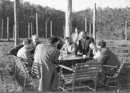
The key heritage themes for this destination are as follows:

Aboriginal Country
Convict Life
Bushland Shire

Transport
Industrial Enterprises.
12.13.5 Key heritage listed items
The key heritage listed items for this destination are included below.
Table
Hornsby Shire DRAFT Heritage Interpretation Strategy and Action Plan Page 119
Figure 14. Left: Hornsby Quarry, Old Mans Valley, Hornsby (Source: Hornsby Shire Recollects); right: Scientists at the Hornsby CSIRO radio astronomy station, c. 1947-55 (Source: Hornsby Shire Recollects)
Suburb Item Address HLEP Listing Details
Sandstone steps Quarry Road 537
Diatreme Hornsby Quarry and surrounding vegetation 1X Quarry Road 538 and A54
Hornsby Park—sandstone steps 203X Pacific Highway 513
25. Key heritage listed items, Hornsby Regional Park
Hornsby
Hornsby
Hornsby
Hornsby Old Man’s Valley Cemetery
12.13.6 Other non-listed items
1X Quarry Road A55
SHR No. 01764 (cemetery)
Including Higgins’ Family Cemetery, sandstone receptacle, cool room and site of Higgins homestead on which the Higgins Family Memorial is located
Non-listed historical and Aboriginal cultural items of interest are listed below. These items have been suggested by stakeholders.
Table 26. Non-listed items
Suburb Item name


Address Notes
Hornsby Quarry crusher plant Hornsby Park
Hornsby Former CSIRO radio telescope program
Hornsby Park, Old Mans Valley (OMV)
Between 1947 and 1955 OMV was home to the Hornsby Radio Astronomy Field Station, where some 30 different experiments in radar astronomy were conducted. Australian Pioneer in radiophysics and radio astronomy and the first female radio astronomer, Ruby Payne-Scott (1912-1981), made a world-first discovery of types of solar bursts at the Field Station in 1948
12.13.7 Recommendations for interpretation
The following interpretive media and strategies, reflecting the key themes and heritage items of this destination, are recommended. These are broad recommendations only and should be refined in future development planning.
Heritage Interpretation Plan
Although interpretive options are included in the Hornsby Park Master Plan (Clouston, 2021) and Draft Hornsby Park Embellishment Interpretation Strategy (Coulston, 2022), Hornsby Regional Park is a significant destination, and a dedicated Heritage Interpretation Plan should be developed in line with this Heritage Interpretation Strategy. The HIS would reference the Hornsby Park Heritage Assessment and Conservation Strategy (Mayne-Wilson and Associates, 1996). Interpretive elements could include:
public art
lighting for example re-creating the observatory
adaptive re-use for example of the crusher plant
Acknowledgement of Country
Conservation for example of the state heritage listed Higgins Family cemetery
play spaces
public programming and festivals
ground plane elements
Hornsby Shire DRAFT Heritage Interpretation Strategy and Action Plan Page 120
Item Address HLEP Listing Details
Suburb
The old crusher plant is situated on a flat area and provides views of the quarry.
functional elements
digital/website content
educational materials

interpretive panels
trails and tours
12.14 Hornsby Town Centre
12.14.1 Summary
Hornsby is the seat of Hornsby Shire, and is filled with sites of heritage significance, such as the Junction stores, art deco cinema, a cemetery dating to the 1870’s, and a range of significant parks, spaces, and residential buildings.
12.14.2 Destination history
The following history is based on historic information from the Hornsby Thematic History.93

Hornsby is located on the traditional lands of the Darug and Kurringgai language groups. Old Mans Valley (located near Hornsby Quarry) was a traditional women’s site according to Cammeraygal Elder, Dennis Foley.94 The first Europeans to colonise Hornsby were the Higgins family, who were granted land in Old Mans Valley and lived there from the 1830s. From 1835, Thomas Higgins sold the timber of Old Mans Valley’s bluegum and ironbark forests, planting orchards along its slopes and valley floor.95
Hornsby was initially known “Jack’s Island” by European settlers. In 1886, a railway station named “Hornsby Junction” was opened, 3km away from the suburb of ‘Hornsby’ (now Normanhurst). This caused confusion for transiters, and ‘Jack’s Island’ changed its name to Hornsby, and the former Hornsby to Normanhurst. Life in Hornsby revolved around the railway (still formally called Hornsby Junction to this day), and in 1888 the Hornsby Railway Hotel was opened nearby, catering to the railway workers and commuters. From 1906 – the same year that the Hornsby Shire Council was established –blue metal gravel was mined at the Hornsby Quarry. Electricity arrived in Hornsby from 1924, and the railway was electrified five years later. Hornsby remains the commercial centre of the Hornsby Shire.

93 GML Heritage. 2021. Hornsby Thematic History. Unpublished report prepared for Hornsby Shire Council.
94 Read, Peter. 2003. Haunted Earth. Sydney, University of New South Wales Press.
95 Hornsby Shire Council, “History of Hornsby,” accessed 6 May 2022, <https://www.hornsby.nsw.gov.au/library/catalogues-and-resources/local-history/history-resources/suburbhistories/hornsby>.
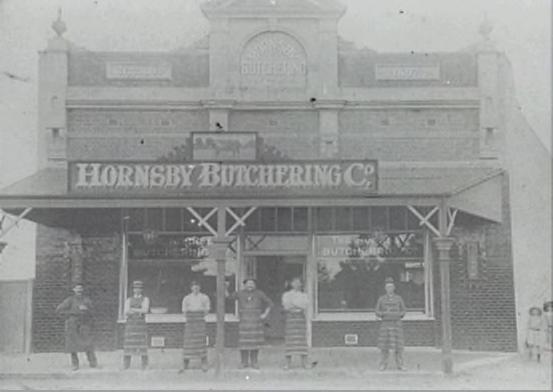
Hornsby Shire DRAFT Heritage Interpretation Strategy and Action Plan Page 121
Figure 15. Left: Jack's Island/Hornsby Junction railway station, 1886 (Source: Hornsby Shire Recollects); right: Hornsby Butchering Co, Peats Ferry Road Hornsby, 1890s (Source: Hornsby Shire Recollects)
12.14.3 Key audiences
The key audiences for this destination are as follows:
Local residents
Visiting Friends and Relatives
International students
Over 55s travel.
12.14.4 Key heritage themes related to the area
The key heritage themes for this destination are as follows:
Aboriginal Country
Convict Life
Transport
Agriculture and Horticulture


Industrial Enterprises
Belief and Faith
Leisure and Recreation
Settlement and Suburbanisation; and
The Changing Face of the Shire.
12.14.5 Key heritage listed items
The key heritage listed items for this destination are included below. The majority are located on the western side.
Hornsby Shire DRAFT Heritage Interpretation Strategy and Action Plan Page 122
Suburb Item name Address HLEP Listing Notes Hornsby Edgeworth David House (“Coringah”) and grounds 49 Burdett Street 463 Hornsby Barker College Junior school College Crescent 465 Hornsby Street trees Dural Street 468 Hornsby Christian Science Church 19 Dural Street 470 Currently Hornsby Baha’i Centre of Learning Hornsby Street trees Edgeworth David Avenue 475 Hornsby Hornsby Girls’ High School 12 Edgeworth David Avenue 476 Buildings and masonry fence (excluding other school structures and grounds)
Table 27. Key heritage listed items, Hornsby Town Centre
HLEP Listing Notes
Wallarobba Arts and Cultural Centre – Built in 1903,
to the

Hornsby
Hillside garden originally created by academic horticulturalist Max Cotton
noted in Draft
–

Hornsby Shire DRAFT Heritage
and Action Plan Page 123
Item
Address
Interpretation Strategy
Suburb
name
“Wallarobba” and Willow Park 25–27 Edgeworth David Avenue 477
Wallarobba
Wallarobba
Hornsby
Hornsby War Memorial Hall 2 High Street 483
Railway cloakroom buildings Jersey Street 552 and A52
Railway station Jersey Street 551 and A51 SHI #4801889
SRA electricity plant and signal box Jersey Street 485 and A50 Hornsby Street trees Jersey Street 484 Hornsby Shops 1–3 Jersey Street 486 Hornsby Lisgar Gardens 23, 27X and 35X Lisgar Road 492
Homestead is now home
Arts and Cultural Centre, which offers classes, workshops, and exhibitions for local artists and the wider
community. Hornsby
Hornsby
Hornsby
Hornsby
Hornsby Street trees Manor Road 494 Hornsby “Mount Wilga” and grounds 2A Manor Road 495 Aboriginal cultural
value:
Aboriginal Heritage Study (Coast,
Hornsby Neal Park and bushland 31X Northcote Road 549 Hornsby Barker College 91 Pacific Highway 501 Group of buildings, grounds and gate Hornsby Barker College 91 Pacific Highway (2, 4, 6 and 8–10 The Avenue and 2–6 Unwin Road) 782 Centenary Design Centre, McCaskill Music Centre and Development Office Hornsby Hornsby Cinema 155 Pacific Highway 502 Hornsby Odeon Cinema
Dating to
this art deco cinema has
a
hangout for Hornsby residents and visitors for over a century. Hornsby War Memorial and Palms 155X Pacific Highway 503 Hornsby Shop 165–167 Pacific Highway 504 Hornsby Shop 169 Pacific Highway 505
heritage
2022)
1914,
been
popular
Built during the Great Depression to relieve unemployment, these historically significant steps link the Great North Walk and the Berowra Valley National Park.
Opened in 1889, the east stained glass window was installed in the church in 1924 as a memorial to the 19 men of the Parish who were killed in the World War One.
The first court session took place on 22 January 1926.
‘Hornsby Police Court’ Aboriginal cultural heritage value recommendation from Draft Aboriginal Heritage Study (Coast, 2022)

Buildings “K” and “M” and grounds (excluding other buildings)
The Hornsby Home Science School opened in 1947, developing from the Hornsby Superior Public School, and closed after the bushfire of 1957. The site is now part of Hornsby TAFE. Aboriginal cultural heritage value recommendation from Draft Aboriginal Heritage Study (Coast, 2022)

Hornsby Shire DRAFT Heritage Interpretation Strategy and Action Plan Page 124 Suburb Item name Address HLEP Listing Notes Hornsby Shop 171 Pacific Highway 506 Hornsby “The Junction Stores” 173 Pacific Highway 507 Hornsby Shop 175 Pacific Highway 508 Hornsby Shop 183–183A Pacific Highway 509 Hornsby Bank 185 Pacific Highway 510 Hornsby Shop 187 Pacific Highway 511 Hornsby Bank 193 Pacific Highway 512 Hornsby Hornsby Park—sandstone steps 203X Pacific Highway 513
Hornsby St. Peter’s Anglican Church and hall 207–207A Pacific Highway 514
Hornsby Hornsby Court House 292 Pacific Highway 519
Hornsby Hornsby Shire Council Chambers 296 Pacific Highway 520 Hornsby TAFE College 298–300 Pacific Highway 521
Hornsby Street trees Palmerston Road 528


Hornsby Shire DRAFT
Action Plan Page 125 Suburb Item name Address HLEP Listing Notes Hornsby Hornsby Hospital— “Collingridge House” (excluding grounds) 38–76 Palmerston Road 529
Aboriginal cultural heritage value recommendation from Draft Aboriginal Heritage Study (Coast, 2022) Hornsby Street trees Pretoria Parade 530 Hornsby Reddy Park 53–61X Pretoria Parade 532 Hornsby Sandstone steps Quarry Road 537 Hornsby Diatreme Hornsby Quarry and surrounding vegetation 1X Quarry Road 538 An extinct volcano Hornsby Hornsby Rifle Range 64 and 64X Rosamond Street 543 Hornsby Street trees Rosemead Road 544 Hornsby “Mt. Errington” and gardens 1 Rosemead Road 545 Hornsby Street trees William Street 553 Hornsby Old Man’s Valley Cemetery, including Higgins’ Family Cemetery, sandstone receptacle, cool room and site of Higgins homestead on which the Higgins Family Memorial is located 1X Quarry Road A55 SHR No. 01764 (cemetery) Located off Dural Street, Hornsby, the first burials in this forest cemetery date to 1879. Hornsby Suspension bridge 5 Manor Road A53 Barker College Heritage Conservation Area C1 Mount Errington Precinct, Hornsby West Side Heritage Conservation Area C3 Pretoria Parade Precinct, Hornsby West Side Heritage Conservation Area C4
Heritage Interpretation Strategy and
Also
Peats Ferry Road Precinct, Hornsby West Side Heritage Conservation Area
12.14.6 Other non-listed items
Non-listed historical and Aboriginal cultural items of interest are listed below. These items have been suggested by stakeholders.
Table 28. Non-listed items
Suburb Item name Address Notes

Hornsby Hornsby Railway Hotel 31 Station St
The Hornsby Railway Hotel was built in 1888 to provide travellers and new colonists with a ‘taste of home.’ It was the first commercial building in Hornsby.
Hornsby The Junction Stores Peats Ferry Road
The Junction Stores on Peats Ferry Road were built in 1905, and the road retained its early twentieth century façade
Hornsby Alexander Berry’s timber lease
Aboriginal cultural heritage value recommendation from Draft Aboriginal Heritage Study (Coast, 2022)
Hornsby
Hornsby Baptist (Northern Life) Church Pretoria Parade, Hornsby 2077
12.14.7 Recommendations for interpretation
Aboriginal cultural heritage value recommendation from Draft Aboriginal Heritage Study (Coast, 2022)

The following interpretive media and strategies, reflecting the key themes and heritage items of this destination, are recommended. These are broad recommendations only and should be refined in future development planning.
Heritage Interpretation Plan
As a significant destination, Hornsby should develop a Heritage Interpretation Plan in line with this Heritage Interpretation Strategy. Council should ensure that any new significant developments be required to develop a HIP.
A new Masterplan for the future development of the traditional town centre around Peats Ferry Road and George Street is due to be placed on Exhibition in July 2022. This should include heritage interpretation planning, as it will facilitate and guide the future development of a new city centre, assist in place-making, and both preserve and highlight the suburb’s rich heritage.
Hornsby Shire DRAFT Heritage Interpretation Strategy and Action Plan Page 126
HLEP Listing
Suburb Item name Address
Notes
C5
Interpretive elements could include:

public art
lighting
Aboriginal language elements
Acknowledgement of Country
public programming and festivals
ground plane elements
functional elements
digital/website content
educational materials
interpretive panels
trails and tours
12.15 Pennant Hills to Normanhurst
12.15.1 Summary
The Pennant Hills, Thornleigh and Normanhurst region is distinguished by its built heritage, with many historic houses and buildings possessing their own special stories that can be emphasised. Collingridge Hall, for example, served as a military drill hall in WW2 before being repurposed as a Scout Hall; the Cherrybrook Uniting Church and Wesleyan Hall are some of the earliest churches in Hornsby Shire; the Pennant Hills Danish Church was the first Scandinavian church in Australia; Thornleigh’s many Federation homes are outstanding for their conservation.
12.15.2 Destination history
The following history is based on historic information from the Hornsby Thematic History.96

Normanhurst, originally called Hornsby, was named after prominent local resident Norman Selfe. A civil engineer, Selfe won the second Sydney Harbour Bridge design competition in 1902, and his design was almost used. However, following a change in government, the works were delayed until 1912 and his designs were replaced by J.J. Bradfield’s. Selfe’s State heritage listed estate, Gilligaloola, is located in Normanhurst.
Thornleigh was named after Chief Constable John Thorn, who was granted land for shooting and capturing a bushranger in 1830. Thornleigh, like much of the Hornsby Shire, was an orchard town throughout the nineteenth century. However, the town became increasingly industrialised in the twentieth century, and was home to a quarry, a brickworks, and the largest maltworks in the southern hemisphere. In 1883, the state’s third and final zig zag railway opened in Thornleigh, connecting Thornleigh railway station to Thornleigh quarry until its closure in 1900.
In 1816, on orders by Governor Lachlan Macquarie, convict timber-cutting gangs cleared the land now known as Pennant Hills. Following permanent European settlement in the 1840s, the region became well known for its orchards. The Pennant Hills Railway Station opened in 1886 and by 1920 was the largest railway depot in the shire, with one local newspaper reporting 80 tonnes of fruit passing through the station per day.97 Pennant Hills was also home to a branch of the Sydney Observatory from 1890,
Hornsby Shire DRAFT Heritage Interpretation Strategy and Action Plan Page 127
96 GML Heritage. 2021. Hornsby Thematic History. Unpublished report prepared for Hornsby Shire Council.
97 GML Heritage. 2021. Hornsby Thematic History, 43.
and Australia’s principal Wireless Telegraphy Station (an early form of radio communication) was established at Pennant Hills in 1912.
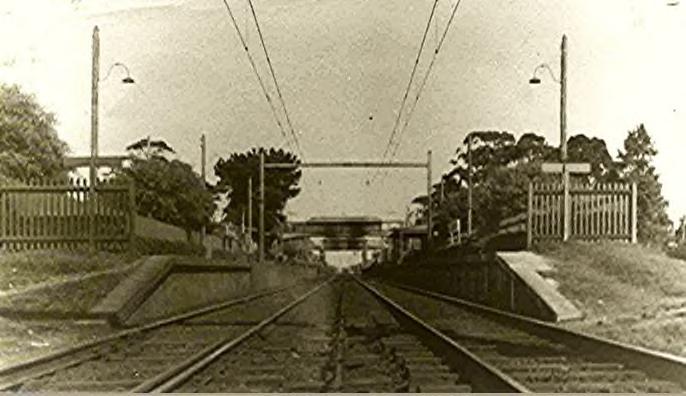
12.15.3 Key audiences
The key audiences for this destination are as follows:
Local Residents
Visiting Friends and Relatives
Over 55s Travel
12.15.4 Key heritage themes related to the area
The key heritage themes for this destination are as follows:
Aboriginal Country
Bushland Shire
Transport
Agriculture and Horticulture


Leisure and Recreation
Settlement and Suburbanisation; and
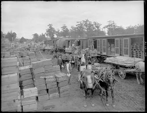
The Changing Face of the Shire
Industrial enterprise
12.15.5 Key heritage listed items
The key heritage listed items for this destination are included below.
Table 29. Key heritage listed items, Normanhurst, Thornleigh and Pennant Hills
Hornsby Shire DRAFT Heritage Interpretation Strategy and Action Plan Page 128
Figure 16. Left: The Goods Yard at Pennant Hills Railway Station with produce from orchards, 1911-1916 (Source: State Library of NSW); right: Thornleigh Railway Station, 1930 (Source: Hornsby Shire Recollects)
Suburb Item name Address Listing Notes Normanhurst Street trees Calga Avenue 589 Normanhurst Street trees Campbell Avenue 590 Normanhurst Davidson Park 9X Denman Parade 592
Kenley Park is home to Collingridge Hall, which has been used as a courthouse (1907), drill hall (1914), public school (1927), and now museum. The hall was originally built in Hornsby in 1900 and was transported to Normanhurst in 1970.
The Hornsby & District Historical Society Museum, which operates out of the Hall, exhibits objects and themes pulled from life in the Hornsby Shire over the years.


Hornsby Shire
and Action Plan Page 129
Item name
Listing Notes Normanhurst Street trees Ferndale Road 593 Normanhurst Street trees Fraser Road 594 Normanhurst Street trees Harris Road 597 Normanhurst Street trees Malsbury Road 598
Roadside trees and bushland Milson Parade 602
Roadside trees and bushland Nanowie Avenue 604
“Gilligaloola” and garden 82 Pennant Hills Road 606
Loretto Convent group— grounds, gates and cemetery 91–93 Pennant Hills Road and 16–22 Mount Pleasant Avenue 607 and A60
spring
Kenley Park and Hornsby Shire Historical Society drill hall 136–140X Pennant Hills Road 608
DRAFT Heritage Interpretation Strategy
Suburb
Address
Normanhurst
Normanhurst
Normanhurst
Normanhurst
Organises a
fair open to the public. Normanhurst
Pennant Hills Blackwood Memorial Sanctuary, including North Road culvert 2X Beecroft Road A61 Pennant Hills St. Agatha’s Primary School— grounds (excluding buildings) 18–26 Boundary Road 618 Pennant Hills Pennant Hills High School— grounds (excluding buildings) 90 Boundary Road 621 Pennant Hills Public reserve 1X Briddon Close 622 Pennant Hills Street trees Laurence Street 638 Pennant Hills Lillian Fraser Gardens 1 Laurence Street 639 Open to the public. Lilian Fraser was the third qualified female biologist in Australia. Pennant Hills Street trees Lilla Road 640 Pennant Hills Street trees Loftus Road 679 Pennant Hills House and grounds, including convict brick paths, stone love seat, palm tree, remnant circular drive and beehive well 41 Loftus Road 644
Next
to


now St
This park was the site of a branch of the Sydney Observatory from 18901930.
Pennant
is home to the first Danish church in Australia, built in 1940 in response to the growing Scandinavian migrant population in Sydney. In March 2005, Crown Prince Frederik and Crown Princess Mary of Denmark made an official visit there. Summer and
held there every year.
Convict timber camp established c.1816 at Pennant
Hornsby Shire DRAFT
and Action Plan Page 130 Suburb Item name Address Listing Notes
Hills Baden Powell Scout Centre— buildings, gate and grounds 19 Orchard Street 646
Hills St Luke’s Church Hall 323 Pennant Hills Road 648
Heritage Interpretation Strategy
Pennant
Pennant
Luke’s
Orthodox
Hills Former Bank of New South Wales building 370 Pennant Hills Road 651
Hills Mount St. Benedict’s Convent and grounds 449D Pennant Hills Road 653
Hills Observatory Park—Observatory site and park 449X Pennant Hills Road 654 and A62
door
St
Church,
Therapon Greek
church Pennant
Pennant
Pennant
Hills Bushland Wongala Crescent 688
Hills Wollundry Park 60–62X Yarrara Road 692 Pennant Hills Pennant Hills Danish Church 33-35 Hillcrest Rd Not listed
Pennant
Pennant
Hills
Pennant Hills The Government Sawing Establishment Hull Road Not listed AHS15
winter fairs are
Hills. Archaeological
Thornleigh Street trees Giblett Avenue 706 Thornleigh Oakleigh Park 15X Giblett Avenue 707 Thornleigh Thornleigh West Public School— grounds (excluding buildings) 18 Giblett Avenue 708 Thornleigh Trees 22–56 Hillmont Avenue709 Thornleigh Street trees Loch-Maree Avenue 710 Thornleigh Brickworks wall and bushland 142 –178 Pennant Hills Road 713 and A65
Quarry and zig zag railway track De Saxe Close (near end) A64 and A64 Thornleigh Remains of maltworks 1 Pioneer Avenue A66
Convict heritage sites.
Thornleigh
Thornleigh
This

sanctuary was founded in 1920 and the building officially opened in 1930

The Wesleyan Hall, located on the Uniting Church property on New Line Road, is a modest church constructed in 1845. The property also features a graveyard that dates to 1846. The larger Uniting Church was built in 1889. All sites are viewable from New Line Road, which is itself a significant heritage road dating back to the 1830s.
12.15.6 Other non-listed items
Non-listed historical and Aboriginal cultural items of interest are listed below. These items have been suggested by stakeholders.
Hornsby Shire DRAFT Heritage Interpretation Strategy and Action Plan Page 131
Item name Address Listing Notes
Suburb
1830s
The Comenarra Parkway A67 Thornleigh Pennant Hills Park—Lorna Pass within Thornleigh 40X The Comenarra Parkway A68 West Pennant Hills Street trees Cardinal Avenue 784 West Pennant Hills Koala Park 74–78 and 80–82 Castle Hill Road 786
road remains
heritage-listed
West Pennant Hills Street trees Dean Street 787 West Pennant Hills New Farm Road Bushland Reserve 24X John Savage Crescent, 8X Leumeah Close and 52X New Farm Road 789 West Pennant Hills Campbell Park 3X Wilga Street 793 Cherrybrook Cherrybrook Uniting Church, hall and cemetery 134 New Line Road 305
wildlife
Cherrybrook “Gumnut Hall”—Cherrybrook Pre-School and Community Centre 144 New Line Road 306 The Crescent, Pennant Hills Heritage Conservation Area C8
Normanhurst Normanhurst Railway Station Not listed
Cherrybrook Cherrybrook Time Capsule
Greenway Park Shepherds Drive Cherrybrook NSW 2126
Buried in Greenway Park in 1991
Cherrybrook
Cherrybrook Jawan Memorial
Greenway Park Shepherds Drive
Cherrybrook NSW 2126
The Anzac Jawan Memorial in Cherrybrook is an important symbol for Indian communities but some of the data is out-of-date or incomplete.
The Jungo
Benowie Walking Track, Cherrybrook NSW 2126
The Jungo is a small clearing. Aboriginal cultural heritage value recommendation from Draft Aboriginal Heritage Study (Coast, 2022)
Normanhurst apprenticeships

James Bellamy’s property
12.15.7 Recommendations for interpretation
Aboriginal cultural heritage value recommendation from Draft Aboriginal Heritage Study (Coast, 2022)
Aboriginal cultural heritage value recommendation from Draft Aboriginal Heritage Study (Coast, 2022)

The following interpretive media and strategies, reflecting the key themes and heritage items of this destination, are recommended. These are broad recommendations only and should be refined in future development planning.
Publications
The suburbs of Normanhurst, Thornleigh and Pennant Hills etc have a significant number of widely spread heritage buildings which would lend themselves to an engaging thematic based publications along the lines of Sydney Cemeteries: A field guide. In particular, ‘field guides’ could be commissioned to highlight and provide information about churches, cemeteries, railways stations and historic houses.
Public programs
An annual heritage festival similar to ‘Open Sydney’ where locals and visitors are encouraged to visit heritage houses and streets in the area may be considered for this cluster of suburbs. The festival would be hosted by homeowners, local heritage organisations like the Civic Trust, Rotary Club, the Council, churches, retreat centres who occupy heritage houses or buildings. For one weekend doors (or gates) are unlocked to spaces normally closed to the public. Participation would need to be voluntary but preliminary discussions with community groups demonstrate that local residents have a pride in their heritage homes and areas that may like to celebrate.
Hornsby Shire DRAFT Heritage Interpretation Strategy and Action Plan Page 132
Suburb Item name Address Notes
Not listed
Table 30. Non-listed items
Pennant Hills Pennant Hills Railway Station
Thornleigh Thornleigh Railway Station Not listed
Lighting
This area in particular has many street trees which are listed. The trees could be lit in a way which emphasizes them and encourages locals to appreciate the number of heritage listed trees in their areas. In particular, the site of the 1890-1930 observatory in Observatory Park, Pennant Hills, could be commemorated with a lighting installation.
Podcast
The T9 and T1 North Shore lines include both listed and not-listed heritage trains stations. The history and heritage of the stations and the suburbs that the trains pass through would make an interesting Podcast to be downloaded and listened to while passengers are travelling by train through the area.
Blue plaques
Lilian Fraser / Lilian Fraser Gardens could be considered for submission to Heritage NSW’s Blue Plaque program. Dr Lilian Fraser lived on the now heritage-listed property for most of her life. Her career spanned 33 years and she made significant contributions to knowledge of citrus diseases.
Museums
The Hornsby & District Historical Society Museum, run by members of the Hornsby Shire Historical Society, is located in Kenley Park, Normanhurst. The museum operates out of Joseph Collingridge Hall, a heritage-listed building that has been used as a courthouse, public school, drill hall, and museum. Greater financial support for this museum would allow it to be open more frequently and for longer, and would facilitate the development of new exhibitions.
Public art
Mural artists could be commissioned to produce artworks on walls replicating the success of the streetscape murals on Dural Lane in Hornsby. Focussing on the urban heritage of the area, these murals are a trompe l’oeil which are engaging and celebrate the local heritage.
Tours and Trails / App


A walking tour or trail could be developed that leads visitors around the area to visit heritage buildings and site of interest. The Pennant Hills Civic Trust have compiled a provisional list of notable heritage buildings (listed and unlisted) that could form the basis of the walking tour. Two streets of particular interest are Maple Avenue and Greycliffe Avenue. These streets could be augmented with additional insitu interpretive panels.
Play spaces
Any play spaces developed in this area could be inspired by or incorporate elements that explore local heritage.
Interpretive panels
Strategically positioned heritage interpretation panels that follow the design guidelines can provide contextual information about the heritage of a particular building, site or location in this area. Integrated QR codes can provide a link back to more detailed information on Councils website.
Hornsby Shire DRAFT Heritage Interpretation Strategy and Action Plan Page 133
12.16 Wahroonga and Waitara
12.16.1 Summary
The streetscapes of the neighbouring suburbs of Wahroonga and Waitara are marked by their impressive, cohesive architectural style. Wahroonga’s churches are striking and Waitara’s Blue Gum hotel, the oldest in the Hornsby suburban district, remains a popular local hangout.
12.16.2 Destination history
The following history is based on historic information from the Hornsby Thematic History98


The word Wahroonga means “our home” and is probably from the Kuring-Gai language.99 In 1805, the explorer George Caley was accompanied by Aboriginal man Daniel Moowattin – who acted as a translator and guide – on a surveying mission to Brookvale via Wahroonga. Wahroonga was known as “Pearce’s Corner” – named after timber-getter and early settler Aaron Pierce – until 1890, when the town was given its current name.100 Wahroonga is home to the second oldest church in the Hornsby Shire, St. Paul’s Anglican Church, from which the majority of Anglican congregations in the surrounding suburbs grew. Wahroonga became a popular suburb in the early twentieth century, with new residents looking to take advantage of the Shire’s fresh air and elevated altitude.
The name Waitara originates from the Māori word for “pure water” or “mountain stream,” and was suggested by Railway Commissioner Myles McRae in 1895. The ‘Hornsby Junction Hotel’ was established in Waitara in 1884 to accommodate the railway passengers, the first pub in the Hornsby Shire. In 1896, Barker College moved from Kurrajong Heights (Hawkesbury LGA) to Waitara and served as a boarding school for boys around Sydney. The college became co-educational in 1975. In 1897, the Sisters of Mercy Foundling Home was established in Waitara, which housed unmarried mothers and children from infancy to 15 years old. The township was subdivided in 1902, however development largely took place from 1915.
12.16.3 Key audiences
The key audiences for this destination are as follows:
Local residents
98 GML Heritage. 2021. Hornsby Thematic History. Unpublished report prepared for Hornsby Shire Council.
99 State Library NSW. 2015. Word of the Week: Wahroonga, accessed 2 May 2022, <https://indigenous.sl.nsw.gov.au/recent-updates/word-week-wahroonga>.
100 Rowland, J. 2008. Wahroonga, accessed 2 May 2022, < https://dictionaryofsydney.org/entry/wahroonga>.
Hornsby Shire DRAFT Heritage Interpretation Strategy and Action Plan Page 134
Figure 17. Left: Shop in Wahroonga, c. 1890s (Source: Hornsby Shire Recollects); right: Hornsby Hotel (now The Blue Gum), Waitara, 1885 (Source: Hornsby Shire Recollects)
Visiting Friends and Relatives

Over 55s Travel.
12.16.4 Key heritage themes related to the area
The key heritage themes for this destination are as follows:
Aboriginal Country
Convict Life
Bushland Shire
Belief and Faith
Health and Wellness
Settlement and Suburbanisation; and

The Changing Face of the Shire.
12.16.5 Key heritage listed items
The key heritage listed items for this destination are included below.
St John’s. Built in 1930, this state heritage listed church features massive stained-glass windows depicting memorials WW1 and WW2 created by Norman Carter. The church is an excellent example of the Australian Inter-War Gothic style. Now the Amitabha Foundation Tibetan Buddhist Centre – Located in the former Waitara Uniting Church building (constructed 1931).
Hornsby Shire DRAFT Heritage Interpretation Strategy and Action Plan Page 135
Suburb Item Address HLEP Listing Notes Wahroonga Street trees Bundarra Avenue 728 Wahroonga Trees in playground 1X Carden Avenue 740 Wahroonga Uniting Church 79 Edgeworth David Avenue 742
Table 31. Key heritage listed items, Wahroonga and Waitara
Wahroonga Street trees Edwards Road 743 Wahroonga Street trees Fern Avenue 744 Wahroonga Street trees Ingram Road 750 Wahroonga Street trees Myra Street 758 Wahroonga Waitara Public School— grounds (excluding buildings) 48–58 Myra Street 760
Wahroonga
Waitara Foundling Home 18981927. Aboriginal cultural heritage value recommendation from Draft Aboriginal Heritage Study (Coast, 2022). In 1928 the Waitara Foundling Home was renamed Our Lady of Mercy Home. Demolished in 1977.
The Mercy Family Life Centre Waitara was previously known as Our Lady of Mercy Home and was run by the Sisters of Mercy. It was built in a part of the grounds of the old Waitara Orphanage (Our Lady of Mercy) in 1977. In 1994, it was incorporated and became the Mercy Family Centre.
This modest sandstone church remains largely untouched since it was built in 1881. St Paul’s Church is one of the earliest churches in the suburban zone of Hornsby Shire.
12.16.6
Other non-listed

items
Non-listed historical and Aboriginal cultural items of interest are listed below. These items have been suggested by stakeholders.
Table 32. Non-listed items
Aboriginal cultural heritage value recommendation from Draft Aboriginal Heritage Study (Coast, 2022)

Hornsby Shire DRAFT Heritage Interpretation Strategy and Action Plan Page 136
Mercy
Life Centre—garden and trees 28–32 McAuley Place 757
Suburb Item Address HLEP Listing Notes Wahroonga
Family
St.
and
1711 Pacific Highway 767
Paul’s Church (Pearce’s Corner)
grounds
Wahroonga Street trees Russell Avenue 768 Wahroonga Street trees Woonona Avenue 769 Wahroonga Wahroonga Heritage Conservation Area C7 Wahroonga Wahroonga North Heritage Conservation Area C8 Wahroonga Barker College 501 and C1 Waitara Street trees and bushland Alexandria Parade 772 Waitara Shop 11–37 Alexandria Parade 773 Waitara Waitara Park 20X Waitara Avenue 783
Suburb Item name Address Notes
Wahroonga
Wahroonga
apprenticeships
12.16.7 Recommendations for interpretation
The following interpretive media and strategies, reflecting the key themes and heritage items of this destination, are recommended. These are broad recommendations only and should be refined in future development planning.
Tours and Trails
There are a number of significant churches and other religious institutions in the area that could form the basis of a ‘Places of Worship’ heritage trail – perhaps linked with adjoining destinations such as the Pennant Hills to Normanhurst region.
Lighting
The many heritage listed trees in this area could be lit in a way which emphasizes them and encourages more night time activation of the area.
Public art
Mural artists could be commissioned to produce mural artworks replicating the success of the streetscape murals on Dural Lane in Hornsby. Focussing on the urban heritage of the area, these murals are a trompe l’oeil which are engaging and celebrate the local heritage.
Public art celebrating local heritage could be commissioned for some of the local parks in Wahroonga and Waitara. The Council could collaborate with a local school such as Barker College to commission artworks from students that enhance the heritage values of the area.
Museums and libraries
The Merritt Kellogg Museum is a little gem in the heart of Waitara and Wahroonga, though currently only open on Thursdays from 10am to 1pm. Access to the museum and its collections could be increased through development of more small-scale exhibits and longer opening hours Additionally, objects from the museum could be loaned to Hornsby Central Library for display to increase public access. Access could also be increased to the library via a virtual tour made available online or through an App.
Landscaping and plantings


One of the many parks in Wahroonga and Waitara could be developed to have a dedicated native plant garden to enhance understanding of the Aboriginal heritage values of the area.
Interpretive panels
Strategically positioned heritage interpretation panels that follow the design guidelines can provide contextual information about the heritage of a particular building, site or location in this area. Integrated QR codes can provide a link back to more detailed information on Councils website. Observatory Park, for example, is an ideal location for an interpretive panel.
Play spaces
Any play spaces developed in this area could be inspired by or incorporate elements that explore local heritage.
Hornsby Shire DRAFT Heritage Interpretation Strategy and Action Plan Page 137
13.0 DESTINATION MANAGEMENT PLAN INPUT

13.1 Introduction

This section provides an approach based on the guiding principles of best practice destination management as laid out in Tourism NSW’s ‘The Guide to Best Practice Destination Management101
13.2 Place: Defining the destination
According to the State-wide Destination Management Plan102 Hornsby Shire falls into ‘Sydney Surrounds North’. Destination NSW have currently not designated anywhere in Hornsby Shire as a ‘hero destination’ – but the ‘Hawkesbury’ has been designated as one of the ‘next potential future ‘hero’ destinations’. In defining destinations for the Hornsby Shire Destination Management Plan this HIS&AP offers recommendations for destinations which contain the most prominent heritage items in each area, and, when visited, can tell powerful, intriguing and engaging stories of the history and cultural values of the Hornsby Shire. They are:
Lower Hawkesbury River Settlements
Wisemans Ferry and surrounds
The Great North Road
Berowra, Berowra Waters and Creek
The Field of Mars: Beecroft and Cheltenham
The Orchard District: Dural, Arcadia, Galston, Glenorie and surrounds
Fagan Park and Netherby
Cowan and Muogamarra
Maroota and Canoelands
Hornsby Regional Park
Hornsby Town Centre
Pennant Hills to Normanhurst
Wahroonga and Waitara
101 Knowledge Transfer Services for the Australian Regional Tourism Network. 2020. The guide to best practice Destination Management
102 NSW Government. 2019. Statewide Management Plan. https://www.destinationnsw.com.au/wpcontent/uploads/2019/02/nsw-statewide-destination-management-plan.pdf

Hornsby Shire DRAFT Heritage Interpretation Strategy and Action Plan Page 138


Hornsby Shire DRAFT Heritage Interpretation Strategy and Action Plan Page 139
Figure 18. Location of the Hornsby Shire recommended heritage destinations
13.3 People: Understanding your market (customers and visitors)
See section 8.0 Audience identification

13.4 Product: Community based vision
According to the State-wide Destination Management Plan103 the Hornsby Shire Destination Management Plan should include a vision. This vision could include heritage and heritage interpretation as a main focus of the plan. Key aspects would be to include:
The diversity of heritage across the Shire
The accessibility of the heritage and heritage experiences
13.5 Product: Understanding your offering (key products or experiences)
According to the State-wide Destination Management Plan104 key tourism travel and tourism trends related to heritage interpretation are:

Experiential travel – more and more travellers will search for immersive, authentic, education and local experiences
Holidays with a purpose – volunteering, conservation and the like will play a bigger part in travel and destination choice
Personalisation – digital and mobile technology have empowered visitors to take more control of their travel experiences and increased their expectations. As a result, the expectation of personalised and tailor-made experiences is likely to grow
Multigenerational travel – the trend in multigenerational travel will continue, as families use their holiday time to bond and create memories together, and this will influence the type of customer experience they are looking for
Digital – digital technology will continue to advance, facilitating all stages of the customer journey and experience, e.g. search, booking, payments, augmented reality, real time translations etc.
Mobile – mobile will be the preference of travellers throughout their customer journey, so mobile optimisation of the customer experience will be key.
Social media – social media and user generated content will continue to be key, and can present opportunities for destinations that optimise them well.
103 NSW Government. 2019. Statewide Management Plan. https://www.destinationnsw.com.au/wpcontent/uploads/2019/02/nsw-statewide-destination-management-plan.pdf
104 NSW Government. Statewide Management Plan.
Hornsby Shire DRAFT Heritage Interpretation Strategy and Action Plan Page 140
14.0 ACTION PLAN
The following Action Plan itemises recommended heritage interpretation outcomes, both tangible and intangible, priority actions and estimated cost range.
14.1.1 Table of actions
Table 33. Action Plan: Heritage Interpretation Strategy Hornsby Shire
*Cost Range: Low - 0-$30k, Medium - $30k- $80k, High – Above $80k
**Responsibility: to be a collaboration of work between teams nominated by Hornsby Shire Council
Incorporate the material in this HIS&AP into the Destination Management Plan (DMP)
Delivery of a DMP which references and values heritage
Incorporate material into Council’s preparation of a

Action the Shire-wide opportunities on policy (see section 11.2 for details) Reference this HIS&AP in future strategies
Ensuring consistency of approach across the Shire
Embedding heritage interpretation into policies
Share HIS&AP with relevant departments at Hornsby
Strategic Land Use Planning
Parks, Trees and Recreation
Natural Resources
105 ‘Responsibility’ information provided by Hornsby Shire Council 4 October 2022

Hornsby Shire DRAFT Heritage Interpretation Strategy and Action Plan Page 141
Action Objectives Key Tasks Duration Priority *Cost Range **Responsibility105
4 – 6 months High Low Strategy & Place
DMP
5 – 8 months High Low
Shire Council
Strategy & Place
Library
Develop conservation management plans/strategies for Council owned heritage listed assets and SHR items
Ensuring consistency of approach across the Shire
Embedding heritage interpretation into policies
Carry out an audit of CMPs/Plans of Management for Council owned heritage listed assets and SHR items and identify gaps
Commission CMPs/strategies for Council owned heritage listed assets and revise Plans of Management for Council owned landscape heritage assets
Encourage owners of SHR items to prepare a CMP/strategy.
Consider heritage interpretation as actions within the CMPs/strategies/Plans of Management where relevant
Parks, Trees and Recreation
Asset Operations and Maintenance
Natural Resources


Include heritage interpretation considerations in DA conditions
Ensuring consistency of approach across the Shire
Embedding heritage interpretation into policies
Require development
proposals to consider heritage
Include the development of Heritage Interpretation Strategies and plans in DA conditions where appropriate
Encourage cooperation between cultural organisations and community groups
Ensuring consistency of approach across the Shire
Embedding heritage interpretation into policies
Share HIS&AP with local cultural organisations and community groups to promote and encourage inter organisational cooperation to deliver heritage interpretation
Hornsby Shire DRAFT Heritage Interpretation Strategy and Action Plan Page 142 Action Objectives Key Tasks Duration Priority *Cost Range **Responsibility105
Medium High
12 months
4 – 6 months High Low Strategic Land
Assessment
Use Planning Development
4 – 6 months High Low Strategic
Planning
Land Use
Consult Aboriginal community knowledge holders for Aboriginal Interpretation
Ensuring consistency of approach across the Shire
Embedding heritage interpretation into policies
Best practice in Aboriginal Cultural Heritage
Implement findings of the Aboriginal Heritage Study to inform a policy for engagement of Aboriginal stakeholders in projects related to heritage.
Reference the Design guidelines
Ensuring consistency of design approach across the Shire
Share HIS&AP and design guidelines with relevant departments at Hornsby Shire Council
Incorporate the material in this HIS&AP into the Arts and Cultural Plan
Ensuring consistency of approach across the Shire
Embedding heritage interpretation into policies
Develop heritage resources for people with disability and their carers
Ensuring consistency of approach across the Shire
Embedding heritage interpretation into policies
Increase accessibility to heritage
Incorporate material into Council’s preparation of a Arts and Cultural Plan
Develop accessible heritage resources in line with Council’s Disability Inclusion Action Plan
Update access information to heritage sites
Implement the Dual naming policy

Ensuring consistency of approach across the Shire
Embedding heritage interpretation into policies
Share HIS&AP with relevant departments at Hornsby Shire Council
Action the Shire-wide opportunities for language (see section 11.2 for details

Hornsby Shire DRAFT Heritage Interpretation Strategy and Action Plan Page 143 Action Objectives Key Tasks Duration Priority *Cost Range **Responsibility105
4 – 6 months High Low Strategic Land Use Planning
4 – 6 months High Low Strategic
teams
Land Use Planning to share with all
4 – 6 months High Medium Library and Community
4 – 6 months High Medium Strategic Land Use Planning Library and Community
4 – 6 months High Low Strategic
Land Use Planning to share with all teams
Use of Aboriginal Language
Increasing accessibility to heritage and broadening audiences
Consider opportunities for naming of places and spaces in line with Councils Dual Naming Policy
Consult with Aboriginal Stakeholders
Consider multilingual interpretation

Increasing accessibility to heritage and broadening audiences
Incorporate considerations of multilingual heritage interpretation into future heritage interpretation plans
Action the Shire-wide opportunities for websites and apps (see section 11.2 for details)

Develop a series of heritage trails as an app
Increasing knowledge of access to heritage to locals and tourists
Increase accessibility to heritage
Develop or acquire a heritage app with reference to this HIS&AP
Expand Hornsby Shire Recollects
Increasing knowledge of access to heritage to locals and tourists
Increase accessibility to heritage
Consider opportunities for expanding Hornsby Shire Recollects (refer to s 10.27)
Expand the Discover Hornsby website
Increasing knowledge of access to heritage to locals and tourists
Increase accessibility to heritage
Consider opportunities for expanding the Discover Hornsby website, including short histories, interactive, maps, heritage themed itineraries
Hornsby Shire DRAFT Heritage Interpretation Strategy and Action Plan Page 144 Action Objectives Key Tasks Duration Priority *Cost Range **Responsibility105
5 – 8 months Medium Medium Library and Community
4 – 6 months Medium Medium Library and Community
8 – 12 months High High Technology & Transformation Strategy & Place
8 – 12 months High Medium Library and Community Services
8
High High Strategy
– 12 months
& Place
Provide digital school materials
Increasing knowledge of access to heritage to locals and tourists
Increase accessibility to heritage

Develop heritage specific content with Council’s Instagram account
Increasing knowledge of access to heritage to locals and tourists
Encourage younger audiences to engage with heritage
Collate and share existing digital heritage school materials through Council’s website
Share the list of school material opportunities in Appendix E through Council’s website
Consider opportunities for expanding school materials available on Council’s website
Develop and share heritage specific content within Council’s Instagram account
Develop a set of podcasts
Increase the engagement of locals and tourists with heritage in the Shire
Develop a set of podcasts of curated stories of the history and heritage of Hornsby.
Action the Shire-wide opportunities for other interpretive media (see section 11.2 for details)

Develop an oral history project
Increase the engagement of locals and tourists with heritage in the Shire
Develop an oral history project to expand the oral history section of the Hornsby Recollects website
Integrate heritage interpretation opportunities within playgrounds/play spaces as part of the Play Plan
A consistent approach to heritage interpretation within playgrounds/play spaces
Assess Play Plan against key heritage destinations/items of heritage significance both Aboriginal and non-Aboriginal) and include heritage interpretation at appropriate levels, at detailed design stages for new playgrounds
Land Use Planning
Recreation
Hornsby Shire DRAFT Heritage Interpretation Strategy and Action Plan Page 145 Action Objectives Key Tasks Duration Priority *Cost Range **Responsibility105
8 – 12 months High Low Strategic
Library and
Community Services
Ongoing Medium Low Strategy &
Library and
Services
Place
Community
1
2 years Low High Strategic Land
Strategy &
–
Use Planning
Place
8 –
months High Medium Library and
Services
12
Community
months High Medium Parks,
&
5 – 8
Trees
Promote guidelines for Blue Plaques nominations
Increase the engagement of locals and tourists with heritage in the Shire
Increase chances of blue plaque applications being accepted
Share the State Government guidelines for Blue Plaques nominations with civic and historical societies around the Shire
Encourage the community to submit Blue Plaque nominations in future application rounds
Reinstate Community history awards
Increase the engagement of locals with heritage in the Shire
Consider reinstatement of the Hornsby Heritage Award for conservation/architectural works within a Council wide award program
Consider reinstatement of the Owen Nannelli Memorial Award within a Council wide award program
Install Interpretive panels in Heritage Conservation Areas
Increase the engagement of locals with heritage in the Shire
Finalise the HCA report
Commission a suite of interpretive panels 12 – 18
Consult with Aboriginal Stakeholders
Develop an LGA-wide Acknowledgement of / Welcome to Country
Increase the engagement of locals and tourists with heritage in the Shire
Collaboration with Aboriginal Traditional Knowledge Holders
Develop wording or symbol for the Acknowledgement/ Welcome of Country at key sites and destinations


8 – 12 months
Land Use Planning
Hornsby Shire DRAFT Heritage Interpretation Strategy and Action Plan Page 146 Action Objectives Key Tasks Duration Priority *Cost Range **Responsibility105
–
months Medium Low Strategic Land
Planning
8
12
Use
8 –
months Medium Medium Strategic Land Use Planning Strategy & Place
12
months Medium Medium Asset
Operations and Maintenance
Strategic
Medium Medium
Consider developing a formal Welcome to Country policy for Council led events Library
and Community Asset Operations and Maintenance Parks, Trees & Recreation
Develop tours and trails on Conservation management
Increase the engagement of locals and tourists with heritage in the Shire
Encourage increased interest in conservation management
Develop a list of good conservation examples to include in self-guided tours
Liaise with local historical societies and heritage organisations
Consider conservation management interpretation in Heritage Interpretation Plans
Collate current walking tours into Discover Hornsby website

Expand Heritage walks
Increase the engagement of locals and tourists with heritage and natural heritage in the Shire
Develop interpretive content for heritage walks around Hornsby Shire
Develop leaflets, website, App and tour scripts for tours
Promote material on heritage themes for schools
Promote school excursions

Increase the engagement of students with heritage in the Shire
Share the list of school excursion opportunities in Appendix E through Council’s website
Incorporate heritage into designs for temporary hoardings
Increase the engagement of locals and tourists with heritage in the Shire
Increase the visibility of heritage in the Shire
Develop a suite of designs for temporary hoardings which celebrate the heritage of the Shire
Program heritage themed annual events
Increase the engagement of locals and tourists with heritage in the Shire
Encourage repeat visitation from locals and tourists
Refine and develop the list of events in Appendix D: Heritage related Annual Program of Events
Investigate reintroducing Council led events
6 months to 2 years
Hornsby Shire DRAFT Heritage Interpretation Strategy and Action Plan Page 147 Action Objectives Key Tasks Duration Priority *Cost Range **Responsibility105
8 – 12 months Medium Low Strategic
Planning
Land Use
months Medium Medium
Library
Strategy
8 – 12
and Community Services
& Place
Natural
Resources
8 – 12 months Medium Medium Strategic Land Use Planning
months Medium Low
Strategic Land
8 – 12
Use Planning
Strategy
& Place
Major Projects
Medium High Library
and Community
Suite of interpretation panels
Increase the engagement of locals and tourists with heritage in the Shire
Action the individual destination opportunities
Develop a suite of interpretive panels based on the graphic design guide
Incorporate within site projects and funded works
Ongoing Medium High
Strategy & Place
Parks, Trees & Recreation
Asset Operations and Maintenance
Major Projects
Natural Resources
Develop HIPs for specific destinations
A consistent approach to heritage interpretation in major heritage areas
Increase the engagement of locals and tourists with heritage in the Shire
Develop HIPs for Fagan Park and Netherby, Hornsby Regional Park and Hornsby Town Centre destinations
5 – 8 months High Medium
Strategy & Place
Parks, Trees & Recreation
Asset Operations and Maintenance
Major Projects
Strategic Land Use Planning
Library and Community
Natural Resources


Hornsby Shire DRAFT Heritage Interpretation Strategy and Action Plan Page 148
Objectives Key Tasks Duration Priority *Cost Range **Responsibility105
Action
Within each destination, review and consider the recommended heritage interpretation elements when new developments or projects are planned. See section 12.3
Destination opportunities for details
Areas of priority are:
Great North Road
Lower Hawkesbury River Settlements
Wisemans Ferry and surrounds
Increase the engagement of locals and tourists with heritage in the Shire
Increase the visibility of heritage in the Shire
Increasing accessibility to heritage and broadening audiences
Develop the Destination Management Plan for Hornsby Shire
Confirm destinations


Prioritise destinations and finalise scope of heritage interpretation
Develop heritage interpretation
1 – 3 Years High High Strategy & Place
Hornsby Shire DRAFT Heritage Interpretation Strategy and Action Plan Page 149
Key Tasks Duration Priority *Cost Range **Responsibility105
Action Objectives
15.0 CONCLUSION

This Heritage Interpretation Strategy and Action Plan (HIS&AP) has been developed in response to the Heritage Gap Analysis and Action Plan (Action Plan), which was endorsed by Council on 8 April 2020. The HIS&AP for the Hornsby LGA has been prepared to address both Aboriginal and nonAboriginal (historical) values of the Hornsby Shire, providing a comprehensive interpretive strategy that aligns with industry best-practice and builds on the suite of heritage studies developed for the Comprehensive Heritage Study program. The HIS&AP reviews heritage recommendations in existing reports, provides an historical context for Hornsby Shire, outlines the values and significance of heritage across the Shire, provides feedback from community consultation, reviews audiences and recommends interpretation examples and opportunities across the Shire. The report also recommends design principles and input into a Destination Management Plan.

15.1 Next steps
The following table shows the next steps in the development of this HIS Table 34. Next steps
Hornsby Shire DRAFT Heritage Interpretation Strategy and Action Plan Page 150
Stage Action Responsibility Timing Stage 1 Submission of first draft HIS&AP Artefact 12 July 2022 Feedback on first draft HIS&AP Hornsby Shire Council 2 August 2022 Submission of second draft HIS&AP Artefact 25 October 2022 Feedback on second draft HIS&AP Hornsby Shire Council 24 February 2023 Submission of final draft HIS&AP Artefact 15 March 2023 Stage 2 HIS&AP on public exhibition Hornsby Shire Council TBC 2023 Final document with post exhibition amendments Artefact TBC 2023 Inclusion of relevant heritage information into the Destination Management Plan Hornsby Shire Council TBC Stage 3 Implement Heritage Interpretation Action Plan Hornsby Shire Council TBC
16.0 REFERENCES
Artefact Heritage, 2022. Draft Hornsby Shire Heritage Review. Report prepared for Hornsby Shire Council,
Attenbrow, V. 2010. Sydney’s Aboriginal Past: Investigating the Archaeological and Historical Records. 2nd ed. Sydney, UNSW Press
Australia ICOMOS. 2013. Burra Charter – The Australian ICOMOS Charter for Places of Cultural Significance.


Australian Heritage Commission. 2002. Ask First: a guide to respecting Indigenous heritage places and values.
Berowra Visions, Margaret Preston & Beyond. 2005. Macquarie University Art Gallery.
Bladen, F.M. 1979. Historical records of New South Wales, Volume 5. Sydney: Charles Potter, Government Printer.
Clouston Associates & Hornsby Shire Council. 2021. Hornsby Park Masterplan. Report to Hornsby Shire Council.
Coast History and Heritage. 2022. Draft Hornsby Shire Local Government Area Aboriginal Heritage Study. Unpublished report prepared for Hornsby Shire Council.
Dangar Island Historical Society, Guide to Historic Dangar Island
Destination NSW market segments. 2022. https://www.destinationnsw.com.au/tourism/facts-andfigures/market-segments
DJN Consulting. 2021. Brooklyn Place Planning Discussion Paper, Hornsby Shire Council
Extent Heritage. 2022. Hornsby Shire Council Archaeological Heritage Study. Unpublished draft report prepared for Hornsby Shire Council.
Extent Heritage. 2022. Landscape Heritage Study. Unpublished draft report prepared for Hornsby Shire Council.
GML Heritage. 2019. Hornsby LGA Heritage Gap Analysis and Action Plan. Report to Hornsby Shire Council.
GML Heritage. 2021. Hornsby Thematic History. Unpublished report prepared for Hornsby Shire Council.
Government Architects Office of NSW. 2020. Draft Connecting with Country Framework.
Green, R. 2021, A History of Asquith NSW Volume 1.
Hornsby Shire Council. 2004. Fagan Park – Plan of Management and Conservation Management Plan
Hornsby Shire Council. 2013. Hornsby Local Environmental Plan.
Hornsby Shire Council. 2017. Hornsby Shire Council Brand and Style Guide.
Hornsby Shire Council. 2020. Hornsby Shire Public Domain Signage Manual.
Hornsby Shire Council. 2021. Community Engagement Plan: Your Say Matters. Accessed at: https://www.hornsby.nsw.gov.au/__data/assets/pdf_file/0020/162425/HSC_CommunityEngagement-Plan.pdf (May 2022).
Hornsby Shire DRAFT Heritage Interpretation Strategy and Action Plan Page 151
Hornsby Shire Council. 2021. Brooklyn Place Plan.
Hornsby Shire Council. 2021. Draft Dual Naming Policy.
Hornsby Shire Council. 2021. Hornsby Public Domain Guidelines.
Hornsby Shire Council. 2022. Landscape Heritage Study – unpublished draft.
Hornsby Shire Council. 2022. Play Plan – Future Hornsby.
Karskens, G., Watson, L., Wilkins, E., Seymour, J. and Wright, R. 2021. “A Deep Human History: Remapping Darug place names and culture Dyarubbin, the Hawkesbury River,” Reconciliation 45
Kass, Dr Terry. 2012. “An Investigation of Historical Evidence Regarding the Remnant Stone Bridge, Pyes Creek, Castle Hill.”
Michael Bennett. 2021. Aboriginal History, Hornsby Shire LGA.
National Trust of Australia. 2012. We’re a Dreaming Country.
Office of Environment and Heritage. 2009. ‘Asquith Railway Station Group’. <https://www.environment.nsw.gov.au/heritageapp/ViewHeritageItemDetails.aspx?id=4800188>.
Office of Environment and Heritage, 2012. Adaptive Reuse of Heritage Places Policy
Read, Peter. 2003. Haunted Earth. Sydney, University of New South Wales Press
Rowland, J. 2008. Wahroonga, accessed 2 May 2022, <https://dictionaryofsydney.org/entry/wahroonga>.
SC Lennon & Associates Pty Ltd. 2021. Hornsby Shire Economic Development and Tourism Strategy 2021-2026. Report prepared for Hornsby Shire Council.
State Library NSW. 2015. Word of the Week: Wahroonga, accessed 2 May 2022, <https://indigenous.sl.nsw.gov.au/recent-updates/word-week-wahroonga>.
Tourism Australia. 2020. The Guide to Best Practice Destination Management.
UNESCO World Heritage List. 2010. Australian Convict Sites: <https://whc.unesco.org/en/list/1306>.


Hornsby Shire DRAFT Heritage Interpretation Strategy and Action Plan Page 152
17.0 APPENDIX A: REVIEW OF DOCUMENTS

17.1 The Burra Charter (Australia ICOMOS, 2013)

This document has been informed by the Australia ICOMOS Burra Charter. The Burra Charter defines interpretation as ‘all the ways of presenting the cultural significance of a place’, which may be achieved through a combination of the treatment of heritage fabric, the use of the place, or activities undertaken at the place, and the introduction of material explaining this history (Article 1.17). Interpretation should provide and enhance understanding of the history, significance and meaning, as well as respect and be appropriate to the cultural significance of a place (Article 25). In addition, and specifically in relation to Aboriginal consultation processes Article 12 recommends the participation of people who have a spiritual responsibility for place.
The Interpretation Practice Note of the Australia ICOMOS (2013) has also informed this document. It provides seven key principles to guide approaches to the interpretation of places, closely linked with those of the Ename Charter:
Facilitate understanding and appreciation
Communicate
Safeguard the tangible and intangible values
Respect authenticity
Contribute to sustainable conservation
Encourage inclusiveness
Develop technical and professional guidelines.
17.2 Connecting with Country Framework (Government Architect NSW, draft 2020)
This HIS has been developed mindful of the Government Architect NSW A draft framework –Connecting with Country.106 This framework assists with understanding the value of Aboriginal knowledge in the design and planning of places/built environment projects. The key principles are:
Thinking differently about Country means prioritising Country
Gaining cultural awareness is the first critical step towards connecting with Country
Gaining an understanding of Country requires leadership from Aboriginal people.
An understanding of Country, how that is expressed through culture and how it forms identity is key to the Connecting with Country framework. The framework defines key strategies for connecting with Country and developing cultural awareness, key to working with built environment projects with an Aboriginal perspective. These strategies comprise:
Pathways for developing cultural awareness:
Learning from first languages and place names
Developing mutually beneficial relationships with Country
Reawakening memories of cultural landscapes
Finding common ground through sharing knowledge and ways of knowing.
106 Government Architects Office of NSW, 2020. Draft Connecting with Country Framework.
Hornsby Shire DRAFT Heritage Interpretation Strategy and Action Plan Page 153
Considering how project life cycles can be understood from an Aboriginal perspective:
Project formation becomes sensing, the point at which we start with Country
Project design and conceptualisation becomes imagining, where we listen to Country
Project delivery becomes the process of shaping, designing with Country
Project maintenance becomes caring, an ongoing continuum of caring for Country.
17.3 Ask First: A Guide to Respecting Indigenous Heritage Places and Values (Heritage Commission, 2002)
The HIS has been prepared in accordance with the definitions and principles within the Australian Heritage Commission’s Ask First: a guide to respecting Indigenous heritage places and values. The guide states that Aboriginal people107:
Are the primary source of information on the value of their heritage and how this is best conserved;
Must have an active role in any Indigenous heritage planning process;

Must have input into primary decision-making in relation to Indigenous heritage so they can continue to fulfil their obligations towards this heritage; and
Must control intellectual property and other information relating specifically to their heritage, as this may be an integral aspect of its heritage value.
17.4 We’re a Dreaming Country (National Trust, 2012)
The National Trust’s 2012 guidelines for Aboriginal heritage interpretation, We’re a Dreaming Country, have provided a set of shared principles, protocols and guides that will be used throughout this HIS. Utilising a base of Aboriginal values, Aboriginal heritage interpretation should sensitively guide the viewer into ‘sharing the Aboriginal experience and meaning of heritage and connection to place and Country’. 108 This document works with three Underpinning Rights, linked to the United Nations Declaration on the Rights of Indigenous Peoples:
Aboriginal peoples have the right to self-determination
Aboriginal people have the right to full and fair participation in processes, projects and activities that impact on or portray them
Aboriginal people have the right to control, maintain and celebrate culture, heritage and identity.
17.5 Aboriginal Arts and Culture Protocols (Create NSW, 2011)

The Create NSW Aboriginal Arts and & Culture Protocols were used during the preparation of this HIS. The relevant principles relate to the section ‘Aboriginal people being asked to be part of a project’, as follows:
Principle 1: Cultural authority and agency
Principle 2: Free prior informed consent and consultation
Principle 3: Attribution and sharing benefits
107 Australian Heritage Commission, 2002. Ask First
108 National Trust of Australia, 2012. We’re a Dreaming Country.
Hornsby Shire DRAFT Heritage Interpretation Strategy and Action Plan Page 154
Principle 4: Recognising rights and maintaining culture
Principle 5: Integrity of Aboriginal culture.
17.6 Heritage Interpretation Policy (NSW Heritage Office, 2005)
This HIS has been prepared in accordance with the NSW Heritage Interpretation Policy (2005). The Heritage Interpretation Policy states that:
The interpretation of New South Wales’ heritage connects the communities of New South Wales with their heritage and is a means of protecting and sustaining heritage values. Heritage interpretation is an integral part of the conservation and management of heritage items, and is relevant to other aspects of environmental and cultural management and policy. Heritage interpretation incorporates and provides broad access to historical research and analysis. Heritage interpretation provides opportunities to stimulate ideas and debate about Australian life and values, and the meaning of our history, culture and the environment.
17.7 Interpreting Heritage Places and Items: Guidelines (NSW Heritage Office, 2005)
The NSW Heritage Office (2005) provides ‘The Ingredients for Best Practice’, as below.
Table 35. Best practice principles
Ingredient Outline
1: Interpretation, people and culture
2: Heritage significance and site analysis
3: Records and research
4: Audiences
5: Themes
6: Engaging the audience
7: Context


8: Authenticity, ambience and sustainability
9: Conservation planning and works
Respect for the special connections between people and items.
Understand the item and convey its significance.
Use existing records of the item, research additional information, and make these publicly available (subject to security and cultural protocols).
Explore, respect, and respond to the identified audience.
Make reasoned choices about themes, stories, and strategies.
Stimulate thought and dialogue, provoke response, and enhance understanding.
Research the physical, historical, spiritual, and contemporary context of the item, including related items, and respect local amenity and culture.
Develop interpretation methods and media which sustain the significance of the items, its character and authenticity.
Integrate interpretation in conservation planning, and in all stages of a conservation project.
10: Maintenance, evaluation and review Include interpretation in the ongoing management of an item; provide for regular maintenance, evaluation, and review.
Hornsby Shire DRAFT Heritage Interpretation Strategy and Action Plan Page 155
Ingredient Outline
11: Skills and knowledge Involve people with relevant skills, knowledge, and experience.
12: Collaboration Collaborate with organisations and the local community.
17.8 Heritage Gap Analysis and Action Plan (GML Heritage, 2019)
In 2019, Council commissioned GML Heritage to undertake a Heritage Gap Analysis and Action Plan for Council’s heritage management systems to inform a future comprehensive Hornsby Shire Heritage Study.
The Action Plan recommended that Council prepare an LGA-wide heritage interpretation strategy and visitor strategy as a high priority.
Action: Prepare a Heritage Interpretation Strategy
The Interpretation Strategy will identify opportunities for telling important local stories and celebrating Hornsby Shire’s local heritage.
17.9 Hornsby Thematic History (GML Heritage, 2021)
Hornsby Shire Council commissioned GML Heritage in 2020 to update the Hornsby Thematic History. The new history updates the original 1993 report. This history identifies locally distinctive themes to structure Hornsby’s historical narrative. The 2021 Thematic History is intended to inform Council’s subsequent Aboriginal, landscape and archaeology studies and the HLEP and HDCP review, community engagement, promotion and interpretation studies outlined in the Action Plan 2019.109
The Hornsby Thematic History was intended to inform the heritage interpretation study. Recommendations for interpretation within this document included:
Self-guided tours

Extend the Hornsby Shire Recollects Platform
Programs and events
Local History Prize
Short publications.
17.10 Hornsby Shire Council Archaeological Heritage Study (Extent Heritage, unpublished draft 2022)

The Hornsby Shire Council Archaeological Heritage Study includes a review of the archaeological resource of Hornsby, identification and assessment of potential areas of archaeological significance, updated inventory sheets and recommended management actions for historical archaeological sites. It also updates the significance of listed sites and recommends amendments to the HLEP.
The study contains a specific recommendation for heritage interpretation concerning archaeology within the Hornsby LGA:
Hornsby Shire DRAFT Heritage Interpretation Strategy and Action Plan Page 156
109 GML Heritage. 2021. Hornsby Thematic History. Report prepared for Hornsby Shire Council.
Communication of heritage values and interpretation
▪ Post-excavation reports should make recommendations for interpretation appropriate to the nature and significance of the archaeological resources investigated.
▪ Opportunities to interpret any archaeological evidence discovered during site works may be considered as part of a holistic approach to interpreting the site. The evidence revealed by archaeological investigation should be incorporated into an integrated approach to heritage interpretation within an individual site or the region.
17.11 Hornsby Shire Council Landscape Heritage Study (Extent Heritage, unpublished draft 2022)

The Hornsby Shire Council Landscape Heritage Study is a comprehensive review that captures all cultural and natural landscapes and attributes with heritage significance and provides greater detail and clarity around the landscape heritage of Hornsby Shire. Cultural and natural heritage values identified in the report have been included in section 4.4
Landscapes may include designer landscapes, organically evolved landscapes and associative landscapes based on religious, spiritual, or cultural associations. The assessment focusses on the way people have interacted with the physical landscape over time. Significant landscapes identified in the study have been referred to in this HIS&AP. Recommendations for interpretation have also been noted:
Natural landscape heritage management as a way to preserve and appreciate heritage values
The use of memorials to interpret events, ideas and people in the landscape
The need to preserving a typical orchard in the Galson/Dural/Arcadia district.
Prioritising native plant species in areas of strong indigenous character.
It is noted that the consultation for this report included feedback on interpretive options in the shire. Suggestions included:
Sound trails
Displays
Signage.
17.12 Hornsby Shire Local Government Area Aboriginal Heritage Study (Coast Heritage, unpublished draft 2022)

The Hornsby Aboriginal Heritage Study updates data on Aboriginal sites and places. The study provides an improved understanding of the current condition of Aboriginal heritage and cultural sites, recognises Aboriginal cultural values beyond site-based values and identifies mechanisms for ongoing consultation and collaboration with local Aboriginal people about their local heritage.
Tangible and intangible heritage values from the Aboriginal Heritage Study have been used to inform the values and significance, history and archaeology sections of the HIS&AP.
Recommendations from the Aboriginal Heritage Study that are pertinent to heritage interpretation include:
Hornsby Shire DRAFT Heritage Interpretation Strategy and Action Plan Page 157
The importance for the local non-Indigenous community of knowing about the Aboriginal history, heritage and contemporary community of the Country now included within the Shire. Noting that at present, this aspect of the heritage of the Shire can be obscure to non Indigenous people. Also noting the importance of recognising Aboriginal peoples and places specific to the Shire (rather than generic Aboriginal history). Recommendations include use of Aboriginal places names, signage, public interpretation, walking tours.

The importance of understanding sites in the context of stories which may connect places, communities and the natural environment. Recommendations include incorporation of First Nations pedagogies, knowledge systems and research methodologies in the project and ongoing.
17.13 Hornsby Public Domain Guidelines (Hornsby Shire Council, 2021) (with the exclusion of Part E covering key projects in Beecroft)
The guidelines include concept proposals, design standards, streetscape design and materials selections to provide an integrated public domain development approach to five key areas identified for growth across the Hornsby LGA. They are intended to guide future public domain plans across all areas administered by the Hornsby Shire Council.
17.14 Hornsby Shire Public Domain Signage Manual (Hornsby Shire Council, 2020)

Hornsby Shire Council have adopted a typology for Council’s core signage needs which is currently being implemented across the LGA. The typologies include:
Gateway Marker signs (adopted 2019)
Suburb Marker Signs (adopted 2019)
Town Centre, Village and Neighbourhood markers
Park and Reserve Markers; Facilities signs
Information Markers
Wayfinding Signs
Regulatory Signs
Trail Markers
Interpretive Markers.
17.15 Hornsby Shire Council Brand and Style Guidelines (Hornsby Shire Council, 2017)
These guidelines are used by contractors to produce promotional and publicity materials on behalf of Council. The guidelines do not seek to describe all possible applications but provide examples to illustrate correct use and application. The guidelines include:
Logo specifications
Core visual elements including colour palette, fonts and imagery
Designs and templates
Writing style and editorial guide
Hornsby Shire DRAFT Heritage Interpretation Strategy and Action Plan Page 158
Online media specifications.

17.16 Hornsby Shire Economic Development and Tourism Strategy 2021-2026 (2021)
The Economic Development and Tourism Strategy, 2021-2026 was prepared to provide Hornsby Shire Council, in its role as a promoter and a facilitator of economic development, with a high-level plan of action to support the vibrancy, diversity and sustainability of the Hornsby Shire Council area.
Several points raised in the Strategy are relevant to heritage interpretation, including the focus on a Bushland Shire, the importance of the Great North Walk, the opportunities in the upcoming Hornsby Park project, the Shire’s natural assets, and identification of locations and events that are underutilised.
The strategy summarises Hornsby Shire’s tourism profile which consists of:

59% of visitors are domestic overnight visitors – visiting friends or relatives
60% of international visitors are visiting friends and relatives
27% are visiting the Shire on holiday.
In particular, heritage interpretation can support some of the objectives under ‘Theme 3: Destination Hornsby Shire’ in terms of contributing to:
A clear vision and strategy for sustainable development of Hornsby Shire as a visitor destination
Development and management of key visitor areas to a tourism industry standard
Further product and experience development.
The strategy specifically identifies the needs for a Heritage Action Plan: Further develop visitor experiences that celebrate Hornsby Shire’s and the region’s Indigenous and European histories and cultural heritage consistent with the Heritage Action Plan.
17.17 The Guide to Best Practice Destination Management (Tourism Australia, 2020)
The Guide to Best Practice Destination Management provides a procedure that ‘identifies the product or experience available, understands the visitor and engages more broadly with community and other industry sectors and then markets the offering’ in tourism development. Key aspects are ‘defining the destination’, ‘understanding your market’, creating a ‘community based vision’ and developing a ‘destination management structure’.
Heritage interpretation can feed into destination management planning through giving audiences a sense of ‘place’ and defining a ‘destination’. It is also one aspect of the ‘tourism product’ or the ‘tourism experience’. Specific products include heritage ‘attractions and tours’ while heritage can also contribute to ‘tourism experiences’:
‘A destination might require investment in soft infrastructure such as interpretation to make experiences more accessible to and interesting for the visitor.’
Hornsby Shire DRAFT Heritage Interpretation Strategy and Action Plan Page 159
This report builds on the recommendation in the guide to ‘create and maintain visitor experiences’ which ‘meet visitor needs and expectations’. It will ‘identify gaps in the tourism product and experience offering’.
17.18 Brooklyn Place Planning Discussion Paper, Hornsby Shire Council (DJN Consulting, 2021)
The Brooklyn Place Plan Discussion Paper marks the first stage of community engagement in Brooklyn’s future planning, offering a draft vision and principles for the Brooklyn village centre. Planning focuses on the functions of Brooklyn as a waterfront interchange on the Hawkesbury River and a multi-use destination for tourists and residents alike.
Part of this plan involves the activation of local heritage and culture, celebrating Brooklyn’s rich history and connection to the river while creating a sense of place and a village atmosphere. Proposed future outcomes included:
Heritage walk circuit and shared pathway/boardwalk between Kangaroo Point and Seymours Creek
Improving access to heritage items, such as the WWII gun lookout
Continued improvement to the Arts Cottage at 10 Dangar Road in collaboration with the Brooklyn Community Association.
17.19 Hornsby Park Masterplan (Clouston Associates, 2021)
The Hornsby Park Masterplan, adopted by Council in July 2021, envisions a bright future for the Hornsby Quarry site as a landmark recreation destination for local residents offering an extraordinary bushland experience celebrating Aboriginal and non-Aboriginal heritage. The park will encompass the existing heritage-listed Hornsby Park (HLEP item no. 513), Diatreme Hornsby Quarry (HLEP item no. 538), Depression-era sandstone steps (HLEP item no. 537), and Old Man’s Valley Cemetery (SHR no. 01764).
The Masterplan includes provisions for Wayfinding and Interpretation onsite, focusing on key heritage elements such as the Higgins Family Cemetery, Geology of the Diatreme, Quarry Void and Old Mans Valley as well as key environmental aspects like the rare Blue Gum Diatreme Forest. Other opportunities for interpretation include:
Aboriginal Heritage: Council will consult with the Aboriginal Community throughout the project. Any confirmed areas of likely Aboriginal heritage value or items will be protected as required under legalisation. Subject to consultation, recognition and information on Aboriginal Heritage will form part of the interpretation strategy of the site as part of an integrated narrative
Cultural Space: A ‘Yarning Circle’ or similar space, may be incorporated in the parkland


Quarry: The quarry story should be a key feature of the interpretation strategy of the site
Crusher Plant: This is the key piece of remnant infrastructure from the quarry process. Consider opportunities to reuse the plant as a key hub for the site due to its interpretation value, location and ease of access from Hornsby CBD
Water: Opportunities to use the various elements utilised in the water strategy of the quarry including, structures, landforms, pipes, realignments and erosion protection to form part of the interpretation of the site
Hornsby Shire DRAFT Heritage Interpretation Strategy and Action Plan Page 160
Local Heritage: Options to explore the quarry’s importance to the development of Hornsby both economically and physically and tell its story.
European History: Early European History to explore mining such as early settler land grant, timber, farming and orchards, construction of the Heritage Steps by the community during the Great Depression.
17.20 Hornsby Park Embellishment Draft Interpretation Strategy (Clouston Associates, 2022)
The draft Interpretation Strategy for Hornsby Park Embellishment was developed in 2022 by Clouston Associates for Hornsby Shire Council. It suggests an approach and rationale, and recommends three themes: ‘country and home’, ‘women and learning’ and ‘disruption and healing’. A draft map offers locations for types of interpretation.
17.21 Fagan Park – Plan of Management and Conservation Management Plan (Hornsby Shire Council, 2004)
The Plan of Management and Conservation Management Plan for Fagan Park, developed in 2004 by Hornsby Shire Council, aims to provide a comprehensive approach to the future management of the community space. Interpretation is recommended as part of the ‘Education, Recreation and Research’ section of the plan, with the preparation of a Heritage Interpretation Plan to ‘promote the conservation significance and appreciation of the value of Fagan Park within the community’.110 To date, a Heritage Interpretation Plan has not been developed for Fagan Park.
17.22 Draft Dual Naming Policy (Hornsby Shire Council, 2021)

This policy was prepared to facilitate the dual naming and/or re-naming of Council facilities incorporating Aboriginal words. Where Aboriginal words are used, they will sit alongside the nonAboriginal name, each part having equal status and to provide a framework for decision making when accessing dual names or re-naming request. This approach, the use of local language, is a key heritage interpretation strategy in itself, honouring Connection to Country.

17.23 Play Plan – Future Hornsby (Hornsby Shire Council, 2021)
The Play Plan was developed to holistically consider all aspects of play across the Hornsby Shire and provide recommendations for the development of new and refurbishment of existing playgrounds within the Shire. While heritage interpretation is not mentioned in the Play Plan, there are several opportunities where heritage interpretation could be integrated both within the main Regional, District and Local play spaces in areas of identified tangible or intangible significance, and within identified special purpose play spaces (e.g. bush trail play, ‘splashpad’ water play spaces, natural water play spaces).
Hornsby Shire DRAFT Heritage Interpretation Strategy and Action Plan Page 161
110 Hornsby Shire Council, 2004. Fagan Park – Plan of Management and Conservation Management Plan.
18.0 APPENDIX B: NSW HISTORICAL THEMES
The Heritage Council of NSW (2001) has established thirty-two NSW Historical Themes to connect local issues with the broader history of NSW and the nation. Historical themes provide a context within which the heritage significance of an item can be understood, assessed and compared. Themes HLEP to explain why an item exists, how it was changed and how it relates to other items linked to the theme.
The historical themes which relate to the Hornsby LGA have been extracted from the Hornsby Thematic History (GML, 2021) and are listed in Table 36
Table 36. Historical themes relevant to the Hornsby LGA
Australian Theme NSW Theme
1 Tracing the natural evolution of Australia
Environment – naturally evolved
Features occurring naturally in the physical environment which have shaped or influenced human life and cultures.
Aboriginal cultures and interactions with other cultures
Activities associated with maintaining, developing experiencing and remembering Aboriginal cultural identities and practises, past and present; with demonstrating distinctive ways of life, and with interactions demonstrating race relations.
Local Theme for Hornsby
The Bushland Shire
2 Peopling Australia
Aboriginal Country Convict
Convict Life
Activities relating to incarceration, transport, reform, accommodation and working during the convict period in NSW (1788-1850) – does not include activities associated with the conviction of persons in NSW that are unrelated to the imperial ‘convict system’: use the theme of Law & Order for such activities.
Multi-Cultural influences
Activities associated with common cultural traditions and peoples of shared descent, and with exchanges between such traditions and peoples.
Migration
Activities and processes associated with the resettling of people from one place to another (international, interstate, intrastate) and the impacts of such movements.
Agriculture
Activities relating to the cultivation and rearing of plant and animal species, usually for commercial purposes, can include aquaculture.
Industrial Enterprise Transport
Belief and Faith
Changing Face of the Shire
Changing Face of the Shire
3 Developing local, regional and national economies
Commerce
Activities relating to buying, selling and exchanging goods and services.
Agriculture and Horticulture
Aboriginal Country Agriculture and Horticulture

Settlement and Suburbanisation

Hornsby Shire DRAFT Heritage Interpretation Strategy and Action Plan Page 162
Australian Theme NSW Theme
Communication
Activities relating to the creation and conveyance of information
Local Theme for Hornsby
Bushland Shire
Settlement and Suburbanisation
Environment – cultural landscape
Activities associated with the interactions between humans, human societies and the shaping of their physical surroundings.
Events
Activities and processes that mark the consequences of natural and cultural occurrences
Exploration
Activities associated with making places previously unknown to a cultural group known to them.
Fishing
Activities associated with gathering, producing, distributing, and consuming resources from aquatic environments useful to humans.
Forestry

Activities associated with identifying and managing land covered in trees for commercial timber purposes.

Health
Activities associated with preparing and providing medical assistance and/or promoting or maintaining the well being of humans
Industry
Activities associated with the manufacture, production and distribution of goods.
Mining
Activities associated with the identification, extraction, processing and distribution of mineral ores, precious stones and other such inorganic substances.
Leisure and Recreation
Bushland Shire
Transport
Leisure and Recreation
Bushland Shire
Convict Life
Settlement and Suburbanisation
Aboriginal Country
Leisure and Recreation
Industrial Enterprises
Health and Wellness
Transport
Industrial Enterprises
Hornsby Shire DRAFT Heritage Interpretation Strategy and Action Plan Page 163
Australian Theme NSW Theme
Pastoralism
Activities associated with the breeding, raising, processing and distribution of livestock for human use.
Science
Activities associated with systematic observations, experiments and processes for the explanation of observable phenomena.
Technology
Activities and processes associated with the knowledge or use of mechanical arts and applied sciences.
Transport
Activities associated with the moving of people and goods from one place to another, and systems for the provision of such movements.
Towns, suburbs and villages
Activities associated with creating, planning and managing urban functions, landscapes and lifestyles in towns, suburbs and villages
Land tenure
Activities and processes for identifying forms of ownership and occupancy of land and water, both Aboriginal and non-Aboriginal
Local Theme for Hornsby
Industrial Enterprises
Bushland Shire
Agriculture and Horticulture


Transport Convict Life
Transport Convict Life
Settlement and Suburbanisation
Aboriginal Country
4 Building settlements, towns and cities
Utilities
Activities associated with the provision of services, especially on a communal basis
Accommodation
Activities associated with the provision of accommodation, and particular types of accommodation – does not include architectural styles – use the theme of Creative Endeavour for such activities.
Labour
Activities associated with work practises and organised and unorganised labour
Settlement and Suburbanisation
Industrial Enterprises
Settlement and Suburbanisation
Changing Face of the Shire
Industrial Enterprises
Convict Life
Hornsby Shire DRAFT Heritage Interpretation Strategy and Action Plan Page 164
Australian Theme NSW Theme
5 Education Education
Activities associated with teaching and learning by children and adults, formally and informally.
Defence
Activities associated with defending places from hostile takeover and occupation
Government and administration

Activities associated with the governance of local areas, regions, the State and the nation, and the administration of public programs –includes both principled and corrupt activities.
Law and order
7 Governing
Activities associated with maintaining, promoting and implementing criminal and civil law and legal processes

Welfare
Activities and process associated with the provision of social services by the state or philanthropic organisations.
Domestic Life
Activities associated with creating, maintaining, living in and working around houses and institutions.
Creative endeavour
Activities associated with the production and performance of literary, artistic, architectural and other imaginative, interpretive or inventive works; and/or associated with the production and expression of cultural phenomena; and/or environments that have inspired such creative activities.
Local Theme for Hornsby
Belief and Faith
Health and Wellness
Settlement and Suburbanisation
Bushland Shire Transport
Changing Face of the Shire
Settlement and Suburbanisation
Health and Wellness
Settlement and Suburbanisation
Health and Wellness
8 Developing Australia’s cultural life
Leisure
Activities associated with recreation and relaxation
Leisure and Recreation
Religion
Activities associated with particular systems of faith and worship
Bushland Shire
Leisure and Recreation
Belief and Faith
Hornsby Shire DRAFT Heritage Interpretation Strategy and Action Plan Page 165
Australian Theme NSW Theme
Social institutions

Activities and organisational arrangements for the provision of social activities

Sport
Activities associated with organised recreational and health promotional activities
Birth and Death
Activities associated with the initial stages of human life and the bearing of children, and with the final stages of human life and disposal of the dead.
9 Marking the phases of life
Persons
Activities of, and associations with, identifiable individuals, families and communal groups
Local Theme for Hornsby
Leisure and Recreation
Leisure and Recreation
Health and Wellness
Health and Wellness
Bushland Shire.
Hornsby Shire DRAFT Heritage Interpretation Strategy and Action Plan Page 166
19.0 APPENDIX C: HLEP 2013 LISTED ITEMS


Table 37 shows the 233 non-residential heritage-listed items located in the Hornsby LGA, as gazetted in the Hornsby Local Environmental Plan 2013.
19.1 Heritage Items, Hornsby Shire LGA
Table 37. Heritage items listed on the HLEP 2013
Hornsby Shire DRAFT
Plan Page 167
Heritage Interpretation Strategy and Action
Suburb Item name Address Item No. Arcadia Arcadia General Store 89–91 Arcadia Road 1 Arcadia Arcadia Community Hall 136 Arcadia Road 4 Arcadia St. Columb’s Anglican Church and grounds 138 Arcadia Road 5 Arcadia Arcadia Public School—original building (excluding other buildings and grounds) 140 Arcadia Road 6 Arcadia Windbreak Halls Road 12 Arcadia Windbreak 8–12 Sunnyridge Road 17 Arcadia Windbreak 15–17 Sunnyridge Road 18 Asquith Mills Park 2X Chelmsford Road 19 Asquith Street trees Haldane Street—Asquith Station 21 Asquith Asquith Golf Course 2—46 Lord Street 579 Asquith St Patrick’s Church—grounds 1 Royston Parade 26 Asquith Street tree Corner Sherbrook Road and Baldwin Avenue 30 Asquith Street trees Sherbrook Road 31 Asquith Asquith Park 1X Wall Avenue 531 Beecroft Beecroft Public School (excluding grounds) 90–96 Beecroft Road 49 Beecroft “Vintage Cellars” building 100 Beecroft Road 50 Beecroft Beecroft Community Centre 111 Beecroft Road 51 Beecroft The Village Green, Boer War Memorial, World War I and II Memorials 111X Beecroft Road 54 Beecroft Street trees Boronia Avenue 66 Beecroft Gardens 2–4 Boronia Avenue 67 Beecroft Street trees Cardinal Avenue 68 Beecroft Street trees Castle Howard Road 69 Beecroft Bushland reserve—Beecroft and Cheltenham Parks 23X Castle Howard Road 70 Beecroft Street trees Chapman Avenue 71


Hornsby Shire DRAFT
Page 168 Suburb Item name Address Item No. Beecroft St. John’s Anglican Church 9 Chapman Avenue 72 Beecroft Street trees Hannah Street 98 Beecroft Beecroft Post Office 5B Hannah Street 101 Beecroft Fearnley Park 86X Hannah Street 110 Beecroft Street trees Hull Road 111 Beecroft Lyndon Way Reserve and street trees Lyndon Way 113 Beecroft Street trees and bushland Malton Road 114 Beecroft Presbyterian Church 1A Mary Street 127 Beecroft Chilworth Reserve 11X and 14X Mary Street 129 Beecroft Street trees Murray Road 130 Beecroft Devlins Creek Bushland Reserve Orchard Road 135 Beecroft Street trees Orchard Road 136 Beecroft Pennant Hills Golf Club—grounds 589 Pennant Hills Road 138 Beecroft Bushland Railway land—Beecroft to Pennant Hills 139 Beecroft Bushland Reserve Sutherland Road and Park Avenue—Byles Creek Valley 140 Beecroft Booth Park 82X Sutherland Road 141 Beecroft Beecroft Railway Station and garden Wongala Crescent and Great Northern Railway 142 Berowra Berowra Park 14X Berowra Waters Road 158 Berowra Community hall and grounds 41X Berowra Waters Road 161 Berowra Street trees Crowley Road 165 Berowra Street trees Waratah Road 176 Berowra Creek “Capo di Monte” Collingridge Point 182 Berowra Creek “Berowra Waters Inn” Dusthole Point 183 Berowra Heights Scenic road through bushland Berowra Waters Road 187 Berowra Waters Rex Jones Memorial Berowra Waters Road 193 Brooklyn Shop 1–3 Bridge Street 197 Brooklyn Shop 5 Bridge Street 198 Brooklyn Shop 7 Bridge Street 199 Brooklyn Brooklyn Police Station 11 Bridge Street 200 Brooklyn Brooklyn Post Office and residence 13 Bridge Street 201
Heritage Interpretation Strategy and Action Plan


Hornsby
Page 169 Suburb Item name Address Item No. Brooklyn Brooklyn cemetery Brooklyn Road 204 Brooklyn Seymours Creek Mangrove wetland Brooklyn Road 205 Brooklyn Boatshed 53 Brooklyn Road 207 Brooklyn Brooklyn Park 87X Brooklyn Road 209 Brooklyn Brooklyn Public School (excluding grounds) 106 Brooklyn Road 213 Brooklyn War Memorial Hall 120 Brooklyn Road 215 Brooklyn Old St Mary’s Church 156A Brooklyn Road 219 Brooklyn Shopfronts 212–214 Brooklyn Road 224 Brooklyn McKell Park—lower, upper, cabbage palms and World War II gun and emplacements Dangar Road 225 Brooklyn Hawkesbury River Railway Station group (Brooklyn Railway Platform and Station) Main Northern Railway— Dangar Road to Brooklyn Harbour 227 Brooklyn Railway shelter shed 6 Dangar Road 228 Brooklyn Nature Reserve—bushland Long Island 245 Brooklyn Kangaroo Point Pacific Highway 99 Brooklyn Rest Park Pacific Highway 248 Canoelands “Gentleman’s Halt” Gentleman’s Halt 251 Carlingford Street trees Plympton Road 254 Carlingford Ray Park 26X Plympton Road 402 Castle Hill Mowll Village group including “Lober House”, “Tower House”, “Gate House” entry gates, dairy, stables and grounds 284, 296, 300–302 and 304 Castle Hill Road and 146–200 David Road 255 Castle Hill Mary Mercy Centre—grounds 36–56 David Road 256 Castle Hill Oakhill College, original building and grounds 423–521 Old Northern Road 259 Castle Hill Public Reserve 1X Westminster Drive 213 Cheltenham Former church and grounds 179 Beecroft Road 266 Cheltenham “Ahimsa” and grounds 67 Cobran Road 276 Cheltenham Bushland Sutherland Road 416 Cheltenham Trees 1 The Boulevard 280 Cheltenham Grounds—Cheltenham Recreation Club 60–74 The Crescent 296 Cheltenham Street trees The Promenade 298 Cherrybrook Street trees Boundary Road 301 Cherrybrook “Inala School” (original house) 160–168 Castle Hill Road 303
Shire DRAFT Heritage Interpretation Strategy and Action Plan


Hornsby Shire DRAFT Heritage
Action Plan Page 170 Suburb Item name Address Item No. Cherrybrook Cherrybrook Uniting Church, hall and cemetery 134 New Line Road 305 Cherrybrook “Gumnut Hall”—Cherrybrook Pre-School and Community Centre 144 New Line Road 306 Cherrybrook “The Lakes of Cherrybrook Reserve” 54X Shepherds Drive 311 Cherrybrook Greenway Park 69–85X Shepherds Drive 310 Cowan Street trees Pacific Highway 314 Dangar Island Pedestrian street Baroona Street 323 Dangar Island Recreation Reserve 15–17 Baroona Street (corner Grantham Crescent) 325 Dangar Island Blackbutt trees Grantham Crescent 327 Dangar Island Sandstone tower 9 Neotsfield Avenue 331 Dangar Island Waterfront, seawall, wharf, trees and 1889 Railway Bridge construction site Northern foreshore 332 Dangar Island Roadworks Riverview Avenue 333 Dangar Island Kiparra Park bushland 35–127 Riverview Avenue 334 Dural Swanes Nursery 490–498 Galston Road 341 Dural Original alignment of New Line Road (Elouera estate) New Line Road 344 Dural Street trees and bushland New Line Road 343 Dural House, former Uniting Church and chapel 925–935 and 937 Old Northern Road 351 Dural St Jude’s Anglican Church and grounds 951–965 Old Northern Road 352 Galston Galston Community Centre 37 Arcadia Road 420 Galston Fagan Park group, including Netherby, farm buildings, packing shed, brick kiln site, clay pit and bushland 38–50X Arcadia Road 421 Galston Galston Public School—original building, former teacher’s residence and grounds (excluding other buildings) 39–45 Arcadia Road 422 Galston Stone wall 71–73 Arcadia Road 425 Galston Windbreak Bayfield Road 428 Galston Windbreak 29 Crosslands Road 431 Galston Galston Branch Library (former church) 357 Galston Road 437 Galston Galston High School—“Waddell Cottage” and water trough (excluding grounds) 403 Galston Road 438 Galston Galston Park and memorial 412X Galston Road 439
Interpretation Strategy and


Hornsby Shire DRAFT
Page 171 Suburb Item name Address Item No. Galston Pipe organ 11 School Road 447 Glenhaven Roadside trees Old Northern Road 448 Glenorie Glenorie Mission Hall 1409 Old Northern Road 451 Glenorie Former church 1477 Old Northern Road 453 Glenorie Glenorie Memorial Hall and war memorial precinct 1729 Old Northern Road 456 Hornsby Edgeworth David House (“Coringah”) and grounds 49 Burdett Street 463 Hornsby Barker College Junior school College Crescent 465 Hornsby Street trees Dural Street 468 Hornsby Christian Science Church 19 Dural Street 470 Hornsby Street trees Edgeworth David Avenue 475 Hornsby Hornsby Girls’ High School—buildings and masonry fence (excluding other school structures and grounds) 12 Edgeworth David Avenue 476 Hornsby Hornsby War Memorial Hall 2 High Street 483 Hornsby Railway cloak room buildings Jersey Street 552 Hornsby Railway station Jersey Street 551 Hornsby SRA electricity plant and signal box Jersey Street 485 Hornsby Street trees Jersey Street 484 Hornsby Shops 1–3 Jersey Street 486 Hornsby Lisgar Gardens 23, 27X and 35X Lisgar Road 492 Hornsby Street trees Manor Road 494 Hornsby “Mount Wilga” and grounds 2A Manor Road 495 Hornsby Neal Park and bushland 31X Northcote Road 549 Hornsby Barker College—group of buildings, grounds and gate 91 Pacific Highway 501 Hornsby Barker College—Centenary Design Centre, McCaskill Music Centre and Development Office 91 Pacific Highway (2, 4, 6 and 8–10 The Avenue and 2–6 Unwin Road) 782 Hornsby Hornsby Cinema 155 Pacific Highway 502 Hornsby War Memorial and Palms 155X Pacific Highway 503 Hornsby Shop 165–167 Pacific Highway 504 Hornsby Shop 169 Pacific Highway 505 Hornsby Shop 171 Pacific Highway 506 Hornsby “The Junction Stores” 173 Pacific Highway 507
Heritage Interpretation Strategy and Action Plan


Hornsby Shire
Page 172 Suburb Item name Address Item No. Hornsby Shop 175 Pacific Highway 508 Hornsby Shop 183–183A Pacific Highway 509 Hornsby Bank 185 Pacific Highway 510 Hornsby Shop 187 Pacific Highway 511 Hornsby Bank 193 Pacific Highway 512 Hornsby Hornsby Park—sandstone steps 203X Pacific Highway 513 Hornsby St. Peter’s Anglican Church and hall 207–207A Pacific Highway 514 Hornsby Hornsby Court House 292 Pacific Highway 519 Hornsby Hornsby Shire Council Chambers 296 Pacific Highway 520 Hornsby TAFE College—Buildings “K” and “M” and grounds (excluding other buildings) 298–300 Pacific Highway 521 Hornsby Street trees Palmerston Road 528 Hornsby Hornsby Hospital—“Collingridge House” (excluding grounds) 38–76 Palmerston Road 529 Hornsby Street trees Pretoria Parade 530 Hornsby Reddy Park 53–61X Pretoria Parade 532 Hornsby Sandstone steps Quarry Road 537 Hornsby Diatreme Hornsby Quarry and surrounding vegetation 1X Quarry Road 538 Hornsby Hornsby Rifle Range 64 and 64X Rosamond Street 543 Hornsby Street trees Rosemead Road 544 Hornsby “Mt. Errington” and gardens 1 Rosemead Road 545 Hornsby Street trees William Street 553 Hornsby Heights Street trees Galston Road 558 Hornsby Heights Rofe Park 100X Galston Road 559 Hornsby Heights Hopeville Park 11X Marine Crescent 560 Hornsby Heights Indigenous vegetation Somerville Road 562 Hornsby Heights Public Reserve 264–266X Somerville Road 563 Hornsby Heights Crosslands Reserve 441 Somerville Road 564 Laughtondale Fords Farm 1275 Singleton Road 566 Middle Dural Bushland reserve 18—20 Sallaway Road 572 Milsons Passage Prison building Milson Island 573
DRAFT Heritage Interpretation Strategy and Action Plan


Hornsby Shire DRAFT
Action Plan Page 173 Suburb Item name Address Item No. Mount Colah Peat Park 31X Amaroo Avenue 574 Mount Colah Hunt Reserve 1X Beryl Avenue 575 Mount Colah “Bobbin Inn” (Ku-ring-gai Chase National Park) Ku-ring-gai Chase Road 576 Mount Colah Berry Park 39X–41X Ku-ring-gai Chase Road and 36X Berowra Road 577 Mount Colah Mount Colah Public School—grounds (excluding buildings) 19–21 Telopea Street 582 Mount Kuring-gai Mount Kuring-gai Public School—grounds 5–9 King Street 585 Mount Kuring-gai Pedestrian bridge Newcastle Freeway 586 Mount Kuring-gai Mount Kuring-gai Railway Station 790 Pacific Highway 587 Normanhurst Street trees Calga Avenue 589 Normanhurst Street trees Campbell Avenue 590 Normanhurst Davidson Park 9X Denman Parade 592 Normanhurst Street trees Ferndale Road 593 Normanhurst Street trees Fraser Road 594 Normanhurst Street trees Harris Road 597 Normanhurst Street trees Malsbury Road 598 Normanhurst Roadside trees and bushland Milson Parade 602 Normanhurst Roadside trees and bushland Nanowie Avenue 604 Normanhurst “Gilligaloola” and garden 82 Pennant Hills Road 606 Normanhurst Loretto Convent group—grounds, gates and cemetery 91–93 Pennant Hills Road and 16–22 Mount Pleasant Avenue 607 Normanhurst Kenley Park and Hornsby Shire Historical Society drill hall 136–140X Pennant Hills Road 608 Pennant Hills St. Agatha’s Primary School—grounds (excluding buildings) 18–26 Boundary Road 618 Pennant Hills Pennant Hills High School—grounds (excluding buildings) 90 Boundary Road 621 Pennant Hills Public reserve 1X Briddon Close 622 Pennant Hills Street trees Laurence Street 638 Pennant Hills Lillian Fraser Gardens 1 Laurence Street 639 Pennant Hills Street trees Lilla Road 640 Pennant Hills Street trees Loftus Road 679
Heritage Interpretation Strategy and


Hornsby Shire DRAFT Heritage
Action Plan Page 174 Suburb Item name Address Item No. Pennant Hills House and grounds, including convict brick paths, stone love seat, palm tree, remnant circular drive and beehive well 41 Loftus Road 644 Pennant Hills Baden Powell Scout Centre—buildings, gate and grounds 19 Orchard Street 646 Pennant Hills St Luke’s Church Hall 323 Pennant Hills Road 648 Pennant Hills Former Bank of New South Wales building 370 Pennant Hills Road 651 Pennant Hills Mount St. Benedict’s Convent and grounds 449D Pennant Hills Road 653 Pennant Hills Observatory Park—Observatory site and park 449X Pennant Hills Road 654 Pennant Hills Bushland Wongala Crescent 688 Pennant Hills Wollundry Park 60–62X Yarrara Road 692 Singletons Mill Cottage 1549 Singleton Road 832 Thornleigh Street trees Giblett Avenue 706 Thornleigh Oakleigh Park 15X Giblett Avenue 707 Thornleigh Thornleigh West Public School—grounds (excluding buildings) 18 Giblett Avenue 708 Thornleigh Trees 22–56 Hillmont Avenue 709 Thornleigh Street trees Loch-Maree Avenue 710 Thornleigh Brickworks wall and bushland 142 –178 Pennant Hills Road 713 Wahroonga Street trees Bundarra Avenue 728 Wahroonga Trees in playground 1X Carden Avenue 740 Wahroonga Uniting Church 79 Edgeworth David Avenue 742 Wahroonga Street trees Edwards Road 743 Wahroonga Street trees Fern Avenue 744 Wahroonga Street trees Ingram Road 750 Wahroonga Mercy Family Life Centre—garden and trees 28–32 McAuley Place 757 Wahroonga Street trees Myra Street 758 Wahroonga Waitara Public School—grounds (excluding buildings) 48–58 Myra Street 760 Wahroonga St. Paul’s Church (Pearce’s Corner) and grounds 1711 Pacific Highway 767 Wahroonga Street trees Russell Avenue 768 Wahroonga Street trees Woonona Avenue 769 Waitara Street trees and bushland Alexandria Parade 772
Interpretation Strategy and
19.2 Heritage Conservation Areas (HCAs)


The following table lists the Heritage Conservation Areas (HCAs) associated with heritage destinations or specific key stories within the LGA.
Table 38. HCAs, Hornsby LGA
Hornsby Shire DRAFT Heritage Interpretation Strategy and Action Plan Page 175 Suburb Item name Address Item No.
Shop 11–37 Alexandria Parade 773
Waitara Park 20X Waitara Avenue 783 West Pennant Hills Street trees Cardinal Avenue 784
Pennant Hills Koala Park 74–78 and 80–82 Castle Hill Road 786 Aboriginal cultural heritage value: noted in Draft Aboriginal Heritage Study (Coast, 2022)
Pennant Hills Street trees Dean Street 787
Pennant Hills New Farm Road Bushland Reserve 24X John Savage Crescent, 8X Leumeah Close and 52X New Farm Road 789 West Pennant Hills Campbell Park 3X Wilga Street 793 Wisemans Ferry Road, stone wall, bridge, escarpment and drain Old Northern Road 794 Wisemans Ferry Wiseman’s Ferry Inn, including grounds River Road 795 Wisemans Ferry Cable ferry River Road 796
Waitara
Waitara
West
West
West
Item name Item No. Beecroft/Chelte nham Beecroft/Cheltenham Heritage Conservation Area C2 Hornsby Hornsby West Side Heritage Conservation Area C3, C4, C5 Pennant Hills The Crescent (Pennant Hills) Heritage Conservation Area C6 Wahroonga Wahroonga Heritage Conservation Area C7 Wahroonga Wahroonga (North) Heritage Conservation Area C8 Waitara Barker College Heritage Conservation Area C1
Suburb
19.3 Archaeological Sites, Hornsby Shire LGA


Arcadia
Waddell Ridge group—dwelling remains, cistern, benchmark, rock inscription, field terracing, road terracing, fenceline and footings
Lots 146, 160 and 178, DP 752048; Crown land
A1
A2
A3
Berowra Creek Ballast heap Berowra Creek and Murramurra Creek junction Waterway
Lot 2, DP 882783; Lot 163, DP 1113746; Lots 78, 168, 185 and 194, DP 752048
Local
A4
Local A5
Local A6
Local A7
Berowra Waters Boat shed Berowra Waters Road Lot 466, DP 727082 Local A9
Berowra Waters Kiosk—teahouse Berowra Waters Road Crown land Local A10
Berowra Waters Toilet block Berowra Waters Road Crown land Local A11
Hornsby Shire DRAFT Heritage Interpretation Strategy and Action Plan Page 176
Suburb Item name Address Property description Significance Place ID (Item No.)
Table 39. Archaeological sites listed in HLEP 2013
Calabash Road and Calabash Creek Local
Local
Berowra Depression era sites Sam’s Creek, Berowra Valley Regional Park
Local
Berowra Creek Cemetery, church ruins and memorial Bar Island Lots 22A, 23A and 24, DP 752040
Berowra Creek Jetty Bennets Bay Waterway
Berowra Creek Fire trail McCallums Avenue
Berowra Creek Fretus Hotel ruins McCallums Avenue fire trail Lot 3, DP 882783
Berowra Waters Vehicular cable ferry Berowra Waters Road and Bay Road Waterway Local A8
Berowra Waters Tidal bath remains
Lot 7031, DP 1076532; Lots 7049 and 7050, DP 1076533; Lot 395, DP 46975


Brooklyn
McKell Park—lower, upper, cabbage palms and World War II gun and emplacements
Hornsby Shire DRAFT Heritage
Strategy and Action Plan Page 177 Suburb Item name Address Property description Significance Place ID (Item No.)
Interpretation
Franks
Crown land
Local A12
Brooklyn
Bight adjacent to Kirkpatrick Way
and waterway
Brooklyn Brooklyn Cemetery
Road
Local A13
Dangar
Lot
Local A15
Brooklyn Governor Phillip Memorial
Road
415, DP 52026
Dangar Road Lot
Lots
Local A14
shed 10–16 James Road Lots H, J, K and L, DP 19744 Local A17 Brooklyn
dams Ku-ring-gai Chase National Park Lot 2, DP 545639 Local A18
Main Northern Railway— Dangar Road to Brooklyn Harbour Transport corridor State A16 Brooklyn Hawkesbury River Rail Bridge and Long Island group Main Northern Railway—Long Island Lots 1 and 2, DP 1002941 State A19 Brooklyn
Old Peats Ferry Road (disused) Road reserve Local A20
Pacific Highway Lot 1, DP
Local A21
Peats
Pacific Highway Crown land Local A22
1, DP 62933; Lot 1, DP 1005081;
7015 and 7016, DP 1058527
Brooklyn Brown’s boat
Old railway
Brooklyn Hawkesbury River Railway Station group—Brooklyn Railway Station, including platform
Road remains
Brooklyn Kangaroo Point
740853; Public Reserve; Crown land
Brooklyn
Ferry Road bridge
Gentleman’s Halt Lot 8, DP 90421 Local A23
Canoelands Gentleman’s Halt Inn ruins


Hornsby Shire DRAFT Heritage Interpretation Strategy and Action Plan Page 178 Suburb Item name Address Property description Significance Place ID (Item No.) Cherrybrook Cherrybrook Uniting Church—hall and cemetery 134 New Line Road Lot 100, DP 1102533 State A24 Cherrybrook Bridge, approaches and quarry Pyes Creek near Woodlark Place Lot 163, DP 775483 Local A25 Cowan House ruins near quarry 1245 and 1247 Pacific Highway Part Lots 262 and 359, DP 752026 Local A26 Cowan Original quarry Pacific Highway Mining Lease 10 Local A27 Cowan Railway Station Pacific Highway Lot 10, DP 1112249 Local A28 Cowan Peats Ferry Road remains Pacific Highway (Muogamarra Nature Reserve) Local A29 Cowan Remains of George Peat’s farmhouse Peats Bight Lot 8, DP 752026 Local A30 Cowan Old road Peats Bight (Muogamarra Nature Reserve) Local A31 Dangar Island Tyneside House 8 Baroona Street Lot 47, DP 101902 Local A32 Dangar Island Bradleys Beach 43X Grantham Crescent Lot 78, DP 10902 Local A34 Dangar Island Sandstone tower 9 Neotsfield Avenue Lot 62, DP 872117 Local A35 Dangar Island Waterfront, seawall, wharf, trees and 1889 railway bridge construction site Northern foreshore Waterway Local A36 Dangar Island “The Pavilion” 9 Yallaroi Parade Lot 2, DP 521484 Local A37


Hornsby Shire DRAFT Heritage Interpretation Strategy and Action Plan Page 179 Suburb Item name Address Property description Significance Place ID (Item No.) Dural Cemetery 885–887 Old Northern Road Lot 1, DP 616947 Local A38 Dural St Jude’s Anglican Church and grounds 951–965 Old Northern Road Lot 1, DP 589402 Local A39 Galston Fagan Park group— Netherby, farm buildings, packing shed, brick kiln site, clay pit and bushland 38–50X Arcadia Road Lot 1, DP 558731; Lots 12–14, 16 and 18, Section 2, DP 975148 Local A41 Galston Roadworks Crosslands Road Road reserve Local A42 Galston Galston Gorge culvert Galston Road Road reserve Local A44 Galston Galston Gorge sandstone buttressing Galston Road Road reserve Local A43 Galston Galston Gorge timber bridge Galston Road Road reserve State A46 Galston Galston Gorge water troughs Galston Road Road reserve Local A45 Galston Banksia cottage quarry 40 Mid-Dural Road Lot 4, DP 583876; Lot 261, DP 859029; Road reserve Local A47 Galston Culvert Sallaway Road Road reserve Local A48 Glenorie House and stone sheds 1355 Old Northern Road Lot 1, DP 615183 Local A49 Hornsby Railway cloak room buildings Jersey Street Lot 164, DP 1043781 Local A52 Hornsby Railway station Jersey Street Lot 164, DP 1043781 Local A51


Hornsby Shire DRAFT Heritage Interpretation Strategy and Action Plan Page 180 Suburb Item name Address Property description Significance Place ID (Item No.) Hornsby SRA electricity plant and signal box Jersey Street Lot 164, DP 1043781 Local A50 Hornsby Suspension bridge 5 Manor Road Lot 13, DP 15427 Local A53 Hornsby Diatreme Hornsby Quarry and surrounding vegetation 1X Quarry Road Lot 1, DP 926103; Lots A and D, DP 318676 Local A54 Hornsby Old Man’s Valley Cemetery, including Higgins’ Family Cemetery, sandstone receptacle, cool room and site of Higgins homestead on which the Higgins Family Memorial is located 1X Quarry Road Lot D, DP 318676; Lots 1 and 2, DP 169188 State A55 Laughtondale Chimney 890 Singleton Road Lot 50, DP 752029 Local A57 Laughtondale Singleton’s Mill 1457 Singleton Road Lots 17 and 44, DP 752029 Local A56 Maroota Great North Road relics Old Telegraph Road Road reserve Local A58 Mount Kuringgai Mount Kuring-gai Railway Station 790 Pacific Highway Transport corridor Local A59 Normanhurst Loretto Convent group—grounds, gates and cemetery 91–93 Pennant Hills Road and 16–22 Mount Pleasant Avenue Lot 1, DP 734965; Lots 15 and 16, DP 6612 Local A60 Pennant Hills Blackwood Memorial Sanctuary, including North Road culvert 2X Beecroft Road Lot 70, DP 1208019 Local A61 Pennant Hills Observatory Park— Observatory site and park 449X Pennant Hills Road Lot 7, DP 828179 Local A62


Hornsby Shire DRAFT Heritage Interpretation Strategy and Action Plan Page 181 Suburb Item name Address Property description Significance Place ID (Item No.) Singletons Mill House ruins Singleton Road Lot 8, DP 752029 Local A63 Thornleigh Quarry and zig zag railway track De Saxe Close (near end) Part Lots 847 and 569, DP 752053 Local A64 Thornleigh Brickworks wall and bushland 142–178 Pennant Hills Road Lot 1, DP 633292 Local A65 Thornleigh Remains of maltworks 1 Pioneer Avenue Lot 12, DP 235680; Lot 1, DP 542202 Local A66 Thornleigh 1830s road remains The Comenarra Parkway Road reserve Local A67 Thornleigh Pennant Hills Park—Lorna Pass within Thornleigh 40X The Comenarra Parkway Lot 7301, DP 1131003 Local A68 Wisemans Ferry Road, stone wall, bridge, escarpment and drain Old Northern Road Road reserve Local A69 Wisemans Ferry Wiseman’s Ferry Cemetery Singleton Road Lot 7004, DP 93995 Local A71 Wisemans Ferry Sandstone well/soak 80 Singleton Road Lot 20, DP 856306 Local A73 Wisemans Ferry Mill Creek Mill ruins 174 Singleton Road Lot 1, DP 59266 Local A70 Wisemans Ferry The Lodge 292 Singleton Road Lot 301, DP 629539 Local A72
20.0 APPENDIX D: HERITAGE-RELATED ANNUAL PROGRAM OF EVENTS
Table 40. Annual program of events
Heritage event
Current or past events
Hornsby Shire Historical Society Heritage Festival
Comment
Dates
Displays at Pennant Hills Library, Hornsby Library and HSHS Museum. May 2022
Hornsby Shire Historical Society events Society meetings with guest speakers. Various
Hornsby Library
Hornsby Shire Council events
Hornsby Shire Council - Celebrate Deerubbin
Hornsby Heritage Awards
The Hornsby Shire Family History Group
Yearly event at the War Memorial for the Australians of Indian Heritage Hornsby RSL Sub-branch, Cherrybrook Community and Cultural Centre
NAIDOC Week
Reconciliation Week
Earth Hour Fun Day, Environmental Day to coincide with World Environmental Day
Potential events
History Council History Week
Already organise events – could do more which are heritage/history related events. Weekly
Hornsby Shire Council has various heritagerelated events on their website. Searching for heritage events could assisted by a ‘History and Heritage’ category filter. Various

Celebrate Deerubbin – A Festival of the Hawkesbury River (Brooklyn). The event could become annual.
Reinstate these awards - Hornsby Heritage Award (HHA) for conservation/architectural works, and the Owen Nannelli Memorial Award.
18 June 2022
Last awarded in 2017
The group have organised events in the past. Future events could be promoted via the Council’s website. Various

The War Memorial has an unveiling in 2022 and could be a focus for a yearly event.
An opportunity to celebrate NAIDOC with events around the shire. Hornsby Shire already organises events for this week.
An opportunity to mark Reconciliation Week. Hornsby Shire already organises events for this week.
Hornsby Shire already organises events for these days. They mainly have an environmental focus but events which are heritage-related could be categorised as such on the Council website.
Events related to the theme of the year could be organised in the Shire and promoted through the History Council. This year’s theme is Hands-on History.
25 April
First Sunday in July
27 May to 3 June 2022
Various
3-11 September 2022
Open [Sydney]
Either during the Open Sydney event or at another time, hold an equivalent festival at ‘Beecroft and Cheltenham’ and ‘Pennant Hills to Normanhurst’ with tours of houses, gardens, civic buildings etc
5-6 November 2022
Hornsby Shire DRAFT Heritage Interpretation Strategy and Action Plan Page 182
Heritage event Comment Dates
National Archaeology Week
Events focussed on archaeology around the Shire could be highlighted during National Archaeology week and then promoted via the National Archaeology week website.
Third week of May
National Trust Australian Heritage Festival
The National Trust Australian Heritage Festival is an opportunity to promote built heritage around the Shire. Events can be promoted through the NT website. Each year has a theme for example the 2022 theme was. curiosity’.

1 April to 31 May 2022

Wisemans Ferry 200th year of ferry crossings in 2027/2029
A one-off event in 2027 (when the first ferry started) or 2029 (when it moved to its current location) to celebrate the 200th year of operation of the ferry. This could be a large festival celebrating the heritage of the area.
2027 or 2029
Berowra Waters Festival
A local festival celebrating the heritage of waterbased activities along the river, from both Aboriginal and non-Aboriginal perspectives. Could feature a regatta, wooden boat show, boat repair workshops, heritage boats, canoe making etc
Summertime
Orchard District Harvest Festival
A local festival celebrating the heritage of agriculture and farming in the area featuring market stalls, pick-your-own, picnics, guided tours, orchard visits, etc
Autumn
Hornsby Shire DRAFT Heritage Interpretation Strategy and Action Plan Page 183
21.0 APPENDIX E: SCHOOLS MATERIALS
21.1 Introduction
A specific audience group identified by Hornsby Council as benefitting from heritage focused educational experiences are school students. Within the Hornsby LGA there are:
34 public primary schools
9 public high schools
20 private primary schools
9 special education schools
This equates to a large, growing and permanent audience group.
21.2 Existing resources
A limited number of educational resources are currently available through the Council and associated organisations. Of particular note is the school excursion program run by Hornsby Historical Society Museum, (http://www.hornsbyhistory.org/uploads/1/3/4/1/13412505/brochure4.pdf), the most common school bookings being for Stage 1-2 history classes. Additionally, Hornsby Library has prepared some links to resources for Senior Geography students: https://www.hornsby.nsw.gov.au/library/cataloguesand-resources/local-history/senior-geography-projects
Council’s website also lists a number of education resources that are provided by other organisations, (https://www.hornsby.nsw.gov.au/community/services/school-education-programs/resources-forschools) but they are not location specific. Council also provides educational materials on Road Safety, Water Conservation and Waster & Recycling.
Some of Council’s existing resources may also be used by schools, but there is no information on usage:
Hornsby Shire Council Local History website

Hornsby Shire Recollect website

Hornsby Shire Historical Society Museum “The Way We Were” PDF
Hornsby Shire Historical Society school excursions
Hills Shire Wisemans Ferry fact sheet
Self-guided heritage walks
o Hornsby
o Dangar Island
o Bar Island
o Carrs Bush track
o Great North Road Convict Trail
At present, the local history section of the Council website is informative but limited in its scope, mainly focusing on Hornsby proper and a few of the surrounding suburbs. Currently, only Beecroft, Brooklyn, Epping, and Hornsby have Suburb History pages. Creating suburb history pages for each suburb in the LGA and/or adapting portions of the Hornsby Thematic History to a more readable short publication format for the website would provide both students and the public with more cohesive information about the history of Hornsby Shire as a whole. Additionally, many of the existing guided walks could be adapted to be used within an education program.
Hornsby Shire DRAFT Heritage Interpretation Strategy and Action Plan Page 184
21.3 NSW school curriculum links
The NSW school curriculum areas most closely aligned with the Hornsby Thematic Study and the Aboriginal Heritage Report are: Human Society and the Environment, in particular History K-10 and Aboriginal Studies: 7-10. Geography for Stage 4 and 5 students is also an area where resources could be made available, specifically in relation to the Hornsby Quarry landscape and the diatreme.
Other curriculum areas, such as Design and Technology and Visual Arts, may also provide connections to educational opportunities within the LGA however as they are not specially targeted to heritage they have not been assessed in this report.
The following table outlines the key curriculum stages and outcomes, mapped against the Hornsby Themes and key stories, as well as suggested types of education materials that would be suitable for different school Stage levels.
Table 41. NSW curriculum links
Stage Outcome
History K–10 (Stages 1-4)
Sample stories
Related Hornsby Themes
Stage 1
HT1-2 identifies and describes significant people, events, places and sites in the local community over time
HT1-4 demonstrates skills of historical inquiry and communication
Traditional Aboriginal owners of Hornsby Shire Country, archaeological and deep time evidence of this throughout Hornsby
Construction of the Great North Road to connect Sydney and Newcastle
Rural and Suburban life in Hornsby area over time (e.g. compare orchard district with Hornsby and surrounding suburbs)
Changing face of Hornsby – migration and multiculturalism (e.g. churches, places of worship, pre- and post-WW2).
Aboriginal Country
Convict Life
Bushland Shire
Agriculture and Horticulture
Changing Face of the Shire
Stage 2
HT2-4 describes and explains effects of British colonisation in Australia
Traditional Aboriginal of Hornsby Shire Country, archaeological and deep time evidence of this throughout Hornsby
Early colonisation – farming and agriculture in Dural area, growing population in Hornsby, convict life in Wisemans Ferry.
Aboriginal Country
Convict Life
Agriculture and Horticulture


Stage 3
HT3-1 describes and explains the significance of people, groups, places and events to the development of Australia
Importance of the Hawkesbury River to Aboriginal inhabitants of Hornsby
Changing face of Hornsby – migration and multiculturalism (e.g. churches, places of worship, pre- and post-WW2).
Aboriginal Country
Changing Face of the Shire
Hornsby Shire DRAFT Heritage Interpretation Strategy and Action Plan Page 185
History K–10 (Stages 1-4)
Aboriginal life in Hornsby area – Brooklyn (coastal) vs Hornsby (inland).
Aboriginal Country Transport
HT3-2 describes and explains different experiences of people living in Australia over time
Hornsby during WW2 (e.g. Thornleigh Quarry became a shooting range, training grounds at Cowan Greek, anti-submarine nets at Brooklyn, trenches dug on school grounds).
Rural and Suburban life in Hornsby over time (e.g. compare development of orchard district with Hornsby and surrounding suburbs)
Construction of the Great North Road to connect Sydney and Newcastle.
Agriculture and Horticulture
Industrial Enterprises
Belief and Faith
Convict Life
Bushland Shire
HT3-3 identifies change and continuity and describes the causes and effects of change on Australian society
Rural and Suburban life in Hornsby area over time (e.g. compare development of orchard district with Hornsby and surrounding suburbs)
Changing face of Hornsby – migration and multiculturalism (e.g. churches, places of worship, pre- and post-WW2)
Agriculture and Horticulture
Settlement and Suburbanisation
Changing Face of the Shire
Stage 4
HT4-3 describes and assesses the motives and actions of past individuals and groups in the context of past societies

HT4-4 describes and explains the causes and effects of events and developments of past societies over time
Dispossession of Aboriginal land by early European colonists
Aboriginal Country
Agriculture and Horticulture

Industrial Enterprises
Great North Road – convict life in Hornsby Shire, convict labour and nation-building
Settlement and Suburbanisation
Changing Face of the Shire
Additionally, providing information to support the History Stage 4 and 5: Site Studies, specific projects which students can undertake which focus on historical inquiry, could be developed.
A site study can be integrated within each of Stages 4 and 5 as a means through which students acquire knowledge, skills, values and attitudes from experience in the field or by analysing a virtual site using ICT. Site studies enable students to understand their historical environment and participate actively in historical inquiry. They can offer a means of interpreting the past and/or recognising how human occupation and use of the site has changed over time. Such an approach can lead to an understanding of the historical context in which changes have occurred. The enjoyable experience of active engagement in the past HLEPs to create and nurture a lifelong interest in history111
111 NSW Department of Education, 2016. Teaching History, pg. 62. Accessed on 26 August via <https://www.hsiensw.com/uploads/4/7/7/1/47718841/fnl_teaching_history.pdf >.
Hornsby Shire DRAFT Heritage Interpretation Strategy and Action Plan Page 186
Stage Outcome
Aboriginal Studies 7–10 (Stages 4 and 5)
Sample stories
Related Hornsby Themes
Stage 4
AST4-4 outlines changes in Aboriginal cultural expression across time and location
AST4-5 identifies the importance of families and communities to Aboriginal Peoples
Traditional Aboriginal owners of Hornsby Shire Country, archaeological and deep time evidence of this throughout Hornsby, changes over time, contemporary cultural expression
Importance of the Hawkesbury River to Aboriginal inhabitants of Hornsby
Changing face of Hornsby from an Aboriginal perspective
All sharing of cultural knowledge should be approved by key knowledge holders and delivered by Aboriginal people
Aboriginal Country
Changing Face of the Shire
Stage 5
AST5-3 describes the dynamic nature of Aboriginal cultures


AST5-4 explains adaptations in, and the changing nature of, Aboriginal cultural expression across time and location
AST5-5 explains the importance of families and communities to Aboriginal Peoples
Traditional Aboriginal of Hornsby Shire Country, archaeological and deep time evidence of this throughout Hornsby, changes over time, contemporary cultural expression
Importance of the Hawkesbury River to Aboriginal inhabitants of Hornsby
Changing face of Hornsby from an Aboriginal perspective
All sharing of cultural knowledge should be approved by key knowledge holders and delivered by Aboriginal people
Aboriginal Country
Bushland Shire
Changing Face of the Shire
Hornsby Shire DRAFT Heritage Interpretation Strategy and Action Plan Page 187
Stage Outcome
Geography 7–10 (Stages 4–5)
Sample stories
GEE4-1 (Stage 4) describes the diverse features and characteristics of a range of places, environments and activities
GEE4-2 (Stage 4) describes geographical processes and influences that form and transform places and environments
The Hornsby Diatreme: Volcanic processes in the Australian context
Related Hornsby Themes
Stage 4
GEE4-3 (Stage 4) explains patterns associated with natural phenomena and human activity
GEE4-4 (Stage 4) describes the interactions and connections between people, places and environments that impact on sustainability
GEE5-1 (Stage 5) explains the diverse features and characteristics of a range of places, environments and activities
Bushland and Biodiversity in Hornsby, exploring the landscape and land management practices over time
Bushland Shire
Industrial Activity
Aboriginal Country
Stage 5
GEE5-2 (Stage 5) explains geographical processes and influences that form and transform places and environments
GEE5-3 (Stage 5) analyses patterns associated with natural phenomena and human activity at a range of scales
The Hornsby Diatreme: Volcanic processes in the Australian context
Bushland Shire
Industrial Activity
Aboriginal Country
Bushland and Biodiversity in Hornsby, exploring and explaining the landscape and land management practices over time
21.4 Opportunities for education materials
21.4.1 Education materials available on a new Learning Programs of Council’s website

A Learning Programs webpage on Hornsby Council’s website could provide an easy access point to a range of education materials that provide information about the Hornsby Shire based on the appropriate learning stage and subject, specifically, History and Aboriginal Studies curriculum. Each subject and learning stage could have its own page that includes:

Case studies
Activities
Excursion opportunities
Resources
Hornsby Shire DRAFT Heritage Interpretation Strategy and Action Plan Page 188
An example of this website model is the Sydney Living Museums Learning webpages: https://sydneylivingmuseums.com.au/learning


21.4.1.1 Case Studies
Examples of possible case studies for inclusion on the website include:
Subject Curriculum Reference Case Study

Hornsby before colonisation
History (Stage 2)
HT2-4 describes and explains effects of British colonisation in Australia
Traditional Aboriginal owners of Hornsby Shire Country Examine evidence of Aboriginal lifeways throughout Hornsby (e.g. Devils Rock, Westleigh Aboriginal Site). This project should include consultation/interviews with local knowledge holders
Early colonisation
Farming and agriculture in the Dural area, growing population and suburbanisation in Hornsby, convict life in Wisemans Ferry and the Great North Road.
History (Stage 3)
Students “use a range of sources to investigate the role of a particular man, woman or group and the contributions each made to the shaping of the colony.”112
Students “identify the European and Asian countries from which people migrated to Australia during the nineteenth century and reasons for their migration AND investigate the experiences of a particular migrant group and the contributions they made to society.” 113
The Wisemans Ferry colony
Contributions of Solomon Wiseman to the shaping of Wisemans Ferry, the Hornsby Shire, and broader NSW through his participation in the construction of the Great North Walk.
Immigrating to Hornsby
With reference to a range of heritage sites constructed during European and Asian migration to the area, this case study would trace the history of Hornsby’s multicultural growth and outline the contributions of immigrants to the Shire’s development. This project should include consultation/interviews with local knowledge holders
112 https://educationstandards.nsw.edu.au/wps/portal/nesa/k-10/learning-areas/hsie/history-k-10/content/804
113 https://educationstandards.nsw.edu.au/wps/portal/nesa/k-10/learning-areas/hsie/history-k-10/content/804

Hornsby Shire DRAFT Heritage Interpretation Strategy and Action Plan Page 189
Subject Curriculum Reference Case Study

Ancient Australia, Ancient Hornsby
History (Stage 4)
Depth Study 1: Investigating the Ancient Past.114
Case study would outline the ancient lifeways of the Aboriginal peoples of the Hornsby Shire. Particular attention is given to ancient Aboriginal sites in the region, their histories, and their conservation. This project should include consultation/interviews with local knowledge holders
Aboriginal Studies (Stage 4 & 5)
AST4-4 outlines changes in Aboriginal cultural expression across time and location
AST5-3 describes the dynamic nature of Aboriginal cultures
AST5-4 explains adaptations in, and the changing nature of, Aboriginal cultural expression across time and location
GEE4-1 (Stage 4) describes the diverse features and characteristics of a range of places, environments and activities
GEE4-2 (Stage 4) describes geographical processes and influences that form and transform places and environments
GEE4-3 (Stage 4) explains patterns associated with natural phenomena and human activity
Darug and GuriNgai peoples – life in Hornsby
Case study would integrate Aboriginal cultural heritage sites throughout Hornsby to emphasise the way the lives of Darug and GuriN gai peoples in Hornsby have changed and stayed the same over time. This project should include consultation/interviews with local knowledge holders
Geography (Stage 4 & 5)
GEE4-4 (Stage 4) describes the interactions and connections between people, places and environments that impact on sustainability
GEE5-1 (Stage 5) explains the diverse features and characteristics of a range of places, environments and activities
GEE5-2 (Stage 5) explains geographical processes and influences that form and transform places and environments
GEE5-3 (Stage 5) analyses patterns associated with natural phenomena and human activity at a range of scales
The Hornsby Diatreme
This case study provides students with the opportunity to investigate volcanic processes in an Australian context, as well as impact that industrial activity such as quarrying can have on a landscape. The case study of the newly developing Hornsby Regional Park is also a good example of the way land management practices have changed since the early twentieth century.
Bushland and Biodiversity in Hornsby
This case study would explore the diverse landscape of the Hornsby Shire, from the sandstone seams that run beneath it to the bushland that covers it. Students learn about the way the landscape has changed via natural and human processes, using examples of Aboriginal and non-Aboriginal land management to understand the way humans have shaped the natural world they live in.
114 https://educationstandards.nsw.edu.au/wps/portal/nesa/k-10/learning-areas/hsie/history-k-10/content/804

Hornsby Shire DRAFT Heritage Interpretation Strategy and Action Plan Page 190
21.4.1.2 Activities
21.4.1.2.1.1 Heritage ‘treasure maps’
A ‘treasure map’ or ‘scavenger hunt’ model is an engaging and effective way of actively involving students in local heritage. Students travel around a local suburb finding heritage sites that correspond with the historical topic or theme that they are learning about. One side of the ‘treasure map’ could be the actual map which records the locations of sites relevant to the historical topic, the other side could include historical context, a list of the sites, and questions for the students to answer. The ‘treasure map’ concept can be used as an individual student activity or adapted to a class excursion.
For example, for a WW2 topic, the student may visit a local War Memorial and answer questions such as “Can you find any names you recognise? How many people are listed on the memorial? Why do you think we commemorate soldiers?”
The difficulty of the questions and the scavenger hunt can be adapted to the chosen teaching Stage. Some suggested topics and themes could include:
Leisure in Hornsby – map leads students through a timeline of leisure places e.g. Hornsby Railway Station (built 1886); Wallarobba Arts and Cultural Centre (built 1903); Hornsby Odeon Cinema (built 1914).
Hornsby in World War Two – map takes students to the sites of various WW2 activities, such as the Hornsby RSL, the Hornsby train station (with details about the way troops would have been transported), the Hornsby War Memorial (opposite the train station), and Collingridge Hall at Kenley Park (which F Company of 6th Division used as a drill hall).
Hornsby Regional Park – map leads students around the new park development focusing on various sites such as the quarry, the unusual geographical feature of the Hornsby diatreme, Old Man’s Valley, the early CSIRO activities, and the cultural significance to Aboriginal people. A separate heritage interpretation plan is to be developed for Hornsby Regional Park, and should include educational materials for students as one of the interpretive media.
Treasure hunt maps should be designed in line with the heritage interpretation design guidelines, using the chosen colour palette, font and motifs.
21.4.1.2.1.2 Oral history project

Students could be given a specific topic (e.g. “Travel in Hornsby”, “Weekends in Hornsby”) and be connected with a senior, such as a grandparent who grew up in Hornsby or a member of the Hornsby Historical Society or local Aboriginal Land Council. Their task is to gather an oral history demonstrating how “travel in Hornsby” (i.e. transport and industry), “weekends in Hornsby” (i.e. leisure), and other relevant aspects of life have changed over the past 50+ years. This activity may be most suitable for Stage 2’s “Community and remembrance” History content topic, as the task demonstrates the key Stage 2 historical concepts of Continuity and Change and Perspectives.

21.4.1.2.1.3 Activity sheets
Activity sheets based that use heritage sites in Hornsby LGA as evidence/case studies can teach students to link broad historical concepts with the world around them. The worksheets could be accessible to teachers as downloads from the Council’s website, and be editable so as to allow their adaptation depending on the specific context they are to be used in
Hornsby Shire DRAFT Heritage Interpretation Strategy and Action Plan Page 191
Examples of worksheet questions aimed at Stage 1-3 History students may include:
Hornsby’s agricultural and fishing history
Imagine you’re living in Hornsby 100 years ago and decide you want to make orange juice. Where would you go if you wanted to find an orange orchard?
How did farmers in these suburbs transport fruit from the farm to the city in 1850 vs.1950?
The first fishermen in Brooklyn were the Darug and Guringai peoples. Name some of the seafood that a fisher people in Brooklyn would have caught back then, and ones that are caught now. What changes have happened and why?.
In 1884, the government passed a law that restricted the amount of oysters that fishermen could gather from the Hawkesbury River. Why do you think the government did this?
Why do you think agriculture and seafood were important in Hornsby Shire in the 1800s and 1900s?
Being a convict in Hornsby
Imagine you’re a convict in the Hornsby Shire in the early 1800s. Name four jobs that you might do.
Which convict is the town of Wisemans Ferry named after? Why was he important?
From 1825 to 1836, a road was built by convicts that connected Sydney to Newcastle. What is this road called, and where would you find it?
What was the name of the groups of convicts that worked on the road?
Why was this road important for the development of NSW?
Activity sheets should be designed in line with the heritage interpretation design guidelines, using the chosen colour palette, font and motifs.
21.4.1.3 Excursion Opportunities
Excursions are an effective way of providing unique educational experiences for students, , allowing them to interact with sites of state, and local heritage significance and learn that heritage is a living, active entity. Below is a list of potential excursion locations that could be the focus for site specific excursions in the Hornsby LGA, supported by worksheets and trails, which relate to the History and/or Aboriginal Studies curriculum.
Location Application to Curriculum Related Hornby Themes
HT1-2 (Stage 10 identifies and describes significant people, events, places and sites in the local community over time


Hornsby & District Historical Society Museum (Normanhurst)
HT2-4 (Stage 2) describes and explains effects of British colonisation in Australia
HT3-2 (Stage 3) describes and explains different experiences of people living in Australia over time
Changing Face of the Shire Settlement and Suburbanisation
Hornsby Shire DRAFT Heritage Interpretation Strategy and Action Plan Page 192
Location Application to Curriculum
HT3-2 (Stage 3) describes and explains different experiences of people living in Australia over time
Related Hornby Themes
Historic orchards (Wisemans Ferry, Galston, Dural, etc)
HT4-4 (Stage 4) describes and explains the causes and effects of events and developments of past societies over time
HT5-1 (Stage 5) explains and assesses the historical forces and factors that shaped the modern world and Australia
HT3-1 (Stage 3) describes and explains the significance of people, groups, places and events to the development of Australia
AST4-4 (Stage 4) outlines changes in Aboriginal cultural expression across time and location
AST5-3 (Stage 5) describes the dynamic nature of Aboriginal cultures

AST5-4 (Stage 5) explains adaptations in, and the changing nature of, Aboriginal cultural expression across time and location
HT2-4 (Stage 2) describes and explains effects of British colonisation in Australia
HT3-2 (Stage 3) describes and explains different experiences of people living in Australia over time
Agriculture and Horticulture Settlement
Industrial Enterprises

Great North Road
HT3-1 describes and explains the significance of people, groups, places and events to the development of Australia
HT4-4 (Stage 4) describes and explains the causes and effects of events and developments of past societies over time
HT5-1 (Stage 5) explains and assesses the historical forces and factors that shaped the modern world and Australia
Aboriginal Country Bushland Shire
Convict Life
Industrial Enterprises Transport
Hornsby Shire DRAFT Heritage Interpretation Strategy and Action Plan Page 193
Devil’s Rock, Maroota
Location Application to Curriculum Related Hornby Themes
HT1-2 (Stage 1) identifies and describes significant people, events, places and sites in the local community over time

HT3-2 (Stage 3) describes and explains different experiences of people living in Australia over time
Wisemans Ferry
HT3-1 (Stage 3) describes and explains the significance of people, groups, places and events to the development of Australia
HT4-4 (Stage 4) describes and explains the causes and effects of events and developments of past societies over time

HT5-1 (Stage 5) explains and assesses the historical forces and factors that shaped the modern world and Australia
GEE4-1 (Stage 4) describes the diverse features and characteristics of a range of places, environments and activities
GEE4-2 (Stage 4) describes geographical processes and influences that form and transform places and environments
GEE4-3 (Stage 4) explains patterns associated with natural phenomena and human activity
Convict Life Settlement
Changing Face of the Shire
Hornsby volcanic diatreme and bushland at Hornsby Regional Park (upon completion)
GEE4-4 (Stage 4) describes the interactions and connections between people, places and environments that impact on sustainability
GEE5-1 (Stage 5) explains the diverse features and characteristics of a range of places, environments and activities
GEE5-2 (Stage 5) explains geographical processes and influences that form and transform places and environments
GEE5-3 (Stage 5) analyses patterns associated with natural phenomena and human activity at a range of scales
Bushland Shire Industrial Enterprises
Hornsby Shire DRAFT Heritage Interpretation Strategy and Action Plan Page 194
21.4.2 Resources
A number of published local histories could be utilised as a resources for education programs and particularly for Site Stories or student research projects, including:
Metzke, Mari. 2002. ‘Pictorial History: Hornsby Shire’. Alexandria: Kingsclear Books
Powell, Jocelyn. 2012. ‘Women of Hornsby Shire: Selected Lives’, Berowra Heights: Deerubbin Press & Hornsby Shire Council.
Richmond, Tom. 2007. ‘1906: The Birth of Hornsby Shire’, Berowra Heights: Deerubbin Press & Hornsby Shire Council.
Webb, Joan C. 2005. ‘Prosperity Around the Corner: The Great Depression in Hornsby Shire’, Berowra Heights: Deerubbin Press & Hornsby Shire Council.
The Hornsby Shire Council Local History website, the Hornsby Shire Recollects website and the ‘Aboriginal Stories’ section of the Hornsby Council Aboriginal projects and Services Website would also provide important resources, particularly if enhanced with additional information, experiences and short publications as recommended in the HIS&AP.


Hornsby Shire DRAFT Heritage Interpretation Strategy and Action Plan Page 195
22.0 APPENDIX F: DESIGN GUIDELINES


Hornsby Shire DRAFT Heritage Interpretation Strategy and Action Plan Page 196
Draft Interpretive Design Guidelines

a Hornsby Shire Council Heritage Interpretation Strategy and Action Plan | Proposed Design Aspects V2.0 | 01 October 2022 | © 2022 Artefact Heritage Services Pty Ltd
Hornsby Shire Council Heritage Interpretation Strategy
image: © Artefact Heritage
Cover
1.0 Interpretive Signage — General Format
Use the existing signage styles and sizes (Public Domain Signage, 2020) to provide a range for different uses and locations. Create a new sign format/size - Trail Marker
Small for site-specific markers, plant identification, labels
Medium for the majority of the interpretive signage, telling specific stories, 200-300 words with 2-3 images Two options - stand and wall mounted
Large area markers with general heritage information, 300+ words with 2-4 images
Trail Marker at multiple locations along trail routes, a variation of the existing Pylon Sign, 2000mm high x 450mm wide, 100-200words with 1 image
1
Shire Council Heritage Interpretation Strategy and Action Plan | Proposed Design Aspects V2.0 | 01 October 2022 | © 2022 Artefact Heritage Services Pty Ltd
Hornsby
Small Medium (stand) Medium (wall) Large Trail Marker
- 2000 - 1800 - 1600 - 1400 - 1200 - 1000 - 500 - 300
1.1 Interpretive Signage — General Format — Small
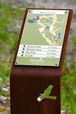
Use cases — for site-specific markers, plant identification, labels

Sign size
450mm wide x 300mm high
Support

Steel, sandstone, Corten or recycled timber, sufficient to raise the top of the sign 1000mm above ground level
Elements
Heading, up to 100 words of text, a single image, QR code
Typograhy
Heading - 96pt Univers Bold
Text - 20pt Univers Regular
QR code
50mm x 50mm
Hornsby Shire Council Heritage Interpretation Strategy and Action Plan | Proposed Design Aspects
2
V2.0 | 01 October 2022 | © 2022 Artefact Heritage Services Pty Ltd
- 2000 - 1800 - 1600 - 1400 - 1200 - 1000 - 500 - 300
1.2 Interpretive Signage — General Format — Medium
Use cases — for the majority of the interpretive signage, telling specific stories
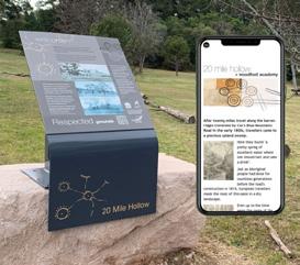

Stand-mounted (landscape)
Wall-mounted (portrait)
Sign size
900mm x 600mm (either portrait or landscape)
Support Steel, sandstone, Corten or recycled timber (or wall mounted), sufficient to raise the top of the sign 1200mm (stand) or 1900mm (wall) above ground level
Elements
Heading, up to 300 words of text, 2-3 images, QR code

Typography
Heading - 120pt Univers Bold
Text - 24pt Univers Regular
QR code
75mm x 75mm
Hornsby Shire Council Heritage Interpretation Strategy and Action Plan | Proposed Design Aspects
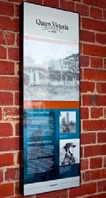
3
V2.0 | 01 October 2022 | © 2022 Artefact Heritage Services Pty Ltd
- 2000 - 1800 - 1600 - 1400 - 1200 - 1000 - 500 - 300
1.3 Interpretive Signage — General Format — Large
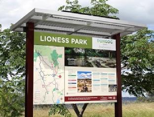

Use cases — area markers with general heritage information
Sign size 1600mm wide x 1060mm high
Support

Steel, sandstone, Corten or recycled timber, sufficient to raise the top of the sign 1800mm above ground level
Elements
Heading, 300-500 words of text, 2-4 images, QR code
Typography
Heading - 200pt Univers Bold
Text - 36pt Univers Regular
QR code
125mm x 125mm
Hornsby Shire Council Heritage Interpretation Strategy and Action Plan | Proposed Design Aspects
4
V2.0 | 01 October 2022 | © 2022 Artefact Heritage Services Pty Ltd
- 2000 - 1800 - 1600 - 1400 - 1200 - 1000 - 500 - 300
1.4 Interpretive Signage — General Format — Trail marker
Use cases — at multiple locations along trail routes
Sign size
450mm wide x 2000mm high
Support

Contiguous signage, with sandstone, Corten or recycled timber base insert

Elements
Heading, 100-200 words of text, 1-2 images, QR code
Typography
Heading - 120pt Univers Bold
Text - 24pt Univers Regular
QR code
125mm x 125mm
Hornsby Shire Council Heritage Interpretation Strategy and Action Plan | Proposed Design Aspects

5
V2.0 | 01 October 2022 | © 2022 Artefact Heritage Services Pty Ltd
- 2000 - 1800 - 1600 - 1400 - 1200 - 1000 - 500 - 300
Hornsby
2.0 Interpretive Signage — Design Options
Using the existing signage styles and general formats (Public Domain Signage, 2020), variations in motifs, colour palettes and structural components are proposed to distinguish heritage interpretation signage from general wayfinding signage.
2.1 Use of distinctive motifs, ghosted into the background
Heritage motifs coud be added to the signs to signal if the information is of Aboriginal or non-Aboriginal significance. The motifs should be ‘ghosted’ so as not to detract from the text/images on the sign. The motifs could be placed either as a feature in the right hand strip of the sign or as an all-over pattern.
a) Non-Aboriginal heritage motifs
(i) built heritage features, such as an image of the Hornsby Council Chambers;
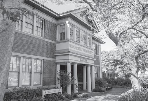
(ii) landscape features, such as an image of eucalyptus trees
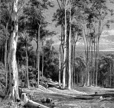
b) Aboriginal heritage motif, produced by an Aboriginal graphic artist with connection to Country in the Hornsby area
Australian
Gibalee (come together) © Tracey Howie (reproduced with permission) Used as an example. If this or any Aboriginal design were to be used by Council, an arrangement would need to be negotiated between Council and the artist.

6
V2.0 | 01 October 2022 | © 2022 Artefact Heritage Services Pty Ltd
Shire Council Heritage Interpretation Strategy and Action Plan | Proposed Design Aspects
Hornsby Council Chambers (image from Hornsby LGA website)
eucalyptus forest (wood engraving after a drawing by Joseph Selleny, 1897)
2.2 Colour palette
The existing colour scheme (Public Domain Signage 2020) would be maintained:
Heading
Vit lab is molorpor maion nus de et unt rest, ulpa sum nus et quam apeliquid modipsam hil intia dolorro beatendella volorer endipsandis aliquis quunt faccuptam velest omnist inctiam alibust, in nus molupta quuntotassim volendempor sam ut venecto estem dolupta que pa con pores aut fuga. Ut ad maximporia volorrum fugitatur, untectat aliquam dolorrum aliqui corio bea nobis dollorro conseque ipsunt.
Vit lab rest, ulpa modipsam volorer cuptam nus molupta sam ut pores aut rum fugitatur, aliqui corio ipsunt.

2.3 QR Codes
QR codes could be added to panels where appropriate, linking to additional information on the Council’s website.
Heading
Vit lab is molorpor maion nus de et unt rest, ulpa sum nus et quam apeliquid modipsam hil intia dolorro beatendella volorer endipsandis aliquis quunt faccuptam velest omnist inctiam alibust, in nus molupta quuntotassim volendempor sam ut venecto estem dolupta que pa con pores aut fuga. Ut ad maximporia volorrum fugitatur, untectat aliquam dolorrum aliqui corio bea nobis dollorro conseque ipsunt. Um quodi omnimus moluptas ut ulpa sum nus et quam apeliquid modipsam hil intia dolorro beatendella volorer endipsandis aliquis quunt faccuptam velest omnist inctiam alibust, in nus molupta quuntotassim volendempor sam ut venecto estem dolupta que pa con pores aut fuga. Ut ad maximporia volorrum fugitatur, untectat aliquam dolorrum aliqui corio bea nobis dollorro conseque ipsunt. Ut ad maximporia volorrum fugitatur con pores aut fuga. Ut ad maximporia
Um quodi omnimus moluptas ut ulpa sum nus et quam apeliquid modipsam hil intia dolorro beatendella volorer endipsandis aliquis quunt faccuptam velest omnist inctiam alibust, in nus molupta quuntotassim volendempor sam ut venecto estem dolupta que pa con pores aut fuga. Ut ad maximporia volorrum fugitatur, untectat aliquam dolorrum aliqui corio bea nobis dollorro conseque ipsunt.
Ut ad maximporia volorrum fugitatur con pores aut fuga. Ut ad maximporia volorrum
Vit lab is molorpor maion nus de et unt rest, ulpa sum nus et quam apeliquid modipsam hil intia dolorro beatendella volorer endipsandis aliquis quunt faccuptam velest omnist inctiam alibust, in nus molupta quuntotassim volendempor sam ut venecto estem dolupta que pa con pores aut fuga. Ut ad maximporia volorrum fugitatur, untectat aliquam dolorrum aliqui corio bea nobis dollorro conseque ipsunt.
Um quodi omnimus moluptas ut ulpa sum nus et quam apeliquid modipsam hil intia dolorro beatendella volorer endipsandis aliquis quunt faccuptam velest omnist inctiam alibust, in nus molupta quuntotassim volendempor sam ut venecto estem dolupta que pa con pores aut fuga. Ut ad maximporia volorrum fugitatur, untectat aliquam dolorrum aliqui corio bea nobis dollorro conseque ipsunt.
ad maximporia volorrum fugitatur con pores aut fuga. Ut ad maximporia volorrum fugitatur, untectat aliquam dolorrum


Um quodi nus et dolorro aliquis inctiam sim volendempor dolupta maximporia aliquam dollorro
Ut ad maximporia pores aut rum fugitatur, aliqui corio ipsunt.
7 Hornsby Shire Council Heritage
Plan
V2.0 | 01 October 2022 | © 2022 Artefact Heritage Services Pty Ltd
Interpretation Strategy and Action
| Proposed Design Aspects
Green Mid green-grey Dark grey
aliqui corio bea nobis dollorro conseque ipsunt. Caption details incuding source details
Ut
Caption details incuding source details
3.2 Motifs for Trail Markers
i

Heading
Sub-heading
Vit lab is molorpor maion nus de et unt rest, ulpa sum nus et quam apeliquid modipsam hil intia dolorro beatendella volorer endipsandis aliquis quunt faccuptam velest omnist inctiam alibust, in nus molupta quuntotassim volendempor sam ut venecto estem dolupta que pa con pores aut fuga. Ut ad maximporia volorrum fugitatur, untectat aliquam dolorrum aliqui corio bea nobis dollorro conseque ipsunt.
Um quodi omnimus moluptas ut ulpa sum nus et quam apeliquid modipsam hil intia dolorro beatendella volorer endipsandis aliquis quunt faccuptam velest omnist inctiam alibust, in nus molupta quuntotassim volendempor sam ut venecto estem dolupta que pa con pores aut fuga. Ut ad maximporia volorrum fugitatur, untectat aliquam dolorrum aliqui corio bea nobis dollorro conseque it.
iHeading
Sub-heading
Vit lab is molorpor maion nus de et unt rest, ulpa sum nus et quam apeliquid modipsam hil intia dolorro beatendella volorer endipsandis aliquis quunt faccuptam velest omnist inctiam alibust, in nus molupta quuntotassim volendempor sam ut venecto estem dolupta que pa con pores aut fuga. Ut ad maximporia volorrum fugitatur, untectat aliquam dolorrum aliqui corio bea nobis dollorro conseque ipsunt.
Um quodi omnimus moluptas ut ulpa sum nus et quam apeliquid modipsam hil intia dolorro beatendella volorer endipsandis aliquis quunt faccuptam velest omnist inctiam alibust, in nus molupta quuntotassim volendempor sam ut venecto estem dolupta que pa con pores aut fuga. Ut ad maximporia volorrum fugitatur, untectat aliquam dolorrum aliqui corio bea nobis dollorro conseque it. Caption
Caption details incuding source



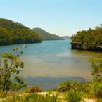

iHeading
Sub-heading
Vit lab is molorpor maion nus de et unt rest, ulpa sum nus et quam apeliquid modipsam hil intia dolorro beatendella volorer endipsandis aliquis quunt faccuptam velest omnist inctiam alibust, in nus molupta quuntotassim volendempor sam ut venecto estem dolupta que pa con pores aut fuga. Ut ad maximporia volorrum fugitatur, untectat aliquam dolorrum aliqui corio bea nobis dollorro conseque ipsunt.
Um quodi omnimus moluptas ut ulpa sum nus et quam apeliquid modipsam hil intia dolorro beatendella volorer endipsandis aliquis quunt faccuptam velest omnist inctiam alibust, in nus molupta quuntotassim volendempor sam ut venecto estem dolupta que pa con pores aut fuga. Ut ad maximporia volorrum fugitatur, untectat aliquam dolorrum aliqui corio bea nobis dollorro conseque it.
Heading
Sub-heading


Vit lab is molorpor maion nus de et unt rest, ulpa sum nus et quam apeliquid modipsam hil intia dolorro beatendella volorer endipsandis aliquis quunt faccuptam velest omnist inctiam alibust, in nus molupta quuntotassim volendempor sam ut venecto estem dolupta que pa con pores aut fuga. Ut ad maximporia volorrum fugitatur, untectat aliquam dolorrum aliqui corio bea nobis dollorro conseque ipsunt.
Um quodi omnimus moluptas ut ulpa sum nus et quam apeliquid modipsam hil intia dolorro beatendella volorer endipsandis aliquis quunt faccuptam velest omnist inctiam alibust, in nus molupta quuntotassim volendempor sam ut venecto estem dolupta que pa con pores aut fuga. Ut ad maximporia volorrum fugitatur, untectat aliquam dolorrum aliqui corio bea nobis dollorro conseque it. Caption
9 Hornsby Shire Council Heritage Interpretation Strategy and Action Plan | Proposed Design Aspects V2.0 | 01 October 2022 | © 2022 Artefact Heritage Services Pty Ltd
Caption details incuding source details
i
details incuding source details
Caption details incuding source details
details incuding source details
details
Caption details incuding source details
3.3 Use of distinctive structural components


a) existing painted galvanised steel supports


b) use of recycled timber for supports
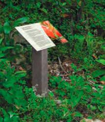

10 Hornsby Shire Council Heritage Interpretation Strategy and Action Plan | Proposed Design Aspects V2.0 | 01 October 2022 | © 2022 Artefact Heritage Services Pty Ltd
c) use of locally quarried sandstone for supports


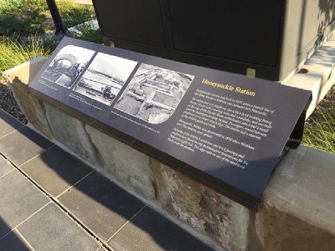
c) use of Corten (rusted steel) for supports
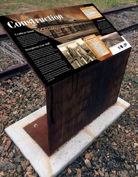


11 Hornsby Shire Council Heritage Interpretation Strategy and Action Plan | Proposed Design Aspects V2.0 | 01 October 2022 | © 2022 Artefact Heritage Services Pty Ltd
4.0 Interpretive Signage — Additional Elements
Functional Elements identified in the Hornsby Public Domain Guidelines — to include interpretive elements using the approved typeface, motifs and colour palette
Bus shelter walls




Left: Bus Shelter design from the existing Public Domain Guidelines


Below: Examples of design alternatives
Bubblers
Left: Bubbler design from the existing Public Domain Guidelines
Below: Examples of design alternatives

12 Hornsby Shire Council Heritage Interpretation Strategy and Action Plan | Proposed Design Aspects V2.0 | 01 October 2022 | © 2022 Artefact Heritage Services Pty Ltd
4.0 Interpretive Signage — Additional Elements - continued

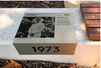
Seating inserts

Pavers

Above: Custom seating design from the existing Public Domain Guidelines
Below: Examples of design alternatives
Above: Plain granite paver from the existing Public Domain Guidelines
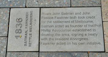

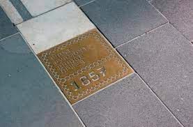
Below: Examples of design alternatives
Tree grates

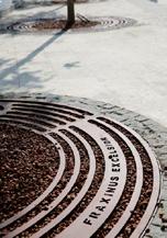

Hornsby Shire Council Heritage Interpretation Strategy and Action Plan | Proposed Design Aspects
Above: Unadorned tree-grate format from the existing Public Domain Guidelines
Below: Examples of design alternatives
13
V2.0 | 01 October 2022 | © 2022 Artefact Heritage Services Pty Ltd
5.0 Interpretive Design — Publications

A range of existing brochures, walking guides, and web pages form part of the heritage interpretation materials already produced by Council. Examples are shown below.


Guidelines for new heritage-related publications:
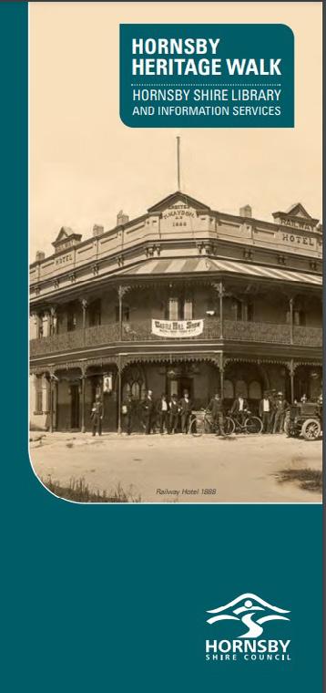
Colour palette: Green, Mid green-grey and Dark grey (Public Domain Signage 2020)
Type:
Headings - Univers Bold
Body Text - Univers Regular
Sizes: Consistent sizing for families of materials
(e.g. walking guides A4, schools materials A4, brochures DL, posters A3)
Graphic elements: Use ghosted motifs, if appropriate and if not conflicting with the publication design
14
Strategy
Action Plan | Proposed
Aspects V2.0 | 01 October 2022 | © 2022 Artefact Heritage Services Pty Ltd
Hornsby Shire Council Heritage Interpretation
and
Design


