

Westleigh Park Draft Master Plan February 2023
Council recognises the Traditional Owners of the lands of Hornsby Shire, the Darug and GuriNgai peoples, and pays respect to their Ancestors and Elders past and present and to their Heritage. We acknowledge and uphold their intrinsic connections and continuing relationships to Country.
2 WESTLEIGH PARK DRAFT MASTER PLAN Contents 1.0 Introduction 3 2.0 Project Objectives 4 3.0 Site Description 6 3.1 Aboriginal Heritage 6 3.2 Current Site Conditions and Use 7 4.0 Draft Masterplan 13 4.1 Recreation 13 4.2 Access 19 4.3 Approach to landfill management 23 4.4 Environmental Sustainability 25 4.5 Staged Implementation of Master Plan 27 4.6 Connecting with Country 27 Conclusion 28
1.0 Introduction
In 2016 in response to progressively increasing demands upon existing open space, Hornsby Shire Council Council purchased 36 hectares of land from Sydney Water for the primary purpose of developing additional sports facilities for the district. The demand for sports facilities in the district has been identified through various studies including NSROC Regional Sportsground Strategy Review (2016) and Hornsby Sportsground Strategy (2018).
The proposed new sports facilities seek to assist Council in meeting the evolving needs of the community. The previously cleared and disturbed area of the site is currently zoned R2 Low Density Residential and is proposed to accommodate the new playing fields, amenities and supporting facilities.
Westleigh Park will play a key role in recreational provision for the district including a diverse range of provisions for formal sports, passive recreation (e.g. picnics, walking, playground), mountain biking and ancillary facilities (including internal roads, carparks, amenities buildings, shared paths and water management).
Fundamentally Council has sought to develop an environmentally and culturally sustainable framework for the development of the recreational site that:
• Protects biodiversity at every stage - Several vegetation communities are found on the site, some of which are threatened ecological communities. Biodiversity protection principles have been applied throughout the planning process which look to avoid, minimise and mitigate environmental impacts. Residual impacts will be offset and rehabilitated in accordance with relevant policies and guidelines.
• Minimises adverse impacts to local creeks by applying Water Sensitive Urban Design (WSUD) Avoid and minimise adverse impact of stormwater on downstream waterways. Apply water sensitive urban design (WSUD) to manage water quality and flows, including stormwater harvesting, conservation and water quality treatment.
• Supports environmental sustainability -
Environmentally sustainable design features will reduce operational carbon emissions, such as passive solar design, renewable energy and energy efficient hot water and lighting
• Designs for bushfires - Planning for Bushfire Protection to embed resilience of the site.
• Provides active transport - Pedestrian and cycle paths have been proposed to provide a loop access around the perimeter of the site, entering from Warrigal Drive and the new entry from the south. Paths will also connect to a broader local network of cycle paths and the adjoining mountain bike trails to the east. Bus access with bus bays are also proposed along the
perimeter park road to encourage public transport / group access to the park.
• Connects with Country - Being guided by the local Aboriginal groups on protection and promotion of the indigenous heritage and culture within the park.
Council undertook community engagement on the draft Master Plan in June 2021 to understand the community’s views on the draft proposals, including the sports fields, traffic and parking, community facilities, adjoining mountain bike trails, bushland biodiversity, potential link between Hornsby Park and Westleigh Park, and indigenous history.
Feedback generally conveyed that the draft Master Plan had a good balance of ‘active’ and ‘passive’ recreation activities, and a sustainable approach to restoring and protecting the natural environment while addressing recreational needs. Typical concerns raised during the consultation included the management of potential biodiversity impacts of mountain bike use and sport field development, and potential for impacts on traffic and local road systems. The engagement reports have been used to inform this draft of the Master Plan to strengthen positive features while seeking to address community concerns.
The development of the draft Master Plan has involved a multidisciplinary team including specialist inputs in the following areas:
Environmental Partnerships (NSW) Pty Ltd
Master Planning and Landscape Design
Taylor Thompson Whitting (TTW)
Master planning, Civil, Traffic and Transportation Engineering
Civille
Water Management
Bitzios
Traffic Planning
Coffey Partners, Senversa
Contamination Remediation and Environmental Management
Eco Logical Australia
Environmental Assessment
Trailscapes, Dirt Art & Griffith University
Mountain Bike Trail Assessment and Concept Planning
Wannangini Pty Ltd
Aboriginal Cultural Heritage
SJB Planning
Statutory Planning
This report provides a summary of the site conditions and describes in summary form the Draft Master Plan for Westleigh Park.
3 WESTLEIGH PARK DRAFT MASTER PLAN
2.0 Project Objectives
The Draft Master Plan seeks to provide a conceptual framework for ongoing planning on the site. Specifically it seeks to achieve the following:
• To assist in catering for the ongoing demand for sports facilities (including female sports) in the district and in response to NSROC Regional Sportsground Strategy Review (2016) and Hornsby Sportsground Strategy (2018);
• To provide a safe, clean and high quality environment for the community to enjoy a range of activities through the remediation of past contamination on the site;
• To embed environmental sustainability throughout the project including :
i. Avoid, minimise and mitigate environmental impacts.
ii. Improve and manage the natural environment in particular threatened ecological communities and species.
iii. Provide water management that minimises adverse flow or water quality impacts to the local creek system and to Council’s existing stormwater system.
iv. Employ Water Sensitive Urban Design (WSUD).
v. Reduce operational carbon emissions, through passive solar design, renewable energy and energy efficient features in all facilities.
vi. Integrate planning for bushfire protection.
vii. Support active and public transport to and within the site.
• To Connect with Country and Design with Country in consultation with local Aboriginal peoples.
4 WESTLEIGH PARK DRAFT MASTER PLAN
5 WESTLEIGH PARK DRAFT MASTER PLAN
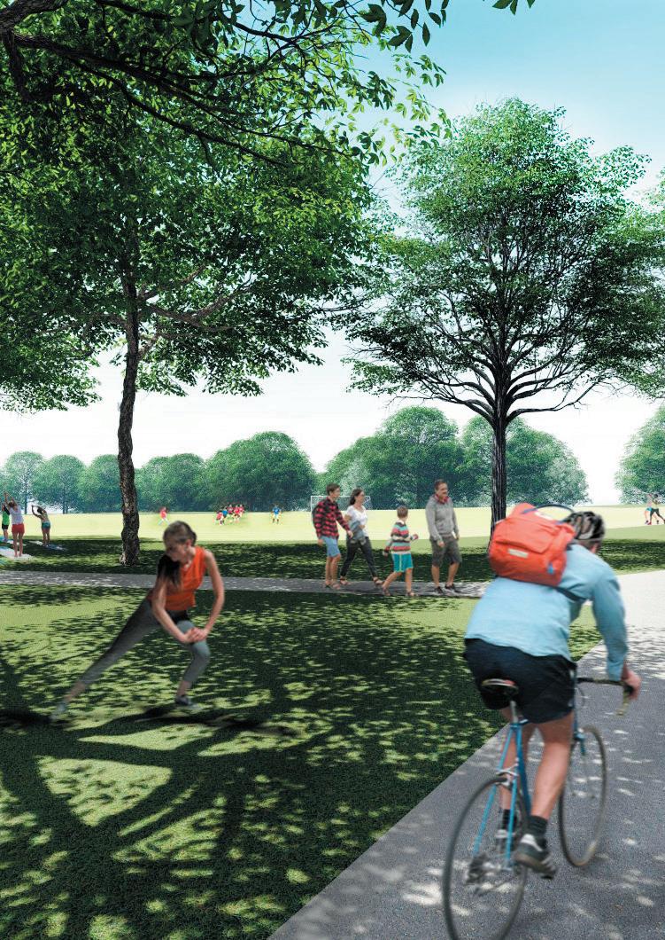
Westleigh Park Artist’s impression
3.0 Site Description
Westleigh Park (refer Figure 3.1) is located at 62 Quarter Sessions Road, Westleigh on Lot 101 DP 1217395. The land is owned by Hornsby Shire Council and is currently zoned (R2) Low Density Residential and Environmental Management (E3) in the Hornsby Local Environmental Plan (LEP) 2013, with adjoining lands zoned as (R2) Low Density Residential or (RE1) Public Recreation. The Dog Pound Creek land, located to the north of the Westleigh Park site, is owned by Hornsby Council and is mostly bushland zoned (RE1) Public Recreation. The Dog Pound Creek BioBanking area cannot be used or impacted upon.
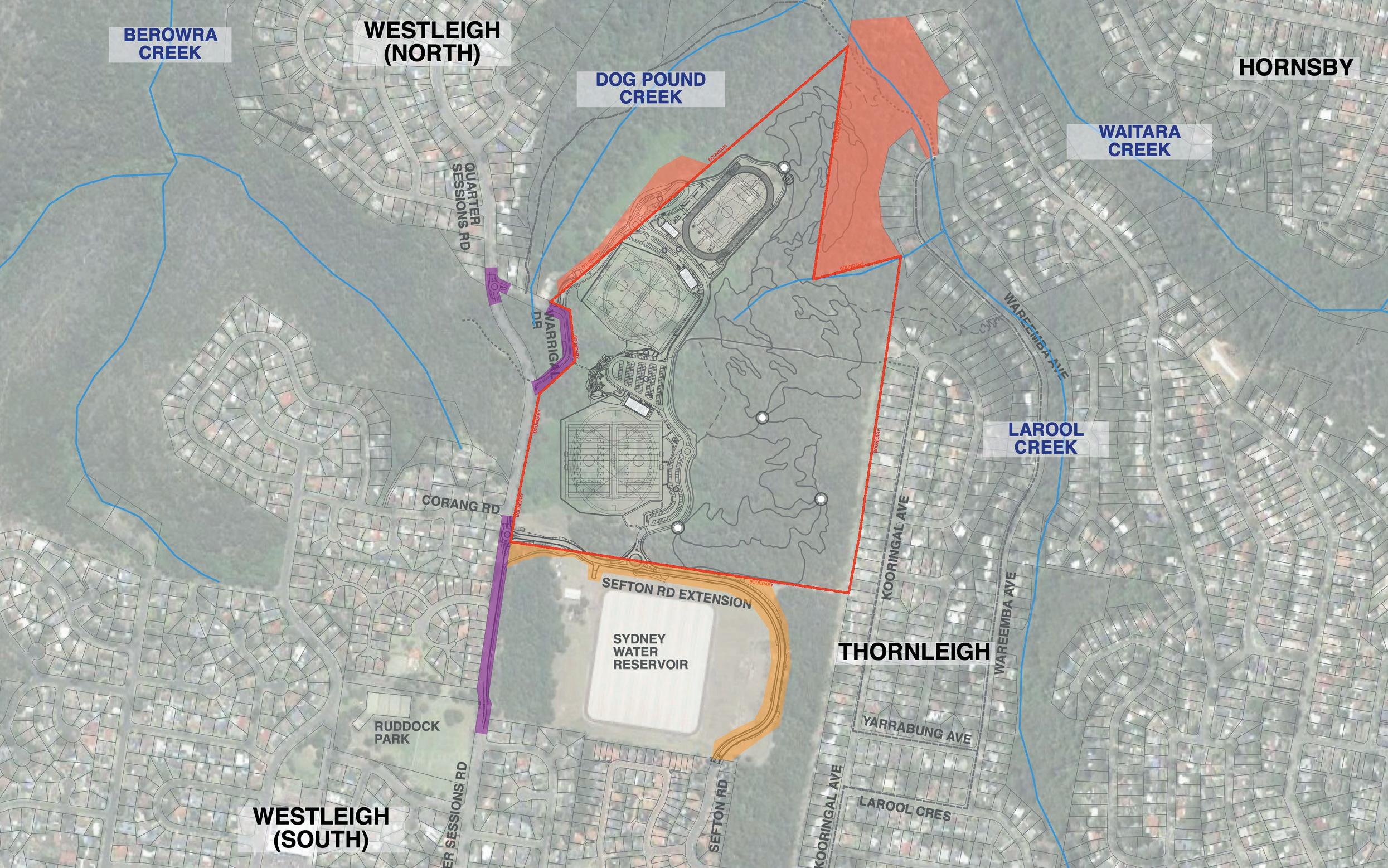
The study area is approximately 46 hectares (with about 36 Ha. in Westleigh Park and around 10 Ha. in the adjoining Dog Pound Creek bushland). In Westleigh Park around 10 hectares is currently cleared land with the remainder being bushland (referred to as ‘Westleigh Park Bushland’).
The Westleigh Park land was formerly owned by Sydney Water and adjoins the Sydney Water Thornleigh Reservoir to the south and is bordered by bushland to the north. Quarter Sessions Road runs along the western frontage of the park with some adjoining residential properties backing on to the site from Kooringal Avenue to the east.
Areas of bushland within the site are mapped as ‘endangered’ and ‘critically endangered’ as well as threatened species being present. These areas need to be retained and impacts are to be avoided, minimised or mitigated through the project.
3.1 Aboriginal Heritage
As identified in the Due Diligence Assessment Report for the Westleigh Park complex, prepared in 2019 by GuriNgai Tribal Link Aboriginal Corporation, “the study area for Westleigh Park, has been for generations and still is, home to the GuriNgai & Darug Mobs (Wannangini).”
In addition, the area was seasonally occupied in various locations by the Darginyung peoples. The connections to this area for each of these groups includes pre and post European colonisation.
An Aboriginal Cultural Heritage Assessment (ACHAR) was undertaken for the site in 2020 which identified the following Statement of Aboriginal Cultural Significance:
“The land containing the project area embodies the collective and contemporary Aboriginal social values of loss, remembrance and resilience. From a traditional viewpoint, the land represents an important meeting place along a well-travelled path and therefore embodies the shared values of family, community and social cohesion. Looking forward, this land still retains the potential to educate and celebrate a unique connection to Country by promoting a shared understanding of the area’s cultural values.”
In addition the ACHAR refers to the existing dead Scarred Tree on site which is recommended to be relocated to a safe location for conservation and interpretation on the site (an indicative location is shown on the maps in this draft Master Plan), as well as other aspects of cultural heritage importance in the local area which are to be conserved and protected.
Works areas outside cadastral boundary and on adjoining Council lands subject to the applicable PoM. (Generic Plan of ManagementPlanning District Two)
Works areas outside cadastral boundary and on Operational Land
Works areas outside cadastral boundary and on adjoining Sydney Water Lands - owners compliance and consent required
Works areas outside cadastral boundary and on Operational Land
6 WESTLEIGH PARK DRAFT MASTER PLAN
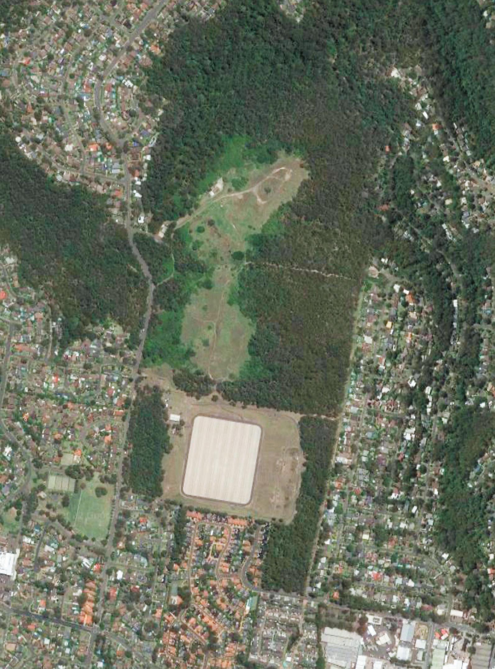
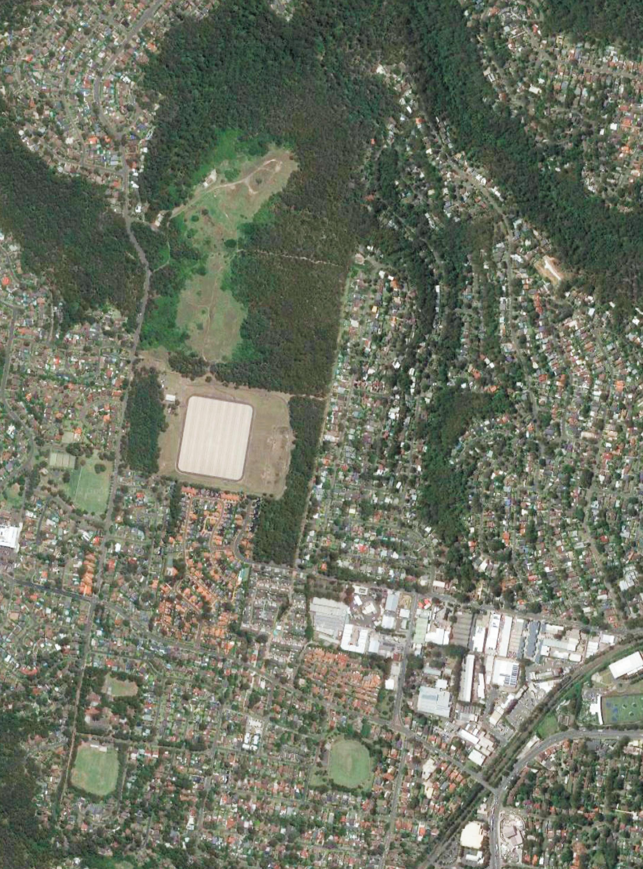
Figure 3.1 Westleigh Park Site
Westleigh Park cadestral boundary
Image Source: visitnewcastle.com.au
Centennial Park - multi purpose parklands.
Image Source: Greater Sydney Parklands
Centennial Park - multi purpose parklands.
Image Source: Sydney.com
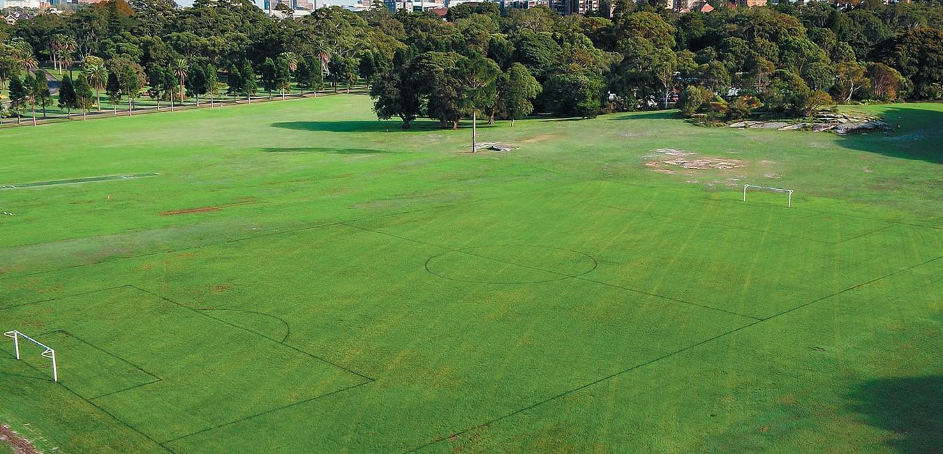
Centennial Park - multi purpose parklands.
Image Source: Centennial Parklands Sports Centre


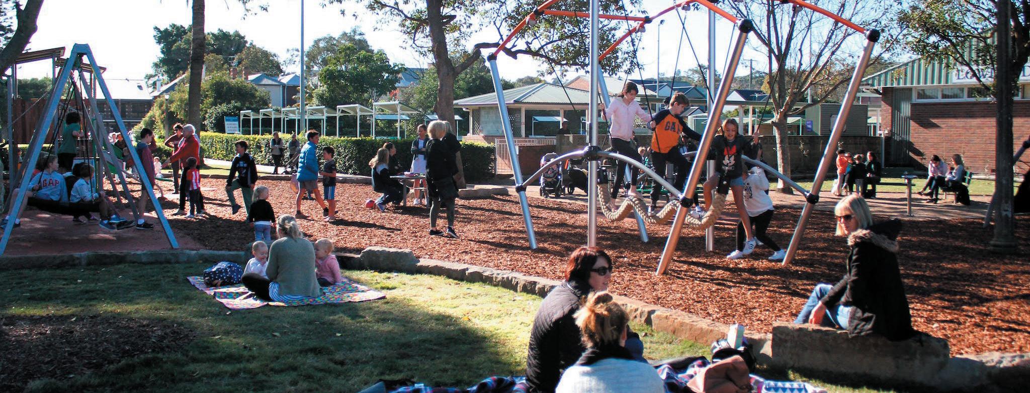
Centennial Park - multi purpose parklands.
Image Source: centennialparklands.com.au

7 WESTLEIGH PARK DRAFT MASTER PLAN

8 WESTLEIGH PARK DRAFT MASTER PLAN
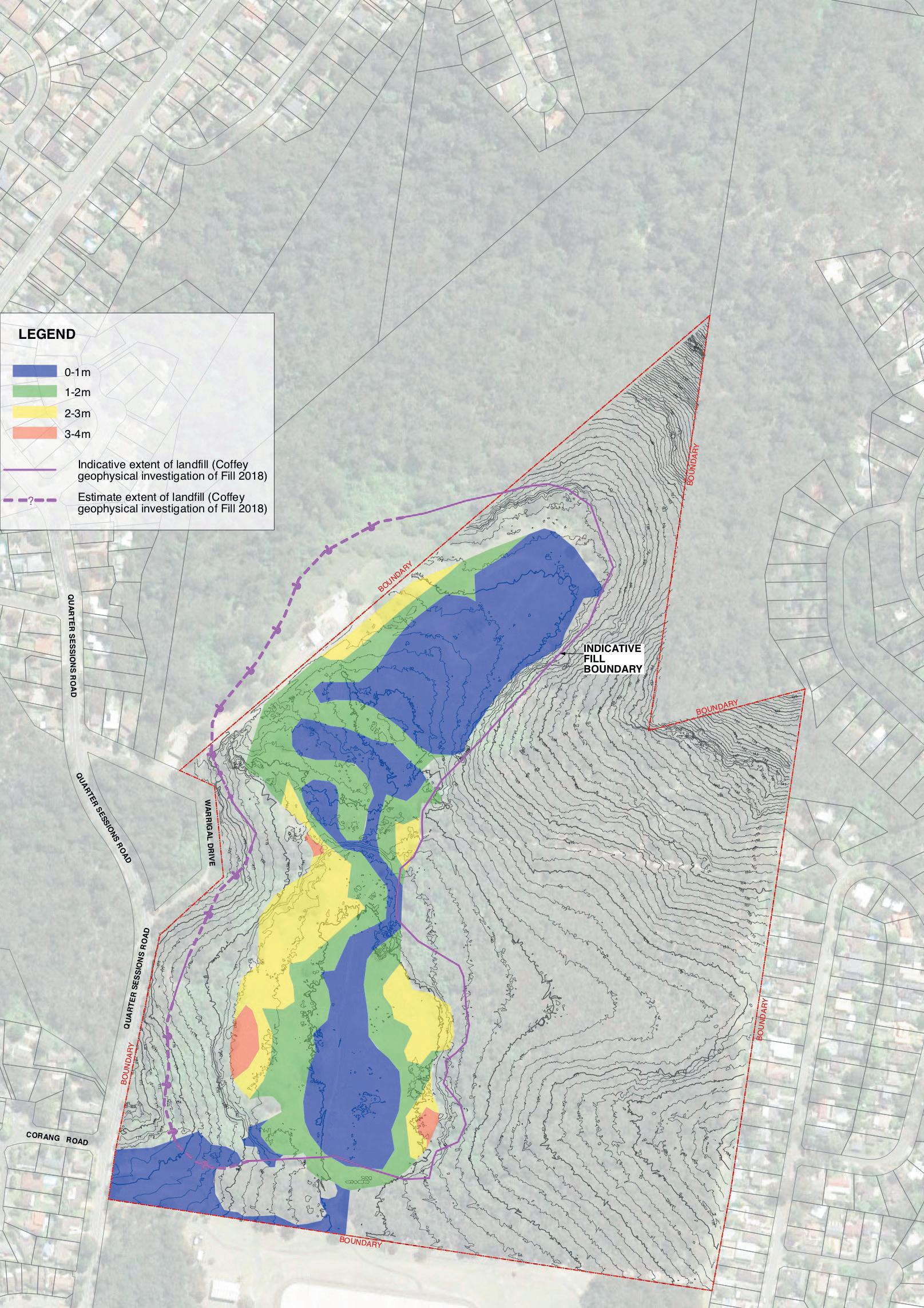
Figure 3.2 - Indicative Landfill Depth (source: SJB & J 2014 and Coffey 2018)
3.2 Current Site Conditions and Use
The cleared area on the site is predominately tufted grasses and un-maintained exotic grass with significant weed encroachment. Several worn tracks traverse the cleared area. The Westleigh Park Bushland contains areas of mapped Threatened Ecological Communities and includes an extensive network of unsanctioned mountain bike trails.
The site is currently informally used for casual recreation such as dog walking and access for established but ununsanctioned mountain bike trails through the bushland areas. A former Rural Fire Services (RFS) building is located along the north edge of the cleared lands.
The adjacent Dog Pound Creek site is mostly bushland with some fire trails and areas of weed growth. The majority of Dog Pound Creek site is managed under a BioBanking agreement and cannot be impacted by the proposals or any other uses.
Westleigh Park, including the bushland area, contain areas of contamination (asbestos, PFAS and others) on the surface and within the site fill. Much of this material is considered solid waste including landfill materials from construction and demolition sites.
PFAS (Perfluoroalkyl and Polyfluoroalkyl Substances) are manufactured chemicals formerly used in products such as fire fighting foams which do not degrade over time and may be harmful to humans and fauna. A detailed PFAS contamination assessment has been undertaken and the NSW Government has undertaken to provide remediation of all PFAS affected areas. At time of writing monitoring is ongoing. The initial recommendation was at least 6 months between sampling events. As no seasonal change was noted in the sampling results, Senversa recommended 12 months between sampling events to provide an opportunity to analyse results over a longer period in order to identify any trends/changes. The Environmental Protection Authority (EPA) has had oversight of this matter.
Topography
The site lies at approximately 171-186m Australian Height Datum (AHD) on an approximately north trending ridgeline. Land slopes away from the centre of the site to the east and west, while the northern areas slope to the northwest, north and northeast towards gullies. Falls across the existing landform range between 1:20–1:30 which is significantly steeper than a playing field platform (generally 1:100).
Drainage
Surface runoff generally falls to the east and west, away from the ridgeline and into the surrounding bushland areas through natural drainage lines and as infiltration. In major storm events, runoff travels via overland flow paths to nearby watercourses. (Civil Stormwater Report by TTW)
Geology
Most of the site is assumed to be underlain by Ashfield Shale along the top of the central ridgeline, with the northwest and northeast areas underlain by Hawkesbury Sandstone.
A borrow pit (small quarry) in the north of the site was used as a source of rock during construction of the Thornleigh Reservoir south of the site. Approximately 23,700 m3 was obtained from this excavation. Based on an approximate area of 11,690 m2 the indicative depth of the borrow pit has been estimated to be 2m. (Sydney Water)
This suggested that the depth of fill/soil overlying bedrock may vary from up to approximately 3m below ground level near the southern site boundary, to less than 1m below ground level towards the northern site boundary.
Landfill
Between 40–50% of the cleared portion of the site has a landfill depth of one metre or lower with up to 2–4m depth in zones along the south western and eastern boundaries (refer Figure 3.2).
Vegetation
Several vegetation communities exist on the site, including Sydney Turpentine Ironbark Forest (STIF), listed as Critically Endangered under the Commonwealth Environment Protection (EPBC) Act and Biodiversity Conservation Act 2016 - BC Act (NSW) and Duffys Forest, listed as an Endangered Ecological Community under the BC Act. Vegetation community mapping is reflected in Figure 3.3.
Over 240 plant species, including eleven species of Orchids, have also been recorded on-site. In addition surveys indicate that Darwinia biflora (Threatened Flora - under the EPBC Act (Commonwealth)) and Tetratheca glandulosa (BC Act) were observed on-site.
There are unsanctioned mountain bike trails that pass through the above areas as indicated on Figure 3.4.
Fauna
Habitat assessments undertaken in 2016 by Council have been supplemented by work undertaken by Eco Logical Australia from 2021 to 2023. The vegetation survey indicated the site exhibits high diversity in birds species, with 50 species observed including the threatened Squaretailed Kite and summer migrants the Sacred Kingfisher, Eastern Koel, Channel-billed Cuckoo and Dollarbird. Both Barking and Powerful Owls were heard, but no roosting or nesting observed on the site.
There were a few reptile species, and indications of mammals (scats and tracks, burrows and feeding scars) present. Red Crown Toadlets were also observed in a couple of locations.
A full species list of flora and fauna observed on the site will be included in subsequent development application documentation.
9 WESTLEIGH PARK DRAFT MASTER PLAN
Site Boundary BioBanking Site


Vegetation Zones 20221031
Duffys Forest
Blue Gum Diatreme Forest
Sydney Turpentine-Ironbark Forest


Sydney Coastal Sandstone Gully Forest


Sydney Hinterland Apple-Blackbutt Gully Forest


Sydney Hinterland Dwarf Apple Low Woodland
Sydney Coastal Sandstone Bloodwood Shrub Forest

Typha
Exotic
Exotic Grasslands
Vegetation Communities
Map Scale: 1:6,000 at A4 Portrait
3.3 -
0 90 180 270 360 m
Figure
Westleigh Vegetation Communities (Source: Eco Logical Australia 2023)
20230220_Westleigh
MGA zone 56 ¬ Dimensions, location of features and boundaries are indicative only, their actual position has not been surveyed. Aerial photography may not align with cadastral boundaries. Hornsby Shire Council accepts no responsibility for any incident arising from any inaccuracy. Copyright © Hornsby Shire Council 2019; © The State of New South Wales; Aerial imagery: © NSW Department of Finance, Services and Innovation 2016 Important Notice! Hornsby Shire Council 296 Peats Ferry Road HORNSBY NSW 2077 Telephone: 02 9847 6666 hsc@Hornsby.nsw.gov.au Email:
Projection: Date: 20/02/2023 GDA94 /
10 WESTLEIGH PARK DRAFT MASTER PLAN
SiteBoundary


Existing Tracks


BioBanking Site

Vegetation Zones 20221031
Duffys Forest
Blue Gum Diatreme Forest
Sydney Turpentine-Ironbark Forest


Sydney Coastal Sandstone Gully Forest


Sydney Hinterland Apple-Blackbutt Gully Forest


Sydney Hinterland Dwarf Apple Low Woodland
Sydney Coastal Sandstone Bloodwood Shrub Forest
Typha
Exotic
Exotic Grasslands
Westleigh Existing Unsanctioned Tracks
Map Scale: 1:6,000 at A4 Portrait
GDA94 / MGA zone 56
Projection:
Date: 20/02/2023
090180270360 m
¬ Dimensions, location of features and boundaries are indicative only, their actual position has not been surveyed. Aerial photography may not align with cadastral boundaries. Hornsby Shire Council accepts no responsibility for any incident arising from any inaccuracy. Copyright © Hornsby Shire Council 2019; © The State of New South Wales; Aerial imagery: © NSW Department of Finance, Services and Innovation 2016 Important Notice! Hornsby Shire Council 296 Peats Ferry Road HORNSBY NSW 2077 Telephone: 02 9847 6666 hsc@Hornsby.nsw.gov.au Email:
11 WESTLEIGH PARK DRAFT MASTER PLAN
Figure 3.4 - Westleigh Park Unsanctioned mountain bike trail network (Source: Hornsby Shire Council 2018)
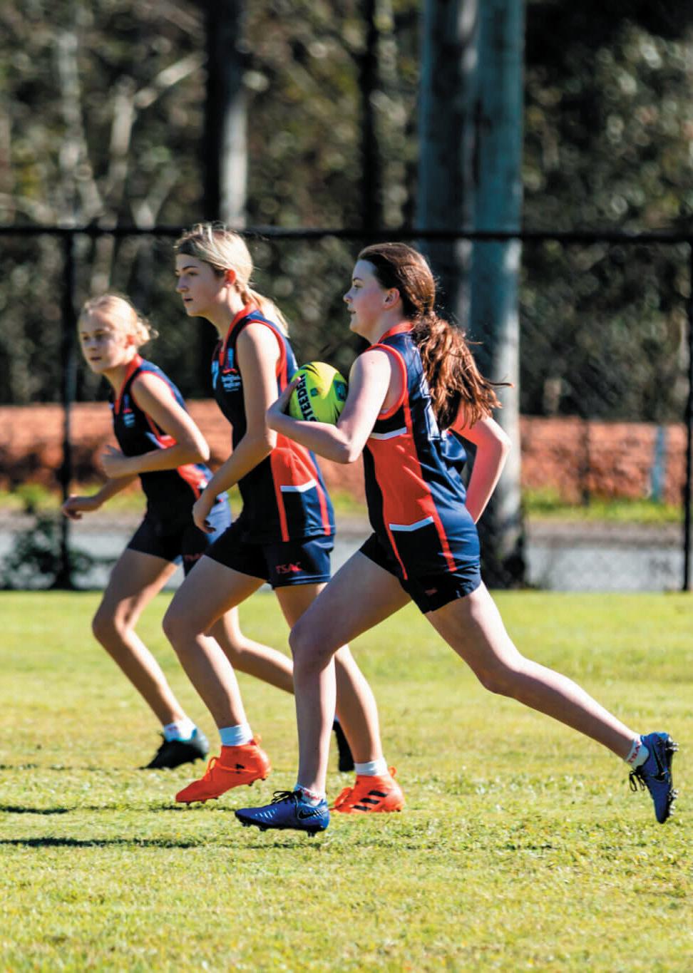
Image Source: The Springfield Anglican College 12 WESTLEIGH PARK DRAFT MASTER PLAN
4.0 Draft Master Plan
The Draft Master Plan illustrates the development of the park’s recreational and supporting facilities to address district recreational needs. The plan integrates the sensitive planning of uses and facilities to conserve important bushland and habitat, and to facilitate remediation of the site in an appropriate manner.
Key aspects of the draft Master Plan are outlined in the following summary and illustrated on the Draft Master Plan diagrams provided in Figures 4.1 to 4.8 .
4.1 Recreation
Provisions for recreation within the site are illustrated on Figures 4.1 to 4.3
4.1.1 Active recreation
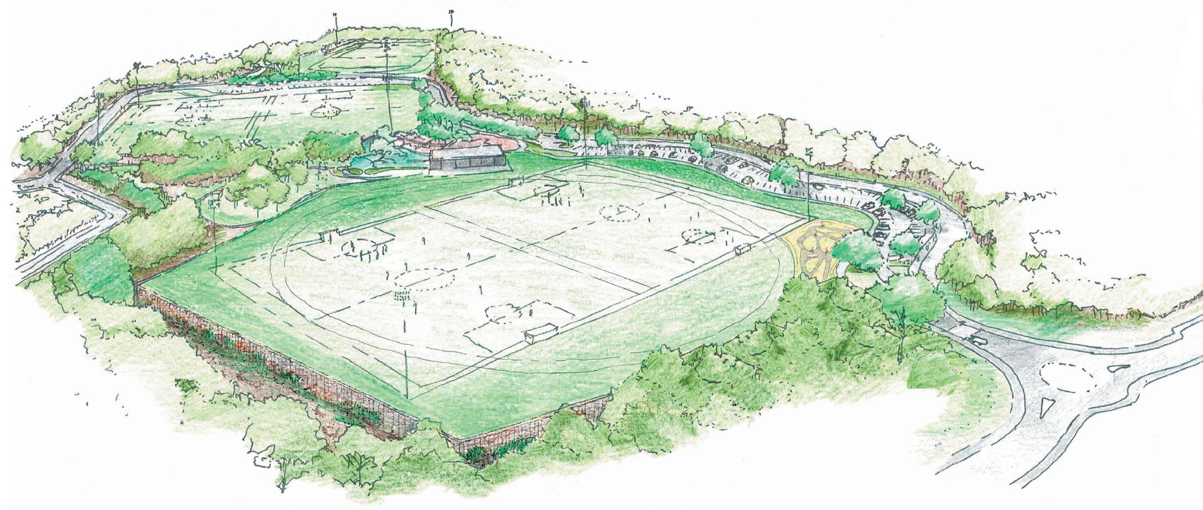
The draft Master Plan proposes three sports facility platforms that have been sited to integrate within the constraints of existing bushland vegetation and provision of road access.
From south to north, the field platforms step down the site executing a level change of around 8m overall. Each of the platforms is served by off street parking areas which have direct accessible connections to field and associated amenities/ facilities. The field platforms are also connected by the shared pedestrian cycle path network and supplementary pedestrian path network.
Precinct 1 Athletics track and support facilities
The north platform, in the narrowest section of the cleared lands, can support a senior competition athletics track and internal field area (which could be used as a fifth football field if not being used for athletics).
The area can accommodate a line marked grass track or alternatively be developed as an all-weather athletics facility. The internal field areas are proposed to accommodate other field events e.g. shot put, long jump, high jump, discus etc.
Precinct 2 central multi-purpose sportsfield platform
The central multipurpose field platform sits above adjoining levels to the west and is flanked by retaining walls of varying heights along with discrete ball fencing to retain balls within the fields. To the east, the platform is recessed into the landform. This central facility could accommodate a synthetic surface or alternatively be developed as a natural sports turf surface.
The available space in this zone will limit field sizes to dimensions between minimum and maximum sizes for senior competition.
Precinct 3 southern multi-purpose natural turf sportsfield platform – full senior size
The southern field platform provides the widest area working within the zone defined by adjoining bushland. The draft Master Plan illustrates a multipurpose playing field platform accommodating two (2) full competition size football fields, or two (2) full-size Rugby fields, or a fullsize AFL field, with a full-size cricket field during summer.
The field platform sits above adjoining levels and is flanked by retaining walls of varying heights to the west, Black coloured perimeter fencing again prevents balls leaving the fields and entering the bushland area.
4.1.2 Multipurpose park amenities buildings
Each of the field platforms is served by an amenities building at the same level as the field. The amenities buildings are accessed off the main carparks or the internal road network and path network.
All the amenities buildings will be designed to reduce operational carbon emissions, conserve potable water and harvest rain water.
4.1.3 Informal Recreation Grassed
viewing areas
Along the edge of each sport field, shaded grassed sections provide warm up areas and spectator viewing.
Open grassed informal games and picnic parkland
An open grassed space with seating and shelter, located to the north of precinct 3, provides for both local use and complements the sports uses of the fields. This area also provides a buffer zone for the playground from the carpark.
Play Space
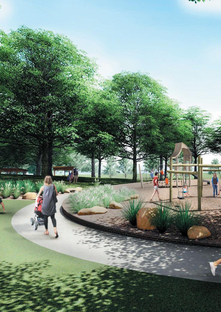
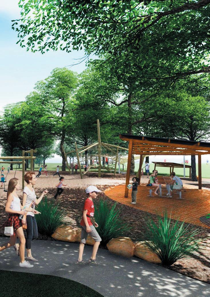
Between the southern and central field platforms is a passive recreational area that includes a play space area that is integrated into the level changes in this area, with the surrounding bushland as backdrop. The play space could provide a local play facility in accordance with Council’s Play Plan 2019.
13 WESTLEIGH PARK DRAFT MASTER PLAN


BOUNDARY BOUNDARY BOUNDARY BOUNDARY BOUNDARY BOUNDARY B O U N D A R Y BOUNDARY BOUNDARY 72 39 137 97 18 16 2 0 5 0 2 0 2 0 5 0 2 0 2 0 5 0 2 0 2 0 5 0 2 0 APZ56m APZ29m APZ 29M APZ 3 6 M R UDDOCK PAR K KOOR I NGAL AVE W A R R I G A L D R SYDNEY WATER R ESERVOIR CORANG RD Q U A R T E R S E S S I O N S R D SEFTO N RD QUARTER S E SS I ONS RD WAR E E MBA A V E
SEFTON RD EXTENSION YARRABUNG AVE LAROOL CRES QUARTER SESS I ONS RD 0 10 20 30 40 50 M CONTROL POINT POTENTIAL LOCATION OF S CARRED TREE CONTROL POINT POS S IBLE PRIMARY TRAIL HEAD POS S IBLE MINOR TRAIL HEAD We stle igh Pa rk Sports Comp ex Development Application DATE CL ENT TITLE SCALE N + MAS TERPLAN 1 Sports field North - Athletic field 2 Grassed viewing area 3 Amenity Building 3 4 Carpark 1 (72 spaces) 5 Bus stop 6 Maintenance compound with shed (400m2 fenced with 100m2 shed) 7 Carpark 2 (55 spaces) 8 Sports field Middle - Football - AFL - Cricket 9 Amenity Building 2 10 Carpark 3 (149 spaces) 11 Play space 12 Picnic and open grass area Amenity Building 1 13 14 Sports field South - Football - AFL - Cricket - Rugby 15 Carpark 4 (97 spaces) 16 Mountain Bike (MTB) trails KEY 17 New Sefton Road extension 18 Upgrade of Warrigal Drive 19 New roundabout at Quarter Sessions Road/Warrigal Drive 20 New park access on Quarter Sessions Road 21 Path connection to Ruddock Park 22 Existing scarred tree to be relocated 23 Preferred location of pump track 90˚ ANGLE PARKING SPACE :355 90˚ ANGLE ACCESSIBLE PARKING SPACE :8 PARALLEL PARKING SPACE :16 TOTAL PARKING SPACE : 379 1 2 3 4 5 6 7 8 10 11 12 13 14 15 16 17 18 19 20 21 9 22 23 5 LEGEND HAR D SUR FACE Asphalt roadway (7m wide in general) with mountable kerb on both sides / Asphalt roadway to car park Concrete pedestrian path (1 8m w de) Permeable pavement to parking bay Total Parking number: 381 Concrete pedestrian/cycle shared path (2 5m wide in general) Ma ntenance path to playground (2 5m w de) Boardwa k structure Rubber softfal to p ayground - type 1 SPOR TS FIELD SUR FACE Sports turf surface Synthetic turf surface Athlet c track markings on sports turf General turf surface SOFT LANDSCAPE Revegetation Mass p anting bed Garden bed TR EE CANOPIES Proposed tree -155 Ex sting tree to be retained Existing tree to be removed (Arborist Report) -26 Ex sting tree to be removed (Construct on) -102 xx Bio-retention basin / vegetated swale Track Hubs - pr mary mountain bike trai head Adjoin ng potential mountain bike trai networks ( ndicative only) Turfcrete (1 5m) - turfcrete path integrated with shared path for fire trail at north TC Timber edge Rubber softfal to fitness node Track Hubs Building Asset Protection Zone (APZ) Sydney Coastal Sandstone Bloodwood Shrub Forest BioBanking EXISTING VEGETATION COMMUNITY Blue Gum Diatreme Forest Sydney Coastal Sandstone Gully Forest Sydney Turpent ne-Ironbark Forest Sydney Hinterland Apple-Blackbutt Gu ly Forest Sydney Hinterland Dwarf Apple Low Woodland Duffy s Forest
WAREEMBAAVE
14
Figure 4.1- Westleigh Park concept masterplan
WESTLEIGH PARK DRAFT MASTER PLAN
PR ECINCT 1 - S ports field north:
• Athletics field
- Amenities - Building 3 (400m2)
- Turfed mound for spectators
- Car park 1 (72 spaces including 2 x accessible parking for Athletics field)

- Car park 2 (55 spaces ncluding 2 x accessible parking) shared by Precinct 1 & 2 - Bus stop
- Maintenance compound (400m2 including a 100m2 maintenance shed)
PR ECINCT 2
S ports field middle Football •AFL
- Amenities - Building 2 (500m2)
- Carpark 3 (155 parking spaces including 2 x accessible parking) shared by building 1 & playground
- Bus stop
- Playground
- Passive recreation lawn with BBQ/picinic shelter
Drive upgrade
New roundabout at Quarter S essions Road/ Warrigal Drive
PR ECINCT 6
- Bushland: Existing vegetation to be retained and restored - Moutain Bike Trails


(800m2)
Carpark 4 (97 parking spaces)
PR ECINCT 5 - New park access on Quarter S essions Road - S efton Road Extension - S hared connection to Ruddock Park
We stle igh Pa rk Sports Comp ex Development Application DATE + PRECINCT PLAN BOUNDARY BOUNDARY BOUNDARY BOUNDARY BOUNDARY BOUNDARY B O U N D A R Y BOUNDARY BOUNDARY 72 39 137 97 18 16 3 0 5 0 3 0 1 0 3 0 5 0 3 0 1 0 3 0 5 0 3 0 1 0 3 0 5 0 3 0 1 0 R UDDOCK PAR K KOOR I NGAL AVE KOOR I NGAL AVE W A R R I G A L D R SYDNEY WATER R ESERVOIR CORANG RD Q U A R T E R S E S S I O N S R D SEFTO N RD QUARTER S E SS I ONS RD WAR E E MBA A V E WAREEMBAAVE SEFTON RD EXTENSION YARRABUNG AVE LAROOL CRES QUARTER SESS I ONS RD 0 10 20 30 40 50 M CONTROL
-
-
-
-
CONTROL
POINT PR ECINCT 3
S ports field S outh •Football •AFL Cricket •Rugby - Amenities - Building 1
Bus stop - Primary Mountain Bike Trail head - Pump track PR ECINCT 4 - Warrigal
POINT
-
•Cricket
PRIMARY TRAIL HEAD
15 WESTLEIGH PARK DRAFT MASTER PLAN
Figure 4.2 - Westleigh Park concept masterplan - activity precincts
SiteBoundary # TrackHubs
Hornsby_Westleigh_Connections

BioBanking Site
Site Plan

Dirt Art Tracks - GRADE


Easy
Intermediate
Hard
Shared
Walking
Vegetation Zones
Duffys Forest
Blue Gum Diatreme Forest
Sydney Turpentine-Ironbark Forest


Sydney Coastal Sandstone Gully Forest


Sydney Hinterland Apple-Blackbutt Gully Forest


Sydney Hinterland Dwarf Apple Low Woodland
Sydney Coastal Sandstone Bloodwood Shrub Forest
Typha
Exotic
Exotic Grasslands
Westleigh Mountain Bike Track Network

Map Scale: 1:6,000 at A4 Portrait
GDA94 / MGA zone 56
Projection:
Date: 20/02/2023
# # # # 0100200300400 m
¬
location of features and boundaries are indicative only, their actual position has not been surveyed. Aerial photography may not align with cadastral boundaries. Hornsby Shire Council accepts no responsibility for any incident arising from any inaccuracy. Copyright © Hornsby Shire Council 2019; © The State of New South Wales; Aerial imagery: © NSW Department of Finance, Services and Innovation 2016
Notice! Hornsby Shire Council 296 Peats Ferry Road HORNSBY NSW 2077 Telephone: 02 9847 6666 hsc@Hornsby.nsw.gov.au Email:
Dimensions,
Important
16 WESTLEIGH PARK DRAFT MASTER PLAN
Figure 4.3 - Westleigh Park - proposed alternative trail network (Hornsby Shire Council 2023)
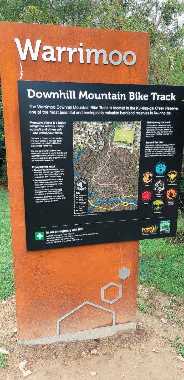
Mountain Bike Trails
Vegetation and biodiversity surveys of the bushland at Westleigh Park have identified several threatened ecological communities and threatened species. In many cases the existing unsanctioned mountain bike trails pass through these areas. Council has expressed a desire to provide for a wide range of recreational opportunities at Westleigh Park and recognises, while currently unsanctioned at this site, mountain biking remains popular with the community.
Council undertook community engagement in mid-June 2021 as part of the previous draft Master Plan exhibition to understand community perspectives on mountain biking at the site. Significant concern was raised by the community relating to the balance between recreational needs and environmental protection.
In response to the community’s concerns, Council undertook a targeted engagement process in mid-2022. This included members of the mountain biking community, community environmental representatives and local residents. This co-design process aimed to provide opportunities for all groups with an interest in the issue to contribute. Due to divergence views a consensus on an acceptable trail network at the site was not able to be achieved. Rather, the co-design participants respectfully chose to present two options to Council for consideration.
Council gave consideration to both options and worked closely with both a trail designer and ecological consultant (Dirt Art and Eco Logical Australia, respectively) to inform the development of a trail concept plan (refer to figure 4.3). This concept plan evolved over several iterations and was informed by stakeholder feedback, best practice design principles and on-site investigations, including:
• Vegetation community validation
• Flora and fauna surveys
• Desire to maintain a focus on easy to immediate trails
• Avoidance and reduction of tracks in areas of high value biodiversity
• Creation of additional trails in less sensitive areas
• Recycling and upgrading existing tracks to avoid creating new impacts
• Establishment of a primary track head, including wayfinding and auxiliary facilities (e.g., wash bays)
• Creation of zones and hubs to improve rider experience and environmental sustainability
• Ground truthing to ensure constructability
The draft Master Plan also identifies potential connections between Westleigh Park and Hornsby Park. These links will offer another experience to visitors of either park, with them able to be enjoyed by those moving through the Shire on foot or bike.
Cycle Pump Track
A cycle pump track is proposed at the south-eastern corner of the southern sportsfield platform, approximately opposite the primary mountain bike track head, and adjoining the southern carpark.
The pump track is proposed to include a beginner track and an intermediate/advanced track to cater for users of different ages and abilities, and complement other facilities on the site.

17 WESTLEIGH PARK DRAFT MASTER PLAN Image Source: Ku-ring-gai Council Image Source: Trailscape
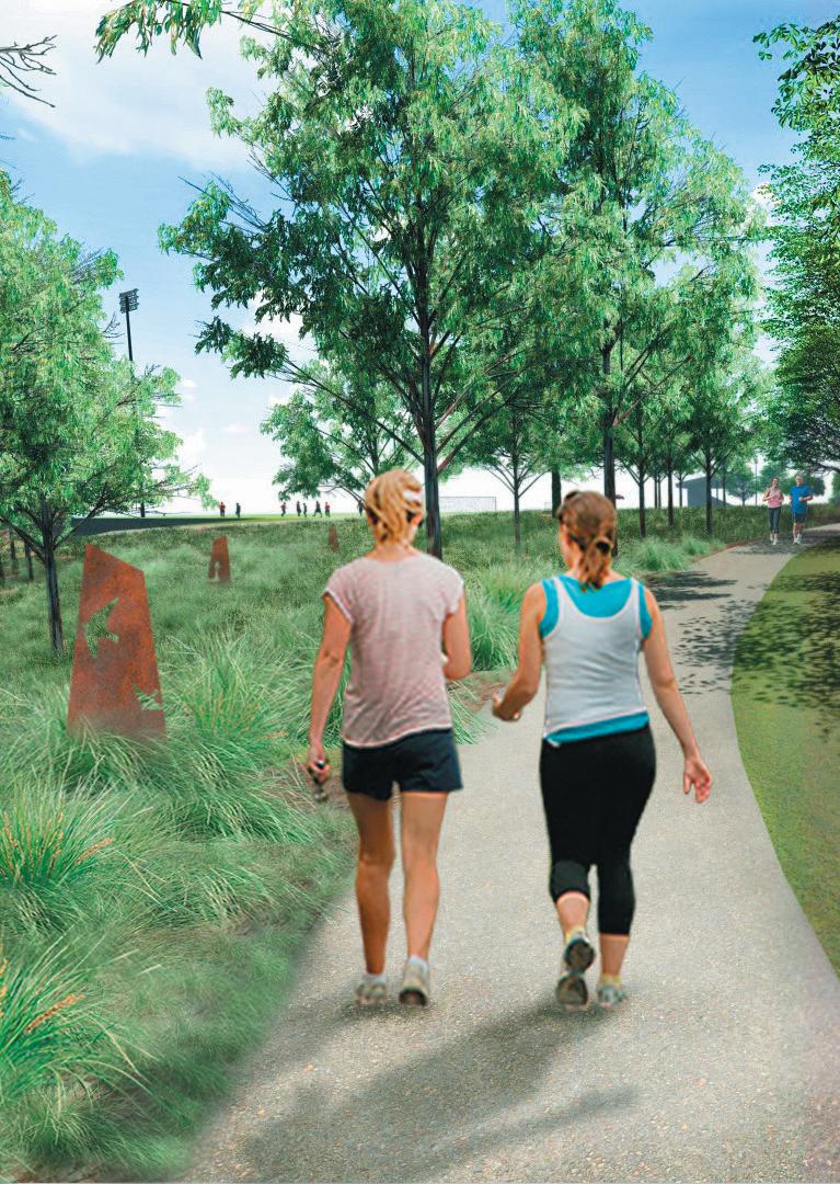
Westleigh Park Artist’s impression 18 WESTLEIGH PARK DRAFT MASTER PLAN
4.2 Access
4.2.1 Pedestrian and cycle access Shared pedestrian and cycle path
The pedestrian and cycle access network to and within the site is illustrated on Figure 4.4.
Pedestrian access into the park is focused on a 2.5–3m shared recreational and maintenance path network which enters the site from Warrigal Drive and the proposed new entry from the south. This will provide loop access around the perimeter of the facilities in addition to providing supplementary maintenance access. The shared path will be supplemented by pedestrian paths in the centre of the site which connect parking areas to facilities and provide access through the central parkland area between the southern and central fields. The shared path will connect to a broader local network of cycle paths via both on road and off-road links. The adjoining mountain bike trails and bush walking tracks being considered will also be connected to track and trail networks beyond the site.
Access points to adjoining mountain bike (MTB) trail network
The proposed MTB trail network would be accessed through Westleigh Park where riders can use parking and other facilities, or cycle to the site and access the MTB trail entry points via shared paths or the internal road network. The primary access point (trail head) is proposed at the south-eastern edge of the park reached via the shared path or perimeter road. Other access/exit points are also been considered from the shared path to the north of the site. Access and exit is also being considered to Wareemba Avenue and the Dog Pound Creek fire/ maintenance trail.
4.2.2 Vehicular access and parking
The vehicular access and parking within and to the site is illustrated on Figures 4.5.
New roundabout at Warrigal Road north
This intersection is proposed to be converted into a roundabout to improve traffic flow and to better manage traffic volumes. The central island will be mountable to allow for bus movements. Consideration was also given to the requirement for firetrucks to access the Westleigh Rural Fire Brigade facility.
Associated kerb adjustments, median islands, line marking and signage would also form part of the works.
The intersection of Warrigal Drive south is proposed to be converted into a one-way exit with left turn movements permitted out onto Quarter Sessions Road. Signage and line-marking is proposed to provide clear priority to Quarter
Sessions Road traffic movements. New road access from Quarter Sessions Road
A new vehicular access point is proposed from Quarter Sessions Road located between the southern boundary of the site, and the Sydney Water facilities. This access point was chosen to avoid sight-line issues of the option near Corang Road, and to minimise impact to the existing significant vegetation community (STIF). This access will be shared with Sydney Water to access their operational site to the south, rather than creating a duplicate access point off Quarter Sessions Road.
Future road access to Sefton Road subject to ongoing discussions with Sydney Water
The proposed new Sefton Road access connection would require road works to continue from Sefton Road through the Sydney Water site and into the Park. This link seeks to enable more effective spreading of traffic loads on (for example) weekend game days. Traffic modelling has confirmed that this link could operate for specific controlled use when only one sporting platform is operational and is not required to provide day to day through access.
The extension of Sefton Road coupled with the new road access from Quarter Sessions Road would also provide an alternate access for the Westleigh community in the event of an emergency (such as bushfire).
To avoid potential impacts on the existing Sydney Water reservoir’s infrastructure and address the safety and security matters to the existing assets, the new extension is proposed to be generally on or slightly above existing grade, minimising fill embankments but avoiding any disturbance of Sydney Water dam walling. The corridor would be provided with security fencing to limit public access to the Sydney Water site.
The proposal is subject to ongoing discussions with Sydney Water.
Parking areas
It is proposed to provide off street parking to service the sports facilities within the Westleigh Park site. The draft Master Plan aims to provide 379 car parking spaces. These are distributed between the main field platforms and have been predominantly provided as off-road parking areas with some additional parallel spaces between the central fields and northern athletics field. Each parking area includes a number of accessible parking spaces.
19 WESTLEIGH PARK DRAFT MASTER PLAN


20 WESTLEIGH PARK DRAFT MASTER PLAN We stle igh Pa rk Sports Comp ex Development Application DATE + PEDES TRIAN & CYCLE ACCES S AND NETWORK 39 137 97 18 16 BOUNDARY BOUNDARY BOUNDARY BOUNDARY BOUNDARY BOUNDARY B O U N D A R Y BOUNDARY BOUNDARY R UDDOCK PAR K KOOR I NGAL AVE KOOR I NGAL AVE W A R R I G A L D R SYDNEY WATER R ESERVOIR CORANG RD Q U A R T E R S E S S I O N S R D SEFTO N RD SEFTON RD CH I LVERS RD DUFFY AVE QUARTER S E SS I ONS RD WAR EE MBA A VE WAREEMBAAVE SEFTON RD EXTENSION YARRABUNG AVE LAROOL CRES W I LD ASH WAY 0 50 100 M POS S IBLE PRIMARY MTB TRAIL HEAD EXIS TING S HARED PEDES TRIAN / CYCLE PATH ACCES S EXIS TING ON ROAD CYCLE ROUTEHORNS BY BIKE PLAN EXIS TING ON ROAD CYCLE ROUTEHORNS BY BIKE PLAN MTB TRAIL NETWORK TO HORNS BY PARK VIA VALLEY AND ROS EMEAD RD, HORNS BY POTENTIAL PUMP TRACK LOCATION PROPOS ED PEDES TRIAN PATH PROPOS ED S HARED PEDES TRIAN / CYCLE PATH POS S IBLE MINOR MTB TRAIL HEAD EXIS TING PATH (INDICATIVE ONLY, S UBJECT TO DES IGN DEVELOPMENT) LEGEND Proposed Shared path2 5m width Pedestrian crossing/ refuge crossing - to be determined Potential refuge crossing - to be confirmed Major pedestr an entry Secondary pedestr an entry Existing shared path Proposed on-road cycle route Existing on-road cycle route SHAR ED PATH Proposed accessible shared path - 2 5m width CYCLE PEDESTR IAN Proposed accessible pedestr an path - 1 8m width CR OSSING ENTRY Proposed pedestrian path w th steps - 1 8m width LEGEND PEDESTR IAN ACCESS AND WALKING Proposed MTB trai sEasy TR ACK NETWOR K Existing managed walking tracks Existing fire trail connect on Optiona MTB connection on road or verge ProposedMTB tra lsIntermediate Proposed MTB trai sHard Shared trai s Wa king tracks Track Hubs - primary mountain bike trail head Track Hubs Sydney Coastal Sandstone Bloodwood Shrub Forest BioBanking EXISTING VEGETATION COMMUNITY Blue Gum Diatreme Forest Sydney Coastal Sandstone Gully Forest Sydney Turpent ne-Ironbark Forest Sydney Hinterland Apple-Blackbutt Gu ly Forest Sydney Hinterland Dwarf Apple Low Woodland Duffy s Forest Typha Exot c Exot c Grasslands
Figure 4.4 - Pedestrian & Cycle Access and Network (Source: TTW+EP)


21 WESTLEIGH PARK DRAFT MASTER PLAN 3 3 7 B OUNDARY B OUNDARY BOUNDARY BOUNDARY BOUNDARY BOUNDARY B O U N D R Y BOUNDARY BOUNDARY 97 D D D D L L L 155 P 72 P 55 P P R UDDOCK PAR K KOOR I NGAL AVE KOOR I NGAL AVE W A R R I G A L D R SYDNEY WATER R ESERVOIR CORANG RD Q U A R T E R S E S S I O N S R D SEFTO N RD SEFTON RD CH I LVERS RD DUFFY AVE DUFFYAVE QUARTER S E SS I ONS RD WAR EE MBA A VE WAREEMBAAVE SEFTON RD EXTENSION YARRABUNG AVE LAROOL CRES W I LD ASH WAY THE ESPLANADE LEFT TURN OUT ONLY PROPOS ED INTERS ECTION UPGRADES NEW ENTRY INTO PARK S ITE PROPOS ED NEW ROAD ACCES S OFF-S TREET PARKING OFF-S TREET PARKING ROAD VERGE PARKING UPGRADE INTERS ECTION WITH ROUNDABOUT NEW ENTRY INTO PARK S ITE - NEW INTERS ECTION WITH ROUNDABOUT 0 50 100 M POTENTIAL PUMP TRACK LOCATION CONTROL POINT CONTROL POINT We stle igh Pa rk Sports Complex Development Appl cat on DATE CL ENT T TLE SCALE N + VEHICULAR ACCES S & PARKING LEGEND Ex sting external road Proposed internal road with mountable kerb - 7m width in general and 8m width to wherever mountable kerb not applied Proposed intersection upgrade Proposed park ng area - off street 90 Proposed maintenance access/ emergency access to f e d TR AFFIC & PAR KING D Accessible Parking (2 x parkings & 1 x shared area ) L Loading zone Proposed new entry into park s te Proposed park ng arearoad verge paral e Potential pump track 90˚ ANGLE PARKING SPACE :355 90 ANGLE ACCESSIBLE PARKING SPACE :8 PARALLEL PARKING SPACE :16 TOTAL PARKING SPACE : 379
Figure 4.5 - Vehicular Access and Parking
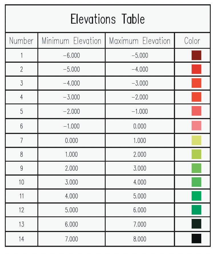
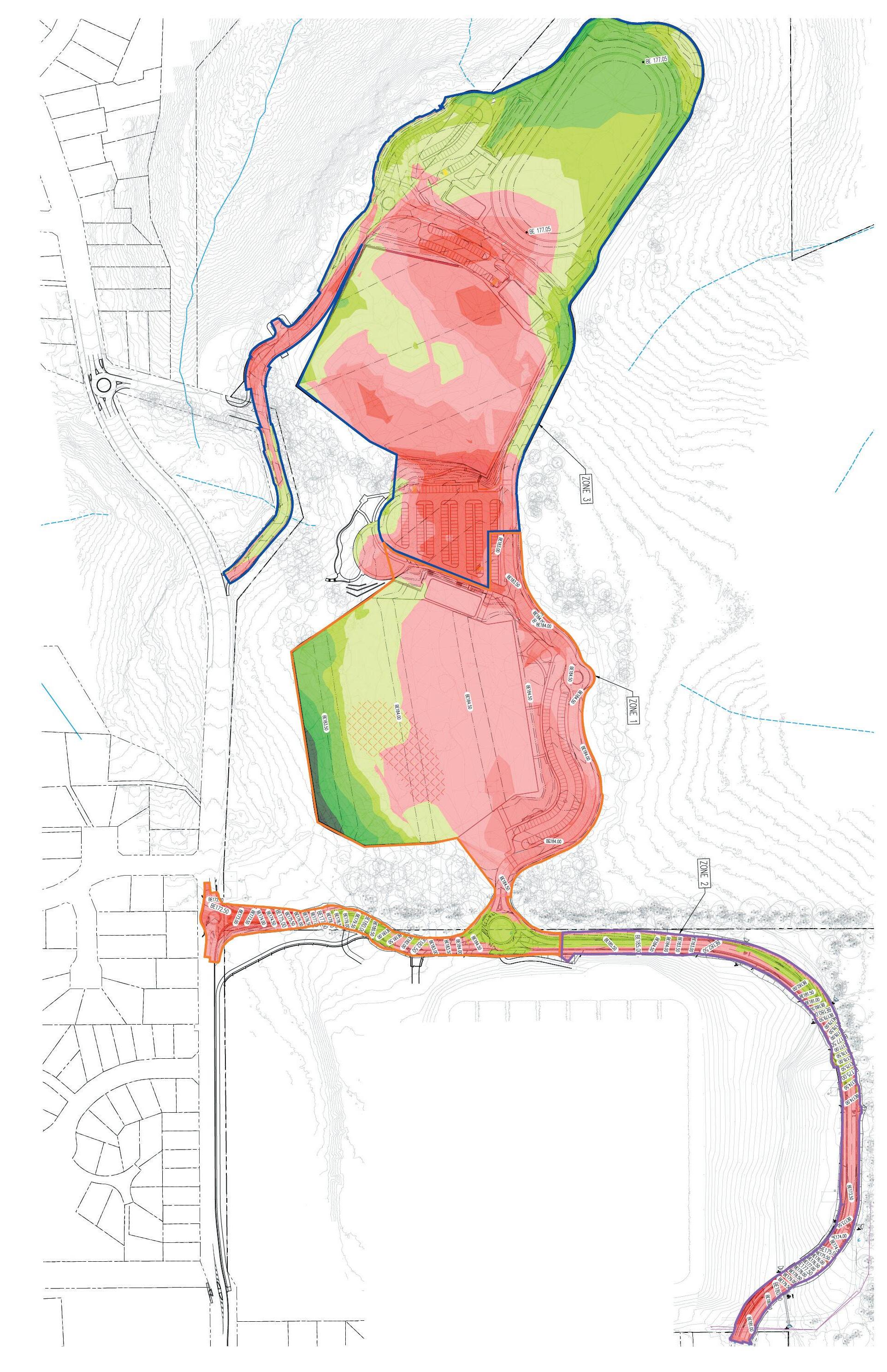
The TTW civil concepts illustrate the proposed final levels concept and related earthworks strategy. This earthworks strategy is only related to fields and associated infrastructure. The coloured diagram this page represents a “heat map of cut and fill across the site.

22 WESTLEIGH PARK DRAFT MASTER PLAN
Figure 4.6 - Cut & Fill (Source: TTW)
Traffic assessment
To address community concerns raised during the initial concept Master Plan exhibition and to consider the influences of the NorthConnex project on the traffic volumes and patterns to the study area, Council engaged Bitzios Consulting. In 2022 Bitzios carried out traffic modeling to inform road and intersection upgrade requirements, assess the impact of the proposed Sefton Road extension and review active and public transport facilities and potential improvements.
This assessment concluded that the proposed Sefton Road extension would be required at some stage to address the potential impacts on the adjoining neighbourhood traffic flows.
In addition, Bitzios suggested a through access between Quarter Sessions Rd and Sefton Road would provide a supporting emergency egress route for the community.
4.3 Approach to landfill management Cleared & Weedy Areas
A cap and contain approach is proposed to isolate the mixture of contamination in the existing fill material on site. This includes excavation of landfill and relocation for capping elsewhere on site.
A Remedial Action Plan has been developed to guide and monitor the site remediation.
Environmentally sensitive bushland areas
In the environmentally sensitive bushland areas adjoining the cleared zone of the site a combination of strategies is to be employed including:
i. localised removal of dumped waste and asbestos;
ii. localised isolation of asbestos exposure in accessible areas, accompanied with administrative controls
iii. implementing a long term Environmental Management Plan (EMP), to reduce potential impacts of contamination remediation on the environmentally sensitive areas. This may include fencing to preclude entry to areas of possible contamination and signage to identify permissible activities.
Earthworks
Although the site appears quite level to undulating, most of the land currently falls at a gradient of between 1:20–1:30. The draft Master Plan proposes the sports field platforms grading at the required sports profiles of 1:100.
The field platforms will be cut into existing fill and natural ground in places, (in particular to south east) (refer Figure 4.6), but due to the required level sports profiles, the edges of the platforms to the west and north will generally have a deeper profile of fill material and will need to be retained (see Figure 4.7 below)

Around 40% of the cleared portion of the existing site is covered in landfill to a depth of less than a metre. It is proposed to excavate down to natural ground to reach virgin excavated natural material (VENM) and relocate the excavated material to “containment cells” within the major fill zones required to establish the field levels.
Site won material will be used where possible as capping material to these containment cells and as fill material to the major fill zones on the site.
Some additional capping material may be needed if site won material doesn’t meet required materials specifications for capping use.
The final levels have been calibrated to account for a generally balanced cut and fill exercise, focusing the requirement for imported material on landscape and related construction materials (e.g. road pavement materials) to build up surface profiles.
23 WESTLEIGH PARK DRAFT MASTER PLAN
Figure 4.7 Section through Western edge of Southern field platform (Source: TTW)
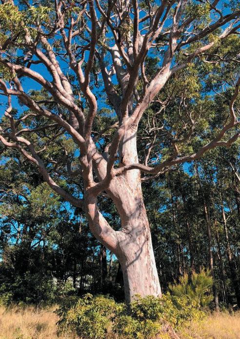
Angophora costata - Significant tree in Westleigh Park
Image Source: Eco Logical Australia
WESTLEIGH PARK DRAFT MASTER PLAN
4.4 Environmental Sustainability Biodiversity protection
Conservation of the bushland and biodiversity values of the site have been a major factor in development of the draft Master Plan.
The proposed development has predominantly been confined to existing cleared areas and has been subject to ongoing refinement through detailed ground survey and ecological assessment.
Biodiversity and arboricultural assessments are ongoing, seeking to inform the refinement of the draft Master Plan proposals. The assessment and refinement process is guided by the biodiversity conservation principles of ‘avoid, minimise and mitigate’ to produce a sustainable footprint and reduce likely ecological impacts of the proposal.
Any localised residual impacts will be offset in accordance with relevant offset policies and schemes. Restoration of current ‘weedy’ areas, along with the rehabilitation of poor quality bushland and protection of good quality bushland will be integral to ongoing, future site management.
Stormwater management & WSUD
A further key consideration for development of a recreational parkland on the site is avoiding and minimising adverse impacts on the local creek system. This includes alteration of existing flow regimes, in addition to the quality of water entering these waterways from the site.
Existing catchments and the drainage lines to which they drain have been analysed, and the drainage proposal seeks to maintain sustainable flows and volumes to each of the existing catchment.
An integrated water management approach will guide the design process. This will involve treatment of runoff from roads and carparks in a combination of on-site bioremediation beds and wetlands, as well as capture, storage and reuse of stormwater to minimise erosive impacts downstream and to provide an alternative (to potable) water supply for irrigation and other uses.
Sustainable design
Environmentally sustainable design elements will reduce operational carbon emissions, provide resilience to the effects of climate change, reduce potable water use and improve waste management.
The key sustainable design elements in the proposed development include bicycle racks to encourage active transport, electric vehicle charging, rooftop solar system, solar hot water, LED lighting and motion sensors, minimising light pollution, high water efficiency rating for fixtures, waste management plan, rainwater tanks and passive solar design of the amenities architecture.
Bushfire management
A Bushfire Opportunities and Constraints Assessment has prepared to inform the design for bushfire protection and management. Key requirements include:
• Asset protection zone (APZ) provision — achieve a minimum BAL-40 exposure to all amenities buildings. Location of the amenities buildings are considered carefully to avoid any conflicts between APZ and adjoining vegetation communities;
• Construction — achieve the standard National Construction Code (NCC) fire safety requirements;
• Access — provide multiple access points with perimeter access and suitable dimensioned roads for fire rescue services
• Emergency management- provide a suitable bushfire emergency management and evacuation plan;
• Landscape — Vegetation management and design as per Planning for Bush Protection (PBP) guidelines. Utilise fire retardant planting species to reduce fire risks;
• Utilities- design to compliant with PBP guidelines.
Active transport
Pedestrian and cycle access is proposed within the park and connecting to the surrounding walking and cycling network. This seeks to support people of all ages and abilities to get to and around the park facilities. A shared path along the eastern edge of Quarter Sessions Road links the park from the southern entry to Ruddock Park, with the provision of a new refuge crossing point.
The existing bus stops located at Quarter Sessions Road and Corang Road near the southern entry of the park also support sustainable transport to the site
25 WESTLEIGH PARK DRAFT MASTER PLAN
STAGE 1
(This section for specific controlled use, not providing a day to day through access )
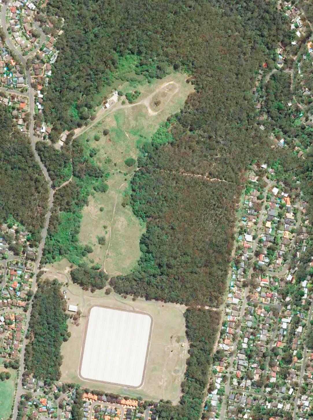


Figure 4.8 - Staging Plan Sports Comp ex Deve opment Application DATE S TAGING PLAN 72 39 137 97 18 16 3 0 1 0 1 0 4 0 3 0 1 0 3 0 1 0 1 0 4 0 3 0 1 0 BOUNDARY BOUNDARY BOUNDARY BOUNDARY BOUNDARY BOUNDARY B O U N D A R Y BOUNDARY BOUNDARY R UDDOCK PAR K KOOR I NGAL AVE W A R R I G A L D R SYDNEY WATER R ESERVOIR CORANG RD Q U A R T E R S E S S I O N S R D SEFTO N RD QUARTER S E SS I ONS RD WAR E E MBA A V E WAREEMBAAVE SEFTON RD EXTENSION YARRABUNG AVE LAROOL CRES QUARTER SESS I ONS RD STAGE 1 STAGE 2 STAGE 2 STAGE 1 0 10 20 30 40 50 M STAGE 1
WESTLEIGH PARK DRAFT MASTER PLAN
4.5 Staged Implementation of Master Plan
Delivery of the draft Master Plan will be staged as funding becomes available.
It is noted that around 40–50% of the cleared portion of the site is proposed to be excavated to natural ground with the landfill material redistributed beneath filled areas.
The final boundary of the stage one area would be based on the detailed volumes of contaminated material yeilded from stage 1 earthworks to be contained and capped, but would generally reflect Figure 4.8.
Stage 1 works would mainly include the southern multipurpose natural turf sportsfield platform and its amenities, the carpark to the east, the new entry from Quarter Sessions Road along the southern boundary of the site, and the southern portion of internal park road linking to the amenities and the MTB trails. The existing unsanctioned mountain trails will be either upgraded and improved or closed and rehabilitated. Some new trails and a primary trail head will be constructed to facilitate connections and circulation around the network.
The associated utilities would also be required to support the stage 1 works, including electrical substation kiosk, and water and sewer connections. Stage 1 works would include the proposed Sefton Road extension linking the park to Sefton Road for specific controlled use, but not providing a day to day through access.
Stage 2 works will be the remaining construction, including the northern and middle platform, the playground and BBQ/picnic area and associated carparks, amenities and utilities, along with the internal road networks and the upgrade of Warrigal Drive, and the Quarter Sessions Road / Warrigal Drive intersection.
4.6 Connecting with Country
Having committed to embedding the principles of Connecting and Design With Country, Council has been working with Aboriginal Consultants and stakeholders to review conservation priorities and develop a Connecting with Country Framework to guide ongoing design refinement and development.
A preliminary Aboriginal Cultural Heritage Assessment Report (ACHAR) has been received with a particular focus on several items of conservation importance including a Scarred Tree on the site. Based on consultation and discussion with the Registered Aboriginal Parties (RAP) the existing Scarred Tree (a dead Scribbly Gum) is proposed to be relocated and interpreted at the northern end of the northern field platform, connected with the valley landscape and bushland and providing a gathering and contemplation space.
Ongoing consultation and collaboration with the RAP will inform a Connecting with Country framework, which will in turn guide ongoing design development of Westleigh Park.
Progression of the framework will embody the NSW Government Architect’s Designing with Country Guidelines - Statements of Commitment and can be expected to cover such opportunities as enhancing awareness and understanding, celebrating local language and stories, and encouraging living culture and relevance to contemporary First Nations communities.
27 WESTLEIGH PARK DRAFT MASTER PLAN
Conclusion
The Draft Westleigh Park Master Plan aims to provide a socially, environmentally and culturally sustainable plan for the site to encourage and support healthy community.
The plan seeks to address the increasing demands upon existing sports facilities within Hornsby Shire and will play a key role in recreational provision for the district area including provisions for formal sports, passive recreation, unstructured recreation and ancillary facilities.
The draft Master Plan reflects a holistic approach to making a safe, sustainable and resilient place addressing the challenges of site remediation, biodiversity protection, water management, sustainable energy and resource use, bushfire protection and active transport.
To Connect with Country, ongoing consultation and collaboration with Aboriginal stakeholders will inform Cultural Themes and roles into ongoing design to conserve and celebrate our indigenous legacy in a responsible, appropriate and respectful way.
28 WESTLEIGH PARK DRAFT MASTER PLAN
Westleigh Park Concept Sketch – Southern multi-purpose platform looking north (indicative only)
Hornsby Shire Council ABN 20 706 996 972
Contact us PO Box 37 Hornsby NSW 1630
Phone: (02) 9847 6666
Fax: (02) 9847 6999
Email: hsc@hornsby.nsw.gov.au hornsby.nsw.gov.au
Visit us Hornsby Shire Council Administration Centre 296 Peats Ferry Road, Hornsby NSW 2077
Office hours: Please check the website for the latest opening hours for the Customer Service Centre and Duty Officer.
Disclaimer
Every effort has been made to provide accurate and complete information. However, the authors assume no responsibility for any direct, indirect, incidental, or consequential damages arising from the use of information in this document.
Copyright Notice
No part of this publication may be reproduced in any form, or stored in a database or retrieval system, or transmitted or distributed in any form by any means, electronic, mechanical photocopying, recording, or otherwise without written permission from Hornsby Shire Council. All rights reserved.
Copyright © 2023, Hornsby
23
Shire Council


