9 Month Diploma
Medical Services Accessibility in Cairo Geodatabase project


The objective of this project is to design a database. The database will include entities such as Hospitals, Medical Centers, Districts, Bus Stops, and Bus Routes. Starting with the design of the conceptual, logical, and physical aspects of the database
Choosing three type of districts two of them are in the East of Cairo ‘Elnozha and Masr Elgadida’ and one is in the West of Cairo ‘Elwaily’ on which a sub-type has been created.


• Setting District_name as a subtype filed.
• Making a four different domains for each code of the sub-type to define the sub-districts each district has.
• Making a domain to assign it to the Hospital_types field, and one for the specialty field of the medical centers.


• Using overpass turbo a web-based data filtering tool for Open Street Map to gather the data.
• Using google earth pro to get the data of the bus stops which was exported as a KML file.
• Using the conversion tool to convert the files from KML to layer and then export the feature class into the database from this layer.
• Using the clip tool to clip the roads layer by the district layer to only have the bus routes within the study area.
• Making sure of the data in the attribute table of the Hospitals and medical centers feature classes by checking every record.


Exporting The final layout after adjusting the symbology for each layer to effectively represent its data an after adding the map legend, the scale bar and the North arrow.


Model Builder


• ArcGIS Pro's Model Builder automates workflows by connecting data and tools to create geodatabases, feature datasets, and feature classes.
• ArcGIS Pro Model Builder automates domain and subtype creation for feature classes. It builds building, road, and transportation domains with subdomains (transportation type/capacity, road type/building condition, education/government type). It also assigns domains to fields and sets subtypes (educational/governmental building types).


Cartography


Creating maps and vistualization
• This map of Mali's airports was created using ArcGIS Pro. The map includes symbology to differentiate airport types (international, regional, local) and legend for clarity.
04
ArcGIS online Operations Dashboards and Instant App
• Using instant app to create an app for hikers to plan their trips before they arrive and provide them with useful information even when they're exploring the trail, away from internet connectivity.


• Developed an interactive ArcGIS Online dashboard with a real-time map and dynamic data refresh. It showcases simulated emergency incidents and tracks the movement of emergency service vehicles in real-time.


• I created this presentation, to showcase the functionalities of the QGIS2Web and Qgis2threejs plugins through a live demo. It guides users on creating interactive web maps and 3D web scene visualizations from their QGIS projects.
HTML& CSS final project


• First HTML page showcasing courses users can add to their carts and Developed reusable header and footer component to use it in all pages.


• Second HTML page showcasing About us page header and footer component


• Developed a user-friendly two sign-up pages allowing users to create accounts with email and password or through social logins (Google, Apple, Facebook).
E-Commerce Website
• Essentials: Defines Base URL, Authentication (JWT), User/Admin CRUD operations (Create, Read, Update, Delete).


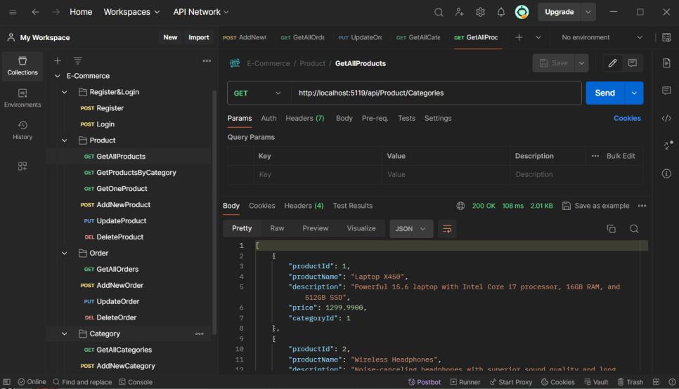
• Developed an e-commerce Website API using .NET Entity Framework within an n-tier architecture.
• HTTP Methods: Explains GET, POST, PUT, DELETE for data manipulation.
• Response Codes: Provides a reference for server responses (status codes).
• Endpoints: Details functionalities for Products, Categories, Orders, and User Roles.


