


CilincingFloodResilientHousing:
HighDensityCoastalSettlementAdaptation
TowardstheIssueofRisingSeaLevel
InNorthJakarta MuhammadIsaTsaqif 15218002
ThesisApproval, 13June2022 Supervisor, Dr.AllisNurdini,S.T.,M.T..


CilincingFloodResilientHousing:
HighDensityCoastalSettlementAdaptation
TowardstheIssueofRisingSeaLevel
InNorthJakarta MuhammadIsaTsaqif 15218002
ThesisApproval, 13June2022 Supervisor, Dr.AllisNurdini,S.T.,M.T..

Similiar Projects
Summary Space Allocation
Basic Concept Space Organization Massing
Social Interaction Strategy
Landscaping
Flood Mitigation
Floatation Module Concept
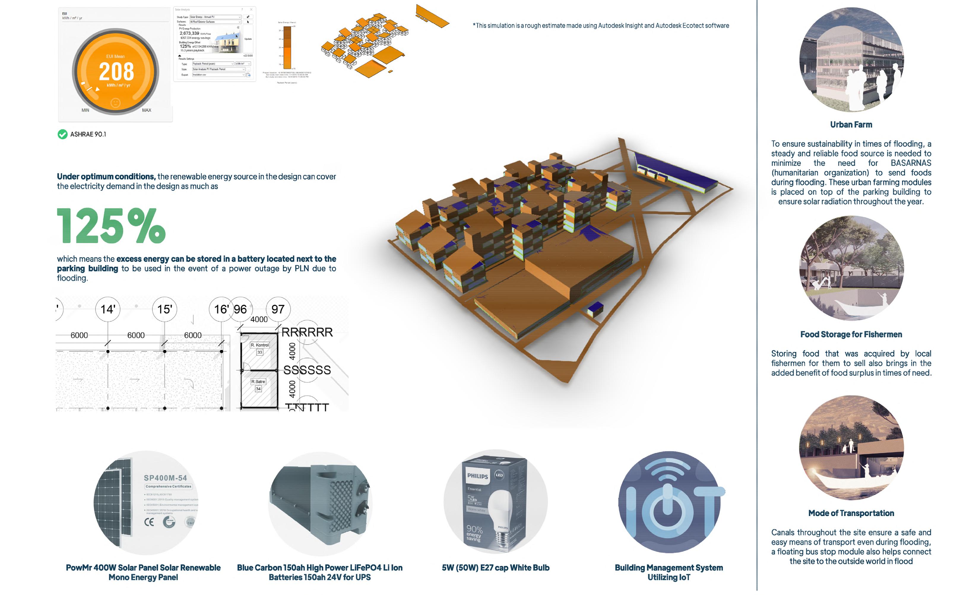
Self Sustainability
Utility System Integration
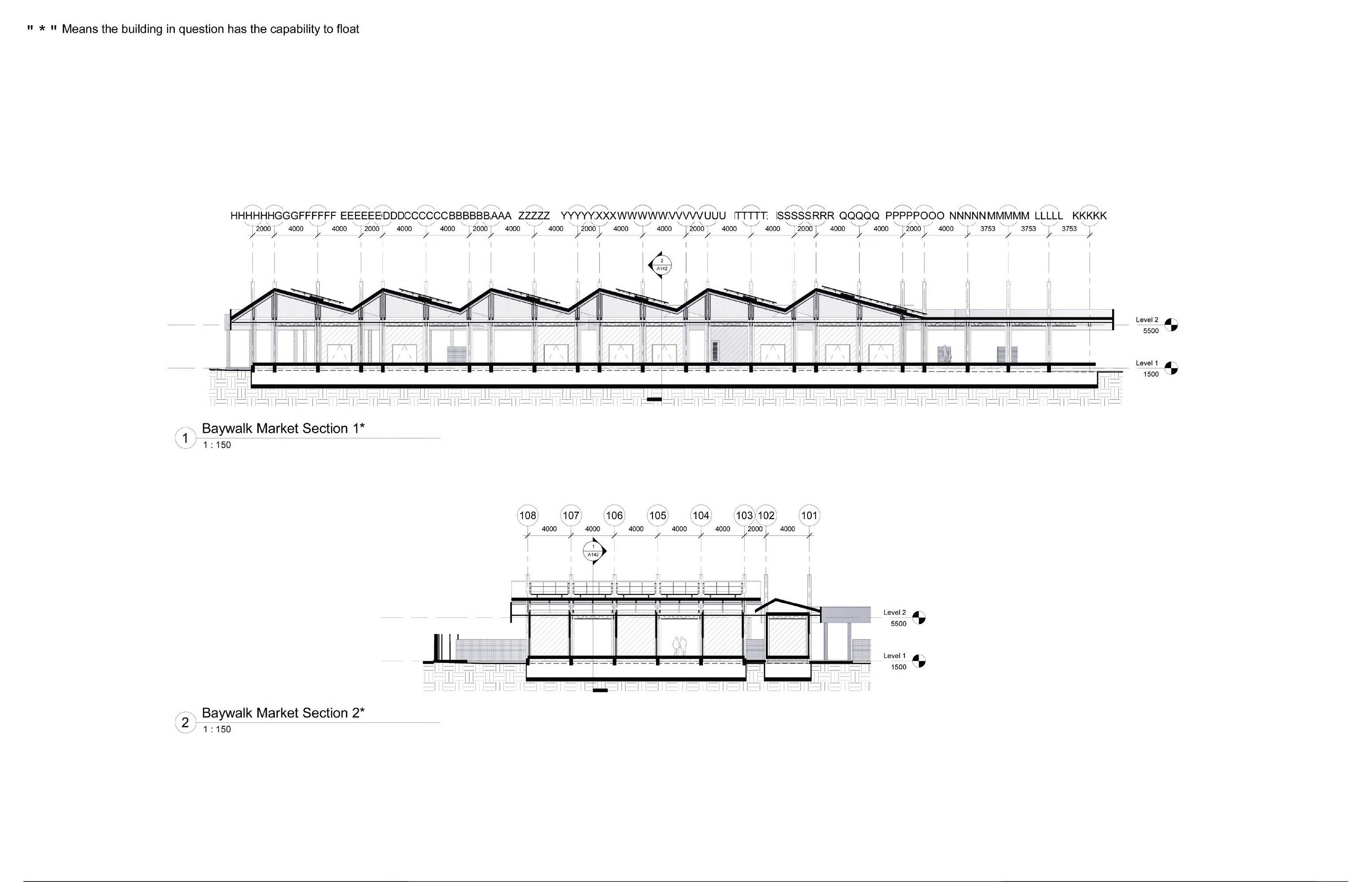
Technical Drawing
Detailed Engineering Design (DED)
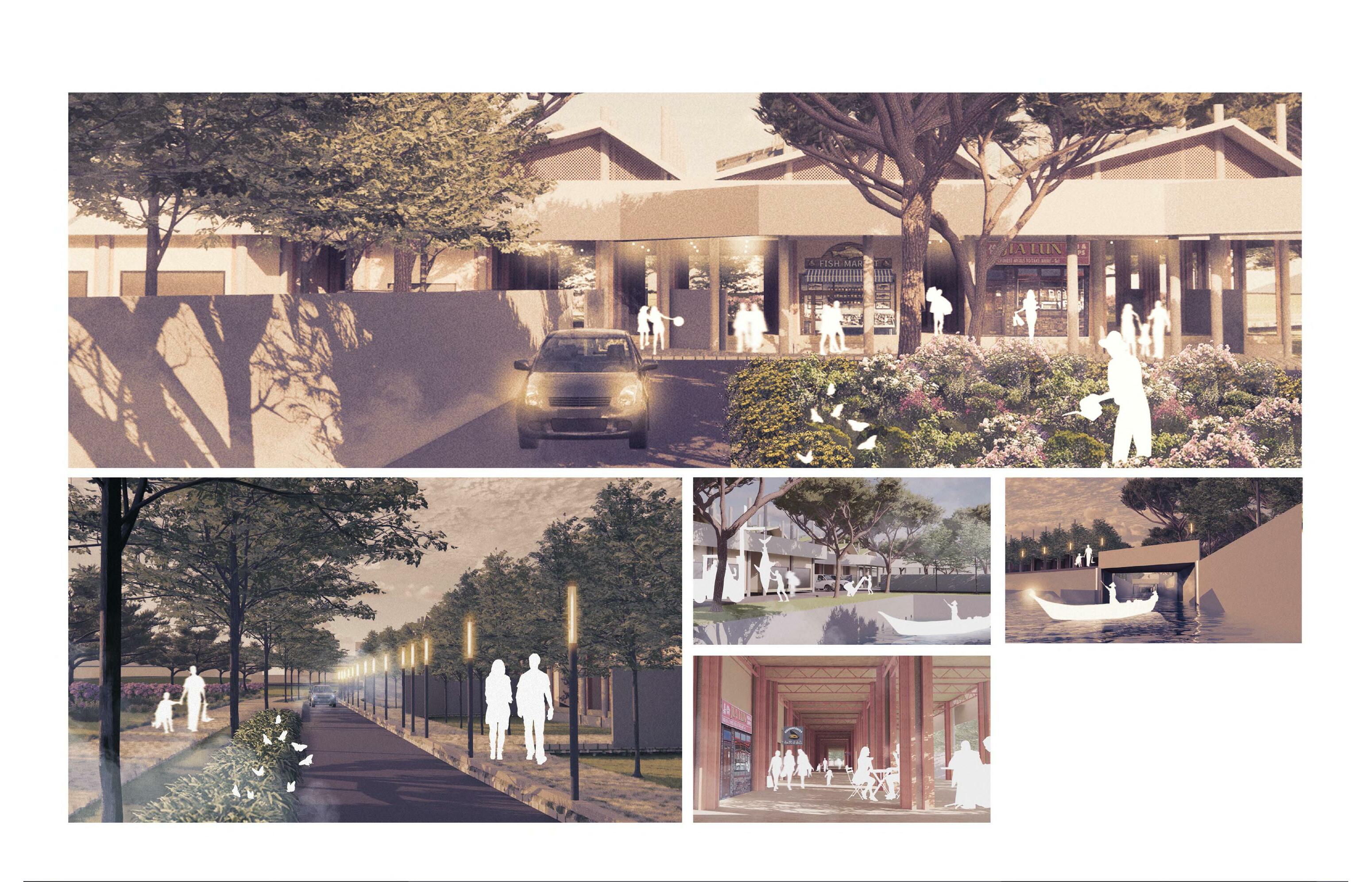
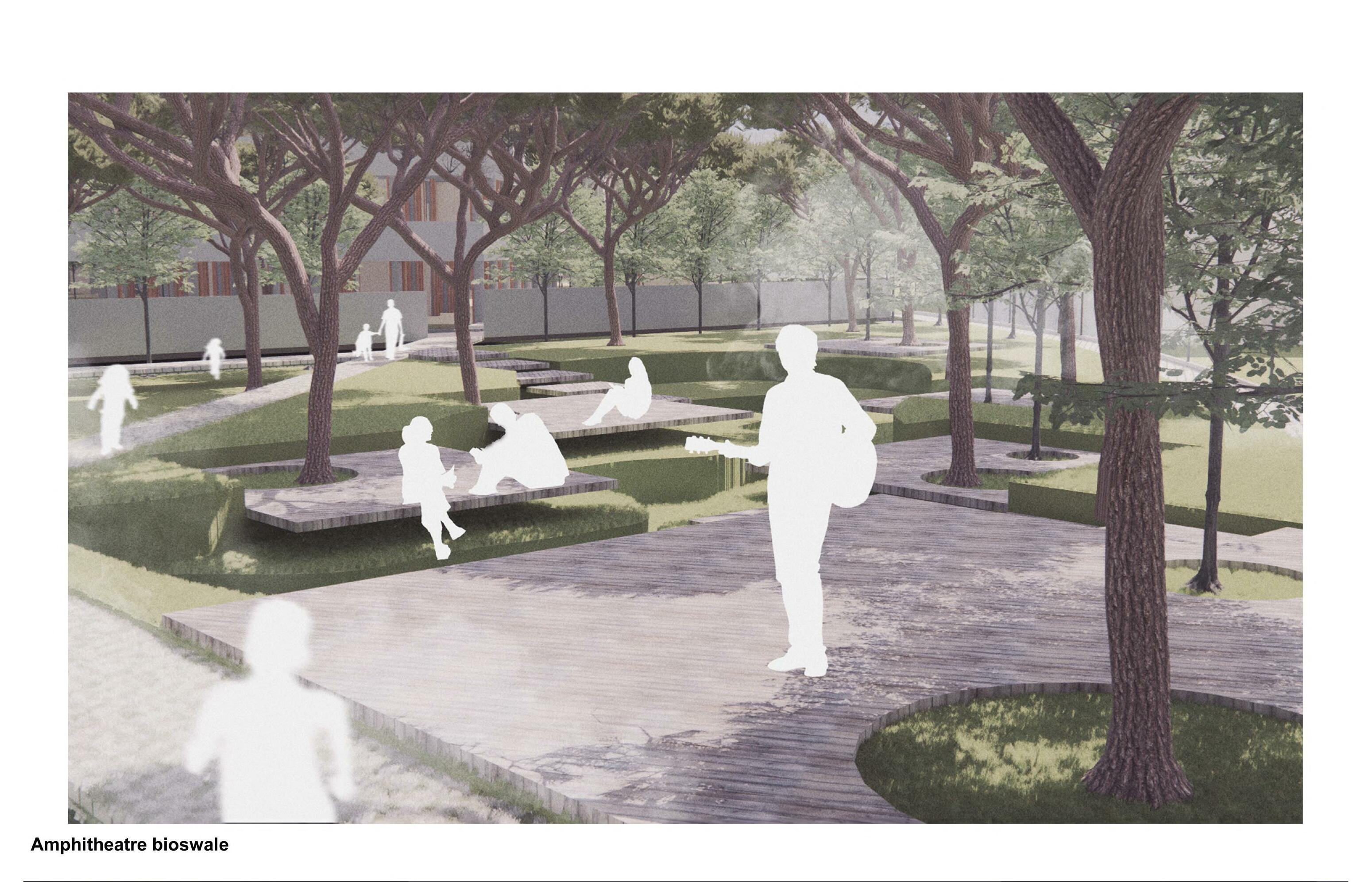
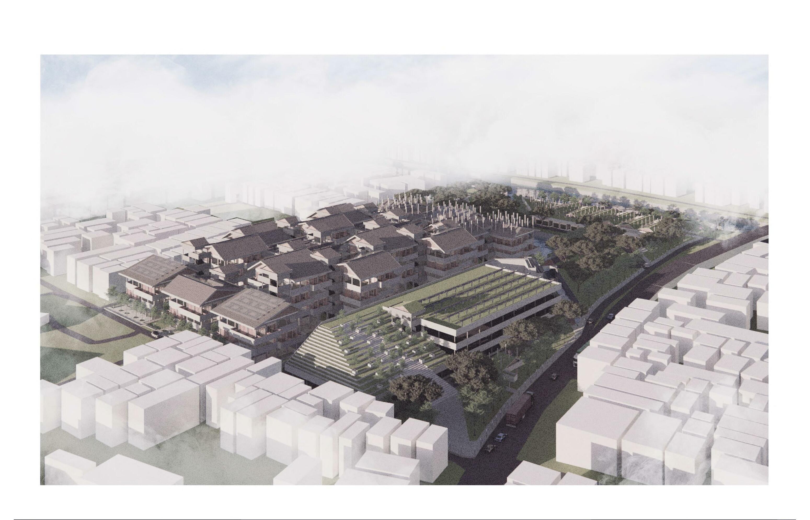
Exterior and Interior Perspectives
Project Background Project Goals Description
Jakarta has an area of 664.01 km² with an ocean area of 6977.5 km², the population of Jakarta is 11,100,929 people in 2020. This makes Jakarta one of the areas with the highest population density in the world.
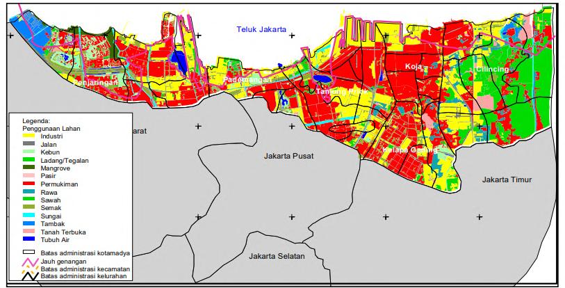
As the center of business, political and cultural activities in Indonesia, Jakarta is the place where various assets are vital for the running of the country. Jakarta is located at around 8 meters above sea level and was previously built on land that was once full with swamps, this condition makes Jakarta one of the most vurnerable megapolitan area to issues of flooding and sea level rise.
Prediction of the sinking of the north coast of Jakarta is not a surprise to many, global sea level rise, coupled with the rate of high land subsidence in Jakarta due to excessive use of ground water. Won Jakarta the title of the fastest sinking city in the world. “this could not become a city-size problem if only a few households are doing it this way; but this has become the main reason of the whole city sinking because industries and businesses are also reying on these wells and groundwater” (Tarrant, 2014).
Based on a projection study conducted by the Department of Environmental Science University of Indonesia, in 2030 after adding tidal predictions, subsidence of land level, as well as sea level rise, it was found that sea level in North Jakarta would increase by 6.45 m, submerging most of Jakarta’s North Coast. Through this study it is
stated that there are two sub-district most affected by the issue of sea level rise, The first is Penjaringan with 523 ha of affected residential land, and the second is Cilincing with 311 ha of affected residential land.

Responding to this issue, Penjaringan, as the most affected sub-district, have tried various solutions to protect their coastline, where they have built wave breaking dykes, reclaiming islands to reduce abrasion on the Jakarta coastline, as well as regrowing mangroove forests throughout the coast. This can be done because the area has received special attention by the government when compared to other areas in the Coast North Jakarta.
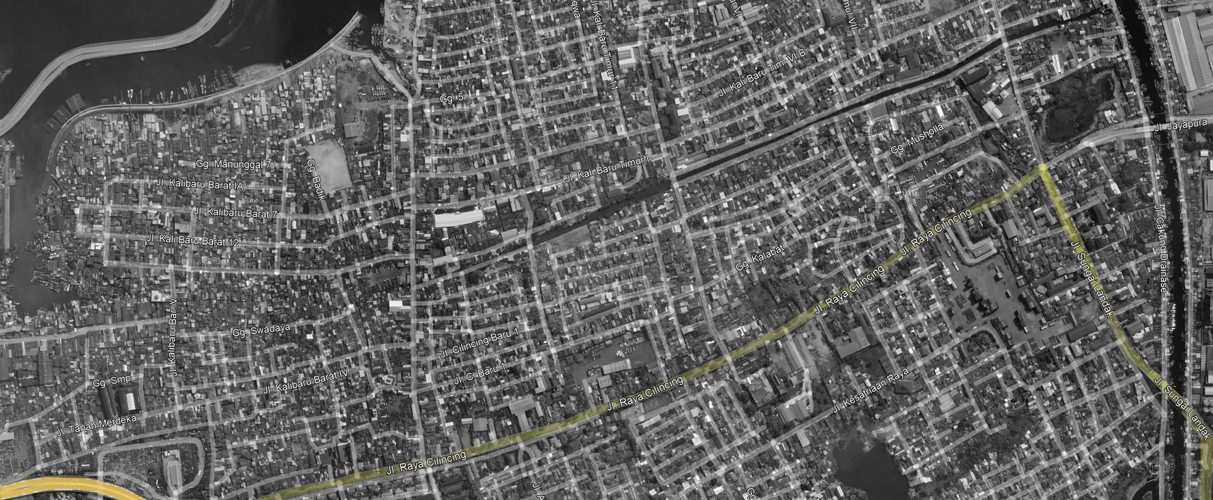
After Pluit, the sub-district most affected by this is Cilincing, where not much effort has been made to save their seafront apart from the installation of sea walls carried out by central government itself. In addition, this area is also known as a slum when compared to areas like Pluit its close proximity with a container port also reduces the interest of developers to establish decent housing here.
Several studies shows that resident’s capita and it’s community characteristic has a direct impact on their readiness to face flooding. In this case, the residents of Cilincing can be categorized as a low income citizen with strong community, and high flood risk. Even though they have good preparedness for floods, residents this category tends not to last long in flood conditions because
their lack of capita, and with rising water levels sea in Jakarta every year, the risk of flooding that drowns Coastal areas have become more and more prevalent in the long term. For that, an effort to save the residential community there is felt needs to be done, of course the approach to this issue must remain realistic considering that the issue of
Jakarta sinking is a complex issue and cannot be solved solely by a project of this scale. So that the chosen approach here is an approach that response to these complex issues in an adaptive manner.
The aim of this project is to create a living environment based on existing local community in the form of a residence equipped with various public facilities and social facilities, to support and sustain the surrounding community. So, the mission of this project is project is:

1. Designing affordable housing that is based on existing local community and is able to fulfill everyday needs even in flood
2. Interpreting existing local communities characteristic, needs, and potentials to be facilitated in architectural form

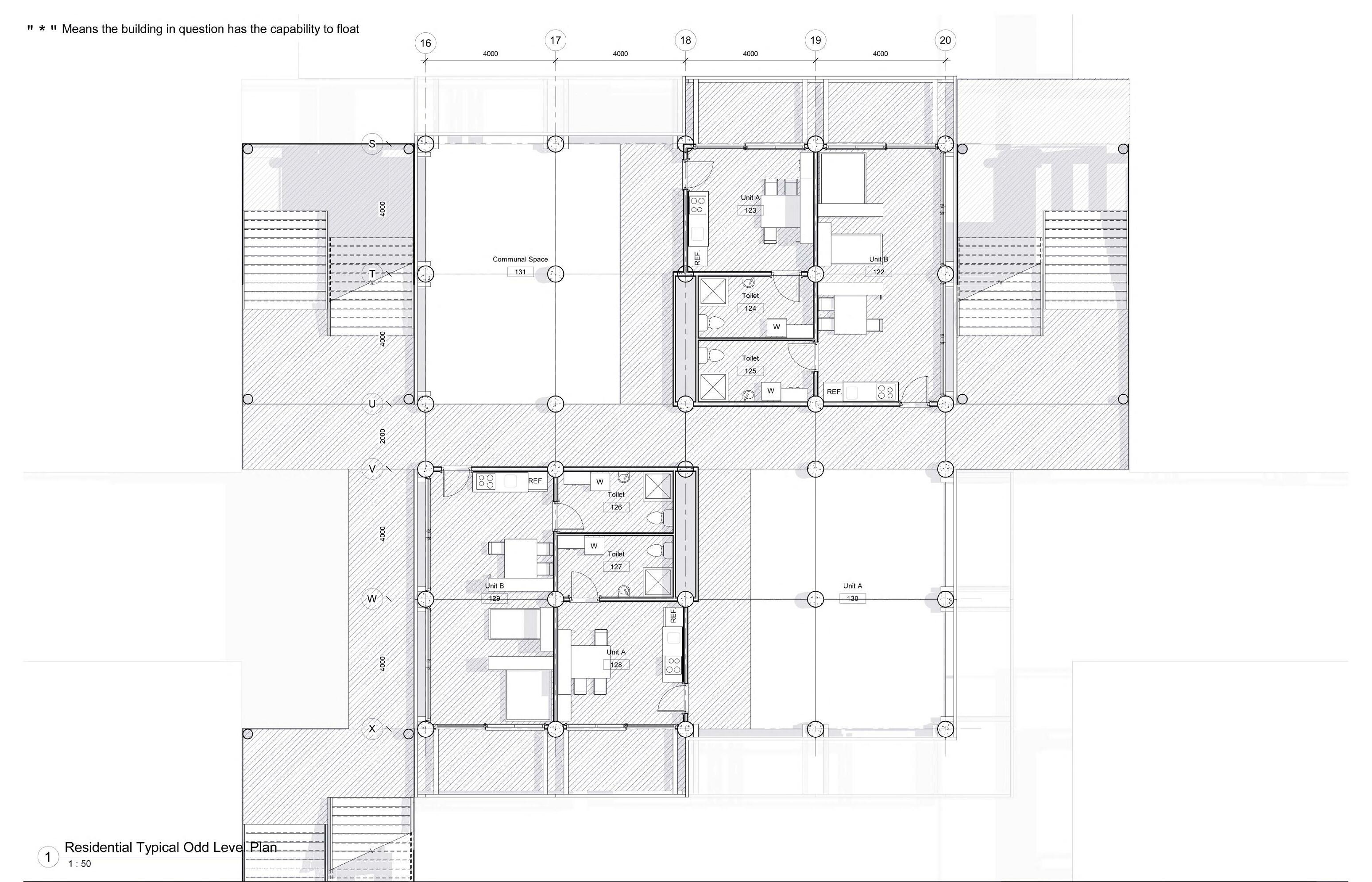
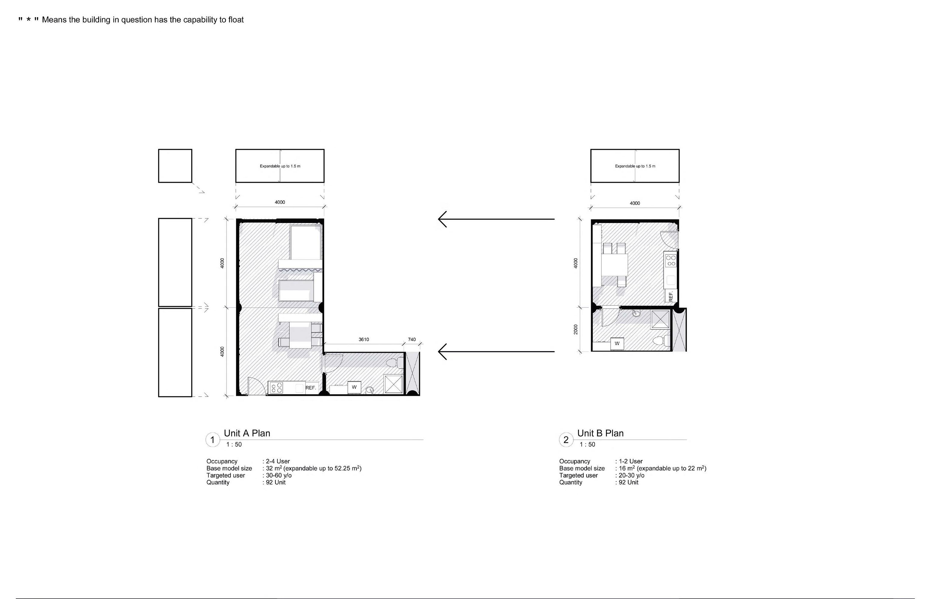
The primary purpose of the design is to provide a mean of social housing in form of residential units modules that can accommodate small families consisting of 2-4 people, local fishing boat pier, small pier to connect people with the outside world when the area is inundated by floods, food warehouses, and other life support facilities such as small-scale health facilities, mediumscale renewable electricity production facilities, small and clean water facilities.
Completion of these needs is based on the concerns of when the community’s residential area is flooded, access to most life support facilities such as food, health, water, energy, and transportation had to be cut off, thus creating a situation where people could not survive in the more frequent floods coming in the future.
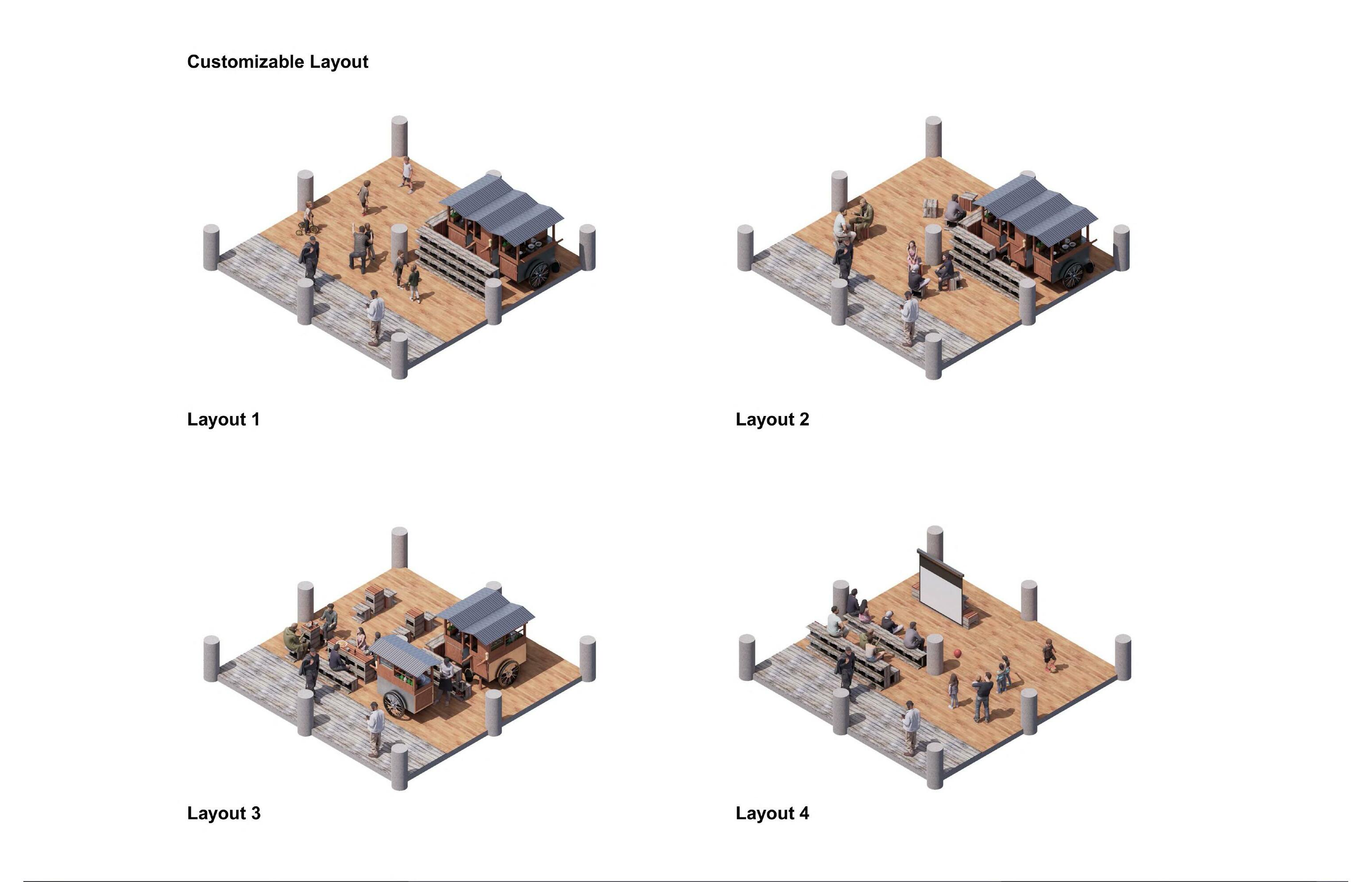
The secondary function is used as a social means where the surrounding community can gather together and perform traditional ceremonies together, one of the traditional ceremonies local community that has become a habit of local people is Nadran, a ceremony where fishermen raced to the sea to then offer a cow’s head to the sea. Facilities to be provided for this function includes amphitheater plaza facilities, children’s playground facilities, as well as community management facilities.
In programming the space allocation for the project, an approach by the name of characteristic approach is used. By exploring the characteristics
of the existing community in general, It is hoped that the building design can take advantage of all the potentials present on the site and could tackle or avoid any of the issues that are present on the site as well. Things such as the nearest point of interest or the side of the site that has the most pollution is taken into account.
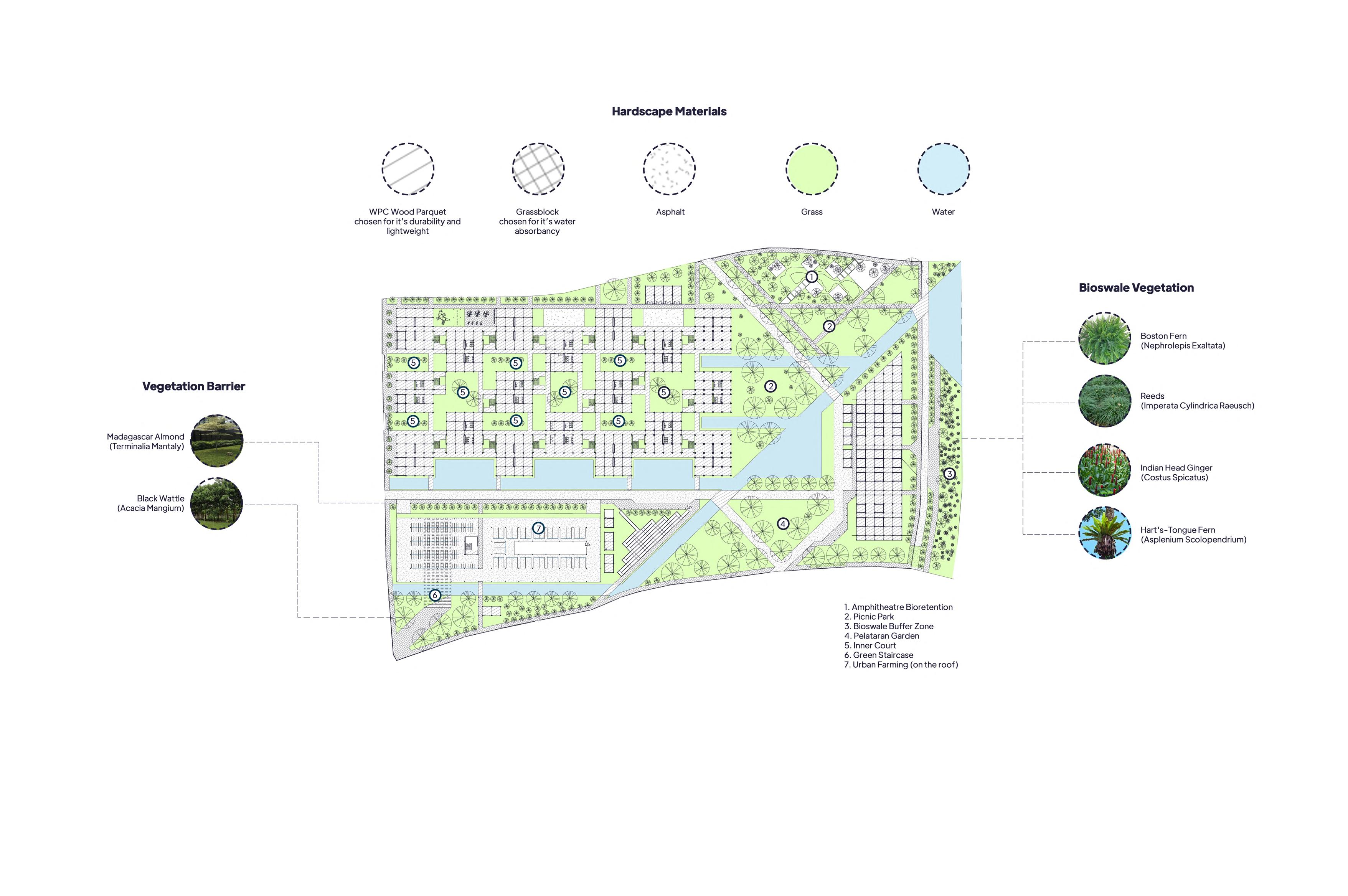
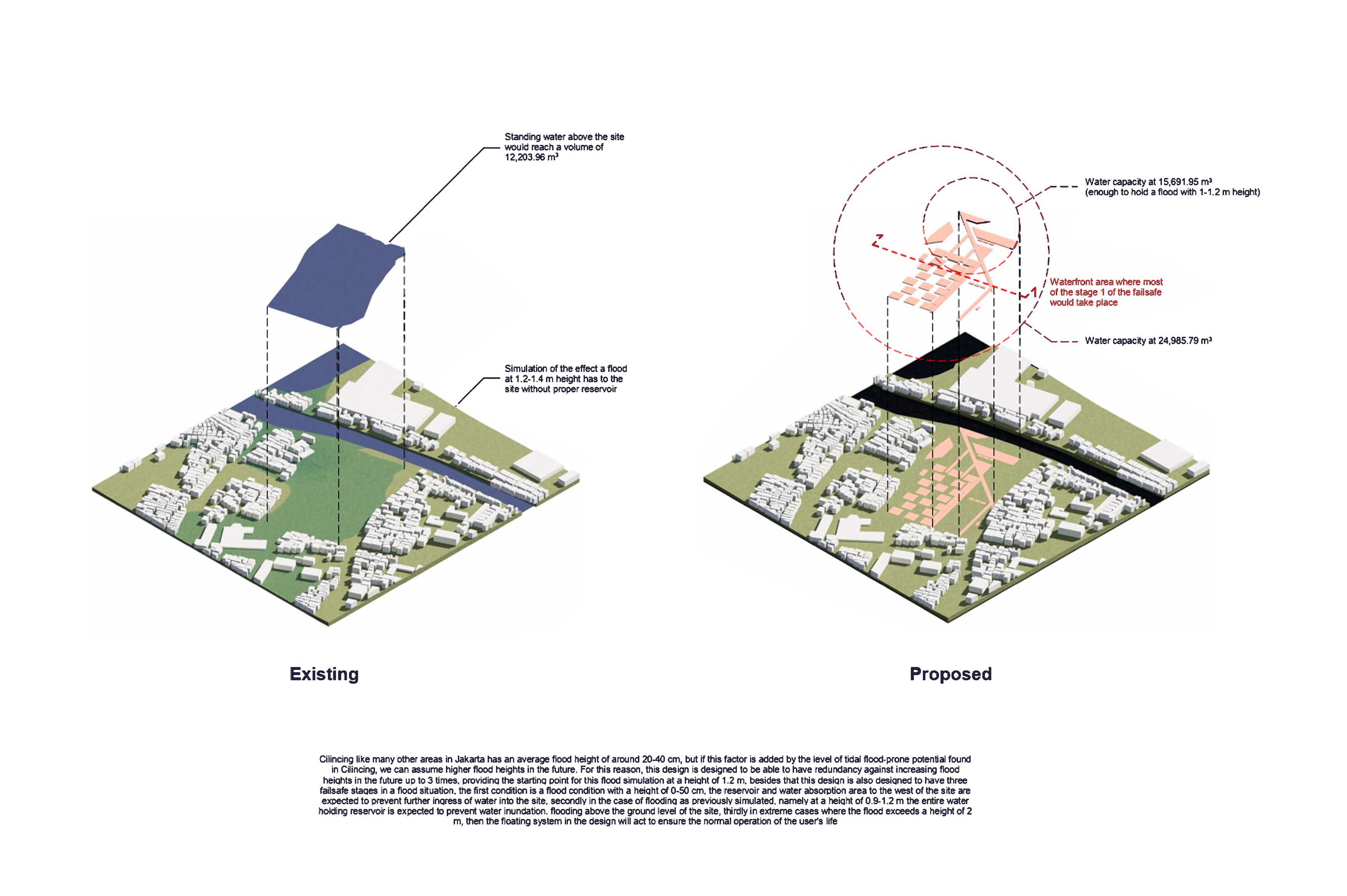
In addition, the scope of the design includes the composition of landscape elements on the site plan to create a natural open space that can act as a water catchment areas, to speed up the duration of waterlogging that occur after heavy rainfall. While tvhis project is led and funded by the central goverment to act as a pioneer project in
response to the rising sea level in North Jakarta. It will be returned and shared to each previous landowner accordingly by the means of land ownership size percentage for them to continue their normal life there.

User and Behavioral Study Site Analysis
Similiar Projects


Playing with kids around their age = Playground, Open spaces
Playing soccer, badminton, basketball = Sports field

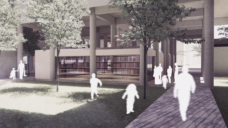
Studying together = Microlibrary
Hanging out, doing assignment together =
Communal spaces
Excercising, jogging = Outdoor fitness center, jogging track


Fishing =
Pier and somewhere to store fishes
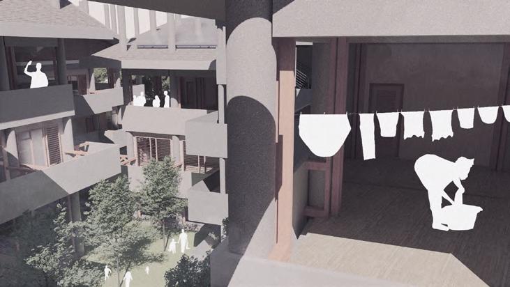
Housekeeping = Laundry, kitchen, storage, drying area

Hanging out = Communal spaces
Preparing and loading merchandise =
Loading dock
Selling goods = Retail area, multipurpose hall for smaller business
Socializing = Elderly park with benches
Light excercise = Walkable path throughout the site

Utility engineer = Staff room, storage, utility room.

Administration = Administrative office


Separated dropoff area between occupant and visitor

Shopping = Marketplace

1. Jalan Jayapura which is the main road leading to the site is only 9 meter wide and is full of container truck, so traffic highly depends on the volume of truck on that road at any given time.
2. Site could be accessed with only a 6.6 km drive from Kebon Bawang Toll Exit (easy access from the Greater Jakarta Area)
North : Possibly bike and pedestrian with low density traffic
East : Possibly bike, pedestrian, and boat with low density traffic
South : Possibly car, bike, pedestrian, and public transportation access with high density traffic (suitable for entry)
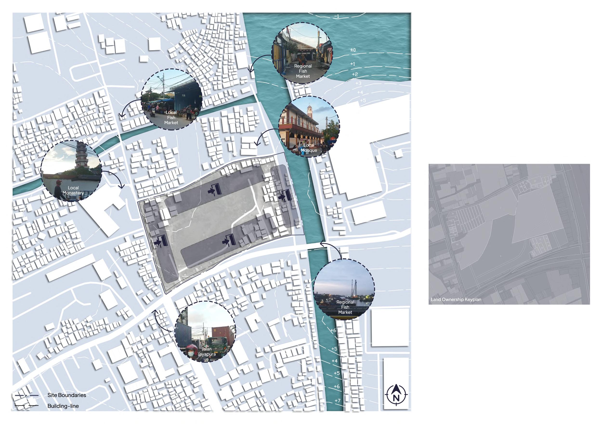
West : Possibly car, bike, pedestrian, and public transportation access with high density traffic (suitable for exit)
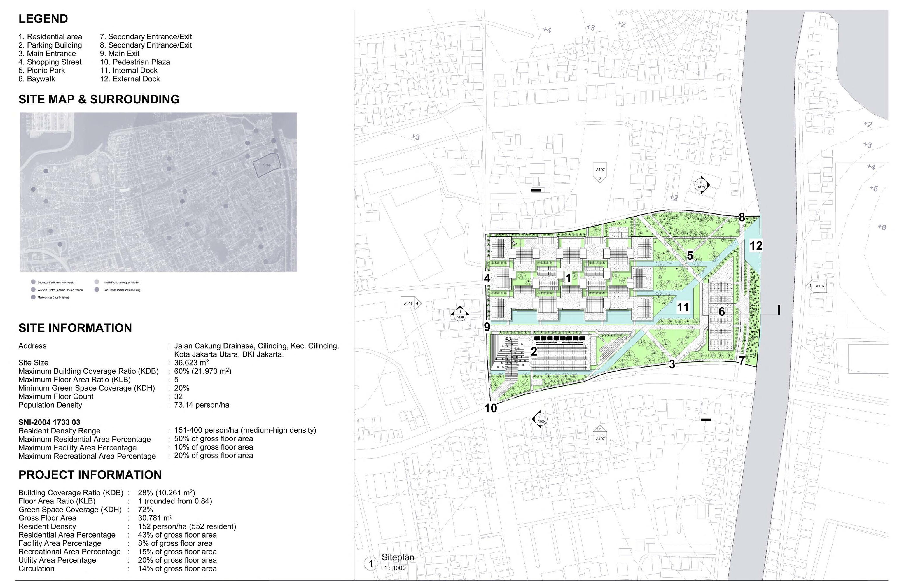
Address : Jalan Cakung Drainase, Cilincing, Kec. Cilincing, North Jakarta, Daerah Khusus Ibukota Jakarta. Site Size : 36.623 m2
Pop. Density : 7.314 person/km2


Regulation
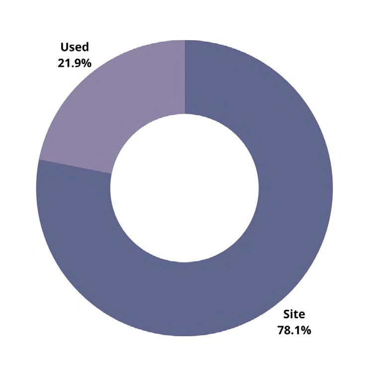
BCR : 60%(21,973 m2)
FAR : 5 GSC : 20%(7,324 m2)
3. Cilincing is already connected to Jakarta Outer Ring Road Toll gate (easy acces to Greater Jakarta Area)

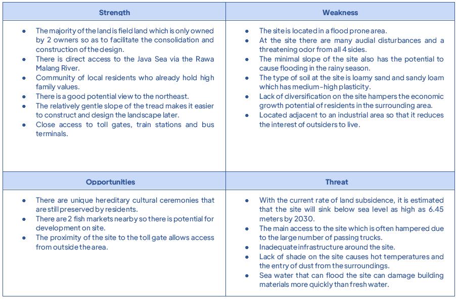
The site is located on land with a slope of ±1.05%. The highest point of the contour is at an altitude of 3 meters above sea level, while the lowest point is less than 2 meters above sea level. The minimal slope of the contour on the site


is a problem that must be resolved in the design of the landscape design later because there is no place for rainwater to quickly flow into rivers or nearby drainage channels.
Based on data provided by BPS Kota jakarta Utara2020 and windfinder, it is found that on average the wind blows from the north, west and northeast with an average annual speed of 4 knots, the temperature on the site averages at around 28.9 degrees celsius, average humidity at 74%, air pressure at 1011.4 mb, precipitation at 1,667 cubic millimeters per year, and sunlight at around 6.64 hours/day.
The best view from inside the site is located on the east, northeast, and southwest side of the site where it is looking straight towards Rawa Malang River, Jakarta Bay, and Greater Jakarta Area in chronological order.

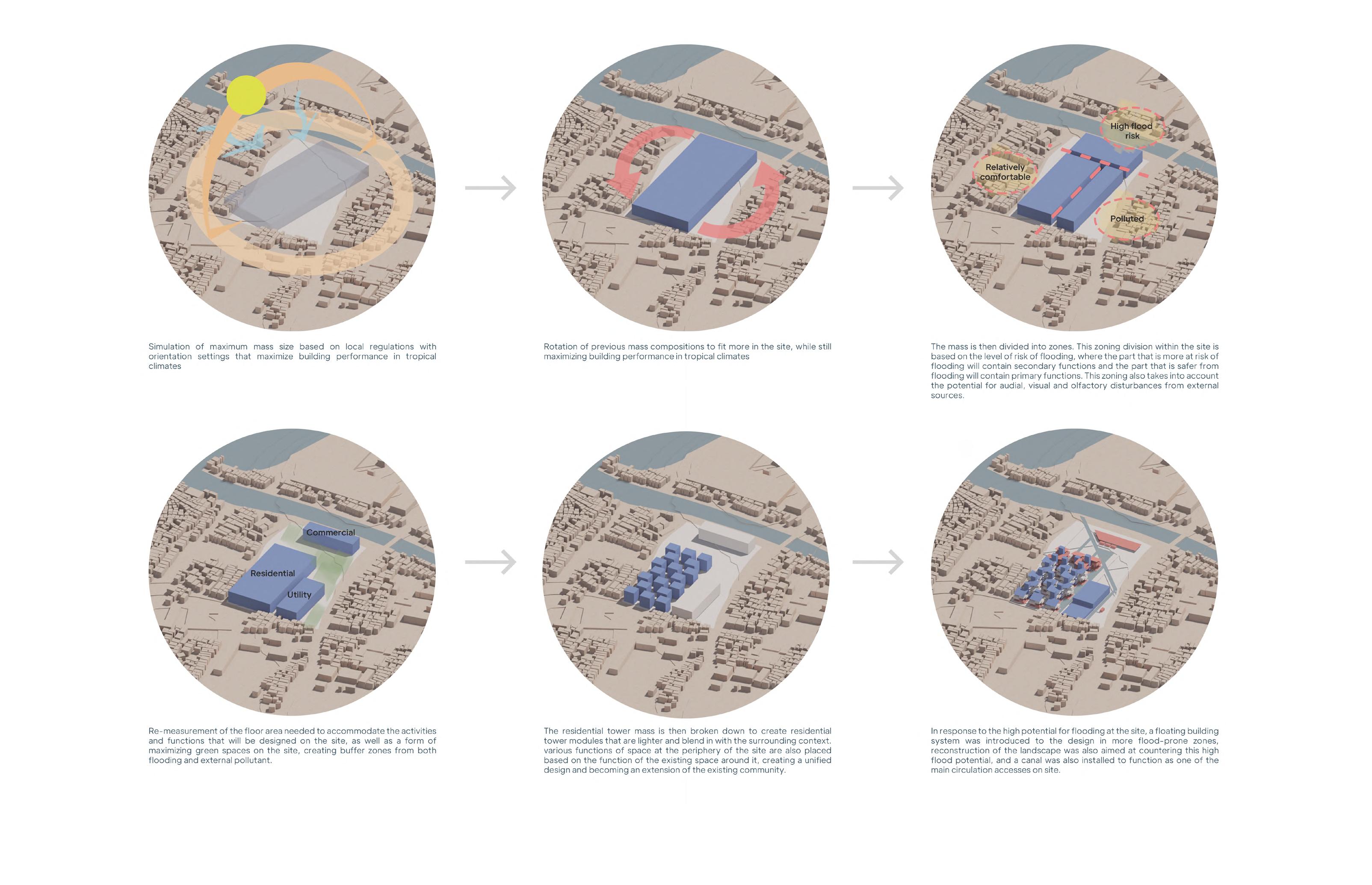
1. North-south orientation to mass to maximize climate performance.
2. Applying a rainwater harvesting system to help minimize waterlogging on the site.
3. Opening up the mass towards the best view

The common soil types that can be identified in the site are loamy sandy soils and sandy loams. which are alluvial deposits from rivers and beaches. Both of these soil types have moderate to high plasticity characteristics.
1. Adding an independent water channel to the site to help water flows to the nearby river
2. Considerations to building weight and foundation shape to help it stand on the soft ground
Sound, smoke, and dust are blown by container trucks on the south side of the site. Then there is also an audial disturbance that comes from the west side of the site due to heavy traffic and activities at the fish market. Also not
helpful are the presence of 2 religious centre located on the west and north sides of the site, which can get very crowded at times. On the east side of the site, you can also hear the sound of boats passing by, as well as the fishy
Vegetation in the site varies, there are rows of sea mango trees on the west, north and south sides of the site, which function as filters and natural walls against dirt and visual access to enter the site.
There arent’t many shrubs scattered around the site because the majority of the land on the site is either dry or is puddled by dirty water,

Several large trees on the north and center sides of the site serve as the main shade in the northern part of the site.
Across the south, west, east, and north sides of the site there are not many plants that can filter out pollutant particles in the air, causing a dusty and hot atmosphere.
If we drew a line further onto the north side of the site, we can find a mangrove ecosystem that protects the site from infiltration of excess seawater.

smell emitted by the fishermen’s catch. For this reason, it is necessary to resegregate what disturbances can be tolerated and become potential, from disturbances that must be completely blocked.
The planting of proper vegetation barrier such as acacia and madagascar almond that has been proven to be able to filter out dust and other air pollutant effectively


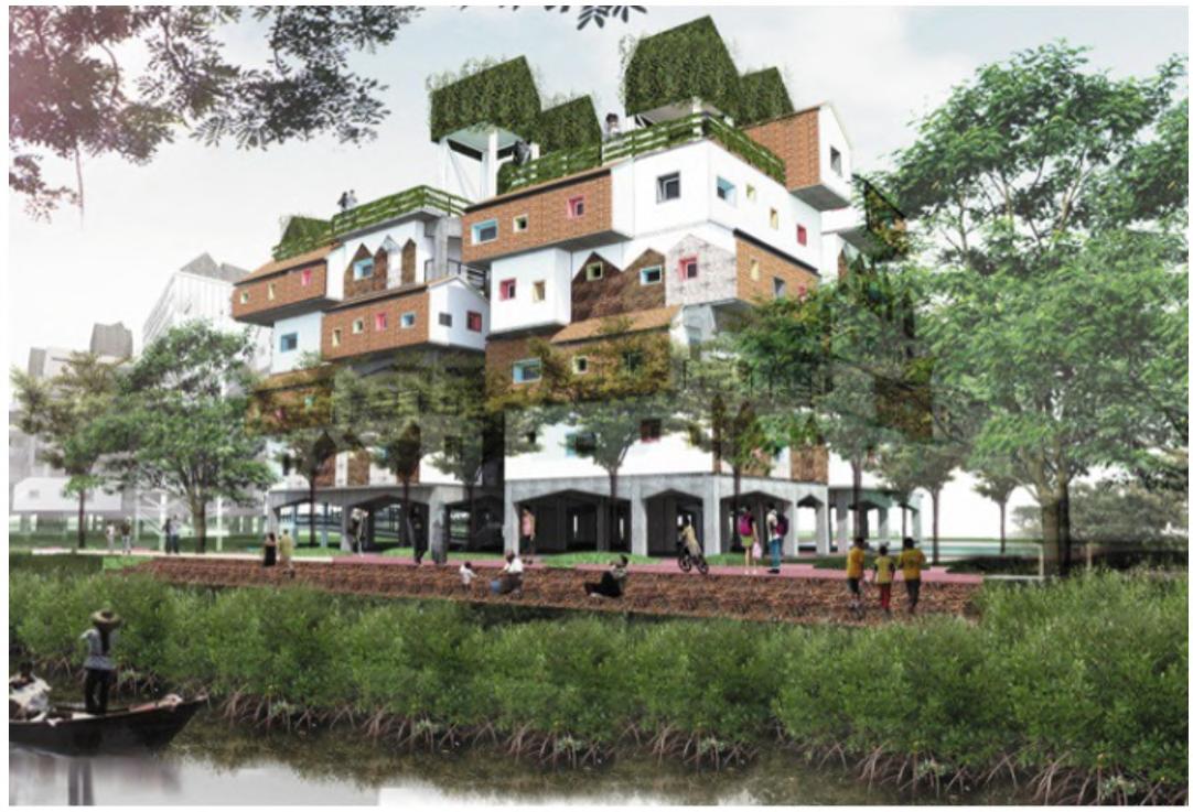
The first precedent is called Kampung Susun Manusiawi which was designed by Akanoma Studio. Although it is still a design proposal, this project contains many aspects of the housing needs of middle to lower class residents which can also be seen in other projects of Studio Akanoma such as the Cakung Productive Village which has been
given the green light by the DKI Jakarta Provincial Government. The concept carried out in this design departs from the on-site village rejuvenation where local residents are not relocated to distant places, so that the existing cultural, economic and social sustainability can be maintained.
The Floating Housing Concept in Brazil, which won the Sustainable social housing competition in Brazil. This design is a residential and community complex on the banks of the Manaus River designed by Danielle Gregorio, a student at the University of São Paulo, Brazil. The people on the banks of the Manaus River live in a flood-prone zone,


which experiences a tidal cycle every year, so this design is designed as a social housing that can adapt to these environmental conditions.

Since the aim of this project is to create a living environment based on existing local community in the form of a residence equipped with various public facilities and social facilities, to support and sustain the surrounding community, It should also achieve that in a way that perfectly correspond with the main issues found on this project, so to summarize.


Basic Concept
Space Organization
Massing
Social Interaction Strategy
Landscaping
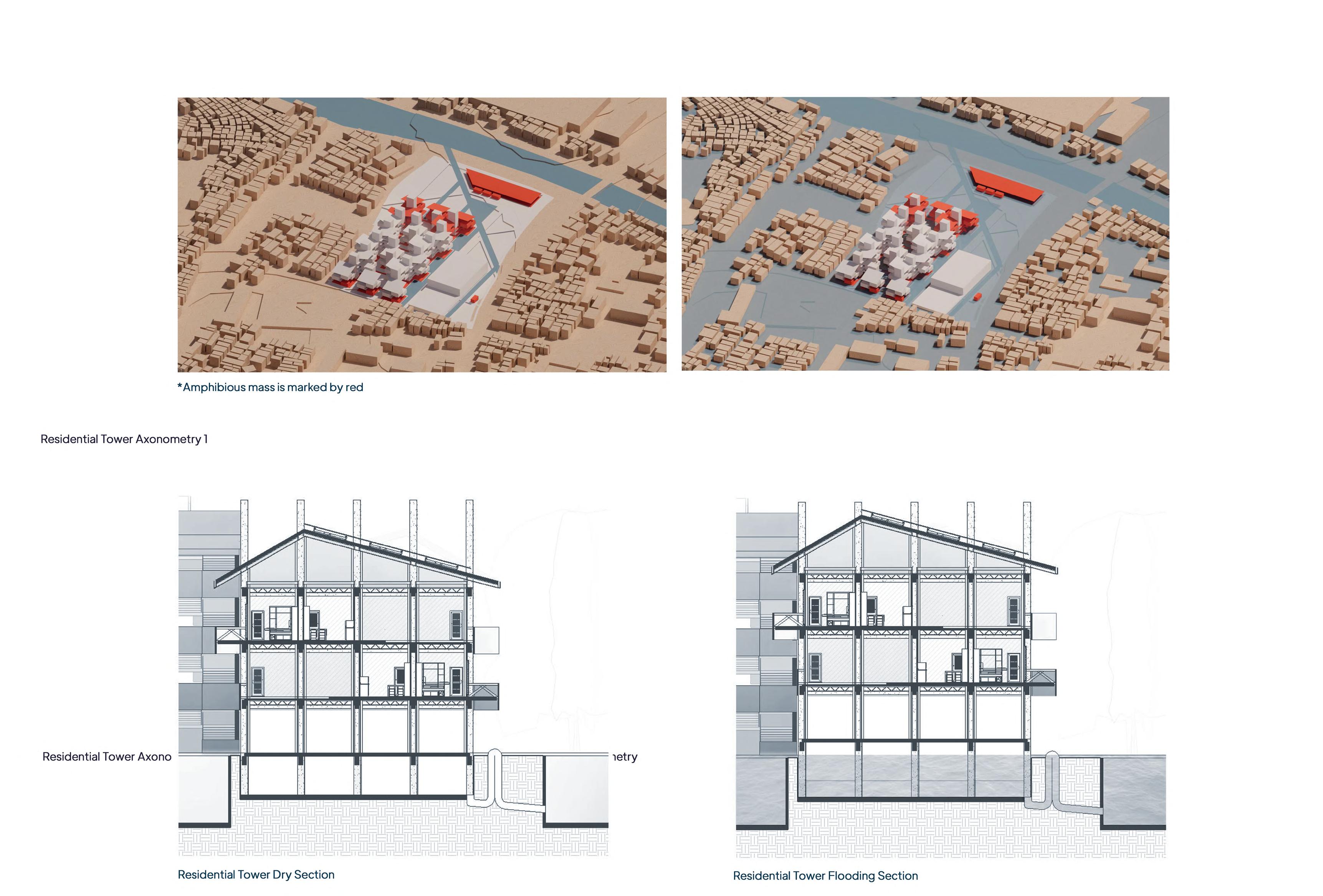
Flood Mitigation
Floatation Module Concept Self Sustainability
Utility System Integration






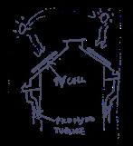
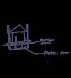
Implementation of blue architecture strategy on flood-prone tropical residential building

Implementation of resilient and selfsustaining strategy on residential building


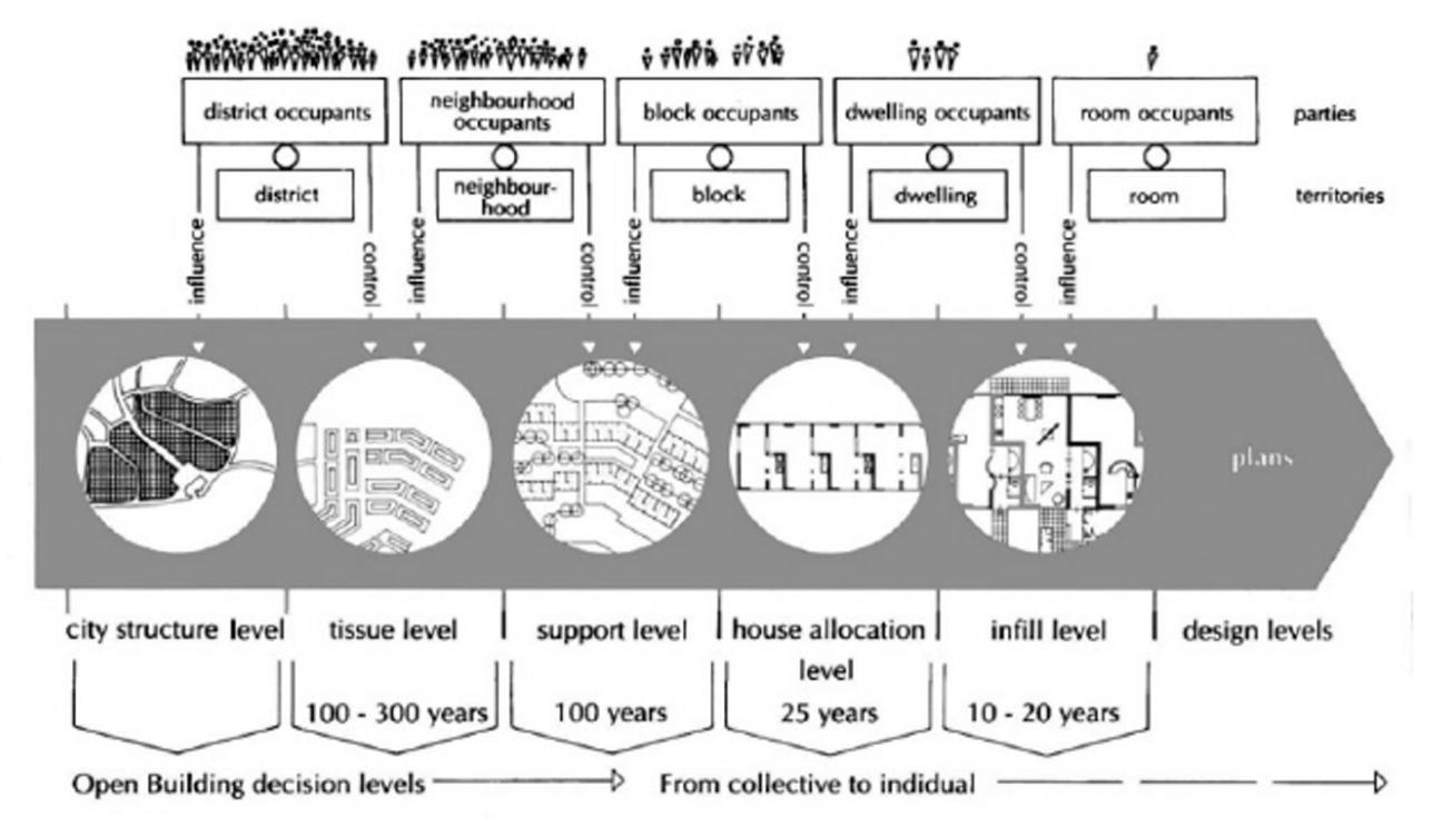
Supporting
Framework, planned by developer to accomodate various customization


Infill Micro-adjustment and customization by occupants

Implementation of community based strategy on a residential building
Designing a comfortable and healthy living environment
Response toward site topography






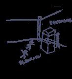

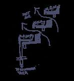
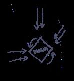


“The resulting design will be focused more on creating more spaces where occupants could customize the base framework provided by developer to tailor fit their needs”

Many aspect are taken into account when the concept of the zoning plan is being developed, things like accesibility from the nearest point of interest, level of audible noise present on the area, social behavior of local communities on a specific area, all took part in determining the placement of each zones. Then a basic sketch on the zoning plan is drawn

by hand to reveal much of the possible composition of zones for the site. Those sketches are then developed into a 3D model using computer softwares to show the imperfection on each iteration. The chosen iteration are then tested and simulated in Rhinoceros for it’s performance in tropical climate, after many iteration a base model for the 3D

massing development is created and is ready to be developed further on the next stages of the design process.
Residential Facilities
Recreational Facilities
Supporting Facilities
Multipurpose Facilities
Commercial Facilities
Throughout the city, even at its densest points, there are strong human reasons to subject all buildings to height restrictions. There is abundant evidence to show that high buildings make people crazy. Therefore : In any urban area, no matter how dense, keep the majority of buildings four stories high or less. It is possible that certain buildings should exceed this limit, but they should never be buildings for human habitation.







Water Piping Rainwater Harvesting Electrical Wiring
Pump Room
Rainwater Tank Septic Tank Control Tank
Clean Water Pipe Black Water Pipe Grey Water Pipe
Pump Room Rainwater Tank Septic Tank Control Tank
Rainwater and Other Reservoir Pipe


Electrical Line

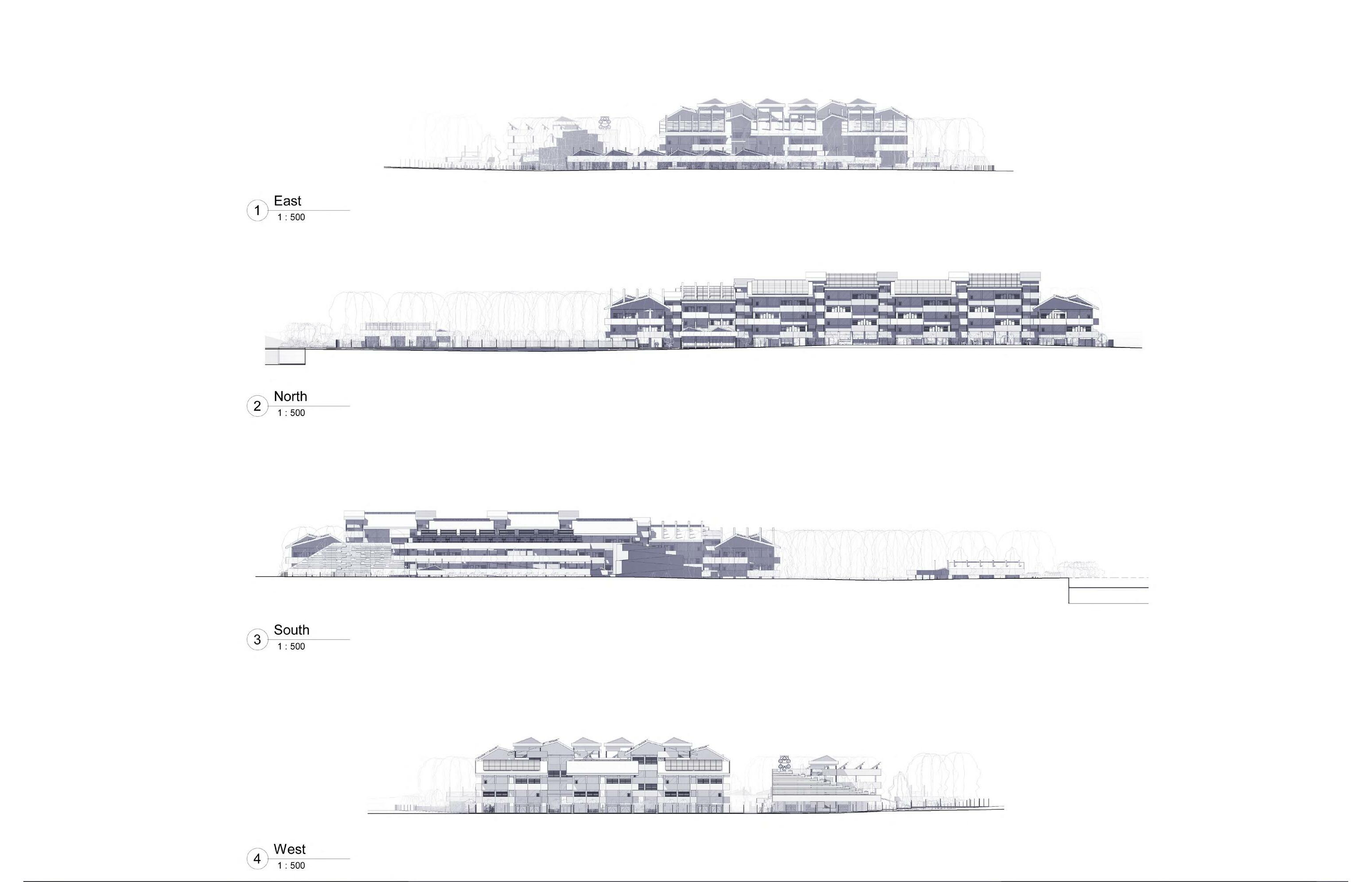
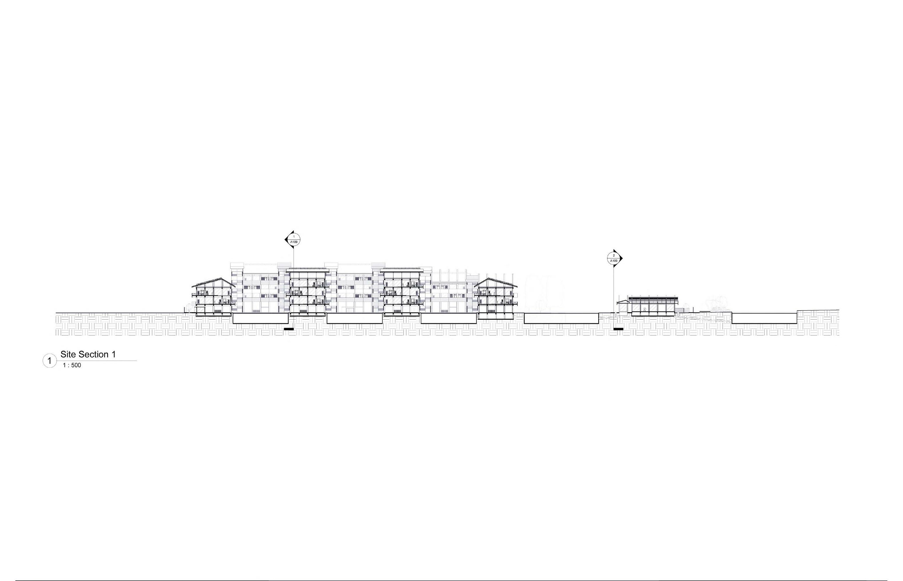
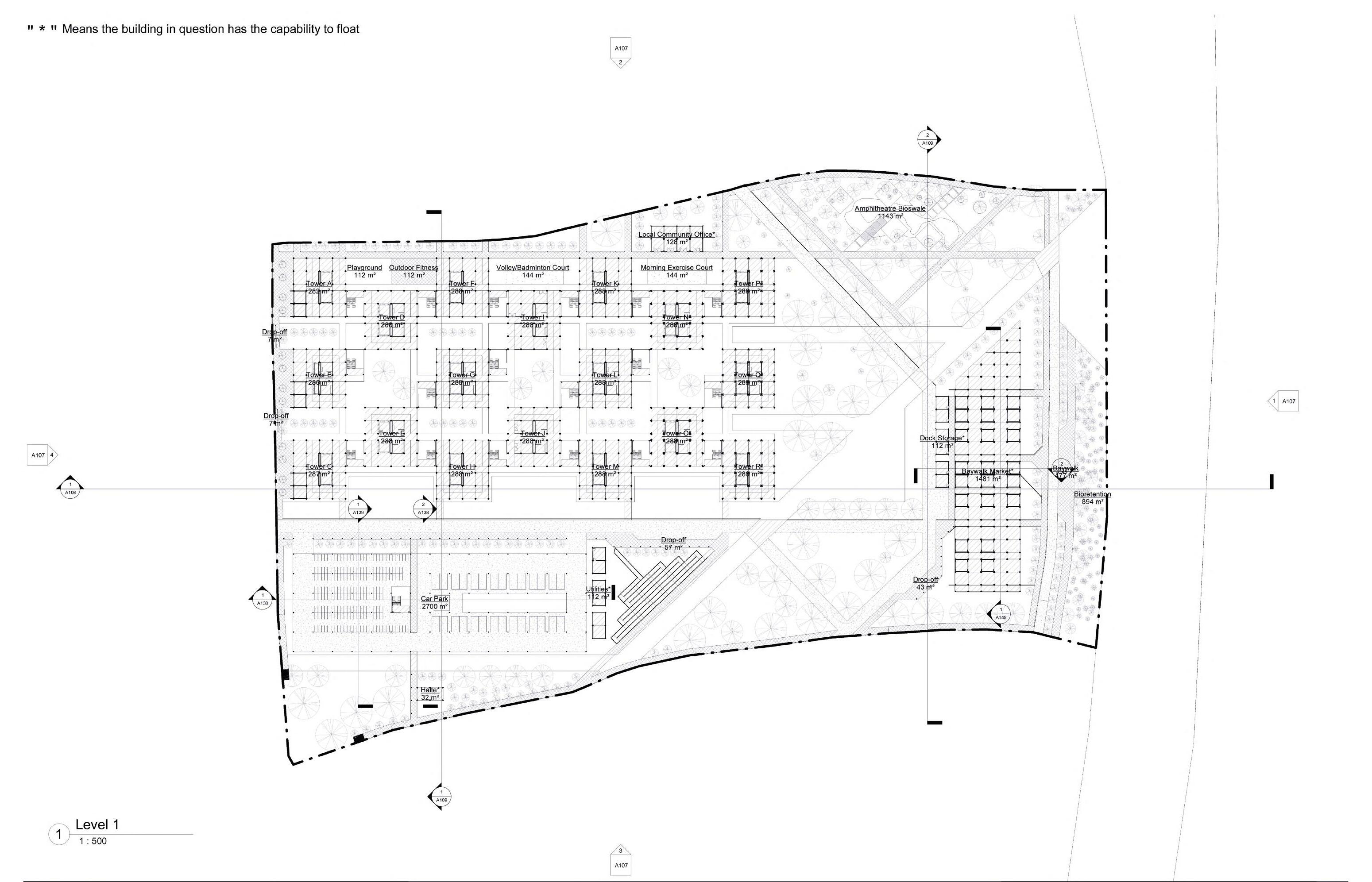
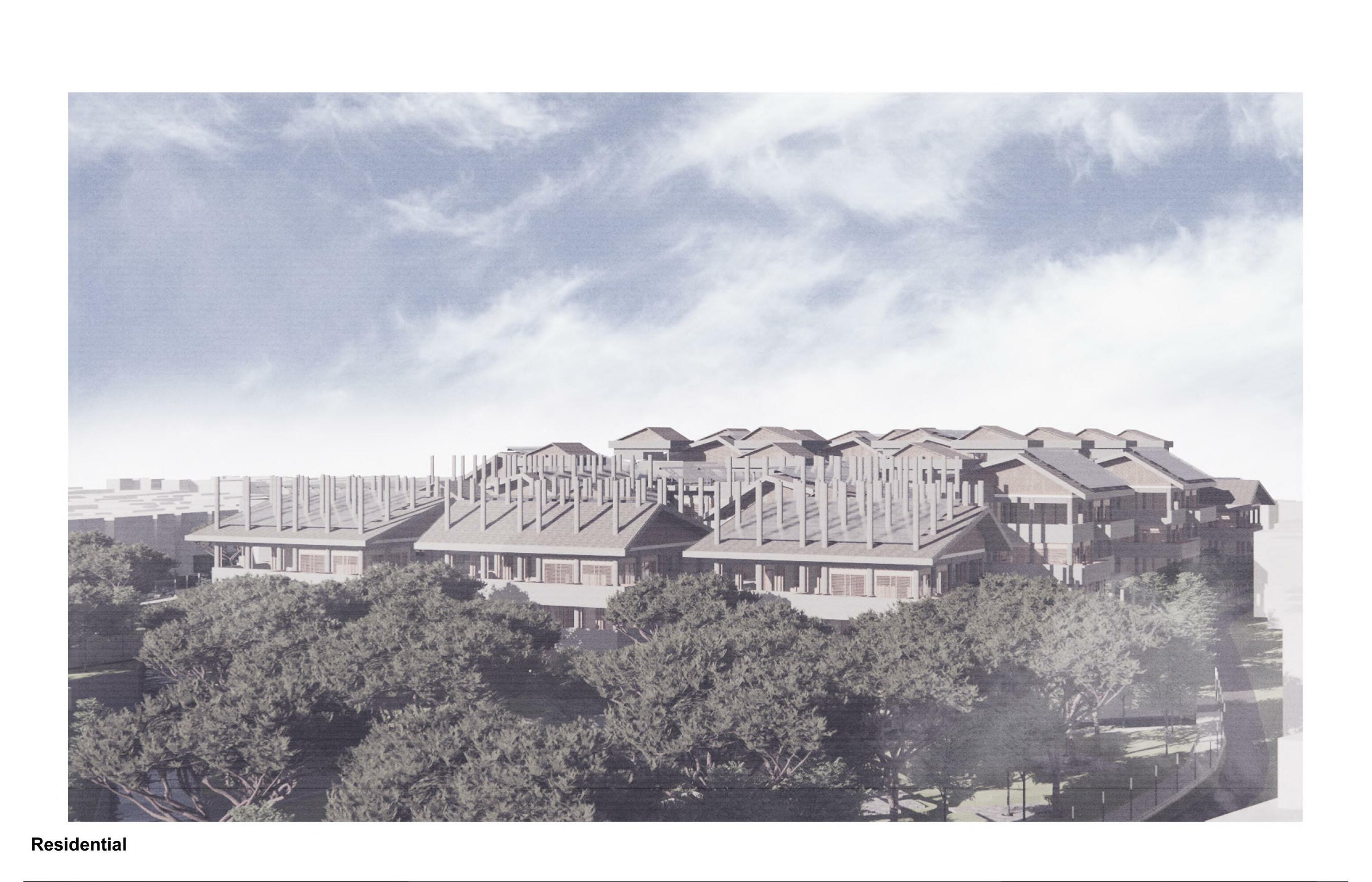
Detailed Engineering Design (DED) Exterior and Interior Perspectives









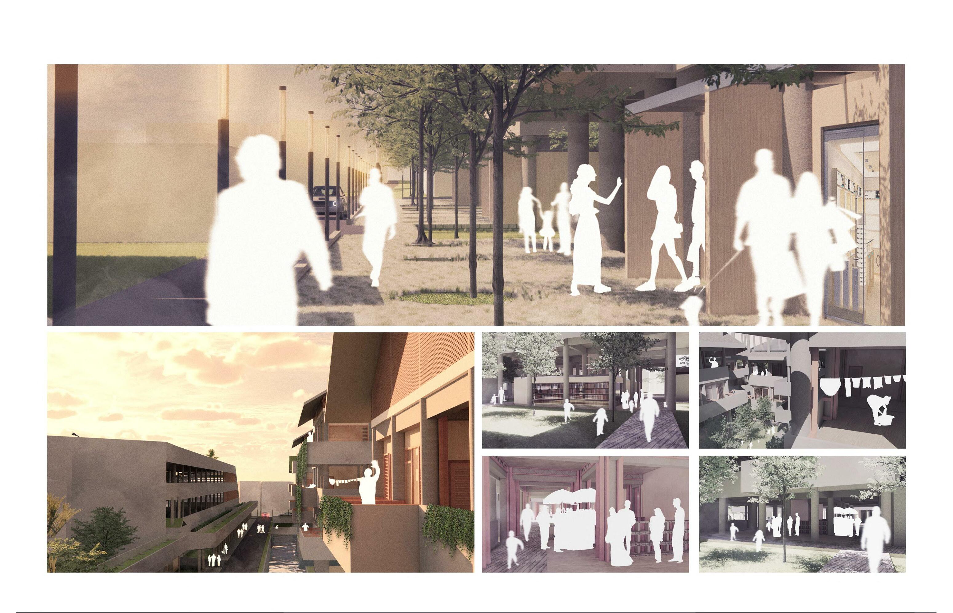
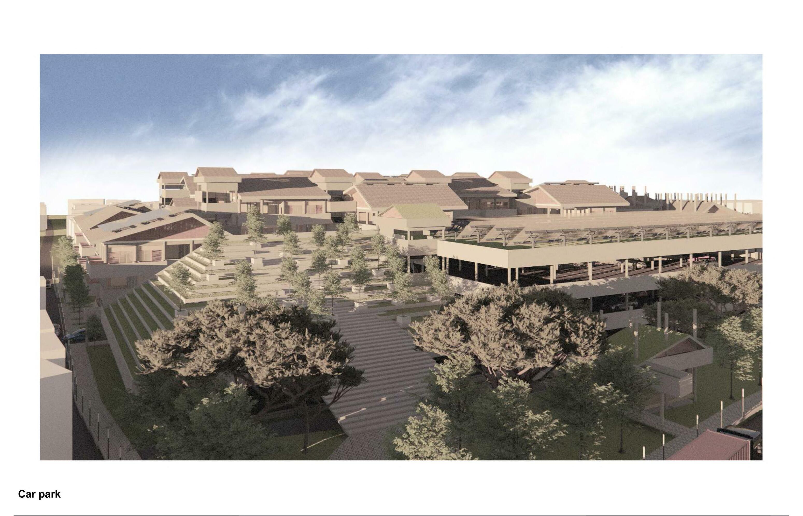


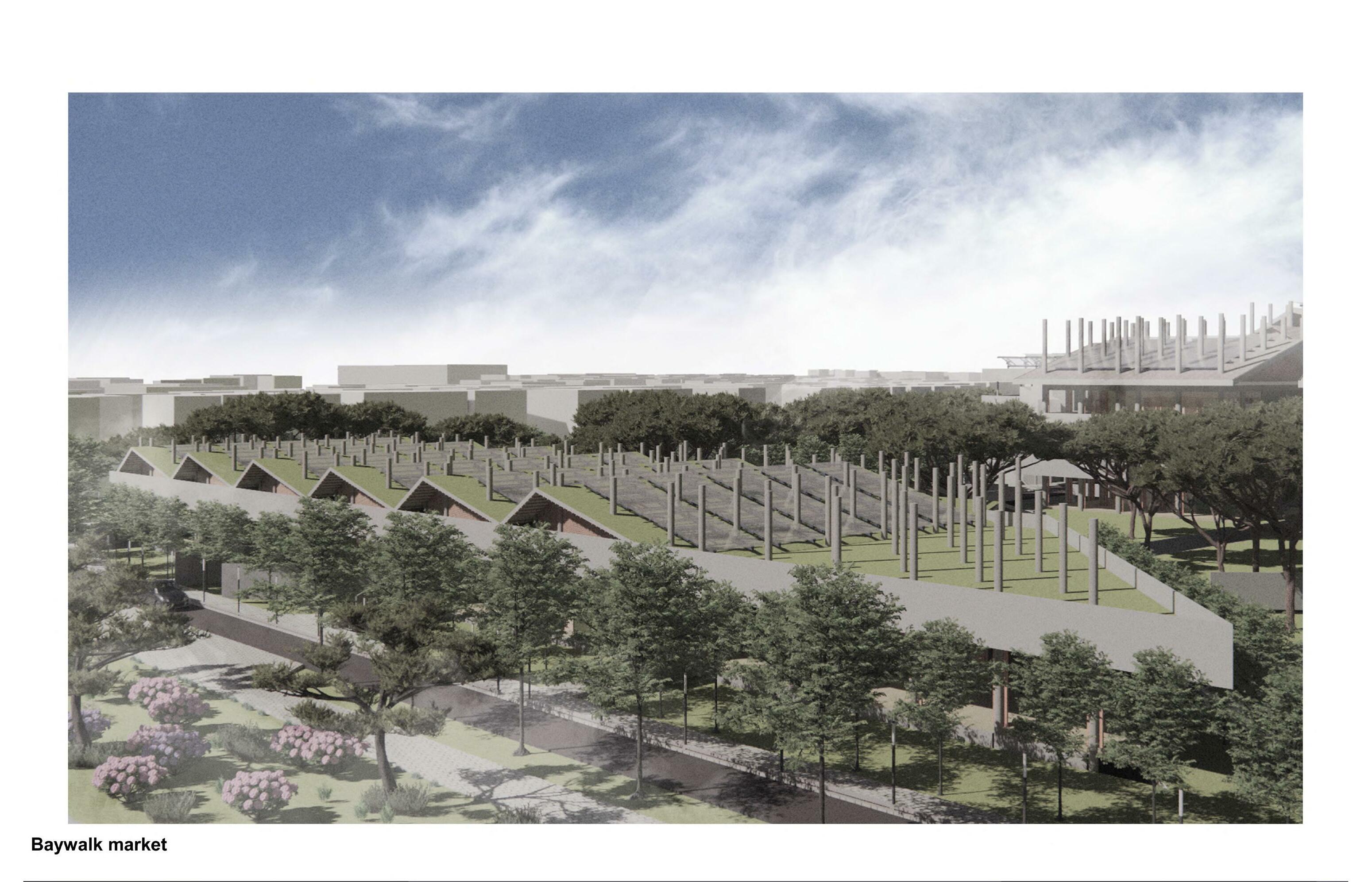
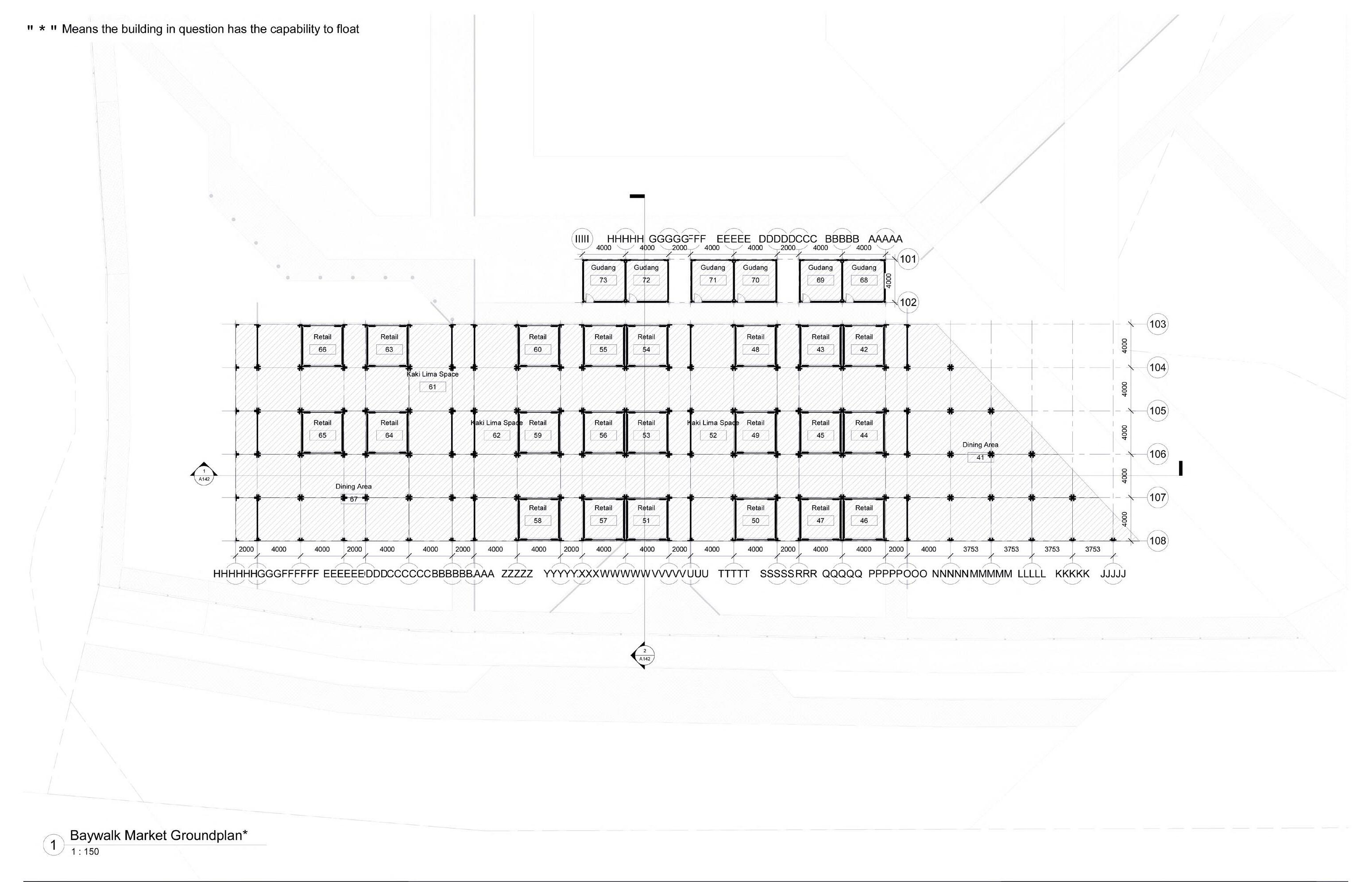





Terima Kasih!