Jace Armstrong
Landscape Architecture Portfolio
BLA with Highest Distinction University of Nebraska-Lincoln ‘23


Jace Armstrong
Landscape Architecture Portfolio
BLA with Highest Distinction University of Nebraska-Lincoln ‘23
Email 2000jacearmstrong@gmail.com
Phone (402) 619-1812
https://linkedin.com/in/jace-armstrong-larc
Portfolio
www.issuu.com/jacearmstrong
Technical
Photoshop // Illustrator // InDesign
Rhino // Grasshopper Sketchup
Lumion // Enscape // Twinmotion
AutoCAD // Civil3D ArcGIS // QGIS
Personal Philomath Optimist
Problem Solver Analyst Peacemaker
University of Nebraska-Lincoln 2023
Bachelor in Landscape Architecture with Highest Distinction
GPA: 3.88
Minors in Architecture, Urban Forestry, and Community and Regional Planning
Member of Alpha Rho Chi (APX), American Society of Landscape Architects-UNL, College of Architecture Student Advisory Board (‘20-’21)
Leadership roles include Teaching Assistant, Resident Assistant, and Worthy Scribe (APX)
Landscape Designer // Carson Enterprises Aug 2023 - current
Develop initial concepts, drawings, plans, and renderings for client review
Communicate with clients and team members to ensure clear understanding of projects goals, budgets, and timelines
Landscape Architecture Intern // OLIN May - Aug 2022
Participated in OLIN Lab’s Conservation @Scale research project
Developed planting regimes with emphasis on native desert typologies and low water usage
Teaching Assistant // University of Nebraska-Lincoln Aug 2021 - May 2023
Two-time teaching assistant for LARC 210 & 211 (four semesters)
Assisted faculty in preparing course material
Reviewed coursework and offered constructive criticism
Peer-Reviewed Publication 2023
Journal of Digital Landscape Architecture // Parametric Planting Design: Algorithmic Methods for Resilient Communities
Student ASLA Merit Award
Nebraska/Dakotas ASLA // Plant Pattern Guide for Affordable Housing
ASLA Student Honor Award
Recipient upon graduation
Olmsted Scholar
Recognized 2023 Olmsted Scholar by UNL Landscape Architecture faculty
College of Architecture Friends Association Outstanding Student Award
Recipient upon graduation
Norman Ochsner Scholarship 2022
Recipient of academic scholarship
Student ASLA Excellence Award
Nebraska/Dakotas ASLA // Trail Guide to a Hybrid Landscape
Nebraska/Dakotas ASLA Scholarship 2021
Recipient of academic scholarship
Regents Scholar 2019
References available on request
Recipient of academic scholarship
University of Nebraska-Lincoln
Subterranea
20 ac
The Nursery Trail
175 ac
Towards a New Urban Frontage
25 ac
Plant Pattern Guide for Affordable Housing
2 - 10 ac
Carson Enterprises
Elkhorn
3 ac
Westside
0.75 ac
Instructor:
Brian Kelly
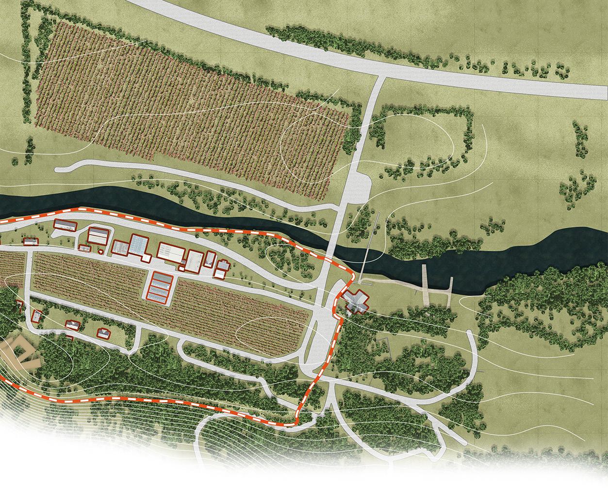
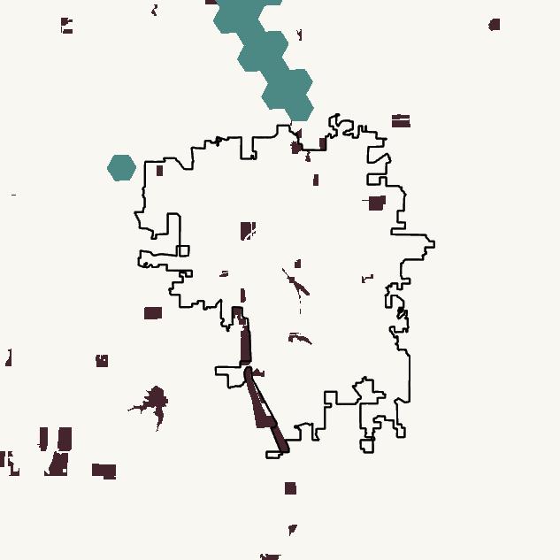
Location: Seward, Nebraska, USA
Collaborators:
Daniel Pinto (architecture)
Xanthe Steffen (interior design)
Trent Weatherwax (architecture)
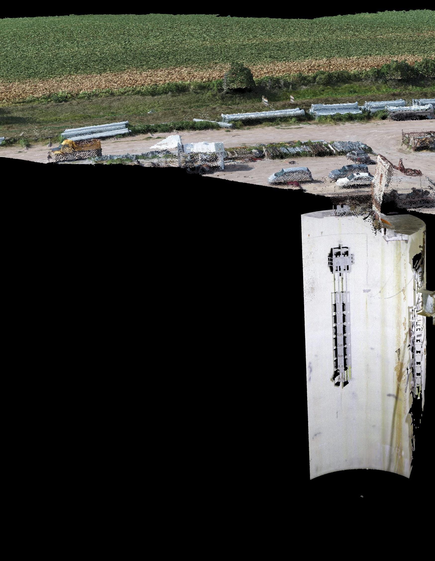
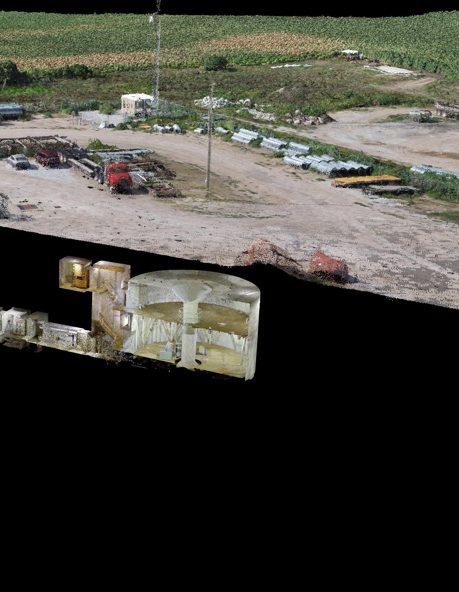
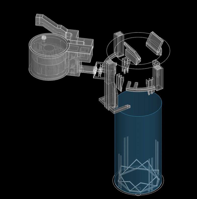
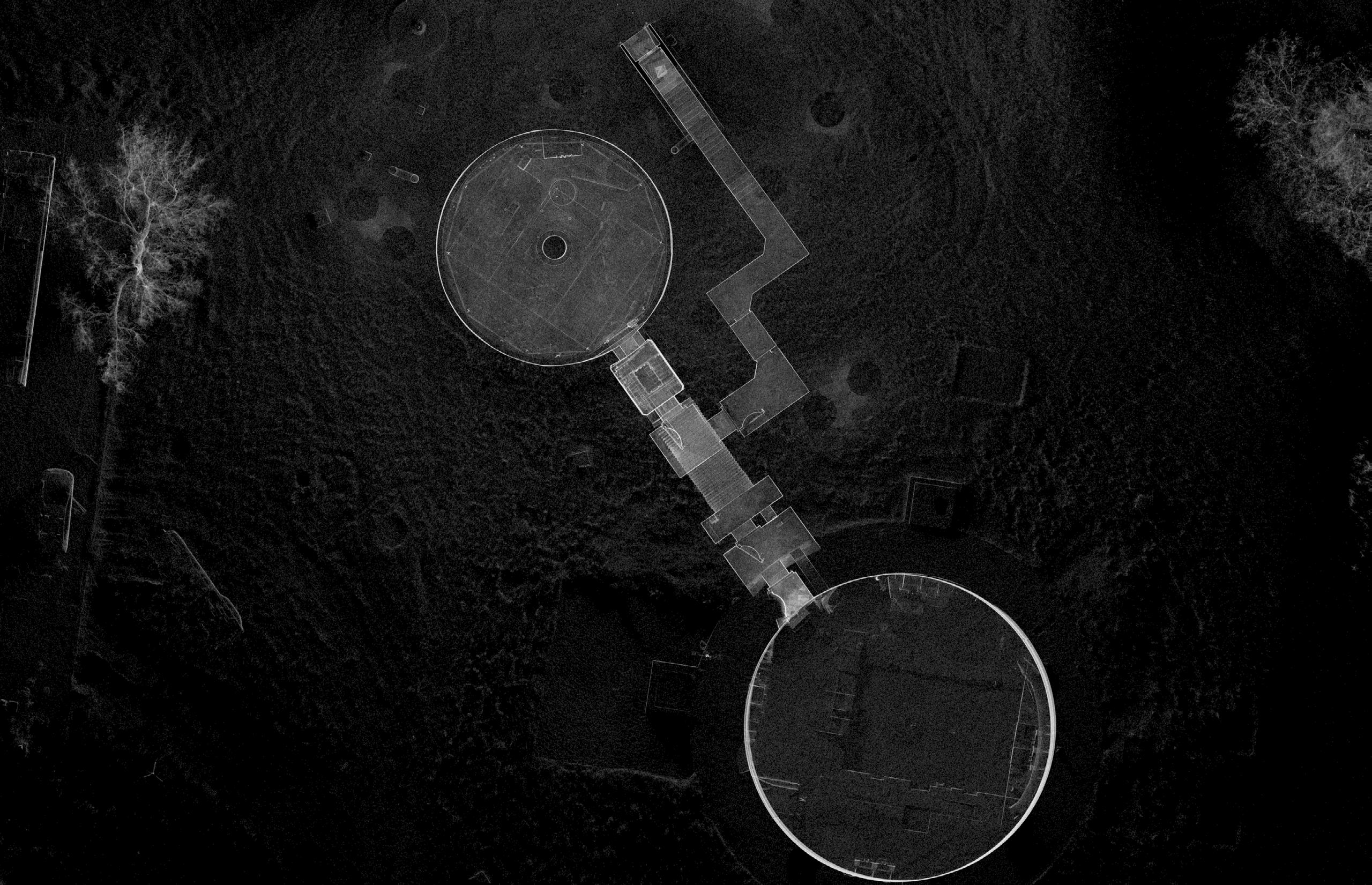
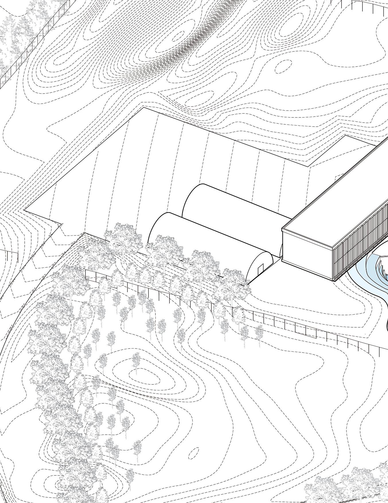
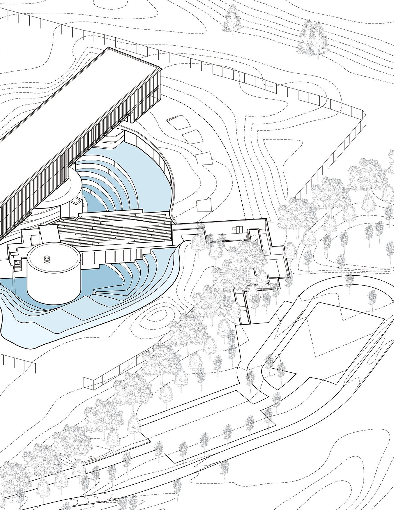
An unassuming field holds a subterranean complex leftover from the Cold War. Hidden below the surface is an Altas-F missile silo, one of five in the state, sitting decrepit and decaying. While the facility’s mechanical accessories are corroded and fractured, the concrete walls are intact and capable of supporting a new purpose. Researchers from the University of Nebraska-Lincoln have turned to this piece of military infrastructure as inspiration for a research facility for Antarctic ice drill testing. This collaborative studio investigates the history of the Atlas-F missile program and explores potential redevelopments of the silo in rural Nebraska. Our proposal re-excavates the site, shedding light on dark corners and long-forgotten histories.
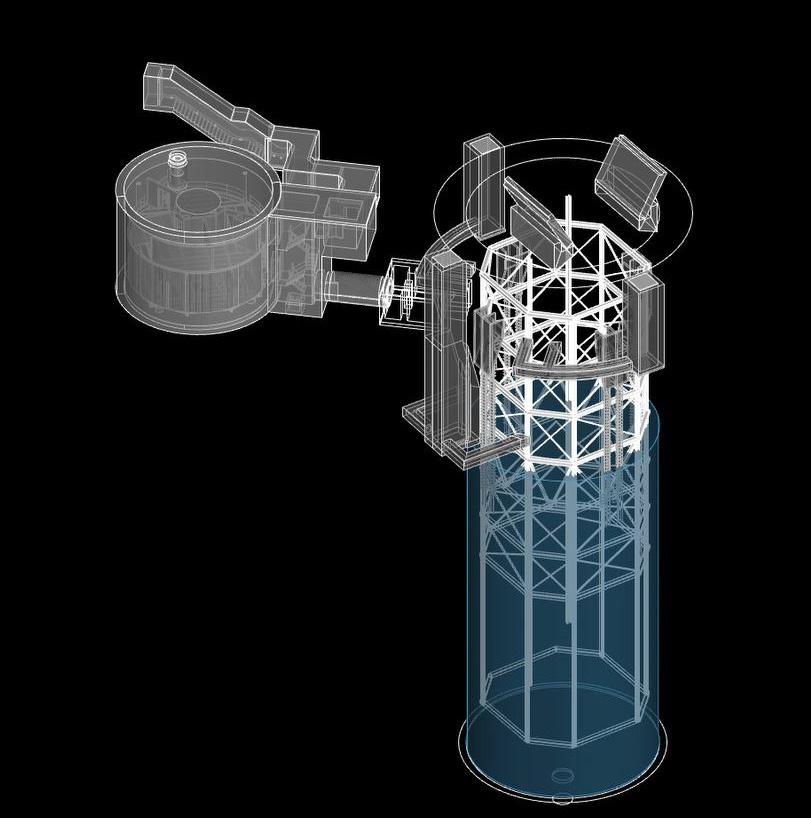
Sequence of silo degradation. Axonometric.
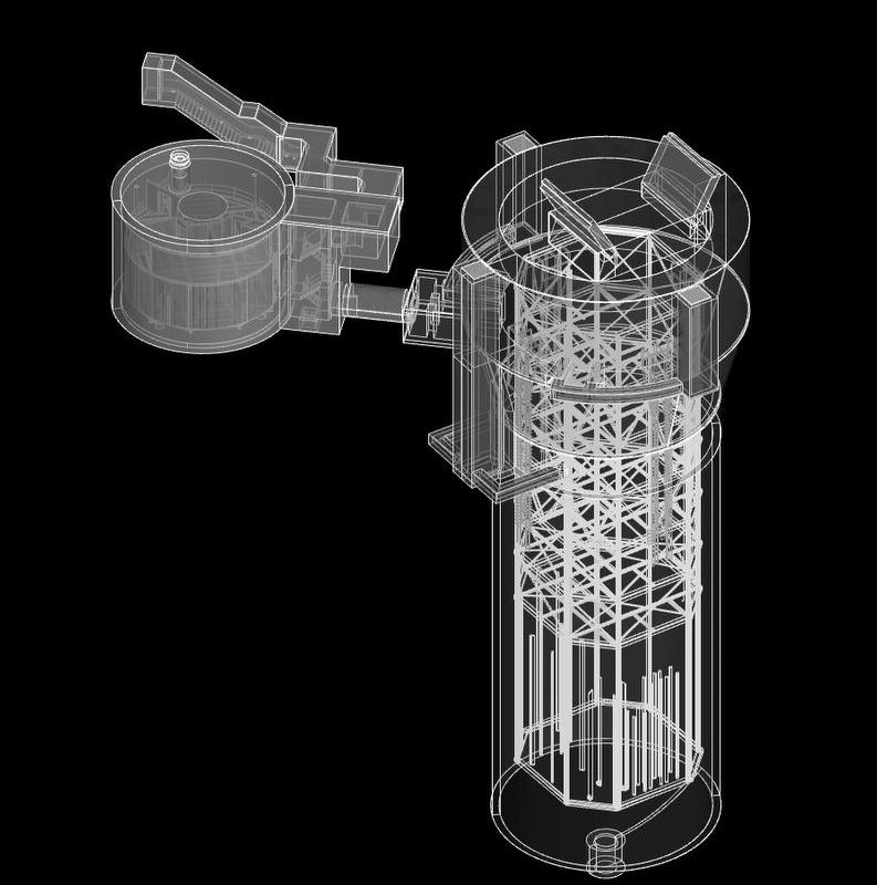
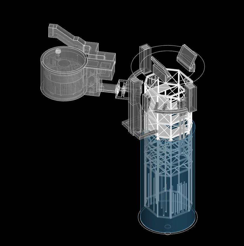
The studio utilized a 3D LiDAR scan to evaluate the internal conditions of the silo, as its current state includes extensive mold growth. A 3D model was built in Rhino utilizing historical construction documents and matched to the scan, allowing us to view discrepancies between documents and final structure. A layer of water covers the silo floor, obstructing the full scan and hides the true extent of material lying at the bottom.

Subterranean view of LiDAR scan. Perspective.
Site LiDAR scan . Plan.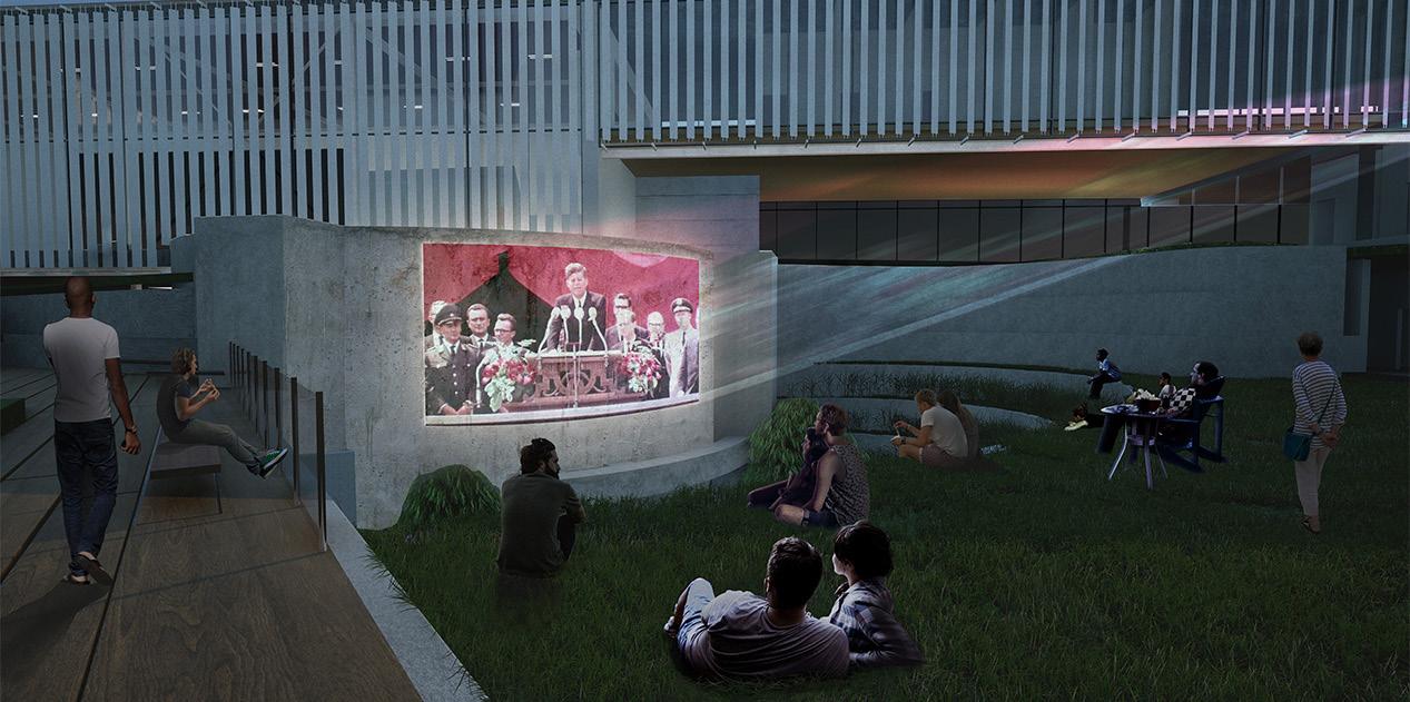
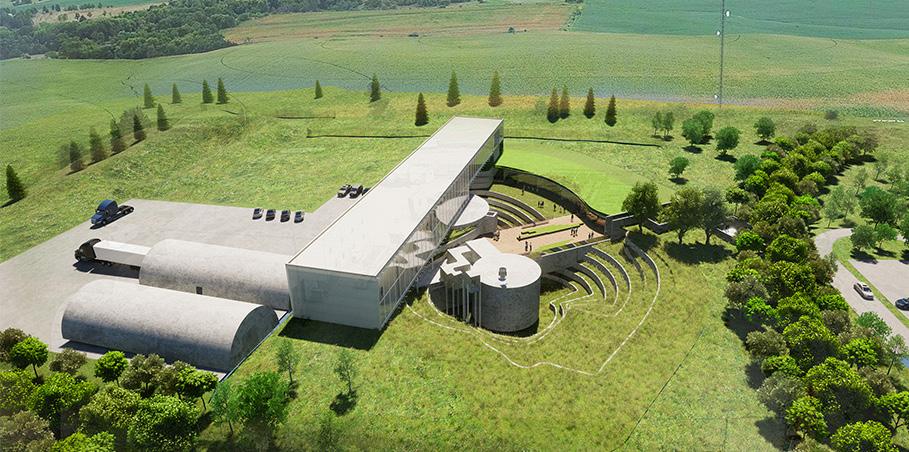
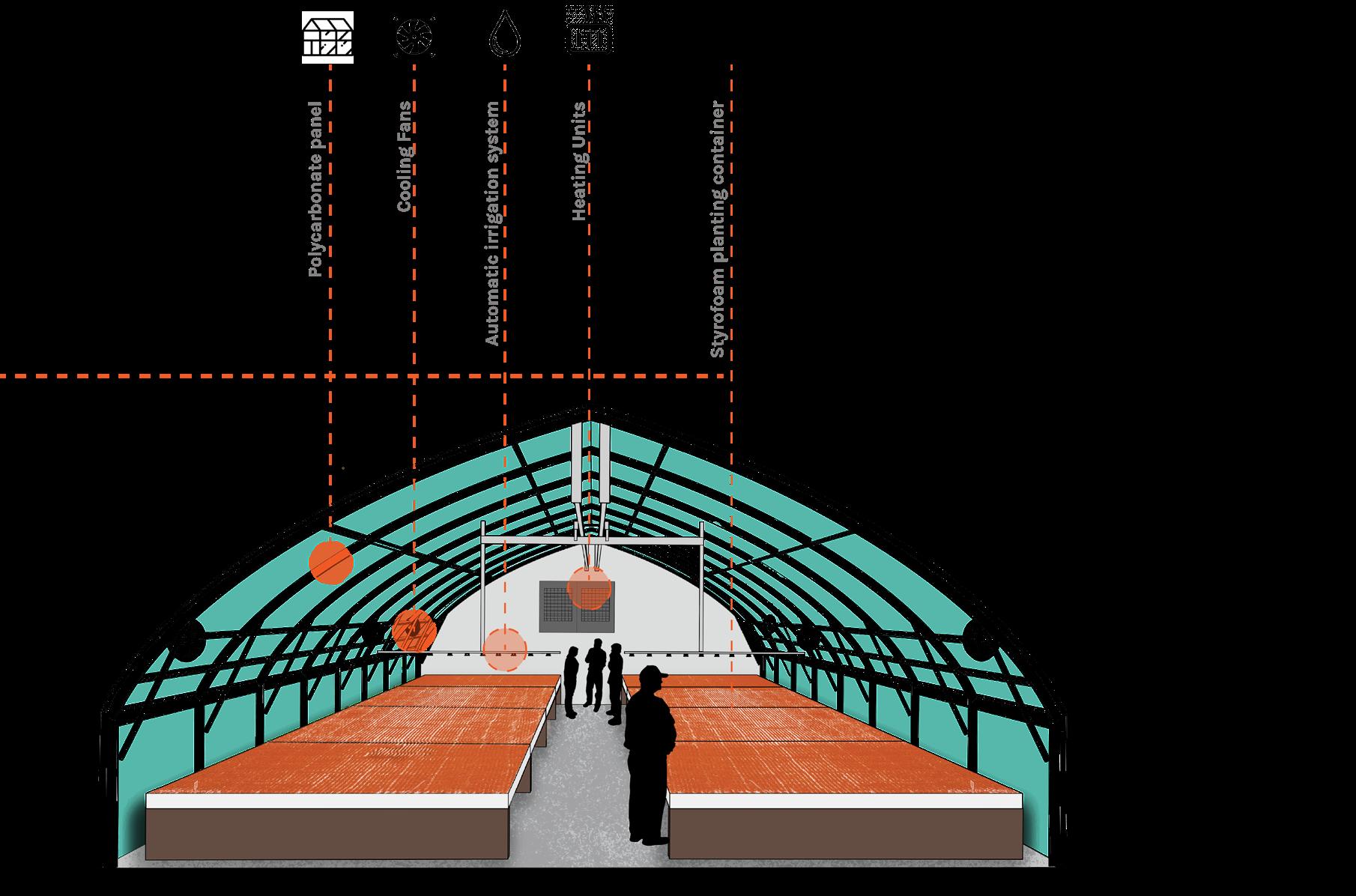
As the terraces wind down and the silo rises up, a new platform focuses attention on the concrete shell’s discolored exterior. Our vision for this exposed boundary includes projections for interacting with historical moments and paths for first-hand exploration. A museum building cuts across the open excavation, affording visitors the liberty to make their own experience through the Launch Control Center and repurposed silo. An education wing is tucked under a green roof, while the ice drilling research wing covers the silo opening.
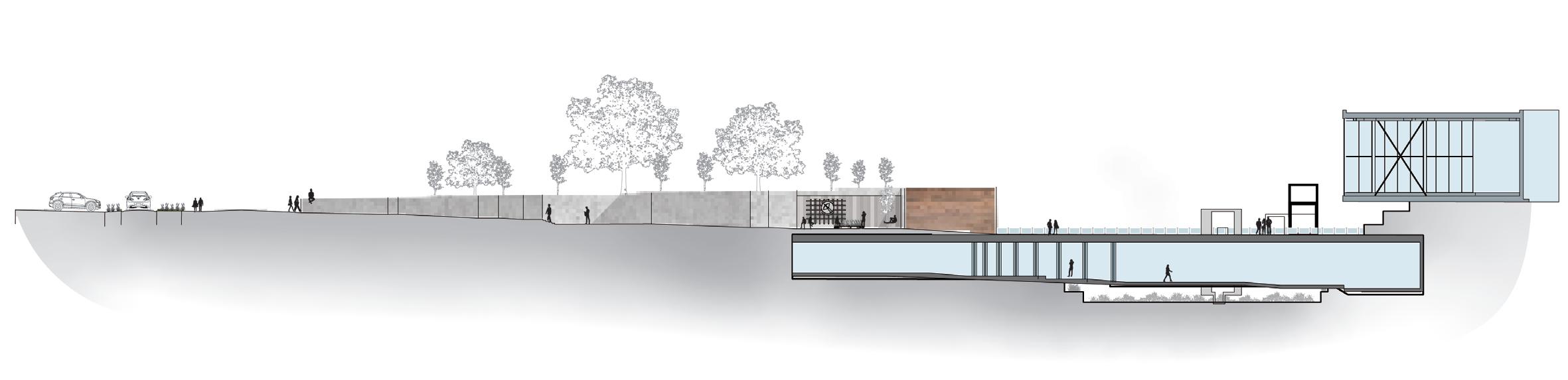
The experience begins as a winding path “submerges” visitors into the site, gradually separating them from the surface. Signage regarding the history of the site shows context, and eventually the path opens up to an inner court before first entry into the building. Concrete and rammed earth make up the walls while corrugated steel and wood accents juxtapose the heavy materials, softening the vine-covered wall and central fountain. Further installation pieces are dotted throughout the broader landscape, bringing relics from the silo’s primary function, such as radios and other machinery, to light.
Site diagram. Axonometric.
Instructor: Salvador Lindquist
Location: Halsey, Nebraska, USA
Collaborators: Dennis States
Alyssa Winkelman
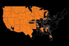
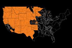
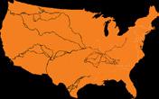
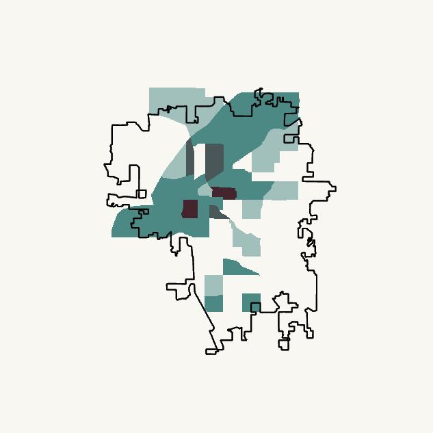
Nestled in the eastern edge of the Nebraska Sandhills exists a 20,000 acre conifer forest, remnant from a 1906 experiment on afforesting the Great Plains. Through the years it has benefited from management via the Civilian Conservation Corps, Nebraska Forest Service, and the US Forest Service. Today the forest reels from a devastating wildfire and underutilization, which can be remedied by developing more trails through the hybrid landscape. This studio investigates the complex and interwoven history of the forest, understands the current ecological makeup, and identifies multiple trail paths to expand the recreation possibilities. This project received a Student Award of Excellence from the Nebraska-Dakotas ASLA chapter.
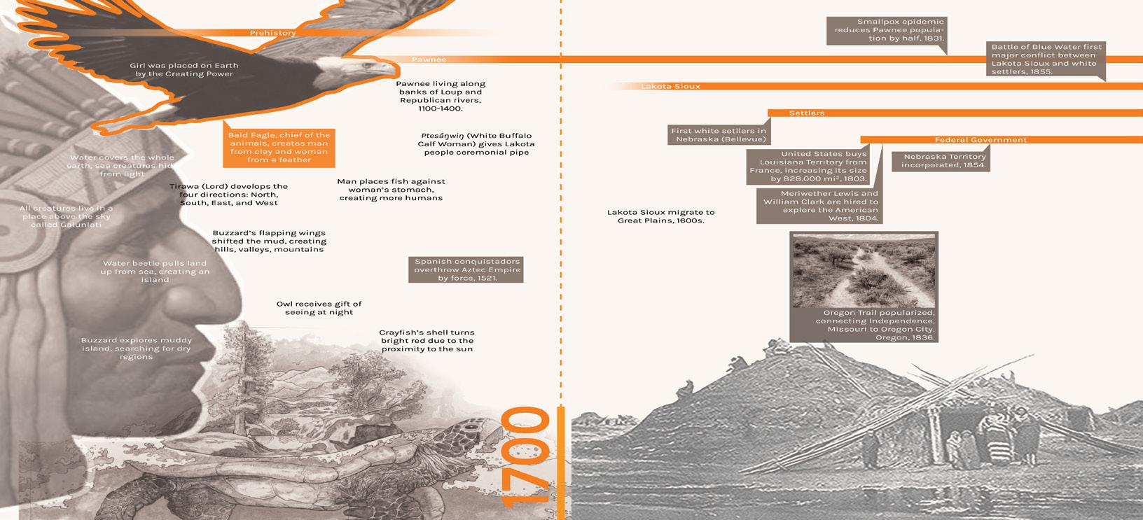
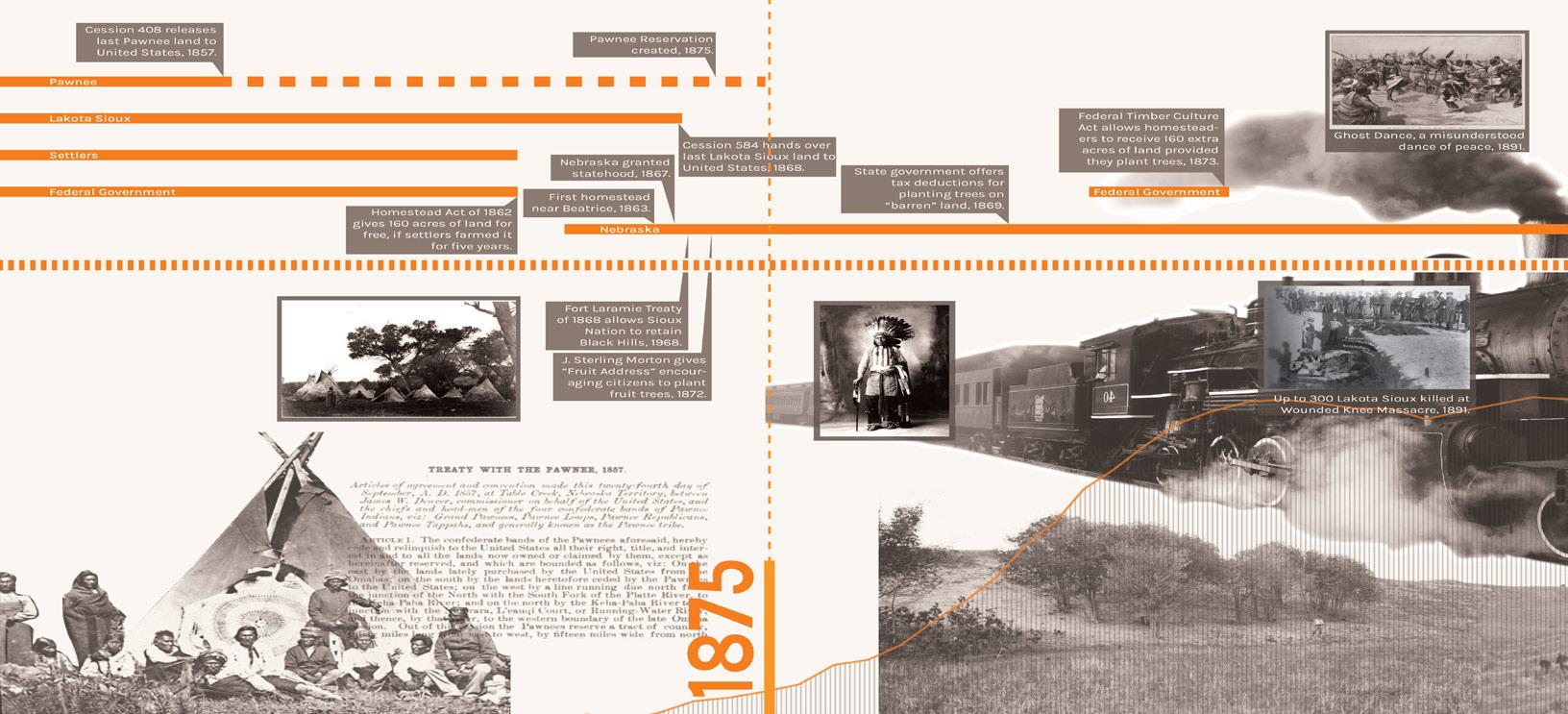
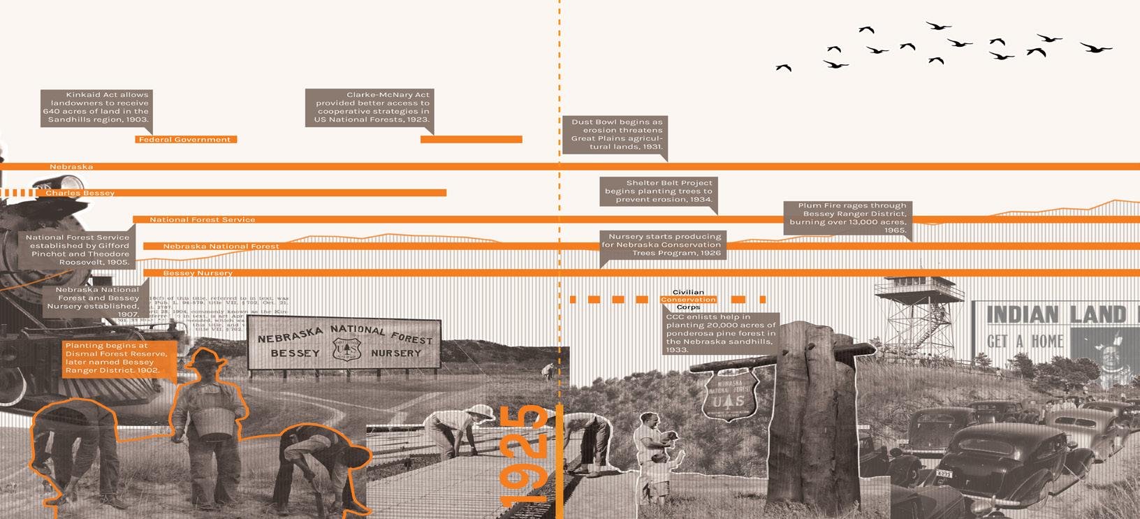
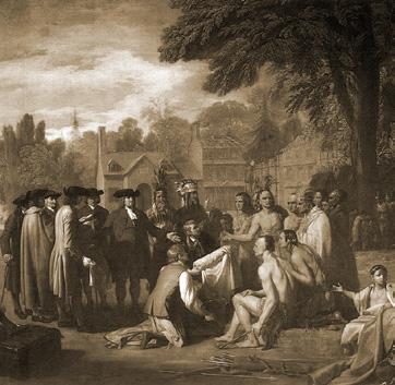
To account for the various indigenous tribes, cultures, and jurisdictions that have occupied the land the forest now covers, a timeline shows the breakdown of the who, what, and when. The story is partitioned into four epochs: Origin, Disruption, Production, and Recognition. These categories denote major themes found through analysis of major events and recognize that the land the forest sits on was unjustly taken by force from its original inhabitants, underwent massive change through afforestation, and now exists as an artificial landscape within the Sandhills.

pox epidemics and what some experts label genocide. Colonists recognized individual land ownership, while indigenous tribes viewed land as collective.

-
have a long and profound
Public lands in the US, specifically National
not
the mainstream agenda until 1864 with the establishment of Yellowstone as a National Park. The growth of public lands for recreation and production only grew from there, and today there are over 150 national forests and 63 national parks. The preservation aspect of this land ensures that future generations will be able to enjoy the wild outdoors, and creates habitat for existing wildlife.
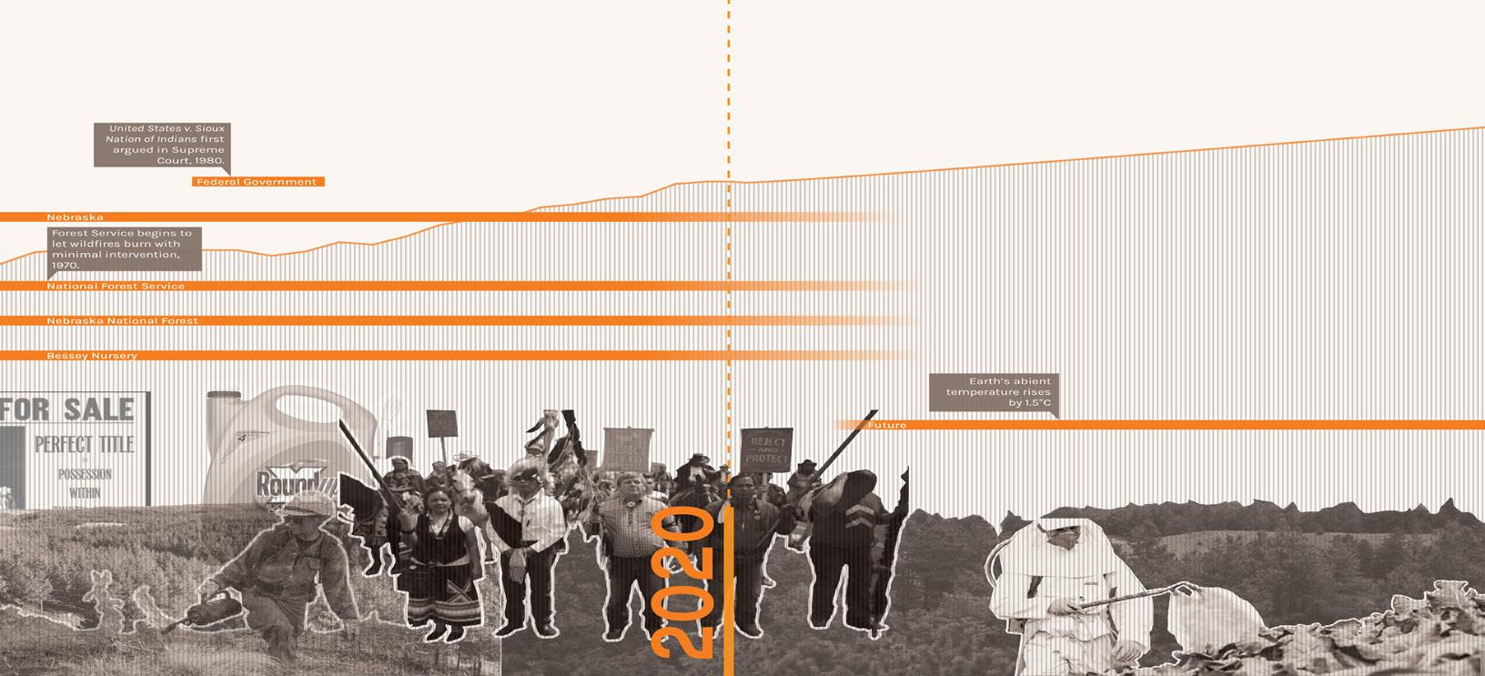
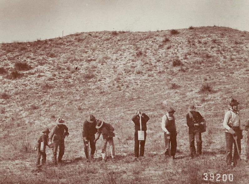
As it stands now, the Bessey Ranger District hosts the largest hand planted forest in the United States. This comes with the realization that fires are a natural part of many ecosystems, and the removal of that natural element causes the buildup of flam mable materials, which may be part of the increasingly strong fires in the Western United States. Letting wildfires burn natu rally removes kindling and fuel from wooded areas, regenerates ecological successions, and the fires can always be managed when there is threat to human life or property.
A growing interest in the adverse effects of pesticides to hu mans and the natural environment is coming to light in the US. The proliferation of chemicals is not limited to the household, but to agricultural fields as well. The majority of crop fields a coated with aerosolized chemicals intending to target pests, insects, and weeds, but these chemicals contain mixtures that may also impact humans. Short term exposure to pesticides commonly causes skin, eye, and throat irritation, up to severe and painful internal pains. The riskier long term background exposure to pesticides may include cancers and abdominal dis eases. Chemicals in agriculture also have potential to harm the forest itself, as herbicides can travel up to half a kilometer from where they are sprayed. Effects on forest health affect all tro levels, from microbial life in the soil to the ability of trees to be able to photosynthesize. The anthropogenic origin of the forest exposes it to certain weaknesses, and herbicidal damages will need to be considered when planning for the future.


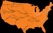

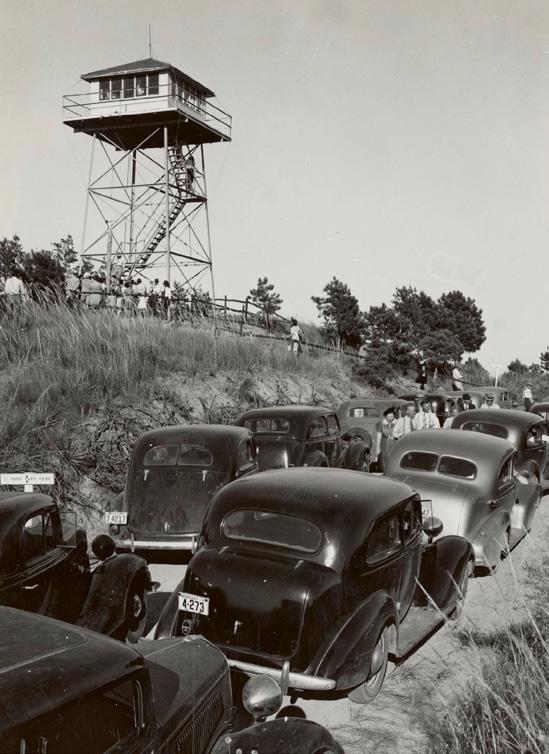


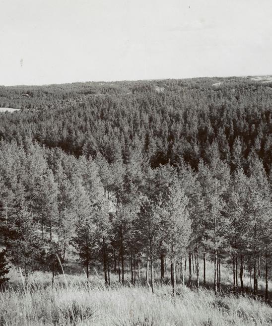


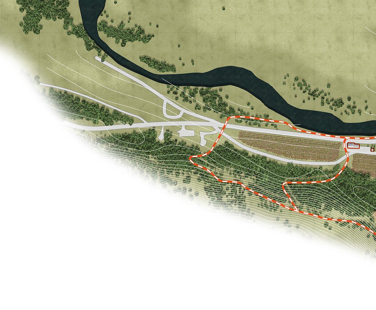
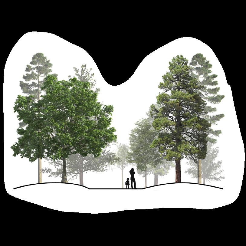
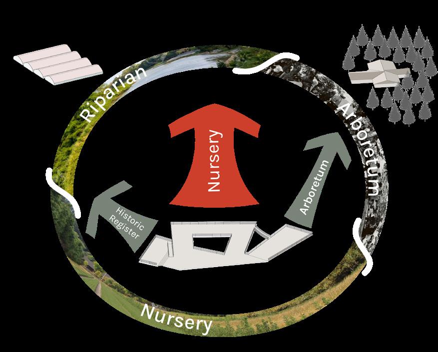
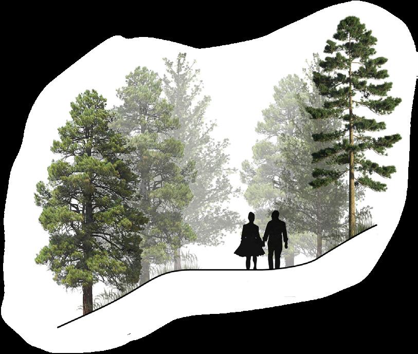
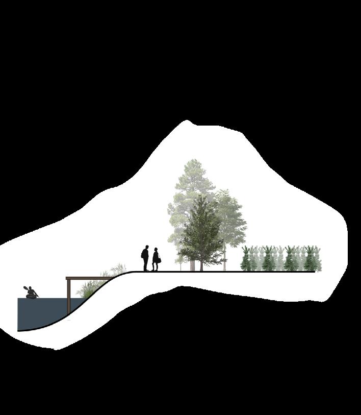
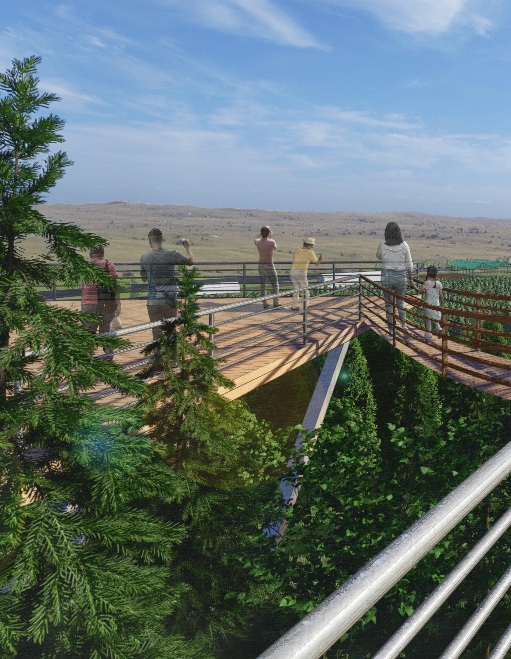
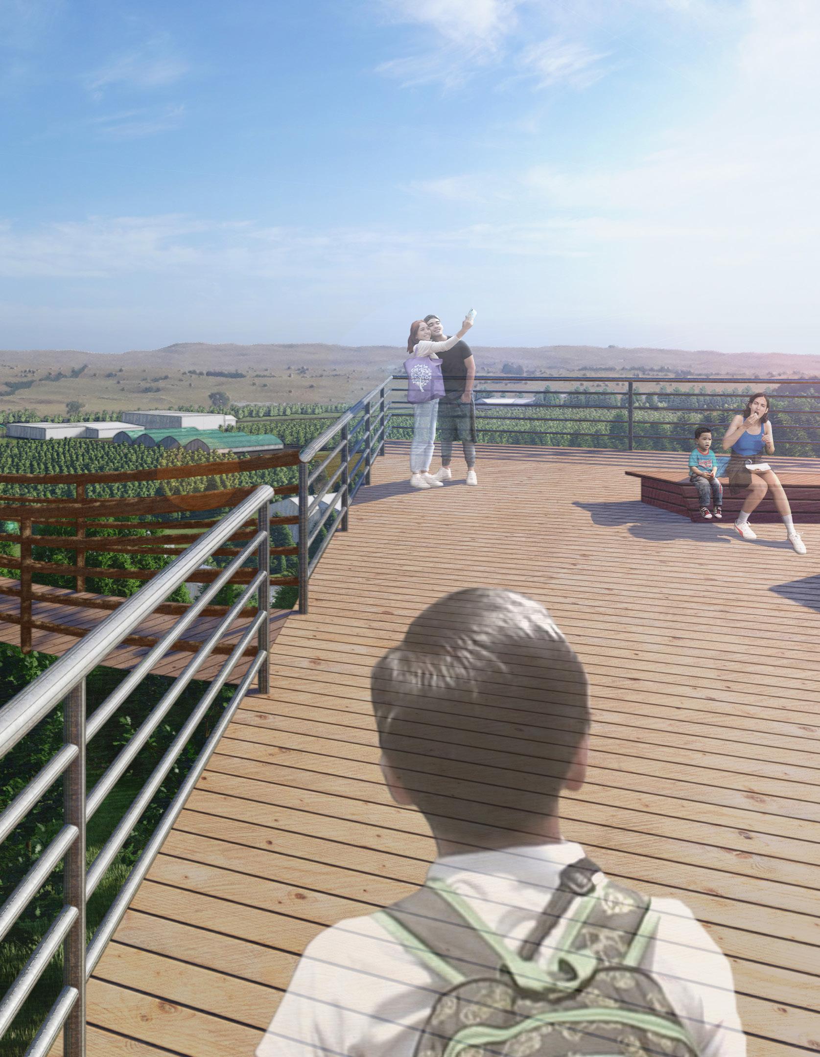
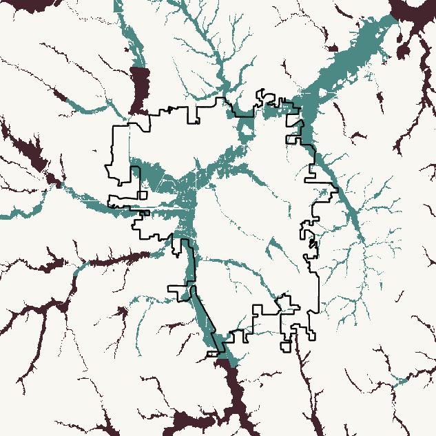
An active nursery sits embedded between a hill and the Middle Loup River, producing 2+ million trees per year in a former grassland. Our trail offers three distinct experiences including a river walk, arboretum tour, and hillside overlook of the nursery, all wrapped up in one mile of trail with an optional half mile loop through the original 1906 nursery buildings, which are on the National Register of Historic Places. The overlook has three tiers, focusing on each of the experiences, and allows hikers an unobstructed view of the nursery, river, and natural Sandhills landscape beyond.
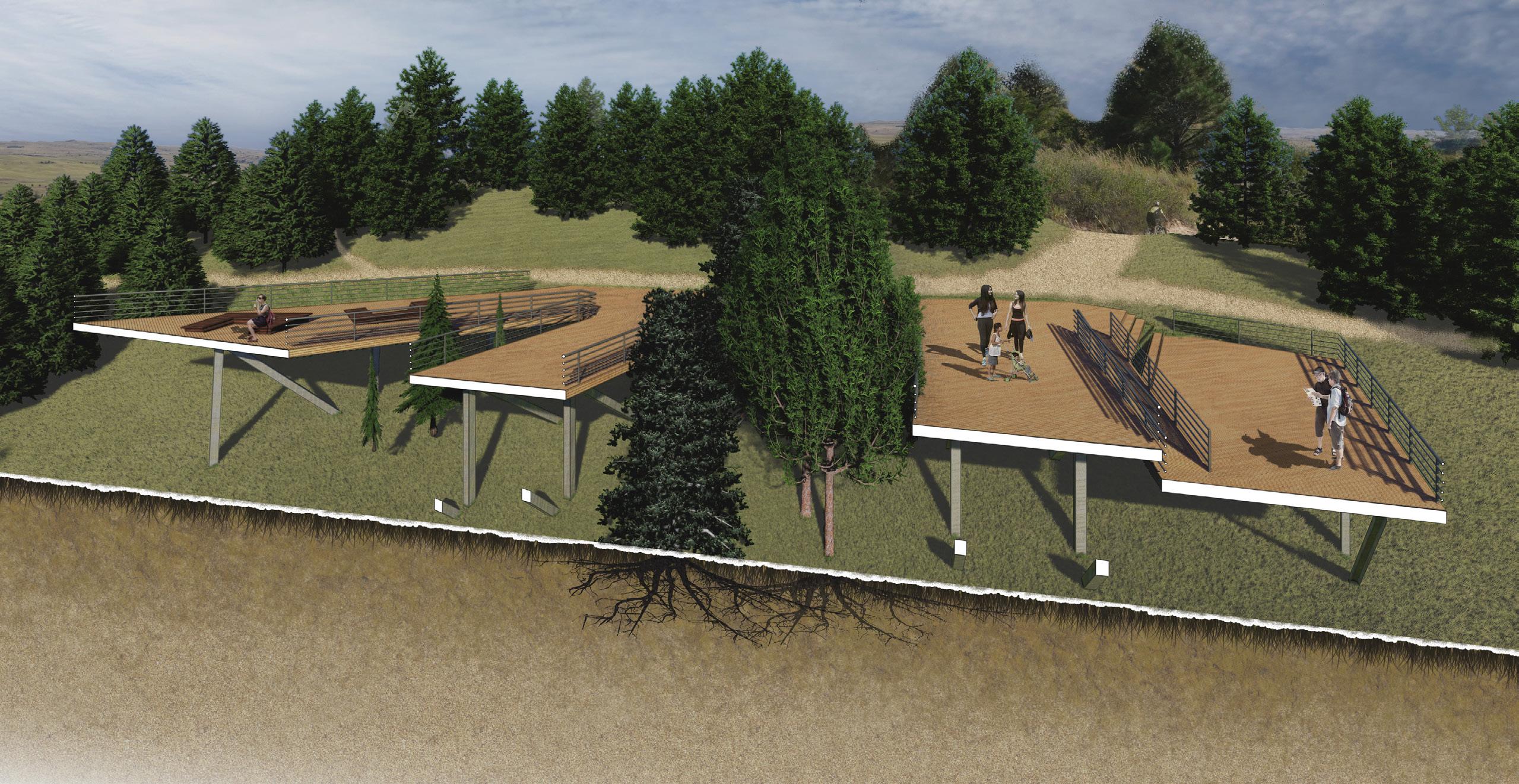
Central overlook embedded in the hillside. Section perspective.
Trail path through active nursery. Plan. Instructor: Yujia Wang
Location: Omaha, Nebraska, USA
Collaborators: Olivia Berck Jake Essink
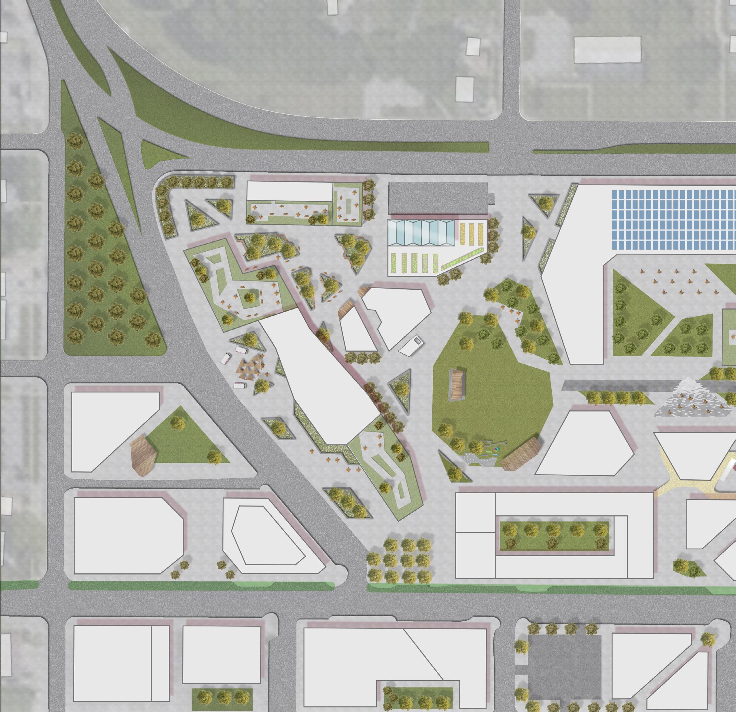
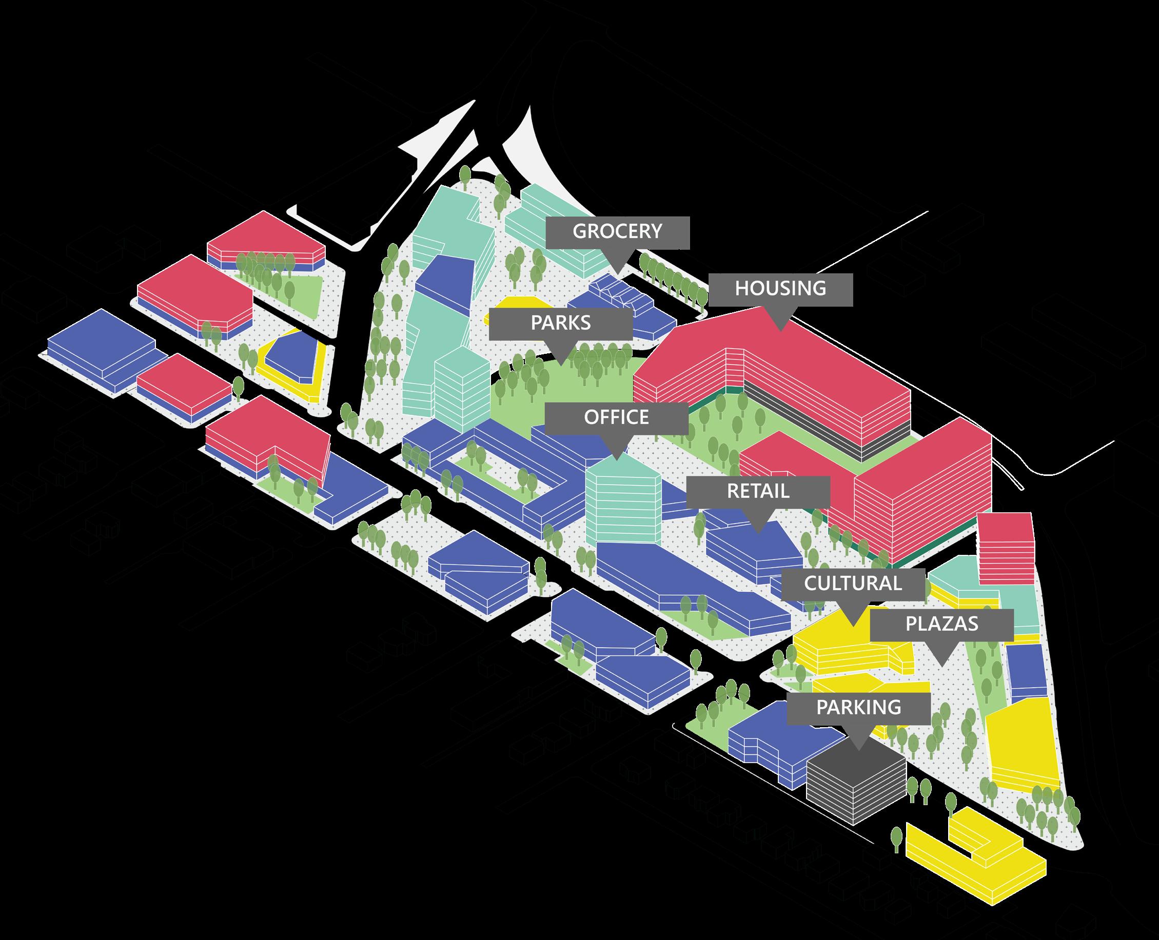
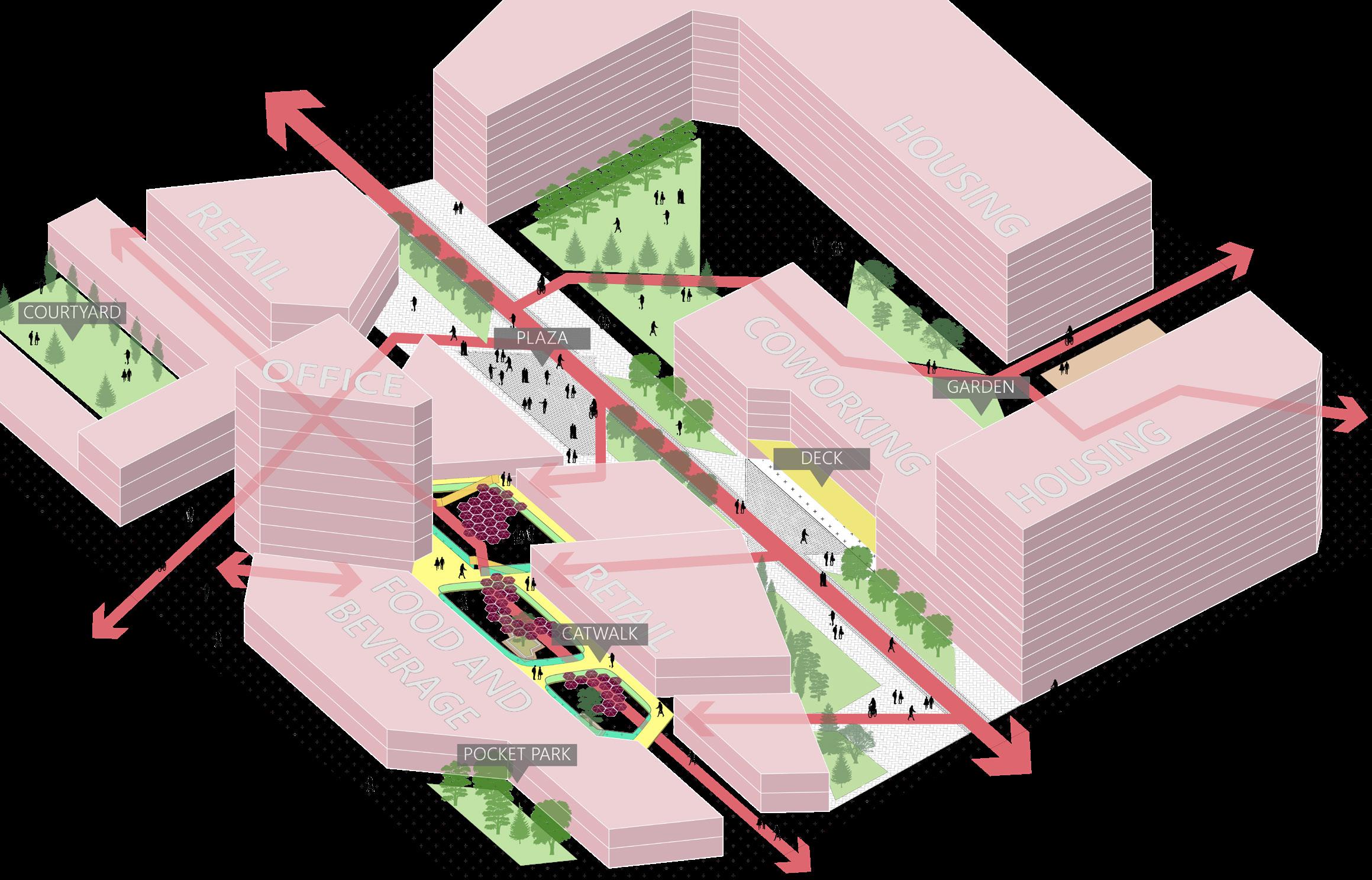
The historic Benson neighborhood comprises many small shops, bars, and music venues located between major roads in the heart of Omaha. As the city continues to grow around it, this studio envisions a major densification of the neighborhood. Multiple futures are considered including a work-from-home or back-to-office push, increases or reductions in traffic, and integration of public transit and sustainable technologies. Benson’s connection to surrounding communities is maintained through permeable edges that invite people in and situate the historic neighborhood in place, while a diversified program is influenced by–and expands beyond–Benson’s current culture.

[Context]
Benson sits at the crossroads of Central and North Omaha, and as such comprises many demographics regarding age, race, income, and mobility. Further, the area is home to a variety of small businesses and venues that are celebrated within the community. To account for the many needs of a diverse population, a strong pedestrian circulation network is implemented through “permeable” openings between buildings, and limited vehicular paths through the site itself. Implementing accessible paths allows for the surrounding neighborhood to contribute to this development’s success, and brings benefits beyond the site boundaries.
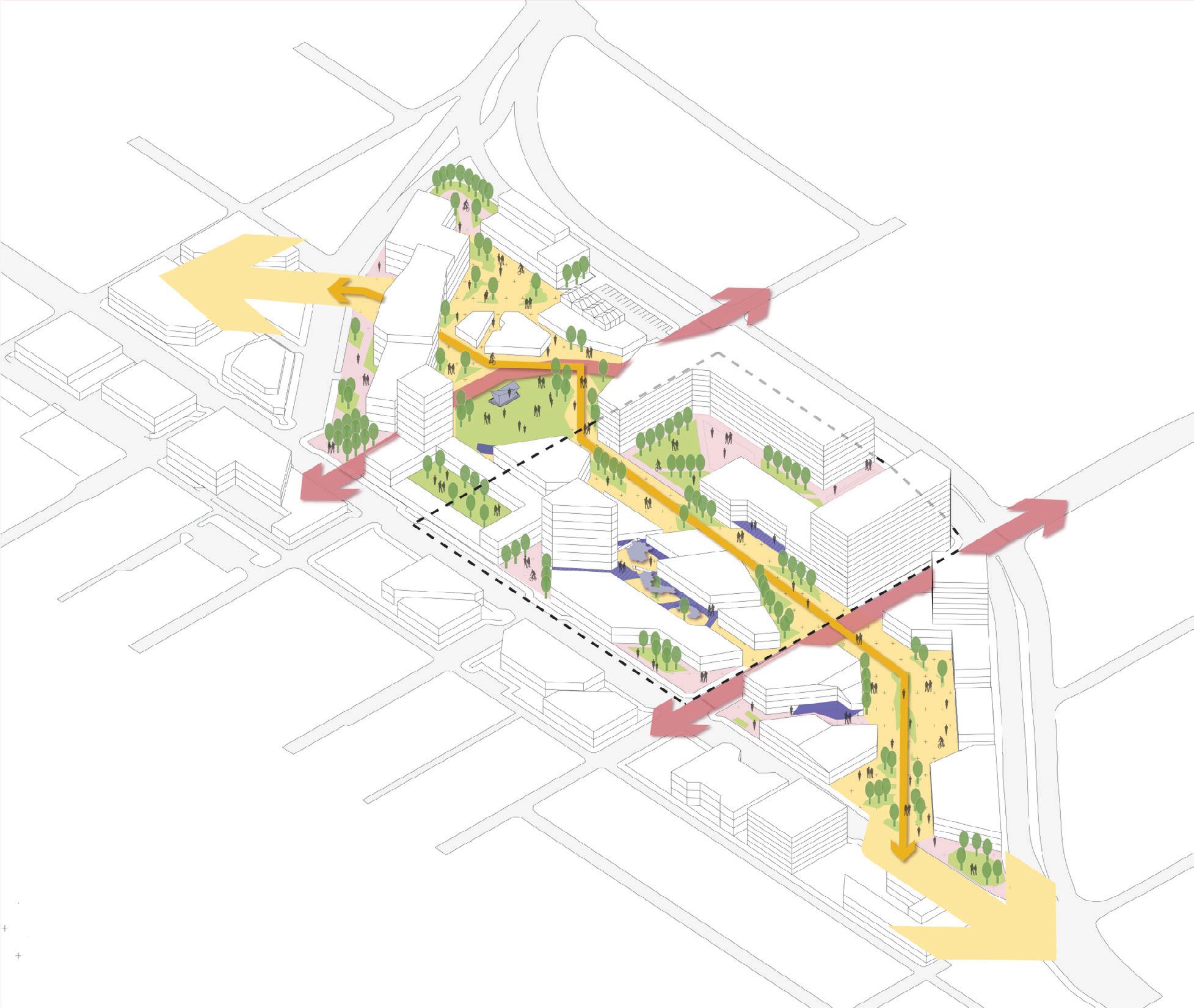
Masterplan for Benson revitalization. Plan.
[Concept]
Our concept utilizes a pedestrian corridor that enters through three distinct–yet connected–zones of program. The journey starts on the eastern edge with a cultural plaza that brings in visitors from outside the development, including spaces for public art, children’s play, cuisine, and music performance. Visitors make their way to the middle section, which is transitory in nature and home to a residential block as well as existing small business space. The redevelopment is capped off at the west end with a large urban park flanked by office buildings. The entire urban plan is accessible and pedestrian-friendly, with two crossings made available for bicycle and utility vehicle traffic.
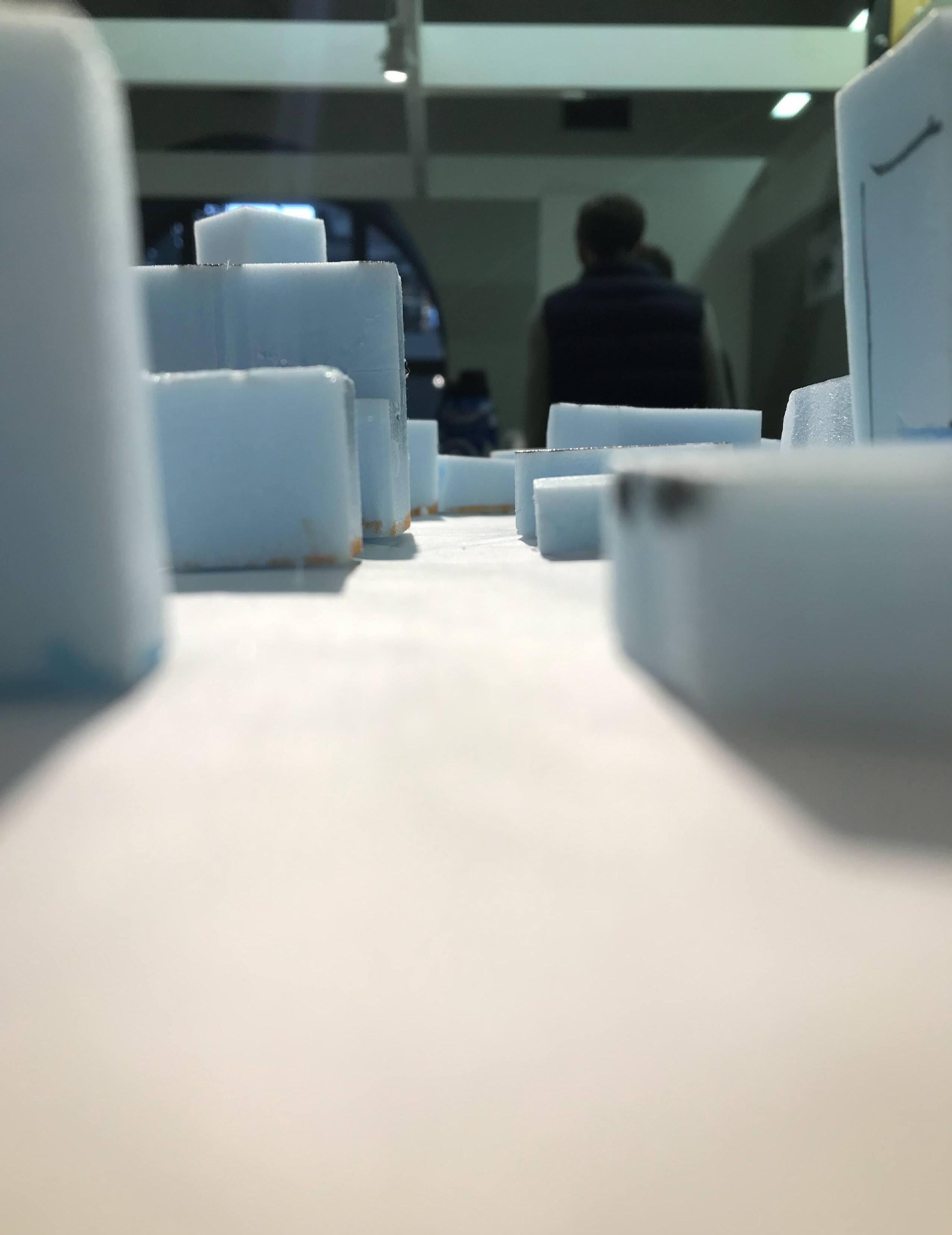
While the idea of landscape architecture students developing building massings sounds absurd, the practice works to better the understanding of circulation systems in urban environments. This photo illustrates our strategy of lowering building heights on the southern half of a project, thereby allowing more natural light to enter and illuminate the corridor and residential block. Seeing a model from different perspectives also allows us to consider viewsheds and skylines, creating a more thoughtful interface with the surrounding communities. Once the physical model was finalized, we traced building footprints and measured heights to begin modeling the buildings in Rhino.
Scale model of foam building forms. Photograph.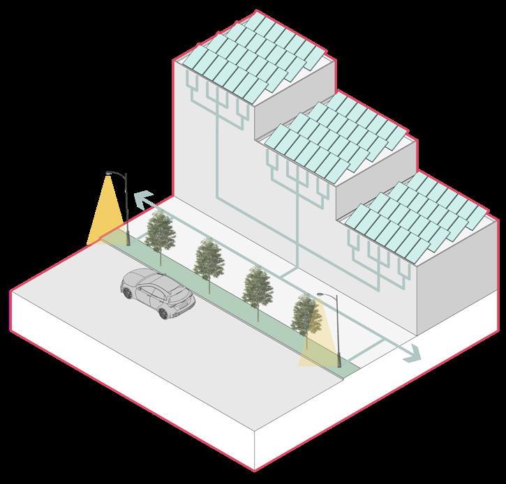
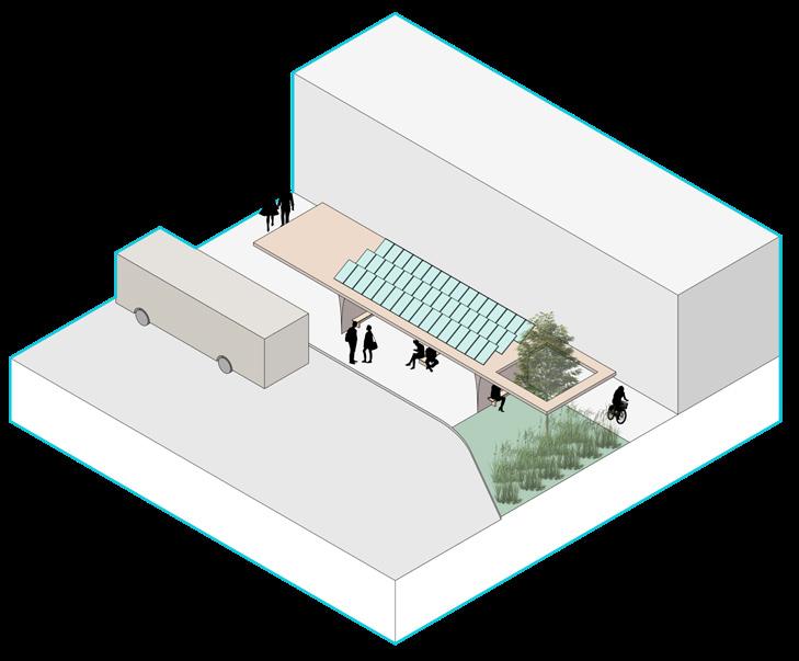
As a response to an ever growing lack of quality urban amenities and infrastructures, we identified a series of goals and objectives to achieve and situate our project to address. This includes physical interventions such as walkable paths and corridors, alternative transportation modes such as sheltered bus stops and bike lanes, and infrastructural additions such as green and solar roofs. The plan for Benson also includes a variety of programming that centers on residents’ daily needs while accounting for higher pedestrian circulation from surrounding neighborhoods.
Central nodes expanded upon from the overall site. Axonometric.
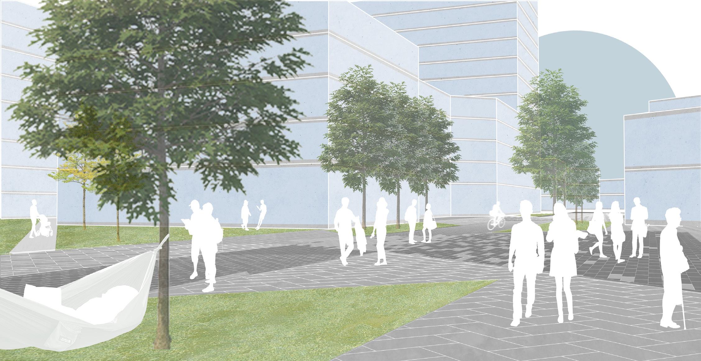
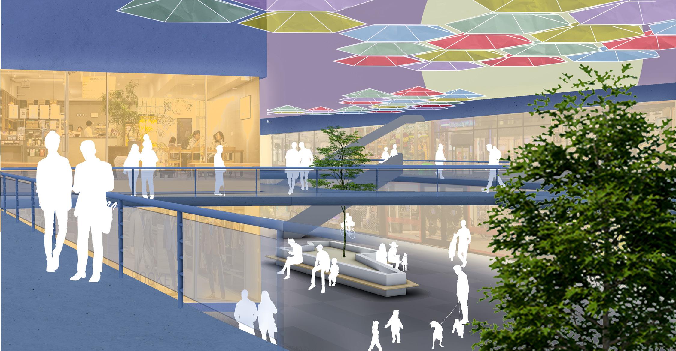
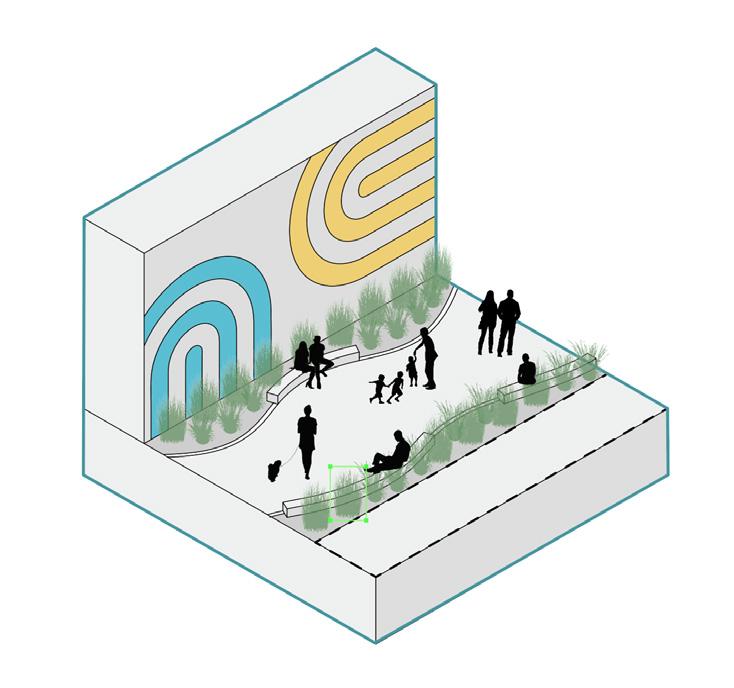
Each group member received one third of the project to develop further, with my section being the residential and retail blocks. The retail section identified a “reinvigoration of the back alley,” with multiple small entrances off of the main pedestrian corridor splitting off to enter a secluded shopping space with numerous planter-benches and overhead umbrella canopy. Across the main divider lies the residential sector, which includes lawn and first floor commercial space. The corridor both divides and unites these nodes by utilizing horizontal strips of canopy trees and perpendicular gradient paving to break up the expanse into human-scale spaces. Small side areas provide rest areas away from the main thoroughfare.
 Instructor: Salvador Lindquist
Location: Lincoln, Nebraska, USA
Collaborators: Sarah Cope
Low-income housing and neighboring areas are disproportionately affected by lack of urban green infrastructure and vegetation. This can lead to higher energy bills from less tree cover, health issues due to a lack of green spaces, and a decrease in biodiversity from monoculture lawns. By studying how plants interact with each other, people, and the wider urban environment, plant communities can be established and thrive. Through environmental assessments of these communities, both plant and human, we can gain insights into their beneficial interactions. By developing a guide for designing resilient plant communities, aimed for use by NeighborWorks Lincoln, a local affordable housing developer, we aim to lower costs and enhance environmental conditions for marginalized communities. Recognizing the importance of easily manageable, well-designed landscapes, this project aims to explore sustainable planting design for affordable housing communities.


The Guide is organized into sections that start with basic information regarding Nebraska’s climate and ecosystems, and covering design, installation, and basic maintenance. Images were captured of ongoing projects and used to understand how NeighborWorks redefines locations with rehabilitated or new homes. NeighborWorks Lincoln develops upwards of 70 projects per year, highlighting their experience in architectural design and finance, and as such we needed to structure our response to their knowledge base, while keeping the major ideas clear for other audiences.
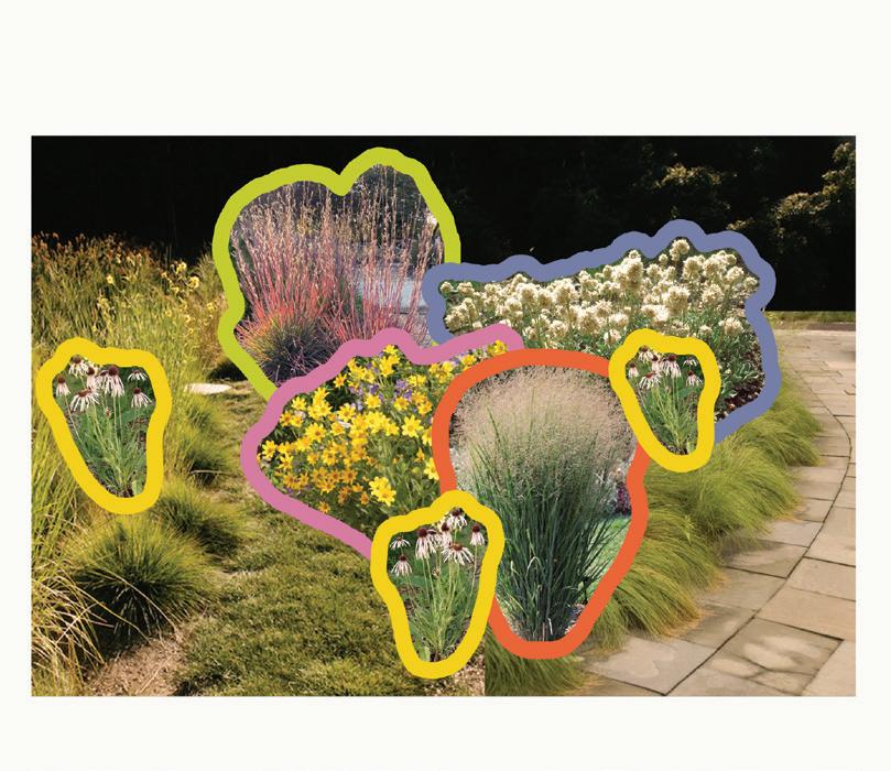
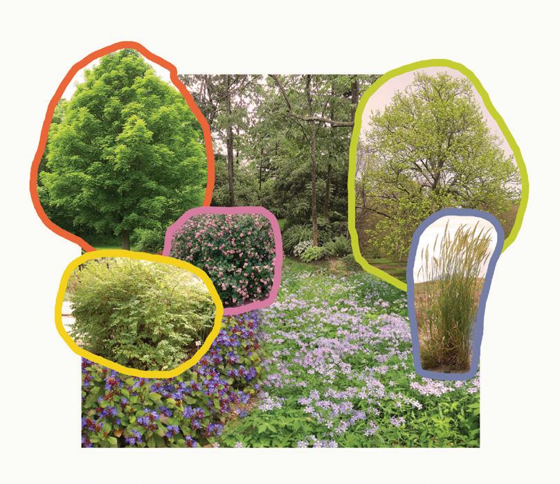
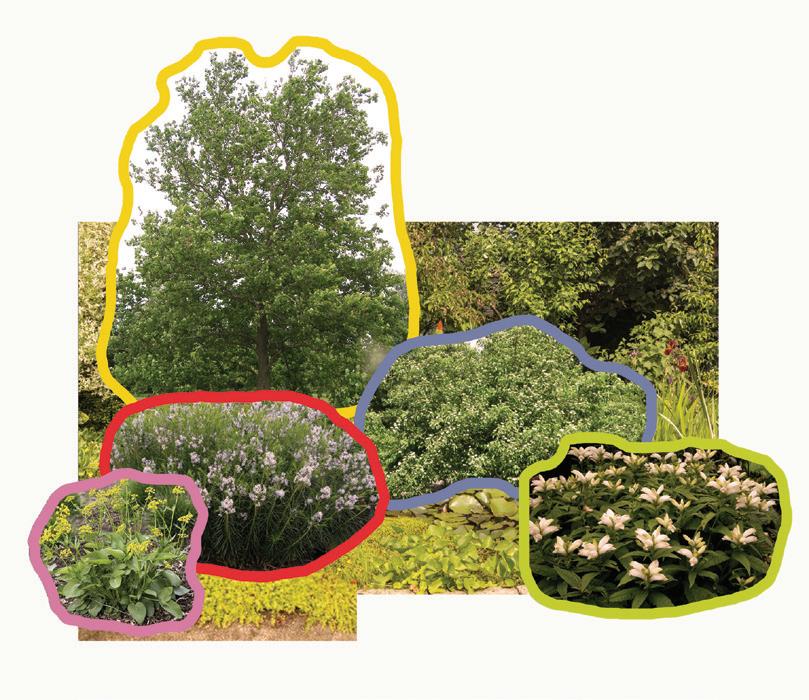
Graphics are extensively used to capture the essence of ideas, while concise descriptions efficiently explain some of the more complex topics. The shaky style of simple drawings is inspired by Nike designer Ruohan Wang, while a palette of bright colors pop off the page and keep the messages engaging. The same style is extended to more technical diagrams where trees and plants receive distinctive colors to clearly reveal patterns, and tables where colors denote plant typology and highlight information such as bloom time, height/width range, and more.
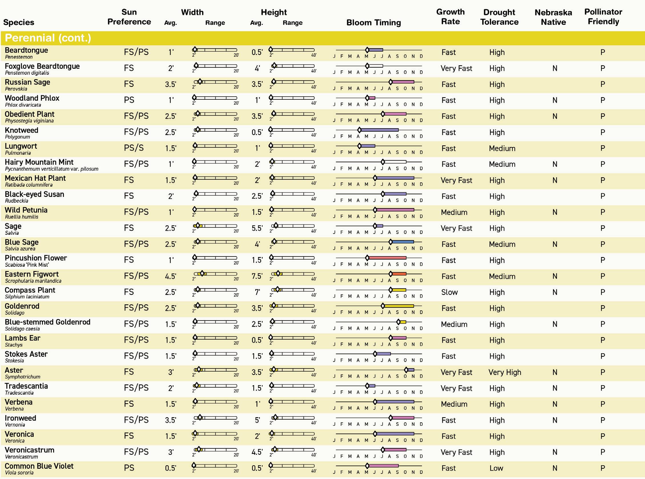
Table.
To maximize the potential value of this research, sample designs were developed for NeighborWorks’ most used designs. In this example, a duplex is designed in a modern prairie style, slotting native plants in and around the property, providing shade and creating distinctive zones in the yard for each tenant. A highly informative plant schedule was developed from a list of native and naturalized plants sold in eastern Nebraska nurseries, highlighting plants that thrive in our climate and are available for purchase. NeighborWorks Lincoln is interested in developing partnerships with local nurseries to secure plant donations or nonprofit discounts.
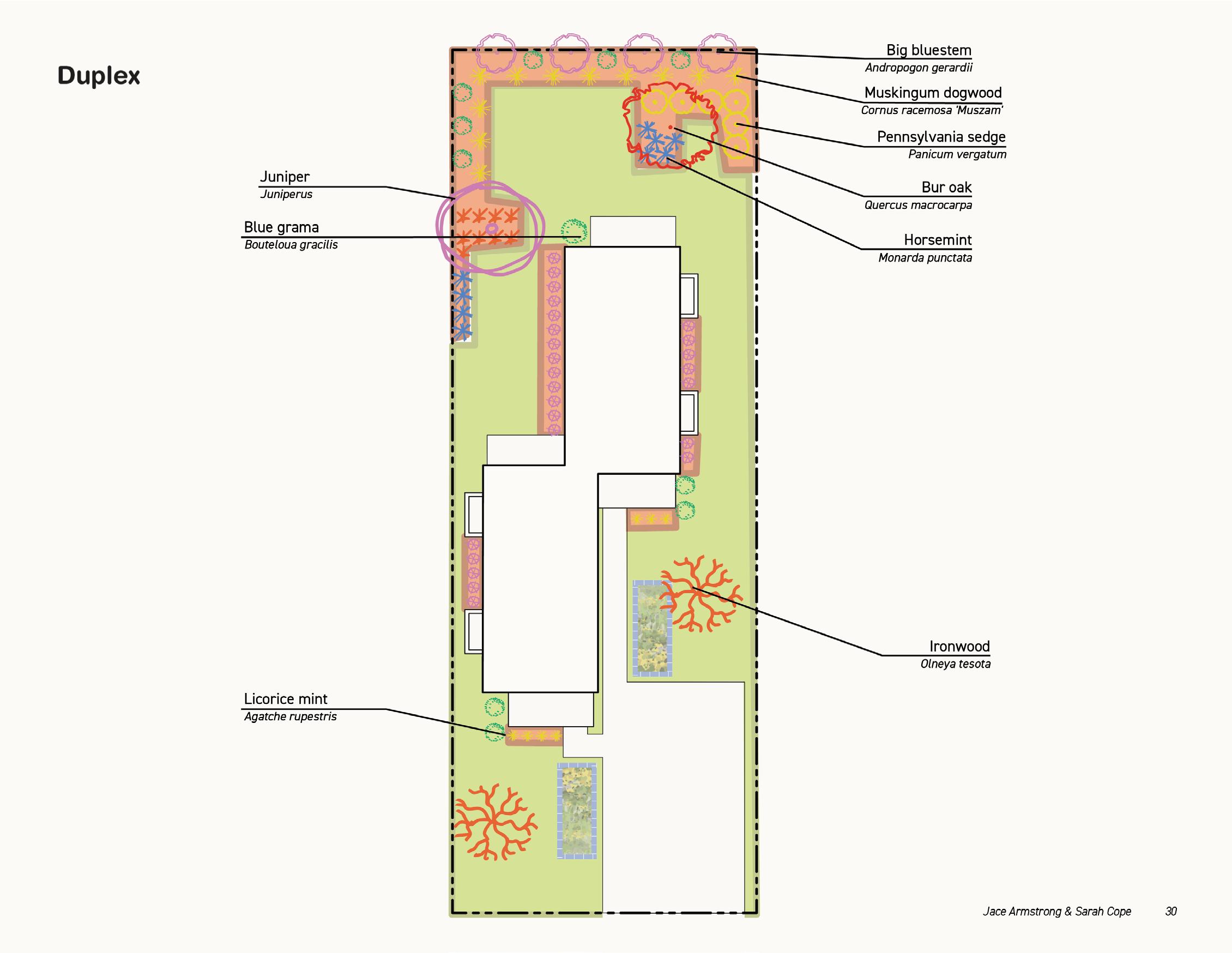
Sample plant design page for duplex. Plan.
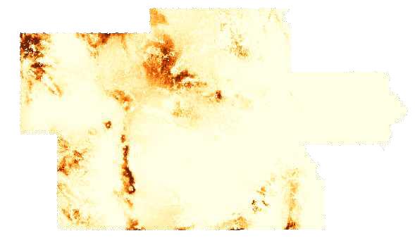
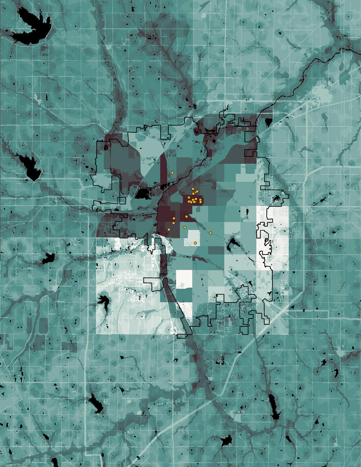 Social and ecological wellbeing in Lancaster County from GIS. Plan.
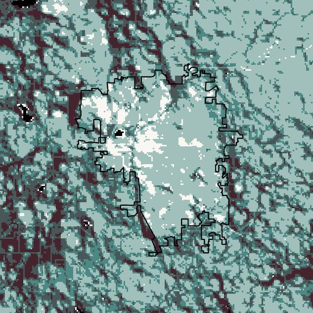
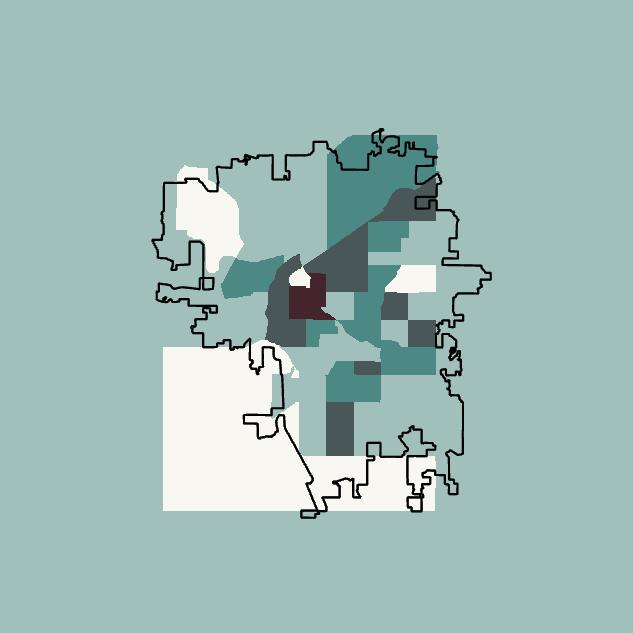
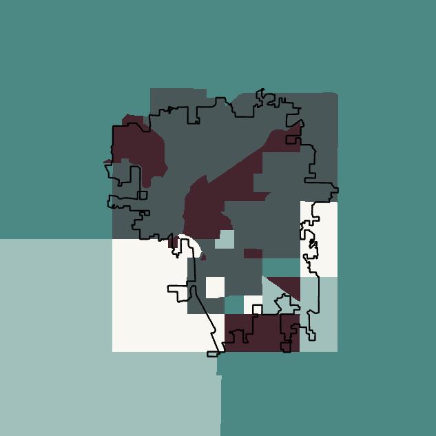
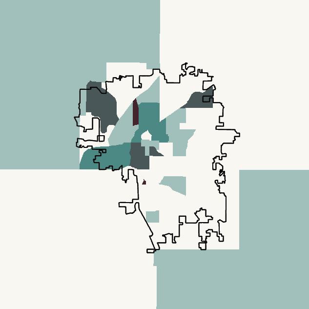
Lincoln’s urban social and ecological wellbeing can be analyzed through the combination of rasterized maps pertaining to factors such as poverty status, proximity to public transportation, biodiversity, canopy cover, and more. NeighborWorks can use this map to identify areas of Lincoln that would benefit most from enhanced urban greenspace, and plan future projects in areas lacking most in these areas. Further, this method of overlaying data can be applied to any municipality, allowing for developers to create more impactful and sustainable projects.
$300,000 - $2,000,000+
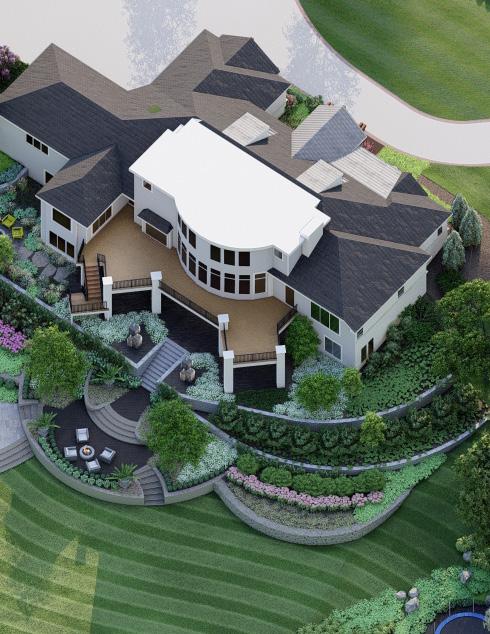
Supervisor: Jake Foutch (Carson Enterprises)
Location: Omaha, Nebraska, USA
Through my experience at a local landscape designbuild company, I have played a major role designing and documenting mid- to high-end residential projects. With knowledge in conceptualization, project management, and an eye for sustainability, I have partaken in delivering highquality designs that exceed client expectations. AutoCAD, Sketchup, and Lumion are used daily to translate ideas into visually stunning and environmentally conscious landscapes. This section showcases two designs that highlight my experience in creating quality landscape designs.
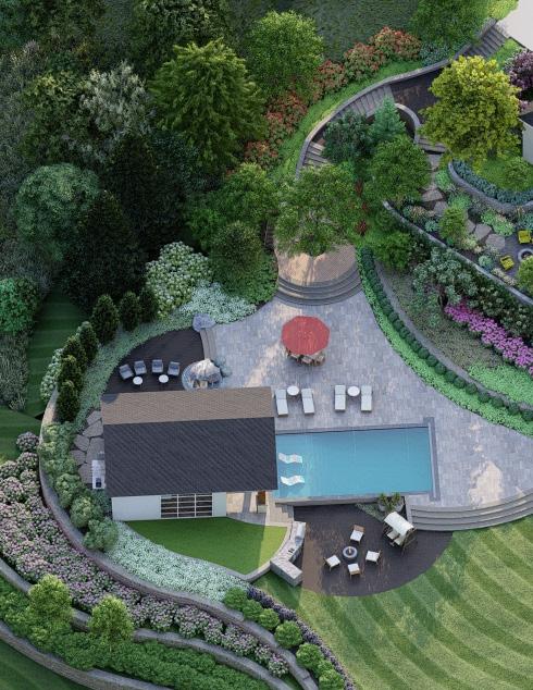
[Elkhorn Moments]
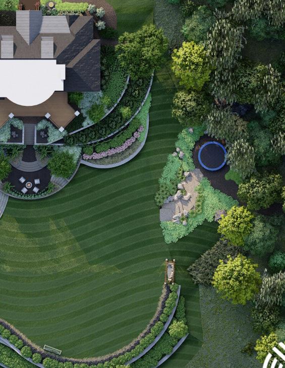
We crafted settings for each of the spaces in this yard, allowing each one to thrive in passive and active recreation. The side entrance for guests is engrossed in lush planting, while stepping out of the house starts at an existing patio and extends down to a formal garden terrace. A grassy prairie setting surrounds an upper fire pit, while a children’s trampoline pad is embedded into the hillside and shaded by an existing forest. Through each of these scenes, we create idyllic moments that contribute to the larger movement of the backyard.
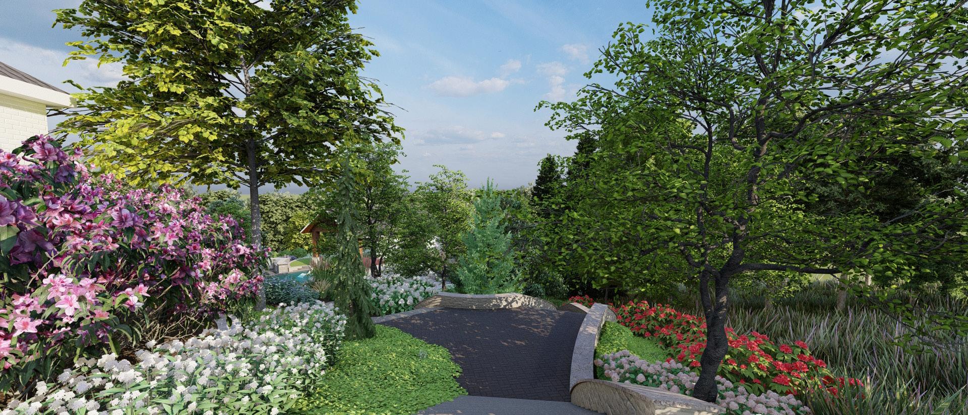
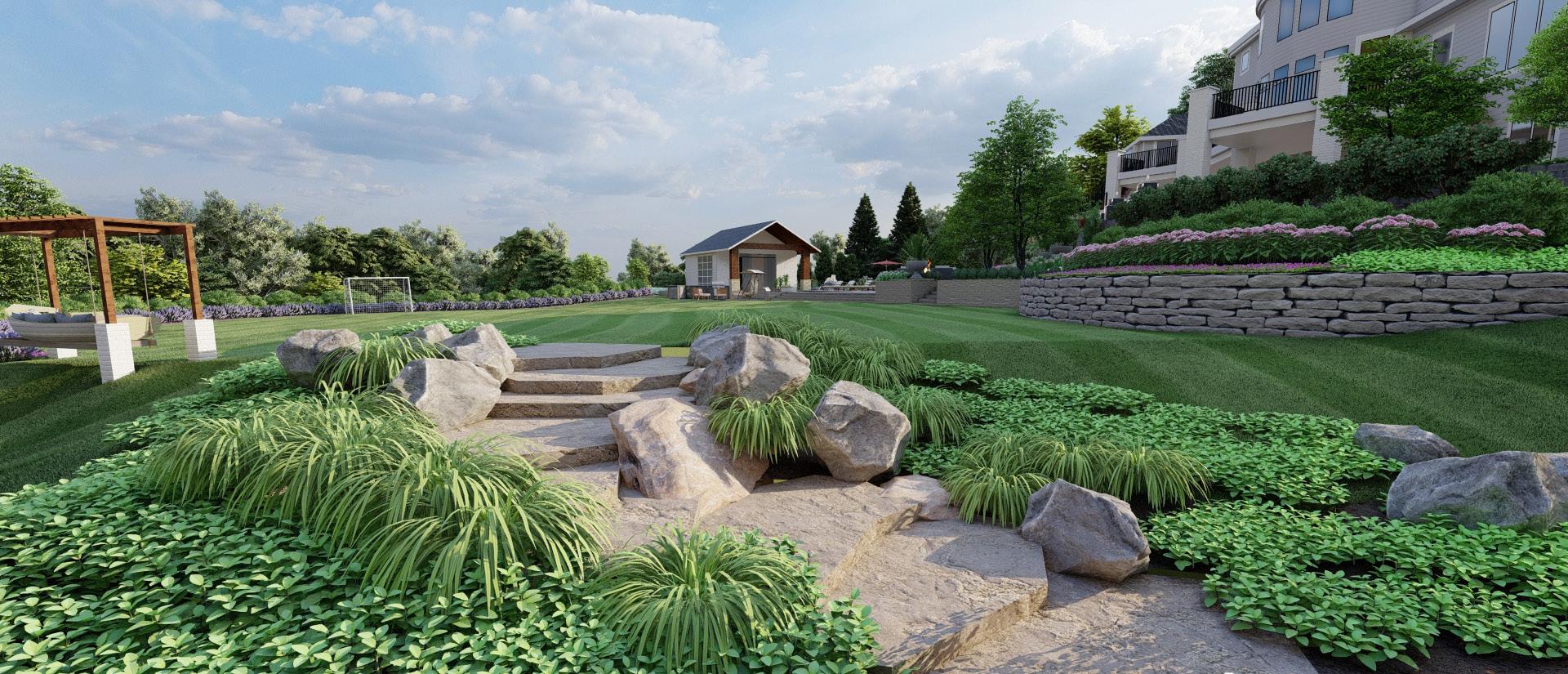
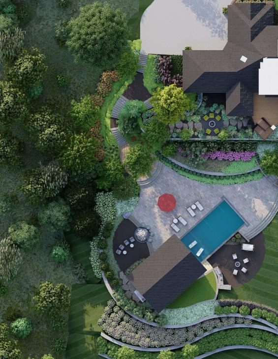
The yard is planned to maximize usage and split between passive and active. Rendered plan.
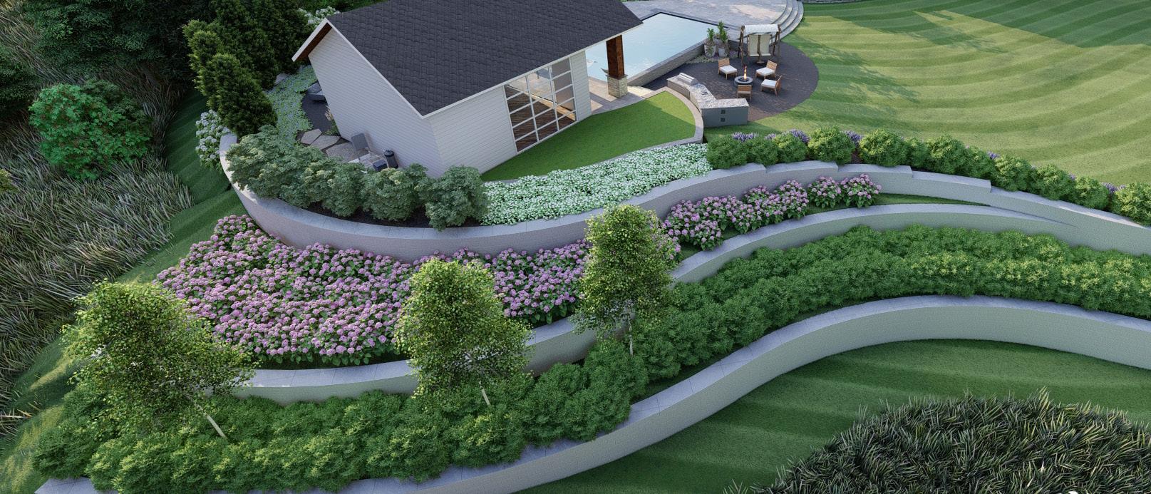
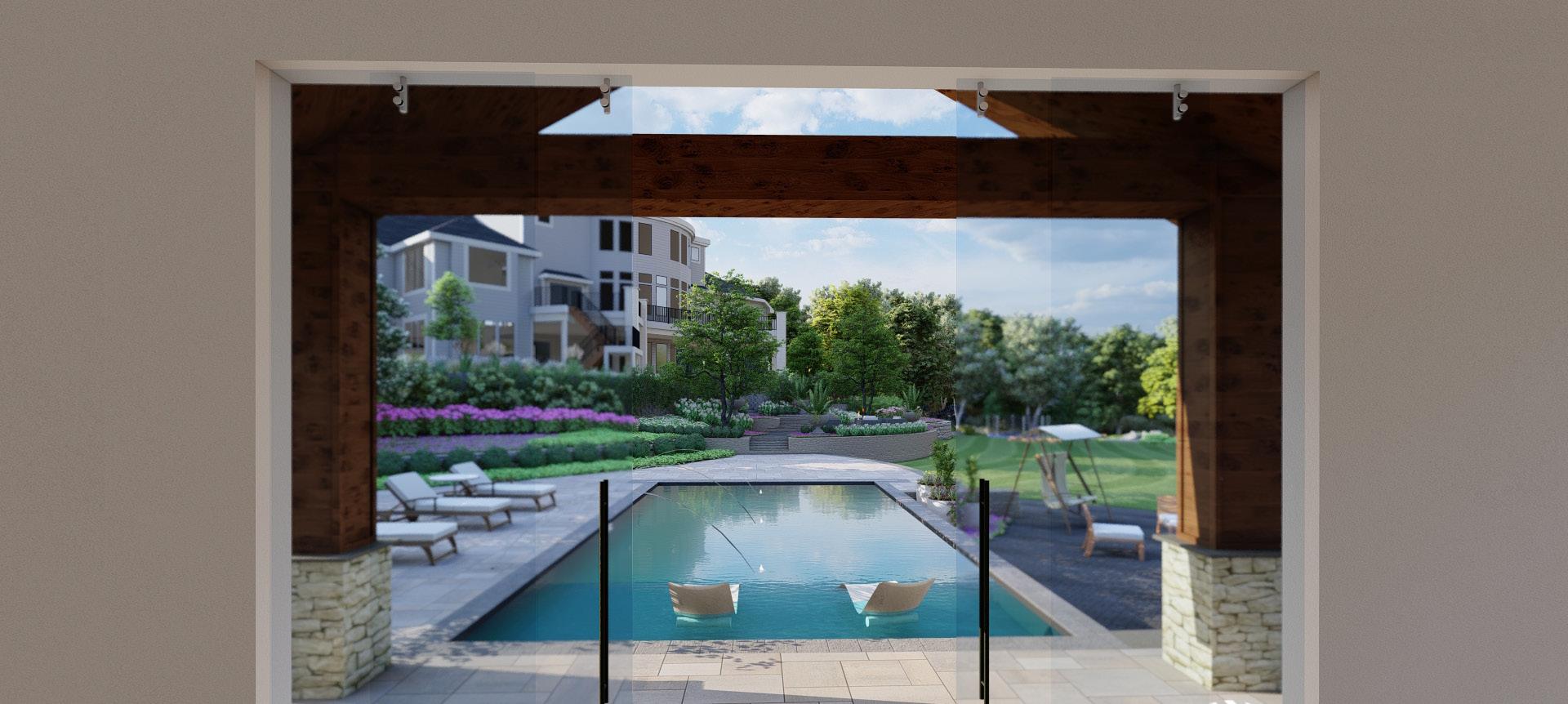
[Elkhorn
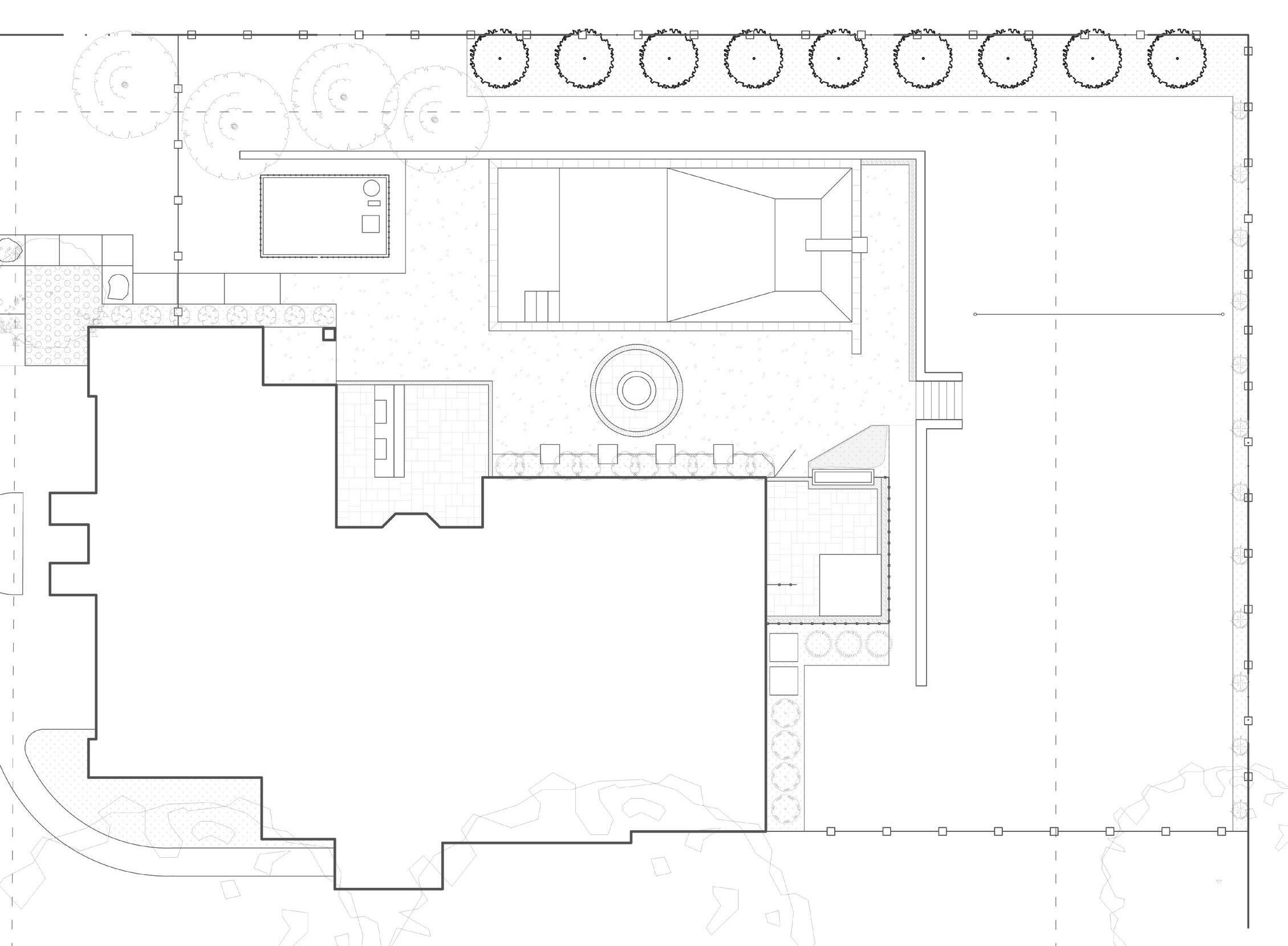
The layout of this 3-acre hillside property allows for an illustrious transition between front and back, and also a large retaining wall to turn more yard area into usable space. The guest entrance walks down and offers visitors a path towards the upper patio or pool deck. The existing upper patio walks out into the native prairie fire pit and extends down to a junction, offering a dropoff at either the lawn or pool deck. A children’s trampoline area leads to a path towards the neighboring in-law’s lot.
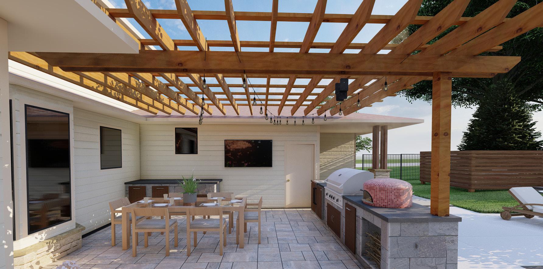
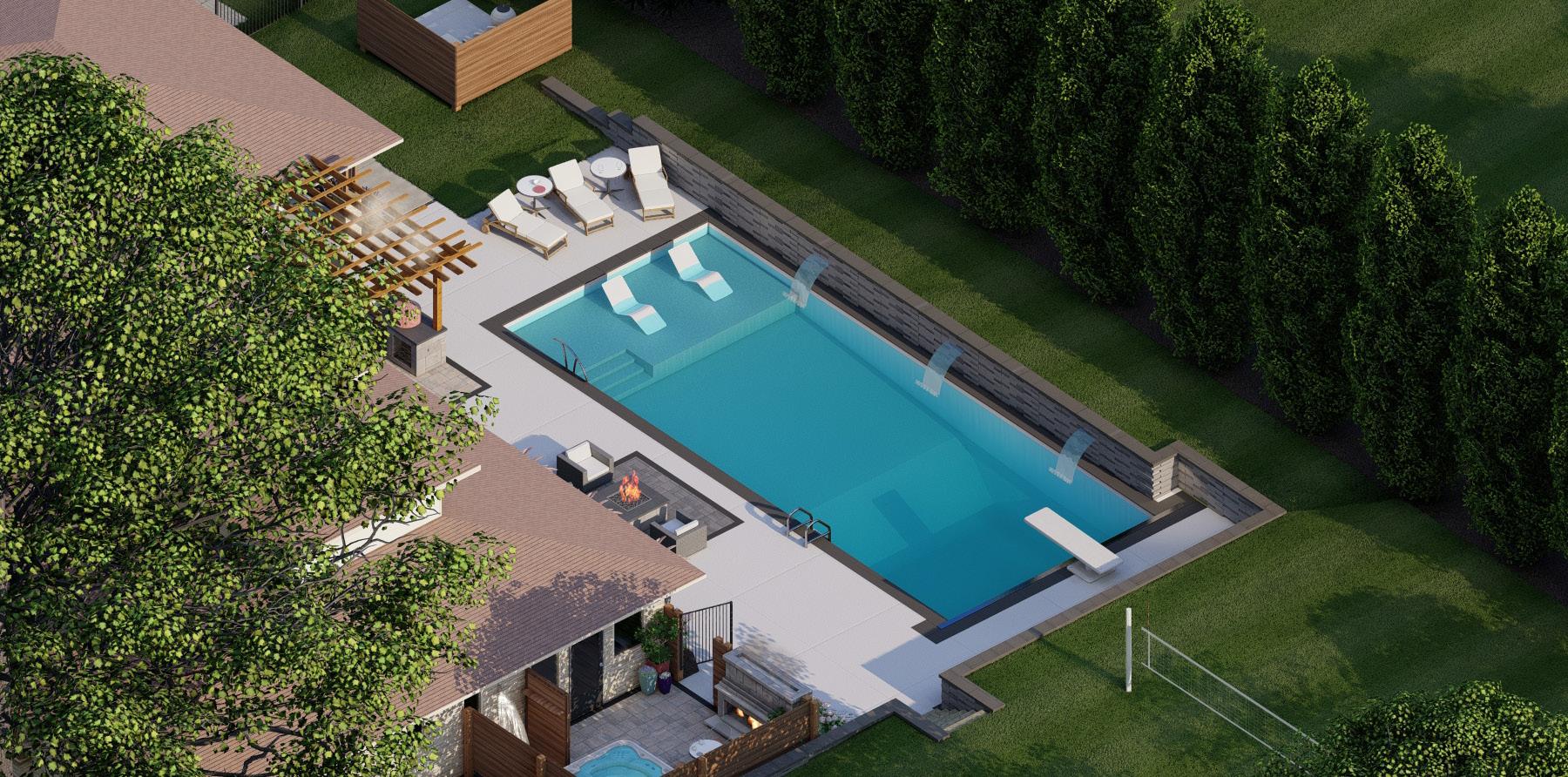
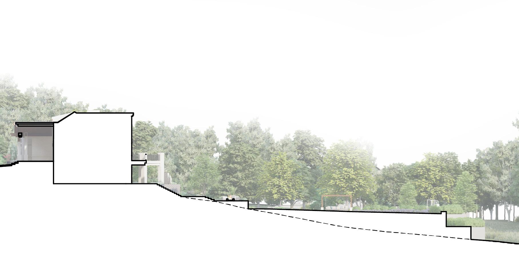
Nestled on a busy corner lot, this yard becomes an idyllic retreat for relaxation. At the heart of this design lies a standard pool embraced by a visually intriguing Graphix retaining wall. An outdoor kitchen offers an inviting space for culinary indulgence and guest entertainment, while around the corner is a private patio boasting a hot tub, fireplace, and outdoor shower. Above the wall includes a volleyball net and borders of columnar sweetgums and grasses, rising above the patio to further enclose and seclude. The proximity of the wall to the pool required intense constraints, and warranted the creation of wall details to ensure a sound structure.
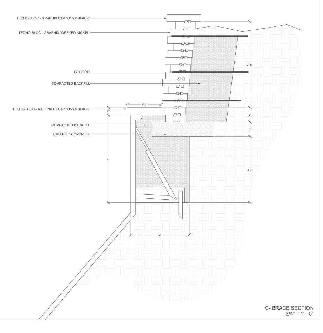
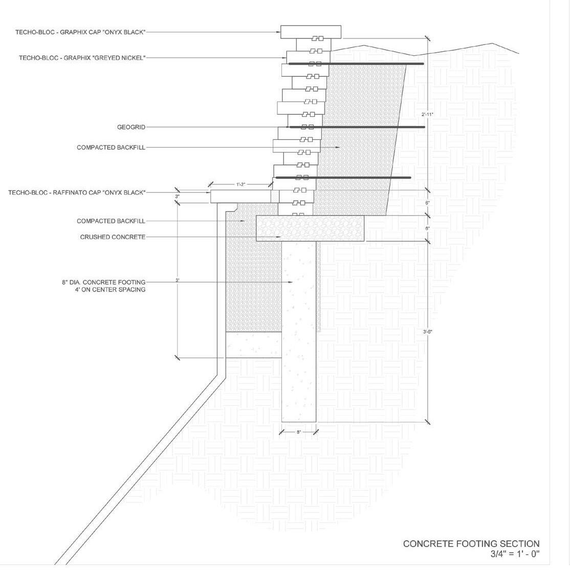
Section showing underlying structure of the wall. Detail.
Jace Armstrong Landscape Architecture Portfolio 05.04.2024