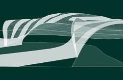
PALIMPSEST


Hard infrastructure with monofunctional conceptions is viewed as standalone objects, away from human interaction. There is purpose FROM the structure but not OF it, especially after their design life. Re-imagining them as haptic spatial elements instead of optic would allow them to weave together communities instead of fragmenting them.
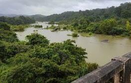
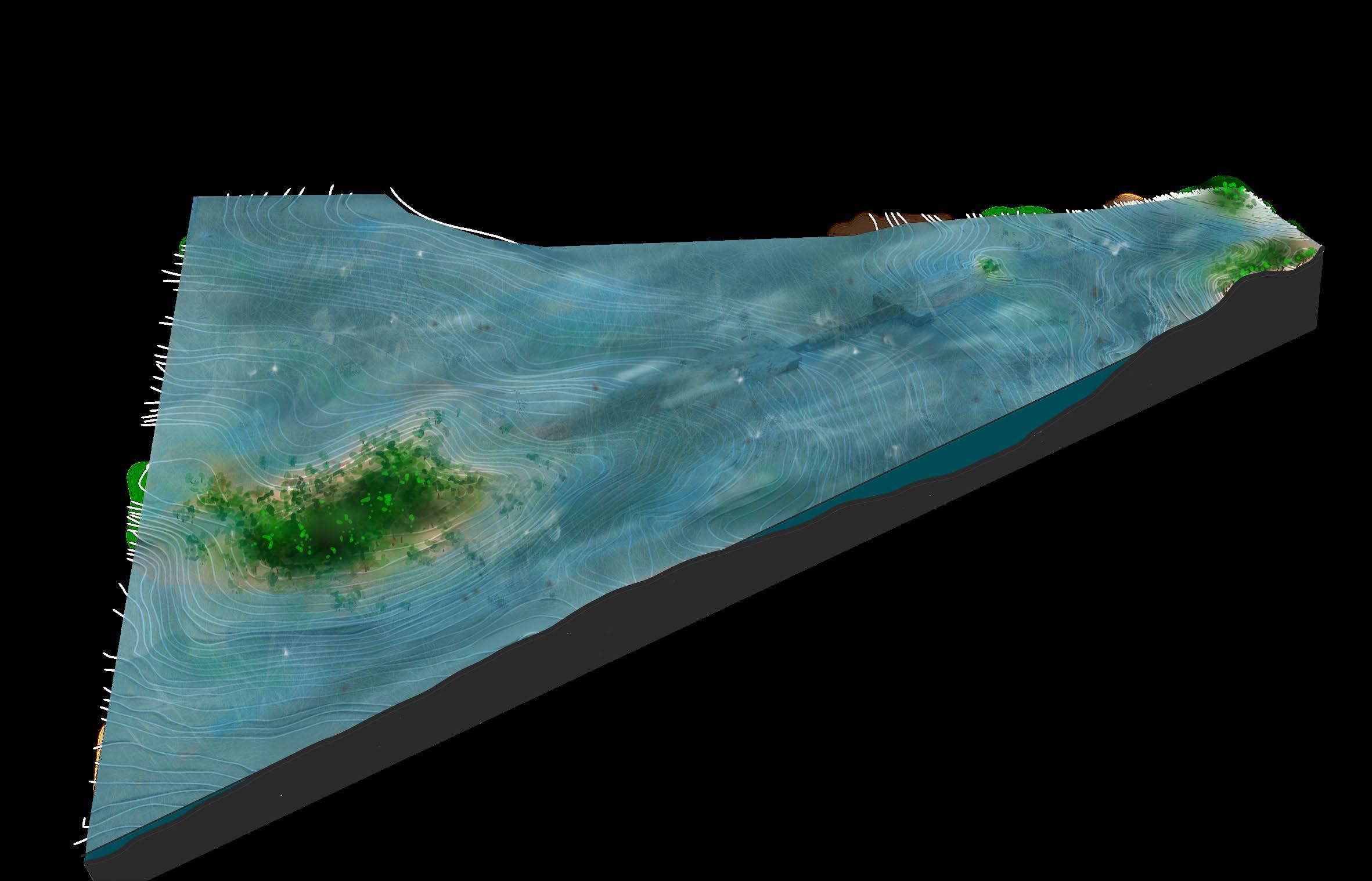
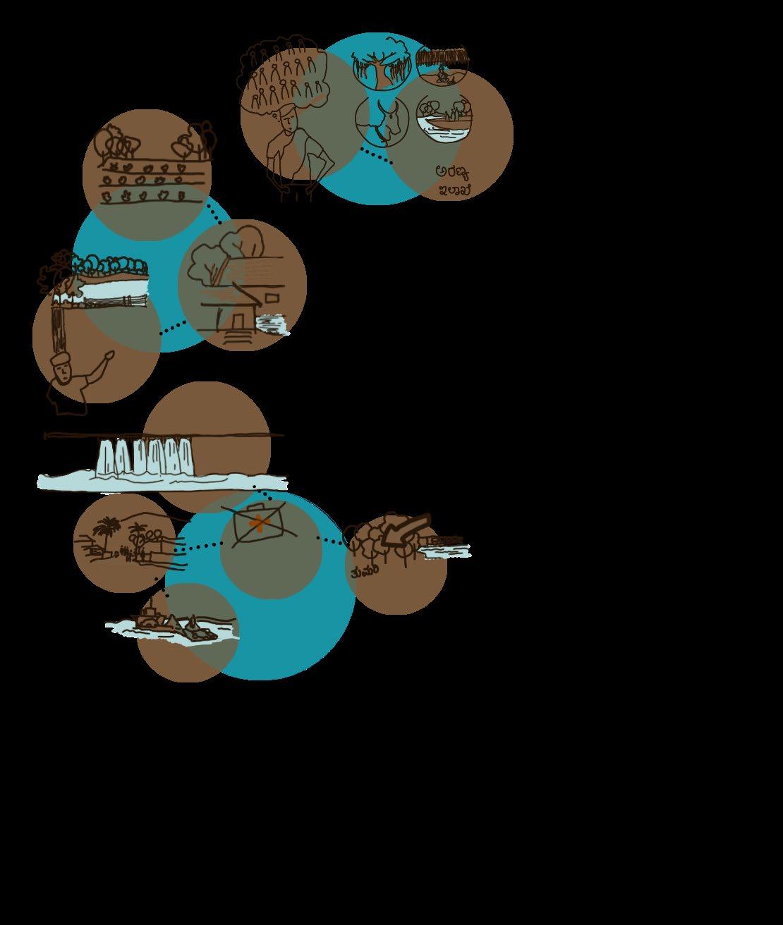
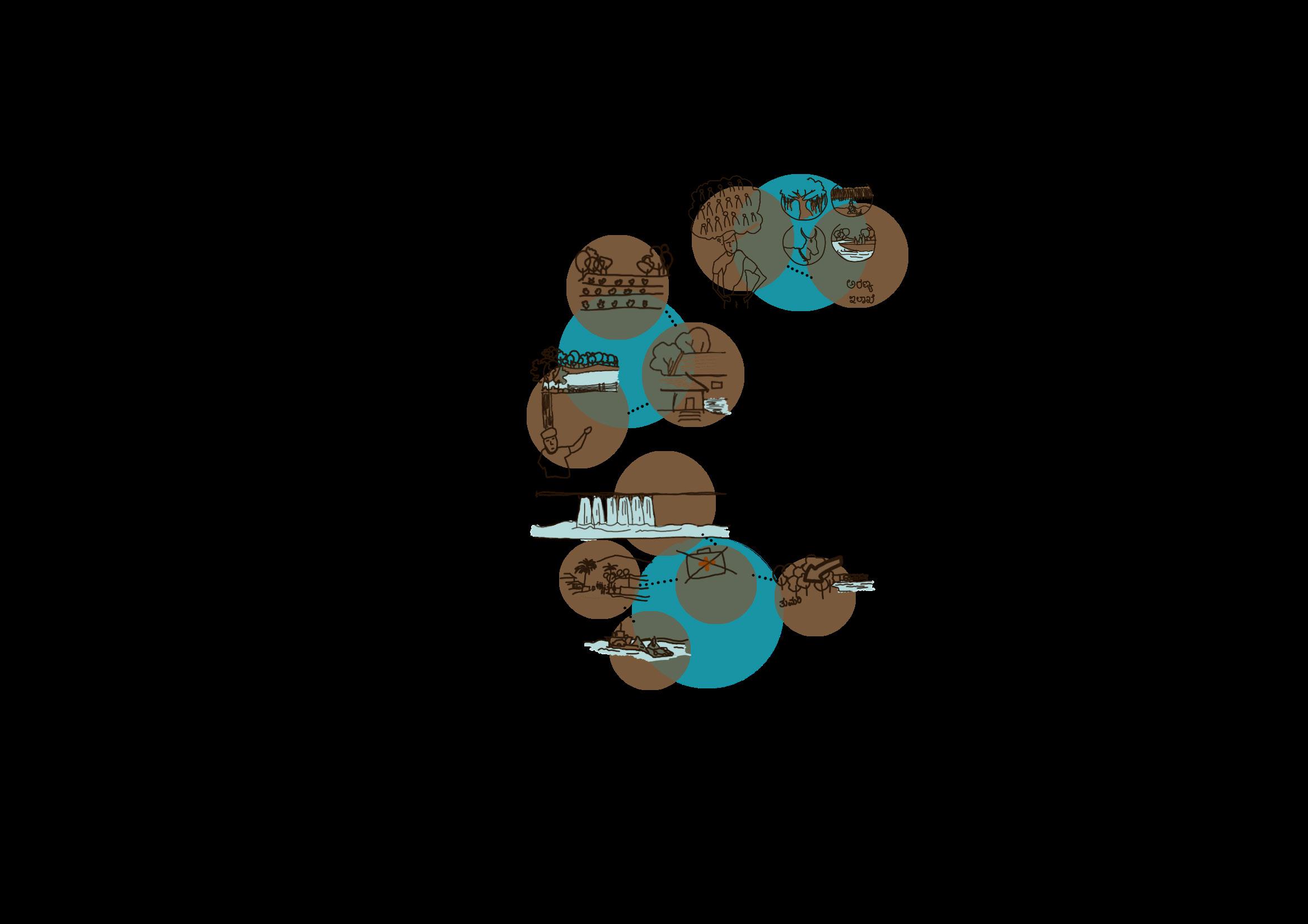
Such infrastructure has minimal capacity for human engagement. They focus on separating conditions rather than integrating them. And in the long term, have bigger social and ecological repercussions. With the example of the submerged and defunct Hirebhaskara dam in Linganamakki reservoir, Sagar, Karnataka, this thesis claims that such a structure can be repurposed to a hybrid type. The construction of multiple dams on the Sharavathi river led to villages being submerged within the reservoirs, creating a man made island amongst other ecological repercussions.
The people lost not only their homes but also their culture and memories of the land called ‘Kalenadu’. Current communities struggle to survive with lands handed down to them by the Government in Forest areas with barely any resources/ climatic conditions required for agriculture. With lack of any amenities in the ‘island’ the current generation is forced to move out. The plight of the people either seeking connectivity with the outside world or a selfsustained island leads to negative connotations towards any future infrastructure project on the river. This thesis will explore how to extend the axis of this forgotten structure to give back to the community and ecosystem, instead of newer proposals on the river.It addresses the issues of the immediate context to foster resilience and connectivity, thus re-building community and collective memory. It pieces together the narrative of the land by linking past functions and future possibilities, so that people associate the dam with better memories.
(4)
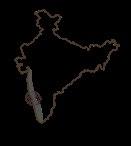
LOCATION: Sharavthi valley in Western ghats

Jog falls- after Linganamakki dam

TIMELINE: Sharavathi Valley
WATER BASIN: Sharavathi

LAND USE MAP: Sharavathi Valley


Before 1920Sharavathi valley between Ambutheertha and Honnavar with multiple settlementsBio-diversity zone

1930s-
Construction of Hirebhaskara dam- 3rd and largest siphon volute dam in india at HirebhachhugaruFirst displacement
1964-
Construction of Linganamakki dam Submergence of Hirebhaskara Second displacement


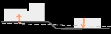
PresentBridge construction ongoing between NH66 and NH69
Proposal of artificial waterfall and underground dam

City extents 1- Sagara 2-Tumari Path 1
Tumari-Holebagilu
10km-40min-
43min Total:
Tumari-Sigandur/Hirebhaskar
Sagar Tumari to
Legend Sharavathi wildlife sanctuary
Currently taken route
ferry-Sagar
2/3 hours - 34km-
5/6 hours Path 2 Proposed
dam-
sigandur- 7km/13min
Talakalele Bridge construction/ferry Connects: (Present) NH69 and NH66 (previously) NH206 and NH17 Funded by Central government highway authority- since past 2 years Request sent to State govt. 10 years ago 5 5 5 3 3 6 4 1 2 0km 2.5km 5km 15km 10km Site 1 6 5 4 3 1 2 2 Towards NH66 NH69 Road widths are not to scale* 1 1 4
Linganamakki dam Beyond jog falls Sigandoor temple/Hirebhaskar dam
Hirebhaskara
Talakalele Jog falls Shimogga
Sagar
dam
1 2 3 4
LOWEST MEASURED
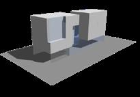
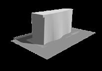
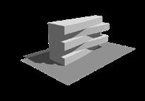
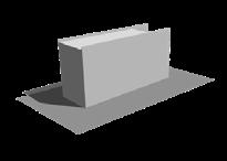
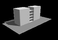
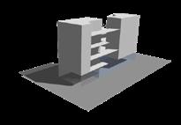
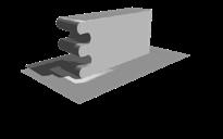
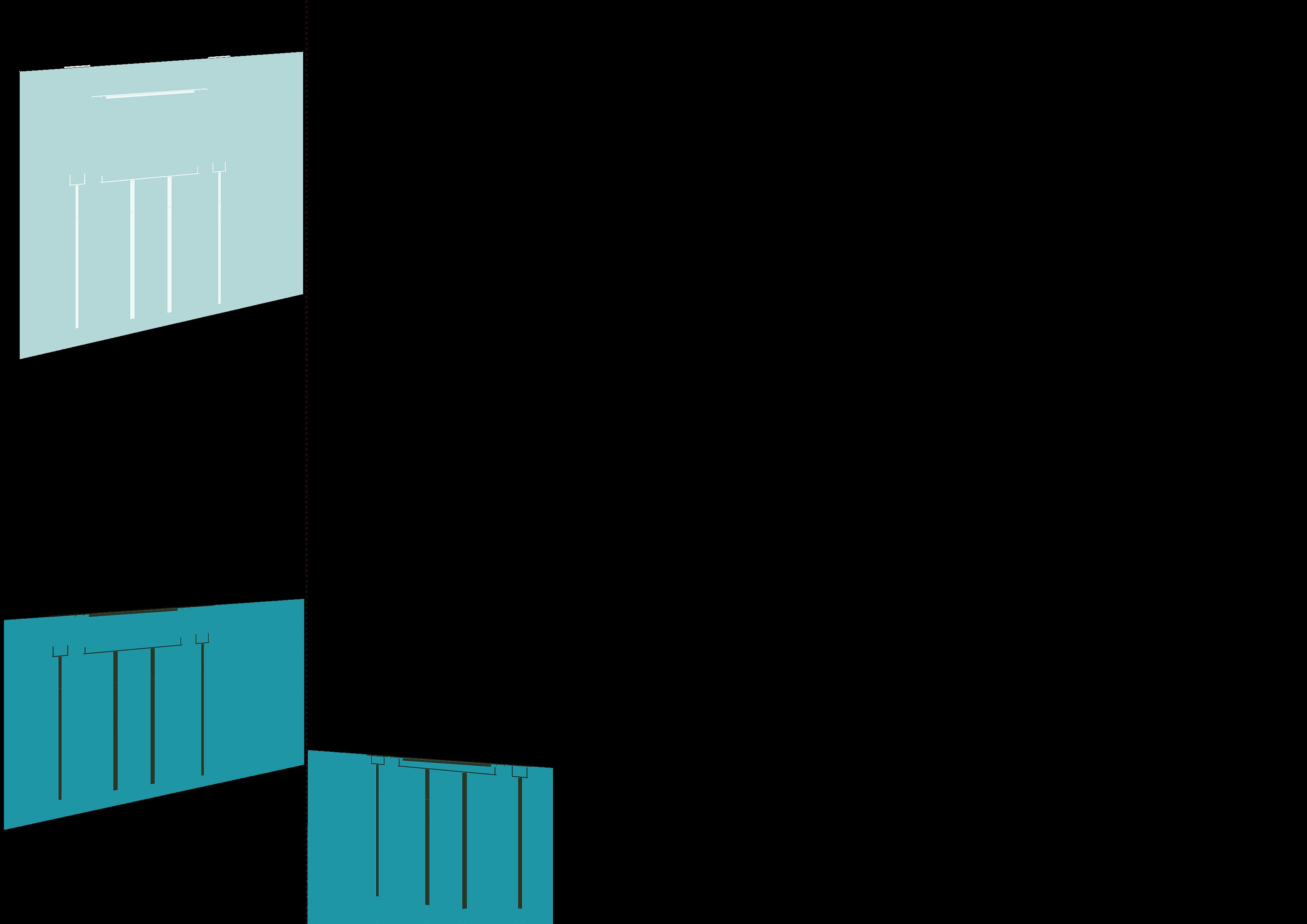
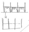
WORKING OF VOLUTE SIPHON DAMS


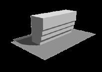
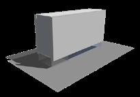
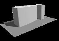
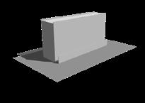
3rd and Largest Volute Siphon dam in India Sagar, Karnataka

The Hirebhaskara dam functions with the help of large volute siphons which automate the opening and closing of gates with fluctuations in water levels

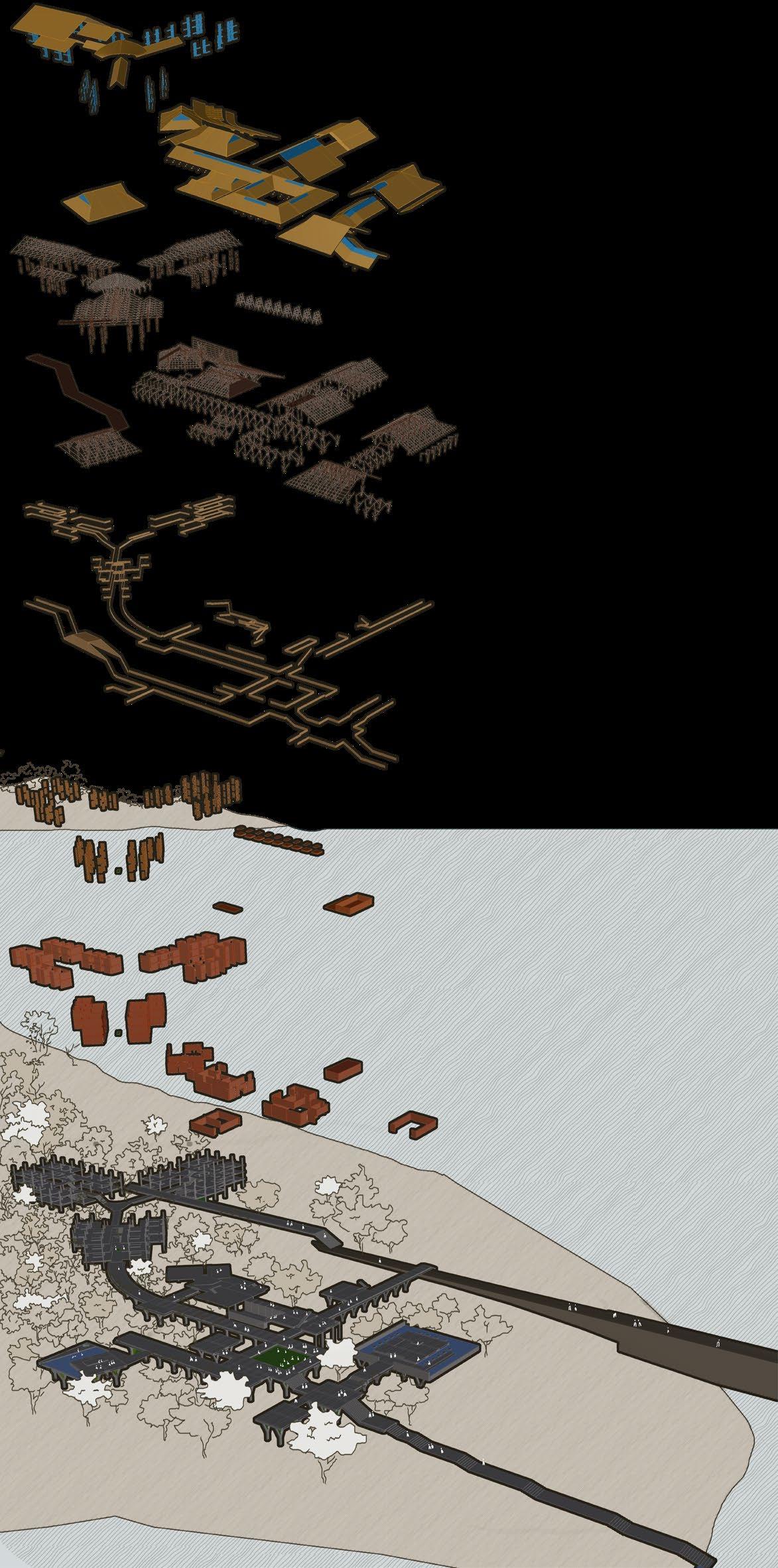
LAYERS:
Natural- Existing contours, Forests: Muppane State forest, Sharavthi river
Man made InterventionHirebhaskara dam that intercepts water flow in the river human settlements like Tuma ri scattered around the river valley and the agricultural plots with cart roads

LAYERS:
Natural- Existing contours, Forests: Muppane State Forest, Sharavthi river


Man made Interventionsubmerged
HIGHEST MEASURED
jan w-122.36 l-27.4 may w-43.1 l-9.65 jun w-27.9 l-6.25 jul w-34.4 l-7.7 aug w-88.9 l-19.9 sep w-121.4 l-27.2 oct w-139.09 l-31.15 nov w-135.81 l-30 dec w-135.81 l-30 feb w-98.2 l-22 mar w-78.1 l-17.49 apr w-78.1 l-17.49
DAM
HIREBHASKARA
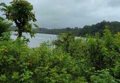
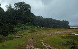
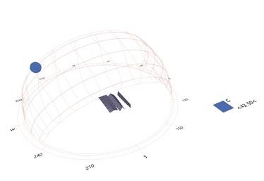
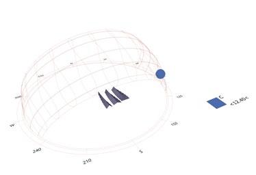
3 4 Hirebhaskara dam Linganamakki dam Jog falls Talakalele dam Kargal dam Water Reservoir Built Tumari village Land Sharavathi valley SITE IMAGES A B C: Site Conditions near Linganamakki Dam and Jog falls B: Site Conditions near Hirebhaskara Dam and Sigandoor village A: Sharavathi river- Linganamakki reservoir SITE CONDITIONS: Shown as a cycle through the year with respect to the amount of rain received every month l- water level above base of dam in m BASE OF DAM IS AT 544 MSL w- water stored in the reservoir in TMC
WATER LEVEL
Valley +558m msl
Sharavathi
WATER LEVEL Sharavathi Valley +578m msl
S I T E C 2 Bird’s yojana-Existing Mahatma Hydroelectric (6)
Bird’s eye view of Sharavathi yojana-Existing dams
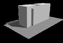
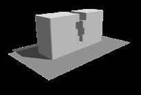
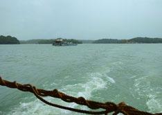
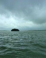
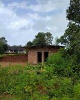
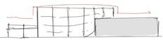
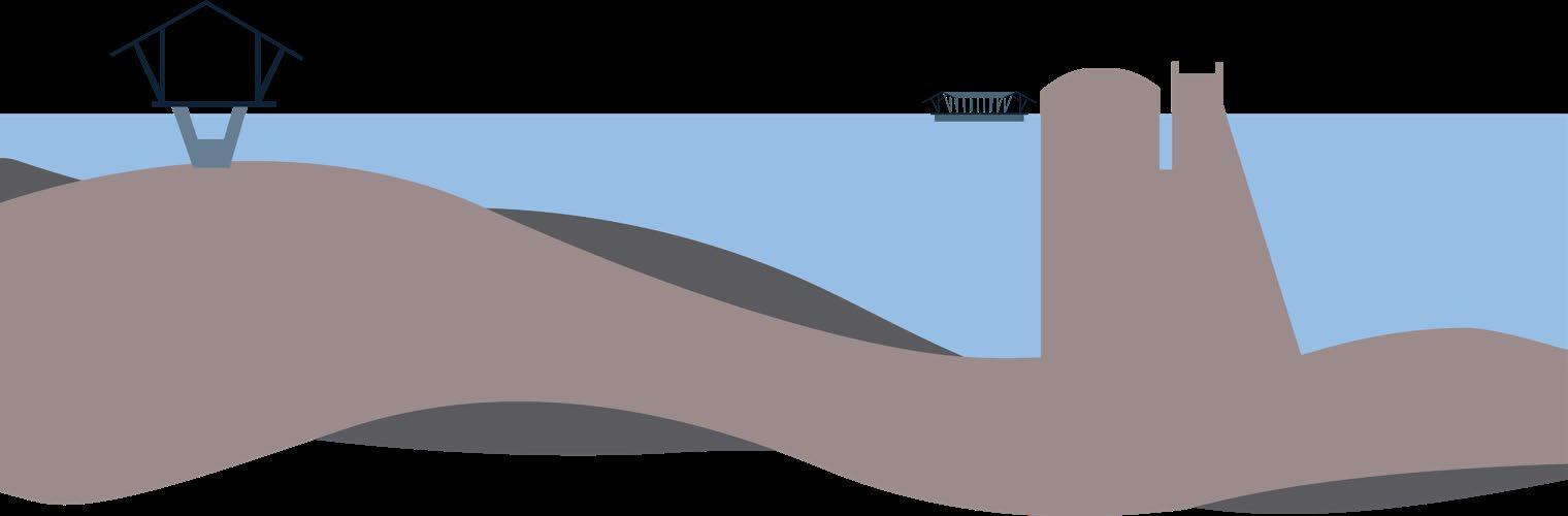
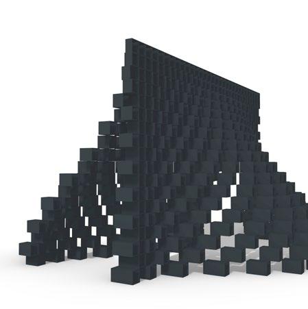
Site is located along Hirebhaskara dam which was the first among the 4 major dams along Sharavathi river in Sagar taluk in Karnataka, which is currently submerged in the water of the Linganamakki reservoir which stores more water. Both dams cause relocation of multiple communities and submerged large areas of land and ecosystems. Hirebhaskara dam was the 3rd and largest siphon dam system in India when it was built.
“We planted trees here on this land. We don’t have the land documents and we will never get them also”
“We came here after Gante Harish sir left and we cultivated his land; do part-time in Bangalore for extra income. The water level receeds in may and


we harvest one batch of crop and then its submerged for the rest of the year”
“When covid struck us here and we had to take them to the hospital, we had to travel kilometers to reach Sagar, the nearest hospital”
“Why should we allow Bangalore to take water when we ourselves cant use it? They plough lands belonging to KPCL and they cant even take water for agriculture, its only for hydroelectricity”
“Our family was displaced twice by both projects and we were given 13 acres of land in Purdal, our community was fully dispersed. They have declared this area as a Wildlife Sanctuary and deny us amenities until we are forced to move again”
Boats and ferry as only means of transport
“ When the ferry shut down due to covid lockdown drove the ambulance from Sagar to take people from here to hospitals in the nearest cities and used to work all day. didn’t come back home for half a month at times. We don’t have a police station here. If need to fight for my land in a law office plan a 2 day trip to Sagar and back because after 6 pm you are stuck on either side of this man made island”
Highlighting the issues faced due to the nature of the context:
1- Social Loss of land as it gets submerged in the reservoir, disconnect to mainland, declining local arts and culture without exposure

2-Nature: Fragmentation of habitat, misuse of forest land, decline of endemic species in the bio-diversity rich zone
“ We can’t use that land. What use is the land here when it rains? Of course my son went outside to earn money. We got the bad end of this deal. They promised us so many things but see none of them in reality.

So many of our temples have now drowned under the reservoir. Our elders made a mistake asking for a ferry thinking bridge will cause problems but now we know how hard it is to get anything here. “
“We used to have multiple Yakshagana institues in this area. It was called Kalenadu. Now only 2-3 of them remain. We are jains in this area. Inititally because of the queen there were a lot of jains in this region ,now the basadis are in ruin ( you will find many on your way to jog falls on the western edge) and our gods are now in the museum near Liganamakki dam. We would love to perform but we can’t arrange funds if people are not interested”

TIME CYCLE ISSUES
Durbars and markets that happened here are lost
Even though there is one hospital, no doctor wants to visit the place and we dont have other amenities as well
Ferry only works from 8am-6pm and the locals fight for a bridge or else they are stranded on a manmade island
Map showing type of vegetation (natural and cultivated) near the Hirebhaskara Dam in the Sharavathi Valley
West zone- Thickest vegetation cover- lesser variations in fish migratory path and habitat
Central zone- Most frequented by fishermen especially when water level else receeds.
Mostly in need of development due to overuse and lack of proper habitat
Map showing Lion-tailed Macaque sightings and current proposal area


33kV lines cant be taken from Linganamakki because of forest areas that come in the middle
East zone- Closest to habitation- lesser forest coverLeads to more flactuations in water temperature causing variations in fish habitats seasonally
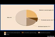
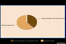
Map highlighting the issues of fisheries in the area Breakdown of fish species: Sharavathi
Fragmentation of land due to water body increasing in area
Natural forest extent

Reduction of forest area by habitation and dam construction
Issue of fragmentation of habitat due to the submergence caused by reservoir constructionsThreat to natrual habitats of endemic species in the area
Locating the interviewees on the context map


Map showing type of fisheries near the Hirebhaskara Dam in the Sharavathi Valley
1-Holebagilu ferry point 1
2- Holebagilu ferry point
2

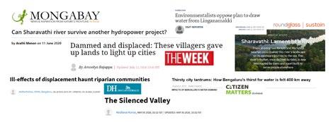
Issues related to ecologyHighlighted in articles
3- Tumari- site of interview

4- Sigandoor- site of temple
5- HIrebhaskara dam

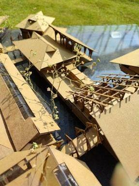
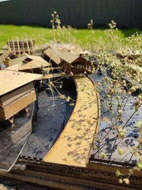
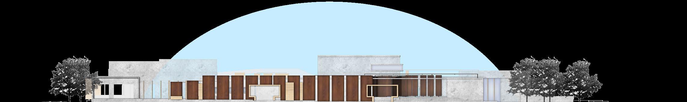
IMAGES OF HIREBHASKARA DAM 1
Gandhi Hydroelectric plant
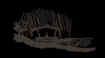
Nature worship Loss of Gods and temples Simple living in grass huts
Festivities like Gopuja
R
Narayanappa Honnale
H
Raghupathi
1 2 3 4 5
Lokpal and Omkar Jain
Bamboo dominated forests Mixed plantations Evergreen forests Scrub Open to fishing whole year Fishing ban in monsoon+ strict restrictions Fishing prohibited during month initial monsoon Metalled roads Cart tracks ISSUES (7)
Breakdown of the program in relation to the issues identified
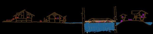
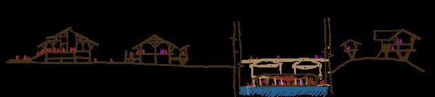
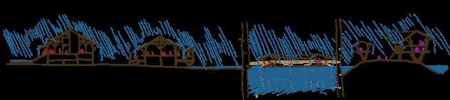
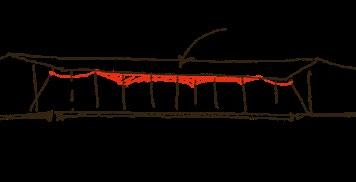
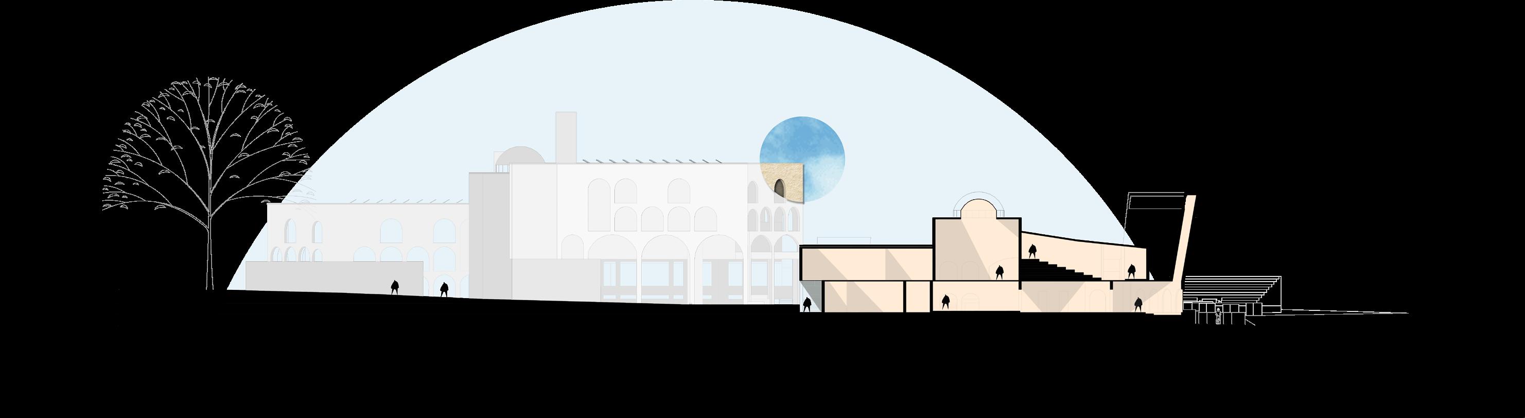
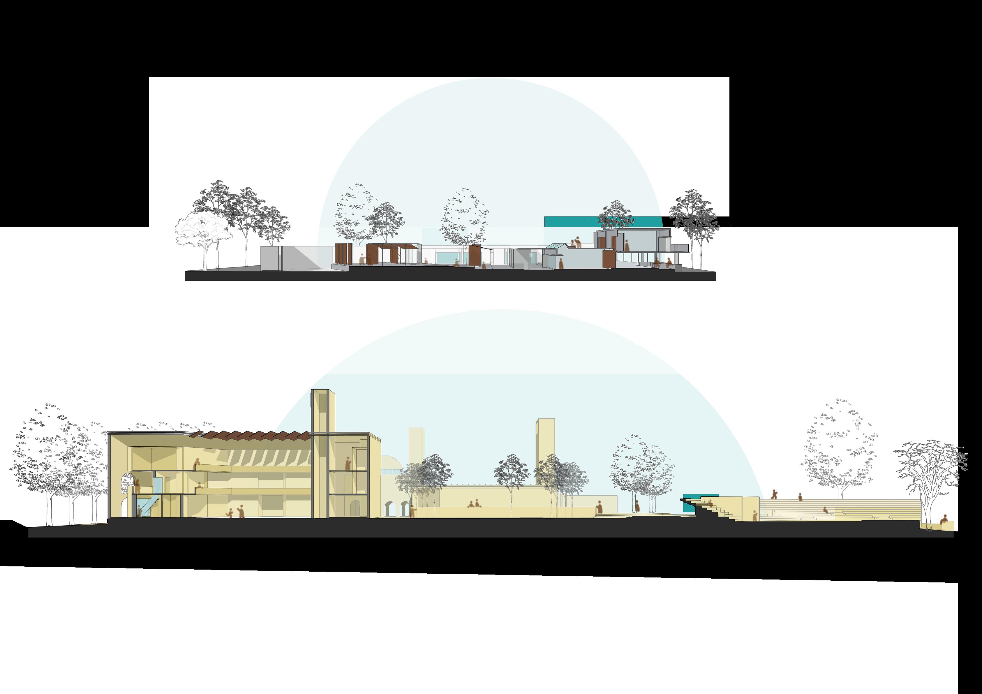
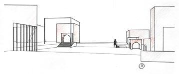
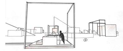
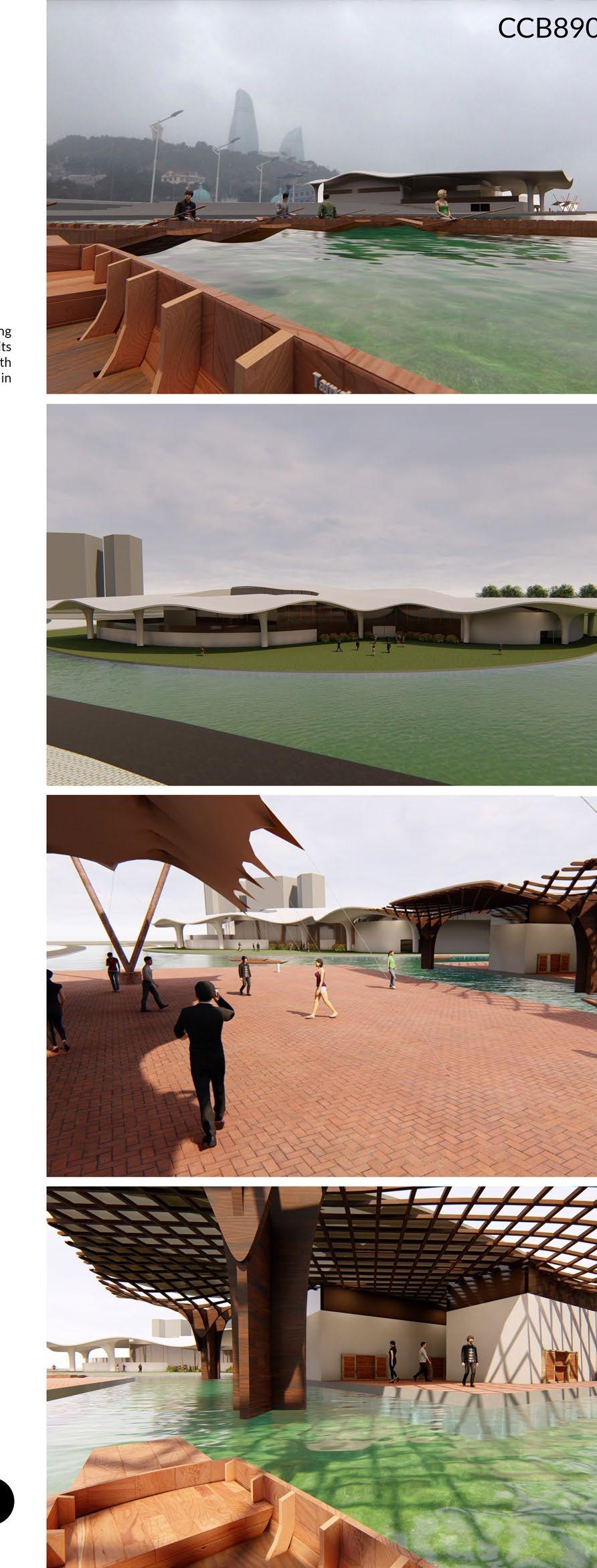
Condition 1: Lowest water levelAll spaces support gathering and spread of cultural activities, the dam gallery is part of the design, structure tethered to dam acts as culture centre and exhibition
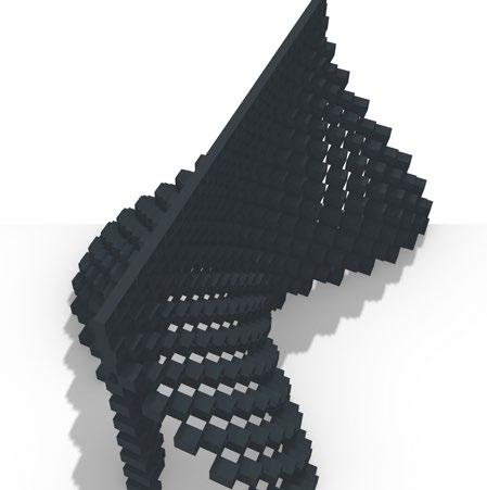
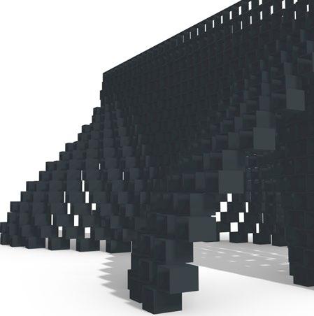
The dam as the main human intervention on site
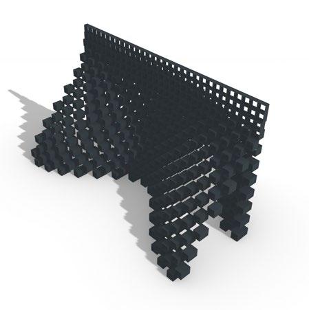
Contrasting character of design on land and waterLand cluster being more solid and rooted and water cluster as a marker for existing structure, more temporal and transperent in character
Analysis from Site Visits is represented as a cycle and the concepts social and nature-related as well as aestheic and cultural interviews on site and articles published in
The dam as the main human intervention on site
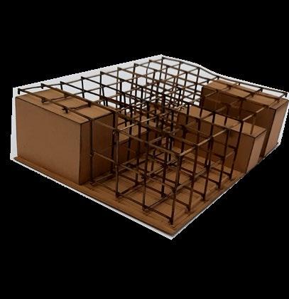
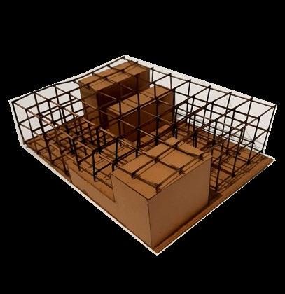
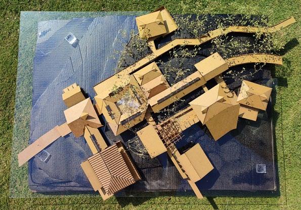
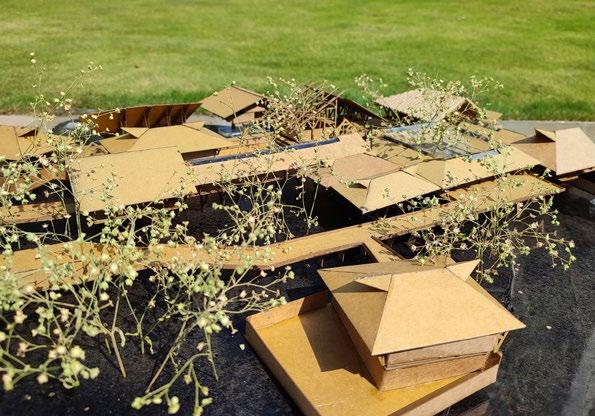
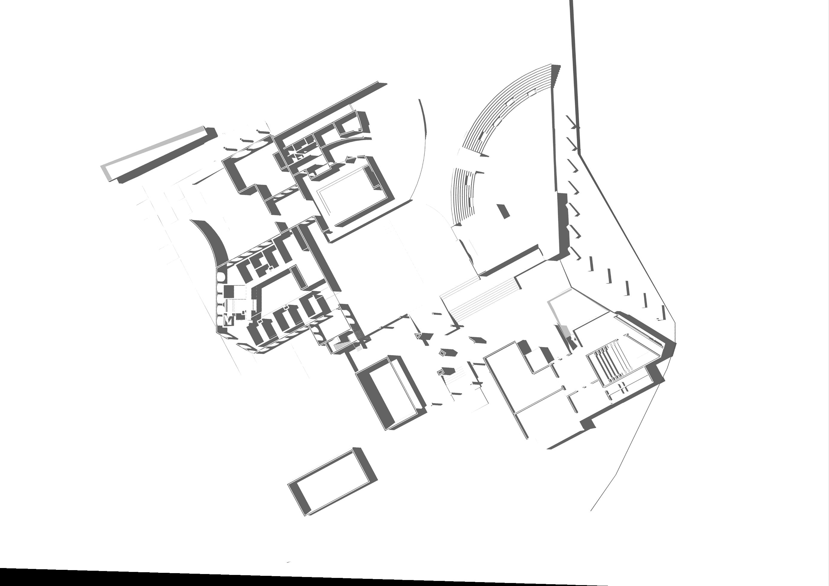
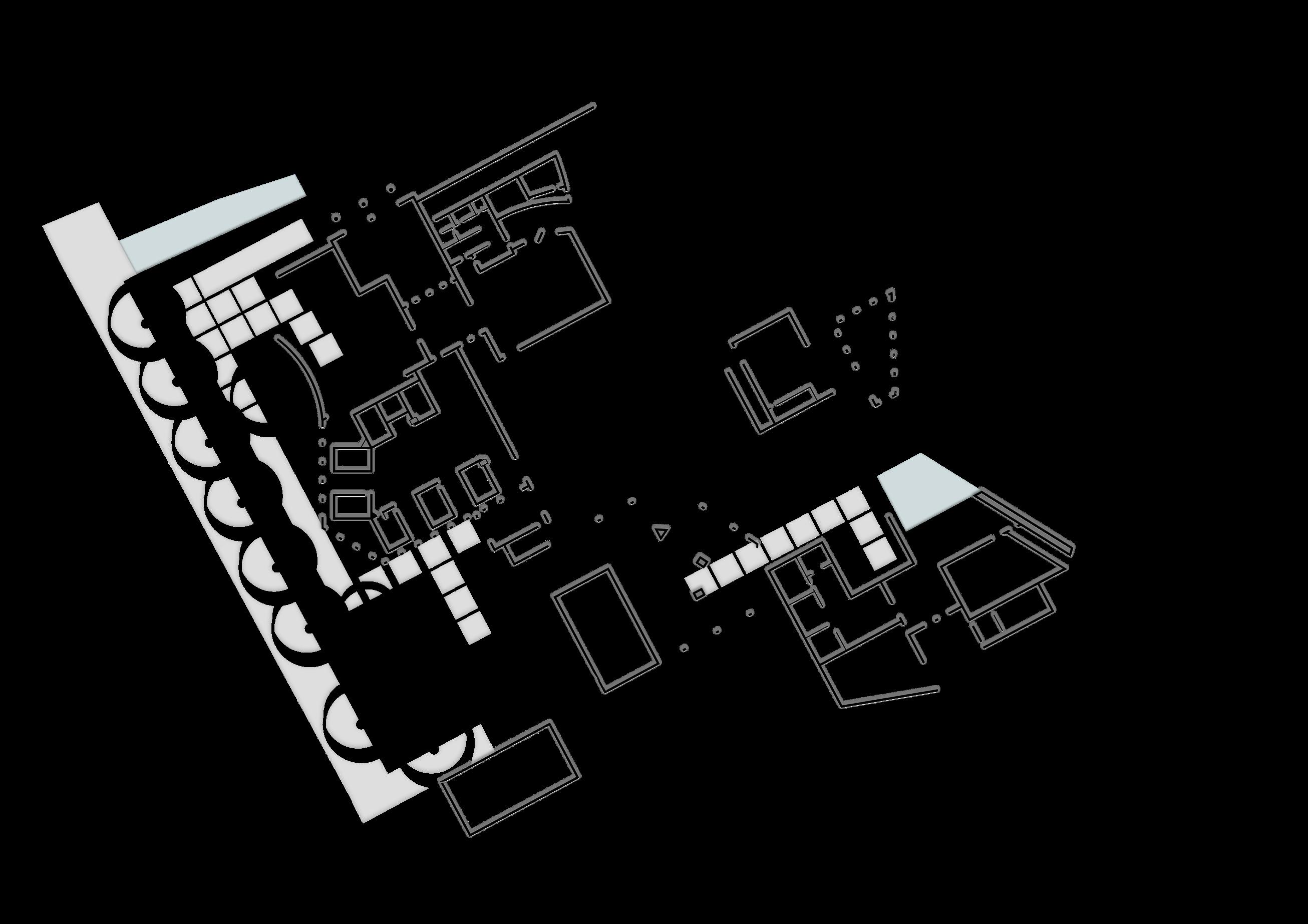
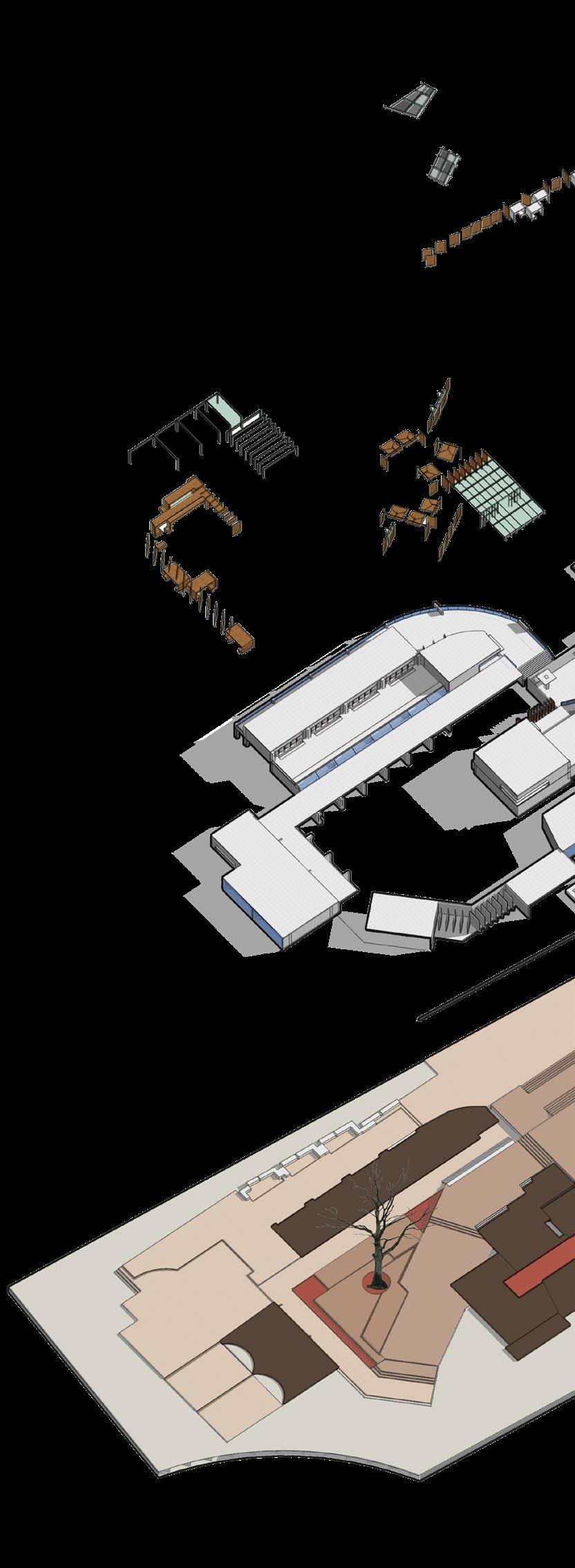
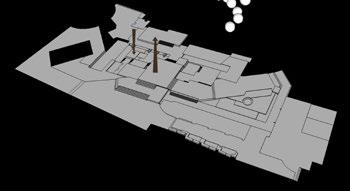
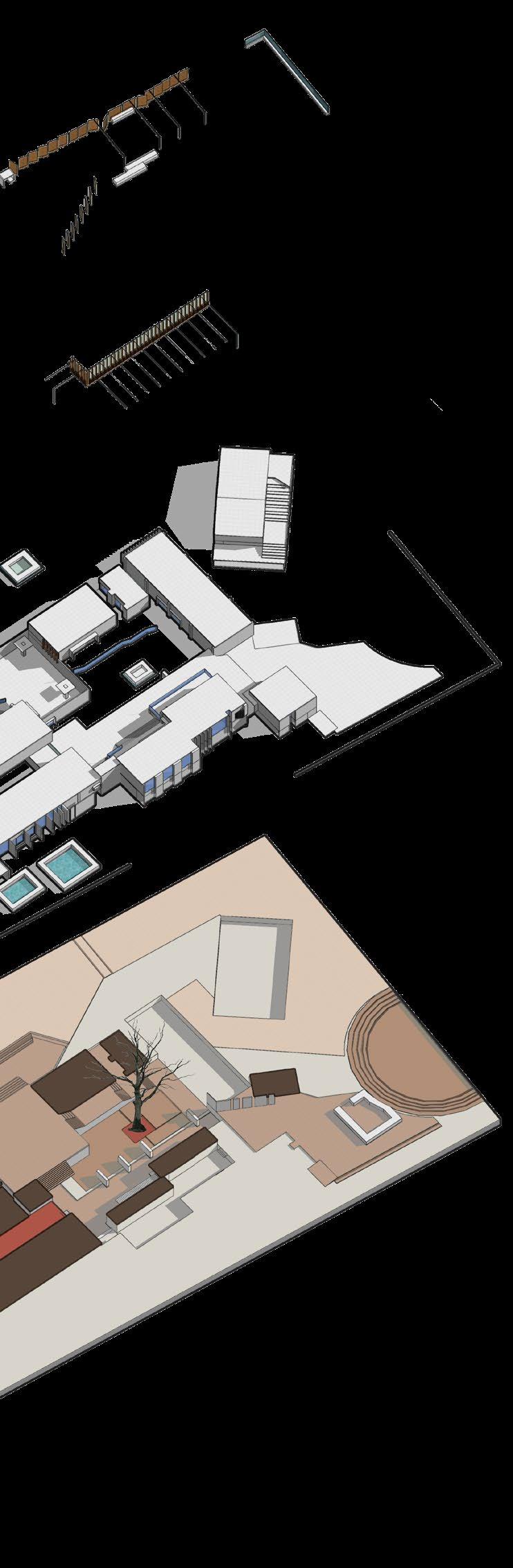
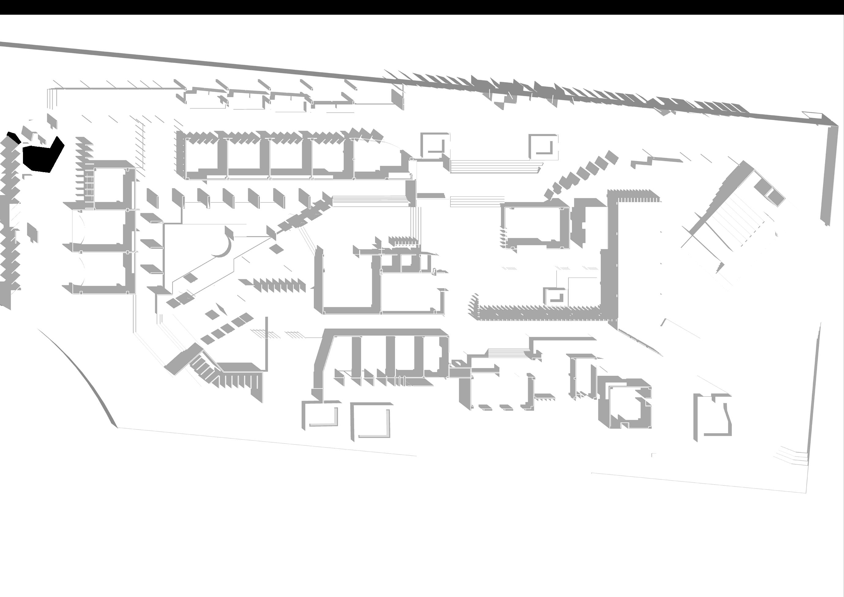
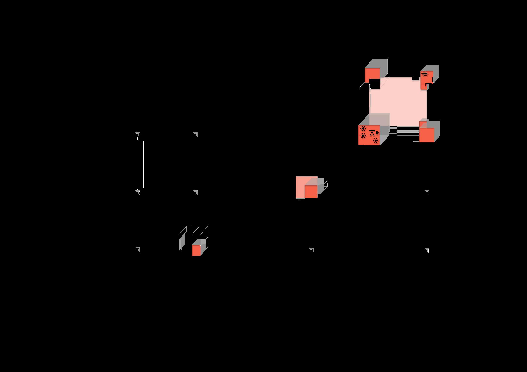
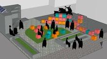
Key Plan of project showing 3 major typologies on site:
1- Cultural Centre- tethered to Dam
2- Resort, Exhibition and Basadi- On Banks of the river
3-Research unit- On the Island at end of the Dam Site Sections
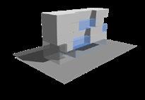
The project identifies the cycle and layers existant in the context, analyses the issues faced around the year due to such cycles and proposes 3 major typologies for combating the problems. It is sensitive to both the natural cycles and man-made interventions and needs.
The project retrofits into the cycle as an added layer, without hindering the dynamics; in fact, it compliments it and allows effiecient use of the landscape. Although the idea originates at an urban level, with consideration of the entire valley, the main focal point and first demonstration of the proposal is detailed as the thesis.
Type B- Bottom fish Type AMigratory fish HOSPITALITY RESEARCH UNIT CULTURE CENTER
Contrasting character of design on land and waterLand cluster being more solid and rooted and water cluster as a marker for existing structure, more temporal and transperent in character

1-Light dirzzleInteract

2-Heavy rainRain collectors to create views
EXTENTION OF CONTEXT EXTENTION OF NATURE
“We planted trees here on this land. We don’t have the land documents and we will never get them also”
Normal medium density rainfallRain wall- form enclosures with roof structure
“We came here after Gante Harish sir left and we cultivated his land; do part-time in Bangalore for extra income. The water level receeds in may and
Gopuja
The design enables experience on siteThe character of site during monsoons makes the site un-useable
Enable the spread of culture during times of lower water levelshidden structures resurfacing
Boats and ferry as
Type B- Bottom fish
“When covid struck us here and we had to take them to the hospital, we had to travel kilometers to reach Sagar, the nearest hospital”
Highlighting the issues faced due to the nature of the context:
The character of site during monsoons makes the site unuseable
we harvest one batch of crop and then its submerged for the rest of the year”
Artificial reef plandeployment of units in complex for theatre structure in design
Introduction of artificial reef using the structure of the tethered design in the reservoir to increase aquatic habitat and help culture of endemic species.
The type of fishes, the unit structure and plan of arrangement of units shown.
Durbars and markets that happened here are lost
“Why should we allow Bangalore to take water when we ourselves cant use it? They plough lands belonging to KPCL and they cant even take water for agriculture, its only for hydroelectricity”
1- Social Loss of land as it gets submerged in the reservoir, disconnect to mainland, declining local arts and

2-Nature: Fragmentation of habitat, misuse of forest land, decline of endemic species in the bio-diversity
Even though there is one hospital, no doctor wants to visit the place and we dont have other amenities as well
CONCEPT SECTIONS
Enable the spread of culture during times of lower water levels- hidden structures resurfacing
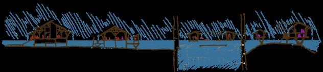

The conceptual section is represented as a cycle with 4 main conditions as the water level fluctuates through the year
Artificial reef plan- deployment of units in complex for theatre structure in design


The project is designed to fit into the cycle exisiting and complement it.


When the water level is low and it reveals the man-made intervention of the dam in the context, the design also aims to capitalise on the human and social aspect by uncovering spaces for workshops and theatres.\
When the water level is high and nature has the upper hand then the design acts as a pavilion to view the scenic backdrops and the spaces where activities happen are introverted. (8)
Condition 2: Mid water level IThe water level starts increasing and rain is still minimal. The cultural activities continue and there is a slow shift of activity towards the hospitality sector.
Condition
4: Mid
6pm and the locals fight for a bridge or else they are stranded on a man-made
path and habitat
33kV lines cant be taken from Linganamakki because of forest areas that come in the middle
All spaces support gathering and spread of cultural activities, the dam gallery is part of the design, structure tethered to dam acts as culture centre and exhibition
East zone- Closest to habitation- lesser forest coverLeads to more flactuations in water temperature causing variations in fish habitats seasonally Central zone- Most frequented

Mostly in need of development
Map highlighting the issues of fisheries in the area
Breakdown species: Sharavathi
The conceptual section is represented as a cycle with 4 main fluctuates through the year
Design is tool to experience nature. Research thrives.
The water level starts reducing but the rain continues. The design enables experience of context and interacts with the rain, rather than just shielding
MAIN CONCEPTS
Simple living in grass huts
“Our family was displaced twice by both projects and we were given 13 acres of land in Purdal, our community was fully dispersed. They have declared this area as a Wildlife Sanctuary and deny us amenities until we are forced to move again” only means of transport
Introduction of artificial reef using the structure of the tethered design in the reservoir to increase aquatic habitat and help culture of endemic species. The type of fishes, the unit structure and plan of arrangement of units shown.
level II-
Condition 1: Lowest water level-
water
The water level starts increasing and rain is still minimal. The cultural activities continue and there is a slow shift of activity towards the hospitality sector.
Type AMigratory fish
Location of tourism spot at hirebhaskara which is an important node for current travellers- reduces the stress on development in Jog region which has endemic habitats
C O N C E P T S
ROOF
Extended large roof acts as barrier to noise and light escaping from design and creating disturbance for nature around. Inward looking design.
Roof ideas inspired by tree canopy and cover and the roofing in malenadu house, if re-created in a bamboo structure


STRUCTURE
EXPLODED VIEW OF DESIGN ON LAND:


EXPLAINING THE DESIGN DETAILS USED TO ACHIEVE THE CONCEPT
Parapet detail: The simple addition of a slab cut-out paired with the raised plinth is seen to trap insects during rains.
Bamboo half culm
Concrete grout
Steel gusset plate
Slab cut-out to trap insects by collecting water
Materiality:
Use of screens allows diffused light in the day; at night it appears to glow dimly

PARAPETS
Response to sun-
SCREENS

Bamboo and clay blocks used as main materials to evoke sense of building with wood and mud. Located closest to bamboo plantations- easily available Concrete plinth seen as relating to the human intervention of the dam
ENCLOSURE
Relationship with forest edge
Idea of a Malenadu house and programatically breaking down its functions for zoning activity on site
PLINTH & CIRCULATION
Plinth condition- Used by people above and animals below
Raised plinthAllows context to flow as ground cover and canopy
Shades the areas of reservoir under the structure
Shaded area Rain wall Skylight Wall Structure
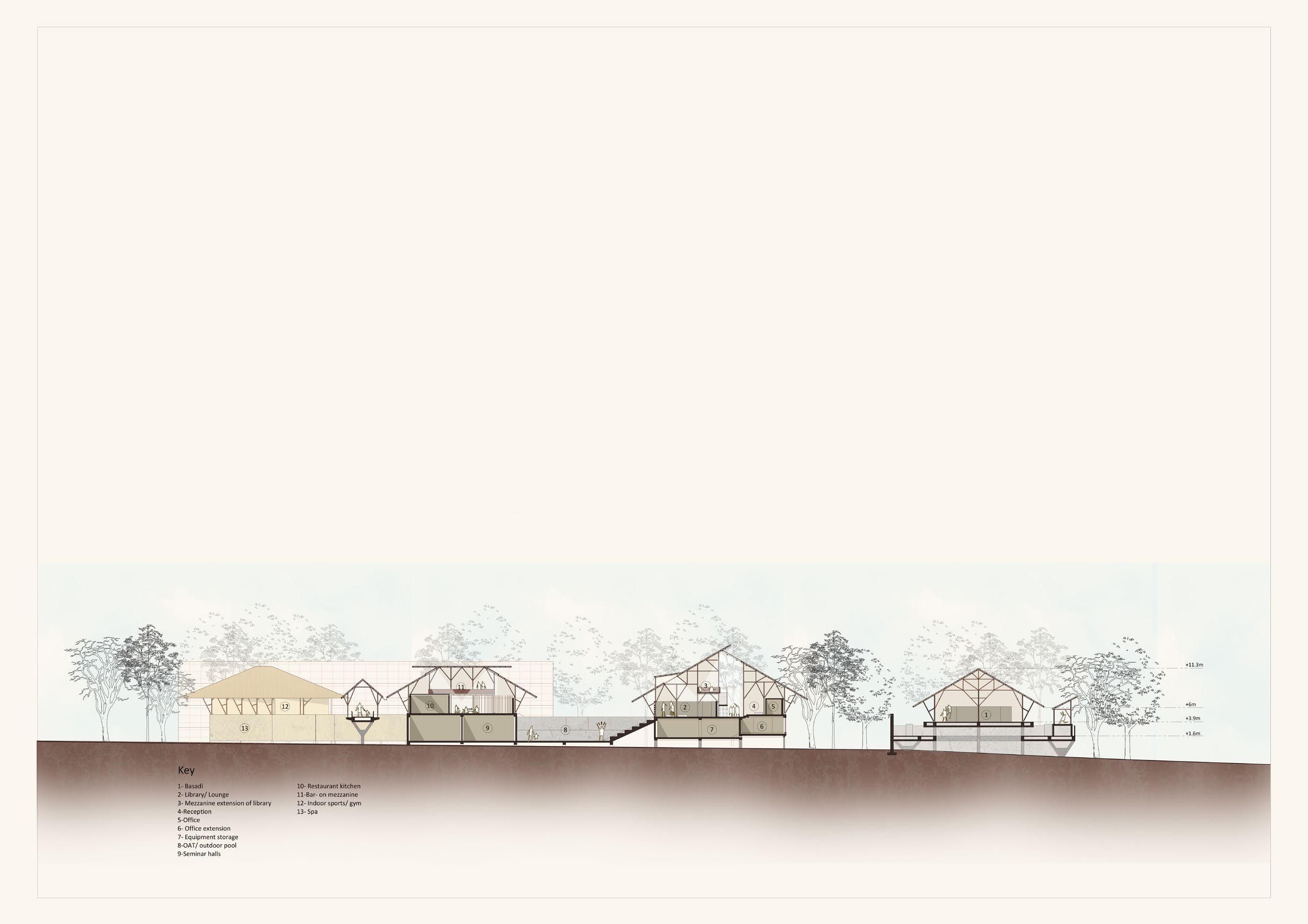
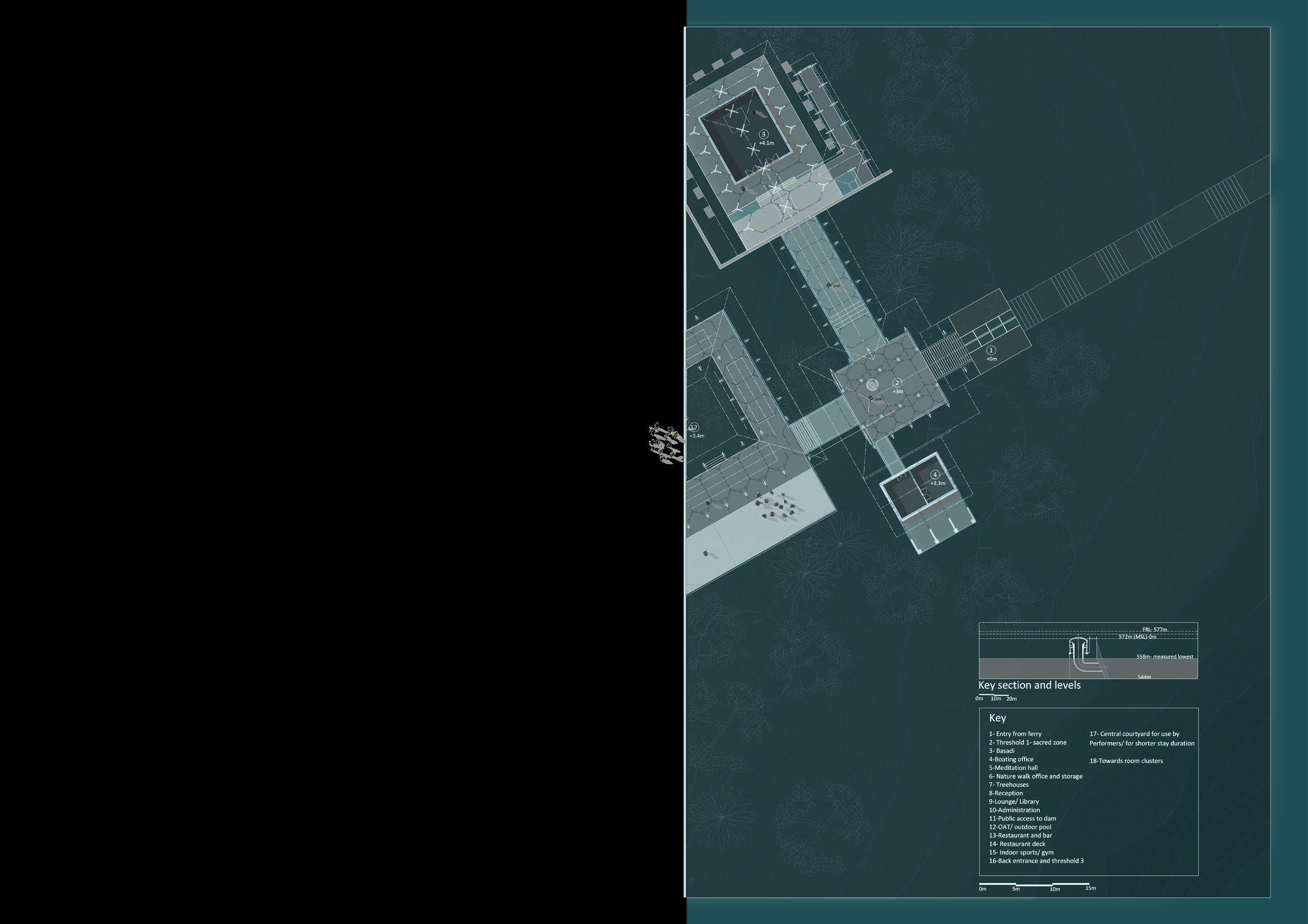
1- Entry 2- Foyer 3- Boating office 4- Basadi 5- Reception 6- Admin office 7- Way to dam and boating 8-Office and Storage for adventure trails 9- Way to adventure trails 10-Meditation centre 11- Restaurant, spa and gym 12- Rooms 13- Floating rooms 1 2 3 4 7 6 5 8 9 10 11 12 13
path, wind and views- RECEPTION/ Katte (9)
PLAN: RECEPTION SIDE


PLAN WITH RISE IN WATER LEVELS RECEPTION SIDE
SECTION A A
DESIGN DEVELOPMENT


Circulation patterns
Use of dam bridge as spine.

Before construction of dams and hydroelectric projects along the Sharavathi, locals lived peacfully in villages nearby, fishing in the small stream when needed
BEFORE DAM CONSTRUCTION
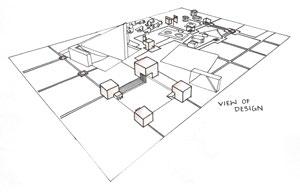
Main axis
Dam as datum. View points generated by forest, reservoir and dam.
When the dam was constructed, most of the villages were submerged fragmenting not just the vegetation but also the cultures

AFTER DAM CONSTRUCTION
AFTER DESIGN: Lowest water level
The design allows culture to shine through when the water level recedesspreading awareness about the regional traditions


AFTER DESIGN: Normal condition
It also enables the user to enjoy the scenic beauty of the place; creating a pause point in between over-populated tourist destinations
Grid introduced on site
The design engages with natural constraints like the weather and fluctuations of water levels, making it a part of the design mechanics


AFTER DESIGN: Highest water level
ILLUSTRATING THE CYCLE WITH DESIGN PLUGGED IN

Key Research facility and display Key section and levels Muppane state forest Access routes- ferry Muppane state forest
ENTIRE
PLAN: LAND PART
KEY PLAN:
DESIGN
(11)
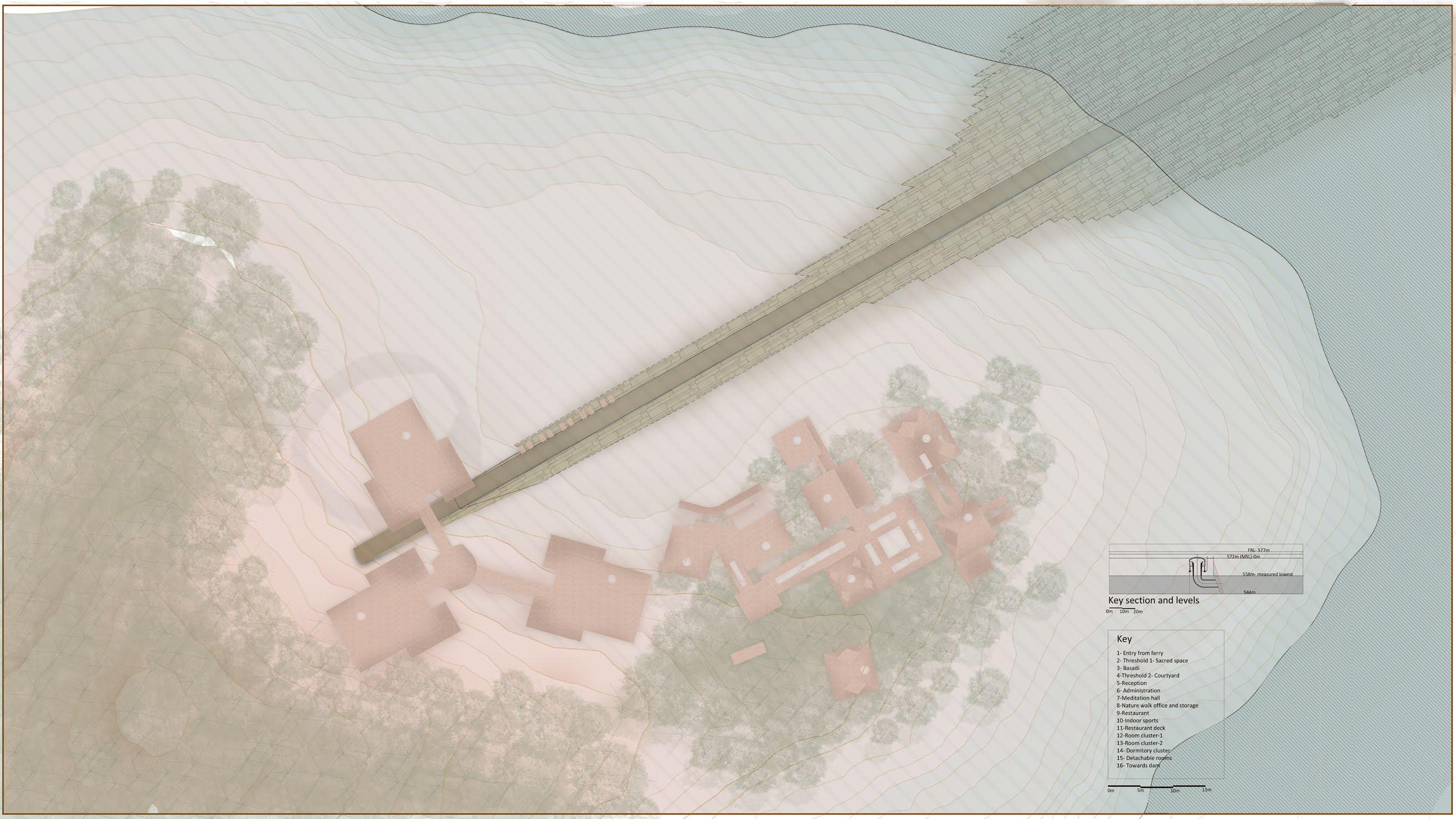

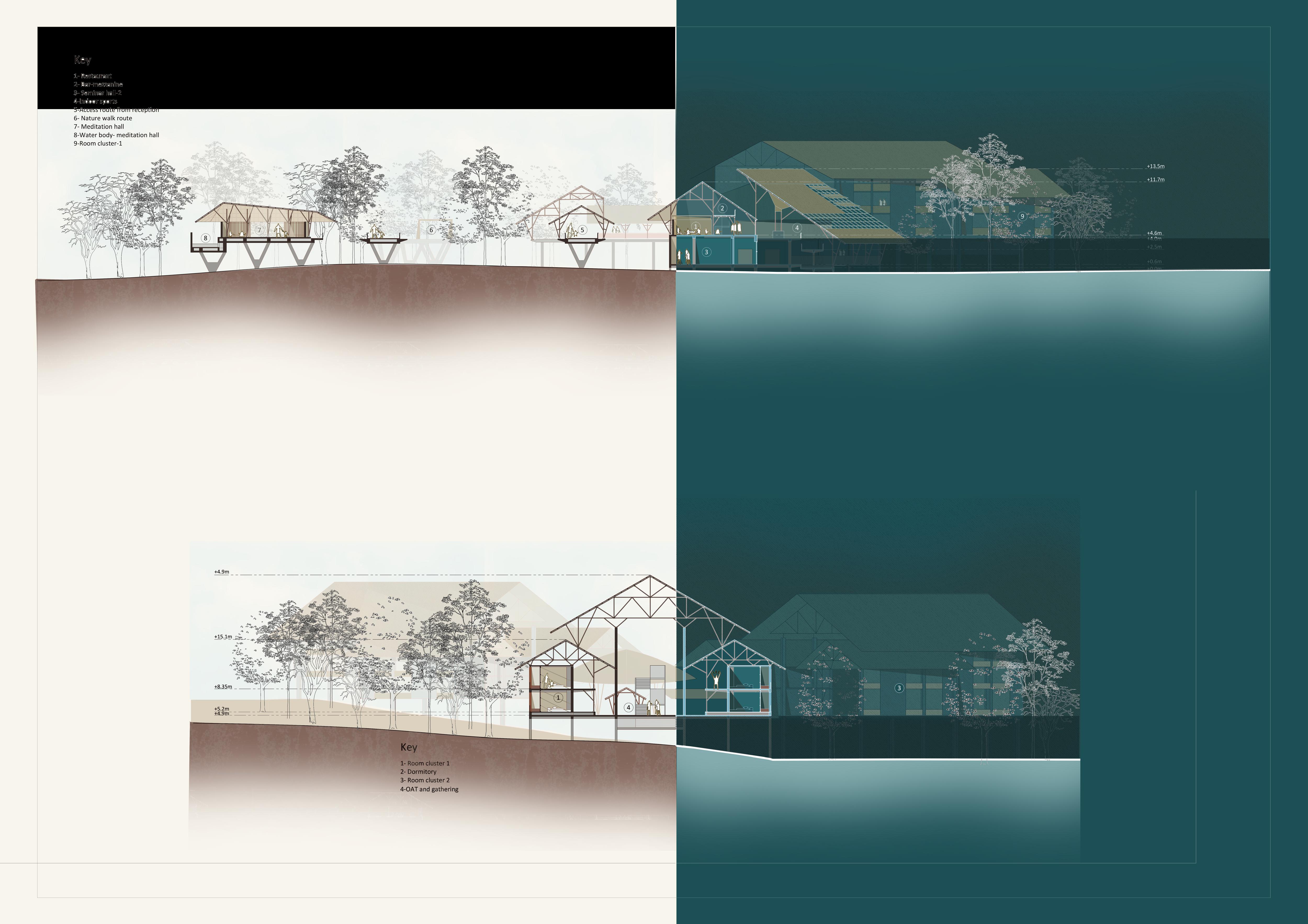


16 15 13 12 14 11 9 10 8 4 2 3 5 6 1 Key 1- Entry from ferry 2- Threshold 1- Sacred space 3- Basadi 4-Threshold 2- Courtyard 5-Reception 6- Administration 7-Meditation hall 8-Nature walk office and storage 9-Restaurant 10-Indoor sports 11-Restaurant deck 12-Room cluster-1 13-Room cluster-2 14- Dormitory cluster 15- Detachable rooms 16- Towards dam Key section and levels 0m 10m 20m 558m- measured lowest 544m 0m 5m 10m 15m Key 1- Entry from ferry 2- Threshold 1- Sacred space 3- Basadi 4-Threshold 2- Courtyard 5-Reception 6- Administration 7-Meditation hall 8-Nature walk office and storage 9-Restaurant 10-Indoor sports 11-Restaurant deck 12-Room cluster-1 13-Room cluster-2 14- Dormitory cluster 15- Detachable rooms 16- Towards dam Key section and levels 0m 10m 20m 558m- measured lowest 544m 0m 5m 10m 15m ROOF PLAN LAND SIDE SECTION 1 Lower water levels Reception 1 (12)


Restaurant and spa Rooms Meditation centre SECTION 1 Higher water levels 0m 1.5m 4.5m 9m (13)
SECTION A:
HIGHEST WATER LEVEL CONDITION
DETAILED PLAN OF FLOATING STRUCTURES:
HIGHEST WATER LEVEL CONDITION
SECTION A:
LOWEST WATER LEVEL CONDITION
SECTION A: NORMAL CONDITION
A Piles Artificial reef Enclosure for supports Anchor for platform Bouyant element R E N D E R S
(14)
6
Proposed relation to dam


Existing dam bridge is used as spine. When the water level receeds, the Dam platform becomes extened part of design
BEFORE DAM CONSTRUCTION
PLINTH & CIRCULATION
STRUCTURE ARTIFICIAL REEF

AFTER DAM CONSTRUCTION
Tensile temporary roof 3
AFTER DESIGN: Lowest water level
AFTER DESIGN: Normal condition
4
AFTER DESIGN: Highest water level


1- Exhibition and Performance
2- Dance and culture workshops
3- Learning studio for locals from the research unit
4- Research unit display and workshops
5- Market and commercial
6- Dam Bridge
ILLUSTRATING THE CYCLE WITH DESIGN PLUGGED IN


Temporary roof added during 2
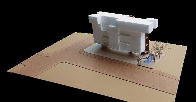
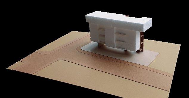
The Desert Getaway
Located in Jaisalmer near the Bada Bagh Project type : Hospitality, Resort

BRIEF .
1
The Resrvoir and the Dam Integration with site

1. 2.
Enery conservation/ Urban heat island Water conservation/


Site 26.9533742, 70.8834762
Located in Jaisalmer near the Bada Bagh
In the location of India’s first wind farm Climate Hot and dry Resources available Wind/ Solar energy
14.5m
Site elements : Effect on design

Wind movement/ Orientation Necessity of screens Windcatcher profile

GREEN BUILDING QUALITIES
2
0m 3.6m 10.8m
SECTION BB
0m
3.6m
(16)
Process i. Vehical circulation and parking as per proposed circulation ii. Public zone with access to monument through design


Public zone with ameneties
PROCESS AND MOVEMENT
Used mostly during evening and early morning hours
The levels follow the contours
Varying height of wind catchers as per the heights of the spaces served
Landscape as screen is used to shade and demarcate spaces

Used mostly during night hours and in the afternoon
OAT follow the design of the ghats
Integration of water bodies for cooling

ZONING WITH RESPECT TO ORIENTATION AND ACITVITY


Proposed circulation
Key:
CIRCULATION
DESIGN ELEMENTS
PRIVATE ZONE
SEMI-PUBLIC ZONE
PUBLIC ZONE
hours
access
Used mostly during morning
Vehicle
to public and semipublic areas from rooms General public/ tourists Restaurant and OAT access Zoning Key: Private zone: 1-Rooms Semi-public zone: 2- Lobby 3- Spa 4- Gym 5- Sports (outdoor) Public zone: 6-OAT 7-MPH 8-Restaurant 9-Bar 10- Central lawn
1 2 3 iii. ii. Entry Movement through transition zones Entry to rooms Entry to Semi-public zone iv. 4 5 6 7 8 9 10
For people staying at the hotel Acess
The three zones are connected by nodes as transitional spaces
iii.Semi
(17)
iv.Private zone with rooms v. Final design with landscapping

Office Site A A B B Plan at +1.2m 0m 5m 15m 35m 2 1 4 3 5 6 7 8 9 10 11 12 13 14 15 16 17 18 19 20 21 22 23 24 25 26 27 (18)


Plan at +6.5m
Renders
1-Recreation area bird’s eye view 2-Rooms
4 4 15 28
3-Entrance lobby 4-Semi-public areas
1.
3. 3
2. 1 2
0m 2.5m 7.5m 17.5m +10.5m +3.6m +0m -1.3m +16.8m +23m KEY 1-Main entry 2-Lobby 3-Parking under the OAT 4-Water pool near entrance 5-Kitchen and unloading deck for restaurant 6-Restaurant outdoor deck seating 7-Restaurant 8-OAT 9-Bar dance floor 10-Bar outdoor seating 11-Exit from OAT seating to bada bagh 12-Spillout near lobby 13-Reception node 14-Relaxation zone node 15-Room cluster 1 16-Lawn for banquet- spillout from restaurant and bar 17-Badminton courts 18-Room cluster spillout 19-Services 20-Outdoor shaded court 21-Outdoor court- not shaded 22-Indoor sports 23-Gym 24-MPH 25-MPH spillout 26-Swimming pool 27-Toilets and changing rooms 28-Room cluster 2 (19)
Section AA
Site features

Natural features on site like the levels due to contours, the trees and the edge conditions are preserved in the design
in-Between pauses: The film institue
Located in Mysore inside Mysore university campus
Project type Institution


Architecture acts as a lens to capture daily activities which happen within spaces
The objective of this project was to design a film institute trying to maximise the functionality of the space and heighten the daily experiences within
The design has porous edges with strategically places voids which capture activities happening within the institute from the exterior whilst also framing the views of the outside from the interior
Site 12.309034, 76.624669

Located in old Mysore University campus
Focus: Experiential architecture
Type: Institution

Context study

Plan and sections Entry,

The existing architecture inside the campus, the view sheds, main circulation paths and acitivity mapping was done to inform the zoning

Entry Kukkarahalli
lake
Karnataka State Open University
OAT Bogadiroad
Mangalore-mysore highway
Campus road
circulation Activity mapping 9am-1pm 1pm-4pm after 4pm low density medium density high density
visual axes and
BRIEF . 3 Temporary
Idea of the screen
Replacing one solid edge of a courtyard by a porous screen

Interconnected courtyards

The porus edge of one courtyard connects to the other to form a hierarchy


Framing the views
The design captures the views around through the screen, like a film strip
Axis
The predominant path for circulation is changed and building is organised along this axis


i. Given site
ii. Massing as per zoning and proximity diagrams


iii.Promenade is introduced on one edge, integration of courtyards


iv.By having the promenade cut through the site, it establishes a relationship between built and circulation paths, an urban street
v. Variation of levels of promenade so it acts as vertical and horizontal spine

vi. Integration with massing
vii. Addition of courtyard, screens and informal spaces
Temporary roof Vehicles Public Members of the institute Key Public Closed Semi-Public Semi-open Private Open
Concepts
Process Iterations
1.
(21)
2.

A B B 0m 5m 15m 35m Plan at +2.9m 2 5 6 7 8 9 10 11 12 13 14 15 16 17 18 19 20 21 22 23 24 25 26 28 27 1 3 4 Section AA 0m 5m 15m 29 (22)


Site A West elevation Renders 1-Outside the acting studios 2-Library entrance 3-Promenade area 4-Entrance
29 30 31
4. +4.35m +2.1m +0m -2.1m Key 1- Main entry 2-Prop store 3-Material store 4-Camera store 5-Workshop 6-Classroom 7-Courtyard 1 8-Display/Discussion space 9-Lobby 10-Faculty rooms 11-Spillout from faculty space 12-Studio 1 13-Acting hall 14-Toilets 15-Promenade 16-Library 17-Library spillout 18-Classroom spillout 19-Display courtyard 20-Acting hall 2 21-Courtyard 2 22-Computer lab 23-Motion photography studio 24-Service lifts 25-Dark rooms 26-Pre-view theatre 27-Lighting studio 28-Toilets 29-Cafe and spillout OAT
entry from University OAT
1.
2.
30-Auditorium 31-Public
(23)
3.
The Broken Library

Located in Jaipur inside Jantar Mantar Project type Library, Public square
BRIEF
.
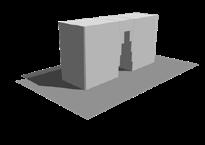
How multiple individual entities come together to create meaning in space~
This project started out with 6 cubes and a wall and how we can bring these elements togeher to create a functional yet interesting composition


Why Jaipur?
Jaipur has a very rich history and culture. Along with this it boasts of on of the largest literary fstivals in India.
Attention is being given to improve the reading culture among people. A bookstore 10 minutes away from the literary festival is proposed as solution in the Jantar Mantar observatory
Mandala
City planning of Jaipur is based on the Indian Shilpa Shastra. The mandala is usually a square of 3*3 to 9*9 but when applied to rectangles the perfect ration is described to be 1:1.5


Application
The site is divided into 7*4 grid of 27 m The number 7 as well as 9 was very auspiscious as per the vastu shastra. The instruments are inclined at a 27 degree angle

Creating the axis
Identification of grid points for suitable location of project by studying axis hierarchy and composition on site
RamganjBazaarRoad
Site 26.924720, 75.824231
Located in Jantar Mantar, Jaipur
Focus: Deconstructivism
Type: Book store
5 4 3 2 1 1 2 4 3 Section AA 0m 1.5m 4.5m 10.5m
The cubes based on their function acess contain recesses and extensions to emphasize said emotion. The addition of frame, plinth courtyard etc., serves to define the closed boundary created by wall for each cube. Arched openings establish links with existing architecture and highlight the idea of solid and void. The addition of frames creates views which lead the observer through the design subconsciously


Emphasizing the frame around the cube to visually create bigger volume of enclosed space
Solid and voids emphasized in design to highlight access exit and lobby areas
Volume of cube removed is added within the constraints of the cubes created by division of wall


Emphasis on solid and void with open colonnade spaces
 Grid structure in jaipur
Tal Katora Lake Albert Hall Museum Ramganj Bazaar
Nahargarh Fort Jaipur zoo
Grid structure in jaipur
Tal Katora Lake Albert Hall Museum Ramganj Bazaar
Nahargarh Fort Jaipur zoo
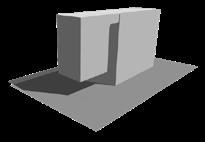
The design devides the wall into the cubes and these are scattered on site such that individually they perform various funtion but when put together they form the intitial wall Process
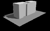
i. Freestanding wall
ii. Wall divided into 6 cubes
iii. Variation of cube sizes within wall grid
iv. Cubes are separated out and the outer boundary established by the wall grid is used to define space around the cube
4
v. Wall formed when the final cubes are put back together
Breaking down the cubes
Extension or addition of elements of design help to emphasize the invisible boundary established by the wall.
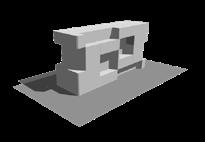
The cubes without the idea of the wallextention or addition and subtraction is random and is a cluster of separate isolated objects with not relation to each other


Renders


The cubes with the wall Addition or extention is limited by the grid due to wall, visually connected and cubes form composition where they are reated to one another


+0.6m +6.6m +9.6m
1 2 4 5 3 Site Ground plan 0m 3.5m 10.5m 24.5m Key 1-Library area 2-Bookstore 3-Office 4-New path 5-Pavilions 1 2 Sketches
1-Library
2-Entrance 5 (25)
area
7TH SEMESTER
Mapping the street


The loafer’s lane is mapped and the useage of each building is understood


SELECTION OF SITES FOR THE STUDIO
The three sites were selected after a study of the Vasantnagar region in Bangalore which was done in groups.
The sites identified best suited a public intervention which could weave together the current fragmented activities happening along the main road. The aim of the studio was to create convivial spaces which energise
SWOT

The swot analysis is done based on mapped information to aid structure plan
Multi-functional:
The spaces designed can evole with the time and useage. The wall enable people to pull out seating which can also double up as a basket for carraying food from nearby bakeires to the gathering spaces. It enables daily workers like the milk and coffee vendors to have a more formal location along the street
CONVIVIALITY POSTER CHARACTER OF CONVIVIAL SPACES
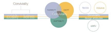
Flexibility:
The wall changes when a person interacts with it. For two people using the same space, the character of the wall depends on the previous person’s use. This creates spaces that are for the community yet affected by individual changes


Key Heavy traffic Med. traffic Sites Existing play areas Residential Potential pedestrian zone Amenities-opportunity Relations Major project site Problems of traffic/parking Key Residential Commercial Zone of intervention Proposed traffic movement Proposed sites Proposed connectivity View sheds Bridge SITE ANALYSIS
pit(W)all int[]rsect
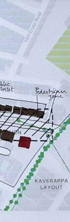
SITE MAPPING Need for seating MCC College Shangrila 3rd cross park Site 1 Site 2 Vasantnagar main road Palace road
Expansion of road Expansion of footpath 2-way lane 1-way lane
(26)
From the SWOT analysis of the site, 3 areas are chosen for intervention along the Vasanth nagar main road, also 8th main road:

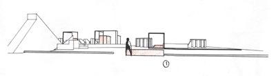
- Edge of the streetTheatre and public plaza
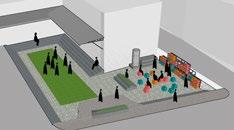
- Along the streetSpillout spaces for shops and activities in the neighbourhood
Where is the theatre?
During the times of covid when people did not go out to malls/ theatres, coming out on their balconies or terraces provided a break from the mundane life

Havelis

The havelis had small viewing chambers around the courtyard for women to sit inside and watch activities.

Creating small pods/ viewing chambers facing a blank screen wall would provide the privacy demanded whist also creating a public character.


VIEWING PODS/ CHAMBERS
ARRANGED AS A WALL BETWEEN ZONES


The design is devided into the front plaza and public space and the hostel area by the wall


CONNECT BETWEEN PUBLIC AND PRIVATE ZONES With


EXTENSION OF IDEA FROM OTHER INTERVENTIONS
The grid wall is used in the plaza and the arrangement of pods gives it a character of a pixel wall which is in contrast with other solid surfaces
PALACE ROAD +0.90m +0.45m +0.00m +0.00m +0.60m +0.75m 8. 7. 6. 10 12. 11 9. 1ST
Jahnavi J 1RW17AT038
CROSS ROAD 2ND CROSS ROAD
Major project - Vasanthnagar
Detail
Wall additionstrengthening the edge
Seating addition, extention of curb
Addition of flexible wall where people can pull out chairs to sit in gathering areas Activitynormal Activitycrowded Activitycrowded footpath Intervention of public into site Vehicular movement SITE SELECTION PROCESS SITE 1 Site Plan GROUND FLOOR PLAN SECTION AA A A 0m 10m 20m 30m 60m SITE 2 1 1 2 4 3 2 3 4 5 SITE 3
Removal of existing buildings Creating a ‘pit’ with stairs along edge and blank walls Seating along footpath and gathering area
of chair and wall grid Shading the seating area and creating a small resource hub- water, newspaper, storage
Removal of existing buildings
Creating resource hub- water, milk, newspaper, first aid powered by solar panels
VASANTHNAGAR MAIN ROAD 1 2 3 Silent zone PRIVATE PUBLIC
Plaza as extension of street activity
SITE 1 3 4 2 Legend 1.Cafe 2.Library 3.Plaza 4.Rentals 5.Lobby for theatre 6.Washrooms 7.Theatre 8.Lounge 9.Back entry 10.Dormitory 11.Court for dormitory 12.Exhibition (27)
Ugly Design


 Stage 2 sectionNoise cancelling walls incorporated in spaceacoustically better than stage 1
Stage 3 sectionEnhanced experience within the space with externally added sound track
Stage 2 sectionNoise cancelling walls incorporated in spaceacoustically better than stage 1
Stage 3 sectionEnhanced experience within the space with externally added sound track