7 minute read
9 great winter hikes around the Front Range


By Sarah Lamagna
Special to The Denver Post
Just because the leaves have fallen and the days are shorter, doesn’t mean your trail adventures have to come to a screeching halt. If anything, trails and trailheads are less busy and national and state parks are shockingly empty in winter.
Regardless of your abilities or skill level, we’ve got the perfect trails for you to hit up this winter. You may want to take snowshoes and micro-spikes to ensure a fun and safe adventure.
Check trail conditions and get directions to trailheads online before you head out. Wear layers, don’t forget to let someone know where you’re going — and take some hot cocoa in a thermos for a little après hike treat!
Emerald Lake Trail
Near: Estes Park
Length: 3.2 miles
Difficulty: Easy to moderate
Rocky Mountain National Park is usually overrun with locals and tourists alike, but it’s a bit sparser in the wintertime.
The trail to Emerald Lake starts at the Bear Lake parking area. It would still be a good idea to get there as early as you can since this is still a popular trail, even in the winter. The hike begins on the Nymph Lake Trail where you’ll encounter the lake the trail is named after about a half-mile in. You’ll skirt around the eastern side of its bank and then take a left to go along its northern border.
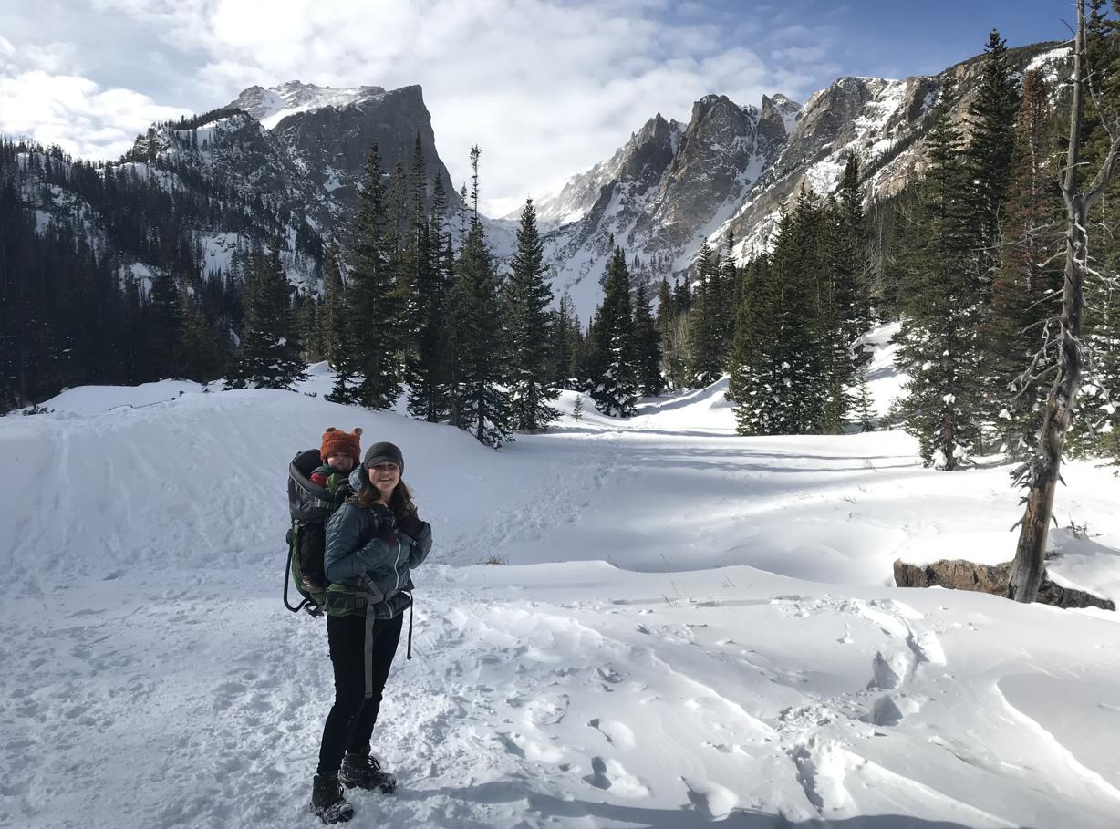
Another half-mile will bring you to the eastern point of Dream Lake. In the wintertime, the lake is frozen, and you’ll likely be able to walk right across it (just be careful!). Once you’re past Dream Lake, it’s less than a half-mile to Emerald Lake where you’ll witness the looming summits of Hallett Peak and Flattop Mountain.
Saint Mary’s Glacier
Near: Idaho Springs Length: 1 mile Difficulty: Easy If solitude is what you’re after, Sarah Lamagna enjoys the quiet of winter as she hikes with her son near Dream Lake along the Emerald Lake Trail in Rocky Mountain National Park. Courtesy of Sarah Lamagna
this trail is not the one for you. The hike to Saint Mary’s Glacier is short with minimal elevation gain so your destination may be crowded. Saint Mary’s Glacier isn’t actually a glacier; instead, it’s a semipermanent snowfield (i.e., you can usually sled down it in July). But when you go in winter, it’ll definitely have snow and the lake at the bottom of the “glacier” will be frozen over.
Due to the heavy amount of traffic on the trail, it will also likely be slick, so come prepared with the right boots. Bring skates for the lake or a sled to make the most of this short, fun hike.
CMC-Brainard Snowshoe Trail
Near: Ward Length: 6 miles Difficulty: Moderate This is a dedicated snowshoe trail in the Brainard Lake Recreation Area, meaning snowshoes are required and skis aren’t allowed. It’s a great hike when you want to get out on a blustery day.
The trail starts at the Gateway trailhead across the street from the parking lot. Stay alert as you hike; you’ll cross several ski-only trails along the way and a skier may seemingly come out of nowhere.
When you reach the lake, you’ll take a sharp right after the bridge to continue to the Colorado Mountain Club cabin. Remember to take cash so you can purchase some steaming hot cocoa to warm your insides for the hike back to your car.
Mayflower Gulch
Near: Frisco Length: 2.6 miles Difficulty: Easy to moderate Want to see some old mining ruins with an epic mountain backdrop? Look no further than the trail to Mayflower Gulch.
In winter months this trail is full of skiers and snowshoers hoping for a bluebird day. The trail starts before you hit Fremont Pass on Colorado 91. It’s wide as it used to be a mining road.
The trail opens up at the base of the surrounding mountains when you reach the ruins. It’s the perfect spot for a snack and a hot beverage before heading back to your car. The views are gorgeous.
You can extend your adventure and hike the Mayflower Gulch Grand Traverse, an out-and-back that adds a few miles.
Clear Creek Trail
Near: Golden Length: 1-20 miles Difficulty: Easy to moderate,
HIKES
«FROM 12
depending on how far you go
You can go as far as you like on the Clear Creek Trail. In its entirety, the trail is 20 miles roundtrip. It starts in the heart of Golden — home to Coors Brewery and with a walkable downtown of restaurants and shops.
You can hike a bit west and as far east as downtown Denver on connecting trails. It’s a great walking — and biking — trail no matter the time of year.
Head west and you’re more likely to have the trail to yourself. Head east and you’ll find ponds and picnic tables along the trail as it winds along Clear Creek. Make time for a bite and pint in Golden’s historic downtown.
Silver Dollar Lake Trail
Near: Georgetown
Length: 5.5 miles
Difficulty: Moderate to strenuous
The road up to Guanella Pass closes in winter due to heavy snowpack, but it’s blocked off exactly where you need to park to start hiking to Silver Dollar Lake. In summer, there is a rugged dirt road that brings you closer to the trailhead, but it’s not open in the winter.
You’ll start by crossing the street to head up the dirt road for 0.7 miles. The trail will veer left and continue to climb up for a beautiful view of Naylor Lake. After 1.5 miles, you’ll reach Silver Dollar Lake. You can continue another half-mile to Murray Reservoir from there, for more lovely views and a bit more of a workout.
Gem Trail to Balanced Rock
Near: Estes Park
Length: 7 miles
Difficulty: Strenuous
Head to the Gem Trail for a slightly different (and less visited) view of Rocky Mountain National Park. Starting at the Gem Lake trailhead (a popular spot in summer), you’ll meander up toward the lake.
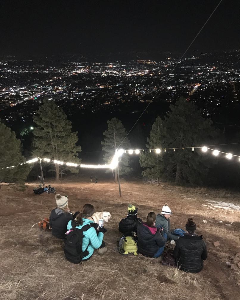
The ascent begins to flatten once you get to the lake. If you Friends gather to take in the view during an evening hike to the Flagstaff Star in Boulder. Courtesy of Sarah Lamagna
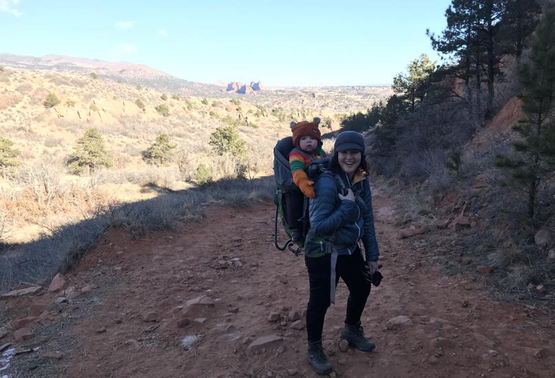
Sarah Lamagna and her son hike the Greenlee and Mesa trails loop at Red Rock Canyon Open Space near Manitou Springs.
Courtesy of Sarah Lamagna
need to use the toilet, there’s an epic one at the lake. (Trust us on this.) Make sure to look back where you came from and snap a photo of Longs Peak.
Once you’re past the lake, you’ll meander through forests until you reach Balanced Rock. When you’ve had your fill of beauty, head back the way you came.
Flagstaff Star
Near: Boulder
Length: 1.5 miles
Difficulty: Easy to moderate
Sure, you can drive up to Boulder’s Flagstaff Star. But it’s way more fun to hike to it. For extra fun, set off as the sun is setting so you can reach your destination when it’s all lit up!
The trail starts at the Flagstaff trailhead and is a steady incline for about a half-mile. Around the 0.7-mile marker, you’ll stay straight onto the Halfway House trail. This is also the point where you’ll see the shine from the star.
Bring some tea and treats to nosh on while sitting under the stars (both natural and humanmade).
Greenlee and Mesa Trail Loop
Near: Manitou Springs
Length: 3.4 miles
Difficulty: Easy
For a different view of the famed Garden of the Gods Park, hike the Greenlee and Mesa Trail Loop in Red Rock Canyon Open Space. You may be shocked to find few fellow hikers on a snowy day at this gem of a park on the south side of U.S. 24.
The trails here are usually clear most of winter, so there’s no need for snowshoes. But you may want micro-spikes; the sun doesn’t reach some stretches of the trail and snow and ice can linger.
Head up the hill on the Mesa Trail, past the off-leash dog park (leashed dogs are welcome on all trails) for about a mile. Stop now and then to take in the views of the sandstone spires of this park and those to the north in Garden of the Gods — they’re part of the same formation. Look west, too, for views of Pikes Peak.
At the intersection with the Greenlee Trail, turn left (north) to take it back to your car. To explore further, take any of the network of trails at Red Rock Canyon to complete a longer loop. Pop into Manitou Springs for a bite and a beverage before heading home.


