Justin Villareal Estanislao
Student at the University of Virginia
jve7csp@virginia.edu
(757) 405-4512
I am an undergraduate student at the University of Virginia. As an Urban and Environmental Planning major in the School of Architecture, I have studied the social, economic, political, and environmental forces that inform the built environment. Our urban future depends on the careful consideration of these factors. My background in the hospitality industry and urban planning lends itself to professional work that embraces innovation, encourages collaboration, and celebrates diversity.
Technical Skills
Adobe InDesign
Adobe Illustrator
Adobe Photoshop
Adobe Lightroom
ArcGIS Pro
ArcGIS Online
Curriculum
Foundation Studio I
History of Architecture
Global Sustainability
Digital Visualization for Planers
Environmental Justice Writing
GIS for Planners
Global Environmental Issues Cities and Democracy
Planning Methods
Rhino
Microsoft Word
Microsoft Excel
Microsoft PowerPoint
Google Suite
Planning for Coastal Resilience
Science, Tech, and Development
Models for Higher Density Housing
Ethics of Cities and Environments
Law, Land, and the Environment
Education
2020 - 2024 Bachelor of Urban + Environmental Planning University of Virginia, School of Architecture
Professional Experience
2023 - Present Student Research Assistant
Sea Level Rise Visualization
Under the supervision of Professor Bev Wilson, I explore various tools for visualizing the impact sea level rise will have on coastal communities of Hampton Roads.
2021 - Present
Training Director
Chick-fil-A Barracks Road
I lead a team of specialized trainers to teach new hires franchise and corporate expectations. I create digital and print resources that streamline the training process and ensure adequate investment in each team member. Under my leadership, my team helps develop the future leaders of the business.
2018 - 2023
Operations Manager
Chick-fil-A Crossways Center
Chick-fil-A Indian River Road
I led the operations of two multimillion-dollar QSR establishments serving thousands of guests daily and achieving business benchmarks.
Contents
Urban Fabric of Maré Health of Citizens?
& Rachel Kinzer
Foundations
a profound impact on their health and well-being within their community. Housing, identify major components of the Urban Fabric that influence our physical and mental done on mosquito-borne diseases (Santos, Jefferson Pereira Caldas et al, 2020) and Restorative City framework. This analysis investigates these issues in the context on Maré, implications they have on the health of citizens.
Mental Health
Mental health has gradually been accepted as an issue within Maré. Despite this acceptance, few institutions provide appropriate care for mental illness. With complications from violence, weapons, police, lack of greenspace, and minimal security, anxiety and fear proves common across Maré. The church has served as a form of community therapy. Its funding by the government, however, suggests it is a form of propaganda. Strong cultural cohesion across communities unites residents and provides mental peace.
without access to such as contact City.” many emotional symptoms.”
Praia de Ramos
Parque Roquette Pinto
Parque União
Parque Rubens Vaz
Nova Holanda
Parque Maré
Baixa de Sapateiro
Nova Maré
Morro do Timbau
Conjunto Bento Ribeiro Dantas
Conjunto Pinheiros
In response to Maré’s housing shortage, real estate investment has shaped the urban fabric. After maximizing the available landscape, investors have reconfigured interior space to accommodate more residents with the tenement model (Santa et Silva, 2015). The average number of people per room in Maré is 1.9 people; this is nearly 3.5 times the average of countries recorded by OECD, with 0.58 people per room.
te•ne•ment
housing that maximizes infill growth with room subdivision and shared space

OECD Countries Maré


0.58 people per room
Street Conditions
1.9 people per room
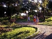
The patchwork-like streets in Maré are also overcrowded, affecting the quality of life of residents and access to emergency services. The narrow streets are often congested with automobiles and business stands. This, in addition to inadequate sidewalk space, makes it harder for pedestrians to move freely around the neighborhoods. Significantly, there is no formal infrastructure for runoff water; this means that the impervious streets fill with water and can become breeding grounds for mosquitos.
Vila dos Pinheiros
Salsa E Merengue
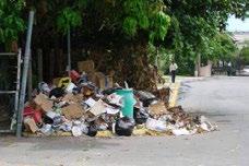
Many of the Favelas have poor road networks, as shown by the lack of official roads on the map. Therefore, it is estimated that around 40% of the trash in the favela does not get disposed of properly (Source, year), leading to further environmental degredation.
Poor Trash Collection Highway Pollution
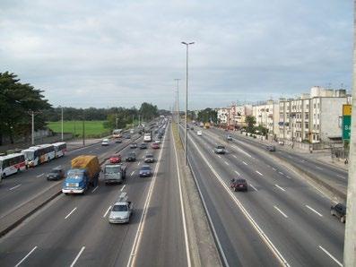
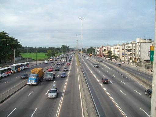
Maré is bordered by two major highways: Avenida Brasil (left) and Linha Vermelha (right). Avenida Brasil is the busiest highway in Rio de Janeiro, carrying around 800,000 cars daily (Source, year). This contributes to air, sound and ground pollution in the favelas while also serving as a barrier to the areas to the west.
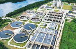
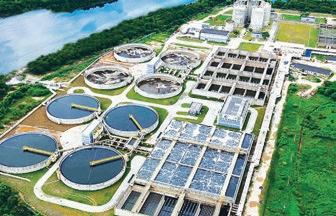
The location of the Alegria sewage plant directly adjacent to Mare puts the citizens in danger of groundwater contamination. This is due to a majority of the sewage not being treated correctly, and being dumped (Source, year).
Urban Informality in Maré
Vila do João
Parque Ecológico Da Maré
Conjunto Esperança
Residents of Maré experience a disparate imapct froim diseases. Many lack access to proper healthcare and poor infrastructure limits accessibility to distant opportunities.
Key Vegetation Tenement Housing
0 0.25
0.13 Miles
Urban Heat Island Effect
Maré has a significant amount of impervious pavements within its favelas, resulting in a hotter and more humid environment. This worsens respiratory conditions and skin allergies, while also increasing the potential for mosquito-borne diseases.
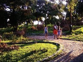
Soccer fields commonly serve as public green space in the favelas.
Parque Ecológico Da Maré
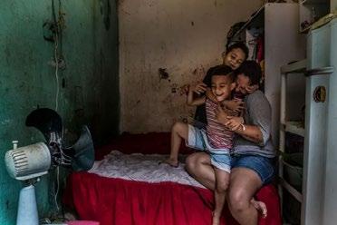
Tenement model housing maximizes real estate availability, providing more housing for Maré’s residents. This overcrowding relies on common spaces, promoting the more active spread of disease and illness.
The infrastructure of Maré falls short of all citizens’ needs. In fact, its presence even degrades the livability around Maré between sewage treatment and highway clamor.
University of Virginia: Multimodal Accessibility


1 Foundations
As a 1st Year in UVa’s School of Architecture, undergraduate students develop a fundamental understanding of design. Skills acquired during two semesters of studio work carry into the students’ future design-oriented academic career. I spent my First Year studying remotely from Virginia Beach. This section is a collection of the physical and digital design projects I accomplished remotely as foundational work for my School of Architecture career.
Lessons in Making
As an undeclared Architecture student, first year School of Architecture students participate in an introductory design course under the instruction of Sanda Illiescu. The 3-credit course provides first-year students the opportunity to discover and apply design practices through a variety of mediums. Those include sketching, collaging, and modeling.
Fields //
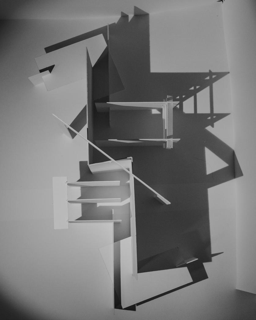
Working with fields strengthens the understanding of relationships across microscopic design elements. This exercise introduced that interactive design system by cutting and gluing an 18”x24” paper sheet into organic forms.



Proun //
The “Proun” was coined by El Lissitzky referring to a “project for the affirmation of the new” (Yale). It is the coalescence of abstract pieces into a larger architectural mosaic. This assignment was performed using corrugated cardboard as an exploratory iteration and finer bristol board in a more refined model.
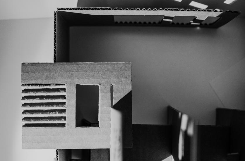
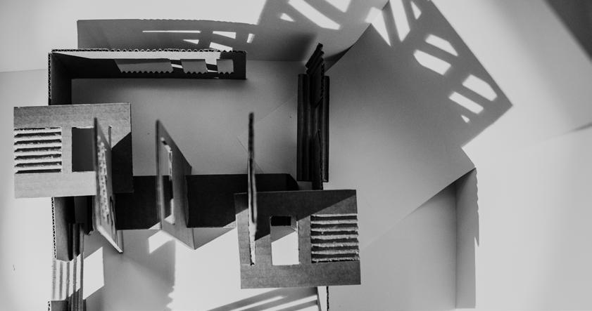
/ Corrugated Cardboard

ARCH 1030 // Foundation Studio I
First year School of Architecture students participate in an introductory studio course under the head instruction of an architecture department faculty number. Each student participates in a smaller studio of around 10 students, 1 student instructor, and 1 assistant professor. The studio builds on the practices of design introduced in ARCH 1020 in more complex physical and digital models.
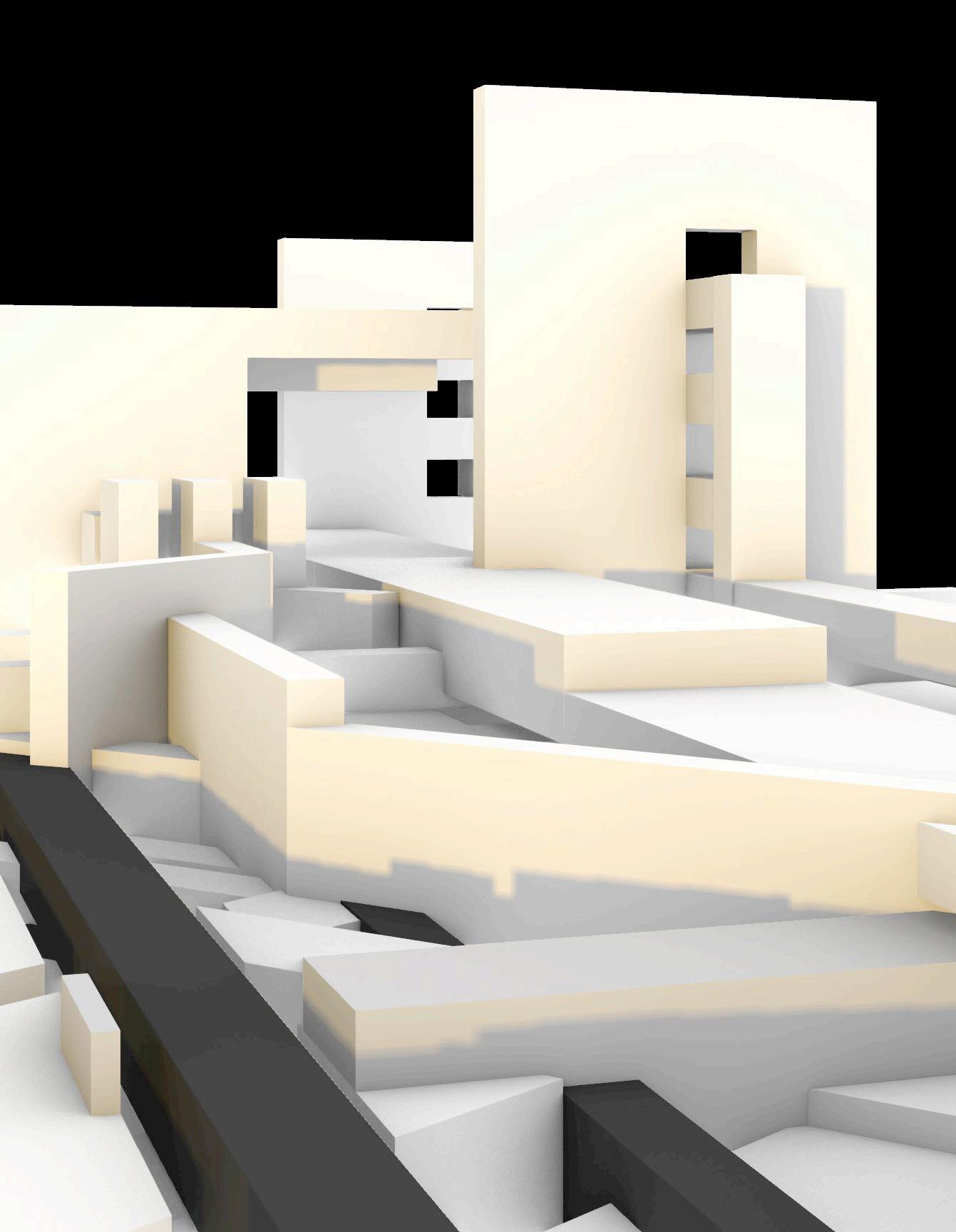
Building Mass //
The Building Mass project provided 1st Year architecture students an opportunity to experiment with the layering of physical materials and the relationship among repeated overlaps. The project required spatially considering the overlay of edges, surfaces, and masses, while introducing dimensional possibilities.


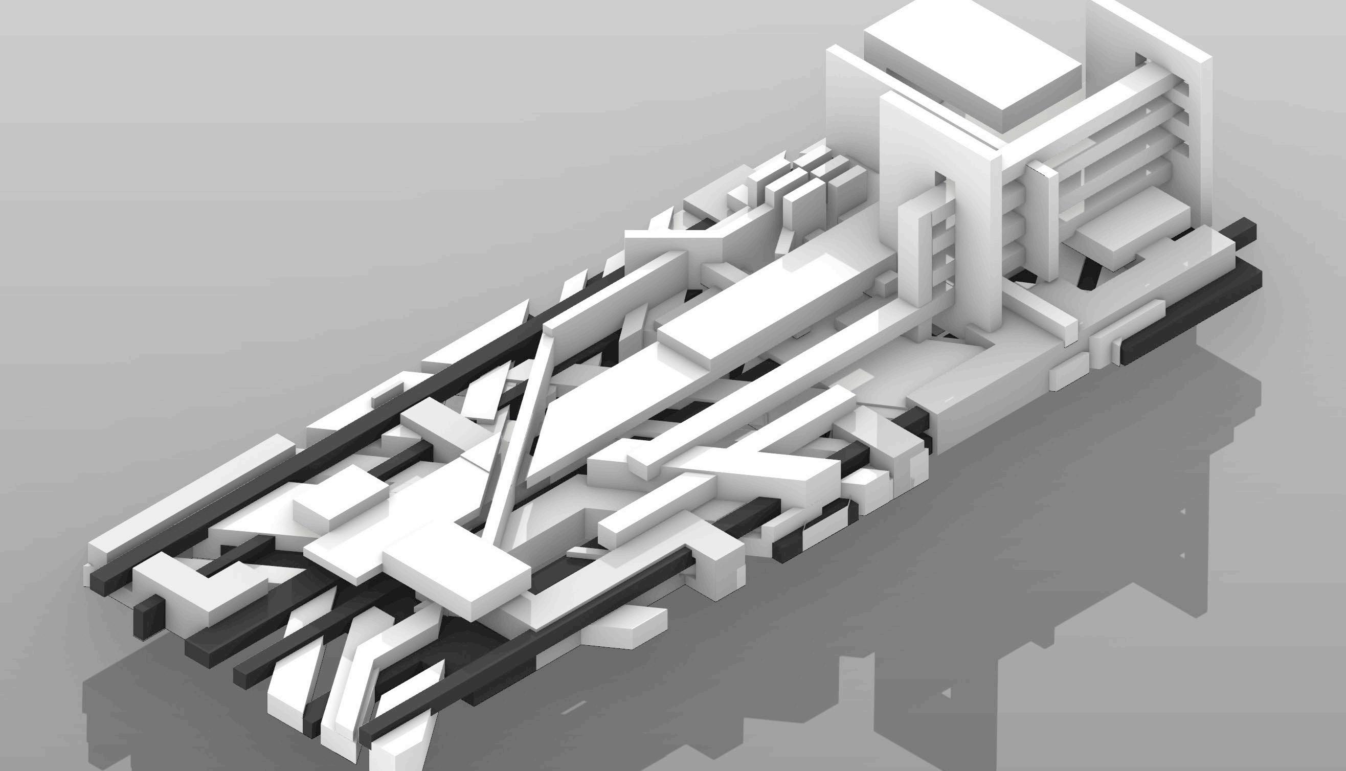
Planar Site //
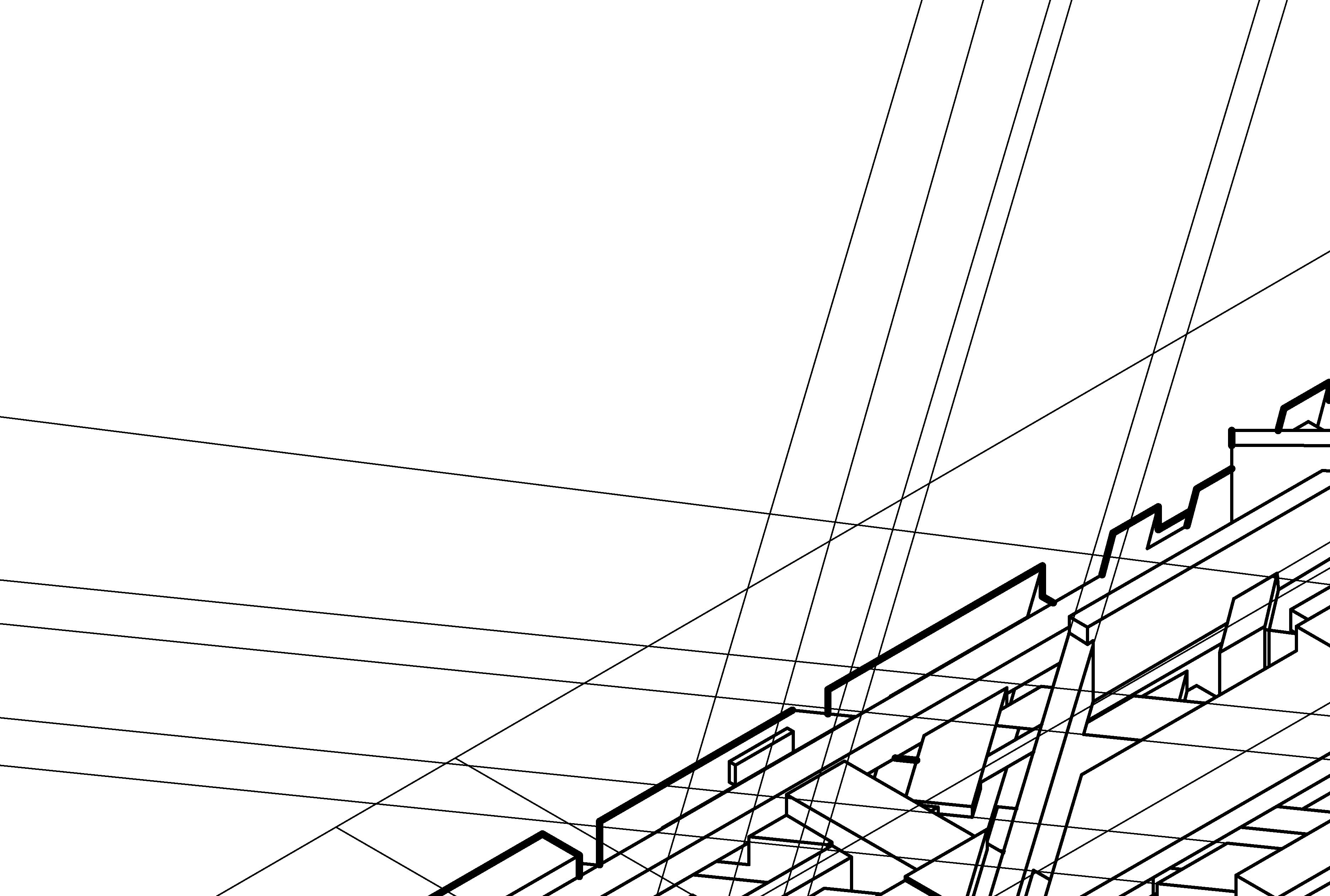
The Planar Site model adapted the spatial understandings from the Building Mass project into Rhino. Rendering software enabled a more complex consideration of diverse physical elements, designing in both microscopic and macroscopic levels.
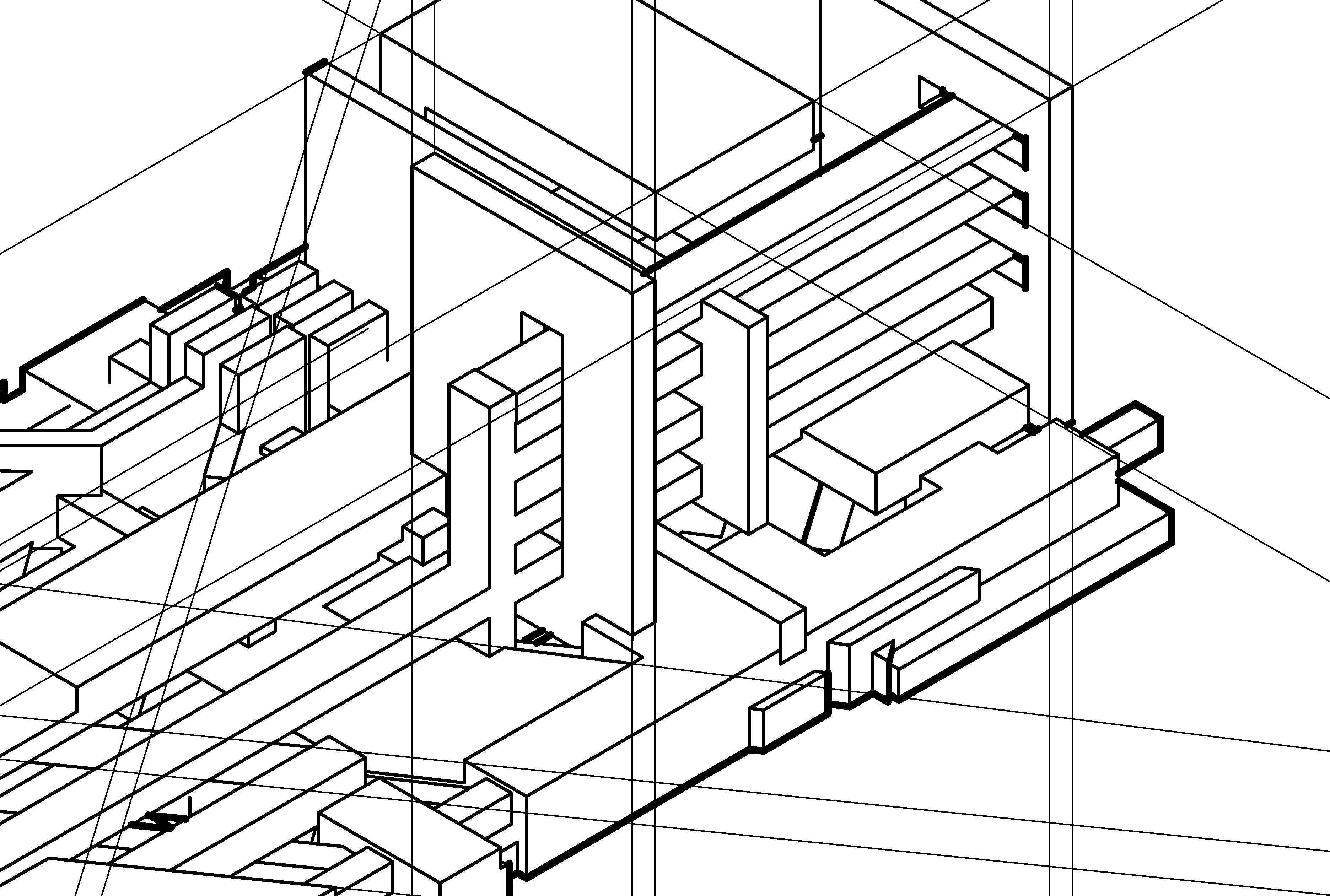


2 Urban Informality
Informal urbanism accounts for a significant portion of the global political economy. Its significance is reflected in the urban landscape of countries and cities around the world. As a Second Year student in Planning Design, I collaborated with other planners to investigate the consequences urban informality has on the lived experience of the built environment. Paired with a community engagement seminar, we explored the neighborhood of Maré in Rio de Janeiro in a semester studio.
In collaboration with: Erik Jacobson, Rachel Kinzer, and Shaque Roberson
How Does the Urban Fabric of Maré Influence the Health of Citizens?
Maré, Rio de Janeiro
An individual’s environment holds a profound impact on their health and well-being within their community. Housing, infrastructure, and green space identify major components of the Urban Fabric that influence our physical and mental health, according to research done on mosquito-borne diseases (Santos, 2020) and the Restorative City framework (Roe & McCay, 2021). The implications of the urban fabric on the health of citizens expose the omnipresence of environmental injustice among residents. This analysis investigates these issues in the context of Maré, Rio de Janeiro.
Context
Maré accounts for 10% of COVID-19 cases in Rio de Janeiro’s favelas
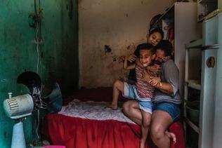
“There were many months without access to rights fundamental to well-being, such as contact with the nature and the City.”
“[Children and teenagers] had many emotional and psychosomatic symptoms.”

- Daniel Becker, Pediatrician (Redes da Maré, 2022)
Mental Health
Mental health has gradually been accepted as an issue within Maré. Despite this acceptance, few institutions provide appropriate care for mental illness. With complications from violence, weapons, police, lack of greenspace, and minimal security, anxiety and fear proves common across Maré. The church has served as a form of community therapy. Its funding by the government, however, suggests it is a form of propaganda. Strong cultural cohesion across communities unites residents and provides mental peace.
Rafael Nascimento de Souza @nasrafaelHello, @CedaeRJ. How’s it going? Can you imagine Jardim Pernambuco with no water for four days?
What’s going on in Maré? Any explanation?
9:17 AM • Nov 18, 2020
Despite having water infrastructure leading to most houses, Maré experiences inconsistent service from CEDEA, the area’s water supplier.
eduardopaes
Street Conditions
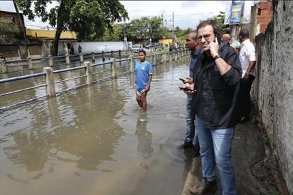
4,283 likes eduardopaes Keeping track of the disturbance caused by the rains in the city!


Eduardo Paes became mayor of the city in January 2021. From his social media, Paes appears concerned about public heath and improving stormwater management in the city’s favelas. Comments, however, suggest that his posts are performative.
Sources Arujo. (2021, February 5). Waste is gold: Energy recovery as a solution for the favelas [opinion]. RioOnWatch. Retrieved March 24, 2022, from https://rioonwatch.org/?p=63898
Catalytic Communities (2022). Covid-19 in Favelas Uni ed Dashboard. Retrieved from https://experience.arcgis.com/experience/8b055bf091b742bca021221e8ca73cd7/
Costa, R. da G.-R. (2007, March 1). Scielo - Brasil - Tra c. História, Ciências, Saúde-Manguinhos. Retrieved March 24, 2022, from https://www.scielo.br/j/hcsm/a/QsvKbK53WXkyPWm W5WmcBYF/?lang=pt Lucas Santa, V. et Augusto C sar Pinheiro da Silva. Houshold Subdivision: The precariousness of the urban habitat in the Mare Complex, Rio de Janeiro, Brazil. Colombian Journal of Geography, 2012. Vol 21, pp. 27-39.
OECD Better Life Index. Housing. Retrieved from https://www.oecdbetterlifeindex.org/topics/housing/
Redes da Maré. (2022). From the Start of Vaccination to the Omicron Outbreak, Going Through the Peak of Deaths and CPI of COVID: 2021, A Year of Great Challenges. Health Connection - An Eye on Corona, 44. Retreived from https://www.redesdamare.org.br/media/downloads/arquivos/01E44deolhonocorona.pdf Roe, J., & McCay, L. (2021). Restorative Cities: Urban Design for Mental Health and Wellbeing. London: Bloomsbury Visual Arts. Saneamento Nada Básico. Agência Pública. (2018, May 26). Retrieved March 24, 2022, from https://apublica.org/video/2018/05/saneamento-nada-basico/
Santos, J. P. C. et al. (2020). A Perspective on Inhabited Urban Space: Land Use and Occupation, Heat Islands, and Precarious Urbanization as Determinants of Territorial Receptivity to Dengue in the City of Rio de Janeiro. International Journal of Environmental Research and Public Health, 17(18), 6537. Retrieved from https://doi.org/10.3390/ijerph17186537
OVERCROWDING Housing
Tenement Housing
In response to Maré’s housing shortage, investment has shaped the urban fabric. available landscape, investors have space to accommodate more residents model (Santa et Silva, 2015). Andreza, a Holanda, further revealed common housing as unfinished windows, the lack of central mold caused by humidity.
] te•ne•ment mo•del
housing that maximizes room subdivision and


OECD Countries Maré
0.58 people per room
1.9 people per room
shortage, real estate
After maximizing the reconfigured interior residents with the tenement a resident from Nova housing conditions such central air systems, and
maximizes infill growth with and shared space
Residents of Maré experience a disparate impact from diseases. There is evidence of State agencies failing to support, and even neglecting, people’s basic rights.

Justin Estanislao, Erik Jacobson & Rachel Kinzer
Penultimate Review

LACK OF INFRASTRUCTURE
Infrastructure
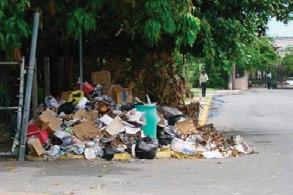
Poor Trash Collection
Many of the Favelas have poor road networks, as shown by the lack of official roads on the map. Therefore, it is estimated that around 40% of the trash in the favela does not get disposed of properly (Simões, Roza; 2018), leading to further environmental degredation.
Highway Pollution
Maré is bordered by two major highways: Avenida Brasil (left) and Linha Vermelha (right). Avenida Brasil is the busiest highway in Rio de Janeiro, carrying around 800,000 cars daily (Arujo, 2021). This contributes to air, sound and ground pollution in the favelas while also serving as a barrier to the areas to the west.
Untreated Sewage
The siting of the Alegria sewage plant directly adjacent to Maré puts its citizens in danger of groundwater contamination. This is due to a majority of the sewage not being treated correctly, and being dumped (Costa, 2007).
URBAN HEAT ISLANDS
Green Space
Urban Heat Island Effect
While Maré’s favelas appear surrounded by vegetation, there is a significant amount of impervious pavements within the favelas, resulting in a hotter and more humid environment where people actually live. Henrique, a local Maré resident, revealed that respirtory diseases and skin allergies are common.
While tenement model housing provides more affordable options for Maré’s residents, the consequential overcrowding promotes the spread of disease and illness.
The infrastructure of Maré falls short of all citizens’ needs. In fact, its presence even degrades the livability around Maré between sewage treatment and highway clamor.
S.W.O.T. Analysis
How Does the Urban Fabric of Maré Influence the Health of Citizens?
Maré, Rio de Janeiro
Our previous analysis revealed the implications of Maré’s urban fabric on the quality of life of its residents. Building on Maré’s community agency, the support from necessary political, economic, and social actors will help catalyze improvements to the Favelas. The redesign of Maré’s urban fabric will diminish the environmental injustices that have burdened residents for decades as new projects begin to protagonize their built environment.
Strengths Weaknesses
• Self-representation by the community
° strong cultural bond
° community organizations collecting data and putting Maré on the map
° community voice strengthened by church and organizations
° community agency
• Existing soccer fields promote active community
• Multifunctional streets promoting mixed-use development
° street serves as an extension of the home
° active economic scene on the streets
° transportation
• Proximity to central city and national university
• Through multiple health clinics, health professionals and their affiliated institutions collaborate with the community
• Inattentive state leadership to community concerns
• Lack of formalized data collection and information
• Church uses vulnerable community members to serve agenda
• Overcrowded tenement housing model
• Lack of infrastructure
° no stormwater management
° inadequate trash collection services
° untreated sewage polluting streets
• Highway pollution
• Minimal green urbanism
° little tree canopy coverage
° one primary public park in south Maré
• Population disconnected from central city and university poor transportation systems
Threats Opportunities
• Bridge gap between community members and the state through community organizations empowered by state
• Enhance existing active space through greening techniques
° Rua da Muda Pilot Program
• Increase connectivity between Maré and the rest of Rio de Janeiro
• Enhance existing health clinics with more quality instruments and the inclusion of formalized mental health resources
Taking Action
• Diminishing individual and community agency
• Worsened vulnerability to flooding events, mosquito mold, and further infrastructural degradation
• Exacerbated urban heat island effect
• More frequent severe public health outbreaks
• Degraded quality of life
° increased mental illnesses
° worsening of severe illnesses, heat-related illnesses, mosquito-borne diseases, air-borne diseases
Now 2025 2030 2035 2040
• Incremental urban upgrading specific to Maré that pulls from Favela Bairro Project
• Implementing multi-year community engagement meetings to understand housing conditions in Maré from residents with government officials and city planners
• Tree canopy planted in underserved areas identified with GIS
• Begin mental health training with current mental health professionals
Funding
• Gradual hiring and training of community members to lead neighborhood maintenance program
• Existing housing upgrades: ventillation, windows, air conditioning, dehumidifiers, mold removal
• New gathering spaces with park utilities, benches, fields
• Maré-wide implementation of mental health services in clinics
• City collects holistic data to better analyze community with co-created data collection programs
• Adaptable infill housing (e.g. Alejandro Aravena housing) to improve availability and provide temporary housing for next phase
• Full transformation of greenspace in Maré
• Structual upgrading of housing, redesigned floor plans to provide privacy, organic architecture
A Future for Maré
Vision
A built environment for Maré that enhances public health and well-being. 2045 2050
Mission
Cultivate and reimagine an urban fabric for Maré that promotes public well-being while respecting existing community culture. Upgraded infrastructure, redesigned housing typology, supplemented greenspace, strengthened healthcare services, and co-produced public data will improve public health and well-being for residents of Maré.
Maré will mitigate the spread of disease with a standardized infrastructure system that properly manages stormwater and waste by 2050.
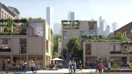
Maré will provide adequate affordable housing for residents that reduces overcrowding and its harmful implications in minimally intrusive phases by 2050.
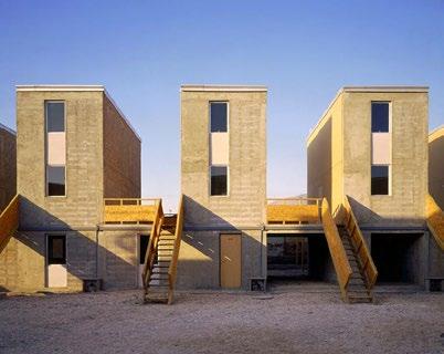
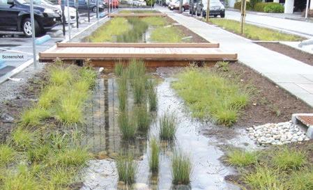
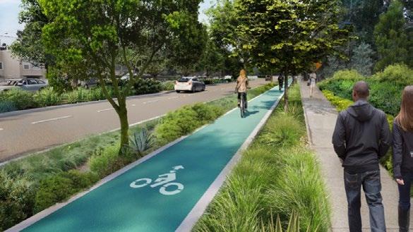
Residents of Maré will have access to greenspace throughout their neighborhood with public park infill development and green street initiatives by 2030.
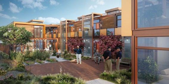
Healthcare clinics in Maré will effectively serve all patients with improved access and inclusion of mental health services to promote complete well-being by 2030.
Maré will empower community members to speak and act on issues within their neighborhood by establishing platforms for individual and community agency by 2025.
3 University of Virginia: Equitable Mobility
This is my final project from PLAN 2111: GIS for Planners. Tasked with choosing any topic to demonstrate our GIS skills, I mapped the impact construction has on pedestrian mobility at the University of Virginia. I worked with a variety of geospatial data in ArcGIS, which I then visualized using Rhino and Adobe Illustrator.
Equitable Mobility at the University of Virginia
The University of Virginia takes pride in its stance as among the best public institutions in the world. Its leadership in subjects such as health, public policy, business, and more have earned “Jefferson’s University” the esteem it touts. Located in the humble suburb of Charlottesville, VA, UVa “Grounds” provides the academic atmosphere for cultivating successful students. The Academical Village, a UNESCO World Heritage Site, centers the University across the Piedmont’s rolling hills and among its deciduous forests. The University of Virginia’s Grounds shape the educational experience of students from around the world, but current students are forced to adapt to a disrupted landscape.
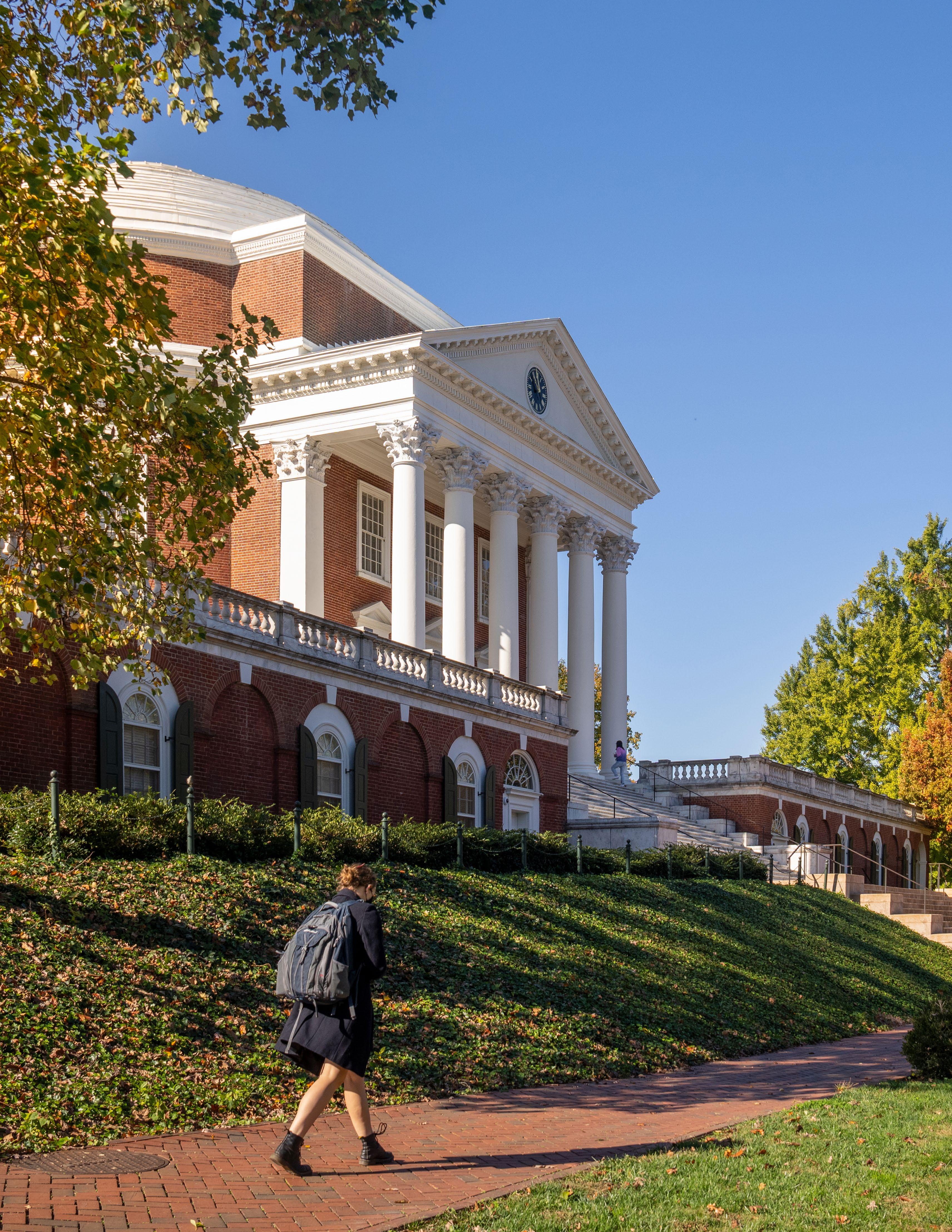 Photo from BRAND.VIRGINIA.EDU
Student Experience
The built environment must adapt to the consistently evolving demands of its users. The academic scene requires even more frequent transformations to its structural landscape to ensure it provides an adequate setting for enhancing student excellence. The University of Virginia seeks to serve its students with prime facilities, but the journey of construction required to achieve these results takes a toll on the current student body. UVa’s construction sites have obtained infamy among “Hoos”. Between obstructed sidewalks and frequent detours, UVa adds stress to pedestrian safety and challenges to accessibility. This analysis seeks to expose the impact construction across UVa has had on students’ mobility, access, and safety traversing Grounds.
Pedestrian Accessibility
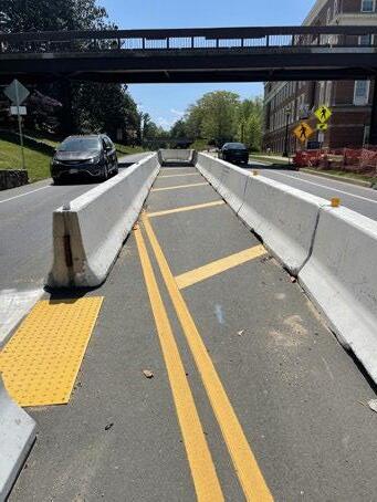
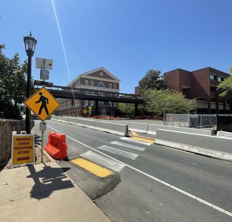
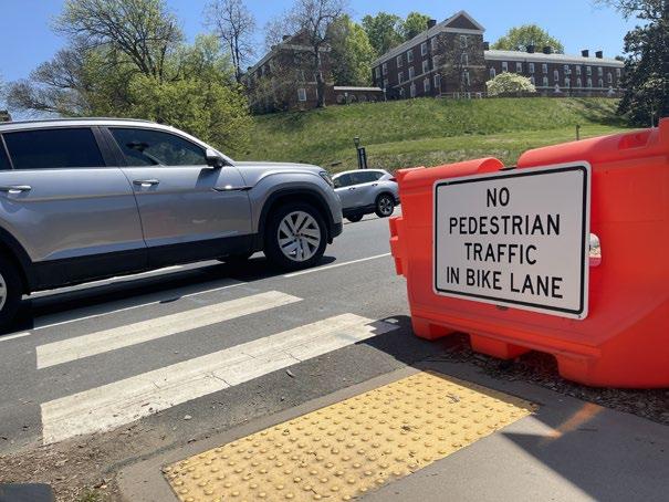
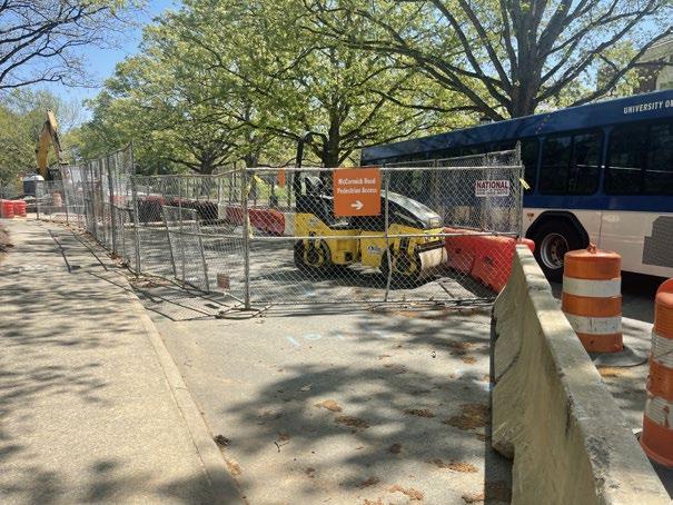
Sidewalk closures expose pedestrians across Grounds to added risks in their commute. Construction reroutes pedestrians across busy streets often with insufficient notice to drivers to watch out for varieties in crossing pattern increasing the potential of an accident. The associated dangers with walking interfere with students’ right to multimodal mobility forcing them to rely on motorized transportation.
Travel Context
With the overwhelming majority of commuters favoring the private automobile’s flexibility, efficiency, and safety, infrastructure reflects those preferences, especially at UVa. Pedestrians suffer a disparate impact from construction zones on Grounds. Sidewalks are frequently the first to be closed, rerouting people across busy streets and through a maze of detours. As indicated in statements from UVa students, these changes in walkway availability are hardly communicated until arrival and cause unnecessary delays and heightened risk of fatal accidents.
1 out of 3 commuters avoid walking because they feel unsafe.
(University of Virginia Center for Survey Research, 2017)
What Students Have to Say
It seems like I am constantly being surprised by new construction and detours that I have to take, which really impact my ability to get places on time.
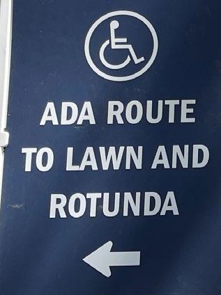
 Sarah L, 2nd Year
It seems like I am constantly being surprised by new construction. The construction has made walking slightly less pleasant but still almost completely accessible, and it has made driving much more difficult.
Dominic R, 2nd YearIt cuts off a lot of shortcuts and I feel uninformed about most of what’s going on so it’s hard to prepare in advance (like leaving earlier, finding a new route, etc.).
Patrick R, 1st YearWalkways
Closed Walkways
Construction Zones
Mapping Pedestrian Accessibility
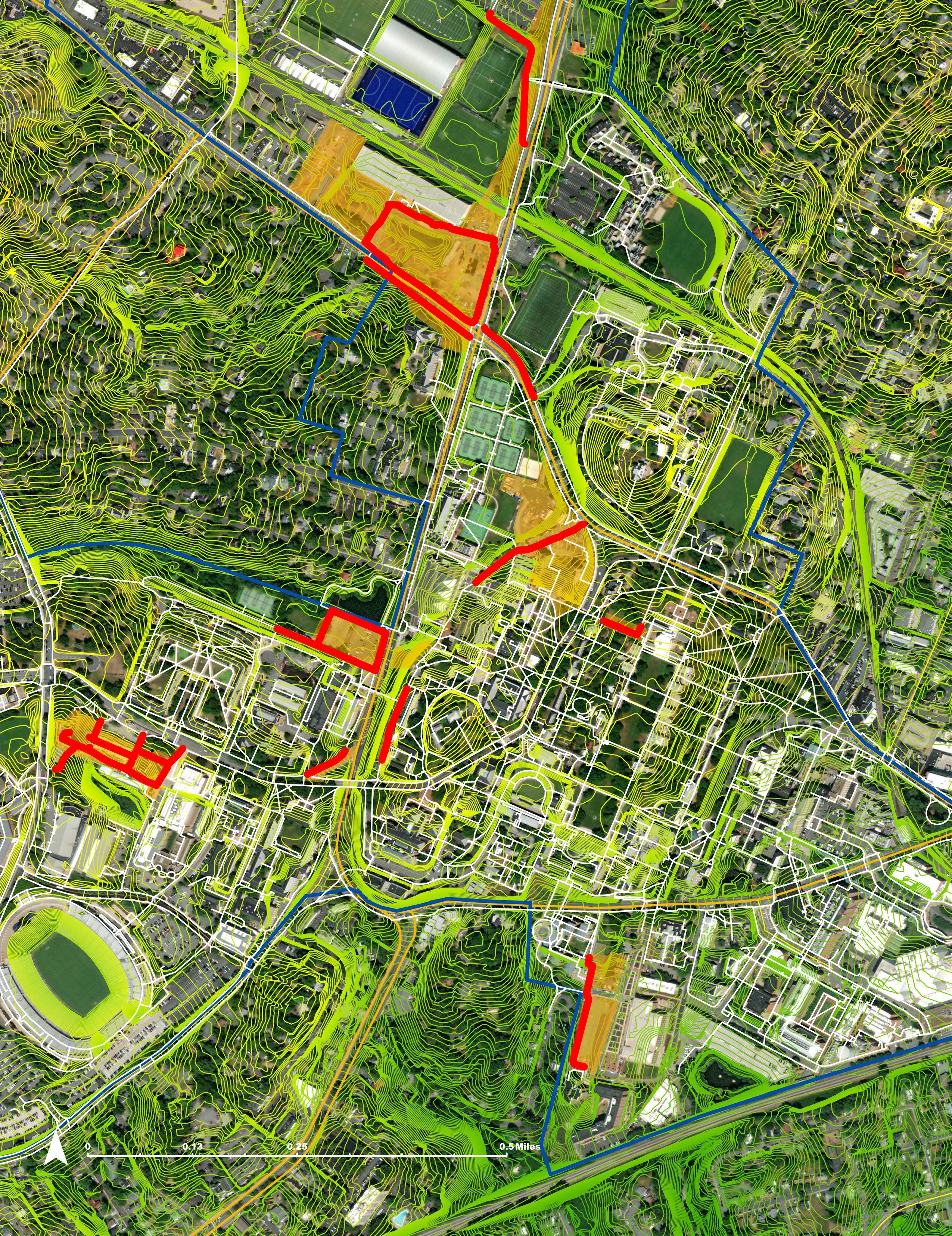
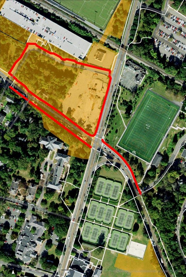
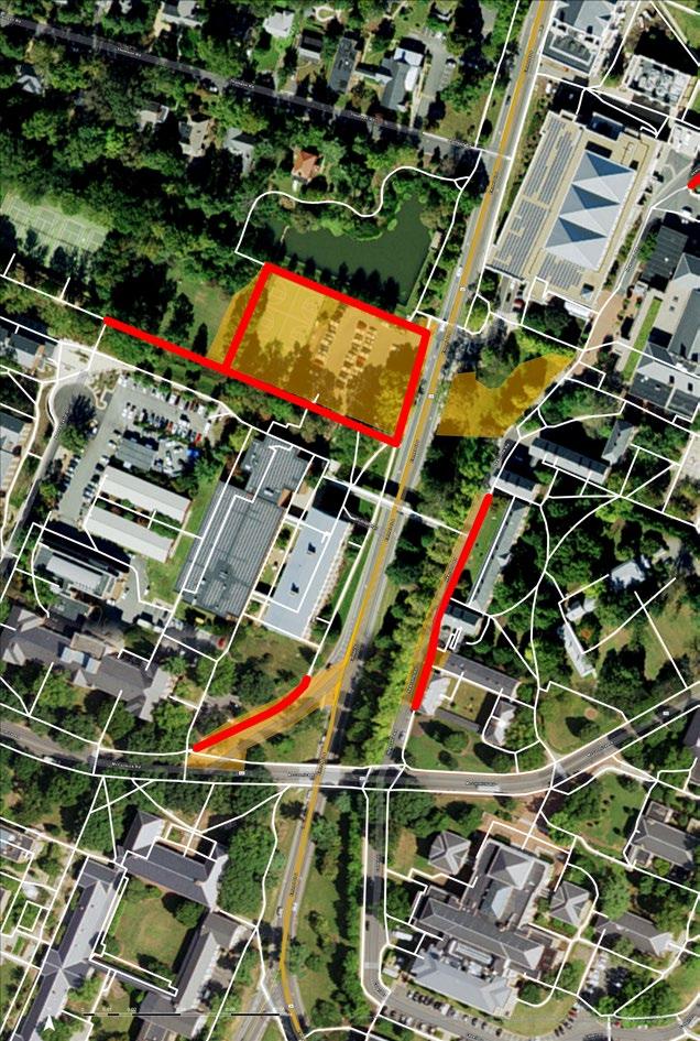
As indicated by the student accounts, the construction around Grounds has forced students to adapt to new routes on-the-fly to reach their desired destinations. The frequency of walkway closures limits students’ ability to fully anticipate the variety of detours they should expect.
Why include ADT and Topographic maps?
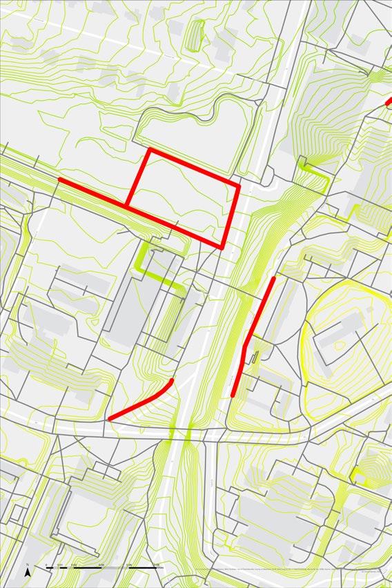
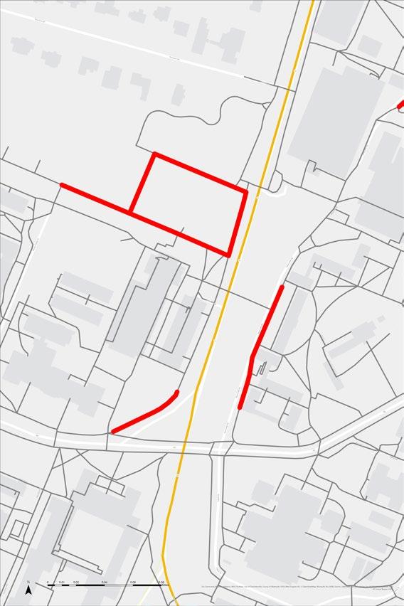
The impact of walkway closures extends past the need for pedestrians to find alternative routes. Average Daily Traffic (ADT) and Topographic (Topo) maps contextualize the deeper implications of these closures on safety and accessibility. ADT informs the potential of an accident at street crossings. By providing data on the average traffic at some of these major intersections and streets, it gives context to the potential of an accident, based on the average amount of cars present. Topo maps inform the accessibility of alternate routes for those with more limited mobility. While sidewalk closures may add additional time to the routes of many, those who are injured or physically disabled face greater barriers when alternate routes force them through steep slopes to reach their destination.
The remaining section highlights popular regions around Grounds facing not only significant construction proejcts, but also heavy traffic from all forms of mobility. This analysis seeks not to provide a comprehensive account of all current projects; rather, this section will see how a variety of walkway-closure contexts inform pedestrian accessibility.
Key
The key listed below appllies to all the following maps.
Emmet St + Ivy Rd
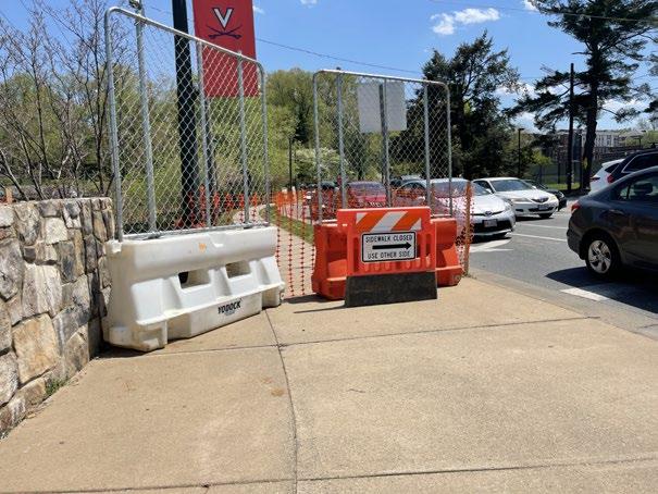
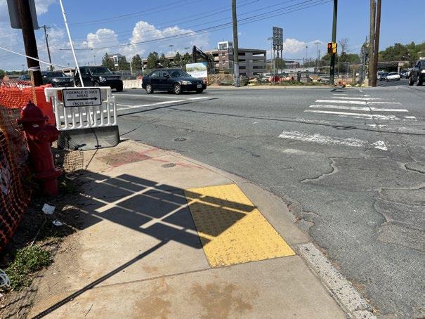
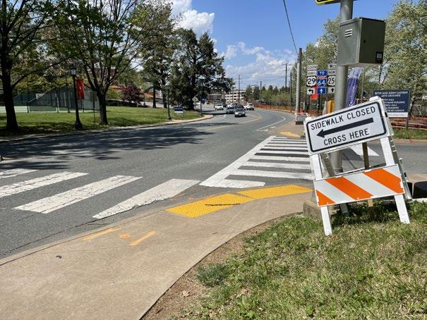
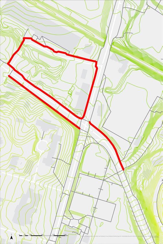
The Emmet St and Ivy Rd intersection is among the most traversed Charlottesville junctions going through UVa Grounds. As a meeting point for North Grounds, Central Grounds, Barracks Shopping Center, and I-29, this intersection is a popularly travelled intersection for all modes of mobility. Construction on 3 out of 4 corners to this intersection has reduced pedestrian mobility, forcing walkers across streets when unnecessary to reach their final destination, increasing the risk of an accident with frequent crossing. Dilapidated street crossings further reduce safety.
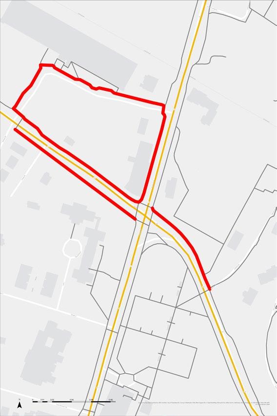
Present Experience
McCormick Rd + Dell Pond
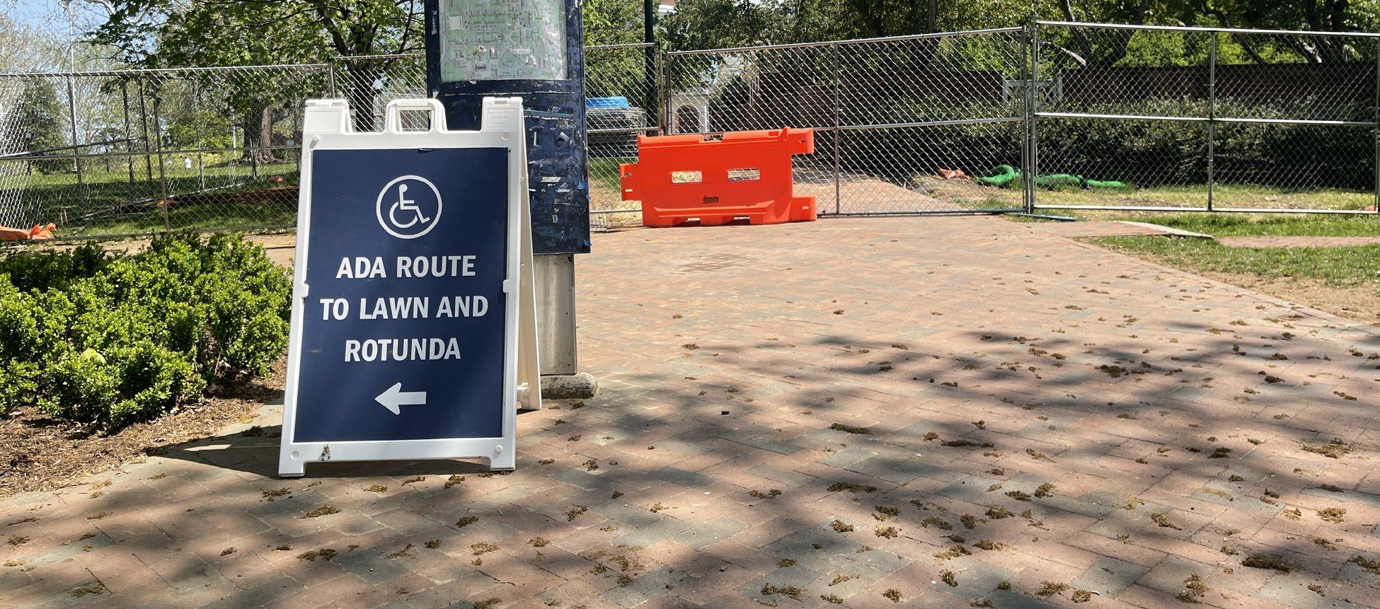
Surrounded by the Bookstore, Newcomb Hall, Memorial Gymnasium, and two of the busiest bus stops on Grounds, students and faculty traverse this area frequently. A well-trafficked road as well, pedestrians–even cyclists–increase their chances of an accident. The inclusion of road barriers and crossing lights help improve pedestrian safety. They even include a map to help navigate the detours.
Present Experience
Walkways
ADT Construction Zones
UVaGrounds
Navigating the Future of UVa
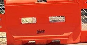
Year after year, the University of Virginia continues to push out leaders of the future in an array of fields. Those students face the daily challenge of navigation in a complex university typology. Construction is necessary in order to provide facilities that adapt to a rapidly advancing academia. The construction scene has gained significant infamy among the student body as orange-and-white barriers reach near omnipresence. Frequent sidewalk closures and detours raise concern over pedestrian mobility and equitable access. As the university pursues a variety of projects, commuters of the University of Virginia hope they will continue to consider the various contexts affecting safety and multimodal accessibility.
Sources
UVA Grounds Data provided by the University of Virginia’s Geospatial Engineering Services
Photography by Justin Estanislao
4 Chick-fil-A
In almost five years with Chick-fil-A, I have assumed several roles in the business. My current position as Training Director has inspired the creation of various materials for facilitating effective and thoughtful investment in new team members. The materials created follow Chick-fil-A’s Visual Identity Standards.
Comprehensive Training Plan
The Role of a Chick-fil-A Trainer


Chick-fil-A Barracks Road Trainers are compassionate and supportive role models for the restaurant. Our collaboration with new hires and store leadership works to build an effective team.



glorify
by
Chick-fil-A Barracks Road Trainers use their compassion and supportive nature to inspire new generations of team members. We preach and practice excellence, embodying the corporate purpose and store vision. Our investment in team members aims to build future leaders in the business.
Promoting excellence, demonstrating faithful stewardship, and exceeding expectations every time require a mindful balance of collaboration and autonomy. While sharing similar values, practices, and aspirations, we understand each team member is unique, and we adapt to their strengths and opportunities.

efficient and effective training experience?

To
God
being a faithful steward of all that is entrusted to us.
To have a positive influence on all who come in contact with Chick-fil-A.
To glorify God by being a faithful steward of all that is entrusted to us.
To have a positive influence on all who come in contact with Chick-fil-A.
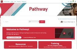
I created the following resources as Training Director to create a streamlined process for new hires to learn front-of-house operations with the help of a team of Trainers.
We are ecstatic for you to join us! When you walked through the doors of 1000 N Emmett St you became part of an atmosphere driven by excellence, compassion, and servitude. You radiated those qualities in your interview, and now you will have the opportunity of serving some of the best food with the best people for the best company. Working at Chick-fil-A is an experience like no other, and as you begin your training, we are excited for you to see why.
Chick-fil-A Corporate Purpose


To glorify God by being a faithful steward of all that is entrusted to us.
To have a positive influence on all who come in contact with Chick-fil-A.
