
-1Contents GROWING FACTORY RECONNECTING COMMUNITIES PORTFOLIO URBAN DESIGN, ARCHITECTURE, AND TRANSPORTATION PLANNING The Renovation of Jinshan Cement Factory Vine Street Corridor Plan & Chinatown East Neighborhood Urban Design
of Pennsylvania ST. CROIX RESILIENCE PLAN Emergency Management in Community Spaces on St. Croix Island, USVI REIMAGINING THE PAST A Modern Revival of Traditional Shanghai Laneways and Row Houses GIS WORKS GALLERY Personally Completed Space Design Project Pencil Drawings & Watercolor Paintings 14 02 25 34 42
Zihan Zhao (Joann) University
RECONNECTING COMMUNITIES: Vine Street Corridor Plan & Chinatown East Neighborhood Urban Design
RECONNECTING COMMUNITIES: VINE STREET CORRIDOR PLAN & CHINATOWN EAST NEIGHBORHOOD URBAN DESIGN
Philadelphia, Pennsylvania, USA
Instructor: Nando Micale/ Danielle Lake E-mail: nandomicale@gmail.com / danielle.marie.lake@gmail.com
Vine Street New Corridor Plan: Group Work Main Role: Mapping/Urban Design Analysis /Rendering/Groupwork Managing Chinatown Eastward Haven Urban Design: Individual Work
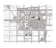
This studio prompt takes inspiration from the Reconnecting Communities Pilot Program, which is a federal program that strives to reconnect communities previously cut off from economic opportunities due to transportation infrastructure.
Our capstone project was redesigning Philadelphia's Vine Street Expressway with a sustainable approach and a vision of The Highway to Boulevard. I picked Chinatown East for the individual urban design, which aimed to boost land value and integrate the public transit system.
INDIVIDUAL AREA PLANS
The Chianntown Eastward Haven not only considers how to increase the value, increase the density, of the land, but also emphasizes how to create a warm, active, and sustainable community of residential, office, and commercial throughout the transportation system of various scales.
COMMUNITIES: Vine Street Corridor Plan & Chinatown East Neighborhood Urban Design
RECONNECTING

-2-
MUSEUM SOUTH BROAD & VINE RESHAPING THE RAIL PARK RECONNECT: CHINATOWN OLD CITY BUSINESS CORRIDOR CHINATOWN EASTWARD HAVEN ADAPTIVE INDUSTRIAL ECOSYSTEM LOGAN FAIR AND SQUARE
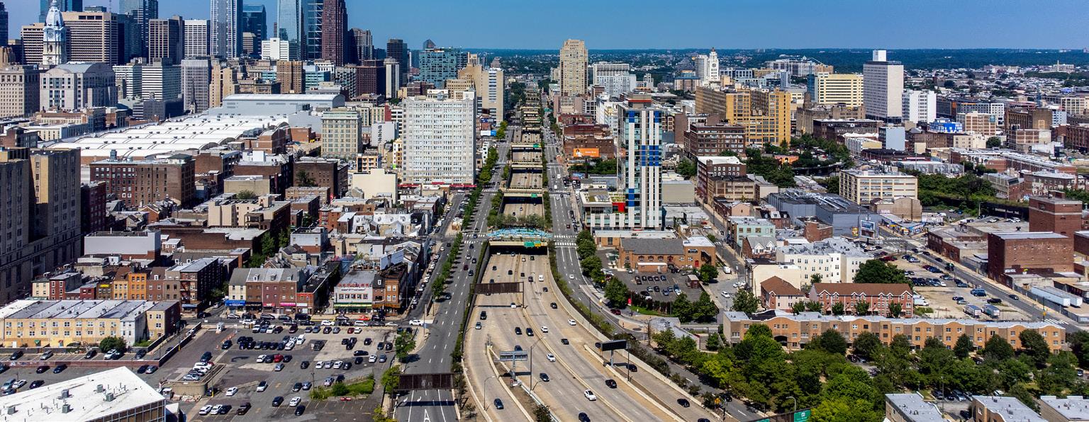
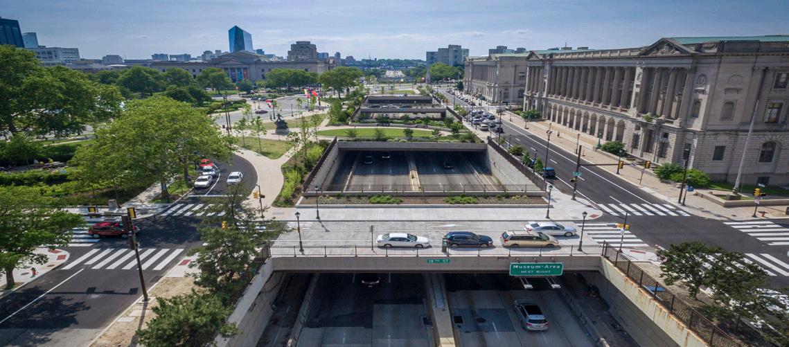
VINE ST. EXPRESSWAY IN PHILLY SOURCE: MARK HENNIGER, IMAGIC DIGITAL
Vine Street Expressway
Philadelphia has a strong grid network of streets, but the Expressway interrupts many of the north-south connections.
THE HIGHWAY TO BOULEVARD PROPOSAL: AFTER

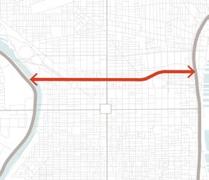
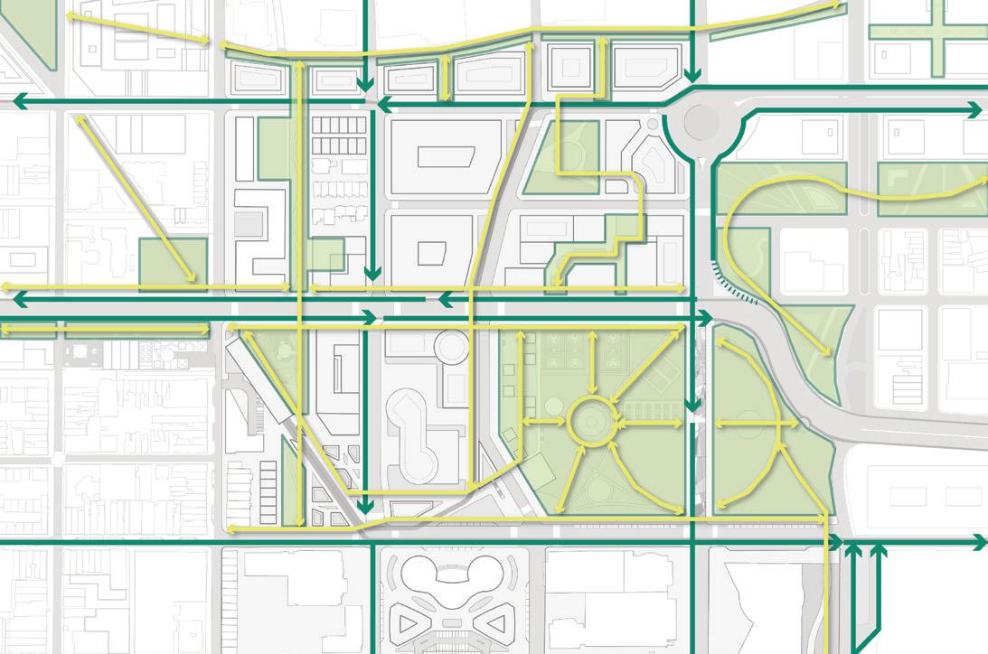
The Highway to Boulevard proposal restores the grid through a new Vine Street/Callowhill Street connector and distributes traffic through other east-west connections.


VINE STREET/CALLOWHILL STREET CORRIDOR
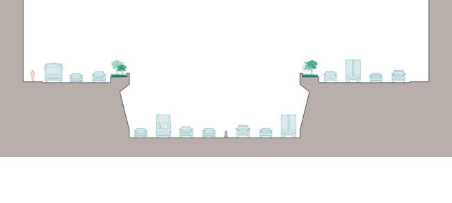
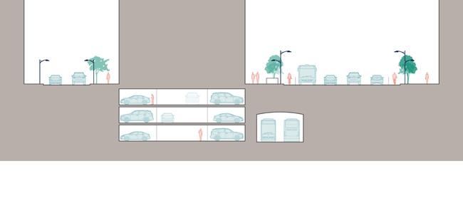
VINE STREET SECTION - BEFORE VINE STREET SECTION - AFTER
The current Expressway creates a large chasm in the urban fabric, and this division is further exacerbated by the wide frontage roads.
With a significantly narrowed roadway, the Corridor can gain an entire new block of publicly-owned land that can spur economic development and provide opportunities to create affordable housing.The new roadway will consist of two travel lanes and a bike lane in each direction, providing space for pedestrians, cyclists, transit riders, and drivers to create a multimodal corridor.
-3250 500 1000 0 Feet N 250 500 1000 0 Feet N New Trolley New Parking Garage Former Expressway Winter Street Vine Street New Development Block Expressway Frontage Road Frontage Road 87’ - 130’ 6’-9’ 6’-9’ 20’ Sidewalk 6’ 6’ 12’ 12’ 12’ 12’ 20’ Sidewalk 60’ Roadway EXISTING CITY GRID
THE HIGHWAY TO BOULEVARD
PROPOSAL: BEFORE
New Corridor Existing City
Secondary Streets
Grid
THE HIGHWAY TO BOULEVARD PROPOSAL: PUBLIC TRANSPORTATION BEFORE
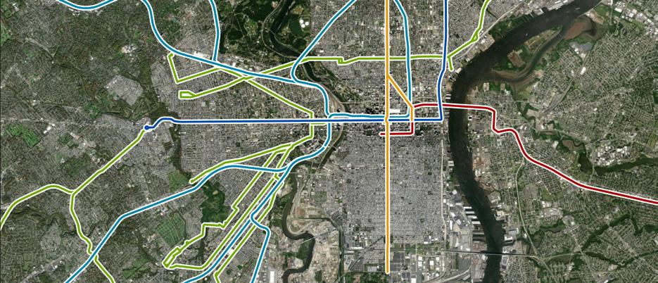
The existing rail network concentrates along Market Street and Broad Street with limited east-west rail connections.
THE HIGHWAY TO BOULEVARD PROPOSAL: PUBLIC TRANSPORTATION AFTER
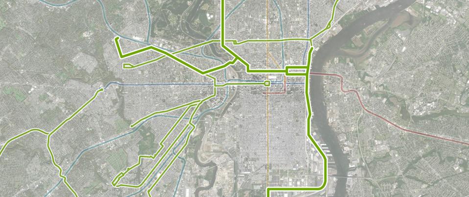
New trolley routes will fill in these some of theses gaps, continuing Philadelphia’s long and unique history of trolley lines.


RAIL NETWORK - REGIONAL
The existing regional rail network covers a lot of Philadelphia, but there are still gaps in coverage, especially in South Philadelphia, away from the BSL. The new trolley line will fill in some of those gaps while also linking back into existing routes.
-4250 500 1000 0 Feet N 250 500 1000 0 Feet N GIRARD AVE MANSION STRAWBERRY WESTPHILADELPHIA
RAIL NETWORK - EXISTING RAIL NETWORK - PROPOSED
BROAD &VINE 11TH 16TH 19TH/LOGAN SQUARE 22ND RODIN EAKINS 7TH 7TH 8TH 4TH 4TH 2ND 2ND CALLOWHILL SPRING GARDEN RACE Stations At-Grade Trolley Stop Rail Lines 5-Minute Walkshed
Trolley Stop Regional Rail Lines Broad Street Line (BSL) Trolley Lines Market-Frankford Line (MFL) PATCO Line
Below-Grade
Greater than a 5-minute walk to parks
Some areas along the Corridor, including Chinatown, have less access to park space.

THE HIGHWAY TO BOULEVARD PROPOSAL: GREEN NETWORK BEFORE THE HIGHWAY TO BOULEVARD PROPOSAL: GREEN NETWORK AFTER
New Parks & Major Green Streets
Resilient Green Grid Connections
The proposed green network focuses on filling in those gaps and creating a comprehensive network of green space across the Corridor. Resilient green grid connections will strengthen the network, largely along north-south streets, with smaller connections through pedestrian walkways.

16,700 TOTAL UNITS
2,830,000
6,100 AFFORDABLE UNITS
5,550,000
8,300
PARKING SPACES
GREEN NETWORK - EXISTING
4 MUSEUMS
62 ART GALLERIES / STUDIO SPACES
GREEN NETWORK - PROPOSED
10 COMMUNITY CENTERS
2 SCHOOLS
CORRIDOR BY THE NUMBERS
-5250 500 1000 0 Feet N 250 500 1000 0 Feet N RESIDENTIAL
RETAIL SF
44 PARK ACRES
PUBLIC
OFFICE SF
COMMERCIAL PARKS PARKING
CIVIC / CULTURAL
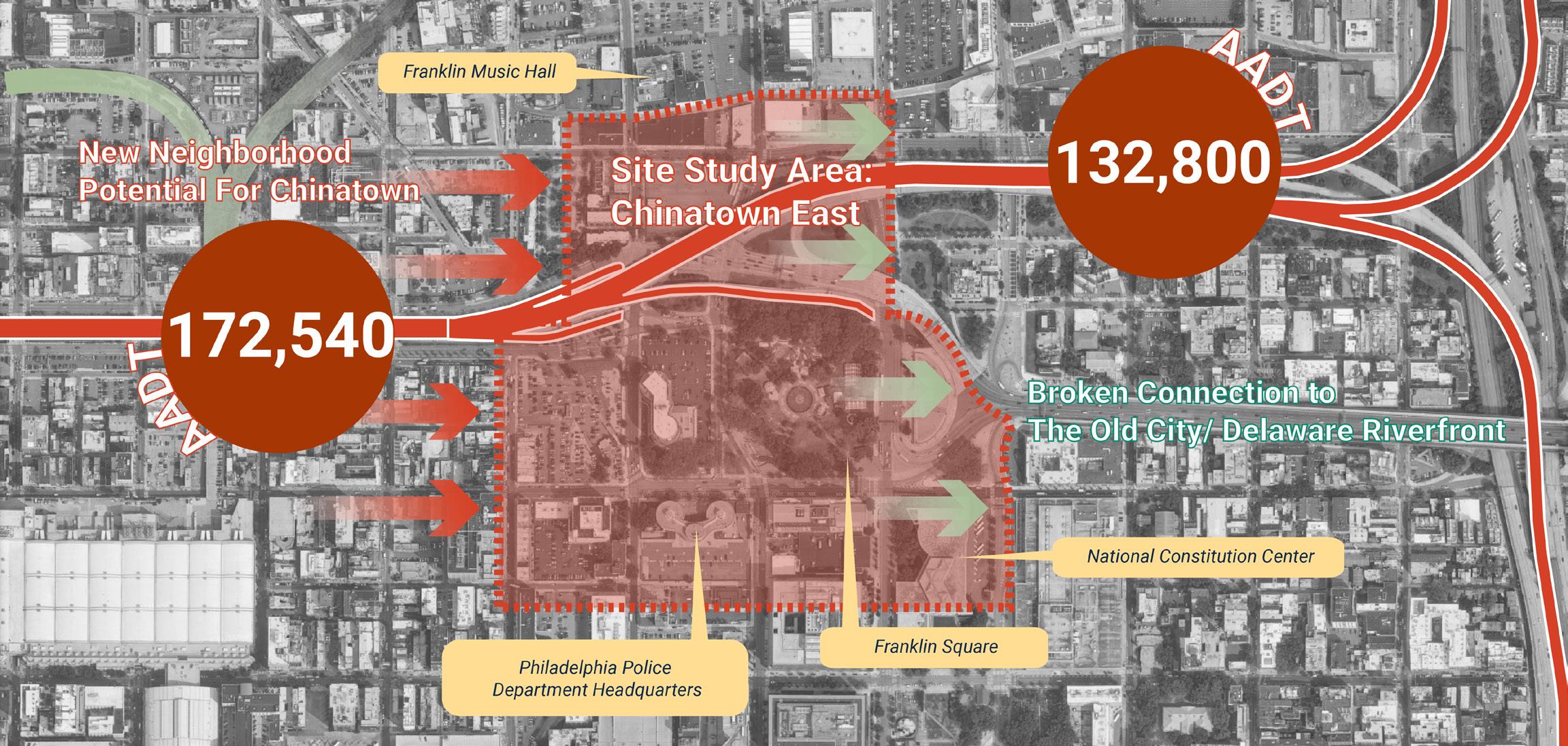
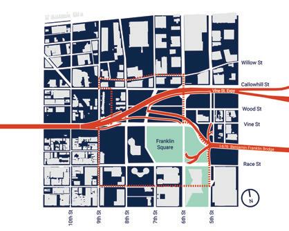
This site locates between 9th Street and 6th Street, bordering Philadelphia’s Chinatown on the west and Philadelphia’s eastern gateway - Benjamin Franklin Bridge. With so many resources surrounding it, This site should be a transition that connects Chinatown to the Old City and Delaware Riverfront. However, the connection is now broken because this area is where the highway lifted to connect to I95 and Benjamin Franklin Bridge. After we remove the expressway, what does a new Chinatown eastern haven need if there’s no expressway?
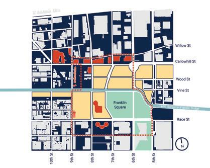
After we remove the expressway, Over 45% of the lands within the study area have the potential to rebuild a new Chinatown TOD community.
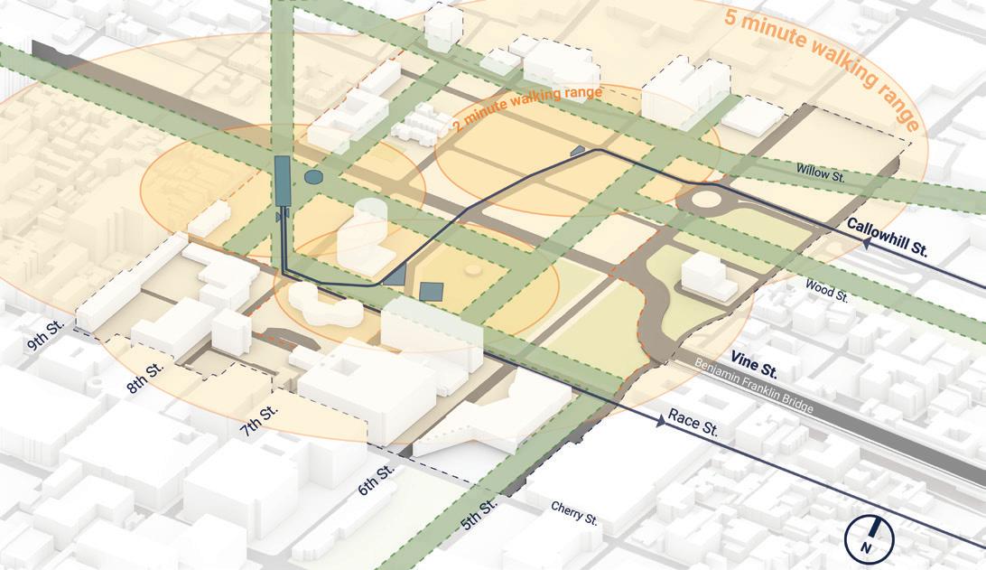
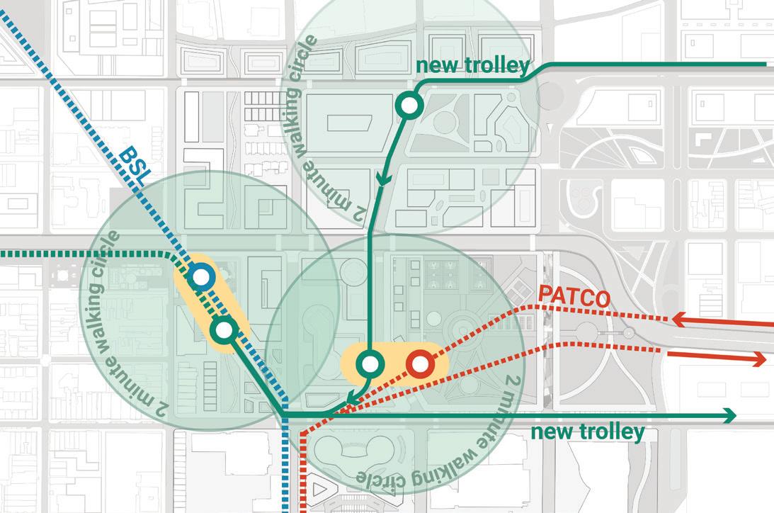
After integrating the three public transit lines, there will be five stations in total, and 4 of them will have the potential to build new transit hubs.
INDIVIDUAL AREA PLAN: CHINATOWN EASTWARD HAVEN EXISTING CONDITION

-6Parcel Actived Buildings to Be Rethought Original Green Space Vine St. Expy BSL PATCO Trolley Transit Hubs
EXPRESSWAY...
AFTER WE REMOVE THE
SITE
Transit Hubs
Preserved Buildings
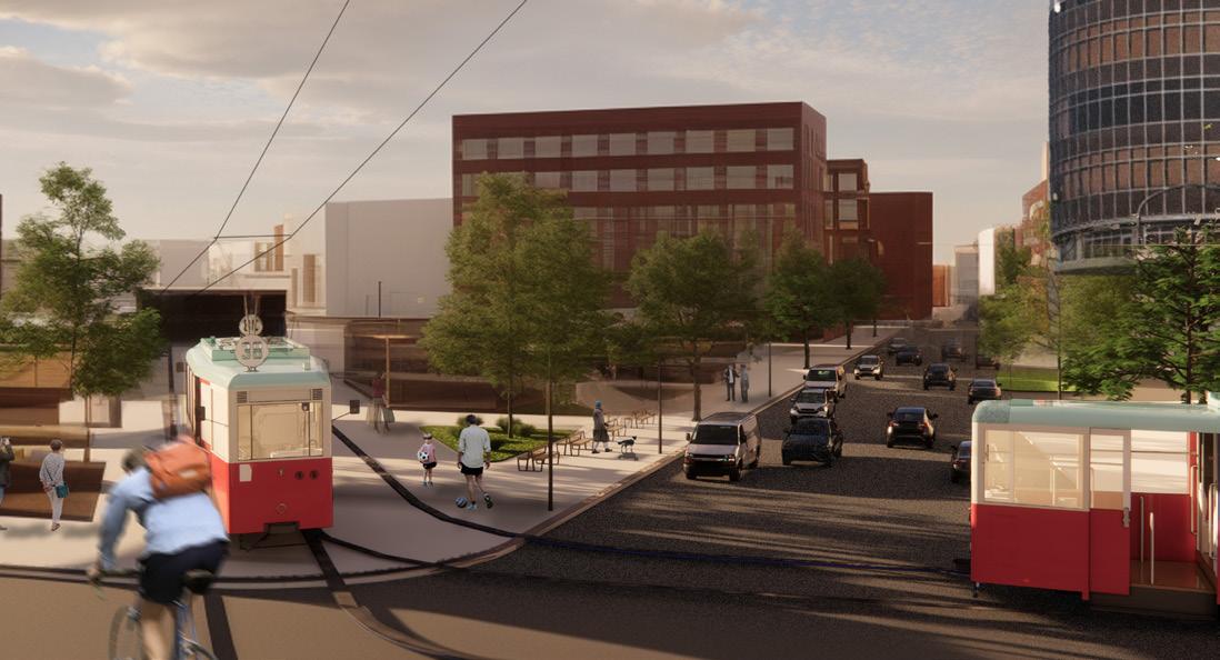
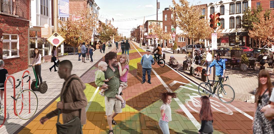
A. Integrate Public Transportation: The new trolley rails above ground can also create a new streetscape.
B. THE “STITCH”
Transit


Traffic Calming Design
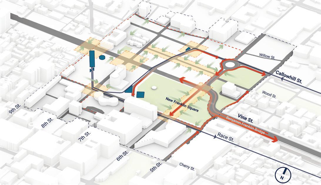
B. Integrate Motor Transportation: By re-planning the traffic system and appropriately increasing the traffic calming design, “sew up” the previously broken community connections.

C. CONNECT BLOCKS AND EXTEND TO SURROUNDING COMMUNITIES
C. Biking and Walking Experience:
Creating a continuous walking experience can greatly enhance the development value of the surrounding parcels.
D. COMMERCIAL CORRIDORS - CORE RESIDENTIAL AREAS - OTHER FACILITIES


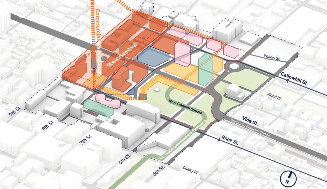
D. Dense up the area:

Continuous trails bring continuous commercial potential and attract more people to live nearby. Besides, the trail can also extend to the Chinatown north plaza on the west and the independence National Historical Park.
-7-
NEW
A.
URBAN CONTEXT CREATED BY THE NEW TRANSIT SYSTEM
PUBLIC TRANSIT REGIONAL TRANSIT
Cultural Continuous Pedestrian Corridor
Old Buildings
Residence Transit Hubs
Hubs
Transportation
Area for surrounding community
Vehicular Lanes
Retail Office The “Stitch” PRIVATE VEHICLE PARK & RIDE P
Service
New
Trolley’s impact on the Streetscape
WALK BIKE
542,420 SQFT. NEW OFFICE
444, 200 SQFT. NEW RETAIL
3 NEW TRANSIT HUBS
778 NEW UNITS/ 371 AFFORDABLE
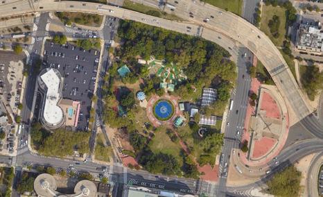
The new developments will bring about 6 acres of continuous new open green space to the community, which is equivalent to a new Franklin Square.
CHINATOWN EASTWARD HAVEN SITE PLAN
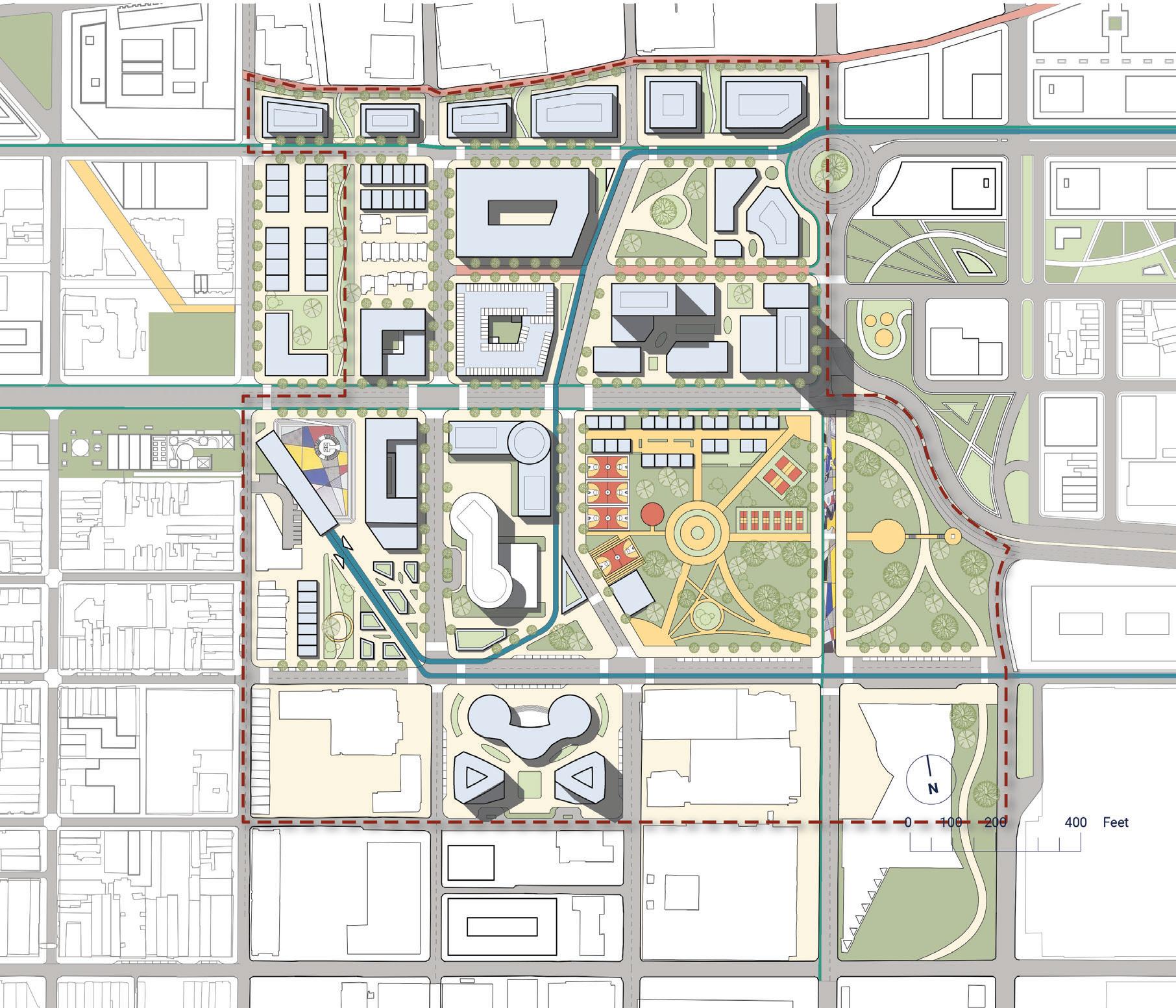
-81 2 7 8 9 10 14 26 24 25 27 30 29 31 28 32 33 34 13 12 11 15 16 17 18 19 20 21 22 23 3 4 5 6 Callowhill St. Vine St. 5th St. 6th St. 7th St. 8th St. 9th St.
Benjamin Franklin Bridge
St. Race St. Cherry St. New Buildings 1 Apartment 2 Apartment 3 Apartment 4 Apartment 5 Office Building 6 Office Building 7 Row Houses 8 Condominium Complex 9 Mixed-use Building 10 Mixed-use Parking Building 11 Community Park 12 Retail Street
Hotel/ Residence Tower
Shopping Center 15 Office Tower
Trolley
Apartment
Trolley
Condominium
22
23 Trolley
Trolley
FS Farmer’s
FS
FS
FS
FS
Wood St.
Spring
13
14
16
Station: Chinatown 17 BSL Subway Station 18 Transit Hub Sunken Plaza 19
20
Rail Park Retail Street 21
Complex
Condominium Complex
Rail Park Retail 24
Station: Franklin Square 25 PATCO Staion: Franklin Square 26
Market 27
Basketball Courts 28
Flower Fields 29
Badminton Courts 30
Volleyball Courts 31 Memorial Sculpture Park 32 Roundhouse: Cultural Center 33 Twin Office Buildings 34 Trolley Station: Callowhill & 7th St.
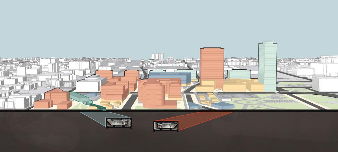
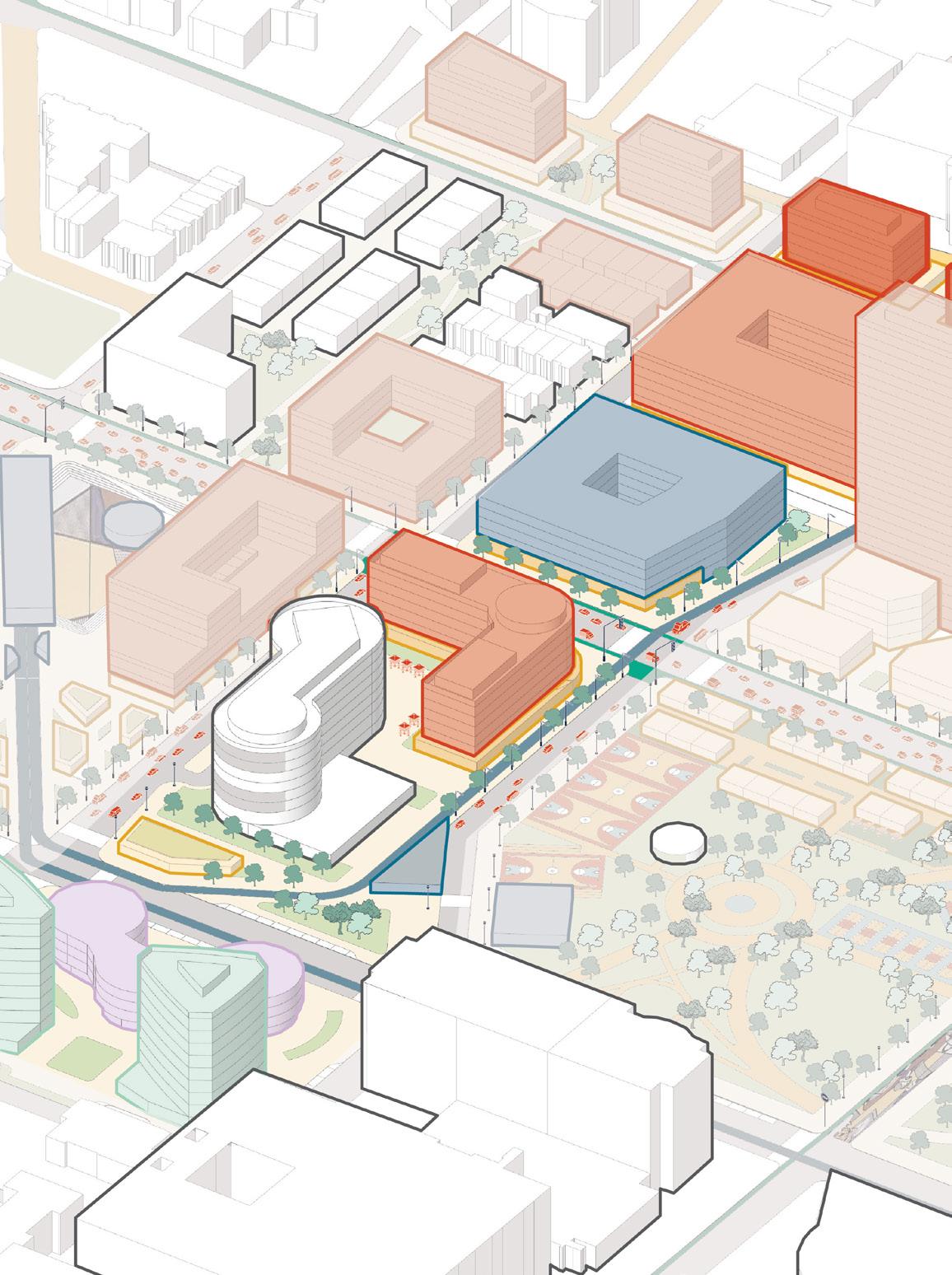
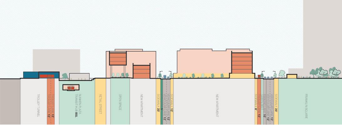
In addition to the original BSL subway and PATCO regional railway, the block will incorporate stations for three public transport lines. These transportation stations will attract more people in the future and significantly increase the surrounding land value.
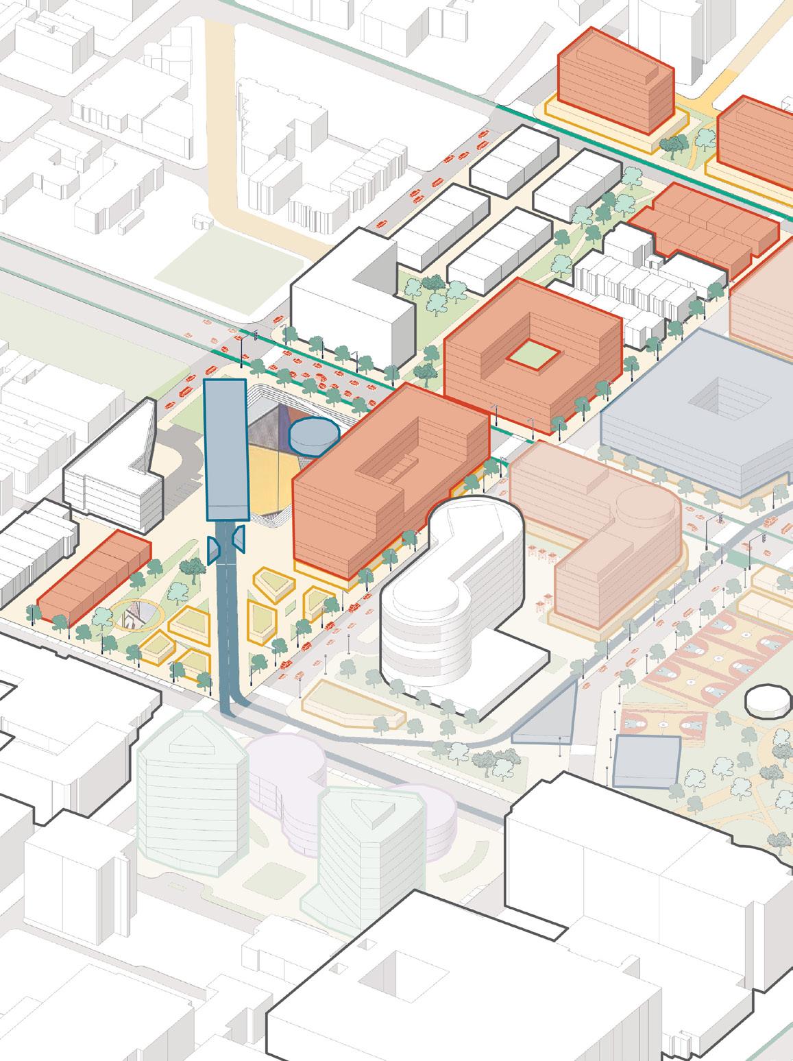
Besides, this neighborhood plan not only considers how to increase the value of the land but also emphasizes how to create a warm, active, and sustainable community of residential, office, and commercial throughout the transportation system of various scales.


CITY & REGIONAL SCALE: PUBLIC TRANSIT


Trolley/Subway/Patco Station
Transit Hubs
2 Minute Walking Range
CITY & REGIONAL SCALE: PRIVATE VEHICLE/ PARK & RIDE


Vehicular Lane
Traffic Calming Design
Street Parking
Parking Building

COMMUNITY SCALE: BIKE & WALK
Bike Lane
Pedestrian-friendly Street

Open Spaces/ Green Walks


-9-
Vine St.
Vine St.
Vine St.
Race St. Race St.
Race St.
Benjamin Franklin Bridge
Benjamin Franklin Bridge
COMMUNITY SCALE WALK BIKE PRIVATE VEHICLE PUBLIC TRANSIT PARK & RIDE REGIONAL TRANSIT REGIONAL SCALE CITY SCALE P LIFESTYLE LOGISTIC
N N N
EFFICIENT FUNCTIONAL VALUEABLE TRANSPORTATION ORIENTED
Benjamin Franklin Bridge
COMMUTE RESIDENTIAL TRAVELING
TRANSIT HUB AFFORDABLE HOUSING GREEN CORRIDOR COMMERCIAL GATEWAY
DEVELOPMENT
P P
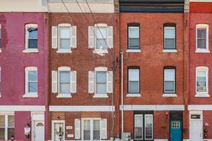
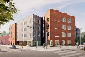
Surrounding the existing residential fabric of the area and the new transit hubs, we hope to create a culturally rich and diverse community. It will attract more young people to Chinatown in the future.
Transportation Retail Office
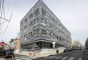
The trolley trails can form an interesting community landscape as well as bring vitality to business and tourism.
-10-
TROLLEY RAIL PARK RETAIL STREET
COMMUNITY LINEAR PARK
8thSt. 7thSt. 9thSt.
DEVELOPMENT PART 1: CORE RESIDENTIAL AREA
TYPOLOGY IN CORE RESIDENTIAL AREA
TRANSIT HUB SUNKEN PLAZA
VineSt.
NEIGHBORHOOD-SCALE
HOUSING
SECTION A-A: TRANSIT HUBS
TROLLEY RAIL PARK RETAIL STREET VIEW
Cultural Residence
PATCO
A A Affordable Housing New Row Houses Youth Apartments
FRANKLIN SQUARE
BSLSUBWAYNEWTROLLEY
NEIGHBORHOOD-SCALE DEVELOPMENT PART 2: TRANSITION AREA


9thSt.
ACTIVATED RESIDENTIAL AUXILIARY SPACE
PedestrianizedWillowSt.
PARKING + PUBLIC TRANSIT
NEW PROPOSAL: PEDESTRIANIZE WILLOW STREET
8thSt.
AFTER PEDESTRIANIZED
7thSt.
NEW ROUND HOUSE: AFRICAN AMERICAN ARTS GALLERY
NEW TWIN OFFICE BUILDINGS
6thSt.
Willow street is a narrow street on the north of this site. Most of the space on either side of Willow Street now consists of vacant or parking lots. As a motor vehicle street, Willow Street does not bear the traffic it should have. Therefore, we transformed Willow Street into a continuous walking trail connecting Chinatown’s north plaza and Delaware Riverside.
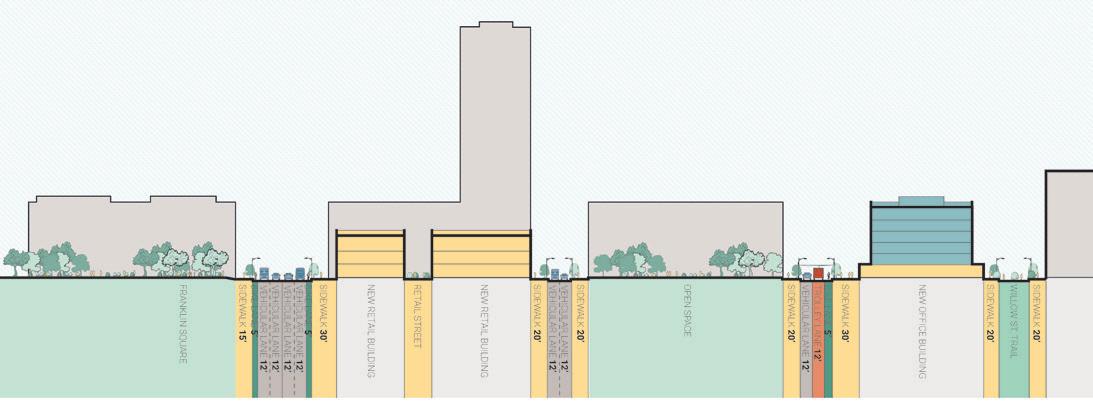
SECTION B-B: NEW GREEN OPEN SPACES INTERACTING WITH THE NEW TRANSIT SYSTEM
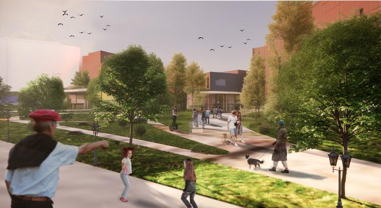
The new developments make Franklin Square accessible in all directions. It will not be surrounded by the highway walls, but will expand to the surrounding communities.
-11-
VineSt.
Cultural
Residence Transportation Retail Office
Willow St.
BEFORE
Sunken Plaza 8th Street 7th Street B B
NEIGHBORHOOD-SCALE DEVELOPMENT PART 3: NEW SQUARE, NEW GATEWAY

RENTAL STUDIOS
SECTION C-C: PEDESTRIANIZED WILLOW ST. & NEW TROLLEY LANE ON THE CALLOWHILL ST.
NEW SHOPPING CENTER/ URBAN COMPLEX
NEW COMMUITY FIELDS/ COURTS
Extra Sports Courts & Fields
7thSt.
Farmers’ Market
VineSt.
6thSt.
New Chinese Lantern Festival Event Space
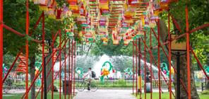
The new developments make Franklin Square accessible in all directions. It will not be surrounded by the highway walls, but will expand to the surrounding communities.
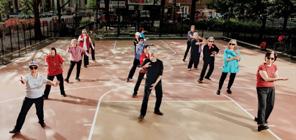
NEW PROGRAMMING FOR A NEW FRANKLIN SQUARE
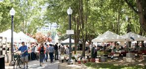
NEW STATUE PLAZA
NEW STATUE PLAZA
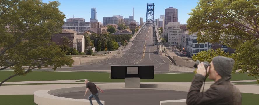
The monumental landscape design reshaped the original Bolt of Lightning sculpture, making this sculpture and the entire Chinatown TOD design a future landmark for Philadelphia.
-12-
RaceSt.
Cultural Residence Transportation Retail Office
Vine St. Wood St. Callowhill St. Willow Walk C C
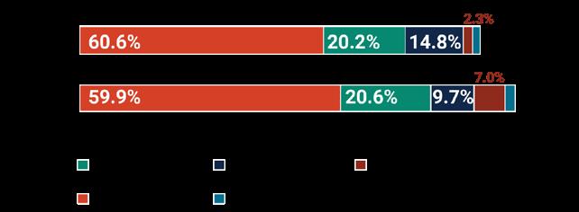
Population along the Corridor has seen an increase in the past ten years, but demographic share has remained largely the same. Despite the high volume of movement in and out of the Corridor, most people who work near Vine Street do not live in the area. The Vine St. Corridor is home to multiple unique neighborhoods that are supported by associations and community groups that are pivotal in shaping the identity of the area.


As the City plans for new ways to reconnect neighborhoods like Chinatown that have been impacted by the Expressway, our studio has the opportunity to envision a radically different Vine Street Corridor and propose thoughtprovoking alternatives beyond what is possible through the Reconnecting Communities Pilot Program.
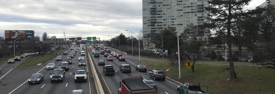

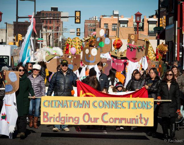
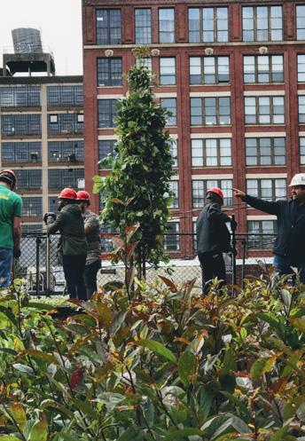
Our vision are the restored grid connections, the community-driven public-private partnerships, and the enhanced cultural artery under the goals of contextual and interactive experiences, comfortable multimodal streetscapes, celebration of cultural and historical diversity, and resilient and accessible community health.

-13-
19,099 commute in 4,804 commute out
Source: 2010 - 2020 US Decennial Census
Source: 2019 OnTheMap 272 work here
GROWING FACTORY: THE RENOVATION OF JINSHAN CEMENT FACTORY
Jinshan District, Shanghai, China
Instructor: Yong CHEN/ Qiang CHEN E-mail: 525514614@qq.com
Urban Design: Group Work
Main Role: Mapping/Urban Design Analysis /Rendering/Groupwork Managing Silo Art Gallery Research & Design: Individual Work
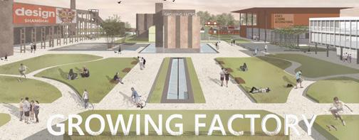
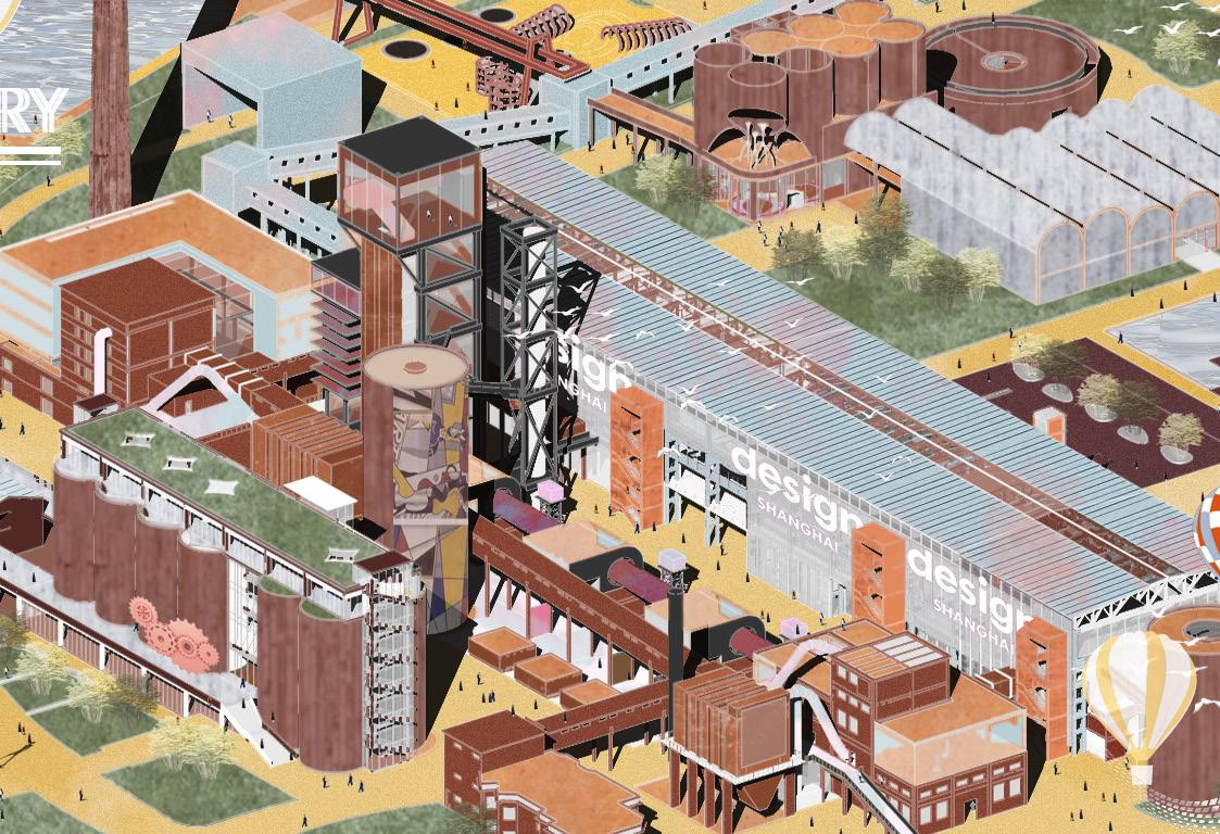
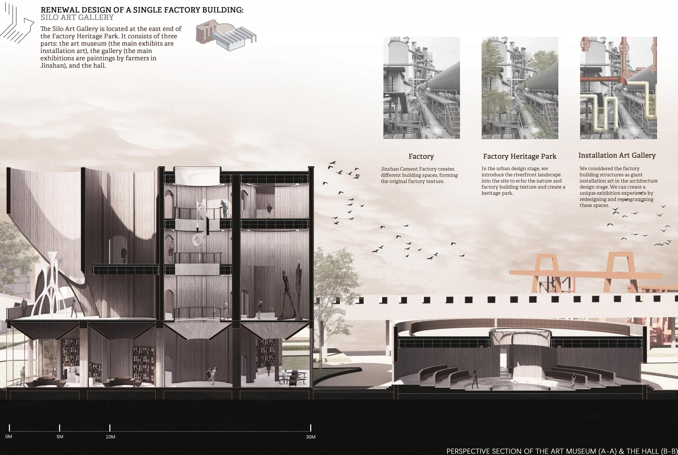
The preservation and renovation of industrial heritage have become an essential urban design topic. The project is located in the Shanghai Jinshan Cement Factory, which tries to preserve the historical factory texture, implant public cultural activities, and introduce diverse creative industries combined with the local culture, economy, and ecological transformation.
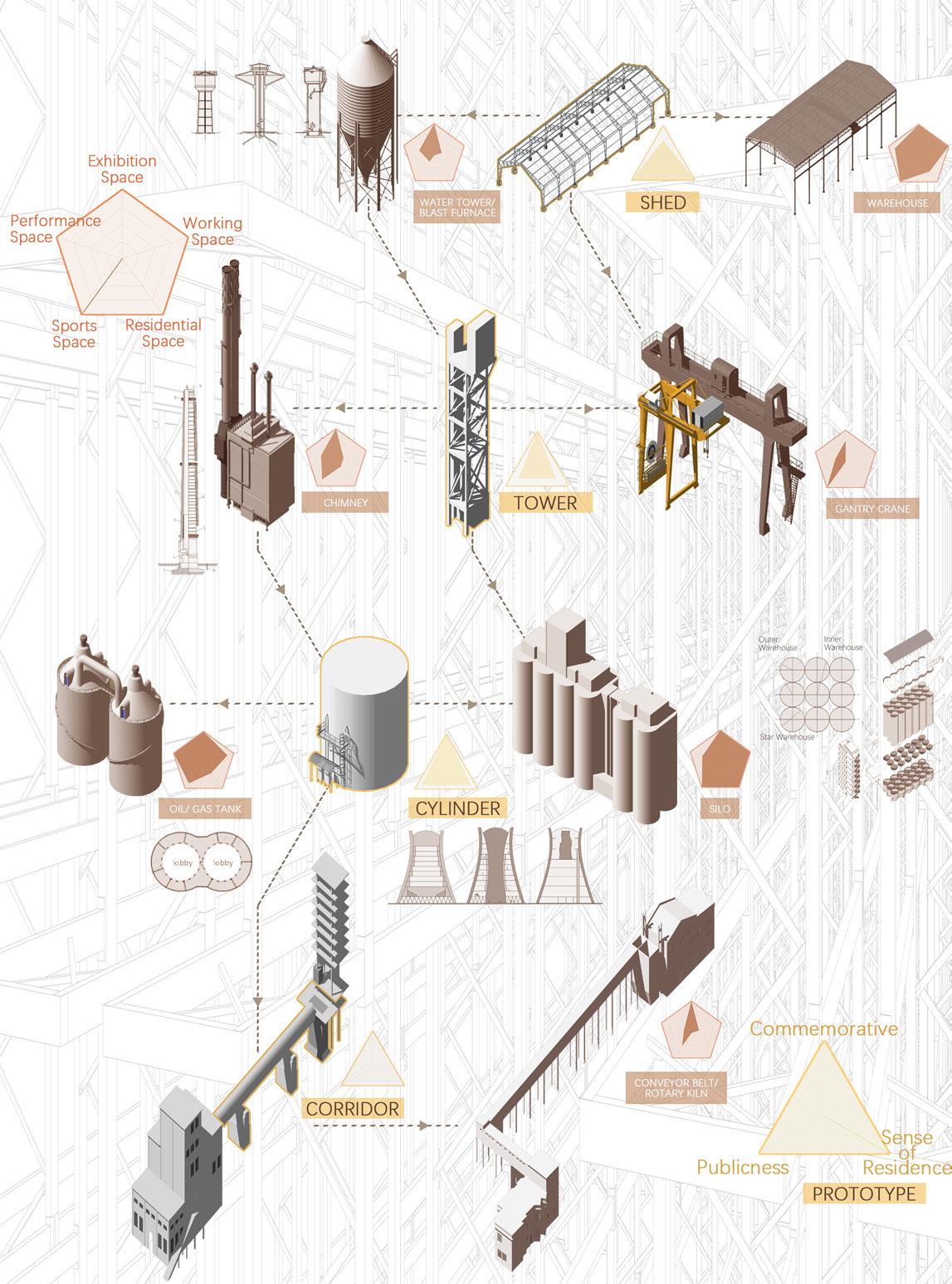
The design concentrates on the unique structural typology study of the factory buildings. Based on the research, the architectural design of the factory proposes different innovative utilization of industrial buildings and facilities.
-14-
Growing Factory: The renovation of jinshan cement factory
Growing Factory: The renovation of jinshan cement factory
Preserved Buildings Preserved Green Spaces
Preserved Roads
Preserved Facilities Preserved Waterfront Spaces New Roads Proposed
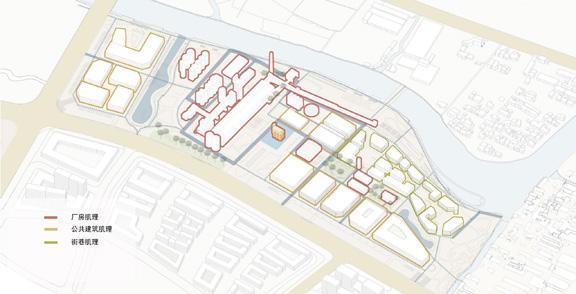
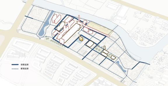
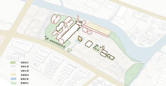
Factory Buildings Renovation New Mixed-use Buildings
New Commercial Buildings
Demographic Analysis: Peripheral areas of cities with apparent cores
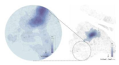
Distribution of Office Facilities: Need for cultural industry parks
Distribution of Consumer Outlets: Need to increase commercial interest
Commentary analysis: Specific consumption potential in the future
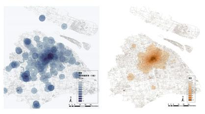
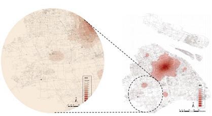
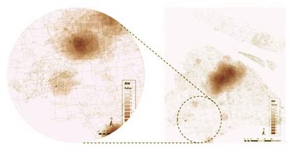
DATA ANALYSIS: WHAT'S THE FUTURE DIRECTION OF THE FACTORY RENOVATION? (DATA SOURCE: DIANPING)
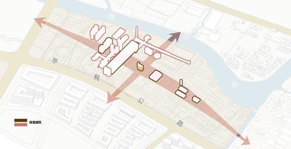
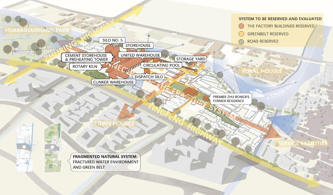
Jinshan Cement Factory is located north of Zhujing Town, Jinshan District, Shanghai, China. The old town of Zhujing has outdated facilities, insufficient employment support, and blurred cultural characteristics waiting to be updated. However, the town also has a lot of traditional cultural and artistic heritage.
LOCAL CULTURE AND URBAN TEXTURE RESEARCH

-15-
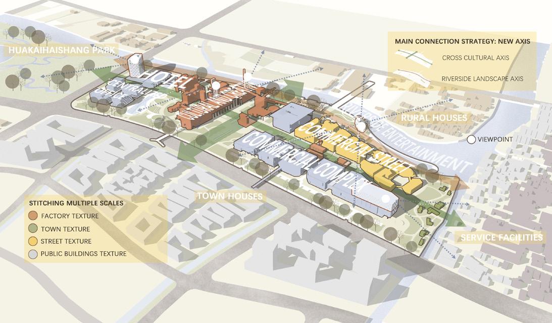
THE INTERVENTION OF THE CROSS AXIS integrate the surrounding natural resources and activate the future commercial potential
EXISTING CONDITION
PRESERVED BUILDINGS EVALUATION

-16-
SITE PLANNING ANALYSIS
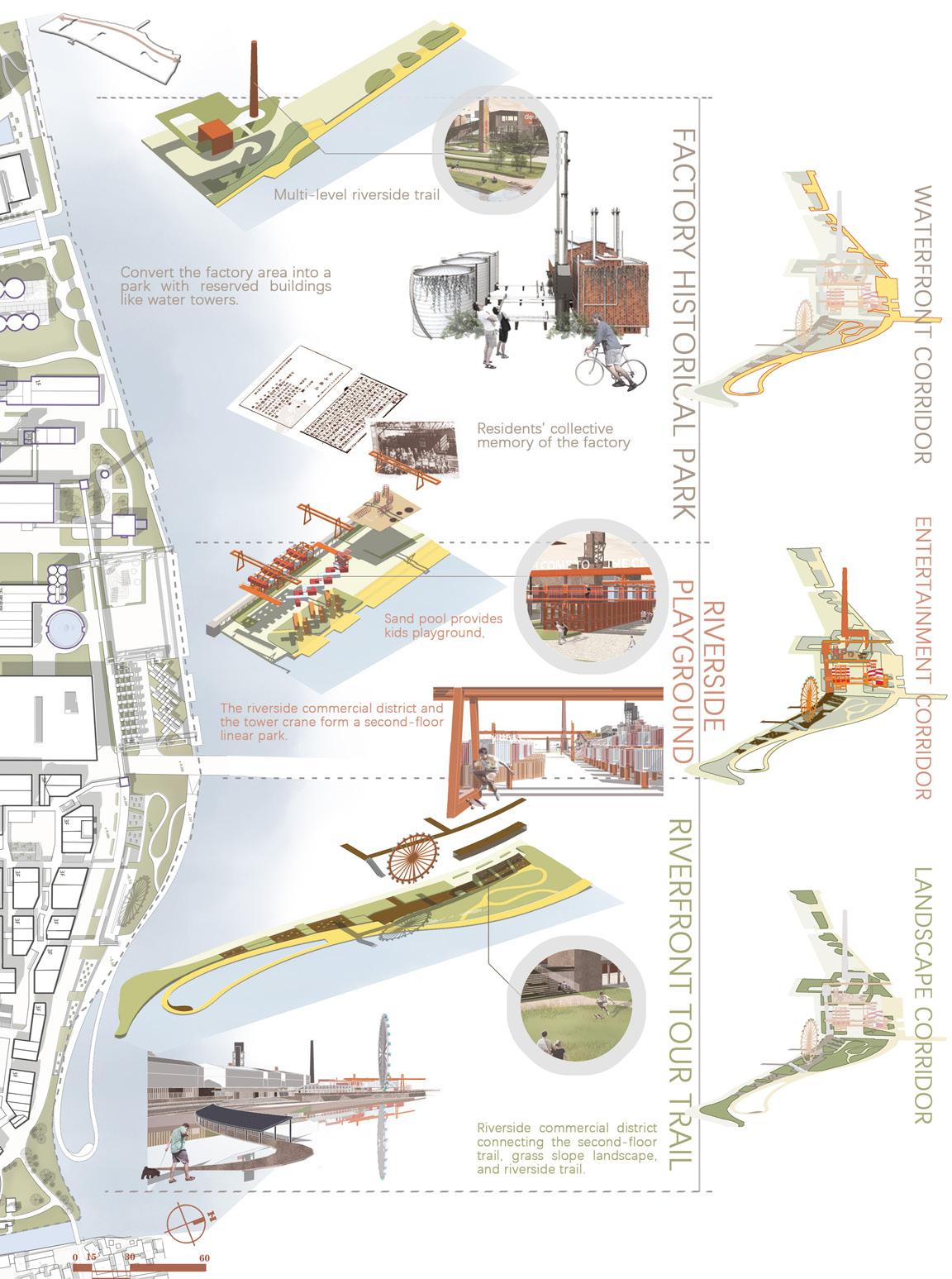
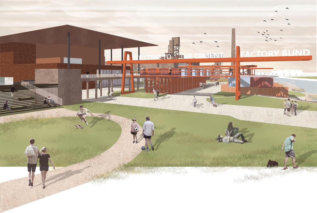
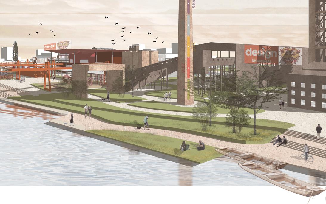
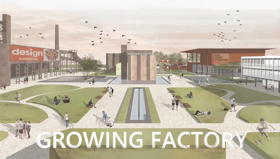
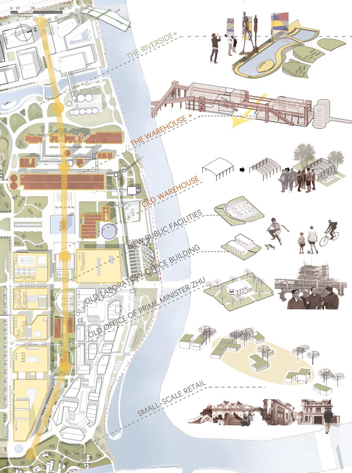
The general urban design concept is a "Growing Factory" with a historical heritage park. Hence, we weave the east-west riverside park and cultural experience axes to intersect the north-south axis. Then we address the important nodes along these axes to value the whole system.
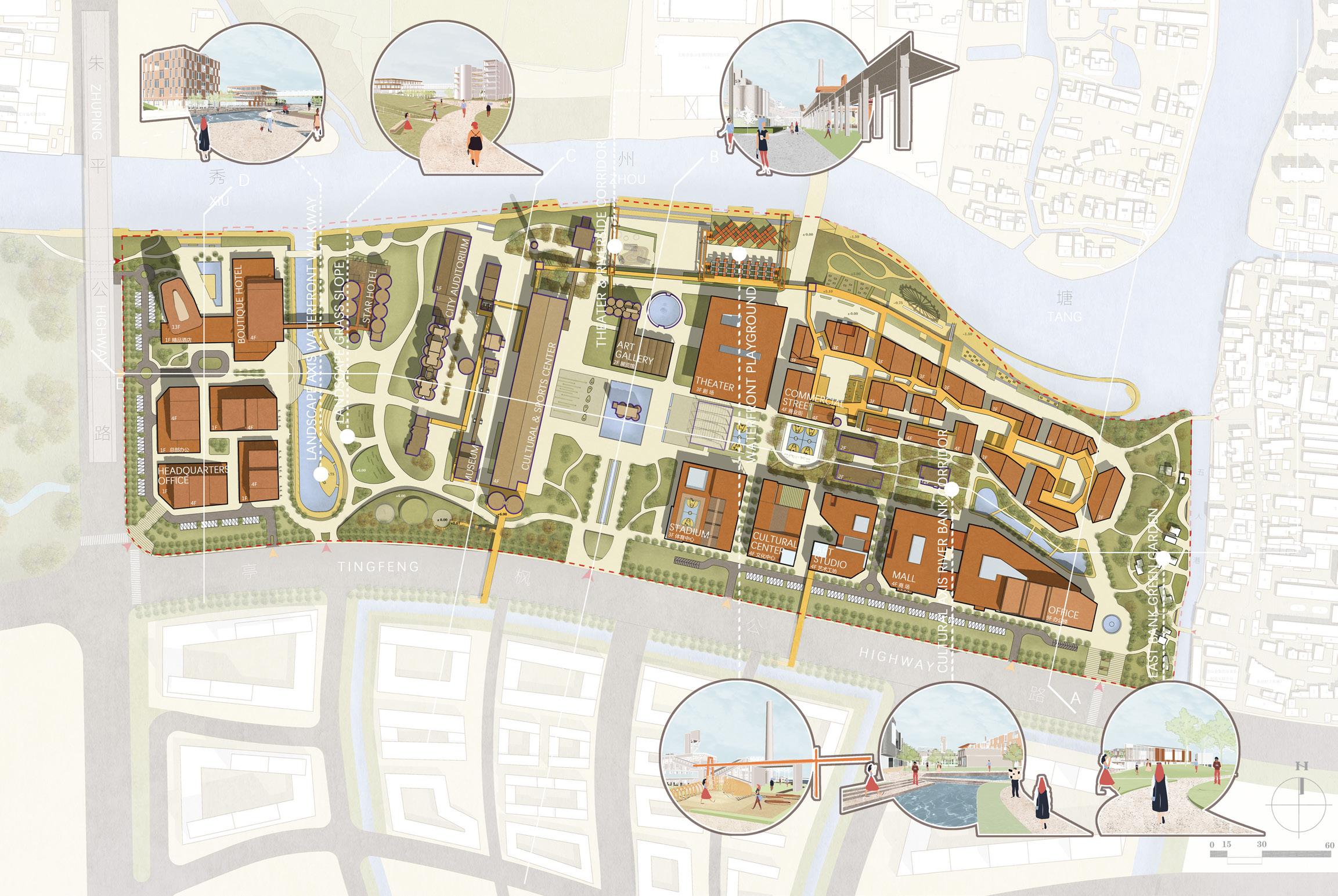
-17MASTER PLAN
SEGMENTAL
-18-
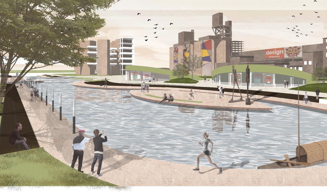
RIVERSIDE TRAIL IN THE FACTORY HISTORICAL PARK
LANDSCAPE OF RIVERSIDE COMMERCIAL AREA
PROGRAMMING OF THE RIVERSIDE WALK
-19-
ENTRANCE AXIS
MAIN
WATERSCAPE AND SHORELINE LANDSCAPE IN THE SITE
SHAPING OF THE EAST-WEST CULTURAL AXIS NODE
-20-
PRESERVED FACTORY BUILDING TYPOLOGY STUDY
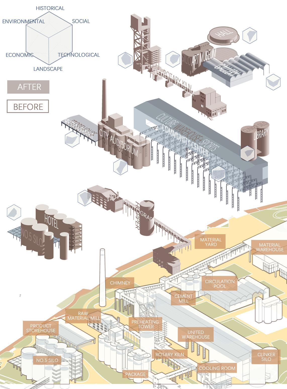
RENOVATION OF THE PRESERVED BUILDINGS
-21-
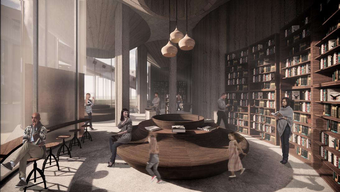
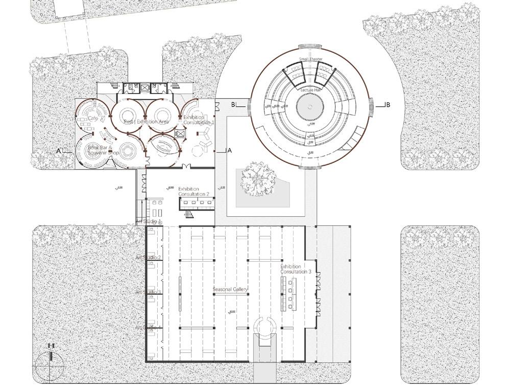
THE BOOKSTORE ON THE 1ST FLOOR OF THE SILO ART MUSEUM
Inside the bookstore of the Silo Art Museum, you can see the funnel-shaped silo's bottom at the top, forming an exceptional indoor space experience. A reading table below each bottom silo structure creates a quiet space for visitors to do some reading.
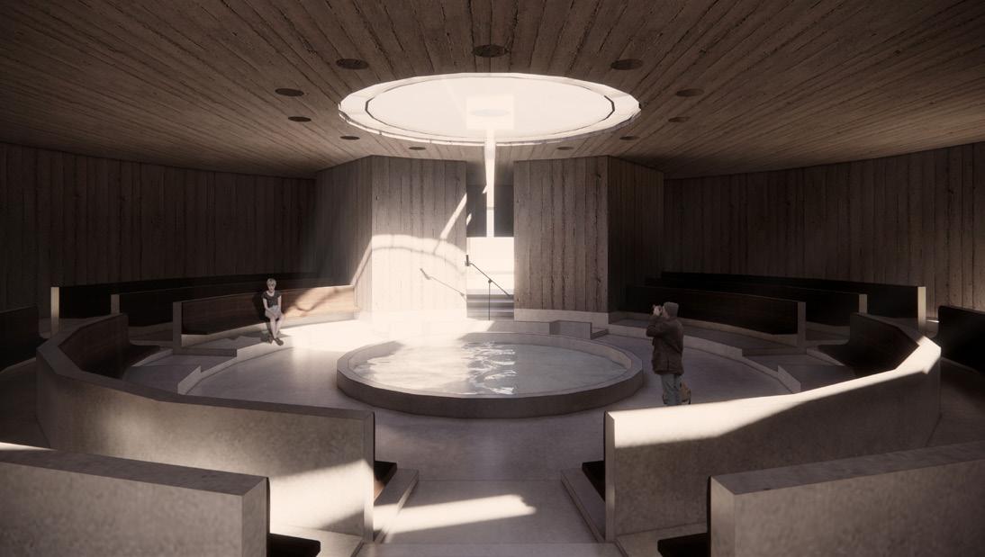
THE ENTRANCE OF THE HALL
The interior space of the hall is strongly centripetal. When visitors walk into the space from the main entrance in the south, they will be immediately attracted by the central pool and the skylight on the entrance axis. When resting and meditating in the hall or conducting conference lectures, people will intuitively experience how time goes by through the slowly changing skylight.
-22-
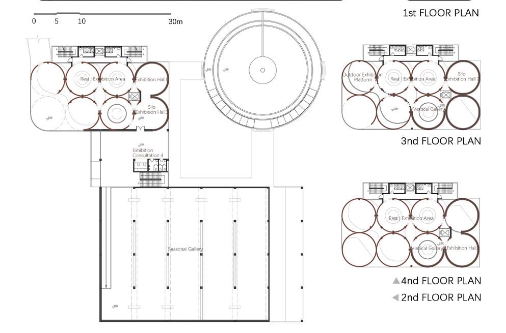
INTERIOR SPACE OF THE NEW GALLERY
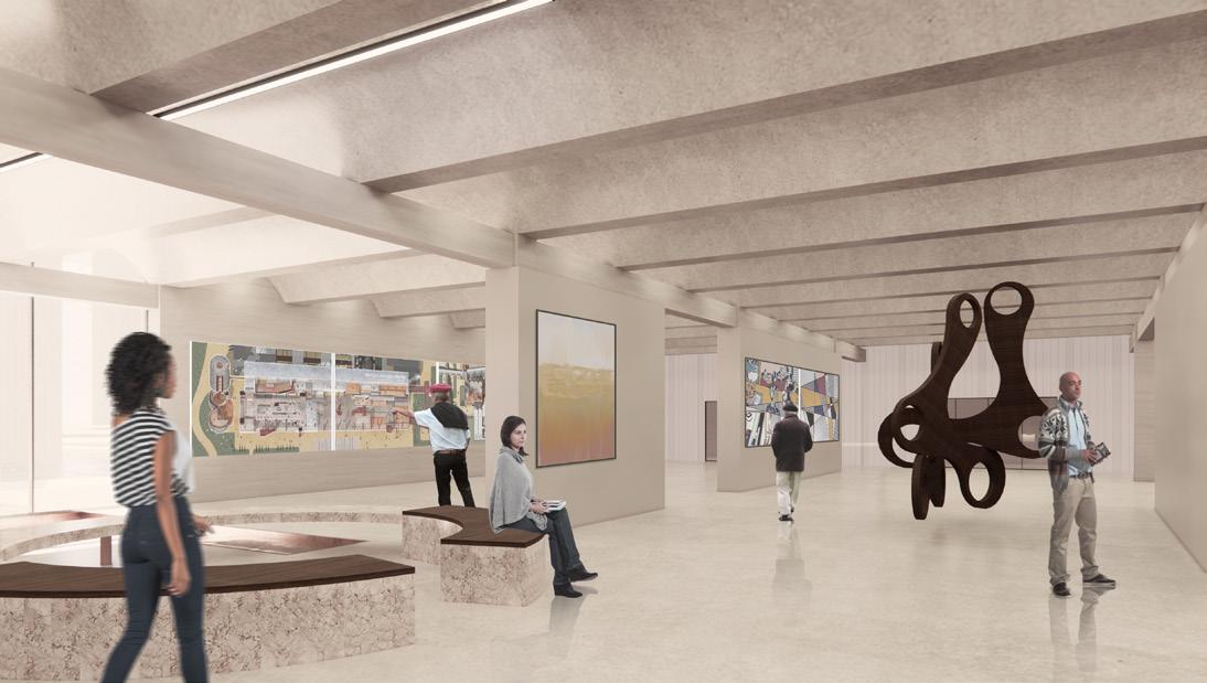
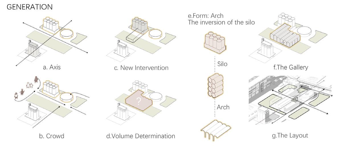
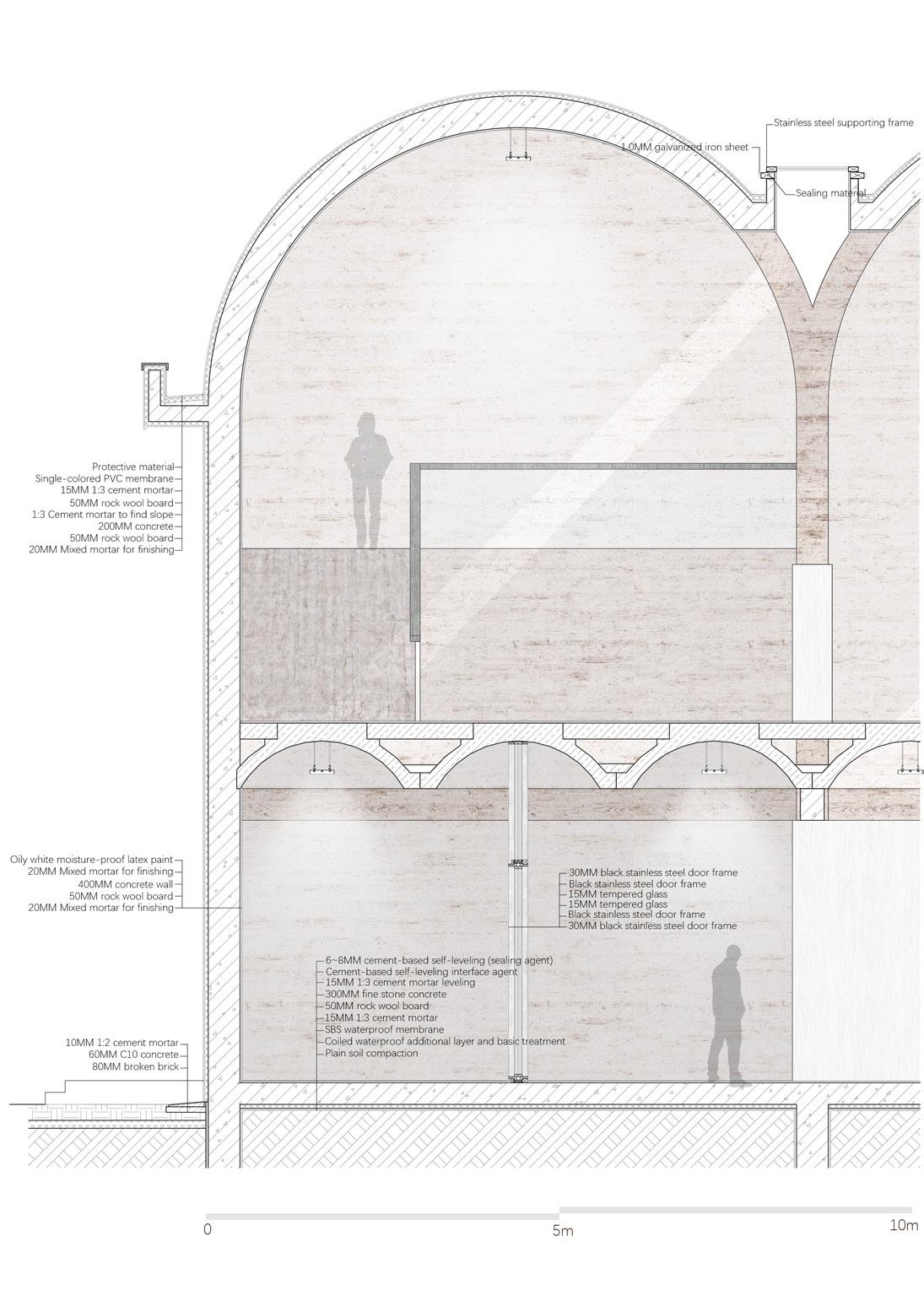
The main exhibits of the new Seasonal Gallery are Jinshan farmers' paintings and some small and medium-sized installation art, so most of the indoor light is the diffused light on the top and walls. In addition, the structure of the new gallery mainly arches, which could be considered a unique expression of the silo structure horizontally.
-23-
THE WALL STRUCTURE OF THE SEASONAL GALLERY
China has entered the post-industrial era, and the urban open space once occupied by industry, transportation, and storage industries will face functional transformation and redevelopment.
In this plan, we made unexpected collisions to redevelop different urban functional spaces and industrial buildings. In addition, we evaluated the preserved factory buildings by typology study. This type of research is also essential in various urban space renewal projects.


-24-
LONG SCROLL PAINTING OF JINSHAN CEMENT FACTORY AFTER THE RENOVATION: THE WAREHOUSE+ AND THE SILO ART GALLERY
LONG SCROLL PAINTING OF JINSHAN CEMENT FACTORY AFTER THE RENOVATION: THE CONCRETE MUSEUM, THE CITY AUDITORIUM AND THE STAR HOTEL
St. Croix Resilience Plan: Emergency Management in Community Spaces
ST. CROIX RESILIENCE PLAN: EMERGENCY MANAGEMENT IN COMMUNITY SPACES
St. Croix Island, U.S. Virgin Island, USA
Instructor: Scott Page/ Jamie Granger
E-mail: scott@interface-studio.com/ jamie@interface-studio.com
Existing Condition Research: St.Croix Resilience Studio at the University of Pennsylvania Emergency Management in Community Spaces: Zihan(Joann) Zhao/ Lexi Lee-Ittah/ Olivia Marcus/ Wynter Adams Main Role: Project Manager/ Urban Designer/ Diagram Designer The diagrams and analysis in the portfolio are all individual works.
The St. Croix Resilience Studio from the University of Pennsylvania (UPenn Studio) conducted this plan. 15 master’s students from various city planning and environmental studies backgrounds worked together to investigate resilience in St. Croix. The emergency management project in community spaces is one proposal of the plan conducted by a small planning group of 4.
As noted throughout this Studio’s research and work, natural disasters and storms are a great threat to St. Croix. Citizens vulnerable to these threats may seek shelter or assistance in community safe rooms.

This project first researched, analyzed, and mapped existing safe room sites. The GIS data analysis helps us propose new sites for future safe rooms. Furthermore, the project designed the new community spaces on the sites filtered out by the precedent study.
St. Croix Resilience Plan: Emergency Management in Community Spaces
-25-
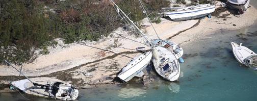
Image Source: boats litter a beach after Hurricane Irma struck. (Joe Raedle/Getty Images)
Safe Room
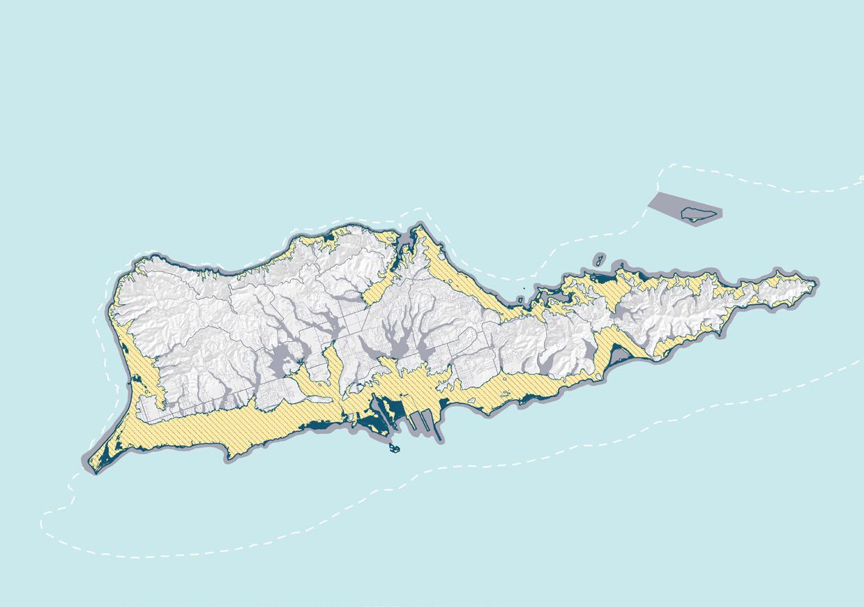
Extreme Weather Hazard in St Croix

Tsunami Evacuation Zone
Riverine/ Coastal Flooding Zone
Storm Surge Zone
Extreme Weather Hazard Evacuation Map (Data Source: VITEMA)
Area A
Airport/ Seaplane Base Sirens Health Clinic Campground Area
Ferry Terminal/ Cargo Port/ Cruise
Tsunami Evacuation Zone

Building
Plans Islandwide Proposed New Safe Room Locations Site Plan of New
Anchorage
Flooding Evacuation Zone Hotels Beaches Assembly Point
Contingency
Community
Programming Funding STX Hazard Study Islandwide Community Resources Potential Community Space Functions Local Culture and History Heritage Community Safe
Emergency Management Community Space Design Research and Design Workflow
About 19,900 people are living in the extreme weather hazard zone.
Multifunctional Facilities
Code/ Requirements
Hub
Hub
Existing Condition Research
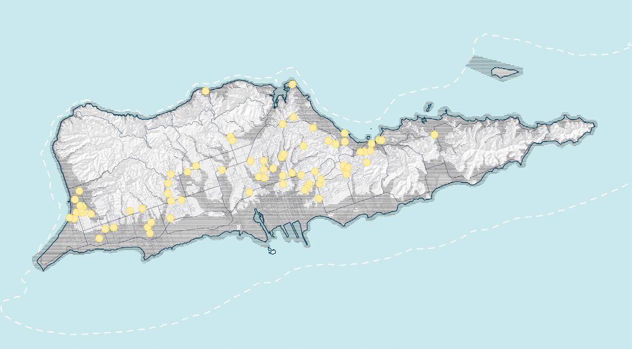
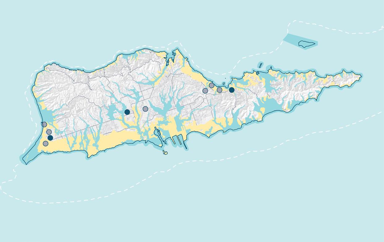
St. Croix Existing & Future Safe Rooms
Community Spaces & Resources
With only three existing locations and nine future expected locations, our findings indicated that there is an insufficient number of safe rooms in St. Croix. Moreover, there are not enough
safe room sites, there is not enough capacity to serve St. Croix’s population, and safe rooms are not adequately or evenly distributed throughout the island.
Emile Henderson Fire Station Safe Room
Claude O. Markoe Elementary School (Capacity: 500)
St. Dunstan Episcopal School
Herbert L. (Richmond) Canegata Fire Station Safe Room (Capacity: 9)
Before we developed our site plan, researched and mapped island-wide community resources, including youth centers, recreational spaces, churches and other religious institutions, art and cultural centers, and more.
While there are several notable organizations, resources, and spaces that serve various communities on the island, we found that additional and improved spaces may benefit local
Existing Community Resources
Existing Community Spaces
Evacuation Zone
communities, especially those that are particularly vulnerable. Additionally, many of the spaces that do exist could be improved or renovated to maximize their potential and use.
Therefore, we started to select the community spaces and finish our site plan based on the filters we set up. The filters’ data includes population, natural disaster hazard zones, accessibility, existing community asset, ect.
Department of Human Services Division of Family Services Head Start (Capacity: 35)
DC Canegata Complex (Capacity: roughly 54)
Alexander Theater (Capacity: roughly 300)
Central High School (Capacity: 938)
St. Croix Educational Complex (Capacity: 600)
Existing & Future Safe Rooms on the Island
Arthur Richards PK-8 & Safe Room (Capacity: 690)
Existing Safe Rooms
Future Safe Rooms
Tsunami Evacuation Zone
Hurricane/ Flooding Evacuation Zone
-27-
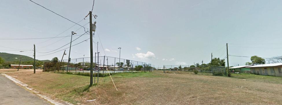
Image: Williams Delight Community Space Existing Condition (UPenn Studio)
The planned capacity for safe rooms is meant to be 10% of the population, which is roughly 5,060 for St. Croix as of 2021. However, as of 2022, the St. Croix shelters can take 792 people.
Safe Room Location Selection Filter 1: Population Density
Christiansted
Safe Room Location Selection Filter 3: High Social Vulnerability
Bethlehem
Christiansted
Population Density Map


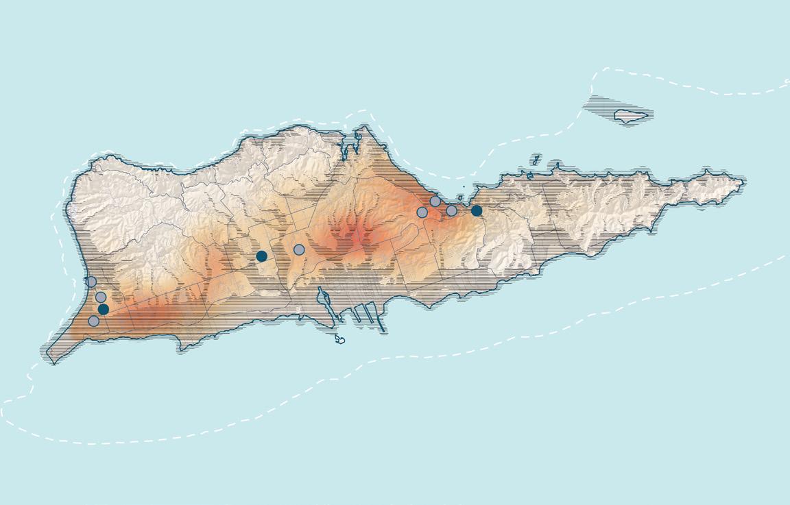
Sunny Isle
Existing Safe Rooms
Future Safe Rooms
South Frederiksted and Williams Delight
Williams Delight
Safe Room Location Selection Filter 2: Outside of Natural Disaster Hazard Zones
Population Density High Low
Evacuation Zone
Safe Room Location Selection Filter 4: Accessibility to Existing Community Assets
Extreme Weather Hazard in St. Croix
Tsunami Evacuation Zone
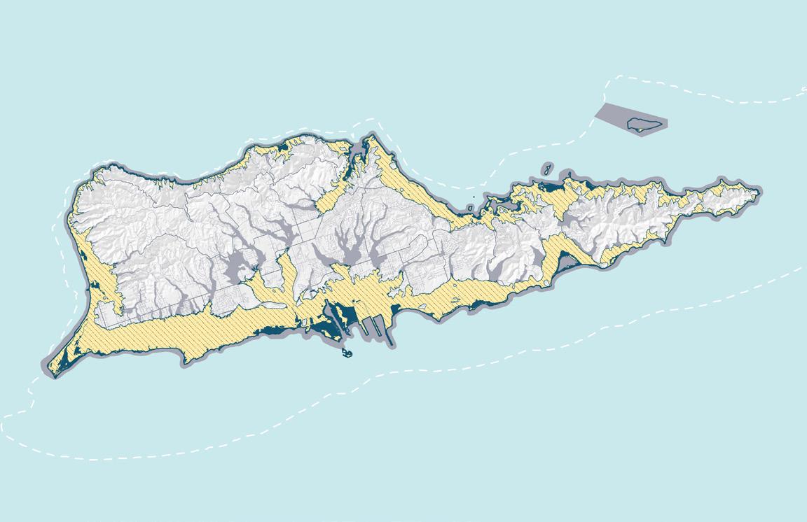
Riverine/ Coastal Flooding Zone
Storm Surge Zone
Safe Rooms and Community Resources
Existing Community Spaces
Existing Safe Rooms
Future Safe Rooms
5 Minute Reachable Range by Foot
15 Minute Reachable Range by Foot
Evacuation Zone
-28-
Increasing Vulnerability No Population 1 2 3 4 Top 10% Most
Social Vulnerability
Vulnerable
New Safe Rooms Location
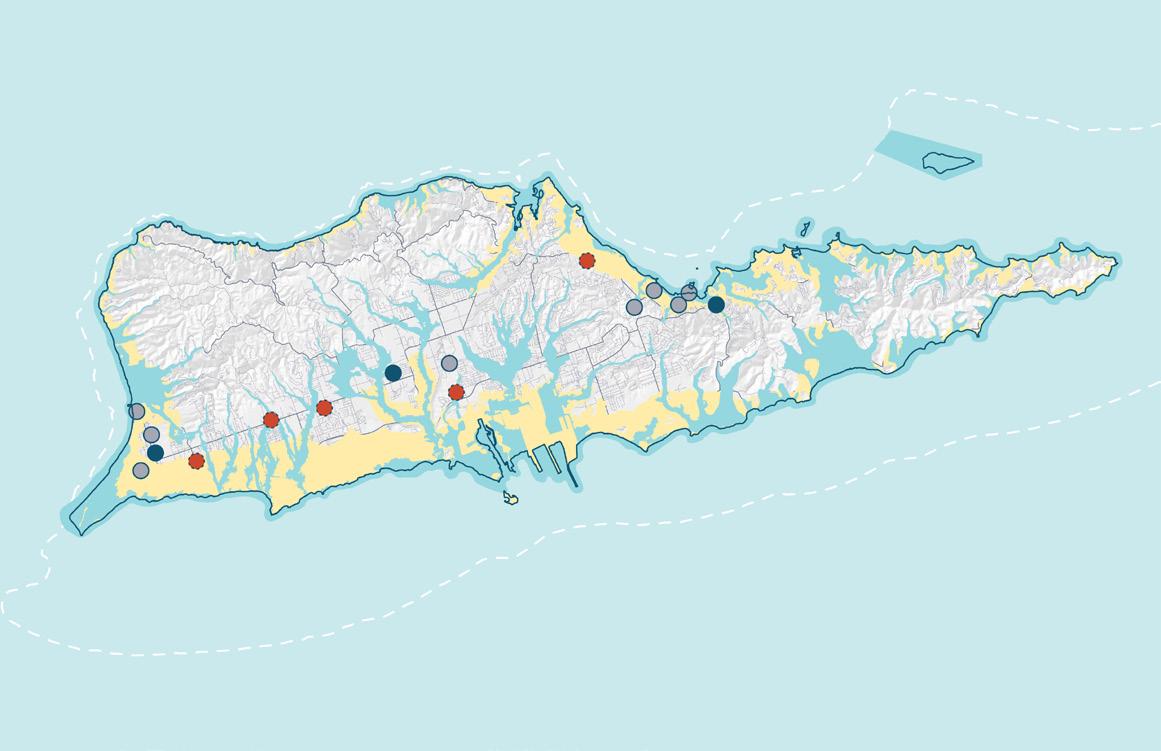
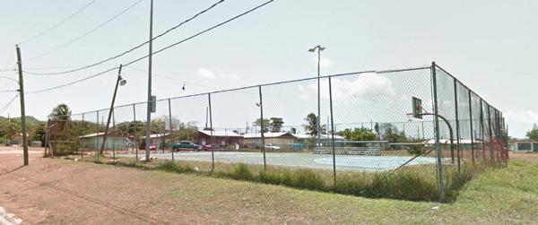
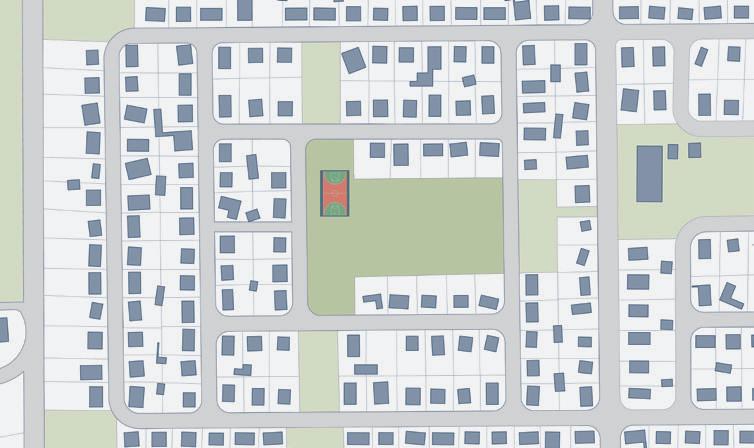
Several sites were filtered out as potential new safe room locations- the Five Corners Office Building and Shopping Center, Cruz St Baseball Field, Williams Delight Basketball Court, Renholdt Jackson Sports

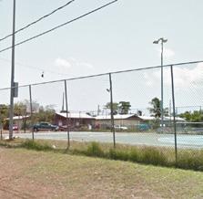
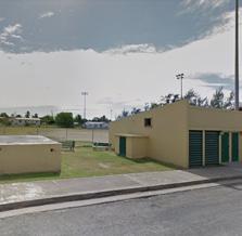
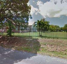
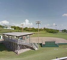
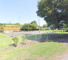
Complex, and St. Joseph’s Catholic Church. We decided to develop a site plan for the Williams Delight Basketball Court based on our research, analysis, and methodology.
Community Safe Hub Design
Five Corners Office Building and Shopping Center Cruz St Baseball Field
St Joseph’s Catholic Church
Williams Delight Community Basketball Court
Community
Emergency
Playground Pathway to Safe Rooms Sports Complex
Renholdt Jackson Sports Complex
Safe Hub
Management Community Space
Farmer’s Market Temporary Exhibition Performance Multifunctional Open Space Public Bathroom Assembly Point Resource Distribution Safe Room Guide System Food/Water Storage Parking Lot
Rain Garden
Safe Room Candidate Overview: Williams Delight Basketball Court
Our team conducted a market study to understand the currently present and missing resources in the Williams Delight neighborhood, where the William’s Delight Basketball Court is located. Williams Delight has various grocers and restaurants, sports recreation spaces, retail presence, a historical place, and other community assets.
The demographics of the neighborhood indicate that Williams Delight is largely home to a historically marginalized and underserved population that may still bear the effects and challenges linked to cycles of
systemic poverty.
Therefore, the community uses for the site may include recreation, entrepreneurship, climate mitigation, energy and water generation, crop production, general public services, and after-disaster uses.
-30-
Williams
CenterlineRd. KMartCommercialCenter
ConcordiaRd.Farmland
NeighborhoodPharmacy CrucianRum
STX Energy
MelvinH.EvansHwy.
Delight Rd.
Community Facilities Churches/ Community Spaces
ToFrederiksted ToAirport
Distillery
Office Community United Methodist Church/School
CenterlineRd.
Delight
MelvinH.EvansHwy.
Williams
Rd.
Community Basketball Court
Community Basketball Court Service Area (5min Running)
New Community Safe Hub
Community Resources in Evacuation Zone
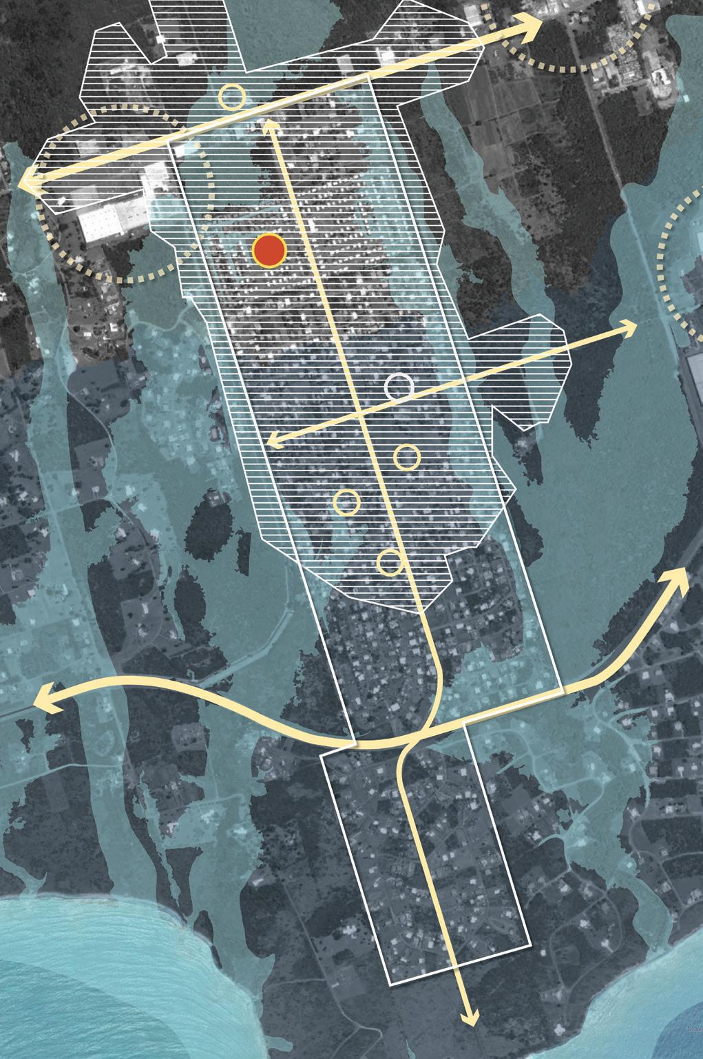
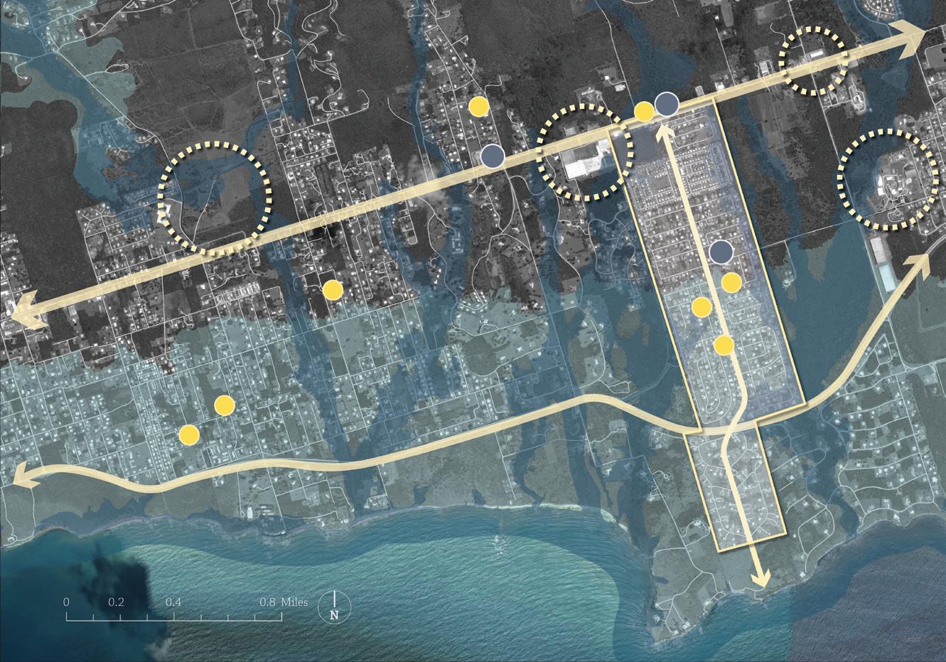
Accessibility Analysis
Programming
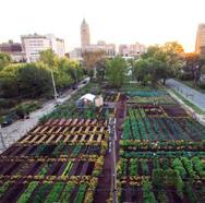
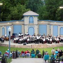
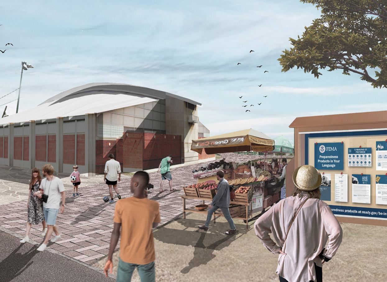
In daily life, the community safe hub can also provide a variety of public spaces for the community.
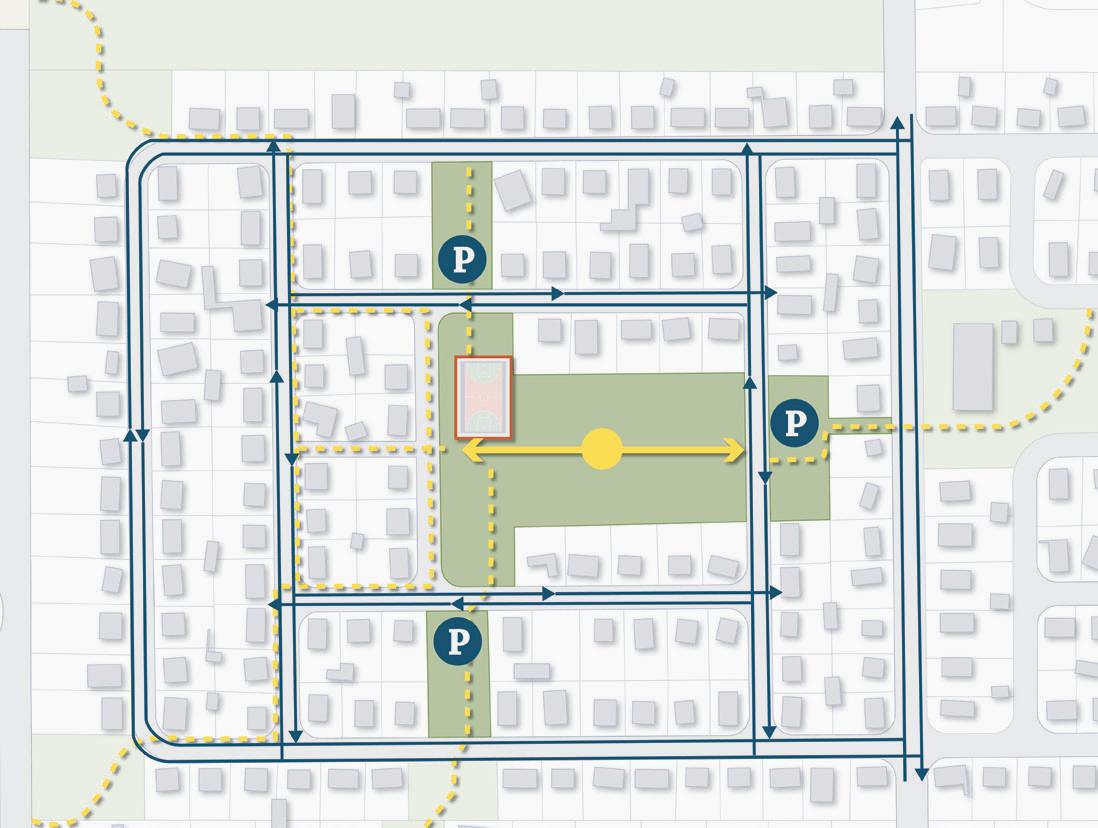
Main Pathways
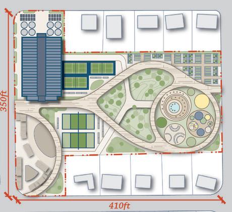
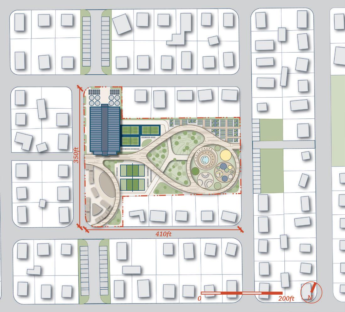
For programming, we create different types of interactive spaces and landscape to help enrich the function of a community center.Besides, the main pathways that serve as a quick access to the safe hub, there are also a secondary pathways which connect the vibrant community spaces.
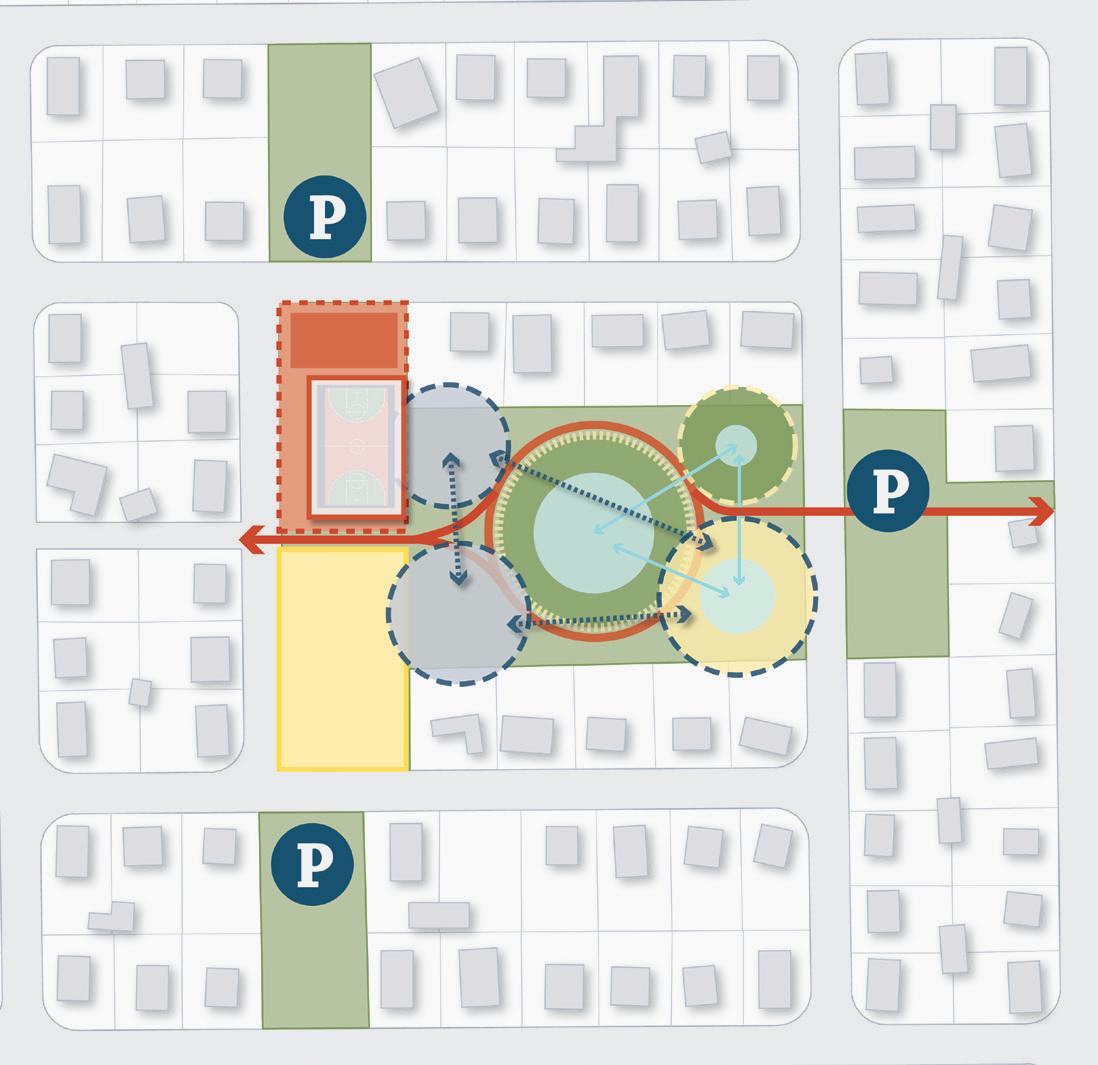
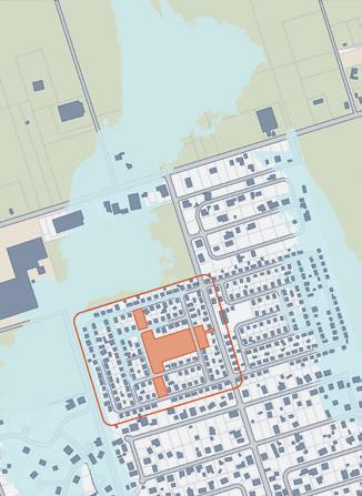
Within a five-minute pedestrian traffic range, this community safe hub can serve 74.7% of Willams Delight’s community area. About half of the people who live in the area this community safe hub can serve to live in the extreme weather hazard evacuation area.
-31Williams Delight Rd. Vehicle Circulation Parking Pedestrian Circulation Community Basketball Court N P
Williams Delight Rd.
Secondary Pathways
Sports Complex Recreation Landscape
Multifunctional Space
Parking Water Management Community Safe Hub Community Basketball Court & Safe Hub
N P
CenterlineRd. Williams Delight Rd. Williams Delight Rd.
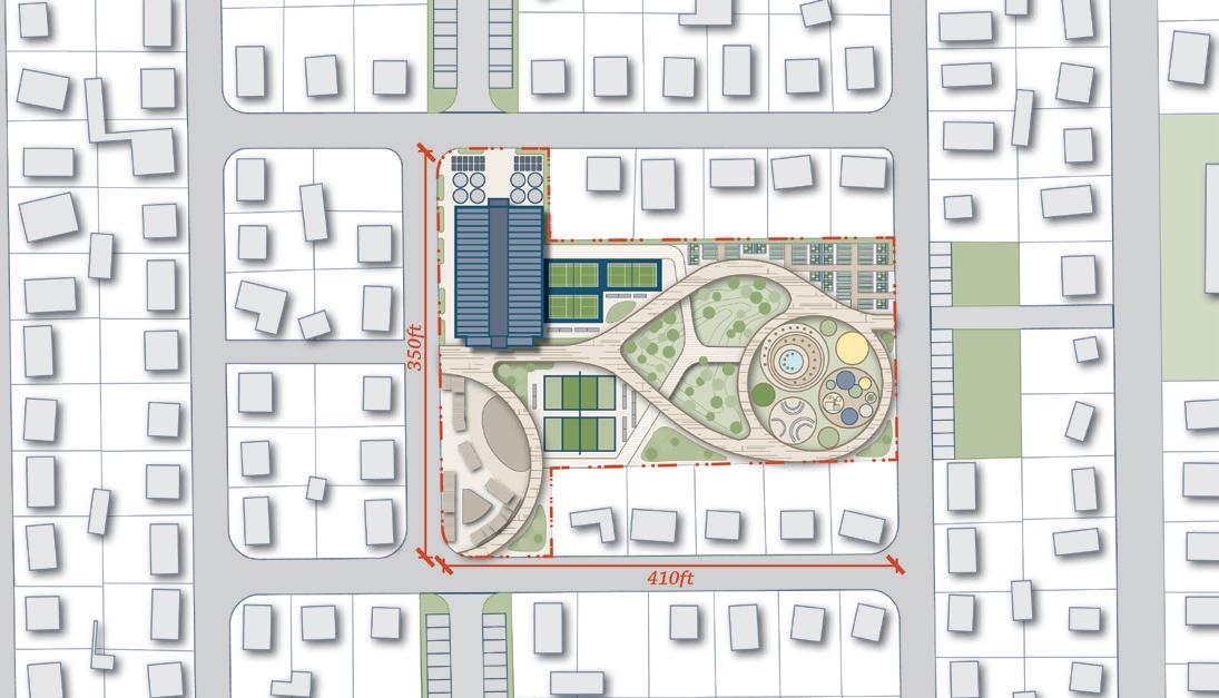
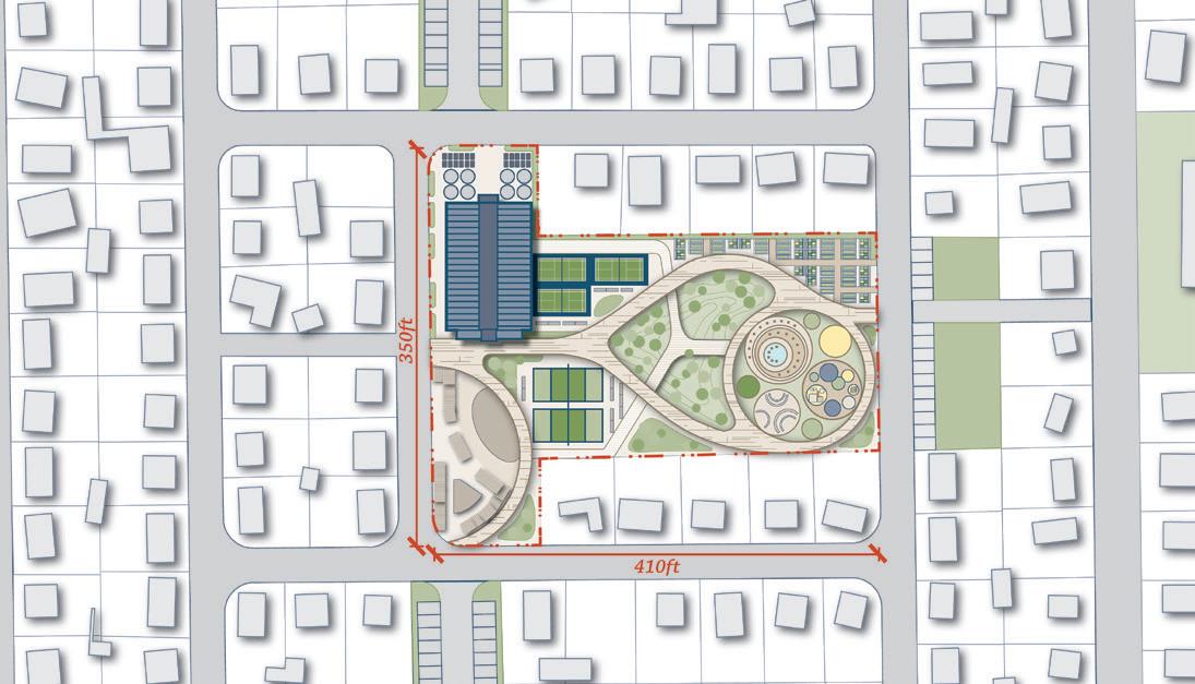
Community Safe Hub Site Plan

Site Plan
Daily Scene
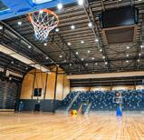
The multifunctional spaces and the indoor basketball court can provide different community functions in different situations.
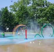
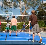
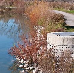
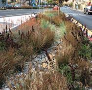
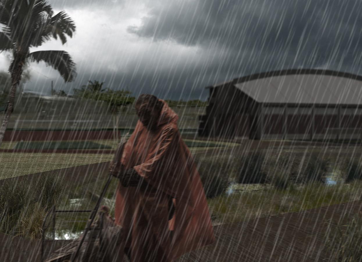
We also use biofiltration as one of our main landscape strategies to help create a beautiful landscape area for the community. Meanwhile, it can gather and purify the water from the garden and cooling center/ splash pads. During an emergency such as riverine flooding, the biofiltration marshland can help manage the stormwater and reduce the impact of extreme weather hazards.
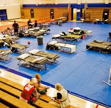
Emergent Scene
-321 2 3 4 6 7 8 9 10 11 11 11 5 Williams Delight Rd.
1. Indoor Basketball Court
2. Safe Room Auxiliary Space
3. Multifunctional Space
4. Volleyball Courts
5. Badminton Courts
6. Biofiltration Marshland
7. Community Farm Garden
8. Cooling Center/ Splash Pads
9. Kids Playground
10. Interactive Spaces
11. Parking
Community
Biofiltration Landscape
Indoor Basketball Court
Farm Garden
Sports Complex Temporary Performance or Farmers Market Community Interactive Spaces Community Safe Room Stormwater Management
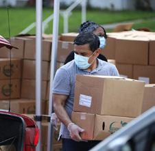
Disaster Relief Resource Distribution
Our analysis began by researching information about FEMA Safe Rooms, including requirements, codes, regulations, and funding. This led us to question what best practices exist around emergency management and creating safe rooms- regarding general location and site-specific characteristics, population capacity, target demographic, and potential funding sources.
With this, we concluded that an effective, modern-day safe room should be located close to a densely populated area and serve as a multifunctional facility that benefits the local community in both times of disaster and blue-sky days. Additionally, a safe room located in a high poverty area would best serve the needs of vulnerable populations.
-33-
In the future, the community safe hub can also serve as a natural disaster knowledge issemination center.
Reimagining the Past: A Study and a Modern Revival of Traditional Shanghai Laneways and Row Houses
REIMAGINING THE PAST: A STUDY AND A MODERN REVIVAL OF TRADITIONAL SHANGHAI LANEWAYS AND ROW HOUSES
Hongkou District, Shanghai, China
Instructor: Adam Sun E-mail: adamsun32@gmail.com
The diagrams and analysis in the portfolio are all individual works.
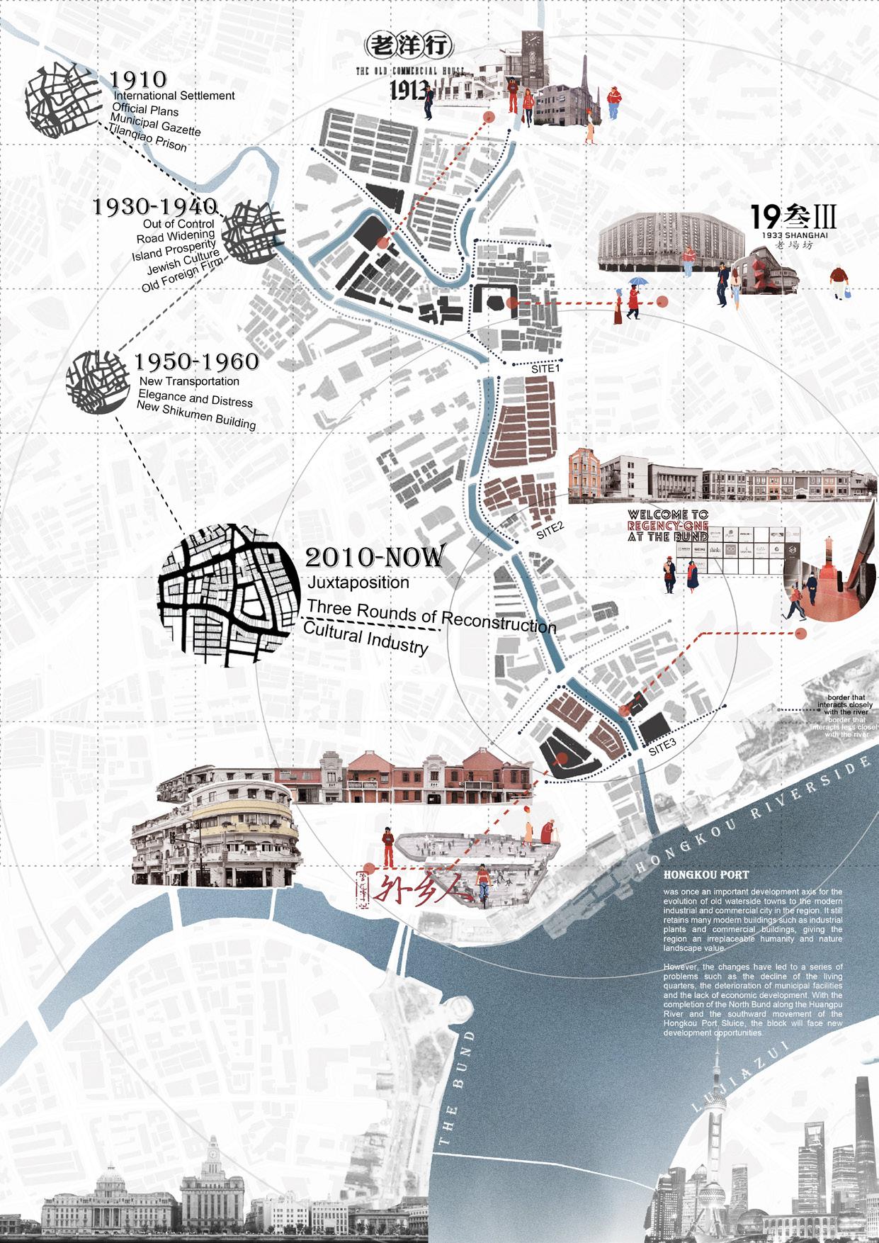
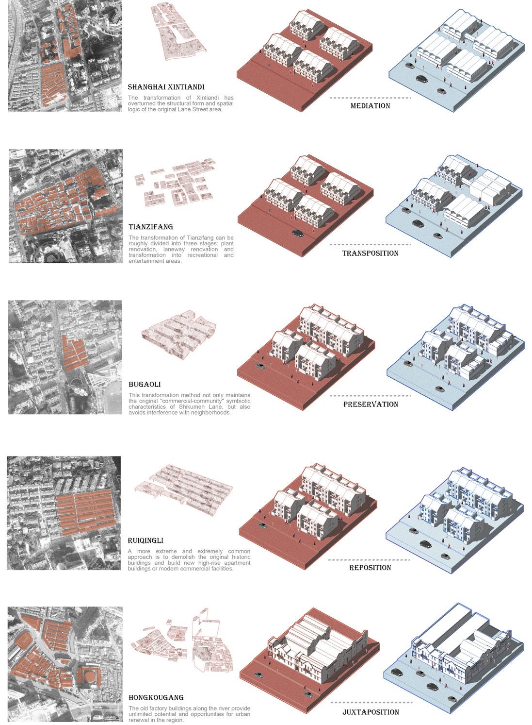
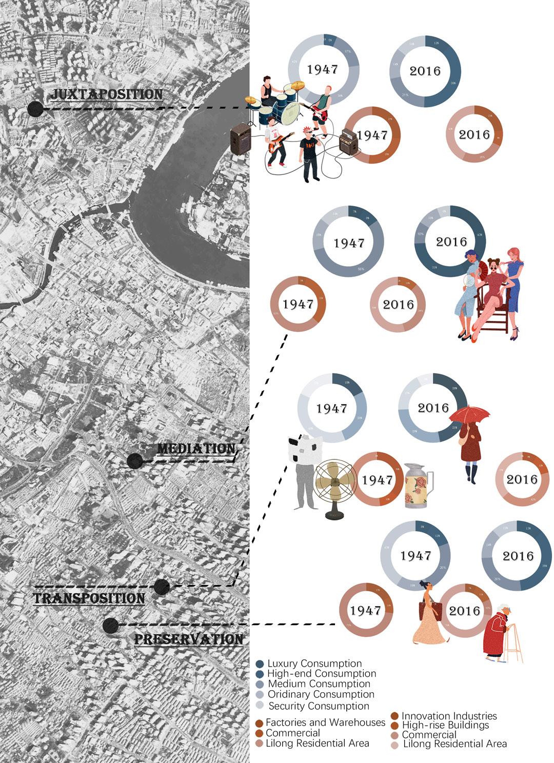
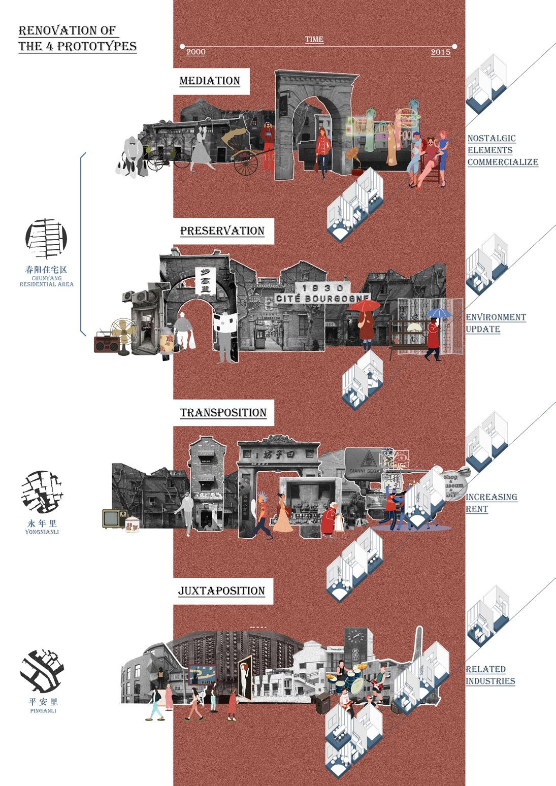
Through the comparative analysis of Shikumen laneway neighborhoods' reconstruction in downtown Shanghai since the 1990s, A study from Tongji University College of Architecture and Urban Planning (Xiang Zhou, Yanbo Li, and Yuning Cheng, 2020) indicates that the existing transformation modes of Shanghai Shikumen laneway neighborhoods can be mainly classified as five types: mediation, transposition, preservation, reposition, and juxtaposition.
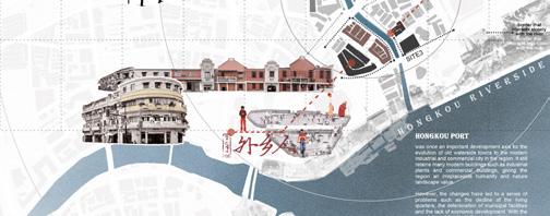
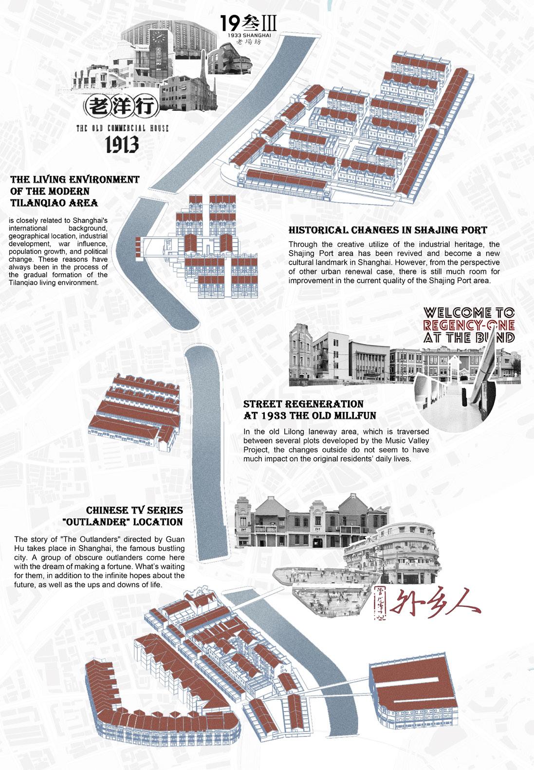
The area along the Hongkou Port River that this project focuses on starts from the 1933 Laochangfang and ends at the Hongkou North Bund riverwalk. There are many Shikumen residential buildings along the Hongkougang River and many preserved buildings. This project will study the five renewal modes of the laneway community and the typology of existing traditional row houses within the area. Besides, the project will also renew the laneway community to be a vibrant and dynamic neighborhood.
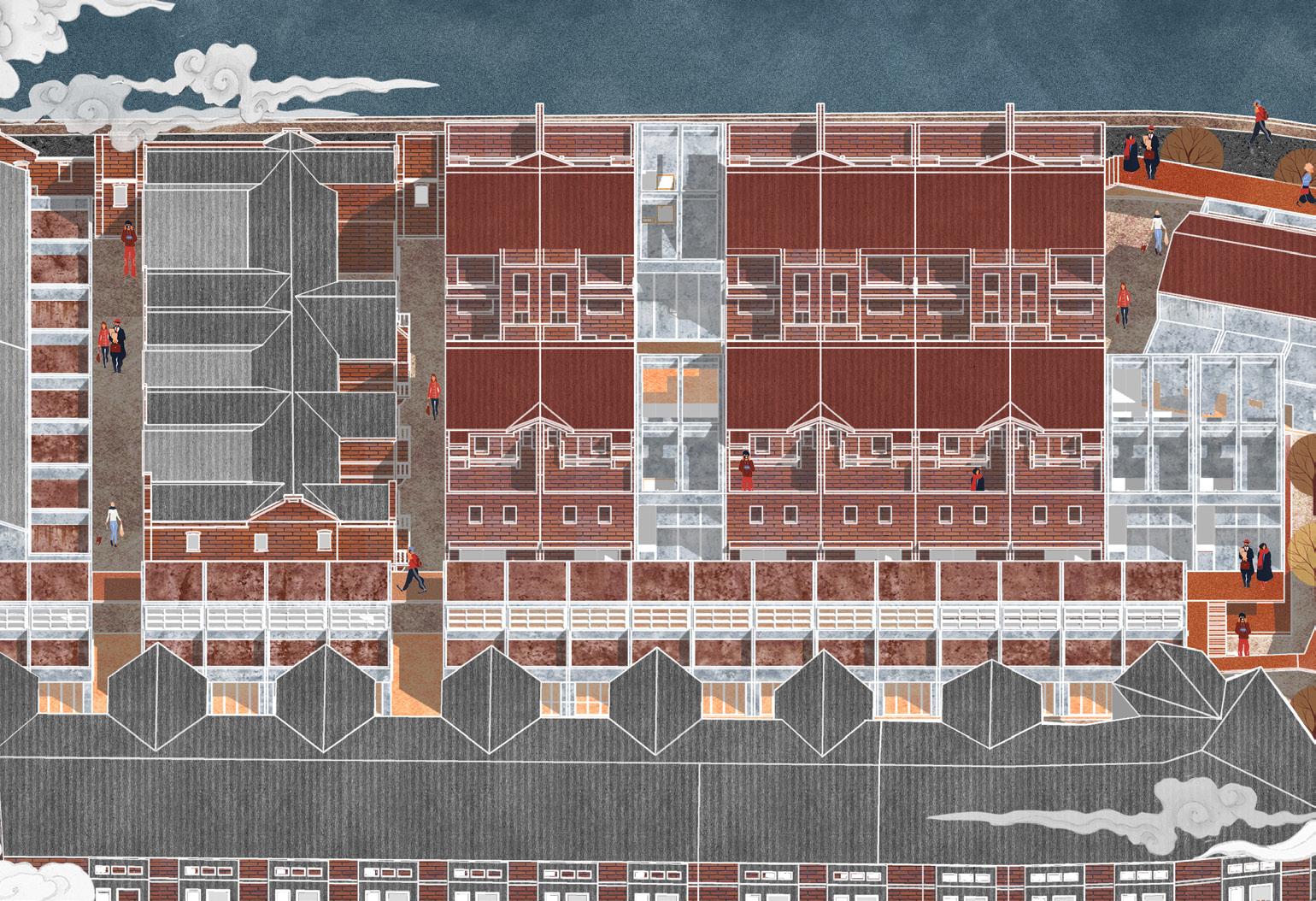
Laneway spaces should have the nature of "commercial-community" symbiosis. This symbiotic relationship should evolve from a simple dual symbiosis to a composite one.
Reimagining the Past: A Study and a Modern Revival of Traditional Shanghai Laneways and Row Houses
-34-
-35BASE CONTEXTUAL ANALYSIS
SITE1
SITE2
SITE3
-365 TRANFORMATION MODES ANALYSIS OF BUSINESS MODE TRANSFORMATION
-37-
ADAPTIVE COMMUNITY
ADAPTIVE COMMUNITY
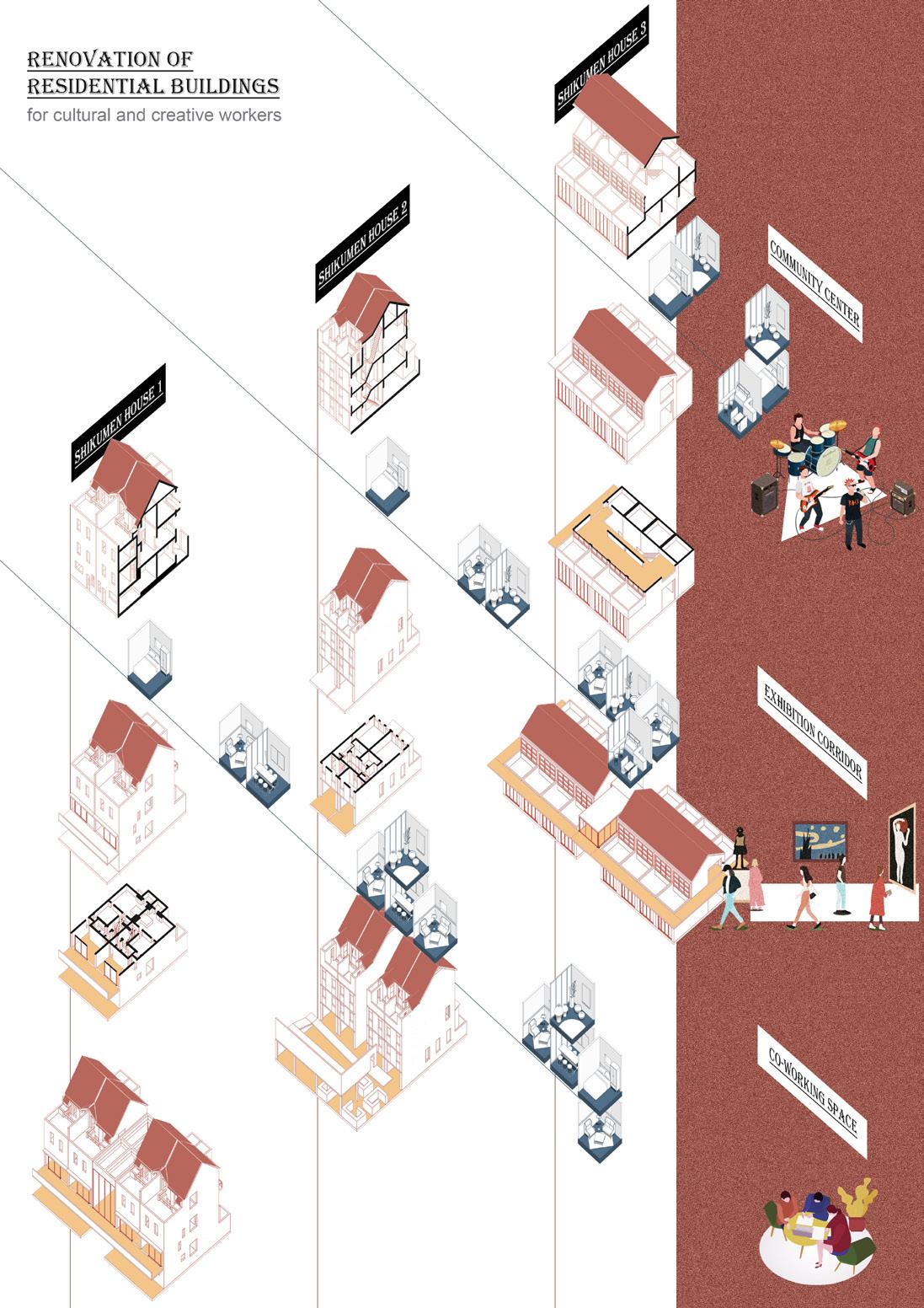
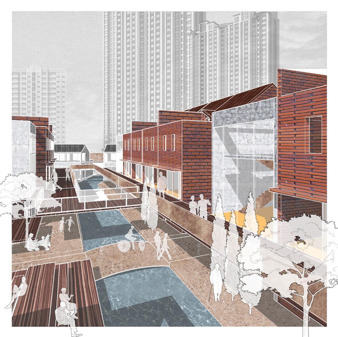
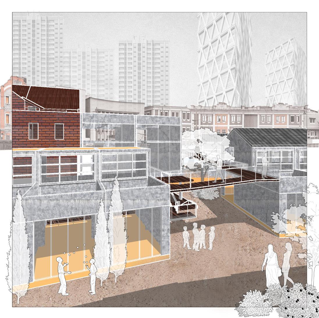
The Chunyang residential area is renewed to form a self-contained community. The second floor of the original Shikumen residential building will be transformed into a common working area to make it a new home for the new residents.
The corridor connects the artistic creation space units of each residential building, which all lead to the surrounding cultural and creative shops and display buildings. Cultural and creative workers can complete this area's artistic life, work, and social activities.

-38SITE1: CHUNYANG RESIDENTIAL AREA MEDIATION & PRESERVATION
CENTRIPETAL COMMUNITY
CENTRIPETAL COMMUNITY
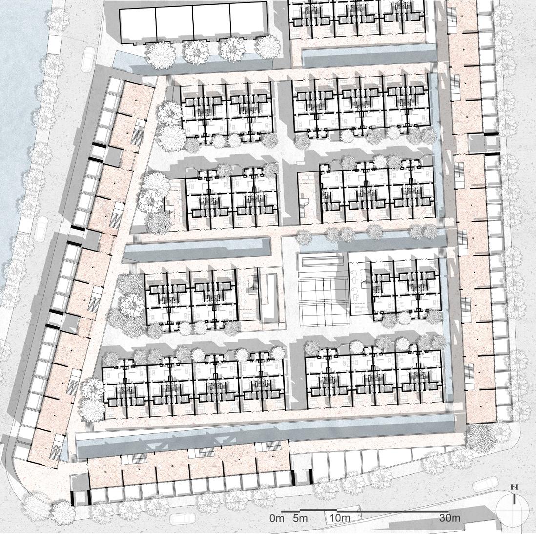
This residential area has a certain concentricity. The former market in the space provided a natural center for the new residential layout. This project transformed the vegetable market into a two-story building for exhibition activities and a onestory commercial building. Therefore, the residential building frontages are all towards this center.

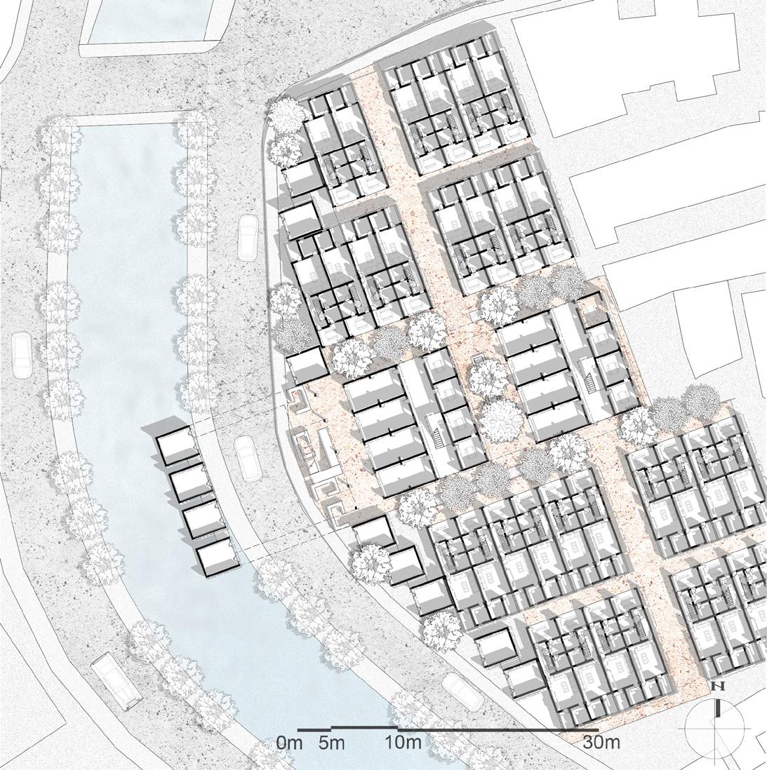
-39SITE2: YONGNIANLI RESIDENTIAL AREA TRANSPOSITION
SYMBIOTIC COMMUNITY
SYMBIOTIC COMMUNITY
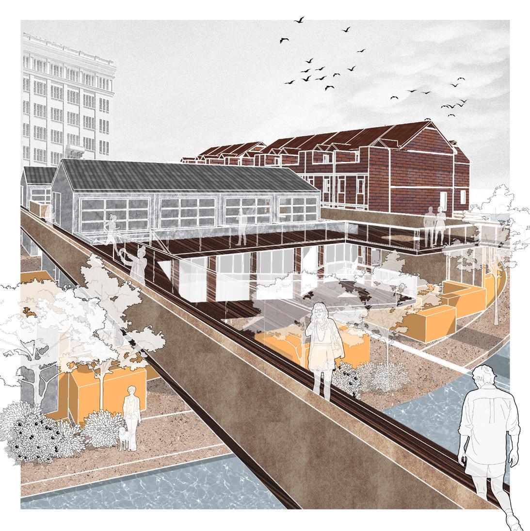
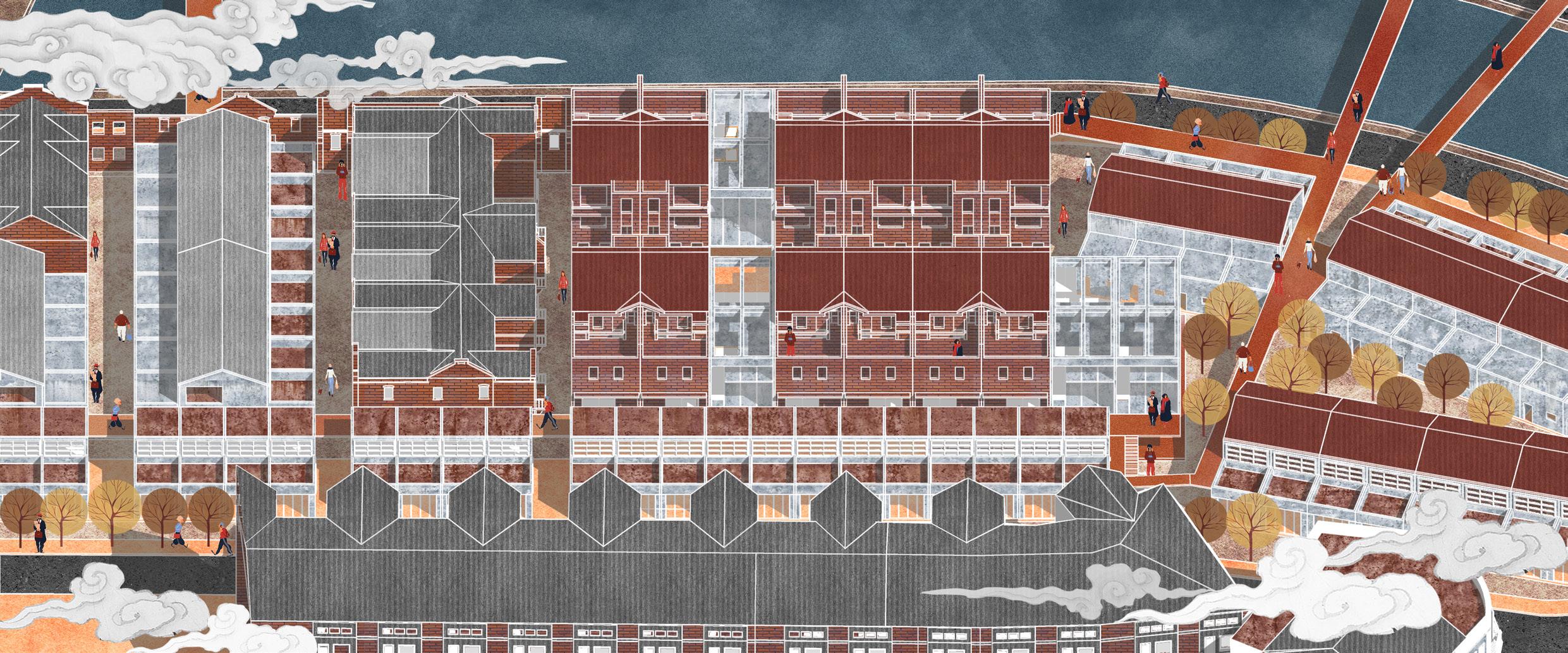
The residential area of Ping'anli has a complex urban texture. There are many historic buildings around it. Therefore, the project retained specific historical building components and re-planned the relationship between the residential and commercial areas and public spaces to form a symbiotic community.

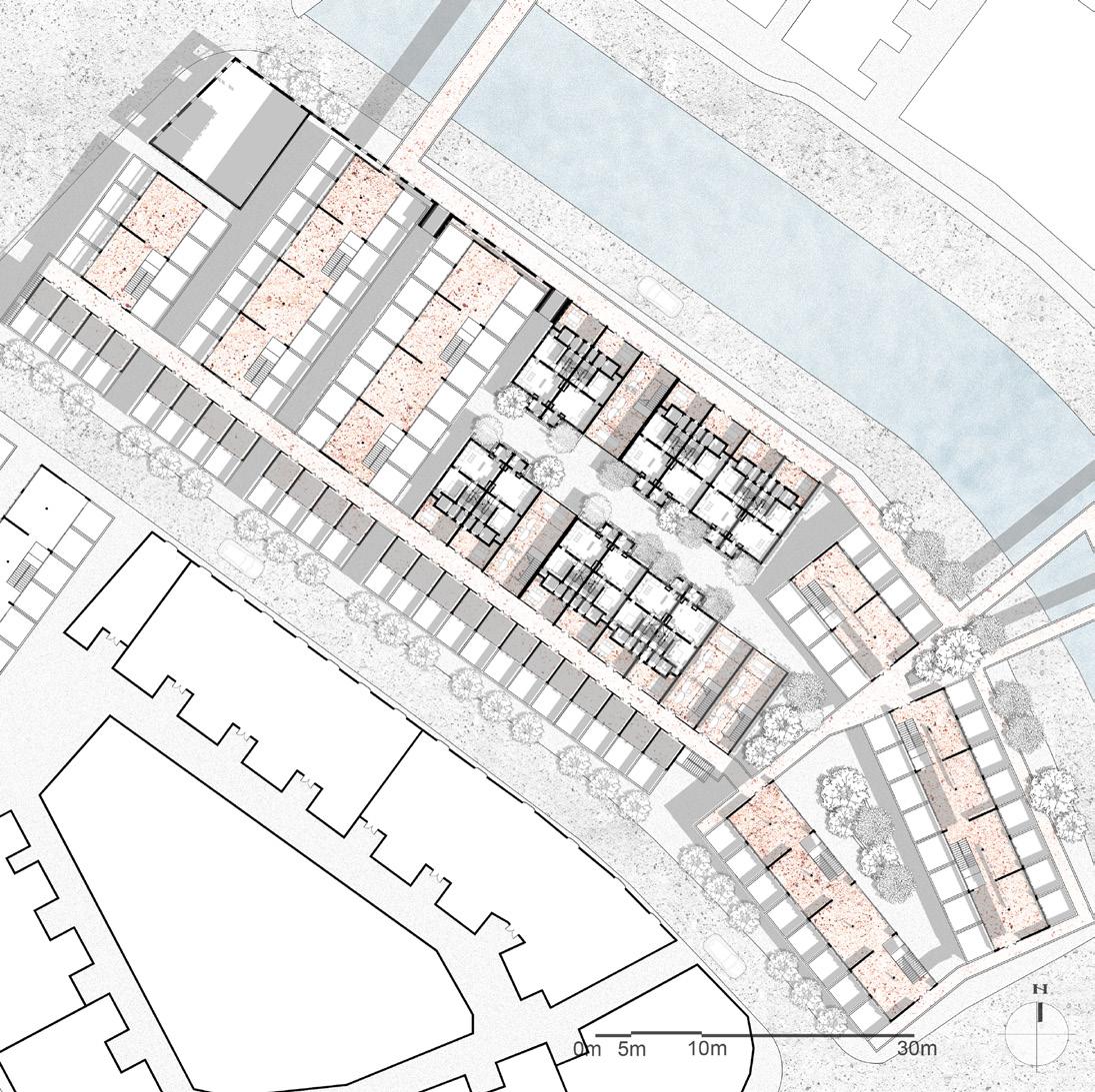
-40SITE3: PINGANLI RESIDENTIAL AREA JUXTAPOSITION
-41-
-42-
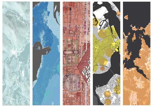
GIS WORKS GALLERY


