
15 minute read
Sketches


Paul Girrawah House, Ngambri/Ngunnawal peoples, work in progress, Kamberri/Canberra, 2021 © the artist. designs in four bands, 1987–88, purchased with the assistance of funds from National Gallery admission charges and commissioned in 1987

Advertisement
Material Culture
Scars on trees can result from the deliberate removal of bark by Aboriginal people for a variety of reasons.Tree bark was an integral component of Aboriginal material culture.
It was deliberately removed in order to use the bark for shelter, canoes and domestic articles such as coolemons;
Create a marker tree allow access to other tree resourcessometimes toeholds were cut into trees to assist climbers obtain bird’s eggs or possums;
sometimes carved patterns in the tree trunks served ceremonial purposes and some indicate burial sites.
8

Rock Grooves from Terramungamine Reserve The Birrigai Rock Shelter-Tidbinbilla Nature Reserve


Illustration by Paul Memmott
The Life Style
Grinding grooves are small depressions in rock typically formed by the repeated movement of hard stone artefacts against a softer one (usually sandstone).
The Birrigai Rock Shelter is one of the oldest known inhabited rock shelters in the world, and shows Aboriginal use of shelters during the last Ice Age dating back over 25,000 years to a time when temperatures were 8-10°C colder than they are now and when snow covered the ground for almost half the year.This shelter provide warmth and comfort to Aboriginal people who used the area for ceremony.
Layout of an Aboriginal dance-ground in the Wellesley Islands, Gulf of Carpentaria, showing socio-spatial arrangement of seated subgroups of spectators from the geographic divisions of the Lardil tribe. This is an example of a “behaviour setting” with minimal physical structures.
9

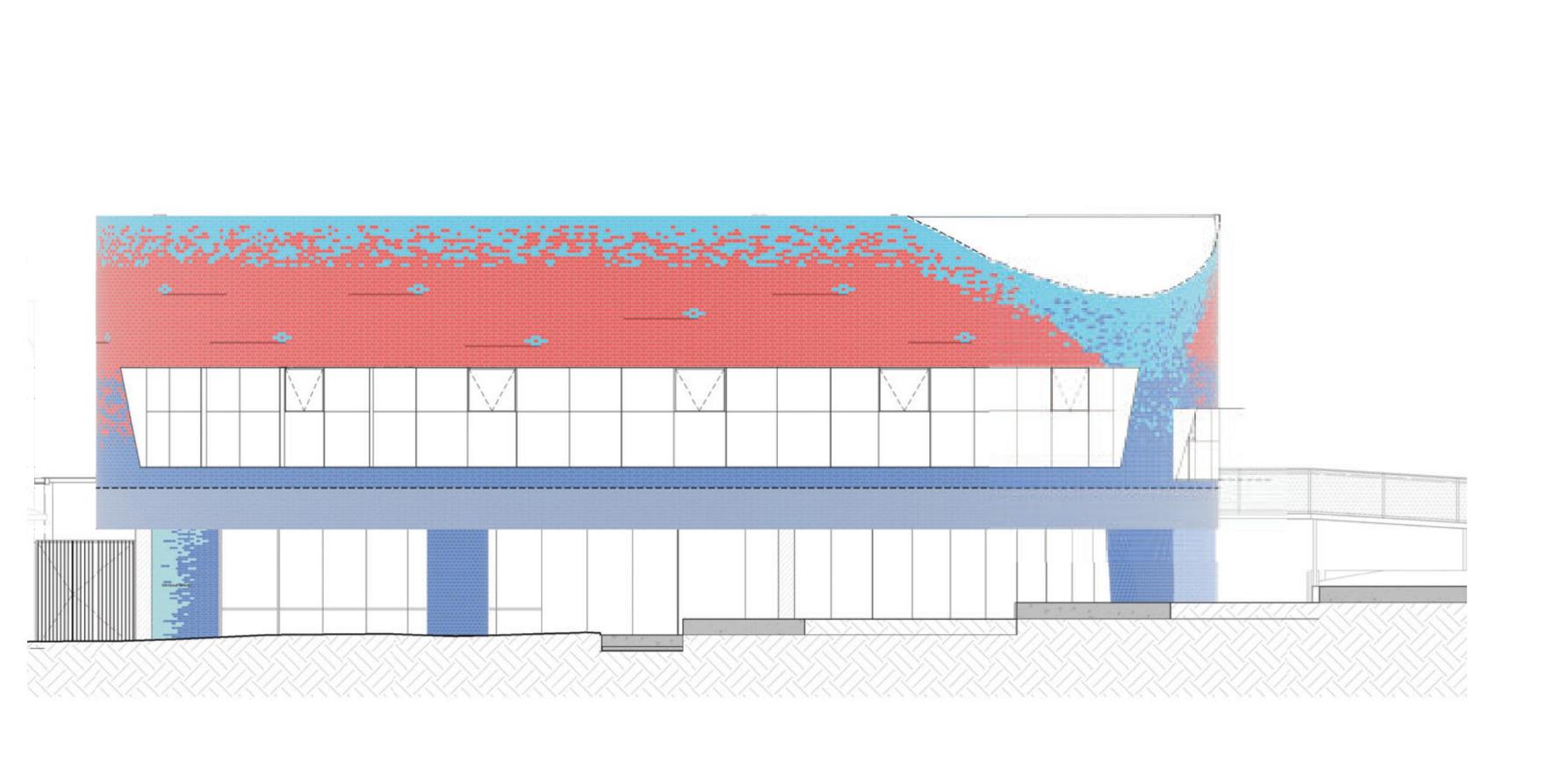
Architecture Case Study 1 Drysdale Library,2021
Antarctica Architects and Architecture Associates @Geelong Public Library Site area:1830sqm ,Building area:1215sqm
The building form is conceived as a gathering place and ANTARCTICA and Architecture Associates have engaged with the local Wathaurong community looking at gathering places throughout the Wadawurrung culture in its development. The roof top landscape is envisioned as an expansion of the library and incorporates local and indigenous botanical elements, whilst also engaging with the park and main street and referencing the nearby Macleod’s waterhole. The brickwork facade draws upon the material history of Drysdale and the greater Bellarine Peninsula.
10
1. Drawing on the material heritage of the Drysdale area, the brick façade incorporates motifs from the surrounding heritage buildings as well as referencing colours, textures and tones from the natural landscape of the Bellarine Peninsual
4. Central yard applying the nature into building while allows the nature light going,the roof top plandscape could be envisioned as an expansion of the the library. 2.The roof top landscape is envisioned as an expansion of the library and incorporates
local and indigenous botanical elements,
part of the landscape
reduction of heat island affect through planted roof.


3. Amphitheatre and terrace engaging with
the park and main
street and referencing the nearby Macleod’s waterhole

11

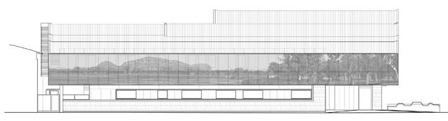
Architecture Case Study 2 The New Kununurra Courthouse,2014
TAG Architects + iredale pedersen hook architects @Geelong COURTHOUSE
The design of the new Kununurra Courthouse, on the site of the former courthouse, interprets local physical qualities to capture the uniqueness of Kununurra in a establishes a sense of gravitas.
The architecture draws heavily on Kununurra’s geographic uniqueness, visible from the air and particularly visual when moving around the town. The contrast of the natural landform, embracing the ordered plantations and buildings is especially unique, combined with the close proximity of Kelly’s Knob and Hidden Valley. Both natural landmarks are visible from the site; they visually and experientially connect the community and visitors to Kununurra in a manner that is respectful and sophisticated. Efforts have
been made to create a less formal court environment where Aboriginal people are more comfortable
12
1. The roof form of the building creates an immediate dialogue between building and mountain while creating a variety of volumes that respond to the program requirements for the interior spaces. 2. Both foyers and courtrooms reference the quality of space experienced in Hidden Valley through the use of carefully crafted material and spatial qualities.
3. On the north-western facade the roof form folds down with large panels perforated with an image of Lake Kununurra. This provides a sunscreen that limits the direct sun and creates privacy to the judicial chambers and mediation suite. 4.The main entry houses a glass print design based on Nyamooli, a bush soap that grows near swamps
13


Architecture Case Study 3 Centre for Nyoongar Culture, 2018
TAG Architects + iredale pedersen hook architects @Northam Culture Centre Area: 1450 sqm
IPH and the interpretive designers Thylacine worked in parallel with the Aboriginal community of Northam to design a place to teach Aboriginal and non-Aboriginal people about Noongar culture and the environment. A project working
group drawn from representatives of Elders and key families in the region who worked
directly with the design teams to generate the brief for the building, decide how it would function and how Noongar Culture would be presented.
Social Sustainability is achieved by the genuine trust and engagement with the Aboriginal families of Northam- allowing them to determine the form, function, content and operation of the centre.
14
1.The afternoon sun and heat load is managed by the long timber screen, formed from vertical planks of local recycled Jarrah timber, arranged to respond to the the river. 2. These forms are perched on columns above the 1:100 year

3. Windows and openings in the facility make reference to the idea of a “cultural compass” and gesture across the landscape to both visible hills and distant Cultural sites- allowing visitors to understand the Ballardong country beyond the immediate place
15
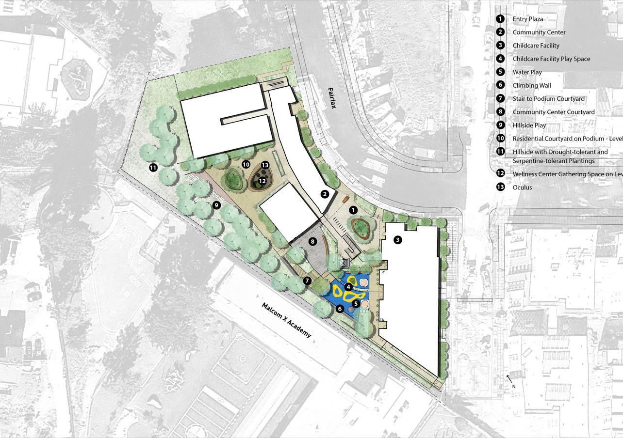


Landscape Architecture Case Study 1 901 Fairfax Avenue 2018
David Baker Architects & Paulett Taggart Architects @San Francisco, California Multifamily
Area: 8,444 sqm
This community hub in San Francisco encourages social interaction and supports a safe, walkable neighborhood.
“901 Fairfax is the centerpiece of an organic neighborhood that connects homes, services, transit, and views, and works with the site’s steep, pick” shaped oculus connects the platform and the land.
16


According to the section, the oculus on the platform provides sunlight and fresh air to the site. Also, the native plant list and the slope design would be able to handle the weather of California and the well-being of high-density housing.
17


Landscape Architecture Case Study 2 Suining South Riverfront Park
ECOLAND Planning and Design Corp., Sichuan Provincial Architectural Design, Research Institute CO., LTD. @Suining City, Sichuan Province, China
From a Concrete Bulkhead Riverbank to a Vibrant Shoreline Park - Suining South Riverfront Park
This project was a great example of how the constructed wetland turned the constructed river into green infrastructure.
Three ponds doing their own job to serve back the ecosystem. the re-establishment of native species in problem but also provides a massive habitat for wildlife.

18


Green Concrete Timber Wall Cladding Sandstone Cladding Steel Structure

Engagement Plan (Architecture)
- Site design engages with the context and supports the cultural activities including ceremonies, which connection with the general activities of the community;
- Connecting the indigenous and nature by surrounding environment and natural elements to show respect to nature by architectural form;
- Creating a less formal place where aboriginal people are more comfortable;
- Applying indigenous artwork as a part of communication with the public;
- Creating a unique architecture and space experience refers to the indigenous people;
- The building should be Visible to nature interior and external;
- Project working group drawn from representatives of Elders and key families in the region who worked directly with the design teams to generate the brief for the building, and decide how it would function and how the building would be presented.
19
Engagement Plan (Landscape Architecture)
- The carpark could be planned as a pop-up market to invite more local small business opportunities;
- Add aboriginal culture values to the lakeside walking track as a part of the NCCS’s extension;
- Transect canopy green strategies and green roof or platform with climate-positive design solutions to reduce urban heat effect;
- Use rain garden/tiny forests as green infrastructure to islands and wildlife habitats;
- Indigenous/native building materials and native plants echo back to the surrounding environment and the indigenous seasons.

Coarse-Grained Basalt Sandstone Quartzite


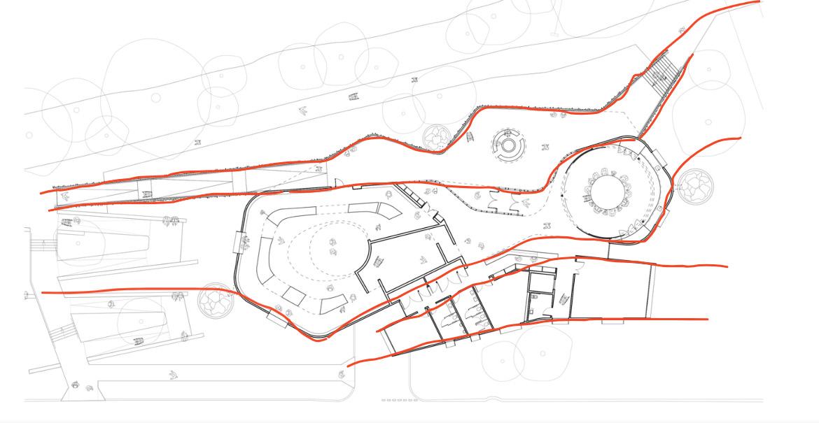
Site Analysis
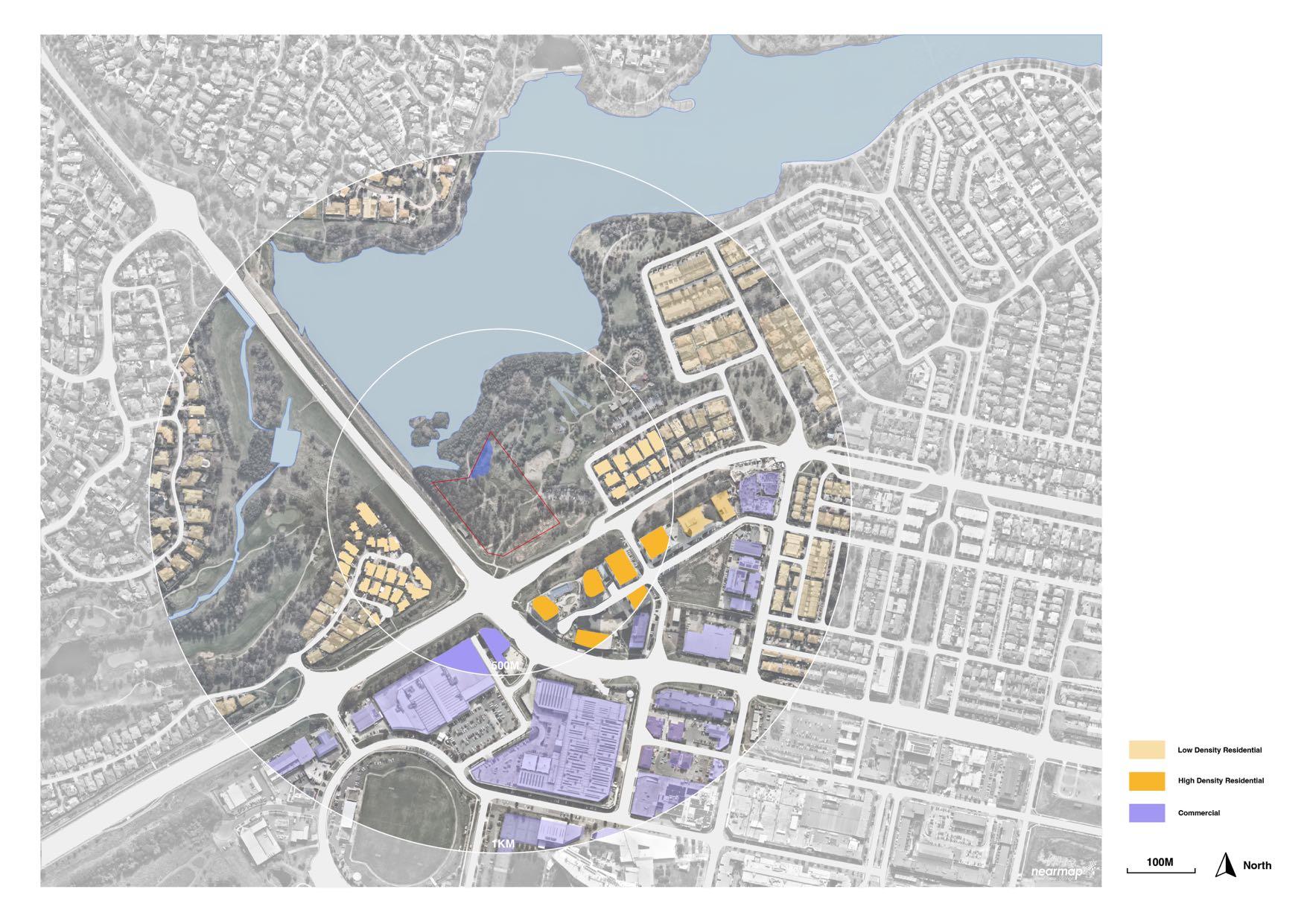
Site Analysis

Site Analysis
Pic.1 Flood Depth

Pic.2 Flood Hazard
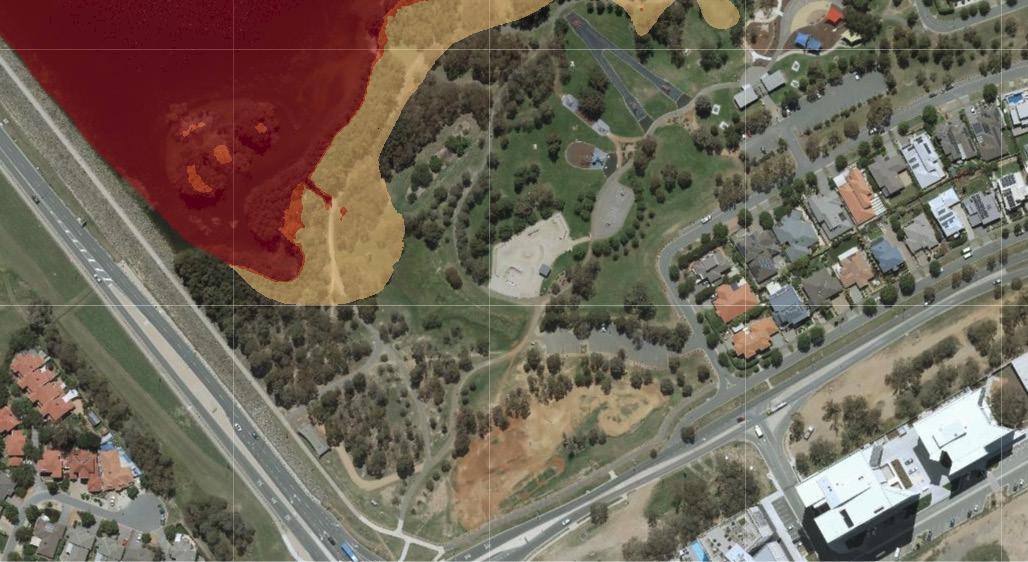

the site. Also, there is a high nutrition level on the Yerrabi Pond(O’Driscoll, 2022). - Moreover, Gungahlin is one of the hottest areas in the ACT due to the new housing developments. (Pic. 3)(Meyers, Devereux, Niel, and Barnett, 2017)
Meyers, J., Devereux, D., Van Niel, T., & Barnett, G. (2017). Mapping surface urban heat in Canberra. CSIRO Land and Water.
O’Driscoll, M. (2022). Online stink over Yerrabi Pond comes as government reveals its 10-year plan. My Gungahlin. Retrived at https://mygungahlin.com.au/online-stink-over-yerrabi-pond-comes-as-government-reveals-its-10-year-plan/9324/ 23
Site Analysis
Analysis shows that there were inseparable relations between the site and Yerrabi Pond.
Rain Season
October to March
Soil Type
Clay based, with varying amounts of sand and small pebbles
Water
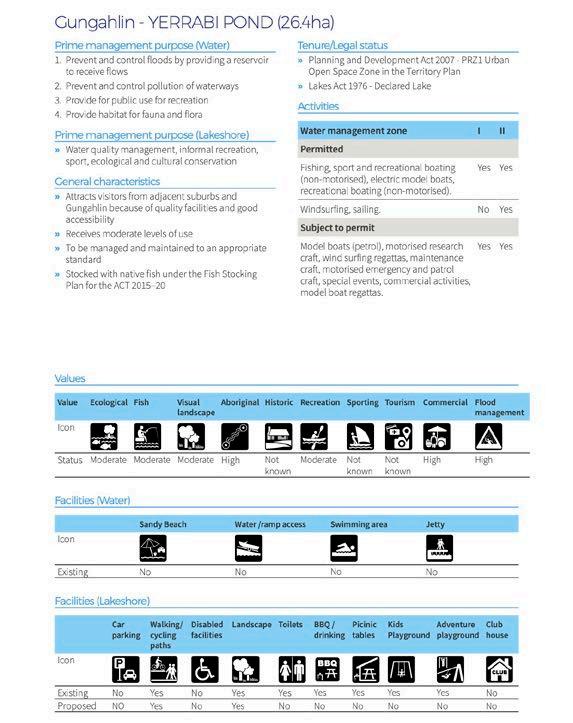
“ACT Government neglects Yerrabi Pond”(Costigan, 2021)
The plans of the Yerrabi Pond(ACT Government, 2019). Pic. plan of Yerrabi Pond(ACT Government, 2019).
History Map
is in 1999 in Gungahlin, and there was no further development after 1999(ACT Government, 2022).


Pic. 2004(ACTmapi, ACTGovernment, 2022) Pic. Historical map(ACTmapi, ACTGovernment, 2022)

Biodiversity
Habitat situations(Pic. Habitat, 2022).
Fish: Murray Cod, Golden Perch Bird(97 species): Musk Duck, Cumbungi, Eastern Great Egret, Noisy Miner and White-plumed Honeyeater,Superb Parrots(Polytelis swansonii)(vulnerable)
Plants: Water Millfoil, Slender Western Rosemary, Australian Bindweed, Waterlily, Banksias (Banksia), Wattle (Acacia), Waratahs (Telopea), Bottlebrushes(Callistemon), Kangaroo Paws (Anigozanthos), Ferns. Pic. Habitat(ACTmapi, ACTGovernment, 2022)

Habitat (Colonisation Potential) Generalist Model
Local Links - Functional Canopy Connection
Canopy Gap of 100m - 195m
ACT Government. (2019). Gungahlin - YERRABI POND (26.4ha), Draft Canberra Urban Lakes And Ponds Land Management Plan. ACTmapi. (2022). Retrived from https://app2.actmapi.act.gov.au/actmapi/index.html?viewer=ssvcrt Costigan, P. (2021). ACT Government neglects Yerrabi Pond. Retrived from https://the-southern-cross.com/act-government-neglects-yerrabi-pond/ 24
B.

Preliminary Conceptual Design
Connection
How can the architecture of an educational facility(precinct) integrate indigenous wellbeing frameworks to improve the connection between indigenous Australians and the public in the Gungahlin Region of the Australian Capital Territory?

26
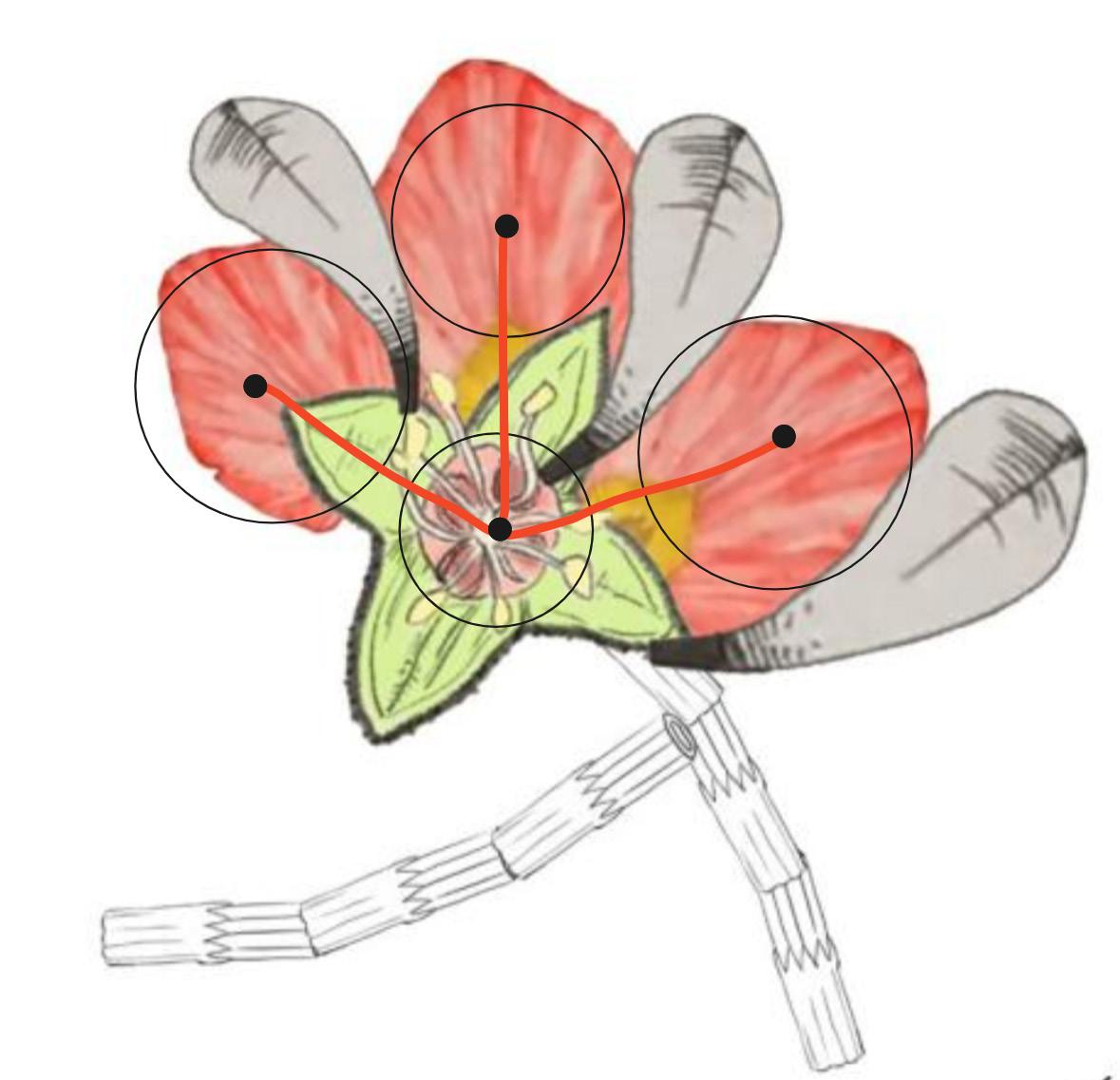
Concept
Native Ngunnawal plants-Kurrajong Flowers, through the analysis of the plant structure and connection way, the design was generated as a connection platform blending the aboriginal culture with the new.

27
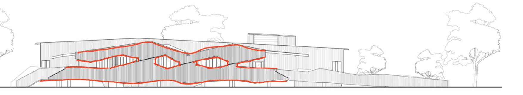
Design Progress

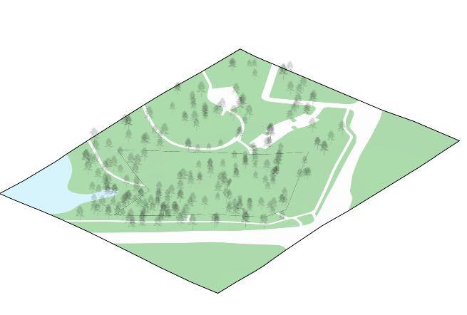

The Exsiting Site Basic Geometry
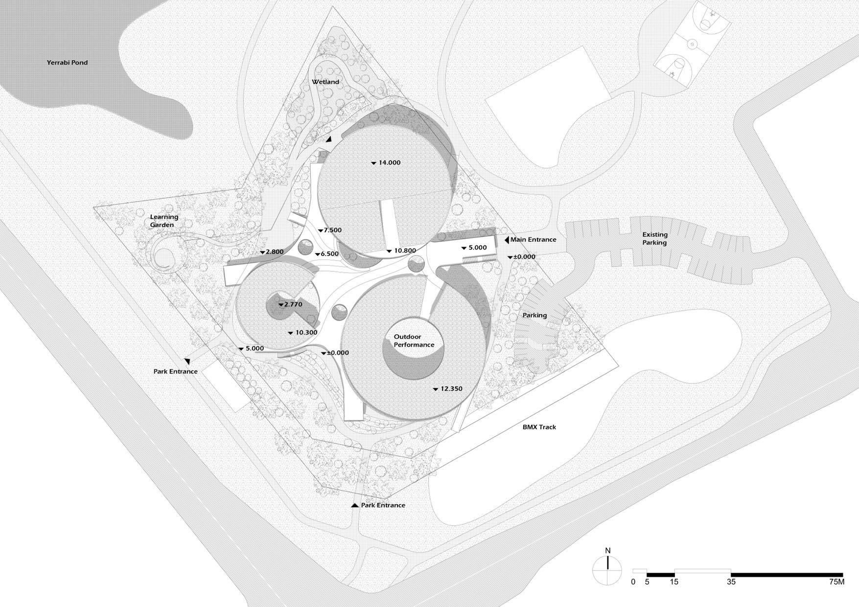
Apply the program in the three cylinders (Basic geometry reference from the aboriginal painting) in different volumes suiting the terrain with a 3-meter high difference, where it avoids the cluster of trees.
The City and the Nautre
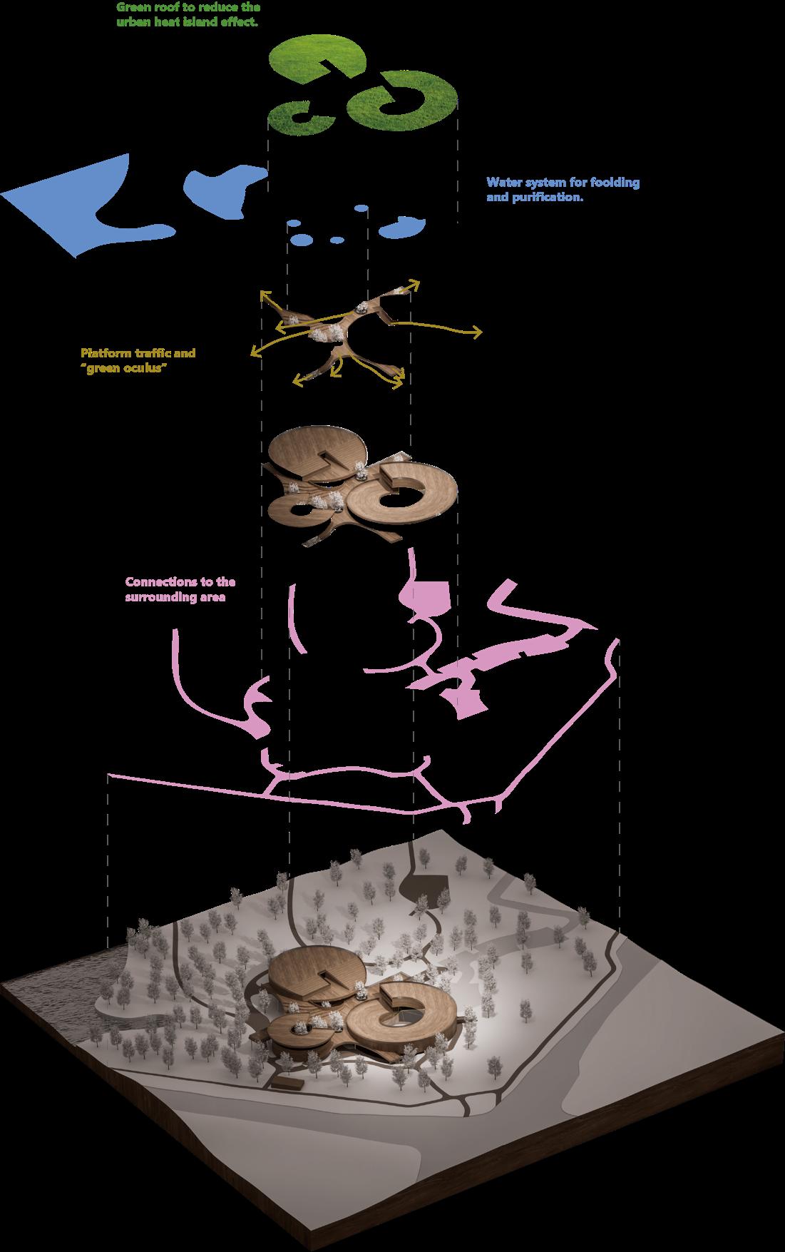
Two straight lines as the connection are going through the cylinders, while connecting the urban and nature by the view sight.
Blending
public place for diverse social activities, blending with the linear way.

Optimization
The geometry is optimized by the common curvitual language.
Activing the Park
The bridges are going up in three different directions to connect the BMX ground, park track, and main street.
Green System
The proposed “oculus“ and the wetland system allow the green to grow with the architecture, and be able to collect and purify the rainwater as part of the ecosystem in the surroundings.
Shaping
Buildings are shaped to respond to the lake view and the collective activity place, while the rooftop space is activated.
28
The Accommodation Building The Learning Building
The Support &Administration Building Lot Area..............................15286 SQM
Building Footprint .....................3954 SQM Public Deck Foot Print .............2174 SQM Roof Green Area..........................3936 SQM Green Area.....................................7516 SQM Parking Area......................................447SQM Outdoors Performance................623 SQM Learning Garden Area....................52 SQM
The Learning Building
Footprint.........................................1610 SQM Totoal Area....................................3840 SQM
General Purpose Rooms Specialist Art Studies Specialist Dance Studies Specialist Music Studies
The Support &Administration Building Footprint...........................................1759SQM Total Area........................................3400 SQM
Library Exhibition Staff Lounge Canteen
The Accommodation Building
Footprint............................................585 SQM Totoal Area.......................................700 SQM
Student Rooms Staff Rooms Student Lounge Support Rooms
29

Pedestrian
Pedestrian Under Building
Building Entrance
30
Bike Path(GF)
Bike Path(1F)
Bike Path(GF) Under Building
Bike Path(1F) Under Building 31
Single Car Lane for Emergency (Under Building)
Single Car Lane for Emergency
Loading Bay
32
Plant List

Landscape Strategies
Ecosystem

Landscape Strategies
Wetland System


Rain Season
Normal
The forest walk also explains the 6 indigenous seasons in ACT. Learning Garden 35
Axonometric View
36
Aerial View

37
Birdeye View

38
Aerial View


39
Aerial View

40
Initial Space Proposal
Perspective-Outdoor Performance (Temporary tensile structure)

41
Initial Space Proposal
Perspective-Track

42
Initial Space Proposal
Perspective-Terrace
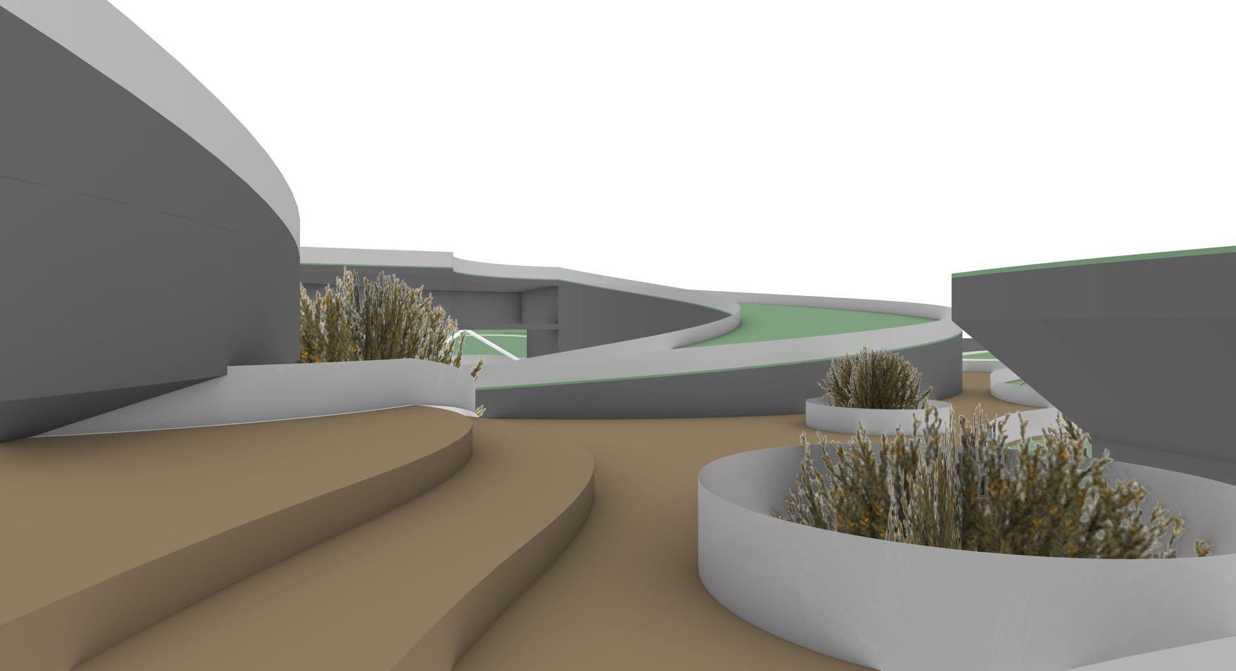
43
Initial Space Proposal
Perspective-Track
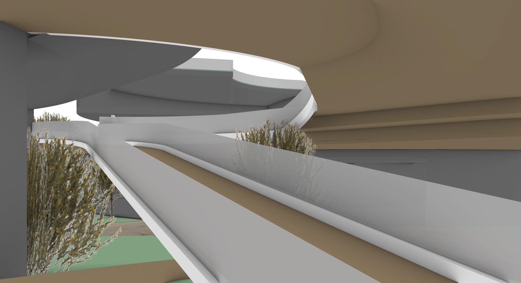
44
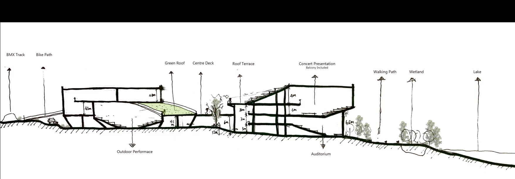
Sketch Section

45


Conceptual Design
46
Sketches
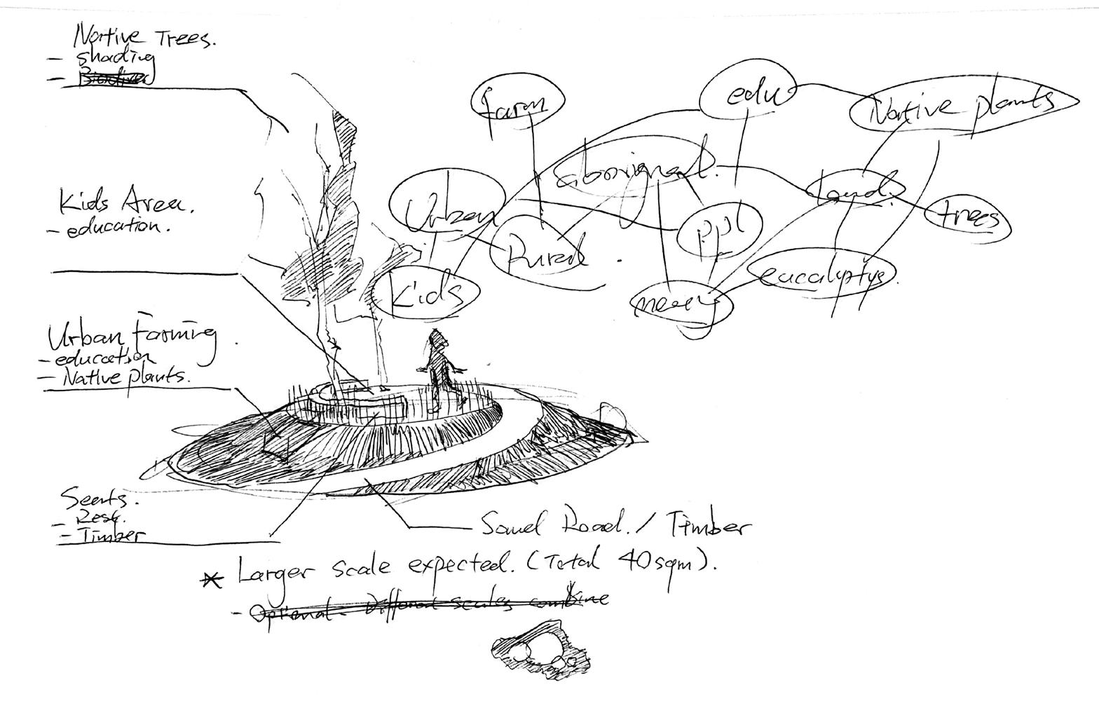


Conceptual Design of Learning Garden

47
Sketches


Conceptual Design of Carpark and Wetland System
48
