7 minute read
The History of the Coastal Forest
by Joon Ma
Adjacent Page
Unrealized 1910 proposal to transform Jamaica Bay into an industrial port, with a north-south canal connecting Jamaica Bay with Flushing Bay. Source: Scientific American
Advertisement
The History of the Jamaica Bay Coastal Forest
The Jansson-Visscher Map of New Netherlands
Novae Belgiae Angliae nec non parties Virginiae multis locis emendata 1651-1655
This early map is a culmination of surveys by Dutch colonists and shows Jamaica Bay relatively correctly drawn in location and scale, uncommon into the eighteenth century. It specifically highlights variations in the landscape across the Northeast, giving special attention to illustrating remarkable natural areas.

Of note is the careful drawing of the shores of Jamaica Bay. Although it is unclear what the landscape may have been like behind the dark green watercolor wash, it was notable enough to distinguish from the surrounding regions of Long Island. The additional marking of dark green to the northeast was the extent of the Central Long Island Grasslands, which are today almost completely lost to urbanization.
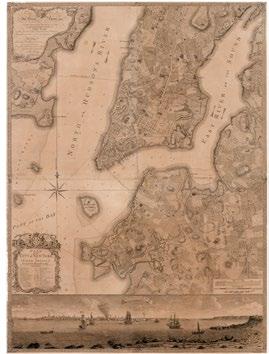
The Ratzer Plan
Plan of the City of New York in North America 1766-1777
This map was produced by Bernard Ratzer, a British military surveyor who was charged with producing a survey of the city and its surroundings in the years leading up to the American revolution. The map is remarkable for its painstaking detailing of the city, showing the extant wetlands, marshes, and forests in Manhattan and beyond. Notably, Ratzer illustrates the salt meadows of the East River and Paulus Hook, planted by the early settlers for livestock foraging.
Unfortunately this highly detailed map does not show South Brooklyn or Queens, hiding Jamaica Bay off-frame, but it does give a good indication of what the wetland environments around New York would have been like at that time.
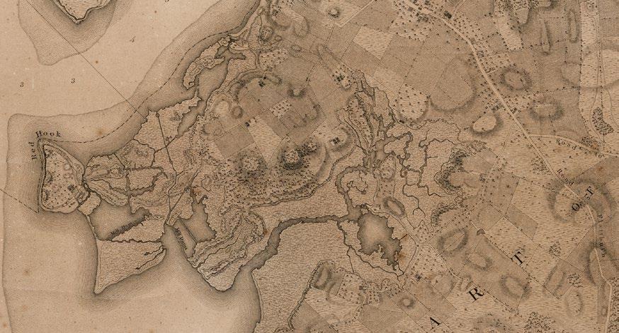
Manuscript Map for the Battle of Long Island
British and American troop positions in the New York City region 1776
Likely the finest map of New York City and the surrounding region from the eighteenth century, though geographically inaccurate in terms of its coastal geography even at that time. The map indicates the position of troops during the Battle of Long Island during the American Revolution. Of note are the illustration of an established coastal forest around Jamaica Bay including on a much wider Rockaway Peninsula, and an appropriately named Barren Island, which is both an island and barren of trees, neither of which is true today.
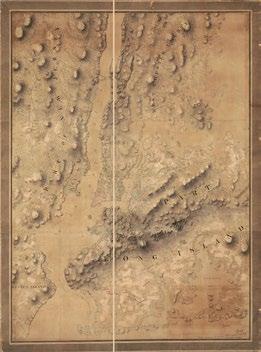
This Map appears to be a composite copied from the De Barres sheets of the Atlantic Neptune. Newly scanned in 11/2018 to the Library of Congress Maps Collection.

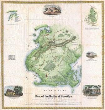
Stiles Map of the 1776 Battle of Long Island
Plan of the Battle of Brooklyn, August 27th, 1776 1867
The Stiles map is a recreation of the Ratzer Plan for a historically captivated audience produced by the Civil War. It includes additional information compiled from other military and topographical surveys available since Ratzer’s time, and conveniently shows a portion of Jamaica Bay.
The map shows abundant forested areas around Canarsie and Barren Island at the western extents of Jamaica Bay. The representation of the location of maritime forests is consistent with earlier maps. However, given the historiographical amis of Stiles’ map, a romanticization of the landscape is certainly possible.

United States Coast Survey
New-York Bay and Harbor and the Environs 1845
U.S. Coast Surveys were initiated in 1806, and the first survey of New York Harbor was published in 1845. These surveys were designed to assist with maritime navigation of complex coastal waters.
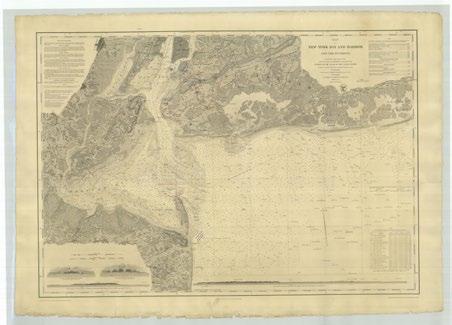
The notation of the survey indicates extensive forests throughout the coastal lands around the bay. These include an; extensive maritime forest shown in the region of what is now Arverne and expanding into upland forest at Rockaway Neck, a small forested stand in on the peninsula that is now uninhabited; a small coastal forest on Barren Island; and a belt of maritime forest circling the tidal wetlands at the northern extent of the bay, extending from a heavily wooded area at Canarsie. IWithin the next fifty years, most of these areas would be cleared for housing and farmland.

Bien’s Atlas of the Metropolitan District
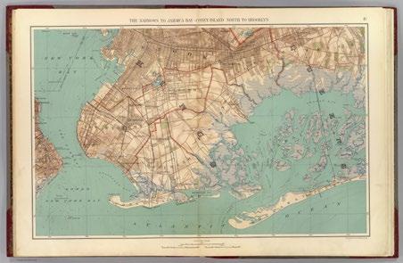
The Narrows to Jamaica Bay–Coney Island, North to Brooklyn. 1891
Produced by Julius R. Bien and C. C. Vermeule to comprehensively cover the metropolitan areas of New York and New Jersey. Bien was considered a master cartographer, producing thousands of U.S., Governmentissued and private maps, and was a pioneer the chromolithograph, used to render this 1891 map.
By 1890 only a few notable tree stands are indicated in the upland areas from Plunders Neck to Jamaica South and a few stands in the Sheepshead Bay and Gravesend areas. The well-forested areas of Barren Island and the Rockaway Peninsula seem to have disappeared. Morphologically, the bay’s islands and marshes are shown fragmented, foreshadowing a long-term trend.
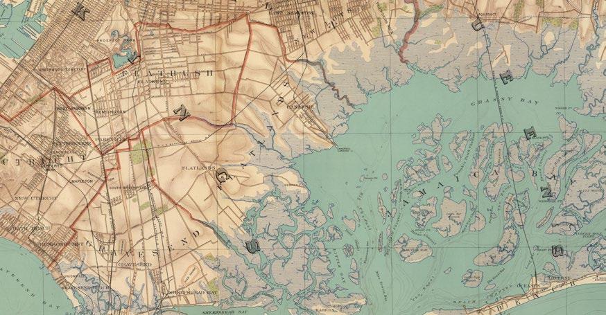
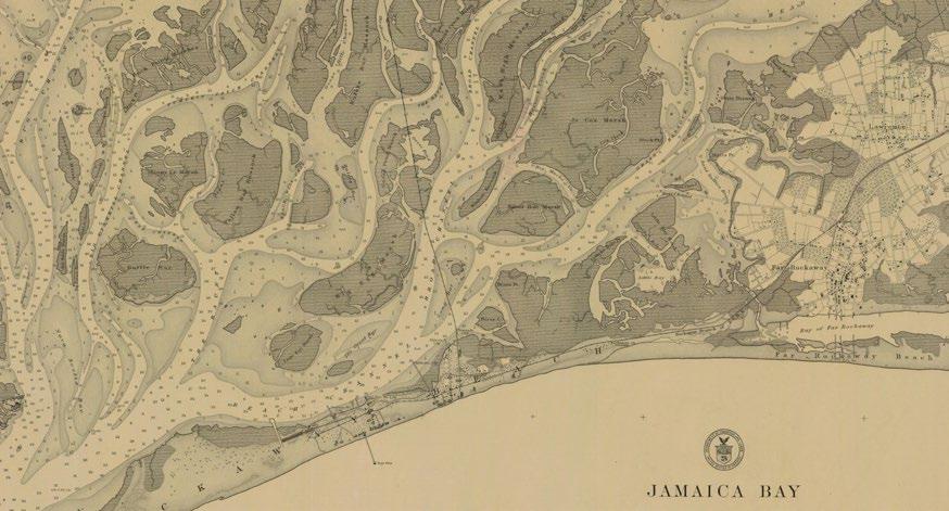
Jamaica Bay and Rockaway Inlet
U. S. Coast and Geodetic Survey, Nautical Chart No. 542 1903
Published almost 60 years after the 1845 U. S. Coast Survey map of the New York Harbor, this map shows a more detailed version Jamaica Bay, Rockaway Inlet, and the immediately adjacent coastal waters. This map highlights the advancements made since the original in understanding coastal morphodynamics.

Of note is the notation of different tree species, the first time this appears, although by now there are very few stands of trees remaining around the bay. However, as the Peninsula has grown over time, a band of conifers has grown with it, a spontaneous forest spreading along the beach. Interestingly the beach is rendered as an island, as it was briefly severed by a navigable channel, likely created in an overwash event between Jamaica Bay and the now subsumed Bay of Far Rockaway.
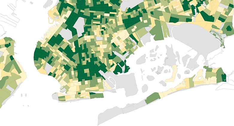
New York City Street Tree Map
New York City Department of Parks and Recreation 2015-2016
Modern mapping of New York’s trees is now fully intentional. The NYC Street Tree Map was created through volunteer submissions of street tree counts on lands under the jurisdiction of NYC Parks, including on sidewalks and other public rights-of-way. Trees on NYCDOT, NPS, or state and federal government lands are not included, nor are trees on private property.
This particular map shows street tree density by census tract, clearly indicating low densities in the Rockaway Peninsula with a few exceptions, and a mix of densities around the north shore of Jamaica Bay.

MIT Senseable City Lab’s Treepedia
New York City Tree Canopy Maps 2016
MIT’s Treepedia map utilizes a machine learning model and Google Street View to measure tree canopy. Using Street View, the model identifies the trees in the panoramas and plots their approximate locations, allowing for the measurement of the relative experience of canopy at any given Street View location. The map doesn’t provide an exact tree count, but rather illustrates the sensorial presence that canopy provides in each neighborhood while walking or driving through a city.
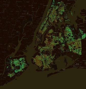
The model is limited to areas where Street View exists, so it will give a false indication in unmapped areas. So, although the map shows few trees at Jamaica Bay, not all of these areas are mapped or mappable using Street View.
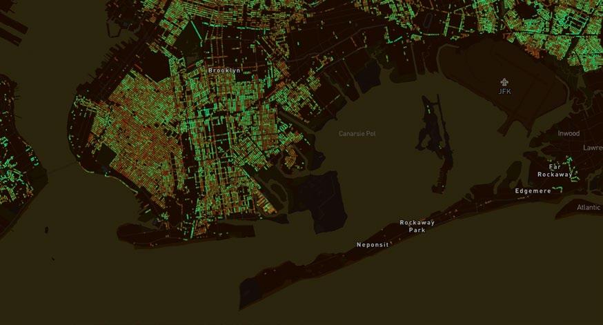
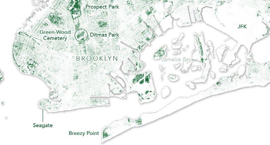
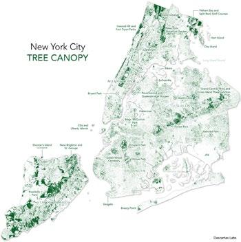
Descartes Labs Tree Canopy Maps
New York City Tree Canopy 2018
The Descartes Labs map of New York City uses a machine learning model to plot the urban tree canopy. The model was built using LIDAR data and NAIP imagery, but now runs exclusively on satellite and aerial imagery. The Descartes Labs map has an advantage over NDVI maps because the model exclusively identifies trees over all plant matter. It is perhaps the most accurate plotting of tree canopy that currently exists.
Notably, and in line with the MIT map on the preceding page, there are almost no trees indicated along the Rockaway Peninsula and in large swaths of Jamaica Bay’s bordering lands. The impetus for afforestation comes from this notable contemporary absence of forest at the coastal edge of New York.
