
P O R T F O L I O K A A V I Y A A
NAGARAJAN


2 City Planning Single Family Campus Design Neighborhood Planning Multi Family Industrial Architecture Master/Site Planning Mixed Use LEGEND
JACKSON LILES ARCHITECTURE
PLANNING, DESIGN AND CONSTRUCTION

HUTKER ARCHITECTS


 LORD AECK SARGENT
Architecture
Urban Design
4
Professional Projects
5 Table of Contents
Urban Design Master Plan At Coral Hollow 8 Heritage Hills-New Traditional Neighborhood Plan 14 Revitalizing Alleys ......................................................................................................................................................................18 Envision Napier Sudekum- Choice Neighborhood Plan 20 Cherokee Triangle & Bonnycastle Neighborhoods Plan 26 DHA and Downtown Neighborhood Planning ..............................................................................................32 Architecture Renovation and New Addition to Historic Cooper House .................................................................. 36 Yield Study for a Multi-Family Residential Development 38 Yield Study for a Multi-Family Residential Development 40 Clemson Interpretive Center ...........................................................................................................................................42 Residences At South Hill 48 Single Family Vacation Home 50 Single Family Residence .......................................................................................................................................................52 Single Family Residence 54 Academic Projects From Organic to Organized 60 Master Plan Proposal - ULI Competition 72 Urban Retreat - Redevelopment of Evergreen Cemetery Lands .................................................. 80 Innovation Hub 88 School Of Architecture 98 Urban renewal of North Madurai ............................................................................. 104


PROFESSIONAL WORKS

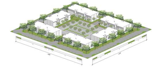
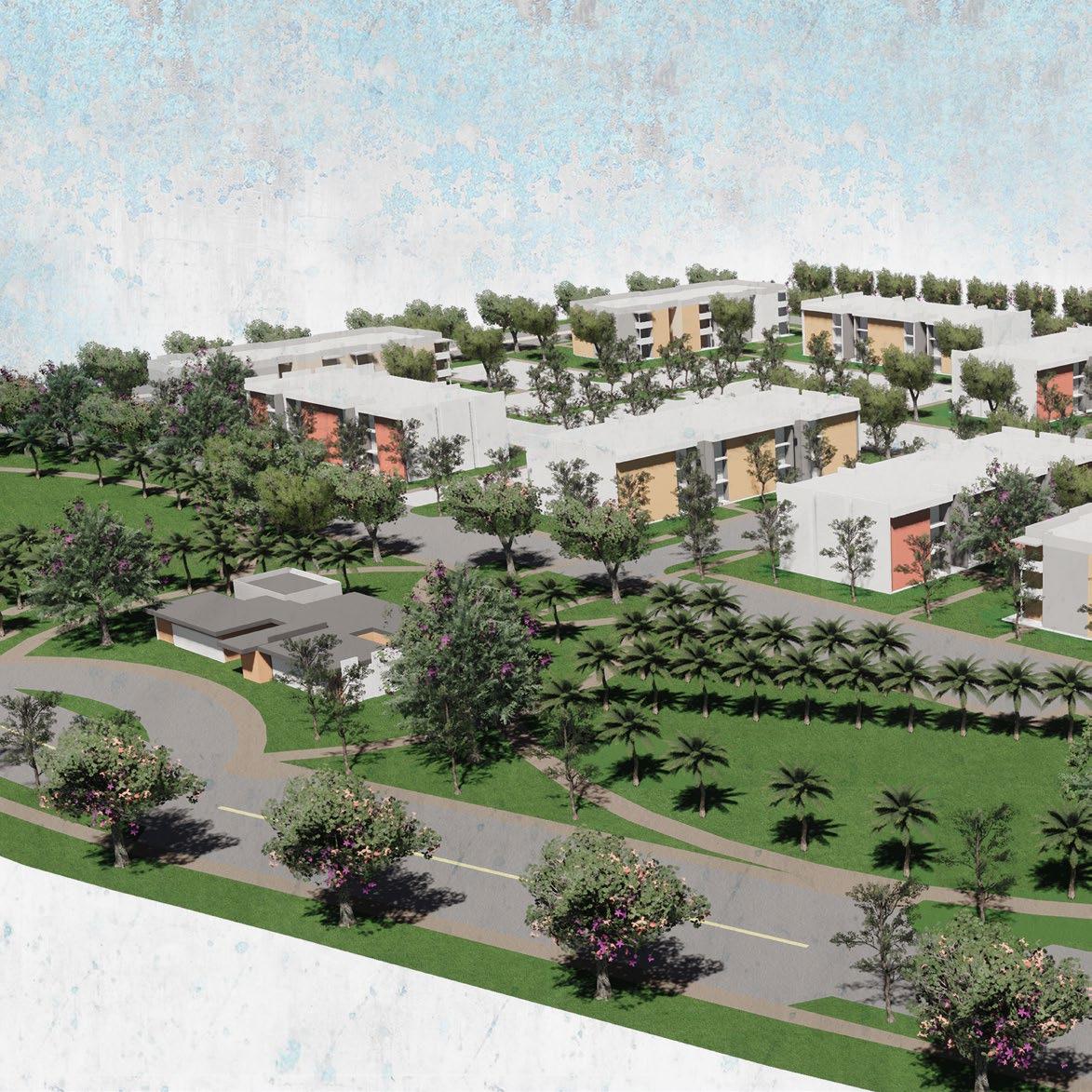
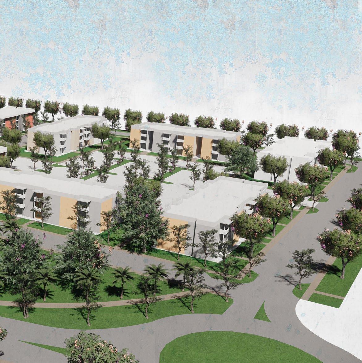
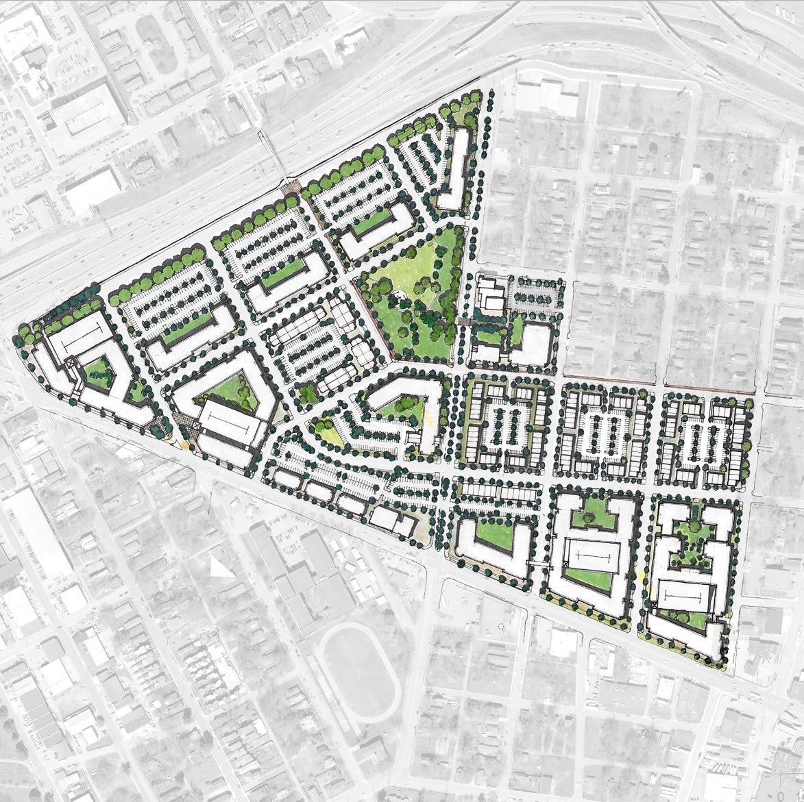
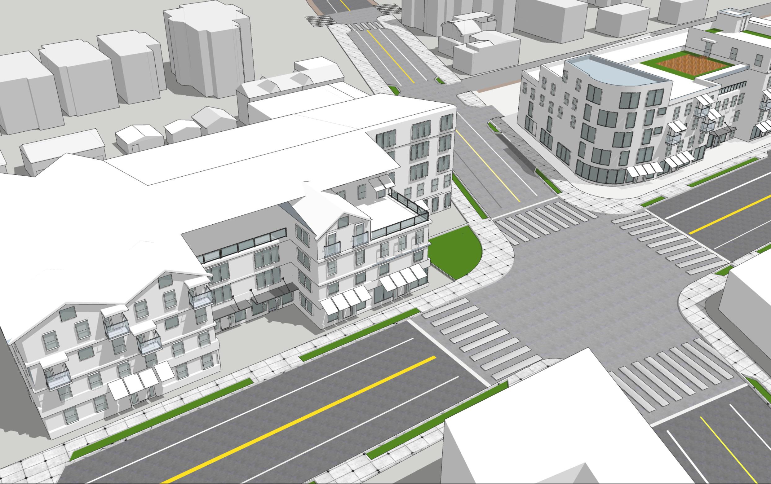
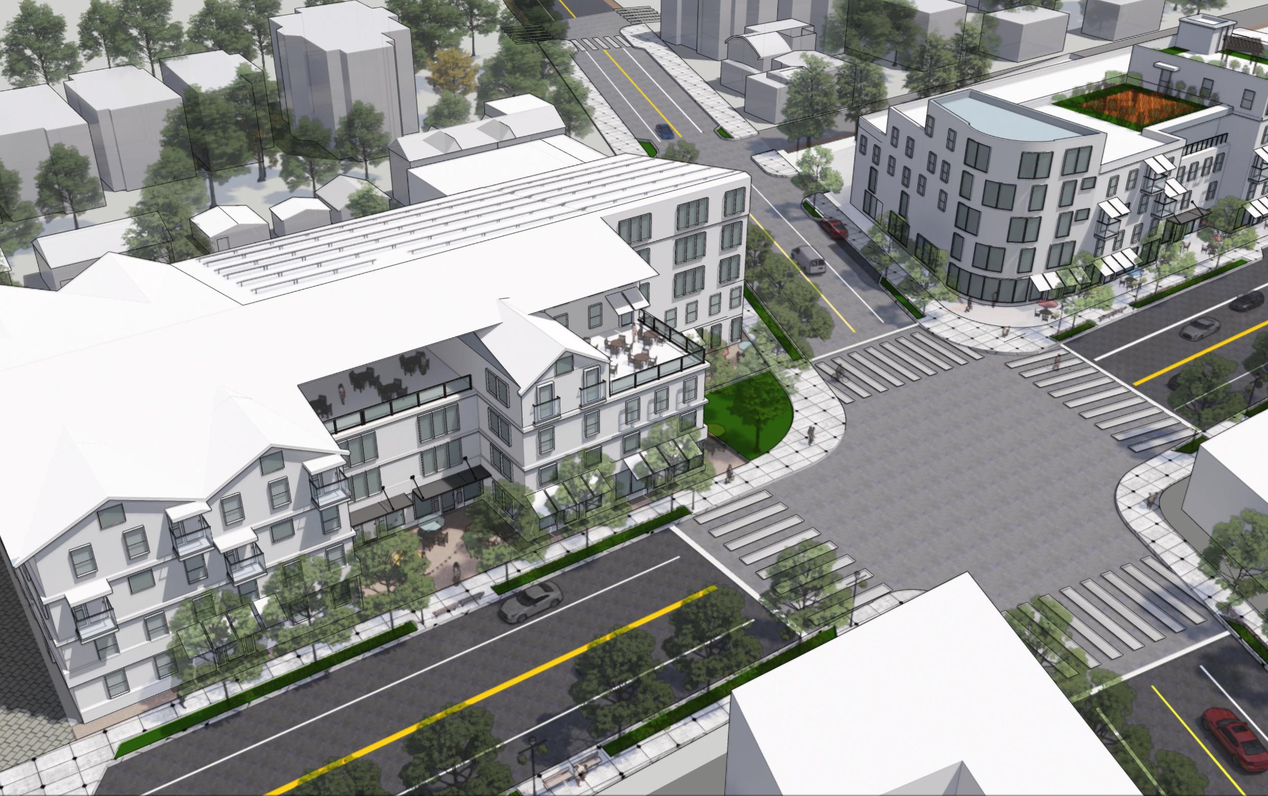
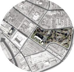
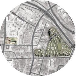
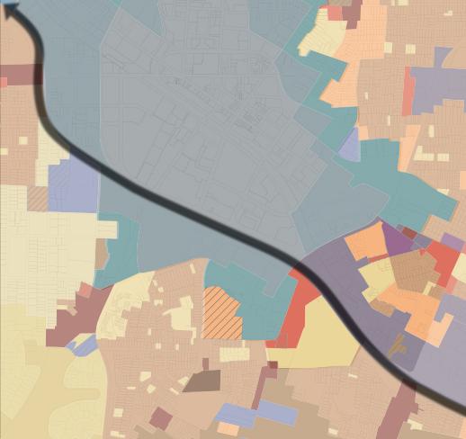
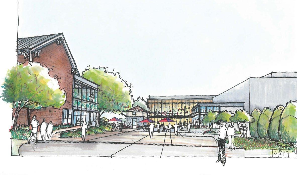
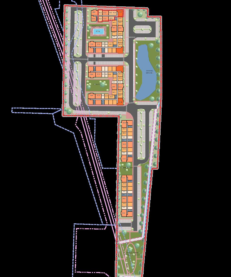
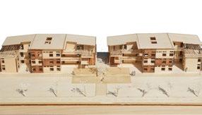
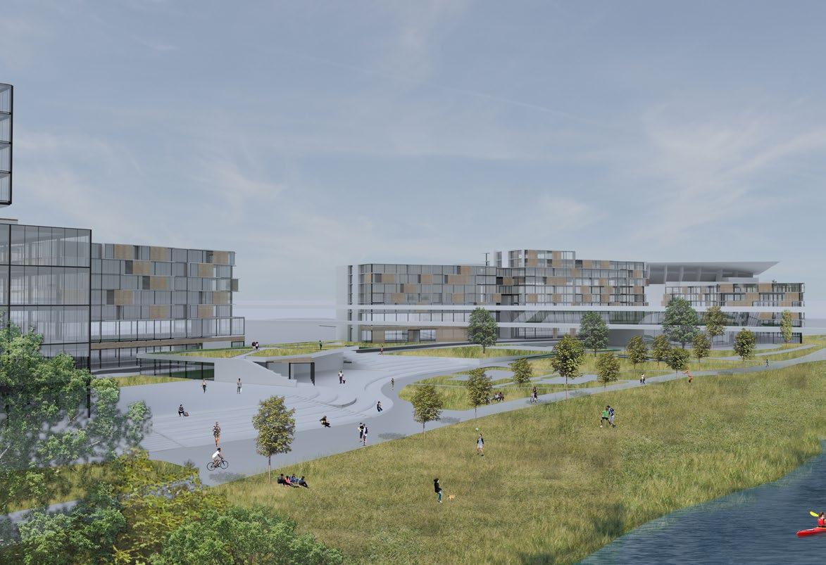
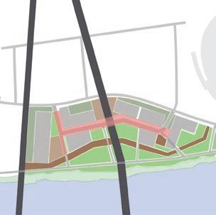
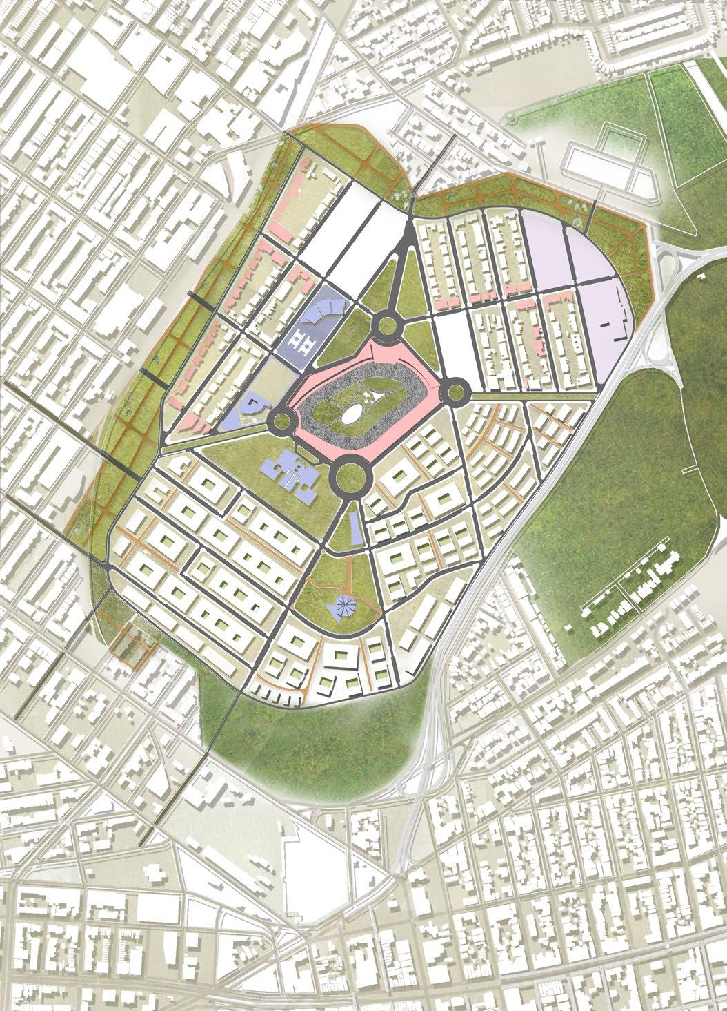
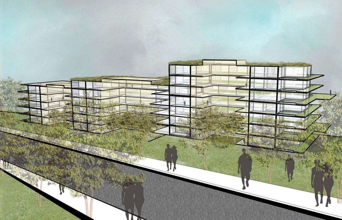
Master Plan At Coral Hollow
Using Kit-Of- Parts Building Construction, Tracy


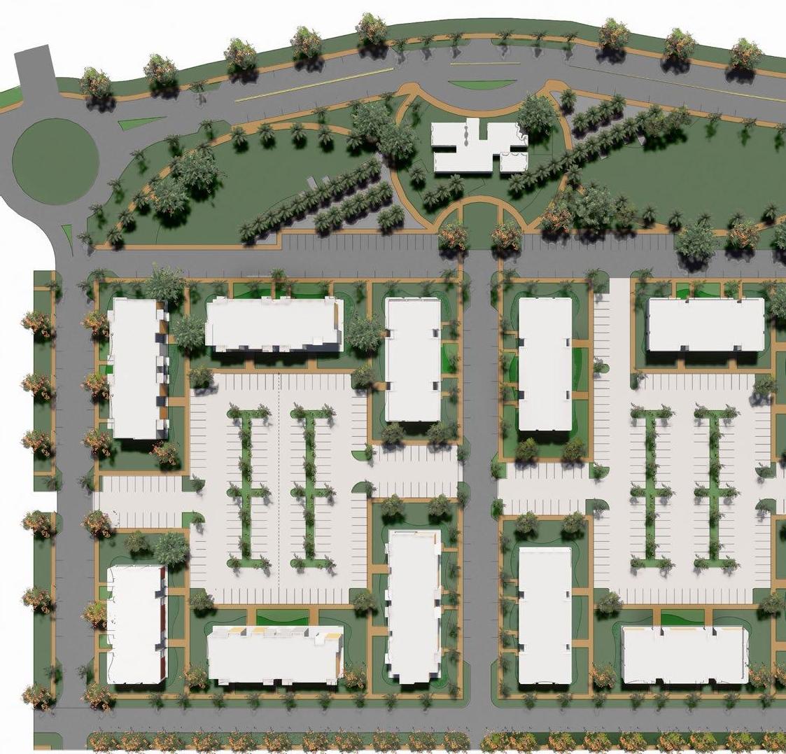
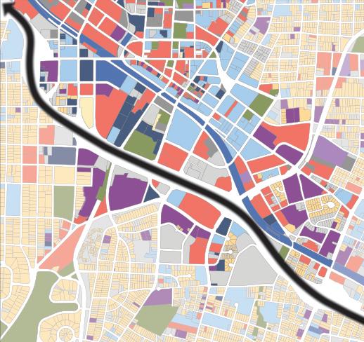
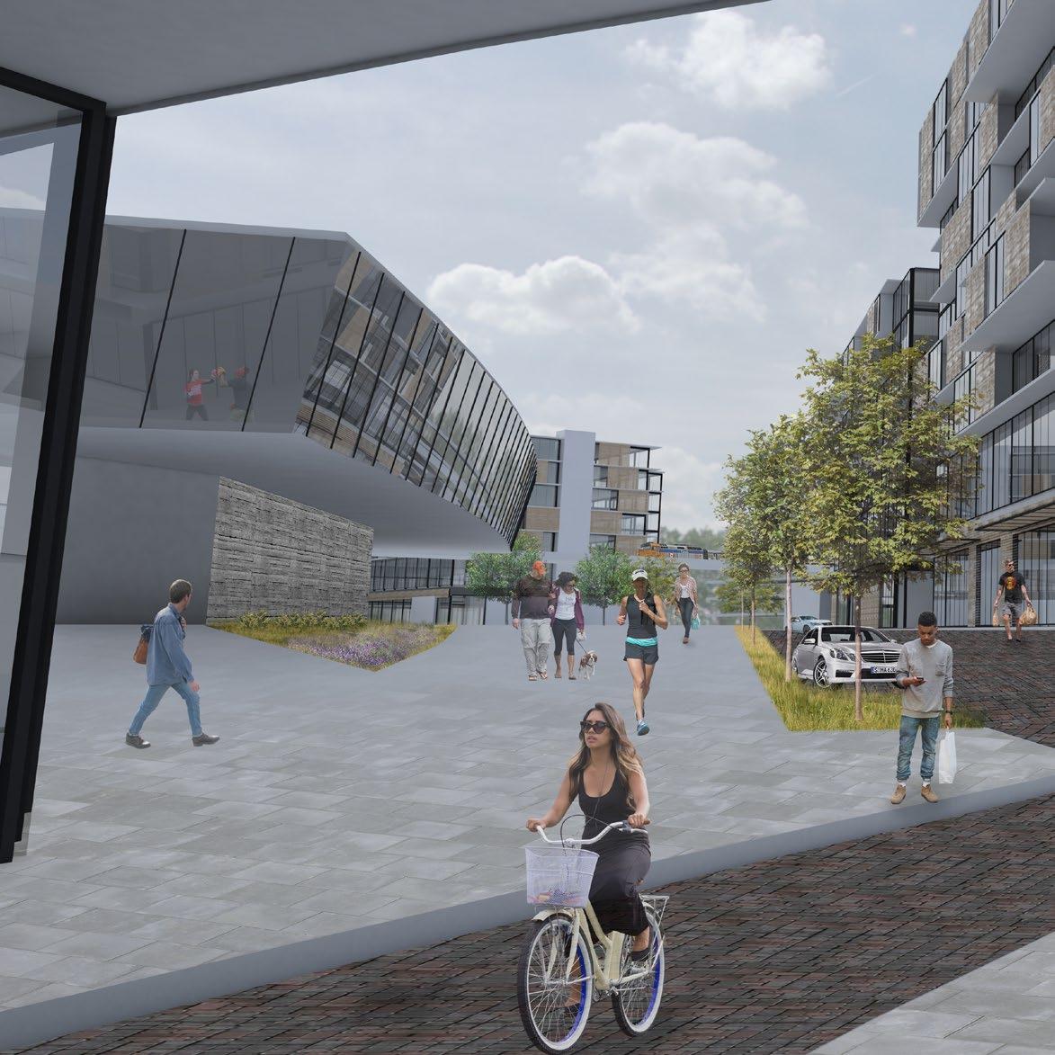
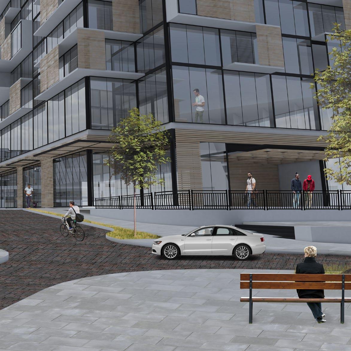
Master plan at Coral Hollow proposes a framework plan for a privately owned land, only using Katerra’s manufactured kit-of-parts building. The site was intended to be used as a “model-site” to showcase the various manufactured building typologies.
The development included mixed-income and diverse housing typologies like garden apartments, townhouses, moderateintensity multi-family corridor apartments and lower-intensity multifamily-housing. The whole concept centered along a green-trail that connected the aqueducts and pedestrian trial along it. The development has multiple pocket parks spread across the site to increase access and usage of the planned open spaces and increase land likability. The first phase construction was along the main entry with moderate-intensity garden apartments and a CLT clubhouse/amenity block. The framework plan is a guide to regulate development and keep the overarching urban design principals of the development intact.
Firm: Lord Aeck Sargent
Client: Katerra, inc.
Role: Studio to a Senior Urban-Designer Involved in developing the development framework plan. Designed the block plans and graphic representation.
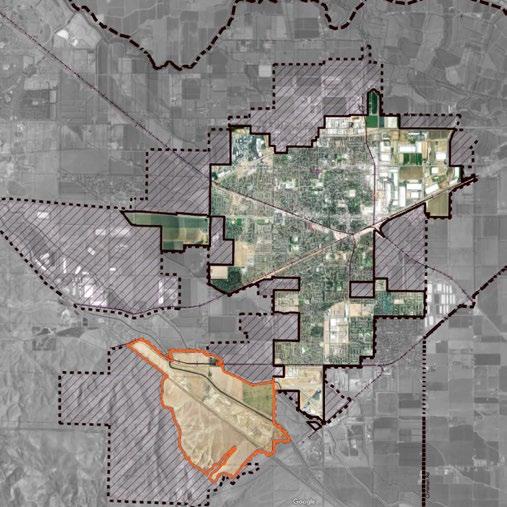
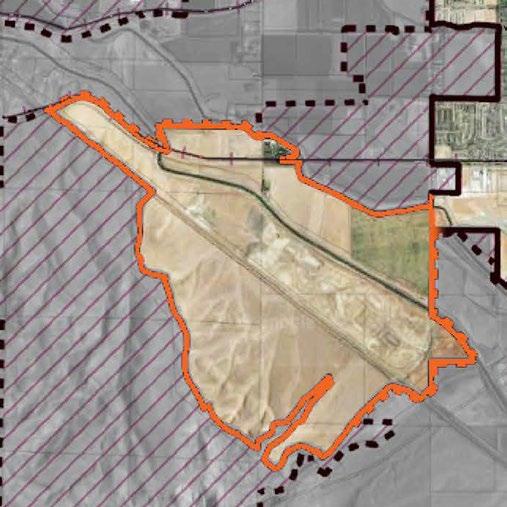
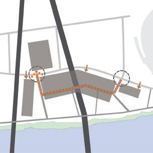
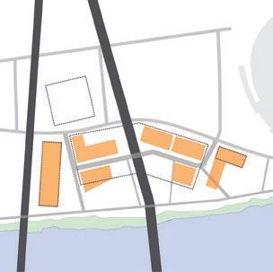
8 Project Regional Context Site Project Location Framework Plan
Software
Framework Plan


Conservation Easement and Trails System
Area Constrained by Proximity to the Airport
Trail System along PG&E Easement
Main Entry School or Civic Use

Site and Phase 1

Townhomes Lining Open Space Spine
Community Amenity Space
Conservation Easement and Trails System
Major Residential Development Currently Under Construction
9
Civic
Townhomes Townhomes Single Family Residential Moderate
Moderate Intensity Corridor Apartments School /
Use
Intensity Garden Apartments Lower Intensity Garden Apartments Major Shared Community Open Space Traditional Neighborhood
Corral hollow road
Aqueduct
0 100’ 300’ 600’
Aqueduct
Model
Model Site
Phase
Plan
and
1
K3 (ED)
K4 (L)
K4 (L)
K3 (FD)
K4 (M)
K3 (AD)
K3 (AD)
K4 (M)
K4 (S)
K4 (S)

Block size: ~550’x340’ (4.29 Acres)
Number of large buildings: 6
Total number of buildings: 6
Total number of units: 144
Could be parked at: ~1.6 To 2.0
Density 33.5 Units/acre
Block size: ~540’x340’ (4.21 Acres)
Number of large buildings: 4
Number of small building: 1
Number of medium building: 1
Total number of buildings: 6
Total number of units: 144
Could be parked at: ~1.6 To 2.0
Density 34 units/acre
Block size: ~515’x340’ (4.01 Acres)
Number of large buildings: 4
Number of townhouses: 3
Total number of buildings: 7
Total number of units: 108
Could be parked at: ~1.7 To 2.0
Density 27 units/acre
Block size: ~425’x410’ (4 acres)
Number of large buildings: 4
Number of small buildings: 2
Total number of buildings: 6
Total number of units: 144
Could be parked at: ~1.6
Density 36 units/acre
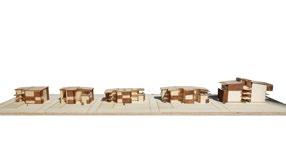
11 Block Configuration Options Option 1 Option 2 Option 3 Option 4 CORRAL HOLLOW ROAD
K3 (BF)
K3 (CD)
(425’X485’) (~ 4.7 Acres)
6 BUILDINGS, 144 UNITS
K3 BUILDINGS: 4
K4 BUILDINGS: 2
CLT
~5100 sf
AMENITY BLOCK LARGE
CLUBHOUSE
du/ac)
BLOCK B: (30.6
BLOCK A: (30 du/ac)
(440’X485’) (~ 4.8 Acres)
6 BUILDINGS, 144 UNITS
K4 BUILDINGS: 4
K3 BUILDINGS: 2
Block Visualization

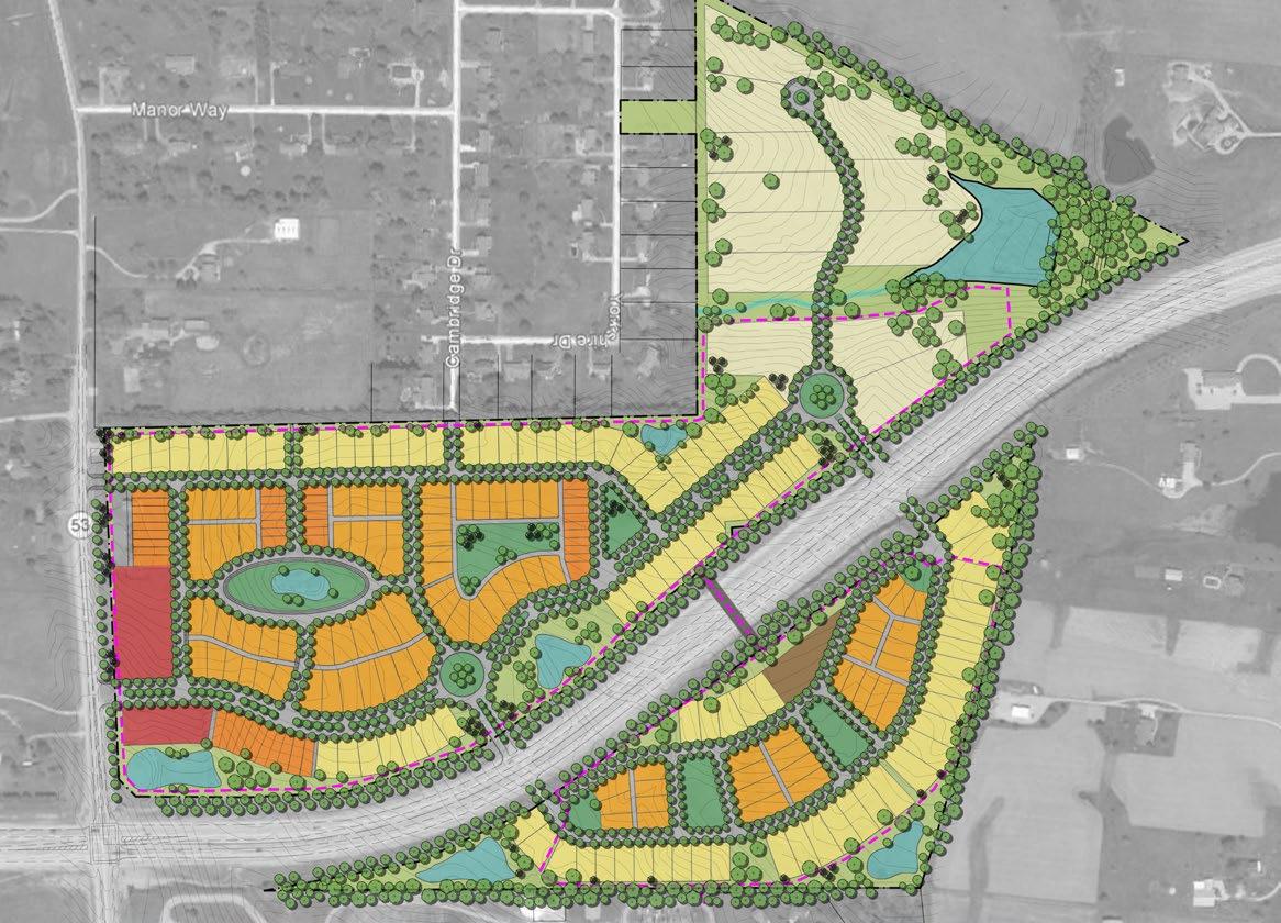
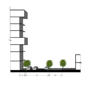
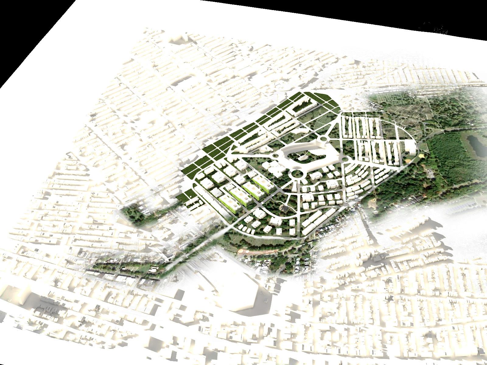
Heritage Hills-New Traditional Neighborhood Plan
Shelbyville, KY


Heritage Hills is a new Traditional Neighborhood Development proposal for a private client in Shelbyville, KY. The site was particularly challenging as it is split into two by a highway, access in and out of the site had to be solved keeping in mind the traffic volume and speed of travel on the highway. The development had 4 major housing lot categories: deeper driveway lots that has access from the roads directly to the garage in the rear of the lot; wider alley lots where curb-cuts are minimized by creating access to the lots through a rear alley connecting individual garages; narrow town houses lining major streets and open spaces and finally larger estate lots to the north-east.
Firm: Lord Aeck Sargent
Client: Private Developer
Role: Studio to a Senior Urban Designer and Landscape Architect. Worked on the framework and master plan. Created Photoshop plan renderings and 3-D renderings.
Land Use Plan
Software
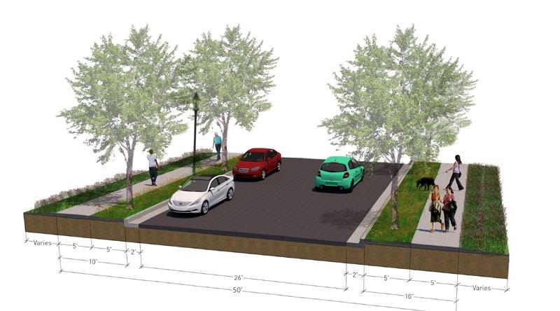
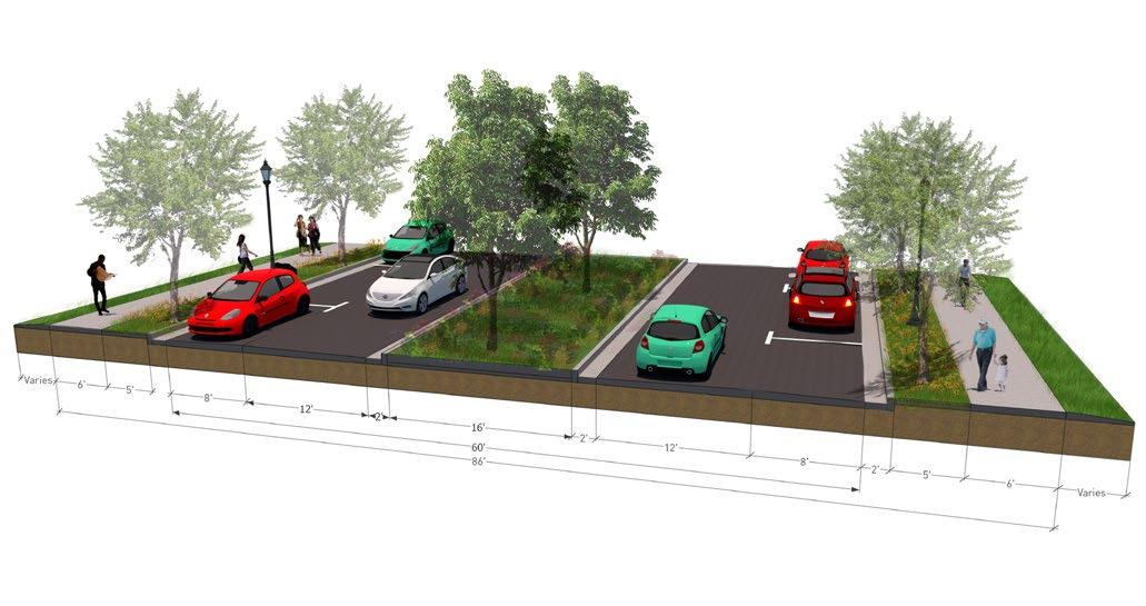

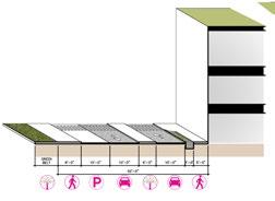
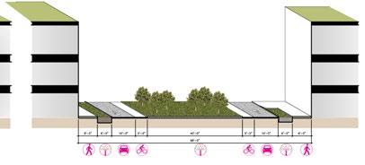
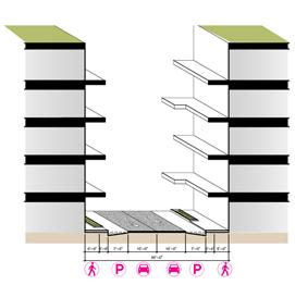
SECTION SITE RELATIONSHIPS CLEAR CREEK PARK SHELBY LAKE PAINTED STONE E.S. S.C. WEST M.S. DOWNTOWN 1MILERADIUS 2MILERADIUS FREEDOM’S WAY BOONE STATION RD. WASHINGTON ST. MAIN ST. 7th ST. MIDLAND TRAIL 53 55 55 53 TO I-64 TO I-64 SITE The Heritage Hills Site, located just north of the Shelbyville city limits, at the intersection of KY55 and KY-53, has a multitude of positive site location attributes illustrated in the Context Map. • As noted by the concentric circles around the center of the site, Heritage Hills is a mostly rural/farmland tract located just 2 miles from Downtown Shelbyville. • Heritage Hills is located within one mile of Shelby Lake and Clear Creek Park. • The site is directly across KY55 from two schools, Shelby county West Middle School and Painted Stone Elementary School. • The site has multiple access points to I-64 towards Louisville & Lexington. • Heritage Hills is just across KY55 from existing greenways that would could be tied in to and offer different transportation and recreation activities. TYPICAL 50’ RIGHT OF WAY SECTION TYPICAL 85’ RIGHT OF WAY SECTION SITE RELATIONSHIPS LAKE PAINTED STONE E.S. S.C. WEST M.S. 53 55 SITE The Heritage Hills Site, located just north of the Shelbyville city limits, at the intersection of KY55 and KY-53, has a multitude of positive site location attributes illustrated in the Context Map. noted by the concentric Road Character - Local Street 50 Feet Road Character - Connector Street 86 Feet
TYPICAL 85’ RIGHT OF WAY
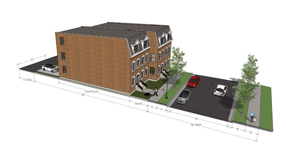
 Driveway Lots
Alley Lots
Town Houses
Driveway Lots
Alley Lots
Town Houses
Site Plan

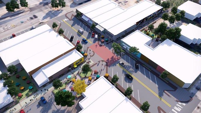
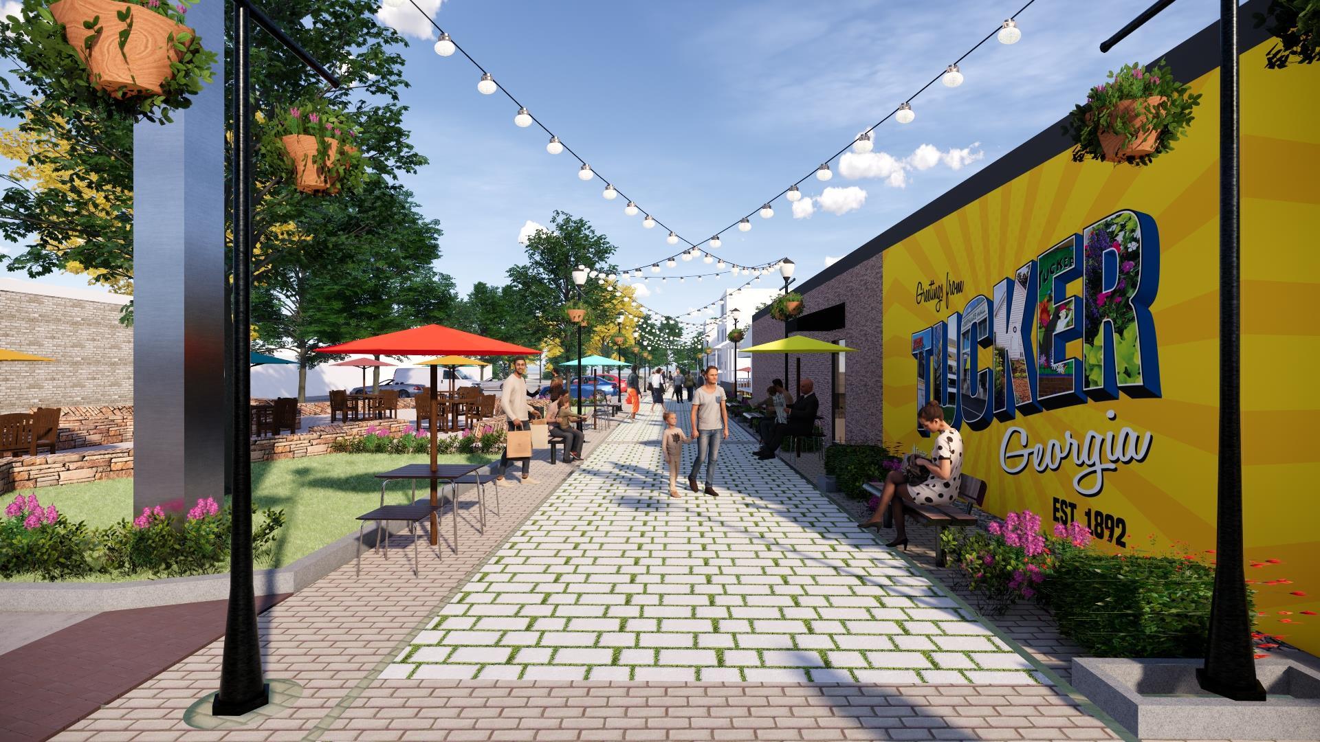
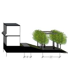
Revitalizing Alleys
Tucker, GA
Role: Studio to a Senior Urban Designer. Developed 3-D rendering, virtual reality renders for the concept (used for community engagement and visualization). Software
Tucker is a small town in Georgia. The City of Tucker hired Lord Aeck Sargent to conduct a study on the street grid system and ways to revitalize the alleys in Downtown Tucker. These visuals are concept proposals for alley revitalization. The client’s requirement was to create an engaging, safe and lively alleys that could have seaters, outdoor dining options etc. These alleys would provide opportunities to the local artists to create murals and make it engaging for the users.
Firm: Lord Aeck Sargent
Client: City of Tucker
Project Cost: $100,500
Street-Eye Level View
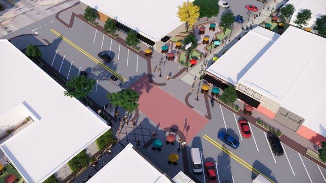

Alley Intersections
Main Street Junction - East Main Street Junction - West
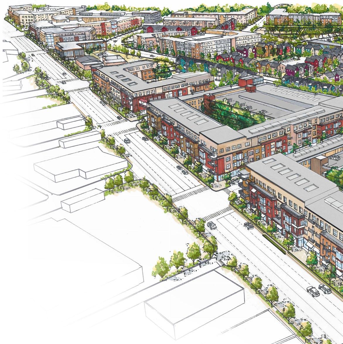
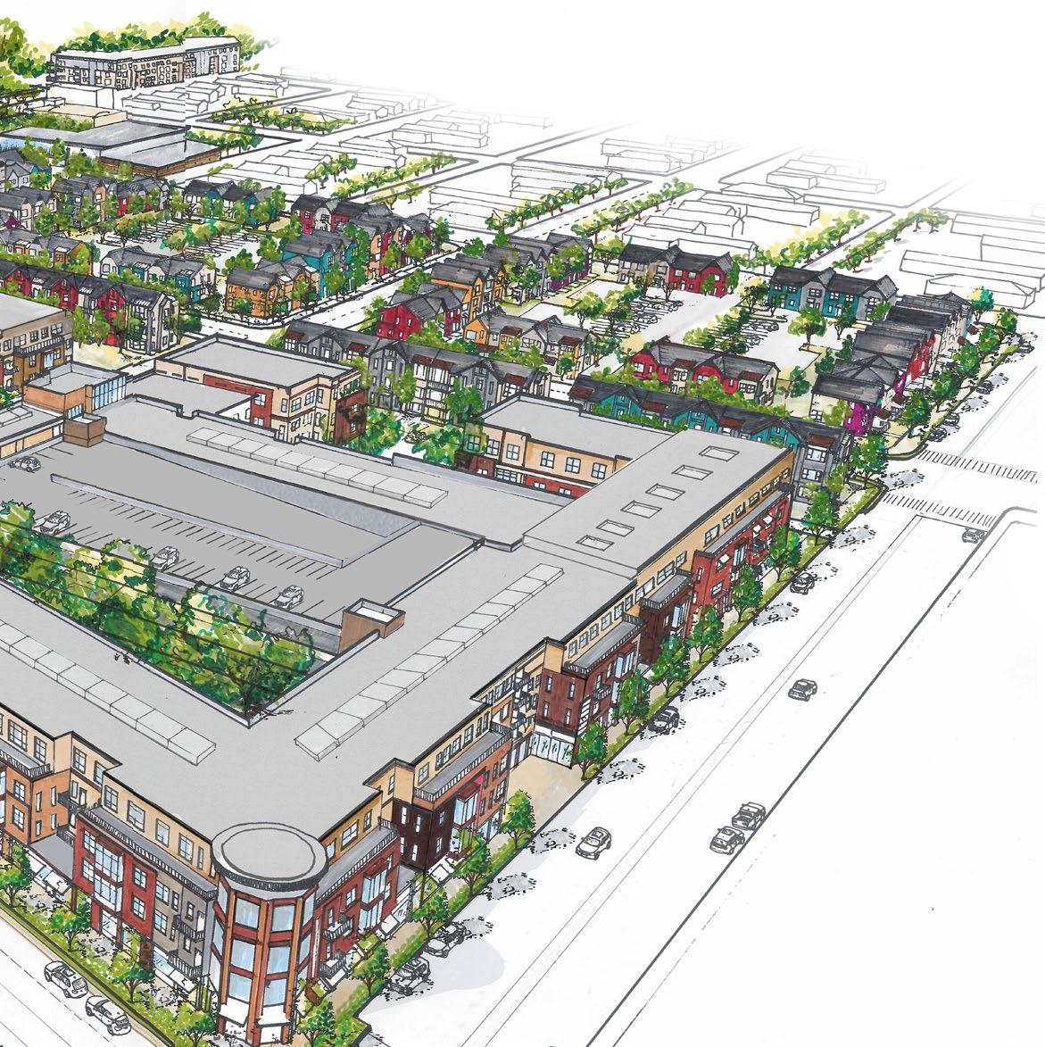
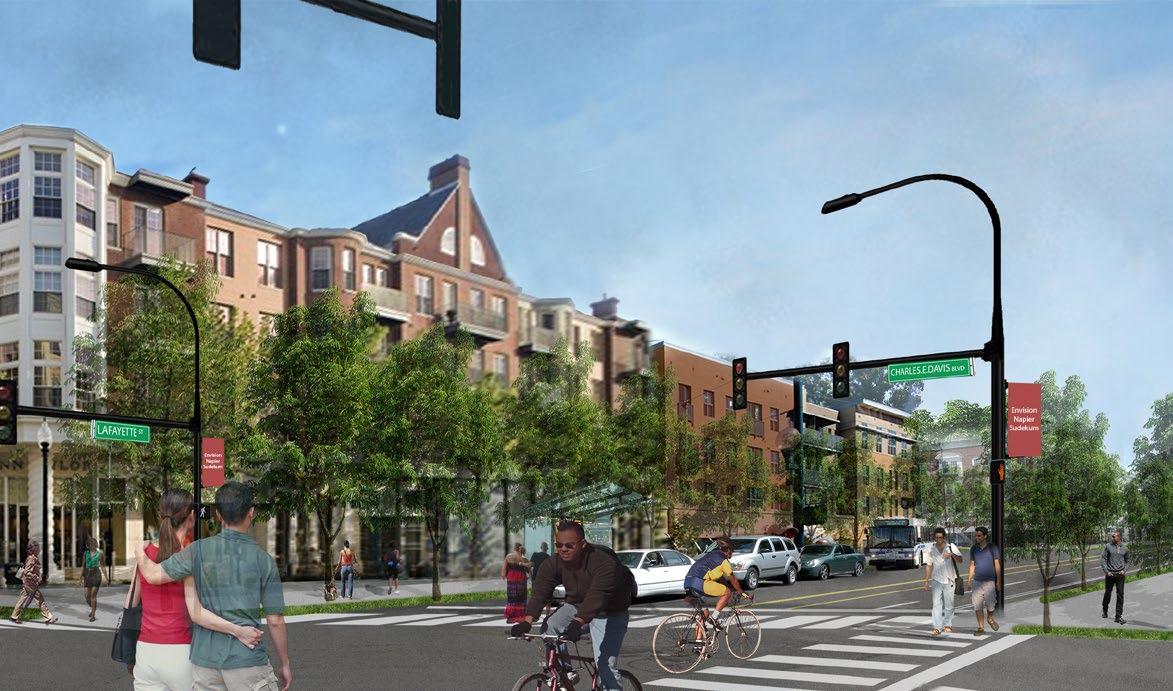
Envision Napier Sudekum- Choice Neighborhood Plan
Nashville, TN


Nashville is a fast growing and rapidly diversifying city. The urban core neighborhoods have become progressively more attractive to new development with significant property value increases over the last few years. This has put a lot of pressure on the adjoining neighborhoods to redevelop and create needed affordable housing. The Envision Napier and Sudekum (ENS) sites were distressed public housing sites, along with all the existing vacant and underutilized properties around, provided a huge opportunity to direct some of the growth towards South Nashville.
Envision Napier Sudekum is a choice neighborhood plan in Nashville, TN which involved an extensive four phase process: People, Education, Neighborhood and Housing. Launched in November 2016, planning process consisted of 20 months of intense, community driven efforts to revitalize and redevelop South Nashville. MDHA and the design team offered various opportunities for community involvement during the process and utilized multiple interactive charrettes and events to encourage residents to become part of the planning. The Plan targeted to achieve a mixed-use, mixed-income and diverse neighborhood with varying ownership and renting opportunities.
Firm: Lord Aeck Sargent
Client: MDHA Nashville Housing Authority
Cost in CNI funding: $500,000
Collaboration: Kimley Horn (Transportation lead) and Moody Nolan (Housing Lead)
Role: Studio- to a Senior Urban Designer. Helped with the developed of framework plans, creating photo-montages, 3-D renders and manual visualization.
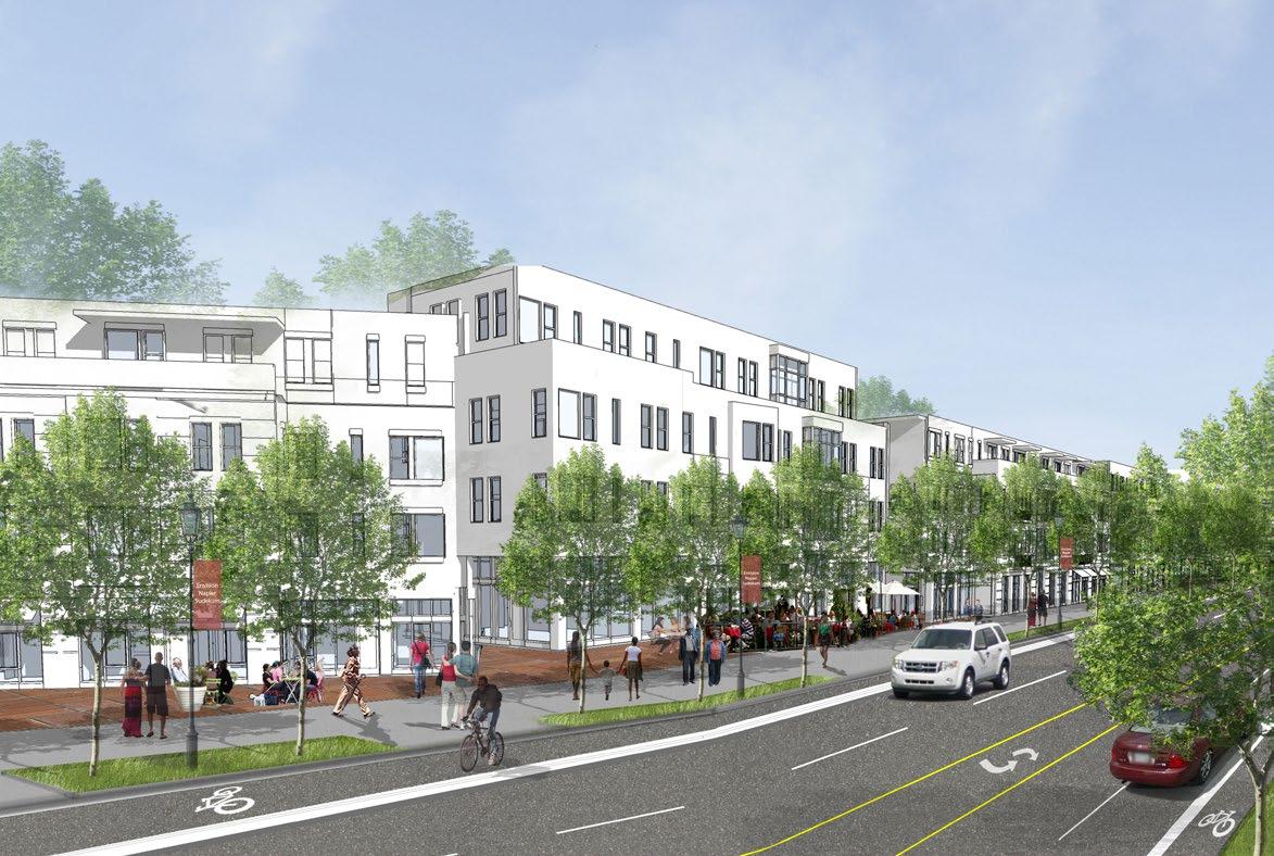
Software View-1
Master Plan Mixed Use Podiums Multi Family Garden Apartments Community Open Space Town Houses Community building
View-2
View-3
Retail Double Loaded Multi Family Housing
View-1
View-2
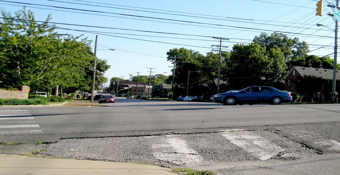
Existing Situation
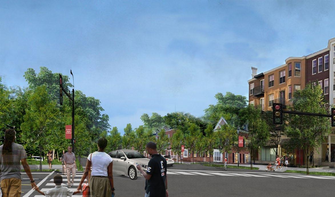
Proposed Street View View-3
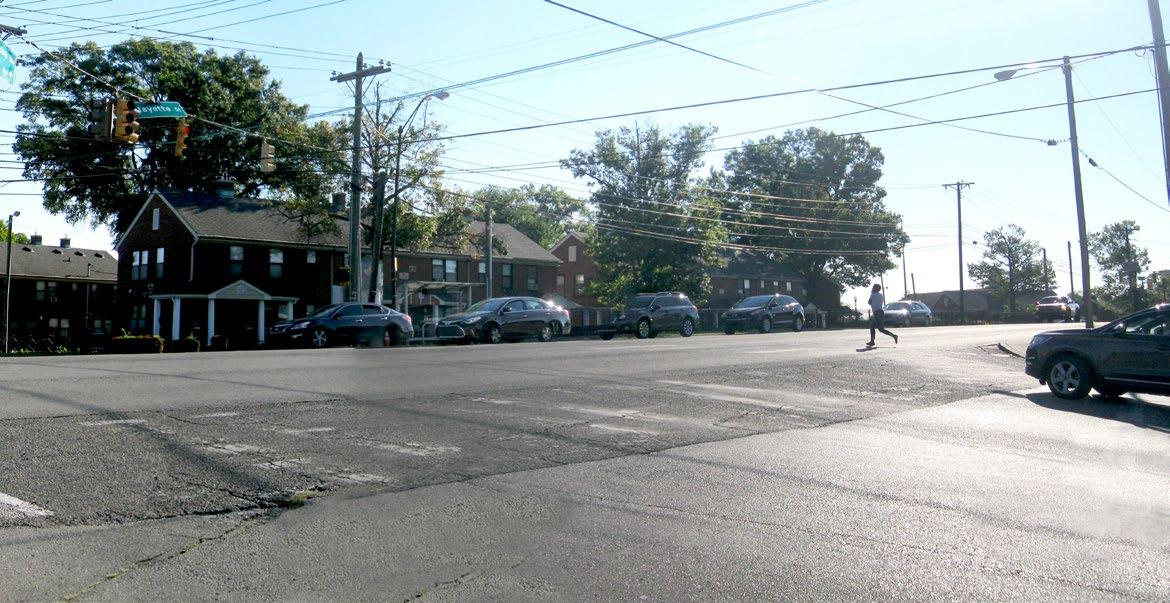
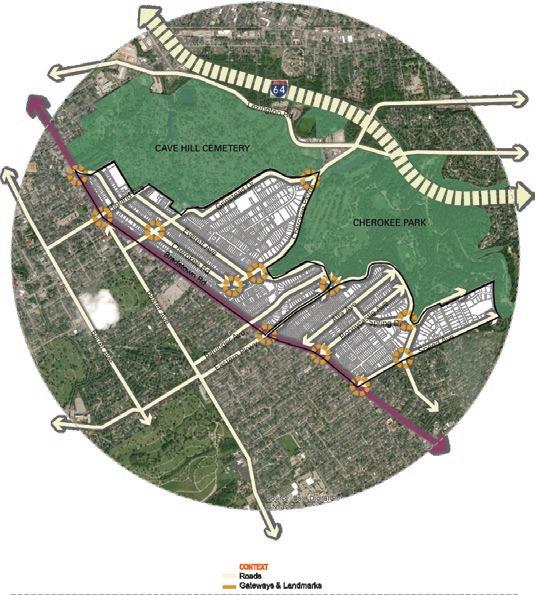
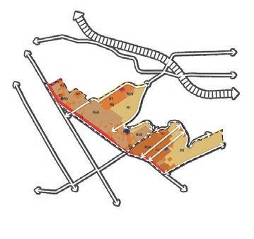
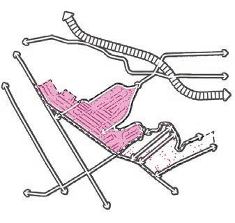
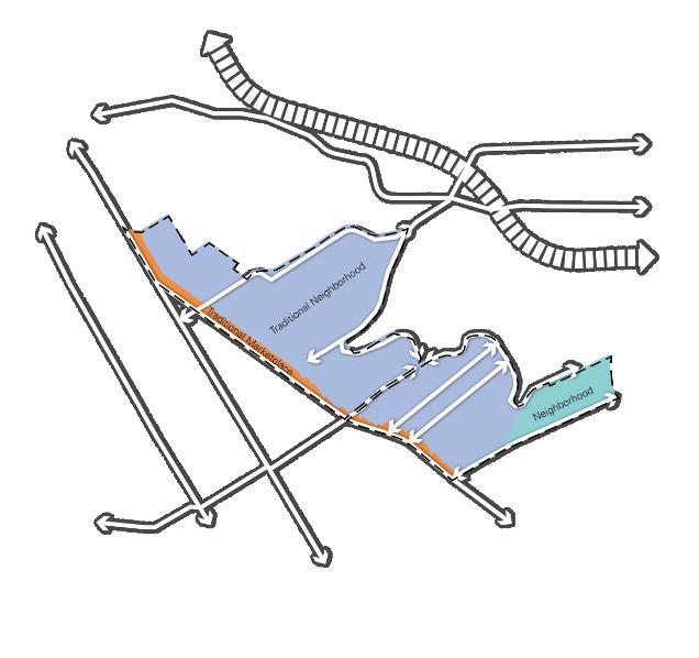
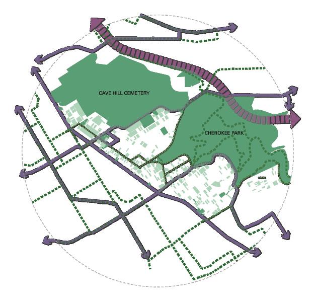
Cherokee Triangle & Bonnycastle Neighborhoods Plan
Louisville, KY

Known for their eclectic mix of architectural character, the historic neighborhoods of Cherokee Triangle and Bonnycastle have maintained their strong identity over decades. Their proximity to the Cherokee Park, part of Fredrick Law Olmsted’s visionary park system, and the adjacent commercial corridor along Bardstown Road make them some of the most desirable neighborhoods in Louisville. The Cherokee Triangle and Bonnycastle Neighborhoods Plan strives growth while addressing: Density that is sensitive to existing context and scale focusing on “missing middle” housing types; the role of existing regulatory requirements; Bardstown Road Corridor’s relationship to both the neighborhoods; opportunities to improve safe pedestrian access to parks and throughout the neighborhoods. The plan is grounded in a deep understanding of these unique contexts, with a strong focus on historic preservation, diversity, and inclusion. This Plan is the result of community engagement, common themes, and a shared vision for the future of these two historic neighborhoods. The neighborhoods plan is a 15-month robust process that started in Jan 2020. Covid 19 caused a major shift in the process to virtual engagement from a series of planned in person community engagement.
Firm: Lord Aeck Sargent
Client: Louisville Metro Government
CherokeeTriangle&BonnycastleNeighborhoodsPlan Louisville,KY
Harioresam,eiciulpacorrocorestrunt.
Us.Quost,undan�unteriaseiciaelaturiatodmaionectealiquamsinumconseporsimilitullis eturauteictursan�sen�atur?
Tissolest,ommosdeseumquideresnaturautposreratustenedolutveribusdolorraeinulpar ionseditutautautoffictodoluptaseaquiaadmotoquiaconpreoccaequamquam,ipsaque nietautoccumipitat.
Collaboration: Gresham Smith (Transportation Sub-Consultant, Environs & Jones (Open space/environment sub-consultant)
Obitamiduntumresciblatur?aseaquiaadmotoquiaconpreoccaequamquam,ipsaqueniet autoccumipitat.
Role: Project Manager: Created work-plans, managed two studio members, invoicing and budget management, communication, and coordination with the clients/sub-consultants (mobility and). Led the design and development of the project. Facilitated/presented to the Advisory Group and the community.
Project Process
Understanding the Context Vision Formulation
Defining the Scope Exploring Alternatives Creating an Action Plan
26
1 Context Map
Software
Us.Quost,undan�unteriaseiciaelaturiatodmaionectealiquamsinumconseporsimilitullis
Us.Quost,undan�unteriaseiciaelaturiatodmaionectealiquamsinumconseporsimilitullis
Tissolest,ommosdeseumquideresnaturautposreratustenedolutveribusdolorraeinulpar
Us.Quost,undan�unteriaseiciaelaturiatodmaionectealiquamsinumconseporsimilitullis
Tissolest,ommosdeseumquideresnaturautposreratustenedolutveribusdolorraeinulpar
Us.Quost,undan�unteriaseiciaelaturiatodmaionectealiquamsinumconseporsimilitullis
ionseditutautautoffictodoluptaseaquiaadmotoquiaconpreoccaequamquam,ipsaque
ionseditutautautoffictodoluptaseaquiaadmotoquiaconpreoccaequamquam,ipsaque
Tissolest,ommosdeseumquideresnaturautposreratustenedolutveribusdolorraeinulpar
Tissolest,ommosdeseumquideresnaturautposreratustenedolutveribusdolorraeinulpar
Obitamiduntumresciblatur?aseaquiaadmotoquiaconpreoccaequamquam,ipsaqueniet
ionseditutautautoffictodoluptaseaquiaadmotoquiaconpreoccaequamquam,ipsaque
Obitamiduntumresciblatur?aseaquiaadmotoquiaconpreoccaequamquam,ipsaqueniet
Obitamiduntumresciblatur?aseaquiaadmotoquiaconpreoccaequamquam,ipsaqueniet
ionseditutautautoffictodoluptaseaquiaadmotoquiaconpreoccaequamquam,ipsaque Obitamiduntumresciblatur?aseaquiaadmotoquiaconpreoccaequamquam,ipsaqueniet
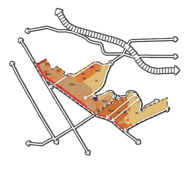
ZONING
ZONING
Predominantly Residential CommercialCorridor
Predominantly Residential CommercialCorridor
ZONING
ZONING
Predominantly Residential
Predominantly Residential

FORMDISTRICTS
FORMDISTRICTS
Traditional Neighborhood Neighborhood Traditional Marketplace
FORMDISTRICTS
Traditional Neighborhood Neighborhood Traditional Marketplace
FORMDISTRICTS
Traditional Neighborhood Neighborhood Traditional Marketplace
Traditional Neighborhood Neighborhood Traditional Marketplace
OPENSPACE NETWORK
OPENSPACE NETWORK
27
CherokeeTriangle&BonnycastleNeighborhoodsPlan
CherokeeTriangle&BonnycastleNeighborhoodsPlan
OPENSPACE
LINKAGE BikeRoute BusRoutes HISTORIC PRESERVATION DISTRICT HistoricProperties
NETWORK
OPENSPACE NETWORK LINKAGE BikeRoute BusRoutes HISTORIC PRESERVATION DISTRICT HistoricProperties
Historic Preservation District Open Space Linkages Network Form District Zoning
1 2 3 5 1 2 3 4 5 DESIGNBESTPRACTICEGUIDELINES CommercialFocusAreaAtGrindsteadDriveAnd BardstwonRoad BreakUpTheMass EnhancePublicOpen SpaceAnd Streetscape RelationshipToStreet ParkingandServices Environmental Initiatives
3
4 4 5 2
1
3
1 2 4 1 2 3 4 5 2 FitinWithTheContext EnhancePublicOpen SpaceAnd Streetscape RelationshipToStreet ParkingandServices ADU’s DESIGNBESTPRACTICEGUIDELINES ResidentialFocusAreaAtSherwoodAvenueDrive AndCherokeeRoad
1 2
3 4
5
3
4
Durham,NC
Harioresam,eiciulpacorrocorestrunt.
DHA and Downtown Neighborhood Planning
Durham, NC
Durham,NC
Harioresam,eiciulpacorrocorestrunt.
Us.Quost,undan�unteriaseiciaelaturiatodmaionectealiquamsinumconseporsimilitullis eturauteictursan�sen�atur?
Us.Quost,undan�unteriaseiciaelaturiatodmaionectealiquamsinumconseporsimilitullis eturauteictursan�sen�atur?
Us.Quost,undan�unteriaseiciaelaturiatodmaionectealiquamsinumconseporsimilitullis eturauteictursan�sen�atur?
Harioresam,eiciulpacorrocorestrunt.
Durham is experiencing unprecedented growth since 2000, the City’s population grew by 40% to nearly 270,000 in 2018 and this trend is expected to continue. The target area for DDNP focuses on a subset of the downtown area that includes nearly 60 acres of publicly owned land. The planning area and key landmarks, boundaries and the eight opportunity sites are shown in the image below. The DDNP reflects the vision and input from public housing residents living at the sites today and an array of local stakeholders. DDNP reflects the shared concern about the limited supply of quality affordable housing options in Durham. The plan provides a framework to guide future investments in a coordinated way.
Firm: Lord Aeck Sargent
Collaboration: EJP
Tissolest,ommosdeseumquideresnaturautposreratustenedolutveribusdolorraeinulpar ionseditutautautoffictodoluptaseaquiaadmotoquiaconpreoccaequamquam,ipsaque nietautoccumipitat.
Us.Quost,undan�unteriaseiciaelaturiatodmaionectealiquamsinumconseporsimilitullis eturauteictursan�sen�atur?
Obitamiduntumresciblatur?
Tissolest,ommosdeseumquideresnaturautposreratustenedolutveribusdolorraeinulpar nietautoccumipitat.
Obitamiduntumresciblatur?
Tissolest,ommosdeseumquideresnaturautposreratustenedolutveribusdolorraeinulpar ionseditutautautoffictodoluptaseaquiaadmotoquiaconpreoccaequamquam,ipsaque nietautoccumipitat.
Obitamiduntumresciblatur?
Tissolest,ommosdeseumquideresnaturautposreratustenedolutveribusdolorraeinulpar ionseditutautautoffictodoluptaseaquiaadmotoquiaconpreoccaequamquam,ipsaque nietautoccumipitat.
Osauteminus,quamfacerumsadigniseaqueesnepratesundellestestvolorporeiciumrenieniendametvoloris�umetexpladissitrepta�onreautasiminctemfugitatesimquist,sectore eumsuscipsaquatusvelendiciunt.
Obitamiduntumresciblatur?
Osauteminus,quamfacerumsadigniseaqueesnepratesundellestestvolorporeiciumrenieniendametvoloris�umetexpladissitrepta�onreautasiminctemfugitatesimquist,sectore eumsuscipsaquatusvelendiciunt.
Osauteminus,quamfacerumsadigniseaqueesnepratesundellestestvolorporeiciumrenieniendametvoloris�umetexpladissitrepta�onreautasiminctemfugitatesimquist,sectore eumsuscipsaquatusvelendiciunt.
Osauteminus,quamfacerumsadigniseaqueesnepratesundellestestvolorporeiciumrenieniendametvoloris�umetexpladissitrepta�onreautasiminctemfugitatesimquist,sectore eumsuscipsaquatusvelendiciunt.
Client: Durham Housing Authority
Imusmoluptadoluptatur,simi,ommoloquiutdoloraeassenimileatursitaturmodicatursi voloruntquidelitasalit,imiliquossuntutdebitathariseliquisdollatur?Xernamreriorumrepra quam,utvoluptatur?Modiamun�ustlicilicatenosipitatrecestillorehendestruntemquisitaut
Imusmoluptadoluptatur,simi,ommoloquiutdoloraeassenimileatursitaturmodicatursi
Imusmoluptadoluptatur,simi,ommoloquiutdoloraeassenimileatursitaturmodicatursi voloruntquidelitasalit,imiliquossuntutdebitathariseliquisdollatur?Xernamreriorumrepra quam,utvoluptatur?Modiamun�ustlicilicatenosipitatrecestillorehendestruntemquisitaut
Imusmoluptadoluptatur,simi,ommoloquiutdoloraeassenimileatursitaturmodicatursi voloruntquidelitasalit,imiliquossuntutdebitathariseliquisdollatur?Xernamreriorumrepra quam,utvoluptatur?Modiamun�ustlicilicatenosipitatrecestillorehendestruntemquisitaut
quam,utvoluptatur?Modiamun�ustlicilicatenosipitatrecestillorehendestruntemquisitaut
Role: Started as a studio to Senior Urban Designer and took up Lead Urban Designer role: Developed analysis maps, involved in stakeholder/community engagement process, helped with the design development of the focus areas, visualization/graphic presentation, and final report.


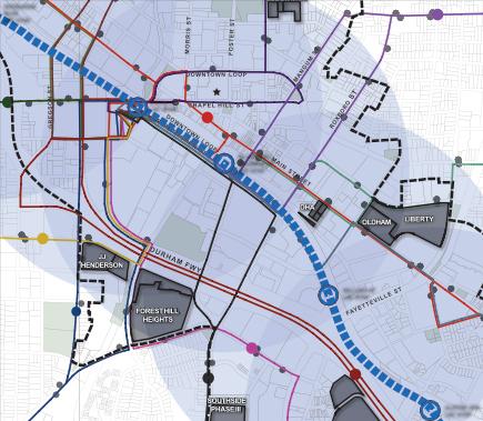
32 County ofElections PETTIGREWST ROXBOROST NCDivisionof Social Services Durham County Departmentof Health St.Philips County Solid Church County Library RIGSBEE SUBSTATION DHA CRIMINAL JUSTICE BUILDING DOWNTOWN& NEIGHBORHOODPLANNING CONTEXT- OLDHAM, LIBERTY, ST SDUKE ST WLAKEWOODAVE Physician Program UniversityDrive BP Orchard JJ HENDERSON MAJOR ROADS SITE S ROXBOROST EPIEDMONT ELAKEWOODAVE SOUTHSIDE PHASEIII Durham Recreation School MtVernon StMark Ame Zion DOWNTOWN& NEIGHBORHOODPLANNING SITE CONTEXT- FAYETTE
1 DHAandDowntownNeighborhoodPlanning
Eastway Elementary School Long Meadow Park DOWNTOWN TIER DEVELOPMENTTIERS DHA DOWNTOWN SITE AMERICANLAKEWOODAVE SDUKE WLAKEWOODAVE DHA SITE Durham Hillside Park
1 DHAandDowntownNeighborhoodPlanning Durham,NC Eastway Elementary School Long Meadow Park DOWNTOWN TIER Downtown MAJOR ROADS DHA DOWNTOWN SITE AMERICANWLAKEWOODAVE WLAKEWOODAVE BP UniversityDrive DHA SITE Durham Recreation Center Hillside Park OPPORTUNITYSITES DHA DOWNTOWN& NEIGHBORHOODPLANNING SITE CONTEXT- FAYETTE PLACE,
0300600 Feet Edgemont Park Eastway Elementary School Golden Belt Manufacturing Complex Wrights Auto MachineryBldg. VenableCenter C.C.ThomasHouse PercyReadeHouse Former LibraryBldg. Durham Convention Center Rocky Creek Park Hillside Park Grant Park Durham Central Park Durham Athletic Park Trinity Park East End Park Oakwood Park Long Meadow Park Durham Bulls Athletic Park Orchard Park Bay Hargrove Park Old Durham Park DURHAMFWY CHAPEL HILL ST MAINSTREET DOWNTOWNLOOP E.PETTIGREWST W.PETTIGREWSTDOWNTOWNLOOP FAYETTEVILLEST ROXBORO ST MANGUMST DUKEST MORRIS ST FOSTERST GREGSONST S.ALSTONAVE DHA LIBERTY OLDHAM FAYETTE PLACE FOREST HILL HEIGHTS SOUTHSIDE PHASE III JJ HENDERSON RIGSBEE AVENUE SUBSTATION MAJOR ROADS STUDY AREA OPPORTUNITYSITES OWNEDBYDHA OPPORTUNITY SITES OWNEDBYCITYOF DURHAM PLANNING FOCUSAREA GREEN/OPENSPACES LANDMARKS HISTORIC LANDMARKS DOWNTOWN TIER DEVELOPMENTTIERS 0300600 1200 Feet Date:March 09, 2018 CONTEXT County Board ofElections PETTIGREWST RAMSEURST ELIZABETHST ROXBOROST Social Services Departmentof HumanServices ParkingLot Durham County Departmentof Health St.Philips Episcopal Church Urban Ministriesof Durham County Solid FirstPresbyterian County Library Durham Park RIGSBEE AVE. SUBSTATION DHA CRIMINAL JUSTICE BUILDING LANDMARKS DHA DOWNTOWN& NEIGHBORHOODPLANNING SITE CONTEXT- OLDHAM, LIBERTY, AMERICANWLAKEWOODAVE TOBACCO SDUKE ST SDUKE ST WILLARDST WLAKEWOODAVE Physician Assistant Program BP UniversityDrive BP Orchard Park JJ HENDERSON PARKS DHA SITE ROXBOROST EPIEDMONT AVE JACKIEROBINSONDR MOREHEAD ELAKEWOODAVE DURHAMFWY SOUTHSIDE PHASEIII Durham Recreation Center WhittedMiddle Hillside Park MtVernon Baptist Church Leone MAJOR ROADS DHA DOWNTOWN& NEIGHBORHOODPLANNING SITE CONTEXT- FAYETTE PLACE,
Harioresam,eiciulpacorrocorestrunt.
Understanding the Context Vision Formulation Defining the Scope Identifying Focus Areas Creating an Action Plan Project Process Focus 1
3 Focus 2
Focus
Software
Us.Quost,undan�unteriaseiciaelaturiatodmaionectealiquamsinumconseporsimilitullis
Us.Quost,undan�unteriaseiciaelaturiatodmaionectealiquamsinumconseporsimilitullis

Us.Quost,undan�unteriaseiciaelaturiatodmaionectealiquamsinumconseporsimilitullis
Us.Quost,undan�unteriaseiciaelaturiatodmaionectealiquamsinumconseporsimilitullis
Us.Quost,undan�unteriaseiciaelaturiatodmaionectealiquamsinumconseporsimilitullis
Tissolest,ommosdeseumquideresnaturautposreratustenedolutveribusdolorraeinulpar
Tissolest,ommosdeseumquideresnaturautposreratustenedolutveribusdolorraeinulpar ionseditutautautoffictodoluptaseaquiaadmotoquiaconpreoccaequamquam,ipsaque
Tissolest,ommosdeseumquideresnaturautposreratustenedolutveribusdolorraeinulpar
Tissolest,ommosdeseumquideresnaturautposreratustenedolutveribusdolorraeinulpar ionseditutautautoffictodoluptaseaquiaadmotoquiaconpreoccaequamquam,ipsaque Osauteminus,quamfacerumsadigniseaqueesnepratesundellestestvolorporeiciumrenieniendametvoloris�umetexpladissitrepta�onreautasiminctemfugitatesimquist,sectore
Tissolest,ommosdeseumquideresnaturautposreratustenedolutveribusdolorraeinulpar
ionseditutautautoffictodoluptaseaquiaadmotoquiaconpreoccaequamquam,ipsaque
Osauteminus,quamfacerumsadigniseaqueesnepratesundellestestvolorporeiciumrenieniendametvoloris�umetexpladissitrepta�onreautasiminctemfugitatesimquist,sectore
Imusmoluptadoluptatur,simi,ommoloquiutdoloraeassenimileatursitaturmodicatursi
Osauteminus,quamfacerumsadigniseaqueesnepratesundellestestvolorporeiciumrenieniendametvoloris�umetexpladissitrepta�onreautasiminctemfugitatesimquist,sectore
Osauteminus,quamfacerumsadigniseaqueesnepratesundellestestvolorporeiciumrenieniendametvoloris�umetexpladissitrepta�onreautasiminctemfugitatesimquist,sectore
Tissolest,ommosdeseumquideresnaturautposreratustenedolutveribusdolorraeinulpar ionseditutautautoffictodoluptaseaquiaadmotoquiaconpreoccaequamquam,ipsaque Osauteminus,quamfacerumsadigniseaqueesnepratesundellestestvolorporeiciumrenieniendametvoloris�umetexpladissitrepta�onreautasiminctemfugitatesimquist,sectore
ionseditutautautoffictodoluptaseaquiaadmotoquiaconpreoccaequamquam,ipsaque Osauteminus,quamfacerumsadigniseaqueesnepratesundellestestvolorporeiciumrenieniendametvoloris�umetexpladissitrepta�onreautasiminctemfugitatesimquist,sectore
voloruntquidelitasalit,imiliquossuntutdebitathariseliquisdollatur?Xernamreriorumrepra quam,utvoluptatur?Modiamun�ustlicilicatenosipitatrecestillorehendestruntemquisitaut
Us.Quost,undan�unteriaseiciaelaturiatodmaionectealiquamsinumconseporsimilitullis Tissolest,ommosdeseumquideresnaturautposreratustenedolutveribusdolorraeinulpar ionseditutautautoffictodoluptaseaquiaadmotoquiaconpreoccaequamquam,ipsaque Osauteminus,quamfacerumsadigniseaqueesnepratesundellestestvolorporeiciumrenieniendametvoloris�umetexpladissitrepta�onreautasiminctemfugitatesimquist,sectore Imusmoluptadoluptatur,simi,ommoloquiutdoloraeassenimileatursitaturmodicatursi voloruntquidelitasalit,imiliquossuntutdebitathariseliquisdollatur?Xernamreriorumrepra quam,utvoluptatur?Modiamun�ustlicilicatenosipitatrecestillorehendestruntemquisitaut
Imusmoluptadoluptatur,simi,ommoloquiutdoloraeassenimileatursitaturmodicatursi
Imusmoluptadoluptatur,simi,ommoloquiutdoloraeassenimileatursitaturmodicatursi
Imusmoluptadoluptatur,simi,ommoloquiutdoloraeassenimileatursitaturmodicatursi voloruntquidelitasalit,imiliquossuntutdebitathariseliquisdollatur?Xernamreriorumrepra quam,utvoluptatur?Modiamun�ustlicilicatenosipitatrecestillorehendestruntemquisitaut
Imusmoluptadoluptatur,simi,ommoloquiutdoloraeassenimileatursitaturmodicatursi
quam,utvoluptatur?Modiamun�ustlicilicatenosipitatrecestillorehendestruntemquisitaut
voloruntquidelitasalit,imiliquossuntutdebitathariseliquisdollatur?Xernamreriorumrepra
Imusmoluptadoluptatur,simi,ommoloquiutdoloraeassenimileatursitaturmodicatursi voloruntquidelitasalit,imiliquossuntutdebitathariseliquisdollatur?Xernamreriorumrepra quam,utvoluptatur?Modiamun�ustlicilicatenosipitatrecestillorehendestruntemquisitaut
voloruntquidelitasalit,imiliquossuntutdebitathariseliquisdollatur?Xernamreriorumrepra quam,utvoluptatur?Modiamun�ustlicilicatenosipitatrecestillorehendestruntemquisitaut
quam,utvoluptatur?Modiamun�ustlicilicatenosipitatrecestillorehendestruntemquisitaut


33 Long Meadow Park OPEN DHA COM UC RU-M ZONING DHA DOWNTOWN
Long Meadow Park OPEN DHA UC RU-5(2) RU-M ZONING DHA TRANSIT DHA EXISTING DHA
Long Meadow Park OPEN DHA COM UC RU-M RESIDENTIAL RESIDENTIALSUBURBAN RESIDENTIAL RESIDENTIAL RESIDENTIAL RESIDENTIAL RESIDENTIAL RESIDENTIAL UNIVERSITY ZONING DHA DOWNTOWN 5 MULTI-USE HOTEL(COM) COMMERCIAL OFFICE PARKING INDUSTRIAL LR GRANTST SIMMONSST
Long Meadow Park STUDY MAJOR OPPORTUNITYSITES TREECANOPY OPEN DHA DOWNTOWN CN UC RU-5(2) RU-M STUDYAREA MAJOR ROADS OPPORTUNITYSITES COMMERCIALGENERAL COMMERCIALGENERAL COMMERCIAL COMMERCIAL COMMERCIALNEIGHBORHOOD DESIGN DESIGN DESIGN LIGHTINDUSTRIAL OFFICEANDINSTITUTIONAL OFFICE PLANNED RESIDENTIAL RESIDENTIAL RESIDENTIAL RESIDENTIAL RESIDENTIAL RESIDENTIALSUBURBAN RESIDENTIAL RESIDENTIAL RESIDENTIAL RESIDENTIAL RESIDENTIAL RESIDENTIAL UNIVERSITY UNIVERSITY UNIVERSITYAND ZONING DHA DOWNTOWN 5 11 3 TRANSIT DHA DOWNTOWN MAJOR ROADS STUDY AREA OPPORTUNITYSITES COMMUNITY/CIVIC(CMNTY) MULTI-USE HOTEL(COM) COMMERCIAL OFFICE PARKING INDUSTRIAL LR PUBLIC RESIDENTIAL(RES) RECREATION/OPEN VACANTPROPERTIES EXISTING DHA DOWNTOWN Park
Park Long Meadow Park S.ALSTONAVE IMPROVEDSTREETSCAPE 0300600 1200 Feet Date:March 09, 2018 OPEN SPACE NETWORK DHA DOWNTOWN& NEIGHBORHOODPLANNING 0300600 S.ALSTONAVE COM CN CN RU-5 UC RU-5 RU-5(2) RU-5 RS-M RU-M UNIVERSITY ANDCOLLEGE(D) UNIVERSITYAND COLLEGE-2 0300600 1200 Feet Date:March 09, 2018 ZONING DHA DOWNTOWN E.PETTIGREWST
5 SOUTHSQUARE/NEW HOPECOMMONS THEVILLAGE/GLENVIEWSTATION/HWY98 0300600 S.ALSTONAVE RECREATION/OPEN SPACE(ROS) LAKEWOODAVE ROXBOROST AVE SOUTHST Courthouse FAYETTEVILLEST MERRICKST LINCOLNST LINWOODAVE Monument of Faith Church-God Feet
S.ALSTONAVE
Park Long Meadow Park S.ALSTONAVE IMPROVEDSTREETSCAPE 0300600 1200 Feet Date:March 09, 2018 OPEN SPACE NETWORK DHA DOWNTOWN& NEIGHBORHOODPLANNING 0300600 S.ALSTONAVE COM CN RU-5 UC RU-5 RU-5(2) RU-5 RS-M RU-M UNIVERSITY ANDCOLLEGE(D) UNIVERSITYAND COLLEGE-2 0300600 1200 Feet Date:March 09, 2018 ZONING DHA DOWNTOWN& NEIGHBORHOODPLANNING E.PETTIGREWST S.ALSTONAVE 5 SOUTHSQUARE/NEW HOPECOMMONS THEVILLAGE/GLENVIEWSTATION/HWY98 TRANSIT NETWORK 0300600 S.ALSTONAVE RECREATION/OPEN SPACE(ROS) VACANTPROPERTIES EXISTING LANDUSE Downtown LAKEWOODAVE S ROXBOROST HILLSIDEAVE SOUTHST Courthouse FAYETTEVILLEST MERRICKST LINCOLNST LINWOODAVE LincolnCommunity Pharmacy Monument of Faith Church-God Feet 16, SOUTHSIDE PHASE III
0300600 Feet Rocky Creek Park Hillside Park Grant Park Durham Central Park Durham Athletic Park Trinity Park East End Park Oakwood Park Long Meadow Park Durham Bulls Athletic Park Orchard Park Bay Hargrove Park Old Durham Park DURHAMFWY CHAPEL HILL ST MAINSTREET DOWNTOWNLOOP E.PETTIGREWST W.PETTIGREWSTDOWNTOWNLOOP FAYETTEVILLEST ROXBORO ST MANGUMST DUKEST MORRIS ST FOSTERST GREGSONST S.ALSTONAVE PROPOSED GREENWAY AMERICANTOBACCO TRAIL DHA LIBERTY OLDHAM FAYETTE PLACE FOREST HILL HEIGHTS SOUTHSIDE PHASE III JJ HENDERSON RIGSBEE AVENUE SUBSTATION STUDY AREA MAJOR ROADS OPPORTUNITYSITES TREECANOPY EXISTINGOPENSPACE PROPOSED OPENSPACE RENOVATIONS TO EXISTING OPEN SPACE AMERICAN TOBACCOTRAIL PROPOSED GREENWAY IMPROVEDSTREETSCAPE 0300600 1200 Feet Date:March 09, 2018 OPEN SPACE NETWORK DHA DOWNTOWN& NEIGHBORHOODPLANNING 0300600 Feet DURHAMFWY CHAPEL HILL ST MAINSTREET DOWNTOWNLOOP E.PETTIGREWST W.PETTIGREWSTDOWNTOWNLOOP FAYETTEVILLEST ROXBORO ST MANGUMST DUKEST MORRIS ST FOSTERST GREGSONST S.ALSTONAVE DHA LIBERTY OLDHAM FAYETTE PLACE FOREST HILL HEIGHTS SOUTHSIDE PHASE III JJ HENDERSON RIGSBEE AVENUE SUBSTATION COM COM COM COM CN DD DD DD DD-1 DD-1 DD-1 DD-1 DD-2 DD-2 DD-2 OI OI DD-2 IL IL CN CN RU-5 UC RU-M RU-M RU-M RU-5 RU-5 RU-5(2) RU-5(2) RU-5(2) RU-5(2) RU-5(2) RU-5(2) RU-5(2) RU-5(2) RU-5 PDR RC RC RS-M RS-M RS-M RS-M RS-M RS-M RU-M UC(D) RU-M(D) OI(D) COM CN RU-5 RU5(D) RU-M OI OI RU-5(2) STUDYAREA MAJOR ROADS OPPORTUNITYSITES COMMERCIALGENERAL COMMERCIALGENERAL (D) COMMERCIALINFILL COMMERCIALINFILL (D) COMMERCIALNEIGHBORHOOD DESIGN DISTRICT-C DESIGN DISTRICT-S1 DESIGN DISTRICT-S2 LIGHTINDUSTRIAL OFFICEANDINSTITUTIONAL OFFICE ANDINSTITUTIONAL(D) PLANNED DEVELOPMENTRESIDENTIAL RESIDENTIAL COMPACT RESIDENTIAL COMPACT(D) RESIDENTIAL SUBURBAN-8 RESIDENTIAL SUBURBAN-10 RESIDENTIAL SUBURBAN-20 RESIDENTIALSUBURBAN MF RESIDENTIAL URBAN-5 RESIDENTIAL URBAN-5(D) RESIDENTIAL URBAN-5(2) RESIDENTIAL URBAN -5(2)(D) RESIDENTIAL URBAN-M RESIDENTIAL URBAN-M(D) UNIVERSITY ANDCOLLEGE UNIVERSITY ANDCOLLEGE(D) UNIVERSITYAND COLLEGE-2 0300600 1200 Feet Date:March 09, 2018 ZONING DHA DOWNTOWN& NEIGHBORHOODPLANNING 0300600 Feet W E.PETTIGREWST DUKEST S.ALSTONAVE FAYETTE PLACE RIGSBEE AVENUE SUBSTATION BUCHANAN BLVD LRT STOP DURHAM LRT STOP BLACKWELL /MANGUMST LRT STOP DILLARDST LRT STOP ALSTONAVE LRT STOP 1 5 6 2 9 11 10 12 13 8 7 3 4 OPPORTUNITYSITES GREEN/OPENSPACES PROPOSEDLRT STATION PROPOSEDLRT LINE 1/2 MILE BUFFER FROMLRTSTATION TRANSIT STOPS BULL CITY CONNECTOR DEARBORN DR/NORTH DURHAM DUKEUNIVERSITY/HILLSBOROUGHRD DUKEUNIVERSITY/SPARGERST EAST DURHAM/THEVILLAGE/ANGIER AV FAYETTEVILLEST/NCCU/SOUTHPOINT FORESTHILLS/WEAVER ST/MLK PKWY LAWSONST/NCCU/DURHAM TECH NROXBORO/DURHAMREG/N DUKECROSSIN NCCU/HWY 54 &55 NORTHGATE/HORTONRD SOUTHSQUARE/NEW HOPECOMMONS THEVILLAGE/GLENVIEWSTATION/HWY98 0300600 1200 Feet Date:March 09, 2018 TRANSIT NETWORK DHA DOWNTOWN& NEIGHBORHOODPLANNING 0300600 Feet DURHAMFWY CHAPEL HILL ST MAINSTREET DOWNTOWNLOOP E.PETTIGREWST W.PETTIGREWSTDOWNTOWNLOOP FAYETTEVILLEST ROXBORO ST MANGUMST DUKEST MORRIS ST FOSTERST GREGSONST S.ALSTONAVE DHA LIBERTY OLDHAM FAYETTE PLACE FOREST HILL HEIGHTS SOUTHSIDE PHASE III JJ HENDERSON RIGSBEE AVENUE SUBSTATION MAJOR ROADS STUDY AREA OPPORTUNITYSITES COMMUNITY/CIVIC(CMNTY) MULTI-USE (COM) HOTEL(COM) COMMERCIAL AREA(COM) OFFICE (COM) PARKING GARAGE/DECK(COM) INDUSTRIAL (IND) LR CONVEYANCE PUBLIC SERVICE (PUBL SVC) RESIDENTIAL(RES) RECREATION/OPEN SPACE(ROS) VACANTPROPERTIES 0300600 1200 Feet Date:March 09, 2018 EXISTING LANDUSE DHA DOWNTOWN& NEIGHBORHOODPLANNING ELIZABETHST E.MAINST LIBERTYST HOLLOWAYST N.DILLARDST ELIZABETHST Departmentof HumanServices ParkingLot Ministriesof DurhamCrisis Response WTVD-TV ABC11 Dog Oakwood Park LIBERTY OLDHAM RIQSBEE AVE.SUBSTATION LAKEWOODAVE TOBACCOTRAIL ELAKEWOODAVE SMANGUM ST S ROXBOROST HILLSIDEAVE FARGOST SMANGUM ST JACKIEROBINSONDR WPETTIGREWST DURHAMFWY MOREHEADAVE BLACKWELLST SOUTHST Durham Bulls American Tobacco Campus St Mark Ame ZionChurch Durham Performing ArtsCenter County Courthouse FORESTHILL HEIGHTS HENDERSON E.PETTIGREWST RAMSEURST FAYETTEVILLEST FAYETTEVILLEST GRANTST EUMSTEAD OLD FAYETTEVILLE ST MERRICKST LINCOLNST SIMMONSST LINWOODAVE JACKIEROBINSONDR MOREHEADAVE DURHAMFWY DURHAMFWY FAYETTE PLACE Hayti Heritage Center Square DaVita Durham Dialysis Warren Branch Library LincolnCommunity HealthCenter/ Pharmacy Church-God Date:March 16, 2018 SOUTHSIDE PHASE III
Us.Quost,undan�unteriaseiciaelaturiatodmaionectealiquamsinumconseporsimilitullis
proposal- Focus Area 1 - Durham Housing Authority and Criminal Justice Buildings Site
Development proposal- Focus Area 1 - Oldham and Liberty Apartments Site
34
Development
Development proposal- Focus Area 2 - JJ Henderson Site
Development proposal- Focus Area 3 - Forest Hill Site
35

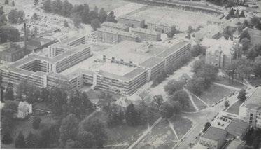
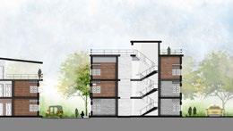
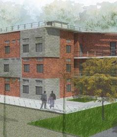
Renovation and New Addition to Historic Cooper House
University of Kentucky

LAS was contracted by the University of Kentucky (2016) for its expertise in Historic Preservation. To renovate and add to the historic Cooper House. The building program included classrooms, closed offices, meeting/seminar rooms, café (100-seater), retail space and a kitchen. I was briefly involved in the project to do manual rendering requested by the client for the promotion of the project to secure more funding for it’s construction. The project is under construction presently.
Firm: Lord Aeck Sargent
Client: University of Kentucky - Marketing
Project cost: $4 Million
Role: Studio- to Principal Architect, together we created the manual renderings for marketing purposes.
Software
2 1
Aerial View of the New Addition
1 Central
2 View of the New Addition
Plaza View
Software

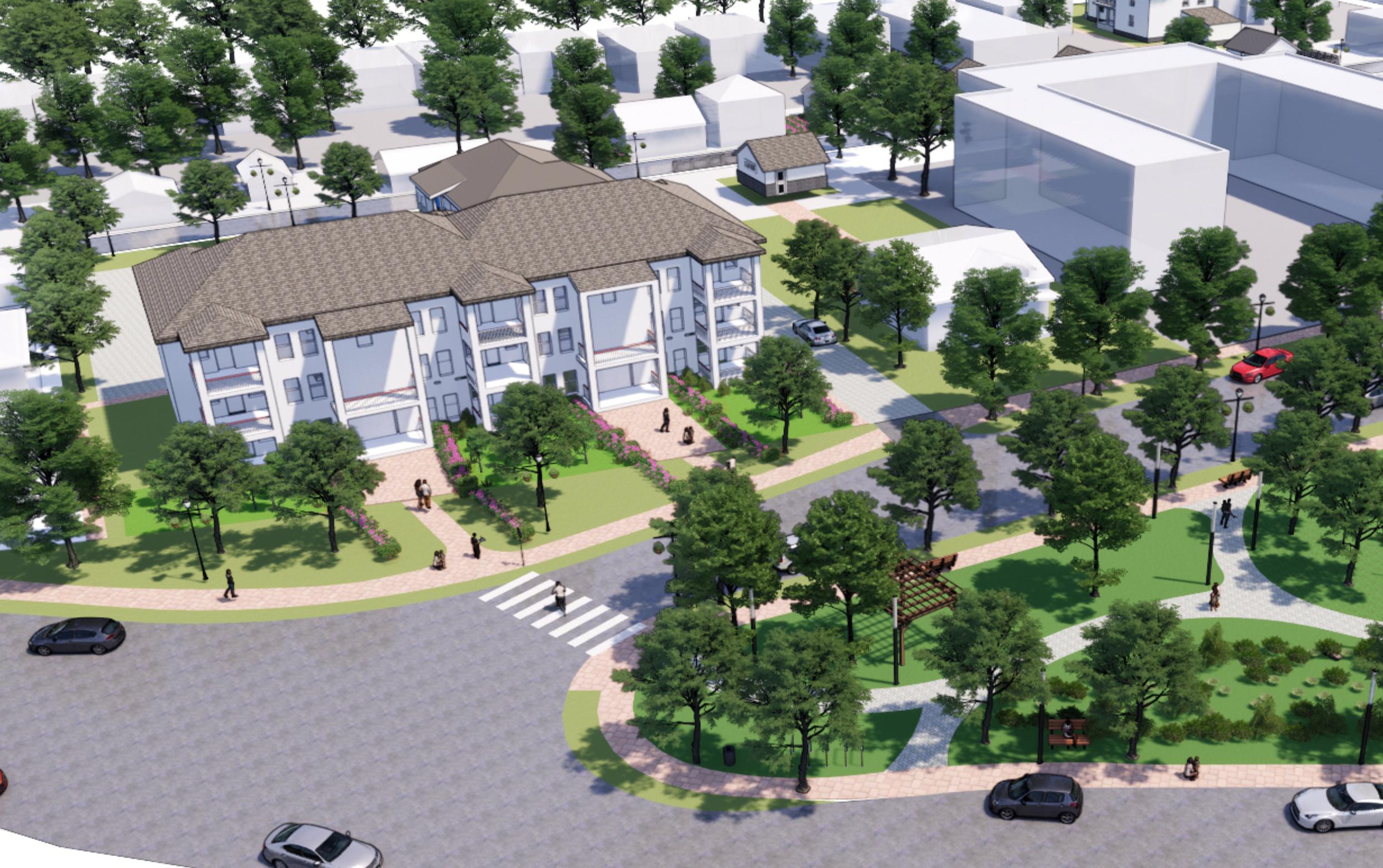
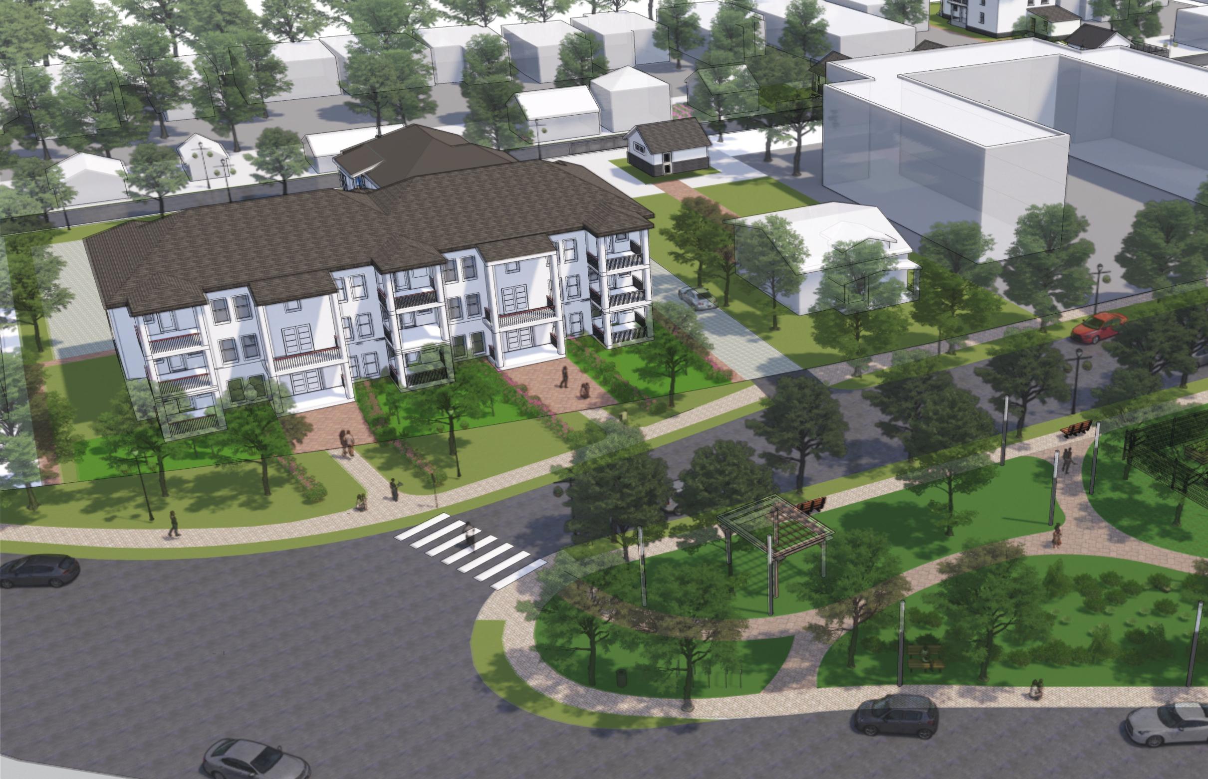
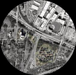
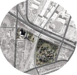
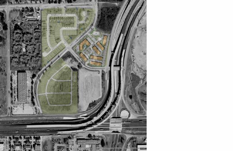
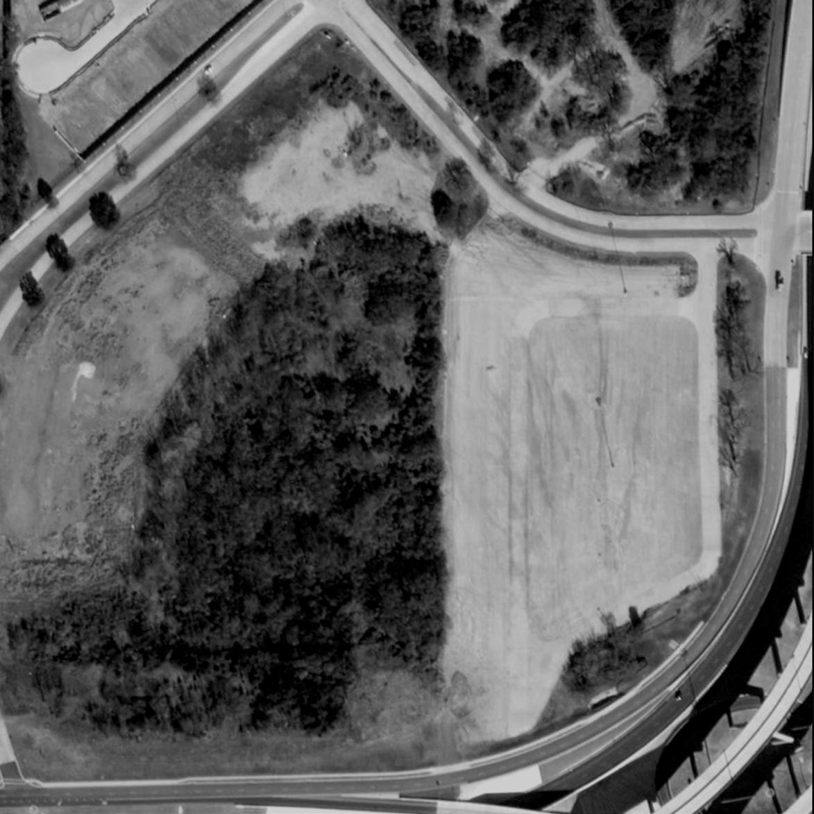
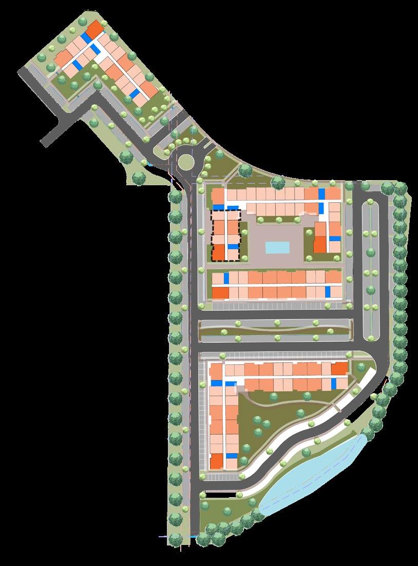
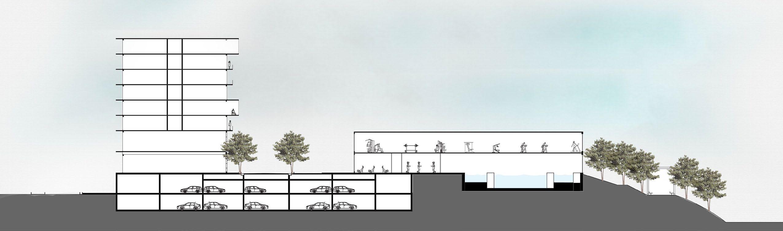
Yield Study for a Multi-Family Residential Development
Ridgeview, WA
The high density multi-family apartments were designed a part of feasibility investigation. The site is located in Ridgeview, WA and was riddled with challenges. The site has an existing wetland and warranted a Phase 1 EPA assessment. A proposed light-rail line passes through the north-west edge of the site. With a highway to the east and light-rail to the west, noise was a big concern to tackle. The plan was to develop the site to it’s maximum and full potential so that the test-fit that could help the developer do an economic analysis on it’s feasibility.
Firm: Lord Aeck Sargent
Client: TCR - Feasibility Package
Estimated Cost: ~$100 million
Role: Project Manager - Was in direct communication with the clients, cost estimators and the sales team. Designed and developed the yield study from research/analysis to design to client presentation.
38 35TH AVE. S INTERSTATE 5 Property Line City Proposed Circulation Framework City Proposed Pedestrian and Bike Path Framework Proposed Light Rail Elevated Track 150’ 50’ 0’ 100’ KATERRA RIDGEVIEW KENT, WA December 5, 2019 3 Site Investigation Zoning Zoning Summary SITE DENSITY (Zoning Code TBD, Section TBD) DENSITY TBD FLOOR TO AREA RATIO Allowed TBD Provided ## BUILDING CONSTRAINTS (Zoning Code TOC) BUILDING HEIGHT Based on the Comprehensive Plan; minimum of 2-story to 5 story with a max. 200’ hight limit LOT COVERAGE Maximum Allowable TBD Provided ## ACCESS REQUIREMENTS (Zoning Code TOC/MRC, Section 13.01) SITE ACCESS Driveway Width (Min. - Max.) TBD FIRE ACCESS Unobstructed Width (Min.) 20’ Inside/Outside Turning Radius 30’/50’ SETBACKS (Zoning Code XYZ, Section AA) TBD TRASH ENCLOSURES Shall be screened from abutting properties and streets by 100% sight-obscuring fance or wall and appropriate landscape screen Type II or III landscaping - 3’ wide min.) OPEN SPACE LANDSCAPING REQUIREMENTS (Zoning Code MCR, Section 12.04) OPEN SPACE For developments of more than 50 dwelling units at least (1) playground equipment, sport court, sport feild, tennis court, or any other recreation facility proposed and approved by the parks and community services director shall be provided for every 25 units in addition to a tot lot or childrens play area; Minimum Required 10% Provided ## STORM RETENTION REQUIREMENTS Type II Landscaped Peremeter (MIN.) 10’ LANDSCAPE BUFFER Minimum Required 10% Zoning Overview Parcel ID Number: Allowable Density: FAR: Occupancy: Zoning Current: Zoning Proposed: Zoning Adjacent: Land Use: Land Use Adjacent: Specific Plan: ## ## du/ac 0.## R-2 MCR TBD MTC-2 TOC - Transit Oriented Community C, SF-6 TOC - Transit Oriented Community Buildable Area Building Type Chassis Config. # Units/Bldg K2 Corridor Building 1 154 K2 Corridor- TUP Building 2 150 K2 Corridor- TUP Building 3 72 K2 Corridor- TUP Building 4 72 Total 448 TOTAL CHASSIS UNIT TYPE UNITS TOTAL UNITS % UNITS TOTAL BEDS UNIT SQ. FT. TOTAL UNIT SQ.FT. Studio 50 86 19% 50 502 25100 A1 1BD/ 1BA 149 195 44% 149 670 99830 A2 1BD/ 1BA 8 8 765 6120 A3 1BD/1BA 20 20 837 16740 A4 1BD/1BA 18 18 788 14184 B1 2BD/ 2BA 35 148 33% 70 907 31745 B2 2BD/ 2BA 33 66 1005 33165 B3 2BD/2BA 40 80 1105 44200 B4 2BD/2BA 40 80 1252 50080 C1 3BD/ 2BA 19 19 4% 57 1367 25973 TOTAL 448 598 TOTAL NET RENTABLE +/- 347,137 AVERAGE UNIT SF 775 Locational Context
Preliminary Unit Schedule
Units per Building

Site Plan Test Fit
Software
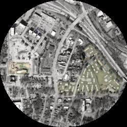
Yield Study for a Multi-Family Residential Development
Irving, TX
The high-density multi-family apartments were designed a part of feasibility investigation. The site is in Irving, Texas and was riddled with challenges. The site is surrounded by major arterials along the east and north, highway to the south and a major residential development to the north and west. The site was irregular and had a utility easement running through the site that limited the direction of development. With zoning regulating setbacks along the arterials and highway, the plan was pushed to the middle, also with topographical challenges there was very few ways to develop the site to its full potential.
Firm: Lord Aeck Sargent
Client: JPI - Feasibility Package
Role: Project Manager - was in direct communication with the clients, cost estimators and the sales team. Designed and developed the yield study from research/analysis to design to client presentation.
40 Chassis Type Chassis Config. # Of # of Units K2- CORRIDOR In-Line One Bedroom Type A1/A2 3 24 Type A1/A2(T) 1 7 Type A2/A2 8 64 10 70 1 7 2 16 10 70 1 8 3 21 3 24 1 7 1 12 Type B4(T)/A1(T)/A1(T) 1 9 1 12 Type A2/B2/A2/End ck 1 21 47 376 TOTAL % UNITS TOTAL UNIT SQ. TOTAL UNIT 63% 46 670 30820 160 770 123200 30 840 25200 32% 14 1020 7140 180 1110 99900 46 1270 29210 5% 60 1310 26200 TOTAL 376 376 536 TOTAL NET RENTABLE SF 341670 AVERAGE UNIT SF 909 TOTAL AMENITY AREA + 8000 Locational Context
30’ 50’ 30’ 10’ 30’ Site Access Point (PUD) Pedestrian Street (PUD) Setback Line Property Line Existing Street Existing Bus Stop 150’ 0’ 300’ 600’ KATERRA TEXAS PLAZA SOUTH | Irving, TX AUGUST 14, 2019 3 TEXASPLAZADR. Site Investigation Zoning Zoning Summary SITE DENSITY (Zoning Code XYZ, Section AA) DENSITY PUD allows for a Maximum Density of 18 du/ac Max. Residential Units 360, approx. 27.6 du/ac FLOOR TO AREA RATIO Allowed ## Provided ## BUILDING CONSTRAINTS (Zoning Code XYZ, Section AA) BUILDING HEIGHT 65’-0” or five stories LOT COVERAGE Maximum Allowable (Buildings) 50% Maximum Allowable (Buildings, Driveways and Parking) 70% Provided TBD ACCESS REQUIREMENTS (Zoning Code XYZ, Section AA) SITE ACCESS Driveway Width (Min. - Max.) TBD FIRE ACCESS Unobstructed Width (Min.) TBD Inside/Outside Turning Radius TBD SETBACKS (Zoning Code XYZ, Section AA) Has been indicated in the Diagram. OPEN SPACE LANDSCAPING REQUIREMENTS (Zoning Code XYZ, Section AA) OPEN SPACE Minium ratio of 0.1 acre for each Residential Unit Minimum Required 3.45 ac Provided TBD STORM RETENTION REQUIREMENTS Minimum Required TBD LANDSCAPE BUFFER Minimum Required 15’-0” Zoning Overview Parcel ID Number: Allowable Density: FAR: Occupancy: Zoning Current: Zoning Proposed: Zoning Adjacent: Land Use: Land Use Adjacent: 65010775610040000 18 du/ac 2.5.## PUD PUD SH 183 Overlay District N/A R-MF-2, R-SF Vacant Residential Multi-Family Residential R-6 Single Family Residential Single Family Residential To DART Station R-MF-2 Multi-Family Residential E NORTHGATE DR. AIRPORT FWY TOMBRANIFFDR LOOP 12 ZONE PUD 13.04 ACRES
Site Plan Test Fit
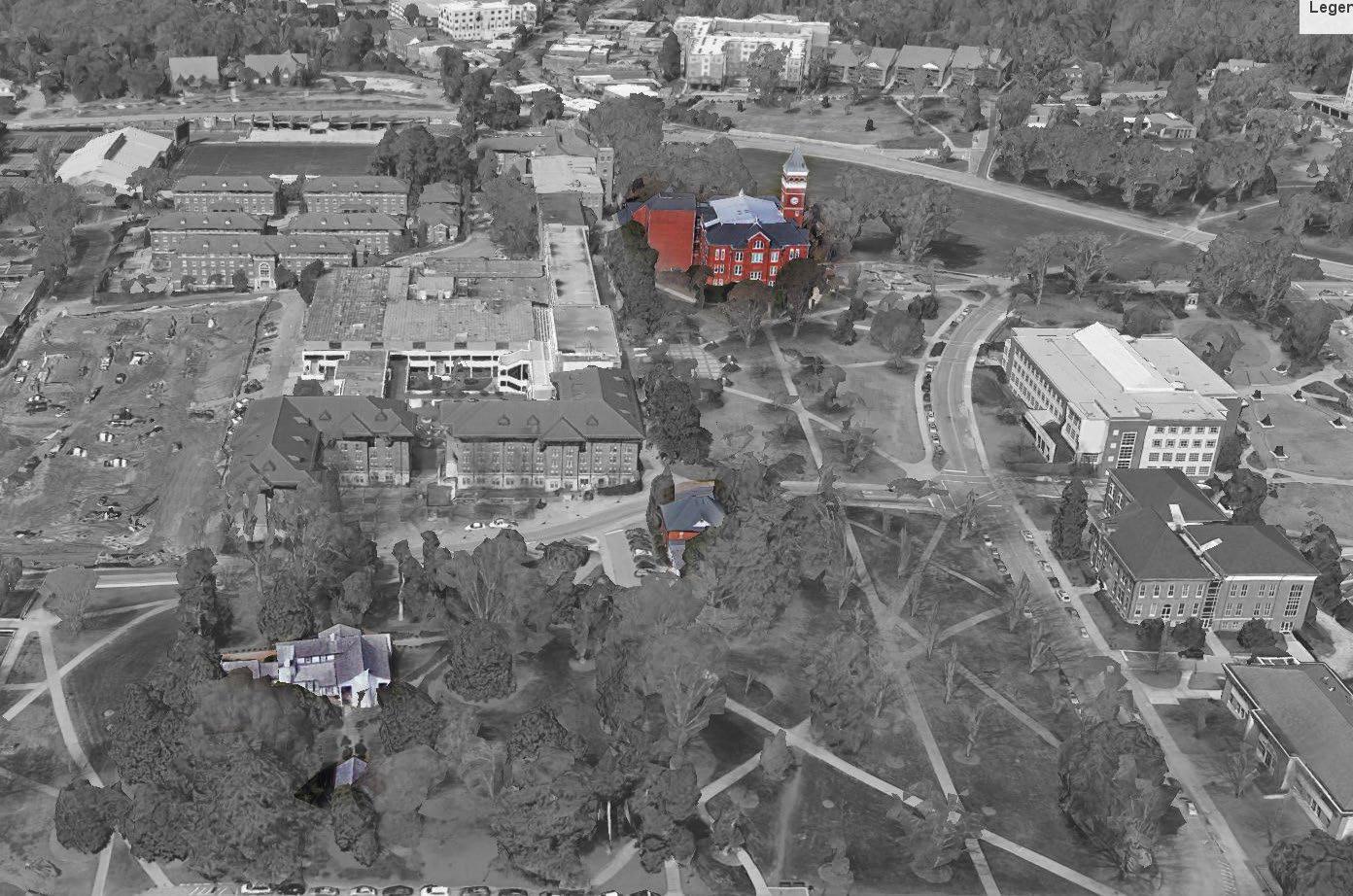
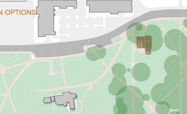
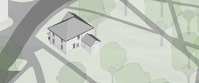
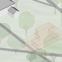
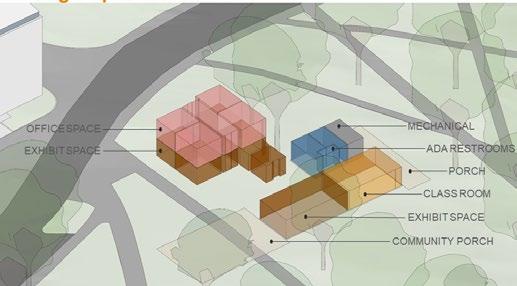
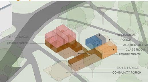
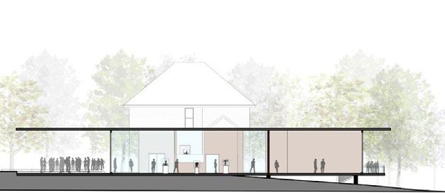
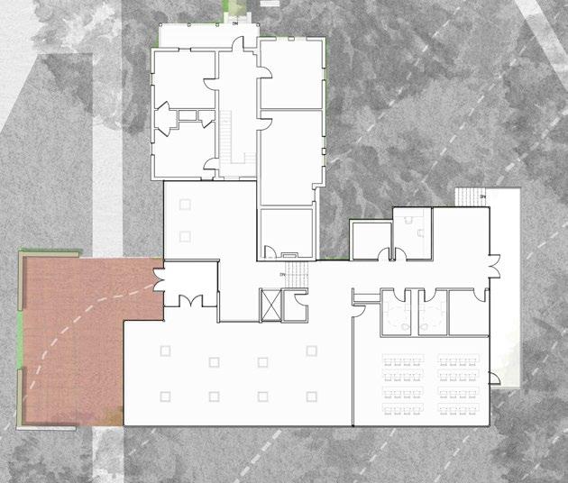
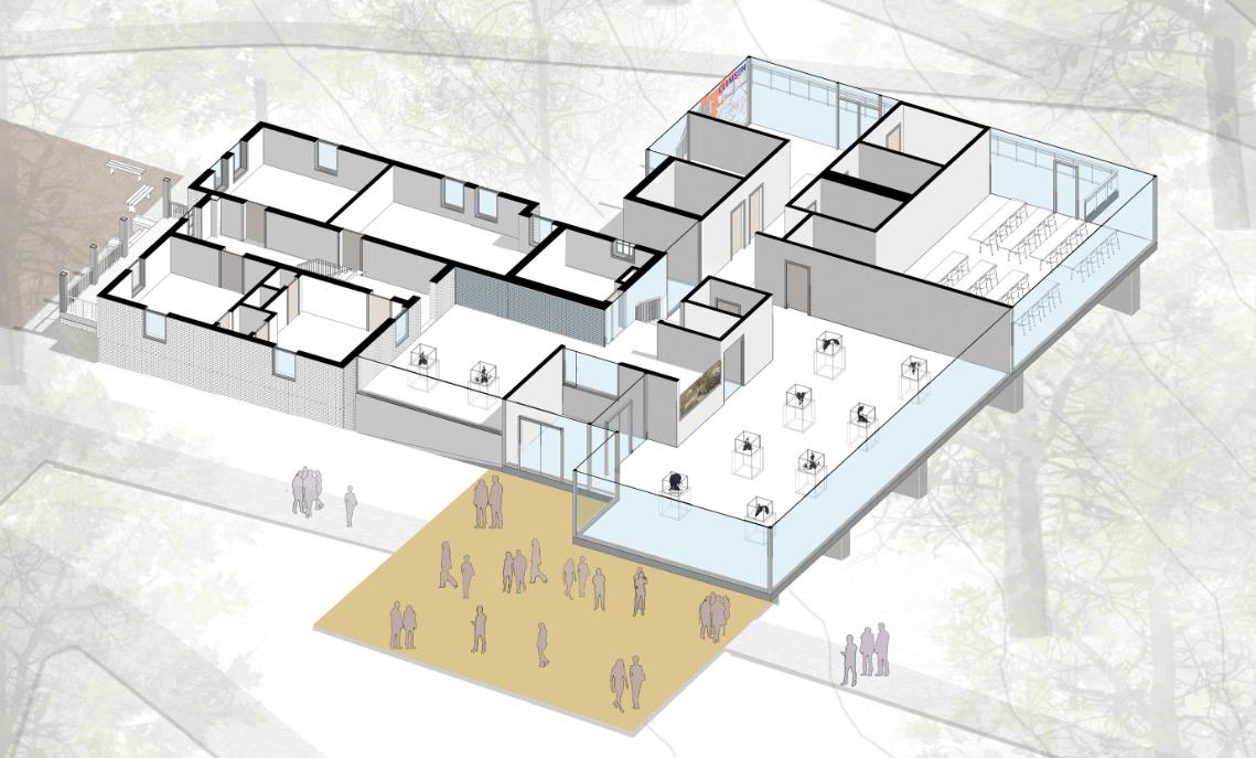
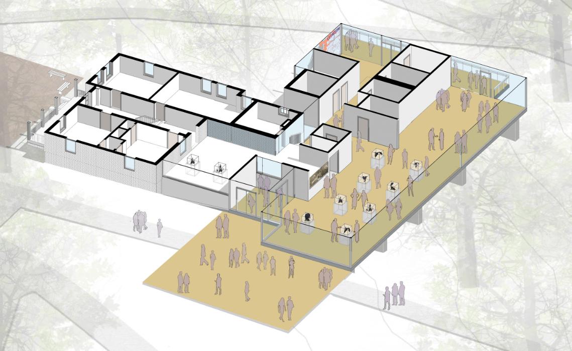
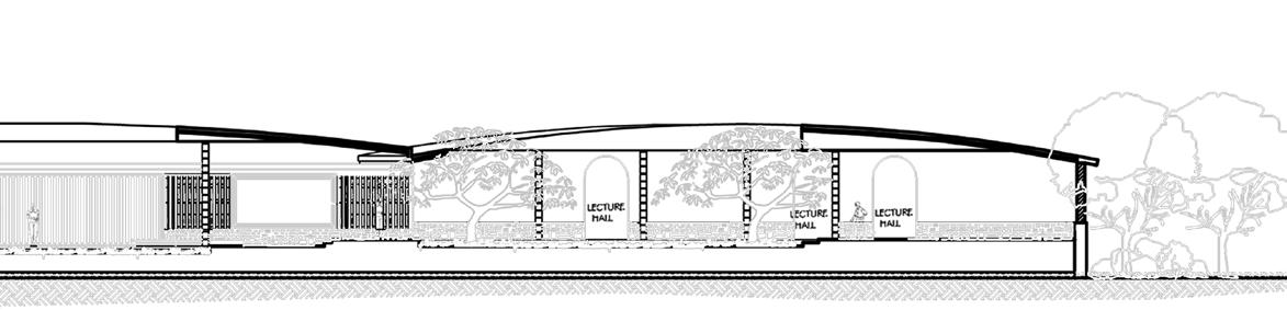
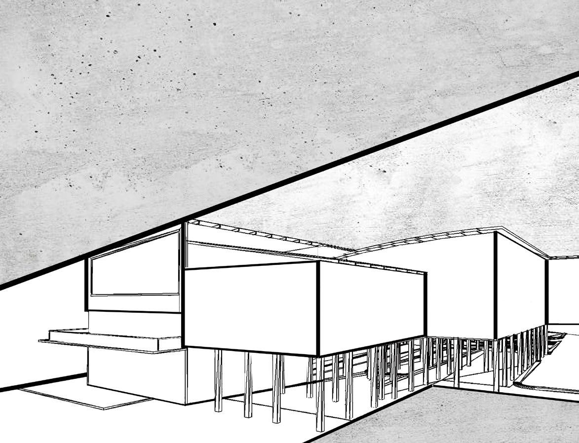
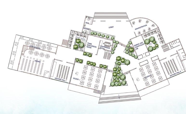
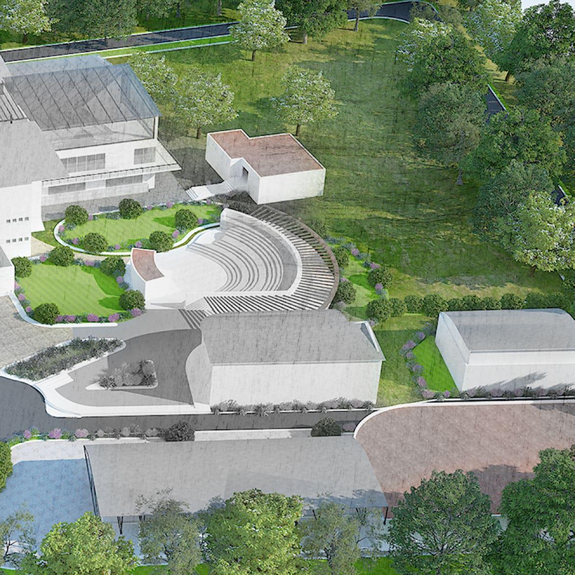
Clemson Interpretive Center
Addition to Historic Trustee House, Clemson University, SC


The proposed History Center for Clemson University will provide a space to initiate a deeper understanding of Clemson’s complete history. The History Center will serve as a “trail head” from which to launch into a greater exploration of the campus and its history. The Center will be tied into a larger, connected series of trails, buildings, markers, and spaces throughout campus helping to tell a full history of Clemson.
Firm: Lord Aeck Sargent
Client: University of Clemson: Schematic Design Package
Role: Studio with a Principal Architect and Landscape Architect- involved in project interview process creating conceptual. Created the design options and detailed schematic design package. Developed 3-D renders, axons, site plans and the final report
Software Locational Context
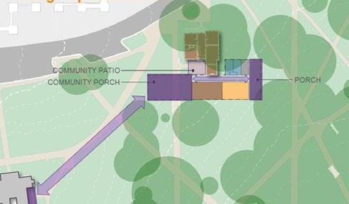
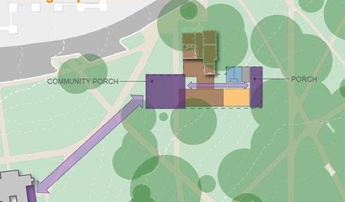
FORT HILL STREET
CONNECTEDPORCHES
The History Center will be located in the historic Fort Hill area and will be strategically nestled into the site to pay respect to this hallowed ground while contributing to everyday experiences and living into the history of the campus. The addition will strive to be deferential to the historic buildings on the site through being a minimalist aesthetic differentiating historic from new, from being mostly transparent, by being a lower elevation behind the Trustee House and being shorter than either of the existing buildings.
HALL CONNECTION
TILLMAN-RIGGS
Back Porch Community Porch
View to TILLMAN HALL
EXTERIOR GATHERING SPACE Campus Connection
View into site
Historic Preservation
TRUSTEE HOUSE Site Plan Development Concept
New Construction
The ADDITION
ENGAGED OPTION
OUT-STRUCTURE OPTION
44 BESIDE OPTION Programing
Sequence

45 Program Visualization
The Center will be an addition to the Trustee House, however it will have its own primary entry looking towards the Calhoun Mansion. A Community Porch/ Plaza has been designed as the entry to the History Center to allow visitors and those passing through Fort Hill to have the ability engage with history on the site. This area will provide outdoor seating and gathering spaces as well as a great stop along a tour of campus. The current, “non-historic” addition on the rear of the Trustee House will be demolished taking the building back to its original form. The new addition will provide a connection to the original back door of the Trustee House and provide a much needed ADA accessible route to the house. The Trustee House will be renovated as part of the project with careful attention to the historic preservation of the building. The program for the existing building will be Exhibit Spaces, a Gift Shop, Exhibit Storage, and Office.
Community Porch Lower Exhibit Space
Classroom/ Multi-Purpose
46 CommunityPorch
26
28
F
Building Plan - New Addition

47 ViewFromNEExhibitSpace SPACE PROCESSION PROCESSION ToXXXXXXX ViewFromLowerExhibitSpace D E SPACE PROCESSION SPACE PROCESSION b Main Entry-Vestibule LowerExhibitSpace NEExhibitSpace BackPorch VisualConnectionAcross ToXXXXXXX ToXXXXXXX ToXXXXXXX ViewFromLowerExhibitSpace ViewFromNEExhibitSpace b D C E SPACE PROCESSION ViewfromUpperExhibitSpaceToFortHillPlantation Classroom UpperExhibitSpace TrusteeExhibitSpace ClassroomTransitioning into Multi-Purpose Room G I H J SPACE PROCESSION Space Usage Axon Analysis

Software


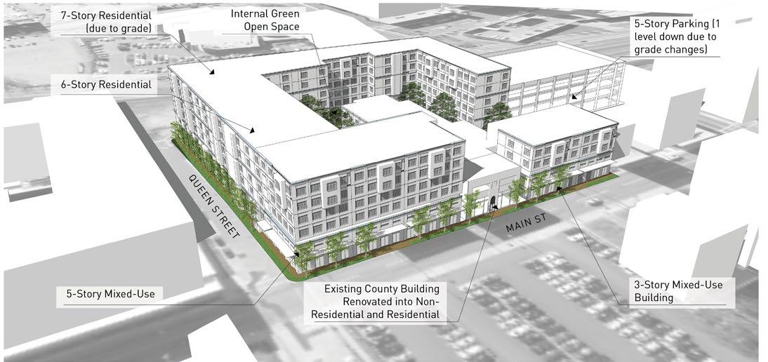
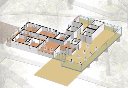
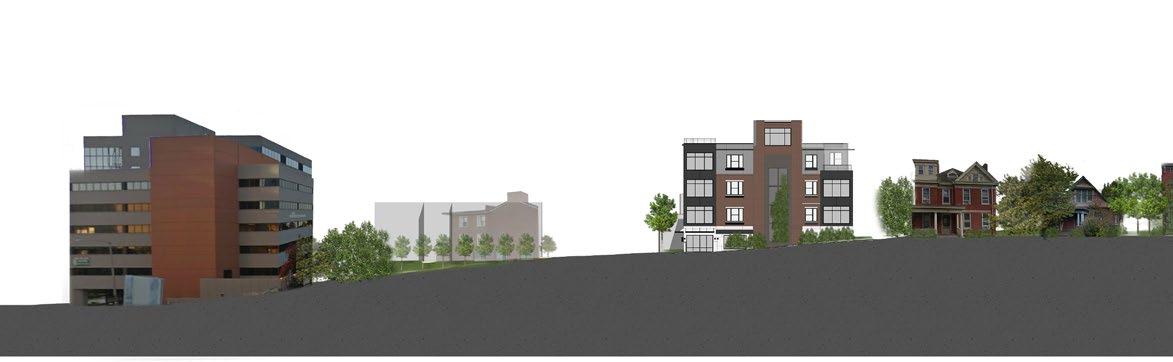
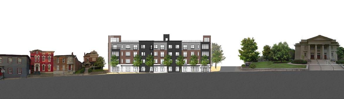
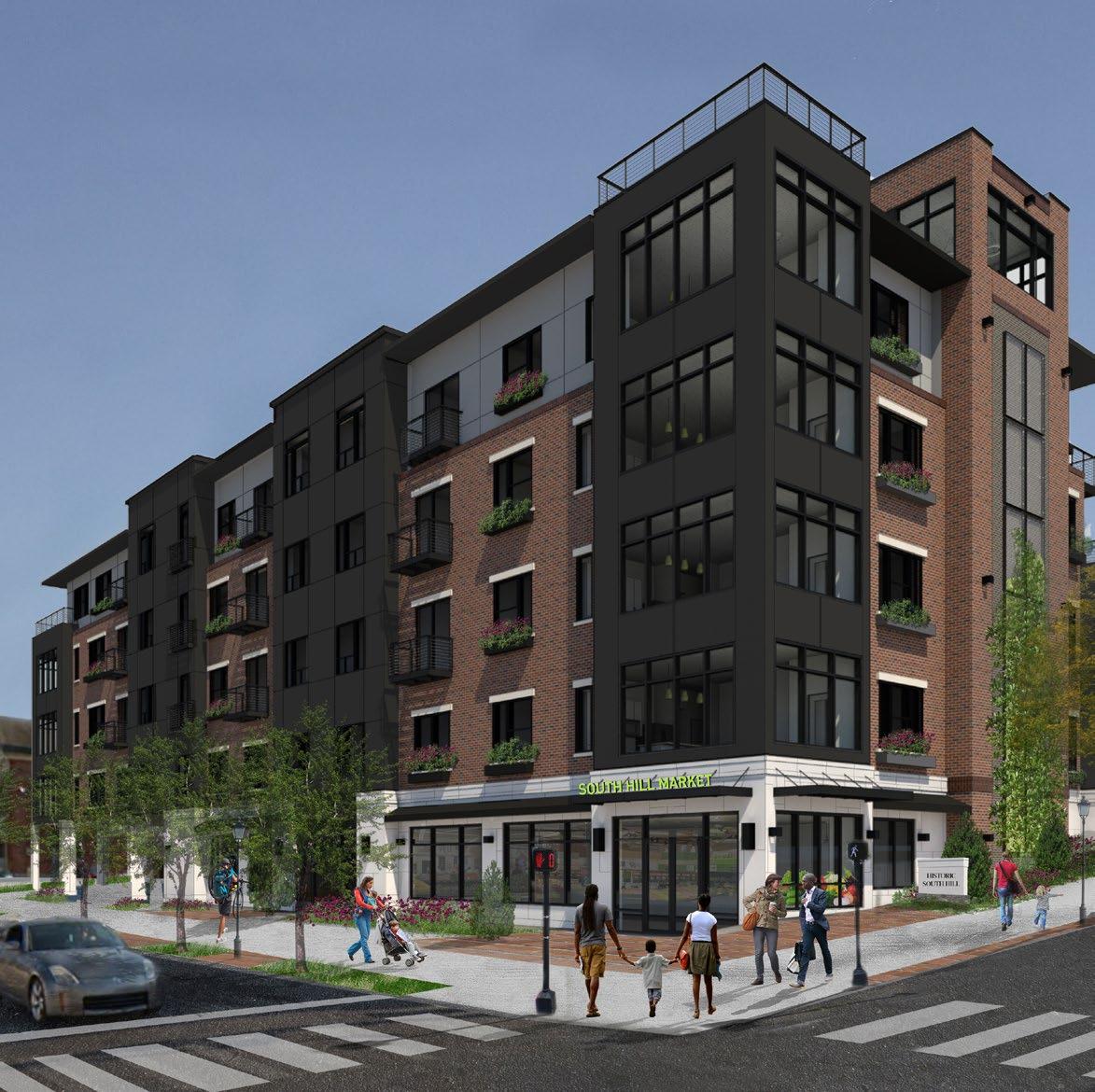
Residences At South Hill
Lexington, KY
Residences at South Hill is a 50,000 square ft mixed-use, multi-family apartments with a small retail space at the corner of High Street and Upper Street. The Building will be at the edge of Lexington Downtown and with the South Hill Historic District. The planning process involved submitting and appealing in front of the Board of Architecture Review to prove the context sensitivity of the development as it lies in a transition zone between downtown and historic district fabric.
Firm: Lord Aeck Sargent
Client: Private Developer: Design Development Package
Role: Studio to an Architect. Helped with developing the design package. Developed 3-D renders, context analysis, and site plans
 Thoroughbred Sport Horse, LLC
High Street
Proposed Building
First United Methodist Church
Upper Street
Proposed Building
Thoroughbred Sport Horse, LLC
High Street
Proposed Building
First United Methodist Church
Upper Street
Proposed Building


Church

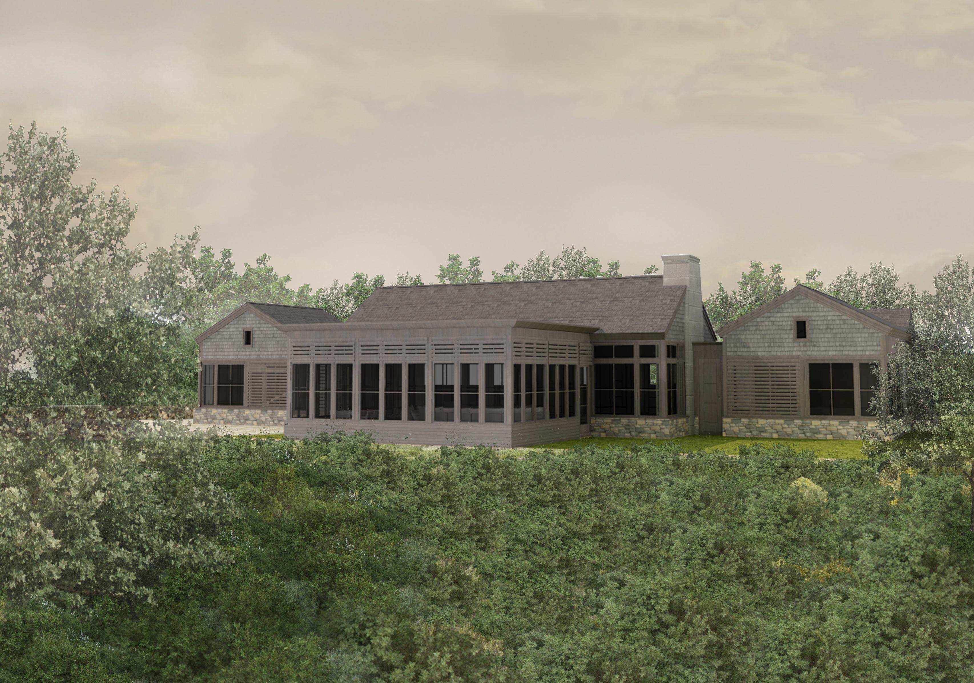
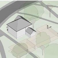
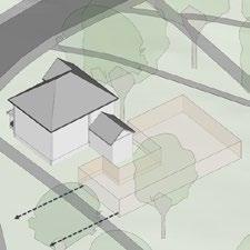
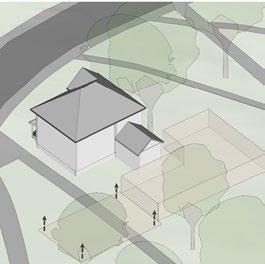
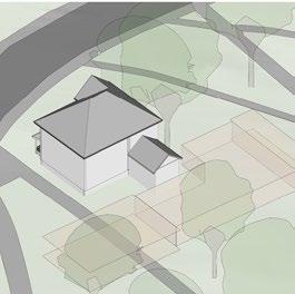
Single Family Vacation Home
Martha’s Vineyard, MA
Firm: Hutker Architects
Client: Private Client
Role: Studio to an Architect. Helped with Final building visualization, exterior rendering

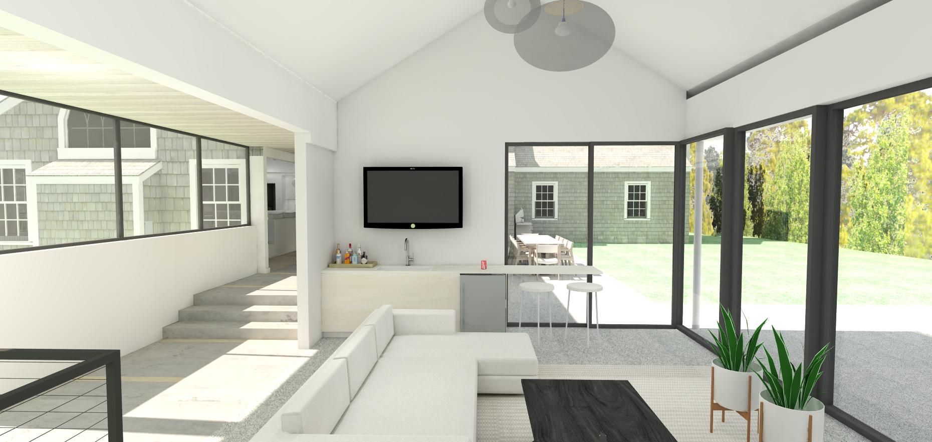
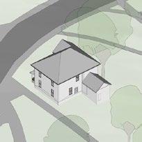
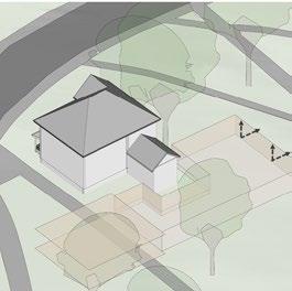
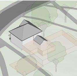
Single Family Residence
Martha’s Vineyard, MA
Firm: Hutker Architects
Client: Private Client
Role: Studio to an Architect. Helped with Final building visualization, Interior rendering
Single Family Residence San Fransisco, CA
Firm:
Jackson Liles Architecture
Client: Private Client: Construction Drawings
Role: Studio to an Architect. Existing conditions assessment, site topographic survey and created construction drawing package under the supervision of the project architect.
54
SECOND FLR 20' 0" FIRST FLR 10' 8 3/4" J FIRST FLR CLG 18' 8 3/4" SIMPSON STRONG WALL, SSD. OCCURS WITHIN THE SPACE OF WD FRAMING (E) 4x DECK STRUCTURE TO REMAIN BATH RM BED RM 2 FOR TYP NOTES SEE SUSPENDED CEILING: (WHERE OCCURS) 2x WD FRAMING, 5/8" GWB K SECOND FLR 20' - 0" FIRST FLR 10' - 8 3/4" J FIRST FLR CLG 18' - 8 3/4" FIRST FLOOR ASSEMBLY: SOG, PLYWD VAPOR BARRIER, FINISHED FLOOR, VARIES 2" SAND (E) 4x DECK STRUCTURE, TO REMAIN LIVING RM MASTER BED RM WOOD BASE, SEE FINISHED SCHEDULE SECOND FLOOR ASSEMBLY: (N) FIN FLOOR, (E)SUBFLOOR, (N)2xWD FRAMING, SSD BATT INSULATION, 5/8"GWB (E) WALL TO REMAIN (E) ROOF STRUCTURE TO REMAIN 15 MIL VAPOR BARRIER, SEALED @ EDGES 4" COMPACTED DRAIN ROCK K (N) WD DECK SECOND FLR 20' 0" FIRST FLR 10' 8 3/4" 2 1 TYP SECOND FLOOR ASSEMBLY P L TYP FIRST FLOOR ASSEMBLY LIVING RM MASTER BED RM FOR TYP NOTES SEE (N)FOUNDATION & STEM WALL (E) WALL TO REMAIN (E) ROOF STRUCTURE TO REMAIN 1 HR RATED WALL ASSEMBLY: WD SIDING, 2 LAYER BUILDING PAPER, EXT TYPE X GWB, WD FRAMING, R-14 BATT INSULATION, 5/8" TYPE X GWB (N) 4" CONC SITE PAVING W/ WELDED WIRE MESH OVER 3" COMPACTED SUB-GRADE, PROVIDE BROOM FINISH ADJACENT BUILDING 15 A-8.1 SECOND FLR 20' 0" FIRST FLR 10' 8 3/4" 5 6 4 FIRST FLR CLG 18' 8 3/4" TYP FIRST FLOOR ASSEMBLY FOR TYP NOTES SEE LIVING RM TYP SECOND FLOOR ASSEMBLY MASTER BED RM BED RM 2 SECOND FLR 20' 0" FIRST FLR 10' 8 3/4" 5 6 4 FIRST FLR CLG 18' 8 3/4" (E) 2x8 FLOOR FRAMING, SUBFLOOR + FLOORING 2 LAYERS 5/8"TYPE X GYP BD 6" CONC. CURB, SSD ADHERE GWB TO CURB GARAGE LAUNDRY FINISH FLOORING, SEE FINISH SCHEDULE FOR TYP NOTES SEE 1 HR RATED WALL ASSEMBLY: 5/8" TYPE X GWB, 2 x WD FRAMING, R-19 BATT INSULATION, 5/8" TYPE X GWB SECOND FLR 20' - 0" FIRST FLR 10' - 8 3/4" F FIRST FLR CLG 18' - 8 3/4" E 6" CONC.CURB, SSD 2x4 STUDS, 5/8" WATER RESISTANT GYP BD, 1/4" TILE (WHERE OCCURS) BATH 5/8" TYPE X GWB OVER PLYWD, WD FRAMING, BATT INSULATION, 5/8" TYPE X GWB 1/4" WALL TILE MASTER BATH RM GARAGE FINISH FLOORING, SEE FINISH SCHEDULE FOR TYP NOTES SEE SECOND FLR 20' - 0" FIRST FLR 10' - 8 3/4" 2 1 FIRST FLR CLG 18' - 8 3/4" BED RM 1 GARAGE (N) FINISHED FLOOR SEE SCHEDULE R-14 BATT INSULATION 2 LAYERS OF TYPE X GWB 2 LAYERS OF TYPE X GWB OVER (E) WALL (E)WD FRAME WALL PROVIDE (N) SILL PLATE ANCHOR BOLTS, SSD GARAGE SOG FOR TYP NOTES SEE ADJACENT BUILDINGECT NIA C-27108 EXP. 5/17 JULIE E. JACKSON LICENSED ARCH STAT OF CALIFO E IT R 2325 Third Street #206 San Francisco, CA 94107 Tel 415.621.1799 Fax 415.621.1798 www.jacksonliles.com Jackson Liles A R C H I T E C T U R E Assembled By: Job #: Scale: Date: Date & Issue COPYRIGHT C 2016 JACKSON LILES ARCHITECTURE ALL RIGHTS RESERVED Revit File: Z:\jobs\1402\Revit + BL/JJ/KN 02.29.16REVISED PLAN 04.15.16PRICING SET 07.25.16PERMIT SUBMITTAL 08.04.16CONSTRUCTION SET 1/2" = 1'-0" A-4.1 WALL SECTIONS 1425 20TH STREET SAN FRANCISCO, CA 94107 BAUCOM RESIDENCE RENOVATION BAUCOM RESIDENCE RENOVATION 1402 02.29.16 1/2" = 1'-0" 2 WALL SECTION - TYPE EX-3 1/2" = 1'-0" 1 WALL SECTION - TYPE EX-2 1/2" = 1'-0" 3 WALL SECTION -TYPE EX-2 - /HR WALL 1/2" = 1'-0" 5 WALL SECTION - TYPE IN-4 1/2" = 1'-0" 9 WALL SECTION - TYPE IN-1 1/2" = 1'-0" 10 WALL SECTION - TYPE IN-2 1/2" = 1'-0" 4 WALL SECTION EXISTING - TYPE EX-1 1 A-4.1 1 A-4.1 1 A-4.1 1 A-4.1 1 A-4.1 1 A-4.1
55 J EXT INT FOR TYP NOTES SEE WD FRAME WALL ASSEMBLY PT WD INTERIOR TRIM A28J (N) DOOR ASSEMBLY W/ NAILING FIN 3 J EXT INT NAILING FIN WINDOW ASSEMBLY BUILDING PAPER WRAP UNDER NAILING FIN PT WD INTERIOR TRIM A28J (N) DOOR W/ ASSEMBLY NAILING FIN FOR TYP NOTES SEE FIRST FLR 10' - 8 3/4" J EXT INT FOR TYP NOTES SEE (N) DOOR ASSEMBLY W/ NAILING FIN 2 x COMPOSITE DECKING FINISH FLOOR OVER VAPOR BARRIER GA SHT MTL FLASHING, WRAP BENEATH DOOR SILL 2x WD LEDGER BOLT TO CONC STEM WALL CONC FOUNDATION SSD J EXT INT SEALANT, TYP NAILING FIN BUILDING PAPER UNDER NAILING FIN SIMPSON STRONG WALL PT WD INTR TRIM - A28J FOR TYP NOTES SEE J EXT INT SEALANT,TYP 1 1/2" PT WD TRIM 1"x6" PT WD TRIM 1" PT SHIPLAP SIDING TO MATCH (E) 2 LAYERS BLDG PAPER BATT INSULATION PLYWD, SSD 2x WD FRAMING, SSD PT WD INTR TRIM A28J 1/4" DRIP EDGE PT GA MTL FLASHING LAP UNDER BLDG PAPER WINDOW TRIM EXTENSION NAIL IN FIN WINDOW 1/2" J INT EXT SEALANT, TYP 1 1/2" PT WD SILL W/ DRIP EDGE 1x PT WD INTR SILL 1 1/2" 1"x6" PT WD TRIM WD SIDING FOR TYP NOTES SEE PT WD INTR TRIM - A35J 3/4" 3 1/2" (N) PTD EXT WD TRIM 2 LAYER BLDG PAPER WRAP BEHIND WINDOW JAMB (E) 2x WD FRAMING SEALANT, TYP FOR TYP NOTES SEE 3/4" SOLID SURFACE TRIM, SLOPE SEALANT TYP AWNING WINDOW ASSEMBLY W/ NAILING FIN WD BLOCKING, SHAPE AS NECESSARY (N) WD TRIM (N) THIN SET TILE 2 LAYERS TYPE X GWB INTER LAYER TO BE WATER RESISTANT (E) 2x WD FRAMING (E) WD SIDING PATCH AS NECESSARY W/ (N) SIDING TO MATCH FOR TYP NOTES SEE (E) 2x WD FRAMING (N) WD TRIM SEALANT TYP SOLID SURFACE TRIM FOR TYP NOTES SEE 6 (N) PRE.MANU DECK MOUNTED SKYLIGHT, SEE WINDOW SCHEDULE (N) GWB ON THE INTERIOR SURFACE OF THE SKYLIGHT WELL ON ALL SIDES (E) ROOF ASSEMBLY: SHINGLES, OVER BUILDING PAPER, OVER (E) ROOF DECKING & 2x WD FRAMING (N) DOUBLE 2x6 HEADER @ OPENING (N)2x4 WD FRAMING @ SIDES OF SKYLIGHT WELL, TYP (N) DOUBLE 2x4 WD FRAMING @ OPENING OPPOSITE SIDES OF SKYLIGHT WELL TO BE VERTICAL & TIGHT TO THE EDGE OF SKYLIGHT (E) WALL FRAMING, EXTEND (N) FINISH DOWN OVER (E) FRAMING G (N) GWB ON THE INTERIOR SURFACE OF THE SKYLIGHT WELL ON ALL SIDES (N) PRE.MANU DECK MOUNTED SKYLIGHT, SEE WINDOW SCHEDULE OPPOSITE SIDES OF SKYLIGHT WELL TO BE VERTICAL & TIGHT TO THE EDGE OF SKYLIGHT FOR TYP NOTES SEE SECOND FLR 20' - 0" 2 FIRST FLR CLG 18' - 8 3/4" ECT NIA C-27108 EXP. 5/17 JULIE E. JACKSON LICENSED ARCH STAT OF CALIFO E IT R 2325 Third Street #206 San Francisco, CA 94107 Tel 415.621.1799 Fax 415.621.1798 www.jacksonliles.com Jackson Liles A R C H T E C T U R E Assembled By: Job #: Scale: Date: Date & Issue COPYRIGHT C 2016 JACKSON LILES ARCHITECTURE ALL RIGHTS RESERVED Revit File: Z:\jobs\1402\Revit + BL/JJ/KN 02.29.16REVISED PLAN 04.15.16PRICING SET 07.25.16PERMIT SUBMITTAL 08.04.16CONSTRUCTION SET As indicated A-8.1 EXTERIOR DETAILS 1425 20TH STREET SAN FRANCISCO, CA 94107 BAUCOM RESIDENCE RENOVATION BAUCOM RESIDENCE RENOVATION 1402 02.29.16 3" = 1'-0" 2 EXTERIOR DOOR HEAD- TYP 3" = 1'-0" 3 EXTERIOR DOOR JAMB - TYP 3" = 1'-0" 1 EXTERIOR DOOR SILL - TYP 3" = 1'-0" 7 EXTERIOR WINDOW JAMB -TYP 3" = 1'-0" 6 EXTERIOR WINDOW HEAD - TYP 3" = 1'-0" 5 EXTERIOR WINDOW SILL - TYP 8 WINDOW FLASHING, TYP 2 3 1 2 WINDOW NAILING FLANGE UNDER FLASHING, TYP FLASHING UNDER WINDOW NAILING FLANGE NAILING FLANGE WINDOW, TYP WINDOW NAILING FLANGE UNDER FLASHING, TYP NOTES: A. INSTALL FLASHING IN ORDER AS SHOWN BY NUMBERS B. CHECK LOCAL BUILDING CODES FOR WEATHER RESISTIVE BARRIER REQUIRMENTS AND INSTALL FLASHING TO FORM WATER-SHEDDING LAPS 3" = 1'-0" 11 AWNING WINDOW JAMB 6 A-8.1 6 A-8.1 7 A-8.1 6 A-8.1 3" = 1'-0" 9 AWNING WINDOW SILL 3" = 1'-0" 10 AWNING WINDOW HEAD 10 A-8.1 3/4" = 1'-0" 13 SKYLIGHT AT HALLWAY 3/4" = 1'-0" 14 SKYLIGHT AT KITCHEN 10 A-8.1 13 A-8.1 3" = 1'-0" 15 WALL SECTION HR WALL - VENT DETAILS 5 A-8.1 10 A-8.1 7 A-8.1 5 A-8.1
56 MAX 1 1/2" 3'6" TOP OF GUARD RAIL 4X4 PT GRADE NEUAL POST 1 1/2" POST 5 1/2" BASE BOARD TO MATCH (E) FINISH FLOOR 1/4" x 1/4" REVEAL @ TOP OF POST (ALL AROUND) 4" 1 1/2" CLR FINISH DUAL OAK RAIL - OR3 WALL BEYOND PT WD BASE - C3BJ 1.5" x 1.5" PT WD PICKET CONT WD BLOCKING SHAPED FROM 4"x6" (N) FINISH FLOOR 3/4" PT WD TRIM 1 1/4" (E) SUB FLOOR GWB OVER FLOOR FRAMING 3/8" PT WD WAINSCOTT.J47 PT WD TRIM DEPTH TO MATCH STAIR RISER CLEAR FINISH, WD WALL MOUNTED SATIN FINISH FINISH FACE BLOCKING AS REQUIRED 34"-38" AFF 1 3/4" MIN 1 1/2" C D F E FOYER COATS CLOS 6'8" MIN COPYRIGHT C 2016 JACKSON LILES ARCHITECTURE ALL RIGHTS RESERVED 1" = 1'-0" 7 ENLARGED GUARD ELEVATION 3" = 1'-0" 4 STAIR TREAD @ BASE 3" = 1'-0" 8 GUARD RAIL AT SECOND FLOOR LANDING 3" = 1'-0" 5 HANDRAIL AT INTERIOR STAIR 1/2" = 1'-0" 9 ENLARGED SECTION AT STAIR - WEST
57 UP CMD SECOND FLR 20' - 0" FIRST FLR 10' - 8 3/4" B C D FIRST FLR CLG 18' - 8 3/4" E HEAD HT. 6'8" MIN OPEN BEYOND ENTRY GARAGE FOYER COATS CLOS 3'6" (2) LAYERS 5/8" TYPE "X" GYP BD 8 7 B C D F 3 A-7.1 3 A-7.1 E 9 A-7.1 9 A-7.1 8 7 B C D 3 A-7.1 3 A-7.1 E R @ 0' - 7" 16 9 A-7.1 9 A-7.1 3'9 3/4" WD FLOORING STAIR TREAD WITH ROUNDED LEADING EDGE. CLEAR FINISH, TYP PT GRADE RISER 2x WD BLOCKING, TYP 2X WD STRINGER BEYOND (1 OF 3) SEE ENLARGED STAIR PLAN A-7.1 FOR RISER & TREAD DIMENSIONS PT WD BASE, BEYOND- C38J PT WDTRIM TO FULLY ENCLOSE RISER DEPTH TO MATCH C38J 2x WD TREAD, TYP FINISH FLOOR WAINSCOTT, BEYOND WD HANDRAIL - OR4 HANDRAIL BRACKET FACE OF WALL REQUIRED B GARAGE ENTRY (2) LAYERS 5/8" TYPE "X" GYP BD ECT NIA C-27108 EXP. 5/17 JULIE E. JACKSON LICENSED ARCH STAT OF CALIFO E IT R 2325 Third Street #206 San Francisco, CA 94107 Tel 415.621.1799 Fax 415.621.1798 www.jacksonliles.com Jackson Liles A R C H I T E C T U R E Assembled By: Job #: Scale: Date: Date & Issue Revit File: Z:\jobs\1402\Revit + BL/JJ/KN 02.29.16REVISED PLAN 04.15.16PRICING SET 07.25.16PERMIT SUBMITTAL 08.04.16CONSTRUCTION SET As indicated A-7.1 STAIR PLANS, SECTIONS & DETAILS 1425 20TH STREET SAN FRANCISCO, CA 94107 BAUCOM RESIDENCE RENOVATION BAUCOM RESIDENCE RENOVATION 1402 02.29.16 1/2" = 1'-0" 3 ENLARGED SECTION AT STAIR - EAST 1/2" = 1'-0" 1 ENLARGED STAIR PLAN - FIRST FLOOR 1/2" = 1'-0" 2 ENLARGED STAIR PLAN - SECOND FLOOR N N


ACADEMIC WORKS


From Organic to Organized
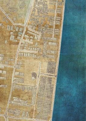
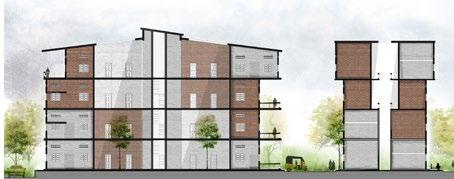
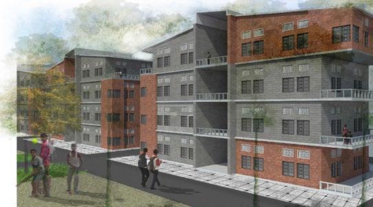
Graduate Thesis-Slum rehabilitation, Chennai, India

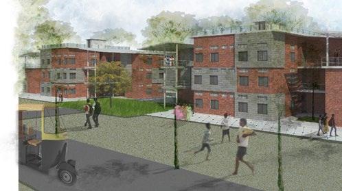
This thesis “from organic to organized” aims to create an architectural solution which successfully involves and resettles people coming from organic settlement patterns to more organized living conditions. It targets to give the users a sense of ownership, social inclusion, and belonging. Furthermore, it accounts for the expansion and adaptation of the community in the future, through flexible design solutions. This thesis also proposes a tsunami and a flood resistant design to equip the community to survive these natural disasters in the future.
In India, drastic migration from the rural to urban areas has resulted in a population explosion across all the major cities; these cities and its infrastructure were not equipped to accommodate the overflowing population and their needs. This rapid population growth and inadequate infrastructure in the cities has led to the creation of large pockets of slums around the urban core.
Slum dwellers suffer from poor living conditions, meager sanitation, high child mortality rate, low literacy rate, dilapidated housing, inadequate infrastructure, high crime rate, and poverty. Many social activists and architects are trying new ideas to resettle the slum dwellers to an affordable and sanitary housing condition. The government is trying to fund and encourage the urban poor to own a basic house and has built multiple slum rehabilitation housing projects for the slum dwellers. Besides all the effort the government has put in, the demand and supply chain is still facing a great lag.
Software
From Organic To Organized
STAGE 1
STAGE 2
Precedent Study And Analysis Alleviate Socio-Economic And Political Issues Through Architectural Solutions
Priorities
A series of studies and analyses of various precedents have been conducted to understand the reasons for the success and failure of the slum rehabilitation projects, specifically in India. From these directed studies, a set of design guidelines have been derived that can function as a reference tool to address a slum project.
From organic to organized, proposes an affordable tsunami-resistant housing for the Nochikuppam slum that will allow the community to expand, adapt, and sustain; thereby alleviating the socio-economic and political issues using architectural solutions.

Affordable Housing 12 Design Guidelines Site Level Cluster Level Building Level
Guidelines and
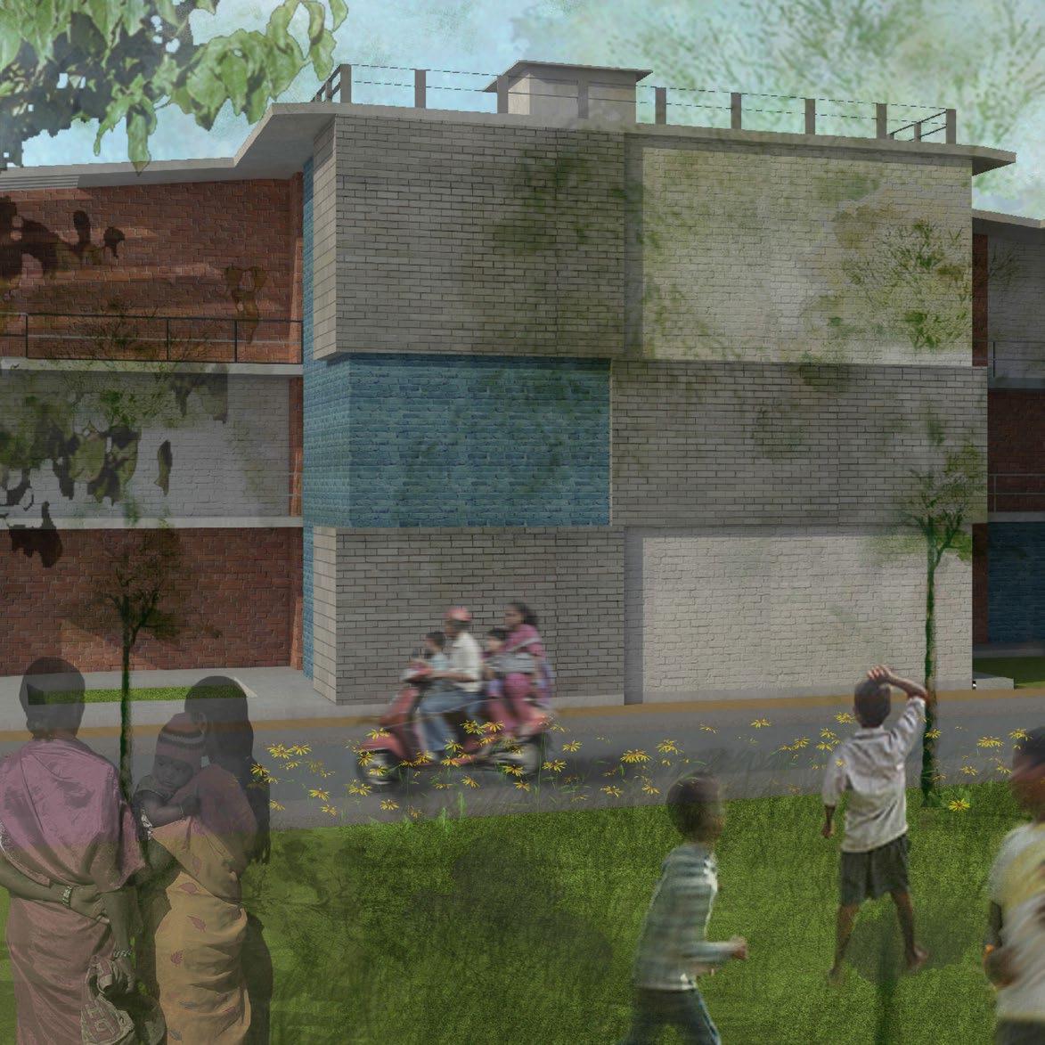
01 Climate Responsive Design
Wind Direction and Orientation
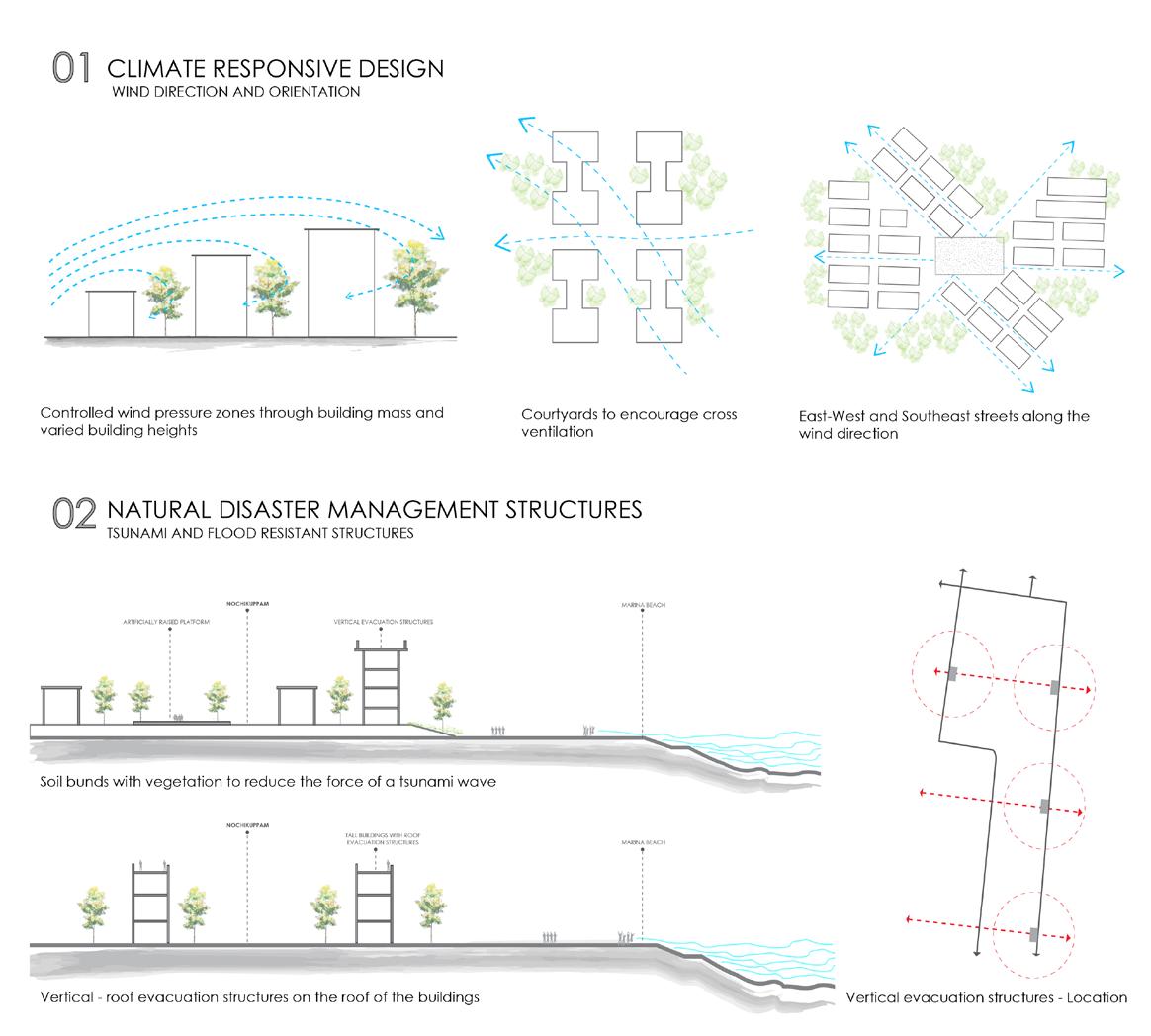
Controlled wind pressure zone using building mass and varied heights.
02 Natural Disaster Management Structures
Tsunami and Flood Resistant Structures
Courtyards to encourage cross ventilation
East-West and Southeast streets along wind direction allowing multiple and varied heights
bunds with vegetation to reduce the force of a tsunami wave
62 Site Guidelines
- roof evacuation structures on the roof of the buildings Vertical evacuation structures - Location
Soil
Vertical
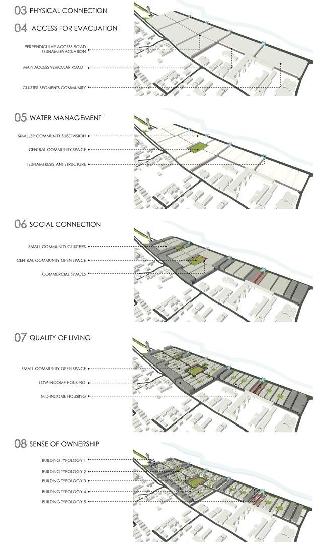
The Interior roads of the existing site are inaccessible to the emergency vehicles or garbage trucks to pass through. This has resulted in an unclean surrounding (garbage dumping on the roads). The site became an island of its own without any property rights or access to public services. The design solution should cater to this problem and provide adequate physical connection to the site.
Water management is a prime service consideration in this case. This place has faced multiple natural disasters over a period. The site should adopt storm water management systems, means to reduce surface runoff, rainwater harvesting systems, and disaster management systems.
The site plan should encourage the site to connect back into the city. The Nochikuppam slum has grown organically since 1970. The sanitary conditions, accessibility, and appearance of the place have been compromised by this rapid and organic development. Thus, the site plan should mend the current social seclusion and encourage a seamless connection to the city.
Social and physical seclusion of the slums happen in two levels. First, the people who live in the slums do not feel confident about their living conditions and they do not believe that they can move past their current situation. Second, people who do not live in these slums, seclude the slum dwellers. This design should improve the quality the inhabitants’ life so they can grow out of their current scenario, this could in turn have a considerable change in the morale of people who live in the slums.
The site plan should account for some level of freedom, for the users, to expand and customize their homes based to their needs and culture. A palette of materials, window types, door types etc. Will be given to the users from which they can choose and use for their homes. Involving the community in the design process has proven to have a positive impact in the maintenance of the built environment.
63
03 Physical Connection 04 Water Management 06 Quality of Living 05 Social Connection 07 Sense of Ownership
Cluster Guidelines
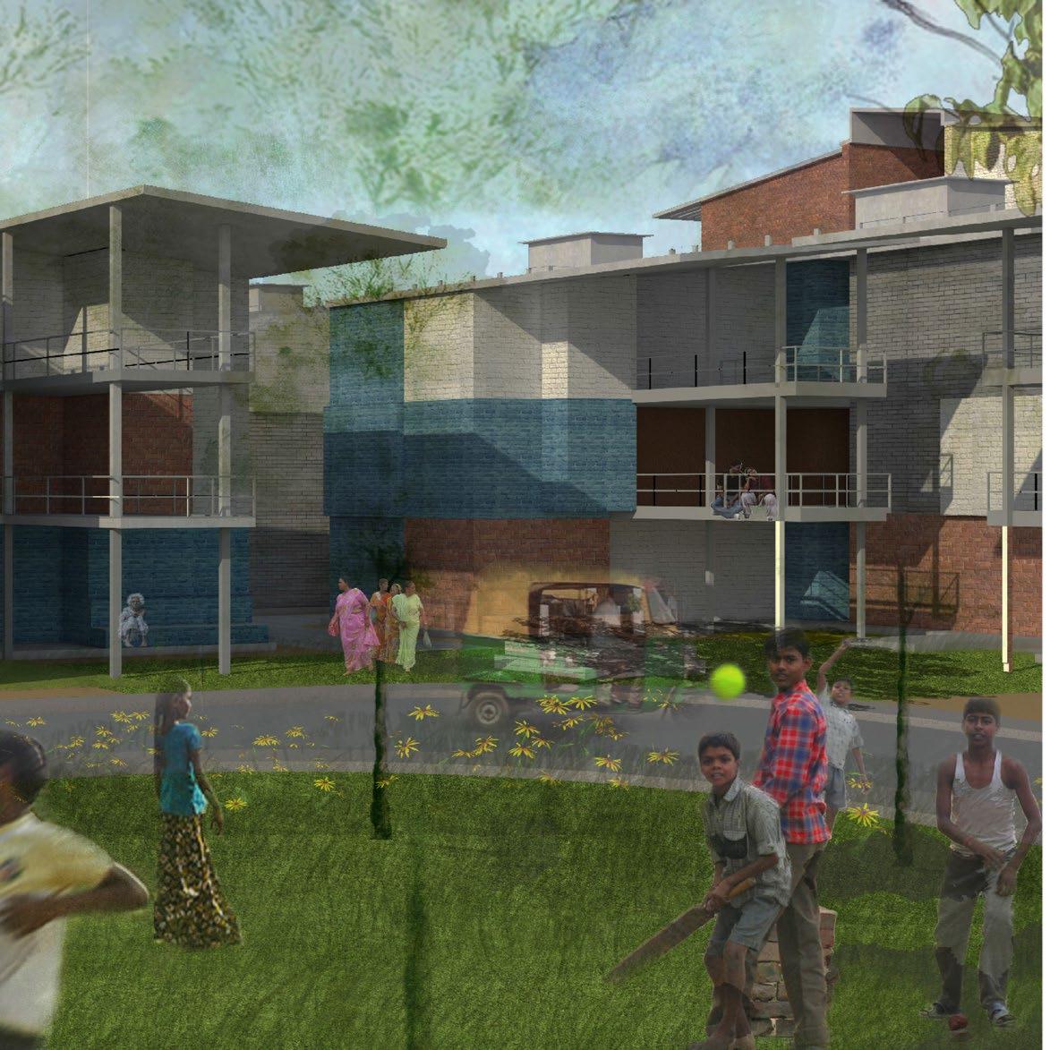
08 Cluster
Stoop and Alley Culture
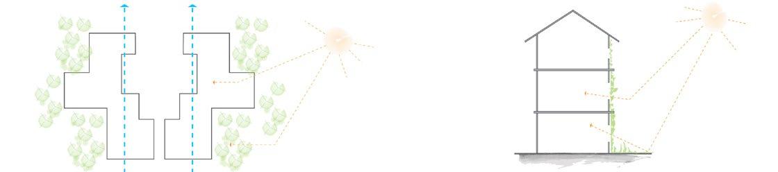
North-South orientation- staggered East-West wall to avoid large surface area exposure.
Walls to reflect sun radiation and to reduce heat
community clusters with a hierarchy of open spaces to encourage stoop culture
64
Green
Taller West and South buildings to mutually shade the streets and common courtyard spaces
Smaller
Building Guidelines
09 Adaptation and Expansion
Flexible Building Design
Adequate building structure to account for expansion in the future
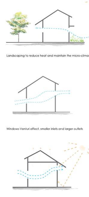
Landscaping to reduce heat and maintain the micro-climate
Windows-Venturi effect, smaller inlets and larger outlets
10 Individualizing Design
Customized Exterior Building Materials
Vertical expansion through mezzanine floors Flexibility in material selection and exterior finish
Insulated double roof to reduce heat gain
Hierarchy in the landscaping elements to reflect the solar radiation
Windows with sunshades to deflect the wind
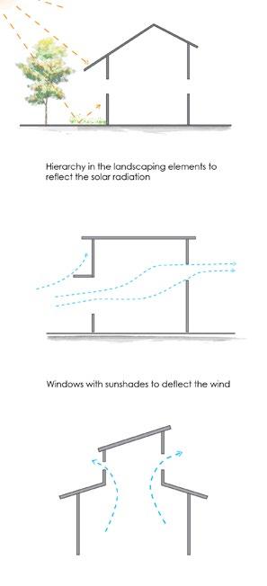
Mixed-use buildings with commercial spaces on the ground floor
Louvered windows to create funnel effect and increase the wind speed that enters the building
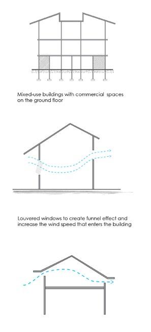
65
Stack effect - roof ventilation systems
Stack effect - roof ventilation systems
National Shrine Of St.thomas Basilica
St.bete’s Anglo Indian School Kamarajar Promenade
Sinus And Nose Hospital Foreshore Estate Promenade
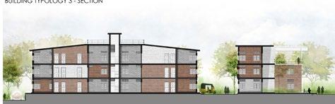
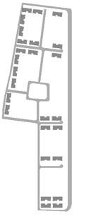
Building Typology 5
There Are 25 Typology-5
Buildings With 8
Individual Houses Within It And A Total Of 856 Houses
Building Typology 4
There Are 14 Typology-4
Buildings With 9
Individual Houses Within It And A Total Of 473 Houses
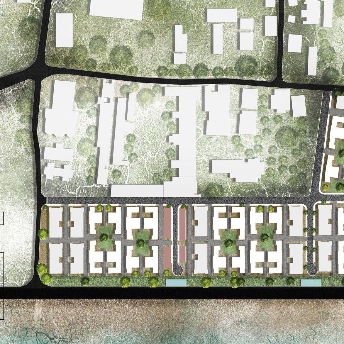
Community Open 13’ Pedestrian
Only Road
22’ Pedestrian Friendly Road ommunity Open Spaces
Central Node With Commercial Spaces
36’ Vehicular Road
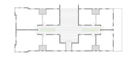
Building Typology 3
There Are 32
Typology-3 Buildings
With 7 Individual Houses Within It And A Total Of 728 Houses
Building Typology 2
There Are 12
Typology-2 Buildings With 6 Individual Houses Within It And A Total Of 168 Houses
Building Typology 1
There Are 6
Typology-1 Buildings With 4 Individual Houses Within It And A Total Of 52 Houses
Marina Beach Road Marina Lighthouse All India Radio
Building Typology 1
Buildings:6
Individual Houses:4
A Total Of 52 Houses
Building Typology 2
Buildings:12
Individual Houses: 6 A Total Of 168 Houses


Building Typology 3
Buildings:32
Individual Houses: 7
A Total Of 728 Houses
Building Typologies
Plan Sections Building Visualization
Building Typology 4
Buildings:14
Individual Houses: 9
A Total Of 473 Houses
Building Typology 5
Buildings:25
Individual Houses: 8
A Total Of 856 Houses


Master Plan Proposal - ULI Competition
Mixed-Use, Mixed-income development
The site is located on th banks of Ohio river that is currently housing the Hilltop Basic Resources Concrete power The site is in between two highway bridges and one railroad bridge, the northeastern edge of the site is the Paul stadium, the south edge is lined by the Ohio river.
Potential
The site is very accessible and visible, making it a very valuable asset in the development of downtown Cincinnati. site will be the first impression of Cincinnati, looking from Kentucky. The lack of identity or physical context of the site provide a wide range of opportunities to develop the site from scratch with new creative ideas. Having Paul brown stadium abutting the site, the economic value of the development is increase considerably.
Challenges
The parcels are highly noisy because of the thorough traffic on the highways, the trains, the concrete plant and game on the stadium. Added to the noise the site sits on the floodplain. The site has been zoned as heavy industrial use the site may not be suitable for other land-use.
Software
plant. Brown Cincinnati. This site will stadium game nights that is
Concept Evolution
PHYSICAL HEALTH
ENVIRONMENTAL HEALTH
PSYCHOLOGICAL HEALTH

The ultimate goal of our project is to create a vibrant lifestyle that will allow the users to live, work and entertain in a healthy and a resilient community. The design targets health holistically, giving equal importance to the physical, mental and environmental health of the community. 1 2 4 5 3
• Parking structure under ground to rise the site level above the floodplain
• Understanding the city’s influence and nature’s influence on the site.
• Restricting the built environment in the North end of the development, thereby giving back to the nature through planned landscape in the South end.
• Creating a streescape on the new site level with multi use buildings.
• Bringing the roads into the site to connect the development to the rest of the city yet introducing minimal vehicular influence within the development.
73 Urban influence Parking structure Building Building Vehicular road Nature’s influence Vehicular road Parking below Planned landscape Entry Pedestrian road Small Park extension Bike path
power
A B C D H E
* All buildings have retail in the ground floor.
A- Office and Hotel building
B- Live-work and Residential building
C- Beer garden
D- Recreation building
E- Live-work Residential building
F- Live-work Residential building
G- Residential Condo building
H- Parking structure
F G


BLOCK - A Ground +8 floors Total Area :334,000 sq ft
Floor
Retail
34,000 sq ft
60’ Mehring way
G
:
:
ft
1-4 Floor: Office : 181,000 sq
BLOCK - B Ground +6 floors Total Area :131,250sq ft
18,750
ft
BLOCK - H Ground +4 floors + Rooftop Total Area :246,500 sq ft G-4 Floor area : 49,300 sq ft BLOCK - C Ground structure + Rooftop Floor Area :16,250 sq ft
5-8 Floor: Hotel :119,000 sq ft
G Floor :Retail :
sq
1 Floor: L-W : 18,750 sq ft 2-6 Floor: Res : 93,750 sq ft
Rooftop BLOCK - D Ground +1 floor Total Area :76,000 sq ft G-1 Floor area :38,000 sq ft BLOCK - E Ground +7 floors Total Area :129,600sq ft G Floor : Retail : 16,200 sq ft 1 Floor: L-W : 16,200 sq ft 2-7 Floor: Res : 97,200 sq ft BLOCK - F Ground +7 floors Total Area :129,600sq ft G Floor : Retail : 16,200 sq ft 1 Floor: L-W : 16,200 sq ft 2-7 Floor: Res : 97,200 sq ft BLOCK - G Ground +5 floors Total Area : 223,000 sq ft G Floor : Retail : 23,000 sq ft 1-5 Floor: Condo: 200,000 sq ft Transverse section of the site
Bike path 46’ new access road
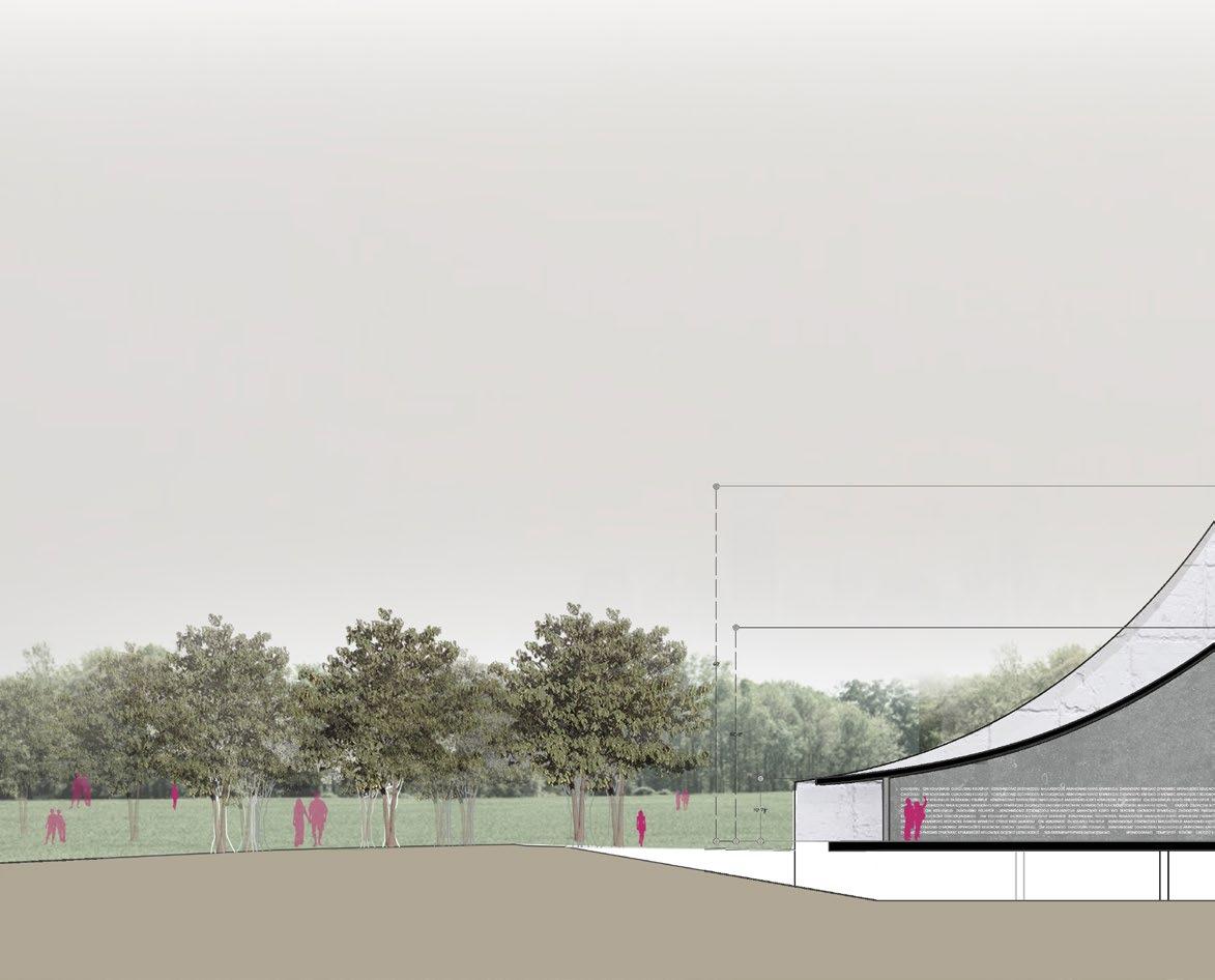
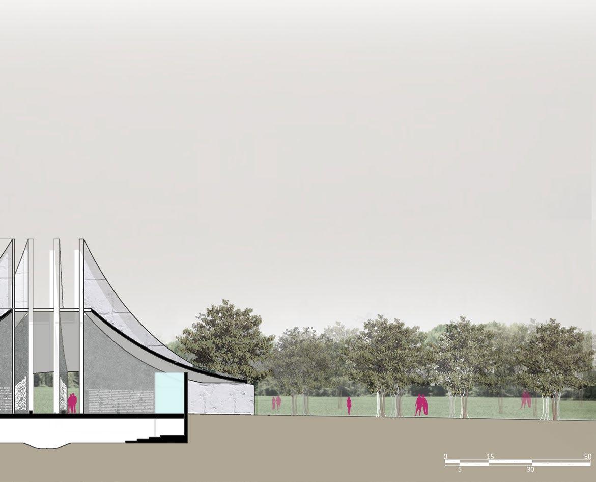
Urban Retreat - Redevelopment of Evergreen Cemetery Lands
New York, USA Software
EVERGREEN CITY-
Urban retreat was a 5th semester graduate studio/research project completed by two student teams. The project intended to provide a safe space and move people from Redhook area to a higher ground. Redhook, New York was hit by Hurricane Sandy in 2012 and many lost their homes. With high land demand in NY, the research studio looked at an option to use denominational cemetery lands to create new neighborhood plans to accommodate people that was hit by Sandy. This project proposes to move the people from Redhook area to Evergreen cemetery lands in Brooklyn and Queens. Alternate burial methods were studied to respectfully move the bodies from the cemetery and the settlement is planned for 5000 people. This settlement includes medium-density and high-density housing, commercial spaces, institution spaces, recycling center, memory grove and memory palace. The memory grove and a memory palace honor the people who were buried in the cemetery. Memory grove is a landscape buffer that has trees with names of people who were buried. Memory palace is a structure that stands on the higher ground of the site.
A SUSTAINABLE PLACE TO LIVE
Concept Evolution
• Creating a green buffer around the site.
• Decentralized nodes.
1 4 2 5 3 6
• Assigning specific use for every node.
• Creating exterior loop road.
• Creating Axial road connecting form loop road to central market.
• Bringing in the grid from different sides of the city.
• Altering the grid in to reduce vehicular speed.
• Alternating internal roads for pedestrian and vehicular uses while retaining the grid.
• The highest point in the site, is the memory palace.
• The landscape buffer is designed as a memory grove.
• The green buffer extends and bleeds into the city to connect to other green spaces around the site.
81 CONCEPT EVALUATION CONCEPT EVALUATION CONCEPT EVALUATION CONCEPT EVALUATION ACCESS ROADS GREENWAY COMMERCIAL SERVICE ROADS ACCESS

82 Memory Grove Memory Palace Amphitheater D E F
48’Road section
50’Road section
A B C
42’Road section
52’Road section
53’Road section
98’Road section
Recycle center Recreation zone Administration unit Central market/ garden School Church Residential zone A B C F D E

Medium-Density Block

Transverse section of the site
High-Density Block
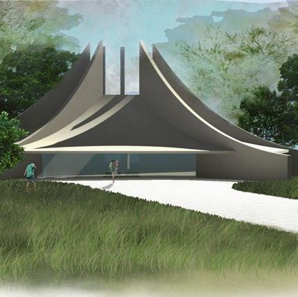
The memory palace is a structure built at the highest point of the site. This structure honors the people who were buried in the Evergreen cemetery. The memory palace has the names of the people engraved on the fins of the structure. The form of the structure is inspired from the sails boat of Redhook area.
Water cascade screening the names stone
Fins representing the sails of Redhook
Fins with names of the people buried in the cemetery, inscribed on them
Park

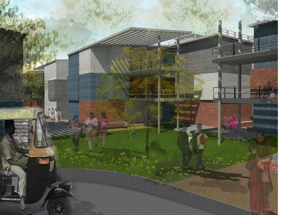
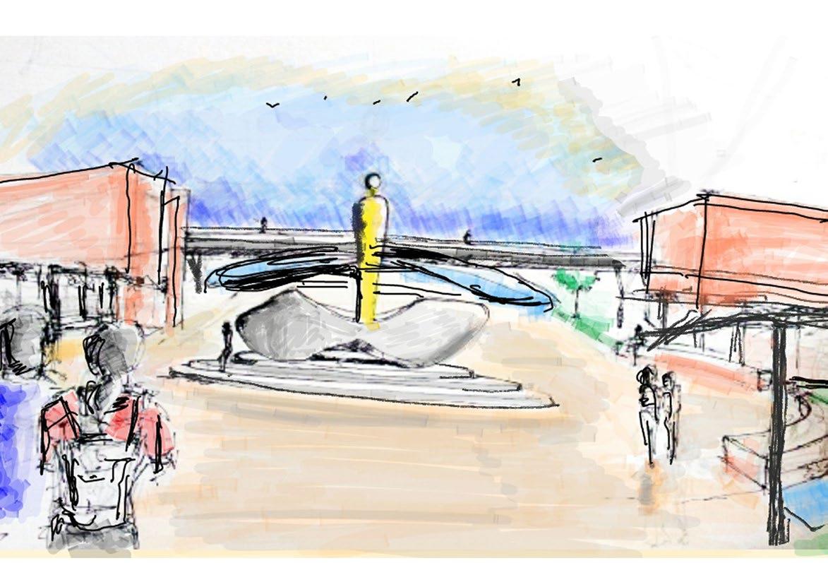
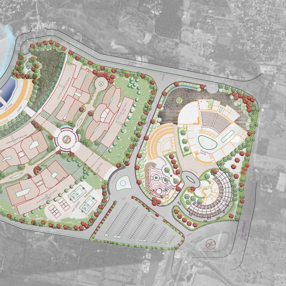
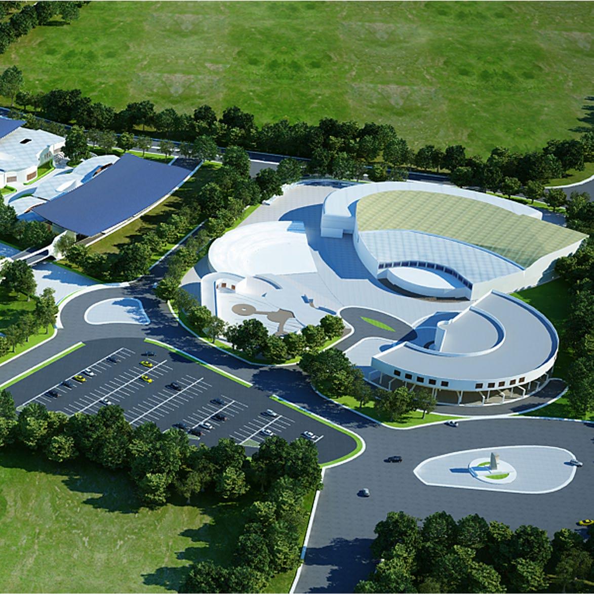
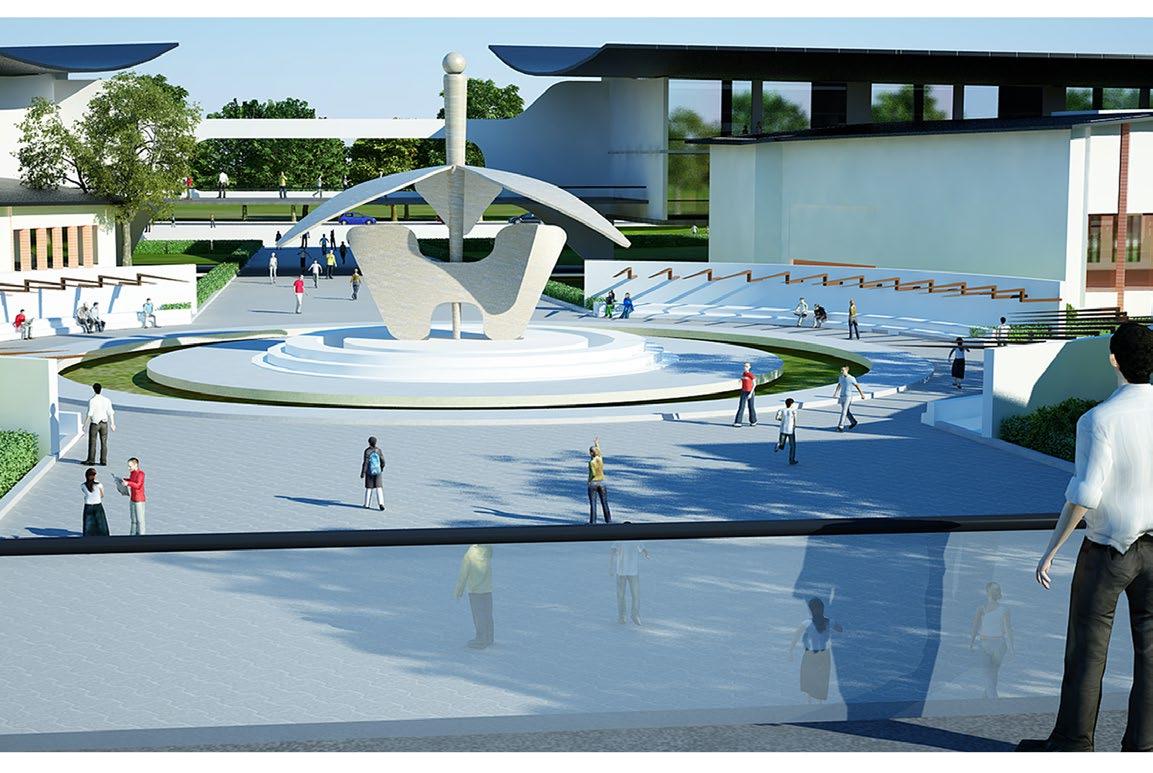
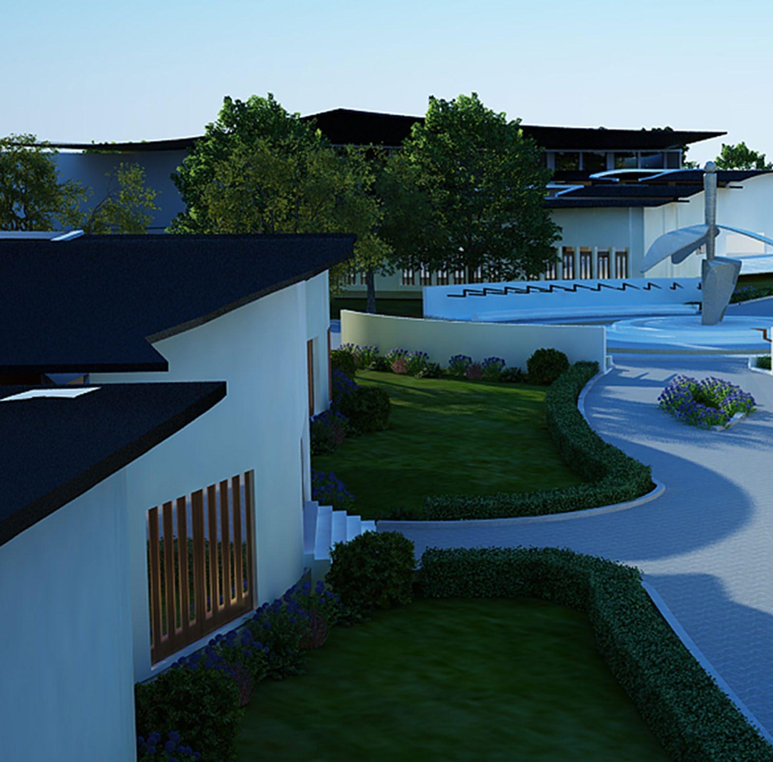
INNOVATION HUB
Undergraduate
Thesis-Institution Design, Chennai, India
India produces less than 1% of the total designers in the world annually which is significantly less than the number of people that are educated in the field. after investigation and research, it was identified that the biggest challenge designers face is the lack of practical application of the knowledge and training to do so.
Design thinking brings together the finest sensibilities of the arts with the logic of science in an innovative framework. While learning a craft brings students close to materials and material culture. A design attitude and methodology help them realize larger patterns in the fabric of society. The industry does not want designers to be mere artists, but a blend of creative and logical thinking. Designers need to think holistically from the business and strategy perspective as well. Innovation Hub is a design solution to the problem where the program of the place provides three distinct functions: Institution zone where people can learn hands-on industry skills through research, experimentation and knowledge sharing, Promotion Zone where designers can exhibit, market, and promote their work and thirdly, the Private Zone providing temporary accommodation to the designer.
 Overarching Concepts
Projecting Balcony Interactive Studios
Overarching Concepts
Projecting Balcony Interactive Studios
Collaboration
Materiality And Color
The Green-Way
Conceptual sketch of the central plaza
Software
PRIVATE ZONE
Temporary accommodation, fitness area, cafe/restaurant etc.
TRAINING ZONE
Studio spaces, lecture areas, labs, exhibition, research facilities, library etc.
PROMOTION
ZONE
Spaces marketing and promotions, conference rooms, meeting rooms, convention area, boutique spaces etc.
89
Program
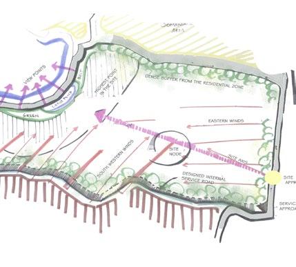
Site Landscape Analysis
Site Analysis
Site Wind Analysis
Internal pedestrian road section
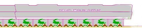
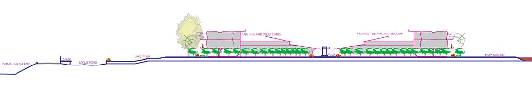
TRAINING ZONE
Glass and Product design studio
Painting and Sculpting studio
Central plaza
Developed landscape
Open air theater
Lotus pond
Photography and Fashion design studio
Interior and Furniture design studio
Ceramic and Graphic design studio
PRIVATE ZONE
Private parking
Health complex
Private park
Accommodation
Outdoor dining
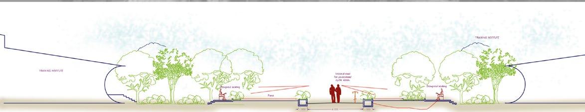
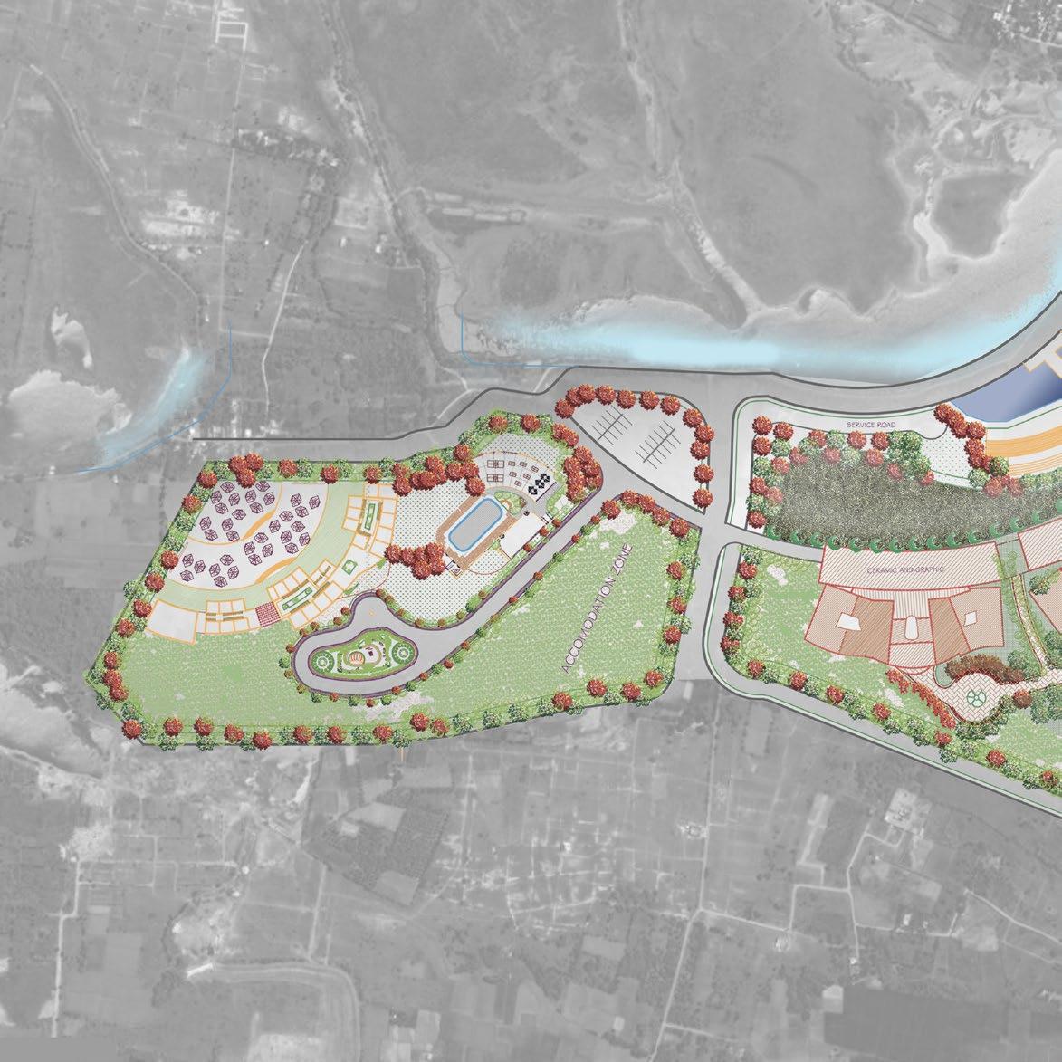
PROMOTION
Open air theater
Administration building
Cafe and boutiques
Convention center


Internal vehicular road section
Privateroad
Institution Zone Elevation
Lotus Pond
Access to Private Zone Central Plaza Pedestrian/Bike Connected Studios
Private Zone
 Pedestrian/Bike Access
Amphitheater Convention Centre Administration Cafe Promotion Zone
Pedestrian/Bike Access
Amphitheater Convention Centre Administration Cafe Promotion Zone
Training Zone
94
2 1
1.View Towards The Lotus Pond And Lake
Institution zone
Transition zone
Entrance
95
Longitudinal Site Section
2.View Towards The Central Plaza From Balcony
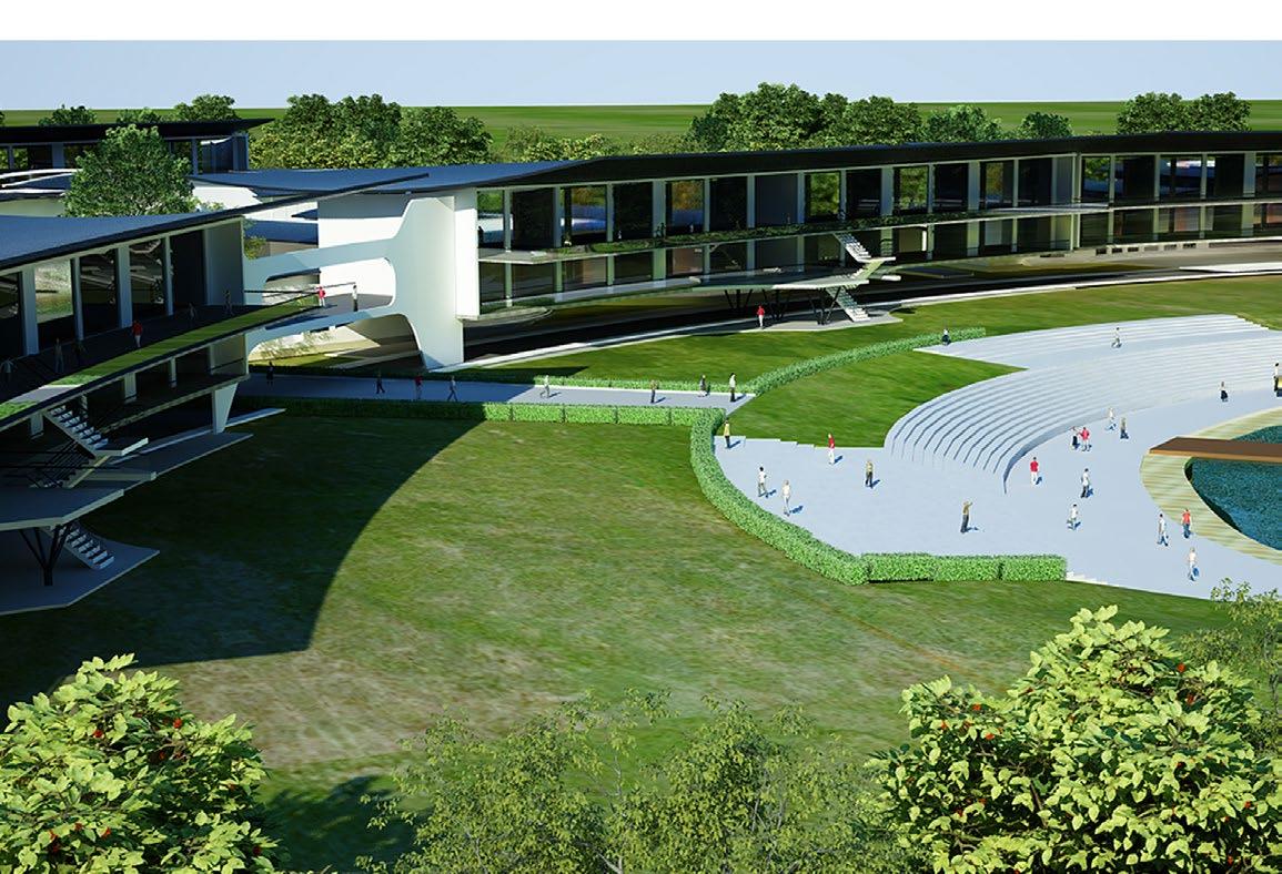
Hierarchy Of Spaces:
Spatially the institution building departments have a common cross section with a continuous visual connectively to the other end (planned open space overlooking the lotus pond and Somangalam lake).
• A series of varied enclosures are experienced throughout the building. A closed porch leads to an open landscape followed by an enclosed space which terminates in an open workshop overlooking the lake/playground.
• Every training department enjoys its own private courtyard; the courtyards have built-in seaters to encourage stoop culture and interactions.
• Space around the main courtyard is used as a display/exhibit area.
• The studios in the first level are cantilevered) to enhance the lake view and leaving the ground floor for open and shaded for the workshop space.
3 Closed porch Semi-open lobby Interior courtyard Open workshop 1 4 2 3
3 3
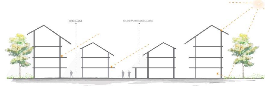
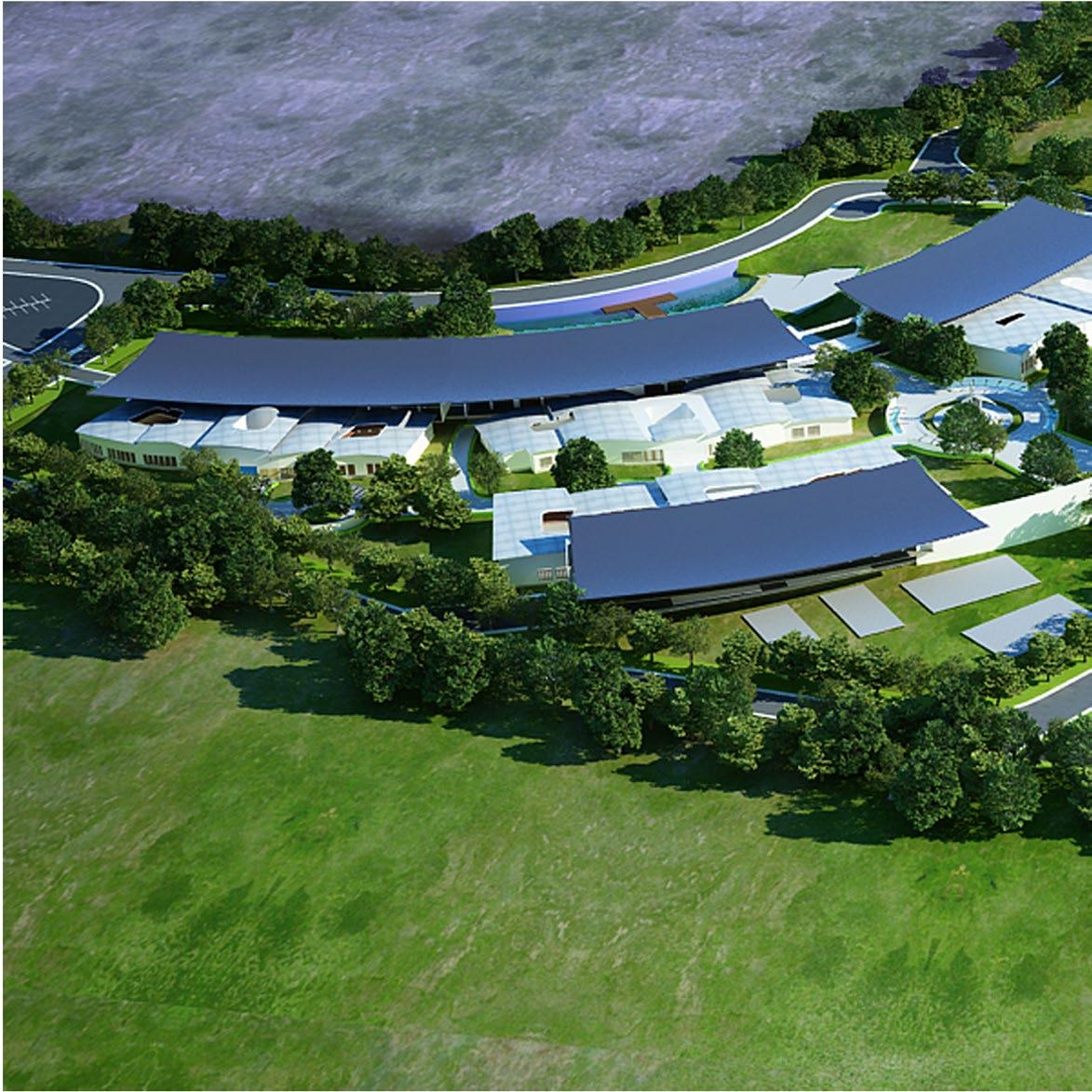
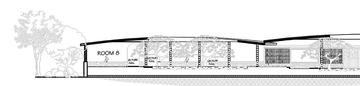
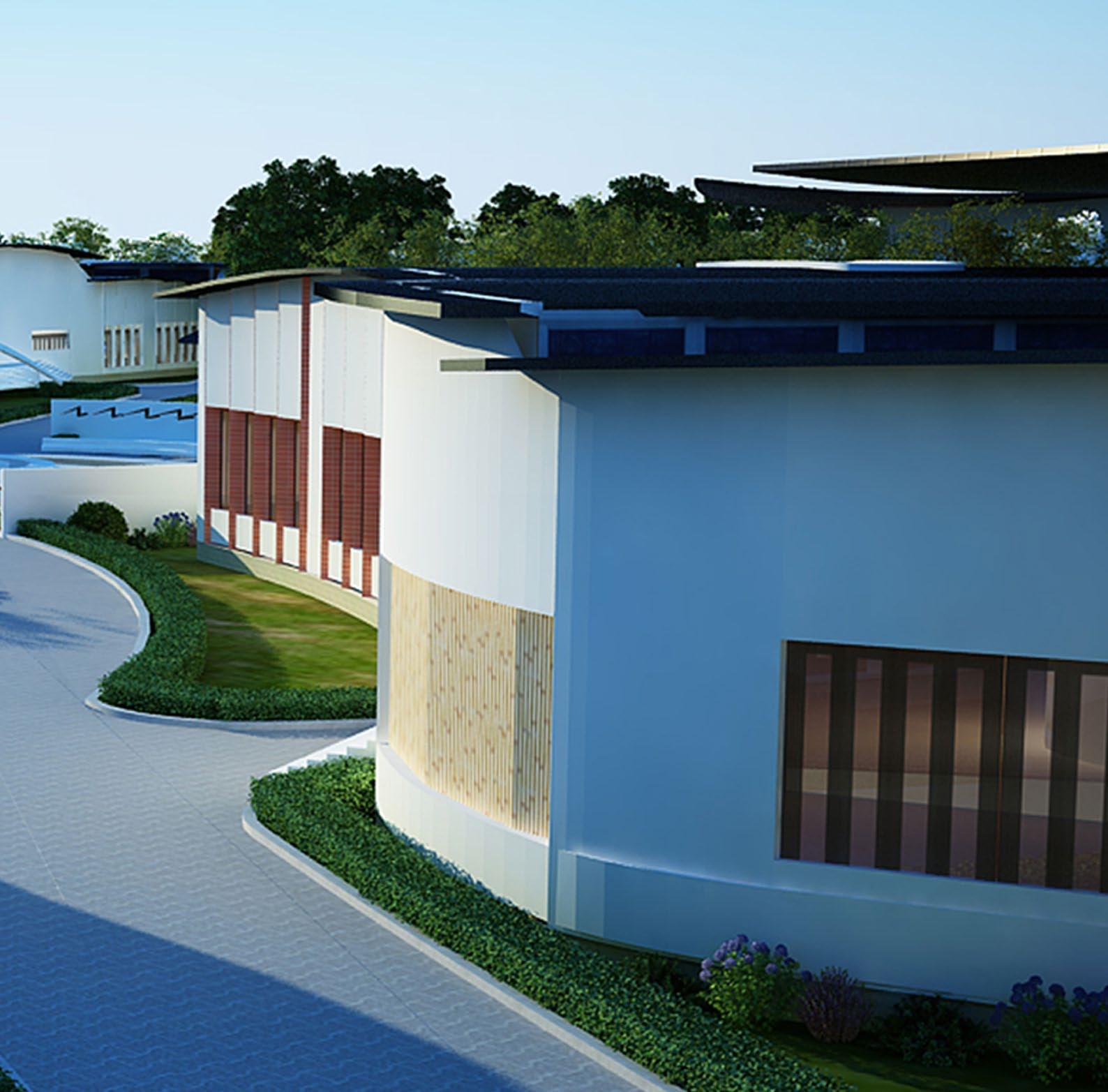
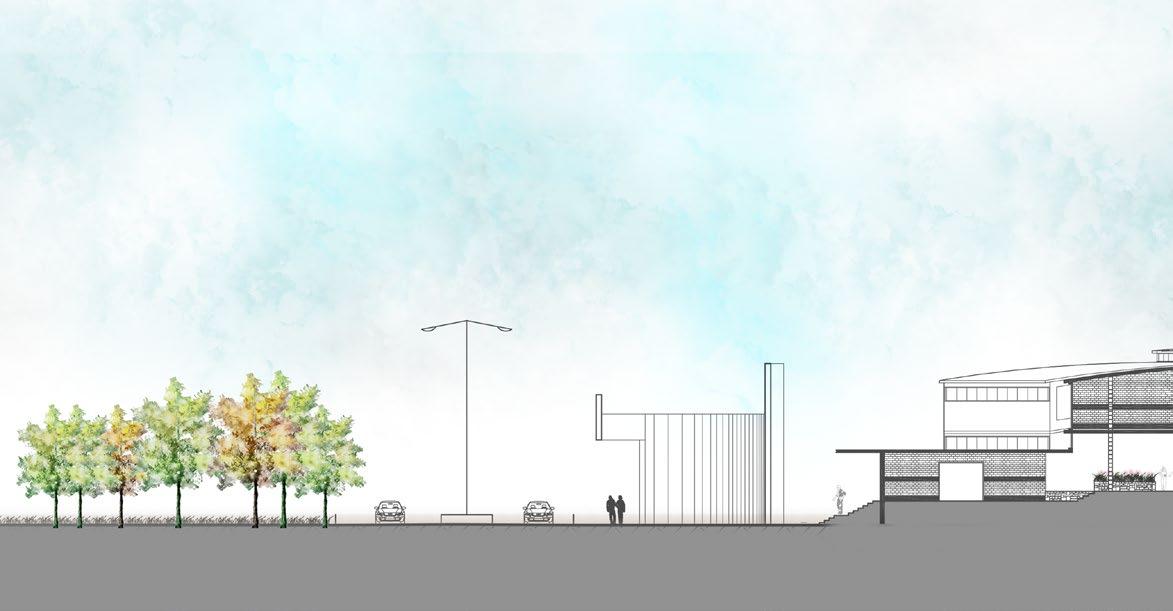
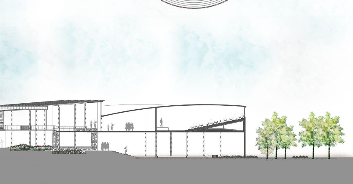
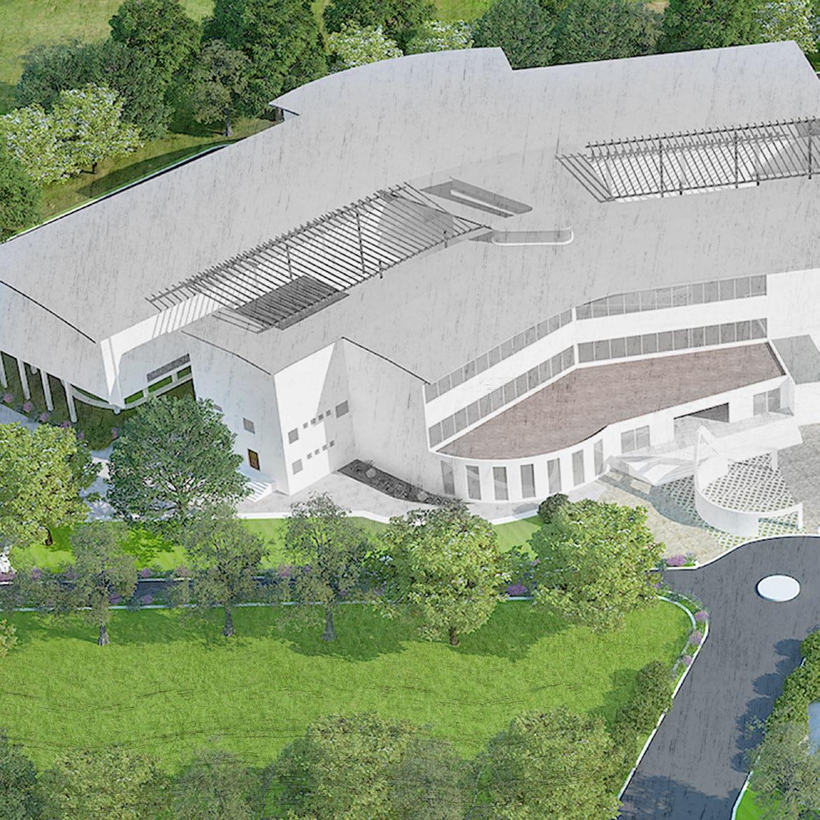
SCHOOL OF ARCHITECTURE
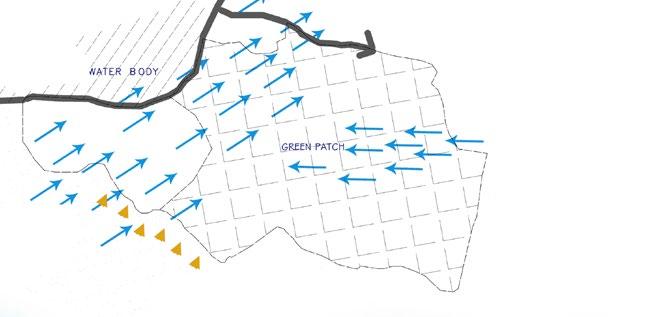
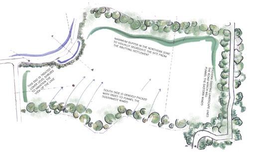
Institute Design, Goa, India Software
The school of architecture was a studio project during the 3rd year of undergraduate studies. It was an introduction to bigger-scale building design, understanding its relation to the context and to incorporate site design principles to tie multiple programmatic elements within the campus.
Located in an extensively humid climate, tackling the heat and humidity in the building design was critical to the project. The project aimed to enhance the existing view-sheds, incorporate natural daylight, create an indoor-outdoor connection through open well ventilated connecting spaces and to create a nurturing space for its users, The water body and hills, to the north was an idle location for the academic blocks that they receive even north light and pleasant views. All the recreational program was pushed to the front the site, landscape buffer around the recreation zone was created to minimize noise from disturbing the academic activities. Open Air Theater, cafe and outdoor seating were combined as an amenity complex and is strategically located to provide easy access from both the academic and recreation zones.
The campus is pedestrian friendly with only Emergency Vehicular access provided through peripheral road around the building. The studios were placed in two levels and they extend out to a balcony, to enjoy the view towards the lake and hills.


Outdoor Seatingtowards existing viewshed


99
Day-lit studio spaces
Staggered corridor
Staggered corridor
1
Balcony
Staggered corridor
2 Extensive verandas Less moisture Cross ventilation Mutual shading East - west/ opening Roof space ventilation High ceiling Higher elevation High thermal capacity materials Conceptual Section Conceptual Interior Section
Staggered
corridor Lecture Office
First Floor Program
First Floor Plan
Lecture
Administration
Entrance arch
LECTURE LECTURE CONFERENCE STUDIO STUDIO ACTIVITY ZONE OFFICES OFFICES ADMINOFFICESOFFICES LAB1 CORE CORE TOILETS LIBRARY 1
Corridor
space
Auditorium
Studio
room
unit
Second Floor Program
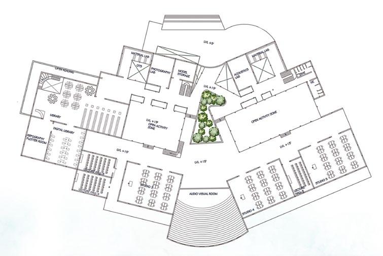
Second Floor Plan
LECTURE LECTURE LECTURE LECTURE STUDIO STUDIO ZONEACTIVITY ACTIVITY ZONE LAB2 LAB 2 CORE CORE TOILETS LIBRARY LIBRARY LIBRARY STUDIO 2 Longitudinal section
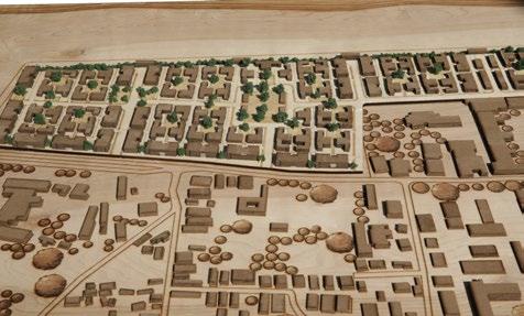
Urban renewal of North Madurai Urban Redesign, India
AIM
To restore the bifurcated temple complex.
OBJECTIVE
To establish physical & visual connectivity
To regain lost heritage value of the site
Need of public open space in the surrounding
To Redesign Alagar Kovil road Reducing the traffic load on this road Dispersing the load through the other routes
The proposal is an attempt to regain the lost significance of the place .the temple was built by the Nayaka with a direct visual contact from his palace. Due to rapid urbanization this feature was lost. Elements to visually connect the temple with the place is an important design element. The challenge while designing was to redesign the space without disturbing the festival procession and the religious character of the place. After studying the overall structure plan for redesign ,a loop around the temple was proposed.
Process involved
Possibility of redesign Execution

Design proposal
Study Documentation Analysis
Software
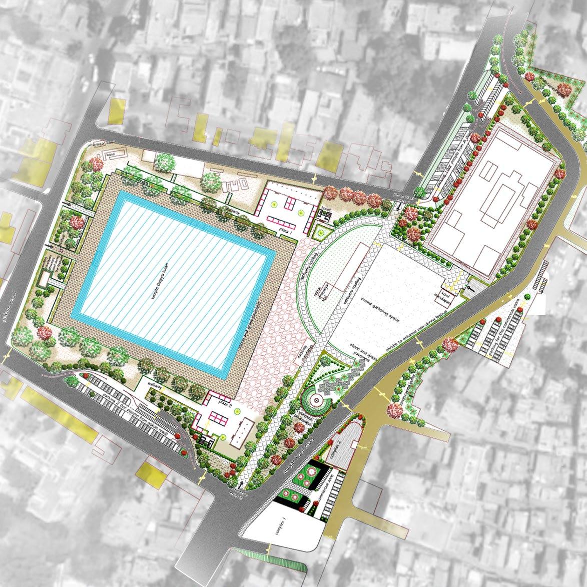
1.
9.
10.
1 4 3 4 5 6 7 9 8 8 10 9 3 2
Temple
2.
Temple
3.
Pebble flooring for water peculation
4.
Mandapas to be used for cottage industries
5.
Temple tank
6.
Internal pedestrian road
7.
Open space to accommodate the festival crowd
8.
Tree with seater
Parking
Proposed commercial complex
Site Plan
Existing Conditions Analysis
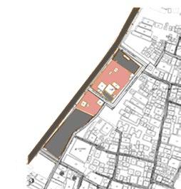

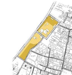

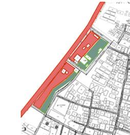

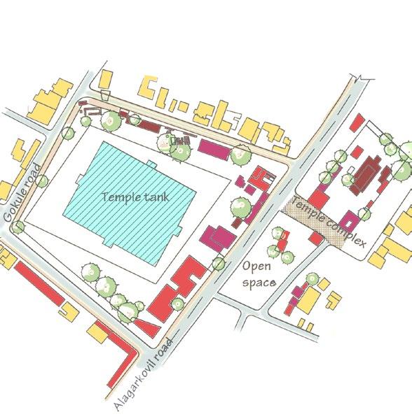

106 Worship area Access road Parking area Highly used Lowly used 75-79 DB 50-64 DB Commercial Mandapa - commercial Temple Residential
Mud roads around the temple complex
East gate North gate Temple tank 70% underutilized open space Automobile workshops Land Use-Activity Analysis Land Use Analysis Land Usage Analysis Noise Level Analysis
Alagar kovil Road
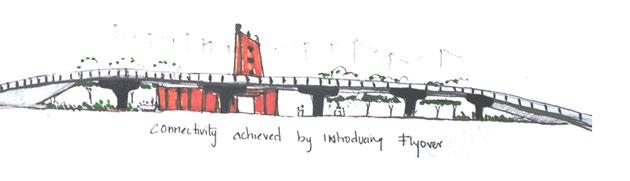

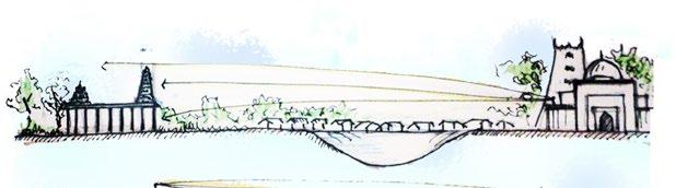
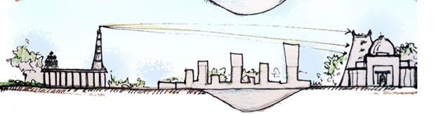
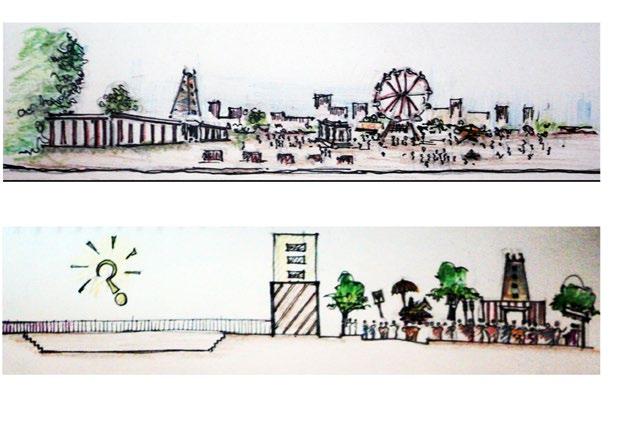
Conceptual
The traffic flow in the alagar kovil roads split into 2 major roads.
Traffic to Mattuthavani and high court will take the road abutting the Rajamuthaiah Mandram. The alagar road will take the remaining traffic.
Design Options
Building a fly-over will decline the urban quality of the place by hiding the prominent skyline of the temple.
A subway connection can be a better solution, but the Investment on the its construction is high. The traffic has to be en routed during the construction,but no road can manage to take up the heavy traffic load .
Creating a loop around the complex A huge chunk of open space amidst the commercial entity –Bifurcated by the peripheral roads ,fueling the recreational need of the residential abutting the site.
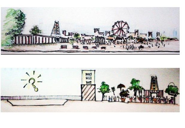
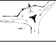
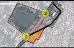
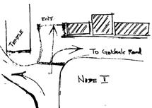
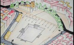
107
Exploring a loop design-road realignment
The Temple Was Built With A Direct View From The Palace
Temple Complex During The Festival
Option 1 : Proposal For A Fly-Over
Option 2 : Proposal For a Fly-Over
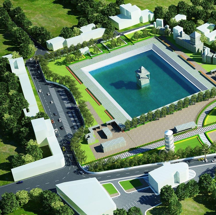 Temple Tank
ProposedWatch Tower
ProposedCommercial Complex
Temple Tank
ProposedWatch Tower
ProposedCommercial Complex
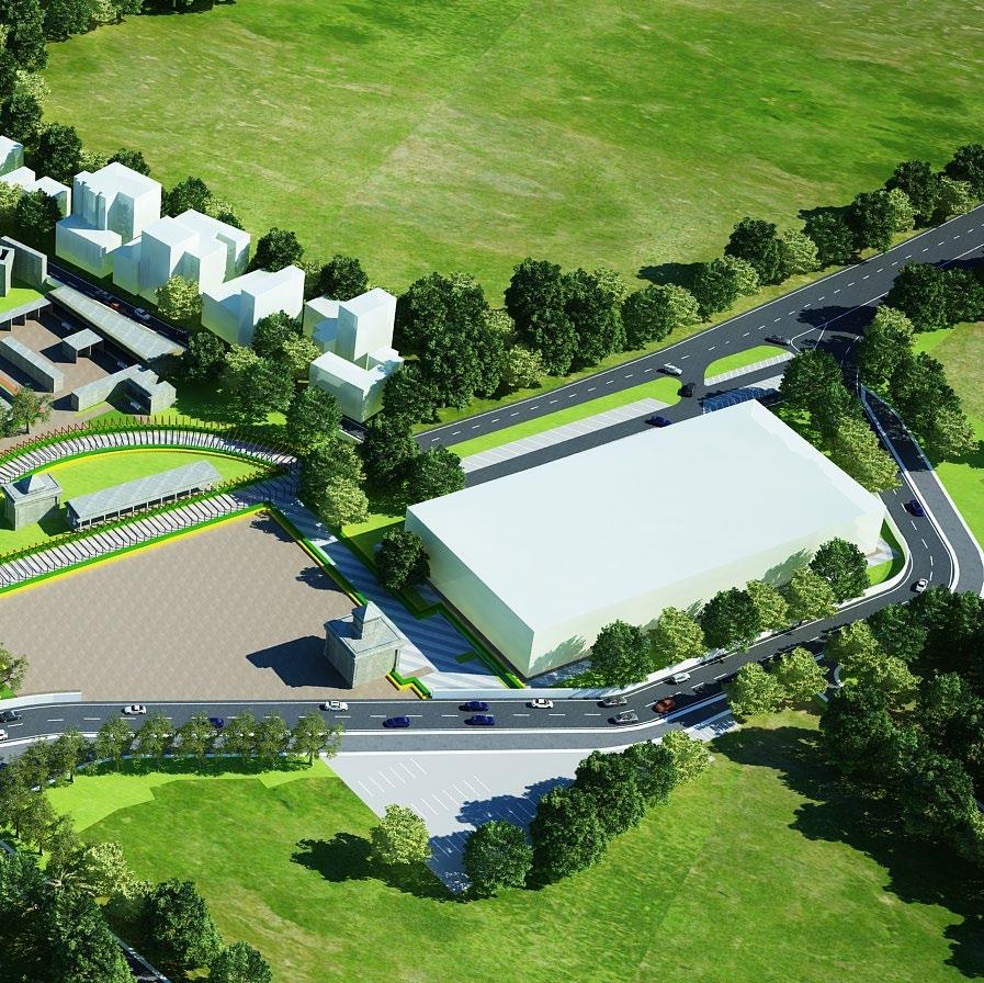
ProposedPedestrian
AlagarKovilRoad
Proposed Loop Road
you
Thank
