LANDSCAPE ARCHITECTURE & URBAN DESIGN
QIANNAN GUO
Columbia University
O F I R O O P T L
CONTENTS The Food Corridor
Urban Design Studio I: Bronx, New York, USA
Summer 2022, Group project
Professor Nans P. Voron & Sagi Golan
Credit: Sanya Verma, Donnal Baijnauth, Iza Khan
Greenbriar Palace
Urban Design Studio II: Greenbriar Mall, Atlanta, USA
Fall 2022, Group project
Professor Emanuel Admassu
Credit: Wenjun Zhu, Haoyu Zhu, Hongfeng Wang
Urban Design Studio III: Fucha River, Bogota, Colombia
Spring 2023, Group project
Professor Kate Orff
Credit: Haoyu Zhu, Zicong Liu, Yiwan Zhao
The Sensuous Community Garden
Larch Studio: Hazelwood, Pittsburgh
Spring 2020, Individual project
Professor Kenneth Tamminga
The Ecological Corridor
GIS: Springcreek Watershed, Pennsylvania, USA
Fall 2022, Individual project
Professor Leah Meisterlin, Mario Giampieri
19 25 03
09
13 Reclaiming The
“Sabana”
THE FOOD CORRIDOR
Urban Design:
Urban Design Program by Columbia University Urban Design Studio I,
Professor: Nans P. Voron & Sagi Golan
Site: Bronx, New York, 2022.8
Type:Academic
Course Number: ARCHA6849
Credit: Sanya Verma, Donnal Baijnauth, Iza Khan
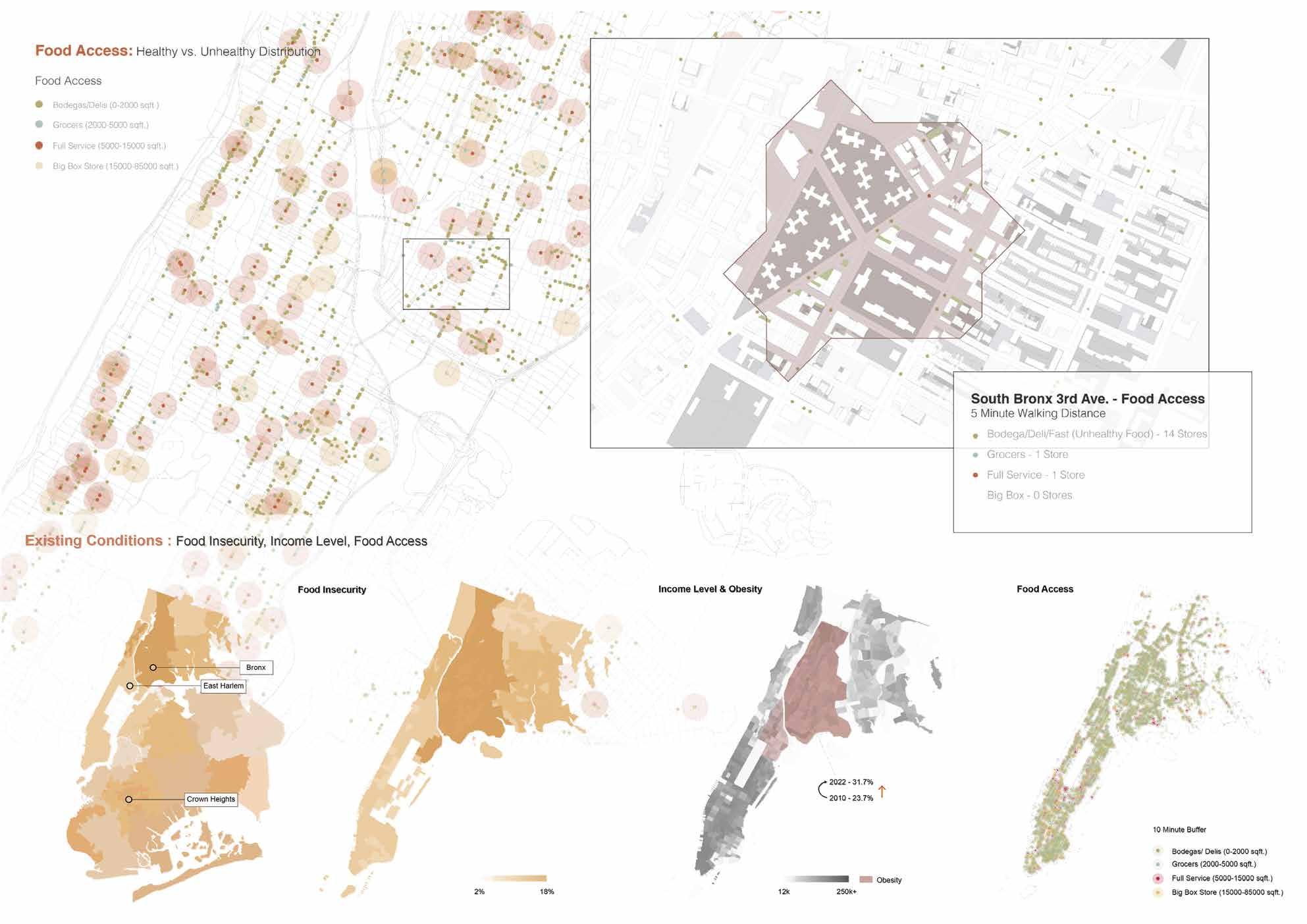
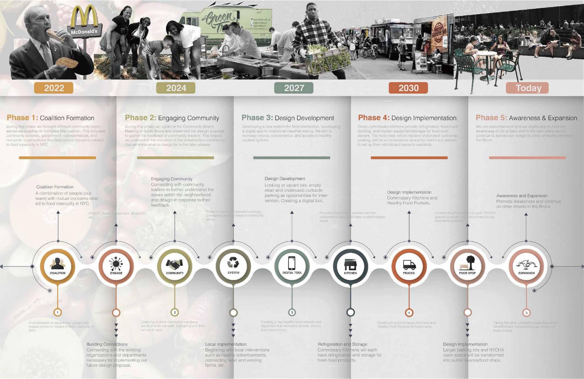
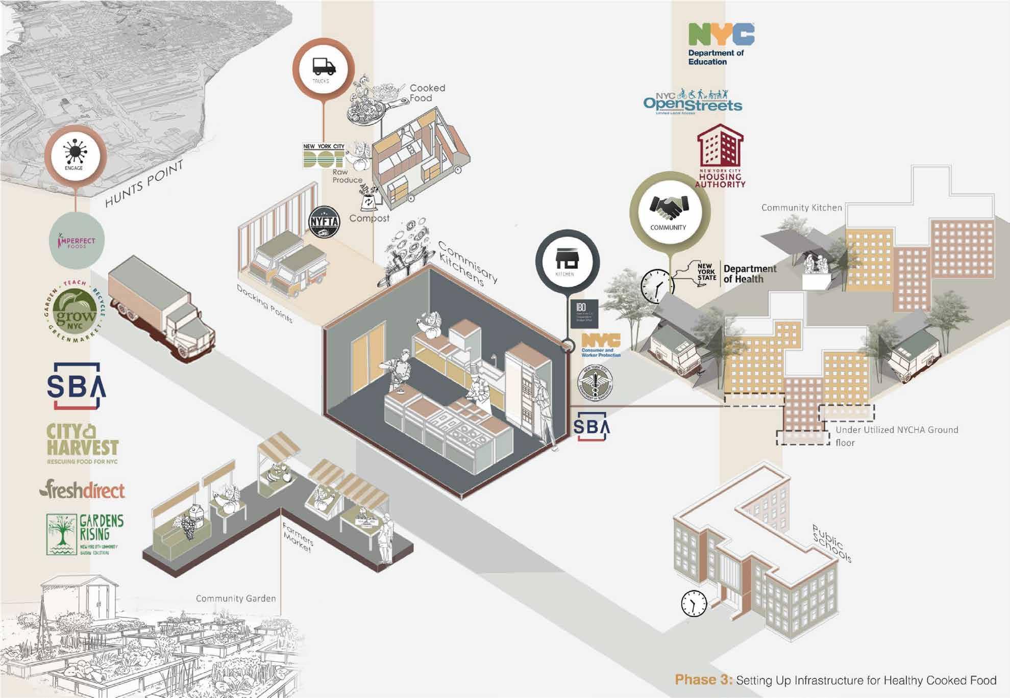
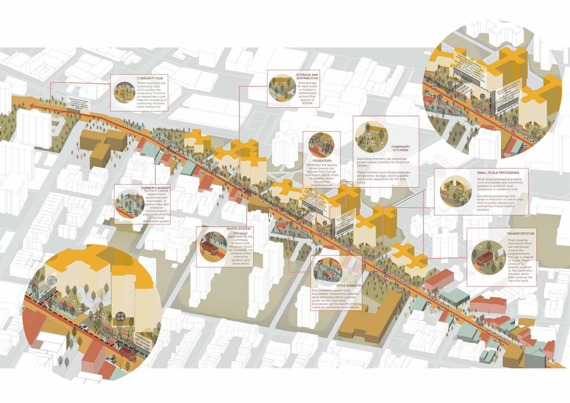
This project is a food supply system design in Bronx, New York. The focused are is along the 3rd Ave near the NYCHA housing, which the residents are in proverty. Due to the food culture and low income, people in this area prefer to buy fast food, which is unhealthy and cause high rate of obesity. So, the goal of this project is to create a food system in the Bronx and provide people with more convenience and more accessible ways to get fresh food, and offer them several choices, which will include the Bodega, Fresh Truck, and also Community Garden. And we will try to incorporate with the government and other organizations to work together, which include the Hunts Points distribution, NYC Sanitation Department, Grow NYC, Mayor’s Office, and Community Associations.
3
4
5

The Food System 6
7
8
Greenbriar Palace
Urban Design:
Urban Design Program by Columbia University
Urban Design Studio II,
Professor: Emanuel Admassu
Site: Greenbriar Mall, Altanta, 2022.9
Type: Academic
Course Number: ARCHA6820
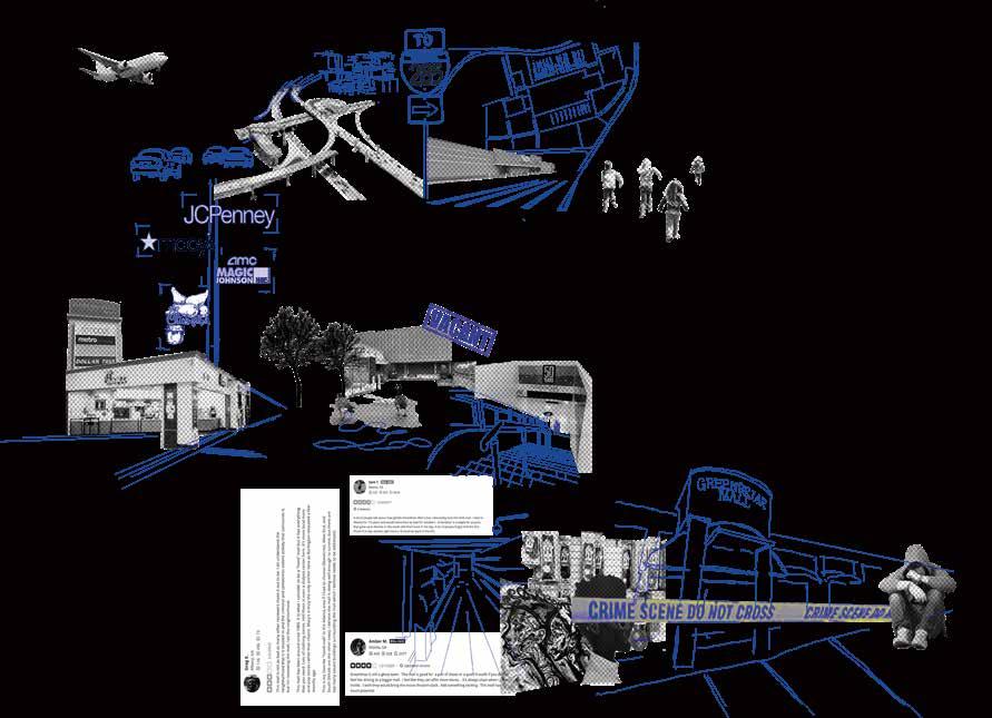
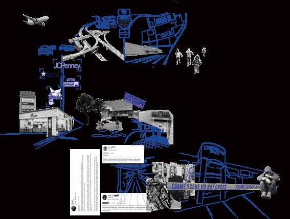
The American suburban shopping mall is the “property” built for the consumption and living habits of the American middle class. The design and operation of the shopping mall philosophy is creating the maximum possible economic benefit in the shortest time. However, with change of people’s lifestyles and emerge of online shopping in 21 century, the traditional shopping mall has gone into decline.
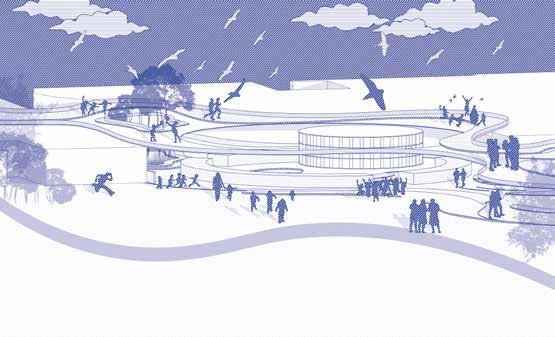
This project illustrates how the space of greenbriar mall can be intervened and absorbed by the activities of youth, but it was never to discontinue the existing relationship between the community and the greenbriar mall. The project rather to facilitate the idea that youth communication and learning should not be tied to traditional classrooms and outside of the social framework and community life. The process should be more expansive and dynamic, subtlety affecting young people of all ages in different spaces that is not clearly defined. Only better to accommodate youth population will make community sustainable.
9
Education Levels

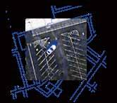
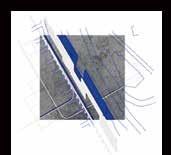

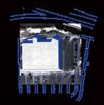

Exclusive and Enclosed Unwelcome Youth Car-oriented Mall Large Scale Parking Lot 1960
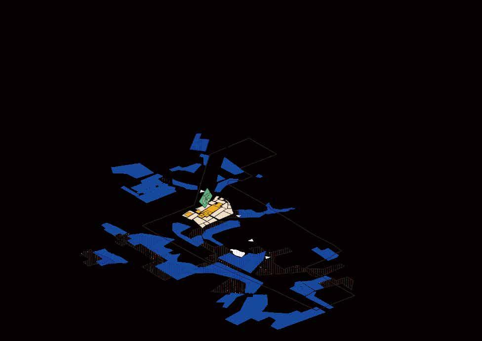
Burlington Coat Factory National Black Arts Festival Magic Johnson Theatre 1970 1980 1990 2000 2010 2020 The Decline of Greenbriar 285 20 10.04% 6.83% 30.1% (age 0-18) Downtown Atlanta
25mins
J.C. Penny Macy’s
Greenbriar 35mins
Greenbriar education level National average education level less than high school diploma high school diploma or equivalent some college or associate’s degree bachelor’s degree master degree or higher 0% 5% 10% 15% 20% 25% 30% 35% 40% 45% 50% Project site Mean travel time to work Age group Crime rate per 10000 population Vacant building
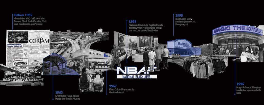
Although the Greenbriar mall is dying as a commercial space, it used to attract a group of people who were forgotten or even rejected by malls, those who did not have the ability to spend but were active in every corner of the shopping mall spaces: teenagers and youths, Shopping malls are one of the few safe recreational spaces in suburban communities for them who live far from thriving urban areas.
1995 Burlington Coat Factory opens in J.C. Penny’s spot
1988
National Black Arts Festival hosts annual Artist Marketplace inside the mall as part of festivities
1967 First Chick-fil-a opens in the food court
1996 Magic Johnson Theatres multiplex opens outside mall
1965
Greenbriar Malls opens being the first in Atlanta
Before 1965
10
Greenbriar Mall built over the former Black Rock Country Club and Continental golf course
Breakdown the Property
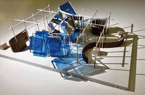
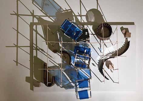
Project Statement
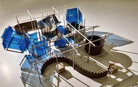
The topic of this project is to breakdown the property. However, the “dead” mall itself was once synonymous with capital that most shopping malls from the last century to the present still believe that the activities of young people in the mall are reducing the revenue that the mall can generate. So, the proposal of this project is to claim that all malls in the United States should encourage and support the social learning and leisure activities of youth. Especially for communities that lack safe public spaces for youth activities.
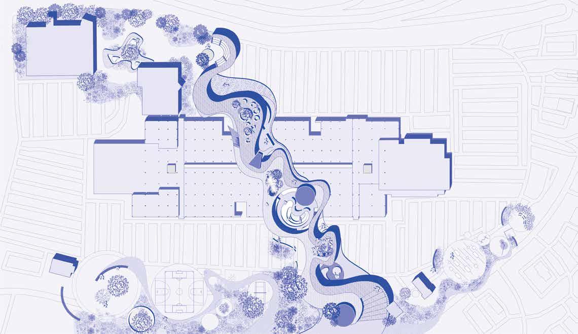
The main idea of the design is to breakdown the mall by adding a large corridor structure in the center of the mall in order to provide more activities for the neighborhood. The corridor will provide multiple spaces for young people that they can define the function of spaces by theirselves according to the use. By infusing new and dynamic programs, the dead mall has been transformed into a place for young people to learn, play, and socialize. The traditional sense of a mall built for capital interests will be transformed into a youth paradise.
11
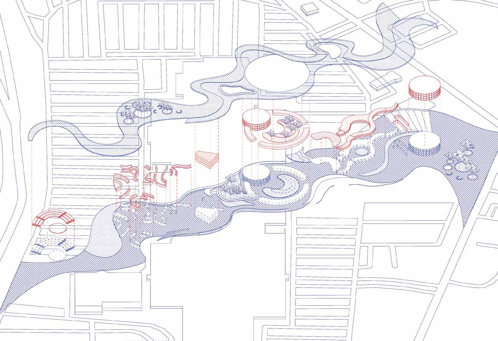


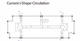
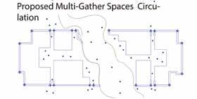
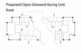
Current Enclosed Inward-facing Unit Front Proposed Open Outward-facing Unit Front Current I-Shape Circulation Proposed Multi-Gather Spaces Circulation 12
Reclaiming The “Sabana”
Urban Design:
Urban Design Program by Columbia University
Urban Design Studio III, Professor: Kate Orff
Site: The Fucha River, Bogota, Colombia, 2023.5
Type:Academic
Course Number: ARCHA6851
Credit: Haoyu Zhu, Zicong Liu, Yiwan Zhao
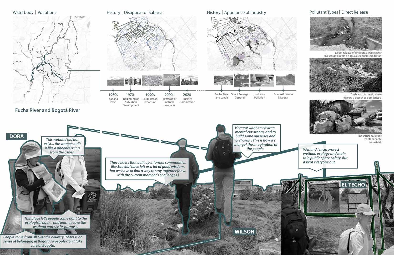
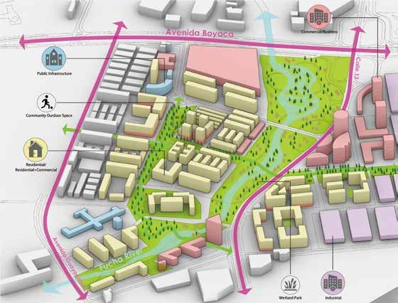
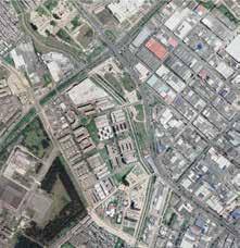
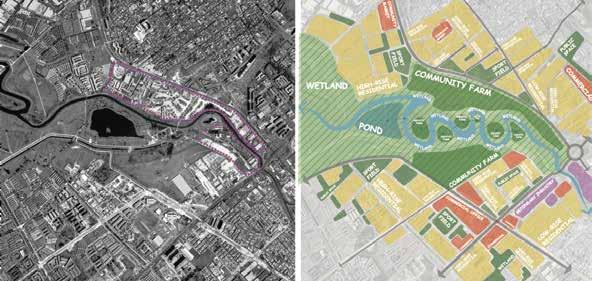
The Fucha River, a tributary of the Bogotá and Magdalena Rivers that crosses the city of Bogotá, has a river ecosystem and water quality that affects the water system of the eastern Andes and even the whole of Colombia. However, the Fucha River is considered one of the most polluted rivers in the world, with 90% of the pollution coming from within the Bogotá metropolitan area, so it is urgent to rehabilitate the Fucha River and the surrounding area.
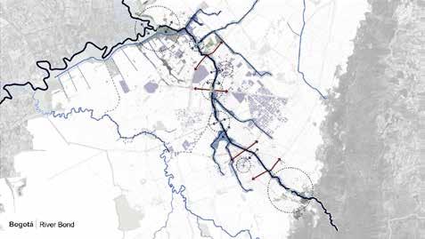
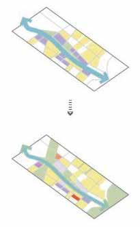
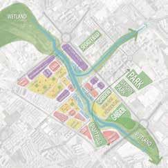
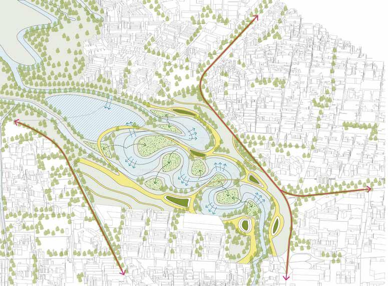
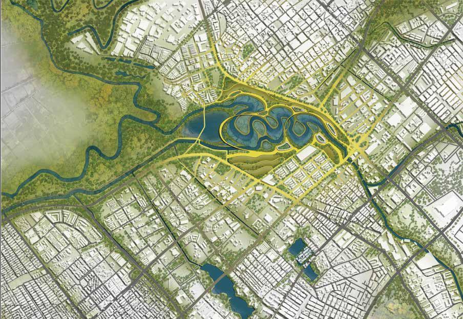
This project proposed the Fucha river as a new holding system to connect the canals, wetlands, and rivers and finally to reclaim the “Sabana” plain. The water bodies will be reconnected into a new urban ecology system to be more stable and robust.
13
14
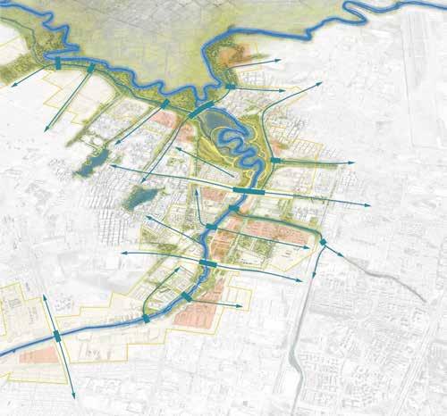
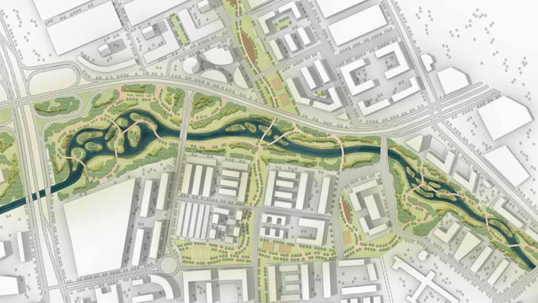
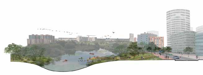
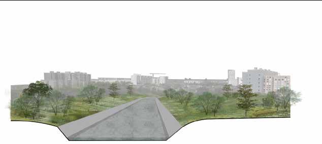
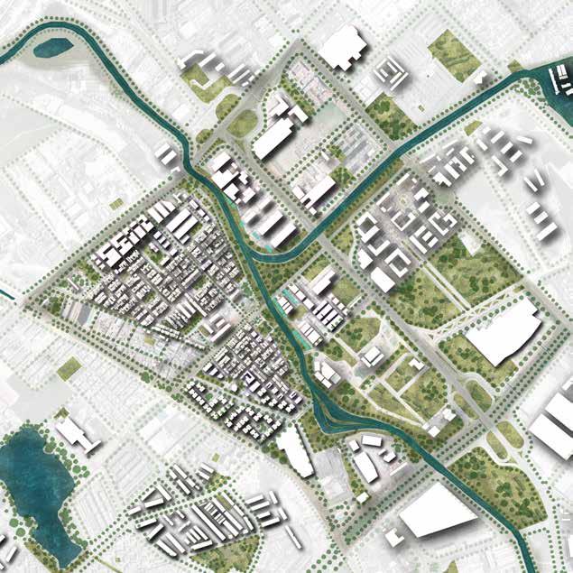
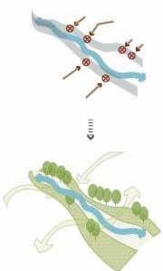
The main concept of this project is to extend the river bank and transform the concrete canal into natural landscape with softening materials and improved green infrastructure. And most importantly, bring this environment into the urban fabric and be accessible to local people.
Due to the difference of the types of pollutants, there will be three strategies to deal with different conditions. In order to create a robust and stable urban ecology at the waterfront, this project shifts the market-based planning to river-based planning, an ecological and sustainable way of moving forward.




15
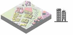
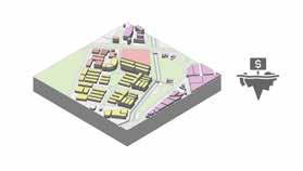
Interconnection between functions and zones

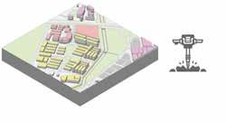
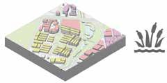
The program is divided into four steps including reclaimed land, Reshape river, Rebuild wetland, and Re-mixed region function.While providing new riverside commercial space, the new zoning plan also provides affordable housing to compensate residents whose housing are exchanged for commercial space

16
Mixed-use redevelopment
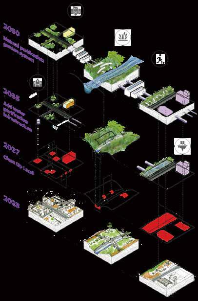



This phase is to add biological water purification structures. The concrete river bank will be broken up and widened. Additionally, the bio thermalsnd filtration pond along the sewage systems will be added in order to deal with the polluted water from the heavey industry areas that along the Fucha River.

17
Recovery of wetland and nature
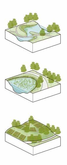
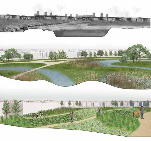
The main goal of this phase is to restore the natural environment of the site so that the green infrastructure could gradually permeate the surrounding community, which could provide people a more healthy and natural neighborhood to live in. The strategies used in this phase is providing more wetlands for the river water to be precipitaed and aquatic nurseries to cultivate plant that could be used in natural purification system. Besides, the design of community garden and the aquatic nursery could also engage with the neighborhoods.
18
BELOW THE TRACK
Community-Based:
City Semester Program by Pennsylvania State University
Design Studio,
Professor: Kenneth Tamminga
Site: Hazelwood, Pittsburgh, 2020.3
Type: Academic
Course Number: Larch 414 V
This project is a functional design for the residents who live in the Hazlewood community. The function includes the community garden, farmer's market, public plaza, amphitheater, and restaurant. The aim of this project is providing food sources and job opportunities for the community, improving the living quality in Hazelwood, Pittsburgh. The site used to be a large trail transition for the goods, while part of the trail line has been abandoned for years, making the site become isolated from the community and also block the way to the Monongahela River. In this project, I made carefully pre-studies and fild trip to identify the main problems that residents concerned about and the kind of community that they wish to live in. Consequently, the BELOW THE TRACK idea is brought out.
19
The focused area is separated by the railroads, which a lot of places in the same situation also happen in Pittsburgh. Besides, the community are mainly occupied by poverty families with low employment rate.
GAP OF WEALTH AND RIVER ACCESSIBILITY IN PITTSBURGH
This project aims to provide people with a more sustainable and friendly place to interact, to relax, and to work by creating a encourages people to engage with nature. The design of a community garden provides people with an opportunity to work together and improve relationship between residents, and provides a convenient way to grow healthy food.
Legend
GAP OF WEALTH AND RIVER ACCESSIBILITY IN PITTSBURGH

The focused area is separated by the railroads, which a lot of places in the same situation also happen in Pittsburgh. Besides, the communities are mainly occupied by poverty families with low employment rate.
The focused area is separated by the railroads, which a lot of places in the same situation also happen in Pittsburgh. Besides, the community are mainly occupied by poverty families with low employment rate.
This project aims to provide people with a more sustainable and friendly place to interact, to relax, and to work by creating an environment that encourages people to engage with nature. The design of a community garden provides people with an opportunity to work together and improve the relationship between residents, and provides a convenient way to grow healthy food.
This project aims to provide people with a more sustainable and friendly place to interact, to relax, and to work by creating an environment that encourages people to engage with nature. The design of a community garden provides people with an opportunity to work together and improve the relationship between residents, and provides a convenient way to grow healthy food.
Unaccessible area
The monongahela river
Isolation
Isolation
The community was isolated by walls, preventing people to get close to the trail and river.
The community was isolated by walls, preventing people to get close to the trail and river.
Unaccessible for poverty
Most poverty families are prevented by the trails from river.
Unaccessible for poverty
Most poverty families are prevented by the trails from river.
Focued area
Areas in same situation
Trails Roads
Legend
Isolation line
Residents
Green public spaces
The monongahela river
Accessible for rich
+ [+]
Focued area
Building footprint
The rich
The poverty River
Areas in same situation Trails Roads Building footprint The rich The poverty River
"Scotchbottom" formed along river lowlands after majority Scottish people settling there.
1800s
1800s
Burial Mounds discovered along Mansion street, demolished by settlers and used to pave what is now Second Ave.

The Hot Metal Bridge is an important infrastructure investment.
"Scotchbottom" formed along river majority Scottish
Segregation by the railroad tracks culminates in a race riot at the Gladstone High School on February 16 and 17.
A lot of poblic green spaces closing to the river are provided for the riches.
Accessible for rich
A lot of poblic green spaces closing to the river are provided for the riches.
Residents
Green public spaces
The monongahela river
Unemployment rate inPittsburghfrom 2000-2020.
1800s
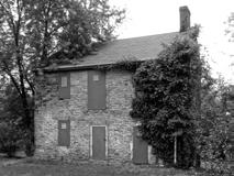
Burial Mounds discovered along Mansion street, demolished by settlers and used to pave what is now Second Ave. 1780s-1790s
1861 Pittsburgh Connellsville Railroad separates area from the rest of Hazelwood.
Burial Mounds discovered along Mansion street, demolished by settlers and used to pave what is now Second Ave. 1780s-1790s
<1870s
PRE INDUSTRIALIZATION
1861 Pittsburgh Connellsville Railroad separates area from the rest of Hazelwood.

1870s-1900s
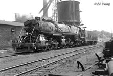
Hazelwood is home to many industries including a railroad industry, iron and steel industries.

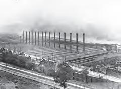
1870-1950s
LTV closed the plant and ceased all operations on site, bringing an end to the steel industry on the site.
The Hot Metal Bridge is an important 1870s-1900s Hazelwood is home to many industries including a railroad industry, iron and steel industries.
1883
Segregation by the railroad tracks culminates in a race riot at the Gladstone High School on February 16 and 17.
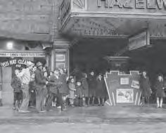
1980-1990
20% of the population left Hazelwood, Second Ave was nicknamed "Depression Corridor"
1980-1990 20% of the population left Hazelwood, Second Ave was nicknamed "Depression Corridor"
1950s-2020
LTV closed the plant and ceased all operations on site, bringing an end to the steel industry on 1994 1969
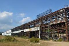

October 2017
The site was rebranded as Hazelwood Green during the Big Tent Event.
October 2017
The site was rebranded as Hazelwood Green during the Big Tent Event.
+
5%
4%
6% 7% 8% 9% 10%
+ + + + + [+]
PRE INDUSTRIALIZATION INDUSTRIALIZATION POST INDUSTRIALIZATION
1969
1994
1883
CURRENT Goals the life circle GardeningRunning 2000 4% 5% 6% 7% 8% 9% 10% 2002200420062008201020122014201620182020
Unemployment rate inPittsburghfrom 2000-2020.
Unaccessible Site Road Railroad Existing People
walls
by
+ + + + + [+] Focued area Legend Areas in same situation Trails Roads Building footprint The rich The poverty River + [+] Unaccessible area Green public spaces Green public spaces Residents Residents Isolation line The monongahela river The monongahela river The monongahela river 4.8 miles from downtown Pittsburgh
20
garden that has been used for more than fifty years, and a recreation area that is in the construction. People from the community is isolated from the river because of the railroad, which has been abandoned. So, it is suitable for the construction of the focused area to provide opportunities for people to get close to the river and a recreation space for tourists and residents.
People from the community are separated from the river by walls and trail.
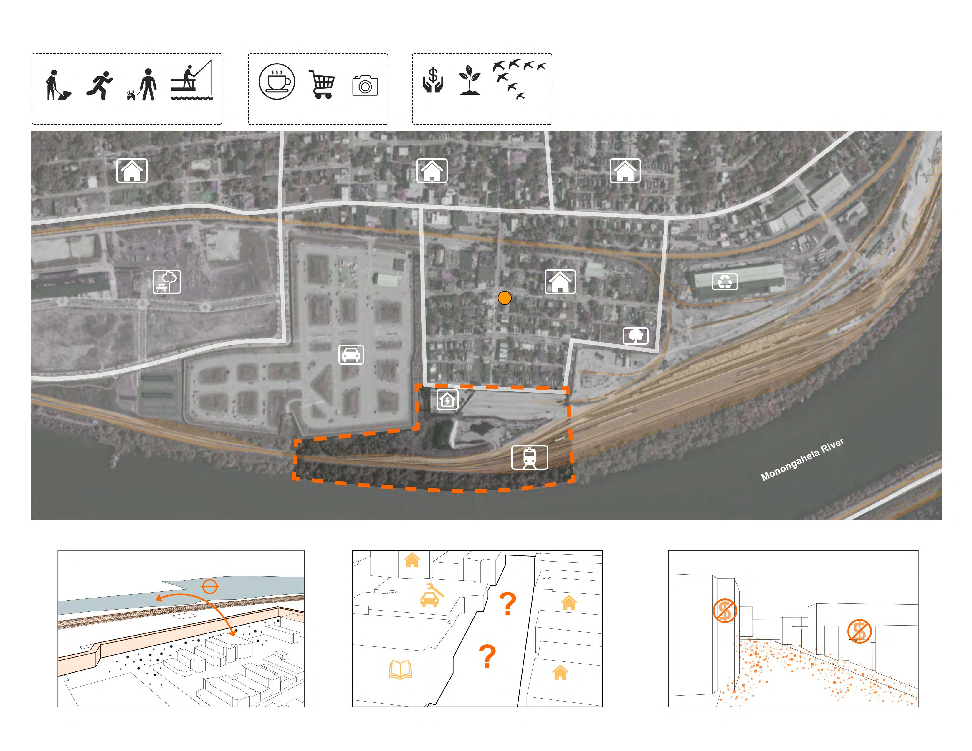


There is no market arround the community, which is inconvenient for residents to get food.
The employmentrate is extremely low in the community.Alot of families are poverty and there are few job opportunities.
GardeningRunning Walking dog Fishing CafeShoppingPhotography JobNature Animal Habitat
river Site boundary Road Railroad Existing community garden
Unaccessible to the
Unaccessible to the river
Lack of food sources Few job opportunities
21
GENERATE PROCESS


Existing condition analysis existing condition
abandoned!
UP! UP!
DOWN
DOWN
Step 1
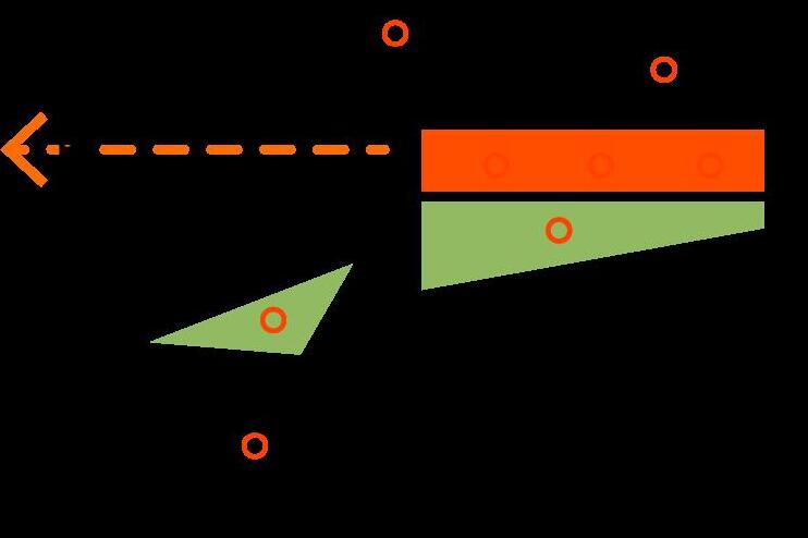
-level up the main circulation to join up the elevation difference


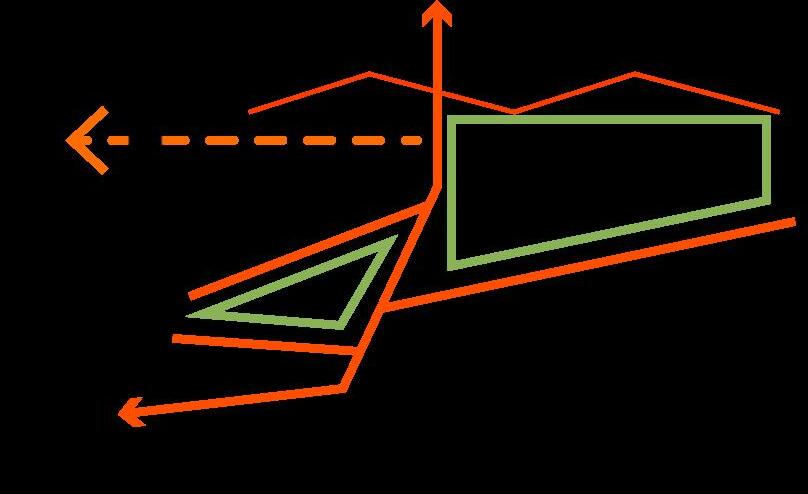


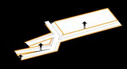
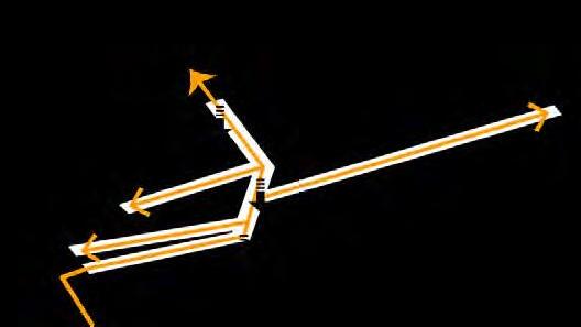
-generate dock to allow people get close to river

Step 2
entrance and main pedestrian landform
-level down the other parts of the site to form the landscape
- connect the inner activity areas
Step 3
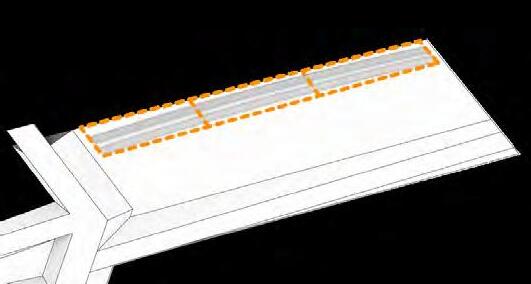
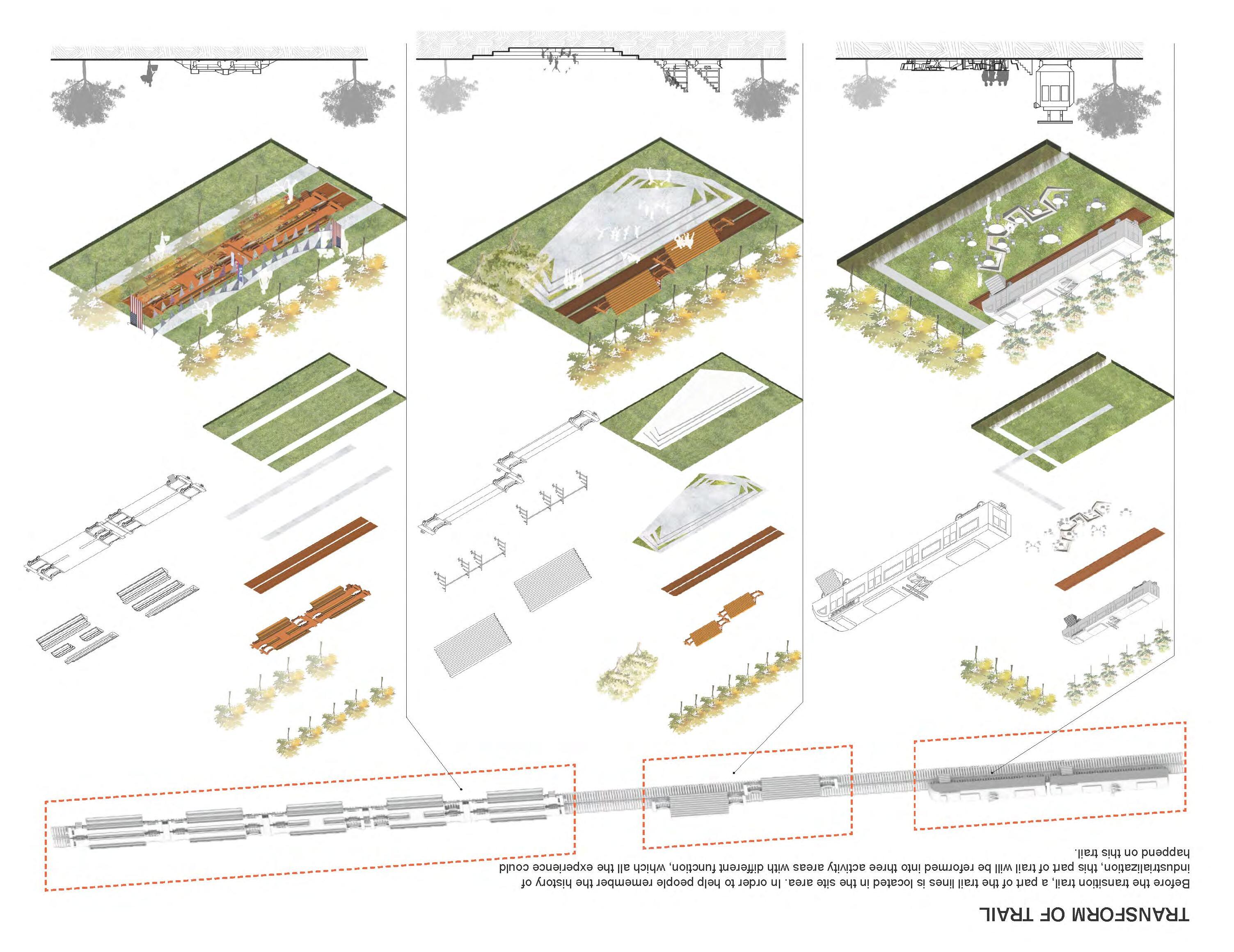
reuse of abandoned trail
- transform the trail into three function areas


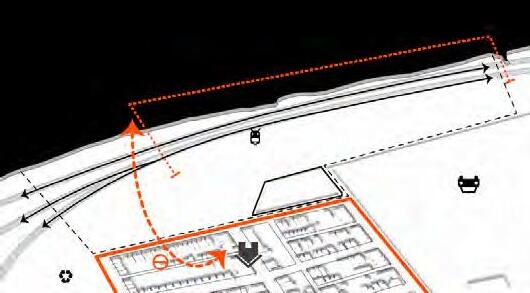
Step
-set the rest of the place as gathering plaza and the community garden


Step 5
- provide people opprtunity to get closer to the river

- abandoned trail and low accessibility to river EXTEND!

4 activities
river
walk
farmer's market amphiteater restaurant community garden fountain plaza fence boundary power station river walk above river plateform
GOAL: new pedestrian GOAL: meet demands - the site was isolated little bluestem viola princeana summer snowflake prairie flat-top prairie dropseed ironweed greek valerian balloon flower pennsylvania sedge feather reed grass buttonbush japanese yew VEGETATION Trees Perennial Shrubs SECTIONS Original Trail Leveled Pedestrian Community Garden The Plaza Leveled Pedestrian Power Station Leveled Pedestrian Under bridge walk Slope Existing Trail Leveled Pedestrian Lawn Community Garden Leveled Pedestrian Uber Center Public Plaza Leveled Pedestrian Rain Garden Leveled Pedestrian Community PERSPECTIVE star magnolia sweet gun white oak little bluestem viola princeana summer snowflake prairie flat-top prairie dropseed ironweed greek valerian balloon flower pennsylvania sedge feather reed grass japanese yew star magnolia white oak sweet gun VEGETATION Trees Perennial Shrubs SECTIONS Original Trail Leveled Pedestrian Community Garden The Plaza Leveled Pedestrian Power Station Leveled Pedestrian Under bridge walk Slope Existing Trail Leveled Pedestrian Lawn Community Garden Leveled Pedestrian Uber Center Public Plaza Leveled Pedestrian Rain Garden Leveled Pedestrian Community PERSPECTIVE buttonbush Shrubs pennsylvania sedge feather reed grass buttonbush japanese yew star magnolia white oak sweet gun VEGETATION Trees Perennial Shrubs SECTIONS Community Community greek valerian prairie dropseed little bluestem viola princeana ironweed balloon flower summer snowflake prairie flat-top Perennial
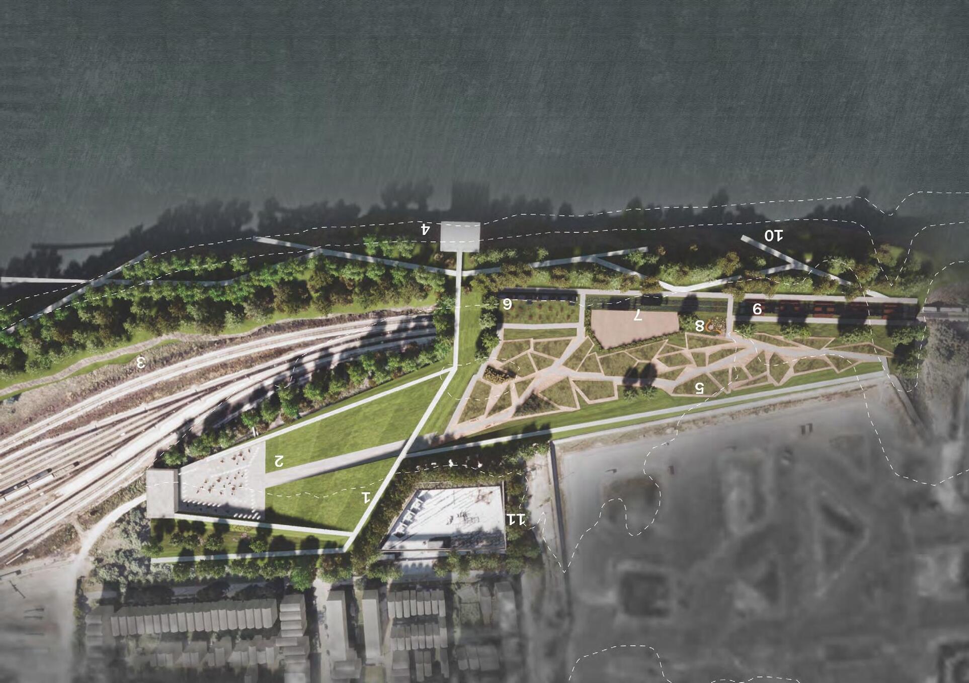
PLANTING CHOOSE Trees -set main walk flow and divided function areas. -provide river access. -food sources, job opportunities, river accessibility, and safty. The Bridge Sidewalk Fountain Plaza The Original Rail Transition The River Platform Community Garden Restaurant Amphitheater Children's Playground Farmer's Market Above-river walk The Original Power Plant 1. 2. 3. 4. 5. 6. 7. 8. 9. 10. 11.
Existing condition
MASTER PLAN
Restaurant
Market
Amphitheater Farmer's
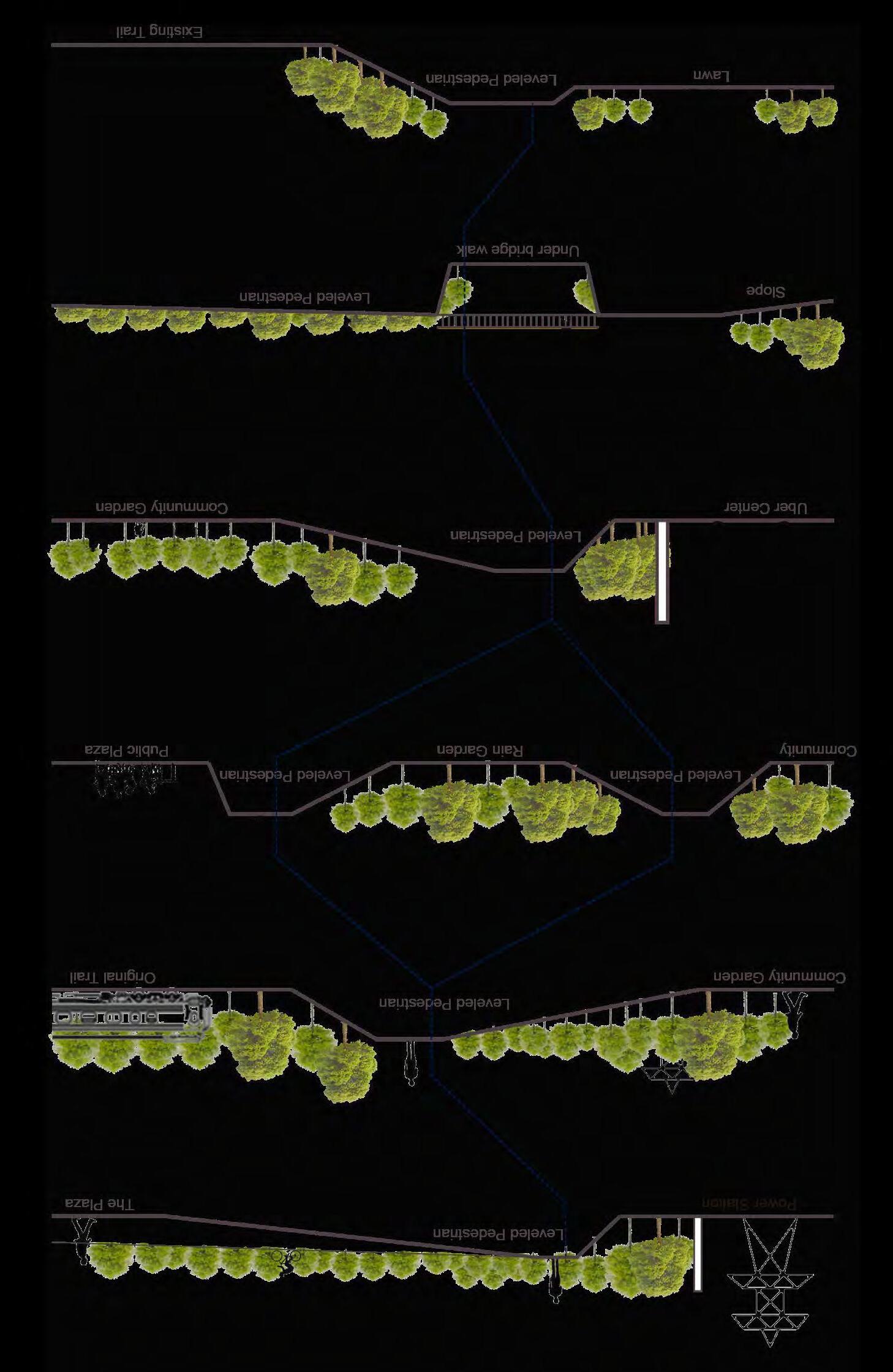
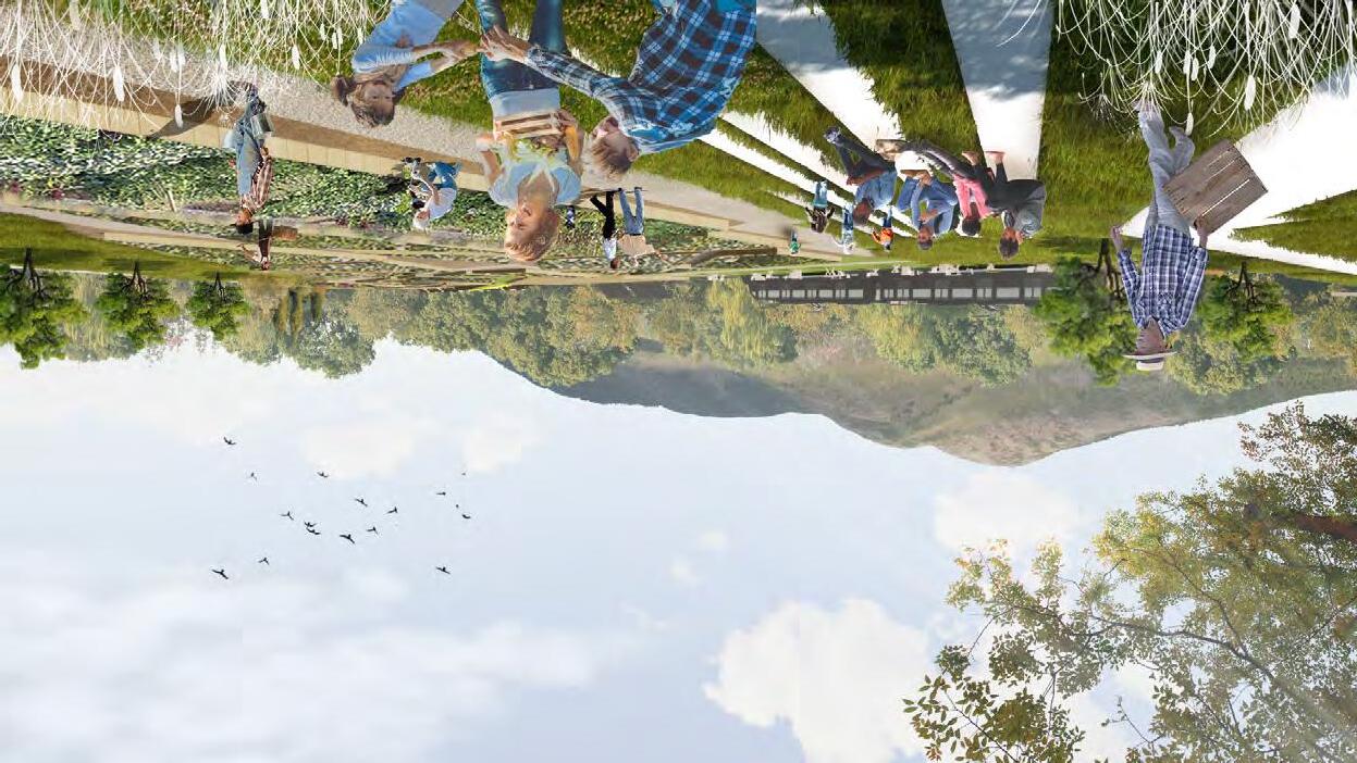
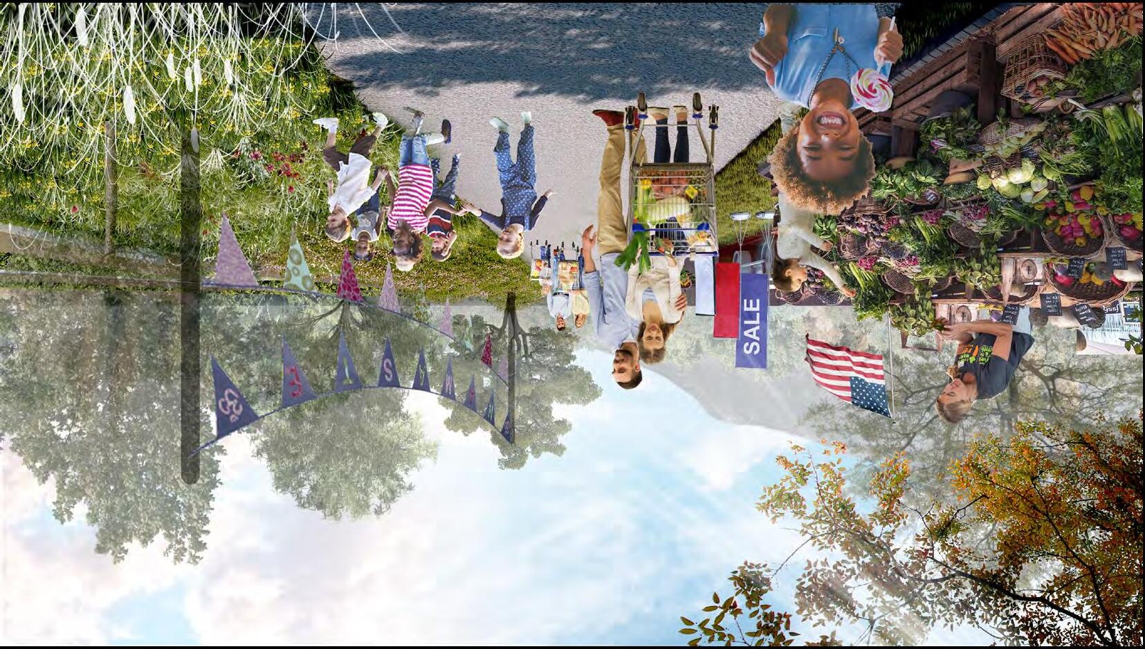
SECTIONS
EXPERIENCE ALONG THE TRAIL
EXPERIENCE IN COMMUNITY GARDEN
THE ECOLOGICAL CORRIDOR
Ecological Environment Planning:
Urban Design Program by Columbia University, GIS-Based Analysis, Professor: Leah Meisterlin, Mario Giampieri
Site: Spring Creek Watershed, Pennsylvania, 2022.9
Type: Academic
Course Number: PLANA4578
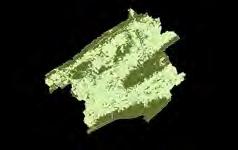
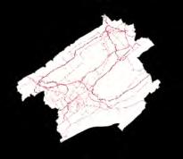
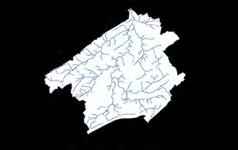
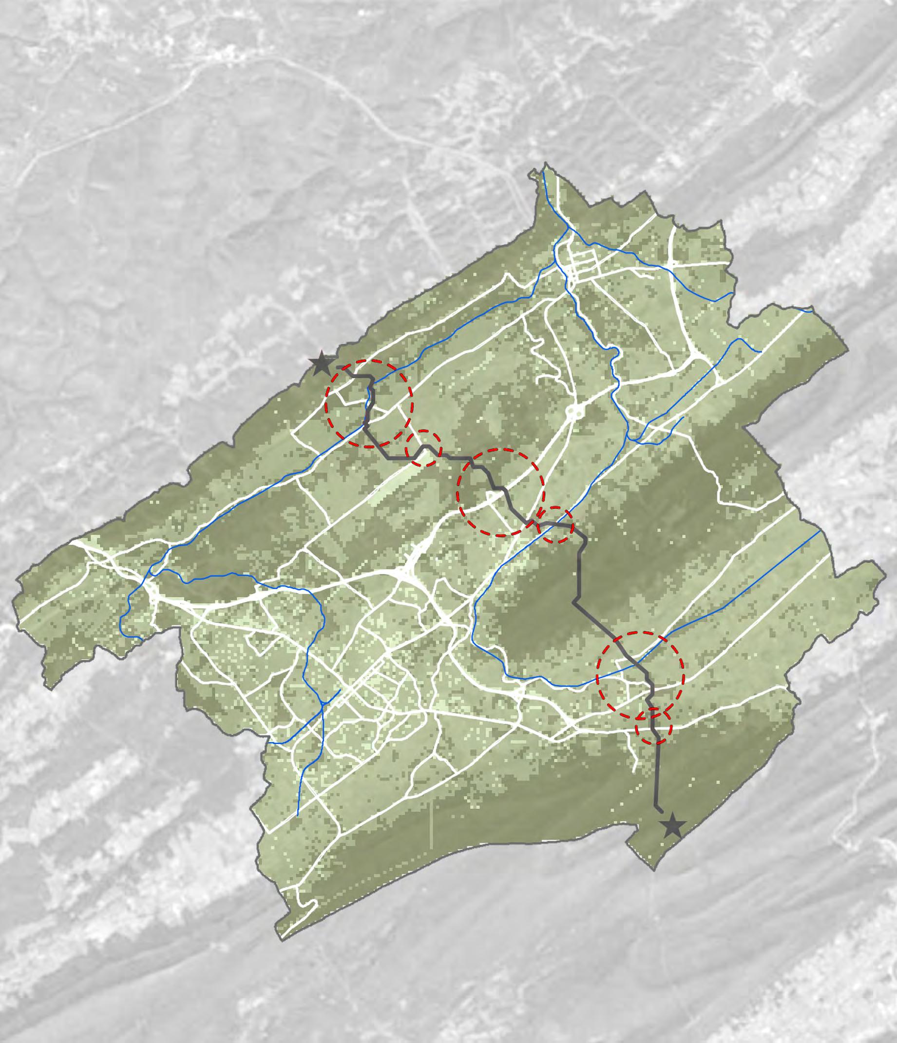
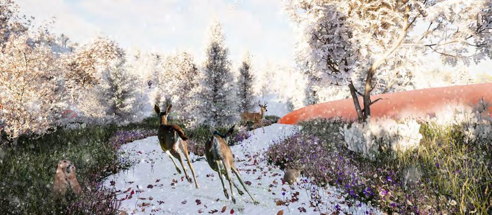
This project is to provide a eco-friendly and safe corridor for terrestrial animals to migrate. In the Spring Creek Watershed, most animals are living in the Nittany Mountain and Rothrock State Forest, while several highway and trails are in between. During the four-year living in State College, I noticed a lot of deers or some small animals died as a result of car accidents. Before the design, I did a lot of researches and using the GIS to culculate the best migration way for the animals to move. The design is for the areas
where the corridor crashed with highway and trail.
25
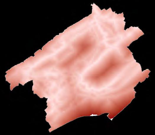
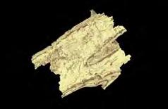
ECOLOGICAL SENSITIVE ASSESSMENT MODEL
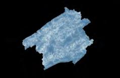


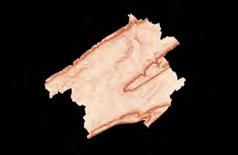

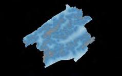
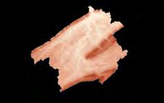

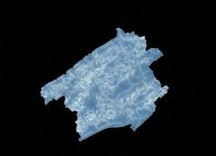
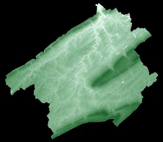
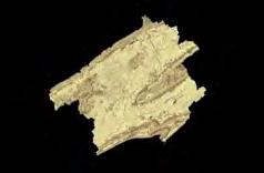
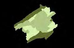





CONSTRUCTION SUSTAINABILITY ASSESSMENT MODEL
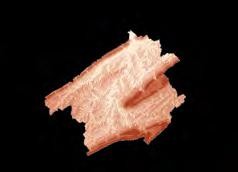
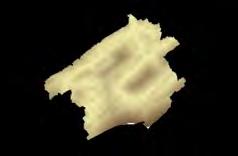
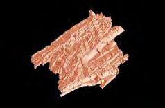


Elevation Catchment Buffer Zone Vegetation Coverage Soil Permeability Slope Water Buffer Zone Vegetation Type Soil PH Aspect Water Flow Cultivated Status Soil Overlayer Topography Overlayer Hydrology Overlayer Hydrology Overlayer The Grading Standard and Weigth of Index Ecological Sensitive Assessment Extremely Sensitive Sensitive Insensitive Elevation 3%>100m 50-100m <50m Slope 6% 0-8% 8-25% >25% Aspect 1% North and SouthNorthwest and South west East and West Soil PH 9%<4.5, >8.5 4.5-5.5, 7.5-8.5 5.5-7.5 Soil Permeability6%>20% 10%-20% <10% Vegetation Coverage25% Diverse Shaded Bare Vegetation Type15%Mixed ForestGrassland, Developed ForestFarming Land Cultivated Status 10%<15% 15%-50% >50% Catchment Buffer Zone 10%<50m 50-150m >150m Water Buffer Zone 8%<10m 10-50m >50m Water Flow7% Slow Fair Quick 50% 25% Ecoligical Sensitivity Ecology Space Weight Grading Standerd Topography Soil Vegetation Evaluation Type Index Type First Level Index WeightSecond Level Index Hydrology 10% 15% Elevation Catchment Buffer Zone Highway Accessibility Present Landuse Slope Water Buffer Zone Railroad Accessibility Reclassed Present Landuse Aspect Hydrology Overlayer Road Accessibility Overlayer Topography Overlayer The Grading Standard and Weigth of Index Construction Sustainability Accessment
Extremely Sensitive Sensitive Insensitive Elevation 6%<50m 50-100m >100m Slope 12%0-8% 8-25% >25% Aspect 2% North and SouthNorthwest and South westEast and West Catchment Buffer Zone 4%<50m 50-150m >150m Water Buffer Zone 6%<10m 10-50m >50m Railroad 10%Good Fair Limited Highway 20% Active None Inactive Present Landuse 40% Lanuse Type 40% Construction Area, Industrial Road, Agriculture Farmland Evaluation Type Index TypeFirst Level Index Weight Second Level Index Weight Grading Standerd SpaceTopography20% 10% Hydrology Construction Sensitivity Ecology Behavior Road Accessibility 30% 26
ECOLOGICAL CORRIDOR SELECTION MODEL
Step
STEP 3 - CULCULATE THE IDEAL ECOLOGICAL CORRIDOR
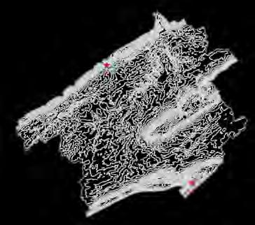
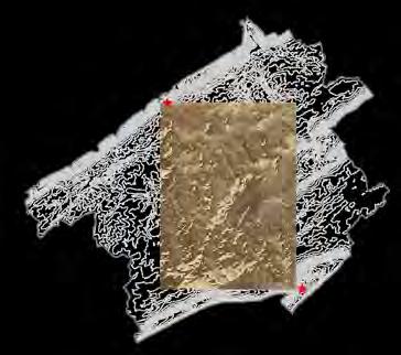

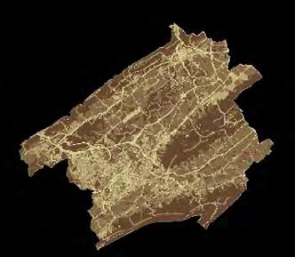
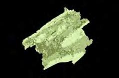
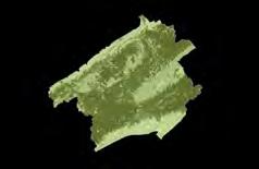
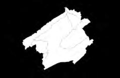
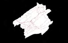
1 - Reclassify and Combine Step 2 - Culculate the Cost and Cost Distance Highway River FLow Railroad Vegetation Road Combine Land Cover Nature Combine Nature-Road Combine Culculate the Cost DIstance Culculate the Cost Raster Define the start and destination
Start and destination Legend Conflict areas Ideal ecological corridor Highway Railroad 27
existing highway
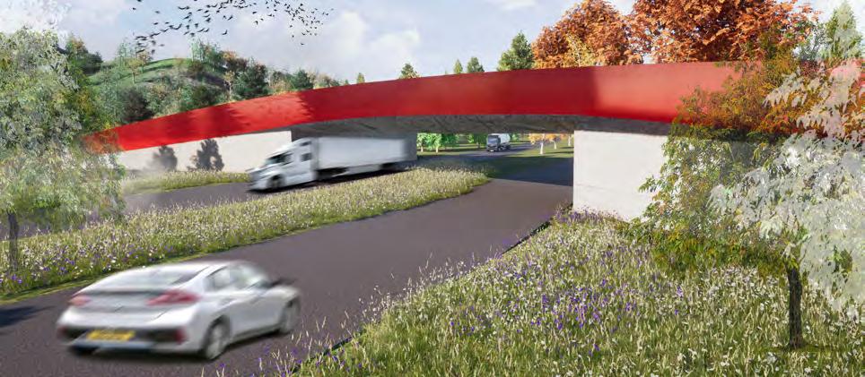
the corridor bridge
the protection wall existing forest

PLANTING CHOOSE
Grass
Prairie Meadow
Forb
A Mesic Meadow
mix 2
mix 2 mix 1 mix 1
Forb
mix 3
mix 3 mix 4 mix 4
Mix 1
Schizachyrium scoparium Little Bluestem
Sporobolus heterolepis Prairie Dropseed
Tridens flavus Purpletop
Eragrostis spectabilis Purple Love Grass
Asclepias syriaca Common Milkweed
Lupinus polyphyllus Blue-Pod Lupine
Heliopsis helianthoides Smooth Oxeye
Monarda fistulosa Wild bergamot, horsemint
Coreopsis lanceolata Lance-leaved coreopsis
Mix 2 Grass
Elymus canadensis Canada wild rye
Elymus hystrix Bottlebrush gras
Danthonia compressa Flattened Wild Oat Grass
Lotus corniculatus Birdsfoot Trefoil
Trifolium repens Ladino Clover
Solidago rigida Stiff Goldenrod
Symphyotrichum laeve Smooth Aster
A Rain Meadow
Upper Zone
Grass Between
Lower Zone
Mix3
Filipendula rubra Queen of the Prairie
Symphyotrichum novae-angliaeNew England American-Aste
Veronicastrum virginicumCulver root
Elymus virginicus Virginia wild rye
Chasmanthium latifoliumIndian Wood-Oats
Chasmanthium latifoliumRiver oats
Lobelia siphilitica Great Blue Lobelia
Physostegia virginiana Obedient plant
Vernonia noveboracensisNew York Ironw eed

Mix 4
Lilliputian Fothergilla Bottlebrush
Shrubs
Itea virginica Fizzy Mizzy Sweetspire
Davidia involucrate Dove Tree
Tree Clusters
Deciduous
Pseudolarix amabilis Golden larch
Ginkgo biloba Gingko
Magnolia stellata Star Magnolia
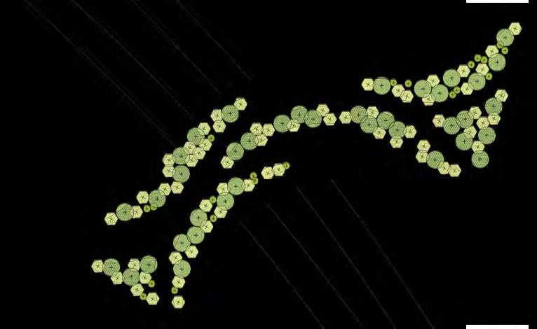
SITE PLAN SECTION
EXPERIENCES ON THE BRIDGE
28


