5 minute read
Executive summary


How can we adapt Pelican, Blacksmiths, Swansea and surrounds to an uncertain climate future?
This Local Adaptation Plan (LAP) is a call for action to help the community plan for the worst and act when necessary in response to flooding and sea level rise. Urgent action is needed to address priority issues identified by the community. For other issues we have time to plan and prepare.
The objective of this LAP is:
"To adapt Pelican, Blacksmiths, Swansea, Swansea Heads and Caves Beach to the projected effects of sea level rise and the compounding issues associated with inundation, flooding, drainage, sewerage and major storm hazards, so that community wellbeing, economic prosperity, and our valuable lake, channel and coastal environment can be protected".
Why adapt?
• Commonwealth, State and local government studies identify the suburbs included in this
LAP as extremely vulnerable to the projected impacts of sea level rise • These impacts include threats to public safety, damage to houses and other private and public assets (roads, drainage and utilities) and threats to our unique coastal environment and lifestyle • This LAP will help our community to adapt to these impacts.
How we approached the LAP?
Council and the community assessed current and projected hazards using flood and coastal studies and the CoastAdapt website. Flooding and sea level rise will impact many people across the LAP area through damage to private and public assets, service and access disruption, increased operational and maintenance costs and threats to the environment.
What are the hazards?
The LAP working group and Council consulted with residents and businesses in the area to identify and assess the following hazards related to flooding and projected sea level rise:
LF Lake flooding
increased extent of flooding caused by rainfall in and around the lake and its catchment TI Tidal inundation increased frequency, duration and extent of tidal inundation (fine weather flooding) ECL East Coast lows and storm surges increased frequency and intensity of storm events resulting in temporary water level surges and storm damage CD Channel dynamics
changes in water volumes and behaviour in the channel, erosion of the channel and impact on adjoining land GW Groundwater
short term and long term increases in the level of underground water CH Coastal hazard
erosion of beach and dunes, potential wave overtopping and coastal inundation ER Emergency response
risk of failure of our emergency response systems including storm preparedness and evacuation
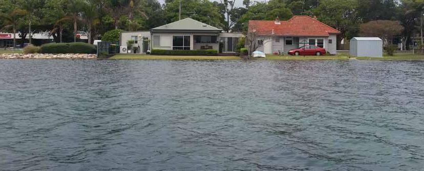
Residences adjacent to Black Neds Bay Swansea taken 21 feb 2019 Photo: D. Hanslow NSW DPIE
How did Council and the community assess hazards and options?
Feedback from residents and businesses, collected at workshops and community drop-in sessions, identified more than 180 potential options to manage the impacts of flooding, inundation and sea level rise.
Council and the LAP working group carried out a preliminary assessment of these options to assist with shaping the future adaptation plan.
In 2018, the revised NSW Coastal Management Framework directed Councils to include a more probabilistic (statistical) approach to hazard assessment. This probabilistic hazard assessment (PHA) formed the basis for an economic assessment of options known as a cost benefit analysis (CBA).
The PHA of inundation in and around Swansea Channel was undertaken in 2018-2019 as a basis for a feasibility study (using multi-criteria analysis) carried out in 2019. This assisted Council and the LAP working group to identify options that could proceed directly to the LAP and another subset of high cost/high risk options that could benefit from economic analysis by a CBA carried out in 2020 as part of the broader assessment process.
Members of the LAP working group conducted further hazard and options assessments, and combined this with the findings of the PHA and the CBA to provide valuable insight and direction for the final set of management actions included in the LAP.
When to plan and when to act?
• The LAP includes 30 actions (split into 6 categories) implemented over a 10 year period.
It sets the foundation for the long-term adaptation of the area to 2100 and beyond • The longer-term strategy is based on trigger points e.g. an action is implemented once water levels reach a given height • The results of the technical studies and community assessments highlighted the need for continued investigation, collection of information, and research to understand acceptable trigger points, longer-term impacts of sea level rise, and how to implement complex adaptation actions • We aim to plan ahead, act when necessary, and in proportion to the risks faced; avoiding wasted expenditure and maladaptation.
Impacts of East Coast Low Storm - Pelican Foreshore Reserve - June 2016

Snapshot of adaptation actions (from Tables 3.1 to 3.6 of the LAP)
MANAGEMENT ACTION CATEGORIES EXAMPLE ACTIONS
On-ground works • Implement Pelican Foreshore Remediation Project • Complete Swansea tidal gates pilot and, subject to review, extend to priority areas • Maintain and augment, as necessary, channel training walls and lake foreshore protection works Planning and development controls • Review land-use planning and development controls in collaboration with industry and community as new scientific information comes to hand Maintenance, monitoring and reporting • Monitoring and reporting of hazards and regular reporting against LAP triggers Piloting, research and innovation • Research and pilot integrated adaptation strategies addressing properties, drainage, roads and utilities at the local or neighbourhood level
Advocacy and engagement • Enhanced partnerships with utility providers and funding agencies to ensure ‘efficiencies of scale’ and innovation
Governance and funding • Maintain and enhance community participation and engagement in ongoing planning and implementation • Investigate feasibility of capital reserve and other resourcing measures to support implementation and future adaptation
Acknowledgement of Country
The City Council of Lake Macquarie acknowledge the Aboriginal people known today as the Awabakal, as the traditional Custodians of the land, respecting Aboriginal Elders past, present and future. Lake Macquarie City Council recognise the local Aboriginal community today in all of their diversity, who came forward to share their experiences, knowledge, images and memories.
CONTENTS
Executive summary
Section 1: Setting the scene 1.1 LAP area and background 1.2 What does the community value about the area? 1.3 Our collective challenge - why adapt? 1.4 Regulatory, policy and planning framework 1.5 Working together to adapt 1.6 LAP Objective and scope 2
6 6 8 9 10 12 14
Section 2: Investigations and findings 16 2.1 LAP Working Group assessment of community identified hazards 16 2.2 Modelling hazards and damages 20 2.3 Identifying and assessing adaptation options 22 2.4 Timing and triggers 26
Section 3: Recommendations and plan 3.1 Recommendations 3.2 The 10-year Action Plan 3.3 Monitoring, evaluation, reporting and improvement 28 28 30 37
References and resources
List of abbreviations 37
39
List of appendices contained in LAP volume 2 (separate document) 1. Detailed descriptions for each of the 30 LAP actions 2. Community engagement strategy and activities 3. Hazard summaries for LAP areas 4. Summary of Probabilistic Hazards and Damages Assessment 5. Pelican and Blacksmiths LAP working group preliminary options assessment 6. Swansea and surrounds LAP working group preliminary options assessment 7. Summary of multi-criteria analysis and cost-benefit analysis
