7 minute read
The Hraun project: new volcanic caves on the Reykjanes peninsula


Tommaso Santagata
Advertisement
As speleologists, we are accustomed to exploring ancient caves even if they were formed thousands or even millions of years ago, in the wake of long geological, physical and chemical processes that today allow us to make our way inside them to document them and study their history. We often try to imagine what was their prior to their formation, pondering what the landscape looked like before those processes began to excavate their way through a mountain, eventually creating a link between the outside world and the unknown, but it is not always easy to interpret these processes, which for the most part occurred before we human beings even appeared on this planet. Over the average lifespan of a human, it is very unlikely that anyone could visit a landscape before and after the formation of a cave – but “very unlikely” is not the same as “impossible”. Volcanic caves are perhaps the only cavities that afford us this possibility. Naturally, glacier mills and contact caves that are located near to and inside glaciers have a genesis that is very rapid, but we are well aware of the fact that the processes leading to their formation are markedly different with respect to those for caves made of rock. In addition, in most cases, the caves in question also have a very short lifespan, closely bound up with that of the glacier and the external climatic conditions. In contrast to glacier caves, volcanic caves develop following eruption events that drastically and permanently modify the landscape both externally and in the subsoil, and as such they can have a far longer duration. Speleologists are far more likely to find themselves exploring volcanic caves that have long ago completed their process of formation, entering them once the lava has solidified. We are talking about hundreds, thousands or millions of years after they have cooled. In rare cases, speleologists may find themselves investigating caves that formed just a few years before. When this has happened, it has been possible to document hitherto unknown minerals, defined as “metastable”, meaning that they are only found in certain chemical and physical conditions, before they have reached their state of stability.
The project
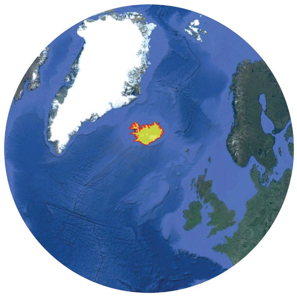
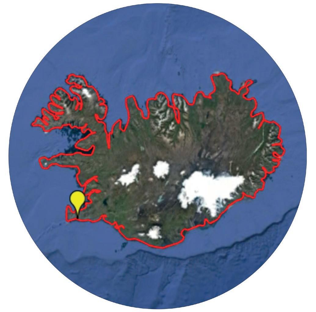
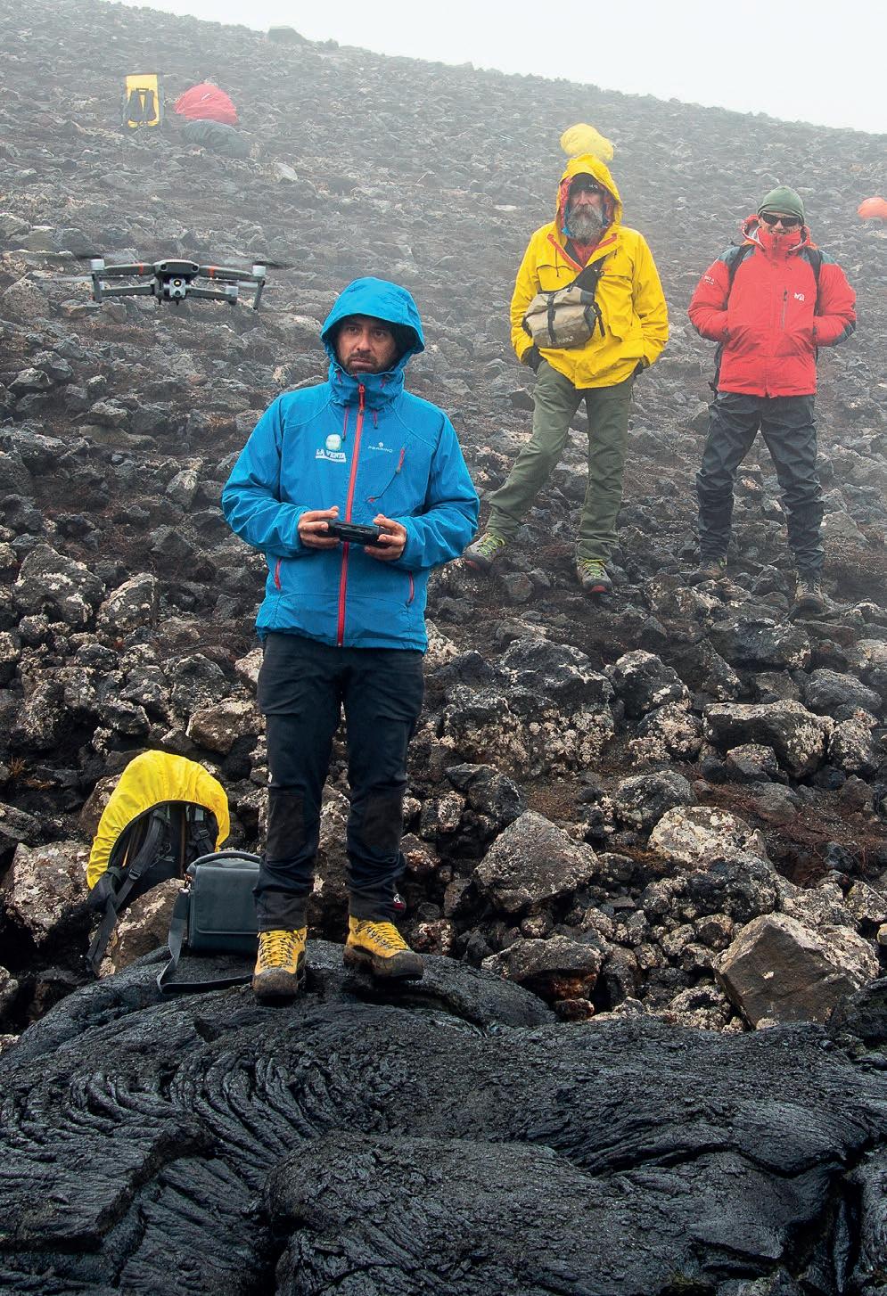
Last year, we had the opportunity to start work on a new project concerning the study of new volcanic caves formed recently following the eruption of the Fagradasfjall volcano on the Reykjanes peninsula in the Suðurland region. This event was preceded by intense seismic activity and by the rapid rising of the ground near a mountain close to the volcano – Mount Þorbjörn. After approximately eight hundred years of dormancy, for around six months starting from the night of 19 March 2021, this volcano erupted continuously, providing a unique spectacle, with explosions and lava fountains up to 500 metres in height. Lateral fractures on the volcano emitted around 150 million m3 of lava, forming a lava field stretching for almost 5 km2. During the eruption, we could observe how the lava tubes constitute major flow routes that contribute to the sliding of the lava, down into the subsoil and elsewhere. From the speleological perspective, this phenomenon immediately attracted the attention of geologists and researchers in our association. The event was monitored by means of various webcams installed near the volcano by the island authorities, and a plethora of amateur videos were posted on the internet, fostering the idea to undertake a study of the possible formation of new volcanic caves created as a result of the eruption.
This was the genesis of the “Hraun” (meaning “lava” in Icelandic) project. October 2021 saw the completion of the first survey, on which eleven members of La Venta participated. It provided an opportunity to get back to work after a prolonged pause due to the pandemic, as we found ourselves dealing with the “new normal” of Covid passes, swabs, masks and hand sanitiser.
In the heart of the volcano
Iceland is an island of volcanic origin, and is geologically very young (around 20 million years old). It is renowned for its geological features and is subject to intense geothermal activity due to the presence of numerous volcanos. Situated on the mid-Atlantic dorsal, in the North Atlantic, east of Greenland and south of the Arctic Circle, out of all the European islands, Iceland is second only to Great Britain in terms of its surface area, covering a little over 100,000 km2. The rocks that compose this country mark the dividing line between the European plate and the North American plate. Out of the volcanos on the island, both active and inactive, we can observe fissure phenomena – a type of eruption characteristic of the volcanic complexes of the oceanic dorsal. This type of volcanic activity leads to the discharge of lava through cracks that open on the terrestrial surface and can reach several kilometres in length. At the end of the eruptions, these cracks can be filled by the solidification of the lava itself and then covered over by subsequent events. The eruption of the Fagradalsfjall volcano was marked out by precisely this type of volcanism. Having observed the volcanic activity remotely for several months, we set ourselves various objectives for this initial survey, including the identification of the main collapses and volcanic tubes. For the future, we plan to conduct research directly within the caves that have been identified, with a view to documenting them and studying the metastable minerals that form only under specific temperature conditions. Considering, however, the high temperatures and the high concentrations of gas there, it will only be possible to carry out these activities several months or even years after the end of the eruptions. To identify the main collapses in the volcanic conduits, clearly visible by observing the surface of the flows
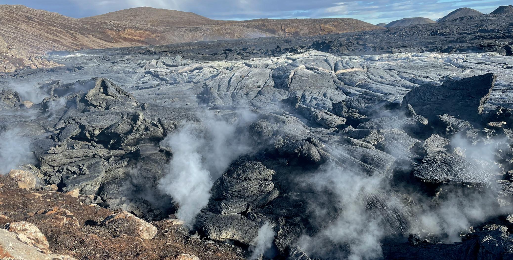
Lava from the latest eruptions of the Fagradalsfjall volcano
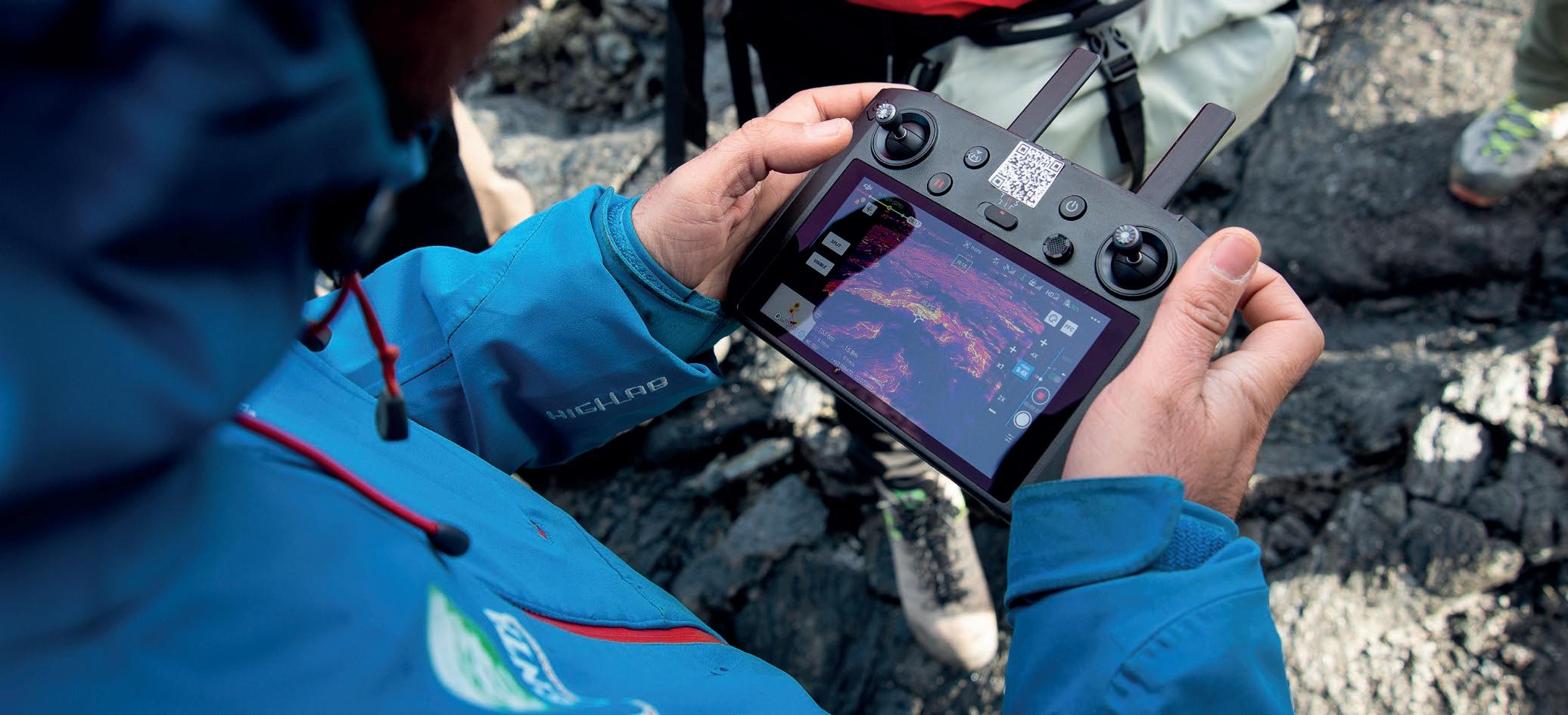
from above, an unmanned aerial vehicle was used. More commonly referred to as a drone, the vehicle in question was equipped with a thermal camera in order to identify more easily the areas of the greatest interest – i.e. those with collapses – and to measure their surface temperatures. During numerous flyovers, 324 thermal images and 21 videos were captured covering various areas, including one with a large portal from which the last active flow was discharged in September 2021. Within the entrances and collapses, at the time of the survey temperature levels of around 200°C were recorded. Once the images and footage had been captured, we were able to produce various photogrammetric models of a number of channels both through RGB images and thermal images, which will provide the basis for subsequent research. Alongside the study of these caves, the hospitality of the Icelandic Speleological Society enabled us to visit a number of caves currently being explored on the Reykjanes peninsula. Of particular interest was the three-dimensional laser-scanner survey of the Búri lava tube, one of the largest and most spectacular conduits in Iceland, which was only discovered in 2005. The study of tubes formed in more ancient eruptions near Fagradalsfjall allowed us to glean a better understanding of the speleogenetic processes, helping us to foresee what we may come across inside just-formed caves. This initial survey also gave us the opportunity to initiate a valuable partnership with Veðurstofa – the Icelandic meteorological institute, which works on monitoring volcanic risk – and with some of the researchers of the Museum of Natural History in Reykjavík and the University of Iceland. The foundations were laid for a fruitful collaboration, through the exchanging of data and the sharing of scientific objectives, thanks above all to the support of Sara Barsotti, an Italian researcher who has been working for several years at the meteorological centre as co-ordinator of volcanological risk. The preliminary activities of the project have highlighted the speleological potential of this area, flagging up numerous areas of considerable interest. At the time of writing, we are preparing for a new exhibition, set to take place in May 2022. This time, we will endeavour to enter inside the caves both in person and through the deployment of other types of drones, thanks to the help of our friends at the Swiss company Flyability, with whom we have been working for several years now on the study of glacier caves.
Thanks
This project is supported by AKU, Ferrino, Amphibious, Scurion, Vigea – Virtual Geographic Agency, Miles Beyond, Kibo.it and Studio Atlante, and carried out in partnership with the National Institute of Astronomy and Physics, the University of Bologna and the University of Padua, under the patronage of the Italian Speleological Society.
Drone surveys on the lava field of the Fagradalsfjall volcano


