
6 minute read
RESEARCH
LANDSCAPE RESTORATION, NJ
SEAGRASS RESTORATION IN KELP FORESTS
Advertisement
Design
REVOLUTIONARY INDUSTRIES
GROWING TOGETHER
1st Place Winner, EPA Competiton
THE CAP
GREEN NEW DEAL
ECOLOGICL EXPERIMENT
PREDICTED FLOOD INUNDATION IN CALGARY
PREDICTION OF 2020 DEVELOPMENT
DEMAND IN DVR
ENVIRNMENTAL JUSTICE
SOIL INFILTRATION CALCULATION
Tell: +1(215)866-7997 lbahrami@design.upenn.edu lbahrami69@gmail.com
Linkdin.com/in/profile
Philadelphia, PA, USA
GREEN X BLUE REDEFINERY
THE FARMTOWN IN CITY
VANDERBILT RESIDENTIAL COMPLEX
BRIDESBURG PARK
Leila Bahrami
Urban Ecology and Environmental Planning professional
I am a Ecological Researcher and Environmental Planner with +5 years of higher education spanning environmental analytics, ecological restoration, GIS mapping, and visual communication, as well as hands-on experience in Urban Design and Resillient Landscape. In the past three years, I have collaborated with multiple research and design teams with diverse background on very different projects from remote sensing analysis to ecological restoration implementation and resillient landscape to solve environmental, ecological and socio-economic dilemmas in a fast-paced, enthusiastic environment.
I always have curiosity, passion and collaborative spirit to work in an innovative field and contribute my skills to improve ecology in natural and built environment and preserve the environmental balance for future generations.
EDUCATION & CERTIFICATION
University of Pennsylvania, Philadelphia, PA
Dec 2020
• Master of Landscape Architecture and Regional Planning
(Merit based Scholarship)
• Certificate in GIS and Spatial Analysis
University of ETH Zurich
• Online Certificate in Smart Cities
Shahid Beheshti University, Tehran, Iran
• Master of Landscape Architecture
University of Tehran, Tehran, Iran
• Bachelor of Architecture
Skills
Aug 2018
May 2017
Professional Experience
Environmental Modeling Lab, University of Pennsylvania
Ecological & Remote Sensing Analyst
Sep 2020- Now
• Landcover Classification for non-classified wetland areas derived from remotely sensed images
• Created a series of maps to analyze the factors associated with deteriorating coastal wetlands in New Jersey using ArcGIS.
•Vegetation analysis through remote sensing techniques to locate and calculate the amount of endangered marsh species for future protect ion ans restoration.
Resillience Youth Network
Educatuional Chair, Founding memebr
May 2014
• Ecological skills: Environmental Restoration, LandUse and Environmental Planning, Hydrology, Climate Resilince,Sustainability
• Spatial Analysis& Cartography: ESRI ArcGIS Software Suite (Vector, Raster, ModelBuilder, ArcGIS Online) , Google Earth Engine, Environmental Modeling, QGIS
• Satellite Imagery, Remote Sensing: ArcGIS Spatial Analytics Toolbox, Image Processing ( ENVI, ArcGIS, Python)
• Programming Languages: JavaScript, Python, R Studio
• Graphic Design: Adobe Suite, Adobe Creative Cloud, Rhino, Grasshopper, Autocad, Google Sketchup, 3DSMax, Vray,Lumion
Honors
• First Place winner in 2020 Campus RainWorks Challenge Results in Demonstration Project Category
Growing Together, A community food forest for stormwater management at Andrew Hamilton School at Philadelphia, PA
• ASLA Student Award - Award of Excellence in Student Collaboration
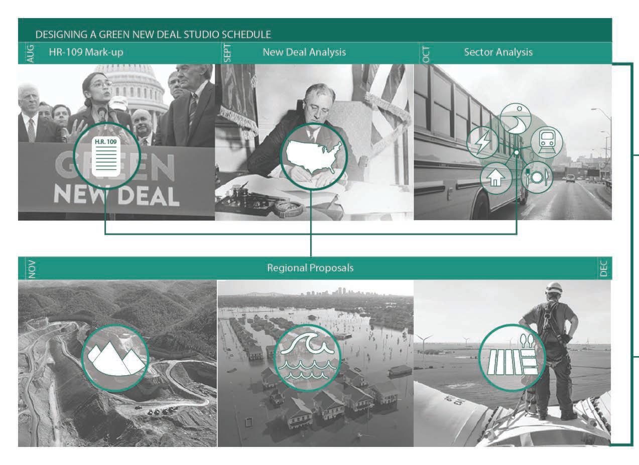
Designing a Green New Deal
• Winner of the ISF Graduate Scholarship based on excellent qualification
• Winner of the merit-based scholarship of the University of Pennsylvania, Weitzman School of Design based on excellent qualification
•National full Scholarship for graduate studies
•National full Scholarship for undergraduate studies
Aug 2021 - Now
• Promote action to plan for natural risks to improve climate resilience in communities and the built environment.
• Raise awareness of built environment disasters though connecting with expets in climate resillience.
• Research and work on climate adoptation scenarios in urban design projects.
University of Pennsylvania
Teaching Assitant
Aug 2019- June 2021
• Co-taught Natural Systems with Prof. Sally Willing for 60+ students with non-environmental background through practical experiments.
• Organized outdoor workshops for 40+ students with non-ecology background to teach built environment and ecology as well as native plants.
• Taught 60 students in collaboration with Dr. Dana Tomlin, the founder of Map Algebra, in Google Earth Engine JavaScripts API, Python in ArcGIS(Arcpy Module) and ArcGIS API for Python.
Julia Watson Studio
Junior Urban Designer
March 2021- June 2021
• Develope nature-based technologies to bring creative and interdisciplinary thinking to urban projects and create resilient landscapes.
• Prepared proposals and site analysis regarding LO-TEK technologies for incorporated companies intrested in systematic and sustainable changes.
Viridian Landscape Studio
Landscape Architecture Intern
June 2019- Aug 2019
• Assisted in Educational Design Projects through converting final drafted plan into 3model using Rhino and SkethUp.
Lindy Institute for Urban Innovation / Drexel University
Volunteer Urban Planner
Oct 2017- Dec 2017
• Designed and developed planning framework for urban projects implementation.
May. 2021
Landscape Restoration
Provide landcover classification for non-classified wetland areas to identify and protect endangered species
Land cover data derived from remotely sensed images are an important feature of environmental impact studies, policy formulations, and flood and watershed management and modeling. Landscape architects frequently use thematic data such as that provided by the National Land Cover Database (NLCD); however, this data comes prepackaged after it has undergone many levels of interpretation and decision-making. Knowing more about these datasets allows to develop literacy about the environmental information that they often take for granted.
Mentor: Keith Vandersys
“Finding” water is a key step in most land cover datasets. Making material distinctions using multispectral imagery involves a great deal of interpretation as it is dependent on the detection index, satellite schedule, and tidal variation. This series of images shows different boundary locations between land and water depending on which classification method is used.
Regional Context
Multispectral imagery set within New Jersey coastal context.
Locating Land
The position and area of land/ water changes depending on the water detection method. This image compares the outcomes of three of the most widely used indices: mNDWI; TCW; and NDVI.
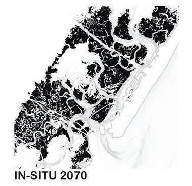
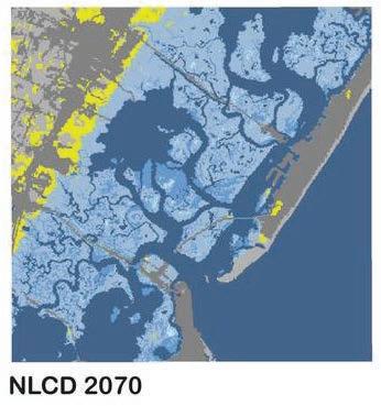
Existing wetland datasets are woefully insufficient for accurate modeling of vulnerable coastal conditions. This set of images shows the difference in a model created with NLCD (Right) and site-collected data (Left).


TWI Wetland Classing
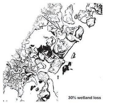
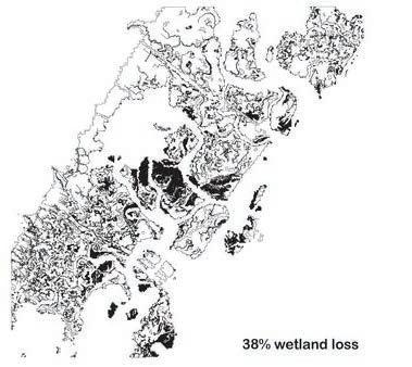
Image comparing existing landcover data (NLCD) and custom high-resolution wetland landcover data created by using UAV multispectral imaging.


INTERNATIONAL LANDCOVER CLASSIFICATION
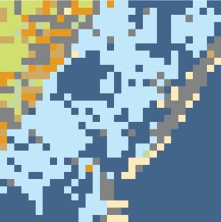
NLUD Land Cover Classification (1000 m)
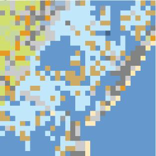
EU Land Cover Classification (500 m)

India Land Cover Classification (100 m)
International Classifications
The application of different international landcover classification standards to the same image clearly demonstrates how the spatial and thematic structure of various classification systems frame our understanding of the landscape. A comparison among the legends shows similarities and differences in how land cover themes are defined.
Multi year / Season Classifications
The application of different international landcover classification standards to the same image clearly demonstrates how the spatial and thematic structure of various classification systems frame our understanding of the landscape.
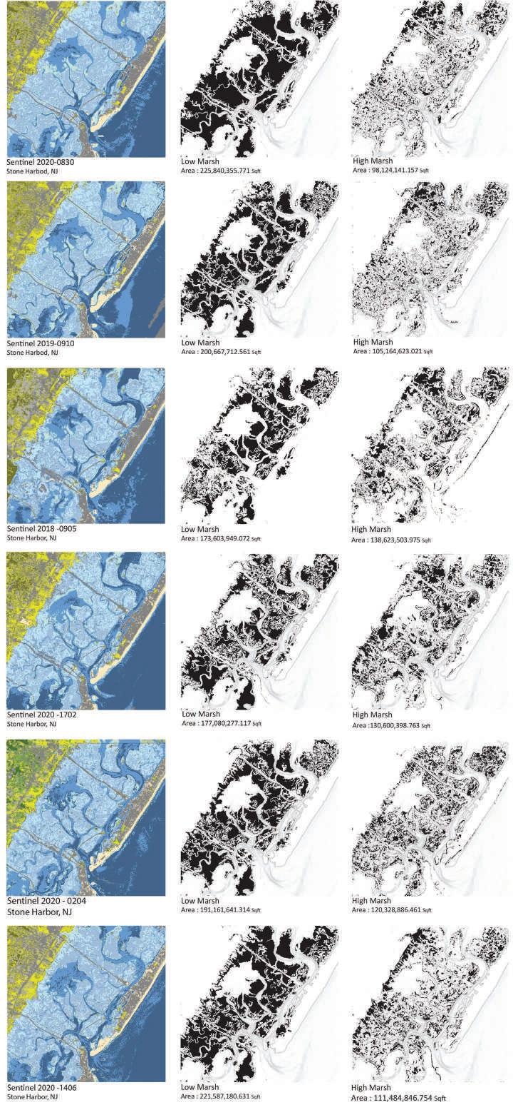
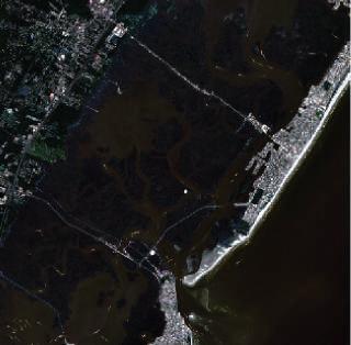



A comparison among the legends shows similarities and differences in how land cover themes are defined.
China Land Cover Classification (1000 m)
UAV Mapping
Coastlines are migrating upland faster than at any point in recorded history. As dunes and coastal marshes disappear, the need for littoral adaptation increases. In recognition of this, the United States Army Corps of Engineers (USACE) has placed an increasing importance on developing sediment placement strategies for restoring deteriorating coastal wetlands. These strategies, however, are still experimental and need to be monitored to track their performance. This project’s goal is monitoring and analyzing a recent sediment placement on Sturgeon Island in the Great Sound Bay of New Jersey.
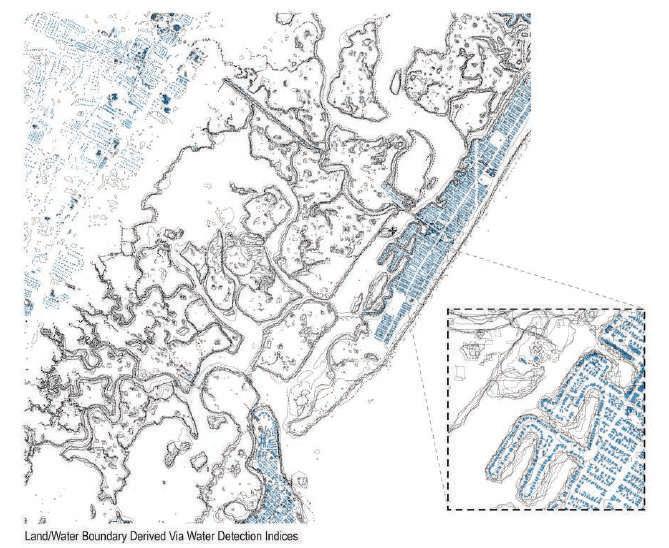
Locating Land
Composite image comparing the land/ water boundaries of five different water detection indices.
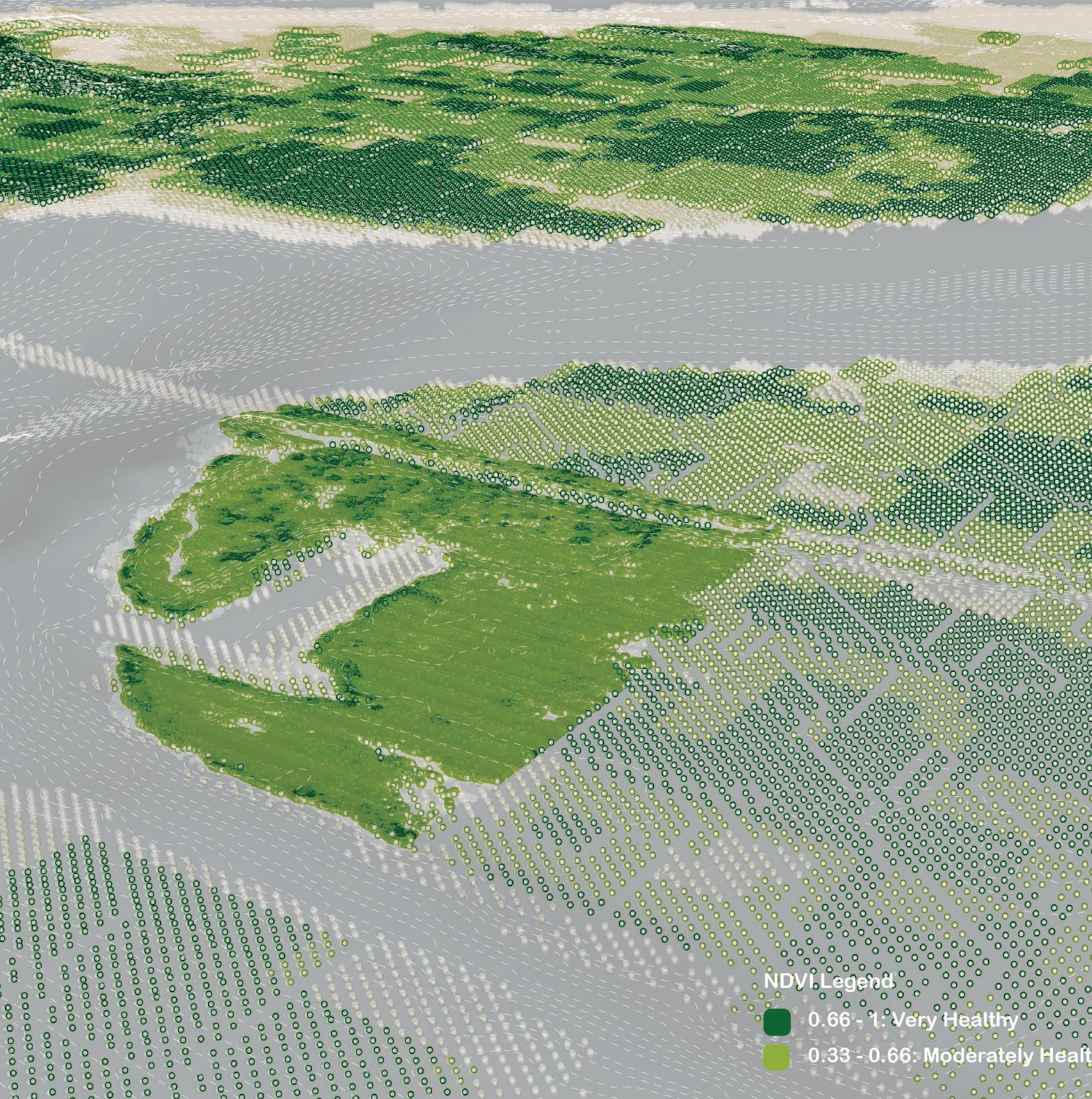
Seagrass Restoration
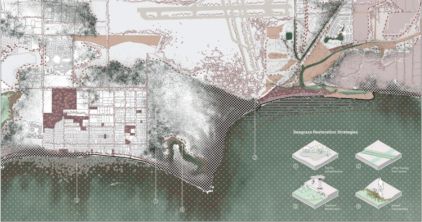
California Kelp Forests
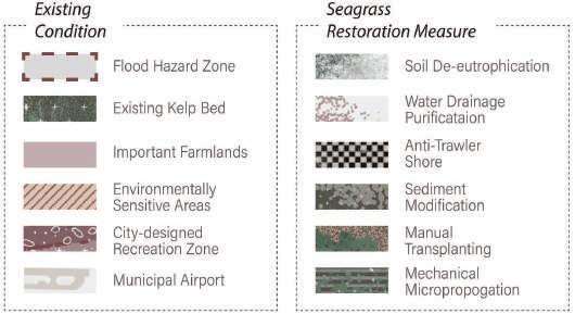
Seagrasses are all being lost globally, contributing to fewer carbon stocks on bed and in turn blue carbon emissions. Seagrass restoration has become a common management tool for recovering the ecological functions and services lost due to habitat fragmentation and degradation. The intervention phase is divided into two parts. Firstly, to avoid seagrass loss by improving water quality. Specific methods include reducing eutrophication, managing urban water systems by adding treating ditches and ponds, and supervising the industrial infrastructure applied on the site in order to formulate a protected water shoreline. Secondly, it comes the phase of restoring the disappearing seagrass. It’s important to improve sediment instability caused by excessive bioturbation before planting.
Data Calculation : Carbon Sequested / yr
Total site area: 5.96 km x 3.15 km = 18.774km/2 = 18775000 m*2
Restored Shoreline Kelp Bed: 3.4% x Site area = 635000 m2 = 63.5 Ha (Sediment Modification Area+ Mechanical Micropropagation Area)


Carbon intake = Total C sequestration = The hectares of patches transplanted x 0.89 Mg C Ha-1 yr-1 = 56.5 Mg C / yr
Relocated Inland Seagrass Marsh: 0.9% x Site area = 179000 m2 = 17.9 Ha (Goleta Slough Manual Transplanted Area + Urban Water Purified Area)
Carbon intake = Total C sequestration = The hectares of patches transplanted x 0.89 Mg C Ha-1 yr-1 = 15.9 Mg C / yr

Mitigation Potential: 72.4 Mg C / yr

Uncertainty: standard error of seagrass decline rate, unstable emission rate of kelp
Other Impacts
The intervention is expected to imrove the long-term water quality, air conditions and biodiversity. When seagrass is successfully propagated, the amount of sea urchins decline which will in turn attract sea otters. The return of otters and other native animals will further contribute to the revival of seagrass meadow ecological system.
Moreover, the anti-trawler actions along some parts of the shore and lucid water will make more regional natural resources alive. Residents and students nearby acquire a better living environment and a space for ecological education. The carbon export to adjacent ecosystems through direct transport of seagrass detritus and through the spread of faecal matter takes energy to fisheries, stimulating their productivity.
Unintened consequences include excessive sediment management, sulfide concentration as well as huge cost.
177,044 gallons of gasoline consumed = 1,733,660 Pounds of coal burned
= 26016 trees seedlings grown for 10 years
Important Farmlands
ASLA Award of
Excellence


