2 minute read
Skarresø wetlands Walk with me 2


SKARRESØ WETLANDS
AND SURROUNDINGS
Advertisement


Generalstabens historical map of Skarresø 1889

1 Island of trees in the wetlands of Skarresø

2 Birds at Skarresø wetlands

2 The dike from the inside of the dike
SKARRESØ WETLANDS WALK WITH ME 2
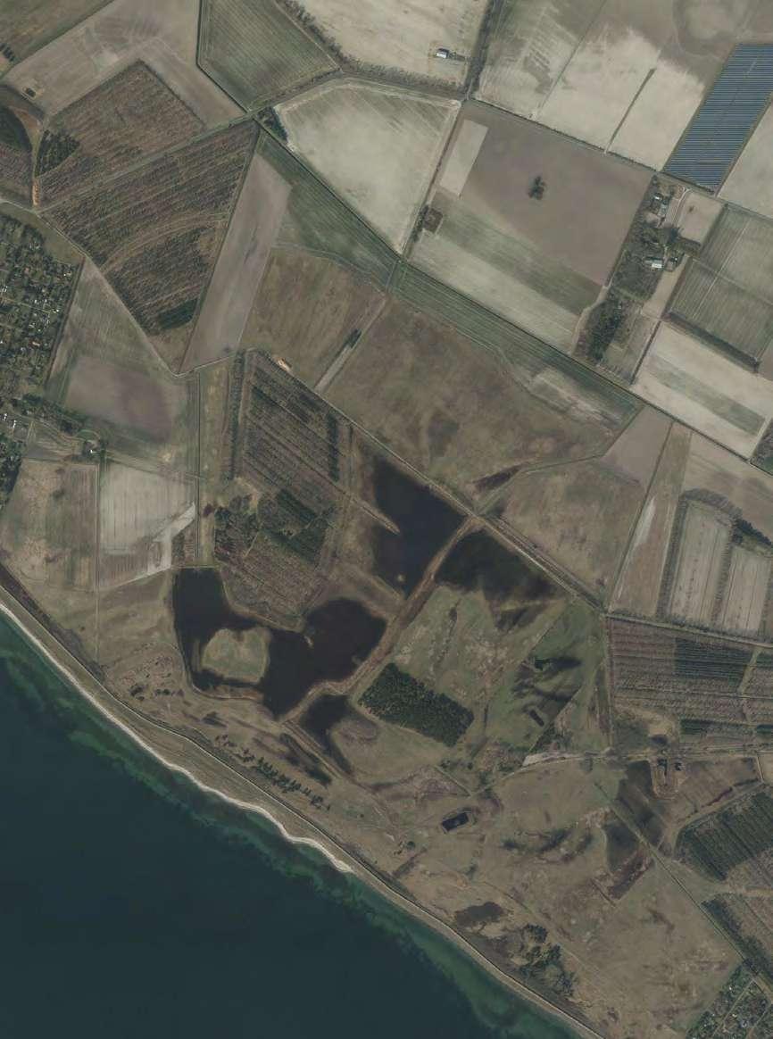
Skarresø wetlands is a restored wetland area east of Kramnitze. Historically Skarresø was not a lake but a part of the inlet waters. Skarholm and Præsteholm were small islands in the inlet protected by the two barrier islands Tjørnebjerg and Bredfjed. For many years after the reclamation of the inlet the lands of Skarresø were cultivated until the establishment of Lidsø estate initiated a restoration project in 1999 (Lidsø Gods, 2017).
The Municipality of Lolland has in collaboration with The Danish Society of Nature Conservation (Danmarks Naturfredningsforening) and The Heathland Society (Hedeselskabet) raised the water level to 0 and planted a forest of oak at the lands of the former island Skarholm. A local farmer has later established an oak plantation in his triangular parcel northwest of Skarholm Forest. Today Skarresø wetlands are home to a wide range of breeding birds, toads, insects, deer, hares, mice and reptiles. When comparing the orthophoto of Skarresø wetlands and the historical mappings of the site a repeating pattern starts to emerge. The visual connection between the former islands and modern landscape structures empowers a sense of place in the historical landscape. I access the wetlands from the dike from which I see shimmering reflections of the sun appearing behind tall and pale reeds. To get a glimpse of the resting birds I hide behind a cluster of pines. In-between dark green branches of pine I film birds taking off into the sky with Skarholm forest and the windmills of Rødby Fjord in the horizon.
In the wide and open landscape small forest volumes appear as islands in a sea. The dark colour of the trees stands in contrast to the pale colours of the wetlands. Here and there behind sun kissed reeds, reminding me of the opening scene from the film Gladiator, small waterholes appear. I use the camera to explore the space underneath the water surface.
A long bumpy passage takes you from south vest to north east where two oblong forests connect the wetland zones with Lidsø Forest. North of Skarresø, Klokkerholmsvej creates a barrier between the wetlands and the surrounding farmland. This road also takes you back to Kramnitze village. I am filming from the passenger seat on my way back home; windmills, straight roads, canals and naked black agricultural soils. My fingers are cold and numb.
In the next filmic notation, you get to see how the filmic explorations of waterholes and water surfaces evoke reflections on the link between the past inlet waters and the present wetland waters.


