3 minute read
At the heart of the L-C Valley
Trail system along Snake and Clearwater rivers offers residents an outdoor respite
By ELAINE WILLIAMS FOR DAYTRIPPING
A quartet of pelicans soared over the Clearwater River on a recent Sunday near its confluence with the Snake River. Minutes later, a rainbow materialized in the sky roughly where the birds had just flown.
As the rainbow’s colors grew more brilliant, pedestrians along the Lewiston Levee Parkway stopped, almost in unison as if they were being choreographed, and stared in wonder before grabbing their cellphones to take pictures.
Such moments so intense they bring a small part of the world to a standstill are what draw hundreds to the Lewiston Levee Parkway and its counterpart, the Greenbelt just across the state line in neighboring Clarkston.
The 19 miles of paved trails a short distance from the homes of many Lewiston, Clarkston and Asotin residents are the area’s not-sosecret healthy addiction.
In Idaho, the paths go from Hells Gate State Park and into and through Lewiston. A lesser-known leg of the system runs east of Lewiston on the north side of the Clearwater River, often paralleling U.S. Highway 12/95.
It’s a place of chance encounters with friends; 15-minute, fresh-air breaks from work; and walks on weekends when schedules crowded by family commitments and chores put hikes at more remote destinations out of reach.
Located at Idaho’s lowest elevation, the accessible outdoor space has surprisingly diverse amenities in one of the mildest climates of a mountainous state.
195 95
Lewiston-Clarkston Valley Trail System
Clarkston
Asotin
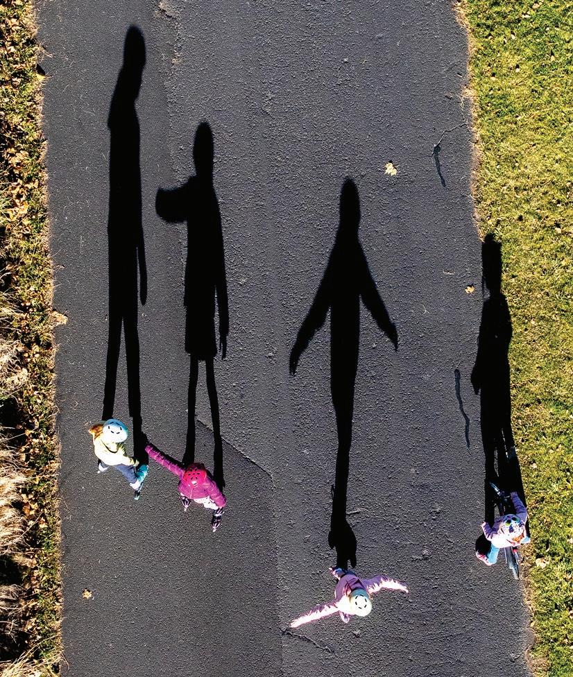
ABOVE: A dog walker moves down the Lewiston Levee Parkway Trail as the setting sun peeks under a layer of dark clouds, creating one starburst in the sky and another in the water in a photo from September 2021. The trails along the rivers are a favorite destination for residents of the Lewiston-Clarkston Valley. BELOW: Kids cast long shadows as they roller skate along the Greenbelt Walkway under the Southway Bridge in Clarkston in December 2020.

Bicycling, walking and running are permitted on the paths that offer expansive views of the two rivers and the Lewiston Hill.
Nature mingles with commerce here: From a single vantage point, it’s sometimes possible to see pelicans and mallard ducks, as well as grain silos and overnight cruise ships.
Those birds are part of the rotating cast of wildlife that can also include heron, coots, deer, osprey, mink, otters and bald eagles.
Kiwanis Park in Lewiston and Swallows Park in Clarkston. Families gather to celebrate graduations, weddings and reunions at picnic table shelters.
Lewiston
It’s where people gather for beloved annual events such as the Seaport River Run and a Pearl Harbor remembrance ceremony. It’s one of the best spots to view Community Spirit Fireworks on July 4 and the Lighted Boat Parade during the holiday season.
Throughout the year, boaters launch their vessels at ramps adjacent to the trails. Children swing, slide and climb at playgrounds at
More intense forms of activity are available too. East of Lewiston’s railroad bridge, fitness enthusiasts can test their strength and endurance on equipment such as a rowing machine, monkey bars and balance beams on springs. They can also improvise fat-burning workouts on stairs at Chestnut Street in Clarkston, and Kiwanis Park and near the Railroad
Bridge, both in Lewiston.
Whatever brings people to the paths, chances are high they’ll return again and again if they live in the area. If you don’t know why, ask a local.
> Lewiston-Clarkston Valley trail system

LOCATION: LewistonClarkston Valley. Lewiston parking lots are along Snake River Avenue and the Levee Bypass. Clarkston parking lots are just north of the Interstate Bridge on the east end of Chestnut Street and off Washington State Route 129.
WHAT TO DO: Bicycle, picnic, fish or walk. (One popular route is “walking the bridges,” which often starts from the Southway boat launch in Lewiston or the Clarkston boat launch just north of Interstate Bridge.)
DIFFICULTY (1-5 SCALE): 1 if you’re walking on a mild day and 3 if you’re stair running in 90-degree temperatures.
NEARBY SITES OF INTEREST: Downtown Lewiston and Asotin; Locomotive Park in Lewiston, home to the Winter Spirit light display; and Clarkston’s commercial district.


Lewiston


Asotin ONFields Spring State Park
Austin Johnson/for Daytripping


WABOVE: Signs illustrating some of the activities and the distance to Puffer Butte stand near the entrance of the North Trailhead at Fields Spring State Park in Asotin County near Anatone. BELOW: Evergreen trees stretch as far as the eye can see atop Puffer Butte in Fields Spring State Park.

Part2
On the cover
Britnee Waters, a nursing student at Lewis-Clark State College, approaches the summit of Puffer Butte on May 5 in Fields Spring State Park. Every season has something to offer at Fields Spring, from Nordic skiing and snowshoeing in the winter to hiking and overnight camping in summer. Photo by Austin Johnson in


