3 minute read
Utah Adventure Day 1: Capitol Reef’s Colorful Canyons


BY KAREN RUBIN WITH LAINI MIRANDA AND DAVE E. LEIBERMAN TRAVEL FEATURES SYNDICATE GOINGPLACESFARANDNEAR.COM
Travel is as much about resilience, adaptability and problem-solving, as it is about personal growth, rejuvenation, and human connection. And so, though our intent was to camp (mostly wild camping) for our 8-day expedition through Utah’s wilderness and immerse ourselves in the topography and indigenous culture, the forecast for the first half of our trip in mid-April was for temps down to the 20s. In fact, when we arrived, there was a fierce gale-force wind blowing at 60 mph that pushed our rental Jeep around and made it difficult even to open the door.
Laini and Dave had taken the temperature into account and fortunately booked a spacious two-bedroom AirBnB in Teasdale (https:// www.airbnb.com/rooms/41151071 ) just outside Capitol Reef National Park for our first night, and a oneroom cabin at Canyons of Escalante RV Park for two nights in Escalante (where Dave has arranged for delivery of winter-grade sleeping bags and pads from Moosejaw.com).
Laini and Dave – who are making their third trip back to Utah and have invited their friend Alli and me to join – have carefully planned the itinerary. Each day has its own highlight, and each destination its own topography and character, and therefore, the experience we have. At Capitol Reef National Park it is the colored rock formations; Grand Staircase Escalante National Monument (for hard-core adventurers) offers slot canyons and hoodoos; Lake Powell in the Glen Canyon Recreation Area is our boat expedition into the flooded canyon; Cedar Mesa offers hiking expeditions in search of cliff dwellings and petroglyphs; and Arches National Park offers the most dramatic, expansive landscapes.
Fortunately, during the course of our trip, just about all the hikes and experiences we have are new for Dave and Laini.
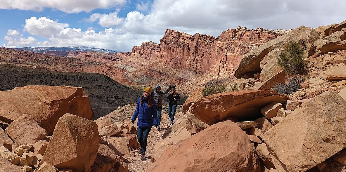
We land at Salt Lake City Airport and pick up an off-road Jeep capable of plowing through deep gravel and sand from Alamo, and set out for the four-hour drive.
We arrive at Capitol Reef in the late afternoon and (I suggest) we take advantage of the gorgeous light and weather and drive the Scenic Drive to get a sense of the park. It is utterly perfect – the warm light, rich colors – and we get such a wonderful introduction.
The Scenic Drive is a 7.9 mile (12.7 km) paved road, suitable for passenger vehicles. You would need about an hour and half roundtrip to drive the Scenic Drive and the two dirt spur roads, Grand Wash and Capitol Gorge which go into canyons and lead to trailheads. (You can follow the Park Service’s Virtual Tour: https://www.nps.gov/care/ planyourvisit/scenicdrive.htm; the tour is free but you still need to pay the $20 park entrance fee when you drive the Scenic Drive – though my America the Beautiful Pass satisfies; check to see the roads are open, 435425-3791.)
‘A Wrinkle in the Earth’s Crust’
Located in south-central Utah in the heart of red rock country, Capitol Reef National Park is a tapestry of cliffs, canyons, domes, and bridges. What makes Capitol Reef so special is how the rock layers tilt. The notes say that this was caused by intense crustal pressure which reactivated a fault buried deep beneath the sedimentary rock layers of the Colorado Plateau. In response, the overlying sedimentary rock layers folded or bent into a one-sided slope called a monocline. It is named the Waterpocket Fold because of the numerous small potholes, tanks, or “pockets” that hold rainwater and snowmelt.
Extending almost 100 miles from Thousand Lake Mountain to Lake Powell, uplifted 6,800 feet higher on the west side, this geologic feature is what accounts for the vibrant palette of constantly changing hues, as the light hits the towering cliffs, massive domes, arches, bridges and twisting canyons. Over eons, the Waterpocket Fold has been impacted and shaped by the geological processes of erosion, deposition, and uplift, all playing a part in the “drama” of Capitol Reef.
On the way back from our Scenic drive, we stop at a fascinating site, the Fremont Culture petroglyphs, not far from the Capitol Reef Visitor Center. The petroglyphs are reached after a short stroll on two boardwalks. The shorter boardwalk provides views of large, anthropomorphic (human-like) petroglyphs, zoomorphic (animal) petroglyphs of bighorn sheep and other animals, as well as geometric designs; the longer boardwalk parallels the cliffs and the petroglyphs along it are closer to the viewer but harder to see because of a patina that has developed over them.
The indigenous people who lived in what is now Utah for about 1000
Continued on next page