
5 minute read
Syosset Woodbury Chamber celebrates 25th anniversary


From page 1 cia Shannon of Compass Real Estate; and Tami Racaniello of Wellness Unicorn.
“For the last 25 years, the Syosset-Woodbury Chamber of Commerce has demonstrated its unparalleled commitment to supporting the small business owners that do so much to make communities unique and more vibrant,” Legislator
Drucker said. “I extend my heartfelt congratulations to everyone who has contributed to the Syosset-Woodbury Chamber’s quarter century of success, and I look forward to working closely with President Russell Green and the entire board in pursuit of an even more prosperous future.”
“Organizations like the Syosset-Woodbury Chamber of
Commerce are so instrumental in growing our local economy and supporting the local entrepreneurs that make Nassau County’s downtown business districts such wonderful destinations,” Legislator Lafazan said. “Congratulations to everyone at the Syosset-Woodbury Chamber for 25 amazing years of championing our community!”
Have you lost someone?
If you would like to post an obituary for a loved one, simply send a short biography of them with (if desired) their photo, details of their funeral/visitation services, and/or any donation requests to editor@gcnews.com, or call our office at 516-294-8900 to inquire.

March 3, 2023
Utah Adventure Day 4-5: Driving Burr Trail, Exploring Glen Canyon, Wild Camping in Arch Canyon
BY KAREN RUBIN WITH LAINI MIRANDA AND DAVE E. LEIBERMAN TRAVEL FEATURES SYNDICATE GOINGPLACESFARANDNEAR.COM
It’s the afternoon when we leave the Grand Staircase-Escalante after having a sensational hike through Big Horn Canyon, and drive through the Dixie National Forest on our way to Glen Canyon Recreation Area.
We stop in Boulder where the Magnolia burrito food truck that Dave and Laini love is based in the parking lot of the Anasazi State Park Museum. I wander into the museum for a quick look – the displays are really wonderful and had I had the time, I would have taken advantage of the interactive exhibits (you can grind corn using a mano and metate, identify seeds with a microscope, make rubbings of pottery designs).
I find it fascinating that “Anasazi” is actually a Navajo word meaning “ancient enemies” or “enemy ancestors” but it is not actually known what these people - Ancestral Pueblo who inhabited the area before the Navajo - called themselves. Still, the name has stuck. They were village-dwelling farmers – that is to say, not nomadic people - who lived in the Four Corners between 1 and 1300 AD, when there is some mystery about why they suddenly left en masse (some suspect it was the drought of historic proportions, only rivaled by our current 20-year drought). Behind the museum you can walk a short trail to the Coombs Site Ruins and a life-size, six-room replica of part of the pueblo as it would have existed 800-900 years ago.
Beyond that are several more unexcavated areas. (Anasazi State Park Museum, Boulder, UT, 435-335-7308, www.stateparks.utah.gov)
Just down the road from the museum, we turn onto the Burr Trail Scenic Backway, considered one of the most picturesque drives in Utah. Paved and graded in some sections, gravel and dirt in others, the road extends 66 miles from Boulder, passing the slickrock canyons of the Grand Staircase–Escalante National Monument, the Badlands of Capitol Reef National Park, the Waterpocket Fold, and painted rock desert of Glen Canyon National Recreation Area, ending at Bullfrog Basin on Lake Powell - our destination on the fourth day of our Utah Adventure.
I find it interesting to learn that the Burr Trail was originally developed as a cattle trail by stockman John Atlantic Burr (born in 1846 aboard the SS Brooklyn sailing across the Atlantic; his family estab- lished Burrville, Utah, in 1876). Burr developed the trail so he could take his herd through the rough, nearly impassable country around the Waterpocket Fold, Burr Canyon and Muley Twist Canyon.
We drive through Long Canyon and soon come to one of the highlights along the route, which accounts for its nickname, Singing Canyon. It looks like a setting for Jurassic Park. We walk in, feeling so small against these gigantic, high cliffs of red rock. Dave gets out his mini-guitar for the occasion and we revel in the acoustics that give the canyon its name.
As we drive this rustic highway, we see giant red rock boulders strewn all over, having broken off from these cliffs, so close to road. Some are precariously balanced. We wonder over what period of time they came down (last century, or last week?), and whether more are likely to come down anytime soon. This is a landscape that seems at once fixed and yet is constantly changing. Burr Trail is like driving through destruction – you see these enormous, massive walls of rock collapsed in heaps and think how fragile it all is, how even the mighty can fall. It is as if it is all falling apart and you wonder how long before these rocks turn to mounds of sand.
We next come to the famous Burr Trail Switchbacks. The view from the top to the Henry Mountains and Waterpocket Fold is stunning. The intriguingly named “Waterpocket Fold” is a geologic wonder: a nearly 100-mile long warp in the Earth’s crust that formed between 50 and 70 million years ago.
After taking in the view, Dave maneuvers down the series of ridiculously steep, tight turns (scary!) several hundred feet to the valley below. (https://www.visitutah.com/ places-to-go/cities-and-towns/boulder/burr-trail)
We don’t get to do our wild camping tonight either, but rather have found what seems one of the few motels around, Tikaboo Lodge, and make do with the remaining food supplies we have.
(Note that there are very minimal amenities in the Bullfrog/Ticaboo area during the off-season. There are, however, two helpful outdoor outfitters/gas stations open until 4pm.)
Boating in Glen Canyon, Wild Camping in Arch Canyon

Our destination the next morning is Glen Canyon National Recreation Area. Spanning 1.25 million acres,
Continued on next page
Continued from previous page it stretches for hundreds of miles from Lees Ferry in Arizona to the Orange Cliffs of southern Utah.
Lake Powell is only 13% of the National Recreation Area, but is (or rather was) one of the largest manmade lakes in North America.
But since 2001, declining water levels (the lake had dropped over 100 feet over a two-year period at the time of our visit) due to climate change and 20 years of drought have reshaped Lake Powell’s shoreline, and changed or closed boat ramp access points, on-lake facilities, and dramatically altered the landscape. (Check conditions, www.nps.gov/glca/ learn/changing-lake-levels.htm)
Laini has rented a power boat from Bullfrog Boat Rentals (435-684-3010) at the Bullfrog Marina so we can explore the canyons that were flooded when they created the controversial Glen Canyon Dam on the Colorado River.
We get a map from the boat rental company and try to follow the mile markers on the lake that help us orient.
Compared to our two days of adventuring in Grand Staircase-Escalante, this day is like a resort vacation, with the luxury of a boat allowing us to traverse 20+ miles in one afternoon.
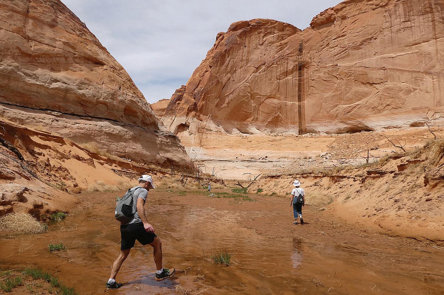
The water level has dropped so much over the past two years that trees are poking out from the bottom. We are in search of signs of cliff dwellings or petroglyphs that may have been exposed with the drop in water level.
Dave navigates to Forgotten Canyon where Laini has information that a trail will lead to Defiance House Archaeological Site, an 800-year old cliff


