Highways across our country have done one thing successfully, move people in and out of a city. In turn, this has been a contributing factor to the decay of our city centers and suburban sprawl. Today, over 30 cities are considering targeted removal of aging highways to “restore a sense of space” back to neighborhoods. In the context of Cincinnati, Ohio, a study completed in 2006 states, “Dislocation of residents and disruption of the neighborhoods due to the construction of I-71 had a detrimental effect on the vitality of the adjacent area.” This has been a common trend in highway studies done across the country, they are more harmful than they are helpful. This thesis covers precedents for highway removal and calculated responses to infill land that is reclaimed to connect communities back to one another.
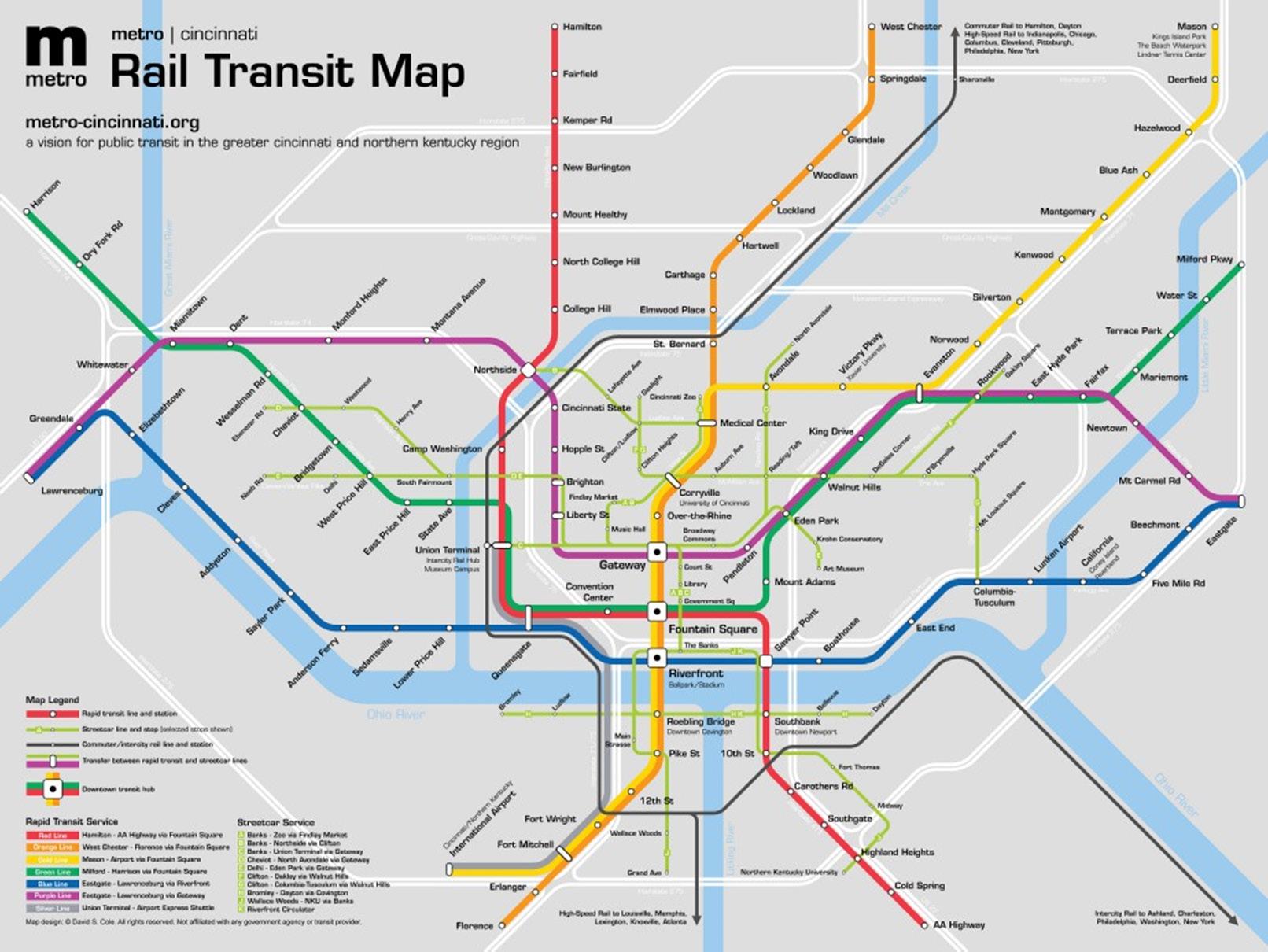
Cincinnati may have one of the most fraught relationships with public transportation in the united states. The metro plan (image to the right) was voted against several times through the course of the early 2000’s.
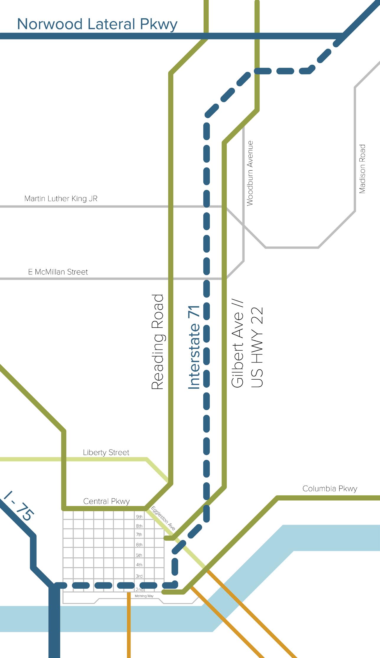
However, this thesis takes the assumption that the 2012 metro plan will be in effect. In addition, the city has opted to remove the portion of I-71 (image to the left) to provide the right of way for rail lines. This is one of the most difficult aspects of building rail transit, finding available space for rail lines. The colored routes represent Rapid transit light rail lines that run underground through the city, resurfacing on the outskirts. The green lines represent streetcar lines that help with local traffic and carry people from neighborhood to neighborhood. The Thin black line that runs through union terminal is an intercity rail that would connect Columbus through Cincinnati down to Louisville, Lexington, and Charleston among other cities on the network. The three white boxes with black squares represent downtown transit hubs that serve as connection points for light rail to streetcar to bus service.