6 minute read
A Canal Side Setting
Rod Auton tells us why he finds the canal through Retford to be so attractive.
The 46 miles of the Chesterfield Canal vary hugely. There are places where you can’t see a house. You go past open fields and dense woods, delightful pubs and ancient bridges, but it also passes through several towns and villages.
There are four major towns. Chesterfield is much the largest, but the canal there runs through a green corridor and you are very close to the famous Crooked Spire before it becomes really urbanised.
The next town is Killamarsh, but the canal has not yet been restored there; indeed 30 houses were built on the original line of the canal in the 1970s. The new route will be really exciting, but we will have to wait a few years before that can be enjoyed.
Worksop has massive potential and includes the magnificent Straddle Warehouse, but unfortunately much of the town turns its back on the canal, especially near Bridge Street and Town Lock.
Retford is the complete opposite. It has an enchanting canalscape. All the way along you will see houses that have patios or decks built right next to the canal at the end of their gardens so that the residents can enjoy the view, the wildlife, the boats and the tranquillity.
Approaching the town from the west you come under Woodcock’s Bridge and immediately arrive at West Retford Lock.
The first boat to reach Retford, loaded with coal, arrived here on 1st November 1774. By April 1776 the canal had been opened to the east right through to West Stockwith on the River Trent. The following year it was fully opened west to Chesterfield. After the lock, you pass the new houses of Elizabethan Gardens on the offbank where the Elizabethan High School used to stand. To your left is King’s Park. Under the Inkerman footbridge, you come to some lovely old houses including a warehouse which has lettering saying “… & Sons, Furniture Repository” but I can’t make out the name!
Round a corner you come upon three sets of narrows. These are all aqueducts. The middle one carries the canal across the River Idle. Next to it is a very insignificant little brick building which houses a pump to top the canal up with water from the river.
For 200 years the canal got water from the Idle via a feeder – a mini-canal. Then the river was dredged, and the bed was lowered as a flood prevention measure. This meant that the river was too low for the feeder to work, so it was abandoned. It has since been built over and is almost impossible to trace.
It came off the River Idle just south of Goosemoor Farm Produce, near Ordsall. It then ran through what is now one of their greenhouses, across Goosemoor Lane where it becomes Whitehouses Road, east of Goosemoor Park, under the railway, behind Adrian’s Walk, behind Whinney Moor Way, under the railway, through Perry’s car sales, east of the old King Edward VI school, along what is now a pathway, under Dominie Cross Road, coming out at the end of Osberton Road where there are now some garages. Peep over the fences and you will see the canal.
Back to the canal, we now arrive at Town Lock and some very interesting buildings. The newish looking red brick building just above the lock is in fact the old Manchester, Sheffield & Lincolnshire Railway warehouse that was converted into luxury
flats in 2017. (The MS&LR had bought the canal in 1847.) On the opposite side is the old lock keeper’s house. If you cross the lock and go down the pathway, you will see the fabulous Retford canal mural, unveiled in 2019.
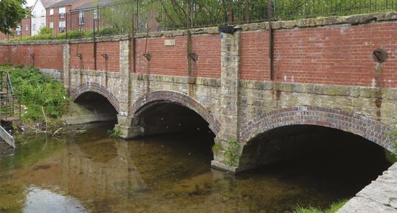
River Idle aqueduct.
Below the lock is Corporation Wharf. This used to be the centre of canal operations and was a really busy, dirty place. There would have been boats arriving, loading and unloading constantly. Packet boats would come from outlying villages on market days bringing shoppers and people selling their wares.
There were lots of warehouses, sheds, stables etc. Retford Little Theatre and the Fire Station occupy much of this land nowadays. The Bay Tree Café is in an old warehouse. On the opposite bank, Retford Mariners’ marina includes a crane that is Grade ll listed and a dry dock that has been filled in.
As late as the 1930s, wheat and grain were still being delivered here, collected from farms along the canal. Flour arrived from the Albion Mill at Worksop.
The boatmen used to stay at the nearby inns and the allimportant towing horses were looked after in the stables.
Slightly further on, you pass under Carolgate Bridge and arrive at the site of a basin. There is no sign of it now, but it was just before the modern Arlington Way Bridge. It was constructed in 1883 as a private venture by Mr Taylor White for his chemical works. The site is now occupied by Jewson and the big shed with a green roof almost exactly fits the footprint of the old basin.
Past Spa Common, you come to an old house in grey brick. The feeder mentioned above came out on the opposite bank. Now it is just a tiny bit of scrub land with fences all round it.
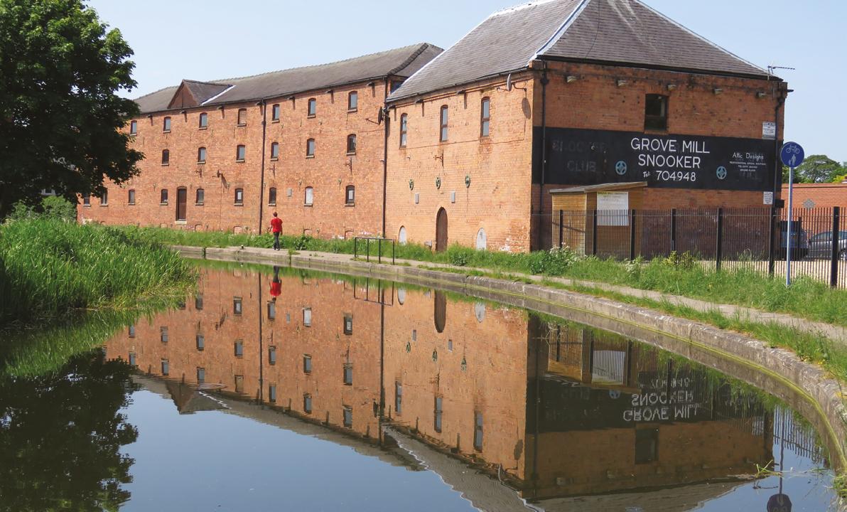
Further on you go under Grove Mill bridge and past the snooker hall that used to be another warehouse. The next bend is the site of the notorious ‘pulling the plug’ incident when the canal was accidentally drained in 1978; for the full story see p.28 of issue 17, the July/August 2020 edition of MADE.
The canal now becomes more suburban passing more modern houses and Leverton Road Recreation Ground on the towpath side and open fields on the offside.
If you have never walked along this section of the canal, I can heartily recommend it.
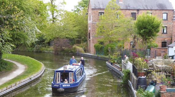
Seth Ellis by the furniture repository.
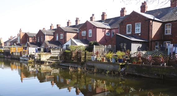
Houses facing the canal.
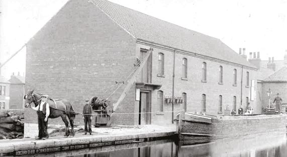
MS&LR warehouse 1910 (Bassetlaw Museum).
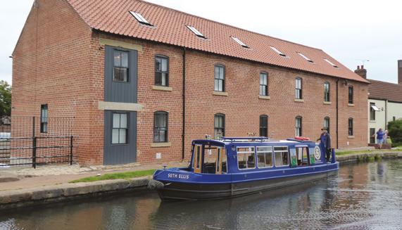
Renovated warehouse.
Rod Auton
Rod is the Publicity Officer for the Chesterfield Canal Trust which is campaigning to complete the restoration of the canal by its 250th Anniversary in 2027. For further information go to www.chesterfield-canal-trust.org.uk. All imagery courtesy of The Chesterfield Canal Trust (various photographers).


