As a graduate of the John H. Daniels Faculty of Landscape, Architecture, and Design, I envision my role as an architectural designer sitting at the intersection of representation and design practices by confronting the socio-political issues that subconsciously shape our built environments. My work details the macro and micro scales of both landscape and architectural projects, often obscuring where one ends and the other begins in an effort to understand their interdependence. All the while, my research examines urban contexts faced with ideological conflicts that begin to morph and expose the cultural fabric of spaces that are integral to their political autonomy. I imagine that my work will continue to pose questions of how urban spaces can foster a vast range of social activities that are integral to the fabric of our ever changing cities.
Maggie Ghobrial
Toronto, ON maggiegh.arch@gmail.com 403.714.4543
EDUCATION
University of Toronto, Toronto ON
Master of Architecture Graduate
John H. Daniels Faculty of Landscape, Architecture and Design
Awarded with the John And Myrna Daniels Foundation Opportunity Award
University of Toronto, Toronto ON
Honors Bachelor of Arts, Specialist in Architectural Studies, Minor Art History
John H. Daniels Faculty of Landscape, Architecture and Design
PROFESSIONAL EXPERIENCE
Teaching Assistant - Daniels Faculty of Architecture
Design Research Internship Program (ARC495 DRIP): co-ordinating logistics of internships between students and host firms, preparing presentations for in-class seminars, maintaining point of contact between professor and students
Close Readings in Urban Design (ARC253): leading discussion-based tutorials, grading all student work and providing thorough feedback, maintaining first point of contact for all course inquiries from students
Design History of Landscape Architecture (ARC356): leading discussion based tutorials, grading all student work and providing thorough feedback, leading office hours, maintaining first point of contact for all course inquiries from students
Teaching Assistant - Daniels Faculty of Architecture
Close Readings in Landscape Architecture (ARC252): leading discussion-based tutorials, grading all student work and providing thorough feedback, maintaining first point of contact for all course inquiries from students, preparing presentations for lecture
Close Readings in History of Architecture (ARC251): grading all student work and providing thorough feedback, leading office hours, maintaining first point of contact for all course inquiries from students
Research Assistant - Dreamhouse Seminar
Researching, organizing and documenting primary sources, filtering essential architectural texts to be read by students and referenced in seminar presentations; collecting archival image and text to organize course structure
Graphic Designer, EmpowHERto, Toronto ON
Creating and producing unique design content for clients using programs such as Illustrator, Photoshop,and InDesign; working with clients to create brand identity, logos, business cards, banners, postcards, letterheads, etc.; leading formal meetings with clients; succession of KPI through tasks tracked by deadline dates; producing graphic content for EmpowHERto’s social media feed
2013
COMMUNITY INVOLVEMENT
Global Sustainable Foods, Toronto ON
Creative Director
Co-lead the start up of non-profit organization GSF, director of creative operations, producing graphic content for social media feed & creating posters for upcoming events; participated in bi-weekly meetings
Daniels Orientation, University of Toronto, Toronto ON
Orientation Leader
Organized and lead a group of students during their week of Orientation at the John H. Daniels Faculty of Landscape, Architecture, and Design; co-hosted and lead students on university grounds as well as around Toronto ON; lead creative activities for students to participate in and mingle
West Island College Missions Trip, Nawalgarh India
Volunteer
With a group of 20 students, my school participated in a missions trip to Nawalgarh and Delhi, India; as a group, we built a well for an existing girls elementary school in Nawalgarh; in New Delhi, we led English lessons for a number of schools
Youth with a Mission, Punta Cana, Dominican Republic
Volunteer
With a group of 40 students, my school worked to build two housing structures for a community in the Dominican experiencing uninhabitable living conditions over a period of two weeks. The process of building this wood structures was overseen by contractors but daily tasks included cutting wood, retrofitting structural pieces and painting the interior and exterior of the structure once complete
NON ARCHITECTURAL EXPERIENCE
2024 Azhar Kitchen + Bar, Toronto ON
University of Toronto Varsity Promotions, Toronto ON Event Staff
TECHNICAL SKILLS
THE PLANT
Comprehensive Studio Mass Timber Design Project 8-25
John H. Daniels Faculty of Landscape, Architecture, and Design
Carol Philips
January 2023 - April 2023
Design, Physical and Digital Modeling, Drawing Details, in Collaboration with Jessie Valenti
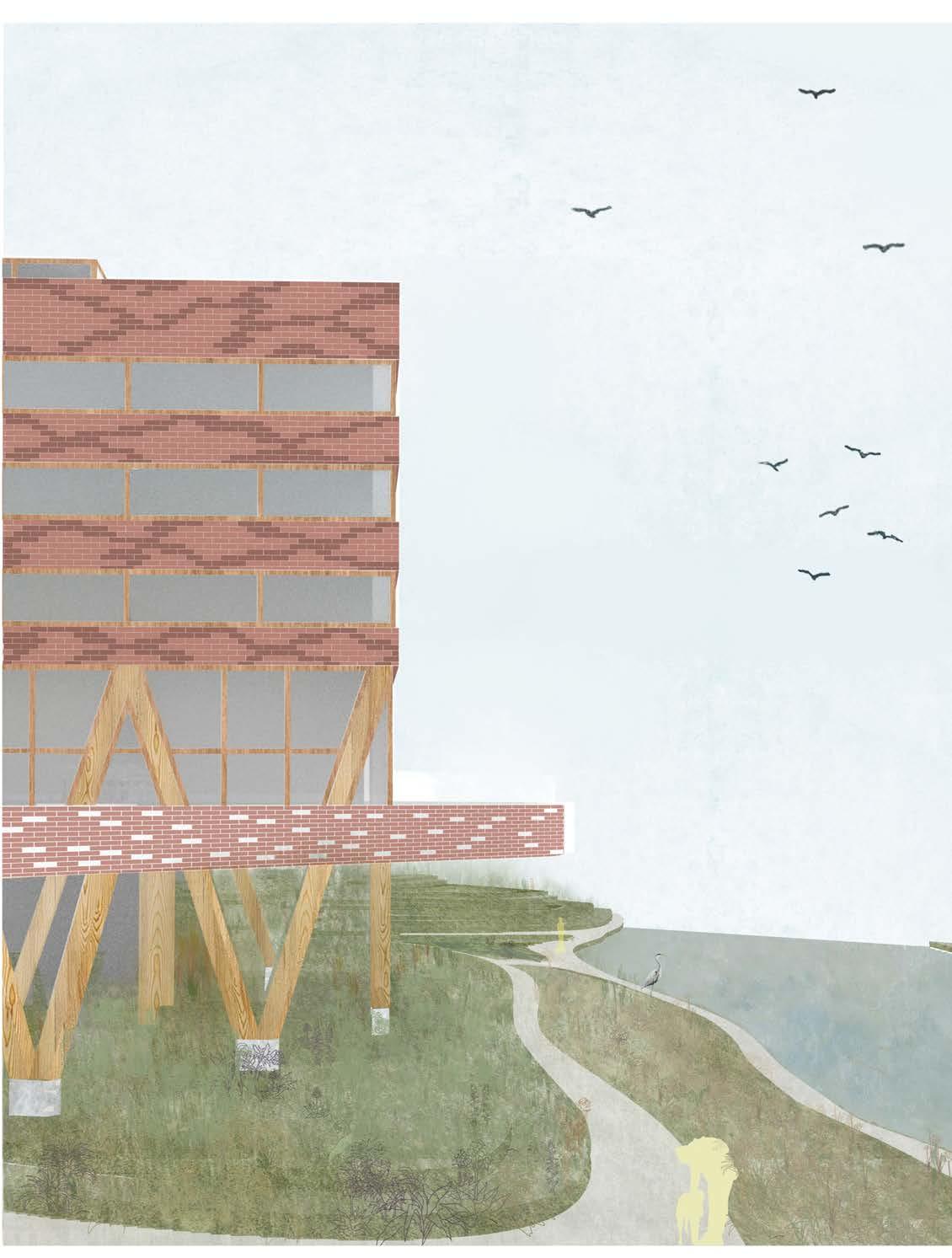
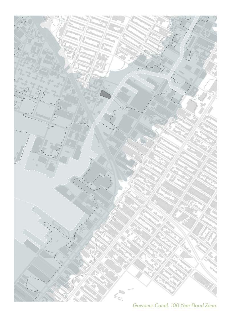
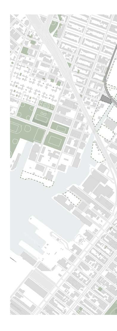
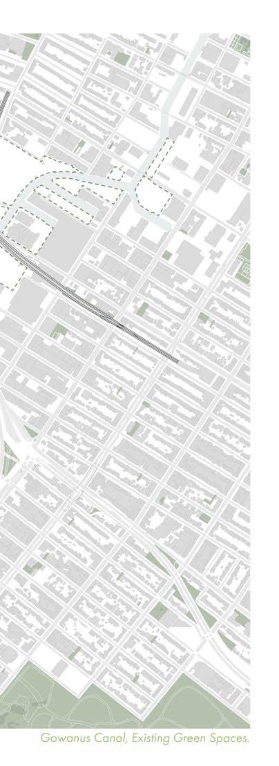
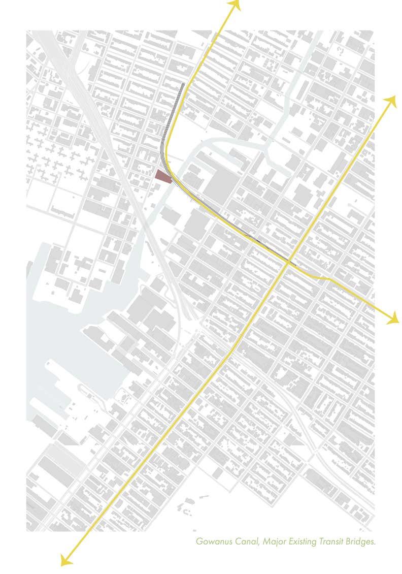
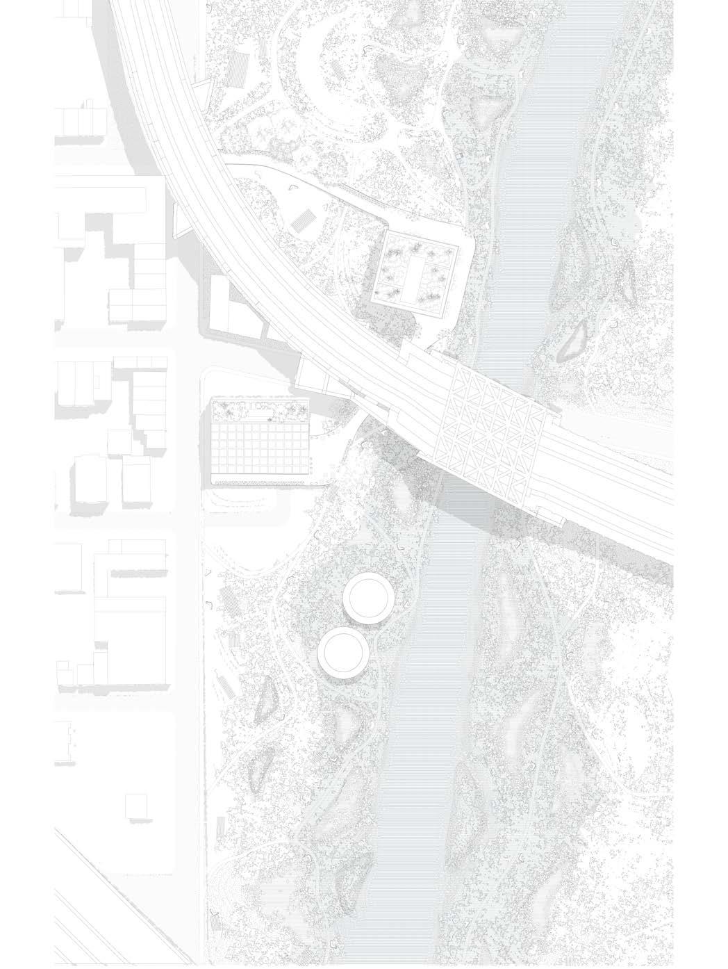
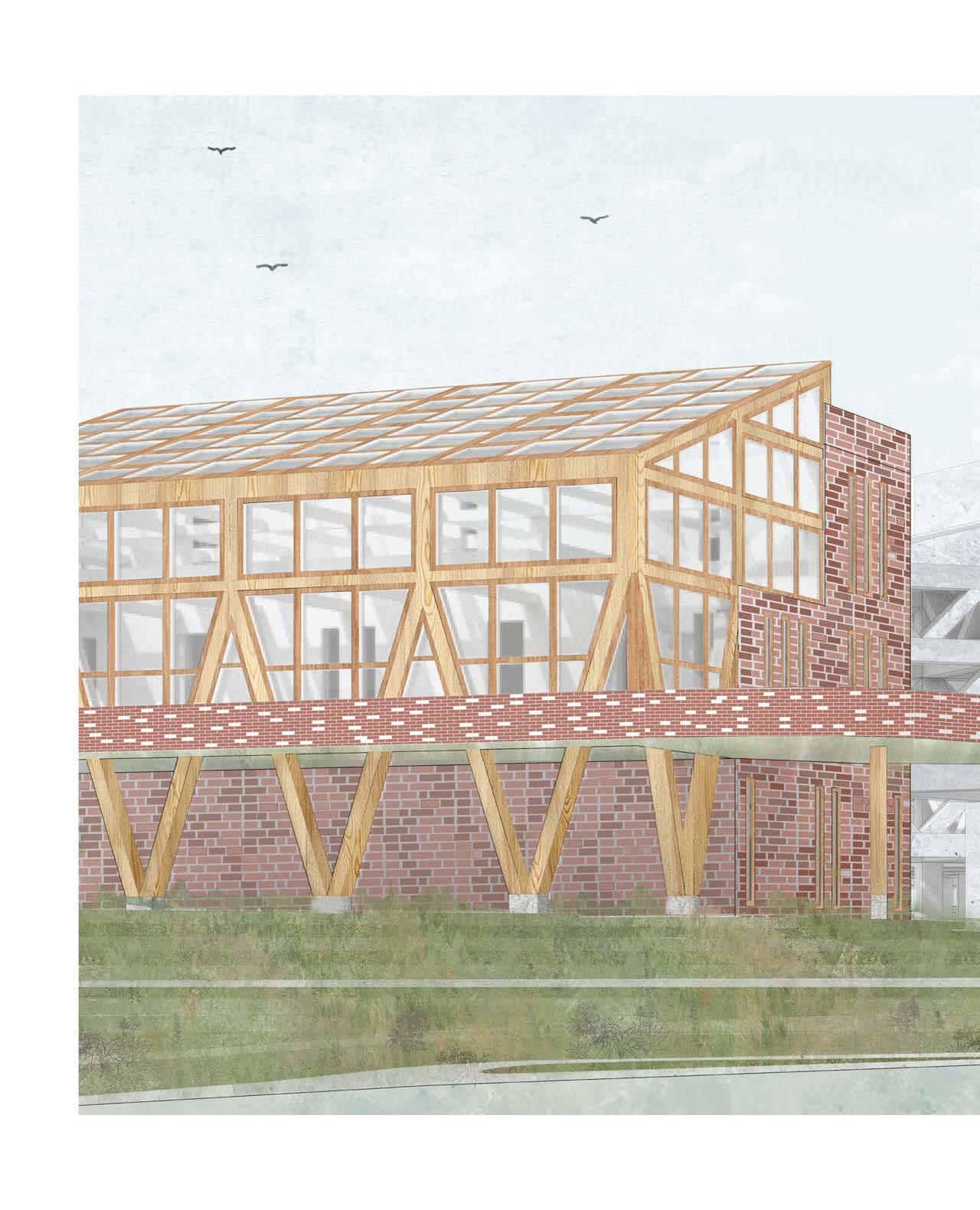
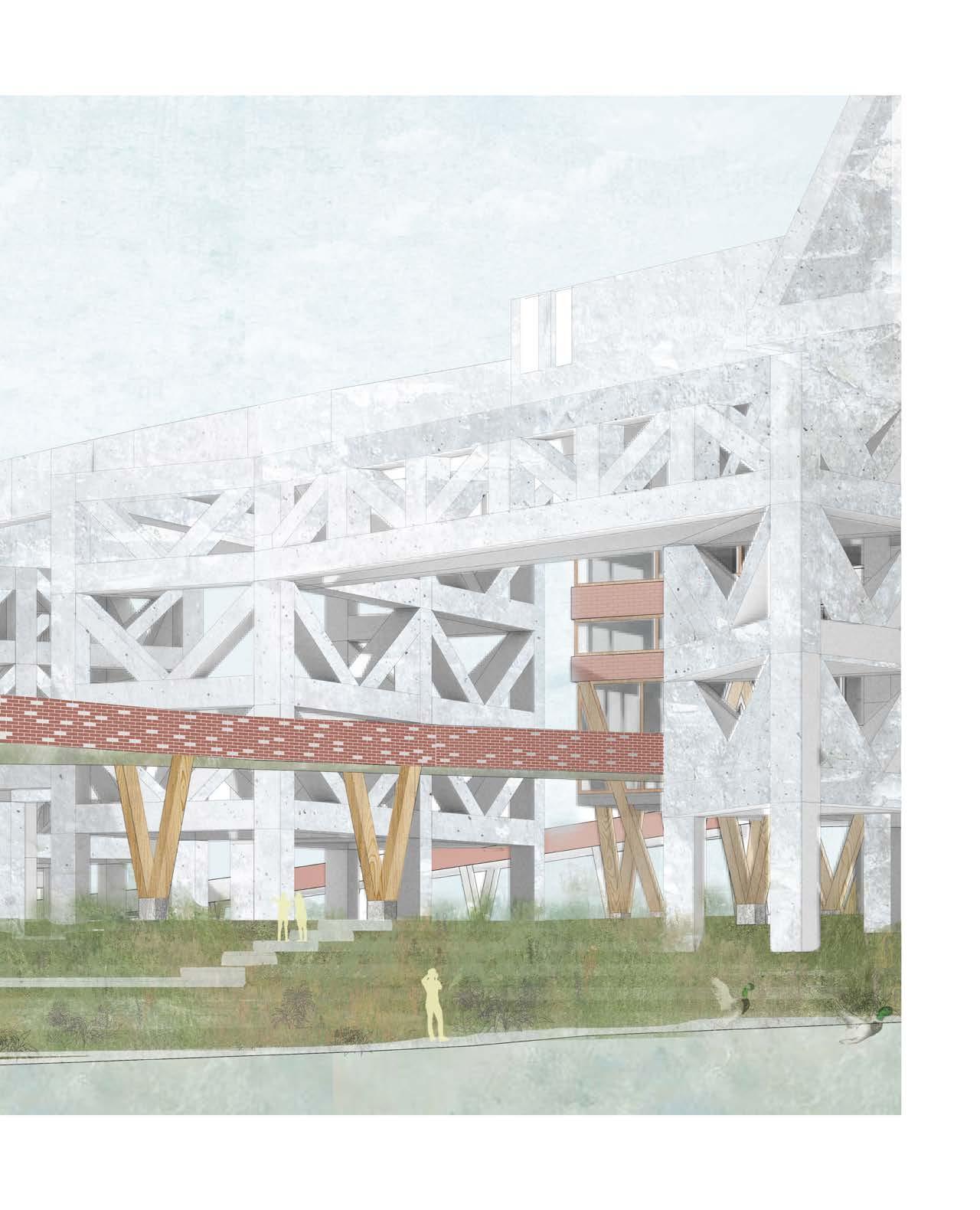
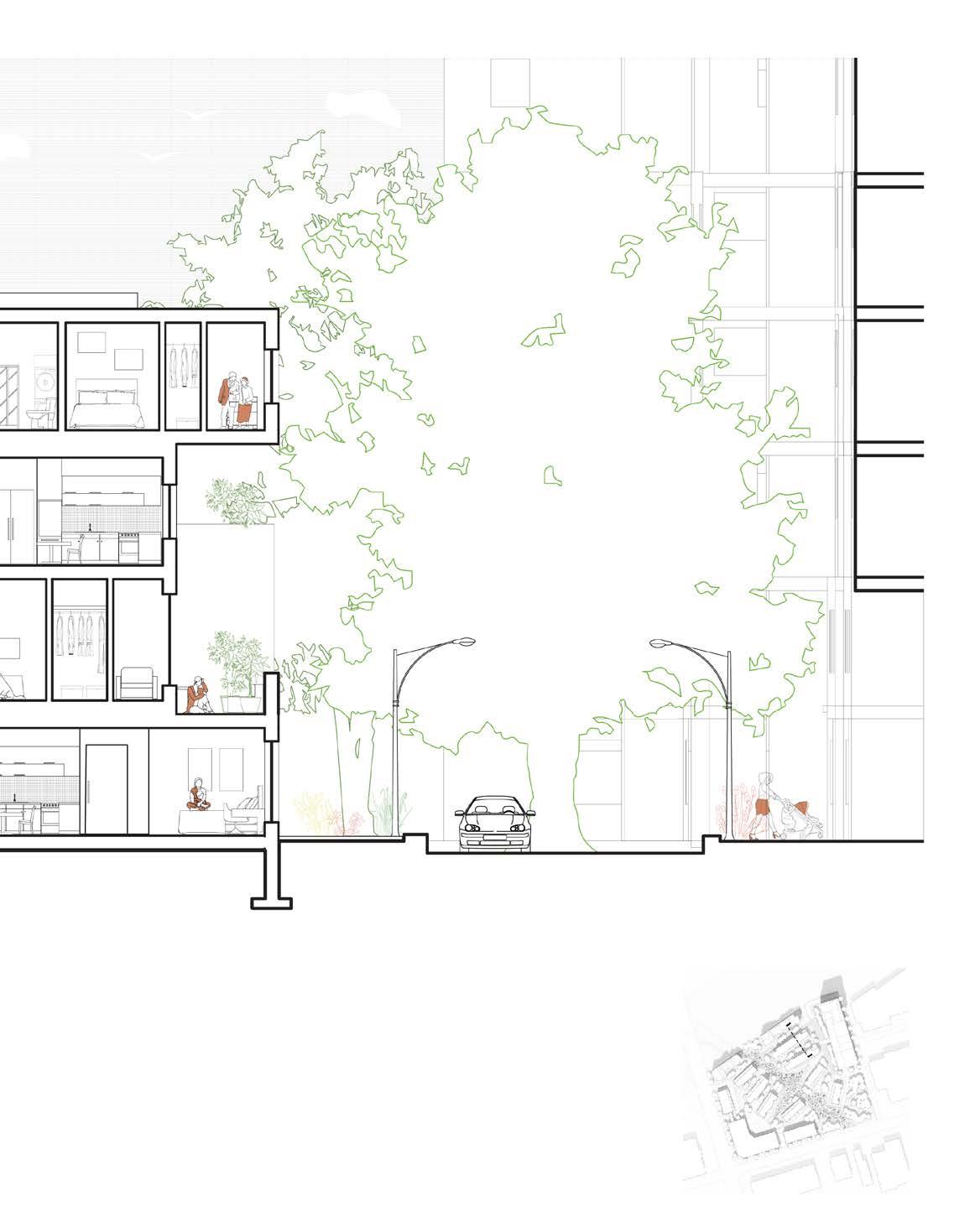
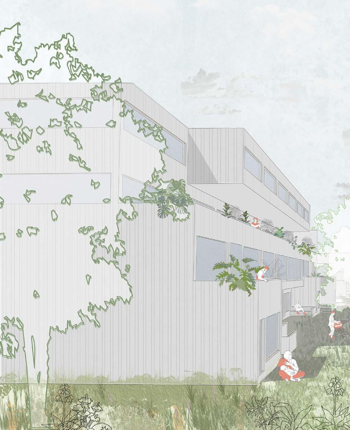
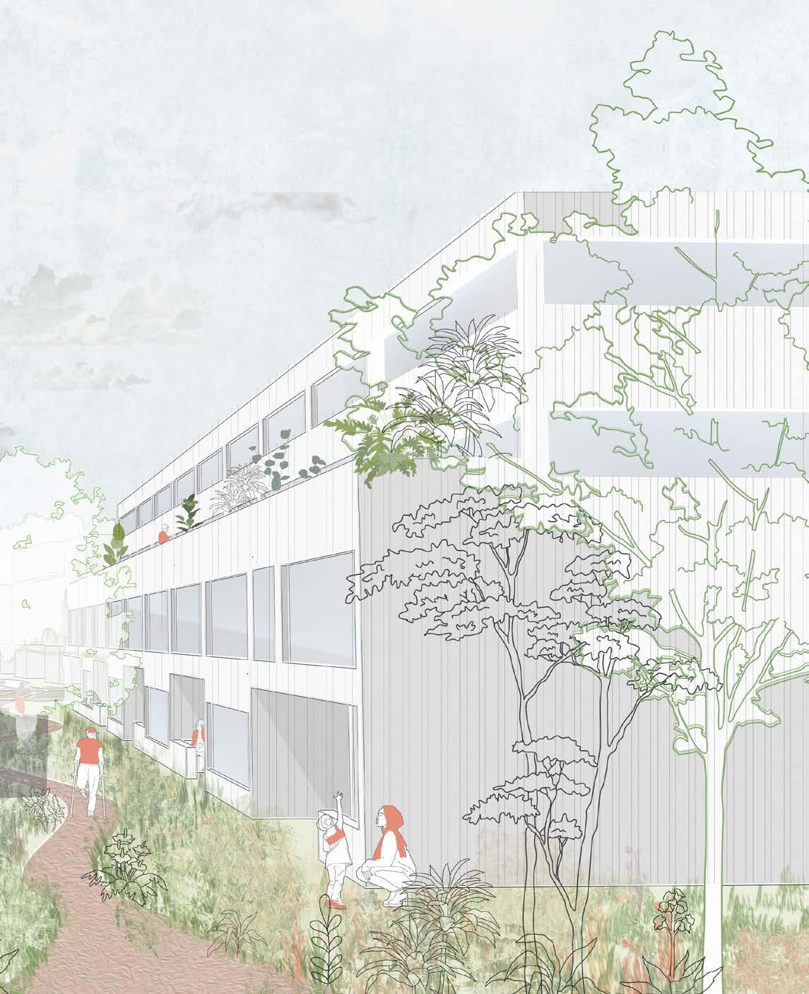
The Plant generates a new paradigm for urban inhabitation by re-integrating historical wetlands within the cityscape. Discarded brick along the Gowanus canal is upcycled to reimagine the symbiotic relationship between parkland and pavilion, which adapt and morph to their specific condition. The structures are comprised of two primary materials - mass timber, and upcycled collaged brick, sourced from nearby demolition sites along the industrial canal. The combination of materials are used to develop raised and semi-raised pavilions along the expansive wetland site in an effort to offset carbon emissions and achieve a net zero design. Within the pavilions, the project proposes a plant factory, creating a space that functions as both a community and research hub, as well as a space for propogating wetland plants. Once mature, these plants would eventually move to their permanent dwelling: the wetland site.
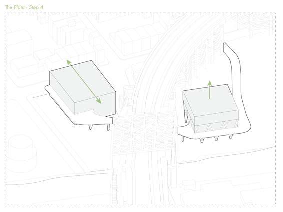
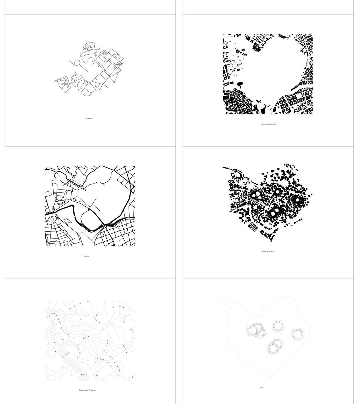
The concept of the project began by studying the two most perment systems on the site systems and noticing the lack of public green space within the greater community, the project
Maggie Ghobrial
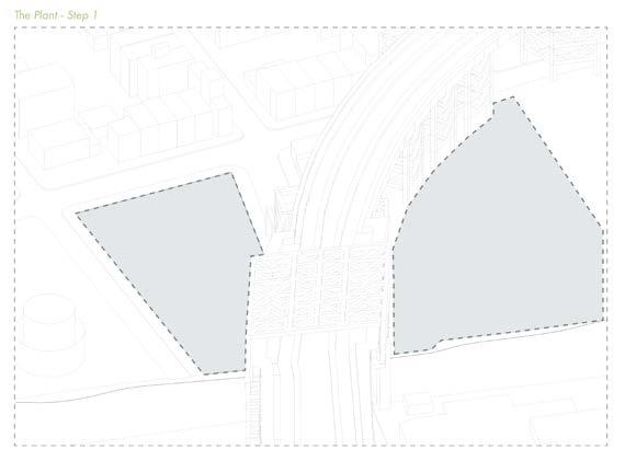
site - the above grade transit system, and the below grade canal system. After mapping these project morphed into a larger, third urban system, rather than a singular building on the site.
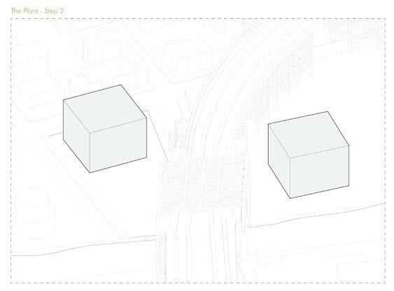
The engulfment of the projects site as well as the site above it allowed for the new, third system to be a connection providing public space, green space, and view points to the other side of the canal. The buildings on both sites began as identical masses that would then take on a different shape, morphing to suit the buildings program and exterior surroundings.
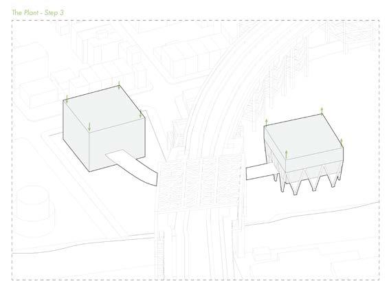
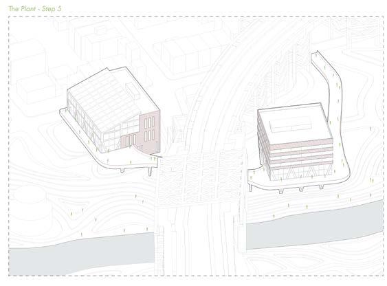
After understanding program requirements and the needs of each mass, each building is either embedded or raised depending on tis location. The project aims to both embrace the flooding and create a wetland that consumes the site; thus, the North-east building closest to the wetland becomes raises, and the South-west building near the street edge, creating a public realm and urban edge. Determining program also allowed each cube to form new massing shapes - the North-east remains a square shape while adding a floor to add a view-point to the canal, while the South-west loses a story and gains an extra structural bay to allow the south-facing greenhouse more surface area for sun exposure.
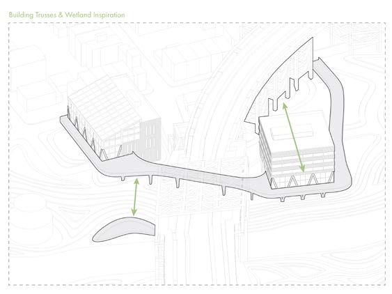
The site then begins to accommodate the canal, removing the hard-edge wood structure and creating a soft edge. The North-east building embraces the flooding, while the Southwest building that touches the ground floor keeps space from the canal and creates a barrier between the water and structure through swaling and berming. Lastly, the building bridges its two main concepts from the transit system and the canal system by mimicking its shapes - the structural truss system originates from the transit bridge spanning over the site, and the buildings bridge mimicks the shapes of the wetland swales and berms.
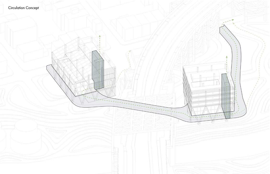
The project aims to provide multiple exit points and alternative respites during times of high tide and flooding. The bridge that begins at the urban edge serves as a public space, but it also becomes an alternative method of entering the site when the egress stairs and elevators are flooded. The bridge also connects the two buildings and allows its users to cross to the South-west building, using the alternative exit closer to the urban edge and away from the flooding canal.
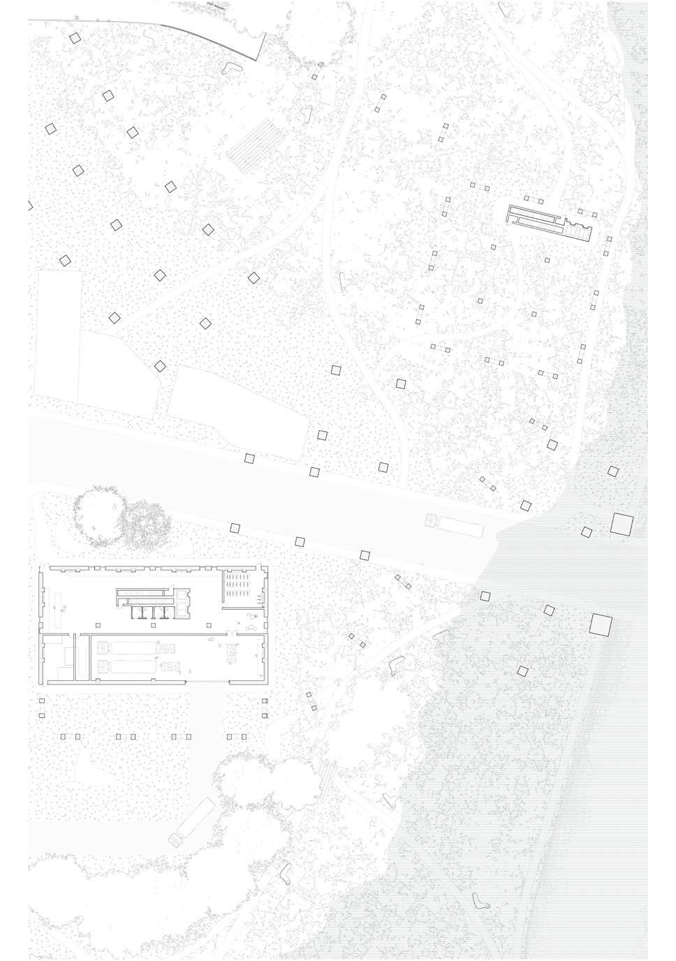
The projects landscape strategy had three major steps - removing the canal wall and reshaping the topography between the canal edge and urban edge, creating gradual incline to invite the water to flood the area; digging bio-swales closest to the water to capture and slowly absorb the water that flooded the site; and lastly, creating a barrier between the urban edge and the swales by using berms near the roads and buildings. The landscape plan above is drawn to show how the site would begin to look during a flood. Paths, pavilions, benches and seating areas have been mapped.
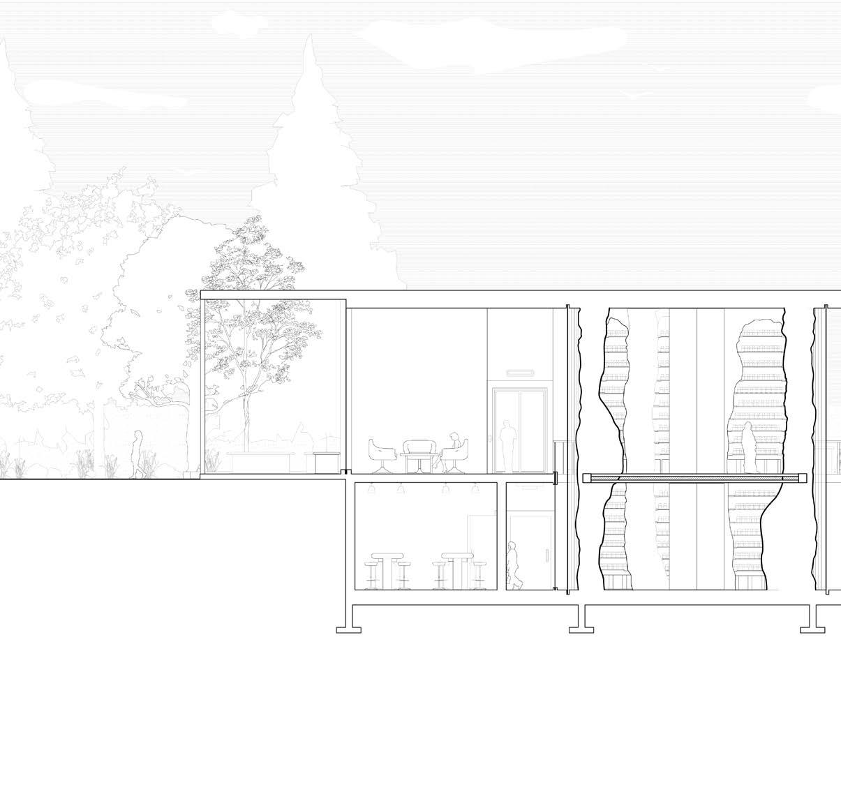
On the ground floor plan, the parts of the building shown are the loading and lobby in the factory (south) building, the egress stairs of the raised community
building, and the bridge entrance. Part of the concept for the ground floor was raising the building program to begin on the second level, in order to accommodate potential future flooding of the first floor.
(north)
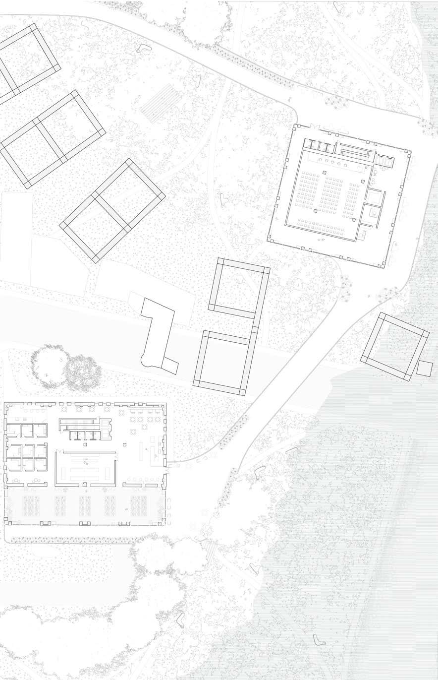
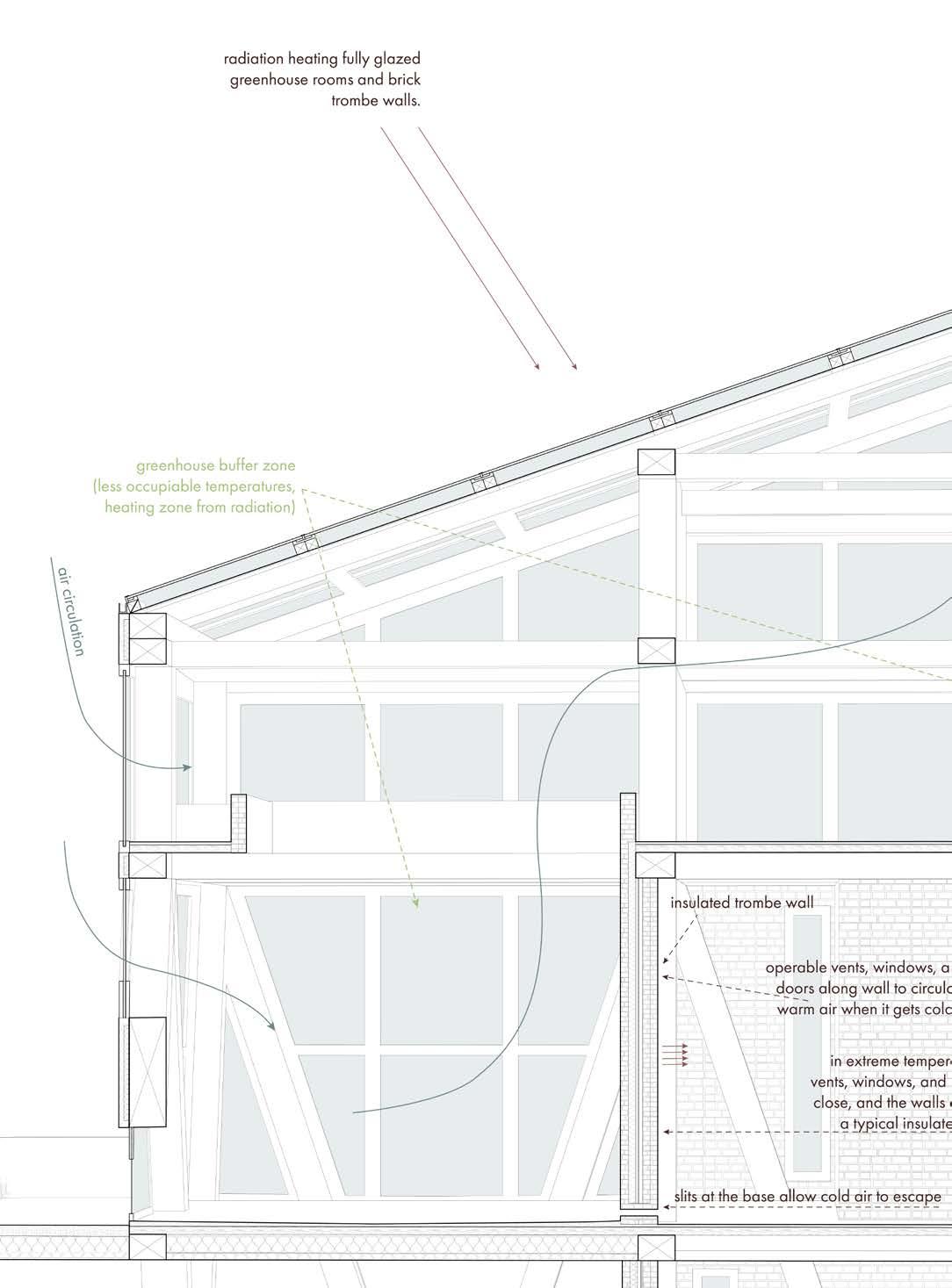
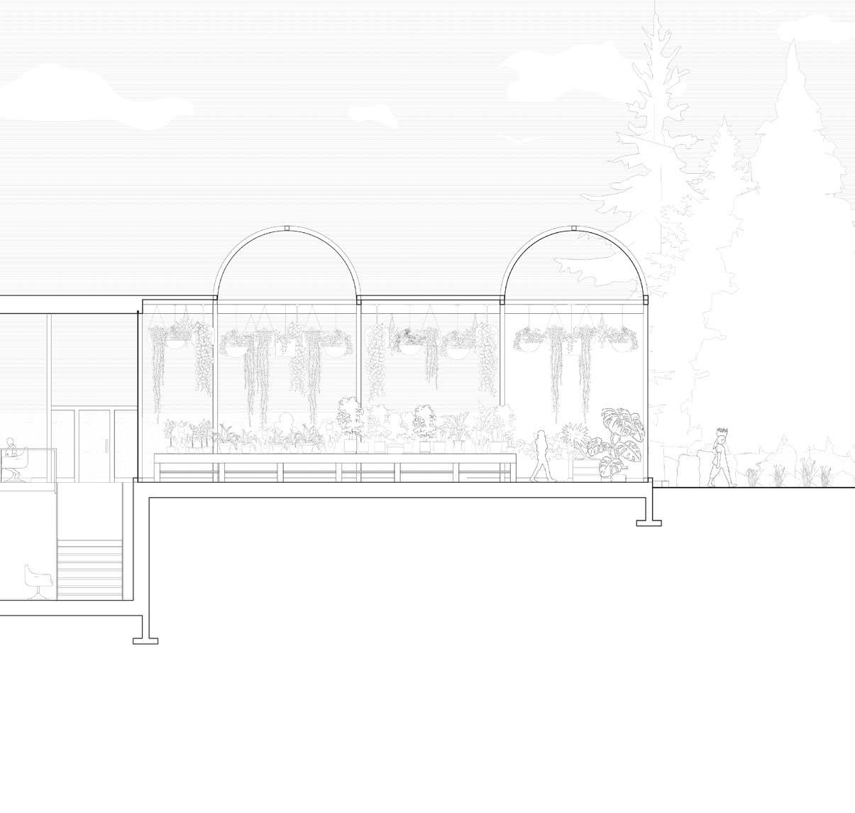
The second floor, shown above, is envisioned to be a new ground floor - this is the most public and likely most used floor that would be a relief zone during floods - in the north building is the auditorium, seating outside on the bridge, and in the south building is the cafe/outdoor seating, the greenhouse, plant store, and the office and work area.
Maggie Ghobrial
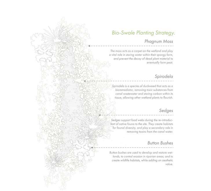
The landscape diagrams above highlight the multitude of strategies at both macro and micro scales for the wetland. Above is a series of wetland micro-plants native to the area that are able to phytoremediate contaminated water. These would exist in and around the swales.
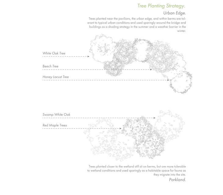
The above diagram shows the trees that would populate the site and be planted on the berms. The project aims to plant as few trees as possible, as they would not thrive during floods, but still need to exist on the wetland for the habitats that would thrive off these plants.
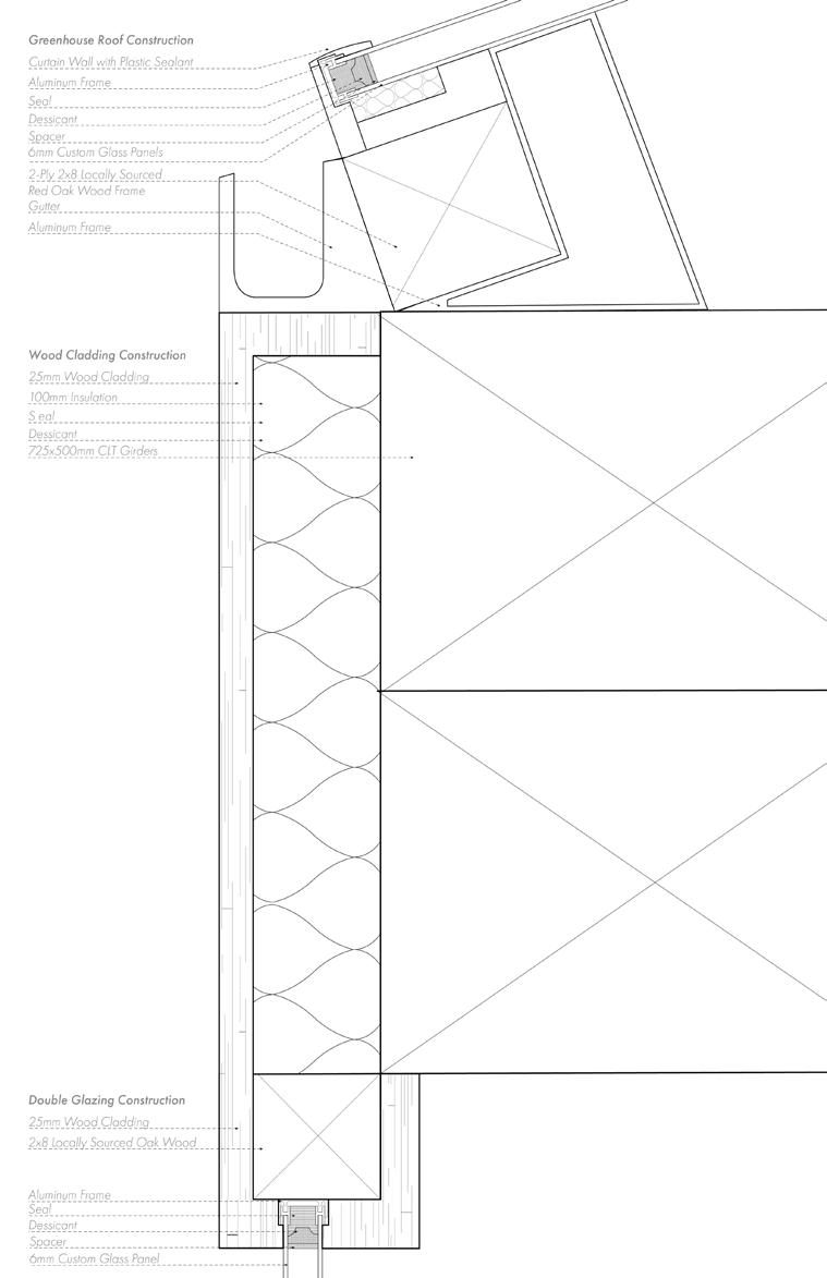
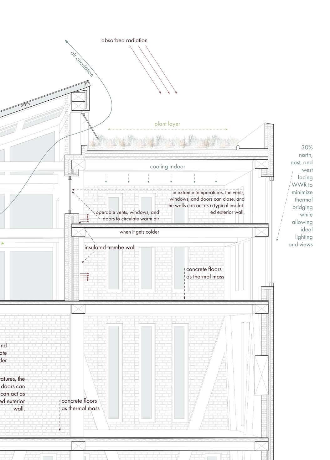
The building enclosure drawn above shows the interface between the sloped curtain roof glazing and the wood cladding to glazing, of the southwest buildings south facade. The double glazed curtain wall is separated by its seal and spacer, then secured in place with the aluminum frame, attached by a stud to the wood elements that connect to the larger wood mullions and structural elements. Thermal continuity is acheived through the wood cladding system and the insulation and sealants between the glazing.
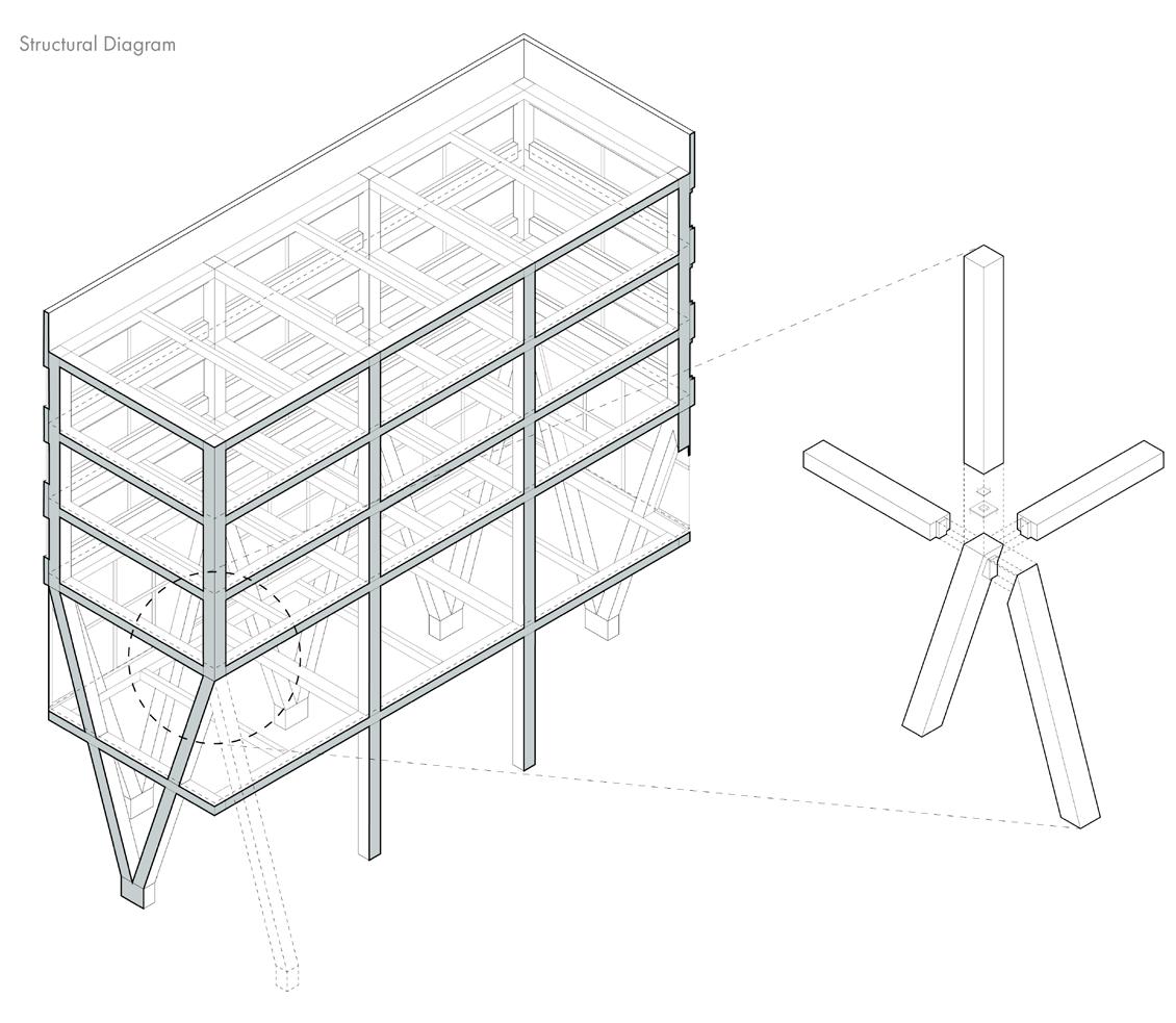
The structural diagram above shows three bays from the north building - both buildings use an identical structure, aside from the sloped roof of the south building. The project opts for 10mx10m bays, structurally composed of CLT trusses, columns, girders, and beams, concrete caps, and steel braces.
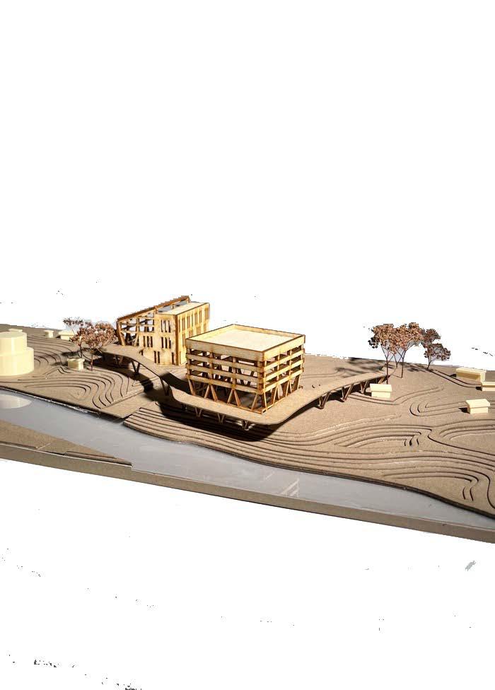
The project aimed to envision the wetland and pavilions at both a macro and micro scale - the physical model of the entire site was created at a 1:500 scale to envision the conditions of the wetland, and how it could be mimicked as a master plan throughout the greater area of the Gowanus Canal.
Maggie Ghobrial
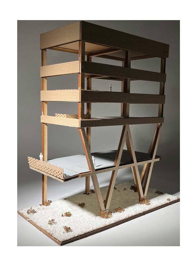
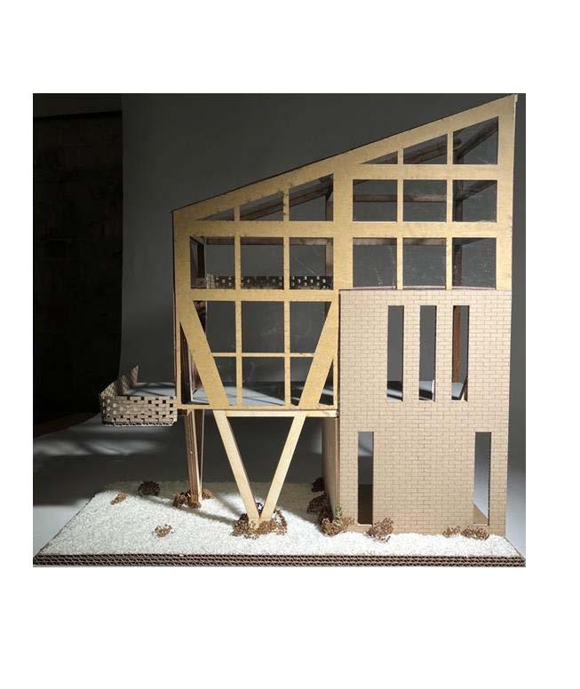
The building details of each pavilion were imagined through 1:50 physical models. The scale of brick exterior, and perforated brick railings in shown in comparison to the extra-large columns and trusses, scaled at 1.2m. The large scale of the columns were designed to allow for an extra-large structural bay, in hopes that the building could be easily re-adapted program-wise.
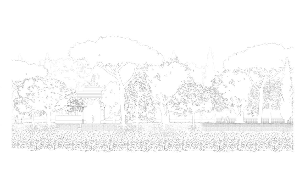
Prospects of the Villa Borghese.
Academic Project
Supervising Professor
Duration
Undergraduate Landscape Studio
John H. Daniels Faculty of Landscape, Architecture, and Design
Behnaz Assadi
September 2018 - December 2018
Design, Digital Modeling, Mapping, and Drawing Details
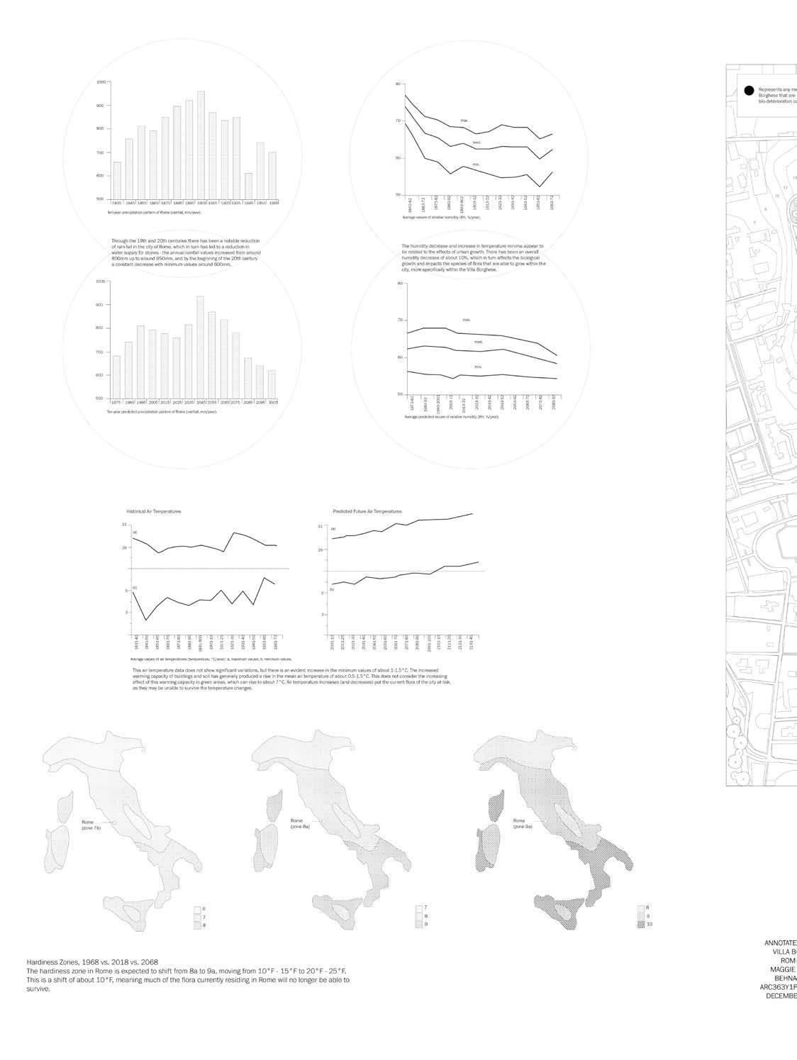
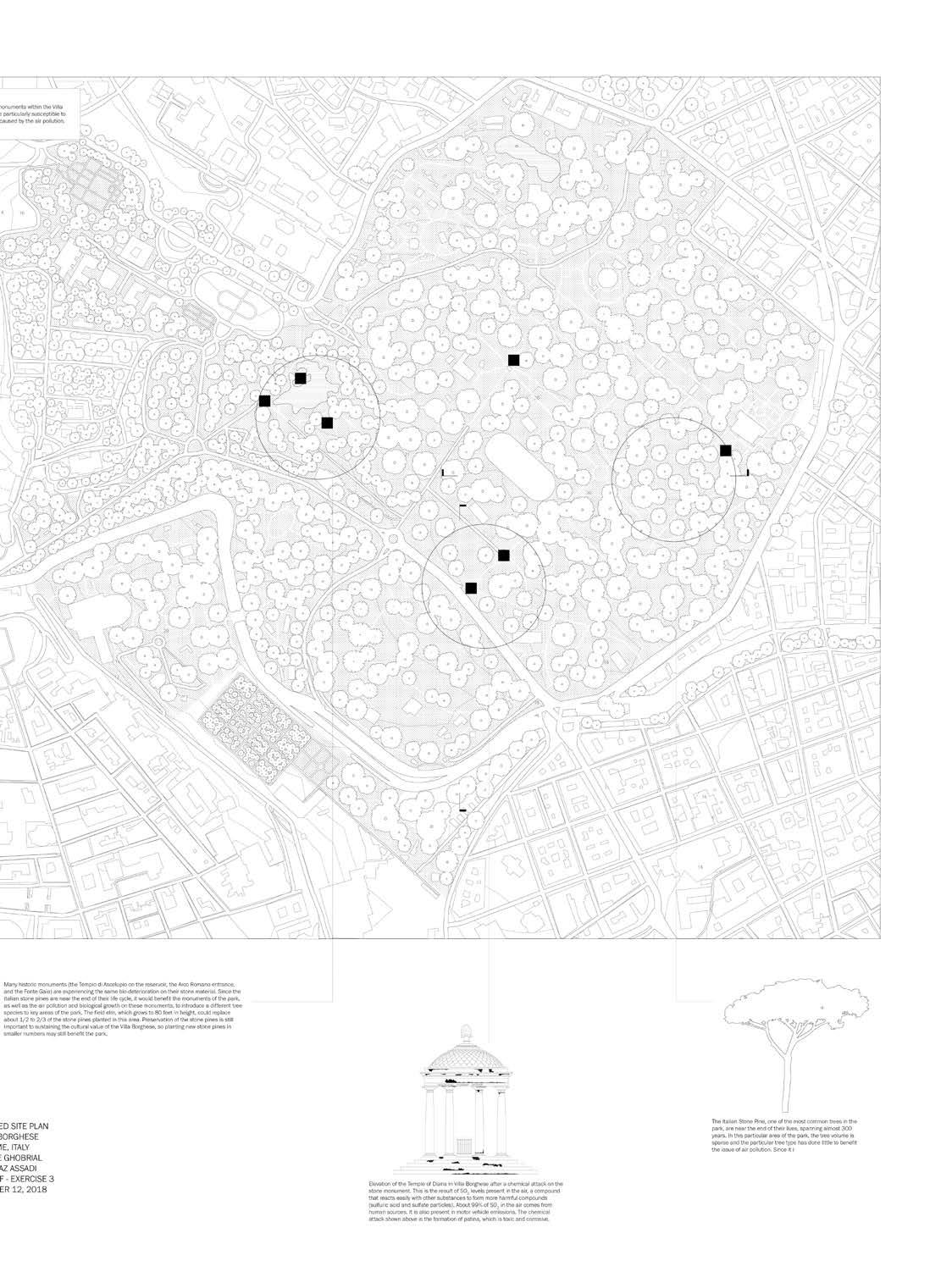
‘Prospects’ envisions a new archetype of urban landscape design that tackles historical city-wide ecological crises, using the Villa Borghese in Rome, Italy as its prototype. Through the 19th and 20th centuries, the city of Rome has faced a notable reduction of rainfall, a 10% decrease in overal humidity, and an overall increase in air temperatures by 1.5C. Additionally, the projected hardiness zone of Rome is set to shift from 8a to 9a in the next 50 years, increasing the overall temperature by 10F. Thus, much of the flora currently existing in Rome will no longer be able to survive, further heightening the ecological degradation of the city.
Amidst this crisis, many of the historical artefacts, pavilions, and buildings residing in the Villa Borghese also face the threat of permanent bio-deterioration by way of sulfate particles. The stone materials of the Arco Romano Entrance, the Tempio di Ascelupio on the reservoir, and the Fonte Gaia have already shown signs of this irreparable erosion.
In summation of these inter-related threats to the site, the project equips the park with ecological resistance by making way for new flora suitable in preparation of the approaching environmental shifts, while creating buffer zones of old and new flora to surround each monument deemed sensitive to biodeterioration, aiding in each areas air quality and preventing future damage to these historical artefacts.
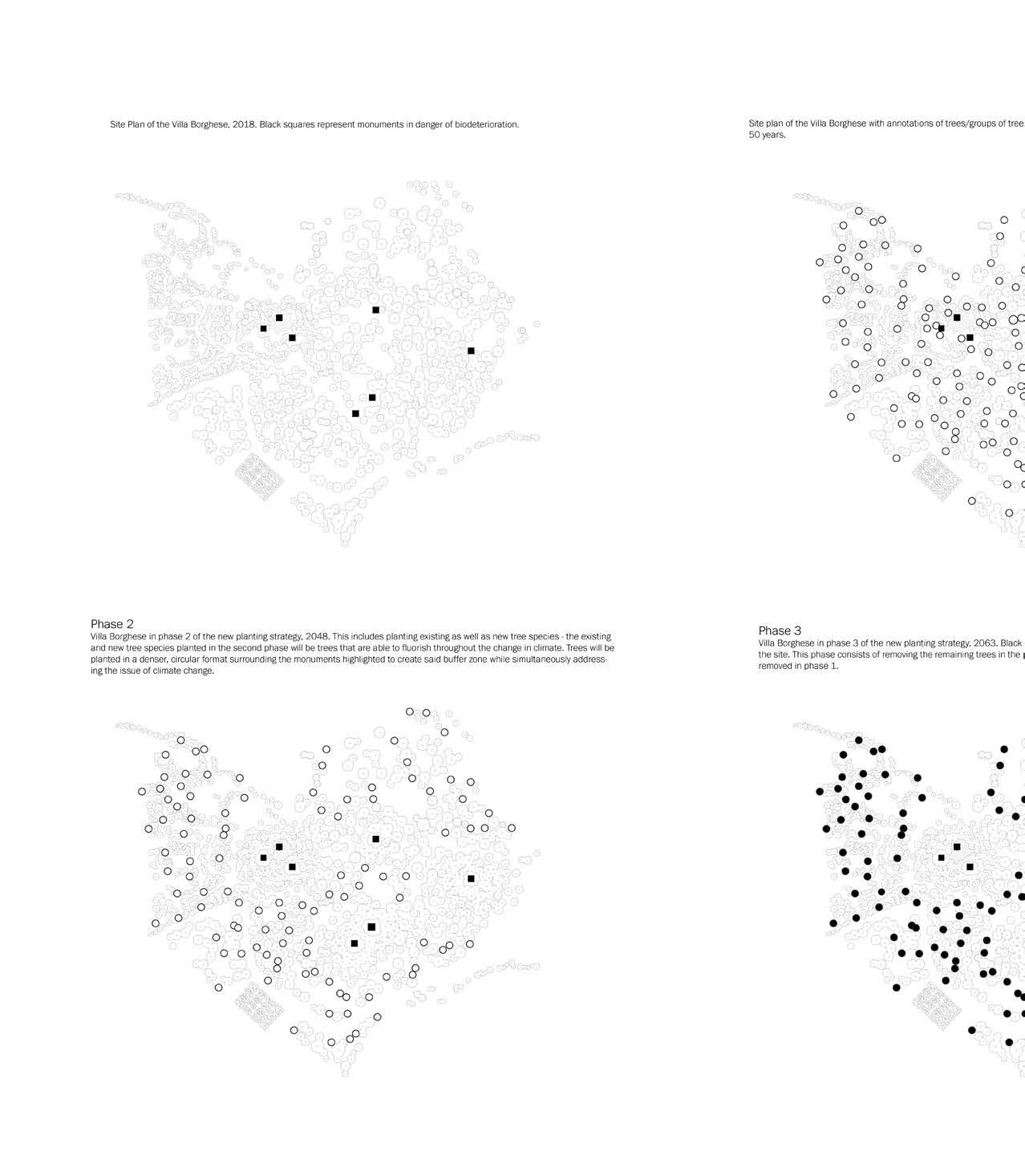
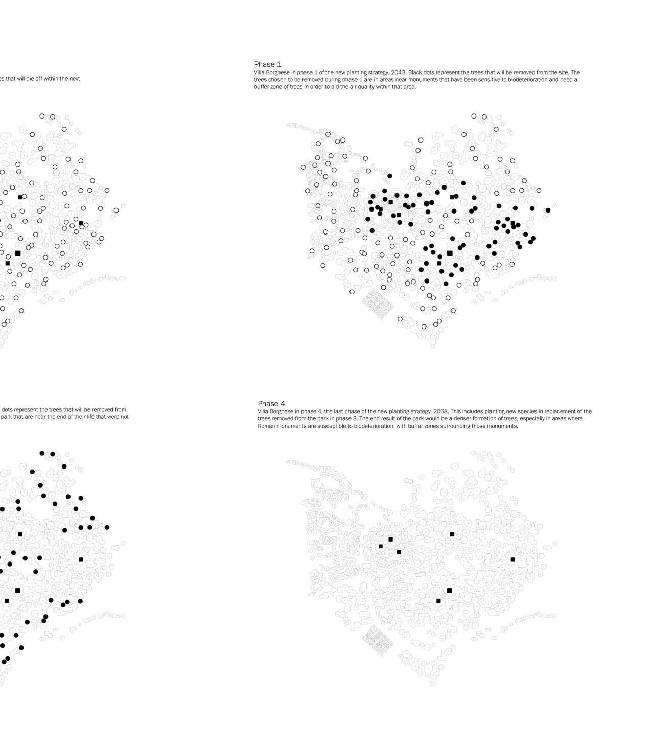
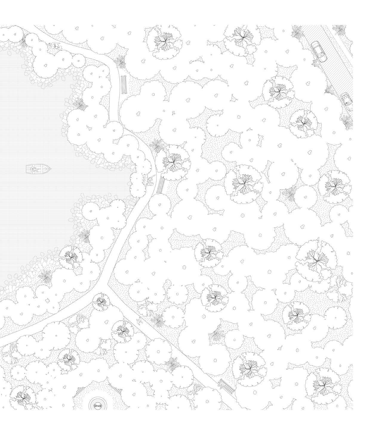
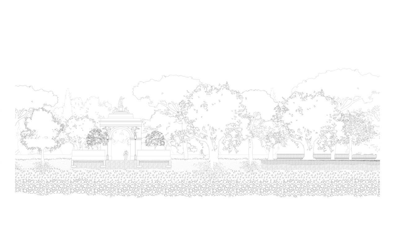
Site plan of the Villa Borghese, 2018. Black squares represent monuments in danger of bio-deterioration.
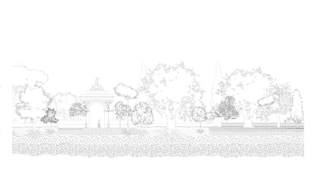
Phase 2 Villa Borghese in phase 2 of the new planting strategy, 2048. This includes planting existing as well as new tree species, which are both able to fluorish throughout the change in climates. The trees will be planted in a denser, circular method surrounding the monuments highlighted to create the buffer zones.
Site plan of the Villa Borghese with annotations within the next 50 years.
Phase 3 Villa Borghese in phase 3 of the new planting the trees that will be removed from the site - the phase are at the end of their life.
Maggie Ghobrial
of trees/groups of trees that will die off
Phase 1 The Villa Borghese in phase 1 of the new planting strategy, 2043. Black dots represent the trees that will be removed from the site. These trees are in areas near monuments sensitive to biodeterioration, that are in need of a buffer zone of trees to aid in the air quality of the area.
planting strategy, 2063. Black dots indicate phase removes any remaining trees that
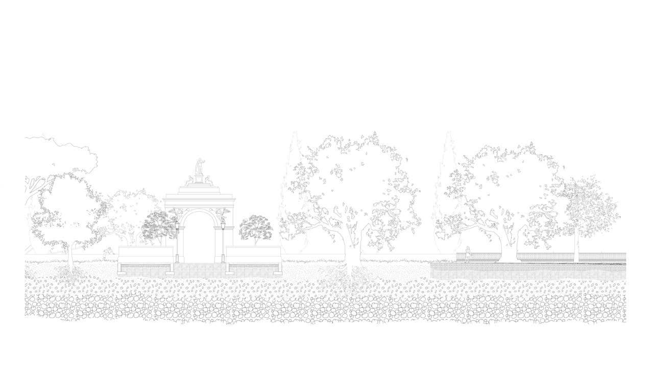
Phase 4 The Villa Borghese in phase 4, 2068. This includes planting new species in replacement of the trees removed in phase 3. The end result would be a denser formation of trees, especially in areas where the ancient Roman monuments are susceptible to biodeterioration, with buffer zones around each monument.
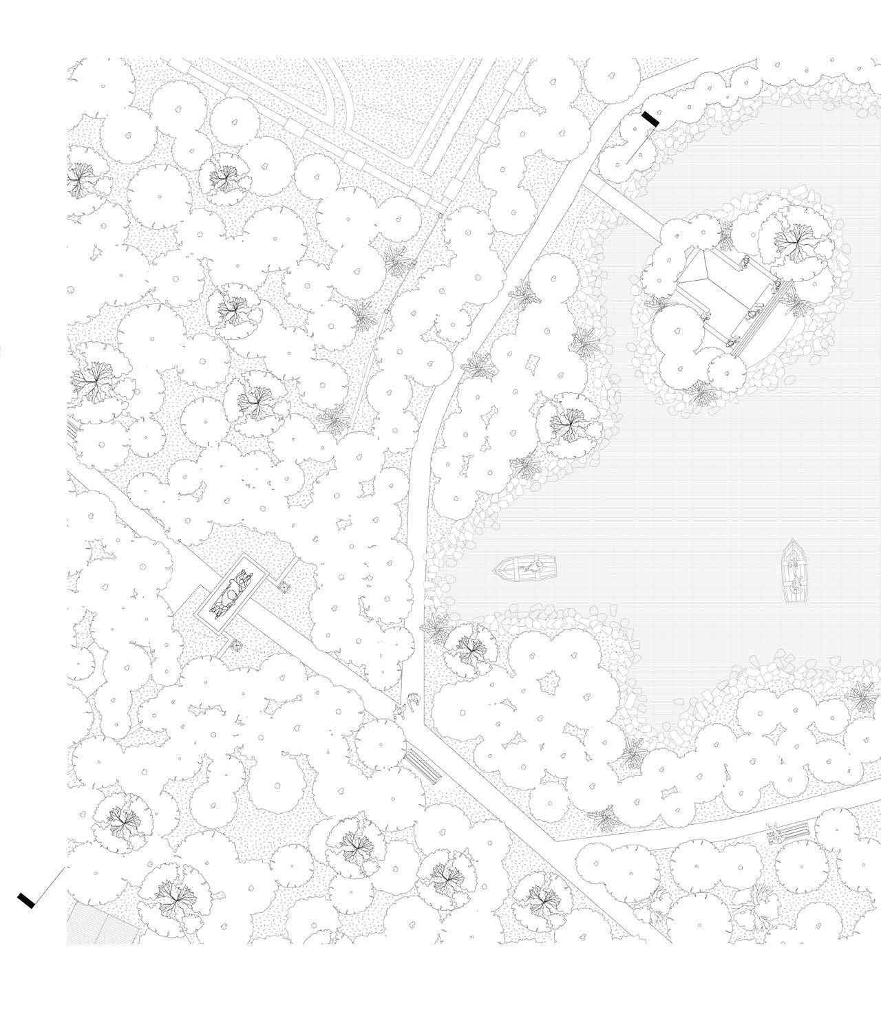
The project investigates this concept of buffer zones through fixating on one biodiverse area of the park, at a scale of 1:250. The area most high traffic areas. Next to the arch is a small lake, and east of he arch is a secondary monument, a historical fountain. The landscape
Maggie Ghobrial
of the park chosen encompasses the Arco Romano entrance, one of the main entrances to the Villa Borghese, and therefore one of the landscape section indicated in the plan above will create a sequence of the park over the next 50 years, highlighting the changes made to the flora.
Maggie Ghobrial
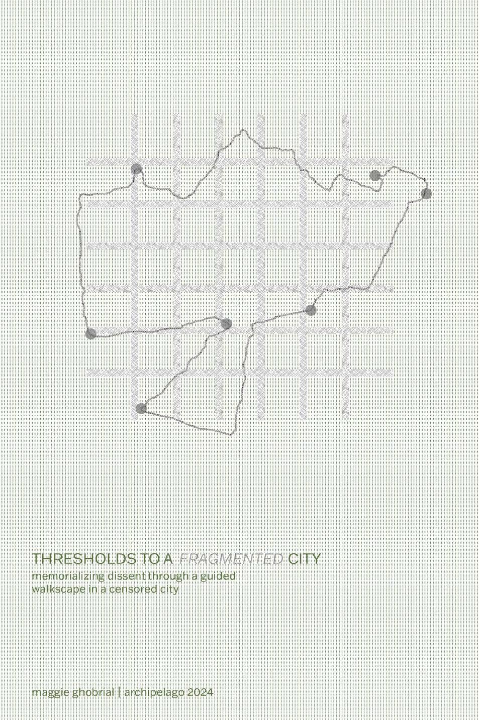
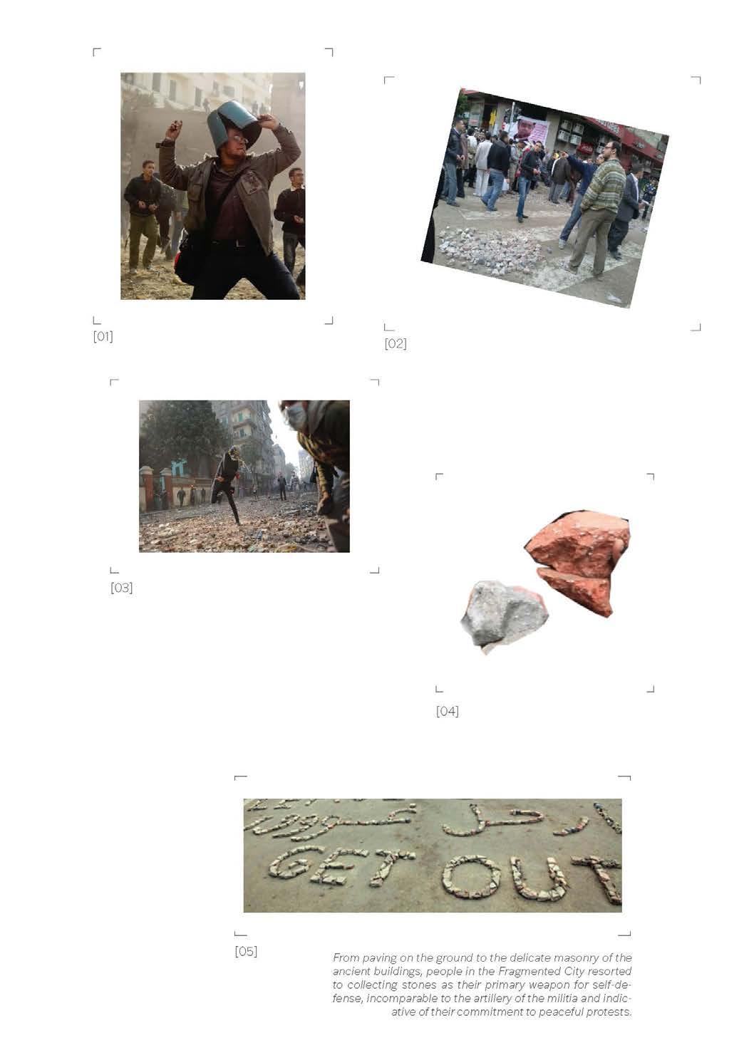
Thresholds to a Fragmented City.
Academic Project
Supervising Professor
Duration
Thesis Research Graduate Studio
John H. Daniels Faculty of Landscape, Architecture, and Design
Petros Babasikas
September 2023 - June 2024
Design, Digital and Physical Modeling, Mapping, Drawing Details, Audiobook and Guidebook Design
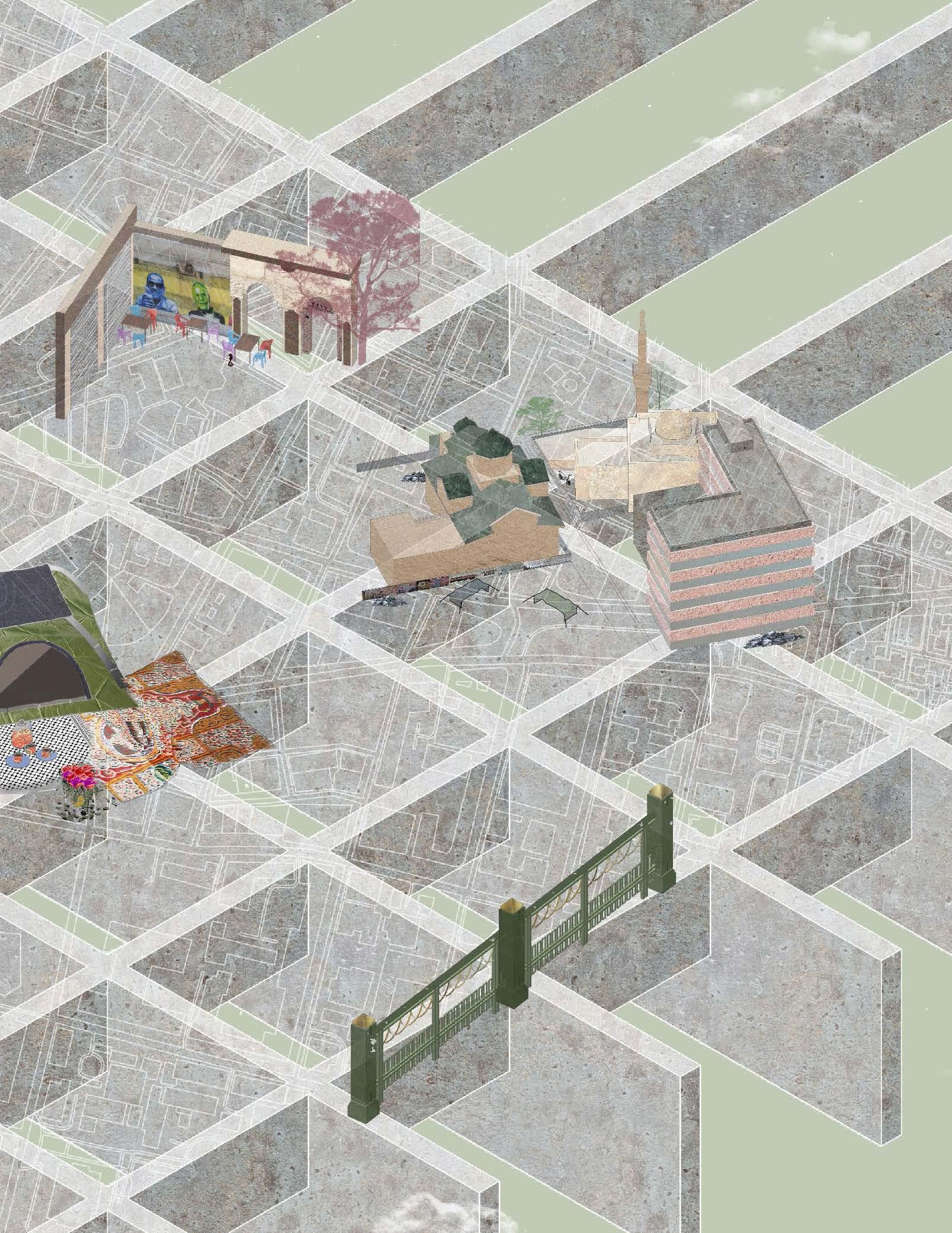
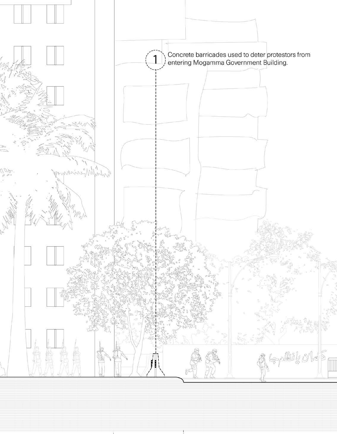
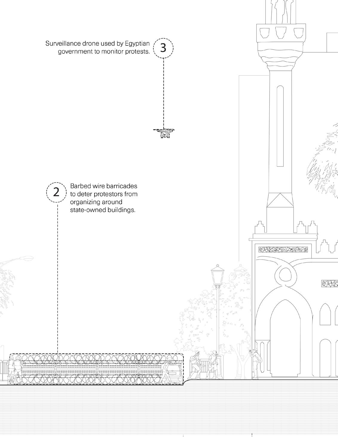
‘Thresholds to a Fragmented City’ integrates the research of an urban context in the height of a Revolution through a guided walk (in the form of an audiobook & guidebook), not through the city itself but in a city within reach, Toronto. Through redacting the city in question, a form of remembrance is brought to life, thus preserving a historical point in time that is culturally integral yet heavily censored and socially ceases to exist, due to the political conditions of its context.
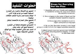
“When the act of explicitly protesting, or even speaking of protest, puts the activist in danger, alternative and implicit forms of advocacy must be used to propel the dormant ideologies that linger during political standstills. Participating in this performance walk-scape is one of the many potential mediums that implicit activism can take on. By taking part in this walk, you (the subject) become the activist that commemorates the Revolution from the Fragmented City. At no point during this walk will you enter the city, or even know where the city is (or if it exists at all). By taking part in this medium of activism, understanding if the city, or the revolution, is real or not becomes unimportant, and even dangerous to you. Instead, in embarking on the walk, you will come to a single realization through three lenses, using the guidebook and audiobook as a repository of collective memories.
As you take part in this performance walk, you’ll begin to understand that many cities (and their revolutions) hold strong parallels to one another, despite their place, through the people that take part in them. The stations you bear witness to during this walk become windows into collective memories of the Fragmented City, and the objects you begin to see and interact with become symbols of resistance activated within these collective memories. Because the current conditions of the Fragmented City would not allow you to safely protest, you will do so in a censored way, in Toronto, Ontario. You will use the walk as both a form of remembrance and learning, and you will use the objects given to you for the walk as a form of political performance and preservation.”
CITY. The first lens is that, though no context is given about the political climate of the Fragmented City, by the end of the walk, you will understand that its Revolution is not unlike any revolution that could take place in any city. It is close to home and simultaneously out of reach. The lack of context protects both you and the commemoration of the Revolution, but it also creates an intimacy between you and the Revolution, one that may not have existed without removing its context.
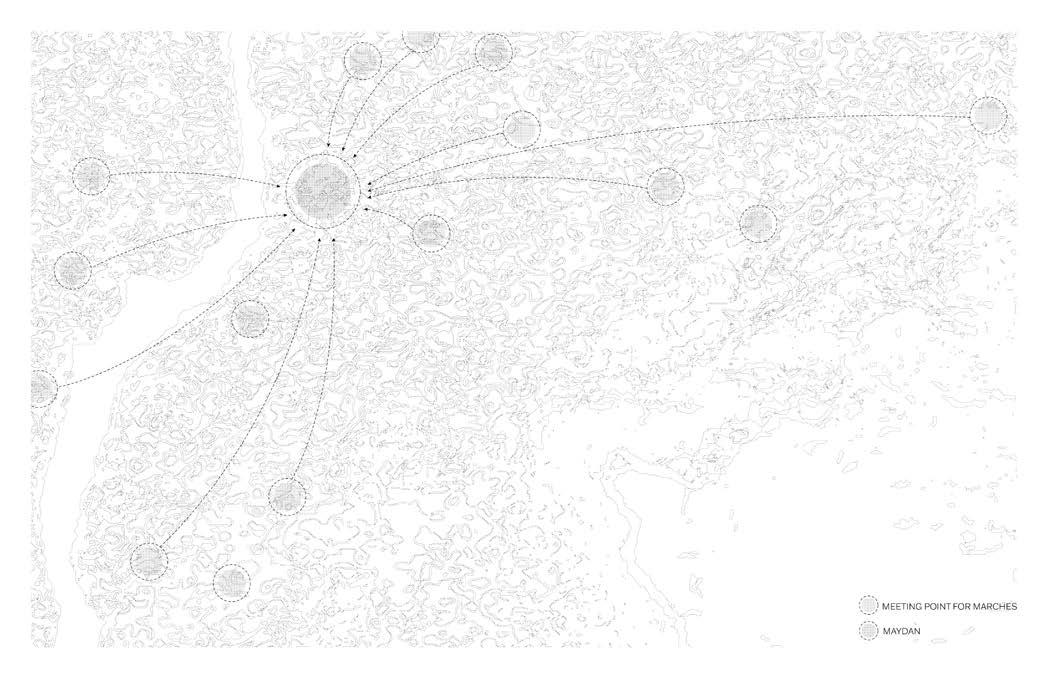
STATIONS. As you witness the seven stations and the stories they hold, you will see intrinsic links between your city and the Fragmented City, strung together by built Imperial symbols that can be found in any city with histories that might parallel. In witnessing these symbols that link your city to the Fragmented City, you will once again understand that the Revolution is both close to home and out of reach, creating a thread between your own notions of dissent to the individuals that exist in the Fragmented City, who you will soon hear stories from.
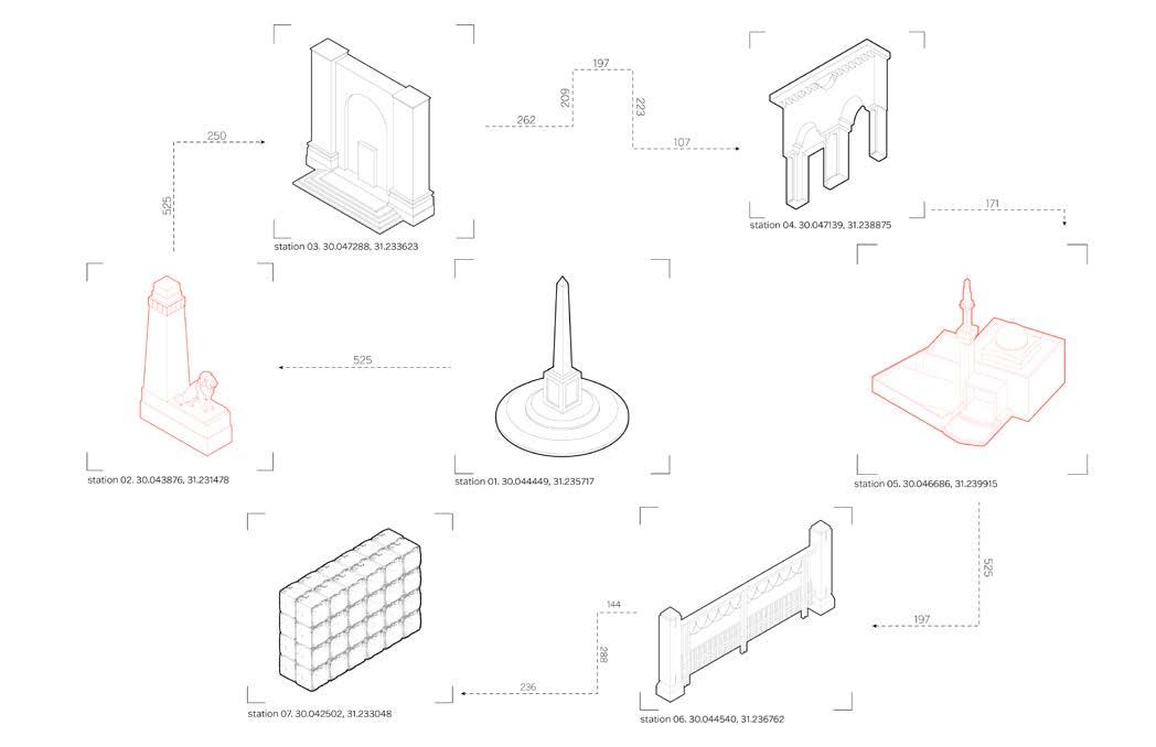
Index of Stations
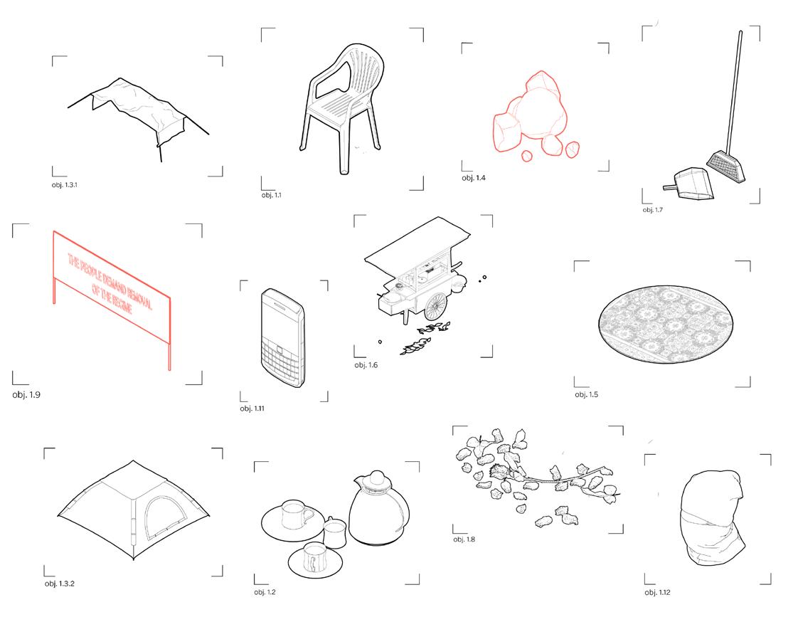
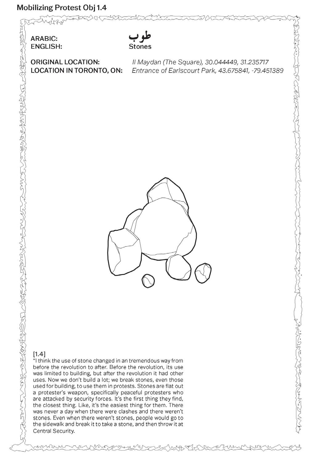
Station 01. The Obelisk Location in Toronto, Ontario: Entrance of Earlscourt Park Object for Site: Sign, “the people demand the removal of the regime;” stones.
Station 02. The Statue Location in Toronto, Ontario: 1450 St. Clair Avenue West (gates of Prospect Cemetery) Object for Site: A rose; a keffiyeh.
Station 03. The Stairs Location in Toronto, Ontario: 1450 St. Clair Avenue West (the stairs to the cemetery’s graveyard) Object for Site: A 50 pound bill.
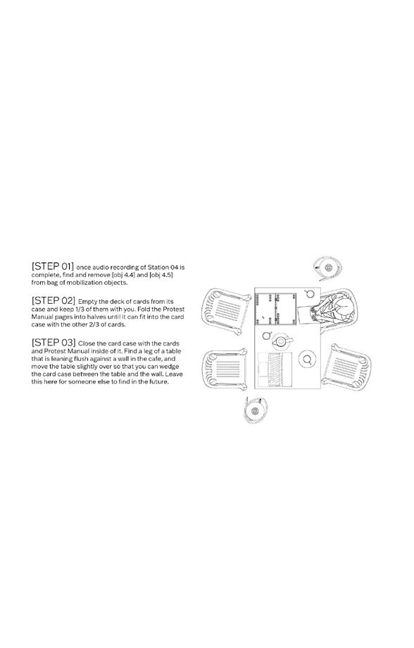
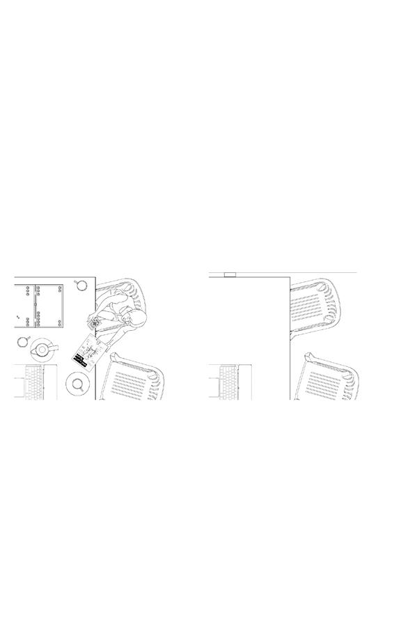
Station 04. The Cafe Location in Toronto, Ontario: Belvedere Cafe & Bar, 1312 St. Clair Avenue West Object for Site: Revolution Manual: How to Protest Intelligently; a deck of cards.
Station 05. The Mosque Location in Toronto, Ontario: St. Nicholas of Bari Catholic Church Object for Site: A rug.
Station 06. The Metal Wall Location in Toronto, Ontario: 57 Mackay Avenue Object for Site: An onion and a bottle of vinegar.
Station 07. The Barricade Location in Toronto, Ontario: The Field of Loretto College School, Earlscourt Object for Site: A can of spray paint.
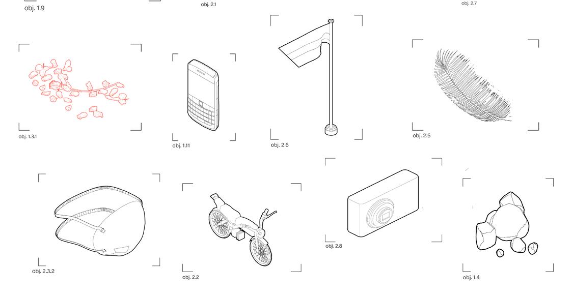
OBJECTS. Everyday objects become a part of the performance that is the walk – you will strategically place them according to their importance to each location, to commemorate memories of protest in the Fragmented City. You may or may not fully understand the use of each object in its given context, but you might start to make assumptions through your own knowledge of protest.
Maggie Ghobrial
Maggie Ghobrial
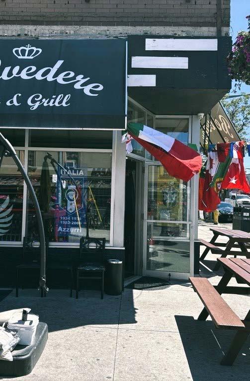
Station 04. Belvedere Cafe & Bar
LOCATION IN TORONTO, ON: 1312 St. Clair Ave W, 43.676885, -79.448655
ORIGINAL LOCATION: The Cafe, 30.047139, 31.238875
OBJECTS FOR SITE: “How to Protest Intelligently” Manual; deck of cards.
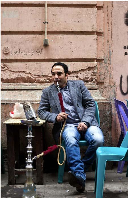
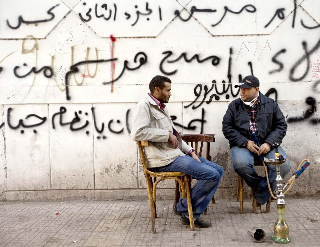
Once you’ve exited the cemetery, you’ll walk east until you reach [Station 04], the Belvedere Cafe. Similarly to the Fragmented City’s cafe, the Belvedere spills out onto the pavement of the street, obscuring the exterior and interior of the site. It might be packed with people, but its more likely that the Belvedere is nearly barren in comparison to the Fragmented City’s cafe. The lure of the latter cafe is in the people that enliven it - in the Fragmented City, there was a near-constant over-population of all the cafes near the maydan during the revolution. As you read about the fourth statio, you are invited to take a seat in the cafe, and order a cup of tea or an espresso. By the end of the chapter, you will gain an understanding of the role that these cafes played in implicitly mobilizing activists of the revolution. You will also understand the purpose of the objects, so that you may participate in the fourth step of mobilizing your chosen protest objects.
Identification of Obj 1.1
THRESHOLDS TO A FRAGMENTED CITY
ARABIC: ENGLISH: Lawn Chair; Kursiya
[3.5]
“She then says, ‘on the Day of Rage, I left the protests and finally got to [a bar] and told those who were there what had happened. The owner of the publishing house advised me to file a complaint at the [Center for Human Rights]. He gave me their numbers, but their lines were all busy. They were obviously inundated with complaints. I asked one of my friends to call his brother who worked for the center. He smiled but did not answer. I kept insisting and he kept nodding dismissively. I was upset but kept it to myself. left [the bar] and went to [the] coffeehouse where I talked with friends about the events of the day. Suddenly, a gigantic man in a black coat appeared. He stopped to inspect the area: the coffeehouse itself, as well as the street and alleyway where customers were seated at tables. A general sense of unease hung over the place; people started to leave and the waiters began to remove the tables and chairs. I also felt uneasy about this mysterious man’s presence.’”
THRESHOLDS TO A FRAGMENTED CITY
by maggie ghobrial
Downtown and [ the maydan] are new social spaces with the internet being central to the mix. “That’s why these cafes are so popular – these kids can get a couple of teas and hang out for hours. Before they served a slightly different function - a working
population would hang out, read the newspapers in the mornings or take a break after work. Now, there are literally hundreds and thousands of small
Identification of Obj 4.1
(social) structures - some of them religious, some secular and the cafes serve all of them. For him, the whole function of [the central city] has changed. “It’s become more of an empty shell where people go to meet (and) there’s a need for public space that wasn’t quite there before.” The intellectuals of an older generation, politicised through the cafes, were “brought up reading Mahfouz, Dickens and modern European literature” but “a lot of modern (Egyptian) art and literature is now self-generated and not reverential to that older European stuff.”
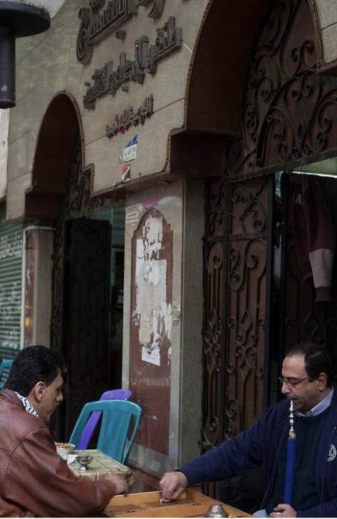
ARABIC: ENGLISH: Backgammon; Tawila
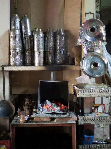
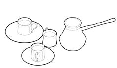
ARABIC: ENGLISH: Coffee; Ahwa Identification of Obj 4.2
[4.2] Coffee became something of a ceremony and according to Ibn ‘Abd al-Ghaffar writing in the sixteenth century of [the Fragmented City] Dervish meetings “They drink coffee every Monday and Friday evening… Their leader ladled it out with a small dipper and gave it to them to drink, passing it to the right, while they recited one of their usual formulas…” In 1511, a conservative Imam in Mecca banned coffee as un-Islamic. When news reached the Sultan of [the Fragmented City] he softened the edict: coffee was legal in [the city] and, as the object of trade, had brought great wealth to the city. Over the next few decades coffeehouses were closed and reopened as various religious edicts fought over the stimulant effects of the drink and the disruptive influences of the cafes that sold it. In time however, the drink and its economic interests won out and coffee entered the secular sphere. By the late sixteenth century, the governer of the country was building coffeehouses as public work projects and they had become the roots of social life in the Islamic world. They were also, as their
[4.4] [Fragmented City] Revolution Protest Manual: How to Protest Intelligently is an Arabic manual that circulated via email and in hard copy prior to the Friday of Rage. Although its impact was not as widespread as it could have been, due to telecommunications being turned off by the State, the document stands as an artifact from the Revolution. Mobilizing Protest Obj 4.4
ORIGINAL LOCATION: The Cafe, 30.047139, 31.238875 LOCATION IN TORONTO, ON: 1312 St. Clair Ave W, 43.676885, -79.448655
TO A FRAGMENTED CITY
Mobilizing Protest Objects at Station 04.
THRESHOLDS TO A FRAGMENTED CITY
by maggie ghobrial
Maggie Ghobrial
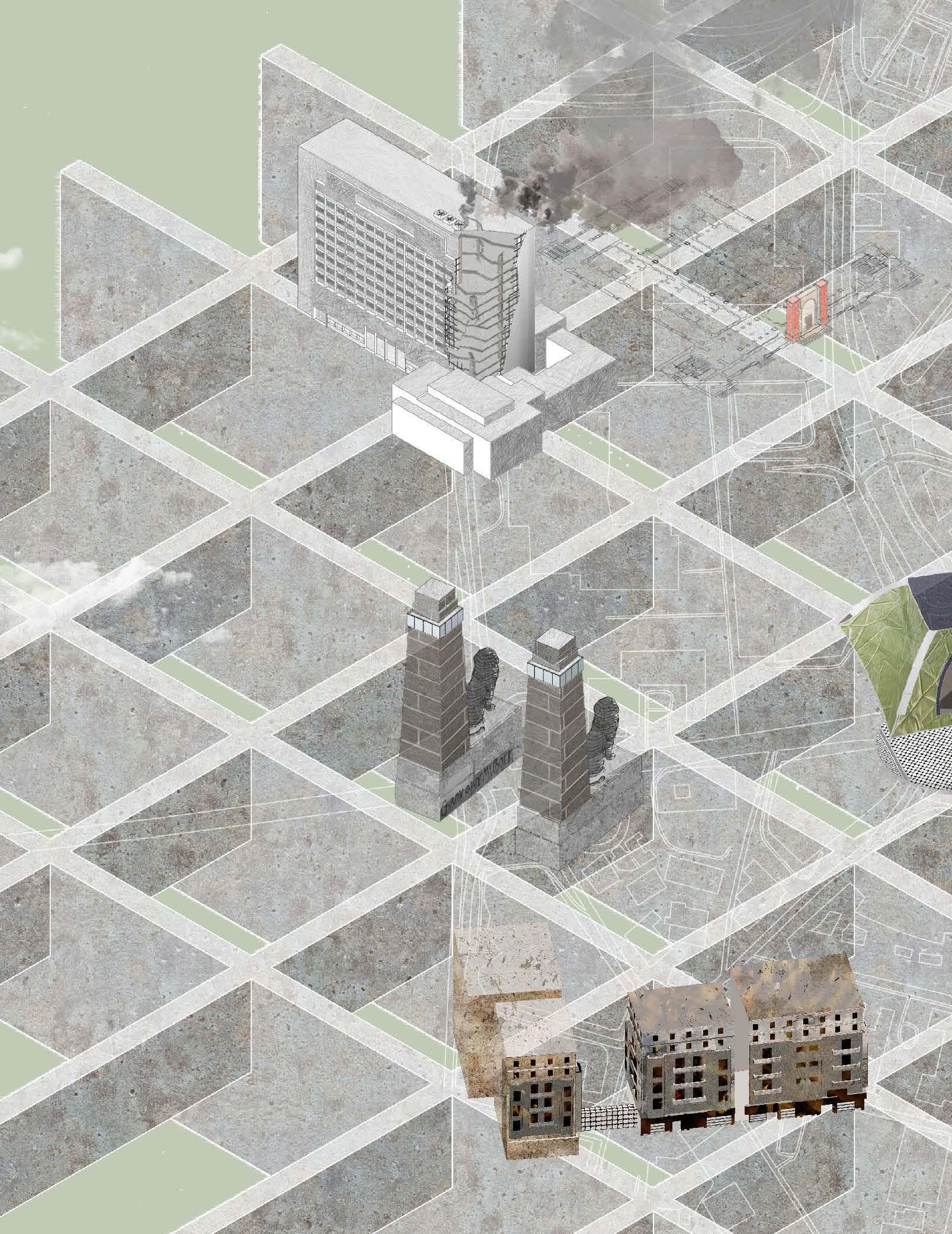
Daylighting the Corridor.
Academic Project
Supervising Professor
Duration
Graduate Urbanism Studio
John H. Daniels Faculty of Landscape, Architecture, and Design
Lisa Rapoport
September 2022 - December 2022
Design, Digital Modeling, Mapping, and Drawing Details, in collaboration with Myriam Rostom and Jacob Tersigni
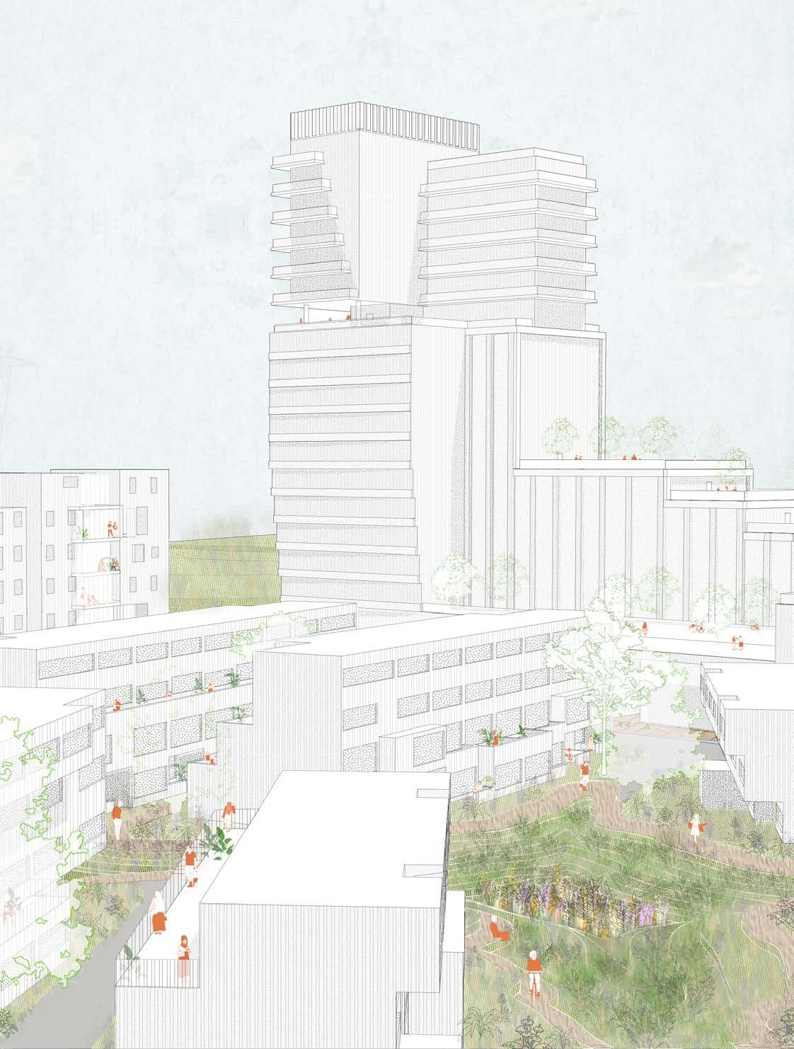
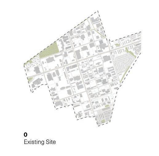
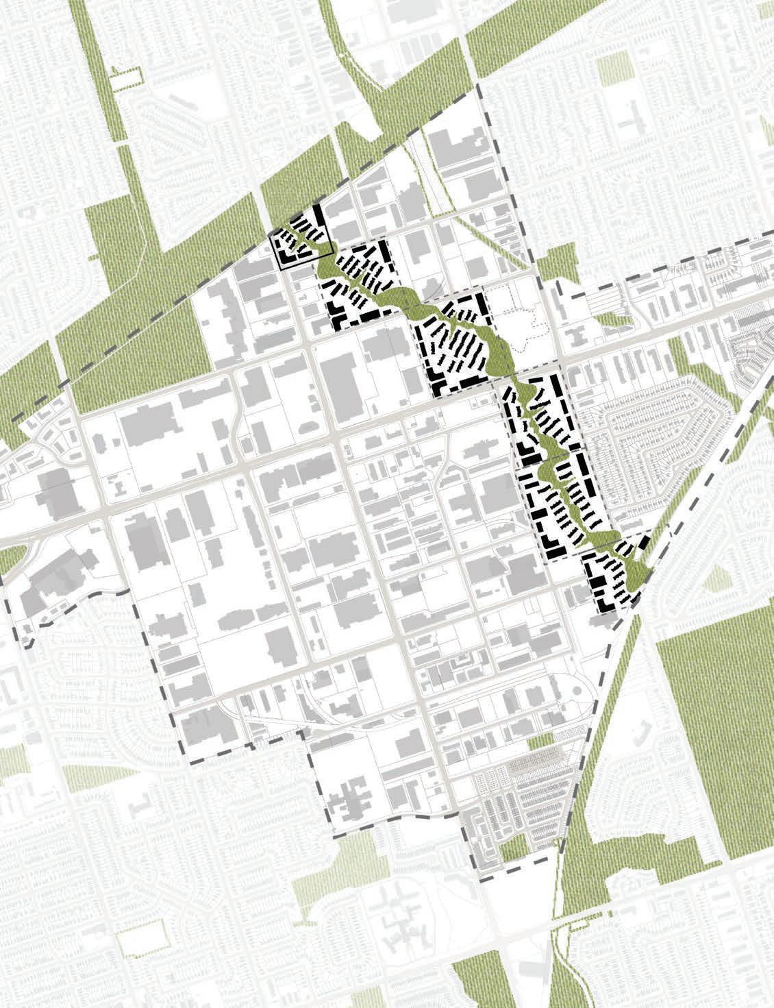
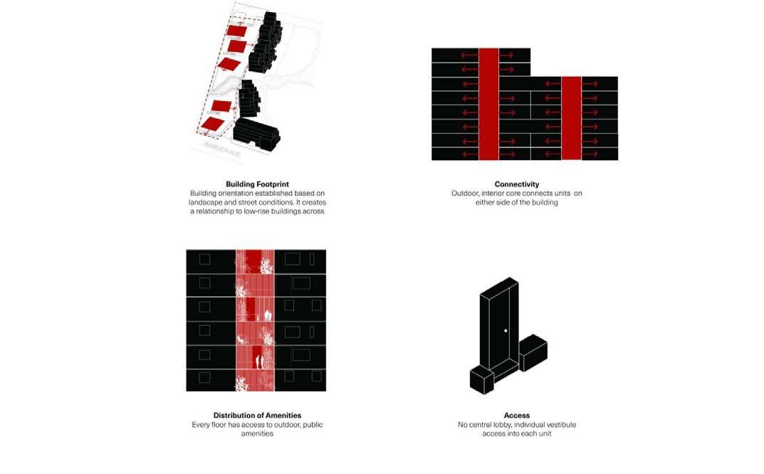
The Centennial College Corridor in the Greater Toronto Area is threatened by lack of amenities and biodiverse green space as it undergoes urban densification through the Eglinton Connects proposal. One of the most pressing issues of this urban densification is the high percentage of impermeable space, leading to pooling issues that will eventually result in flooding. The project also investigates the lack of ecological corridors that link the north and south landscapes.
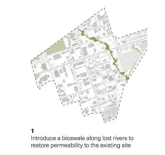
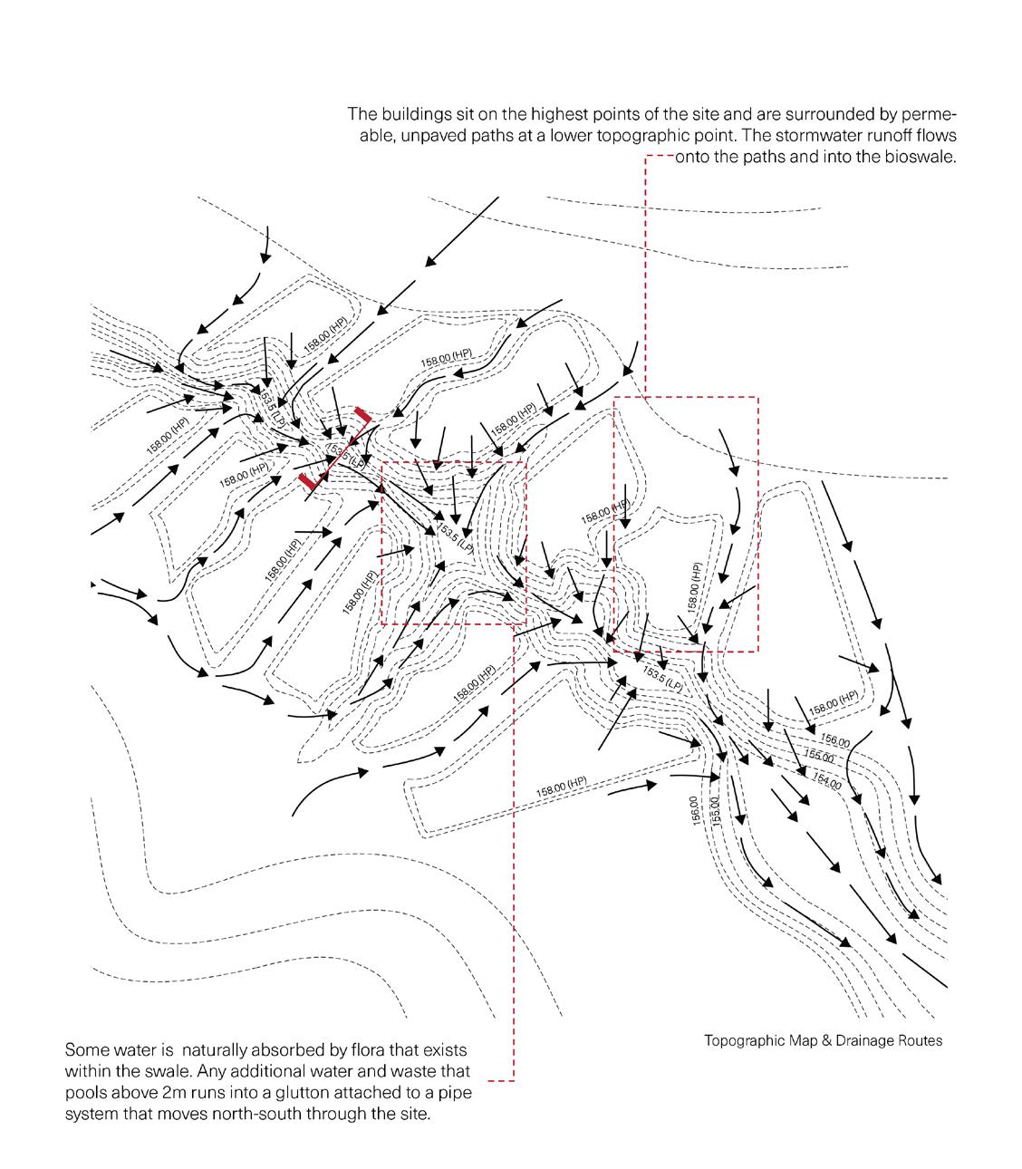
‘Daylighting the Corridors’ seeks to initiate a daylighting strategy that solves the ecological challenges of the site - lost rivers were found while researching the site, that if excavated, would likely uncover a soil legacy that best reacts to water runoff. The projects solution is to develop a bioswale, developed north-south along the lost river route, connecting existing landscapes to re-create an ecological corridor that historically may have existed.
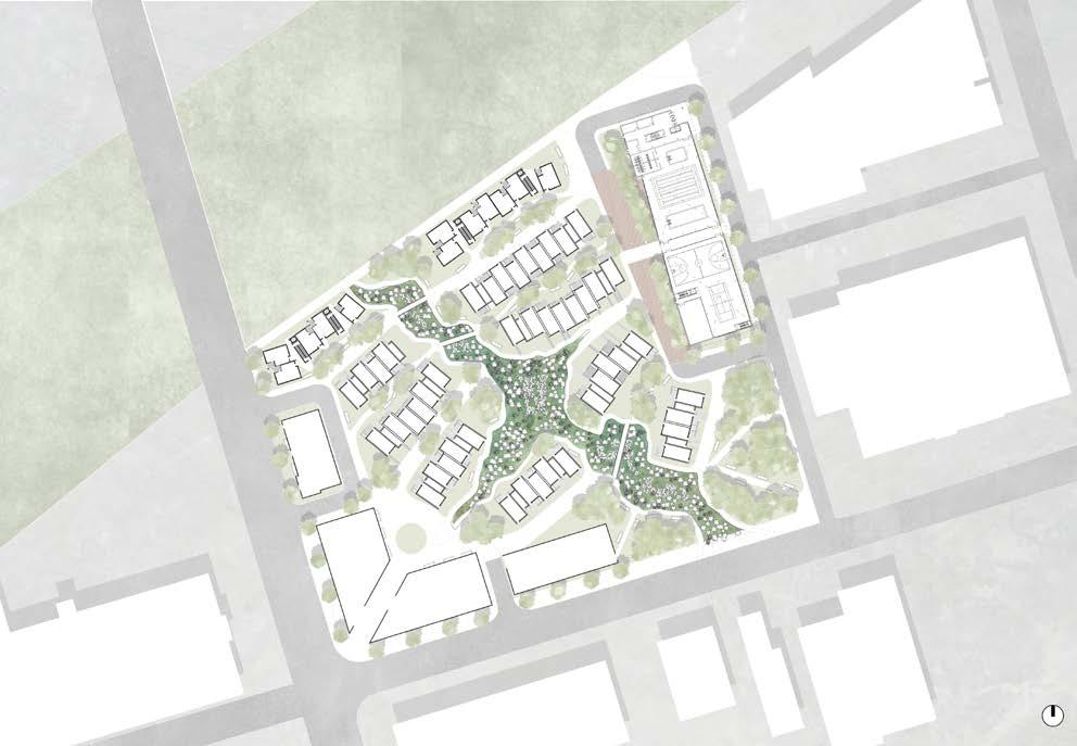
All the while, the projects residential forms seek to introduce a low and mid-rise urban fabric that seamlessly integrates potential high-rise buildings, in order to continue accommodating for the high flux of 1st and 2nd generation immigrants already home to the area, while still paying homage to the existing low-rise fabric of the area. Thus, a new prototype for a potential master-plan is conceptualized, where micro-communities begin to develop along the ecological corridor, each with a set of easily accessible amenities, while still taking advantage of the nearby the Eglinton transit system.
The two drawings above show the existing proposed masterplan site, as well as how the site would look with the proposed daylighting of the corridor, introducing the bioswales to connect the north and south existing green spaces.
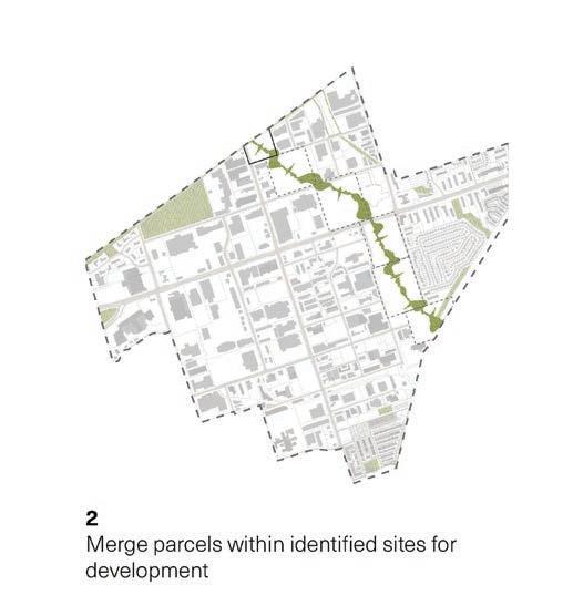
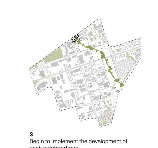
The following two drawings outlines the potential new parcels, created by merging the existing parcels to identify new micro-communities. Lastly, the drawing to the right shows the implementation of the first of all develops at the northern-most part of the site, which is further developed through the rest of the project.
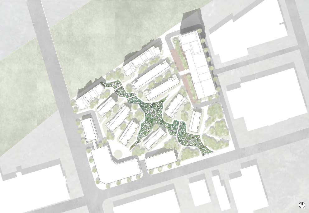
In order to look at the masterplan of the site at a more detailed scale, the project chooses the site nearest the Centennial College Corridor as the prototype for the rest of the site. The drawing above shows the proposed new swale and micro-community on the first site.
Maggie Ghobrial
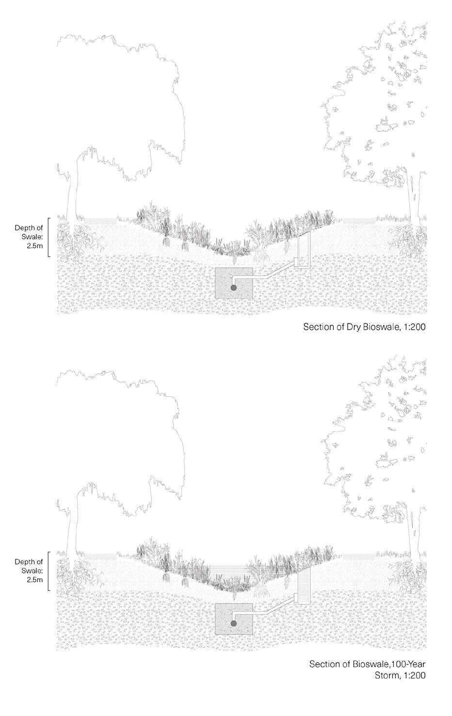
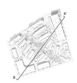
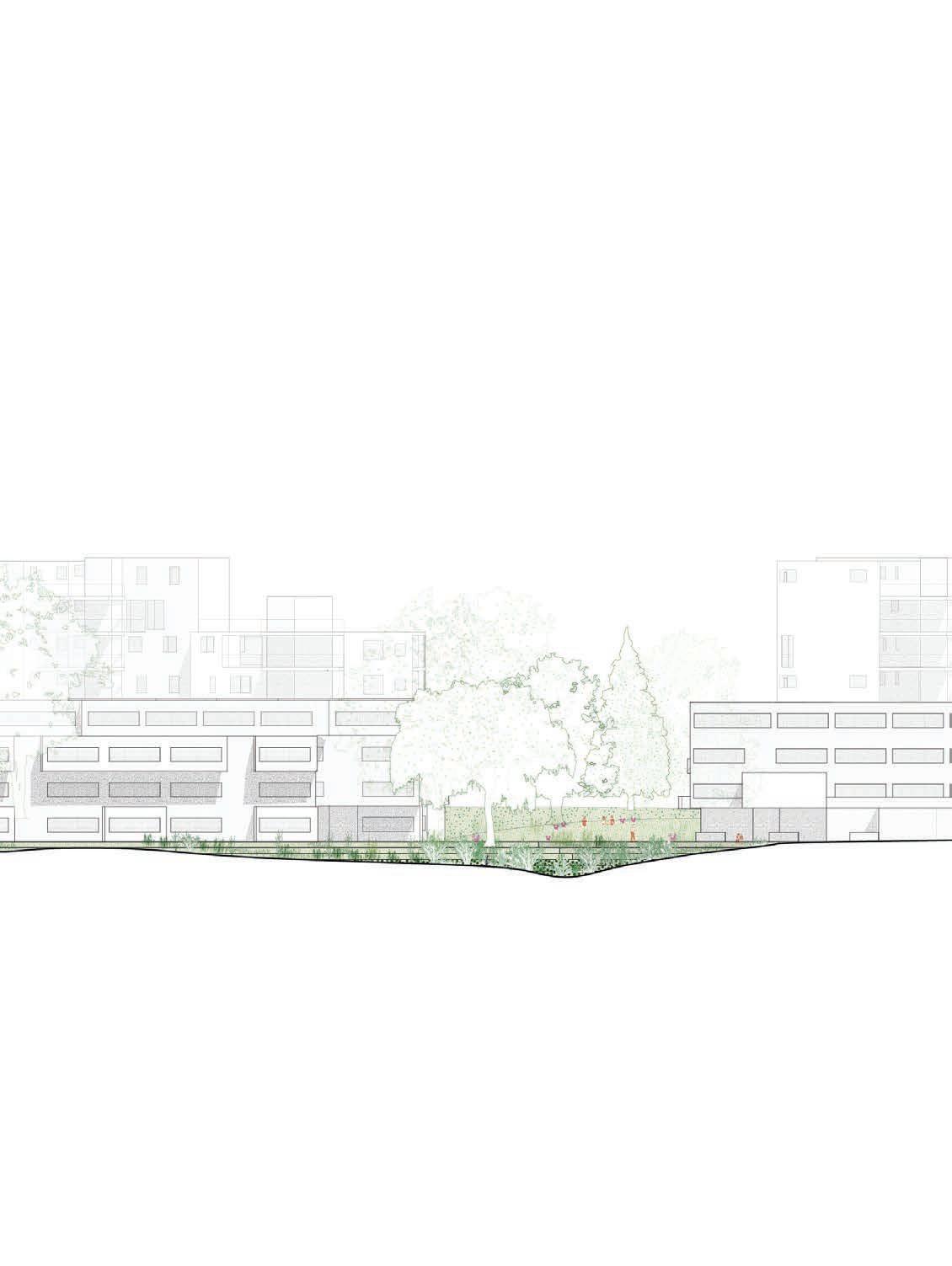
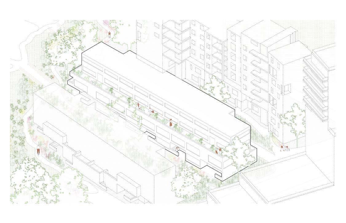
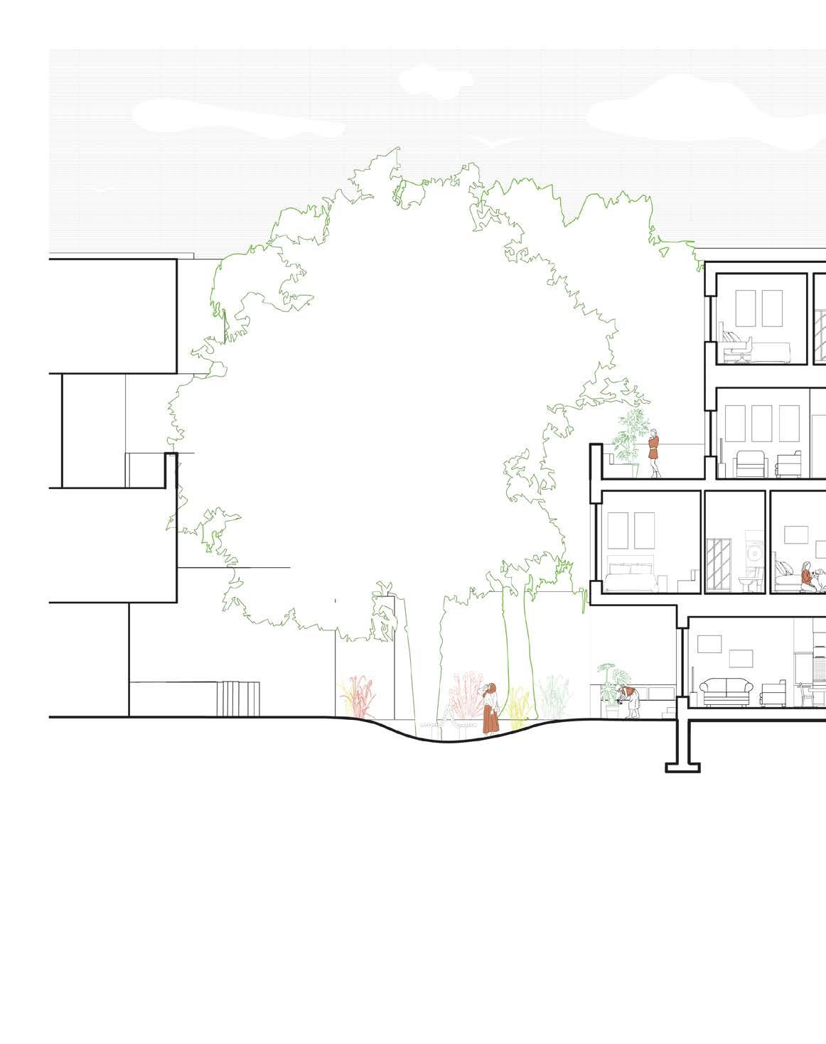
The section drawing above highlights the proposed bioswale for the micro-community, indicating both the proposed low-rise and mid-rise residential units adjacent to the swale. Not shown is the proposed high-rise building, which is to the right of the site.
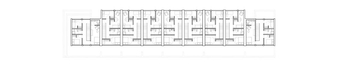
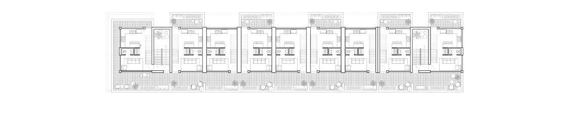
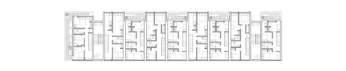
Fourth, third, and second floor of the low-rise residential unit, respectively. Each residential unit is open to a south-facing shared terrace, as well as its own ground floor or third floor private terrace.
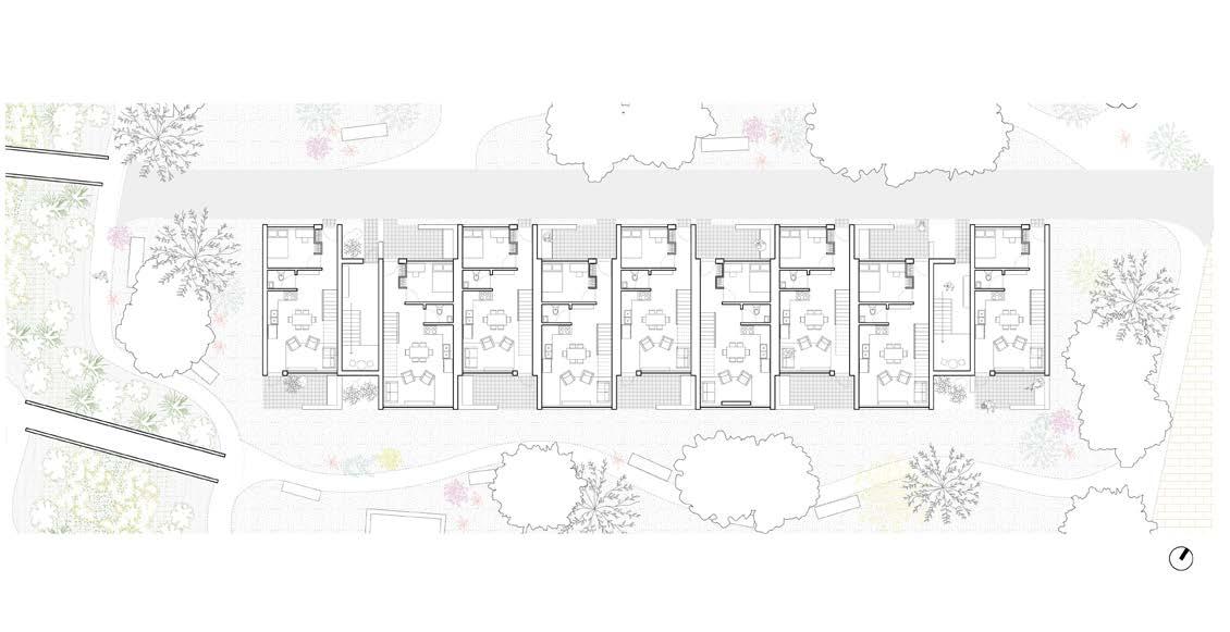
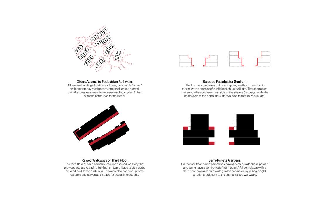
Ground floor of the low-rise residential unit - each low-rise complex on the site connects to the paths leading to the bio-swale in the centre of the site. Each low-rise complex is front-facing to the paths, rather than being typically street-facing. Car access is therefore in the back laneway of each residential complex.
Building code for the low-rise residential units. Axonometric drawing of fully developed low-rise shown below.
Maggie Ghobrial
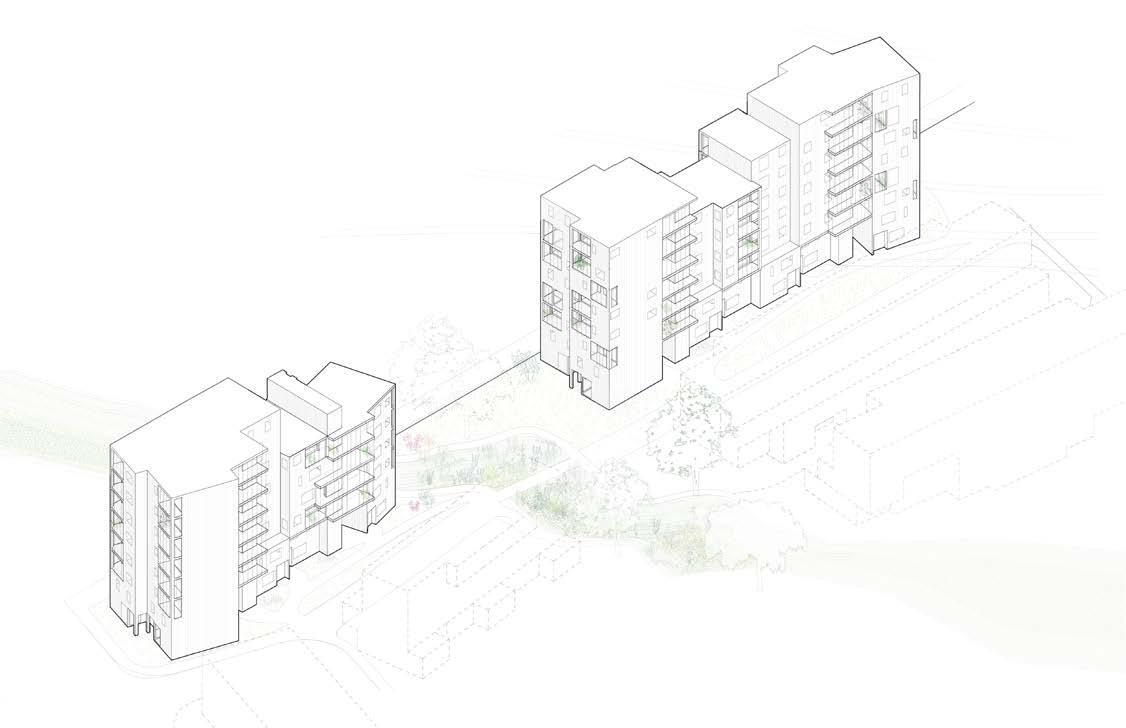
Axonometric drawing of the mid-rise residential complex, fully developed. Below is the building code for the mid-rise developments.
Maggie Ghobrial
Detailed section of the fully-developed low-rise residential complex, with therefore sharing the road with the mid-rise units.
with the front-facing the path and the street facing the mid-rise complex,
Maggie Ghobrial
Maggie Ghobrial
What kind of clay are you made from?
Academic Project
Supervising Professor
Graduate Indigenous Studies Studio
John H. Daniels Faculty of Landscape, Architecture, and Design
Chloe Town
January 2022 - April 2022
Design, Digital Modeling, Landscape and Drawing Details, Physical Modeling, Experimentation of Materials
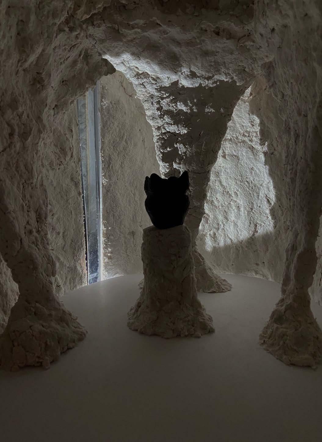
Duration When the Mohawks first greet each other, what they say loosely translates to ‘What kind of clay are you made from,’ meaning ‘where are you from?’ Following the study of pottery, a method of making in the Mohawk nation for over 3000 years, the project begins with the study of a chosen object (Ceramic Pot, Mohawk, made by Elda Smith, 1973) and the making of a gallery room to display the object. Taking inspiration from the medium of clay itself, the room mimics a cave-like experience, letting light into the space through a wrap-around clerestory. The final project then shifts from the gallery room to a larger-scale seedbank building for the Kayanese Greenhouse on the Six Nations Reserve, while still taking methods of making and representing used in the first part of the project.
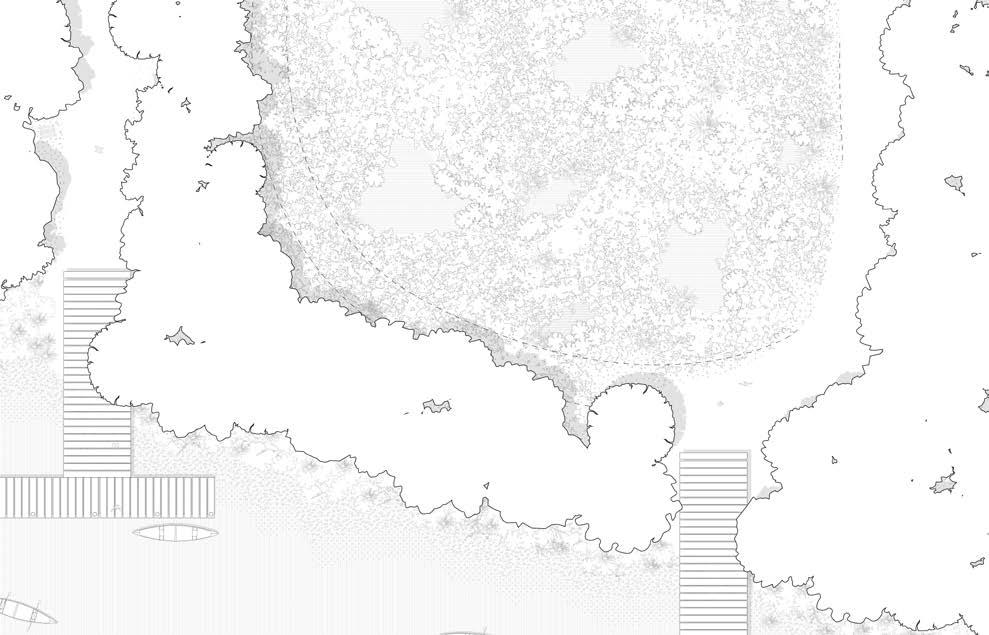
The ‘Clay Silo’ Seedbank design seeks to mimick the land it is surrounded by, shaped in an earth-like form that encapsulates the precious seeds that the building is meant to preserve and protect. Alongside this, the vast expanse of land that connects the seedbank, greenhouse, and longhouse to the Six Nations River, south of the site, is revitalized back to a wetland, encouraging its natural conditions to re-exist. Although a few pedestrian paths are embedded into the site, the majority of the wetlands becomes inaccessible to humans, allowing the site to fluorish. From afar, the Seedbank building blends into the site, due to the building being primarily made of glass and steel, aside from the silo itself.
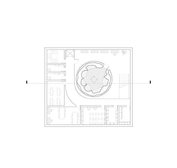
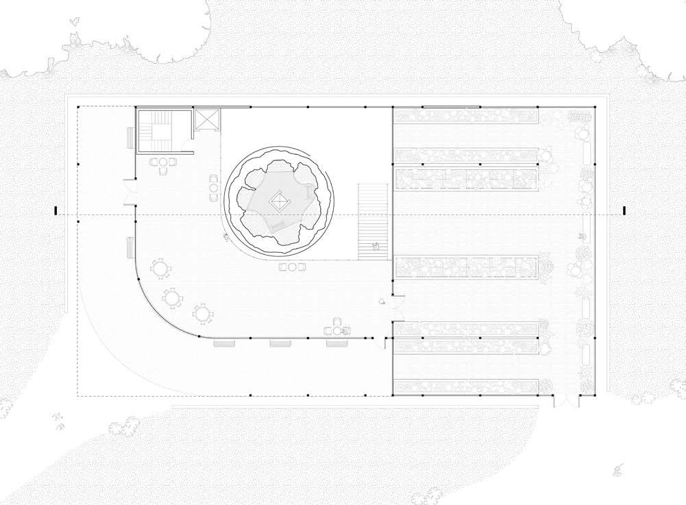
Basement floor plan of the seedbank building. The lower level space features the double-floor height silo seedbank, with the office spaces around the perimeter of it.
Ground floor plan of the seedbank building. The left half of the space is comprised of the mezzanine ground floor which is dedicated to multi-purpose uses, such as lage lectures and meetings. The silo stands in the centre of this half, so that the mezzanine overlooks it. The right half of the building is dedicated to a greenhouse space.
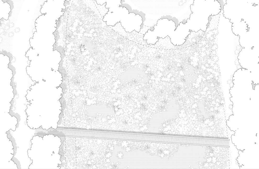
Multiple landscape plans of the wetland area south of the seedbank building. Two linear paths flank each side of the wetland, with two boardwalks that allow users to cross the wetland laterally. Docks are also re-integrated into the river edge to allow for the river to be used by seedbank employees.
Building section of the seedbank - the greenhouse is to the right, the silo is in the
centre of the
Maggie Ghobrial
left half, and the office spaces and mezzanine on the top floor is visible surrounding the silo.
Landscape section of the wetland conditions on the left, the tree canopy
and wildlife conditions in the centre, and the river conditions on the right.