
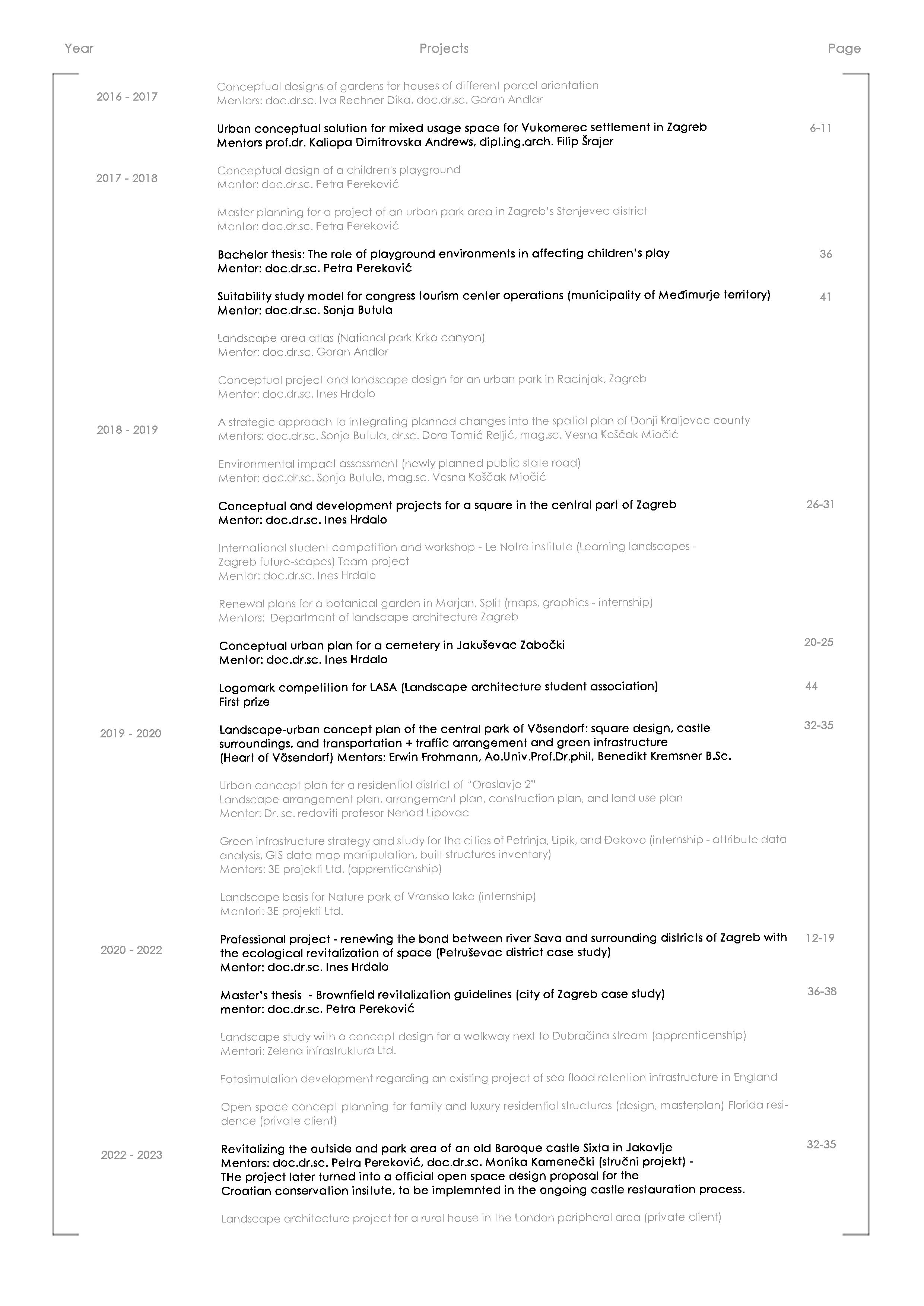
Zagreb, Croatia Phone:
marko.blazic2@gmail.com

Marko Blažić, born in Zagreb, Republic of Croatia in December 1994. (28). Spends a part of his elementary school education in Saronno and Milano, Italy. Which gets him introduced to and efficient at working in intercultural and international groups at a young age. After finishing elementary school he enrolls in High school for graphic arts in Zagreb and graduates by completing his state graduation exam. In 2015. He gets accepted at the University of Zagreb, Faculty of Natural resources and life sciences for a Landscape architecture study program.
In 2018. he graduates with a bachelor’s degree presenting a thesis on The role of playground environments in affecting children’s play. That same year he enrolls in a master’s program. During his master’s degree studies, he spends 7 months at the University of Natural Resources and Life Sciences, BOKU Wien.
During his stay, he participates in planning the reconstruction of a town center with a water castle in the city of Vösendorf. While attending the master’s program, he also participates in various national competitions for squares, memorials, etc. As well as in the international Le Notre competition developing the bond of Zagreb with its river Sava. He is rewarded with first prize at the logo design competition for Landscape architects student association of Zagreb. As an apprentice, he participates in Green infrastructure strategies and plans for the Croatian cities of Petrinja, Lipik, and Đakovo, Landscape study for the Nature reserve Vransko jezero, and promenades along the river Dubračina. In 2020. along with designing the botanical garden on Marjan in the city of Split, He defends his thesis on Brownfield revitalization guidelines – city of Zagreb case study, and graduates (magna cum laude) with a master’s degree in Landscape architecture. During his stays abroad working in teams of colleagues and mentors, he further develops his intercultural and international teamwork. In his professional career, he expands his knowledge of software and has 2 years of experience working as an expert advisor in an environmental consultancy firm. Working at this position his tasks include producing EIA and SEA for various projects, municipal and local development plans, and communicating with heads of departments, engineers, and various interdisciplinary professionals. His work requires research and writing skill in all environmental components as well as technical skills.

Marko Blažić
please request over email
Software skills
AutoCAD
Photoshop
InDesign
QGIS/ArcGIS
Lumion
Blender
Corel
ProVal
AutoCAD Maps
Twinmotion
Sketchup
Archicad 25
Physical modeling
Microssoft office
Adobe ilustrator
Personality
Determination, practicality, cooperativeness, flexibility, efficiency, rationality, communicativeness
Other skills
European drivers licence various categories
Drone piloting
Graphic design
Problem solving on the fly and researching
Experience
III-VII 2018 Apprenticenship / Landscape architecture department university of Zagreb
III-VII 2020 Apprenticenship / 3E projekti Ltd.
VII. 2021. Apprenticenship / green infrastructure Ltd.
XII 2020 - VI 2021 / Associate / Landscape architecture department university of Zagreb + Freelance Landscape architect
XII 2021 - Present / Expert associate at IRES EKOLOGIJA ltd.
Interests
Landscape architecture and planning, Urbanism, architecture, nature, technology, travel, art, design and industrial design, cooking, sport.
High adaptability for new environments and tasks as well as interest for research and acquiring new knowledge.
Languages
English - Fluid, flexible and efficient use (C1-C2 tested by the American institute of Zagreb - 2019.)
Italian - efficient use (B2-C1)
Croatian - Mother tongue
XI.2020 - IX.2021 Freelance Landcape architect + Associate at LA department
XI.2021 - Present Expert environmental advisor at IRES Ecology ltd.
IX. 2019. - II. 2020. BOKU university in Wien / Erasmus+ programme
IX. 2020. mag.ing.prosp.arch. Masters thesis / Brownfield revitalization guidelines - city of Zagreb case study
IV-IX. 2020. Apprenticenship 3E Ltd.
X. 2018. - II. 2019. International workshop / Le notre - City of Zagreb (Learning landscapes)
IX. 2018. univ.bacc.ing. prosp.arch. Bachelor thesis (role of playground environments in affecting children’s play)
III - VII. 2018. Apprenticenship / Landscape architecture department
IX. 2015 Enrolls into Landscape architecture study
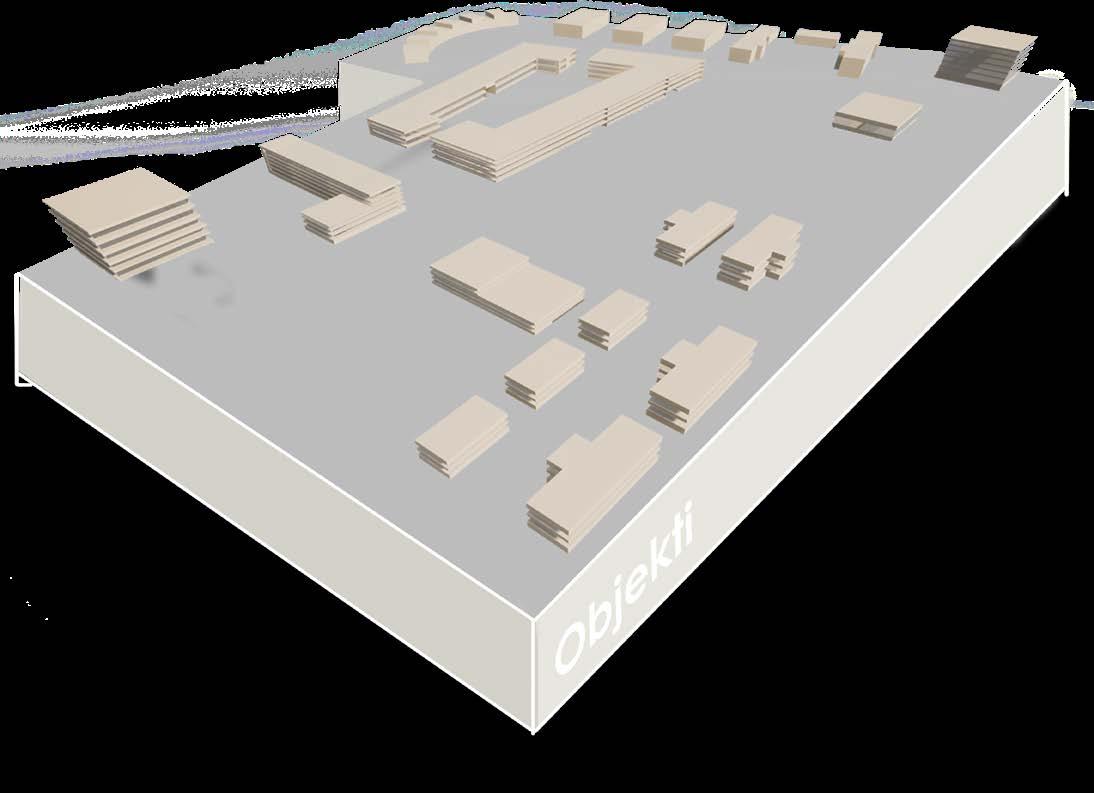
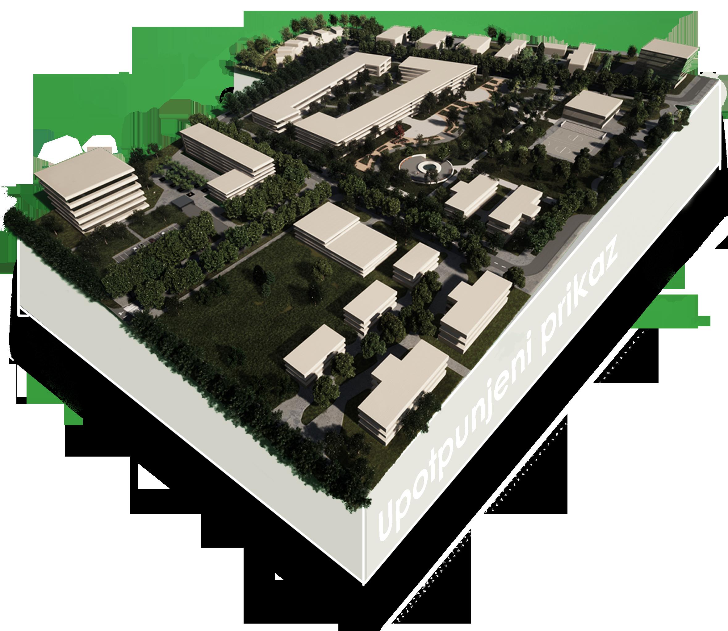
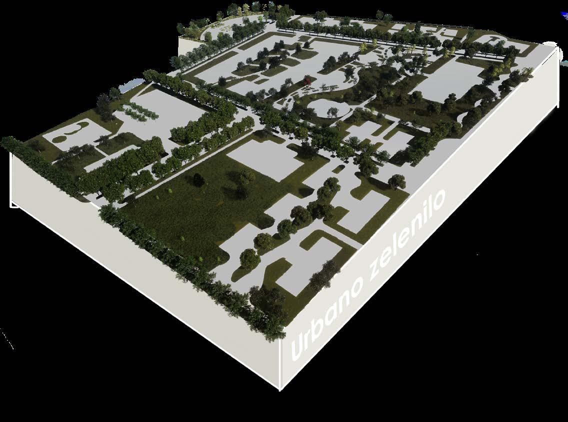
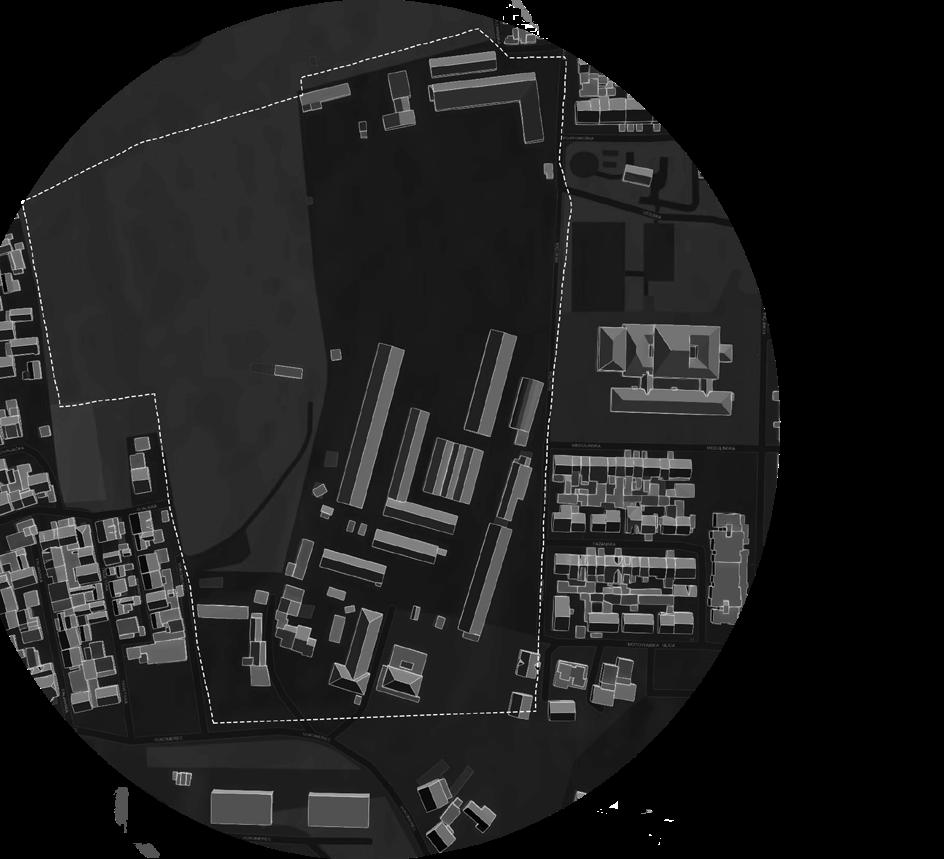
Vukomerec disctrict urban Masterplan
CONCEPTUALIZING THE URBAN MIXED USAGE AREA FOR VUKOMEREC DISTRICT IN ZAGREB
The project recommends an urban plan which follows the contemporary guidelines of integrating public open and green spaces into everyday life sets the trend of a new kind of urban development for Zagreb.
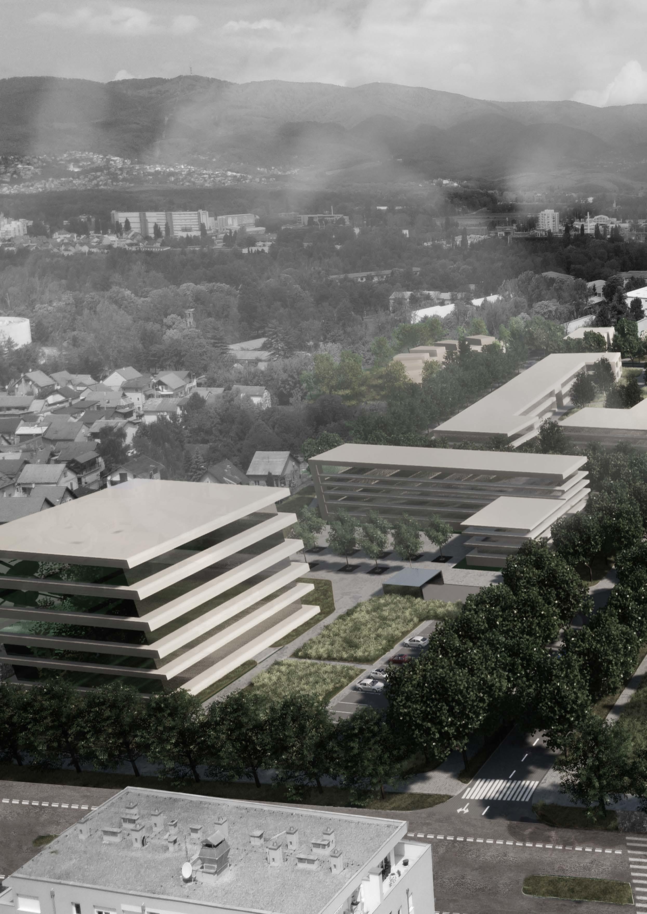
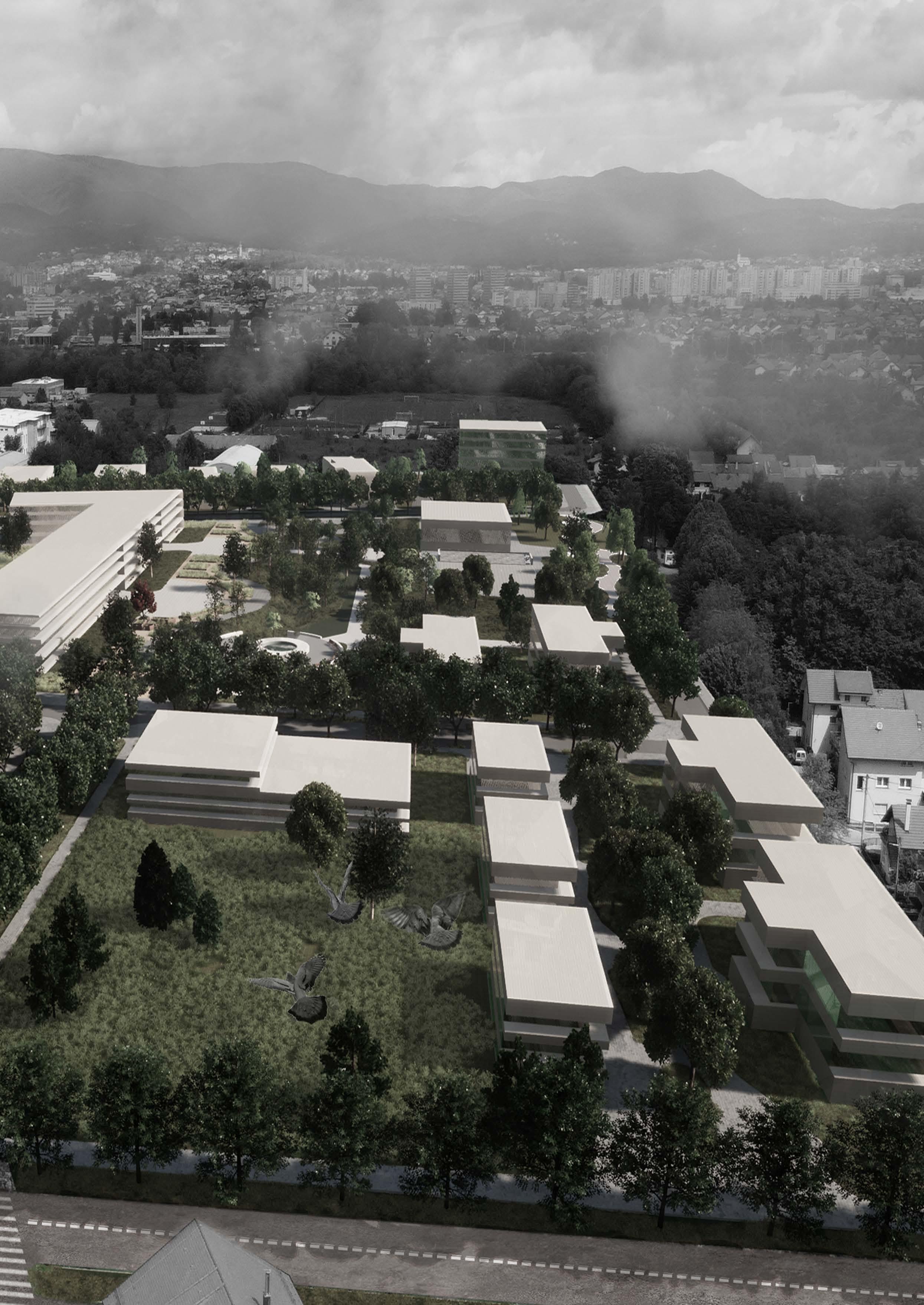
The urban plan consists of two higher structures placed on the south and east of the perimeter and frame the space. Smaller housing units comply with the surrounding urban scale. The placement of the structures creates a square with a district scale park.
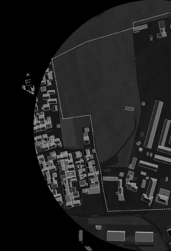
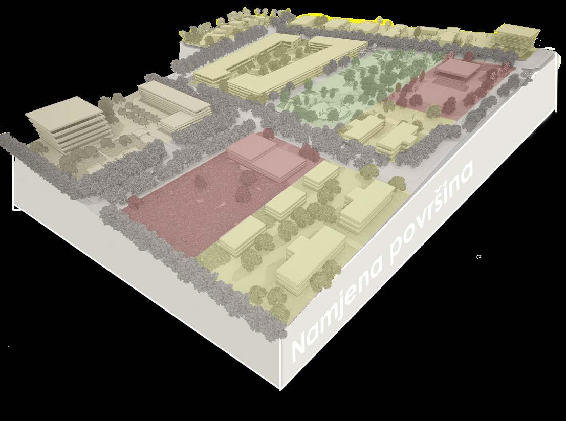
Following the guidelines of the urban development plan, the new district is complied out of mixed usage, predominantly housing which is followed by social (school and kindergarten).
A newly planned urban setting gives the local residents a grid of new and high-quality public open spaces, extending their benefits to the neighboring residential areas as well.
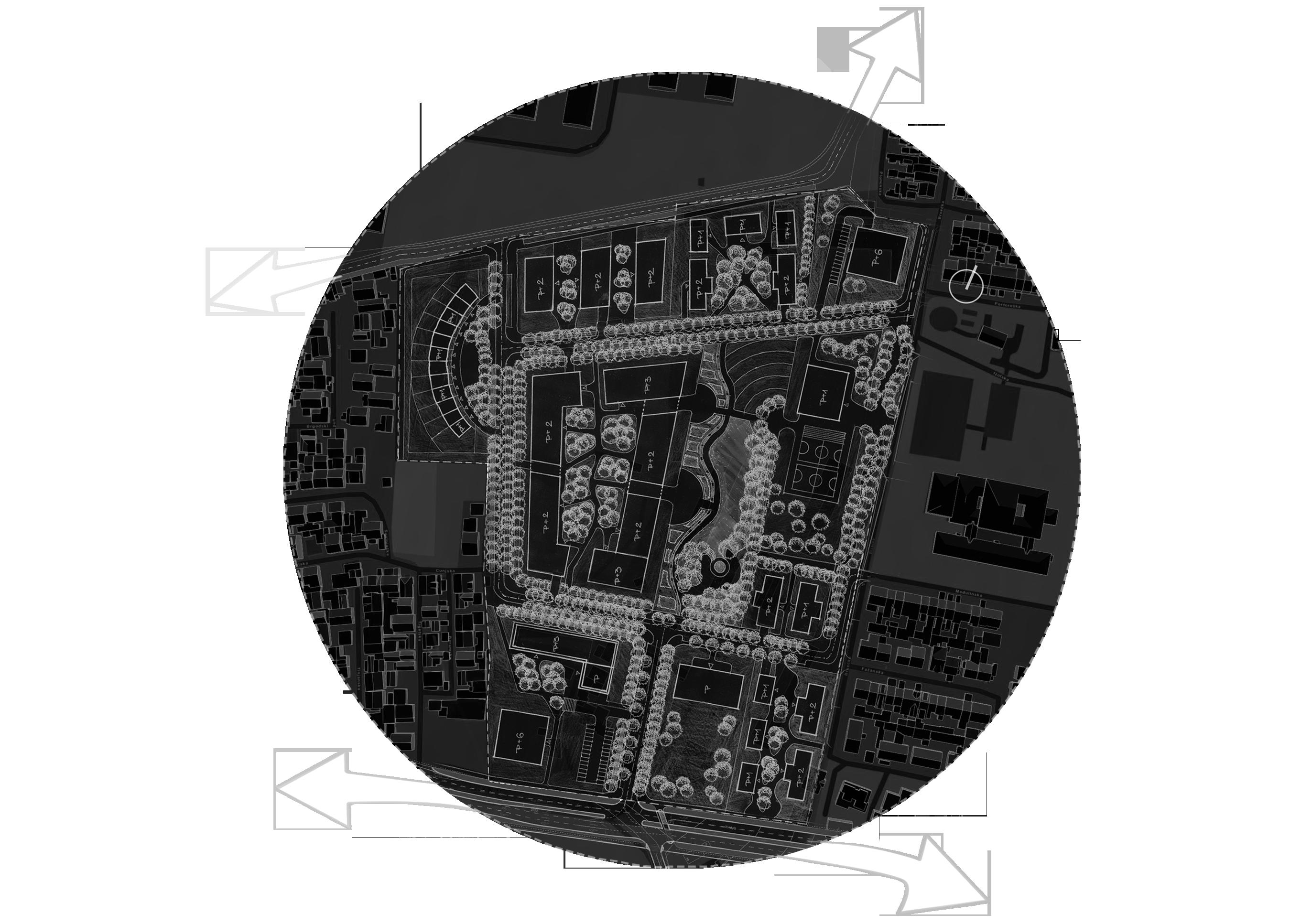
The urban solution is planned for one thousand new residents. It is formed out of a varied spectrum of structures. the southwest and northeast corners are formed with higher structures recommended for business and residential usage. The rest of the structures are a series of semi-closed blocks with halls. Smaller structures with 2-3 apartments per floor and a central staircase. On the northwest of the area, there is a circular assembly of family houses in a row. With their layout, the structures form planned open spaces whose multifunctional role in the urban living complex is emphasized. This way the open space is introduces as a structural piece of the entire site plan and forms its own hierarchy.
8
Planned vegetation zones and parks develop a contemporary urban setting when it comes to the urban environment and residential needs, and create much-needed human-scale environments.
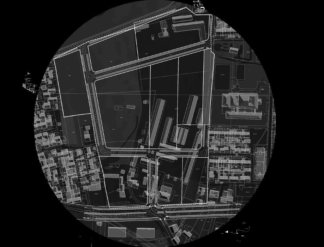
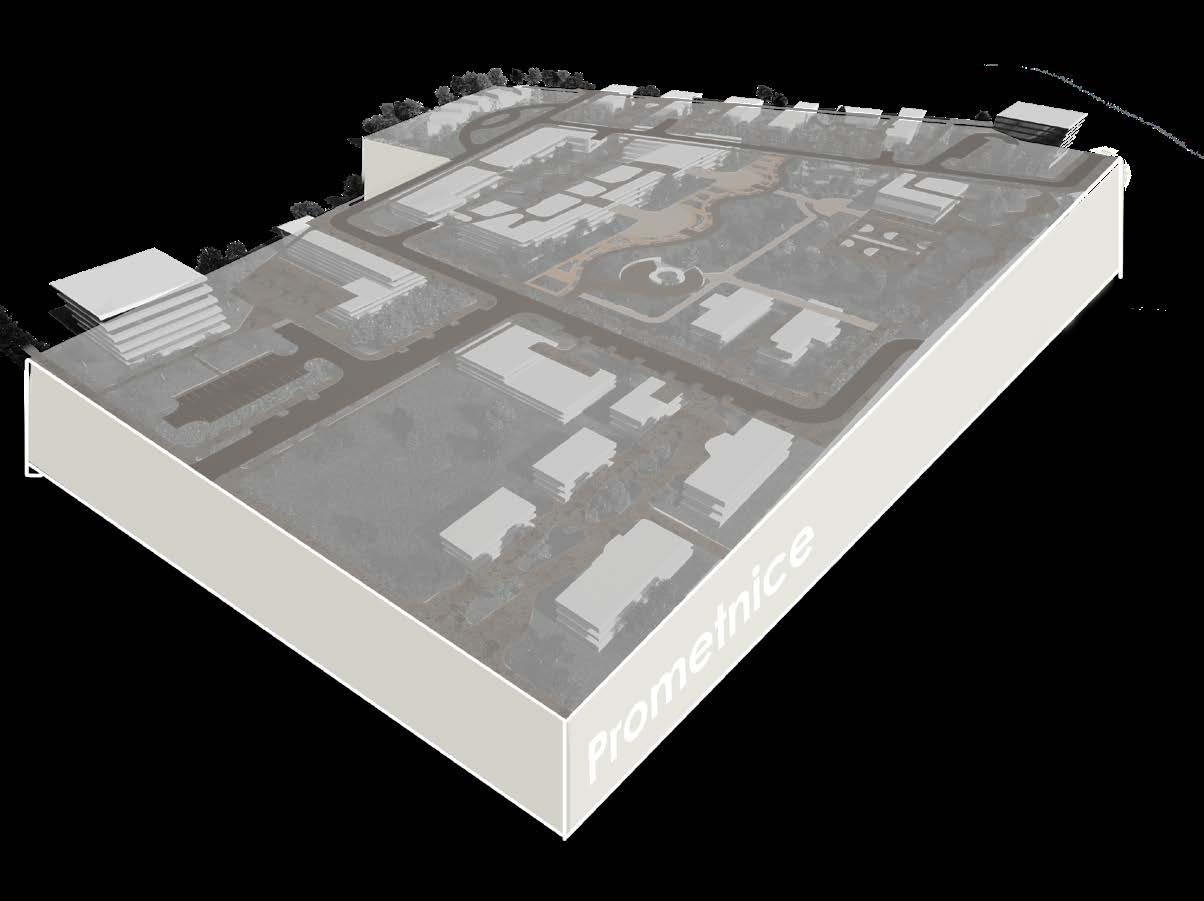
The traffic development plan consists of new roads in the north and west which are connected to the existing road infrastructure through a grid of busbars.
Existing state of the area
Proposed traffic development
9
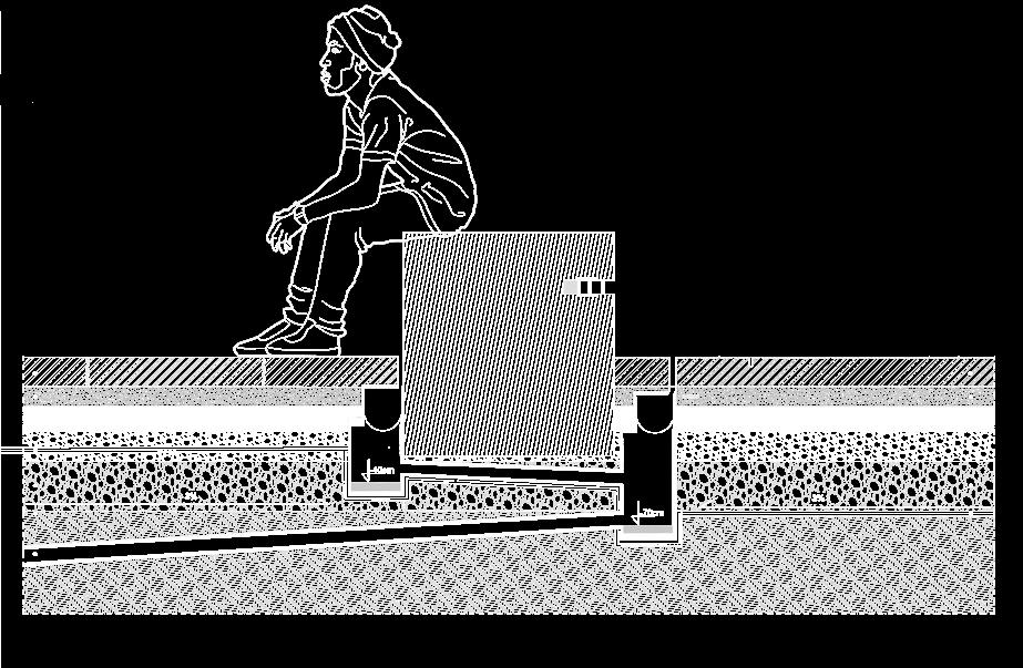
Playground and street workout Dog park Lowered meadow Urban gardening square
Lowered meadow
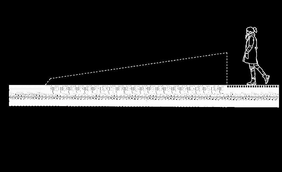
Stairs
Sculpture area
Seating elements
Water feature
Square
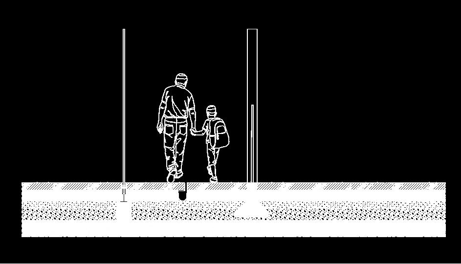
Vegetation barrier
Urban garden area
Entrance
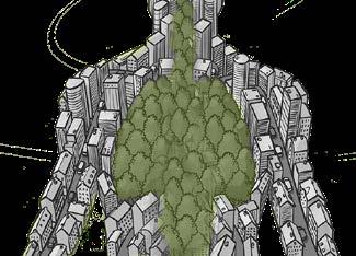
Let Zagreb Breathe
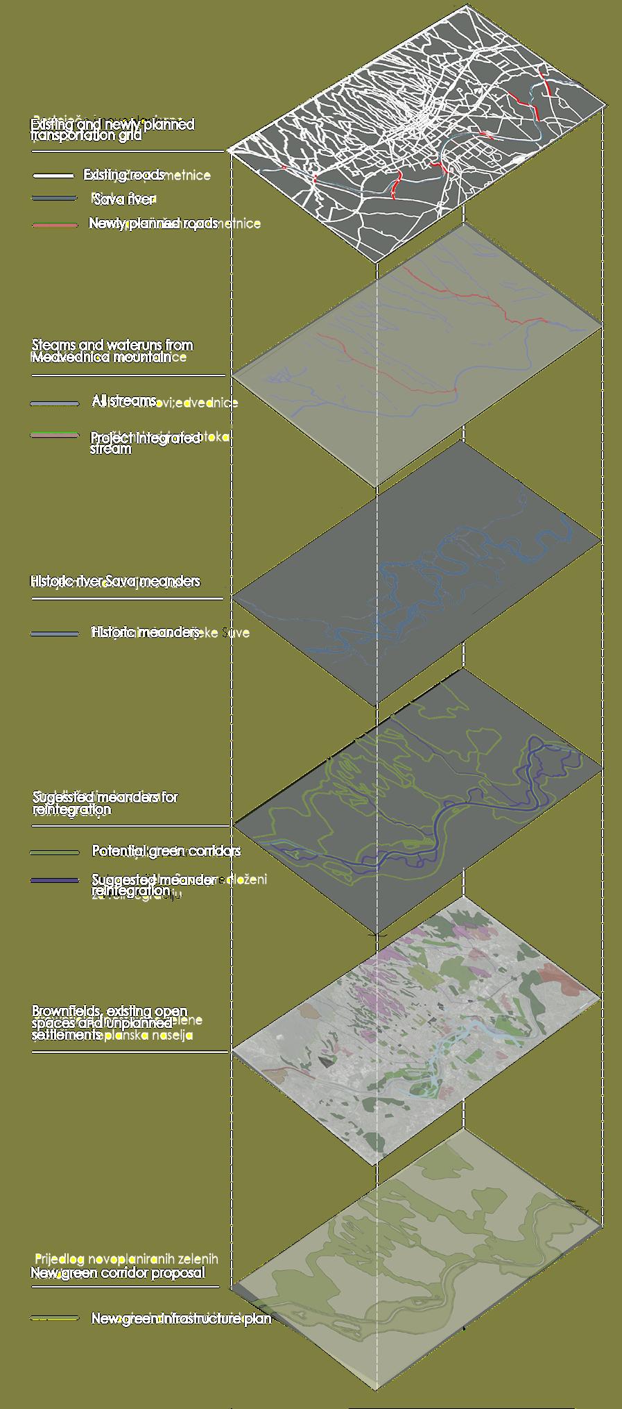
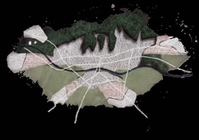
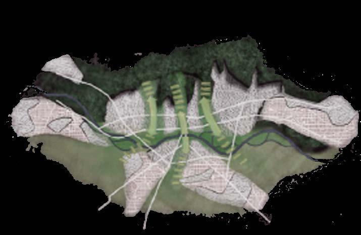
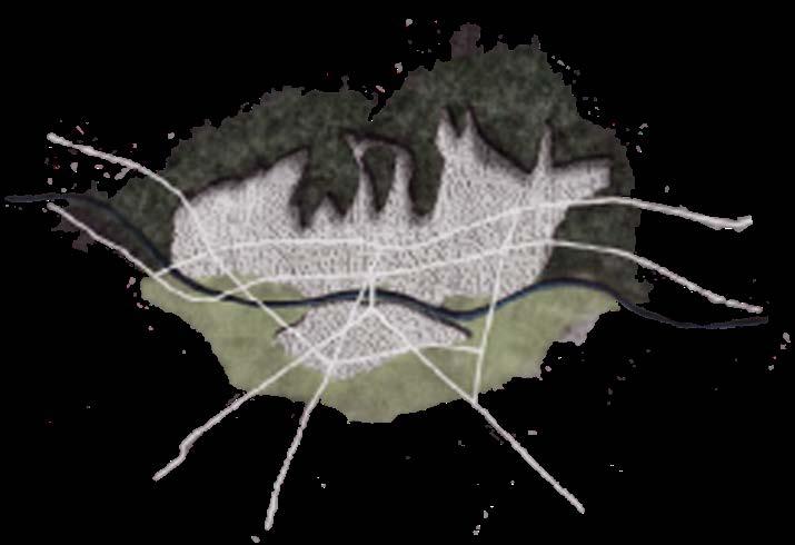
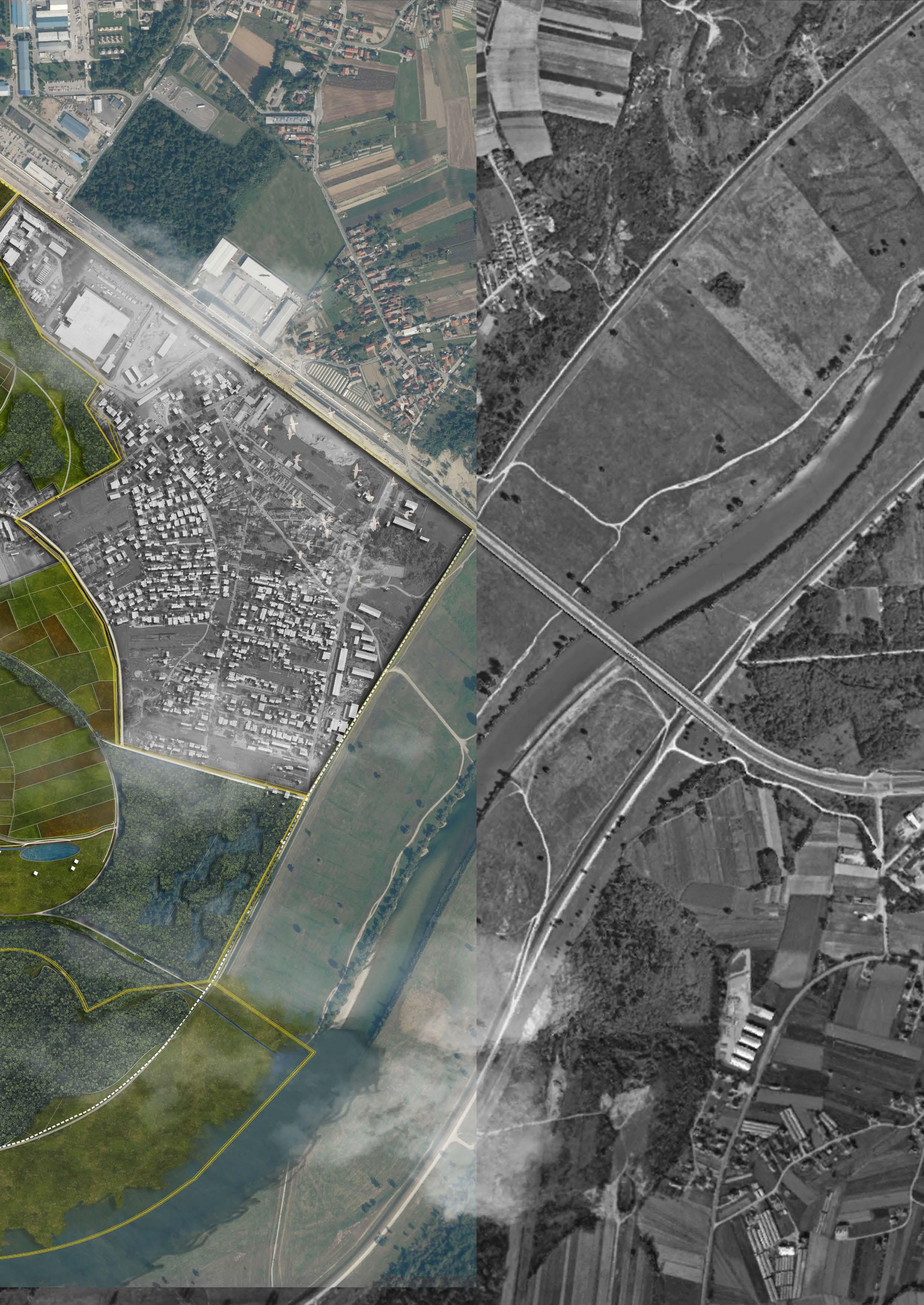
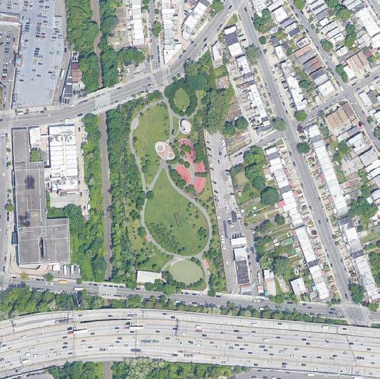
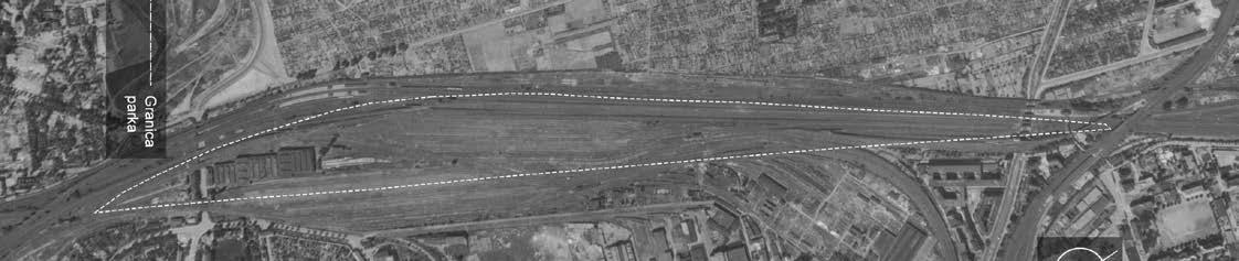
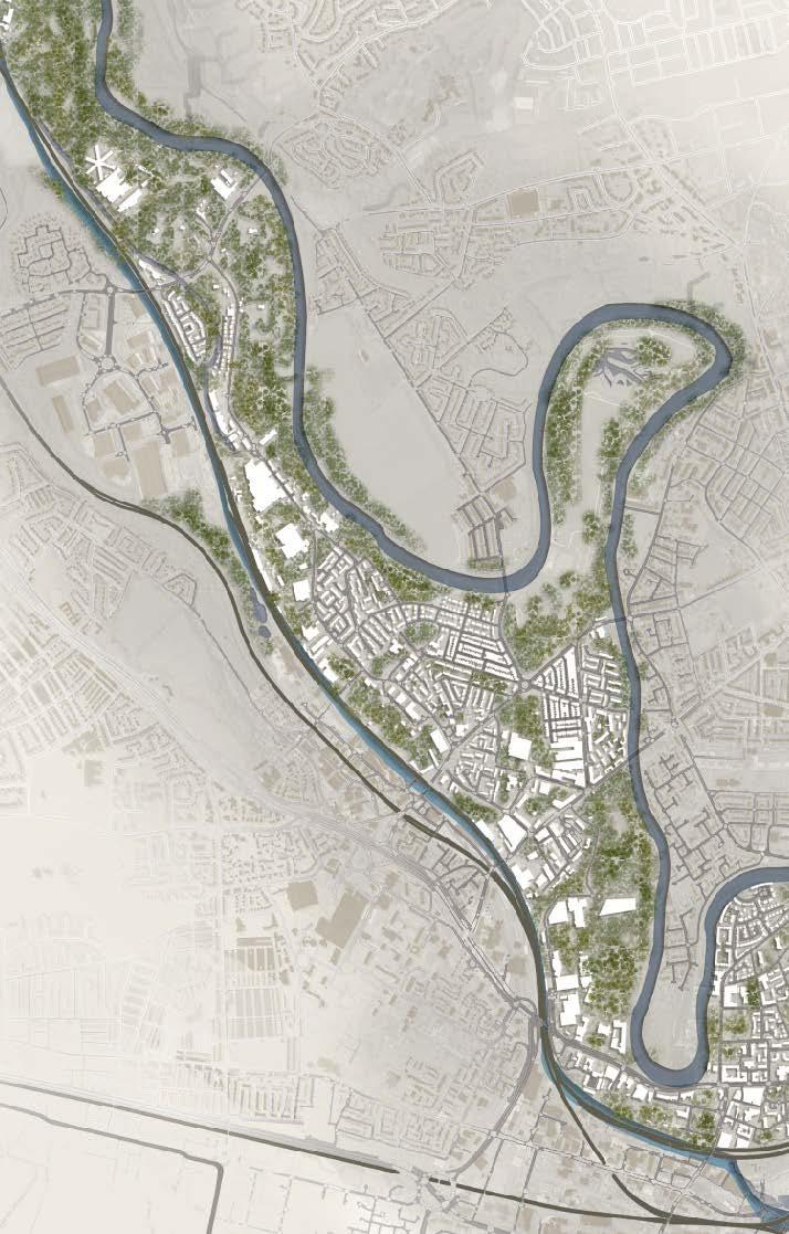
CONNECTION RENEWAL BETWEEN THE SAVA RIVER AND URBAN INHABITATED SPACES THROUGH ECOLOGICAL REVITALISATION OF SPACE - PETRUŠEVEC SETTLEMENT IN THE CITY WOF ZAGREB
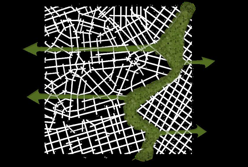
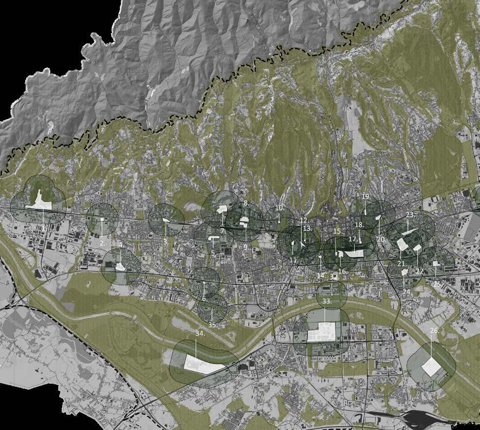
The plan is a part of a broader idea at the entire city scale. Inside this idea, the connection of existing and future high-quality green areas is considered. This way a high-value green corridor grid would be created passing through the city. Which would create “breathability” inside a dense urban infrastructure. Provide higher air quality for the inhabitants and elevate the quality of life by providing a chance for psychological regeneration and a life rhythm that breathes easier.
During recent history, the city of Zagreb has experienced a vast flood of a new population, a crisis in housing deficiency, a political and social transition and economic globalization, new urban trends which discontinued socialistic urbanism, and the lack of urbanism in its rapid expansion altogether. Untransparent and unclear land use in general urban plan and uniform usage city development. These are all problems that contributed to urban decay and poor living standards when it comes to the living environment. Decreasing the existence and creation of key urban elements like green spaces and public open areas. Even today the city is continuing to expand towards east and west which increases the distance of green spaces and nature and brings the cities edge further away from its residents. Therefore the unconsolidated and unplanned urban spaces which are waiting for urban renewal maWke a promising potential for the creation of a much-needed and essential green infrastructure of the city following the trend of many worldwide cities.
With that in mind, the already existing idea of green corridors/ fingers passing through the city was developed further. These green corridors are intended to connect on unused space inside the city like brownfield areas, future development spaces of unplanned urban areas, the blue infrastructure, and surroundings of streams from the mountain and existing green open public spaces in the city.
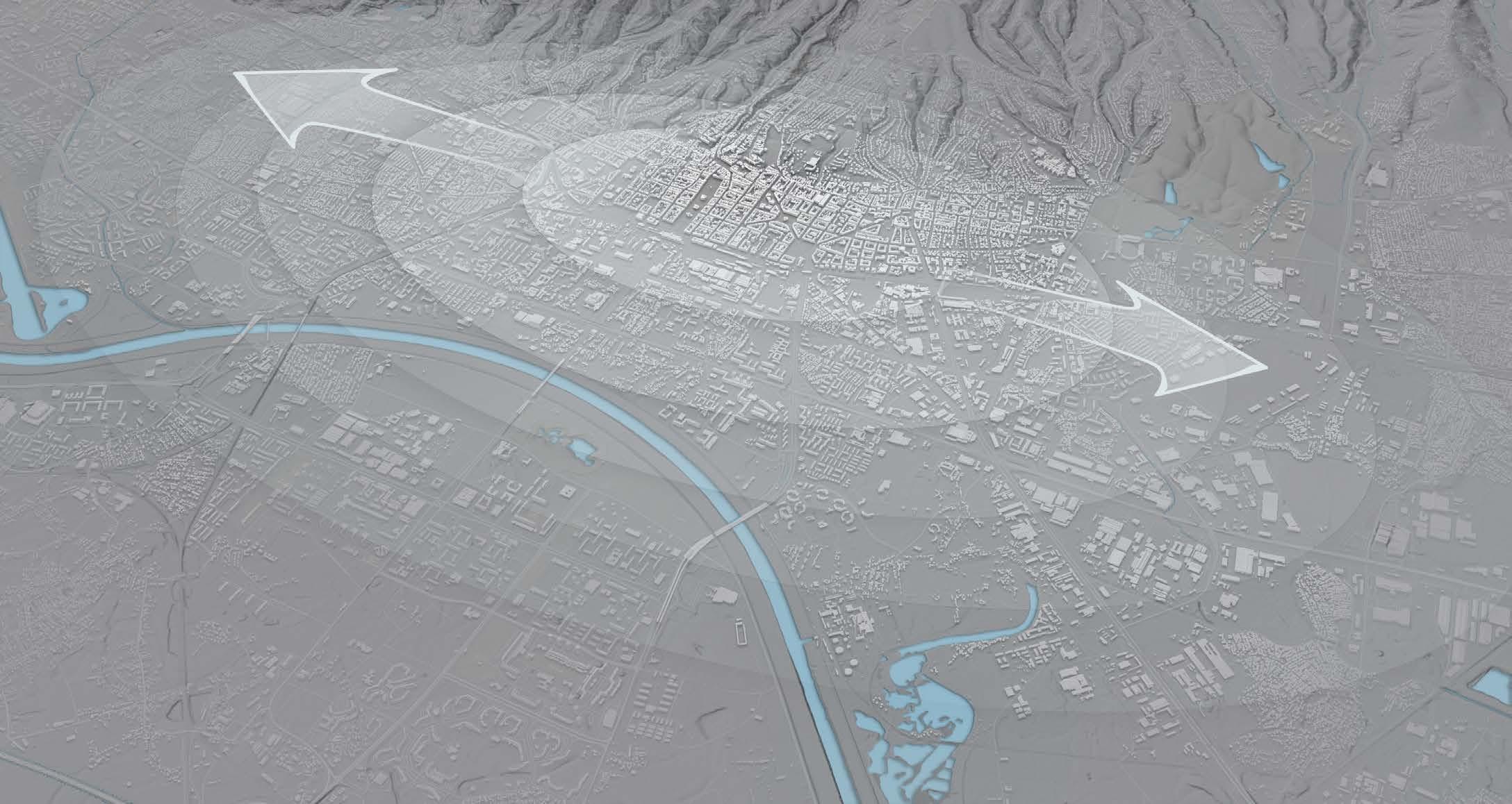
The title/guideline of the idea titles “Let Zagreb breathe” was generated as a reference to a triangle of potential benefits the green infrastructure brings. Straightforward easier breathing of the inhabitants due to cleaner air, psychological and mind breathing by rehabilitating inside green spaces and morphological breathing of the city of the existing and future planned urban infrastructure.


14
- Higher living standards
- Elevated aesthetic value

- Increased recreation potential
- More frequent and stronger social life
- Cleaner and fresher air
- Rehabilitation benefit (mind and body)
- Elevated work efficiency
- Reduce car usage towards green areas surrounding the city
- Water purifying through rain gardens
- Disburdened and lowered flooding of denivelated areas
- Preservation of integrated streams
- Mitigation of climate change impact
- Integration of Microclimate zones
- Reduced amount of greenhouse gas -
- Burden reduction on existing green areas like the Nature park of Medvednica
Zone A and B further developed areas.
Zone A - Racinjak Park (multifunctional space equally oriented towards human use and reintegrating lost biodiversity)
Zone B - Ecological revitalization zone + reintegrating the river Sava and expanding the existing ecologically rich zones.
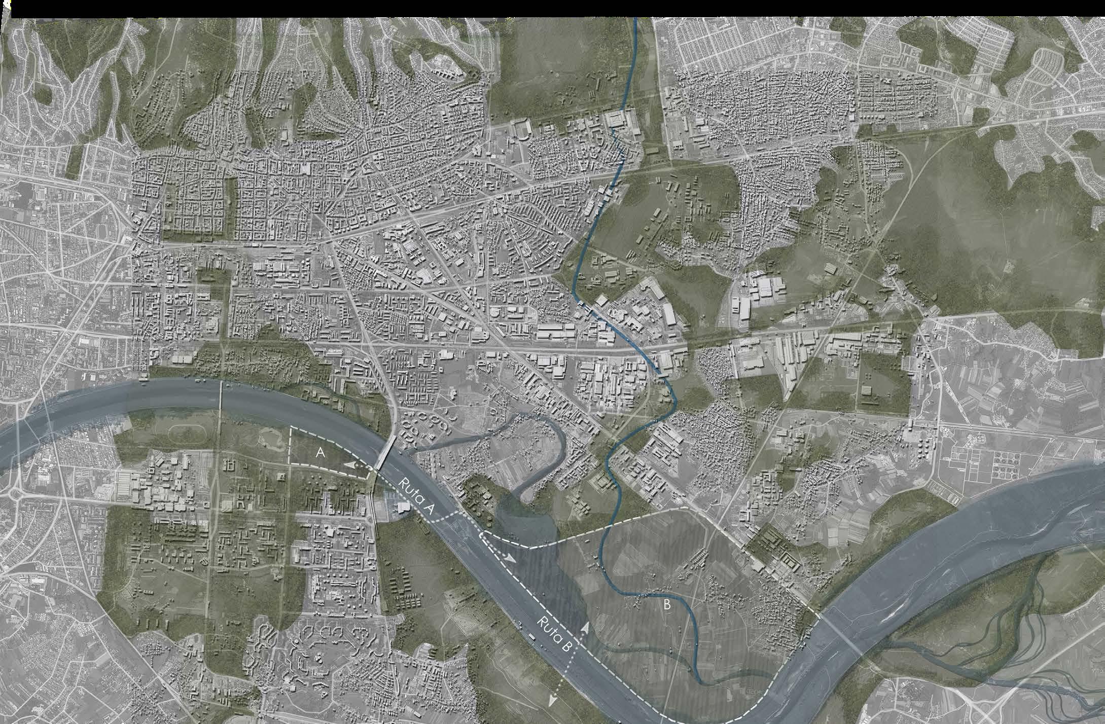
Route A - Marks an alternative walkway between the two zones by walking on the existing embankment and the newly proposed pedestrian bridge over a small hydropower plant.
Route B - Potential communication between the future remediated landfill and the ecological area of zone B.
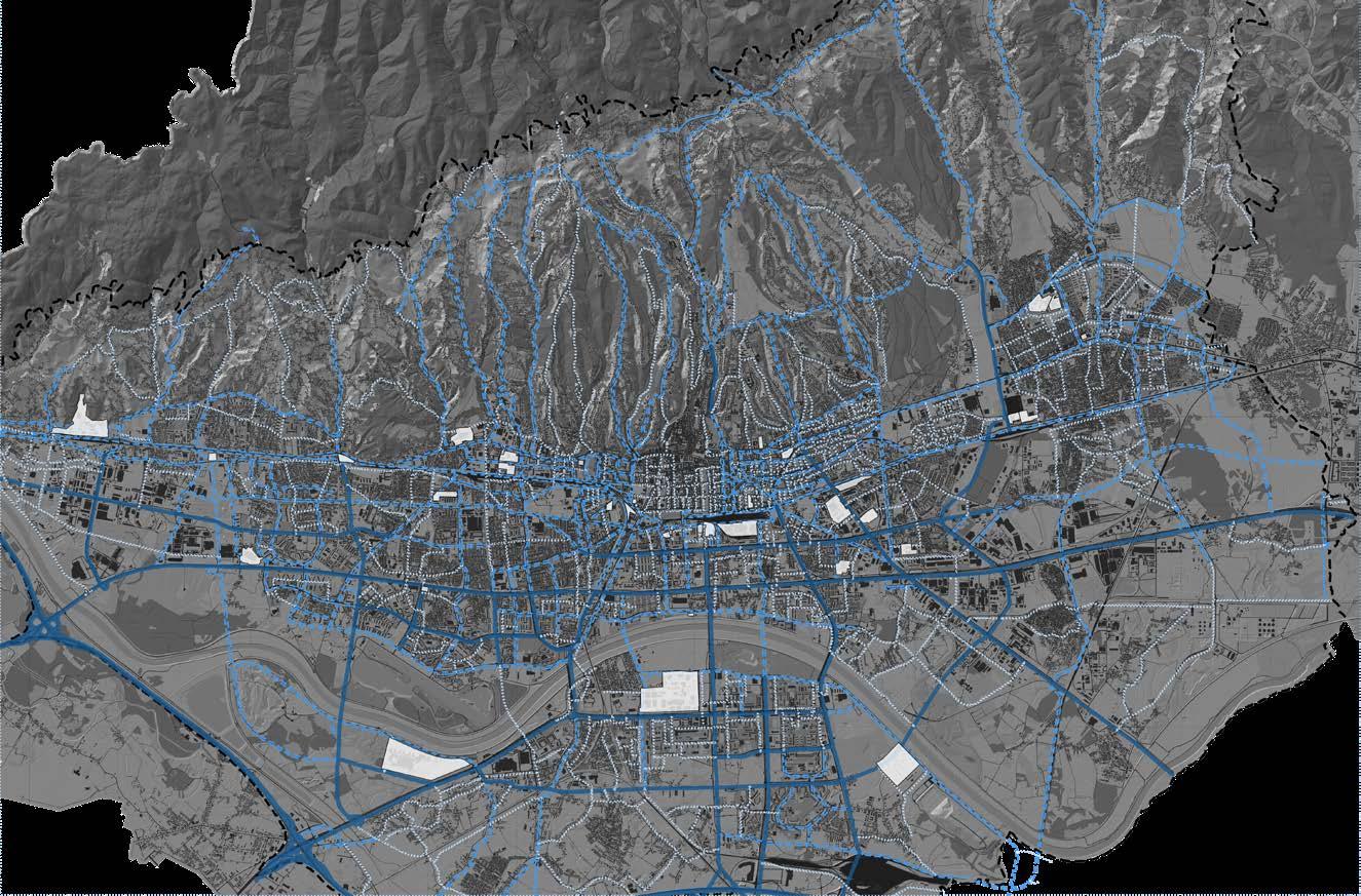
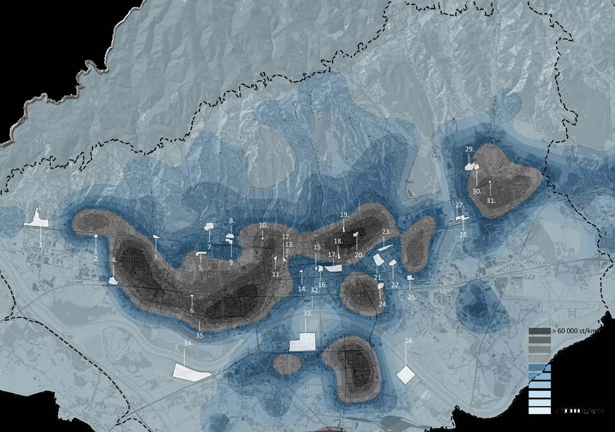
The broad map shows the central and eastern potential green corridors of Zagreb. The east corridor is dominated by big ecological zones next to the river and broader green areas on the periphery of the central part of the city. The goal of this proposition is ecological revitalization, reintegration of blue infrastructure, and retainment of “wild” spaces inside the city reach.
 Zagreb of Zagreb and satellite cities.
15
Established green infrastructure inside a dense urban matrix
- Urban public park with gardening, amphitheater and
- designed river and wetland landscape integrating recreational, educational, social, aesthetic, and ecological
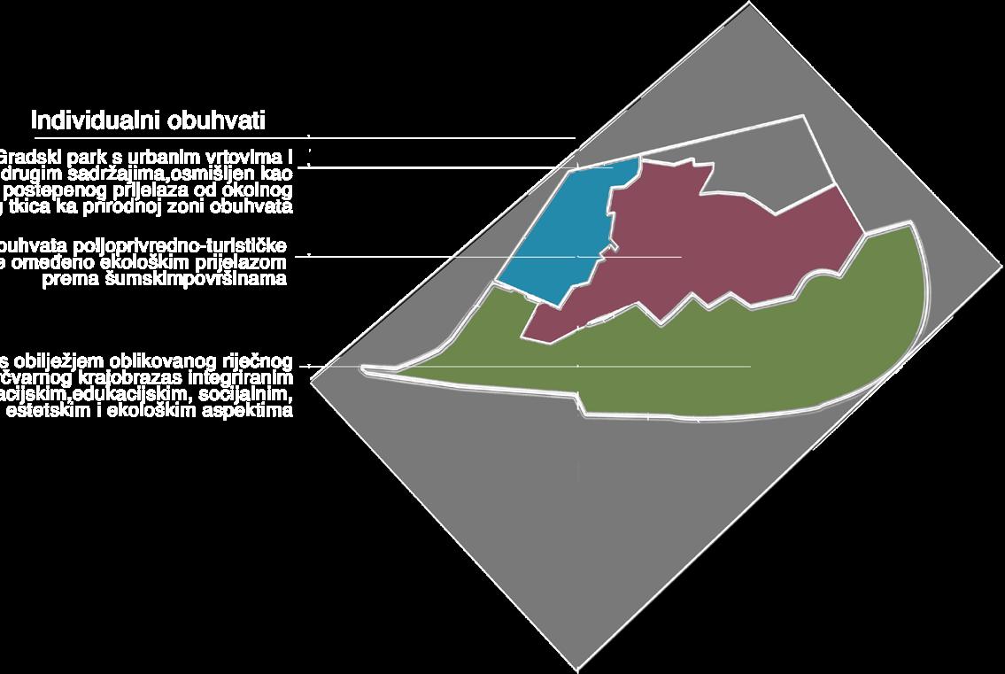

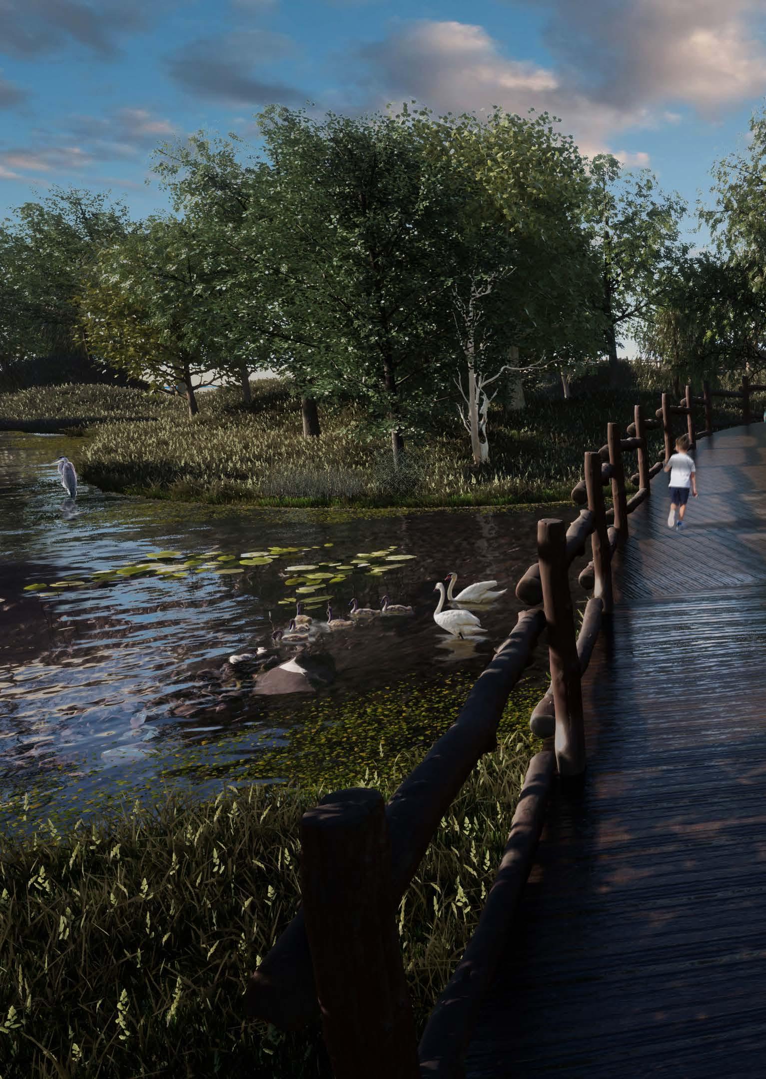
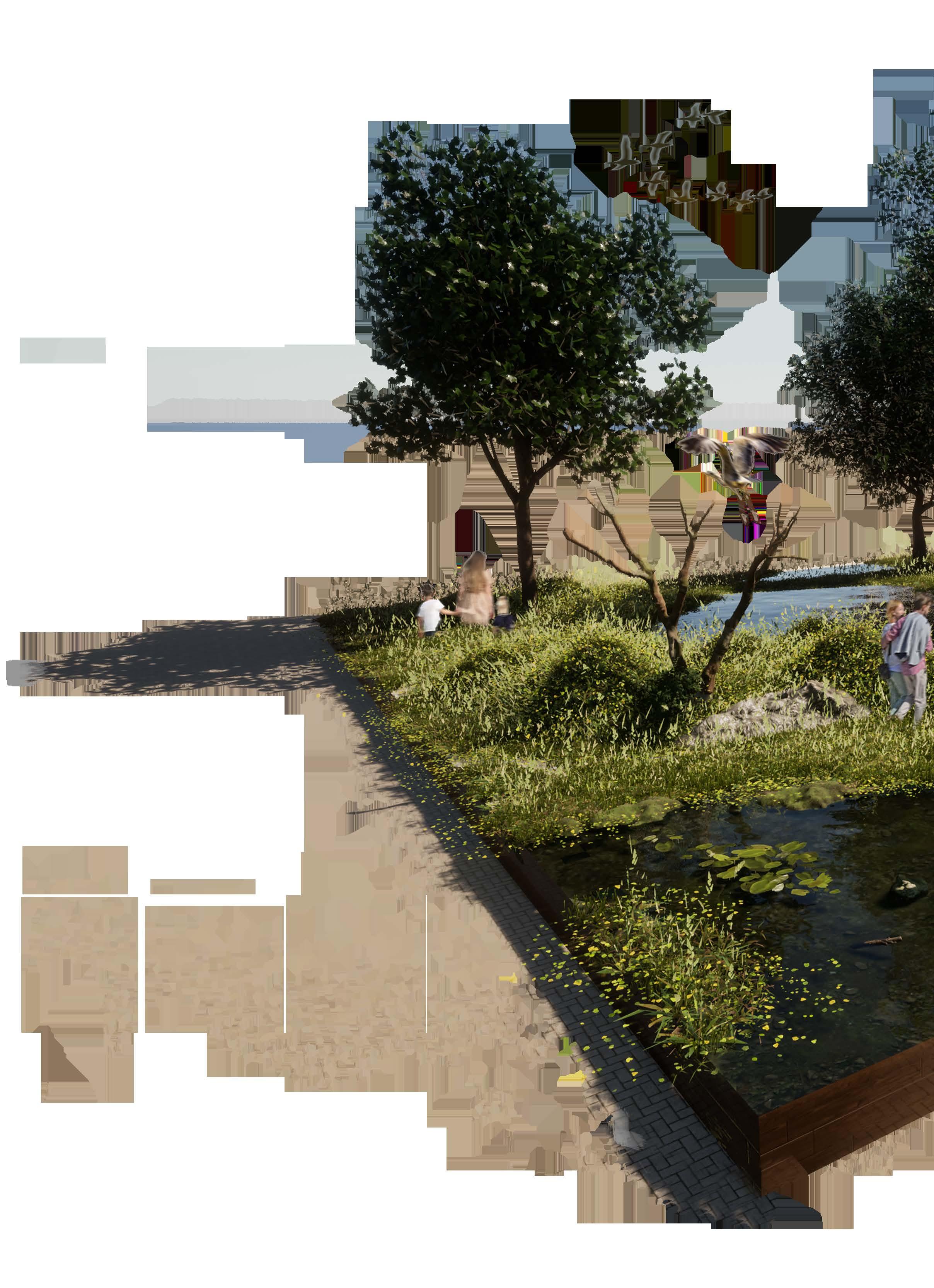
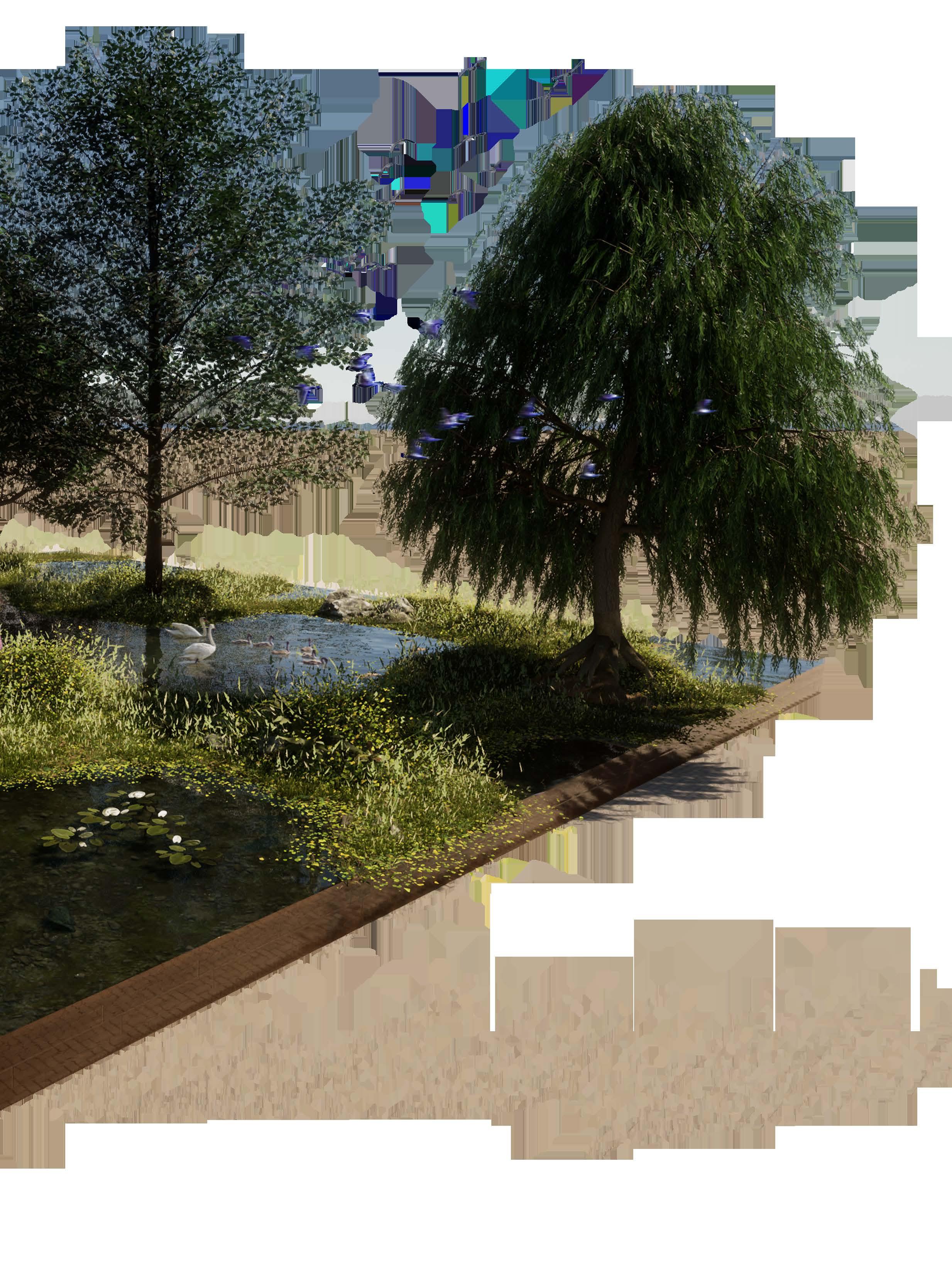
Further developing the idea a more detailed scale space of roughly 5.1 km2 was selected. On this space, a series of interventions were planned: embankment offsetting, expenditure of the free flood area , integration of elevated walkways, glamping , road, and public transport connections , exposure of forested areas, amphitheater, urban gardening, lakes, and accompanying uses were added to strive towards a new function of the area. High emphasis was placed on ecological preservation and rehabilitation with the creation of new habitats. This way the ecological, visual-aesthetic, recreational, and educational attributes of the space would merge.

a b c 16
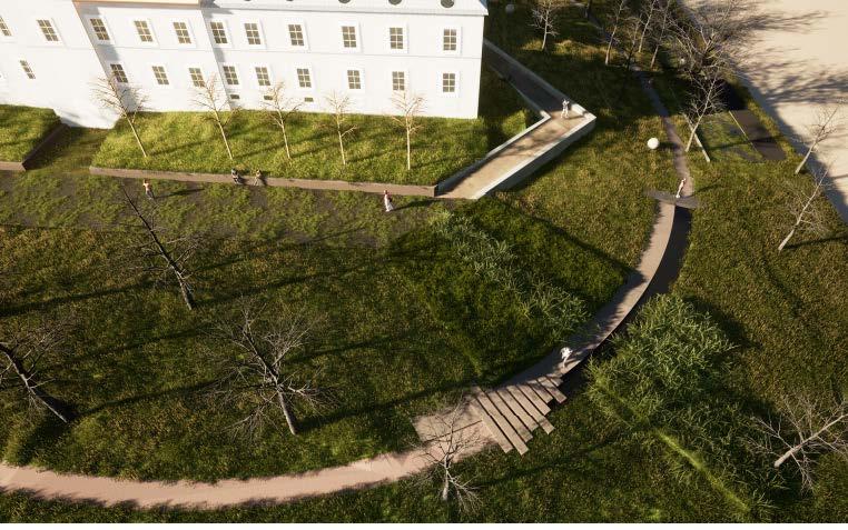
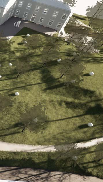
Constructed ecology area. A designed park that emphasizes the ecological aspect. Thematically integrated into its surroundings. It is comprised of artificial shallow pond lakes that are held on the edge of vegetational overgrowth and anthropological contained landscape.
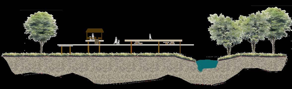
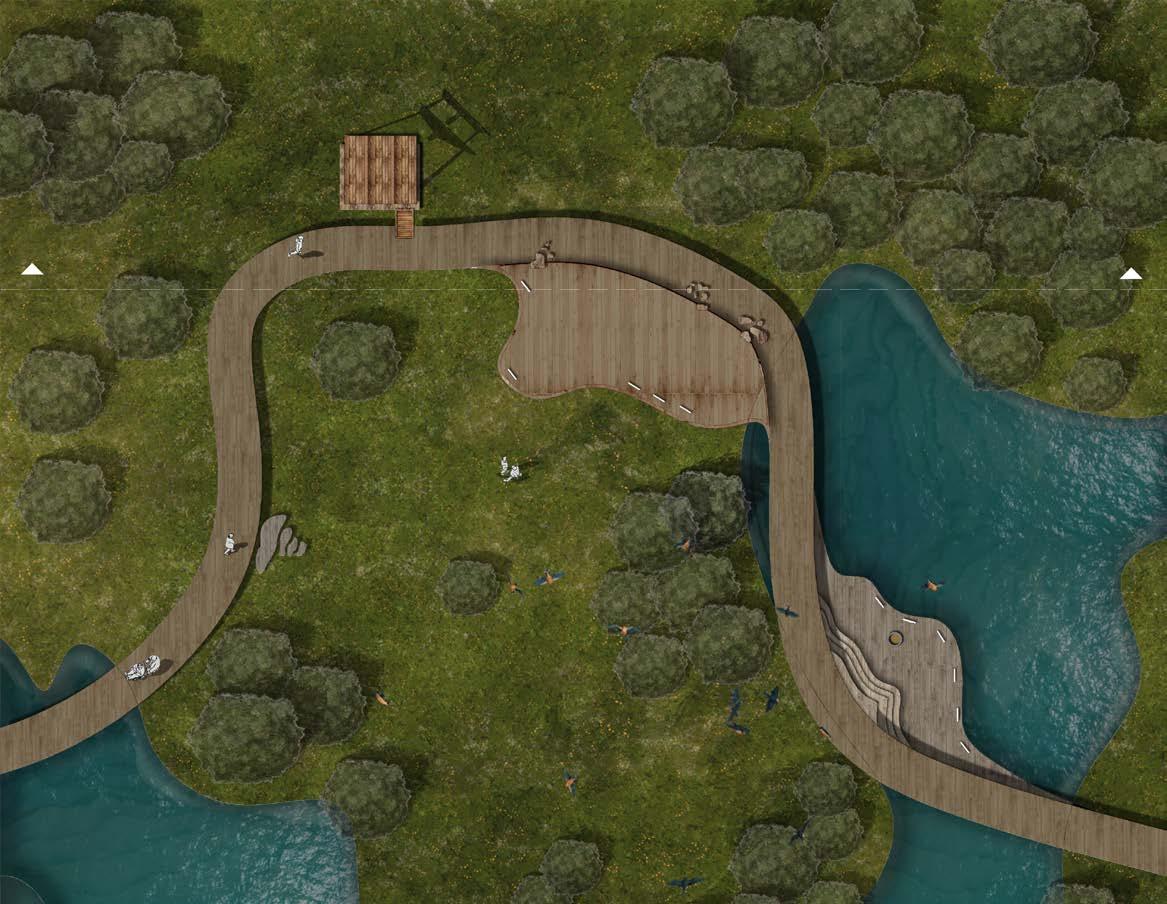
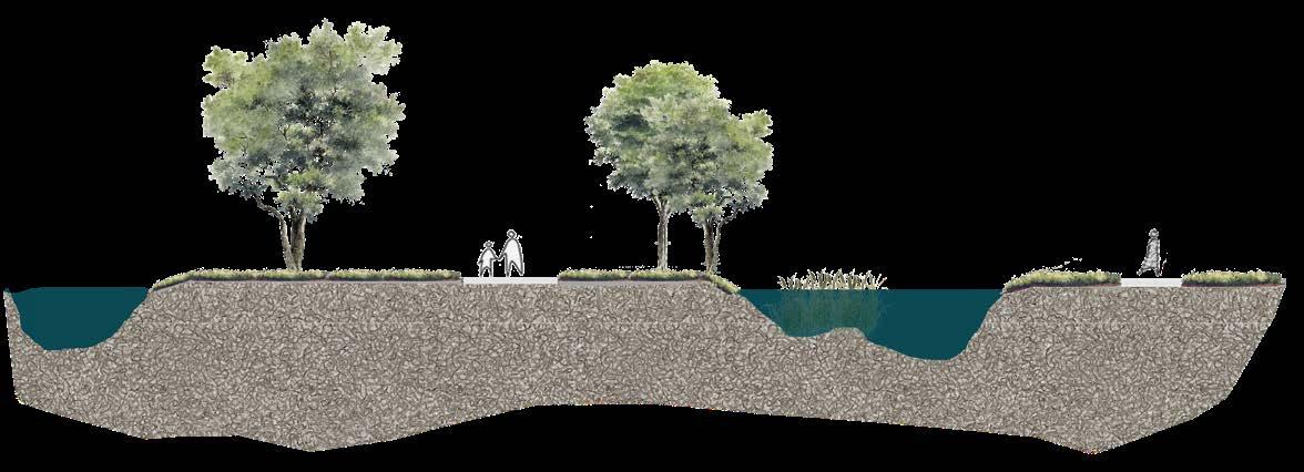
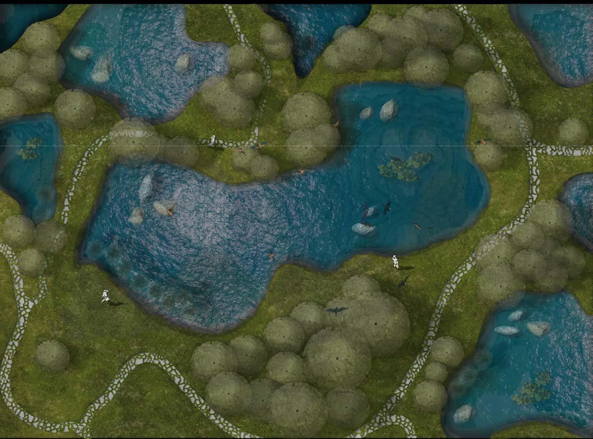
The extension of the artificial lake area broadens the habitat for protected fauna and creates a hierarchy of water bodies according to their distance from the main flow. This way the habitat diversity is increased and lost river biodiversity with lost species like Quercus robur and Berberis vulgaris is set to return. Since the best way to preserve something is often to use it, a hierarchy of elevated walkways is introduced to bring new experiences to the urban inhabitants of Zagreb.
17
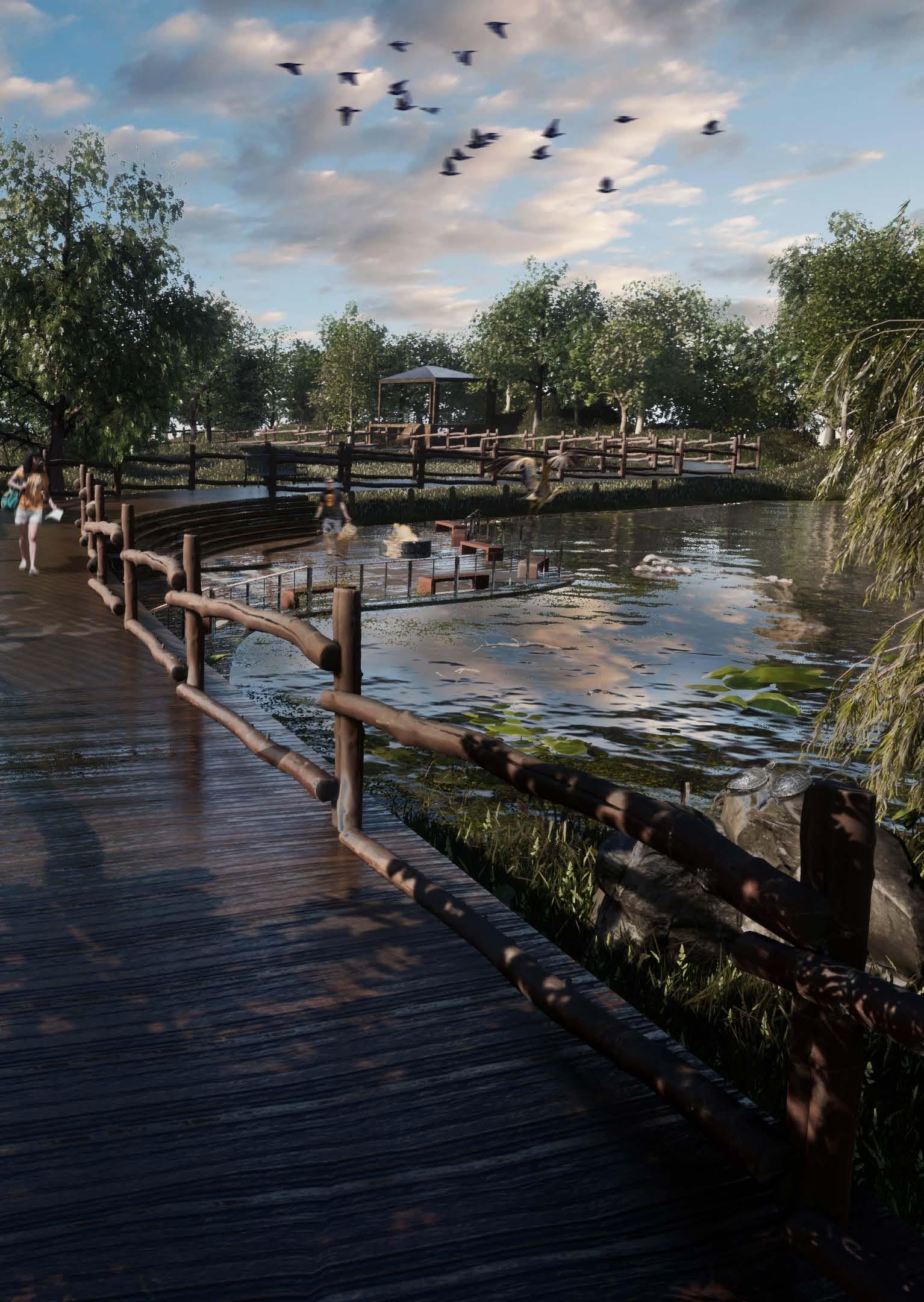
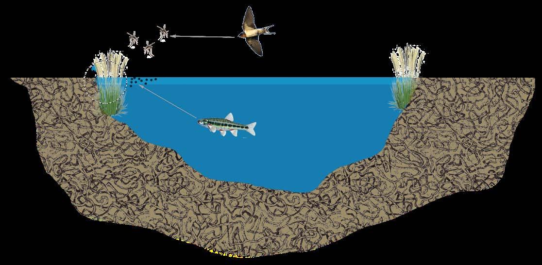
This detail shows the space of constructed ecology (shallow water bodies) that create a wetland. The level and quality of the water are controlled through underground systems and phytoremediation. Inside this project, smaller details were also developed. For example, the mosquito problem was tackled in an ecological manner without insecticides and larvicides. Ihtiofauna contained in the lakes feeds with all states of the mosquito larvae. Therefore a steeper bank of the lakes allows for fish to get to it and creates a disturbed surface of the water. Waterflow through the planned system also regulates temperature and quality which ensures the fish’s wellbeing. On the other hand, by encouraging bat and ornithofauna population, in other words, fly feeding birds the problem of adult mosquitoes phase is mitigated.
18
19
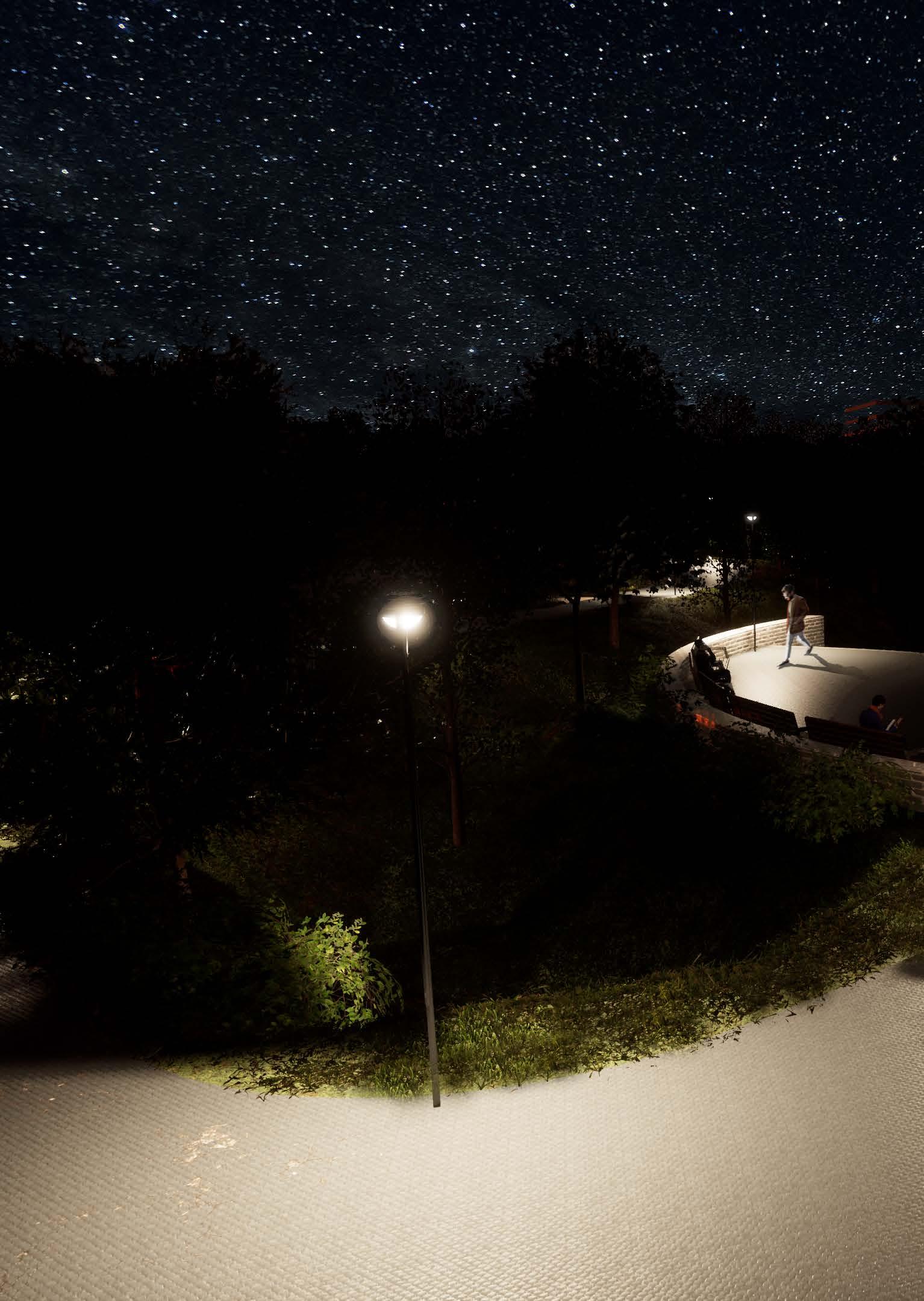
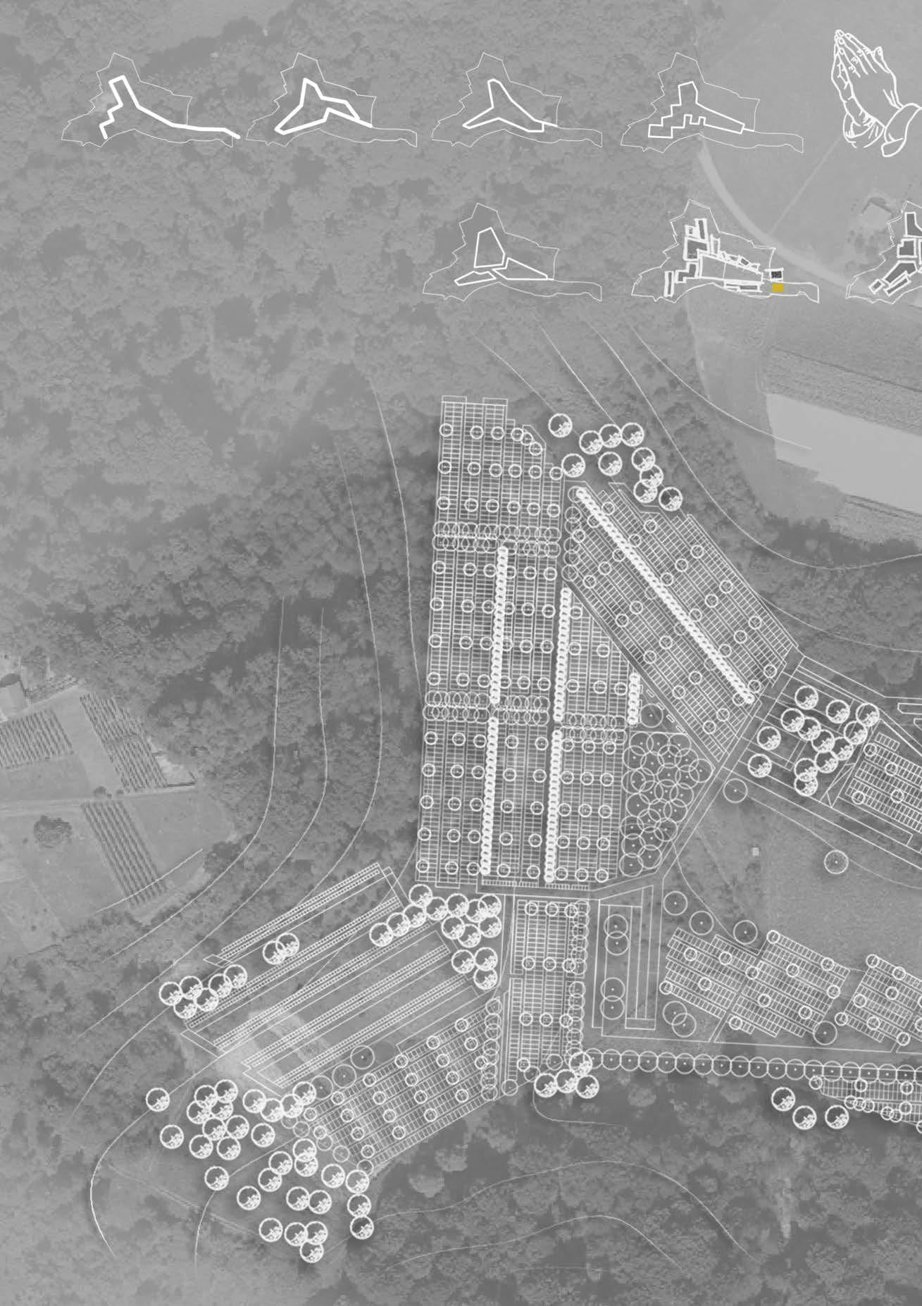
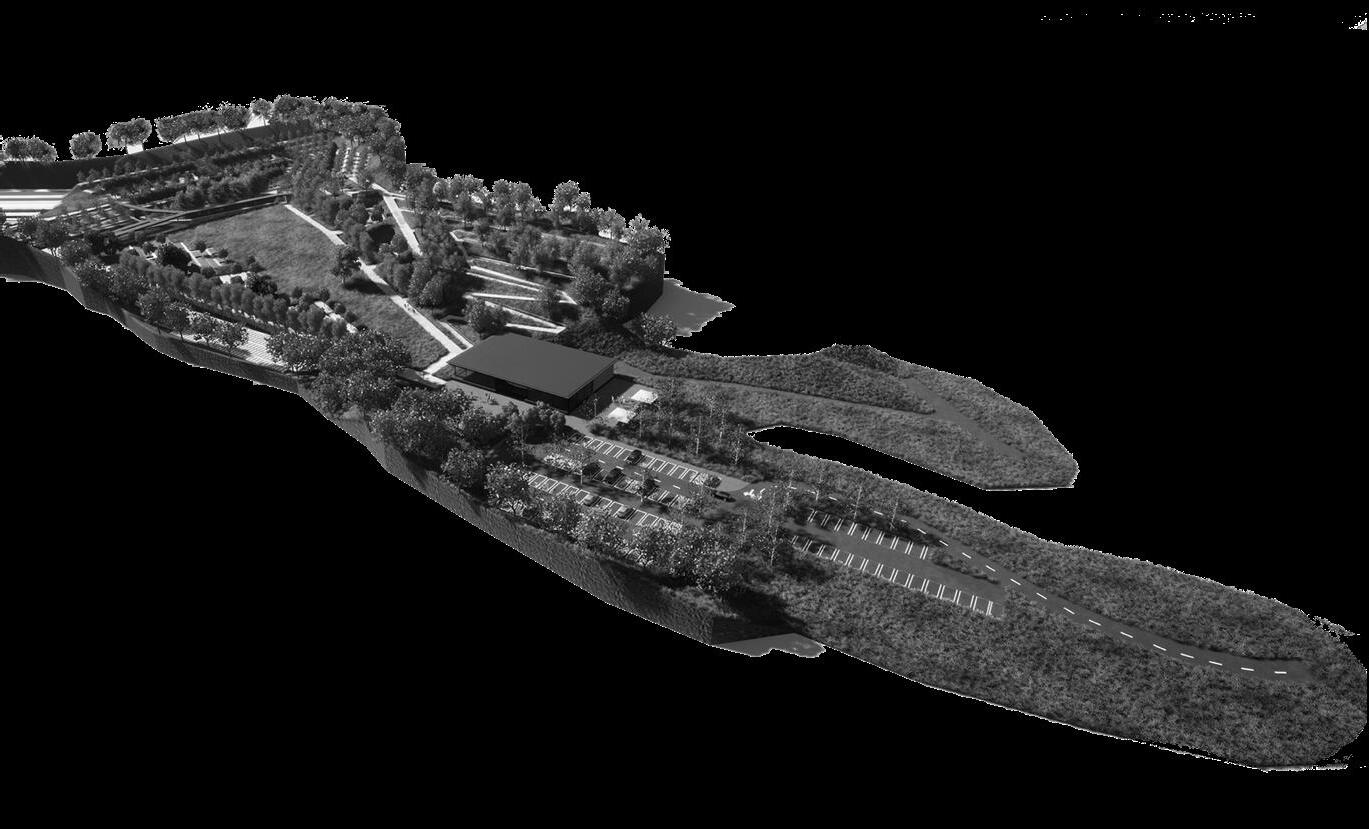
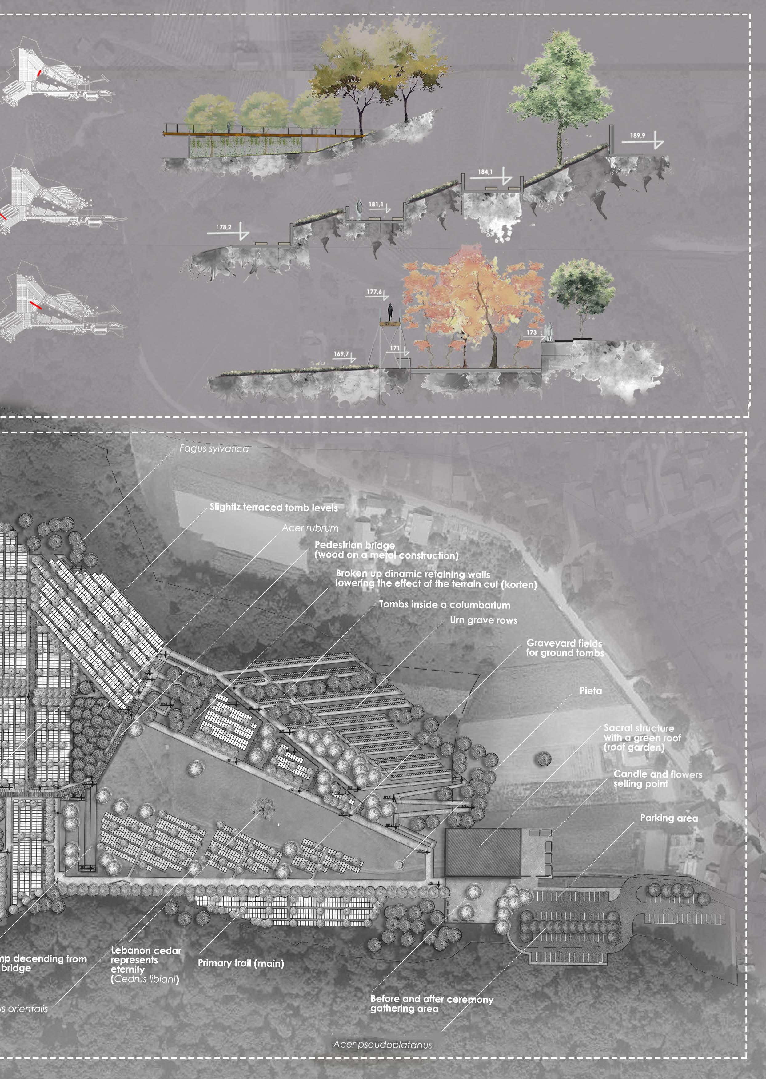
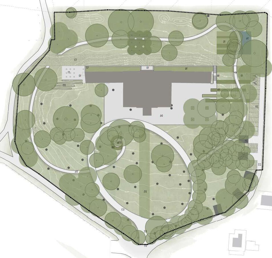
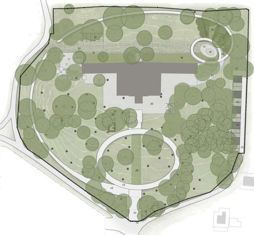
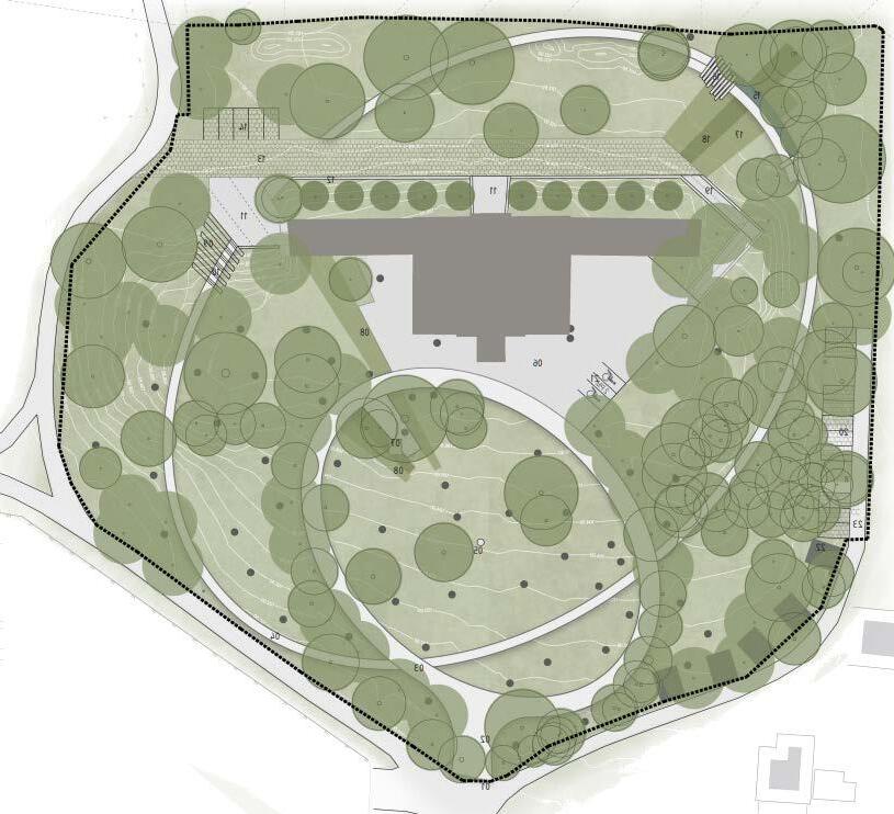
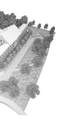
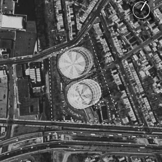
Jakuševec zabočki cemetery masterplan
A MASTERPLAN AND LANDSCAPE DEVELOPMENT PLAN OF THE NEWLY PLANNED CEMETERY IN JAKUŠEVEC ZABOČKI
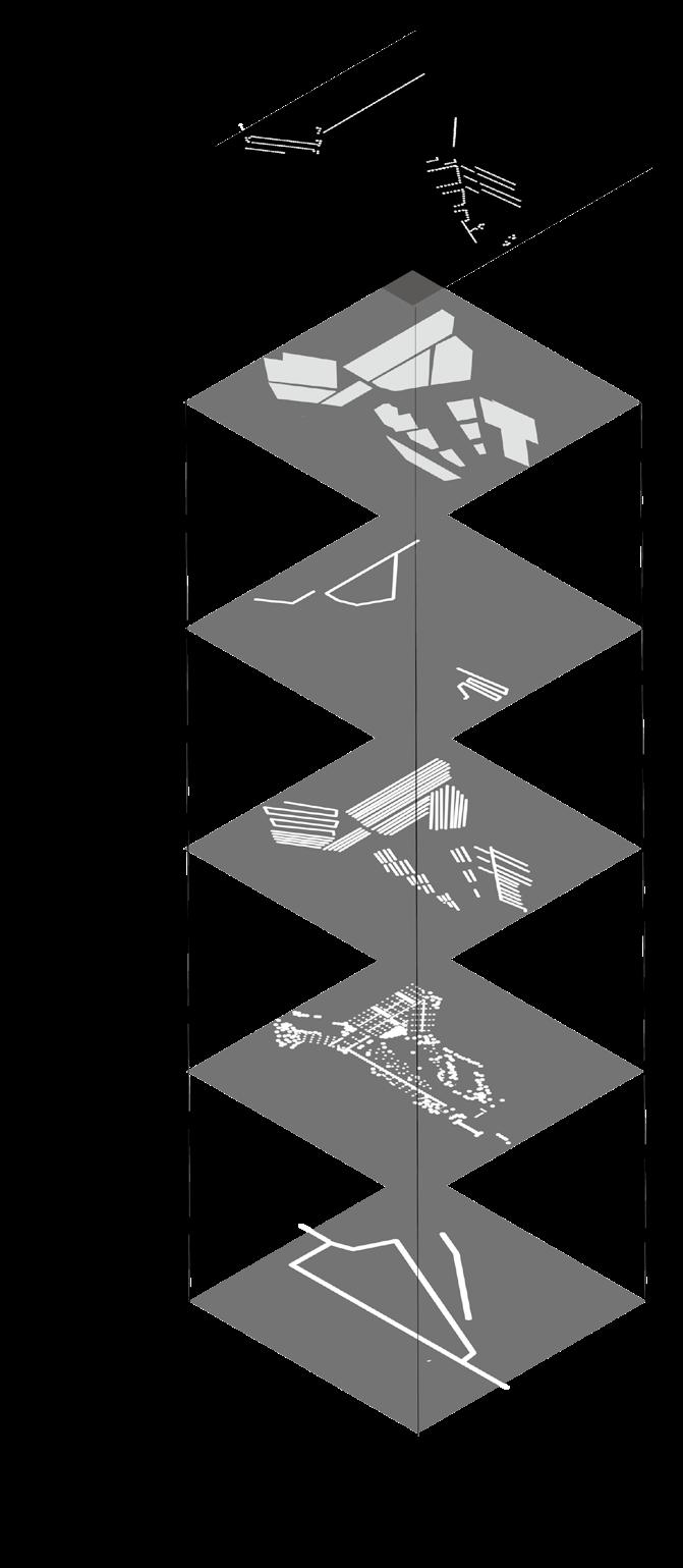
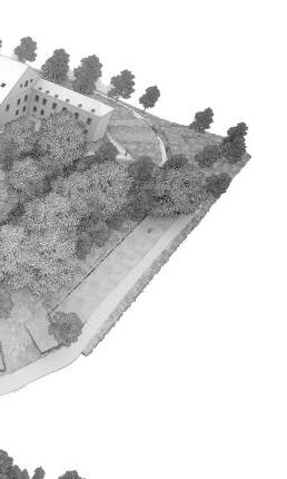
The new cemetery idea and plan in the municipality of Zabok incorporates into a demanding terrain using retaining walls, stairs, and ramps. It forms a dynamic and mysterious space that opens up by walking through it. Unique features of certain separate cemetery areas and fields allow for recognition and easier orientation in space. While existing and planned vegetation creates a serene and monumental ambient.
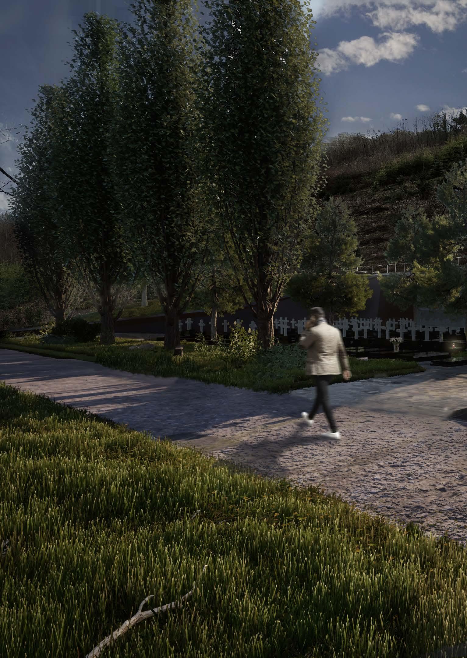
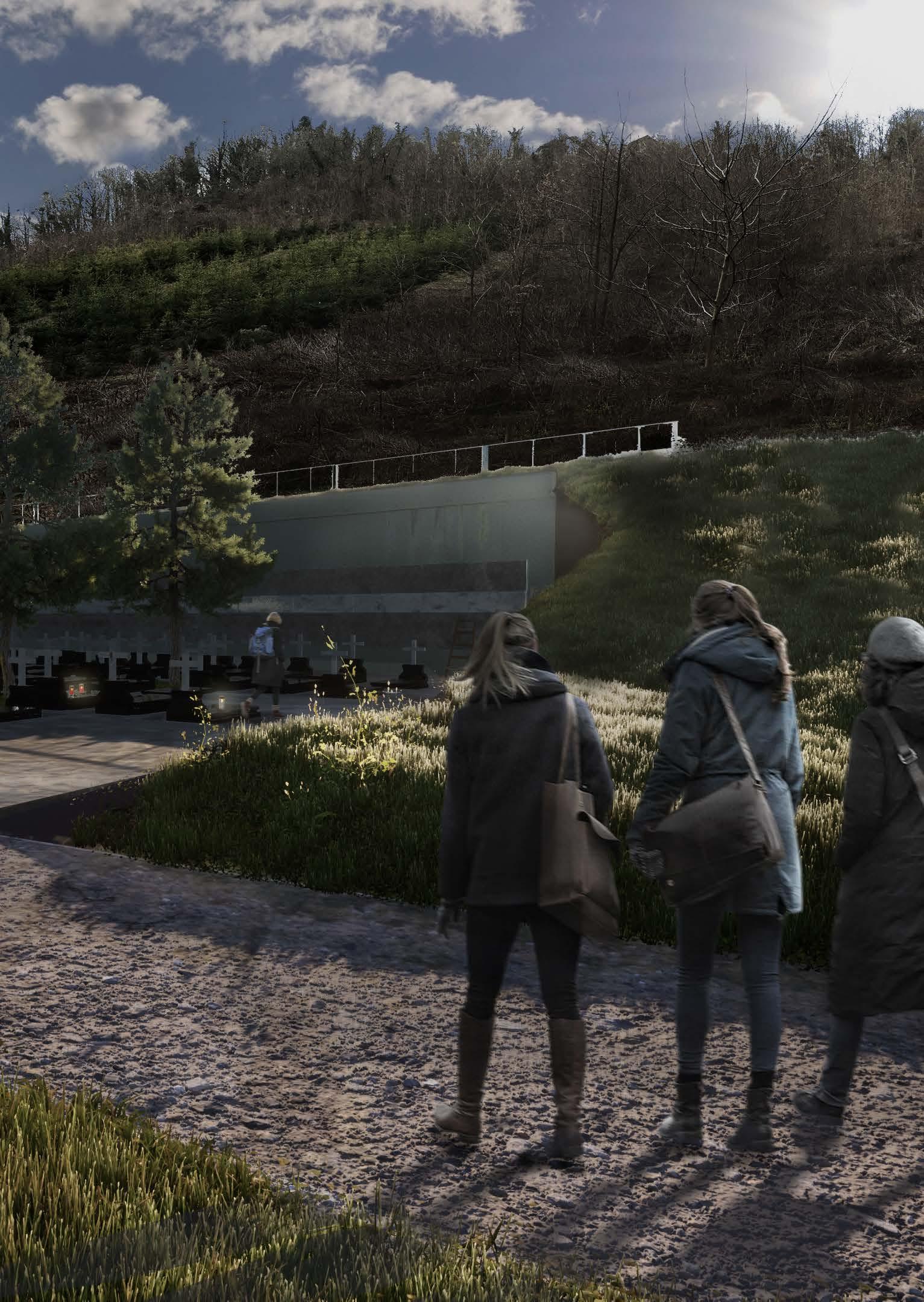
The solution and the idea were born from a combination of morphological aspects of the location and the deconstruction of and the act of folded palms with drapery. Massive vegetation and trees form an edge which in combination with fragmented open spaces creates “rooms” whose intimacy and privacy are discovered while walking through the area. In addition, the retained high vegetation acts as a visual barrier for the existing settlements and structures in the vicinity. Its volume also contrasts the mentioned meadows and creates an entirely new scenery in autumn when the ground is covered with red leaves. Open spaces which create the initial base for cemetery zones have been articulated even further through the structure of folded praying palms which are a universal symbol of serenity, calmness, eternity, pray and humbleness.

The newly planned cemetery is located in a valley between hills overgrown with a semi-dense forest of pillar-like high trees of beech (Fagus sylvatica). This vegetation changes the ambient from summertime shrowdly and darker space to an autumn and winter picturesque and colorful landscape. Through the entrance extending the entire cemetery from east to west end, an axis forming recognizable view extends over the Pieta towards the pedestrian small bridge and the accent trees placed next to a central square. While moving towards the square and the western part the visitors experience the space through a hierarchy of unique views and ambients empowered by the form and aesthetic of the introduced vegetation, terrain, and different types of tombs. The entire space further develops and contributes to the image of the small city and highly increases its identity and recognition.
22
1. Open area
2. Columbarium area
3. Sacral structure and area (entrance)
4. Terraced urn field in the forest
5. Tomb area
6. Terraed urnes (steep-slope)
7. Square
Retaining walls
Cemetary zones
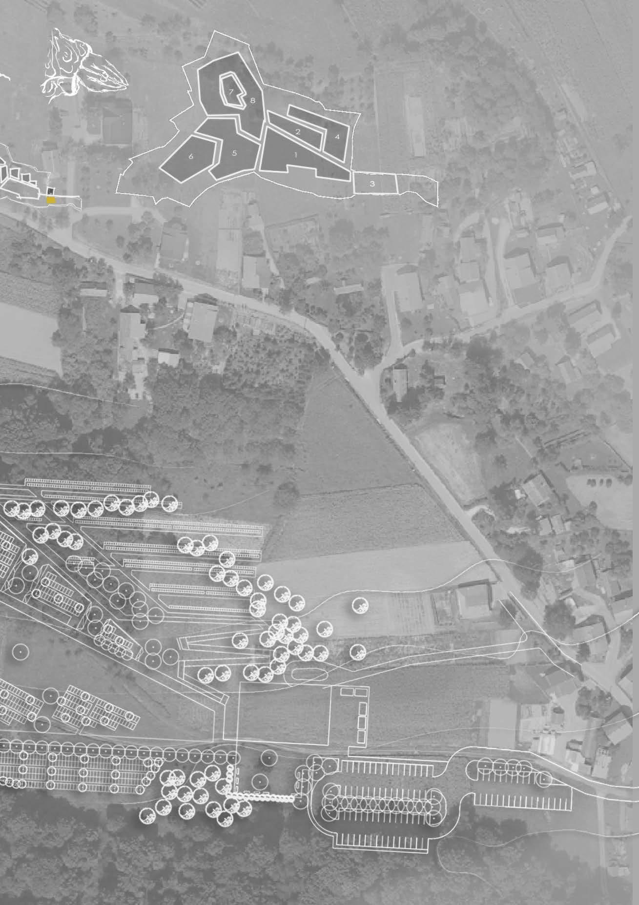
Secondary walkways
tertiary walkways
Vegetation
Primary walkways
23
tombs inside the wall (columbarium) tombs 260x140210x80m tilted broken corten wall which softens the feeling of enclosement of space and the height of the retaining wall. 24
25
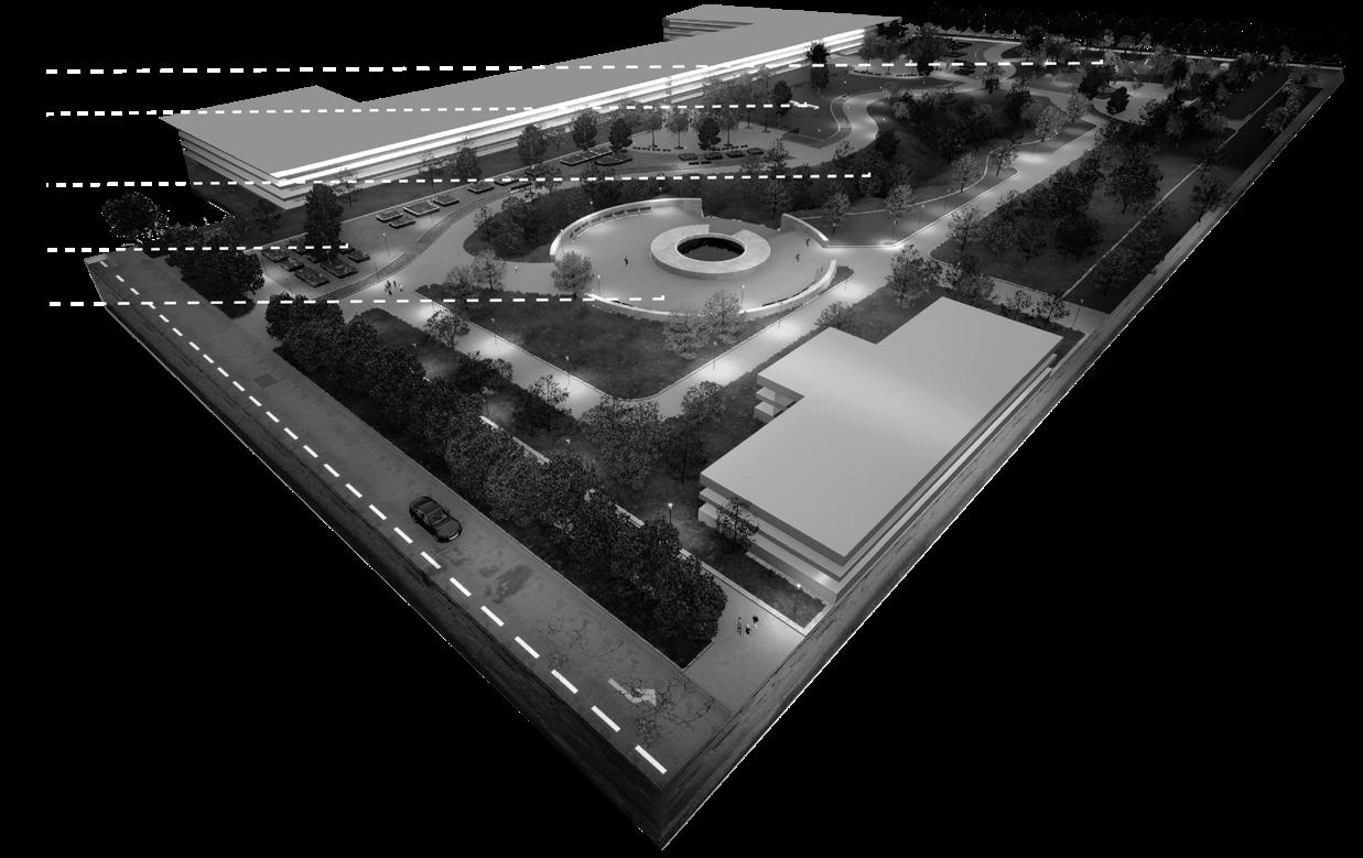
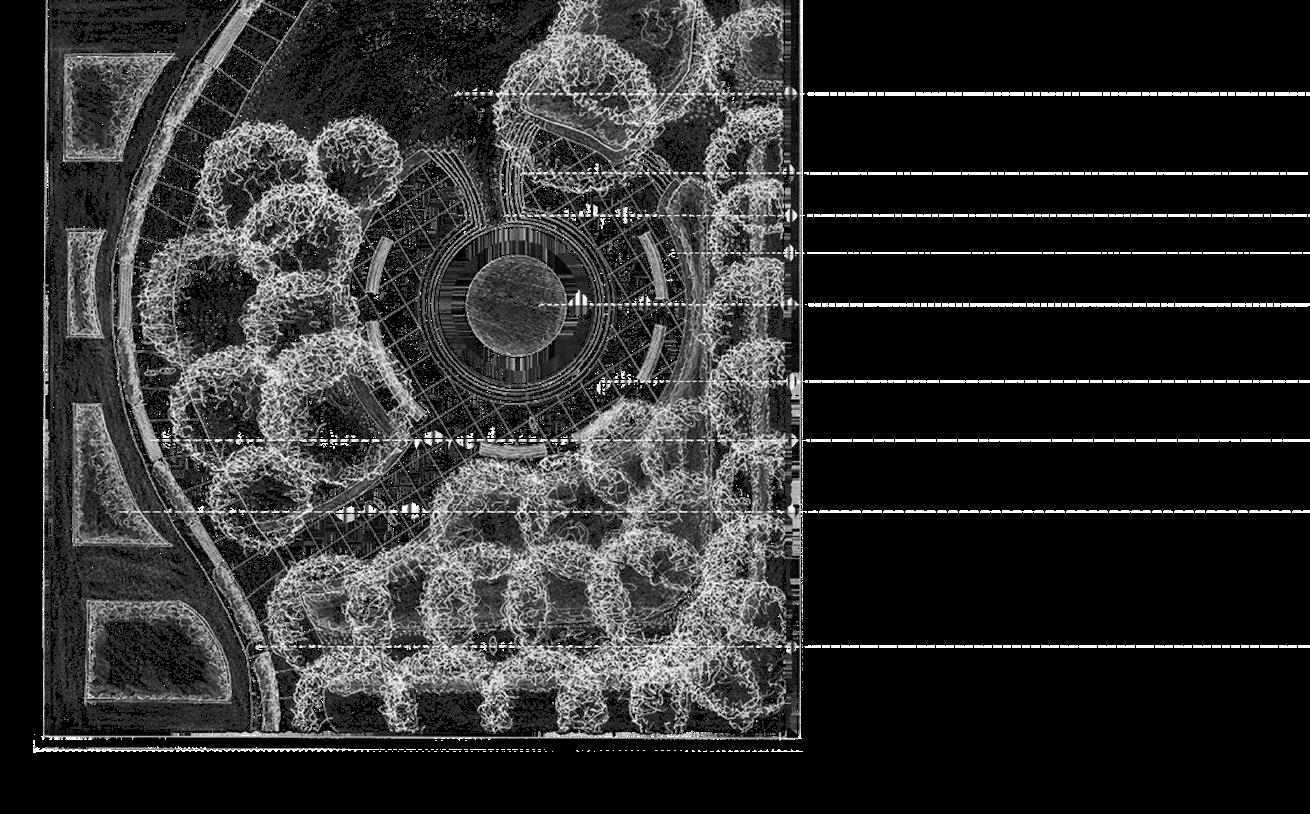
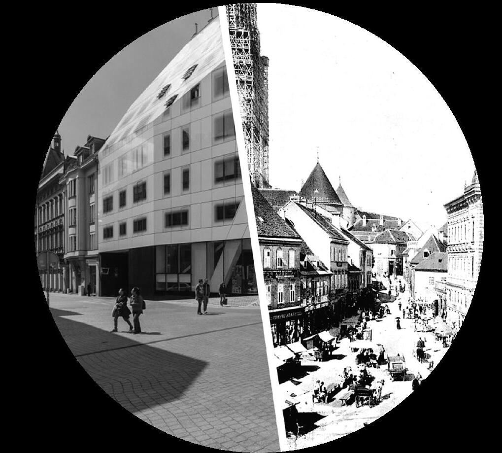
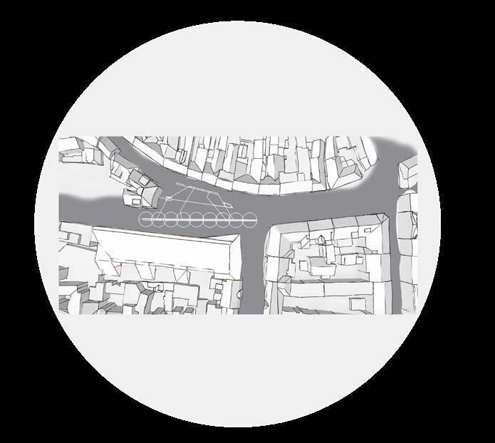
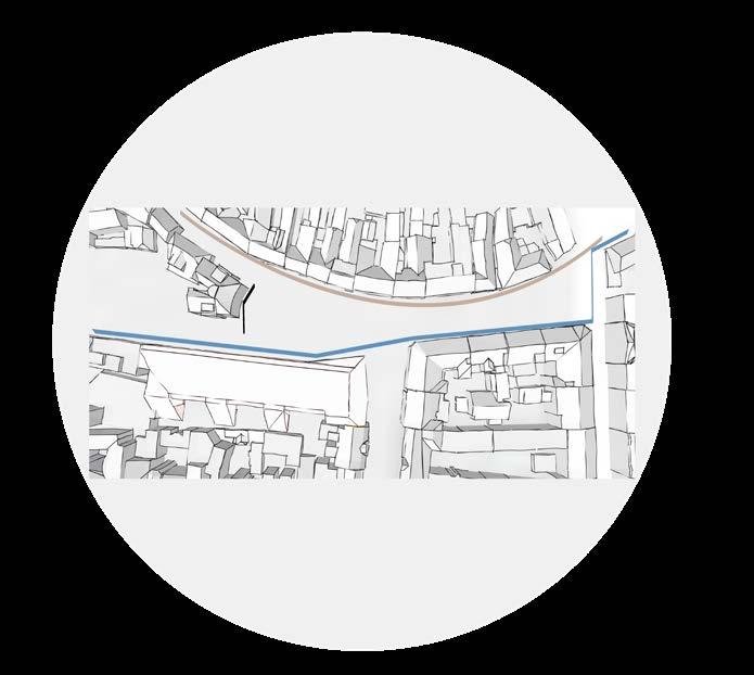
European square
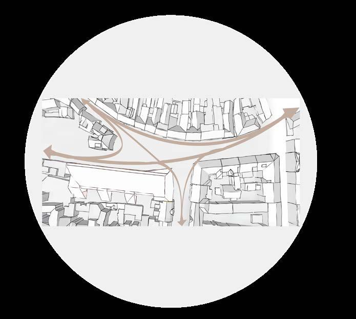
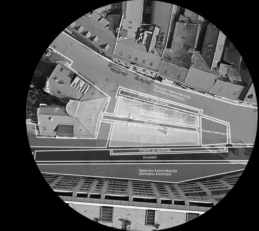
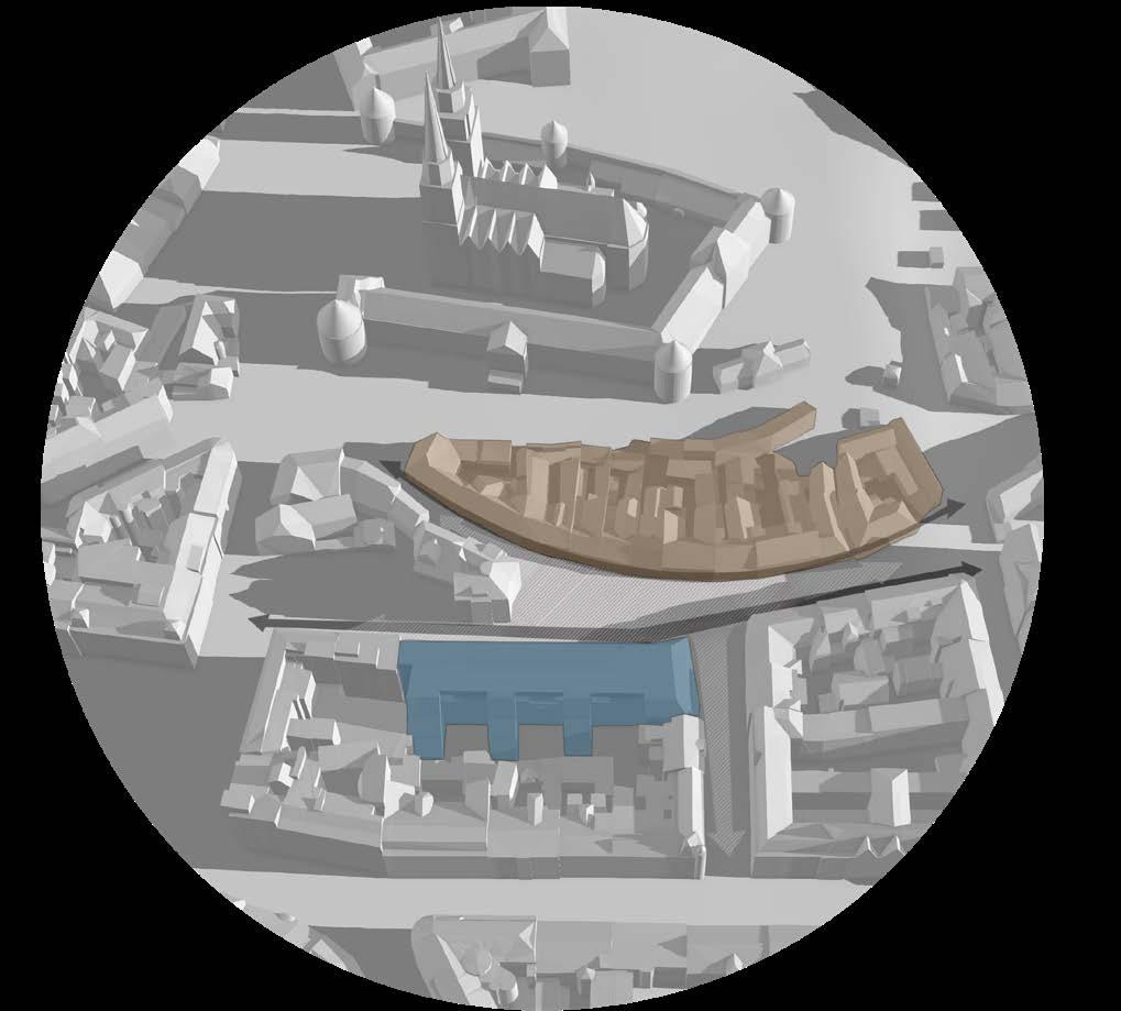
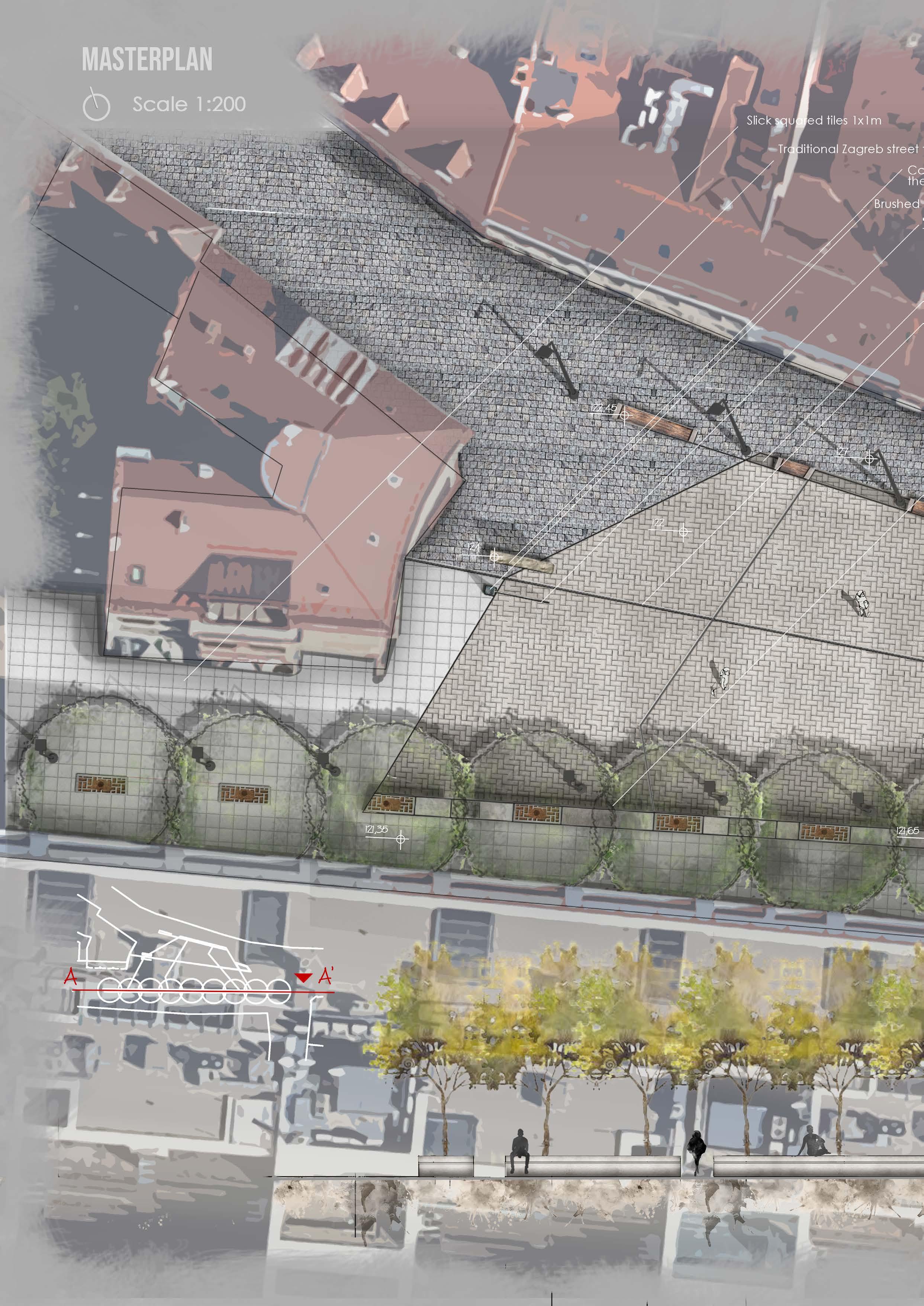
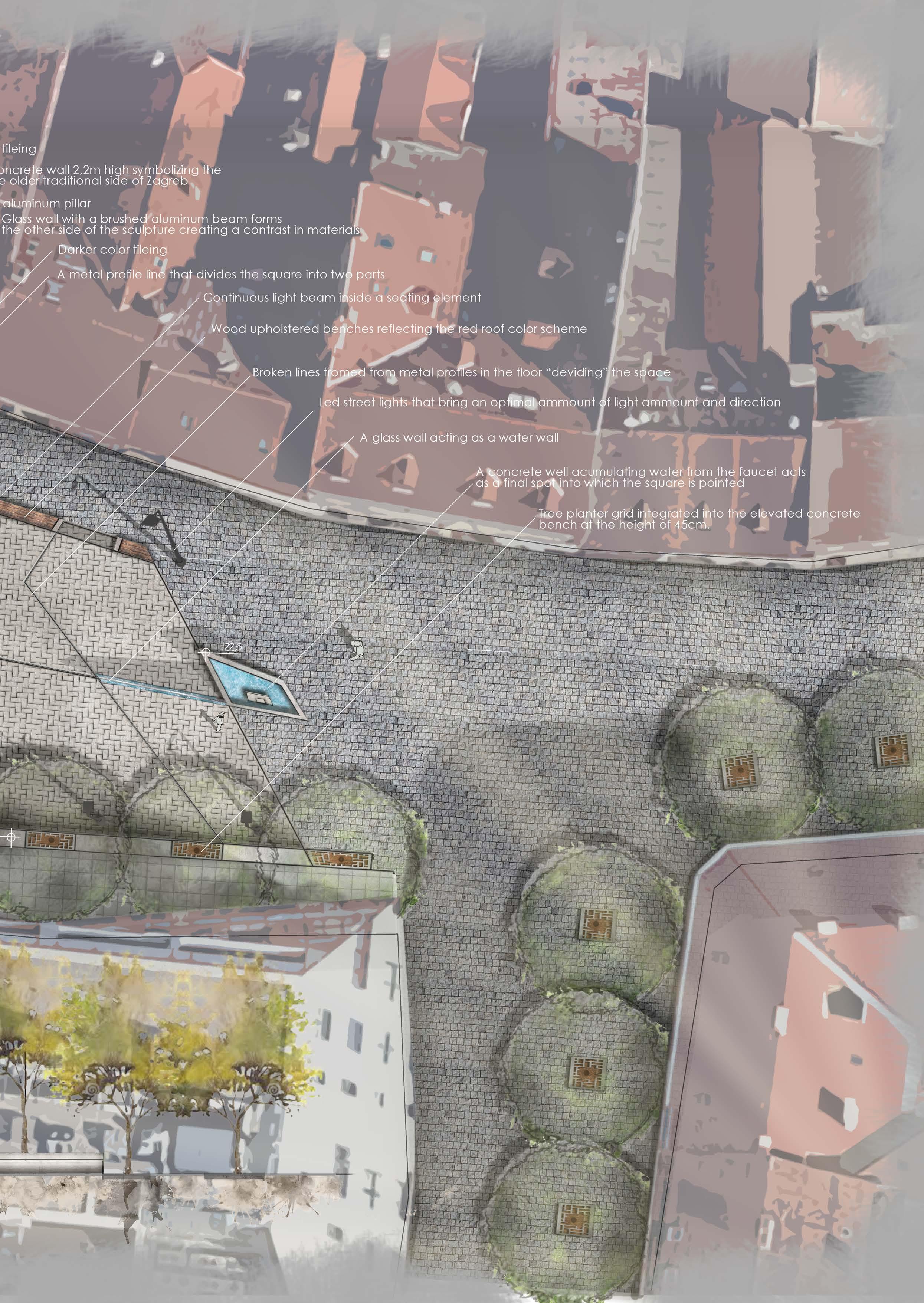
A RECONCENTUALISING MASTERPLAN FOR THE EXISTING EUROPEAN SQUARE IN ZAGREB
The guideline for the idea of this square is based upon the contrast of an old baroque city of Zagreb and the arriving contemporary architecture.
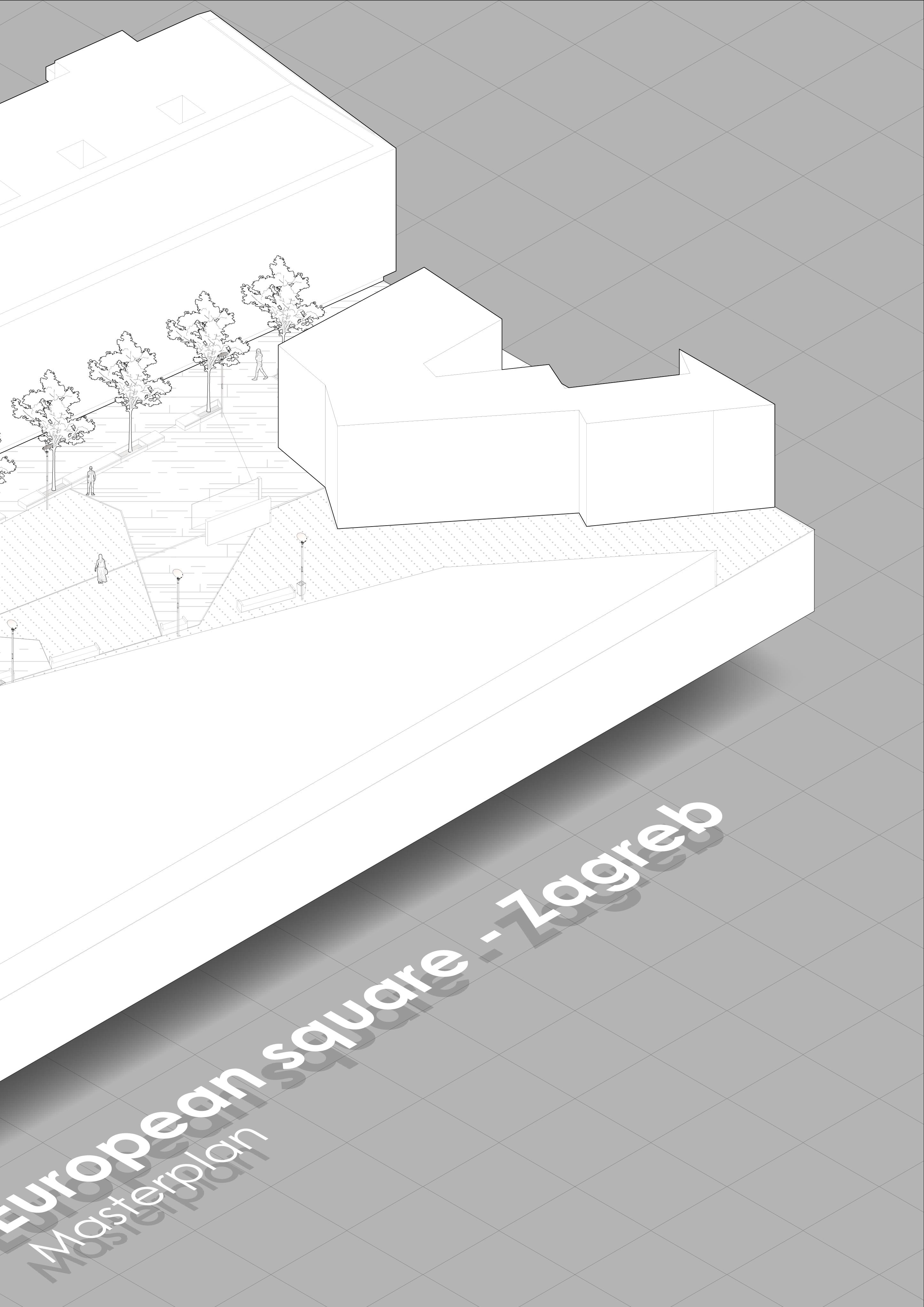
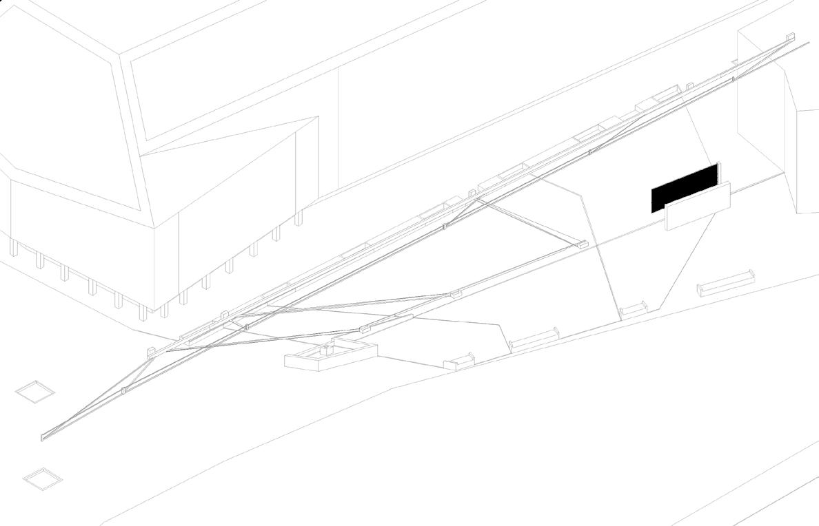
The space that forms this square is located directly between monuments of two different eras in building, that had an impact on the city of Zagreb. The historical architecture of the late 19th century with its organic facade line is located to the north. While a more contemporary block-like urban grid of the 20th century is visible to the south and southeast of the square. The Hight dynamics of the older structures complement the dynamic of the facade on the contemporary buildings. Those dynamics were transferred into the square plan (example of an uneven rhythm of benches that allow for free movement from house entrances to the square. The designed new sculpture for the square is a representation of the eras contrast on a smaller scale being a sheath of glass and metal on one side while a wall of bricks with a rough facade is located on the other.


28
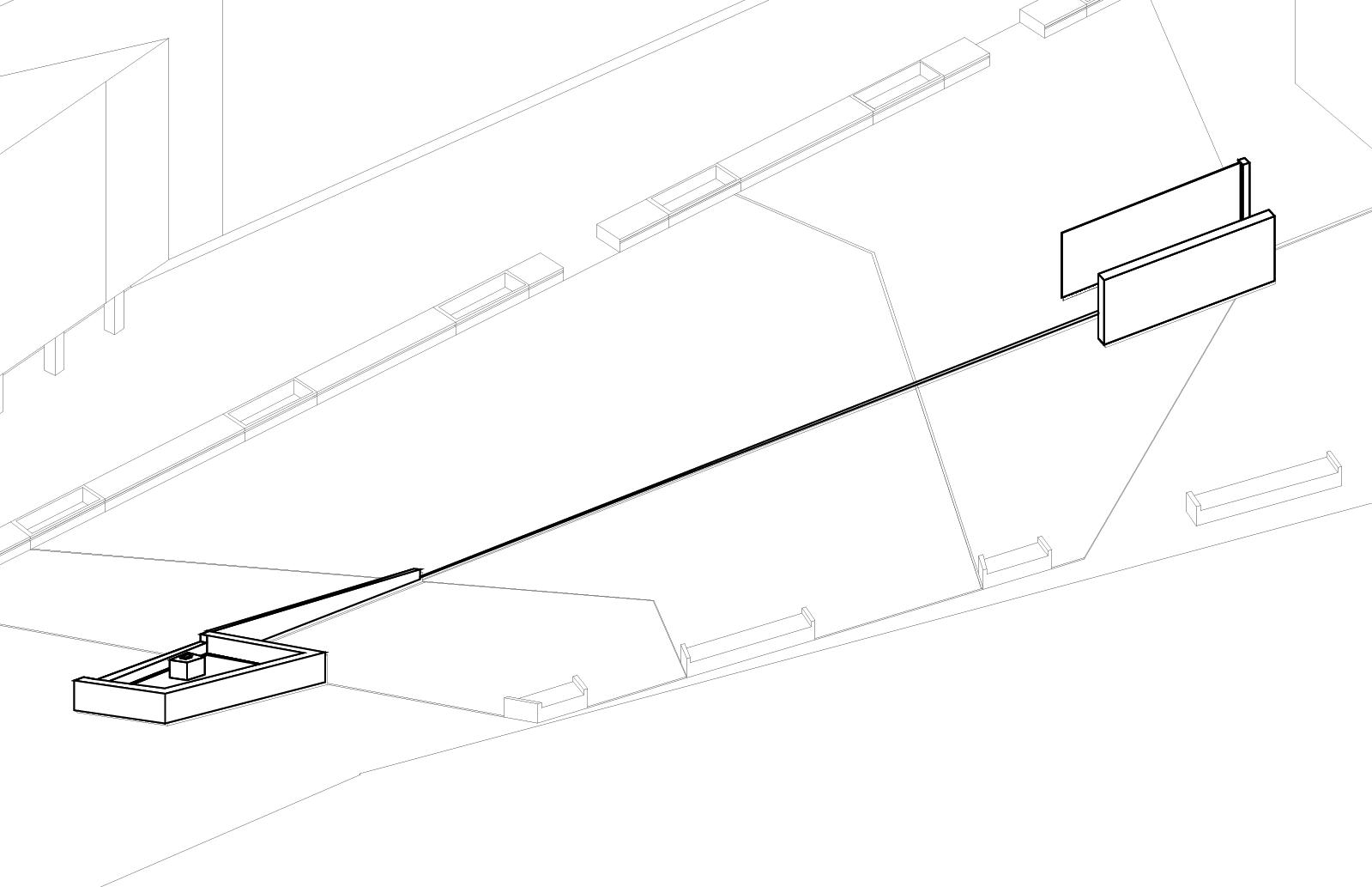
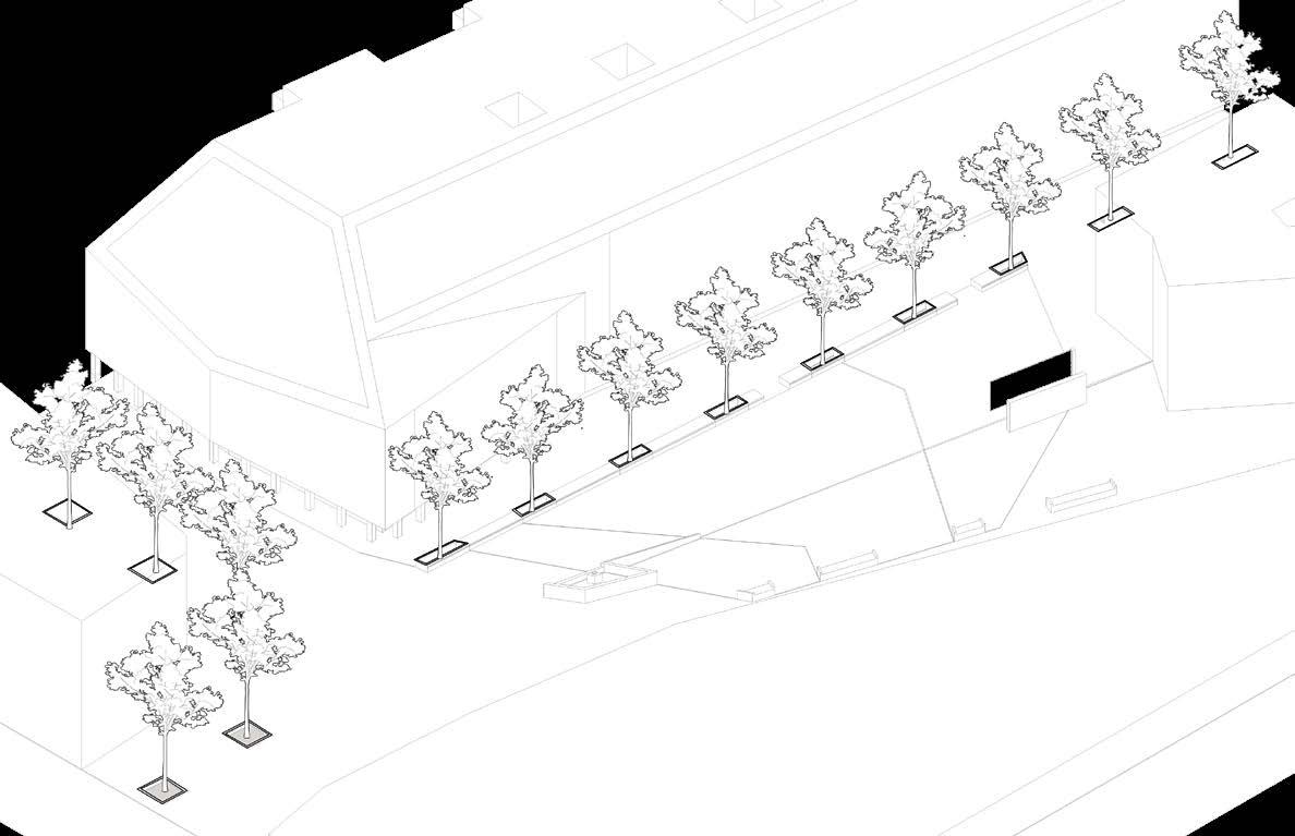
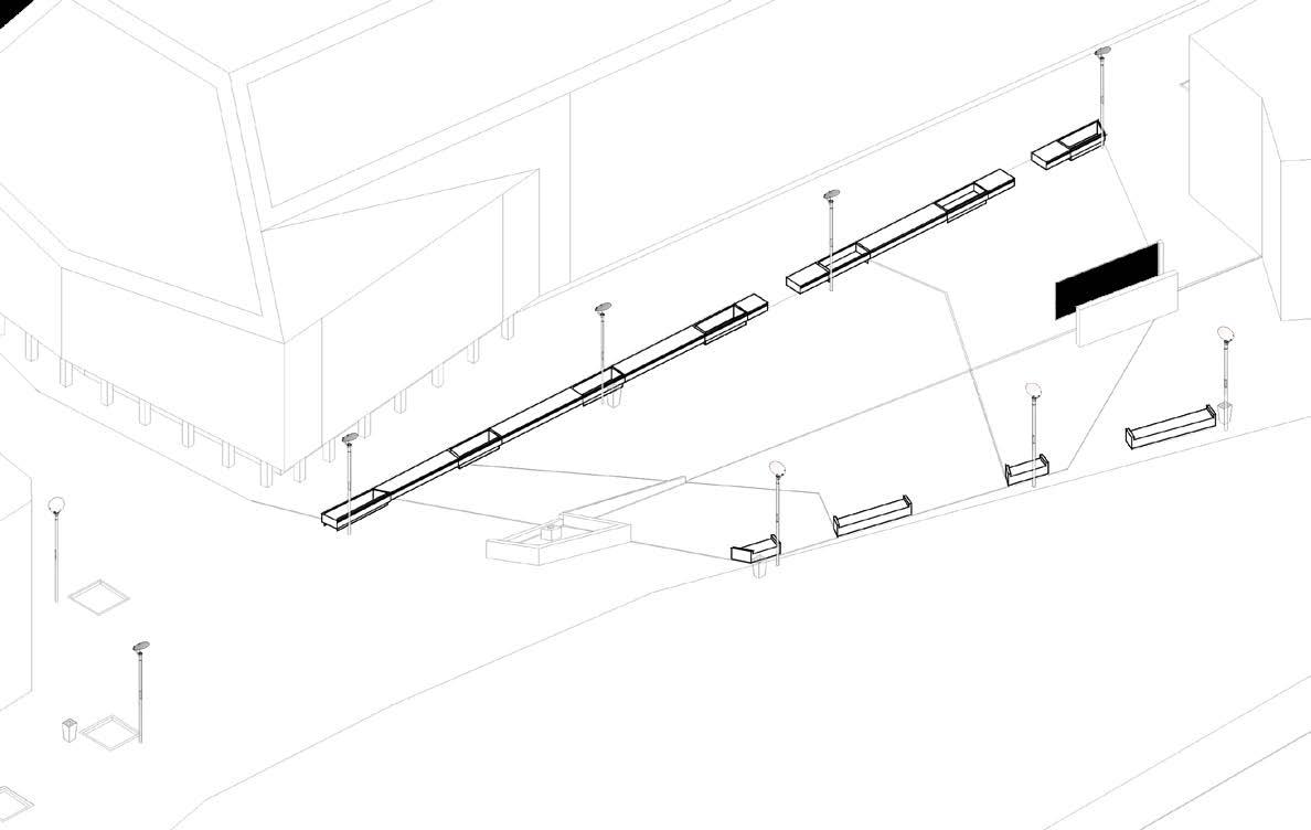
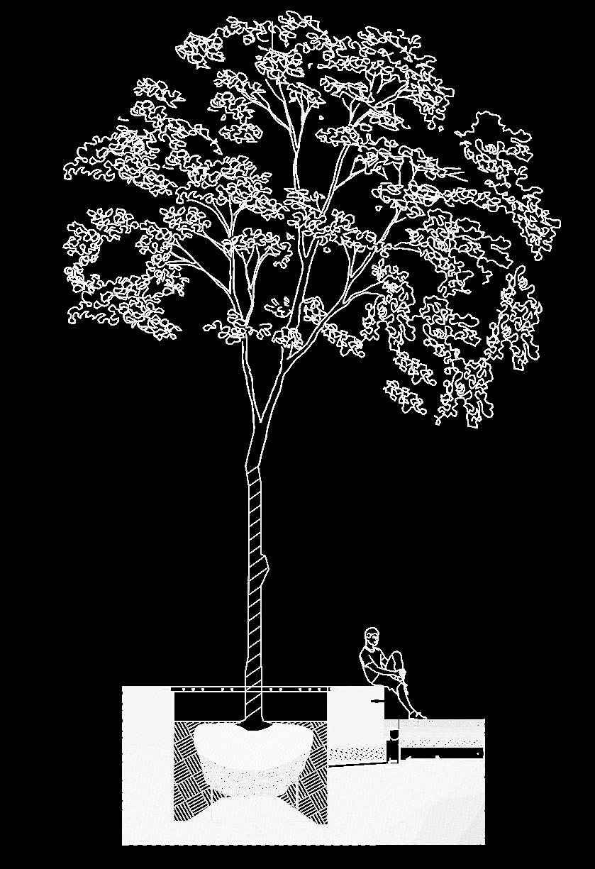


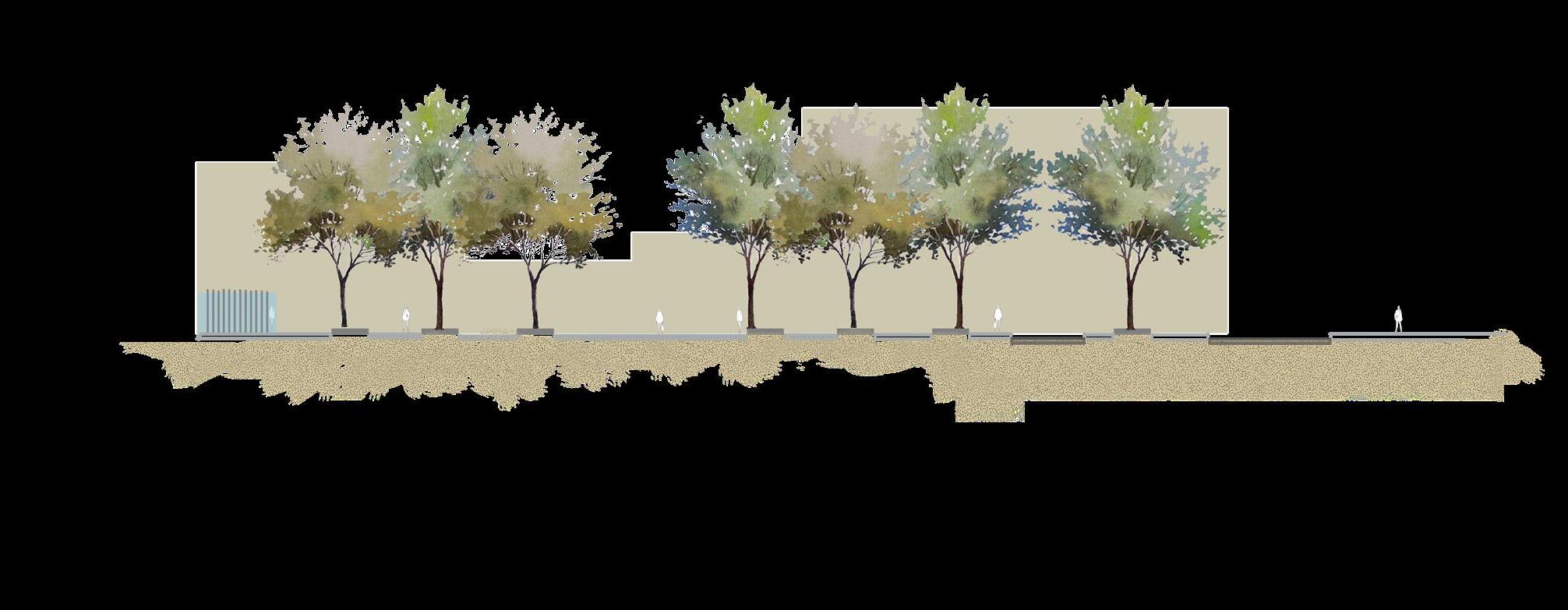
Concrete bench element Tree trench detail Monument section Water feature section 29
30
31
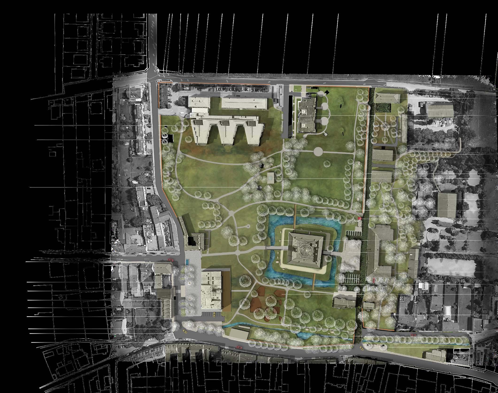
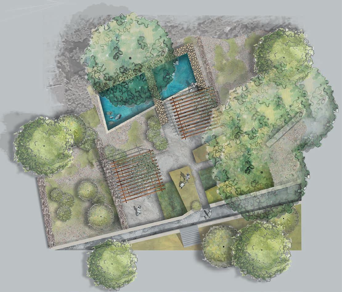
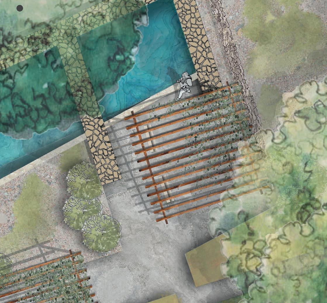
Two Castle projects
CONCEPTUALIZING HERITAGE OPEN AREAS OF (VÖSENDORF WASSERSCHLOSS AND SIXTA CASTLE)
Druting two separate projects open spaces around two castles were conceptualized. The projects differed in heritage protection status, period of construction and type. Both were culmination points of linear towns. During conceptualization and production of final space propositions, differing methods were used between these two examples.
slope/inclination
focal points
viewshed manipulation
path adaptation

34
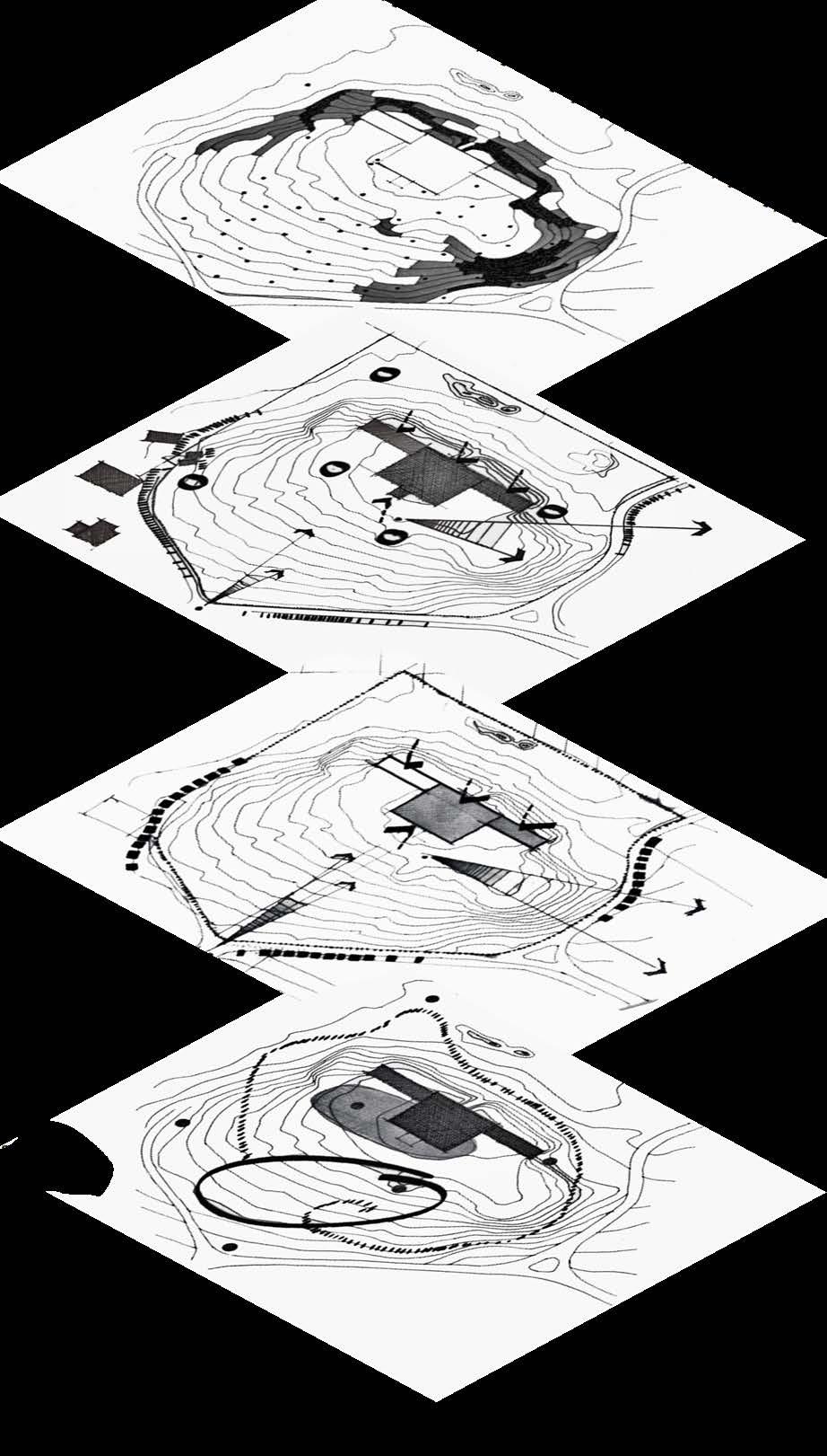
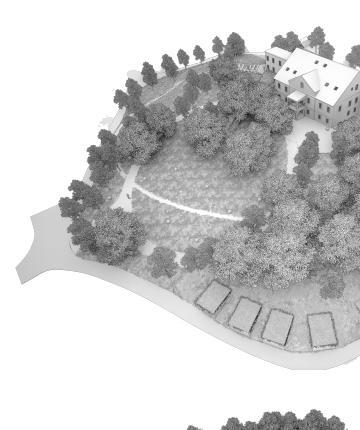
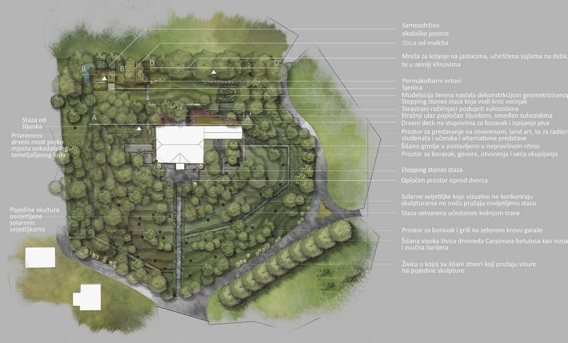
The first castle named Sixta is located in Croatia’s municipality of Zagorje. Its most valuable landscape phase was during romanticism in the 19th century. While conceptualizing the space for contemporary 21. century times, the emphasis was on defining sustainable (ecological,natural,socio-political, and cultural) parameters and urbanistic forms, while respecting and inspiring the design with historic layers of the space.
The circular elliptic walkway composition is used in all concepts, following the historic Baroque spatial organisation, along with allowing access for users with disability. Vegetation axes and treelines are also reinforced by the new design. The southern (entrance) open area of the castle is being used as a permanent art sculpture exposition, which was incorporated into the final designs.
Some functional tasks to be resolved by this designwere:
- analysing the connection of the junction in relation to the visual exposure from the castle and from the peripheral roads
- Connect the open gentle southern elevation permeated with sculptures with pedestrian communications
- Investigate the possibility of circular access to the castle and fitting into the existing landscape elements in the park and sculpture park
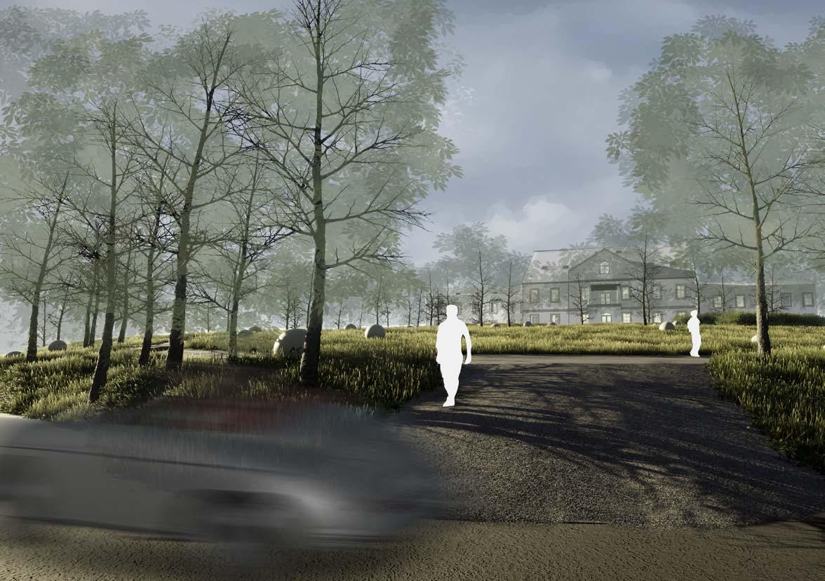
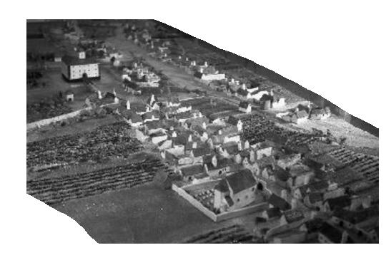
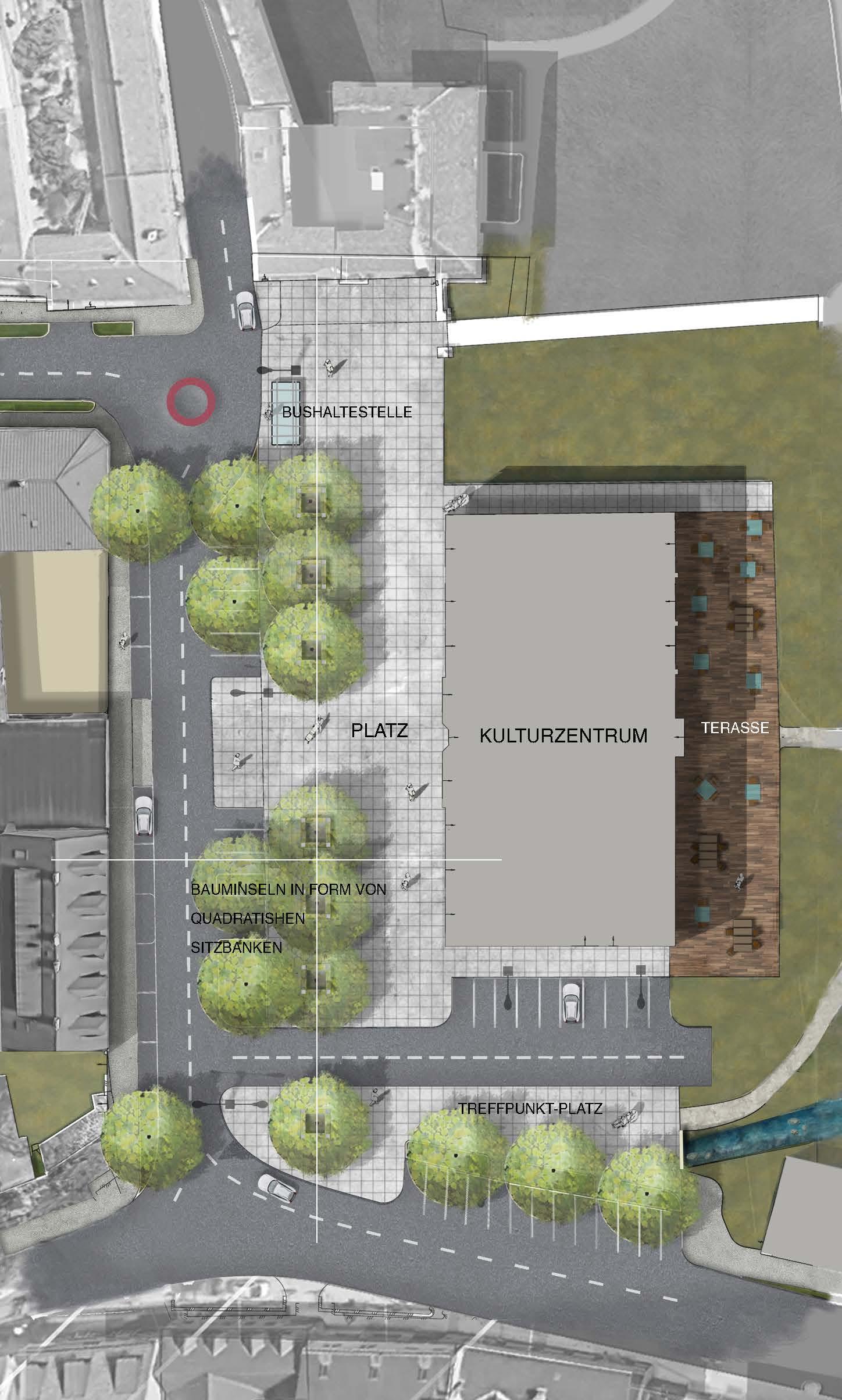
Vosendorf wasserschloss dates back to the 13th century. Rebuilt with surrounding agricultural estaate in 1806. Renovated in 1996. The main goal of the project was to incorporate the space with the surrounding town, make it more useable and create a square area. The main idea was based on capturing the existing qualities (place based design) and manipulating the feel of space. The old center area of Vosendorf was not being used or represented the identity of the town. To incorporate it and make a homogenous grid of a series of open spaces, the current Kulturzentrum and the Feuerwehr were swapped. Creating a main square. A series of historic buildings at the back of the castle were re-activated with new proposed usage, and car traffic was manipulated. This way the space is given back to the pedestrians makeing it accessable from all sides and creating a heart of this little town.
35
new square and bus station
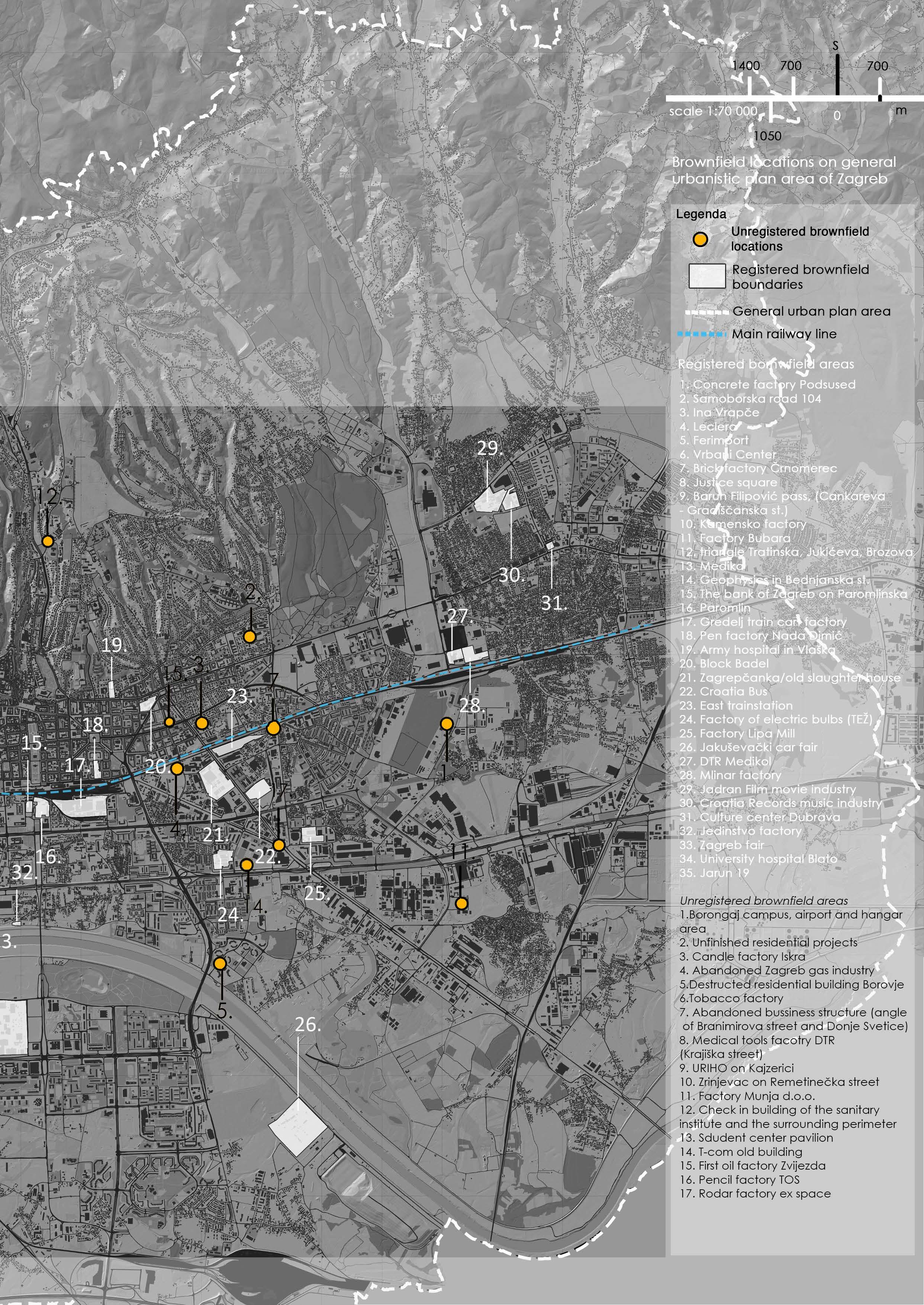
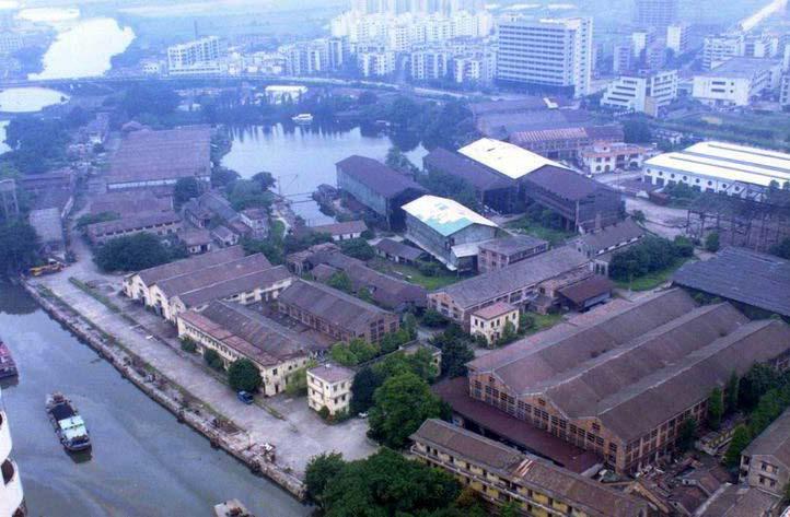
Brownfield revitalization guidelines
A case based broad analytic study of brownfield revitalization. Worldwide examples along with the spatial and socio-economic parameters which resultet in their construction is analysed and reflected on Zagreb’s potentinal locations to create a database of possible approaches and necessary action for their implementation.
Transportation connections
Green public areas
36
APPLYING BROWNFIELD REVITALISATION TRENDS AND PARAMETERS ON THE CITY OF ZAGREB CASE STUDY
Population density
37
Brownfield revitalization guidelines – city of zagreb case study
Master degree thesis
The term brownfield is first used as a reaction towards a complex problem of appearing problematic urban zones that do not comply with their surroundings when it comes to the potential they can deliver to the city and its inhabitants. This work strives to get a view into different perspectives of the term brownfield and the role which revitalization of those areas has in fulfilling the broader plans of and for the city. By analysis of worldwide case studies in which the revitalization is based on creating multifunctional open spaces , this work strives to form a review of numerous factors that determine them. Such as: political, economic, social, professional, and environmental.
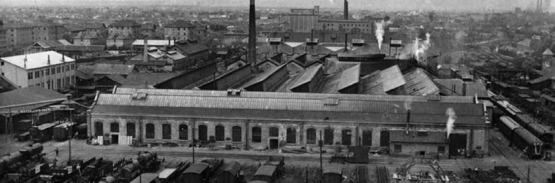
In the end, the attention was turned towards the city of Zagreb. The analysis showed that a lot of brownfield locations can be integrated into the everyday lives of the inhabitants and they have the potential to become successful revitalized areas. In that sense, general guidelines were set to encourage the carry out of those processes, while 3 detailed locations were selected and analyzed in detail. After which detailed guidelines were set for them.
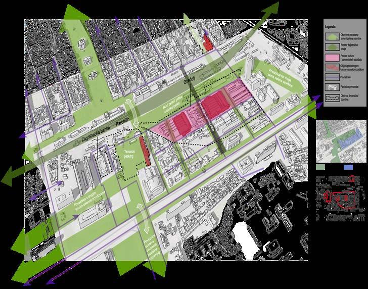
Contemporary urban guidelines emphasize that public facilities, open public, and green areas represent one of the main structural elements of quality urban living. But in contemporary cities like Zagreb, brownfield areas as a product of urban evolvement and maturity represent one of few locations with the potential to fulfill those guidelines and criteria.
Through the analysis of selected examples, a view has been formed on the situation and the parameters which were used for these locations to become publicly available spaces. Those spaces then strengthen the identity and the value of living inside a city for all its inhabitants.
Some of the problems that stop Zagreb from integrating such changes were encountered and they are: Inadequate conducting of strategic plans and documents, unexisting and uncomplete urban regeneration plans, incomplete and shallow brownfield registers, uniformed models of revitalization, the negation of the intrinsic value of the locations, heritage value deterioration, high dependency on private financing, inadequate professional diversity.
To mitigate this problem and produce results when it comes to brownfield revitalization into public spaces, stopping the uniformed model and uniformed space usage the work suggests guidelines such as: involvement of professions such as urban psychology, urban ecology, sociology, landscape architecture, and similar professions, generating the green infrastructure study of Zagreb, expansion of the existing brownfield register with GIS base of data on history, architectural, economic, landscape, ecological, socio-demographic, transportation, spatial, land pollution, and other analysis. Also suggested are ecological remediation, better and stronger triangle bond between (government - non-governmental organizations - inhabitants), consider the revitalization in the context of the city tissue with continuity or replenishment of needed uses, transparency on location info. and the use of contemporary ecological landscape sustainable design . With those general guidelines of which all were expanded on in detail, more precise guidelines were set for the chosen locations for green infrastructure integration and open public space formation
38
The role of playground environments in affecting children’s play
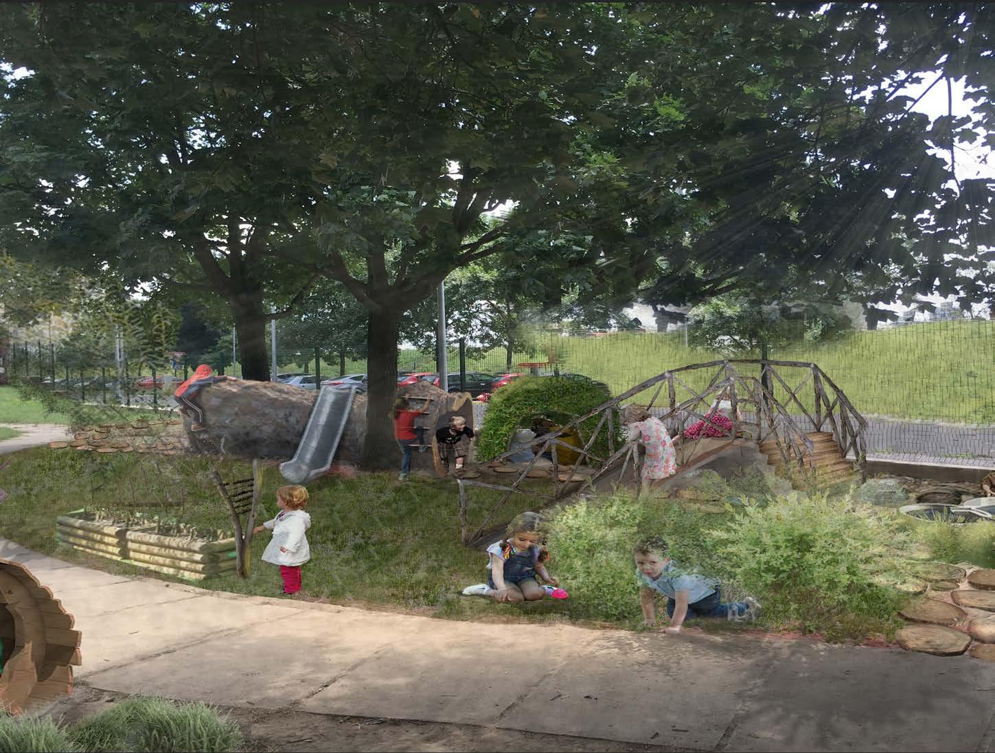
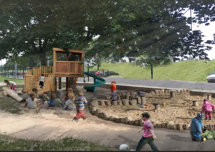
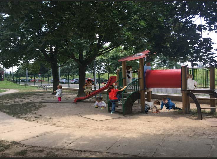
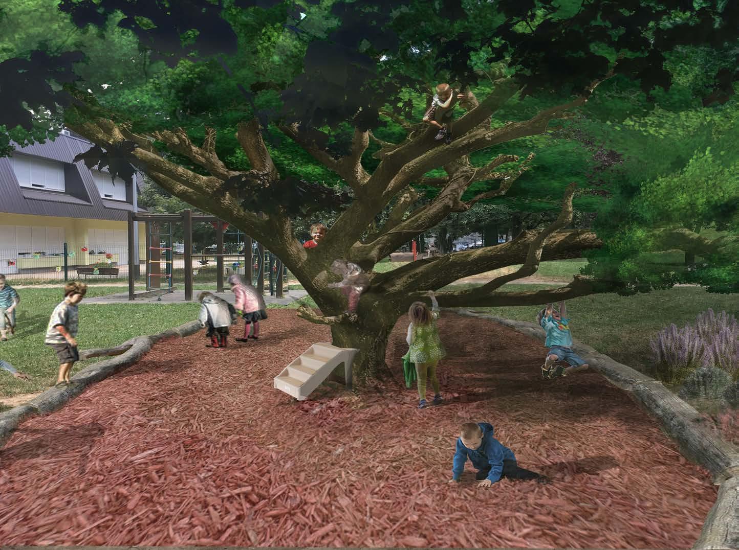
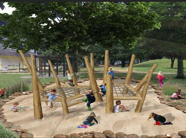
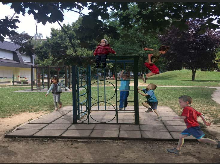
Bachelor degree thesis
When considering the contemporary way of perceiving children play the problem of diverse opportunity proportion between spaces where it is realized has been recognized. Raising on that learning this report tends to examine more closely the relationship between how a child perceives an environment in which play takes place and the up-to-date guides in creating an environment like that. To get these results a survey has been conducted in the form of alternative perspective sections of the environment where the play takes place every day. To alternate between sections a differing amount of natural, semi-natural, and traditional elements are used in creating them. By carrying out the survey there were some interesting results recognized, along with new questions about the matter.
By analyzing the survey it has been discovered that kids elect spaces not only relying on the specter of activity they want it to provide but also by numerous other factors like their mood, the sway of their coevals, the longing for new experiences, the Ambiental value according to their individual judgment, etc.
As a guide for creating such spaces which will leave beneficial marks on not only their development but also their memory, it is of paramount importance to include their own selves.
The photo simulations have been produced to try and get an insight into the preferences towards play spaces from kindergarten children. A questionary was broth forth to the employees of the facility. And later a questionnaire and an interview using visual experience and open-ended answers from children were conducted resulting in insight into the specter of parameters thought which children choose the type and form of play in space. To achieve real and development potential rich play it is necessary to further develop the tools to include children in “envisioning” the space that is designed for them. A space that would include active and passive participants, observation, various age groups, and a spectrum of exploratory, passive, cooperative, constructive, motoric, and other activities.
39
EIA FOR A LARGE SOLAR POWERPLANT ON a Cultivated slope
Analysing the impact on landscape morphology

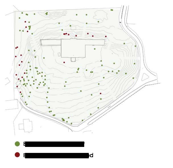
This project is part of an EIA regarding a large solar powerplant which is planned for realization on a picturesque cultivated slope. The basic natural relief predispositions of this eastern part of the subject landscape area are ridges orographic cross massifs of Psunj and Papuk at the highest altitudes up to approx. 900 m. The whole area is dominantly indented in relief with lower, gradually uneven hills and a ring of the aforementioned hills massifs, which reach towards the plains in all directions. Mountain massifs and smaller peaks are covered with forest, without dominant peaks that stand out, but with a large number of them, which causes a very dynamic terrain, intersected preserved stream valleys, and cuts or gullies in the sides of the hills, which form precipitation temporary flows. Within the entire landscape area, the main The entire area of the Landscape Region is characterized by long views from the mountain massifs towards the Požega Basin the area is quite unsurveyed due to the volume of the forest and the dynamics of the area, but in places, the long vistas are opened up over the lower hills to distant plains. By further lower hierarchical division of the subject landscape region , the planned intervention can be classified as a mountain ridge landscape type south-western Psunj, agricultural and forested hillsides. Along with splitting the space into landscape units which are made of main natural/anthropogenic elements, various analyses were conducted to determine the vulnerability and sensitivity of the area.
A complex viewshed analysis that combined terrain observations and photographs, paired with cabinet research resulted in an inset showing highly exposed areas. These areas combined with their sensitivity are potentially set as highly vulnerable and therefore should be avoided while developing the project.
By land-use and landscape inventory, combined with a Lynch analysis the space is divided into structural pieces (accents, edges, knots, lines, and stretched surfaces. Considering this, valuable parts of the area are selected as important for the maintenance of current land use and therefore current landscape.
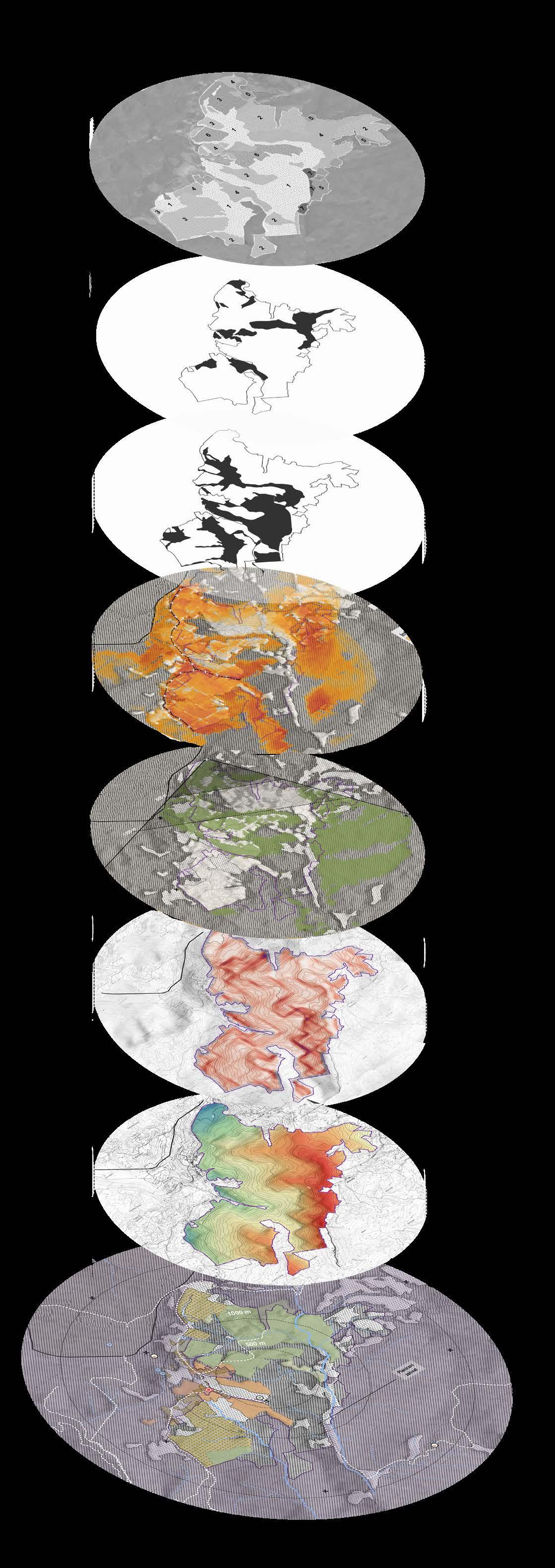
Landscape units roadway viewshed Pasture meadows viewpoint viewshed Dredged overgrown slopes slope degree Terrain elevation Landscape inventory
40
Optimal placement study for congress center structure in međimurje municipality
Spatial analysis through feasibility study, vulnerability study and suitability study models
The subject of this work represented research and valuation for development potentials of međimurje municipality by the placement of congress tourism infrastructure , and the potential impact it would have on the environment. The work strived to find the optimal location for placement which would balance between low environmental impact and high value of the location regarding economical parameters.
The current situation regarding congress tourism was researched at the state and municipality level along with the benefits such an operation would bring to the area. The second phase included forming a semantic tree graph of preferred parameters for the location to include to be as feasible as possible. By creating a feasibility model those parameters were turned into spatial data which determined optimal locations for feasibility. In the next phase, ecological parameters were included and formed into spatial models which showed which locations should be avoided or were too “vulnerable” to receive such an intervention.
Value maps were formed from voulnerability models that contained where not to place the structure to avoid degrading the environment.
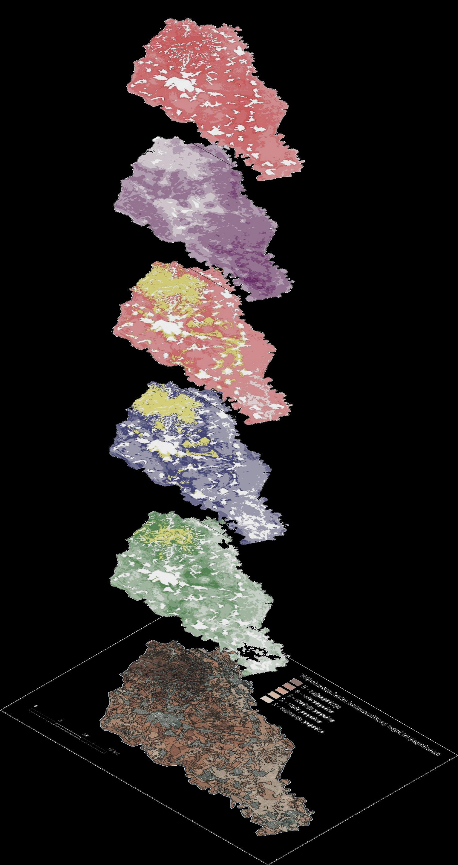
The final map was compiled of natural resource protection, human environment protection, and nature protection, each of which forms a pillar of environmental protection.
The final phase of this work resulted in finding the most suitable location to place the newly planned congress tourism center. By combining previously formed spatial value factors or parameters 3 different suitability value factor maps were created. One prioritizing protection , one prioritizing development , and the final one balancing between the two which hangs on a balance of developmental aspirations but also the importance of protecting the value of the environment creating a compromise

41
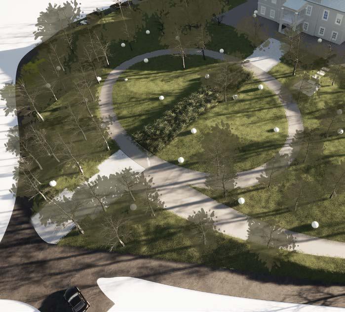
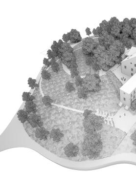
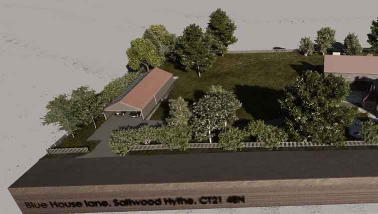
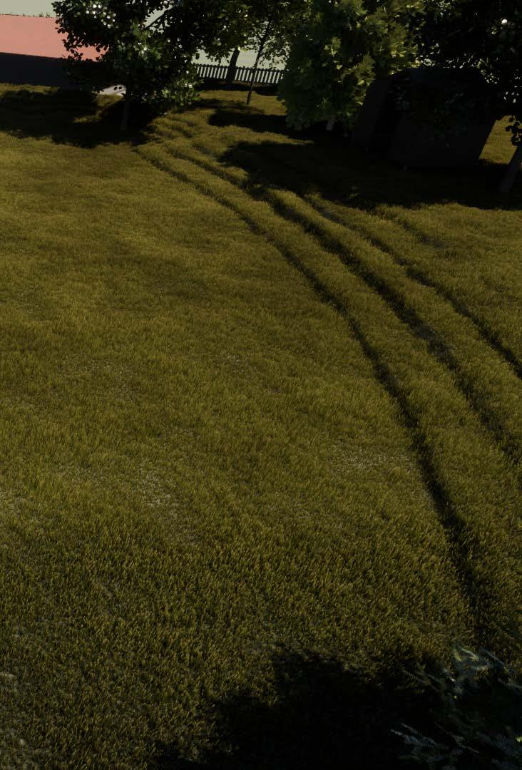
Photosimulations
Rendering
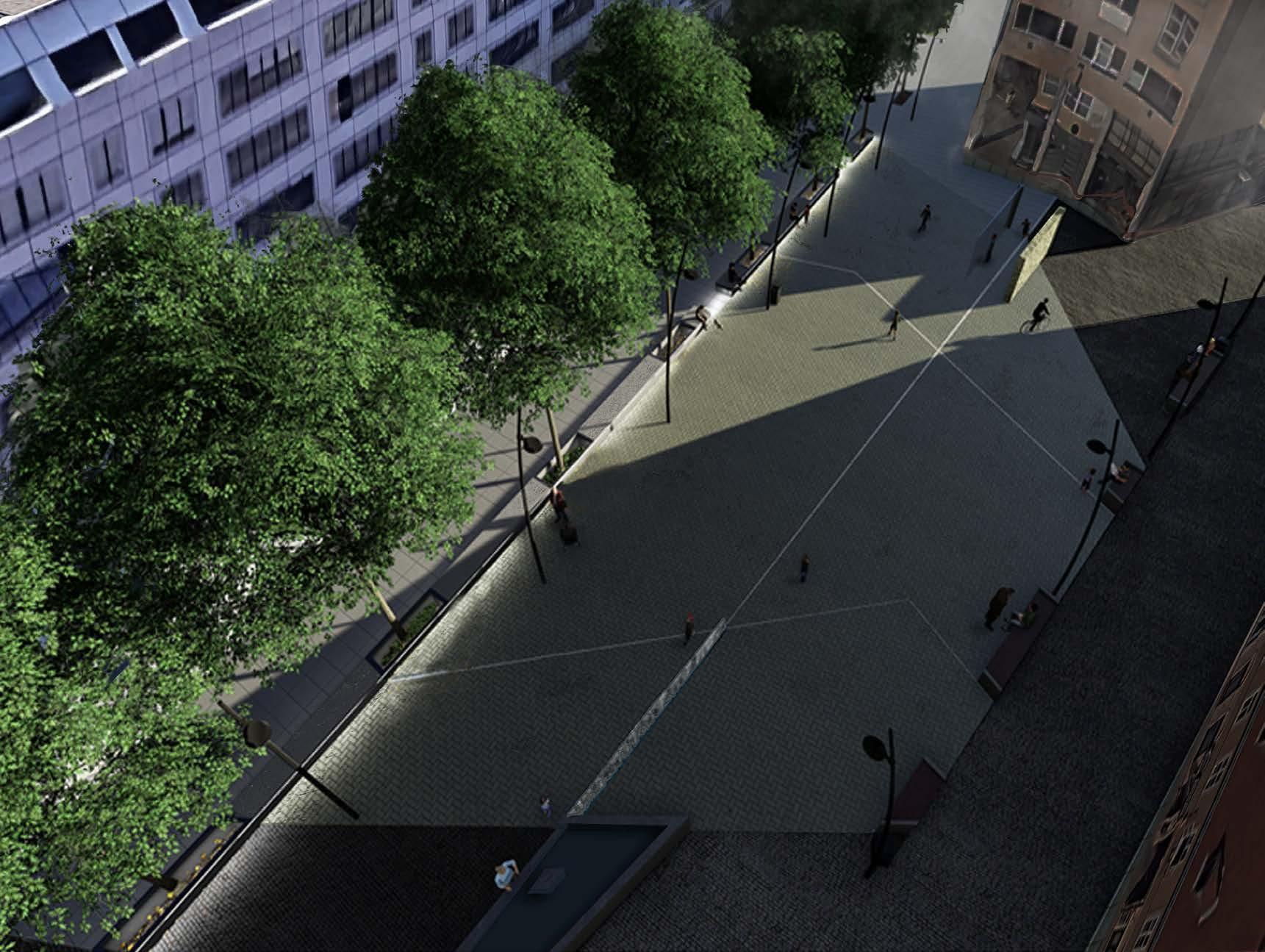 Şquare area aerial render
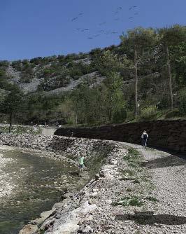
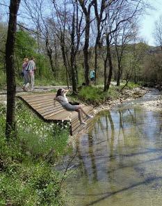
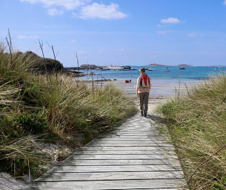
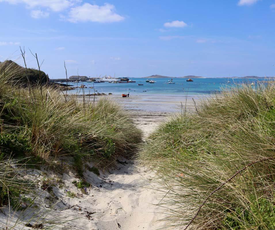
Beach trail photosimulation
Graphical processing, Photosimulations and drone Photography - further work Feed
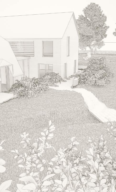
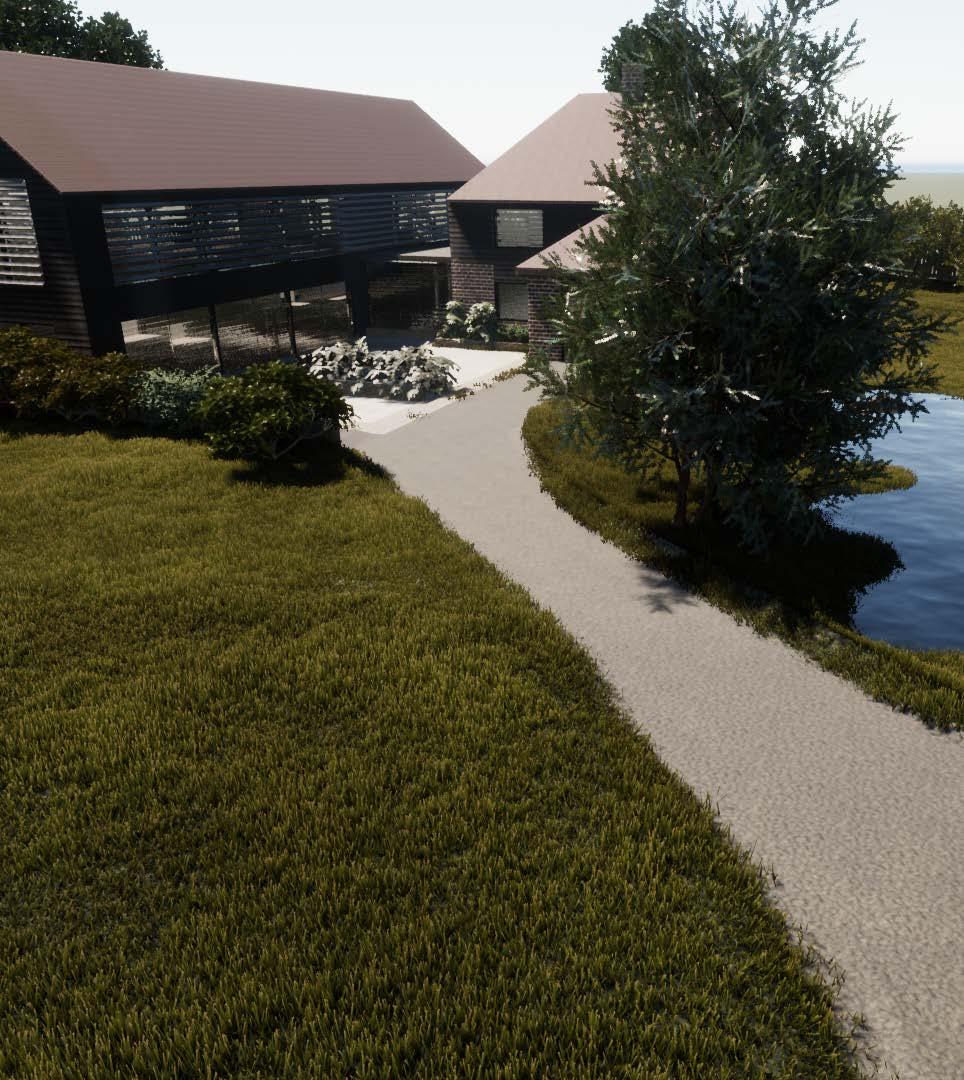
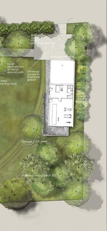
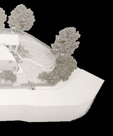
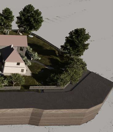
English suburban house garden render
Şquare area aerial render
Beach trail photosimulation
Graphical processing, Photosimulations and drone Photography - further work Feed
English suburban house garden render
42
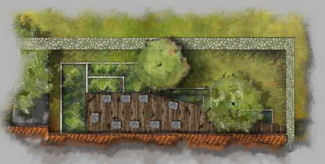
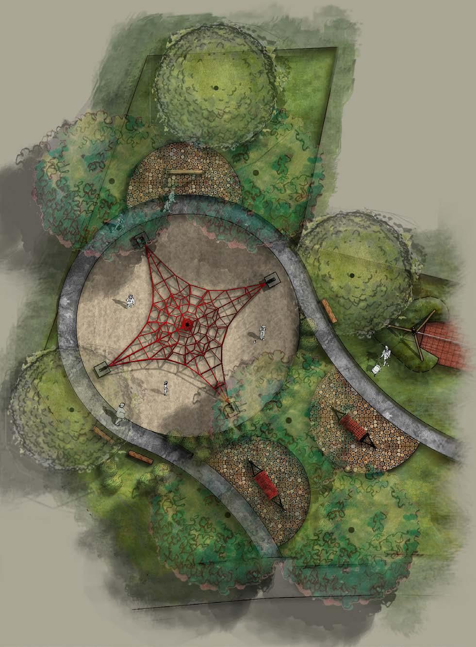
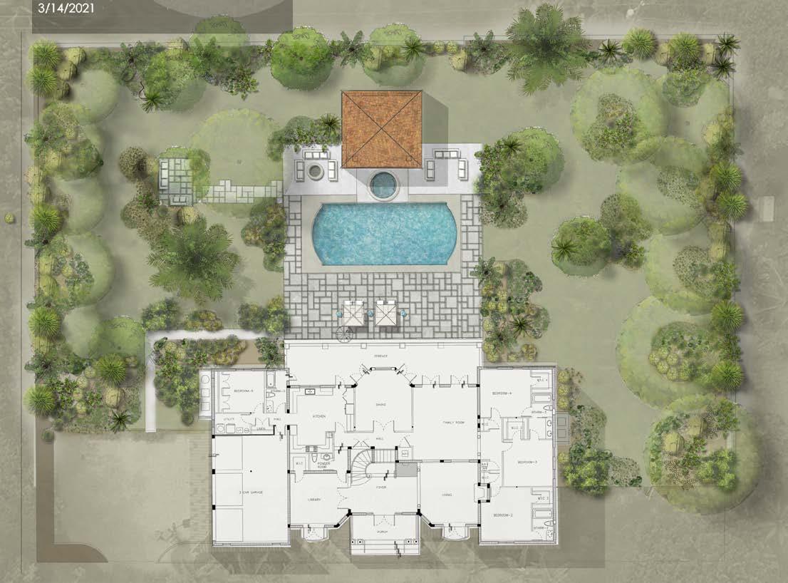
Florida villa backyard Hotel resort children playground
Split botanical garden detail
Vösendorf main square 43
Graphical processing
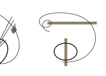
First prize
The Logomark/type is formed out of 4 repeated aligned signs equally distanced from each other. They represent the four letters of LASA (Landscape architecture student association) in Croatian USKA (udruga studenata krajobrazne arhitekture).

Each sign is gained from a separate square whose parts were taken out to form empty space that outlines each letter. On the first square by pulling a line to the middle and chipping away the edge the letter U has been created. The second square has been cut through with a curvilinear swipe forming a shape resembling an abstract form of a meandering river and at the same time of a letter S. It also symbolizes innovation and creativity in Landscape architecture. The third square contains a line that breaks at a right angle representing order and discipline inside the profession, also it represents the letter K. The last signs and its empty spaces form the letter A along with a recognizable shape of an abstract tree.
Standing one next to the other the letters S and K represent two different design languages and styles in landscape architecture and the relation between sharp geometric lines and organic free stroke forms. They also represent the unavoidable, unbreakable, and continuous bond between landscape and architecture.
The first and the last letter are spun and reflected and therefore close the composition of the logo mark and turn it into a whole.
The color variants of this logomark in which the first sign is colored in brown (137,100,39 RGB) represents the earth and fertility, the blue represents confidence and intelligence (28,125,170), grey represents formality (119, 120,122) while green represents ecological awareness, renewal, nature, and harmony (66,82,33).
New logo mark/type generation competition LASA (landscape architecture student association of zagreb, croatia)
44
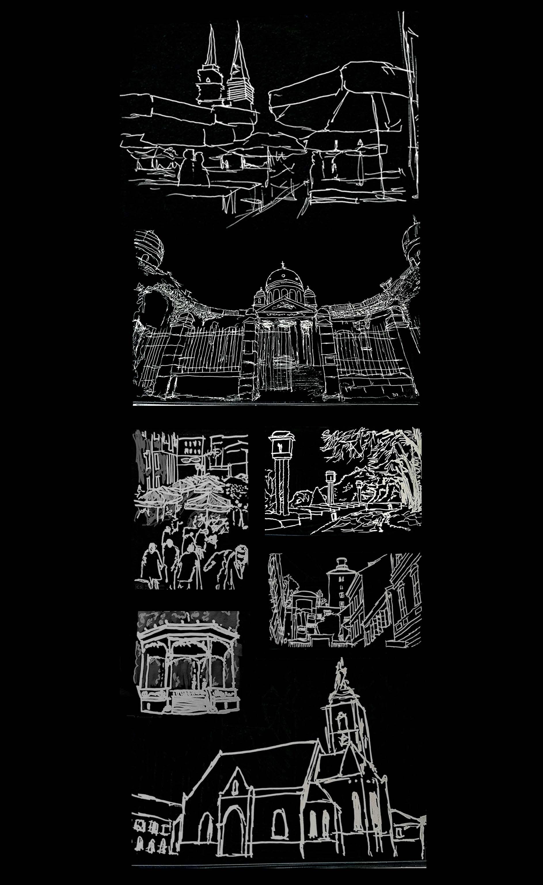
Sketching 45
M.L.A. MARKO BLAŽIĆ Contact: email: marko.blazic2 @gmail.com Phone: Please inquire over email
Sincerely...
