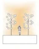
SHUAI YUAN
Selected Work 2016-2022
SHUAI YUAN
+1(434)257-5733 ctf6nd@virginia.edu
PROFESSIONAL EXPERIENCE
Z+T STUDIO
Senior Landscape Designer
· Led SD, CD to CA design work of The Valley, a 0.37ha park in Chengdu, China, with work in concept generating, rendering, model making, presentation, construction drawing, onsite work checking and feedback
· Led SD design work of Colombia Park (landscape area: 1.8ha), a complex in Shanghai, China, with work in concept generating, rendering, diagram producing, presentation
· Conducted SD, DD, and CD design work of Vanke Industry Financial Center (landscape area: 4.3ha), a complex in Hefei, China, with work in concept generating, rendering, model making, construction drawing
· Conducted SD, DD design work of Growth Park, a 1.4ha park in Wuhan, China, with work in concept generating, rendering, model making, detailed designing
Landscape Designer
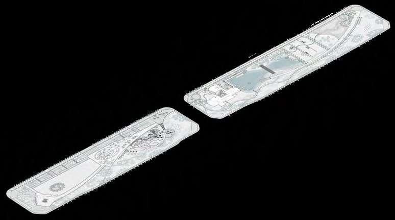
· Completed SD, DD design work of Wisdom Park, a 5.73ha park in Hefei, with work in concept generation, plan drawing, rendering, diagram producing, layout plans drawing, detailed drawings
· Completed SD, DD, and CD design work of Tangshan Quarry Park, a 20ha park in Nanjing, China, with work in concept generating, conceptual plan drawing, rendering, diagrams producing, detailed construction drawing
· Participated in the following projects as a team member: Chunmu Yuan Park, a park in Heyuan, China, from SD, DD to CD; Cloud Valley Hotel, a resort hotel in Yellow Mountain, China, from SD, DD to CD; Yang Liujun Park, a community park in Hangzhou, China, from DD to CD; Great South Slope, a rural reconstruction project in Zhengzhou, China, SD; Meigao Mei Park, a complex in Beijing, China, from SD, DD to CD
Shanghai, China 06/2018-05/2021
03/2016-05/2018
TL
STUDIO Exchange Visitor
·Engaged in the Competition of BSLA East Boston Greenway
·Participated in Boston Neck Farm, mainly involved design generating, rendering, model making
Providence, RI 12/2018-03/2019
EDUCATION
UNIVERSITY OF VIRGINIA
Master of Landscape Architecture, School of Architecture
· GPA: 3.47/4.0
· Honors: Annual merit scholarship ($5,000 per year); Anchor QEA Scholarship ($1,500, 01/2023)
DONGHUA UNIVERSITY
Master of Arts, Artistic Design, School of Design
· GPA: 3.94/5.0 (Top 1%)
· Honors: Shanghai Excellent Graduate (03/2016); Excellent Graduation Project of Donghua University (02/2016); 2nd-class Scholarship of Donghua University (03/2015);
Outstanding Student Leader of Donghua University (02/2015); HATTERS'HUB 2nd-class Prize Scholarship (03/2014); Outstanding Student Leader of Donghua University (02/2014)
Bachelor of Arts, Environmental Design, School of Design
· Honors: Outstanding Student of Donghua University (05/2012); 1st-class Scholarship of Donghua University (03/2012); Zhou Huasheng Scholarship (03/2012)
DESIGN SKILLS
Parametric 3D Modelling: Rhino, SketchUp
Drafting and Presentation: AutoCAD, Photoshop, InDesign, Illustrator, ArcGIS, Microsoft Office
Computer Graphic, Animation and Virtual Reality: Lumion, Enscape
Charlottesville, VA 08/2022-05/2025 (expected)
Shanghai, China
09/2013-03/2016
09/2009-07/2013
CONTENTS
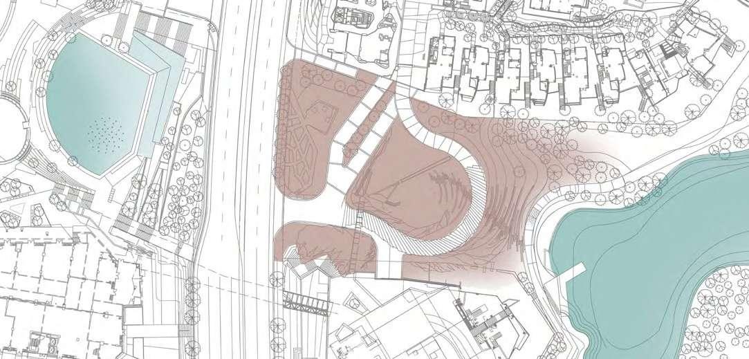
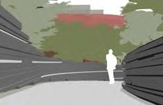
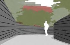
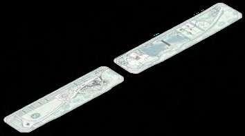
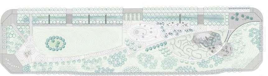
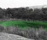
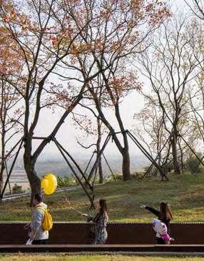
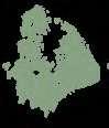
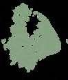
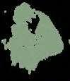
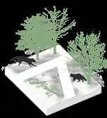
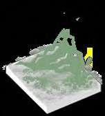
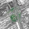
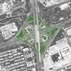
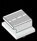
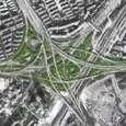
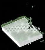
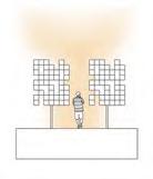
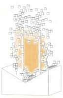
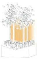
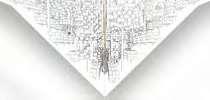
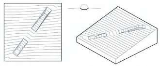
01 THE VALLEY
Professional Individual Work: 0.4ha
Concern about how to transform boundary spaces within cities that have been rapidly expanding in recent years.
11.2017-05.2019
03.2018-09.2018
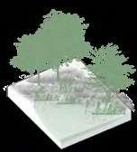
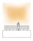
Professional Team Work: 5.73ha, 4 team members
A park designed for residents' better life and try to look for the optimal equilibrium of various relationships in the design process
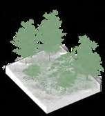
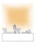
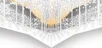
03 TANGSHAN QUARRY PARK
Professional Team Work: 20ha, 7 team members
Revitalize an old quarry that serves the leisure life of local people and motivates the development of the tourism industry
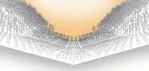
04 SHANGHAI FRIENDLY RING
Individual Academic Work
Repurpose the blank space in the ring-road system to solve the survival issues of the raccoon dog and illustrate new possibilities of alternative urbanism for cohabitable urban space
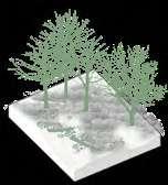
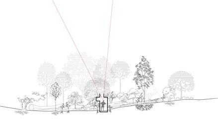
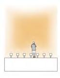
05 TIME-SPACE COMPRESSION
Individual Academic Work
Following an analysis of compression of release in landscape experience, the design proposal intends for its visitors to focus on the variation of such an experience, and draw new links between humans and non-humans.
* OTHER WORKS
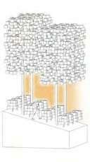
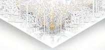
02 WISDOM PARK *
05.2017-12.2018
06.2021-12.2021
09.2022-12.2022
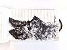
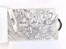
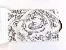
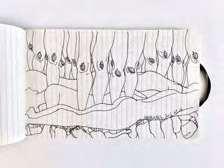
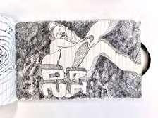
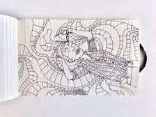
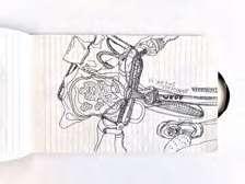
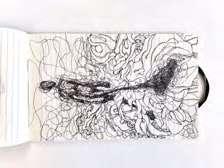
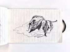
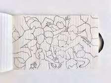
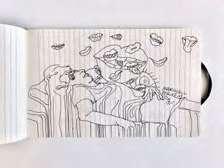
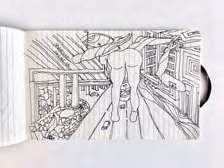
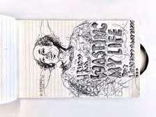
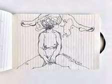
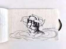
ARTWORK
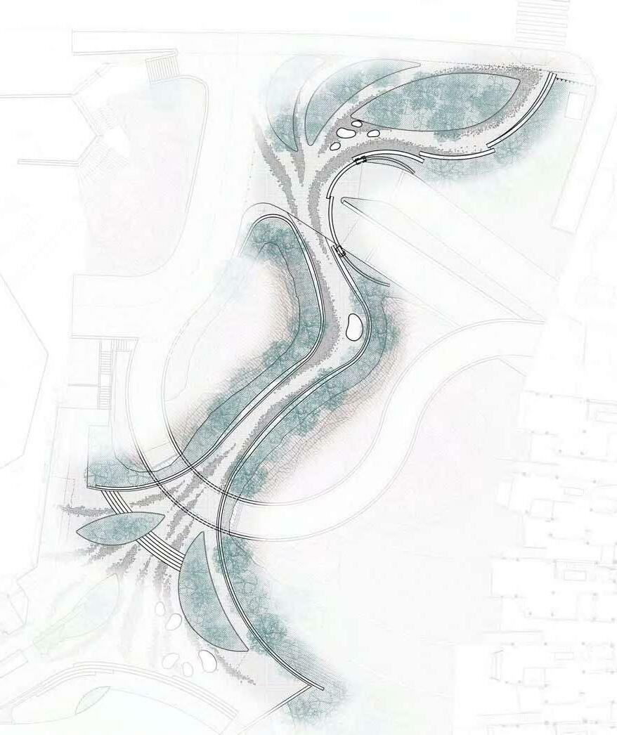
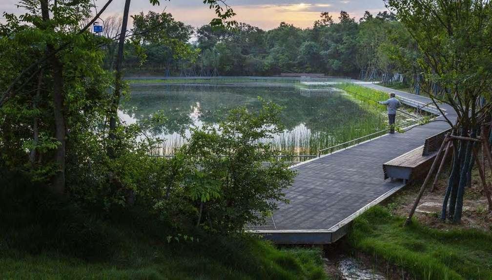
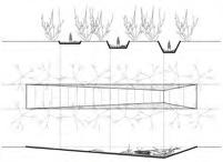
01 THE VALLEY: ACTIVATE BOUNDARY AS CONNECTION
Professional Individual Work
Design Director: Dong Zhang, Ziyin Tang
Team Member:
Shuai Yuan
My Contribution:
Schematic Design (2017.11-2018.03):
Concept-100%, Site Analysis and Programming-100%, Modeling and Rendering-100%, Physical Model Study-100%
Construction Dcuments (2018.07-2018.09):
Landscape Construction Drawings -100%
Info:
Location: Chengdu, Sichuang
Area: 0.4 ha
Client: Chengdu Wanhua Investment Group
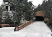
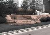
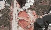
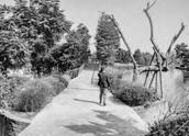
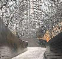
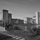
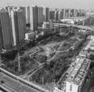
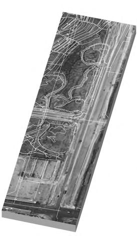
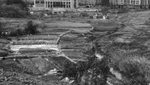
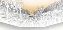
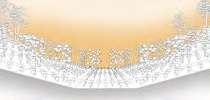
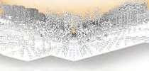
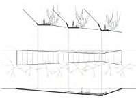
Since the project site is small, I was given the opportunity to control the project by myself from the conceptual design phase to the construction drawings phase. It is a big challenge since I have to solve all problems and make all the drawings on my own without others’ help. Of course, it comes with tremendous rewards that I have learned an incredible amount of landscape-related knowledge in the process.
I like the project very much because its special site condition comes with different problems to be solved. And I believe that properly solving the problems is a very important part of a good design. My design breaks through the limitations of the narrow and dark site environment, and ingeniously connects and integrates the complex, irregular spaces, lush vegetation, and exposed red sandstone through a winding path, forming a beautiful passing space. The space structure and reinterpretation of natural forms make this space be a good place to connect with the surrounding areas.
Project Background
The Valley is a story about transforming boundary spaces in cities and reflects the concern about how to improve the use of land in cities that have been rapidly expanding in recent years.
I put forward the concept of "valley" in combination with a series of characteristics of the site and the design goals:
-The site is like a valley between the high-rise residential buildings on the north and south sides; -A winding community driveway and a number of garage entrances make the site fragmented;
-There are many huge red sandstones that are exposed and very steep inside the site, which was caused by the previous road construction.
-The site has the potential to become the connection of the surrounding environment, rather than just a boundary between them.
-The design reflects human intervention on the site and the gradual restoration of nature, which, like the rift valley in nature, holds many possibilities.
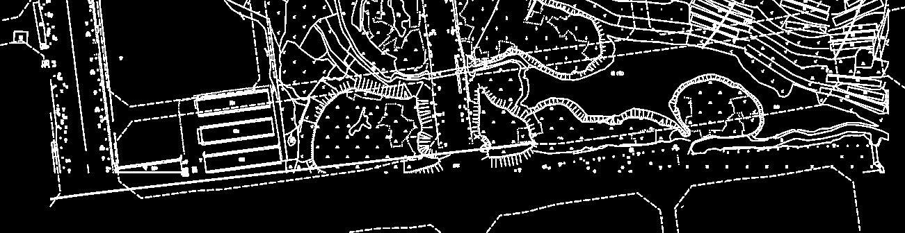
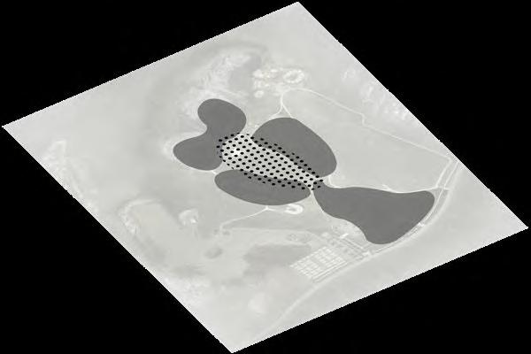
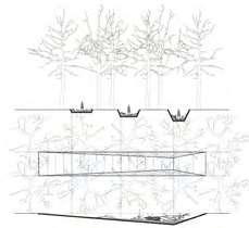
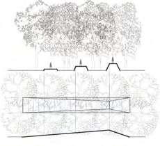
Site Analysis
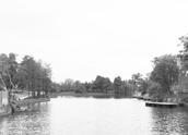
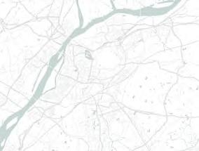
The project’s area is about 3709 m2, with Chengdu Lu Lake to the west, a regional commercial center to the east, and two high-rise residential areas to the south and north. When I visited the site, the first thing that came to our mind was whether we could design a pedestrian path to connect the commercial center on the west side with the lake area on the east side. How to deal with the relationship between the pedestrian path and vehicle roads to ensure the safety of people's activities has become a key issue for this project.
This area was originally a hilly area where farmers planted rice and other crops. With the expansion of cities, agricultural land was expropriated for residential and commercial land.
Beltway
2018 2015 2013 2010 Before 2005
1988 2012 2017 2018 1986 Cheng
Site Site N 0KM 2KM 6KM
Du, China
Street Area Dock Commerical Center
Lu Lake Steep Red Sandstone
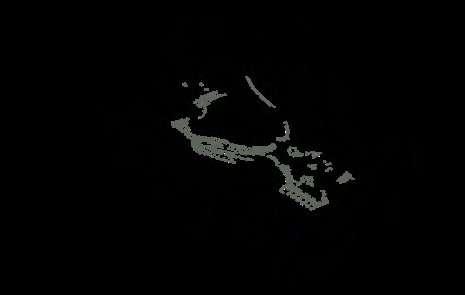
11M Community Driveway 485.00M 0M 8M 16M 24M 40M 32M 48M 487.00M 489.00M 491.00M 493.00M 495.00M 497.00M 499.00M 0M 5M 15M N Commercial Plaza Transformer Room Hill Top High-rise Residence in the South High-rise Residence in the North Waterfront Trail Garage Entrance Ramp K B A J K J L A C C D B D E E F F G L G H H I I
Thinking and Modeling
Existing Conditions & Challenges
Solutions
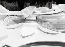
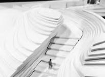
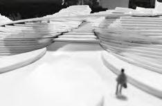
Thinking with the Hand-made Model
Design Target


Lack of East-West connectivity, and the existing traffic conditions need to be maintained Create
Lack of public open space that people can stay
Some areas are potentially dangerous for human activity
a pedestrian path to
the area
space
make
to be a betterconnected
60% 40% 27% 17% 100% 160% Extreme elevation difference Design an accessible route embedded in the red sandstone Use walls to isolate the garage entrances and guide the direction of people's passage Add a bridge to separate the pedestrian and vehicular connections
public open spaces are designed on the east and west sides to attract people to enter and stay !
The
Original Topography
Pedestrian
and Driveway Public
Space around Street
Relationship Between
Path
Open
Plan
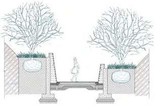
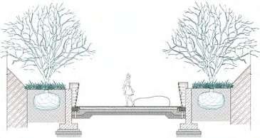
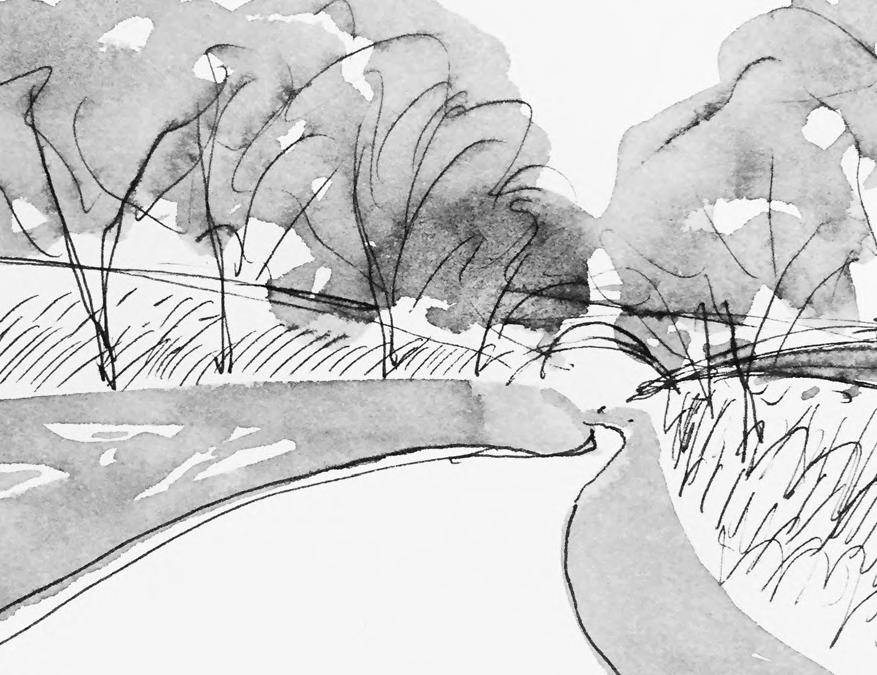
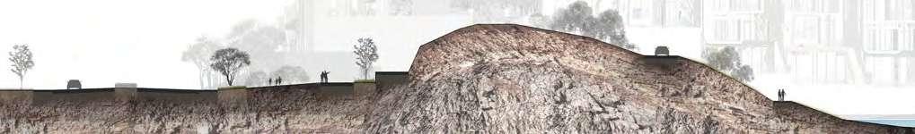
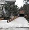
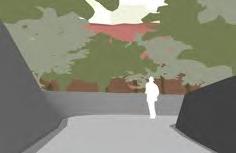
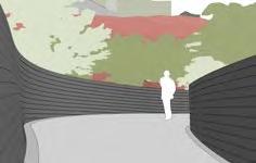
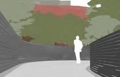
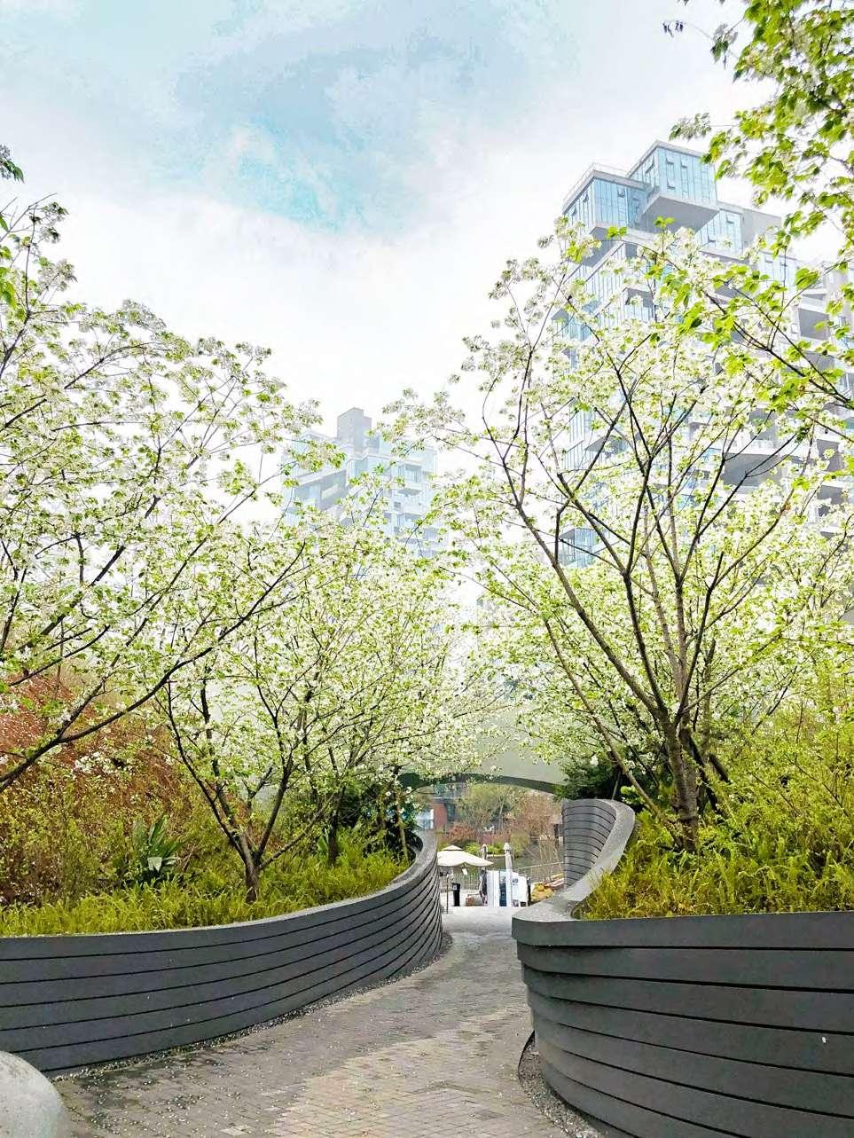
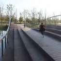
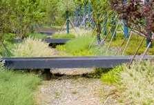
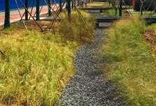
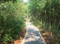
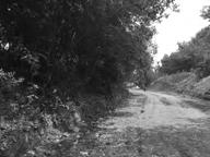
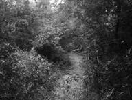
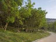
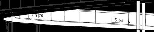
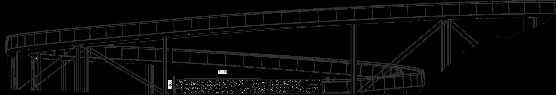
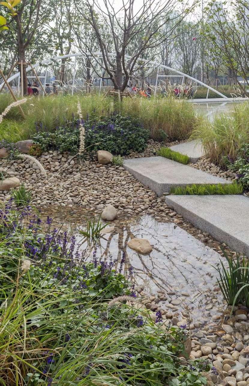
By Adding the meandering path, the project broke free from the constraints of a small site, dark environment, and poor location, and built a scenic pedestrian space for people. The intricate and irregular site, dense trees, exposed red sandstone, and prominent topography constitute the winding design features of the park.
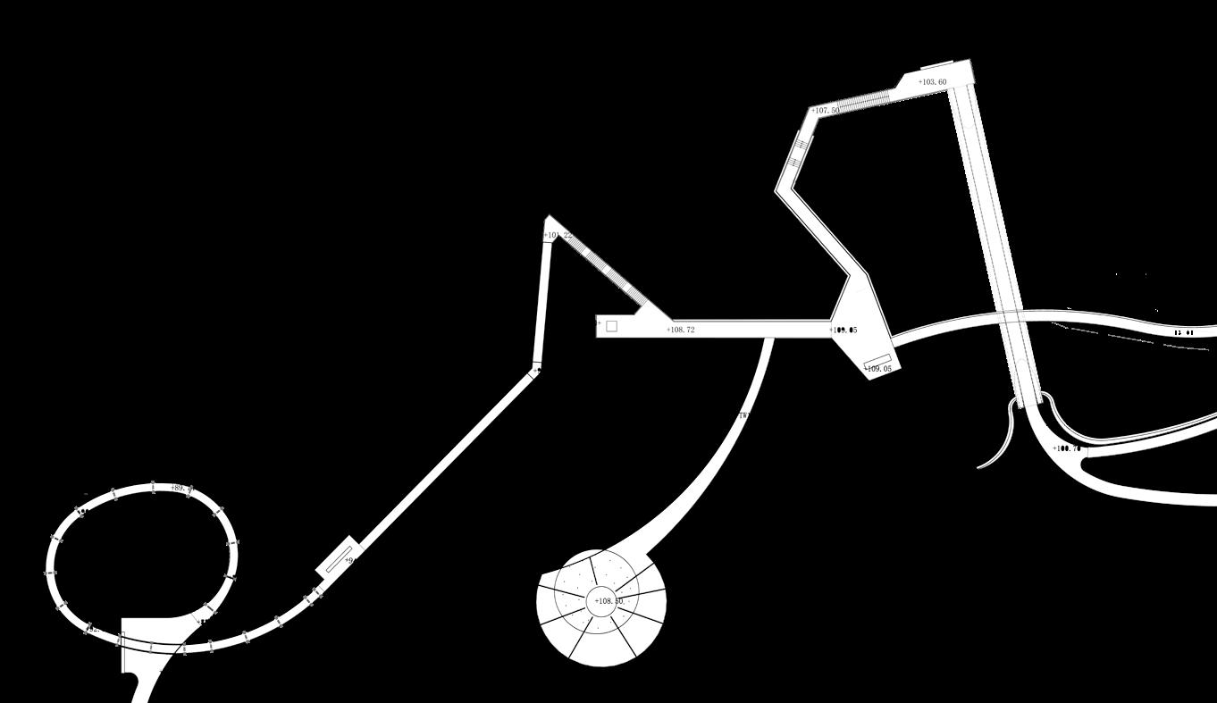
Planting Bed Stone Seats Movable Wall Paving South Wall Red Sandstone North Wall Bridge Steps Ramp Dock North Garage Entrance Residential Entrance South Garage Entrance B B A A C C D D E E F F G G H H I I J J K K L L M M N N 0M 5M 15M N A B C +489.30 +488.90 +497.00 +494.00 +492.78 +491.00 +489.60 +491.20 +490.35 490.50+ 489.60+ 487.50+ +487.90 +487.00 +487.00 486.55+ +486.10 +486.10 486.25+ 486.40+ +485.80 +485.80 488.90+ A1 B1 C1 A A 1 C C 1 B B 1 Pedestrian Path Vehicle Road
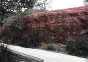
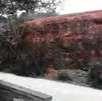
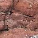
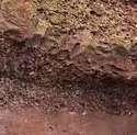
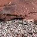
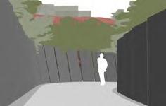
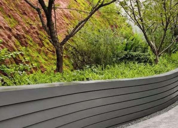
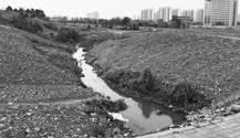
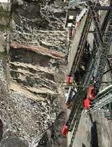
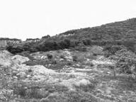
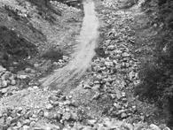
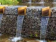
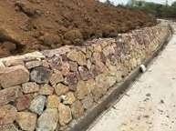
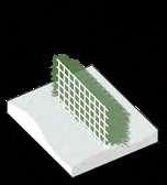
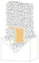
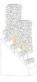
Red Sandstones, Path and Winding Walls
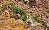
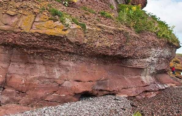
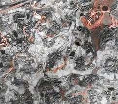
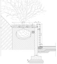
Weathering traces on the exposed red sandstone can be easily seen. Meanwhile, the local climate is rainy and humid, so beautiful moss can grow easily on the surface of red sandstone.
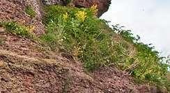
For people can see the red sandstone's gradual recovery process through plants, I deliberately kept the exposed red sandstone. And in order to prevent steep red sandstone from falling into the path after being weathered, I set up a retaining wall reflecting the traces of the weathering of red sandstone.
The path direction is studied repeatedly to fit the appropriate gradient. The complex topography, winding paths, coupled with the natural texture to give people a natural feeling, make the whole space seems bigger.


NaturallyRecoveringPlants


Spacial Experience along the Path

Surface Pattern Study


General Implementation Steps


Traces of weathering
Height Variation C A B A. Cut roads in red sandstone C.
D.
trees E.
ForwardandBackward
Install walls' surface
Plant
Natural recovery of vegetation
B. The height of the wall varies with the height of the red sandstone
C. The surface pattern echoes the weathering of the red sandstone
Top Edge Bottom Edge
A. The top and bottom edges of the wall change back and forth
B. Set up retaining walls and backfill the planting soil
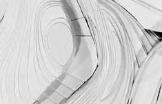
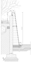
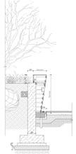
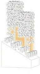
Construction of the Winding Walls
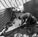
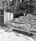
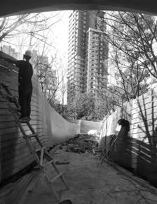
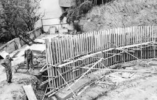
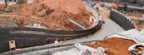
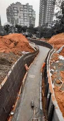
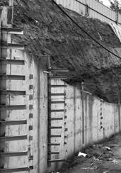
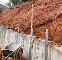
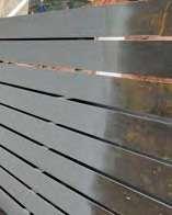
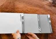
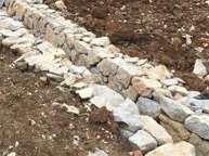
Considering the cost and feasibility, I finally adopted stainless steel as the skin material of the wall, so that the surface can be cut and processed in the factory first, and then installed on-site. If there are some errors in the construction process, it is convenient for timely modification. Of course, even so, our team still encountered many difficulties during construction. The lighting originally designed inside the wall was canceled considering the difficulty of installation; the color of the wall surface had been repeatedly adjusted to adapt to the volatile weather in Chengdu.
Walls' Plan
North Wall
South Wall
TYP. 2000 BW490.65 BW490.45 BW487.45 BW487.00 TW491.95 TW492.14 TW492.27 TW492.34 TW492.35 TW492.29 TW492.17 TW492.01 TW491.81 TW491.57 TW491.31 TW491.04 TW490.81 TW490.68 TW490.70 TW490.90 TW491.20 TW491.47 TW491.65 TW491.70 TW491.64 TW491.50 TW491.27 TW490.98 TW490.65 TW490.28 TW489.90 TW489.48 TW489.03 TW488.52 TW488.35 1300 300 1550 300 1690 1760 1770 1710 1650 1560 1490 1390 1270 1140 1170 300 300 300 300 300 300 300 300 300 300 300 122 183 200 168 90 59 15 186 1180 1330 1670 2100 2500 2810 3000 3080 3070 2970 2820 2620 2380 300 300 300 300 300 300 300 300 300 300 300 300 300 119 87 245 347 396 390 329 235 44 140 277 364 399 2090 1850 1580 1520 300 300 300 300 381 311 190 B1 B2 B3 B4 B5 B6 B7 B8 B9 B10 B11 B12 B13 B14 B15 B16 B17 B18 B19 B20 B21 B22 B23 B24 B25 B26 B27 B28 B29 B0 B1 B2 B0 B3 B4 B5 B6 B7 B8 B9 B10 B11 B12 B13 B14 B15 B16 B17 B18 B19 B20 B21 B22 B23 B24 B25 B26 B27 B28 B29 TYP. 2000 BW490.45 BW487.45 BW487.00 TW491.95 TW492.14 TW492.27 TW492.35 TW492.29 TW492.17 TW492.01 TW491.81 TW491.31 TW491.04 TW490.81 TW490.68 TW490.70 TW490.90 TW491.20 TW491.47 TW491.65 TW491.70 TW491.64 TW491.50 TW490.98 TW490.65 TW490.28 TW489.90 TW489.48 TW489.03 TW488.35 300 300 1560 1490 300 300 300 300 300 300 300 300 300 300 300 183 200 90 59 15 186 1670 2100 3070 2970 2820 300 300 300 300 300 300 300 300 300 300 300 300 119 87 245 347 396 390 329 235 44 140 277 364 399 300 300 300 300 381 311 190 LD3.3.6 步道景墙详图六 施工图 Principal Charge 首席设计师 Checked by 审 核 Project Manager 项目经理 Designed by 设 计 Counter Signature 会签 结 构 电 气 给排水 Client 业主 Project Title 工程名称 Sub-Title 子项名称 Drawing title 图纸名称 info@ztsla.com www.ztsla.com 址: 电子邮箱: EMAIL. HTTP. 200052 021-62808950 址: ADD. 编: PC. 话: 真: FAX. TEL. 021-62808929-802 Z+T Studio, Landscape Architects 上海张唐景观设计有限公司 此设计图则之版权归上海张唐景观设计有限公司所有。非得本公司之书面 批准,不得随意将任何部分翻印。切勿以比例量度此图,一切依图内数 字所示为准。承建人必须在工场核对图内所示数字之准则,如发现有任 何矛盾处,应立即通知项目经理。 Design Stage. 设计阶段 DWG.STYLE 图别 DWG.NO. 图号 Date 日期 Scale 比例 Cad-Ref File Disk/Tape No. PROJECT 项目编号 ALL DESIGNS ARE THE SOLE PROPERTY Z+T STUDIO, LANDSCAPE ARCHITECTS. AND CANNOT USED WITHOUT WRITTEN PERMISSION THE SAID COMPANY. NOT SCALE DRAWING FIGURED DIMENSIONS ARE FOL如图所示 园建 2018.04 VER.NO. 版 号 Date 日 期 第一版 2018.04 成都万华新城发展股份有限公司 成都万华麓湖项目 成都万华麓湖生态城裂谷公园项目 上海市长宁区新华路543号1号楼3楼B室 ROOM B, FLOOR 3, BLDG 1, NO.543 XIN HUA ROAD, SHANGHAI, CHINA 张东 赵桦 赵桦 袁帅 B1 B2 B3 B4 B5 B6 B7 B8 B9 B10 B11 B12 B13 B14 B15 B16 B17 B18 B19 B20 B21 B22 B23 B24 B25 B26 B27 B28 B29 B0 B1 B2 B0 B3 B4 B5 B6 B7 B8 B9 B10 B11 B12 B13 B14 B15 B16 B17 B18 B19 B20 B21 B22 B23 B24 B25 B26 B27 B28 B29 BW487.45 BW487.00 TW491.81 TW491.57 TW491.31 TW491.04 TW490.81 TW490.68 TW490.70 TW490.90 TW491.20 TW491.47 TW491.65 TW491.70 TW491.64 TW491.50 TW491.27 TW490.98 TW490.65 TW490.28 TW489.90 TW489.48 TW489.03 TW488.52 TW488.35 300 300 1560 1490 300 300 300 300 300 300 300 183 200 15 1670 2100 3070 2970 300 300 300 300 300 300 300 300 300 300 119 87 245 347 396 390 329 235 44 140 2090 300 300 300 300 311 190 B9 B10 B11 B12 B13 B14 B15 B16 B17 B18 B19 B20 B21 B22 B23 B24 B25 B26 B27 B28 B29 B1 B2 B0 B3 B4 B5 B6 B7 B8 B9 B13 B14 B15 B16 B17 B18 B19 B20 B21 B22 B26 B27 B28 B29
2018.09 2018.10 2018.11 2018.12 2019.01 2019.02 2019.03 2019.04 2019.05 BW490.50 BW487.90 BW487.00 BW486.95 TW492.40 TW492.34 TW492.25 TW492.10 TW491.88 TW491.61 TW491.30 TW490.99 TW490.72 TW490.51 TW490.38 TW490.30 TW490.27 TW490.29 TW490.35 TW490.44 TW490.55 TW490.67 TW490.79 TW490.91 TW491.01 TW491.08 TW491.11 TW491.10 TW491.03 TW490.89 TW490.68 TW490.40 TW490.07 TW489.67 TW489.22 TW488.71 TW488.35 TYP. 2000 BW489.96 BW489.68 1900 1970 2020 2000 1920 1720 1480 1240 1040 970 980 1030 1130 151 206 175 89 201 193 154 21 128 167 239 284 300 300 300 300 300 300 300 300 300 300 300 300 300 1290 1490 1710 1950 2210 2470 2720 2950 3160 3330 3460 3530 3530 301 289 248 179 79 76 267 378 381 398 379 354 324 300 300 300 300 300 300 300 300 300 300 300 300 300 3460 3330 3040 2660 2230 1740 288 247 200 145 95 37 300 300 300 300 300 300 Principal 首席设计师 Checked 审 Project 项目经理 Designed 设 Counter 结 电 Client Project Sub-Title Drawing Design DWG.NO. PROJECT VER.NO. 版 A1 A2 A3 A4 A5 A6 A7 A8 A9 A10 A11 A12 A13 A14 A15 A16 A17 A18 A19 A20 A21 A22 A23 A24 A25 A26 A27 A28 A29 A30 A31 A0 A1 A2 A0 A3 A4 A5 A6 A7 A8 A9 A10 A11 A12 A13 A14 A15 A16 A17 A18 A19 A20 A21 A22 A23 A24 A25 A26 A27 A28 A29 A30 A31 BW490.50 BW487.90 BW487.00 BW486.95 TW492.40 TW492.34 TW492.25 TW492.10 TW491.88 TW491.61 TW490.99 TW490.72 TW490.51 TW490.38 TW490.30 TW490.27 TW490.29 TW490.35 TW490.44 TW490.55 TW490.67 TW490.79 TW490.91 TW491.01 TW491.08 TW491.10 TW491.03 TW490.89 TW490.68 TW490.40 TW490.07 TW489.67 TW489.22 TW488.71 TYP. 2000 BW489.96 BW489.68 1720 1480 1240 980 1030 151 206 175 89 201 193 154 128 167 239 284 300 300 300 300 300 300 300 300 300 300 300 300 300 1290 1490 1710 2470 2720 2950 3330 301 289 179 76 267 378 381 398 379 354 324 300 300 300 300 300 300 300 300 300 300 300 3040 2230 288 247 200 145 37 300 300 300 300 300 LD3.3.5 步道景墙详图五 施工图 Principal Charge 首席设计师 Checked by 审 核 Project Manager 项目经理 Designed by 设 计 Counter Signature 会签 结 构 电 气 给排水 Client 业主 Project Title 工程名称 Sub-Title 子项名称 Drawing title 图纸名称 info@ztsla.com www.ztsla.com 址: 电子邮箱: EMAIL. HTTP. 200052 021-62808950 址: ADD. 编: 话: 真: FAX. TEL. 021-62808929-802 Z+T Studio, Landscape Architects 上海张唐景观设计有限公司 此设计图则之版权归上海张唐景观设计有限公司所有。非得本公司之书面 批准,不得随意将任何部分翻印。切勿以比例量度此图,一切依图内数 字所示为准。承建人必须在工场核对图内所示数字之准则,如发现有任 何矛盾处,应立即通知项目经理。 Design Stage. 设计阶段 DWG.STYLE 图别 DWG.NO. 图号 Date 日期 Scale 比例 Cad-Ref File Disk/Tape No. PROJECT NO 项目编号 ALL DESIGNS ARE THE SOLE PROPERTY Z+T STUDIO, LANDSCAPE ARCHITECTS. AND CANNOT USED WITHOUT WRITTEN PERMISSION THE SAID COMPANY. NOT SCALE DRAWING FIGURED DIMENSIONS ARE FOLLOWED. ALL MASUREMENTS MUST BE CHECKED ON SITE THE CONTRACTOR.ANY DISCREPANCIES SHOULD BE REPORTED THE PROJECT MANAGER. 如图所示 园建 2018.04 VER.NO. 版 号 Date 日 期 第一版 2018.04 成都万华新城发展股份有限公司 成都万华麓湖项目 成都万华麓湖生态城裂谷公园项目 上海市长宁区新华路543号1号楼3楼B室 ROOM B, FLOOR 3, BLDG 1, NO.543 XIN HUA ROAD, SHANGHAI, CHINA 张东 赵桦 赵桦 袁帅 A2 A3 A4 A5 A6 A7 A8 A9 A10 A11 A12 A13 A14 A15 A16 A17 A18 A19 A20 A21 A22 A23 A24 A25 A26 A27 A28 A29 A30 A31 A0 A1 A2 A0 A3 A4 A5 A6 A7 A8 A9 A10 A11 A12 A13 A14 A15 A16 A17 A18 A19 A20 A21 A22 A23 A24 A25 A26 A27 A28 A29 A30 A31 BW490.50 BW487.90 TW492.34 TW491.88 TW491.61 TW491.30 TW490.99 TW490.72 TW490.51 TW490.38 TW490.30 TW490.27 TW490.29 TW490.35 TW490.44 TW490.55 TW490.67 TW490.79 TW490.91 TW491.01 TW491.08 TYP. 2000 BW489.96 BW489.68 2020 1480 1240 151 206 175 201 193 154 21 128 300 300 300 300 300 300 300 300 1290 1490 2470 2720 2950 3160 3330 301 289 248 179 79 76 267 381 398 300 300 300 300 300 300 300 300 300 300 2230 200 145 95 37 300 300 300 300 300 300 A1 A2 A3 A4 A5 A6 A7 A8 A9 A10 A11 A12 A13 A14 A15 A16 A17 A18 A19 A20 A21 A0 A1 A2 A0 A3 A4 A5 A6 A7 A8 A9 A13 A14 A15 A16 A17 A18 A19 A20 A21 A22 A26 A27 A28 A29 A30 A31
Construction Timeline
lightgage steel joist
the wall furface
study
of moveable wall's track Paving
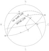
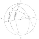
bloom BW487.00 TOP LINE BOTTOW LINE TOP LINE BOTTOW LINE + TW492.40 BW490.50 TW492.34 BW490.37 TW492.25 BW490.23 TW492.10 BW490.10 TW491.88 BW489.96 + TW491.61 BW489.89 TW490.99 BW489.75 TW490.72 BW489.68 + TW490.51 BW489.54 TW490.38 BW489.40 + TW490.30 BW489.27 TW490.27 BW489.14 TW490.29 BW489.00 TW490.35 BW488.86 TW490.44 BW488.73 TW490.55 BW488.60 TW490.79 BW488.32 TW490.91 BW488.19 TW491.01 BW488.06 TW491.08 BW487.92 TW491.11 BW487.78 TW491.10 BW487.64 + TW491.03 BW487.50 TW490.89 BW487.36 TW490.68 BW487.22 TW490.40 BW487.07 + TW490.07 BW487.03 TW489.67 BW487.01 + TW489.22 BW486.99 BW490.52 TW492.17 + BW490.58 TW492.29 + BW490.58 TW492.35 BW490.58 TW492.34 TW492.27 BW490.58 TW492.14 BW490.59 TW491.95 BW490.65 + BW490.45 TW492.01 + BW490.32 TW491.81 BW490.18 TW491.57 BW490.04 TW491.31 BW489.90 TW491.04 + TW488.52 BW487.00 TW489.03 BW487.45 + TW489.48 BW487.63 TW489.90 BW487.81 TW490.28 BW487.90 TW490.65 BW488.03 TW490.98 BW488.16 + TW491.27 BW488.30 TW491.50 BW488.43 TW491.64 BW488.56 TW491.70 BW488.70 + TW491.65 BW488.84 TW491.47 BW488.97 TW491.20 BW489.10 TW490.90 BW489.23 TW490.70 BW489.37 + TW490.68 BW489.50 TW490.81 BW489.64 TW488.35 + TW488.35 BW486.95 A1 A2 A3 A4 A5 A6 A7 A8 A9 A10 A11 A12 A13 A14 A15 A16 A17 A18 A19 A20 A21 A22 A23 A24 A25 A26 A27 A28 A29 A30 A31 B1 B2 B3 B4 B5 B6 B7 B8 B9 B10 B11 B12 B13 B14 B15 B16 B17 B18 B19 B20 B21 B22 B23 B24 B25 B26 B27 B28 B29 + TW491.30 BW489.82 TW490.67 BW488.46 TW488.71 BW486.97 A0 B0
South Wall North Wall B B 1 C C 1 A A1
Concrete wall construction Stall
Stall
Color
Installation
First
A C B A1 C1 B1
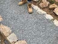
*All photos are taken by me during construction
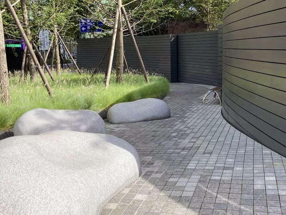
 Red sandstone
Stone seats made by local artisans
Growing moss
Tuber ferns and other Shade-tolerant plants
Cherry trees
The ever-changing curves enrich people's sense of space along the path
Red sandstone
Stone seats made by local artisans
Growing moss
Tuber ferns and other Shade-tolerant plants
Cherry trees
The ever-changing curves enrich people's sense of space along the path
are taken by me on site
Slope:2-6% *All photos
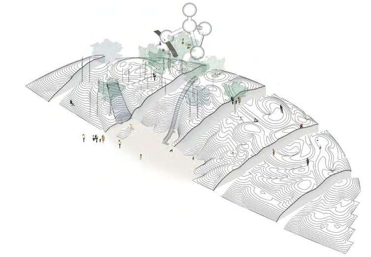
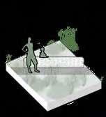
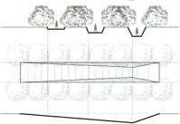
02 WISDOM PARK: RESPOND TO RAPID URBANIZATION
Professional Team Work
Design Director:
Dong Zhang, Ziyin Tang
Xiao Zhou, Lixia Bao, Yu Yao, Shuai Yuan
Team Member: My Contribution:
Schematic Design (2018.03-2018.05):
Concept-50%, Modeling and Rendering-40%, Analysis Diagrams-80%
Construction Document (2018.05-2018.07):
Granding, Materials and Layout Plans -30%, Detailed Drawings-60%
Info:
Location: Hefei, Anhui
Area: 5.73 ha
Client: China Vanke Co., Ltd.
The development of landscape architecture in China is inseparable from real estate. In the few years after my graduation, a large number of Chinese people moved to big cities which brought with rapid increase demand for housing as well as public landscapes. In the past few years, real estate-related industries have tried to find various ways to adapt to this super-fast development. How to make good designs in a short design cycle is the primary problem that landscape companies are facing in China.
The project is a good representative of this special state of development. The design of the project only took less than half a year from the concept phase to the phase of construction drawings. In the design process, we looked for the optimal equilibrium of various relationships, for example, balancing between cost and materials, between short construction period and construction quality, and between real estate developers, government, and users.
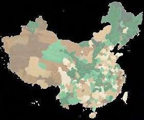
Number of Hefei Parks'Area (2001-2015) Unit: hectare
Polupation Change 2000-2015
China's megacities with rapid population growth
The Value of the Public Park Needs to Have
· Have demonstrability and recognition

· Increase property values

· Improve the local tax base
· Create jobs
· Attract Capital Investment
Social Importance
Population is migrating to Hefei from small and mediumsized surrounding cities
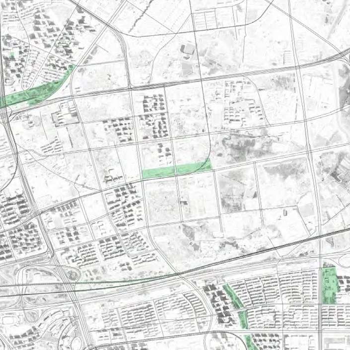
The project is located in Feihe New District, southeast of Hefei City
Hefei High-speed Railway Station
A Park Responding to Rapid Urbanization
· Beautify urban environment
· Provide identity for citizens
· Provide gathering places
· Maintain social stability
· Improve the quality of life
Health and Environmental Benefits
· Excercise and stay fit

· Improve air quality
· Improve water quality
· Prevent flooding
Residential Land Education Land
Land
and Health Land
Land
As a designer, it is a compulsory course to learn to balance the interests of all parties on the basis of ensuring the quality of the design.
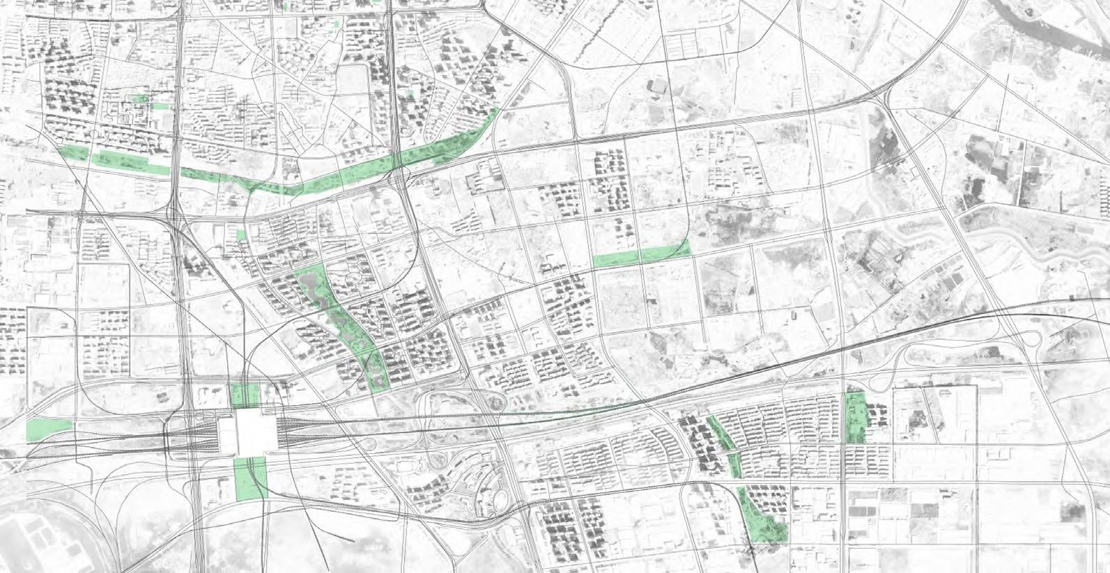
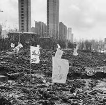
Hefei is a super-large city in the Yangtze River Delta urban agglomeration. In recent years, the population migration from surrounding areas to Hefei has accelerated the city’s expansion speed. Hefei built a new high-speed rail station and is planning more subway lines and new urban districts to cope with this demographic change. Feihe New District is a typical place. Residential land accounts for nearly 70% of the land use planning in this area. More and more people will buy houses and live in this new district under construction.
The Park is located on the central public green axis of Feihe New District. Its ownership belongs to the local government, but the construction will be funded and organized by Vanke, the real estate company that will develop the surrounding land, this mode has been widely used in the development and construction of various new districts in China in recent years. By selling residential land this way, the government can use the money to build urban infrastructure such as subways. Developers utilize a good-looking park to showcase a pleasant living environment and a promising future for increasing the value of the housing. Buyers also see buying a house as a way to cope with China's inflation.
The special national conditions put forward different requirements on the value of the public landscape. The public landscape is more of a display of regional development for the local government and developers. In the design process of the park, we tried to deal with the relationship between all stakeholders to design a better work, hoping to give some inspiration to the development of the public landscape in China in the future.
2 km Radius 2001 2002 2003 2004 2005 2006 2007 2008 2000 2009 2010 2011 2012 2013 2014 2015 3 6 9 12 15
Public Recreational Green Space Per Capita (2000-2015) Unit: m2 2000 Hefei Population Growth (2001-2015) Unit: 10,000 2001 2002 2003 2004 2005 2006 2007 2008 2009 2010 2011 2012 2013 2014 2015 600500400 800700 2001 2000 The Number of Hefei Parks (2001-2015) 2002 2003 2004 2005 2006 2007 2008 2009 2010 2011 2012 2013 2014 2015 20 40 60 80 100
2001 2002 2003 2004 2005 2006 2007 2008 2000 2009 2010 2011 2012 2013 2014 2015 2500200015001000500
Hefei
The
Economic Value
Three Interested Parties Closely Linked to the Park
Medical
Established
-50%~-20% -20%~-5% -5%~-0% Decline Groth 2%~4% 4%~10% 10%~20% 20%~50% 50%~500% N
Parks
Commercial
Hefei Metro Line 4
SITE (5.73ha)
Help buildpublic parks Sellresidential land Buyhousing Property Developers Local Governments Local Residents Show thelivingenvironment
Site Analysis
Design Approaches
-Leave spaces for future overpasses at intersections to connect the adjacent land -Create a close connection to the residential area on the north side
The Survey of the Residents’ Demand
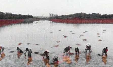
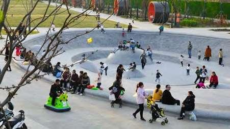
Together with developers, we conducted a survey on the demands of existing residents in the surrounding public landscape. The respondents were divided into four groups according to their age. Children are particularly concerned about the children's activity space and the activity facilities inside; Young and middle-aged people pay more attention to the sports space in the park; the elderly care more about amenities and plant abundance.
39%
-Preserve part of the mound as a park high point
-Some of the soil are used to create a green barrier
28%
The Age Distribution of the Residents
Visual Intrigue like Art Sculptures
Amenities like Shade Structures
Sports Space with Fitness Equipment

Children Playground with Play Structures
Waterfront Space
Open Outdoor Space like Great Lawn
Abundant Plants
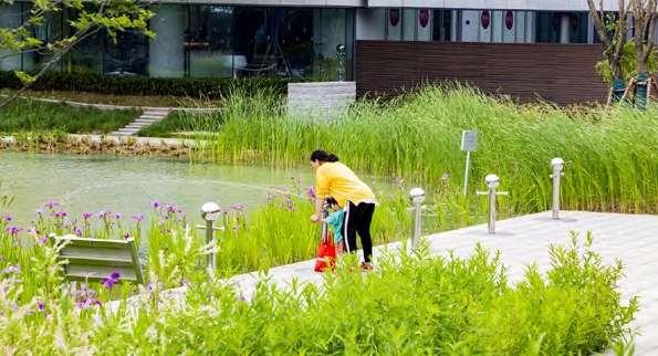
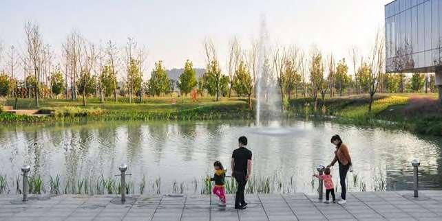
-Use existing lowland to design an ecological lake and collect rainwater from the park and surrounding areas
-Increase the interaction between humans and natural elements such as water


-Different functional areas to meet the needs of different age groups
- Enhance the identity of the park through the uniqueness of each activity area


Urban Farm
Pet Park
Connections Topographic Utilization Rainwater Collection Recognition & Experience
Previous
A residential area under construction on the north side The urban main road separates the park from its surroundings 60M 15M 40M 7M 30M The
rainwater
a pond Cropland A planned community library Rainwater Undeveloped Land 60+ Old People 15-35 Young People 36-59 Middle-aged People 0-14 Children
road construction around the site created a huge mound
lowland collected
and formed
N 0M 40M 120M
60+ Old People 36-59 middle-aged people 0-14 Children 15%
Tranquility Joy Multi-purpose Playground Slop Direction SlopDirection Big Lawn Plaza Library Lake Urban Farm
15-35 Young People 18%
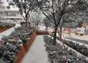
*All photos are taken by me and my colleagues on site

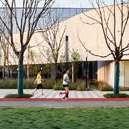
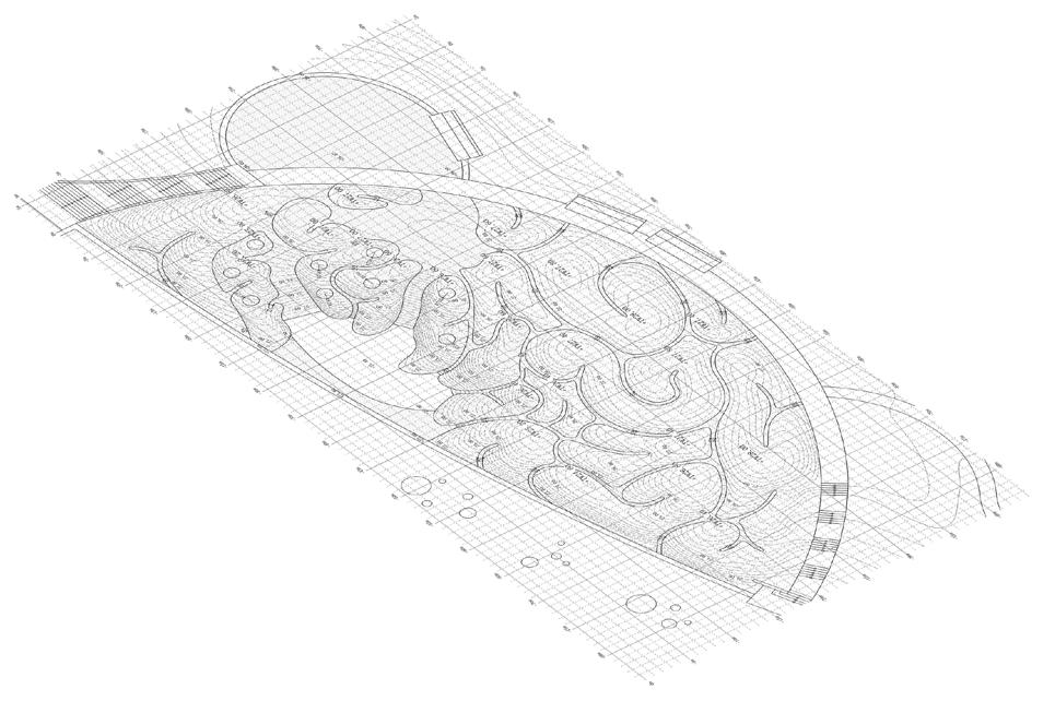
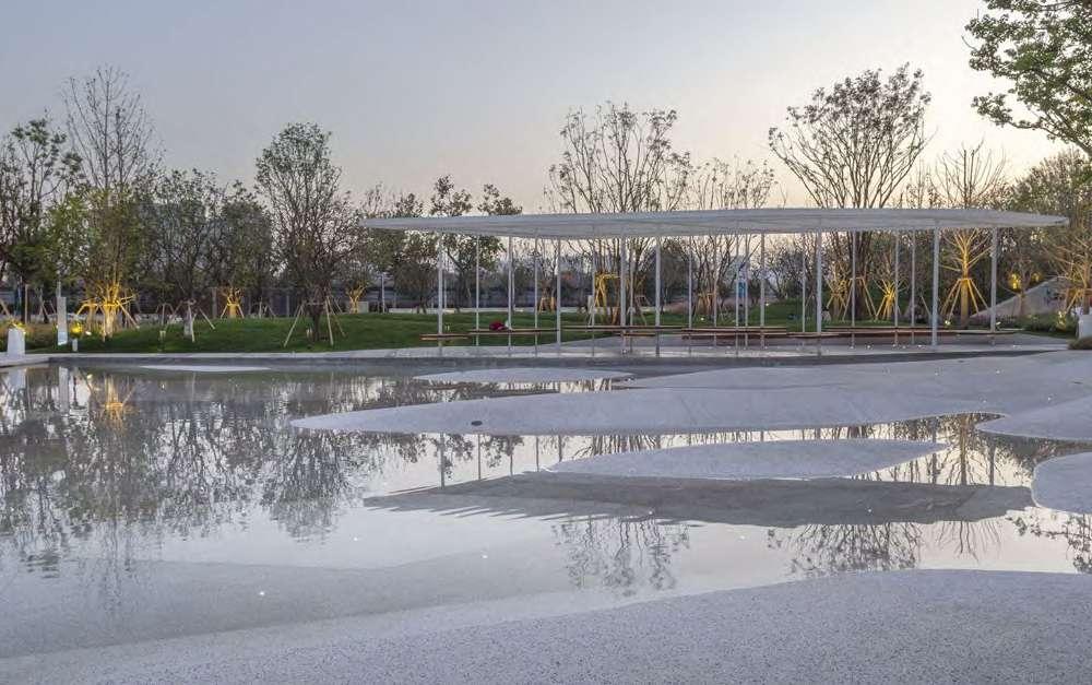
The master plan emphasizes the differences of each activity space, and the functions of different spaces meet the needs of people of different ages. At the same time, a series of distinctive facilities enhance the park’s identity to demonstrate what the developer and the local government need. The design of the park will provide an unforgettable experience and will activate the adjacent open space, welcoming all surrounding residents.
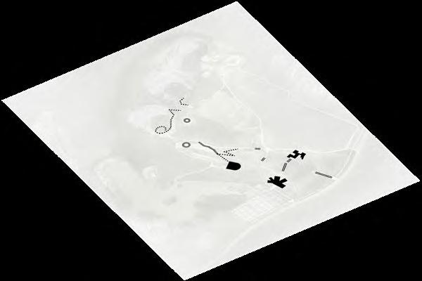
N 0M 20M 60M 60+ Old People 15-35 Young People 36-59Middle-aged People 0-14 Children B B A A C C D D E E F F G G H H I I J J K K L L M M N N ·North Connection ·Jogging Track · Main Entrances ·Circulation ·Sculptures · Structures ·Public Seats · Waterfront Space ·Sports Space ·Green Space ·Plaza Spatial Activities Accessibility and Road System Harscape and Amenities ·Ecological Pavement Plan
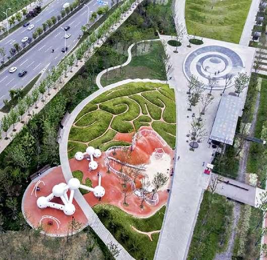
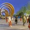
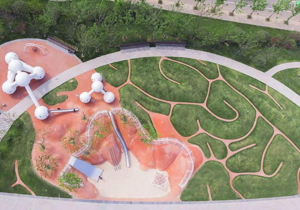
Sculpture Plaza Gravitational Waves Lawn Rain Garden Atomic Booth Star plaza Urban Farm Senior Sports Area Wind Sculpture Brain Playground Interactive Ring Waterfront Space Ecological Pond
DNA Bridge Atomic Pavilion Community Library
Rainfall Treatment and Planting
Park Runoff Street Runoff Gutter Pond
300mm gravel mulch
150mm amended planting soil
300mm gravel bed
Undisturbed (not compacted) native subgrade
+24.07 +26.00 +TP27.20 +24.00
Bio-swale with local wild flowers can slow down stormwater run-off
Canopy trees capture rainfall for evaporation and slow down stormwater run-off at the beginning
Atomic booth
Domed riser grate
5060m2
Outflow to sewer or outlet control structure 28631m2
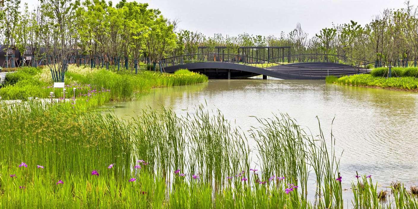
Steel grating bridge
·Canopy Trees 1450 treees ·Water Plants
·Shrubs and Groundcover
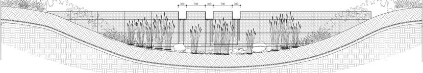
Water collection
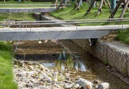
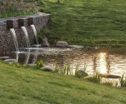
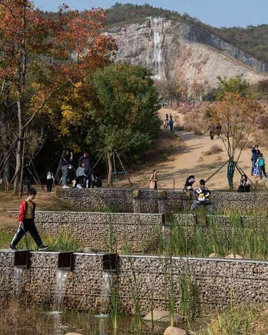
According to calculation, on the basis of reasonable collection and utilization of on-site rainwater, 2750 m2 of water level of the lake in the park can be maintained at 1.2-1.5m all year round. The park's rain garden corridors and eco-lake provide shade and human comfort, and reduce runoff from the adjacent road surface. The design provides ecofriendly and comfortable evidence for the development of the area.
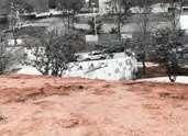
Residential area under construction
City main road 2018.10 2019.06 2020.08
Green belt
Rain garden
*All photos are taken by me and my colleagues on site

 A. Louisiana iris
Fountain provides aeration
Water-viewing deck
Water interactive installations
B. Cyperus alternifolius
F. Iris pseudacorus
A. Louisiana iris
Fountain provides aeration
Water-viewing deck
Water interactive installations
B. Cyperus alternifolius
F. Iris pseudacorus
L
G. Rhynchospora colorata
Bridge with step seatings
Atomic pavilion
H.Iris tectorum
C. Typha orientalis
D. Miscanthus
A C D F G H E B *All photos are taken by me and my colleagues on site
E. Rosemary
Play in the Brain

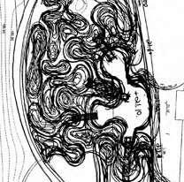
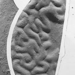
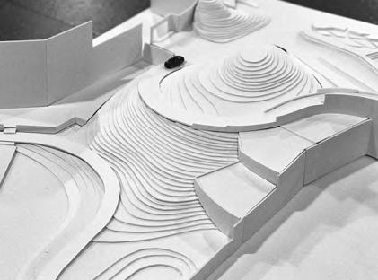
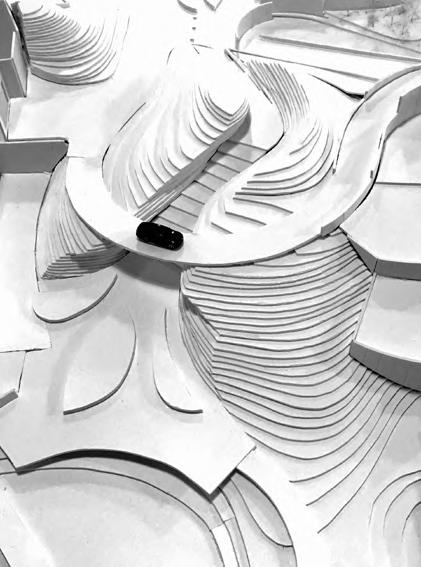
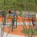
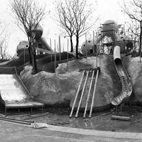
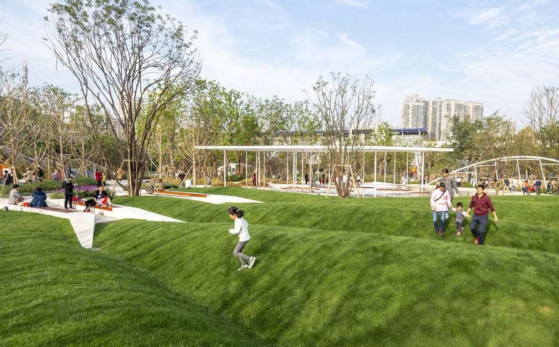
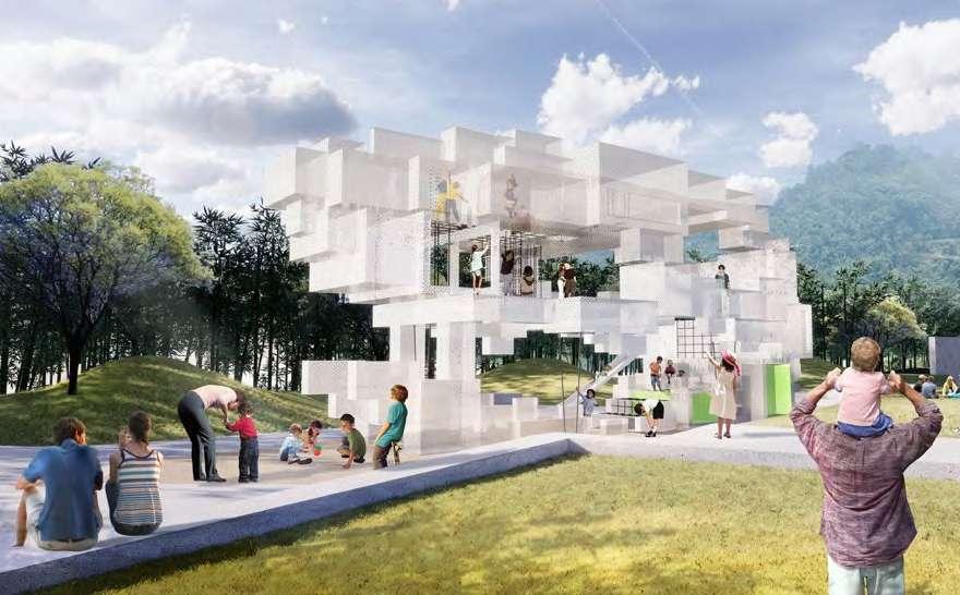
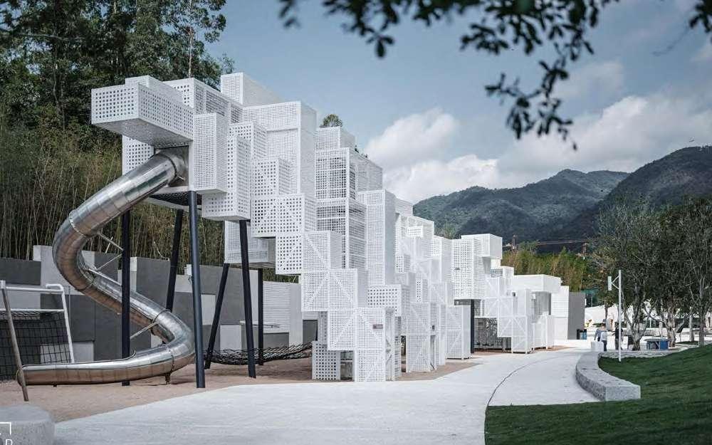
The children's activity area was originally a mound formed by road construction around the site. We hope to highlight the theme of "wisdom" in this area, so we linked the shape of the mound to the source of wisdom -- the brain. The whole space had been repeatedly modified from the initial conceptual sketch to a hand-made model and then a computer model, and finally presented in the real space. The combination of rich terrain and various interactive installations has turned the previously featureless mound into an extremely popular space for comprehensive activities.
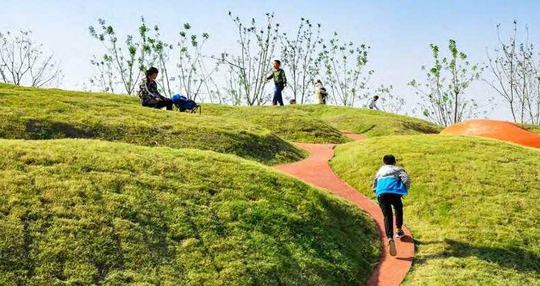
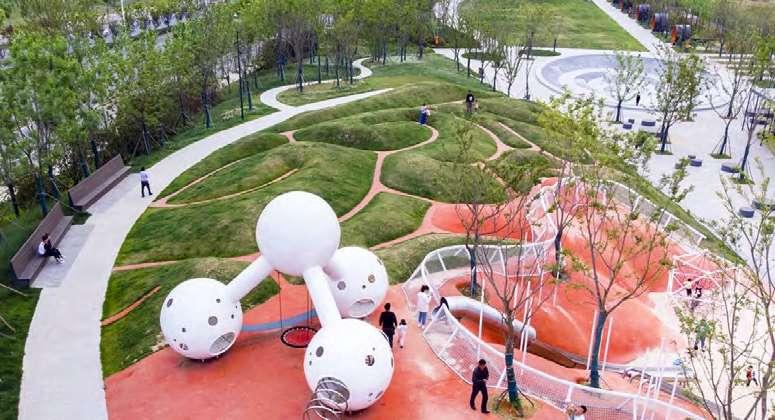
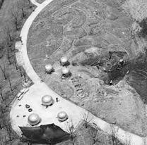
A B C D E A1 B1 C1 D1 E1 E E1 D D1 C C1 B B1 A A1
2018.03
Concept Discussion 2018.04 Physical Model 2018.07 Layout Survey
2018.09 Rubber Mats Laying
2018.08 Installation of Play Facilities
2018.05-06 Software Model & Construction Drawing
*All
on
photos are taken by me and my colleagues
site
Long bench for parents
The green belt separates the park from the city mian road
Safty fence
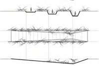
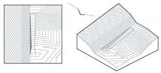
TANGSHAN QUARRY PARK: FROM A BROWNFIELD TO AN ECOLOGICAL PARK
Professional Team Work
Design Director:
Dong Zhang, Ziyin Tang
Team Member: My Contribution:
Qing Zhang, Min Xu, Yifan Chen, Yupeng Yang, Xin Liu, Shaohao Bian, Shuai Yuan
Schematic Design (2017.05-2017.10):
Concept-50%, Plan Drawing-50%, Modeling and Rendering-40%, Site Analysis and Diagrams-80%
Design Development(2017.11-2018.02):
Details Drawings of Main Entrance Area-80%, Meadow Area-100%, Rain Garden-100%
Construction Drawings (2018.08-2018.12):
Detailed Drawings of Discoveryland Area-40%
Info:
Location: Nanjing, Jiangsu
Area: 20 ha
Client: Nanjing Tangshan Construction Investment Development Co. LTD
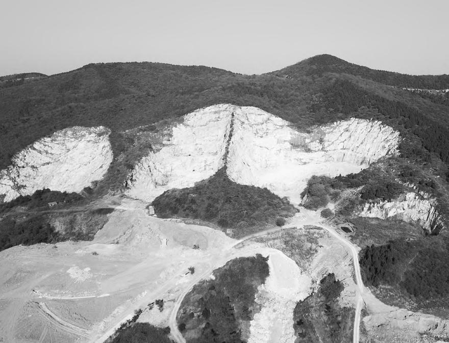
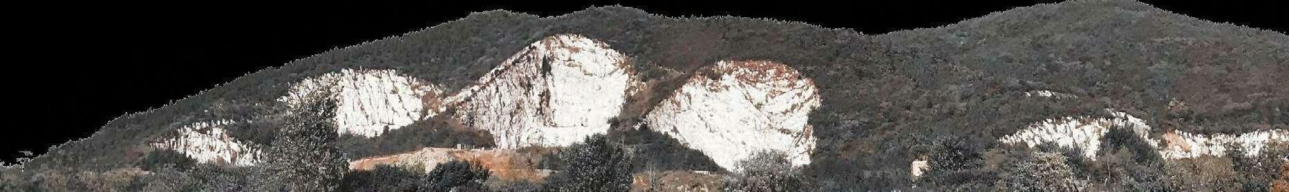
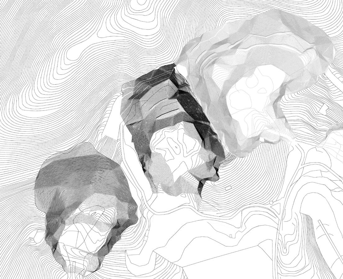
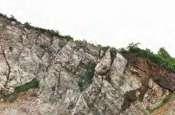
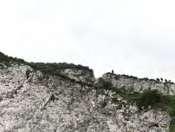
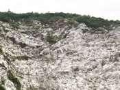
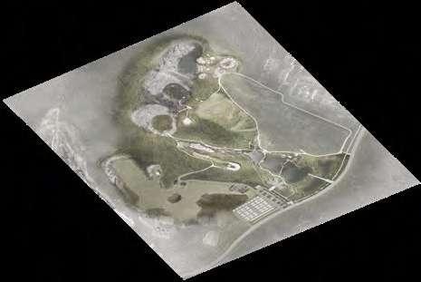
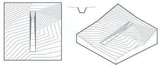
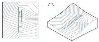
Tangshan Quarry Park is one of the large-scale projects I have been working on in the past few years in Z+T Studio. The background and site conditions of the project are more complicated than other projects. This project provides a good opportunity to understand the meaning of being a landscape architect for the development of the whole society: rethink the interference, plunder, and destruction of nature in the course of human development, and explore the more harmoniously way of living between human being and nature.
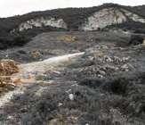
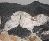
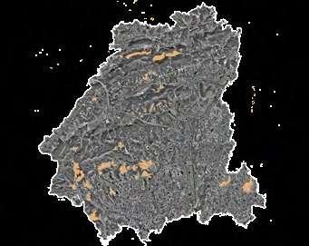
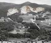
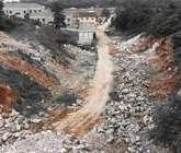
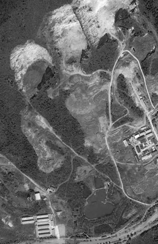
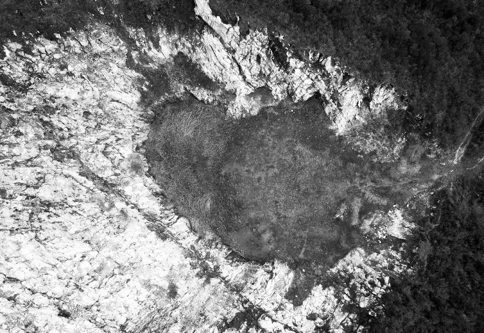
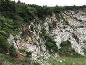
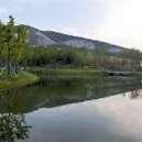
We can clearly see several abandoned quarry pits from the road a few kilometers away. These pits belonged to the largest quarry in Tangshan. The original intention of the project is how to make these remarkable landmarks green again and provide a place for future tourism and leisure activities. It looks scarred when looking at a distance but walking in it, you can see plants grown out of the cracks in the broken stone and matched with the cold stone wall to form a beautiful texture; the scale of the huge quarry feels untouchable but passionate.
03
Project Background


Major Mining Cities in China (By Population)
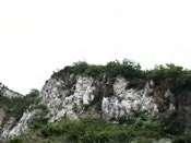
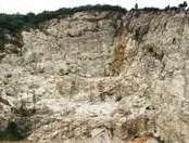
Tangshan Town is part of Nanjing, about 30 kilometers away from downtown, and only 2.5 hours from Shanghai. Tangshan town has been famous for its mineral resources and hot spring industry, and its gold reserves rank first in Jiangsu Province. In recent years, in order to optimize the industrial structure, further resolve the mine overcapacity and eliminate the backward production capacity, many quarries have been closed, and Tangshan town has been gradually transformed into a tourist resort town.
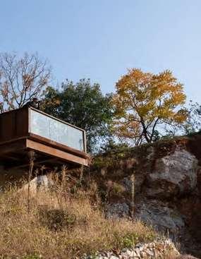
Tangshan Quarry Park is located to the south of the town, where it used to be Longquan Quarry, mainly engaged in open-pit mining of limestone. In 2004, the quarry was officially closed due to years of artificial damage. Four quarry pits with varying heights were formed. The local planning department decided to transform it into a quarry park, which serves the leisure life of local people and is conducive to the development of the tourism industry.
0 0 2 3 4 5 6 7 8 9 10 11 1 2 3 4 5 6 7 8 9 10 hectometer Meiquan Road N
Tangshan Nanjing 130km 230km Shanghai Changzhou Wuxi Suzhou Nantong Jiaxing Huzhou Hangzhou 30km Nanjing Tangshan
Big City Middle City Small City
Tang Mountain
Site
hectometer 11 PRE-INDUSTRY POST-INDUSTRY ECONOMICAL CRISIS ECONOMICAL FRIENDLY Quarries in Tangshan Town How to change it? Project Area: 21ha Pond Mining Road Project Boundary Undisturbed Native Forests Quarries
Tangshan Resort Town
Framework of Environmental Surveys and Analysis
Geographical Location
Topography, Landform, Geology

Overview of Tangshan Town
Natural Environment
Surface Water Hydrology and Hydrological Characteristics
Surface Water Hydrology and Hydrological Characteristics
Climate and Meteorology
Soil

Ecological Environment
Terrestrial Ecosystem
Aquatic Ecosystem Mineral Resources
Vitex Negundo/ Pistacia Cinensis/ Platycarya Strobilacea
Pistacia Chinensis/ Quercus Variabilis/ Pinus Massoniana
Excoecaria Sebifera/ Quercus Variabilis

Monitoring And Evaluation Of Surface Water Environmental Quality
Specific Investigation of the Quarry Site
Monitoring And Evaluation Of Groundwater Water Environmental Quality
Plant Community Type Vegetation Biomass
Soil Condition Survey
Topography Survey
The systematic restoration of geological disasters, hydrology, soil and vegetation is the prerequisite of ecological restoration of the quarry. We selected Sustainable SITES Initiative Version2, SITES V2 as the ecological restoration process manual of this project. SITEs V2 involves 10 parts, including site environment, pre-design assessment and planning, water, soil and vegetation, materials, construction, operation and maintenance, etc. At the beginning of the program, we discussed possible conflicts from these different professional perspectives and clarified the sustainable principles and performance goals of the project.
- There are several scattered ponds in the base, and rainwater is the main water source, which lacks futility and quality


- Storm runoff has caused serious damage to the site

- The planting activities of the existing farmers lead to the direct discharge of agricultural non-point sources and pollution sources into surface water, resulting in high concentrations of nitrogen and phosphorus in existing water bodies
The ecological environment in the region is disturbed, the ecological system structure is incomplete, ecological problems are prominent. No national or provincial protected animals were found.
-Elevation: The area below 100 meters belongs to the flat area, which has a high degree of development. Areas above 100 meters (except for pit areas) are the main

Evaluation
Flora and Fauna Survey 0t/hm 56t/hm2 >
Pollutant Source Distribution Monitoring and
of Atmospheric Environmental Quality
Distribution
Excoecaria Sebifera/ Broussonetia Papyrifera Conyza Canadensis Urban Vegetation Cover Typha orientalis/ Phragmites Australis Bare Land Construction Land Water Rare and Protected Plants (Xylosma Racemosum) Storm Runoff Path Catchment areas Temporary Ponds Permanent Ponds Mammals Birds Insects Reptiles Trionyx sinensis Lizard Elaphe Dione Sparrow Blackbird Siberian Weasel Mus Musculus Bat Craig Brelsford Gryllotalpa Orientalis Ducetia Japonica Atractomorpha Sinensis 57.00 67.00 77.00 87.00 97.00 107.00 117.00 127.00 137.00 147.00 157.00 167.00 177.00 187.00 197.00 Land-ecology Suitability 55 Plant Coverage 60 Soil Erosion Degree 0 Recovery Capability 40 Evaluation Result 38.75 0 100 Evaluation Index
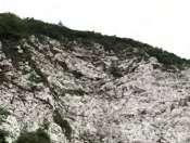
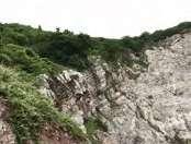
Quarry Pits Stability Analysis
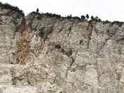
At present, there are no signs of tensile cracking and large-scale collapse deformation in the two quarry pits. Due to the reasons of excavation blasting and weathering during mining, the upper surface of the slope is relatively broken, with partial collapse and block falling.
According to the occurrence of the rock formation and its relationship with the slope surface, the possibility of overall slippage is small; while the upper surface rocks of the slope are developed with joints and fissures, some of which are broken. It is predicted that the possible failure mode of the upper broken rocks is partial collapse and block falling under the action of vibration or rainfall.
Slopes Treatment
-Make the top of the quarry pits gentle and green
-Preserve partial broken slope rocks with bolting and shotcrete
-Clean up dangerous rocks on slope
-Use the backfill grouting technique to treat the joints and cracks
-Set up intercepting ditch on the top of the slope
11 12 21 22 3 32 41 42 51 52 61 62 71 72 8 1 8 2 9 1 9 2 10 10 151 15 2 114 214 16 16 19 1 19 2 201 202 211 212 221 231 171 172 181 111 112 121 122 131 132 Remove loose and dangerous rock
Large dangerous rocks are strengthened by bolt
Large dangerous rocks are strengthened by bolt
Rock cracks are treated by grouting
Catchwater and green belt
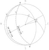
Slope of Pit A
Slope of Pit B
A1-B1 A1-B1 B1-C1 B1-C1 C1-D1 C1-D1 D1-E1 D1-E1 Stereographic Projection of Pit B Slope A1 A1 C1 C1 C1 C1 D1 D1 D1 D1 E1 E1 B1 B1 B1 B1
Stereographic Projection of Pit A Slope
Goals and Strategies
Experience
Create a park with rich multi-functional activities, enrich people's experience, make the park attractive and interactive, and promote the development of the local tourism industry and become a public leisure space for local residents.
Ecology
-Stormwater Management
-Manage precipitation on site
-Reduce landscape irrigation water use
-Manage precipitation beyond baseline
-Reduce outdoor water use
-Design functional stormwater features for landscaping
-Restoration of aquatic ecosystems
-Soil and Vegetation
-Develop and deliver a soil management plan
-Control and manage invasive plants
-Use appropriate plants
-Preserve healthy soil and suitable vegetation
-Preserve special vegetation
-Preserve and use native plants
-Preserve and restore native plant communities
-Optimized biomass
Education
Promote the awareness and education of sustainable development, and provide a variety of environmental education lines, nodes and elements.
-Materials selection
-Eliminate the use of wood from threatened tree species
-Reuse salvaged materials and plants
-Use regional materials
-Support responsible extraction of raw materials
-Support transparency and safer chemistry
-Support the sustainability of material manufacturing
-Support the sustainability of plant production
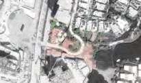
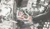
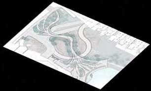
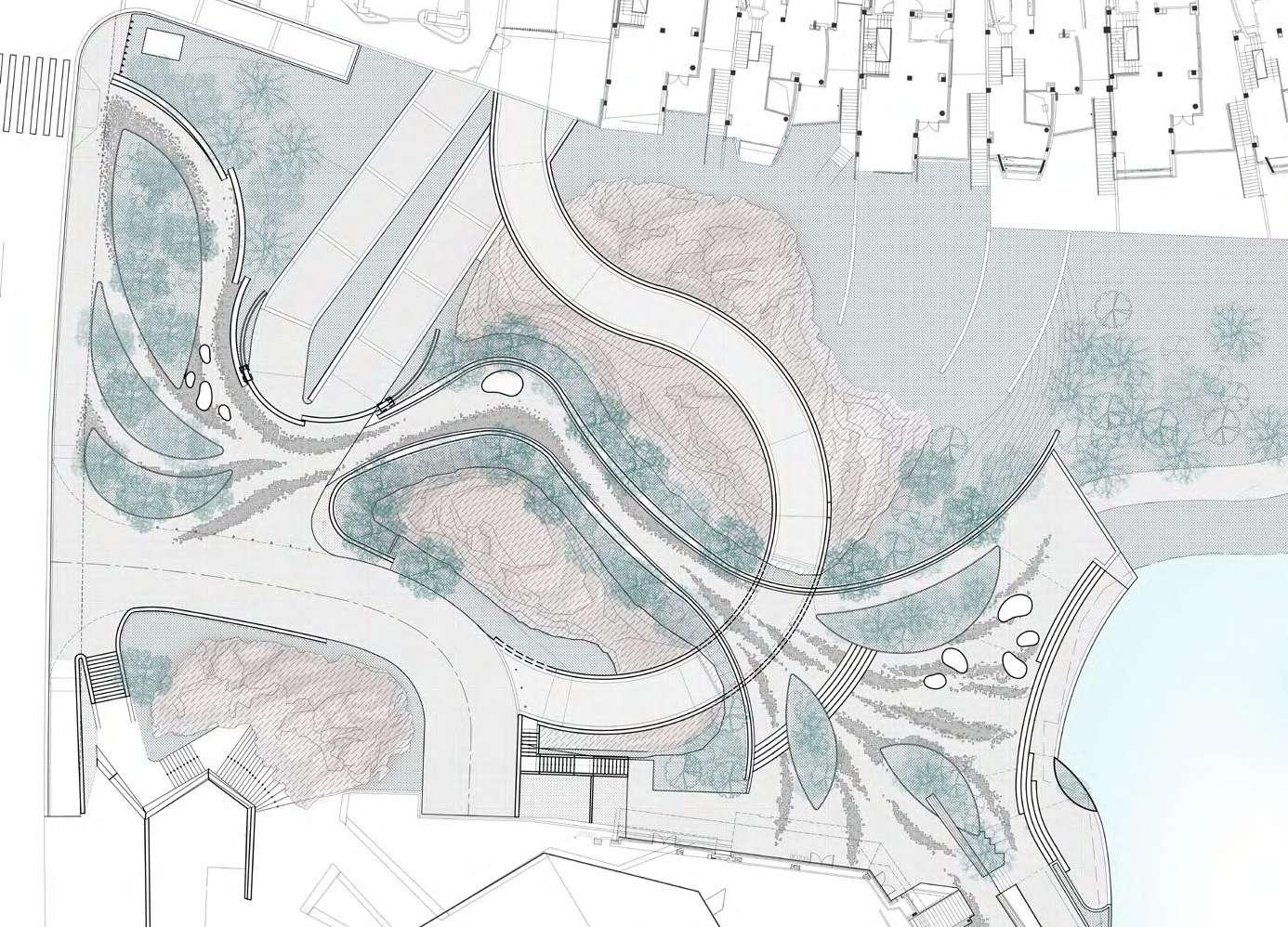
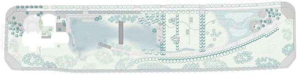
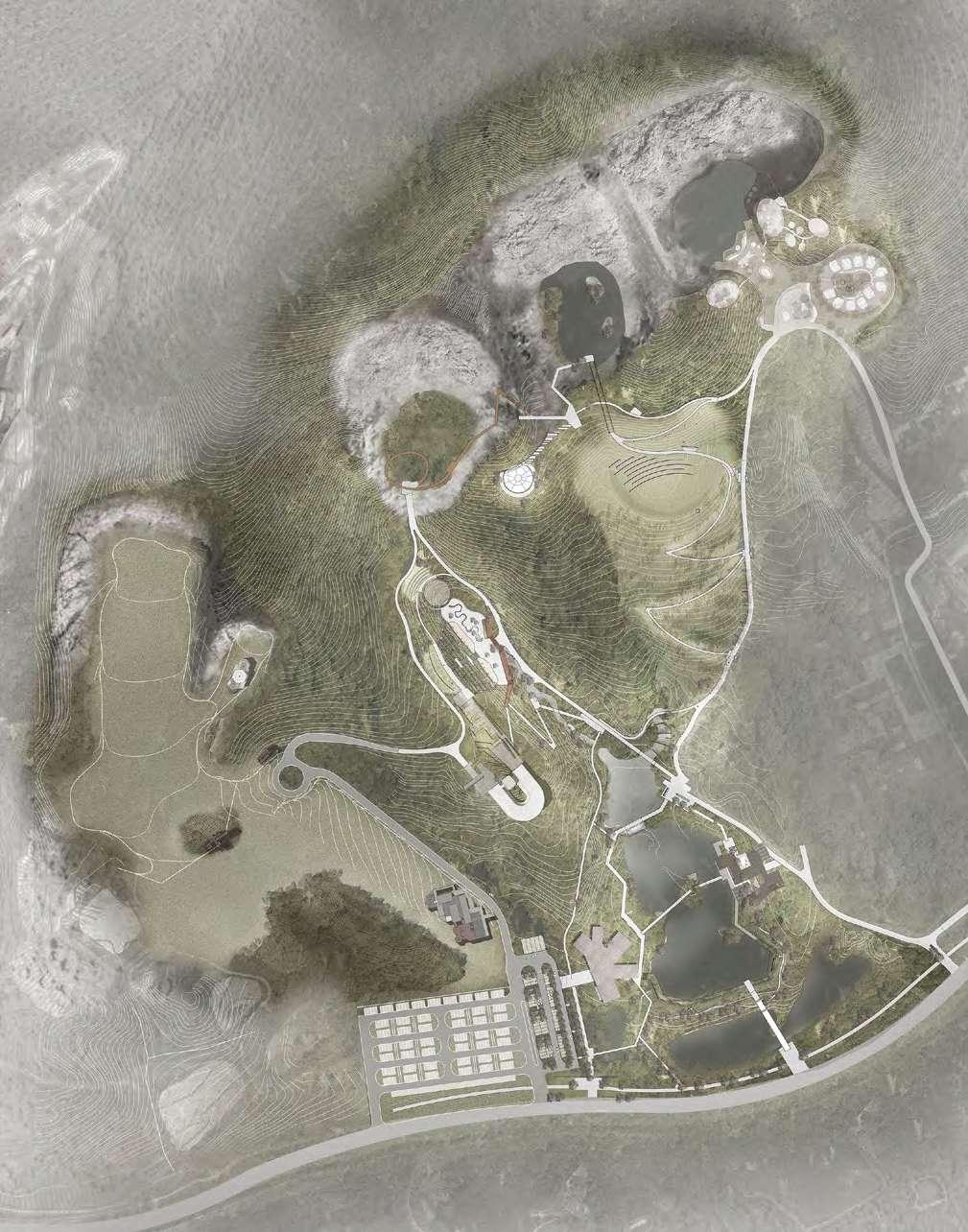
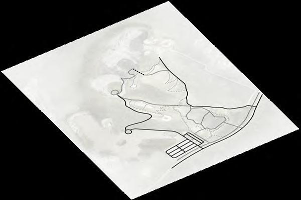
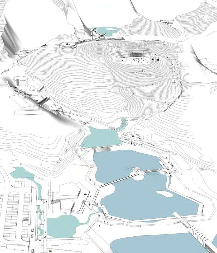
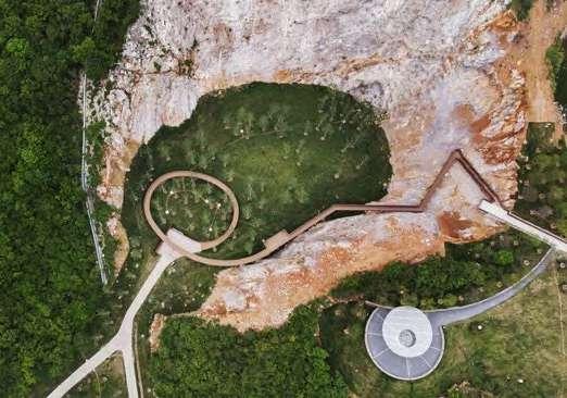
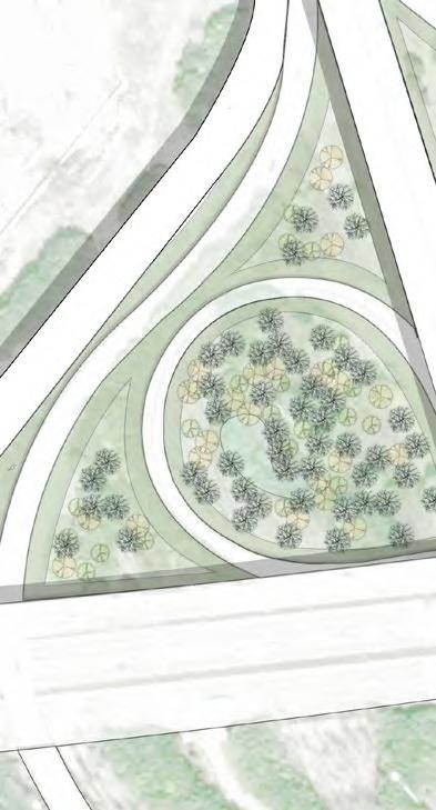
B A C D E F O G H I J K L M N Plan Tourist Center Parking Lot Ecological Lake Tea House Waterfront Path Outdoor Theater Meadow Tunnel Cascade Pond Cliff Corridor Pavilion Spa Hotel Discoveryland Campsite Rain Garden B A C D E F G H I J K L M N O 0M 30M 90M N
Lake Lawn Quarry Forest
Roadway Service Buildings Parking Lot Structures Main Path Bridges Secondary Path Hanging Walkway Native Plant Preserve Tunnel Activity Areas
Stormwater Management
- Increase the runoff path
Extending and guiding the passage of rainwater runoff through rainwater gardens, bio-swale, etc., effectively delay the peak of rainstorms and make rainwater more purified in the process at the same time.
- Create hierarchical buffer pools
The stormwater buffer zones of different sizes are established according to the site on the way of stormwater runoff, which can effectively relieve the flood storage pressure during the rainstorm.
- Expand the area of rainwater retention ponds
According to the situation of the site to increase the area of the south lake area, increase its storm flood capacity.
-Add pipes to the buffer pool and detention pool to share the drainage pressure
Surface Runoff
Bio-swale/Rain Garden
Channel Flow
Pipe Drainage
Surface Flow Wetland
Retention Pond
•
CW •
CW •
Surface
Surface
Raingarden
• Swale
• Swale
• Swale
• Swale
• Catchment
Soil and Vegetation Plants and Space


A soil management plan was developed before construction. By planning soil restoration during the design phase and limiting soil disturbance during the construction phase, it supports the maintenance of healthy plants, biomes, and water storage and infiltration capacity.
Only plant plants suitable for site conditions, climate, and design intent to improve landscape performance and reduce resource use (the proportion of any species does not exceed 10%, the proportion of any genus does not exceed 20%, and the proportion of any family does not exceed 30%)


Materials Selection
Reuse of waste materials at least 10% of the total material cost. Reduce transport energy consumption by supporting the use of regional resources; Increase demand for regional materials, plants, and soil. Use materials, plants, and soil purchased within a specified distance to cover at least 30% of the total material cost.
 New Trees
Original Trees Areas
Shrub
Meadow
Aquatic Plant
New trees
Preserved trees
Tangled Woods
Clean shrub layer for better views
Create paths where plants are sparse
Remove shrubs where necessary to design the activity space
Utilize the original quarry roads to design the park paths
Replant native plants
Destroyed Woods
Waste material on site
New Trees
Original Trees Areas
Shrub
Meadow
Aquatic Plant
New trees
Preserved trees
Tangled Woods
Clean shrub layer for better views
Create paths where plants are sparse
Remove shrubs where necessary to design the activity space
Utilize the original quarry roads to design the park paths
Replant native plants
Destroyed Woods
Waste material on site
Quarry Experience

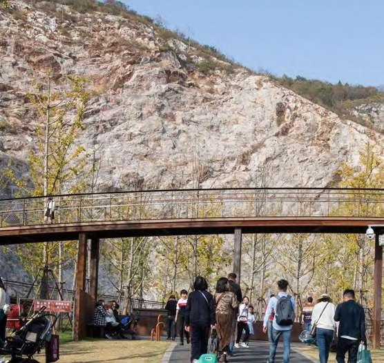


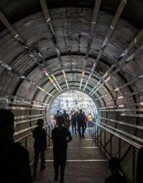
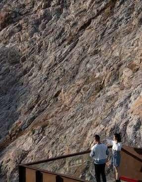
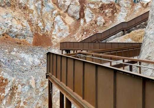

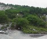
Covering up mistakes will only make people create similar errors in the future. We think it’s better to let people see these destructions, so as to awe and cherish nature more. Isn’t this a better environmental education? One enters the bottom of a quarry pit through a tunnel, then steps up to experience the rough, steep rock face of the abandoned quarry, before reaching a platform with a panoramic view of the park, which is relatively flat and formed by the waste rock and slag of the old quarry. After that, through the cliff corridor into another adjacent quarry pit, along the sidewall gradually down to the bottom of the quarry, and finally out of it to the next activity space.

A B D C E F G
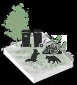
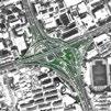
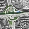
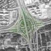
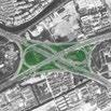
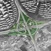
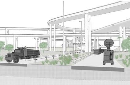
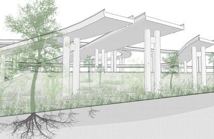
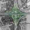
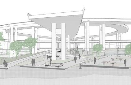
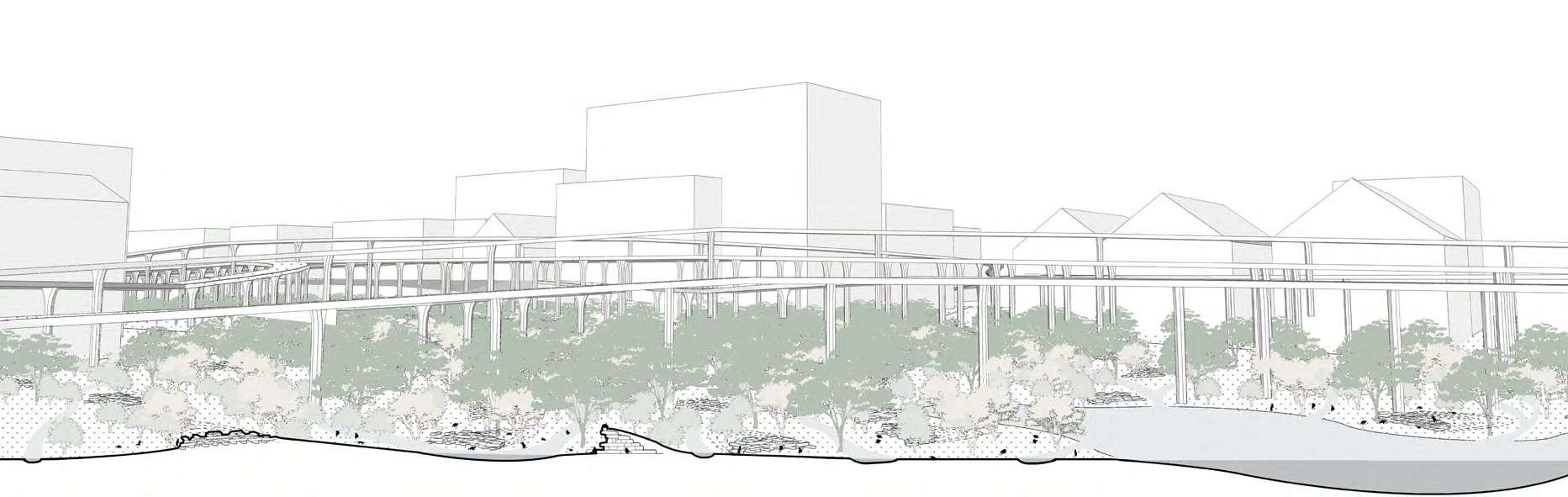
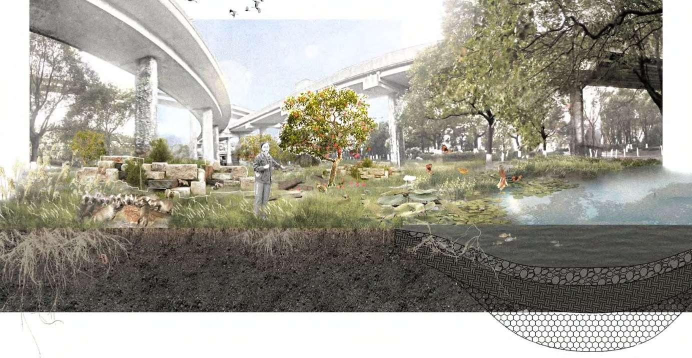
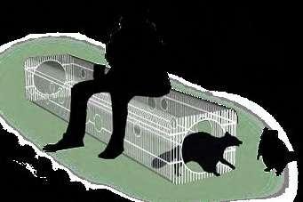
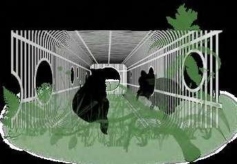
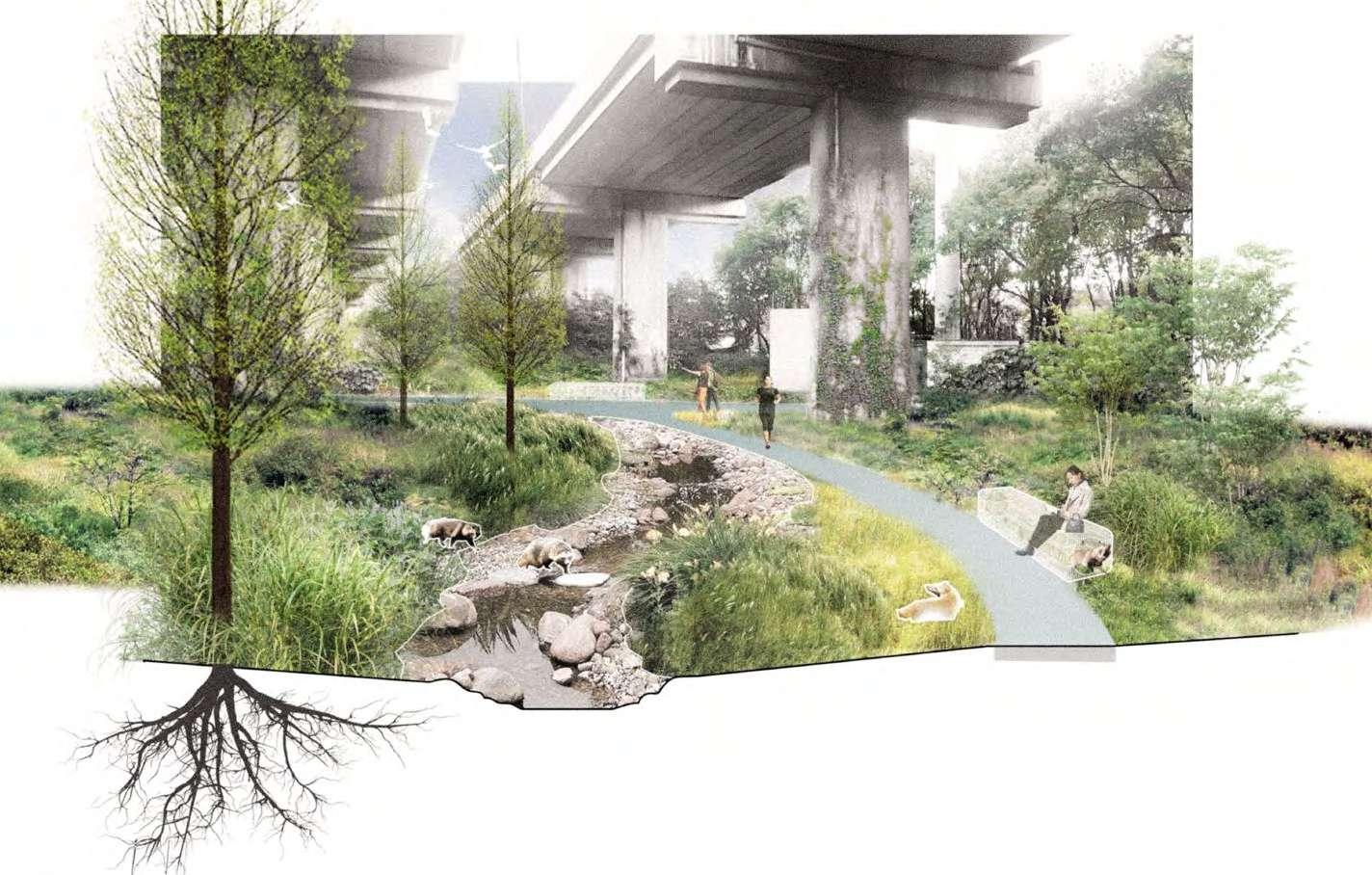
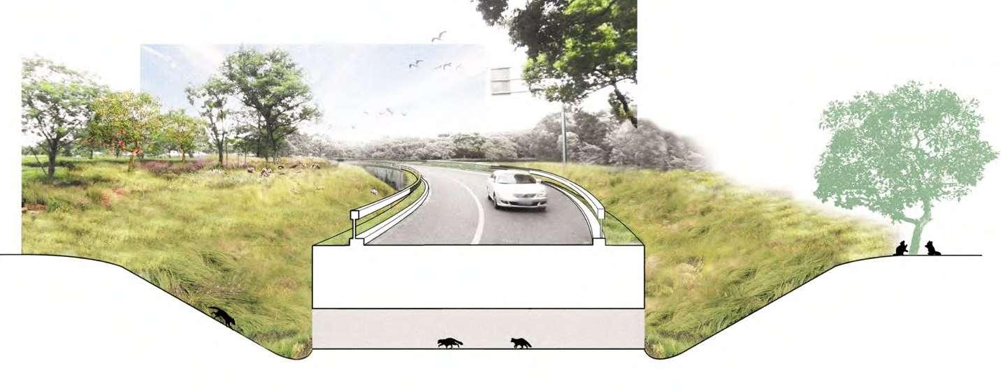
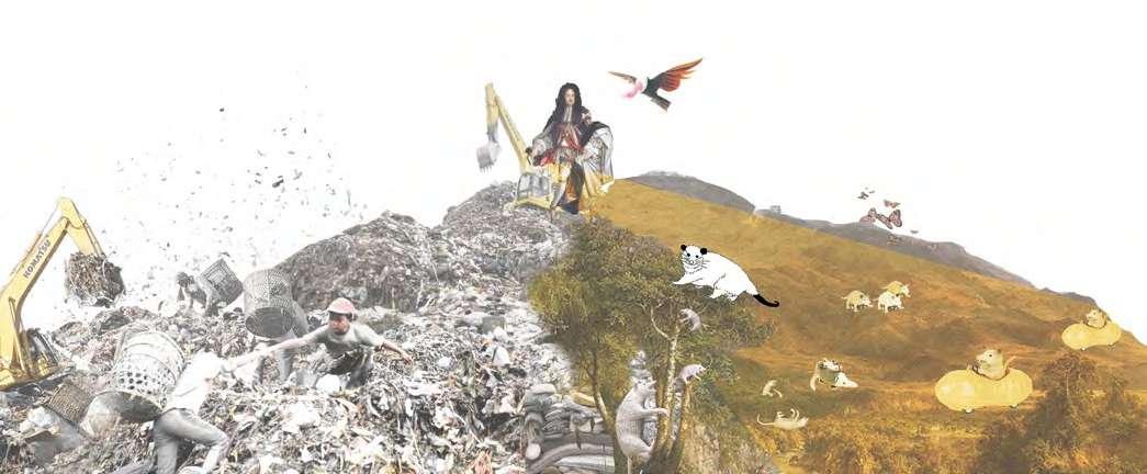
04 SHANGHAI FRIENDLY RING: REWILDING AND COHABITATION
Individual Academic Work
Info:
Location: Shanghai
Date: 06/2021-12/2021
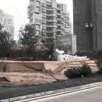
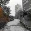
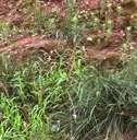
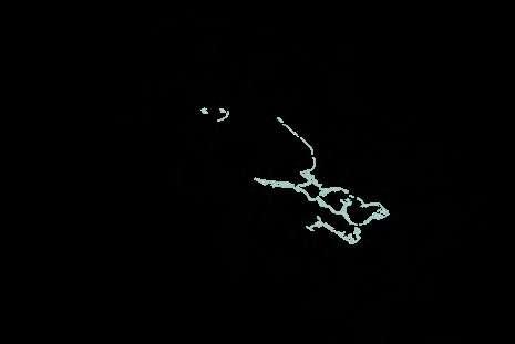
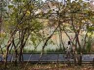
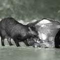
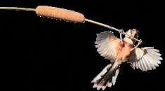
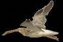
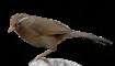
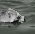
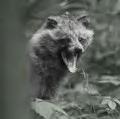
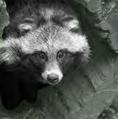
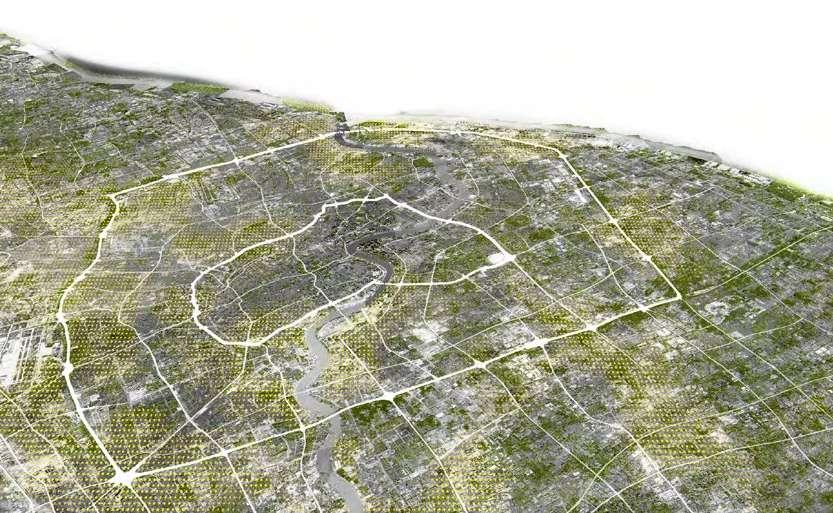
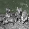
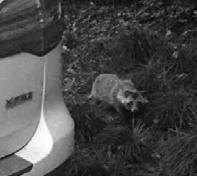
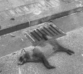
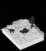
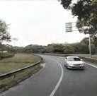
This project unpacks unsustainable relationships between humans and other creatures in the Shanghai metropolitan area and proposes potential scenarios for alternative co-habitation. The idea for this project comes from my daily experience: living close to the inner ring road of Shanghai, I saw how this main traffic line in the city became a deadly boundary for nonhuman residents. The left photo was taken when I was saving a stray dog with two passers. The stray dog crossed the road in a dangerous way: it was lingering around the sidewalk with a look of fear in its eyes while fast-driving cars forced it to move back and forth. The scenes like this gave me a perspective to understand the life of stray animals in the metropolitan city. What’s worse, the urban design not only leaves a threat to animals’ life but also creates barriers for humanitarian aid. Dangerous and complicated infrastructures trap animals into barely inevitable dangers.
As one of the wild species living in Shanghai, the raccoon dog has a very wide variety of habitats in the city, which overlap with the habitats of many other wild animals. Therefore, I chose the raccoon dog as the key species. Starting from the blank space in the ring-road system of Shanghai, I proposed three urban space types: rewild space, eco-social space, and safe-crossing space to solve the survival issues for the raccoon dog. I hope to create a co-living infrastructure that is not only for transportation but an inclusive space for migrant and urban animals, native plantings, and human residents. Thus, the project presents a new illustration of alternative urbanism regarding the cohabitable urban space.

Urban Ecological Network Involved with Immigrant and Local Animals


The expansion of cities has eroded the original habitats of some wild animals, forcing them to start to settle in cities. These wild animals living in the city make us think about how to coexist in harmony with them.
The reasons of Animals Immigrate to Shanghai
4
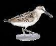
Broad-billed Sandpipe


40%
Protected Species Hedgehog

Four national natural reserves have been established around Shanghai
The green coverage rate in built-up areas has reached 40%
OuterRing-road InnerRing-road
75% Shanghai urban areas have more than doubled in the past 20 years
In 2020, 75% of Shanghai residents identified with the importance of urban biodiversity
Chongming Bird Nature Reserve
Chinese Sturgeon Nature Reserve
Jiuduansha Wetland Nature Reserve
Ecological Conservation Area
Green Space of Outer Ring
Jinsha Sandao Marine
Ecological Nature Reserve
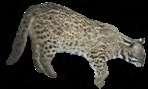
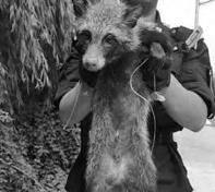
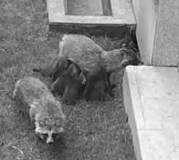
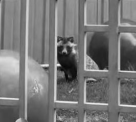
Raccoon Dog's Adaptive to Urban Environment


>50%
-50%
Gradually Intermingles With Surrounding Green Space
Life
Sciences,

Urban raccoon dogs quickly adapted to various types of city environments. Helping raccoon dogs establish habitat can have a knock-on effect, promoting habitat restoration for other wild species.
 The Main Active Area of Raccoon Dogs
Raccoon Dog
Feral Cat
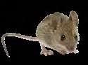
Hog Badger
House Mouse Leopard Cat
Earthworm Blackbird
Mallard Mosquito
Anser Albifrons River Deer Chinese Hare
Mantis
Callosciurus erythraeus
Yellow Weasel
Eurasian Curlew Reed Parrotbill
The Main Active Area of Raccoon Dogs
Raccoon Dog
Feral Cat
Hog Badger
House Mouse Leopard Cat
Earthworm Blackbird
Mallard Mosquito
Anser Albifrons River Deer Chinese Hare
Mantis
Callosciurus erythraeus
Yellow Weasel
Eurasian Curlew Reed Parrotbill
408km² 1990 787km² 2000 1024km²
Green
Build-up Area 2010 1563km² 2020
Area
Rana Nigromaculata
Surrounding
Space
Urban
Live in Nature Live in Shanghai Habitat Live in meadows or bushes near rivers Live in parks, sewers, backyards, roadside verges Food Source Love nocturnal activities, live a solitary life Increase daytime activity and live in groups
Due to COVID-19, the number of tourists in many public places has decreased by 50% compared to before Living Habit Eat rats or human food residue Eat fish, small mammals, and fruit
2000 2000 30 4000 35 6000 40 8000 10000 45 50
*The data from the Institute of
Fudan University
The number of Raccoon Dog in Shanghai Build-up Area
2005 2010 2015 2020
The number of Protect animal species in Shanghai Build-up Area
Raccoon Dogs' Habitats in Shanghai
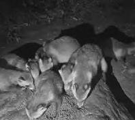
Raccoon dogs inhabit not only private courtyards, but other noisy urban environments thanks to their weak hearing. Therefore, raccoon dogs have a very wide range of activity space, often within a radius of 6 kilometers.
Obstacles for Raccoon Dogs in Current Urban Spaces


With the increase in the number of raccoon dogs in Shanghai, many issues have emerged and always threatened raccoon dogs in the city.
Raccoon Dogs' Needs

Behaviours
Raccoon dogs will choose different types of environmental habitats according to different seasons. During the breeding period, they choose shallow holes to give birth and to breastfeed; in summer, they use the shade of trees to inhabit; in severe cold winter, they choose to live in deep holes which preserve the heat.
JAN. Hibernation Forging Courtship Brereeding Cub out of Nest Nesting FEB. MAR. APR. MAY JUN. JUL. AUG. SEP. OCT. NOV. DEC. Winter Summer Autumn Winter Spring
Caves Caves Woods with leaves, twigs
Pond Pond Shrub grassland Shrub grassland Dense jungle with shadow
Comprehensive Parks Roadside Verges Priviate Gardens Community Green spaces Living Environmental
Activity Movement Green Space for Public Facilities
Requirements
Food Insecurity Various Barriers Threat of Vehicles Artificial Greening Overlap of Activity Spaces Discontinuity of Space
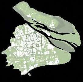
Potential of Leftover Space within Ring-road System


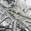
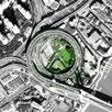

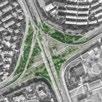


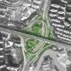


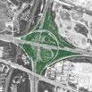

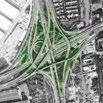
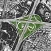


The green spaces in the ring-road system connect the various green space systems in the city, but they are not fully utilized and have become blank spaces. However, the lack of human intervention has made these blank spaces become habitats for raccoon dogs and other animals, which are also important for raccoon dogs to migrate between the countryside and the main city. Therefore, this kind of green space with complex conditions is very suitable as a starting point for us to improve the living environment of raccoon dogs.
Some Raccoon dogs already live here
The utilization rate of activity space is low Solve road-crossing problems for raccoon dogs
Comprehensive Green Space Street Park
Waterfront Green Space
The Main Active Area of Raccoon Dog
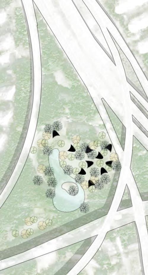
According to the current conditions, I divided the green space in the ring-road system into three types based on their purpose: rewild space, eco-social space, and safe-crossing space, so as to correspond to the survival problems of raccoon dogs in the city.


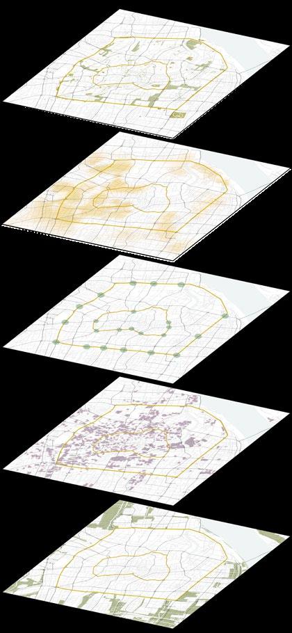
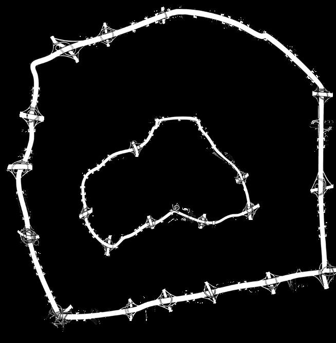
Ring-road Green space


Residential Area
Type A: Rewild Space
Type B: Eco-social Space
Type C: Safe-crossing Space
Green Coverage Degree

Traffic Interference Degree
Human Involvement Degree
Ecological Conservation Area
Complete space with more than 70% green space coverage, which can be designed to be a very suitable habitat for raccoon dogs.
Space where raccoon dogs cohabit with humans whose activities don’t too much interfere with each other.
Green space is severely cut by the ring-road, which affects the passage of raccoon dogs. Through design, the safety of raccoon dogs’ activities can be improved.
I-01 I-05 I-09 O-04 O-08 O-12 I-02 I-06 O-01 O-05 O-09 O-13 I-03 I-07 O-02 O-06 O-10 O-14 I-04 I-08 O-03 O-07 O-11
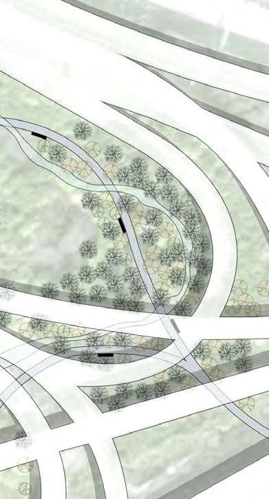
Taxonomy of Strategies
Passages
Living Conditions
Type A: Rewild Space

Type B: Eco-social Space
Type C: Safe-crossing Space
With the obstacles that the raccoon may encounter in the city, I proposed three types of design strategies. Different strategies can be flexibly combined according to the specific conditions in a certain type of space, which can furthermore improve their implementation.
Programming with Topography

V-moat Permeable Pavement Culvert Hedgerow
App
Relationships With People
With Wire Fence Broadcast
Gentle Gradient ≤ 8% 8% < Moderate Gradient ≤ 20% 20% < Steep Gradient ≤ 45% Extremely Steep Gradient > 45% • Fast Moving • Courship • Basking • Expanding Territory • Cooling • Drinking • Foraging • Breeding • Drinking • Nesting •Hibernation • Breeding • Limiting Home Range • Guiding Moving Direction
Volunteers Nest Seats Pollution-free Pesticide Stone Nests Various Shrubs Fruit Plants Tall Grass Meadow Retention Pond Deciduous Plants Canopy Trees Rain Gardens Twigs And Leaves Swales
Retention

Provide drinking water for animals and alleviate rain storm pressure in the city
Animals Locals Animal-lovers in the World
By broadcasting live on mobile phones, people can observe animal activities anytime and anywhere. In this way, more people can know about other species living together in the city without undue interference of their living space.

Stone nests were built for raccoon dogs to avoid overheat in the summer and keep warm in the winter. At the same time, the micro-topography created by the nest can better converge rainwater and provide water for the animals.
LIVE
Canopy Tree
Retention Reuse
Twigs And Leaves
Fruit Tree Volunteer
Stone Nests
Swales
WildAnimals @Shanghai
Type A: Rewild Space
Stone Nests
Swales
Swales
Swales
Storage
Rainfall
Stone Nests
Rainfall
Type B: Eco-social Space
Create a temporary nest for raccoon dogs, which makes them feel safe in the human-involved space.
The utilization of the space that was designed for human activities in the ring-road system is very low, and lawns and pavement occupy most of the area. Therefore, I propose to reduce the area of the original pavement while retaining the basic pedestrian functions and using rich vegetation to bring a sense of security to Raccoon dogs.
 Seat & Nest
Runoff
Collect Rainwater to provide drinking water for raccoon dogs
Rainfall Seat&Nest
Deciduous Plants
Permeable Paths
Rain Garden
Seat & Nest
Runoff
Collect Rainwater to provide drinking water for raccoon dogs
Rainfall Seat&Nest
Deciduous Plants
Permeable Paths
Rain Garden
Type C: Safe-crossing Space
In the green spaces that are severely divided by roads, hedgerows with wire fences and V-moat can be used to block unnecessary crossing of raccoon dogs to reduce accidents. At the same time, culverts are excavated under the necessary roads for raccoon dogs to pass through.
Runoff CollectRainwater toRetention
Fruit Trees
Deciduous Plants
Culvert
Culvert
Canopy Trees
V-moat
05
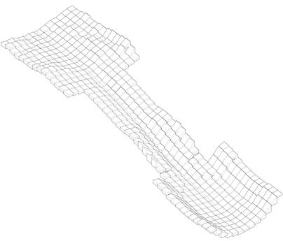
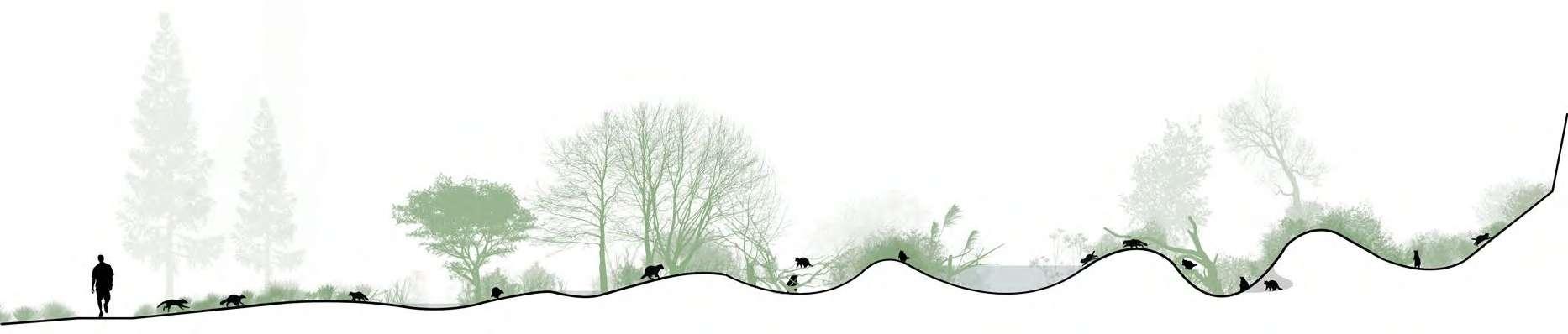
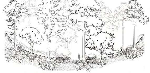
TIME-SPACE COMPRESSION: ANALYZING THE COMPRESSION AND RELEASE
PRODUCED BY PLANT STRUCTURES
Individual Academic Work
Instructor:
Matthew Seibert, Leena Cho
Info:
Date: 09/2022-12/2022
LAR 6010 Foundation I Studio: Elements of Landscape Architecture
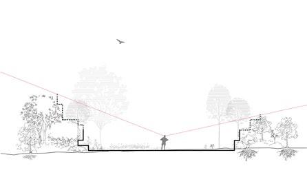
Following an analysis of compression of release in landscape experience, the design proposal intends for its visitors to focus on the variation of such an experience, and through its configuration and employment of diverse plant structures, draw new links between humans and non-humans.
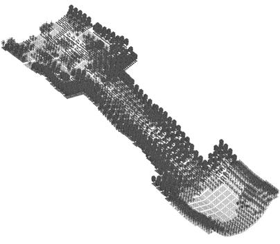
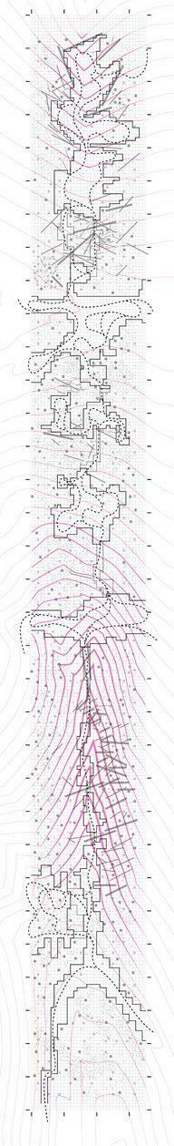
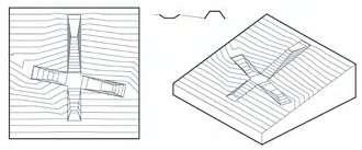
When I first came to the O-hill, it was a completely messy, hectic environment, I didn’t know where it was and only can feel the terrain seems like a huge valley. It’s very hard to describe the variation of space formed by plant structures and terrain. If I don’t use some tools, I would lose in the natural environment. I may be in an open space covered with large canopy trees, and feel I am incredibly small; of course, there is also the possibility that wild bushes or shrubs surround me, and then I feel at a loss immediately; I need to sort out the surrounding plant structure before I can move forward. In this environment, time and space all be distorted, they are compressed, pinched, stretched, and released.
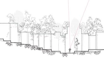
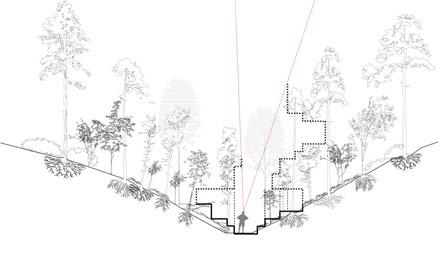
Reveal - Perception of Compression
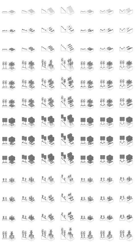
Canopy Trees Spatial Boundary Confined Space Movement Route Ground Tilt
YoungTrees Saplings Shrub Trunks/Twigs
I extracted several kinds of plants of different sizes, constructing a series of units with different gradients, using them to elaborate on different compression that I meet at the O-hill. Some compression comes from the ground, some come from your enclosure, and some come from the canopy trees are like a ceiling above your head. Of course, lots of situations are very hard for us when the variations of plant structures and landforms are really nuanced and complicated, I call it the minimum of compression and release. In the second part, I did an experiment, assembling some units to construct a sequence of the spatial experience. Space can be chaotic, disordered, and also can be pinched by topography and plants, and in the final, it reaches a status of the maximum release.
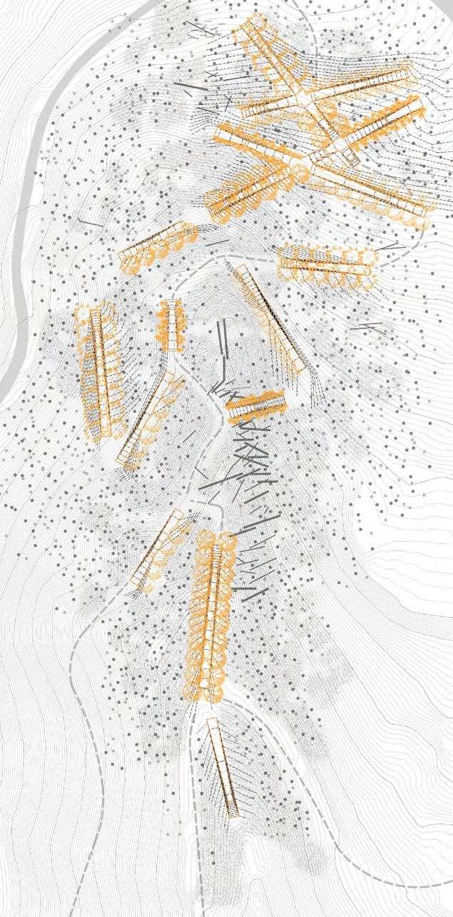
A1 A2 D1 D2 E1 E2 F1 F2 G1 G2 B1 B2 C1 C2
N 0ft 20ft 40ft 60ft A2 A1 B2 B1 C2 C1 D2 D1 E2 E1 F2 F1 G2 G1
Assemble - Analysis of Compression
Single Slope Double Slope 30 % 50% 100% Below Eye Level-Ground Cover Eye Level: Understory Trees Above Eye Level: Canopy Trees Saplings/Leaves Trunks Shrubs Sparse Foliage Sparse Foliage Dense Foliage Dense Foliage
high low
slow open enclosured
of Space
Compression from Surrounding
Speed of Movement fast
Dimension
30% 50% 100% 0 % Synthetic Moduel
Ground Cover (Sapling/ Trunks/ Shrubs)
Ground Cover +
Canopy Trees (Sparse Foliage)
Ground Cover +
Canopy Trees (Dense Foliage)
Ground Cover +
Understory Trees (Sparse Foliage)
Ground Cover +
Canopy Trees (Sparse Foliage) +
Understory Trees (Sparse Foliage)
Ground Cover +
Canopy Trees (Dense Foliage) +

Understory Trees (Sparse Foliage)
Single Slope Double Slope 0% 30% 50% 100% 30% 50% 100% A B C D E F Maximum of Release Maximum of Compression Minimum of Compression and Release
Catalog
Spatial Sequence
Entangle - Non-humans’ Perspective

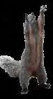
Opossum Behavior

The opossum lifespan is usually only one to two years in the wild. They are most active during the spring and summer and not hibernate but reduces its activity during the winter.
-Rock crevices
-Hollow stumps

Ecological Benefits
-Hunt, kill, and eat mice, rats, and snakes (including poisonous ones).

-Opossums are scavengers and clean up dead animal carcasses


-Opossums have a natural resistance to rabies and botulism, so they aren’t likely to spread these diseases
-When opossums are searching for a mate, they make loud clicking noises


-The female opossum is a spontaneous ovulator with an estrous cycle of about 28 days. She is in estrus a short period, about 36 hours.


-Wood piles -Don’t build nests and only spend few days in a den site to prevent encounters with predators. -Females with young tend to be the exception, using the same den sites for weeks at time.
-They have children three times a year
-Carrying babies on the pouch on stomach within the first 2 months


-Carrying babies on back within the 3-4 months
Insects (Crickets,Beetles, Snails...)


JAN.
MAY SEP. MAR. JUL. NOV. FEB. JUN. OCT. APR. AUG. DEC.
Foraging Nesting Mating Breeding
Ideal Scenarios
Bats Ticks Birds Opossums
Mosquitoes
Spreading Food Chain Maggots Human
Mice Mating-Clicking Sound Increasing Echo Carrying Babies Learning Skills Dead Bird Rat Bird Fresh Fruits Danger! WaterGathering Rooten Foods Playing Dead Clumsy Walking Hare Hollow Stumps CreatingSpace Rock Crevices Playing Feeding Cockroch Wind Protection Tree Holes Pile of leaves Collecting Materials Climbing Bat Squirrel Mating&Breeding Nesting Overwinter Foraging
Rats Snakes Carrion
Rotten fruits Flies
Disease
Cockroches
will forage for food when the weather turns cool to resist the cold winter
-Opossums
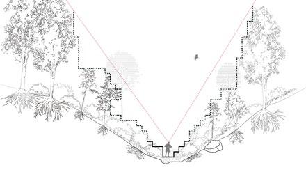
Inscribe - Potential of Compression
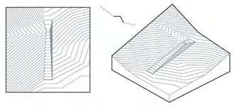
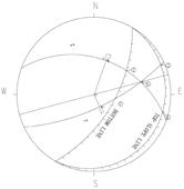
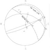
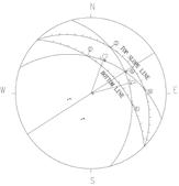
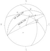
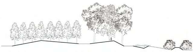
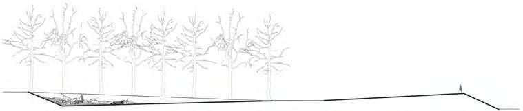
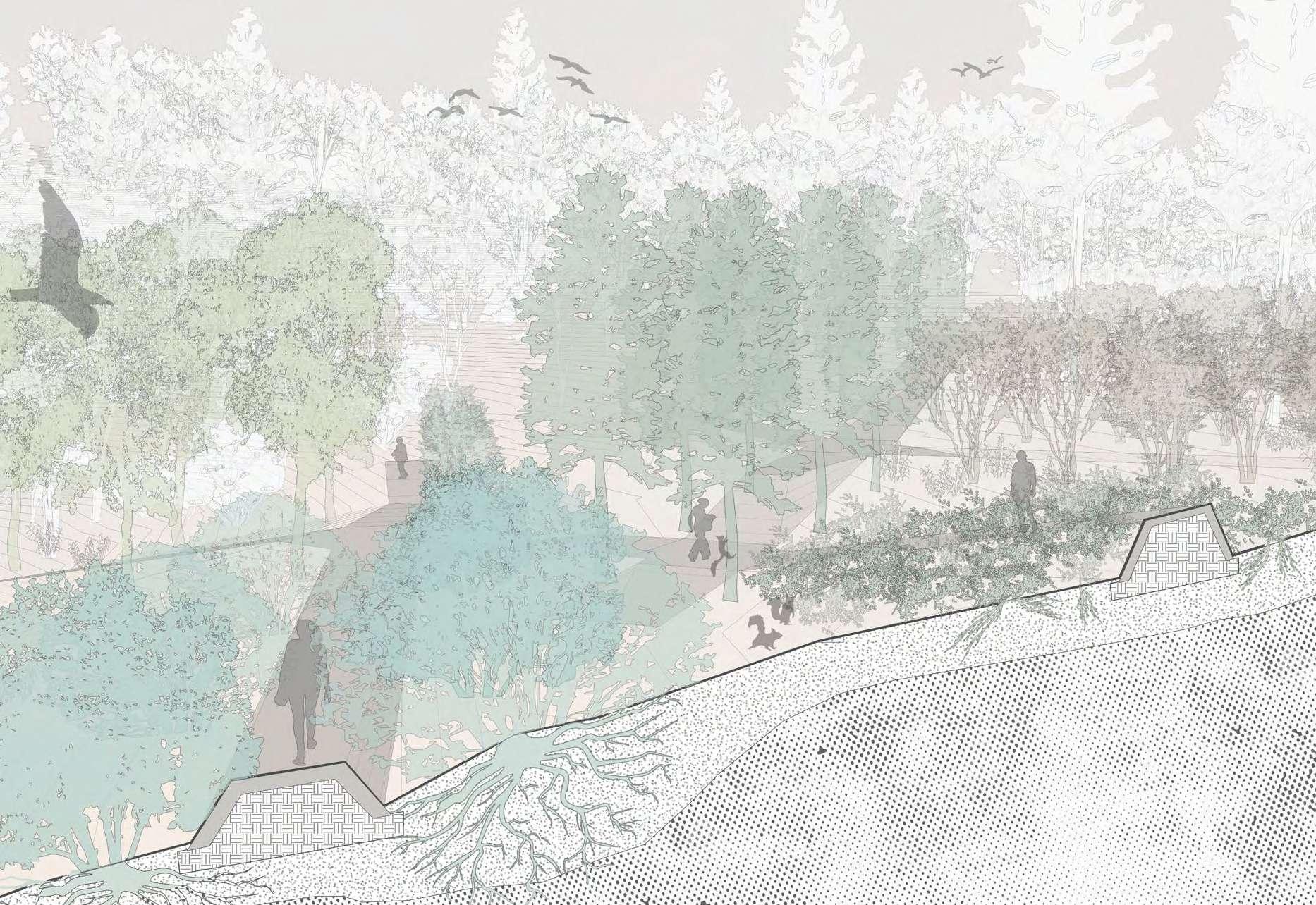
This form of “slope” has a limited width and is constructed through rammed earth. It is 10 feet wide at both ends, but the width of the path narrows to 5 feet wide as the slope rises or falls. Trees of different heights and forms are planted on both sides of the slope, and they are all common in O-hill. So when we walk in it, the “slope” can help us feel the space brought by these different plant parts. For example, some bushes, many of them are elliptical in shape, so when we walk on flat ground, our eyesight perceives a sense of compression, which gradually disappears as the slope rises. Some of the larger trees are the opposite, and as the slope rises, we gradually feel the sense of compression from the canopy. However, in winter, the leaves accumulate on some sunken slopes, and at this time, we feel another kind of space brought to us by the plants. Of course, you can also observe the activities of different animals and their relationship with different plants.
Wineberry Mountain Laurel Witch Hazel White Pine Chestnut Oak 1 year 0’ 10’ 20’ 30’ 40’ 50’ 60’ 70’ winter winter winter 40 years 25 years 20 years 10 years 25 years 15 years 10 years 5 years 10 years 10 years 1 years 1 years Provide shelter for small mammals from the wind and from predators For small mammals to climb and provide protection from predators Provide shelter and a possible food source for small mammals Provides fruit source for small mammals Good nesting materials for small mammals
and pinch both sides
and pinch two sides
and pinch one side
and pinch one side Discrete combination Crossover combination
Existing Plant Selection Landform Units Wineberry + Rise on both sides Wineberry + Fall on both sides White Pine + Rise on both sides White Pine + Fall on both sides Mountain Laurel + Rise on both sides Mountain Laurel + Fall on both sides Chestnut Oak + Rise on both sides Chestnut Oak + Fall on both sides Witch Hazel + Rise on both sides Witch Hazel + Fall on both sides Witch Hazel + Fall on one side Witch Hazel +Fall on one side
Rise
Fall
Rise
Fall
Space Parameter
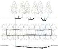
Asphalt Existing path Utilize existing path Parallel to the contour Trees to be removed Trees to be removed Shrub Fallen trunk Sampling(<2m) to be removed Shrubs to be revomed A’ A’’ Asphalt Existing path D’ E’ F’ G’ D’’ E’’ F’’ G’’ Trees to be removed Fallen trunk Shrub Sampling(<2m) to be removed N 0ft 20ft 40ft 60ft Chestnut oak White pine Mountain Laurel Witch Hazel Wineberry C’ B’ C’’ B’’ Minimum of Compression and Release Maximum of Compression and Release A’ A’’ B’’ C’ C’’ B’ Plan Designed Disturbance Site Sections

10’ Move Rise&Descend Landform Pinch 20 Years 10 Years 1 Years Compression Rammed Earth Release
Wineberry
Mountain Laurel
Witch Hazel
White Pine
Chestnut Oak
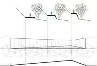
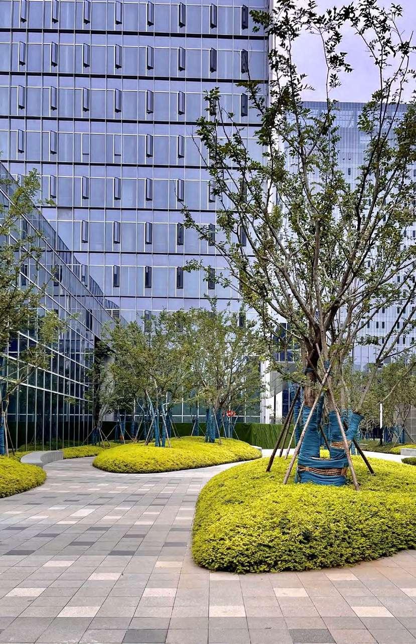
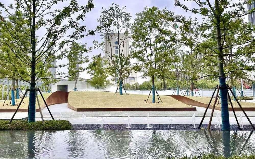
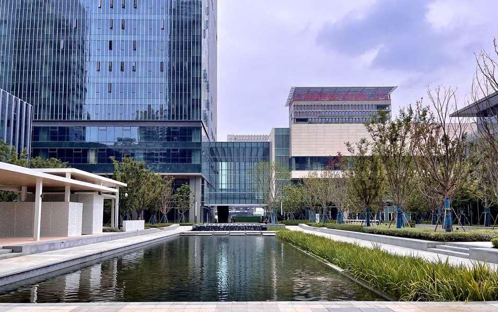
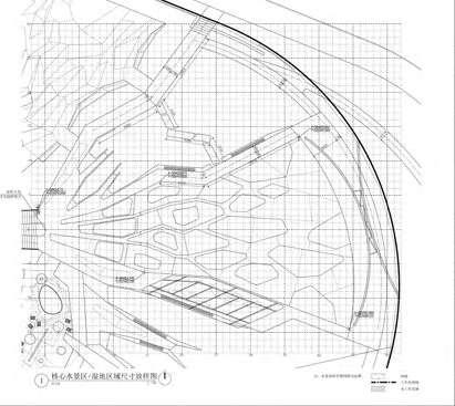
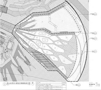
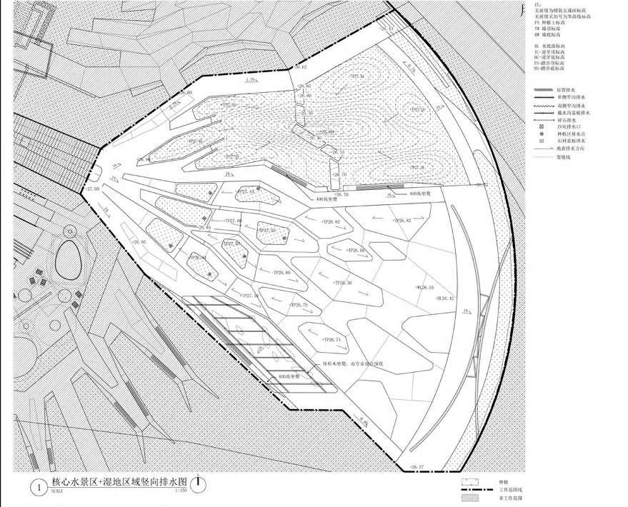
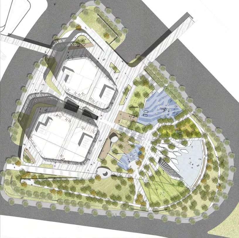
VANKE INDUSTRY FINANCIAL CENTER
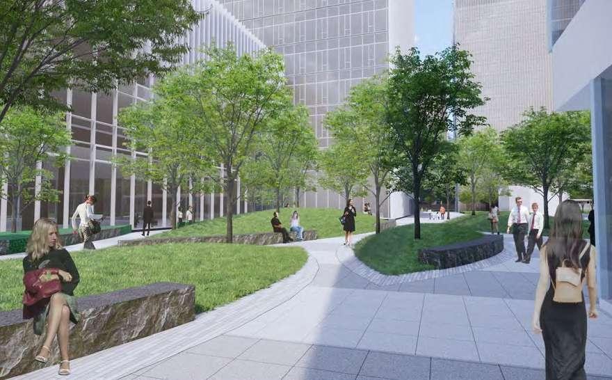
Location: Hefei, Anhui
Area: 4.4 ha
Client: Anhui Wanrong Real Estate Co.
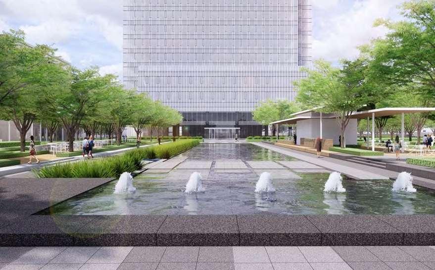
My Contribution:
Schematic Design (2019.05-2020.05):
Concept-30%, Plan Drawing-40%, Modeling and Rendering-60%, Site Analysis and Diagrams-40%
Design Development(2020.06-2020.09):
Main Plans-100%, Details Drawings of Hotel Area-100%, Details Drawings of Central Lake Area-80% Details Drawings of Commercial Plaza-100%
Construction Drawings (2020.12-2021.02):
Main Plans-60%, Details Drawings of Hotel Area-100%, Details Drawings of Central Lake Area-100% Details Drawings of Commercial Plaza-100%
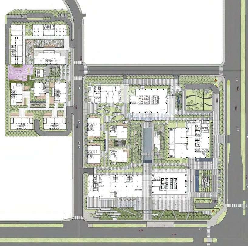
Info: Professional Team Work * OTHER WORKS
GROWTH PARK
Info: Professional Team Work
Location: Wuhan, Hubei
Area: 1.5 ha
Client: Wuhan Wandi Hanyi Real Estate Development Co.
My Contribution:
Schematic Design (2017.05-2017.10):
Concept-30%, Plan Drawing-30%, Modeling and Rendering-60%, Site Analysis and Diagrams-30%
Design Development(2017.11-2018.02):
Details Drawings of Lawn Area-80%
* OTHER
WORKS
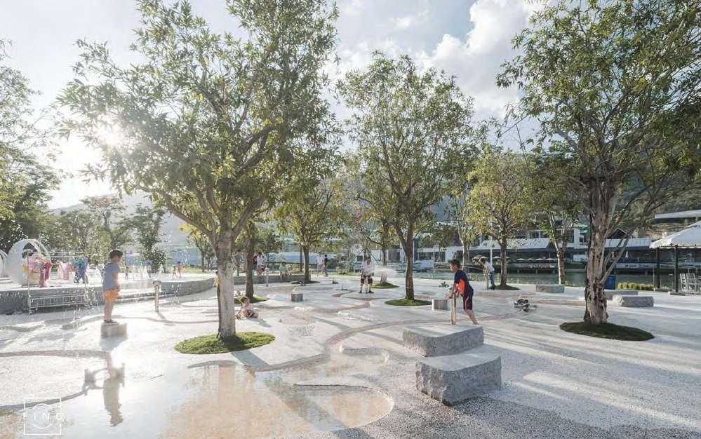
CHUNMU YUAN PARK
Info:
Location: Heyuan, Guangdong
Area: 2.5 ha
Client: Heyuan Chunmuyuan Tourism Culture Co.
My Contribution:
Schematic Design (2019.10-2020.04):
Concept-20%, Plan Drawing-20%, Modeling and Rendering-30%, Site Analysis and Diagrams-20%
Design Development(2020.05-2020.07):
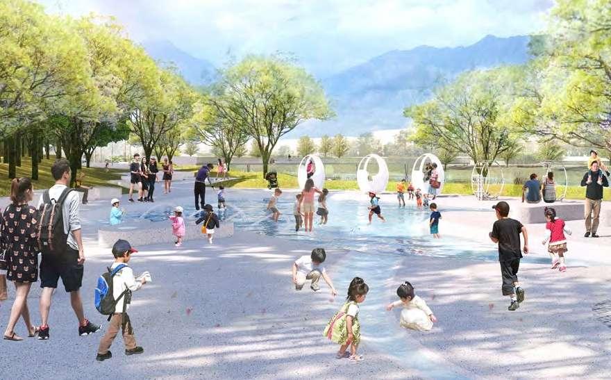
Details Drawings of Water Playground-100%, Shallow beach and Lawn Area-100%
Construction Drawings (2020.08-2020.12):
Details Drawings of Water Playground-100%, Shallow beach and Lawn Area-100%
Professional
Team Work
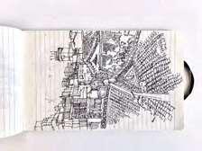
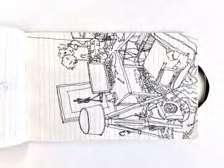
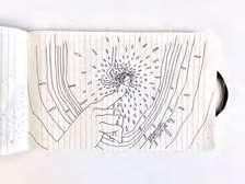
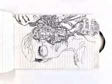
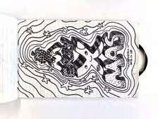
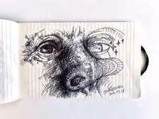
Record the experiences and emotions in daily life
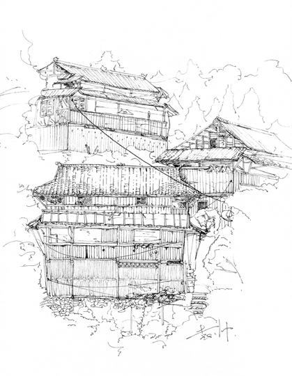
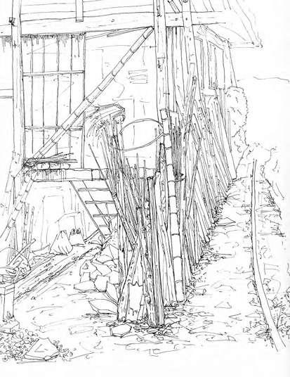
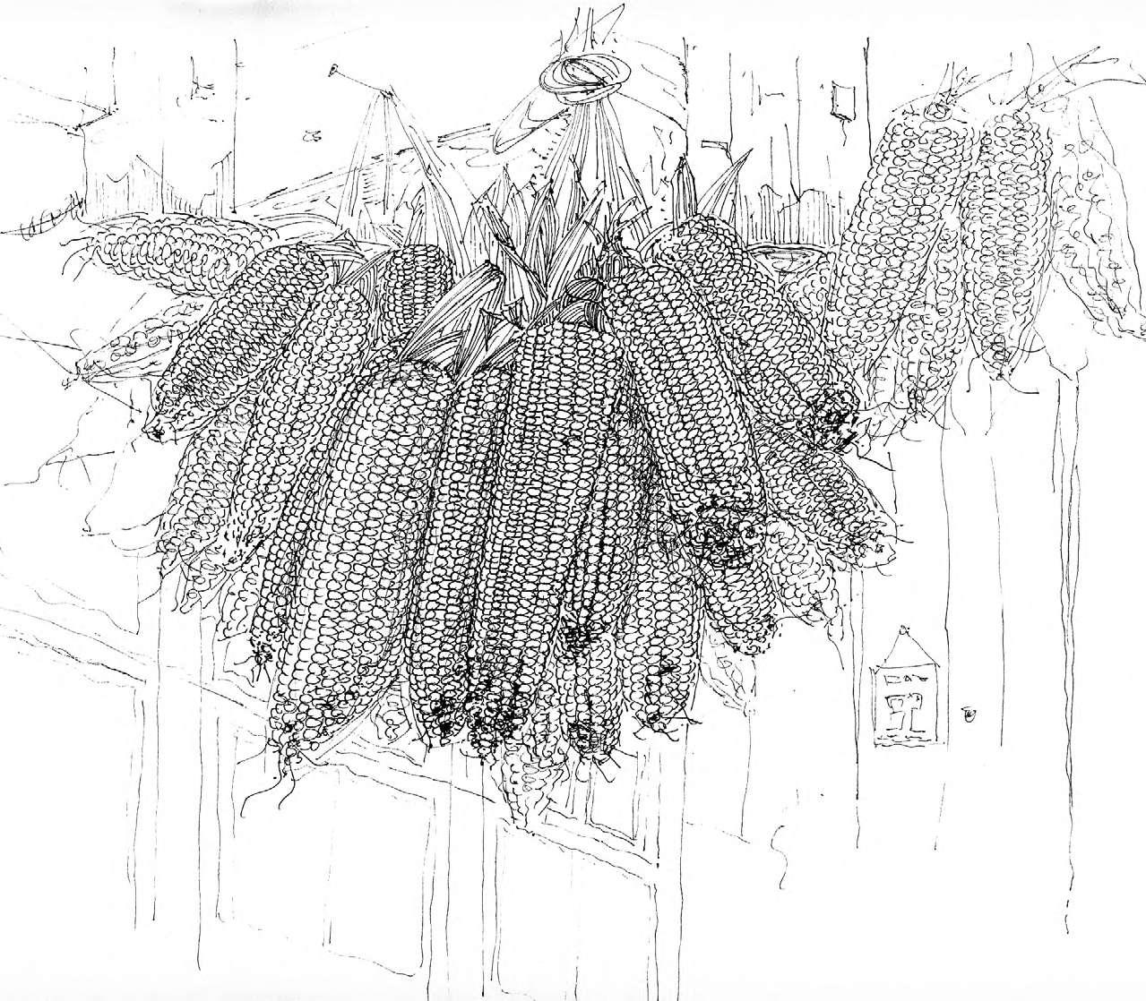
*
ARTWORK

SHUAI YUAN +1(434)257-5733 ctf6nd@virginia.edu
